Albania Road Trip: Tirana to Berat or Skyscrapers, a Pyramid, Castles & Albania’s Worse Road

Moments before we had just flown over a crescent-shaped beach, its thin strip of sand brilliantly separating the rich, inviting blues of the Adriatic Sea from the verdant land of the Albanian coast. What we didn’t expect as we continued our descent was just how mountainous the terrain was. This turned out to be a characteristic of the land that we enjoyed tremendously, after realizing there really aren’t many straight roads in the country, and we’d be spending most of our three weeks in Albania driving winding through its mountains.

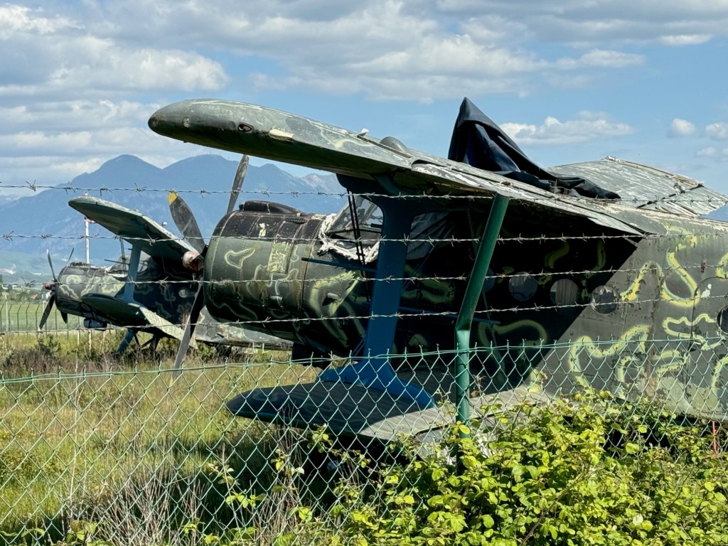
It was mid-April and 80F/26C as we sat outside the airport terminal enjoying coffees and the unseasonably warm day. “Do you really think you’ll need the thermal underwear you packed?” Donna chided, with a smile. “We’ll see,” I responded. At the rental car counter across the street, we reviewed our paperwork for the sedan and received the document we needed to drive the car into North Macedonia later on during our trip. “Now you have a city car, don’t drive on any restricted roads. The car has GPS tracking, and you will be fined if you do,” the rental agent explained. While we were aware that Albania did not have the best road infrastructure, we were not aware of road restrictions. We asked for a map showing the forbidden routes, but the agent didn’t have any, nor could he explain all the routes restricted. “Use your best judgement, if it’s a gravel road you should probably avoid it.” Which was not very helpful considering we’ve had lots of experience driving sedans to destinations that folks have said, “you’ll never make it there in that.” The rental agent also related that Albanians are very friendly, but terrible drivers. “Drive defensively!” he warned. We set off. My map app is set to default to no highways, and we followed a route along the perimeter of the airport, which also serves as an Albanian Air Force base, past a row of rusting, derelict MiG fighter jets and, for those aviation enthusiasts, several Antonov An-2, a legendary soviet bi-plane, first flown in 1947.
It was an interesting serpentine route through fields of grazing sheep, the roadway sporadically lined with irises in bloom, flowering orange trees, their scent filling the air, and fig trees laden with newly set fruit. Groups of old men sat at tables playing cards and dominos in vacant lots between mansions and shacks. A psychedelically painted, cold war era tank commanded a park along the road. As it neared the end of the workday and we got closer to Tirana, the roads became congested and wild, with drivers ignoring traffic signs and rules. Often it felt like a game of chicken with oncoming cars zipping into our lane to weave around creatively parked cars. Motorcycles were driven on sidewalks. Numerous speed bumps were the only deterrent preventing the roads from becoming the Daytona 500. In decades past, Tirana was a small town with an ancient footprint. It managed well enough during the country’s communist era when few people had the resources to buy cars. But now the city’s arteries are clogged and it’s ready for permanent gridlock due to the current number of vehicles.

With a car, there is always parking to take into consideration, and we lucked out with Lot Boutique Hotel, located on a narrow side street in the center of Tirana, because it had a small parking lot. The hotel recently had been nicely refurbished and was the perfect base for our wanderings around Tirana, the capital of Albania since 1920. Later after resting – jet lag affects us more as we age – we asked the front desk for recommendations for a traditional Albanian dinner. The young receptionist suggested two places: Ceren Ismet Shehu, a contemporary restaurant located behind the low ancient walls of Tirana Castle, in an area smartly repurposed for shopping and dining. And in the opposite direction Oda – Traditional Albanian Restaurant nearer the traditional daily market. We ended up eating at both on different nights. Each was excellent, but we preferred the simple, laid-back ambiance of Oda, its homestyle cooking, and inexpensive menu.

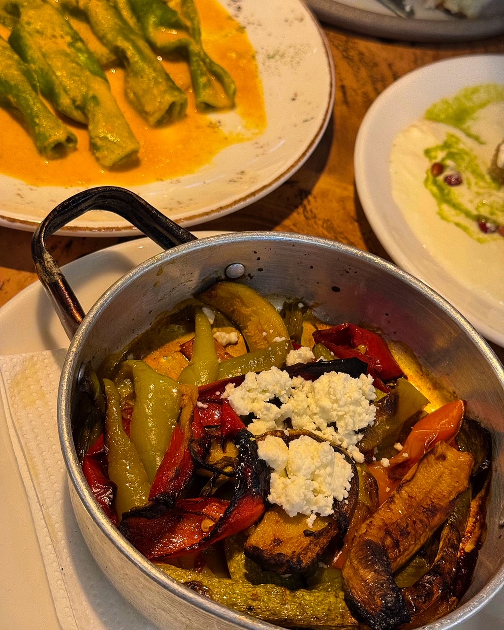
We’ve enjoyed all the cuisines of the different countries we’ve visited over the years, but surprisingly and refreshingly in Albania we found it very easy to eat a well-balanced meal. French-fried potatoes served automatically in other countries were replaced with the Albanian trilogy of lightly grilled vegetables: peppers, eggplants, and zucchini. And the customary salad of cucumbers, and tomatoes with brined cheese were always good. Grilled meats and fish were expertly prepared, though it was also easy to be a vegetarian sometimes and indulge in a variety of eggplant dishes.

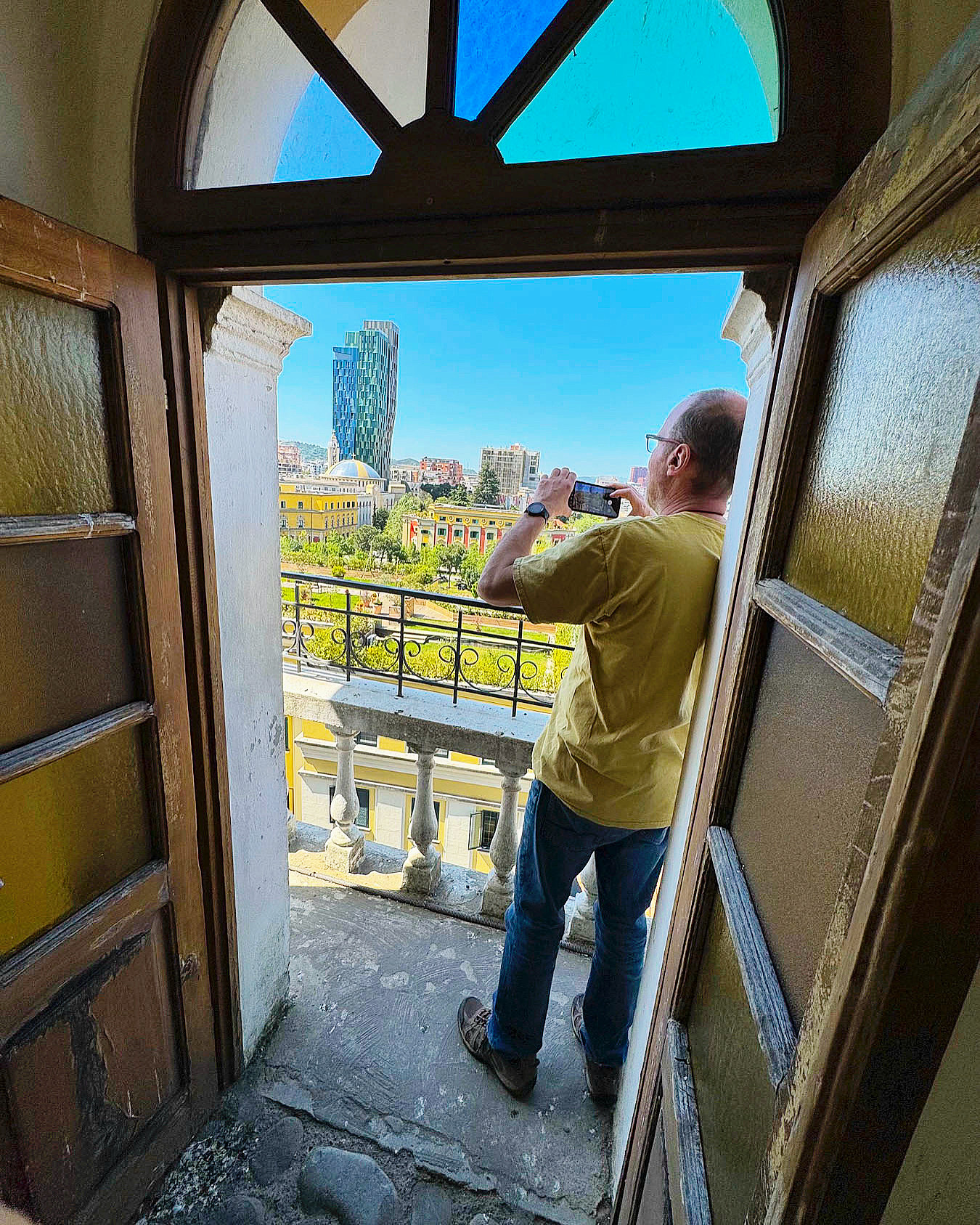
The next morning, we headed to Skanderberg Square. Next to the Et’hem Bey Mosque, built in the early 1800s, but closed during the anti-religion decades of communism, we climbed 90 steps to the top of the 115-foot-tall Clock Tower of Tirana. For decades during the 19th century, the tower was the tallest structure in Tirana. Unfortunately, its once 360-degree view has been hemmed in by the rapid construction of new buildings nearby, but it did have a view over Skanderbeg Square, and the rooftop garden atop Tirana City Hall.

Before its renovation the plaza was a traffic circle with one side hosting a larger-than-life statue of Stalin and the other side a colossal 30ft tall sculpture of Albanian’s paranoid and isolationist communist leader Enver Hoxha. The 1991 student protests on the square, along with other demonstrations across the country, helped bring an end to 46 years of repressive communist ideology and failed economic policies. Stalin’s statue was replaced with a heroic sculpture of Skanderbeg, the 15th century nobleman who rallied Albanians to repel Turkish rule and defeated 13 Ottoman reinvasion attempts.
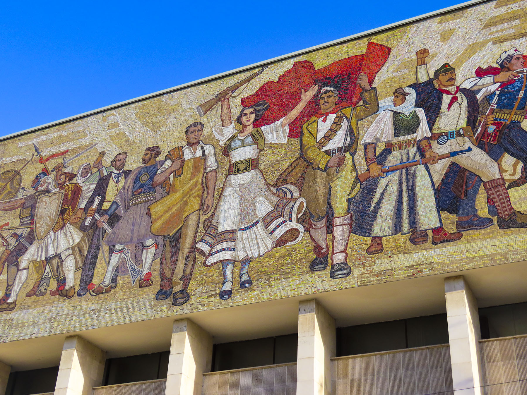
Hoxha’s statue was replaced with a public toilet. Centuries of conflict and resistance have defined Albania’s history and is reflected in a large, emotive mosaic above the entrance to the National Historical Museum. The Palace of Culture, the Opera & Ballet Theatre, and several government ministry buildings, designed by Italian architects in the 1930s, also line the square. Surrounding the plaza, an array of new construction projects are rapidly changing Tirana’s skyline. The city is having its moment as tourists rediscover this once isolated country, with its paranoia of the west, and shunned by its communist neighbors.

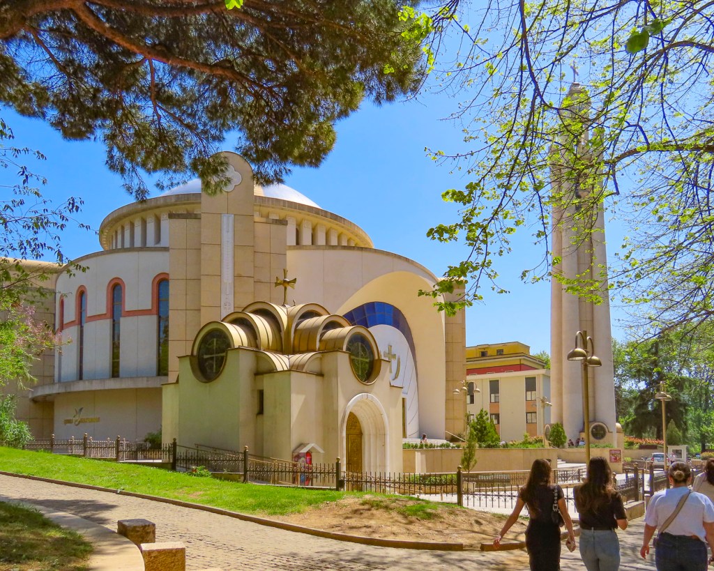
Spotting a belltower through the trees, we headed to the Resurrection of Christ Orthodox Cathedral, built between 1994 and 2002 to celebrate the revival of the Albanian Orthodox Church. It is one of the largest orthodox churches in the Balkans, and is a testament to a renewal of faith that had been outlawed under communism, when churches and mosques were destroyed or desecrated, after Hoxha proudly proclaimed Albania “the world’s first officially atheistic state.” The church is dedicated to the apostle St. Paul, who is believed to have founded the Christian community of Durrës, on the Albanian coast, during the 1st century AD.
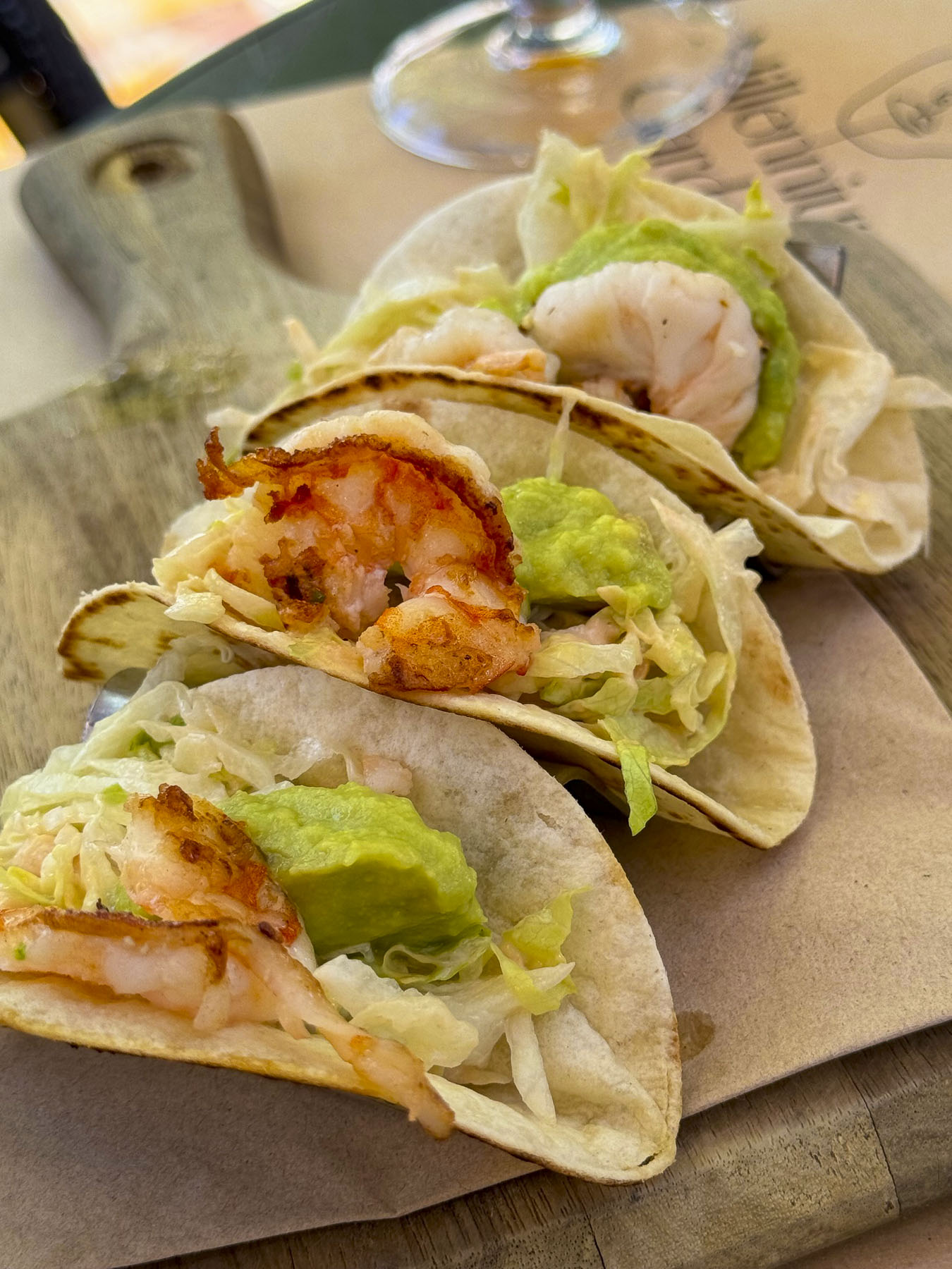
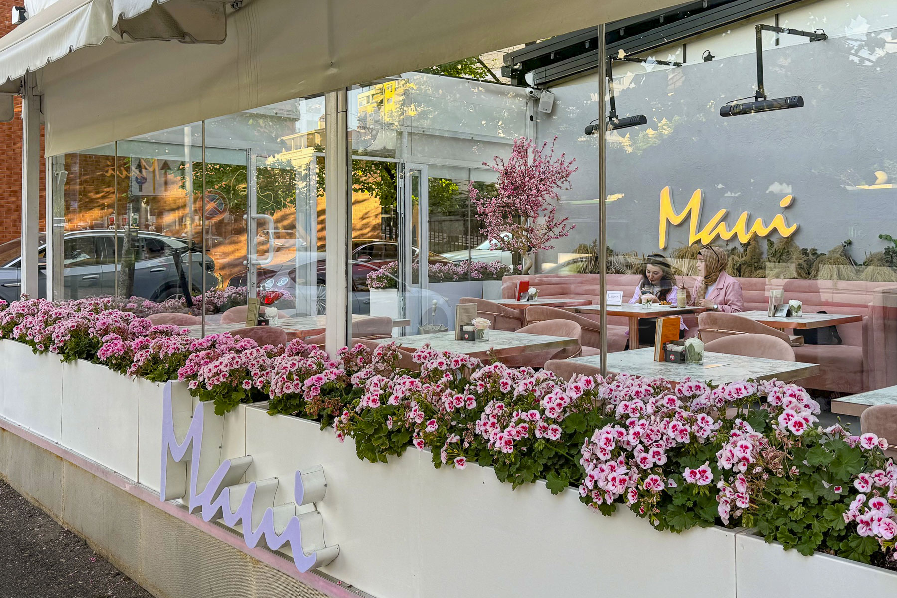
We wandered through Rinia Park, a popular green oasis in the center of the city that is known for its Taiwan Musical Fountains, which were unfortunately still winterized when we visited. Afterwards we headed to Rruga Murat Toptani, a shady, treelined pedestrian-only lane with many outdoor cafes and restaurants, offering traditional Albanian food and various international cuisines. We enjoyed a light lunch and a local craft beer under the shade of a sun umbrella at the Millennium Garden.

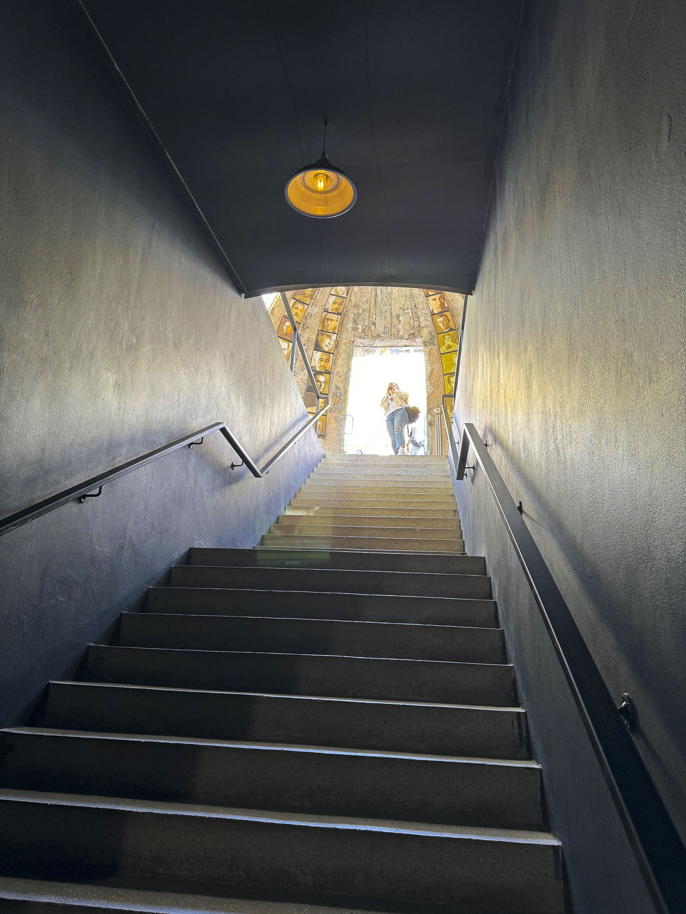
Bunk’Art2, an eye-opening reminder of the perils of the despotic leader, Enver Hoxha, and the communist police state he created in order to stay in power for forty years, was nearby. It’s a large nuclear bomb-proof bunker in central Tirana, that was connected to various government ministries with tunnels for top officials of the regime to escape through. It was also an interrogation center for the Sigurimi, Albania’s Communist-era secret police force, which spied upon the country’s citizenry, and imprisoned anyone considered an opponent to Hoxha’s policies or authoritarian rule. Across the country 23 prisons were built to imprison 17,900 political prisoners.

Thirty Thousand people were sent to internment camps, and it’s believed over 14,000 were killed, died or worked to death from forced labor, often in dangerous mines. 6,000 are still missing. Often it was not just the individual who was jailed that suffered, but his family would be surveilled for years afterward, and his children would be denied educational opportunities. In Tirana the secret police kept 4,000 people under constant surveillance. The border was heavily patrolled with guard dogs and soldiers authorized to “shoot to kill,” as anyone trying to escape the country was viewed as an enemy of the state, and punishable for treason.

Only the most loyal communist families were allowed to live along the borders. Small villages were forcefully abandoned. The villagers were sent to larger cities were it was easier for the Sigurimi to watch for dissent. The mushroom shaped dome above the entrance to Bunk’Art 2 is symbolic of Hoxha’s paranoia, which manifested as a building campaign to construct an amazing 175,000 + bunkers of various sizes, across the country.  Most of them are only big enough for 2-3 people, but they were placed in strategic spots along Albania’s borders to protect the country from foreign invasion, not only from the western powers, but also from Yugoslavia or the USSR. Others were placed in the mountains, farm fields, road intersections and parks, with the intention that Hoxha’s loyalists would man them in a time of crisis.  The irresponsible cost of building the bunkers, from which shots were never fired, diverted Albanian funds away from other needed projects and ensured Albania’s position as the poorest country in Europe.  The communist government collapsed in 1991, and in the following years, more than 700,00 Albanians emigrated to find better opportunities in Europe  or farther afield.  Remittances from the Albanian diaspora to family still in the country amount to 14% of Albania’s Gross Domestic Product.
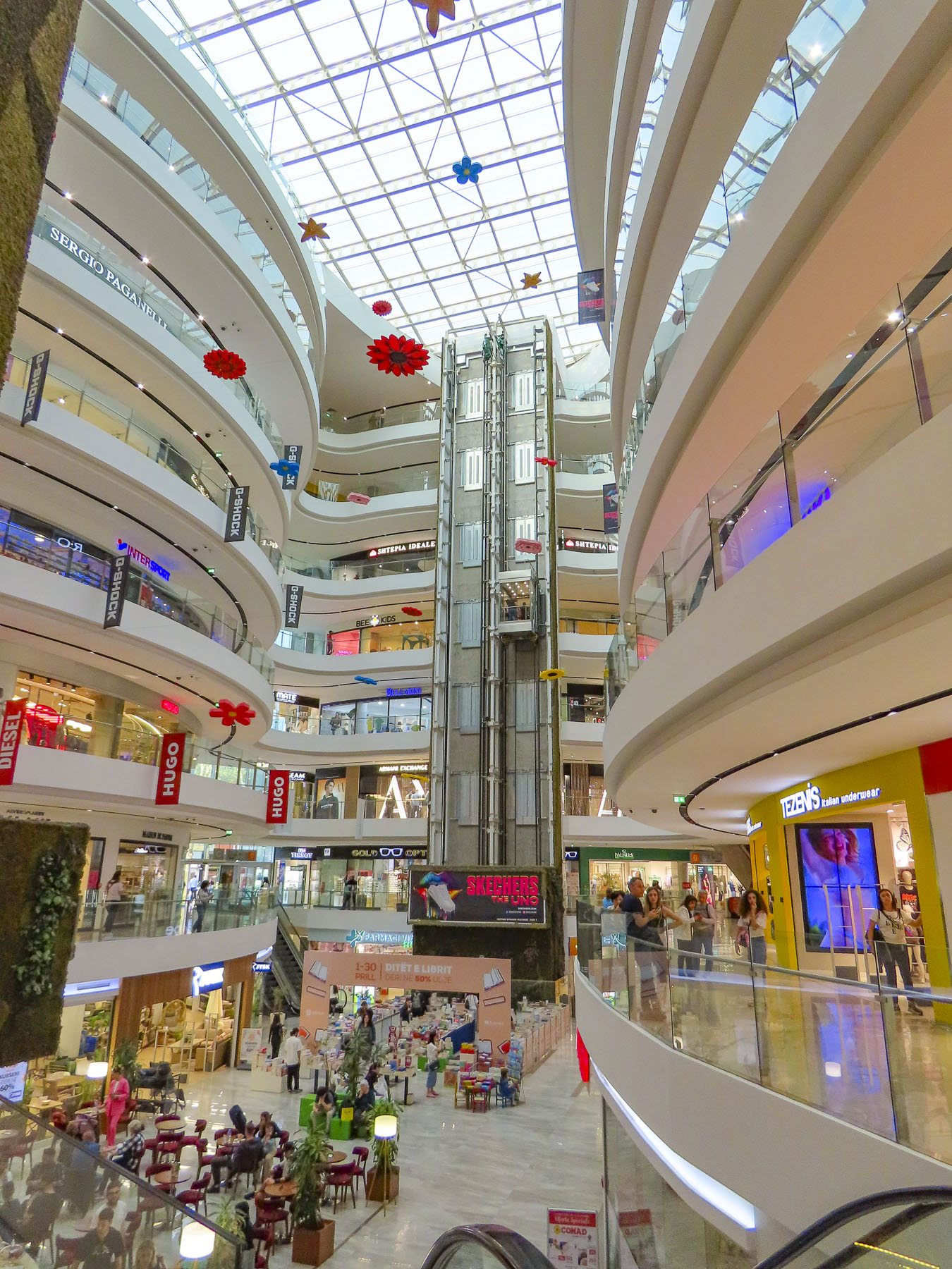
Our eyes needed a moment to adjust after resurfacing from the labyrinth of Bunk’Art 2, but if the construction boom underway in Tirana is an indication, Albania has thrown off the shackles of its communist past and is embracing the prospects of an exciting new future. Heading back to our hotel for a short rest before going to dinner we detoured into the Toptani shopping mall. A nine-story tower dedicated to the “shopping therapy” philosophy of capitalism.
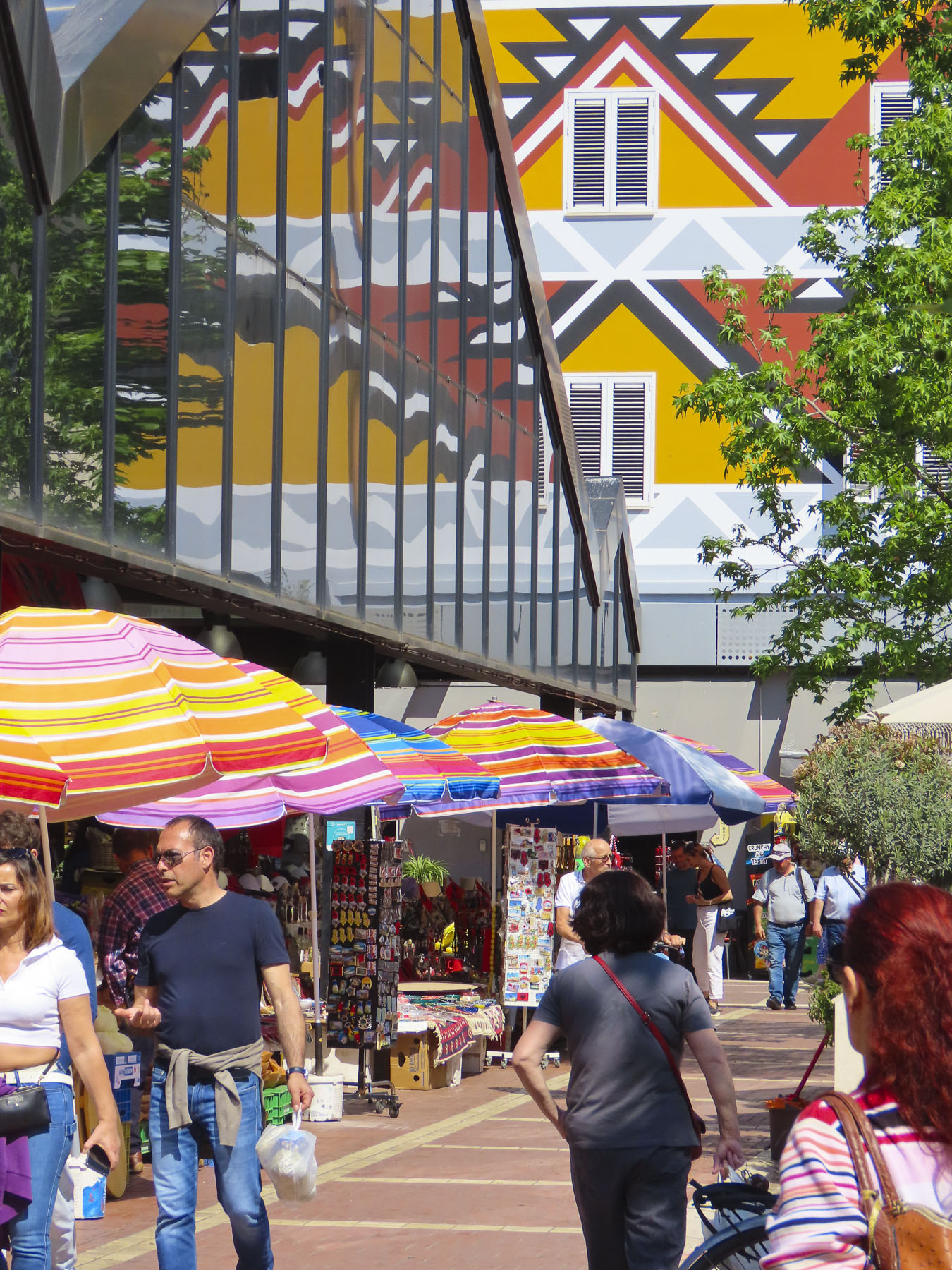
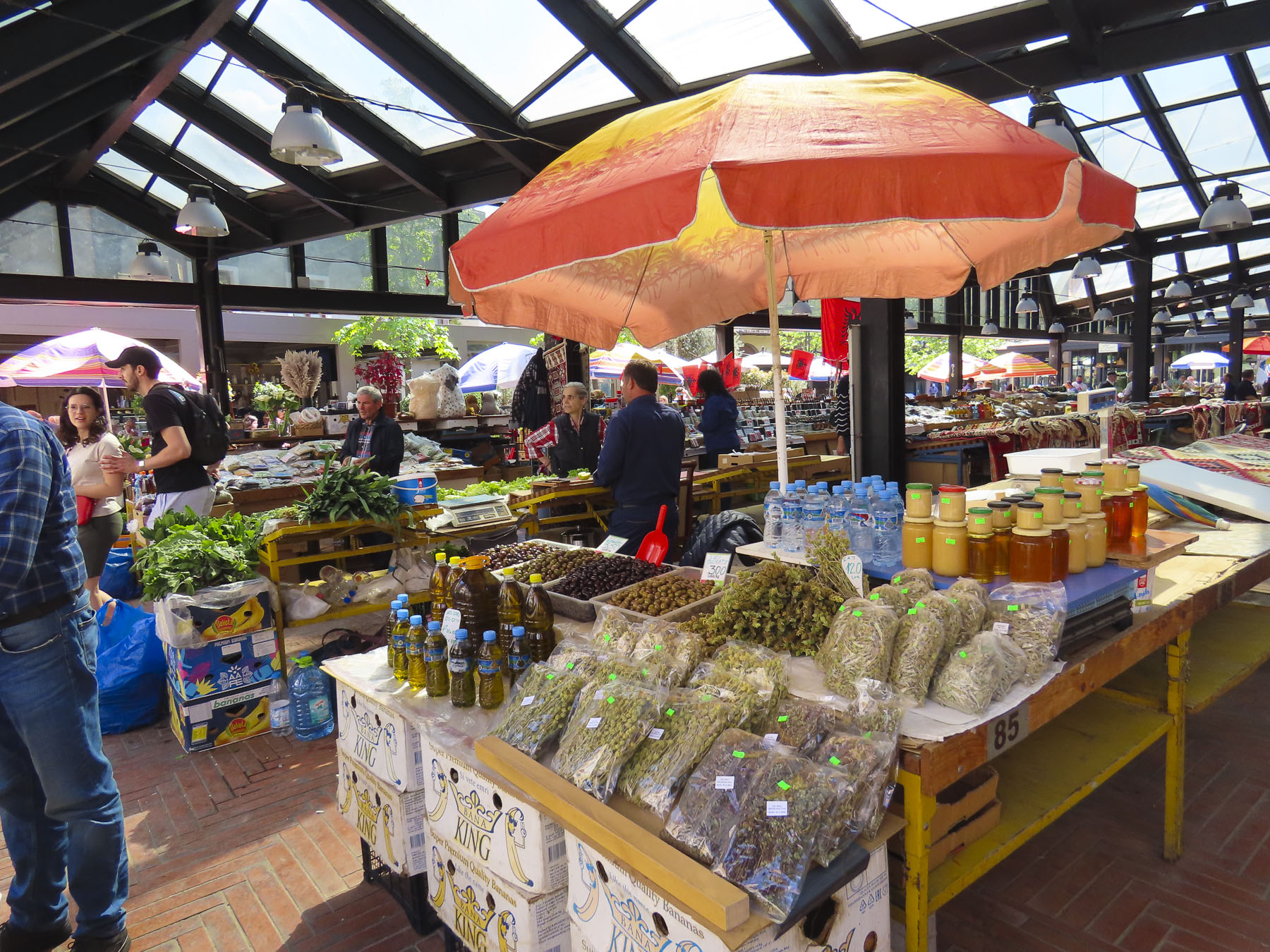
The next day we headed to the New Bazaar market area, only a five-minute walk from our hotel. On the way we passed impromptu sidewalk vendors, their crops and merchandise displayed on blankets or sheets of cardboard on the street, hoping to make sales to folks before they reached the daily market. The covered bazaar centers a plaza surrounded by restaurants, cafes, cheese shops and butcher stores. Under its roof, stands filled the space with vendors selling vegetables, olives, honey, and fruit. Women crocheted wool socks as they waited for customers. We browsed tables piled with rugs, displays of tools, pottery, vinyl records, and books, along with knickknacks, questionable antiques, and surplus Albanian army helmets. The time flew by.

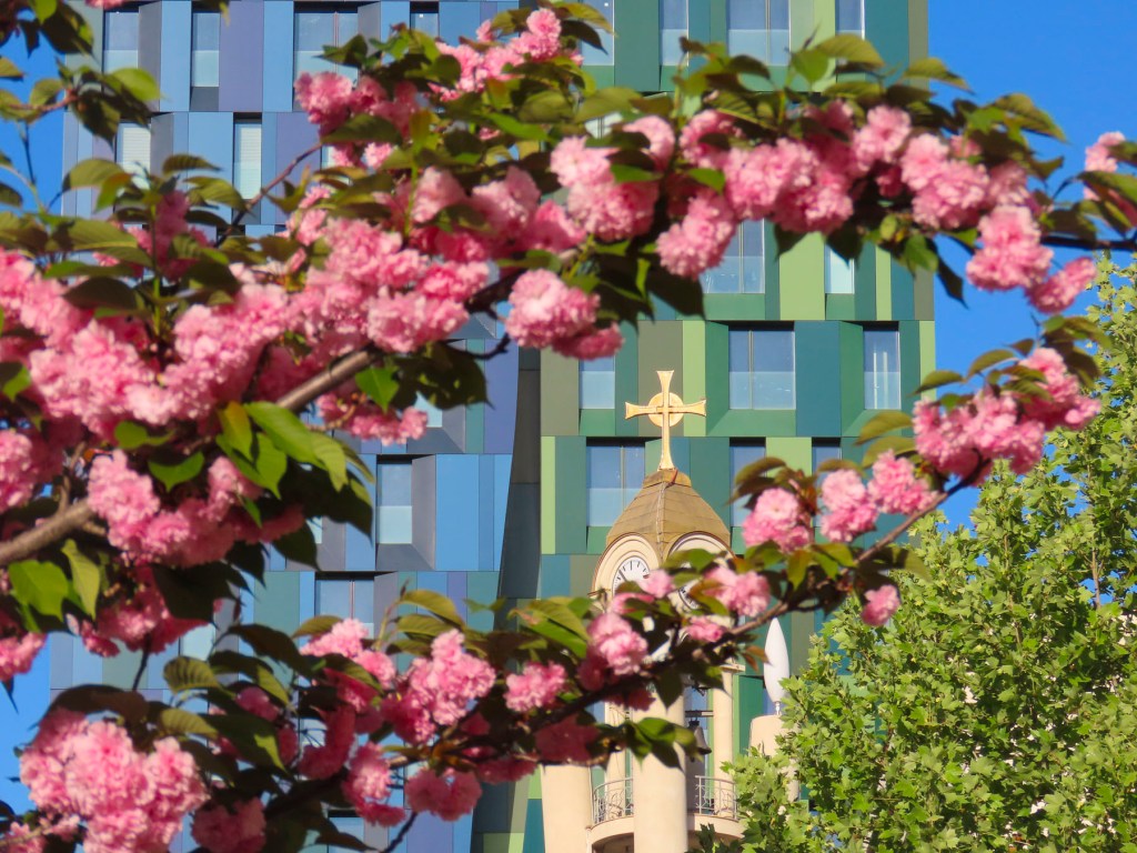
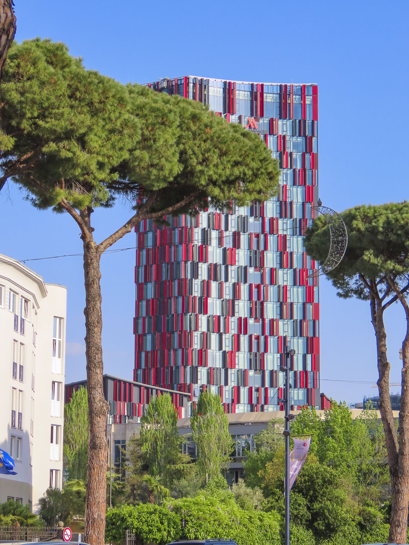
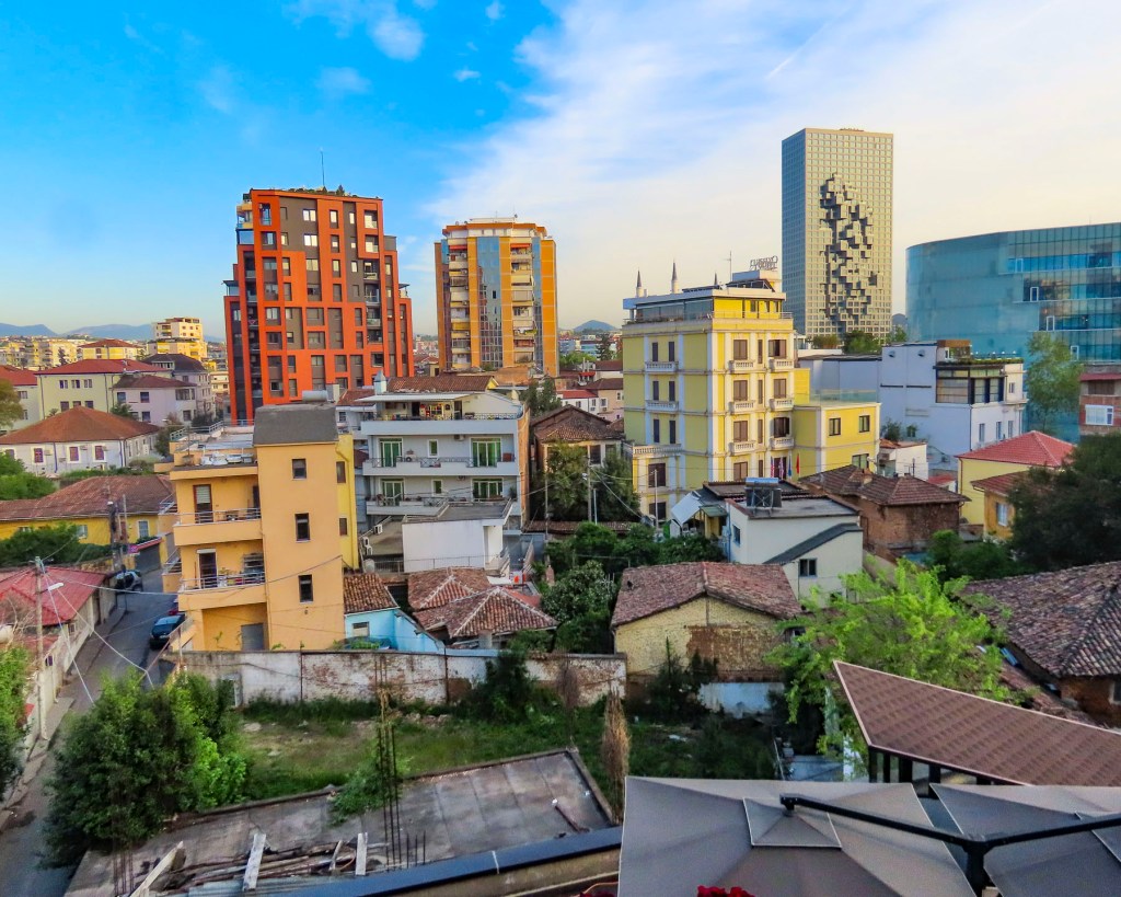
Tirana is a wonderful, midsize cosmopolitan city with a population of 375,000 people, with many parks, tree lined streets, and older buildings, mostly under five stories tall. New high-rise buildings rise from the old neighborhoods across the city. It was an interesting and delightful place to wander around.

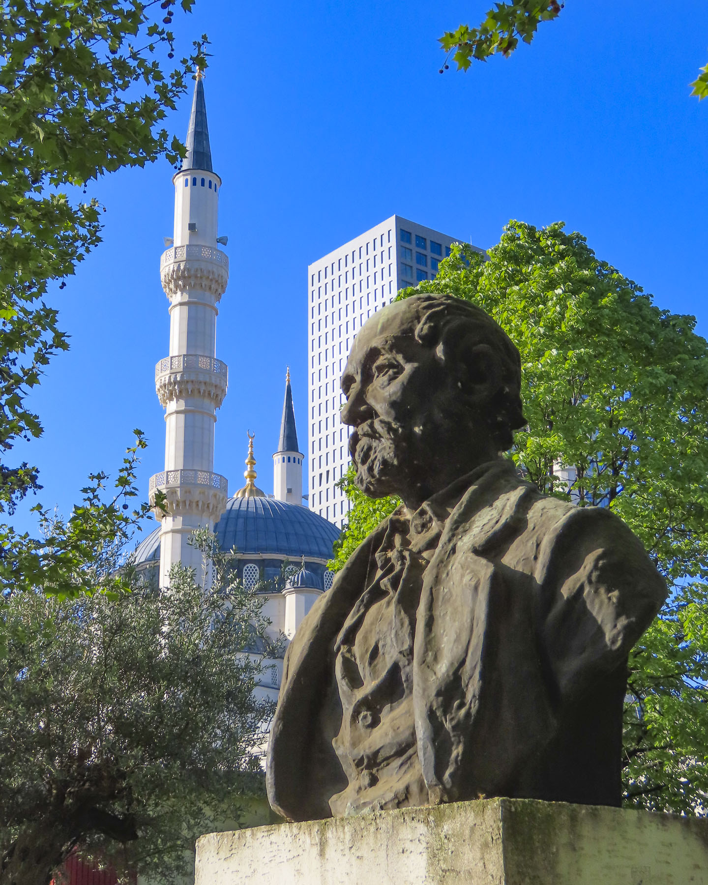
We passed ruins of Tirana Castle’s ancient defensive wall, dating to the 1300s, in the park next to Namazgah Mosque, the Great Mosque of Tirana. Completed in 2019, the mosque is currently the largest in the Balkans, and capable of holding 5,000 worshippers. The Muslim community was also persecuted under Hoxha’s anti religion policies, with many religious leaders killed or imprisoned, and 740 mosques destroyed around the country.

Nearby stood the 18th century Ottoman era Tanners’ Bridge, a stone arch across the Lana River that was used by farmers to bring produce into the city and livestock to the butcher shops and tanneries along the river. Farther away we crossed the ETC Bridge, a beautiful pedestrian only walkway over the Lana that is also a free wifi hotspot. The city’s tallest skyscraper, Downtown One, a 37 story, mixed used building with a very distinguishable cantilevered and recessed façade, stood in the background.

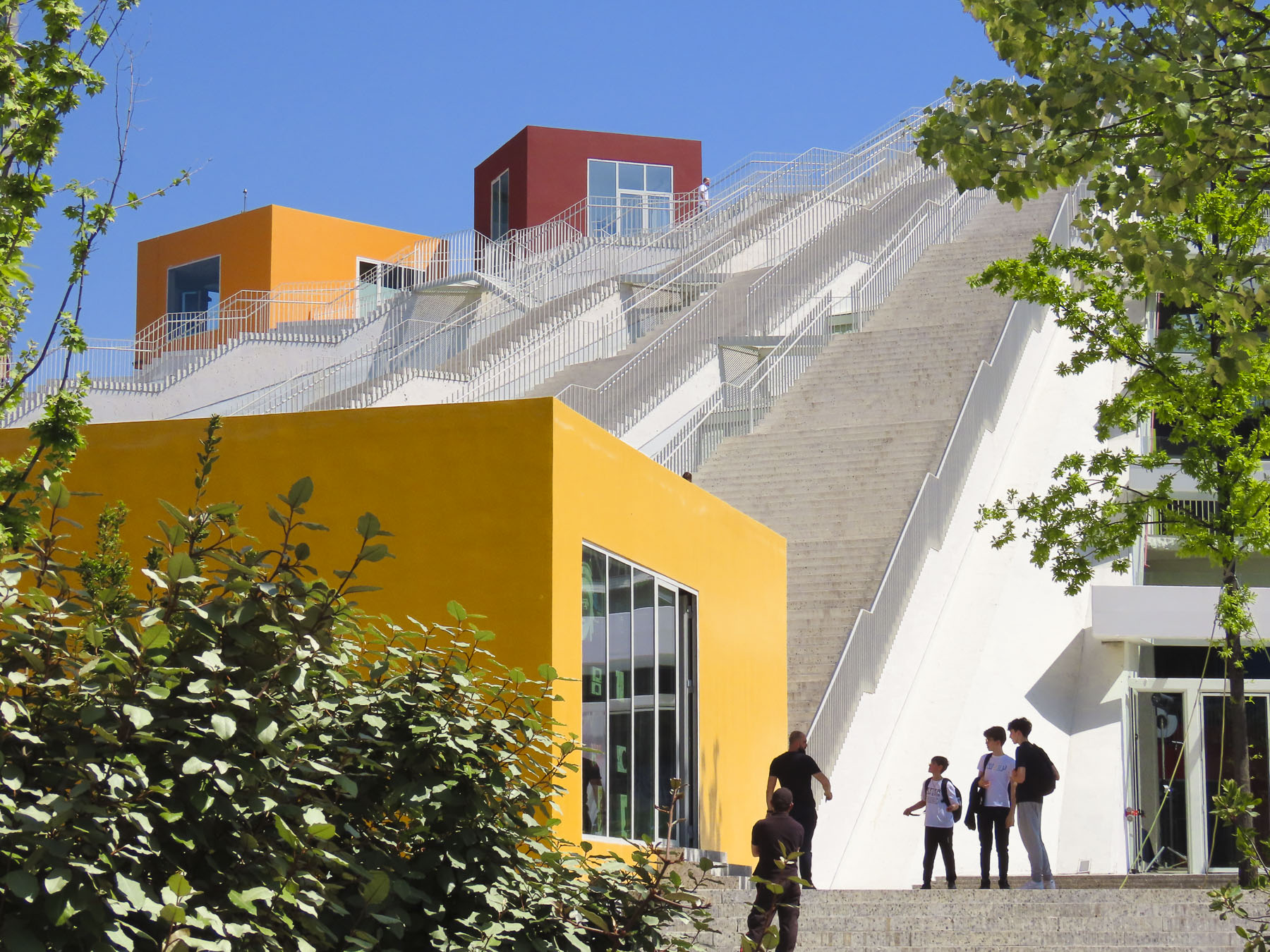
Our destination was the Pyramid of Tirana. Planned by Hoxha to be a memorial to his legacy as the Enver Hoxha Museum, covered in gleaming white marble, it opened in 1988, three years after his death. It was designed by Hoxha’s daughter and her husband and at the time of its construction thought to be the most expensive structure ever built in Albania.

Most likely forced prison labor and compulsory labor were used for parts of the project. With the collapse of the country’s last communist regime in 1991, the museum was closed and the space repurposed as a conference center, then a NATO base. It eventually fell into disuse and was vandalized, and its marble covering stripped away. It was finally reincarnated as an IT youth center with classrooms housed in colorful blocks attached on its slope, and 16 staircases leading to the viewing platform atop its 70ft high summit. We climbed to the top and enjoyed the panoramic view.

A short distance away, Hoxha lived in a modest villa in the Blloku neighborhood.  It was a secret district during the communist era, with housing reserved for the party elite, with entry forbidden to anyone else, and its road did not appear on any maps.
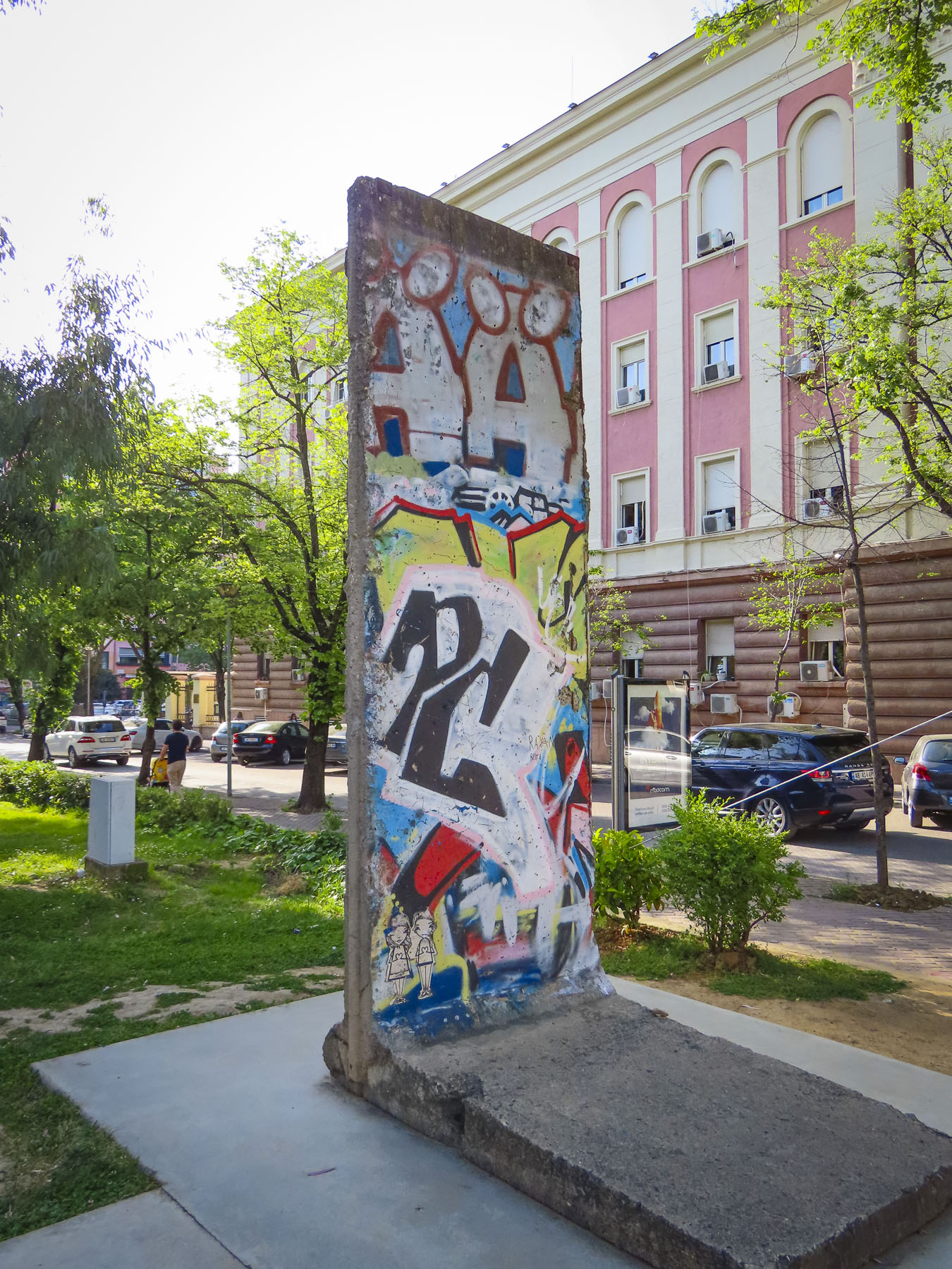
The Checkpoint memorial stands in the park down the street from his residence and features a bunker, iron mine shaft railings from the infamous Spac prison, and a section of the Berlin Wall. Subtle reminders of the brutality of communism.

For our last day in Tirana, we decided to head to the outskirts of the city to check out Bunk’Art1 before continuing into the mountains to Bovilla Lake. It’s easy to miss the turn into the long single-lane tunnel that leads to Bunk’Art1, an appropriate entrance to explore Albania’s past. After walking through a seemingly forgotten park, we entered a non-descript door in the side of an overgrown slope that hides the extensive maze of corridors and rooms of Hoxha’s secret command center.
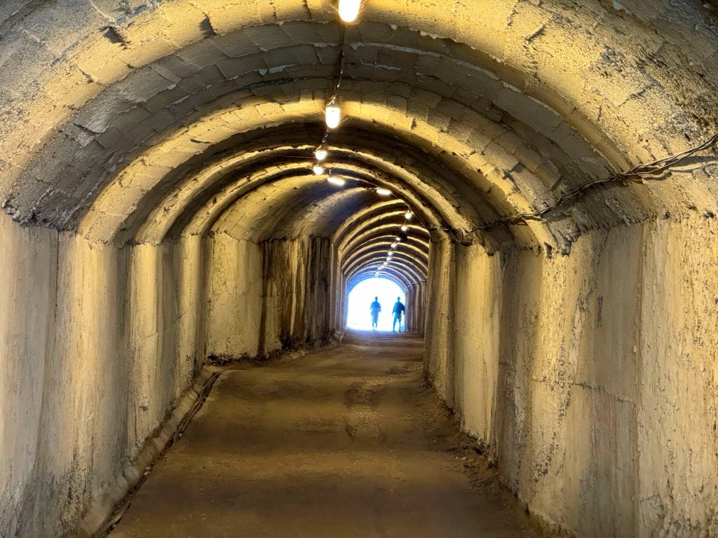
We followed a short corridor to the nuclear blast proof doors set in walls 6ft wide, and into a decontamination room. We were five stories underground in the foothills of Dajti Mountain, near the village of Linzë. There are no windows, the lights flicker, and a sign warns the power could go out at any time! It was a massive facility designed to shelter hundreds of Hoxha’s military and communist comrades, for six months, during any war.
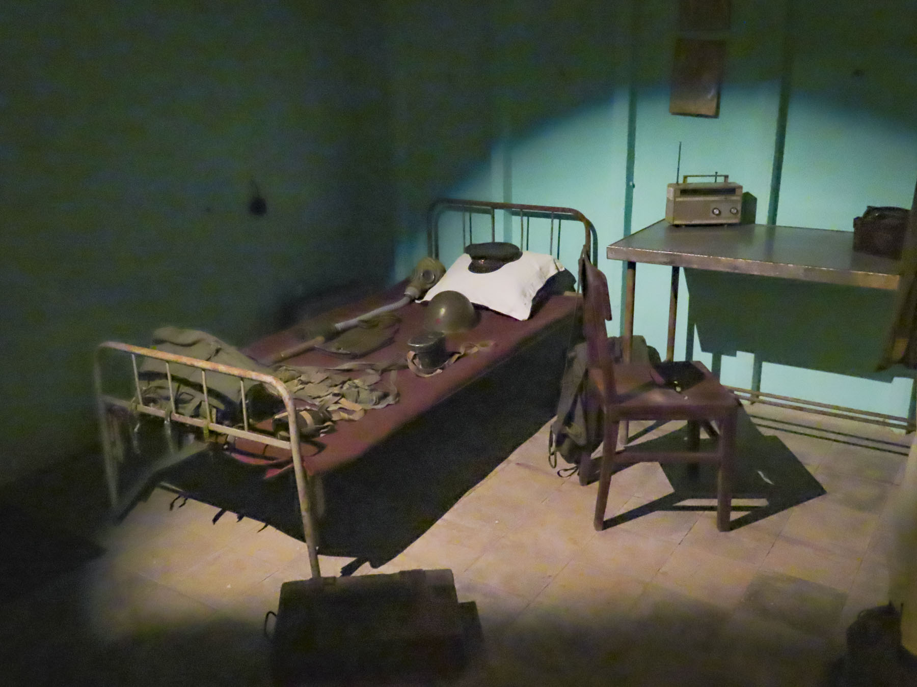
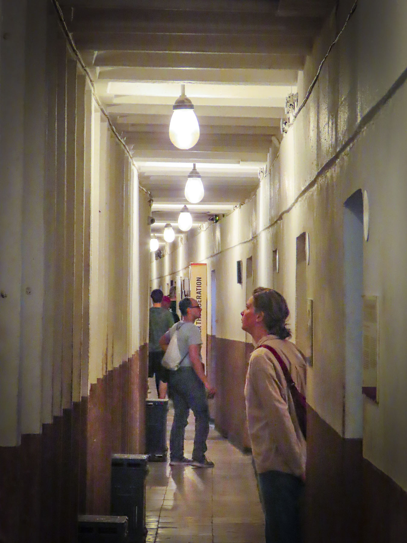
In Hoxha’s private quarters, we picked up a phone and listened to a recording of his voice. It was a sparse apartment, more prison cell than home, that lacked any warmth. Obviously, his wife wasn’t consulted. Other rooms displayed vintage equipment and weaponry. The isolation of having to live in this depressing environment would have been psychologically damaging; fortunately, the structure was never needed for war-time use and since 2014 it’s been a museum explaining Albania’s history from liberation by the partisans during WWII through Hoxha’s communist regime. The exhibits use amazing photographs and examples of nationalist propaganda from the country’s archives to great effect. The bunkers’ large meeting hall now hosts concerts and art exhibits. Emerging from the darknes,s an amazing number of different bird calls filled the air, as if welcoming us back to the present.

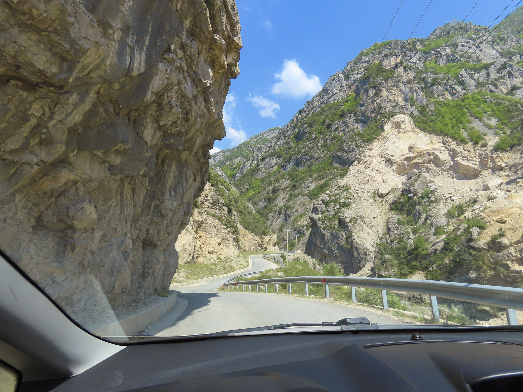
Following our map’s apps instructions we followed a confusingly serpentine route across the rolling hills outside Tirana before reaching the road, SH53, that led to Bovilla Lake. In the beginning the paved asphalt road was fine, but after a while abruptly changed to graded gravel. Nothing unusual here. Though the farther we traveled into the countryside, we passed fewer cars; rather, we saw large dump trucks, laden with stone from a quarry, headed towards Tirana, filling the air with dust. The road progressively worsened the closer to the quarry we got, as the weight of the trucks pulverized the road surface and created numerous potholes that we had to slowly navigate around. We thought several times about turning back, but we had driven through the Andes in Ecuador, with a sedan, on worse roads. While the going was slow and extremely bumpy, we did eventually make it to the lake, actually a reservoir, and more importantly, Bovilla Restaurant!

The views were astounding! The restaurant was full, with hikers and day trippers from Tirana. The food was good, the beer cold. It was a journey well worth the effort. The car rental GPS tracker did flag us, and we were fined for driving on possibly the worse road in Albania. Fortunately, when we returned the car eighteen days later, after some Albanian-style dickering, we were able to politely negotiate a reduction in the fine.

There were numerous speed traps on the highway leading out of Tirana and most of the times when we passed one, officers were writing out tickets, so we drove well below the speed limit. We were on the way to Berat and it was well past our usual morning coffee break when we spotted the colorful reflection of Bashkia Belsh’s waterfront.

After parking, we strolled along the Belshi Lake shorefront past small shops and some interesting street murals to the town’s boardwalk. Being a weekend, it was full of families with young children. To the delight of many, small rideable electric toy cars were available to rent, along with balloon, ice cream and cotton candy vendors. A small ferry boat took folks on a short cruise around the lake, while others enjoyed the fine weather and strolled along the boardwalk or sat under the umbrellaed tables of the restaurants that lined it.

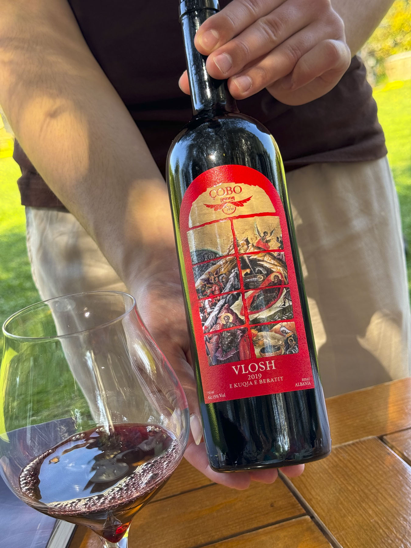
Closer to Berat we stopped at the Çobo Winery for a tasting that was accompanied by homemade cheeses and locally grown olives. Vintners of white, red, and sparkling wines and raki, they are regarded as one of the best wine producers in Albania.

It’s a small family vineyard with a 100-year tradition spanning four generations, that was sadly interrupted during the communist era, but since the 90s has grown production from 8,000 to 100,000 bottles per year. It was a nice break from our driving, and we enjoyed relaxing under the ancient olives trees in the their courtyard. The wines we tasted were very good and we purchased four to bring home in our luggage, and I’m happy to say they all made it back safely to the states.
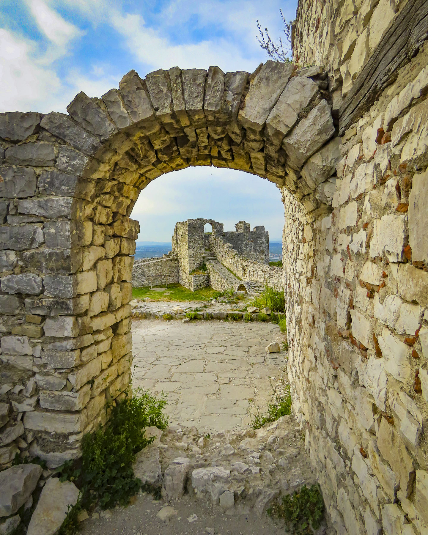
We reached Berat Castle just as the golden hour was approaching. We walked along its cobbled lanes, past homes surprisingly still occupied by about 400 people who live in 13th century citadel. But its history extends much farther back, with Roman records noting capture of the castle in 200BC. Archeological evidence shows the site has been inhabited since 2600-1800BC, making it one of the oldest settlements in Albania.
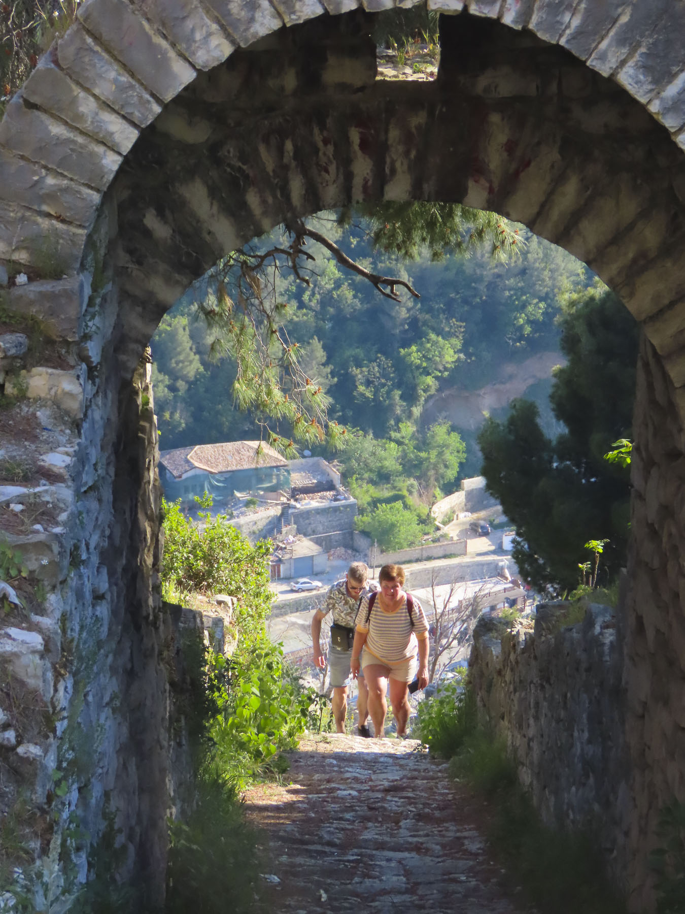
We worked our way to the overlook above Berat, passing the ruins of the Red Mosque, built in the 1400s after the Ottomans captured Berat, and Kisha e Shën Gjergjit, an orthodox church that’s been neglected since the communist ban on religion.

The panoramic view from the overlook out over Berat, the Osumi River below, and snowcapped 7900ft Mount Tomorri in the distance was stunning. Walking back along the ramparts we enjoyed watching an energetic dog race along the narrow top of the wall, chasing a stick his owner tossed up for him to retrieve multiple times. On the western slope of the castle, between the outer and inner defensive walls, Kisha Shën Triadha, a beautiful red brick, 14th century Byzantine church graces the hillside.

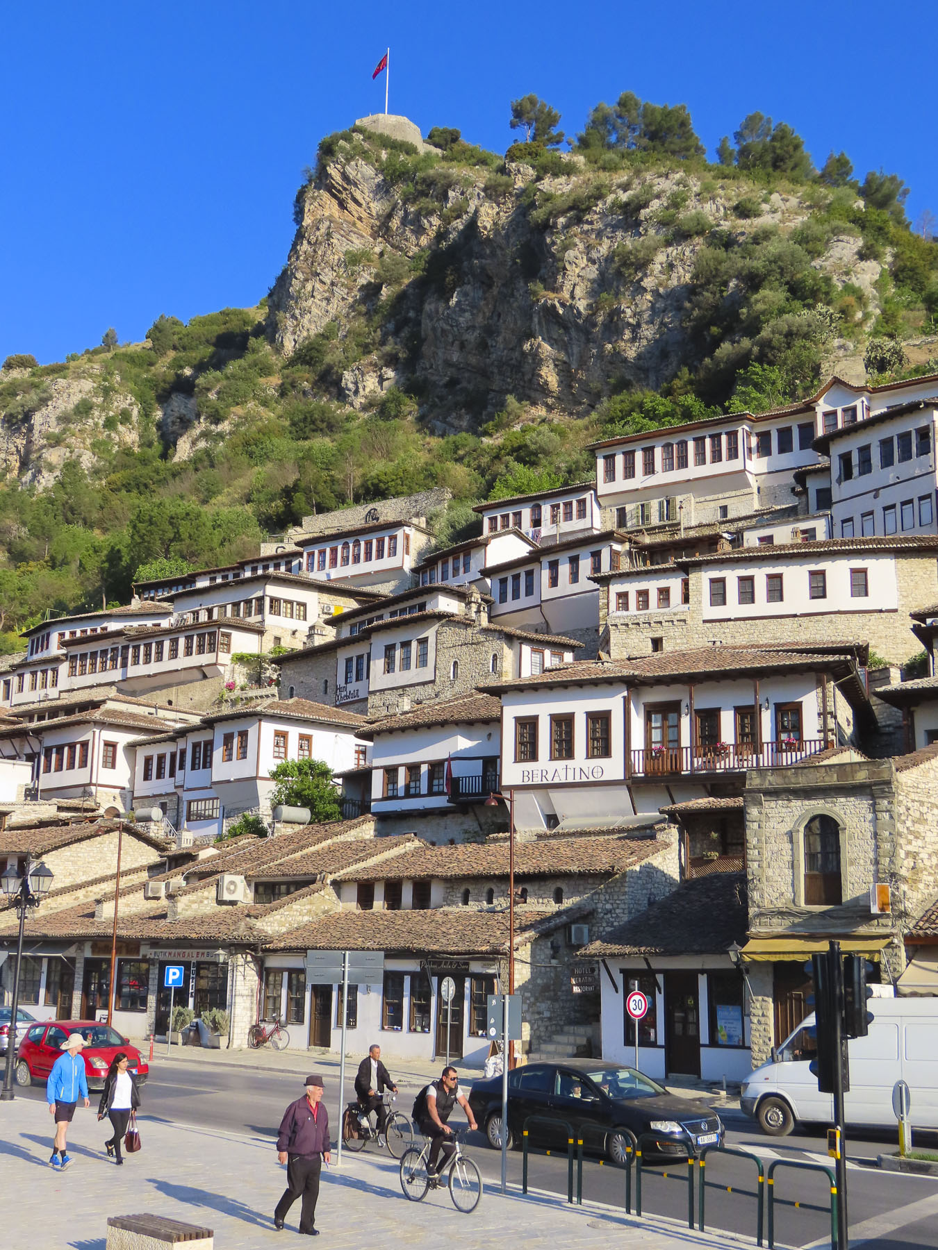
We wanted to stay on the “City of a Thousand Windows,” hillside under the castle, but didn’t want to drag our suitcases too far up the narrow alleys, and we had a car that needed parking. With those considerations in mind The Beratino Hotel fit our requirements perfectly and was great place to stay for two nights. Recently renovated, its stone and woodwork exemplified the best of Albanian craftsmanship. Still the shoulder season, in mid-April, I think were the hotel’s only guests.
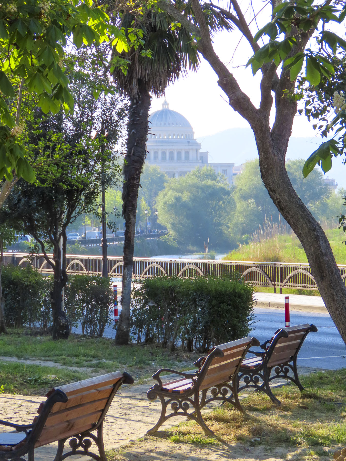
Sated from our afternoon wine tasting we walked into the newer part of Berat, now a small city of 47,000, along the pedestrian only Bulevardi Republika, next to Lulishtja park. It had a lovely Neapolitan vibe, with families enjoying the Albanian tradition of “xhiro,” to stroll with friends, relax and enjoy the outdoors after dinner. At a small shop perfectly named Bakery & Food we purchased Burek, a traditional Albanian pastry made with various meat and vegetable fillings. We purchased their spinach burek, reputed to be the best in Berat, some even say the best in Albania. The quest for the best byrek, burek, or borek in Albania might be the catalyst for a return trip to the country. Back on the balcony of our room we enjoyed a glass of wine, and the burek was delicious.

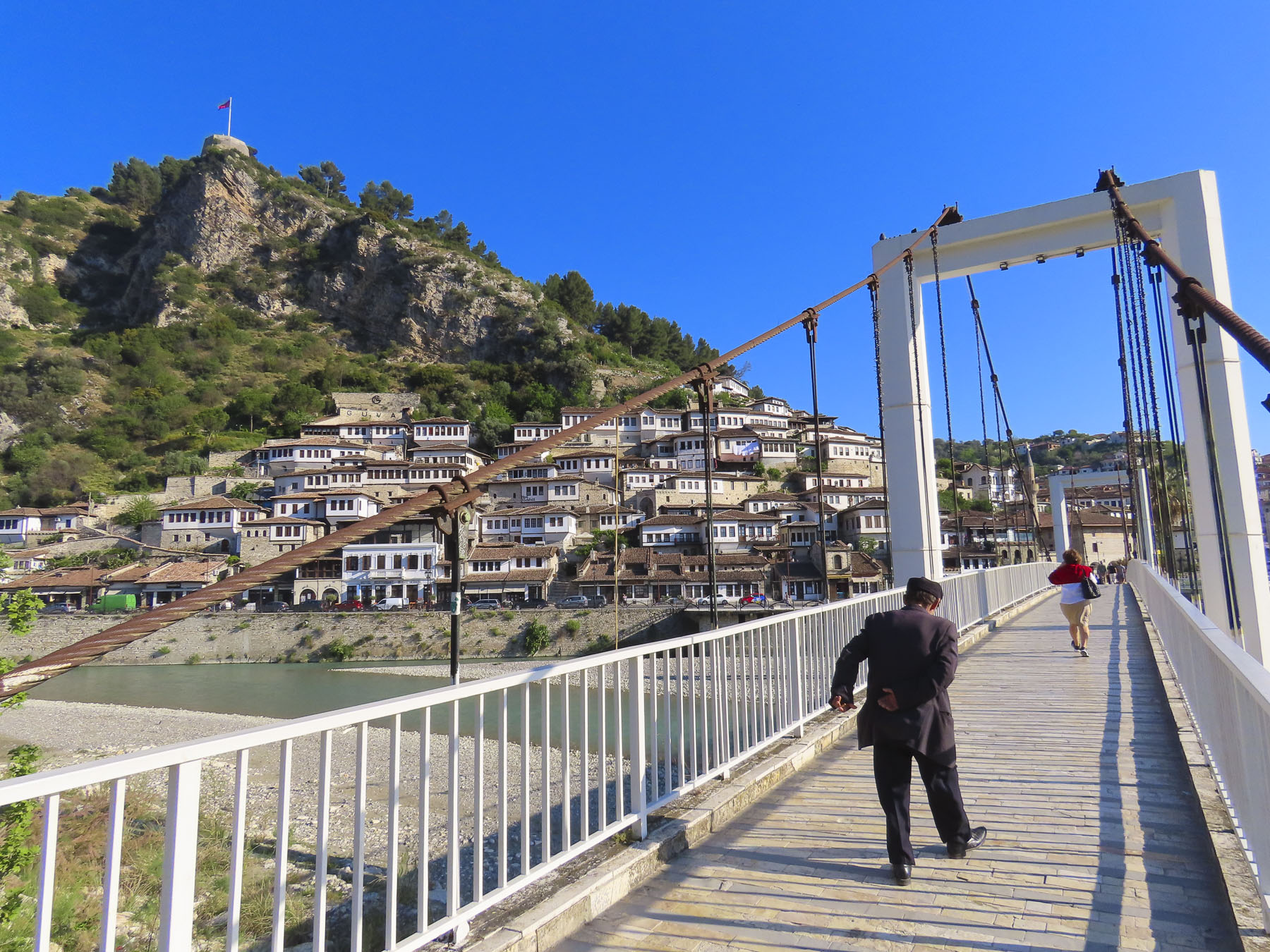
The next morning, we were up early and walked across the suspension bridge linking the old town with the southern Gorica “Little Village,” across the river. From this vantage point we spotted the Kisha e Shën Mehillit, St. Michael’s Church, an Eastern Orthodox Church, built on the steep rock face under the flag that flies above Berat. Thought to have been built in the 14th century, the setting of the red brick and stone church pricked our curiosity and we decided to hike there. The alley that led to the church was only a short distance away from our hotel but wound quickly up the hillside past homes and small inns.

We admired the strength of workers we passed carrying long wooden beams on their shoulders up the hill for a renovation project. We zigzagged higher up the hill, now looking down on the rooftops below, the trail looking like it hadn’t been trodden upon in ages. Unfortunately, the sanctuary was closed, but the views of the church with the river and mountains were well worth our effort.   

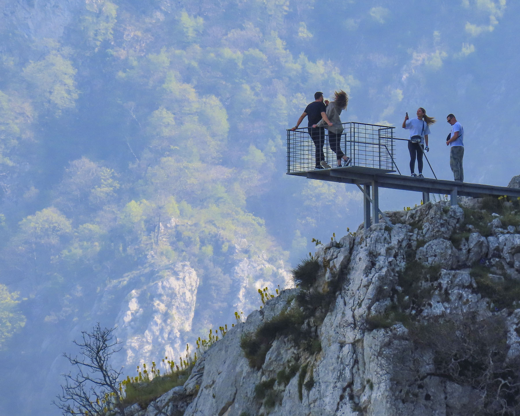
Later that morning we drove to the small town of Çorovoda, the gateway to the Osumi Canyon. It was a beautiful drive on a bright spring day, and we stopped many times along the way to photograph the scenery.

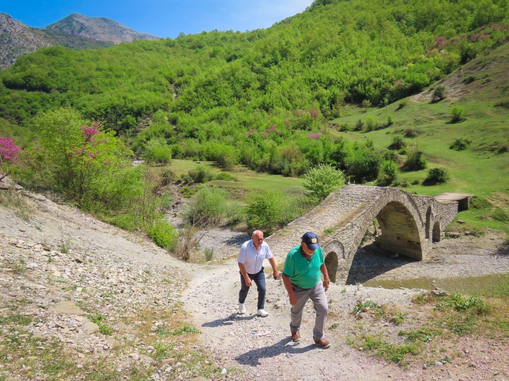
Before reaching the town, we veered off into the mountains to Ura e Kasabashit “The Bridge of Master Kasa/Kaso,” a classic high arched Ottoman era bridge constructed in 1640 across a wide stream, by the chief engineer of the Ottoman empire, at the time, Albanian architect Reis Mimar Kasemi. It was part of an ancient caravan trade route across the rugged central Albanian mountains, that connected the Adriatic Sea port of Vlorë to Berat, and Korçë before ending in the Greek city, Thessaloniki. Almost 400 years old, it surprised us that it is still standing and we followed some other tourists across it. Farther up the road from the bridge there are more abandoned military bunkers and warehouses, but we were bunkered out after Tirana and chose not to investigate them.
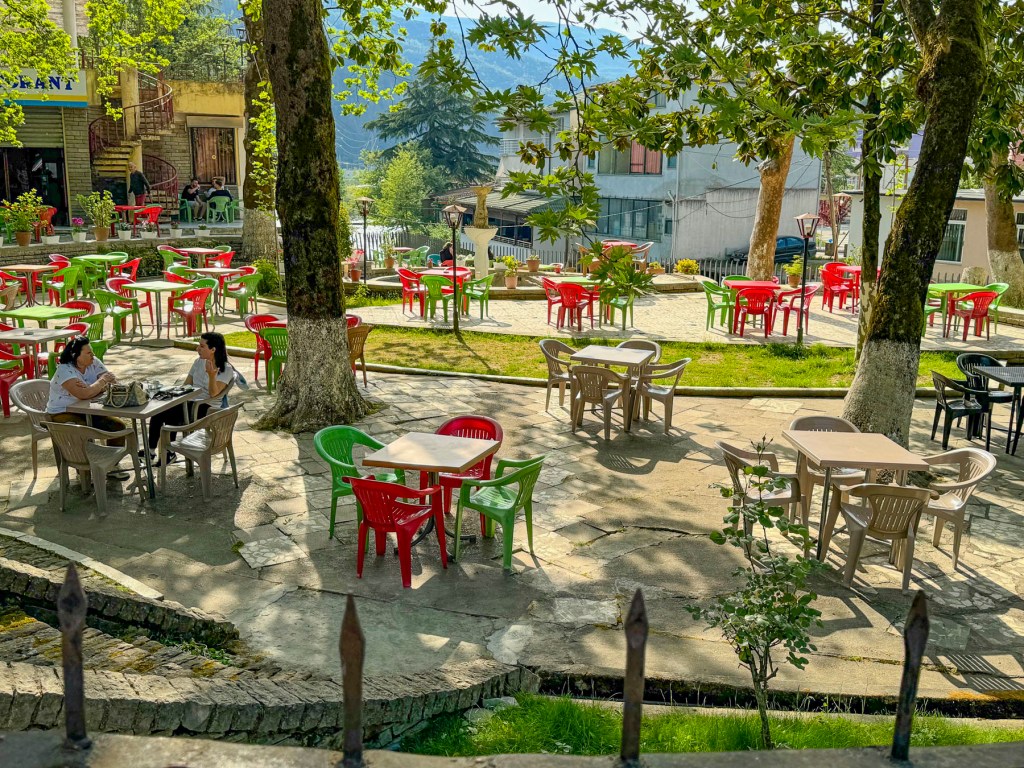
Our “drive a little, then café,” was way behind schedule when we stopped in Çorovoda at Drita e Tomorrit, a restaurant with a small park like setting.
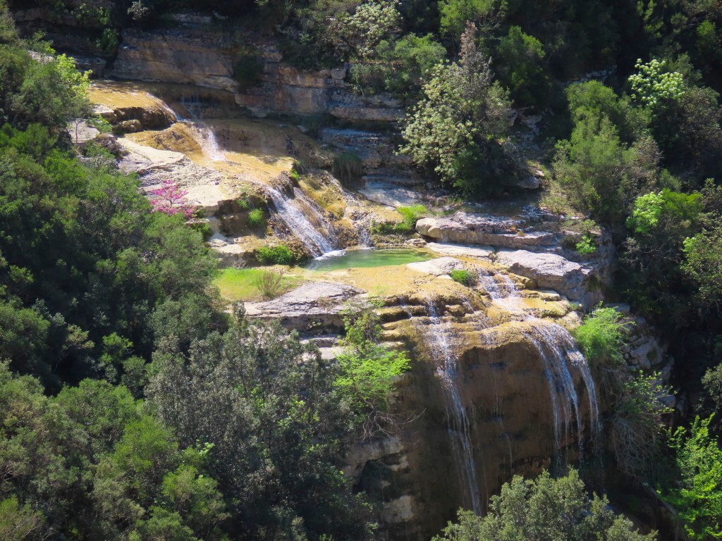
South of Çorovoda there are number of fantastic viewpoints along the Osumi Canyon. The water in the canyon is an amazing turquoise and it’s easy to see why it’s a popular area for rafting and swimming in the summer.
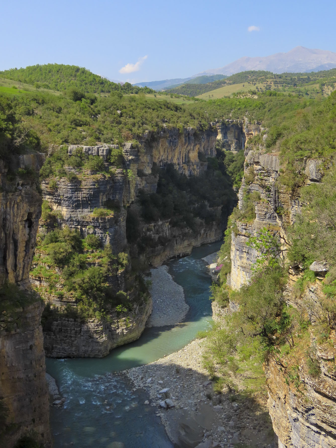
Before returning to Çorovoda for a late lunch we stopped at Gjurma e Abaz Aliut, the Footprint of Abaz Ali, a small roadside shrine believed to have in the solid rock under its canopy an impression of Ali’s foot. Made when the Albania folk hero, with legendary strength and courage, jumped across the Osumi Canyon from this spot. The depression in the stone looked very convincing to me.
Back in Çorovoda we had an early laid-back dinner at Zgara Korçare. It’s a small restaurant with nice owners across the street from where we earlier had coffee. Their mixed grill was delicious and we enjoyed our first tastes of Birra Korça. A good refreshing light beer brewed in Albania since 1928. Gëzuar, cheers!

The next day we headed to the Apollonia Archaeological Park before driving south to the semi-abandoned village of Upper Qeparo, eager to explore the rest of this interesting and stunningly beautiful counrty.

Till next time, Craig & Donna

Sailing to Bora Bora: Magic Mountains, Sacred Eels & the Turquoise Waters of Tahiti

I teeter-tottered to the bow and gently landed on my back into a lounge chair, like a turtle out of water, my hands and feet waving in the air. My unbalanced ballet was appreciated with oohs, aahs and the friendly chuckles of our congenial shipmates from Poland, Germany, France, Spain, England, Australia, New Zealand, and the United States. We’d just left Papeete’s Nanuu Bay and had entered the gentle swells of the Pacific Ocean, and my sea legs were not accustomed to the ocean’s rhythms yet. The captain had just unfurled the sails of Variety Cruises’ MS Panorama II, a beautiful, 24 cabin, 160ft motorsailer, for a sailing adventure through the Society Islands of French Polynesia to Bora Bora. Our first stop was Moorea.

The shoreline of ‘Ōpūnohu Bay hasn’t changed much since the cry “land ho!” came down from the crow’s nest of the HMS Resolution during Captain Cook’s third and final voyage around the Pacific, in 1777. Remarkably, there are not any multi-story massive hotels disrupting the serene beauty of the bay, only the verdant flora rising steeply into the jagged mountains which surround the bay. The only hint of modernization, a few small cottages, barely visible through the palm trees, were sporadically placed along the shore, and an inflatable Zodiac which raced by.

Cook wasn’t the first European to arrive in the Islands. In 1521, Ferdinand Magellan sailed through, and was probably advised by the Inquisition Officer aboard not to land, fearing that witnessing a hip-shaking Ote’a dance would condemn the sailors to years of purgatory, and so they sailed on. Two hundred forty-seven years later the French Captain, Louis Antoine de Bougainville arrived and viewed the islands as “a paradise found on earth.” Wanting to name the islands after the legendary birthplace of the mythical Greek goddess of love, Aphrodite, he called it ‘La Nouvelle Cythere.’ So began the myth of paradise found on earth.

Anchored in the calm waters of the bay, the swimming ladder was lowered for a short while before dinner, and we enjoyed the warm water. So blue and clear, the polar opposite of the murky grey waters of the North Atlantic off New England, which we were used to. Before dinner the captain introduced us to the crew, assembled from Greece, Bali, the Philippines, and Tahiti. After a week together we appreciated their cohesive professionalism and amiable nature. Dinner was always a sumptuous affair, under the canvas canopy of the upper stern deck, that was usually timed to coincide with the sunset. We especially enjoyed the locally caught Mahi Mahi and various tropical fruits that were delicious. Ubiquitous on Tahiti, French baguettes were even served daily and in a nod to the Greek crew, an excellent feta cheese, imported from Athens, was available for the salads.

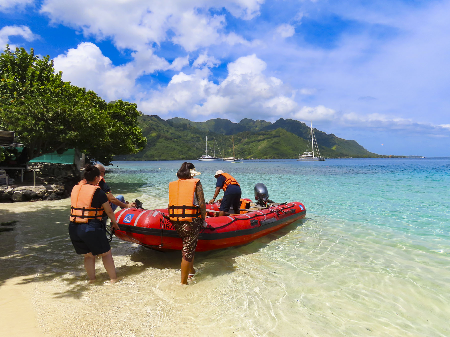
The next morning, we packed our dry sacks in preparation for a wet landing, using the ship’s small Zodiac to beach us at Ta’ahiamanu Beach. The clarity of the water was amazing, and the white sandy beach sparkled, as gentle ripples washed ashore. The bay is a natural harbor, with a passage through the island’s encircling reef wide enough for large cruise ships to sail through. Yet the reef is substantial enough to absorb the energy of the Pacific Ocean’s relentless pounding against it, leaving the small waves that reached the beach barely noticeable. We had time to amble along the beach until the groups separated into various tours.

Six of us climbed into the bed of a Toyota 4×4 pickup truck, outfitted with bench seats and a canvas awning, in case of rain, for a tour of the island. The cool rush of air felt good in the day’s already building humidity, as we drove along the coast. It was a little unusual considering it was well before noon, but our first stop was at Manutea TahitiRotui Juice Factory & Manutea Distillery for a tasting. We are not big fruit juice fans, but the Rotui juices – Papaya Passion, Mango, Banana Vanilla, Pineapple, and their various blends, all organic, were delicious. The aged rums are created from distilled O’Tahiti sugar cane, a flavor heirloom variety that thrives in the volcanic soil of the Polynesia islands. Captains Cook and Bligh brought this variety to the sugar plantations of the English colonies in the Caribbean. For nearly a century afterwards the O’Tahiti sugar cane variety was the most widely cultivated in the world. Saluting the old adage, “the sun is over the yardarm somewhere,” we enjoyed our daily ration of rum, and  even purchased a bottle of Coconut flavored rum to take home. Cheers!

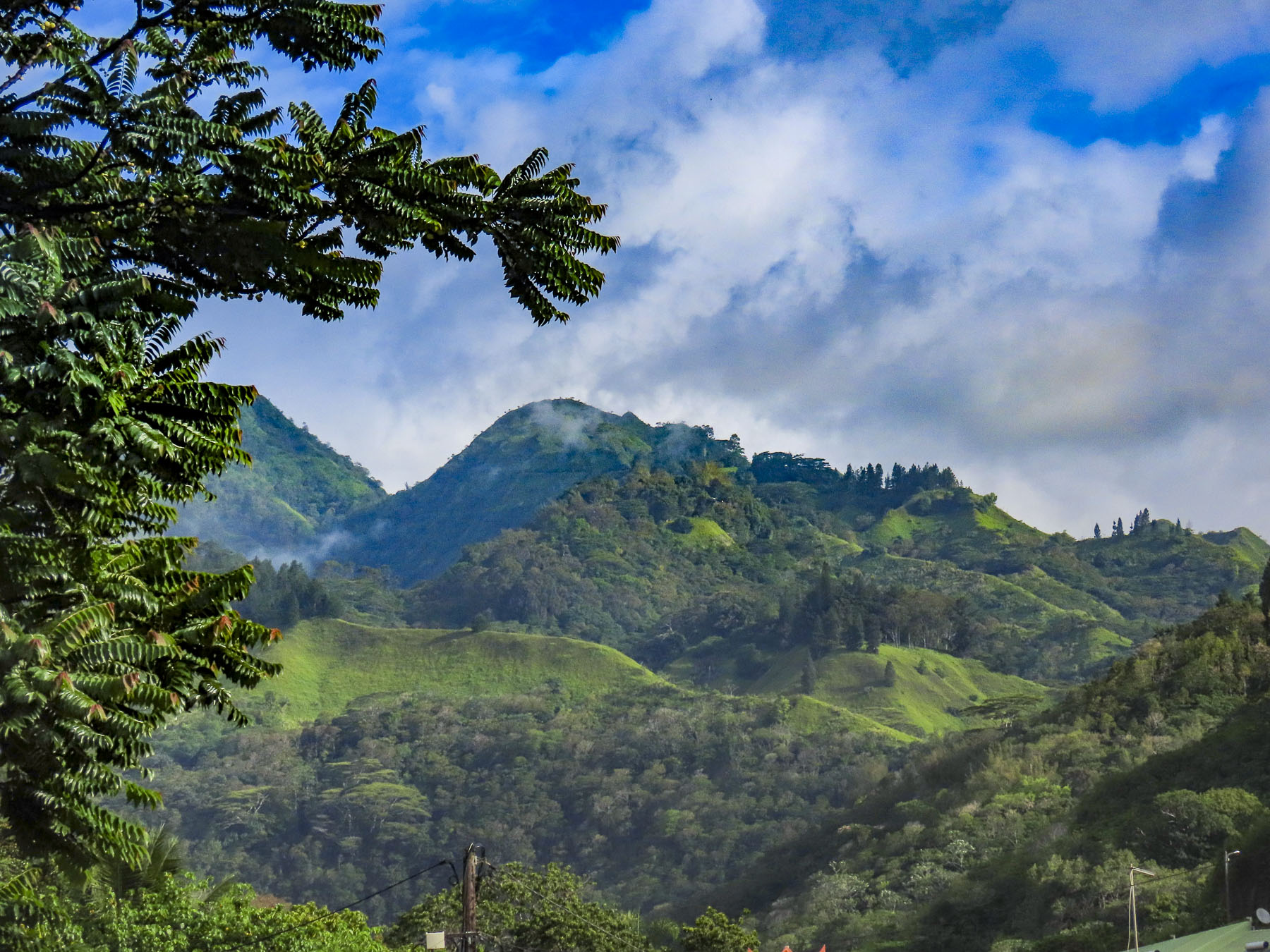
Our tour continued into the center of the island where the fertile ‘Ōpūnohu Valley is surrounded by a crown of four rugged peaks, created from the collapsed cone of an ancient volcanic eruption. Mount Tohiea, at 3959 ft, is the highest peak on Moorea. It’s followed by Mt Rotui, at 2,949 ft, and Mounts Mouaputa & Maturaorao, at 2724 and 2700 feet. Of the four, only Mount Rotui is hikeable.

Driving along a dirt track through rolling acres of pineapples and sugar cane, our guide stopped and with a small machete cut a fresh pineapple from the field and deftly sliced it, without getting any juice on himself. He explained that Queen Tahiti pineapples thrive in the volcanic soil here, though smaller than the famous Dole pineapples grown on Hawaii, which are good for canning. Queen Tahiti pineapples are sweeter, have a smaller tender core, and are better eaten fresh.

Tahitian myths and gods are associated with mountains throughout Polynesia. Though Mouaputa is not the island’s tallest mountain, its shear pinnacle shape with a hole through its summit, like the eye of a needle, spectacularly sets it apart from the others. Passed down through generations for more than a millennium, Tahitian’s oral lore tells a story about Hiro, the god of thieves, and his cohorts, who rowed a large war canoe across the ocean from Raiatea one night and tried to steal sacred Mount Rotui, where it was believed the souls of the dead begin their journey to heaven. Seeing this thievery from Tataa hill on Tahiti, the famous warrior, Pai, a demi-god, threw a magic spear crafted from hibiscus wood across the 11 miles of ocean separating the islands, in order to stop them. Missing its target, the spear punched a hole straight through Mount Mouaputa with such an enormous bang it woke all the roosters on the island. Fearing the whole island would awaken from the rooster’s cacophony of crowing, and discover their treachery, the thieves fled emptyhanded.

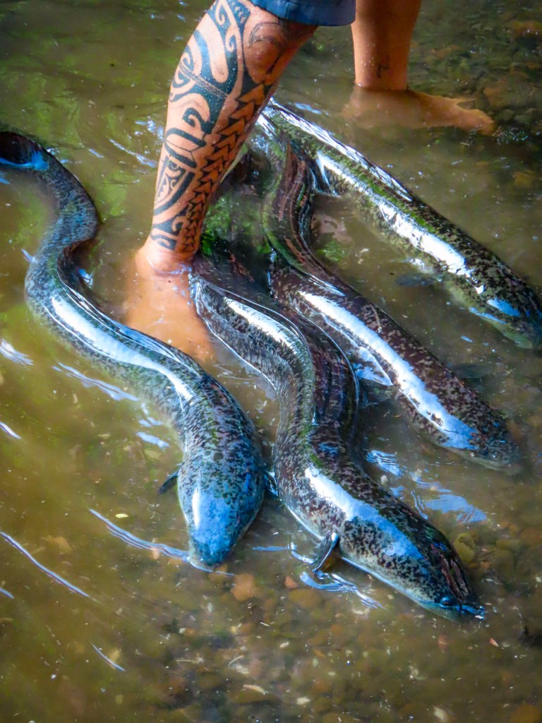
Later we pulled down a shady lane and stopped at a narrow, fresh-water stream, where we followed our guide into the shallow, barely ankle deep water. We had stopped to see the sacred blue-eyed eels of Moorea. The surface of the water was very still, with barely a ripple, until our guide ceremoniously reached into his rucksack and withdrew a magic can of mackerel to chum the water. Suddenly the water around our group erupted with a dozen or more 4-6 feet long eels racing toward us from all directions!  They squirmed and splashed in a frenzy around us, fighting for pieces of mackerel. Tahitian legend believes the eels are the reincarnation of the God Hiro, who after his death assumed the shape of an eel and took on the responsibility of keeping the island’s freshwater streams and springs clean. The eels are a protected species across Tahiti, and are also believed to possess healing powers that can cure disease and bring good fortune to anyone who touches them.

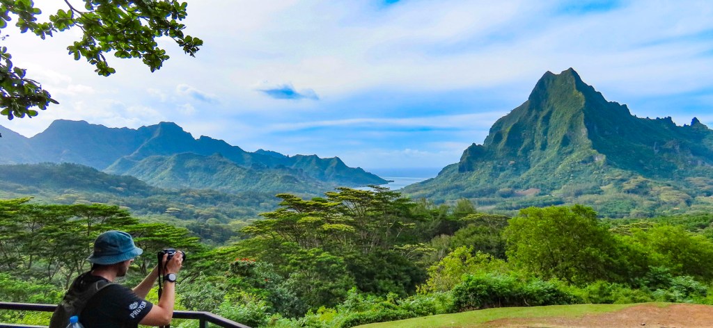
Reaching the Belvedere Lookout, we were rewarded with a pristine panoramic view, without any hint of mankind in the landscape, centered by Mount Rotui, and flanked by ‘Ōpūnohu Bay on the left and Cook’s Bay on the right. Afterwards we stopped a short distance away at Marae Ti’i-rua and Marae-o-Mahine, where tiered open-air platforms had been constructed with rounded lava stones, and used for religious ceremonies and sacrifices. During Captain Cook’s third and final visit to Tahiti in 1777, he along with several other officers from the HMS Resolution witnessed a human sacrifice held on Moorea to ensure the success of a war party against a neighboring island.

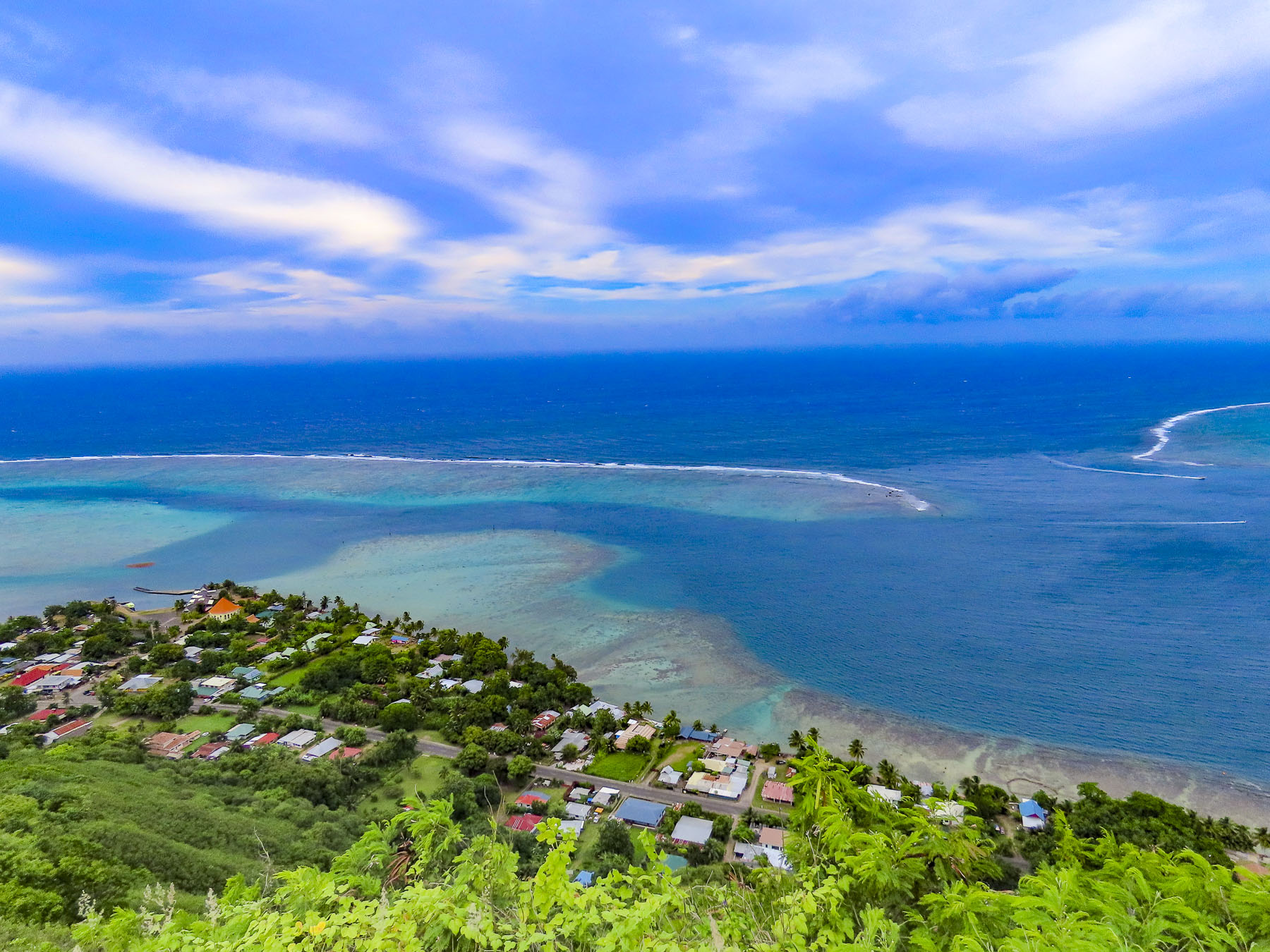
Tahitians are practical and for centuries the lava outcropping behind the village of Papetō’ai, near the reef on the edge of ‘Ōpūnohu Bay, was simply called the “hill behind Papetō’ai.” Its name change probably happened in the 1960s after the opening of the Tahiti International Airport and a marketing executive was tasked with drawing tourists to islands. I can just imagine the conversation, “Listen folks, who wants to fly across the Pacific, or sail around the islands to visit a hill? Now Magic Mountain, that creates an impact!” Signed, sealed, and delivered. The rutted road up was very steep and the six of us bounced and swayed quite a bit in the back of the 4×4 and when we stopped, we still had to walk up a rough zig-zag trail to the summit. But it was well worth the effort for tremendous views of the mountains, reef, and bay, with the Panorama II tranquilly anchored below us. Our guide pointed out an octagonally shaped red roof at the water’s edge in Papetō’ai. “That’s a church, the Église protestante de Saint Michel, the first western structure built in the South Pacific. It was built by Protestant missionaries from the London Mission Society in 1827 atop the ancient Marae Taputapuatea, which was dedicated to Oro, the Tahitian god of war.”

After dinner, we pulled anchor and sailed through the night to Huahine, and tied to the quay in Tahateao just as the sun was breaking the horizon, We shared the dock with an inter-island ferry readying to get underway. The quiet unpretentious street harkened back to a different bygone era. Huahhine is actually two islands, Huahine Nui and Huahine Iti, connected by a short bridge. Legend believes that the Tahitian troublemaker Hiro sliced the island in half when he paddled his canoe through it.

Women are revered on the island, and islanders attribute the land’s fertility to the mountain silhouette that looks like a pregnant woman lying on her back. Huahine meaning, “woman’s womb.” There is a long history of Queens ruling Huahine, and they are credited with a sacred power and wisdom, often counseling their warrior chiefs to make love not war, especially as the British Navy began to explore the islands of Tahiti.

We joined a tour heading to see the marae that line the shore of Lake Fa’una Nui, a shallow saltwater bay. Our guide explained to us that there are over 200 ancient stone ceremonial sites, of various sizes, around the lake, which were central to the community’s religious life. There are more hidden on the forested and jungled hillsides of the island’s mountains, some dating to the arrival of the first Polynesians around 700 AD. After the marae are discovered and if the sites are not maintained, the jungle grows quickly over them again. This is the reason the island is commonly called, ‘the Garden or Secret Island.”

Farther along we stopped at the bridge over the saltwater estuary that feeds Lake Fa’una Nui to view the ancient V shaped stone fish traps that are still used communally. A sandy road led us to the Marae Manunu, a very substantial stone platform that stood taller than us. It was quite different from the earlier ones we viewed, which were low to the ground, like patios. It was along the road here that we noticed gravestones in front of houses; it is a Polynesian custom to bury your deceased family members close to home, often in the front yard. There is usually more than one grave. It’s a custom that stems from the ancient belief that the spirits of your dead relatives will protect the family home from evil spirits. The mountains of Huahine aren’t as dramatic as on Moorea, but the vista from the Maroe Bay Viewpoint out over a verdant jungle, and the azure waters of the bay with Mont Pohu Rahi, on Huahine Iti behind it, was sublime.

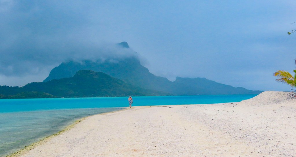
We’re all familiar with those epic aerial photographs of Bora Bora, a volcanic atoll, with Mount Otemanu rising from its center, like a spear thrust up through the crust of the earth, ringed with white surf, and  surrounded by an artist’s inviting palette of blues. It’s an expensive perspective you’ll only get if you fly into the island, but sailing through the reef is truer to the Polynesian way of life – smelling the air, tasting the salt spray blown up from the bow of ship lunging forward through the waves, feeling the wind on your face, and listening to the surf crash against the reef. For us it was a rewarding tactile journey. We had crossed the waves and arrived.

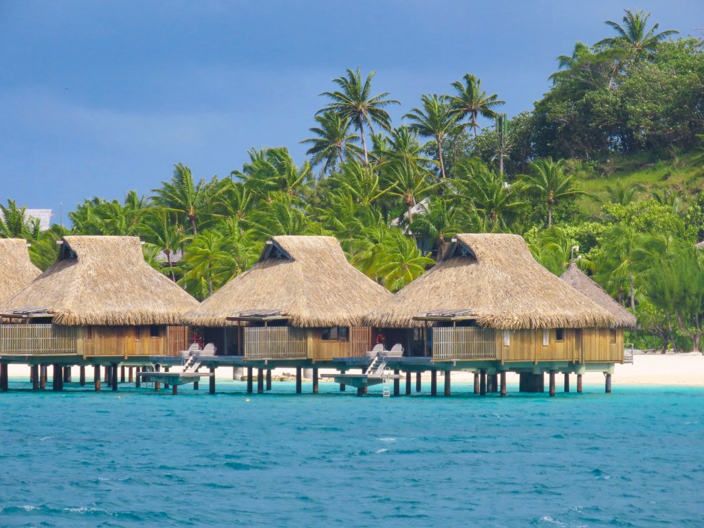
Bora Bora has been a romantic destination since the publication of James Michener’s Tales of the South Pacific, a collection of related anecdotes garnered from his time in the South Pacific during WWII, and which was awarded a Pulitzer Prize. Later the book was brought to the stage as a Broadway musical by the playwrights Rodgers and Hammerstein. South Pacific the movie premiered in 1958. Resorts with thatched roofed overwater bungalows, a new concept in the 1960s, followed. Tahiti was suddenly an exotic honeymoon destination with bragging rights, and the island still retains its allure.

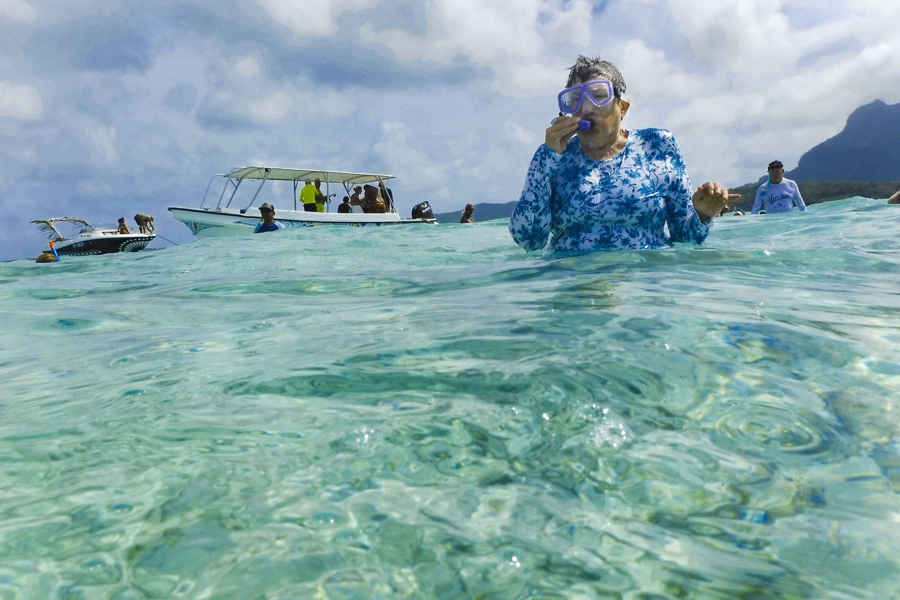
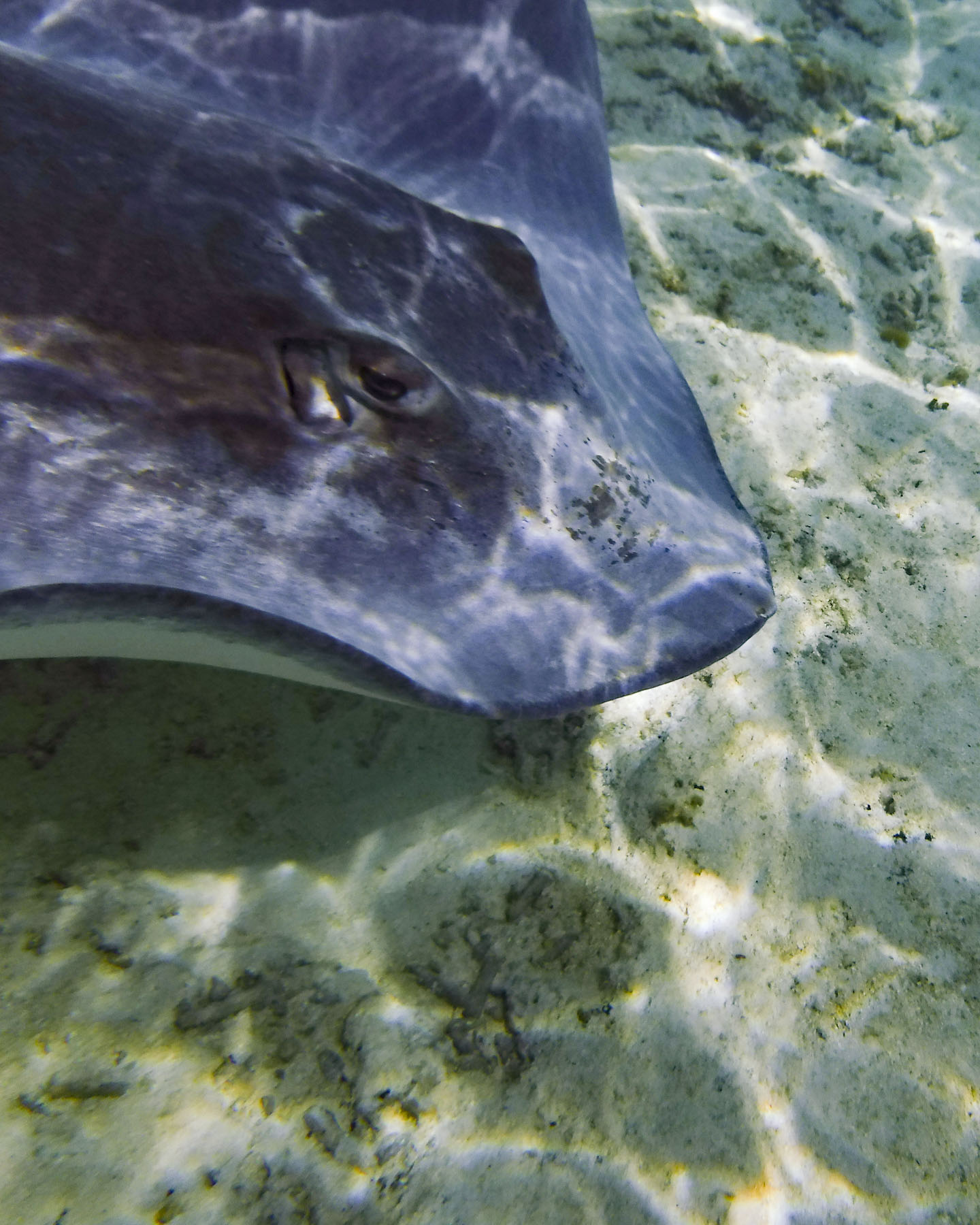
With two days scheduled in Bora Bora, it was time to get our feet wet again and we signed up for a snorkeling excursion. The tour group boarded a motorized catamaran which made 4 stops as we circumnavigated the lagoon, known for its concentration of marine life. Our first stop was to see sting rays and black tip reef sharks.

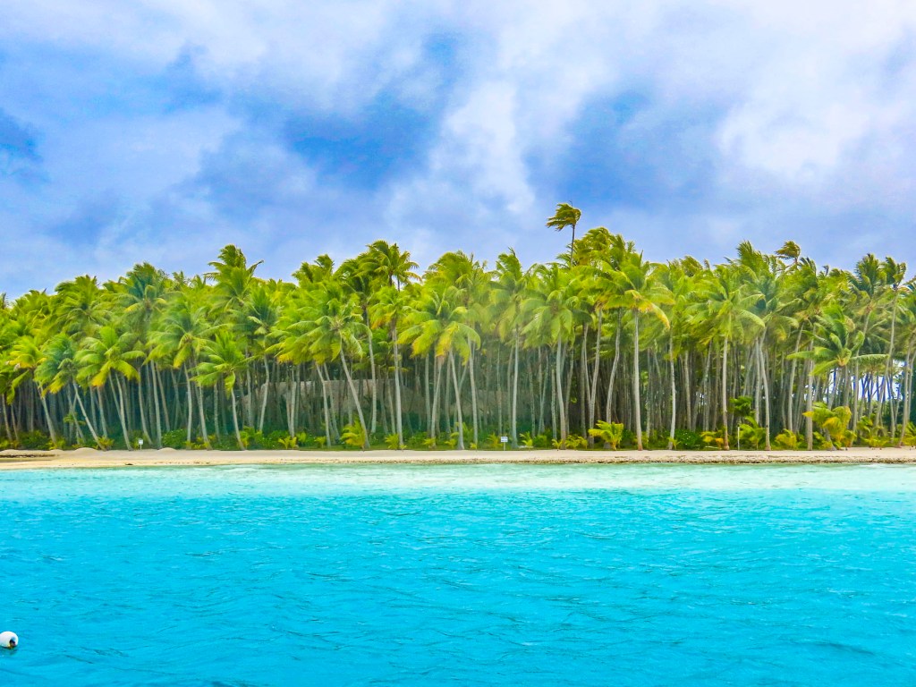
The 80°F/27°C water was perfect for snorkeling without a wetsuit, and the clarity of the water was amazing, making it easy to attempt some underwater photography. I have a new respect for the photographers that document marine life – it’s not easy. Pulling anchor, we motored along the shoreline, the captain calling out the name of the resorts and any celebrities that might have vacationed there. The underwater coral garden just off the beautiful palmed lined shore of Pitiuu Uta, a small islet or motu, had us imagining a Robinson Crusoe adventure and Tom Hank’s character in Castaway, though we didn’t spot any wayward volleyballs floating along.

The water was deeper here and the naturalist who accompanied us warned us not to stand on the endangered coral. Even as our party tried hard to avoid contact with the reefs, the currents made it difficult, and Donna and another person discovered the hard way that coral is sharp! It was a great spot for a variety of fish, and we enjoyed finding giant clams embedded into the reef. The colorful lips of their shells were the only clue to their presence. It was easy to appreciate the beauty of Bora Bora as we motored along.

Off the Tā’ihi Point we stopped to snorkel with large manta rays which swam close to shore, and appreciated the joy and enthusiasm of four black dogs that frolicked through the surf to join us. They swam safely back to shore as we departed.

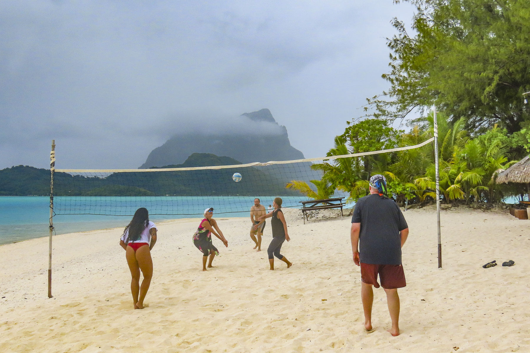
Beaching at a motu, we enjoyed refreshments and snacks. Some of us joined an impromptu game of volleyball, as others relaxed in the water or walked along the beach to savor the view of Mount Otemanu.

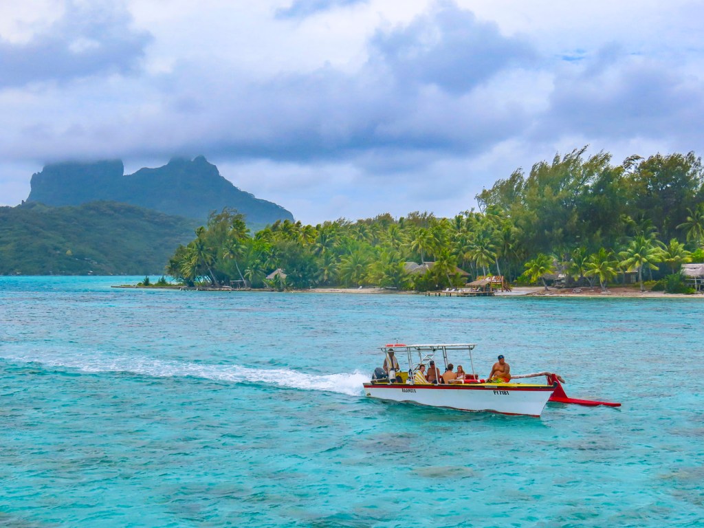
The next day we continued with an outrigger taxi ride along the lagoon’s waterfront before wandering around the small village of Vaitape. Remarkably, Bora Bora is not overrun with a intensely developed tourist infrastructure. The resorts with overwater bungalows are barely visible from the mainland. And a walk along the main road through Vaitape revealed a town that has kept its laid-back identity, hosting stores geared for the islanders. There are not any international fast-food joints or coffee shops, though there are several art galleries and a pearl shop. Fishermen still display their daily catch along the roadside along with farmers selling fruits and vegetables. There are several small grocery stores in town as well.

Walking back to our ship along the quay, we noticed a memorial to the U.S. Navy Seabees who arrived on the island in February 1942 after sailing from Charleston, South Carolina. The 150 men were tasked to build a fuel depot and airfield. It was the first of many naval air patrol bases built on various islands across the South Pacific to keep communication channels open with our allies during WWII. Later they built roads around the island to strategic points for the placement of naval artillery batteries to defend the island. And they brought electricty to the island for the first time. After the war the airfield they built was passed to civil authorities and it became Bora Bora’s Motu Mute Airport which accepted international flights from Los Angles through Hawaii, before Papeete’s airport was constructed. The Seabee memorial resonated with Donna, remembering her dad’s stories from WWII, when he was a young, 18 year old sailor on a fuel-tanker making frequent stops to this enchanting paradise.

By the end of the day the weather had turned and our overnight passage to Taha’a across a tempestuous sea was the roughest of our cruise. If you expect verdant jungle in paradise, you need to accept some rainy days. Unfortunately, the weather didn’t break, and we stayed onboard all-day watching movies, playing board games, and reading.

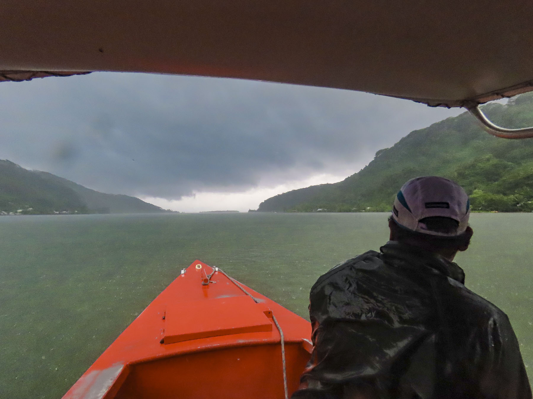
Overcast skies followed us to Raiatea, but we kept our plans with several other passengers and toured along the coast in an outrigger canoe to the Faaroa River, which flows from the mountainous interior of the island. Our hope for the day brightened as the sky cleared and brilliant colors returned to the landscape. It lasted only a brief time until we were deluged with rain. The Faaroa is referred to as the only navigable river in Polynesia, but during our visit the river narrowed as it travelled through the jungle and was blocked by a fallen tree. It would be perfect for exploring with a kayak.

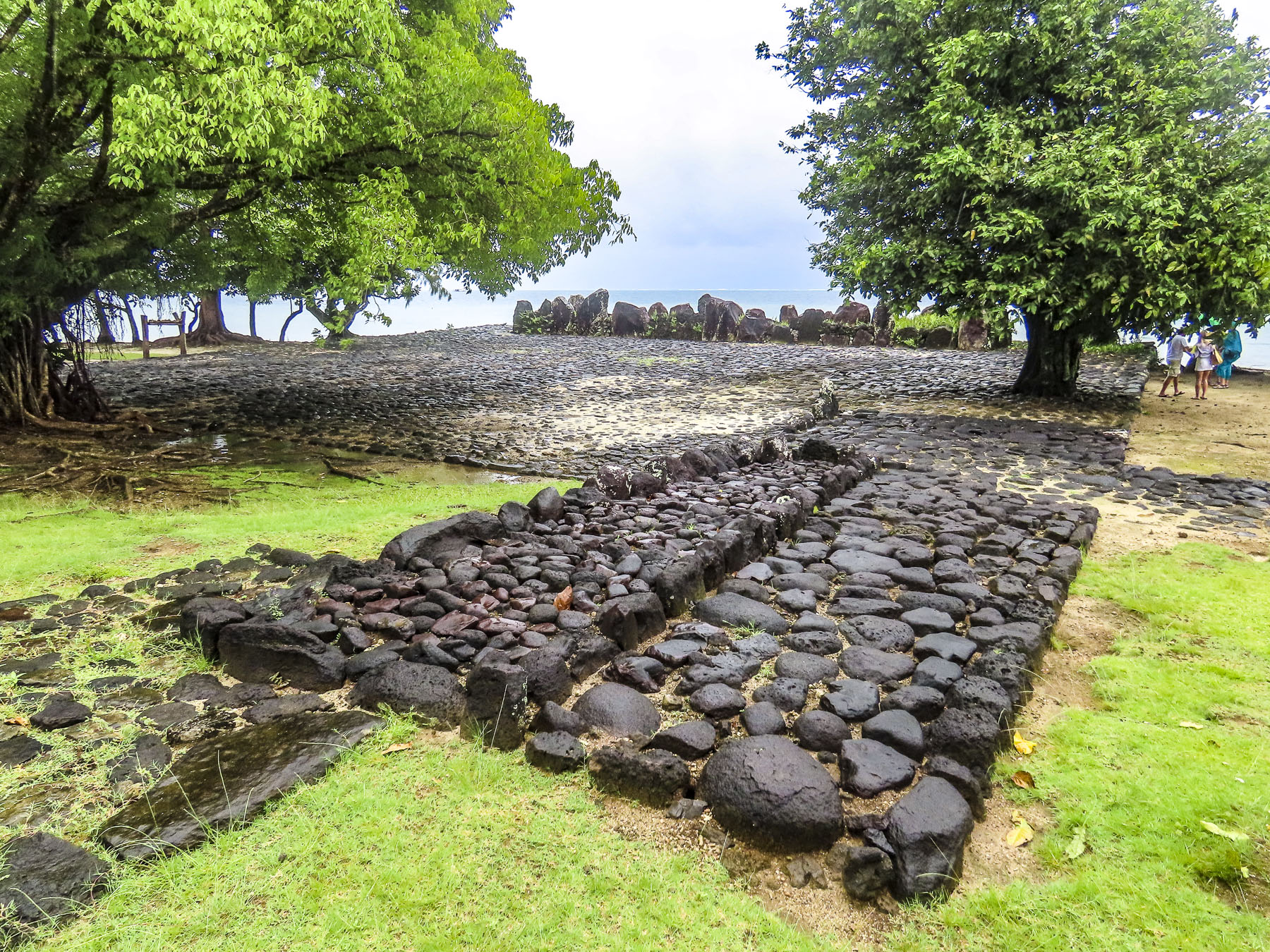
Afterwards our guide explained as our outrigger headed towards the Marae Taputapuatea archeological site that Raiatea, meaning “faraway heaven,” is believed to be the homeland, Hawaiki, in Polynesian legend, and the island from which the colonization of the South Pacific began around 500AD. Polynesians wayfarers sailed across the great expanse of ocean, using their seafaring knowledge of the stars, wind and waves to reach Hawaii, 2500 miles away to the North, and eventually reaching New Zealand 2400 miles to the south, and Easter Island 2800 miles east – the area referred to as the Polynesian triangle. These were amazing weeks-long voyages in double-hulled, sailing canoes, with folks aboard exposed to the weather.

The Marae Taputapuatea was not only a religious ceremonial site, but also a place where the knowledge of the sea was passed down from generation to generation. The bravery of these wayfarers was immense, but they followed a belief that “under a chosen star there is a land that that will provide us with a new home.”

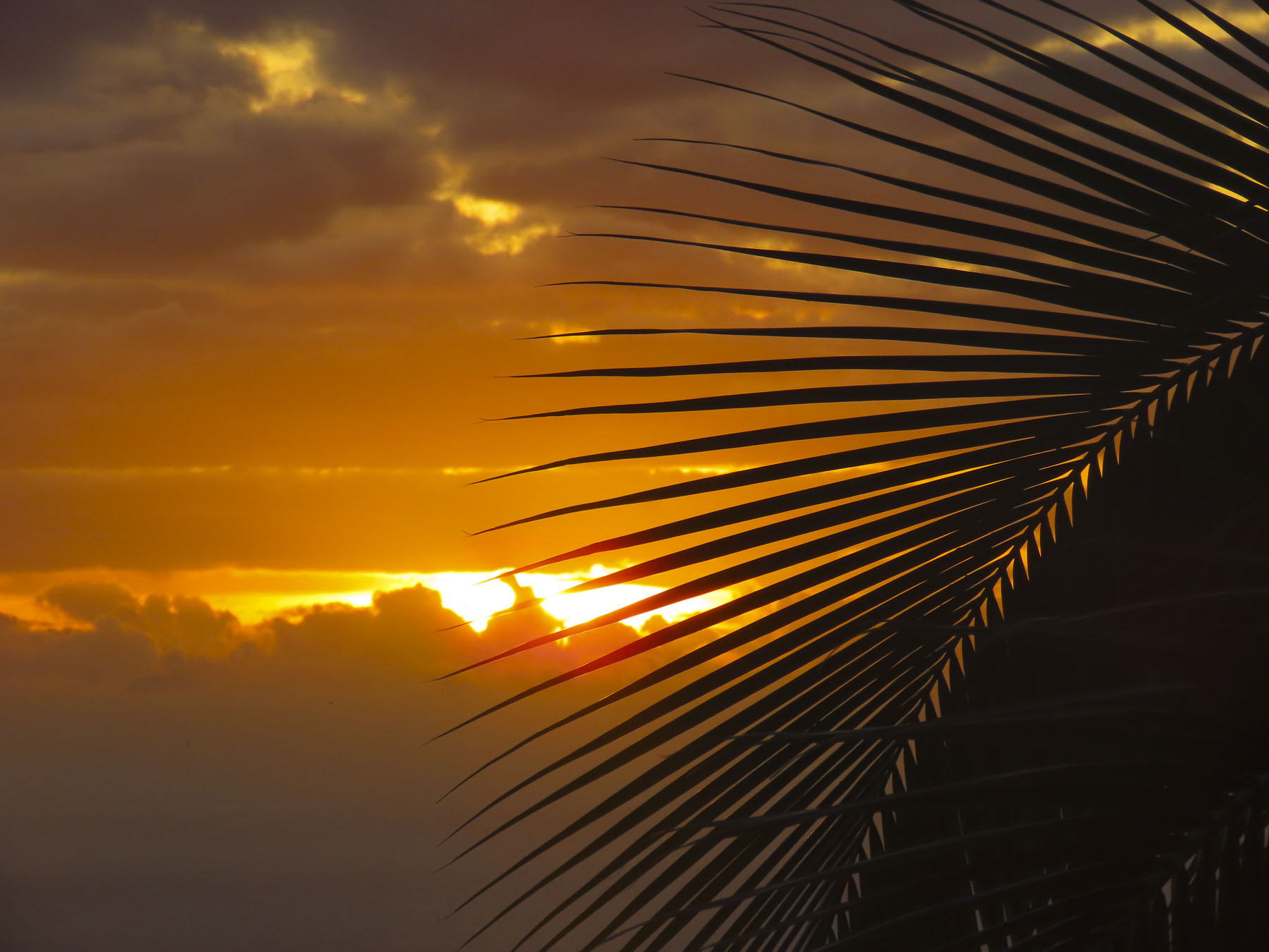
The last evening of the cruise, the sky cleared, and our cruise director, a vivacious Tahitian woman, arranged for a local ukulele trio to come aboard and entertain us on the top deck, as she and a crew member demonstrated the three different styles of ‘Ori Tahiti, the Polynesian dances, once banned by the first missionaries that arrived to the islands, from which Hawaiian hula evolved. Between songs she explained the characteristics of the types of dance: the slow, graceful motions of Aparima, which mixes hand and body movement to tell a story in a kind of elaborate pantomime; the lively Ote’a, similar to Hula, and danced to drumming; and Hivinau, a group dance performed as a  communal celebration in a group circle with singing and clapping.

It was a wonderful evening of shared camaraderie. Our adventure complete, and the night darkened; the stars we’d follow back to Papeete, and eventually home, sparkled above us.

Till next time,  Craig & Donna
Road Trip Tahiti: Black Sand, Waterfalls and Sunsets or Enjoying a Week in Paradise

“What do you think about Tahiti?” Donna asked.  “I haven’t, honestly – it’s not on my radar.” “There’s this very good airline points sale to Papeete. I think we should go!” And so, we made it happen.  It’s one of our great pleasures in retirement, the ability to indulge our desire to see the world. Though the statement that Tahiti was not on my radar might not be exactly true.  James Michener’s Tales of the South Pacific might have been the first book I freely chose to read as a teenager, fifty-plus years ago; the catalyst was my dad’s dream of building a sailboat to sail around the world. Frustratingly, our sailing never extended beyond Long Island Sound, but the lifelong desire to explore had been instilled in me.

It was a long sixteen-hour flight from the east coast of the United States to San Francisco with a final connection to Papeete on Tahiti in French Polynesia. Arriving just before 9:00pm, we opted to taxi to our three-night apartment rental, Little Home Tahiti, a small studio apartment chosen for price, onsite parking, and short walking distance to the car rental agent – Tahiti Rent.

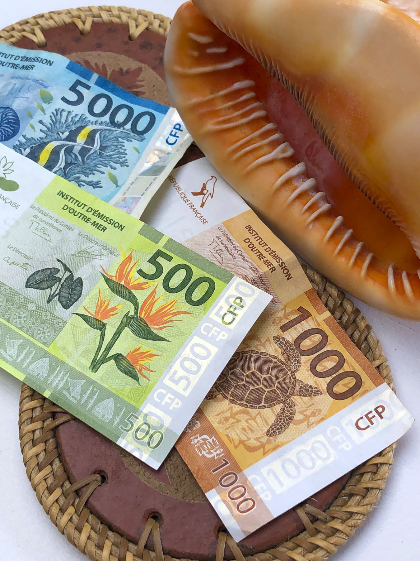
Checking into Little Home Tahiti was a bit unusual: instructions to access the key to the apartment building and garage door fob from a key box were hanging from a traffic signpost in front of the building (our payment, Tahiti has the prettiest currency, was to be placed there too.) The next morning, after excellent coffees at Kaūa’a Tahiti, just around the corner (they roast the coffee beans in the café), we walked a few short blocks to the Marché de Papeete, the town’s old central market.

The 2-story building still has several fruit and vegetable vendors, fish mongers and exotic flower stalls. Most of the space is now, though, is filled with folks selling handicrafts, souvenirs, and Tahitian black pearls, for the tourist trade. Afterwards we picked up our rental car – an easy procedure, with the caveat that we would need to vacuum out the beach sand, before returning the car. We thought this was an unusual request, as most car rental companies that we’ve used have provided this service. Not being local, I asked where I would accomplish this and was informed most gas stations have vacuums available. Easy enough in theory, but nine days later after stopping at five different gas stations, I was not able to find a vacuum pump. Upon returning the car the rental agent was ready to charge us an additional fee for a small amount of sand, difficult to avoid on Tahiti, on the car’s front floor, until I pointed out that we interrupted him from vacuuming a car when we pulled into the lot.

While the airfare to Tahiti, the largest island in French Polynesia, was relatively low, restaurants and hotels in this isolated paradise in the middle of the Pacific Ocean are expensive. This is the direct result of having to import nearly everything from France, China, the United States, Australia and New Zealand. So, to keep within a reasonable budget for nine nights, we chose to stay in three different self-catering apartments across the island. We’ve always enjoyed checking out the local grocery stores and markets during our travels, and enjoy cooking in. Food trucks were mentioned as a budget friendly alternative to restaurants; although good, we found these to be not nearly as inexpensive as you would think. Surprisingly, freshly caught tuna and mahi-mahi were reasonably affordable in restaurants and stores. We enjoyed preparing it several times during our stay.

Papeete, the capital of French Polynesia, is a small city with a population of roughly 27,000. Its popularity as a booming destination was never envisioned and the traffic in paradise is just as bad as NYC’s at rush hour, since most of the island seems to drive to work here. To help alleviate the morning and evening congestion they use a road zipper, moveable barrier systems, to reconfigure the incoming and outgoing lanes of traffic at rush-hour. The city’s antiquated footprint was inherited from the days when the town was viewed as only ever being colonial backwater.  Fortunately, the town is thoroughly walkable.

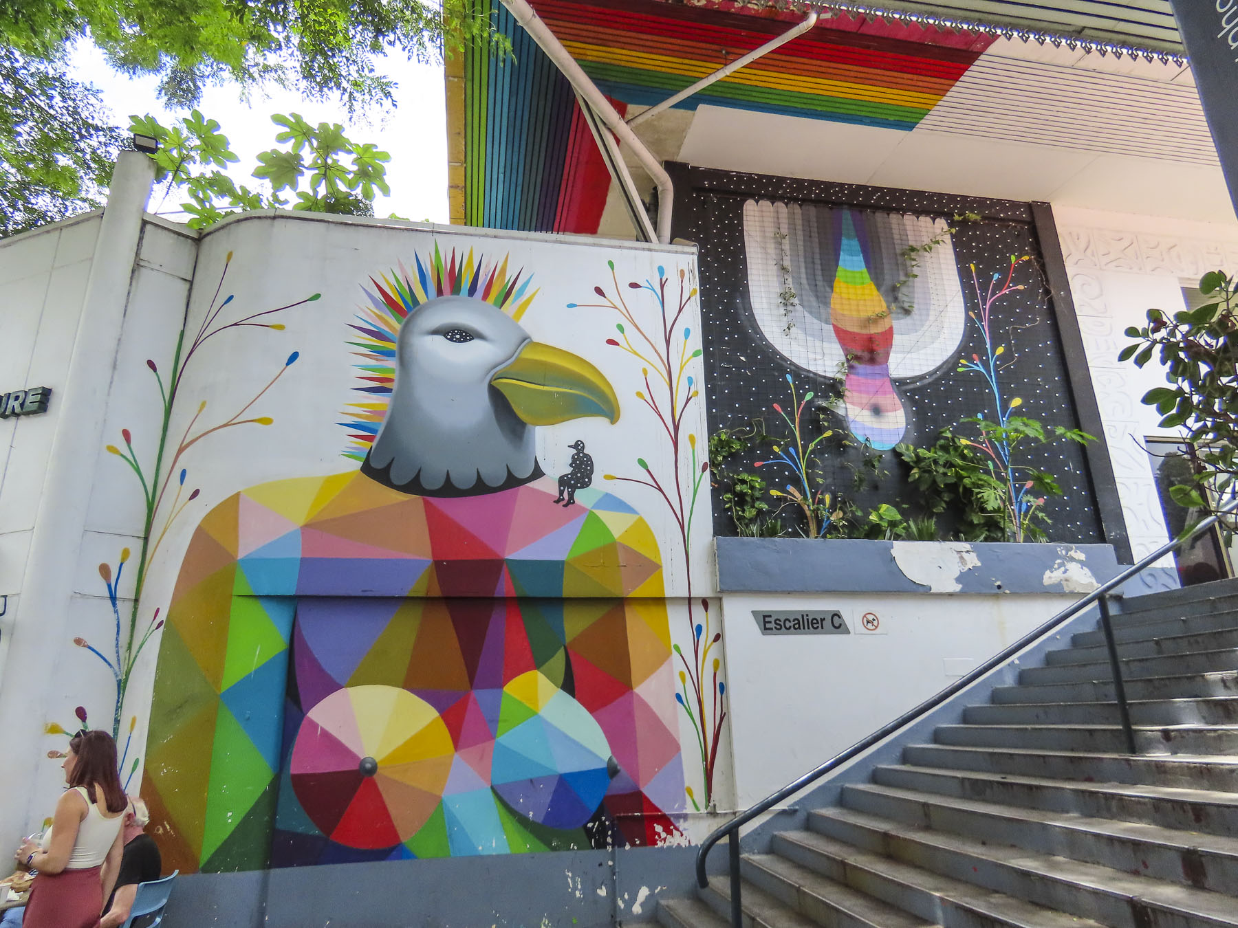
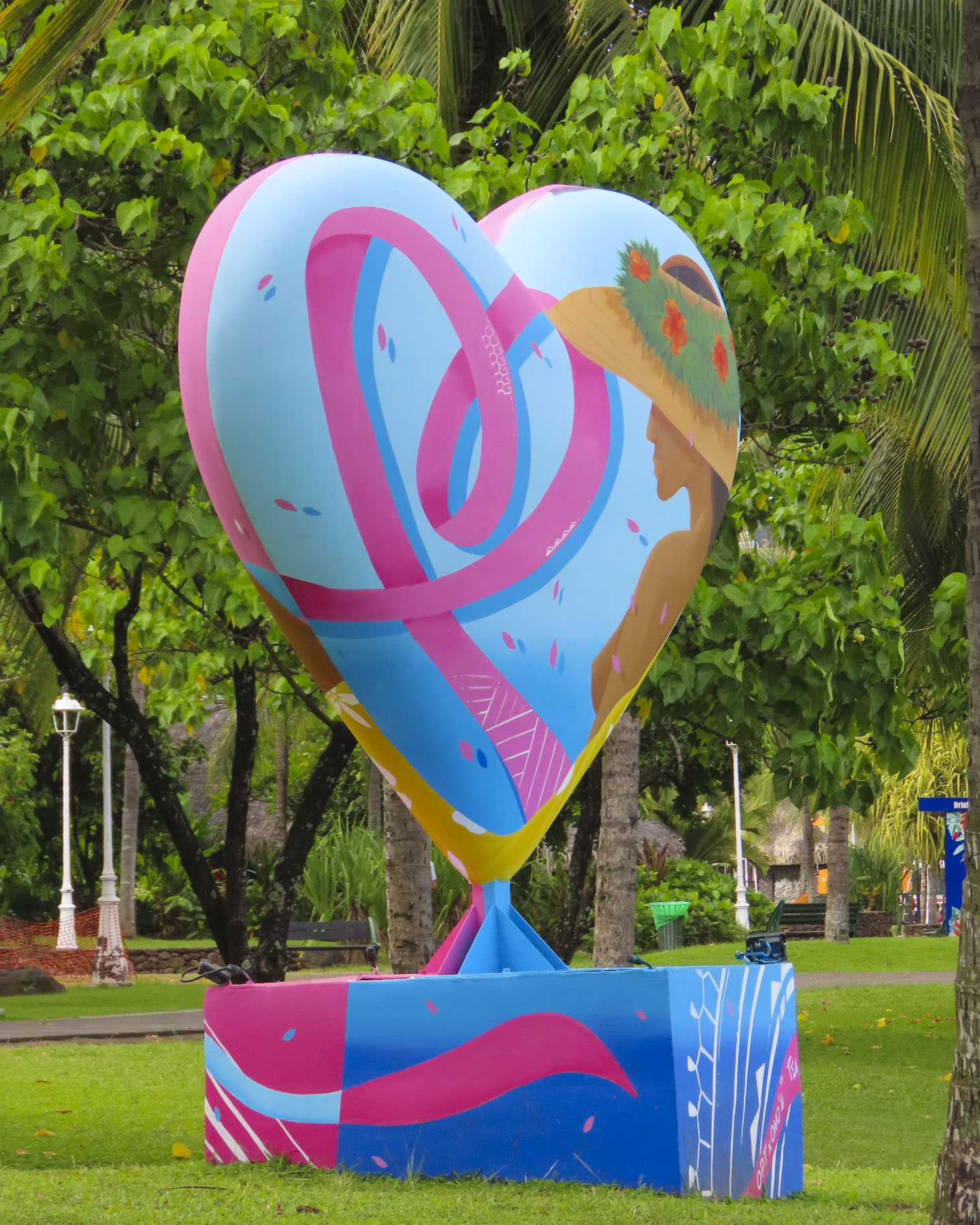
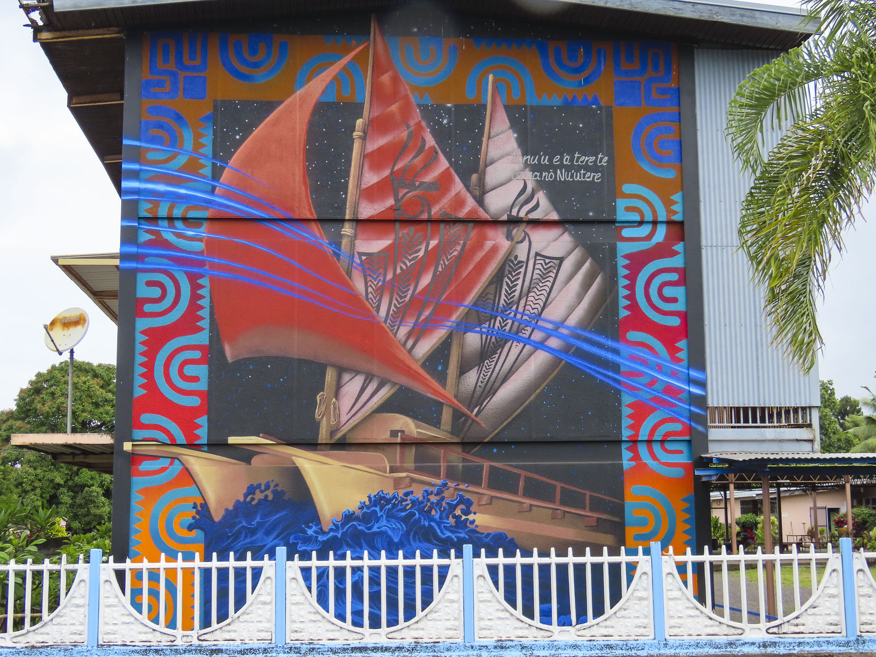
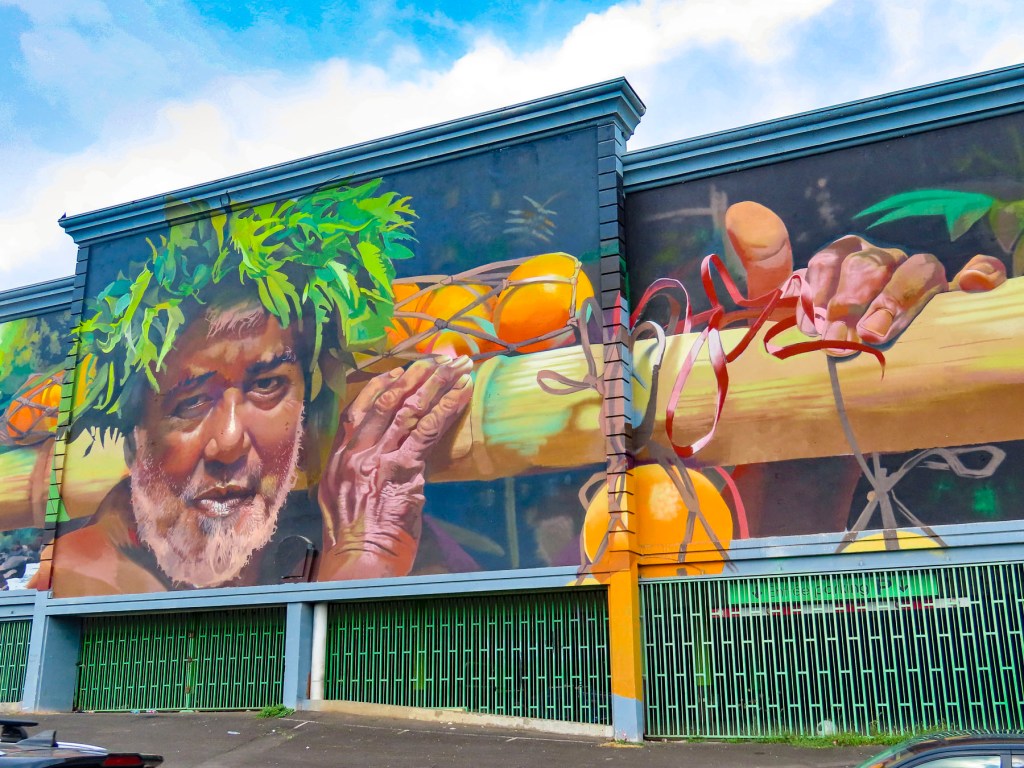
Surprisingly wonderful street murals grace the side of many otherwise dull city walls. Many of these beautiful pieces of art were sponsored by the Ono’u Festival, a street art event that has been held in Papeete since 2014. We used this street art map to help plot our walks around the different areas of the city. There are murals spread all across the city, but several of our favorites were located along the Rue Mgr Tepano Jaussen near the Cathédrale Notre-Dame de Papeete, a French colonial era church from 1875.

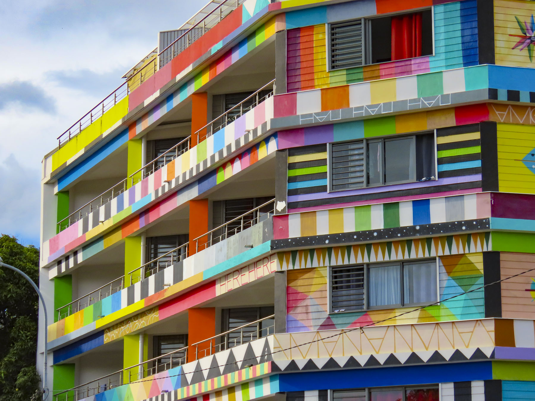
Closer to our temporary home, the Résidence Paraita, an apartment building, was totally immersed in an abstract design by the Spanish street artist Okuda, which we could see from the balcony of our apartment.

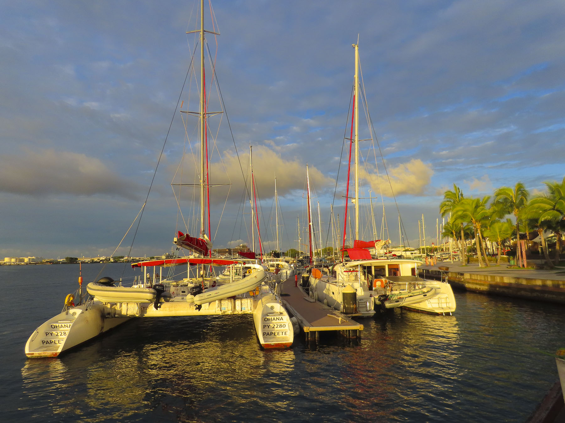
We also enjoyed the walk along the waterfront promenade to Pā’ōfa’i Gardens and the Papeete Marina, where it was interesting to see the different home ports painted on the stern of wandering sailors’ boats. San Francisco, Sydney, Barcelona, Paris, Rio. The boat crews enjoying a safe anchorage before continuing their journey.

Further along we had drinks at the over-water tiki bar of the Restaurant Le Moana and watched with amazement as the bay in front of us filled with just off from work Tahitians who took to the water in Polynesian outrigger canoes, called “va’a,“ and larger longboats, practicing in preparation for a number of races around the islands that take place each year.

The longest and largest, with over 100 teams participating, is the Hawaiki Nui Va’a Race, in which six-person crews paddle across 79 miles of ocean in three days. Starting in Huahine they visit Raiatea, and Tahaa before beaching their canoes on Bora Bora.

This is one of many races around Tahiti keeping alive the nautical heritage of their Mā’ohi, ancient ancestors’ incredible ocean-going feats in search of new horizons. Folks stayed on the water until sunset, one of the most colorful we experienced while on the island. The last of the day’s inter-island ferries sailed toward the sunset.

Also on the waterfront in Place Jacques Chirac is a full-size replica of an ancient Polynesian wa’a kaulua, a double-hulled, long distance, sailing canoe. Just looking at it made us realize what an amazing accomplishment it was for the early Polynesians to cross vast stretches of unforgiving ocean.

Walking back through town we stopped at Vini Vini Fish N’Chill for dinner. It’s a small casual place, with inside and outside tables, that grew as an off-shoot from the families long-line fishing fleet and serves poke bowls, tartines – a French open face sandwich with various toppings, sushi and of course burgers. Occasionally they’ll host a ukulele band outside on the sidewalk.

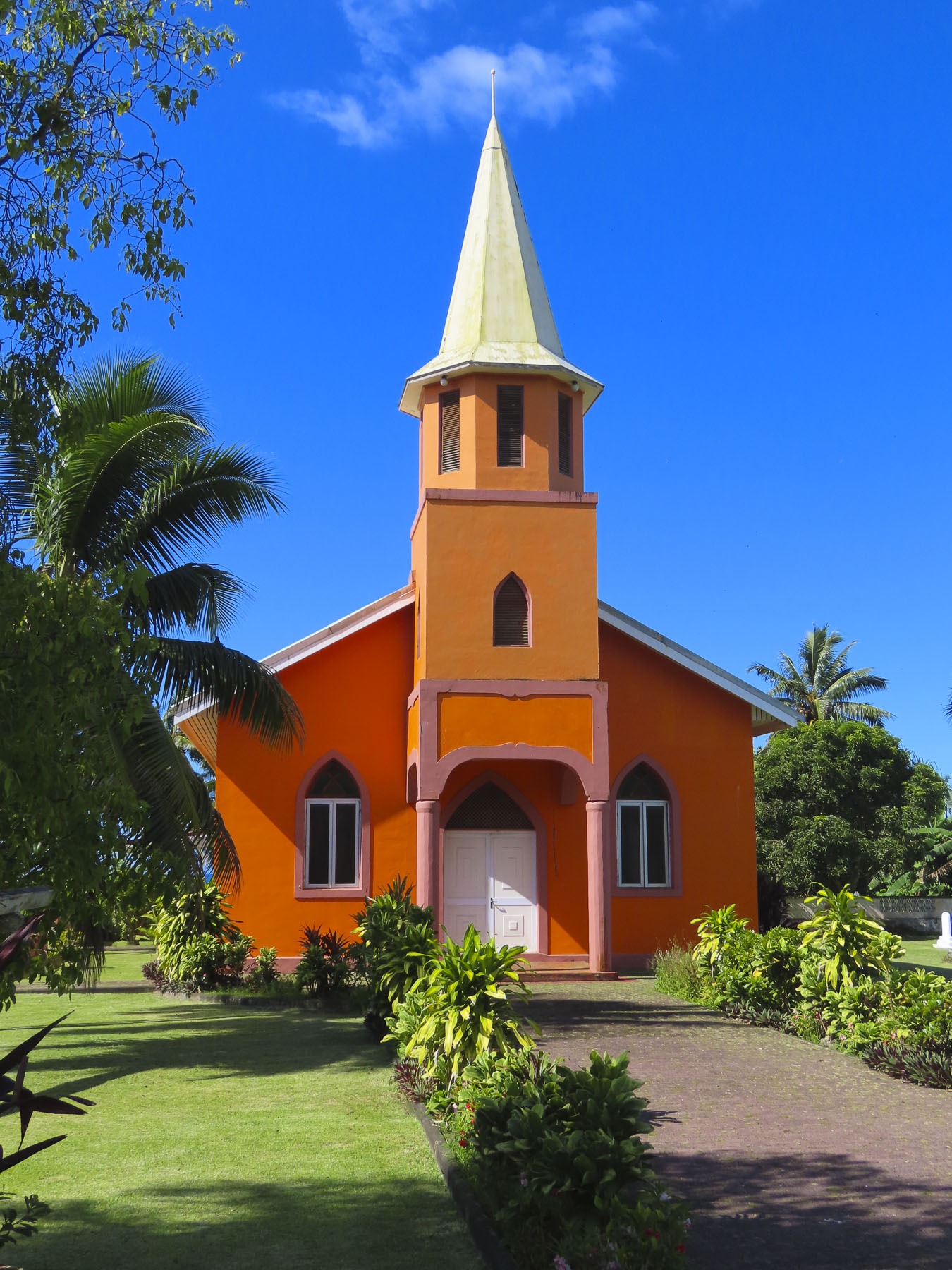
Outside Papeete the traffic eases tremendously and we took several short day-trips out into the surrounding area, traveling along the north coast to the Pointe Vénus lighthouse in Māhina. Built in 1867, on a black sand peninsular that juts into Matavai Bay, it was the first lighthouse built in the South Pacific and equipped with a powerful beam that could be seen by ships 215 miles out to sea. It takes its name from an event on Captain James Cook’s first voyage around the world, when on June 3rd, 1769, Cook and his accompanying astronomer Charles Green set up equipment to observe the transit of Venus, a small black dot, travelling across the Sun. From the shore here looking north the blues of the sea gradated seamlessly into the sky, a vast endless emptiness that Polynesians explored and found Hawaii, 2600 miles away, 1200 years ago. The brightly painted Église Getesemane de Mahina along the road to the lighthouse was definitely a worthy photo stop that epitomized the Tahitian celebration of color.

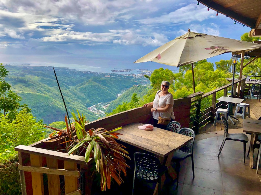
Later we headed to the O Belvédère, a remote French restaurant, located in the foothills of 7,352 ft Mount ‘Orohena, the island’s tallest peak and the highest mountain in French Polynesia. The restaurant is only open for lunch and dinner Friday – Sunday. Unfortunately, we visited earlier in the week, but the staff kindly let us take in the breathtaking views, over the rugged foothills which extend to the coast, from its balconies.

It’s definitely a destination restaurant and part of its allure is the harrowing 3.5 mile drive, not for the faint of heart, up a single-track, heavily potholed road through dense jungle-like forest that dead ends at the restaurant. There was barely room for the rare oncoming car to pass. It’s not a drive we would undertake in the dark. Guided hikes to Mount ‘Orohena and 4×4 safaris into the mountains can be arranged through local tour operators, as there are not any roads that cross Tahiti’s mountainous interior. One the way back to Papeete we passed and then circled back to photograph the Mairie de Pirae, the local town hall, a beautiful example of French colonial architecture that seemed out of place on the tropical island.

The morning of our checkout from Little Home Tahiti, just as we had finished our coffee and zippered the suitcases, the power to our building went out. Not usually a big deal, but we were staying on the 5th floor and the car was in the underground parking. The heat and humidity builds quickly in the tropics without A/C. We called our host for a situation update, only to be informed that it was an island wide power outage, something that, it turns out, happens rather frequently. The big question for us, was the electric gate to the underground garage functioning? We were reluctant to walk down seven flights with only the emergency stairwell lights and the weak flashlights on our cell phones. After an hour of indecisiveness, I slowly carried our suitcases downstairs to the car and was very relieved to find the gate wide open. I parked the car on the street, called Donna and relayed, “We’re free – let’s go!”

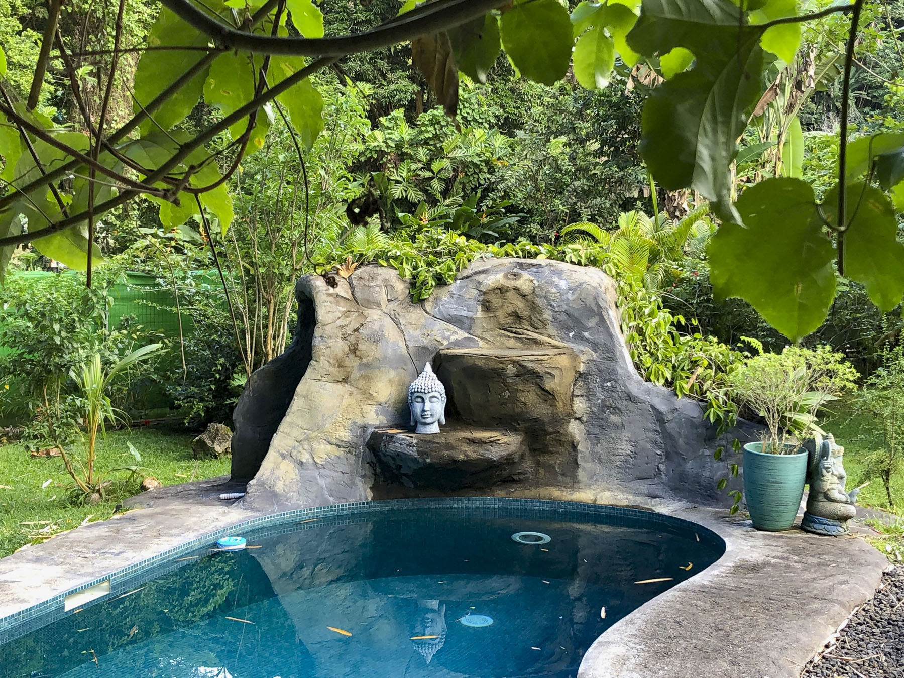
The intersections required caution as the traffic lights were also down, but once we followed Route 1 away from Papeete the prevalence of traffic circles was a blessing. From the air, the island of Tahiti is shaped like a flounder or beaver with a larger upper body and smaller tail. Similar to the way Tahiti Nui, the larger main island, connects to the smaller Tahiti Iti, at the narrow Taravao isthmus. It’s difficult to get lost on Tahiti considering the ring road, Route 1, is only 72 miles long and transverses a narrow coastal plain that encircles the island and separates the ocean from the abruptly steep mountainous interior. The road starts and ends in Papeete, with short spurs down the east and west coasts of Tahiti Iti. It’s a modest distance that we gave ourselves seven days to cover, split between exploration of the island and R&R. Our target at the end of the day, after multiple stops, Soul Rise in Nutae on Tahiti Iti, a rustic attached bungalow, with a private cabana and shared pool, for three nights.

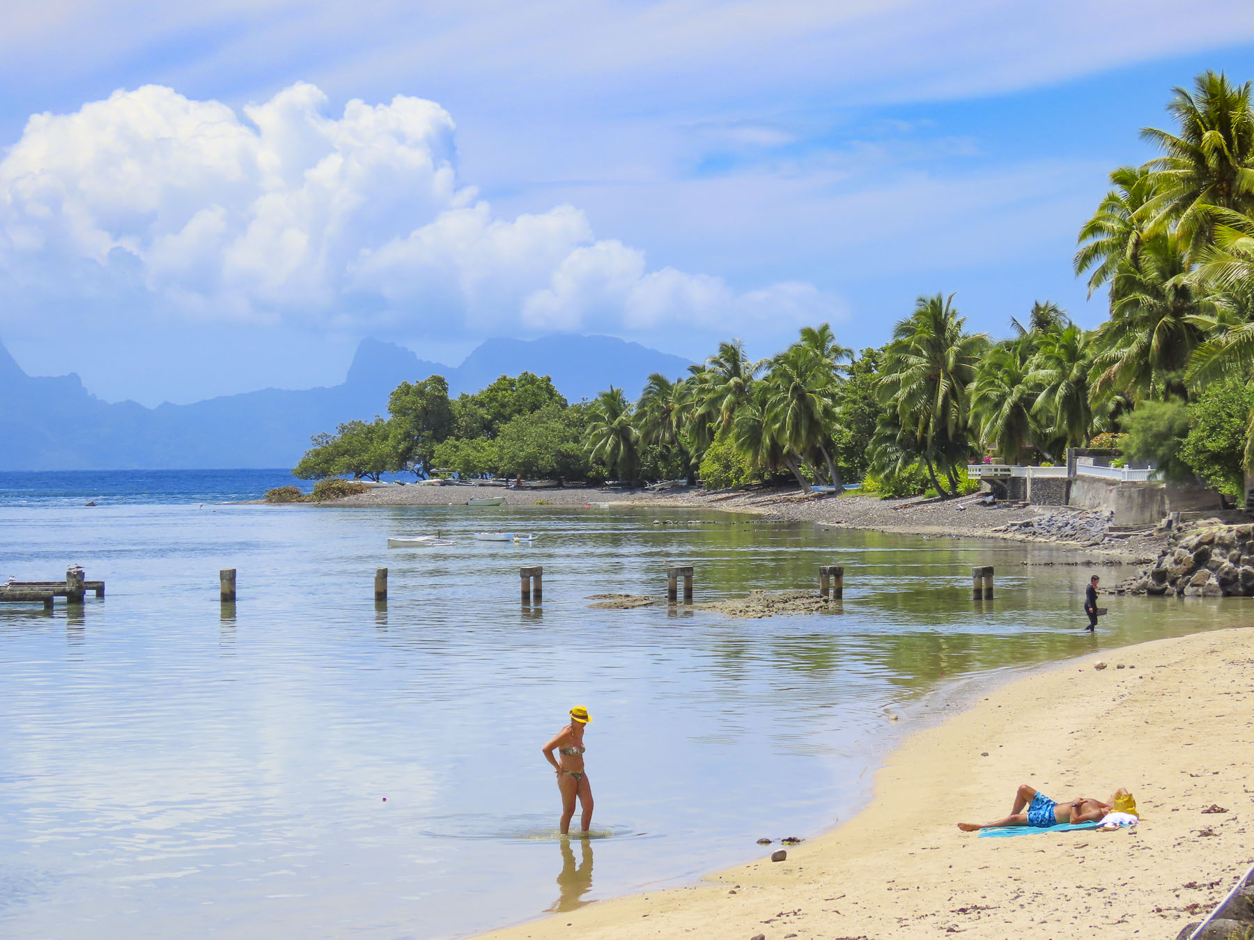
Following the ring road east we stopped at the Arahoho Blowhole. It’s a geological curiosity, as it’s not the usual type of blowhole that exists right at the ocean’s edge and water is pushed up through a crack in the rock. Here water is vented quite a distance inland from the sea as a fine mist after being pushed back forcefully by the waves through an ancient, long and narrow lava tube. The park here has picnic tables and a black sand beach that surrounds a small cove that’s popular with surfers.

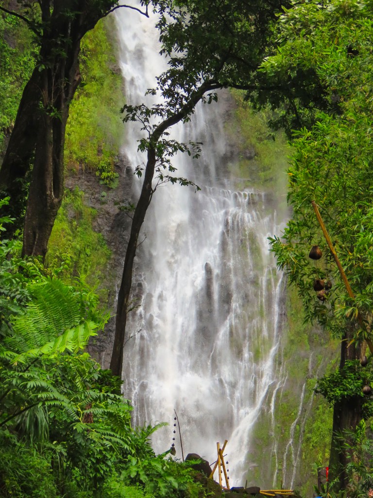
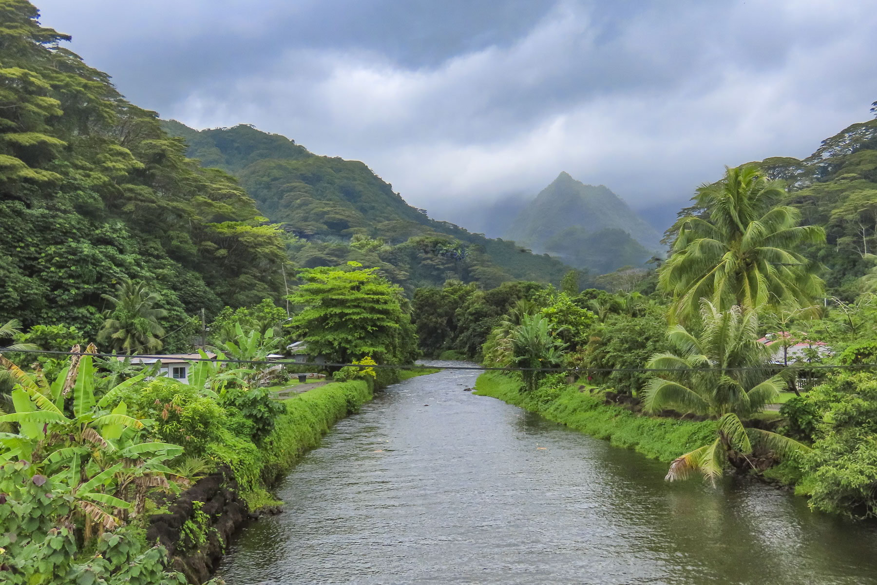
Located at the end of the road, almost directly across the street from the blowhole, the Fa’aruma’i Waterfalls were beautiful. This first was an easy walk from the parking area, but the second two are reached by an eroded and rocky trail that took some effort for us to negotiate before crossing a rickety suspension bridge and climbing farther into the hills. There were numerous photo stops along this drive, especially at the bridges over the rivers, that give a glimpse into Tahiti’s rugged, verdant interior.

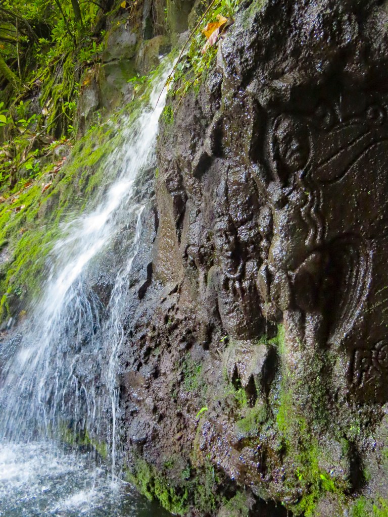
Closer to Tahiti Iti, La Cascade de Pape’ana’ana was a hidden gem barely visible from the road. It’s a mysterious site with figures of a tribal chief and a woman carved into the stone face of a small waterfall. No one knows when or who created it. There were numerous waterfalls and beaches along the east coast of Tahiti Nui just waiting to be explored.

We reached Taravao late in the afternoon, at the time when most restaurants are closed until dinner. We opted to eat at the local McDonalds, something we rarely do, especially when traveling abroad. But we were pleasantly surprised with tasty McWraps, and the coffee was good. But one of the memorable things about this stop was the appearance of a young father and his daughter dressed in matching pinks tutus, enjoying each other’s company and lunch together. It’s not something every dad would do, and I would have loved to know the backstory, but I admired him for his self-confidence, and that he didn’t perceive this playfulness as eroding his masculinity, just a desire to please his little girl. Something I can relate to.

Afterwards we stopped at the local Carrefour, which was as fully stocked as any supermarket in France, though the prices were through the roof, as high as if we were living in Paris. We purchased tuna, mahi-mahi, some vegetables, salad, and a fresh baguette for dinner. Croissants and French style pâtisseries were gathered for breakfast. A bottle of French rose’ and a 6 pack of locally brewed Hinano beer rounded out our purchases. Curiously, the beer’s distinctive and elegant “vahine” logo of a Tahitian woman wearing a red pareo was painted by a fellow from Sweden in 1953.

With the groceries put away and the beer in the fridge, we cooled off in the pool. Tahiti was one of our warmest vacations with daily temperature in the mid-80Fs, with high humidity. Usually we target locales with spring-like weather. Fortunately, along the coast there was always a cooling breeze blowing in from the ocean.

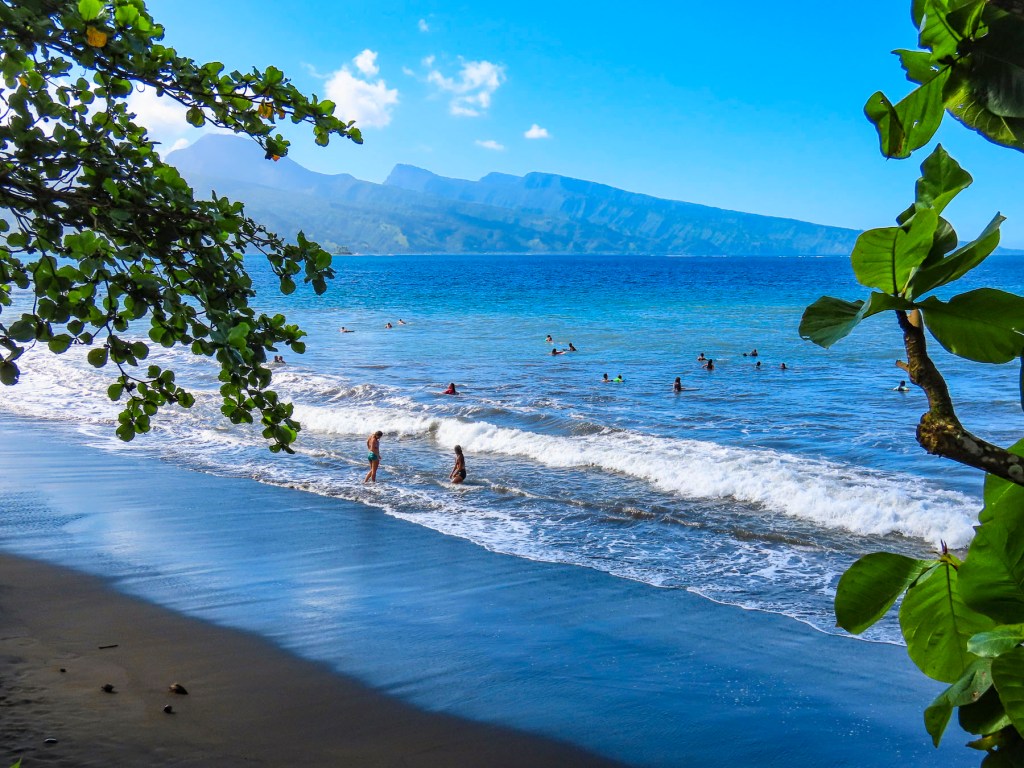
The next morning, we walked a short distance and crossed the road to a black sand beach, created eons ago from volcanic eruptions. Following the local folks’ example lead we rinsed off after our swim under a pipe, driven into the hillside like a spout into a barrel, gushing spring fed water from the highlands.

Later we headed to Tautira for lunch at Le Bout du Monde, which sounds so elegant in French, but translates as “The End of the World,” and aptly describes the locale, with the coast of South America nearly 5,000 miles east. The road literally stops here, as there is not a coastal plain around the southern tip of Tahiti Iti that is suitable for a road. The mountains descend into the sea here. Folks live along this isolated eastern coast but need to use boats to get to their homes. Rustic simplicity best describes Le Bout du Monde, with its walk-up ordering window, and wallboard menu. There were several dishes listed, but I think they only serve the catch-of-the-day. Picnic tables were around the back under shade trees at the edge of the ocean. Only us and another couple were there. The fish was delicious!

Afterwards we took our time walking along Tautira’s beautiful black sand beach set against the mountains. On the way home we noticed people standing by the roadside in front of their homes. Some were holding umbrellas to shield themselves from the intense sun. Soon a van stopped and handed the people waiting a paper bag, with tan colored oblong shapes protruding from the top. Aha! We realized folks had been waiting for their rural baguette delivery, fresh from the bakery. It’s so wonderfully French.

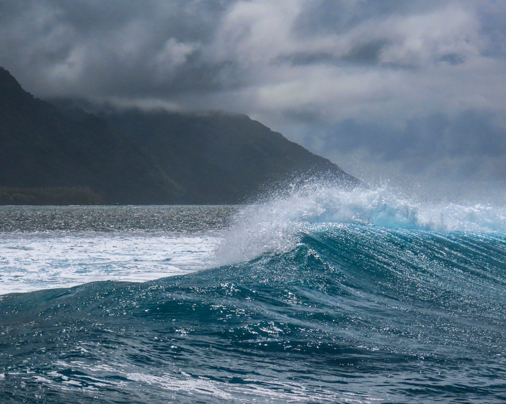
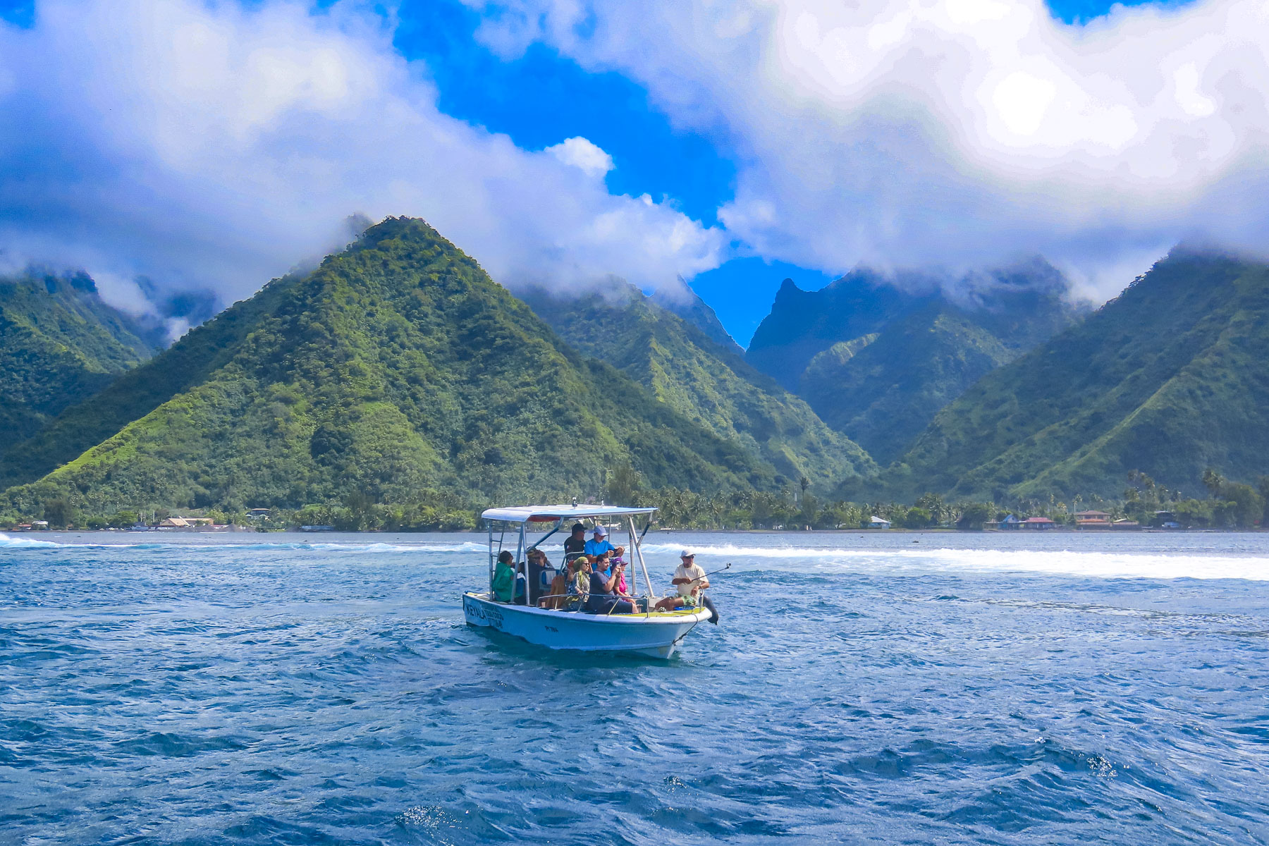
We have never surfed, though we were intrigued by the spectacular photos captured of the surfers riding the famous Teahupo’o Barrel Wave, located off the west coast of Tahiti Iti. The next morning, we drove to the village of Teahupo’o on the opposite side of Iti, where there are a number of boat operators, and booked a tour with Michael, the owner of Teahupoo Excursion Taxi Boat.

Though the conditions were not right to form the famous curl that day, we still enjoyed our time on the water and the dramatic perspective it provided looking back at the mountainous coastline. The 2024 Summer Olympic Surfing event will be held at Teahupo’o.

Afterwards we enjoyed a scenic drive to the Belvédère de Taravao in Iti’s highlands. The inaccessible Mount Ronui, standing at 4370 feet, is the highest point on Tahiti Iti. The Belvédère de Taravao, at 1800 feet, offers an expansive view of the Taravao isthmus that includes the east and west coasts of Tahiti Nui.

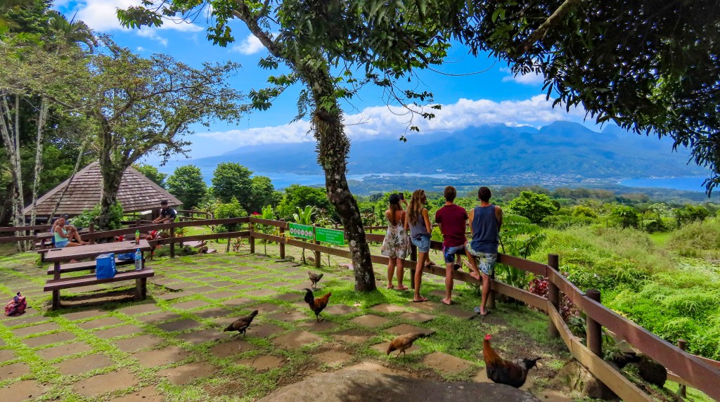
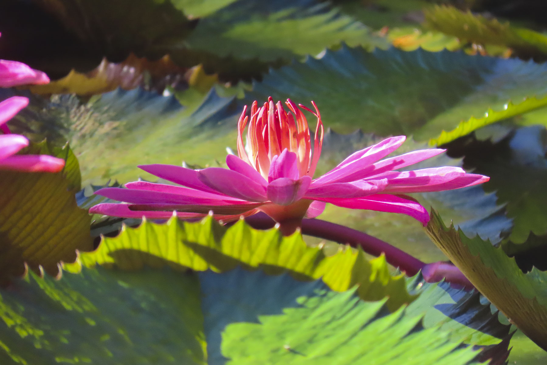
For the last four days we headed back to Tahiti Nui and drove along the west coast towards Papeete, stopping to take pictures numerous times. Gardneners ourselves, we especially enjoyed the Water Gardens Vaipahi and the Grottes De Mara’a, where we followed the paths through colorful specimen plantings and noticed, not for the first time, the ubiquitous free range roosters, hens, and chicks that seem to roam everywhere in Tahiti.

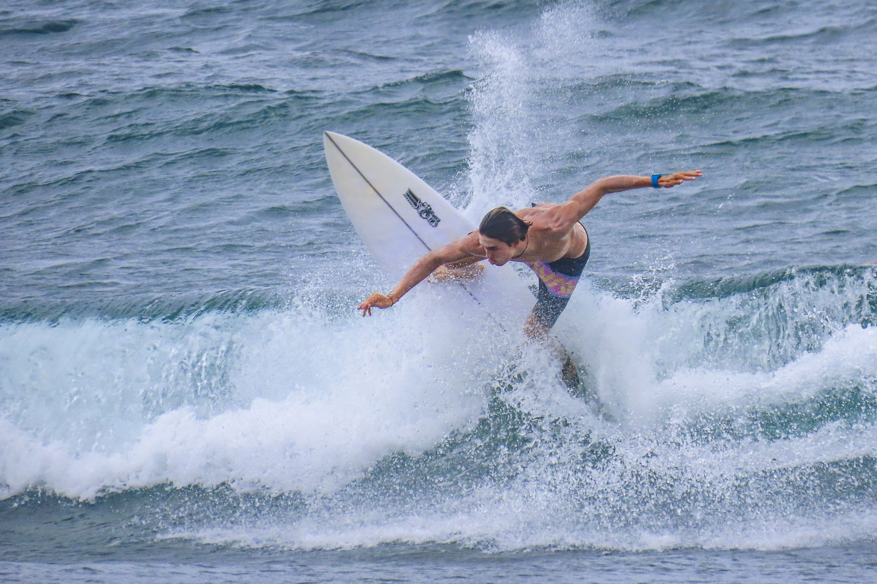
At Taharuu Beach we practiced our sports photography skills, capturing surfers riding the waves, an activity we could spend hours engrossed in, but the weather just wouldn’t cooperate fully.

Later that afternoon we arrived at Bungalow Poerava in Punaauia and were blown away by its dramatic location. It’s a small apartment next to the owner’s home that’s cantilevered out over a steep hillside.

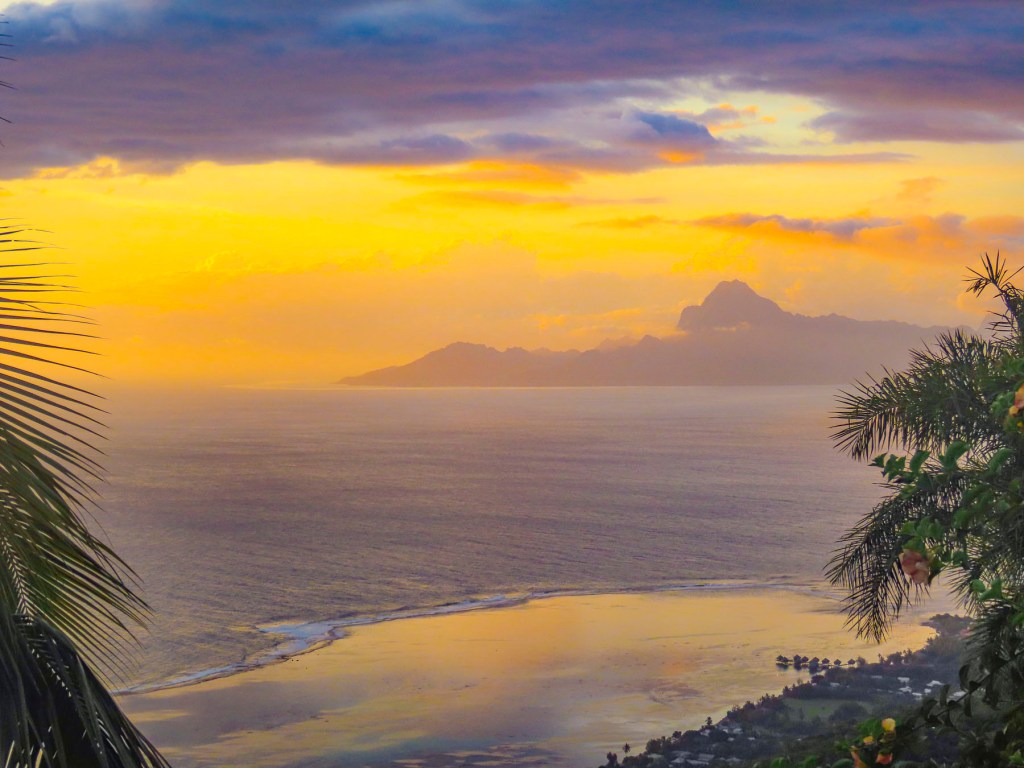
This construction gave it a splendid Robin Crusoe treehouse feel. It had a fully equipped outdoor kitchen, and porch and seating area boasted a view of Moorea in the distance. It was one of the nicest apartments we’ve every stayed in during our years of travel. Oh, and it had an avocado tree laden with fruit hanging over the entry stairs. We didn’t want to leave!

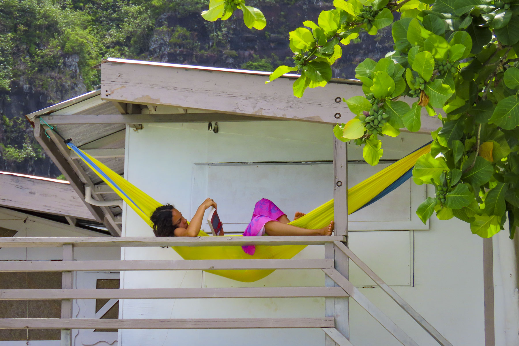
Normally we never just stay still and chill while traveling, but the setting here was perfect for kicking back, reading and enjoying a glass of wine on the shaded deck. We explored the surrounding area in the mornings but made sure we were back to enjoy the sunset.

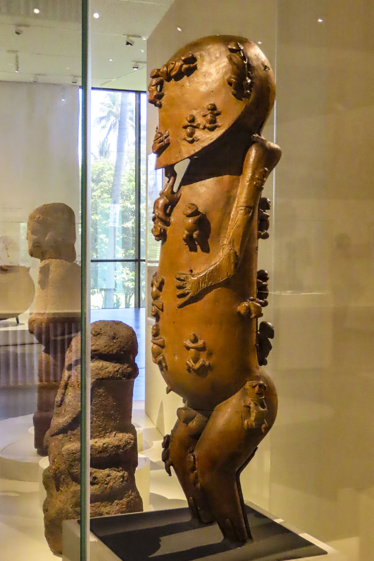
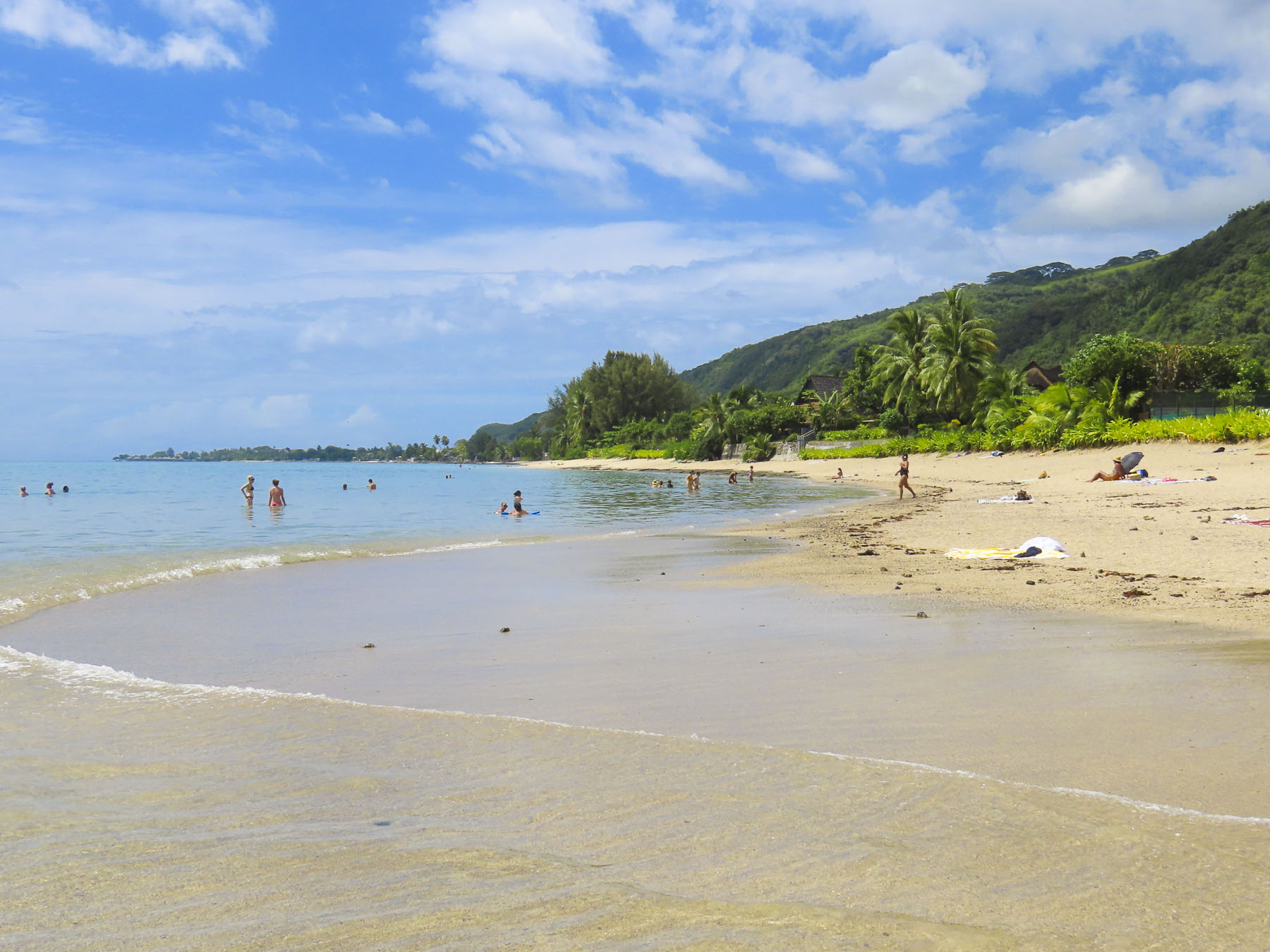
We divided our mornings between exploring cultural sites and swimming at beaches sheltered by the island’s surrounding reefs before returning for the day. The Museum of Tahiti and The Islands is a Polynesian ethnographic museum and has a fascinating collection of ancient artifacts collected from across the Tahitian islands. Later we enjoyed the food trucks at Parc Vaipoopoo, before enjoying the soothing bath-like waters of the Plage publique de Toaroto’s white sand beach.

The next day at ‘Ārahurahu Marae, an ancient Polynesian place of worship, a striking stone moai guarded the entrance to the religious site. Though smaller than its famous cousins on Easter Island, there was a definite resemblance. A large marae, an ancient ceremonial altar, constructed from lava stones and coral was at the rear of the site, where human sacrifices were once held centuries ago.

Afterwards we savored our last swim on Tahiti in the gentle waves of Plage Vaiava. Tomorrow we would head to the Port of Papeete to board Variety Cruises’ Panorama II for a sailing adventure to Bora Bora.

Till next time, Craig & Donna

The Rouen Lean: It’s not a Dance

We had narrowly escaped Paris’s evening rush hour as we sped away from Orly through the French countryside. Our destination is Rouen, an ancient port town on the river Seine with a pivotal role in France’s history since the Romans first settled along the graceful bend of the river there. It would be a restart to a trip cut short by covid in 2020.

The last light of the darkening sky reflected off the Seine, like a brush stroke of silver paint across a dark canvas, as we turned away from the river and entered Rouen. We are not fans of night driving, especially in a new locale, and our maps app had difficulty with the narrow one-way streets in the historic center of the city. Frustrated, we decided to park at the first opportunity. Miraculously the planets were aligned in our favor as we entered the Q-Park Palais de Justice Musée des Beaux-Arts, a massive unground parking garage that encompasses several subterranean blocks beneath a park in Rouen’s historic district. Not sure exactly where to park, something urged us to continue through the cavernous space until we found a garage attendant moments before he locked his booth for the night. Friendly and extremely helpful, he explained how their multiday ticket would be the best value for us. Yes, we were so lucky he spoke English. Our good fortune continued at street level when we realized we were only two blocks from our hotel. But we had arrived later than planned and the gate to Le Vieux Carré was locked. Fortunately, another guest was returning to the hotel at that time and let us in. “I saw several keys on the reception desk when I went out, and figured you were one of the late arrivals.” Indeed, a room key with our name on it was there waiting for us.

Early the next morning the unusual, but pleasant aroma of caramelized onions drifted in through our open window. With our tastebuds awakened and appetites whetted we headed out. “Walk a little, then café,” is how we like to describe our wanderings. Our first stop – coffee and pastries. It is France, after all! But where to stop? There’s an abundance of eateries in Rouen, thanks to the city hosting two universities and thousands of students. There were so many places that looked inviting, but the criteria for us first thing of a morning was a café with a table in the sun, a must in mid-October to help alleviate the day’s early chill. Once sufficiently caffeinated, we set out.

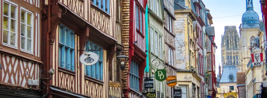
Flat as a crepe, Rouen was a walker’s delight and savory with explorations that pulled us in every direction. During the 9th century, Vikings pillaged and then stayed to become the first Normans, and the prosperous town of became the capital of Normandy in the 10th century. During the Middle Ages, conflicts in the region were nearly continuous, but the city somehow evolved into one of France’s gems, with its distinctive medieval half-timbered buildings and three towering, majestic churches which still grace the city’s skyline. 

A who’s who of historical figures have crisscrossed Rouen’s cobbled lanes for centuries. The Anglo-French kings, William the Conqueror, a succession of King Henrys, Eleanor of Aquitaine and Richard the Lionheart viewed the city as their home away from home. In 1431, after inspiring her countrymen to rally against English expansionism, Joan of Arc was captured, tried, and burnt at the stake in Rouen’s Old Market Square. It wasn’t until the Siege of Rouen in 1449 when forces commanded by King Charles of France finally defeated the English. Later the French impressionist painter Claude Monet found inspiration in the city, featuring the Rouen Cathedral over thirty times as he put paint to canvas to catch its essence perfectly. With conflicts never seeming to end in Europe, somehow, this beautiful renaissance city, though deeply wounded, miraculously survived World War II. Most importantly perhaps, in March 1948, Julia Child had her first taste of French cuisine at Restaurant La Couronne, on Rouen’s central square, the Place du Vieux-Marché.  

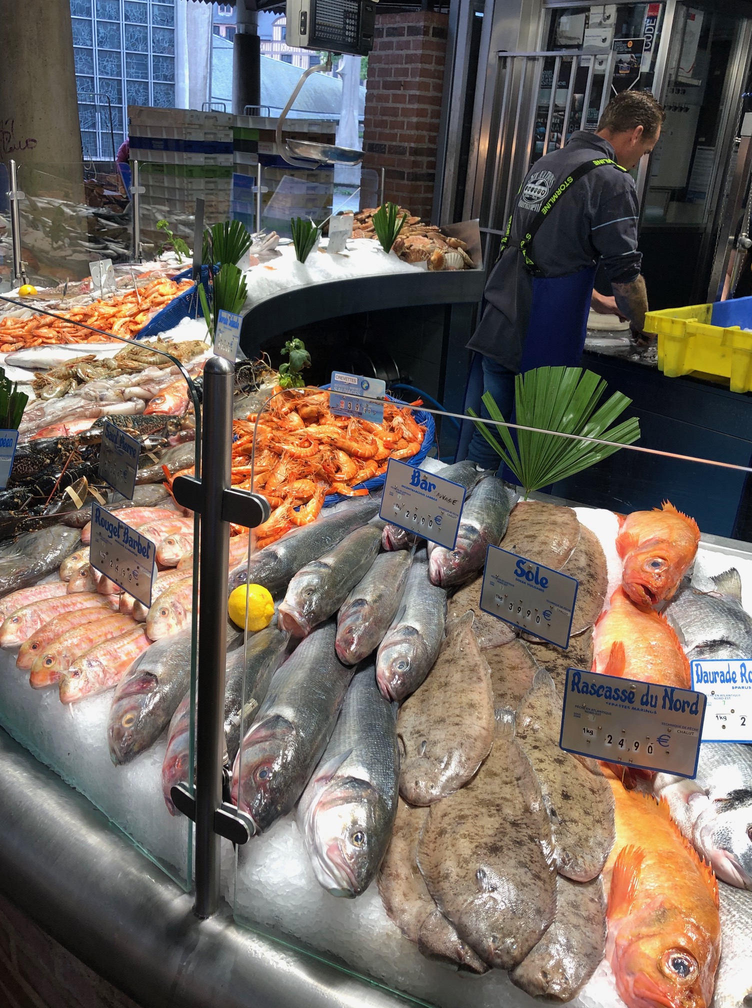
Open since 1345, La Couronne is France’s oldest inn. Savoring her Sole Meuniere, a lightly breaded fish dish flavored with fresh butter, lemon, parsley and capers, it was an experience she described “as the most exciting meal of my life.” Local oysters and a bottle of Pouilly-Fumé were also enjoyed. She was hooked and a Francophile was born!

The Rouen Lean is not a dance, nor the result of drinking too much wine, but the very obvious tilt exhibited by many of the city’s ancient half-timbered buildings constructed during the Middle Ages. Our hotel was a prime example of this with scarcely a wall or floor that was square, plumb, and level. But that was the charming character and ambiance we were looking for. The half-timbered building’s superstructures were constructed with huge square oak timbers held together only with mortises, tenons, and wooden pegs, while the nonstructural area between the supporting timbers was filled with bricks or stones and covered with plaster. Over the centuries it has proven to be an aesthetically pleasing and durable construction method used to build five to six story houses. Many of the buildings still retain a centuries old, carved wooden sculpture on the front of the building that represented a service or craft that was once conducted there.

Approximately two thousand half-timbered structures from the Middle Ages still stand in Rouen. The abundance of wooden buildings surprised us as most of our travels have been through the countries of Southern Europe, Portugal, Spain, and Italy, where stone was historically used to construct everything. In Rouen, scarce stone was saved for the churches and castles.

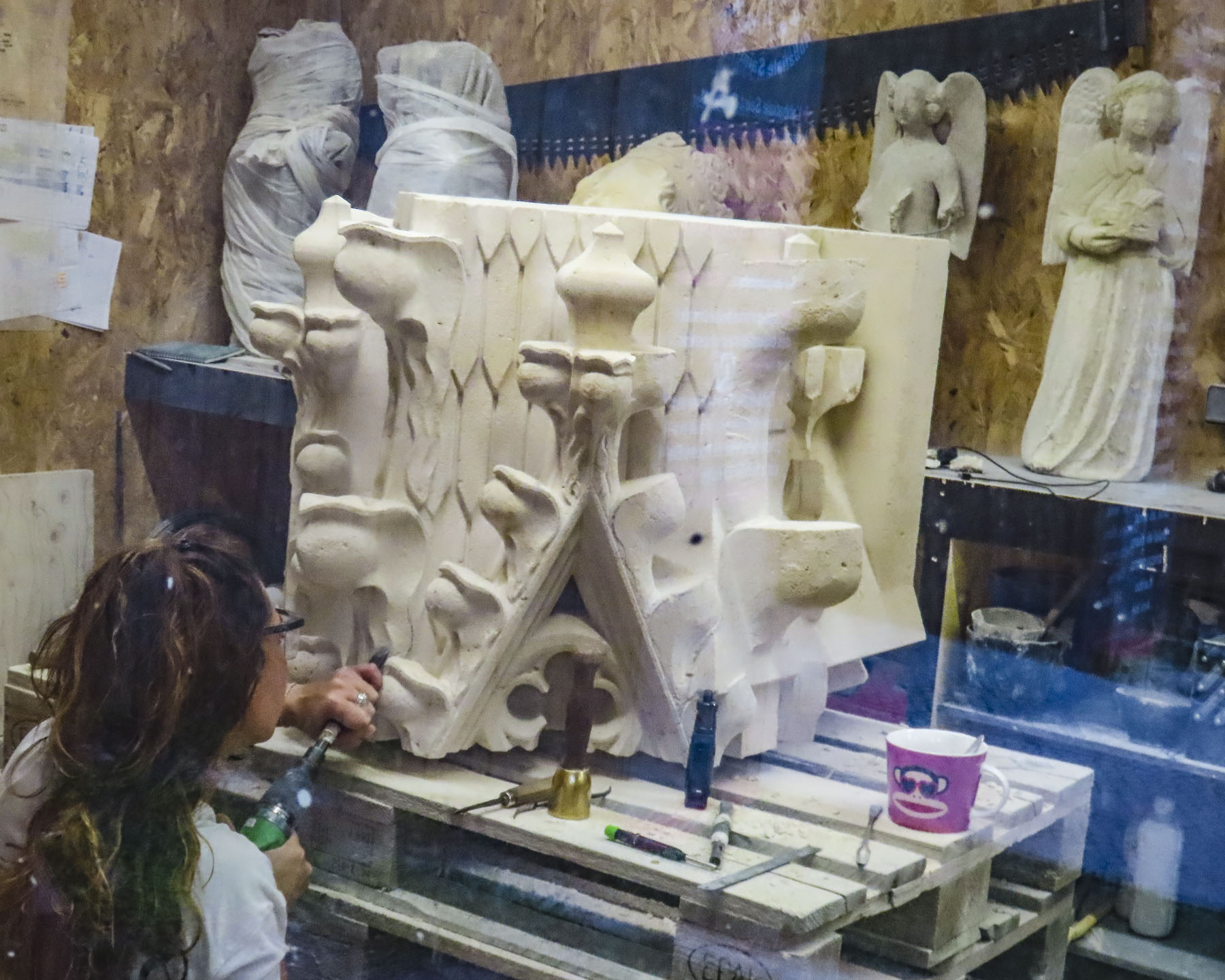
Even stone erodes over time and occasionally old churches need a facelift every few centuries, as was evident by all the scaffolding surrounding the15th century, Gothic style, Saint-Ouen Abbey Church, though with a selective camera angle I was able to eliminate most of the temporary platforms from our photo. But the difference between the areas covered by grime and the newly cleaned sections was phenomenal. The multiyear project is scheduled to be completed later in 2024. Though the interior of the church was closed the day we visited, we were able to watch a stone carver as she worked to create a new gargoyle to replace one beyond repair.

Rouen’s three main churches, Saint-Ouen Abbey Church, Église Catholique Saint-Maclou, and the Cathédrale Notre-Dame de Rouen are all located a short distance from each other on the eastern edge of the historic district, but the journey through the narrow lanes connecting them and exploring many other splendid points of interest along the way made for a wonderful day.

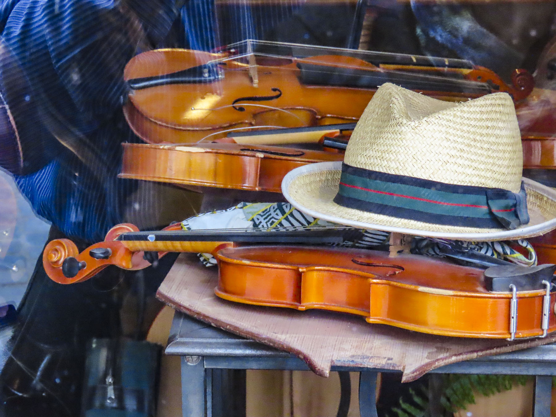
After the abbey we window-shopped down Rue Damiette, admiring the handcrafted violins created by master luthier Sarhan Jean-Marc. Farther on, interesting antique stores lined the narrow lane. Behind us the abbey’s belltower rose over the street. A view that hasn’t changed significantly in centuries. One of the best examples of the “Rouen Lean” is at the end of the street across from Saint-Maclou and caused us to stop for a double take. How, we wondered, can these buildings still be standing?

There was a shortage of cemetery space in Rouen during the Middle Ages when the plague revisited the city repeatedly and 75% of its citizens died. At the time it was the custom to bury the dead only until their bodies decomposed.

Then the bones were exhumed and reinterned above ground in the ossuary Aitre Saint Maclou and the grave reused for the newly departed. Hidden away down a discreet side alley, the ossuary complex was expanded several times and functioned as a secondary cemetery until the early 1700s when the remains were removed, and the buildings were repurposed as a school for poor boys. Today the space houses a fine arts academy and exhibition space. Though it’s still a macabre place with skull and crossbones carved into its exterior timbers.

We rested with coffees at a café on Place Barthélémy in front of Saint Maclou. While a lovely spot, the coffees were overpriced to the point that we could have purchased lunch for two if we’d chosen a less touristy spot. Just a reminder, a block or two off the usual tourist routes and prices drop dramatically.

Rouen’s Cathédrale Notre-Dame has been the center of focus since the first early Christian converts built a temple in 395 AD, on the spot where the current church now stands. And, like the city, the church has a turbulent history. Charlemagne visited in 769, but those pesky Vikings couldn’t decide if they hated or loved the place, sacking it repeatedly in the 9th century, only to later claim the Duchy of Normandy as theirs and embrace Christianity after the Viking leader Rollo was baptized in the church and later buried there as well. Nearby, Richard the Lionheart’s tomb only contains his heart.

Romanesque architecture was the rage during the 11th century and William the Conqueror attended the consecration for the first of many expansions and renovations that would follow over the centuries.

More chiseling and hammering continued during the 12th century when successive Archbishops embraced the new Gothic style. In 1204, Philip II of France celebrated Normandy’s merging with his kingdom amidst the new Gothic renovations.

During the 16th century, a second tower in the Renaissance style was built and ornate stonework and hundreds of statues were added to the front of the church, creating the visage that remains today.

Later lightning strikes, hurricanes and Calvinists would wreak havoc on the church. During the French Revolution any metal objects, not hidden away, were seized and melted down to create cannon balls. During WWII the cathedral was heavily damaged by Allied bombs. The damage was so extensive that final restoration wasn’t completed until 2016, when all the scaffolding was finally removed. Built and rebuilt, inside and out, for over eight hundred years, the cathedral is a fascinating place to explore.

The next morning we headed down Rue de Gros-Horloge, Rouen’s main pedestrian-only thorough fare that runs east to west from the cathedral to the Place du Vieux-Marche, a historic market square. This is the street where the city’s famous 14th century astronomical clock, Le Gros-Horloge, seems to transport you backwards through time to the Renaissance. Early in the morning is the best time to experience this landmark without crowds, as later in the day the narrow lane is as busy as Paris’ Champs-Élysées. During our short time in Rouen, we passed under its gilded façade many times and always, like Monet and his multiple paintings of the cathedral, tried to capture this beautiful clock just right in our photographs.

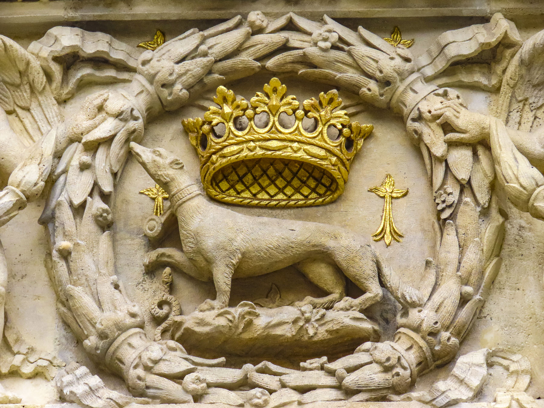
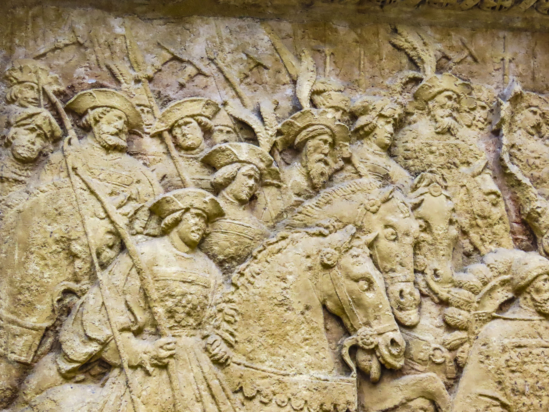
Indulging our wanderlust, we veered left and right off the lane to satisfy our curiosity. We found ancient gargoyles on the Tribunal Judiciaire de Rouen, and whimsical unicorns, a porcupine, and a reference to L’Ordre de l’Hermine, the Order of the Ermine, a medieval chivalric order on the exterior walls of the Hotel de Bourgtheroulde, a former 1500s mansion, built in what is kindly referred to as the Flamboyant Gothic style popular at the time.

Seriously – the Order of the Ermine is not from a Monty Python skit. A small but ferocious animal, during the Middle Ages the ermine was believed to to fight to its death if attacked rather than “sully the purity of its white fur,” and was used by many medieval chivalric orders to symbolize their uncompromising integrity and honor.

There was also the Ordre du Porc-Épic, porcupine, for prickly knights, and the Order of the Golden Fleece, for royal embezzlers. These were actual chivalric orders, though I am taking liberty with their membership.

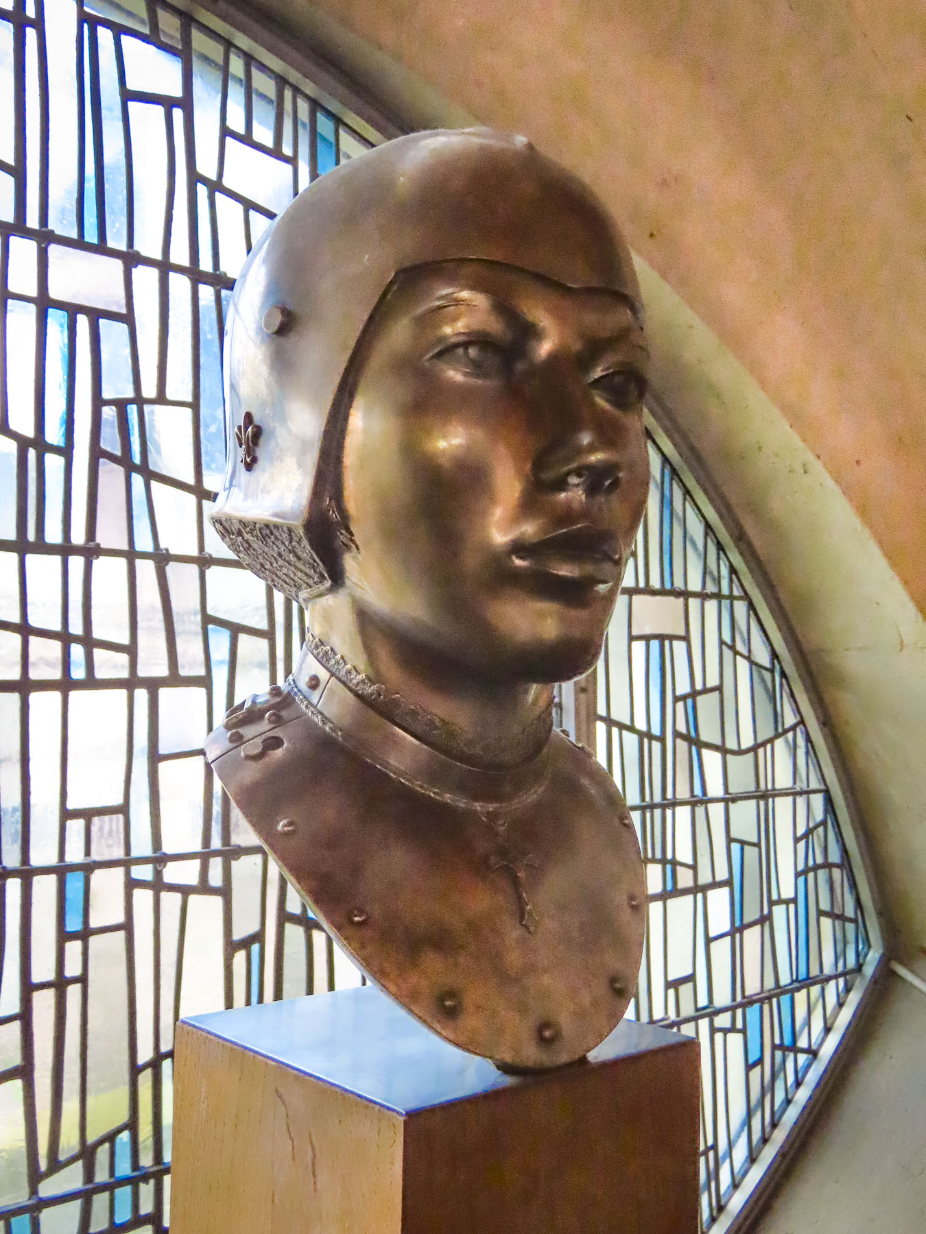
Today the Place du Vieux-Marché is surrounded with restaurants and cafes with outside tables, which were very lively at Happy Hour when students and folks just off work congregated on the square. Quite a different scene now as opposed to the day in 1431 when Joan of Arc was burned alive at the stake, in the center of the square, though her heart remained untouched by the flames. A beautiful, modern wooden church built in 1979, the Église Sainte-Jeanne-d’Arc now memorializes the spot where her pyre stood. A plaque nearby reads “Oh Joan, you who knew that the tomb of heroes is in the hearts of the living.”

Inside the food market we savored our first fresh oysters from the Brittany coast and purchased some fruit, and of course cheese! A difficult process considering the tremendous variety we could choose from.

Intrigued by Joan of Arc’s story, the next day we headed to the Historial Jeanne d’Arc, which is housed in a wing of the ancient Archbishop’s Palace where part of her trial was held. We were skeptical at first while buying our tickets, thinking we’d just be watching a movie. But we both ended up being enthralled with the interactive digital technologies used to project Joan’s saga onto the old stone walls, floors, and domed arches.

Her history was exceptionally well portrayed and presented as chapters, with each chapter presented in a different room of the architecturally interesting space. We climbed one of the palace’s towers and were rewarded with a timeless view down Rue Saint Romain to the church of St. Maclou; a view that would look familiar to Joan of Arc were she to stand in this spot today, so little changed from her time.

A symbol of defiance, heroine for the French, and a successful military adversary against the English, she claimed God supported Frances’s freedom, but this was a position the Rouen church could not support as they were allied to England and claimed God was on their side. She was tried and convicted for her heresy. Her male jury also had difficulty with her dressing in men’s clothing for battle. As if because she was a woman, she should have worn a skirt and sat side saddle as she rallied the French to fight. But this practicality was viewed as cross dressing and as such was held to be against God’s law. (Though the robes of the clergy were not considered feminine.) The French finally defeated the English and succeeded in uniting Normandy and Rouen with France. Twenty-five years after her execution, Joan’s family petitioned for the trial records to be reviewed. The court determined she had been tried “under false articles of accusation,” and posthumously declared her innocent and annulled her sentence in 1456.

Our time in Rouen was a beautiful look back into Medieval France.

Till next time, Craig & Donna

Tenerife; Miradors, Miradors, & More Miradors

You’ve landed, rented a car, checked into your hotel. Then what? Where to? It seems the more we’ve traveled and the older we’ve become, the less we plan. Throw a dart at the map? Often, how blue the sky is is the determining factor. That can be tricky in Tenerife where the weather changes quickly multiple times a day. But when in doubt, choose a mirador, any mirador. We figured enroute to them we’d pass other wonderful discoveries that would spur us to detour and investigate, rounding out what we saw of the island. Let your adventure around Tenerife begin. Here’s twelve of the miradors and viewpoints we enjoyed.

Mirador Punta del Fraile

Located on the outskirts of Buenavista del Norte, a manned roadblock across the pavement required us to park. It was about a thirty minute, moderately strenuous uphill walk, and the views along the way were awesome. It was well worth our effort. Reaching the mirador, gale force winds whipped through a cut in the rock which the road followed down to the lighthouse at Punta de Teno, three miles away. Behind us a large cliff face blocked most of the view of the Teno headland.

Nearby Buenavista del Norte is delightful old village with a historic church and memorial to a locust plague in 1659.

Playa del Roque de las Bodegas & Mirador de Playa Benijo

Any resemblance to a straight road disappeared as we turned onto TF-12 to work our way across the island to Playa del Roque de las Bodegas and the Mirador de Playa Benijo. The distances between sites on Tenerife are relatively short as the crow flies, but the roads are narrow and serpentine, so the driving is slow, even though not many cars are on the roads. Rising into the mountains, the terrain changed from arid brown to verdant green. The views along the way of isolated villages hugging the steep slopes were tremendous and there are multiple places you’ll want to stop for photos.

Our intent was to drive all the way to the El Draguillo Mirador, as our GPS map led us to believe it was feasible, but the road ended at a very small gate in a muddy car park with a sign that said only residents of the village were allowed to drive past this point. Evidently this is the starting point for El Draguillo trail, a 6-hour hike.

The parking lot was jammed full, and it took a serious multipoint K turn to get us out. We recovered nicely though by having a great lunch nearby at La Venta de Marrero, a cliffside restaurant with a fabulous view of Playa de Benijo, below.

Mirador Playa de las Teresitas

Only twenty minutes from Santa Cruz de Tenerife, the island’s largest city and capital, the Mirador Playa de las Teresitas seems a world away with tremendous views south of the coast.

Turn around and walk a few yards back along the road for a spectacular view of the black sand beaches Playa de Las Gaviotas and Playa Cueva del Agua.

La Barada

Set on a steep hill, the restaurant La Barada, just a short distance off TF-5, is technically not a mirador, but it is a very popular place due to its glass pier that is cantilevered dramatically out over the countryside from the restaurant. It offers an amazing bird’s eye view of the coast with Pico del Teide in the distance. The food was also very good and the terrace was alive with boisterous activity the afternoon we stopped. 

Mirador de Cherfe

Sitting atop a mountain pass, this mirador has expansive views of the sea. It was also one of the busiest miradors, with vendors selling lava trinkets, and many tourists stopping on the way to or from Masca, like us.

Oh, the thrills of driving in the mountains of Tenerife were just beginning!

Pico del Teide: Mirador de los Poleos, Mirador de Samara & Mirador de La Ruleta

Venturing into the foothills, our drive continued along TF-38 and traversed ever-changing, diverse bio-systems as we left the arid shrub-covered lowlands behind and climbed into hillsides covered with pine forests. It was a well paved but narrow serpentine road, without any shoulder, that required constant vigilance. The mouths of ancient lava tunnels were visible from the road, but there was no room to pull over and stop for photos until we reached the Mirador de los Poleos.

Beautiful, inhospitable, Death Valley-esque, lunar or Martian, however you choose to describe the varied topography that surrounds Pico del Teide, it’s enthralling and fascinating. So much so that filmmakers have used the location for scenes in several block buster films: One Million Years B.C. – 1966, Planet of the Apes – 1968, Clash of the Titans – 2010 and its 2012 sequel Wrath of the Titans and in 2023 the Last Triala, a Star Wars fan film. 

TV episodes of Doctor Who, The Dark Along the Ways and season 2 of The Lord of the Rings: The Rings of Power have incorporated Tiede’s environs into their productions.

Jardines del Marquesado de la Quinta Roja

Any visits to La Orotava should start at the Jardines del Marquesado de la Quinta Roja. Constructed in 1883, it’s a beautiful French-style, terraced, formal garden with a view over the town and the distant sea. A smaller but older (1788) sister park next to it, the Hijuela del Botánico, features a towering dragon tree and other plantings of specimen trees collected from Spain’s former colonies. After coffee at the garden’s café, it’s an easy walk downhill in La Orotava’s historic center.

Mirador La Garañona

Is set dramatically atop a 1000ft sheer cliff, in El Sauzal, with a tremendous view of the coast below. The park’s shaded paths lead to a delightful small café perched at the cliff edge. We lingered and soaked in the view.

The Iglesia de Santa Catalina is nearby. It’s a classic, white-washed church from the early 1500s and picture perfect with its magnificent dragon tree in front. Nearby the Restaurante el Calvario is a great place to stop for a delightful meal.

Mirador Roque Grande

The waterfront in Puerto de la Cruz is beautiful and there are numerous miradors, beaches and tidal pools along the coast where you can swim. We strolled along the promenade above the black sand beaches at Playa Maria Jiménez, and Playa Chica to El Castillo San Felipe, a small block fortress built in the 1600s to prevent pirates or the British from landing on the beach there.

We lunched at a restaurant on the boardwalk under umbrellas just yards from the surf. Stopping at the Mirador Roger Piedra Gorda and Mirador Roque Grande rounded out the afternoon. Though parking was a challenge at both spots, we think the effort was worth it for the dramatic seascapes we viewed.

Mirador del Emigrante

The views driving into Garachico are impressive, and we stopped several times before entering the old town. As prosperous as the Canary Islands are today, we were reminded by the statue at the Mirador del Emigrante that life here was not always easy.

This poetic description by Fernando García Ramos, the sculptor, explains for the viewer the meaning behind his statue of a walking man – with a hole in his chest, as if in his heart – holding a suitcase. “The figure is scanning the horizon, in a daring position, as if pretending to jump over the sea, with a suitcase in hand, and many more suitcases in a series as a chain behind him; these suitcases behind him surely mean the memories, the sadnesses, the nostalgia, the girlfriend, the mother, the sisters, the families that are left behind by an emigrant who takes a new life, who jumps over the infinite sea, in search of a new life in strange and distant lands.”

Mirador Caribe at the Palmetum

Reaching the Mirador Caribe at the Palmetum, we were rewarded with an expansive view of the city and Auditorio de Tenerife.  A botanical garden, the Palmetum was started in 1995 atop 30 acres of reclaimed land that was once a landfill. Now it’s filled with nearly a thousand palm trees gathered from around the world. It’s a spectacular place.

Playa del Médano

For our last full day on Tenerife we headed to El Médano to be nearer the airport for our flight the following morning. Arriving late in the afternoon to Playa del Medano, we entertained ourselves watching wind and kite surfers speed across the whitecaps. The more experienced kiters crested the waves and performed aerobatics before splashing back into the sea. Closer to town, families favored the gentler waves, wider beach, and a view of Montaña Roja volcano on the horizon. Tables at eateries along the boardwalk were quickly filling as the golden hour approached. A crescent beach, gentle waves, good wine and delicious seafood – is there a better way to end the day? We’ll miss Tenerife.

We hope you found the photos inspirational for planning a trip to Tenerife.

Till next time, Craig & Donna
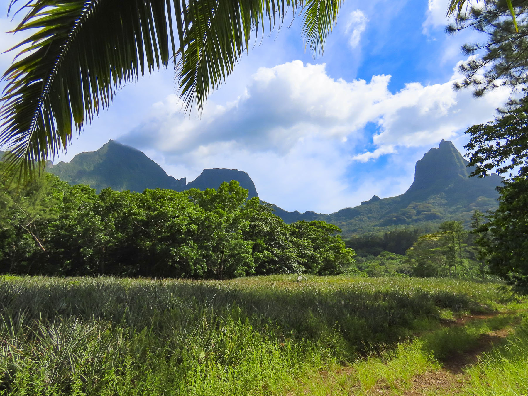
Cadiz: Walk a little, then Café

With a leisurely departure from Jerez de la Frontera, we headed towards Cadiz for four nights before continuing our road-trip through the southwest corner of Andalucia. Our friend Giulia had shared her fond memories of Cadiz with us several years ago and we were finally on our way to experience the charms of this coastal city ourselves. Situated on a narrow peninsula that juts into the Atlantic Ocean, the city’s small size appealed to us. “You won’t need a map!” Donna teased, referring to my inclination to track our every route. While the city does have several beach areas, only one, La Caleta is in the Casco Antiguo, old town district.

We decided to have lunch along Andalucia’s Atlantic coast before we reached Cadiz and followed the signs to Vistahermosa, an upscale neighborhood in El Puerto de Santa María that has a crescent shaped beach. It’s a wide stretch of golden sand, with the ruins of an old fortress at one end and a marina at the other.

The Sunday afternoon in March when we visited, folks were sunbathing and swimming. Offshore boaters, kite surfers, and a sailing class were enjoying the gentle waves of Cadiz Bay. We parked at the marina and strolled along the restaurants and homes that lined the breakwater until we decided on Sotavento Puerto Sherry, which offered some shade from the intense afternoon sun.

Afterwards we headed to the lighthouse that marks the entrance to the marina. If you ask locals where the best beaches in Spain or Europe are, they’ll spread their arms wide to encompass the north and south vistas along the coast and say, “aquí mismo,” right here, proud of the fact that their beaches are consistently awarded numerous Blue Flags, a European Union award for water purity and beach cleanliness, in the Mediterranean region. Though it shares the same climate as the Costa del Sol on Spain’s Mediterranean coast, with 300 days of sunshine annually, the Atlantic coast beaches have stayed relatively undiscovered by mass tourism. This is attributed to the provinces’ wilder, windswept coastline, with many nature preserves and few large tourists resorts.

When you look at a map of old town Cadiz the streets appear to be laid out in a slightly modified grid pattern. In actuality they are a confusing array of one-way streets that inhibit easily circling around the block. Fortunately, there is very little auto traffic through the historic district, as there are no sidewalks and folks treat the calles as pedestrian only thoroughfares, stepping into doorways for the occasional delivery vehicle to pass. There are expensive parking garages scattered about the city; however, if you are willing to walk a little farther, the least expensive parking areas are near Parque Genovés.

We were delighted when the elevator doors opened onto a rooftop terrace and we realized that our room was on the hotel’s top floor, which we shared with one other guest room and an outdoor bar that was closed until the high season started later in the Spring. For under $100 a night our room, with sitting area, large bath, and private patio at Hotel Las Cortes De Cádiz   was an incredible value in mid-March.

Breakfast was not included, but we had a coffee maker and I always enjoy photographing sunrise, then wandering about in the early morning hours looking for a neighborhood pastelería. Our sweet tooth was not dissappointed in Cadiz.

While many of the calles in Cadiz are strictly utilitarian aside from their fascinating architecture, the plazas, parks, and some strictly pedestrian only lanes are lined with palm trees, and a variety of other specimen trees collected from Spain’s far-flung empire, which lasted from the 16th to 18th century.

Calle Virgen De La Palma is particularly attractive with its tall palms lending a Caribbean vibe to this quiet barrio that has two of Cadiz’s best tapas bars and restaurants, Taberna Casa Manteca and Restaurante La Isleta de la Viña.

Plaza de Mina, Plaza de San Juan de Dios, and Plaza de la Catedral are especially beautiful, with the latter two also providing an Island flare to the stately stone buildings surrounding them. The Caribbean ambiance is so intense that the barrios of Cadiz are often used by the movie industry as a location stand-in for Cuba. Parts of 007: Die Another Day (2002,) were filmed at Cadiz’s La Caleta beach and Malecon.

There were two islands, separated by a natural narrow channel near La Caleta beach that extended to what is now the cruise ship harbor, when the Phoenicians landed 3000 years ago, making this the oldest continually inhabited city in western Europe. Over time the detritus of ancient Phoenician, Greek, Carthaginian, Roman, Visgoth, and Moor civilizations filled the canal and connected the two pieces of land.

Some interesting notes from the history of Cadiz:

In Greek mythology Hercules needs to travel to an island called Erytheia, beyond the Pillars of Hercules, to slay the three-bodied, winged monster, Geryon. The Pillars of Hercules were thought to be the Rock of Gibraltar in Spain and Jebel Musa in Morocco at the mouth of the Mediterranean Ocean, and represented the end of the known world at the time. Cadiz is believed to be Erytheia.

Hannibal famously departed Cadiz in 218 BC with his calvary of elephants to trek across the Iberian Peninsula, the Pyrenees Mountains, and the Italian Alps to battle the Roman Empire.

During Spain’s Age of Discovery, Christopher Columbus set sail to the New World from Cadiz on his second and fourth voyages. As Spain’s closest deepwater port to its new colonies in the Americas, it subsequently became the home port of the Spanish treasure fleet and the city prospered for several centuries.

England’s favorite bad boy, Sir Francis Drake, attacked Cádiz in 1587 and pirated away 3,000 kegs of sherry, starting Britain’s long obsession with the Andalucian wine. This event prompted the city to build better fortifications.

1596 was a bad year for Cadiz. An Anglo-Dutch fleet of 150 ships with 15,000 men captured Cádiz, burning 685 homes and the old Parroquia de Santa Cruz Cathedral before they left. But the Spanish treasure ships they were after were purposely sunk by the Spaniards in the Bay of Cadiz, where the gold and silver was later recovered.

In 1805 smoke from the Battle of Trafalgar, a decisive naval engagement between a British Fleet, commanded by Admiral Lord Nelson, and a combined French and Spanish Fleet, could be seen on the horizon from Cadiz.

During the Napoleonic Wars, Cadiz successfully resisted French invasion and served as the capital of Spain for a short time.

In 1887 two large 5th century BC Phoenician stone sarcophagi were discovered at the Cadiz shipyards.

Construction crews in 1980 unearthed the ruins of a 1st century BC Roman amphitheater. Estimated to seat 10,000 spectators, the theater was one of the largest ever built in the Roman Empire.

I find these recent archeological findings fascinating, in the sense that there are still discoveries about the extent and complexity of ancient civilizations to be made, even though we’ve been living atop them for centuries.

The Cadiz Museum is a great destination and has a very interesting collection of ancient Cadiz artifacts on display. Its location on the verdant Plaza de Mina surrounded by several cafés and the excellent restaurant Mesón Cumbres Mayores was a huge bonus. At the restaurant we shared a delightful experience with a young Spanish/American couple from Oregon who were back in the woman’s hometown visiting family. “You must try the Chicharrones.” We never could have imagined that pure fat is a gourmet delight! Pork belly cooked with spices and garlic, then pressed and chilled, before being sliced paper thin, and served with a squeeze of lemon and a dash of salt. Pared with a nice Andalucian wine, it was Heaven! Obviously, this artery clogger is a tapas to share in moderation.

The urban footprint of Cadiz that we see today is a result of the reconstruction of the city after its 1596 sacking. Resilient, Cadiz was like a phoenix that continued to rise from the ashes and thrive through 200 years of pirate raids and war. Such was the power of the Spanish throne’s, “Casa de Contratación,” a contract with a city that allowed it to impose a tax of 20% on all goods, including gold and silver entering Spain from the New World colonies.

Seville previously held this coveted right before it was granted to Cadiz in 1717. With this new wealth the construction of the Cathedral of Cadiz or, as it was often called, “The Cathedral of The Americas,” was started in 1722.

The church is a huge, cavernous space in need of some maintenance as evidenced by the construction netting suspended below the arched ceiling, which still allowed smaller pieces of plaster to fall through and splinter on the marble floor. The ornately carved choir stalls are a masterpiece of wood sculpture.

In one side chapel there is a huge ceremonial monstrance crafted with an estimated 800lbs of silver from the New World. There are also many other notable works of religious art scattered throughout this chamber. It’s definitely worth the effort to walk to the top of the church’s Levante Tower for the best panoramas of Cadiz from the highest point in the Casco Antiguo.

One of the nicest ways we experienced Cadiz was to walk along its seafront Malecón, a wide sidewalk that runs almost completely around the peninsula. The speedy can do it in a day. But why? Walk a little then café is our mantra.

We enjoyed the brisk salt air and occasionally detoured when something caught our interest. Here we enjoyed the iconic view of the Malecón being caressed by waves as the Cathedral dominated the skyline behind it.

At La Caleta beach there are many chiringuitos, typical Spanish beach bars, for food, beer or a spritz. It’s okay to linger and people watch; we never were encouraged to move along. The beach is guarded by two ancient fortresses. The Castillo de San Sebastian is far offshore but can be reached on foot via a long causeway across the shallows that gets pounded with surf.  Onshore the Castillo de Santa Catalina commands the beach and has been recommissioned as an exhibit space for modern art and concerts. On the sunny afternoon in March when we visited, the beach had a good number of sunbathers enjoying a nice spring day.

Farther along, the Parque Genovés is noteworthy for a grotto, waterfall and a stately promenade of topiary evergreens that could rival Versailles.

Cadiz’s love of botanical gardens continues in the elegant Jardines de Alameda Apodaca which features formal walkways with monuments and statues, as well as fountains and pergolas. Along the waterfront, pensioners jangled fishing rods into the ocean in hopes of enticing fish to bite. There are also several grand centenarian ficus trees, with enormous branches that provide abundant shade, in this tranquil seaside park. Across from the park the pastel façade of the Iglesia del Carmén is noteworthy. While Cadiz has many churches, it is difficult to enter them, since most are open only for morning and evening mass.

Monuments celebrating the 1812 Constitution of Cádiz, Spain’s first short-lived constitution, stand in Plaza de Espana. For Europe it was a liberal document that established equality between Spanish-born Spaniards and citizens from their foreign colonies, ended feudalism, abolished the Spanish Inquisition and limited the power of the monarchy. When King Ferdinand VII returned to the throne in 1814, after the defeat of Napolean, he abolished the constitution and reinstated an absolute monarchy.

If you were a wealthy 17th century merchant in Cadiz it was popular to have a mirador tower atop your home, from which you could scan the harbor with a spyglass looking for ships that were important to your trade. Often the tops of the towers were festooned with the flags of various nations, colonies or family’s coat of arms, for a sea captain to identify and head to when he finally came ashore with news of his cargo. There were originally 160 of them in Cadiz. Several of the remaining ones can be seen from Plaza de Espana.

Walking back to our hotel later, we discovered a fantastic small wine shop, the Despacho de Vino Virgen de la Caridad, that specializes in Andalucian sherry, vermut and wine. Here they will fill your empty water bottles directly from the casks of wine behind the counter.

Cadiz with its touch of the Caribbean was the perfect sunny, friendly, seaside Andalucian town for us.

Thank you, Giulia, for the tip.

Till next time,

Craig & Donna
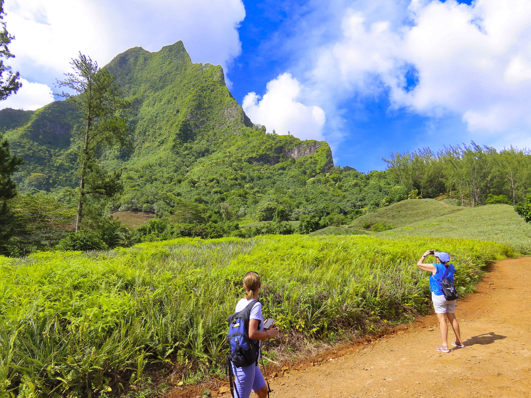
Cienfuegos, Cuba – A Caribbean Time Capsule 

The sun was still below the horizon as men rowed small wooden fishing boats, laden with nets and poles, against the waves as we entered the narrow channel that would eventually widen into the Bahia de Cienfuegos, Cienfuegos Bay. Not much appears to have changed since the old man battled his Marlin in Hemingway’s 1951 novella. Farther along, listing boats were tied to beaten docks in front of weathered homes, their pastel colors muted in the predawn. They faced the inlet under the battlements of Castillo de Jagua, a stone fortress that has guarded this stretch of water leading to the bay since 1745.

The bay was encountered by Christopher Columbus while on his second voyage to the new world in 1494 and noted as a spectacular natural harbor, located at the end of a long narrow inlet, a perfect sheltered anchorage to weather the gales and hurricanes that blow across the Caribbean. However, closer to the gold of the new world, Havanna, on Cuba’s north coast, became the island’s dominant harbor and city. Mostly, Cienfuegos Bay was a forgotten backwater, without a permanent settlement, on the south coast of Cuba, a perfect location for the notorious British pirates Francis Drake and Henry Morgan to launch their raids on the Spanish Main and plunder the treasure fleets that voyaged from Havanna back to Seville, until the fortress ruined a good pirating gig.

The area grew slowly until the early 1800’s when an influx of French migrants fleeing the slave revolt in Haiti founded the city in 1819. Flattened during an 1825 hurricane, the city was rebuilt with a modern cosmopolitan grid pattern. The fertile region surrounding Cienfuegos supported prosperous tobacco, coffee and sugar plantations and continued to attract French immigrants from Louisiana, Bordeaux and Quebec. By the mid-1800s, a railway funneled goods from across the region to the port for export, and a steamship line connected Cienfuegos to Charleston and New York City. The city’s prosperity was reflected in its stately mansions, elegant civic architecture, wide boulevards and parks reminiscent of New Orleans and Paris, earning it the nickname “La Perla del Sur,” the Pearl of the South.

The Cuba of the 2020s still looks very much like it did during Hemingway’s life, as if it was stuck in time, a perpetual movie set. This is a result of the political decisions made during the 50-year reign of the country’s communist dictator, Fidel Castro, who ruled from the revolution in 1959 until 2008, and other communist leaders since then.  Consequently, the United States imposed and still maintains a trade embargo against the Cuban government that visually appears to have frozen the country in the 1960s.

Europeans and Canadians have long traveled to the government-run tourist resorts along the pristine coast. Previously, an inland tourism infrastructure didn’t exist, but with the introduction of the internet to the country and encouraging private enterprise reforms things are slowly beginning to change. We were visiting Cuba on a cruise during that first window of opportunity that was open to Americans between 2016 – 2019, before access was unfortunately tightened again.  Recently the travel restrictions to Cuba have been loosened again.

Across from the pier a horse drawn cart with several wooden benches, car tires for wheels and a sun bleached canopy stood idle. It wasn’t meant for the tourist trade, but instead was the cheapest mode of transportation for local folks to use to move about town. And it was our introduction to how self-reliant Cubans are and how slowly change happens in Cuba. Then we noticed the cars.

Earlier an email confirmed our rendezvous, “Ten is good. Meet at the statue of Benny Moré, a beloved Cuban singer, songwriter and band leader, at the intersection of Paseo El Prado and the pedestrian only San Fernando. Ciao.”

We had decided to skip any ship organized tours of Cienfuegos and instead opted for a tour of the city with a Guruwalk guide we found online.

With introductions made, our small group of four followed our guide through Cienfuegos as they pointed out various sites and their significance. Other stops included the government shoe store where the limited styles were only available in black, and a government bodega.

Here food is acquired with the use of La Libreta, a government issued ration book used to tally your monthly allocation. allowance or allotment Typically the monthly allowance per person is 5 eggs, 1 liter of cooking oil, 1 pound of spaghetti, 3 pounds of refined or white sugar, 3 pounds of unrefined or dark sugar, 6 pounds of white rice, 20 ounces of black beans, 2 packets of “mixed coffee”, daily bread (dinner rolls). Fresh produce not available at the government bodegas is sold at state sponsored farmers markets.

Stopping at a large print shop, we watched the printer set lead type by hand as he assembled each word and sentence for the document he was preparing from a large tray of metal vowels, consonants and punctuation marks. There were not any computers, laser printers or copy machines in sight, only the shop’s heavy German Heidelberg printing presses, which have been meticulously maintained since 1959.

From the top of Hotel La Union, the highest point in the city’s center, we surveyed Cienfuegos, today a sprawling city of 150,000. 

“So, you’ve noticed the old cars on the street?” Our guide turned the talk at lunch away from any political questions we were eager to ask about life in a communist country.

There are about 60,000 old American cars still on the road in Cuba. Most date from the 1950s, but there are still Consuls, Packards, Cadillacs, Dodges, Chevys, Studebakers and Fords from the 1940s and 30s that are still road worthy.  This is an amazing testament to the talent of Cuban mechanics that have been “MacGyvering” the repairs with makeshift parts since the revolution ended in 1959, when the U.S. trade embargo began, and Cuba banned the import of American products. While some cars look to be in mint condition, often the interiors are taped together, door handles are missing, and the windows don’t roll up.

Engines don’t last forever and its not uncommon to swap engines between the American makes and models. Sometimes even the motors from Russian Volgas and Ladas work their way under the hood of Fords and Chevys. Fiats and Peugeots were imported after the revolution but proved to be not as durable as the American models.  With the nationalization of property in 1959 the nicer cars of the wealthy who fled were assigned to government officials, doctors, renown celebrities and famous athletes. Regulations prohibiting the ownership of cars was eventually changed to allow Cubans to freely purchase older cars brought to the island before the revolution. Since then, often cars are family heirlooms that have been handed down from generation to generation. Fathers teaching sons the intricacies of keeping the cars running. It’s extremely rare to find late model cars on the roads as the government imposes very high taxes on new car imports, making them highly unaffordable for the majority of Cubans.

“There are no junkyards in Cuba, everything is still driven.” The ingenuity of Cuban mechanics can surely teach us a thing or two about sustainability. Wonderfully many of these resourceful home mechanics have kept these automotive treasures alive and have created an income for their family by offering rides in their classic cars to tourists.

After lunch we watched dancers rehearse in an old colonial building now used as a community center, and we stopped in several art galleries along the park that featured many talented Cuban artists.  With the government tightly controlling the economy along with the print and electronic media in the country, creative self-expression through art, dance and music are treasured venues as long as the views expressed don’t “run counter to the objectives of the socialist society.”

While the center of the city is well maintained, and many of the old mansions and civic edifices recently renovated. The homes and buildings along the side streets show decades of neglect from a failed socialist system.

Pride in ownership is a difficult concept in Cuba, and since wages are so very low, buying paint is the last thing anyone is thinking about. Low wages necessitate most families to spend any extra funds at the free markets to buy the goods that aren’t covered with the La Libreta rations card.

This quote I found sums up concisely the housing situation. “In Cuba, everything belongs to everyone and no-one at the same time and if a building is “collectively-owned”, it’s understood that the State is the one responsible, but the goverment can’t afford the maintenance.”

Down the side streets, past glories are now sadly intriguing in their neglect, the homes and buildings wearing a texture carved from storms and hot unrelenting sunshine, revealing ancient layers of paint that gives the neighborhoods a weathered patina, a faded elegance.

Till next time,

Craig & Donna

Cordoba & Granada – Location, Location, Location

The view from the train window was a blur of greenery, a vast landscape of undulating hills dotted sporadically with small villages and the remnants of ancient fortresses crowning the hilltops, set amidst a sea of olive trees, that seemed to spread from the wake of the speeding train to the horizon. Seventy million olive trees, 24 different varieties, covering over three million acres in Andalusia produce 900,000 tons of olive oil and 380,000 tons of table olives annually. No wonder we’ve been enjoying Spain so much – the olives are so good!

We were nearing the end of our stay in Seville, but there were still destinations outside the city we wanted to explore before we departed Spain. Being so close to the ancient Moorish cities of Cordoba and Granada, how could we not visit? Plans were made to catch an early train from Seville and spend the day exploring the major sites in Cordoba, before continuing to an Airbnb rental in Granada for three days. There were always debates about budgeting, wanting to do it all and affording it are issues we continually faced during our two-year journey, fortunately the highly discounted rate we received for booking an apartment in Seville during the shoulder season made this side trip financially reasonable.

It was 152 BC when Pliny the Realtor, standing on the bank of the Guadalquivir River, toga blowing in the wind, turned to General Claudio Marcelo, the founder of Roman Cordoba, and with the swoop of his arm across the grand vista before them proclaimed future realtors’ favorite adage, “location, location, location!”

Situated along the last navigable section of the river, Granada prospered as a river port, exporting grain, wine and olives down the river to the Atlantic Ocean, where the goods were then sailed around the Rock of Gibralta into the Mediterranean Sea, eventually reaching ancient Rome. In the 1st century BC Roman engineers built a graceful, sixteen arch stone bridge that spanned 820ft across the Guadalquivir River and has been in continual use, with renovations of course, for two-thousand years.

The city continued to flourish for centuries under Visigoth rule and later Muslim conquest. In the year 1000 the city was estimated to have an enlightened and tolerant population of 450,000 Muslims, Christians and Jews, surpassing Constantinople, making it the largest city in Europe. The intellectuals of the city were renown throughout Europe for their contributions to the advancement of astronomy, medicine, philosophy, and mathematics.

Cordoba slowly lost its significance as a riverport trading center after the reconquest when the waterway eventually silted up and navigation to the city became impossible. By the 1700s its prosperity had diminished, and its population reduced to only 20,000.

Our first stop was Córdoba’s Alcazar de los Reyes Cristianos, Castle of the Christian Kings, a royal residence and fortress built in the Mudéjar-style on the site of a former Muslim Fortress. While the castle is interesting, the exquisite formal gardens were a splendid oasis, wonderfully colorful even in early March. Here Christopher Columbus initiated his negotiations with Isabella I of Castile and Ferdinand II of Aragon to finance his voyage of discovery in 1492.

The city’s most famous landmark, the Mosque-Cathedral of Córdoba, was a short walk from the Alcazar. It’s an enormous structure occupying the equivalent of a New York City office block, part of which features an enclosed courtyard with a central fountain surrounded by an orange grove. The worn exterior was fascinating with its elaborate brickwork, and Moorish arches around the windows. The ancient doors into the space are offset by horseshoe shaped arches, a design influence copied from Visigoth architecture. Construction of the Great Mosque of Cordoba started in 786 AD and lasted for three-centuries as it was continually expanded.

Using 850 recycled Roman columns, topped with two tiers of arches, the Great Mosque of Cordoba’s prayer hall is a dazzling space with rows and isles of geometrically precise columns that seem to recede to infinity, in every direction. It was one of the largest mosques in the Muslim world when it was built.

Fortunately, in 1236 when Ferdinand III, king of Castile and León, captured the city, he was enamored with the mosque’s magnificent architecture, and he chose to leave it totally intact including the mihrab, an elaborate prayer niche in a wall that faces Mecca.

For a time, Muslims and Christians were allowed to pray in the same space. This lasted to 1499 when Muslims were expelled or forced to convert if they wished to stay in Spain. The original mosque remained unchanged until the mid-1500s when a towering high altar and choir loft were built in the center and numerous side altars were added along the exterior walls. The old minaret was finally incased within a magnificent, squared belltower.

Afterwards we wandered through the narrow alleys adjacent to the cathedral, peeking into verdant courtyards that looked so lovely we were tempted to invite ourselves in, but did not.  The only thing missing were flowers in bloom. The sun was not yet high enough in the March sky to warm the cold stones and prompt the first blossoms of spring.

Later that evening upon our arrival in Granada we took an Uber from the train station to our rental in the Albaicín district, on Cta. de Alhacaba, a steep cobbled lane just down from Plaza Larga. It was an attractively gentrified apartment in an older traditional Spanish home, with a center courtyard, that had been divided into several units. Looking out from our window the next morning, we could see on a ridge above us the ruins of an extensive fortress wall, built during the 11th century Zirid kingdom.

Getting our day underway, we walked uphill to Plaza Larga and ventured into the traditional colmados, a small grocery store where you tell the shop clerk everything you need and they pull it from the shelf behind the counter for you. Our Spanish was minimally up to the task.

A few steps from the shop a limited section of the citadel wall containing the Arco de las Pesas has been renovated. Known as the Arch of Weights, this was an important entrance into the city where merchants had their goods weighed and taxed. Its distinctive zigzag tunnel was designed to slow and throw off balance any attacking enemy who had breached its door. The passageway’s vaulted ceiling now provides perfect acoustics for buskers. Crossing through we headed toward the Mirador de San Nicolás.

There are several overlooks on Albaicín hill, but the view of the Alhambra from San Nicolás Plaza was sublime. We stopped here several times as we explored this hilltop across the valley from the Alhambra. We enjoyed lunch and sangria on the terrace at El Huerto de Juan Ranas or dangled our legs over the edge of the mirador as the sun arced across the sky.

We watched the play of light change the shadows and the intensity of the red walls from which al-qal’a al-hamra, in Arabic the red fortress, takes its name.  The palace is dramatically situated on a hill, with the snow-covered Sierra Nevada Mountain Range and Mt. Mulhacén, the Iberian peninsula’s highest peak in the background.

For centuries since the Muslim time, continuing into the 1950s, muleteers ran mule trains laden with fresh produce, fish, and merchandise from the coast up over the Sierra Mountains along a vast network of trails to Granada.  Much of this 8-12 hour journey was done at night to take advantage of the cooler evening temperatures to ensure the quick arrival of perishable food.  The mountains also provided sanctuary to the maquis, resistance fighters, in the 1940s and 50s who opposed the dictatorship of General Franco after the Spanish Civil War.

The historic Albaicín district is extremely hilly, think San Francisco hilly, a severe contrast compared to the flatness of Seville and Cordoba, but the labyrinth of narrow alleys that twist up and down the ancient hillside was intriguing. The Palacio de Dar al-Horra, “Home of the Honest Lady”- the mother of the last Emir of Granada, was an interesting example of 14th century Moorish domestic architecture, with its intricate Alfarje, carved wood ceilings, verandas, and courtyard.

Nearby we accidentally stumbled upon the 16th century Royal Convent of Saint Isabel and entered the courtyard in hope that its church was open. Unfortunately it wasn’t, but as we wandered we discovered the “cookie door.”  Actually, it is a cabinet built into the wall of the convent with a door on each side that separates the cloistered nuns from the public. Ring the bell above the door, speak your order when someone answers and place your money in the cabinet and close the door.  You will hear the other door open and then close when your dulces have been placed inside.  It’s a sweet centuries old tradition which helps the nuns support their convent. 

We were enjoying our stroll through the whitewashed alleys as we headed down the hillside toward Plaza Nueva, when “Splat Splat!” Honestly it felt like we had been shat upon by a flock of tourist hating birds. Something akin to the Spanish version of the Hitchcock movie classic. And the smell was awful! We don’t remember exactly what was said, but quickly a well-dressed middle-aged couple guided us into an empty plaza and pulled a huge roll of paper towels out of their bag and proceeded to “help,” clean the mess off our jackets as they patted us down and attempted to pickpocket us. I wish I had been quick witted enough to yell, I KNOW KARATE!, with an intimidating scowl. At least my wife would have burst into laughter and perhaps that would have broken their concentration. It was over in a flash and they vanished.  Fortunately, we keep all our valuables under our clothing, not in any exterior pockets.  Rattled, we continued on. A beautiful city, good tapas and sangria helped our mood rebound.  Later that evening when I was reviewing the photos taken during the day, I spotted them in the lower corner of a picture taken moments before that encounter.

Bar los Diamantes and La Gran Taberna, located next to each other on Plaza Nueva, were excellent places to dine, and we tried them on separate days. At home in the states now we are making tapas inspired from dishes we tasted at both places.

Afterwards we walked along the thin ribbon of road that follows the Darro River through this section of the old town. It’s lined with numerous historical sites and bridges that cross the river; the ambience was wonderful.

After a long day we couldn’t muster the strength to walk the steep uphill back to our apartment and opted to use the local bus. The routes in the historic section use micro-buses to navigate the ancient parts of Granada and took us pretty close to where we needed to go.

Only a limited number of people are allowed to visit the Alhambra each day, so we made reservations for a group tour early the next morning. 

As we were leaving our rental the next morning, we couldn’t extract the key from the interior lock on the front door. We can’t recall how many doors we’ve unlocked during our travels, but this was a first! Apartment doors in Europe are intriguing, especially if they are in newly renovated buildings.  The trend seems to be to install a very sturdy door with numerous deadbolts that insert into the door frame with the turn of single key.  They appear to be designed to thwart any home invasions or resist the battering ram of a S.W.A.T team. The rental agent asked us to stay at the apartment until a locksmith arrived, without offering a time.  That was unacceptable and we asked them to have the door repaired by the end of the day.  We took the key to the courtyard with us and hoped for the best. 

The Alhambra is massive and originally served as a fortress for many centuries before Mohammed ben Al-Hamar, the first king of the Nasrid dynasty arrived in the 13th century and established it as his royal residence. Each subsequent Muslim ruler continued to add and beautifully renovate every interior surface lavishly adorned yesería, intricately carved or cast stucco featuring arabesque, geometric and calligraphic designs.  Later the Christian monarchs would introduce mudejar tiles and Romanesque, Gothic and Baroque techniques to various building sprees. 

The most significant Spanish contribution to the Alhambra was the Palace of Charles the V. It is an immense renaissance style building with a two tiered colonnaded balcony surrounding a circular courtyard at its center.

Construction started in 1527 and was continually interrupted over the next 430 years and was eventually abandoned until the government dedicated funds to finish it by 1957. Somehow this amazing amalgamation of diverse architectural styles at the Alhambra creates a unique and satisfying visual harmony.

We spent the rest of the afternoon exploring the Catedral de Granada Royal and next to it the Capilla Real de Granada. Both were built over the ruins of the Granada’s Grand Mosque in the old medina after the reconquest.  The cathedral features a towering white and gold interior and a stained-glass cupola above the high altar.

The Capilla Real de Granada is a burial chamber for the Catholic Monarchs Queen Isabella I and King Ferdinand and features their ornately carved marble tomb. Joanna of Castile, Queen of Castile and Aragon, and her husband Philip I “the Handsome” of Castile, are entombed next to them in an equally elaborate sarcophagus.  The Sacristy-Museum here also displays gilded church panels, along with renaissance paintings from Flemish, Italian and Spanish artist. The monarchs’ crowns and scepter are also on display. 

Across the lane the wonderful Moorish architecture of Palacio de la Madraza, a former Islamic school dating from the 1300s, has been well preserved.

To our relief the door lock was fixed when we returned to the apartment that evening. Though to our dismay the landlord left a bill for the locksmith’s services of 150€! Attached to the invoice was a note that said the locksmith could not find any fault with the door, that it was in perfect working, and we were responsible for the bill.  We did not agree that this was our “operating error” and questioned it.  Thinking it was a maintenance issue and ultimately the apartment owners’ responsibility. There was an exchange of text messages, with the rental agent demanding payment. We refused to pay. Things deteriorated – ancient ancestors and future generations to come were flavorfully cursed.  We left early the next morning to avoid any confrontation.

With a half day to fill before our train departed, we dragged our suitcase clickity clacking over the cobblestones of the historic center as we made our way to the Basilica de San Juan de Dios. Built in the 1700s, when a seemingly unending supply of gold and silver flowed back to Spain from their colonies in the Americas, the church is a temple not only to Christ, but a shrine to all things Baroque, with every surface ornately detailed, much of it gilded. The sacristy and the other rooms behind the altar hold a museum-like collection of artwork, precious religious objects, and gold adorned reliquary.

Across the street at Candelas Bocadilleria we sat at a table in the sun and enjoyed the best churrerias of our time in Spain.

Two blocks away and two centuries older, the Monasterio de San Jeronimo (1504) stands as the first great Renaissance style achievement of Spanish architect Diego de Siloe, who was trained in Italy. He followed this with the Grand Cathedral of Granada (1528.) This royal monastery was the first in Granada commissioned by Queen Isabella I and King Ferdinand after the conquest of the city. It’s a massive structure with a two-tiered cloister surrounding a large courtyard fully planted with orange trees. 

The monastery’s main chapel is cavernous with a barrel-vaulted ceiling that leads your eye to a towering gilded high altar, minutely detailed with religious iconography. The tomb of El Gran Capitan, Fernandez de Cordoba, lies in the chapel. A hero, he is credited with several reconquests across Andalucía, and after a ten-year campaign, the surrender of Granada from Boabil, Muhammad XII of Granada, the 22nd and last Moorish Sultan in Spain.

We barely scratched the surface of all the places to see in Granada. It’s a good excuse to plan a return, our own Reconquista, of this beautiful and fascinating region in the future.

Till next time, Craig & Donna
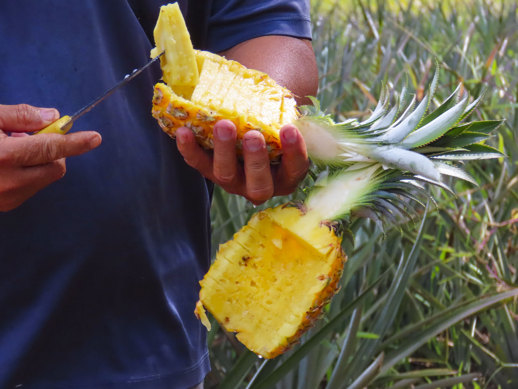
Seville Part 4 – Convents, Cookies, and la Macarena

Seville was a delight to explore by wandering, its cityscape a web of ancient alleys that with every twist and turn slowly revealed the heart of this very old city to us. While the historic center of the city is a relatively condensed area that orbits around the Cathedral of Seville, the Royal Alcázar and the bullring, every bario in the ancient metropolois was fascinating to wander through. Spanish maps of the city from the 16th century hint at what’s to be found. In the 12th century, expanding upon an older Roman defensive wall from the first century AD, Seville’s Moorish rulers totally enclosed the growing town with a new and larger fortified wall.

It started at the Torre del Oro and ran north along the Guadalquivir River until it turned and headed inland in a huge arc that reconnected back at the tower. The old city walls originally had fifteen gates allowing entry into the city and were named for their function. Coal was brought into the city through Puerta del Carbon, while olive oil merchants used Postigo del Aceite to bring their product to town.  Puerta de Jerez and Puerta de Cordoba were the gateways through which travelers from those towns entered Seville.  Puerta Real was built for the exclusive use of the Spanish royals. 

The walls stood until a modernization of the city in 1868 required all the gates except for three be demolished. Today only the Puerta de la Macarena, Puerta de Cordoba, and the Postigo del Aceite remain.  Several small sections of the crenellated wall still stand along the ring road, Ronda de Capuchinos, that now follows the ancient edge of the city. Other parts turn up randomly across the city, where they were incorporated into the walls of newer 19th century buildings.

Roughly following the ring road, we would zig and zag our way through the old neighborhoods of the city that were once shielded behind its ancient wall.  Starting in the old Jewish quarter, now Santa Cruz, we followed the wall topped with an aqueduct along Calle Aqua and peered through locked gates, spying the lush shaded courtyards of the traditional homes. Buildings along this calle that back to the Jardines de Murillo use the old defensive wall as part of their structure. Veering into the center of the old Juderia we found some of the narrowest lanes in Seville. The thinnest being Calle Reinoso which leads off Plaza Venerables and is affectionately nicknamed “Calle de los Besos,” the Street of Kisses to visualize how intimate the passageway potentially can be.

After the Moors were defeated in 1248 every mosque in Seville was converted to a church. A similar policy ensued in 1492 when King Ferdinand II of Aragon and Queen Isabella I of Castille issued the Alhambra Decree, expelling all of Spain’s Jewish population. But a century before the Spanish Inquisition began a rioting mob in 1391 was incited by the hateful rhetoric of a Christian Archdeacon, Ferdinand Martinez, blocked the exits from the Seville ghetto and set the Juderia ablaze. It was once a thriving community that hosted three large synagogues and twenty lesser ones.  Four thousand people died that March 15th. Survivors fled the city, or were forced to convert to Catholicism. The abandoned properties were redistributed by King Henry lll to Christian nobles. The Iglesia de Santa María la Blanca is a notable conversion of a synagogue built in the 13th century. Its stunningly ornate plaster work ceiling veils its tragic history.  A block away where Puerta de la Carne once stood, the street is now lined with umbrellaed tables in front of a mouthwatering assortment of eateries.

Blindfolded or throwing darts at the map, any direction you randomly choose in Seville reveals fascinating layers of history. We never passed the chance to explore a church if its doors were open. Admittedly that’s a huge number in Seville. And some visits are more rewarding than others, we learned upon entering the chapel of the Convento Santa María de Jesús.  The gilded 16th century baroque interior was beautiful. What we found just as intriguing (you get a little numb by the huge amount of gold-leaf in Seville,) though, was that the nuns, of the non-sequestered order of the Poor Clares, bake “Las Dulces,” cookies and pastries, in order to financially support themselves. They sell the tasty creations derived from centuries old, secret recipes from behind an iron barred window.

A half block away the Casa de Pilatos was a marvelous example of a 16th century Andalusian Palace that rivaled the workmanship of Real Alcazar.

It displays a unique juxtaposition of Mudéjar, Gothic, Renaissance and Romantic architectural styles that seamlessly blend into a kaleidoscope of color, shape and texture. 

There are also Roman and Greek antiquities on display that were collected by an early patriarch of the family when he served as Viceroy of Naples in the mid-1500s.  It has amazingly stayed in the same aristocratic family for 500 years and today the 20thDuchess of Medinacelli still has a private residence there.  Admission is free on Mondays after 3pm, but there can be a long queue.

Continuing down the street toward the main boulevard we found Sevilla Vinos a small shop that specializes in local Andalusian wines and sherries. You can purchase wine here by the bottle or you can bring your empty bottles back to be refilled from large casks like the local folks do.

Farther along, the Almazen café was the closest we could find to an internet café in Seville aside from Starbucks. But what’s the fun of that when you can find a neighborhood gem instead. Mostly, taking your laptop computer to work in a public space just isn’t done in Europe from our experience. It seems to break the cherished protocol of separating work from pleasure, a refreshing practice here.

Out on Calle Maria Auxilidora we walked along the ring road to the Jardines del Valle where a long stretch of fortress wall separates the park from the barrio behind it.  That Sunday a crowd had gathered on the sidewalk in front of the park to cheer on the runners in the annual Seville Marathon. 

Farther down the avenue the arched door of the Moorish influenced tower-gate Puerta de Cordoba stands attached to the Church of San Hermenegildo. A legend from the 6th century tells us Hermenegildo was a young Visgoth Prince, son of King Leovigildo who followed a branch of Christianity, Arianism, that did not believe in the holy trinity. Upon marrying a Frankish Catholic Princess, Hermenegildo converted to Catholicism against his father’s wishes. He was eventually imprisoned in the Cordoba tower-gate and beheaded there on Easter Day in 585AD when he refused holy communion from an Arian bishop.  The relic of his severed head was passed for centuries between numerous monasteries and convents on the Iberian Peninsula before finding its final resting spot at the Royal Monastery of San Lorenzo de El Escorial, near Madrid. He was canonized on the thousandth anniversary of his death. During the renaissance on the saint’s feast day, April 13th, the Brotherhood of San Hermenegildo would host jousts in front of the defensive wall that still stands next to the church. 

This is the longest stretch of ancient city wall still standing. It runs parallel to the ring road for seven blocks between the Church of San Hermenegildo and the monumental Arco de la Macarena, which stands next to the church of the same name. The last vestiges of a moat added in the 18th century are still visible here.  During the Spanish Civil War firing squads executed people against this arch. It’s believed this entrance was built by the Moors over one of the three original gates to the city constructed by Julius Caesar when he governed Andalusia in the first century AD.  The origin of the gate’s name is disputed with some historians speculating that it was named after a wealthy Roman property owner. Others think it bears the name of a Moor princess who lived next to the wall when the Arabs controlled the city. Popular belief is it was named in tribute to Macaria, daughter of Hercules, who is the mythological founder of Seville.

We stopped to see the Virgin of Hope, a venerated wooden statue draped in a gold embroidered robe covered with precious stones at Hermandad de la Macarena, and found her fascinating.  Entering the basilica is free, but there is a small fee to view, up close, the exquisite craftsmanship of the robe of the Virgen de la Esperanza de Macarena de Sevilla, (say that ten times fast!) from behind the altar.  The Virgin of Hope is the patroness of bullfighters and was famously re-dressed only once in a black robe to mourn the death, in 1920, of the famous Sevillano bullfighter, José Gómez Ortega, who was loved across Spain. 

To prevent looting of the icons during the Spanish Civil War, a caretaker secretly took the statue home and pretended he was caring for a bedridden sister. Later he pretended to be a stone mason and secreted the statue in the city cemetery within the ornate tomb of the bullfighter Ortega for several months to protect it.

Heading back into the city through the arch we eventually came to the ornately figured baroque façade of Iglesia San Luis de los Franceses.  This was a refreshing change from other baroque churches in Seville that hid their opulent interiors behind plain, almost barren exteriors that benefit from the phrase – “Don’t judge a church by its exterior.” This was clearly not the case with the Iglesia San Luis de los Franceses; it broadcast “notice me!” as if the exquisite stone figures were the 18th century mason’s version of a neon sign.  The church was built at the beginning of the 1700s for the Jesuits to use as a novitiate, but they were only able to use this elegant building for thirty years before the order was expelled from Spain and the rest of the Spanish empire.  Later it was used as a Franciscan seminary and convent, then factory, theatre, hospital for venerated priests and hospice. Eventually it was deconsecrated before being shuttered for many decades. After a ten-year renovation sponsored by the Provincial Council of Seville the still deconsecrated church is now a museum and local government office. Its four gilded baroque altars with their sixteen spiraling, solomonic columns that support the dome above are spectacular and in our opinion it’s one of the finest church interiors in the city.

Associating convents with cookies led to a little misadventure one afternoon. We entered the side door of the Convent of Santa Isabel, located next to the Iglesia de San Marcos, and met a nun talking with a parishioner.  Looks of confusion crossed everyone’s face and heads shook, no, when I asked in very poor Spanish “Los dulces por favor.”  A few moments after leaving empty handed, the gentleman the sister was conversing with called to us and to our surprise presented two simple sandwiches.  We suddenly realized we had approached the convent’s food bank and they thought we were asking for something to eat. We thanked him and made a donation which brought a huge smile to his face and ours.

In this part of the city there seemed to be a church or convent on every block, and we had surely far exceeded the number of visitations to religious institutions to keep thunder and lightning at bay. Just wandering through the neighborhoods without a particular destination in mind was very enjoyable and let us follow any whim spontaneously, whether it was a flash of light from the journeyman knife sharpener as he held the blade to his grinding stone attached to the back of his scooter, or music emanating from an alley as a marching band rehearsed, or the cacophony created by the brotherhoods practicing with their weighted floats prior to Holy Week.

The farther we were away from the historic center of Seville the fewer tourists we encountered and prices in the barrio eateries dropped considerably. Los Coloniales was one such tavern located on a corner across from Plaza Cristo de Burgos. At the beginning of March the days were sunny and warm in the afternoon so dining outside was delightful, though sometimes it required a wait.  Leaving our name with the hostess we waited in the shaded park across the street until she loudly bellowed, “Craig & Donna!” We felt like locals as we hurried over.  The tapas and the ambiance of the setting were very enjoyable.

One afternoon as we walked back to the apartment from a late lunch, luckily I noticed a single black and white flyer tacked high on a tall double-wide door, while Donna had stopped way down the block to take a photo.  Hundreds of years old, the door had a smaller single door built into which was open. I don’t recall seeing a placard on the wall identifying the building, but the flyer had a picture of a tray of cookies! By the time I turned around and got Donna’s attention the door had quietly been shut and locked to our disappointment. Finding it on a map we established that it was the Convento de Santa Inés. Allegedly they baked bolletos, little round cookie balls with sesame and honey-glazed pestiños – dough flavored with orange zest, aniseed, olive oil, and wine, then fried. Determined, we returned earlier several days later and stepped over the ancient threshold into a spartan courtyard with no sign of activity or arrows to follow. But in the far back corner under a small portico there was a plain wooden cabinet built into the wall surrounded by a fading spiritual fresco and Azulejo tiles.  Taped to its door was the price sheet for the available, “Las Dulces.” The cabinet is called a torno and when you open the door there is a lazy Susan style turntable that allows the cloistered nuns to receive your payment and provide your cookies while remaining unseen. Over the centuries, convent tornos were also sadly used to anonymously drop-off unwanted infants in hopes the child would have a better life. Three decades ago, there were forty cloistered convents in Seville, today only a dozen remains, hosting an ever dwindling number of nuns.  Not all of them bake “Las Dulces,” but knowing now we wish we had searched for the others that still do.

Dessert was celebrated, back on our apartment’s rooftop, with a glass of sherry and the cookies from the Convento de Santa Inés, as we sat with our backs to the laundry billowing gently on a warm Spring breeze and waited for the sun to set. This was unfortunately one of our last adventures in Seville before the city entered its first lockdown of the pandemic in March 2020 and all tourists were ordered to leave Spain. We were sitting on the steps of the pillar at Plaza del Triunfo late one afternoon, amazed by the emptiness of the square. There weren’t any horse-drawn carriages or lines of tourists waiting for entry into the cathedral or the Alcázar. Two policemen approached. “The city is closed, you must go home.” It was a shocking eviction notice.

We thoroughly enjoyed our immersion into the nuances of living in Seville and would definitely recommend the city for anyone considering a long-term stay. The city simultaneously manages to be intriguingly historic and contemporary. There were many different ways to enjoy the city and aside from the moderately high price of museum admissions, the cost of living in Seville and dining out was very reasonable.  We walked mostly, but on occasion used the rideshare Uber which operated very well across the city. The weather was splendid in February and March, with cool mornings warming into delightful sunny afternoons.

Make plans, enjoy your travels!

¡Hasta luego!

Till next time, Craig & Donna