The countryside on the way to Olvera was more verdant than the earth toned landscape we traversed on our way to Zahara de la Sierra at the beginning of our road trip. Now the hillsides were a mosaic of greens, light and soft, dark and vibrant, signaling the arrival of spring.
As the road curved, Olvera’s Castle and the belltowers of the town’s church broke the horizon. We are never quite sure where to park in small villages. Worried about getting fined for a parking violation, we always opt to play it safe and find a car lot. But the parking in Olvera was at the bottom of a steep incline below the historic castle and we just didn’t have the oomph that morning to walk from there uphill and then continue higher to the top of the tower. With some persistence we navigated the town’s labyrinth of narrow one-way lanes into the Plaza de la Iglesia. At the apex of the village, the plaza straddles the area between Olvera’s citadel and the town’s majestic church, Our Lady of the Incarnation Parish. Since it was still the off-season, we were in luck and found the last, barely viable parking spot on the plaza. It was a narrow space that required the driver’s side door to be parked tightly against a wall. Fortunately, I’m still limber enough to climb over the car’s center console and stick shift, with a limited amount of grunting and moaning.
The view from the mirador at the edge of the plaza was wonderful. Incredibly, the views across the village continued to get better and better as we climbed the different levels to the top of the Castillo de Olvera, perched atop a rocky outcrop at an altitude of 2000 feet. The climax was a spectacular view of the cathedral and panorama of whitewashed homes with red tiled roofs backed by a shimmering sea of silver green foiliage. Outside the village, the surrounding olive groves harbor nearly two million trees.
Constructed in the 12th century, the castle was part of a line of signal towers along the Moorish frontier in southern Spain. The castle was expanded in the 14th century when it was captured by King Alfonso XI during the Reconquista. The castilo is one of five in proximity to each other on The Castles Route, Witnesses of the Spanish Reconquest through the Moorish Strip, a no-man’s land that separated the ancient Christian Andalusia frontier from the Arab Kingdom of Granada. The other castles on the circuit are Castillo de las Aguzaderas, Castillo de Cote, Castillo de Morón de la Frontera, and the Castillo del Hierro.
With its size and architectural presence, Our Lady of the Incarnation Parish looks more like a cathedral than just a church. The neoclassical church was started in 1823 on the foundation of an earlier dismantled, gothic- mudéjar style church and dramatically counterbalances the castle on ridge above the village. Ordered built by The Dukes of Osuna, the feudal lords over Olvera, the vaulted interior is lined with marble imported from Italy and has many interesting religious icons. To fulfill this extravagance the Dukes diverted the town’s taxes, away from improving the village, to pay for it. They were the last feudal lords over Olvera and declared bankruptcy in 1843 when the church was completed. Then fled, never to be seen again.
A cloudless morning in Olvera turned overcast by the time we arrived in Setenil de las Bodegas only thirty minutes later. While considered a pueblo blanco, it’s totally different from Olvera and Zahara de la Sierra where the homes ascend the steep slopes under their town’s hilltop fortress. In Setenil de las Bodegas, whitewashed homes front caves under large stone overhangs which line both sides of a gorge, created eons ago from the erosion caused by the swift moving water.
The homes along the gorge use the mammoth natural stone ledge as their roofs. The once raging Rio Trejo is now a quiet stream in the narrow gorge, which widens into a shallow ravine where an ancient Moorish castle still guards the approach to the village. When the Romans colonized the area two thousand years ago folks had already been dwelling in the natural caves along the gorge for several millennia. Over the centuries the cave fronts were enclosed to create the unique village that still survives.
Before touring the village, we checked into the Hotel El Almendra to drop our bags, just oustside the historic district, with the intent of driving back and finding parking closer to the gorge. We were just about to pull out of the hotel parking lot when a group of police cars with lights flashing and sirens wailing roared past. A slower patrol car parked and blocked the hotel driveway. Folks were beginning to gather on the sidewalk. We had no idea why until a motorcycle carrying a cameraman facing backward led the first wave of bicycle racers that were a blur of pedaling color as they sped by. A continual surge of racers crested the knoll of the road and coursed downhill towards the village. The race was one leg of the annual Vuelta a Andalucia – Ruta del Sol. A five-day, 500 mile cross-country cycling event that summits 17 mountain passes in the region and attracts 600 riders. Leaving the car at the hotel, we decided to walk the half mile into the village.
By the time we reached Cuevas del Sol, Caves of the Sun, the narrow one-way road through the gorge lined with small taverns and inns, the sun was brightly shining again. Even though the road is open to cars, it was filled with folks walking and was almost pinched closed by tables from the restaurants narrowing its width. We found a table and enjoyed both the lunch and the warmth of the February sun.
Afterwards we walked the length of the lane through the deep chasm until a set of stairs led to the Mirador del Carmen and the small 18th century chapel Ermita de Ntra. Sra. Del Carmen. The view from the overlook encompassed a sweeping vista of the valley filled with whitewashed pueblos stacked atop one another filling the valley to its rim.
The Nazari Castle, the town’s 12th century Moorish fortress, still stands vigilantly on the edge of the valley, the invaders now camera-wielding tourists. Across from it the Gothic style Church of Our Lady of the Incarnation, itself an imposing fortress-like structure, was ordered built by the Spanish Crown. It was constructed in 1505, above the town’s previous mosque, to celebrate the liberation of the village from centuries of Arab rule. We walked back to our hotel along a lane above the gorge lined with newer buildings.
Heading back to Seville before sunrise the next morning we stopped high above the village on the road that followed the ridge opposite the Cuevas del Sol, in one last attempt to capture the iconic pueblos of the village as dawn cast its first rays of light across the gorge.
Till next time, Craig & Donna
PS. Our 226-mile weekend roundtrip from Seville only used slightly more than a half tank of gasoline.
Needing a break from city life we rented a car at the Santa Justa train station and within minutes we were out of Seville heading south to Ronda, one of Andalucia’s many “Pueblos Blancos,” the white villages, so called because of their uniformly whitewashed houses. Although it was less than two hours from Seville, it took us all day due to the number of planned stops and spontaneous detours we made.
Lime paint was introduced to the region when Rome controlled the Iberian peninsular. Its use was greatly expanded during the mid-1300’s when a bubonic plague pandemic swept through the Mediterranean countries. Residents of villages were required yearly to cover the outside and the interiors of their homes and churches with a limewash, known for its natural anti-bacterial and insecticidal properties, in an effort to reduce the spread of disease. Community inspections were done, and folks were fined for noncompliance. This mandated conformity was eventually appreciated as an aesthetically pleasing look and a symbol of meticulous tidiness. Fortunately, the custom stayed and has become an iconic signature of southern Andalusia.
Cresting a low hill on the A-375, we spotted a small castle with crenellated walls and towers in a shallow valley not far from the road. Turning towards it we followed a dirt track through farmland not yet ploughed for the Spring planting to a small intersection where the castle stood next to a narrow, babbling brook. The history of the Castillo de Las Aguzaderas isn’t really known, but it is thought to have been built in the 1300’s by the Moors as they retreated from advancing territorial gains made by the Spanish during the Reconquista.
Of Spain’s 2500 castles this is the only one that does not sit atop the high ground of a hill or mountain to command the surrounding terrain, but according to its historical placard, stands in a hollow to protect the spring that emerges from the earth outside its wall. With no attendant and an open gate, we were free to scramble around the walls and climb stairs in a terrible state of disrepair to the top of the castle keep for views all around. In the distance an ancient stone watchtower, Torre del Bollo, dominated a hill.
From afar the whitewashed casas of Zahara de la Sierra brilliantly reflected the sunlight like polished marble. The homes, stacked like building blocks, rose up the hillside until they met a sheer butte. A square tower crowned the butte’s summit.
We followed the long ring road that circles the mount through the village and decided to have lunch at Meson Oñate where we were drawn to the outdoor patio that overlooks the Zahara-El Gastor Reservoir and the rolling farmland that surrounds it.
After lunch, to work off our delicous meal, we hiked to the Castillo de Zahara, which crowns the mountaintop above the village. It was a well paved steep path at the start, but soon the slope decreased to a manageable incline that zigzagged up the mountain. For our effort we were rewarded with stunning bird’s eye views over the red tiled roofs of the village and to the distant lake below. A tower is all that is left of a larger Moorish castle from the 13th century that was built over the ruins of a small Roman settlement that once called the mountaintop home. Barely accessible, it provided a safe haven during times of trouble. The castle had a turbulent history with its control passing back and forth several times between the Moors and Spanish. Even French troops once commanded its summit through Napoleon’s conquest of Spain during the Peninsular War that raged in the early 1800’s.
With a last-minute decision to take a longer route to Ronda, we headed into the mountains outside of Zahara de la Sierra on CA-9104, a serpentine road with steep slopes that took us into the Sendero La Garganta Verde, a rugged and wild scenic area that is known for its population of Griffon vultures, and Monte Prieto. The wind was insanely whipping around us when we parked the car at the Puerto de las Palomas (4500ft above sea level) mountain pass and walked to an observation deck in hope of viewing some vultures. Griffons are large birds of prey that have wing spans up to nine feet across. We were fortunate to spot some, far off in the distance before we ran back to the car, chilled to the bone.
The sun sets early when you are on the eastern side of the steep Sierra del Pinar mountain range. The last rays of sunlight still illuminated Grazalema as we drove into the village, but the temperature dropped along with the vanishing light of a February afternoon.
We sat in the plaza and had café across the sidewalk from an interesting statue of a bull being roped. The statue commemorates the ancient practice of hunting wild bulls. The tradition continued through the Romans and Arabs and was Christianized by the church into the feast of the bull to celebrate the Virgen del Carmen. During the festival, three times a day, a bull is released to run through the village for an hour with the men chasing after, in hopes of roping it. The beginning and end of each bull’s run is announced with fireworks throughout the day. Sections of an old Roman road that led up into the village are still visible from the mirador on the edge of town.
Enjoying the freedom and spontaneity a rental car offers is a big plus when developing itineraries. Finding convenient and affordable hotels that have free or inexpensive onsite parking was another whole issue. It was dark by the time we reached Ronda and we were having difficulty finding the hotel’s parking. With one last call to the hotel receptionist the garage door to their secret lair, that was our parking space, was magically revealed to us on a back alley, under the Hotel Plaza de Toros. Only big enough for six cars, our tiny Fiat 500 easily fit in its tight confines.
The next morning revealed that the hotel was in an excellent location, just a block from the town’s famous bullring, Plaza de Toros de la Real Maestranza de Caballería de Ronda, built in 1784. Aside from bullfights it has been used as an armory and calvary training grounds by the Real Maestranza de Caballería de Ronda, a noble order of horsemen in the 18th and 19th centuries.
The promenade next to bullring is dedicated to famous literary talents who were enamored with the “Ciudad Sońada” or “Dreamed City,” as Ronda is also called. While Don Quixote didn’t tilt at any windmills in Ronda, his creator Miguel de Cervantes certainly drew inspiration from the area as he traveled between villages for his day job as Royal Tax Collector. Washington Irving found inspiration in the rugged landscape of southern Spain when he traveled through Ronda in 1828 prompting him to write, “There is something in the austere presence of this Spanish landscape that wounds the soul with a feeling close to the sublime.” He also romanticized the brigands, who some saw as Robin Hood figures that lived in the mountainous terrain surrounding Ronda, and Irving was disappointed in not encountering any on his journey through Andalusia, ignoring the poverty and repressive feudal system that forced many into a life of crime. Ernst Hemingway was drawn to the machismo and pageantry of bullfighting in Ronda, where the sword and red muleta cape were first introduced into the ring by the legendary matador Francisco Romero in 1726. Orson Welles explained bullfighting as “an unjustifiable yet irresistible, three-act tragedy.” Wells was so fascinated with this quintessential Andalusian village that he chose to be buried here on the hacienda of a bullfighter friend – “A man does not belong to the place he was born in, but to the place he chooses to die.” Spanish poet, José Agustín Goytisolo summed it up best for us with, “We sighted Ronda. It was raised up in the mountains, like a natural extension of the landscape, and in the sunlight it seemed to me to be the most beautiful city in the world.”
The mirador beyond the park overlooked olive groves and spring fields still dormant. Past them distant mountains faded into the horizon. The path through the mirador led to the Puente Nuevo bridge that connects the younger old town to the ancient village across the steep sided El Tajo (The Deep Cut) gorge, carved out eons ago by the rushing waters of the Rio Guadalevín. Finished in 1793 after 34 years of construction, the new bridge isn’t so new anymore, but it was an engineering feat when it was constructed across the shear 390ft deep chasm that divided the village. It replaced a poorly built 1735 bridge that tragically collapsed after only six years’ use, killing fifty people.
Ronda is a fabulous city for walking and as we continued across the bridge into La Ciudad, Ronda’s old-town quarter, we stopped in awe, to photograph the iconic whitewashed houses that are tenuously perched atop the walls of the gorge. Precarious to the point that if their front door slammed too hard the back of the house might fall into the gorge!
We worked our way to Plaza Duquesa de Parcent in the center of the historic district for lunch. Passing architectural details from Ronda’s Moorish and Spanish past still evident on some of the ancient buildings.
In the off-season not all of the restaurants were open, but it was a beautiful day and we didn’t mind waiting for a table in the fascinating historical surroundings. A few minutes later we were seated at a table in the sun, caddy corner between the Convento de Clarisas de Santa Isabel de los Ángeles and the Convento De La Caridad, both built in the 16th century. The classic symmetry of Ronda’s Town Hall with its two-tier colonnade anchored the far side of the plaza.
Adjacent to the town hall the Iglesia de Santa María la Mayor is the real draw to this side of the historic district. With two rows of covered balconies next to an adjoining former minaret turned belltower, it’s a unique façade for a church and it’s built on the foundation of a 14th century mosque. Ronda and Granada were the last Moorish strongholds in Andalusia, and the mosque was ordered destroyed after Ronda surrendered in 1485. King Ferdinand and Queen Isabel immediately ordered that a Gothic church be built upon the spot.
The balconies on the front were added during the reign of King Felipe II in the 1500s for the well-to-do and nobles of the city to watch maestranza tournaments in the plaza, before the Plaza de Toros de la Real Maestranza de Caballería de Ronda was built. A century later the church was partially destroyed in an earthquake and the rebuilding over the next two centuries embraced a mishmash of Gothic, Renaissance and Baroque styles that sends architectural purists into a frenzy of “how could they.” Though smaller than the churches in Seville, we found the Iglesia very refreshing with its lofty interior and fabulous religious art.
Just inside one of the side entrances, a worn stone stairwell led up to a walled catwalk that wrapped around the side and back of the building. The views from it over the red tiled roofs of the old quarter seemed not to have changed for centuries.
Later that evening we explored the new town and found Grabados Somera, Shallow Engravings, a wonderful workshop and gallery filled with etchings of matadors, senoritas and Ronda, all the creations of master printmaker engraver Pedro Somera Abad. Writing this now we regret not purchasing a print as a souvenir of our time in Spain.
We eventually came across La Casa de Jamon, a gourmet store and Iberian Ham bar that will leave any carnivorous epicure salivating. Here a leg of the best jamon to take back to your casa will dent your wallet an extravagant 600€. We never realized those acorn fed porkers could command such a price. Along with jamon, they have locally sourced sausages, wine and cheese from the Andalusia region. We decided to order a charcuterie board for dinner and we were not dissappointed with the tasty assortment presented.
The next morning we walked through the Jardines De Cuenca along a walled path that traced the course of the Rio Guadalevín through El Tajo gorge far below. Across the chasm the hanging gardens of the old palatial homes that lined the cliff edge were redolent with color. The path through the park slowly descended to the Puente Viejo; built in 1616, it is the oldest stone bridge over the river.
Across the bridge the route split to go back into La Ciudad, the old town, through the Renaissance era Puerta de Carlos V, where taxes were once levied on the wares merchants brought into the city. Or we could go downhill to the impressive arched ruins of the Baños Arabes, a 13th century Moorish bathhouse on the outskirts of the city, that provided heated water, an impressive feat 800 years ago.
Along the river that supplied water to the Arab baths, grist mills once stood just inside Ronda’s double ring of fortress walls that protected this side of La Ciudad. The mills ground wheat harvested from the surrounding countryside. The stones of the outer wall were repurposed long ago. Now only remnants of the massive inner wall, the last line of defense before entering the city still stands, causing us to pause and imagine its former glory. Walking under the last vestiges of Ronda’s mighty defenses, we headed back.
It was lightly raining as we strolled along Carrera Espinel in search of an interesting place for dinner. Most of the inside tables at the restaurants we passed were taken with diners escaping the damp evening chill. But the aroma of savory clams drew us to an outside table at Restaurante Las Maravillas, where the waiter was attentive and refueled the tower heater next to our table to help keep us warm. The dinner and wine were delicious.
Plans to visit Olvera and Setenil de las Bodegas the next day were made over dessert and coffee. It had been a long satisfying day, our “walk a little then café” evolved to “walk a little more, then bed.”
“Welcome aboard, folks. Our flight time toBelize is two hours and ten minutes. The weather is expected to be a balmy 80 degrees Fahrenheit today when we land,” the pilot announced as we were buckling in. Then continued with “As you know the National Weather Service has issued the very rare ‘Beware of Falling Iguanas Weather Alert’ for Miami and South Florida this morning.” As funny as this sounds, it actually happens when the temperature dips into the thirties in Florida. Cold blooded animals, the iguanas slowly stiffen as the temperature drops and eventually lose their grip on the tree branches they have been sleeping on and fall to the ground, stunned, where they lay immobile until the temperature rises. Iguanas can grow quite large and may cause serious injury or death if you are unlucky enough to get struck by one of the falling frozen reptiles. It sounds like something out of a zombie apocalypse movie – be careful out there. We were delighted to be heading south again to a warmer climate after a cold and rainy November and December in Italy, which was followed by a warm-hearted, but very frigid Christmas with our kids in New Jersey.
On our final approach for landing the wing of the plane dipped to reveal a beautiful azure sea outlined with dense green jungle and brilliantly white sand beaches – and not much else – as far as the eye could see. It was still much like it was several millennium ago when a prosperous Mayan civilization flourished, supporting an estimated population of 500,000 – 1,000,000 in the region. Columbus sailed by without stopping and landed in Honduras during his last voyage to the Americas in 1502. Navigator Juan Diaz de Solis did not mention a landfall or discovery during his expedition in 1507 sailing from Panama to the Yucatan. Several theories suggest that the 190-mile-long Belize Barrier Reef, the largest in the northern hemisphere, was too difficult to navigate through so the Spanish fleets sailed past. We witnessed this difficulty once from the deck of a cruise ship as the captain left a snaking wake as he steered a serpentine route through the underwater obstacle course.
The first European to arrive in Corozal literally washed ashore as a survivor of a 1511 Spanish shipwreck. To stay alive, conquistador Gonzalo Guerrero offered his skills as a soldier to Mayan Chief Na Chan Kan at Chactemal, (now Santa-Rita, Corozal Town). He proved his skill as a warrior and married the chief’s daughter, Princess Zazil Há. The children from their union are recognized as the first Mestizos of Central America; theirs was the first Mayan liaison recorded by Bernal Diaz de Castillo in his memoir “The True History of the Conquest of New Spain,” written in 1568.
Guerrero defended his adopted homeland against conquest in 1531 when he helped Chief Na Chan Kan defeat the Spanish army in a battle near the Rio Hondo. Today the river is still Belize’s northern border with Mexico. Spain never established any permanent settlements in Belize. Gold and silver were discovered next door in Guatemala and Honduras. Belize was absorbed into the Spanish empire of Central America by its proximity to its larger neighbors, but was never colonized until the British subversively entered the territory.
The riches of the new world didn’t go unnoticed for long, but by the time English and Scottish pirates arrived on the scene in the mid-1600s, the treasure-laden flotillas destined for the Spanish crown from central America had been replaced by shipments of logwood. Native to northern Central America, logwood or bloodwood was used by the indigenous tribes of the region to produce a vibrant red-orange dye. Mixed with other ingredients, a full spectrum of colors was possible. It grew abundantly and was exported to Spain where the cheap natural resource revolutionized the textile industry and afforded commoners a chance to have colorful wardrobes, which before was only afforded by the nobility. Gone were the days of fabrics dyed gray with soot.
Gold or wood – it didn’t matter. Pirates were pirates and willing to steal your cargo regardless of its content, as long as there was a profit to be made, and the English textile mills were demanding logwood. After plundering large Spanish merchant ships that sailed across the Gulf of Honduras, the pirates found safe refuge for their smaller vessels in the shallow waters behind the Belize Barrier Reef amidst its 450 cays and atolls, where they could hunt for food, get fresh water, and repair their boats. In 1670 England and Spain signed a treaty banning piracy in the Caribbean. The days of the infamous pirates of Belize, Edward Lowe, Captain Charles Johnson, Bartholomew Sharp, Captain Henry Morgan, and Blackbeard, were waning. By this time English pirates had discovered Belize was full of logwood and many ex-privateers became legitimate and wealthy logwood cutters and exporters after buying African slaves to work in the miserable conditions of the mosquito-infested jungles. Though Spain considered all of Central America as part of their empire and occasionally harassed the British logwood camps trying to evict them, the Spanish crown never established any settlements in Belize.
In 1763 Spain signed another treaty allowing English subjects the “privilege of wood-cutting,” but still retained sovereignty over the region. Possession is nine-tenths of the law and Belize finally became the English colony of British Honduras in 1862. Mahogany had replaced logwood as the major export. Conflict with the Mayans escalated as settlers moved farther into the interior exploiting the regions mahogany forests, and forced the indigenous population from their lands by burning their villages and crops. The giant cut logs were floated down the country’s rivers to the coast and where rivers didn’t exist, small logging railroads were built to satisfy the European demand for this beautiful hardwood that was favored for fine cabinetry, furniture and shipbuilding.
Disenfranchised and oppressed, the Mayan revolted in what is called the Caste War against their colonizers. Led by Marcus Canul, a Mayan chief, his people demanded the British pay for the crops they burnt and for the land they occupied. In northern Belize, Canul’s freedom fighters attacked and occupied the garrison town of Corozal. The movement lost its momentum when Canul was killed during an unsuccessful assault on Orange Walk in 1872. Long considered a rebel and criminal, he is now regarded as a Belizean hero who fought against ethnic cleansing. The deforested jungles were replaced by sugar cane, ranching and agriculture plantations.
Belize finally became independent in 1981, though The British Army still maintains a jungle warfare training facility in the country to help deter Guatemalan aggression in an unresolved border issue. Aldous Huxley once wrote, “If the world had any ends, British Honduras (Belize) would certainly be one of them. It is not on the way from anywhere to anywhere else. It has no strategic value. It is all but uninhabited.”
Today the tiny country of 400,000 supports a diverse culture descended from Mayans, Mestizos, African slaves, Garifunas, Europeans and more recently immigrants from Lebanon, Germany, the East Indies, Asia and North America with an economy centered on tourism and agriculture. English is the official language of Belize, but it is not the first language of many with Spanish, Belizean Creole and Q’eqchi’ Maya primarily spoken, depending on what part of the country you are in.
The barrier Islands and cays where pirates might have hidden treasure now sport popular resorts on their white sand beaches. Scuba divers can explore shipwrecks, the Great Blue Hole (a marine sinkhole that is visible from space,) and the exceptional marine life found along the Belize Barrier Reefwhich is now a marine reserve and UNESCO World Heritage site. Ashore the jungles and mountains continue to reveal the extent of the Mayan civilization in Belize with over 600 known archeological sites discovered so far, ranging from ceremonial caves to towering stone pyramids.
We are on the other end of the tourist spectrum and wanted something very lowkey, inexpensive and relaxing for a month. We headed to Corozal! Located on Chetumal Bay, it is the northern most city in Belize and only 16 miles from Chetumal, Mexico. It was founded in 1848 by Mestizo refugees from Mexico fleeing Mayan retribution from the Caste Wars there. It prospered exporting mahogany logs when there were still enough trees to support the timber industry. Sugarcane now fuels the economy.
In 1955 Hurricane Janet, a category 5 storm with winds of 175mph, flattened ninety-five percent of Corozal and left 8,000 people homeless. Surprisingly one of the few buildings left standing on the waterfront, fully intact, was the home of lumber baron John Carmichael. It was built in the 1880’s using only mahogany. The house is still used today as a Catholic mission. The pre-1955 wooden structures have been replaced with concrete block houses now, mostly two stories high, except the four-story Mirador Hotel, the tallest building in town.
Our ah-ha moment happened after the two-hour, inland drive from the airport, when we entered Corozal and saw the enticing turquoise waters of Corozal Bay on our way to our Airbnb rental. We drove a mile along a still bay bordered by a low battered seawall and numerous public parks dotted with palm trees.
Turning onto 2nd St. North our driver stopped in front of a flowering bougainvillea-covered wall, less than 200ft from the water, that hid the Villa Imperial Loft Apartment, our home for the next four weeks. Our host Oscar wasn’t home at the time, but had made arrangements with Sue, another guest, who graciously led us through the flowering garden, complete with a resident mama cat and her kitten, and up the back stairs to our studio apartment. She enthusiastically answered our first questions about Corozal.
The large room was brightly painted and pleasantly decorated with an eclectic mix of antiques, reminiscent of visiting our grandparents. A wall of windows facing east offered a glimpse of the bay, and any storms approaching, through the neighbor’s tree. Best was the kitchen across the landing at the top of the stairs. It was enclosed on three sides with just screened windows, covered with louvered shutters. In stark contrast to the apartment, it was very rustic with the feel of an old lake cabin. But we soon realized it was the perfect spot to observe the wide varieties of birds that visited the trees in the backyard, and we thoroughly enjoyed cooking and eating there. Birding over the next month while walking along the waterfront was one of the highlights of our stay in Corozal. Spotting just a few of the 590 bird species in Belize, we saw sandpipers, great kiskadee, white-collared manakin, yellow-throated euphonia, tricolored heron, kingfisher, lineated woodpecker, great egrets, couch’s kingbird, crimson-collared tanager, black and white warbler, and the outrageously raucous plain chachalaca, which you’ll hear well before seeing them.
For many travelers visiting northern Belize, Corozal is just a brief stop on their way to or from Mexico or Guatemala, or a transfer point to catch the two-hour Thunderbolt Ferry or a flight on Tropic Air from the Corozal Airport (CZH) to San Pedro, on the barrier island, Ambergris Caye. The town doesn’t have a beach, which has probably helped keep it off the beaten path for most tourists that visit Belize. Access to the shallow water is from stairs in the 1.5 mile long stone seawall that has not fared well against the surges of the ocean. We had read that the district has a sizeable expat community, that likes to avail themselves of all the big city options, mainly a Walmart and Sam’s Club that are across the border in Chetumal, Mexico. But from our experiences we only encountered a handful of North Americans, surely not surging numbers that would indicate it was a sizzling hot spot for vacationing or retirement that would change the character of the town. And that’s a good thing. The joy of Corozal for us was its tranquility; there really was not much to do there aside from chilling and the occasional dip in the gentle waves of the bay. The serenity of the seascapes compensated for the lack of activities.
We were enjoying the tropical 80-degree weather of Corozal and re-embracing our slow travel philosophy by immersing ourselves in the daily flow of life in this small coastal town. It was wonderful to see parents accompanying their uniform clad children to school every morning. Some parents drove, others walked along or bicycled with their kids. Routinely at the end of the school day an older couple pedaling a three-wheeler sold homemade popcorn to the kids or the youngsters lined up for ice cream on the porch of a home that doubled as an ice cream parlor. The kids waved to us if they noticed us bobbing in the bay across the street.
Our daily walks led to discoveries all across town, mostly culinary in nature. We were eager to find the best places to buy groceries, interesting places to eat and quench our thirst. Most importantly, our craving for good coffee was easily satisfied directly across the street at the top of a colorful flight of tiled stairs. Here Oscar’s nephew Rudi runs the LVDM Coffee Stop on the porch of his home and makes what are easily the best cappuccinos in Corozal. He also rents two rustic villitas in his backyard.
In town there were any number of Asian-owned grocery stores that all offered the same staples. We tended to prefer a shop called the Central Supermarket, because they were the closest place to carry our recyclable beer bottles. Diagonally across the street the city’s daily market had numerous fruit and vegetable stands, an open-air butcher, and clothing vendors. A twice weekly farmers market was held outside of town, across from the cemetery. Fortunately, this location did not reflect negatively upon the quality of produce sold there. At a much greater walking distance, it didn’t offer any real advantage over the produce sold for the same price at the daily market. Shopping there was an early morning event and the atmosphere was very vibrant. It was here we got the first glimpse of the country’s Mennonite farming community, easily identifiable by their conservative dress and spoken Pennsylvania German. Since 1958 when they were invited to settle in Belize by the first Premiere of the country, George C. Price, the community has grown to 10,000, and they have contributed immensely to Belize’s agriculture self-reliance.
Surprisingly, even though Corozal is located right on the bay, we could not find fresh fish and had to purchase locally caught frozen fish, conch and lobster from Frank’s, a great butcher shop that makes their own sausage and offers a wide assortment of fresh beef, pork and poultry. Directly across from Frank’s on the other side of the civic center field we found Vivi’s for wonderful meat pies.
On one of our walks, we did meet a young brother and sister team carrying a five-gallon bucket on the handlebar of their bicycle. It was full of lobster and conch, caught by their father earlier that morning. They were going door to door in the neighborhood, selling it so they could buy their school uniforms. Of course, we purchased some, and it was delicious.
The town does not have a marina for boats, but there are spots along the bay where fishermen pull out their ancient mahogany boats for repairs. Called sandlighters, many of these traditional sailing vessels were built across the bay in the fishing community of Sarteneja and are over eighty years old.
There were several small bakeries in town, each offering different specialties. The Y Not Bakery, to the detriment of our waistlines, was the closest and created the best temptations. Another favorite was Caramelo Bakery across from the high school and down the street from Belcuisine, a spice factory that produces flavorful Belizean Recados mixes.
Corozal really was a rewarding foodie’s destination with numerous small taquerias and enterprising folks offering roadside barbeque. Many businesses were operated from the windows of homes, like Ruby’s, who prepared delicous ceviche then sold it through her living room window for take-away.
The only option for eating out was casual dining. We found June’s Kitchen and Mar’s Caribbean Garden for homecooked meals. Directly across from the bay, Scotty’s Crocodile Cove was a relaxing spot with thatched roofs; it was an enjoyable place for a refreshing Belizean brewed Belikin beer and large burritos that could easily feed three people. The Tortuga Grill, across from the waterfront Rainbow Park, and the Wood House Restaurant, adjacent to Miami Beach, both offered good food and views of the bay.
Corozal enthusiastically supports its art community and one Saturday a month, in the town’s Central Park, holds the Art in the Park event where local artists and craftspeople display and sell their work. It was a fun time, with live music and delicous Belizean food. It’s held between 5pm – 9pm to avoid the heat of the day. If City Hall is open make sure to check out the fantastic wall mural depicting the history of Corozal, painted by Belizean-Mexican artist Manual Villamor.
The blank concrete block walls of homes and businesses across from Miami Beach were the canvases for street artists invited to participate in the Corozal Graffiti Festival. In 2020 street mural artists from Belize, Cuba, El Salvador and Mexico were invited to enliven the walls with an “Ancient Chactemal” theme. It was a lively event with a music stage, art and crafts for sale, body painting and food vendors. On the beach, the Corozal sailing club was offering catamaran rides on the gentle waters of the bay.
There is an abundance of civic pride displayed in this small, well-kept community on Corozal Bay that is endearing. We barely scratched the surface of places to explore in Belize and were perfectly content “Snow Birds” with our choice of Corozal for a month’s worth of lazy rest and relaxation. We’d definitely return to explore the surrounding area more fully.
Occasionally, I will suggest we return to a place we have visited before, to relive that good time and explore the things we missed previously, or if it was a super affordable destination. “The world is so big. I’d rather go someplace new,” is often Donna’s response, said with a sweet smile. But “the rule” doesn’t apply to Italy! – the land of her people. I’ve lost count of the number of times Donna has been there, but I maintain I’ve followed along often enough to receive honorary citizenship. Let’s face it, Italy is a great place to explore, which led us to Verona, again, for a night. Anyway, it was sort of on our roundabout way to Milan.
It was late afternoon when we arrived at the budget friendly Accommodation Verona, (yes, that is the correct name) on the edge of the historic district. We double parked while the proprietor took our bags upstairs. He then hopped in the passenger seat to show the way to the underground car park and the hotel’s newly purchased garage spaces, with overhead doors to totally secure your wheels, which he was immensely proud of. It was a bit of a hike from the hotel, but the car was safe in the parking garage equivalent of Fort Knox.
The sun was brilliant on Verona’s ancient colosseum while we sipped Aperol spritzes and shared a pizza at an outdoor restaurant on Piazza Bra, as shoppers strolled amidst the nearby Christmas market. Gone were the fake gladiators and other street entertainers who left when the weather turned colder.
It was a vastly different dining experience compared to our first dinner in Verona years ago. Travel novices then, we were constantly referencing a travel guide by an American, that recommended sights, hotels and restaurants. With book in hand that suggested the restauranteur would treat us well and offer special prices to loyal readers of said guide, we found a delightful place on a quiet lane lined with outdoor tables and twinkling lights. “Who?” was the response when we mentioned the guidebook. A large antipasto, charcuterie board, wine and “special price” were all agreed upon. Or so we thought.
It was one of those long, delightful European dining experiences, where the table was ours for the evening. The dinner and ambiance were great! Eventually our amiable host, carrying the largest bottle of grappa we’ve ever seen, presented a small wooden box containing the bill. “Please enjoy as much of the grappa as you like.” Drink this to ease the shock of the bill, would have been a more accurate invitation. Grappa is a regional pomace brandy, distilled from the seeds, stems and skins left over from the winemaking process. Production is centered nearby around the aptly named village of Bassano del Grappa. This is strong stuff that, in a pinch, Italian farmers have used to fuel their tractors. A good dent was put into that bottle of grappa, as we were eventually the last to leave. Fortunately, our hotel was a short, though not very straight, giggly walk away. Sleep was unjustly cut short the next morning when at sunrise, the glass recycling truck in the alley under our hotel window loudly emptied a dumpster of wine bottles to haul away. The brash rattling sound of glass bottles crashing was excruciating and reverberated off the narrow alleyway’s walls for what seemed an eternity. Thank God for espresso and Saint Drogo, the patron saint of coffee baristas. (I do not make these things up!)
Normally hidden in deep shadows, Renaissance era wall paintings decorating ancient buildings were now revealed in the last of the afternoon’s light. Likewise, the lowering sun highlighted the fine relief sculptures adorning many of the city’s ancient buildings.
By dusk we were standing along the Adige riverfront watching the last rays of the day’s sun color the sky above the arched 14th century Castelvecchio Bridge. Attached to the Castelvecchio fortress, the bridge was intended as an escape route for the feudal lords to flee across in case of a popular uprising or coup d’état to seek safety in the Tyrol mountains, north of the city, and for the prince’s courtesans to discreetly exit the castle.
The lights of the city’s Christmas tree shined brightly through the twin arches of the Porta Borsari; built by the Romans in the 1st century AD, it was the main entrance to this once walled city. Nearby, Caffè Borsari beckoned, with its extensive list of creative coffee beverages. Maestros of the espresso machine, the baristas here are artists.
The next morning was overcast as we drove across the Adige River and made our way up a serpentine road through a forested hillside, to the esplanade in front of Castel San Pietro for the panoramic view of Verona, and its iconic Ponte Pietra bridge below. A wonderful feat of ancient engineering first crossed in 100 BC, it has had a troubled existence, with multiple collapses caused by flooding over the centuries, and intentional destruction by the retreating Germany army in WWII. Through the various reconstructions, the builders have remained faithful to the original Roman design of five different sized arches with apertures above the pilings. The present castle on the hill was built by the Austrians in 1851 as a barracks, replacing a 400-year-old fortress blown up by Napoleon’s army in 1801. For the hearty, there are stairs from the bridge that lead to the mirador, or the Funicolare di Castel San Pietrothat will whisk you to the top of the hill, should you wish to avoid the muscle aches.
The dull sun barely broke through the clouds, but the filtered light created a serene scene reminiscent of an impressionist painter’s pastel hued landscape, soft and atmospheric.
Rounding a curve on the SS12, as we headed north, we caught our first glimpse of a snow-capped Mt. Baldo, brilliantly white against a clear blue sky. Our destination was the remote and isolated Santuario Madonna della Corona. A pilgrimage site since 1522, legend holds that on the eve of the Ottoman invasion of Rhodes, with 400 warships and 100,00 troops, the sanctuary’s statue of the Madonna was carried miraculously by an angel from the Mediterranean island to a shallow cave on a Mount Baldo cliff edge, home to a hermitage for holy men, for safe keeping.
Spiazzi, the village above the sanctuary, was nearly a ghost town when we arrived mid-week in November. We found the empty parking lot for the church and high-season shuttle bus that was not running, but aside from that there was no other signage pointing the way. Taking a guess, we turned down a very narrow country lane and headed down hill, stopping when we reached a farm stand where a stoic woman, bundled up against the cold, was selling alpaca wool, sheared and spun from her flock which was corralled nearby. Stopping, we asked if we were headed the right way and how long she would be open. A little farther on we came to the first Passion of Christ station on the Sentiero del Pellegrino, the Pilgrim’s Path. The series of life-sized bronze sculptures depicting the stations of the cross took the devoted Italian sculptor Raffaele Bonente thirty years to create. Whether you walk along or drive the paved road or hike the steep staired path, the stations are positioned where the routes intersect.
In the off-season, without any other vehicles on the road, it was easy to stop and take photos of the church that tenaciously clings to the cliffside, between heaven and earth, 2539ft above the Adige Valley. In high season the turn-around at the church is reserved for the shuttle bus, but off season we parked next to one other visitor.
The original dangerous path along the cliff edge has been obscured over time through multiple improvements and the approach to the terrace in front of the church is now through a rough-hewn tunnel carved into the cliff. Tranquility reigns here. The views across the valley were phenomenal and accompanied only by the sound of a gentle wind rustling through the forest below. The spiritual devotion and shear physical effort to build a church in such a difficult spot attests to the deep faith and dedication of the builders. For hikers, the Sentiero del Pellegrino continues down the slope, through the valley to the village of Brentino.
Following the same route back to Spiazzi, we stopped at the alpaca farm and purchased some much-needed heavy weight alpaca wool socks, to help keep our feet warm. Early on in our two-year journey Donna decided to start crocheting in the evenings. Wool has been purchased for various projects, mostly gifts, in Ecuador, Guatemala, Portugal, South Africa and now Italy, from an off-the beaten-path farm stand on a remote mountainside. It was late afternoon now, but fortunately the Albergo Trattoria Speranza, located at the crossroads of Spiazzi was still serving food and has rooms if you want to stay overnight in the hamlet. A good meal restored us for the drive to Lake Garda.
With night drawing in earlier now we reached the lakeside village of Garda at twilight. Sunset colors lingered in the sky as we walked along the marina. A few fishermen were still casting, hoping for that last bite, and small boats gently rocked on the ripples of Lake Garda.
The lights of a Christmas market set up along the lakefront drew us further down the promenade. Wonderful aromas drifted from the various food stalls, making what to choose for dinner even more difficult. Mulled wine and porchetta sandwiches capped the evening.
There is not a definitive count, but it’s thought that there are nearly two hundred rock churches scattered about the remote northern highlands of Ethiopia. The highest concentration of eleven in one locale, collectively known as the “Rock Churches of Lalibela,” is the most famous. In the immediate rural area surrounding Lalibela there are several additional rock churches and ancient monasteries worth seeking out. Asheten Mariam Monastery is perched at 11,500 ft on a lower ridge of Mount Abuna Yosef, (at 14,000 ft Ethiopia’s sixth highest mountain) and St. Na’akuto La’ab Monastery behind a waterfall, both located southeast of Lalibela. Farther afield, to the north of Lalibela, St. Yemrehana Krestos and Bilba Kirkos Church lie in remote farmlands. All four required a little more physical effort to get to, but were well worth the effort.We started our day listening to bird calls and watching the morning clouds burn off from the valley below our hotel as the sun rose higher into the sky. The Mountain View Hotel Lalibelawas the perfect spot on the outskirts of town, with extensive views and a wonderful variety of birdlife in the trees outside our room. Farther along the ridgeline was an odd, futuristic structure that looked like it was a tower for a water ride in an amusement park.
The day before after touring the Lalibela churches, our guide suggested we hire a driver with an SUV to take us into the mountains. “We can drive to the end of the dirt track, but then it’s another forty-minute hike to the monastery,” Girma explained. “How difficult is the trek?” “It’s a gradual climb until the end and then there is a short steep section,” he replied. The shops were busy, and the roadside Ping-Pong games were in full swing as we departed Lalibela. The road into the mountains rose quickly from Lalibela into a semi-forested landscape. Too steep for crops, the land was used for cattle, which grazed on clumps of wild grasses on the hillside. We stopped at one clearing for the view and noticed a herder gently nudging his cows away from recently planted tree seedlings. “This is part of our government’s commitment to reverse deforestation and help mitigate climate change. It’s called the Green Legacy Initiative,” Girma shared. “On July 29th Ethiopians planted 350 million trees in a single day, a world record!” he proudly shared. “The farmers know how important this is and help shoo the cattle away, but the government has also chosen a tree seedling that doesn’t taste good.” This annual Ethiopian project is part of the African Union’s Great Green Wall initiative to reclaim arid lands that border the Sahara Desert with a living wall of trees. This belt of greenery will stretch from the Atlantic Ocean to the Gulf of Aden. The road deteriorated after this, with deep mudded ruts tossing us from side to side regardless of how slowly we navigated through, over or around them. Our “rattled tourist syndrome” is the most appropriate way to describe the ride, while optimists might refer to it as an an “African deep tissue massage.” We were the only truck to park at the trailhead to the Asheten Mariam Monastery and were greeted with children selling handicrafts, and young men renting walking sticks and offering to accompany us on the hike. Confident in our abilities we declined, but they tagged along anyway. This was a good thing. What our guide had forgotten to mention was that there was a short steep section at the beginning of the hike, before it leveled off. Within minutes, between the altitude and the terrain, our hearts were pumping and my wife, who struggles with asthma, was gasping for breath. We are unfortunately not the 7 second 0-60mph vroom, vroom of a 1964 Corvette anymore, but more like the putt-putt of a classic Citroën 2CV. We get there, eventually. So, our guide, forgetting his youth and our age, led the way from a distance, as if he was channeling Shambel Abebe Bikila, Ethiopia’s famous marathon runner. It was at this point that my wife spoke up. “Girma, you must think of me as the same age as your mother.” Instantly, his attitude became very solicitous, and he smilingly offered her a hand or other assistance at every opportunity. We marveled at the agility of the local kids. They nimbly scampered up and down the trail, easily outdistancing us, in order to set up their little trailside displays of carvings and beadednecklaces. When we didn’t purchase at first, they simply packed up and reappeared further up the trail. We had to reward such perseverance with a couple of purchases.Meanwhile, we regained our pace as the trail leveled off and tracked along the base of a cliff face that fell away to terraced farmland far below. The incline of the trail continued to rise; the walking sticks were now invaluable in helping us steady our footing on the rough path. Around a curve the trail abruptly narrowed at a sheer rock wall broken by a vertical chasm, slightly wider than our shoulders.
Occasionally we had to plaster ourselves to the rock wall to make room for descending parishioners to pass. It took a moment for our eyes to readjust to the brilliant sunlight after emerging from the darkness of the tunnel as we exited onto a plateau above the highlands.
A young priest answered our knock, greeted us and led us into a small chamber lit only by the light of the open door. The priest proceeded to show us the treasures of the church: a large ebony cross, 900-year-old parchment manuscripts, elegant processional crosses and illuminated Bibles, as well as iconography. Imprinted at the bottom of a page in one ancient text were the thumbprints of the ten scribes who helped copy the book. Legend has it that it was the first church ordered built by King Lalibela during his reign in the twelfth century and that his successor, Na’akueto La’ab, who only ruled for a short time, is buried there.
The way the church is cut from the mountain made it difficult to get an overview as part of it is obscured by protective roofing. The real rewards of this endurance trek were the fantastic panoramic views over the Lalibela highlands. Awareness of your surroundings are vital here as there are not any safety railings at the cliff edge. The walk back was slightly less difficult, but the young men who tagged along and assisted truly earned their payment. Back at the trailhead, parked next to our truck was a tiny blue, Fiat Panda, a sub-compact car with extremely low road clearance. How it managed to traverse the same rutted road we drove hours earlier remains a mystery to us.
Our guide suggested we lunch at Ben Abeba, a curious lunch spot that turned out to be that futuristic building visible from our hotel. Its spiral ramps led to various dining platforms from which we watched raptors soaring along the updrafts of the ridge. The food was exceptionally good. But there was a quirky feature of the restaurant that we found very amusing. The restrooms were something out of a science fiction movie, with cylindrical stalls that resembled cryogenic tubes. It was definitely a Lalibela oddity.
St. Na’akuto La’ab Monastery was closer to town. As with many rural communities, Lalibela included, the cluster of development ended abruptly, and we were instantly in the countryside. Villagers in robes walked purposefully to church along the road that bordered their fields, as we made our way to the hermitage. Coming to the end of the road, we could see the monastery dramatically situated behind a small waterfall, in a long shallow cave at the bottom of a cliff.
It was an easy short walk, from where we parked, down a trail with noisy birdlife. The buildings behind the entrance wall to the cave are not particularly unique; it’s their location that’s inspiring. The oneness with the natural environment.Stone bowls smoothed from centuries of use sat in various places on the rough floor to collect the water seeping from the cave’s ceiling one drip at a time. It gets blessed by the priest and used as Holy water, continuing a tradition from the 12th century when King La’ab ordered the monastery’s creation.
“Miraculously the water has never stopped flowing since the monastery was built,” the priest shared as our guide interpreted. Outside doors to the monks’ cells lined the exterior wall as it narrowed into the cliff face. In the learning area, layers of carpet attempted to smooth an uneven, rocky floor where the novitiates sit to learn the ways of the orthodox church. In the corner rested several large ceremonial drums used during worship services. Picking one up our guide beat out a rhythm that would normally accompany liturgical chanting, or Zema, by the young monks. We’ve noticed that the treasures of the Ethiopian churches are not determined by their monetary value and locked securely away, only to be used on religious holidays, but by their spiritual connection. Precious, irreplaceable, ancient bibles and manuscripts, lovingly worn and torn as they are, continue to be used every day, as they have been for the last nine-hundred-years. It is well worth the effort to visit these remote churches and monasteries. The physical strength required and hardships endured to build these remote churches as a testament of faith continues to be inspiring.
Often overshadowed in recent decades by its East African neighbors recognized for their safaris, Ethiopia has been known to Western culture for millennia. It was first mentioned in the Hebrew Bible, around 1000 BC (3,000 years ago!), when the Queen of Sheba, hearing of “Solomon’s great wisdom and the glory of his kingdom,” journeyed from Ethiopia with a caravan of treasure as tribute. Unbeknownst to Solomon their union produced a son, Menilek, (meaning son of the wise man). Years later, wearing a signet ring given to him by his mother, Menilek visited Jerusalem to meet Solomon and stayed for several years to study Hebrew. When his son desired to return home, Solomon gifted the Ark of the Covenant to Menilek for safe keeping in Ethiopia, and to this day it is said to reside in the Church of Our Lady Mary of Zion, in Aksum, where only a select few of the Ethiopian Orthodox church can see it.The story of the lost tribe of Israel or the Beta Israel (meaning House of Israel) begins with the 12,000 Israelites that Solomon sent to Ethiopia to help Menilek rule following biblical laws. According to legend, Menelik I founded the Solomonic dynasty that ruled Ethiopia with few interruptions for close to three thousand years. This ended 225 generations later, with the deposition of Emperor Haile Selassie in 1974. Blasphemy, I know, but let’s not forget the Hollywood legend with Indiana Jones rescuing the arc from the Nazis, only to have it unceremoniously stored in an underground warehouse in the Nevada desert. That is an aside, but as the writer I’m allowed to digress.Around the same time that Ethiopia appears in the Hebrew Bible, the Greek writer Homer mentioned “Aethiopia” five times in the The Iliad and The Odyssey. In the Histories written by Herodotus (440 BC,) the author describes traveling up the Nile River to the territory of “Aethiopia” which began at Elephantine, modern Aswan.
Ethiopian tradition credits the introduction of Christianity to an Ethiopian eunuch in 34 AD, who was baptized by Philip the Apostle. (Acts 8:26-39) He then preached near the palace in Aksum after returning from Israel.
Ethiopian ports on the Red Sea and the Gulf of Aden were important stops along the trade route that brought spices from India, along with ivory and exotic animals from Africa to the Roman Empire. In the 4th century AD, Ethiopia’s first Christian king, Ezana of Aksum, sent ambassadors to Constantinople, a newly Christian Byzantine Empire, setting the stage for debates about which country – Armenia, Ethiopia (330AD) or Byzantium – was the first Christian state. Archaeologists point to Ethiopian coins minted in the 4th century bearing a cross and Ezana’s profile as solid proof.
After Ezana’s declaration of Ethiopia as a Christian country, civil war broke out between the Christian and Jewish populations, resulting in the creation of a separate Beta Israel kingdom in the Semien Mountains around Gondar that lasted from the 4th century to 1632. With the Ethiopian Orthodox Church having a site in Jerusalem since the sixth century, Ethiopian pilgrimages to the Holy Land, which took six months, were common until the route was blocked by Muslim conquests in 1100s and the journey became too hazardous. As it became surrounded further by Muslim territories, the country sank into isolation from Europe. Ethiopia’s early history and its connection to Judaism and Christianity is a twisting tale, like caravan tracks across the desert, meeting then disappearing behind sand dunes, the story buried by the blowing sands of time.Distraught by this, King Lalibela commissioned eleven architecturally perfect churches, to be hewn from solid rock, to serve as a New Jerusalem complete with a River Jordan for pilgrims to visit. He based the designs on memories of holy sites from his own pilgrimage to the Holy Land as a young man.Considering the limited availability of tools in the 1100s, I can’t imagine what a daunting task this must have been. I’m sure the chief architect said, “you have to be kidding.” It’s believed that 40,000 men, assisted by angels at night, labored for 24 years to create this testament to their faith. Masons outlined the shape of these churches on top of monolithic rocks, then excavated straight down forty feet to create a courtyard around this solid block. Doors would then be chiseled into the block and the creation of the church would continue from the inside, often in near total darkness.
European contact with Ethiopia was sporadic over these centuries, until the Portuguese circumnavigated the African continent in the late 1400s and began to establish trading ports along the East African coast. Early in the 1500s the first European to visit the churches of Lalibela was Francisco Alvares, a Portuguese priest assigned to the Ethiopian court as an emissary. He declared them a “wonder of the world,” penning “I weary of writing more about these buildings, because it seems to me that I shall not be believed if I write more… I swear by God, in Whose power I am, that all I have written is the truth.” It would be almost four hundred years before the next European, Gerhard Rohlfs, a German cartographer, laid eyes on them in the late 1860s.
The magnificence of this accomplishment didn’t reveal itself subtly, like a vision slowly rising from the horizon, but smacked us in the face with a WOW! as we emerged single file from a deep and narrow moss-covered trench dug from the reddish volcanic rock.
“The setting was intentionally designed to give the pilgrims a ‘spiritual journey’ of ascending to heaven as the sky and the 40 ft tall façade of Bete Medhane Alem (Church of the Savior of the World), burst forth before them after exiting the darkness,” our guide explained. The largest rock church in Lalibela and in the world is also significant because it’s believed “The hand of God touched one of its columns in a dream King Lalibela had,” our guide Girma Derbi shared as he explained the church’s columned façade that looks like it was inspired by the Parthenon.
Pilgrims in long white robes made their way through three doors that in all Ethiopian Orthodox churches face west, north and south. The nave is always on the east side of the building. “All visitors must remove their shoes before entering the church and leave them outside. You don’t have to, but it’s good if you hire a shoe guard to watch them. Unattended shoes have been known to disappear,” our guide advised.
Fatima, an official shoe guard registered with the historic site, accompanied us for the next two days as we explored the churches and passages. This kind woman helped us numerous times as we navigated treacherous footing and steep steps. Our wisdom in hiring her was reinforced when we encountered a tourist sitting shoeless, outside a church, contemplating an uncomfortable walk ahead.Women worshippers traditionally enter through a separate door and pray apart from the men. Inside, thirty-eight stone columns form four aisles and support a stone ceiling that soars overhead. After walking for days or weeks to reach Lalibela, often fasting the entire time, the journey ends here for many pilgrims, in hopes of receiving a blessing or cure from touching the Lalibela Cross and offering prayers.
We spent the rest of the day following Orthodox nuns in yellow robes, and pilgrims carrying prayer staffs along narrow interconnecting passages, through tunnels and then portals to the other Northern Churches (churches located north of a stream renamed the Jordan River.) In many churches there are stacks of prayer staffs by the entrance. These are for congregants to lean on, as there are no chairs in the churches and everyone must stand during the long worship services.
Beta Maryam (Church of Mary), Beta Masqal (Church of the Cross), Beta Danagel (Church of the Virgins), Beta Mika’el (Church of Michael), and Beta Golgotha (Church of Golgotha) all share common elements, yet they are all fascinatingly different in their various carved windows, uneven floors covered with carpets, decorated columns, frescoed walls and religious paintings. The high-banked courtyards around the churches contain caves where monks and hermits slept, or became the final resting spot of pilgrims who could go no further, their mummified remains still visible in certain places. The footpaths between churches double as drainage canals in the rainy season to whisk away water to the Jordan River.We ended our day at Beta Giyorgis (Church of St. George). This stunning cross-shaped church was excavated over thirty feet deep into the top of a hill. It is the most widely recognized of the eleven rock churches and was easily viewed from a small bluff adjacent to it, its beautiful orange patina glowing in the afternoon sun.
It has weathered the centuries better than many of the other churches which have had protective coverings suspended above them, to shield the stone structures from deterioration caused by the effects of weather and climate change.The next morning, we completed our tour of the cluster of the southern of the rock churches: Beta Emmanuel (Church of Emmanuel), Beta Abba Libanos (Church of Father Libanos), Beta Merkurios (Church of Mercurius) and Beta Gabriel and Beta Rafa’el (the twin churches of Gabriel and Raphael.)
We arrived at Beta Gabriel and Beta Rafa’el after passing through a wide tunnel that lead to a slender bridge across a deep chasm. It was silent outside, but as we opened the door to enter, the sound of chanting male voices filled the air. We were graciously welcomed into a cavernous room filled with men leaning on prayer staffs or raising them in rhythm, as they sang a liturgical chant, or Zema, accompanied by a drumbeat and the clatter of sistrum rattles. This form of worship has been a tradition in the Ethiopian church since the sixth century. To hear their Zema, click here.It’s important to remember that this is not a museum with ancient artifacts and manuscripts in glass cases, but an active holy site where the ancient manuscripts are still used daily, and it is home to a large community of priests and nuns. It has been a destination for Ethiopian Orthodox pilgrims in the northern highlands (elevation 8,200’) for the last 900 years and continues to be visited by tens of thousands of pilgrims annually.Leaving the churches behind, we walked through an area of ancient two story, round houses called Lasta Tukuls, or bee huts, built from local, quarried red stone. Abandoned now for preservation, they looked sturdy, their stone construction distinctive from the other homes in the area that use an adobe method.Today roughly 100,000 foreign tourists, in addition to Ethiopian pilgrims, visit Lalibela annually, a far cry from its near obscurity 140 years ago. Located four hundred miles from Addis Ababa, it is still far enough off the usual tourist circuits to make it a unique and inspiring destination.
Our visit to Lalibela was the fulfillment of a long-held wish to see these incredible churches, which are an amazing testament to the faith of the Ethiopian people. The altitude challenged us, and it wasn’t always easy to reach the churches themselves, navigating narrow alleys with uneven footing and eroded steps, but we are so glad we persevered. It was a once in a lifetime experience that we will never forget.
Our guide rousted us early for our drive to visit the agro-pastoralist Mursi tribe, in Mago National Park, only to have our trip delayed at the border to the region by a chain across the road. There were only a few vehicles in front us, but two lines soon formed: tourist transports on the left, and on the right, trucks and buses hauling supplies and people to the cotton and sugar cane plantations. “This hasn’t happened in a while. It means there is some sort of incident with the tribes that police need to resolve before we can go further,” Ephrem explained as he killed the engine. As time wore on impatient drivers, guides, (ours included) and passengers began to walk through the lines of stalled traffic, searching for information. Rumors of “soon,” floated by several times. Some groups turned around so they wouldn’t miss their flights to Addis Abba. We would have been terribly dissappointed if this had happened to us and we missed visiting the Mursi tribe. (Note to self – don’t leave important events to the last day.) Curious children made their way amidst the tourist vehicles, looking through the windows and asking for soap, shampoo, pens, pencils, caramels, and empty water bottles. The kids would have been happy with anything anyone gave them. Some pointed to the clothes we were wearing, hoping we would donate them. Folks make do with very little here and wear things until they are threadbare, out of necessity. Often, we saw older children wearing infant onesies with the feet of the garment cut off. We are not criticizing; it’s all they had. It saddened us and we wished we had brought an extra suitcase of clothes along to donate to a village. Eventually there was a burst of activity with rumbling engines at the front of the line and folks running back to their rides. We were the third car in a group of five that was being led by a pickup truck full of armed paramilitary policemen. Many of the incidents that have occurred are related to the increase in truck and bus traffic roaring through Mursi territory on the way to new cotton and sugarcane plantations along the banks of the Omo River. Cattle are very often herded down the roads and sometimes are struck and killed, along with their herders. Often drivers do not stop to take responsibility. In the eyes of the villagers, the local authorities have not resolved the situation. As a result, tribespeople will set roadblocks to rob buses carrying plantation workers and extract revenge on truckers. A while later we stopped and were assigned an armed escort, with an AK-47, who accompanied us for the duration of our visit. He was euphemistically called a scout.Turning off the dirt road, branches scratched against the side of the truck as we followed a narrow dirt track through the savanna to a clearing where a small group of thatched huts stood. Soon the women of the village stopped what they were doing to greet us.
Nowadays regarded as a sign of beauty and self-esteem, the tradition of lip-plates, debhinya, and ear-plugs with which the Mursi tribeswomen adorn themselves is thought by some anthropologists to have begun centuries ago to discourage slave traders from taking them captive. The Mursi have no oral history, however, to support this theory. It most likely signifies that a woman has reached puberty. Both men and women also practice scarification, which is accomplished when a wound, made with a thorn, is rubbed with ash and dirt so that it heals into a thick, raised scar. Today some of the young women of the tribe are choosing not to stretch their lower lips, instead keeping only the ear-plug. It’s a woman’s choice, though the older generation believes “the lip-plate serves to remind people of a woman’s commitment to her culture.”
Tourists have been coming in larger numbers every year to the Omo Valley since the 1970’s and income from posing for photos has become increasingly important in a drought-prone environment that necessitates visiting the local markets more frequently for supplies to survive.
As unique and interesting as the experience truly was and not to be cynical, there was an element of “dressing up for the tourists” revealed when we realized some of the tribeswomen were exchanging items among themselves or going into their huts for a wardrobe change, to create a different look in pursuit of more tourist dollars for additional photos.
We did admire their business acumen and thoroughly enjoyed visiting them. At the end of the day they still struggle to survive in a harsh environment. It was a win-win for everyone.
Leaving the Mursi, we headed to an Ari village closer to Jinka and were pleasantly startled when a dik-dik darted from the bush ahead of us. Chance encounters are the only way to see the smallest and consequently the most elusive antelope in Africa. Further along our guide spotted an Arabian bustard in the tall grass along the road.It was a steep walk up a trail through a forest of false banana, enset, to a well-kept sturdy hut with a medicinal herb garden. Outside two women were pinching clay into bowls and teapots that would later be sold at a weekly market.
Downhill from the hut a toolmaker was using a makeshift hand bellows to add oxygen to his fire. Heating metal to a glow, he would hammer it out on a rock in front of him. As we sat watching him a small group of children gathered around us. Intrigued by Donna’s short and straight black hair, the oldest girl of the group started to braid it into cornrows. Silently communicating, they each enjoyed the experience. “That little girl had really strong fingers! I don’t know how she managed to braid such short hair,” Donna happily shared later.
Agriculturalists and craftspeople, the Ari people are the largest tribe in the Omo region and live in permanent villages across the vast highlands around Jinka. Coffee and cardamom are grown as cash crops while subsistence crops of teff, wheat, barley, sorghum, maize, and a variety of root vegetables and false banana are grown for local markets and family use. Working our way through the village we passed a basket maker who was creating a large woven reed granary. Standing in the partially finished vessel, most of his body was obscured by its size. With sunlight shining through a canopy of giant enset leaves above her, a tribeswoman prepared kocho, a traditional Ethiopian flatbread, over an open smoky fire as we sat and watched. Behind us children giggled as they playfully rolled an old bicycle rim down the path.
The next morning, we headed to a local market in Jinka. The city with a population of nearly 33,000 people has three permanent markets that are open daily. Shops as well as street vendors offer everything imaginable to shoppers who come into town for the occasion. There was a lively commotion of activity by the buses as porters brought over bundles to be tossed up onto the roofs and tied down before heading back to outlying villages. Goats, cows and children were left to wander about freely while small piles of detritus burned slowly in the streets as vendors cleaned up at the end of the day. The earthy smell of dung and smoke lightly scented the air. It was chaotic.
There are continuing issues with tribal lands being seized for the expansion of the plantations along the Omo River, primarily the diversion of irrigation water from the Gibe lll dam to the plantations, which consequently ruins the livelihoods of tribes that practice ancient flood retreat farming downstream. The international community is not sure how this situation will affect future tourism into the Omo Valley if it continues, but it is thought if the Mursi are denied access to their traditional farming area along the Omo River, they will not be able to survive without food aide to replace failed crops.
After getting some up-close shots of warthogs feeding on the lawn in front of our room, we loaded our bags into the Landcruiser and headed south to the Konso region with our guide and our driver. The highlands area is home to the Konso people who are renowned for their ringed hilltop villages, fortified with stone walls. They have developed terraced farming techniques to survive in a semi-arid, rock strewn and hilly territory for almost seven-hundred years.As we entered the town of Konso, bundles of candles miraculously appeared from under our guide’s seat and we stopped to donate them to a young man collecting offerings in front of his Ethiopian church. This was the guide’s ritual when we changed territories and it continued throughout our trip. It was a common sight to see small groups of parishioners walking along the road holding up a picture of a beloved saint and umbrellas for shade.
The main street through town was lined with bustling shops. Their services and merchandise almost spilled into the street. A rutted dirt field served as the bus depot and on the day we passed, a large crowd danced in undulating rhythm to see off newlyweds. As remote as southern Ethiopia is, it has a rural minibus system that connects distant villages. The buses are always jammed full of folks, while their belongings are haphazardly tied to the roof.
The creative hand of man was clearly evident in the sculpted terracing we could see from the road leading to the Gamule Konso Cultural Village, a UNESCO World Heritage site. Staple crops of barley and wheat are grown along with crops of maize, chickpeas, beans, yams, taro, turnips, coffee, tobacco and cotton. The terracing tames a once inhospitable terrain into productive farmland.As we walked to the center of the village young children following us jumped from rock to rock, along the tops of the tall walls built to protect the village, as we made our way along the path below.
Set on a hilltop the village, called a paleta, is ringed with six concentric, high stone walls. Each ring was added as the population of the village expanded downhill. Within these defensive walls are fenced family compounds with pens for a small number of animals and sturdy huts and granaries constructed of tree branches, adobe and thatch along with moringa trees, from which the foliage is an important and delicous food source. Each ring also has a community area called a mora; this is a large thatched roof structure with an open lower level and an enclosed upper platform where the married men and bachelors of the village sleep. More importantly it provides a shaded meeting place where men play gebeta. It’s considered the oldest board game in the world and is played simply with stones, beans or seeds being moved around holes in a board with the goal to capture as many of your opponent’s pieces as possible. Each village is also divided into two zones and a man born in one zone must always have his homestead in that zone.The Konso also erect generation poles, called olahita, which are raised every eighteen years. The olahita are made of cedar trees taken from the kala, a sacred forest. Gamule village had eighteen olahita which dates the village to be nearly 400 hundred years old. Sadly, the oldest central poles have succumbed to termite damage and rot over the centuries. The oldest village in the Konso region is Dokatu which has 43 olahita. Near the olahita was the village ceremonial daga, a large rock, that teenage boys lift over their heads to prove their manhood and eligibility for marriage. The Konso also carve waka, grave makers, in rough likeness of the deceased. These were originally placed at the grave sites in the sacred forest, but have now all been brought back into the village to deter looting. Each village is surrounded by a dina, or grove of trees, which acts as a buffer between the village and agricultural terraces. This buffer of trees was meant to inhibit attack on the village and provide an area close to the settlement where folks could forage for firewood. There are 36 paletas, with populations ranging from 1,500 to 3,000 in each village, scattered across the Konso territory.
Nearby outside the Konso village of Gesergiyo there is a unique landscape nicknamed “New York.” It’s a dramatic red sandstone canyon, that looks like it was violently carved from the earth, with deeply scarred walls and tall pinnacles created from millennium of erosion. Legend says Waga the Konso Sky God created these as he searched for a buried sacred drum. We didn’t really see the NYC comparison, but the landscape was interesting in that it contrasted sharply from the surrounding terrain. And the encompassing territory is beautiful with vistas of rolling hills. Driving away a group of young men were perched on a lone boulder, just passing time.We arrived late in the afternoon to the Konso Korebta Lodge, situated high on a hill. It was a relatively new complex with attractive, circular stone huts topped with steep thatched roofs and beautiful plantings of bougainvillea. Desperately needing showers, we were flummoxed when the tap was dry and headed to reception to see what was up. Unbeknownst to us it’s common practice at hotels throughout the countryside to only turn on the electricity and water between 6:00 – 9:00 in the morning and 6:30 – 10:00 in the evening to conserve resources. Thankfully, the staff called the owner to get permission to start the generator early for us. Back seat driver that I am I thought our driver drove fast, safely but fast to cover the great distances we had to travel. So, we were surprised the next afternoon when he was tootling along very slowly to get back to the hotel. Evidently the hotel owner made it very clear to our guide that he would not turn on the generator early again.
Later we traced the aroma of barbeque to a small garden area where the staff was grilling goat skewered on small tree branches over a fire pit dug into the ground. It was in preparation for a wedding party that was due to arrive. With military timing it seemed, suddenly the parking area in front of the hotel’s restaurant was full of honking minibuses discharging joyous celebrants. It was a short indoor-outdoor event that climaxed with song, dance and well wishes for the couple.Market days are huge events in the rural areas and folks from various tribes travel for miles to attend them. Not just to buy or trade supplies; it’s also a cherished opportunity for men and women to socialize with friends and extended family from other villages, often in raucous beer halls which could be in a makeshift shed or more often a spot under a large shade tree that serves a local brew.
Many folks look and dress their best as it’s also a chance to find a future husband or wife. The Alduba market was exceptionally large, spanning both sides of the main road, and it attracted folks from the Ari, Bena, Hammer and Tsemay tribes. Recently the government constructed a bricked wall corral at the market to show tribespeople that the government was interested in their wellbeing and that local folks are actually part of a greater Ethiopia. And at the same time it started to collect taxes on every head of cattle sold.We were able to take many candid photos as we followed our guide through the market to its various parts. Ceramic pots, handmade tools, ropes and leather goods produced by different tribespeople were available as were pots, pans, cloth and sandals produced in China.
One older woman shared with our guide that she was in her seventies and walked six miles to the market to replace a ceramic cooking bowl that had recently broken. Often, we would stop and ask a person if we could take their picture. Many folks were very receptive to this and our guide would negotiate a fee. And even though we paid for the privilege to take their photo, they seemed pleased that we admired their style. A few, however, angrily waved us away.
Later in the day we headed to Jinka, the largest town in the region, slowly getting closer to the Omo Valley with every move. Traveling through a xeric landscape, we had a long stretch of dirt road to ourselves. Pulling over occasionally to take photos from scenic overlooks along this isolated track, we were always surprised when, in the middle of nowhere, a young man selling souvenirs would emerge from the shade. Later we would come across an enterprising group of young stilt walkers urging tourists to stop for photos – and of course we did.Entering Jinka, we noticed signage for the International Airport (BCO, though we are pretty sure you can only fly in from Addis Abba.) We might have arranged our trip differently if we had known this previously as it would have eliminated two eight-hour drives from and to the capital. Note: if you fly into Ethiopia on a ticketed Ethiopian Airways flight you are able to purchase discounted domestic flights . Our guide booked this discount for our us on our Addis Abba to Lalibela flights.
The Orit Hotel offered very basic accommodation, but it had a wonderful garden restaurant, good food and cold beers.
The next day we would head into Mago National Park to visit the Mursi tribe.
Why Ethiopia? After 14 months of continuous, slow travel, spent mostly exploring cities, we were ready for a change of pace and a more raw or “authentic” experience, for lack of a better phrase. We had planned to visit Ethiopia originally just to see the hand-hewn rock churches of Lalibela. But, with a tough spousal negotiation, we reached détente: three months in the land of her people, Italy, and for me, 12 days bouncing on backroads and possibly camping a night or two in a tribal village, and a cross country adventure through the Southern Nations, Nationalities, and People’s Region which includes the Omo Valley. An exciting itinerary with Ephrem Girmachew of Southern Ethiopia Tours fit the bill and our budget. I’m not sure who got the better deal, but somewhere along our journey we coined the phrase “shaken tourist syndrome” to reflect the road conditions we encountered for hours each day. The area in the northern part of the Greater Rift Valley, known today as the Omo Valley region of Ethiopia, has been at the crossroads of humankind for many millennia. In 1967 Dr. Leaky discovered fossil bone evidence, recently re-dated by scientists to be 195,000 years old, of early Homo sapiens near Kibish, Ethiopia, several miles west of the Omo River near where the borders of Sudan, Kenya and Ethiopia meet. The first migrations of early man out of Africa occurred 60,000 years ago as they followed the Omo River north through the Great Rift Valley to the Red Sea. At its narrowest point, where it meets the Gulf of Aden, they crossed to continue their migration through Arabia and eventually into Europe and Asia. The region was once rich with African wildlife, and Arab towns along the northern East African coast of Somalia and Kenyan were sending hunting parties into the interior for elephant ivory, rhino horn and unfortunately slaves since around AD 1000.
It is thought that the Mursi and Suri tribes developed lip plates and scarification as a way to discourage Arab slavers from taking their women. The first European contact with the region is credited to Antonio Fernandes, a Portuguese Jesuit missionary, who was sent by Ethiopian Emperor Susenyos in 1613 to find an inland route, that avoided all Islamic territories, to Malindi, a Portuguese port at the time, on the Indian Ocean. The next reported western explorers to the region were Antonio Cecchi in the 1870’s and Vittorio Bottego in 1897. Bottego was the first European to follow the Omo River all the way to Lake Turkana, at a time when Italy was trying to become a colonial power and expand its Italian Eritrea territory into Ethiopia. By the early 1900’s teams of cultural anthropologists from various Europeans countries were viewing the area as the “last frontier” and beginning to study the “cultural crossroads” aspect of the tribes of the Omo Valley.
A harsh, vast territory, the semi-arid Omo Valley is home to 13 indigenous groups that are seminomadic pastoralist. These tribes also practice flood retreat cultivation along the banks of the Omo River, to produce crops mostly for subsistence or occasional trading in the local markets. Very remote and undeveloped, the area resisted Ethiopian Orthodox influence from the north of the country for centuries. It wasn’t until the 1990’s, when a fledgling tourist industry began to emerge, and violent cross-border conflicts with various nomadic tribes looking for better grazing or to rustle cattle, that the government began to exert influence over the area. Some nomadic tribes along the border were encouraged to settle down and farm and fish along the Omo River for their livelihood. Government interest in the area was intensified again when the decision to build two dams on the Gibe River, a tributary of the Omo River, were built to supply hydroelectric power to Ethiopia. Later, the massisve Gibe lll dam, completed in 2016, was built to supply irrigation water to foreign owned sugar cane and cotton plantations on lands that were seized by the Ethiopian government from the indigenous tribes of the Omo Valley. Consequently, as the natural cycle of the river flooding was stopped, the centuries old practice of flood retreat farming is failing as there is not enough rainfall in the area to support crops. This has increased tensions amongst tribes already competing for limited grazing and fertile farming lands due to climate change. Things change, but the proud peoples that live in the Omo Valley are trying to retain their way of life amidst external influences they can’t control, as tourists and construction crews course across their territory. Tempers flare when trucks and buses carrying supplies and workers to the agricultural plantations strike and kill cattle. Drivers are required to stop and immediately pay the herder for his loss, but many never do. Consequently, the local tribe will block the road and demand payment until the issue is resolved.
The Beginning:
It was immediately apparent as we were landing that Ethiopia was different. Addis Ababa is a thriving city of almost 5 million people, with gleaming skyscrapers, a new sprawling economic development zone, and high-speed rail line connecting the city to Djibouti. With no suburban transitional zone, the city was an island surrounded by an ocean of farmland. A good night’s sleep at the Jupiter International Hotel Bole (they have the best front desk staff we’ve encountered) made an early start bearable. Meeting us punctually, an amiable Ephrem introduced us to Gee and his trusty Toyota Landcruiser. We could tell from the beginning that they were friends and had worked together for years. Even before leaving the city limits, we met our first of the ubiquitous cattle herds, donkey carts and tuk-tuks slowing our passage.
Our first day would be the longest with over eight hours of driving to Arba Minch, that included a stop at the archaeological site of Tiya Stelae. Here a large field of stelae were adorned with carvings of spears; the number of spear heads on a stone is thought to represent the number of enemy killed. Other stones that dotted the landscape contained symbols that were more difficult to interpret. Nothing is really known about the people that created these monuments and there are no other sites in the area to help archeologists explain their mystery.
Further along, we stopped at an explosion of color and activity that represents an Ethiopian local market, our first of many. Coming from our last stop in parched Zimbabwe, this landscape was unexpectantly and refreshingly green. We passed farmers plowing theirs fields with oxen, the way it has been done for centuries. The 2019 rainy season was good; unfortunately, this is often not the case. There was no water infrastructure in most of the small towns and villages we passed through, forcing folks to gather water from local streams and rivers. It was a constant sight: women carrying yellow water jugs along the side of the road back to their homes, or if they could afford it, having it delivered by donkey cart. The terrain varied tremendously, with full rivers on one side of a mountain range and dry on the other side. These conditions forced people to dig into the riverbed in search of water.
Closer to Arba Minch workers piled just-cut bananas onto trucks, from plantations that lined the road.Since Ethiopia is close to the equator, the daylight hours do not vary seasonally. The sun rises quickly in the morning and seems to drop from the sky at the end of the day. By the time we reached the Paradise Lodge in Arba Minch darkness was falling. It was a long walk to our room, and signs along the path warned of baboons and warthogs. A mosquito netted bed welcomed us under a single light bulb dangling from the ceiling. A dramatic dawn the next morning through clearing storm clouds revealed the hotel’s placement on a cliff edge above a lush, dense forest that was part of Národní Park Nechisar that surrounds the perpetually brown Abaya Lake and Chamo Lake off in the distance below. At breakfast we watched thick-billed ravens in aerial combat as they rode the thermals just off the restaurant’s terrace. Nearby a staff member stood ready to chase away baboons if they got too close to the customers’ tables.
After breakfast we headed into the highlands northwest of Arba Minch to visit the Gamo tribe in the Dorze village. The Dorze, Doko and Ochello are the three clans that comprise the Gamo people. Rising slowly to an elevation of 8200ft, we traveled through heavily forested slopes that opened to patches of verdant farmland, and occasionally passed small groups of children dancing to earn spending money from passing tourists. As we entered the village, compounds ringed with woven rattan walls held back tall Enset plants, better known as false banana, also called the “tree against hunger.” This plant is an important staple that is drought resistant and can be harvested year-round. Starch from the plant is scraped from its fibers and fermented in the ground for three months or longer and used to make kocho, a type of flat bread. Fibers from the plant are used to make rope or coffee bean bags, and the leaves are fed to farm animals. We arrived on market day, and an entire hillside about the size of three football fields was covered with activity. From a distance it looked like an animated impressionistic painting, with undulating dots of color dancing under a blue sky. Sellers of charcoal, sugarcane, vegetables, and a multitude of other goods all had their wares spread out on cloths covering the ground. Men played foosball or ping-pong under the few shade trees that ringed the field.
The Dorze are known for the family structures they build, called elephant huts, and the fine weavings that they create from the cotton they grow. Constructed of hardwood poles, bamboo, thatch and enset, the huts get their name from the symmetrical vents at the top create a silhouette that resembles an elephant’s head. These towering huts can last eighty years, and when the bottom of the main poles become termite-infested they are cut off and the hut is then lifted up and moved to a different spot in the family compound.Men of the Dorze tribe traditionally do the weaving, while the women are responsible for spinning the cotton that the family grows and uses. The colorful textiles they create are highly prized all over the country.Back in Arba Minch we stopped at the Lemlem restaurant for a lunch of local lake fish before checking out the crocodiles on Chamo Lake. The lightly fried fish were served whole, while the sides were scored into squares which we picked off with our fingers. It was delicious. Another side of the restaurant served freshly butchered, grilled meat.
The road south of Arba Minch cut through farmland. Stately fish eagles and traditional Ethiopian honeybee hives dotted some of the trees along the road. The elongated beehives are made from hollowed out logs and wrapped with woven bamboo strips, and then suspended in the trees.
It’s a dangerous livelihood, fishing the muddy waters of Chamo Lake, as attested to by the size of the Nile crocodile that swam alongside our tour boat. He was frightfully as large as our 18ft vessel. Crocodile hunting hasn’t been allowed in the lake since 1973, so there are many big old crocs in its waters. Every year fishermen are killed while standing in the lake casting their nets. Those who can afford to, buy boats to fish. Full immersion baptisms are performed by some churches in Chamo and Abaya Lakes, and tragically, in 2018 a Protestant pastor was snatched by a crocodile and killed in front of his congregation during a baptismal celebration.
“Tomorrow we drive to Kenya,” Ephrem offered. Really? That wasn’t expected! “We will stop before we actually get to the border to see a Singing Well of the Borena tribe, and then head to Chew Bet, an extinct volcanic crater lake where the tribe takes black salt from its water.”“Sorry for the late pick-up, but the road was full of tuk-tuks carrying families to the university stadium up the street for a graduation ceremony,” Ephrem offered as he bundled us into the Land Cruiser and handed us large bottles of water. “It’s hot where we are going today.”
Crossing a small mountain range as we headed south from Arba Minch, we left the green landscape behind us and descended into a semi-arid savanna of acacia trees and thorn scrub that held ostrich and huge termite mounds. Soon we encountered our first herd of camels being prodded along by young herders. In Yebelo we stopped to pick-up a local Borena guide who accompanied us for the rest of the day. Now speeding toward the border, we passed isolated huts and folks seemingly in the middle of nowhere walking to unseen destinations. We abruptly u-turned when our guide spotted the dirt track we needed to follow to the tula, a centuries-old deep well that continues to be dug deeper into the ground as the water table drops.We trailed a young Borena girl herding a small group of cattle down a slowly inclined, dusty trench deeper into the earth. It was impossible to avoid cow patties as we steered clear of an exiting herd. Thirty feet below the surface, the trench ended in a bowl shape with a water trough where cattle were drinking. Rhythmic voices emerged from a shallow cave behind the trough. Climbing worn stone steps, we came to a narrow landing above the trough, where below us men sang to set a pace to their work. (Click the preceding link to see the video.) They lifted heavy buckets of water over their heads to others above them who then dumped the water into the trough for the cattle to drink. The acoustics of the cave increased the sound of their songs.
This was the wide, higher part of the well. At the back of the cave there was a hole, only as wide as a man with a bucket, that descended straight down another sixty feet into the earth where more tribesmen worked in unison to lift water up from the bottom of the shaft. Every day for centuries, teams of men have worked in thirteen tulas spread across the Borena territory to keep the tribe’s cattle alive in a harsh land where there is very little surface water.Imagine one of the most inhospitable places on earth and you might envision the village of Soda, located on the rim of the mile wide El Sod crater. Aside from raising cattle, goats and camels, some Borena tribesmen have given up their pastoral life to dive into the depths of the El Sod Crater Lake to collect salt, which is then dried and traded or sold across southern Ethiopia from Somalia to Sudan and down into Kenya. It takes the salt divers an hour to descend the narrow track to the lake surface, 1100 ft below the crater’s rim. After scraping 50lbs of wet salt from the lake bottom, they bag it and load it on donkeys for the 1.5 hour walk out of the crater, only to turn around and do it again as many times a day as they can. Black and white salt along with crystals are gathered in the lake. Crystal salt is the most valuable, and black salt, used for animals, is the least.
Each diver works for himself and it is a tragically difficult livelihood. Many of the divers suffering from loss of hearing and sense of smell, tooth decay, eczema and blindness from spending years in the highly concentrated, corrosive salt water. No eye protection is worn and nose and ear plugs are rudimentarily, made from plastic bags stuffed with dirt. At the crater rim the salt is sold to middlemen who dry it in slatted wooden shacks before reselling it. Trucks have now replaced legendary camel caravans which once crisscrossed the savanna to remote villages.
After lunch and our first Ethiopian coffee ceremony, we headed to the Yabelo Wildlife Sanctuary, a 1600 square mile grassland preserve that is mostly home to Grevy’s and Burchell’s zebra. Walking with our local scout, we were able to slowly approach a small herd of zebra. Some of the females were heavy with calves soon to be born.A short drive away, our last stop of the day was a well-kept Borena village surrounded by an ochre landscape under a perfect blue sky. Women do the heavy lifting in the villages, building the huts, tending children and crops, and spending a substantial amount of time foraging for firewood and gathering water from far off sources. While the men spend their days moving their cattle across different grazing lands.Women rule their homes and determine who can enter, even prohibiting spouses. “If her husband comes back and finds another man’s spear stuck into the ground outside her house, he cannot go in,” our guide conveyed.
Away from the village as we headed back to Arba Minch we spotted both Grant’s and giraffe-necked Gerenuk gazelles. The latter rises on its hind legs to feed on higher vegetation.
Old ways are changing as the Ethiopian government shows more interest in the south, and while Animism is still practiced, Christianity and Islam are making inroads into the region.


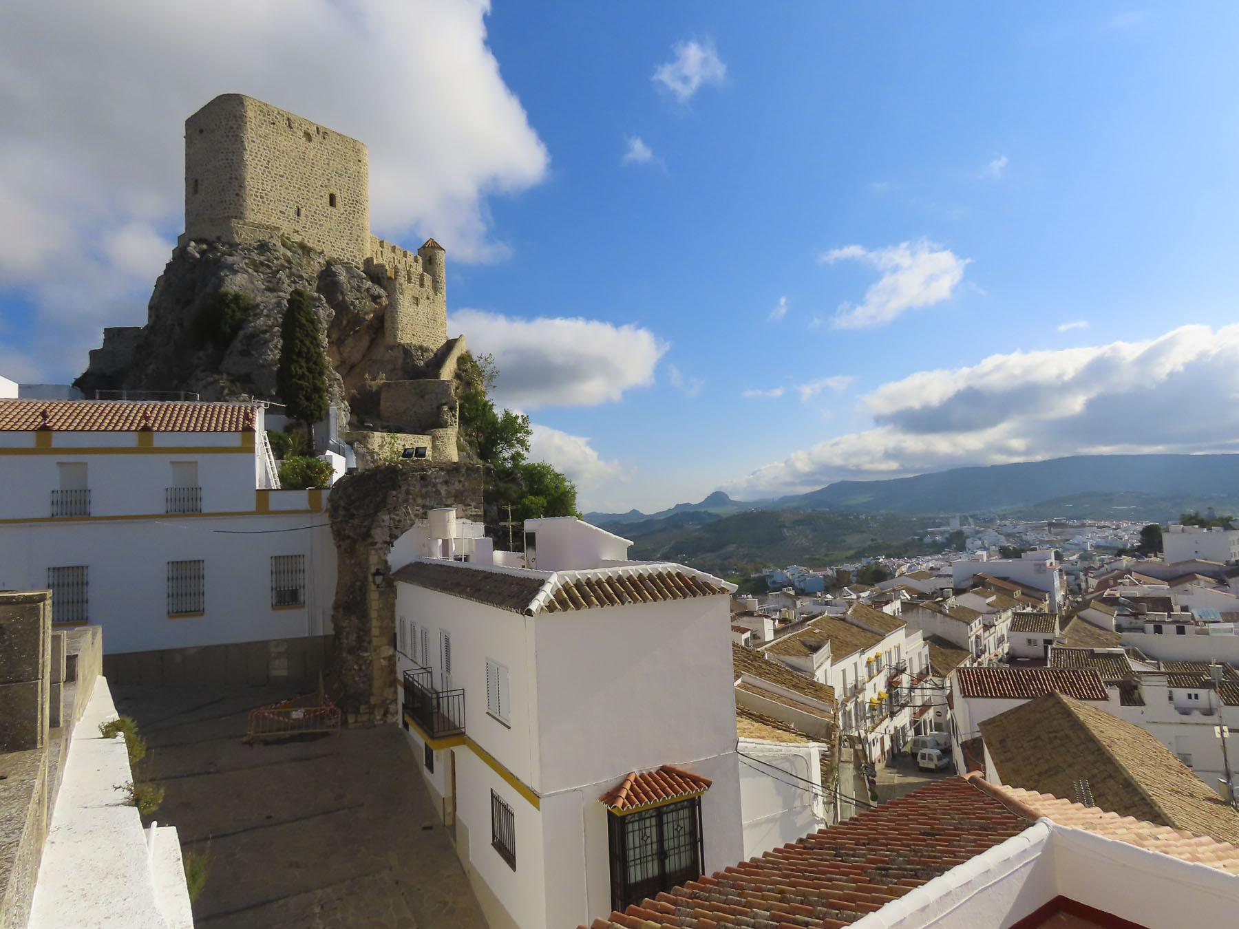


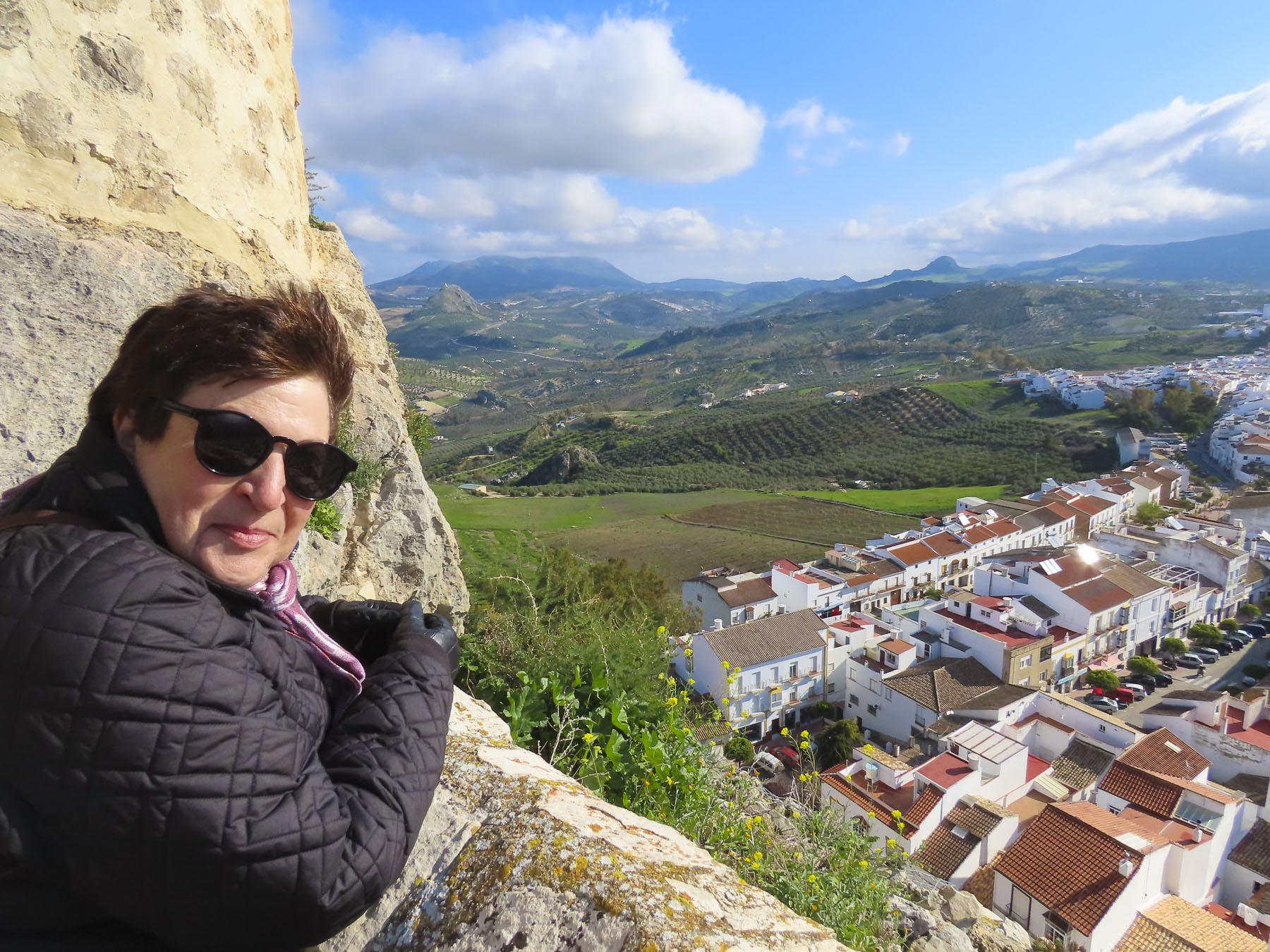
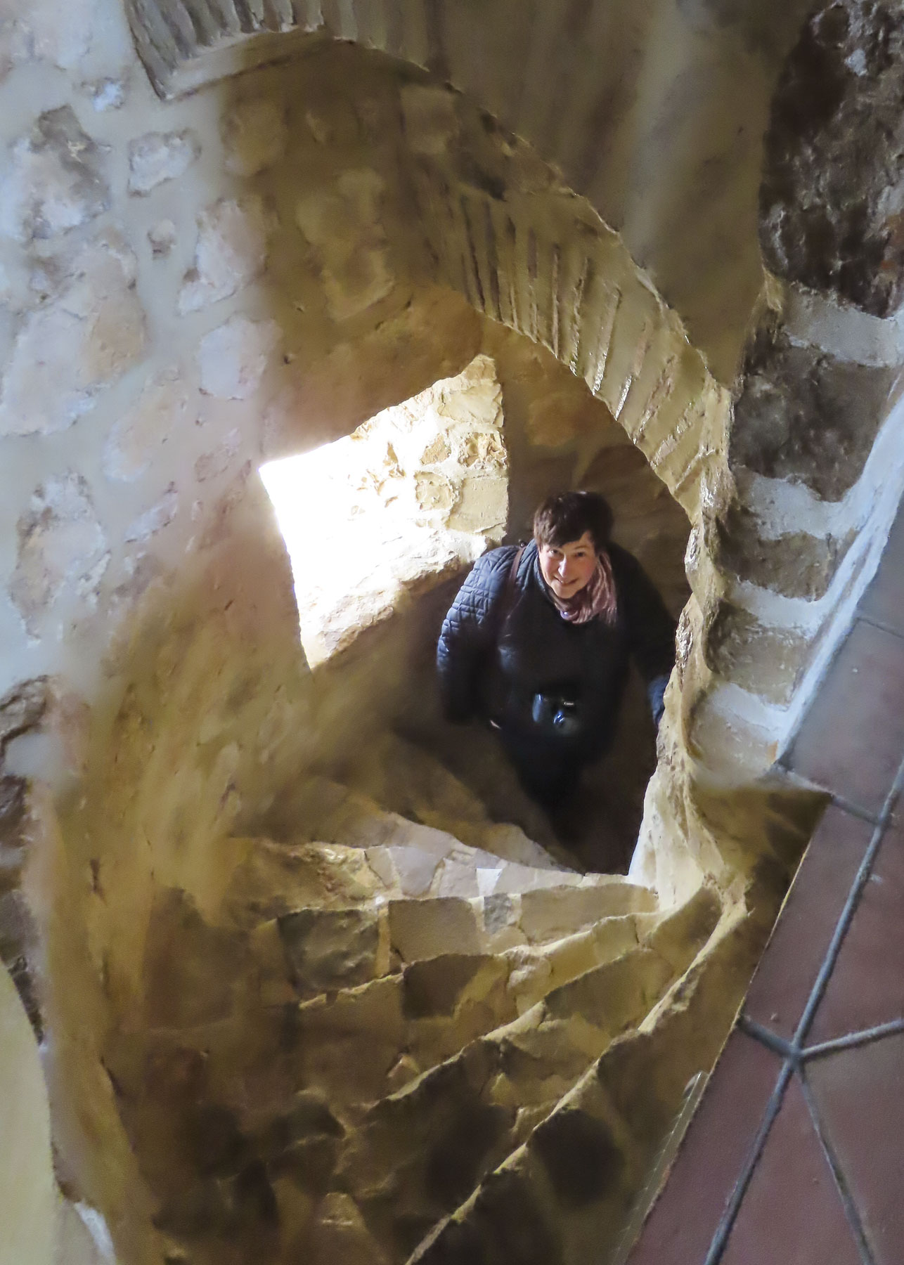

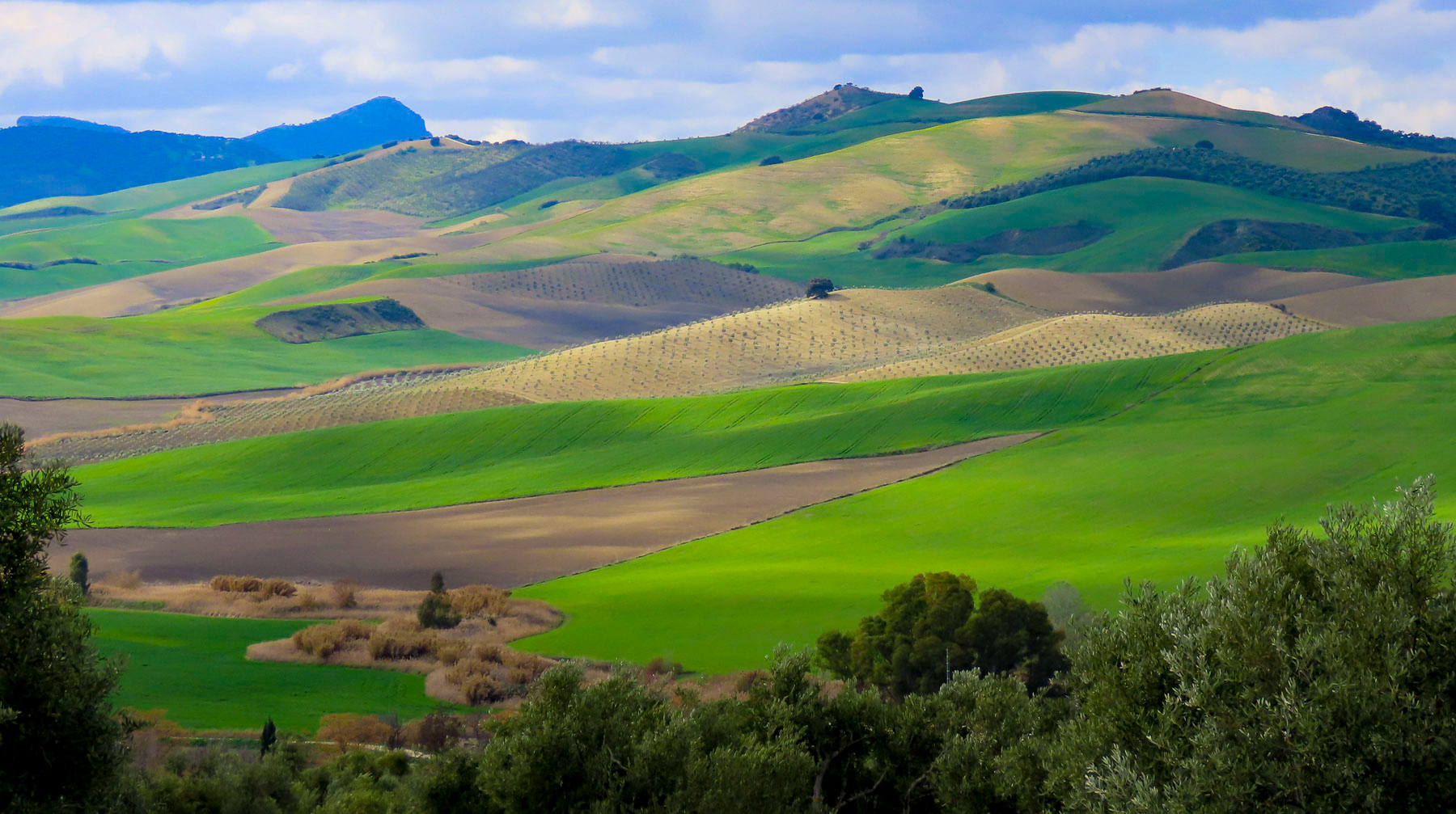


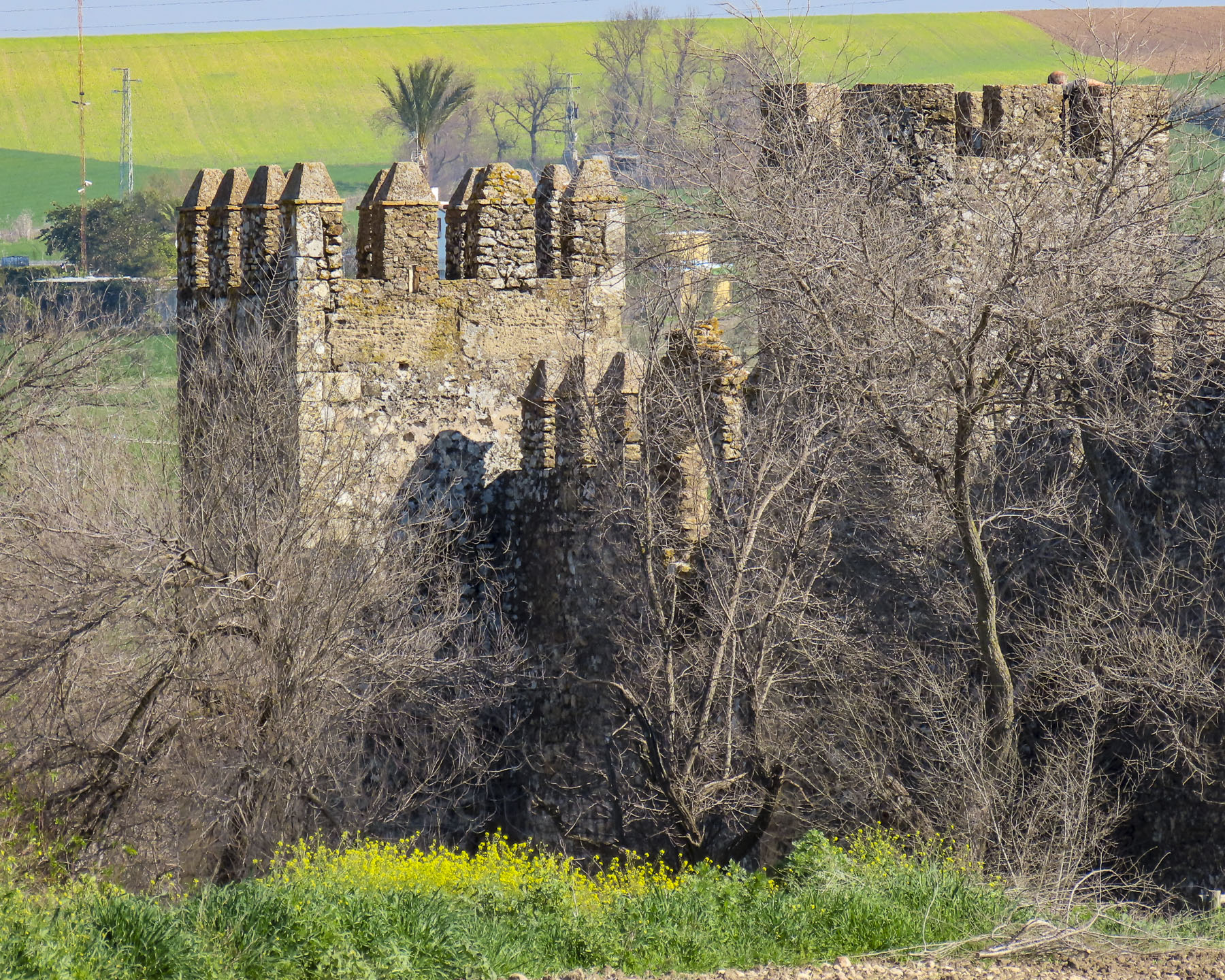


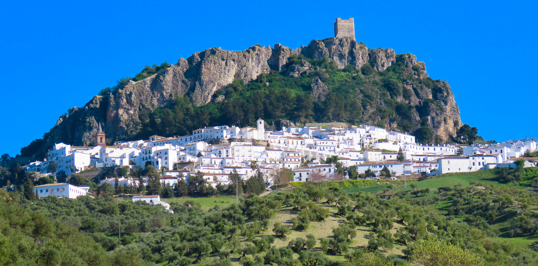


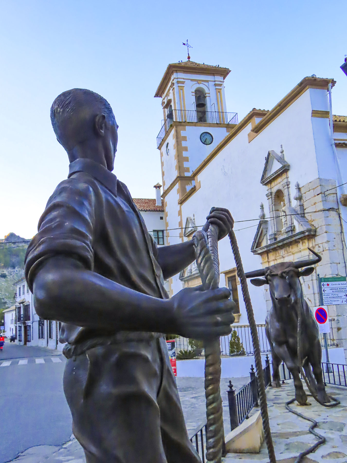


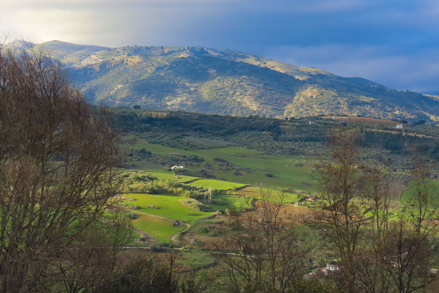


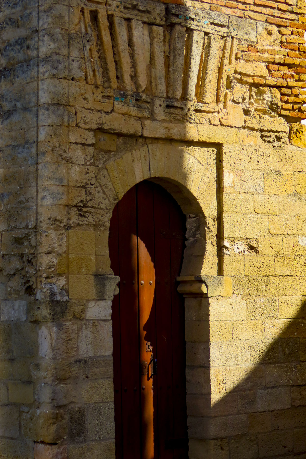


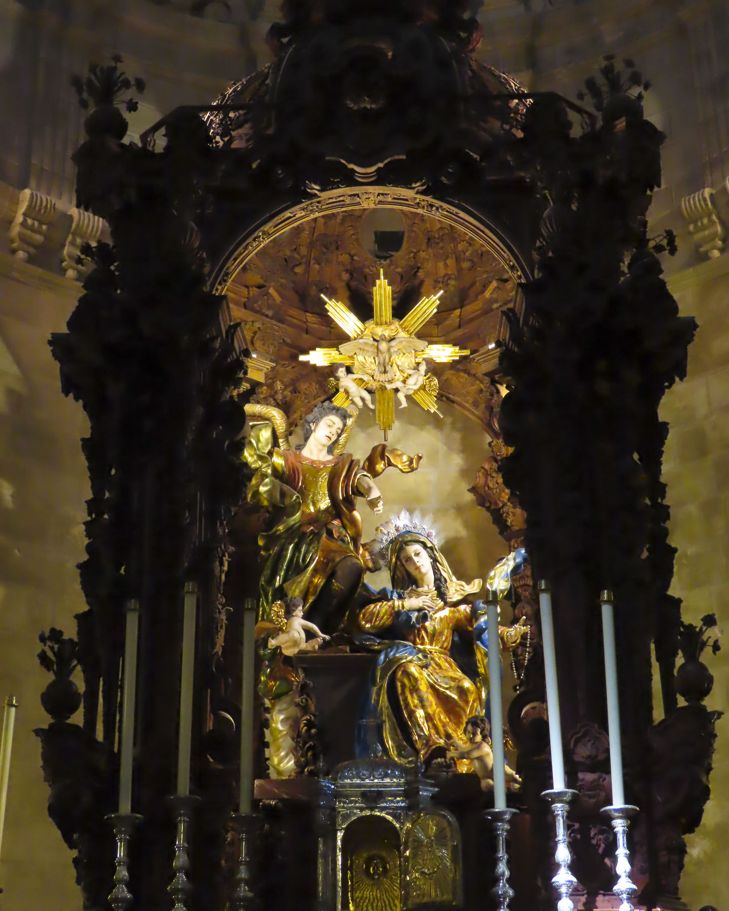

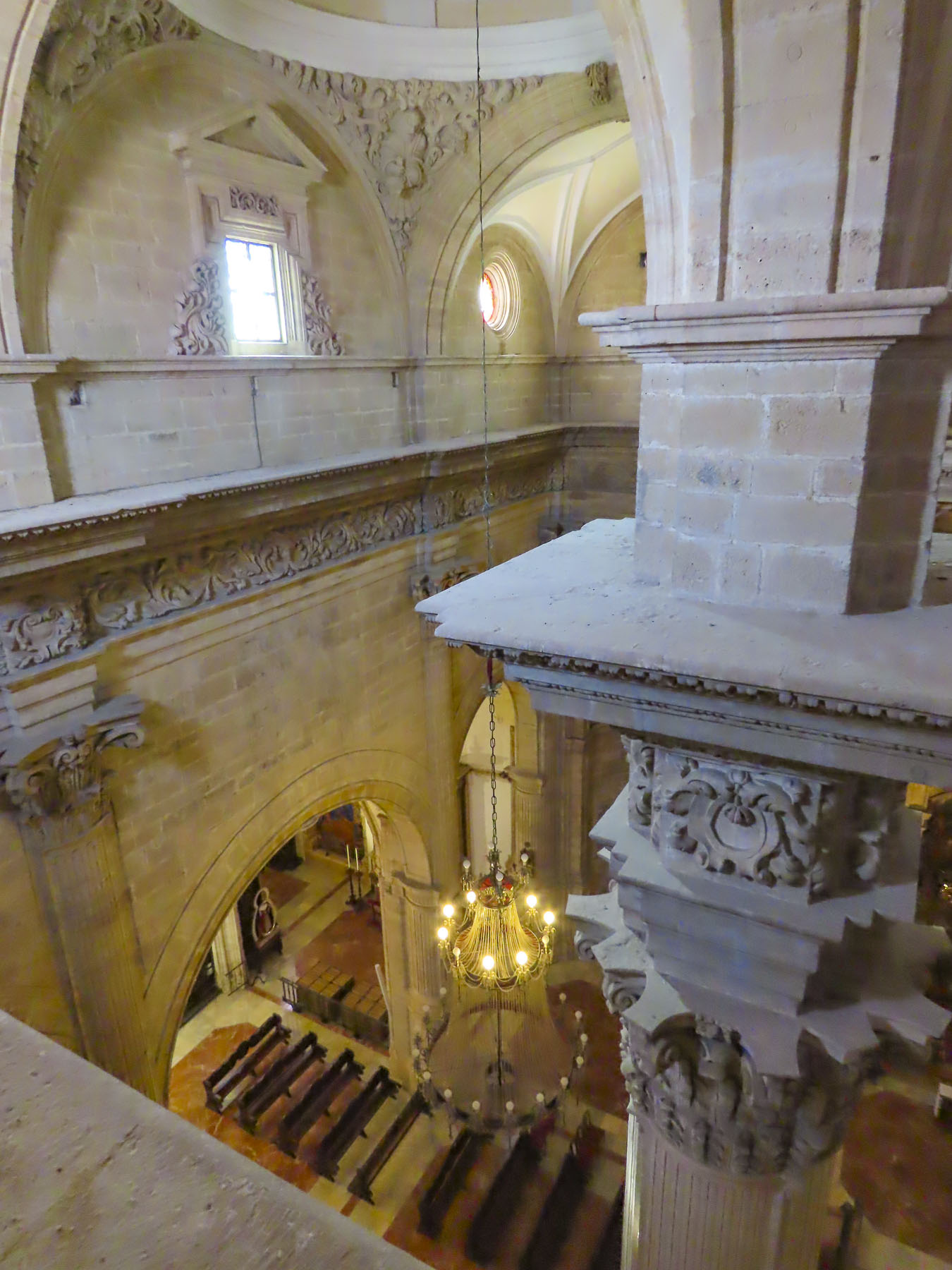


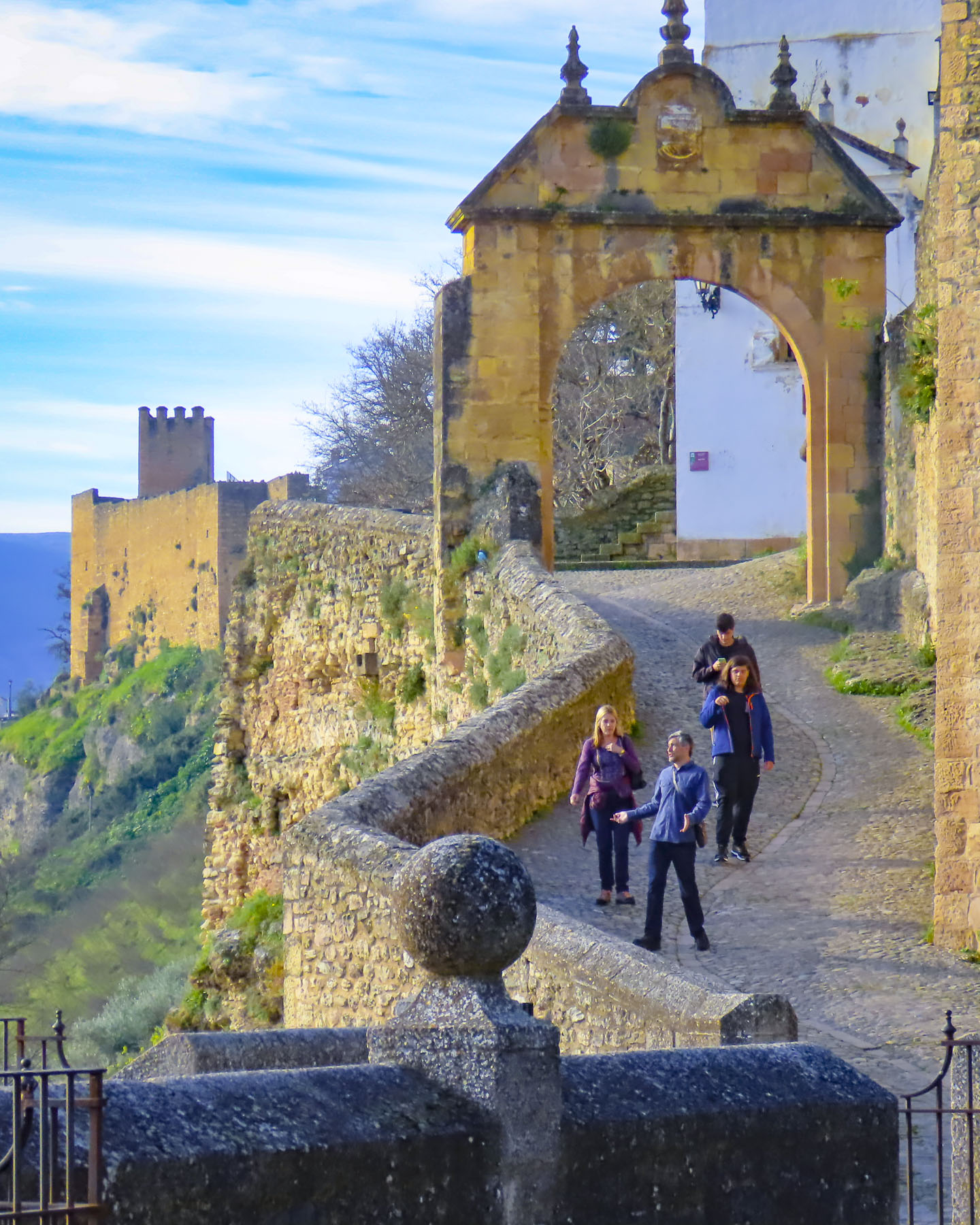

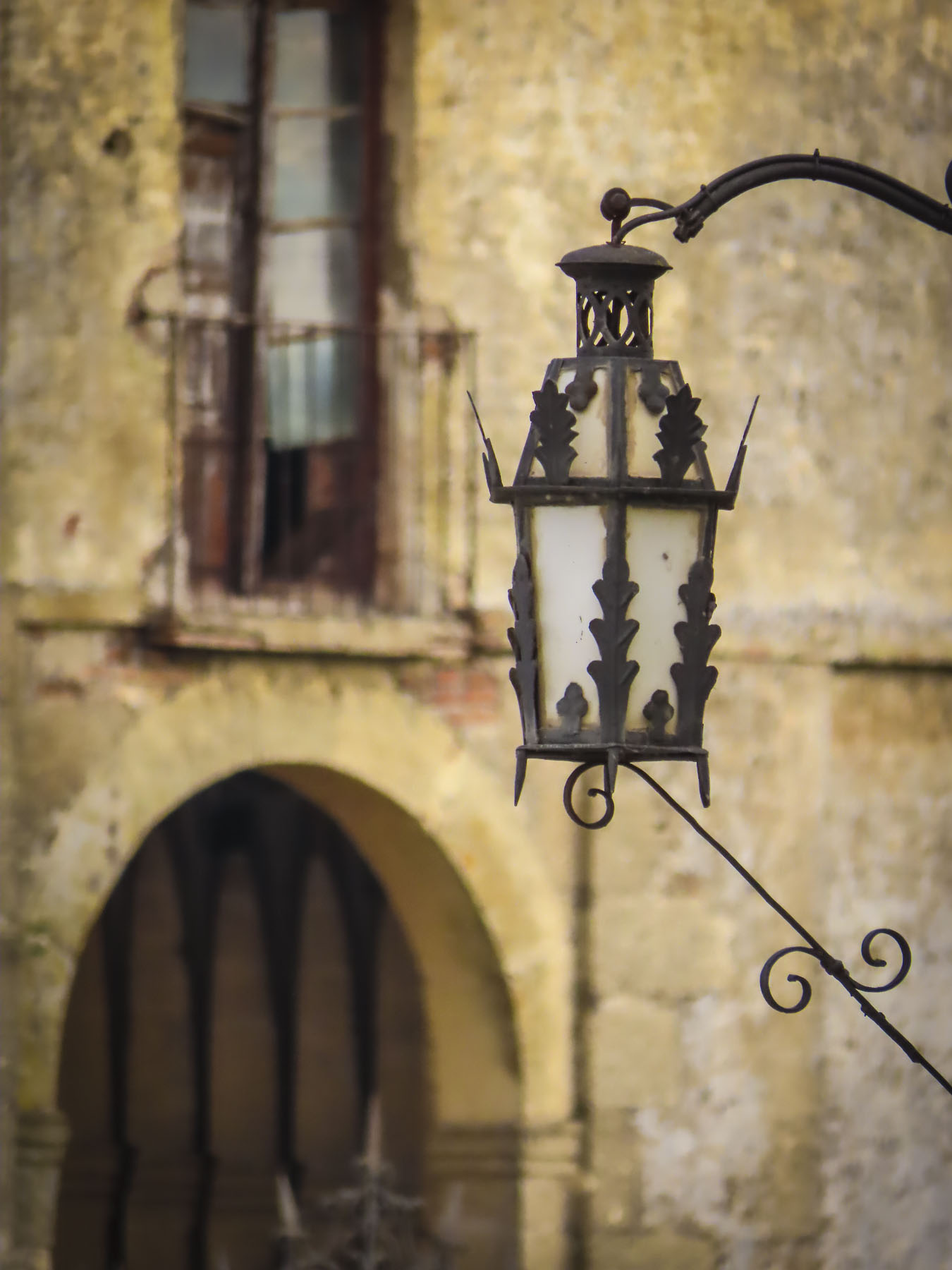


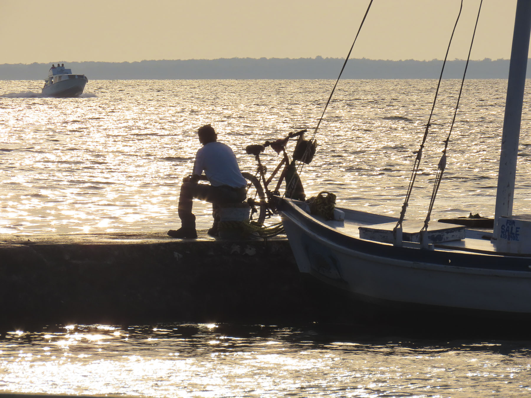
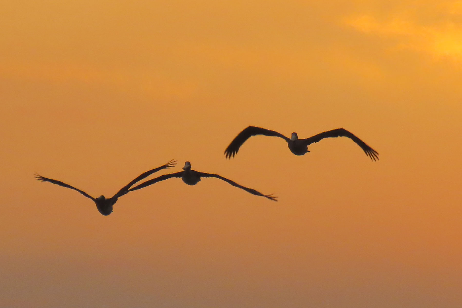


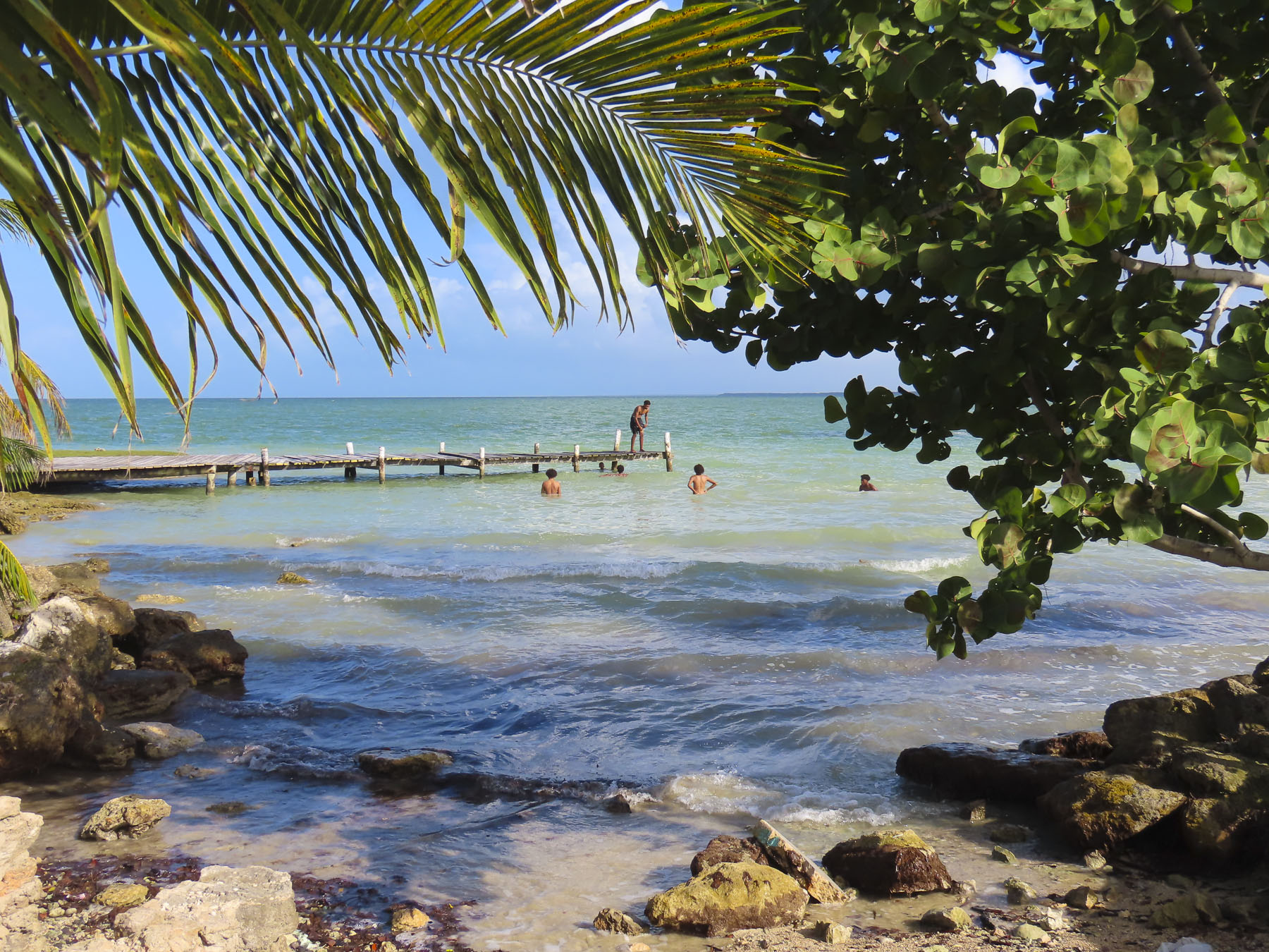


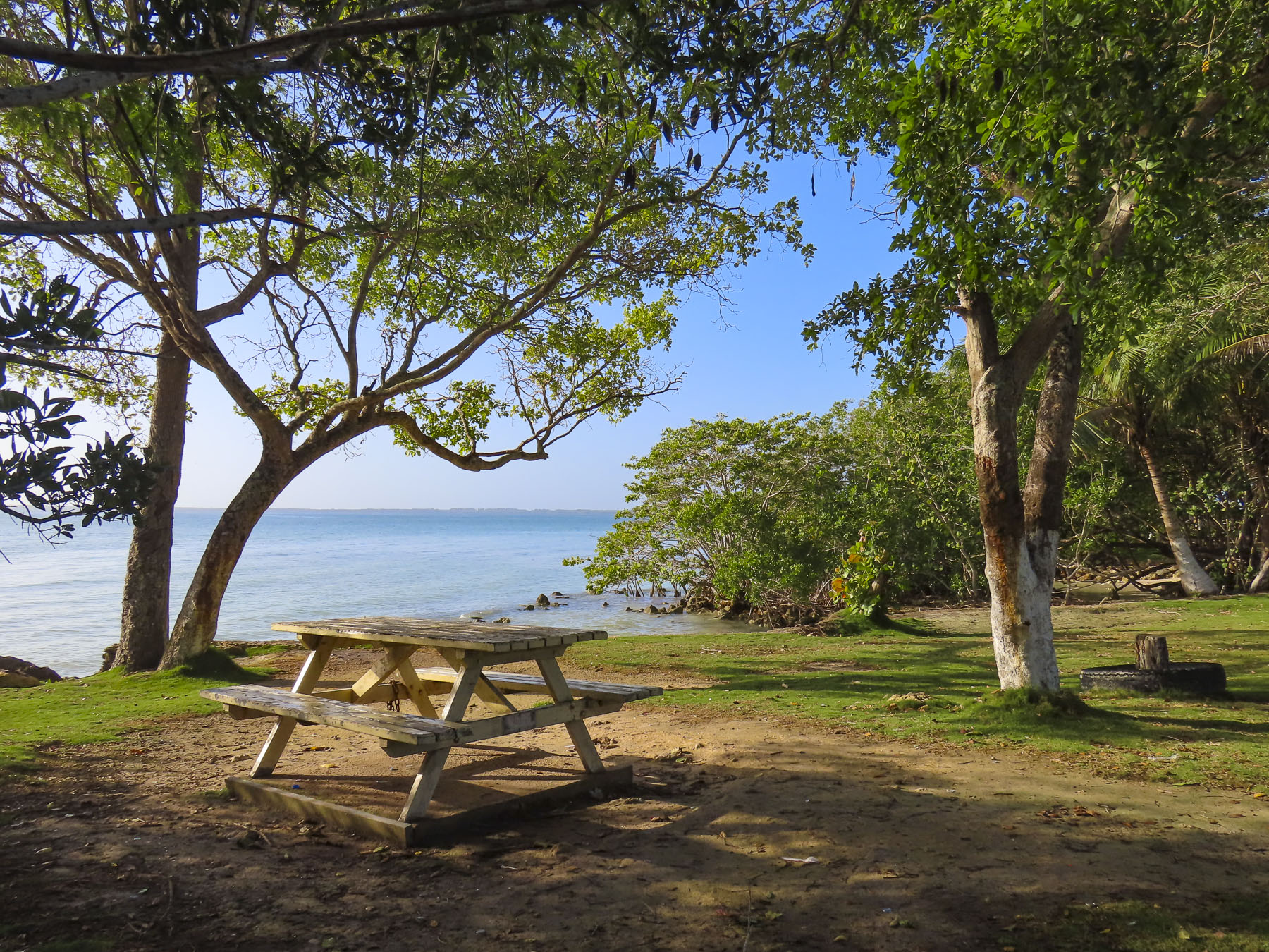
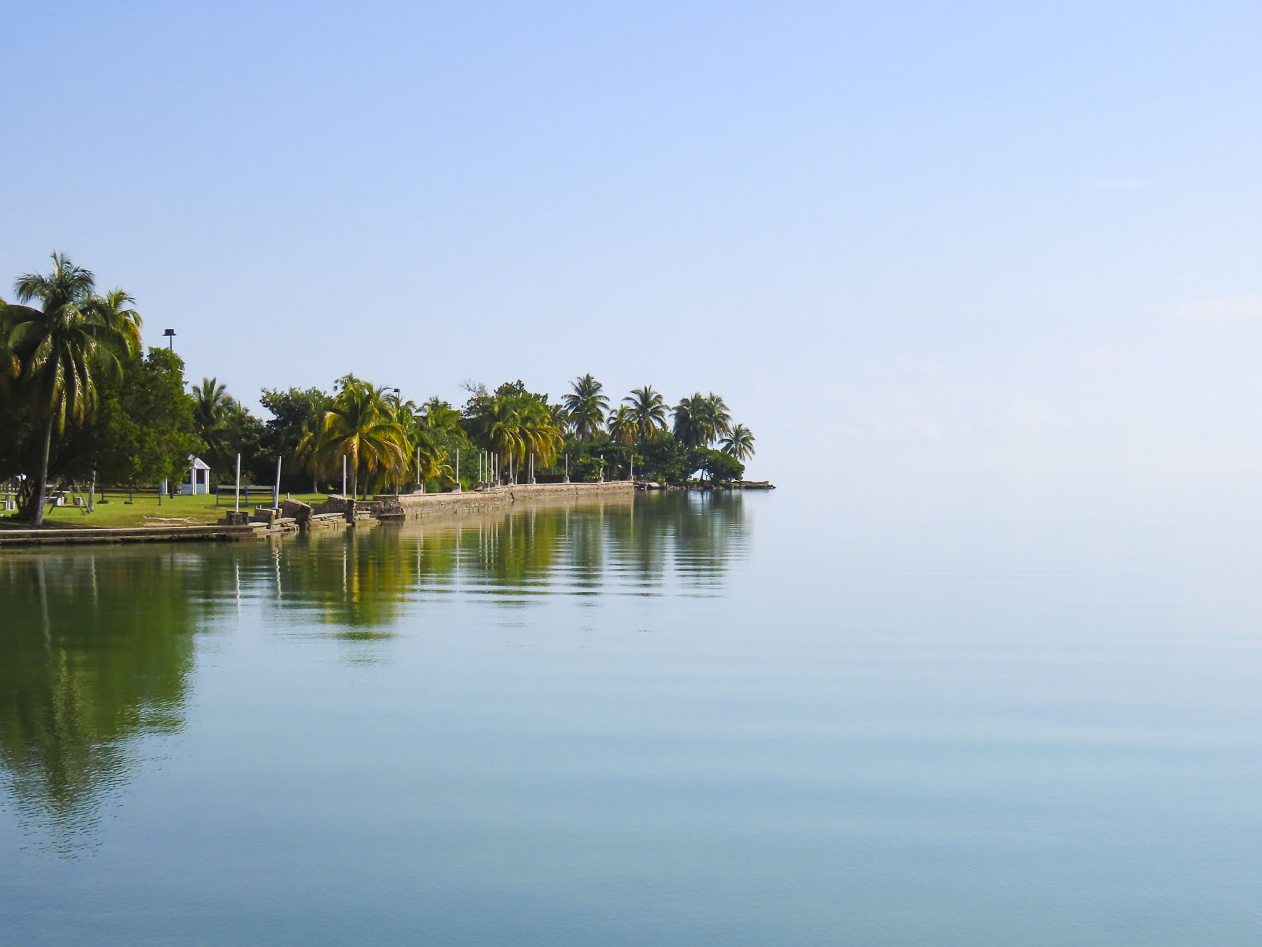


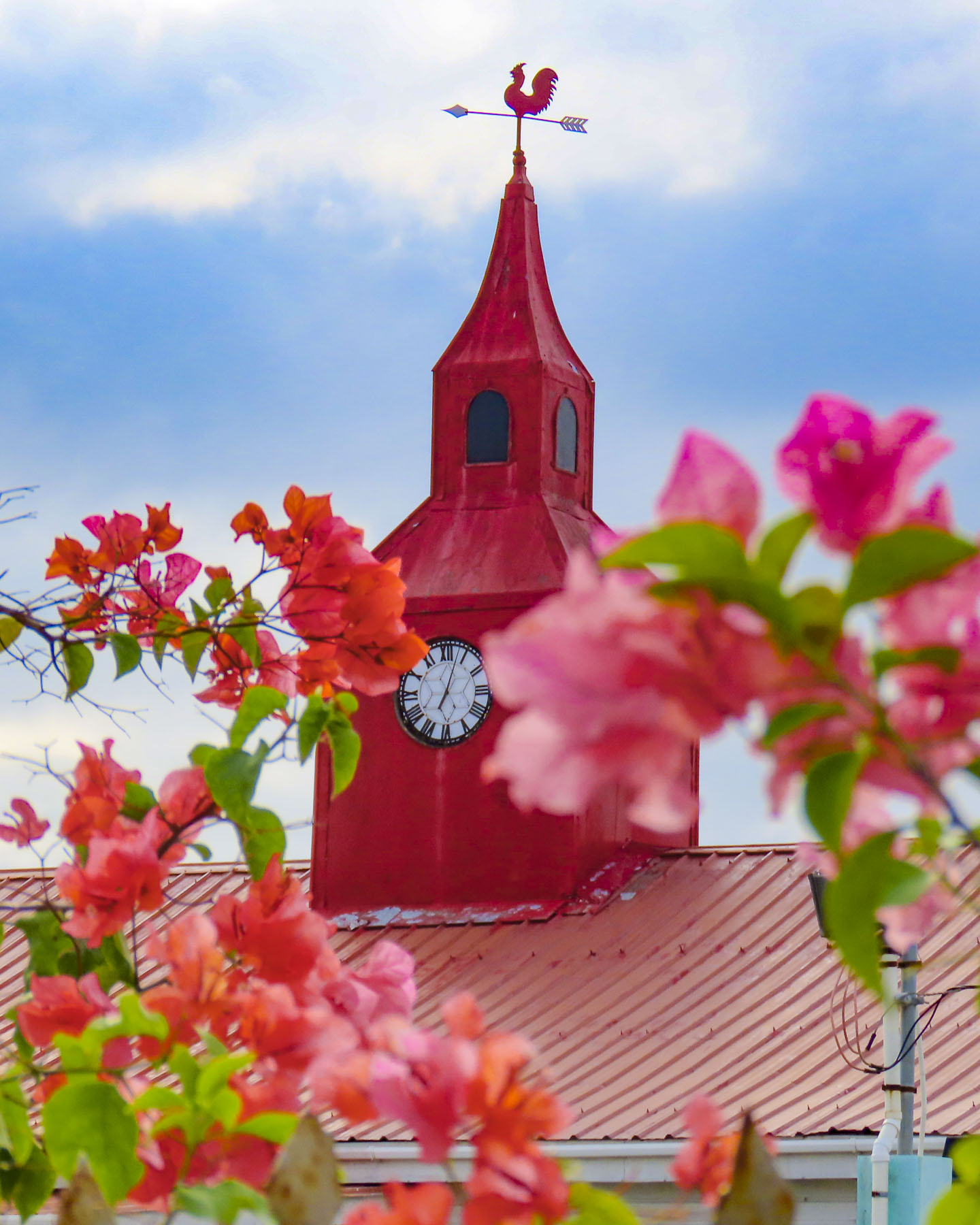
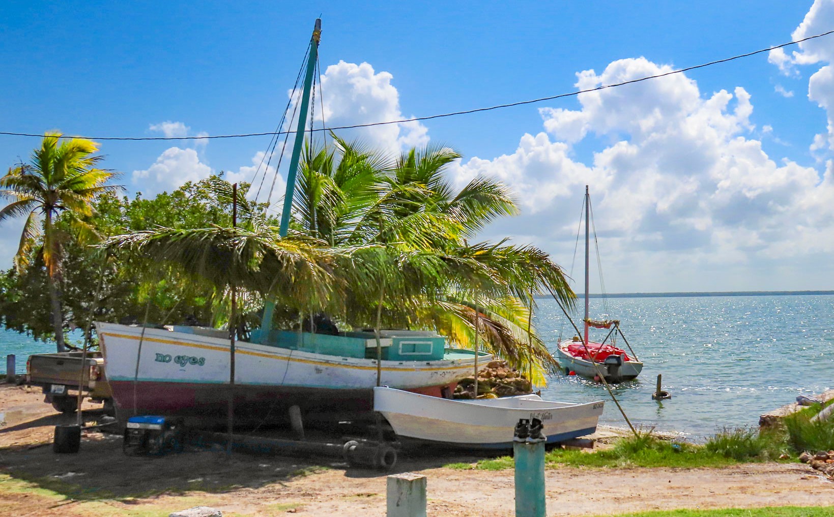


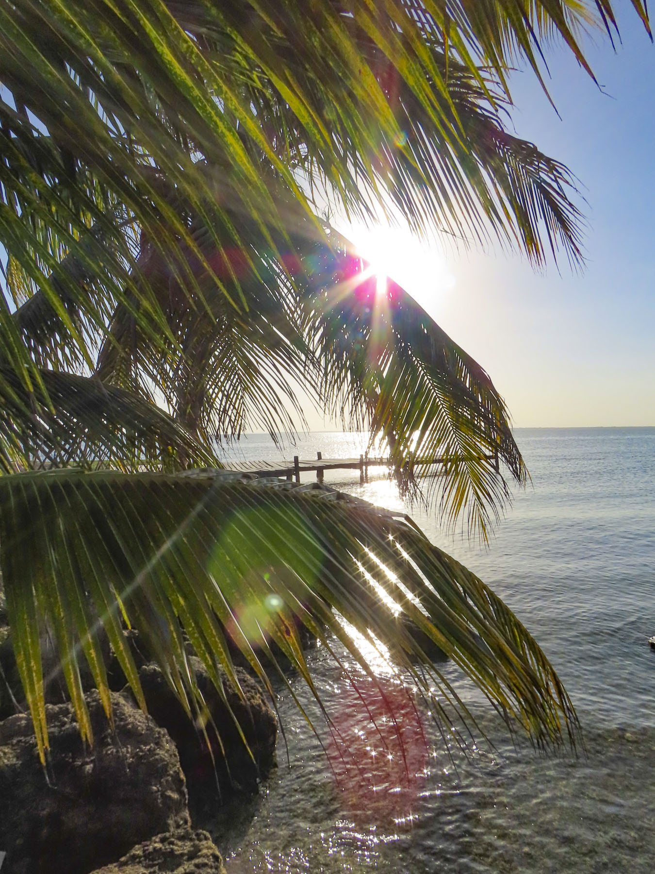


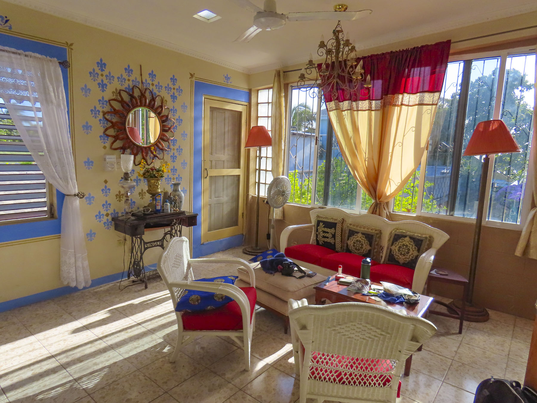


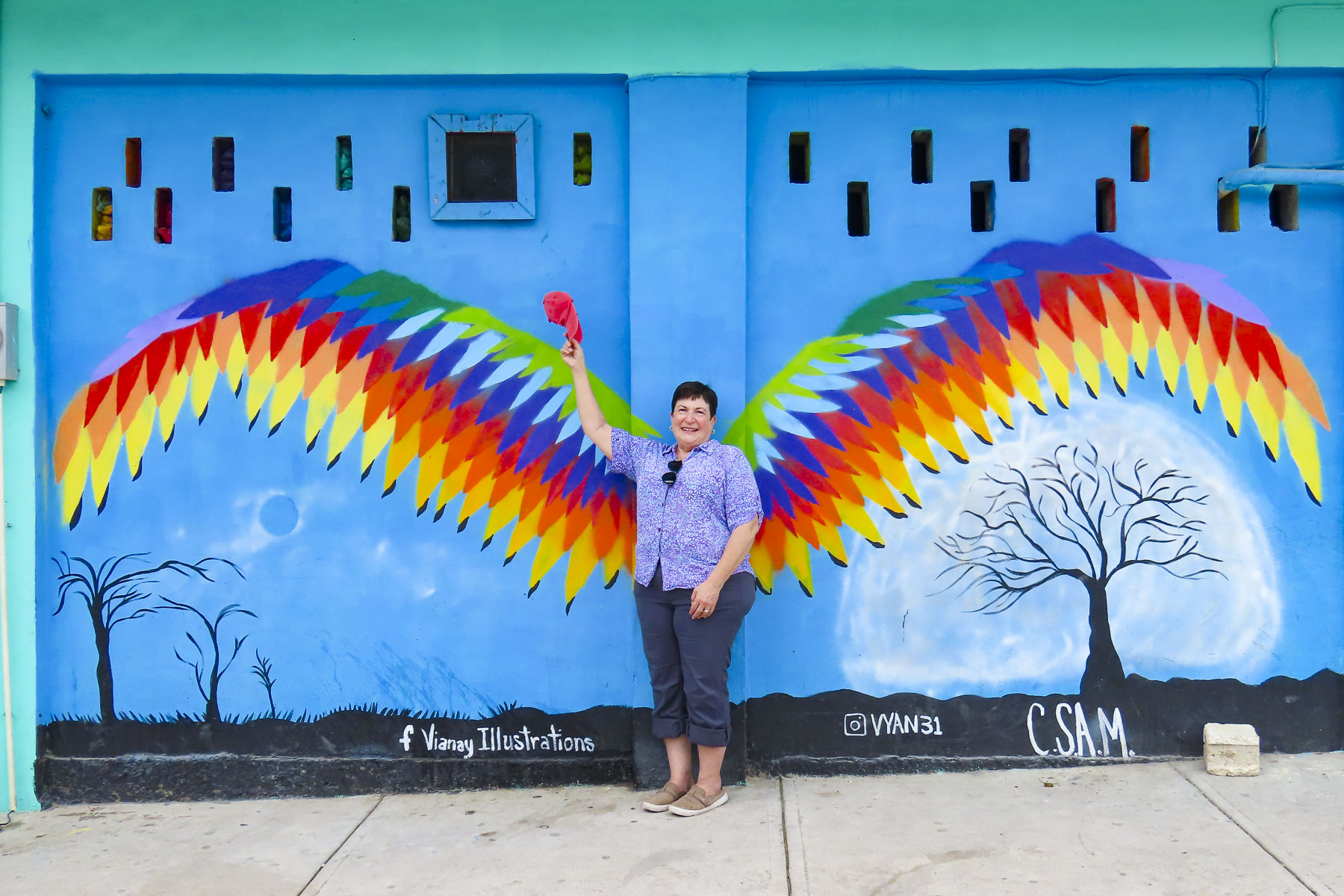


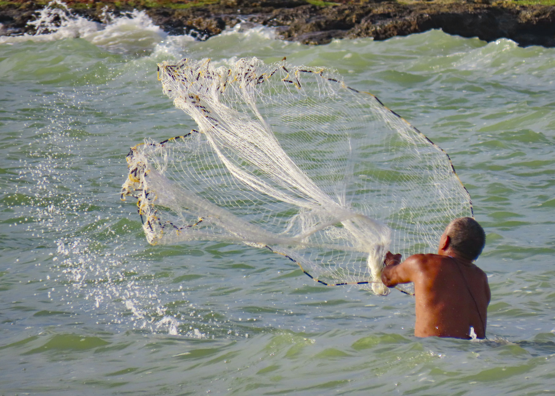


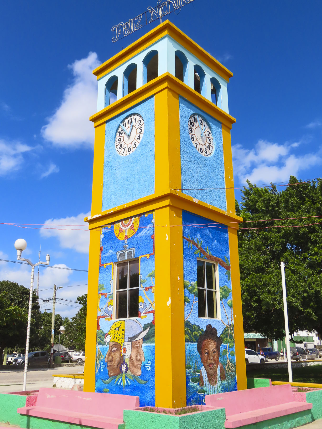


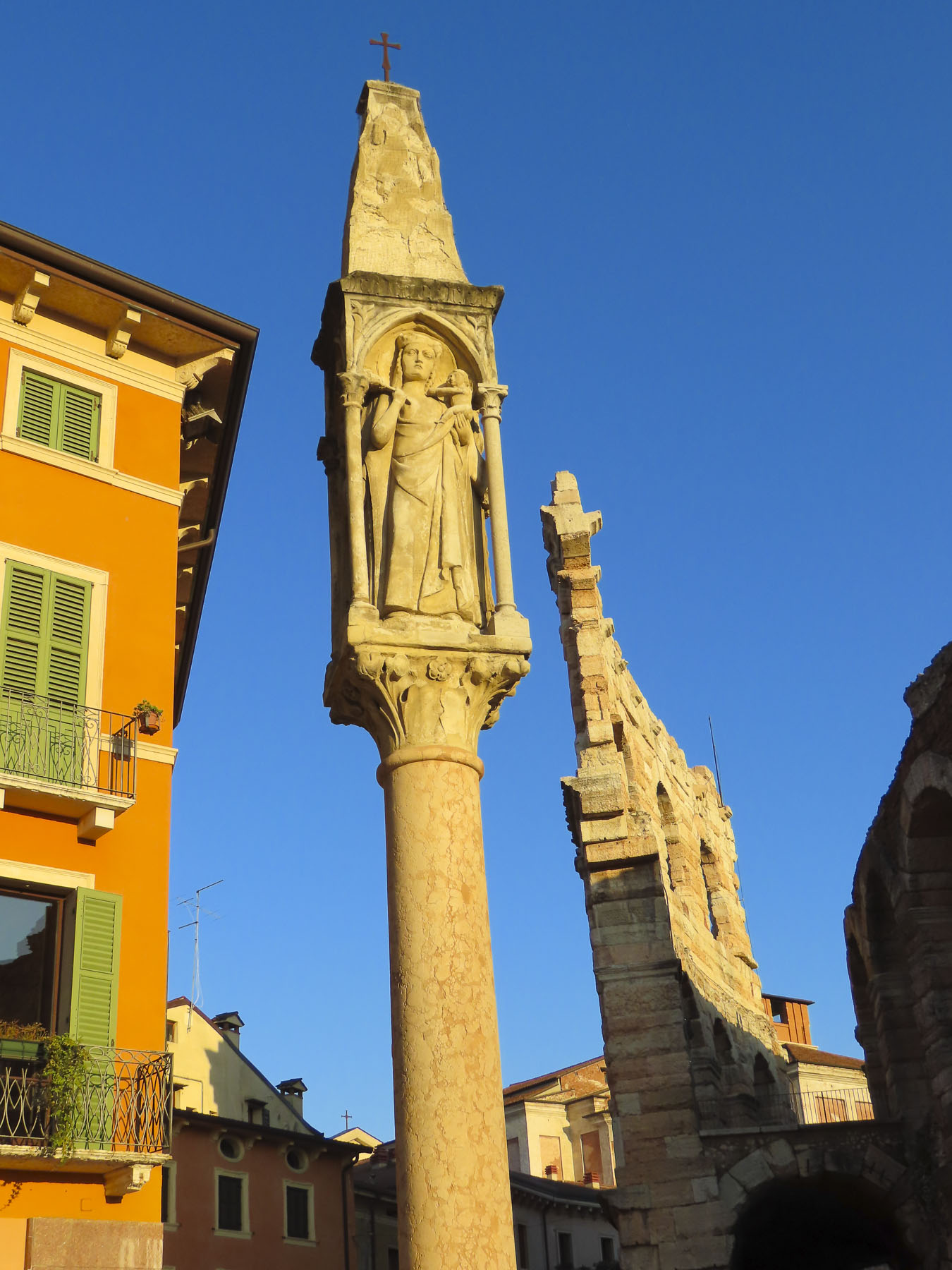
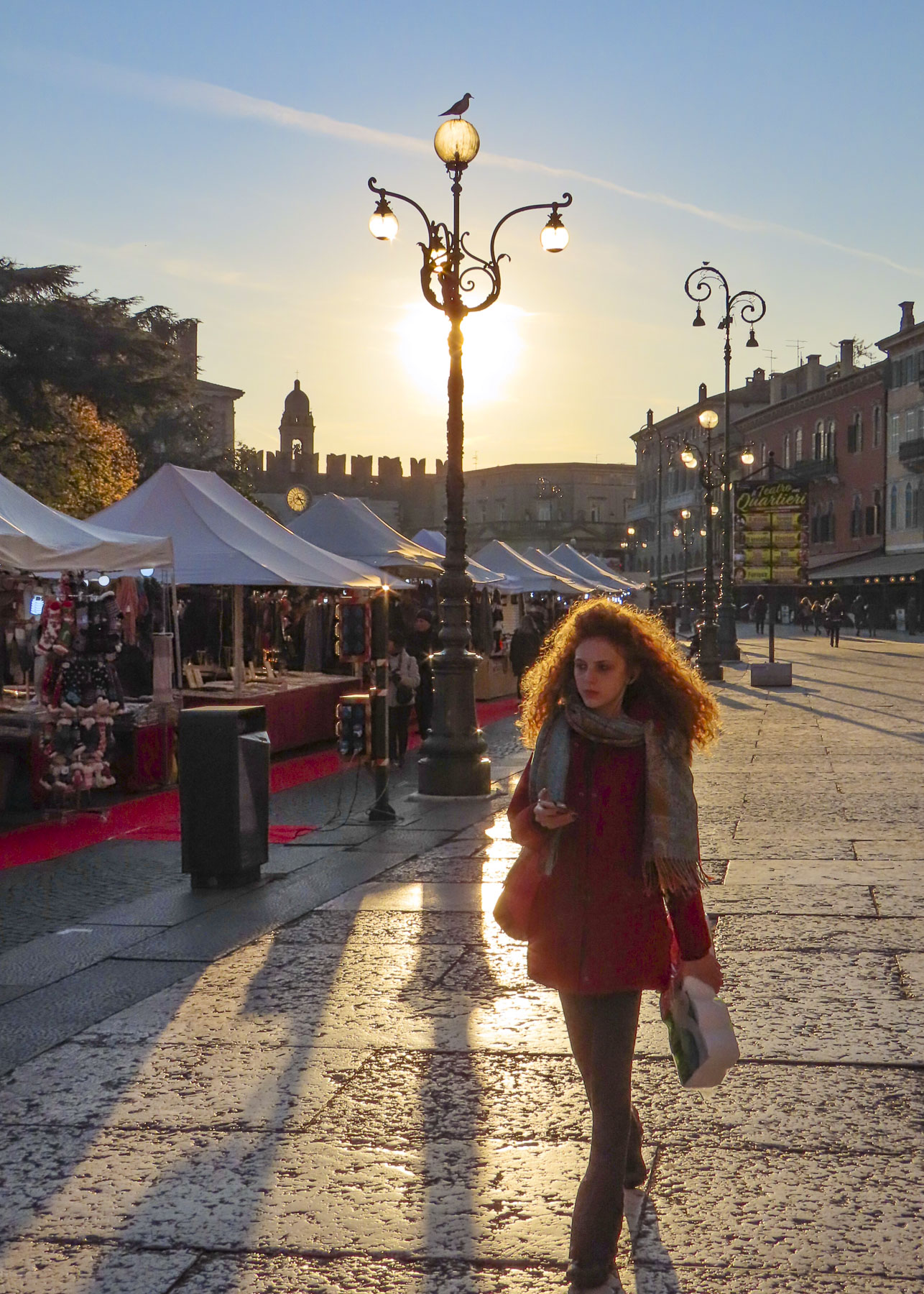

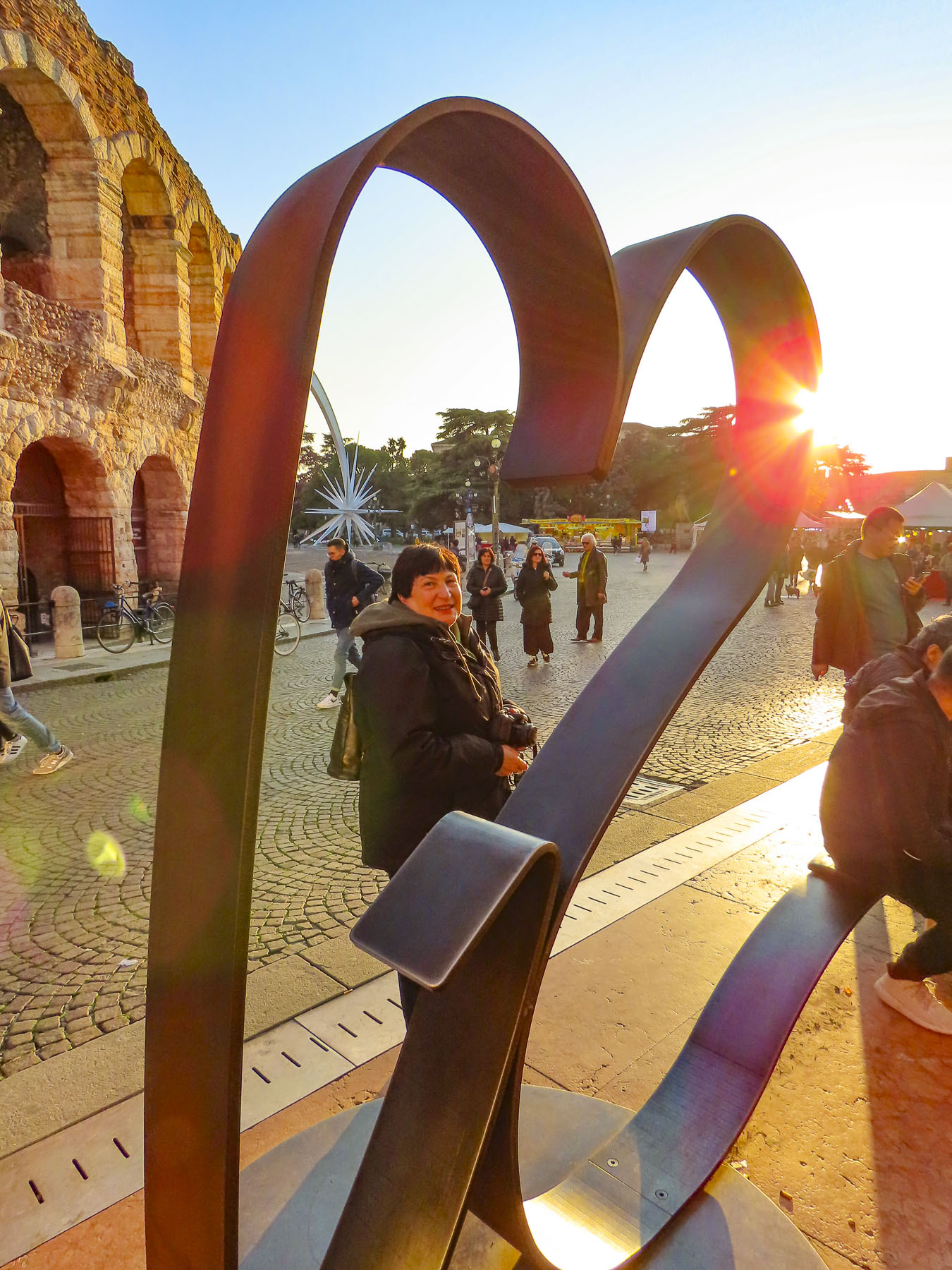

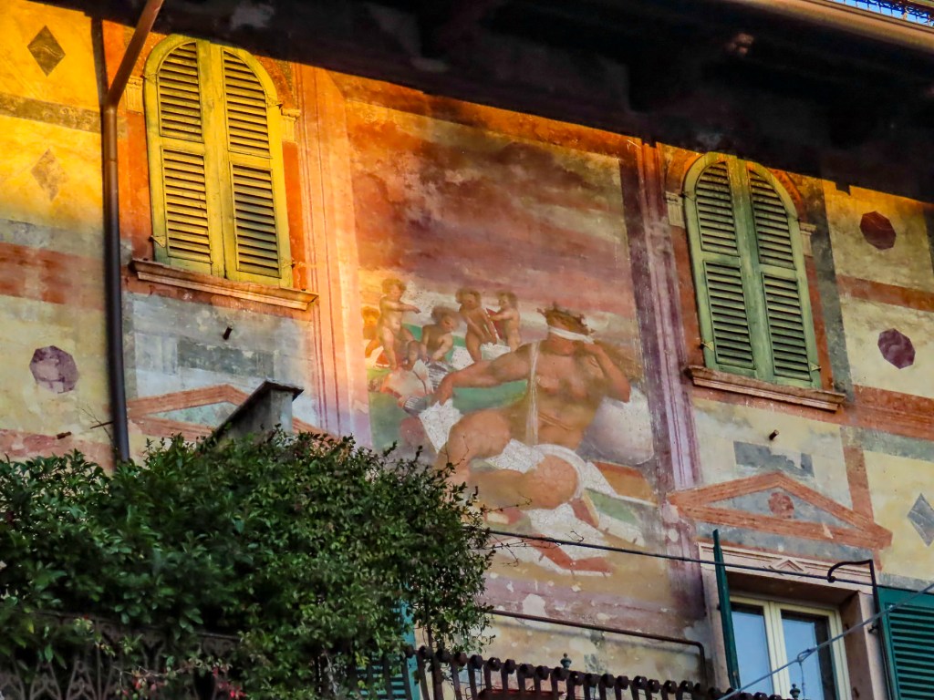


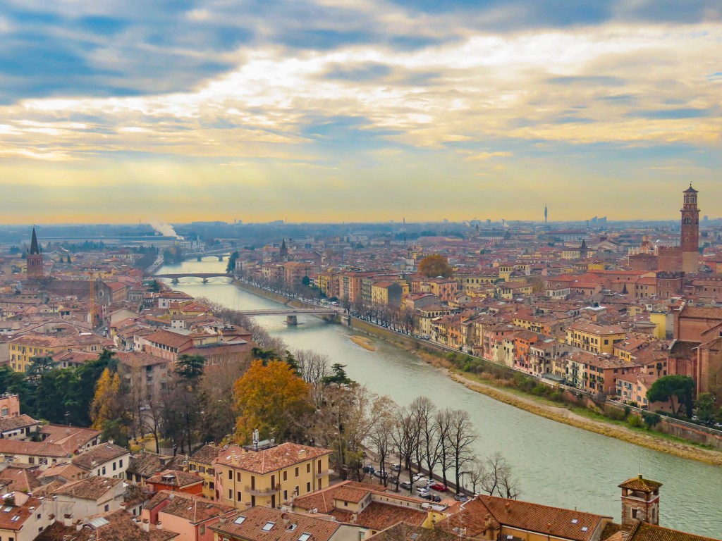
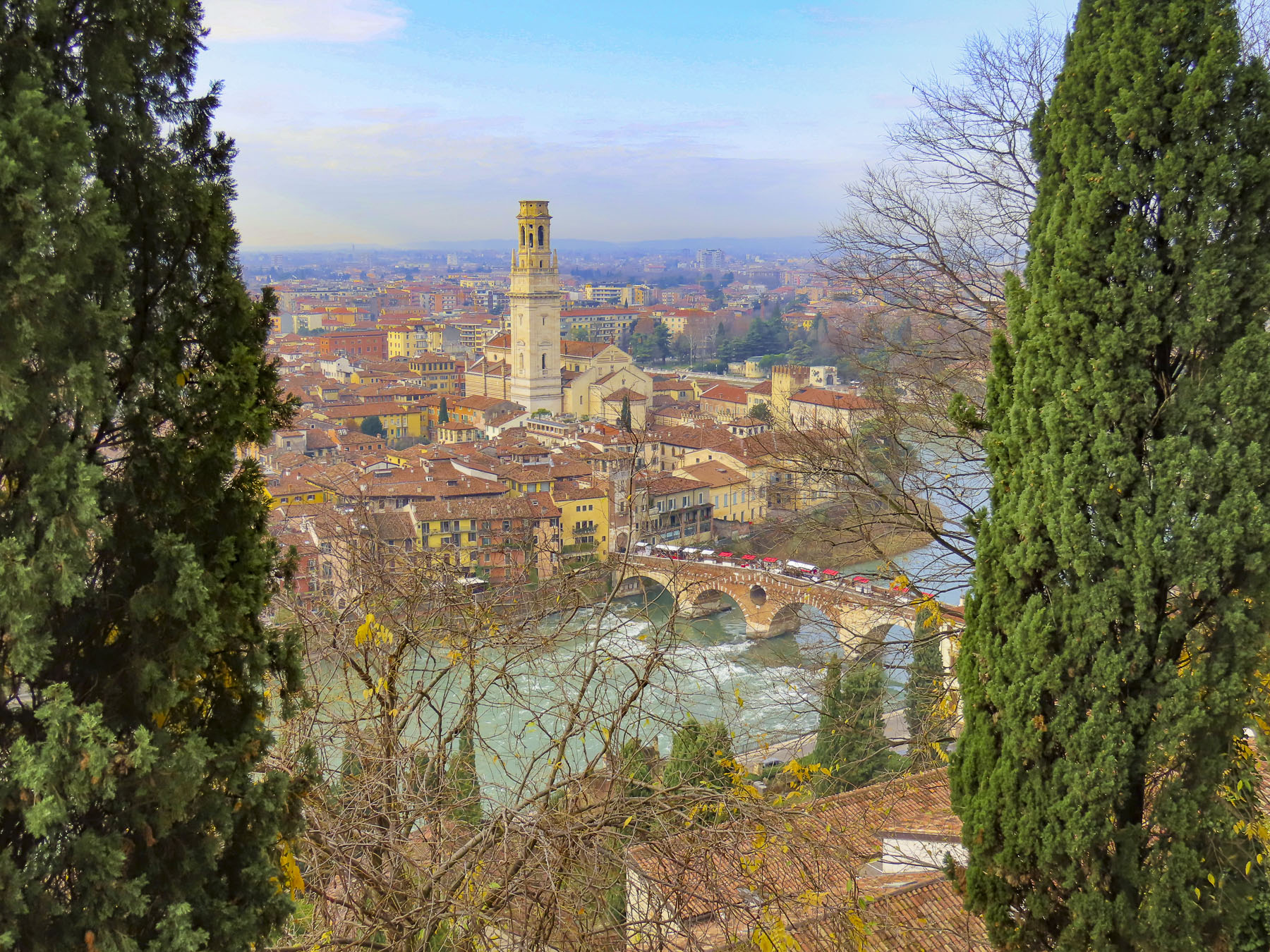


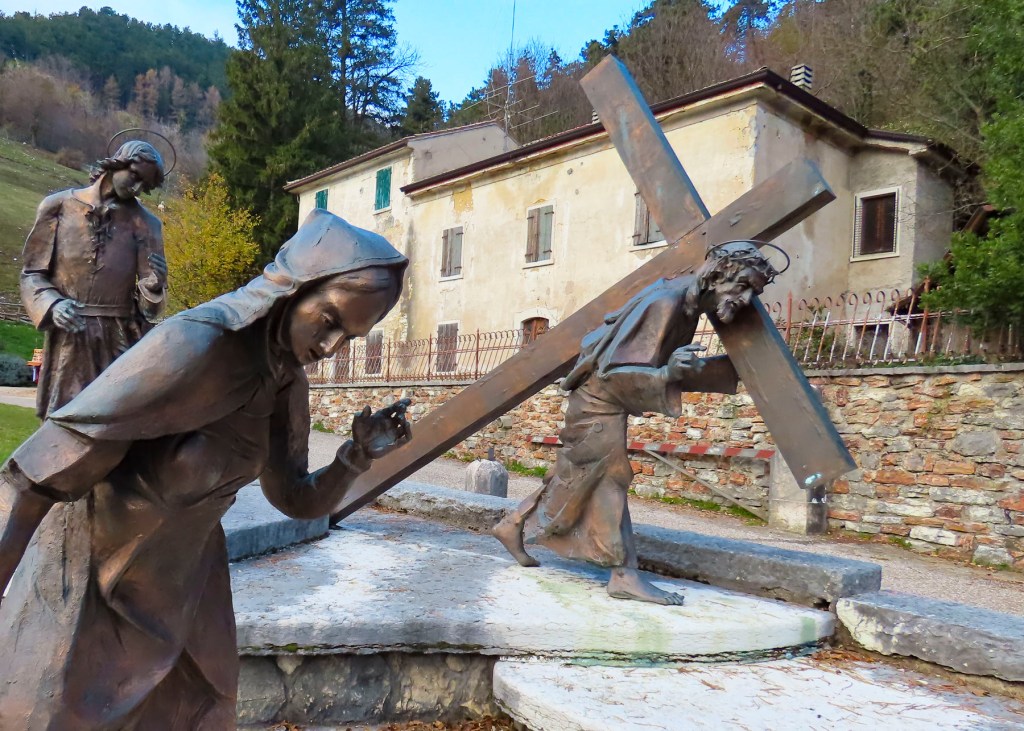

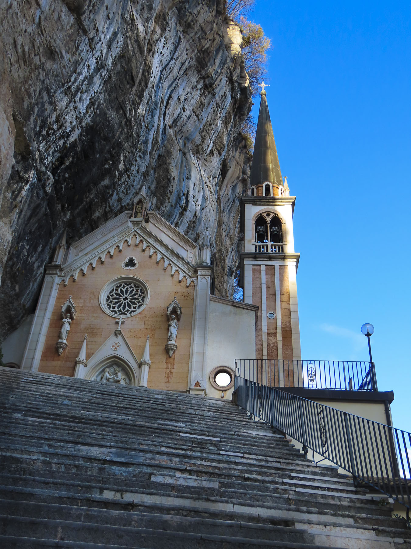


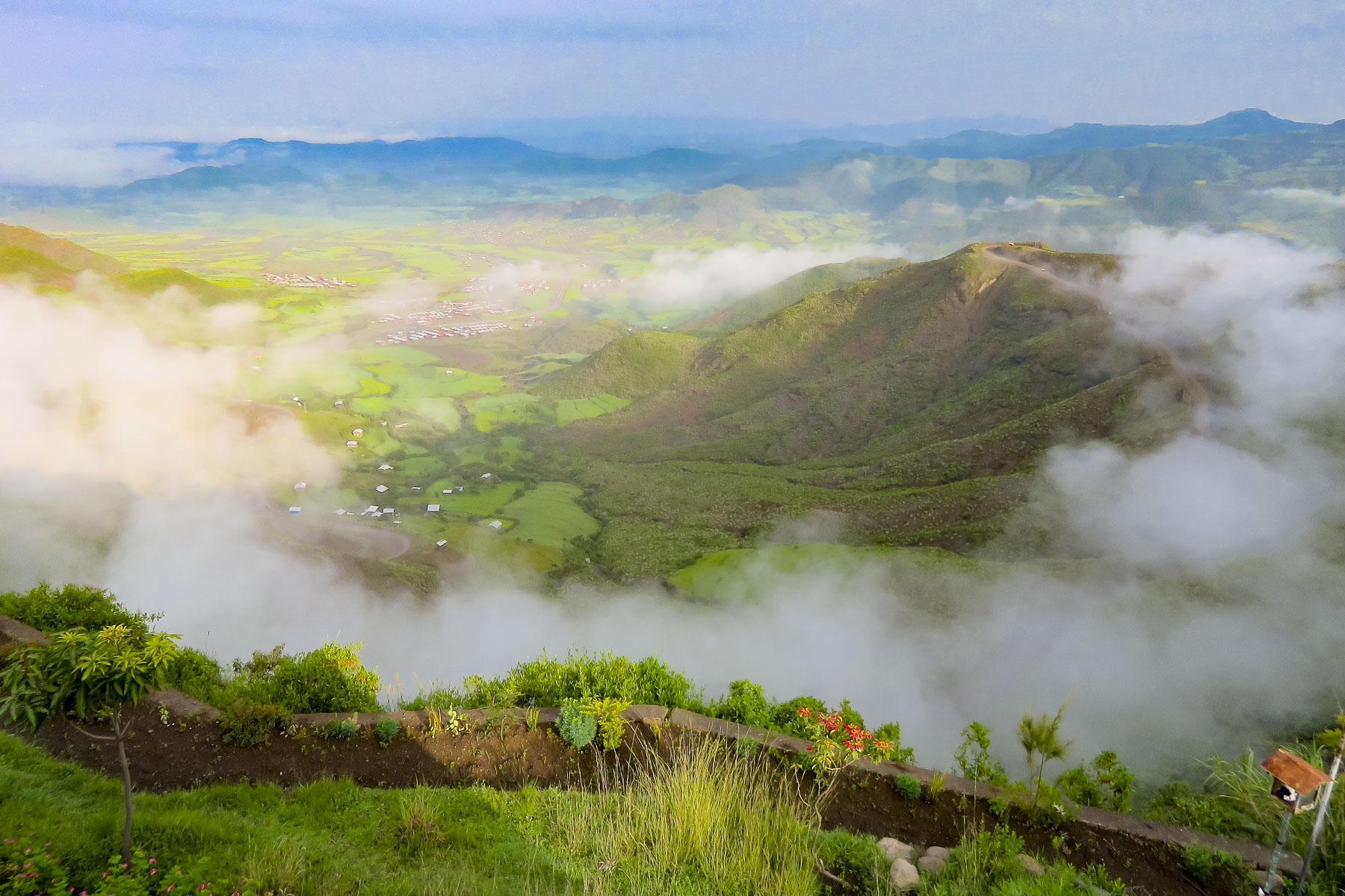 We started our day listening to bird calls and watching the morning clouds burn off from the valley below our hotel as the sun rose higher into the sky. The


 The shops were busy, and the roadside Ping-Pong games were in full swing as we departed Lalibela. The road into the mountains rose quickly from Lalibela into a semi-forested landscape. Too steep for crops, the land was used for cattle, which grazed on clumps of wild grasses on the hillside. We stopped at one clearing for the view and noticed a herder gently nudging his cows away from recently planted tree seedlings. “This is part of our government’s commitment to reverse deforestation and help mitigate climate change. It’s called the
  “On July 29th Ethiopians planted 350 million trees in a single day, a world record!” he proudly shared. “The farmers know how important this is and help shoo the cattle away, but the government has also chosen a tree seedling that doesn’t taste good.” This annual Ethiopian project is part of the African Union’s
 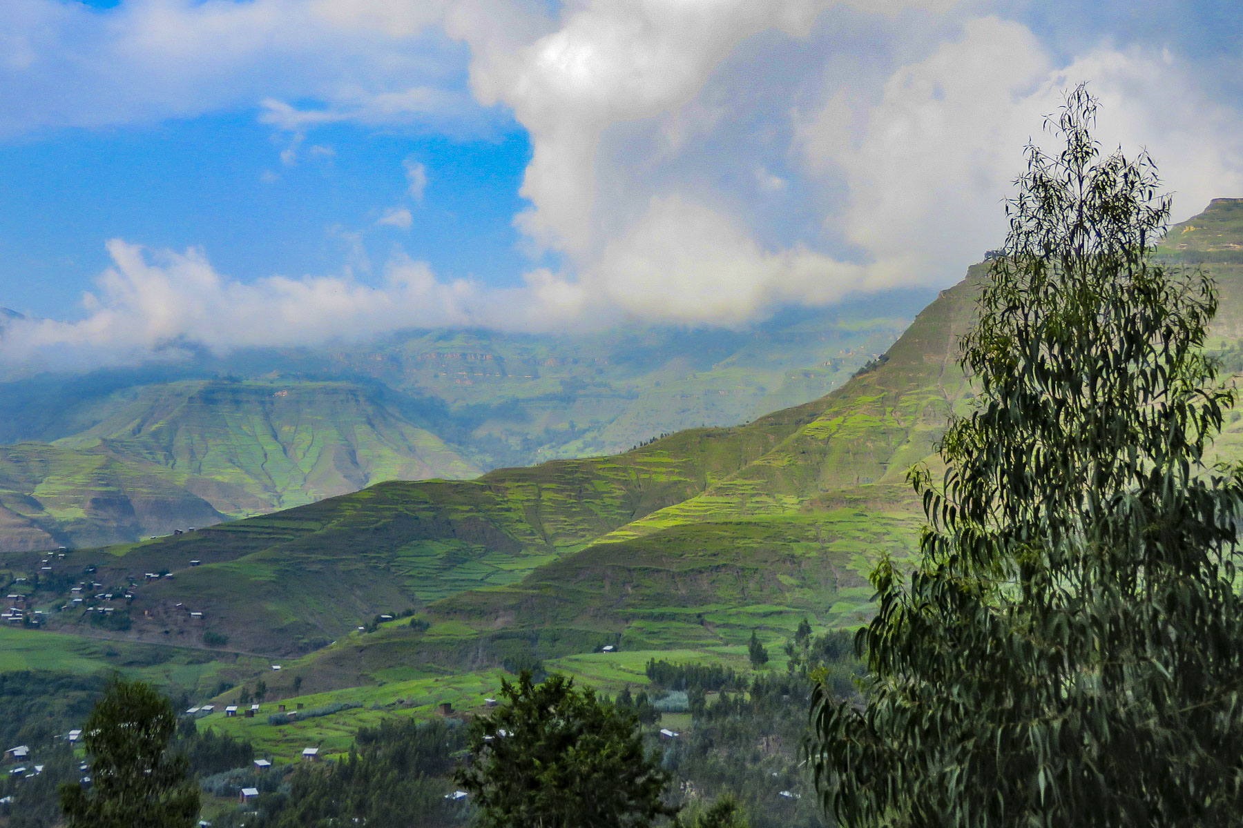 The road deteriorated after this, with deep mudded ruts tossing us from side to side regardless of how slowly we navigated through, over or around them. Our “rattled tourist syndrome” is the most appropriate way to describe the ride, while optimists might refer to it as an an “African deep tissue massage.” We were the only truck to park at the trailhead to the Asheten Mariam Monastery and were greeted with children selling handicrafts, and young men renting walking sticks and offering to accompany us on the hike.
 Confident in our abilities we declined, but they tagged along anyway. This was a good thing. What our guide had forgotten to mention was that there was a short steep section at the beginning of the hike, before it leveled off. Within minutes, between the altitude and the terrain, our hearts were pumping and my wife, who struggles with asthma, was gasping for breath. We are unfortunately not the 7 second 0-60mph vroom, vroom of a 1964 Corvette anymore, but more like the putt-putt of a classic Citroën 2CV. We get there, eventually. So, our guide, forgetting his youth and our age, led the way from a distance, as if he was channeling
  It was at this point that my wife spoke up. “Girma, you must think of me as the same age as your mother.” Instantly, his attitude became very solicitous, and he smilingly offered her a hand or other assistance at every opportunity. We marveled at the agility of the local kids. They nimbly scampered up and down the trail, easily outdistancing us, in order to set up their little trailside displays of carvings and beadednecklaces. When we didn’t purchase at first, they simply packed up and reappeared further up the trail. We had to reward such perseverance with a couple of purchases.
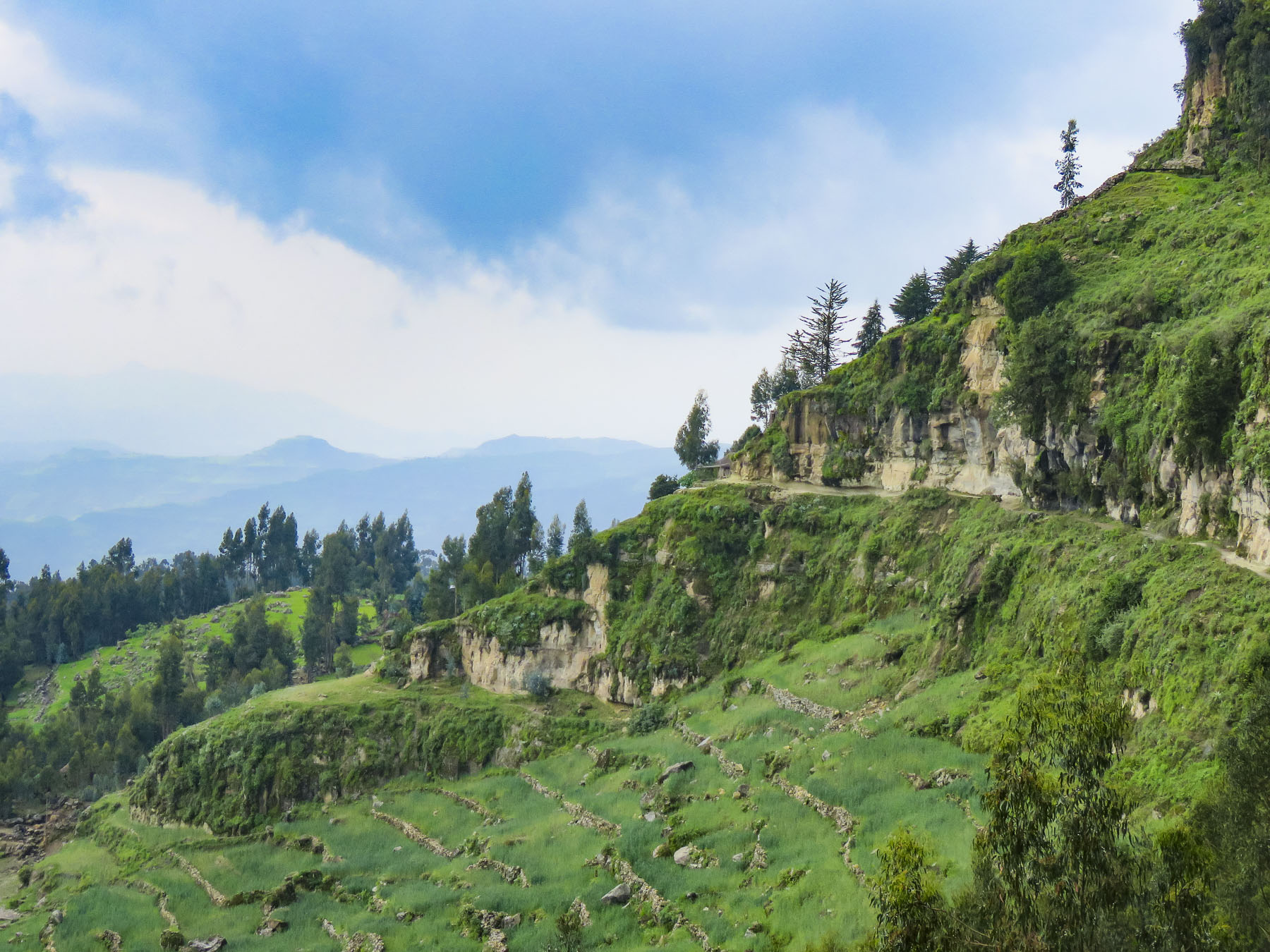 Meanwhile, we regained our pace as the trail leveled off and tracked along the base of a cliff face that fell away to terraced farmland far below. The incline of the trail continued to rise; the walking sticks were now invaluable in helping us steady our footing on the rough path. Around a curve the trail abruptly narrowed at a sheer rock wall broken by a vertical chasm, slightly wider than our shoulders.


 Imprinted at the bottom of a page in one ancient text were the thumbprints of the ten scribes who helped copy the book. Legend has it that it was the first church ordered built by King Lalibela during his reign in the twelfth century and that his successor, Na’akueto La’ab, who only ruled for a short time, is buried there.


 Coming to the end of the road, we could see the monastery dramatically situated behind a small waterfall, in a long shallow cave at the bottom of a cliff.

 Stone bowls smoothed from centuries of use sat in various places on the rough floor to collect the water seeping from the cave’s ceiling one drip at a time. It gets blessed by the priest and used as Holy water, continuing a tradition from the 12th century when King La’ab ordered the monastery’s creation.


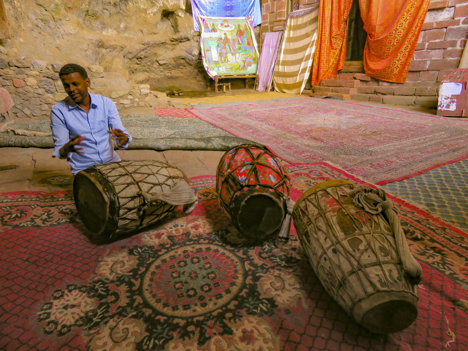 In the learning area, layers of carpet attempted to smooth an uneven, rocky floor where the novitiates sit to learn the ways of the orthodox church. In the corner rested several large ceremonial drums used during worship services. Picking one up our guide beat out a rhythm that would normally accompany liturgical chanting, or Zema, by the young monks. We’ve noticed that the treasures of the Ethiopian churches are not determined by their monetary value and locked securely away, only to be used on religious holidays, but by their spiritual connection. Precious, irreplaceable, ancient bibles and manuscripts, lovingly worn and torn as they are, continue to be used every day, as they have been for the last nine-hundred-years.
 It is well worth the effort to visit these remote churches and monasteries. The physical strength required and hardships endured to build these remote churches as a testament of faith continues to be inspiring.

 Often overshadowed in recent decades by its East African neighbors recognized for their safaris, Ethiopia has been known to Western culture for millennia. It was first mentioned in the Hebrew Bible, around 1000 BC (3,000 years ago!), when the Queen of Sheba, hearing of “Solomon’s great wisdom and the glory of his kingdom,” journeyed from Ethiopia with a caravan of treasure as tribute. Unbeknownst to Solomon their union produced a son, Menilek, (meaning son of the wise man). Years later, wearing a signet ring given to him by his mother, Menilek visited Jerusalem to meet Solomon and stayed for several years to study Hebrew. When his son desired to return home, Solomon gifted the Ark of the Covenant to Menilek for safe keeping in Ethiopia, and to this day it is said to reside in the Church of Our Lady Mary of Zion, in Aksum, where only a select few of the Ethiopian Orthodox church can see it.
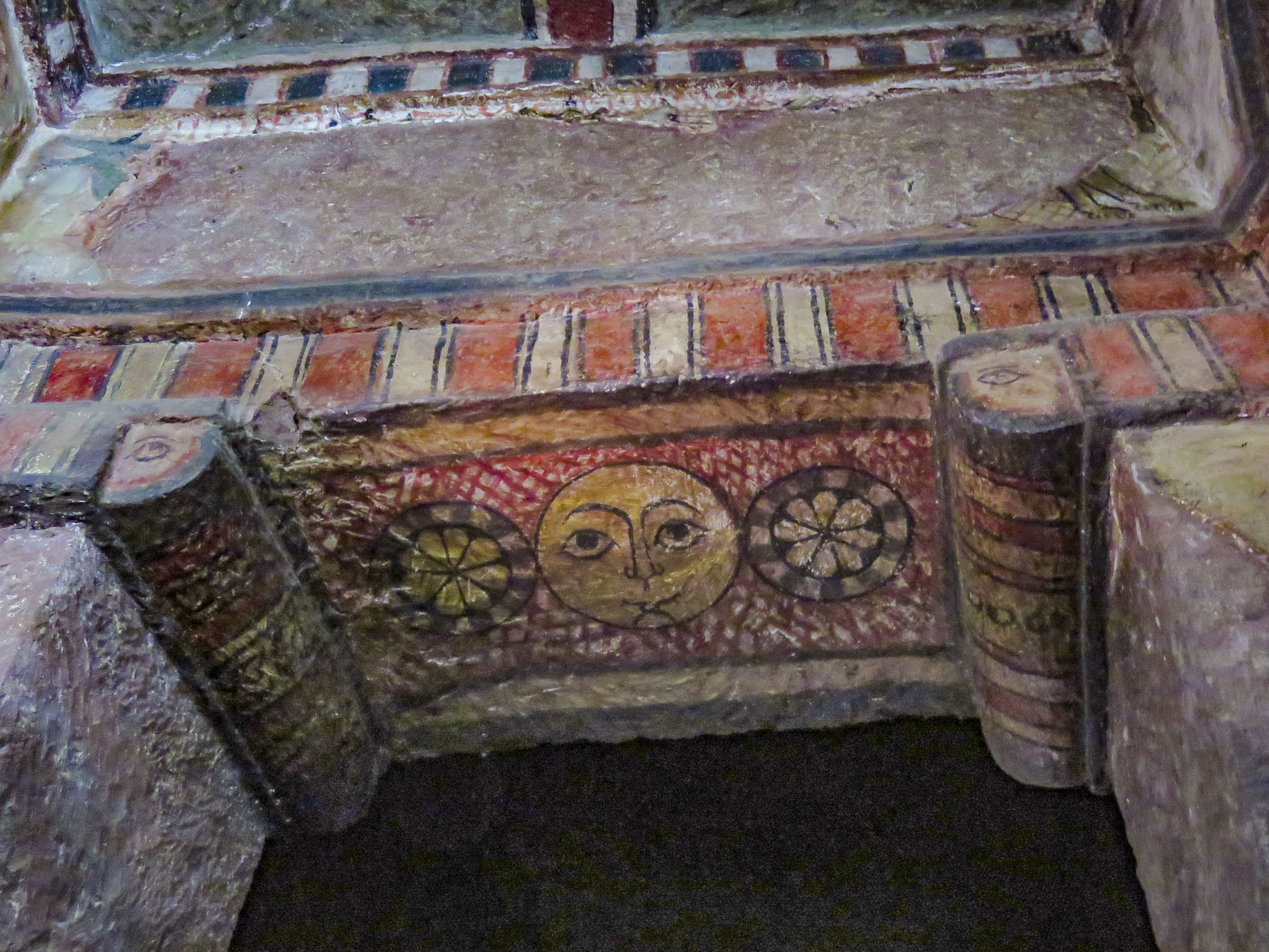
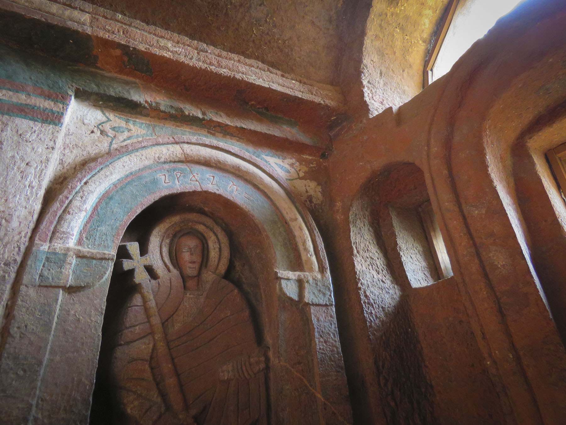


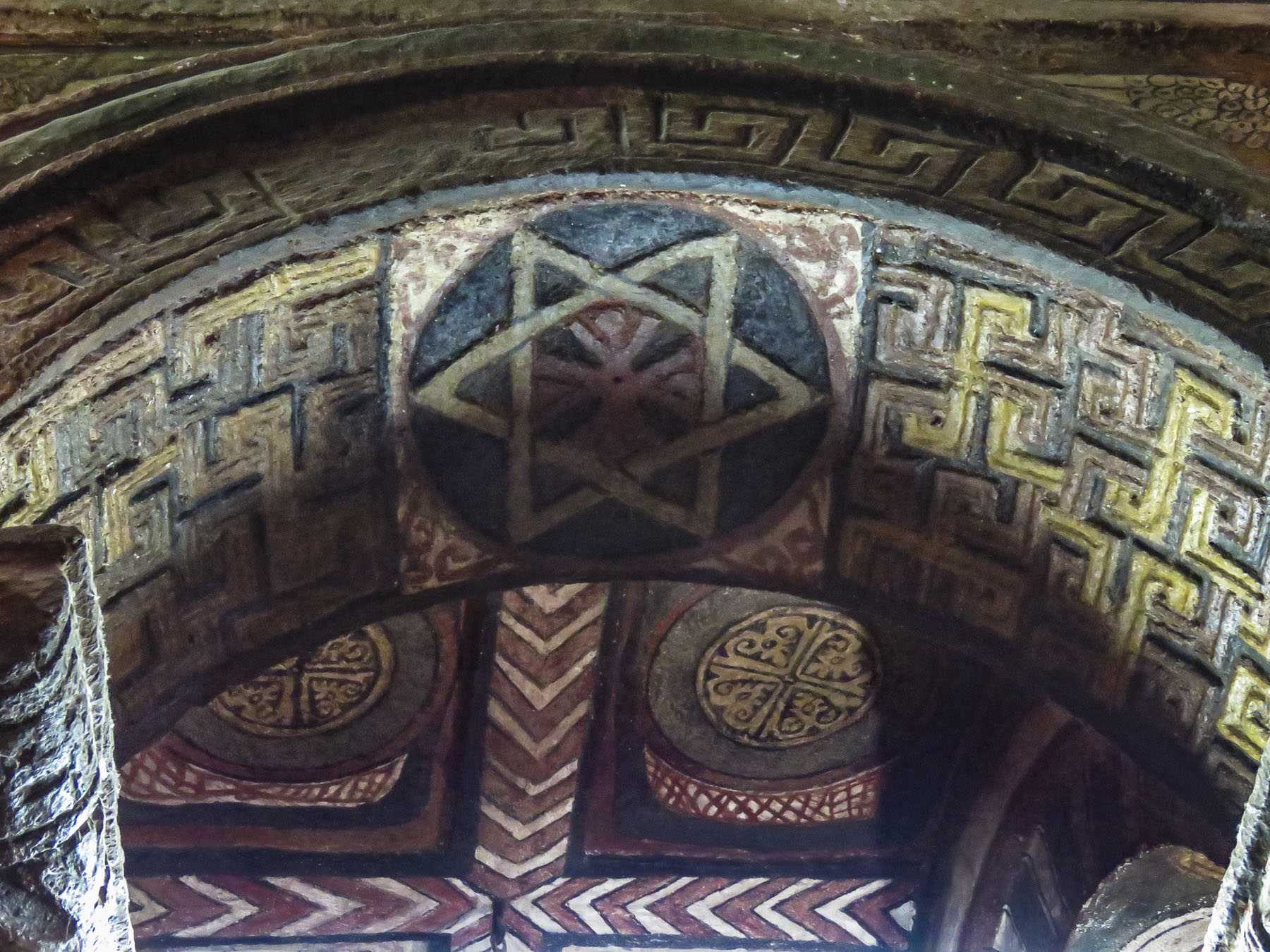 With the Ethiopian Orthodox Church having a site in Jerusalem since the sixth century, Ethiopian pilgrimages to the Holy Land, which took six months, were common until the route was blocked by Muslim conquests in 1100s and the journey became too hazardous. As it became surrounded further by Muslim territories, the country sank into isolation from Europe. Ethiopia’s early history and its connection to Judaism and Christianity is a twisting tale, like caravan tracks across the desert, meeting then disappearing behind sand dunes, the story buried by the blowing sands of time.
 Distraught by this, King Lalibela commissioned eleven architecturally perfect churches, to be hewn from solid rock, to serve as a New Jerusalem complete with a River Jordan for pilgrims to visit. He based the designs on memories of holy sites from his own pilgrimage to the Holy Land as a young man.
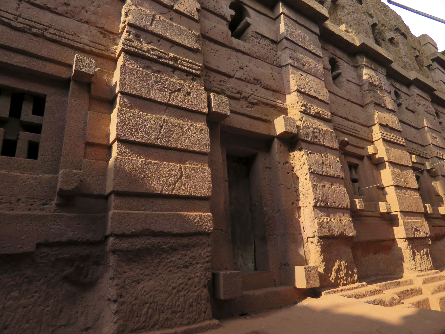 Considering the limited availability of tools in the 1100s, I can’t imagine what a daunting task this must have been. I’m sure the chief architect said, “you have to be kidding.” It’s believed that 40,000 men, assisted by angels at night, labored for 24 years to create this testament to their faith. Masons outlined the shape of these churches on top of monolithic rocks, then excavated straight down forty feet to create a courtyard around this solid block. Doors would then be chiseled into the block and the creation of the church would continue from the inside, often in near total darkness.


 Women worshippers traditionally enter through a separate door and pray apart from the men. Inside, thirty-eight stone columns form four aisles and support a stone ceiling that soars overhead. After walking for days or weeks to reach Lalibela, often fasting the entire time, the journey ends here for many pilgrims, in hopes of receiving a blessing or cure from touching the Lalibela Cross and offering prayers.


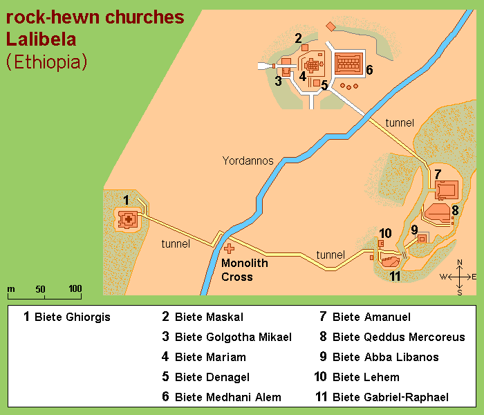


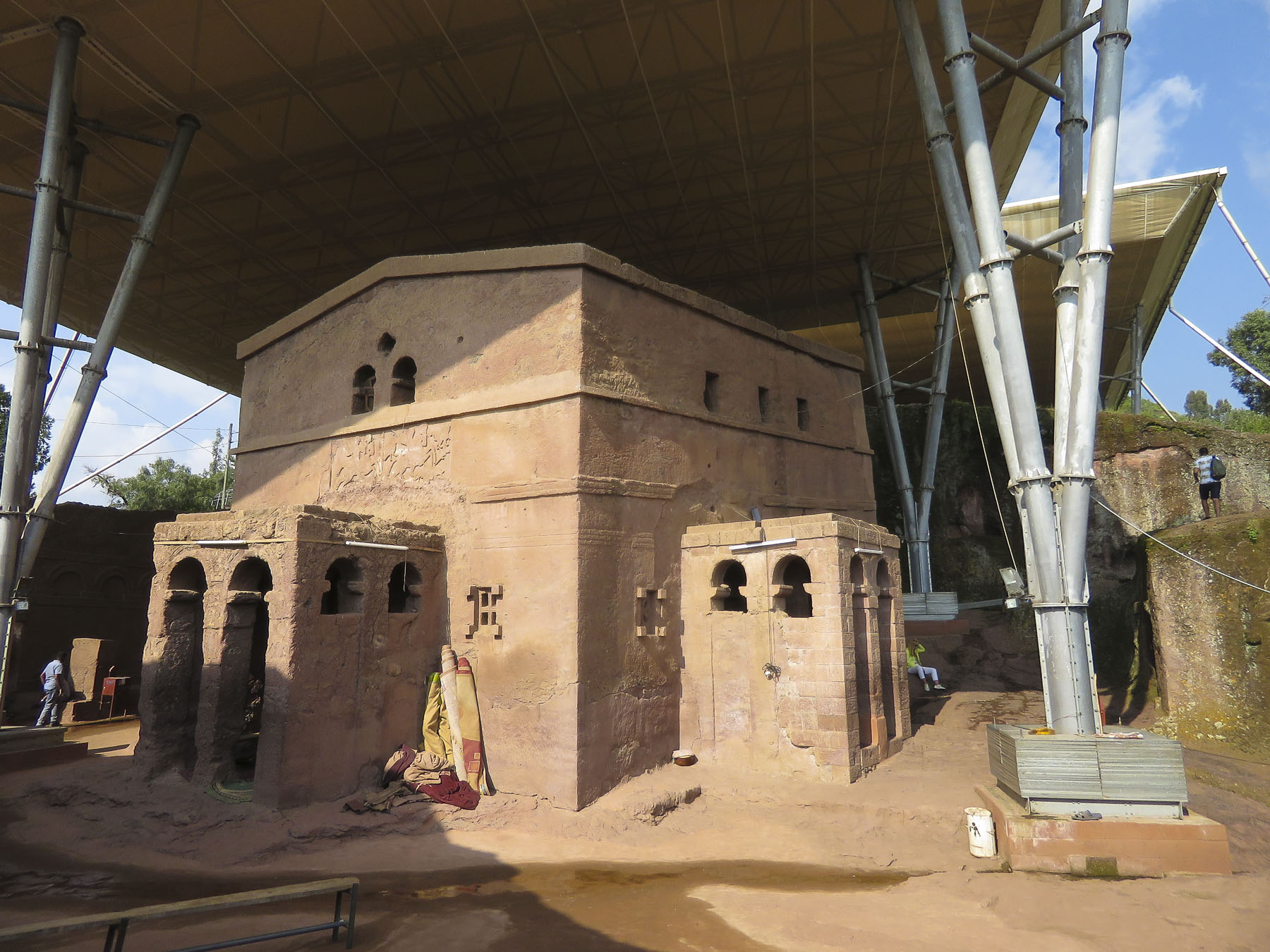 The next morning, we completed our tour of the cluster of the southern of the rock churches: Beta Emmanuel (Church of Emmanuel), Beta Abba Libanos (Church of Father Libanos), Beta Merkurios (Church of Mercurius) and Beta Gabriel and Beta Rafa’el (the twin churches of Gabriel and Raphael.)

 It’s important to remember that this is not a museum with ancient artifacts and manuscripts in glass cases, but an active holy site where the ancient manuscripts are still used daily, and it is home to a large community of priests and nuns. It has been a destination for Ethiopian Orthodox pilgrims in the northern highlands (elevation 8,200’) for the last 900 years and continues to be visited by tens of thousands of pilgrims annually.
 Leaving the churches behind, we walked through an area of ancient two story, round houses called Lasta Tukuls, or bee huts, built from local, quarried red stone. Abandoned now for preservation, they looked sturdy, their stone construction distinctive from the other homes in the area that use an adobe method.
 Today roughly 100,000 foreign tourists, in addition to Ethiopian pilgrims, visit Lalibela annually, a far cry from its near obscurity 140 years ago. Located four hundred miles from Addis Ababa, it is still far enough off the usual tourist circuits to make it a unique and inspiring destination.


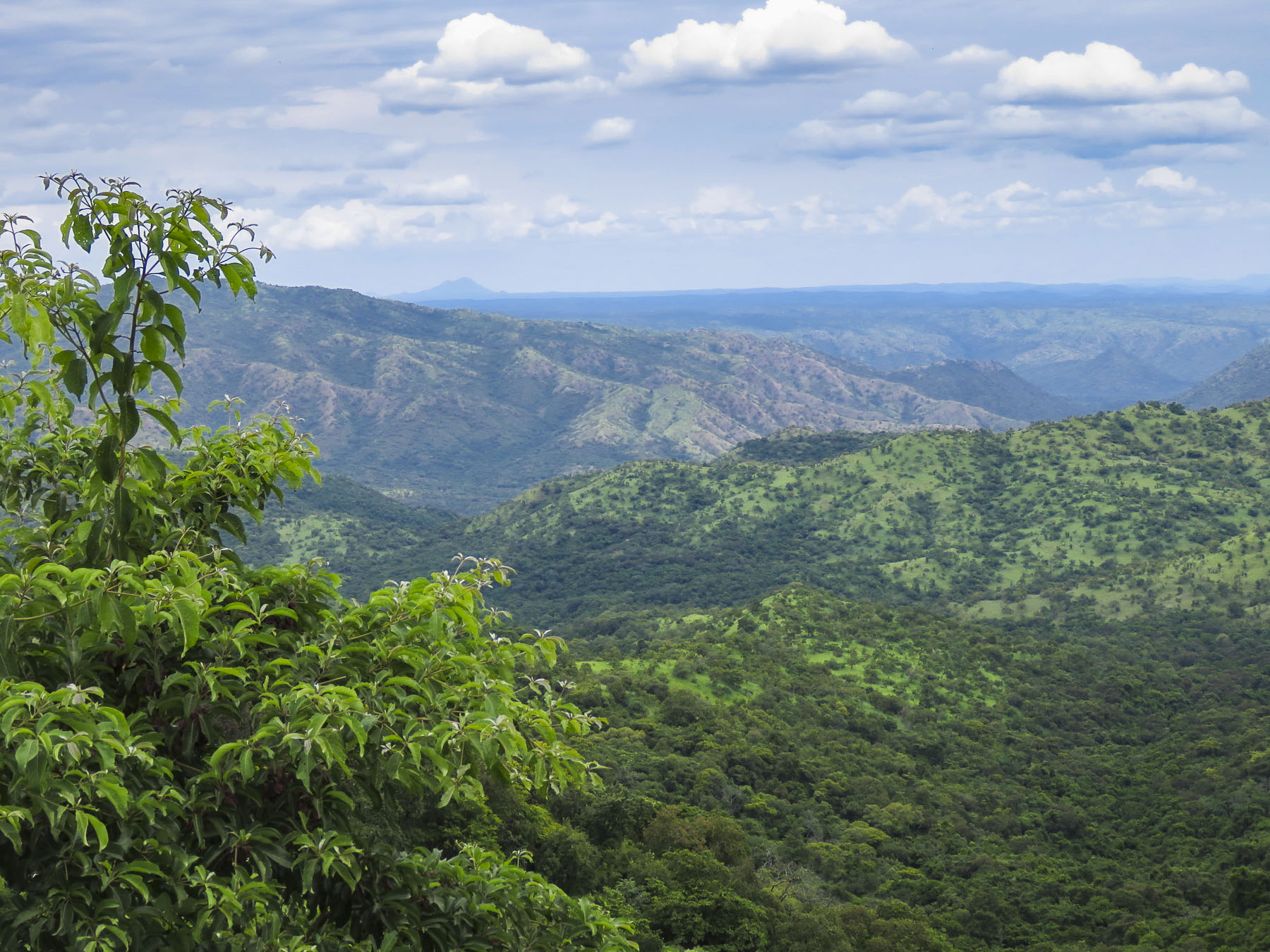 We would have been terribly dissappointed if this had happened to us and we missed visiting the Mursi tribe. (Note to self – don’t leave important events to the last day.) Curious children made their way amidst the tourist vehicles, looking through the windows and asking for soap, shampoo, pens, pencils, caramels, and empty water bottles. The kids would have been happy with anything anyone gave them. Some pointed to the clothes we were wearing, hoping we would donate them. Folks make do with very little here and wear things until they are threadbare, out of necessity. Often, we saw older children wearing infant onesies with the feet of the garment cut off. We are not criticizing; it’s all they had. It saddened us and we wished we had brought an extra suitcase of clothes along to donate to a village. Eventually there was a burst of activity with rumbling engines at the front of the line and folks running back to their rides.
 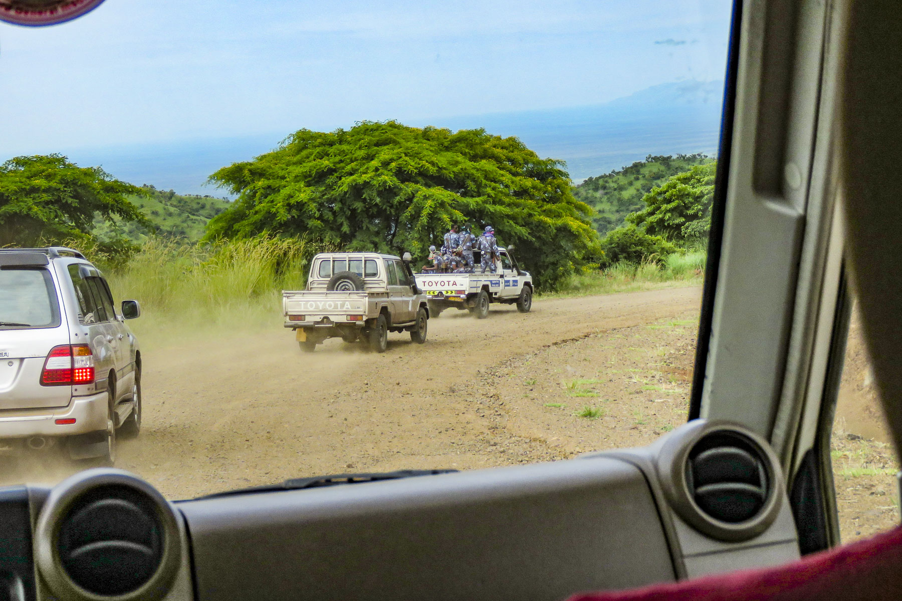 We were the third car in a group of five that was being led by a pickup truck full of armed paramilitary policemen. Many of the incidents that have occurred are related to the increase in truck and bus traffic roaring through Mursi territory on the way to new cotton and sugarcane plantations along the banks of the Omo River.
  Cattle are very often herded down the roads and sometimes are struck and killed, along with their herders. Often drivers do not stop to take responsibility. In the eyes of the villagers, the local authorities have not resolved the situation. As a result, tribespeople will set roadblocks to rob buses carrying plantation workers and extract revenge on truckers. A while later we stopped and were assigned an armed escort, with an AK-47, who accompanied us for the duration of our visit. He was euphemistically called a scout.
 Turning off the dirt road, branches scratched against the side of the truck as we followed a narrow dirt track through the savanna to a clearing where a small group of thatched huts stood. Soon the women of the village stopped what they were doing to greet us.


 It was a steep walk up a trail through a forest of false banana, enset, to a well-kept sturdy hut with a medicinal herb garden.
  Outside two women were pinching clay into bowls and teapots that would later be sold at a weekly market.


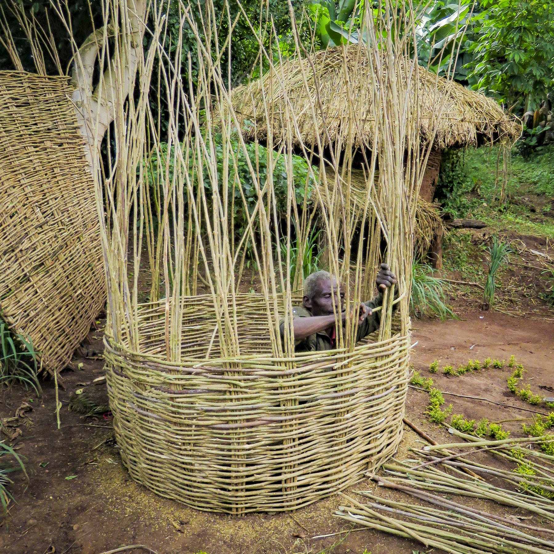 With sunlight shining through a canopy of giant enset leaves above her, a tribeswoman prepared kocho, a traditional Ethiopian flatbread, over an open smoky fire as we sat and watched. Behind us children giggled as they playfully rolled an old bicycle rim down the path.


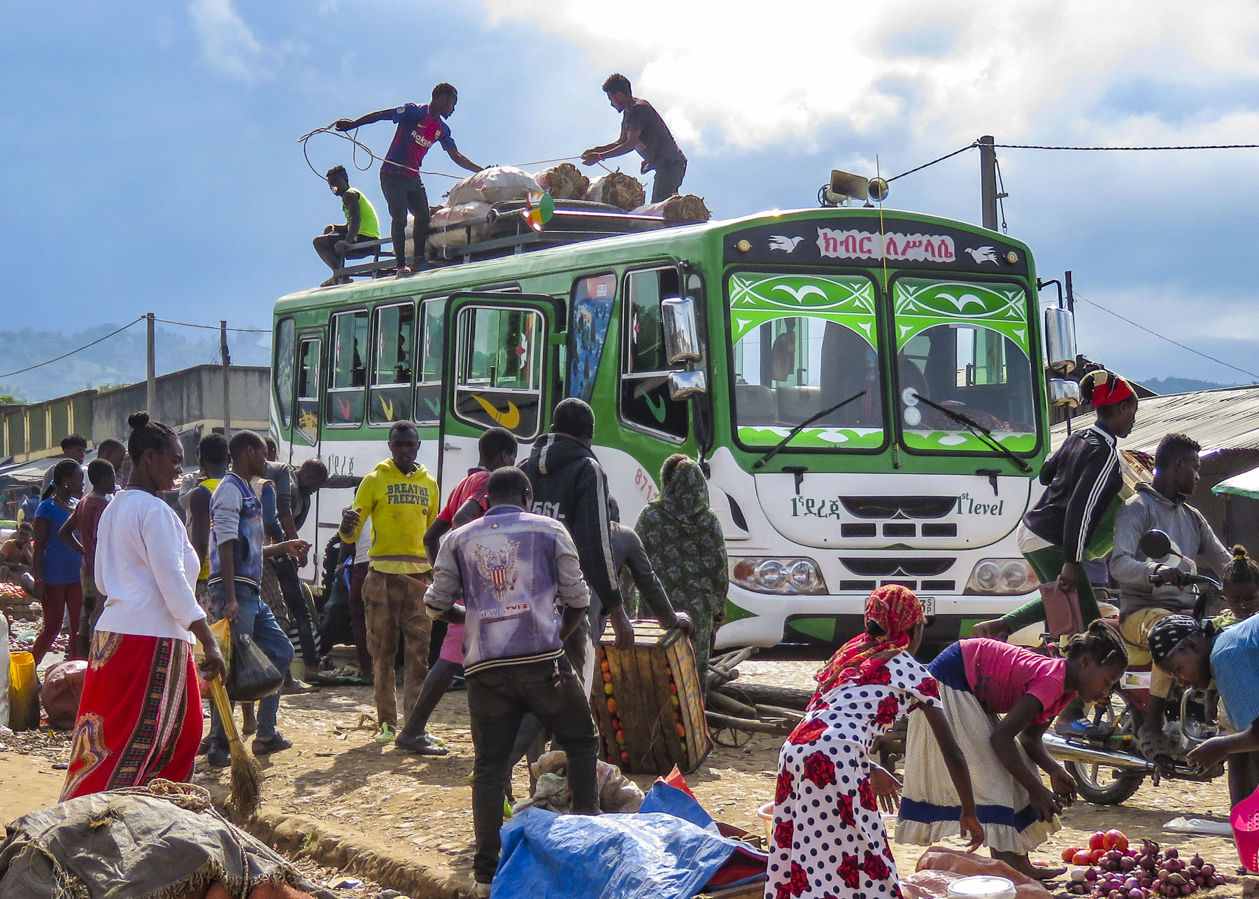 There was a lively commotion of activity by the buses as porters brought over bundles to be tossed up onto the roofs and tied down before heading back to outlying villages.
 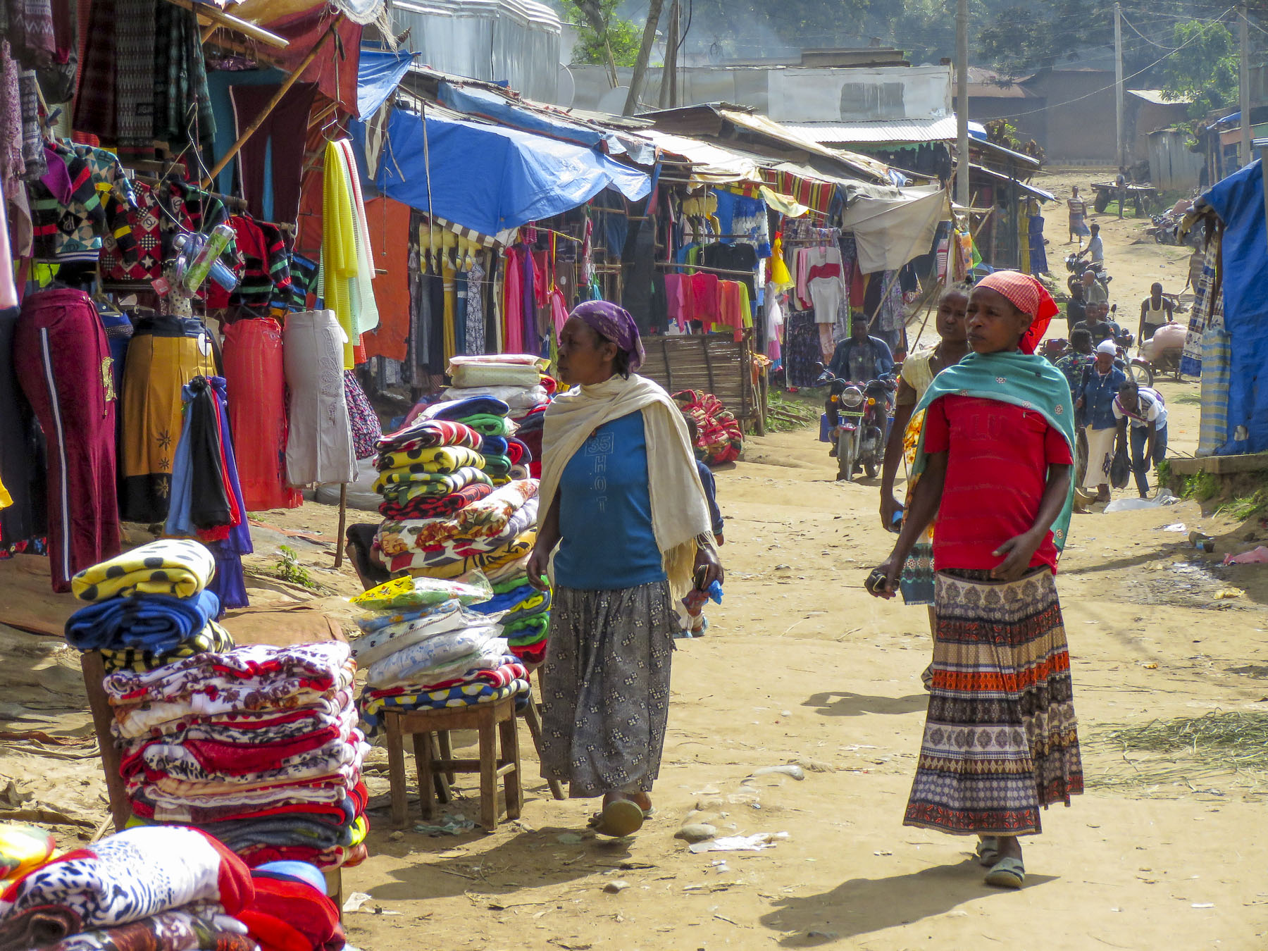 Goats, cows and children were left to wander about freely while small piles of detritus burned slowly in the streets as vendors cleaned up at the end of the day. The earthy smell of dung and smoke lightly scented the air. It was chaotic.


 The highlands area is home to the Konso people who are renowned for their ringed hilltop villages, fortified with stone walls. They have developed terraced farming techniques to survive in a semi-arid, rock strewn and hilly territory for almost seven-hundred years.
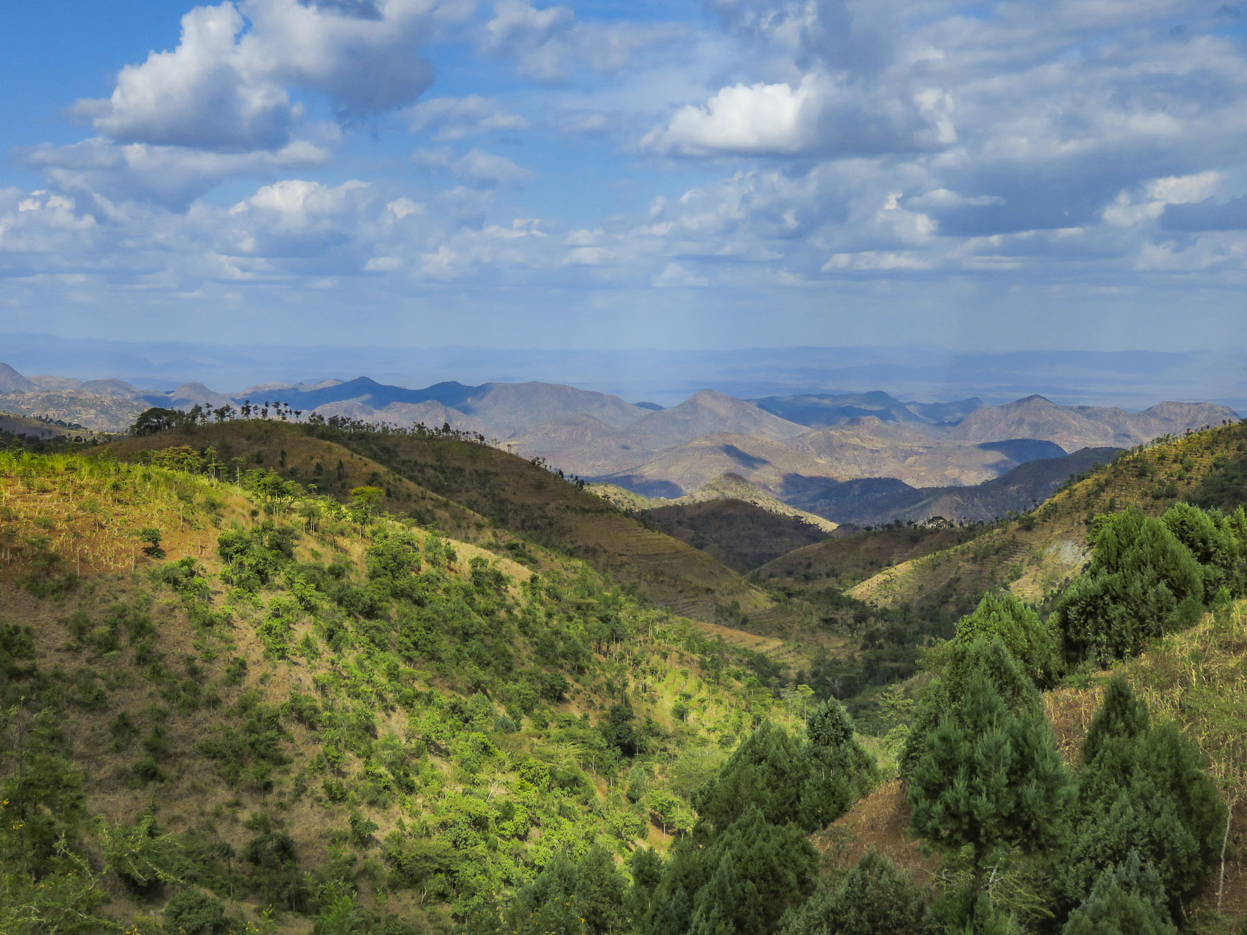 As we entered the town of Konso, bundles of candles miraculously appeared from under our guide’s seat and we stopped to donate them to a young man collecting offerings in front of his Ethiopian church. This was the guide’s ritual when we changed territories and it continued throughout our trip. It was a common sight to see small groups of parishioners walking along the road holding up a picture of a beloved saint and umbrellas for shade.


 As we walked to the center of the village young children following us jumped from rock to rock, along the tops of the tall walls built to protect the village, as we made our way along the path below.

 Each ring also has a community area called a mora; this is a large thatched roof structure with an open lower level and an enclosed upper platform where the married men and bachelors of the village sleep.
 More importantly it provides a shaded meeting place where men play gebeta. It’s considered the oldest board game in the world and is played simply with stones, beans or seeds being moved around holes in a board with the goal to capture as many of your opponent’s pieces as possible. Each village is also divided into two zones and a man born in one zone must always have his homestead in that zone.
 The Konso also erect generation poles, called olahita, which are raised every eighteen years. The olahita are made of cedar trees taken from the kala, a sacred forest. Gamule village had eighteen olahita which dates the village to be nearly 400 hundred years old. Sadly, the oldest central poles have succumbed to termite damage and rot over the centuries. The oldest village in the Konso region is Dokatu which has 43 olahita. Near the olahita was the village ceremonial daga, a large rock, that teenage boys lift over their heads to prove their manhood and eligibility for marriage. The Konso also carve waka, grave makers, in rough likeness of the deceased. These were originally placed at the grave sites in the sacred forest, but have now all been brought back into the village to deter looting. Each village is surrounded by a dina, or grove of trees, which acts as a buffer between the village and agricultural terraces. This buffer of trees was meant to inhibit attack on the village and provide an area close to the settlement where folks could forage for firewood. There are 36 paletas, with populations ranging from 1,500 to 3,000 in each village, scattered across the Konso territory.

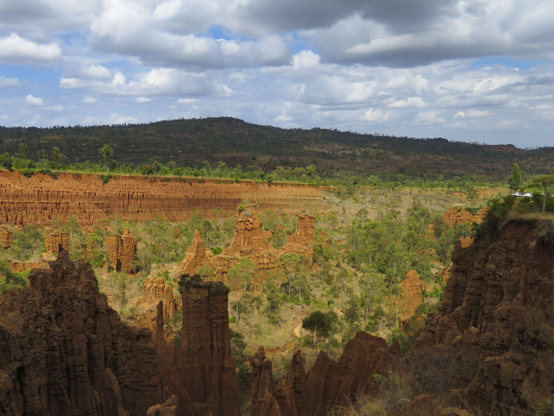 We didn’t really see the NYC comparison, but the landscape was interesting in that it contrasted sharply from the surrounding terrain. And the encompassing territory is beautiful with vistas of rolling hills. Driving away a group of young men were perched on a lone boulder, just passing time.
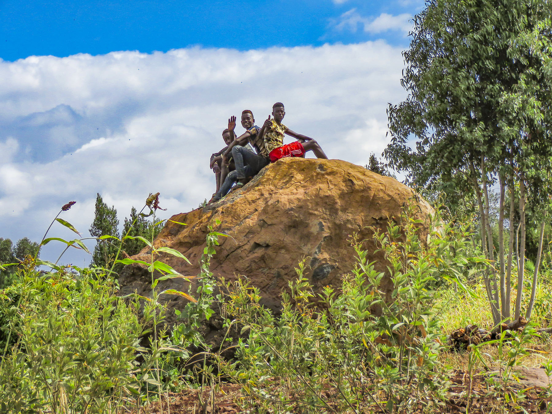 We arrived late in the afternoon to the Konso Korebta Lodge, situated high on a hill. It was a relatively new complex with attractive, circular stone huts topped with steep thatched roofs and beautiful plantings of bougainvillea. Desperately needing showers, we were flummoxed when the tap was dry and headed to reception to see what was up. Unbeknownst to us it’s common practice at hotels throughout the countryside to only turn on the electricity and water between 6:00 – 9:00 in the morning and 6:30 – 10:00 in the evening to conserve resources.
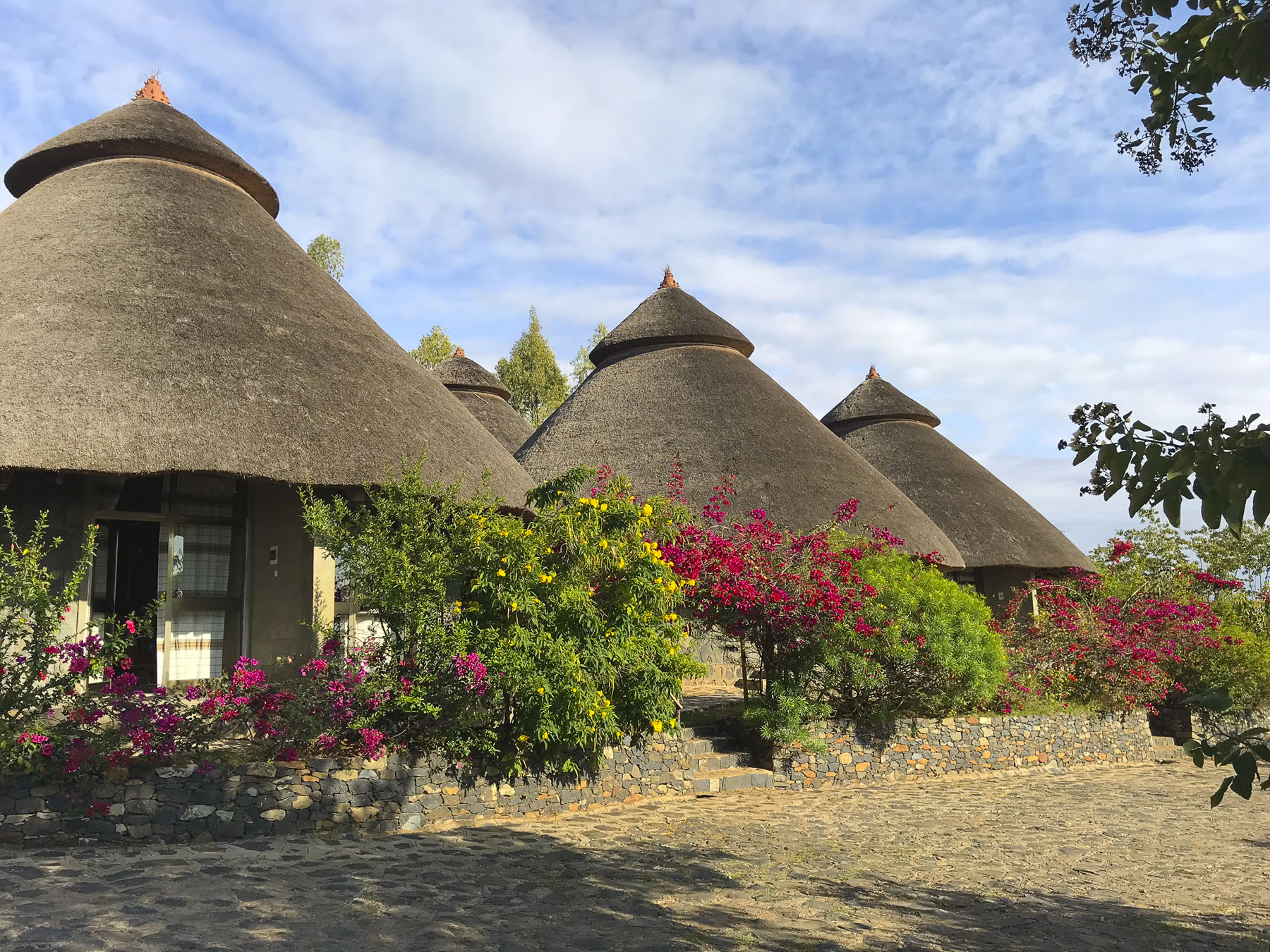 Thankfully, the staff called the owner to get permission to start the generator early for us. Back seat driver that I am I thought our driver drove fast, safely but fast to cover the great distances we had to travel. So, we were surprised the next afternoon when he was tootling along very slowly to get back to the hotel. Evidently the hotel owner made it very clear to our guide that he would not turn on the generator early again.

 Market days are huge events in the rural areas and folks from various tribes travel for miles to attend them.
 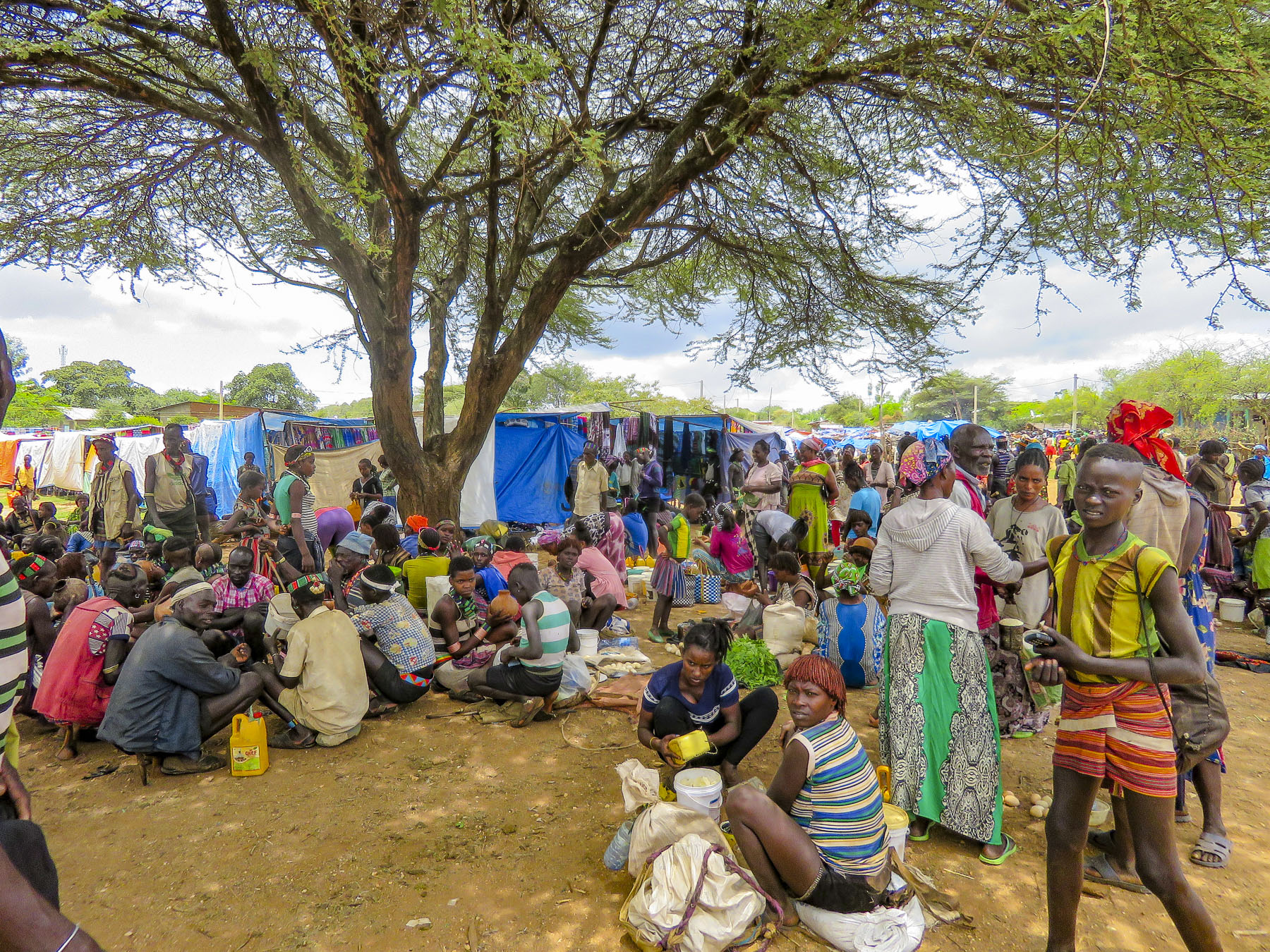 Not just to buy or trade supplies; it’s also a cherished opportunity for men and women to socialize with friends and extended family from other villages, often in raucous beer halls which could be in a makeshift shed or more often a spot under a large shade tree that serves a local brew.


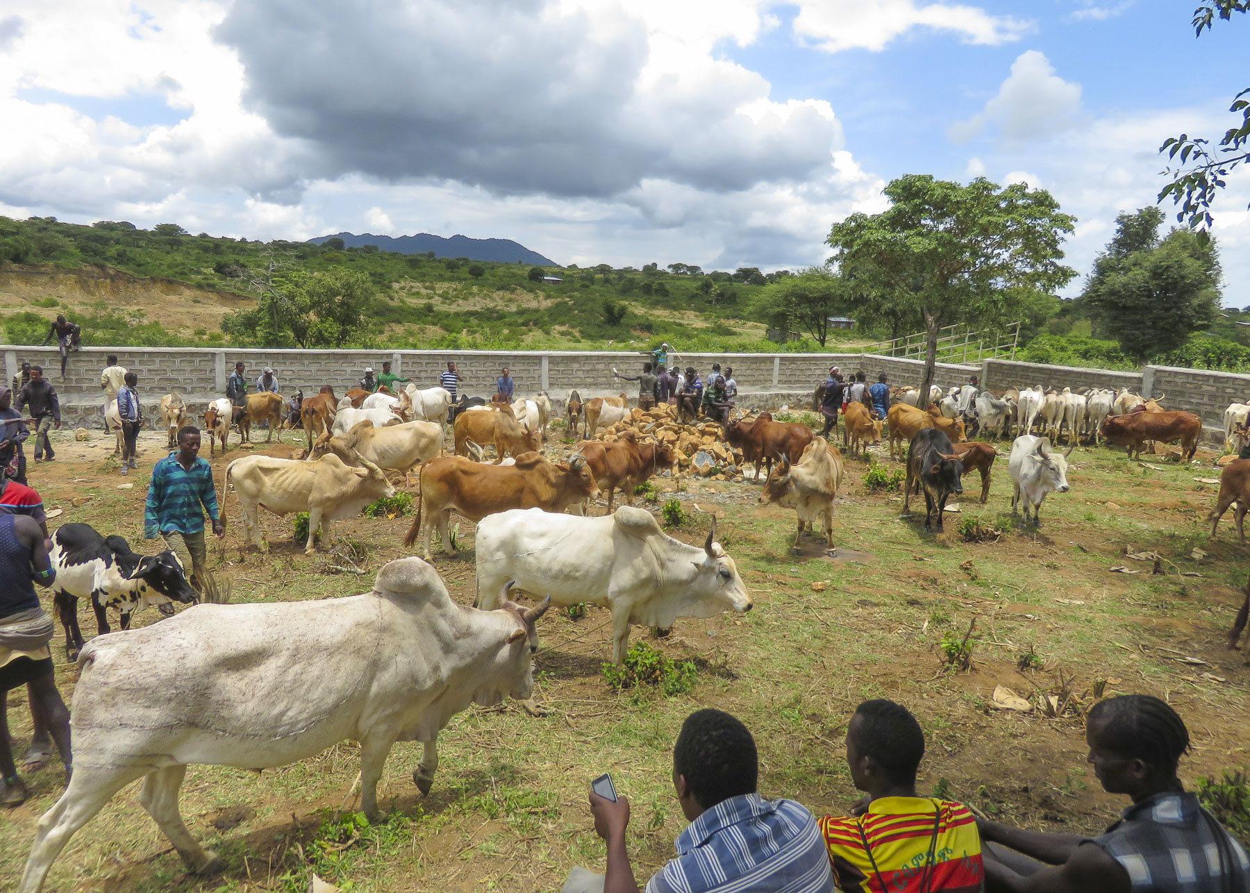 We were able to take many candid photos as we followed our guide through the market to its various parts. Ceramic pots, handmade tools, ropes and leather goods produced by different tribespeople were available as were pots, pans, cloth and sandals produced in China.


 Many folks were very receptive to this and our guide would negotiate a fee. And even though we paid for the privilege to take their photo, they seemed pleased that we admired their style. A few, however, angrily waved us away.


 Pulling over occasionally to take photos from scenic overlooks along this isolated track, we were always surprised when, in the middle of nowhere, a young man selling souvenirs would emerge from the shade. Later we would come across an enterprising group of young stilt walkers urging tourists to stop for photos – and of course we did.
 Entering Jinka, we noticed signage for the International Airport (BCO, though we are pretty sure you can only fly in from Addis Abba.) We might have arranged our trip differently if we had known this previously as it would have eliminated two eight-hour drives from and to the capital. Note: if you fly into Ethiopia on a ticketed Ethiopian Airways flight you are able to purchase


 The area in the northern part of the Greater Rift Valley, known today as the Omo Valley region of Ethiopia, has been at the crossroads of humankind for many millennia. In 1967 Dr. Leaky discovered fossil bone evidence, recently re-dated by scientists to be 195,000 years old, of early Homo sapiens near Kibish, Ethiopia, several miles west of the Omo River near where the borders of Sudan, Kenya and Ethiopia meet. The first migrations of early man out of Africa occurred 60,000 years ago as they followed the Omo River north through the Great Rift Valley to the Red Sea. At its narrowest point, where it meets the Gulf of Aden, they crossed to continue their migration through Arabia and eventually into Europe and Asia. The region was once rich with African wildlife, and Arab towns along the northern East African coast of Somalia and Kenyan were sending hunting parties into the interior for elephant ivory, rhino horn and unfortunately slaves since around AD 1000.


 Things change, but the proud peoples that live in the Omo Valley are trying to retain their way of life amidst external influences they can’t control, as tourists and construction crews course across their territory. Tempers flare when trucks and buses carrying supplies and workers to the agricultural plantations strike and kill cattle. Drivers are required to stop and immediately pay the herder for his loss, but many never do. Consequently, the local tribe will block the road and demand payment until the issue is resolved.
 A good night’s sleep at the


 The 2019 rainy season was good; unfortunately, this is often not the case. There was no water infrastructure in most of the small towns and villages we passed through, forcing folks to gather water from local streams and rivers.
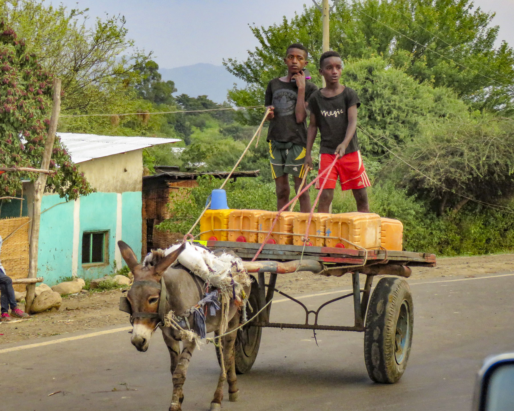 It was a constant sight: women carrying yellow water jugs along the side of the road back to their homes, or if they could afford it, having it delivered by donkey cart. The terrain varied tremendously, with full rivers on one side of a mountain range and dry on the other side. These conditions forced people to dig into the riverbed in search of water.

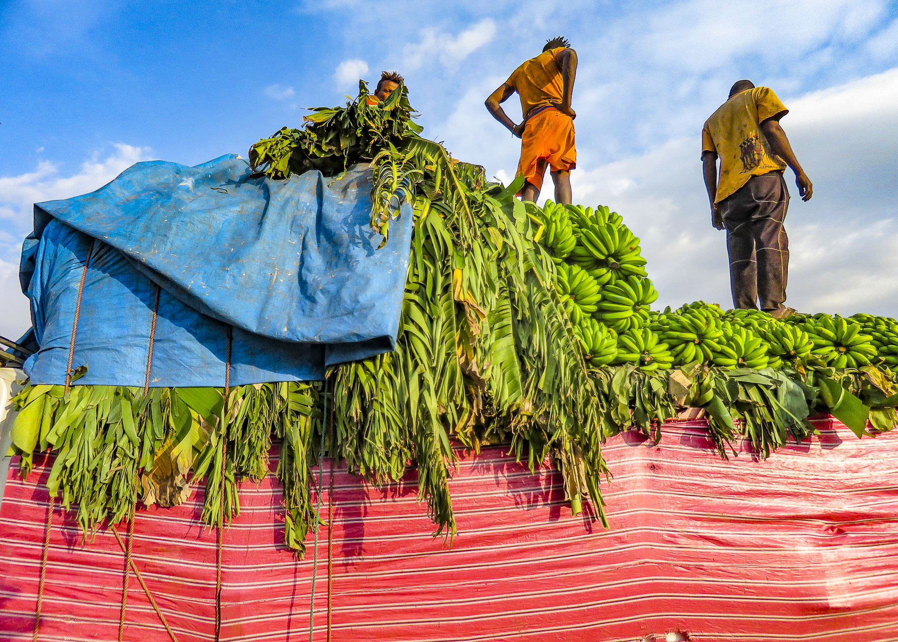 Since Ethiopia is close to the equator, the daylight hours do not vary seasonally. The sun rises quickly in the morning and seems to drop from the sky at the end of the day. By the time we reached the
  At breakfast we watched thick-billed ravens in aerial combat as they rode the thermals just off the restaurant’s terrace. Nearby a staff member stood ready to chase away baboons if they got too close to the customers’ tables.

 As we entered the village, compounds ringed with woven rattan walls held back tall Enset plants, better known as false banana, also called the “tree against hunger.” This plant is an important staple that is drought resistant and can be harvested year-round. Starch from the plant is scraped from its fibers and fermented in the ground for three months or longer and used to make kocho, a type of flat bread.
 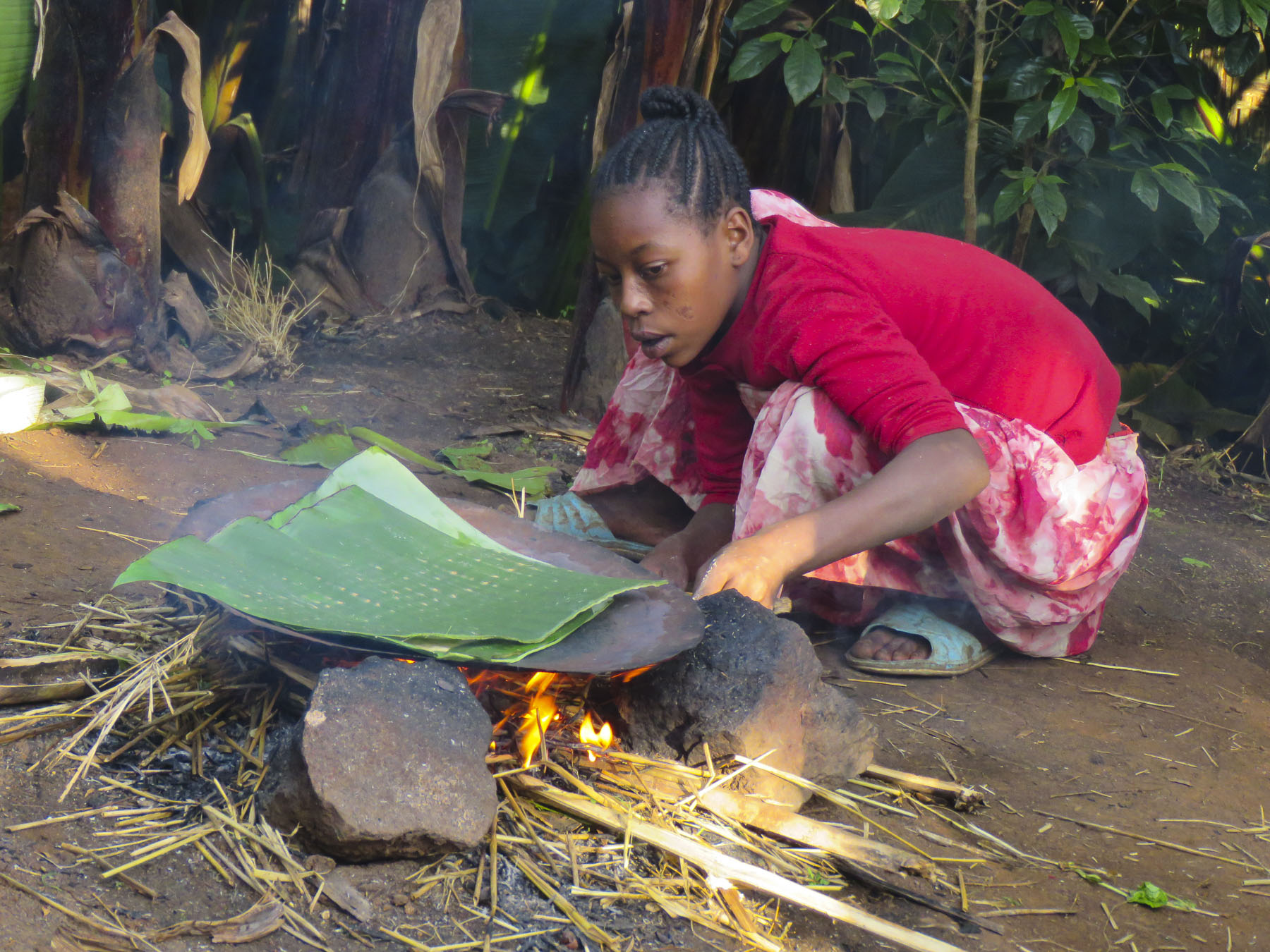 Fibers from the plant are used to make rope or coffee bean bags, and the leaves are fed to farm animals. We arrived on market day, and an entire hillside about the size of three football fields was covered with activity. From a distance it looked like an animated impressionistic painting, with undulating dots of color dancing under a blue sky.
 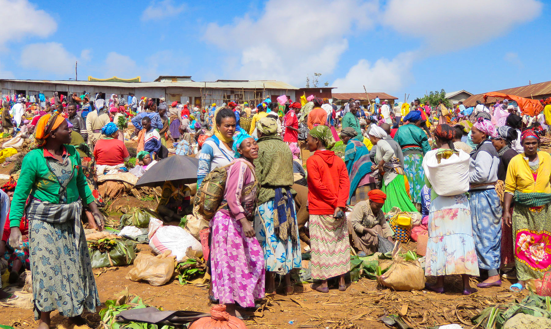 Sellers of charcoal, sugarcane, vegetables, and a multitude of other goods all had their wares spread out on cloths covering the ground. Men played foosball or ping-pong under the few shade trees that ringed the field.


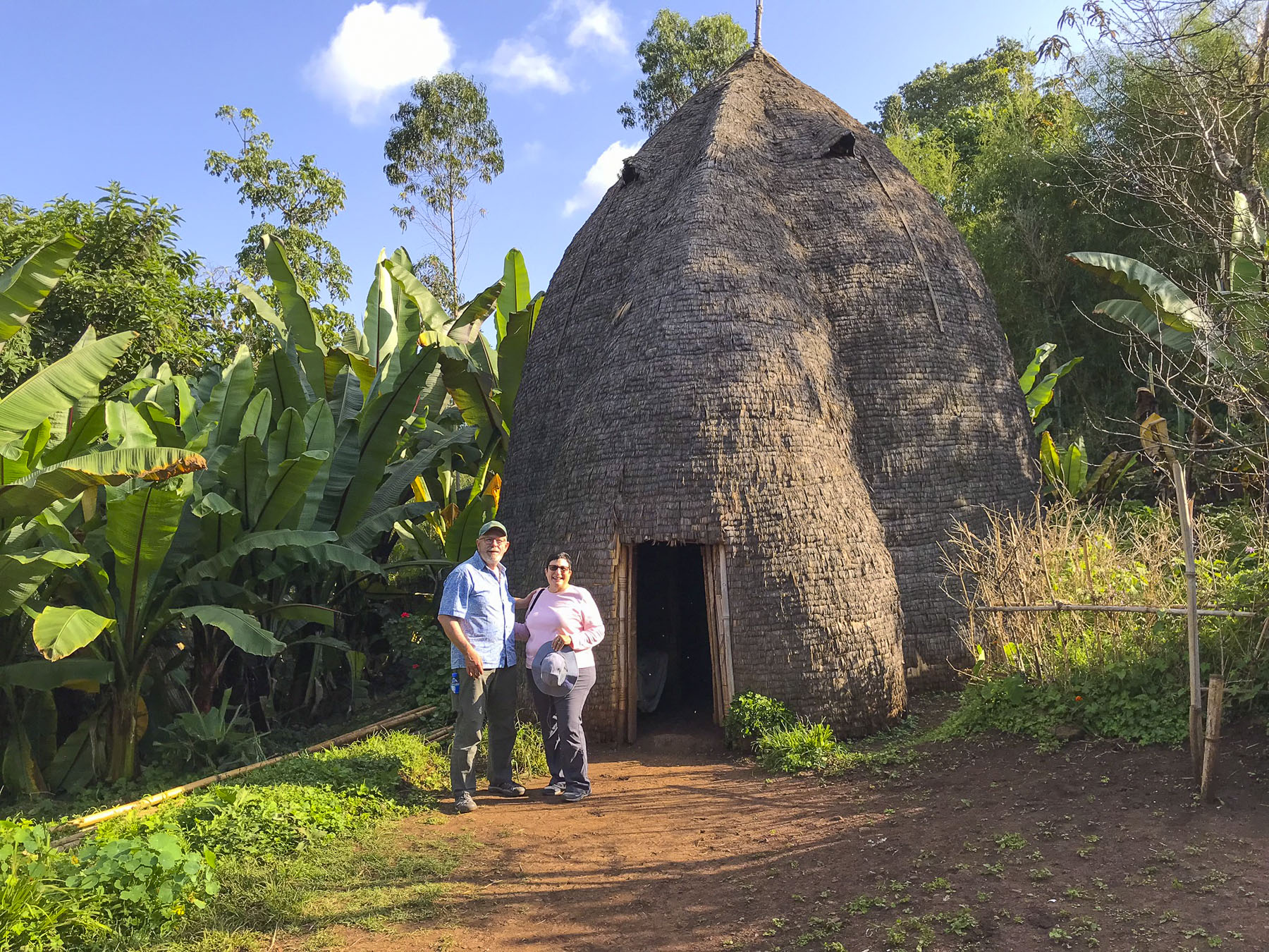 Men of the Dorze tribe traditionally do the weaving, while the women are responsible for spinning the cotton that the family grows and uses. The colorful textiles they create are highly prized all over the country.
 Back in Arba Minch we stopped at the Lemlem restaurant for a lunch of local lake fish before checking out the crocodiles on Chamo Lake. The lightly fried fish were served whole, while the sides were scored into squares which we picked off with our fingers. It was delicious. Another side of the restaurant served freshly butchered, grilled meat.


 “Sorry for the late pick-up, but the road was full of tuk-tuks carrying families to the university stadium up the street for a graduation ceremony,” Ephrem offered as he bundled us into the Land Cruiser and handed us large bottles of water. “It’s hot where we are going today.”

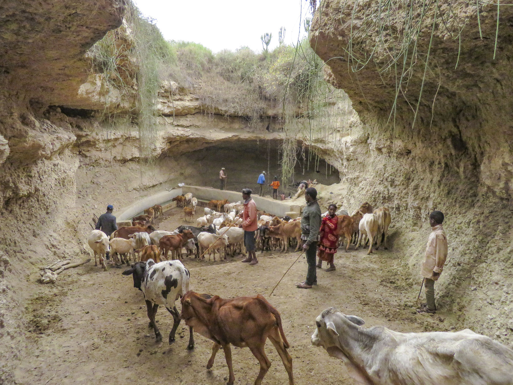 We trailed a young Borena girl herding a small group of cattle down a slowly inclined, dusty trench deeper into the earth. It was impossible to avoid cow patties as we steered clear of an exiting herd. Thirty feet below the surface, the trench ended in a bowl shape with a water trough where cattle were drinking. Rhythmic voices emerged from a shallow cave behind the trough. Climbing worn stone steps, we came to a narrow landing above the trough,


 A short drive away, our last stop of the day was a well-kept Borena village surrounded by an ochre landscape under a perfect blue sky. Women do the heavy lifting in the villages, building the huts, tending children and crops, and spending a substantial amount of time foraging for firewood and gathering water from far off sources. While the men spend their days moving their cattle across different grazing lands.
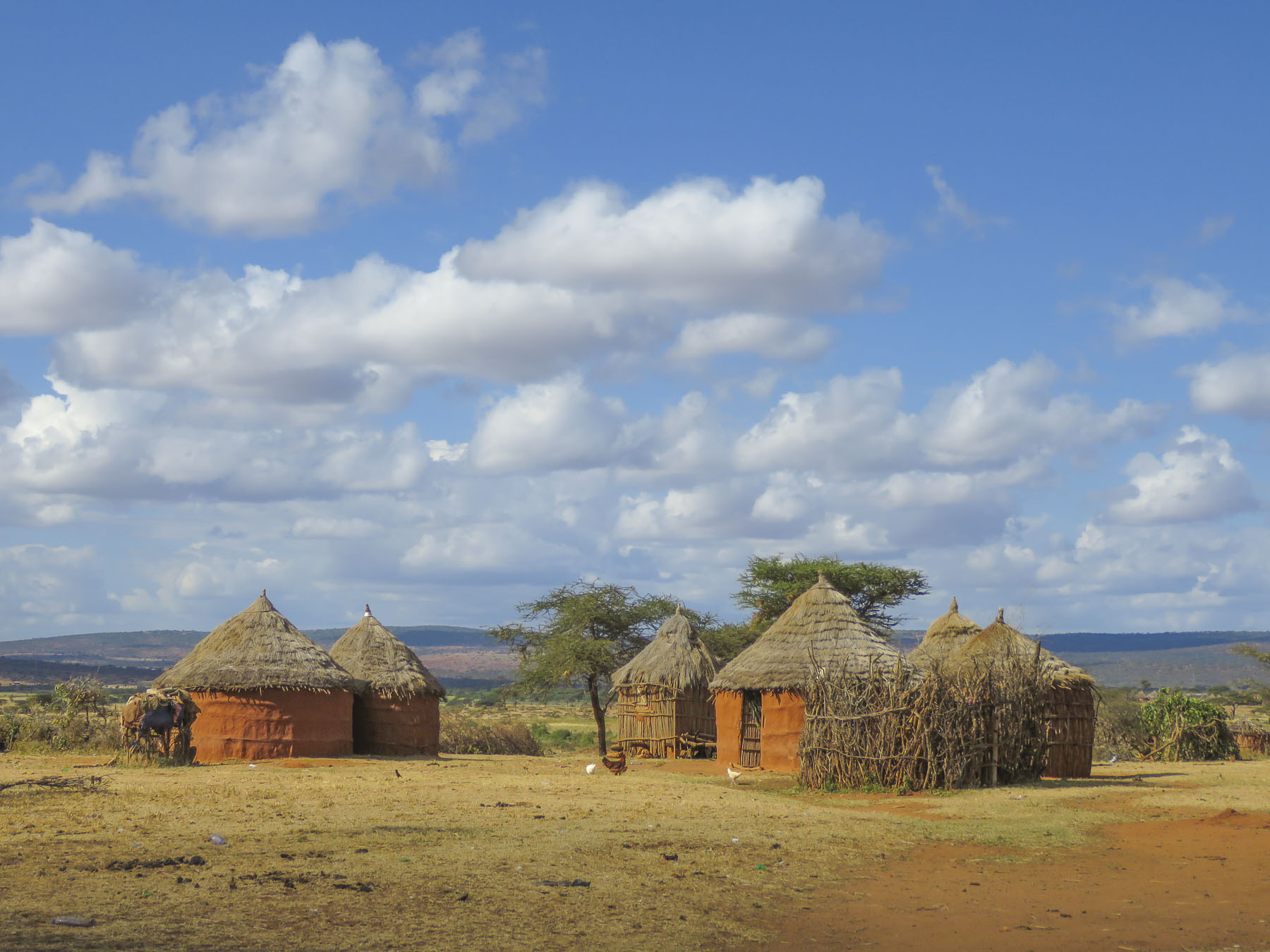 Women rule their homes and determine who can enter, even prohibiting spouses. “If her husband comes back and finds another man’s spear stuck into the ground outside her house, he cannot go in,” our guide conveyed.


