Along the Coast of Uruguay: Sand in Our Shoes – Faro de José Ignacio & Punta del Este & Beyond

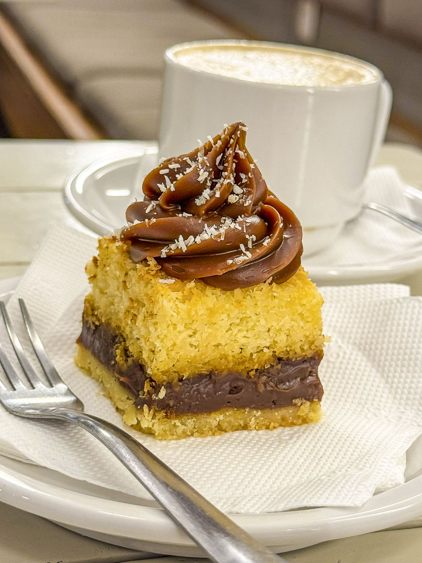
After a three-day road trip through the colonial towns of Colonia del Sacramento and Carmelo, then the rural farmlands of Minas and ranchlands of Gorzon, the amount of activity around the traffic circle in Faro de José Ignacio took us by surprise. We had reached civilization again! Not that it was really busy, but literally more cars had passed us in the last five minutes than the last three days, as we pulled into the small collection of shops along Rt10, which leads up from Punta del Este. Some fruit and supplies were gathered for our four night stay at Casa Franca from the Devoto Market, a well-stocked, but typical beach town store that benefits from a captive market. A few doors down the Panadería José Ignacio, a popular bakery, has a very nice selection of bread, pastries and tasty delectables. They also have a pizza and sandwich counter along with tables for eating outside on their terrace. We returned every morning during our stay for fresh from the oven delights.

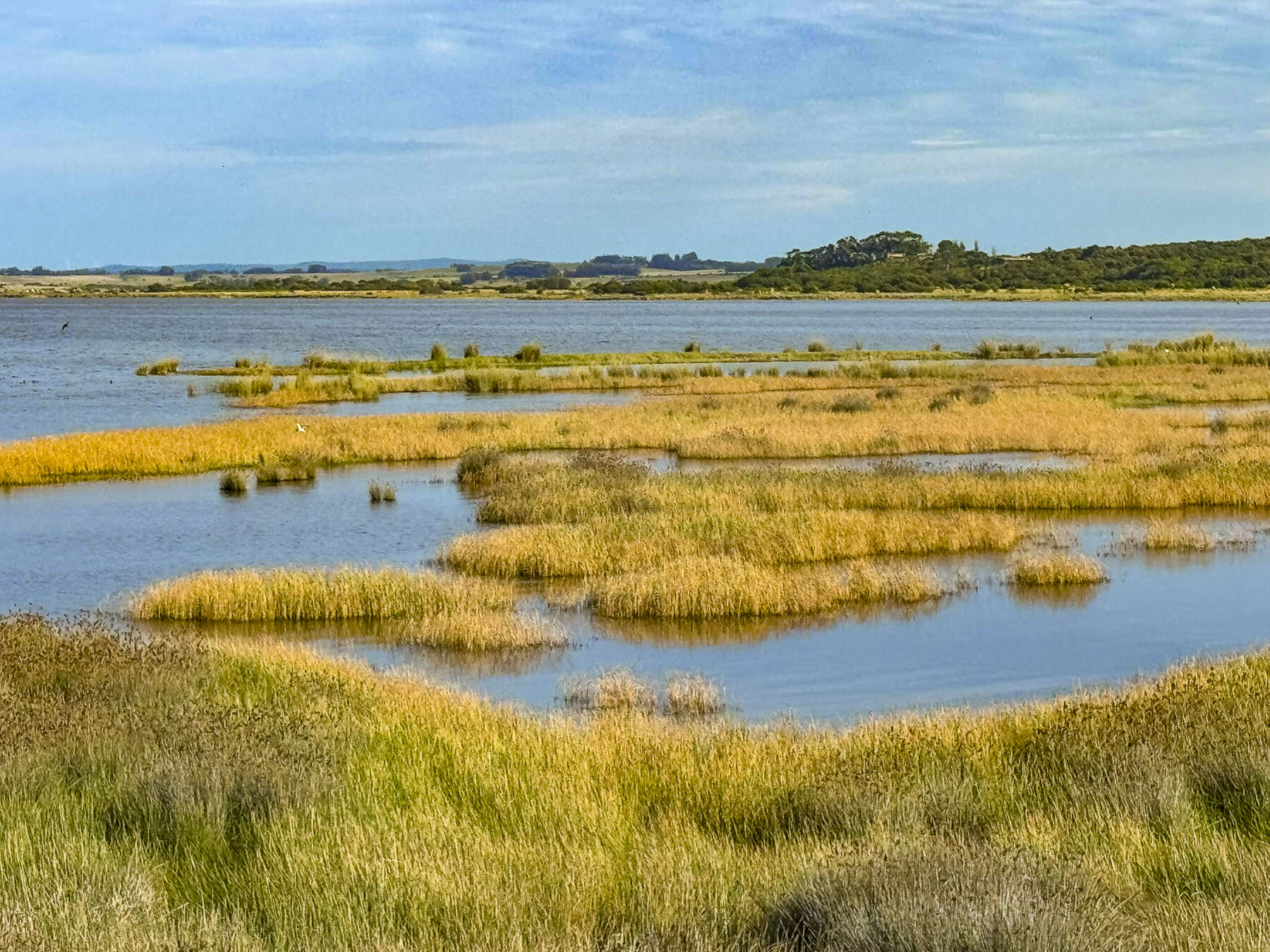
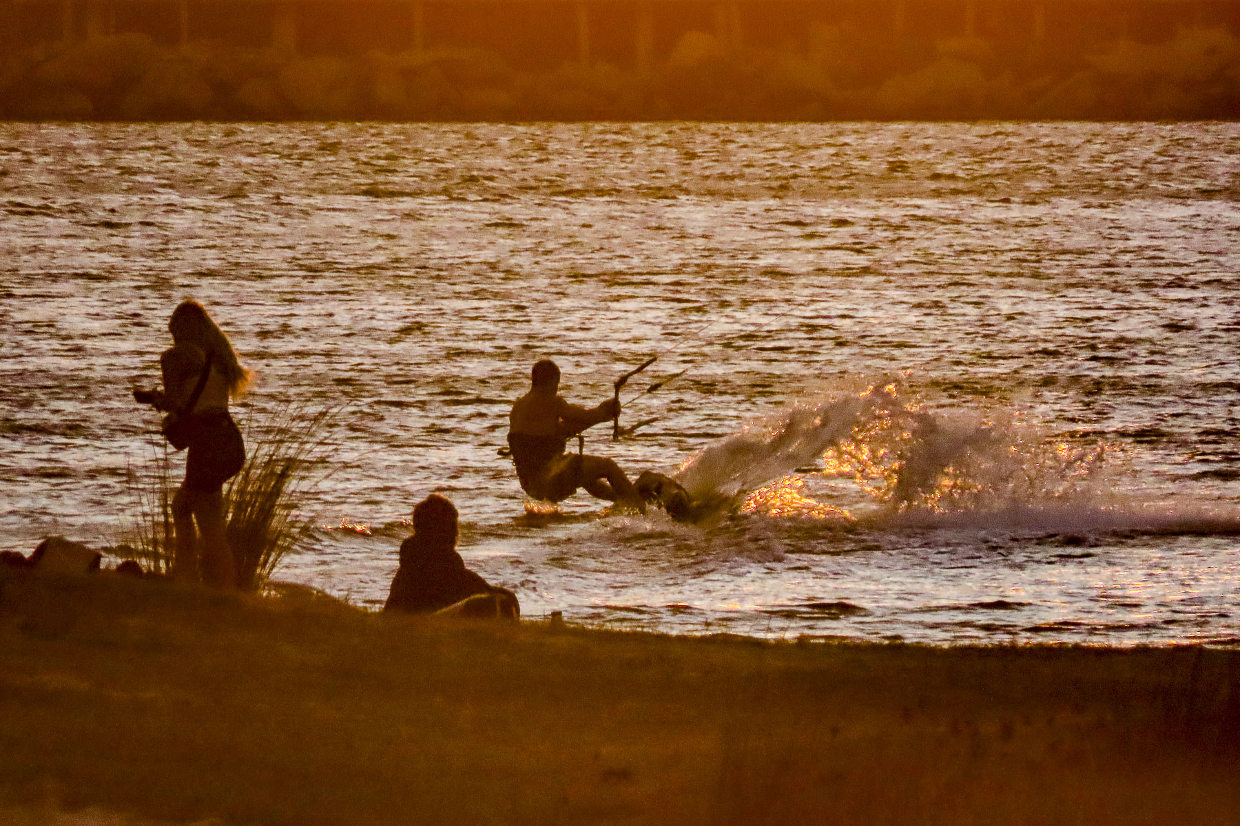
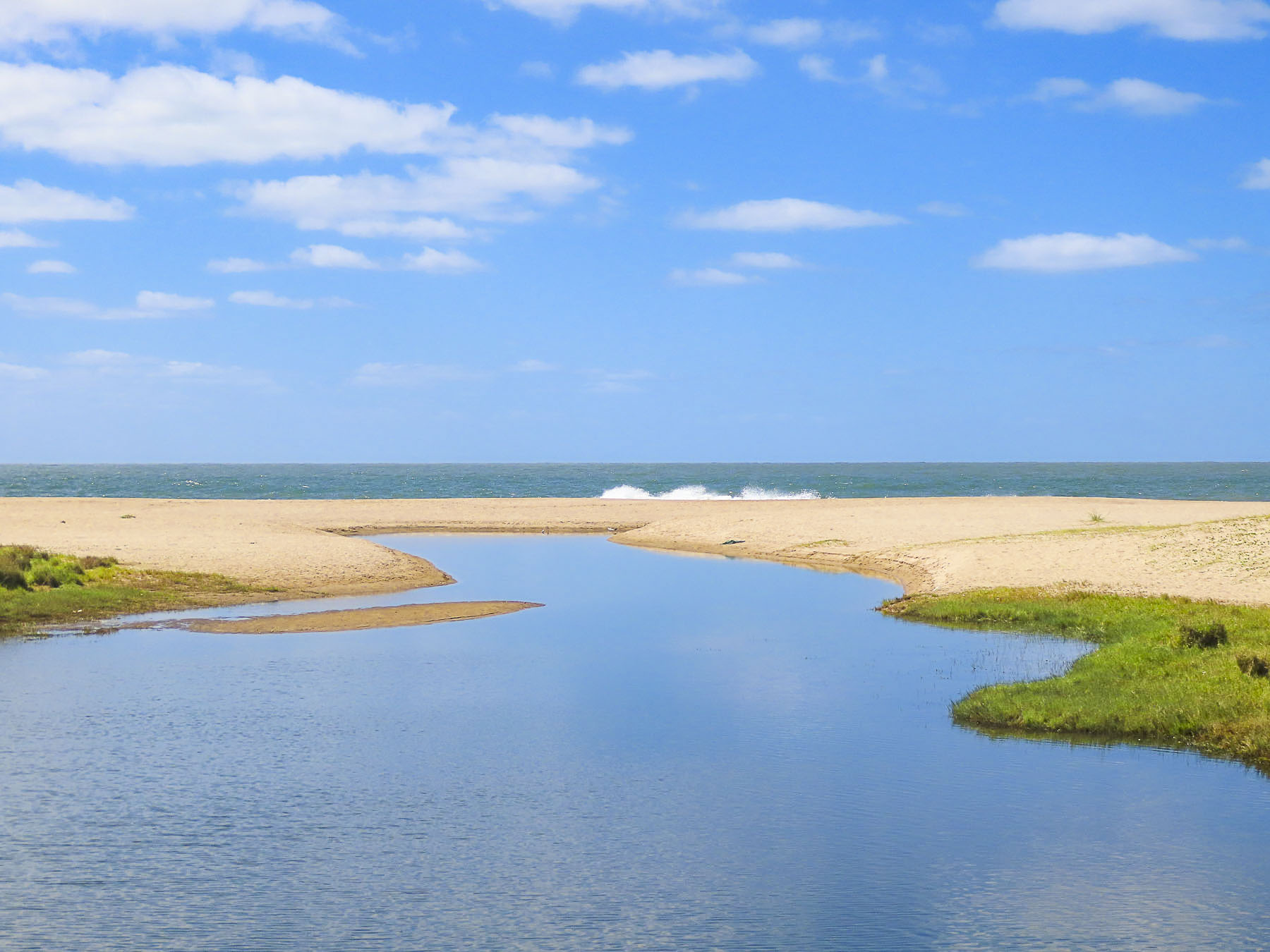
Folks parked along the road followed sandy paths across the dunes to the beach. The sails of kite surfers filled the sky as we passed the Laguana de José Ignacio, a freshwater lake separated from the South Atlantic Ocean by a sandbank, which it breaches when it rains too much.

Surf pounded against the Playa Balneario across from our host Daniel’s guesthouse in the tiny hamlet of Santa Mónica, only 5km (3mi) west of Faro de José Ignacio, but a sea change in tranquility, compared to our earlier shopping experience. His wife and children waved from their balcony as his friendly dog energetically greeted us. Daniel helped take our bags to our room, which was located through a private entrance to an extension on their home with three other guest rooms. While our chic petite studio didn’t face the ocean it did thankfully have a shaded porch, where we spent many hours.

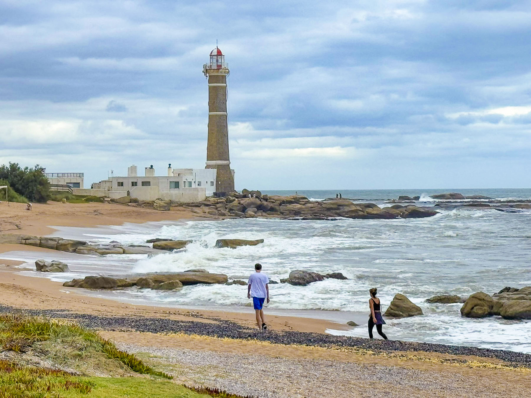
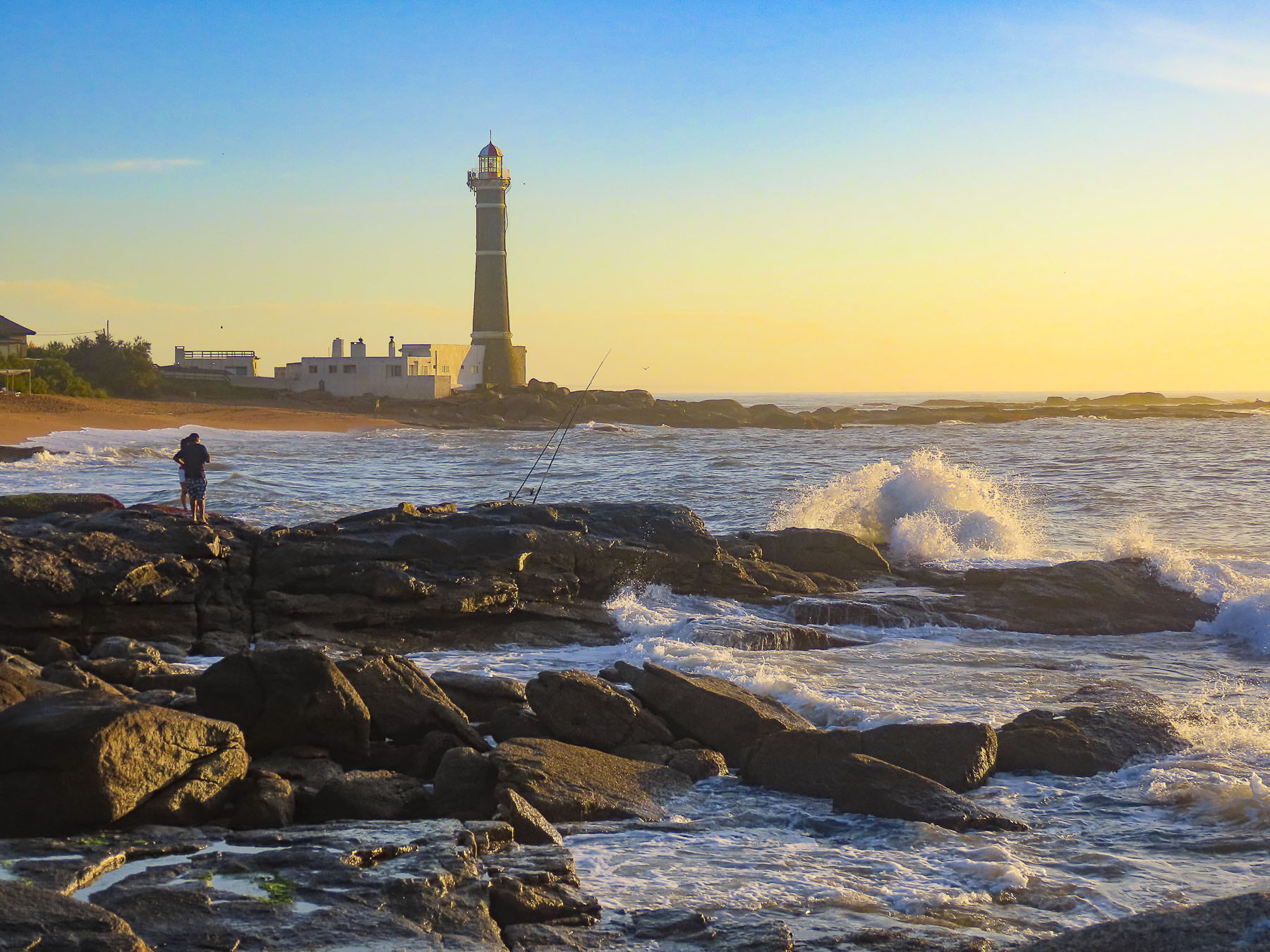
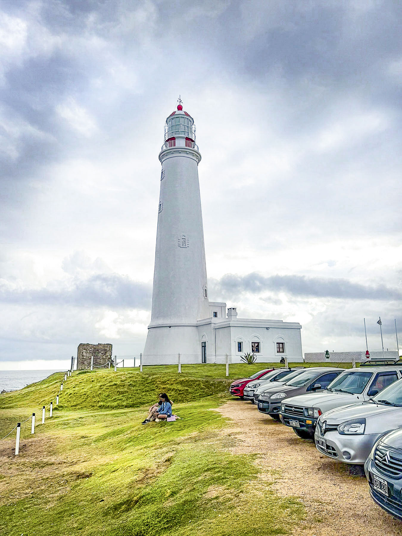
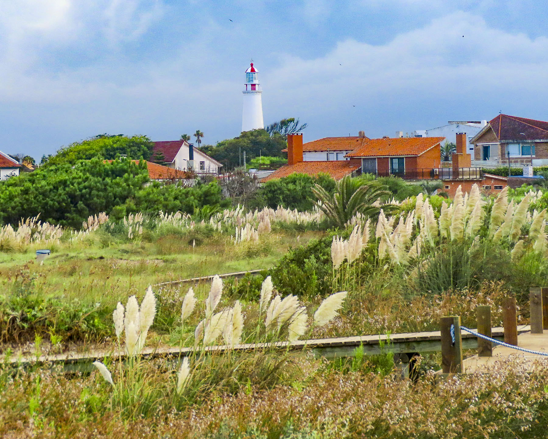
After settling in we headed to the lighthouse in José Ignacio, located on thumb-like peninsula that juts into the South Atlantic. Its 32m (105ft) tall lighthouse has guided sailors off this treacherous reef coast since 1877.

While Punta del Este has been promoted as a beach resort for wealthy Argentinians and Uruguayans since the early 1900s, and is now known as the “Ibiza of Uruguay”. José Ignacio remained a quiet isolated fishing village without running water or electricity, as the coastal road from Punta ended at the Laguana de José Ignacio. All that changed in 1981 with the construction of a bridge across the lagoon. The infrastructure improvements that came at that time were appreciated, but the town’s small population rallied to prevent the coastal area from becoming a Miami-esque playground, and successfully petitioned the local government to enact ordinances to ensure its quiet, peaceful character remained intact by allowing only single-family homes, no taller than two-stories within the Maldonado region. Along with banning discothèques, pubs and nightclubs, as well as all motorized vehicles on the beaches, jet skis and speedboats are also prohibited in the lagoons. Today the town’s seven miles of pristine beaches attract folks from all over who just want to unwind along what many consider the best part of Uruguay’s 410-mile-long coastline.

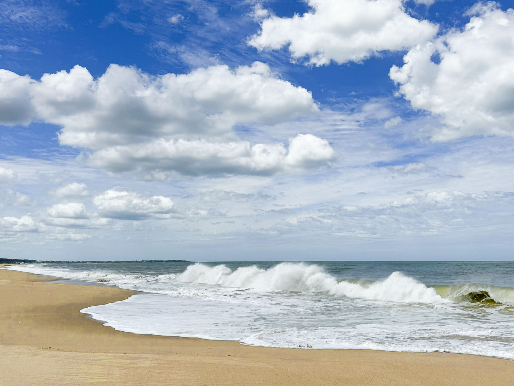
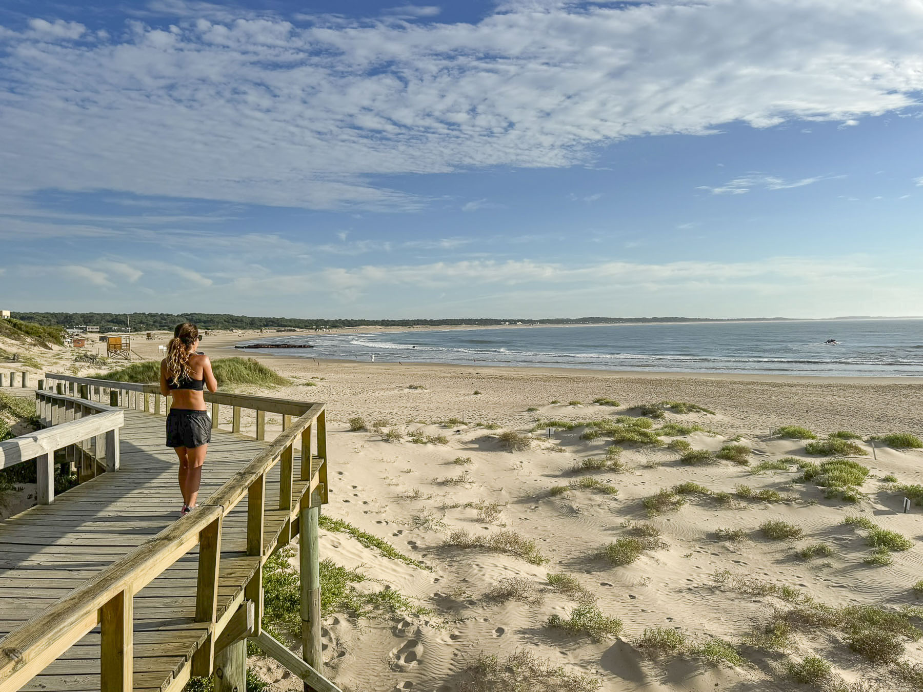
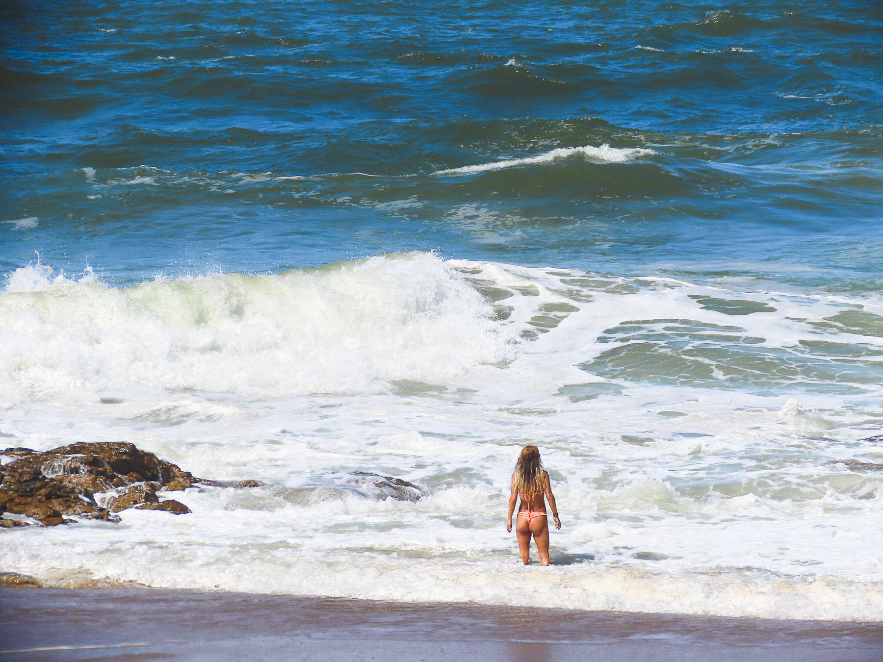
We walked out onto the rocky point next to the lighthouse, then down a boardwalk over the dunes to the Playa Brava, a long gracefully curved stretch of sand, scoping out the best spots to return to the next morning for sunrise photos. We strolled along the wide beach between lifeguard chairs. Squealing kids ran into the surf from the beach speckled with blankets and sun umbrellas amidst impromptu volleyball and soccer games. We stopped at El Chiringo, an outdoor restaurant with tables in the sand and shared a pizza for an early dinner.

Heading back to Casa Francawe stopped along the lagoonto watch a beautiful sunset across its calm water. Kite Surfers unwilling to end their day skimmed along the water until it was nearly dark.

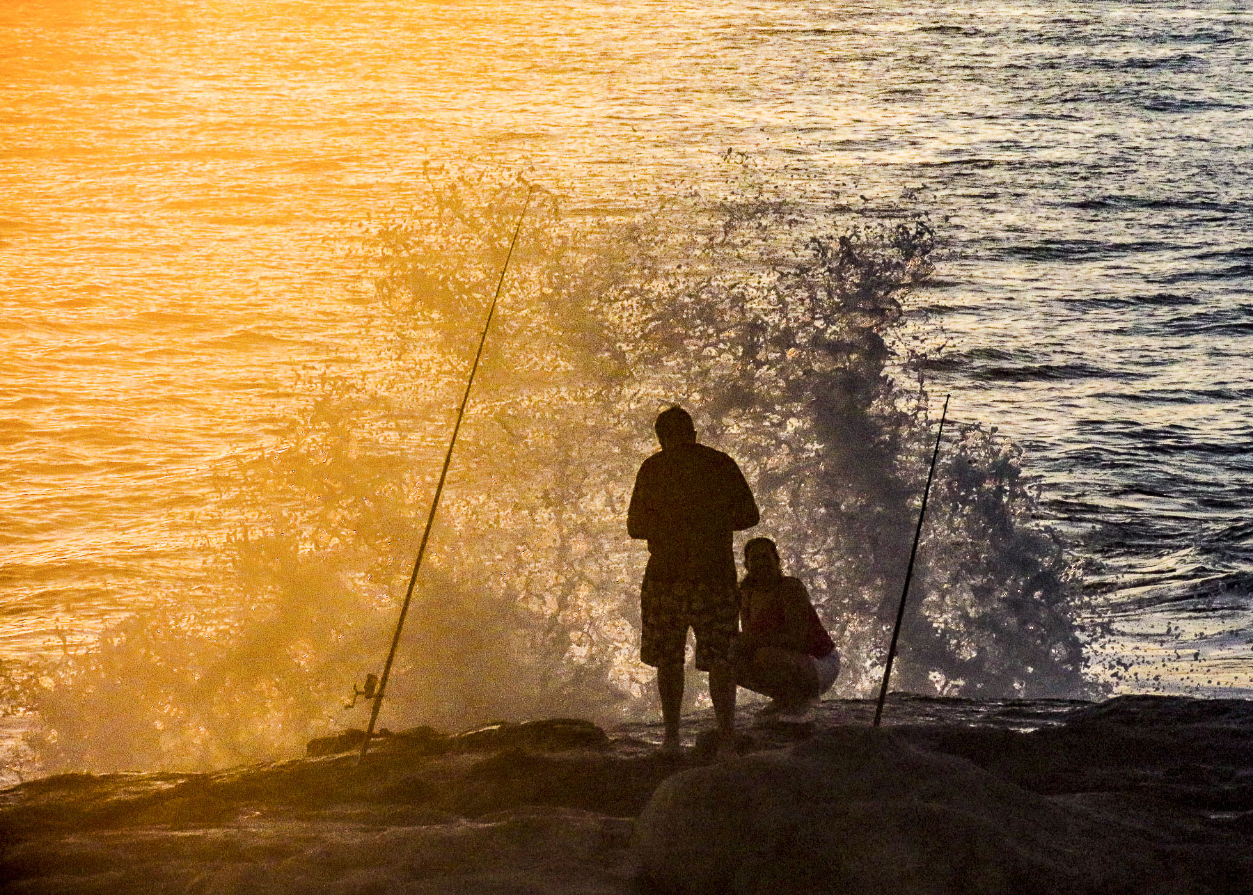
The next morning Donna slept in while I rose before dawn and drove back to the lighthouse to watch the sun cast its first rays of light across the rocky headland and lighthouse.

A few hardy fishermen had already made their first casts of the day from the rocks. On the other side of the lighthouse a group of fishermen were readying two large skiffs to push into the surf from the beach. Next to them the first surfer of the day paddled out, and a few joggers pounded along the cool sand in early morning solitude.

After a day of rest and relaxation we wanted to explore the beach towns farther east along the coast as it runs towards Brazil. The weather doesn’t always cooperate, but we were hopeful the sky would clear as we drove along Rt 9 near Rocha. There were a good number of produce stalls along the road hoping to entice travelers to the beaches to shop. We stopped at one with shelves stacked full with jars of local honey, jams, and Dulce de Leche, along with wheels of artisanal cheeses. We purchased a Dambo, similar to Edam or Gouda. It is a traditional local cheese made with the milk from grass fed cows which graze freely in the palm tree studded, pampas rangelands, that define the region. Farther up the road we stopped for our “drive a little then café,” break at a small shop attached to a gas station in the uniquely named town, 19 de Abril.  The town takes its name from an event related the revolutionaries called the Thirty-Three Orientals, who returned from their exile in Argentina on April 19, 1825, an event that eventually started the Cisplatine War, which led to Uruguay’s independence from Brazil.

Normally in the states we avoid like the plague any eateries attached to gas stations, as they are typically places that just offer junk food, but route 9 traversed a semi-rural region, and there were few options. We were pleasantly surprised as we parked to see a mural of a painting by Simon Silva on the side wall of the café. We bought a poster of this image twenty years ago and it still hangs in our home, and it was nice to know that someone else enjoys the image as much as we do. The café Parador 19 de Abril delighted us. It’s a quaint oasis in the wilderness. The cappuccinos and fresh pastries were quite good, and the folks who ran it were very nice.

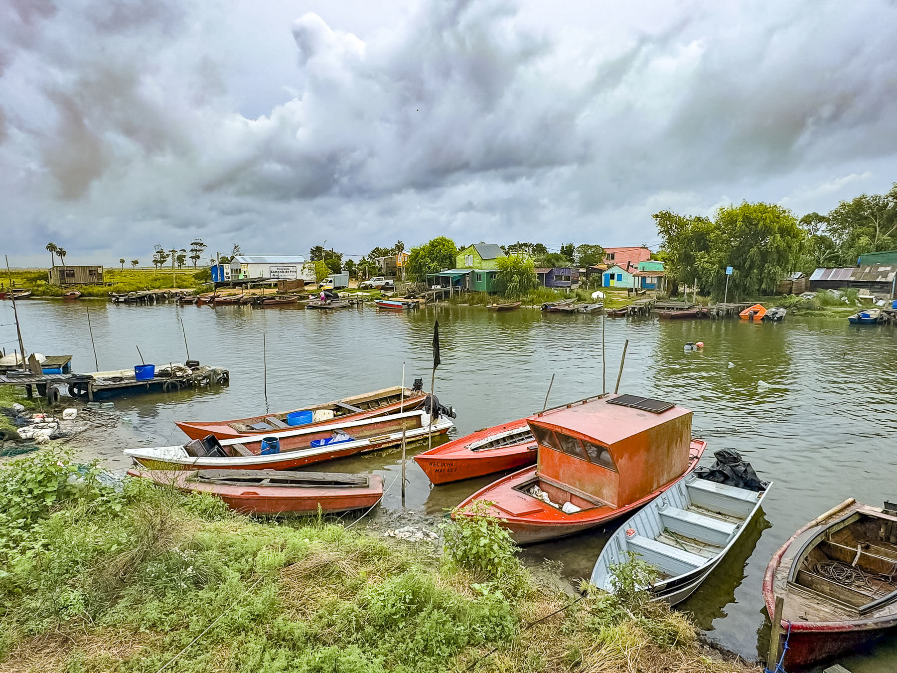
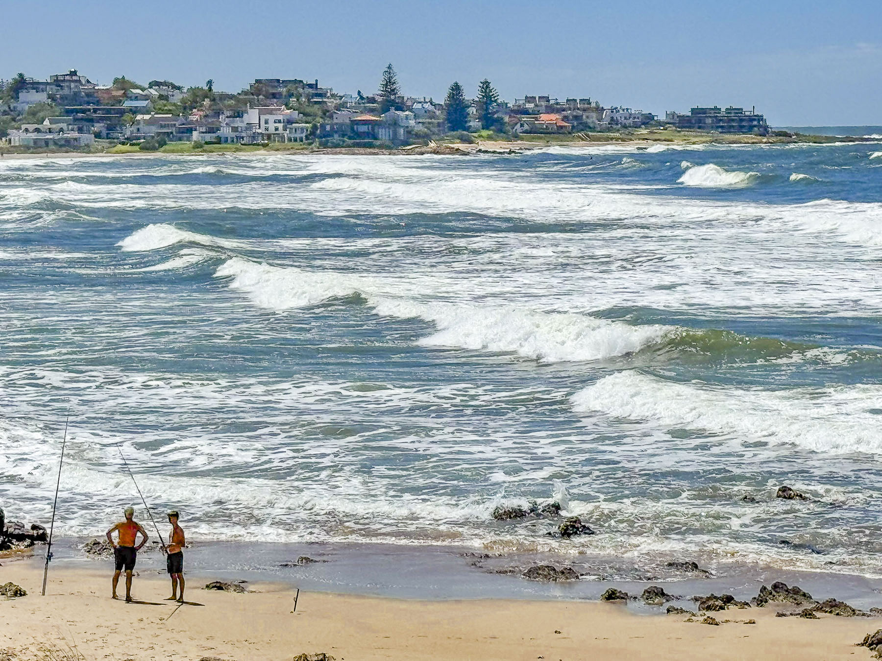
Folks were slipping and sliding through streams of water that were gushing down the hardpacked sandy roads of Punta del Diablo, as a deluge had descended upon us since our coffee break. The rain was too heavy to wander about, but we contented ourselves with driving through the haphazard layout of the oldest part of the rustic fishing village, that now has brightly painted shops and restaurants but is reminiscent of a village being founded by survivors of a shipwreck, using whatever materials they could salvage from the sea. Taking a horse drawn cart across the dunes was the only way to reach the once isolated village, until a road connecting it to Rt 9 was built in 1968. Larger flat bottomed fishing boats were beached along the gentle curve of Playa del Rivero, awaiting their next awaiting their launch at the arrival of high tide. A fisherman under a rain tarp offered his morning catch. Often during the Uruguay’s winter, June to November, the deep ocean just offshore allows folks to spot humpback and southern right whales breaching from the town’s beaches as they migrate north to the warmer waters around Brazil.

By the time we reached Aguas Dulces the rain had stopped, though the sky was still threatening, and the streets were nearly deserted. The high tide was rough from the earlier storm and was inching its way towards the row of boulders placed along the shoreline to prevent further coastal erosion and homes being swept away.  Laidback and low keyed, Aguas Dulces is a budget-friendly destination for Uruguayan families who enjoy its lifeguard protected beaches when the weather cooperates.

On the way to La Paloma we stopped at Puente Valizas, a picturesque riverside fishing village along the Arroyo Valizas. The tributary flows 10km (6mi) from the Laguana Castillos to the Atlantic Ocean, near the beach resort of Barra de Valizas. The river was busy with fishermen speeding to the Laguana to catch pink shrimp, which thrive in the brackish waters of the lagoon, for the restaurants along the coast.

In La Paloma the afternoon sky was brightening as we walked along the Paseo Marítimo, a boardwalk through the dunes that lined the tranquil waters of Bahía Grande, a small clam shell shaped bay. La Paloma is the largest coastal town east of Punta del Este and is a popular resort area with 20km (12mi) of beaches that are suitable for surfers and families with young children to enjoy.  Eventually we reached El Faro del Cabo Santa Maria, the town’s historic 42m (138 ft) tall lighthouse. Built in 1874, the powerful navigational beacon atop the tower can be seen 37km (23mi) out to sea. When it is open, folks can climb 143 steps to the top for some spectacular views of the coast.

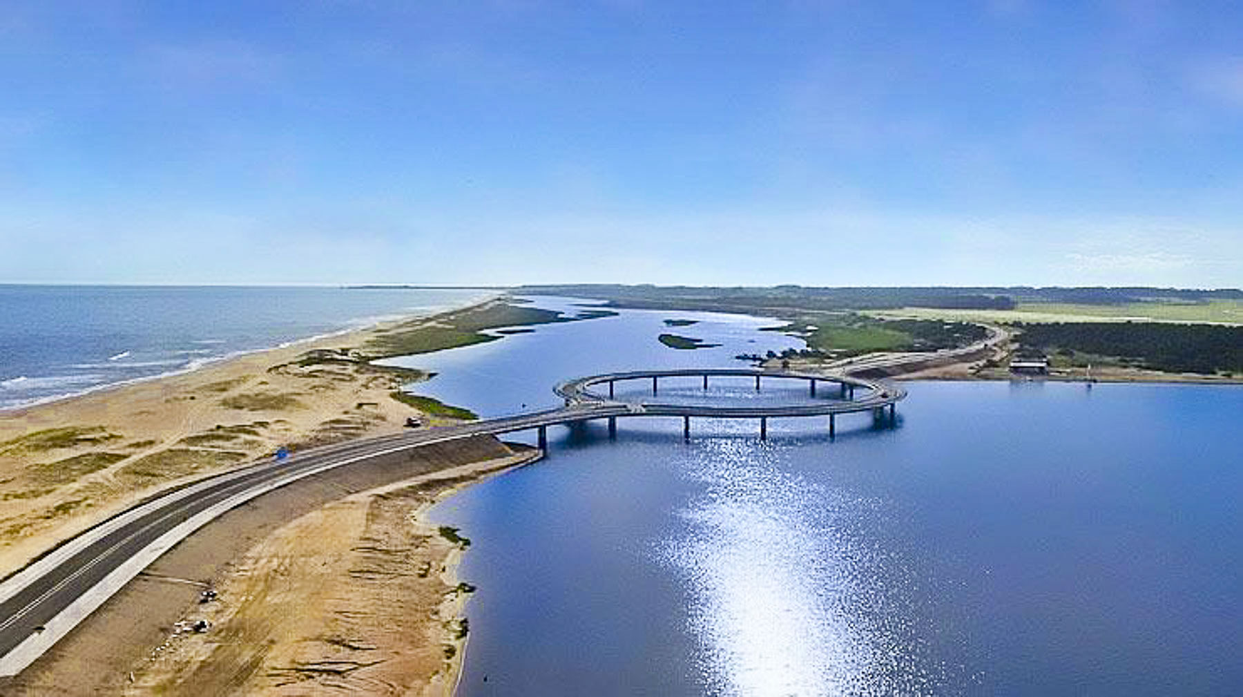
On the way back to Faro de José Ignacio we followed Rt10 across the Laguna Garzón Bridge, an experience that totally took us by surprise, as the 2015 bridge has a unique circular design that resembles a flat donut. It’s really quite unusual but was designed this way to naturally slow the speed of traffic.

Our host and his family the next morning departed for a day trip a few minutes ahead of us. Their dog which watched their leaving from the second-floor deck had somehow escaped and was running frantically around outside the gated area. Fortunately, Donna has mastered that universal dog-call kissing sound, and we were able to lock him securely behind the gate. We called Daniel to let him know.

A few blocks down we stopped to photograph two abandoned properties. They were both very interesting, and we always wonder what the backstory is that goes with these places.

Route 10 hugs the beautiful 33km (20mi) stretch of wild undeveloped coast that extends from Faro de José Ignacio to Punta del Esta.

Reaching the outskirts of Punta we got our first glimpse of the Puente de la barra, a whimsical wavy bridge, that our route followed across the Arroyo Maldonado. Designed in 1965 to force drivers to reduce their speed, it’s said the rollercoaster-like bridge can cause vertigo if you drive too fast across it. On the Punta side there is a traffic circle that made it too easy for us to cross the bridge multiple times, just for the fun of it.

We stopped at a mirador near the “La Ola Celeste,” a stylized sculpture of a wave that overlooks the fast rolling breakers that beat against the waters of the Arroyo Maldonado as the river empties into the sea, and separates Punta from the smaller resort town of La Barra, which has a vibrant nightlife that rivals Punta’s as the best place to party in Uruguay.

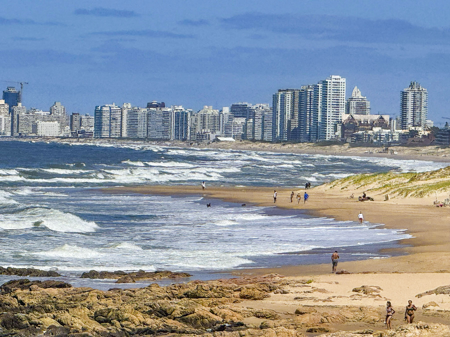
This was also a great spot to get an expansive view of the dramatic beaches along the coast and Punta’s modern skyline, which often prompts folks to refer to it as “the St. Tropez or Monaco of South America.” The vista reminded us of Miami Beach.

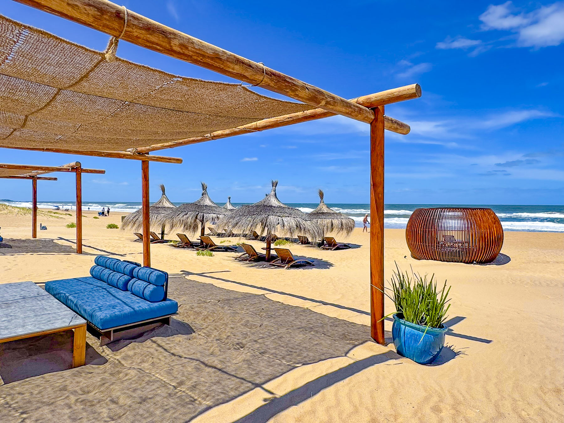
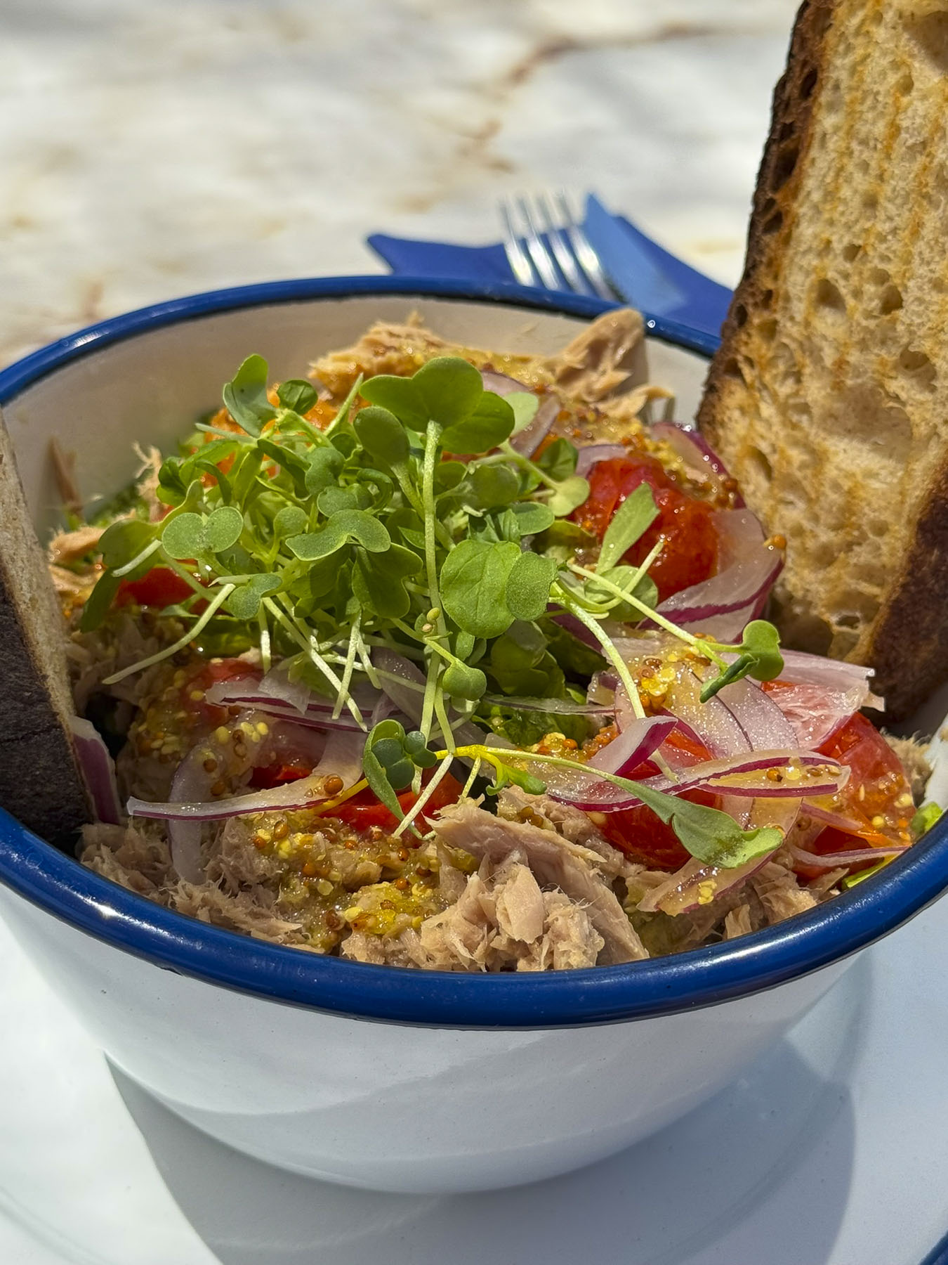
We stopped for lunch at the Aura Beach House, a small modern café with a light menu, set on the brilliant white sand of Playa La Brava. They also have several rows of lounge chairs under nicely thatched beach umbrellas for daily rent. It was a beautiful, relaxing spot and our food and coffees were excellent; we didn’t want to leave. We found in our travels across Uruguay that street parking was always free, even along the beaches, something that is very rare in the United States.

We weren’t sure what the weather was going to be like the next day, so we took advantage of the splendid afternoon and stopped at The Hand, Punta’s most iconic landmark since the Chilean artist Mario Irarrázabal installed it along the oceanfront in 1982. It was very crowded with a tour group, but we waited for their departure before taking any photos. As it turned out the sculpture was within walking distance of our hotel, and we returned to it several times during our stay in Punta.

We continued on our way to the Faro de Punta del Este lighthouse that stands on the highest point of the narrow peninsula that was Old Town Punta, a whaling port established in the early 1800s.  

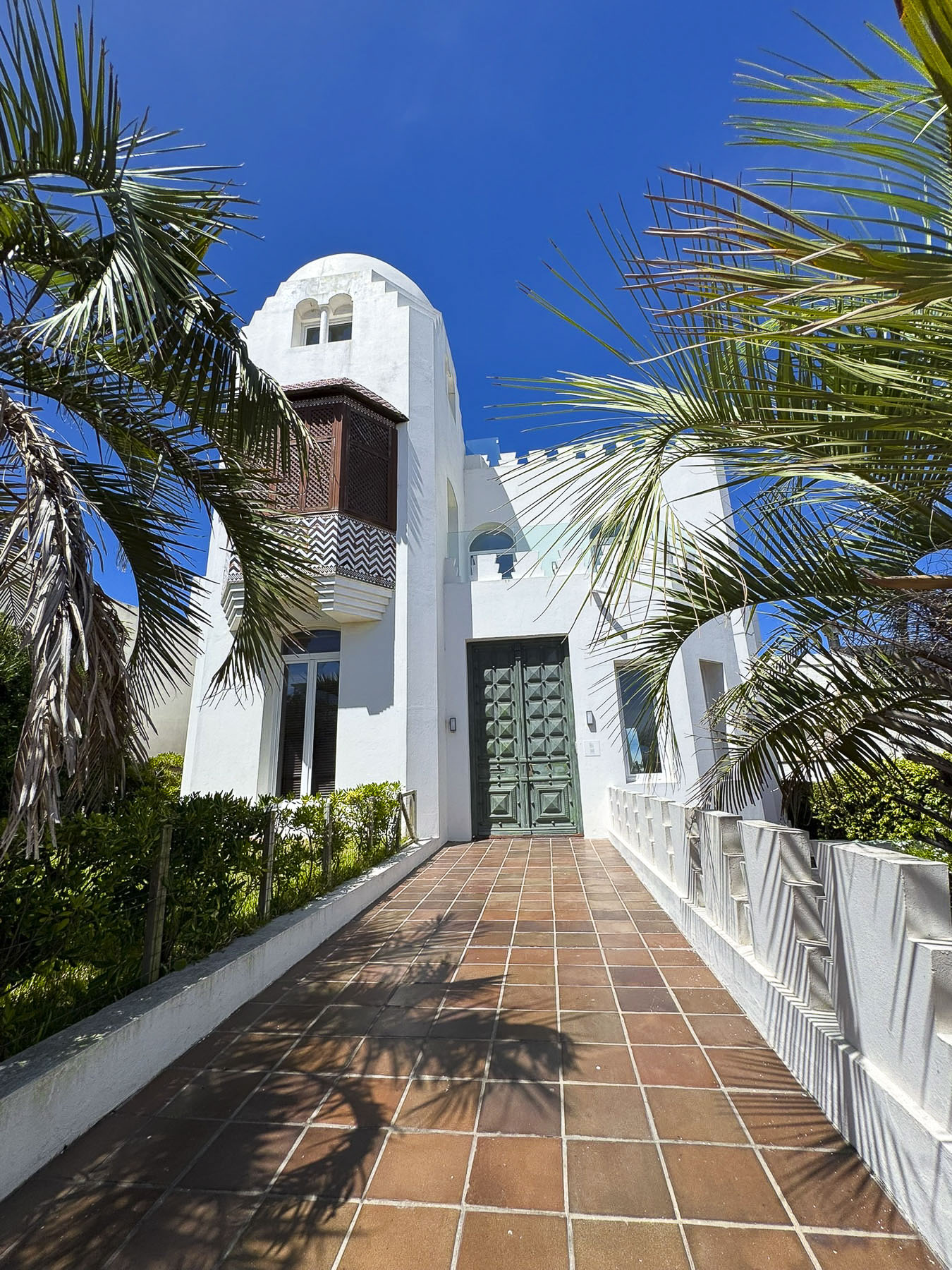
Punta, like Montevideo, has a lot of public art on the streets we realized as we drove by the Monumento El Rapto de Europa. The large bronze sculpture references the myth of Europa, a Phoenician princess who was abducted by Zeus in the form of a bull and taken to the island of Crete.  Why it is on a street corner near the beach in Punta, we haven’t a clue. Across the street from the lighthouse were several architecturally interesting homes and the very blue Nuestra Señora de la Candelaria church which had a lovely tranquil interior.

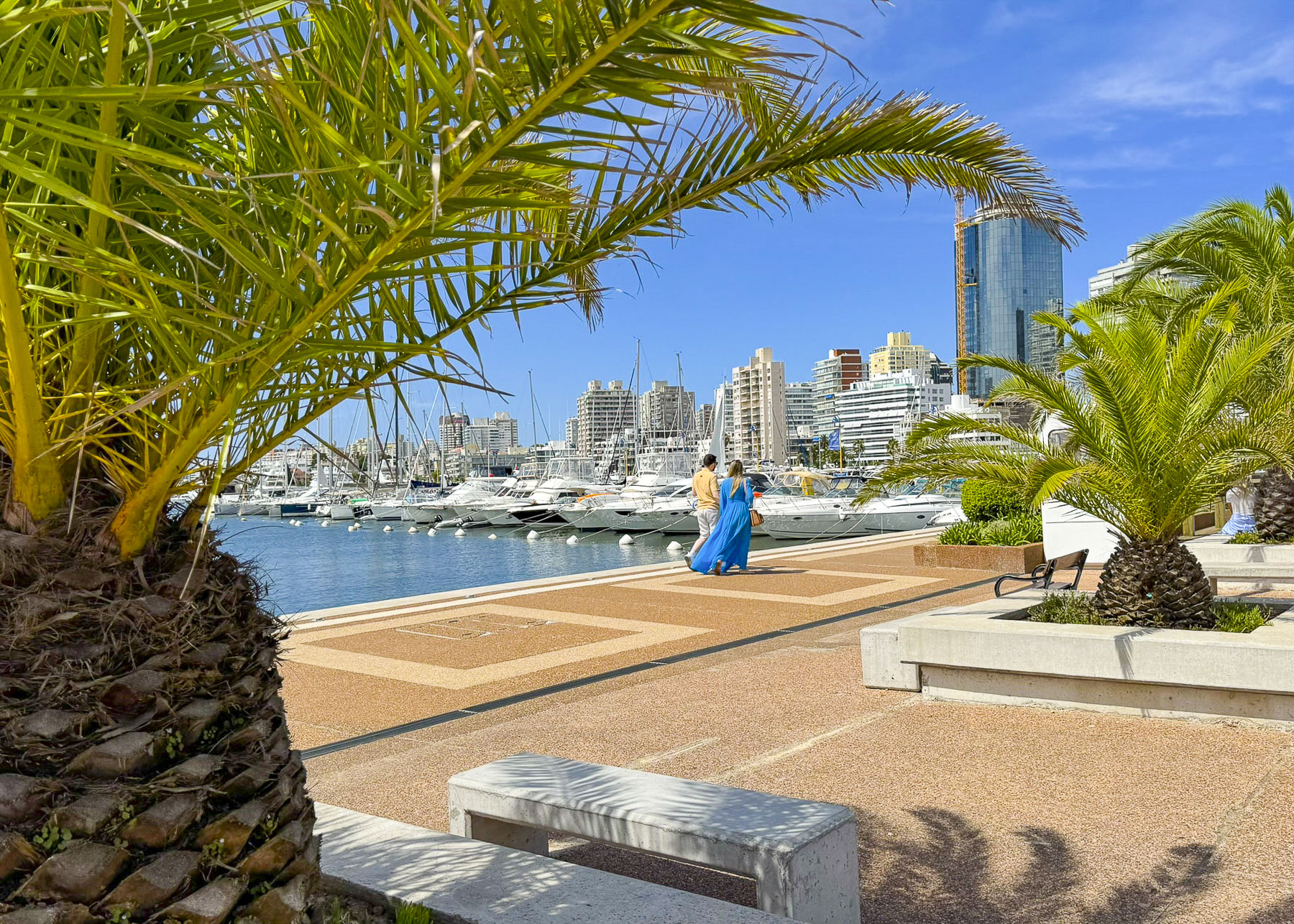
At Punta’s modern marina, sleek motor yachts and sailboats now bob gently in the water where the whaling ships once anchored. The first tourists to Punta arrived in the early 1900s, but it wasn’t until the infrastructure improvements of the 1940’s supported the construction of modern hotels and the town’s first casino that Punta’s reputation as a luxurious destination in South America was cemented. We stayed in the Old Town at Hotel Romimar, a budget-friendly lodging with an excellent breakfast, off Av. Juan Gorlero, Punta’s main shopping street.

We love exploring a new city early in the morning as it wakes up. By 7:30 beach attendants were hard at work carrying lounge chairs and umbrellas from trailers parked along the street, down to the sand and assembling them into tidy rows for their expected sunbathers. It was the perfect time to re-visit The Hand, as the sun was just cresting over its fingertips, and sunlight was reflecting brightly off the row of high-rise condos that fronted the coastline.

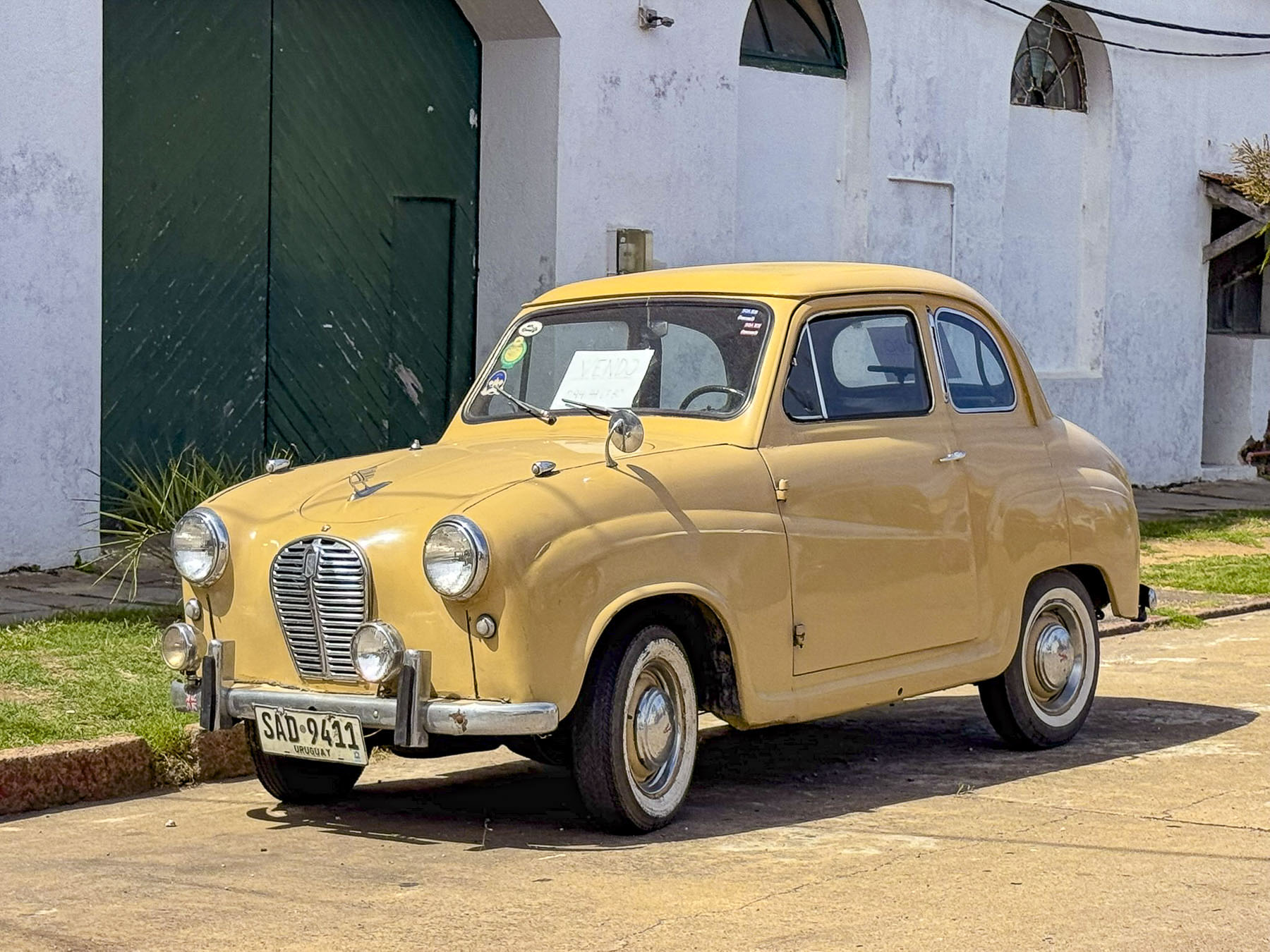
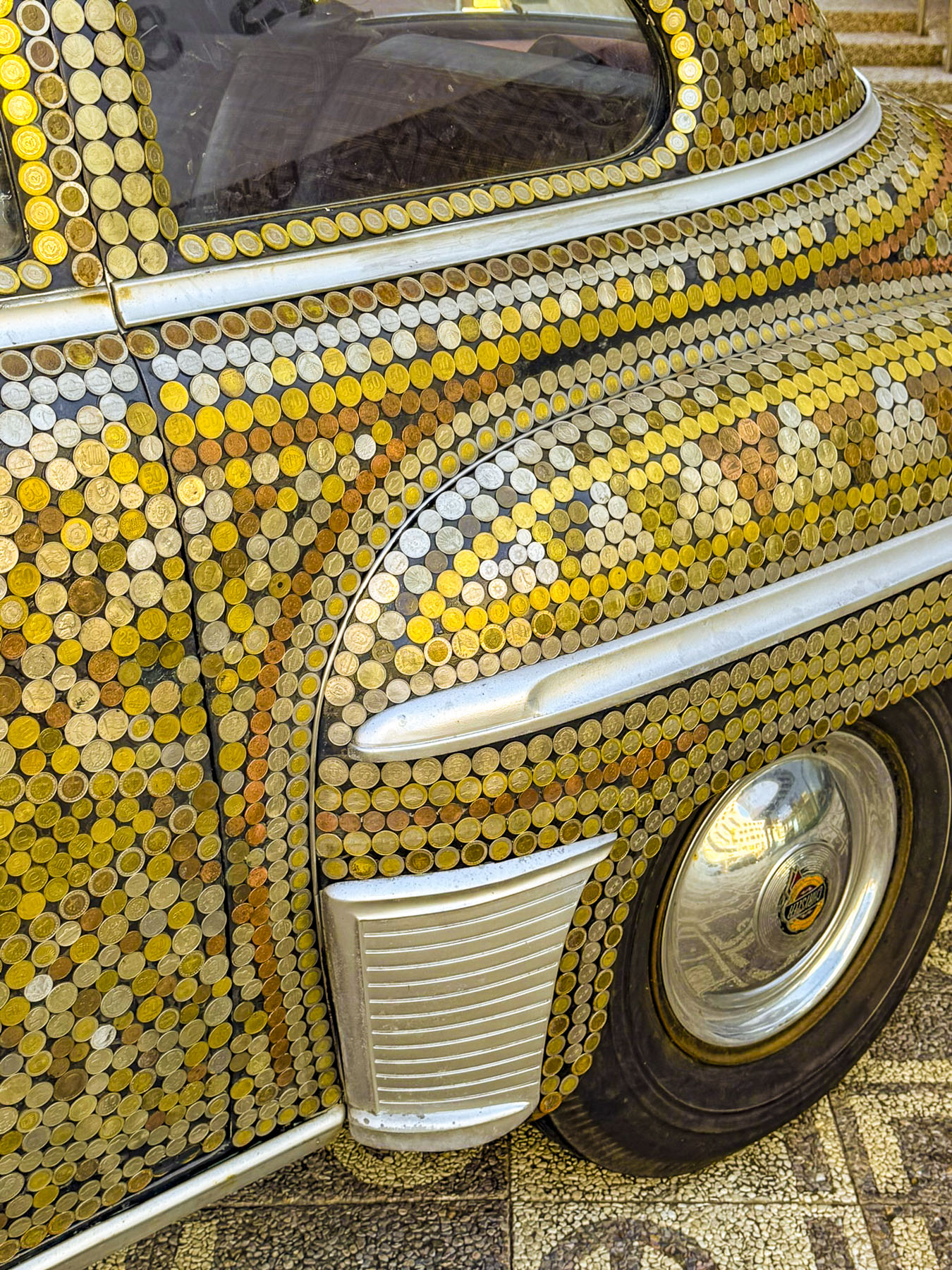
Wandering about we spotted several cachilas, old cars that out of economic necessity were lovingly maintained and passed forward through hard times. Some are now totally restored and look as good as the day they rolled out of the showroom. One, an old Plymouth, was creatively covered in a mosaic pattern of old Uruguayan coins.

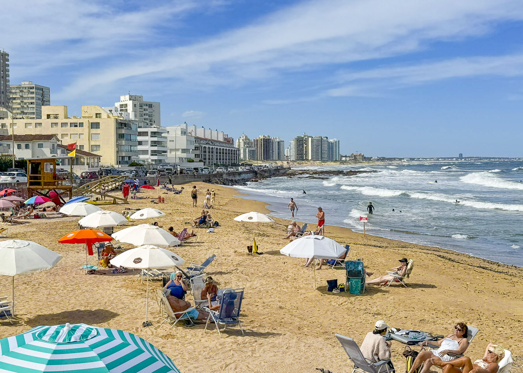
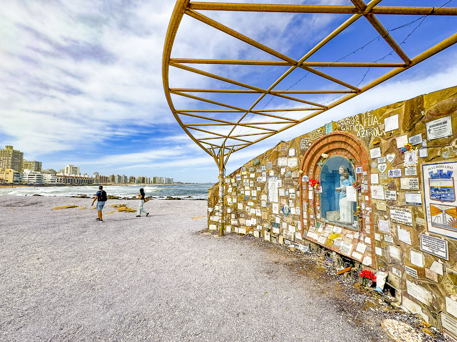
Families were also out early to claim their preferred batches of sand at Playa El Emir, a small beach on the edge of Old Town Punta with a wonderful view of the coastline, near the Ermita Virgen de la Candelaria. The shrine to the patron virgin of Punta del Este is located on a narrow sliver of land that juts into the South Atlantic Ocean, that is believed to be where the Spanish explorer Juan Díaz de Solís held a mass when he landed nearby in 1516. Our “walk a little the café,” breaks were satisfied that morning with excellent coffee and pastries at Donut City and Cresta Café. Both were only a short walk from the beach.

A day trip the next morning took us to towns west along the coast from Punta that also interested us. Our first stop was at the Escultura Cola de la Ballena Franca, an open wire metal sculpture of a whale tail that overlooks the ocean between the endless beaches of Playa Mansa and Playa Cantamar. It is a popular lookout spot for southern right whales during the peak of their winter migration between July and October.

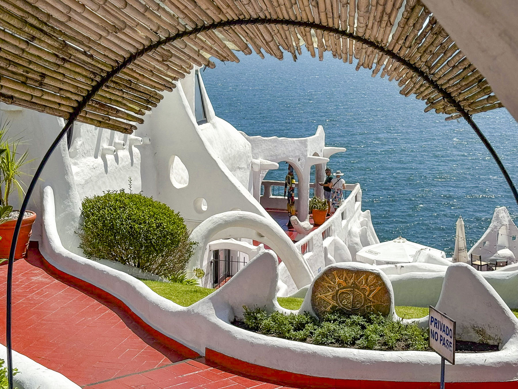
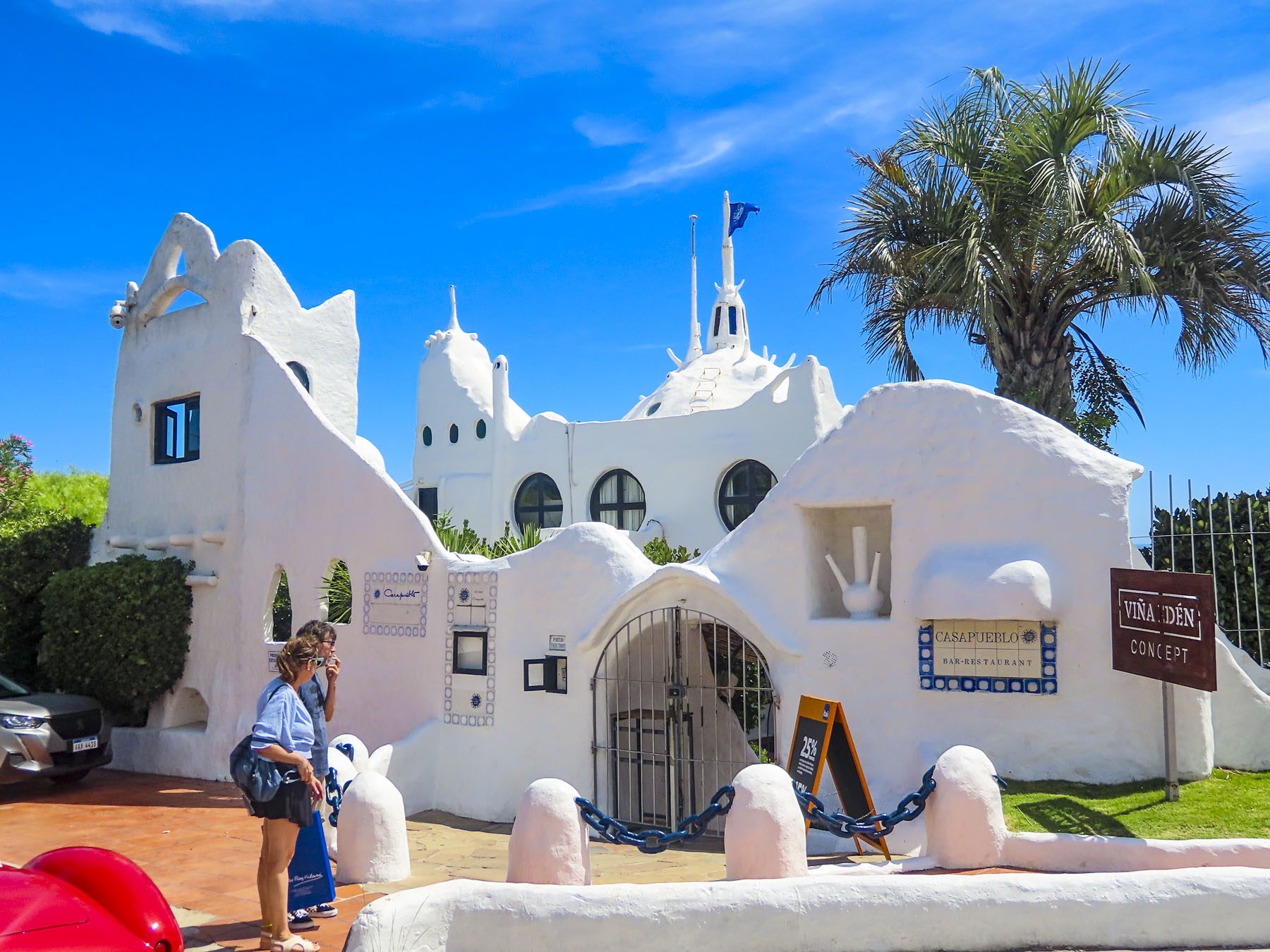
Casapueblo  is a surreal Guadi structure that captures the essence of the whitewashed cliffside homes on the Mediterranean island of Santorini, Greece. It started as a small wooden shack in 1958, the studio of Páez Vilaró, a Uruguayan abstract artist. He expanded it himself along the oceanfront as his family grew, and friends like Picasso and Brigitte Bardot visited, until a whimsical 13-story structure with 72 rooms stacked upon each other covered the cliff face. Today it is a museum and hotel.

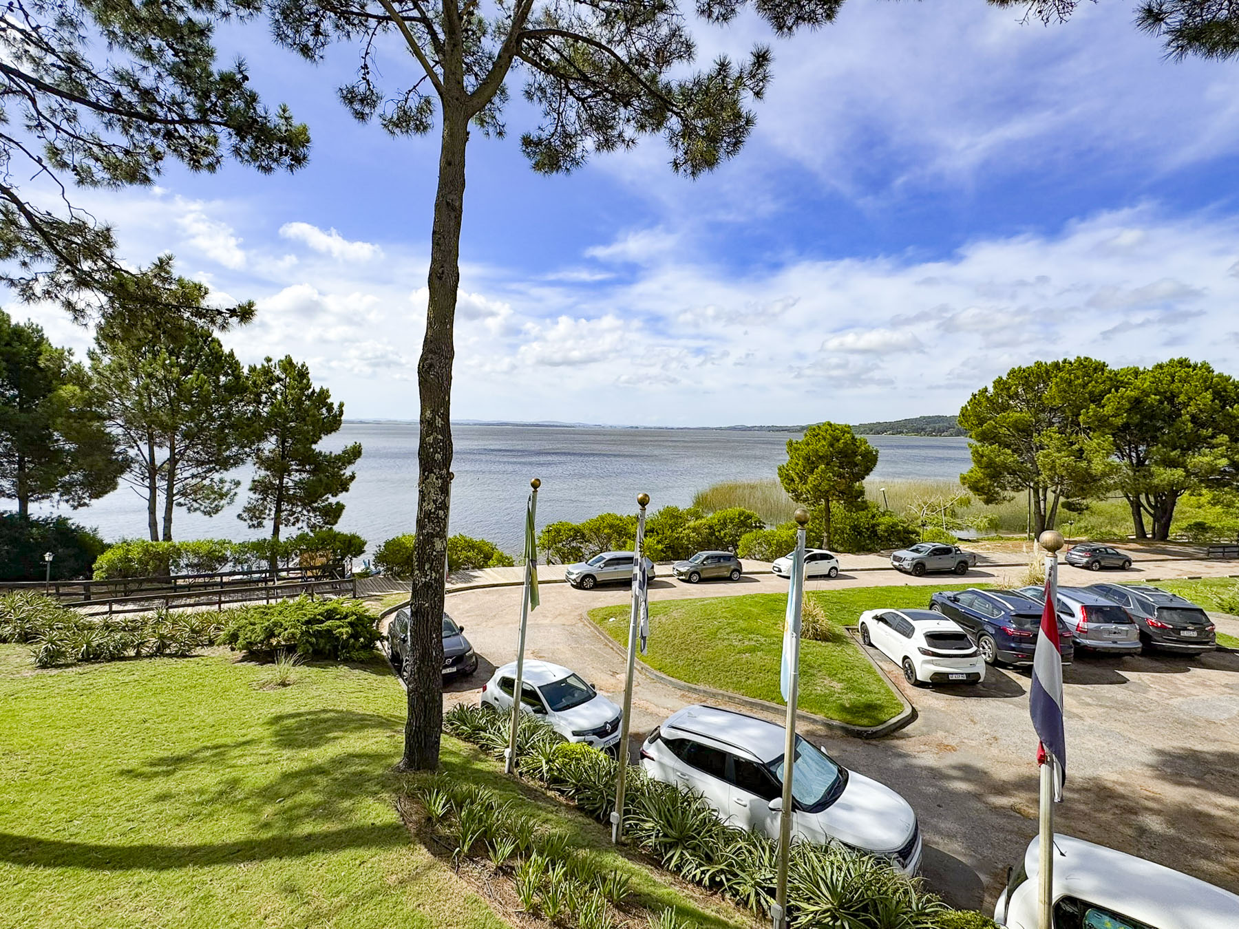
Afterwards we drove to the Laguana del Sauce and enjoyed a quiet lunch overlooking the lagoon from the Hotel Del Lago.

Away from the oceanside a rural landscape quickly unfolded as we drove through farmlands to the Capilla Nuestra Señora de la Asunción, a pretty church that reminded us of settings in the American Midwest.

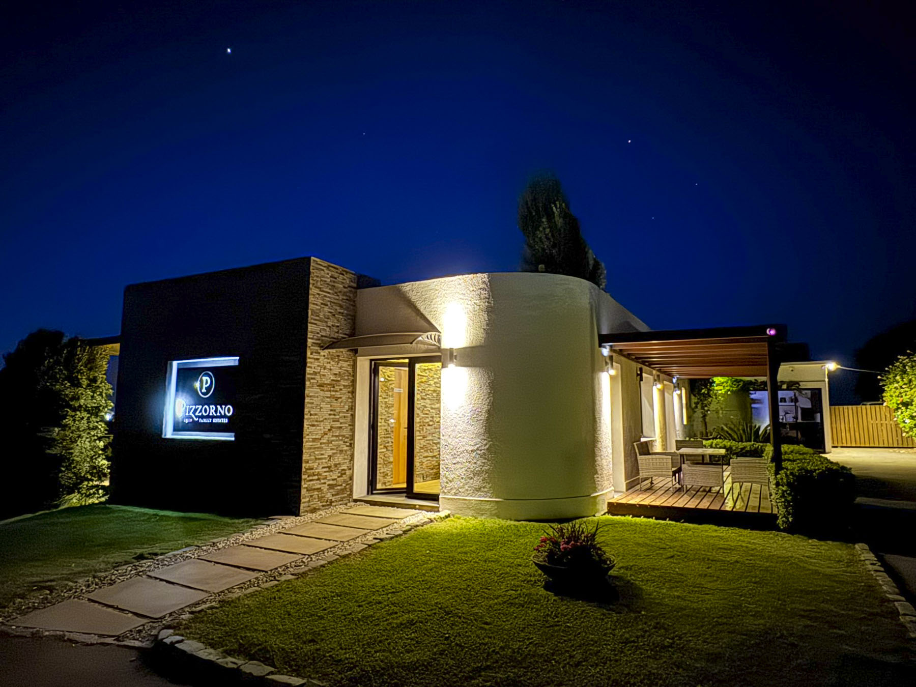
The next morning, our last full day in Uruguay, we headed west toward the Canelones wine region near Montevideo, an area which produces nearly fifty percent of Uruguayan wines at vineyards which were started four to five generations ago by families which immigrated from Europe. Piriápolis is a small coastal city which grew from a private investment as the country’s first planned resort was along our route. El Balneario del Porvenir (the Resort of the Future) was the vision of Francisco Piria, a wealthy Uruguayan businessman, who in 1890 bought 2700 hectares (6672 acres) of undeveloped land along a beautiful beach, 99km (62mi) from Montevideo. He spent forty years commissioning hotels and a promenade along the oceanfront, which he likened to the French Riviera, before his death in 1933. In 1937 the population of the resort town was large enough to be declared a pueblo, and twenty-three years later it achieved the status of a city. From the landing of a small chapel atop Cerro San Antonio we had a perfect panoramic view of the city that still draws visitors to its beach where families can rent scooter cars for their children to wheel along the promenade. During the high season the Aerosillas Piriápolis chairlift whisks tourist from the marina to the top of the hill. The Castillo de Francisco Piria, the entrepreneur’s home, was on the outskirts of the city as we headed to a wine tasting and overnight stay at the Pizzorno Winery & Lodge.

We arrived at the winery as a tractor pulling a wagon full of just-harvested grapes was being unloaded into a destemmer-crusher, the first step in the long process to create wine.

Founded in 1910, the fourth generation of the Pizzorno family operates the wine estate. It has 21 hectares (52 acres) of vineyards planted with Tannat, Cabernet Sauvignon, Cabernet Franc, Petit Verdot, Merlot, Pinot Noir, Malbec, Arinarnoa, Marselan, Sauvignon Blanc, Chardonnay, and Muscat of Hamburg vines.

We were the only guests that afternoon during the last week of February and thoroughly enjoyed the interesting tour of the wine cellar led by Joaquin, the winery’s sommelier. He   explained their viticulture philosophy which endorses “traditionally harvesting grapes by hand, respect for the ecosystem, environmental conservation through a no fertilization and watering wisely policy, along with green pruning, leaf removal, and bunch thinning to obtain the best grapes, which is reflected in the quality of the wines we make using only our own grapes.”

Afterwards Joaquin’s experience continued to enhance our tasting of four wines as he shared his knowledge of the vineyard’s terroir, and the different grape varietals, along with their aromas, flavors, and recommended pairings with food.

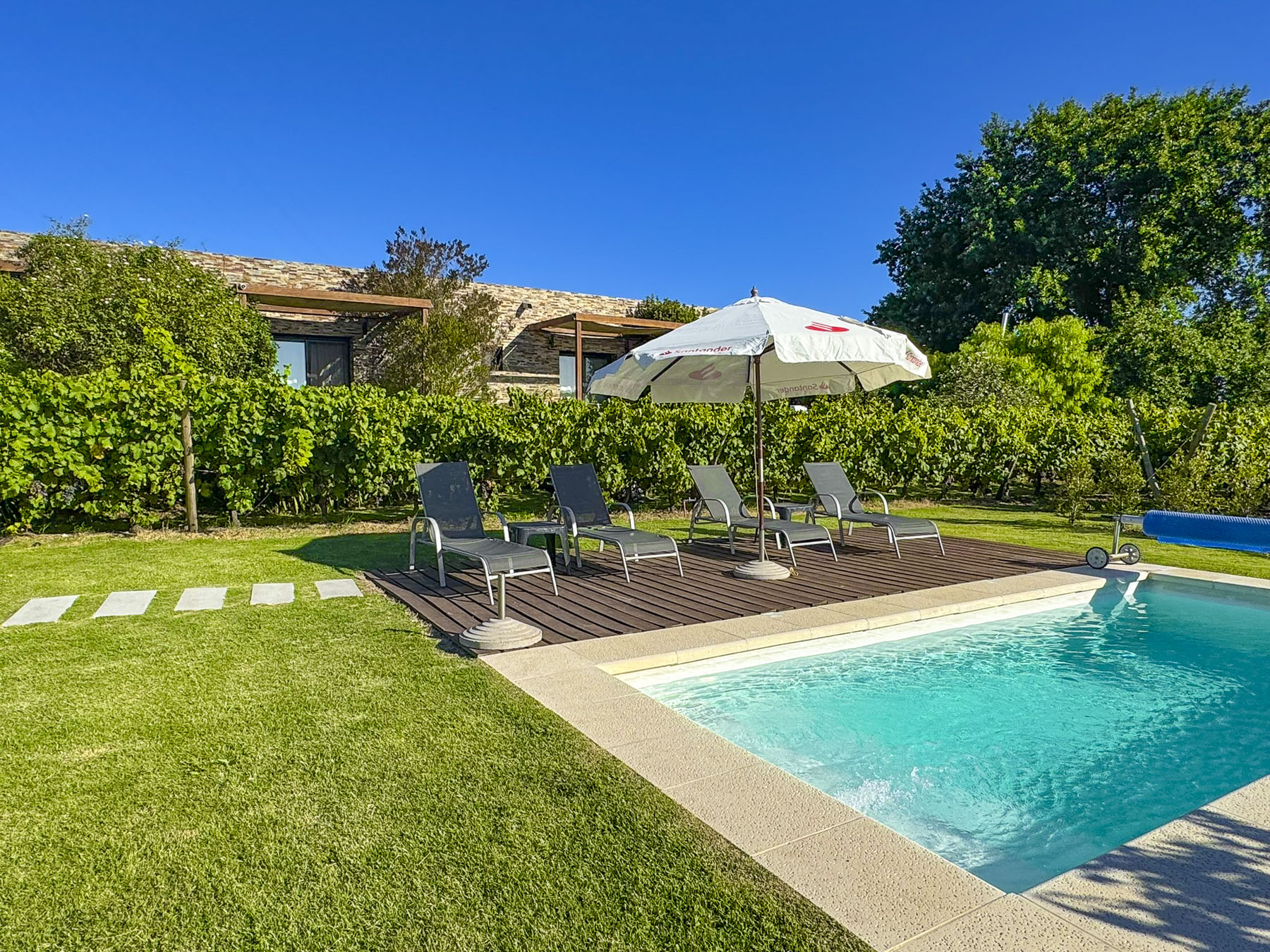
It was our last night of our 15-day trip around Uruguay and we treated ourselves to a luxurious stay in the winery’s posada. It was for many years the family home until it was creatively restored into an attractive boutique inn with four guest rooms overlooking a pool and the vineyards.   

“You will have the posada all to yourselves tonight. Enjoy the pool, and feel free to walk through the vineyard. A nightwatchman will arrive later.”  The golden hour was upon the vineyard as we cooled off in the pool. 

This surely dates us, but it felt like we were in an episode of the TV show Lifestyles of the Rich and Famous hosted by Robin Leach, who used to sign-off with “Champagne wishes and caviar dreams.”

Till next time,

Craig & Donna

Two Hundred Fifty-Three Days on the Road

cropped-img_4837The good news is we haven’t killed each other, though there have been times that I’ve dreamt a pillow was hovering over my head. Just kidding.  We have gone from the two of us working six days a week while living in an eight-room house, to being together 24/7 with only a suitcase each.  Boy did we downsize! It was challenging: what not to bring, considering all the seasonal changes we have encountered.  Don’t laugh, but I have thermals, wool hats and gloves packed, just on the off chance we get snowed in on a mountain pass in the French Alps, this July.  Yes, there’s also a flask of medicinal whisky packed in the bags for emergencies.  And to my wife’s amusement, a cheap plastic fly swatter.  Tragically the backup swatter was left behind in Antigua.  In Lisbon I finally caved in and bought a pair of slippers because the floors of the stone buildings just don’t retain any heat in the winter.  The comfort of a pair of slippers in the evening, after a long day of walking, can’t be underestimated.IMG_8406It’s been a huge but surprisingly easy transition for us. 253 days ago (I thought I was writing this at around day 200, it’s easy to lose track of time on the road) we slammed the door shut on our storage pod, locked it, and popped open a bottle of champagne to celebrate our impending journey. We haven’t looked back.  Ecuador, Guatemala, Cuba and now Portugal; I can’t imagine undertaking this adventure with anyone else.

The Airbnb revolution has greatly contributed to our concept of slow travel, allowing us to immerse ourselves in a location for an extended period of time and to enjoy a community to its fullest. Experiencing a festive Christmas season and an explosive New Year’s celebration in Antigua, Guatemala, was extraordinary and something we wouldn’t have appreciated as much if we were just passing through.

We felt a little blue being away from our kids and their families during Christmas. The irony that we, and not the children, broke with the family tradition first was not lost on us.  A three week visit back to the States in mid-January to see everyone helped tremendously.img_0864 This visit also gave us an opportunity to jettison the wonderful textiles and ceramics we had purchased along the way for a home we don’t have yet.  Imagine this scene from our last stop in San Pedro – the backseat of a tuk-tuk overflowing with Donna and all our suitcases, while I’m sharing the driver’s seat with the driver, one cheek on, one cheek off and a foot dangling outside the cab as we speedily snaked through the steep narrow alleys of the village. 

Shopping in the central markets and street markets of each city has been wonderful as cooking is essential to keeping within our budget, though the size of some of our kitchens have tested our creative culinary abilities.  The exotic fruits available to us in Ecuador were amazing and we tried many that we were unfamiliar with.

In Olon we bought the catch of the day from the fish monger as be pushed his cart through town. Guatemala yielded remarkably flavorful vegetables.  We had a memorable culinary carrot experience there, go figure. This from a home gardener is quite a statement. Like our neighbors in the Alfama district, we are hanging our laundry out the windows to dry in the Lisbon fresh air. Our stays in each place have ranged from four to ten weeks.  I favor the longer stays whereas Donna prefers a shorter visit. 

There have been challenges negotiating the medical systems in Ecuador and Portugal only because we haven’t known the protocol of the local doctors.  We have been extremely impressed by the care we have received from the medical professionals in these countries for altitude sickness and a persistent upper respiratory infection.  The out of pocket costs have been remarkably inexpensive in comparison to the U.S. medical system.IMG_8692 Not everything has gone smoothly.  A rental car agency did not honor a reservation and we had to scramble to find another one late one night in the airport.  We have felt very safe during our travels, but there are unfortunately some extremely talented pickpockets out there. May the curse of arthritis shorten their careers!  Filing a stolen property report in Lisbon with the tourist police turned out to be an enjoyable experience due to the officer assigned to us.  Luckily, within 24-hours they called us with the good news that our wallet had been recovered, minus the cash of course, but that our passport and credit cards were all there.  Honestly, we weren’t following our own advice: only carry in your pockets what you are willing to lose.  Everything else of value needs to be carried under your clothing.IMG_8596After Lisbon it’s a two-week road trip through Portugal. Then we are off to, of all places, Sofia, Bulgaria for a month, (the Beatles song “Back in the USSR” keeps coming to mind) in order to reset our Schengen union days for later in the summer.  After that, two dog sits in England and two Workaway experiences in France at a 14th century chateau await us before we resume our life of leisure in Kotor, Montenegro, in September.img_0669We have shared meals and stories with so many wonderful and interesting people along the way.  These friends have made this journey what it is – fantastic! 

Kindness and a smile go a long way in this world.

Till next time,

Craig & Donna


Onto Banos and Riobamba – The Last Leg of Our Avenue of Volcanoes Drive

IMG_9173
Quilotoa Crater was our  first stop today.

The road conditions don’t warrant driving after dark, there are just to many ifs, so we departed early from Hostal Taita Cristobal, after wishing our table mates safe travels and adventures as they hoisted heavy backpacks to their shoulders. The Quilotoa Crater and Baños, the adventure capital of Ecuador, were our day’s destinations.  Really, Donna’s not going to go zip lining nor am I willing to try bungie jumping.  Still, we thought we could find an adventurous activity where one foot was required to be in contact with the ground occasionally. Experience has taught us to double the amount of time our GPS app suggests it will take to get from point A to B due to road conditions and the frequent stops for photo opps. As my wife says “if we continue to stop every 100 yard for pictures, we’ll never get there.”   The return drive back to the main road in Sigchos seemed to go very quickly.  We only stopped for photos around every other bend. Fortunately we were able to drive down the center of the road or hug the left side to avoid looking over the precipice most of the time. It was nerve racking when we had to get closer to the edge to make room for an oncoming truck to pass. We never thought the sight of a guardrail would bring as much joy as it did when we got back on the main road in Sigchos.  As our host had promised the road out of Sigchos was freshly paved. Along with a bright, yellow double line down the center it had shiny, heavenly guardrails around every curve!  Even with the new road there were still hazards.  There were numerous signs for falling rock or mudslide zones. We also shared it with folks herding sheep or cattle, donkeys carrying water barrels and folks selling things from motorcycles towing small trailers.  Suddenly around one curve, marked by only 2 piles of dirt as a warning, about one hundred feet of road had collapsed into a steep ravine.  There were no flagmen, orange cones or repair crews in the vicinity.  The hair on the back of our necks stood up.

The treed landscape slowly disappeared and was replaced with barren windswept vistas as we rose in altitude, the closer we got to Quilotoa. Gale force winds ripped around us on the ridge above the magnificant Quilotoa Crater (12,913ft), its turquoise waters calm a thousand feet below.  Local legend believes Quilotoa fell in love with the Cotopaxi volcano, and  the tears from her unrequited love filled the crater.  Teary-eyed from the wind chill and altitude, we sought out some restorative coca tea.

IMG_9392

A few miles down the road Canyon del Rio Toachi, a mini Grand Canyon, offered interesting photo opportunities from the parking area.  Further on small groups of men and women could be seen in the fields winnowing grain by throwing it into the air to separate the wheat from the chaff. Barns made from thatch lined the road for storage.In Zumbahua, with the hills green again, we picked up route E30, which connects the Pacific Coast region with the Amazon basin through Baños.  It is a slow cross country route that encounters numerous traffic lights as it passes through many towns along the way, but gives wonderful insight into how folks live along this corridor of commerce.  Shops of every variety lined both sides of the road with their doors and workshops literally on curb of the road.

IMG_0491

Baños is a well developed town of about 40 blocks that is know for its location under the towering, 16,575ft high and still active Volcan Tungurahua.  As recently as two years ago, the town had to be evacuated due to an eruption.  Mineral rich hot-springs, numerous waterfalls and the close proximity to the Amazon basin made this a must stop for two days.

The sight of a tall waterfall pouring down from a ridge above town greeted us a we turned down the street for Hostal Posada de Arte.  This small boutique hotel was as whimsical as its name suggests, with a colorful interior and excellent, locally created art decorating the walls.  If the wind blew just right, mist from the waterfall fell on the inn.  Breakfast and dinner at the hotel were delightful with a large fireplace warming the room.

On the central plaza several blocks away stood the Church of our Lady of Holy Water which has many large paintings depicting miracles granted by the Virgin Mary.  Most illustrate some mishaps centuries ago with the turbulent Rio Pastaza which rushes through town.

IMG_9606

Clouds hung below the mountain peaks as we hiked down to the El Pailon del Diablo, the Devil’s Waterfall. This met our criteria for keeping our feet on the ground.  It was an amazing descent along a cloud forest trail to a thundering waterfall. We weren’t planning on getting wet here, drenched is more like it; there is no way to avoid it, especially if you squirrel under the ledge to find the rabbit hole that leads to the highest viewing platform as we did!  And you haven’t experienced the fury of this cascade fully unless you do. There is a rest hut at the bottom of the trail, by the suspension bridge, with a fireplace where we relaxed and purchased some refreshments to energize ourselves before the trek back up.

The hike back to the parking area wasn’t as difficult as we had worried, nevertheless our muscles ached. So being in the land of holistic cures we tried a locally brewed craft beer by (no kidding) Shaman breweries.  It was so delicous, one of the best brews ever.  Sadly, we haven’t been able to find it since.

IMG_0037-2

The Swing at the End of the World was another matter. Hanging from a treehouse situated on the edge of a ravine, with Volcan Tungurahua rising dramatically to the sky across the way, you can get a thrilling swing or a swing with a twist as many times as you dare.  Cost of entry for the day – $1.00. Brave soul, Donna got airborne!

We took the first left out of Baños onto Rt. 490, the slow road, heading south to Riobamba.  Fortunately, the weather was with us as we began to climb out of the valley, rewarding us with tremendous views of Baños in the valley below and Volcan Tungurahua to the east. The route passed through many small villages and verdant farmland as it sinuously followed the Rio Pastaza which snaked through the valley several hundred feet below us.  With such steep terrain we were always amazed that every acre seemed to be cultivated by manual labor. Constantly battling the whims of nature, a hard living is extracted from the earth here. Mother nature rules in these mountains, as witnessed by the path of older, washed away bridges we viewed.

IMG_0680

The majestic Volcan Chimborazo came into view for the first time as we crested a small hill on the outskirts of Riobamba.  At 20,549ft it is the tallest mountain in Ecuador and the highest near the equator.  As the crow flies the mountain was only 15 miles away, but as the road curved it took us another two and a half hours to get to our night’s lodging at Hosteria La Andaluza in San Andres, which was very near the mountain on Rt. 35, the Pan-American Highway.  The mountain was hidden by afternoon clouds by the time we pulled into the hacienda’s driveway.

Seeing two exhausted travelers approaching, the staff came from behind the reception desk to take our bags and welcome us.  A woodstove in the corner warmed pots of their high altitude tea remedy Canelazo, a mixture of local herbs and fruit which also could be consumed with an optional splash of a sugarcane moonshine.  It definitely warmed our bones.  Red rose petals on the bed sheets greeted us as we opened the door to our guestroom.  The functioning radiator was a nice surprise. This was the first hotel in Ecuador that we stayed in that offered heat; normally it’s window open, window closed, blankets on or off or light the fireplace. Our room overlooked a fountain filled with rose petals and freshly ploughed fields in the distance.

The hacienda dates from 1555 and echoes with history, “Simon Bolivar slept here,” had a familiar ring to it.  Ornate, antique furnishings highlighting the craftsmanship of an earlier era filled the common areas.  As we wandered about the grounds we were delighted to discover one courtyard  had a family of domestic rabbits scurrying about it. A large basket of carrots was left off to the side, so guests could feed them.  Two peacocks also strutted about fanning their elegant feathers. That evening chandeliers and candlelit tables created a romantic setting as the filet mignon we ordered was threactically flambéed at our table.

IMG_1136
The majestic Volcan Chimborazo.

Chimborazo gleamed brilliantly in the morning sun and filled the horizon across the road from the inn.  It seemed almost close enough to touch, but it was only an illusion.  To the north just a tiny wedge of Volcan Carihuairazo appeared in the distance. We spent a good part of the day driving through the surrounding farmlands trying to get as close as we could to these beautiful peaks.

IMG_0942
Volcan Carihuairazo

On mountain overload, later that afternoon we headed into the historic heart of Riobamba just to get a feel for the city and a change of pace. We had a difficult time figuring out the on-street parking rules, but fortunately after circling several blocks we spotted a parking attendant who issued us a ticket to park for fifty cents. Parque Maldonado centers the historic district with a monument dedicated to Pedro Vicente Maldonado, a multi-disciplined Ecuadorian scientist known for his work with the French Geodesic Mission.  He also had responsibilities as Mayor of the City, Lieutenant Magistrate Governor of the Emerald Province, Horseman of the Golden Key and Gentleman of the Camera.  Obviously a renaissance man; we weren’t sure if the statue was tall enough.  Bordering the plaza, La Catedral de San Pedro’s baroque façade is all that remains of the original structure, one of Riobamba’s earliest, after a 1797 earthquake estimated at a 8.3 magnitude shook the region for three minutes and left thousands dead.

A short walk away, Mercado de San Alfonso filled a city block with terraced displays of flowers and exotic fruits (oh, the creative possibilities – truly a smoothie lover’s paradise), seldom seen in  North American markets. Numerous varieties of potatoes in every color and size filled sacks aligned neatly down the aisles.

The next morning we left the wonderful hospitality of Hosteria La Andaluza for Cuenca, our final destination and home for the next five weeks.  Fields of quinoa hugged the steep slopes as we continued south on Rt. E35.  In one small village we passed parade floats and camionetas, shared pick-up truck taxis, filled with costumed revelers leaving town after what looked like a lively celebration.  If we had only arrived a little sooner.  These are the unexpected things you happen across when you travel the backroads.  Places and events that are too small to be included in the popular tour guides, but entertaining, interesting and eye-opening nevertheless.

Safe travels.

Craig & Donna

Ecuador: Cotopaxi to the Quilotoa Loop

IMG_8333

As we left the highway in Sangolqui, grilled Cuy, (guinea pig, the national dish) impaled on tall sticks lined both sides of the road, to entice us to stop for a taste.  We drove on, unable to consume a pet animal yet.  Not sure what side of the omen scale this greeting fell on. We continued for several hours, driving along the route we had chosen through green farmland, before entering the higher regions that encompass Cotopaxi National Park.  The relatively smooth cobbled road soon transitioned to dirt as it began to follow a narrow ridgeline that wove between small villages.  The views of the lush valleys on both sides of the road were fantastic; just finding the appropriate place to stop hindered us from taking as many pictures as we wanted to.  Occasionally we were passed by a speeding tanker truck hurrying from dairy farm to dairy farm to collect the day’s fresh milk.

Slowly the terrain changed and slopes of eucalyptus trees towered over the road.  Our route brought us through the eastern side of Refugio de Vida Silvestre Pasochoa, a wildlife and habitat preserve of 33,000 acres.  Signs for waterfalls began to appear, tempting us to stop at the Rumipamba Falls trailhead to stretch our legs.  We followed the trail until a small suspension footbridge and a glance at the time turned us back.

Forest turned to shrubland as we rose in elevation and neared Cotopaxi National Park.  Having not seen a car or truck for awhile now, we were surprised when all of a sudden five vehicles were parked, a little ways from each other, in the middle of nowhere.  Not a person in sight.  Was this a local lovers lane?  Further along more cars.  Thursday afternoon, what an amorous society we thought – “obtener una habitacion” –  get a room!, seems to have lost something in translation.  Later we spotted folks carrying baskets full of small blue berries, Mortiños or Andean Blueberries as it turned out, which are highly sought after.  Around a bend the cloud covered dome of Cotopaxi (19,347ft) appeared for the first time.

IMG_7785

Surprised by our appearance, a “how did you arrive here?” greeted us as we checked in.  A large cloud of dust behind an SUV, driven by a professional driver, usually announces guests about to check in, we were told.  Our humble vehicle was lost behind tall blueberry bushes in the parking area.  Being surrounded by thousands of acres Andean Blueberry bushes, Hacienda Los Mortiños, is appropriately named. Located just outside the northern entrance to Cotopaxi National Park, (which encompasses 82,500 acres and three other volcanoes , Ruminahui, Sincholaqua and Morurco within its boundary) it offers inspiring views of the surrounding landscape from every window.  If you aren’t into mountain biking, horseback riding or hiking, just sitting next to the fireplace in the restaurant, watching the weather change with clouds building then dissipating suddenly to reveal the shy summit of Cotopaxi is a mesmerizing and relaxing way to spend any day.

IMG_8398

Towards sunset, wild llamas grazed near the main building.  We snapped away while the dominant male approached closer than the rest, as if to announce that he was the protector of his harem.  It was a postcard perfect moment with Cotopaxi as the backdrop.  The temperature drops quickly at these altitudes once the sun is low in the sky.  Towards sunset a housekeeper lite the woodstove in our room to keep the night chill away.

It was not as easy getting onto a horse as it was a few years ago, but I decided to go for a three hour ride with Jorge, a guide from Los Mortiños.  Pull back on the reigns and say “Soa,” sounds like whoa, when you want to stop were my instructions in Spanish.   I am not a very seasoned rider, but I’ve gotten my limited experience on steep trails in the Rocky Mountains of Montana and know enough to realize that the horse is smarter than me in keeping us both safe in difficult terrain. The horse leads, “you’re just baggage” a wrangler once told me.  In a stiff cold wind we saddled up, “Vamamos amigo” and we were off.  Just outside the reserve, cattle grazed in the wind swept grassland and llamas could be seen in the distance.

IMG_8048

As we entered the park and rode along a deep gully I got my first chance to yell “Soa,” at least I hope I was yelling the right phrase, when a unseen bull violently exploded from the earth and spooked our horses into a sudden gallop!  That was more than enough excitement for me. We were miles away from the base of Cotopaxi, but the high plains landscape had a raw natural beauty to it.  Each turn of the trail and every hill crested brought wonderful vistas.  The only sound was the constant wind. Later we would flush Andean quail and ride through several herds of wild horses.  The ride was exhilarating!

I’m not sure which road was bumpier, the one leading to Hacienda Los Mortiños or the one heading away, but we were relieved to be back on the Pan American highway for awhile, as we headed to three days of very inexpensive R&R at a hostel in Isinlivi on the Quilotoa Loop. Not sure what to expect at the hostel, (we are not exactly the demographic you would find there,) we decided to fortify  ourselves with lunch at the historic Hacienda La Cienega which dates from 1695.  As we pulled into the stately drive that led to the hacienda we wondered if there would be sticker shock when we saw the lunch menu.  The elegant dining room overlooked  a beautifully landscaped courtyard and bubbling fountain, where an  extended family was posing for a group photo. Simultaneously, a rock band was filming a music video on the steps of the hacienda’s ancient, private chapel.  Surprisingly there were many reasonably priced entrees offered for lunch.  Hacienda La Cienega is just a short detour off the highway in Tanicuchi, but well worth it.  It’s a great destination to experience the grandeur of a forgotten way of life.

The Quilotoa Loop is primarily known as a mountainous hiking trail that links remote, isolated villages where indigenous Kichwa is the native language, via a series of footpaths that have been followed for several thousand years.

The elevations of the villages range from 9200ft at Isinlivi to 12,500ft at the Quilotoa Crater.  Fortunately Hostal Taita Cristobal, our base for three days, was the in the village of Isinlivi.  Why here? We had been moving almost continuously since returning from our Galapagos trip, so it was time to recharge our batteries and just chill for a couple of days.  Also we wanted to experience something more remote and less expensive. So for under $40.00 per night Hostal Taita Cristobal provided a beautiful setting, a nice private room with en-suite bath with hot water along with two hearty and delicous meals per day. Plus they had llamas on the property!

Getting there was there harrowing part.  Outside of Tanicuchi the road turned to dirt and the low hills became worthy of the Alps with footpaths and stairs cut into steep slopes  leading to places unseen.  We glimpsed the twin peaks of Mt. Iliniza Sur (17,300ft) and Iliniza Norte (16,900ft).  The GPS showed a sinuous route that wound on and on forever.  We quickly developed a system to navigate the numerous blind S curves we were encountering.  I would lean on the horn for 3 long blasts as we were entered a curve and Donna would try to see as far around the corner as possible and give a thumbs if all was clear as we inched uphill in second or first gear.  Once you are off the highway guardrails are non-existent!!! Several times the hair was raised on the back of our necks and Donna grabbed the “Oh Jesus!” strap above the passenger door. We often faced buses barreling downhill at us in a cloud of dust and we tried to navigate the switch-back turns, clinging as tightly to the corner as possible.  We passed many sobering roadside memorials to those less lucky.  Many miles were traveled in second gear with a top speed of twenty miles an hour or so.  Every now and then we would stop and check the road when we heard a loud metallic ping come from the undercarriage, fearing that we lost part of the car.  Fortunately  our wheels stayed intact.  Occasionally we drove through clouds of smoke, billowing up from fields farmers had set afire to burn off the stubble left from the harvest. We saw one partially hidden directional sign for our inn, which contradicted all three GPS mapping apps we were using. Despite no mention of miles to go, trustingly we followed it.  At times we were driving above the clouds.

IMG_8726

For the next three days and nights we shared wonderful meals around a communal table with hikers from the United Kingdom, Belgium, France and Siberia.  Stories told, plans and information shared, we learned about maps.me, which turned out to be quite helpful later on, and as citizens of the world how much we share in common.  After midnight the wind blew so fiercely, for several hours, we thought the roof might fly off. Over the several days spent there, we turned out to be the only guests crazy enough to drive ourselves into this remote region. At tea time every afternoon the owner brought the llamas, 2 adults and a three month old, home from grazing and staked them out behind the inn for the night, to the delight of the guests.  Just watching the little one playfully scamper around the yard was worth the effort to get there.  We strolled around Isinlivi that Sunday just as church was letting out and villagers from outlying hamlets were sitting down on the curb to catch up on local news.  Around the corner sheep grazed in the school yard, and a large hog was reluctantly led uphill through town by a woman and her daughter.  Weary backpackers, dusty from the trail, inquired about lodging.

Discussing our driving plans over a map with one of the tour guides one morning, the inn keeper interjected that you can’t go that way, “YOU REALLY DO NEED A FOUR WHEEL DRIVE” for that route. “You must return the way you came, the road gets better as you leave Sigchos, it was just redone.”

IMG_8692

I never thought I would be so happy to see a guardrail!

Till later, Craig & Donna

Otavalo: Parque Condor

IMG_6947

On the way to Parque Condor, a rescue center for Andean birds of prey, our GPS failed us and lead us down a dirt track on the other side of the mountain that we were supposed to be at the top of.  Fortunately the first person we asked walking along the road spoke a little English and pointed us back in the direction from which we came.  Before we turned around she looked seriously at our car, shook her head and said “I don’t think your little car can make it there”.  We too had our doubts when we saw the condition of the dirt road and the incline that faced us. “It’s not what you drive, but how you drive it” became my favorite mantra when considering the capabilities of our wheels.  And yes, we wished we had a little more ground clearance occasionally, and more horsepower.  With minutes to spare we made it in time for the morning “free flight” demonstration at 11:30.

IMG_7007

In a stone amphitheater set into the side of the mountain top, high above the valley below,  a falconer performed with a variety of Andean hawks, to the audience’s delight.  Starting with their smallest raptor and working their way to the larger ones, from behind us his assistants would release the birds from their cages and they would fly through the crowd to land on the sheathed hand of the falconer. As the falconer tossed food in the air, the birds would grab it in mid-flight, circle around and land on perches amidst the audience. Evidently the falconer moonlighted as a stand up comedian as the enthralled audience erupted in laughter numerous times throughout the hour and a half show. Unfortunately, “no hablo Espanol,” the jokes were lost on us.  The park also houses a great variety of owls and condors which were a delight to photograph.

IMG_6891

IMG_6945

Ecuador: Artisans of the Andes

We were so anticipating the Otavalo Market, and better yet we were there on a Saturday, its largest day. As promised, the streets were full of vendor stalls radiating for blocks from the Artisan Square.  Unfortunately, many stalls featured everyday essentials for the local populace and not the high quality crafts that the market had previously built its legendary status on.  At the very center on the Artisans square, what looked liked machine woven textiles, made in Ecuador, were available and priced accordingly.

IMG_7064

We opted to visit one of the local weavers, Miguel Andrango, at his home workshop in Agato to view his unique and one of a kind textiles, all woven by hand on a backstrap loom.  A fourth generation weaver, he explained to us how everything was done by hand. From the shearing, cleaning, carding, spinning and then dying the wool using local plants or insects to create the colors needed.  A hand woven blanket wide enough for a double bed takes two months to weave by hand.  It is so important to support these local artisans as they are knowledge keepers of their craft and maybe the last, as the younger generation shows little interest in keeping these traditional crafts alive.  Please try to avoid buying cheap foreign knock-offs at these markets. The local craftspeople suffer terribly from this competition.

IMG_7080

The town of San Antonio de Ibarra has two large plazas, one block apart, which are lined with numerous traditional woodcarvers shops.  Here we found artisans creating religious statuary for homes and churches and more contemporary pieces for decoration, in workshops fragrant with cedar and sawdust.

IMG_7220

Otavalo to Papallacta – The First Leg of our Avenue of the Volcanoes Drive

We were still weaving with our sea legs as we stood at the Budget Rental Car counter in dismay and frustration. We were told that our reservation (that we had had for six months) was canceled an hour earlier. Seems we were late for our pickup, and since Budget didn’t hear from us, they cancelled our car.  And since we were on an airplane, it wasn’t possible to call.  We quickly found the LAST vehicle available at the airport at the Thrifty Car rental counter, as more than twice the price.  The best they could do was a SUV with the driver’s door severely banged in, but it was a set of wheels and as they say “vamanos amigos!”

IMG_4602

Ecuador has invested heavily in infrastructure projects and the Pan American highway is a marvel of engineering, whisking drivers away from the Quito area through numerous  S curves that steeply climb then descend, then repeat, repeat, and repeat until you’ve reached Otavalo.  Sometimes the highway is eight lanes wide and at other times it’s only two. If you love S curves, the Pan American highway is a definite must drive.

IMG_7633

Though an international highway, many times the road is the main street through small towns with active businesses lining its sides.  This area is full of nurseries growing flowers, mostly roses, for international export.  Numerous street vendors also lined the route selling a dozen roses for three dollars.  In Otavalo we had to exchange our muscular SUV for a small 5-speed, manual transmission, sedan.

Due to the steep, long climbs and S curves of the highway we spent many miles in second gear.  This continued on the secondary roads as well – they started off asphalt, then switched to flat pavers, followed by cobblestone paving (with a center stone line) which eventually turned into compacted dirt with ruts. Did I say RUTS?!  First and second gears ruled now as it seemed there was not a level or straight road in all of Ecuador, especially where were we were headed.  I had to treat Donna to massage therapy after one particularly bone-jarring adventure, where we were lucky that the muffler didn’t get snagged on a rock .  And of course there is the thrill factor, with side roads in the mountains not having guardrails and buses barreling down hill at you in a cloud of dust as you are trying to negotiate an uphill 180 degree switchback in first gear on a dirt road wide enough for one car! Numerous roadside crosses dotted the landscape for an instant reality check. Really these roads would be a challenge for the drivers that do the infamous Baja off-road race!  Why buy a ticket for a rollercoaster when you can scare yourself to death driving the secondary roads of Ecuador.  As I said before, the Pan American highway is a great road in perfect condition without potholes.  Once you leave it be warned. And really do opt for that SUV. Vroom, vroom!

Set at 9800ft altitude, high in the hills above Otavalo, Casa Mojanda is definitely a destination; a boutique lodge that practices sustainability.  The massive dining room has 3 foot thick walls constructed using a rammed earth technique which was then whitewashed.  Rustic cabins with kiva fireplaces, to ease away the chill of an Andean night, are set into the hillside to follow the natural contour of the terrain and take full advantage of the view.  Lower on the property, a massive organic garden supplies the kitchen. And an authentic sweat lodge is available for those would want to hire a local, registered shaman and indulge in the indigenous traditions.  For a side trip we drove up to the crater lake  of Lagunas de Mojanda which is at 12,000ft, and got the feel for the first of many to follow ubiquitous cobbled roads.  So far our transportation has proven to be the little car that could.

IMG_6741

On the way to Parque Condor, a rescue center for Andean birds of prey, our GPS failed us and lead us down a dirt track on the other side of the mountain that we were supposed to be at the top of. Fortunately the first person we asked walking along the road spoke a little English and pointed us back in the direction from which we came.  Before we turned around she looked seriously at our car, shook her head and said “I don’t think your little car can make it there”.  We too had our doubts when we saw the condition of the dirt road and the incline that faced us. “It’s not what you drive, but how you drive it” became my favorite mantra when considering the capabilities of our wheels.  And yes, we wished we had a little more ground clearance occasionally, and more horsepower.  With minutes to spare we made it in time for the morning “free flight” demonstration at 11:30.  In a stone amphitheater set into the side of the mountain top, high above the valley below,  a falconer performed with a variety of Andean hawks, to the audience’s delight.  Starting with their smallest raptor and working their way to the larger ones, from behind us his assistants would release the birds from their cages and they would fly through the crowd to land on the sheathed hand of the falconer. As the falconer tossed food in the air, the birds would grab it in mid-flight, circle around and land on perches amidst the audience. Evidently the falconer moonlighted as a stand up comedian as the enthralled audience erupted in laughter numerous times throughout the hour and a half show. Unfortunately, “no hablo Espanol,” the jokes were lost on us.  The park also houses a great variety of owls and condors which were a delight to photograph.

We were so anticipating the Otavalo Market, and better yet we were there on a Saturday, its largest day. As promised, the streets were full of vendor stalls radiating for blocks from the Artisan Square.  Unfortunately, many stalls featured everyday essentials for the local populace and not the high quality crafts that the market had previously built its legendary status on.  At the very center on the Artisans square, what looked liked machine woven textiles, made in Ecuador, were available and priced accordingly.

IMG_7052

We opted to visit one of the local weavers, Miguel Andrango, at his home workshop in Agato to view his unique and one of a kind textiles, all woven by hand on a backstrap loom.  A fourth generation weaver, he explained to us how everything was done by hand. From the shearing, cleaning, carding, spinning and then dying the wool using local plants or insects to create the colors needed.  A hand woven blanket wide enough for a double bed takes two months to weave by hand.  It is so important to support these local artisans as they are knowledge keepers of their craft and maybe the last, as the younger generation shows little interest in keeping these traditional crafts alive.  Please try to avoid buying cheap foreign knock-offs at these markets. The local craftspeople suffer terribly from this competition.

IMG_7220

The town of San Antonio de Ibarra has two large plazas, one block apart, which are lined with numerous traditional woodcarvers shops.  Here we found artisans creating religious statuary for homes and churches and more contemporary pieces for decoration, in workshops fragrant with cedar and sawdust.

For a change of pace we switched hotels and drove across the valley to Hacienda Cuisin which dates from a Spanish land grant of 150,000 acres in the 16th century.  The hacienda is a classic example of Spanish colonial architecture, situated under Cerro Imbabura.  Sprawling whitewashed buildings with red tile roofs which once provided exquisite shelter for extended family and staff now sleep guests.  The common rooms filled with antiques have the atmosphere of an old money private estate.  The grounds are also fun to explore with stately plantings and llamas on tether to keep the lawns trimmed.  We were pleasantly surprised to find hot water bottles under the bedclothes, to take away the evening chill, when we went to sleep that night in a bed large enough for a conquistador and his horse.

DSCF9788

Back on the road, we headed to Termas de Papallacta, a hot springs resort in the middle  Andean mountains range, at an altitude of 10,000ft, to soak our weary bones in their therapeutic waters.  Our room faced out onto soaking pools only ten feet from the door.  Since we were there for only one night, we took full advantage of the facilities with Donna getting a much enjoyed deep tissue massage.   Dinner that night was a locally sourced Andean trout which was delicious and surprisingly fairly priced considering the remoteness of the location. The next morning, a chilly early morning mist fell and steam rose from the pools as I soaked for one last time before breakfast.  At $14 per person, what was offered for the buffet breakfast was highway robbery. “Levanta tus manos” or “stick your hands up”!

Till later,

Craig & Donna