The Road to Naples – Driving Through Basilicata & Campania: Searching for Family History

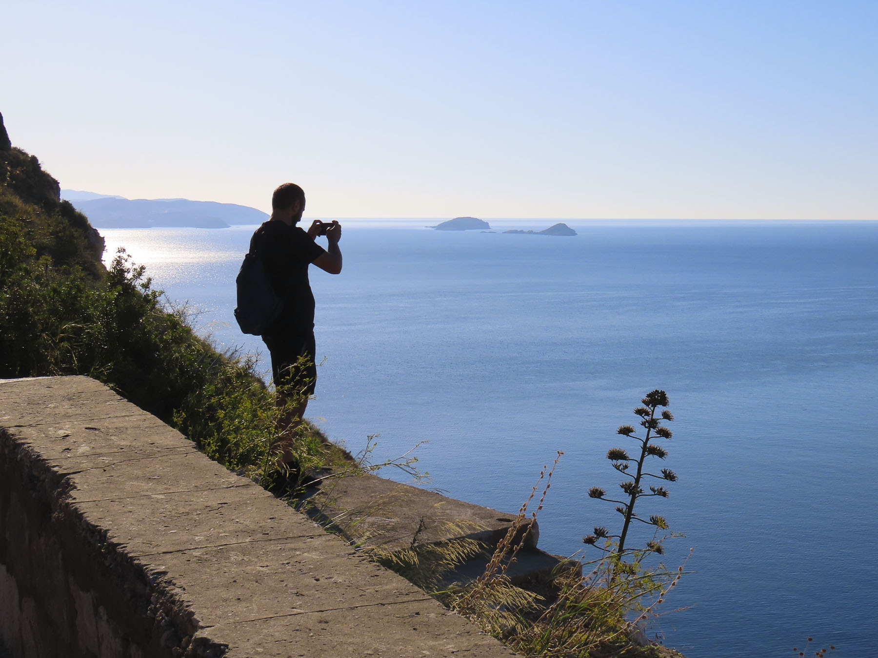
To the south, the Ionian Sea sparkled in the distance as we left Alberobello behind and headed west along the E90.  Our destination in three days’ time – Naples. There was some family history to investigate before that, though, and we set the GPS course to Sassano on a journey to explore the ancestral village of Donna’s maternal grandmother. On the far side of Basilicata, the small hilltop village sits just inside the border of the Campania region.  This would be the culmination of a trip planned years ago, that was originally going to be shared with her mother, before her passing.  Nearer to Naples, we also planned to visit Volturara Irpina, the birthplace of her paternal grandfather. 

Our road trips rarely involved a direct route between destinations and this held true as we turned away from the coast and followed the E847 through the Basento River Valley into the rugged mountains of Basilicata.  Ancient hilltop villages crowned the ridges on either side of the roadway, each looking worthy of future investigation. The Basilicata region has been referred to as “Italy’s best-kept secret” by the New York Times, but it was once the realm of roving bands of brigands. Highwaymen of legend made traveling in the region notoriously unsafe after the unification of Italy in the 1870s.

Under the Royal House of Bourbon, southern Italy fought against unification.  After the war the residents were disenfranchised by unfulfilled promises; with support from Bourbons in exile and the church, which had much of its lands seized, many in opposition to the new government headed to the hills.  These brigands were informally comprised of people with different motives. Former soldiers, some nobles, criminals, peasants, and farmers filled their ranks. The most famous one, Carmine Crocco, aka Donatello, led a band of two thousand men. Your criminal is my guerilla-fighter hero. I guess it depends on which folksongs you listen to.  The region was remote, and severely poverty stricken. During the fascist era of the 1930’s and 40’s, the Basilicata region was used as an open-air prison, where political dissidents were sentenced to exile in remote villages – Italy’s Siberia.

With mountains deforested of wood for fuel, poor soil conditions for farming, an illiteracy rate of seventy percent, bleak employment opportunities in other industries and a central government dominated by northerners that ignored the region, four million Italians chose prospects for a better future and emigrated to the United States between 1880 and 1924.  Others headed to Brazil, Argentina, Canada, Australia and South Africa.  It wasn’t unusual for emigrants from the same village to head to the same new cities overseas where they continued the tradition of campanilismo, the spirit of “loyalty to those who live within the sound of your village’s church bells.” Chicago, Boston, Baltimore, Philadelphia and New York all drew huge concentrations of new immigrants eager to prosper, and societies like the Italian Welfare League helped folks adapt to a new home in a foreign country.

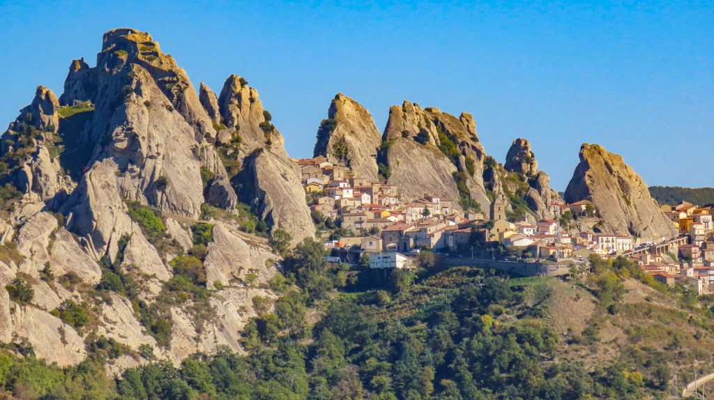
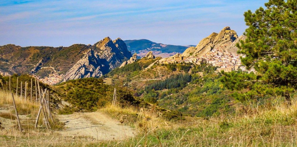
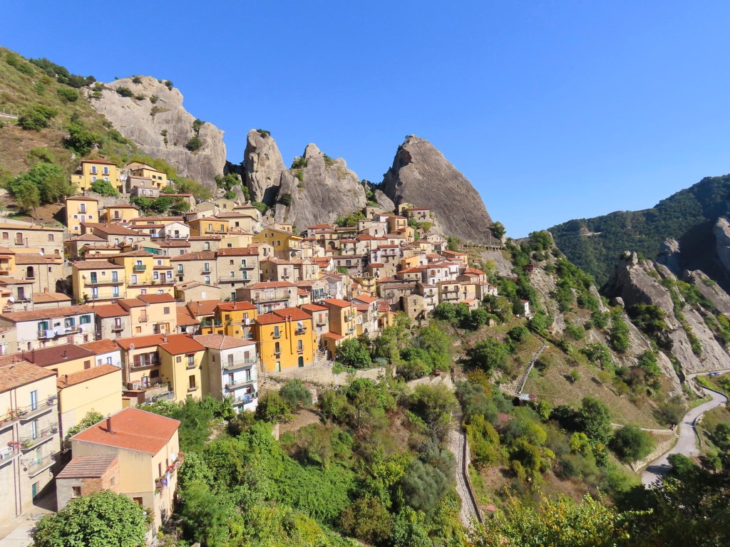
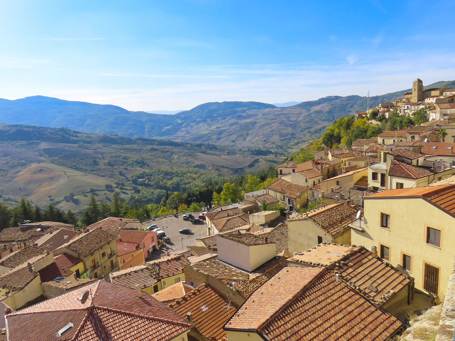
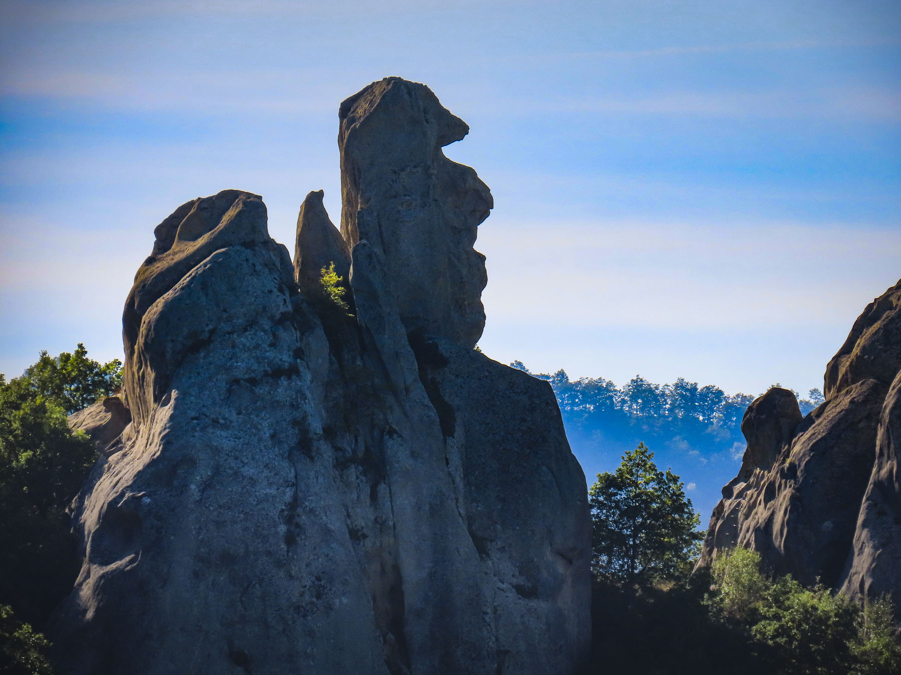
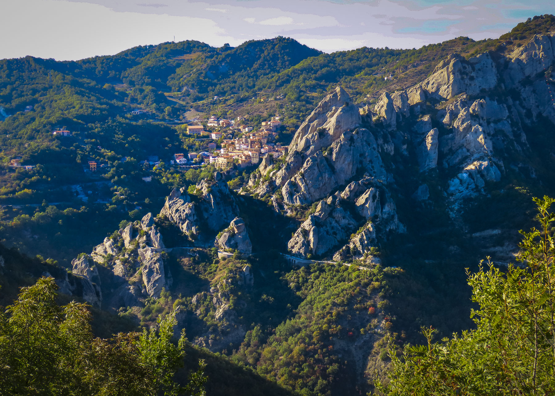
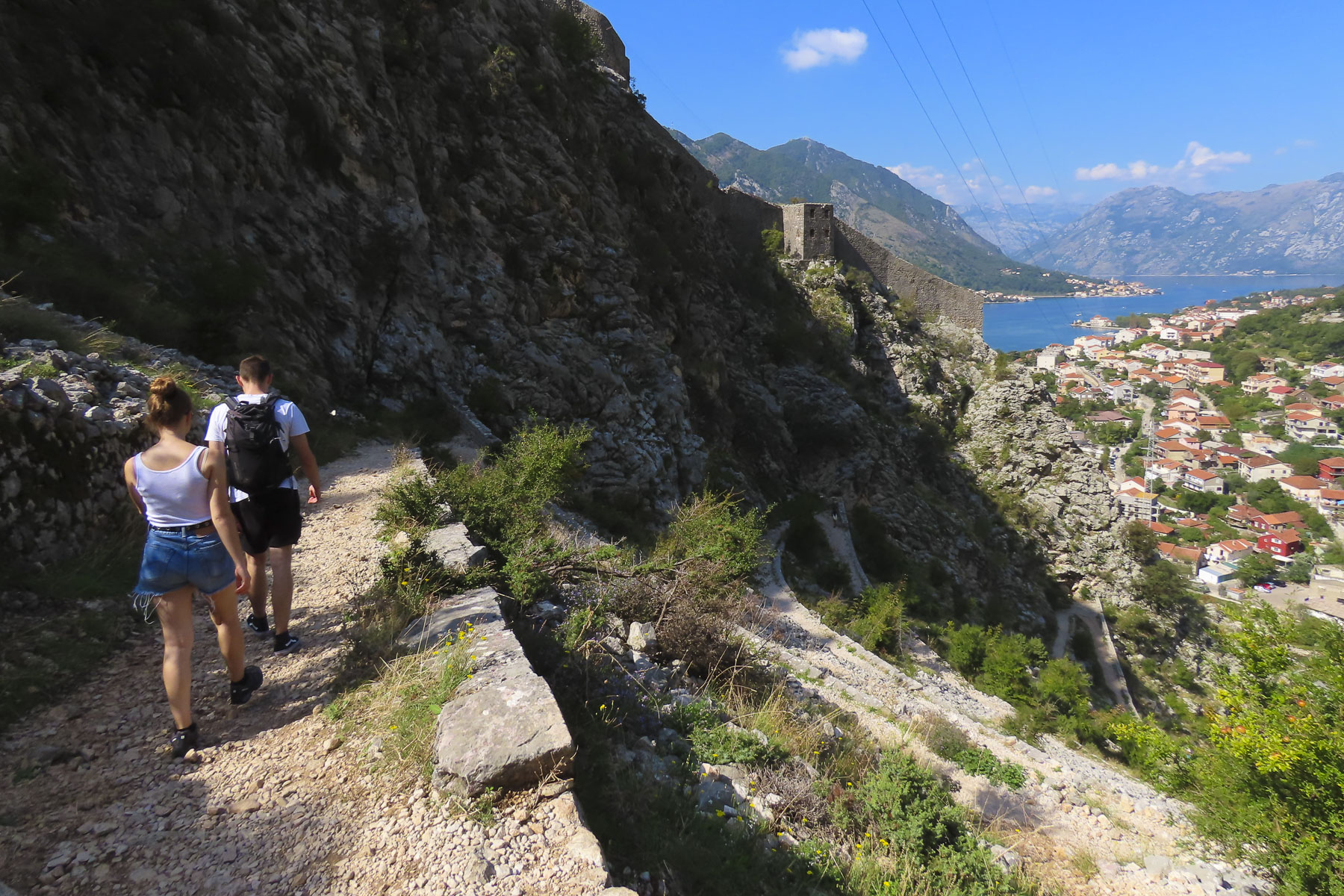
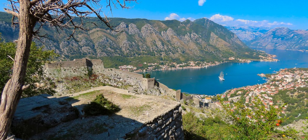
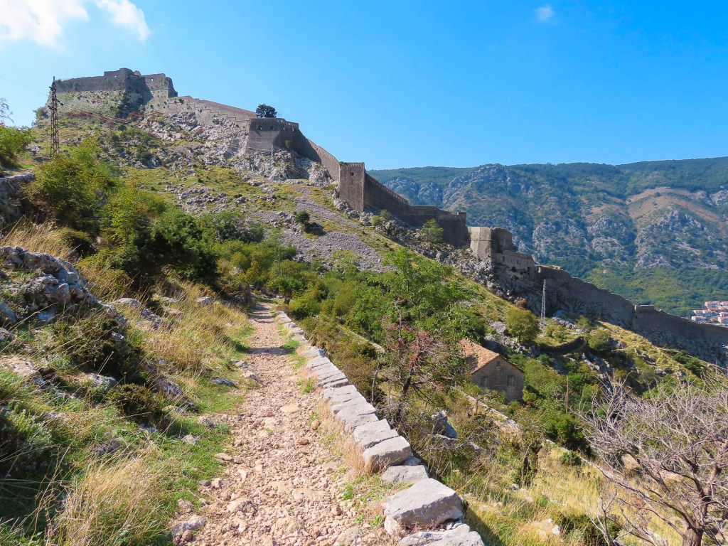
Castelmezzano, castle in the middle, between Albano di Lucania and Pietrapertosa, was our first stop. Descendants of 6th century Greek settlers in the Basento Valley fled to safety in the jaws of the Lucanian Dolomites when Saracen invaders from North Africa forced the local populace from the river valley into the mountains. The smooth sides of the tall, steep tooth-shaped outcroppings that protected the villages of Castelmezzano and Pietrapertosa were perfect for villagers to roll boulders down onto their attackers. 

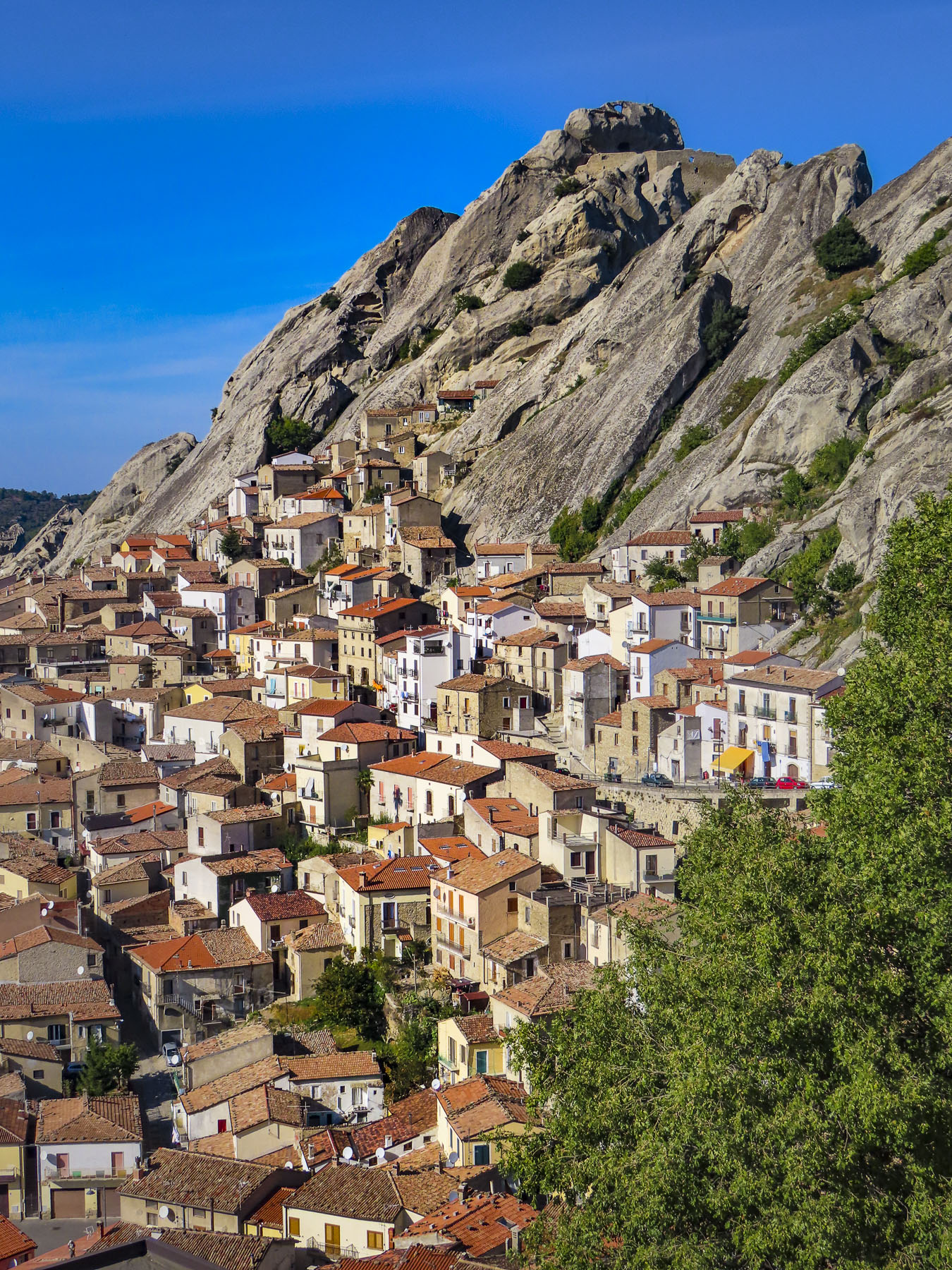
The same mountains offered safe haven to the brigands of the late 1800’s.  Today the area, only two and a half hours from Naples, is part of the 67,000 acre Parco Regionale di Gallipoli Cognato, a mountainous park with wolves, foxes, porcupines, and wild boar that is a magnet for outdoor enthusiasts who enjoy camping, hiking, biking and rock climbing. 

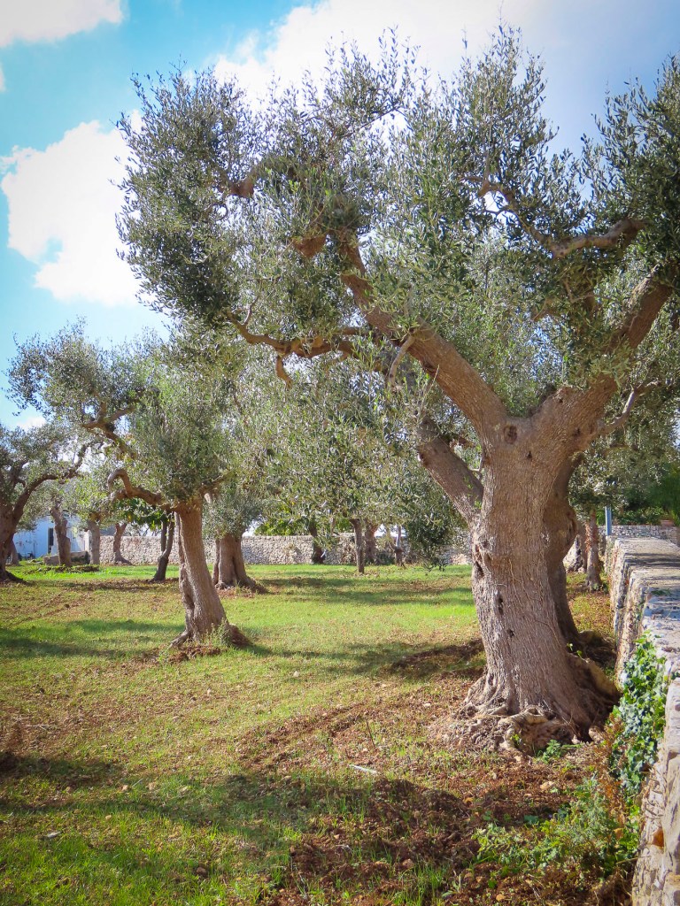
The area is stunningly beautiful with its unique rock formations, lush forests, olive groves, vineyards, and pastures. During the spring and summer, the small villages of the region host colorful Marriage of the Trees Festivals that combine ancient pagan rites with Catholicism to celebrate fertility and hope. Mid-week in the middle of November the area was nearly deserted, and unfortunately there were not any cafes open. Hopefully, it would be different on the weekends. 

Back on the highway we speculated how interesting a future trip would be, zigzagging back and forth across the valley to explore every hilltop village, large and small. There were so many of them!  We still regret not stopping in Brienza to walk through the historic district at the foot of its 7th century castle, after its profile suddenly burst forth and filled the windscreen as we rounded a curve.

The sun was just setting as we pushed the button on the driveway gate to Affittacamere – Nonno Domenico, located in the valley below Sassano.  Check-in was smooth, but establishing our internet connection required first the involvement of the innkeeper’s teenage son and then his older sister. In the off-season, prospects for dinner were extremely limited. Though Google Maps showed many restaurants in the area, they were closed for the season. After driving around searching, we ended up having a delicious, no-frills dinner at the local pizza parlor. 

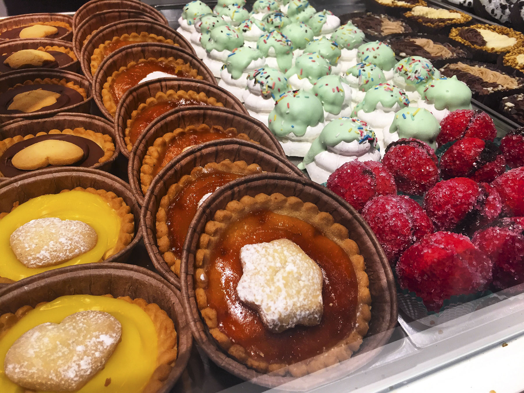
We scored big time the next morning for breakfast with our discovery of Pasticceria Tropiano Peccati di Gola & Dintorni. This bakery and café is run by two brothers, Cono and Franco, who are devoted to guiding their customers through the “consumption of sinful delicacies and coffees.”  They offer baked goods of a quality you would expect to find in Naples or Florence, not in the remote area surrounding Sassano. 

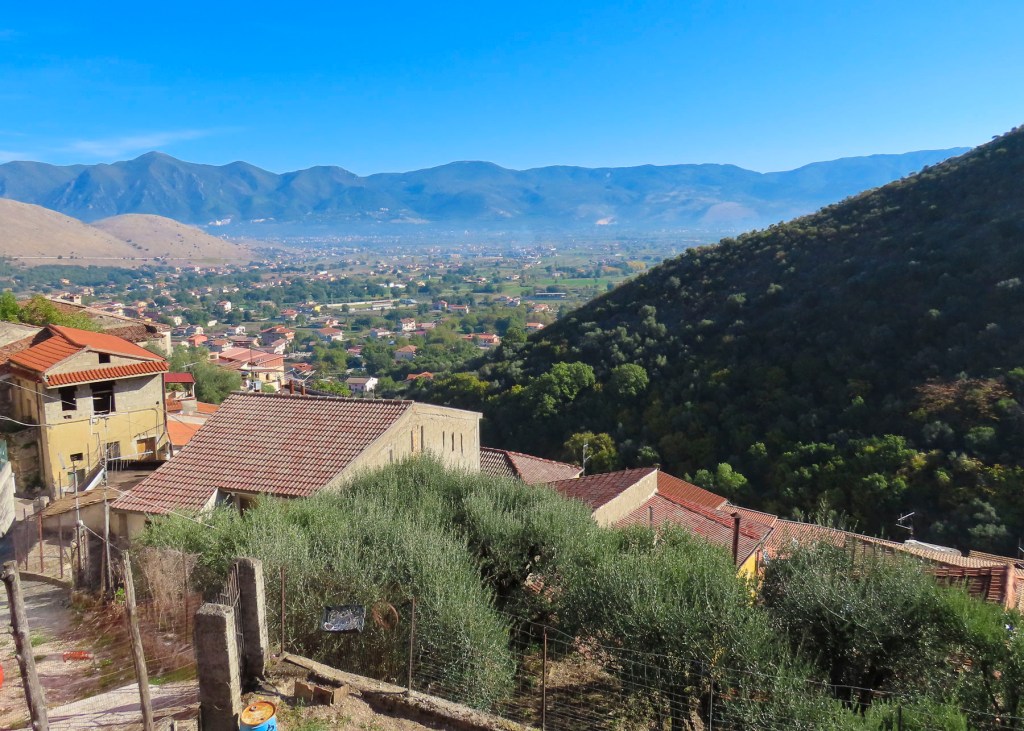
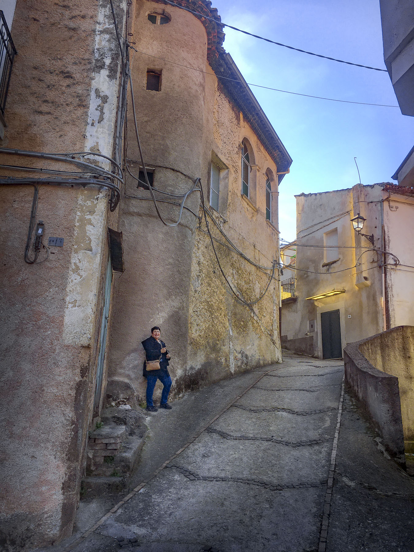
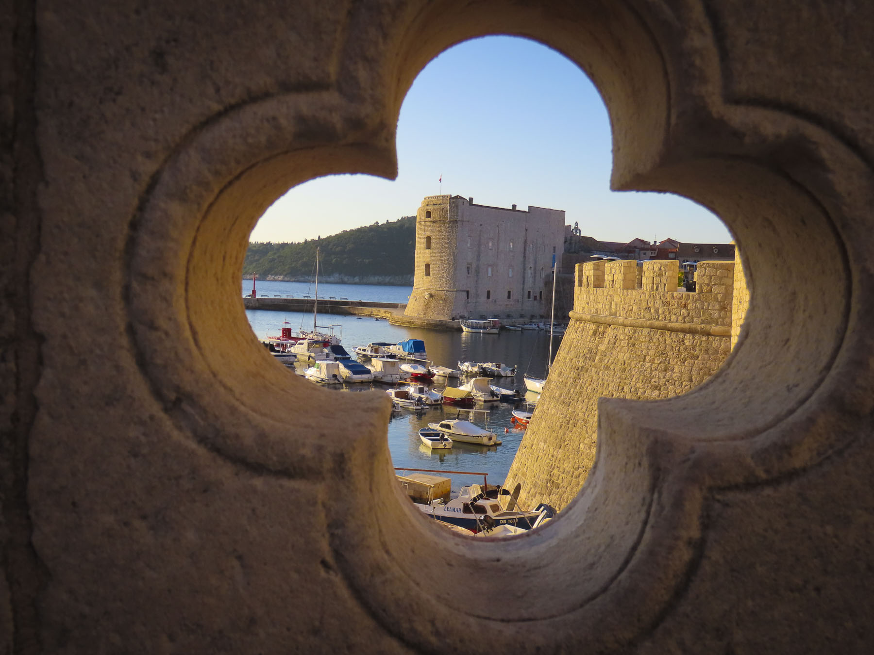
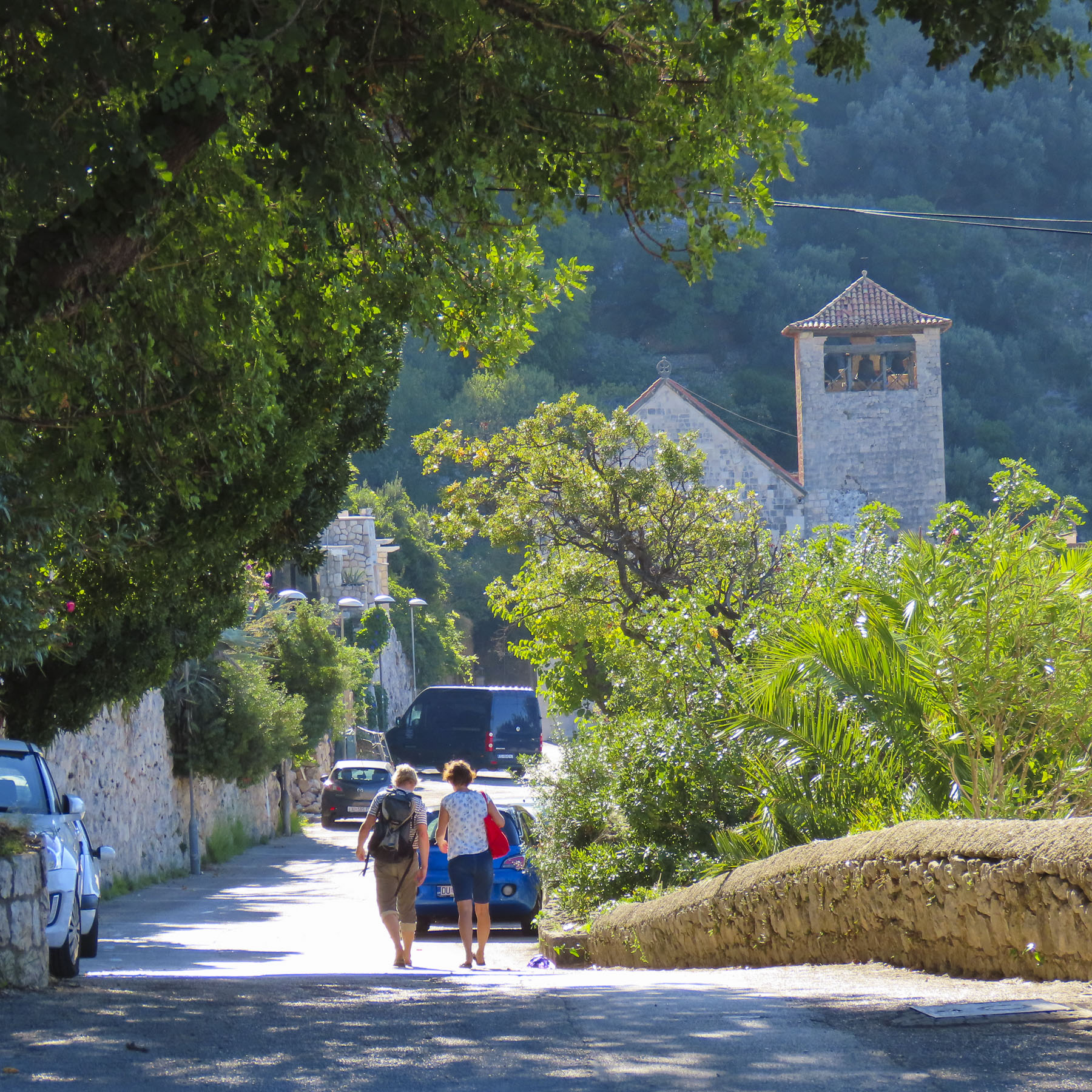
The village of Sassano rose sharply from the flat, flood plain of the Tanagro River in the Vallo di Diano, the lower slope of Monte Cervati checkered with the stacked profiles of dwellings built of stone and capped with red tile roofs. 

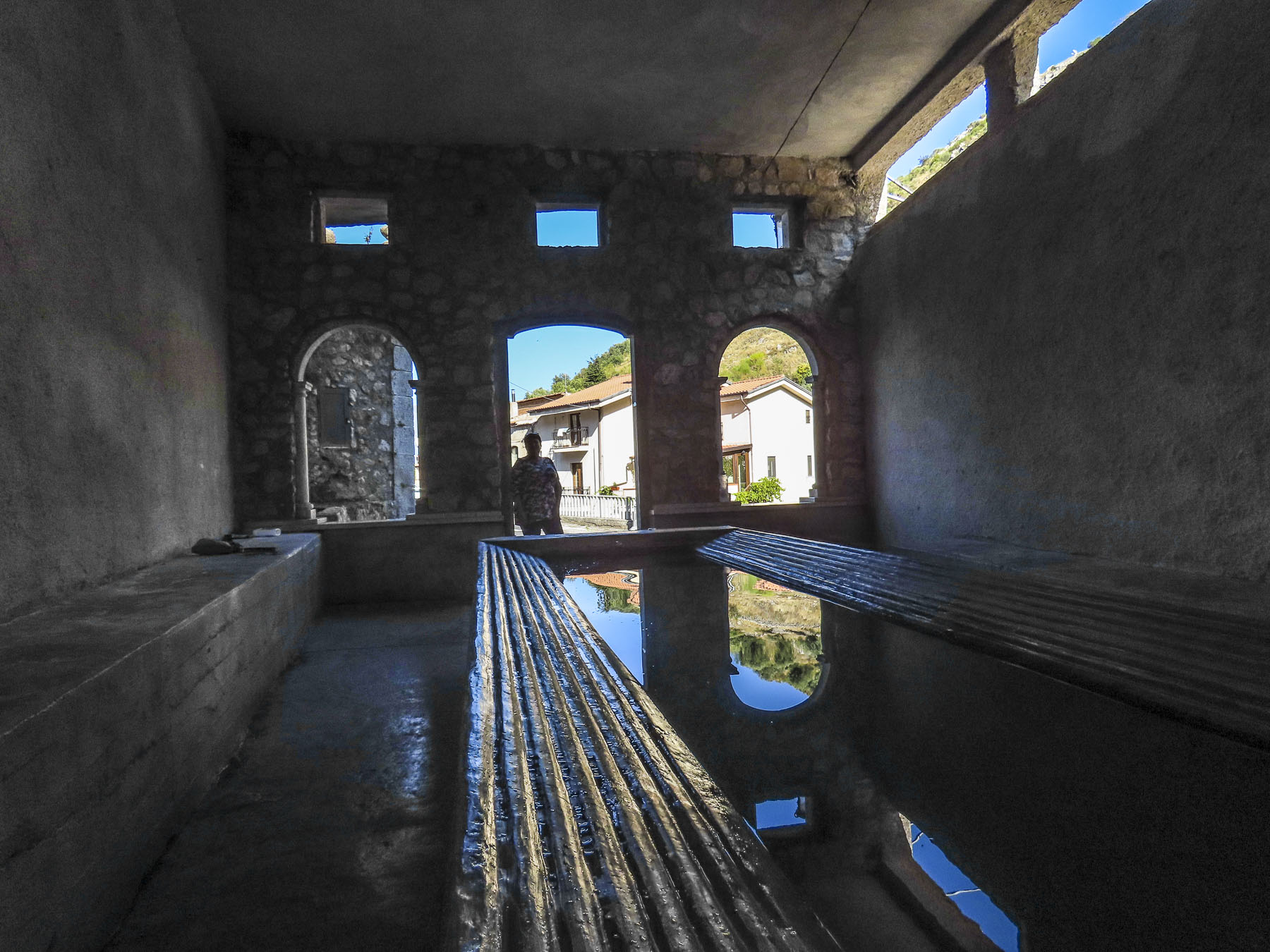
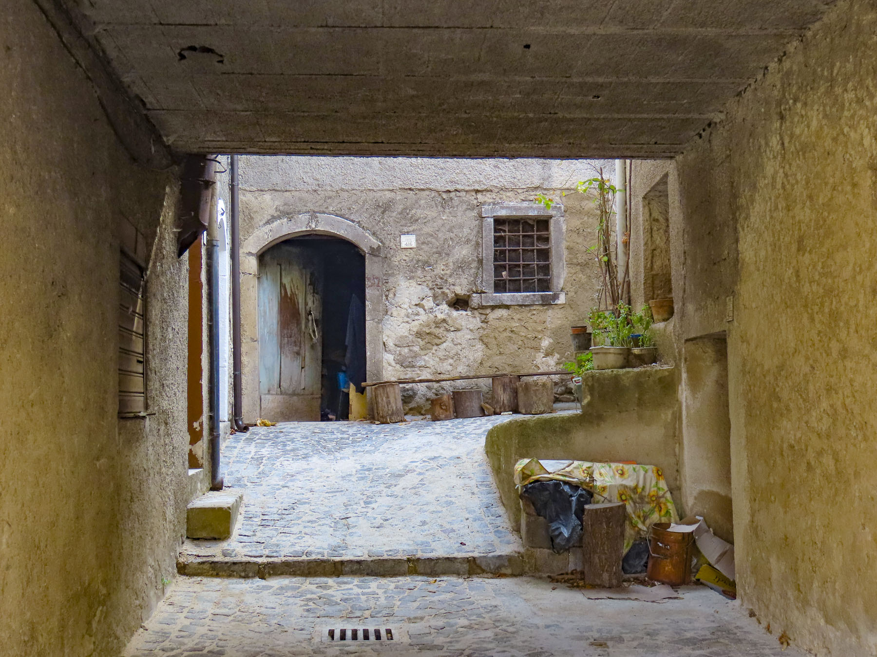
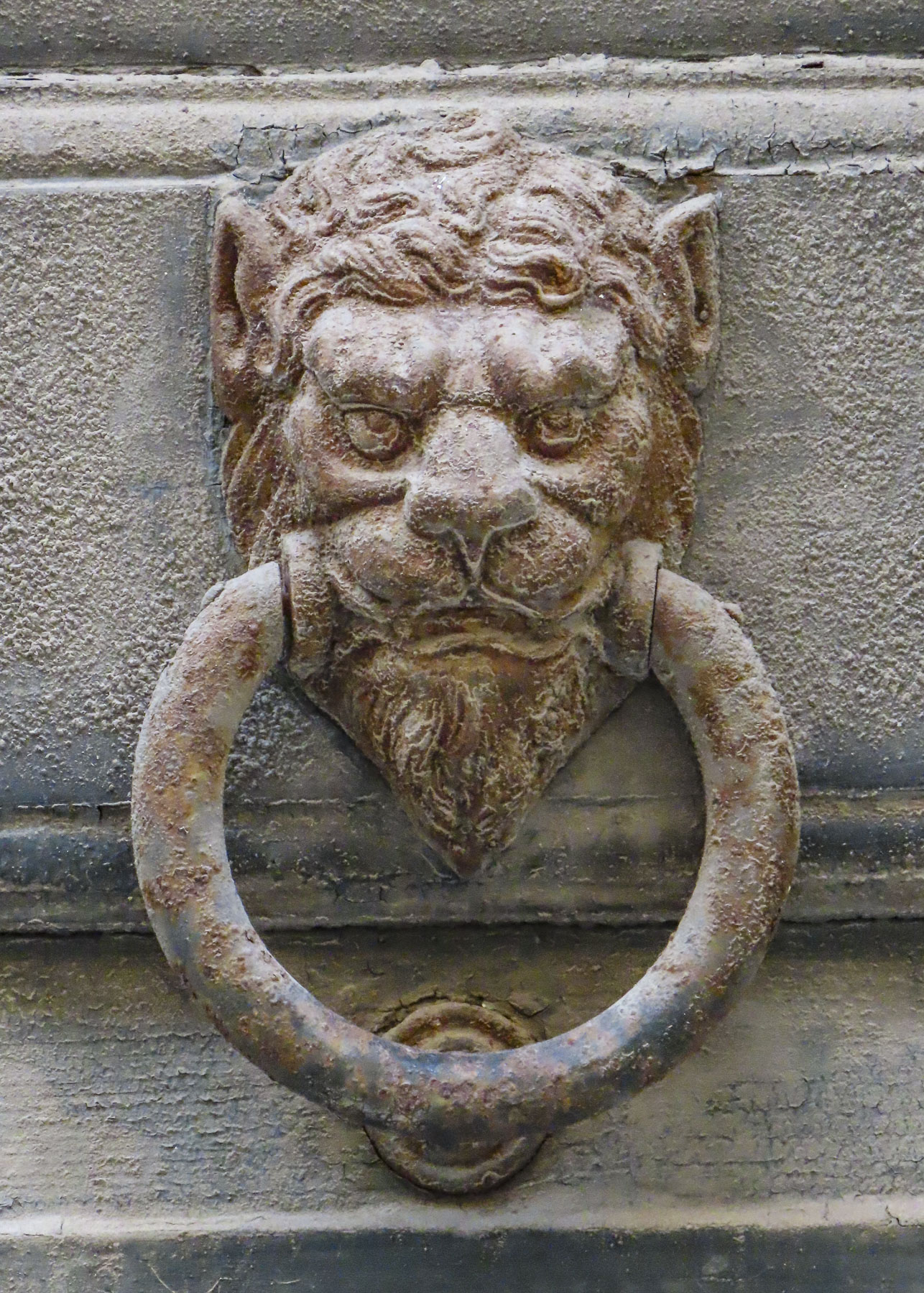
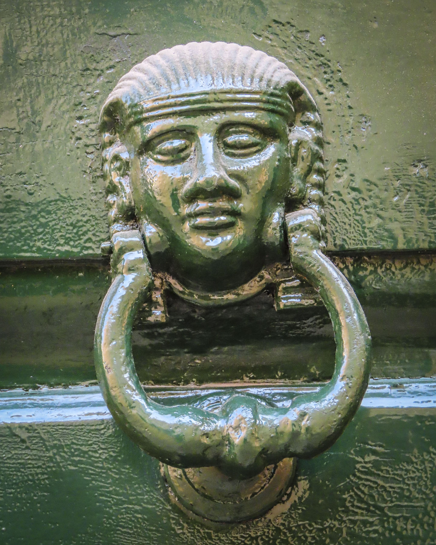
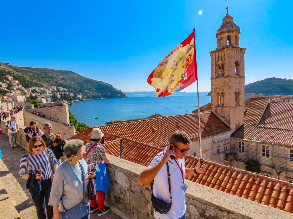
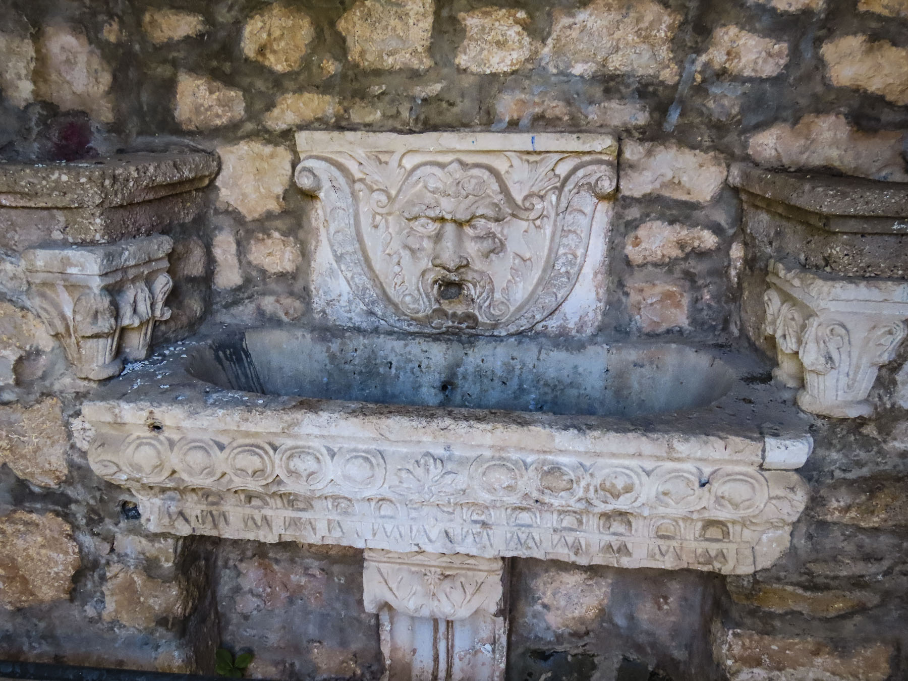
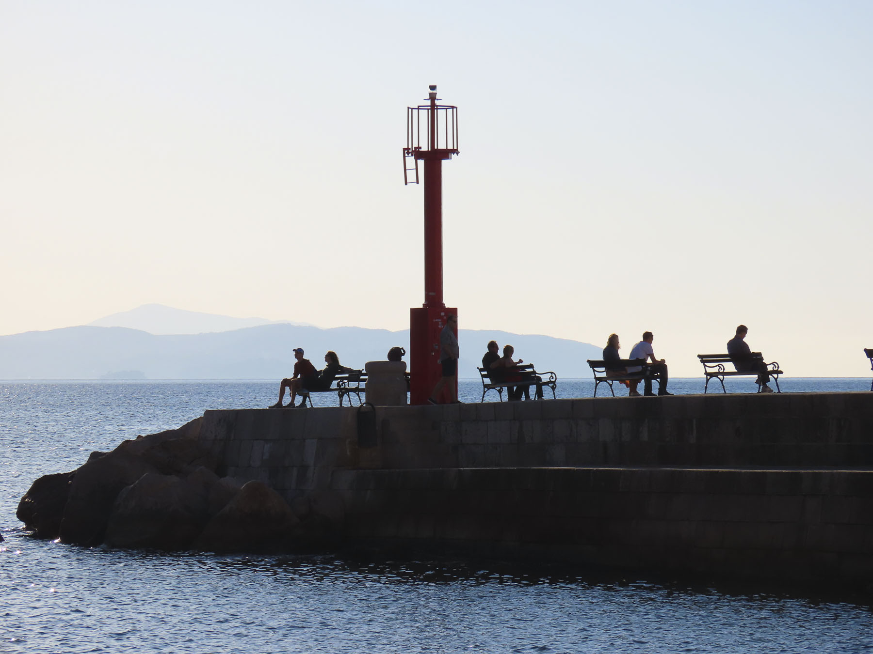
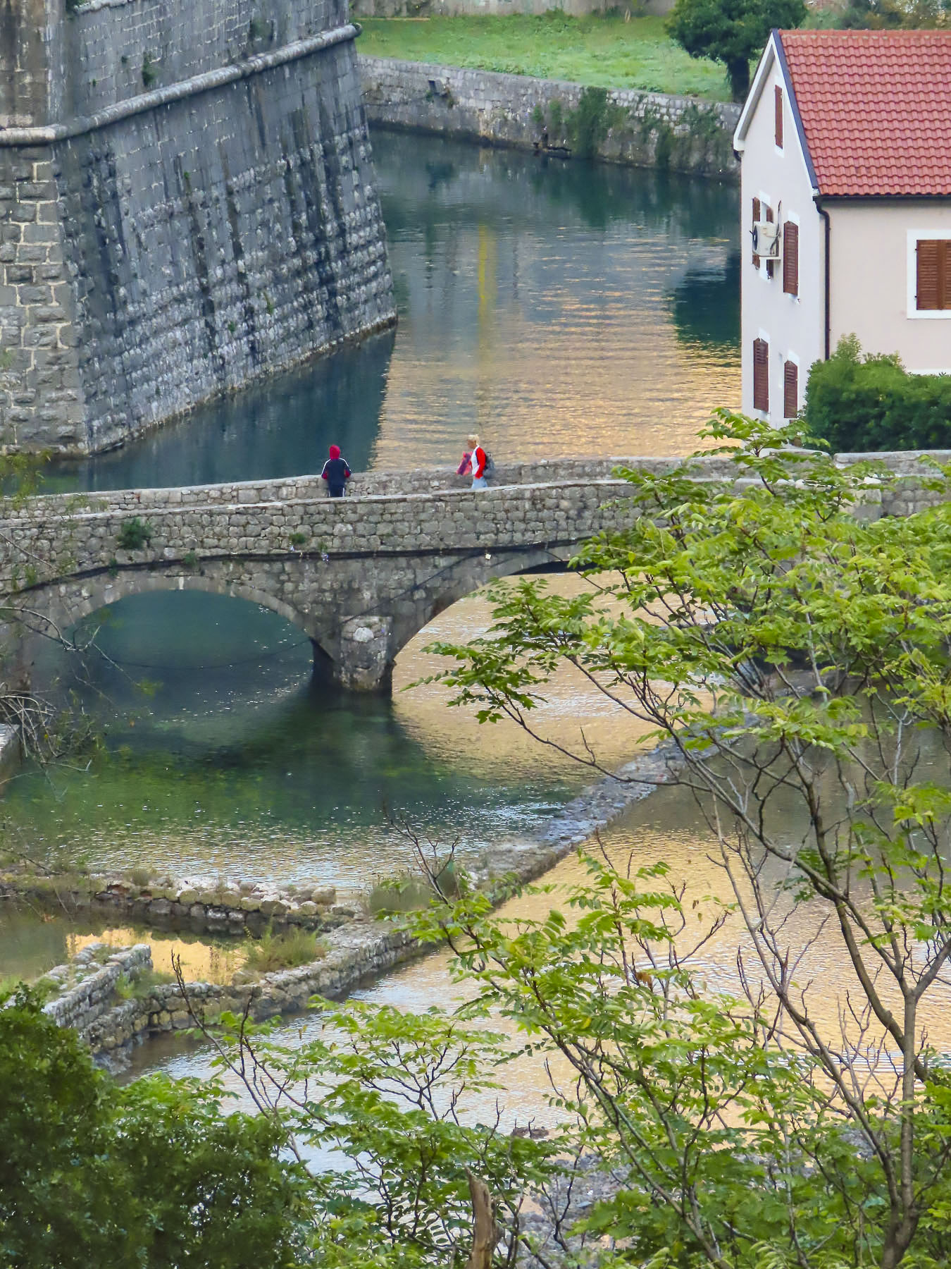
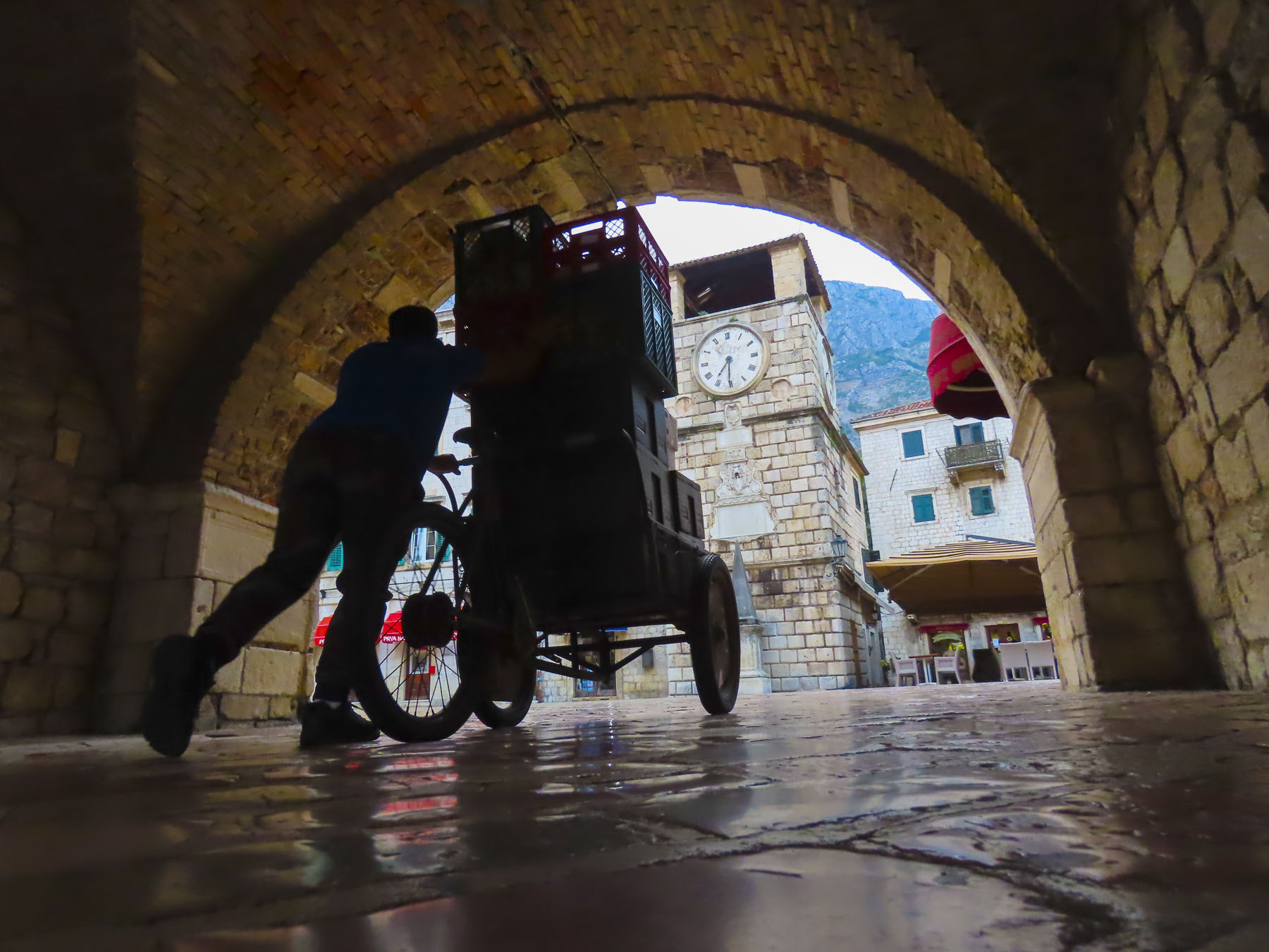
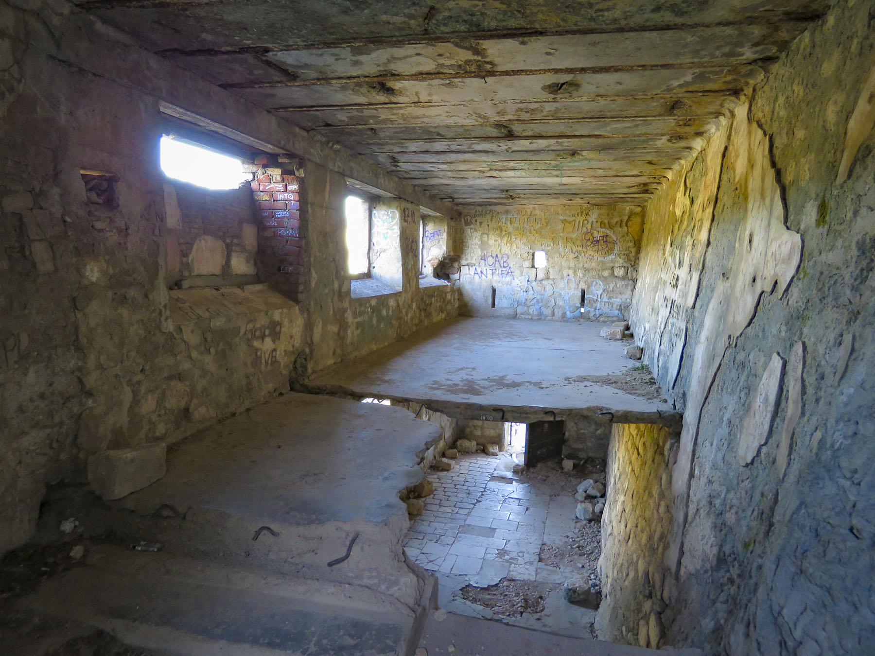
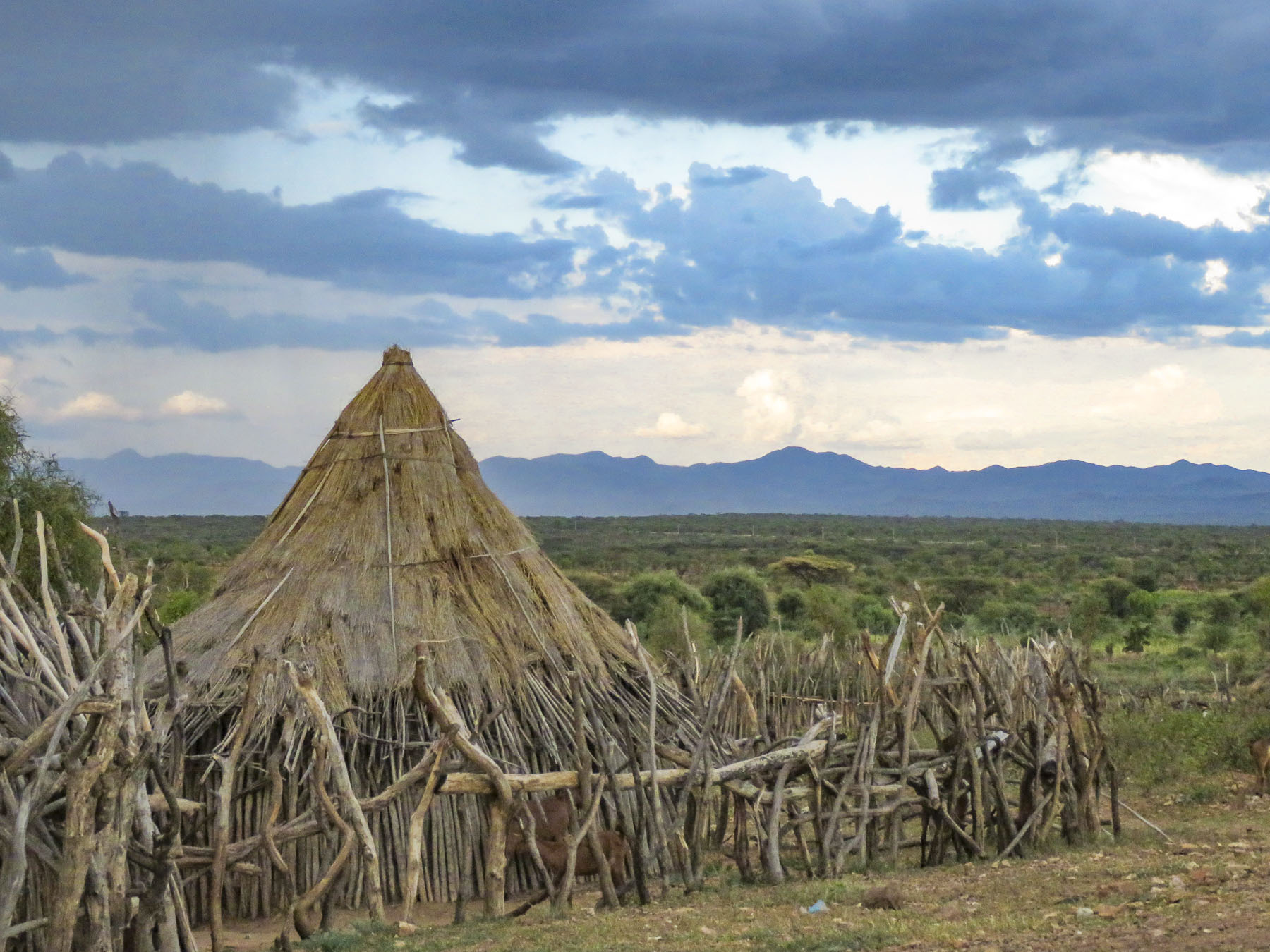
At the foot of the hill, the spring-fed communal laundry looked newly renovated, with updated washbasins and scrub racks.  Empty laundry detergent bottles indicated recent use.  Outside we refilled our water bottles from an ever-flowing fountain built into the terraced wall.  Basilian monks have been credited with the first construction of a fountain on this site in the 10th century when the village was founded. It’s difficult to believe in this day and age that such facilities are needed and still used. But it reflects the past poverty of the region and the plight of the elderly who still use it.  Just imagine the task of carrying a basket of wet laundry uphill, back to your home to dry.

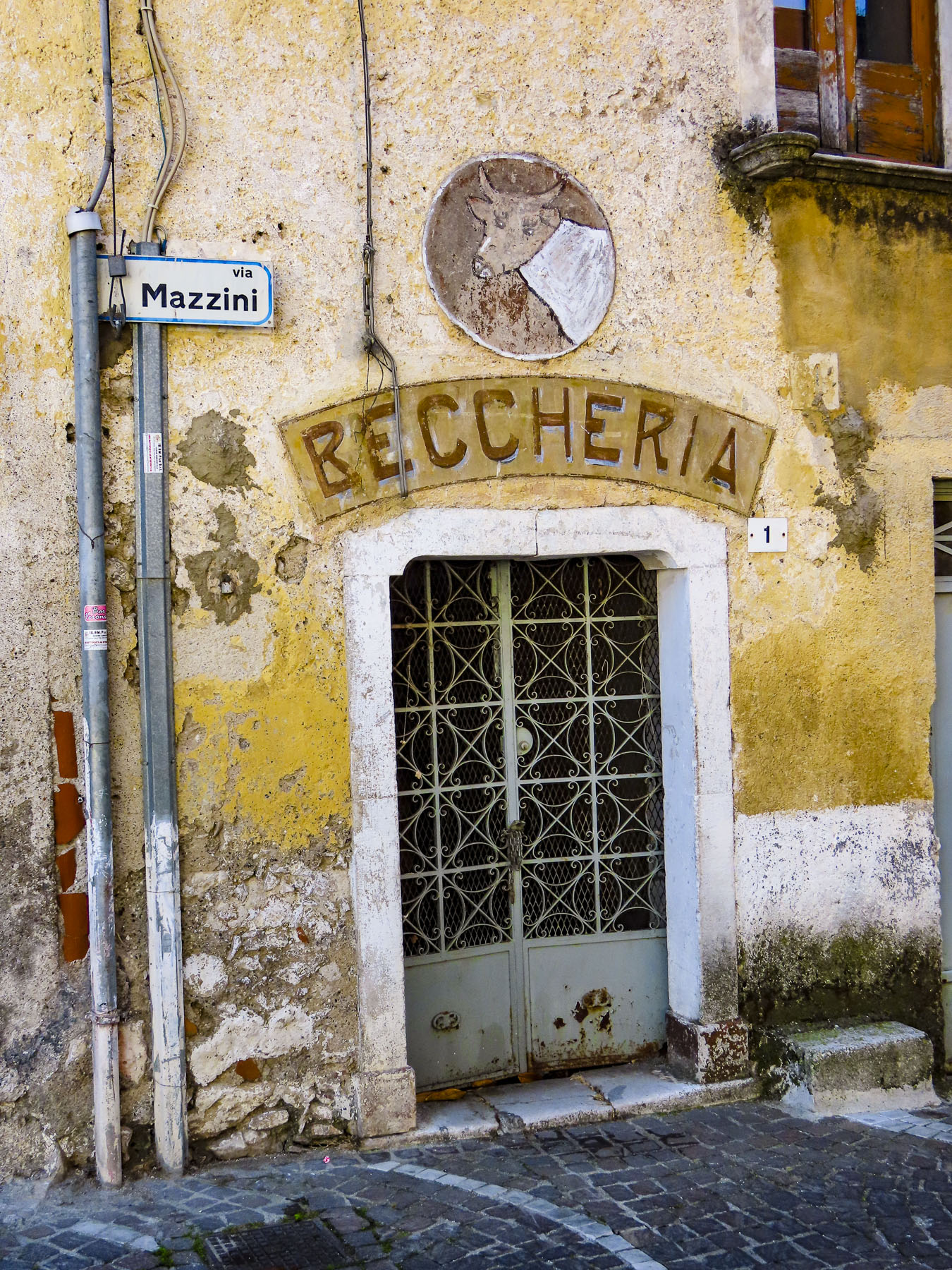
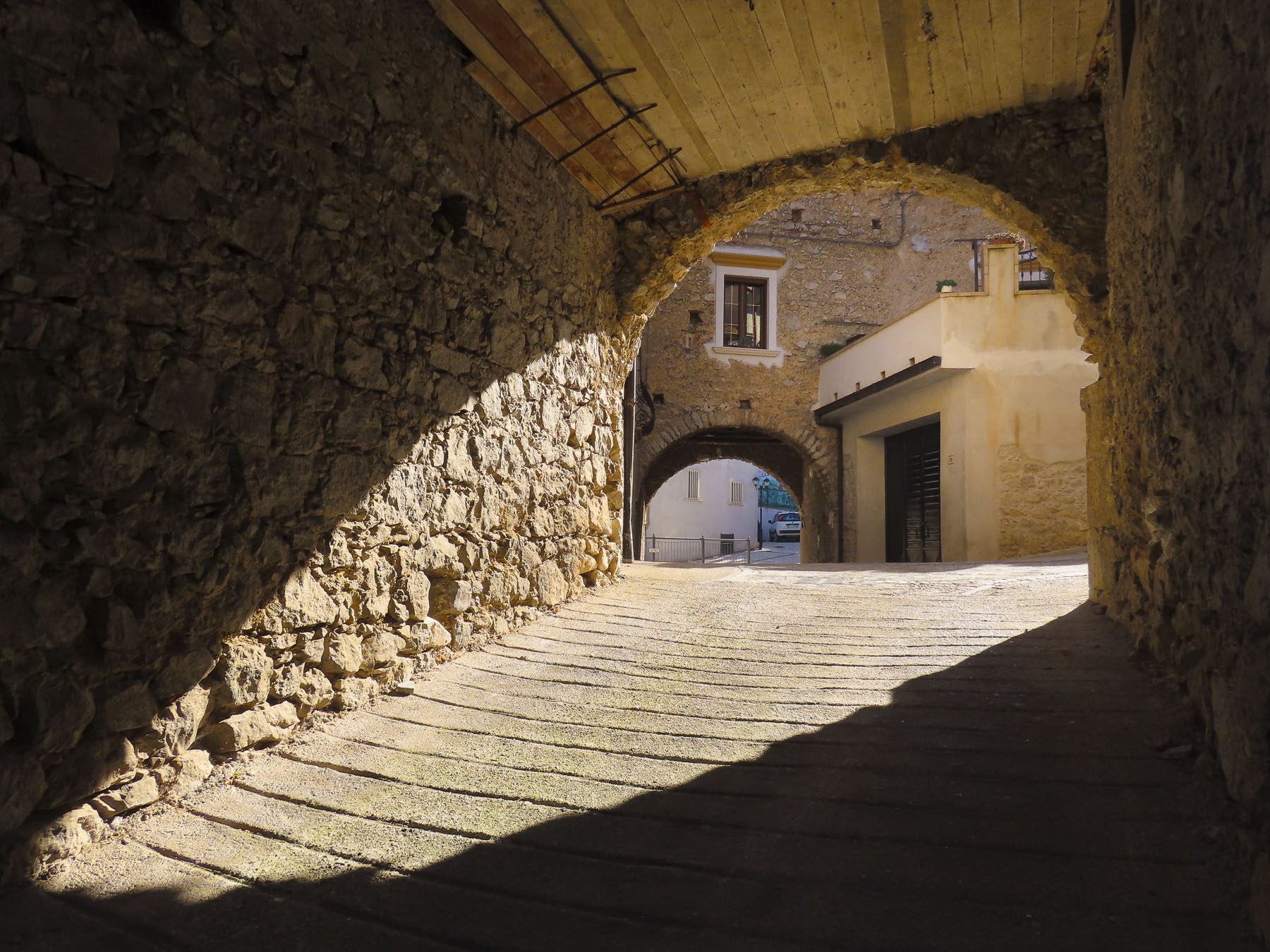
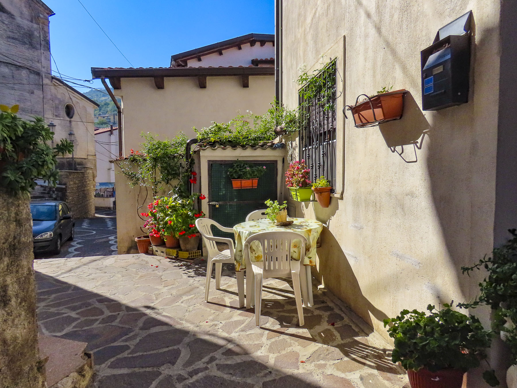
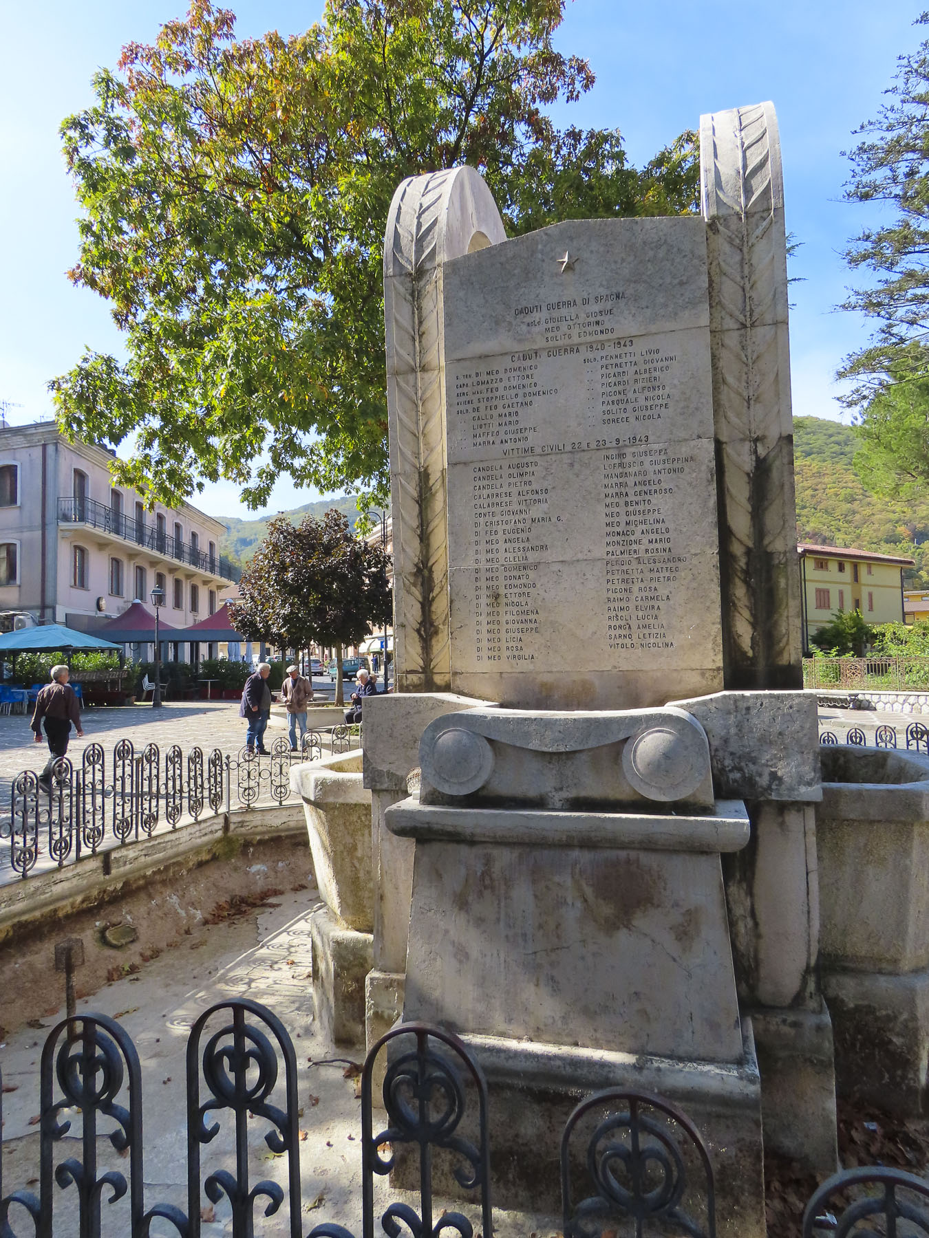
The lane into the village rose slowly to the small central plaza, Piazza Giuseppe Mazzini, where most of the buildings looked permanently shuttered.  We parked in front of a long-closed butcher’s shop which stood yards from a war memorial that listed the village’s men that did not return from two world wars.  The only sign of life emanated from a tiny bar across the cobbled square, where the barista made small talk with an elderly pensioner sipping prosecco, while warming himself at a sunny table.  We ordered café and planned our morning. Could we find Donna’s grandmother’s home here? 

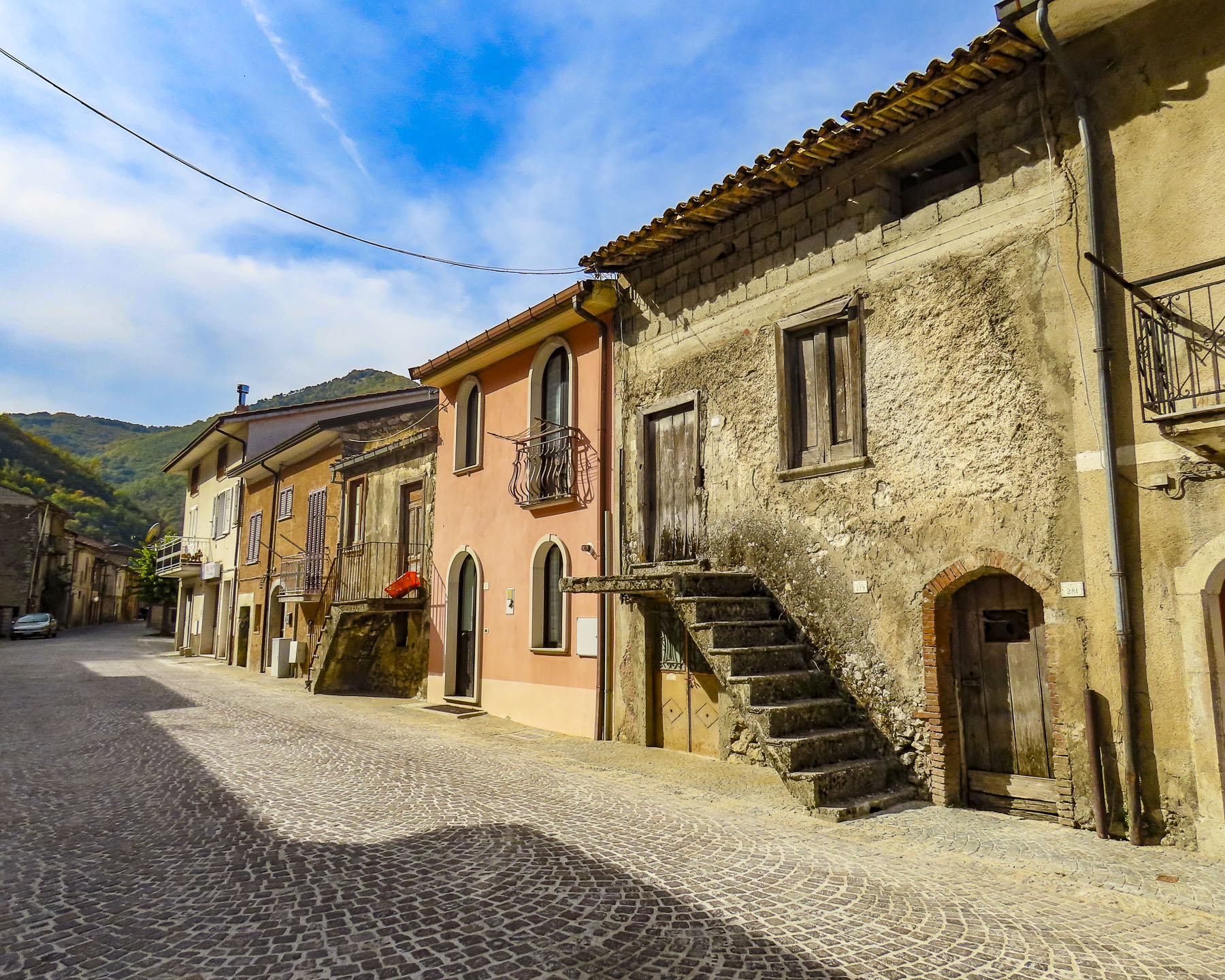
There are only steep, narrow streets called “carrare,” meaning only as wide as a cart, here. In the early 1900s they would have been filled with farm carts, donkeys, chickens, and a milk cow if you were well off.  Somewhere in the family archive, a photo exists of a young woman returning from the forest with a huge bundle of foraged wood tied to her back.  Water was gathered from the village well and carried home. Extremely hard work and no way to avoid it.

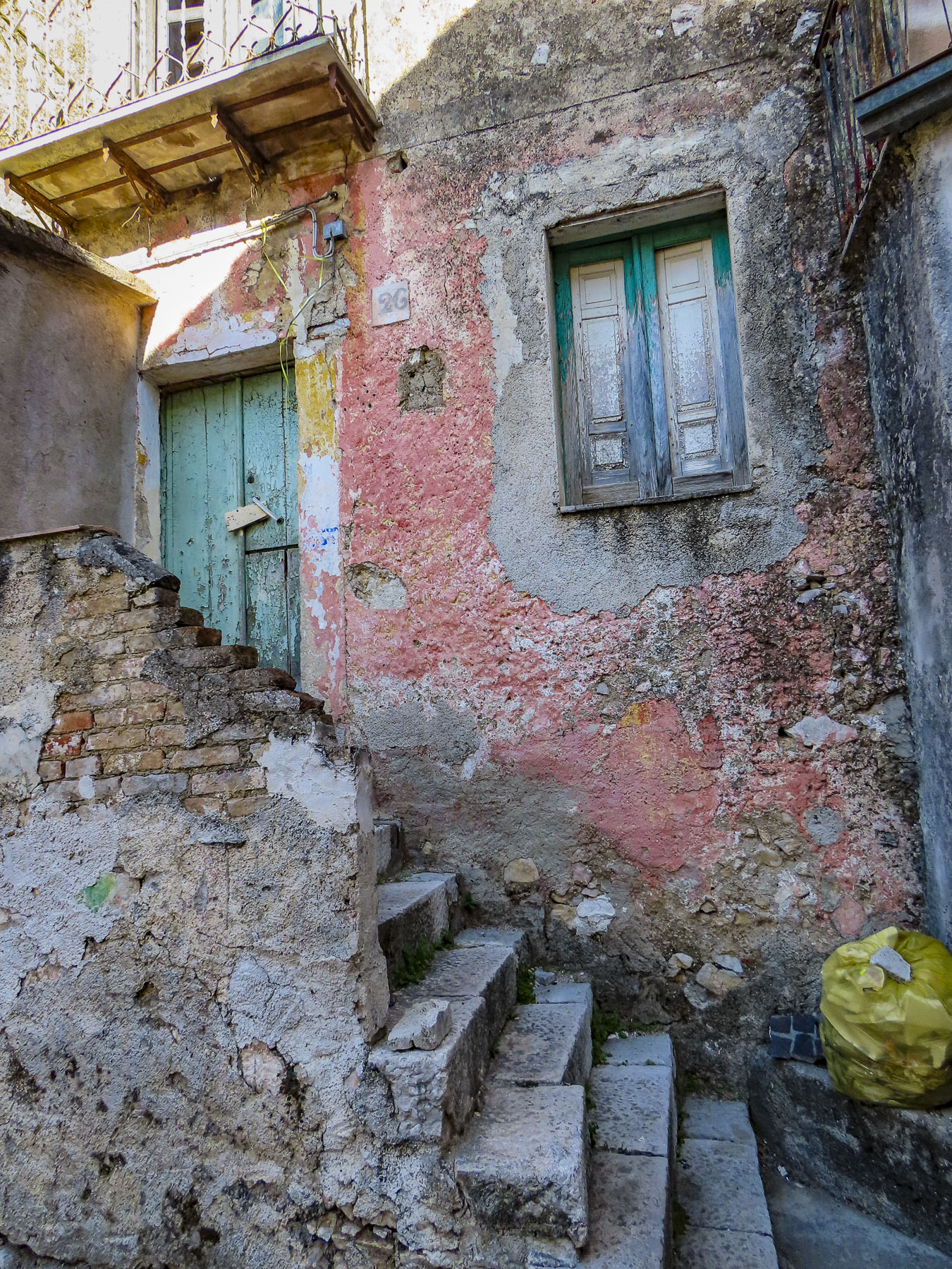
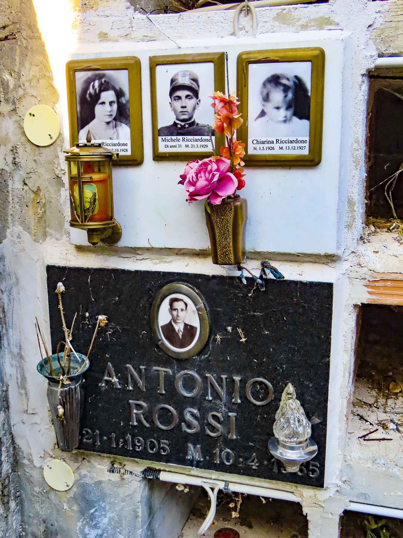
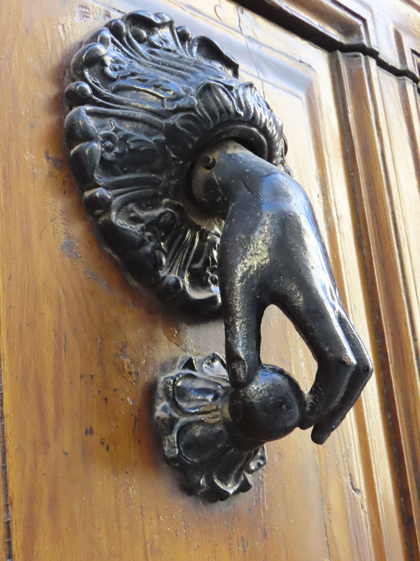
Via San Biagio was a short distance away from the plaza and as steep as expected; it curved its way uphill to a small neighborhood church bearing the same name.  Time has not been kind to the homes on the street. Many showed sign of neglect, with broken stairs and windows along with cobwebbed locks on doors that that looked like they had not been opened in decades. Donna had notes written by her mother, who had passed away only the year before our trip. The familiar clear handwriting stated that Christina D’Alessio DeGondea had lived at Number 10 San Biagio. But Number 10 didn’t exist, only Numbers 9 and 11. A mystery. Perhaps Grandma’s birthplace had been destroyed. 

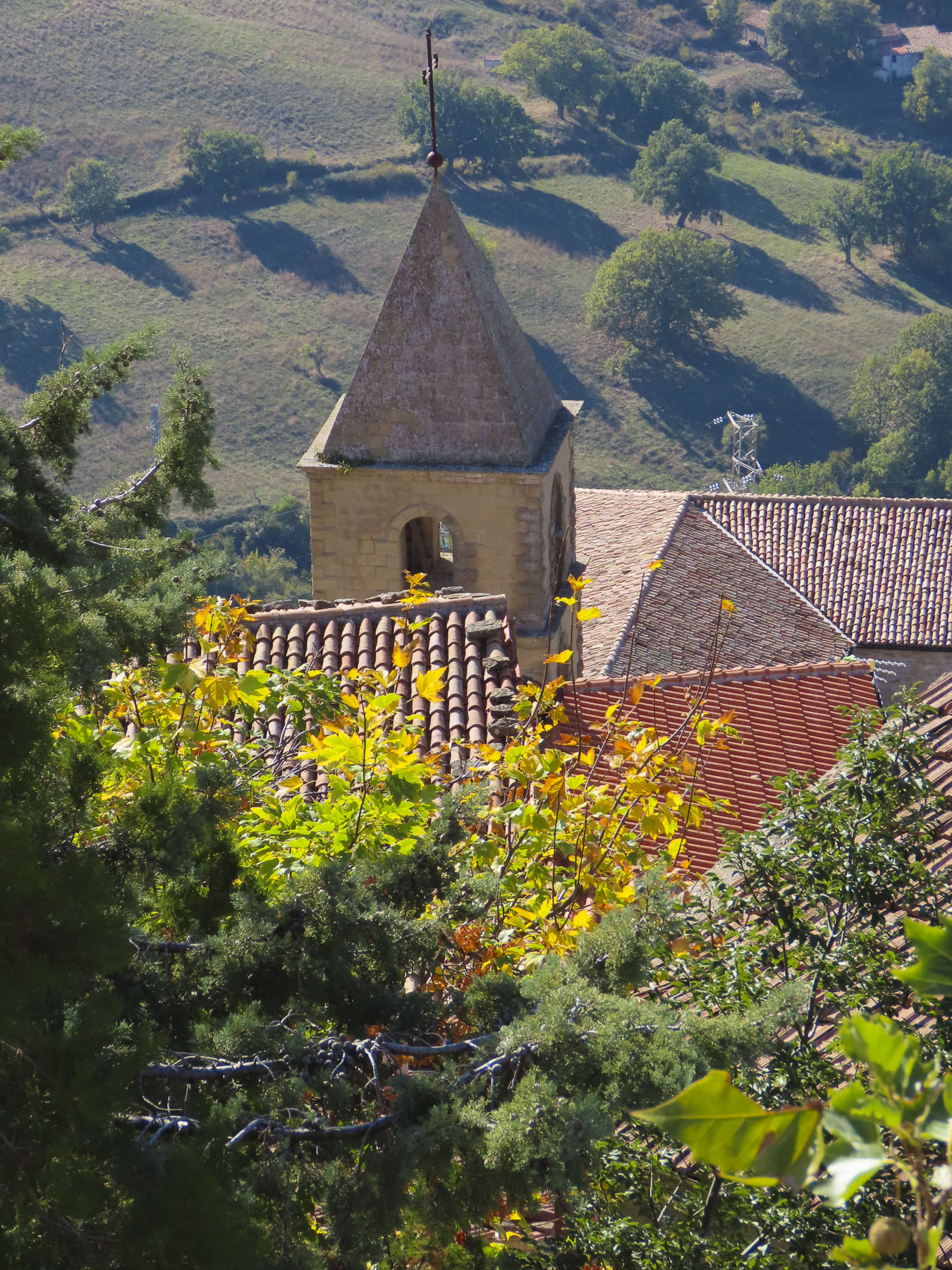
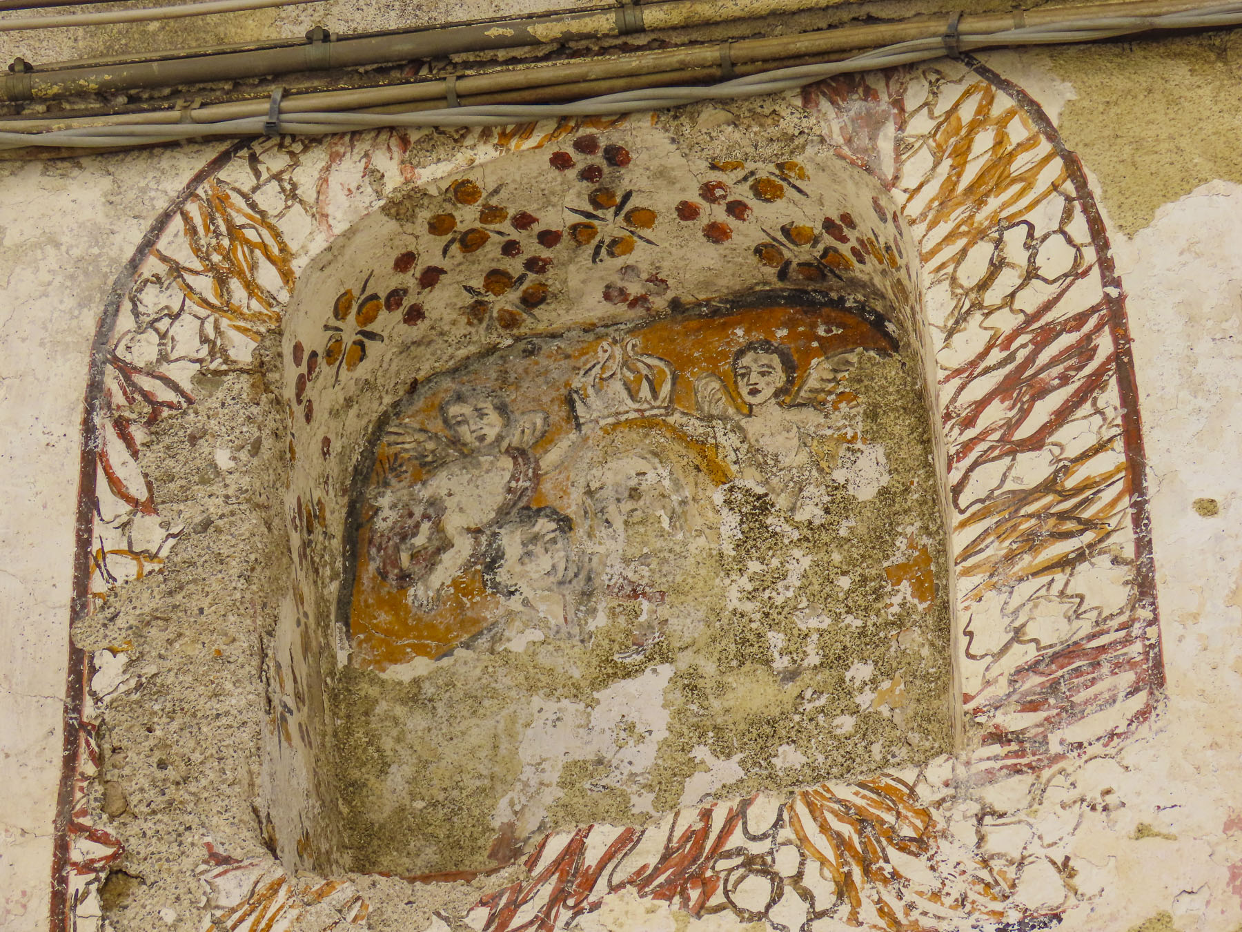
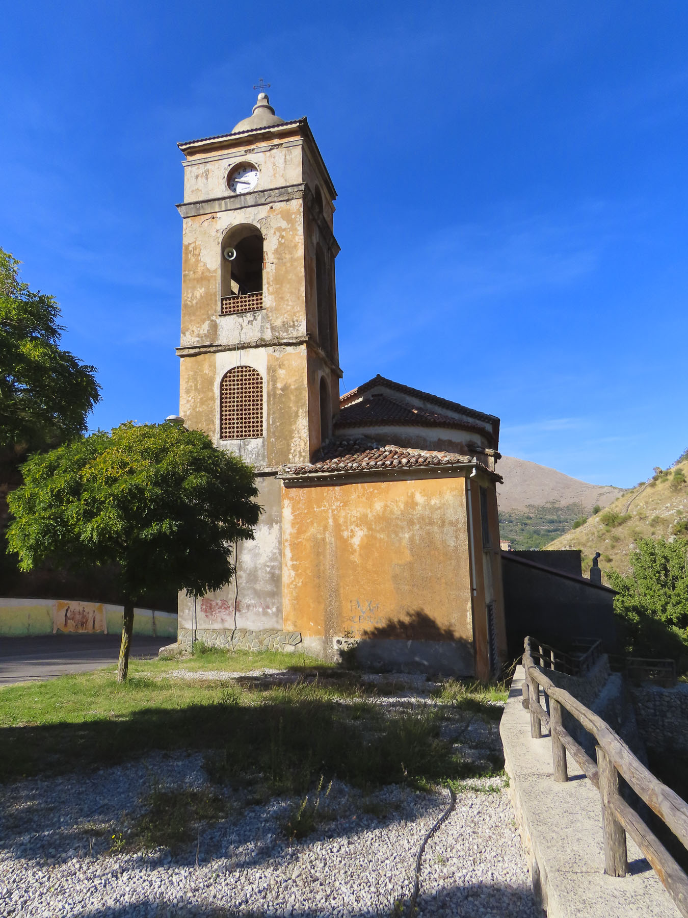
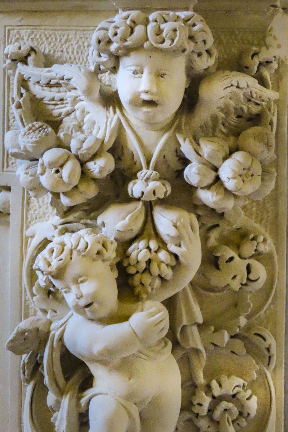
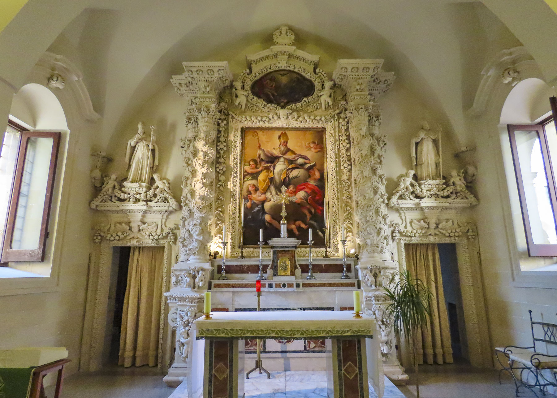
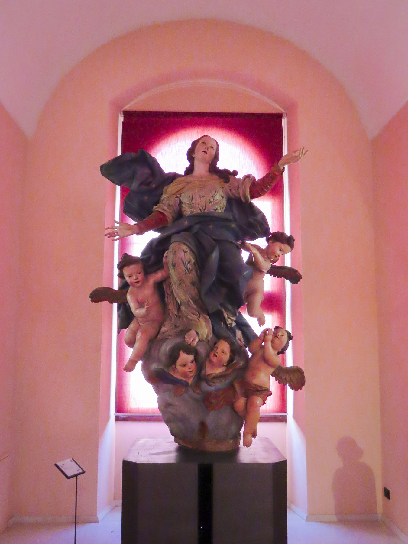
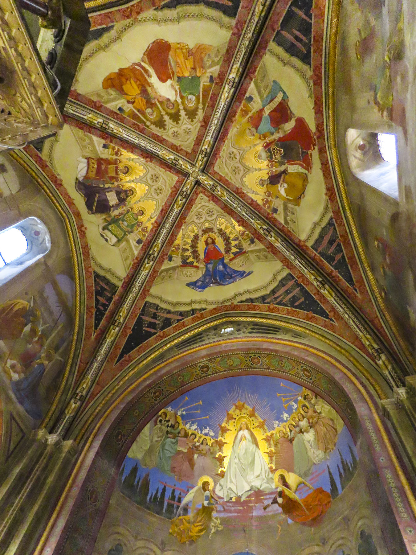
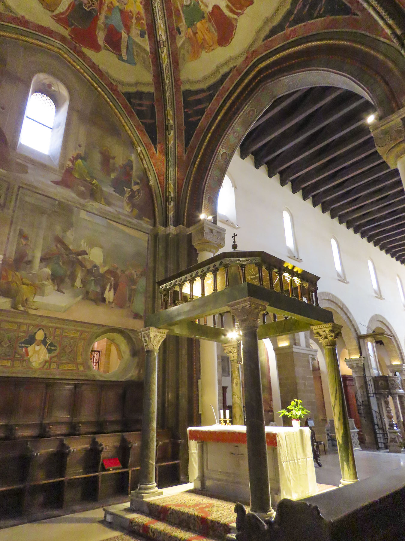
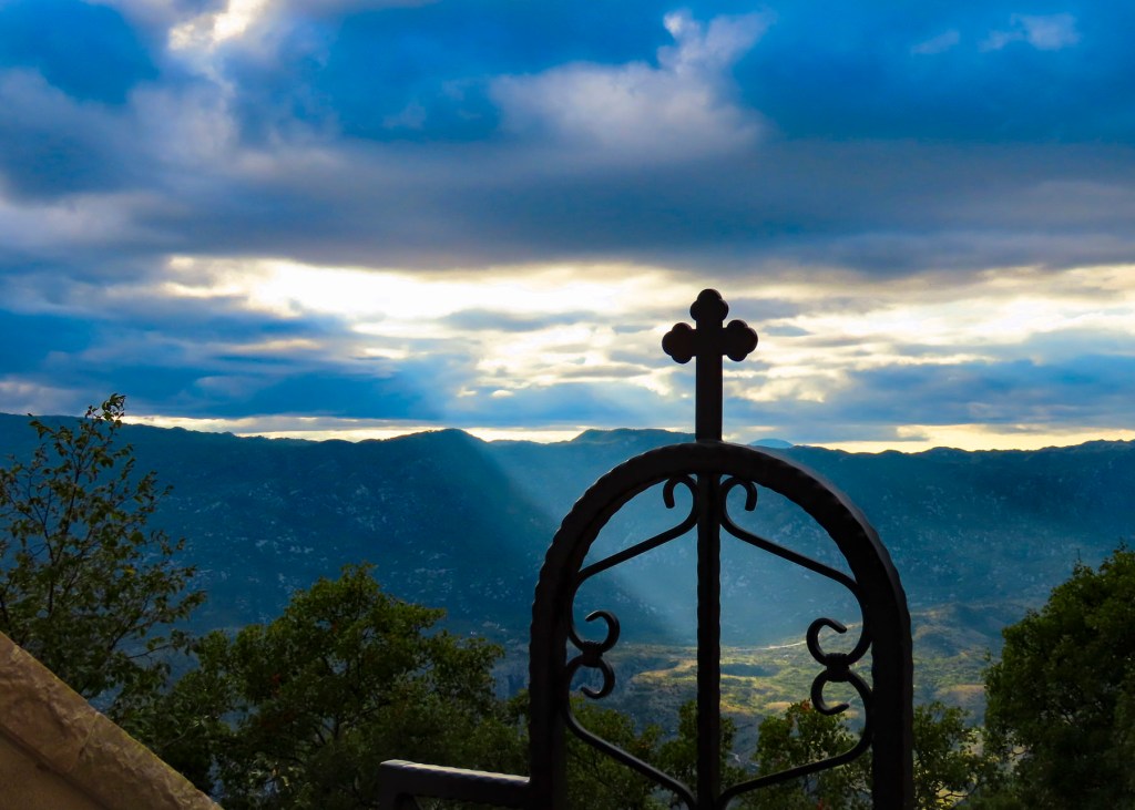
With a copy of her grandmother’s baptismal certificate in hand, we backtracked past the café to the Church of San Giovanni Evangelista. The 16th century church that stands today was built atop the ruins of an earlier 11th century church destroyed by fire.  Unfortunately, the church and its office were closed during the midweek, the population of the village today only supporting Sunday services, and we missed the opportunity to view its preserved baroque frescoes.  We did catch a glimpse of its notable wooden crucifix by peering through the church’s keyhole. 

Only two hours from Naples and just one hour from the Mediterranean, parts of Sassano are showing signs of renewal with gentrification of some of the architecturally unique homes and those with views of the valley.

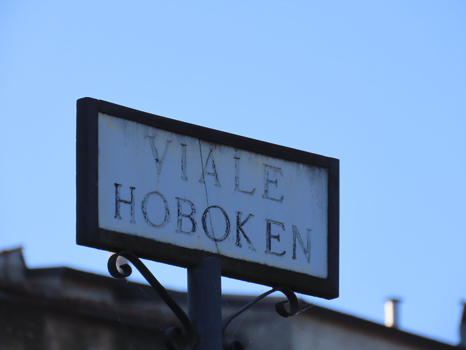
Walking along we came to a street named Hoboken, a city in the shadow of the Statue of Liberty only a short ferry ride away from Ellis Island and the promise of new life in America. At a small square we found a mural dedicated to those that emigrated from the village; we sat for a while and wondered about life here in the past. 

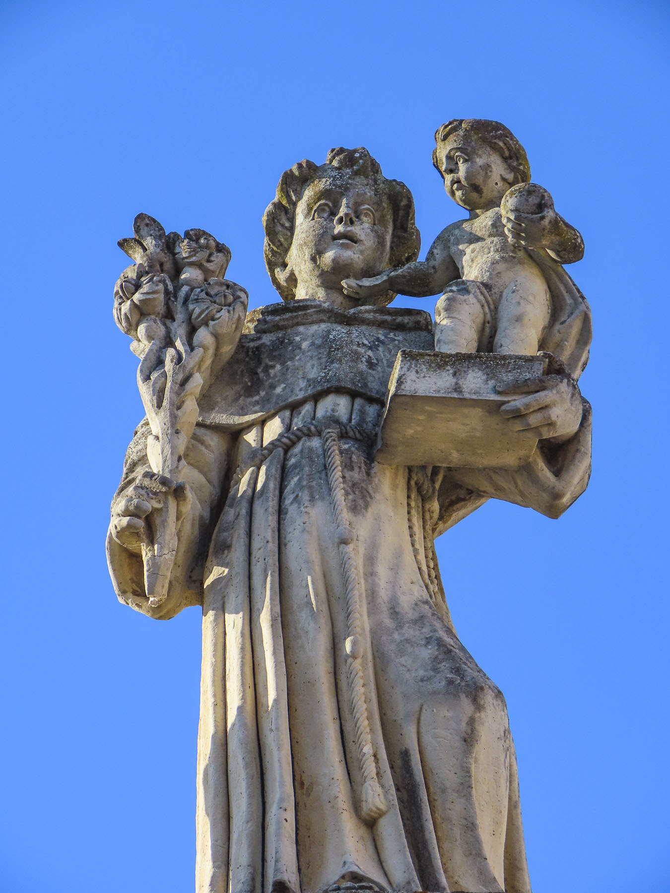
For a small village there was an amazing number of churches, but that is true of most towns in Italy. One of our favorites was the Chiesa San Michele. Located on a ridge across from the village, it had a panoramic view of Sassano and was a perfect spot for our picnic lunch. 

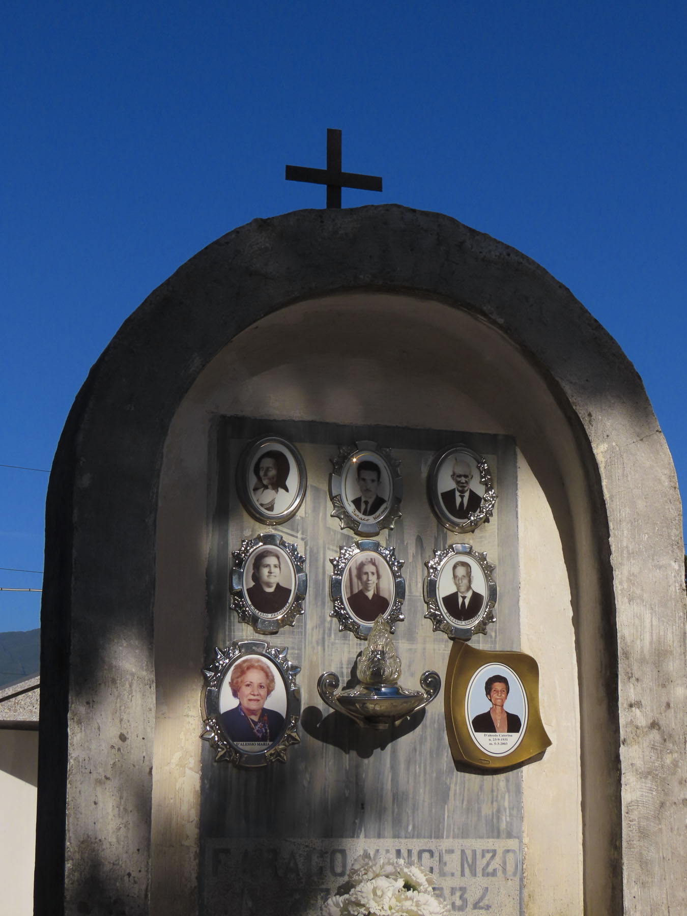
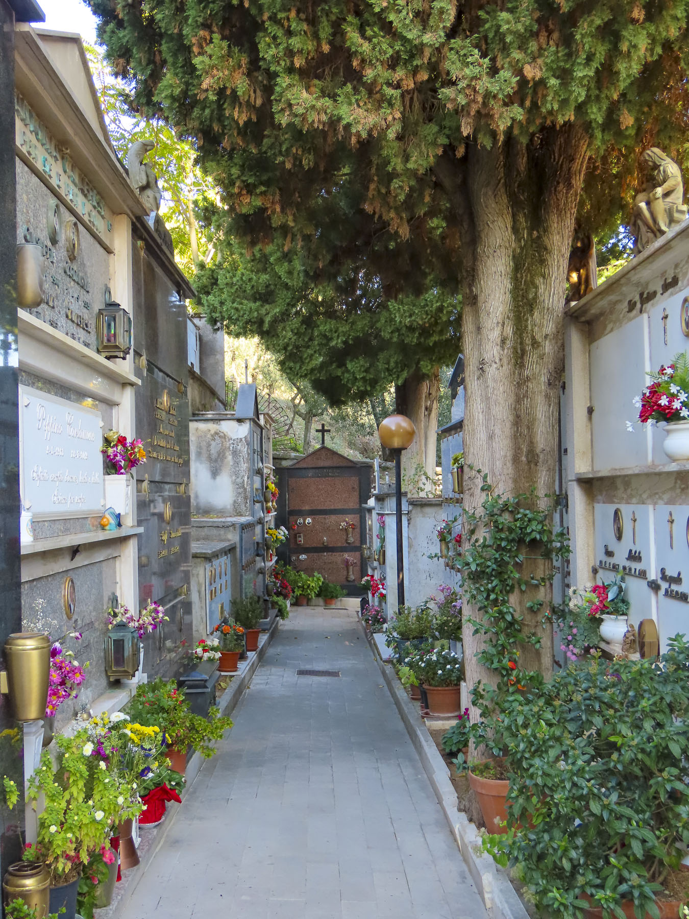
Cilento and Vallo di Diano National Park, the mountainous area around Sassano, is also known for its variety of wild orchids, containing 54 of the 120 varieties found in Italy. Earning the village’s second name “paese delle orchidee” – village of the orchids. It sounds so pretty, and it’s the perfect excuse to return when they are in bloom. Afterwards a caretaker at the town’s cemetery helped us search for family headstones.

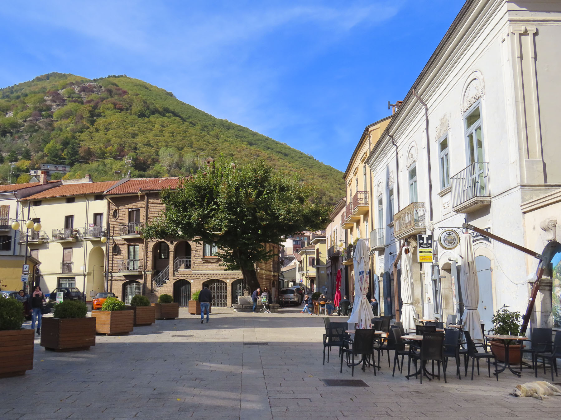
The next day we drove to the neighboring town of Monte San Giacomo to explore the village of Donna’s maternal grandfather, Nunzio DeGondea. Larger, the village looked significantly more prosperous, with several small cafés and an open restaurant, Dei Tigli Di Totaro Domenico.

Without much to go on we worked our way to the town cemetery near the Santuario Di Sant’Anna on the outskirt of town to search for his family name.  As cemeteries go it was gracefully beautiful and very tranquil, though family history eluded us.  At the Sant’Anna, Donna held me by the belt as I leaned as far as I could over a low wall to pick plump ripe figs from a wild tree.

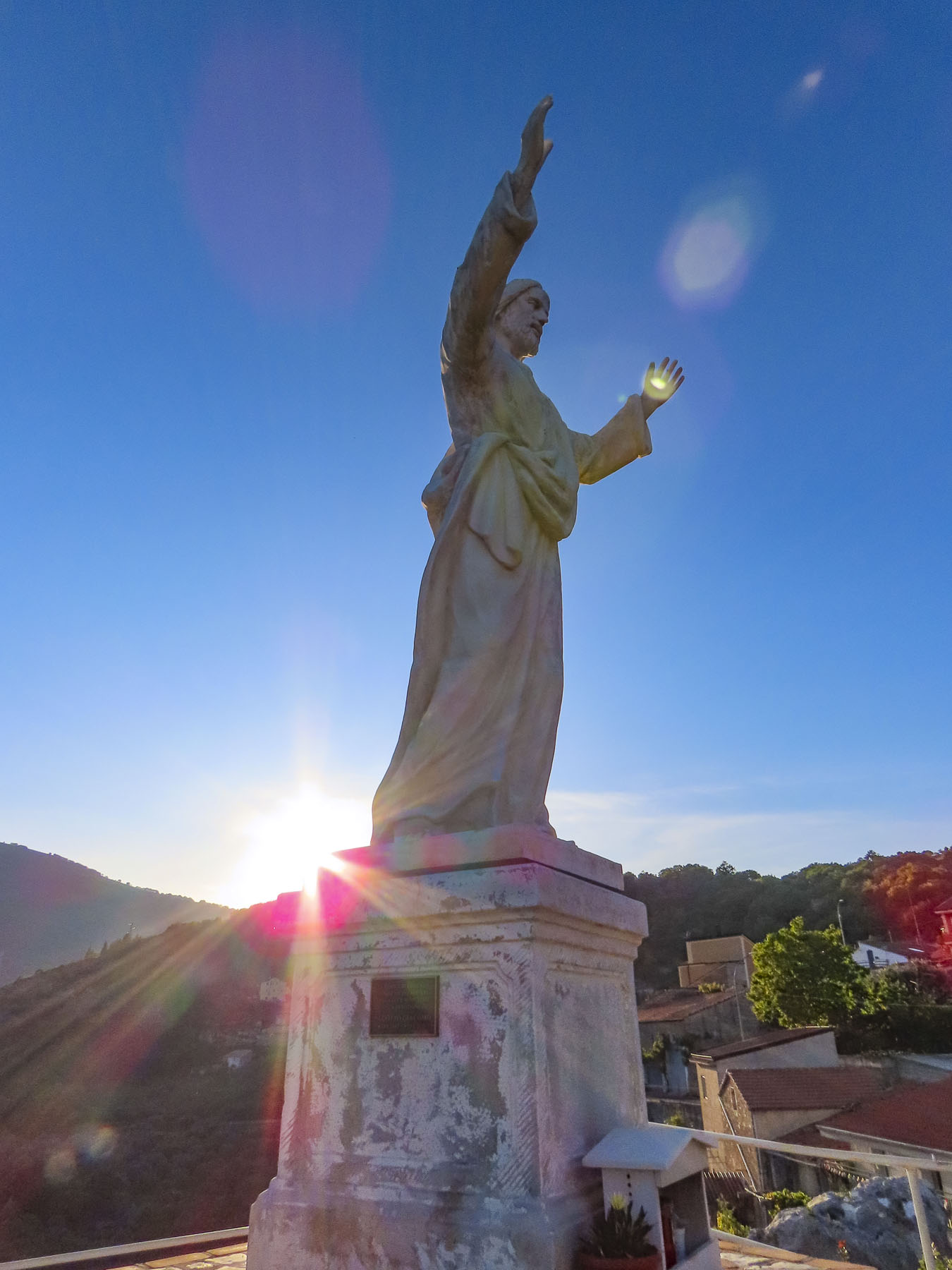
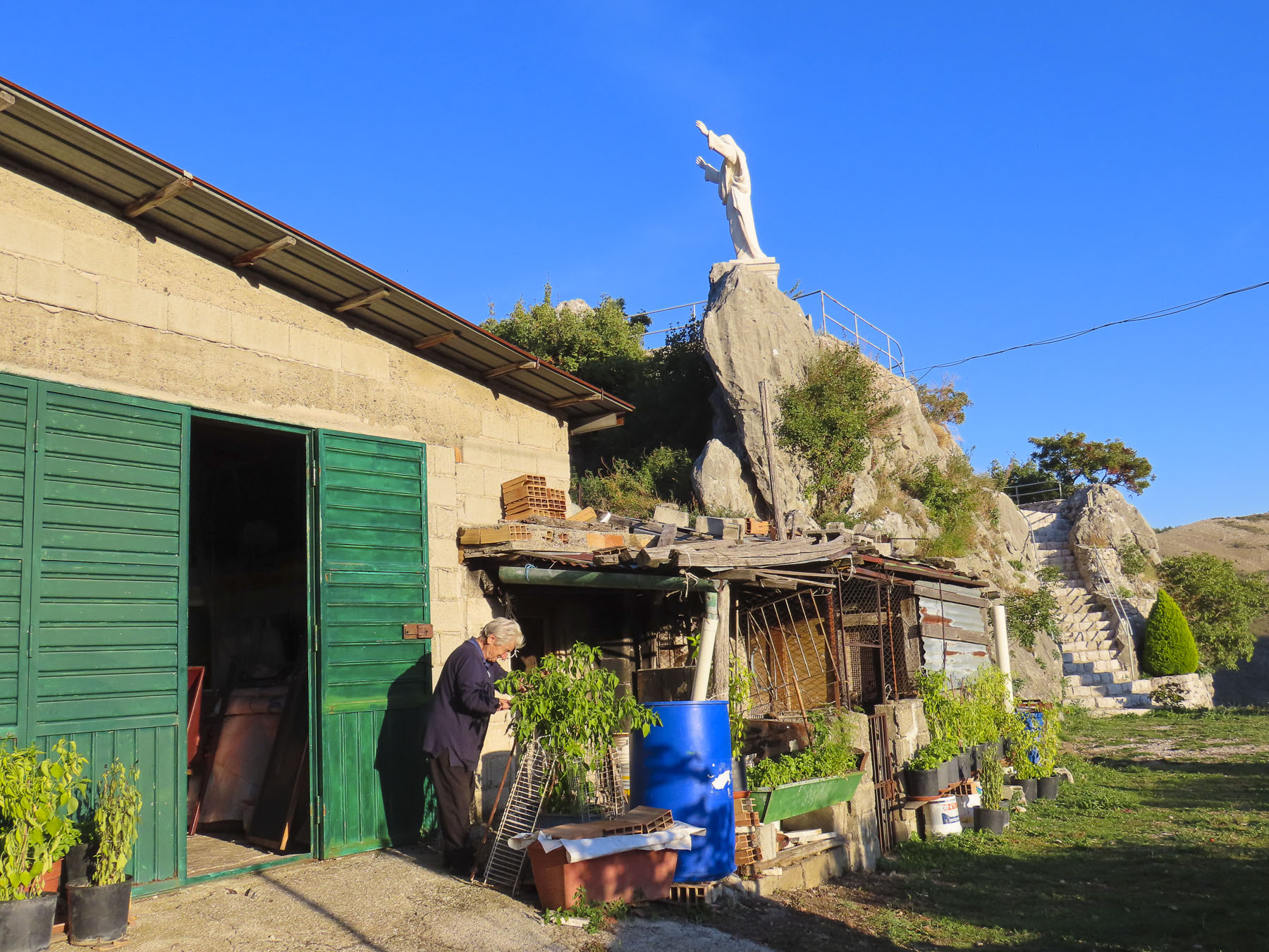
Later we searched for a large statue of Christ that we had spotted from a lower road as we drove into town earlier.  It was a good excuse for a leisurely drive around, exploring. Eventually, down a dead-end near the Chiesa Madonna di Loreto, we found it.

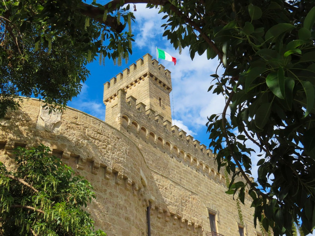
Not much is known about the origins of Quaglietta Castle, but it is thought to be a Norman feudal fort from the 11th century. And as intriguing as it looked from the road, I had to fight the impulse to follow the exit ramp. Next time!

Our desire to reach Naples before sunset required an early start to leave enough time to visit Volturara Irpina, roughly translated as “valley of vultures,” due to a large population of the birds that once inhabited the area until the 1900’s. The village of Donna’s paternal grandfather, or as I referred to it, DiMeo-ville. Farmacia DiMeo, Avvocato DiMeo, Clinica Medica DiMeo were all businesses lining the main boulevard and plaza around town hall. We had found her people! Folks were cordial, and since we were obviously foreigners, a few stopped to chat with us. When Donna introduced herself to one gentleman, he smiled. Making a sweeping gesture with his arm, he proclaimed, “Multo DiMeo!” Closer to Naples, the town had the feel of a relatively affluent commuter suburb. In the town park a monument paid tribute to the men of the village who died in the world wars, and the September 23, 1943, allied bombing, due to Nazis troops in the area, which caused sixty civilian deaths.  Many DiMeos were among those lost that day.

Once again, we tried to locate the home where Grandpa DiMeo lived before emigrating. We visited the town hall, but our lack of an extensive Italian vocabulary prompted the receptionist at town hall to call for assistance.  In a hopeful frame of mind, we followed a kind woman, slightly older than us, back to the archives where she opened a safe-like door and leafed through the century old, dry and torn pages of several thick volumes of town records, taking notes as she went.  We were still having difficulty communicating, though the gist of it was “your grandfather came from a neighborhood on that side of town,” as she pointed the way.  “The streets are still there; however, the names were changed decades ago.”  With several “mille grazie,” a thousand thank yous, followed by hugs all around (after all, this is Italy) we headed to of all places – Via Alessandro DiMeo. Of course! It was a long, quiet residential street with modest, well-kept older homes on the edge of town. Only a few homes looked like they had been forgotten.  What was confusing though was that off the main road there was a parallel lane and several dead-end spurs that all went by the name Via Alessandro DiMeo.  Walking the street, we stopped to take a photo of some just-harvested walnuts which an elderly man had placed in the sun to dry.  Asking of our interest in the area, he led us further down the road pointing to where the grocer and tailor shops used to be, though he did not know any DiMeos still in residence there. Parting, he insisted we take some walnuts with us. 

Slowing to find a parking space near the McMany Scottish Pub & Pizzeria I suddenly yelled “I just saw your Dad!” “What do you mean?” Donna responded in surprise. “That man could have been his twin – same hair, same nose. He even wore the same glasses. We have to ask him if he’s related.” Parking was not easy, so we circled the block, only to have lost him. The search began and fortunately two blocks on the gentleman had stopped to speak to a friend.  We quickly double-parked and introduced ourselves the best we could as he was saying goodbye to a younger man. “Ciao, il mio cognome è DiMeo,” Hello, my last name is DiMeo. His friend had stayed when he saw us approaching and interpreted our tale for him as best he could. 

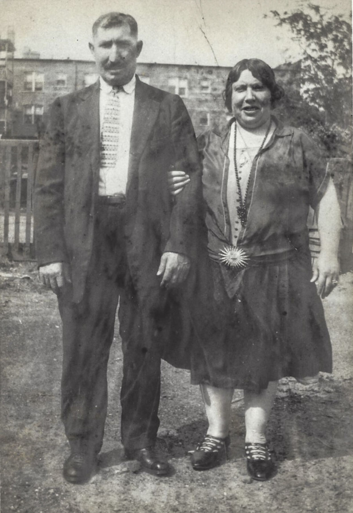
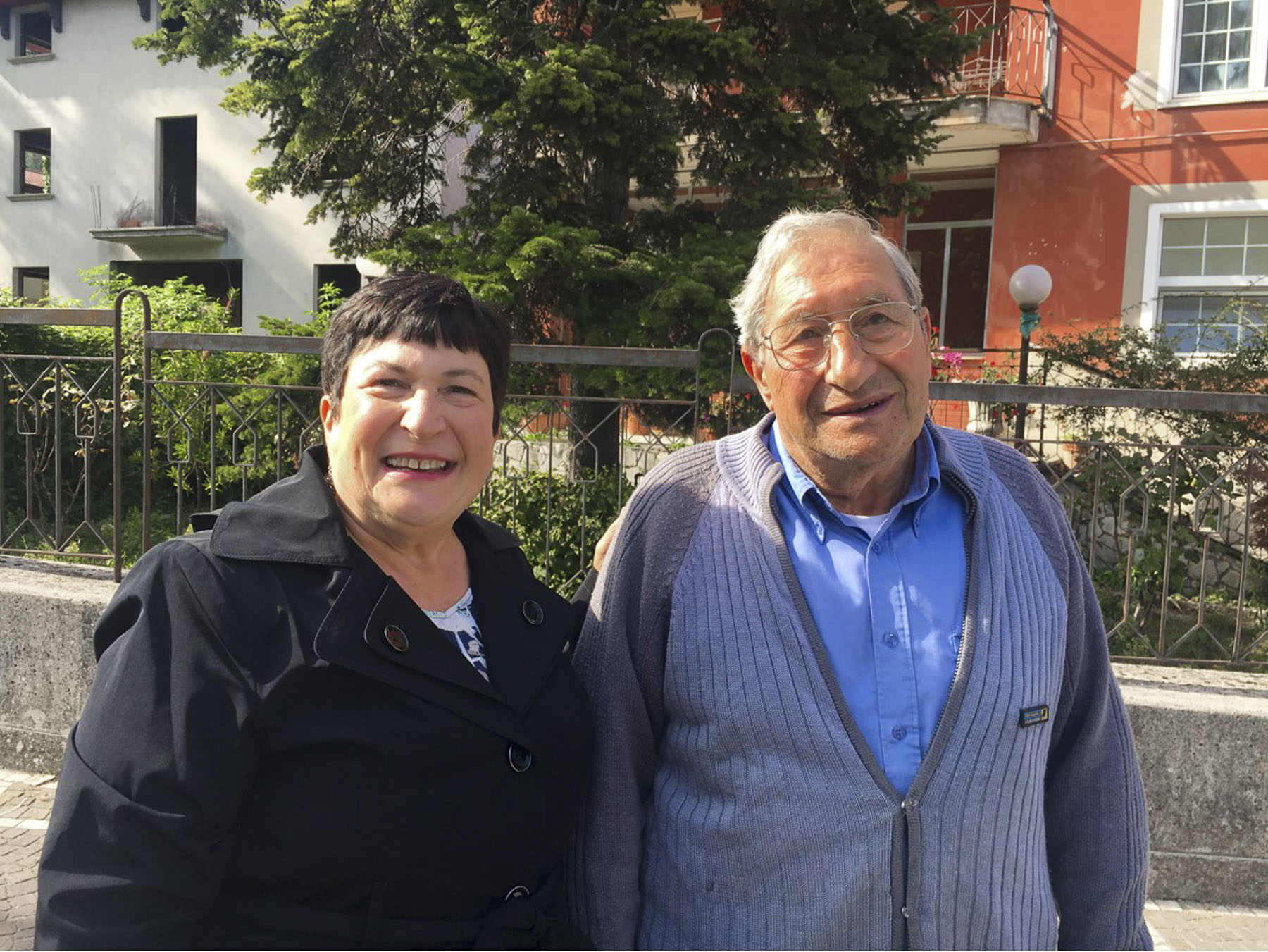
Unfortunately, he had been born in a different region and there were not any DiMeos in his family tree, which was difficult to believe. He kindly posed with Donna for a photo, so we could show the folks back home. For those of you who knew Donna’s father, do you see the resemblance to the gentleman in the above right photo? The old photo on the left is Donna’s paternal grandparents, Domenico and Filomina DiMeo.

Till next time, Craig & Donna

Puglia – Alberobello Part 2: Lecce and Nardo – The Florence of the South

“Signor, mio gattino si è nascosto sotto la yuan automobile ed è salito nel motore.” Roughly translated it means – Sir, my kitten ran under your car and is hiding in the engine! My racing imagination added, I will paint a pagan symbol on your car and you will be cursed for the rest of your life if she is hurt.  I exaggerate a little in jest just so you understand this was a crisis!

The night before we had agreed on an early start to Lecce to rendezvous with our friend Giulia for a day exploring her adopted city.  To help move the day along I offered to retrieve our rental car, which was parked a good distance away, uphill, across from the trullo-shaped Church of Saint Anthony of Padua which crowned the hill.

Donna is the designated linguist of the family. I on the other hand have been lovingly accused of slaughtering a fine romance language with just the utterance of a single word, on more than one occasion.

So, when I heard, “Signor, mio gattino si è nascosto sotto la yuan automobile ed è salito nel motore,” I smiled, as I really didn’t understand a word.  But two very worried young girls and their grandfather were standing next to the car and pointing at the engine.  They had placed a saucer of milk and some cat food near the front tire. I understood and joined the older girl who was on ground, looking under the car and meowing for her kitten, quite convincingly I might add. With no sign of a tail dangling from the undercarriage, I popped the engine hood expecting to find the kitten. Nothing.  I slammed the engine hood hoping the loud sound would jolt her from her hidden perch. Still nothing!  The way the car was parked close to an ivy-covered wall I wasn’t convinced that the kitten hadn’t scampered away unseen earlier.  They were signs of growing concern written on the girls’ faces and a growing crowd of onlookers.  Miming turning the ignition key, I conveyed that I needed to start the car and move it around the corner to jump the curb in order to get better access to the engine from below.  Hesitantly, I turned the starter and was deeply relieved when there weren’t any shrieks of horror from the girls or any fur flying. 

With my entourage trailing along, I drove the car around the corner and put two wheels up over the curb to give me just enough room to shimmy underneath for a closer look.  Fortunately, by this time Donna and Gary were rounding the corner in search of me. Much skinnier and a cat lover, Gary was enlisted to wiggle on his back underneath the car. “I don’t see anything. She’s not here.” I frowned, the girls frowned. “Keep looking.” Time passed. “I see her! she’s tucked up very high – let me have some food.” A few moments later, “I have her!” Beaming with joy, the girls and grandad took the kitten to the quiet sidewalk across the street and set her down on the ground.  Almost immediately, to everyone’s horror, the kitten dashed back across the road. The girls screamed and, oblivious to the traffic, dashed into the street in hot pursuit. The terrified kitten once again raced into her hiding place in the engine!  Mercifully, the second rescue was much faster, and with the kitten firmly in the hands of a local woman who assisted, we jumped into the car and sped away to Lecce.

After circling the port city of Brindisi, the highway (SS613) was a straight shot, past the Mura Urbiche architectural complex that highlights remnants of a once formidable city wall that encircled Lecce, to Giardini Pubblici Giuseppe Garibaldi pretty much in the center of the city.

Even though Lecce is located in the middle of the Salento Peninsular, that is often called the “heel of Italy,” the city has had a long bond with the sea.  Legend has it that the King of Crete, Idomene, was blown off course and shipwrecked here while returning home from the Trojan War.  He married the local Salento King’s daughter, Euippa, and named their newborn girl Lecce, after his Lycia homeland in the eight century BC.

Meter parking was available near the Garibaldi Garden, but we opted to find a 24-hour garage so that we wouldn’t have to worry about time.  Lecce has a population of approximately 96,000 folks, 16,000 of which are students. Their presence was evident with in the jovial sidewalk café life we passed as we headed to meet Giula at the tourist information office on Piazza Sant’Oronzo.  We entered the pedestrian-only historic center through an arched gate that led through the 17th century Palazzo dei Celestini’s impressive, cloistered courtyard. Once the private retreat of nuns, it now seats the regional government. Next door stands the Basilica di Santa Croce with its elaborate façade of carved demons, ogres, gargoyles, and beasts.  It’s enough to send any parishioner questioning his faith inside to seek sanctuary.  Fortunately, our timing to visit Lecce was perfect, as just the month before the façade of the basilica was still under wrap from a multi-year renovation project to freshen the sculptures after centuries of erosion.  Its architect Giuseppe Zimbalo took full advantage of the abundant local rock, called Lecce Stone, with its warm color and malleable characteristics.  His opulent Baroque style along with the lavish designs of his contemporaries is credited with earning Lecce the distinction of being “The Florence of the South” during the 17th century.  The talents of the city’s stone carvers rivaled those in Firenze. 

We had a few minutes to view ruins of the 2nd century Roman Amphitheatre that was undiscovered until construction in 1900 unearthed it. Its full size wasn’t realized until further excavation in 1938 determined it could seat 24,000 spectators.  We think it’s wonderful that ancient archeological discoveries are still happening in cities that have been continuously lived in for over two thousand years.

After joyfully greeting Giulia and making introductions all around, we sat at an outdoor café on the edge of the piazza and relished hearing each other’s adventures over the past year.  “The best way to experience the ambience of historic Lecce is to just wander slowly, discover the small details, touch the walls, enjoy the brilliant light and the warmth of the buildings,” Giulia offered as she stood to lead us through the past glory of Lecce. We followed her along shaded lanes, nearly empty of tourists in late October, past Baroque churches and shops shuttered for the afternoon siesta, still a time-honored tradition in southern Italy. “It’s quiet now, but in the evenings the historic district is transformed into a spirited hot spot. The passegiata brings families into the streets, and later the university students keep it lively with their barhopping.”

Large palazzo, with their arched entrances wide enough for a horse drawn carriage, lined the larger streets. Above, stone buttresses carved with gargoyles and animals supported balconies over the street. Interesting antique door knockers beckoned passers-by to rap on ancient doors, some so covered with cobwebs we wondered how many decades ago they we last used. We resisted the temptation.

As we turned a corner, the large Piazza del Duomo spread out before us.  Unlike other piazza in Italy where there are multiple entrances and shops, this piazza only has one way in and out.  The Lecce stone facades of the Museo di Arte Sacra (once a seminary,) Palazzo Arcivescovile (formerly the Bishops’s residence,) and Cathedral of Maria Santissima Assunta with its belltower enclose the plaza on three sides, giving it the ambience of a tranquil cloister.  The first church on this site was built in 1144 and repaired several times over the next 500 years until 1659 when hometown master architect Giuseppe Zimbalo was commissioned to rebuild the cathedral and design the freestanding 230ft tall belltower in the “Baroque of Lecce” style he helped popularize.  His burial under the altar of the cathedral reflected the honor accorded him.

Sitting on the steps of the museum, we admired the warm glow of the late afternoon light as it lit the walls across the piazza. “I would love to live there,” Giulia said, as she pointed to a small, corner terrace brilliant in the sun on an old building at the entrance to the piazza. I think there was a collective “ah, yes;” we understood.

Later in the week Giulia invited us all to visit her in Nardo, her family’s hometown.  It would be our farthest point south on the “heel of Italy.” The GPS directions from Alberobello suggested the fastest route to Nardo through Lecce, but we chose an alternative route that gave us our first glimpse of the Ionian Sea. Following backroads, we drove through vineyards and olive orchards.  Many of the orchards, though, were suffering from a deadly olive tree disease caused by a bacteria, xylella fastidiosa, that is ravishing southern Puglia and its important olive oil industry.  To curb the bacterium’s further spread drastic measures have been implemented. Infected trees and those within 150ft of it are culled from the orchard. Unfortunately, it has radically changing the landscape and farmers’ lives.

We met Giulia and her family at their winery on Via A. Volta, located just outside the historic district. Giulia’s grandfather started Cantine Bonsegna in 1964. Today her father and uncle continue vinting wines in a 1930’s era industrial building on one of the main thoroughfares of Nardo.  Wines from their vineyards in the countryside are brought into town, then pressed and fermented at the rear of the building, where they cork about 150,000 bottles of wine a year, while the front serves as a retail store.  On the second floor a wine bar is open in the evenings and specializes in small plate fare.  Their Danze della Contessa, Dances of the Countess, label was inspired by Giulia’s love of ballet. We might be slightly prejudiced, but we thought their wines were very enjoyable and definitely worth a visit to taste some fine regional wines and buy a case or two, maybe three. We purchased several bottles to enjoy during our trip, and were disappointed to learn that the Bonsegna label was unavailable in the US.

Heading into the historic district we were treated to a festive lunch at the Hostaria Corte Santa Lucia, a local favorite that specializes in “the forgotten recipes of the Salento region.” Plate after plate of mouthwatering local specialties were placed before us; our young men did justice to the platters, but were soon groaning for mercy as more and more food appeared. Mr. Bonsegna wouldn’t hear of us paying the bill, and afterward our boys marveled at the warmth and hospitality our host showed to us. “It is the Italian way,” Donna explained. “This is how I grew up – family and friends are lovingly embraced, and everyone is fed!”

We followed Giulia’s father into the old town, hugging the shade to avoid the intense sun still strong in late October.  The colors of the buildings were softer here, pastel colors chosen to reflect the nearby sea and surrounding farmlands.  Being close to Lecce, Nardo shared a similar history and the Baroque style adorns many of the town’s ancient churches.  The façade of the Church of Saint Dominic is the best example of that opulent exterior decoration, and was the only wall to remain standing after a 1746 earthquake.  

The Cattedrale di Nardo was our destination.  Partially damaged in the upheaval that shook the region, half of the 11th century church needed to be rebuilt.  Interestingly the effects of this could be seen as we looked down the center nave of the church.  The arches on either side reflected different styles.  The surviving arches were slightly pointed at their apex, while the newer ones are completely curved, a fine detail that Mr. Bonsegna enthusiastically revealed.  Farther inside, original medieval frescoes survived, untouched from the catastrophe, while along the outer wall 19th century murals replaced ones lost to the earthquake. 

Nearby the Guglia dell’Immacolata, a 100ft tall ornately carved baroque spire dedicated to the Virgin Mary, centers Piazza Antonio Salandra. “The piazza is jammed with people every December 8th to watch a fireman climb to the top and place a wreath of flowers on Mary’s head, to honor the Immaculate Conception,” Giulia shared as we crossed the piazza to a still-flowing, ancient public water fountain decorated with a relief carving of a bull. 

Legend says the fountain marks the spot where 3000 years ago settlers watched a large wild bull scuff the earth and uncover a natural spring.  Behind us stood the small Church of San Trifone, built in the 1700’s to honor the martyr who saved Nardo from an infestation of caterpillars. We were disappointed that an explanation of this odd plague was not provided.  Most likely it was an infestation of oak processionary caterpillars. Contact with their toxic hairs can trigger an asthma attack, but most often results in a severe, blistering rash that lasts for weeks. “We have it all here and yet we are still far off the tourist track,” Giula happily joked. “We get very few foreign visitors, and rarely, if ever, Americans.”

Heading back to the car we stepped through the heavy wooden door of the Aragonese Castle of Nardo. Formerly the private residence of the 15th century Acquaviva family, rulers of the fief of Nardò, a reward from King Ferdinand II of Naples.  Today the once moated fortification serves as the city’s town hall.

A very enjoyable day was celebrated and “till next time” was said over coffee before we said our farewells and drove to the seashore to find one of the numerous watch towers that were built along the Ionian coast to warn the country of imminent invasion. 

The sun was setting as we came to a stop behind a car about to turn onto the coast road. A car on the opposite side of the road turned the corner and stopped to wave at the person in front of us. Quickly both parties were out of their cars, hugging and chatting away, oblivious to us. I rolled down my window and photographed the dark silhouette of a square “Nardo tower” against an orange sky. No impatient honking, just enjoying life in Nardo.

Fino alla prossima volta – till next time,

Craig & Donna

Dubrovnik: Dragons and Castles

Our first glimpse of Dubrovnik caught us by surprise as we rounded a curve on Croatia’s RT 8. Its thick limestone walls and brilliant red tile roofs, saturated with color, reflected brilliantly on cobalt blue Adriatic Sea.  Its nickname “pearl of the Adriatic” rightly earned.

Fortunately, mid-October was considered off-season and we were able to find a wonderful apartment, Old Town Sunrise Apartments just steps away from the Babic’ Bakery and the 14th century Vrata od Ploča or East Gate with its ancient drawbridge.  The agony of lugging our bags up three flights of stairs was rewarded with gorgeous views from our roof windows, since the studio apartment was directly across the harbor from Fort St. Ivana. 

We couldn’t have asked for a better location. The sunrises and sunsets were spectacular over the Adriatic and the citadel.  A brilliant Hunters’ Moon one night was an added bonus, as was watching a group of elderly friends take an early morning swim, their daily ritual.

Fort St. Ivana today houses an interesting maritime museum and aquarium, but when it was built in the 16th century its canons protected the city-state’s merchant fleet from the Venetians and Ottomans.  Over the centuries Dubrovnik’s maritime merchants rivaled Venice’s with trade representatives in Goa, India and the Cape Verde Islands off Africa’s Atlantic coast.  Its merchant fleet even traded during the Middle Ages with the English court of Elizabeth the First.

Blame it on Drogon! Since the medieval fantasy Game of Thrones was filmed in Dubrovnik the city has lost its previous reputation as an under-visited and affordable destination on the sunny shores of the Adriatic.  Ever since the TV show’s premiere in 2011 the city has become a mecca, big time, for fans eager to visit the show’s filming locations.  Thankfully, it hasn’t risen to placards of “Jon Snow slept here” or “Rhaegal roasted a nobleman on our roof” level yet.

We had been on our journey fifteen months now and aside from a brief stay in London, Dubrovnik was by far the most expensive destination.  I think this explains why we saw so many people walking down Stradun, the city’s main pedestrian boulevard, eating slices of pizza.  The impact of these high prices was especially acute since the affordability of Kotor, Montenegro (only a short drive away) was still fresh in our minds.  It was actually easier to find an affordable restaurant in London.  It was captive pricing for sure within the fortress walls that encircle Old Town and the only reprieve was to eat in the new town portion of Dubrovnik, outside the citadel. 

Stradum, aka Placa (Stradone or Corso) is the city’s pedestrian-only main boulevard, running 300 yards east to west, connecting both ancient gates and harbors on either side of town.  For us it was too pristine.  An unfair comment, as this resulted when Dubrovnik was rebuilt after the 1991 Balkans War, when the city was shelled for seven months from the top of the mountain above town. Two hundred eighty civilians and soldiers were killed during that prolonged bombardment. Today an aerial tram takes you there for panoramic views. Shrapnel scars, signs of the conflict, remain etched into the stone walls on some buildings.  But the newness of the polished limestone boulevard running past upscale shopping reminded us of an amusement park.

We were drawn into the narrow, arched alleys with steep stairs that climbed the hills and weaved through older neighborhoods on either side of Stradum. The farther away from Stradum we got, the more the crowds diminished. 

Our other alternative was to walk along the fortress walls that encircle the city for slightly over a mile.  Thirteen to twenty feet thick and towering eighty feet high in some sections, the walls once held 120 cannons to protect the city from land or sea attack.  This walk is a popular activity with fast moving tour groups, but we found if we just let them pass there would be a tranquil void until the next group which allowed us to linger in one spot for a while. 

Standing above the West Gate and looking down the Stradum was a prime view that included the circular Large Onofrio’s Fountain built in 1438 and which still supplies fresh spring water, from mountains miles away, to carved faces that spurt water. Farther down the Franciscan Church and Monastery houses the oldest continuously operating pharmacy in the world dating to 1317 in its muraled cloister. Farther along the wall there were several small cafes and stairs that lead to roped off swimming areas at the sea’s edge.

At the far end of Stradum the city’s 100 ft tall clock and belltower zooms skyward over an area that was once the city market in the 1400s. Famously the belltower has two bronze figures named Maro and Baro, zelenci (green) twins that strike the bell on the quarter, half and full hour.  Interestingly, several generations of the same family have maintained the clockworks for over 100 years. Next door the 14th-century Gothic-Renaissance style Rector’s Palace exhibits vestiges of Dubrovnik’s history. Especially noteworthy were the intricately carved exterior columns.

Across the street the statue of golden statue of Saint Blaise cradling a model Dubrovnik on his arm crowns his church.

The city’s 16th century granary and mill has undergone a beautiful and innovative renovation and now houses the Etnografic Museum Rupe. It has a prominent collection of Croatian Cultural items, particularly traditional attire from the regions surrounding Dubrovnik.

Weddings are a boisterous affair in Dubrovnik, with the bride and groom following a flag waving entourage parading through the pedestrian-only streets on the way to their church ceremony.

Walking east one morning away from the city, along Ul Frana Supila, a quiet road that hugs the water, a small village ambiance prevailed with colorful homes, flowering plants and wild pomegranate trees set into the hillside. 

Villas for the well to do, many built on the ruins of previous civilizations, line the road, beautiful none the less. Bored? There was a rainbow-colored selection of wheels for rent at the exotic car dealer to satisfy that zoom, zoom craving. 

Eventually the road narrowed and a chain across it prevented cars from going farther along a treacherous, serpentine stretch that hugs the cliff face.  The road used to connect back to the highway near one of the scenic overlooks.  But it was determined to be too dangerous when its guardrails tumbled down the cliff into the sea.  Now only walkers and bicyclists use it to traverse a dramatic section of the coast. 

A memorial, Spomen ploča žrtvama komunističkog terora, to victims of the communist terror, stands on a curve in the road. It commemorates the lives of five young Yugoslavian partisans thrown from the cliff to their deaths by communist “liberation forces” loyal to Marshal Tito at the end of WWII.

Across from Dubrovnik’s West Gate and harbor, the 11th century Fort Lovrijenac, the “Gibraltar of the Adriatic,” sits atop a towering rock monolith 121 feet above the sea. Climbing to the top of the citadel along well-worn footpaths and stairs satisfied us with great views back across the harbor of walled Dubrovnik and kayakers paddling along in the cove below.

Many kayaking tours leave from West Harbor. Today Lovrijenac’s walls, some reaching a thickness of 39 feet, support theater and music productions during the summer months.  The dramatic setting is also the backdrop for Red Bull Cliff Diving World Series and Knightfall, a historical fiction TV drama about the Knights Templar. 


Behind the fortress, wandering the narrow lanes along the water’s edge felt like we were in a quaint seaside village.

We thought the Three-Day Dubrovnik Card was a good value for us, since it offered free entrance to six museums, two galleries and the city walls, as well as six free rides on the local buses. Staying just outside the fortress walls permitted us to avoid a premium room rate yet allowed us easy entry into the citadel early in the mornings and to find those quiet vignettes and ancient architectural details hidden amidst dramatic shadows.

 For moments we felt like we had this beautiful medieval city all to ourselves.

Till next time, Craig & Donna

Kotor Part 4: The Ladder of Kotor, Camel Tracks and Pirates

The water barely ripples on the inner reaches of Boka Bay when a storm rages across the Adriatic Sea. The steep walls of the fjord created the perfect harbor to shelter ancient fleets of merchant sailing vessels. Three-thousand years ago starting with Greek triremes and later Roman galleys, the vessels carrying goods through the Adriatic to ports along the Mediterranean were mainly rowed.  The ancient Greeks mostly relied on free men as paid rowers while the Romans used slave labor to expand their empire and propel their merchant fleets.

The city of Kotor was essentially a land locked island until an ancient foot path was widened by the Romans in the 1st century into a cobbled road, six to eight feet wide in many places, with stone retaining walls that zigzagged up the mountain four miles and climbed 3100 ft in altitude, about a five- hour trek.  Going downhill was much faster and more difficult for the camel trains. The danger here was if the camels were going too fast and couldn’t round the tight switchbacks, lost their balance and fell off the trail to their deaths.  The camel wranglers definitely had a difficult task on this route. The caravan trail remained the only land route into Kotor until 1897, when the Austrians built the road that now leads from Kotor to Cetinje.

This early example of infrastructure improvement resulted from Rome’s war against the Illyrian Kingdom after it refused to stop their piracy of Roman merchant ships. The empire determined that an overland trade route connecting to Constantinople/Istanbul and the Silk Road from China was needed as a safe alternative.  Eventually a spiderweb of caravan trails and Roman roads spread across the Balkans. Cilician pirates in the eastern Mediterranean were also creating havoc, at one point kidnapping a young Julius Caesar on a voyage to Rhodes. Piracy continued to be a problem for the Venetians with Omis pirates in the 11th to 13th centuries and later Uskok buccaneers from Croatia pillaged along the Adriatic until the 1600s.  Barbarossa, the notorious Ottoman pirate, commanded a fleet of swashbucklers that were the scourge of the Mediterranean at this time, raiding Spanish and Venetians merchant vessels and selling Christians into slavery. European empires also tolerated and endorsed pirates as long as they were “our pirates.”  Piracy persisted on the waters of the Adriatic and Mediterranean for so long because the rugged coastline had many small islands and hidden inlets to shelter the pirates.

Romanticized views of pirates persist today with the popular adventure movie franchise Pirates of the Caribbean, featuring a beguiling Captain Jack Sparrow, and the TV series Black Sails.  Interestingly there is a Japanese anime film about fictitious air piracy on the Adriatic Sea called Porco Rosso which is based on a 1992 short graphic novel called Hikōtei Jidai (飛行艇時代, The Age of the Flying Boat). It’s entertaining and worth checking the Porco Rosso film trailer.

The afternoons in mid-October were still quite hot so we planned for an early start from our apartment in the center the historic district.  This coincided with the young parents of old town escorting their children through the still shadowed alleys to the Vrata od Škurde, the River Gate, which was constructed in 1539 to celebrate a naval victory over Barbarossa, now an Ottoman admiral. We found ourselves behind an orthodox priest holding the hand of his daughter as we crossed the first and then second bridge that spanned the Scurda.  The Scurda is a wide, shallow stream that bubbles to the surface from beneath the tall rock escarpment that the Ladder of Kotor climbs and flows into Boka Bay. This area on the far side of the bridge was for centuries the market for all the goods brought down the trail from afar or from farms in the mountains to be sold or bartered for.

The old caravan trail starts behind the waterworks where the underground spring emerges and zigzags often in the tight confining space at the bottom of the gorge. The trail continued in the shadow of once towering fortress walls now humbled by earthquakes before the ravine widened out and the distance between the switchbacks increased.  There are seventy switchbacks in total if you chose to trek all the way to Krstac pass where the trail ends near Restaurant Nevjesta Jadrana. Here you can zipline over part of the trail you just hiked up, or catch a taxi or local bus back to Kotor or onto Cetinje.  Hiking back to Kotor is also an option for the hardy.

Our plans were more modest, just wanting to hike to a vantage point above the Castle of San Giovanni, Kotor Fortress, for views over the bay.  The cobbled road and retaining walls have seen better days having been damaged in the 1979 earthquake.  While the fortress has been repaired, maintenance of the caravan trail has been forgotten.  Though many sections of it are in better shape than the stairs to the Castle of San Giovanni and not as bad as some city sidewalks across Europe. Still you need to be aware of your footing and wear sturdy shoes.

It was a gentle hike through a rock-strewn hillside dotted with grasses, small shrubs, occasional pomegranate trees and wild thyme.  Off in the distance unseen donkeys could be heard braying. The pomegranates were just ripening, but were all teasingly just inches out of reach, too far from the trail’s edge.  The views were fantastic from many spots and there were two rustic taverns to stop at along the way to rest.  The lower one was closed for the season, but the higher one referred to as the Cheese Shop, on Google maps, is located where the trail veers off towards the deserted village of Spiljari, which is located under the back ramparts of San Giovanni Fortress. 

I think we were the innkeeper’s first customers of the day, and we ordered two espressos while we rested on the shaded porch.  After serving us he crossed to a refrigerator on the other side of the room to get himself a shot of chilled rakija. Being a good host, he offered us some. It was ten in the morning.  We politely declined. Though I’m sure it would have had wonderful medicinal qualities in case of any mishaps.

The village of Spiljari is over 1,000 years old and was abandoned when its water source went dry. Now trees grow between the half walls of a dozen buildings and the ruins of the Church of St John remain standing.  The ruins of the church alone are worth the detour. 

Slowly decaying, colorful remnants of what one only could imagine were beautiful frescoes remain on walls open to the weather. 

From here you can see a ladder to a small portal in the side wall of the fortress. The Ladder of Kotor? We are not sure if the name refers specifically to this or to the climb in general.  Years ago, this was an alternative entrance into the fortress.  Now it is strictly an exit point for those who have paid the €8 entrance fee to the fortress and walked up the stairs from old town and wish to return to Kotor by the caravan trail.  Though you might be able to purchase a cold drink from an ice cooler manned by the ladder attendant.  

The sun was high in the sky when we made it above the castle and the view was spectacular. We sat for a while and imagined the history of the trail: how it conveyed ideas, merchandise, pilgrims and invaders over the centuries. 

Notably in the 1830s a team of fifty men carried an Italian billiard table up this track to the rightfully named Biljarda House, home to the beloved prince bishop and poet Petar II Petrovic. (Just imagine the amount of cursing involved in that endeavor.)  Years later when Petar II Petrovic was on his deathbed a procession carried him up this same track to the historic old capital, Cetinje.  A few months later Montenegrins would carry his successor and nephew Danilo II Petrović-Njegoš to Cetinje to rule.

And although we took many photographs on the trek up, we took even more of the ever changing view as we descended back into town.

Till next time, Craig & Donna

Kotor Part 1 – Water and Mountains, Ancient and Enchanting

Twenty-four hours out of Africa we were finally unloading our bags from the taxi, under tall palm trees across from a beautiful harbor. In front of us stood the Sea Gate, the 16th century arched entrance through ancient stone fortifications and the winged lion of St. Mark.  Both were constructed in 1555 when this port city was under Venetian rule.

With little difficulty we found our host and followed her through the ancient portal under a relief sculpture of the Madonna and Child, flanked by St. Bernard and St. Tryphon, the town’s patron saints.  There was a small rectangular slit underneath the stone carving where prayers were once placed. “Now it’s used as a complaint box by local residents!” our host joked. 

The archway perfectly framed a quaint plaza, The Square of the Arms, lined with shops and restaurants set dramatically under the backdrop of St. John’s Castle, Kotor Fortress, which towers protectively over the city.  Within the walled city it’s a wonderful pedestrian-only maze of narrowing alleys that weave about.  Our second-floor apartment was at the intersection of several of them and overlooked a view of the restaurants on Plaza Tripuna. 

After six weeks of continuous travel we were looking forward to being rooted for a while in an apartment, returning to our immersive travel philosophy. With a spacious living room, kitchen, hot water, and live saxophone music six nights a week, we were ready for this month of R&R in Kotor.  Though by the third night the saxophonist had played the identical repertoire each appearance, without changing its sequence. We were doomed to a Bill Murray-like Groundhog Day scenario, until he took three days off and was temporarily replaced by a young violinist.  She was a breath of fresh air.

But, with any new destination there is the urge to explore.  Outdoor dining was still in full swing and perfect, since the hottest days of summer were long gone by mid-September.  After lunch our first mission was to find a grocery store to get some basic essentials – wine, coffee and some breakfast items for the next day before we crashed from a long travel day.  Through the North Gate and across the Scurda River we found Voli and Aroma grocery stores.

The second, lone mission, was to find the laundry service as our cloths were about to walk away on their own in protest.  Before our host departed, she confirmed there was a laundry service, but wasn’t sure exactly where, as she didn’t use it, only that it was outside the city walls somewhere along the road that followed the bay. She waved vaguely in the general direction of the South Gate. It was a pleasant walk past the vegetable vendors in the daily market, outside the city walls, laden with fresh fruits and vegetables and FIGS!! (Our decision to call Kotor home for a month was instantly reinforced by this discovery.) Further on there was an Idea supermarket and the Sladoja mesara meat shop and grill restaurant. I walked all the way to the bus station and back tracked without spotting the laundry. Not one to accept surrender,  I asked a woman exiting an apartment building with my laughable Serbian, praonica? (laundromat in Serbian.) I also showed her a slip of paper with it spelled out, just in case. Saint Jude must have been watching. She not only spoke English, but happened to work there and was returning from her lunch break. Nearing home, I found the only bakery within the old town just around the corner from our apartment and was able to pick up some wonderful fresh breads and baked goods at very reasonable prices. This became a regular stop during our stay.

Instead of ticking off destinations and sights within a short period of time, it was good to be back on track with our slow travel approach to seeing the world.  Yes, we still want to see everything a locale has to offer, but at a reasonable pace with a walk a little, then café style repeated throughout the day. This approach allowed us to enjoy the Adriatic lifestyle by immersing ourselves into the ambience of Old Town Kotor for a month.

Surrounded by its ancient walls, the village really was the perfect size, impossible to get lost within and full of interesting finds and eateries.  If we started our day early enough, we caught pleasant glimpses of parents walking their children through the ancient gates to school, and vendors delivering the day’s supplies by pushcart down the tight, cobbled lanes, hard work for sure.

Exploring the alleyways that twisted through the town, we found unique architectural details, remnants from past empires and seafaring wealth.

The alleys led to small intimate plazas with umbrellaed tables and entertaining street musicians. Caffe bar Perper on Pjaca od Salate made very good cappuccinos and every morning two singers sang a medley of Balkan folk songs with a sprinkling of western tunes thrown in.  Across the plaza Konoba Scala Santa, the oldest restaurant (1931) in Kotor offered regional specialties and a rustic interior with a fireplace on those rainy fall nights that chased us inside. 

After coffee one morning we followed the steep stairs off Pjaca od Salate past old stone homes (wondering how folks do it when we saw a baby stroller on a landing) built into the hill to the entrance of Kotor Fortress.  1350 steps to the top –  we could do it! Fortunately, we chose a cool day. It was a challenging trek over a rough stone path and stairs still in need of repair from the 1979 earthquake that struck the city. 

Fortifications have loomed over Kotor since Illyrian times, 4th century BC until 167 BC, with additions made by Roman emperor Justinian I in the 6th century.  The Venetian Empire expanded the fortifications further in the 16th century.  It’s their stones that we were tripping over.  Our effort was rewarded with spectacular views of the city, bay and old caravan trail from the serpentine path that twisted all the way to the top. 

As formidable and imposing as the fortress looked, it has been seized several times during conflicts with the Ottoman, French and English. Good walking shoes and water are a must for this going.  650 steps up the Church of Our Lady of Remedy marks the halfway point and is a good place to rest and enjoy the view for a while.  The small chapel was built by survivors of the 1518 plague to honor the Holy Mother.

In 1979 an extremely destructive magnitude 7.0 earthquake devasted old town Kotor and many similar towns along the Montenegro and Albanian coastline which was then part of Yugoslavia, leaving 100,000 people homeless. All the stone buildings suffered some form of damage and the city was closed to the public for ten years during its restoration. Some signs of the earthquake damage are still visible, most noticeably block-long 19th century Austrian Prison that has large cracks in its exterior walls and the sky visible through its roof. 

The churches in the historic center also suffered extensive damage. Their facades have been fully restored, but their ornate interiors were destroyed beyond repair. The interiors are noticeably less ornate than similar era churches in Europe, with only fragments of relief carvings and frescoes remaining, hinting at their former beauty. Priče o Potresu / The Earthquake Stories is a 2020 documentary by Montenegro director Dusan Vulekovic about that destructive natural disaster. Severe earthquakes also struck Kotor in 1563 and 1608.

The one drawback of Kotor is that it’s a busy cruise port with four or five large cruise ships disgorging thousands of passengers between 10am and 3pm every day until the end of the cruising season. But they followed a limited circuit and if we planned around them, they were barely noticeable. By October first only one or two cruise ships were anchoring in the bay each week.

Often referred to as Europe’s southernmost fjord, the walls of Kotor bay are so high and steep that they cast shadows late into the morning and early in the afternoon over the city. This is a tremendous help in moderating the heat of the Adriatic summers.  Its unique geography makes it the most naturally protected harbor along the Adriatic coast, providing safe anchorage for sailors since the beginning of boat building, several millennia ago. 

There were a variety of water tours available and we opted for one that took us to Our Lady of the Rocks and Perast.  The legend of Our Lady of the Rocks starts in the 15th century when two brothers, fishermen from Perast, found an icon of the Virgin on a rock protruding from the center of the bay. Fulfilling the Virgin’s request of them to build a church in the bay, they began transporting stones by boat from the shore and dropping them in the bay. Soon others followed. Today there is a small Catholic church on the island and a festive boat procession every July called Fasinada that keeps the tradition alive.

The views from the bell tower of St. Nikola Church over the quaint village of Perast and the open expanse of Boka (Kotor) Bay were tremendous.  It was a wonderful, beautiful day on the water that ended hours later in agony, as we both succumbed to food poisoning from lunch.  Fortunately, Donna found a visiting Doctor service that provided an English-speaking physician who made house calls.  After a midnight knock on the door and a short consultation we were advised to hop in his ambulance for an intravenous treatment at the local clinic.  It turns out that we had visited this clinic ten days earlier for treatment of a sinus infection and pinkeye that Donna caught before we left Ethiopia. After our hour and half treatment, we felt one hundred percent better and were discharged at 1:30AM onto a deserted sidewalk with no assistance offered to get us back to town.  It was too far out of town to consider walking and considering we were still recovering, we waited patiently as the occasional car sped past Finally a taxi zoomed by and, hearing my booming shout of “TAXI!” the driver hit the brakes and did a U-turn.

Our travel insurance covered the hospital visits, though the claims were cumbersome to file. (Keep your airline tickets for proof of travel.) Amazingly, the hospital treatment, including transport by ambulance, was only €50 each – extremely affordable compared to medical care in the United States.  Likewise, the prescriptions we filled the next day were easily paid for out-of-pocket.  It is worthwhile to compare the cost of drugs that you regularly purchase in the United States with what they cost overseas when traveling. There is an outstanding difference, with foreign prices being much lower and many not requiring a doctor’s prescription.  Just check Google for the correct name of the drug for the country you are in.

The old town is also famous for its colony of “Kotor Cats,” descendants of ratters taken to sea by sailors to control rodents on board their ships.  As we walked around town, we noticed small trays of cat food placed about for them.  Kotor Kitties is a non-profit organization started by an American visitor to Kotor several years ago that provides food, veterinarian care and neutering for the famous felines.  

Our wanderings expanded to include longer treks along the picturesque roads that followed the shoreline of the bay. Walking only minutes from old town along Put I Bokeljske Brigade on the bay’s eastern shore put us in a more relaxed world with pebbled beaches, small marinas, waterfront restaurants, private homes and small boutique hotels along the water.  Though the bay water was still warm enough for swimming, the area was very quiet at the end of September, with most of the small hotels posting “rooms available” signs in their windows. Many of the beach facilities pulled in their cabanas and rental kayaks with the end of the cruise boat season, which coincides with the beginning of the rainy fall season.  Fortunately, the restaurants were still open along this route and several of them enticed us enough to revisit this seven-mile roundtrip walk to the village of Dobrota weekly. 

The western shoreline along the bay was equally enticing with its small coves that sheltered yachts at anchor, and the historic churches of Crkva Sv. Ilije in Gornji Stoliv and the parish church of Prcanj, Bogorodicin Hram, offered wonderful views of the bay from the top of its monumental stairs leading to the church.  There were also some nice quirky finds along this route: props that looked like they were once used in a local carnival.

Montenegro is a small country; besides being known for its fabulous Adriatic coast, it has an equally impressive mountainous interior only a short distance inland from Kotor that can be visited on day trips.  There were numerous tour operators around town that all offered basically the same excursions. We chose one to Durmitor National Park that included stops at the dramatic Most na Đurđevića Tari bridge that spans the turquoise waters of the Tara River. Visits to Black Lake, Lake Slano and the cliffside Ostrog Monastery would round out the day. 

It was late September now and the chill of fall was in the morning air. Optimistically I wore sandals, anticipating a warm and sunny afternoon as it was the day before. As we drove into the mountains, the clouds thickened and the temperature dropped to the point were when we stopped at a small shopping center for a rest break I ran into a shoe store to buy a pair of heavy socks, much to Donna’s amusement. 

The mountain vistas along the drive to Djurdjevica Tara bridge were fantastic and we arrived in time for some in our group to zip-line across Europe’s deepest canyon (4300 ft) and the turquoise waters of the River Tara – the “tear of Europe,” below.

An easy hike through old growth forests around Black Lake followed lunch at a waterside restaurant.

The last stop of the day was at Ostrog Monastery which expanded around a cave church that was built high into the mountains in the 1600s by Vasilije, the Bishop of Herzegovina and later known as St. Vasilije, to escape Ottoman raiders.  Upon his death his body was entombed in the church and legend says his mortal remains have miraculous healing powers.  Over the centuries, the monastery has become a pilgrimage site for Orthodox Christians, Catholics and Muslims, drawing 100,000 visitors annually. Additionally, the monastery is also known for its unigue religious frescoes, which were painted directly onto to the surface of the cave, following their natural curvature.  Our guide had timed our visit perfectly to coincide with the 5:00 PM mass. It was a moving experience to hear the liturgy sung and projected from loudspeakers out over the valley as the sun was setting. 

The last stop of the day was at a scenic overlook above Kotor Bay. Montenegro packs a magnificent amount of beauty into a small country and should be on everyone’s radar for an affordable, budget friendly destination.

A week later we rented a car to explore parts of Montenegro on our own.

Till next time, Craig & Donna  


Omo Valley Part 5: The Devil’s Doorstep and Whipping Scars

Below us, down an extremely steep embankment, a dugout canoe waited to take us across the Omo River to visit the Dassanech tribe.  “If we trip, we are going for a swim,” I mentioned to our guide. “Don’t worry, the crocodiles are further downstream, closer to the delta,” he replied with his dry sense of humor, as several people helped us down to the water. 

Sitting low in the water, the dugout canoe was stable like a kayak and large enough for three of us. Standing on the stern, a tribesman poled us upstream for a distance before letting the current take us across the river to the equally steep, opposite bank. 

At the top of the riverbank freshly tilled fields, bordered with narrow irrigation canals, gave way to a flat dry landscape that extended to the horizon. The Dassanech are the southernmost tribe in the Omo valley, and their territory extends south to the Kenyan border at Lake Turkana and west to South Sudan.  Even with the river and lake nearby it’s a dry inhospitable terrain that has suffered from years of extended drought and climate change.  The temperature often exceeds 110°F. Consequently, as cross border tensions over diminishing grazing lands have increased, the Ethiopian government has discouraged the nomadic ways of the Dassanech.  In exchange for reducing the size of their cattle herds the government is helping them farm along the banks of the Omo River by providing resources and irrigation pumps.

We entered the village through an opening in the corral that encircled it. Roughly made of tree branches, it serves to keep cattle in and hyenas out at night. Low dome-shaped huts called miede constructed from foraged branches, twigs, river reeds and leaves used to be covered in cowhide for protection from dust storms and infrequent rains.  Now corrugated tin is used instead as there are fewer cattle to slaughter.

The huts must be roasting hot inside! Children hoop rolled an old bicycle tire along the irrigation canal while others played with empty water bottles tied to sticks as tribeswomen sat in the meager shade provided by huts.

The more plentiful shade of the few large, ancient trees still standing by the river is reserved for the men of the village and is off-limits to women and children.

This unforgiving environment created the atmosphere of a desolate refugee camp whose tribespeople were awaiting an unknown future.  To borrow a phrase, it felt like “the doorstep to hell.” I don’t say this to be derogatory, but to describe the intensely harsh environment. It’s remarkable that roughly 20,000 Dassanech can survive in such brutal, extreme conditions.  In such an environment, people wear very little clothing except when going to town. 

Visiting the Dassanech gave us a new understanding of the effects of climate change and the desire to migrate as a consequence of it. As we left the village, some of the tribeswomen had gathered to display their crafts. There is a social contract that, aside from paying for photos, tourists should purchase handcrafts from the villagers. It’s an additional way to help.

Back across the river, we stopped for a late lunch at a small place along the road, before heading to a Hamar village near Turmi. Outside the restaurant was a small collection box for the local church. 

Just a little aside: we had no intestinal issues with the food during our time in Ethiopia. The pit toilets, on the other hand, were truly frightening and we are convinced that they could only be mastered if you grew up with them. The privacy of a “bush toilet” behind a large termite mound was the more sanitary alternative.  And bring hand sanitizer!  (Surprisingly, after a year on the road, we only succumbed to food poisoning when we were back in Europe.)

A brief torrential rain dampened the dust and cleaned the air as we headed for the afternoon’s destination.

The golden hour was quickly descending when we arrived in the Hamar village and we only had a short time to work our way around the village before the sun disappeared behind a cloud bank. 

We were supposed to camp overnight in the village, an activity my adventuresome, good sport of a wife reluctantly agreed to when we planned this portion of our tour. “It will be fun!” I reassured her at the time. But seeing our pup tent set up in a small corral surrounded by dried cow dung and imagining how we would deal with a bush toilet in the darkness of the savanna, I had my doubts. I had imagined more of a glamping experience. Thinking of our aching backs in the morning from sleeping on the ground without any kind of padding, we asked our guide for plan B. 

Since the guides would have been participating in this camping adventure with us, they didn’t put up much argument about changing plans. This brought us to a comfortable room at the Buska Lodge, an eco-inn isolated in the thorn tree-studded savanna outside Turmi.  It was an oasis after a long and hot day. By the time we arrived the generator and water had been turned on.  At dinner we discussed returning to the Hamar village the next day, but early enough in the afternoon to give us enough time to enjoy the tribe and their village.

Early the next afternoon, before we entered Turmi, we crossed a dry riverbed where several teams of men were digging deep into the sand to find water. Towns without any water infrastructure rely on these hardworking and enterprising men to fill the ubiquitous yellow jerry cans with water and deliver them by donkey cart to people’s homes. It was another sign of climate change that reinforced its dire consequences.

The men of the village were still out with the cattle herds, but we were greeted by a throng of women and children.  The Hamar are known for their tradition of “bull jumping” or “bullah,” a purification and rite of passage ceremony for young tribesmen to prove their worthiness for marriage. It’s a complex ritual that culminates with the young man jumping over the backs of 10 bulls, which are smeared with dung to be slippery, four times without falling. If he falls he will have to wait a year until he’s allowed to try again.

We did not witness a bullah; what we did see were the results of the whipping ceremonies that precede the bull jumping. Displayed on the bare backs of the women of the village were large raised scars, which were inflicted by the men; the women receive the beatings as a show of loyalty.  Before the bull jumping, the sisters and other female relatives of the initiates from the surrounding villages gather, and with sorghum beer brewed for the occasion dance, sing and blow horns.  As the dancing intensifies the women are said to ask, beg, or provoke the maza, young men who bull jumped but haven’t married yet, to whip them with long birch branches called miceres.  This act of scarification is a visual reminder of the women’s loyalty to the young man about to bull jump and earns them the right to his help in the future should they ever need it.  “If your sisters, female cousins, or aunties need your assistance in the future your debt to them is sealed. You can’t ignore their requests, period. After all, they nearly died for you!” 

By western morals this is a brutal practice, but with the Hamar it’s an ancient ritual that has been performed for centuries. They have a saying, “Women with scars are as strong as lions!”

The Hamar tribeswomen are also very distinctive with their dress, wearing long goatskin garments adorned with cowry shells and beads.  The first wife of a tribesman wears an iron neck ring with a protruding knob on the front, called a binyere, that visually distinguishes her status as the first wife, above two esente, simple iron collars, that she has worn since her engagement.  The collars are permanently placed on the woman by the village blacksmith and only removed by her husband upon her death. Additional wives only wear simple metal necklaces to indicate their lower status.

We stayed late into the day, wandering through the village watching children play atop the cattle corrals while waiting for the herds to return and the sky slowly deepen to darkness.

Till next time, Craig & Donna

Porto – Part 3: Following a Gilded Path to Foz

All week long the gate to Capela dos Alfaiates had been locked with no sign of activity, whenever we passed.  This morning as I headed to our favorite pastelaria to secure breakfast, the gate and the doors of the church were opened wide.  Nothing unusual, just limited hours, I thought. As I opened the inner door to the sanctuary and turned, the sweet aroma of lilies was in the air.  And as my eyes adjusted to the light I suddenly faced a delicately shrouded open casket, by itself in a small elegant chapel.  I quickly left, embarrassed for intruding.  Outside the church nothing indicated that a funeral would begin.  It was not how I expected to start the day.IMG_2161
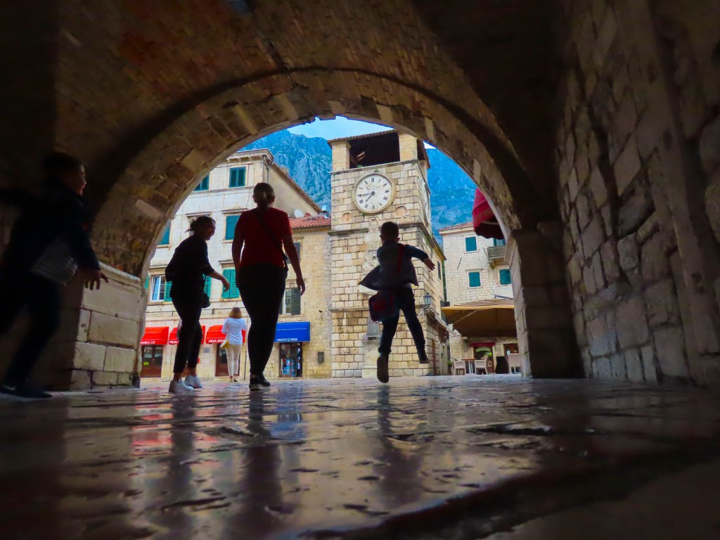
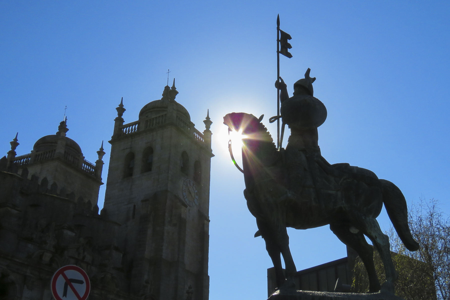
Later that morning the courtyard of the church was filled with mourners as we walked to the Porto Cathedral, Sé do Porto.  Not far from the old towers and ramparts of Muralha Fernandina, the cathedral commands the highest point in Porto.  The building outwardly reflects Porto’s turbulent past, with crenels capping its massive shape, when it was the last point of refuge while the city was under siege.IMG_2235
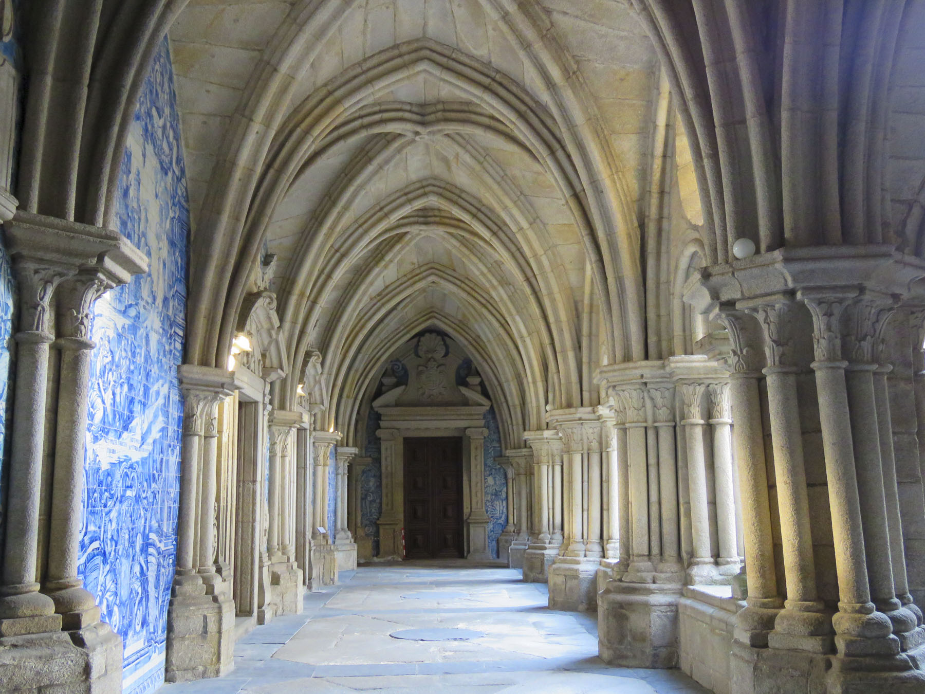
Building started in the 1100s, then continued over the centuries. The cathedral combines Romanesque, Gothic and Baroque features, like so many of the other churches in Porto.

It has a beautiful sanctuary and magnificent colonnaded cloisters lined with the blue and white Azulejo tiles along its walls.  The cathedral’s museum complex next door displays a fascinating wealth of ancient religious items.  IMG_2175
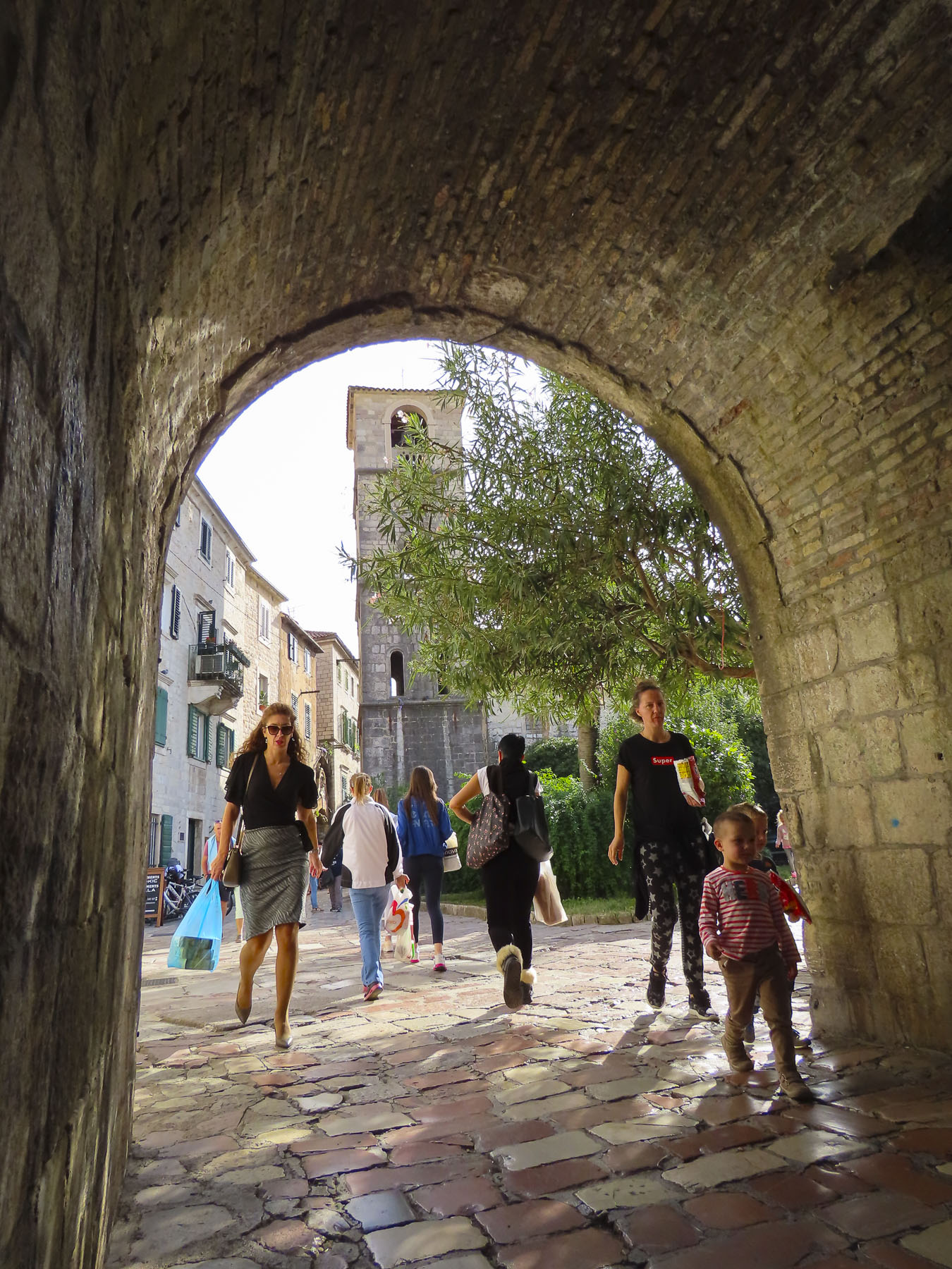
Exiting the museum, the Pillory of Porto centers the vast plaza in front of the Cathedral.  Criminals once hung from hooks, still visible, on this graceful Manueline column.  It struck us as such a disturbing juxtaposition, this instrument of punishment and humiliation, prominent in front of the cathedral, constantly reminding the good citizens of Porto not to stray from a righteous path. Today tourists lounge on its steps and soak in the surrounding views of Porto.

Following steps, we descended towards the river to Chafariz do Pelicano, an elegant old 16th century public fountain built into one of the supporting walls of the cathedral’s plaza above.  Flanked by sculpted female figures, water pours from a hole in the pelican’s chest into a lower reservoir before flowing out of the mouths of carved faces. IMG_3737
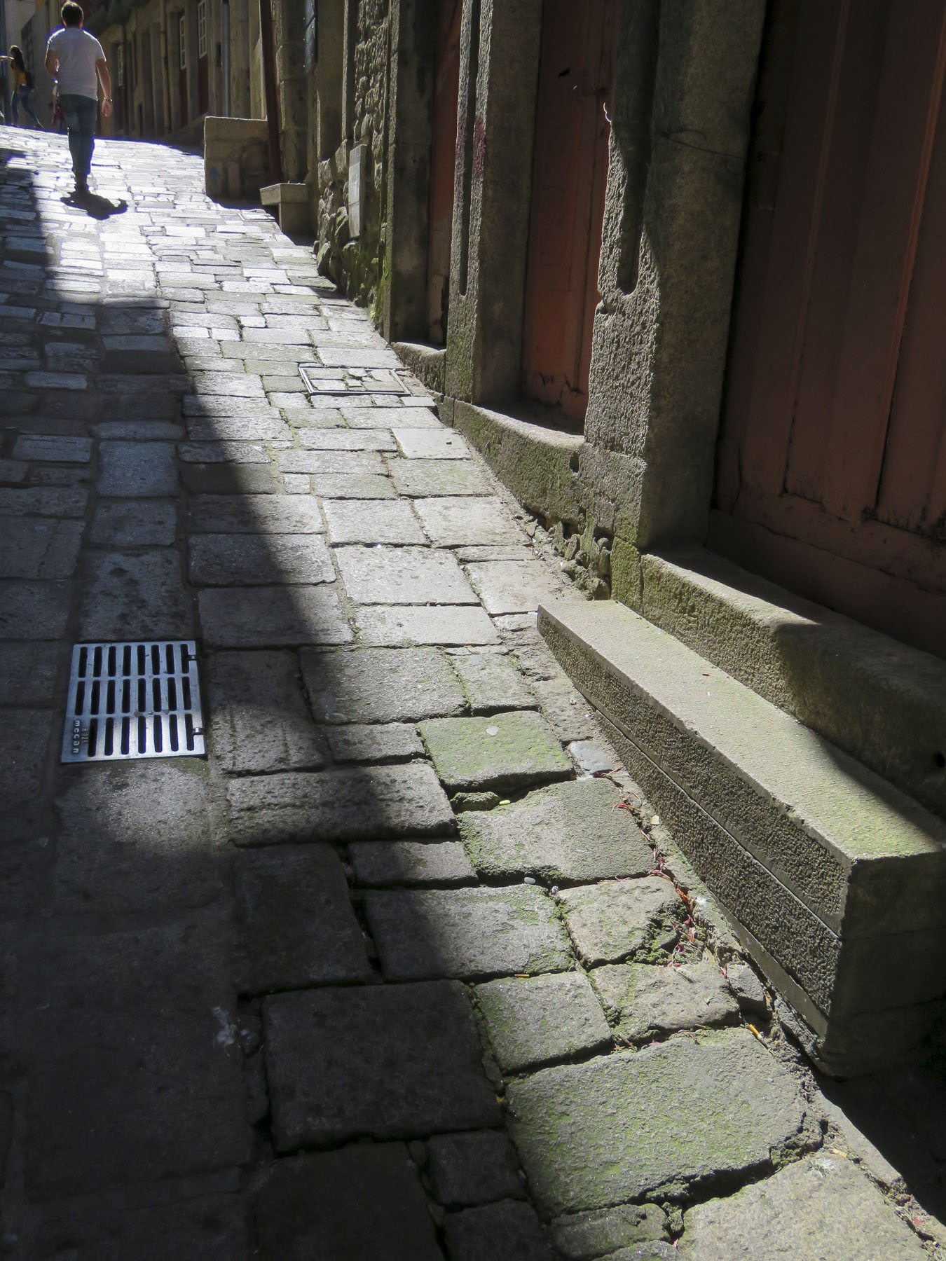
Narrow alleys spurred left and right off the steep stairways.  Taking one we came across a lavadouro público (communal laundry) that appeared to be recently rebuilt with new wash basins and roof.

No one was using it when we walked by, but drying laundry hung from the rafters.  The alley was a contrast of old and new.  At the street level modern galleries, boutiques and restaurants sporadically lined the flagstone lane, while above neighbors chatted effortlessly across its narrow width.  IMG_2955
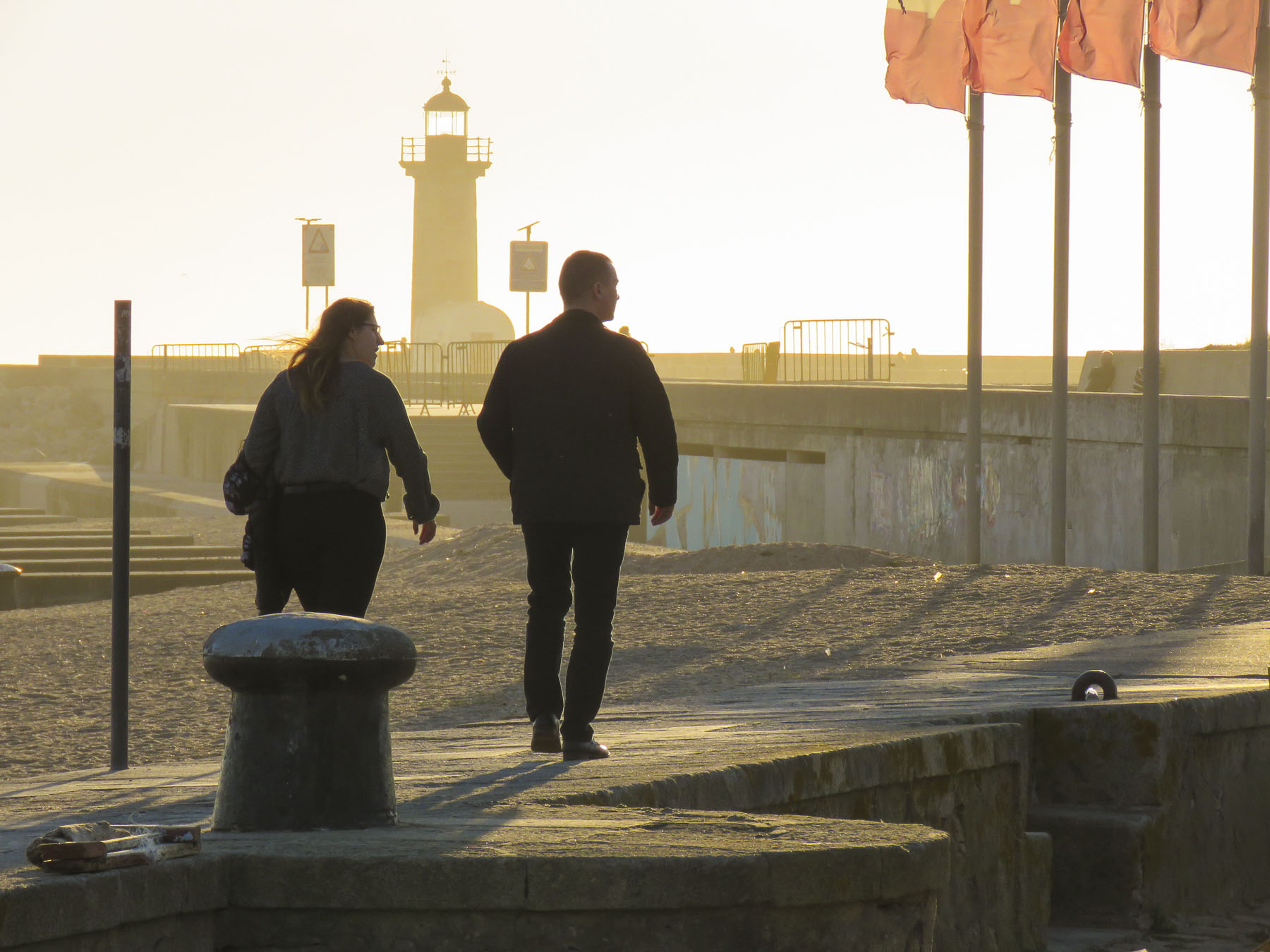
Eventually our route merged onto the quay near Fonte do Cubo, a modern sculpture installed upon the ruins of a 17th fountain by the late José Rodrigues, who made his home in Porto.  Behind the square a three-story high fountain covers one wall.  At its center is a 21st century statue of St John the Baptist, done in a primitive style, by João Cutileiro, another famous Portuguese sculptor.  Surrounded by lively, outdoor cafes and throngs of tourists, this is ground zero for the Ribeira waterfront.IMG_3716Walking past the Museu do Vinho do Porto on Rua da Reboleira, we headed to Igreja Monumento de São Francisco, also known as the gold church, to check out its ornate, gilded interior and crypt.

The church sits atop a steep set of stairs that rise from Rua Nova da Alfândega, giving it a commanding view of the river.  Started by the Franciscans in the 13th century, what was once a small church to support their attached convent was expanded and reconfigured over time into the magnificent monument you see today.  Romanesque, Gothic, Baroque and Neoclassical styles blend harmoniously to create an awe-inspiring sanctuary.  There is so much going on inside it’s difficult to decide where to look.  It was not always this overly ornate.

The Portuguese woodcarvers covered every inch of the interior with exuberant sculptures in the early 1700s and then an estimated 400 kilos, 880 pounds, of Brazilian gold dust was used to cover them.  The “Tree of Jesse,” a polychrome sculpture depicting the family tree of Jesus, is a notable example of the technique that is also widely used to decorate the walls. The extravagant display of wealth was too much for the poverty-stricken neighborhood surrounding the church and in protest it was closed for several years.  IMG_3189
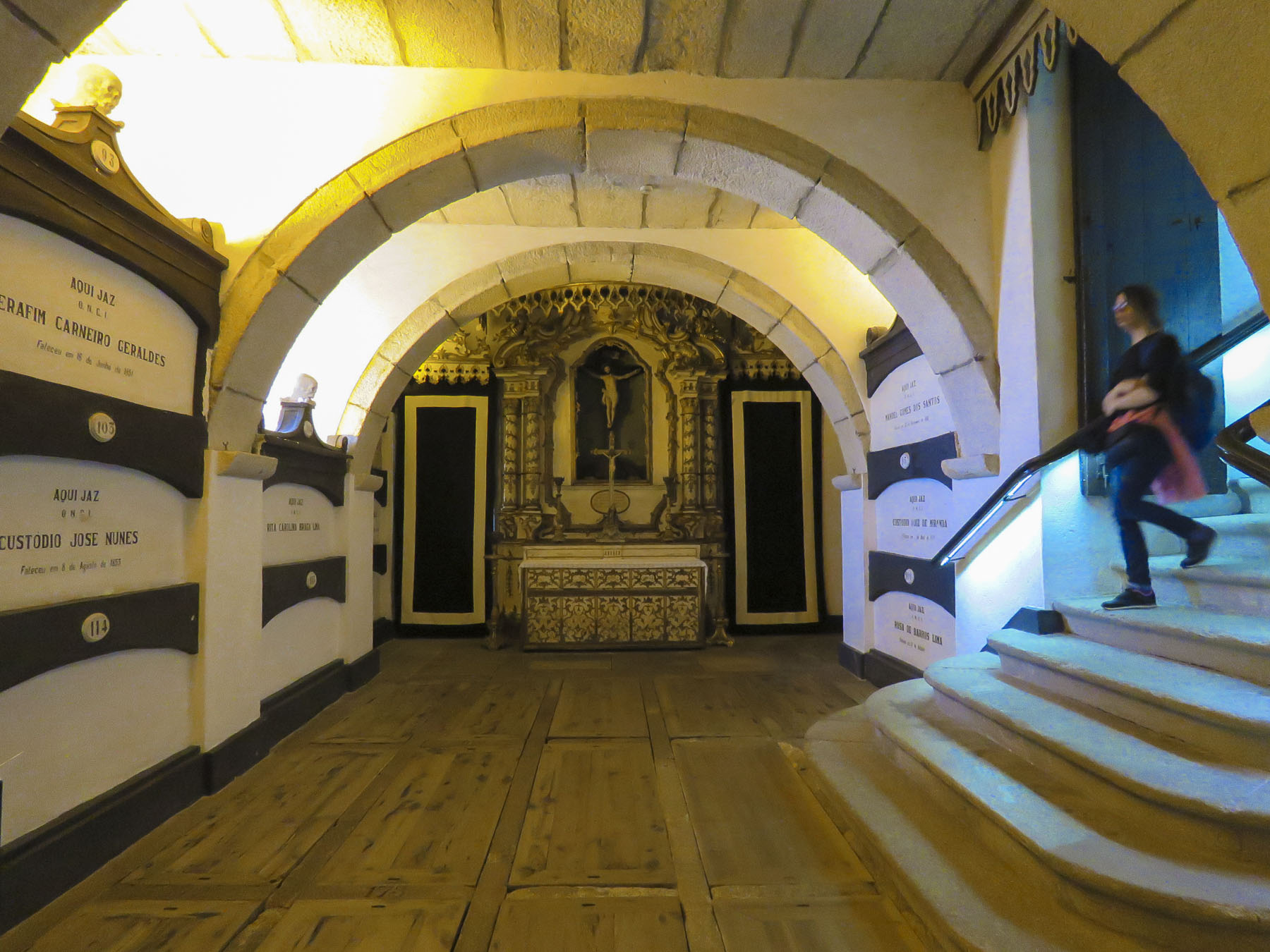
The church was plundered during the Napoleonic Invasions and used as a stable by French occupying forces.  Then later that century during the Portuguese Civil War the city was bombarded and the cloisters burnt to the ground, never to be rebuilt.  The large crypt under the church was the final resting spot for many of Porto’s famous and wealthy citizens and, as catacombs go, is worth a short visit.IMG_3645
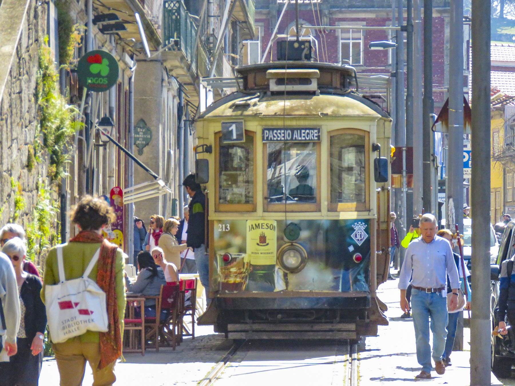
It was time for a change of pace. Being so close to the Atlantic Ocean we decided to take Tram Line 1, which conveniently had a stop in front of the cathedral, all the way out to the Foz district, where the mouth of the Douro River empties into the Atlantic Ocean.  There was a short queue waiting for the tram, but fortunately with the arrival of a second tram we able to snag a seat for the journey.

This is the longest tram route in the city and follows the serpentine riverfront for a rattling twenty minutes past a scenic array of Port warehouses, churches, shops, museums and discotheques, before traveling under the Ponte da Arrábida bridge and ending near the Felgueiras Lighthouse at Jardim do Passeio Alegre. IMG_3249 Just shy of our destination the route was blocked by a disabled truck on the tracks.  With no quick remedy in sight we decided to jump ship and head to lunch at the nearest restaurant, which happened to be in Jardim de Sobreiras, right next to our roadblockFuga Restaurante & BarFuga Restaurante & Bar with its outside deck was a perfect spot to enjoy some seafood and wine for lunch.

This part of Porto has a more relaxed atmosphere, without the multi-storied buildings of the historic center and significantly fewer tourists, which made it a nice reprieve.  After lunch we followed the pedestrian bike and footpath along the river into Jardim do Passeio Alegre and walked around its fountains before continuing to Felgueiras Lighthouse.  For thousands of years what lay beyond the western horizon was unknown and the curiosity about it would spur Portugal’s Age of Discovery.IMG_3325We used an Uber ride to head back to our apartment.  It was only slightly more expensive than our tram tickets would have been.

Till next time, Craig & Donna

Castelo Branco to Castelo da Lousa – Driving Through the Serra da Estrela Mountains

Yesterday, from the tower of Castelo e Muralhas Castelo Branco we saw a distant line of snowcapped mountains glistening under a brilliant Spring sun. Tonight, we’d rest our heads in Coimbra, noted for its historic university and preserved medieval old town.  Though only one and half hours from Castelo Branco by highway, it would take us all day as we decided to take the back roads through the Serra da Estrela mountains to Castelo da Lousa and Talasnal, one of the abandoned Schist villages.  Schist is a shiny, earth-toned local stone that is very durable and was used extensively in the region for building.

Below Torre, mainland Portugal’s highest peak at 1,993m (6,539 ft), the headwaters of three rivers, the Zezere, the Mondego and the Alva, emerge from the range and flow to the Atlantic coast. IMG_9293 We crisscrossed these serpentine estuaries multiple times during the day as we drove through verdant pine forests along roads that hugged the curves of the land.  Isolated, whitewashed villages dotted the mountainside.

Heads turned in Foz Giraldo, Oleiros, Alvaro, Maria Gomes, Alvares and Lousa when we parked to wander around.  Early birds, we were way ahead of the summer crowds that rush to these mountains to escape the heat of the city and urban life.

Foresters, shepherds and cheesemakers squeeze a livelihood from the land in this sparsely inhabited region. Queijo Serra da Estrela is Portugal’s most unique cheese. It’s a strong flavored, soft, raw sheep’s milk cheese still made by hand from a 2,000-year-old traditional recipe.  Firm on the outside, the wheels of cheese are lusciously creamy on the inside when young; as the cheese matures the center firms to a sliceable semi-soft texture.

We arrived at Castelo da Lousa around noon, hoping to explore the castle and nearby chapels after lunch at a restaurant adjacent to it.  Midweek and off-season, unfortunately both were closed, but we enjoyed our time walking around the base of the castle.  This small castle, dwarfed by surrounding mountains, was once a strategic stronghold along the Mondego line, a series of defensive fortresses along Portugal’s 11th century border south of Coimbra after it was captured from the Moors, deterring them from retaking that city.  The knights Templar are credited with constructing its Keep and Glacis, a ramped lower wall, along the base of the castle, designed to impede scaling ladders and ramming.  By the early fourteenth century, as the Portuguese border expanded south, the castle lost its importance and was forgotten.IMG_9452As Donna was waiting for me at the foot of the castle while I went to get the car, she was approached by two weary trekkers, without water, who had just hiked down from a mountain hamlet above the castle and were expecting to lunch and relax at the closed restaurant before hiking back up the steep trail.  As crows fly, the distance from the village to the castle wasn’t far, but the return hike looked daunting without water or food.  We quickly agreed to give them a lift back when they asked if we could help them.  Our compact rental car was packed pretty full, but we pulled the seats forward and piled some bags on Donna’s lap to make room for Catia, Alain and his large backpack. ( Always wildy speculating, I wondered if they found the lost treasure of a local legend: King Arounce, who fled ancient Coimbra with his daughter and hid his riches in the mountains above the castle.) A Portuguese/ French couple, they were on a weekend getaway from Lisbon and his backpack was full of photography gear.

As it turned out they were staying where we were headed, in Talasnal, one of the three Schist villages above the castle. The four of us spent the rest of the afternoon at Ti Lena chatting away; their English was much better than our non-existent Portuguese.  This rustic tavern served wonderful, traditional Portuguese cuisine typical of the region, and good local wine.  This delightful, serendipitous encounter was one of the highlights of our road trip.IMG_9560Along with Catarredor and Casal Novo, Talasnal was slowly abandoned over the years as younger generations moved away to find work.  With the rise of ecotourism these rustic villages, with their beautiful stonework, have been rediscovered by folks who want to reconnect with nature and a simpler pastoral life, if even for short periods of time.IMG_9535With the help of government grants, many of the near-collapsing structures are in the process of being updated and authentically restored, using traditional building materials and techniques, into restaurants, small inns, workshops, galleries and private homes to support a growing tourist infrastructure and revitalize the area.  Across the mountainous central region of Portugal there are twenty-seven Aldeias do Xisto (Schist Villages) that can be explored.

Till nex time,

Craig & Donna


365 Days on The Road – Our First Year as Nomads

“It’s hell, I tell you!” My heart sank. I only regained my composure and burst into laughter when I turned to see a wry smile across Donna’s face and heard, “I only have three pairs of shoes with me.” Dusty after a full day of game drives, we were sitting on the porch of a small cottage sipping wine in the middle of Schotia, a 1600 hectare (4000 acre) private game reserve, just outside of Port Elizabeth on the Eastern Cape of South Africa, reminiscing about our first nomadic year.  Darkness covered the countryside early in June, the beginning of South Africa’s winter season.  Our guide had just lit the oil lamps a few minutes earlier, handed us a walkie-talkie and said, “Use this to call the owner if there’s an emergency, you’re the only folks here tonight.’’ There were no other lights around except for the moon.  The bush has a life of its own and sounded totally different in the darkness. The owner lived somewhere on the other side of this vast reserve.

We’ve had a great year, but there have been some challenges along the way:  An extremely close encounter with an aggressive bull sea lion and seas rough enough to shake a martini in the Galapagos Islands; playing chicken with chicken-buses in the Ecuadorian Andes on serpentine roads, without guard rails, more suitable for Humvees than tiny sedans. Running into the courtyard of our Airbnb in Cuenca half naked when we felt our first earthquake.  Watching a major eruption of Volcan Fuego, only 9 miles away, from our rooftop in Antigua, Guatemala, and surviving the city’s pyrotechnic Christmas season, which at times can resemble a war zone.  Endured an open coconut-taxi ride during a torrential rain in Cuba while searching for Cuban cigars; pickpockets in Lisbon; tourist information officials in Bulgaria who were better suited to working in a gulag – “FOLLOW THE LINE!!” – than greeting visitors to their beautiful country.  Plus, a husband who snores.

And through all that my gal only wants an extra pair of shoes!  I’ve married the right woman.

We didn’t plan on being the only folks at the game reserve during the middle of the week, but that’s one of the benefits of off-season travel.  Following spring-like conditions around the globe, we’ve been able to avoid hot, humid weather and the crowds.  Plus, the prices are lower for hotels and Airbnb’s. Our traveling budget is intact, so we haven’t had to resort to smuggling, selling blood or that extra kidney.IMG_7406When we retired early, a year ago, we had to choose health insurance or travel.  We made the decision to go without U.S. health insurance, because it’s too damn unaffordable and wouldn’t cover us outside the U.S. anyway.  We chose travel insurance instead, with medical evacuation, and we pay out of pocket for wellness care and dentistry.  Our two years on the road will bridge us until age 65 when we qualify for Medicare.  And it’s surprising how affordable excellent healthcare is in other countries.  We’ve paid $25.00 for an emergency room visit to a private hospital and $5.00 for the prescriptions in Ecuador to treat high altitude sickness.  Our travel insurance paid fully for a visit to an ENT specialist in Lisbon to treat a persistent sinus infection.  I’ve visited dentists in Cuenca, Ecuador for a tooth extraction and bridge; Sofia, Bulgaria for a broken filling; and Cape Town, South Africa for a root canal.  The care has been excellent and extremely inexpensive compared to pricing in the United States.  Though when we are in the United States travel insurance only covers us if we are one hundred miles away from our previous home in Pennsylvania.IMG_0594We plan on purchasing a home when we return to the United States. Right now, though, our budget is plus/minus $1000.00 per month for an apartment.  One thousand per month for housing goes much further overseas than in the states and allows us to live in unique and interesting locales.

The regional cuisine everywhere has been wonderful.  Food is a large part of any travel budget and to keep our expenses down we cook in quite a bit.  We enjoy the experience of shopping like a local and buying different fruits, vegetables and “oh, the breads.”  We’ve purchased meat and chicken from street vendors and learned to arrive early in the morning while the day is still cool to avoid the flies.  Our dieting regime of walk a little then café, walk a little more then café, seems to be working.  We monitor our physical activity with our phone’s health app. Though after a day bouncing through the bush in a Land Rover it credited us with climbing 170 flights of stairs.  No fools we – we ordered two desserts that night.IMG_3737[35074]Restaurants have been refreshingly inexpensive with most meals costing half or less for what you would pay in the states for something similar.   In 99% of the places we’ve dined we haven’t experienced tourist pricing and it’s wonderful.  We did get extremely gouged at a historic café in Porto, Portugal, which wouldn’t have been so bad, but the coffees and pastries were tasteless.  Lamb, fish, oysters and ostrich, pricey things at home, are now on our shopping list.  The wines in Portugal and South Africa are very good.IMG_7034
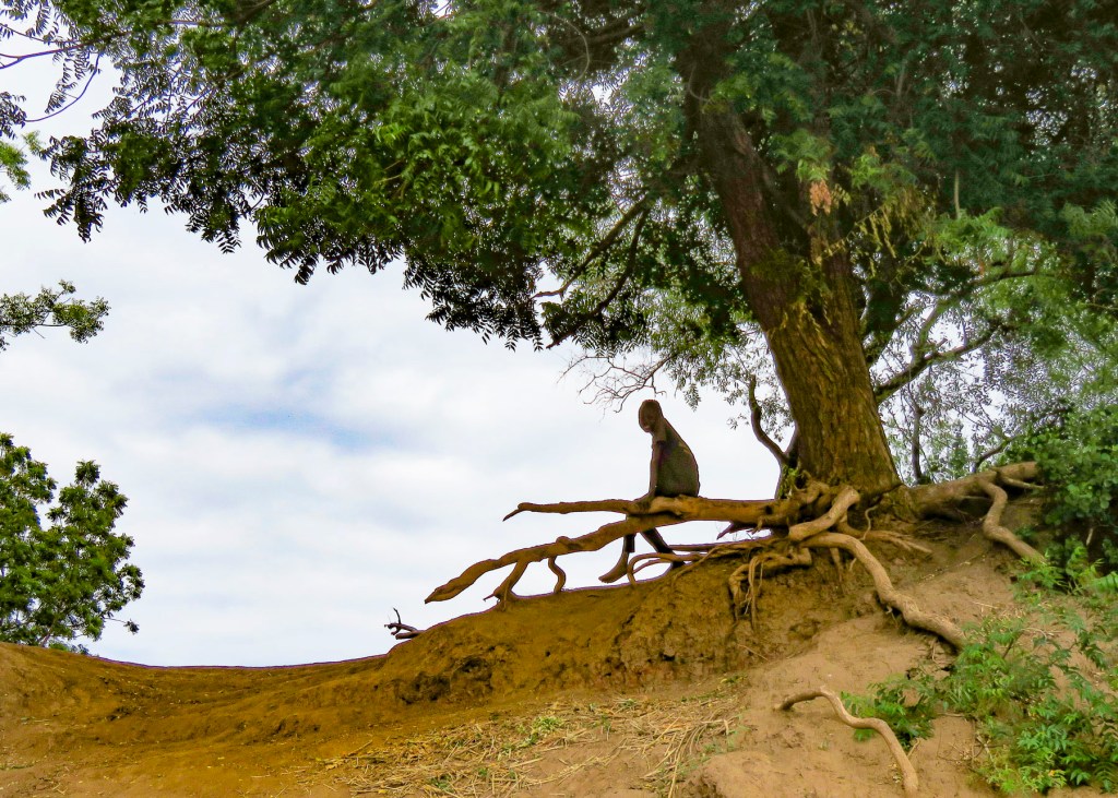
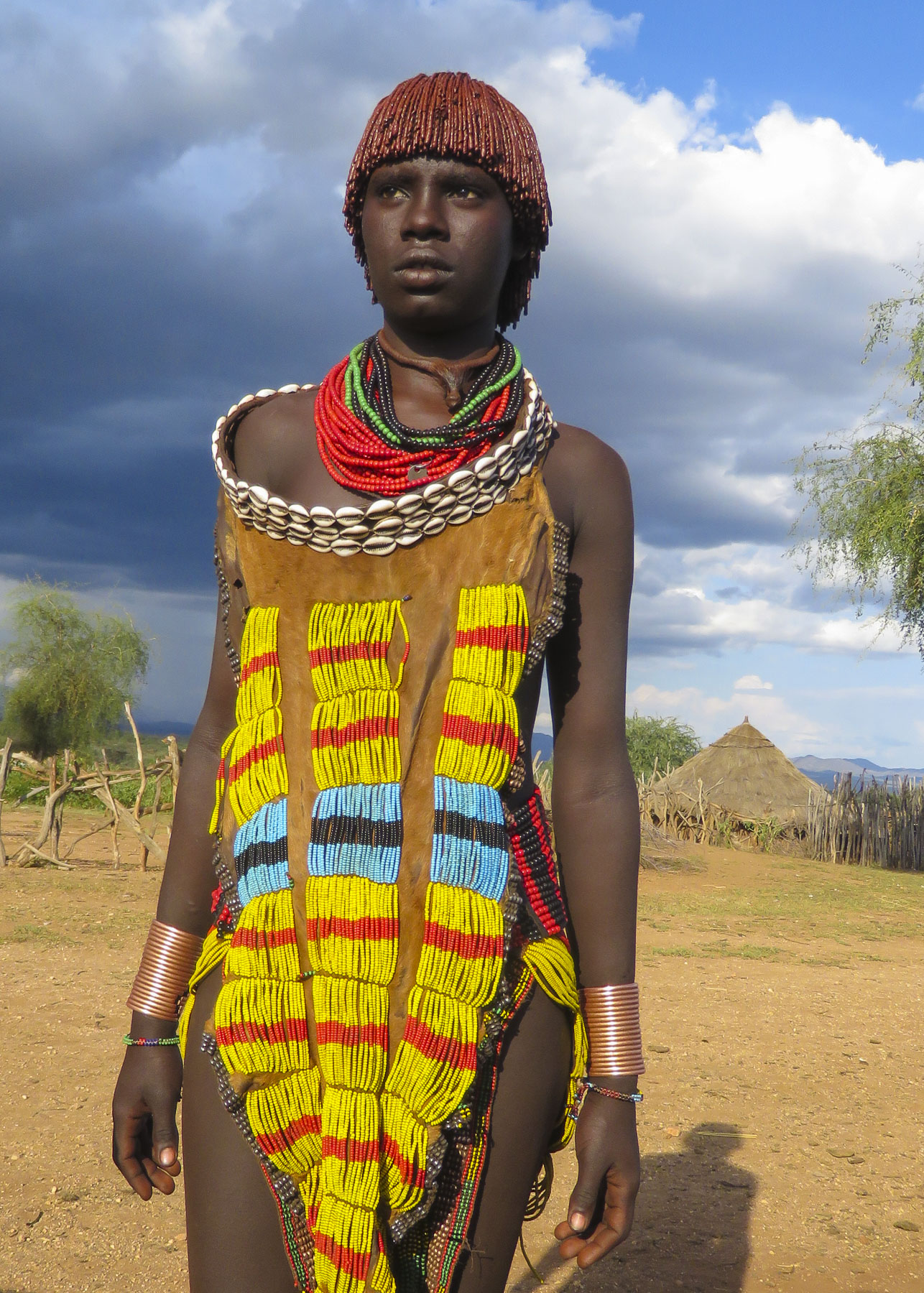
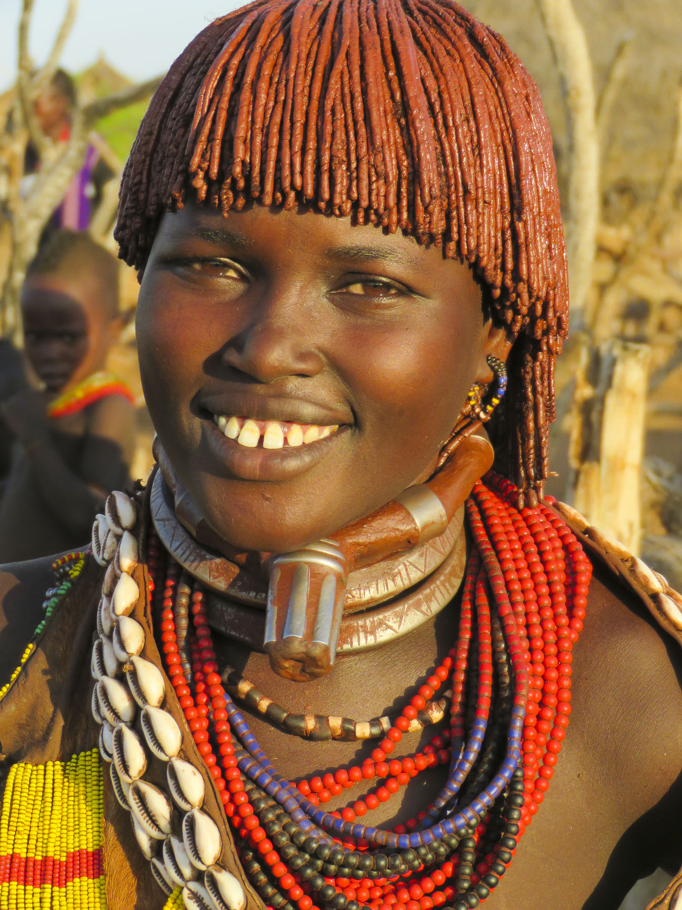
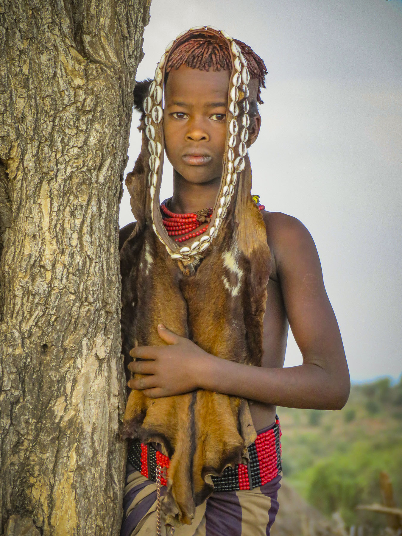
We’ve rented cars in Ecuador, Guatemala, Portugal, Bulgaria and South Africa. Near the Schist villages in the mountains of central Portugal we gave a lift to two hikers, who were exhausted from a long trek without water.  We ended up having a delightful afternoon and lunch with them.  Aside from the deeply rutted dirt roads of the Andes Mountain range in Ecuador, South Africa with its driving on the left has proven to be the most difficult.  We find that a pilot plus navigator system works well, with the latter reminding the pilot to stay left and make very wide right-hand turns.  Interesting traffic signs dot the roads here: Caution Tortoise and Baboons Share this Road Too, Watch for Stray Cattle.  I chuckled to myself when I passed a sign that I thought said Zebras Humping, only to realize a moment later it was a speed bump when I hit it at a pretty good clip.  Caution High Winds – Parents Hold Your Children Firmly by the Hand as there is Mortal Danger of Them Blowing Off, greeted us in the parking lot of a scenic and windy overlook.  South Africa has a well deployed and concealed electronic camera system and we’ve received our first notice of a traffic violation from the rental car company. 

Originally, we were going to spent April and May pet sitting in England, then June, July and August doing two different Workaway assignments, in exchange for free housing in France, in order to budget some extra funds for our push into Africa.  On short notice our first pet sit in England fell through. Next, Donna was sick for several weeks and I fell three times on the same arm, severely bruising it.  With deep introspection we realized we’re not as young as we wish anymore and cancelled our working assignments.  Gardning at a 14th century chateau sounded wonderful, but not in the record 114F heat that France recently experienced.So, we quickly reworked our plans and ended up in of all places Bulgaria, (more on that in future blogs,) for a month, before flying down to Cape Town.  At the end of August, we head to Victoria Falls, bordering Zimbabwe and Botswana, for a few days before flying to Ethiopia to visit the indigenous tribes of the Southern Omo Valley, and the Rock Churches of Lalibela.  Montenegro and Italy will host us until Christmas when we’ll return to the states to celebrate it with our family.  Our route for 2020 hasn’t been determined yet.

When shopping for souvenirs we try to buy directly from local craftspeople and have learned that if an item is very inexpensive it was probably made in China.  Cheap Chinese imports are undercutting the livelihoods of many local craftspeople around the world.  I don’t want my tourist dollars inadvertently supporting rich Chinese businessmen who purchase poached rhino horn for use in folk remedies.  China’s traditional medicine practitioners are the only market for poached rhino horn.  Three rhinos are killed every day to support this illicit trade and China needs to stop turning a blind eye to it.  In Cuba we witnessed widespread poverty, the effects of a failed communist state.  Tourists dollars greatly help aspiring entrepreneurs and local economies grow.  Why the U.S. is restricting travel again to Cuba is beyond me.  We conduct business with China, forgetting its reprehensible human rights record, but not Cuba only ninety miles from Miami. Go figure.

Many of our most memorable moments have been conversations around communal dining tables sharing stories, adventures and tips with inn keepers, guides and fellow travelers.  In many of the places we’ve been “we don’t get many Americans here” is a common refrain. Travel – it’s good for the soul and opens a window of empathy that you can’t find sitting in an armchair watching the nightly news.

Till next time,

Craig – Suitcase #2

Now for a different perspective on our nomadic year check out Suitcase #1, Donna’s blog at: https://bornwithgypsyshoes.com/2019/07/02/a-look-back-one-year-of-being-homeless-jobless-and-uninsured/

P.S. The 2suitcasesfor2years blogs run about 8 weeks behind our actual travel dates.  You can also follow 2suitcasesfor2years on Instagram for more great photography.