We hadn’t planned our return itinerary to Cape Town and were open to suggestions. Over the past two days, during the down time between game drives at Schotia Private Game Reserve our guide, Edward, shared his love of South Africa with us. “Did you stop at Stormsriver?” “No.” “It’s a breathtaking stretch of coast. They have cabins you can rent, right on the water, and there’s a spectacular trail with suspension bridges across the gorge.” “And the Karoo, don’t forget the Karoo and Ronnie’s.”  During the morning “golden hour” we watched a family of giraffe walk gracefully through the forest, nibbling thorns from the acacia trees, before saying our goodbyes. Stormsriver, it was! Backtracking through Port Elizabeth we retraced our drive past Jeffreys Bay and continued west on the N2 until we stopped to photograph the steep chasm that the Stormsriver Bridge spanned, just before the village of the same name. Mostly folks mean the Tsitsikamma National Park when they mention Stormsriver; they are synonymous with each other, the difference being the village is located far inland, just off the highway, and the park is on the coast.
  We thought the entrance fee of $17.00 per person for international tourists was steep and we did see some cars turning away, but we had heard such tremendous recommendations we would regret it if we didn’t check it out. There was a long winding road down from the entrance gate and when we finally rounded a sharp corner, the view of the rugged coastline with crashing waves sending up large white sprays was spectacular!
 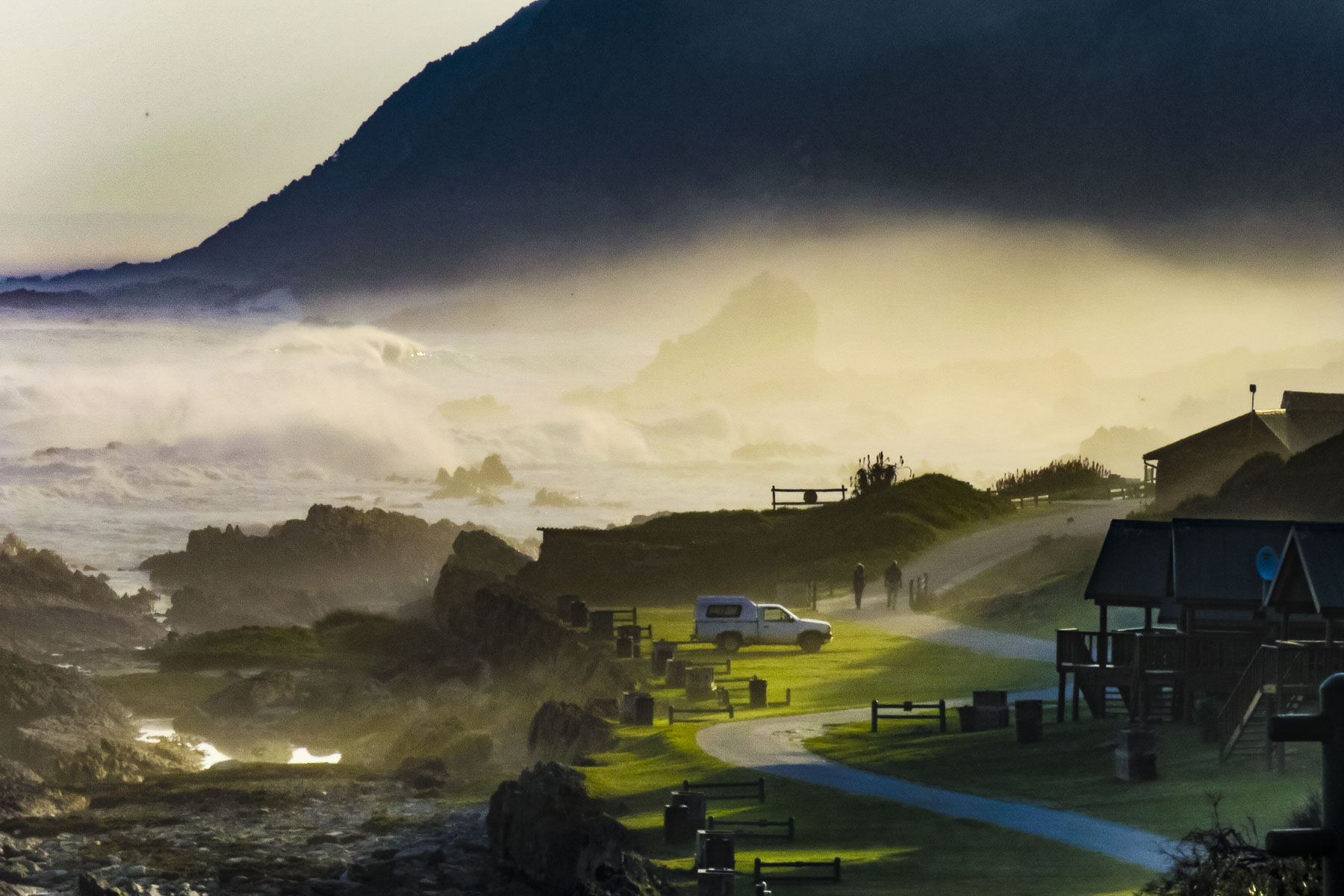 We enjoyed lunch watching and listening to thunderous waves explode against rocks only a short distance away from our table at the Cattle Baron. It’s the only restaurant in the park and was excellent, along with being very affordable. A nice surprise after the park entrance fee.
  After lunch we followed an easy section of the Otter Trail to the three suspension bridges that cross Stormsriver where it meets the sea. Reservations and a permit are required to trek the full length of this popular and strenuous 28 mile trail that follows the edge of the coastal plateau through evergreen forests, traverses boulder strewn beaches and tidal river crossings.
 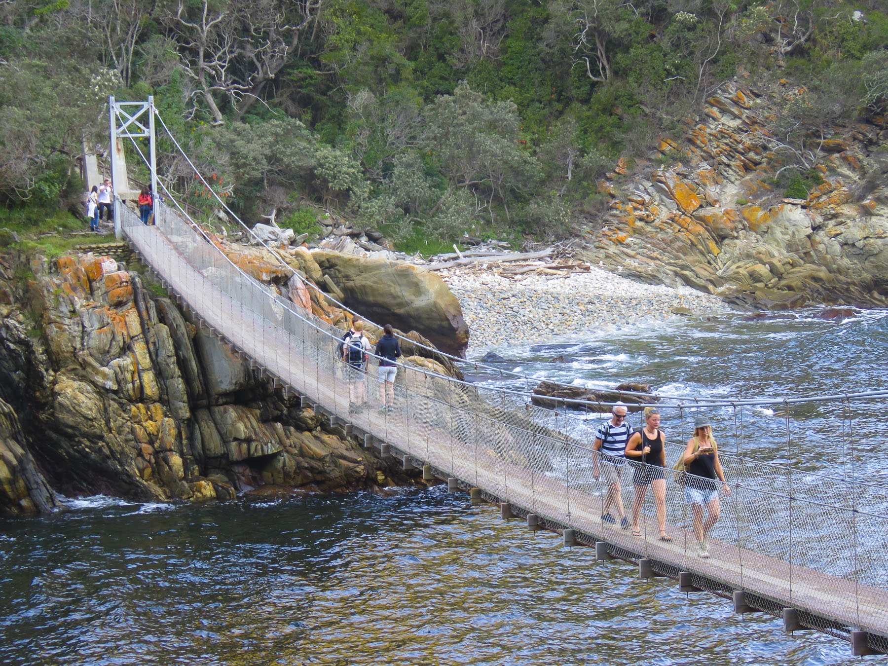 Staying in designated cabins each night, it takes five days to cover the route that stretches from Stormsriver in the Eastern Cape to Nature’s Valley in the Western Cape. The reverse hike is referred to as the Tsitsikamma Trail.
We were greeted warmly by Bev and Marco, owners of At The Woods Guest House Tsitsikamma in the village. Their place is a lovingly envisioned and restored eight room B&B in what had been a carpentry workshop. At check-in Bev noticed that the clasp to the shoulder strap on Donna’s camera bag was broken and offered to repair it. A huge help, the repair has lasted eight months so far. We greatly appreciated it. We walked around the corner to Darnell Street, the village’s restaurant row, with six eateries, and sat down at Marilyn’s 60’s Diner. The place is shrine to Elvis Presley and Marilyn Monroe with movie posters, classic cars, motorcycles, juke boxes, checkered floor and chrome, lots of chrome as décor. Happy Days meets Northern Exposure, it seemed to be a clash of cultures in the woods.
The next morning we enjoyed coffee on our balcony while listening to new bird calls and hoping to spot Narina Trogan, Knysna Turaco (Loerie) and Victorin’s Warblers which inhabit this heavily forested area.  After breakfast, on our way to Nature’s Valley, we crossed over the Bloukans River Bridge, which claims to be the world’s highest bungee jump at 710ft and divides the western cape from eastern cape region. The small resort village is right on the Indian Ocean and borders the Grootrivier lagoon, which is blocked from reaching the ocean by a wide sandbar. The two waters only merge when a hide tide washes over the sand, or when heavy rains raise the level of the river and it cuts a channel through the sand to the sea.
 On the way back to the highway we stopped at Nature’s Way Farm Stall for coffee and a snack before continuing or drive to Oudtshoorn in the Klein Karoo. Located on a working dairy farm, the stand had a wonderful selection of homemade cheeses, breads, jams and chutneys – we stocked up. They also have cottages available for rent.
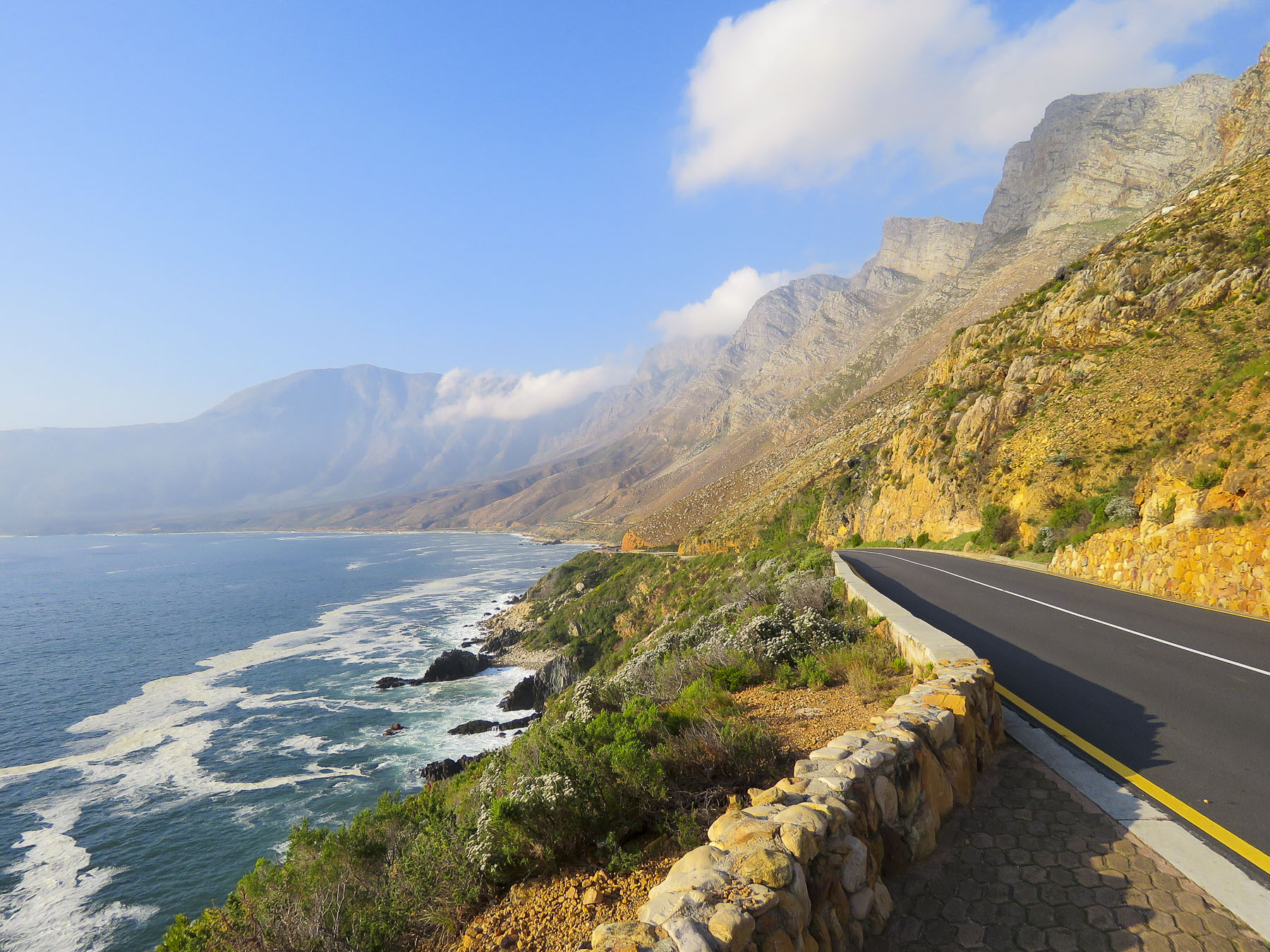
Passing through Plettenberg Bay we stopped at the Old Nick Village to check out their mid-week farmers market and the homeware textiles created on site at Mungo Mill, a local South African company that reinvests 1% of its profit back into community projects. There was also an interesting plant nursery and pottery shop with vervet monkeys scampering across their roofs.  Our steep ascent away from the coast began in George as we headed north on the N9/N12 twisting our way uphill through the Outeniqua Pass to Oudtshoorn. This is a challenging stretch of highway with continuous s-turns that required my constant attention. Passengers can enjoy spectacular views on sunny days that stretch for miles. If possible, drive the route towards the coast, it’s easier to stop at the scenic lookouts this way.
One thing about traveling in the off-season, things are quieter, especially on the late Sunday afternoon when entered Oudtshoorn, looking for dinner before we checked into our B&B for the night. It wouldn’t have surprised us to see tumbleweed blowing down the streets. It was too cold outside to sit by the open firepit in the courtyard of La Dolce Vita, one of the few places we found open. But the staff was friendly, the food was good, and the bartender had a sweet dog to help him keep the conversations going with the ladies. 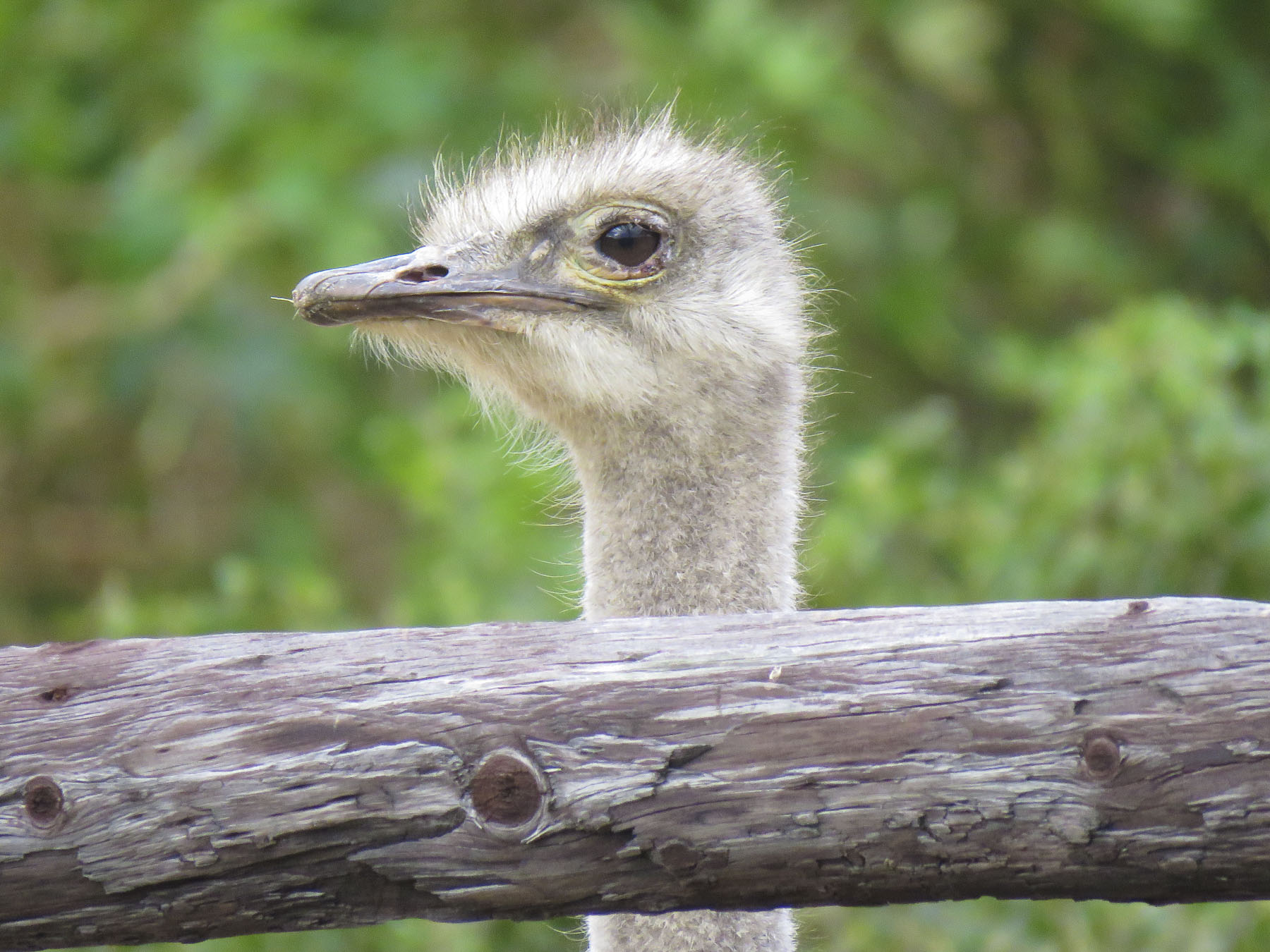 We’ve heard of gold booms, where fortunes were made. But it was the ostrich booms in 1865 -1885 and 1902-1913 when ostrich feathers were the ultimate fashion accessory in Europe that enriched local farmers here. At one point 314,000 ostriches were being raised and their feathers were a valuable South African export, only surpassed by gold, diamonds and wool.
Today Oudtshoorn attracts outdoor enthusiasts, with the Cango Marathon endurance race and the “To Hell and Back” mountain bike race. Wine and cultural events like the Klein Karoo Nasionale Kunstefees (KKNK) a visual and performing arts festival also dot the high season calendar. The region is on the R62 Wine Route and becoming increasingly known for its port style fortified wines and brandies produced from grapes that thrive in the arid conditions of the karoo. Ostriches are still raised in the area for their meat and leather.  Die Fonteine, our B&B for the night, was a few miles north of Oudtshoorn, outside the small village of Schoemanshoek. After a delicous breakfast the next morning we enjoyed exploring the manicured grounds of this beautiful farmette. Caged song birds, chickens and sheep provided our morning entertainment. Anzue, our hostess, gave us a jar of homemade guava jam for our journey back to Cape Town, after we raved about it at breakfast. “How are you headed back? “Through Montagu.” “It’s a long stretch through the karoo, not much between towns, just Ronnie’s.”
Leaving town, we hammed it up with a jaws of death photo at the Cango Wildlife Ranch. It’s South Africa’s version of a petting zoo, where you can go cage diving with crocodiles for an adrenaline rush, if that’s your thing.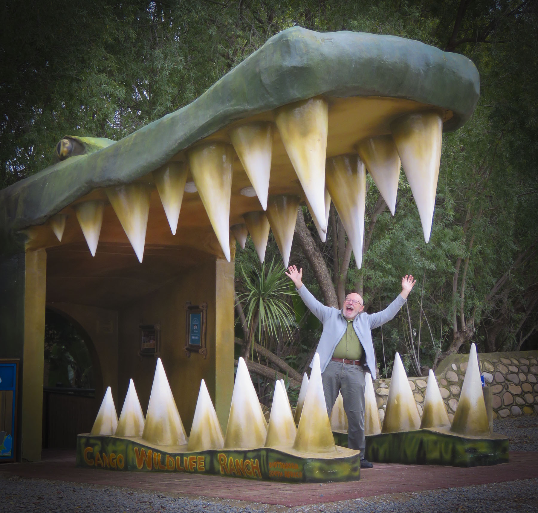 The word karoo comes from the Khoisan language meaning “land of thirst” and it precisely describes the terrain along R62 which we followed. Parched, rock encrusted rolling hills and mountains covered with a fynbos of low heather-like shrubs and proteas occasionally accentuated by taller, lone trees and dry riverbeds crisscrossed the landscape. During the South African spring, in October, it bursts with flowers, but it was July, still winter. The area endures extreme heat during the summer. Fortunately for us recent winter rains had spurred some greenery to burst forth and aloe plants to bloom.
  We stopped in Ladismith, a rural farming community where Vincent, Donna’s friend from seminary, first pastored a church, and enjoyed its colonial Dutch architecture.
Watch for Stray Cattle and Wild Animal Crossing Ahead signs occasionally broke the rhythm of the terrain. Every few miles now we would pass old battered signs for Ronnie’s. Somewhere along the way they turned into signs for Ronnie’s Sex Shop! 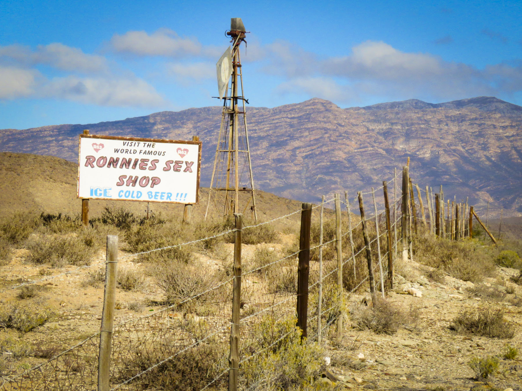 The heat can do strange things to the mind and sometime in the 1970’s Ronnie thought a farm stand on this desolate stretch of highway through the karoo would be a good idea. Fortunately, his buddies realized it was destined for failure and would soon be another abandoned building along the road if something wasn’t done. One night they painted SEX into the name of the shop and suggested he open a bar. They saved his butt! Famous now worldwide as a dive bar in the middle of nowhere, it draws in the curious. It’s not the raunchy place the name implies, filled with frustrated farmers between ostrich roundups. A grey bearded Ronnie, now a cause célèbre, still pours drinks at the bar. It has a tired, dusty bar area filled with foreign money plastered to the walls and lingerie hanging from the ceiling, but aside from that it’s a wholesome oasis with a covered patio where you can get a decent burger with fries, ice cream and coffee along with some hard stuff if that’s your drink. It’s not worth a detour, but if you are on the R62 traveling between Barrydale and Ladismith, it’s worth the stop. Actually, it’s the only place to stop.
For some R62 conjures up thoughts of Jack Kerouac and his road trip across America from Chicago to Los Angeles along Rt 66 through the heartland of the country. Similarly, R62 connects Port Elizabeth, on the Indian Ocean, to Cape Town, on the South Atlantic, while passing through the beautiful karoo region, the core of South Africa. An epic journey for many of the folks in camper vans and cross-country motorcyclists we passed along the way. It’s an interesting, inland alternative to the N2. We zoomed past the small village of Barrydale on our way to Montagu, so we could explore the town a little before nightfall. The farming community is in a valley surrounded by the Langeberg mountain range and has many examples of late 19th century Cape Dutch architecture scattered about town. Ornate gables, thatched roofs, whitewashed walls and occasionally gingerbread trim define the style, but there are modern interpretations also.
 In a country not known for Art Deco we booked ourselves into the Montagu Country Hotel, the only original Art Deco hotel in South Africa. In the main building, lounges with fireplaces and guest rooms are filled with stylish Art Deco antiques. Contrarily, we stayed in their African lodge – after all, this is Africa – which was situated nicely in a lush garden. It was circular structure with a 20ft high thatched roof that had all the conveniences of home. The bathroom had the largest soaking tub we have ever seen that easily could have held a family of four. We wondered when the last time it was filled. Guilt about wasting water, during a drought, prevented us from using it.
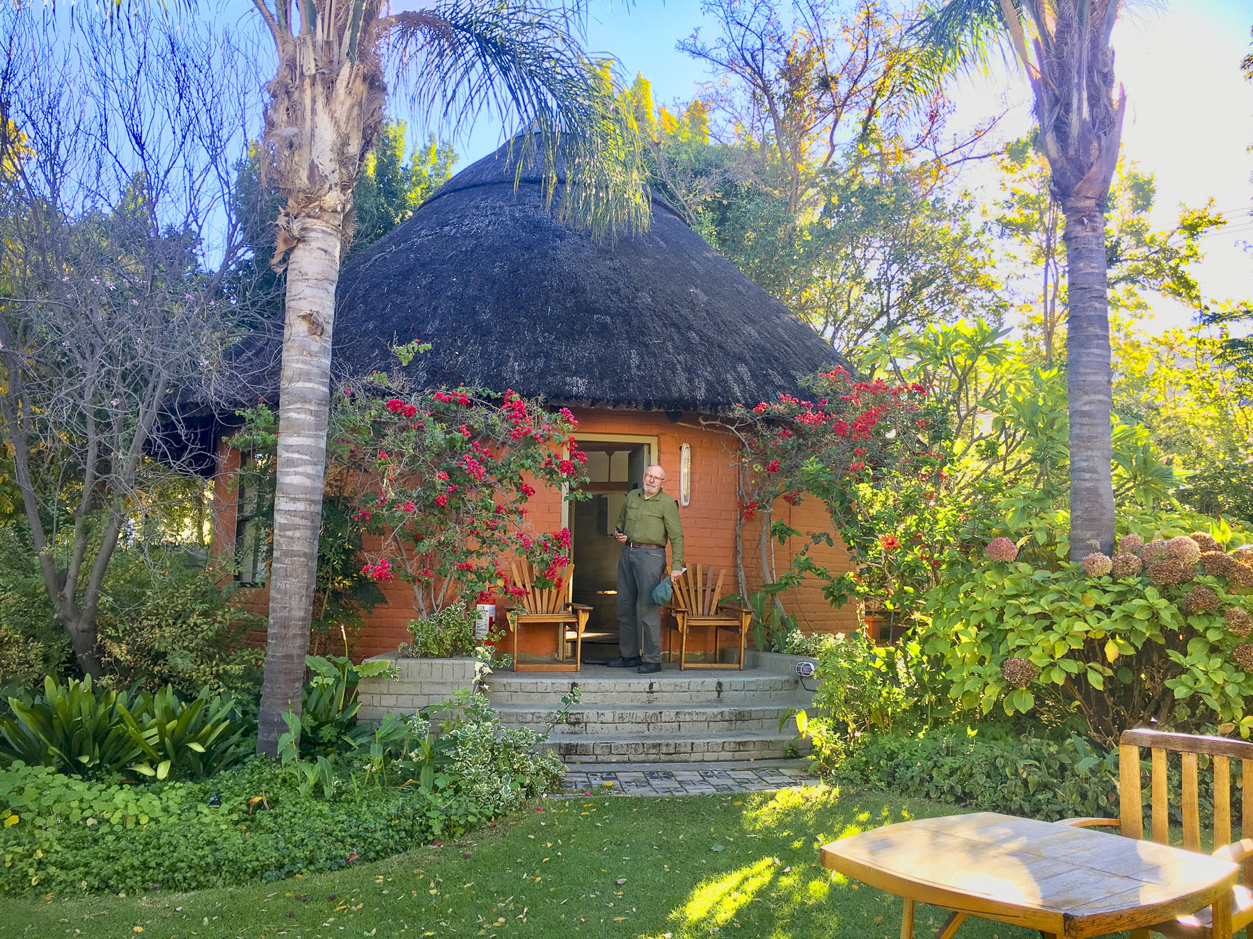 The temperature drops quickly in the mountains once the sun sets so we enjoyed a local wine, in front of a fireplace, in one of the lounges before dinner. We usually look for a less expensive alternative for dinner, but the hotels’ Wild Apricot Restaurant drew us in with elegant candlelit tables and live piano music. It was the last night of our road trip – we could splurge. With Smoked Ostrich Carpaccio and Springbok Tarta for appetizers followed by Cape Malay Bobotie and Karoo Lamb Pie as mains and a traditional Orange Malva Pudding for dessert, we were splendidly sated.
Cruising around the village before heading back to Cape Town, we found some interesting examples of colonial Cape Dutch architecture and a small suspension footbridge over the Kogsmankloofrivier. Water rushes over the road below it when the river runs high.  We followed R62 west through a small tunnel, locally referred to as the “Hole in the Wall,” that was dynamited out in the 1870’s. It’s a dramatic landmark that tells you of your arrival into or departure from the Karoo. As we left our road trip behind, we looked forward to heading to a new apartment in Cape Town.
Till next time, Craig & Donna
Please share my page with your friends


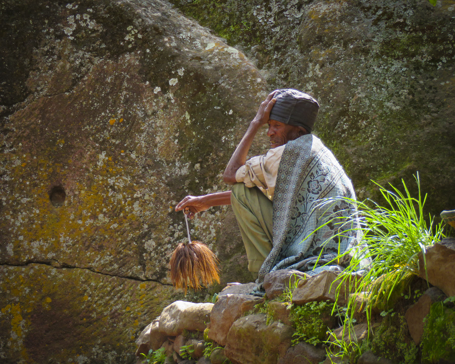
 Walking, walking, walking! The countryside is full of folks out and about on their feet. There is a rural minibus network connecting larger villages once a day, and Lalibela has tuk-tuks, of course. But mostly, whether it’s due to lack of affordability or availability, people walk to and from everywhere. Sometimes it is necessary to travel great distances to accomplish simple, everyday tasks like gathering water, heading out to tend a remote field, going to market, or even farther to visit a doctor.
 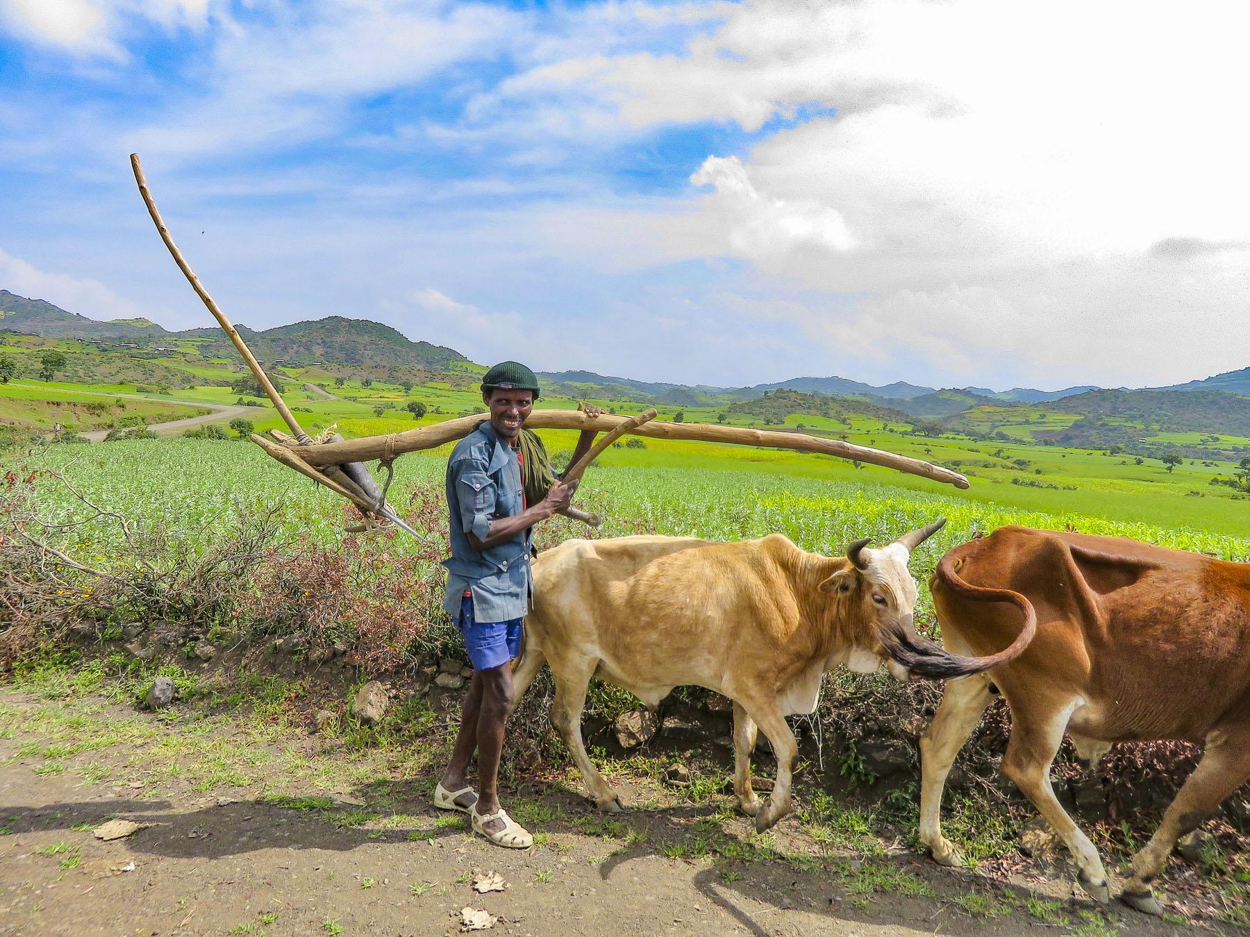 In the rugged agrarian highlands surrounding Lalibela, all the fields are tilled by farmers walking behind teams of oxen, as it has been done for centuries, on farmland passed down through a communal hereditary system called rist.
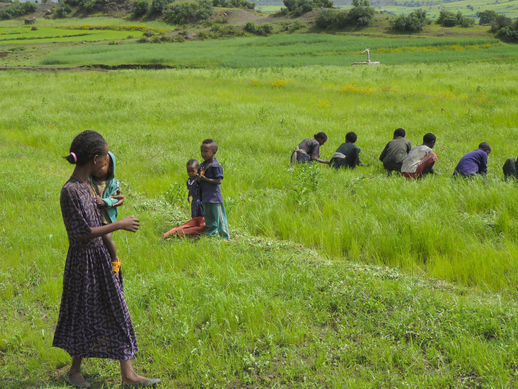


 We started our day listening to bird calls and watching the morning clouds burn off from the valley below our hotel as the sun rose higher into the sky. The


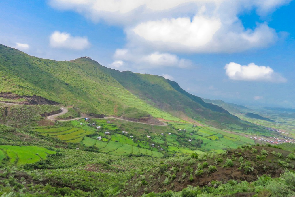
 The shops were busy, and the roadside Ping-Pong games were in full swing as we departed Lalibela. The road into the mountains rose quickly from Lalibela into a semi-forested landscape. Too steep for crops, the land was used for cattle, which grazed on clumps of wild grasses on the hillside. We stopped at one clearing for the view and noticed a herder gently nudging his cows away from recently planted tree seedlings. “This is part of our government’s commitment to reverse deforestation and help mitigate climate change. It’s called the
  “On July 29th Ethiopians planted 350 million trees in a single day, a world record!” he proudly shared. “The farmers know how important this is and help shoo the cattle away, but the government has also chosen a tree seedling that doesn’t taste good.” This annual Ethiopian project is part of the African Union’s
  The road deteriorated after this, with deep mudded ruts tossing us from side to side regardless of how slowly we navigated through, over or around them. Our “rattled tourist syndrome” is the most appropriate way to describe the ride, while optimists might refer to it as an an “African deep tissue massage.” We were the only truck to park at the trailhead to the Asheten Mariam Monastery and were greeted with children selling handicrafts, and young men renting walking sticks and offering to accompany us on the hike.
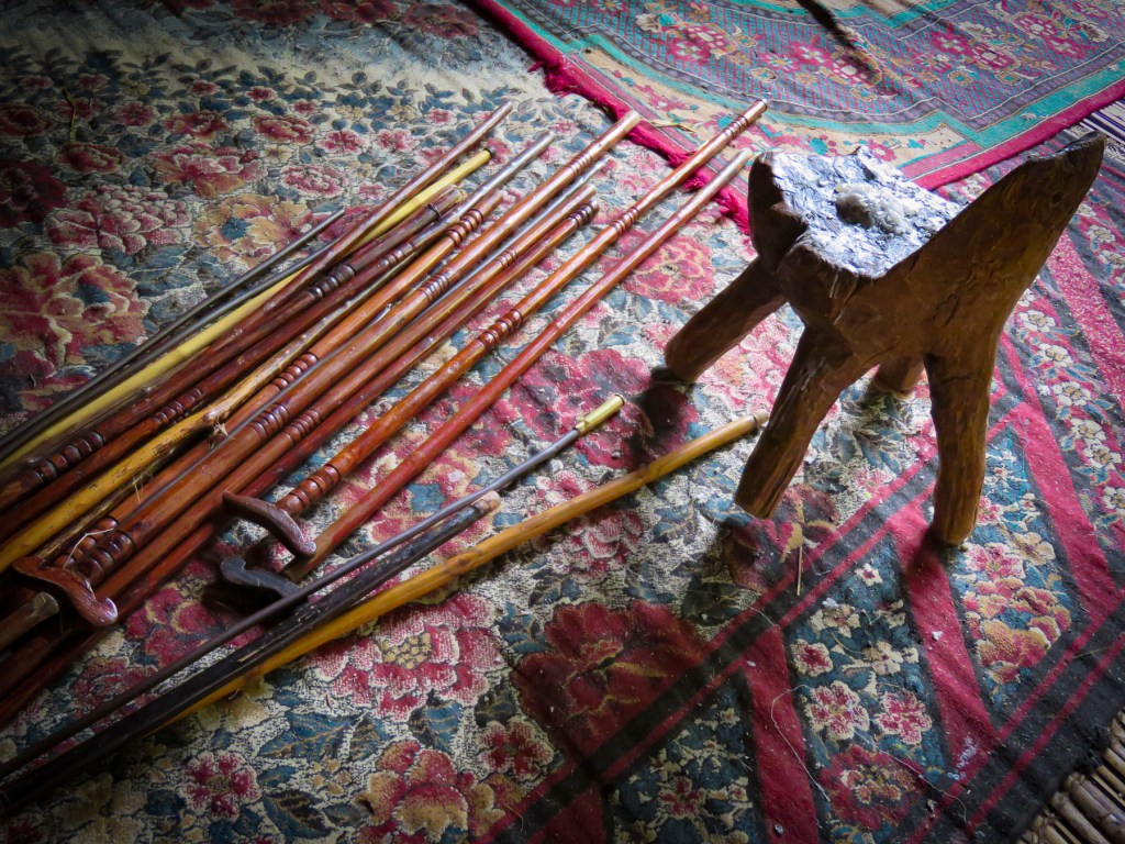
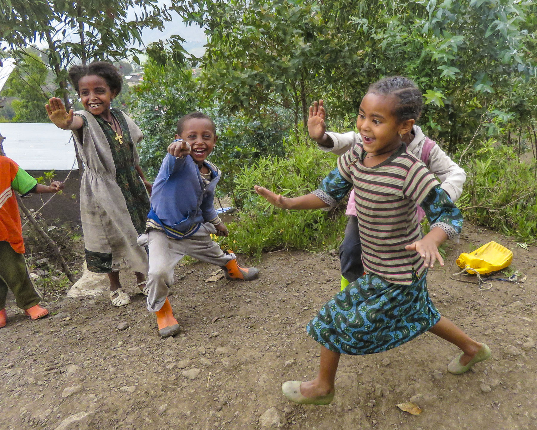 Confident in our abilities we declined, but they tagged along anyway. This was a good thing. What our guide had forgotten to mention was that there was a short steep section at the beginning of the hike, before it leveled off. Within minutes, between the altitude and the terrain, our hearts were pumping and my wife, who struggles with asthma, was gasping for breath. We are unfortunately not the 7 second 0-60mph vroom, vroom of a 1964 Corvette anymore, but more like the putt-putt of a classic Citroën 2CV. We get there, eventually. So, our guide, forgetting his youth and our age, led the way from a distance, as if he was channeling
  It was at this point that my wife spoke up. “Girma, you must think of me as the same age as your mother.” Instantly, his attitude became very solicitous, and he smilingly offered her a hand or other assistance at every opportunity. We marveled at the agility of the local kids. They nimbly scampered up and down the trail, easily outdistancing us, in order to set up their little trailside displays of carvings and beadednecklaces. When we didn’t purchase at first, they simply packed up and reappeared further up the trail. We had to reward such perseverance with a couple of purchases.
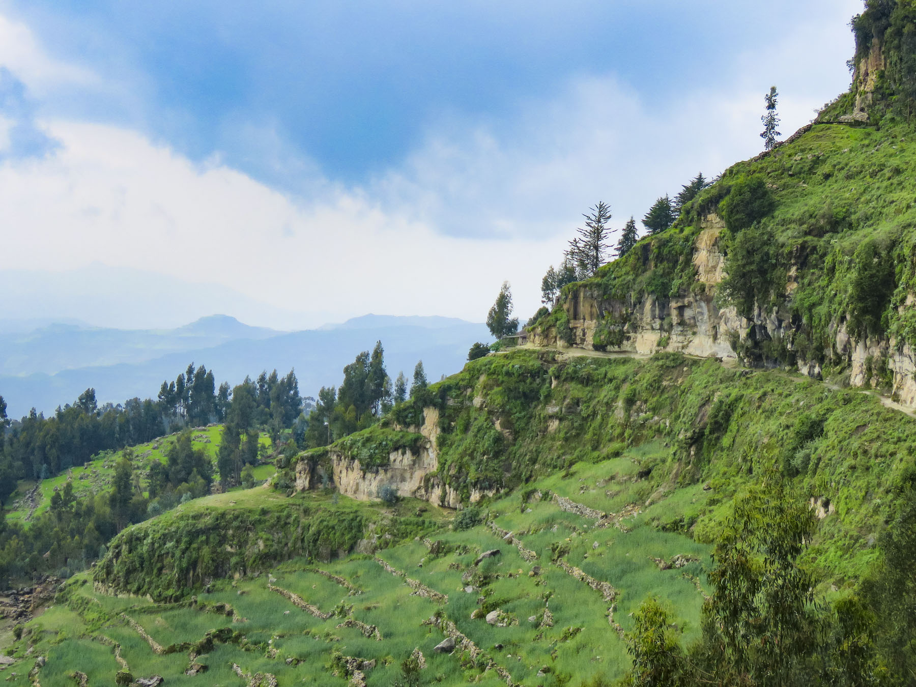 Meanwhile, we regained our pace as the trail leveled off and tracked along the base of a cliff face that fell away to terraced farmland far below. The incline of the trail continued to rise; the walking sticks were now invaluable in helping us steady our footing on the rough path. Around a curve the trail abruptly narrowed at a sheer rock wall broken by a vertical chasm, slightly wider than our shoulders.


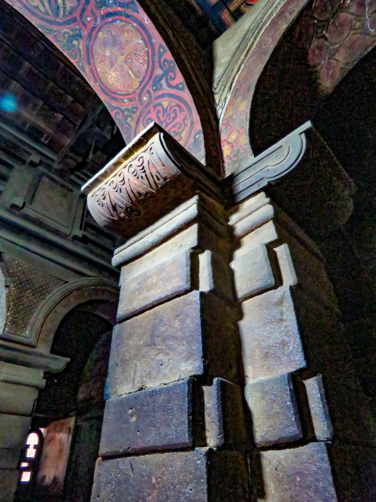
 Imprinted at the bottom of a page in one ancient text were the thumbprints of the ten scribes who helped copy the book. Legend has it that it was the first church ordered built by King Lalibela during his reign in the twelfth century and that his successor, Na’akueto La’ab, who only ruled for a short time, is buried there.


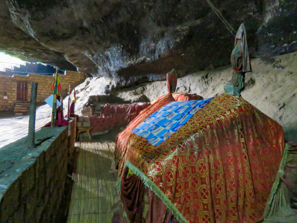
 Coming to the end of the road, we could see the monastery dramatically situated behind a small waterfall, in a long shallow cave at the bottom of a cliff.

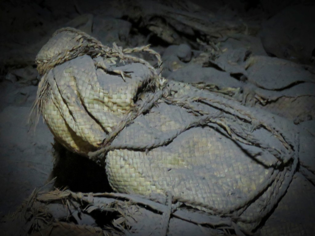
 Stone bowls smoothed from centuries of use sat in various places on the rough floor to collect the water seeping from the cave’s ceiling one drip at a time. It gets blessed by the priest and used as Holy water, continuing a tradition from the 12th century when King La’ab ordered the monastery’s creation.


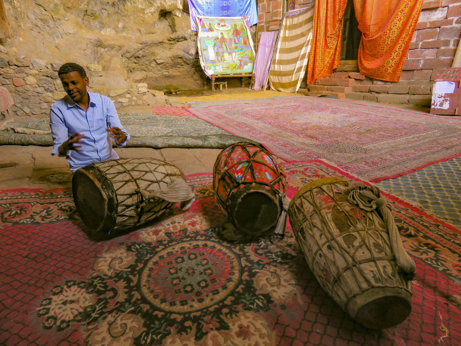 In the learning area, layers of carpet attempted to smooth an uneven, rocky floor where the novitiates sit to learn the ways of the orthodox church. In the corner rested several large ceremonial drums used during worship services. Picking one up our guide beat out a rhythm that would normally accompany liturgical chanting, or Zema, by the young monks. We’ve noticed that the treasures of the Ethiopian churches are not determined by their monetary value and locked securely away, only to be used on religious holidays, but by their spiritual connection. Precious, irreplaceable, ancient bibles and manuscripts, lovingly worn and torn as they are, continue to be used every day, as they have been for the last nine-hundred-years.
 It is well worth the effort to visit these remote churches and monasteries. The physical strength required and hardships endured to build these remote churches as a testament of faith continues to be inspiring.

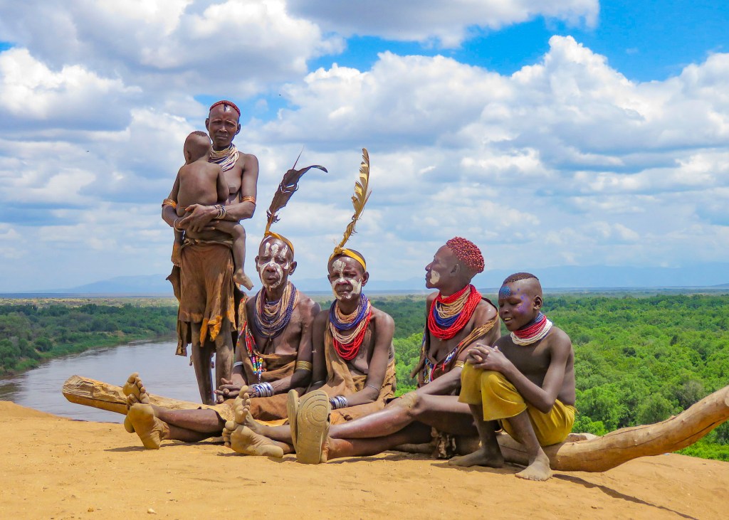
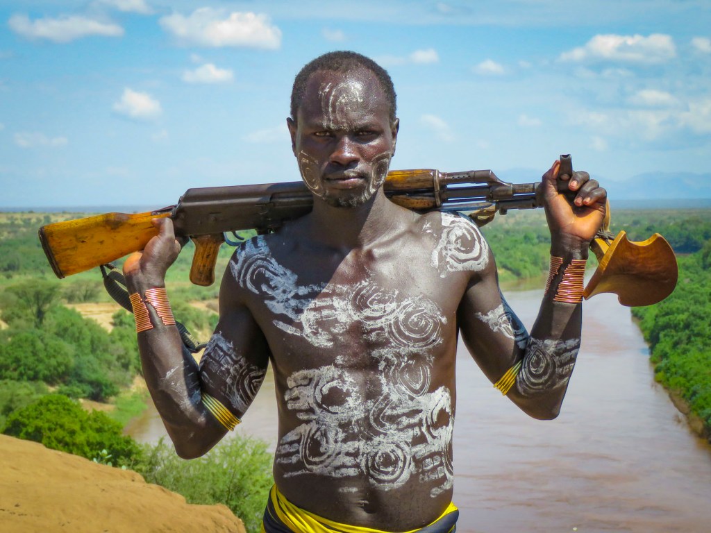
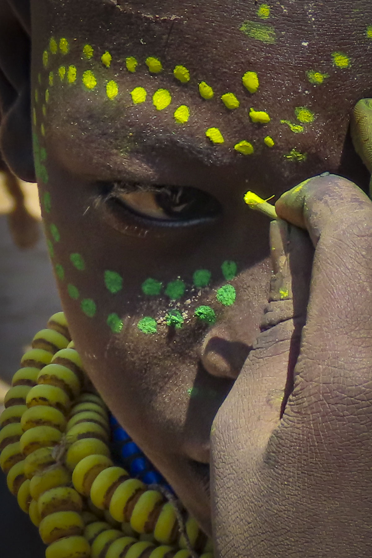
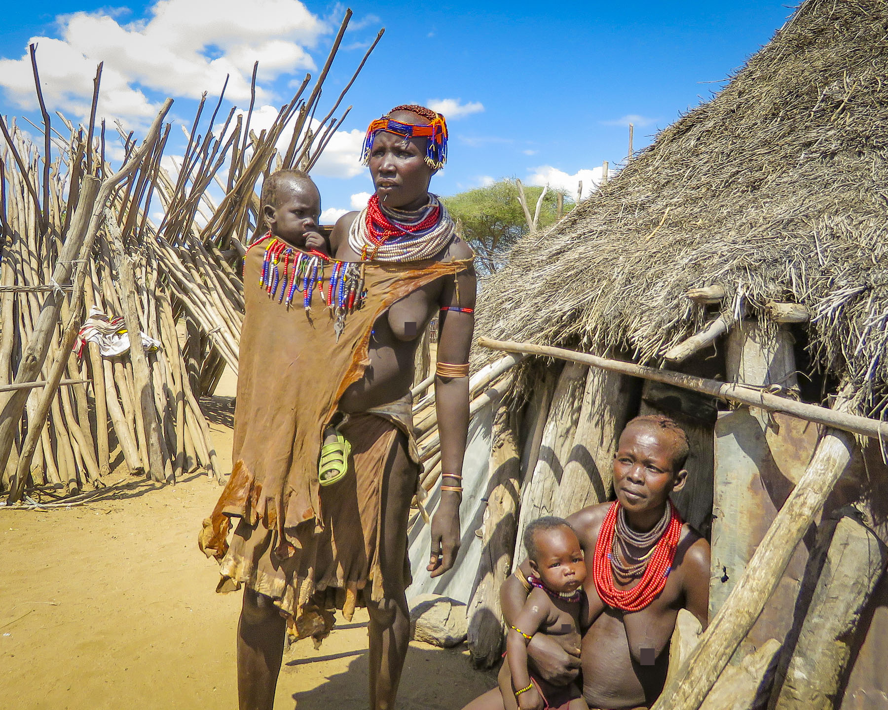
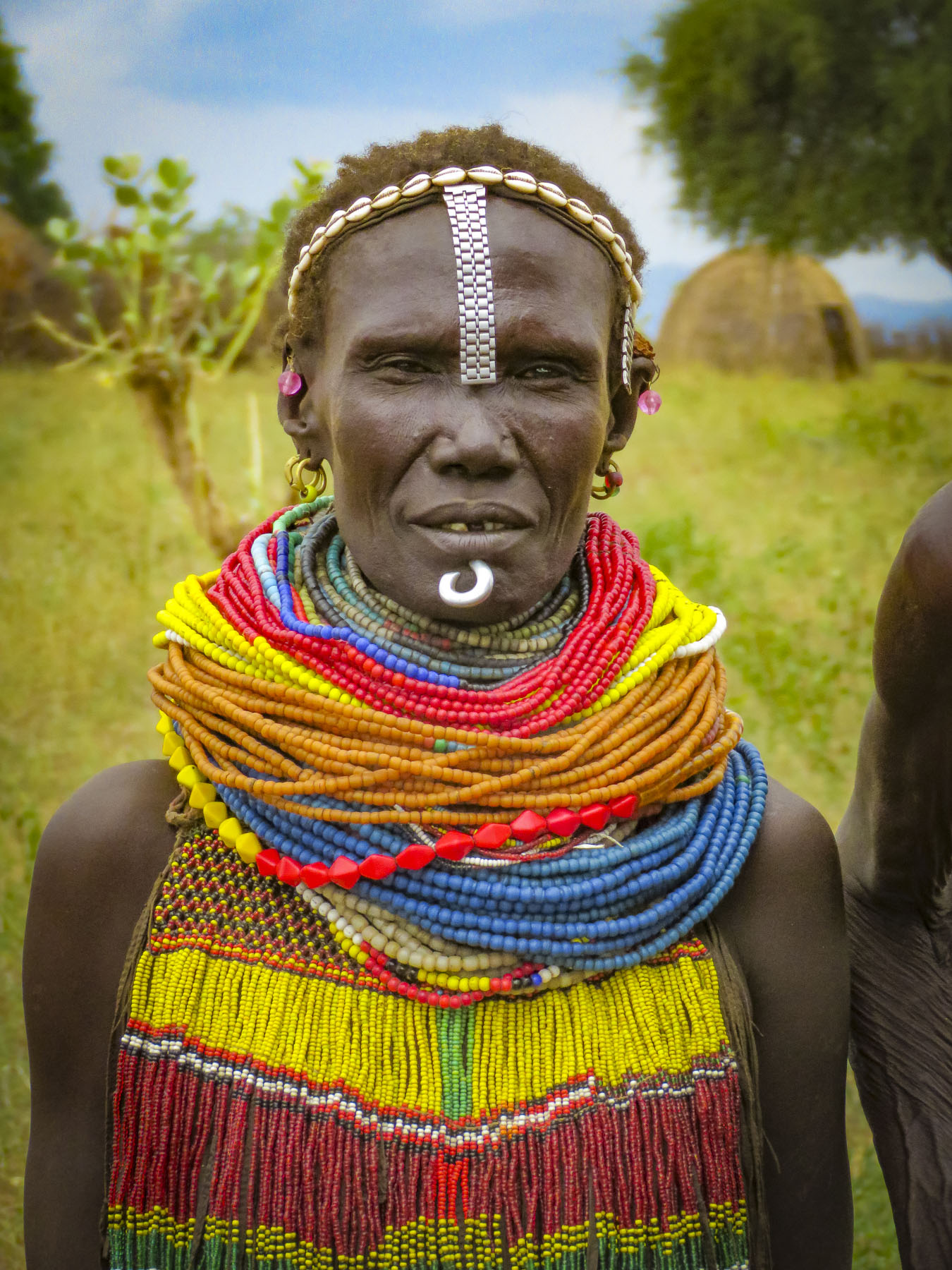
 We would have been terribly dissappointed if this had happened to us and we missed visiting the Mursi tribe. (Note to self – don’t leave important events to the last day.) Curious children made their way amidst the tourist vehicles, looking through the windows and asking for soap, shampoo, pens, pencils, caramels, and empty water bottles. The kids would have been happy with anything anyone gave them. Some pointed to the clothes we were wearing, hoping we would donate them. Folks make do with very little here and wear things until they are threadbare, out of necessity. Often, we saw older children wearing infant onesies with the feet of the garment cut off. We are not criticizing; it’s all they had. It saddened us and we wished we had brought an extra suitcase of clothes along to donate to a village. Eventually there was a burst of activity with rumbling engines at the front of the line and folks running back to their rides.
 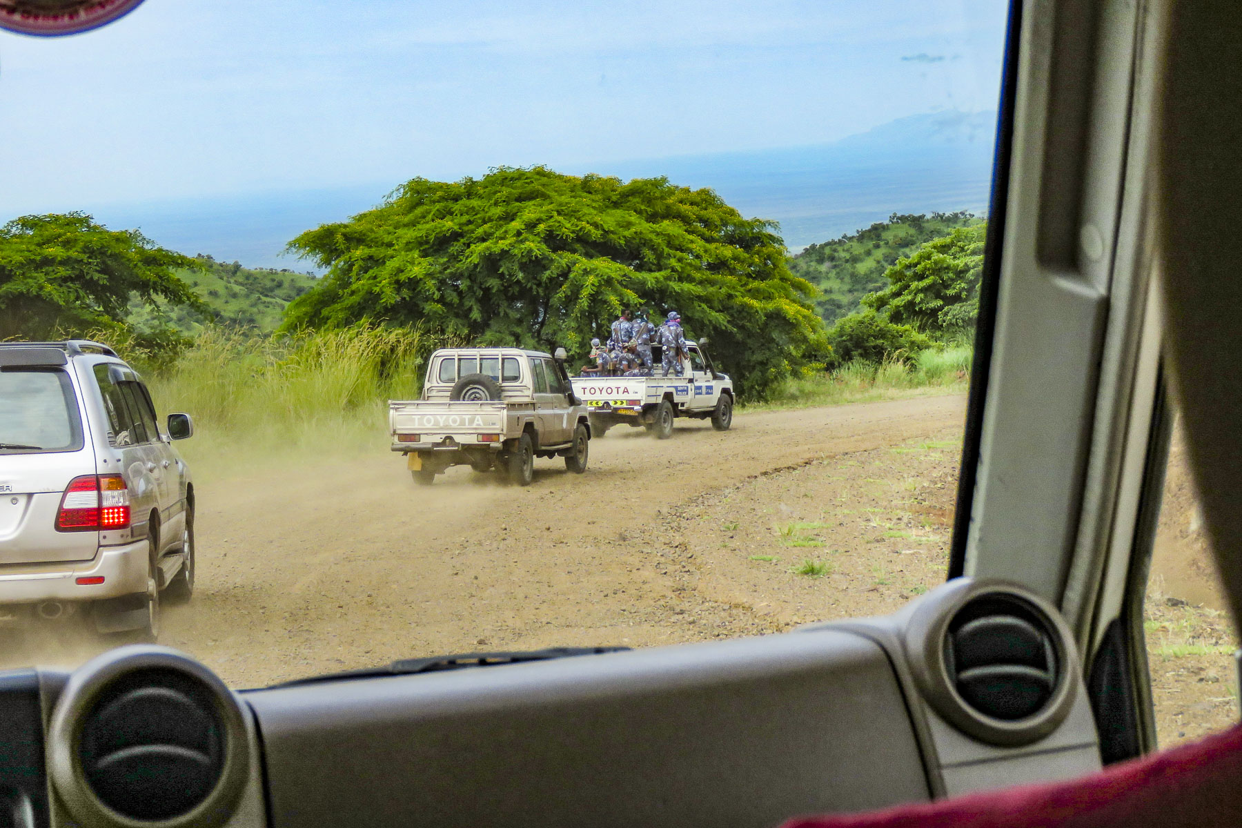 We were the third car in a group of five that was being led by a pickup truck full of armed paramilitary policemen. Many of the incidents that have occurred are related to the increase in truck and bus traffic roaring through Mursi territory on the way to new cotton and sugarcane plantations along the banks of the Omo River.
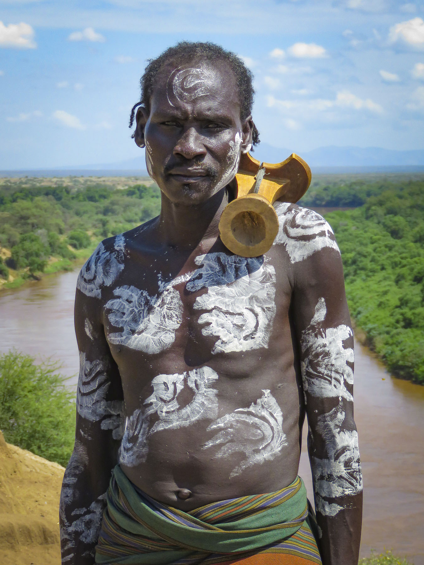
  Cattle are very often herded down the roads and sometimes are struck and killed, along with their herders. Often drivers do not stop to take responsibility. In the eyes of the villagers, the local authorities have not resolved the situation. As a result, tribespeople will set roadblocks to rob buses carrying plantation workers and extract revenge on truckers. A while later we stopped and were assigned an armed escort, with an AK-47, who accompanied us for the duration of our visit. He was euphemistically called a scout.
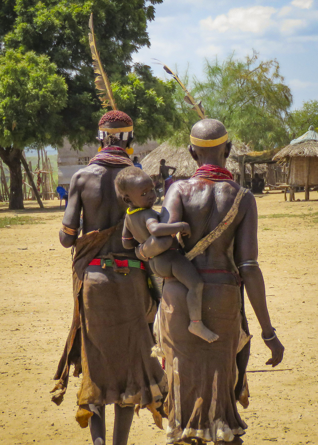
 Turning off the dirt road, branches scratched against the side of the truck as we followed a narrow dirt track through the savanna to a clearing where a small group of thatched huts stood. Soon the women of the village stopped what they were doing to greet us.


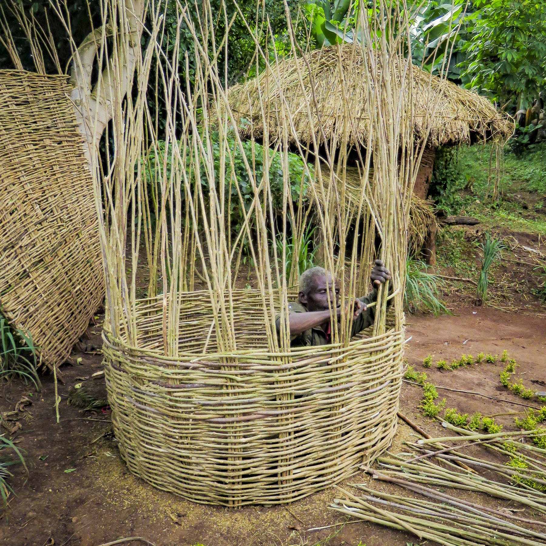
 It was a steep walk up a trail through a forest of false banana, enset, to a well-kept sturdy hut with a medicinal herb garden.
  Outside two women were pinching clay into bowls and teapots that would later be sold at a weekly market.


 With sunlight shining through a canopy of giant enset leaves above her, a tribeswoman prepared kocho, a traditional Ethiopian flatbread, over an open smoky fire as we sat and watched. Behind us children giggled as they playfully rolled an old bicycle rim down the path.


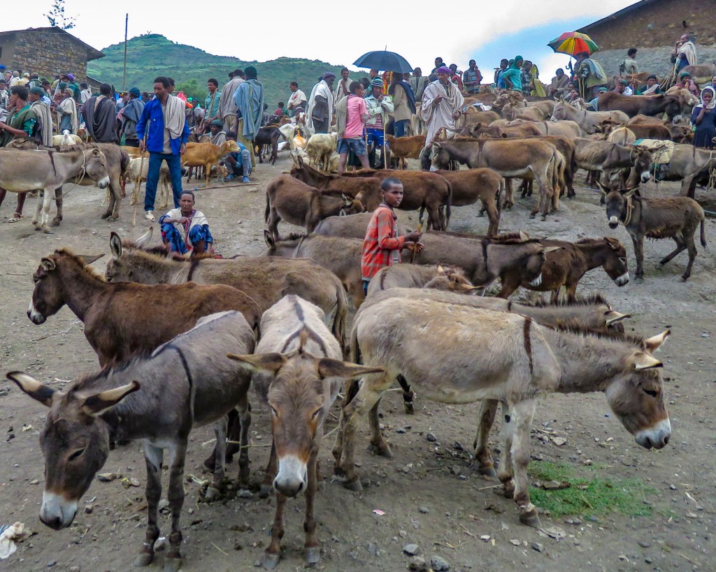
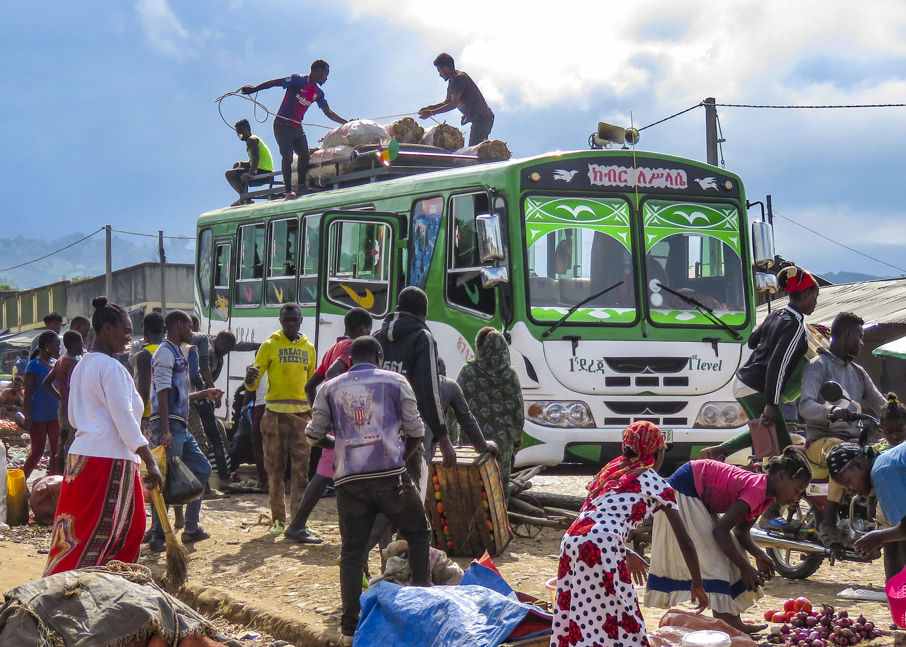 There was a lively commotion of activity by the buses as porters brought over bundles to be tossed up onto the roofs and tied down before heading back to outlying villages.
 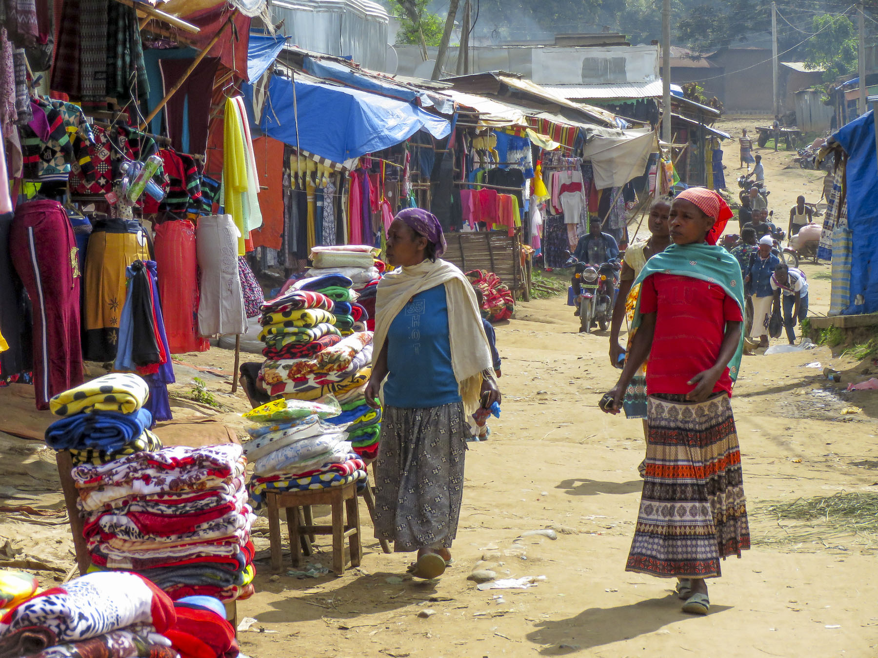 Goats, cows and children were left to wander about freely while small piles of detritus burned slowly in the streets as vendors cleaned up at the end of the day. The earthy smell of dung and smoke lightly scented the air. It was chaotic.


 The highlands area is home to the Konso people who are renowned for their ringed hilltop villages, fortified with stone walls. They have developed terraced farming techniques to survive in a semi-arid, rock strewn and hilly territory for almost seven-hundred years.
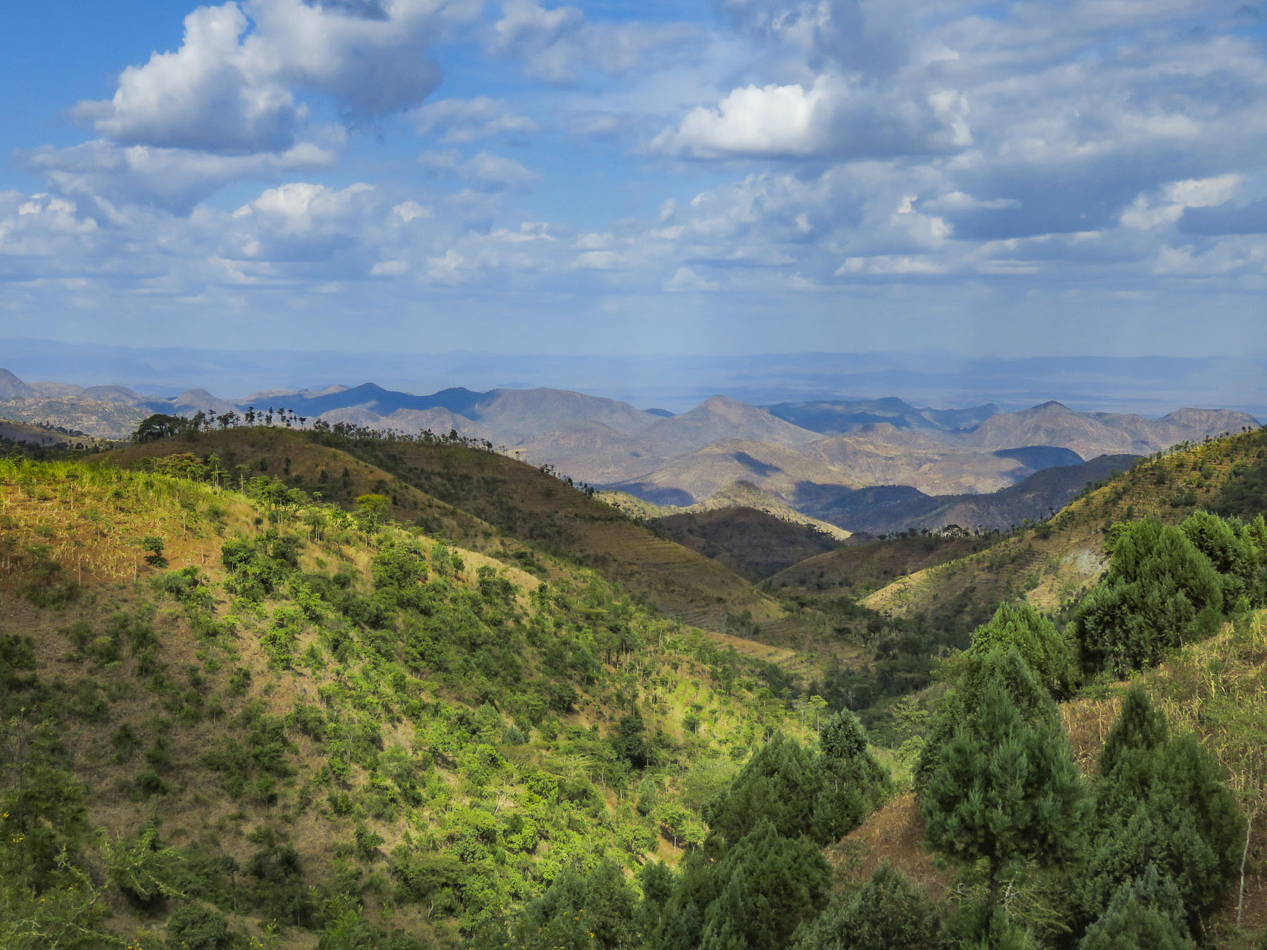 As we entered the town of Konso, bundles of candles miraculously appeared from under our guide’s seat and we stopped to donate them to a young man collecting offerings in front of his Ethiopian church. This was the guide’s ritual when we changed territories and it continued throughout our trip. It was a common sight to see small groups of parishioners walking along the road holding up a picture of a beloved saint and umbrellas for shade.


 As we walked to the center of the village young children following us jumped from rock to rock, along the tops of the tall walls built to protect the village, as we made our way along the path below.

 Each ring also has a community area called a mora; this is a large thatched roof structure with an open lower level and an enclosed upper platform where the married men and bachelors of the village sleep.
 More importantly it provides a shaded meeting place where men play gebeta. It’s considered the oldest board game in the world and is played simply with stones, beans or seeds being moved around holes in a board with the goal to capture as many of your opponent’s pieces as possible. Each village is also divided into two zones and a man born in one zone must always have his homestead in that zone.
 The Konso also erect generation poles, called olahita, which are raised every eighteen years. The olahita are made of cedar trees taken from the kala, a sacred forest. Gamule village had eighteen olahita which dates the village to be nearly 400 hundred years old. Sadly, the oldest central poles have succumbed to termite damage and rot over the centuries. The oldest village in the Konso region is Dokatu which has 43 olahita. Near the olahita was the village ceremonial daga, a large rock, that teenage boys lift over their heads to prove their manhood and eligibility for marriage. The Konso also carve waka, grave makers, in rough likeness of the deceased. These were originally placed at the grave sites in the sacred forest, but have now all been brought back into the village to deter looting. Each village is surrounded by a dina, or grove of trees, which acts as a buffer between the village and agricultural terraces. This buffer of trees was meant to inhibit attack on the village and provide an area close to the settlement where folks could forage for firewood. There are 36 paletas, with populations ranging from 1,500 to 3,000 in each village, scattered across the Konso territory.

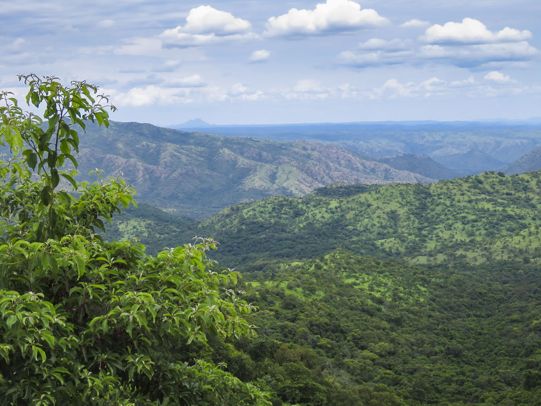
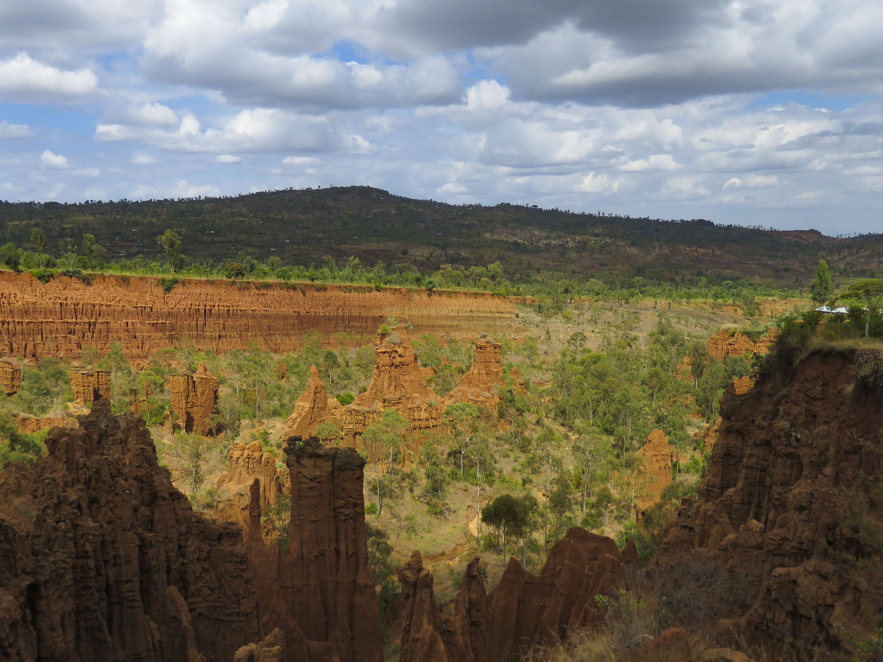 We didn’t really see the NYC comparison, but the landscape was interesting in that it contrasted sharply from the surrounding terrain. And the encompassing territory is beautiful with vistas of rolling hills. Driving away a group of young men were perched on a lone boulder, just passing time.
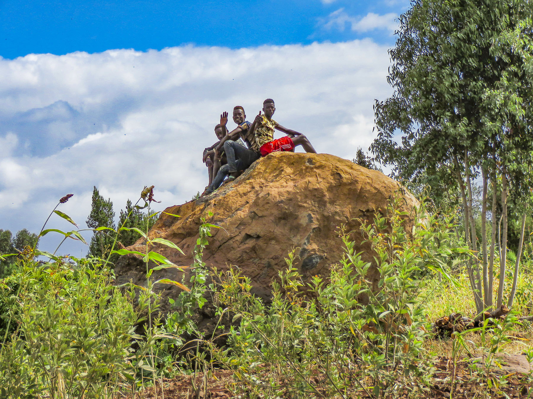 We arrived late in the afternoon to the Konso Korebta Lodge, situated high on a hill. It was a relatively new complex with attractive, circular stone huts topped with steep thatched roofs and beautiful plantings of bougainvillea. Desperately needing showers, we were flummoxed when the tap was dry and headed to reception to see what was up. Unbeknownst to us it’s common practice at hotels throughout the countryside to only turn on the electricity and water between 6:00 – 9:00 in the morning and 6:30 – 10:00 in the evening to conserve resources.
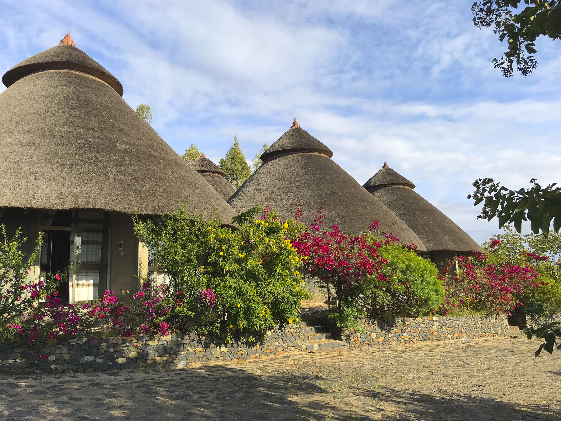 Thankfully, the staff called the owner to get permission to start the generator early for us. Back seat driver that I am I thought our driver drove fast, safely but fast to cover the great distances we had to travel. So, we were surprised the next afternoon when he was tootling along very slowly to get back to the hotel. Evidently the hotel owner made it very clear to our guide that he would not turn on the generator early again.

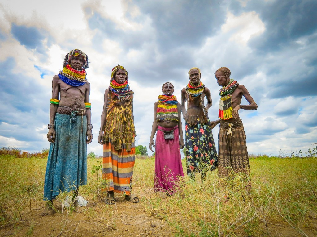
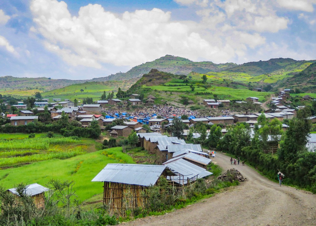
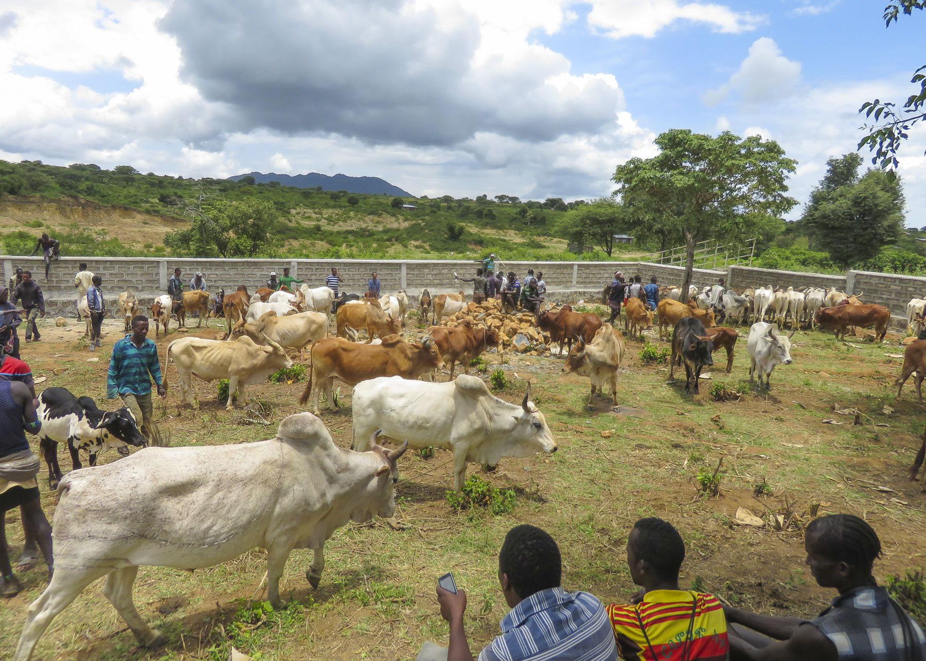
 Market days are huge events in the rural areas and folks from various tribes travel for miles to attend them.
  Not just to buy or trade supplies; it’s also a cherished opportunity for men and women to socialize with friends and extended family from other villages, often in raucous beer halls which could be in a makeshift shed or more often a spot under a large shade tree that serves a local brew.


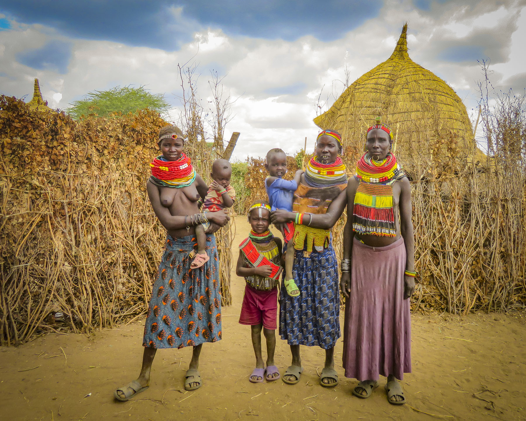
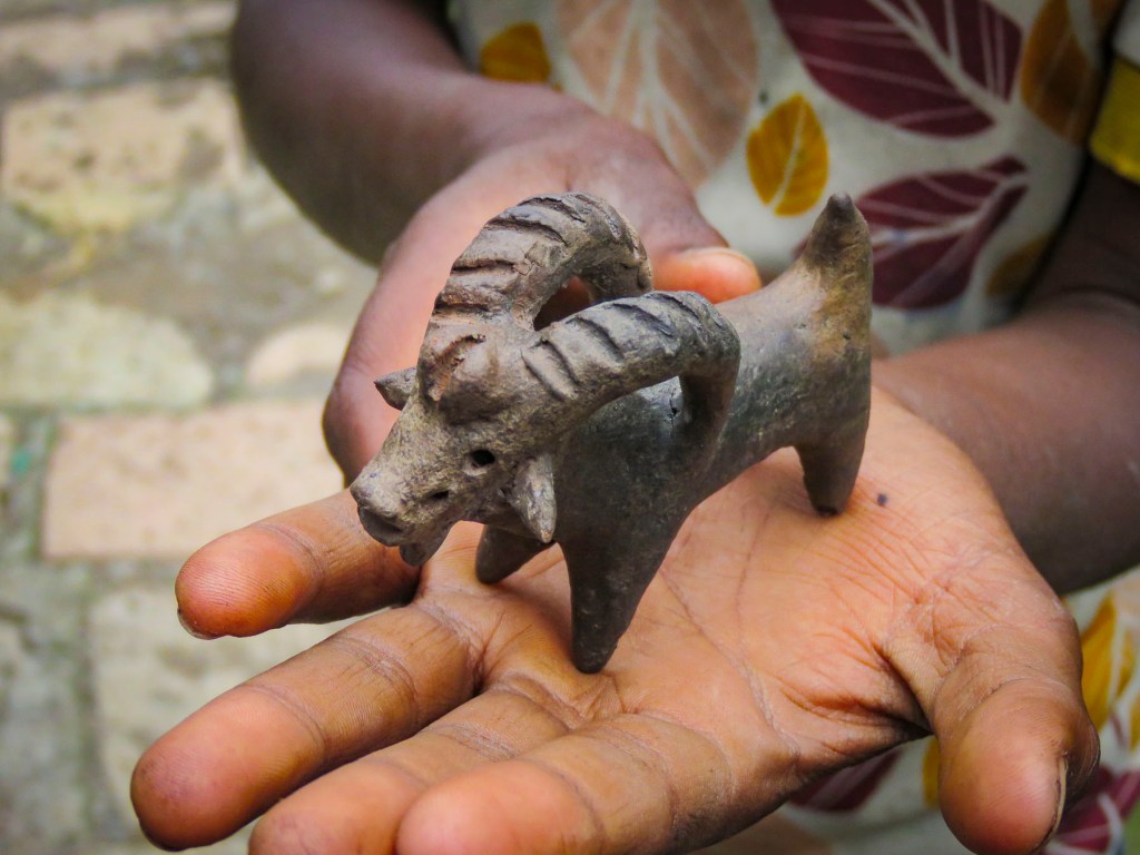
 We were able to take many candid photos as we followed our guide through the market to its various parts. Ceramic pots, handmade tools, ropes and leather goods produced by different tribespeople were available as were pots, pans, cloth and sandals produced in China.


 Many folks were very receptive to this and our guide would negotiate a fee. And even though we paid for the privilege to take their photo, they seemed pleased that we admired their style. A few, however, angrily waved us away.


 Pulling over occasionally to take photos from scenic overlooks along this isolated track, we were always surprised when, in the middle of nowhere, a young man selling souvenirs would emerge from the shade. Later we would come across an enterprising group of young stilt walkers urging tourists to stop for photos – and of course we did.
 Entering Jinka, we noticed signage for the International Airport (BCO, though we are pretty sure you can only fly in from Addis Abba.) We might have arranged our trip differently if we had known this previously as it would have eliminated two eight-hour drives from and to the capital. Note: if you fly into Ethiopia on a ticketed Ethiopian Airways flight you are able to purchase


 We planned a long weekend to celebrate
  But first we had to get there. Just before our exit off the N2, the silhouettes of several tall sailing ships broke the horizon as if they were crossing an inland sea. Imagining a pirate swinging from a yardarm, we did a quick double take and followed a side road down to the entrance of
  Across the street from the movie studio, our wine tasting started at

")


 Our room was spacious and comfortable, bigger than several studio apartments we have rented. We spent a little time walking around the pond, watching the weaver birds dart in and out of their hanging nests, before the sunset.


 We followed the queue of beret wearing Francophiles draped in colors of the flag, past a vintage car show and a very competitive barrel rolling contest, to the Food & Wine Marquee, where our tickets included a live concert by South African rocker Karen Zoid, two very nice wine glasses, tasting coupons and R20 vouchers to use towards the purchase of food or bottles of wine.


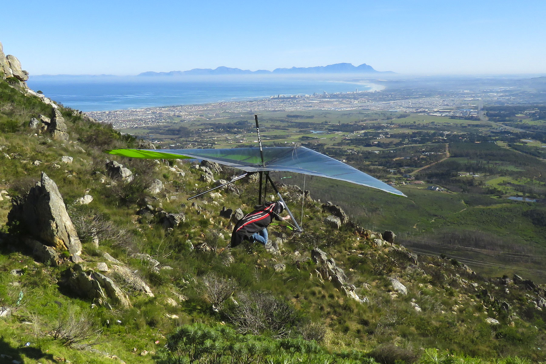 Luck was with us when we pulled into the Sir Lowry’s Pass View Point, in time to see several paragliders launch from the steep slope of the overlook. The view toward the town of Strand, on False Bay, with its long sandy crescent of beach, was incredible. Further on fruit orchards lined both sides of the road for as far as we could see. The valley’s unique climate, cooler and wetter than the surrounding region, is perfect for the local orchards to blossom. Today the Elgin region produces 65% of South Africa’s export crop of deciduous fruits.
 We were working our way to the
  Located directly across the street from the ocean, the
  Walker Bay’s thunderous waves crashing against the rocky coastline were spectacular with their large sprays as we walked along the Hermanus’ Cliffside Path to Gearing’s Point, a scenic overlook, hoping to spot whales. Our Cape Town friends had mentioned that it’s often possible to sight Southern Right Whales from the shore here during their June to November calving season, after which they head back to the waters of Antarctica.
 It’s a well-defined trail, with cement, dirt and boardwalk sections, that starts at the village’s New Harbor and hugs the coast for 7.5 miles, ending at the Klein River Estuary. Five miles of the path are wheelchair accessible. In some places it passes under trees twisted to grow almost parallel to the ground, by the fierce South Atlantic winds that blow in from Antarctica.

 The seascapes from the cliffside path were beautiful, but we hadn’t spotted any whales and the village’s whale crier wasn’t sounding his kelp horn. Yep, what started as a publicity stunt has become tradition and Hermanus has had an official, and the world’s only, whale crier since 1992.
 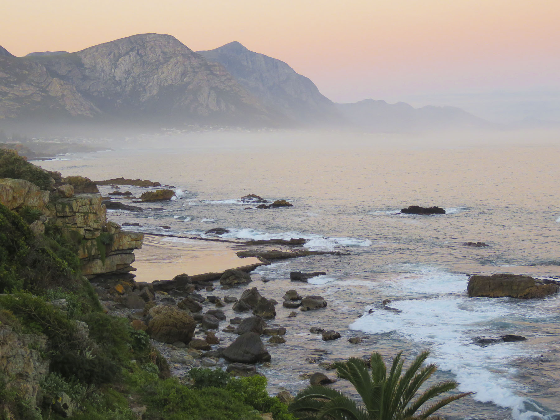 In 2016 the movie The Whale Caller was adapted from South African author Zake Mda’s 2005 novel, of the same name, which has the whale crier as the central character.

 With skipper Emile at the helm, the first mate tossed the mooring lines to the dock and we departed onto a gently rolling sea. Phillip, a registered naturalist with a delightful wry sense of humor shared his love of the sea with us. “There’s a good chance we’ll see Southern Rights today. We spot them by their distinctive V-shaped blow and the callosities (clusters of barnacle like growths) on their heads. We may also see Africa Penguins, Fur Seals, Dolphins, migrating Humpback Whales and resident Bryde’s Whales.” Psyched now, all eyes scanned the horizon for any telltale signs of these gigantic, yet elusive creatures.

 Heading back to Cape Town late the next day, we followed the scenic R44 coastal road through the seaside villages of Kleinmond, Betty’s Bay, Pringle Bay and Rooi-Els as the golden hour was approaching.
 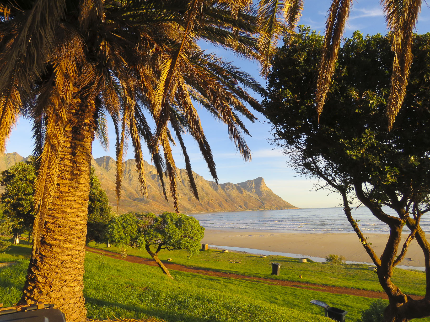 Each turn of the road offered a dramatic view of the coast and we stopped many times for photos. We merged back onto the R2 at Gordons Bay just after sunset for the ride the rest of the way back to the city.


 It’s here that we first noticed the really interesting street murals that could be seen on some of the homes. Not gratuitous bubble-scripted graffiti, but pictorial or political works of art relating to freedom, equality and hope by talented artists that enhanced their surroundings.

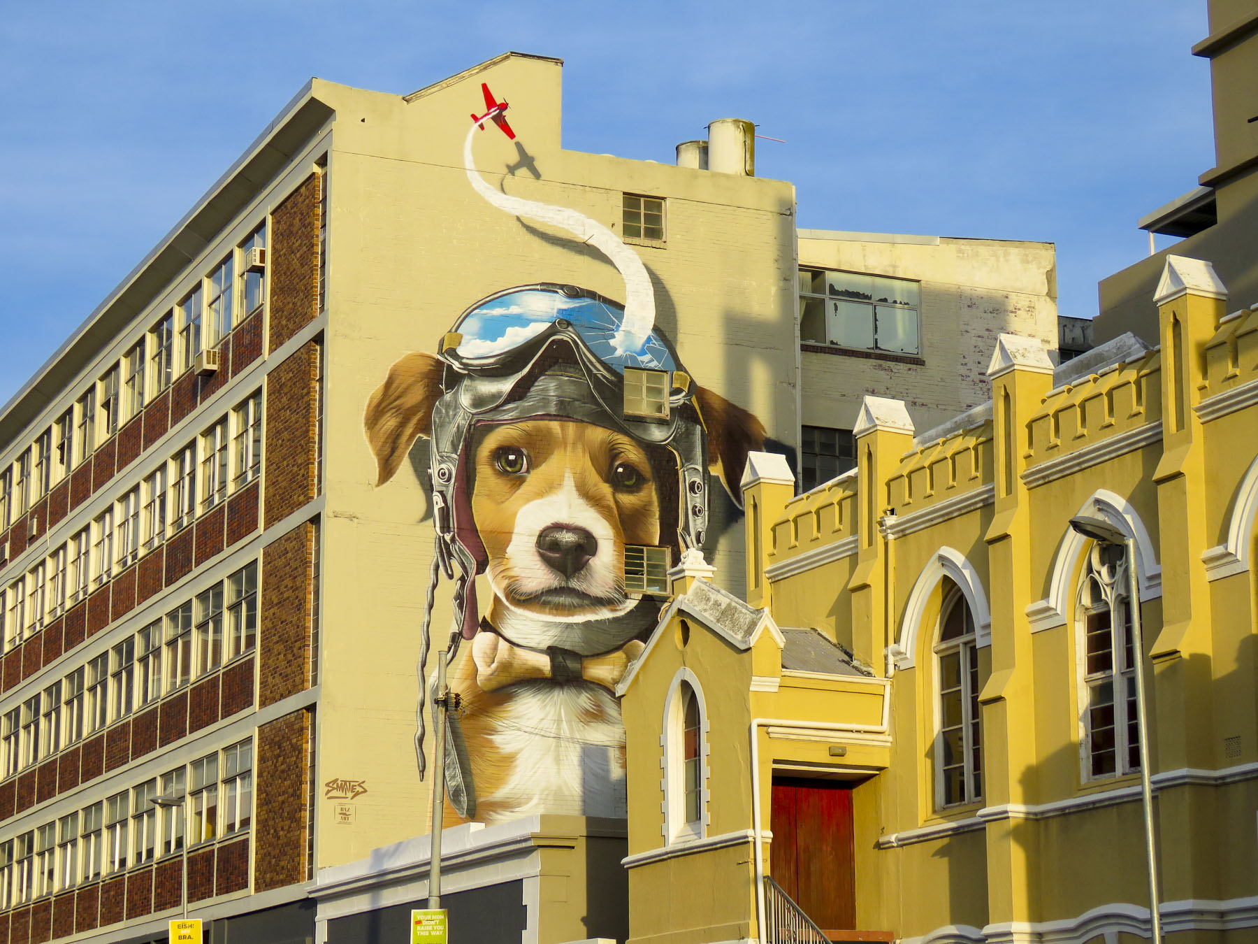 In our exploration of Cape Town, we accidentally and to our delight, came across many wonderful murals while walking or driving about. Behind our apartment on Harrington Street a wonderfully, whimsical mural of a dog dreaming about flying, by Belgian artist
 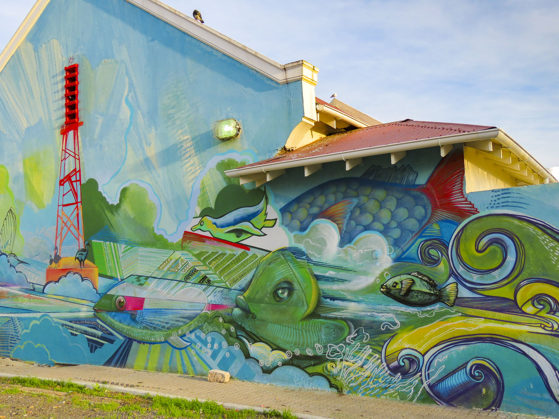 Farther down the street in District 6, across from Charlie’s Bakery, a colorful mural graced the back of a small building in a parking lot, while its front wall featured an understated portrait of Nelson Mandela by
 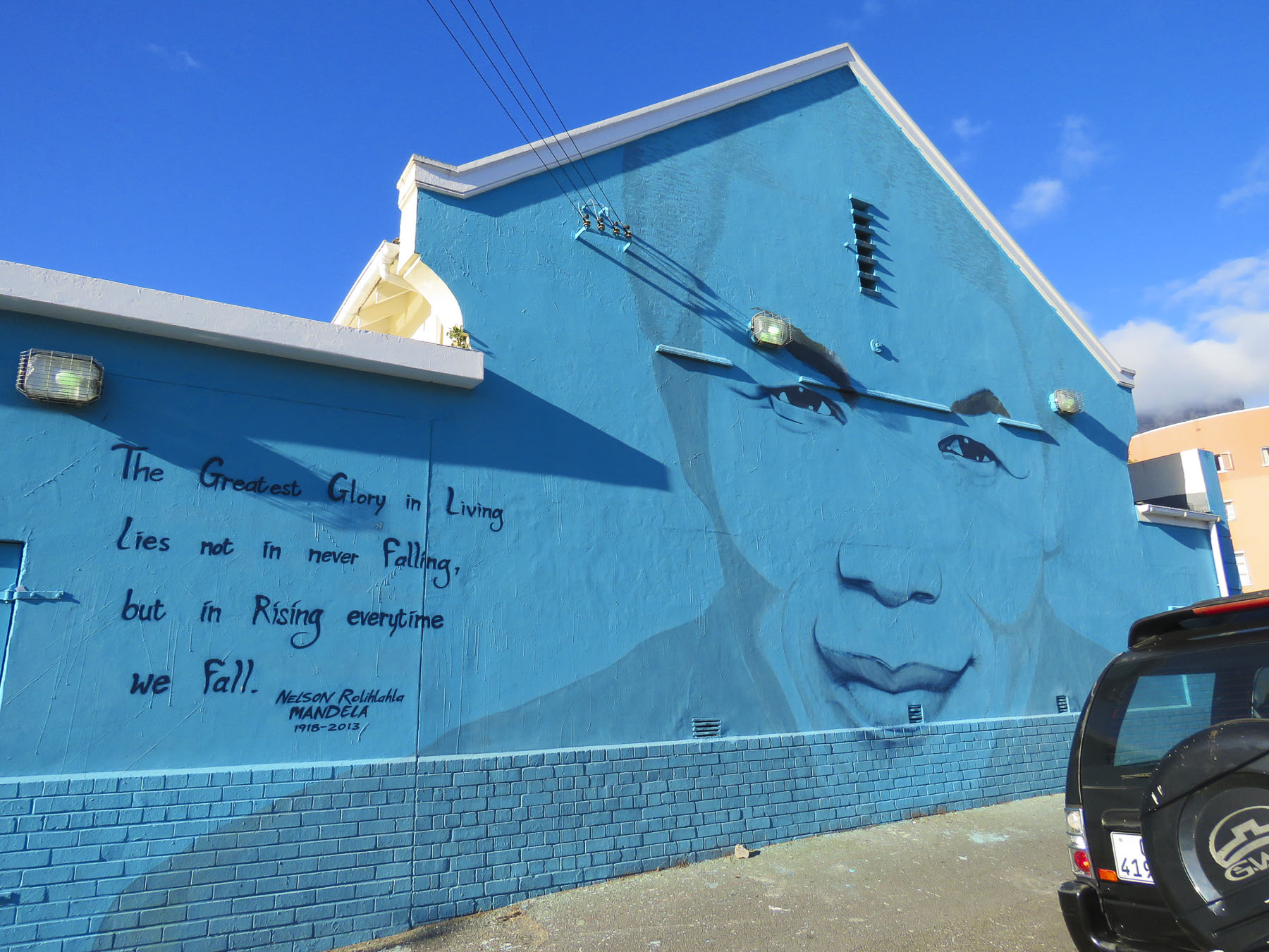 And at the bus station, under the highway, across from the Gardens Shopping Center the dismal gray walls sprang to life with imagery.


 Turns out the Woodstock and Salt River neighborhoods are ground zero for freedom of expression based on the number of street murals we discovered just by driving around. One seemed to lead to another around the corner.
  When we stopped to photograph the mural of the swimming elephant, one of the unofficial parking guards introduced himself as the “curator of street art” and offered to guide us.


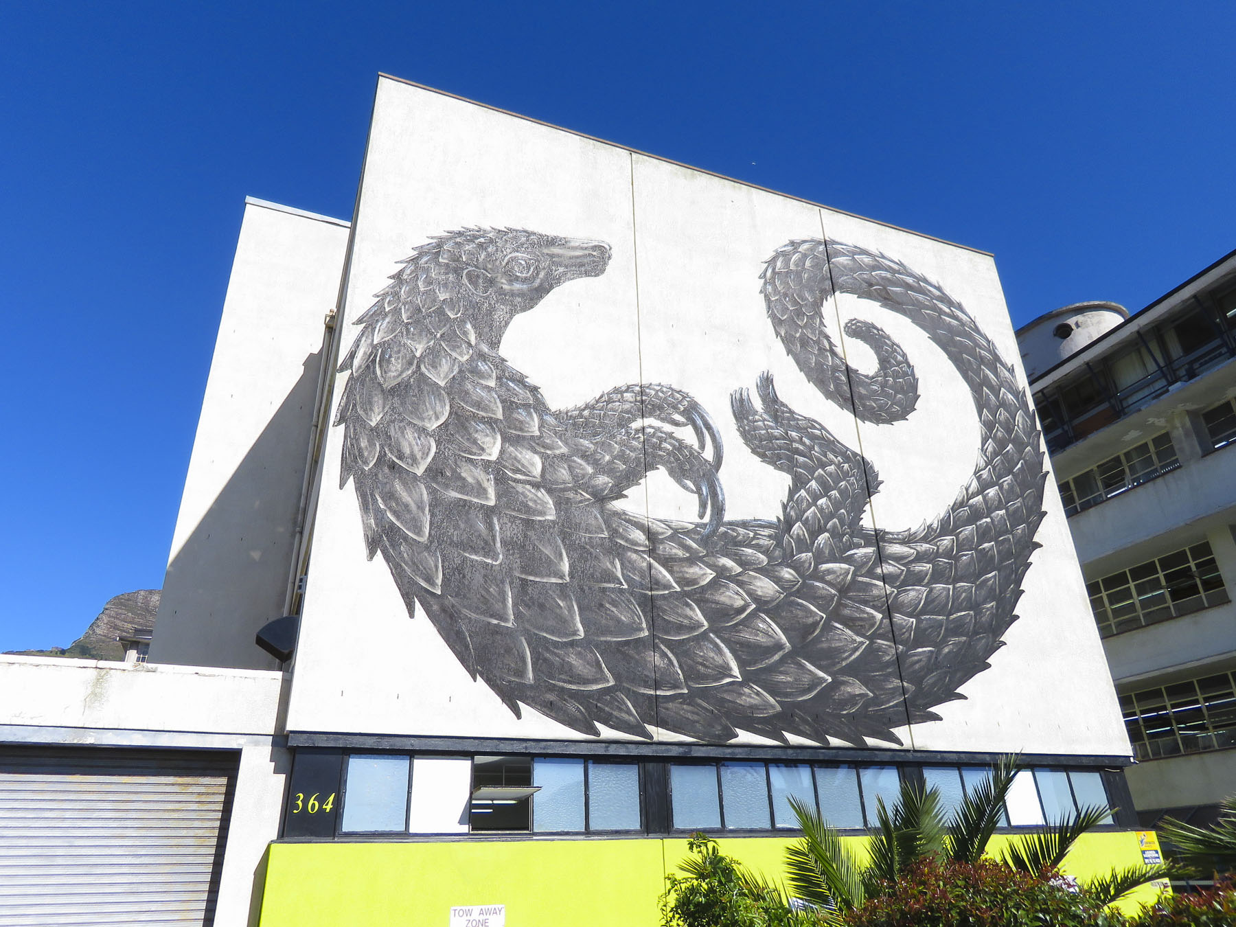 Traveling along Victoria Road in the Salt River district, the large mural of a pangolin, painted by Belgian street artist
  The festival is sponsored by

 His style is very distinctive, and we recognized many of his works as we traveled around the Cape. Back in town the exterior wall of Surfstore Africa is playfully illustrated with a giraffe wearing sunglasses.
 Our most unexpected discovery happened at the indoor parking garage of the Pick N Pay grocery store in Sea Point. Here several beautiful portraits were painted on the walls of the driving ramp leading from one level to the next.


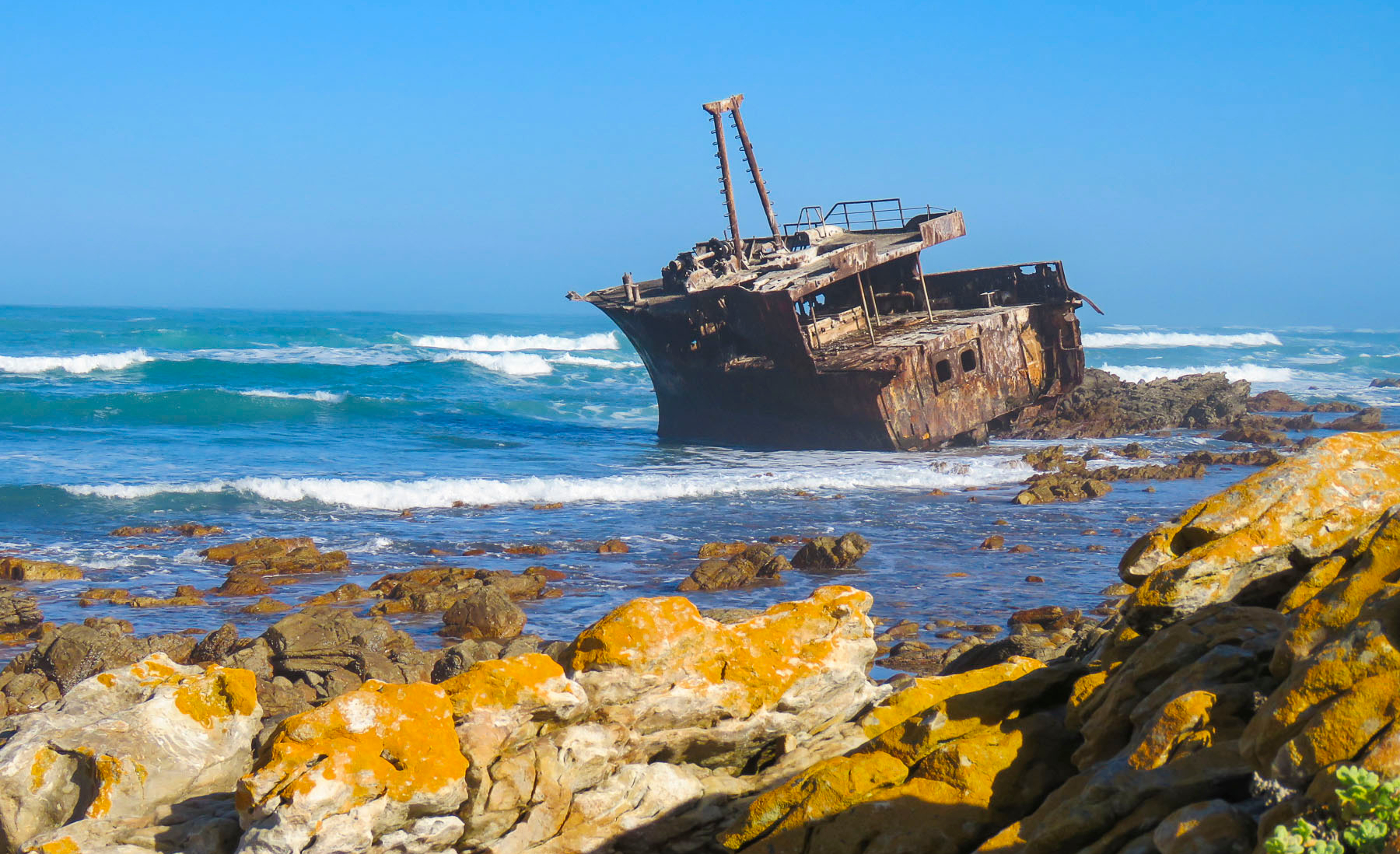 Here gale force winds that blow in from Antarctica and colliding warm and cold currents build ferocious waves that can tower to 100 feet high. These seas have claimed over 140 ships since the Portuguese first sailed here in the 1500s. Within sight of the lighthouse, the most recent wreck of a Japanese fishing trawler from 1982 lies on the beach rusting away.
 We stayed the night at the
 Afterwards we headed toward Wilderness (the town not the idea,) along a route that traversed barren farmlands and coastal pine forests before skirting the coast again at Mossel Bay. We arrived in time to watch the sunset from our balcony at
 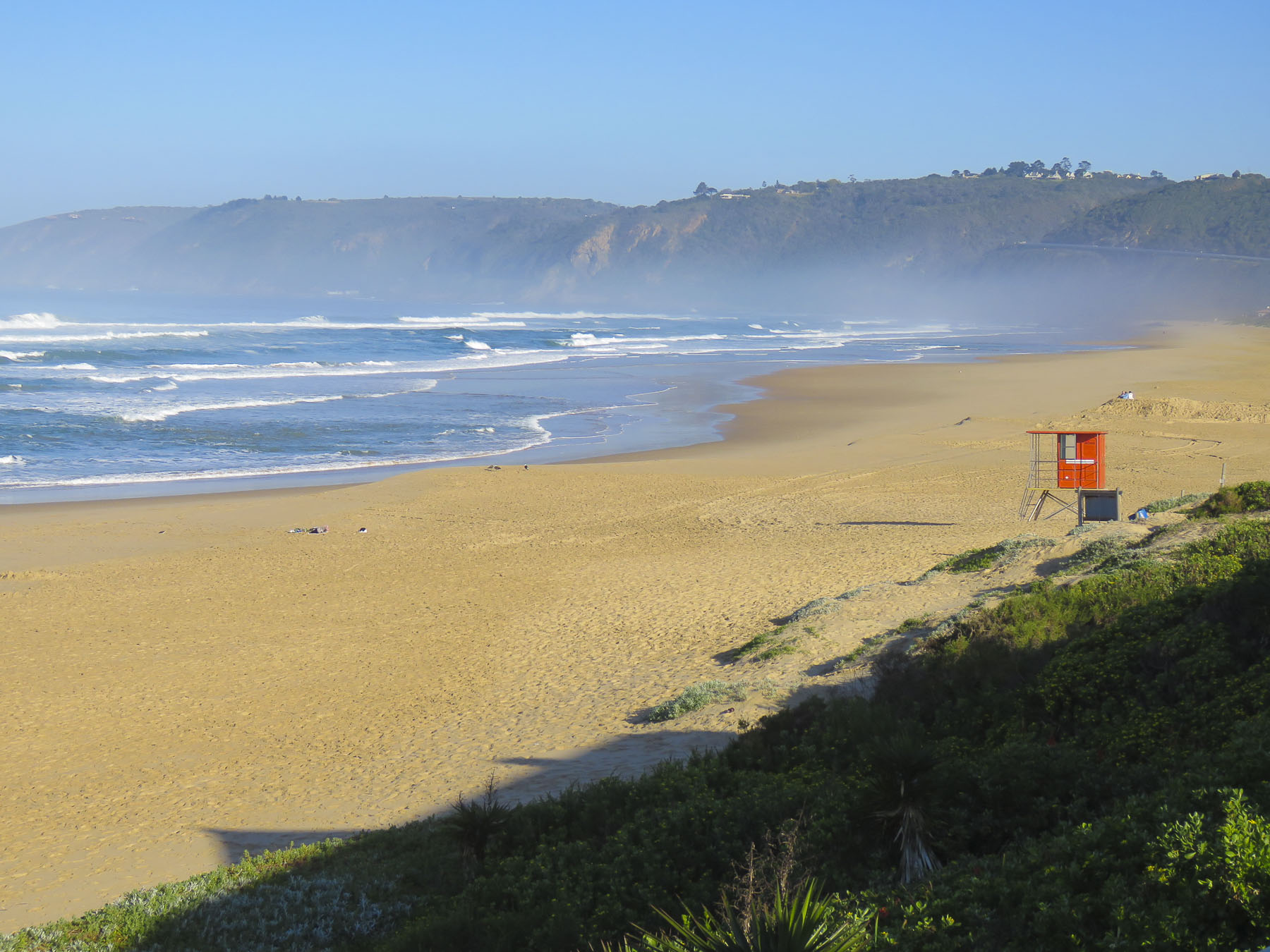 Our room was luxurious and larger than several of the apartments we had rented on our round-the-world journey so far. We were hoping the owners, Leane & Deon, would adopt us. On our sunrise walk the next morning we only sighted a few other folks enjoying the quiet of this vast stretch of pristine beach during the winter season. We noted the considerably warmer weather, a result of the Agulhas Current which swoops warm Indian Ocean currents along the bottom of South Africa and wonderfully moderates the temperature.
  After breakfast we backtracked on N2 to the pullover above the Kaaimans River Railway Bridge. For railroad enthusiasts this was a destination for many years to watch the Outeniqua Choo Tjoe, the last continually operating steam train in Africa, cross the tidal estuary which slowed settlers’ advance along the rugged coast. The line stopped operating in 2006 when landslides destroyed an extensive stretch of track. Today it’s an interesting photo-op.
  Further up the gorge at Map of Africa View Point, raging waters over the eons have eroded a bend in the river to resemble the African continent when viewed from the overlook on the opposite side of the chasm. The sky was empty mid-week, but across the road hundreds of paragliders launch from the grassy slope on the weekends to catch fantastic thermals and awesome views of the coast below.

 After spending hours rattling along dusty back roads we rejoiced to be on Route 2 again. A little while later we pulled over and enjoyed a late lunch and sunny afternoon on the outdoor deck of the Cruise Café, which overlooked Knysna Bay.
  We weren’t yet synched to the rhythm of life outside of Cape Town in the off-season and were surprised to find the restaurants and grocery stores in Plettenberg Bay closed when we arrived. Fortunately, we had a wonderful room with an ocean and lagoon view terrace, right on Lookout Beach, at
  The sun rose quickly the next morning from behind the Tsitsikamma Mountains, across the bay, filling our room with light. We spent the early morning slowly sipping coffee and savoring the view. Upon checkout we were delighted to find a sparkling clean car. This was a wonderful service the hotel provided for guests, and an easy way for the gardener to earn some extra money.
 We kept to a strict schedule, and limited our stops for photos today, because we needed to be at
  Three guides and three open-sided 4×4 Toyota safari trucks, each capable of seating 16 people, were waiting for their respective groups at the reserve’s headquarters. Wonderfully, it was mid-week in the off-season, and we had Edward, our guide/naturalist, and truck all to ourselves, while the other two trucks left with groups of six each. Schotia’s 4,000 acres of gently rolling hills, bush and forest shelter approximately 2,000 animals from 40 mammal species and its’s amazing how difficult it can be to find them.
 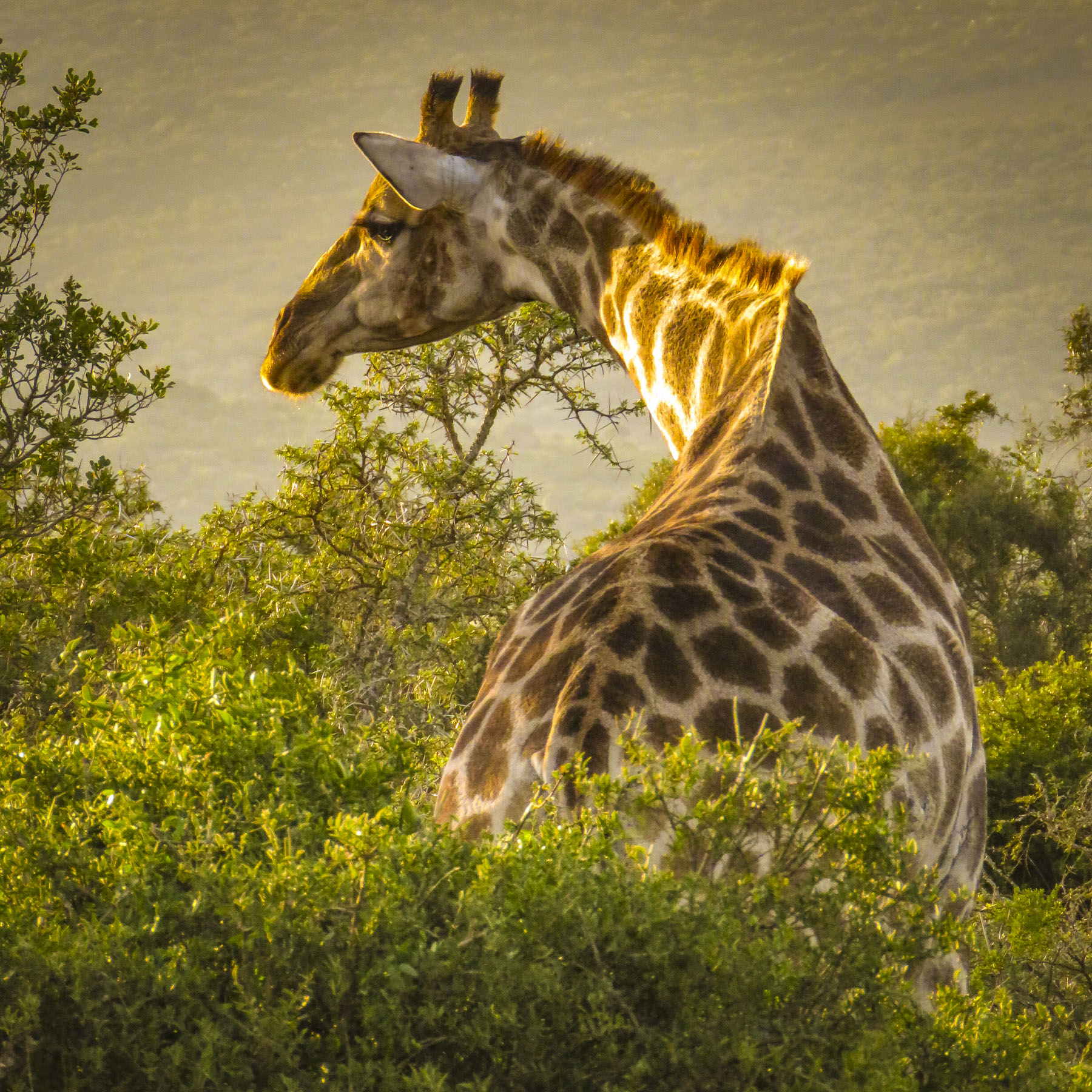 But that was our goal as we rattled along the rutted paths to a high vantage point within the reserve, that provided distant views of the terrain surrounding us. Scanning the vista with binoculars, Edward was searching for elephants, giraffes, antelopes and zebra. “The animals are constantly on the move. We’re never really sure where they will be,” Edward offered. He seconded with, “There’s clouds of dust being kicked up over there. Can’t tell from here what they are, but let’s go investigate.” And our overlanding began, chasing a cloud of dust that turned out to be a small herd of white faced Blesbok, a stunning antelope species we weren’t familiar with.


 Sightings of impala, kudu, wildebeest, warthogs, cape buffalo, zebra, hippos and crocodiles rounded out the afternoon.


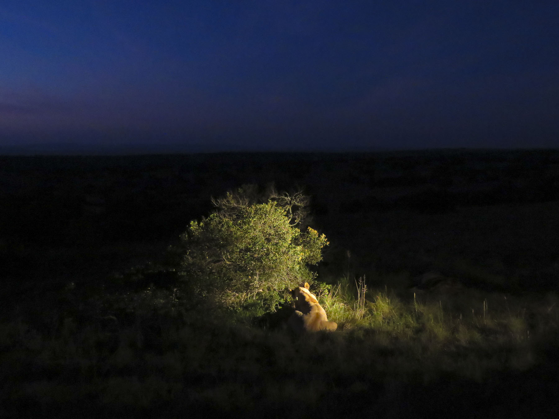 On the way back to the lapa we encountered the hippos we had seen earlier, now grazing far from their waterhole. Large black masses, they were barely visible when out of the headlights.
 Glasses of wine and a large, warming fire greeted us when we returned to the lapa for dinner. Inland the temperature fell quickly, and the warmth from the flames felt good.
 Darkness covered the countryside early in June, the beginning of South Africa’s winter season. Our guide had just lit the oil lamps a few minutes earlier, handed us a walkie-talkie and said, “Use this to call the owner if there’s an emergency, you’re the only folks here tonight.’’ The owner lived somewhere on the other side of this vast reserve. There were no other lights around except for the moon. The bush has a life of its own and sounds totally different in the darkness.
 We didn’t plan on being the only folks at the game reserve during the middle of the week, but that’s one of the benefits of off-season travel. Following spring-like conditions around the globe, we’ve been able to avoid hot, humid weather and the crowds, while managing to have some wonderful experiences along the way. Tomorrow, Edward would guide us through Addo Elephant National Park.
 The eastern cape was once home to tremendous herds of elephant which were hunted by the Xhosa and the Khoe (Khoi) tribes for sustenance, and much like the American Plains Indians and buffalo it did not end well. As colonization spread across the region in the 1700 and 1800s the tribes succumbed to smallpox and were pushed into different regions, and the elephants were slaughtered to near extinction for their ivory and to protect farming interests in the region. With the killing of 1400 elephants in 1919, public opinion slowly turned. Only eleven elephants remained when Addo Park was established in 1931 with 5600 acres.
  The park was enclosed with an elephant proof fence in 1954, to protect the surrounding citrus farms from their rampages, when the size of the herd had rebounded to 22 elephants. Today the park is the third largest in South Africa and encompasses 1,700,000 acres. Home to over 600 elephants now, the reserve has expanded its mission to protect a growing number of mammal species within its borders.
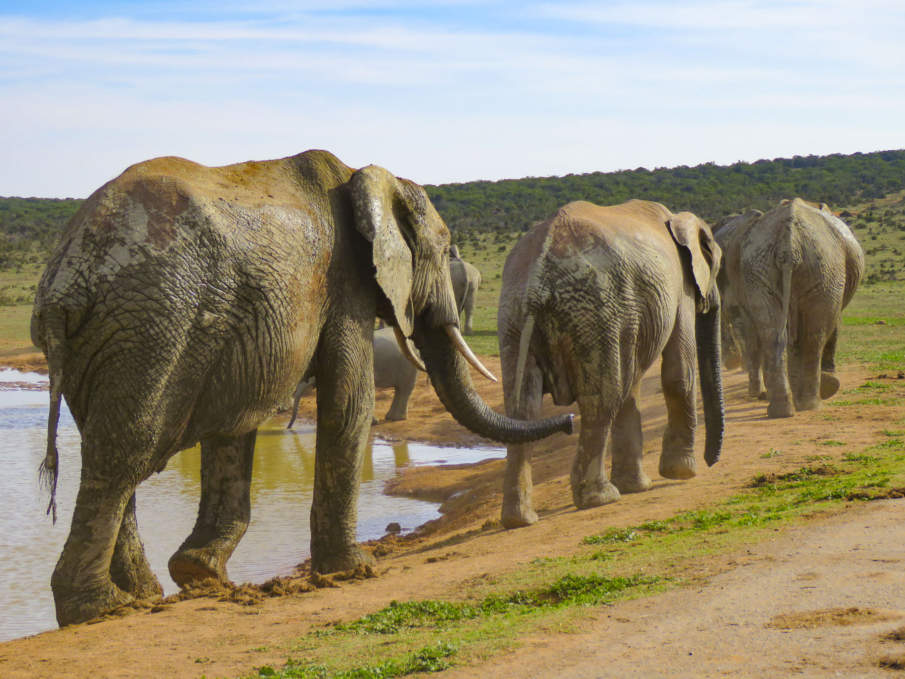 We could have done a self-drive tour through Addo, but we thoroughly enjoyed Edward’s knowledge of wildlife and the region. It was a good decision. Sitting up high in an SUV provided better visibility into the bush, where in our small rental car we wouldn’t have been able to see much. And his timing was perfect in getting us to a waterhole just as a very large herd with calves was creating a trail of dust as it emerged from the surrounding dry bush.
 We witnessed elephants smiling as they drank. It was a tremendous experience.
