

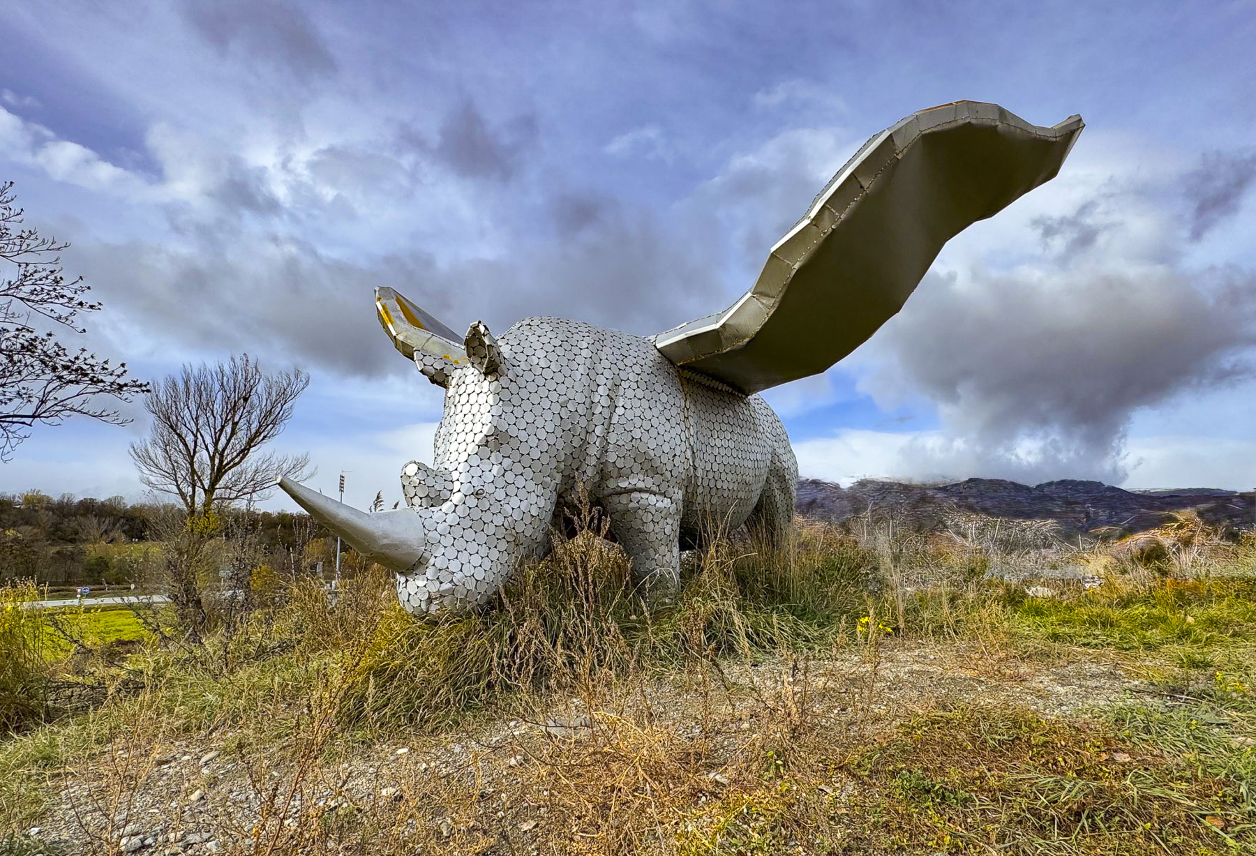
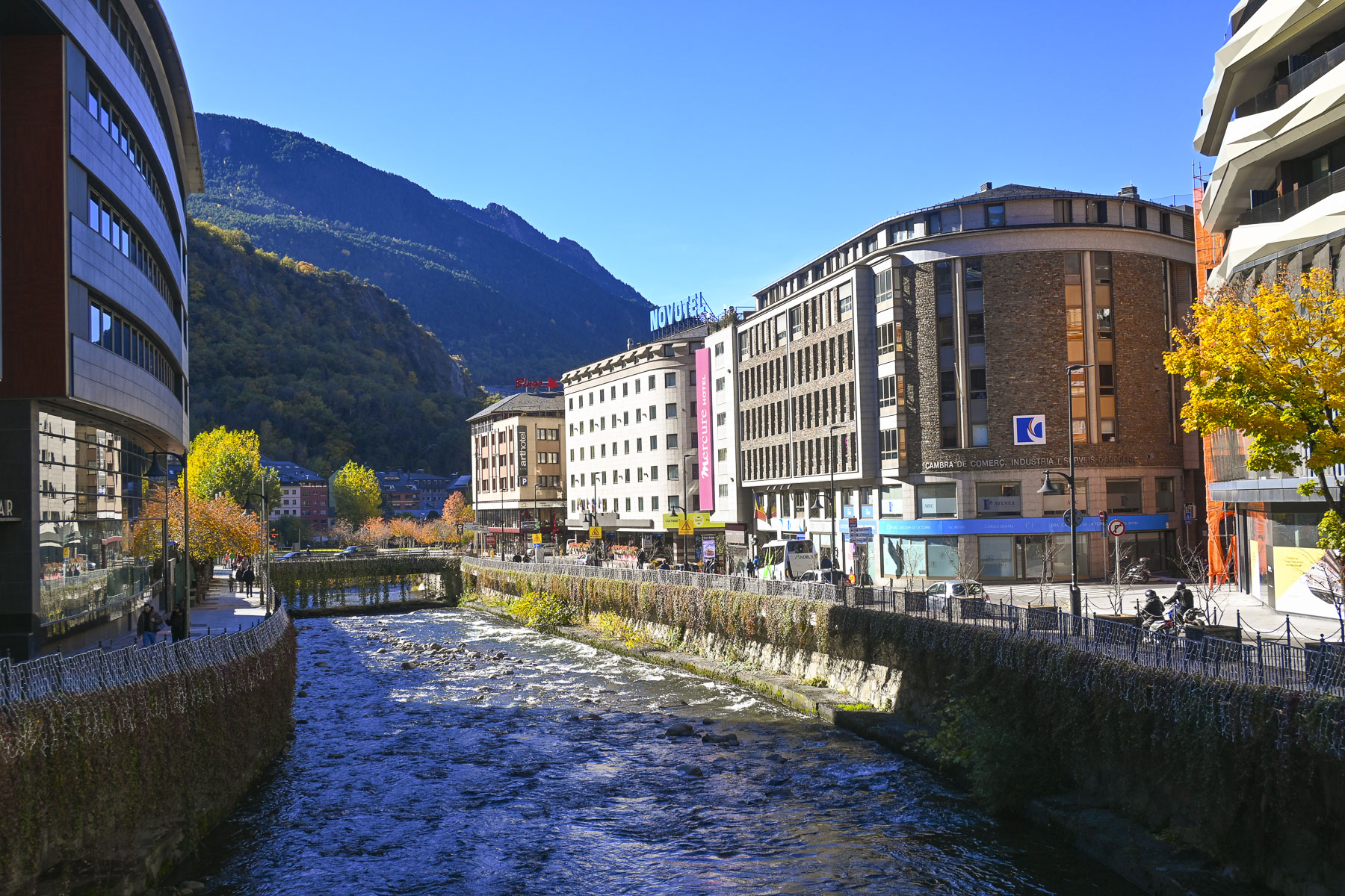
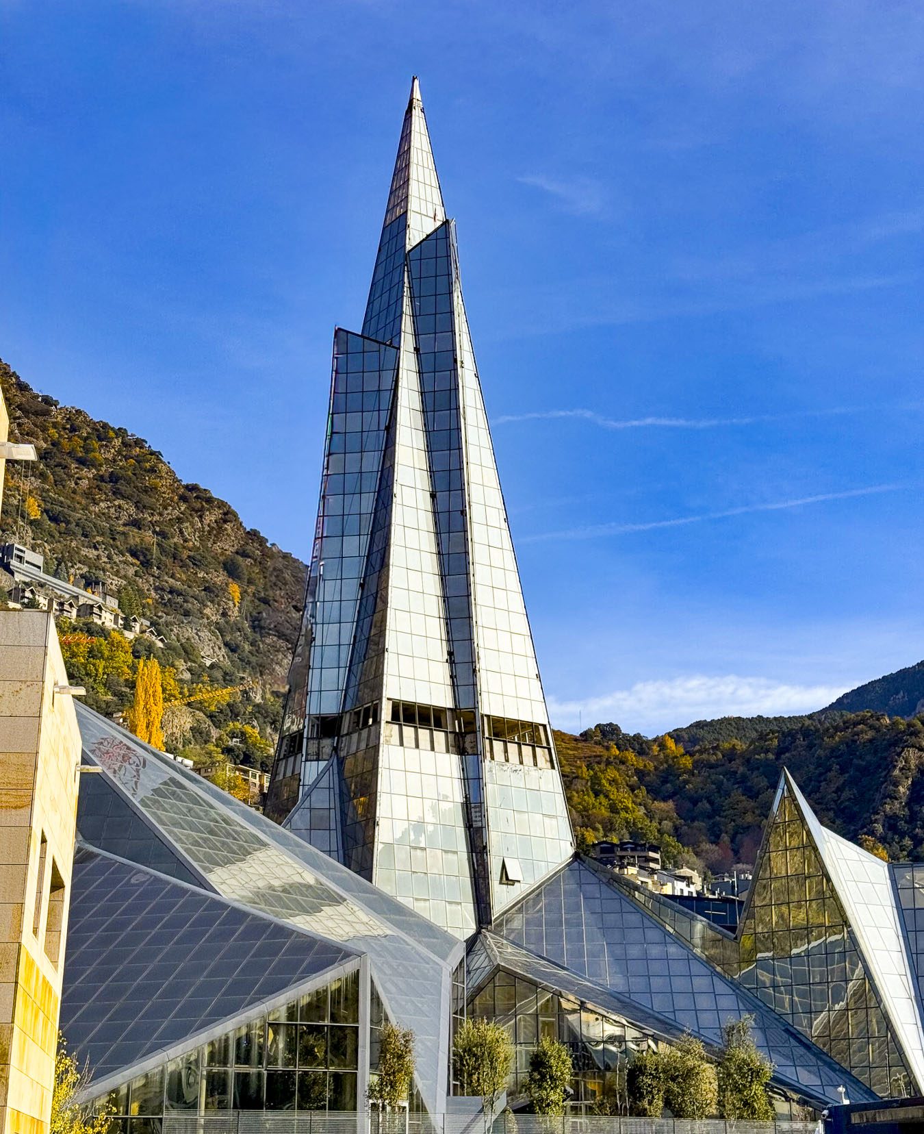
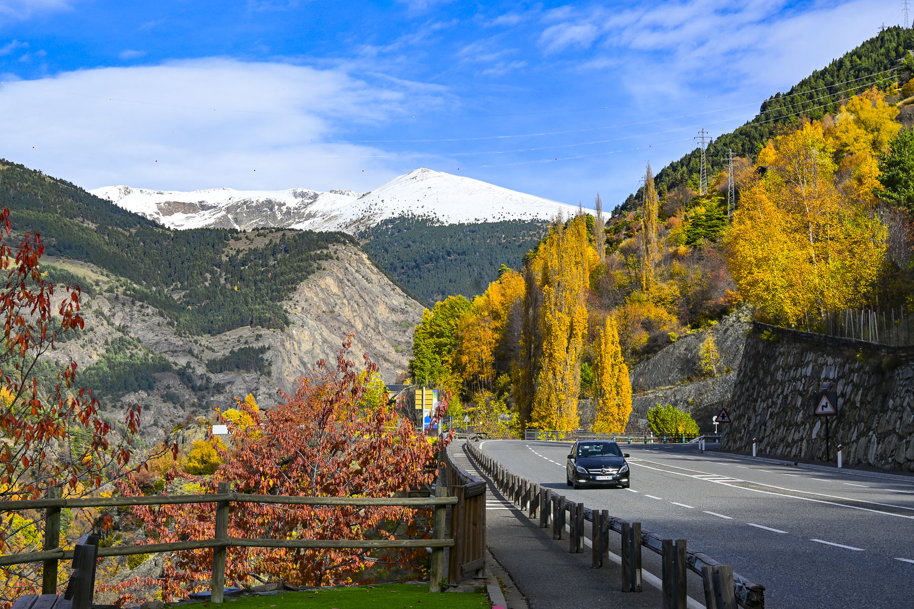
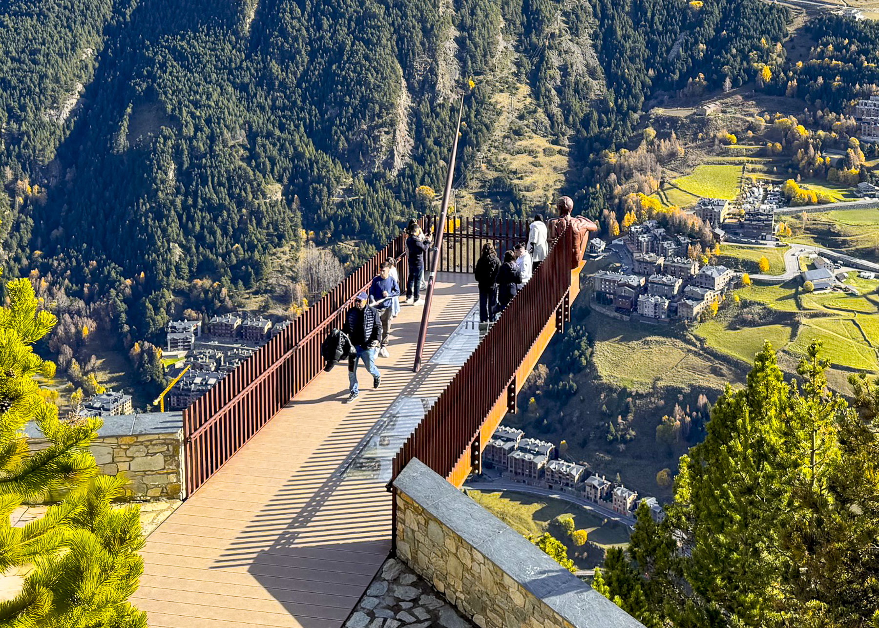
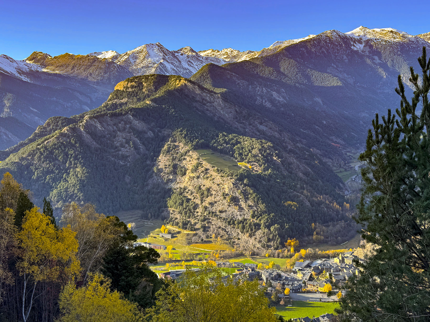
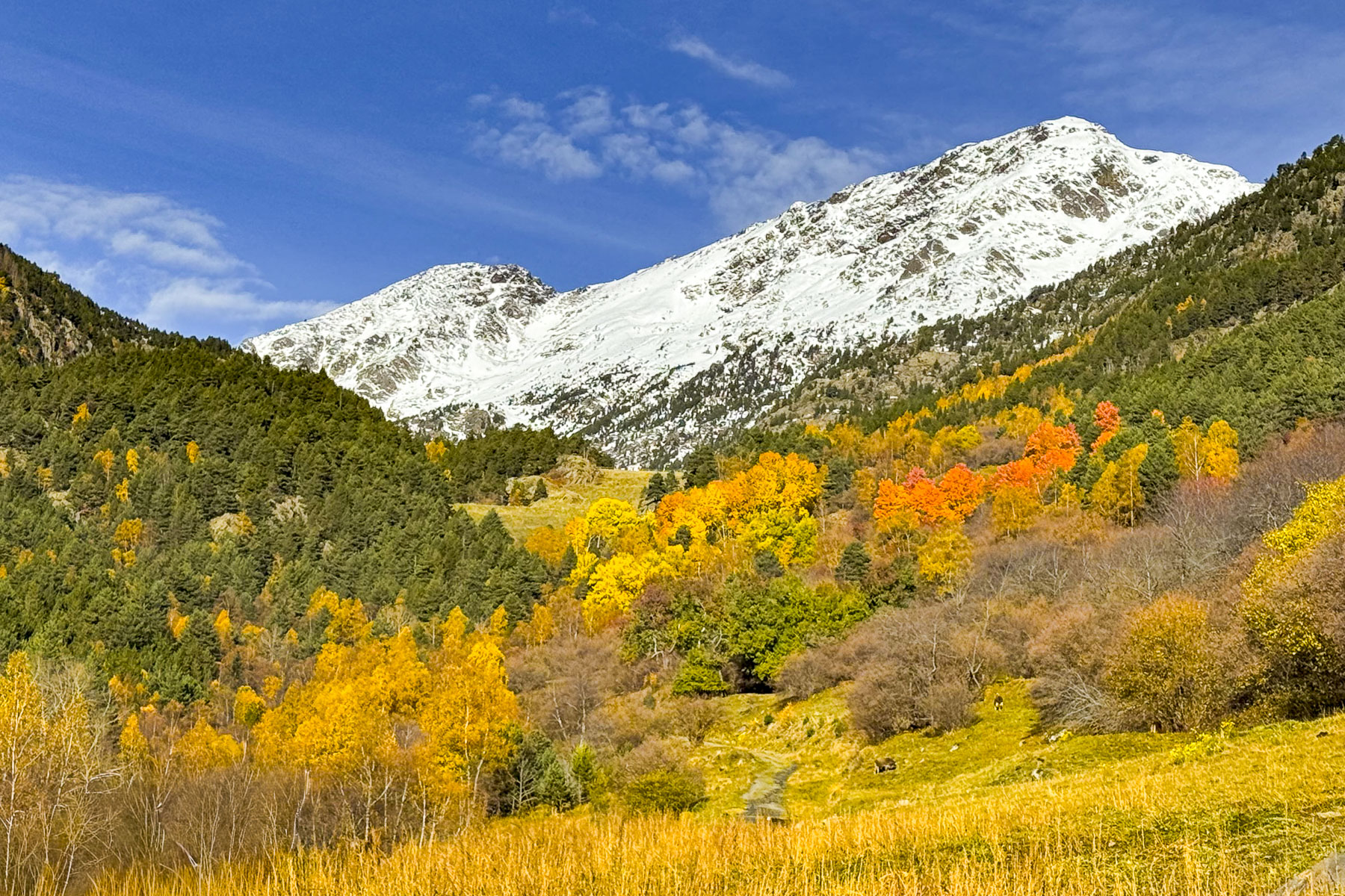
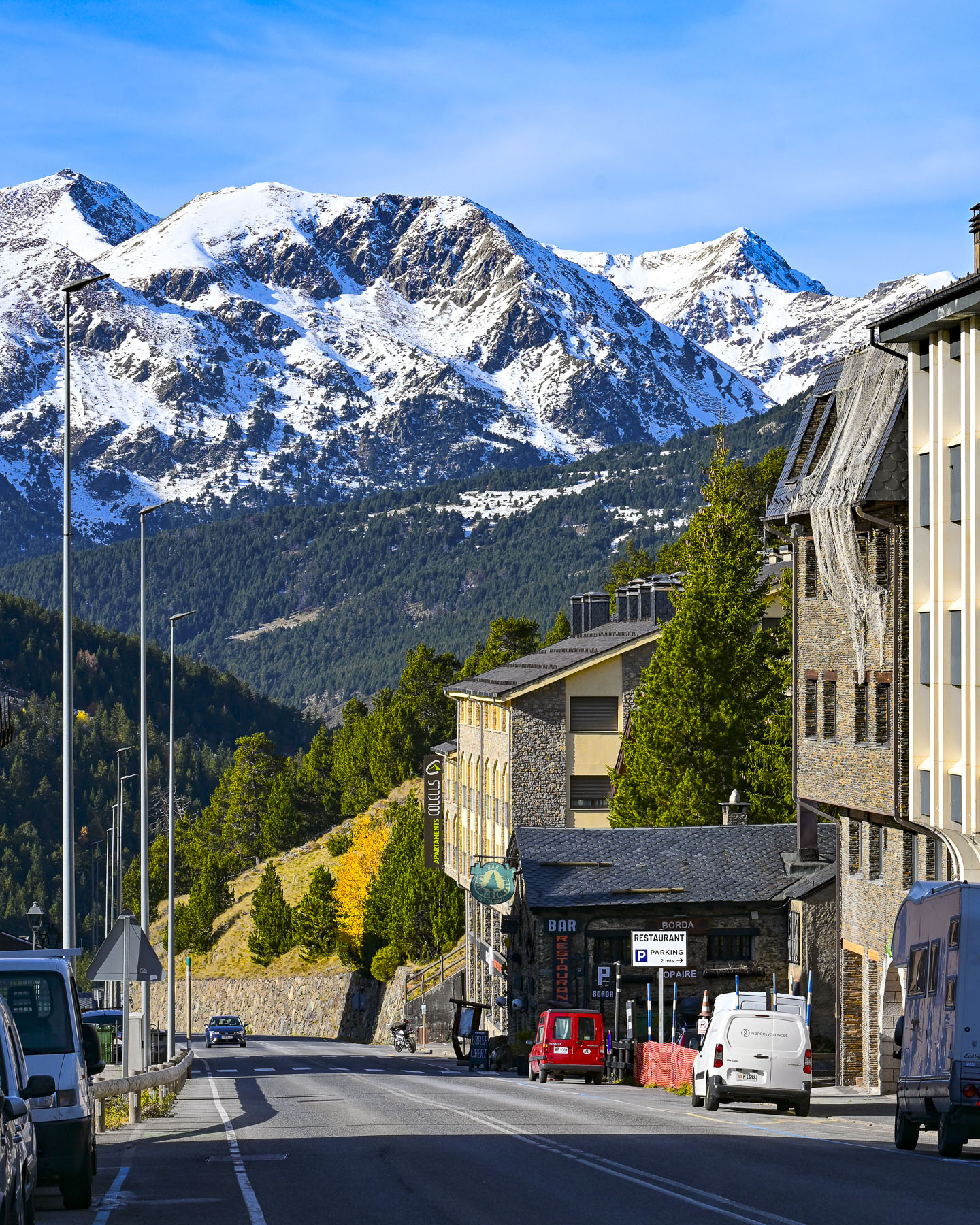
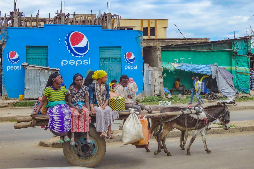
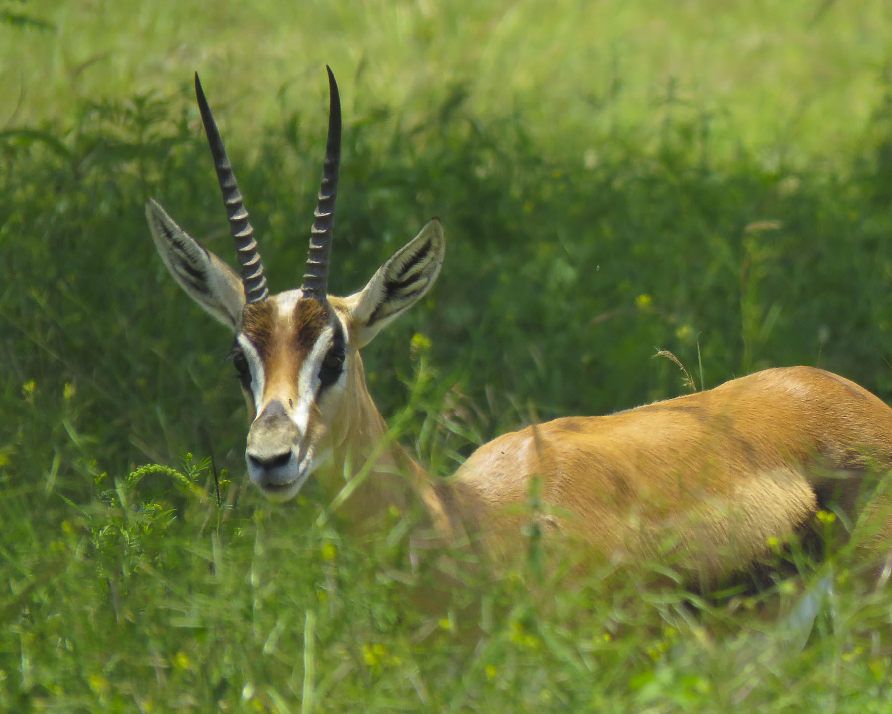
Uzbekistan is having its moment after years of slowly simmering interest; it’s exploding into a full-fledged tourist boom. It is exponentially growing from 1 million tourists in 2016 to almost 13 million in 2026, and with a modern infrastructure that includes the newly operating “Jaloliddin Manguberdi,” a high-speed electric train that will whisk passengers 1,020km (630 mi) across the country from Tashkent to Khiva in 7.5 hours with stops in Samarkand, Bukhara, and Urgench. The country is quickly becoming Central Asia’s most intriguing Silk Road destination, and with the recent opening of the state-of-the-art Islamic Civilization Center, Islom Sivilizatsiyasi Markazi, in March 2026, Tashkent will be of particular interest for tourists from the Middle East and Southeast Asia.

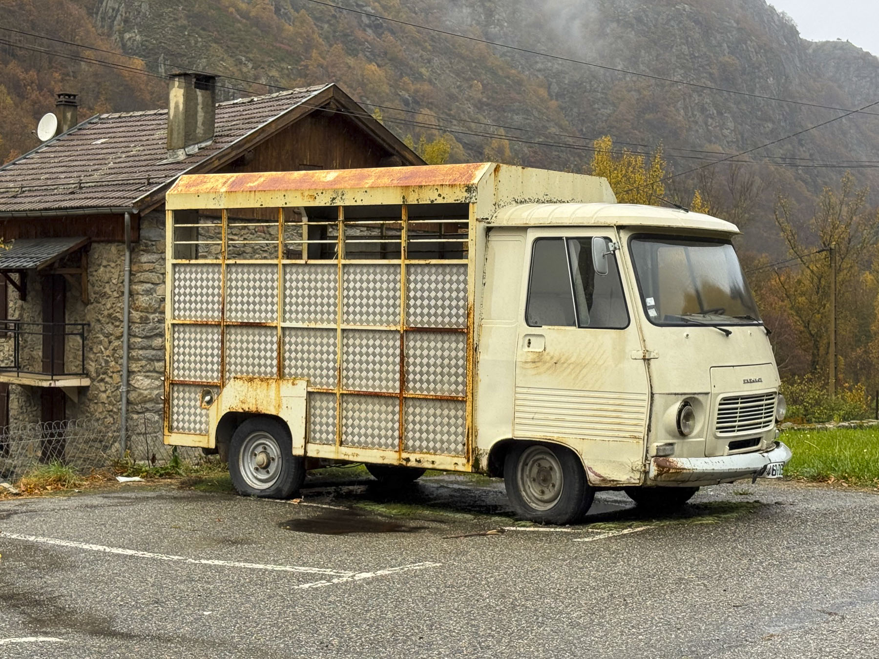
The ATMs at TAS, Tashkent’s International Airport, were conveniently located next to the baggage carousels in the arrivals area, as were signs for YandexGo, the most popular ride-share service in Uzbekistan. Walking away from the ATM with about 2,400,000 Uzbekistani Som, roughly $200.00 at the rate of 1 USD = 12,000 UZS, we felt like newly minted millionaires. We were not able to link a credit card to the YandexGo App, but soon realized a twenty-minute ride across Tashkent to the Hotel Uzbekistanwould only cost 21,000 UZS. Outside the terminal we navigated our way through a gauntlet of taxi hawkers to a sea of ubiquitous white cars. In and of itself, white cars are not unusual in any region where you can cook an egg on a rock during the summer, but the fact that they were mostly American branded Chevrolets, not the ever so popular Japanese cars, was very remarkable. They are the result of a thirty-year-old joint venture between GMC and the Uzbekistan government-owned UzAuto Motors, and steep import tariffs on foreign cars, which has led to Chevrolet producing 95% of the country’s new vehicles.
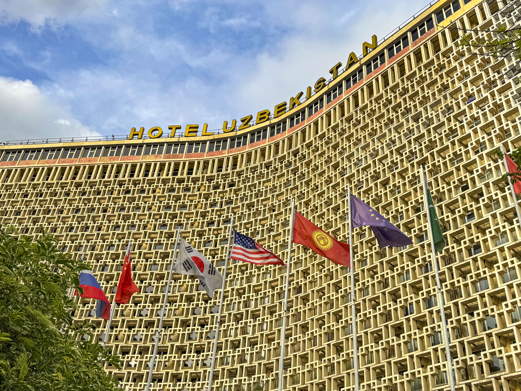
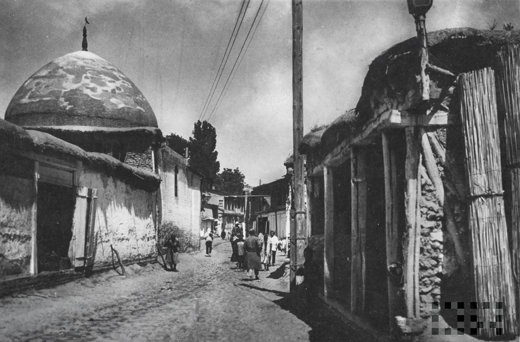
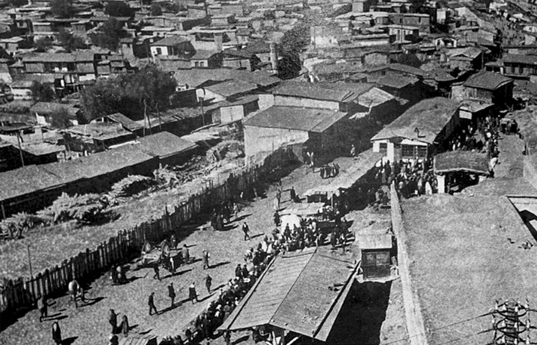
The Hotel Uzbekistan opened in 1974 when Uzbekistan was still part of the Soviet Union, eight years after a April 1966 earthquake destroyed many of Tashkent’s centuries old historic neighborhoods where the one and two-story homes were made of adobe brick. The catastrophic event left 300,000 people homeless.
The Soviet Union used this crisis to transform Tashkent into a “model Soviet city” with wonderfully wide boulevards, open plazas, and earthquake-resistant buildings, deploying architects and laborers from across its republics to build a “showcase of socialist modernism and multicultural “people’s friendship.” The revival of the city mushroomed after Uzbekistan’s independence in 1991, and continues with a building boom that peppers the city’s modern skyline with construction cranes.
The style of the city’s new buildings constructed right after the earthquake is often referred to as Soviet Brutalist, an architectural style which features the love of concrete, and functionality over grace. And Hotel Uzbekistan was designed to be the centerpiece of the Soviet Union’s vision. For many years the building, with an open book profile designed to resist seismic activity, stood as the country’s tallest building, and was the premier hotel for international delegations to stay and hold conferences.
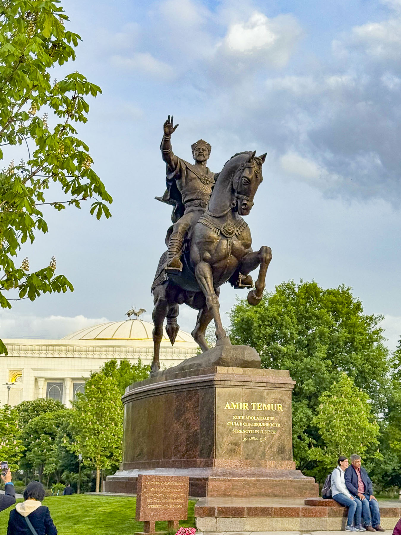
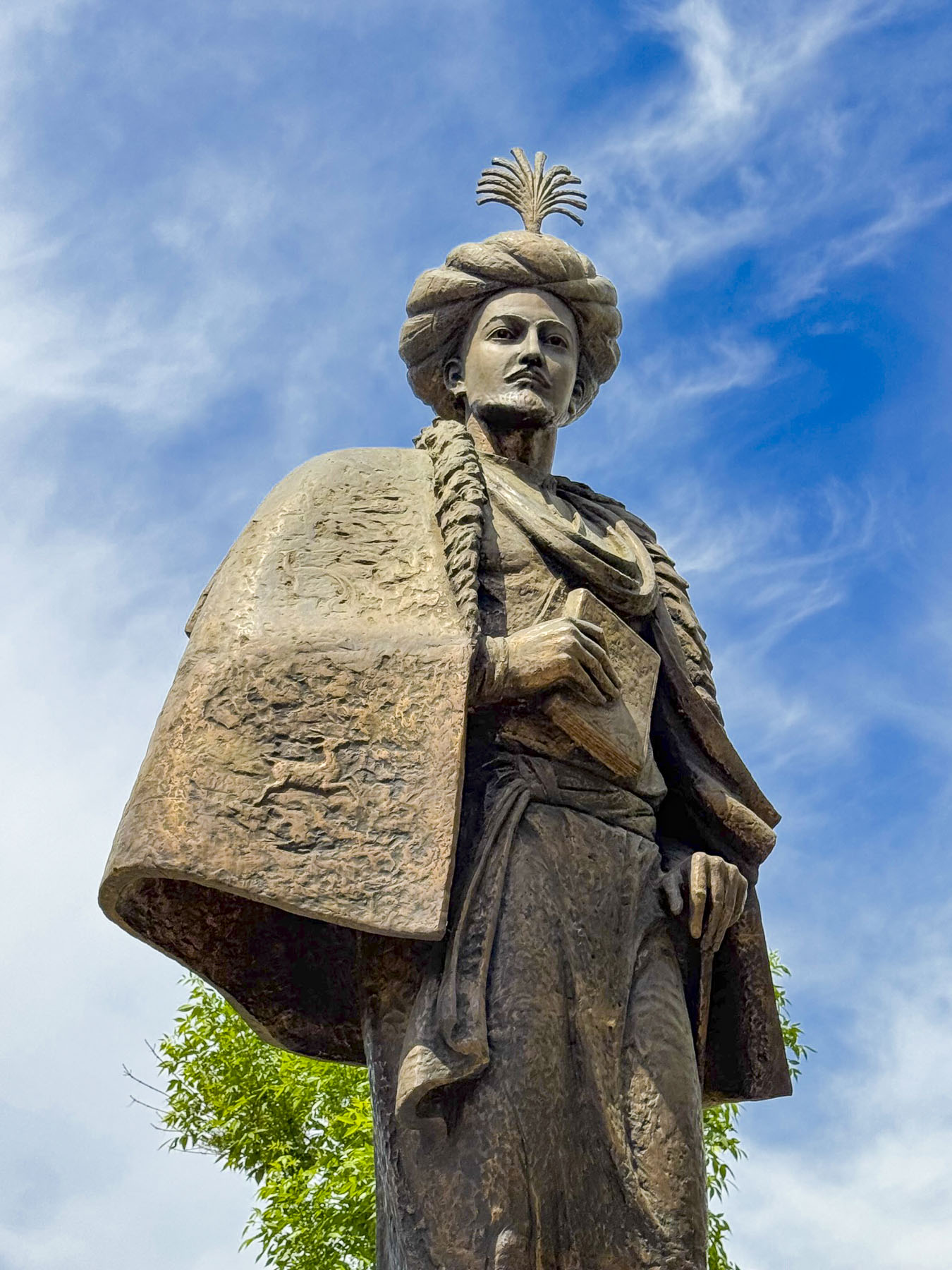
At the time its seventeenth-floor restaurant overlooked Lenin Square until the colossal statue of the Soviet leader was sent to the scrap yard in 1991 when Uzbekistan regained its independence, and replaced him with an equestrian statue of Amir Temur, an enlightened ruler who united the independent kingdoms of Samarkand, Bukhara, and Urgench during Uzbekistan’s 14th century renaissance, as the country seeks to reclaim its cultural history.
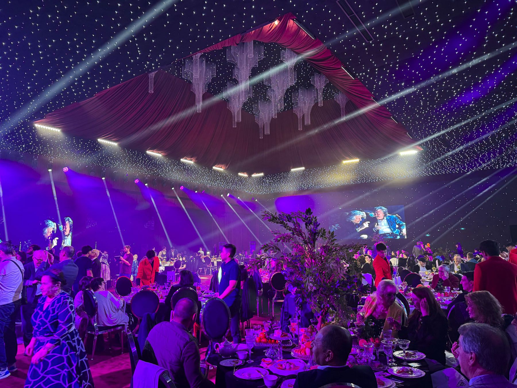
A thumping bass reverberated through the hotel, preventing any attempt of catching an early shuteye. Dressed again, we never intended to be Uzbeki party crashers, but we got caught up in the spirit of a couple’s anniversary celebration and enjoyed watching the band perform for a while. The hotel would be our base for three days to explore Tashkent before joining a group tour to Khiva, Bukhara and Samarkand.
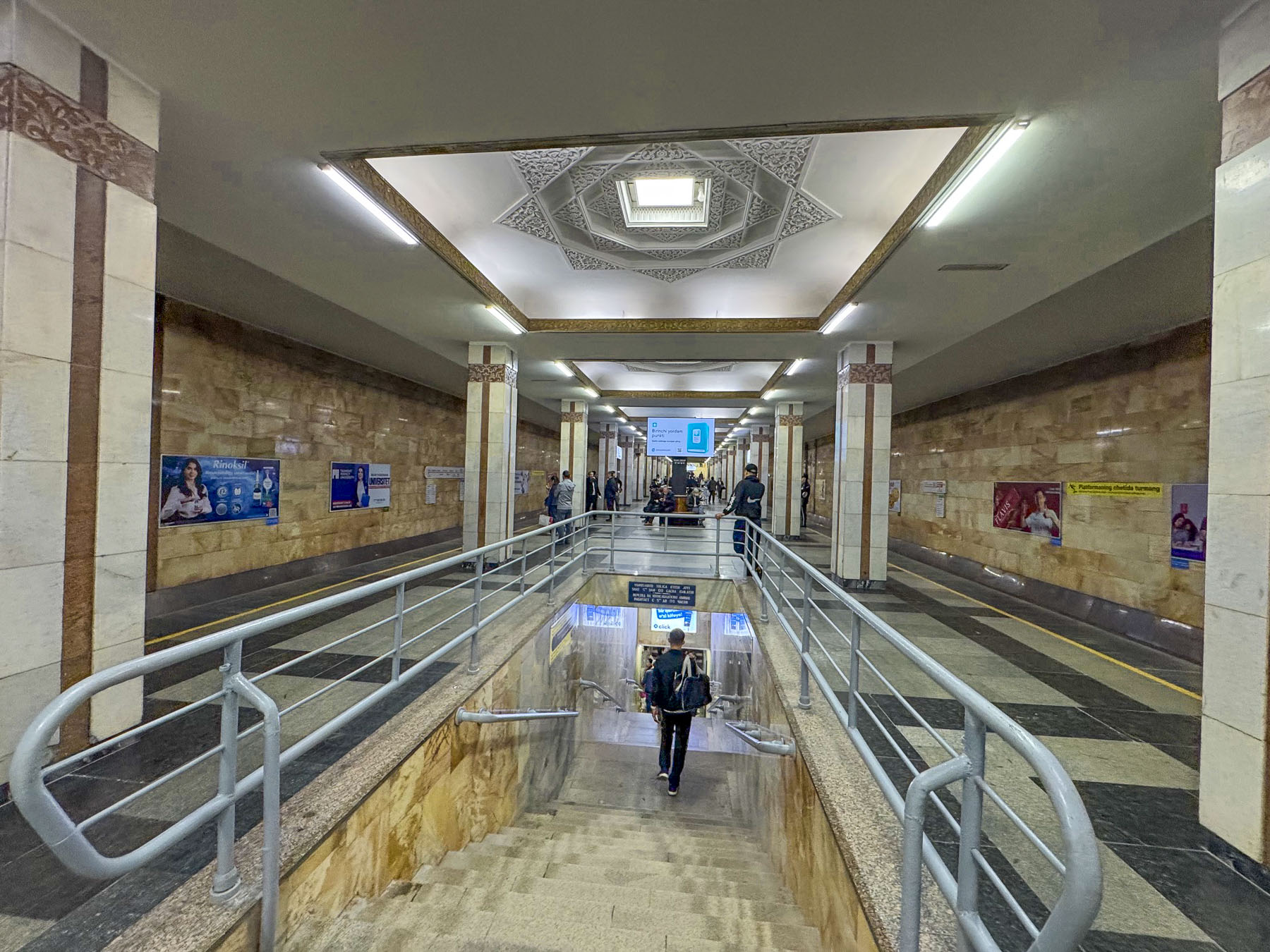
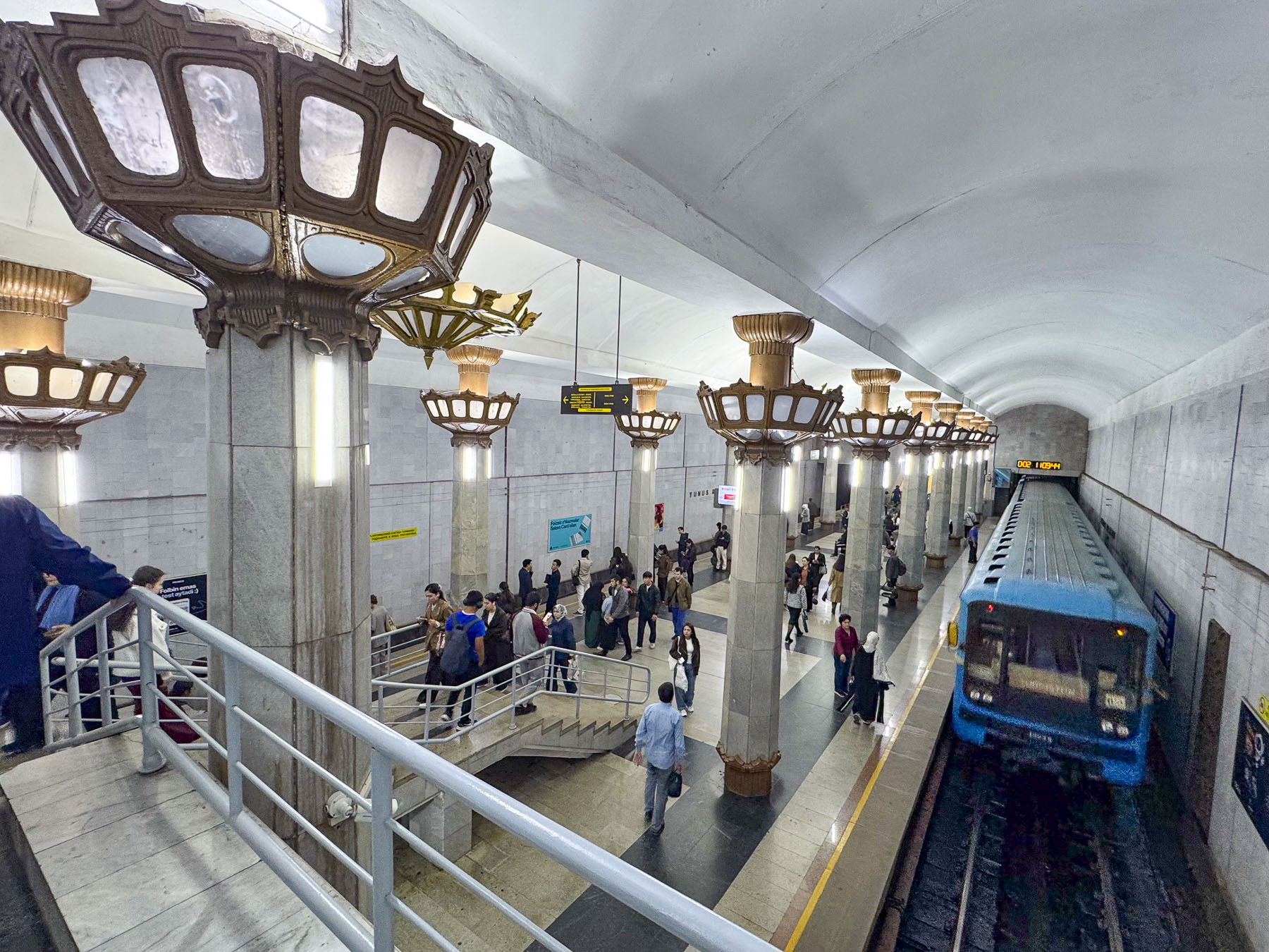
By 1970 Uzbekistan’s capital city was mostly rebuilt, and construction of Central Asia’s first subway system, a series of beautiful stations that were also designed to be utilized as bomb shelters in case of emergencies during the Cold War era, was underway. The next morning, we set out after an early breakfast and worked our way against the morning crush of young professional ascending from the depths of the Amir Temur Hiyoboni station, just a block from our hotel.
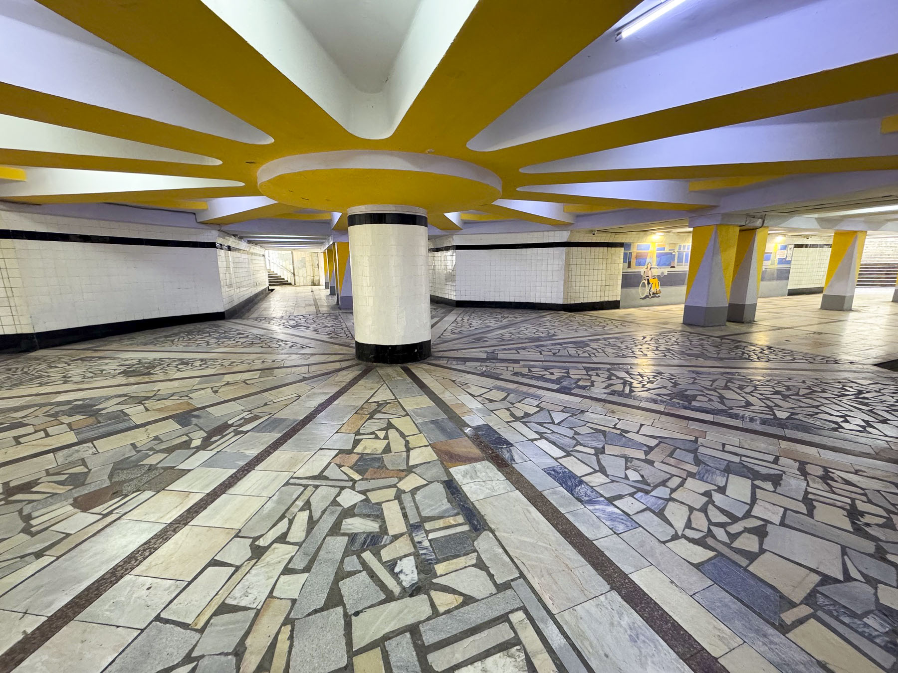
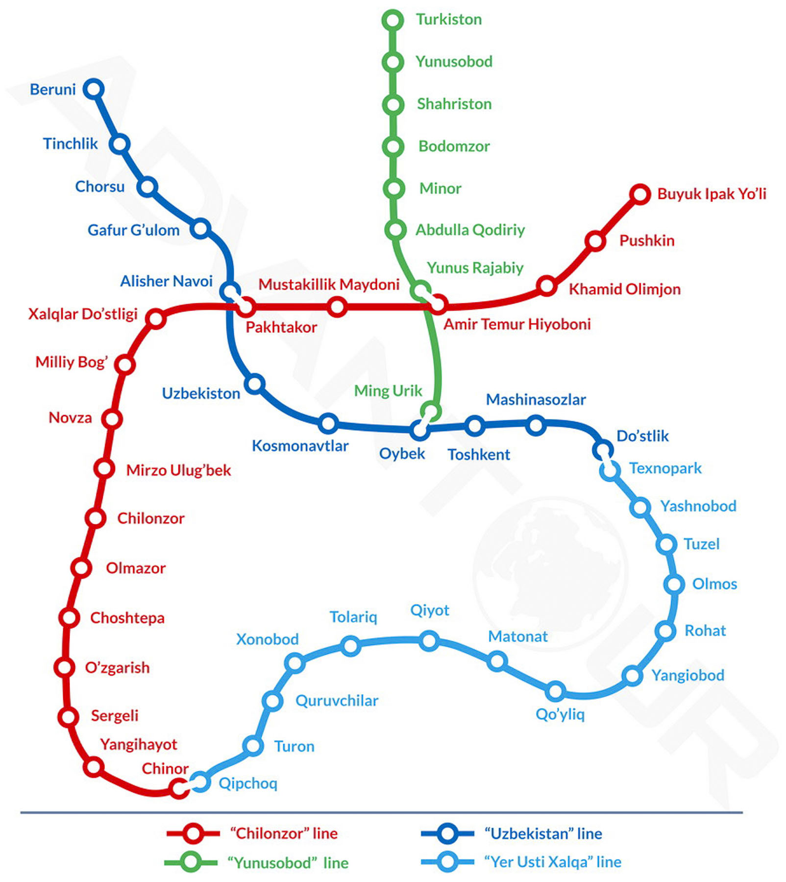
The underground tunnel leading to the turnstile offered perfect acoustics for a young Uzbeki busker who played for the commuters. The Tashkent Metro now has four lines, and 50 stations along 70km (44 mi) of track. Rides at the time of our visit cost 1,700 Uzbeki Som (about $0.14 USD), and were easily payable at the turnstile with a tap of our credit cards.
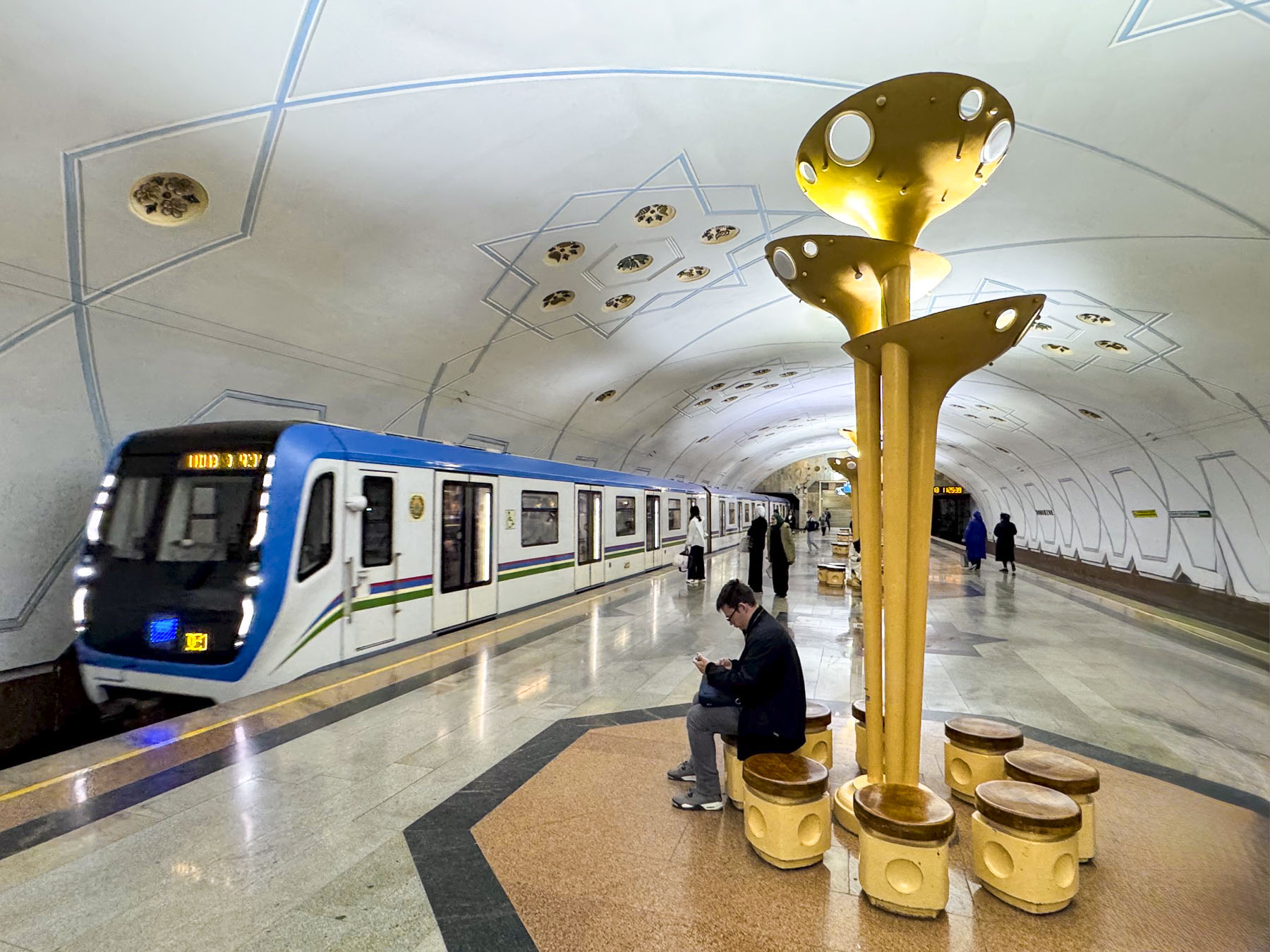
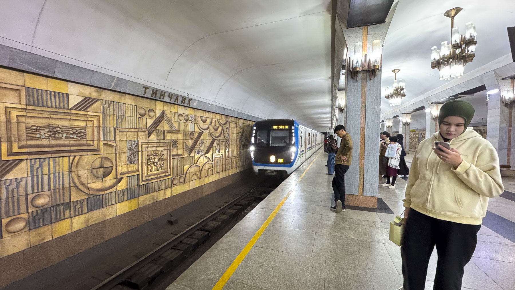
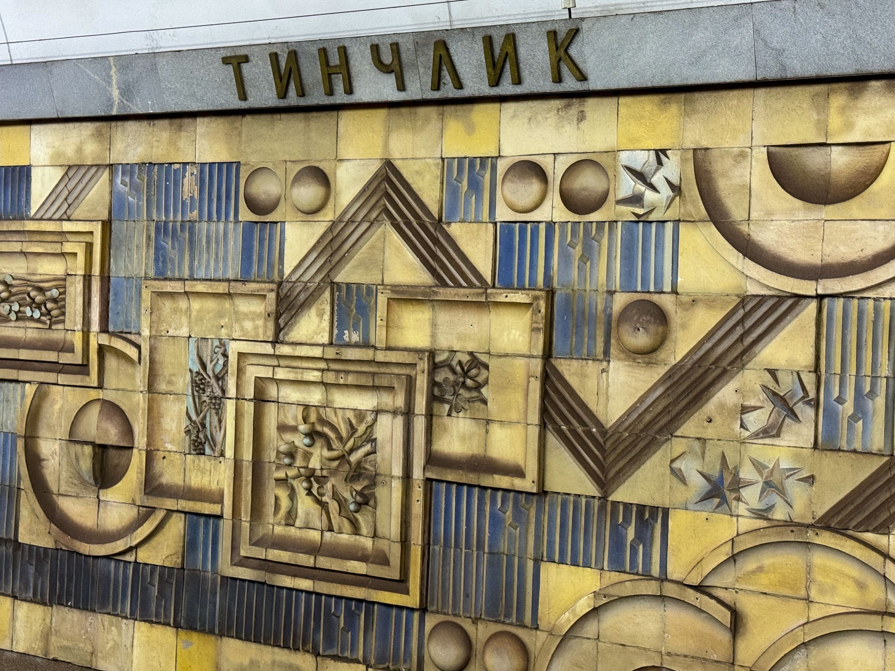
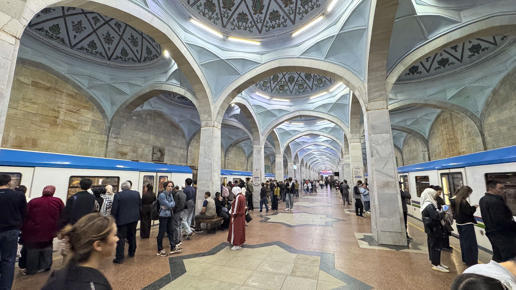
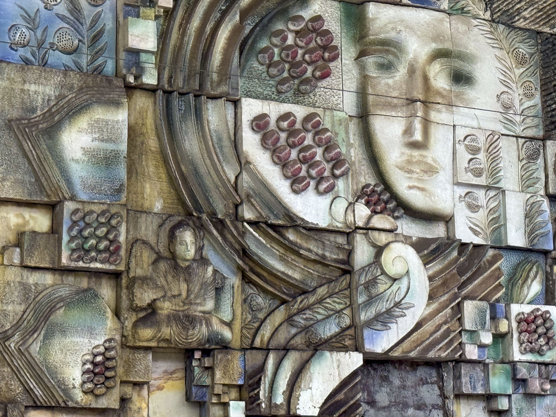
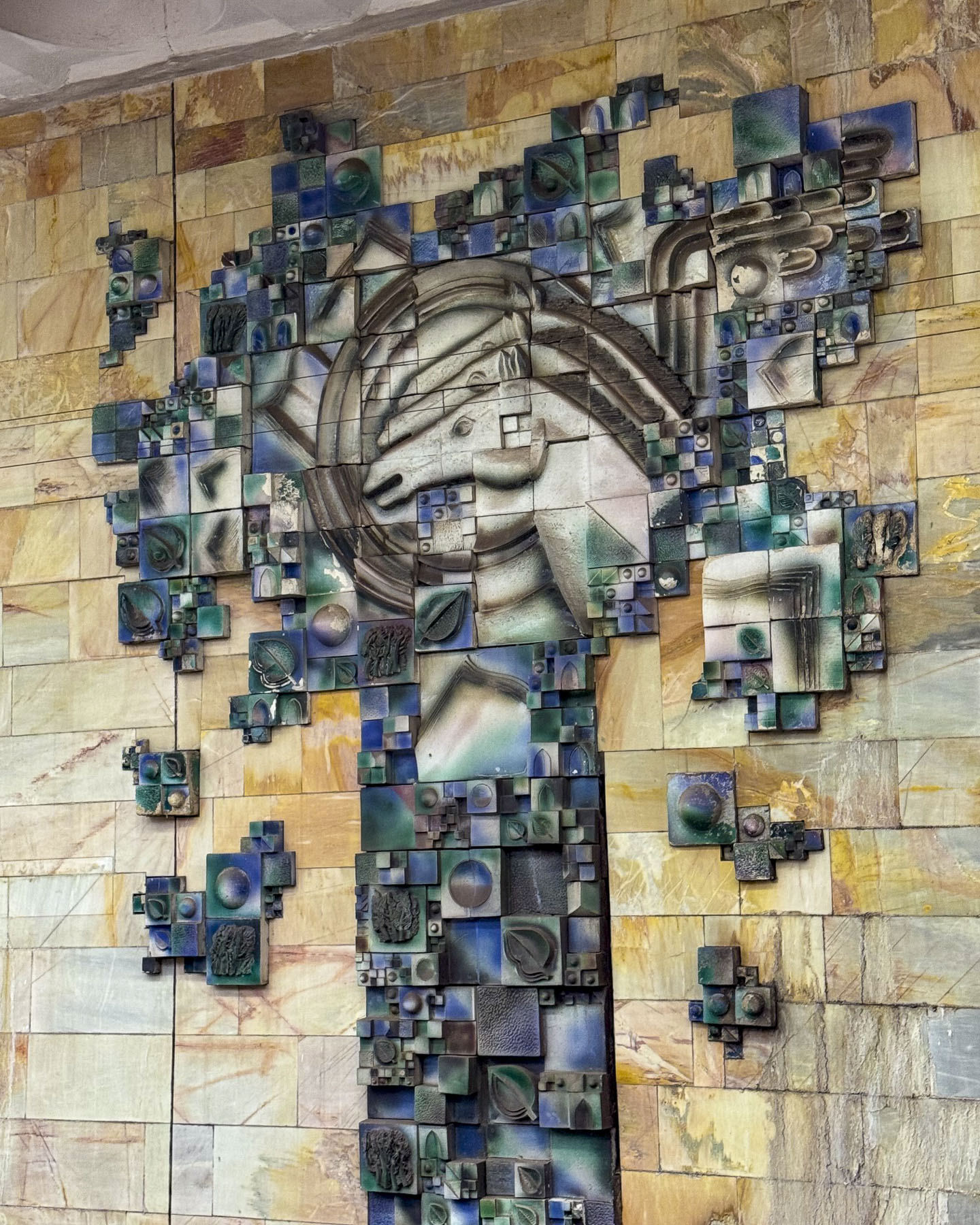
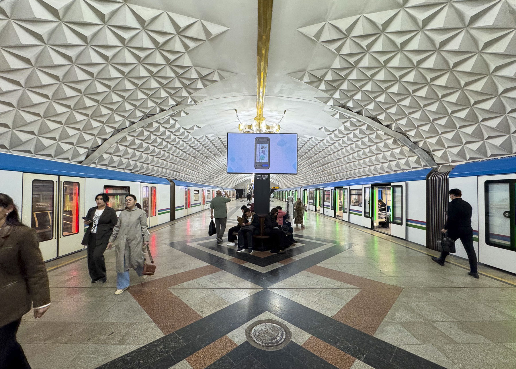
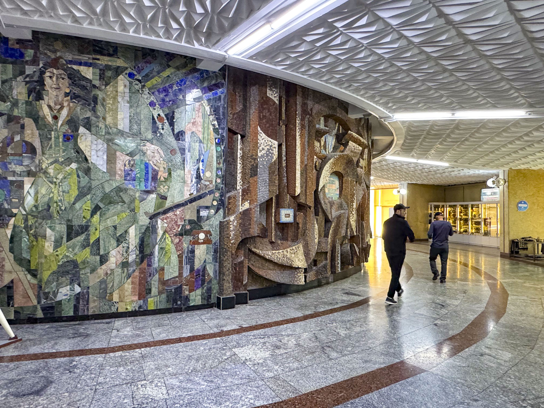
We spent a good part of the morning riding between the stations that encircle central Tashkent, hopping on and off to photograph some stations that were noteworthy for their striking architectural beauty, that often resembled a formal waiting chamber in an elegant palace, before transferring to another line.
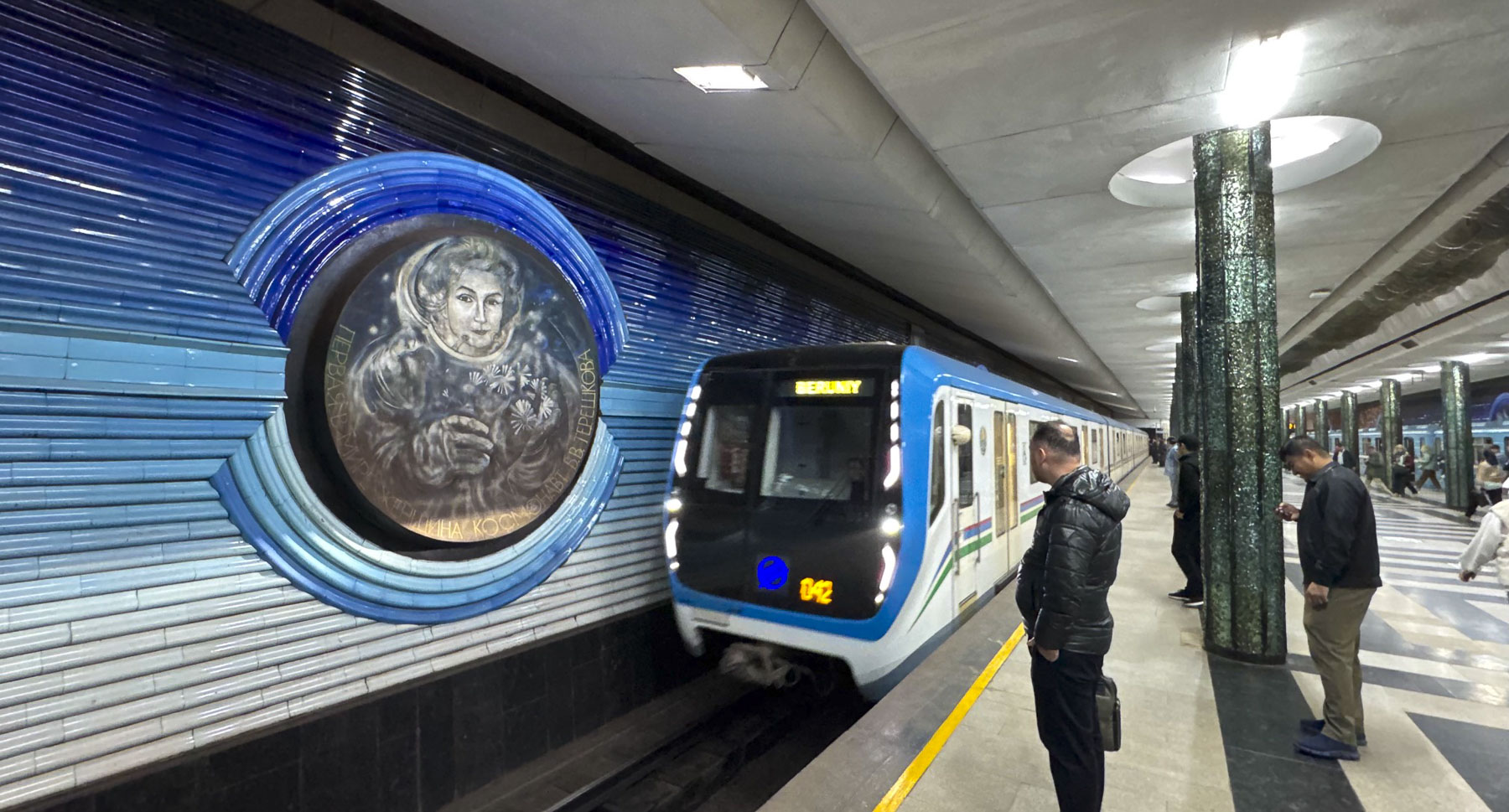
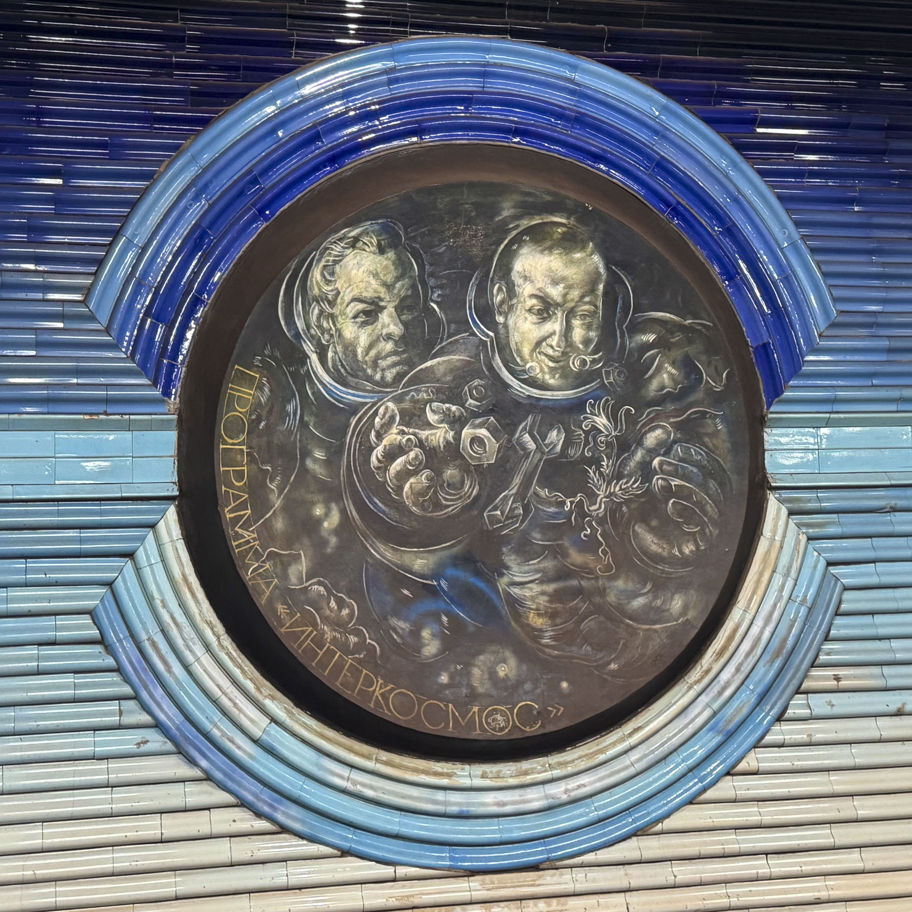
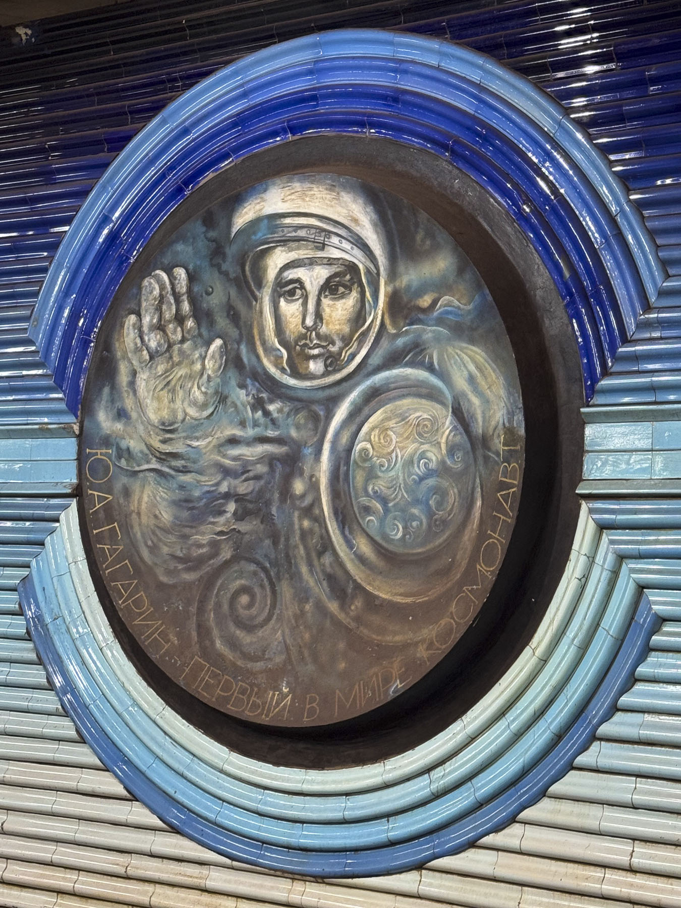
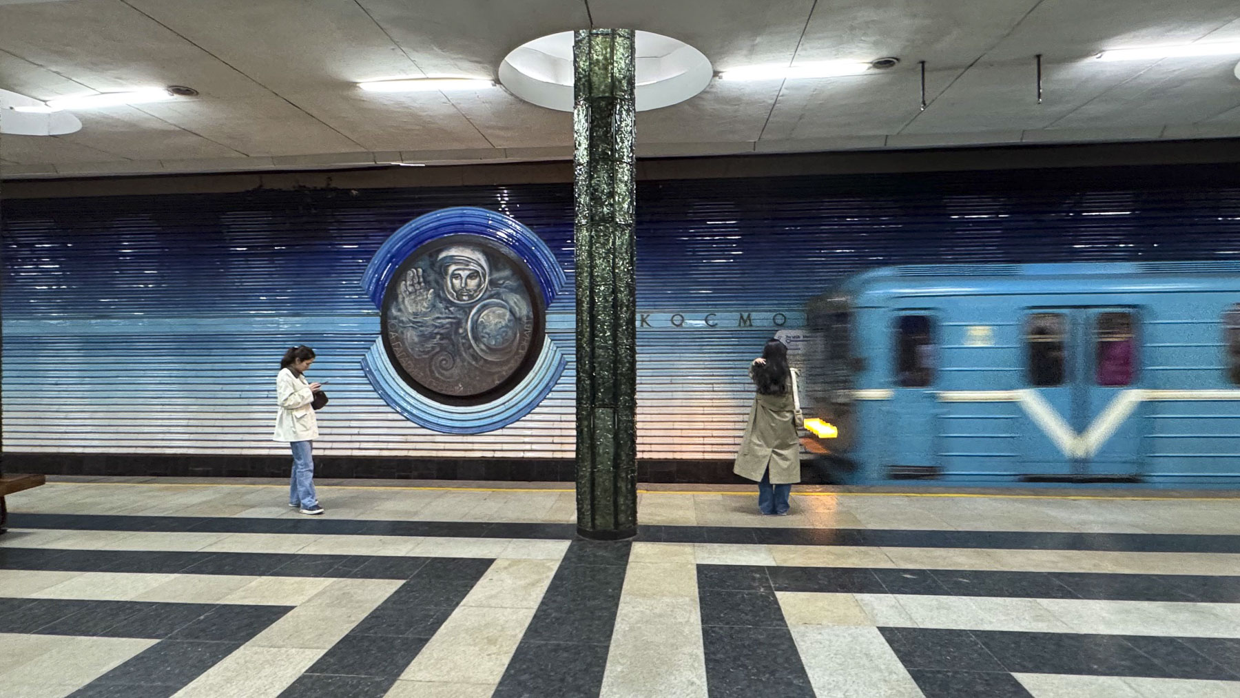
We eventually worked our way to the Kosmonavtlar Station, where the walls are beautifully embellished with tile portraits of early Soviet astronauts. Surprisingly, because of their dual use as bomb shelters, photography in the subway stations was banned until 2018.
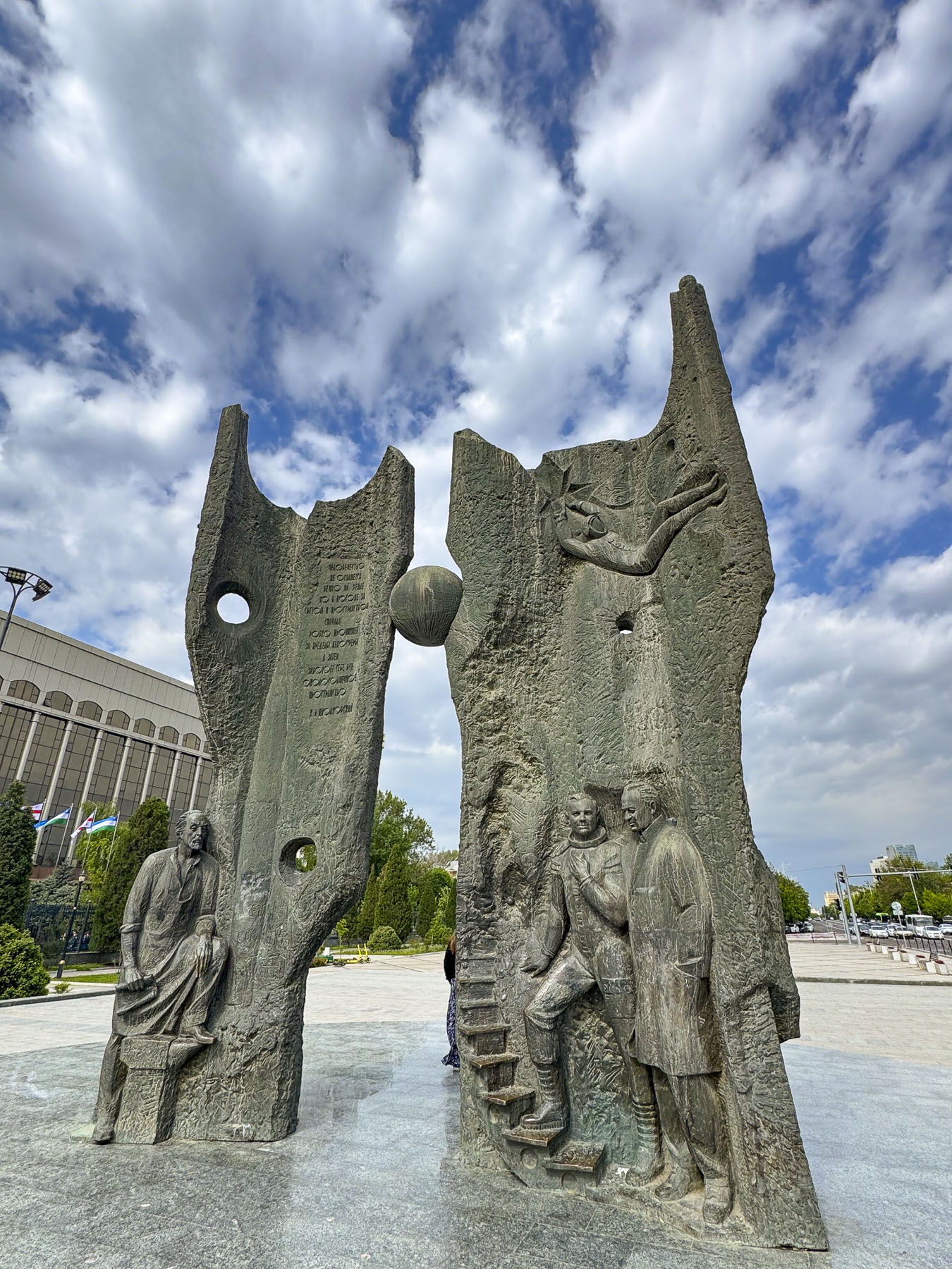
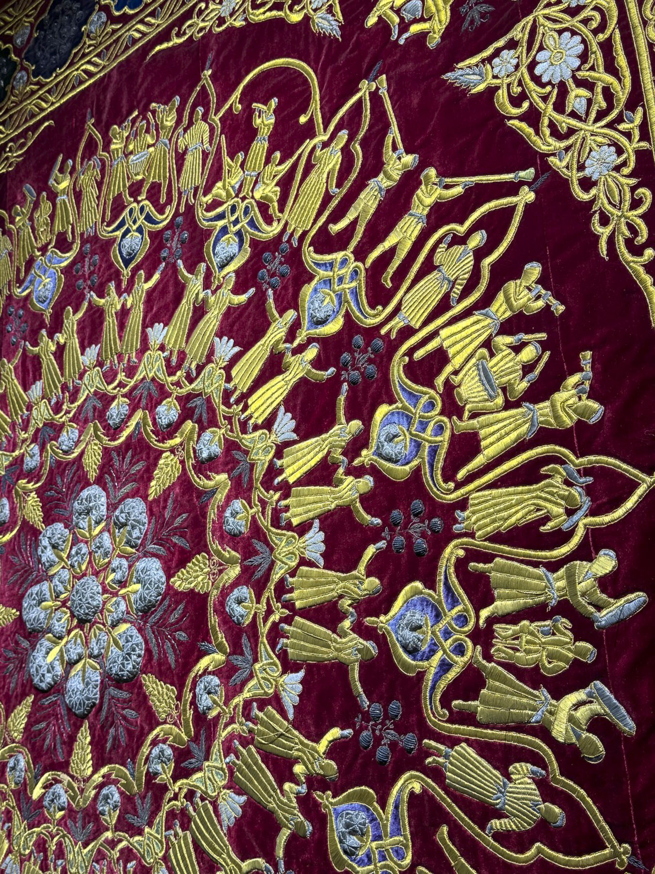
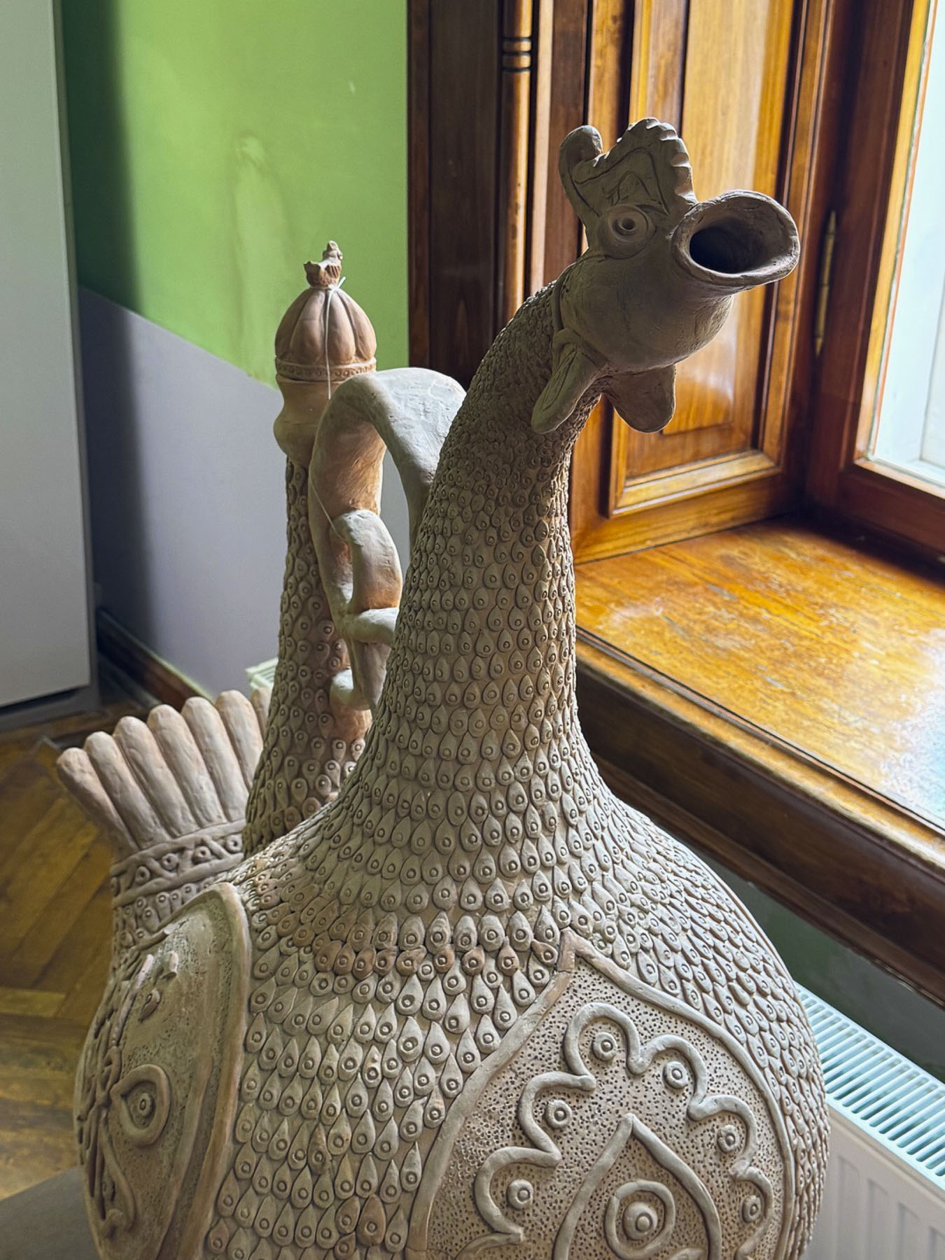
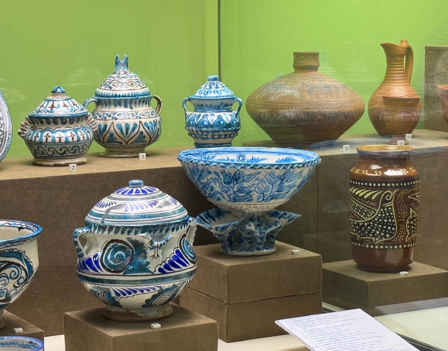
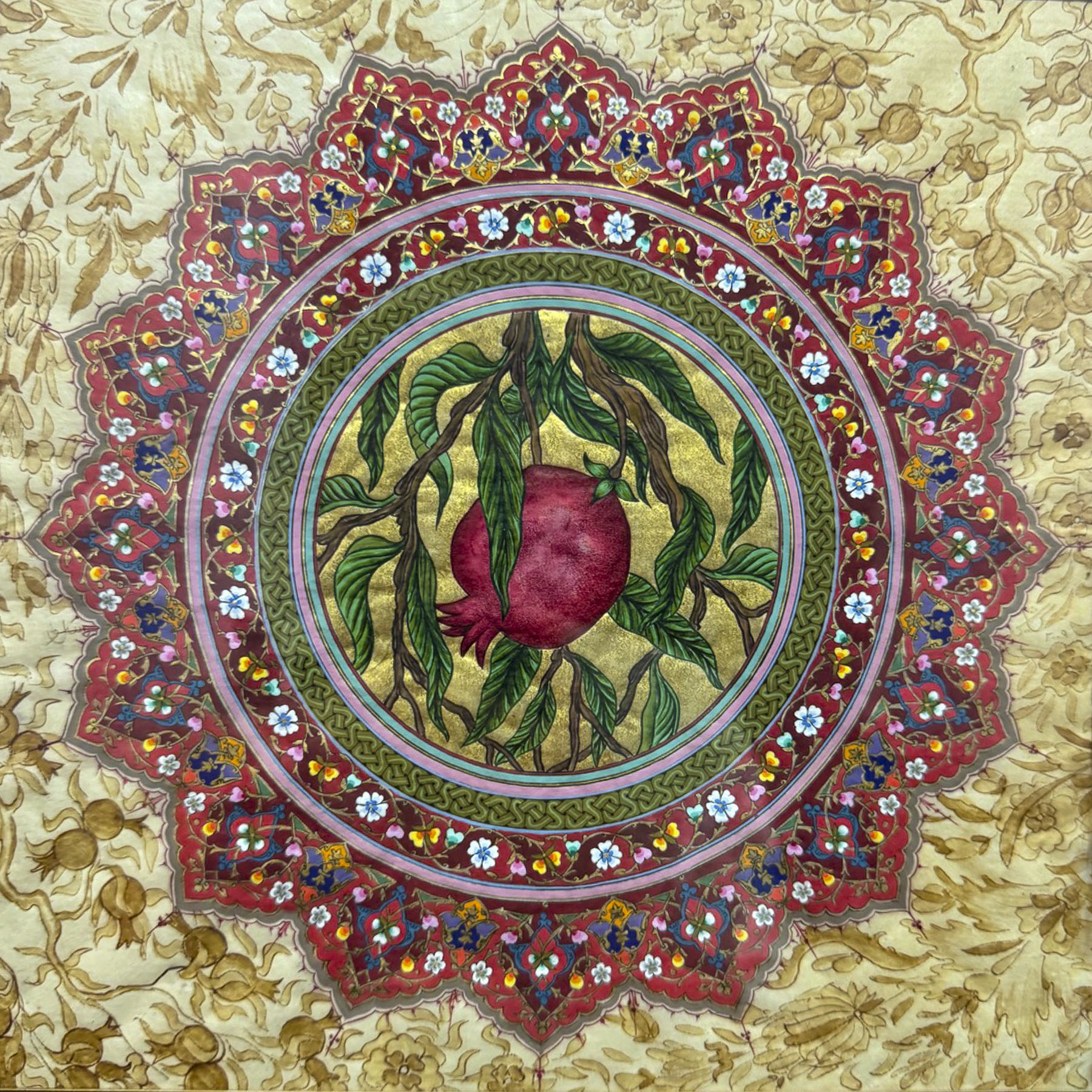
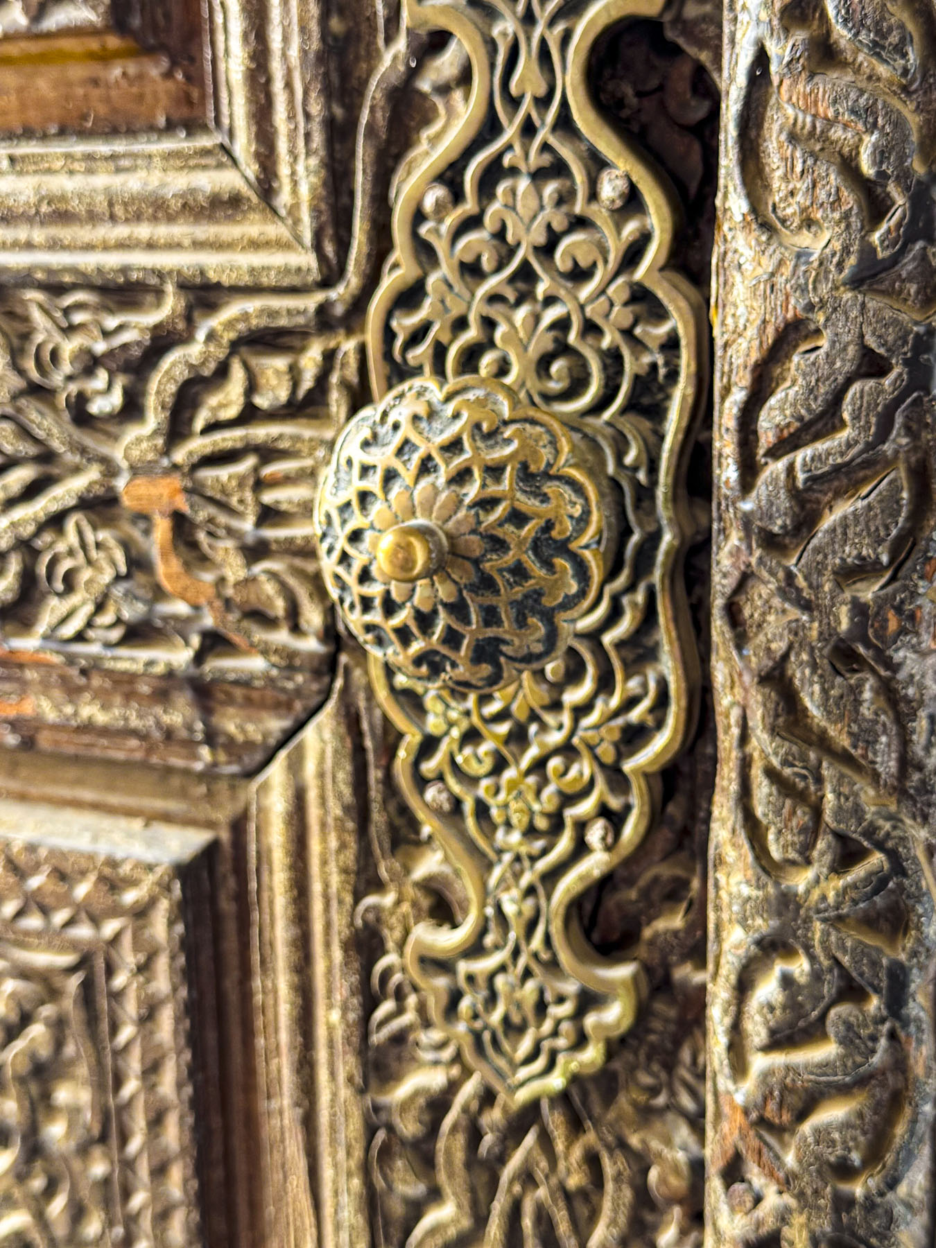
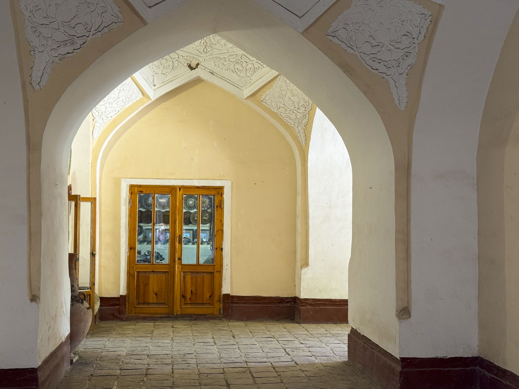
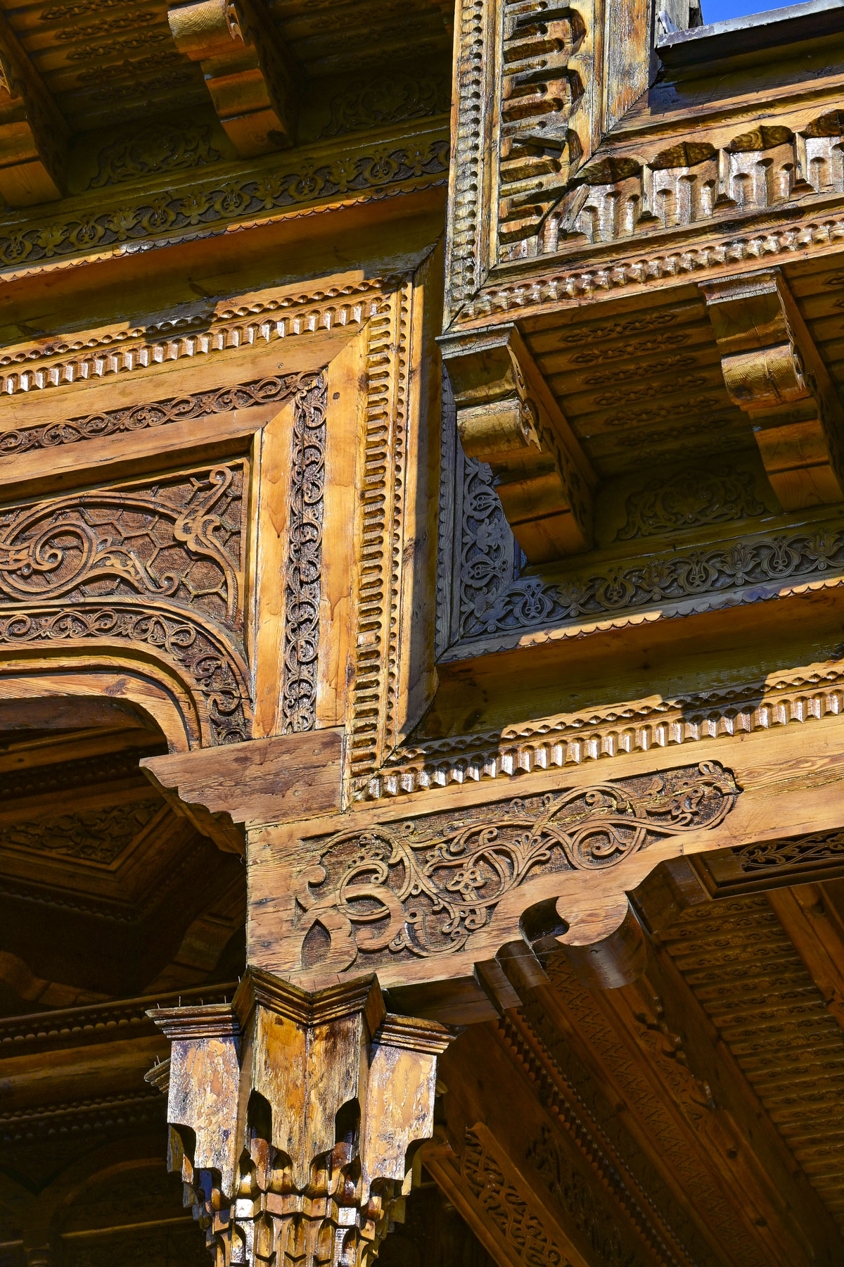
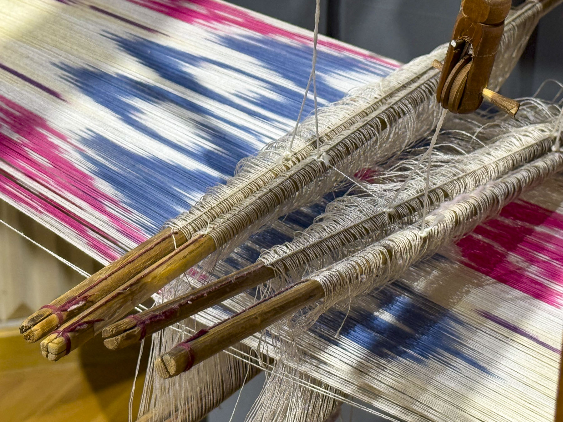
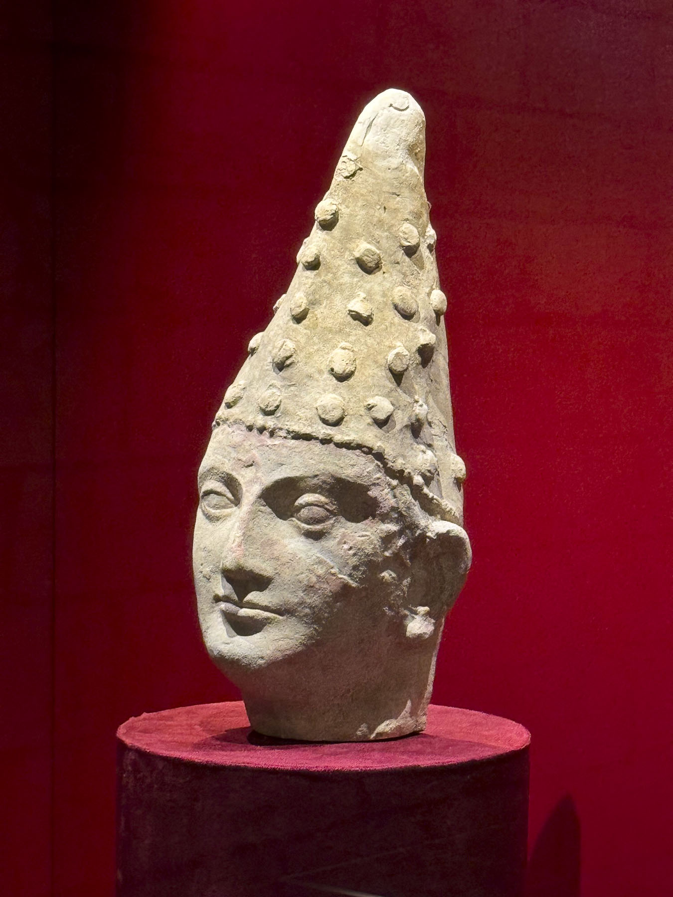
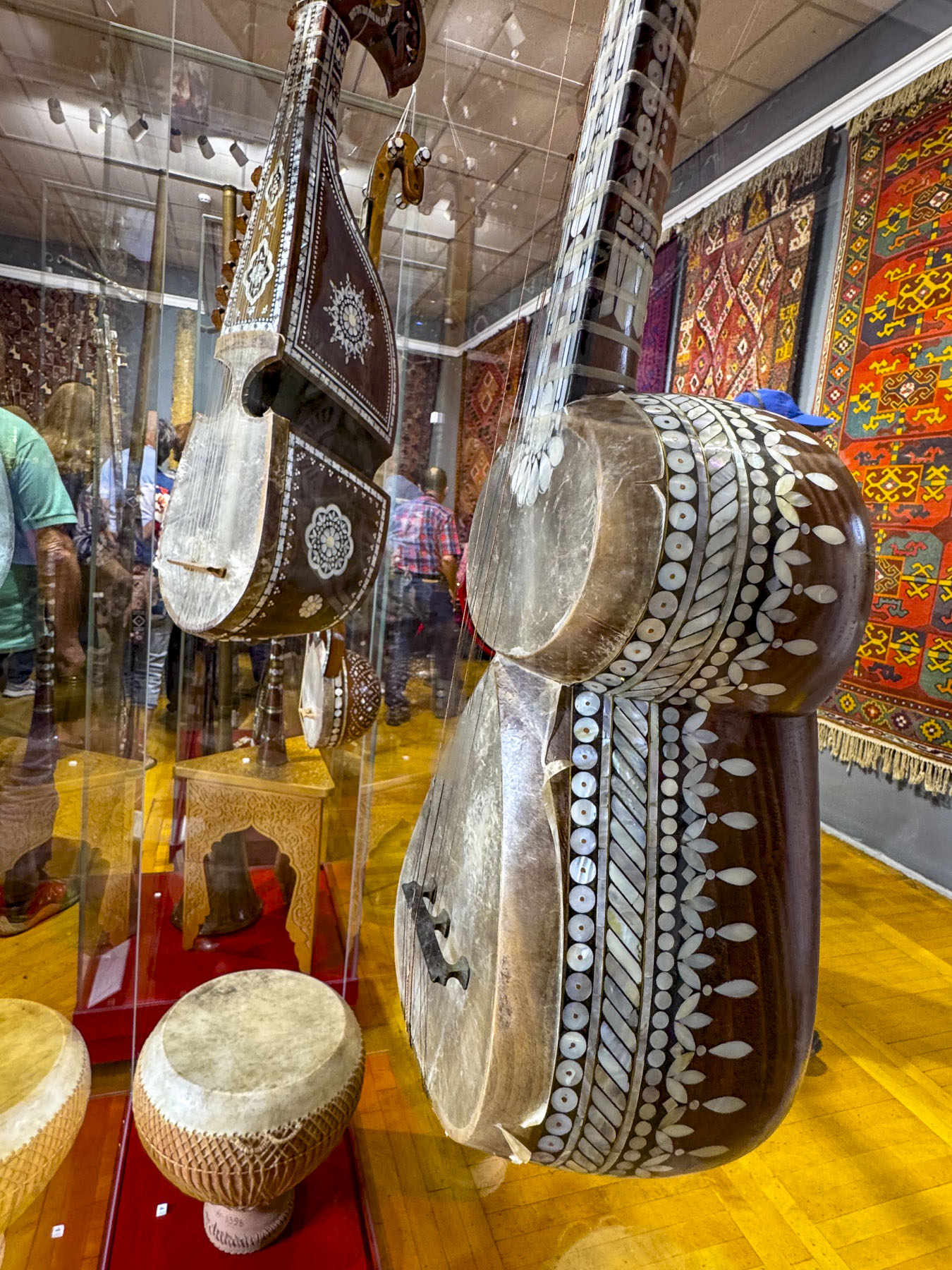
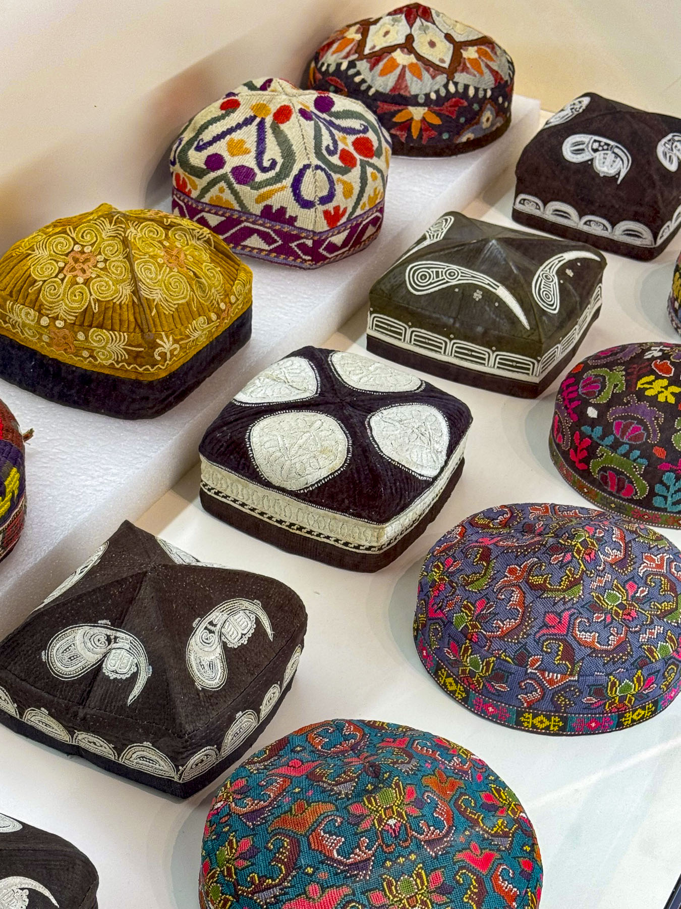
We also visited the plaza above the station where we viewed another interesting monument to the Soviet Union’s space program, before we made a short excursion to Tashkent’s Museum of Applied Arts, only a few blocks away. Founded in 1937, the museum is housed in the former mansion of an Emperial Russia diplomat and has a rotating collection of over 4,000 Uzbeki decorative handicrafts, with examples of traditional wood carving called O‘ymakorlik, ceramics, embroidery, gold weaving, jewelry and musical instruments. In the museum’s traditional courtyard was a very atmospheric café where we enjoyed coffee.
Before descending back underground we detoured slightly to see a modern interpretation of Islamic architecture represented in the 1970s era facade of the Central Exhibition Hall of the Academy of Arts.
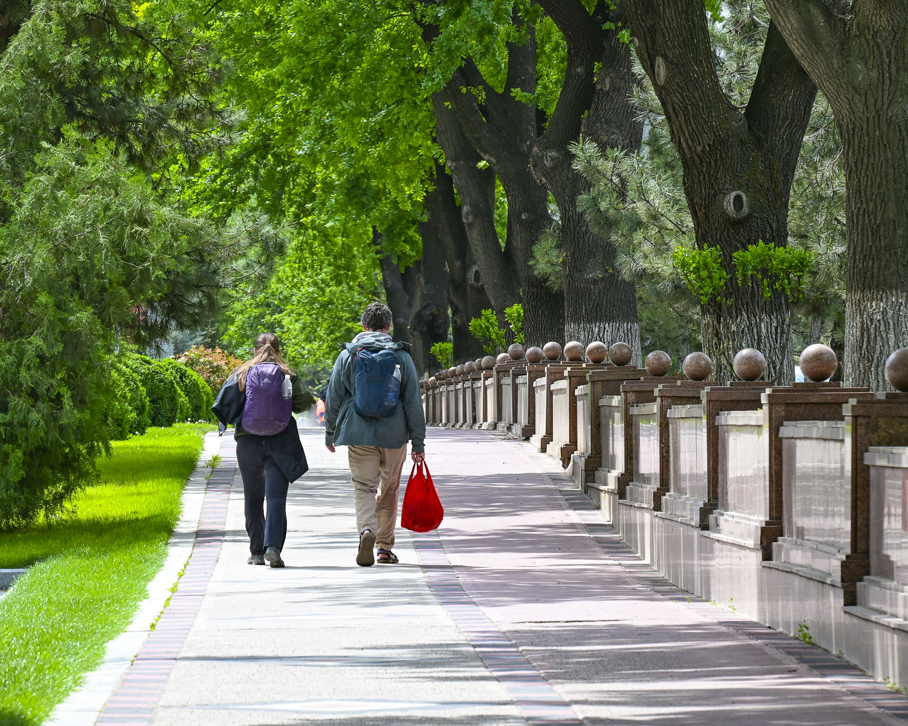
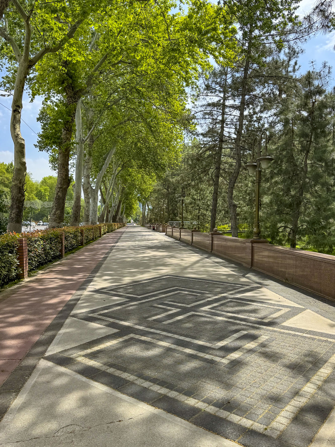
The 1930s built Alisher Navoi Grand Theatre, survivor of the earthquake, features a blend of classic European architecture with traditional Uzbek ornamental styles. Along our route we walked through many of the parks and green spaces that give the city a wonderful ambiance.
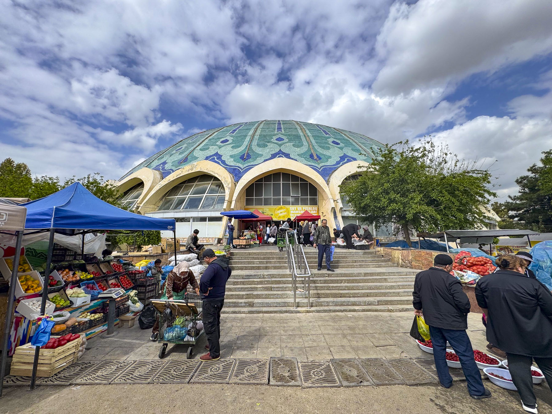
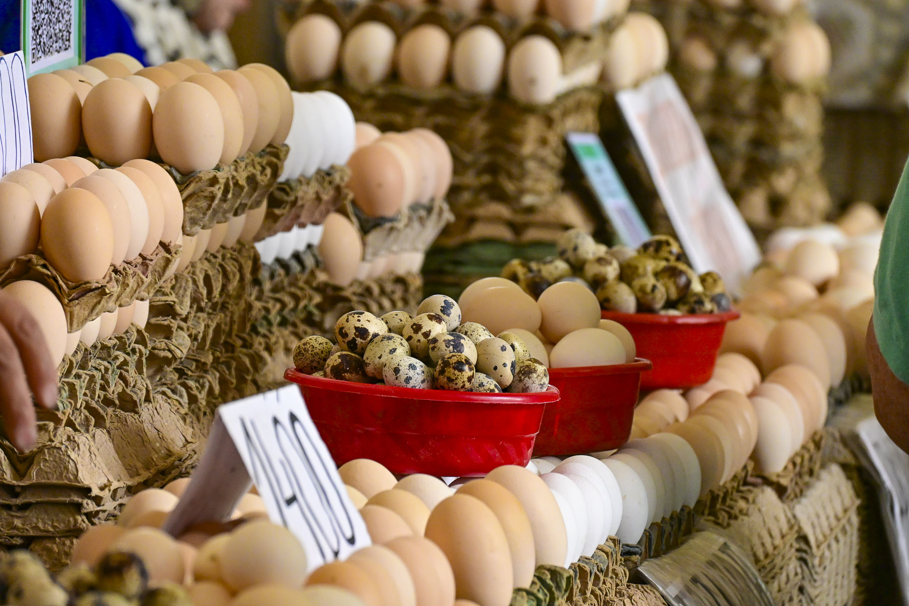
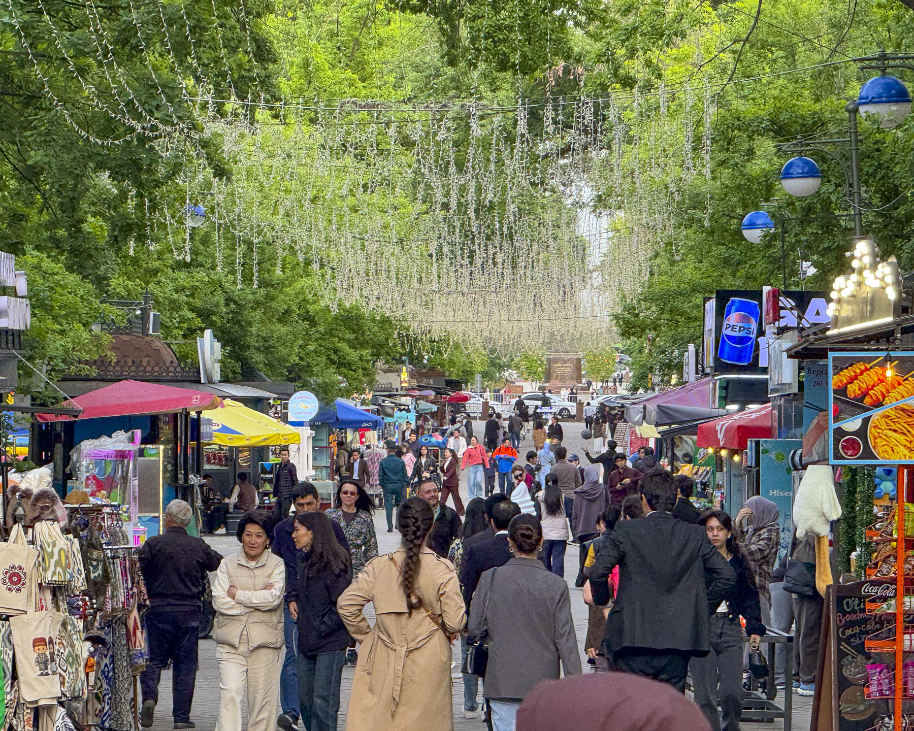
Back on the subway we continued on to the Chorsu Station, only a short walk away from the Chorsu Bazaar, Tashkent’s historical central market, whose history goes back 2000 plus years to the founding of Tashkent. The main hall’s futuristic dome, where meats, poultry and dairy products are for sale, dates from the reconstruction of the city after the 1966 earthquake.
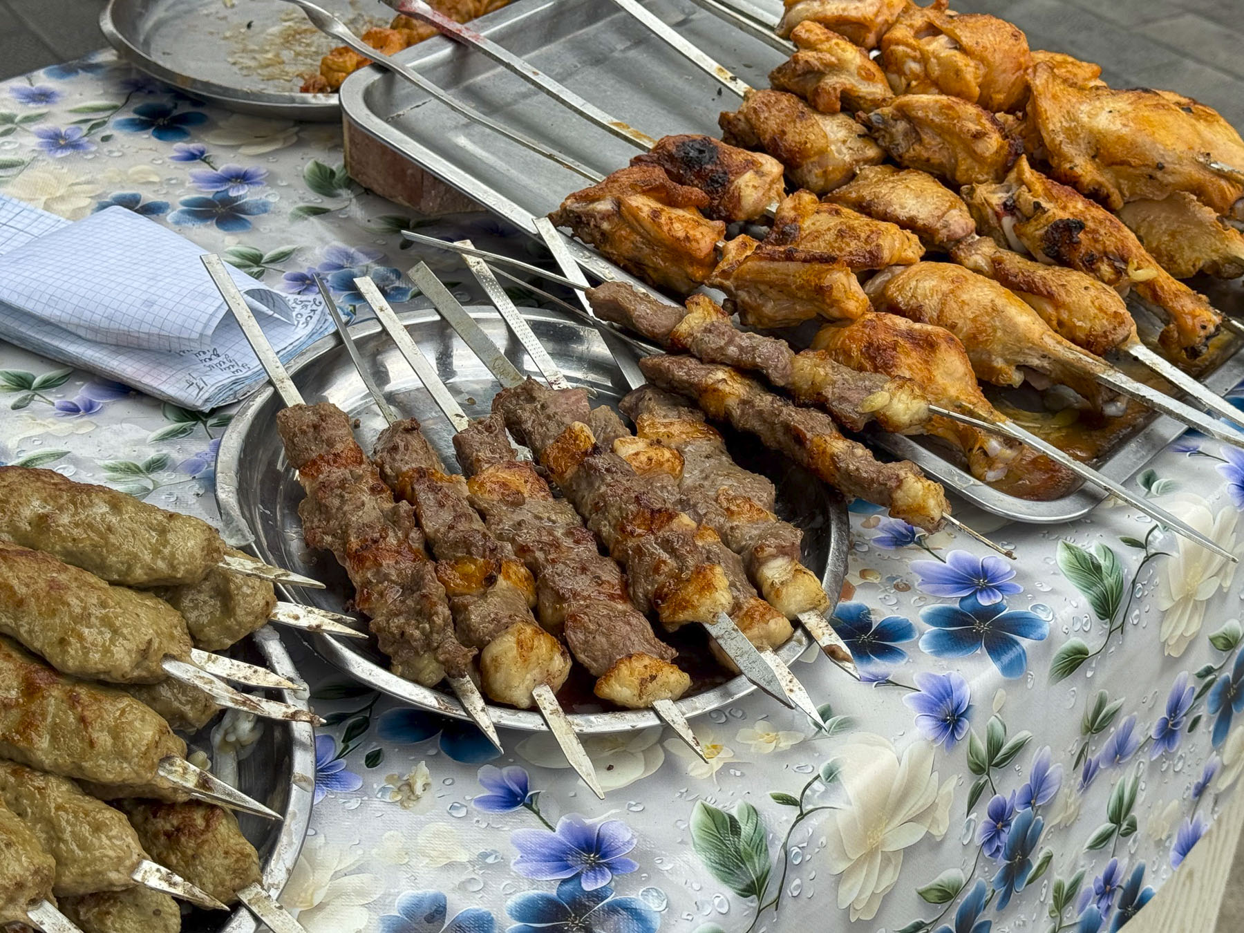
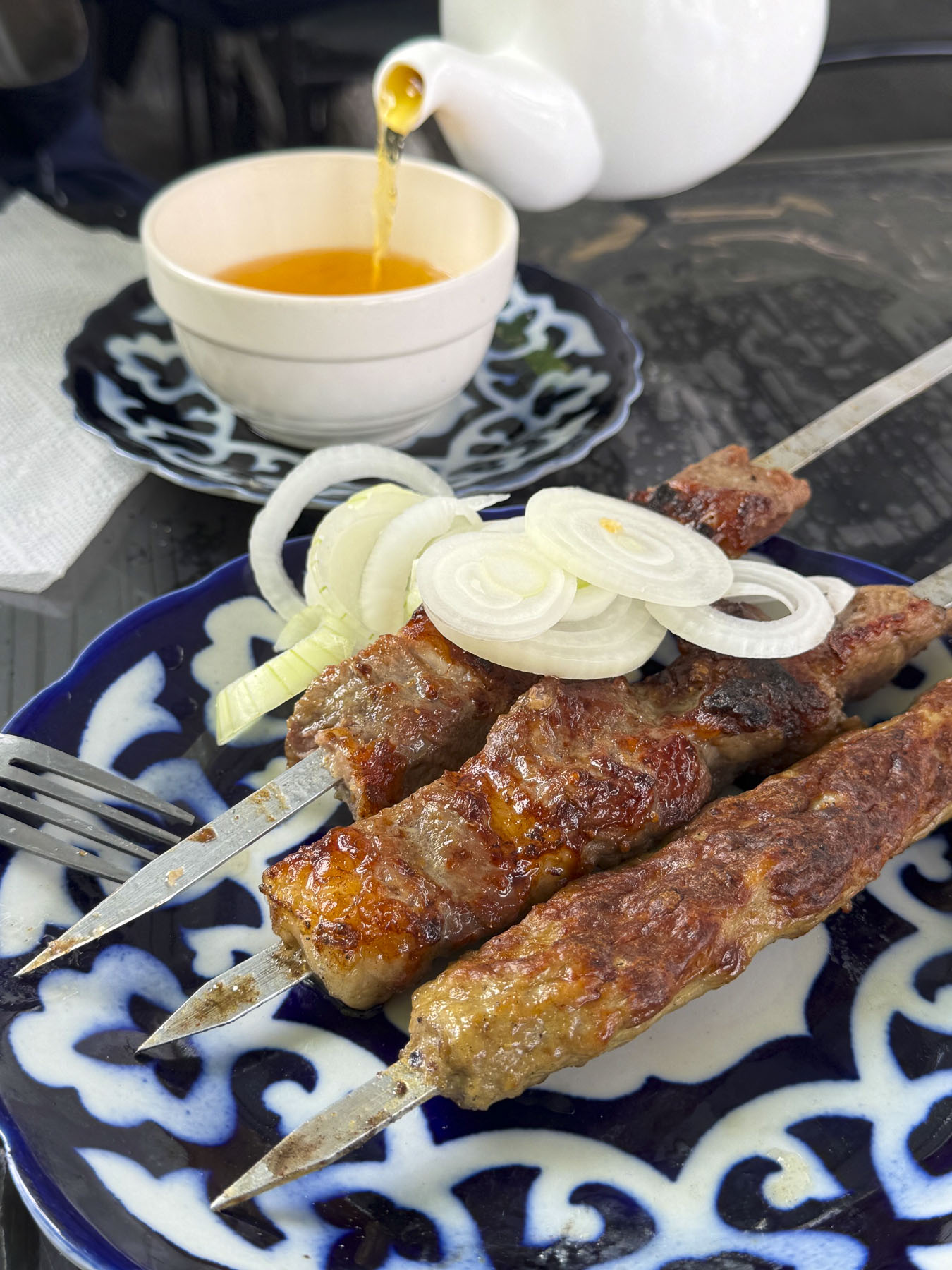
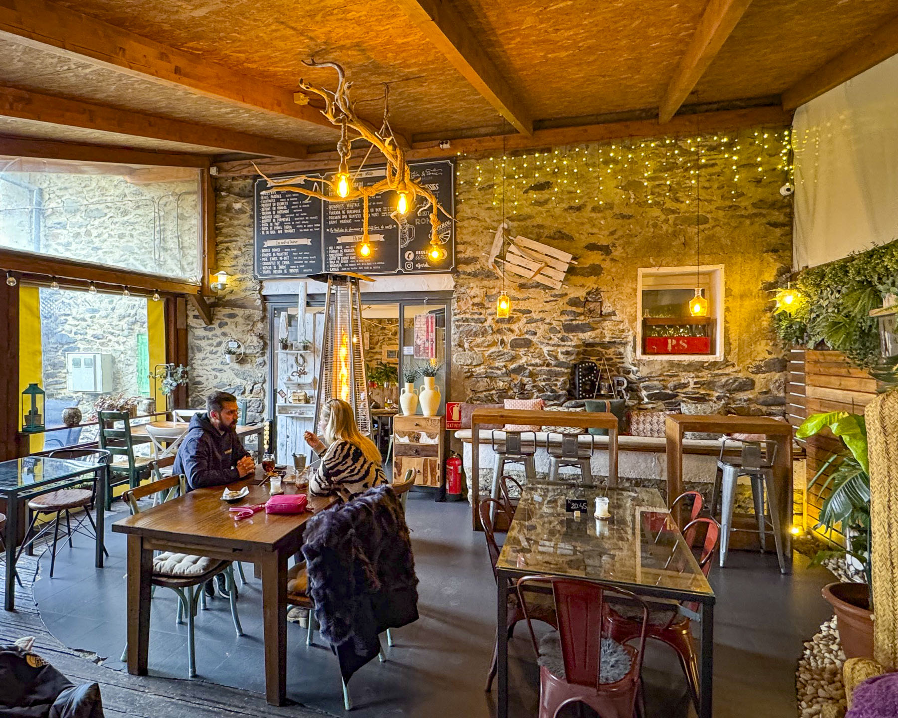
After wandering through the rows of clothing merchants, where nothing has a price tag so bargaining is expected, we were enticed by the aroma of slowly grilling kebabs over an outside fire at Especialidad Pinchos. A smile goes a long way when you don’t understand the language and we were quickly seated outside and served a delightful lemon tea. The restaurant was the perfect place to relax and people watch. It felt as if we were in the audience of an old TV sit-com where good-natured chiding was going on, from the quips flying across the open-air restaurant. We mentally supplied the dialog: “Yasmina we are so busy, can you clear the tables faster?” “Now Zarina you might be the golden one and Bobur’s squeeze, but don’t you go telling me how to take care of my side of the cafe!” And so it went, their familiar back and forth continuing the whole time we were there as the women busily tended the day’s lunch crowd.
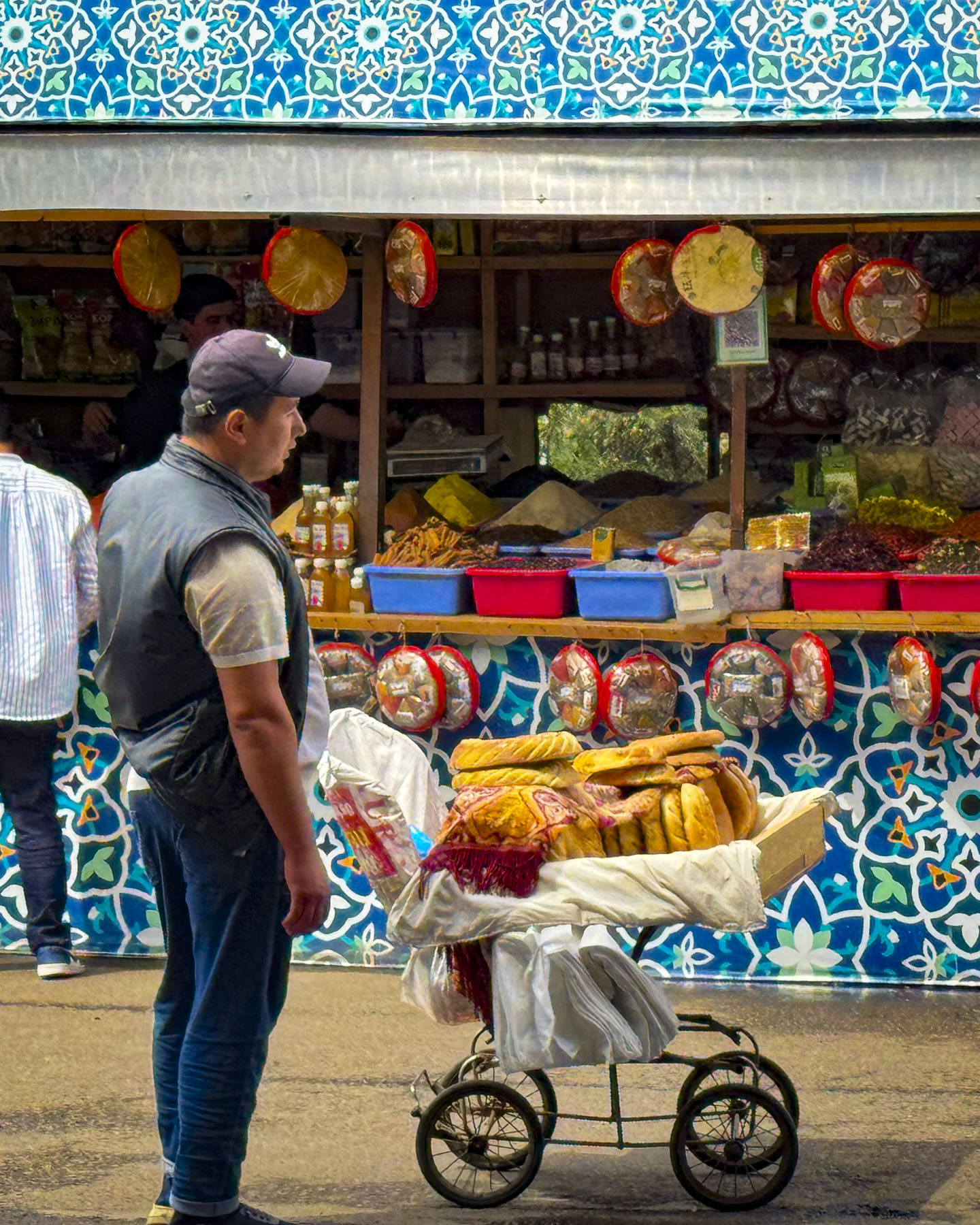
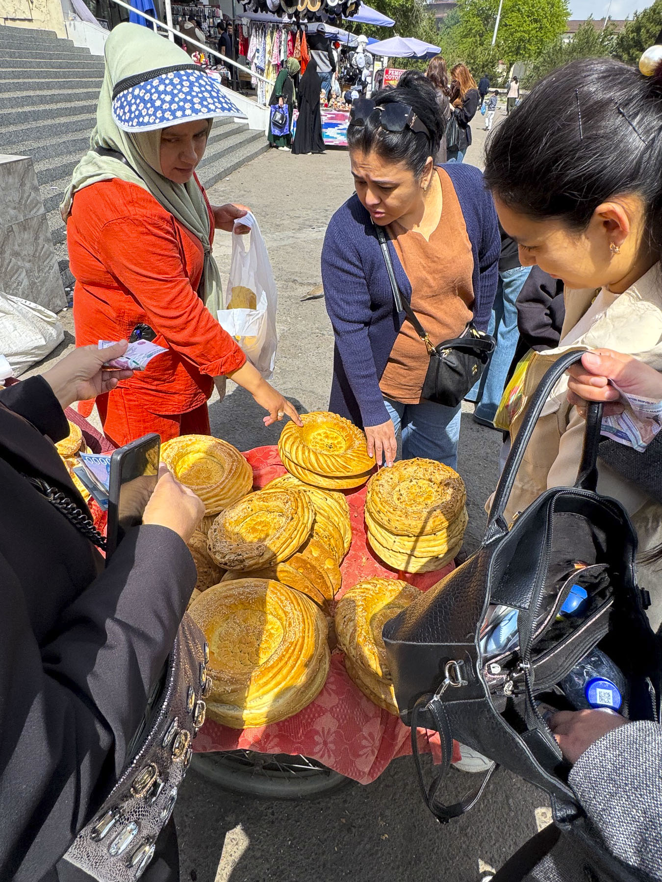
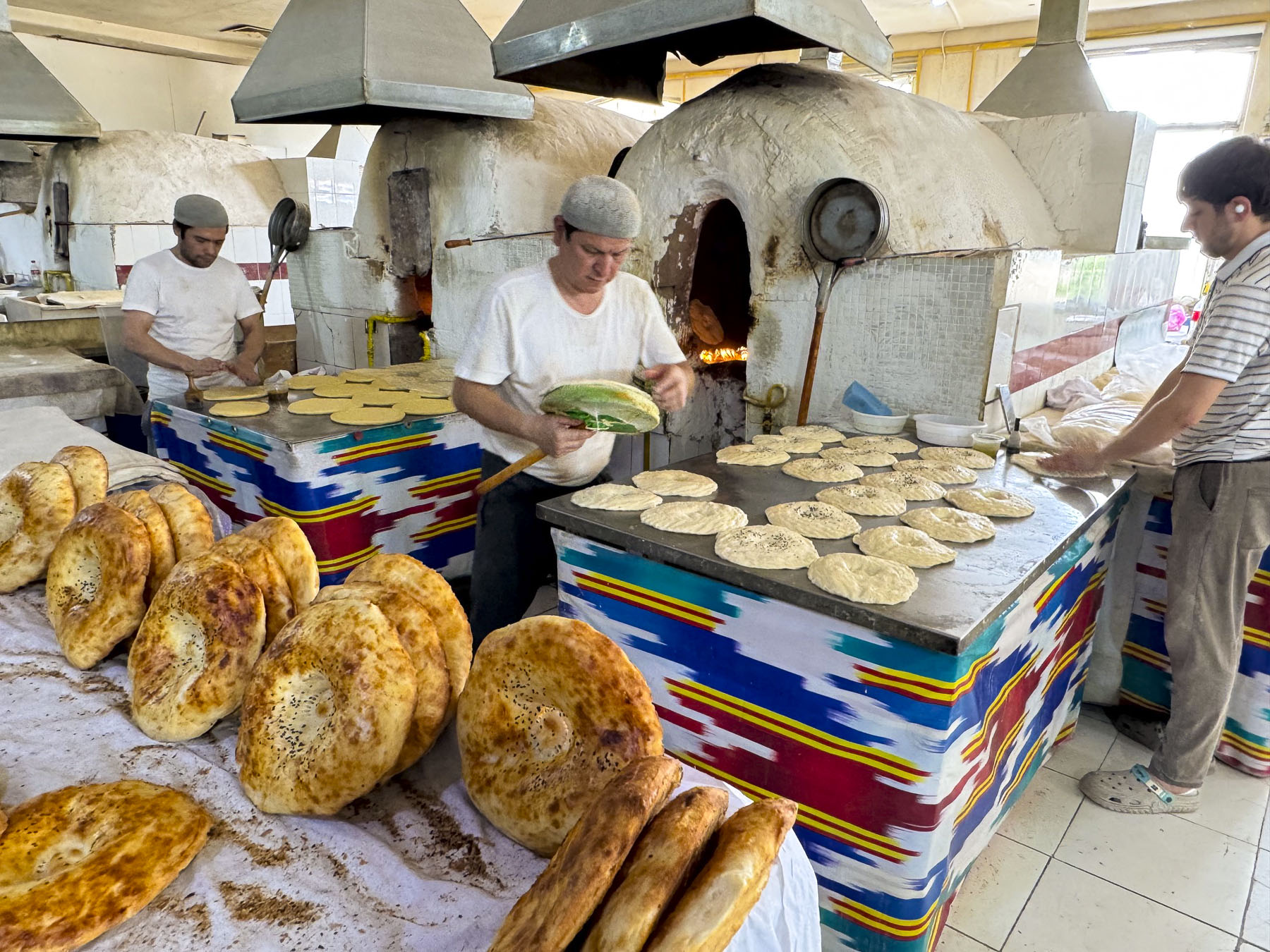
Wheel barrel vendors selling round, flat disk-shaped non coursed through the shoppers. These loaves of dough are traditionally decorated with a stamping tool called a chekich, before baking. We’ve read many rave reviews about Uzbekistan’s non but have found it’s best enjoyed when fresh out of an oven, as in our opinion it becomes a disappointing “eh” later. It’s definitely worth spending the time to find the central bakers in the market to watch them form the dough and then lean into the tall brick ovens to throw it against the side walls to bake. The result is heavenly.
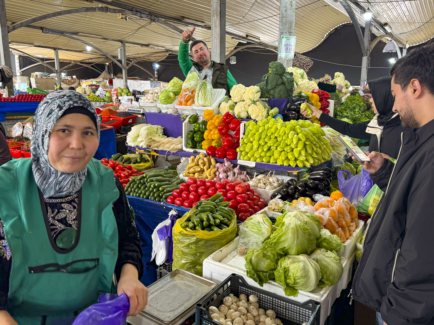
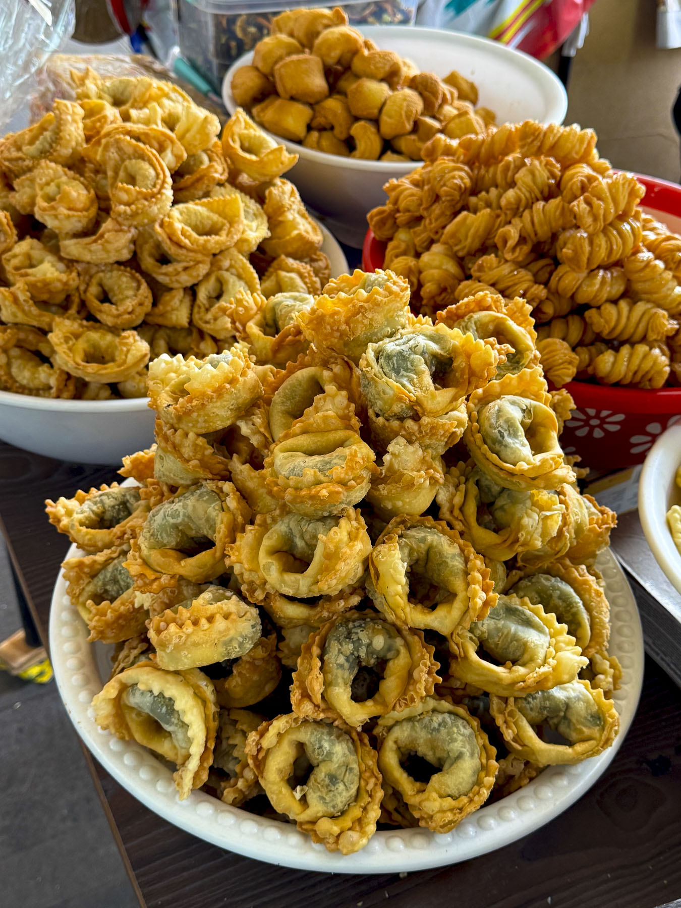
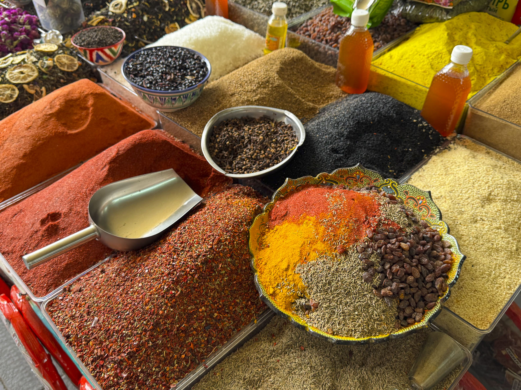
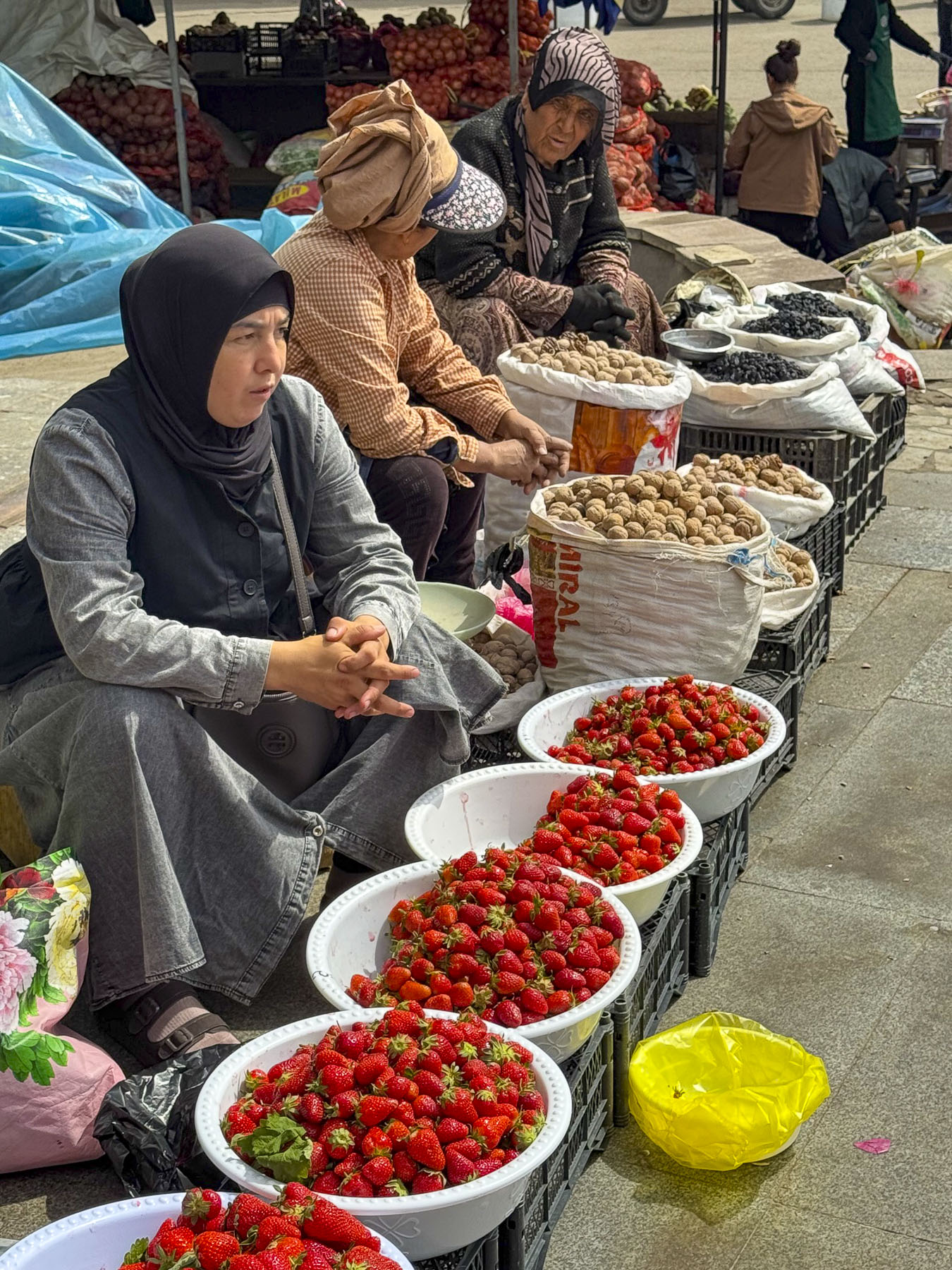
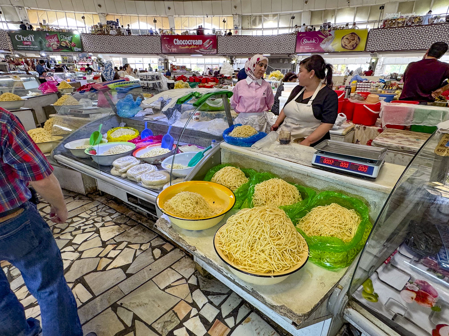
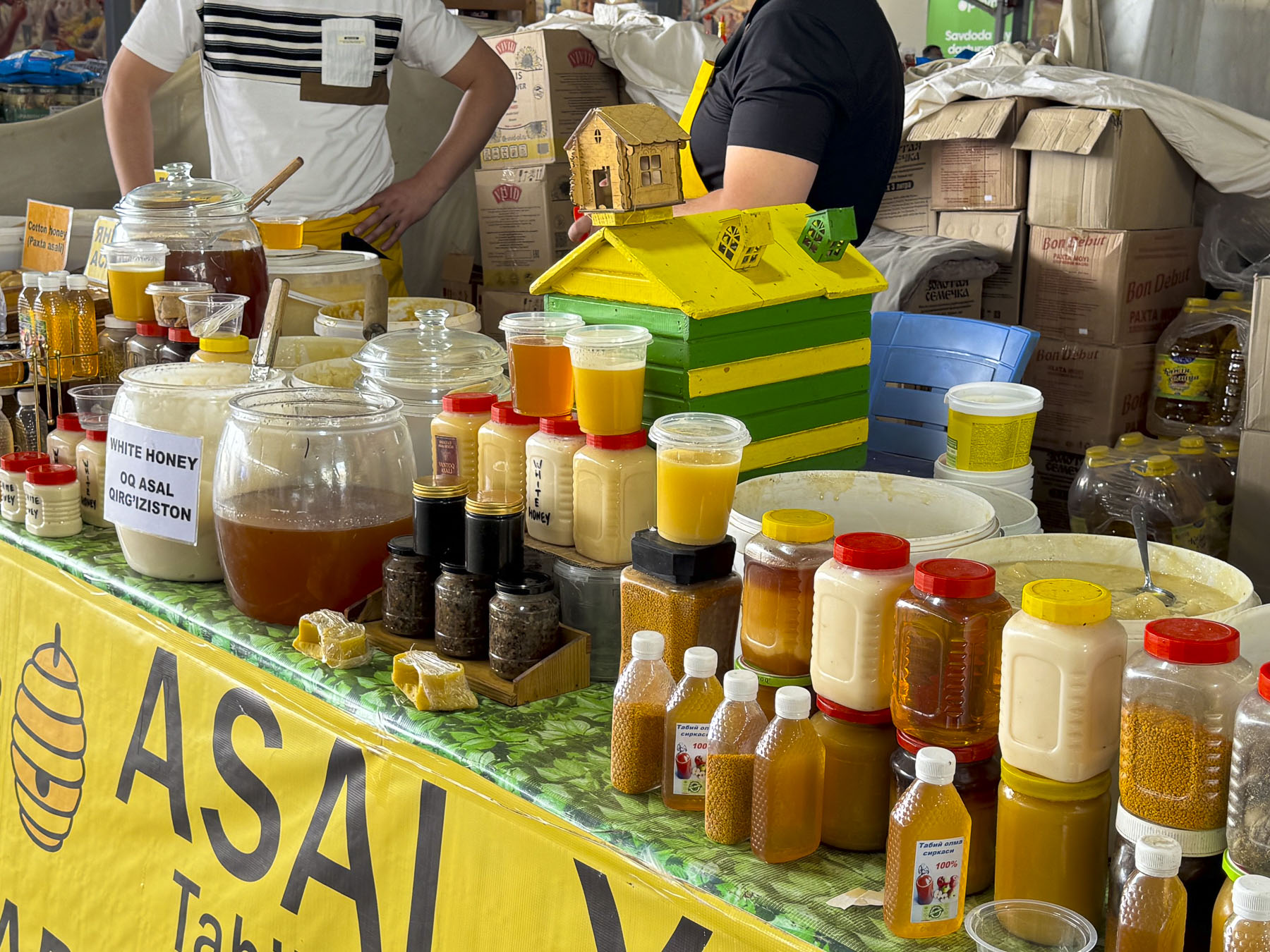
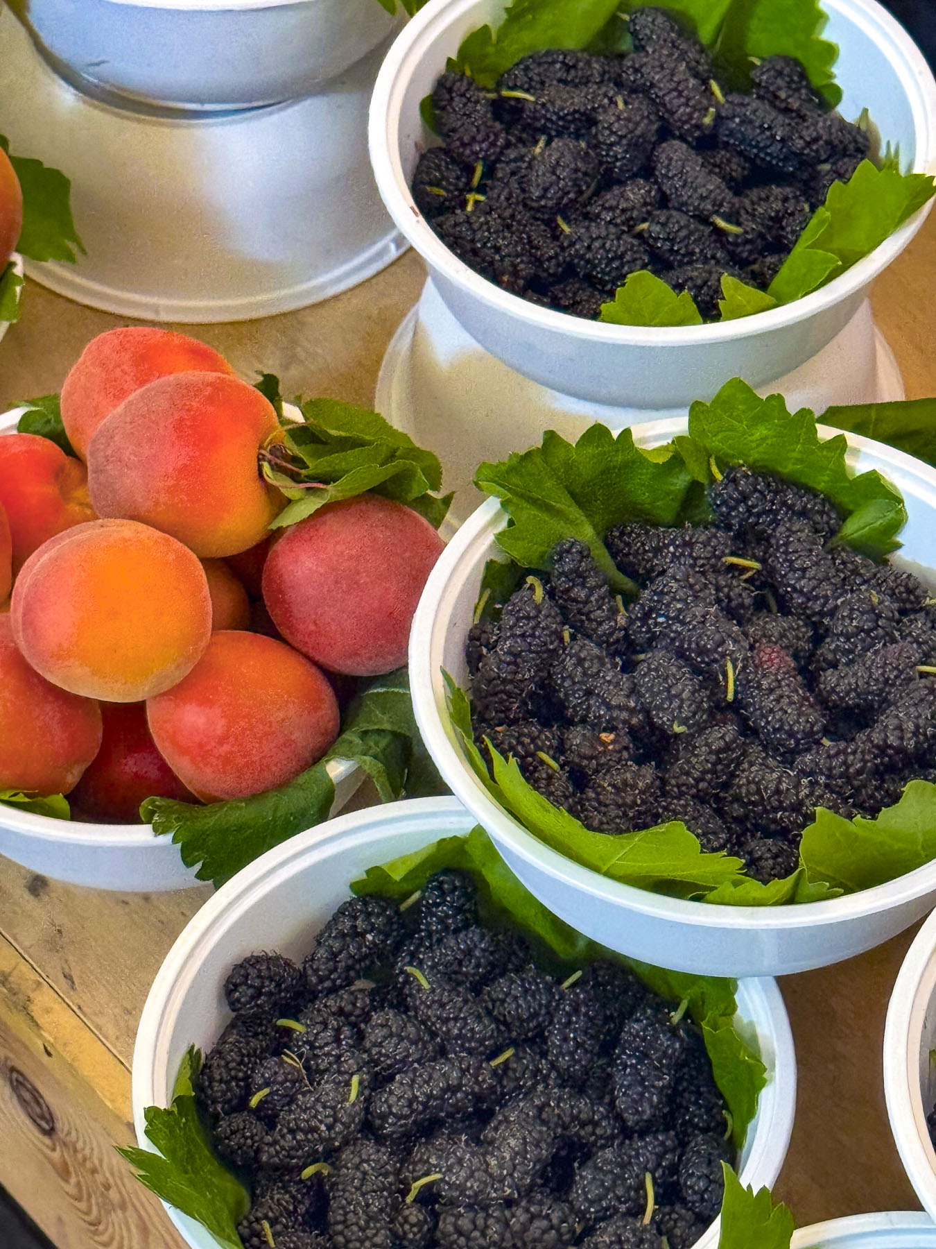
Stairs rose from the market’s lower level to the gastronomical equivalent of Aladdin’s “Cave of Wonders.” Literally it was like a culinary temple, with vendors freely offering samples, it had us wishing we had rented an apartment with a full kitchen. The quality, variety, and abundance of the foodstuffs were amazing. It was difficult for the cooks in us to resist the temptation to buy a cart full of groceries, but we did and only purchased some dried fruit and pomegranate juice for a snack later.
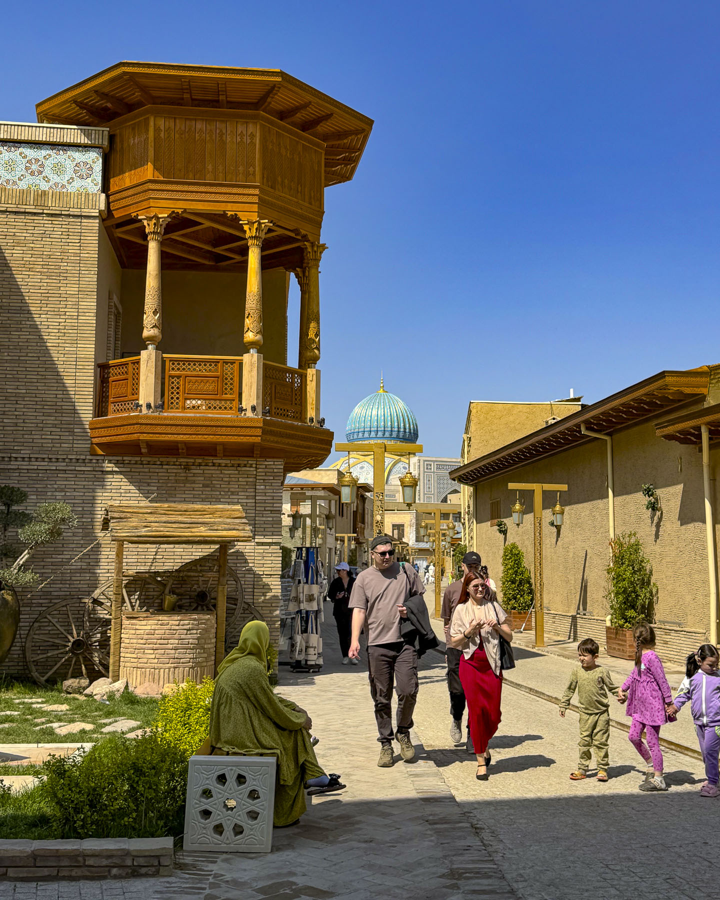
After leaving the market we crossed the street into the Hastimom Mahalla neighborhood, in the Almazar District and walked along Zarkaynar Street. The lane was recently renovated as part of an effort to revitalize the maze of narrow lanes in the ancient quarter that lies between the Chorsu market and the magnificent new Islamic Civilization Center.
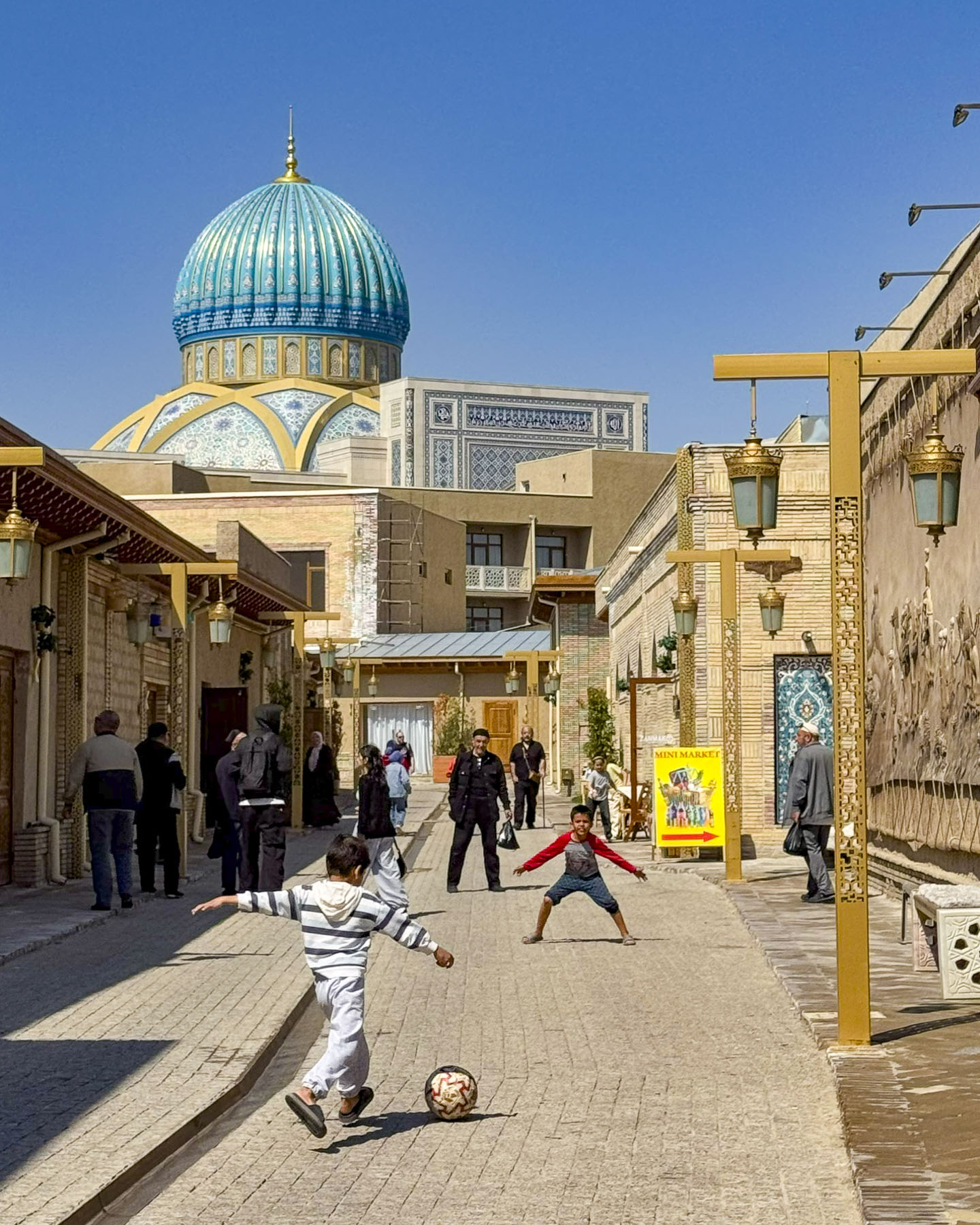
The street was pristine with new historical murals and buildings shining with their new facelifts, but it lost much of its authenticity in the process and felt a little too touristy. Young boys were enthusiastically kicking a soccer ball back and forth down the lane until a neighborhood buvi, grandmother, put a stop to their raucous play.
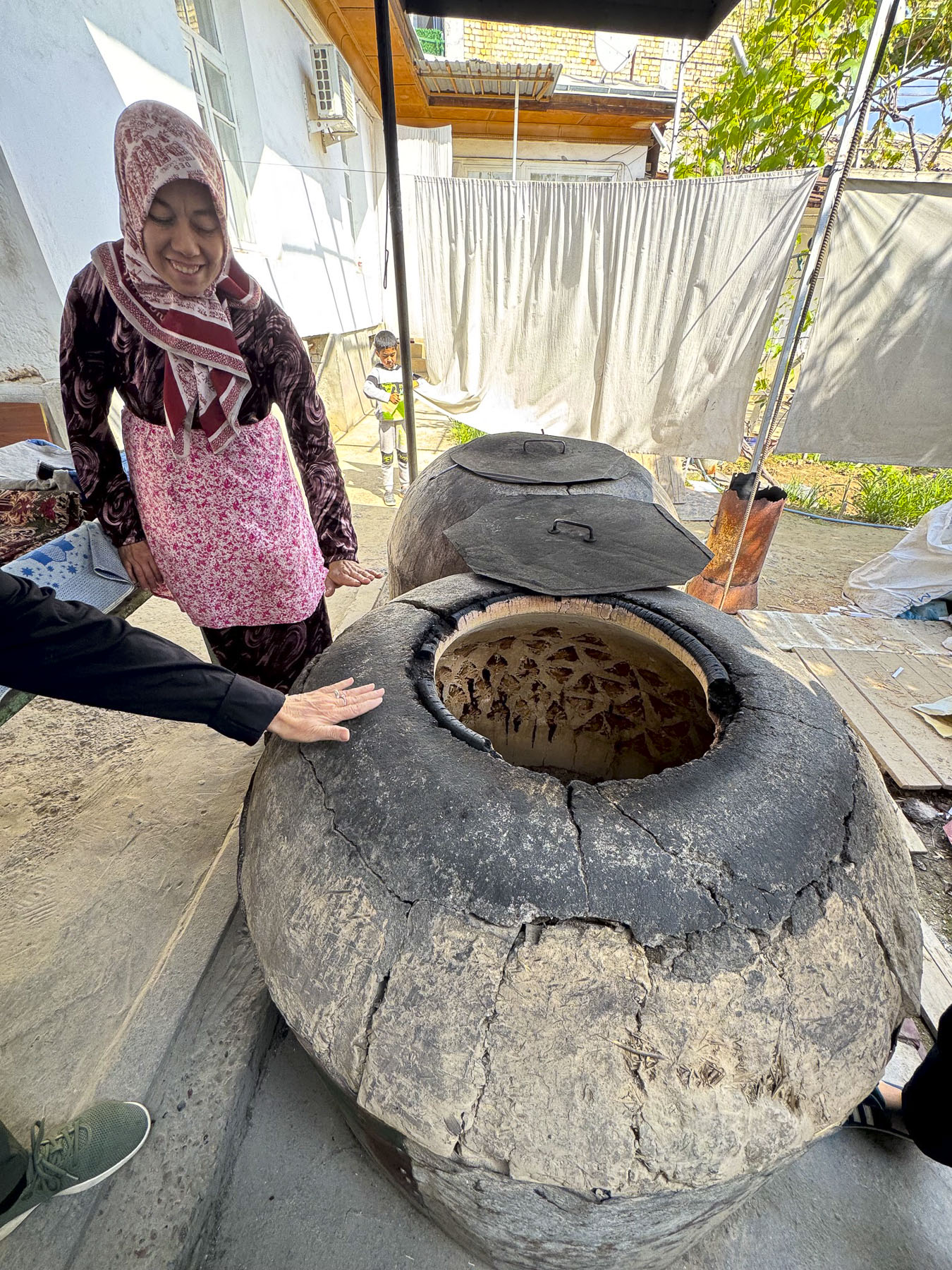
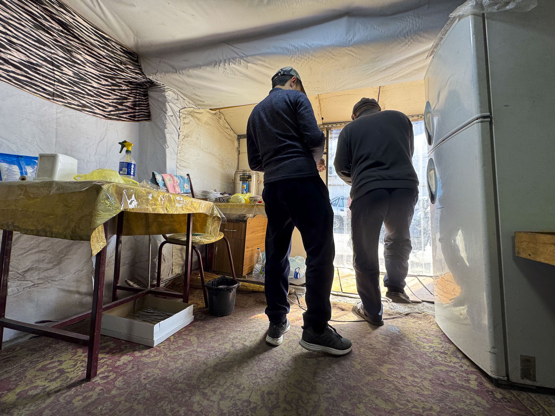
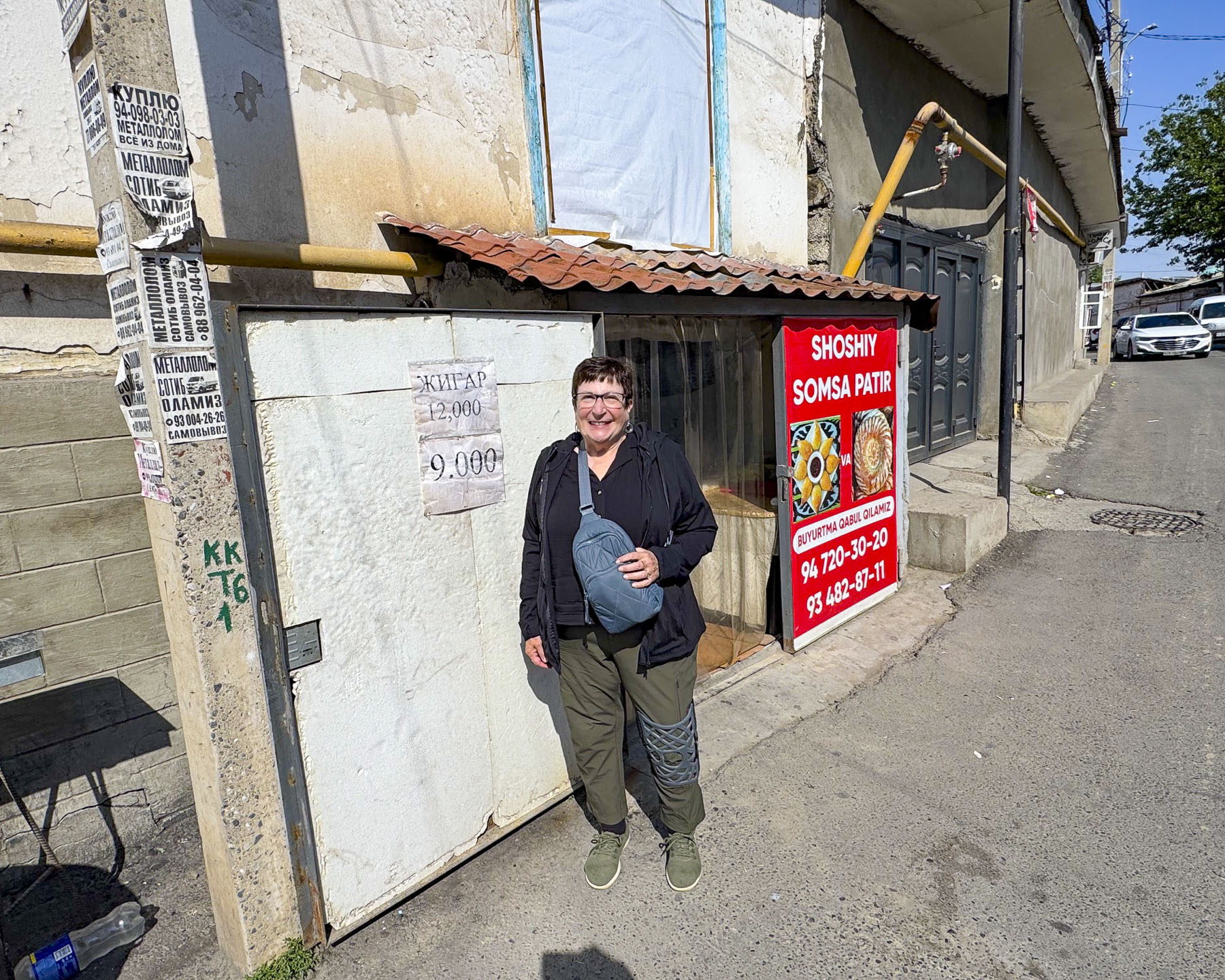
Fortunately, as we walked deeper in the mahalla, smaller alleys led to traditional homes still made of adobe brick that share a communal courtyard called a sheriklikli hovli. It was down one off these lanes that we hoped to find Tandyr Samsa V Dome, a small family run bakery in a hovli that is acclaimed for their samsas, a savory pastry filled with meat, chicken or potato, and then baked in a traditional wood-fired clay oven called a tandir. We had a very difficult time finding it. In this labyrinth our mapping app got us close, but eventually we just had to try different lanes until we discovered the right one. Unfortunately, by the time we found the right hovli, baking for the day was over and the family encouraged us to come back earlier on another day. It was very late in the afternoon when we stopped at a small nondescript restaurant, with a plastic pullback sheet as a door, and one low table and cushions on the floor. The owner was delighted we stopped and shared his experience about working the United States for a short time, while serving his many neighborhood customers who came in to get their takeaway orders. Our meal was very simple, just kebabs and non, but it was delicious and memorable.
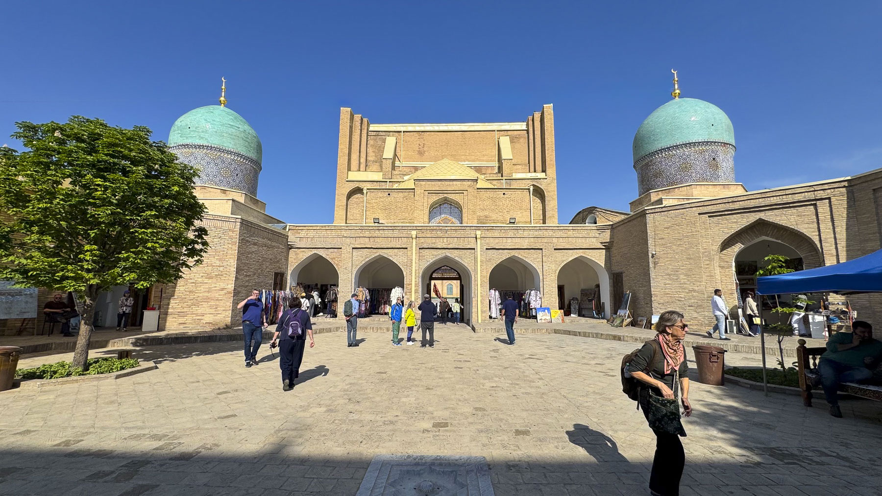
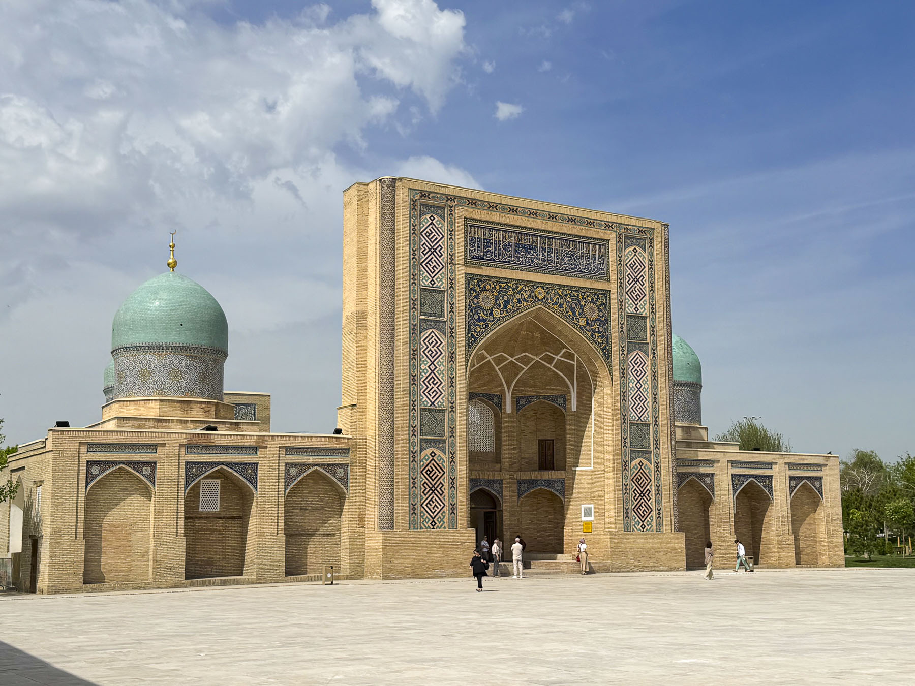
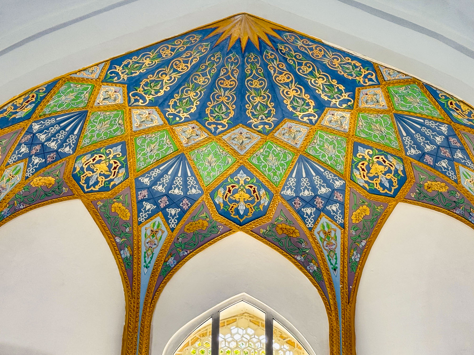
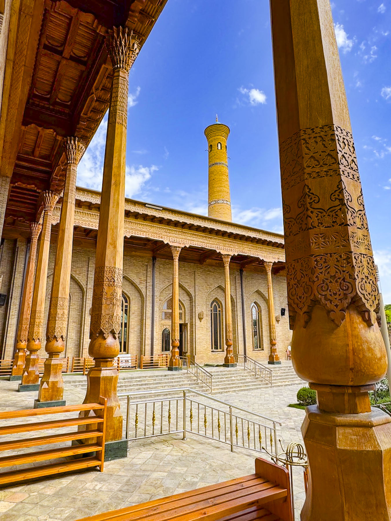
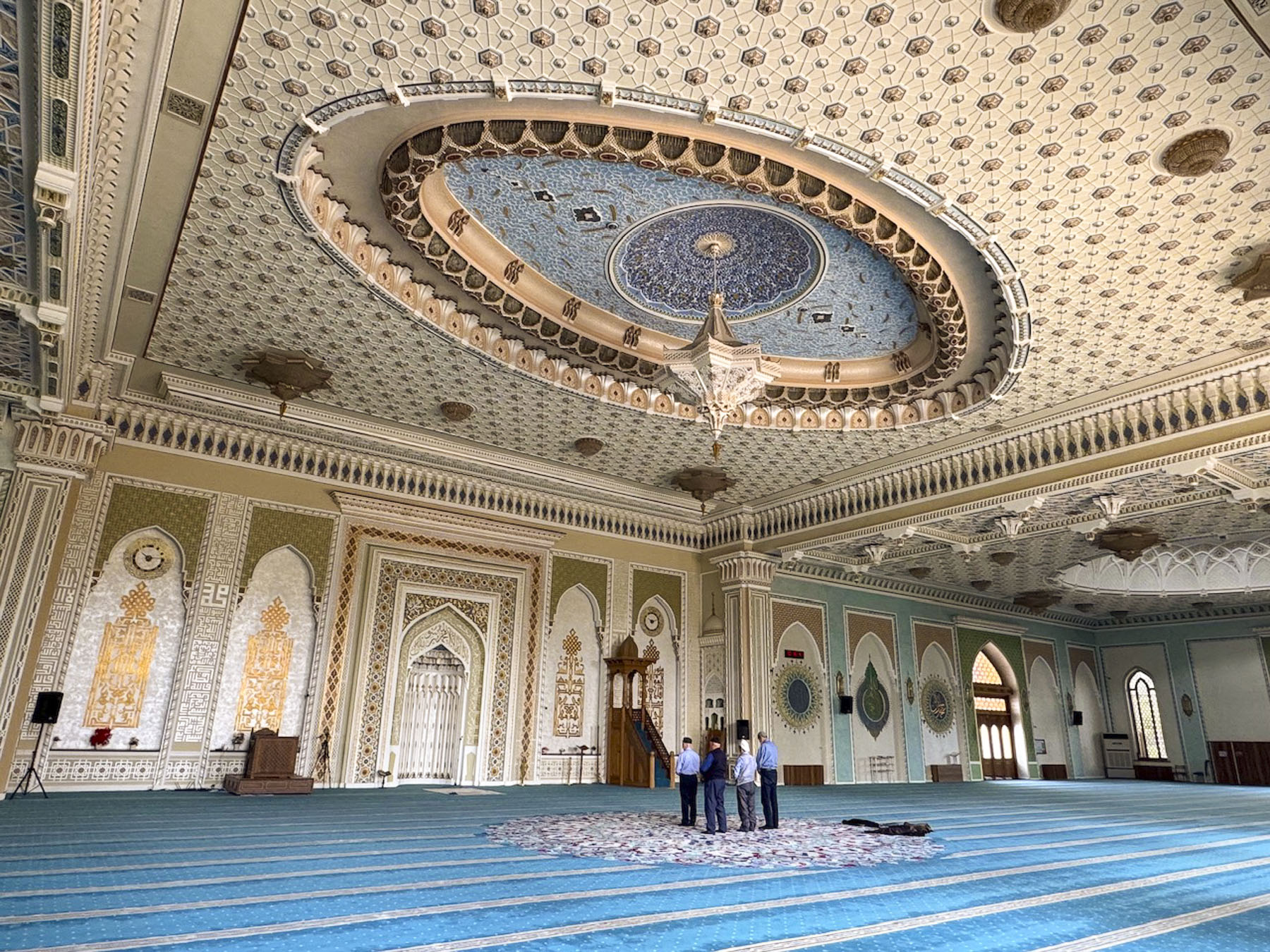
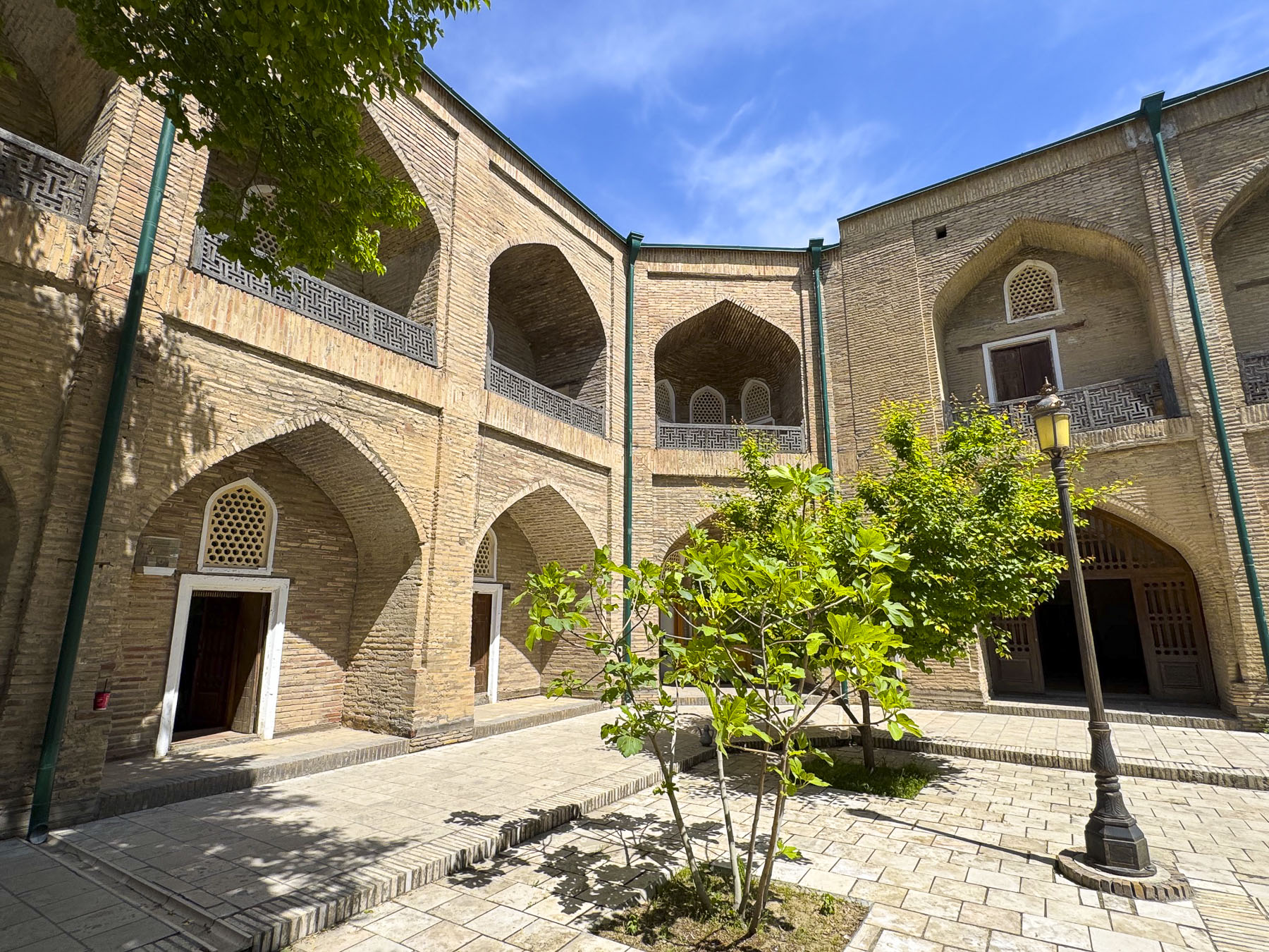
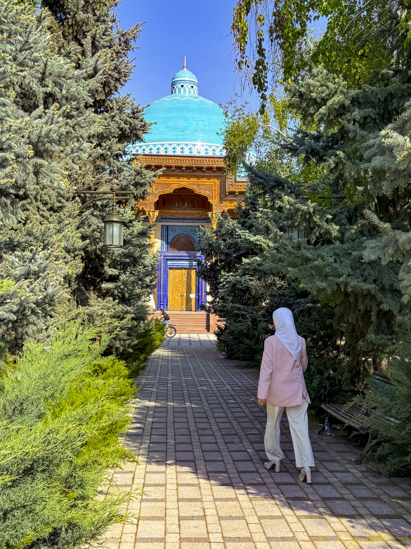
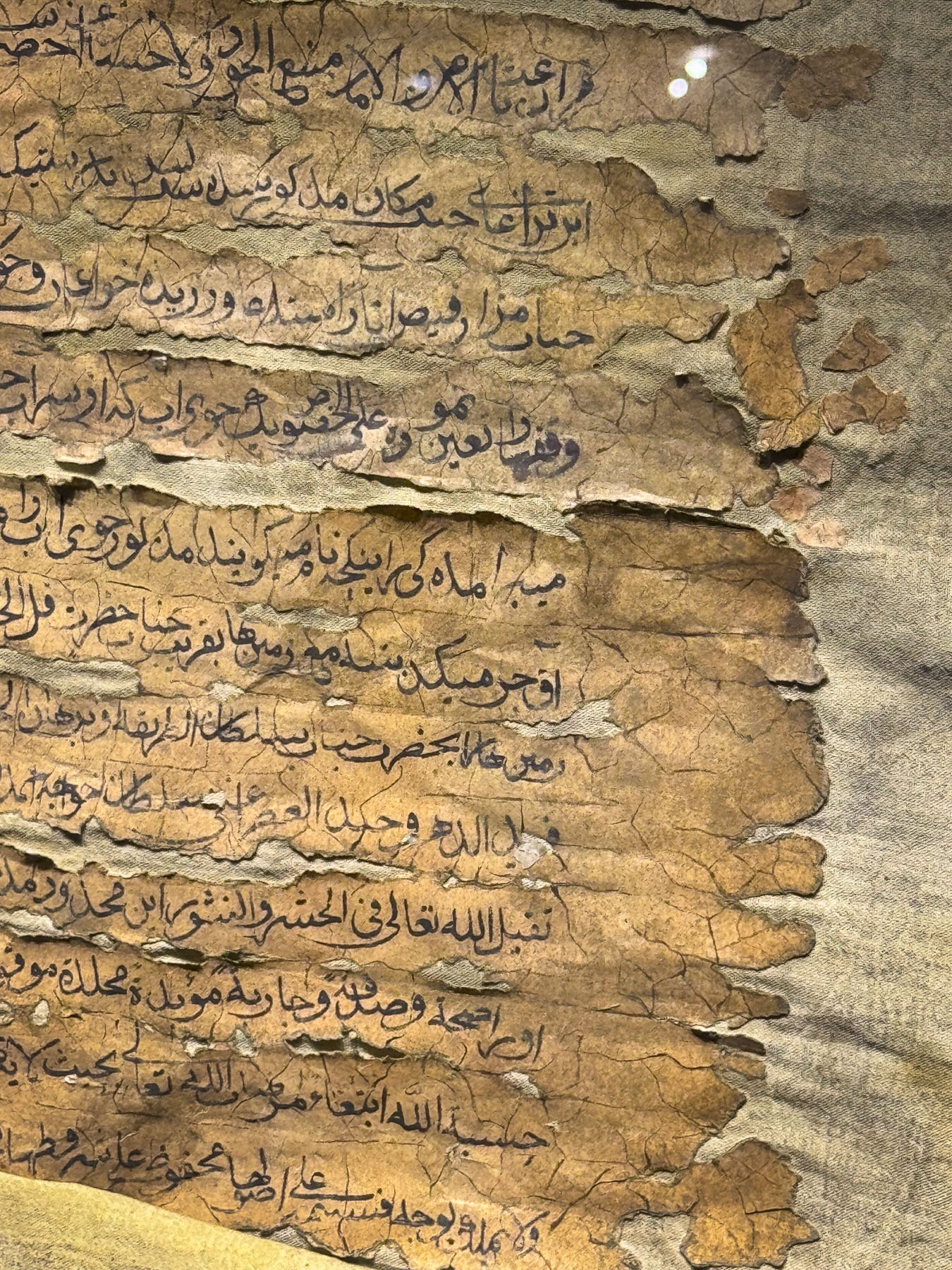
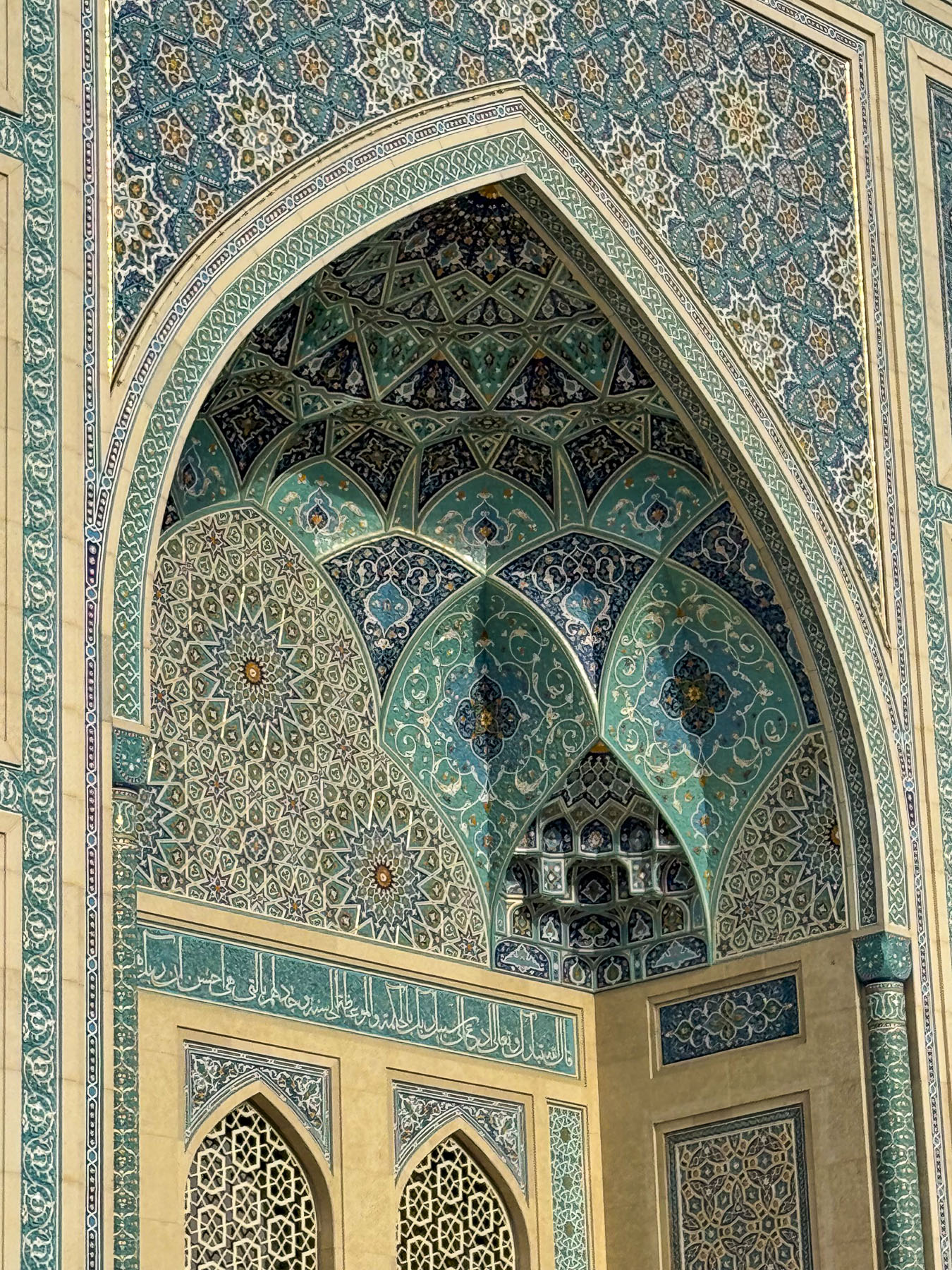
Afterwards we headed to the Hazrati Imam Complex, an ensemble of buildings around a large plaza that include the16th century madrasah Barak-Khan, that is now a crafts center, the 19th century Muyi Muborak Madrasah, which now exhibits a collection of ancient Islamic manuscripts, and the Hazrati Imam Mosque completed in 2007.
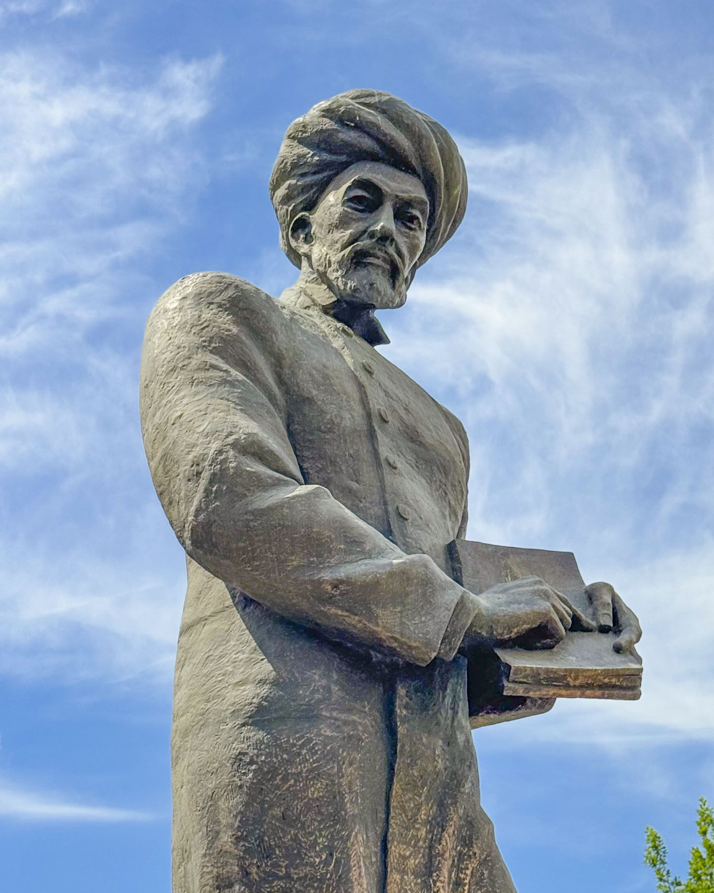
They were built around the Mausoleum of Hazrat Imam, which had become a pilgrimage site. Hazrati was a brilliant 10th-century polyglot and local locksmith who went by the name of Kaffal al-Shashi before pursuing his religious studies in Baghdad, Mecca and Medina. Upon returning to Tashkent he became one of the town’s first local imams and received the title Hazrat Imam. Beloved, he came to be regarded as the chief spiritual protector and patron of Tashkent.
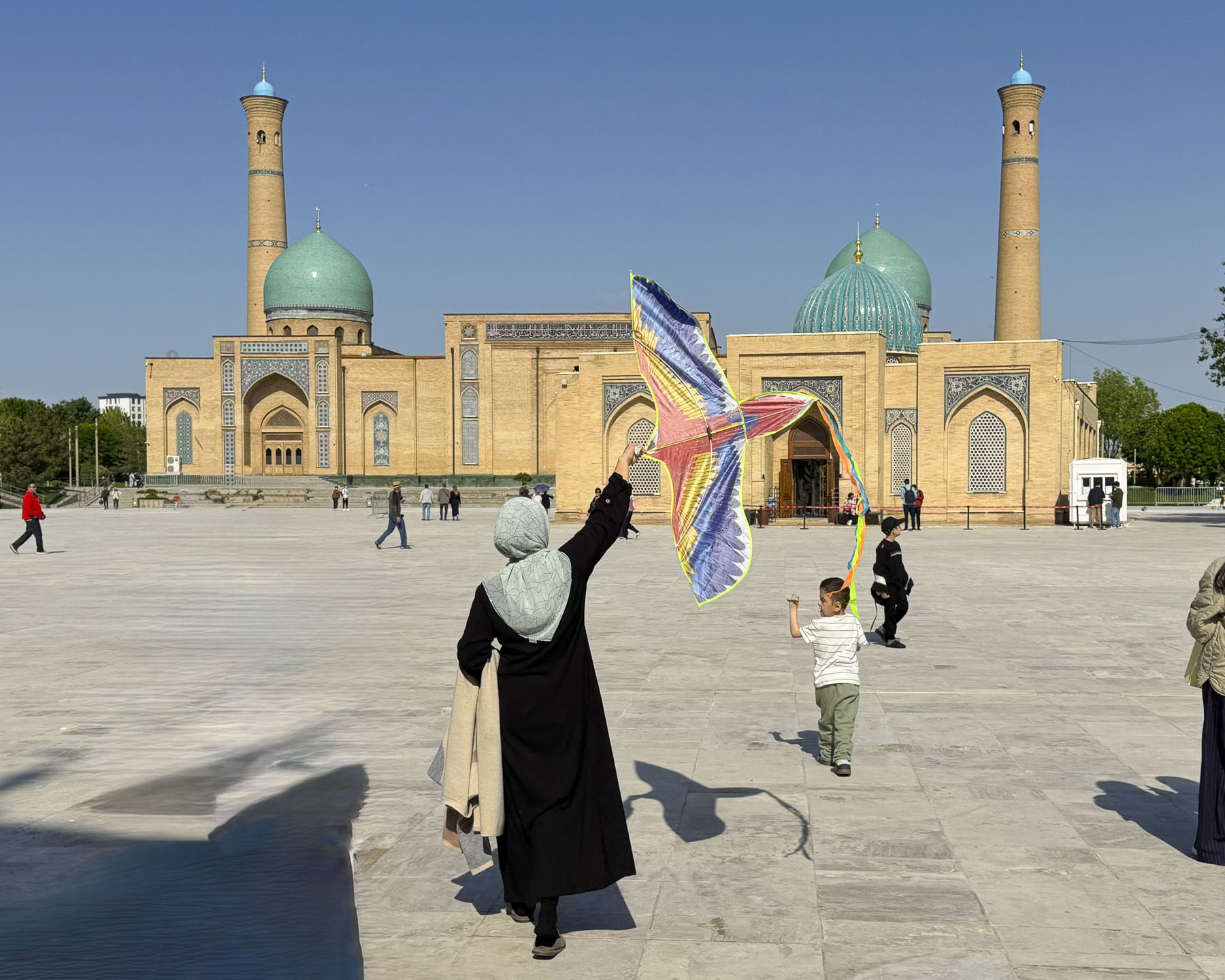
The complex is one of the few large open spaces in the Almazar District, and it’s a popular spot for local families to bring their children to learn how to ride bikes and fly kites.
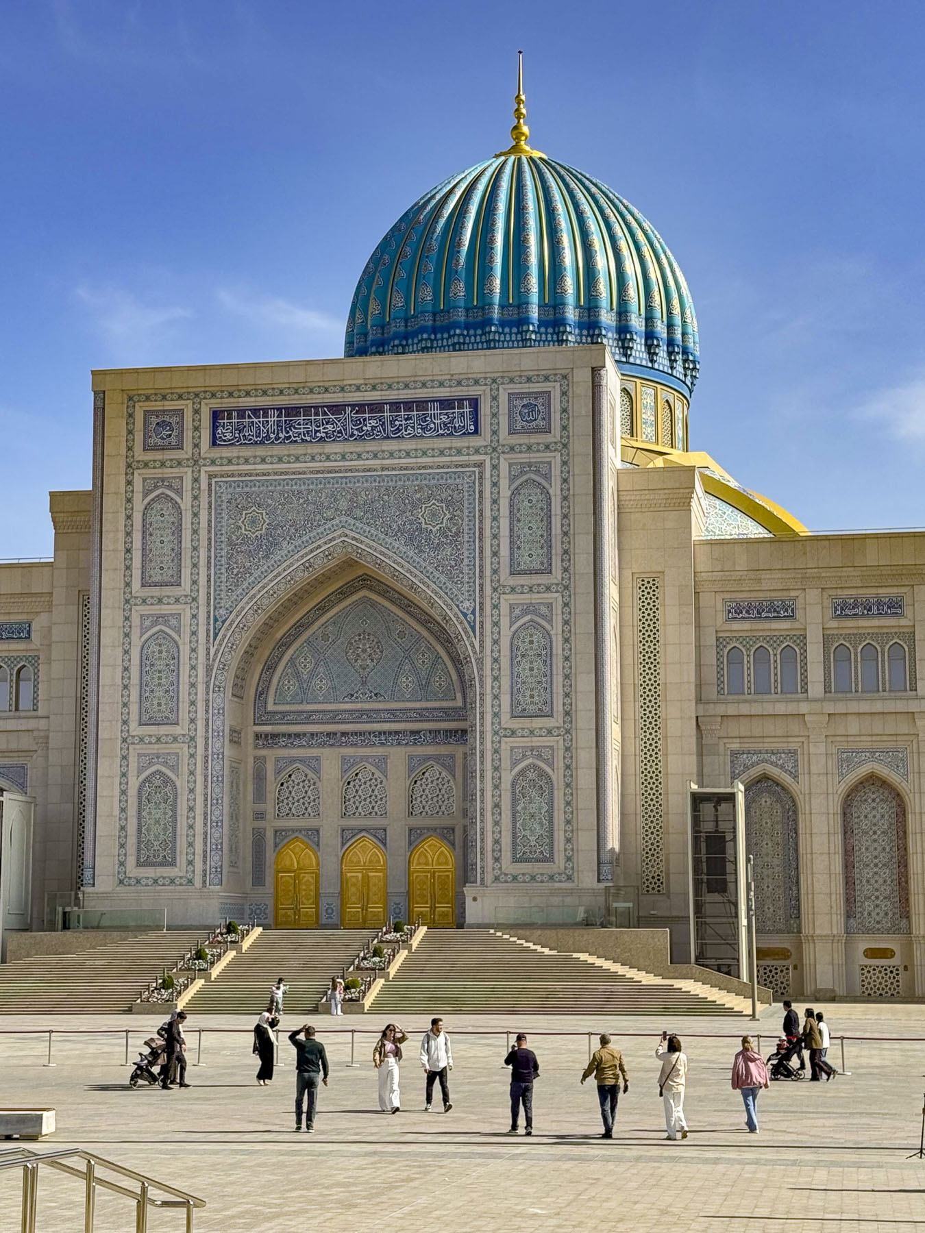
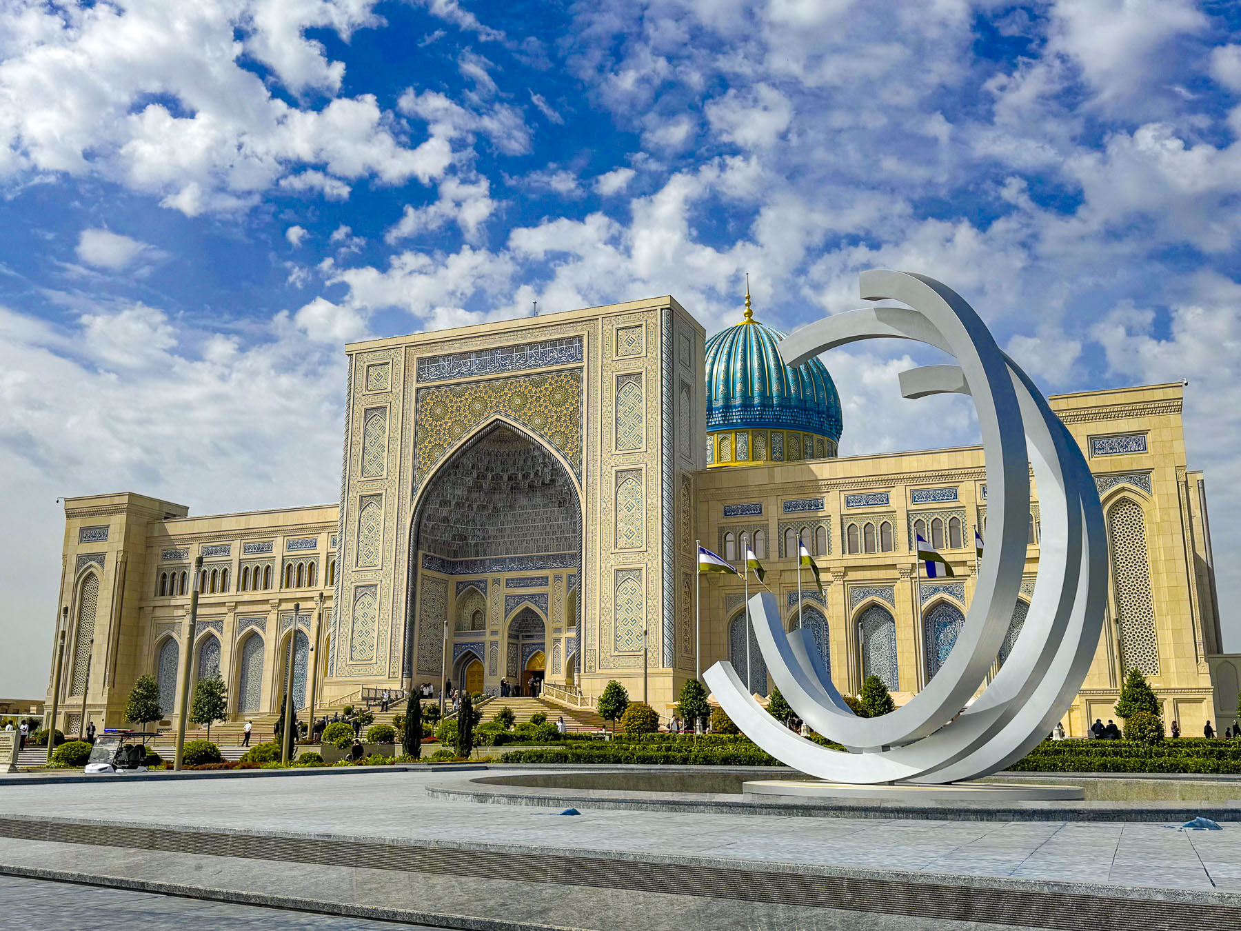
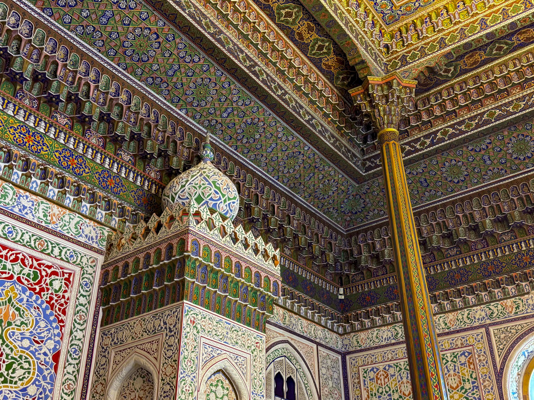
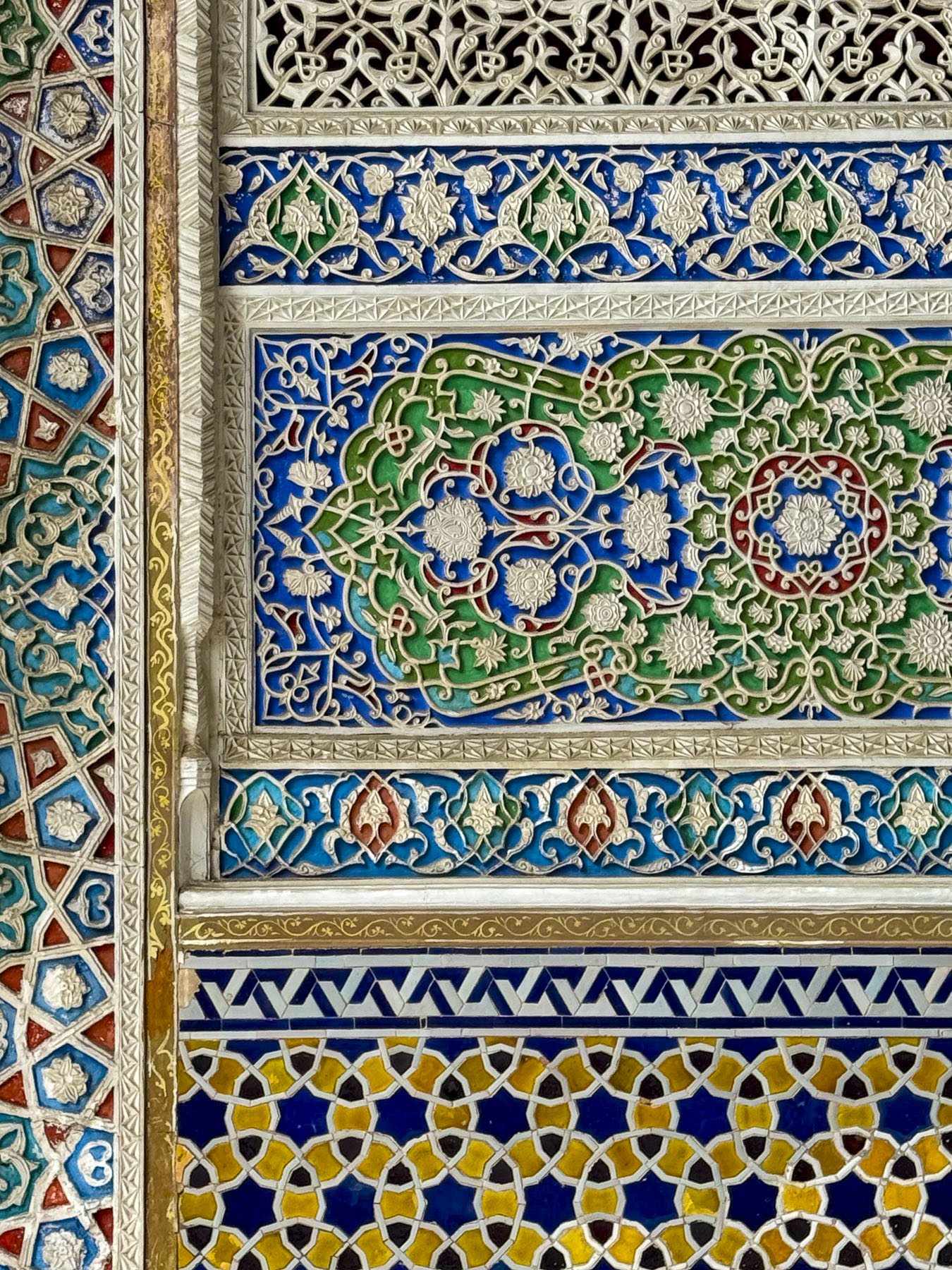
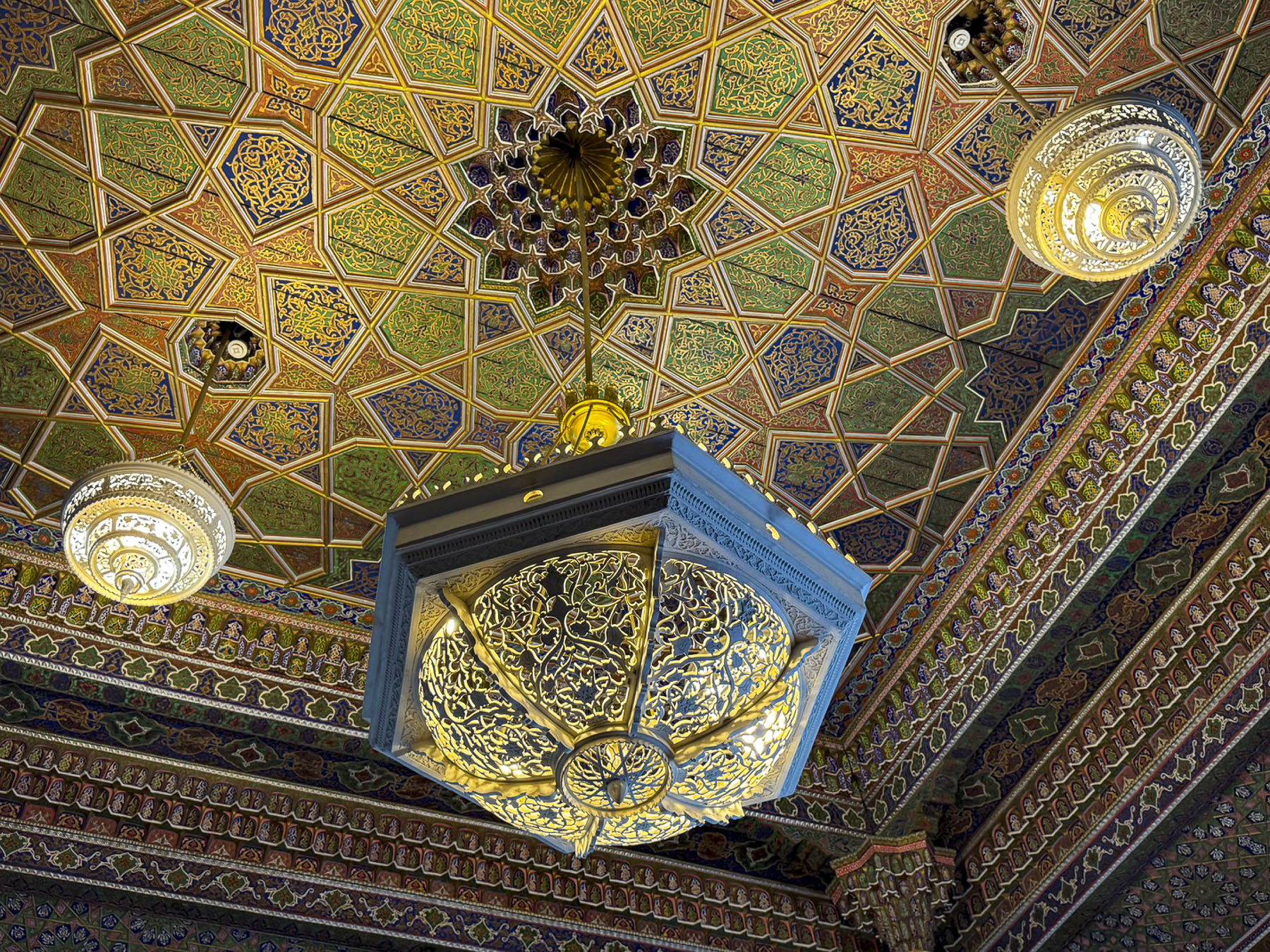
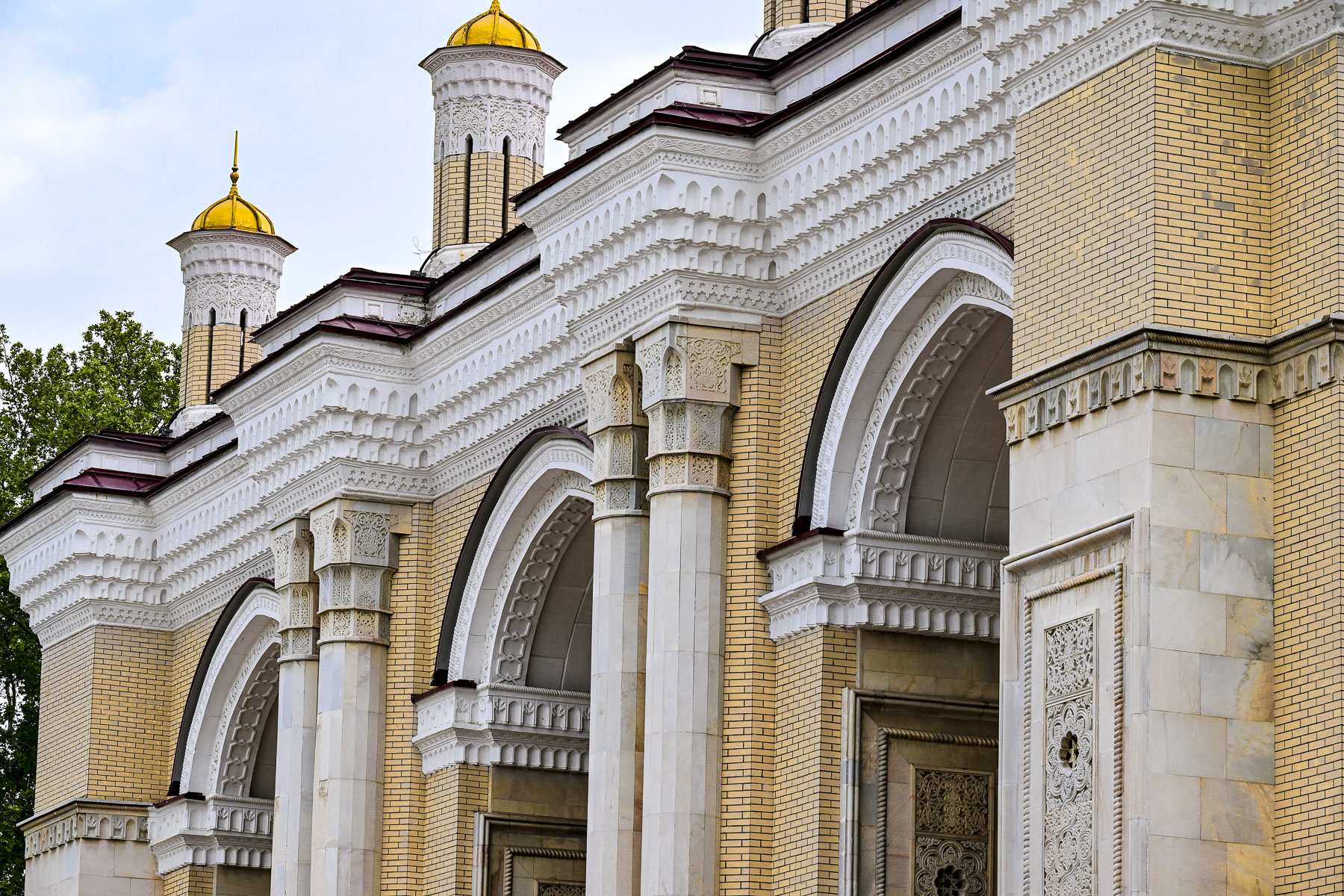
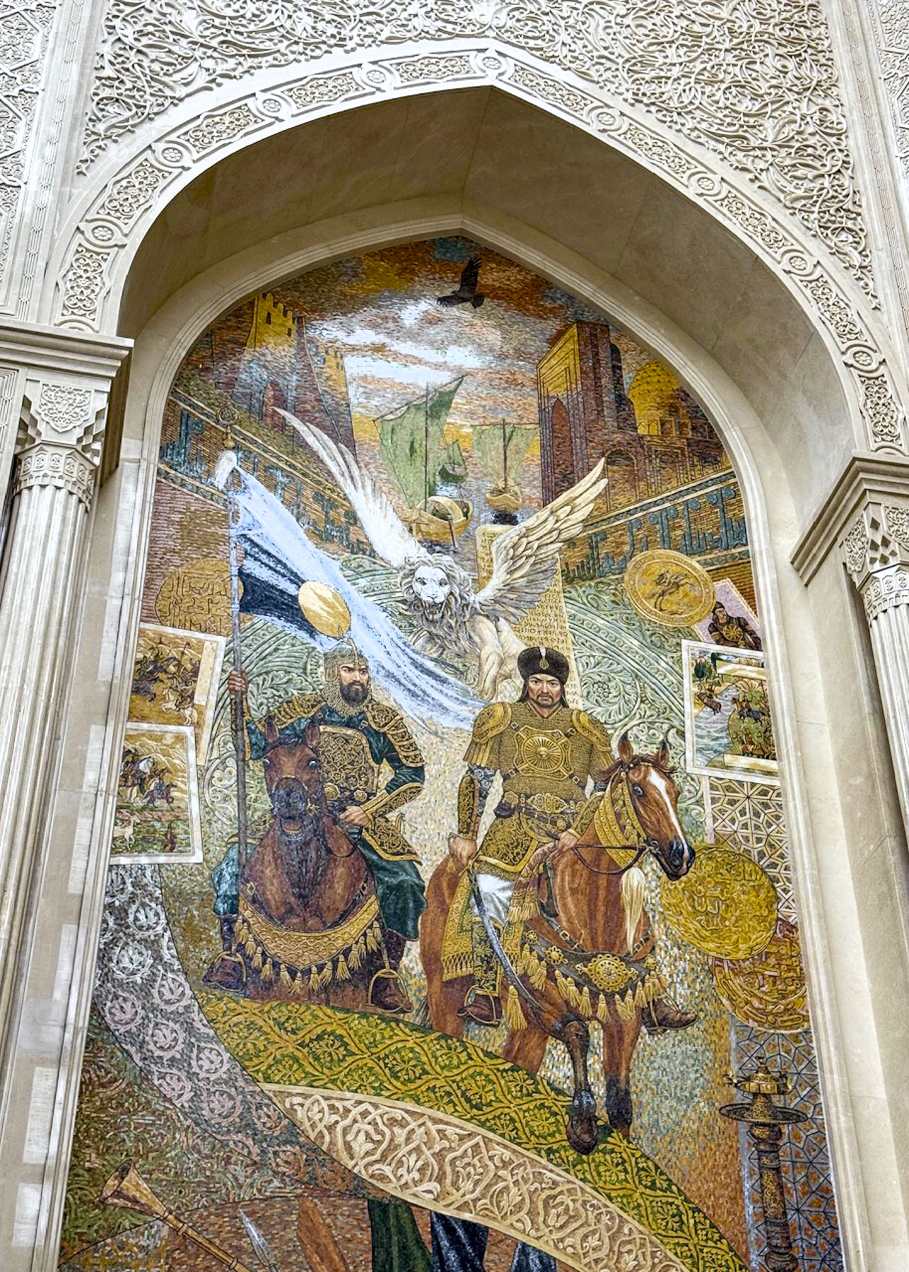
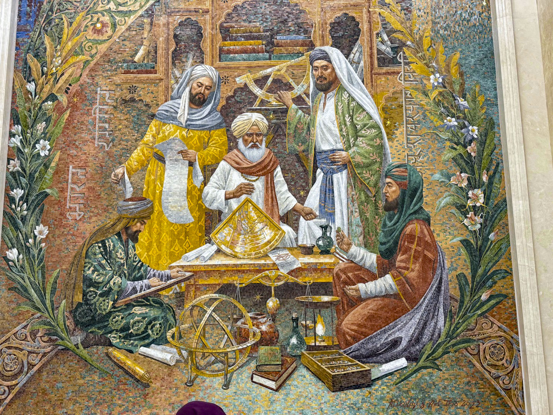
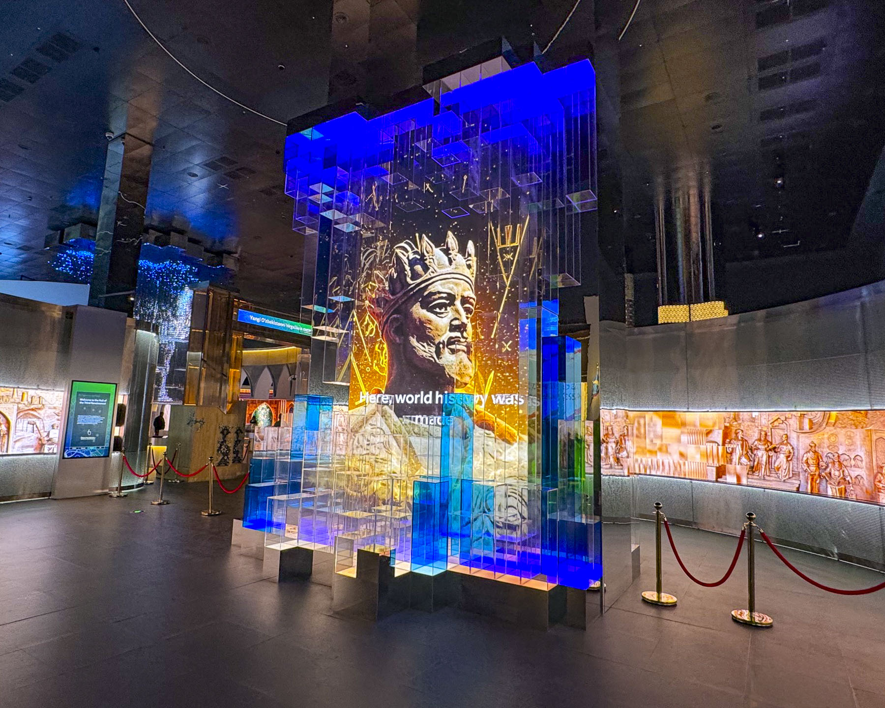
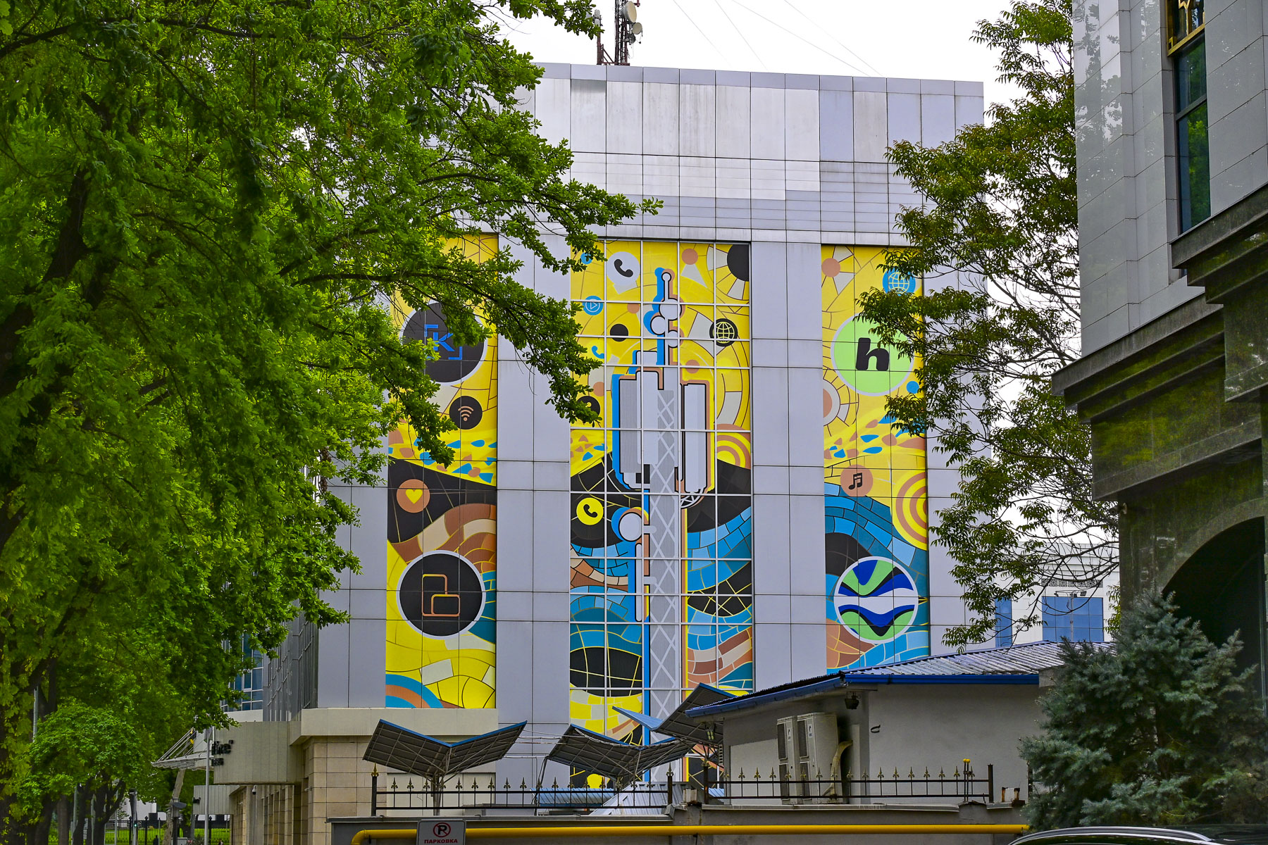
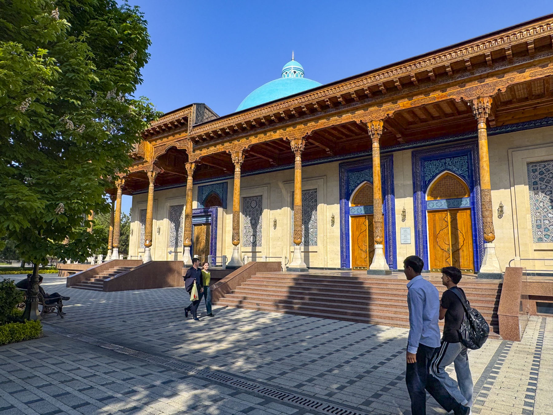
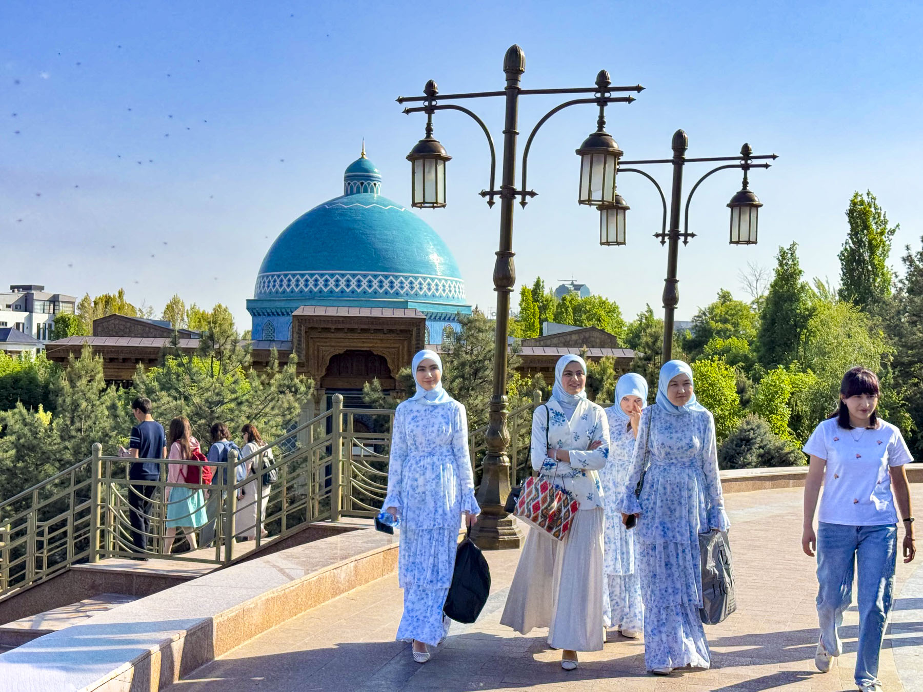
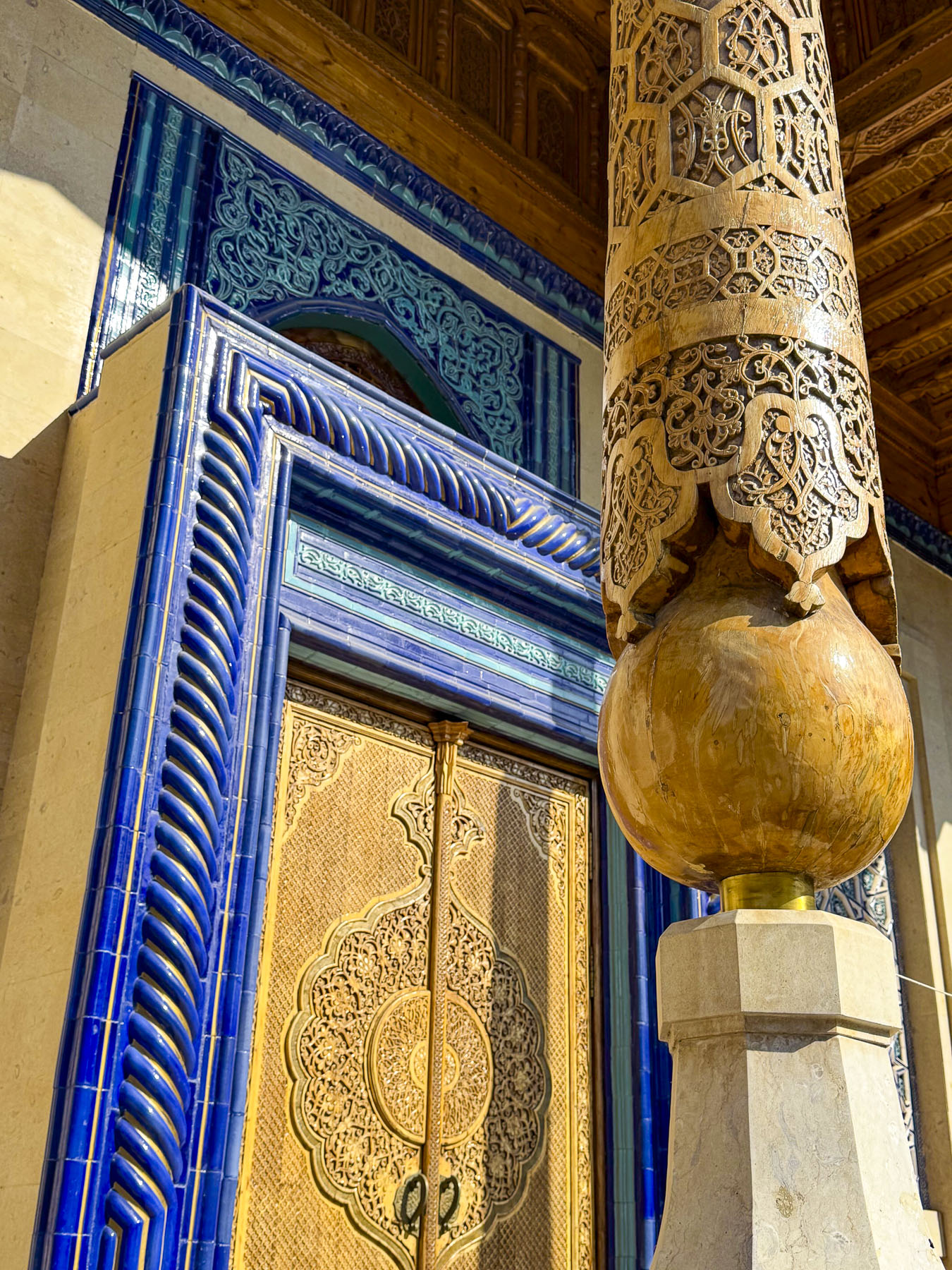
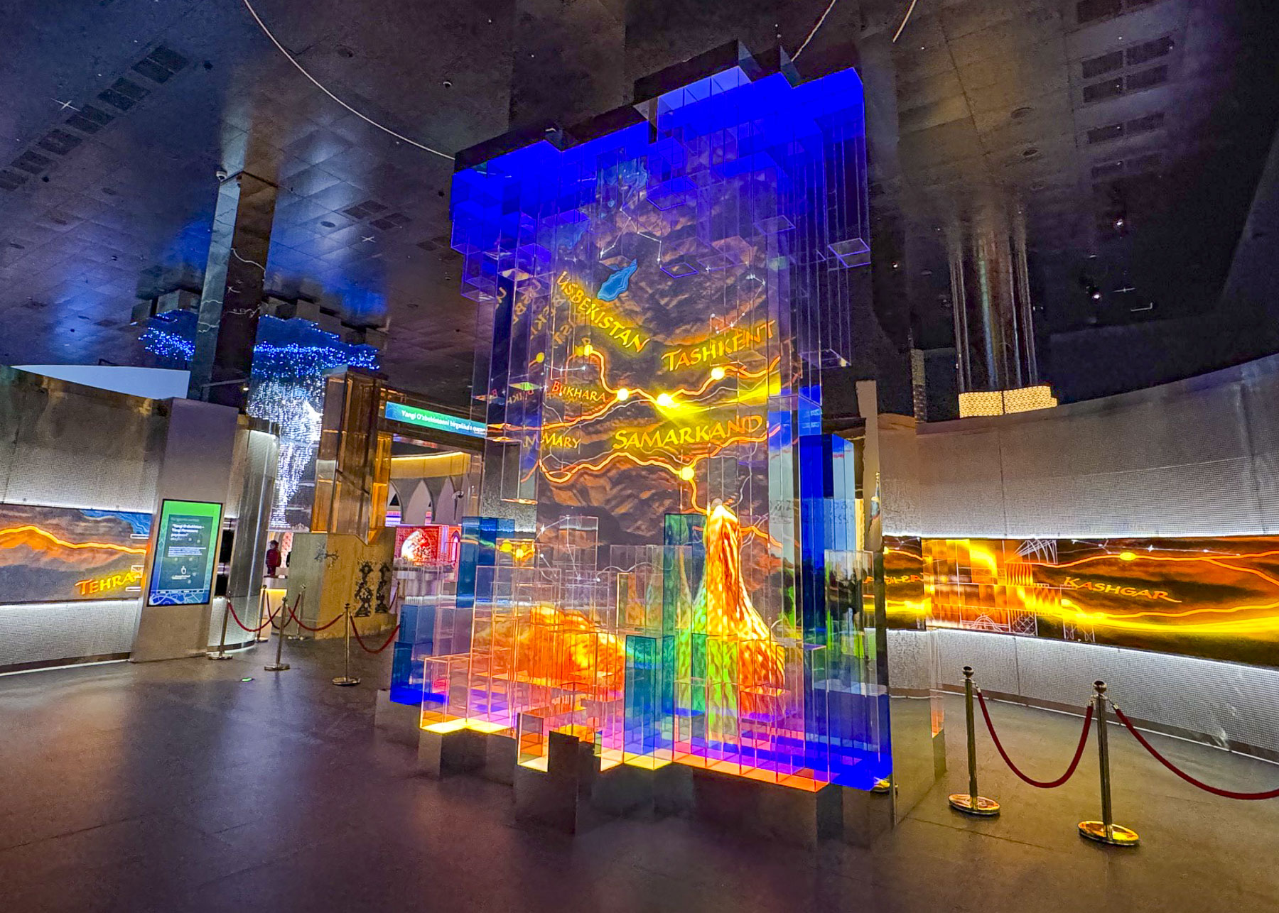
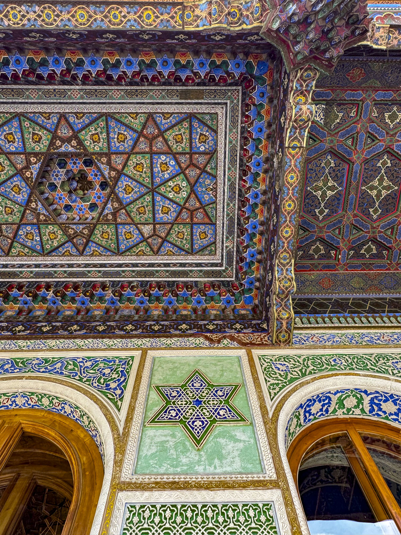
Next to the Hazrati Imam Complex is the Islamic Civilization Center, a newly opened museum, “conceived under the vision and leadership of Uzbekistan’s President Shavkat Mirziyoyev in 2017. The Islamic Civilization Center was envisioned to be more than just a museum, but function as an international hub for science, culture and learning, combining the richest treasures of pre‑Islamic and Islamic heritage of Uzbekistan with modern digital technologies and academic research.” The center’s striking design took inspiration from the architectural masterpieces constructed by the Timurid Empire in the 15th and 16th centuries.
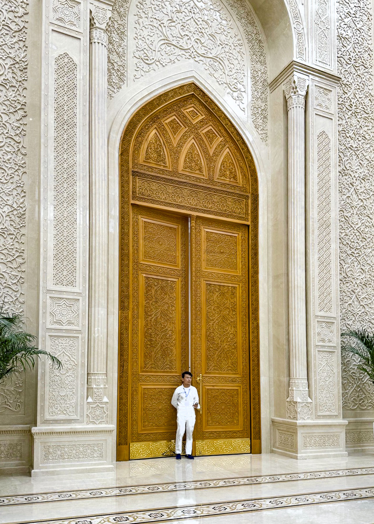
The ICC was not on our radar when we planned our trip to Uzbekistan, but we were delighted to find that the center stays open until 10pm every day, and seeing that the queue for entrance into the museum was very short we spontaneously purchased tickets. Upon entering the building folks were divided into small tour groups determined by the language they spoke and then led through the exhibits with a bilingual guide.
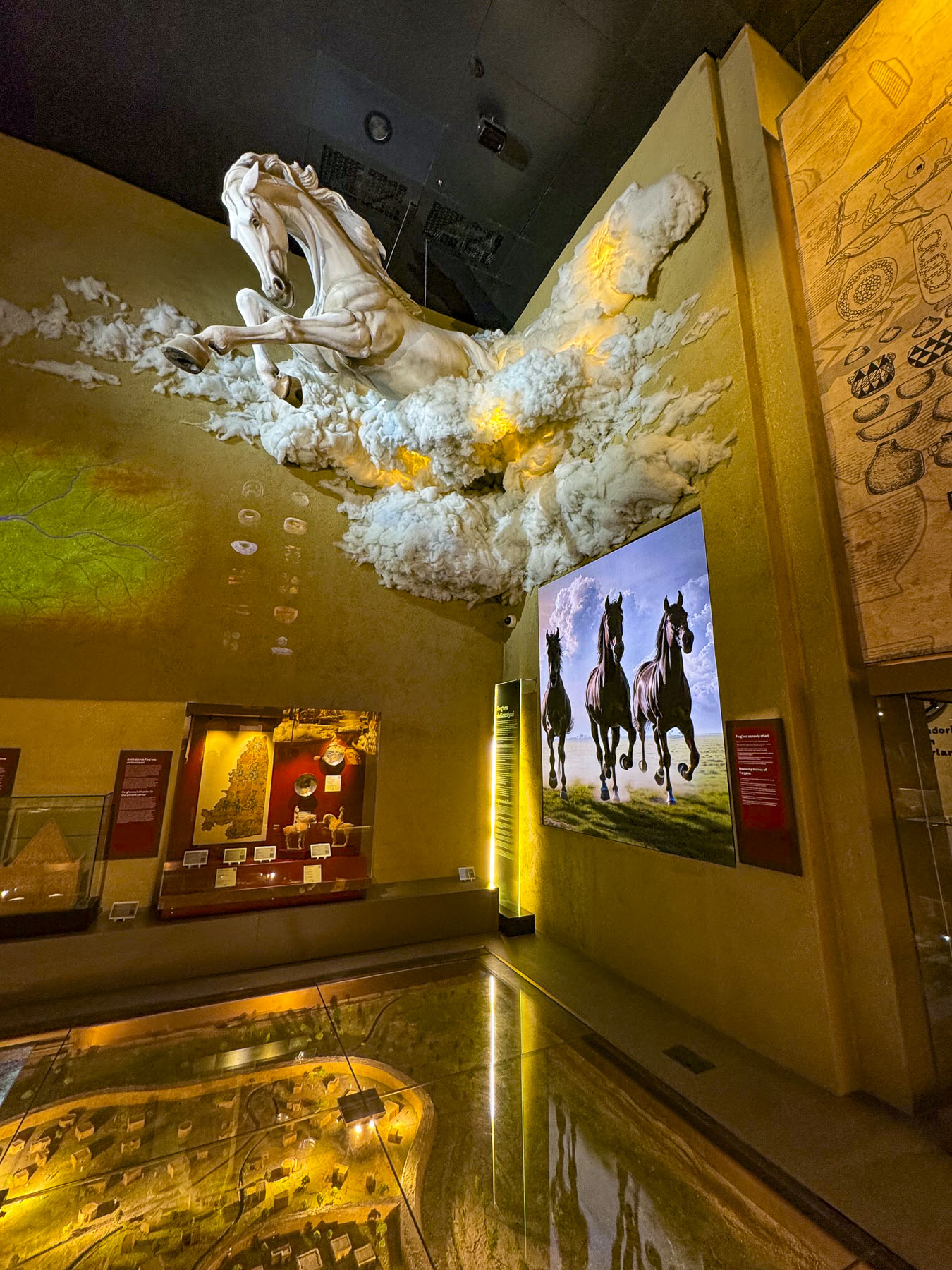
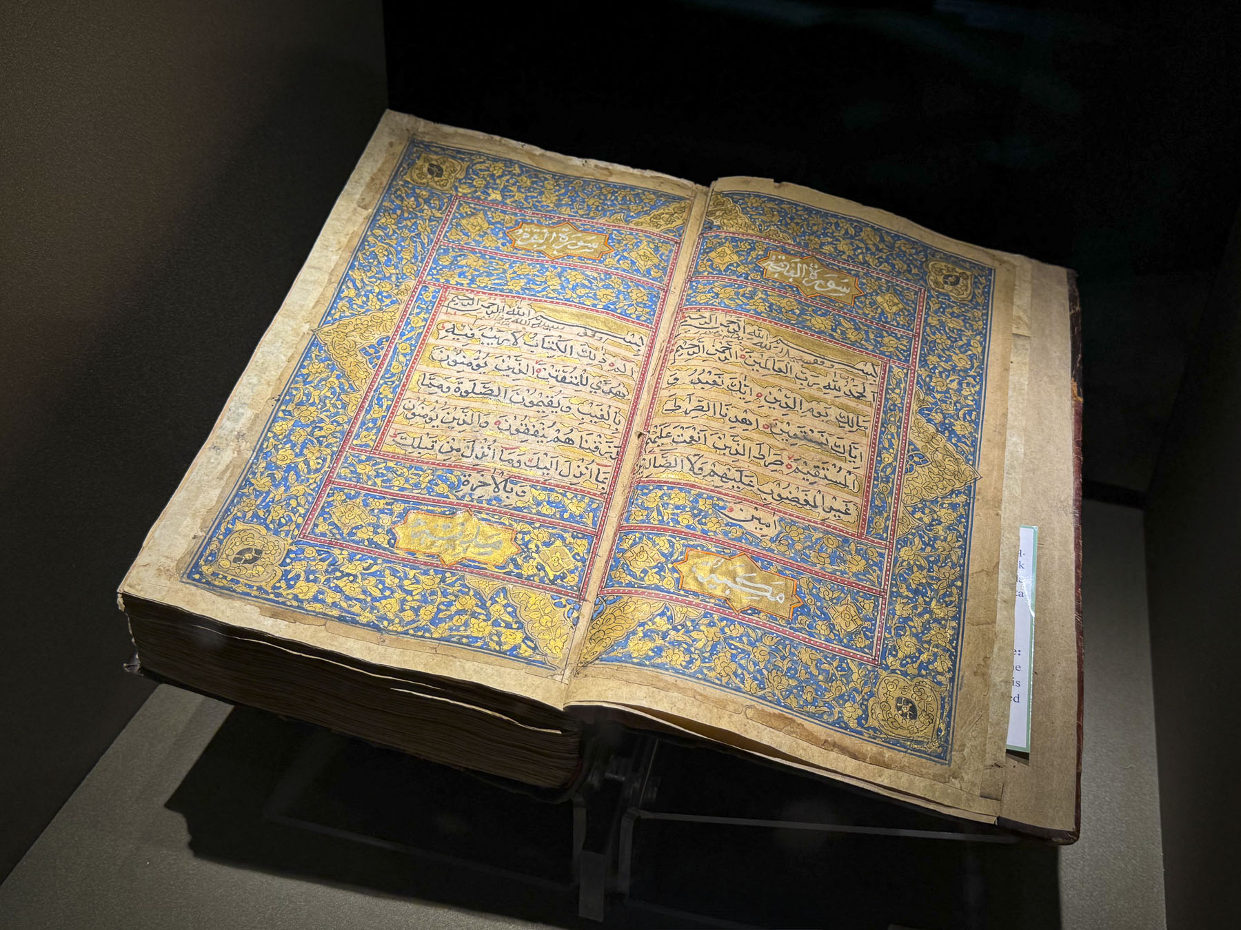
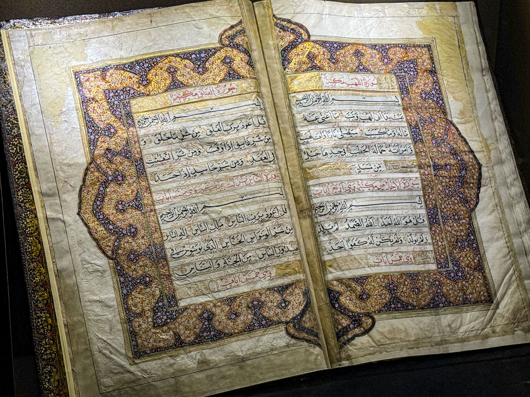
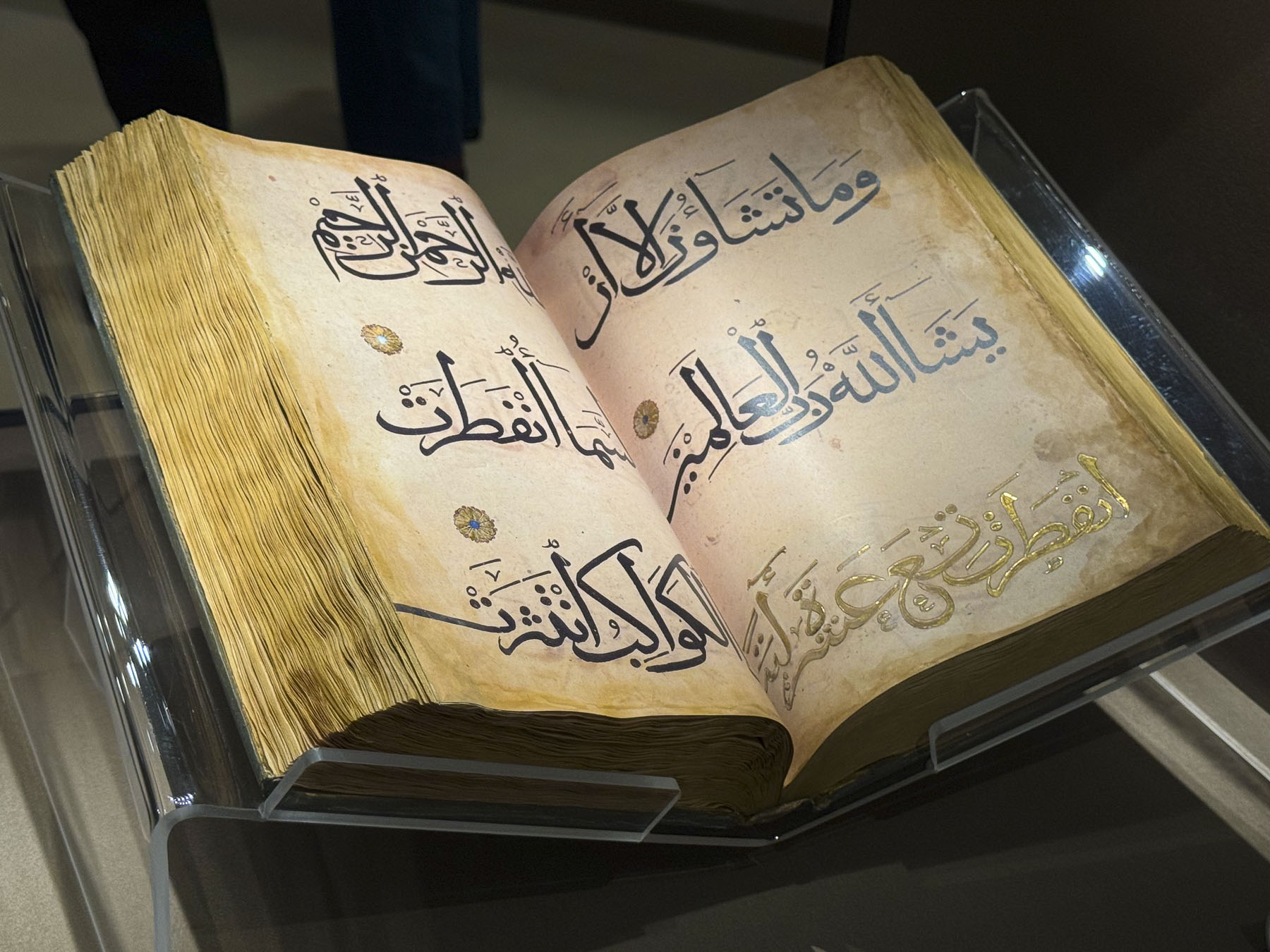
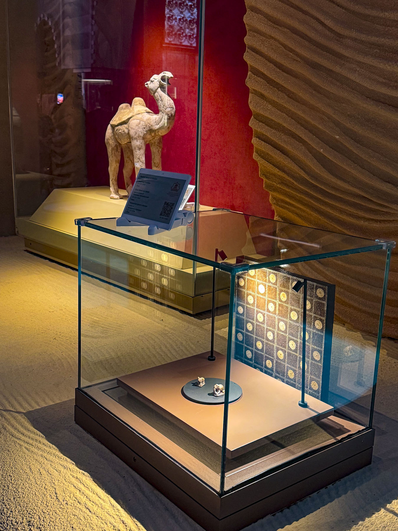
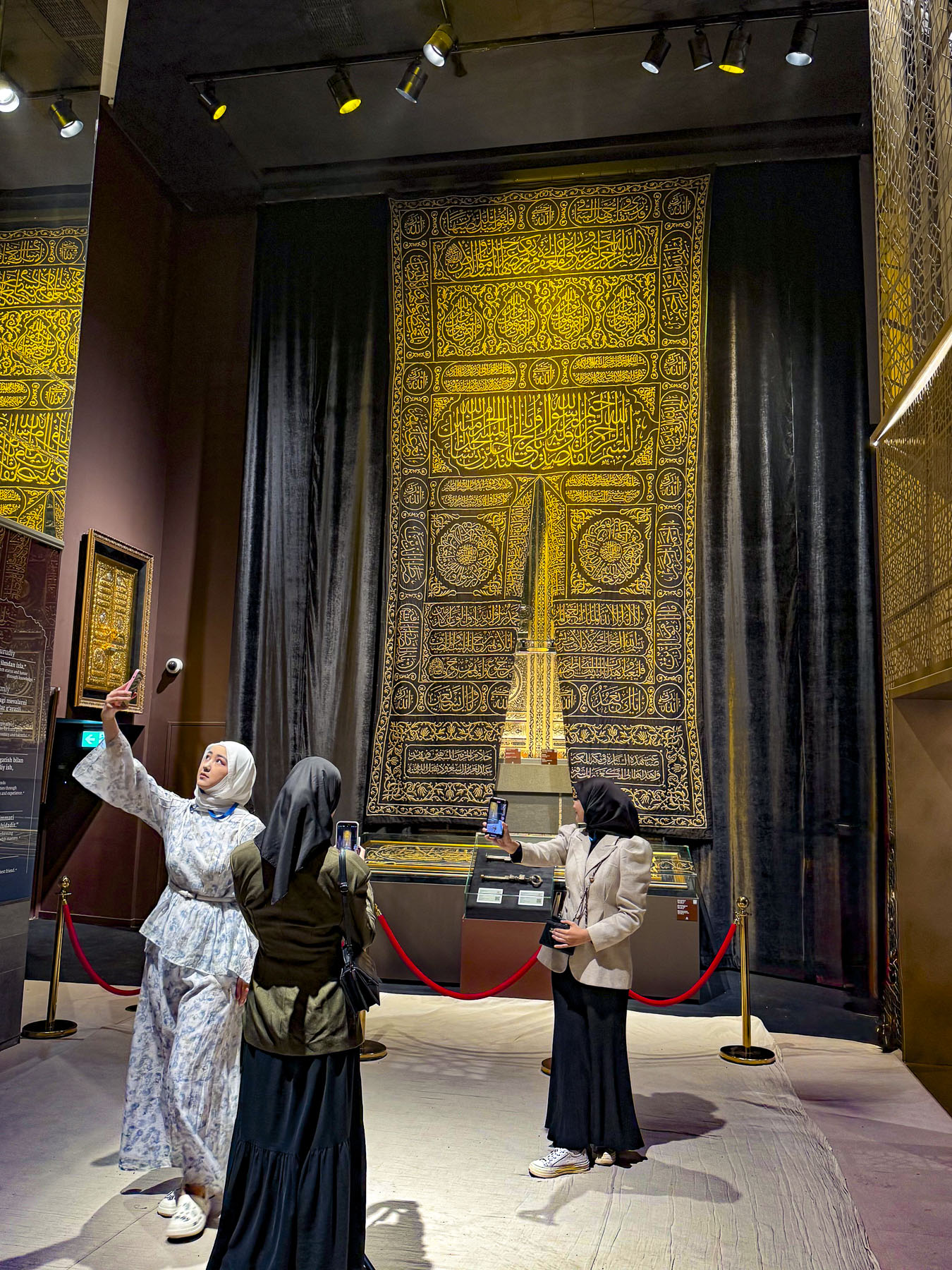
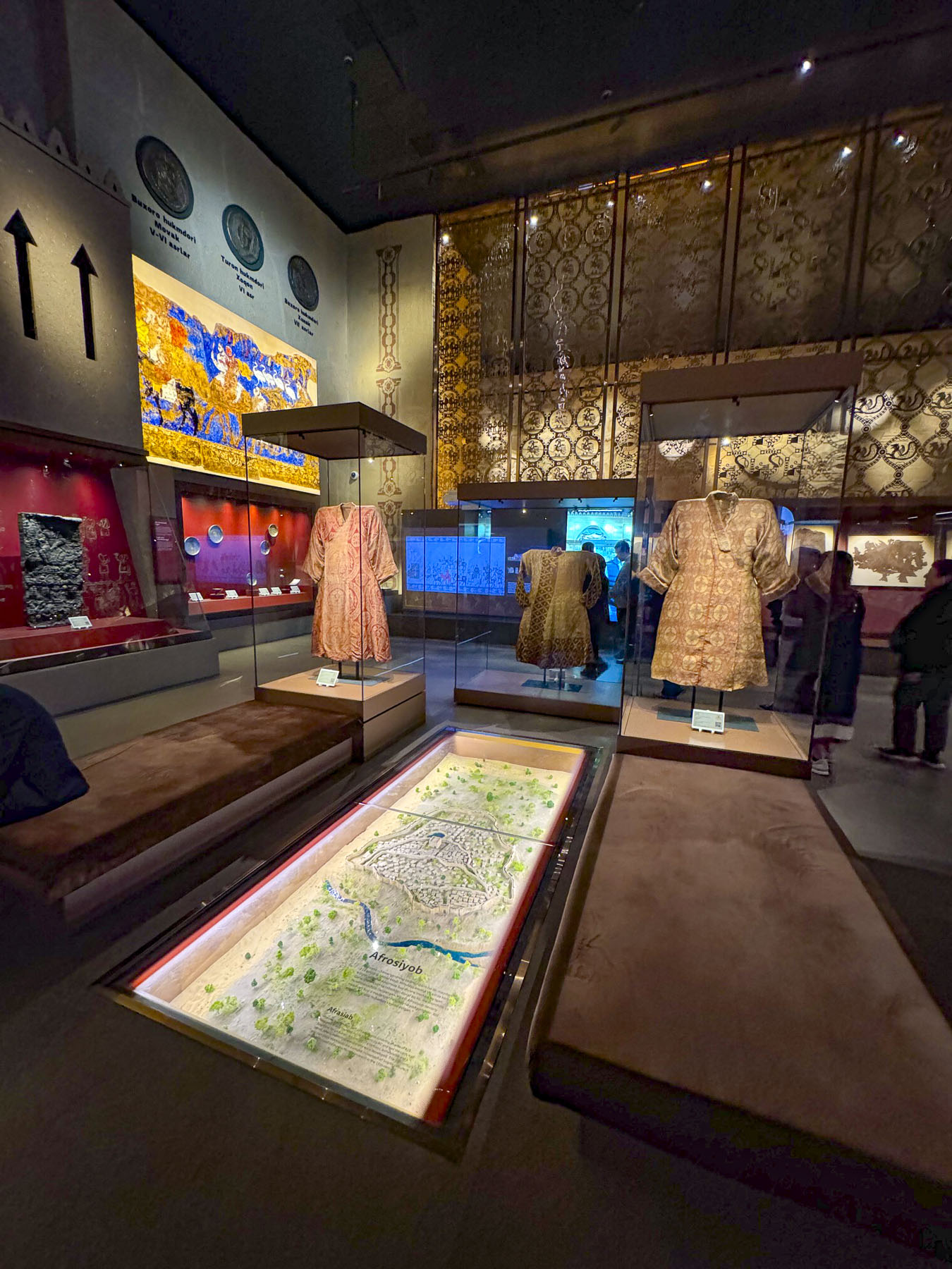
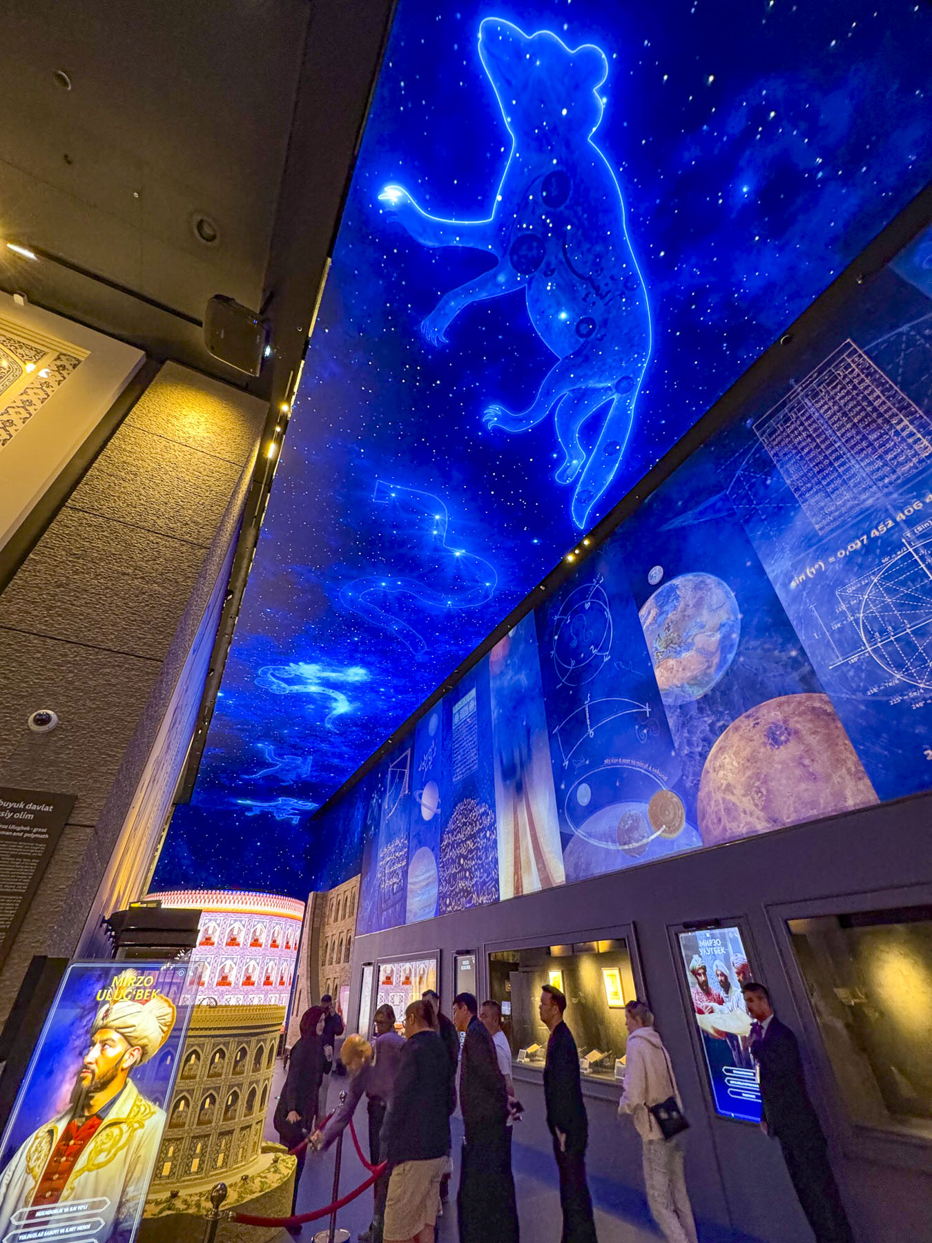
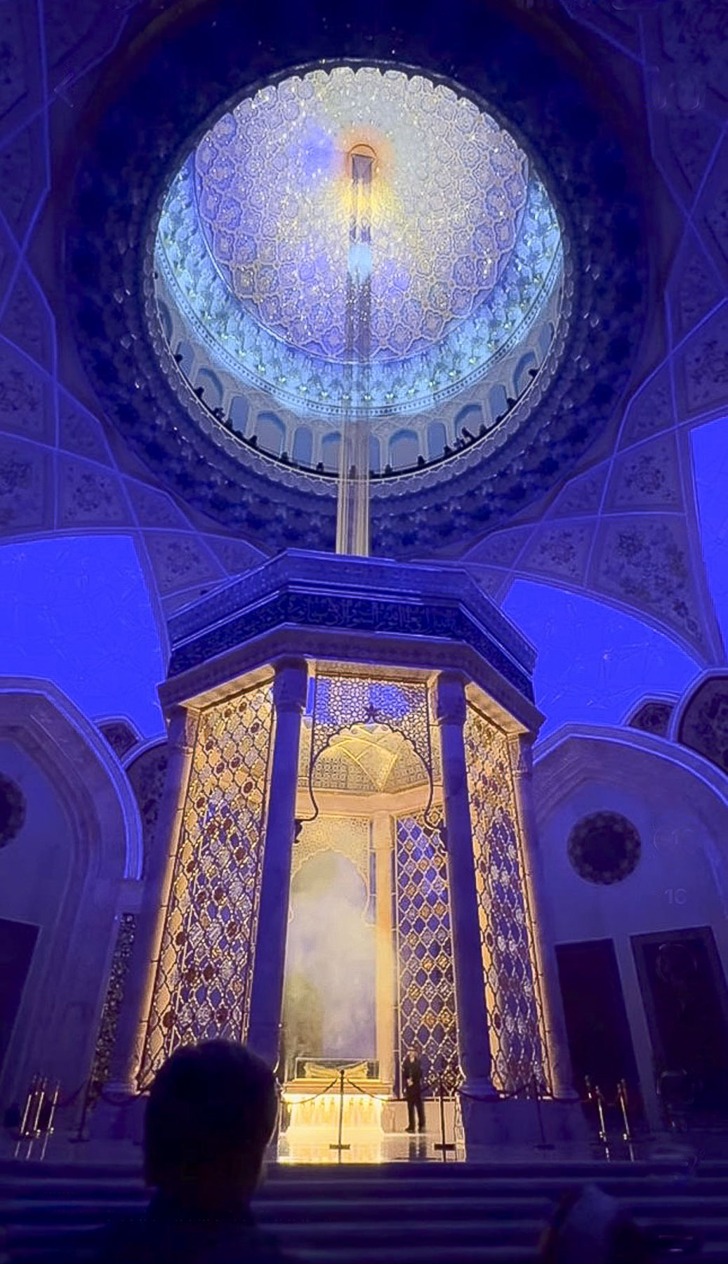
It’s a huge building with over 2,000 historical items, manuscripts, and cultural artifacts on display, 743 of which have been repatriated from international collections, and a 45,000-book research library. It was a fascinating tour that lasted about two hours and ended in the Quran Hall with a dramatic multimedia event where sacred verses of the Quran were projected onto a digitally created night sky in the 65m (213ft) tall dome, directly over the treasured 7th-century Uthman Quran, and a holographic beam of light descends from the heavens to spotlight the manuscript, representing divine revelation.
Though the constitution of Uzbekistan defines the country as a secular state, there are some concerns about how heavily religious freedoms and activities are restricted and monitored by the government in Uzbekistan. The Islamic Civilization Center is part of Uzbekistan’s efforts to reclaim its history and Islamic heritage for the next generation, information which was repressed during the 67 years the country was under the Soviets Union’s control.
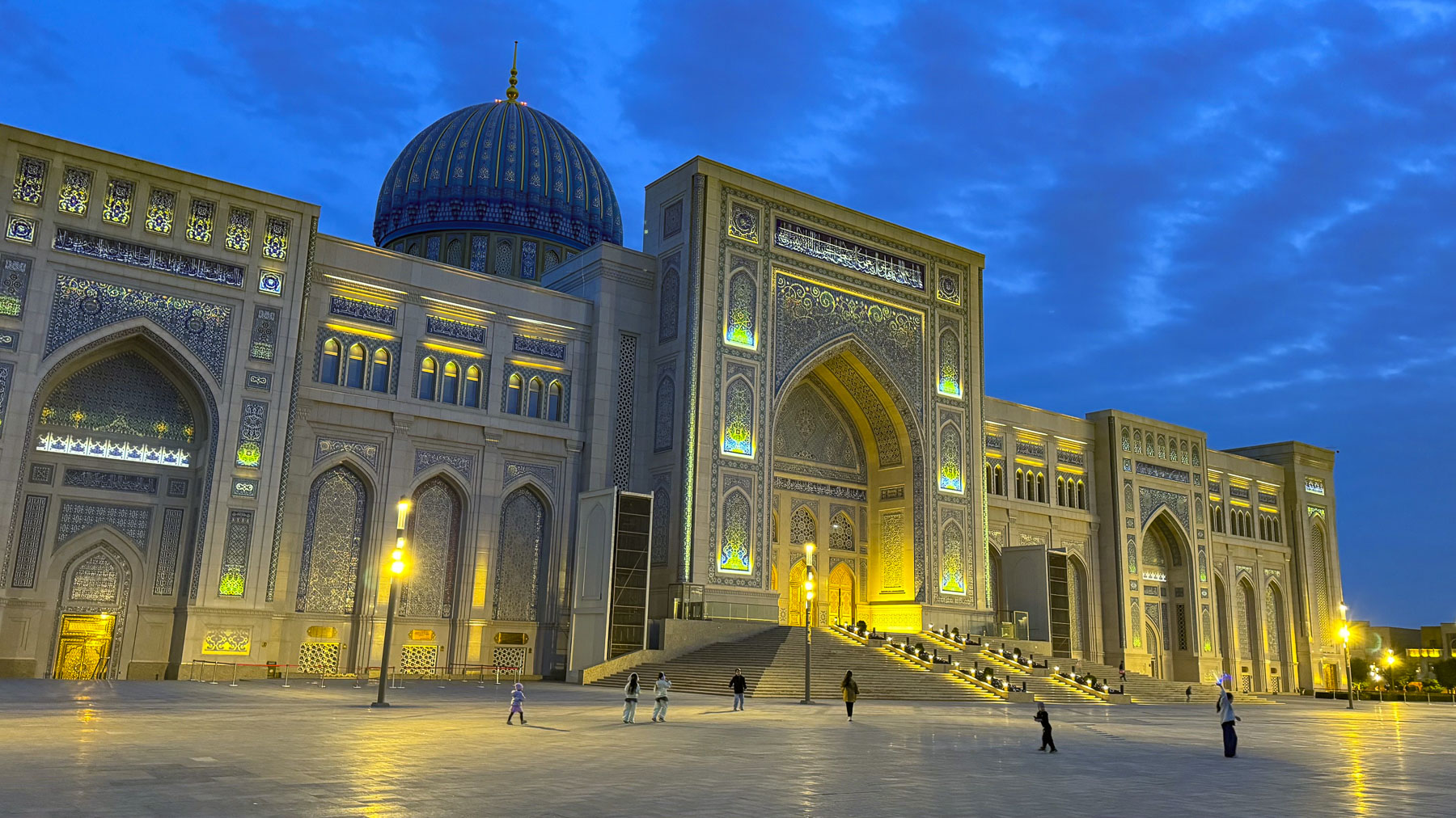
Exiting the building just before sunset, we had the opportunity to take some night photos of the dramatically illuminated building before enjoying dinner several blocks away at the Khan Ahmat, an upscale eatery.
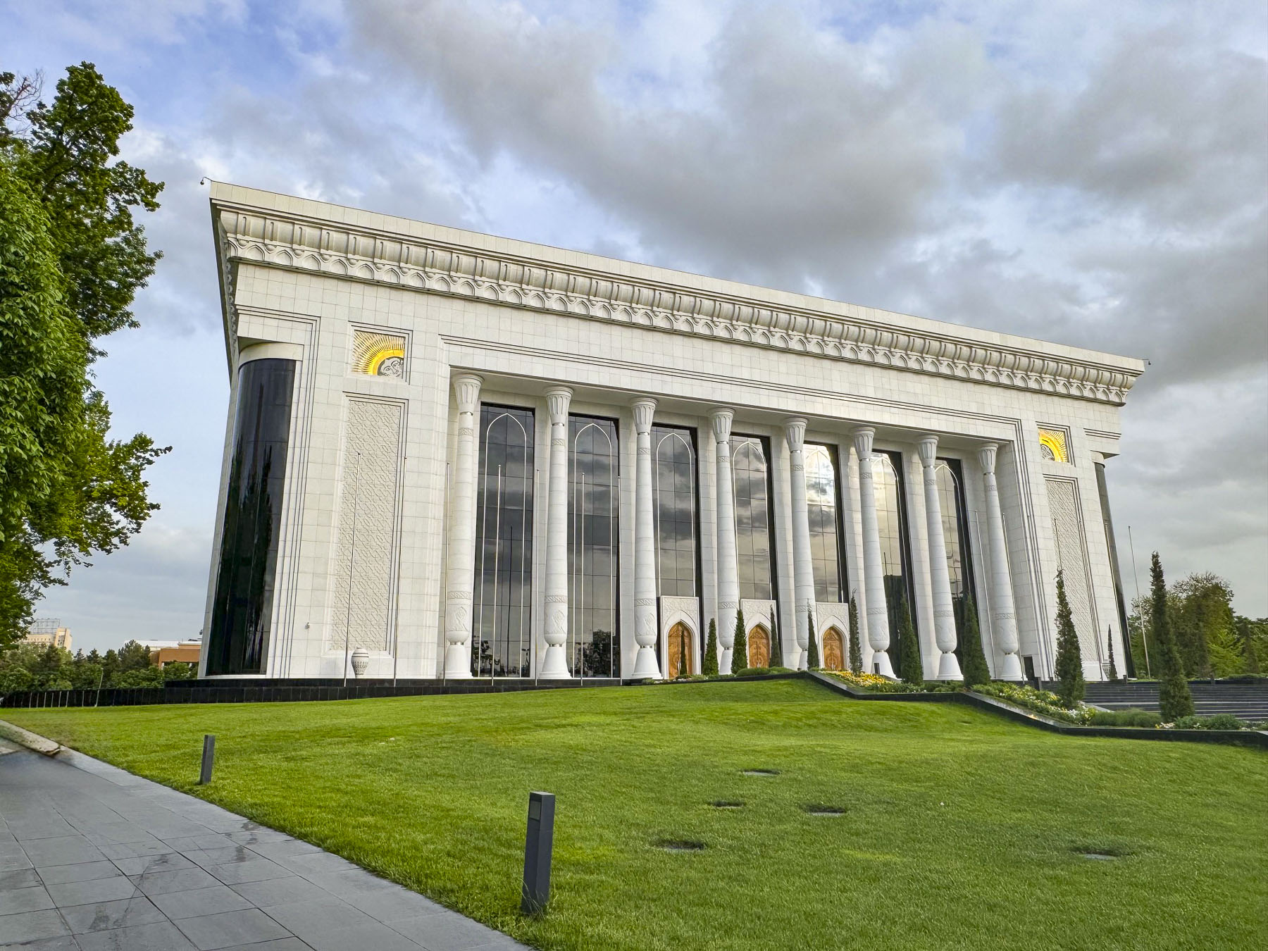
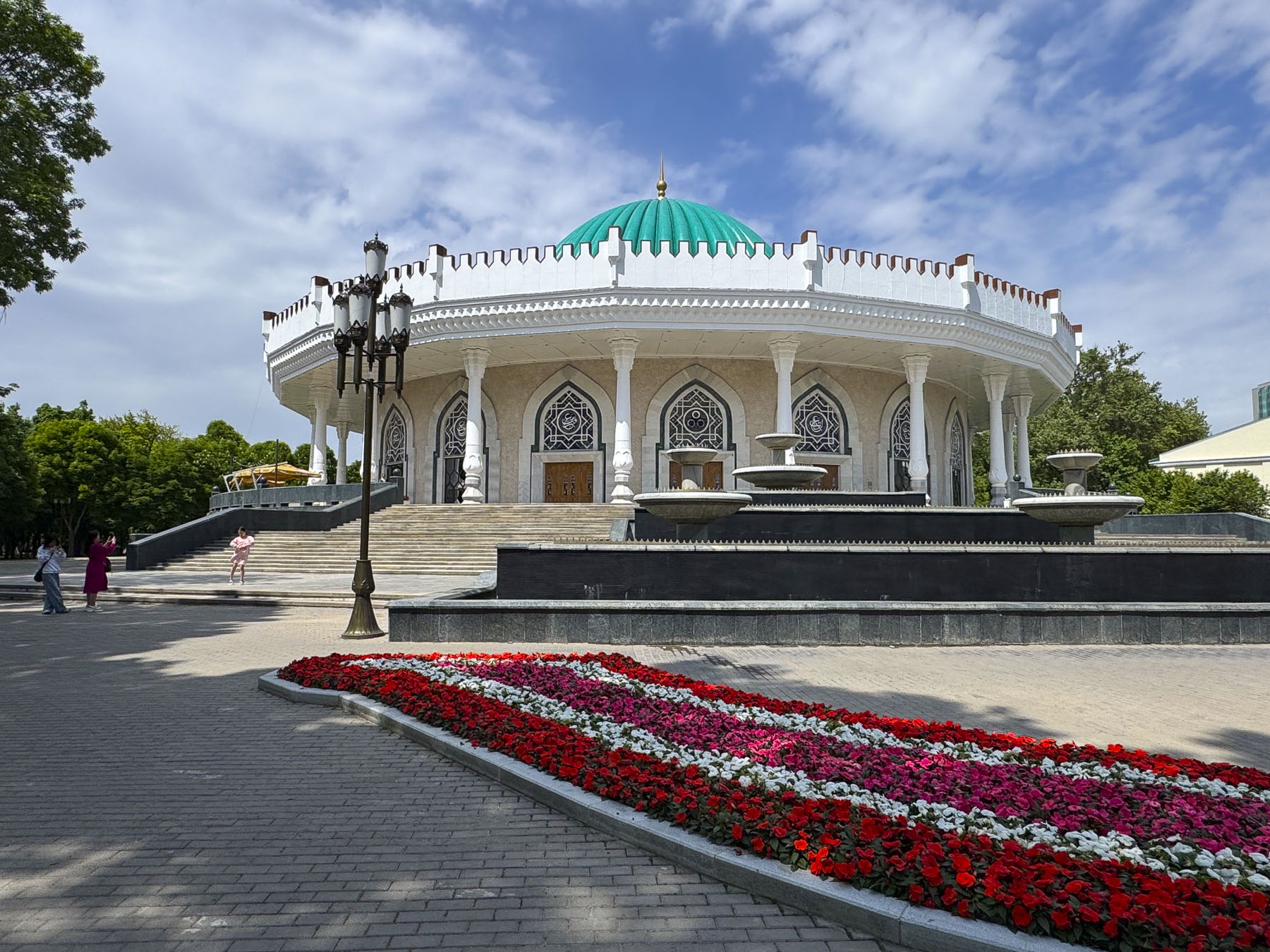
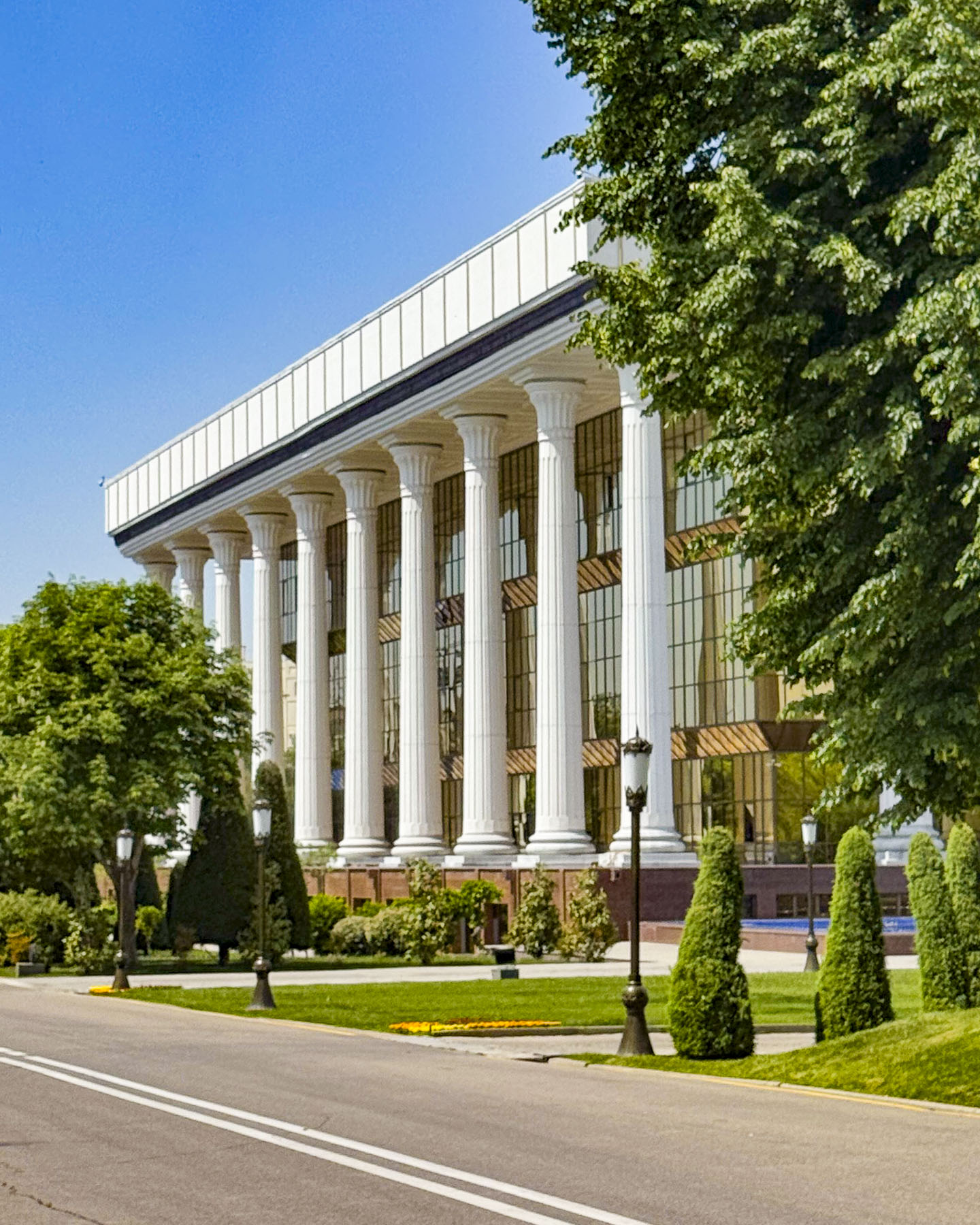
The next day we set out to see the landmarks next to our hotel before exploring farther afield – the Palace of International Forums Uzbekistan, is a modern conference hall opened in 2009, marking the 2,200th anniversary of Tashkent, and the 18th anniversary of the country’s independence; the circular shaped State Museum of the Temurids, which houses a collection of artifacts relating to the 14th century ruler Tamerlane; the Yuridik Instituti (the Tashkent State University of Law) housed in a late 19thcentury building. It is one of the few examples in Tashkent of Tzarist Russia Emperial architecture to survive the 1966 earthquake.
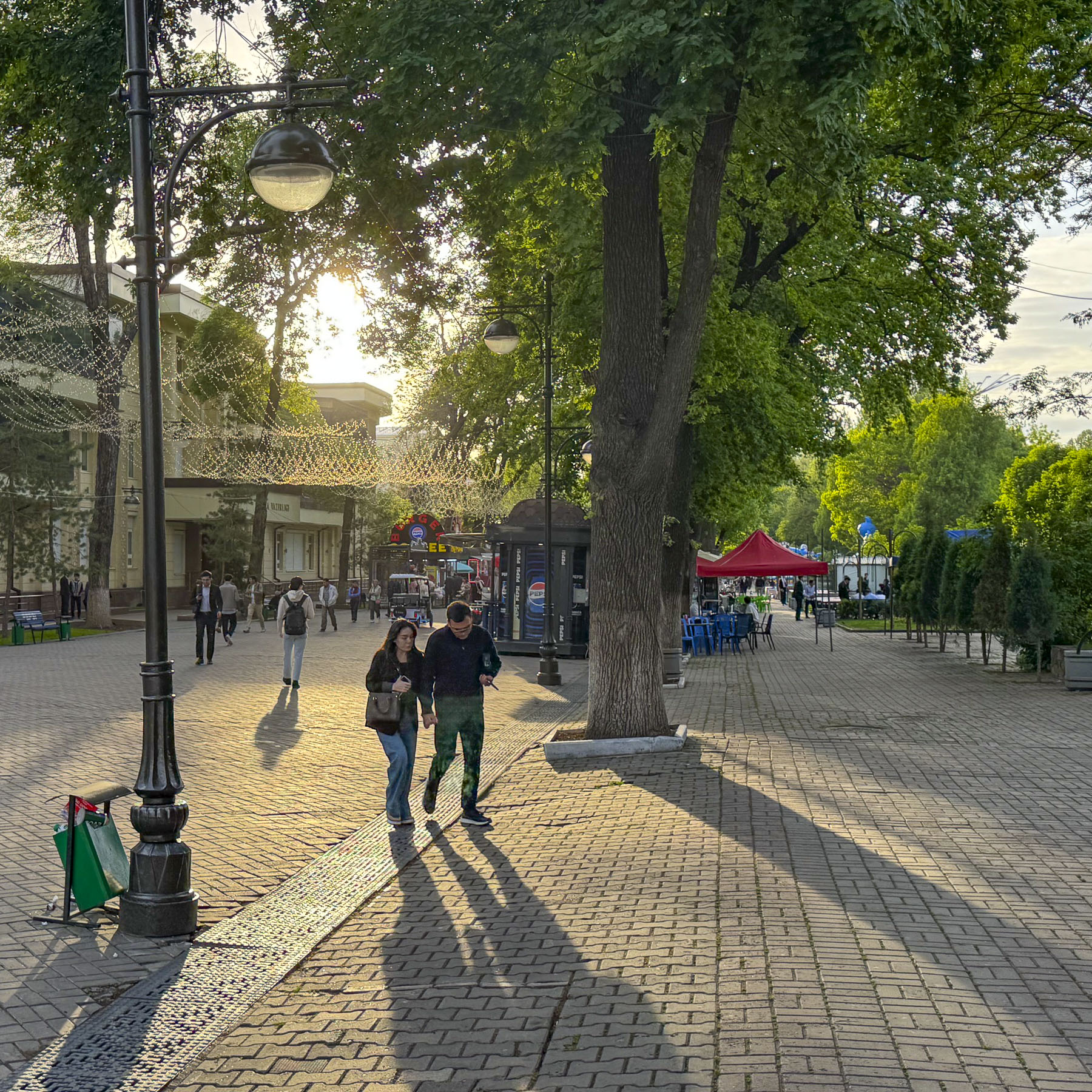
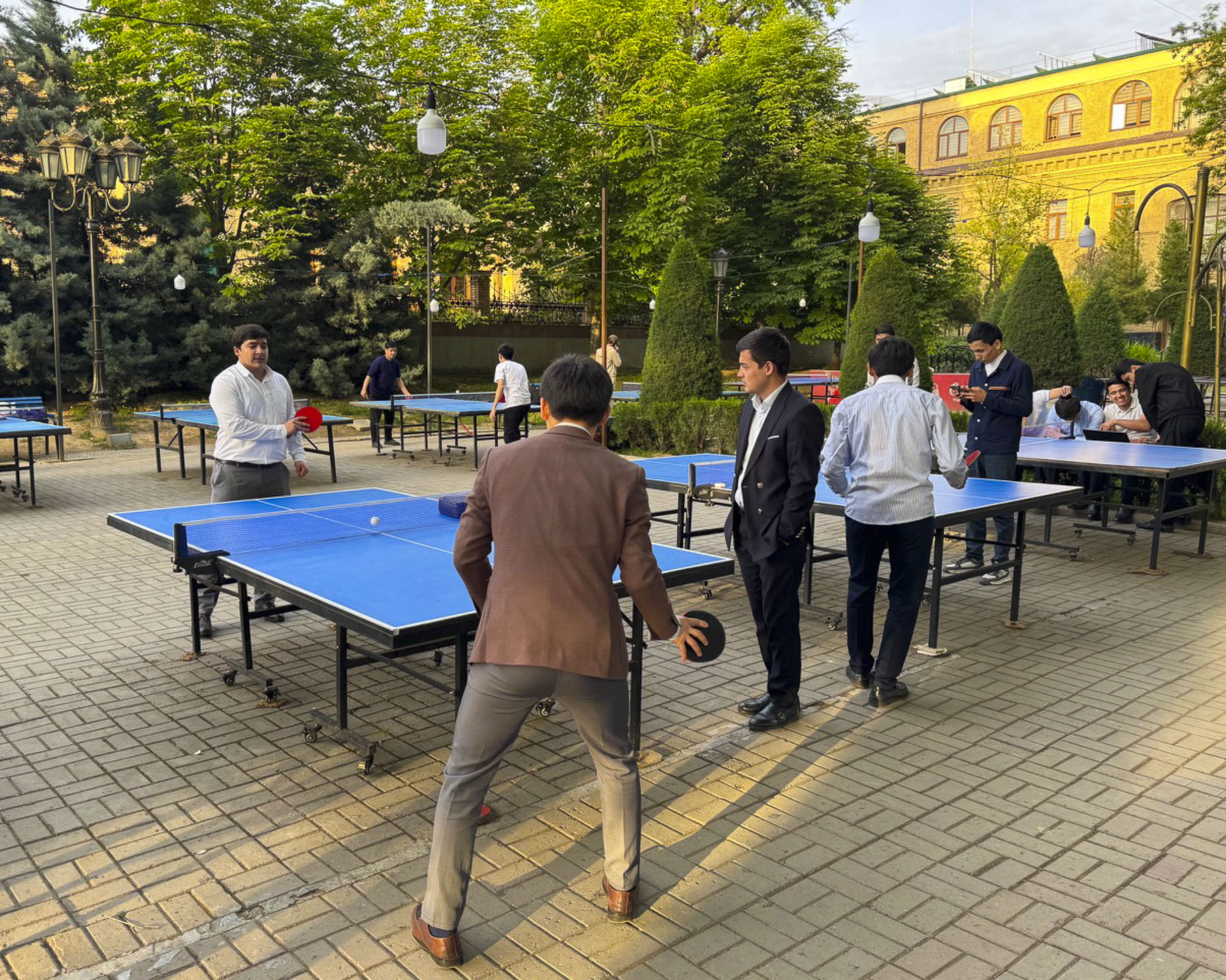
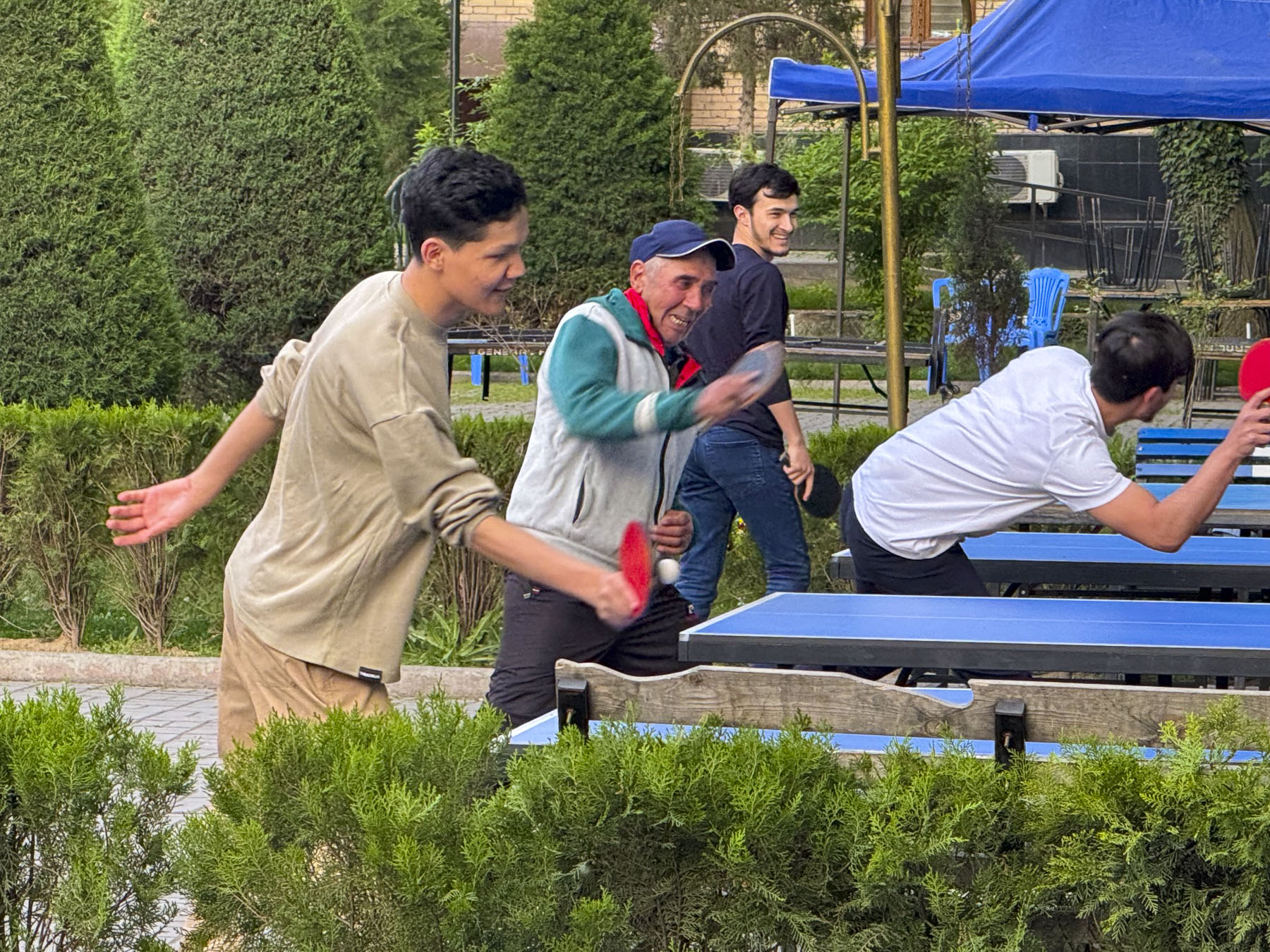
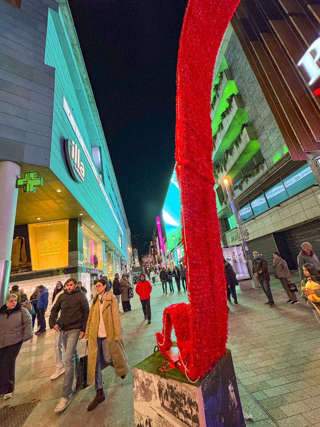
Turning the corner past the school we entered Sailgokh Street, a wide, treelined 1km (6/10mi) long, pedestrian-only boulevard that links Amir Timur and Independence Squares, that’s locally known as Broadway. Sunlight reflected through party lights strung across the street that was lined with food stalls and outdoor seating. Behind them students from the university were challenging their professors to games of ping-pong at numerous tables along the sidewalk. Caricature artists whiled away the time waiting for customers to sit in front of their easels as parents watched their young children scoot about in electric toy cars. It’s a popular destination to grab an inexpensive meal or dine at one of the fancier restaurants along the walkway.
Surprisingly on this street in 1928 Tashkent was on the cutting edge of technology, when a crowd had gathered to watch the first-ever telecast showing a moving tram, made with a device called a Telephot, created and patented by Boris Grabovsky, a student at Tashkent University, and the son of the famous Ukrainian poet, Viktor Popov. Unfortunately, by 1930 he was forced by Soviet officials to stop working on television technology.
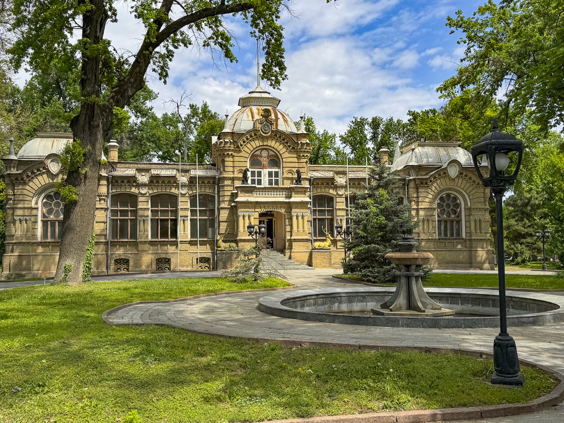
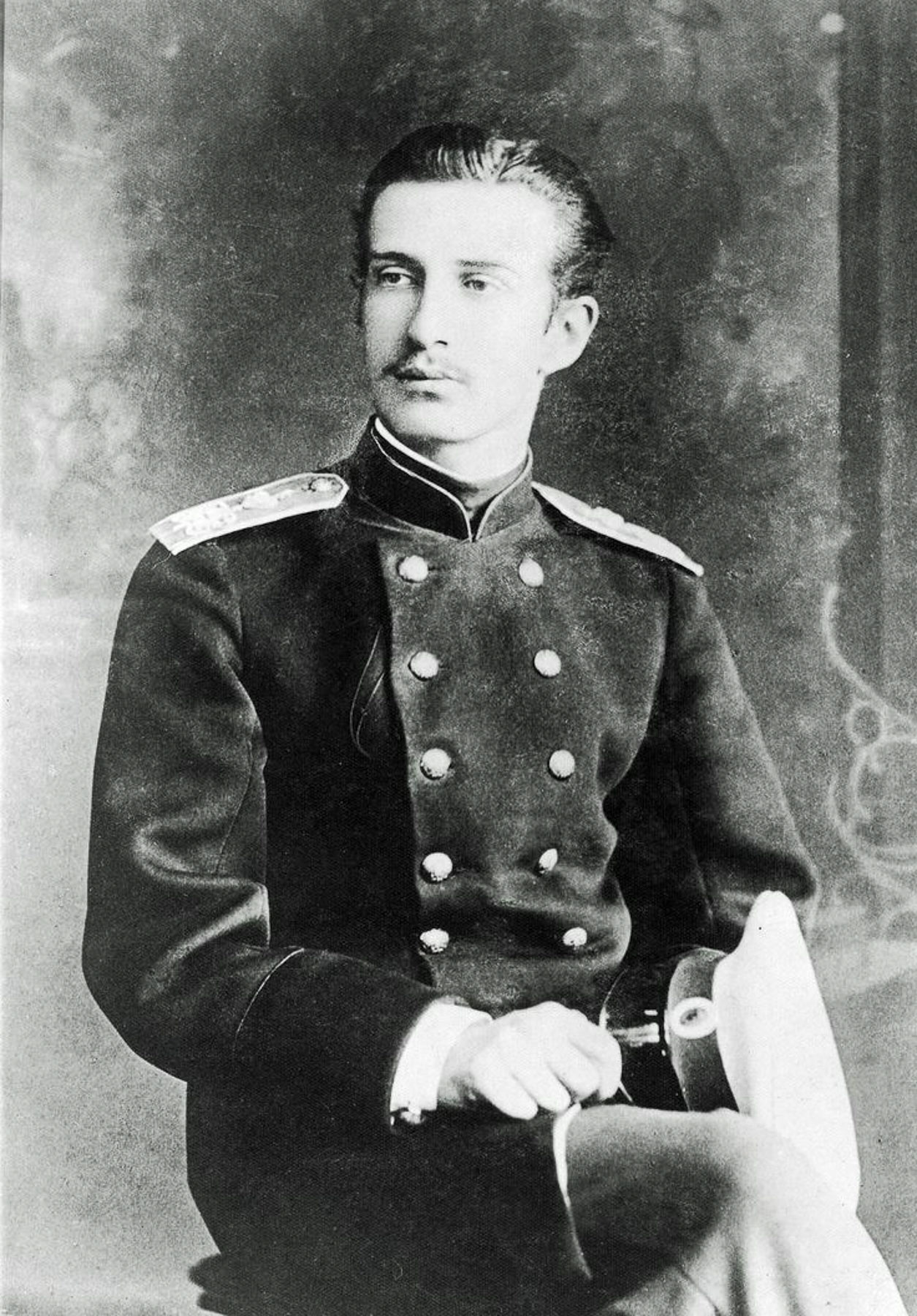
Farther along was a very attractive small royal palace built in the late-19th century and early Art Nouveau style in 1891. It was the home of Grand Duke Nicholas Constantinovich who was permanently exiled to Tashkent by the Russian royal family for stealing valuable diamonds from an icon belonging to his mother, so he could lavish extravagant gifts upon his American mistress! Let’s talk about the punishment fitting the crime here. The entrances are flanked by bronze sculptures of deer and hunting dogs, a reflection of the Grand Duke’s passion for hunting. He was by no means a pauper during his punishment, and received a gracious royal stipend which he invested in cotton mills, a soap factory, and the city’s first cinema. To furnish his prison palace he was allowed to bring his collection of Russian and European artworks from St. Petersburg with him into exile. Using profits from his local business ventures he continued to acquire new pieces of European art, rare books, and priceless artifacts. Before his death in 1918, he graciously bequeathed his art collection and palace to the city of Tashkent, to become the foundation for the State Museum of Arts of Uzbekistan collection. During the early Soviet era the palace was used as a museum to display his collection but later was transitioned into an after-school activity center for young Soviet Pioneers. Sadly, the palace was closed for renovation when we visited.
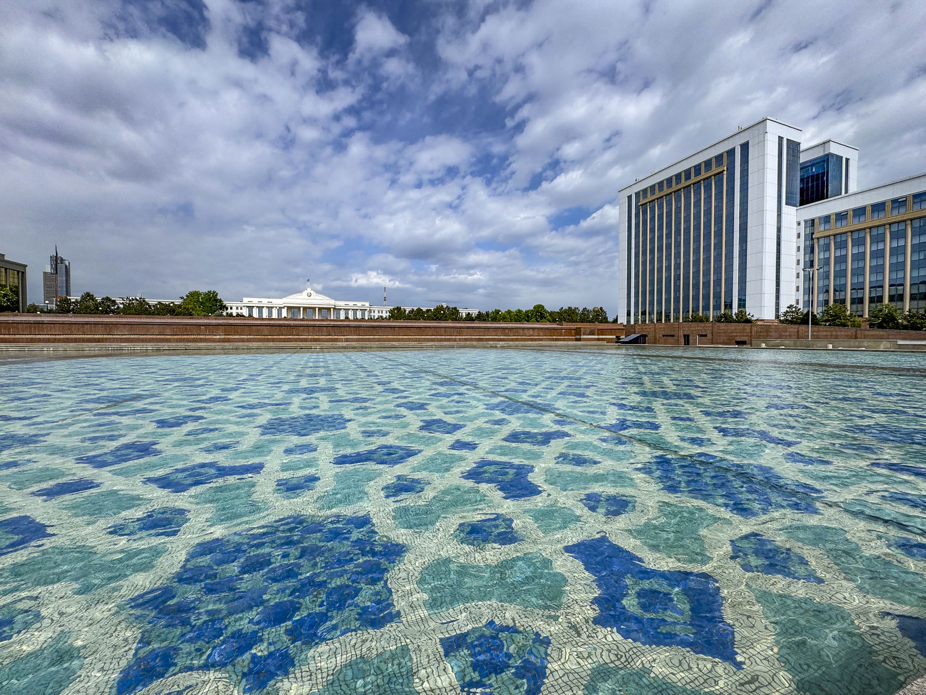
Crossing under Sharaf Rashidov Avenue we reached the large reflecting pool of the Mustakillik Fountain in front of the building housing the offices of the President of the Republic of Uzbekistan. Unfortunately, all the fountains we passed in Tashkent in mid-April were off. We can only speculate how stunning they must be when they are shooting water skyward.
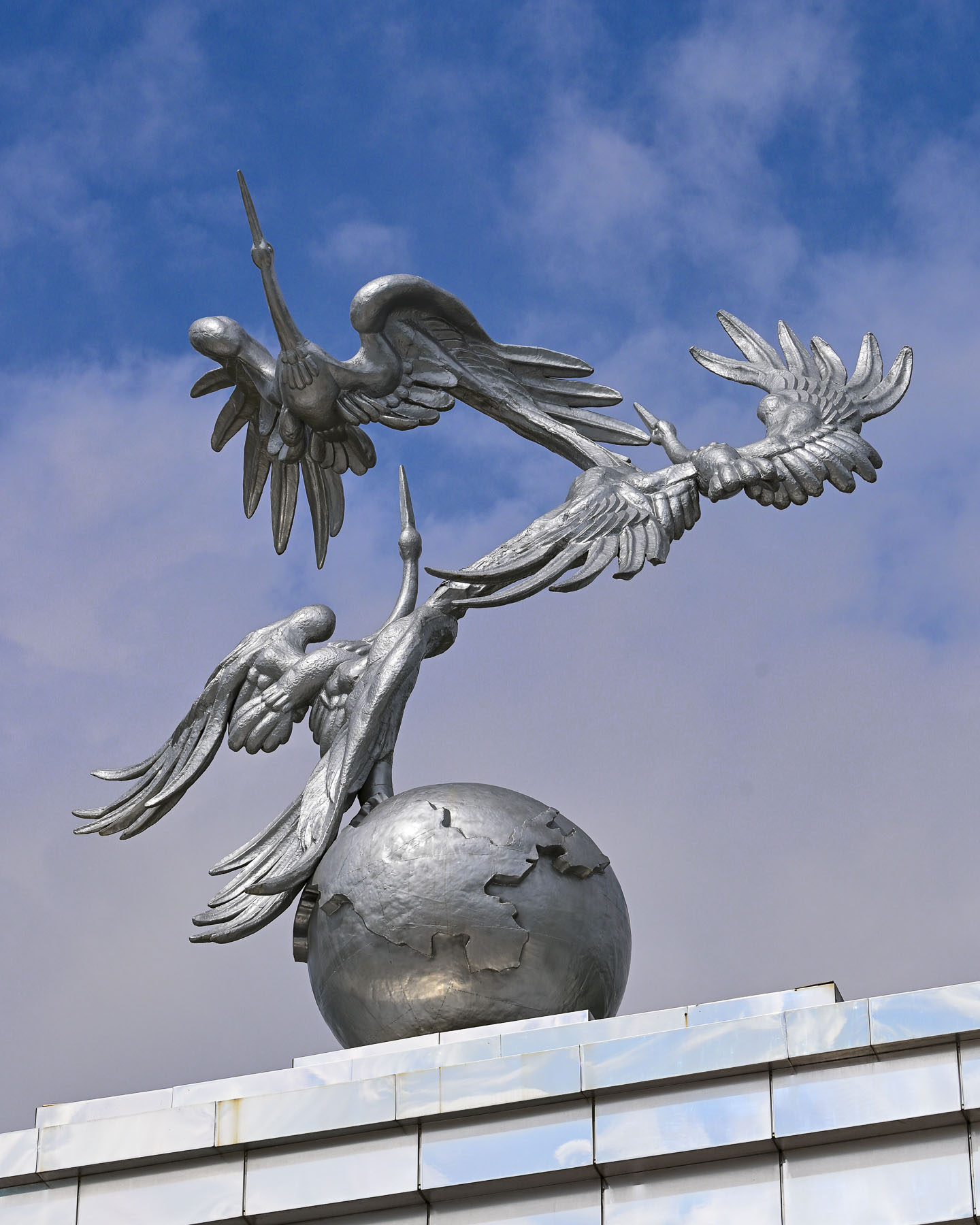
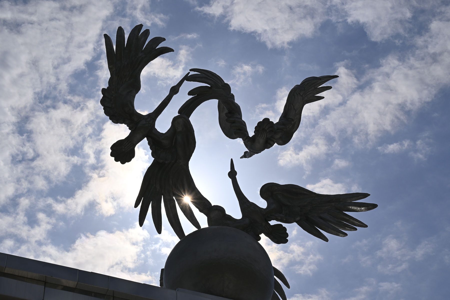
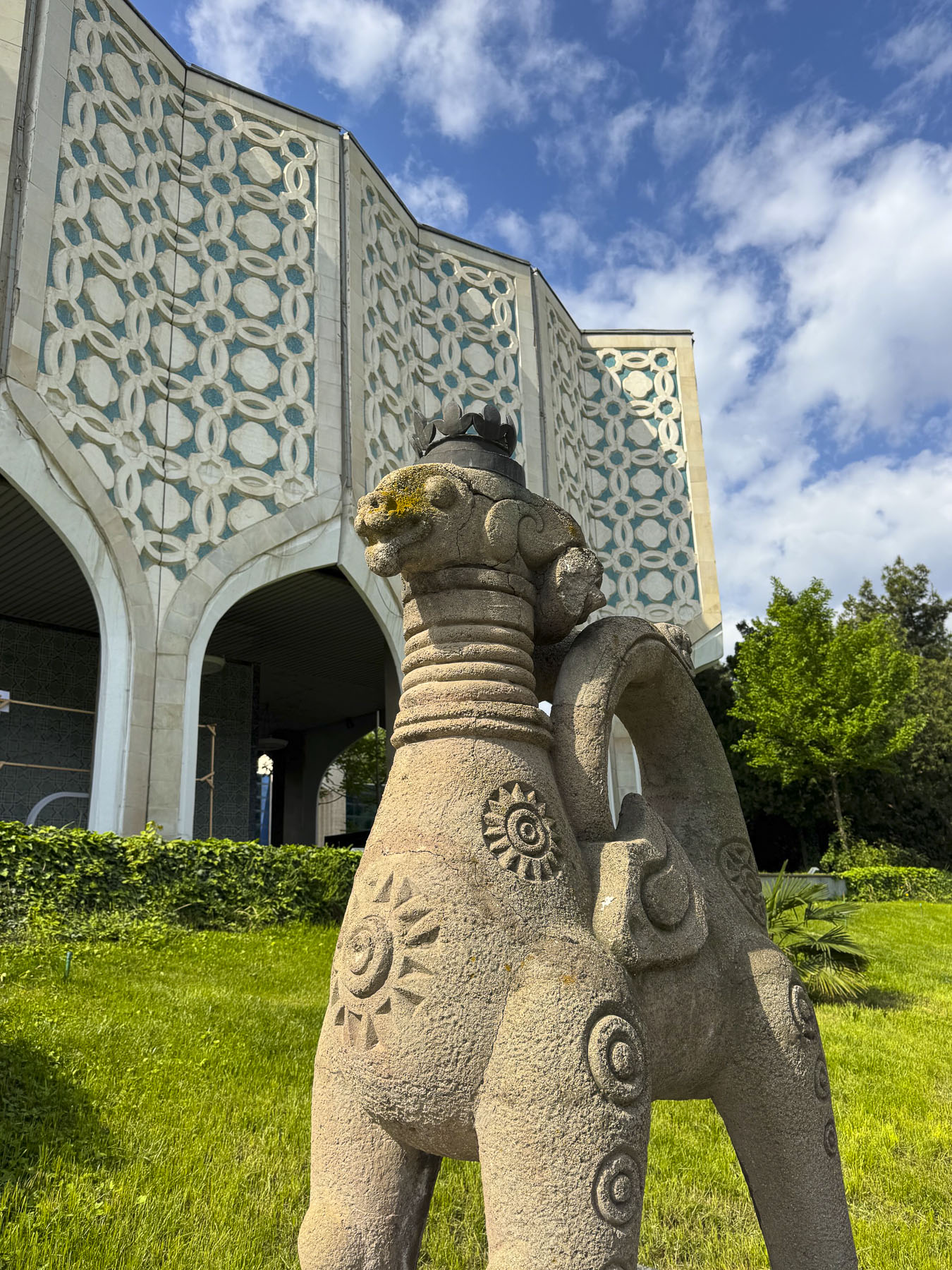
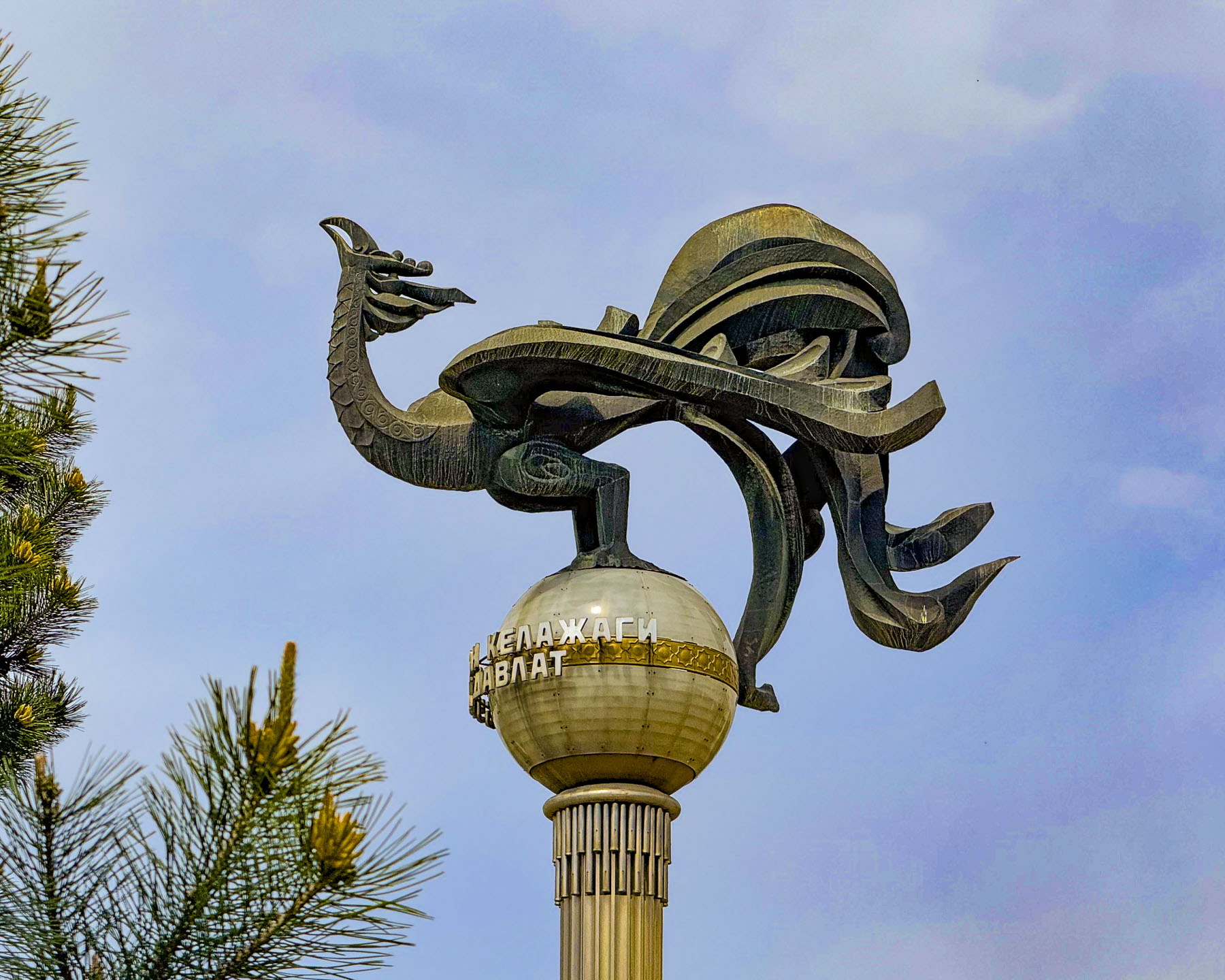
A short walk away was Independence Square where more dry waterworks paralleled the Arch of Ezgulik, a 150m (492ft) long archway held aloft by 16 white marble columns and crowned with a beautiful sculpture of three giant storks circling a globe as they soar skyward. Storks are a prominent theme on the top of many important buildings in Uzbekistan, and in Uzbek folklore they symbolize humanism, peace and prosperity.
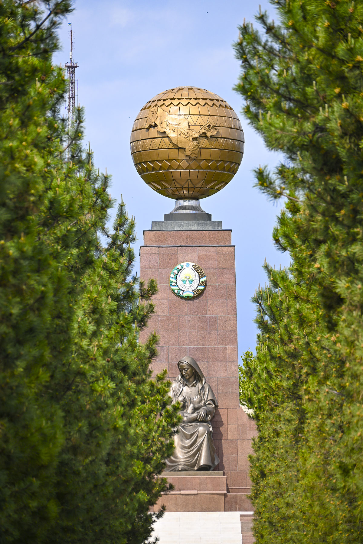
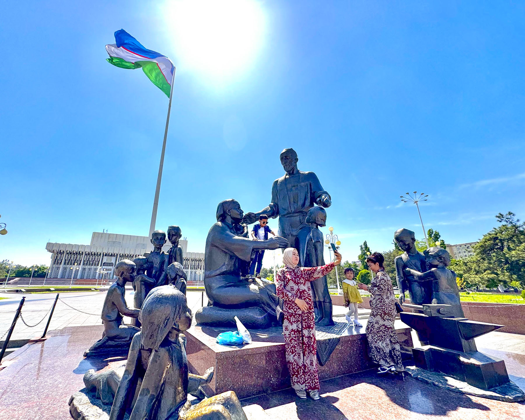
Beyond the arch, down a narrow evergreen-lined walkway, was the Monument of Independence, a tall obelisk with a globe atop it, the map of Uzbekistan chiseled into its center. At the base of the monument is a statue of an Uzbek woman cradling a baby, called the Happy Mother that “symbolizes the Motherland, national rebirth, and hope for a prosperous future for the next generation.”
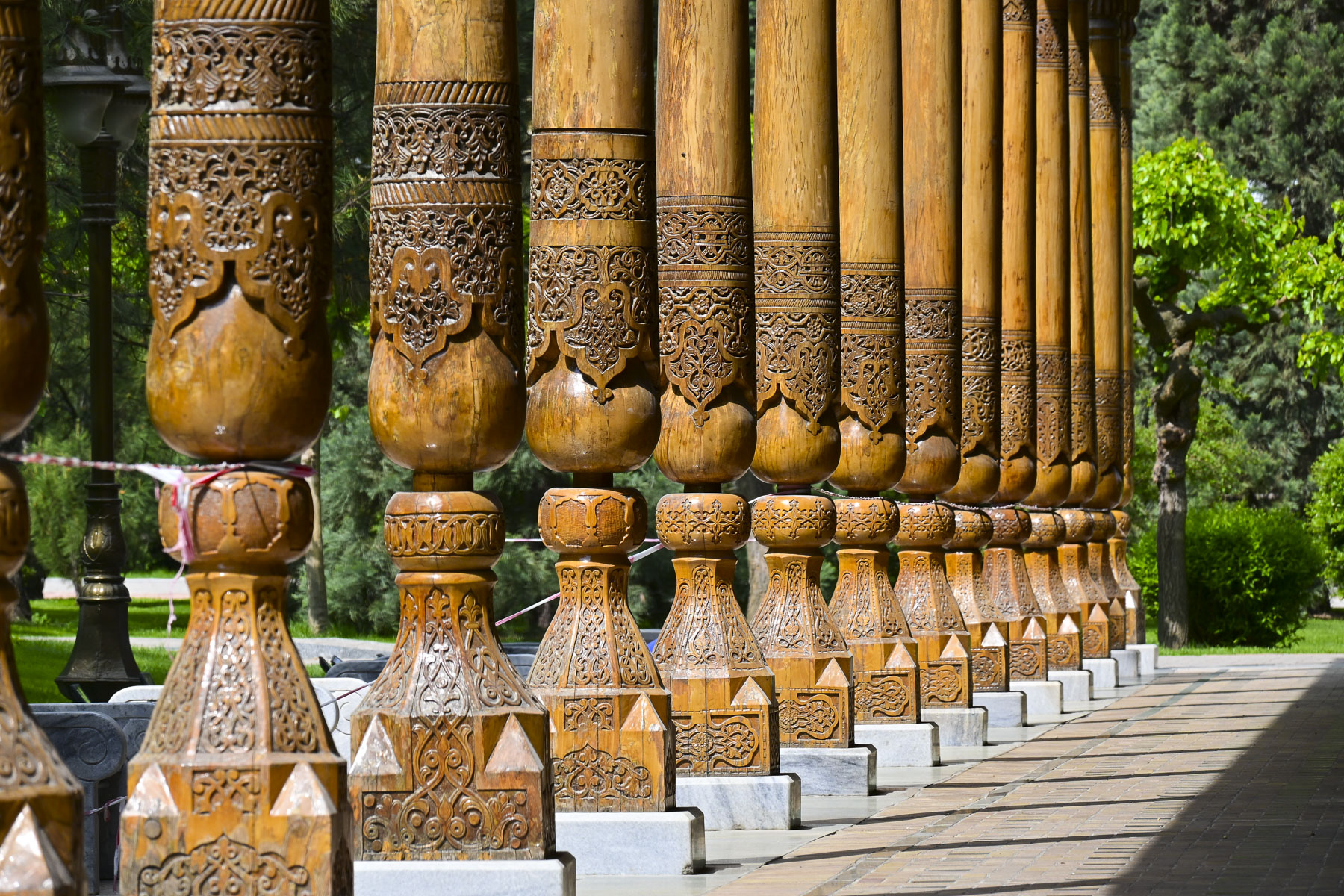
Continuing on we entered Memorial Square where an elegant, long, open-sided wooden building stood, surrounded by traditional Navoi-style carved wooden pillars, called the Memory Corridor. It holds Memory Books which contain the names, inscribed in gold lettering, of over 400,000 Uzbek soldiers who died during World War II.
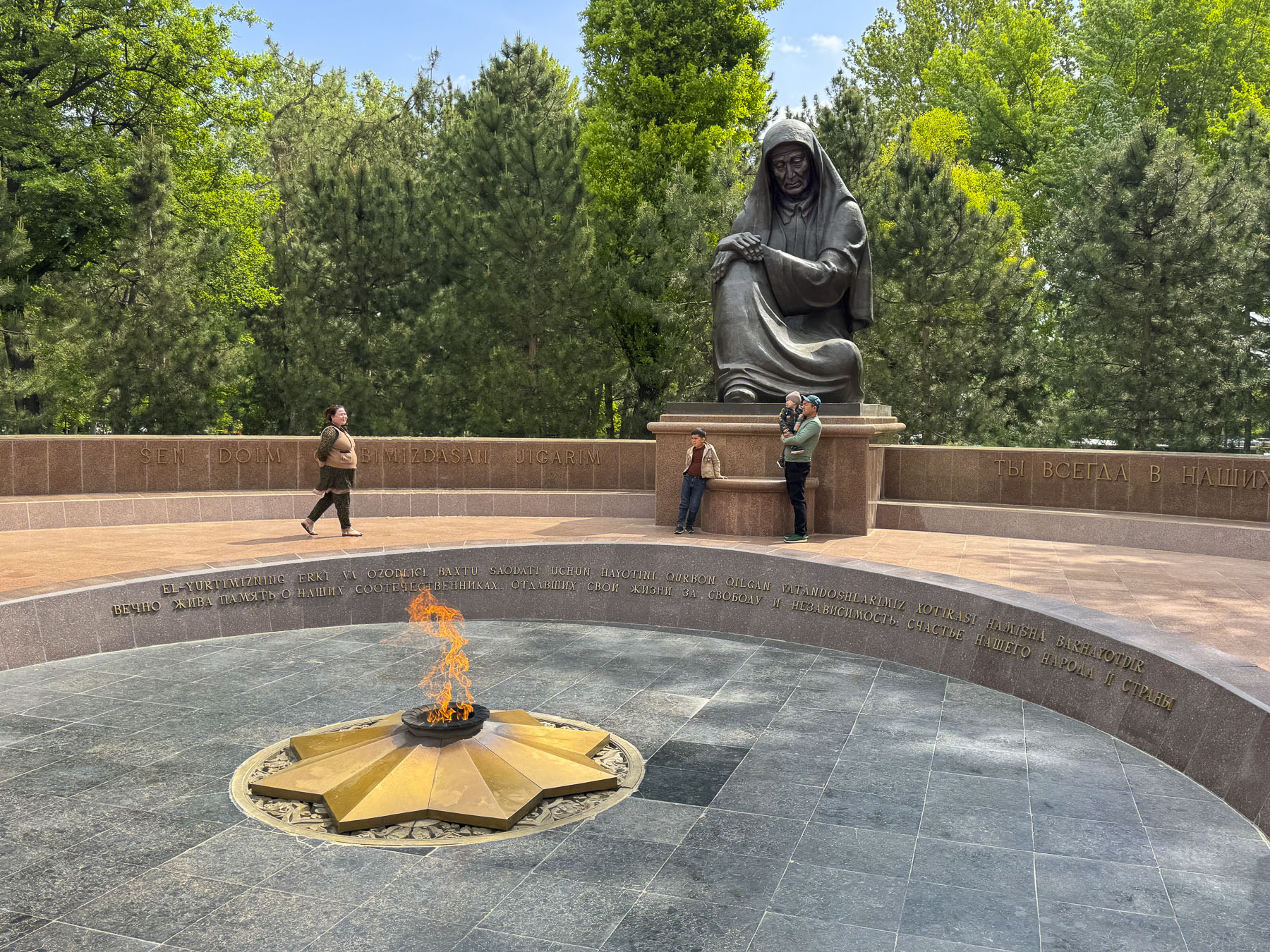
Across from it was a large statue called the Grieving Mother that overlooked an eternal flame. It was a very somber memorial and hardly a whisper could be heard from the observers.
Progressing along Sharaf Rashidov Avenue toward the Monument to “Courage,” we passed the Turkistan Concert Hall, where a stylized statue of a majestic stork is perched on top of a tall column.
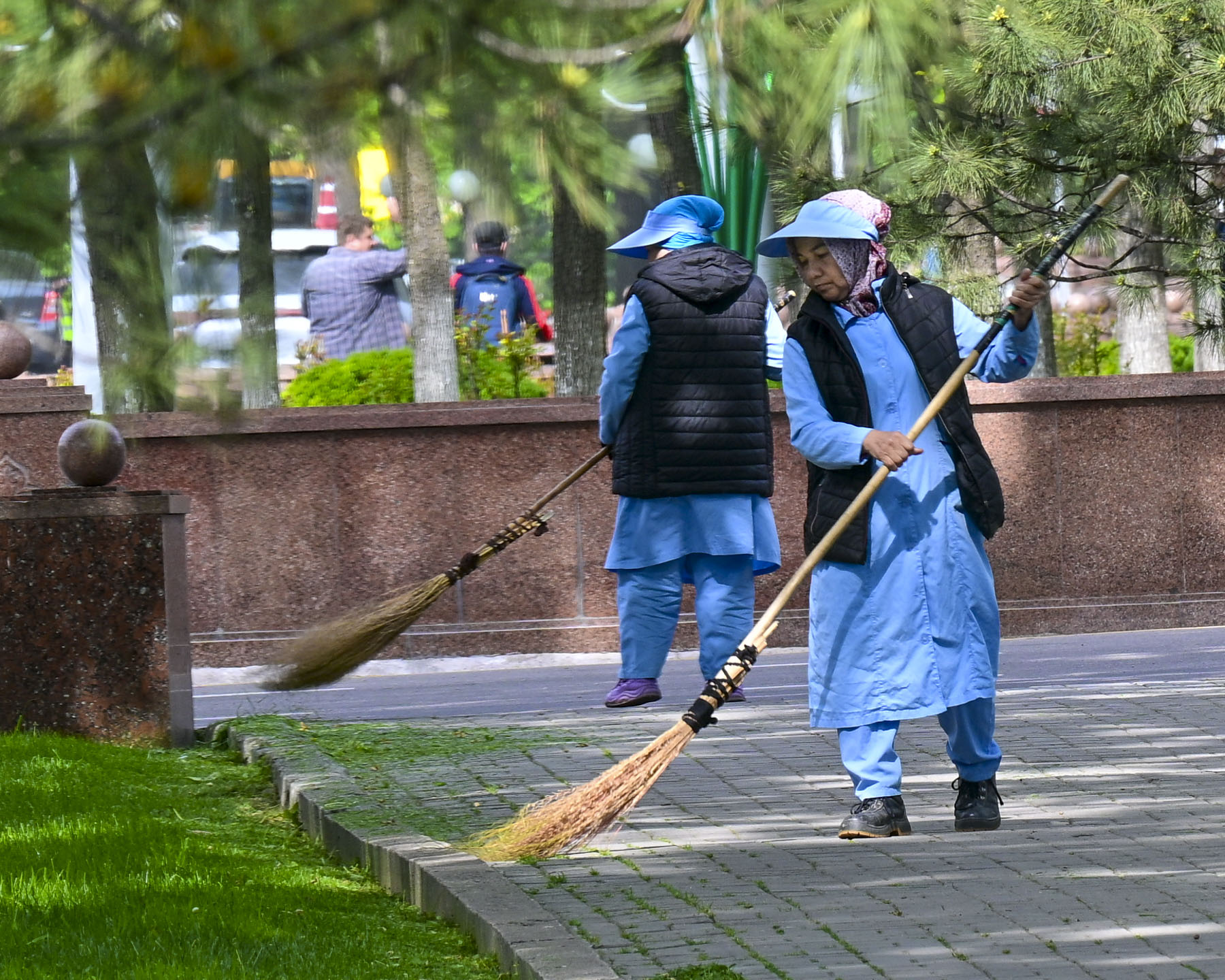
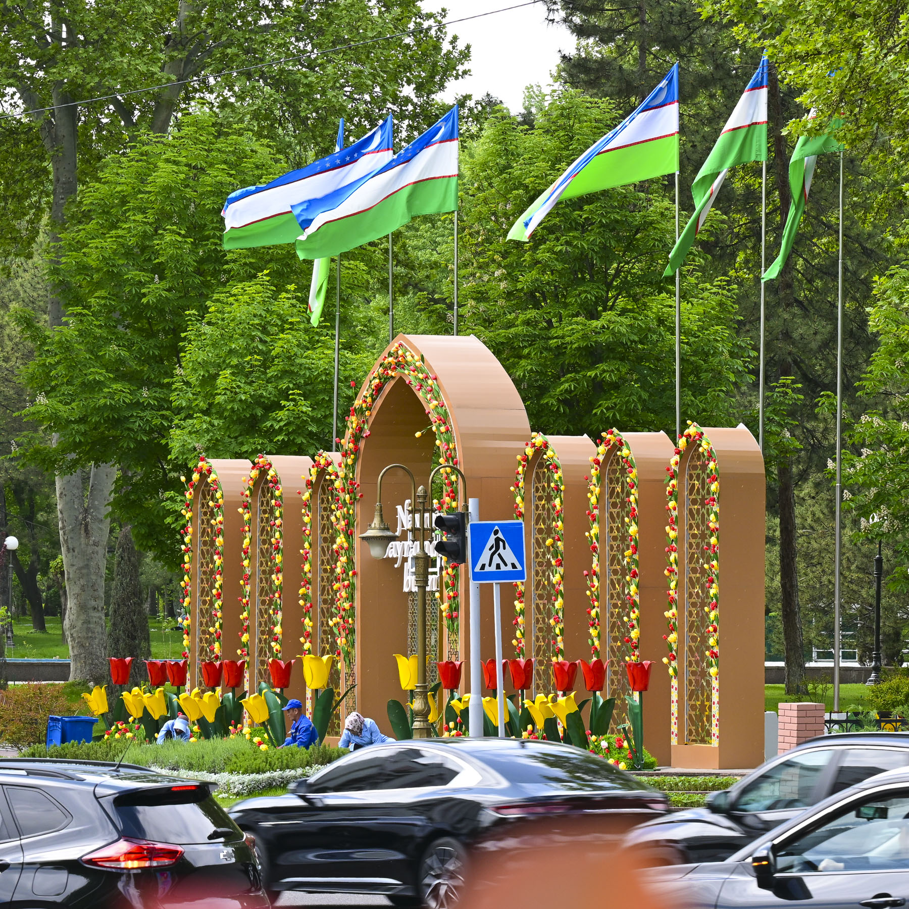
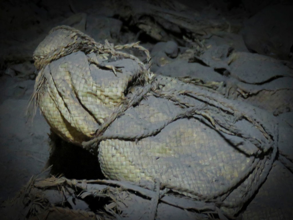
Along the way we noticed that everywhere we walked there was a definite sense of “pride in ownership.” The city was immaculately clean. Street sweepers with traditional brooms called supurgi, made with bundles of twigs tied to a wooden handle, were always out and about, as were the city’s landscapers who seemed to be everywhere planting decorative flower beds and pruning. When they were done in one area, they packed up their tools and brooms and hopped onto a city bus to go to the next location needing tending.
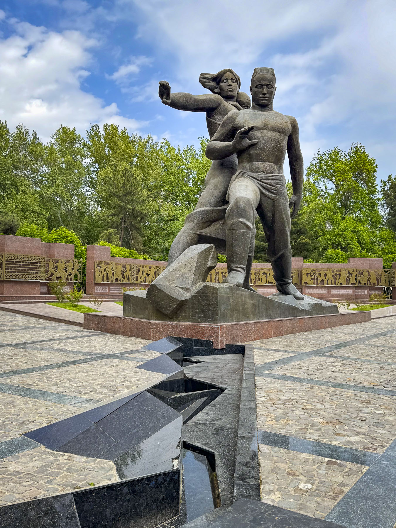
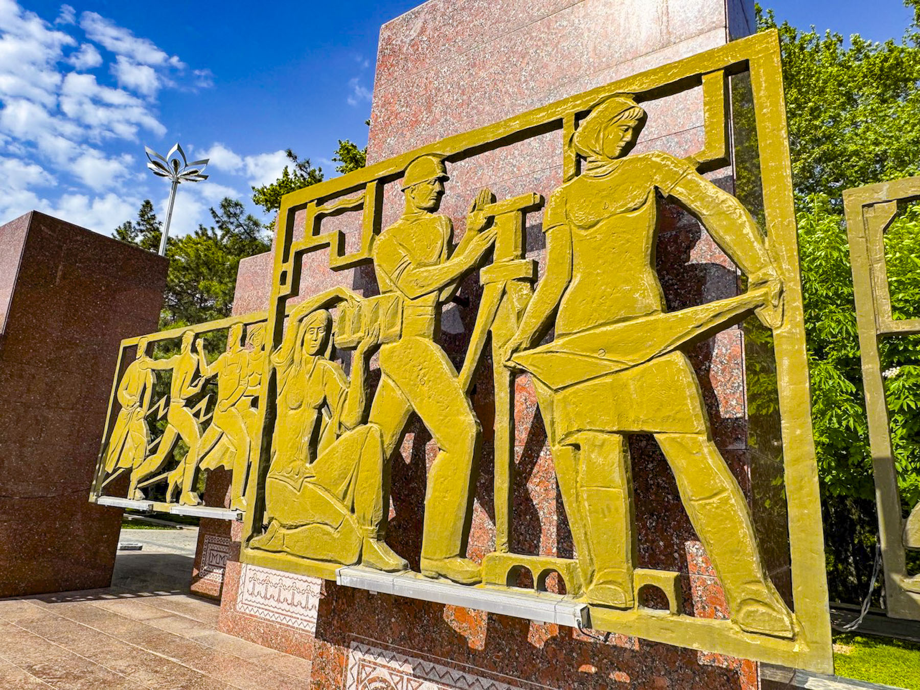
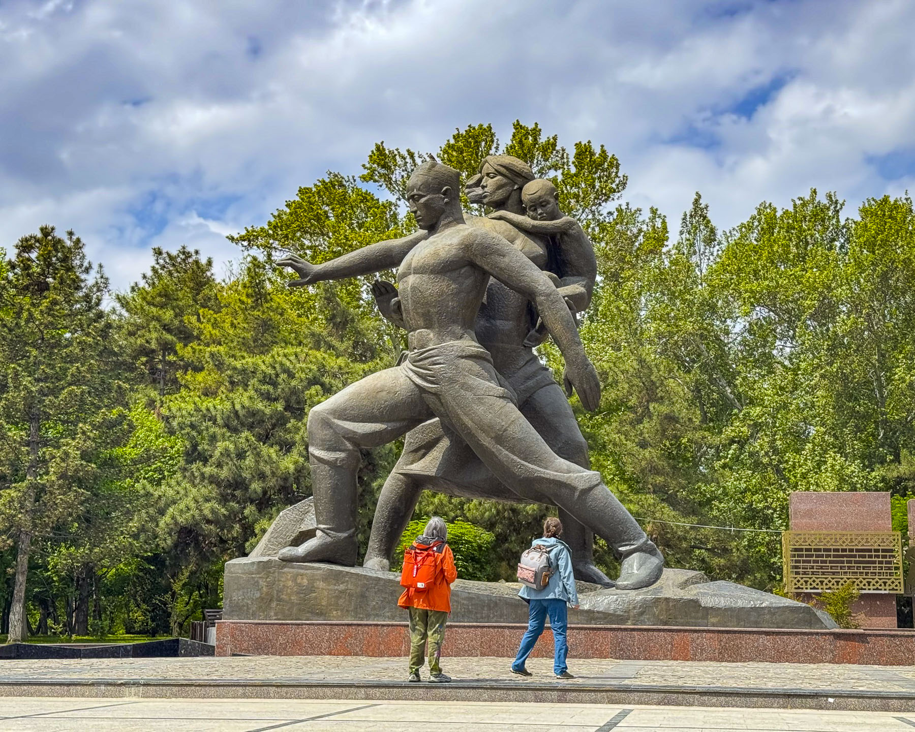
The Monument to “Courage” is a gigantic statue of a family, erected in 1976 on the tenth anniversary of the April 1966 earthquake that commemorates the victims, as well as collective efforts of Tashkent’s survivors and the thousands of workers who arrived from across the Soviet Union to rebuild the city from the rubble. At the foot of the sculpture is a recreated fissure in the earth’s crust that is believed to be directly above the epicenter of the 5.2 magnitude earthquake that rattled the earth for 11 seconds and had nearly 1,000 aftershocks. Behind the statue is a wall of 14 stelae with stylized bronze bas-relief sculptures depicting the reconstruction efforts of the workers and volunteers who rebuilt Tashkent, from literally the ground up.
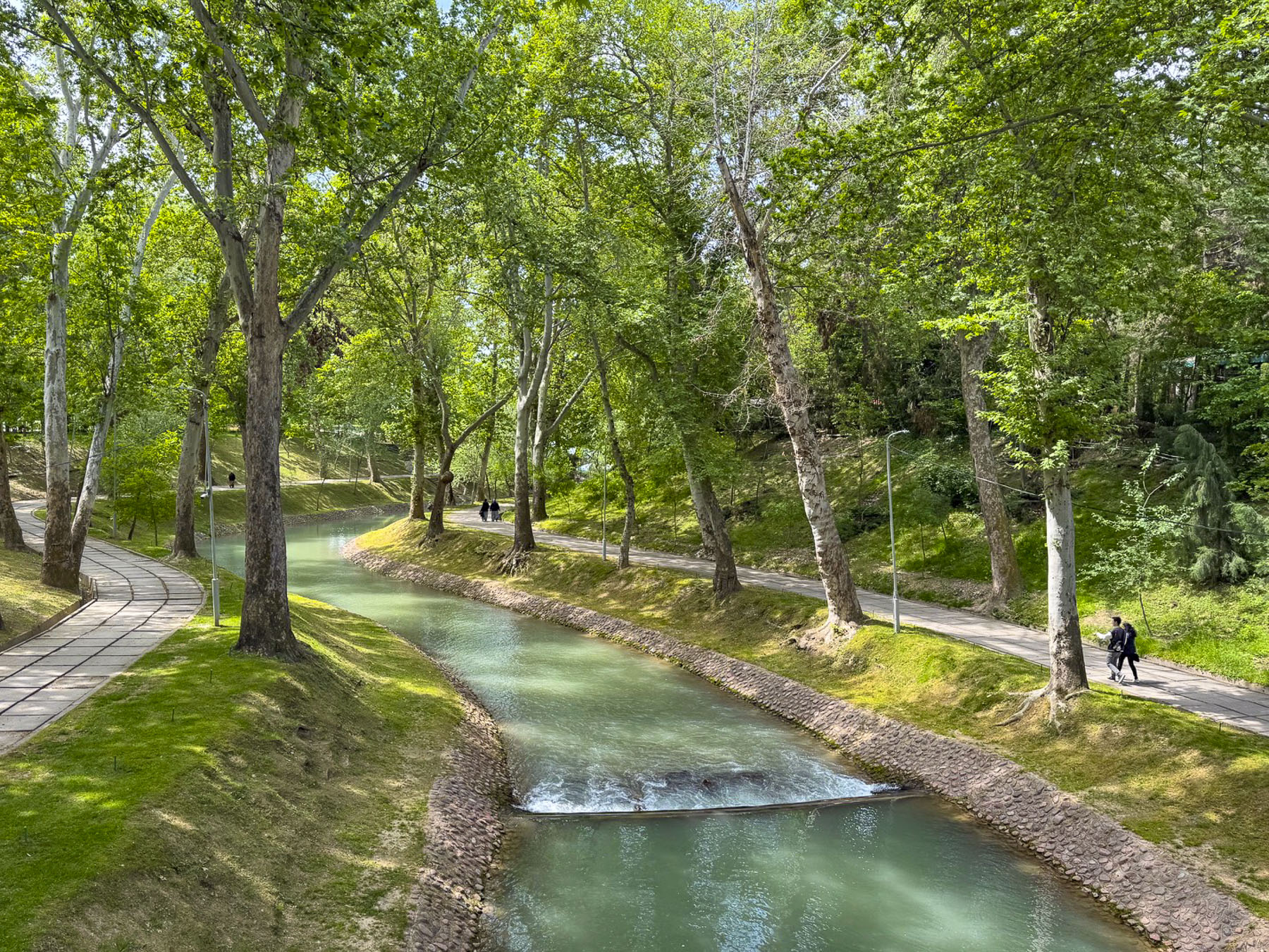
A sidewalk next to the stelae leads to Museum of Olympic Glory and crosses over a bridge above the scenic Anchor Canal as it weaves through a quiet woodland before the museum.

Walking from Independence Square along Sharaf Rashidov Avenue to the Monument of Courage, and then following Navoi Avenue, and Mustaqillik Ave back to our hotel, the new design of this “model Soviet city” was particularly apparent with the wide treelined streets, and tall apartment buildings well-spaced apart.
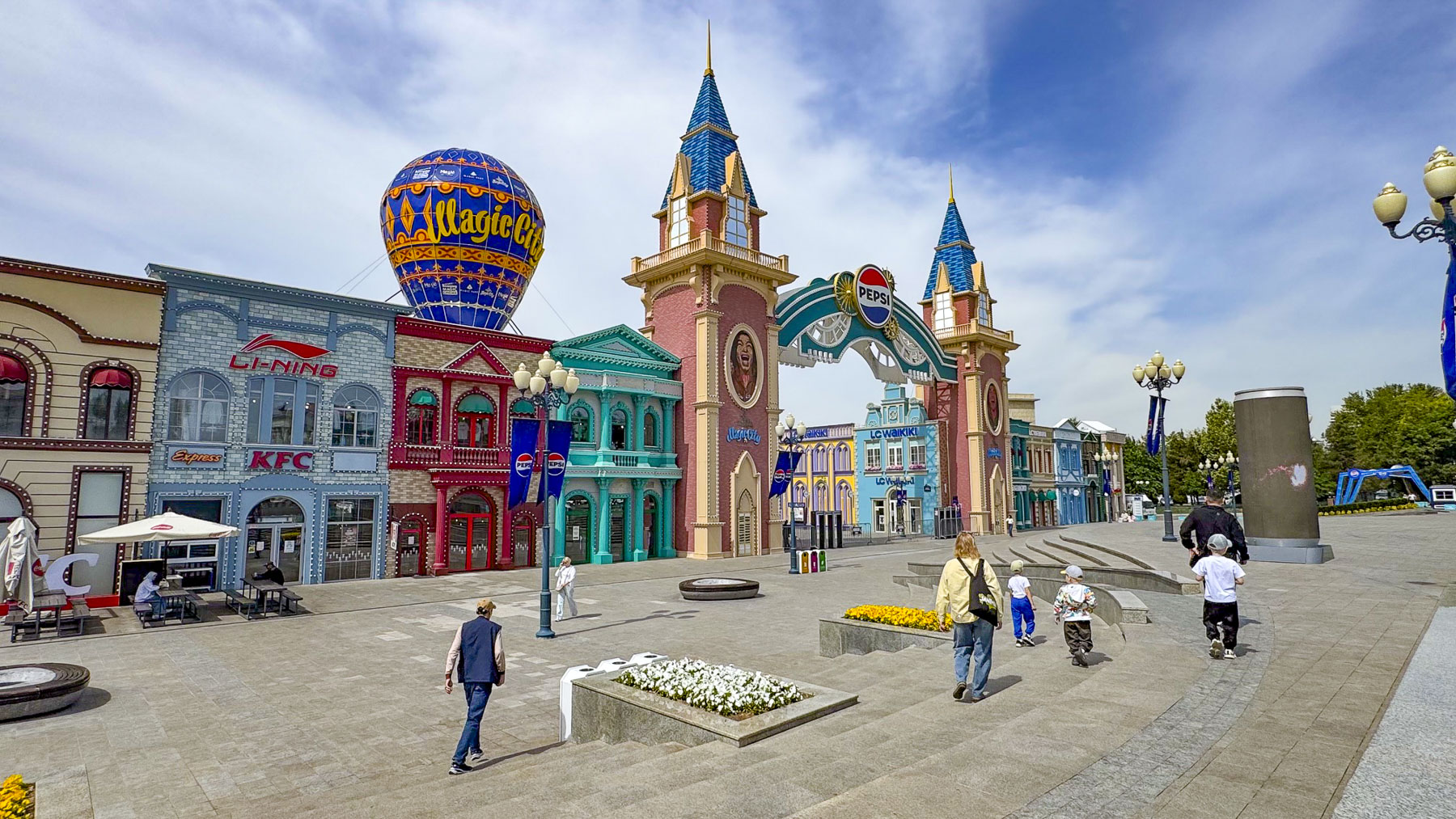
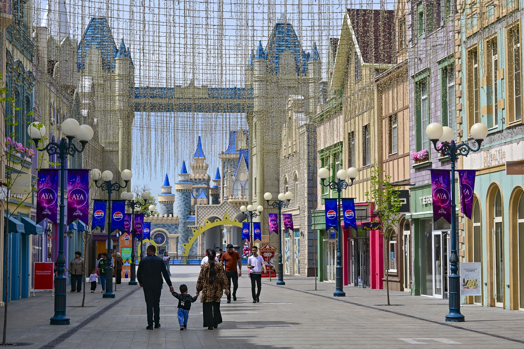
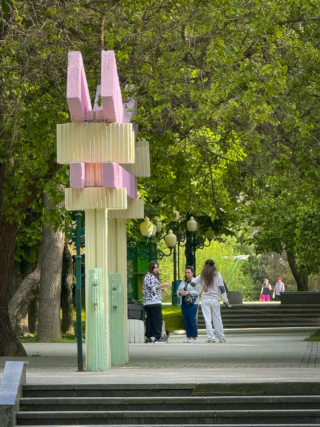
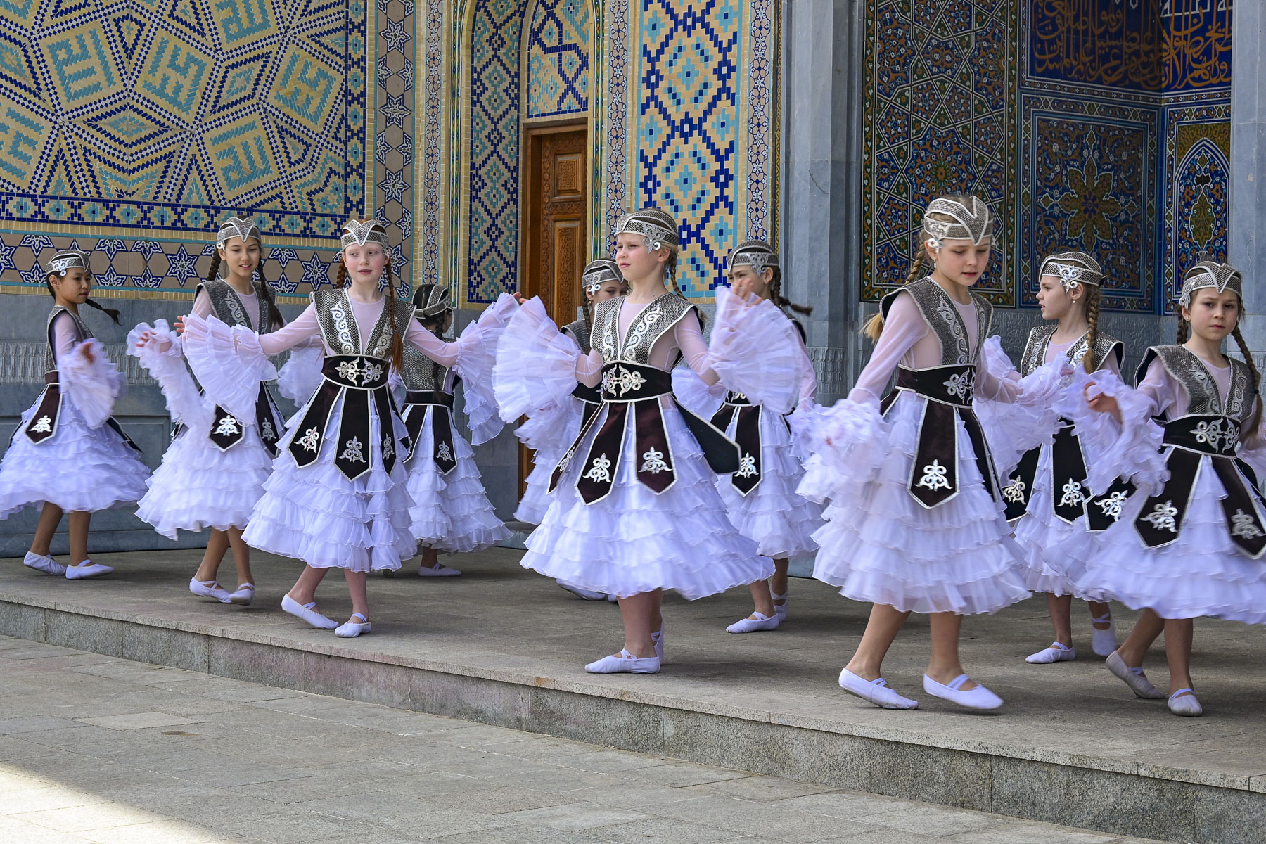
On our last full day in Tashkent we took advantage of multiple inexpensive YandexGo rides and zipped across the city to various destinations. Our first stop, which we had passed earlier in the week, was Magic City Park, an open-air shopping and entertainment complex, that as the name suggests borrows heavily from the mouse kingdom, and seemed very out-of-place in downtown Tashkent. Mid-morning, we had the place almost entirely to ourselves, except for a girl’s dance group practicing their routine in traditional dress.
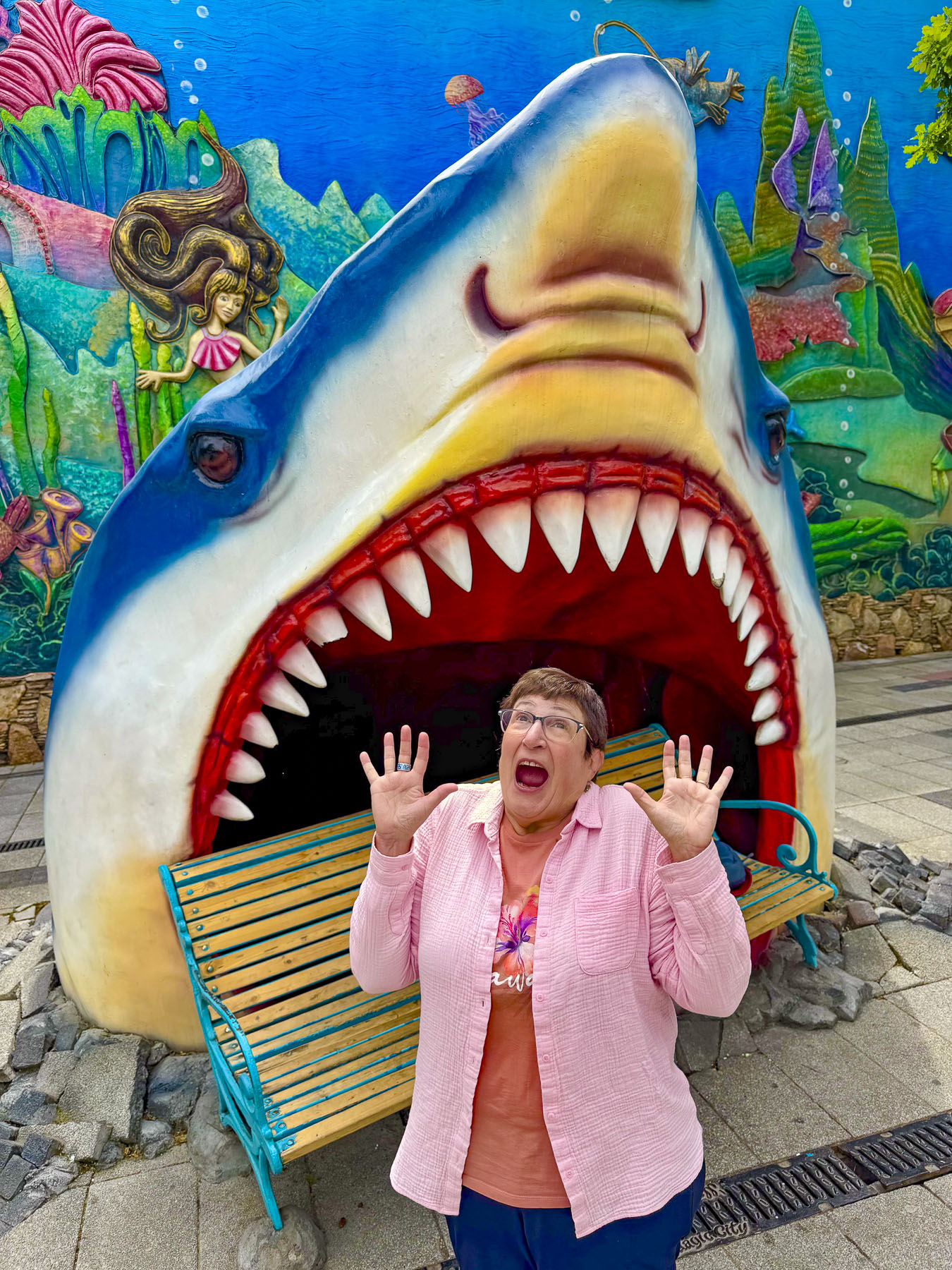

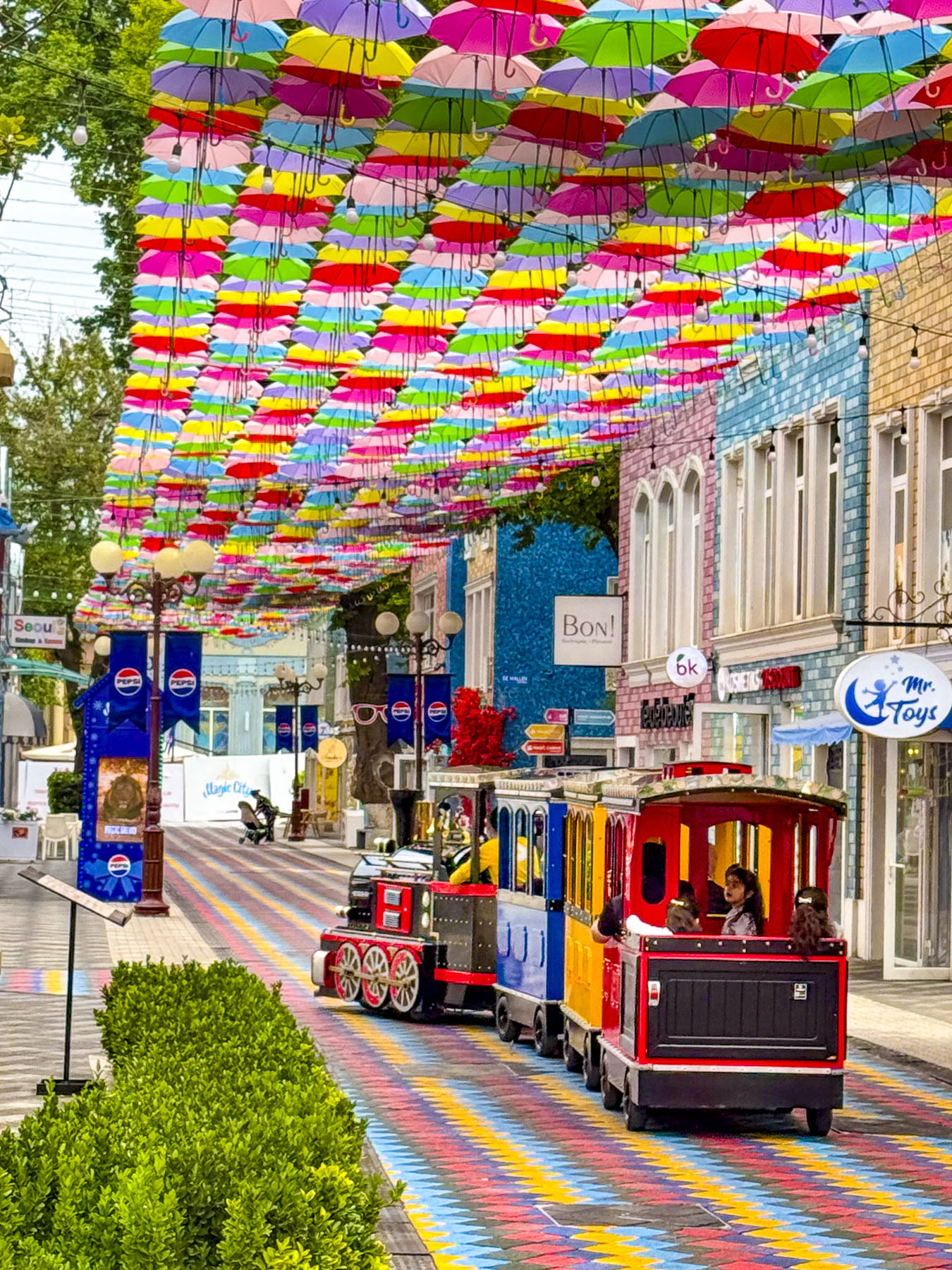
It was a quiet morning, and we enjoyed walking down a colorful painted and umbrella- covered street, making folks smile as we hammed it up in the mouth of Jaws!
Behind Magic City is Milliy Bog, a large open area national park with statues of important Uzbeks along lanes that lead to the Tashkent Museum of State History; the 19th century Abul-kasim Sheikh Madrasah, which once held a sacred relic of the Prophet Muhammad; the Legislative Chamber of the Oliy Majlis; the Friendship of the Nations concert hall; and the Shomakhmudovs Monument, erected in 1982, as a symbol of wartime generosity and unity.
The monument commemorates a local blacksmith, Shaakhmed Shamakhmudov, and his wife, Bahri Akramova, who during World War II adopted 15 orphaned children of various ethnicities. They were only a small portion of the over one million refugees evacuated from the Soviet Union to Uzbekistan to receive food and shelter, an event that caused many to call it “the city of bread.”
From there we traveled far across Tashkent to a beautiful park across from the Tashkent Television Tower that hosts the Museum of Victims of Political Repression. Along our route we passed many examples of older apartment buildings designed with that harsh “Soviet Brutalism” ethos, and only softened by Uzbek tile murals at both ends.
Life in Uzbekistan during Russian times was not easy and the museum documents the hardships and atrocities committed against the Uzbek people, starting with Imperial Russia’s colonization of the country, where the best farmland was given to Russian settlers, through the communist Soviet Union era. Many exhibits draw on information culled from the former KGB archives.
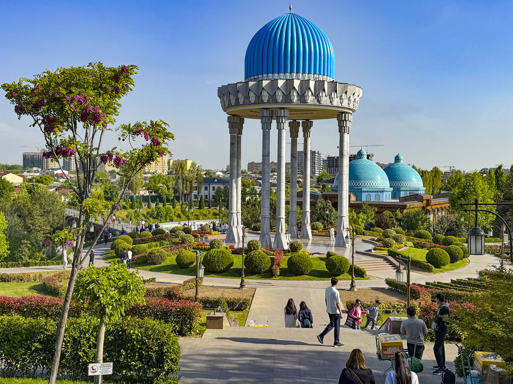
The blue domes of the museum purposely resemble an ancient mausoleum as the building is constructed over the site where the Soviets executed “enemies of the people” during the 1930s. Across the country over 100,000 people were arrested, and over 13,000 of them were shot. Trees in the park symbolically come from the gulags around the country where folks were imprisoned. During World War II ethnic groups that allegedly collaborated with the Soviet Union’s enemies were deported en mass to Siberia.
Outside, the man-made river that runs through the park is symbolically shaped like a Greek meander, to symbolize the eternal flow of life. Under the park’s tall rotunda is a nephrite tomb with the inscription in Arabic, English and Uzbek: “The memory of those who died for their country will live forever.”
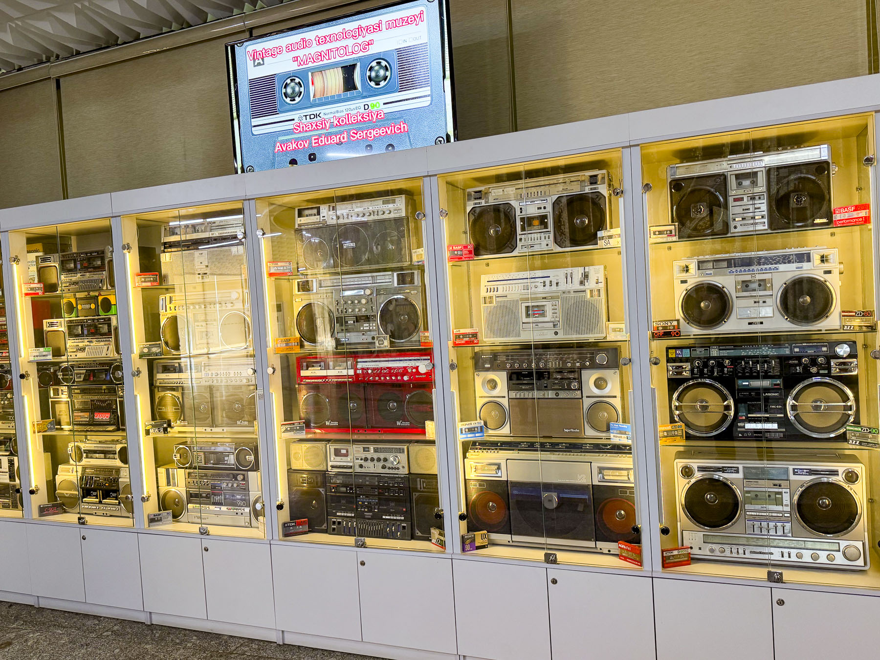
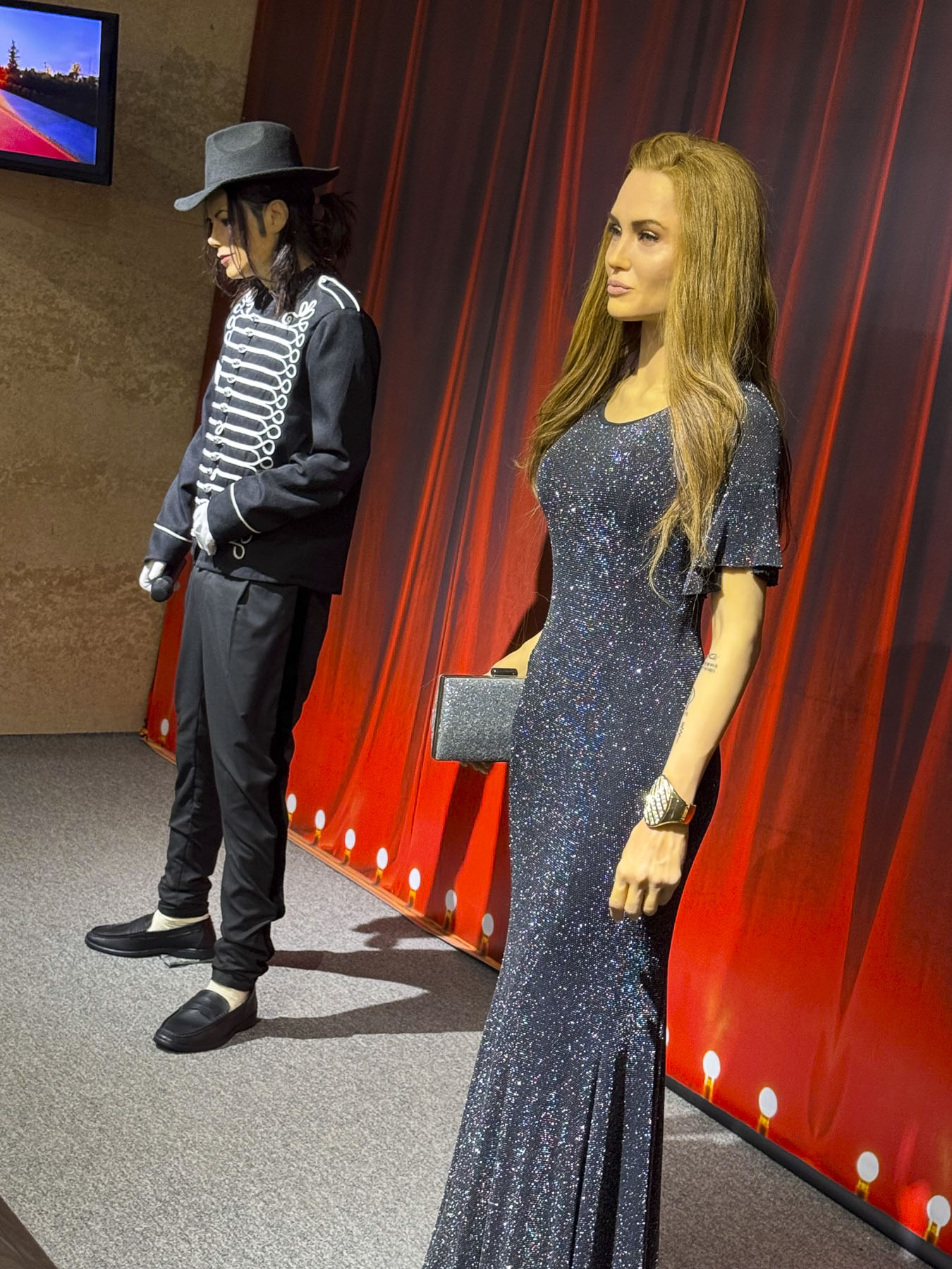
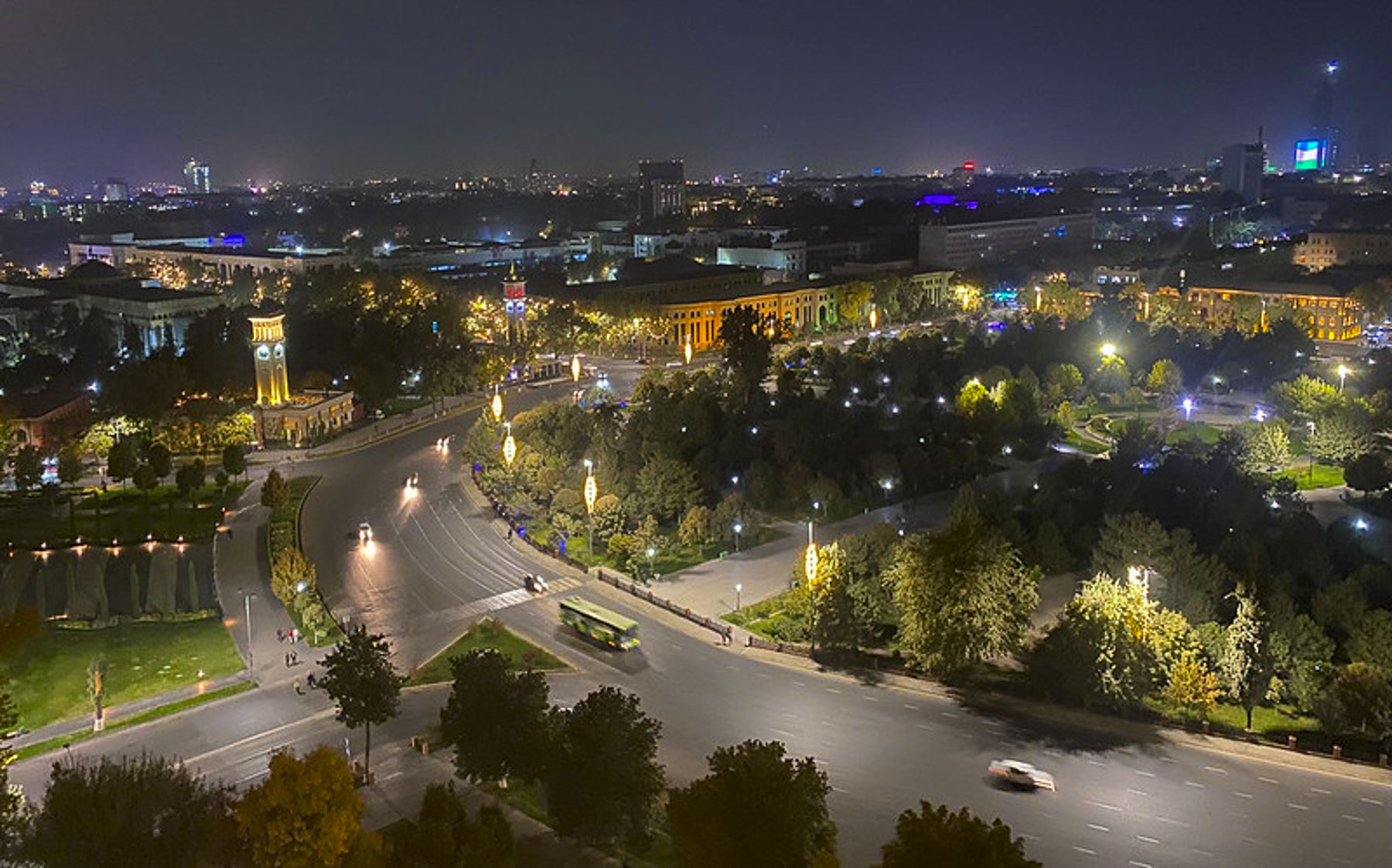
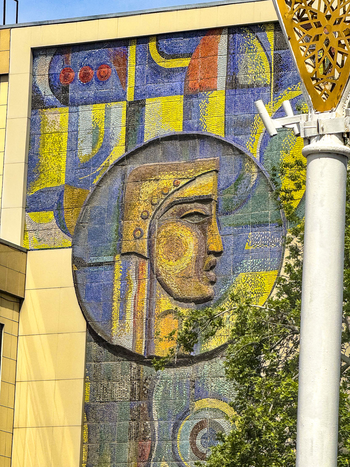
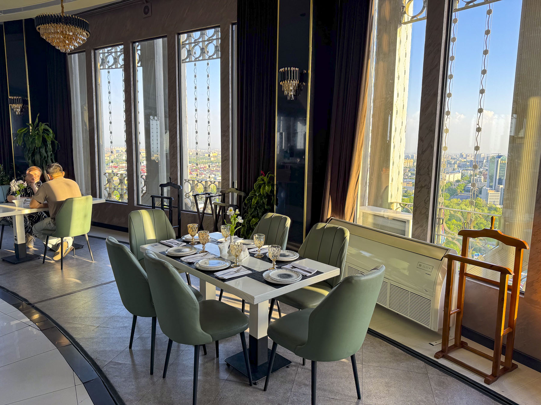
Across the busy road was the Tashkent Television Tower, the tallest freestanding tower with a height of 375m (1,230ft) in Central Asia since its opening in 1985. To get to the elevators that take you up to an observation deck and revolving panoramic restaurant at 104m (341ft) above the ground we had to walk along a long corridor lined with models of other significantly tall television towers around the world, a display of archaic boom boxes, an abstract tile mosaic mural and the wax museum likeness of Michael Jackson and maybe the doubleganger of Melania Trump? The restaurant was enjoyable, though expensive for cake and coffee.
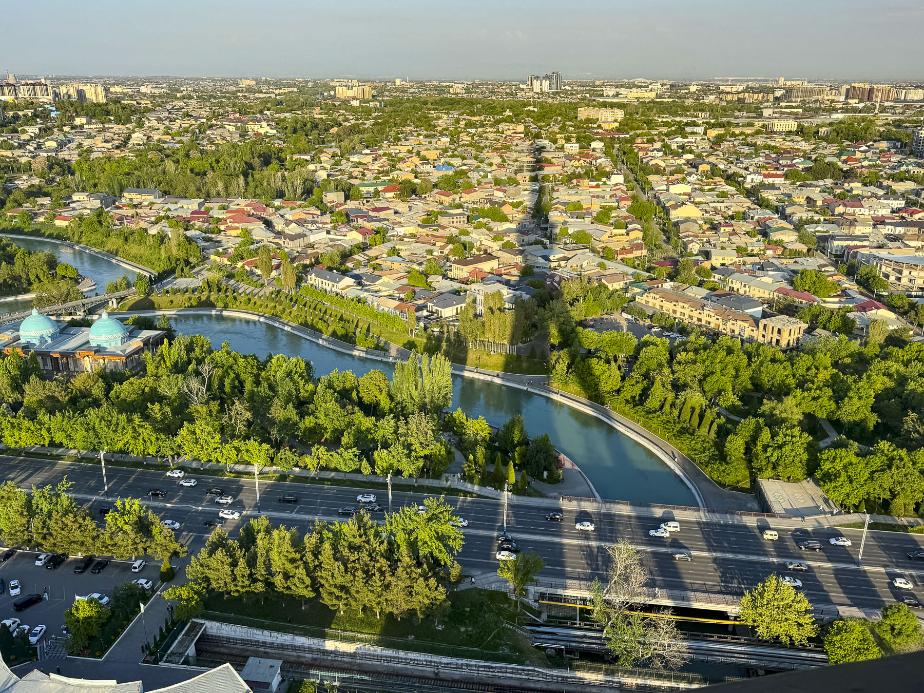

However, the views from the observation deck out over metropolitan Tashkent were fantastic, especially where we would see the shadow of the tower cast across the landscape.
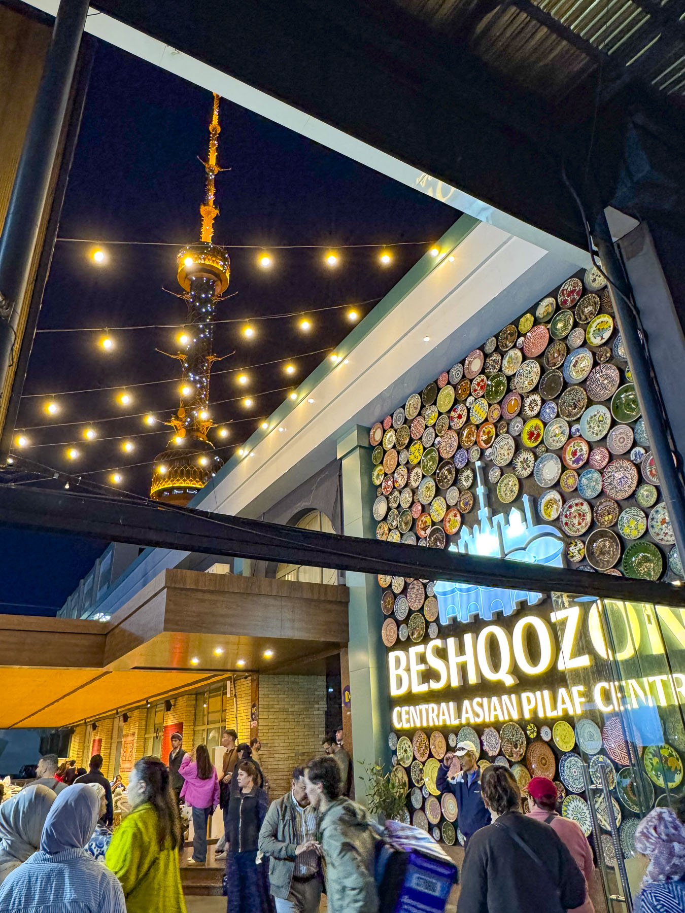
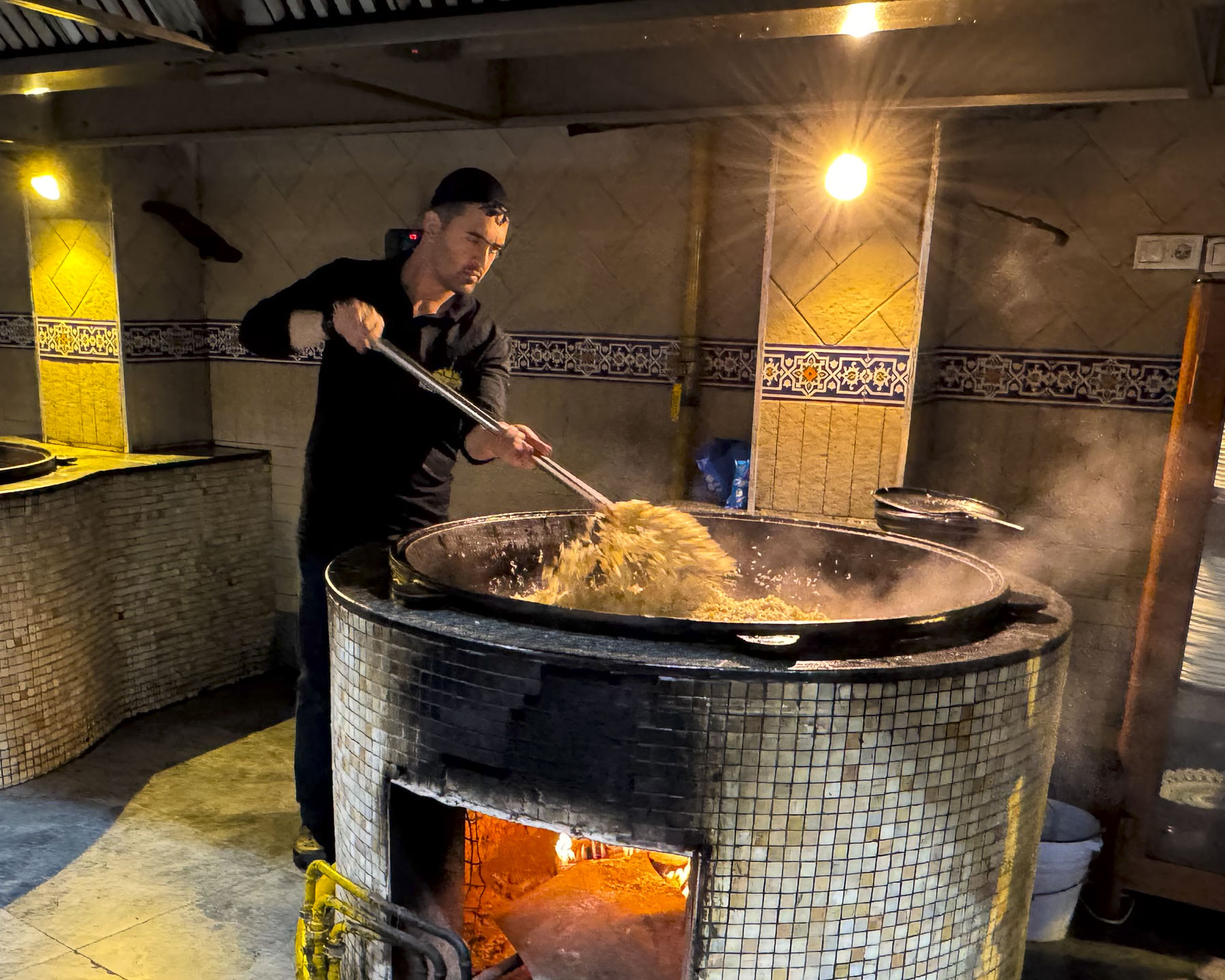
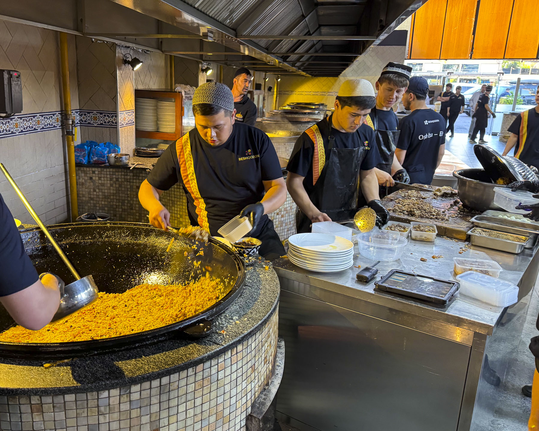
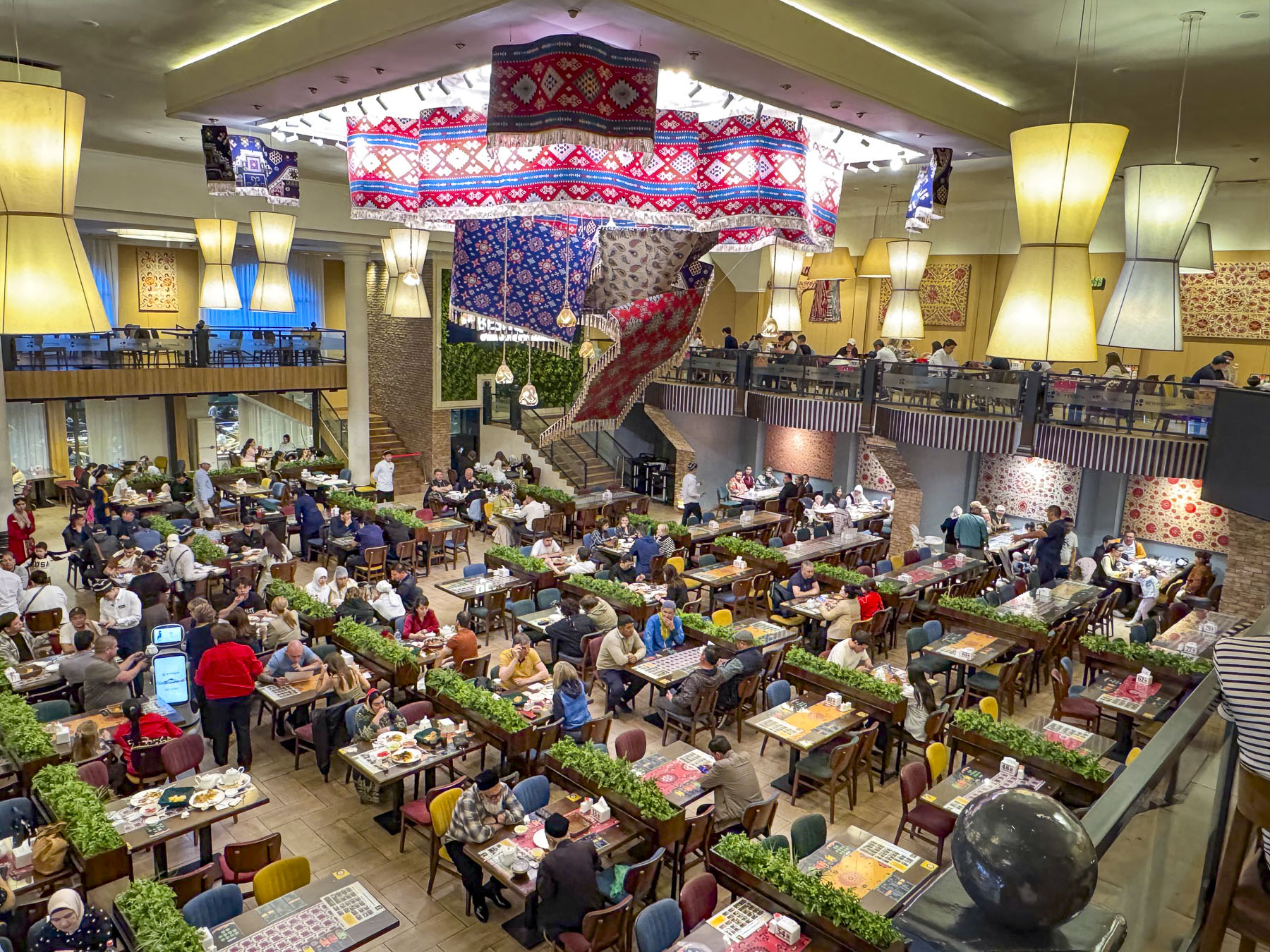
We ended our evening and last day in Tashkent with a short walk to Besh Qozon, a tremendously popular, large, fun restaurant that is known for its Plov, Uzbekistan’s celebrated rice dish. The dish is traditionally prepared by men, and at Besh Qozon visitors are allowed to walk through open kitchen and watch the cooking of several different variations of the recipe being stirred in huge caldrons, and the continuous baking of fresh non.
The first known settlers in Uzbekistan were Persian nomads who settled around the oases in the vast Kyzylkum Desert during the in the 8th–6th centuries BC. The desert covers most of central Uzbekistan, stretching from Khiva in the western part of the country to Samarkand in the east. Many of these oases became crucial caravanserais, fortified waystations, to protect the camel caravans along the Silk Road. Others like Samarkand, Bukhara, and Khiva grew into rich influential regional seats of power called khanates.
In 329 BC Alexander the Great spent two years marching across Uzbekistan in an exhausting campaign to defeat a Persian rebellion, and only left after what legend claims was a love at first sight romance with a local princess named Roxane led to a strategic alliance with her father. The legend of Roxane remains alive in Uzbekistan, with many distinguished families in the region still claiming their lineage from the marriage of Alexander to Roxane, before he set off to conquer India.
In the west we often associate the history of the Silk Road, a 6,400km (4,000mi) camel tract, with the travels of Marco Pollo across central Asia to China in the 13th century. But its history started much earlier in the 2nd century BC, when a Chinese emperor of the Han dynasty sent imperial envoys across Central Asia to establish formal trade routes and military alliances against the Huns. These agreements of safe passage resulted in silk and porcelain from China reaching the eastern-most regions of the Roman empire by 25 BC. On their return journey caravans took glassware, linen, wool and cotton to the Far East.
The Huns never invaded China, but did conquer much of Central Asia, and established a stronghold in southern Uzbekistan during the 4th and 5th centuries. Trade along the Silk Road ebbed and flowed through invasions and peace. Arab conquests swept through Central Asia, bringing the Arabic language and Islamic religion to oasis cities like Bukhara and Samarkand in the 7th–8th Century AD. The Mongol armies of Genghis Khan brought massive destruction to the region in the early 1200s.
By the late 14th century, the region was the central hub of trade and ideas at the crossroads of the known world at the time, and experiencing a renaissance of art, science, and Islamic architecture under the enlightened rule of Emir Timur. By the 16th century the successive invasions of Turkic and Mongol nomadic tribes had ended. The invaders from 92 tribes, as legend believes, had settled and intermingled with the local folk and established what eventually would be recognized as the Uzbek identity.
By the 16th century Spanish and Portuguese Navigators were mapping maritime trade routes across the Indian Ocean to India, Southeast Asia, the East Indies, and China. These nautical routes from Asia to Europe were significantly faster and safer than transporting goods via the Silk Road and trade on the overland route slowly diminished. Regional caravans still plied the deserts of Central Asia, taking supplies to isolated settlements well into the 1930s, but stopped when a growing road network ended the camel caravan era.
Without this international trade flowing both ways through Uzbekistan the armies of the Tashkent, Bukhara, and Khiva Khanates fell in succession from 1865 to 1873 to the technologically superior firepower amassed against them by Czarist Russian Empire in a drive to secure the region’s natural resources, mostly cotton, for the Russian economy. The Khanates retained figurehead monarchs, but all political and economic decisions were controlled by Moscow, which developed Tashkent as its administrative center. Czarist rule quickly forced all viable agricultural lands to be planted with cotton. This valuable crop, often called “white gold,” was then exported from Uzbekistan to the mills of the Russian homeland on the newly built Trans-Caspian Railway that connected Tashkent to the eastern shores of the Caspian Sea. Train ferries then shuttled the freight cars across the water to Baku, Azerbaijan for the last leg of journey. Trains returned to Uzbekistan with colonizers from Ukraine, Belarus, and regions around St. Petersburg and Moscow, who displaced Uzbeks and were given the best agricultural lands. Until this cotton monoculture was forced upon the farmers in Uzbekistan the country was agriculturally self-sufficient but soon relied on imported grains from other regions in the Russian Empire.
After Russia’s communist revolution ended in 1922, Uzbekistan was incorporated into the USSR, the Union of Soviet Socialist Republics, as the Uzbek Soviet Socialist Republic. Communist authoritative rule expanded the cotton monoculture with extensive irrigation systems using water diverted from the Amu Darya and Syr Darya rivers, the source waters of the inland Aral Sea. This environmental mismanagement caused the sea, once an important fisheries resource, to lose over 90% of its volume and transformed the vital waterbody into the new Aralkum Desert within five decades.
Life in Uzbekistan during the Soviet communist era was harsh. While basic housing, medical and education needs were met, there was rampant underemployment, widespread poverty, lack of foodstuffs in the markets, and political and religious repression. During the yearly cotton harvests Uzbeks, including children, were forced to spend 15 – 60 days in the fields picking the “white gold.” Schools and universities across the country were closed, and even teachers, doctors and nurses were not exempt from participating. Refusal could result in the loss of your job or expulsion from higher education.
Over one-hundred years of combined Russian Empire and Soviet rule ended in 1991 when Uzbekistan proudly declared its independence as the Soviet Union was dissolving.
Till next time,
Craig & Donna


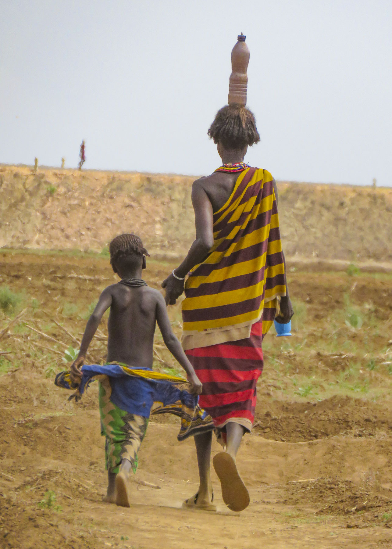


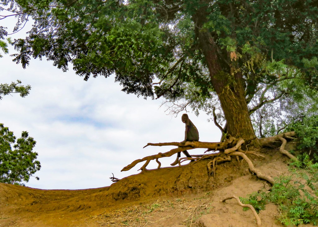


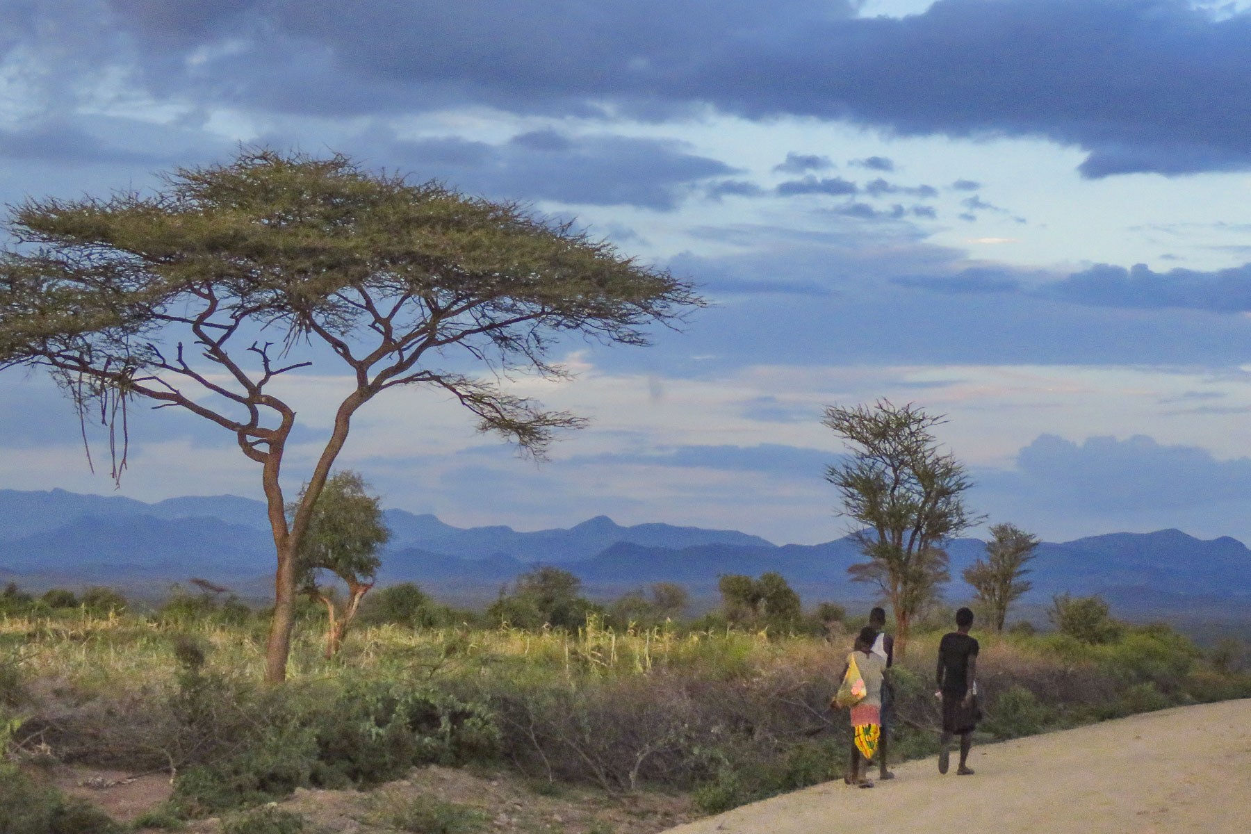


 Walking, walking, walking! The countryside is full of folks out and about on their feet. There is a rural minibus network connecting larger villages once a day, and Lalibela has tuk-tuks, of course. But mostly, whether it’s due to lack of affordability or availability, people walk to and from everywhere. Sometimes it is necessary to travel great distances to accomplish simple, everyday tasks like gathering water, heading out to tend a remote field, going to market, or even farther to visit a doctor.
 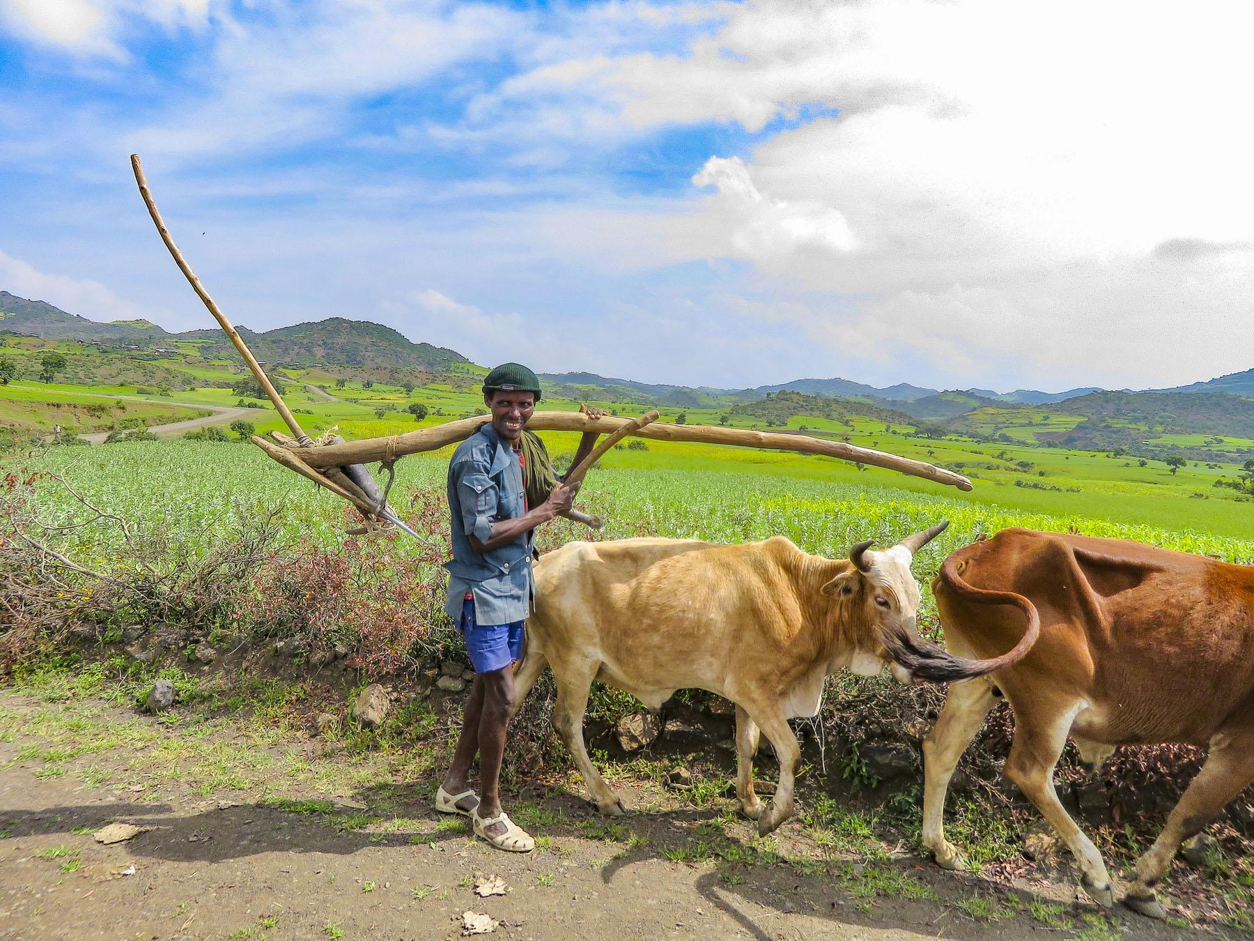 In the rugged agrarian highlands surrounding Lalibela, all the fields are tilled by farmers walking behind teams of oxen, as it has been done for centuries, on farmland passed down through a communal hereditary system called rist.


 We started our day listening to bird calls and watching the morning clouds burn off from the valley below our hotel as the sun rose higher into the sky. The


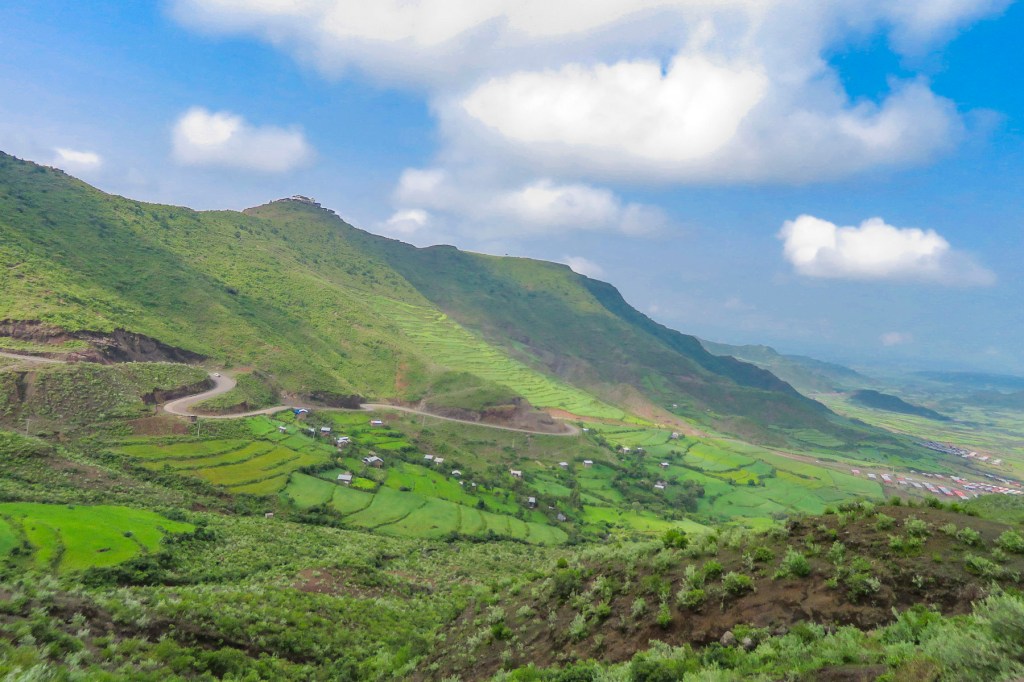
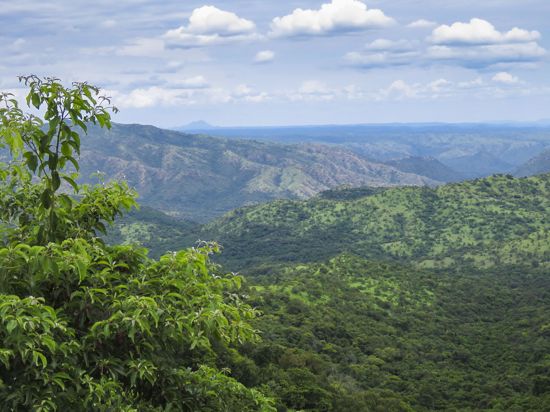
 The shops were busy, and the roadside Ping-Pong games were in full swing as we departed Lalibela. The road into the mountains rose quickly from Lalibela into a semi-forested landscape. Too steep for crops, the land was used for cattle, which grazed on clumps of wild grasses on the hillside. We stopped at one clearing for the view and noticed a herder gently nudging his cows away from recently planted tree seedlings. “This is part of our government’s commitment to reverse deforestation and help mitigate climate change. It’s called the
  “On July 29th Ethiopians planted 350 million trees in a single day, a world record!” he proudly shared. “The farmers know how important this is and help shoo the cattle away, but the government has also chosen a tree seedling that doesn’t taste good.” This annual Ethiopian project is part of the African Union’s
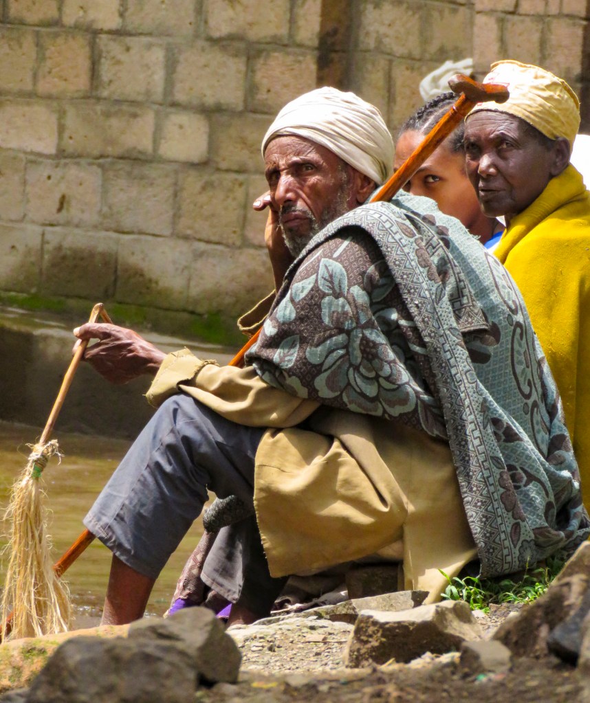
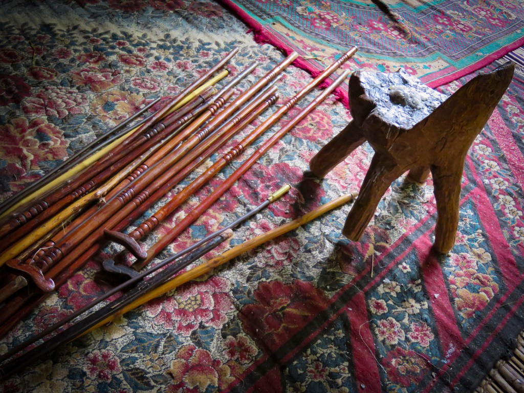
  The road deteriorated after this, with deep mudded ruts tossing us from side to side regardless of how slowly we navigated through, over or around them. Our “rattled tourist syndrome” is the most appropriate way to describe the ride, while optimists might refer to it as an an “African deep tissue massage.” We were the only truck to park at the trailhead to the Asheten Mariam Monastery and were greeted with children selling handicrafts, and young men renting walking sticks and offering to accompany us on the hike.
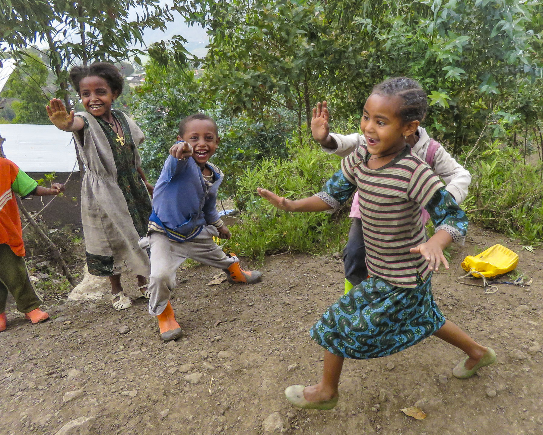 Confident in our abilities we declined, but they tagged along anyway. This was a good thing. What our guide had forgotten to mention was that there was a short steep section at the beginning of the hike, before it leveled off. Within minutes, between the altitude and the terrain, our hearts were pumping and my wife, who struggles with asthma, was gasping for breath. We are unfortunately not the 7 second 0-60mph vroom, vroom of a 1964 Corvette anymore, but more like the putt-putt of a classic Citroën 2CV. We get there, eventually. So, our guide, forgetting his youth and our age, led the way from a distance, as if he was channeling
  It was at this point that my wife spoke up. “Girma, you must think of me as the same age as your mother.” Instantly, his attitude became very solicitous, and he smilingly offered her a hand or other assistance at every opportunity. We marveled at the agility of the local kids. They nimbly scampered up and down the trail, easily outdistancing us, in order to set up their little trailside displays of carvings and beadednecklaces. When we didn’t purchase at first, they simply packed up and reappeared further up the trail. We had to reward such perseverance with a couple of purchases.
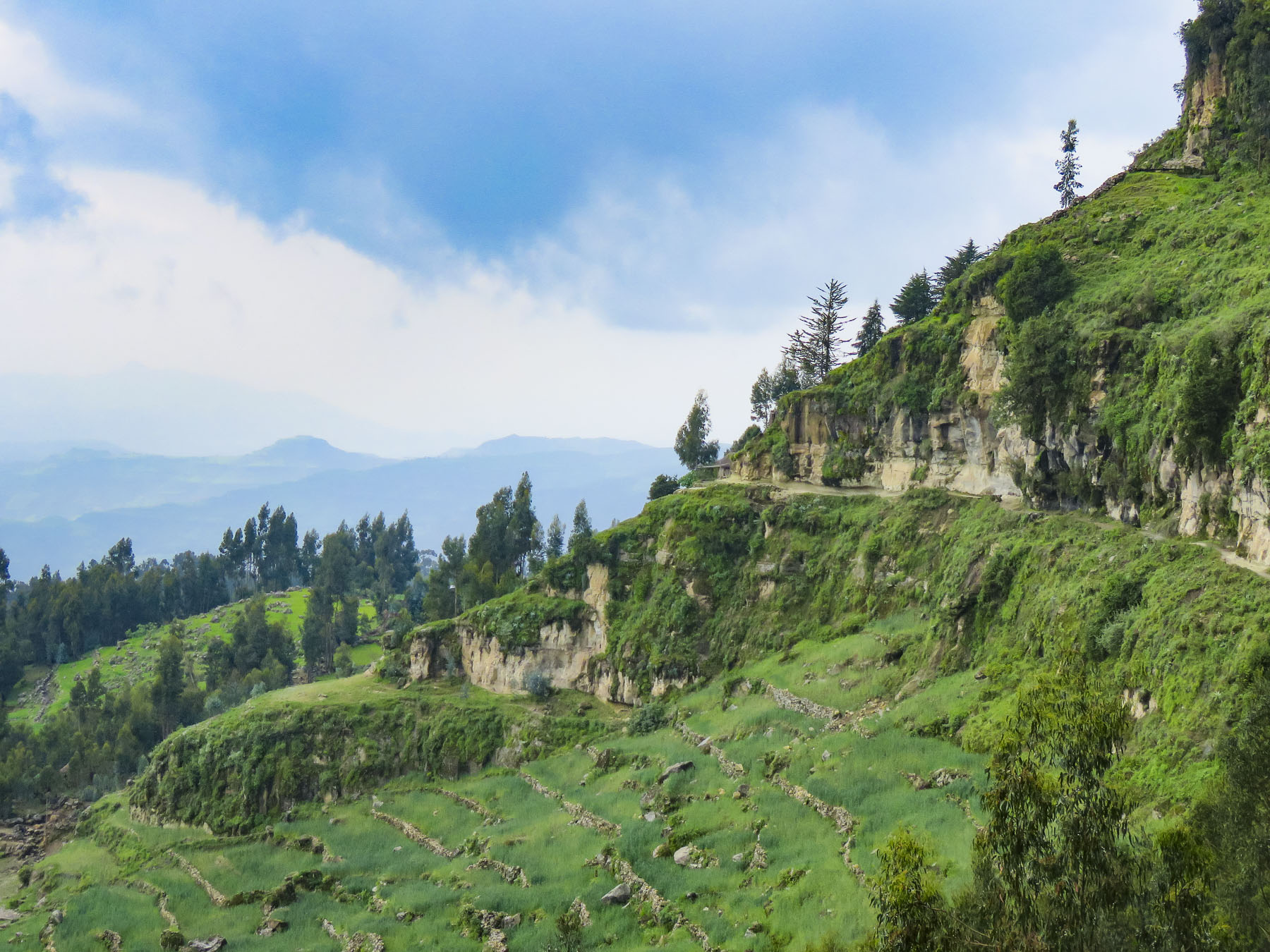 Meanwhile, we regained our pace as the trail leveled off and tracked along the base of a cliff face that fell away to terraced farmland far below. The incline of the trail continued to rise; the walking sticks were now invaluable in helping us steady our footing on the rough path. Around a curve the trail abruptly narrowed at a sheer rock wall broken by a vertical chasm, slightly wider than our shoulders.


 Imprinted at the bottom of a page in one ancient text were the thumbprints of the ten scribes who helped copy the book. Legend has it that it was the first church ordered built by King Lalibela during his reign in the twelfth century and that his successor, Na’akueto La’ab, who only ruled for a short time, is buried there.


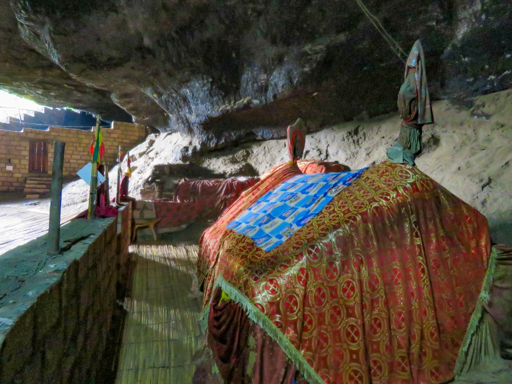
 Coming to the end of the road, we could see the monastery dramatically situated behind a small waterfall, in a long shallow cave at the bottom of a cliff.

 Stone bowls smoothed from centuries of use sat in various places on the rough floor to collect the water seeping from the cave’s ceiling one drip at a time. It gets blessed by the priest and used as Holy water, continuing a tradition from the 12th century when King La’ab ordered the monastery’s creation.


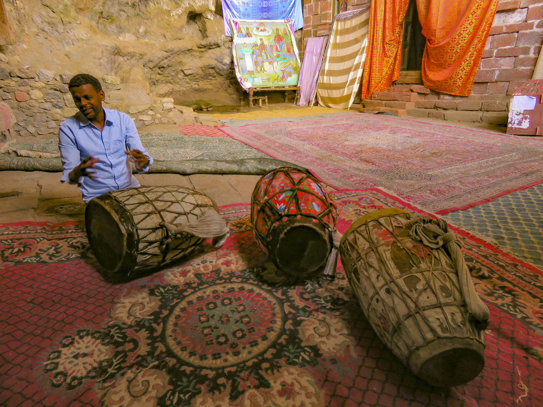 In the learning area, layers of carpet attempted to smooth an uneven, rocky floor where the novitiates sit to learn the ways of the orthodox church. In the corner rested several large ceremonial drums used during worship services. Picking one up our guide beat out a rhythm that would normally accompany liturgical chanting, or Zema, by the young monks. We’ve noticed that the treasures of the Ethiopian churches are not determined by their monetary value and locked securely away, only to be used on religious holidays, but by their spiritual connection. Precious, irreplaceable, ancient bibles and manuscripts, lovingly worn and torn as they are, continue to be used every day, as they have been for the last nine-hundred-years.
 It is well worth the effort to visit these remote churches and monasteries. The physical strength required and hardships endured to build these remote churches as a testament of faith continues to be inspiring.

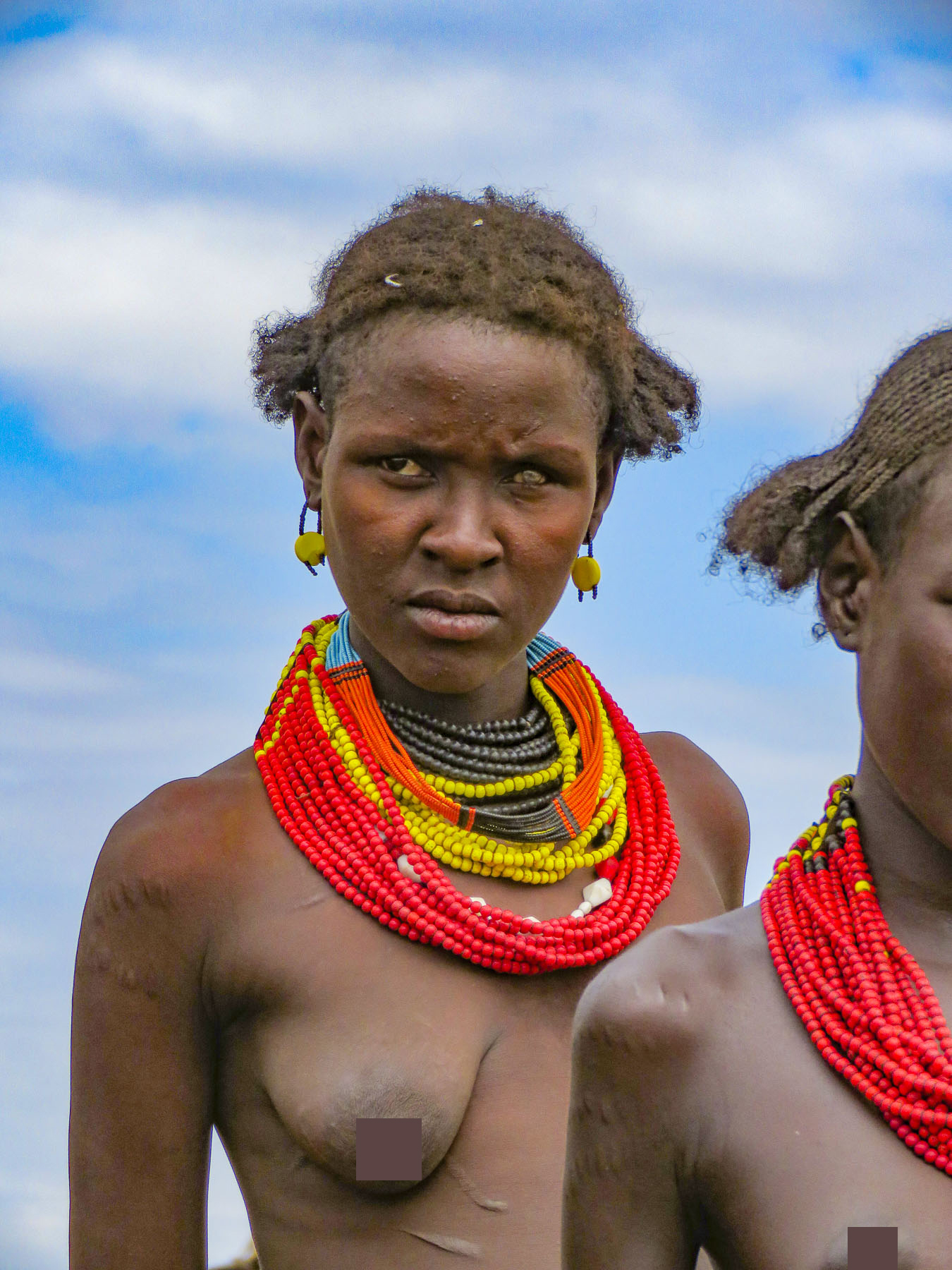
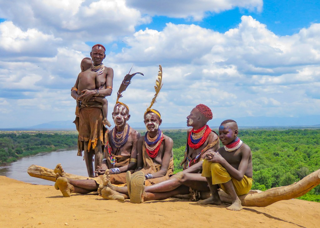
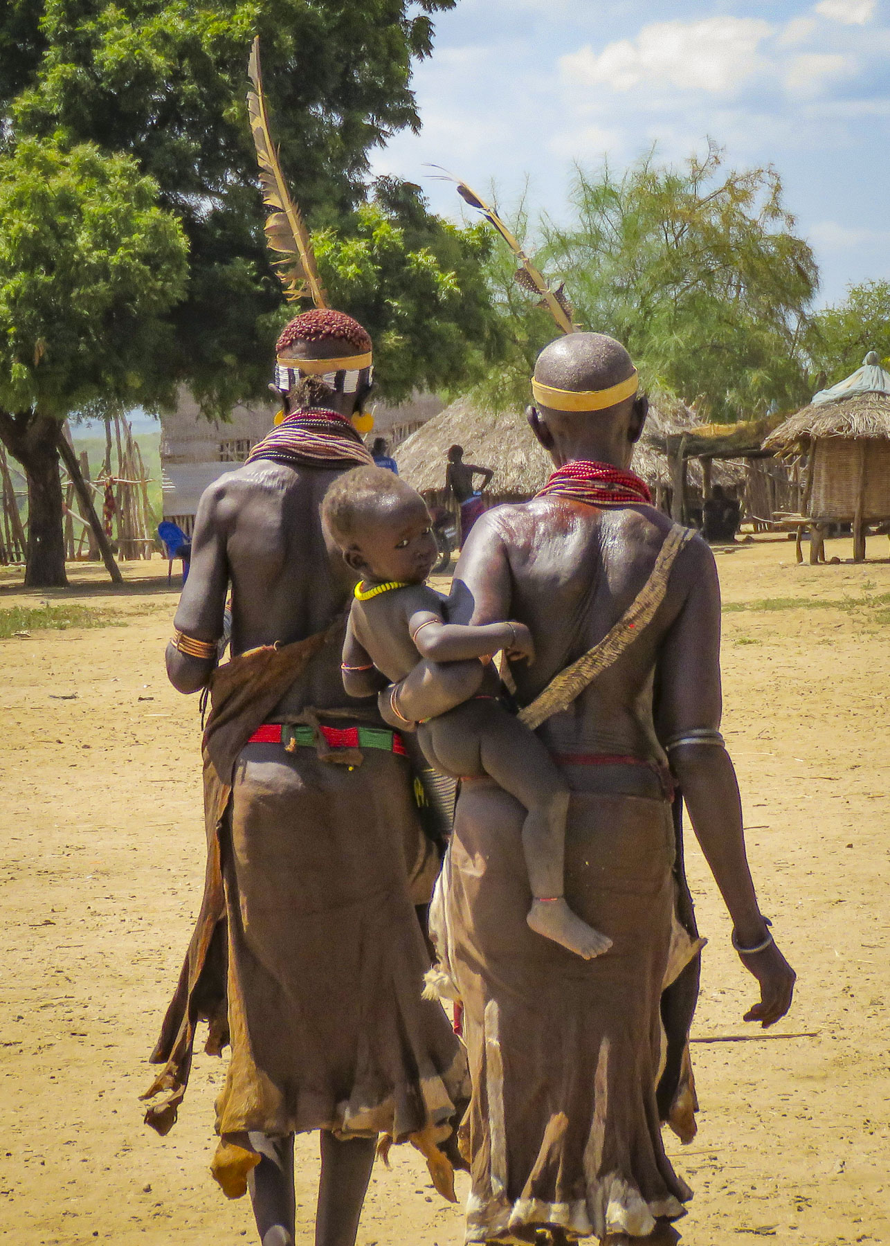
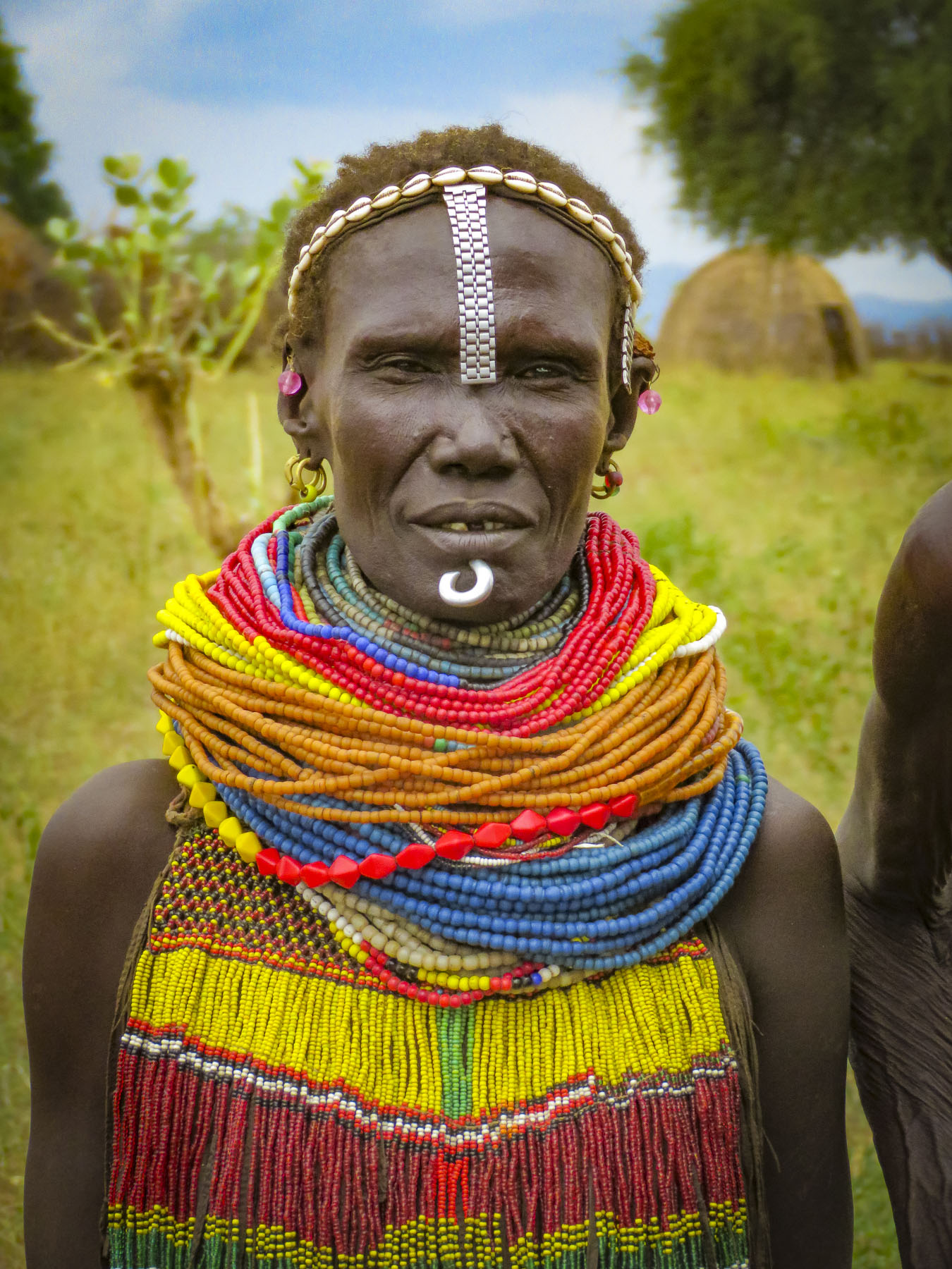
 We would have been terribly dissappointed if this had happened to us and we missed visiting the Mursi tribe. (Note to self – don’t leave important events to the last day.) Curious children made their way amidst the tourist vehicles, looking through the windows and asking for soap, shampoo, pens, pencils, caramels, and empty water bottles. The kids would have been happy with anything anyone gave them. Some pointed to the clothes we were wearing, hoping we would donate them. Folks make do with very little here and wear things until they are threadbare, out of necessity. Often, we saw older children wearing infant onesies with the feet of the garment cut off. We are not criticizing; it’s all they had. It saddened us and we wished we had brought an extra suitcase of clothes along to donate to a village. Eventually there was a burst of activity with rumbling engines at the front of the line and folks running back to their rides.
 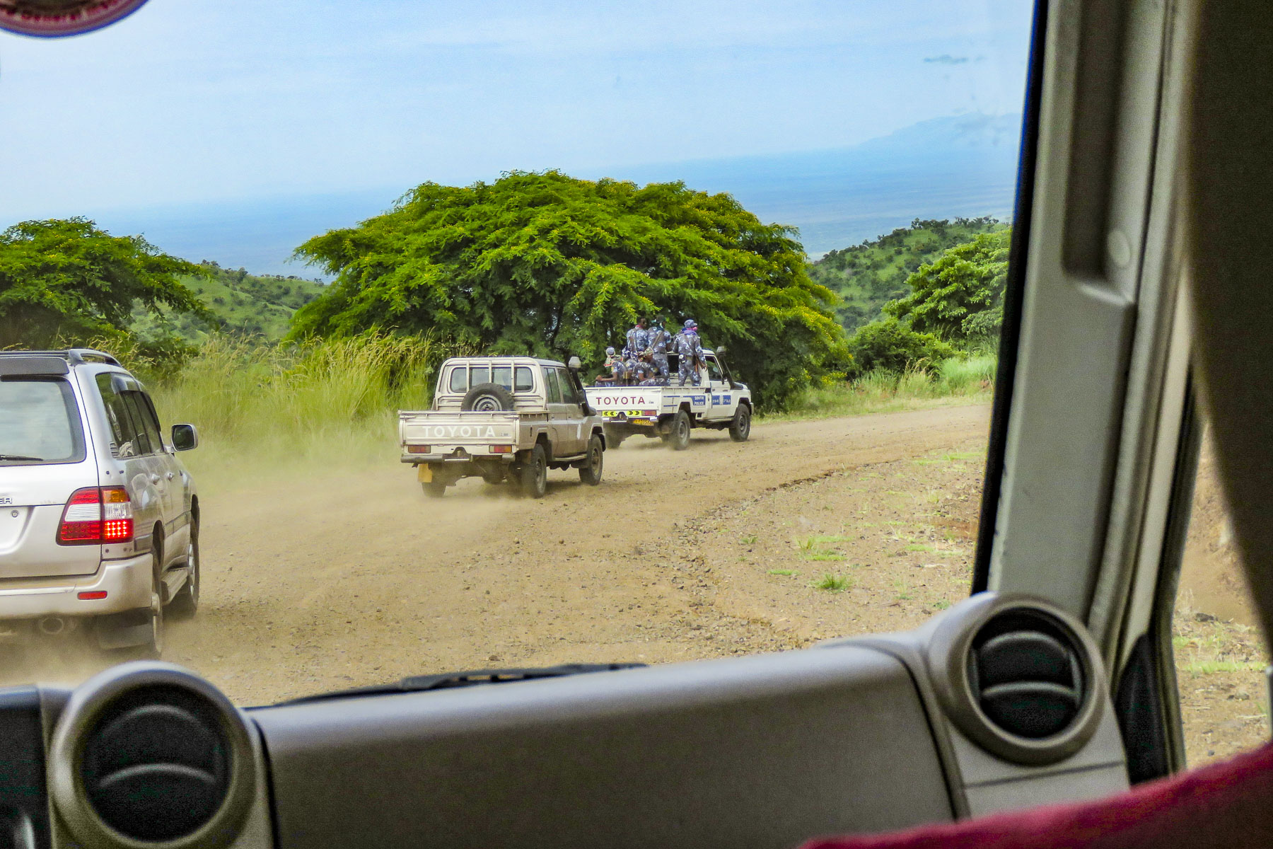 We were the third car in a group of five that was being led by a pickup truck full of armed paramilitary policemen. Many of the incidents that have occurred are related to the increase in truck and bus traffic roaring through Mursi territory on the way to new cotton and sugarcane plantations along the banks of the Omo River.
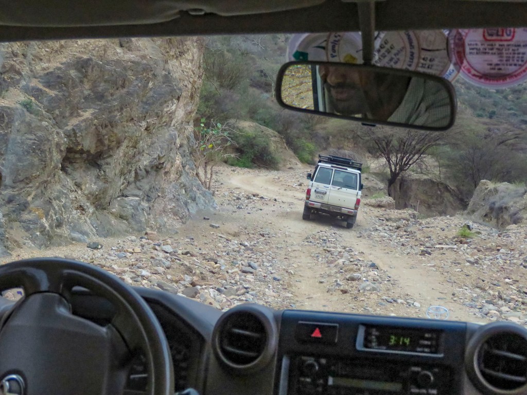
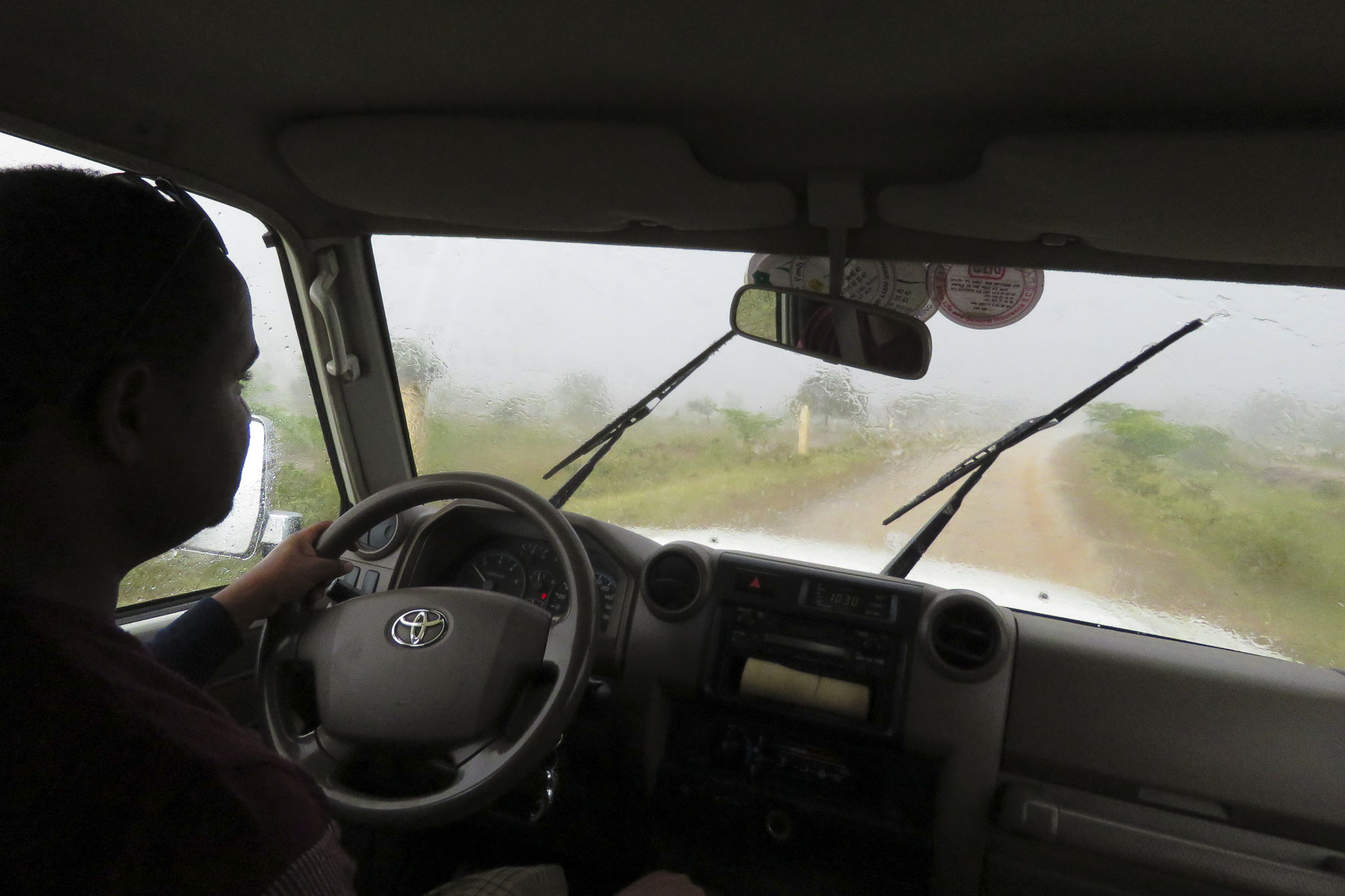
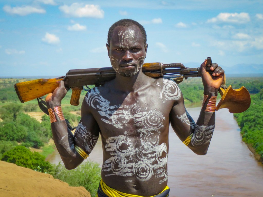
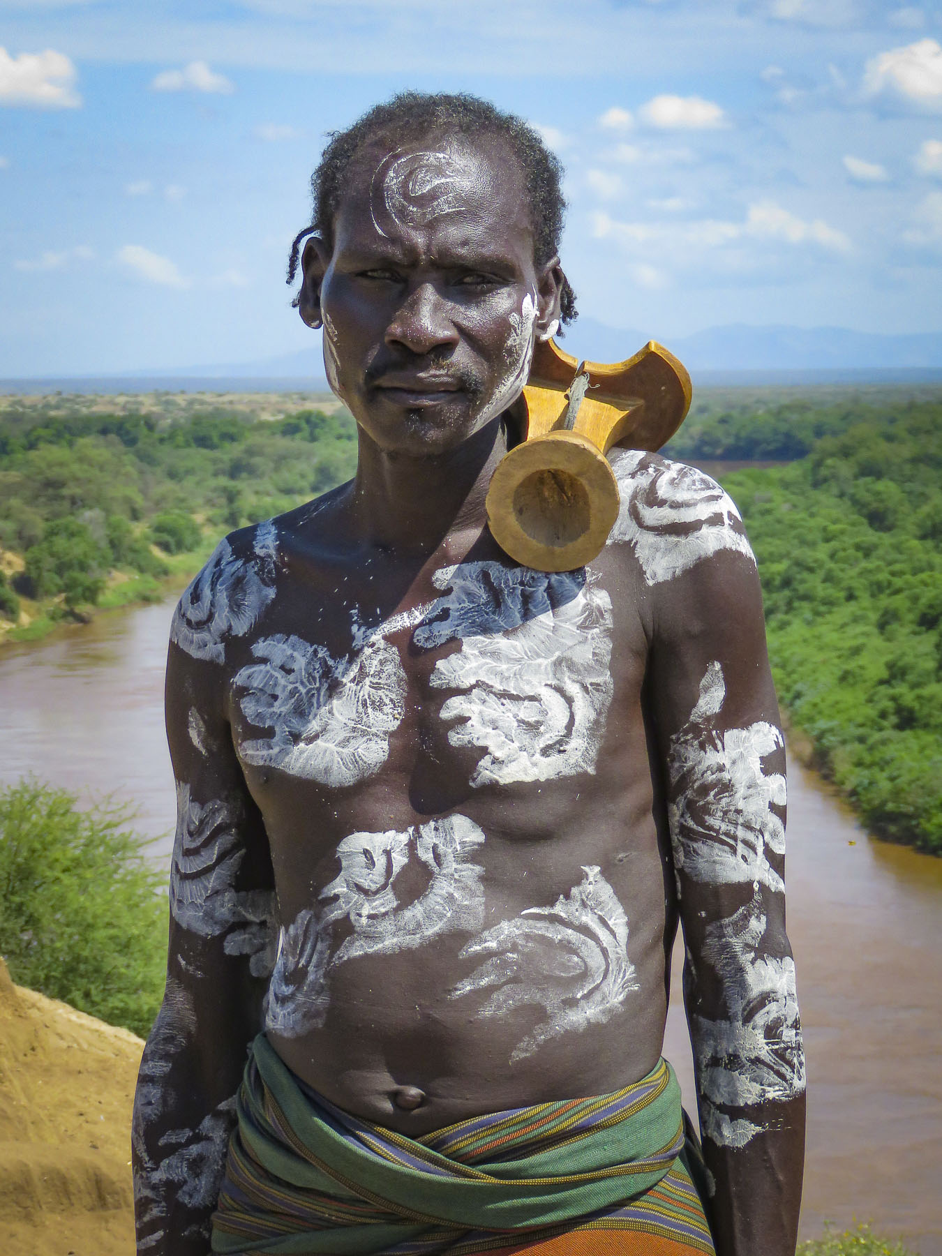
  Cattle are very often herded down the roads and sometimes are struck and killed, along with their herders. Often drivers do not stop to take responsibility. In the eyes of the villagers, the local authorities have not resolved the situation. As a result, tribespeople will set roadblocks to rob buses carrying plantation workers and extract revenge on truckers. A while later we stopped and were assigned an armed escort, with an AK-47, who accompanied us for the duration of our visit. He was euphemistically called a scout.
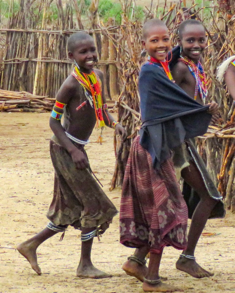
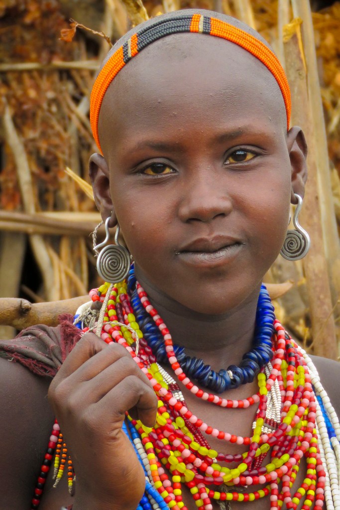
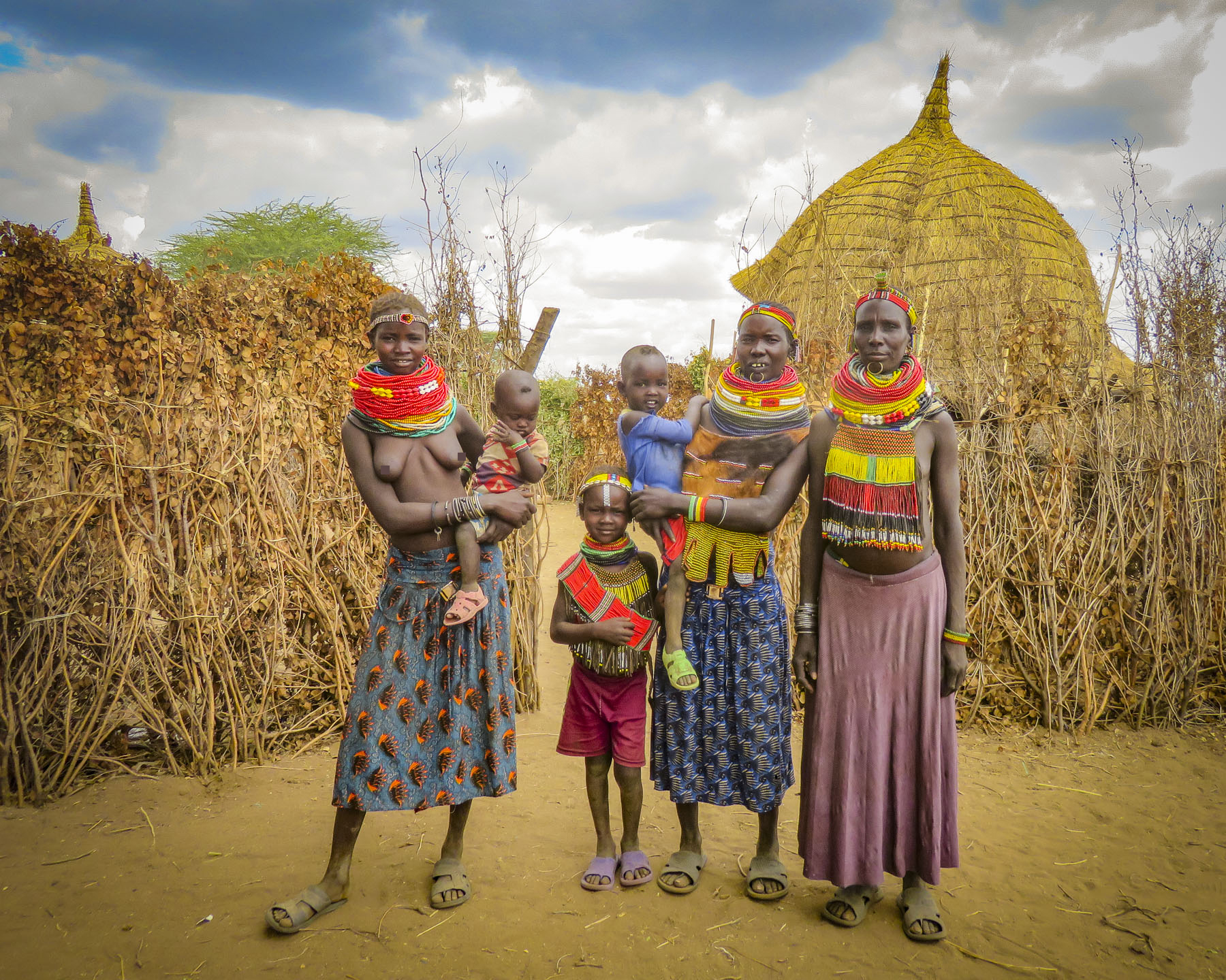
 Turning off the dirt road, branches scratched against the side of the truck as we followed a narrow dirt track through the savanna to a clearing where a small group of thatched huts stood. Soon the women of the village stopped what they were doing to greet us.
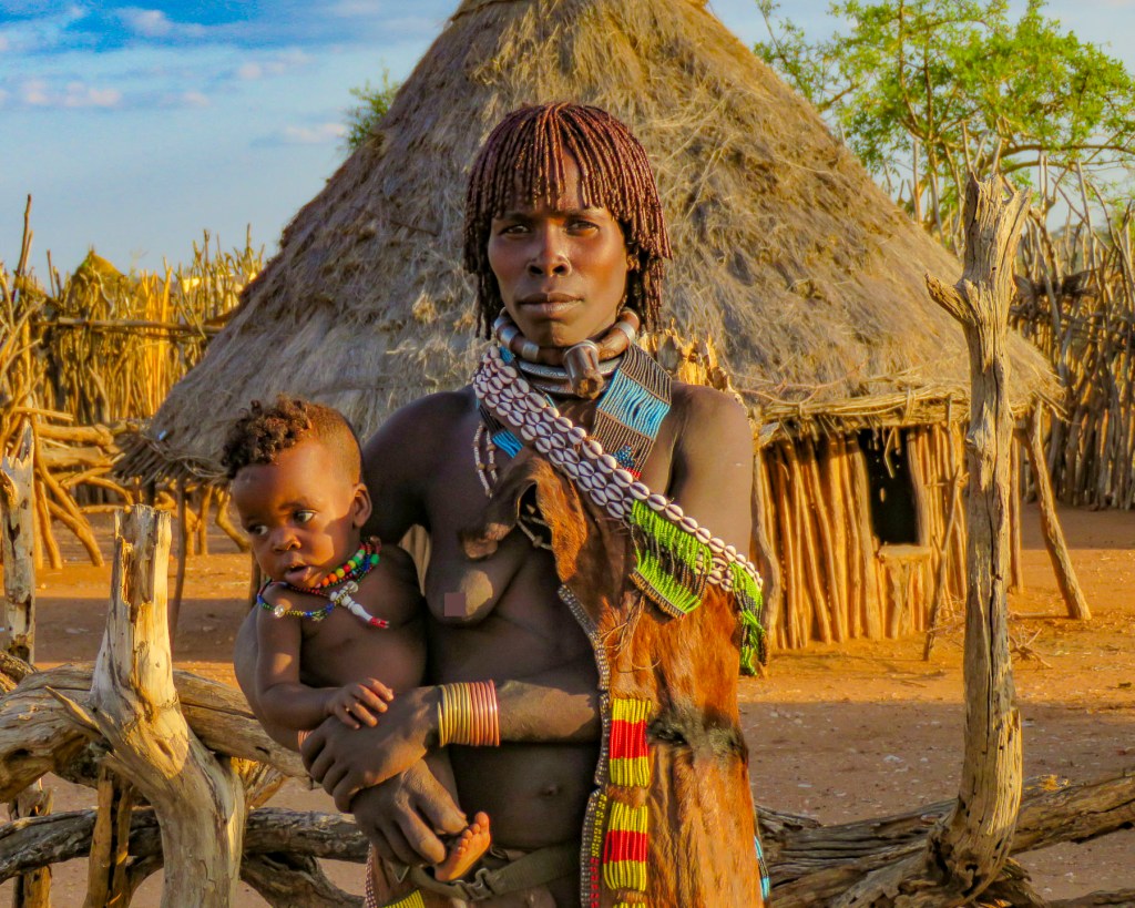
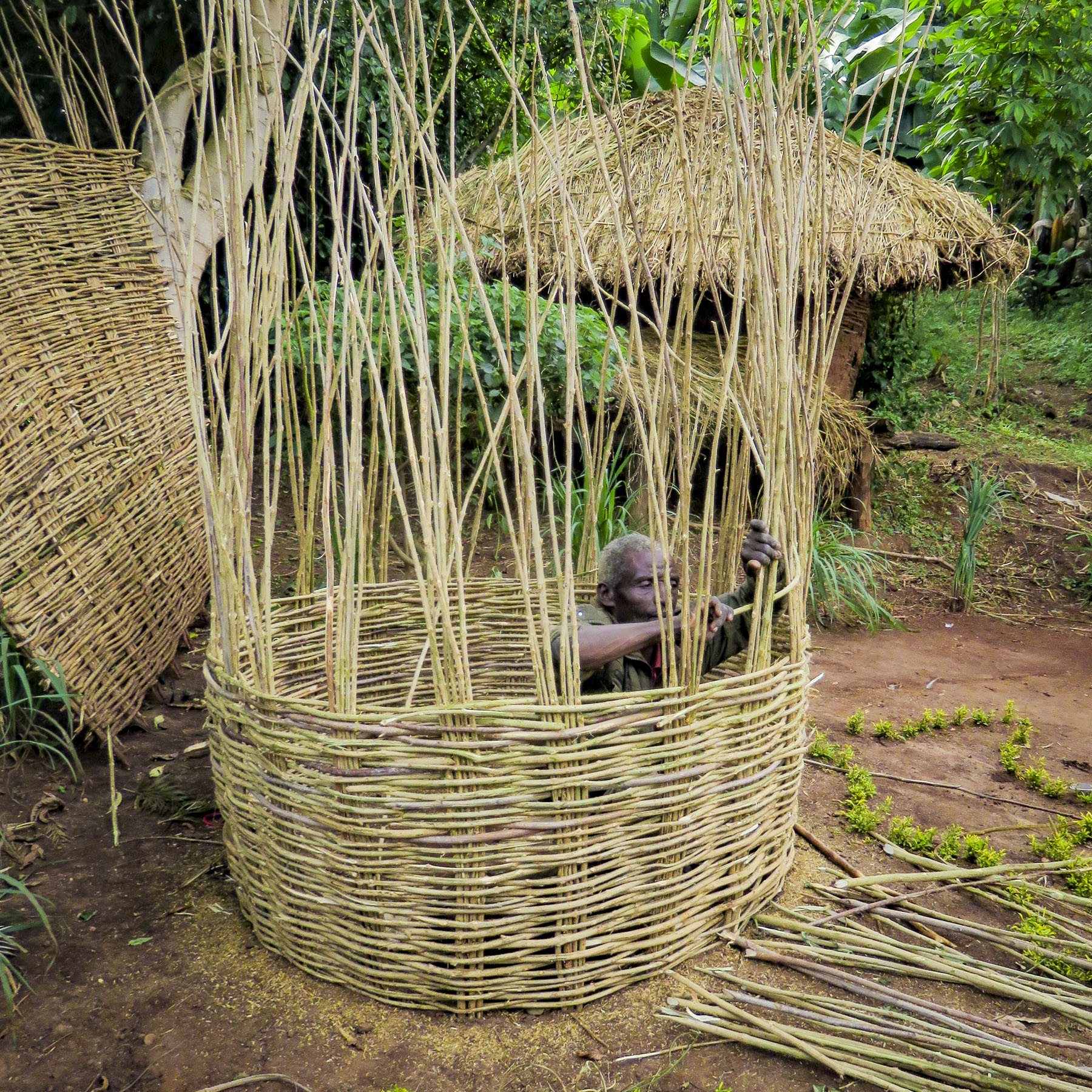


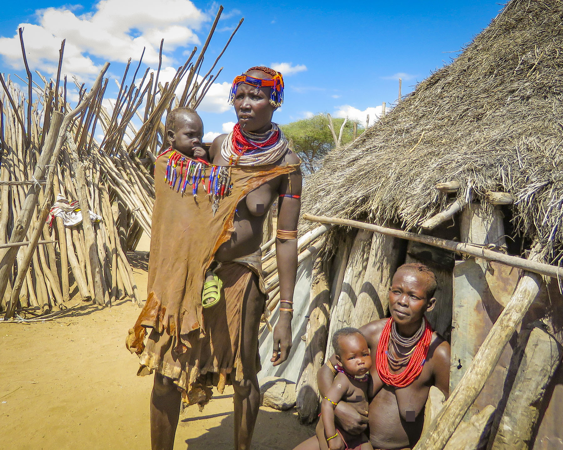
 It was a steep walk up a trail through a forest of false banana, enset, to a well-kept sturdy hut with a medicinal herb garden.
  Outside two women were pinching clay into bowls and teapots that would later be sold at a weekly market.


 With sunlight shining through a canopy of giant enset leaves above her, a tribeswoman prepared kocho, a traditional Ethiopian flatbread, over an open smoky fire as we sat and watched. Behind us children giggled as they playfully rolled an old bicycle rim down the path.


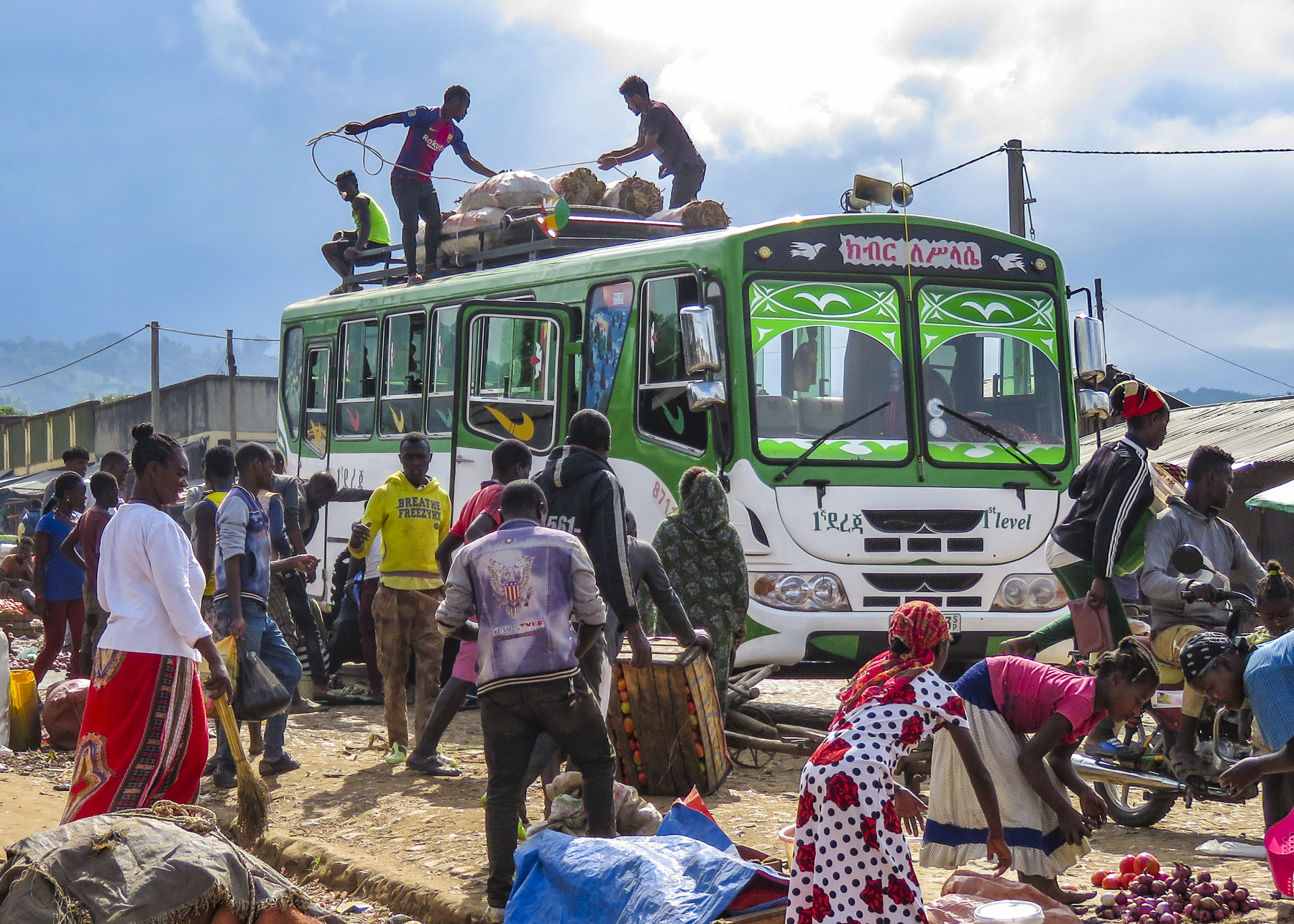 There was a lively commotion of activity by the buses as porters brought over bundles to be tossed up onto the roofs and tied down before heading back to outlying villages.
 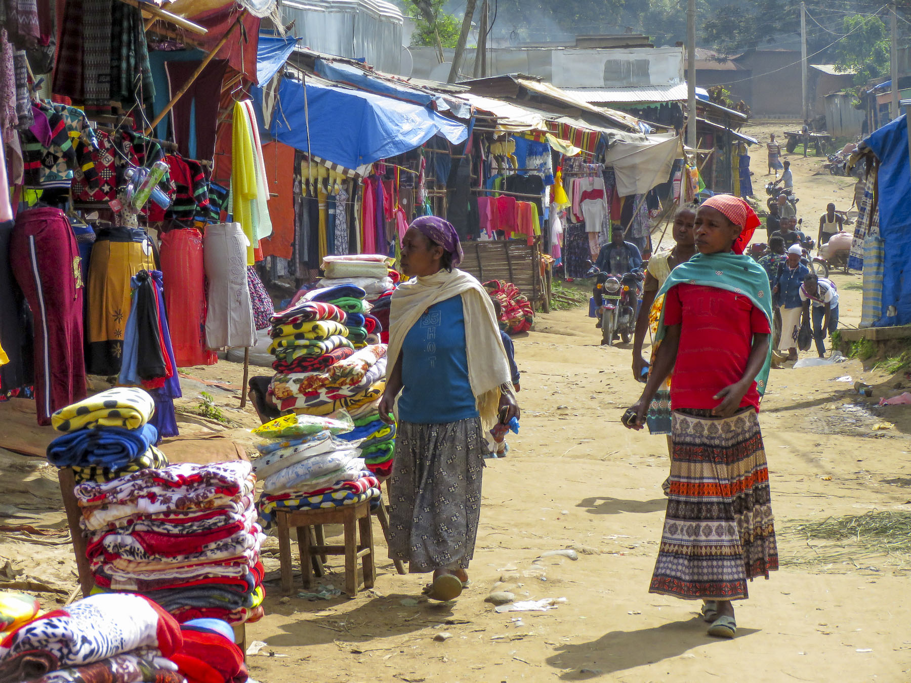 Goats, cows and children were left to wander about freely while small piles of detritus burned slowly in the streets as vendors cleaned up at the end of the day. The earthy smell of dung and smoke lightly scented the air. It was chaotic.


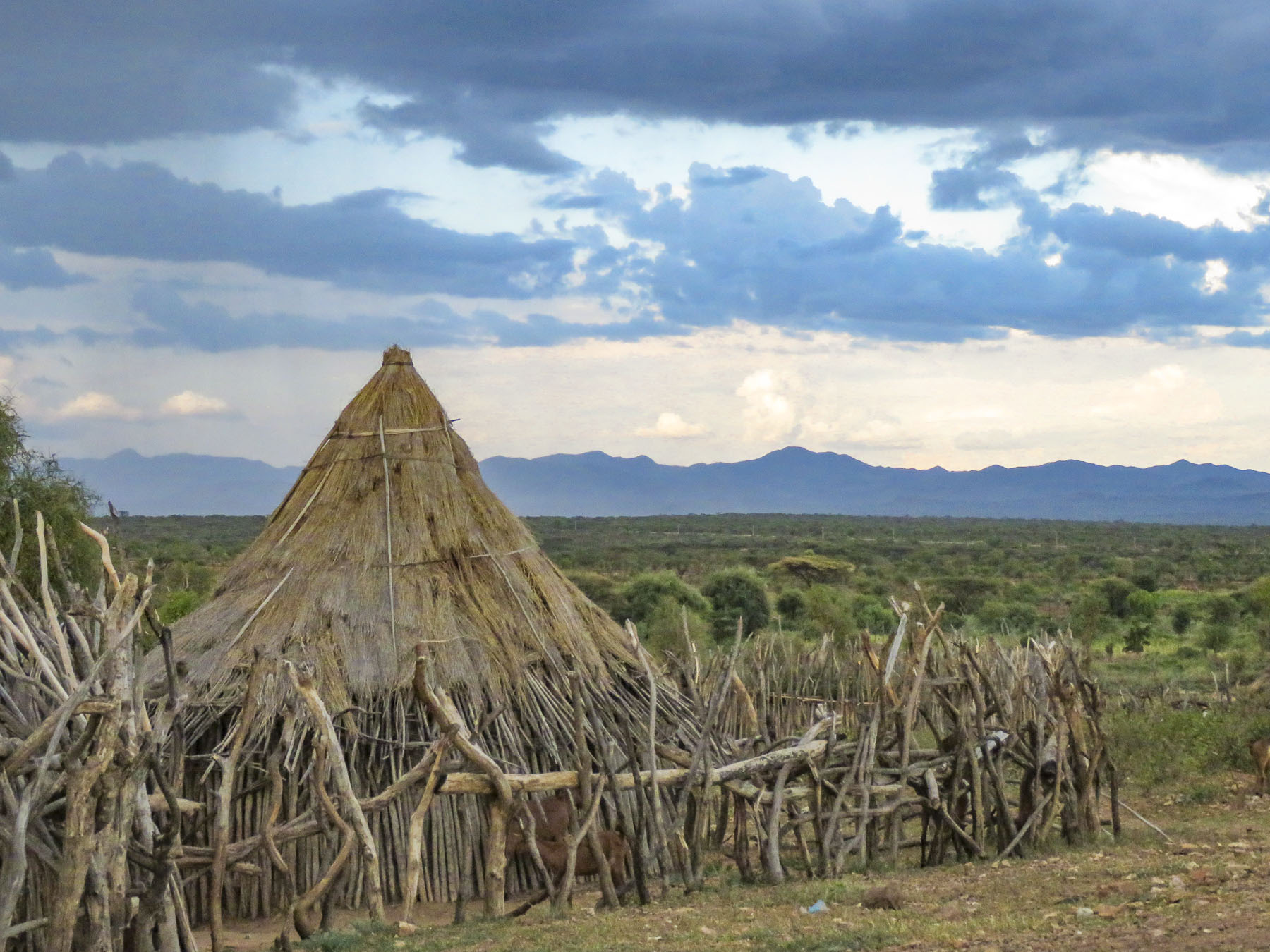
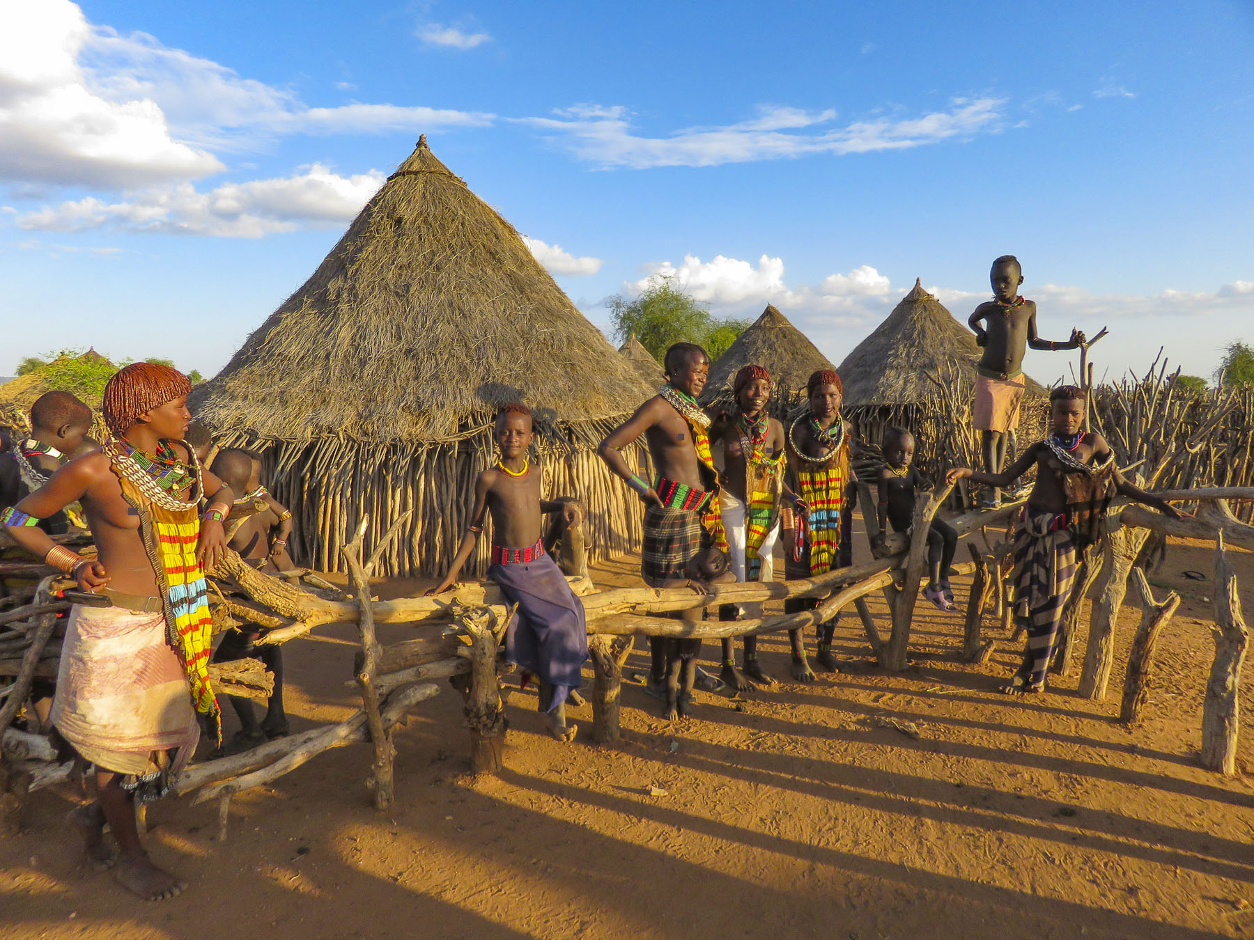
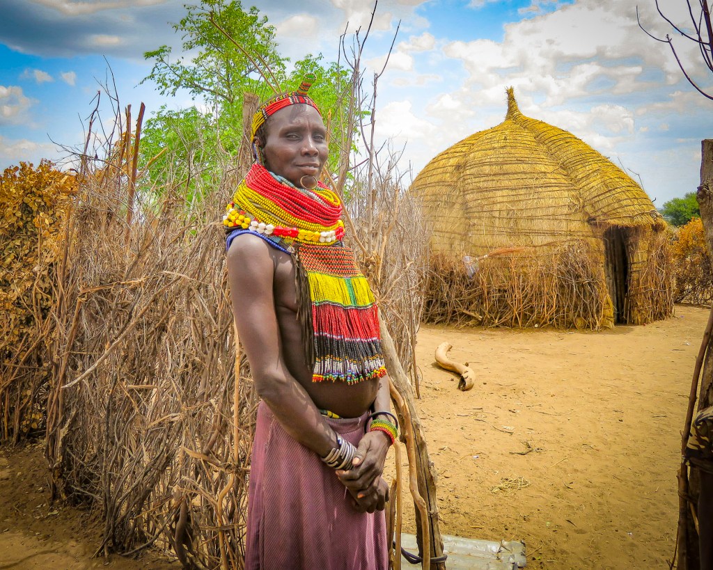
 The highlands area is home to the Konso people who are renowned for their ringed hilltop villages, fortified with stone walls. They have developed terraced farming techniques to survive in a semi-arid, rock strewn and hilly territory for almost seven-hundred years.
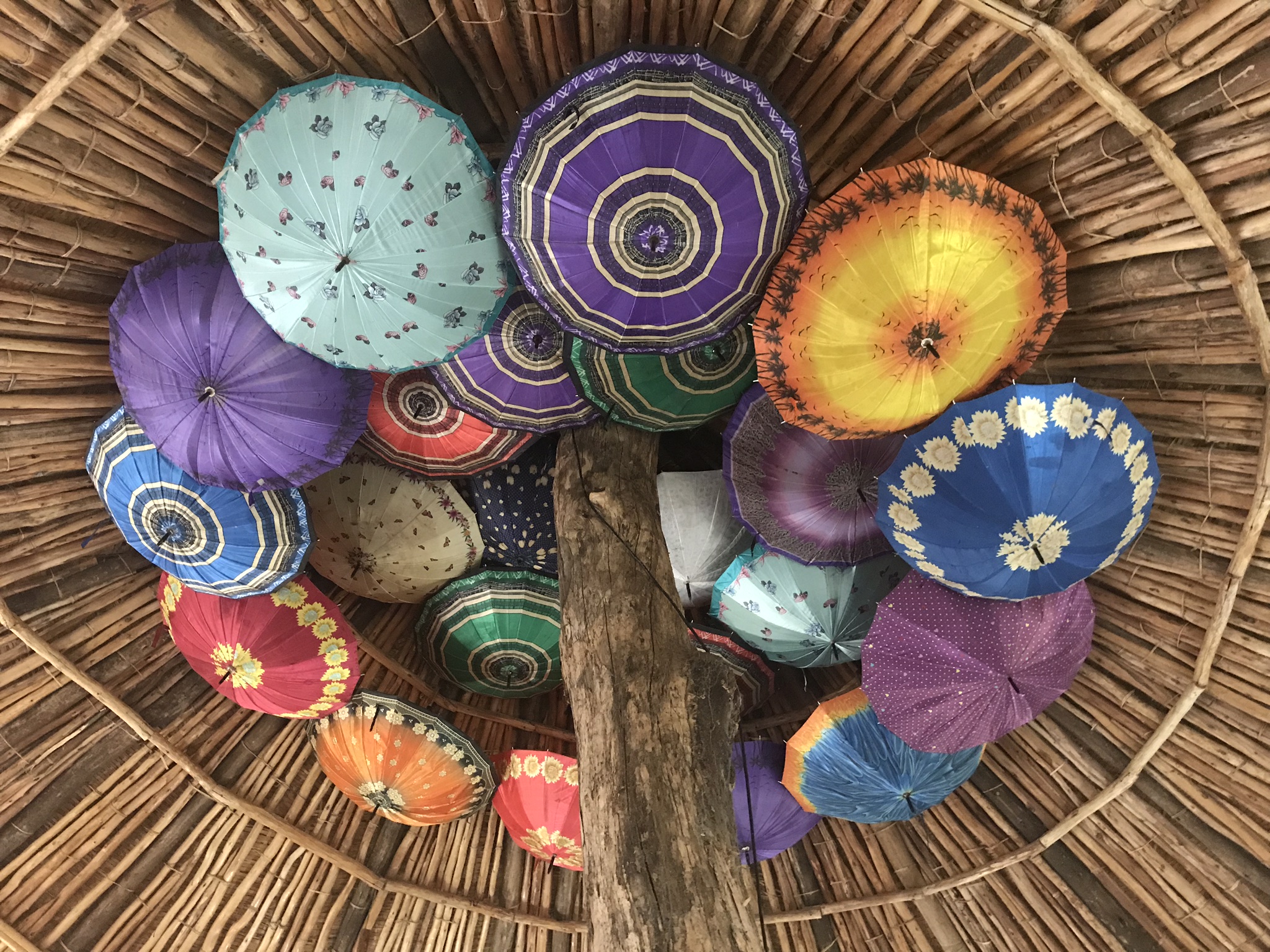
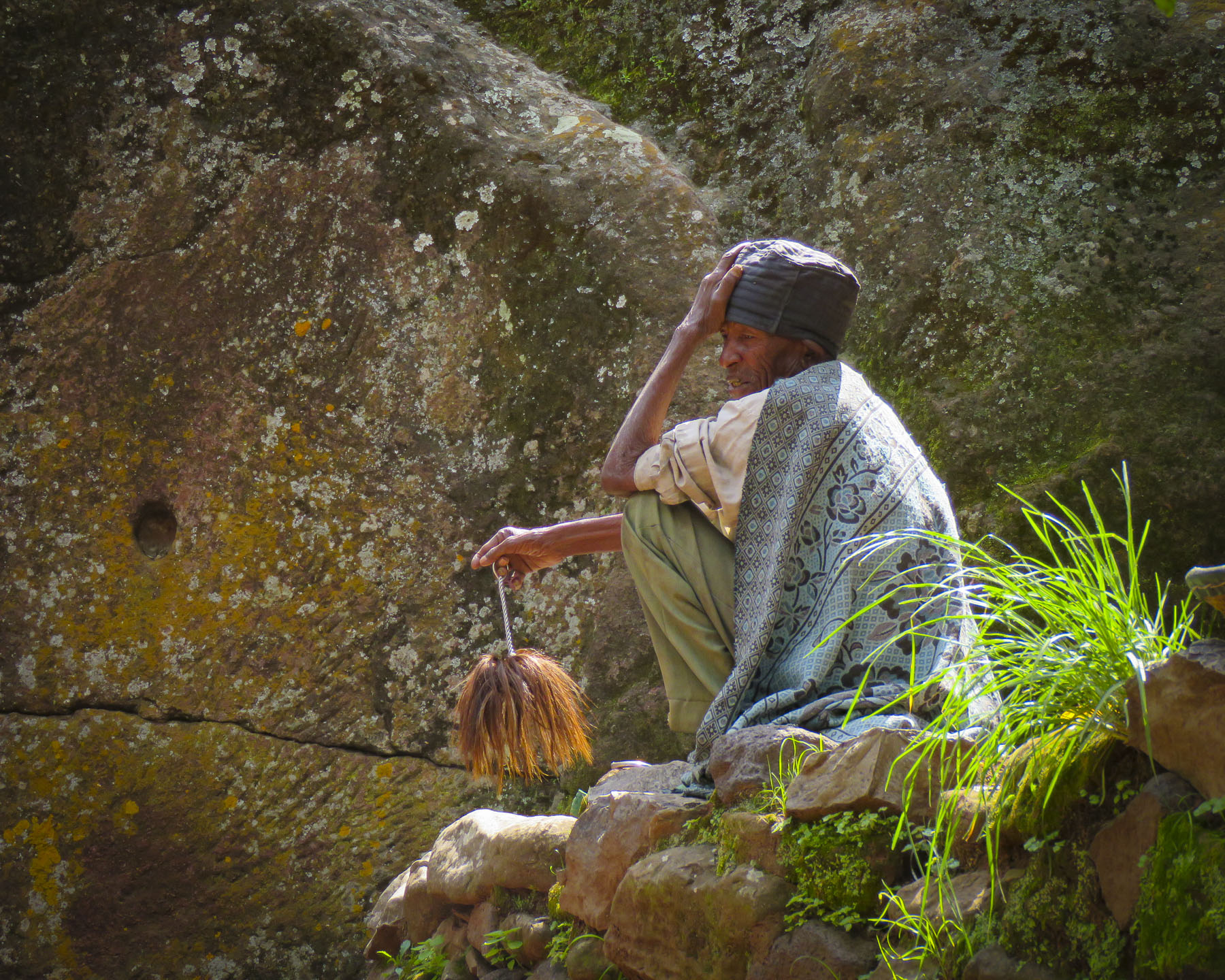
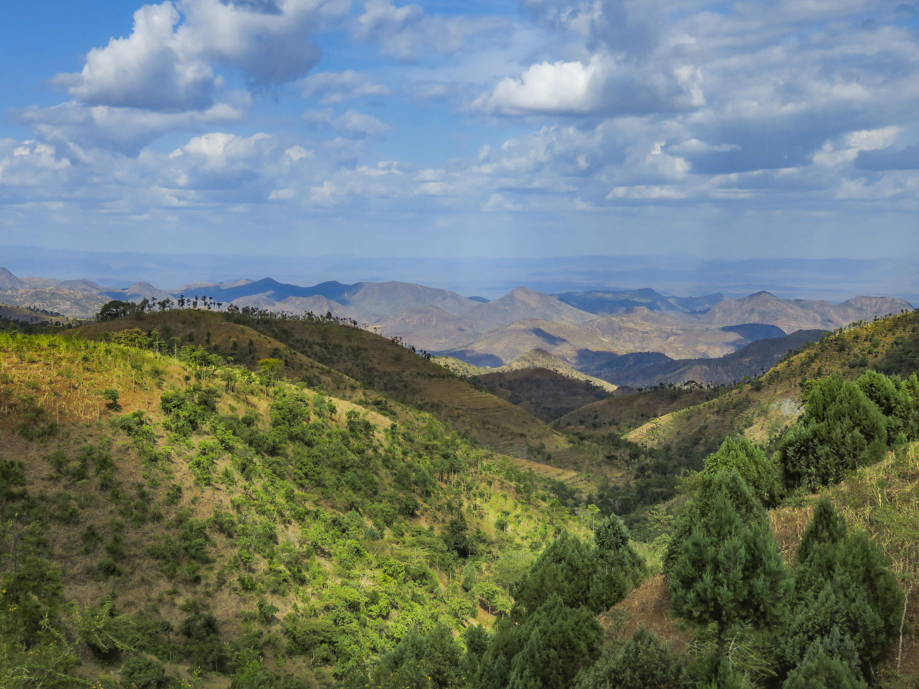 As we entered the town of Konso, bundles of candles miraculously appeared from under our guide’s seat and we stopped to donate them to a young man collecting offerings in front of his Ethiopian church. This was the guide’s ritual when we changed territories and it continued throughout our trip. It was a common sight to see small groups of parishioners walking along the road holding up a picture of a beloved saint and umbrellas for shade.


 As we walked to the center of the village young children following us jumped from rock to rock, along the tops of the tall walls built to protect the village, as we made our way along the path below.

 Each ring also has a community area called a mora; this is a large thatched roof structure with an open lower level and an enclosed upper platform where the married men and bachelors of the village sleep.
 More importantly it provides a shaded meeting place where men play gebeta. It’s considered the oldest board game in the world and is played simply with stones, beans or seeds being moved around holes in a board with the goal to capture as many of your opponent’s pieces as possible. Each village is also divided into two zones and a man born in one zone must always have his homestead in that zone.
 The Konso also erect generation poles, called olahita, which are raised every eighteen years. The olahita are made of cedar trees taken from the kala, a sacred forest. Gamule village had eighteen olahita which dates the village to be nearly 400 hundred years old. Sadly, the oldest central poles have succumbed to termite damage and rot over the centuries. The oldest village in the Konso region is Dokatu which has 43 olahita. Near the olahita was the village ceremonial daga, a large rock, that teenage boys lift over their heads to prove their manhood and eligibility for marriage. The Konso also carve waka, grave makers, in rough likeness of the deceased. These were originally placed at the grave sites in the sacred forest, but have now all been brought back into the village to deter looting. Each village is surrounded by a dina, or grove of trees, which acts as a buffer between the village and agricultural terraces. This buffer of trees was meant to inhibit attack on the village and provide an area close to the settlement where folks could forage for firewood. There are 36 paletas, with populations ranging from 1,500 to 3,000 in each village, scattered across the Konso territory.

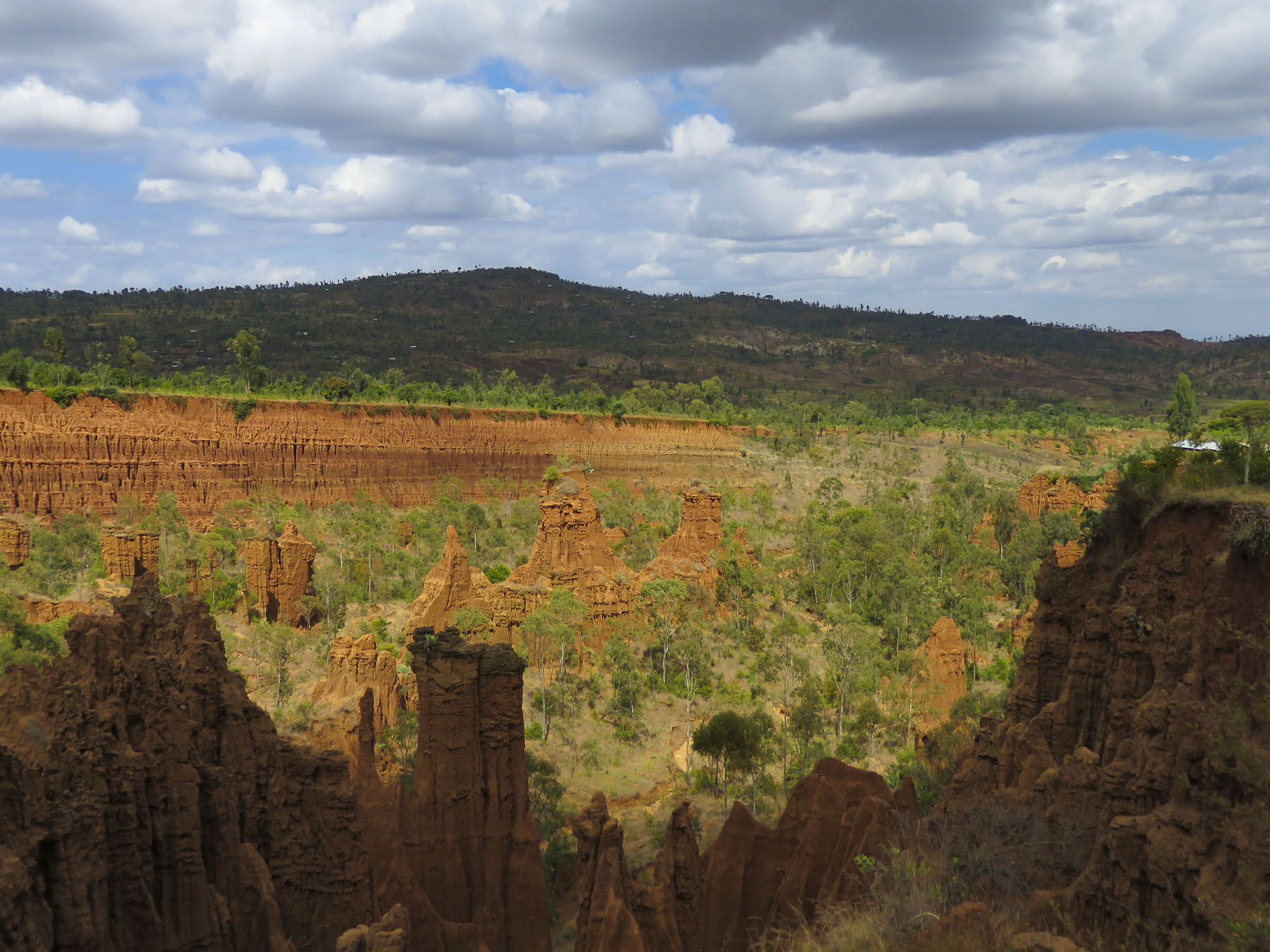 We didn’t really see the NYC comparison, but the landscape was interesting in that it contrasted sharply from the surrounding terrain. And the encompassing territory is beautiful with vistas of rolling hills. Driving away a group of young men were perched on a lone boulder, just passing time.
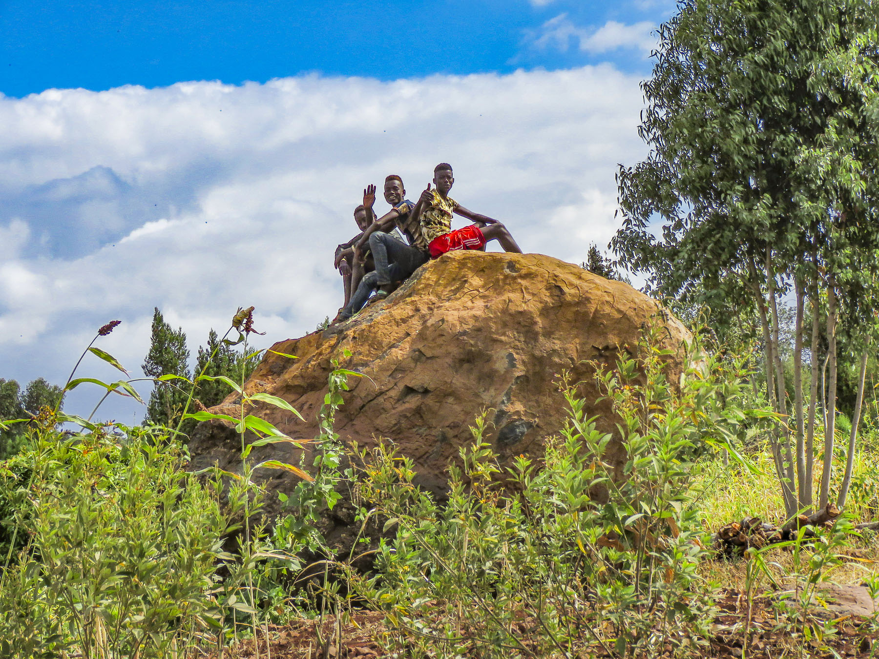 We arrived late in the afternoon to the Konso Korebta Lodge, situated high on a hill. It was a relatively new complex with attractive, circular stone huts topped with steep thatched roofs and beautiful plantings of bougainvillea. Desperately needing showers, we were flummoxed when the tap was dry and headed to reception to see what was up. Unbeknownst to us it’s common practice at hotels throughout the countryside to only turn on the electricity and water between 6:00 – 9:00 in the morning and 6:30 – 10:00 in the evening to conserve resources.
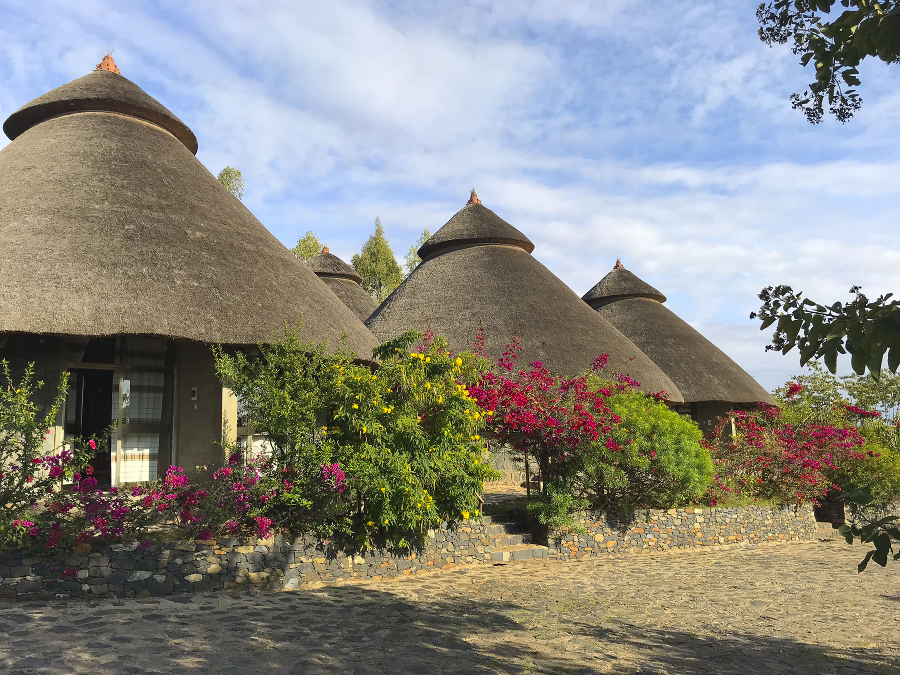 Thankfully, the staff called the owner to get permission to start the generator early for us. Back seat driver that I am I thought our driver drove fast, safely but fast to cover the great distances we had to travel. So, we were surprised the next afternoon when he was tootling along very slowly to get back to the hotel. Evidently the hotel owner made it very clear to our guide that he would not turn on the generator early again.

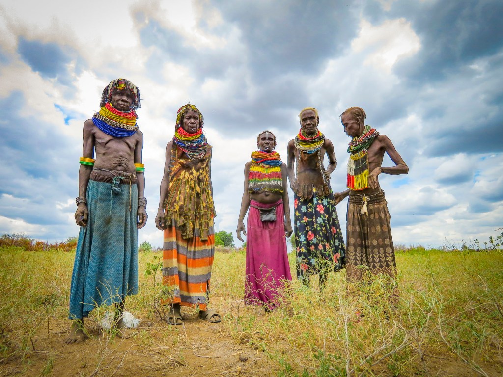
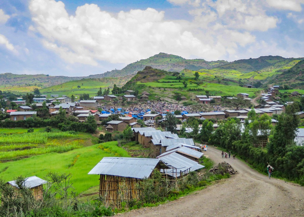
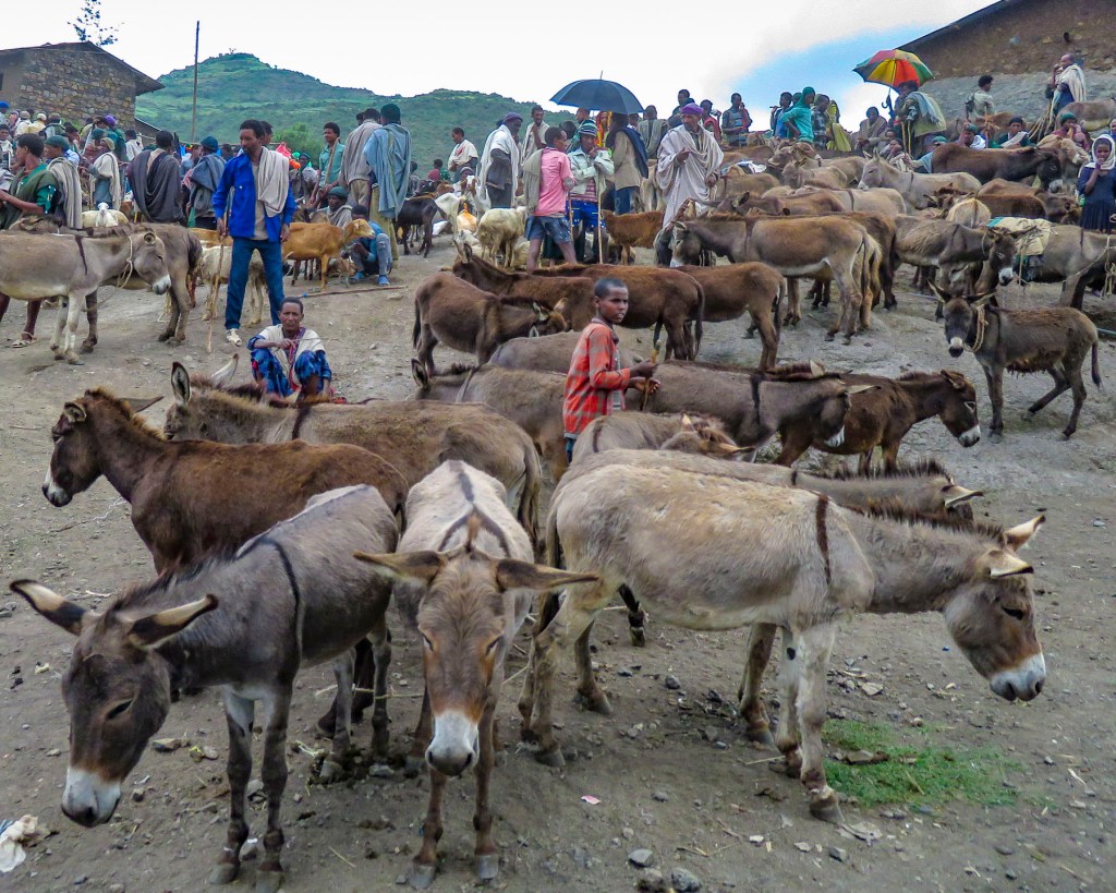
 Market days are huge events in the rural areas and folks from various tribes travel for miles to attend them.
 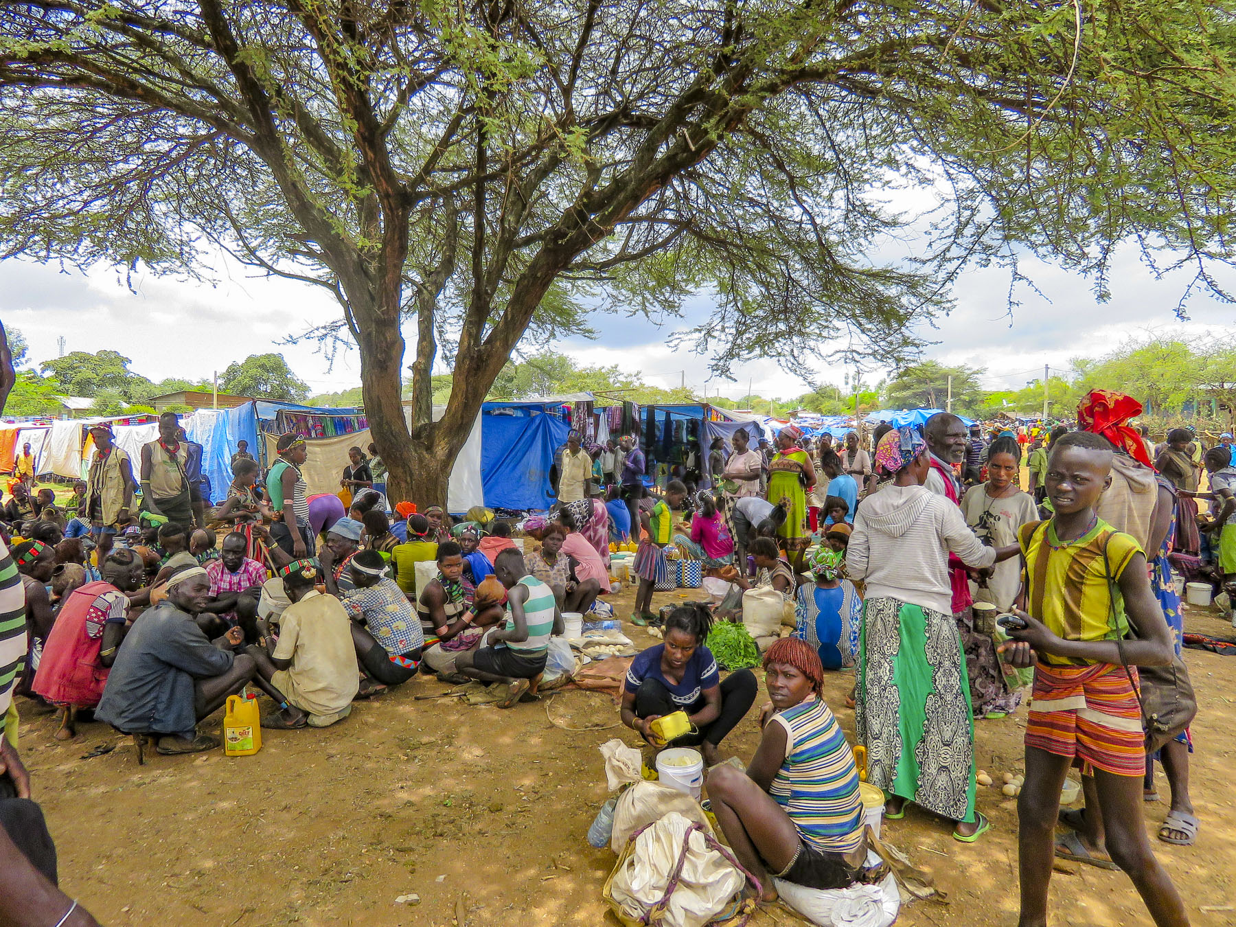 Not just to buy or trade supplies; it’s also a cherished opportunity for men and women to socialize with friends and extended family from other villages, often in raucous beer halls which could be in a makeshift shed or more often a spot under a large shade tree that serves a local brew.


 We were able to take many candid photos as we followed our guide through the market to its various parts. Ceramic pots, handmade tools, ropes and leather goods produced by different tribespeople were available as were pots, pans, cloth and sandals produced in China.


 Many folks were very receptive to this and our guide would negotiate a fee. And even though we paid for the privilege to take their photo, they seemed pleased that we admired their style. A few, however, angrily waved us away.


 Pulling over occasionally to take photos from scenic overlooks along this isolated track, we were always surprised when, in the middle of nowhere, a young man selling souvenirs would emerge from the shade. Later we would come across an enterprising group of young stilt walkers urging tourists to stop for photos – and of course we did.
 Entering Jinka, we noticed signage for the International Airport (BCO, though we are pretty sure you can only fly in from Addis Abba.) We might have arranged our trip differently if we had known this previously as it would have eliminated two eight-hour drives from and to the capital. Note: if you fly into Ethiopia on a ticketed Ethiopian Airways flight you are able to purchase


