

After getting some up-close shots of warthogs feeding on the lawn in front of our room, we loaded our bags into the Landcruiser and headed south to the Konso region with our guide and our driver. 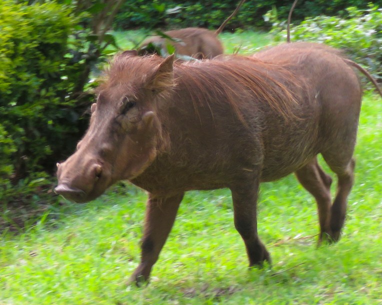 The highlands area is home to the Konso people who are renowned for their ringed hilltop villages, fortified with stone walls. They have developed terraced farming techniques to survive in a semi-arid, rock strewn and hilly territory for almost seven-hundred years.
 As we entered the town of Konso, bundles of candles miraculously appeared from under our guide’s seat and we stopped to donate them to a young man collecting offerings in front of his Ethiopian church. This was the guide’s ritual when we changed territories and it continued throughout our trip. It was a common sight to see small groups of parishioners walking along the road holding up a picture of a beloved saint and umbrellas for shade.


The main street through town was lined with bustling shops. Their services and merchandise almost spilled into the street. A rutted dirt field served as the bus depot and on the day we passed, a large crowd danced in undulating rhythm to see off newlyweds. As remote as southern Ethiopia is, it has a rural minibus system that connects distant villages. The buses are always jammed full of folks, while their belongings are haphazardly tied to the roof.


The creative hand of man was clearly evident in the sculpted terracing we could see from the road leading to the Gamule Konso Cultural Village, a UNESCO World Heritage site. Staple crops of barley and wheat are grown along with crops of maize, chickpeas, beans, yams, taro, turnips, coffee, tobacco and cotton. The terracing tames a once inhospitable terrain into productive farmland.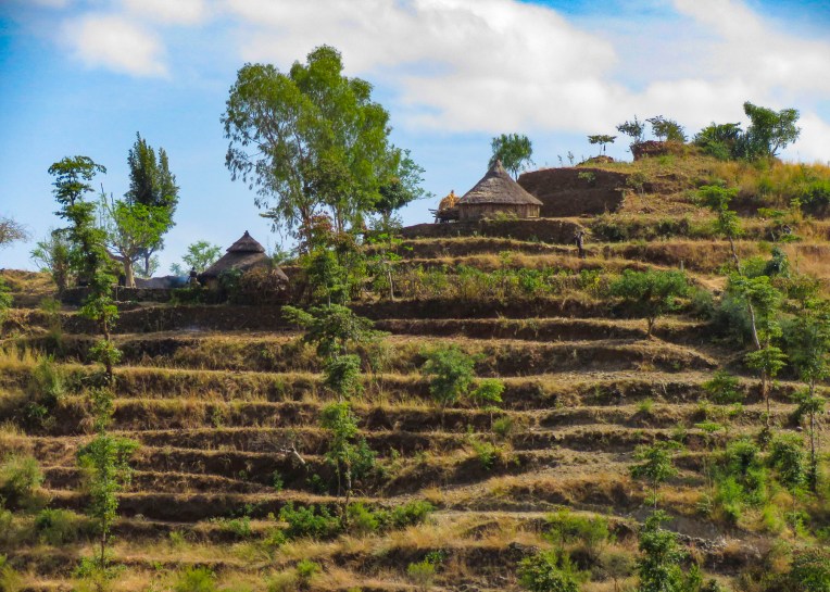 As we walked to the center of the village young children following us jumped from rock to rock, along the tops of the tall walls built to protect the village, as we made our way along the path below.


Set on a hilltop the village, called a paleta, is ringed with six concentric, high stone walls. Each ring was added as the population of the village expanded downhill. Within these defensive walls are fenced family compounds with pens for a small number of animals and sturdy huts and granaries constructed of tree branches, adobe and thatch along with moringa trees, from which the foliage is an important and delicous food source.  Each ring also has a community area called a mora; this is a large thatched roof structure with an open lower level and an enclosed upper platform where the married men and bachelors of the village sleep.
 More importantly it provides a shaded meeting place where men play gebeta. It’s considered the oldest board game in the world and is played simply with stones, beans or seeds being moved around holes in a board with the goal to capture as many of your opponent’s pieces as possible. Each village is also divided into two zones and a man born in one zone must always have his homestead in that zone.
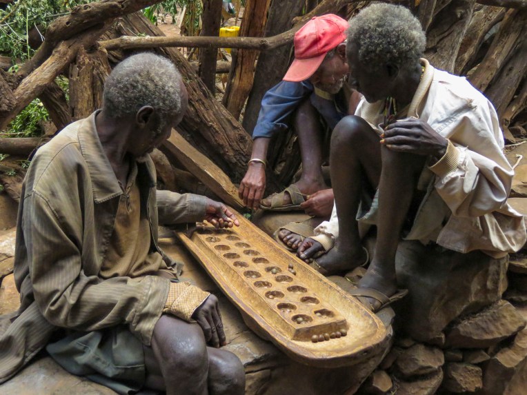 The Konso also erect generation poles, called olahita, which are raised every eighteen years. The olahita are made of cedar trees taken from the kala, a sacred forest. Gamule village had eighteen olahita which dates the village to be nearly 400 hundred years old. Sadly, the oldest central poles have succumbed to termite damage and rot over the centuries. The oldest village in the Konso region is Dokatu which has 43 olahita. Near the olahita was the village ceremonial daga, a large rock, that teenage boys lift over their heads to prove their manhood and eligibility for marriage. The Konso also carve waka, grave makers, in rough likeness of the deceased. These were originally placed at the grave sites in the sacred forest, but have now all been brought back into the village to deter looting. Each village is surrounded by a dina, or grove of trees, which acts as a buffer between the village and agricultural terraces. This buffer of trees was meant to inhibit attack on the village and provide an area close to the settlement where folks could forage for firewood. There are 36 paletas, with populations ranging from 1,500 to 3,000 in each village, scattered across the Konso territory.


Nearby outside the Konso village of Gesergiyo there is a unique landscape nicknamed “New York.” It’s a dramatic red sandstone canyon, that looks like it was violently carved from the earth, with deeply scarred walls and tall pinnacles created from millennium of erosion. Legend says Waga the Konso Sky God created these as he searched for a buried sacred drum.  We didn’t really see the NYC comparison, but the landscape was interesting in that it contrasted sharply from the surrounding terrain. And the encompassing territory is beautiful with vistas of rolling hills. Driving away a group of young men were perched on a lone boulder, just passing time.
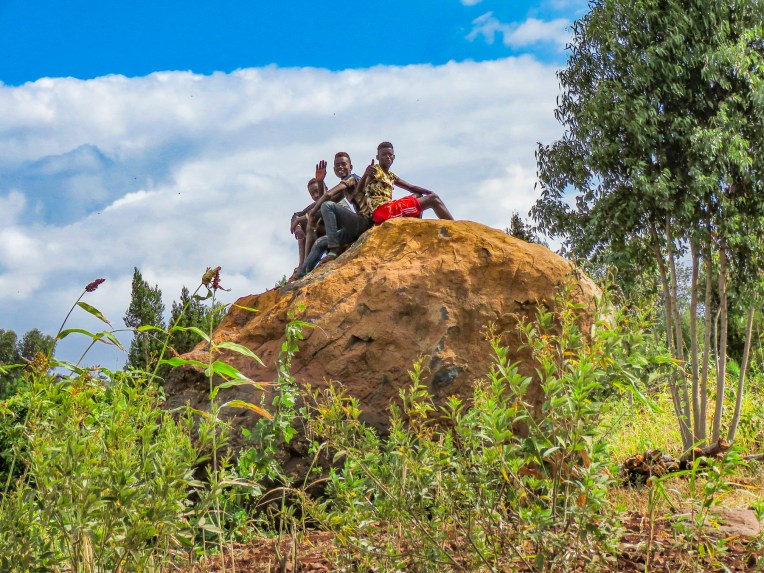 We arrived late in the afternoon to the Konso Korebta Lodge, situated high on a hill. It was a relatively new complex with attractive, circular stone huts topped with steep thatched roofs and beautiful plantings of bougainvillea. Desperately needing showers, we were flummoxed when the tap was dry and headed to reception to see what was up. Unbeknownst to us it’s common practice at hotels throughout the countryside to only turn on the electricity and water between 6:00 – 9:00 in the morning and 6:30 – 10:00 in the evening to conserve resources.
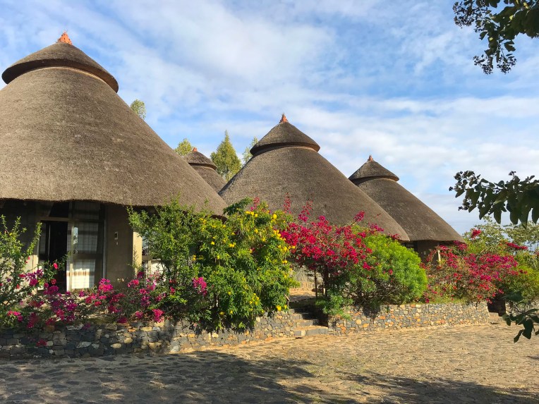 Thankfully, the staff called the owner to get permission to start the generator early for us. Back seat driver that I am I thought our driver drove fast, safely but fast to cover the great distances we had to travel. So, we were surprised the next afternoon when he was tootling along very slowly to get back to the hotel. Evidently the hotel owner made it very clear to our guide that he would not turn on the generator early again.


Later we traced the aroma of barbeque to a small garden area where the staff was grilling goat skewered on small tree branches over a fire pit dug into the ground. It was in preparation for a wedding party that was due to arrive. With military timing it seemed, suddenly the parking area in front of the hotel’s restaurant was full of honking minibuses discharging joyous celebrants. It was a short indoor-outdoor event that climaxed with song, dance and well wishes for the couple. Market days are huge events in the rural areas and folks from various tribes travel for miles to attend them.
 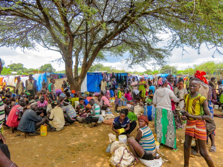 Not just to buy or trade supplies; it’s also a cherished opportunity for men and women to socialize with friends and extended family from other villages, often in raucous beer halls which could be in a makeshift shed or more often a spot under a large shade tree that serves a local brew.


Many folks look and dress their best as it’s also a chance to find a future husband or wife. The Alduba market was exceptionally large, spanning both sides of the main road, and it attracted folks from the Ari, Bena, Hammer and Tsemay tribes. Recently the government constructed a bricked wall corral at the market to show tribespeople that the government was interested in their wellbeing and that local folks are actually part of a greater Ethiopia. And at the same time it started to collect taxes on every head of cattle sold. We were able to take many candid photos as we followed our guide through the market to its various parts. Ceramic pots, handmade tools, ropes and leather goods produced by different tribespeople were available as were pots, pans, cloth and sandals produced in China.


One older woman shared with our guide that she was in her seventies and walked six miles to the market to replace a ceramic cooking bowl that had recently broken. Often, we would stop and ask a person if we could take their picture. Many folks were very receptive to this and our guide would negotiate a fee. And even though we paid for the privilege to take their photo, they seemed pleased that we admired their style. A few, however, angrily waved us away.


Later in the day we headed to Jinka, the largest town in the region, slowly getting closer to the Omo Valley with every move. Traveling through a xeric landscape, we had a long stretch of dirt road to ourselves.  Pulling over occasionally to take photos from scenic overlooks along this isolated track, we were always surprised when, in the middle of nowhere, a young man selling souvenirs would emerge from the shade. Later we would come across an enterprising group of young stilt walkers urging tourists to stop for photos – and of course we did.
 Entering Jinka, we noticed signage for the International Airport (BCO, though we are pretty sure you can only fly in from Addis Abba.) We might have arranged our trip differently if we had known this previously as it would have eliminated two eight-hour drives from and to the capital. Note: if you fly into Ethiopia on a ticketed Ethiopian Airways flight you are able to purchase discounted domestic flights . Our guide booked this discount for our us on our Addis Abba to Lalibela flights.


The Orit Hotel offered very basic accommodation, but it had a wonderful garden restaurant, good food and cold beers.
The next day we would head into Mago National Park to visit the Mursi tribe.
Till next time,
Craig & Donna


 The area in the northern part of the Greater Rift Valley, known today as the Omo Valley region of Ethiopia, has been at the crossroads of humankind for many millennia. In 1967 Dr. Leaky discovered fossil bone evidence, recently re-dated by scientists to be 195,000 years old, of early Homo sapiens near Kibish, Ethiopia, several miles west of the Omo River near where the borders of Sudan, Kenya and Ethiopia meet. The first migrations of early man out of Africa occurred 60,000 years ago as they followed the Omo River north through the Great Rift Valley to the Red Sea. At its narrowest point, where it meets the Gulf of Aden, they crossed to continue their migration through Arabia and eventually into Europe and Asia. The region was once rich with African wildlife, and Arab towns along the northern East African coast of Somalia and Kenyan were sending hunting parties into the interior for elephant ivory, rhino horn and unfortunately slaves since around AD 1000.


 Things change, but the proud peoples that live in the Omo Valley are trying to retain their way of life amidst external influences they can’t control, as tourists and construction crews course across their territory. Tempers flare when trucks and buses carrying supplies and workers to the agricultural plantations strike and kill cattle. Drivers are required to stop and immediately pay the herder for his loss, but many never do. Consequently, the local tribe will block the road and demand payment until the issue is resolved.
 A good night’s sleep at the


 The 2019 rainy season was good; unfortunately, this is often not the case. There was no water infrastructure in most of the small towns and villages we passed through, forcing folks to gather water from local streams and rivers.
 It was a constant sight: women carrying yellow water jugs along the side of the road back to their homes, or if they could afford it, having it delivered by donkey cart. The terrain varied tremendously, with full rivers on one side of a mountain range and dry on the other side. These conditions forced people to dig into the riverbed in search of water.

 Since Ethiopia is close to the equator, the daylight hours do not vary seasonally. The sun rises quickly in the morning and seems to drop from the sky at the end of the day. By the time we reached the
  At breakfast we watched thick-billed ravens in aerial combat as they rode the thermals just off the restaurant’s terrace. Nearby a staff member stood ready to chase away baboons if they got too close to the customers’ tables.

 As we entered the village, compounds ringed with woven rattan walls held back tall Enset plants, better known as false banana, also called the “tree against hunger.” This plant is an important staple that is drought resistant and can be harvested year-round. Starch from the plant is scraped from its fibers and fermented in the ground for three months or longer and used to make kocho, a type of flat bread.
  Fibers from the plant are used to make rope or coffee bean bags, and the leaves are fed to farm animals. We arrived on market day, and an entire hillside about the size of three football fields was covered with activity. From a distance it looked like an animated impressionistic painting, with undulating dots of color dancing under a blue sky.
  Sellers of charcoal, sugarcane, vegetables, and a multitude of other goods all had their wares spread out on cloths covering the ground. Men played foosball or ping-pong under the few shade trees that ringed the field.


 Men of the Dorze tribe traditionally do the weaving, while the women are responsible for spinning the cotton that the family grows and uses. The colorful textiles they create are highly prized all over the country.
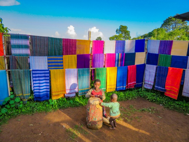 Back in Arba Minch we stopped at the Lemlem restaurant for a lunch of local lake fish before checking out the crocodiles on Chamo Lake. The lightly fried fish were served whole, while the sides were scored into squares which we picked off with our fingers. It was delicious. Another side of the restaurant served freshly butchered, grilled meat.


 “Sorry for the late pick-up, but the road was full of tuk-tuks carrying families to the university stadium up the street for a graduation ceremony,” Ephrem offered as he bundled us into the Land Cruiser and handed us large bottles of water. “It’s hot where we are going today.”

 We trailed a young Borena girl herding a small group of cattle down a slowly inclined, dusty trench deeper into the earth. It was impossible to avoid cow patties as we steered clear of an exiting herd. Thirty feet below the surface, the trench ended in a bowl shape with a water trough where cattle were drinking. Rhythmic voices emerged from a shallow cave behind the trough. Climbing worn stone steps, we came to a narrow landing above the trough,


 A short drive away, our last stop of the day was a well-kept Borena village surrounded by an ochre landscape under a perfect blue sky. Women do the heavy lifting in the villages, building the huts, tending children and crops, and spending a substantial amount of time foraging for firewood and gathering water from far off sources. While the men spend their days moving their cattle across different grazing lands.
 Women rule their homes and determine who can enter, even prohibiting spouses. “If her husband comes back and finds another man’s spear stuck into the ground outside her house, he cannot go in,” our guide conveyed.


 Flying over the Northern Cape, we watched from the window of the jet as the fresh greens of the Western Cape slowly faded to the reddish sands of the Kgalagadi Transfrontier Park, that straddles the border with Botswana. From the air it looked like a flat, dry, desolate landscape broken by faded veins – forgotten dirt tracks to who knows where. Further into Botswana the vast whiteness of the Makgadikgadi Pans National Park intensely reflected the sun as the park’s 2400 square miles of salt pan stretched to the horizon below. The area was once the immense Lake Makgadikgadi, that covered an area almost the size of Switzerland, but dried up more than 10,000 years ago.
 While the Cape Town region had fortunately recovered, Zimbabwe was still suffering from its worst multi-year drought in 40 years and the countryside looked tinder dry, as if it would erupt into a massive mushroom cloud if you breathed too hard on it. As a result of the severe water shortage, electricity was being rationed due to insufficient water levels to run the turbines at the hydroelectric dams along the Zambezi River.
 At the Zimbabwe Airport, the queue for visas to get into the country was very jammed and moved slowly. We were in the middle of the pack, surrounded by organized tour groups so we felt our progress would proceed smoothly. It did not. The delay was extensive and twice I had to skirt security and walk past the border control booths to the baggage claim area to check that our luggage was still there. (It was lucky that I did, as our bags had been gathered into those of a large group tour and we nearly lost them.) But somehow, while we waited in line, it was as if we had grounded a boat on an unseen rock, and we ended up as the last couple entering the country at passport control. Everyone else had managed to sail past us. We were finally about to get our passports stamped when the power failed and the computers went down! And to top it off we had to ask the border control officer to return the change due us from purchasing the visas.
 Our mood was restored by the warm greeting we received from Fungayi, our guide for the next three days and the owner of
  The Zambezi River starts high in the mountains of northern Zambia near where the borders of Angola, the Congo and Zambia converge, and is the fourth longest river in Africa at 1600 miles. It flows south then east for hundreds of miles as the natural border between Zimbabwe and Zambia. Thundering over Victoria Falls, its waters eventually flow through Mozambique and empty into the Indian Ocean. It’s a vital life source for people and animals of the region.


 As tranquil as our water safari was, the river was surprisingly busy with activity, but so well-spaced it didn’t infringe upon our enjoyment of the afternoon. As the sun set, our captain skillfully positioned our boat to capture the last light of the day.
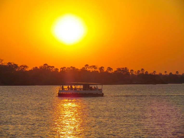 After a long day of travel and sightseeing it was finally time to check into the


 Victoria Falls was originally named by the indigenous tribes of the region, who called it Mosi-oa-Tunya or “The Smoke that Thunders.” The mile wide and 355 feet high falls have been one of the Seven Wonders of the World since British explorer David Livingstone stumbled upon them in 1855 as he was trying to elude that pesky reporter Stanley, and of course he claimed their discovery and renamed them as imperialists did.
 “When the river is full you can’t see the falls across the gorge. It’s just a thundering cloud of mist. It’s much better for photos this way,”our guide offered, trying to put a good spin on a dire situation as he pointed across the gorge toward Zambia. If you are not convinced of climate change, witnessing firsthand the dramatic reduction of water flowing over the falls might change your mind.


 With an unscheduled afternoon ahead of us Fungayi suggested we lunch at the

 We spent our last day in Botswana on a game drive and river safari in


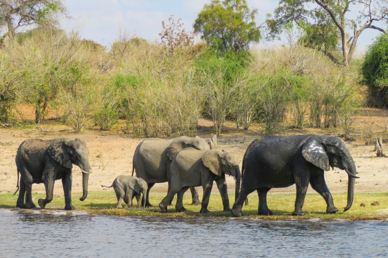
 We hadn’t spotted any elephants yet, so we turned into the forest to look for them. Here we encountered several small elephant family groups, all following their matriarchs in search of food.
  On the way out of the park, heading to our river safari, we viewed giraffe and more antelope.

 Viewing wildlife from the water offered a different perspective on the animal life. Gape-mouthed hippos and crocodile sightings were frequent now.


 The black coats of the buffalo were now glistening in the sun. Unfortunately, we didn’t witness any herds swimming across to the islands, but there were distinctive water lines on the elephants that had forded earlier.


 Surprisingly, there was even a border control station on the riverbank to monitor the movement of people and commerce on the waterway between the two countries. It was a rewarding afternoon with Donna definitely being in her element. And those riverboat hotels got us thinking about potential future trips.
 So many things change yet many things stay the same.

 We planned a long weekend to celebrate
 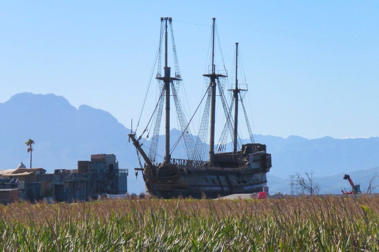 But first we had to get there. Just before our exit off the N2, the silhouettes of several tall sailing ships broke the horizon as if they were crossing an inland sea. Imagining a pirate swinging from a yardarm, we did a quick double take and followed a side road down to the entrance of
  Across the street from the movie studio, our wine tasting started at


")


 Our room was spacious and comfortable, bigger than several studio apartments we have rented. We spent a little time walking around the pond, watching the weaver birds dart in and out of their hanging nests, before the sunset.


 We followed the queue of beret wearing Francophiles draped in colors of the flag, past a vintage car show and a very competitive barrel rolling contest, to the Food & Wine Marquee, where our tickets included a live concert by South African rocker Karen Zoid, two very nice wine glasses, tasting coupons and R20 vouchers to use towards the purchase of food or bottles of wine.


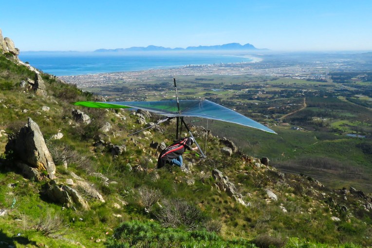 Luck was with us when we pulled into the Sir Lowry’s Pass View Point, in time to see several paragliders launch from the steep slope of the overlook. The view toward the town of Strand, on False Bay, with its long sandy crescent of beach, was incredible. Further on fruit orchards lined both sides of the road for as far as we could see. The valley’s unique climate, cooler and wetter than the surrounding region, is perfect for the local orchards to blossom. Today the Elgin region produces 65% of South Africa’s export crop of deciduous fruits.
 We were working our way to the
  Located directly across the street from the ocean, the
  Walker Bay’s thunderous waves crashing against the rocky coastline were spectacular with their large sprays as we walked along the Hermanus’ Cliffside Path to Gearing’s Point, a scenic overlook, hoping to spot whales. Our Cape Town friends had mentioned that it’s often possible to sight Southern Right Whales from the shore here during their June to November calving season, after which they head back to the waters of Antarctica.
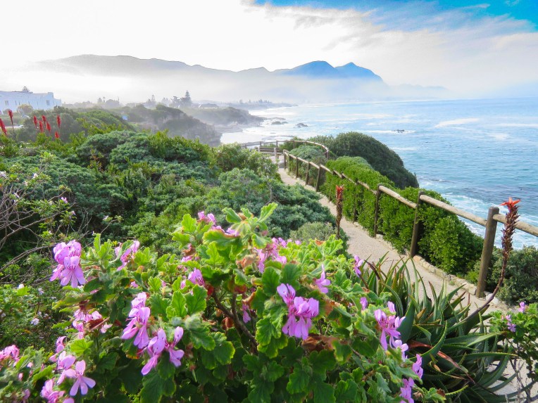
 It’s a well-defined trail, with cement, dirt and boardwalk sections, that starts at the village’s New Harbor and hugs the coast for 7.5 miles, ending at the Klein River Estuary. Five miles of the path are wheelchair accessible. In some places it passes under trees twisted to grow almost parallel to the ground, by the fierce South Atlantic winds that blow in from Antarctica.

 The seascapes from the cliffside path were beautiful, but we hadn’t spotted any whales and the village’s whale crier wasn’t sounding his kelp horn. Yep, what started as a publicity stunt has become tradition and Hermanus has had an official, and the world’s only, whale crier since 1992.
  In 2016 the movie The Whale Caller was adapted from South African author Zake Mda’s 2005 novel, of the same name, which has the whale crier as the central character.

 With skipper Emile at the helm, the first mate tossed the mooring lines to the dock and we departed onto a gently rolling sea. Phillip, a registered naturalist with a delightful wry sense of humor shared his love of the sea with us. “There’s a good chance we’ll see Southern Rights today. We spot them by their distinctive V-shaped blow and the callosities (clusters of barnacle like growths) on their heads. We may also see Africa Penguins, Fur Seals, Dolphins, migrating Humpback Whales and resident Bryde’s Whales.” Psyched now, all eyes scanned the horizon for any telltale signs of these gigantic, yet elusive creatures.

 Heading back to Cape Town late the next day, we followed the scenic R44 coastal road through the seaside villages of Kleinmond, Betty’s Bay, Pringle Bay and Rooi-Els as the golden hour was approaching.
  Each turn of the road offered a dramatic view of the coast and we stopped many times for photos. We merged back onto the R2 at Gordons Bay just after sunset for the ride the rest of the way back to the city.


 After our last apartment in the “Mother City,” on Bree Street, we moved to the Sea Point neighborhood and as its name suggests, it hugs the coastline under Signal Hill and Lion’s Head Mountain. Finding the ideal apartment for our last 30 days in Cape Town required a bit of detective work on our part though. One of the draw backs of using Airbnb is that it does not provide the specific address of a property until you actually book it. So, while the interior photos of a listing might be charming, its exact location could be anywhere within a five-block radius of a dot on the map, unless the host gives hints in the apartment description.
 In Sea Point this could mean on the water or nowhere near it. But with a little sleuthing regarding our final three choices, we were able to determine which one was right on the waterfront. Our reconnaissance of the neighborhood paid off and we booked a sixth-floor one-bedroom apartment with a terrace, that had an ocean view for dramatic sunsets and inland views of the paragliders launching from Signal Hill.
  It was the perfect location across from the Sea Point promenade. The lively Mojo Market, with numerous food stalls and live music seven nights a week, was just around the corner. Here we enjoyed the best fresh oysters and mussels in sauce at The Mussel Monger & Oyster Bar while sipping South African wine or local craft beers as the nightly band played.
 It’s actually possible to walk along the promenade from the V&A Waterfront all the way to the Camps Bay Beach. It’s a little over six miles in length, but it’s a popular stretch of sidewalk, which locals call the Prom.


 Weather permitting, paragliders seemed to launch in rapid succession all day long from Signal Hill, first riding the thermals along the ridge towards Lion’s Head before turning back and gracefully spiraling down over the rooftops of Sea Point to land in a grassy park next to the promenade.
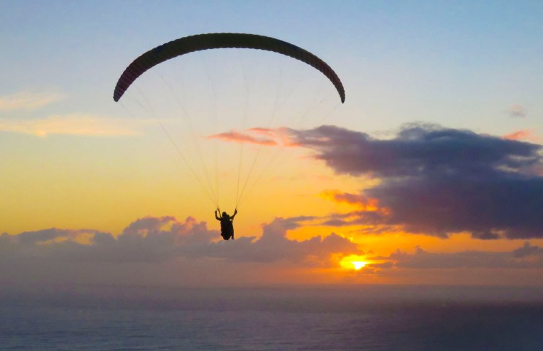 We transitioned easily into our new neighborhood, finding three grocery stores and
 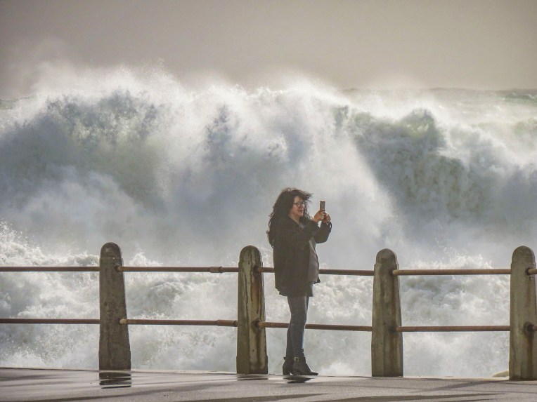 Cape Town artists will paint anywhere and the walls of the underground parking garage at the Pick ‘n Pay – Sea Point were the perfect canvases for some incredibly talented street muralists. Sadly, we don’t think enough folks see these hidden works of art.


 In Hout Bay, time flew by at the


 The wind was so strong it made it impossible to hold the camera steady. We soaked in the views as long as we could before the buffeting winds forced our retreat. Sitting outside at the snack bar we were astonished to witness a baboon snatch an ice-cream cone from a young boy and then gobble it up with great delight.
 We revisited the Simon’s Town area several times, because to see all the spots that interested us required more than one day. The big draw to Simon’s Town was the Boulders Penguin Colony. This is a restricted reserve where visitors must stay on the boardwalk in the viewing areas. Our timing was perfect as penguin chicks had recently hatched and could be seen at the nests snuggling against their parents for warmth. The beach was full of activity, with different groups of penguins doing their best Charlie Chaplin struts into or out of the turquoise waters of the bay.


 One morning in late July we opted to try a whale watching tour again, this time from the Simon’s Town waterfront, hoping to see some tail slapping or breaching action that was elusive in Hermanus earlier. Alas, we only viewed one tail slap on this trip. As much as the tour operators want you to believe July is a good month for viewing whales, based on our disappointing experiences we’d suggest waiting till later in August or September for more certainty when larger whale pods return to the waters of False Bay. But it was a smooth day at sea, cruising along a dramatic coast and we did get to view a large colony of sea lions on some offshore rocks.


 Once outside of Cape Town the R27 cut a desolate track through a rolling landscape of open fynbos with scarcely a tree to be seen. Every so often the head of an antelope or ostrich could be seen emerging above the bushes on either side of the road. The heather clad landscape eventually gave way to pastureland speckled with sheep and wheat fields.
 Paternoster is one of the Western Cape’s oldest fishing villages, dating from the early 1800s, and is said to have gotten its name from Portuguese sailors who evoked the Lord’s Prayer to save themselves from shipwreck off its coast. The area was first explored when Vasco da Gama landed nearby in Helena Bay, in 1497. By then the area had been inhabited by the indigenous Khoisan for thousands of years. Hunter-gatherers, they harvested dune spinach, an local vegetable, from the beaches, and shellfish from the area waters, and they left behind middens that have been estimated to be 3,000-4,000 years old. The harvesting of the ocean’s bounty continues, with fishermen still launching their small boats into the sea from the beach and returning with fish and lobsters. As you pull into the village it’s not unusual to see fishermen selling their day’s catch from five- gallon buckets at the town’s intersections, where they hoist live lobsters aloft and yell “kry hier kreef!”, Afrikaans for “get some lobster here.” Aside from the picturesque whitewashed and thatched roofed fisherman’s cottages along a white sand beach dotted with boulders, there’s not much to this sleepy fishing village, except for some reportedly excellent seafood restaurants that were unfortunately closed the winter day we visited.
 A short way out of town we followed a dirt road to the Cape Columbine Lighthouse. Built in 1936, on an outcropping of boulders called Castle Rock, it’s one of the last manned lighthouses in South Africa. “Seniors are free,” the lighthouse keeper, a senior himself, announced, as he pointed us to a set of stairs that eventually led to a very tall, steep wooden ladder. The panoramic view from the top was brilliant and, as expected, breathtaking. Getting down was a little more challenging than getting up. It was a kind of “make it or break every bone in your body if you don’t” situation. We’ve found in our travels around the world that folks in other countries can do all sorts of risky things, that in the states wouldn’t be allowed for safety concerns. Overseas it’s all about being responsible for your own safety. “See you at the bottom,” Donna said as she agilely maneuvered on to the ladder. “One way or another,” I grimaced in response. For me, with a fearful respect for height, it was all about that first step down.


 Unbeknownst to us, Bree Street is considered “Cape Town’s hippest street.” The area is in the midst of gentrification with numerous restaurants, bars and cafes scattered between high-end boutiques, art galleries, mechanic shops, plumbing supply stores, classic car and motorcycle showrooms, along with marine and industrial supply stores. And I swear all the above seem to offer luscious cappuccinos!


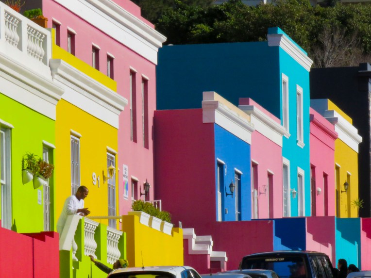 Formerly known as the Malay Quarter, the colorful homes of the Bo-Kaap neighborhood, located between Signal Hill and the city center, were only a few blocks away. One of the oldest continuously inhabited neighborhoods in the city, the first homes were built in the 1760s as housing for mostly Muslim slaves, who were brought by the Dutch from Malaysia, Ceylon and Indonesia to work. The neighborhood grew when slavery was abolished throughout the English empire in 1833. It’s said the houses were then painted bright colors as an expression of newfound freedoms. The neighborhood is home to the Auwal Mosque, the first built in South Africa in 1794 and still in use today. In 1957 the apartheid government declared Bo-Kaap a Malay Only Area and forcibly relocated everyone else. The pressure continues today under the new guise of gentrification. Bo-Kaap means “above the Cape” in Afrikaans and with its stunning location on the lower slope of Signal Hill and its close proximity to the Cape Town Business District, it has become a very desirable location. Old time residents fear the heart of Bo-Kaap will disappear and it will just become a façade of brightly painted buildings.
 We walked the hilly, cobbled streets of Bo-Kaap several times, enjoying its cityscape. One day we encountered a small flock of sheep grazing, within sight of the city’s skyscrapers, as we made our way to the Noon Gun, a naval cannon fired once a day, every day for over two-hundred years.
 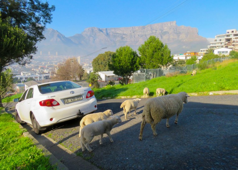 Originally it was a signal for ships in the harbor, back in the day when they used sextants to navigate, to set their chronometers which were used to help calculate longitude. Critical stuff when you are navigating around the treacherous Cape of Good Hope. It’s a tradition that has survived the Dutch, English and apartheid.
  The Cape Malay community has contributed greatly to establishing Cape Town as a foodie’s destination with a cuisine that embraces exotic spices. Cinnamon, cardamom, ginger, cloves, mustard seed, chili and roasted fenugreek seeds all flavor various curries, bobotie, biriyani, rendang, and samosa recipes that have endeared themselves to Capetonians.
")

 Renting a car made it easy for us to reach points farther afield in Cape Town and its outlying districts. Our day trips included taking the cable car to the top of
  One morning we walked through the


 After our morning at the botanical gardens we headed over to Woodstock for lunch at

 We returned to Woodstock to check out The Neighbourgoods Market, a Saturday only food event, at The Old Biscuit Mill, a renovated mixed-use industrial site with offices, galleries featuring local artisans, vintage shops and eateries. If you need a retail therapy fix, this is the place to head. They have an interesting photography store called

 James Michener’s play South Pacific, an appropriate story for the times about diversity and acceptance, was performing downtown at the
  “You must attend a rugby game while you are here, it’s so South African. The playoffs are next weekend.” So Vincent, Donna’s friend from seminary, took us to our first rugby match. We are not sports fans and typically avoid watching any sports on TV. But this playoff match between the hometown favorites the Stormers and the underdog Sharks from Durban was a fascinating contest of almost continuous play; there was never a dull moment. Shockingly, the underdogs pulled off a surprise victory in the final second of the game and earned themselves a spot at the Rugby World Playoffs in Canberra, Australia.

 Muizenberg beach is renowned for its gorgeous stretch of sand, colorful beach cabanas on False Bay and interesting streetmurals scattered about town.


 On a cool Saturday we hiked up Lion’s Head Mountain along a trail that corkscrewed around the mountain to the top.
  The path deteriorated as we climbed higher with uneven footing that at times narrowed to the width of our feet as it edged, for short distances, along cliff tops.
  In some spots, ladders were used for short vertical climbs. If you plan to go, bring water and food. There are plenty of boulders to sit on to enjoy the 360 degree views the trail offers. We didn’t make it to the summit, with the last part a little too vertical for us, but we felt very satisfied with what we accomplished.
 We spent several afternoons on Signal Hill, watching paragliders launch into the sky above Sea Point, and then gently drifting toward the beach as the sun slowly sank below the South Atlantic horizon.
  This is a popular spot at the end of the day with many folks making a picnic of it, clinking glasses of wine as the sun sets. There are also several food trucks that provide light meals and of course cappuccino. It is, after all, Cape Town.

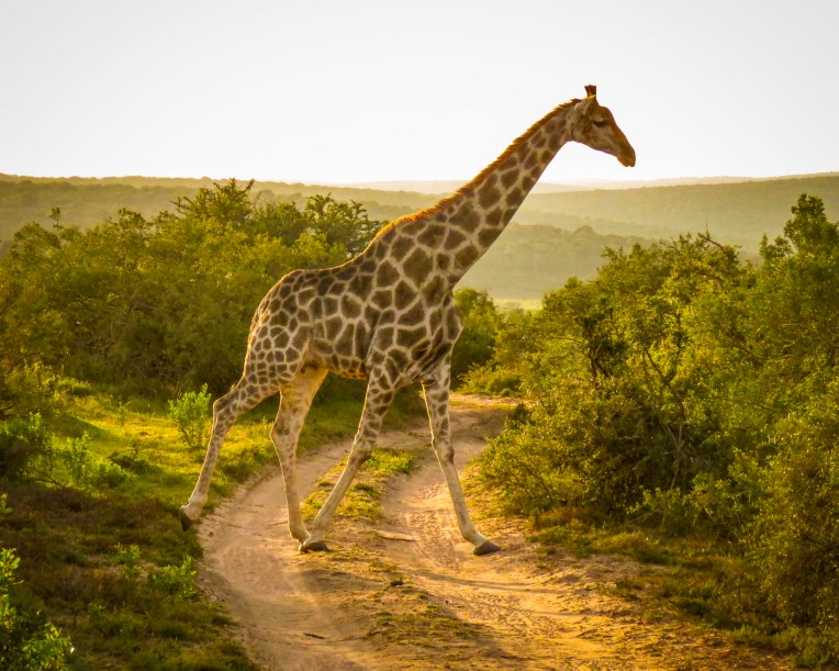 During the morning “golden hour” we watched a family of giraffe walk gracefully through the forest, nibbling thorns from the acacia trees, before saying our goodbyes. Stormsriver, it was! Backtracking through Port Elizabeth we retraced our drive past Jeffreys Bay and continued west on the N2 until we stopped to photograph the steep chasm that the Stormsriver Bridge spanned, just before the village of the same name. Mostly folks mean the
  We thought the entrance fee of $17.00 per person for international tourists was steep and we did see some cars turning away, but we had heard such tremendous recommendations we would regret it if we didn’t check it out. There was a long winding road down from the entrance gate and when we finally rounded a sharp corner, the view of the rugged coastline with crashing waves sending up large white sprays was spectacular!
  We enjoyed lunch watching and listening to thunderous waves explode against rocks only a short distance away from our table at the Cattle Baron. It’s the only restaurant in the park and was excellent, along with being very affordable. A nice surprise after the park entrance fee.
 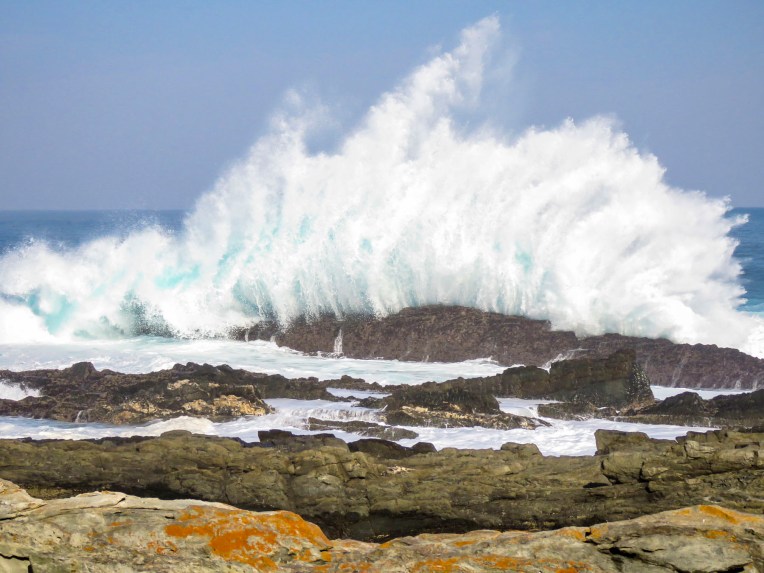 After lunch we followed an easy section of the
  Staying in designated cabins each night, it takes five days to cover the route that stretches from Stormsriver in the Eastern Cape to Nature’s Valley in the Western Cape. The reverse hike is referred to as the


 On the way back to the highway we stopped at


 Our steep ascent away from the coast began in George as we headed north on the N9/N12 twisting our way uphill through the Outeniqua Pass to Oudtshoorn. This is a challenging stretch of highway with continuous s-turns that required my constant attention. Passengers can enjoy spectacular views on sunny days that stretch for miles. If possible, drive the route towards the coast, it’s easier to stop at the scenic lookouts this way.
 We’ve heard of gold booms, where fortunes were made. But it was the ostrich booms in 1865 -1885 and 1902-1913 when ostrich feathers were the ultimate fashion accessory in Europe that enriched local farmers here. At one point 314,000 ostriches were being raised and their feathers were a valuable South African export, only surpassed by gold, diamonds and wool.


 The word karoo comes from the Khoisan language meaning “land of thirst” and it precisely describes the terrain along R62 which we followed. Parched, rock encrusted rolling hills and mountains covered with a fynbos of low heather-like shrubs and proteas occasionally accentuated by taller, lone trees and dry riverbeds crisscrossed the landscape. During the South African spring, in October, it bursts with flowers, but it was July, still winter. The area endures extreme heat during the summer. Fortunately for us recent winter rains had spurred some greenery to burst forth and aloe plants to bloom.
  We stopped in Ladismith, a rural farming community where Vincent, Donna’s friend from seminary, first pastored a church, and enjoyed its colonial Dutch architecture.

 The heat can do strange things to the mind and sometime in the 1970’s Ronnie thought a farm stand on this desolate stretch of highway through the karoo would be a good idea. Fortunately, his buddies realized it was destined for failure and would soon be another abandoned building along the road if something wasn’t done. One night they painted SEX into the name of the shop and suggested he open a bar. They saved his butt! Famous now worldwide as a dive bar in the middle of nowhere, it draws in the curious. It’s not the raunchy place the name implies, filled with frustrated farmers between ostrich roundups. A grey bearded Ronnie, now a cause célèbre, still pours drinks at the bar. It has a tired, dusty bar area filled with foreign money plastered to the walls and lingerie hanging from the ceiling, but aside from that it’s a wholesome oasis with a covered patio where you can get a decent burger with fries, ice cream and coffee along with some hard stuff if that’s your drink. It’s not worth a detour, but if you are on the R62 traveling between Barrydale and Ladismith, it’s worth the stop. Actually, it’s the only place to stop.

 We zoomed past the small village of Barrydale on our way to Montagu, so we could explore the town a little before nightfall. The farming community is in a valley surrounded by the Langeberg mountain range and has many examples of late 19th century Cape Dutch architecture scattered about town. Ornate gables, thatched roofs, whitewashed walls and occasionally gingerbread trim define the style, but there are modern interpretations also.
 In a country not known for Art Deco we booked ourselves into the
  The temperature drops quickly in the mountains once the sun sets so we enjoyed a local wine, in front of a fireplace, in one of the lounges before dinner. We usually look for a less expensive alternative for dinner, but the hotels’ Wild Apricot Restaurant drew us in with elegant candlelit tables and live piano music. It was the last night of our road trip – we could splurge. With Smoked Ostrich Carpaccio and Springbok Tarta for appetizers followed by Cape Malay Bobotie and Karoo Lamb Pie as mains and a traditional Orange Malva Pudding for dessert, we were splendidly sated.


 We followed R62 west through a small tunnel, locally referred to as the “Hole in the Wall,” that was dynamited out in the 1870’s. It’s a dramatic landmark that tells you of your arrival into or departure from the Karoo. As we left our road trip behind, we looked forward to heading to a new apartment in Cape Town.

 It’s here that we first noticed the really interesting street murals that could be seen on some of the homes. Not gratuitous bubble-scripted graffiti, but pictorial or political works of art relating to freedom, equality and hope by talented artists that enhanced their surroundings.

 In our exploration of Cape Town, we accidentally and to our delight, came across many wonderful murals while walking or driving about. Behind our apartment on Harrington Street a wonderfully, whimsical mural of a dog dreaming about flying, by Belgian artist
 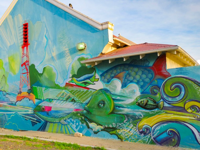 Farther down the street in District 6, across from Charlie’s Bakery, a colorful mural graced the back of a small building in a parking lot, while its front wall featured an understated portrait of Nelson Mandela by
 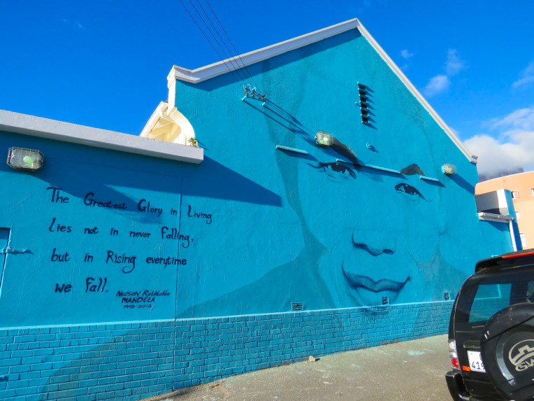 And at the bus station, under the highway, across from the Gardens Shopping Center the dismal gray walls sprang to life with imagery.


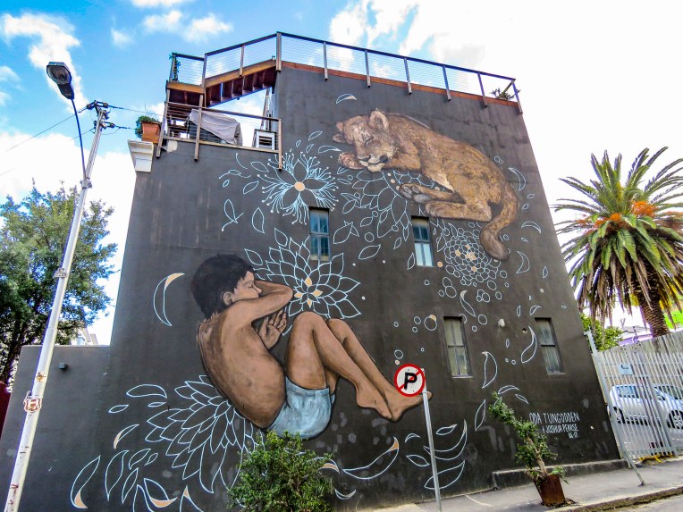


 Turns out the Woodstock and Salt River neighborhoods are ground zero for freedom of expression based on the number of street murals we discovered just by driving around. One seemed to lead to another around the corner.
 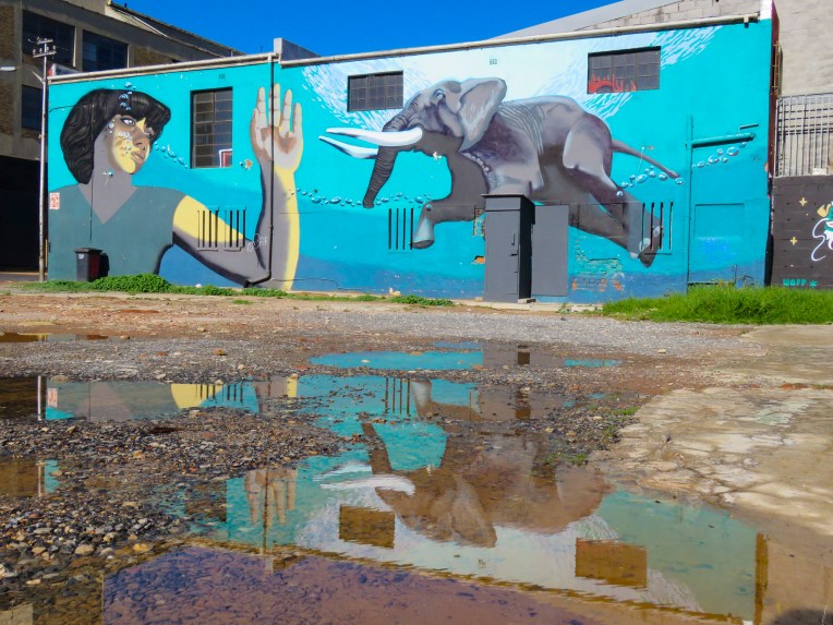 When we stopped to photograph the mural of the swimming elephant, one of the unofficial parking guards introduced himself as the “curator of street art” and offered to guide us.


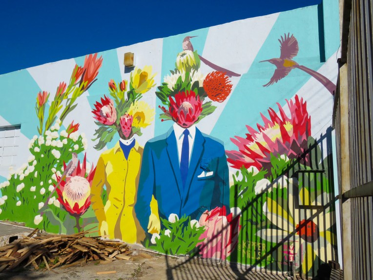


 Traveling along Victoria Road in the Salt River district, the large mural of a pangolin, painted by Belgian street artist
 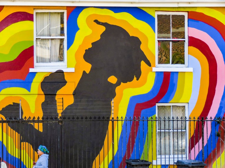 The festival is sponsored by

 His style is very distinctive, and we recognized many of his works as we traveled around the Cape. Back in town the exterior wall of Surfstore Africa is playfully illustrated with a giraffe wearing sunglasses.
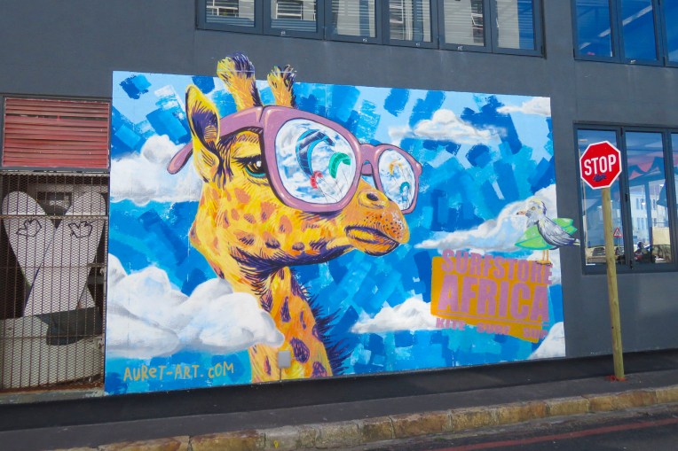 Our most unexpected discovery happened at the indoor parking garage of the Pick N Pay grocery store in Sea Point. Here several beautiful portraits were painted on the walls of the driving ramp leading from one level to the next.
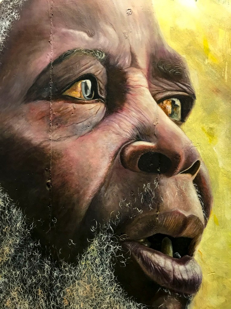


 Here gale force winds that blow in from Antarctica and colliding warm and cold currents build ferocious waves that can tower to 100 feet high. These seas have claimed over 140 ships since the Portuguese first sailed here in the 1500s. Within sight of the lighthouse, the most recent wreck of a Japanese fishing trawler from 1982 lies on the beach rusting away.
 We stayed the night at the
 Afterwards we headed toward Wilderness (the town not the idea,) along a route that traversed barren farmlands and coastal pine forests before skirting the coast again at Mossel Bay. We arrived in time to watch the sunset from our balcony at
  Our room was luxurious and larger than several of the apartments we had rented on our round-the-world journey so far. We were hoping the owners, Leane & Deon, would adopt us. On our sunrise walk the next morning we only sighted a few other folks enjoying the quiet of this vast stretch of pristine beach during the winter season. We noted the considerably warmer weather, a result of the Agulhas Current which swoops warm Indian Ocean currents along the bottom of South Africa and wonderfully moderates the temperature.
 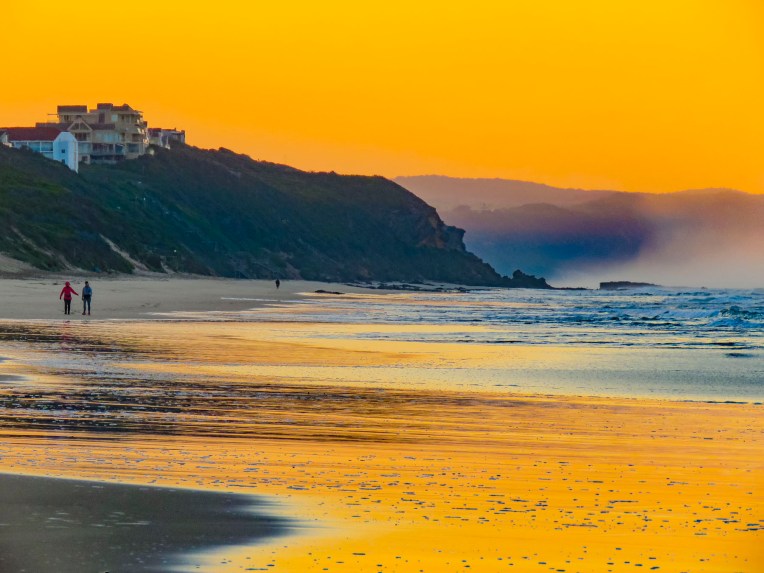 After breakfast we backtracked on N2 to the pullover above the Kaaimans River Railway Bridge. For railroad enthusiasts this was a destination for many years to watch the Outeniqua Choo Tjoe, the last continually operating steam train in Africa, cross the tidal estuary which slowed settlers’ advance along the rugged coast. The line stopped operating in 2006 when landslides destroyed an extensive stretch of track. Today it’s an interesting photo-op.
 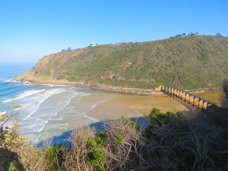 Further up the gorge at Map of Africa View Point, raging waters over the eons have eroded a bend in the river to resemble the African continent when viewed from the overlook on the opposite side of the chasm. The sky was empty mid-week, but across the road hundreds of paragliders launch from the grassy slope on the weekends to catch fantastic thermals and awesome views of the coast below.

 After spending hours rattling along dusty back roads we rejoiced to be on Route 2 again. A little while later we pulled over and enjoyed a late lunch and sunny afternoon on the outdoor deck of the Cruise Café, which overlooked Knysna Bay.
  We weren’t yet synched to the rhythm of life outside of Cape Town in the off-season and were surprised to find the restaurants and grocery stores in Plettenberg Bay closed when we arrived. Fortunately, we had a wonderful room with an ocean and lagoon view terrace, right on Lookout Beach, at
  The sun rose quickly the next morning from behind the Tsitsikamma Mountains, across the bay, filling our room with light. We spent the early morning slowly sipping coffee and savoring the view. Upon checkout we were delighted to find a sparkling clean car. This was a wonderful service the hotel provided for guests, and an easy way for the gardener to earn some extra money.
 We kept to a strict schedule, and limited our stops for photos today, because we needed to be at
 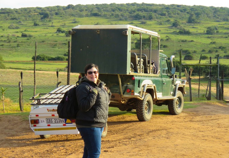 Three guides and three open-sided 4×4 Toyota safari trucks, each capable of seating 16 people, were waiting for their respective groups at the reserve’s headquarters. Wonderfully, it was mid-week in the off-season, and we had Edward, our guide/naturalist, and truck all to ourselves, while the other two trucks left with groups of six each. Schotia’s 4,000 acres of gently rolling hills, bush and forest shelter approximately 2,000 animals from 40 mammal species and its’s amazing how difficult it can be to find them.
  But that was our goal as we rattled along the rutted paths to a high vantage point within the reserve, that provided distant views of the terrain surrounding us. Scanning the vista with binoculars, Edward was searching for elephants, giraffes, antelopes and zebra. “The animals are constantly on the move. We’re never really sure where they will be,” Edward offered. He seconded with, “There’s clouds of dust being kicked up over there. Can’t tell from here what they are, but let’s go investigate.” And our overlanding began, chasing a cloud of dust that turned out to be a small herd of white faced Blesbok, a stunning antelope species we weren’t familiar with.


 Sightings of impala, kudu, wildebeest, warthogs, cape buffalo, zebra, hippos and crocodiles rounded out the afternoon.


 On the way back to the lapa we encountered the hippos we had seen earlier, now grazing far from their waterhole. Large black masses, they were barely visible when out of the headlights.
 Glasses of wine and a large, warming fire greeted us when we returned to the lapa for dinner. Inland the temperature fell quickly, and the warmth from the flames felt good.
 Darkness covered the countryside early in June, the beginning of South Africa’s winter season. Our guide had just lit the oil lamps a few minutes earlier, handed us a walkie-talkie and said, “Use this to call the owner if there’s an emergency, you’re the only folks here tonight.’’ The owner lived somewhere on the other side of this vast reserve. There were no other lights around except for the moon. The bush has a life of its own and sounds totally different in the darkness.
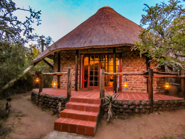 We didn’t plan on being the only folks at the game reserve during the middle of the week, but that’s one of the benefits of off-season travel. Following spring-like conditions around the globe, we’ve been able to avoid hot, humid weather and the crowds, while managing to have some wonderful experiences along the way. Tomorrow, Edward would guide us through Addo Elephant National Park.
 The eastern cape was once home to tremendous herds of elephant which were hunted by the Xhosa and the Khoe (Khoi) tribes for sustenance, and much like the American Plains Indians and buffalo it did not end well. As colonization spread across the region in the 1700 and 1800s the tribes succumbed to smallpox and were pushed into different regions, and the elephants were slaughtered to near extinction for their ivory and to protect farming interests in the region. With the killing of 1400 elephants in 1919, public opinion slowly turned. Only eleven elephants remained when Addo Park was established in 1931 with 5600 acres.
  The park was enclosed with an elephant proof fence in 1954, to protect the surrounding citrus farms from their rampages, when the size of the herd had rebounded to 22 elephants. Today the park is the third largest in South Africa and encompasses 1,700,000 acres. Home to over 600 elephants now, the reserve has expanded its mission to protect a growing number of mammal species within its borders.
 We could have done a self-drive tour through Addo, but we thoroughly enjoyed Edward’s knowledge of wildlife and the region. It was a good decision. Sitting up high in an SUV provided better visibility into the bush, where in our small rental car we wouldn’t have been able to see much. And his timing was perfect in getting us to a waterhole just as a very large herd with calves was creating a trail of dust as it emerged from the surrounding dry bush.
 We witnessed elephants smiling as they drank. It was a tremendous experience.
