
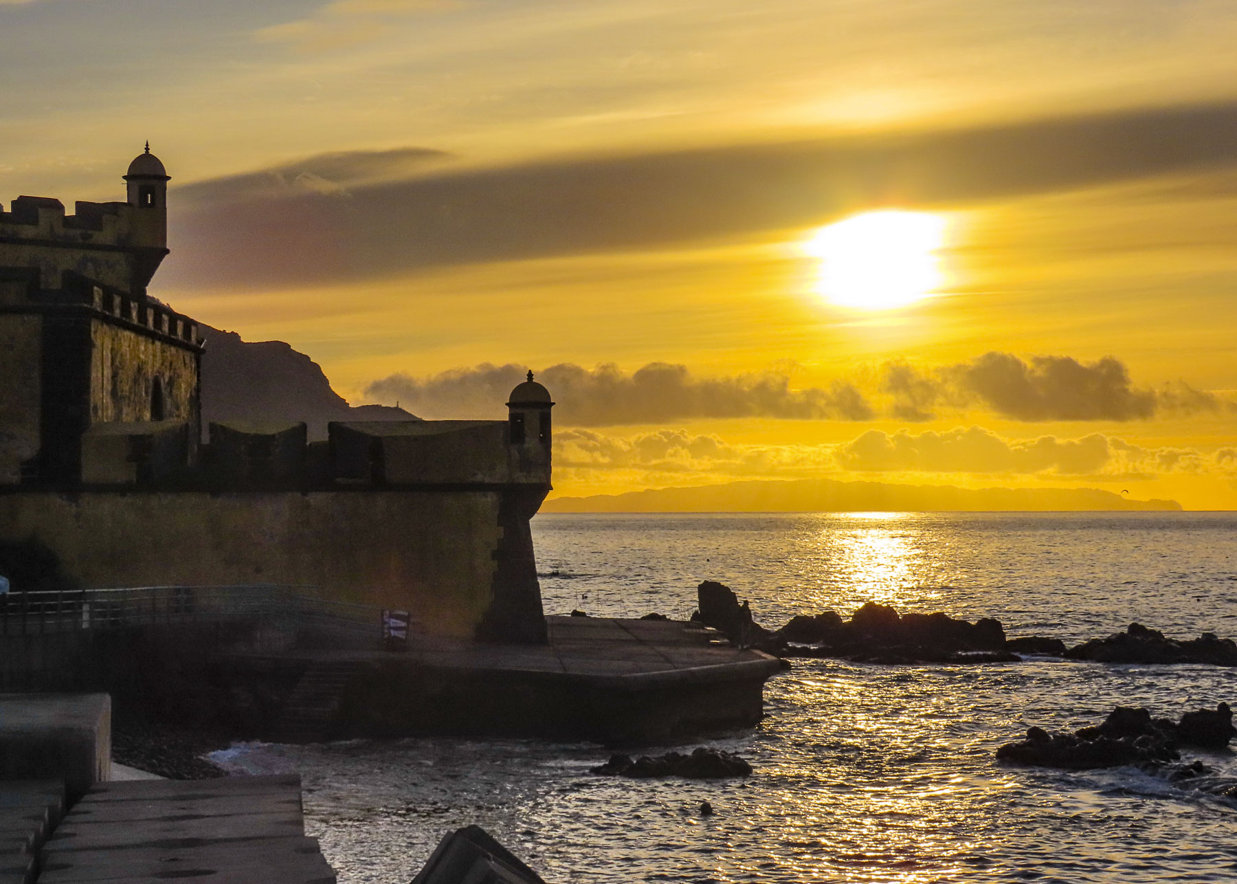
Often, we started our mornings at Forte de São Tiago on Funchal’s seafront to watch the sun rise over the ocean. But turn around and fog could be rolling down the slope of the hills above the city. The weather can be fickle on this mountainous, beautiful island. Though with its numerous microclimates created by the rugged terrain, it would usually be sunny someplace. A fifteen-minute drive in any direction and the weather could be totally different, as was often the case.
While it’s possible to enjoy an entire stay on the sunnier and dryer south side of the island, where Funchal is located, the dramatic mountains and deep valleys of the interior, which stretch the length of the island and the northern coast, are spectacular destinations.

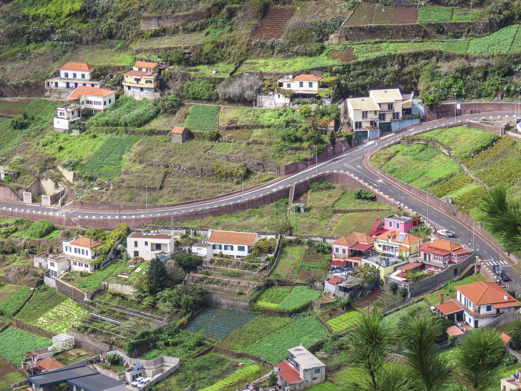
As rugged as Madeira is, man has left his mark on the landscape with terracing and irrigation channels, called levadas. They’ve been an integral part of island life since 1420 when the first settlers were recruited to the uninhabited island, and impossible to avoid. With a landscape covered with virgin forests, experienced lumbermen from the Minho region, farmers and terrace builders from the Douro valley, and fishermen from the Algarve, all seeking better fortunes, were recruited to the island by the promise of land if they worked it for five years.
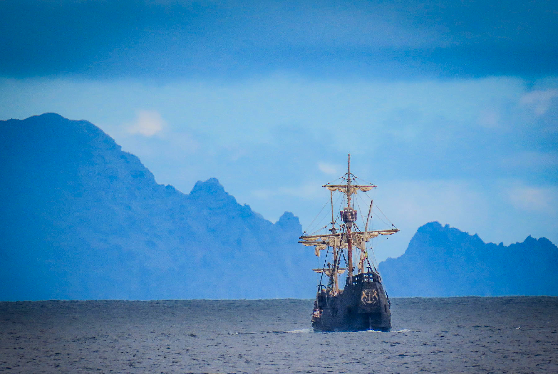
With a plume of black ash rising from it, Madeira from the sea must have looked like a volcano erupting. Slash and burn fires started to clear the land reportedly lasted for seven years. By the mid-1400s, soil erosion became a problem; largescale slash and burn fires were prohibited and cleared land on the slopes had to be terraced immediately. The felled trees were a valuable export to ship builders in Europe. The enriched soil from the fires was perfect for the introduction of sugar cane, which quickly became the island’s main export. Slaves from west Africa were brought to the island to sweat out this economic expansion.


To support the expanding villages, hamlets, and agricultural terraces, narrow irrigation channels called levadas were arduously cut into the mountains to divert water around the island, from the wet northern side to the dryer southern side. Their water was also used to turn the waterwheels of the first lumber, flour, and sugarcane mills on the island. Close to five-hundred miles of levadas cover this mountainous island that is roughly thirty-four miles long and fourteen miles wide.

Madeira wine replaced sugarcane when Madeira lost market share to the larger sugarcane plantations of Brazil and the Caribbean. Madeira’s a small island with a large agricultural punch. Today it’s well-watered terraces support wine grapes, banana and flower exports to Europe, as well as the cultivation of other exotic fruits like custard apple, passion fruit, tamarillo, avocado, papaya and mango.

The clouds were slowly being torn apart. Shafts of light dramatically illuminated the valley as we drove north across the island to Sao Vicente. It’s a compact village centered around its church. Nearer the ocean, we explored an ancient lava tube that led down to the sea.


Surf pounded against a rocky beach across the road from a truly amazing bakery, Padaria do Calhau. Something we didn’t expect to find, but if you need an excuse to visit, a coffee and pastry at Padaria do Calhau should suffice. Heading west, just outside of town and before you enter a tunnel, the Cascata Água d’Alto tumbles down next to the road. Unfortunately, there is not any convenient parking here.
Following the ER101 west towards Porto Moniz there were a number of beautiful waterfalls on the way. First the Córrego da Furna waterfall will be on your left and has a small, unmarked parking area across from it. Then just past the picturesque village of Seixal with its black sand beach, there is the Cascata da Ribeira da Pedra Branca on an old coastal road.
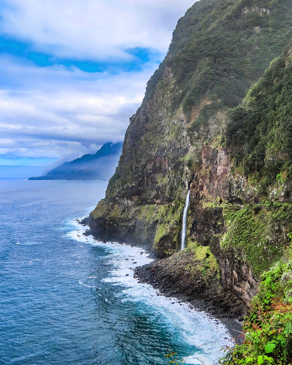
But farther along the most iconic of all of Madeira’s waterfalls is the Véu da Noiva, or bridal veil. It’s a beautiful waterfall that tumbles over a rockslide that permanently closed a section of the old coastal road. It’s a popular stop with plenty of parking, that’s perfect for lingering.

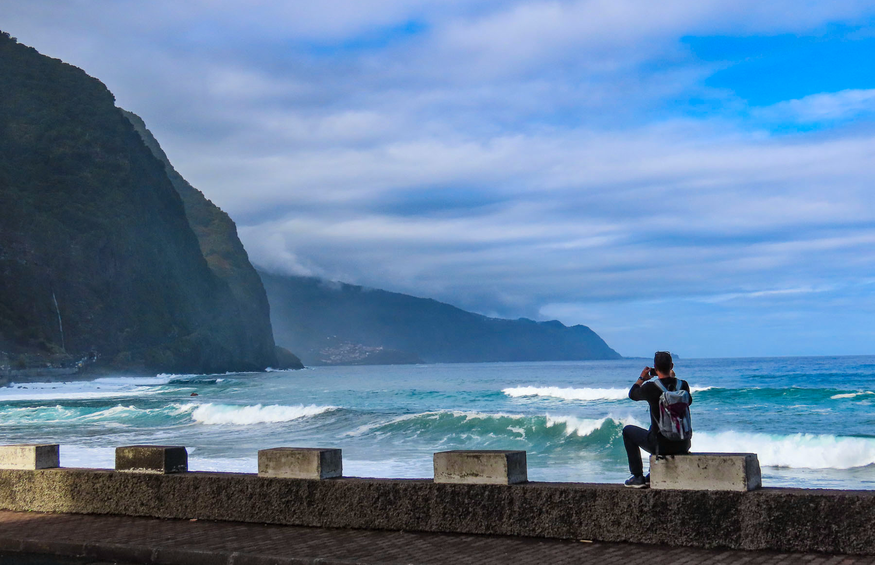
Before Porto Moniz the longest river on Madeira, the Ribeira da Janela, empties into the sea over a rocky, boulder-strewn beach. Tall, eroded sea stacks stand like sentinels amid a crashing surf only a few yards from the shore. We had lost the sun by this time, but the seascape was just as dramatic, nonetheless.


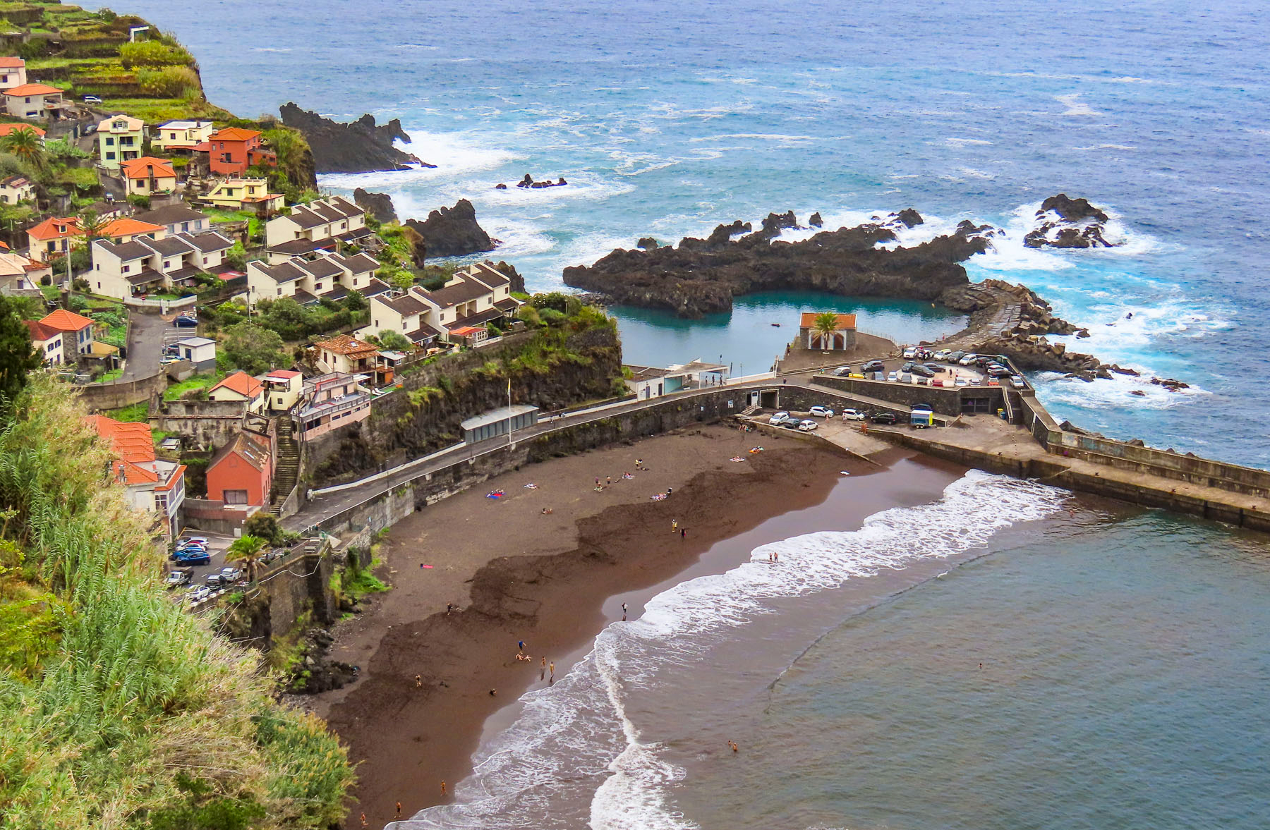
Madeira’s shoreline is very rugged; most of its beaches are pebbly rather than sandy. Then there are spots where over the eons the waves have eroded away the volcanic rock and created natural rock tidal pools along the coast.
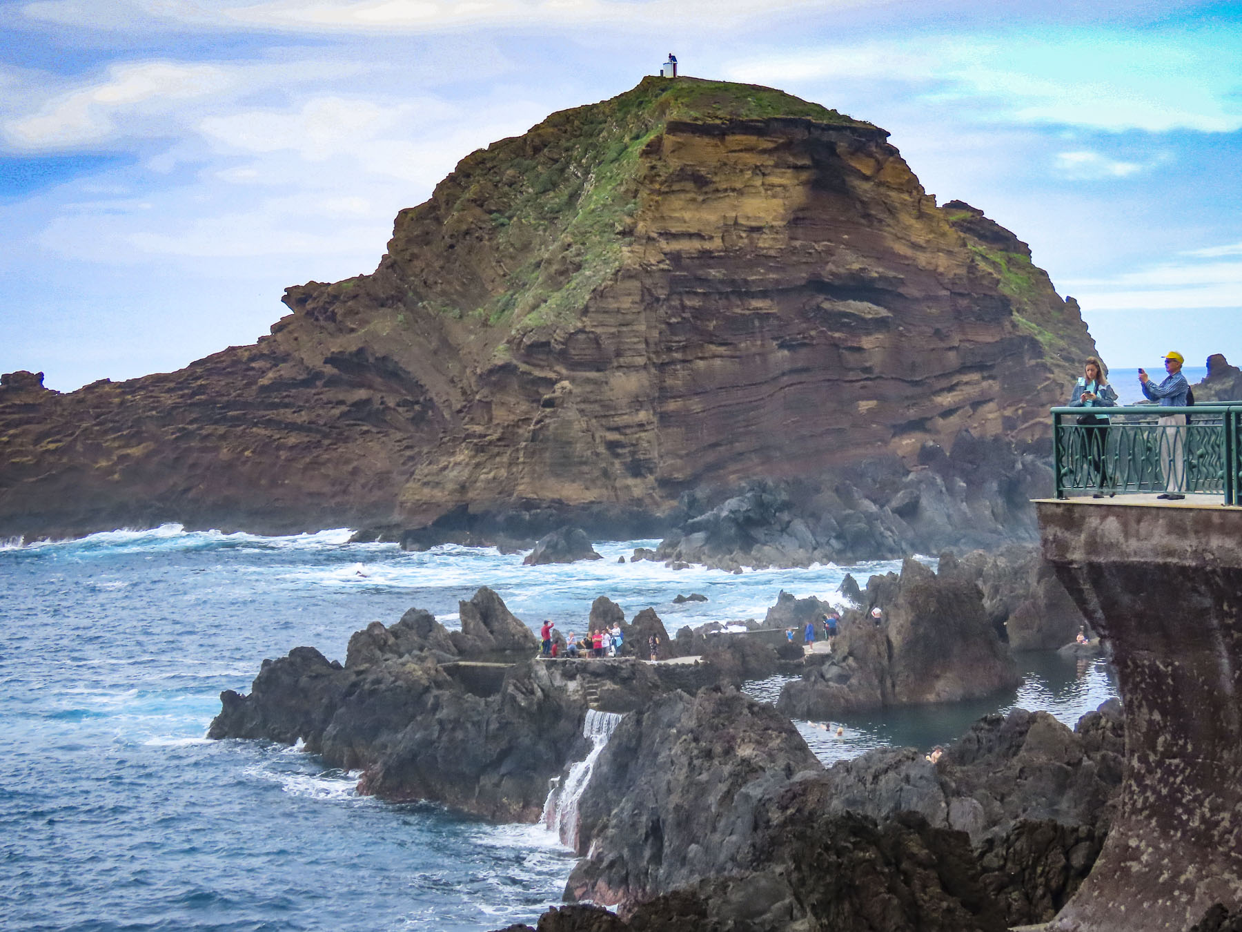

Porto Moniz at Madeira’s northwestern tip is a popular destination for swimming safely in these coastal pools, set dramatically against a background of crashing waves. The pools have been enhanced over time, with steps into the water, sidewalks between swimming areas, and some areas being dammed to create deeper pools. There is modest entrance fee of 1.50€ per person, but it’s one of the best bargains on the island.


After a late lunch we retraced our route to Ribeira da Janela and followed a narrow secondary road over a stone bridge and through the small hamlet of pastel-colored homes set against verdant fields, into the cloud-shrouded mountains.

Whether it was cloudy or foggy we’re not sure, but it was perfectly misty as we pulled into the parking area for the Florestal do Fanal. Roughly 37,000 acres of primal laurel forest, and open woodland, the largest in Europe, it covers the mountainside 3500 feet above sea level. A short walk into the woodlands set us in an atmospheric wonderland of huge windblown trees with gnarled twisted trunks and crooked branches, covered with moss and lichens.

Other hikers and wandering cows vanished into and reappeared out of the mist as we wandered through the silent woods. Mysterious, eerie, or benignly moody are apt descriptions for this intriguing laurel forest that is a photographer’s delight.

Driving back to Funchal we crested the ridgeline of the mountains that divides northern Madeira from the south and suddenly we were driving above the clouds.
Till next time, Craig & Donna

