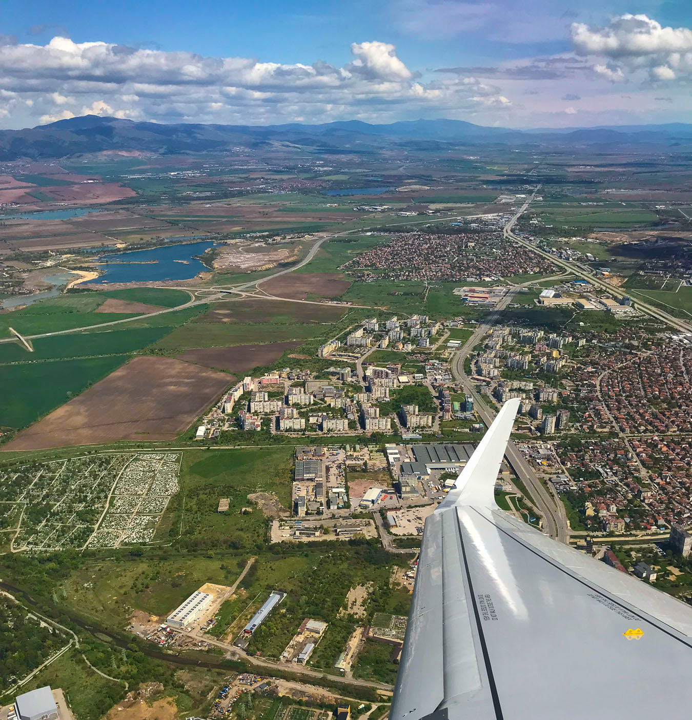
After spending a month in Bulgaria, we headed to South Africa at the end of May, to continue our pursuit of budget-friendly and interesting places with moderate weather to avoid the heat and humidity of a European summer. The seasons are reversed in the southern hemisphere, so we stayed for three months to take advantage of their mid 60sF (16C) winter weather, which is extremely mild in comparison to the winters of the northeast United States. So temperate in fact that most homes and apartments are not built with central heat, relying instead on small, portable electric heaters. Mostly, folks just layered up, and on those gale force, windy days we were amused to see people in fur-trimmed hooded parkas, more suitable for the Alaskan wilderness, than walking around Cape Town. 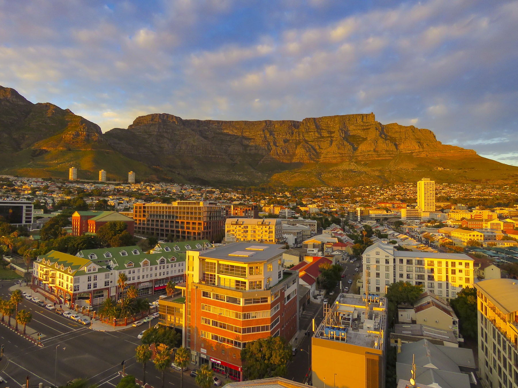 This would be Donna’s fourth trip to Cape Town and my first. Back in 1993 she visited friends she had made while attending Princeton Seminary, and a year later in 1994 she volunteered to be an International Observer for the first free and fair democratic elections in South Africa. In 2016 she returned to a city humming with positive energy and a growing economy. Unfortunately, this situation did not continue, and by 2019 the governance and economy of South Africa and its neighboring countries had stalled. The city was still beautiful and growing as a tourist destination, an amazing coffee culture had been born, but shuttered construction projects and an increasing homeless population were evident, and across many different socioeconomic groups, people were feeling disenfranchised. A multi-year drought exasperated many infrastructure problems that were being neglected. Fortunately, exceptional winter rains broke the severe drought and replenished the city’s nearly depleted reservoirs.
 We immersed ourselves quickly into the neighborhood around our first apartment on Buitenkant Street, just a few blocks away from the District Six Museum, steam punk themed Truth Coffee and the Jason Bakery. One block over we followed Harrington Street, past some great street art, to Bootleggers for more coffee and the best peri-per chicken livers in CPT.
A little further along, Nude Foods sold everything by weight and encouraged us to reuse our bags and refill our olive oil and balsamic vinegar bottles. Around the corner Charly’s Bakery, an institution in CPT with an interesting creation story, would make our sweet tooth ache. We had a memorable evening beginning with dinner at Dias Tavern, a Portuguese restaurant, followed by a performance of Kinky Boots at the Fugard Theatre across the street. 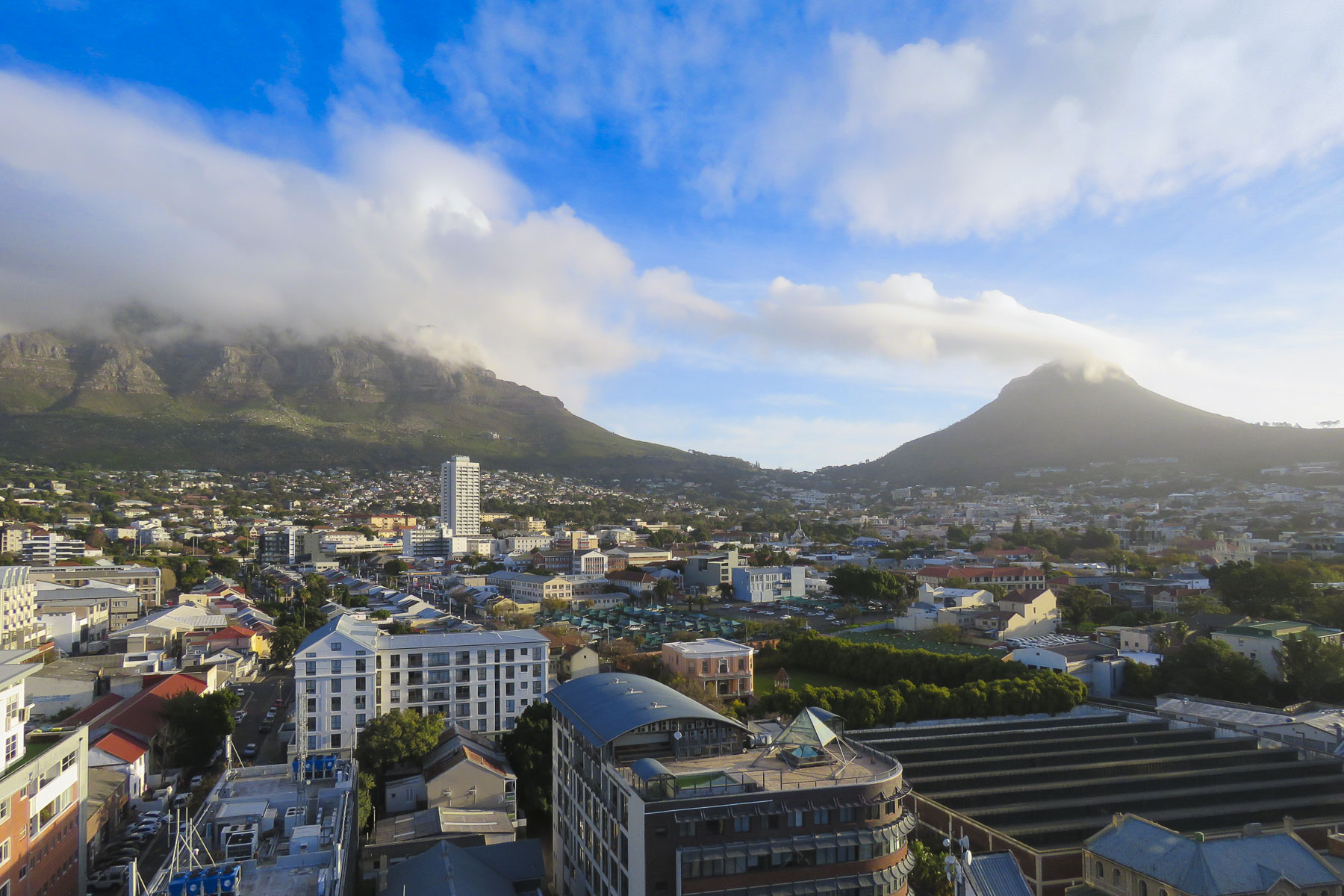 On the edge of the City Bowl and Zonnebloem districts, formerly District Six, our high-rise apartment building had a rooftop gym with fantastic views of the city, a 24hr doorman, gated parking and balconies with beautiful views of Table and Lion’s Head mountains. But the area immediately around us was in transition, without enough residential housing to call it a neighborhood.
After work everyone vanished and the streets were nearly deserted. The multistory construction project adjacent to our balcony was abandoned. While this offered privacy it had an unsettling, post-apocalyptic vibe that deterred our enjoyment of an otherwise sunny space. First world whining, we know, but we felt the Airbnb host was deceptive for several reasons regarding the apartment and surrounding area. Around the corner folks were sleeping rough on the street. We made a habit of carrying our loose change in our coat pockets to easily give it to the unofficial “car guards” and panhandlers. We had a nice room to enjoy nightly, and plenty to eat. How could we just pass them by? We walked all over the city, even at night, and never felt unsafe during our time in Cape Town, but using common sense is in order. During the weeks that we didn’t have a rental car we utilized Uber, which was very affordable, to cover greater distances around town.
We liked to joke that “you know you’re a local when you sign-up for the supermarket discount card.” Part of our weekly ritual was walking up Buitenkant Street towards Oranjezicht, an upscale neighborhood, with many fine examples of Cape Dutch architecture, to The Gardens, a multi-story shopping and residential complex with Pick-n-Pay and Woolworths grocery stores. On Prince Street the Hurling Swaaipomp Pump House still stands. Slaves pumped spring water for the surrounding homes here until the mid-1800s.
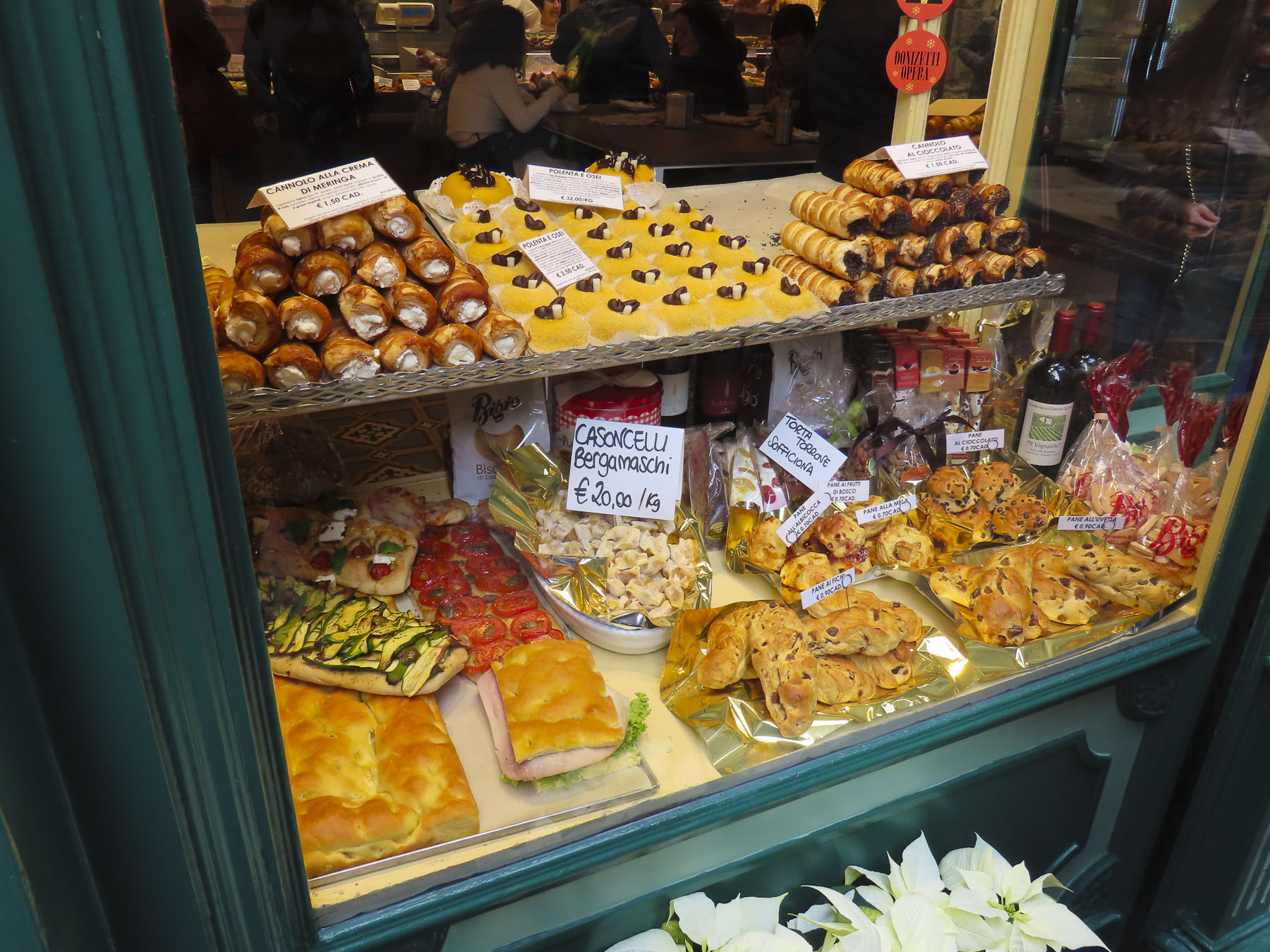
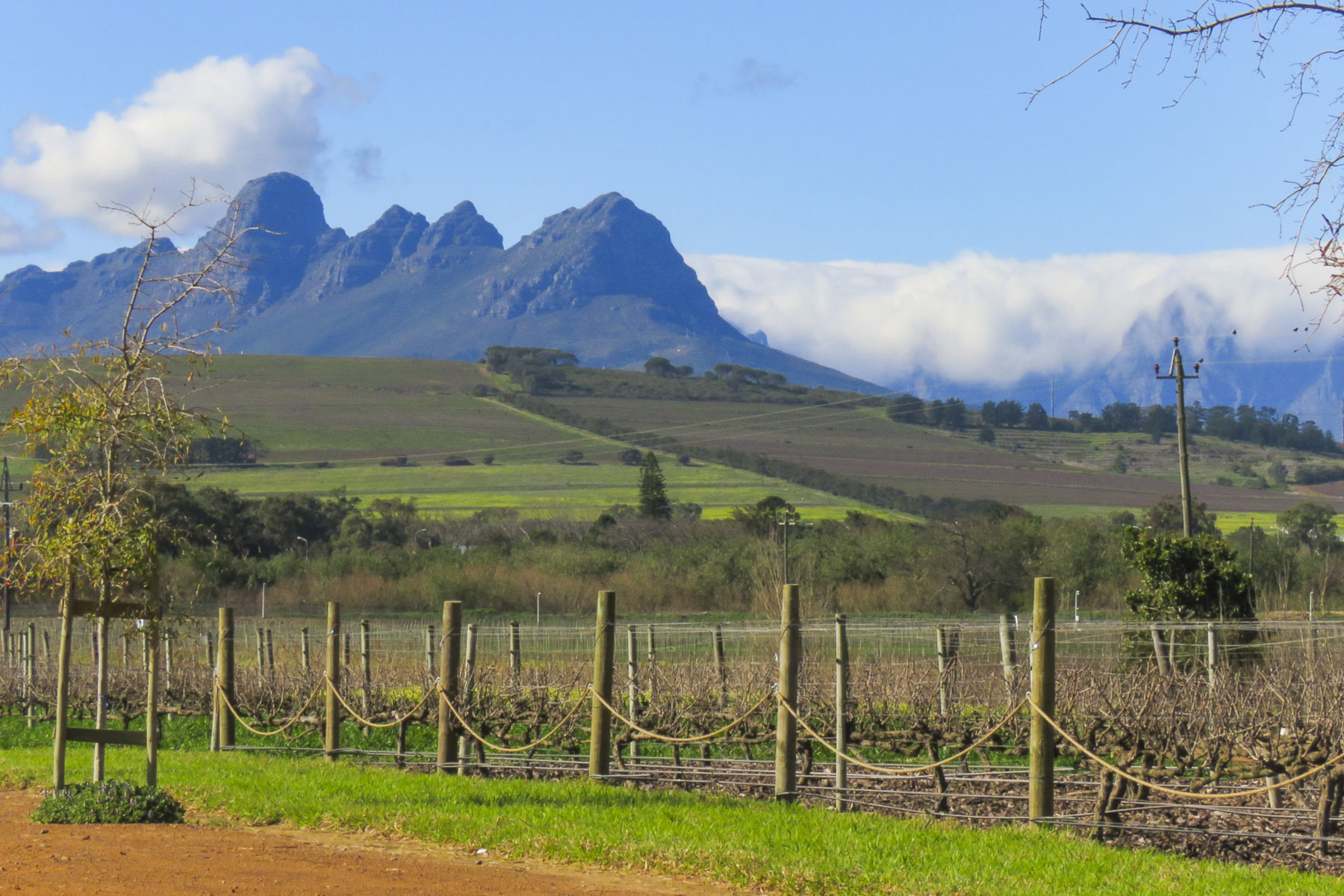
The cost of groceries and dining out in Cape Town was extremely favorable. Grocery items generally cost half of what they would typically cost in the states. A dinner for two with wine, dessert and coffee would run less than $40.00. Seafood was abundant, as you would expect in a coastal city, and inexpensive as well. We took full advantage of this, enjoying grilled octopus, sword fish, mussels and the best oysters on multiple occassions. Sautéed ostrich filets were a tasty meal we prepared for ourselves. Disappointingly, wild game was only available at restaurants. The Western Cape Winelands, around Stellenbosch, just outside Cape Town, covers a vast area and produces some exceptional vintages that are budget friendly. Winery tours of the area are a must and with over 200 vineyards the possibilities are endless. We had to find a dentist also, as just before our flight into Cape Town one of my crowns broke. Fortunately, South Africa is recognized for good medical and dental care and is slowly becoming a medical tourism destination. I found Dr. Ramjee on Google Maps, checked his reviews and made an appointment at his office which was within walking distance of our apartment. With his jovial and comforting manner, I instantly felt at ease. Though only a one dental chair office he had a state-of-the-art digital x-ray machine, a dental assistant and a receptionist. Besides the broken crown, I needed a root canal as well – what fun! My experiences with Dr. Ramjee were excellent and I raved so much about him Donna decided to use his services when the need arose for an emergency root canal and crown also. Unexpected expenses that in the states would be costly, even with insurance, were much more affordable and payable out of pocket here. The savings were tremendous.
Avoiding the past is difficult in Cape Town, with remnants of slavery’s legacy scattered about the city, even on the way to the dentist’s office. Just across from his door a concrete medallion marks the spot of the Old Slave Tree, where slaves were sold until their emancipation was declared in 1834. Around the corner the second oldest building in Cape Town – the Slave Lodge, a euphemism for a small pox-plagued, prison like structure for 500 slaves, still stands. It was built in 1679 to house the slaves owned by the Dutch East India Company that worked in the Company’s Garden, a farm. Today its mission as a museum is to explore the history “Slaves at the Cape: Oppression, Life and Legacy.”
 You just can’t walk enough miles along the coast or up and down Loin’s Head to keep the calories off in this foodie-oriented city. The Saturday- and Sunday-only food markets didn’t help, but they are a treasured tradition, throughout the region, that brings family, friends and tourists together to enjoy live music and good food.
Our favorite in Cape Town was the Oranjezicht City Farm Market down by the V&A waterfront. There’s also The Neighbourgoods Market, located at the Old Biscuit Mill in Woodstock. The Bay Harbour Market in Hout Bay, Blue Bird Garage Food and Goods Market in Muizenberg, the Elgin Railway Market in Grabouw and the Root 44 Market in Stellenbosch. All were enjoyable destinations beyond the city.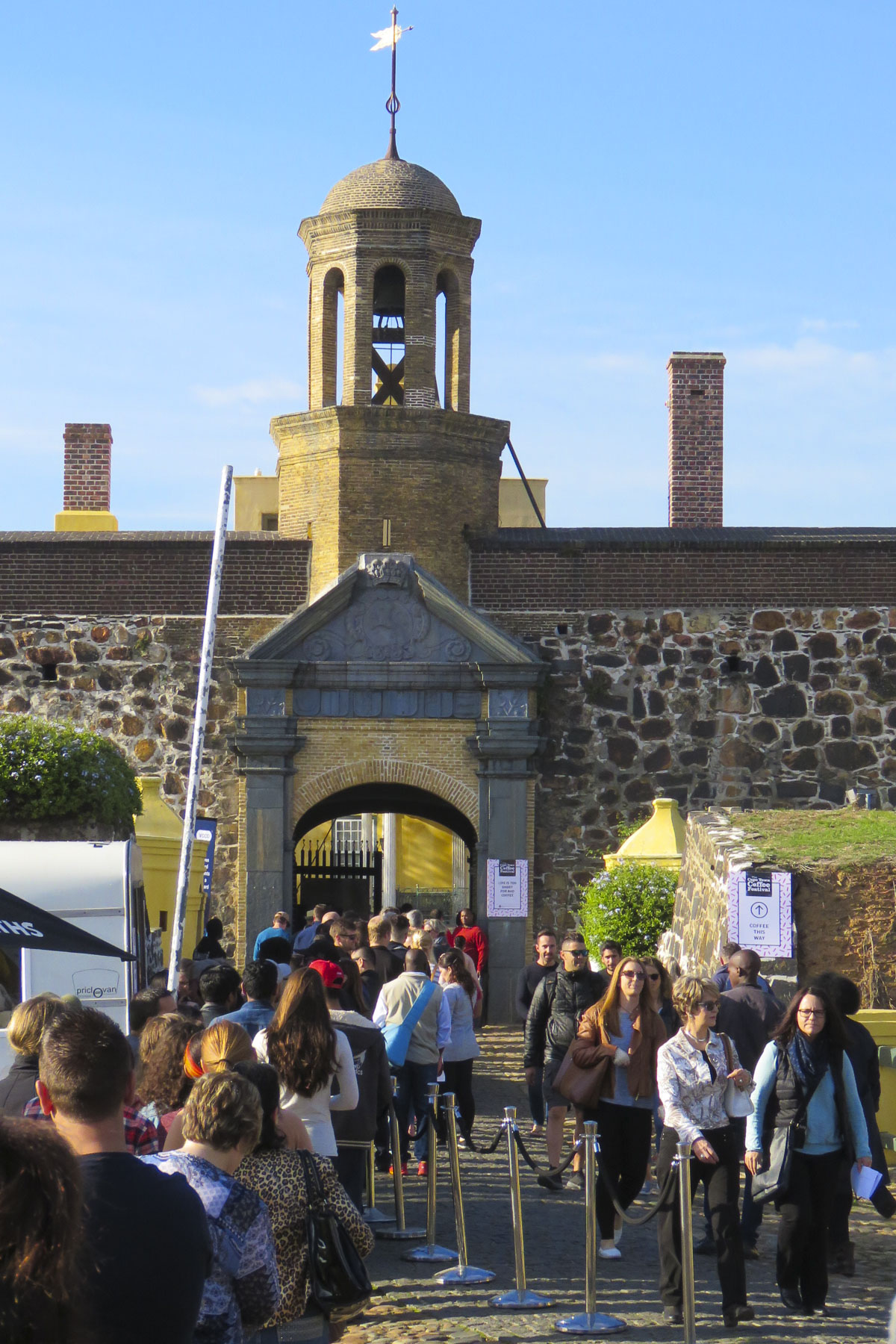 On the lower end of Buitenkant Street, the Castle of Good Hope, a 17th century pentagon-shaped stone bastion fortress, stands surrounded by city streets, its cannons now pointing toward skyscrapers instead of enemy ships. It was originally built on the water’s edge of Table Bay by the Dutch to protect the harbor from the British. After a massive waterfront reclamation project in the 1930s and 1940s reshaped Cape Town’s waterfront, the castle now stands far inland.
It houses a military and ceramic museum along with the William Fehr Collection. This is a controversial exhibit today because the collection only depicts colonial history with no representation of the indigenous KhoiSan people who were the true first inhabitants of the western cape long before the Portuguese stepped ashore, followed later by the Dutch and British. It’s been 25 years since the first genuinely representative government of South Africa has been elected and only four statues of early indigenous leaders who fought colonization, and were imprisoned in the fortress, stand outside. Yet the lopsided narrative of this collection has not been addressed and many wonder why.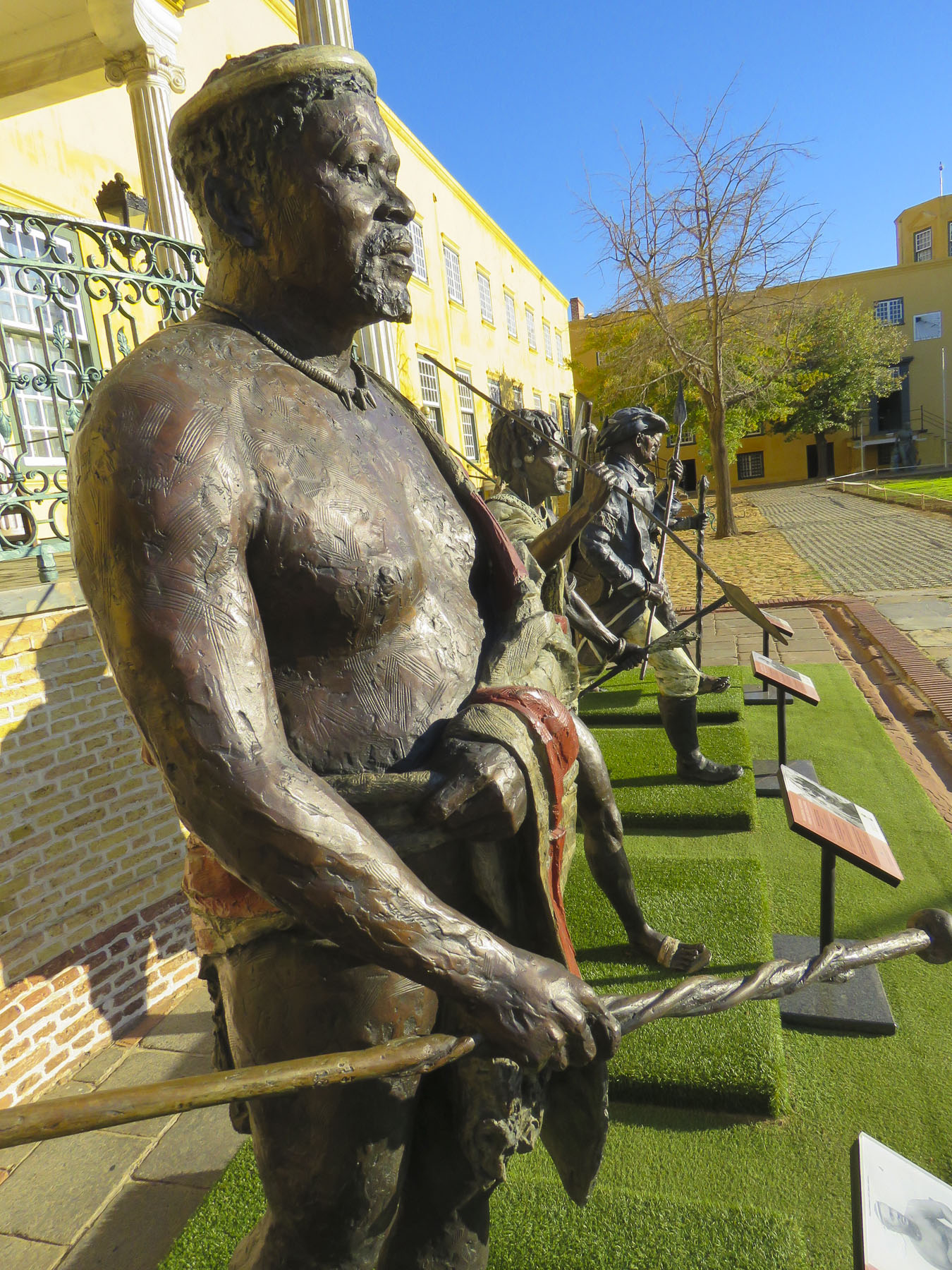 In early June the castle hosted the 2019 Cape Town Coffee Festival which celebrated all things caffeinated with growers from across the continent, barista workshops and pop-up coffee stands. If you ever wanted to see thousands of folks ricocheting off the walls from too much free coffee, this was the place to be.
One of our favorites was a Senegalese coffee prepared by Khadim, a pleasant and engaging expat. It’s a strong sweet coffee, served with a long dramatic pour. We enjoyed it so much that we visited his shop, Khadim’s Coffee, repeatedly. So good was the java and food prepared by Khadim that his shop became our de facto rendezvous point for meeting friends in the city.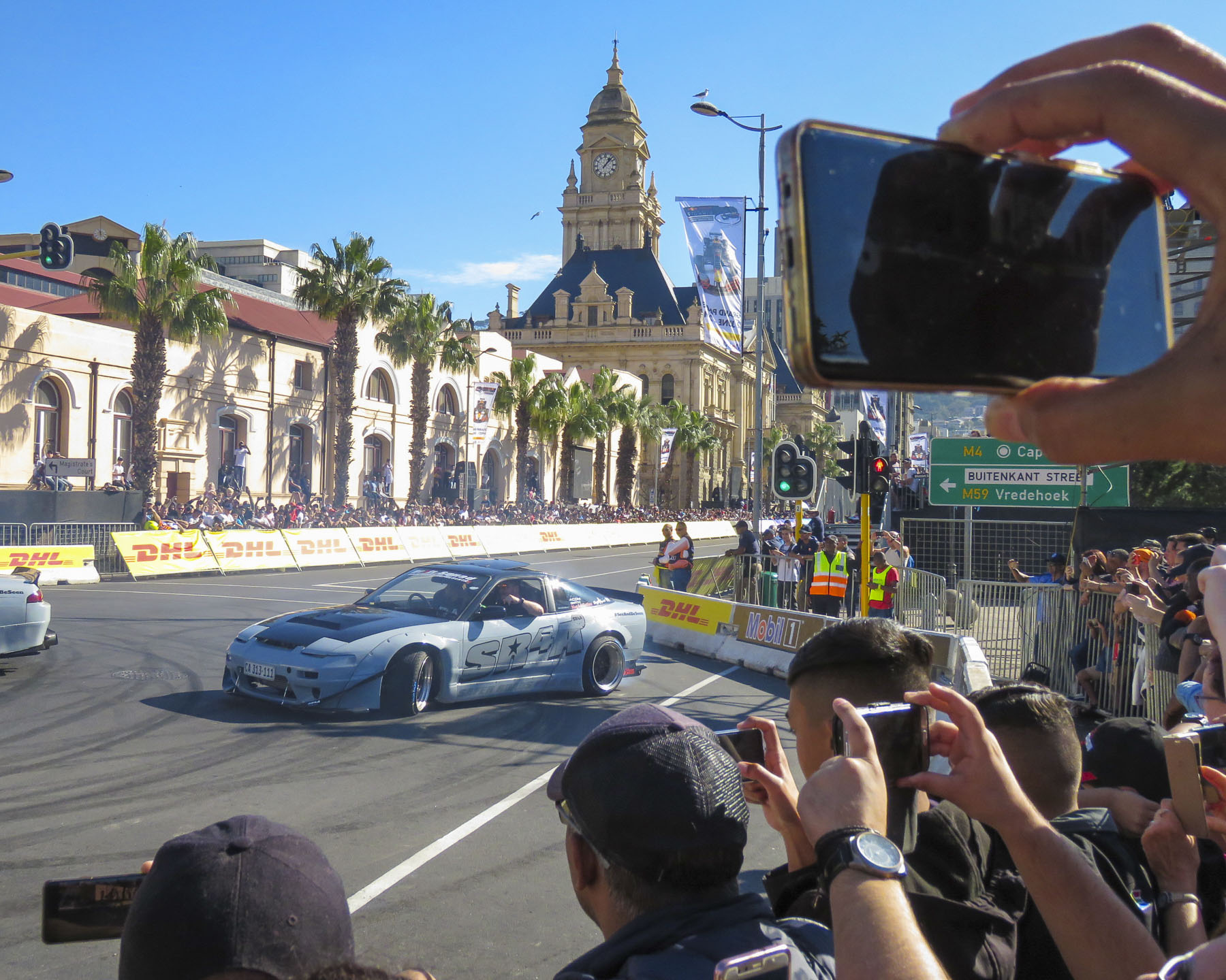 The coffee festival coincided with the Red Bull Cape Town Circuit where their F1 Aston Martin Red Bull racing car roared down Darling Street at over 150mph, passing the spot where Nelson Mandela addressed the nation upon his release from Robben Island, and turning the stretch in front of city hall, lined with bleachers, into a high-speed drag strip. At the intersections, souped-up street cars burned rubber and spun donuts while the Red Bull Air Force performed aerial acrobatics over the city. It was a raucous day that we could hear from our apartment.
Closer to the city center the District Six Museum tells the story of an atrocity, an afront to dignity that should never be forgotten. In 1867 the sixth district in Cape Town was formed as a neighborhood of immigrants, merchants, artisans, laborers and freed African and Asian slaves. It was close to the port and provided the muscle Cape Town needed to grow. It was home to ten percent of Cape Town’s population and thrived as a community for decades until 1966 when the apartheid government, seeing prime real estate under Table Mountain, declared it a whites only area. The district’s 60,000 residents were forcibly relocated with superficial notice into segregated townships 15 miles away, or further, from central Cape Town.  Families and neighbors were intentionally sent to different communities to break the spirit of the people. The apartheid government was so vile it “regarded the district as both physically and morally tainted by miscegenation, wholly unfit for rehabilitation” and flattened every building except for Churches. Even the original streets were destroyed, and new roadways were created so folks couldn’t find their homes, now vacant lots, that they legally owned. Much of the area still remains abandoned. The District Six Museum commemorates this tragedy and the lasting heartbreak of this cruelty.
The Company’s Garden was only a few blocks away. Originally a farm that supplied passing ships with food, it now is a wonderful urban park in the city center with old growth specimen trees, gardens, and café. Adjacent to the entrance of the park, Desmond Tutu used to preach from the pulpit of St. George’s Cathedral, an Anglican Church. And across the street a section of the Berlin Wall stands in remembrance of the struggles people are willing to make for freedom around the world.
At the far end of the gardens two museums grace the grounds and are perfect for a rainy-day exploration. The Iziko South African Museum is a natural history and science museum with a planetarium. It has wonderful collection of early aboriginal tools and rock paintings along with a large compendium of pre-historic fossil remains. There is something for everyone here and we found it to be fascinating. Outside, various street performers entertained visitors to the park.
Across the way the South African National Gallery has an eclectic collection of contemporary and tribal art from South Africa and the rest of the continent. The art scene is thriving in Cape Town with many galleries providing exhibit space to young, talented artists. The museum’s collection reflects this vibrant art scene. Despite our apartment’s faults, we enjoyed our time on Buitenkant Street. Watching the brilliant sunrises and the flat clouds – the tablecloth of Table Mountain – cover the summit and then spill down the side like a waterfall. The street life below spanned the gamut from groups of tutu-clad race walkers one day to noisily protesting sex workers or Fridays for Future demonstrators the next.
It would be superficial of us not to address the painful past of this relatively young democracy; apartheid and race are still underlying issues. Despite this, Cape Town, South Africa, was a wonderful experience: at once contemporary and traditional; challenging, progressive, and hope-filled, it captivated us for three months.
Stay tuned for more as we work our way across the southern tip of the continent.
Till next time,
Craig & Donna
Please share my page with your friends


 We planned a long weekend to celebrate
  But first we had to get there. Just before our exit off the N2, the silhouettes of several tall sailing ships broke the horizon as if they were crossing an inland sea. Imagining a pirate swinging from a yardarm, we did a quick double take and followed a side road down to the entrance of
  Across the street from the movie studio, our wine tasting started at


")


 Our room was spacious and comfortable, bigger than several studio apartments we have rented. We spent a little time walking around the pond, watching the weaver birds dart in and out of their hanging nests, before the sunset.


 We followed the queue of beret wearing Francophiles draped in colors of the flag, past a vintage car show and a very competitive barrel rolling contest, to the Food & Wine Marquee, where our tickets included a live concert by South African rocker Karen Zoid, two very nice wine glasses, tasting coupons and R20 vouchers to use towards the purchase of food or bottles of wine.


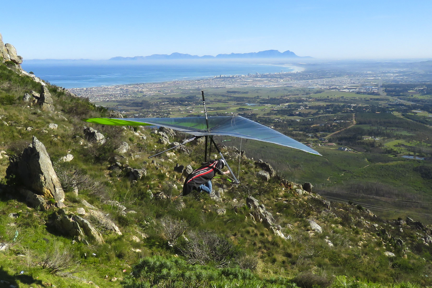 Luck was with us when we pulled into the Sir Lowry’s Pass View Point, in time to see several paragliders launch from the steep slope of the overlook. The view toward the town of Strand, on False Bay, with its long sandy crescent of beach, was incredible. Further on fruit orchards lined both sides of the road for as far as we could see. The valley’s unique climate, cooler and wetter than the surrounding region, is perfect for the local orchards to blossom. Today the Elgin region produces 65% of South Africa’s export crop of deciduous fruits.
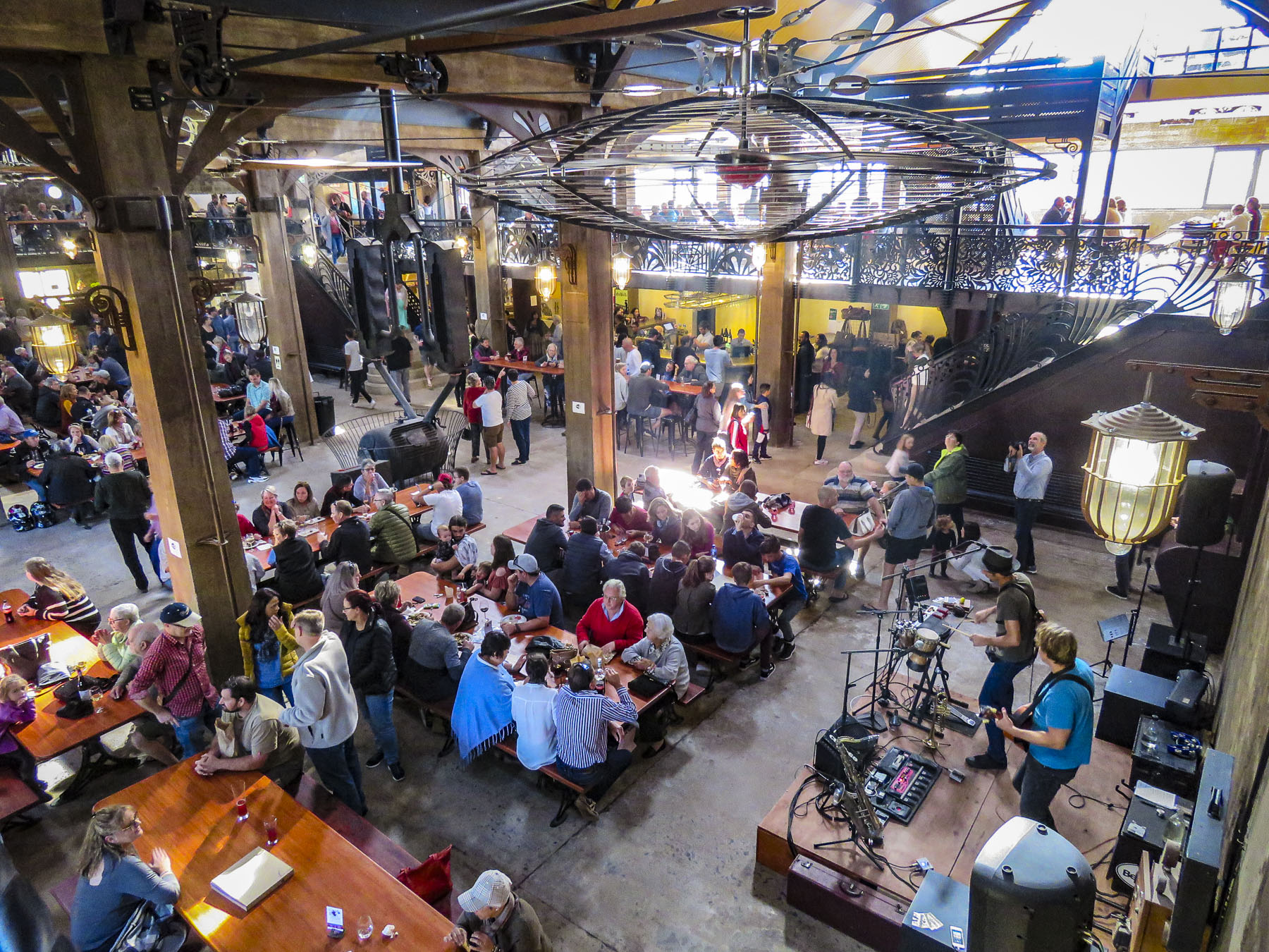 We were working our way to the
 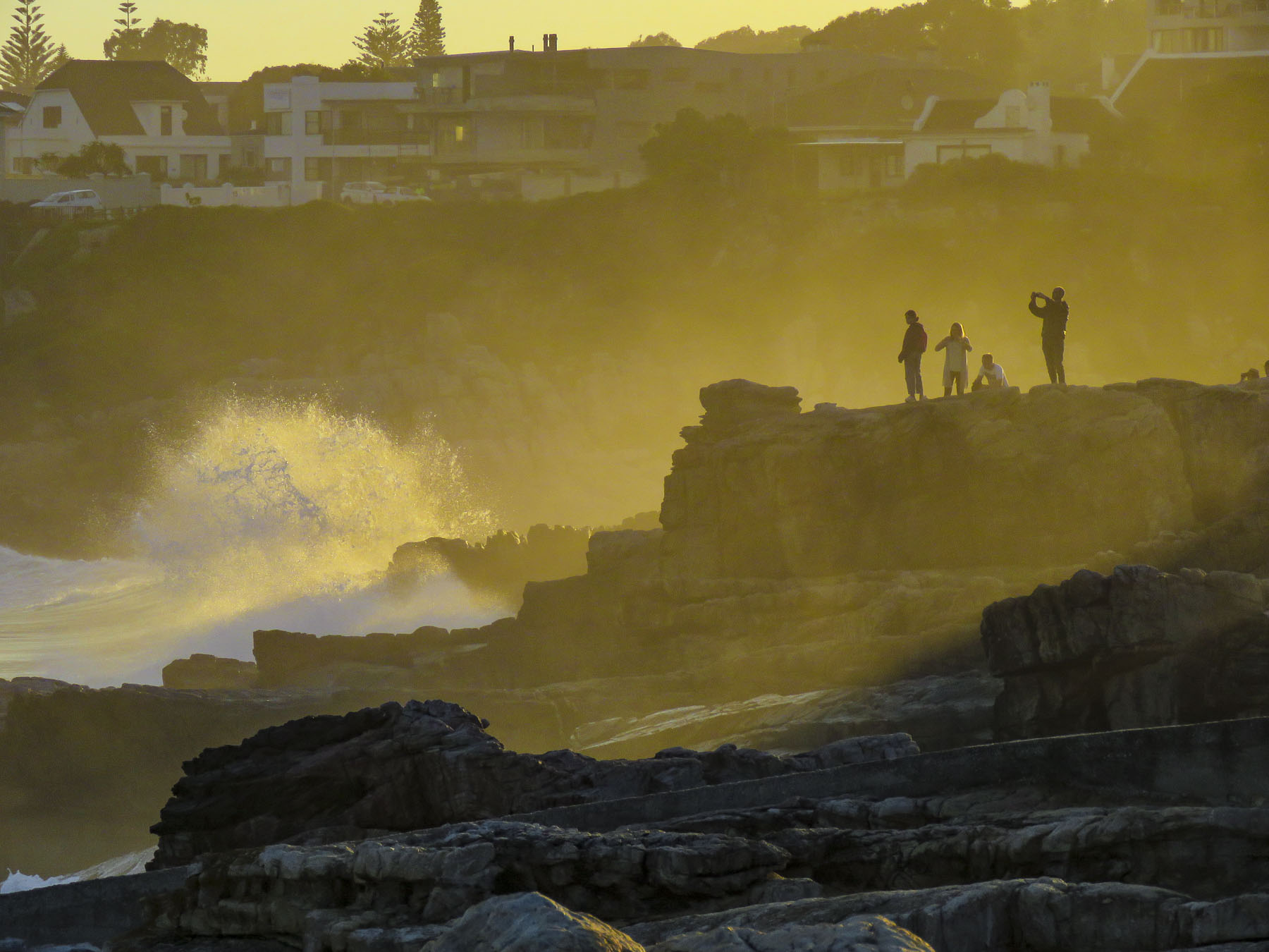 Located directly across the street from the ocean, the
  Walker Bay’s thunderous waves crashing against the rocky coastline were spectacular with their large sprays as we walked along the Hermanus’ Cliffside Path to Gearing’s Point, a scenic overlook, hoping to spot whales. Our Cape Town friends had mentioned that it’s often possible to sight Southern Right Whales from the shore here during their June to November calving season, after which they head back to the waters of Antarctica.
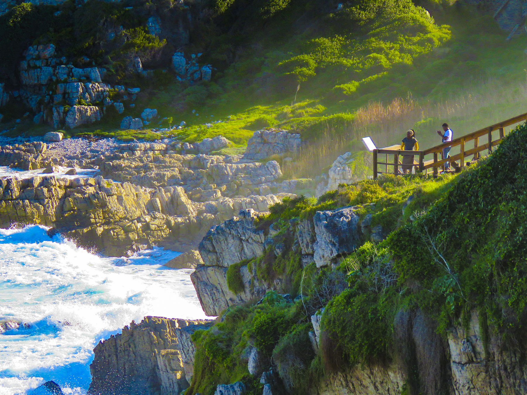 It’s a well-defined trail, with cement, dirt and boardwalk sections, that starts at the village’s New Harbor and hugs the coast for 7.5 miles, ending at the Klein River Estuary. Five miles of the path are wheelchair accessible. In some places it passes under trees twisted to grow almost parallel to the ground, by the fierce South Atlantic winds that blow in from Antarctica.

 The seascapes from the cliffside path were beautiful, but we hadn’t spotted any whales and the village’s whale crier wasn’t sounding his kelp horn. Yep, what started as a publicity stunt has become tradition and Hermanus has had an official, and the world’s only, whale crier since 1992.
 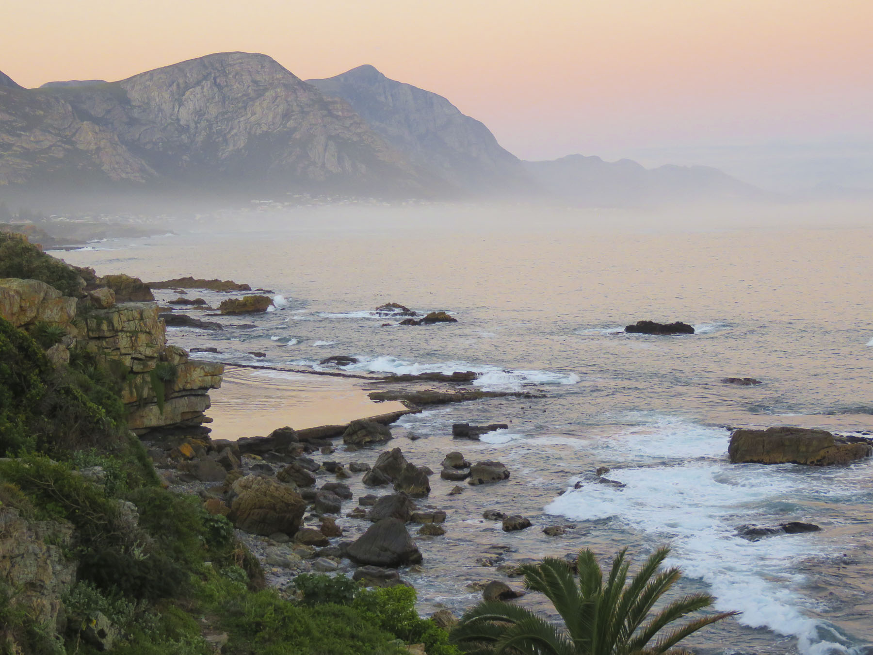 In 2016 the movie The Whale Caller was adapted from South African author Zake Mda’s 2005 novel, of the same name, which has the whale crier as the central character.

 With skipper Emile at the helm, the first mate tossed the mooring lines to the dock and we departed onto a gently rolling sea. Phillip, a registered naturalist with a delightful wry sense of humor shared his love of the sea with us. “There’s a good chance we’ll see Southern Rights today. We spot them by their distinctive V-shaped blow and the callosities (clusters of barnacle like growths) on their heads. We may also see Africa Penguins, Fur Seals, Dolphins, migrating Humpback Whales and resident Bryde’s Whales.” Psyched now, all eyes scanned the horizon for any telltale signs of these gigantic, yet elusive creatures.

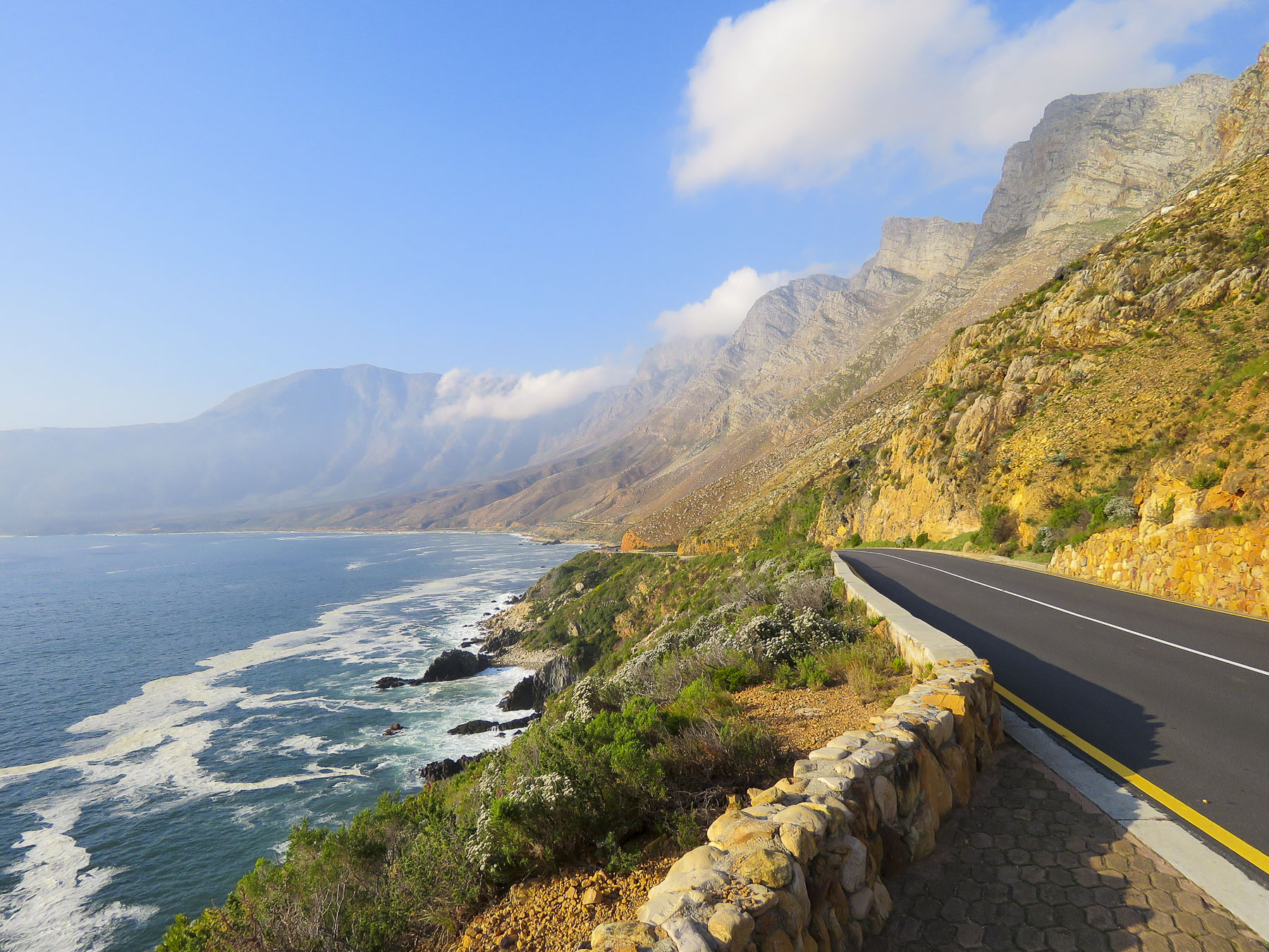 Heading back to Cape Town late the next day, we followed the scenic R44 coastal road through the seaside villages of Kleinmond, Betty’s Bay, Pringle Bay and Rooi-Els as the golden hour was approaching.
 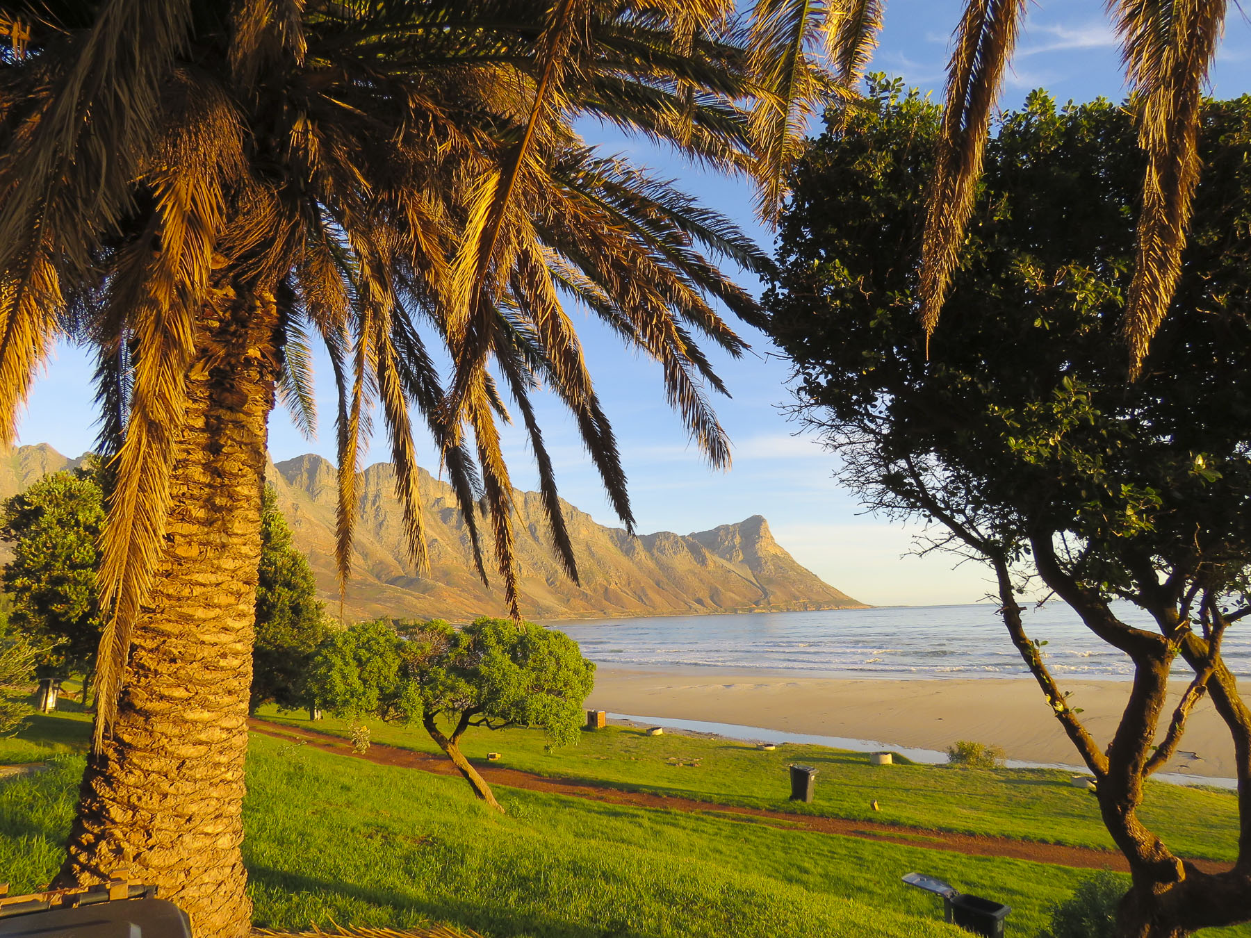 Each turn of the road offered a dramatic view of the coast and we stopped many times for photos. We merged back onto the R2 at Gordons Bay just after sunset for the ride the rest of the way back to the city.


 During the morning “golden hour” we watched a family of giraffe walk gracefully through the forest, nibbling thorns from the acacia trees, before saying our goodbyes. Stormsriver, it was! Backtracking through Port Elizabeth we retraced our drive past Jeffreys Bay and continued west on the N2 until we stopped to photograph the steep chasm that the Stormsriver Bridge spanned, just before the village of the same name. Mostly folks mean the
  We thought the entrance fee of $17.00 per person for international tourists was steep and we did see some cars turning away, but we had heard such tremendous recommendations we would regret it if we didn’t check it out. There was a long winding road down from the entrance gate and when we finally rounded a sharp corner, the view of the rugged coastline with crashing waves sending up large white sprays was spectacular!
 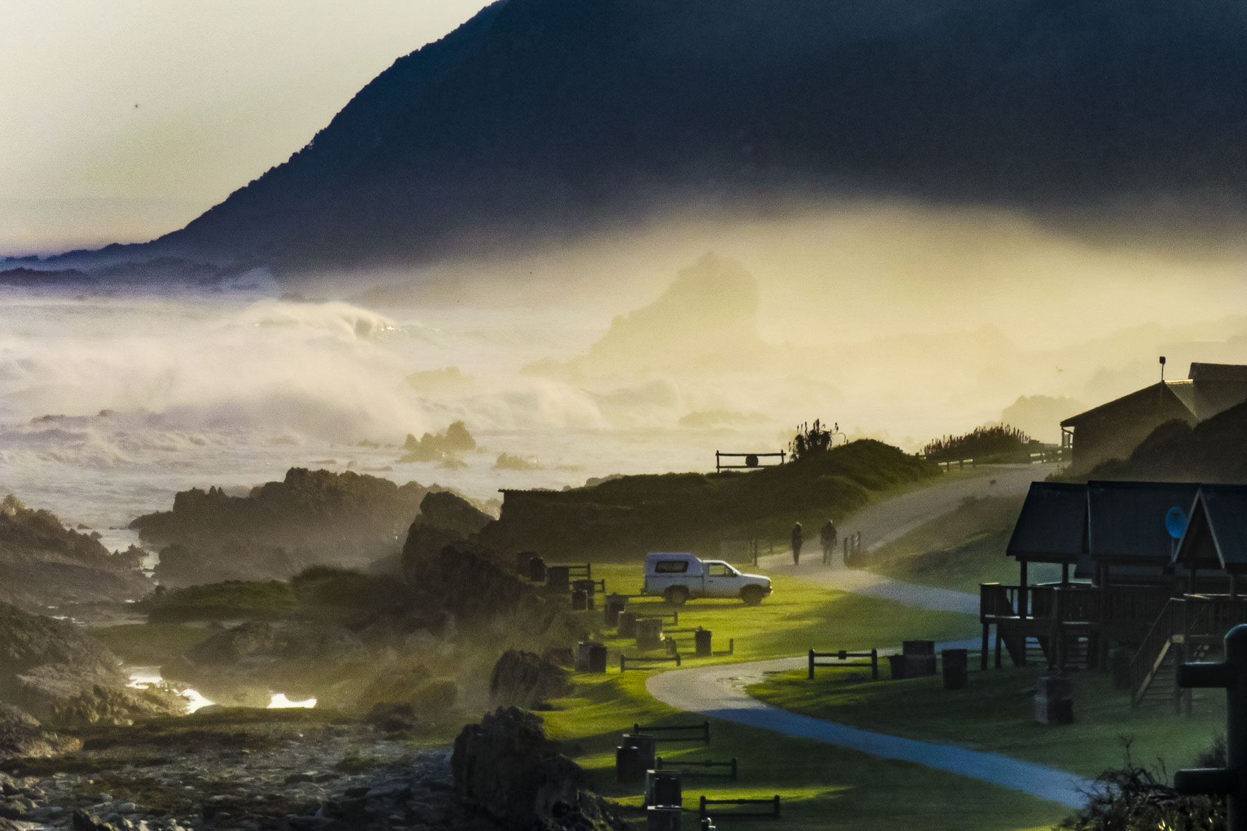 We enjoyed lunch watching and listening to thunderous waves explode against rocks only a short distance away from our table at the Cattle Baron. It’s the only restaurant in the park and was excellent, along with being very affordable. A nice surprise after the park entrance fee.
  After lunch we followed an easy section of the
 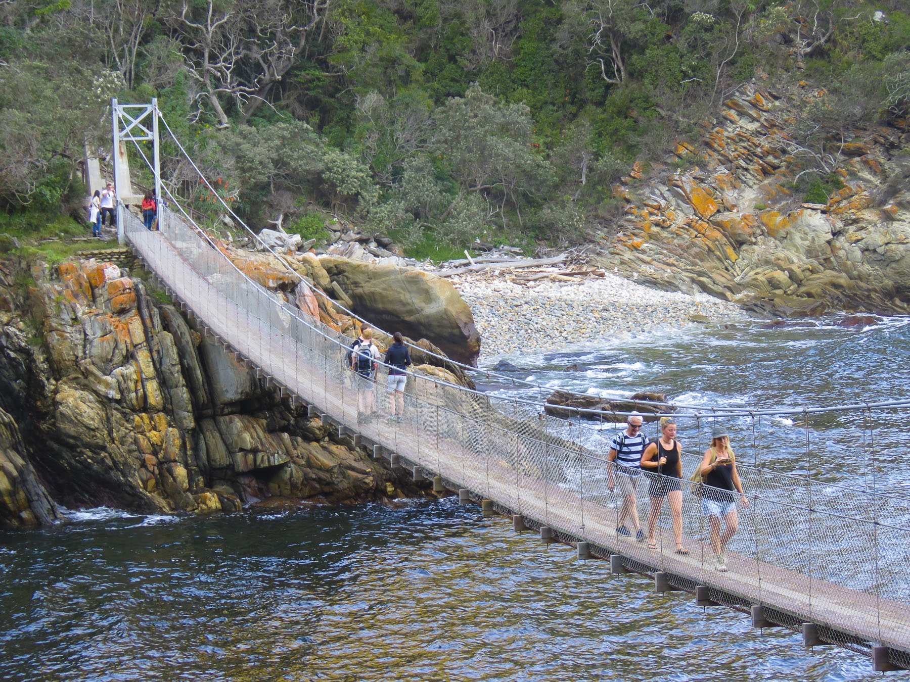 Staying in designated cabins each night, it takes five days to cover the route that stretches from Stormsriver in the Eastern Cape to Nature’s Valley in the Western Cape. The reverse hike is referred to as the


 On the way back to the highway we stopped at


 Our steep ascent away from the coast began in George as we headed north on the N9/N12 twisting our way uphill through the Outeniqua Pass to Oudtshoorn. This is a challenging stretch of highway with continuous s-turns that required my constant attention. Passengers can enjoy spectacular views on sunny days that stretch for miles. If possible, drive the route towards the coast, it’s easier to stop at the scenic lookouts this way.
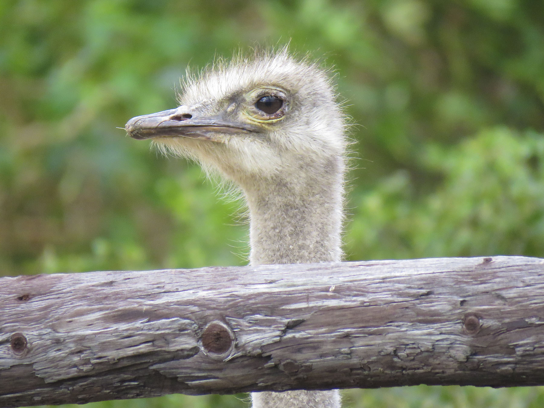 We’ve heard of gold booms, where fortunes were made. But it was the ostrich booms in 1865 -1885 and 1902-1913 when ostrich feathers were the ultimate fashion accessory in Europe that enriched local farmers here. At one point 314,000 ostriches were being raised and their feathers were a valuable South African export, only surpassed by gold, diamonds and wool.


 The word karoo comes from the Khoisan language meaning “land of thirst” and it precisely describes the terrain along R62 which we followed. Parched, rock encrusted rolling hills and mountains covered with a fynbos of low heather-like shrubs and proteas occasionally accentuated by taller, lone trees and dry riverbeds crisscrossed the landscape. During the South African spring, in October, it bursts with flowers, but it was July, still winter. The area endures extreme heat during the summer. Fortunately for us recent winter rains had spurred some greenery to burst forth and aloe plants to bloom.
  We stopped in Ladismith, a rural farming community where Vincent, Donna’s friend from seminary, first pastored a church, and enjoyed its colonial Dutch architecture.

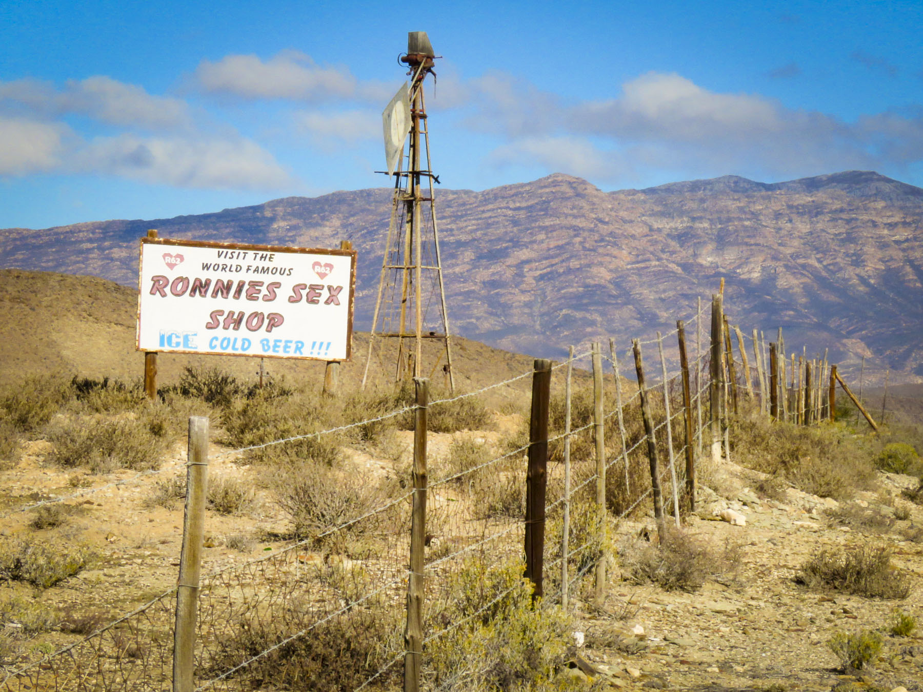 The heat can do strange things to the mind and sometime in the 1970’s Ronnie thought a farm stand on this desolate stretch of highway through the karoo would be a good idea. Fortunately, his buddies realized it was destined for failure and would soon be another abandoned building along the road if something wasn’t done. One night they painted SEX into the name of the shop and suggested he open a bar. They saved his butt! Famous now worldwide as a dive bar in the middle of nowhere, it draws in the curious. It’s not the raunchy place the name implies, filled with frustrated farmers between ostrich roundups. A grey bearded Ronnie, now a cause célèbre, still pours drinks at the bar. It has a tired, dusty bar area filled with foreign money plastered to the walls and lingerie hanging from the ceiling, but aside from that it’s a wholesome oasis with a covered patio where you can get a decent burger with fries, ice cream and coffee along with some hard stuff if that’s your drink. It’s not worth a detour, but if you are on the R62 traveling between Barrydale and Ladismith, it’s worth the stop. Actually, it’s the only place to stop.

 We zoomed past the small village of Barrydale on our way to Montagu, so we could explore the town a little before nightfall. The farming community is in a valley surrounded by the Langeberg mountain range and has many examples of late 19th century Cape Dutch architecture scattered about town. Ornate gables, thatched roofs, whitewashed walls and occasionally gingerbread trim define the style, but there are modern interpretations also.
 In a country not known for Art Deco we booked ourselves into the
  The temperature drops quickly in the mountains once the sun sets so we enjoyed a local wine, in front of a fireplace, in one of the lounges before dinner. We usually look for a less expensive alternative for dinner, but the hotels’ Wild Apricot Restaurant drew us in with elegant candlelit tables and live piano music. It was the last night of our road trip – we could splurge. With Smoked Ostrich Carpaccio and Springbok Tarta for appetizers followed by Cape Malay Bobotie and Karoo Lamb Pie as mains and a traditional Orange Malva Pudding for dessert, we were splendidly sated.


 We followed R62 west through a small tunnel, locally referred to as the “Hole in the Wall,” that was dynamited out in the 1870’s. It’s a dramatic landmark that tells you of your arrival into or departure from the Karoo. As we left our road trip behind, we looked forward to heading to a new apartment in Cape Town.


![IMG_7861[42783]](https://i0.wp.com/2suitcasesfor2years.com/wp-content/uploads/2020/02/img_786142783.jpg?w=272&h=363&ssl=1 "IMG_7861[42783]")


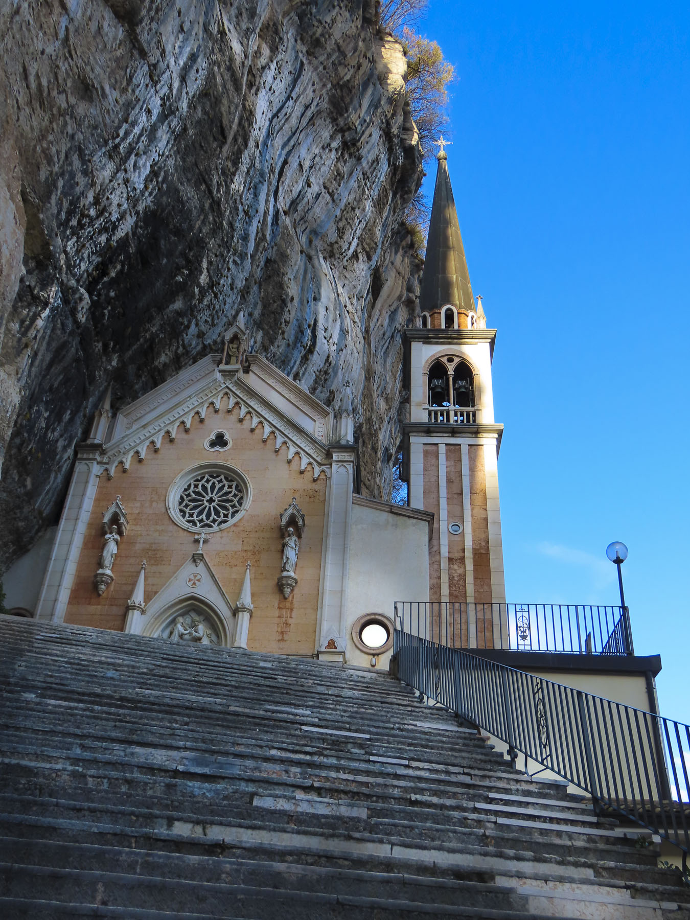
 Just outside Old Town Plovdiv,


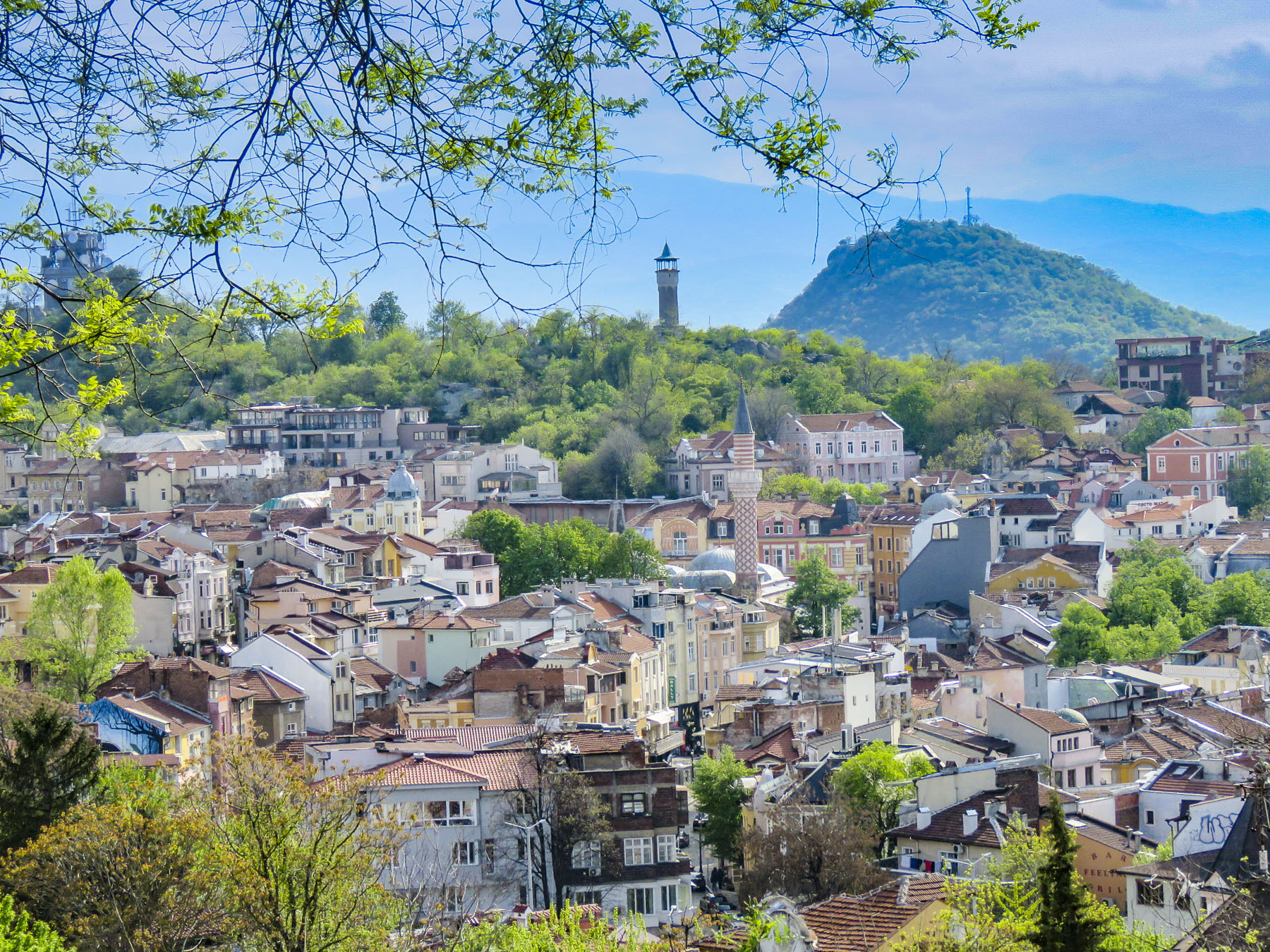 At just over a mile long the pedestrian mall in the center of Plovdiv is the longest in Europe, running from the Stefan Stambolov Square along Knyaz Alexander I, and Rayko Daskalov Street before ending at the footbridge lined with shopping stalls that crosses the Maritza River.


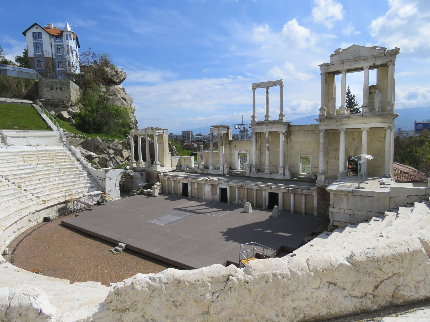
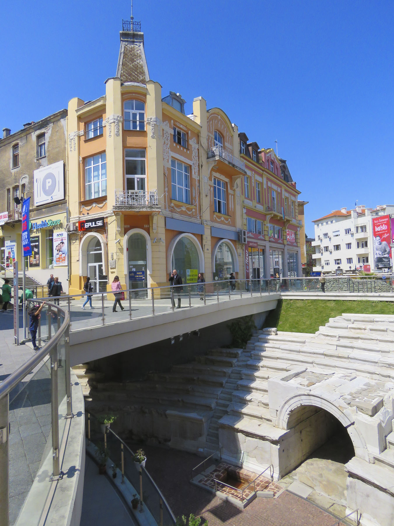 But the jewel of the mall area was the curved ruins of the Ancient Stadium of Philipopolis, with its fourteen tier seating area, unearthed in 1923. Situated below street level and surrounded by modern buildings at Dzhumaya Square, the ruins provided a dramatic juxtaposition of the ancient and contemporary, where you can actually see the layering of history and how the city was built over earlier civilizations. From this excavated section, archeologists have determined that the stadium was a huge 790 feet long and 165 feet wide and could seat nearly 30,000 spectators.
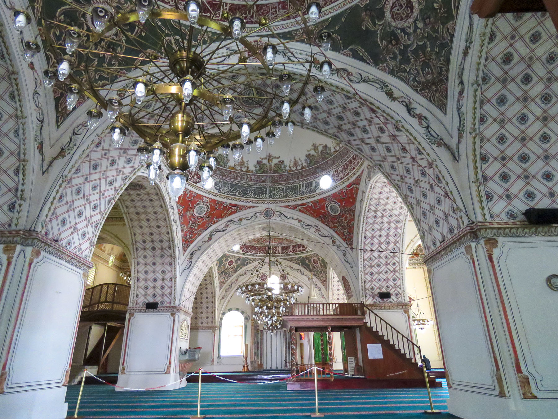 Across the square the Dzhumaya Mosque is the main Friday Mosque for Muslims in Plovdiv. Constructed in 1421, it replaced an earlier mosque built in 1363 on the foundations of a Bulgarian Church destroyed during the Ottoman conquest. It is one of the oldest and largest Muslim religious buildings in the Balkans. At the café in front of it we enjoyed some sweet Turkish tea and pastries in the warm afternoon sun.


 After you crouch to enter through a low door and then look up in this intimate space, the WOW element of

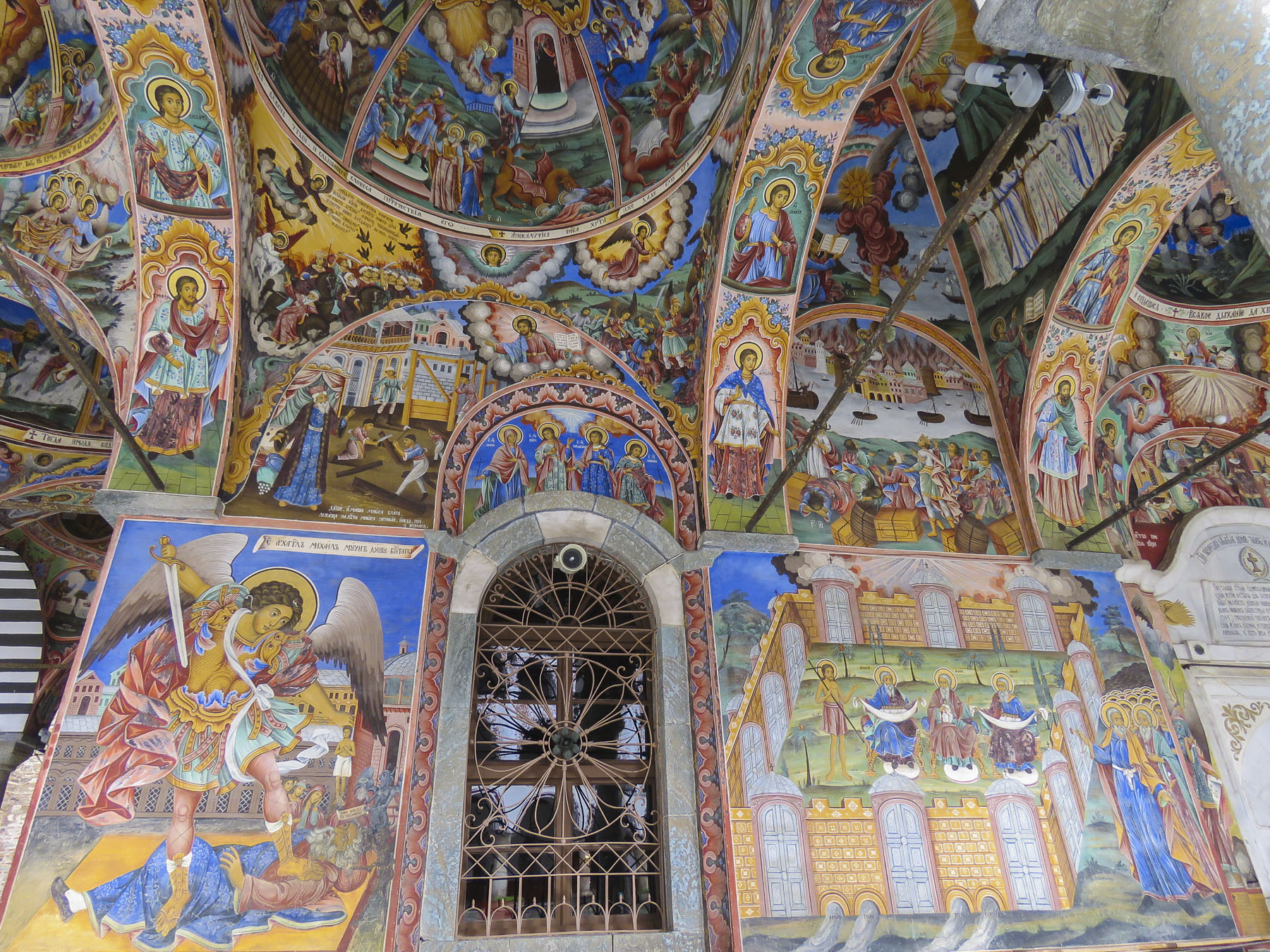
 Our main destination was


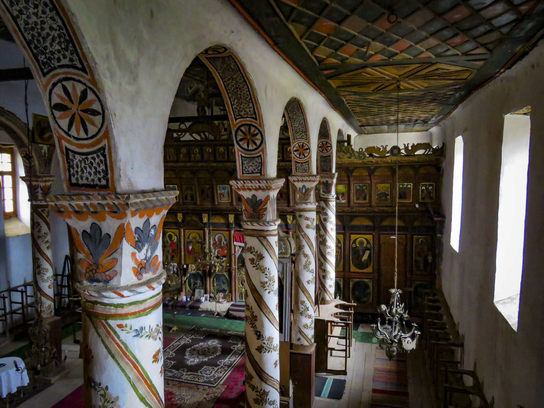
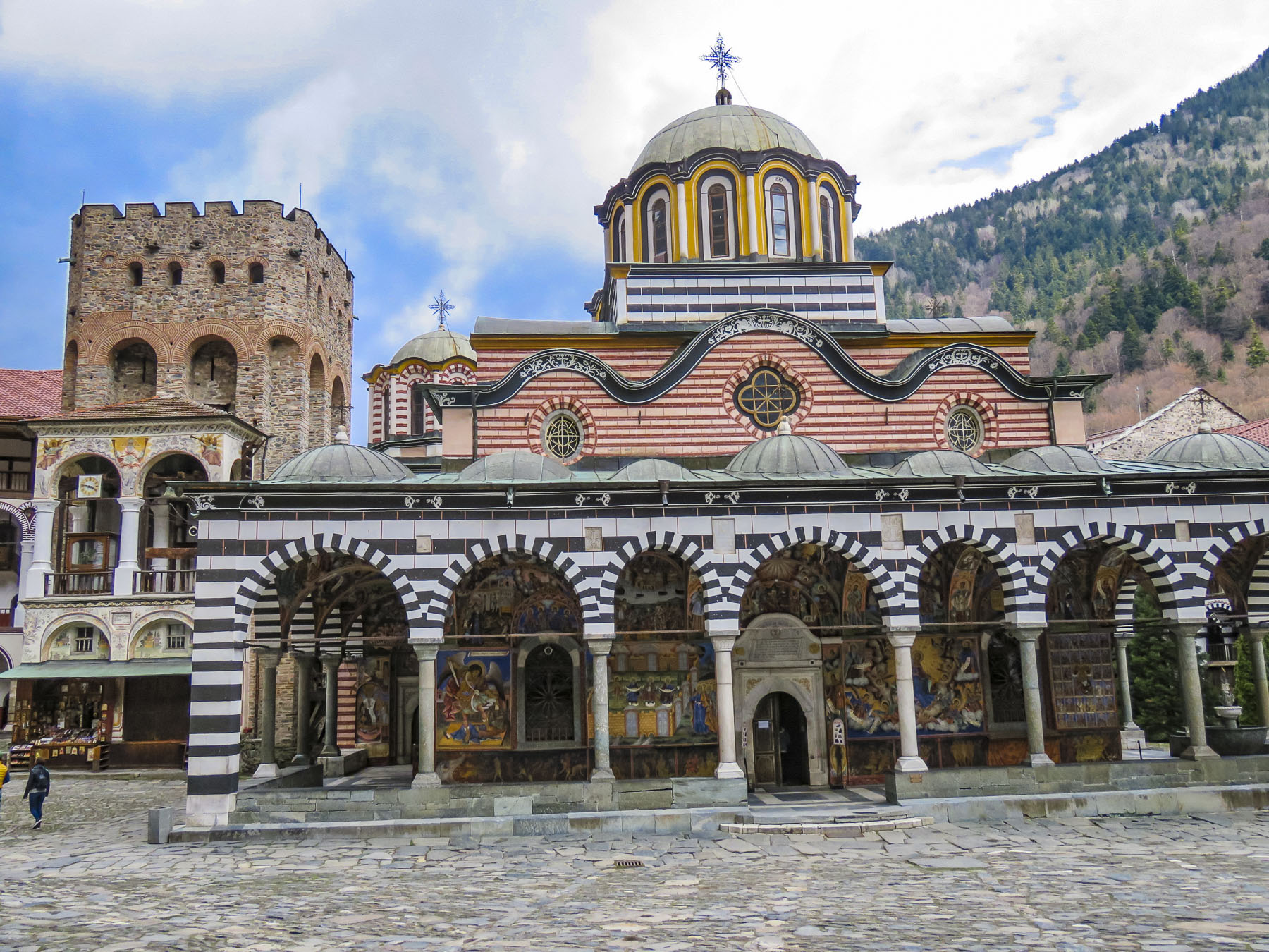 This is the only monastery to survive during the centuries of Ottoman domination over Bulgaria, when it was rebuilt in defiance of the Turks. The Bulgarian people have great affection for this monastery, as a symbol of their religion and culture during those turbulent centuries.


 Thirteen miles from the monastery, on a side street in the town of Rila, we spotted a church with three small cupolas, that called for a quick stop. The church “St. Nicholas the Wonderworker Mirikliyski” was a surprising find with its cracked bell tower and muraled covered entrance porch, complete with woodpile.
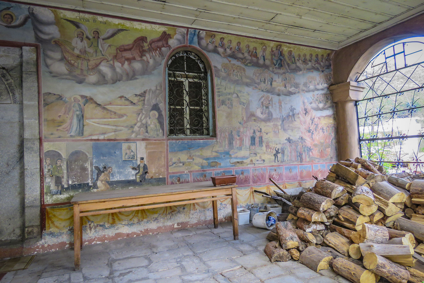 The painter of these hell fire and brimstone murals might have gotten his inspiration from the tortured works of Dutch painter Hieronymus Bosch. Unfortunately, the church was closed and we haven’t been able to find any other information about this off-the beaten-path treasure.


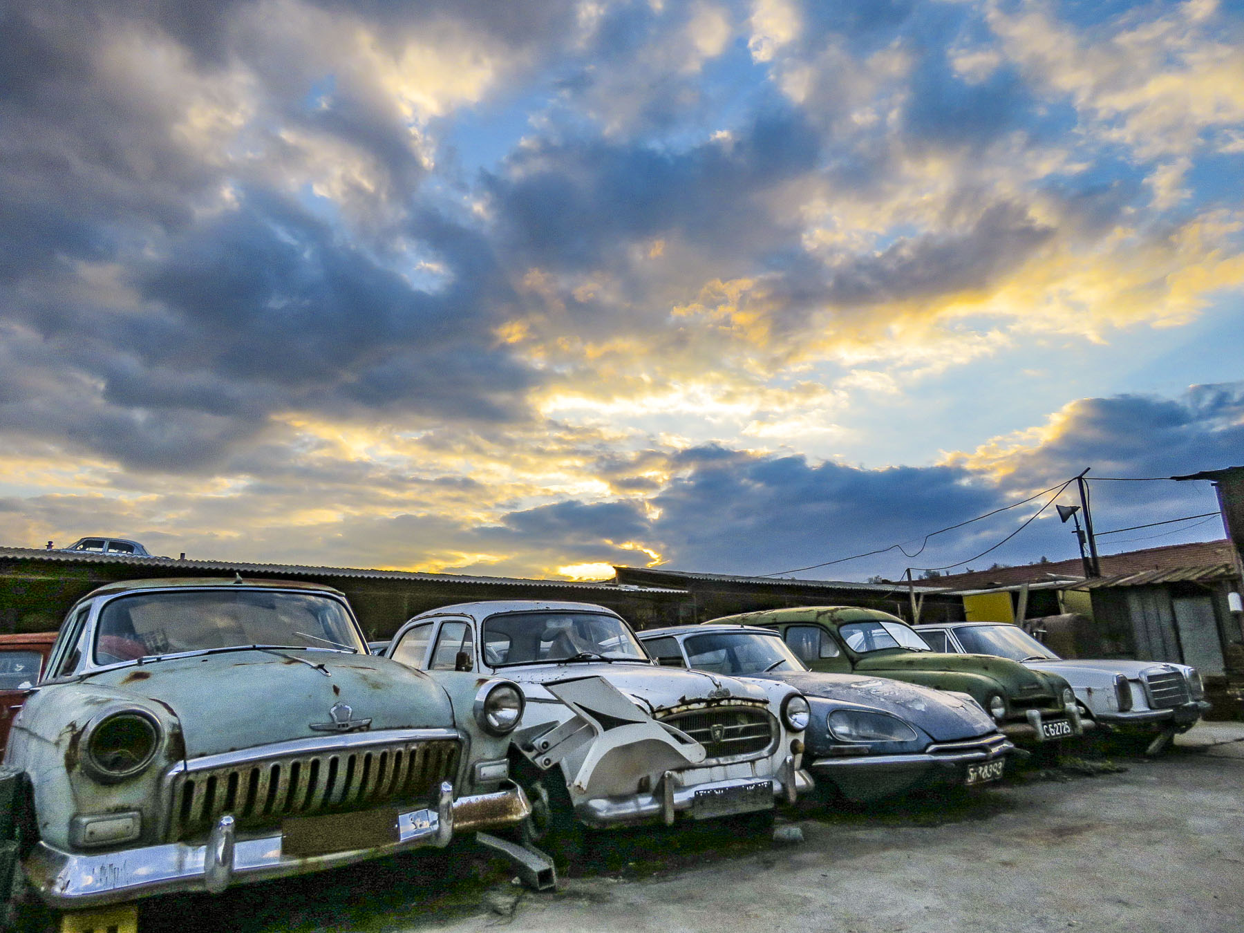 The Unofficial Junk Museum is a vast, rusty and dusty collection of whatever the owner deemed representative of Bulgarian culture under communism. Radios, tv’s, typewriters, farming equipment, cars, motorcycles, household items and busts of Stalin are stacked everywhere. It’s fascinating! And of all the places to buy a bottle of homemade


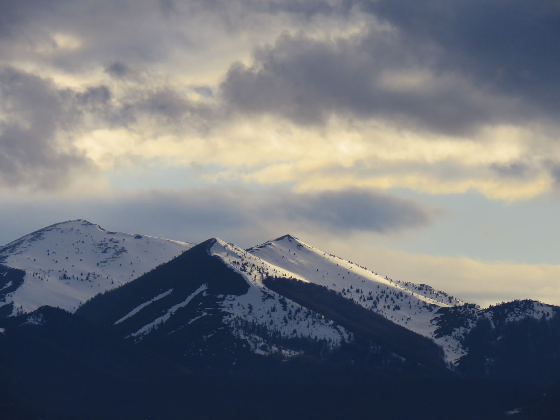
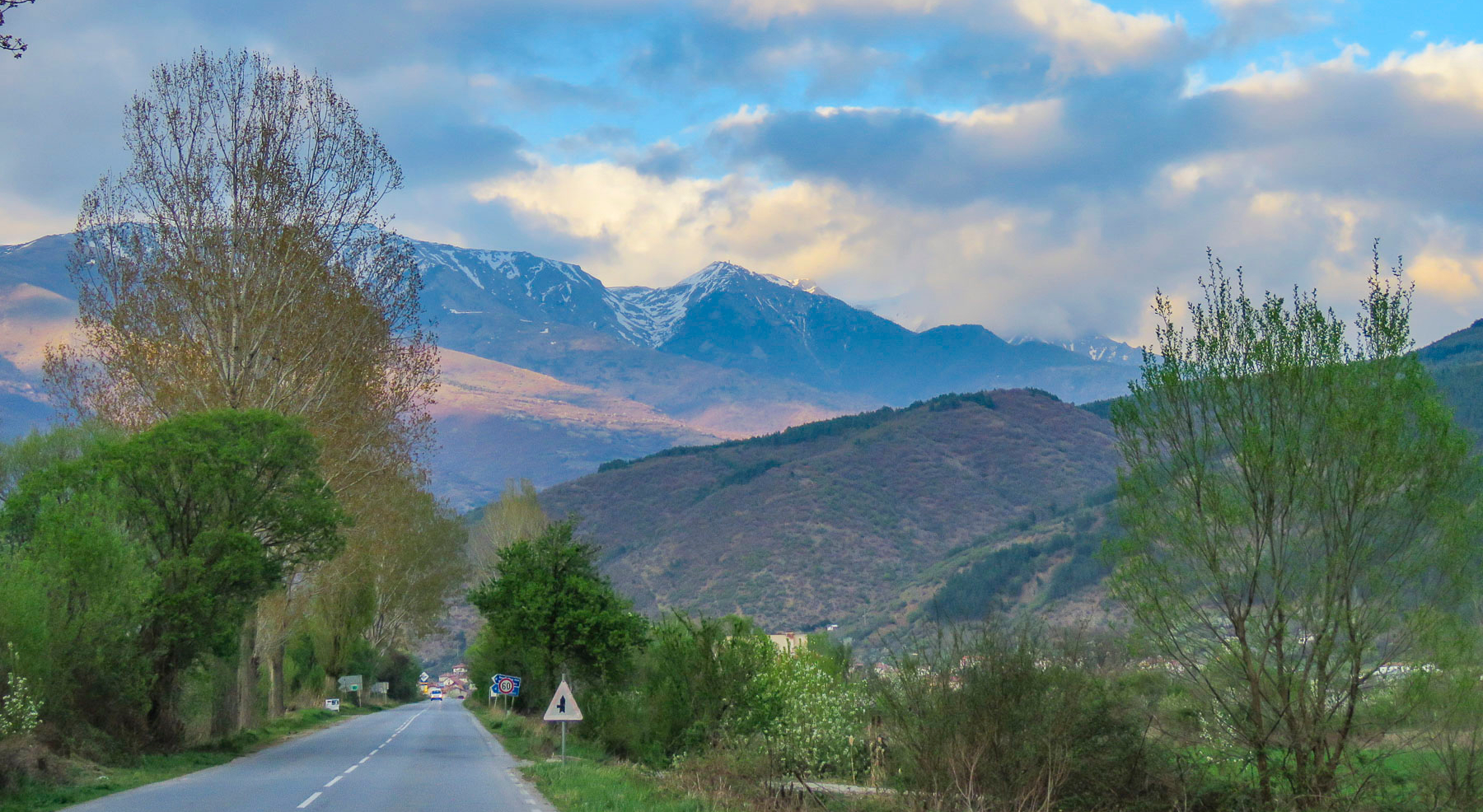
 In the morning we followed Rt. 1 south for a while as it hugged the Struma River, which would eventually reach the Aegean Sea, before we turned off and headed in to the Pirin Mountains.


 Melnik is situated in a wide gorge under striking sandstone rock formations, called hoodoos, that tower hundreds of feet high, created from millennia of erosion. Locals refer to these geological phenomena as Melnik Earth Pyramids. The village has been renown for making strong wine since 1346 from a regional red grape varietal, Shiroka Melnishka, and wine cellars still line its main street.
  Once a thriving village with one thousand residents, today it is now home to fewer than three hundred. The village was a delight to explore with its cobbled streets meandering between the whitewashed stone and timber homes built in the Bulgarian Revival style. Ninety-six of the village’s houses are historically protected. Any new construction in town adhered to that aesthetic.
  From the ruins of Bolyarska kŭshta, high on a hill above the Church of St. Anthony, we spotted the dome of what looked like a hammam, a Turkish bath, nestled between the traditional homes below, and went to explore.
  With the help of a kind woman, who somehow knew what we were looking for, we found the ruins of a small Roman era spa in a small side alley. Its dome was fully intact and the substructure of its once heated floor remained. There is also a single arched old roman bridge, near the parking lot, that you can still walk across. Before continuing to Kovachevitsa, we relaxed at one of the sunny cafes in the center of the village.
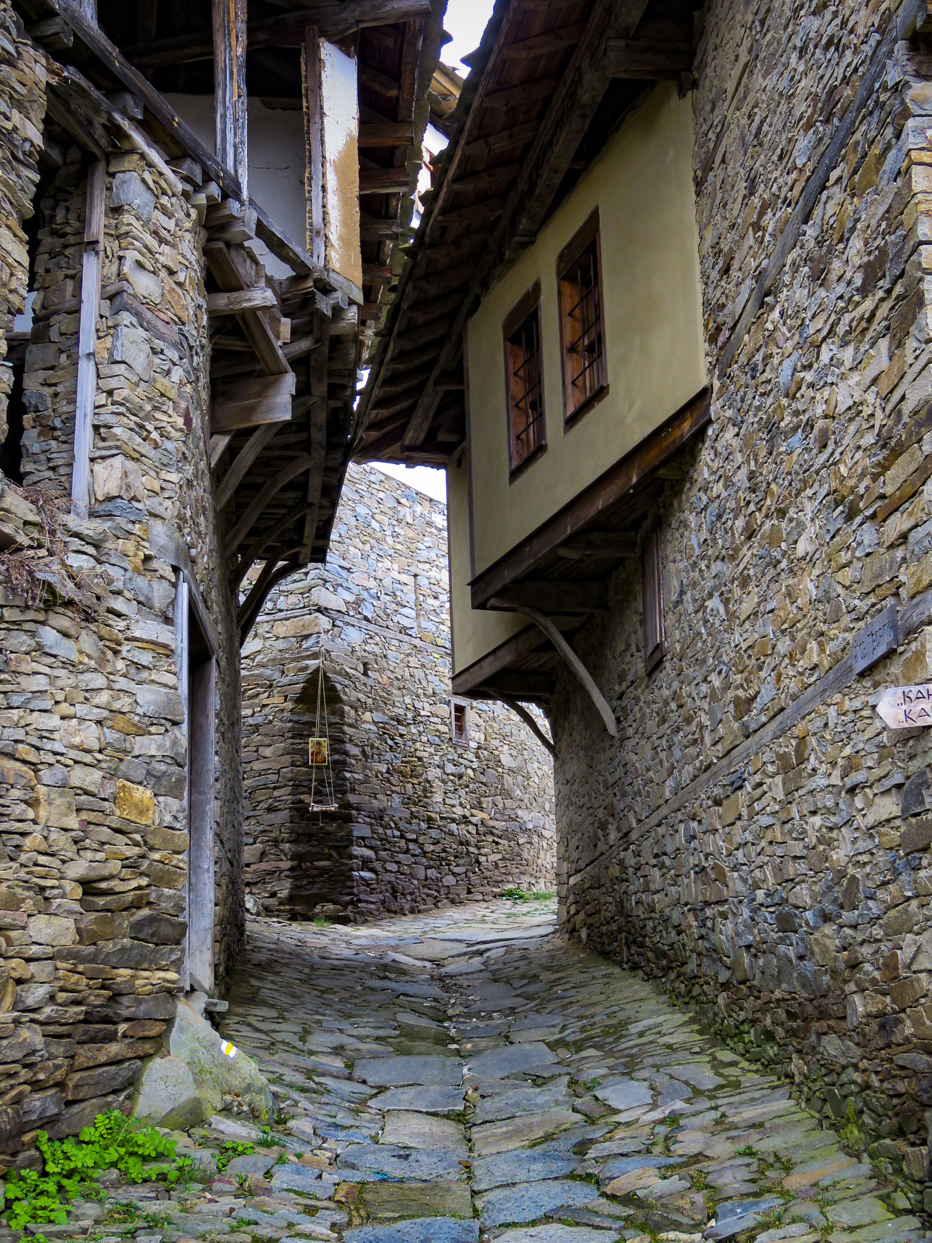
 Kovachevitsa, an isolated, rustic stone village in the Rhodope mountains, was only 52 miles away near the border with Greece. However, it took us the bulk of the afternoon to reach because “someone stops every hundred yards to take a photo.” And stop we did as we were awed by the beauty of the border region as we drove through the mountains. So close were we to the border that our phones binged with a “Welcome to Greece” message from our cell phone carrier.
 At one point we stopped to photograph a complete section of an iron truss bridge, just rusting away on the side of the road, only to have our car suddenly surrounded by a flock of bah-ing sheep.

 So, we knocked on the ancient door of the closest building only to be greeted by loud barking. Retreating back to the car we pondered what to do when a voice behind us said “hello.” That was the only word of English our host spoke until he said “goodbye” two days later. The barking dog turned out to be a gentle giant, who welcomed us to the inn. In fact, all the dogs of the village were St. Bernard-size, and they must all have been related, because they closely resembled one another. Fortunately, they were good-natured.


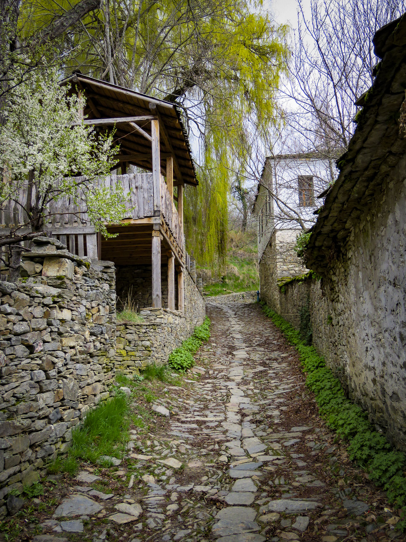
 Bulgarians fleeing religious persecution and the forced conversion policies of the Ottoman Empire sought refuge in the rugged Rhodope mountains and established Kovachevitsa in 1656. Agriculture and stockbreeding in the area thrived during the 1800s and the homes still standing in the village date from that time. The tall stone homes of Kovachevitsa are stunning and unique in an organic way.

 At breakfast the next morning Google Translate nicely bridged our communications barrier with the innkeeper’s wife. Loading the Cyrillic keyboard into the app for our hostess to use, Donna’s phone was passed back and forth repeatedly during a lively conversation about family, each other’s lives, the village and our travels. Our hosts’ children live with their grandparents in one of the larger towns off the mountain as there isn’t a school in the village anymore.
 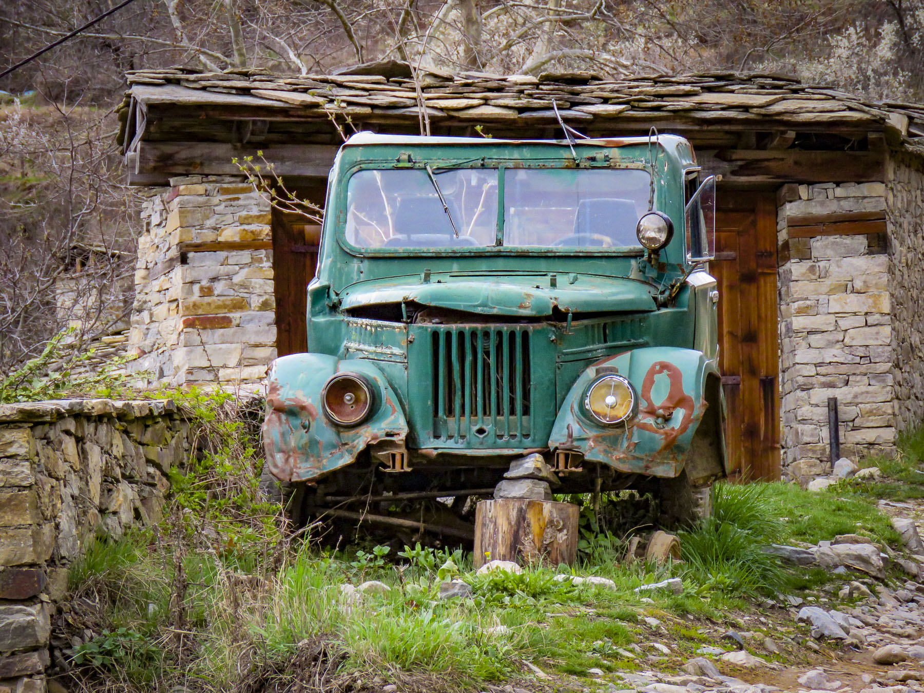 Most of the young families have moved away to find work, leaving only 28 year-round residents looking after the village till the tourist season starts. Strolling under blossoming elderberry trees, we had the narrow lanes to ourselves as we worked our way towards St. Nikolas Church.

 On the way back to our inn we stopped to admire the woolen creations knitted by a lone street vendor with a toothless smile who was bundled under layers of clothing to ward off the mountain chill. Her prospects for a profitable day seemed slim as the street was nearly deserted. When we expressed interest in only one pair of socks, she assertively pantomimed that we needed more. Looking up from readying our payment we could only smile and chuckle when we found she had filled our bag with two extra pairs of socks. They were well made and a bargain, so we caved to her sales pressure. I’m wearing a pair now as I write this, and my toes are happy we she insisted. I wouldn’t have been surprised if we were her only sale of the day.

 In the airport, at the tourist information kiosk, multiple large screen tv’s played flashy videos promoting Bulgaria’s culture, tourism, and natural beauty. We asked the woman staffing the desk for a map of Sofia and directions on how to transfer into the city. “Follow the line,” she snapped. Not fully understanding I asked again. “Follow the line!” she barked firmly a second time. She scowled in the direction of the arrows painted on the floor and turned away. Her previous career, I’m speculating, was a prison guard in the now closed gulags. She was obviously better suited commanding prisoners to “assume the position” than to being the first friendly face welcoming visitors to her country. I’m sure she was hiding handcuffs and would have used them if I asked another question. But that’s how it was, one day you’re communist and the next day you’re taking customer service courses and trying to embrace a free market economy. And for some the promise of a better life hasn’t been realized. Later, one of our hosts would express, “some folks prefer the old way, they’re still communists.” “Come and keep your comrade warm,” another refrain from the Beatles song, didn’t ring true. We weren’t feeling the love just yet. Aside from that rocky start, we had very enjoyable time in Bulgaria.
  The line led to a modern subway station adjacent to the airport terminal and for 1.60 BGN, about 90¢ USD, we rode the
 We emerged onto the pedestrian only Vitosha Boulevard filled with folks enjoying a warm Spring day and an incredible vista of Vitosha Mountain towering over the city. Inviting outdoor cafes lined the street and we quickly chose which one we’d return to after meeting our Airbnb host. We stayed on Knyaz Boris just two blocks parallel to Vitosha Boulevard and as majestic as the pedestrian mall was, the side streets, though tree lined and harboring small shops and restaurants, were slightly dismaying with wanton graffiti tags on every apartment building door and utility box. There was a lack of pride in ownership.
  The idea that’s it’s not my responsibility is a leftover from the communist era, when the government owned and was responsible for everything. The front door to our building was no different, but our third-floor walkup apartment was an oasis with a sun-drenched living room and tiny balcony that we would call home for a month. And to our delight, but to our waistlines’ detriment, there was a baklava bakery across the street!
  Long at the crossroads of expanding empires, Bulgaria has had a contentious past with Thracian, Persian, Greek, Roman, Byzantine, Ottoman and communist influences. The First Bulgarian Empire, 681-1018, has been deemed the Golden Age of Bulgarian Culture, with the adoption of Christianity as the official religion in 865 and the creation of the Cyrillic alphabet. Independent for only short periods of time during the medieval age, the National Revival period between 1762-1878 brought Bulgaria to finally throw off the yoke of Ottoman domination that had lasted from 1396. Sadly, there were only six decades of self-government before the proud people of Bulgaria became a satellite regime of communist Russia at the end of WWII and fell behind the Iron Curtain.
 Today Sofia is transforming itself into one of the most beautiful, cosmopolitan cites in Europe with its pedestrian malls, extensive park system and tram lines that weave throughout the city. But the past is always present and just around the corner in Sofia. Walking north along Vitosha past the end of the pedestrian mall there is a three block stretch that displays a vast stretch of that history on the way to the Central Market Hall, where we were headed to stock our pantry. We got sidetracked.
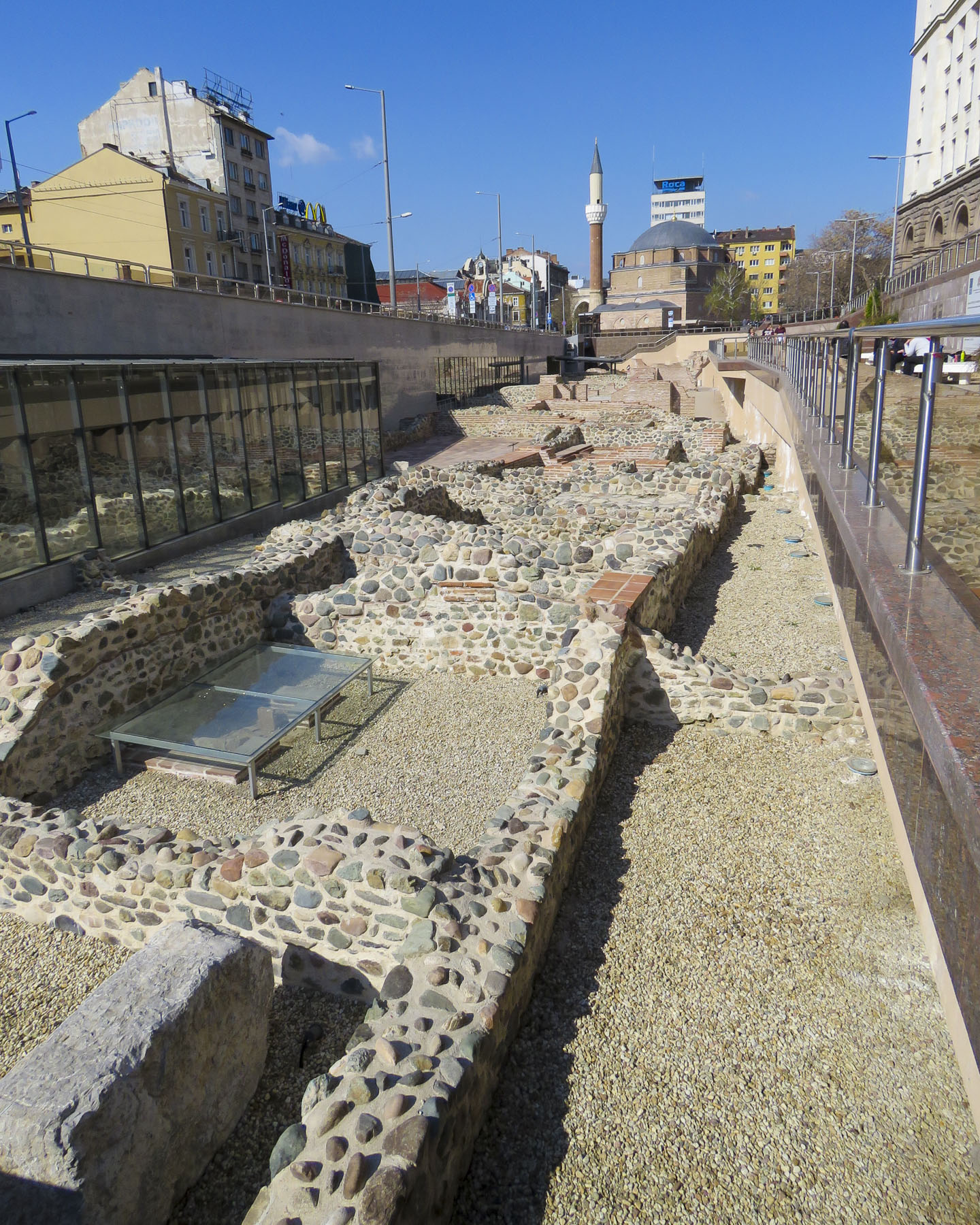 Seven millennia ago, put down the first foundations of what we now call Sofia. The construction of Sofia’s modern subway system in the 1990’s revealed multiple layers of antiquity and many of the amazing artifacts unearthed are displayed, in museum cases, on the subway platforms in the Serdika station and National Archeology Museum nearby.


 Tragically in a 1925 bombing, the Bulgarian Communist Party attempted to kill the King of Bulgaria and other members of the government who were attending a funeral at this church – one hundred-fifty people died, and the cathedral’s dome was razed. Excavations behind the church in 2015 uncovered early ruins and a treasure of 3,000 Roman silver coins from the 2nd century AD.


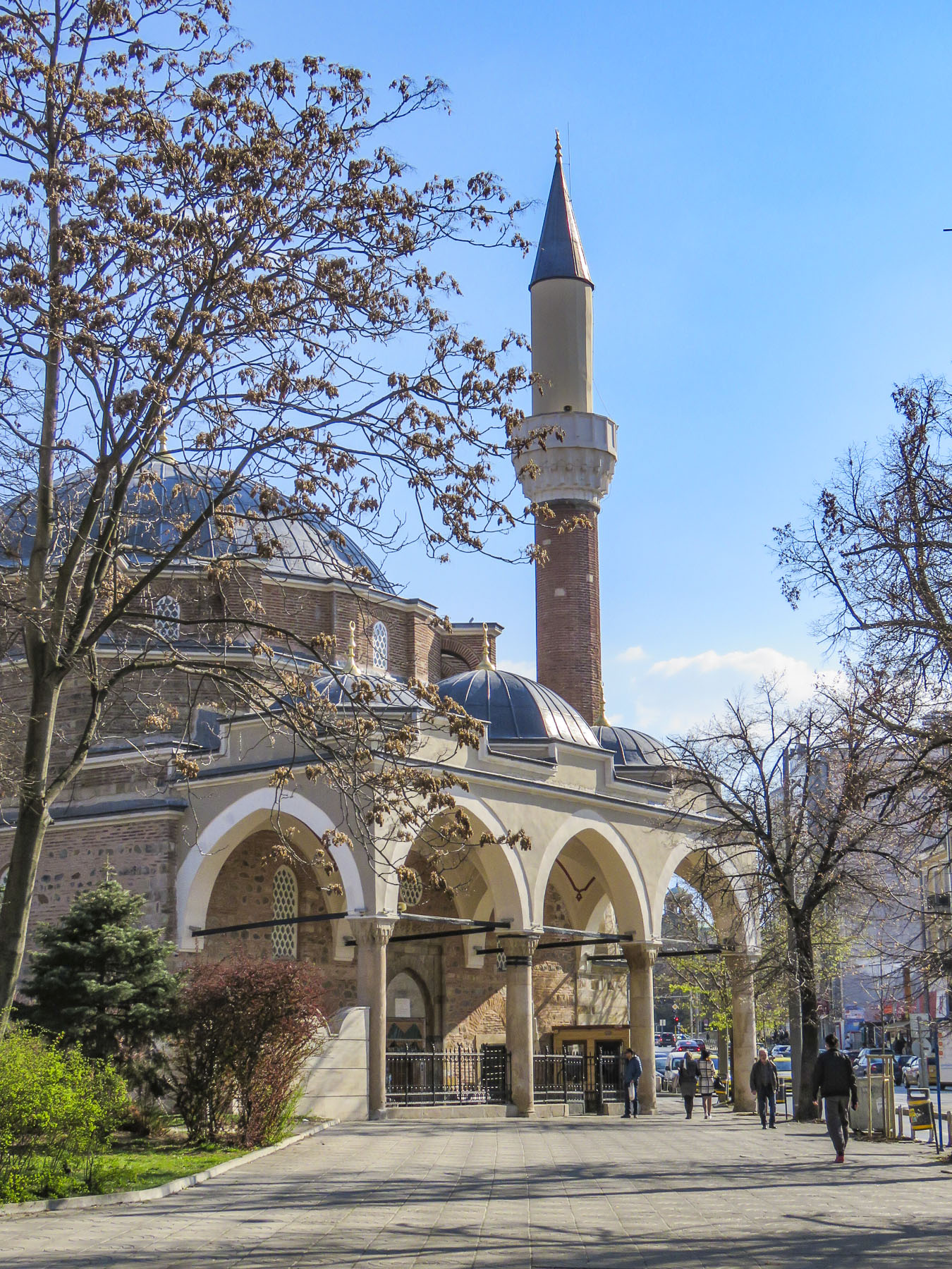 It ends just short of Banya Bashi, an Ottoman mosque built in the 16th century. The towering statue of St. Sofia is also visible just beyond the subway station. Ancient walls found during the renovation of the Central Market Hall can also be seen in the lower level of that building.
 Nearby the oldest building in Sofia, the Church of Saint George, built by the Romans in the 4th century, has early Christian frescoes which were painted over by the Ottomans when it was used as a mosque, but they were rediscovered in the 1900s and restored. It stands surrounded by modern buildings in a courtyard behind the President of the Republic of Bulgaria building, within earshot of the Changing of the Guard.


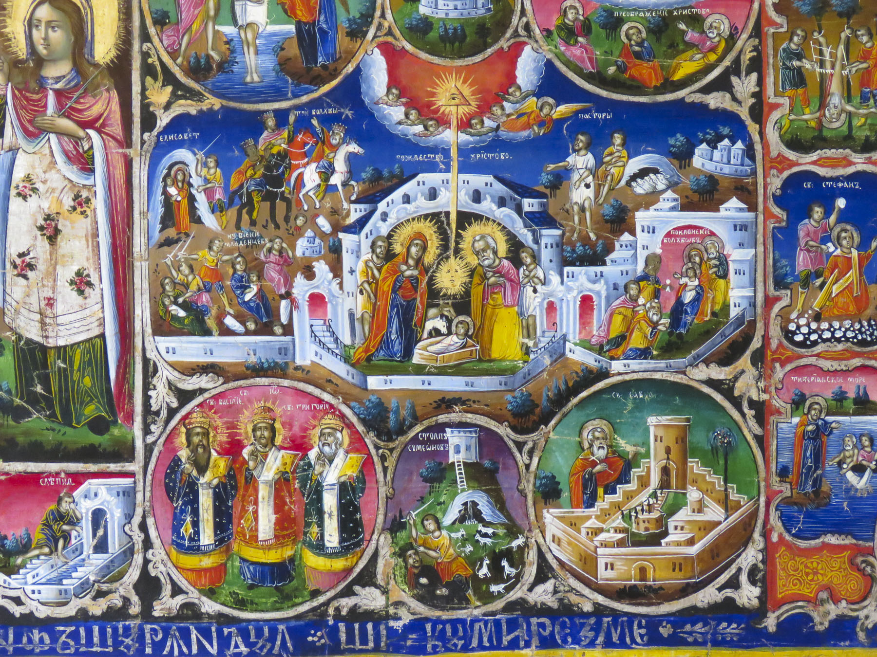
 In the crypt of the cathedral a small, state of the art museum showcases the development of Bulgarian orthodox iconography over the centuries.
 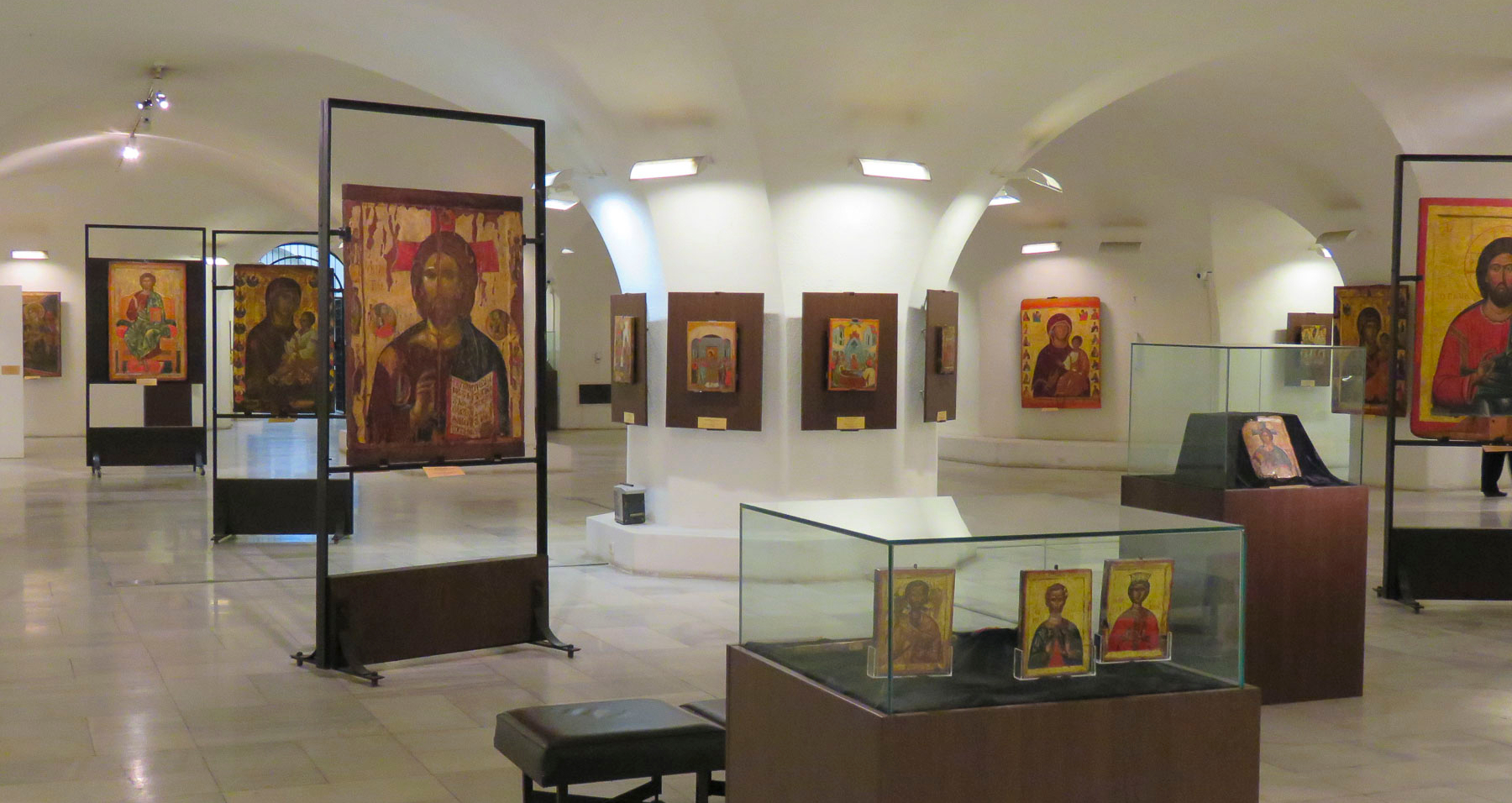 Nearby, the five gilded spires of the Russian Church, officially known as the Church of St Nicholas the Miracle-Maker, can be seen from the steps of Cathedral Saint Aleksandar Nevski. Built in 1914 on the site of a mosque that was torn down after the liberation of Bulgaria, it served has the official church for the Russian Embassy and the Russian community in Sofia. The religious murals that cover the interior of the church were created by Vasily Perminov’s team of talented icon painters, who were also responsible for the iconography in Cathedral Saint Aleksandar Nevski. Darkened by decades of candle smoke, the fresco paintings in the dome were restored in 2014.


 In 2001 an early Christian mausoleum was unearthed near the American Embassy and it’s fantastic that things are still being discovered in 2019.


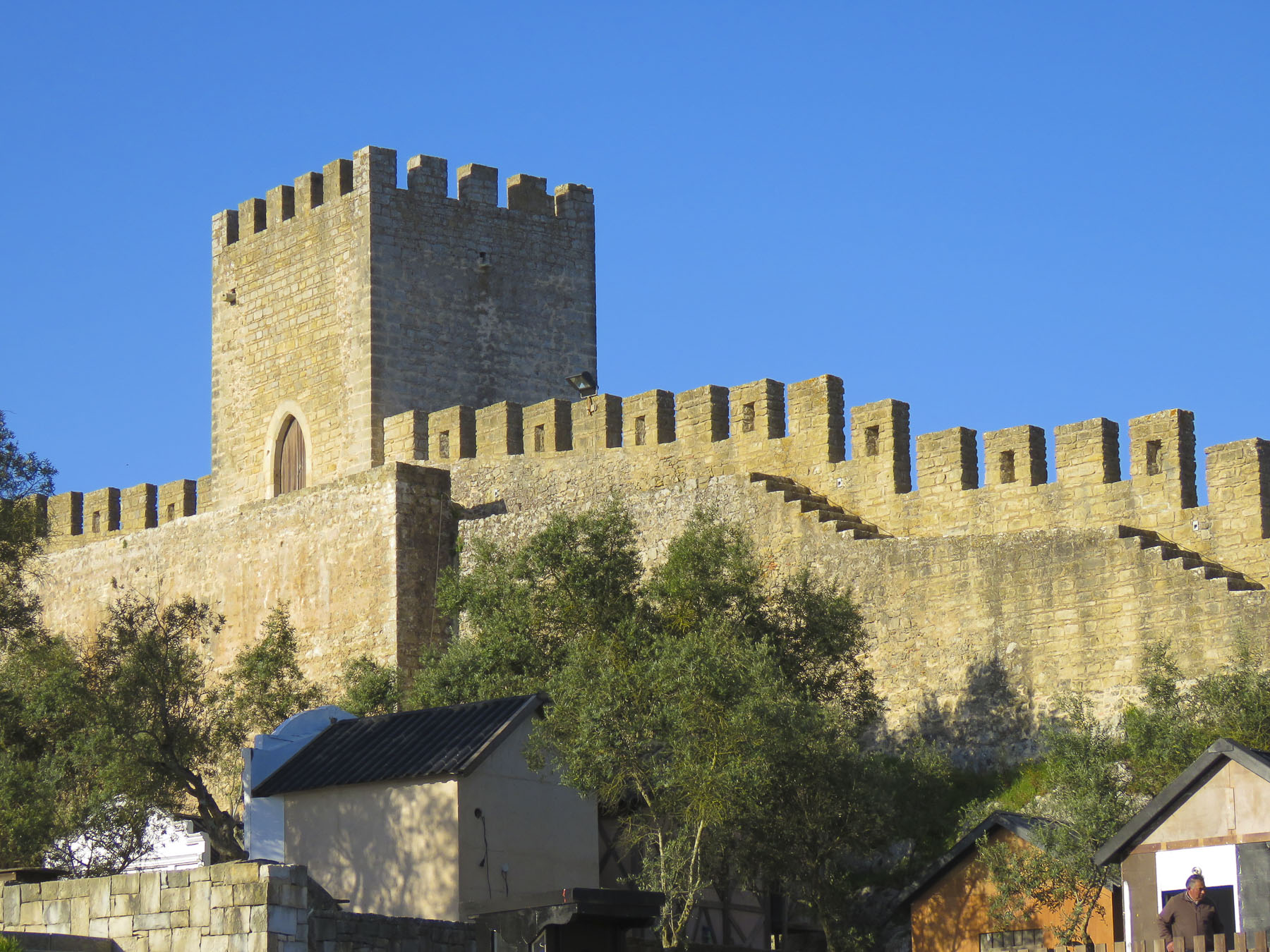 We had spent a wonderful day cruising from Aveiro to Nazare, but now twilight was fast turning to darkness as we drove along an extremely narrow lane at the base of the formidable fortress wall that encircled Obidos. We had arrived at our hotel
  Admittingly Donna is the more accomplished linguist of the two of us. I according to my loved one have been known to torture a language. So, she eagerly sought advice from the only person we had passed. From a short distance away, I watched the conversation unfold with the gentleman flailing his arms every which way for what seemed an inordinate amount of time.
  Smiling, Donna returned to the car. “About the only thing I got from that was we should continue following the lane until the next hole in the wall. He was very insistent about that.” “Did he know the hotel?” I asked. “Never heard of it, but I think he was intoxicated! My luck,” she laughed. The lane narrowed even more as we drove forward. Finally, there was an ancient portal, the size of a single door, through the wall that led to a short set of steps. Abandoning our car for few minutes we climbed the stairs to an inner lane in search of our hotel. After we finally found the place, the receptionist explained to continue driving along the wall until you reach an old city gate, enter there and follow the inner lane back to us and park anywhere you can. OK, piece of cake now, we thought.
 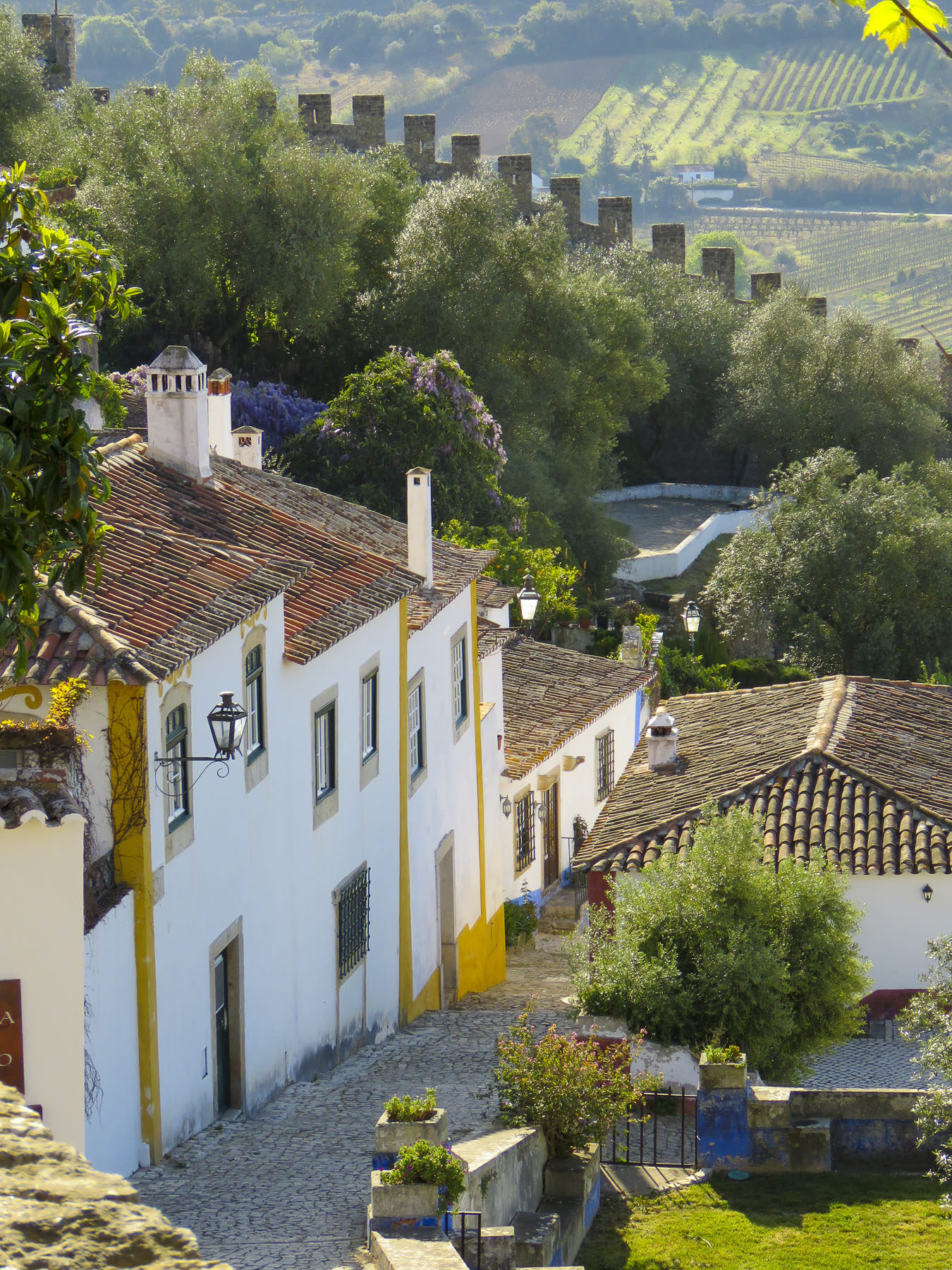 Inhabited since the 4th century BC by the Lusitanos, then the Romans and Visigoths, the city wasn’t fortified until the 8th century by the Moors. Bent entrances, with a quick turn and an additional, heavy inner gate were used in many Arab fortifications. In peacetime they were easy to navigate with pack animals, and during sieges provided a killing zone for the defenders of the city. Remember, these bent gates were built long before cars were envisioned. Obidos had two of them and tonight we had to navigate through one. Porta do Vale ou Senhora da Graça was a drive through chapel dedicated to Our Lady of Grace. In 1727 the old gate was renovated into an oratory chapel with sacristy, altarpiece, gallery, choir, and chancel by a local magistrate to commemorate his daughter’s death. You actually transit through the nave to reach the interior street. The gate was narrow, and it required a sharp k-turn just to line the car up to approach it correctly. Donna was driving and I hopped out to judge just how much room we had around the car. Driving up a slight slope on flagstones worn smooth from centuries of travelers, the tires spun with no traction as the car got halfway through the gate. Backing-up and then gunning the car forward through the gate Donna only had the length of our Fiat 500 to turn sharply right and exit the inner gate. It was do-able but nerve-wracking.


 With only two main lanes that ran the length of village, interconnected by a labyrinth of stairs and smaller alleys, Obidos was the perfect size, only slightly larger than Marvao, to explore for two days and relax before driving back to the airport in Lisbon for our flight to Sofia, Bulgaria.
  The next morning, enjoying deserted lanes lined with flowering wisteria, calla lilies, and other interesting details we weaved our way to the


 We eventually made our way through the main gate of the walled city. Porta da Vila de Óbidos is another bent entrance that did double duty as a chapel to Nossa Senhora da Piedade, the Virgin Mary, patron of the village. Be sure to look up as you walk through, as Azulejos tiles from the 1700’s line the interior balcony.
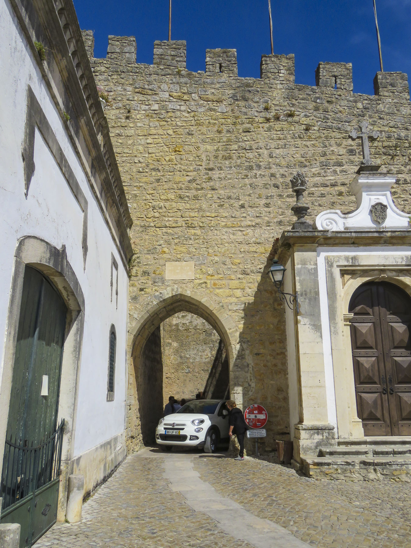 Across the street we walked below remnants of a three-kilometer-long aqueduct built in the 16th century to supply water to the fortress.
  Dinner that night was a simple meal of bread, cheese and local sausages cooked uniquely on a ceramic hibachi, fueled with grappa, placed on our table at Bar Ibn Errik Rex. As flames danced from our mini grill, the waiter would return to our table occasionally and turn the sausages to ensure their perfection. It was an entertaining evening. A few good Portuguese beers helped.
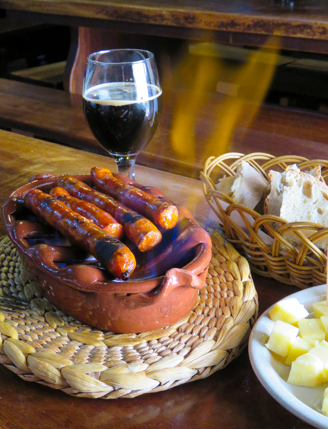 With our GPS App still set to avoid toll roads, we drove through the Porta da Vila de Óbidos and headed towards Lisbon, less than two hours away if we didn’t stop. But, if you’ve been following our blog you’ll know that’s nearly impossible, there is always a quick glimpse of something that calls for a detour.
 Torres Vedras with its aptly named citadel caught our eye. With a historical time-line similar to Obidos, the hilltop in the old historic district was continually fortified against waves of early invaders. Knowing a good piece of real estate when they saw it, the castle was seized during the Christian reconquest in 1148 and used by a succession of Portuguese Kings until it was heavily damaged in the catastrophic 1755 earthquake that hit central Portugal and Lisbon. Built just after the reconquest, Igreja de Santa Maria do Castelo stands just below the castle walls. The church’s bell cast in the 16th century continues to ring today.

 Along the Sizandro River on the outskirts of town, an impressive two-kilometer stretch of a 16th century aqueduct with double arches still stands. Driving under the aqueduct we followed the river south along the R374. The high-density new developments around Torres Vedras quickly gave way to a landscape of vineyards and pastures. Finding a restaurant for a late lunch, though, didn’t seem promising along this rural stretch of road, dotted with the occasional roadside café with a farm tractor parked out front, until we caught a quick peripheral glimpse of a larger establishment, across a small bridge, down a side lane. It would take another mile before we could find a suitable place to perform a U-turn. With nothing else around for miles
