Driving Through the Baltics: Part 10 – Tartu, Estonia or Wandering through a University Town

The street was alive with activity. Three buskers with drum, sax, and tuba were jazzily rendering Bruno Mars’ “Marry You” on the pedestrian mall full of folks strolling and bicyclists weaving amidst a food fair and participants readying their wacky go-cart entries for a Red Bull event later that afternoon.

There’s a long tradition in Estonia of student rock bands in the 70s and 80s transcribing western songs heard via Radio Free Europe broadcasts to countries behind the “Iron Curtain,” including Estonia. Soviet censors viewed any foreign influence, especially rock ’n roll as a threat to communist ideology, and these street musicians were upholding a long-standing musical tradition.

Tartu has been a university town since the 17th-century, and today 14,000 students give the city, Estonia’s second largest with only a population of 104,000, an energetic youthful vibe. They are an important part of the town’s character and are playfully acknowledged on the café-lined cobblestone plaza in front of Tartu’s City Hall with the ‘The Kissing Students’ sculpture and fountain.

The University of Tartu’s students also played a crucial role in Estonia’s expression of national identity and resistance to Soviet rule in the late 1980’s. Their support of the “Five Patriotic Songs” by Alo Mattiisen led to spontaneous mass singing demonstrations at the Tartu Pop Festival in May 1988. These musical protests spread to Tallin, then Latvia and Lithuania. These peaceful protests culminated in the The Baltic Way, a human chain of two million people which spanned from Tallinn, Estonia to Vilnius, Lithuania in August of 1989. The popularity of these peaceful movements strengthened the determination of Estonians to redeclare their independence from the Soviet Union in 1991. Latvia and Lithuania followed suit soon after.

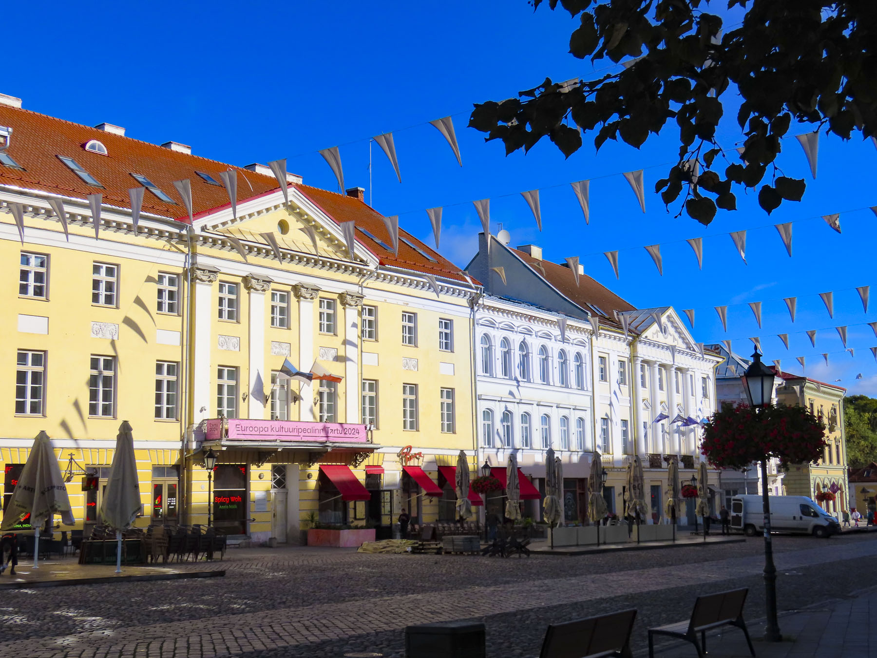
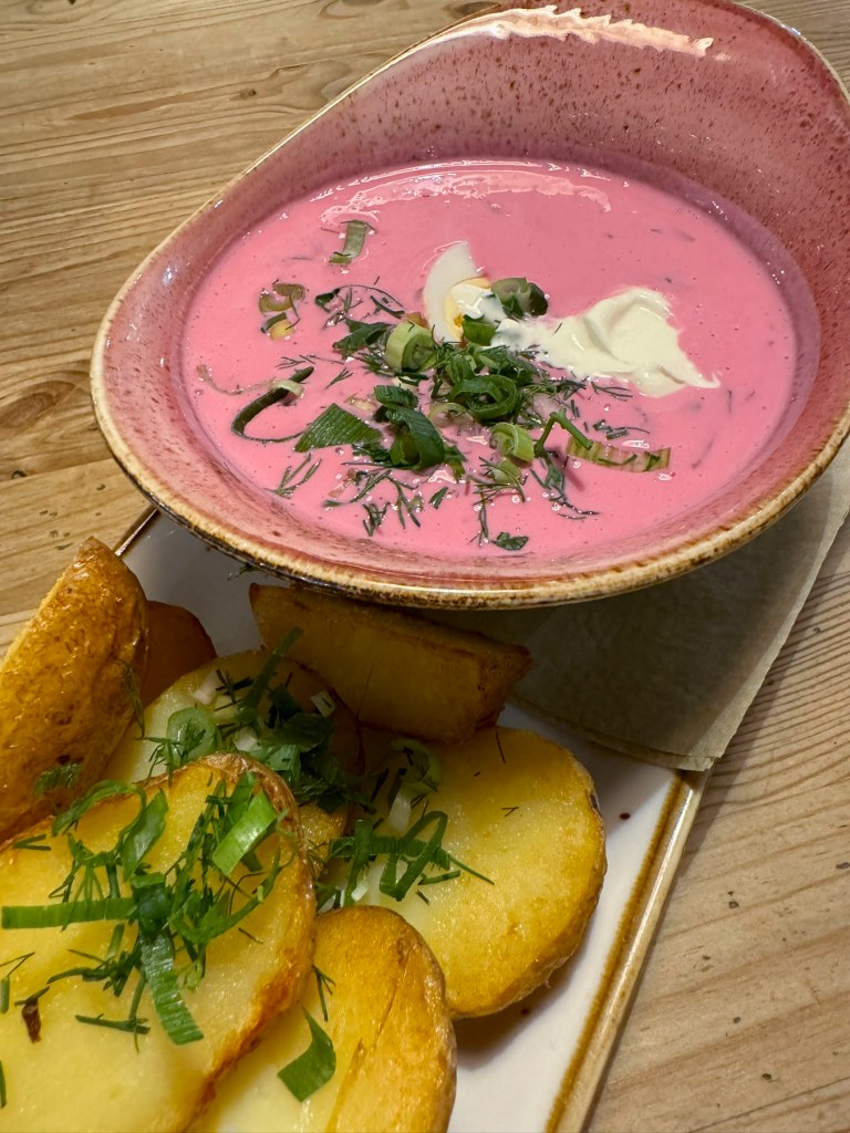
The Kissing Students’ fountain is really the center of activity in Tartu, a splendidly walkable city. Its car-free center extends north along Küüni tn from the modern Kvartal shopping mall, with an array of nice shops, and an excellent Coop supermarket, past the central plaza all the way to the Botanical Garden of the University of Tartu. And there were numerous points of interest just off this route that we explored during our five-night stay at the Art Hotel Pallas, a boutique hotel nicely located across from the Kvartal mall, with views from our hotel room of the spires atop the town’s city hall and churches. It also had convenient free parking, and a scrumptious breakfast buffet. The pickled herring, yes for breakfast, was really good. It was the perfect spot to get some much-needed R&R after driving through Estonia, Latvia, and Lithuania for three weeks.

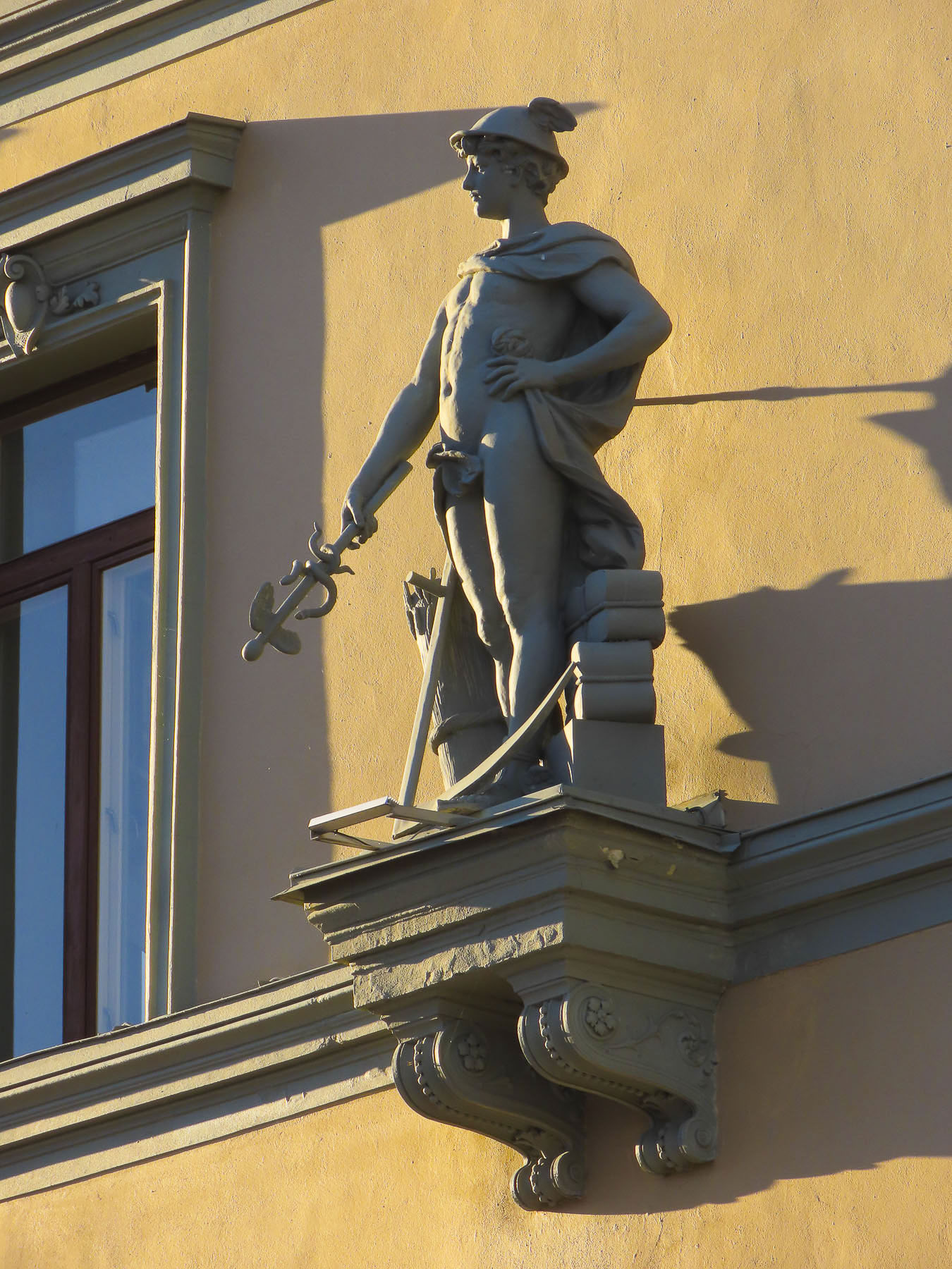
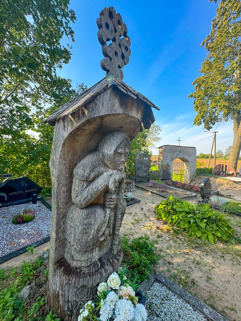
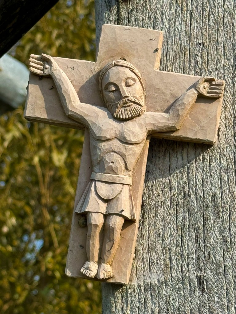
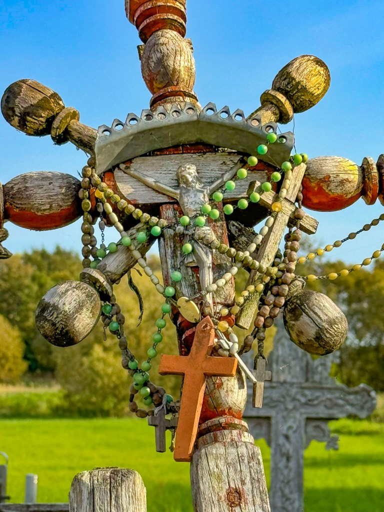
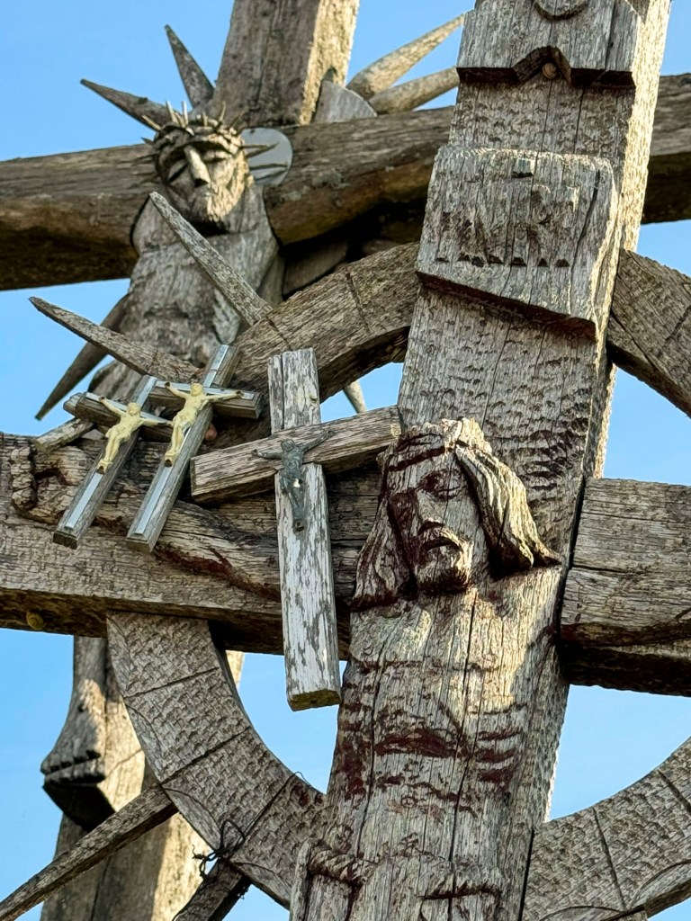
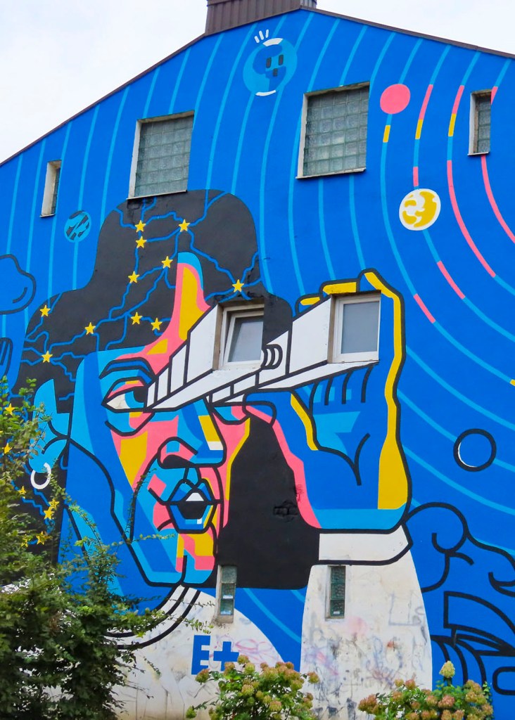
One of the nicest things we’ve encountered during our road trip through the Baltics is the extensive amount of public art that graces the region’s cities and small towns. Few are of a historical nature. The sculptures of Lenin and Stalin that the Soviet Union installed during their fifty years of occupation to erase the Estonia’s history were quickly removed from all public spaces, and sent to the scrap yard. The current sculptures now honor influential writers, poets, and folk heroes or are simply artistic inspirations without any political messaging.

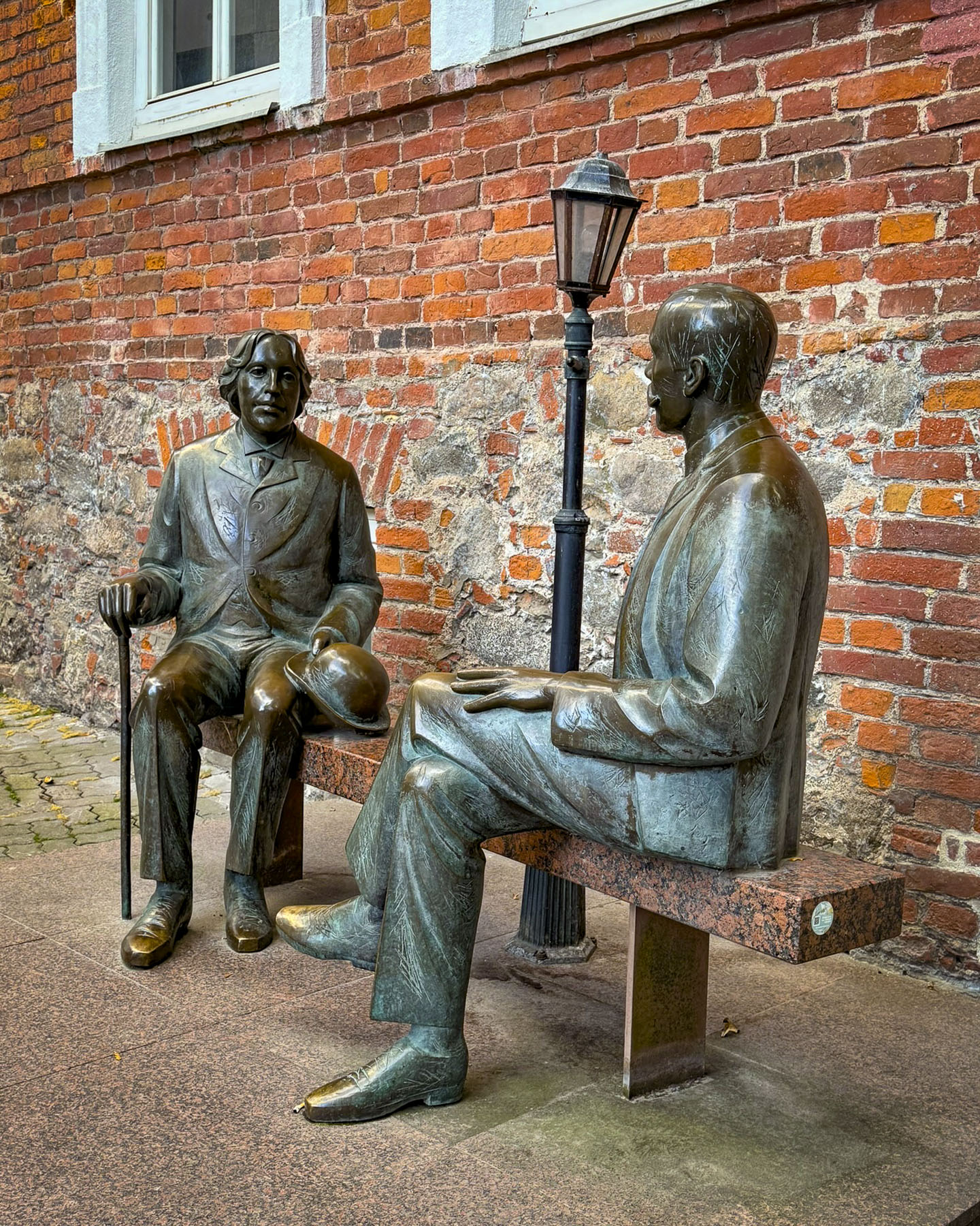
Along Küüni there was a sculpture of Irish playwright Oscar Wilde and Estonian writer Eduard Vilde depicted in an imaginary encounter between the literary heavyweights. Though the two never met, Wilde did give a lecture at the university in 1892.

Nearby was the sculpture “Father and Son,” by the Tartu native Ülo Õun (1944-1988). The Visit Tartu website explains the work represents the sculptor with his 18-month-old son, and “is a symbol of the relationship between different generations, where children are increasingly growing apart from their parents.” A side note – the Visit Tartu website has an extensive calendar of events page. In a park they had a pop-up information tent, and detrimentally to our waistlines, it was across from the Kalev Chocolate Shop and cookie store. This Estonian brand makes, in our opinion, some of the best store-bought snacks. You can buy them in grocery stores across the Baltics, but they surprisingly cost less in their own stores.

A diagonal walk through the park took us to Tartu Turuhoone, the town’s old market hall where a large sculpture of “Siga Roosi,” a pig, advertises the building’s entrance and the products available inside. If you have visited Riga’s large market, this wanes in comparison, but the pig immortalized in bronze appears to be smiling.

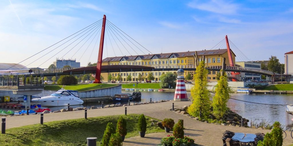
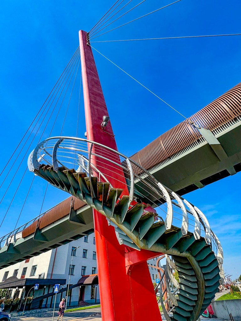
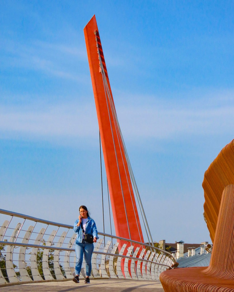
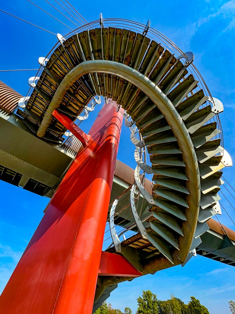
From here a very pleasant walk along the riverfront promenade that follows the Emajõgi River leads to the Kaarsild, an arched footbridge that spans the river to Ülejõe Park and the neighborhoods east of the historic center.

The approach to the bridge was a perfect spot to admire the beautiful buildings surrounding the town’s plaza which represent an eclectic assortment of architectural styles from the 13th to 17th centuries, when the town was a prominent member of the Hanseatic Merchant League.

At the foot of the plaza the Tartu Kunstimuuseum, a museum of art, occupies a 1793 building that is often referred to as Tartu’s Tower of Pisa. The three-story building’s 5.8 degree of tilt is actually greater than the famous tower in Italy. The tilt was a result of one side of the building being constructed on the medieval footing of the ancient defensive wall that once encircled the town, and the other side was erected above loose soil. As the decades passed, the structure slowly sank into the ground. Polish engineers successfully stabilized the building during the communist era, and it was determined safe enough to house the museum since 1988.

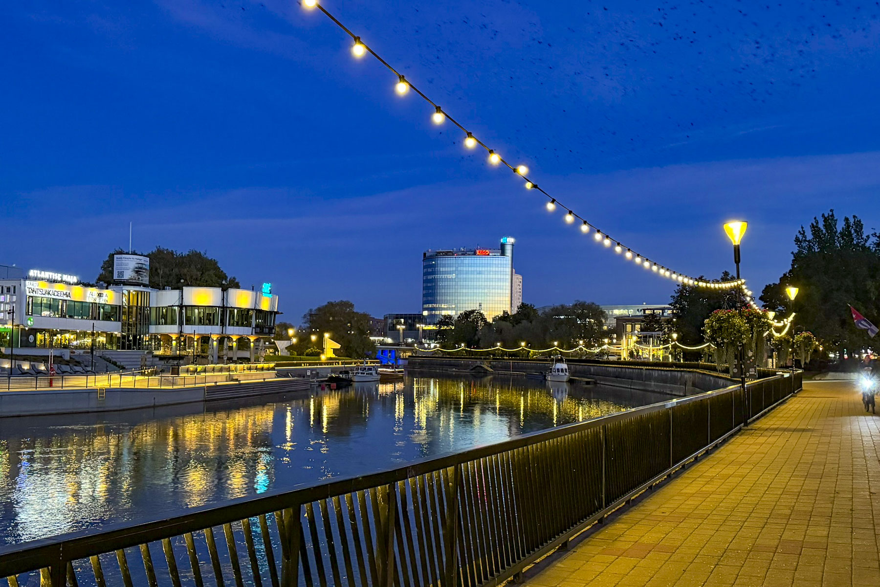
In the other direction there was the reflection of the growing city’s modern skyline reflected on the rippling water of the river. These views were beautiful and equally enchanting in the early evening twilight as we watched the murmurations of European starlings swooping over the river, before they noisily roosted in the park.

Just behind Town Hall and across from a large street mural of the University of Tartu was café/restaurantWerner, an excellent establishment with a nice vibe, that’s popular with both students and professionals; we dined there several times during our stay in the city.

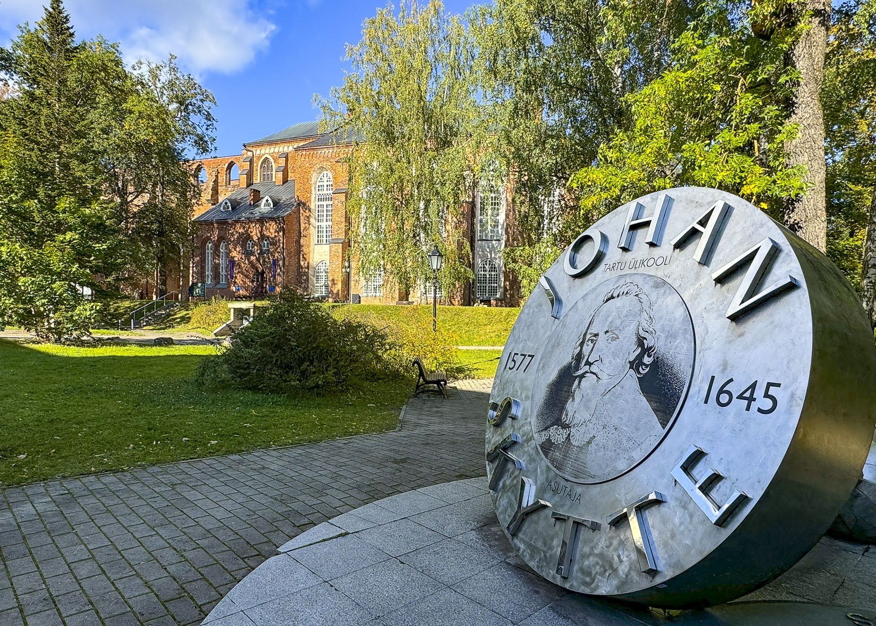
Afterwards we took the long uphill walk to the ruins of Tartu’s immense 13th century cathedral, now on the grounds of the University of Tartu. Construction of the Gothic style church started shortly after the Brothers of the Sword subjugated the pagan tribes around Tartu in the early 1200s and lasted nearly 400 years before it was destroyed during the Livonian Wars that ravished the region. It was never rebuilt.

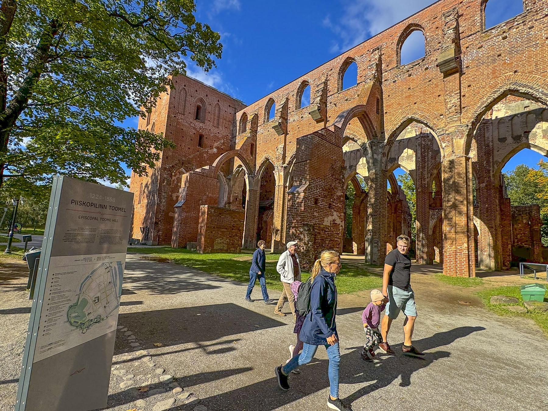
We chose not to, but it’s possible to climb its towers to a viewing platform above the ruins for a panoramic view of the school’s campus and Tartu. The choir end of the cathedral has been restored and since 1981 houses The University of Tartu Museum.

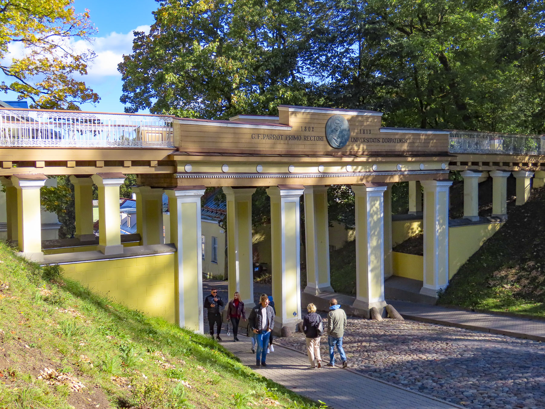
Heading back to the old town we passed under the Angel Bridge, built in 1838 to ease students’ efforts getting across campus. The scenic spot has a bit of a lovers’ lane reputation, as well as having several legends associated with it. The most popular one being “when you cross the bridge for the first time you should make a wish, and if you can hold your breath until you reach the other side your wish will come true.”   

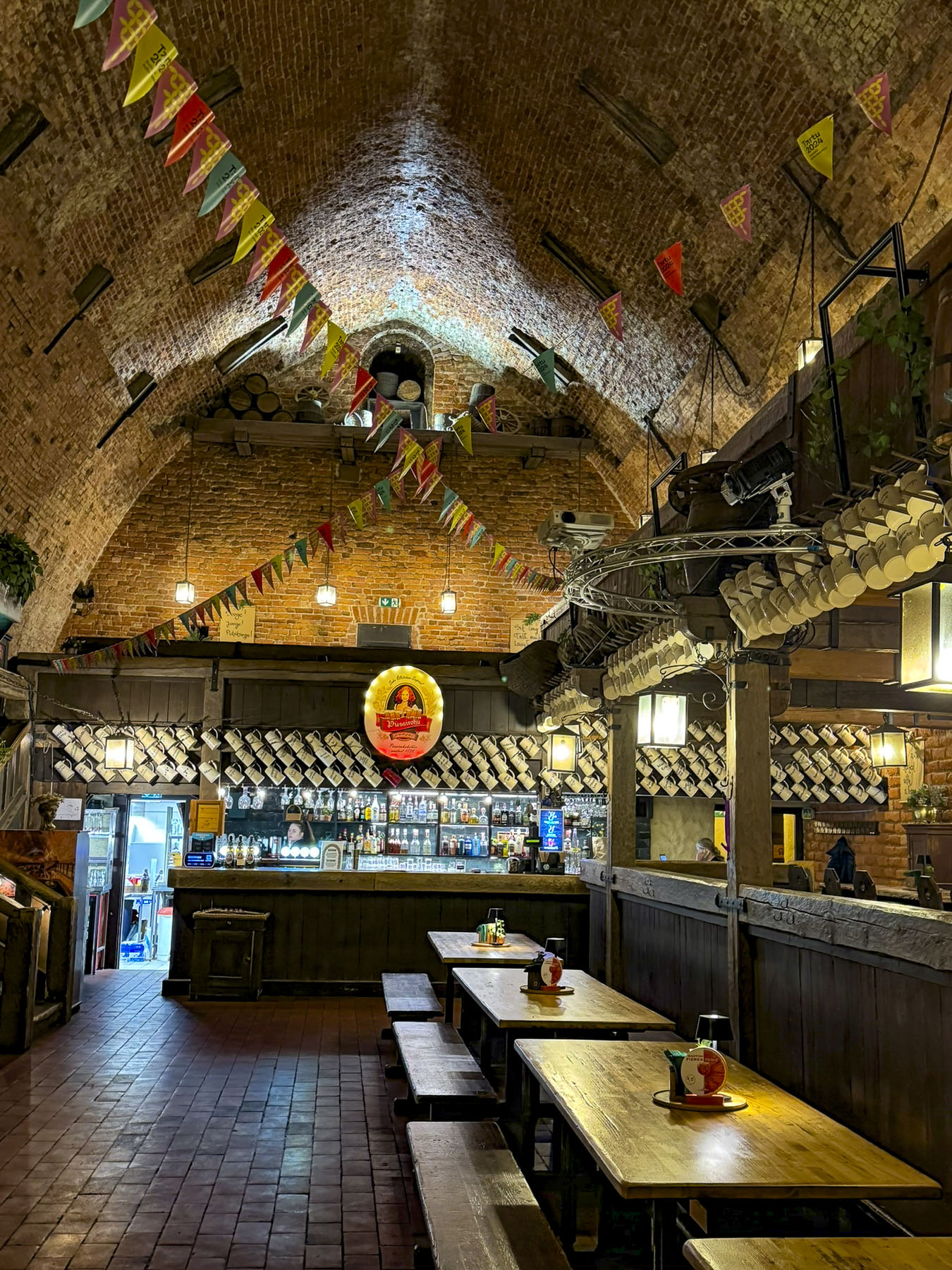
Just off the lane was the Gunpowder Cellar built into the side of a hill, it’s a rustic tavern set in a cavernous old 18th century munitions warehouse with an arched brick ceiling. It’s a popular beer hall and is known for its tasty Gunpowder Red beer, while also hosting frequent band appearances.

Later in the week after having lunch at the Café Werner a second time, we turned right and wandered down Ülikooli tn towards the neoclassic columned façade of the University of Tartu’s main building. It is Estonia’s oldest and largest university and the pride and joy of Tartu. The school was originally founded 1583 as a Jesuit institution during Poland’s brief rule of the country, but most of the credit is given to the Swedish King Gustave II Adolph when he upgraded the school to a university in 1632. It was forced to close several times over the centuries due to regional wars, but was later reopened by Russian Czar Alexander I in 1802 and was again reopened by the Soviet Union after World War II, where it became an important contact spot for Soviet academics to meet their western counterparts during the Cold War era.

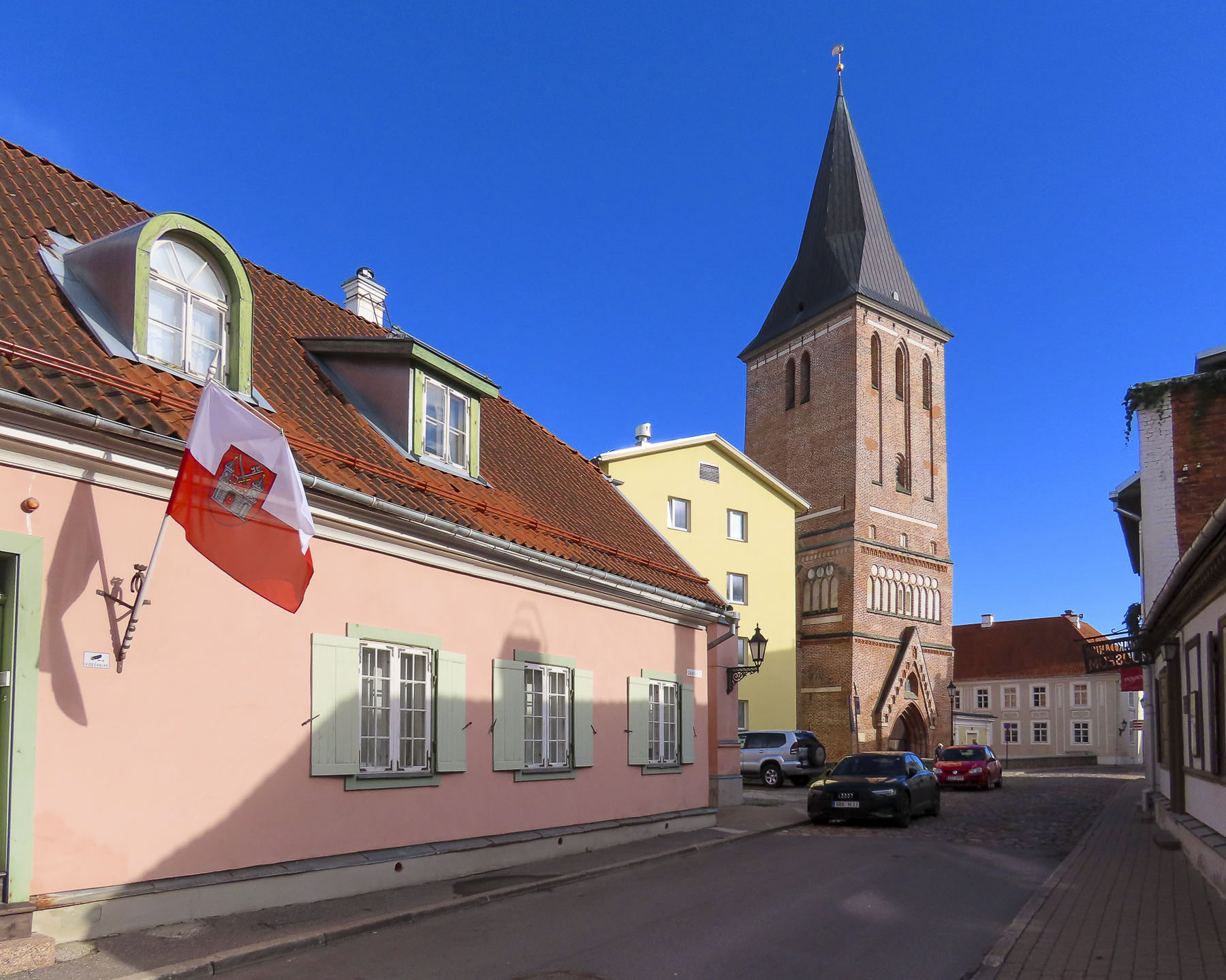
Farther along some of the buildings near Tartu’s St. John’s Church had unique details. Archeological evidence suggests the church dates back to the late 1100s, and could be the first “Christian church building in Estonia before the 13th-century conquest and great Christianization of the country.”  The basic form of the current church dates from the beginning of the 13th century. Due to the region’s conflicts, the church has been reconstructed several times over the centuries. Unfortunately, the church was closed when we visited the area.

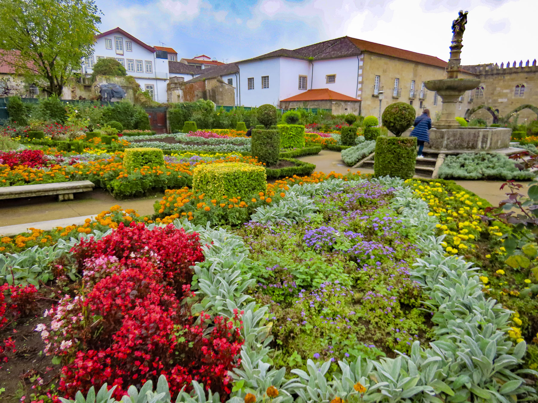
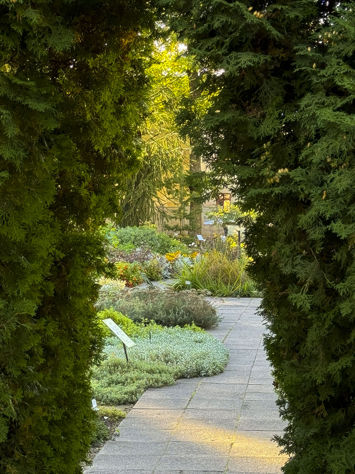
At the end of Ülikooli tn a short walk to the right led us to the Botanical Garden of the University of Tartu. Though in early October it was evident that Estonia has a short growing season and most of the plants were past their prime, but we still enjoyed exploring the various oases of greenery with a number of other couples and families, and imagined how beautiful the gardens must look in the Spring and Summer.

We followed Ruutli tanav, one of Tartu’s oldest streets, back towards the historic center of the town. During the Middle Ages when the winter snows melted during the spring thaw  – “mud season” or Estonia’s “fifth season” – traveling about the countryside was quite difficult. In the larger towns like Tartu the thoroughfares were lined with logs laid perpendicularly across the road to ease the life of the townsfolk and facilitate merchant trade with the Hanseatic League through the town’s riverside port on the Emajõgi. Evidence of these ancient timbered roads is still occasionally discovered whenever there is any infrastructure improvement required in the city. Cobblestones weren’t used for the lanes through town until the 15th century.

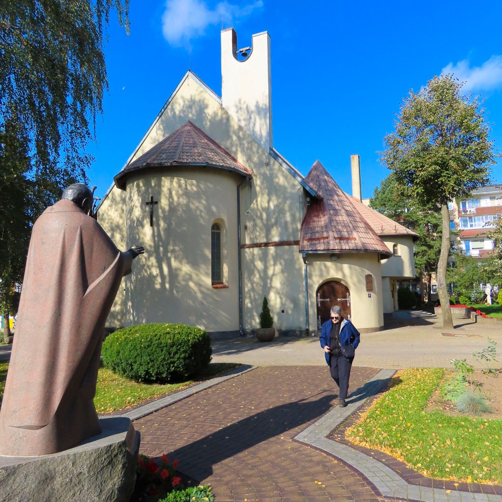
We made a short detour off our route to the Virgin Mary’s Dormition Cathedral, an Estonian Apostolic Orthodox Church. The beautiful Russian baroque style church was built in 1840 atop the foundations of an earlier wooden church that was burnt down during the 1775 Great Fire of Tartu, a devastating inferno which destroyed almost all the old wooden medieval era buildings in the central part of Tartu.

As we reached the central plaza it was evident that the weekend’s festivities were Tartu’s last big event for the summer high season. The weather was now noticeably colder with morning temperatures of 36F (2C) warming only to 54F (12C), and the outdoor café tables and chairs that lined the square were being taken down and sent into storage, until needed again next Spring. But the season is not over until the buskers stop playing and the trio of musicians from the other day were still entertaining folks around the Kissing Students fountain in the warm afternoon sun.

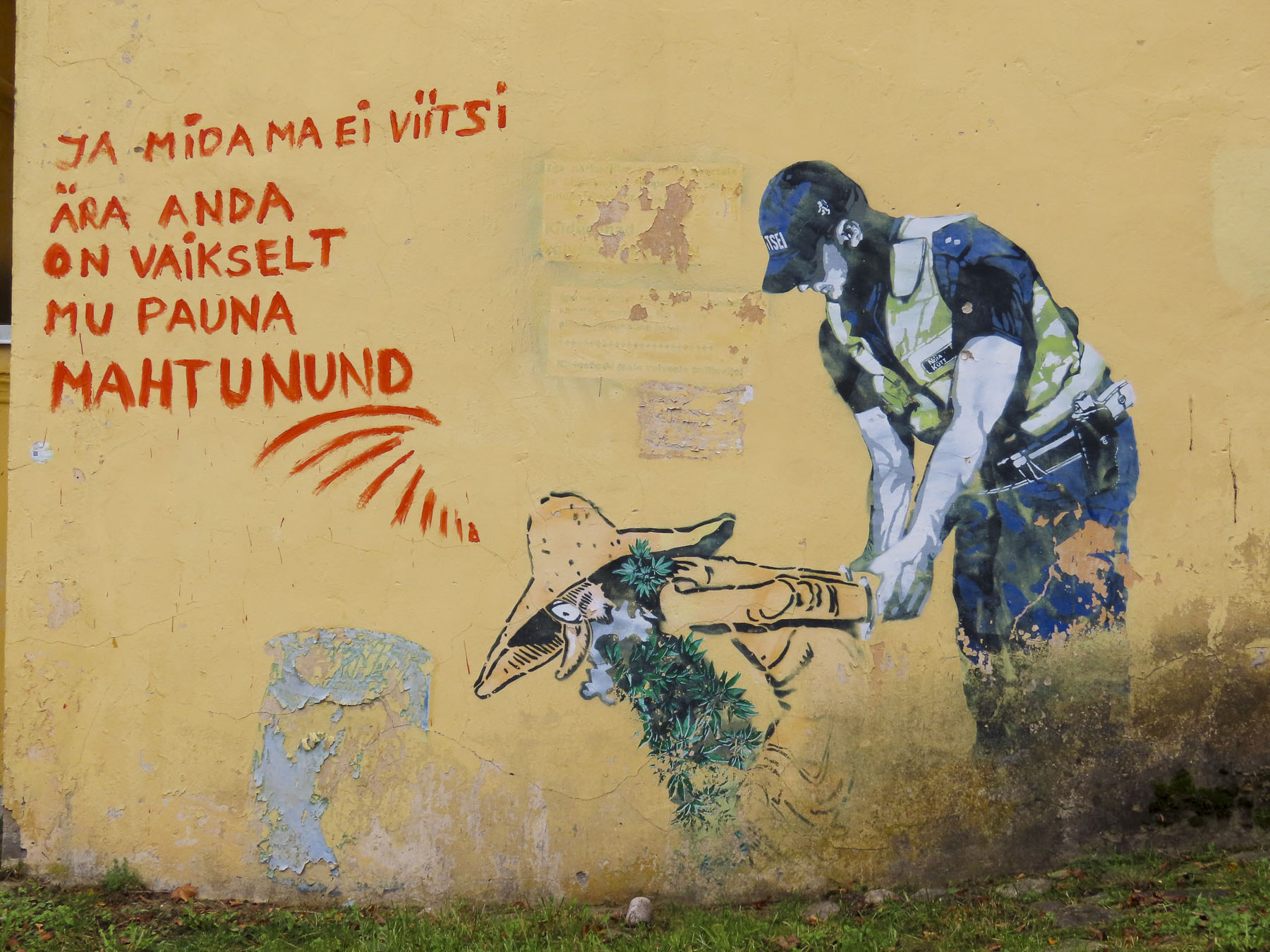
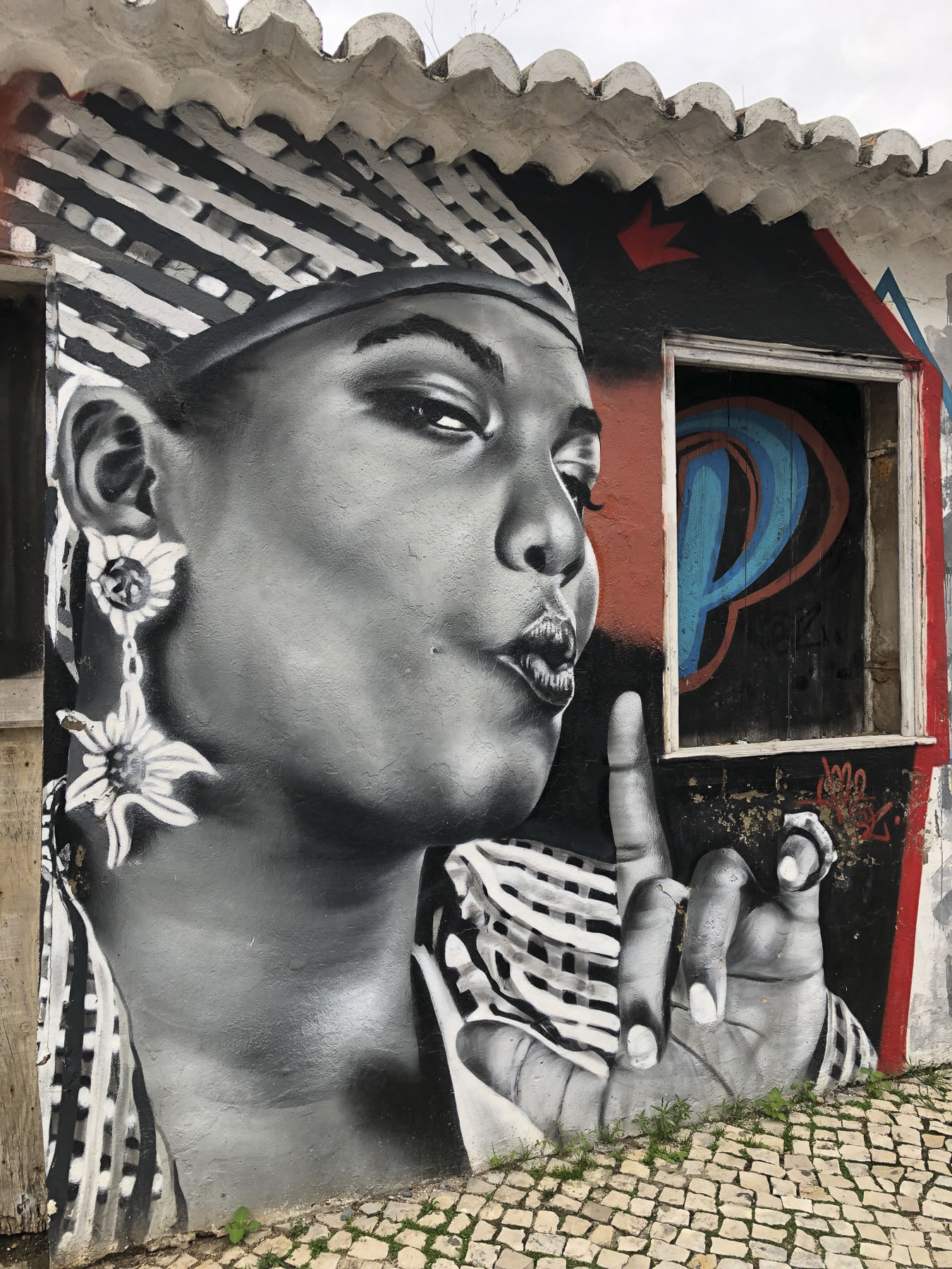
On our walks through the town, we came across some interesting and creative street murals. All were in well-chosen places that enhanced the wall, none were of the loud bubblegum type, though some were of a political nature. After all, our hotel was named for the Pallas Art School, which existed from 1919 to 1944 in Tartu, and was influential in establishing the aesthetic values of the newly independent country, but was closed during the communist occupation of the country.

Today the school’s artistic legacy continues at the  Pallas University of Applied Sciences which opened in 2000, and features ongoing exhibits in the Pallas Gallery.

The Gray House, now the KGB Cells museum, was uphill from the gallery, just three doors down from a busy intersection, on a street that leads to university housing. It was a non-descript door with buzzers for the three-story apartment building above it, and one for the museum. In the 1940s and 1950s the upper floors served as offices for the Soviet’s secret police. We buzzed and a voice released the door lock for us to enter the lobby, where an arrow pointed to a heavy metal door to the basement, and a set of intimidating stairs that descended to a flickering fluorescent lit hallway. It’s a small space with a dozen prison cells and several interrogation rooms in which the brutality of the Soviet years is documented. Notoriously, on July 8th & 9th, 1941, 173 men and 20 women were summarily executed and buried in the building’s courtyard. Mass deportations of 45,000 Estonians to the Soviet gulags in Siberia continued until 1953. For many it was a death sentence, and few ever returned to their homeland. Across the country the KGB is believed to have murdered nearly 60,000 political prisoners between 1940 -1991. It’s a reminder of the danger of authoritative regimes and sadly is still relevant today.

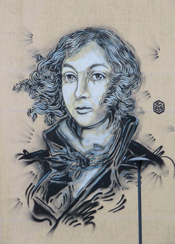
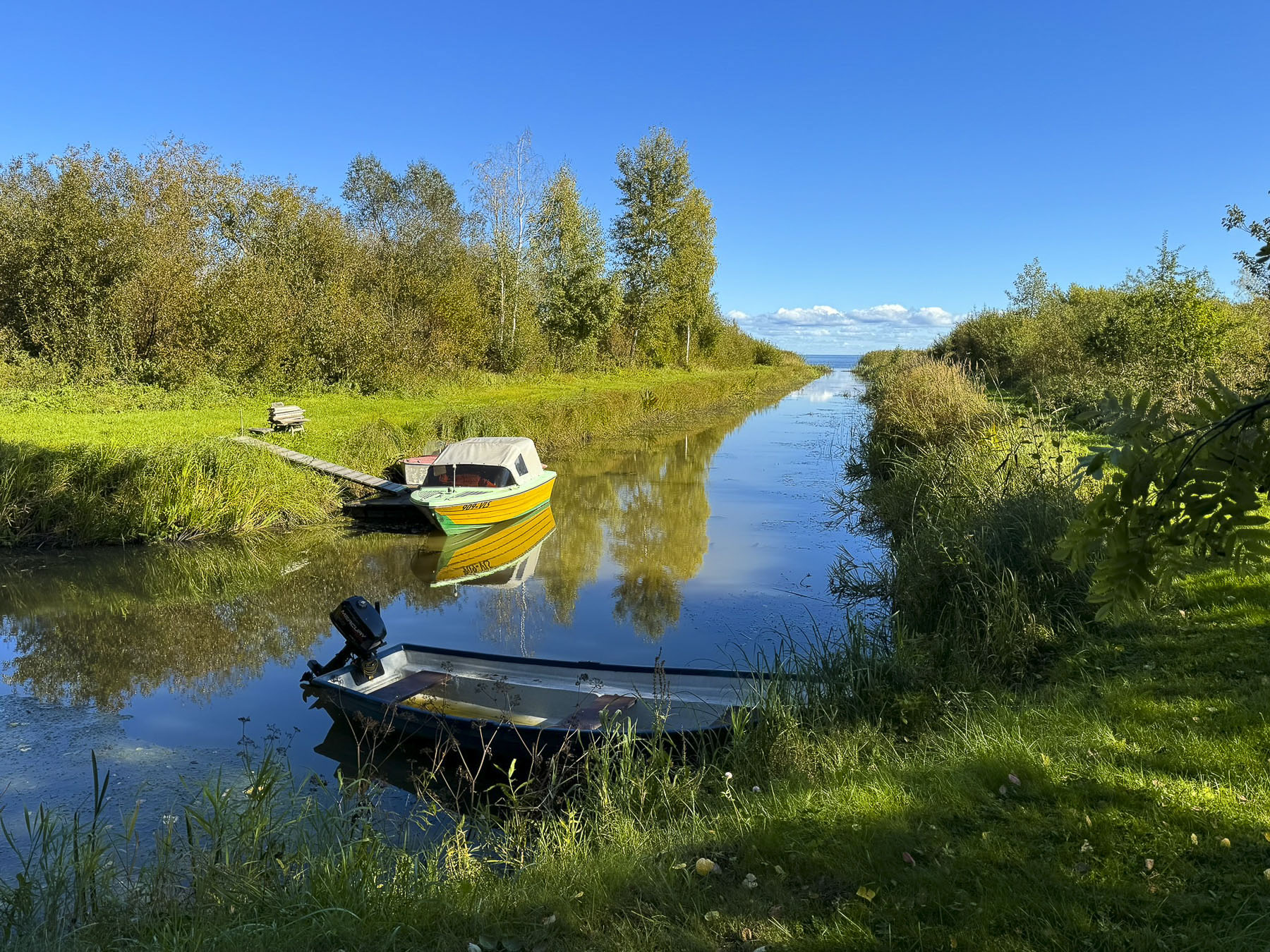
We discovered another street mural just around the corner from our hotel as we headed to dinner at Restoran Spargel. Over an enjoyable evening, we discussed plans to take advantage of the nice weather predicted for the next day by exploring the small fishing villages along the shoreline of Lake Peipus.

We thoroughly appreciated Tartu’s mix of history and youthful enthusiasm for the future. It’s a city but felt like a small town that we could see ourselves quite comfortably living in and enjoy experiencing all of its cultural events throughout the year.

Till next time,

Craig & Donna

Road Tripping Through the Baltics: Part 7 – Riga to Šiauliai, Lithuania or Crosses, Churches and Towns Filled with Art

There are always several dilemmas with a road trip: how far to drive, do we drive straight through or look for interesting stops along our route? We tend to make stops, multiple stops to the point of my trusted co-pilot advising that, “we’ll never make it there at this rate,” but there’s a fear of possibly missing something. Fortunately, our “walk a little, then café,” philosophy easily converts to “drive a little, then café,” and in pursuit of those cups of coffee we’ve happened upon some laid back, interesting places.

The Hill of Crosses in northern Lithuania was our destination as we headed south on the A8/12 from Riga. Only two hours (78 miles/126 km) from Riga, many folks choose to do it as a day trip out of the Latvian capital. Which would have worked for us, but we have this quirky rule that we don’t put a pin in our wall map unless we’ve actually stayed overnight in the country. So, with that in mind, we booked two nights’ accommodation in Šiauliai, the town just beyond the Hill of Crosses.

Craving a cappuccino, we detoured into Jelgava for what we thought would be a short stop to satisfy our caffeine addiction. As we crossed over the Lielupe River we spotted the Jelgava Palace on a large island. It called for a stop. A wooden fortress was first erected here in the 13th century as part of the Livonian Order’s conquest of the pagan Zemgalian tribe that inhabited the region. Today’s beautiful 18th century Baroque style palace with 669 rooms is touted as being the largest in the Baltic states. It is actually a reconstruction of the palace which was burned down during WW2. During its apex it was the seat of the Duchy of Courland and Zemgale, and an important diplomatic post between Russia and Poland. Famously, the exiled French King Louis XVIII, to save his head from the guillotine, inhabited the palace from 1798 – 1807. Part of the palace houses a small museum with the Family Vault of the Dukes of Courland and Semigalla being the main attraction. The rest of the building is occupied by the Latvia University of Agriculture and Latvia’s University of Life Sciences and Technologies.

Across from the palace was Pasta Sala, a smaller island with an interesting art park that hosts the annual Jelgava International Sand Sculpture Festival every June and an International Ice Sculpture Festival every February. Unfortunately, traveling in the late September shoulder season we missed it. But we did enjoy wandering along a walking path through an installation of Chamotte fired-clay sculptures.

Between the palace and the park, we were now smitten with the impromptu stop and were enticed to follow a graceful modern footbridge, the Mītavas Gājēju, that tilts over the river into the town center, which was surprisingly quiet for a Tuesday in late September, considering that the university town is Latvia’s fourth largest city, with a population of roughly 60,000.

It’s unusual for only half a church to be left standing, but Jelgava’s Holy Trinity Church (1574) is a stark reminder of the devastation the city suffered during Soviet Union and Nazi Germany sieges and occupations of the city during WW2, which left ninety percent of Jelgava in ruins and all its Jewish citizens lost to the Holocaust. Its belltower above the town’s tourist information office was opened in 2010 as an observation deck after extensive reconstruction.

That promise of a morning coffee wasn’t forgotten as we walked along a pedestrian mall past a small daily street market to Konditoreja Silva, a bistro and patisserie where the coffees were very good and the selection of tasty pastries was mouthwatering.

Back on the road, we continued our drive south and crossed the border into Lithuania. We zoomed by a small roadside marker that pointed to the Jakiškiai Chapel, one of the last wooden churches from the 17th century remaining in Lithuania. We u-turned in order to find it. Passing through a small hamlet, we located the church situated on a low knoll, surrounded by fields and pasturelands.

It’s also known as the St Ignatius of Loyola Cemetery Chapel, named for the founder of the Jesuits, who were active in the region at the time. It’s a fine example of rustic folk sacral architecture.

The graveyard surrounding the chapel was full of interesting old headstones. Some were carved from logs and were well weathered and split from age and the elements, while the more recent graves were marked with stone or marble memorials with the deceased’s portrait etched into the surface. There was a caretaker working on the grounds who wouldn’t acknowledge our presence, so we contented ourselves with peering through the dusty windows into the sanctuary the best we could.

The Hill of Crosses was only 20 minutes farther south, just off the A12. The precise history of the hill is not known, but it is believed to have started as a way to commemorate Lithuanian rebels who never returned after uprisings against Imperial Russia’s rule in 1831 and 1836.  From a distance the hill is only speck on the horizon. It wasn’t until we were walking the long approach path that the hill slowly grew, and its monumental scale became apparent.

Not really in height, it’s a modest hill with stairs to its apex, but in girth and the sheer number of crosses, from tiny store-bought ones to large crosses handcrafted I imagine with sweat and tears. It’s estimated that there are now 200,000 crosses and crucifixes spread across the half hectare (1 acre) site. All are mingled together haphazardly and are treated equally in their importance, and they stand as testimony to the character and faith of the Lithuanian people who created this spectacular monument. The crosses were bulldozed and razed repeatedly during the Soviet era but were always rebuilt by the people. The hill stands as a sign of quiet resistance to the Soviet Union’s atheist communist occupation.

The fifty years of oppression which started with the Soviet Union’s annexation of Lithuania in 1940 ended in 1990 with the Act of the Re-Establishment of the State of Lithuania. A dream realized after the Baltic Way, a human chain of approximately two million peaceful protesters joining hands along a route that stretched from Vilnius, Lithuania through Riga, Latvia to Tallinn, Estonia in August 1989. Lithuanian was the first of fifteen Soviet republics to declare independence, which forced the collapse of the Soviet Union in 1991. Since Pope John Paul II’s visit to the Hill of Crosses in 1993 it has become a popular pilgrimage site.

During the 13th-century Christianity was not enthusiastically embraced by the pagan Lithuanian tribes of the region who rallied to decisively defeat the onslaught of the crusader Knights of the Livonian Brothers of the Sword in the1236 Battle of the Sun/Saulė, the victory from which Šiauliai takes its name and the year of its founding. It would be another two centuries before the first wooden church in the town was built on a small rise overlooking Lake Talkša.

The graceful Church of Saints Peter and Paul with its soaring belltower and brilliant white façade replaced the earlier 1445 church in 1617. It was our first stop. The church became Šiauliai Cathedral when Pope John Paul II elevated its status when the Diocese of Siauliai was created in 1997.

After checking into the hotel Turnė (free parking) for two nights, we walked a short distance into the center of Šiauliai to stroll along its nearly mile long pedestrian mall, Vilniaus g. One of the first things we noticed about the town was the amount of public art displayed along this street.

It’s an interesting variety of wall murals, and contemporary sculptures that enhance the walkway. As it was getting late we only walked the southern end of the mall to have dinner at Žemaitis Restoranas, located in the Hotel Šiauliai. The Lithuanian specialties – cepelini, homemade dumplings, Kedainiai potato pancakes, Karka with stewed cabbage – were so good and reasonably priced that we dined there twice.  

By the time we had finished dinner it was dark outside and upon leaving the restaurant we spotted the spectacularly lit dancing water fountain “Trys paukščiai,” Three Birds, designed by the Lithuanian artist Kestutis Kasparavicius. Its ballet of synchronized water jets and colored lights totally mesmerized us as we watched its performance several times. The quality of the installation was amazing and equal to the best fountains you’d find in NYC, Paris or Madrid.

The next morning, in pursuit of breakfast, we walked the northern part of Vilniaus Street, which we discovered was the first pedestrianized boulevard in Lithuania when it prohibited cars in 1975, and is the third oldest pedestrian street in Europe. A nice feather in the town’s cap for an off-the-radar-destination.

As we worked our way towards the Prezo Kepyklėlė café, the street was full of university students walking to morning classes in the buildings of Vilnius University and Šiauliai State University of Applied Sciences scattered across town.

Much of the contemporary public art at this end of the mall is sponsored by the Šiauliai Art Gallery with a mission statement to encourage within the community the free expression of art.

A narrow alley next to the gallery led to an almost hidden away St. Ignatius Loyola Church. It’s not very old as churches go, but its uniqueness stems from its roots as an ordinary home before the Jesuits bought it in 1930 and converted it to a church. At the end of WW2 communist authorities imprisoned two of its priests and sent a third to exile in Siberia. The sanctuary was closed and used as a warehouse, then a gym. In 1986 the local government deceptively requested funds from Soviet authorities to renovate the building into a concert hall but instead restored the church. After Lithuania declared its independence in March of 1990 the church was reconsecrated in December, just in time to celebrate Christmas Mass. A statue of Pope John Paul II in the church’s courtyard commemorates his stay in the small rectory when he visited the Hill of Crosses in 1993.

In the parking lot of an apartment building next to the church we noticed a defiant wall mural depicting a young woman in traditional dress lighting a Molotov cocktail held by a partisan resistance fighter. It testifies to the resilient character of Lithuanians. Lithuania did not submit easily to communist rule after WW2 and had an organized resistance movement into the early 1950s, with some individual partisans fighting on in the 1960s. Unfortunately, a car was parked too close to the wall for me to get a clear photo of the mural.

We found Šiauliai to be wonderfully walkable as we made our way across town to Lake Talkša, first stopping at Saulės Laikrodžio Aikštė, Sundial Square, where a brilliant golden archer stands atop an 18m (59ft) tall gnomon which casts its shadow across the numbers 1-2-3-6, the year of the town’s founding, in the plaza at its base.

Two paths from the sundial led to the lake. One was a direct shorter route, but we chose the longer way through the neighboring cemetery to the lakeshore. It was a perfect fall afternoon with puffy white clouds sailing across the bluest sky. On the far shore only a subtle hint of yellow suggested autumn colors would soon appear.

A path along the shore led to a children’s playground and outdoor fitness area before reaching a large stone labyrinth where a lone woman seemed to be deep in a meditative walk.

Beyond the labyrinth stood a large metal sculpture called Geležinė Lapė, the Iron Fox. In 2009 the local artist Vilius Puronas crafted 7 tons of steel into this whimsical monument that’s 15m (49ft) long and 6.6m (22ft) tall to celebrate the 1000th anniversary of the earliest mention of Lithuania as a country. In a 1009 chronicle called Annals of Quedlinburg, a writer described in Latin, “in confinio Rusciæ et Lituæ a paganis capite plexus,” which translates as, on the border of Rus’ and Lithuania, the pagans have their heads covered with plexuses. It’s not the most notable introduction to the world at large, but I will say during our short time in Lithuanian the country made a great first impression upon us! One day we hope to return and make it to Vilnius.

Till next time,

Craig & Donna

Jerez de la Frontera: Quiet and Captivating

For a moment I thought I was hallucinating, when the truck in front of us pulled away at the traffic circle and revealed a towering paranormal monster. A scene and song from GhostBusters! played through my mind. To say the least, this puffy creation was an odd introduction to a new destination, but Bibendum, or Bib, aka the “Michelin Man,” made us laugh.

After a long day of travel, our stomachs were now growling from hunger and Donna quickly located a small neighborhood restaurant, Rincón de Castro. It was only a few blocks away from Bib, down a side street, on the outskirts of Jerez de la Frontera. Shouldering our day packs, we entered the taverna and were obviously tourists – from the puzzled looks we received it was clear they didn’t get many foreign visitors through their doors. It turned out to be a delightful meal. We apologized for our minimal Spanish, and as the waitress seated us she asked Javier, who spoke very good English, to help us through the menu. He suggested the sherry, our first glasses in Spain, an appetizer, and a main. All the dishes were very good and we were enjoying the sherry. “And with your cafe, have you tried Tocino de Cielo? It’s a traditional Jerez dessert.” The name of the dessert roughly translates to ‘heaven’s bacon’, which reflects the dessert’s color only and is a total misnomer for this wonderful flan-like creation. The nuns of Convento del Espíritu Santo have been credited with the divine inspiration for this sweet treat, first baked 600 years ago. They created a recipe to use the huge quantity of leftover egg yolks donated to the convent from the sherry producers of Jerez, who only used the egg whites to clarify their wines. The oldest convent in the city, it dates from 1430, and still stands near the Cathedral of Jerez de la Frontera, between the Bodega Tio Pepe and Bodegas Fundador. Thus began our vacation. We were off to a good start.

We hadn’t heard any buzz about Jerez de la Frontera when we started planning our March Andalucia road-trip. This was a decision sparked by a great deal on airfare. Ultimately, we were headed to Cadiz, a destination highly recommended by our Italian friend Giulia several years ago. While planning the trip, we learned that Malaga, Seville, and Jerez de la Frontera all had good regional airports. We’d lived in Seville for a month several years ago and totally enjoyed immersing ourselves in the city’s life. But this would be a short two-week adventure and we didn’t want to repeat anything. Malaga, on the Mediterranean, seemed too far and we decided we would save that city for another time. And then there was Jerez de la Frontera, which looked surprisingly fascinating, when I started clicking around Google maps. We say surprisingly, because really it gets very little notice, even though it anchors the Sherry Triangle, an area that extends from Jerez northwest to Sanlúcar de Barrameda on the Atlantic coast, and south to El Puerto de Santa Maria, near Cadiz. It’s a quiet off-the-beaten-path destination, especially in the shoulder season. Larger than Cadiz, smaller than Seville, the city was the perfect size for a three-night, two-day stay, after arriving XRY.  We don’t like to admit aging, but twenty hours of airports and flights takes a toll on us.  So now that first afternoon after we land is spent recovering: airport, rental car, food, hotel in short order.

We emerged from the underground parking at the Plaza del Arenal, onto a large square centered with a bubbling equestrian statue, surrounded by empty tables. We would learn that come 8:00 every evening this would all change when folks filled the restaurants, tapas bars and side streets around the plaza with activity.

Following our host’s directions, we crossed the plaza and entered an arched alley that opened to the sky when it reached a small courtyard between the buildings. Shade netting strung across the alley created a picturesque play of light on the diners outside Bar Juanito.

The restaurant was just around the corner from our lodging at the Palacio del Virrey Laserna, a 13th century palace that has remained in the same family for several centuries. While the name is quite impressive, being a palace and all, and it does have some nice antiques along with some interesting décor in the guest wing, it feels a little tired. Perhaps this is an unfair criticism for an ancient family home. A tour of the private part of the palace was included in our room rate. Sadly, they restrict photos in this part of the palace, which is filled with fascinating ancient memorabilia and furniture collected from Spain’s various colonies at the apex of its empire. Interestingly, in 1264, it was one of forty Moorish properties given as a reward to the knights that valiantly served King Alfonso X during the Reconquista of Jerez. Located only a short distance from the Alcazar, the old Moorish fortress, its proximity and size indicated it was once the home of an important Moor.

As nice as the ambience was on the Plaza the del Arenal, prices were rather steep, so the next morning we walked down a side street off the square to Los Reyes Pastelería. One of everything would have been our first choice. Yum!

Later that morning we worked our way to the Mercado Central de Abastos, one of the oldest covered markets in Spain dating back to 1837. It has become part of our travel ritual to explore the central markets in the cities and towns we visit. The ones in Spanish cities close to the ocean are especially rewarding, as vendors display fresh seafood, shellfish, prawns and sea urchins. The Andalucia bounty doesn’t stop there. Olives, sausages, cheeses, and vegetables galore. And of course, jamon! The finest being named Pata Negra, in reference to their black hoofs. This jamon comes mostly from three villages, Jabugo, Cortegana, and Cumbres Mayores in the Sierra de Arecena mountains, two hours north of Jerez. Here the free-range pigs are raised on an organic diet of only acorns which imparts a unique flavor to the jamon. We made some purchases for a snack later.

Around the corner from the market the iconic Fundador sign sits atop a historic building which is home to an equally famous 100-year-old bar named the Gallo Azul, or Blue Rooster. Known for its 6th floor semi-circular bar, interesting interior, and view of Jerez from its windows, it was unfortunately under renovation when we were in the city but is now open.

Walk a little then café was our philosophy as we wandered our way across Jerez towards Plaza de la Yerba and Plaza de la Asunción. There seems to be an infinite number of eateries across the city to the point that it feels like are more restaurants than retail shops. The dilemma is that they all look so inviting.

We were in Jerez several weeks before Easter and signs of Holy Week preparations were evident at the Plaza de la Asunción, where reviewing stands surrounded the plaza in front of the ancient City Hall and Real Iglesia De San Dionisio Areopagita. Built in 1575, during the reign of Felipe II, the façade of the old town hall is covered in ornate relief carvings depicting popular Renaissance motifs and is considered one of the finest examples of Andalusian Renaissance architecture. Though now, its weathered stonework is in need of some tender-loving care.

The church across the plaza stands in austere beauty by comparison, its simple 15th-century Gothic-Mudejar architecture the perfect backdrop for the monument to la Virgen de la Asunción, centered in the plaza before it. Interestingly, the monument was a relatively new addition to the plaza in 1952. It was created by the legendary religious sculptor Juan Luis Vassallo, from Cadiz, whose many monumental pieces can be seen atop buildings and in public spaces across Spain.

The church’s belltower was originally a civilian construction in 1447 to serve as a watchtower to spot attackers or fires. Several years later the town’s first public clock was installed on it. The inside of the church features an 18th-century baroque interior. In preparation for Semana Santa, the statue of the Virgin stood in one corner dressed in her ceremonial attire. Maybe it’s just me, but I think there was a Barbie as Scarlett O’Hara, from Gone with the Wind, theme happening?

A huge church needs a significant name to match it and the Cathedral of Jerez de la Frontera / Colegiata de Nuestro Señor San Salvador successfully fills this obligation. It’s a massive structure supported with flying buttresses that we were able to get an aerial view of from the belltower across the way. It’s thought the belltower was reconfigured around a minaret that was part of the Great Mosque of Jerez before the reconquest.

With a special tax on sherry wine approved by the crown, construction of the cathedral was started in 1695. The first worship service was held sixty years later, but it would take another twenty years before the church was completed.

Inside the church is very austere, but voluminous. The soaring ceilings of the cavernous space is supported by monumental Corinthian columns, the width and height of giant sequoia trees. The huge doors on the ends of the naves dwarfed us. It was an enormous engineering feat.

The sacristy was interesting with a display of the church’s treasure. The old-world craftsmanship in the archaic religious objects was amazing. An odd detail was two doorknobs sculpted as dog heads. We asked the attendants if they knew the story behind them, but no. They were a playful insight into the mind of God’s representative in Jerez. In one corner a small alcove revealed a nautilus staircase that spiraled aloft. Disappointingly, it was roped off and Donna was unwilling to create a diversion for me to explore further.

Walking by along the bodegas of Gonzalez Byass, famous for its sherry aging warehouses, we made our way through a lovely, shaded park to Taberna La Sureña, a small tavern across from the Alcazar. “No se permite hablar de política, religión o deportes,” roughly translated as no talk of politics, religion or sports allowed, was wisely written in chalk above the bar. It’s a small space with only three tables inside and three on the sidewalk. We snacked on two local cheeses with sausage, crunchily addictive picos (a mini dry bread stick,) and our first taste of vermut, or vermouth, that wasn’t part of a martini. It was a wonderful, flavorful revelation. Though sherry and vermouth are considered fortified wines because brandy is added after fermentation, vermut additionally gets infused with spices and aromatic herbs. Flavorful and complex, the local vermut became our wine of choice during our trip through Andalucia.

Across the way the Alcazar of Jerez beckoned for exploration. The history of all the towns in Andalucia is complex, with loosely associated tribes, Phoenicians, Romans, Vandals and Visgoths. It wasn’t until the Moorish rule of the region between the 8th and 13th centuries that Jerez underwent a period of great urban development. It was during this time that the city was ringed with a defensive wall and the Alcazar was expanded to become a fortified palace and city-within-a-city, with its own separate economy, supported by a granary, warehouses and olive presses. With the Christian Reconquista in 1264 the Alcazar became the seat of the first Christian mayors of the city and the palace was used by royal visitors. The addition de la frontera (“of the frontier”) to cities’ name reflects that this was a hotly contested region, with an expanding and contracting border for many decades.

The discovery of the Americas in 1492 brought prosperity with the export of wine to Spain’s colonies in the New World. Interestingly a conquistador from Jerez, lvar Núñez Cabeza de Vaca, survived an ill-fated expedition which explored from the gulf coast of Florida to Texas. Surviving capture and enslavement by Indians, he and three compatriots trekked across the wilderness for eight years before being reunited with fellow Spaniards along the Gulf of Baja on the Pacific coast of Mexico. In his book La relacion y comentarios del gouernador Aluar Nuñez Cabeca de Vaca, the documenting of the native American tribes he encountered is so unique that he is regarded as the first ethnologist of the American southwest.

The ancient olive oil press at the Alcazar is huge. Touring the supporting production rooms with smaller presses and underground ceramic storage vats reinforced the importance of olive oil to the local economy centuries ago. A path through the gardens led to the old hammam. Centuries ago, it must have been quite an impressive structure with cool and hot baths, surely a luxury back then. The scale of the hammam is best seen from atop the fortress walls, some of which were constructed using a rammed earth technique.

We found the palace, renovated to a utilitarian boredom, the least interesting part of the grounds. Though it did have an intriguing set of wood doors carved with the profiles of famous citizens. And on the highest level there is a nice view of the Cathedral of Jerez across the park.

Later that evening as we strolled across town in search of elusive Alcauciles Fritos (Fried Baby Artichokes) we happened upon one of the cities’ brotherhoods practicing marching with a weighted platform before the big events of Holy Week. With military precision they followed their captain’s instructions and performed a switchback maneuver through restaurant tables that nearly blocked their route.

Down a side street near the central market, we found Tabanco La Reja, a small tapas bar far removed from the center of the city, that’s known for its local fare. The young seasonal artichokes are sprinkled with lemon juice and sea salt, then pan fried in oil over high heat until the stalks and hearts are tender, and the juices caramelized to set the flavor. They were sublime.  Flamenco music from a tabanco across the calle drifted in, the vermut was good, the evening was perfect.

Strolling back to our hotel, concert music filled the street as we passed the Iglesia Conventual de San Francisco, drawing us inside. A Brotherhood band was playing to a full church. Another pre Semena Santa event that charmed us.

Churches, churches, churches. Spain, Italy, Portugal. Everywhere a church They share that history of religious influence that so dominated the emergence of European kingdoms during the Middle Ages and Renaissance. Princes and paupers donated for that access to the stairway to heaven, enriching the church with grand architecture, priceless art, and jeweled encrusted religious iconography. Which is exactly why we visit so many of them. “Follow the money, it’s where the art is,” is how I like to phrase it.

Covered in highly detailed baroque relief carvings, the Iglesia de San Miguel stood magnificently before us. Though much smaller than the Jerez Cathedral, the façade of this church and belltower are stunningly beautiful.

And the inside feels more intimate with a modest gilded altar. But we could only speculate on the hell fire and brimstone sermons that might have been delivered here based on a fiery retablo which dominates the church. Created by master sculptors Martínez Montañés and José de Arce, in the 17th Century, it depicts the Archangel Michael fighting very realistic devils.

Across from the church the sequestered nuns of the Convento San José Franciscanas Descalzas still operate a dulces turno, a lazy susan type cabinet, in the wall of the convent from which they sell pastries and cookies made from ancient church recipes to support themselves. It’s handy to have paper and pen to write down what you want from a list that hangs on the wall, or to use the translator app on your phone. It’s a wonderful centuries-old tradition that continues in many convents across Spain.

Scattered across Jerez are colorful ceramic advertising murals that usually highlight various sherries. They are all very artistic and seem to be unique to Jerez.

Touring a sherry bodega, a wine cellar, is a must in Jerez and there are several vintners in the city that offer tours, then tastings at their facilities. We chose Bodega Tio Pepe at Gonzalez Byass, basically for its convenience to other historic sites nearby. And we do admire their iconic Tio Pepe logo and advertising.

The bodega was started in 1835 by a young 23-year-old businessman, Manuel María González Ángel,  who had no experience creating wine, but he enlisted the help of his beloved Uncle Pepe to show him the ropes. Their first sherry was well received, especially in England. In appreciation for his uncle’s expertise González named their sherry Tio Pepe, “Uncle Pepe.” The iconic logo was created in 1935 , and shows a bottle dressed with a wide-brimmed hat, Andalusian jacket, and Spanish guitar to celebrate the company’s 100th anniversary. It soon became one of the world’s most recognizable advertising logos. The sherry is exported to 115 countries around the world.

The tour through the old bodegas was very interesting, as the guide explained that tiered casks never get completely emptied. The ready-to-drink aged sherry is siphoned from the bottom barrel until it is one-third-full. It is then refilled with less aged sherry from the cask above. The procedure is repeated until new wine is added to the partially emptied top cask. From start to finish the aging of sherry takes four years. In keeping with the times, the tour ended in a very hip tasting area that features various configurations of the Tio Pepe logo.

Most worthy restaurants in Jerez don’t open until 8:00PM and then seem to instantly fill up, with patrons spilling onto the street. If you have a particular spot in mind, our suggestion is to arrive when it first opens, as many do not take reservations, or try dining there for lunch. The good news is Jerez takes its cuisine very seriously and there are few places geared toward tourists. The most popular street we found was Calle San Pablo, a narrow alley filled with lively tapas bars. It’s located between the Iglesia de San Miguel and Plaza del Arenal. A walk along Calle Consistorio which starts at the plaza will also lead you past many places that will whet your appetite.

Jerez de la Frontera has a wonderful tranquil ambience. Historic with a cosmopolitan flare, the city is often overlooked by folks visiting Andalucia. This is a blessing for those that enjoy its charms.

“If God had not made Jerez, how imperfect would his work be!” – Benito Perez Galdos.

Till next time, Craig & Donna

Nicaragua: The Dioromo Hipica – a Horse Parade

Celebrating the equestrian lifestyle has been a Spanish tradition since the Middle Ages and followed early Spanish colonists across the Atlantic to Central and South America in the 1500s. In Nicaragua the tradition lives on in beloved hipicas, horse parades.

There are numerous Hípica festivals, held in towns large and small, across the country throughout the year. They are usually the main event of a town’s festivities marking their patron saint’s day. By pure luck, one February, we were able to experience the Dioromo Hipica which is one of many activities held to honor La Virgen de Candelaria in the small village of Dioromo, eleven miles away from Granada.

This was a wild and crazy event, with hundreds of cowboys, dancing horses, a bull riders, and pickups trucks loaded with brass bands parading through the village. The streets were crowded with onlookers.

Because we were standing close, we were occasionally smacked by a horse tail. There were life-size toy horses for kids to sit on and get their photo taken by their parents; small amusement rides and food stalls surrounded the town plaza.

Baile de Las Negras dancers in painted masks and ornate costumes performed before a large crowd in front of the church. Down the side streets a group of men carried aloft a tall statue of the Virgin door to door, to bring blessings to the households.

I think we were the only gringos there experiencing this wonderful local event.

Till next time, Craig & Donna

South of Albuquerque: Mountains, Missions and Bottomless Cups of Coffee

In all our previous trips to Albuquerque, we had always opted to head towards Santa Fe, never exploring south of the city. But we only had a few days to ourselves this time after attending our daughter’s wedding and decided to do day trips from the Duke City. The nickname references the city’s naming in 1706 honoring the 10th Duke of Albuquerque and/or the Albuquerque Dukes, a beloved minor league baseball team.

The pueblo ruins around Mountainair piqued our interest. We mapped out a circular route; south on I-25, east on NM-60 to Mountainair, then north on NM-55 & NM-337 to Tijeras where we would pick up I-40 West back to town. The day dawned with a crisp blue sky, and we headed south. We would have preferred a slower drive through the Rio Grande Valley nearer the stately Manzano Mountain range, but with 153 miles to go and multiple stops it would be a long day. The panoramas from I-25 were expansive.

Francisco Vazquez de Coronado’s failed mission to find the legendary “Seven Cities of Gold,” in 1540 did not discourage other explorers from trying, which brought Don Juan de Oñate onto the scene. A marriage to Doña Isabel de Tolosa Cortés de Moctezuma, granddaughter of conquistador Hernán Cortés, and the great-granddaughter of Aztec Emperor Moctezuma II, gave Don Juan de Oñate new prestige and influence. In 1595 King Philip II of Spain chose Ornate to colonize the upper Rio Grande valley. In 1598 he led an expedition that included his nine-year-old son, a nephew, 20 Franciscan missionaries, 400 settlers, 129 soldiers, 83 wagons, plus livestock, north from Mexico City, with the stated mission from the Pope to spread Catholicism. But there was also hope that riches rivaling that of the Aztecs and Incas would be found again. Fording the Rio Grande near present day El Paso, he proclaimed all the lands north of the river “for God, the Church, and the Crown.”

They eventually reached three pueblos in the Abó Pass area, which were on an ancient route between the mountains that facilitated trade between the Plains Indians of Eastern New Mexico and the Pueblo peoples that lived in the lush Rio Grande Valley. This area that at the time was thought to have a population of 10,000 talented farmers, weavers, stone masons, ceramicists, and adobe making Pueblo Indians, which the Spaniards quickly began exploiting. They eventually reached three pueblos in the Abó Pass area, which were on an ancient route between the mountains that facilitated trade between the Plains Indians of Eastern New Mexico and the Pueblo peoples that lived in the lush Rio Grande Valley.

This area that at the time was thought to have a population of 10,000 talented farmers, weavers, stone masons, ceramicists, and adobe making Pueblo Indians, which the Spaniards quickly began exploiting. Life in the new territory under Oñate was severe. Some settlers urged a return to Mexico when silver was not discovered, and Oñate executed the dissenters. Pueblos that refused to share winter food stocks needed for their own survival were brutally suppressed into submission. The most notorious crime occurred at the Acoma Pueblo, north of Albuquerque, when the inhabitants resisted seizure of their winter provisions, killing Oñate’s nephew during the upheaval. In response, soldiers under his command massacred 800 men, women, and children. The 500 surviving villagers were enslaved and by his decree every Acoma man over the age of twenty-five had his left foot amputated. Word of his atrocities eventually reached the Spanish throne, and in 1606 he was recalled to Mexico City, tried and convicted of cruelty to colonists and natives. With a slap on the wrist, he was banished from Nuevo México, and allowed passage to Spain where the king appointed him Minister of Mining Inspections.

In 1621, Fray Francisco Fonte was assigned the task of building a mission at Abó Pueblo. First occupying rooms in an existing pueblo and later commandeering labor, including a large number of women, to build a separate church and convento which radically incorporated a kiva into its structure. This effort at syncretism was most likely modeled after the Catholic church’s success in Peru where Pachamama, an “Earth Mother” goddess who was celebrated to facilitate the indigenous population’s conversion to Catholicism. This  technique was adapted from Julius Caesar who allowed conquered peoples to keep their religions, as it “eased the acceptance of Roman rule.”

Two other Church missions in the Salinas Valley at Gran Quivira and Quarai pueblos were also constructed around the same time as Abo’s and also incorporate Kivas. This was a controversial practice as the Spanish Inquisition, (1478–1834), was still going strong. This threat couldn’t be used against the Puebloans, as they were not yet considered citizens of Spain without conversion. But it was a dangerous tight rope for the friars who constantly heard from the regional Spanish civil authorities that they were overly tolerant of the Indians “pagan beliefs,” and the Puebloan’s religious studies took too much time away from the encomendero. The encomendero was a colonial business model that granted conquistadores or ordinary Spaniards the right to free labor and tribute from the indigenous population. In return Nuevo México encomiendas were obligated to “instruct the Indians in the Roman Catholic faith and the rudiments of Spanish civilization.” The free land and free Indian labor promised with the encomendero was also used as a recruiting tool to encourage settlers to venture into the wilderness. The pueblos did not submit willingly; any resistance was violently suppressed. Though out-numbering the Spanish invaders, the Indians’ weapons of stone-tipped arrows and spears were no match against the Spaniards’ guns, armor, metal swords, and horses. Relations with Puebloans ultimately deteriorated when the friars, under civil pressure, refused to allow the kachina dances in the Kivas and filled them with rubble and dirt to prevent their use.

An extended period of drought and frequent raids from the plains tribes led to abandonment of the three Salinas pueblos by 1678, two years before the Pueblo Revolution in 1680 in which they surely would have participated. Four-hundred Spaniards died, including 21 of the 33 priests, but there were almost 2000 Spanish survivors. Warriors followed the fleeing refugees all the way to El Paso to ensure their expulsion from Indian territory.

When the Spanish returned 12 years later, they did not try to reimpose the encomendero and returning missionaries displayed more tolerance of indigenous religious beliefs. Spain instead sought to enlist the Pueblo tribes as allies to resist French and British empire expansion farther west. But the Salinas Valley remained deserted until Spanish shepherds returned for a few years in the early 1800s, only to be forced out by nomadic Apaches. Successful resettlement did not happen until the mid-1860s.

We turned off NM-60. Long ago the road was known as the Atlantic and Pacific Highway, one of the original Auto Trails in the early years of motoring. It was a route marked with colored bands on utility poles, that started in Los Angeles, California, and ended 2700 miles later in Virginia Beach, Virginia. Those were the days! We followed the single lane road into a gully and through a seasonal stream before rising to a field in which the earth-red stone ruins of the Abó mission glowed in the morning sun. The ruins of the mission church are massive. The complex must have been a wonderous sight when it was built next to the pueblos. Unfortunately, only piles of rubble remain of the pueblos themselves and I could not find a record as to why they were destroyed. But there is an entry from a Spaniard’s journal that describes the Salinas villages before the mission was constructed; “Each of these pueblos must have about 800 people, young and old. They were close to the plains and had bison-hide (acquired by bartering salt with the Apaches,) as well as cotton and deerskin garments; they had maize and turkeys; their houses were well-built, of slabs and rocks and whitewashed inside; the province was well forested with pine and juniper.”

We imagined a small town nestled into the mountains. Yes, it sits on the summit of Abó Pass at an elevation of 6,500 feet, in the vast expanse of the high desert. The mountains were way behind us. Mountainair is a misnomer, though the air is crisp and the town catches the winds blowing in from the eastern New Mexico plain. It’s a quaint crossroads that keeps its frontier spirit alive. In the early 1900s it was also “The Pinto Bean Capital of the World,” when peak production filled over 750 train carloads of beans in one season. A 10-year drought in the 1940s forced farmers to become ranchers. The town had passenger rail service between 1907 and mid-1960s. The railroad is an important part of the town’s heritage and BNSF Railway now owns the old Atchison, Topeka & Santa Fe Railway depot which is on the National Register of Historic Places. It’s a good spot to watch freight trains, many over a mile long, on the Southern Transcon route, pass by.

One block south of the main thoroughfare the Shaffer Hotel anchors a quiet corner. It has welcomed guests since “Mom & Pop” Shaffer built it in 1923 and decorated it with chandeliers, hand-carved vigas, and Indian art patterns painted on the walls and ceilings in bright primitive colors. The façade features four Navajo Whirling Logs, ancient symbols that represent wellbeing, good luck and protection, but unfortunately, they are often misinterpreted as nefarious swastikas. During the Depression the hotel claimed itself to be “The Most Unique Hotel in the World.” The hotel boasts a colorful history and one on legends tells of the time when Mom fired a shot at Pop when she found him in the arms of another women. She missed, but the bullet is still lodged in the ceiling above the stairs. The marriage continued. Mom died before she got to kill him.

Mr. Shaffer lived on to become a well-regarded creative wood sculptor, using twisted roots and branches from local juniper trees to carve imaginary beasts. Eleanor Roosevelt arranged an exhibit of his unique folk-art in Washington, D.C. An unusual rock-inlaid fence that Pop built still surrounds the side yard of the inn. At the Mustang Diner good food and, surprisingly, bottomless cups of coffee (star****’s is a foul word in my vocabulary) were a welcome break.

Gas stations are far apart out here, and Mountainair will be your last opportunity to fill the tank for many miles. From Mountainair we could have driven south to Gran Quivira, but it would have been a sixty-mile roundtrip, so we chose to save it for another time.

The views across the high desert were endless as we headed north on NM-55 to the Salinas Pueblo Missions National Monument Quarai Unit. To the east white puffy clouds raced across the sky. We turned west and drove into the rain. The storm was clearing by the time we stopped at an old church in Punta de Agua, not far from the Quarai mission, that dates from the 1860s.

A sign at the entrance warned visitors to stay on the paved trail to avoid rattlesnakes. It was an easy one-mile loop that took us through the church ruins and mounds of the fallen pueblos before circling back through a forest and picnic area. Four massive centuries-old logs still firmly held the weight of the thick stone wall above the church entrance. The scale of the church was immense, and the ruins towered above us.

The three Salinas Valley missions share similar histories, but there is an interesting side note to the Quarai mission. It served as the seat of the Spanish Inquisition in Nuevo México during the mid-1600s. A Spanish Inquisition panel consisting of three priests would send abusive encomenderos, (Indians did have certain rights under Spain’s complex laws), and mis-guided priests guilty of liaisons with native women, back to Mexico City for trail. The women would be sent to Santa Fe to be whipped by civil authorities.

The Quarai mission also had an unusual square kiva built within its walls, but there are not any historical references to why this shape was used. As with the one in Ado it’s thought that the kiva’s location within the walls of the mission represents the church’s syncretic approach to teaching the Puebloans the gospel. By the 1630s, there were 25 mission districts encompassing 90 pueblos in northern New Mexico, with 50 friars trying to convert nearly 60,000 Indians.

The good condition of the ruins today are the results of repairs and stabilization projects started in the 1930s by the Depression era Work Projects Administration, WPA, under the guidance of the Museum of New Mexico.

Our route back to Albuquerque traversed many isolated hamlets without many amenities. Coffee and food was a thing of the past until we reached Duke City. But we did pass several nicely done religious murals along the way in Manzano and Chilili.

The mural on the side of San Juan Nepomuceno Church in Chilili looks like it’s a scene from a Spanish Iberian village and we questioned the choice of a scenic river and bridge as a background, only to realize later that, behind the church, we had in fact crossed over a bridge that spanned the Canon De Chilili, and left centuries behind.   

Till next time,

Craig and Donna

Madeira: Sao Vicente, Porto Moniz & the Fanal Forest – Mountains, Waterfalls and Waves

Often, we started our mornings at Forte de São Tiago on Funchal’s seafront to watch the sun rise over the ocean. But turn around and fog could be rolling down the slope of the hills above the city. The weather can be fickle on this mountainous, beautiful island. Though with its numerous microclimates created by the rugged terrain, it would usually be sunny someplace. A fifteen-minute drive in any direction and the weather could be totally different, as was often the case.

While it’s possible to enjoy an entire stay on the sunnier and dryer south side of the island, where Funchal is located, the dramatic mountains and deep valleys of the interior, which stretch the length of the island and the northern coast, are spectacular destinations.

As rugged as Madeira is, man has left his mark on the landscape with terracing and irrigation channels, called levadas. They’ve been an integral part of island life since 1420 when the first settlers were recruited to the uninhabited island, and impossible to avoid. With a landscape covered with virgin forests, experienced lumbermen from the Minho region, farmers and terrace builders from the Douro valley, and fishermen from the Algarve, all seeking better fortunes, were recruited to the island by the promise of land if they worked it for five years.

With a plume of black ash rising from it, Madeira from the sea must have looked like a volcano erupting. Slash and burn fires started to clear the land reportedly lasted for seven years. By the mid-1400s, soil erosion became a problem; largescale slash and burn fires were prohibited and cleared land on the slopes had to be terraced immediately. The felled trees were a valuable export to ship builders in Europe. The enriched soil from the fires was perfect for the introduction of sugar cane, which quickly became the island’s main export. Slaves from west Africa were brought to the island to sweat out this economic expansion.

To support the expanding villages, hamlets, and agricultural terraces, narrow irrigation channels called levadas were arduously cut into the mountains to divert water around the island, from the wet northern side to the dryer southern side. Their water was also used to turn the waterwheels of the first lumber, flour, and sugarcane mills on the island. Close to five-hundred miles of levadas cover this mountainous island that is roughly thirty-four miles long and fourteen miles wide.

Madeira wine replaced sugarcane when Madeira lost market share to the larger sugarcane plantations of Brazil and the Caribbean. Madeira’s a small island with a large agricultural punch. Today it’s well-watered terraces support wine grapes, banana and flower exports to Europe, as well as the cultivation of other exotic fruits like custard apple, passion fruit, tamarillo, avocado, papaya and mango.

The clouds were slowly being torn apart. Shafts of light dramatically illuminated the valley as we drove north across the island to Sao Vicente. It’s a compact village centered around its church. Nearer the ocean, we explored an ancient lava tube that led down to the sea.

Surf pounded against a rocky beach across the road from a truly amazing bakery, Padaria do Calhau. Something we didn’t expect to find, but if you need an excuse to visit, a coffee and pastry at Padaria do Calhau should suffice. Heading west, just outside of town and before you enter a tunnel, the Cascata Água d’Alto tumbles down next to the road. Unfortunately, there is not any convenient parking here.

Following the ER101 west towards Porto Moniz there were a number of beautiful waterfalls on the way. First the Córrego da Furna waterfall will be on your left and has a small, unmarked parking area across from it. Then just past the picturesque village of Seixal with its black sand beach, there is the Cascata da Ribeira da Pedra Branca on an old coastal road.

But farther along the most iconic of all of Madeira’s waterfalls is the Véu da Noiva, or bridal veil. It’s a beautiful waterfall that tumbles over a rockslide that permanently closed a section of the old coastal road. It’s a popular stop with plenty of parking, that’s perfect for lingering.

Before Porto Moniz the longest river on Madeira, the Ribeira da Janela, empties into the sea over a rocky, boulder-strewn beach. Tall, eroded sea stacks stand like sentinels amid a crashing surf only a few yards from the shore. We had lost the sun by this time, but the seascape was just as dramatic, nonetheless.

Madeira’s shoreline is very rugged; most of its beaches are pebbly rather than sandy. Then there are spots where over the eons the waves have eroded away the volcanic rock and created natural rock tidal pools along the coast.

Porto Moniz at Madeira’s northwestern tip is a popular destination for swimming safely in these coastal pools, set dramatically against a background of crashing waves. The pools have been enhanced over time, with steps into the water, sidewalks between swimming areas, and some areas being dammed to create deeper pools. There is modest entrance fee of 1.50€ per person, but it’s one of the best bargains on the island.

After a late lunch we retraced our route to Ribeira da Janela and followed a narrow secondary road over a stone bridge and through the small hamlet of pastel-colored homes set against verdant fields, into the cloud-shrouded mountains.

Whether it was cloudy or foggy we’re not sure, but it was perfectly misty as we pulled into the parking area for the Florestal do Fanal. Roughly 37,000 acres of primal laurel forest, and open woodland, the largest in Europe, it covers the mountainside 3500 feet above sea level. A short walk into the woodlands set us in an atmospheric wonderland of huge windblown trees with gnarled twisted trunks and crooked branches, covered with moss and lichens.

Other hikers and wandering cows vanished into and reappeared out of the mist as we wandered through the silent woods. Mysterious, eerie, or benignly moody are apt descriptions for this intriguing laurel forest that is a photographer’s delight.

Driving back to Funchal we crested the ridgeline of the mountains that divides northern Madeira from the south and suddenly we were driving above the clouds.

Till next time, Craig & Donna

Along the Algarve Coast – Lagos, Carvoeiro & the End of the World

Finally, the weather was improving as we headed south from Evora to the Algarve coast. We had hit an unusual week of rain in “sunny Portugal,” but the whole Iberian Peninsula had been experiencing a multi-year drought. So, it was good to know that some relief was in sight.

The sky was a refreshingly brilliant blue by the time we drove down palm-lined Av. dos Descobrimentos, along the Lagos riverfront, towards the ocean. On our left, Forte da Ponta da Bandeira stood, a silent sentinel still guarding Lagos’ fine harbor since the days of Henry the Navigator and the beginning of Portugal’s Age of Discoveries in the 1400s, when Lagos shipbuilders supplied fleets of caravels to explore the African coast, and later the Indian Ocean and beyond. In 1580,the fortress repelled the English privateer Sir Francis Drake, only to see him sail farther down the Algarve coast and sack Faro instead. Since antiquity Lagos has been an important trading port; Phoenicians established a settlement on the shore of the bay. Later Greek and Carthaginian seafarers visited and traded with the port.

The Romans came, conquered, and left the first defensive walls and a fortress along the cliff. Over the centuries its ruins have slowly fallen into the sea as the cliff face erodes. The only remnant of its existence is an arched bridge, too dangerous to cross, connecting the mainland to a rock pinnacle. Later Visigoths were succeeded by Moors until the Portuguese reconquest in 1241 permanently secured the port for Portugal. The road curved and climbed to the Miradouro Praia da Batata, where we parked and reveled in our first glimpse of the dramatically sculpted Algarve coast and its turquoise waters.

To our delight our accommodation at VI MAR – GUEST HOUSE was located within old town Lagos, just inside the massive defensive wall, which was expanded by the Moors in the tenth century and still encircles the town.

Our room was small, but it had a compact balcony that compensated for the lack of space and was the perfect spot for a morning coffee or evening glass of wine. The big plus was the location, only five minutes from the center of Lagos and just around the corner from MiMar, a great tapas restaurant, Padaria Centrala fabulous bakery, and MarLe Café for excellent coffees and a quiet place to chill. Our host recommended Casinha do Petisco, a small friendly and lively, family run restaurant famous for its cataplana de marisco (a traditional Portuguese seafood stew). We were not disappointed. Arrive right when it opens at 5:30pm if you’d like to be seated without making a reservation; after 7:00pm they are must.

One of our main reasons for choosing Lagos as a base for our five nights’ stay was the size of the town. Small enough to be manageable, yet large enough to be interesting. A walker’s and photographer’s delight within the old town. Plus the fascinating coastal rock formations of Ponta da Piedade and Praia dos Pinheiros were an easy twenty-minute walk away. We planned day trips to explore the coast, east to Carvoeiro and west to Sagres and Cabo de São Vicente.

At the end of October Lagos was quiet and beautiful, with daytime temperatures in the 70sF. With “walk a little then café” as our mindset we explored the old walled town, riverfront and on multiple occasions the trails and boardwalks along the ocean. The coastal rock formations were fascinating and kept revealing different fissures and crevices as the light kept changing throughout the day, though we thought the afternoon light was the nicest for photography.

The cobbled lanes of the historic district were uncrowded during the shoulder season and the ambience was wonderful amidst the palm trees and tiled facades of the buildings.

At the old Mercado Municipal de Lagos we were tempted by the bounty on display to buy “the catch of the day,” beautiful tuna from the fish mongers. On the top level a quaint small café overlooks the waterfront.

Farther along excellent street art decorated a store front awaiting reincarnation near a laundromat we were happy to use after washing clothes in various sinks for two weeks. It wasn’t Portuguese, but Poké Lagos served a delicious bowl of food as we waited for our laundry to finish.

In the evenings buskers performed in several plazas. One misty night a guitarist enthusiastically worked an appreciative crowd that kept growing and tossing coins into his guitar case. He must have sung for 90 minutes, breaking only to quench his thirst with a beer offered by a local waiter. Several times he announced it would be his last song. But the night was electrifying, and he played on. He proudly acknowledged his wife and young child in the crowd, playing for them as much as he was for us. He was, I imagine, in the ultimate musician’s groove, giving one of his best performances, and the folks who circled around watching and listening loved it as much as he did.

After several days of rough water, the wind and ocean finally calmed, and we spontaneously opted for a boat tour along the cliffs. Expertly timing the surge of the waves, our boatsman safely navigated us through tunnels and between rock formations.

At one point he looked high up the cliff face, waved and then yelled “hey Antonio!” to a lone fisherman wedged precariously on a ledge very high above the water. When asked why folks fish from the dangerous cliffs, our boatsman explained that only certain species of fish inhabit the zone where the bluffs meet the sea and that “Antonio, my cousin, thinks they taste better.” We saw this activity in several other places along the coast. Antonio wasn’t the only loco, maluco, fisherman.

The seaside town of Carvoeiro, with its homes built on cliffs encirling a small crescent beach and a boardwalk which follows the rugged coastline, was a destination one morning. One of the things we appreciate about Portugal is that, while gasoline is expensive, parking is free in most places. Even along the beautiful coast.

Parking near the Forte de Nossa Senhora da Encarnação we followed the Passadiços do Carvoeiro boardwalk atop the cliffs and back into town, stopping often along the way to take photos of the seascape before lunch at a shaded café. Although the temperature was comfortably cool, the sun was strong and frequent escapes to shady spots were required.

Afterwards we headed to Ferragudo, a small town, across from the busy port of Portimão, where the Arade River widens and meets the Atlantic Ocean. Two beautiful, wide sandy beaches with calm waters, the Praia Grande and the Praia da Angrinha front the tidal Arade River here. There are three relaxing restaurants along this stretch of sand to grab a beer and find some shade. The dividing point between the two beaches is the Castelo de São João do Arade. The castle was built in the 1500s to protect the important inland city of Silves from pirates, as the upper reaches of the Arade River were still navigable at the time. Over the centuries the fortress lost its relevance and was eventually abandoned and later auctioned off in 1896 to the Portuguese writer Joaquim José Coelho de Carvalho (1855-1934), who restored the cool digs into his summer residence. Years later the town of Ferragudo was unable to fund its transformation into a cultural center. Since 1998, the unique summer home has been owned by the Portuguese businessman Vasco Pereira Coutinho, who continues to use it as a private residence.

Just beyond the castle and the Praia da Angrinha the river juts to the right into a small, sheltered cove that fishermen have used for safe anchor since the Phoenicians. The harborside village, with whitewashed homes and narrow alleys that gently follow the contour of the hill, first appears on a Portuguese map of the Algarve coast in 1560.

It’s a picturesque harbor with boats bobbing softly on wind-blown waves. Quayside fishermen still piled their nets and pots, reminding us of its roots as a working village, but gentrification is slowly happening.

Driving home later that day we were delighted to spot storks resting in their nests before migrating further south to winter over on the African continent. Spontaneously we turned down a country road in search of more birds. We didn’t find any, but we happened across a historic moinho de vento, windmill, in Odiáxere. A nice surprise and something we would have missed if we had stayed on the main road.

Only an endless sky and sea filled the western horizon as we stood on the cliffs next to the Lighthouse of Cabo de São Vicente. The Atlantic Ocean stretched infinitely before us. In the time of Prince Henry the Navigator, this was the last frontier and filled with legendary monsters. Knowing the coast of North Africa can be seen from southern Spain, Henry sent his explorers south to follow the west coast of the African continent in the early 1400s, and later, when blown off course during a storm, Brazil. There was a high mortality rate amongst the sailors who ventured into the unknown. Fewer ships returned than set out.

But there was always the promise of riches and fame to be found. In 1484, in a plea to the Portuguese crown, Christopher Columbus pitched his idea of sailing due west, but maritime officials rejected it because they thought his estimate of distance to India was incorrect. In 1492 Spain was eager to match Portugal’s discoveries and accepted Columbus’ idea. One hundred and fifty miles east along the Algarve coast, just across the border with Spain, Columbus set sail from the river port of Palos de la Frontera.  For many millennia this barren land’s end, where the horizon swallowed the sun, was considered sacred. Today, near the lighthouse, a witty food truck vendor markets the “last hotdog before America.”

Fifteenth century fortresses dot the Algarve coast at every seaside port. While the Moors retreated from Portugal after their defeat during the Reconquista, Barbary pirates from Morocco, Algiers, Tunisia and Tripoli often raided ships and towns along the coast, taking mercantile goods and hostages. As a defense, Prince Henry ordered the unique Fortaleza de Sagres be constructed upon a narrow cliff-faced peninsula that protrudes like an index finger from the coast. From here you can look west and see the lighthouse of Cabo de São Vicente. The peninsula is flanked on both sides by two sandy beaches, Prainha das Poças and popular with surfers, Praia do Tonel. Only the entrance to the fort that divides the peninsula from the mainland is fortified across the narrow width of this windswept headland. The unscalable cliffs provided the bulk of the fort’s defense, or so it was thought. Though some how that thorn in every sailor’s side (if you weren’t English), Sir Francis Drake, returned to the Algarve Coast in 1587 when Portugal was under Spanish rule and raided the fort!

Without any natural harbor, the fishermen in the old village of Salema used to push their boats across the beach and launch their sturdy craft into the crashing surf, hop aboard and row further out into smoother waters.

Fortunately, lifting glasses of sangria to our lips was the only exertion required to enjoy the beach today. The once sleepy whitewashed village has transformed itself into popular tourist destination with many new villas built along the coast that take advantage of the gorgeous seascape.

Trails going east and west from the town’s central Praia da Salema lead to small isolated beaches. From the top of an actively eroding cliff face the ruins of Forte de Almádena loom over the crescent shaped Praia da Boca do Rio below. We freely roamed the ancient ruins, but well away from the roped off precipice that had already swallowed parts of the castle into the ocean. 

The weather along the Algarve coast changes quickly and our sunny day was cut short as we were mesmerized by a fog bank that slowly blanketed the coast. We took this as our  signal to return to Lagos and back our bags for the next part of our journey to Maderia Island.

Till next time,

Craig & Donna

Portugal Road Trip – Part 5: Braga, Vila do Conde & Santa Maria de Feira

My wife and I occasionally discuss the destinations we’ve enjoyed the most and which we’d enthusiastically like to return to. We can truly say we’ve enjoyed every place we’ve chosen so far, but aside from Italy, the land of Donna’s people, being a must, Portugal and Guatemala top the list. They are both wonderfully interesting destinations with fascinating locations and cultural events to experience. With budgeting an important consideration for our travels, both Portugal and Guatemala are pocket friendly destinations. But, with the Euro currently at a favorable exchange rate, Portugal is a tremendous bargain. Throw in the fact that the weather, cities, beaches, and countryside are beautiful, along with a welcoming environment, great food and wine, well we should really emigrate there.  Alas, we’ve never really wanted to be fulltime expats. We’ve opted instead for a return visit to this splendidly diverse country when an airfare deal appeared on our travel alerts.

The city of Braga first popped onto our radar while we chatted with a PSP officer at a Tourism Police Station in Lisbon several years ago as we filed a stolen a passport and wallet report. Conversing as he speedily typed away, asking how we were enjoying Portugal. “What are your plans after Lisbon?” “Drive north to Porto for several days,” we responded. “Ah! Nobody goes above Porto. It’s as if the country stops there. The Minho region of northern Portugal is beautiful with mountains and trees, very different than south of the country and the food is better,” he joked and smiled. “You should visit Braga.” The idea stuck. Later suggestions gleaned from the blog Beyond Lisbon, written by Cátia, who espouses the lesser-known destinations, traditions and delightful quirkiness of her country, helped inspire our route through northern Portugal. Armarante, Guimaraes, Braga then farther north to Lindoso, a stone’s throw from the border with Spain, before returning to the coast above Porto. Two days later our friendly policeman emailed to notified us that the passport and wallet had been recovered. Minus the cash, of course, but we were relieved.

The rain had finally stopped, and the sun was beginning to break through by the time we reached Braga, encouraging us to make a short foray into the centro histórico before ending the day at Bom Jesus do Monte. Braga’s main garden, the Jardim de Santa Bárbara, was surprisingly only added to historic city’s landscape in the 1950’s. A relatively modern intervention, it benefits from its location adjacent to the crenellated walls of Archiepiscopal Palace of Braga, that dates from the 14th century.  Four stone arches are the only reminders of a larger structure with a library containing many historical documents that was lost in an 1866 fire.

Important since its founding in 16 BC, as Bracara Augusta, where five Roman roads converged, Braga today is Portugal’s fourth largest city and a vital metropolis for commerce and education. The city has had a complex relationship with country since 1112 when Count D. Henrique and Countess D. Teresa donated the city to the Catholic Church, creating an ecclesiastical fiefdom that lasted until the 1700s. 

In 1128 the city/church was given the privilege to mint its own coinage as reward for supporting D. Afonso Henriques’ revolution against his mother, the Countess D. Teresa, for Portugal’s independence from Spain. Local wars occasionally erupted between Dukes and various Archbishops over the following centuries.

Count D. Henrique’s and Countess D. Teresa’s tombs are in the Braga Cathedral. The first cathedral built in Portugal, it was consecrated in 1089, inspiring the Portuguese expression “older than the Sé de Braga.” A courtyard scattered with centuries old architectural remnants funneled us into the Cloister of Santo Amaro, which now serves as a museum that displays the church’s vast treasury. The church’s Romanesque and Baroque styles coexist seamlessly after centuries of renovation. The interior is very transfixing with Baroque gilding and mirrored twin organs that seem to float above the central nave. 

It was approaching sunset when we arrived at Bom Jesus do Monte. The neoclassical church with its famous baroque staircase has become an iconic symbol of Braca, since its completion in 1811. Some pilgrims call it the sacred way, others the stairway to heaven. The devout will climb its 573 stairs to the sanctuary at the top on their knees. Each landing features a fountain and allegorical sculptures.

Our timing was perfect. Parking was easily available at the summit, the bus tours all gone for the day. Only a handful of folks remained, enjoying the beauty and tranquility as the sun set.

A north south transition day for us, we set off early to our first stop, the coastal town of Vila do Conde, on the Atlantic Ocean, just above Porto. As if by magic a tall stone aqueduct suddenly appeared before us, and it paralleled our route for quite a distance into Vila do Conde. We mistakenly assumed it was of Roman construction. We learned later that the 999 arches were built in the 16th and early 17th centuries to supply water to the Santa Clara monastery from a hilltop spring in Terroso, three miles away. Though the aqueduct could have benefitted from some Roman engineering after the first section was abandoned because the water flowed the wrong way. Later 46 arches collapsed during a storm.

One of the largest and wealthiest convents in Portugal, the Santa Clara monastery housed 100 nuns. It was founded in 1318 by Afonso Sanches, son of King Dinis and brother to King Afonso IV the Brave. The convent still commands a prominent hill above the city and is undergoing extensive restoration to become a Lince Hotel & Spa.

We were delighted to see the ocean again. Portugal’s lovely and easily accessible coastline is one of the reasons we enjoy the country so much. The town is graced with two beaches, Praia Azul and Praia da Senhora da Guia. Both are only a twenty-minute walk from the center of the town. But it was too cold and windy to enjoy the beach, so we walked along a riverfront park towards the old town. An ocean port city, Vila do Conde’s prosperity came from its shipbuilding industries during the Age of Discoveries.

Farther along we rested at a café across from the Praça da Republica, a beautiful park with brilliant flowers still blooming in October. Following the streets inland we explored the narrow lanes around the Igreja Matriz de São João Baptista which centers a plaza atop a small knoll in the middle of the historic district.

It’s a popular resting spot for pilgrims trekking the coastal camino route from Porto or Lisbon to Santiago de Compostela, Spain. From here we spotted the final length of aqueduct that terminated at the convent. We decided to investigate. 

The aqueduct towers over homes in this neighborhood located on the slope before the convent. Beyond them the crenelated walls of the convent’s Gothic church reflect the time it was built in the 1300s when Viking raids were a recent memory and Spanish invasion was a constant threat. The view of the red roofed city and riverfront from the miradouro next to the convent was spectacular.

Years ago we used to keep magazine and newspaper articles filed away as research for future travels. That slowly evolved to email folders with links to stories and computer bookmarks for favorite travel websites. Now Google Maps and Instagram feeds spark interest for places to visit.  That’s how the Igreja Matriz de Santa Maria de Válega with its colorful tiled exterior wall came to our attention. The church’s unique beauty earning it the nickname “the Sistine Chapel of Portugal.” A half-hour south of Porto, the church is located at the crossroads of Válega, a small rural farming community.

The church was not always this stately. Its history starts in 1150, when a wealthy family built a small private chapel above the ruins of an earlier temple. From 1288 to 1583 it was part of the Monastery of São Pedro de Ferreira.  In 1756, the Diocese of Porto started renovations and building expansions that would last over 100 years. Surprisingly, the tile façade and interior were relatively modern alterations that were installed in 1959, along with a ceiling crafted from exotic Brazilian woods. The exquisite larger-than-life tiles depict stories from the life of the Virgin Mary and other biblical scenes. They were crafted by the Aleluia Cerâmicas of Aveiro, a local company that still creates unique tiles for customers around the world. 

Although it’s an off the beaten path destination, it’s worth the effort to see this truly unique church. If it helps to influence your decision, Flor De Valega is a mouthwatering pastry shop a short walk away. You won’t be disappointed!

Our last stop of the day would be the Castle of Santa Maria de Feira, only twenty minutes away, before spending the night in the town below it. We arrived forty-five minutes before closing. How disappointing, because the castle looked intriguing and it was beginning to rain harder. A shortened visit would have to do. The line at the ticket counter wasn’t advancing as the lone ticket agent was busy selling souvenirs to a tour group that was just finishing a visit. Kindly, a security guard waved us along and we agreed to return in a certain amount of time and pay on the way out. The castle was fascinating.

The castle sits on the apex of a now wooded hill, in a beautiful park, though back in the Middle Ages the hillside was devoid of trees, giving the soldiers in the fort a better view of any approaching enemy.  This was the frontier, a war zone between Christian Spain, later Christian Portugal and the Moors. Twice in 1100 the castle was sacked by the Moors and then liberated by Portuguese forces. This borderland saw continual conflict until the Arabs were driven decisively from Coimbra, only sixty miles away, in 1139.  Large medieval trade fairs held next to the castle earned the village the distinction of being named Santa Maria de Feira. In 1448, King D. Afonso V gave the battle-worn castle to Fernão Pereira on condition that he repair the fortifications. “Hey Fernão, do I have a deal for you.” His modifications of thickened walls, a barbican, spired towers and a large keep with fireplaces and terrace still stand, and are what visitors to the castle see today. After a fire in 1722 the castle was abandoned and left to ruin. In 1839 it was bought by a private citizen at public auction. Serious rebuilding began in the early 1900s and it was reopened to the public in 1950.

To our surprise, the gate of the barbican was locked with a heavy chain when we tried to leave. Our hearts skipped for a moment when we thought we’d be sleeping overnight on the cold stone floor of the castle’s keep. The anxiety was relieved a few moments later when the guard returned from making his final inspection to ensure nobody gets locked in. Reminding him we still had to pay he smiled and waved us away, happy to end his day a little early and get out of the rain. Every August the town and castle host a ten-day Renaissance festival called Viagem Medieval that is regarded as one of the best reenactment events in Europe.

We hadn’t stayed in a hostel in years, but our private and modern room with ensuite bath at the boutique Hostel da Praça, in the historic center, was a bargain at €50. Parking was free at the municipal lot a short walk away.  As we walked across town to dinner that rainy night, the reflections from the old streetlights onto the cobblestones was evocative of the Middle Ages when the town’s nightwatchman lit torches hanging from sconces along the street.

Till next time, Craig & Donna

Portugal Road Trip – Part 3: Everywhere a Miradouro – Into the Douro River Valley

Portugal is blessed with wonderfully diverse landscapes, making it a challenge for photographers like us to actually make any forward progress in a timely manner toward our ultimate destination. As we were constantly tempted to divert and explore a photo opportunity.  Fortunately, after a time the backroads from Ucanha narrowed. Only teasing us with vistas quickly glimpsed, as if shuffling a deck of cards, between houses hugging the road that snaked down into the Douro River Valley.  Whetting our enthusiasm for the days ahead. To our surprise we occasionally passed snowflake signs warning of wintry conditions that sometimes encompass the region. Something we had difficulty reconciling with our sunny view of Portugal, especially since we were experiencing a splendidly warm stretch of fine October weather.

The gate to Casa Vale do Douro slowly swung open to reveal a steep long driveway, which abruptly ended atop the edge of a high retaining wall. It could have been used by Portugal’s Ski Jumping team for practice, if they had one. The view was glorious. Maneul, the charming owner, helped us with the bags to our room. Within minutes we were ensconced in chairs on our balcony. Savoring our glasses of wine and the view. One of the things we appreciate about vacationing in Portugal, during the shoulder seasons, is that it’s still possible to find marvelous accommodations for under €100 a night, that include breakfast. We’d be calling Casa Vale do Douro home for the next three nights.

Incredible scenery attracted us to the Douro region, and we were not dissappointed, especially with the views from our room which faced due east. Brilliant sunrises transitioned to the river valley slowly being filled with fog.

Each morning we watched mesmerized as this ghostly blanket slowly engulfed buildings, vineyards and eventually us as we stood on the balcony. By ten o’clock it had usually burnt off.

The small village of Mesão Frio was a short walk from our guesthouse and as luck would have it, market day. Being mid-October, it was a smaller affair than what we imagined takes place during the high season, but it was still interesting enough, with cheese, meat and vegetable purveyors, along with hardware tents and garden suppliers selling seedlings for fall planting. With a round of Portuguese cheese and jamon secured for a picnic lunch later it was time to enjoy our, “walk a little then café,” break. Afterwards we wandered from one end of the village to the other, along the village’s main lane bordered on one side with a wide plaza and lined with shade trees. At the far end stood the Church of São Nicolau.

Tradition believes that the church was ordered built by Queen d. Mafalda, wife of d. Afonso Henriques in the 12th century, but the thickness of the church’s walls hint that it was constructed in the 14th century. Eighteenth century remodeling left the Baroque and Rococo character that’s visible today.  Several ancient stone sarcophagi, trapezoidal in shape, dating from the Medieval era stood under a side portico.

Heading back through the village we entered the Igreja de Santa Cristina, its interior now modestly decorated after it was looted and destroyed by Napoleon’s army during the Peninsula War of the early 1800s. Leaving only one bell tower that still stands today. It’s attached cloister, dating from 1724, was originally dedicated to Franciscan friars until 1834 when all male religious orders were banned from Portugal and their properties confiscated by the state.

Leaving many original stone details in place the building has been wonderfully repurposed as municipal offices. The most interesting detail a “janelas de vinho” or wine window from which wine used to be sold. The Regional Tourism Board located in the cloister has produced a very comprehensive 54-page Douro Tourism Guide that is a great resource and available to download for free. Listing an astonishing 120 major viewpoints, along with wineries, festivals, lodging, restaurants, and activities throughout the valley. There’s enough wonderful information in guide to encourage multiple vacations into the area.

After coffee, we drove leisurely along the north side of the river, stopping frequently to take photos. Driving through Peso da Régua to Covelinhas, where we followed the sinuous road high up into the mountains.

Occasionally passing olive groves and fruit orchards, their novelty highlighted by being oddities in a sea of grapes, until we reached the Miradouro São Leonardo de Galafura. At an elevation of 2100 feet it’s one of the highest viewpoints overlooking the valley.

Hawks circled on the thermal updrafts below us. As far as we could see, waves of undulating vineyards covered the hillsides, their pattern like a stone thrown into a pond. The unbroken views from the miradouro seemed if we were flying.  

Highly recommended by our host we dined each evening in Mesão Frio alternately at Tasca do Zéquinha an intimate rustic eatery with a silhouette of a wine cask hanging above the front door. Inside was a small bar packed with regulars. With a smile one pointed us upstairs when he saw our dismay that it was standing room only on the street level. Upstairs we were pleasantly greeted in a small dining room of eight tables. We enjoyed lamb chops, a rare and outrageously expensive menu item in the states, but well priced here and delicious. Fully sated, we were pleasantly pleased with how inexpensive appetizers, a house wine, dinner, dessert, and coffee were. In the Douro Valley the wine choices are infinite, or fathomless and as much as we enjoy wine, we are not knowledgeable oenophiles and are content with most restaurant’s house wines. Which in our experiences have found to be very good. 

The next night we ate at Convívio. Honestly, I can’t remember what we ordered, but we thoroughly relished the meal and the house wine. Here the house wine was a bottle of Serro d Asno, which featured a humorous illustration of a donkey’s ass. I’m not sure if the waiter was secretly a radical protesting the invasion of tourists into the Douro Valley or expressing his discontent with something I did not say, ha ha, my mind wanders. The wine was very good. Unfortunately, we haven’t been able to find it here in the states. For a change of pace we had dessert and coffee at Café Avenida, which features a tantalizing display case full of their divine homemade pastries. Staying open to 12AM, this quiet place is the ultimate experience for nightlife in Mesão Frio.

The waters of the Douro River rise in the mountains of central Spain, north of Madrid and flow of west for 557 miles before meeting the pounding waves of the Atlantic Ocean on the Portuguese coast at Porto. The famous region known for its production of Port, a fortified wine, encompasses 615,000 acres along 75 miles of river valley from the Spanish border to Mesão Frio.  

In September 1756 a Portuguese royal charter acknowledged the Douro River Valley as the exclusive region for the production of Port wine. Becoming the world’s first wine region to have a formal demarcation or DOC (Denominação de Origem Controlada).

Though renowned for its Port wines, today production is evenly divided with Douro table wines, which are gaining international recognition. Eighty different grape varietals, many native to Portugal, are cultivated in the region, but by far the most popular red grape varieties are Touriga Franca, Tinta Roriz, Tinta Barroca, Touriga Nacio, nal, Tinta Cao, and Tinta Amarela. While Rabigato, Viosinho, Malvasia Fina, Donzelinho, Gouveio, and Codega are the favored white varieties. Used alone to make full-bodied reds or delicate white wines they are also blended to create the beloved Port wines of the region.  Interestingly grapes growns for Port wine are planted on rocky schist areas while grapes grown for table wines favor a looser soil. The steep terrain of the narrow-terraced hills along the valley are no match for modern harvesting equipment, dictating that every September into early October the grapes are harvested by hand.

Small hamlets with parish churches of all different sizes are speckled across the landscape of the Douro Region. Picking one out on the map we headed to Cidadelhe for the Igreja de São Vicente. Built in the 1700s the stately baroque-style church is showing its age, with its textured graceful patina along with faded and peeling wood.

The backroads through the Douro Valley offered endless vistas of rolling hills and vineyards beginning to display their fall colors around every bend of the road. Fortunately, in October there were few cars or caravans on the roads and we able to stop often. With 119 official viewpoints in the region there’s and infinite number of photography worthy panoramas available just by pulling over onto the shoulder. The landscapes were endless. The fog intriguing.

We really didn’t have any solid plans for our time in the region. No must to this or that. Instead we chose, often remote miradouros on the map for our morning and afternoon destinations. The journey to reach them an integral part of the adventure.

We just brushed the surface of this alluring Douro Valley region. Hopefully, one day we’ll get a chance to return.

Till next time, Craig & Donna

.