

After getting some up-close shots of warthogs feeding on the lawn in front of our room, we loaded our bags into the Landcruiser and headed south to the Konso region with our guide and our driver. 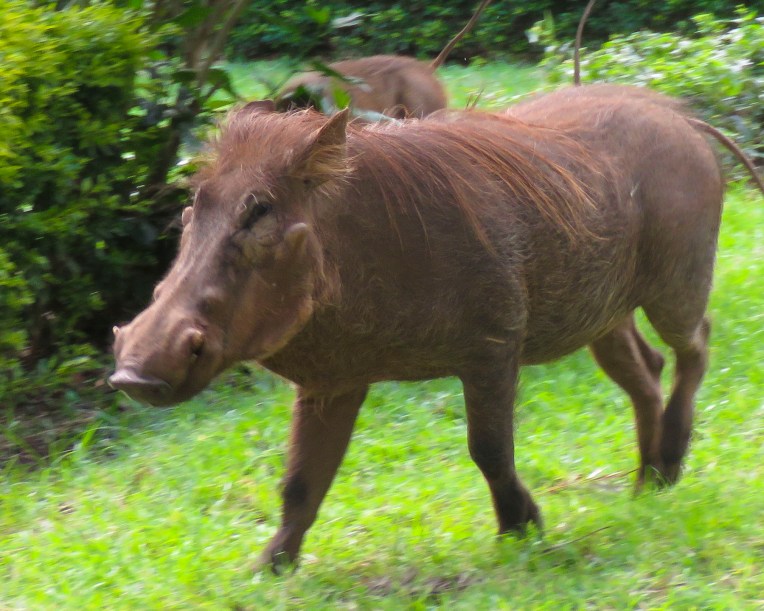 The highlands area is home to the Konso people who are renowned for their ringed hilltop villages, fortified with stone walls. They have developed terraced farming techniques to survive in a semi-arid, rock strewn and hilly territory for almost seven-hundred years.
 As we entered the town of Konso, bundles of candles miraculously appeared from under our guide’s seat and we stopped to donate them to a young man collecting offerings in front of his Ethiopian church. This was the guide’s ritual when we changed territories and it continued throughout our trip. It was a common sight to see small groups of parishioners walking along the road holding up a picture of a beloved saint and umbrellas for shade.


The main street through town was lined with bustling shops. Their services and merchandise almost spilled into the street. A rutted dirt field served as the bus depot and on the day we passed, a large crowd danced in undulating rhythm to see off newlyweds. As remote as southern Ethiopia is, it has a rural minibus system that connects distant villages. The buses are always jammed full of folks, while their belongings are haphazardly tied to the roof.


The creative hand of man was clearly evident in the sculpted terracing we could see from the road leading to the Gamule Konso Cultural Village, a UNESCO World Heritage site. Staple crops of barley and wheat are grown along with crops of maize, chickpeas, beans, yams, taro, turnips, coffee, tobacco and cotton. The terracing tames a once inhospitable terrain into productive farmland.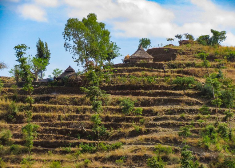 As we walked to the center of the village young children following us jumped from rock to rock, along the tops of the tall walls built to protect the village, as we made our way along the path below.


Set on a hilltop the village, called a paleta, is ringed with six concentric, high stone walls. Each ring was added as the population of the village expanded downhill. Within these defensive walls are fenced family compounds with pens for a small number of animals and sturdy huts and granaries constructed of tree branches, adobe and thatch along with moringa trees, from which the foliage is an important and delicous food source.  Each ring also has a community area called a mora; this is a large thatched roof structure with an open lower level and an enclosed upper platform where the married men and bachelors of the village sleep.
 More importantly it provides a shaded meeting place where men play gebeta. It’s considered the oldest board game in the world and is played simply with stones, beans or seeds being moved around holes in a board with the goal to capture as many of your opponent’s pieces as possible. Each village is also divided into two zones and a man born in one zone must always have his homestead in that zone.
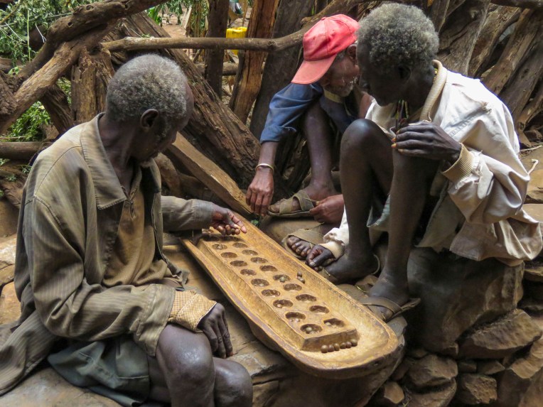 The Konso also erect generation poles, called olahita, which are raised every eighteen years. The olahita are made of cedar trees taken from the kala, a sacred forest. Gamule village had eighteen olahita which dates the village to be nearly 400 hundred years old. Sadly, the oldest central poles have succumbed to termite damage and rot over the centuries. The oldest village in the Konso region is Dokatu which has 43 olahita. Near the olahita was the village ceremonial daga, a large rock, that teenage boys lift over their heads to prove their manhood and eligibility for marriage. The Konso also carve waka, grave makers, in rough likeness of the deceased. These were originally placed at the grave sites in the sacred forest, but have now all been brought back into the village to deter looting. Each village is surrounded by a dina, or grove of trees, which acts as a buffer between the village and agricultural terraces. This buffer of trees was meant to inhibit attack on the village and provide an area close to the settlement where folks could forage for firewood. There are 36 paletas, with populations ranging from 1,500 to 3,000 in each village, scattered across the Konso territory.


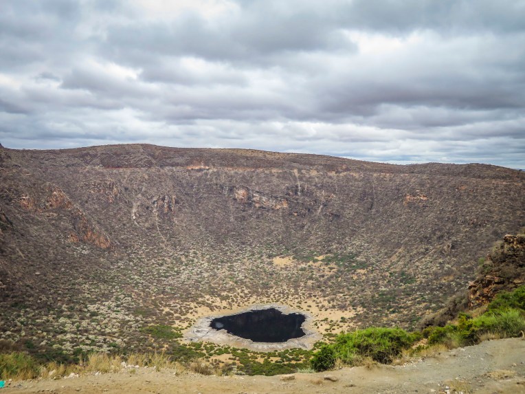
Nearby outside the Konso village of Gesergiyo there is a unique landscape nicknamed “New York.” It’s a dramatic red sandstone canyon, that looks like it was violently carved from the earth, with deeply scarred walls and tall pinnacles created from millennium of erosion. Legend says Waga the Konso Sky God created these as he searched for a buried sacred drum.  We didn’t really see the NYC comparison, but the landscape was interesting in that it contrasted sharply from the surrounding terrain. And the encompassing territory is beautiful with vistas of rolling hills. Driving away a group of young men were perched on a lone boulder, just passing time.
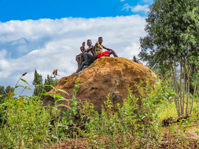 We arrived late in the afternoon to the Konso Korebta Lodge, situated high on a hill. It was a relatively new complex with attractive, circular stone huts topped with steep thatched roofs and beautiful plantings of bougainvillea. Desperately needing showers, we were flummoxed when the tap was dry and headed to reception to see what was up. Unbeknownst to us it’s common practice at hotels throughout the countryside to only turn on the electricity and water between 6:00 – 9:00 in the morning and 6:30 – 10:00 in the evening to conserve resources.
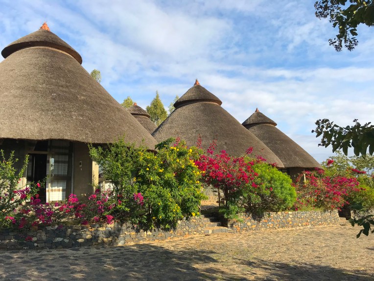 Thankfully, the staff called the owner to get permission to start the generator early for us. Back seat driver that I am I thought our driver drove fast, safely but fast to cover the great distances we had to travel. So, we were surprised the next afternoon when he was tootling along very slowly to get back to the hotel. Evidently the hotel owner made it very clear to our guide that he would not turn on the generator early again.


Later we traced the aroma of barbeque to a small garden area where the staff was grilling goat skewered on small tree branches over a fire pit dug into the ground. It was in preparation for a wedding party that was due to arrive. With military timing it seemed, suddenly the parking area in front of the hotel’s restaurant was full of honking minibuses discharging joyous celebrants. It was a short indoor-outdoor event that climaxed with song, dance and well wishes for the couple. Market days are huge events in the rural areas and folks from various tribes travel for miles to attend them.
 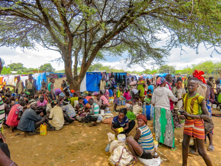 Not just to buy or trade supplies; it’s also a cherished opportunity for men and women to socialize with friends and extended family from other villages, often in raucous beer halls which could be in a makeshift shed or more often a spot under a large shade tree that serves a local brew.


Many folks look and dress their best as it’s also a chance to find a future husband or wife. The Alduba market was exceptionally large, spanning both sides of the main road, and it attracted folks from the Ari, Bena, Hammer and Tsemay tribes. Recently the government constructed a bricked wall corral at the market to show tribespeople that the government was interested in their wellbeing and that local folks are actually part of a greater Ethiopia. And at the same time it started to collect taxes on every head of cattle sold. We were able to take many candid photos as we followed our guide through the market to its various parts. Ceramic pots, handmade tools, ropes and leather goods produced by different tribespeople were available as were pots, pans, cloth and sandals produced in China.


One older woman shared with our guide that she was in her seventies and walked six miles to the market to replace a ceramic cooking bowl that had recently broken. Often, we would stop and ask a person if we could take their picture. Many folks were very receptive to this and our guide would negotiate a fee. And even though we paid for the privilege to take their photo, they seemed pleased that we admired their style. A few, however, angrily waved us away.


Later in the day we headed to Jinka, the largest town in the region, slowly getting closer to the Omo Valley with every move. Traveling through a xeric landscape, we had a long stretch of dirt road to ourselves.  Pulling over occasionally to take photos from scenic overlooks along this isolated track, we were always surprised when, in the middle of nowhere, a young man selling souvenirs would emerge from the shade. Later we would come across an enterprising group of young stilt walkers urging tourists to stop for photos – and of course we did.
 Entering Jinka, we noticed signage for the International Airport (BCO, though we are pretty sure you can only fly in from Addis Abba.) We might have arranged our trip differently if we had known this previously as it would have eliminated two eight-hour drives from and to the capital. Note: if you fly into Ethiopia on a ticketed Ethiopian Airways flight you are able to purchase discounted domestic flights . Our guide booked this discount for our us on our Addis Abba to Lalibela flights.


The Orit Hotel offered very basic accommodation, but it had a wonderful garden restaurant, good food and cold beers.
The next day we would head into Mago National Park to visit the Mursi tribe.
Till next time,
Craig & Donna


 The area in the northern part of the Greater Rift Valley, known today as the Omo Valley region of Ethiopia, has been at the crossroads of humankind for many millennia. In 1967 Dr. Leaky discovered fossil bone evidence, recently re-dated by scientists to be 195,000 years old, of early Homo sapiens near Kibish, Ethiopia, several miles west of the Omo River near where the borders of Sudan, Kenya and Ethiopia meet. The first migrations of early man out of Africa occurred 60,000 years ago as they followed the Omo River north through the Great Rift Valley to the Red Sea. At its narrowest point, where it meets the Gulf of Aden, they crossed to continue their migration through Arabia and eventually into Europe and Asia. The region was once rich with African wildlife, and Arab towns along the northern East African coast of Somalia and Kenyan were sending hunting parties into the interior for elephant ivory, rhino horn and unfortunately slaves since around AD 1000.


 Things change, but the proud peoples that live in the Omo Valley are trying to retain their way of life amidst external influences they can’t control, as tourists and construction crews course across their territory. Tempers flare when trucks and buses carrying supplies and workers to the agricultural plantations strike and kill cattle. Drivers are required to stop and immediately pay the herder for his loss, but many never do. Consequently, the local tribe will block the road and demand payment until the issue is resolved.
 A good night’s sleep at the


 The 2019 rainy season was good; unfortunately, this is often not the case. There was no water infrastructure in most of the small towns and villages we passed through, forcing folks to gather water from local streams and rivers.
 It was a constant sight: women carrying yellow water jugs along the side of the road back to their homes, or if they could afford it, having it delivered by donkey cart. The terrain varied tremendously, with full rivers on one side of a mountain range and dry on the other side. These conditions forced people to dig into the riverbed in search of water.

 Since Ethiopia is close to the equator, the daylight hours do not vary seasonally. The sun rises quickly in the morning and seems to drop from the sky at the end of the day. By the time we reached the
  At breakfast we watched thick-billed ravens in aerial combat as they rode the thermals just off the restaurant’s terrace. Nearby a staff member stood ready to chase away baboons if they got too close to the customers’ tables.

 As we entered the village, compounds ringed with woven rattan walls held back tall Enset plants, better known as false banana, also called the “tree against hunger.” This plant is an important staple that is drought resistant and can be harvested year-round. Starch from the plant is scraped from its fibers and fermented in the ground for three months or longer and used to make kocho, a type of flat bread.
  Fibers from the plant are used to make rope or coffee bean bags, and the leaves are fed to farm animals. We arrived on market day, and an entire hillside about the size of three football fields was covered with activity. From a distance it looked like an animated impressionistic painting, with undulating dots of color dancing under a blue sky.
  Sellers of charcoal, sugarcane, vegetables, and a multitude of other goods all had their wares spread out on cloths covering the ground. Men played foosball or ping-pong under the few shade trees that ringed the field.


 Men of the Dorze tribe traditionally do the weaving, while the women are responsible for spinning the cotton that the family grows and uses. The colorful textiles they create are highly prized all over the country.
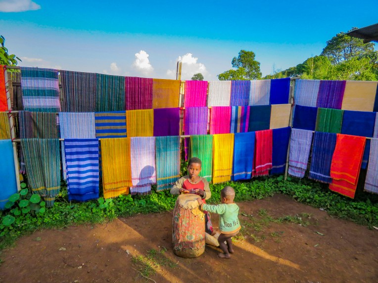 Back in Arba Minch we stopped at the Lemlem restaurant for a lunch of local lake fish before checking out the crocodiles on Chamo Lake. The lightly fried fish were served whole, while the sides were scored into squares which we picked off with our fingers. It was delicious. Another side of the restaurant served freshly butchered, grilled meat.


 “Sorry for the late pick-up, but the road was full of tuk-tuks carrying families to the university stadium up the street for a graduation ceremony,” Ephrem offered as he bundled us into the Land Cruiser and handed us large bottles of water. “It’s hot where we are going today.”

 We trailed a young Borena girl herding a small group of cattle down a slowly inclined, dusty trench deeper into the earth. It was impossible to avoid cow patties as we steered clear of an exiting herd. Thirty feet below the surface, the trench ended in a bowl shape with a water trough where cattle were drinking. Rhythmic voices emerged from a shallow cave behind the trough. Climbing worn stone steps, we came to a narrow landing above the trough,


 A short drive away, our last stop of the day was a well-kept Borena village surrounded by an ochre landscape under a perfect blue sky. Women do the heavy lifting in the villages, building the huts, tending children and crops, and spending a substantial amount of time foraging for firewood and gathering water from far off sources. While the men spend their days moving their cattle across different grazing lands.
 Women rule their homes and determine who can enter, even prohibiting spouses. “If her husband comes back and finds another man’s spear stuck into the ground outside her house, he cannot go in,” our guide conveyed.


 After our last apartment in the “Mother City,” on Bree Street, we moved to the Sea Point neighborhood and as its name suggests, it hugs the coastline under Signal Hill and Lion’s Head Mountain. Finding the ideal apartment for our last 30 days in Cape Town required a bit of detective work on our part though. One of the draw backs of using Airbnb is that it does not provide the specific address of a property until you actually book it. So, while the interior photos of a listing might be charming, its exact location could be anywhere within a five-block radius of a dot on the map, unless the host gives hints in the apartment description.
 In Sea Point this could mean on the water or nowhere near it. But with a little sleuthing regarding our final three choices, we were able to determine which one was right on the waterfront. Our reconnaissance of the neighborhood paid off and we booked a sixth-floor one-bedroom apartment with a terrace, that had an ocean view for dramatic sunsets and inland views of the paragliders launching from Signal Hill.
  It was the perfect location across from the Sea Point promenade. The lively Mojo Market, with numerous food stalls and live music seven nights a week, was just around the corner. Here we enjoyed the best fresh oysters and mussels in sauce at The Mussel Monger & Oyster Bar while sipping South African wine or local craft beers as the nightly band played.
 It’s actually possible to walk along the promenade from the V&A Waterfront all the way to the Camps Bay Beach. It’s a little over six miles in length, but it’s a popular stretch of sidewalk, which locals call the Prom.


 Weather permitting, paragliders seemed to launch in rapid succession all day long from Signal Hill, first riding the thermals along the ridge towards Lion’s Head before turning back and gracefully spiraling down over the rooftops of Sea Point to land in a grassy park next to the promenade.
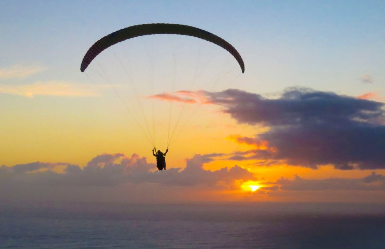 We transitioned easily into our new neighborhood, finding three grocery stores and
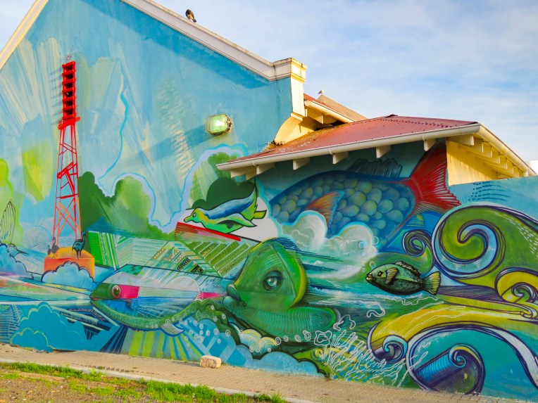
 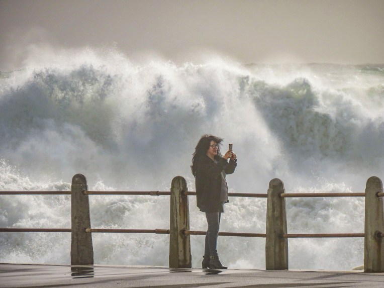 Cape Town artists will paint anywhere and the walls of the underground parking garage at the Pick ‘n Pay – Sea Point were the perfect canvases for some incredibly talented street muralists. Sadly, we don’t think enough folks see these hidden works of art.


 In Hout Bay, time flew by at the


 The wind was so strong it made it impossible to hold the camera steady. We soaked in the views as long as we could before the buffeting winds forced our retreat. Sitting outside at the snack bar we were astonished to witness a baboon snatch an ice-cream cone from a young boy and then gobble it up with great delight.
 We revisited the Simon’s Town area several times, because to see all the spots that interested us required more than one day. The big draw to Simon’s Town was the Boulders Penguin Colony. This is a restricted reserve where visitors must stay on the boardwalk in the viewing areas. Our timing was perfect as penguin chicks had recently hatched and could be seen at the nests snuggling against their parents for warmth. The beach was full of activity, with different groups of penguins doing their best Charlie Chaplin struts into or out of the turquoise waters of the bay.


 One morning in late July we opted to try a whale watching tour again, this time from the Simon’s Town waterfront, hoping to see some tail slapping or breaching action that was elusive in Hermanus earlier. Alas, we only viewed one tail slap on this trip. As much as the tour operators want you to believe July is a good month for viewing whales, based on our disappointing experiences we’d suggest waiting till later in August or September for more certainty when larger whale pods return to the waters of False Bay. But it was a smooth day at sea, cruising along a dramatic coast and we did get to view a large colony of sea lions on some offshore rocks.


 Once outside of Cape Town the R27 cut a desolate track through a rolling landscape of open fynbos with scarcely a tree to be seen. Every so often the head of an antelope or ostrich could be seen emerging above the bushes on either side of the road. The heather clad landscape eventually gave way to pastureland speckled with sheep and wheat fields.
 Paternoster is one of the Western Cape’s oldest fishing villages, dating from the early 1800s, and is said to have gotten its name from Portuguese sailors who evoked the Lord’s Prayer to save themselves from shipwreck off its coast. The area was first explored when Vasco da Gama landed nearby in Helena Bay, in 1497. By then the area had been inhabited by the indigenous Khoisan for thousands of years. Hunter-gatherers, they harvested dune spinach, an local vegetable, from the beaches, and shellfish from the area waters, and they left behind middens that have been estimated to be 3,000-4,000 years old. The harvesting of the ocean’s bounty continues, with fishermen still launching their small boats into the sea from the beach and returning with fish and lobsters. As you pull into the village it’s not unusual to see fishermen selling their day’s catch from five- gallon buckets at the town’s intersections, where they hoist live lobsters aloft and yell “kry hier kreef!”, Afrikaans for “get some lobster here.” Aside from the picturesque whitewashed and thatched roofed fisherman’s cottages along a white sand beach dotted with boulders, there’s not much to this sleepy fishing village, except for some reportedly excellent seafood restaurants that were unfortunately closed the winter day we visited.
 A short way out of town we followed a dirt road to the Cape Columbine Lighthouse. Built in 1936, on an outcropping of boulders called Castle Rock, it’s one of the last manned lighthouses in South Africa. “Seniors are free,” the lighthouse keeper, a senior himself, announced, as he pointed us to a set of stairs that eventually led to a very tall, steep wooden ladder. The panoramic view from the top was brilliant and, as expected, breathtaking. Getting down was a little more challenging than getting up. It was a kind of “make it or break every bone in your body if you don’t” situation. We’ve found in our travels around the world that folks in other countries can do all sorts of risky things, that in the states wouldn’t be allowed for safety concerns. Overseas it’s all about being responsible for your own safety. “See you at the bottom,” Donna said as she agilely maneuvered on to the ladder. “One way or another,” I grimaced in response. For me, with a fearful respect for height, it was all about that first step down.


 Here gale force winds that blow in from Antarctica and colliding warm and cold currents build ferocious waves that can tower to 100 feet high. These seas have claimed over 140 ships since the Portuguese first sailed here in the 1500s. Within sight of the lighthouse, the most recent wreck of a Japanese fishing trawler from 1982 lies on the beach rusting away.
 We stayed the night at the
 Afterwards we headed toward Wilderness (the town not the idea,) along a route that traversed barren farmlands and coastal pine forests before skirting the coast again at Mossel Bay. We arrived in time to watch the sunset from our balcony at
  Our room was luxurious and larger than several of the apartments we had rented on our round-the-world journey so far. We were hoping the owners, Leane & Deon, would adopt us. On our sunrise walk the next morning we only sighted a few other folks enjoying the quiet of this vast stretch of pristine beach during the winter season. We noted the considerably warmer weather, a result of the Agulhas Current which swoops warm Indian Ocean currents along the bottom of South Africa and wonderfully moderates the temperature.
 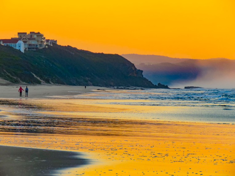 After breakfast we backtracked on N2 to the pullover above the Kaaimans River Railway Bridge. For railroad enthusiasts this was a destination for many years to watch the Outeniqua Choo Tjoe, the last continually operating steam train in Africa, cross the tidal estuary which slowed settlers’ advance along the rugged coast. The line stopped operating in 2006 when landslides destroyed an extensive stretch of track. Today it’s an interesting photo-op.
 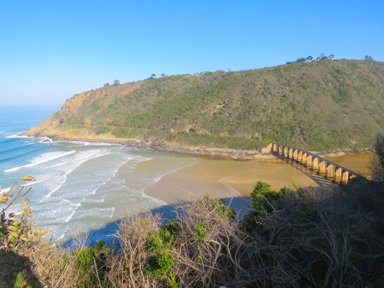 Further up the gorge at Map of Africa View Point, raging waters over the eons have eroded a bend in the river to resemble the African continent when viewed from the overlook on the opposite side of the chasm. The sky was empty mid-week, but across the road hundreds of paragliders launch from the grassy slope on the weekends to catch fantastic thermals and awesome views of the coast below.

 After spending hours rattling along dusty back roads we rejoiced to be on Route 2 again. A little while later we pulled over and enjoyed a late lunch and sunny afternoon on the outdoor deck of the Cruise Café, which overlooked Knysna Bay.
  We weren’t yet synched to the rhythm of life outside of Cape Town in the off-season and were surprised to find the restaurants and grocery stores in Plettenberg Bay closed when we arrived. Fortunately, we had a wonderful room with an ocean and lagoon view terrace, right on Lookout Beach, at
  The sun rose quickly the next morning from behind the Tsitsikamma Mountains, across the bay, filling our room with light. We spent the early morning slowly sipping coffee and savoring the view. Upon checkout we were delighted to find a sparkling clean car. This was a wonderful service the hotel provided for guests, and an easy way for the gardener to earn some extra money.
 We kept to a strict schedule, and limited our stops for photos today, because we needed to be at
 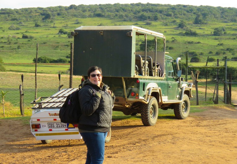 Three guides and three open-sided 4×4 Toyota safari trucks, each capable of seating 16 people, were waiting for their respective groups at the reserve’s headquarters. Wonderfully, it was mid-week in the off-season, and we had Edward, our guide/naturalist, and truck all to ourselves, while the other two trucks left with groups of six each. Schotia’s 4,000 acres of gently rolling hills, bush and forest shelter approximately 2,000 animals from 40 mammal species and its’s amazing how difficult it can be to find them.
  But that was our goal as we rattled along the rutted paths to a high vantage point within the reserve, that provided distant views of the terrain surrounding us. Scanning the vista with binoculars, Edward was searching for elephants, giraffes, antelopes and zebra. “The animals are constantly on the move. We’re never really sure where they will be,” Edward offered. He seconded with, “There’s clouds of dust being kicked up over there. Can’t tell from here what they are, but let’s go investigate.” And our overlanding began, chasing a cloud of dust that turned out to be a small herd of white faced Blesbok, a stunning antelope species we weren’t familiar with.


 Sightings of impala, kudu, wildebeest, warthogs, cape buffalo, zebra, hippos and crocodiles rounded out the afternoon.


 On the way back to the lapa we encountered the hippos we had seen earlier, now grazing far from their waterhole. Large black masses, they were barely visible when out of the headlights.
 Glasses of wine and a large, warming fire greeted us when we returned to the lapa for dinner. Inland the temperature fell quickly, and the warmth from the flames felt good.
 Darkness covered the countryside early in June, the beginning of South Africa’s winter season. Our guide had just lit the oil lamps a few minutes earlier, handed us a walkie-talkie and said, “Use this to call the owner if there’s an emergency, you’re the only folks here tonight.’’ The owner lived somewhere on the other side of this vast reserve. There were no other lights around except for the moon. The bush has a life of its own and sounds totally different in the darkness.
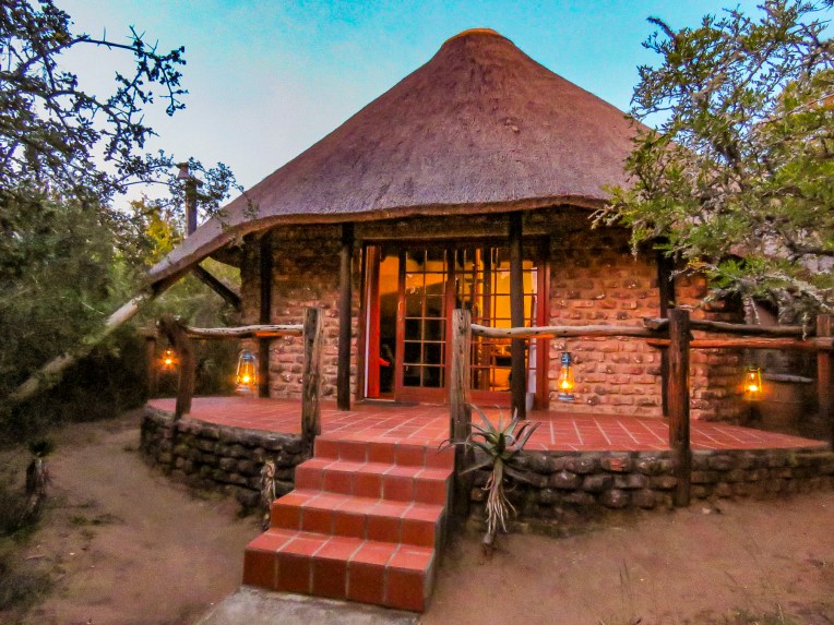 We didn’t plan on being the only folks at the game reserve during the middle of the week, but that’s one of the benefits of off-season travel. Following spring-like conditions around the globe, we’ve been able to avoid hot, humid weather and the crowds, while managing to have some wonderful experiences along the way. Tomorrow, Edward would guide us through Addo Elephant National Park.
 The eastern cape was once home to tremendous herds of elephant which were hunted by the Xhosa and the Khoe (Khoi) tribes for sustenance, and much like the American Plains Indians and buffalo it did not end well. As colonization spread across the region in the 1700 and 1800s the tribes succumbed to smallpox and were pushed into different regions, and the elephants were slaughtered to near extinction for their ivory and to protect farming interests in the region. With the killing of 1400 elephants in 1919, public opinion slowly turned. Only eleven elephants remained when Addo Park was established in 1931 with 5600 acres.
  The park was enclosed with an elephant proof fence in 1954, to protect the surrounding citrus farms from their rampages, when the size of the herd had rebounded to 22 elephants. Today the park is the third largest in South Africa and encompasses 1,700,000 acres. Home to over 600 elephants now, the reserve has expanded its mission to protect a growing number of mammal species within its borders.
 We could have done a self-drive tour through Addo, but we thoroughly enjoyed Edward’s knowledge of wildlife and the region. It was a good decision. Sitting up high in an SUV provided better visibility into the bush, where in our small rental car we wouldn’t have been able to see much. And his timing was perfect in getting us to a waterhole just as a very large herd with calves was creating a trail of dust as it emerged from the surrounding dry bush.
 We witnessed elephants smiling as they drank. It was a tremendous experience.

 This would be Donna’s fourth trip to Cape Town and my first. Back in 1993 she visited friends she had made while attending Princeton Seminary, and a year later in 1994 she volunteered to be an International Observer for the first free and fair democratic elections in South Africa. In 2016 she returned to a city humming with positive energy and a growing economy. Unfortunately, this situation did not continue, and by 2019 the governance and economy of South Africa and its neighboring countries had stalled. The city was still beautiful and growing as a tourist destination, an amazing coffee culture had been born, but shuttered construction projects and an increasing homeless population were evident, and across many different socioeconomic groups, people were feeling disenfranchised. A multi-year drought exasperated many infrastructure problems that were being neglected. Fortunately, exceptional winter rains broke the severe drought and replenished the city’s nearly depleted reservoirs.
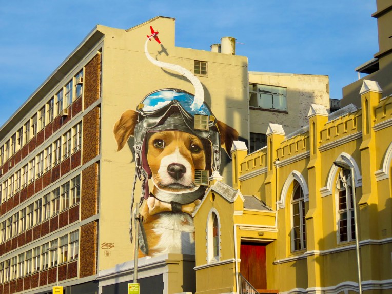 We immersed ourselves quickly into the neighborhood around our first apartment on Buitenkant Street, just a few blocks away from the District Six Museum, steam punk themed


 On the edge of the City Bowl and Zonnebloem districts, formerly District Six, our high-rise apartment building had a rooftop gym with fantastic views of the city, a 24hr doorman, gated parking and balconies with beautiful views of Table and Lion’s Head mountains. But the area immediately around us was in transition, without enough residential housing to call it a neighborhood.


![IMG_7861[42783]](https://i0.wp.com/2suitcasesfor2years.com/wp-content/uploads/2020/02/img_786142783.jpg?w=272&h=363&ssl=1 "IMG_7861[42783]")

 We had to find a dentist also, as just before our flight into Cape Town one of my crowns broke. Fortunately, South Africa is recognized for good medical and dental care and is slowly becoming a medical tourism destination. I found Dr. Ramjee on Google Maps, checked his reviews and made an appointment at his office which was within walking distance of our apartment. With his jovial and comforting manner, I instantly felt at ease. Though only a one dental chair office he had a state-of-the-art digital x-ray machine, a dental assistant and a receptionist. Besides the broken crown, I needed a root canal as well – what fun! My experiences with Dr. Ramjee were excellent and I raved so much about him Donna decided to use his services when the need arose for an emergency root canal and crown also. Unexpected expenses that in the states would be costly, even with insurance, were much more affordable and payable out of pocket here. The savings were tremendous.


 You just can’t walk enough miles along the coast or up and down Loin’s Head to keep the calories off in this foodie-oriented city. The Saturday- and Sunday-only food markets didn’t help, but they are a treasured tradition, throughout the region, that brings family, friends and tourists together to enjoy live music and good food.


 In early June the castle hosted the 2019 Cape Town Coffee Festival which celebrated all things caffeinated with growers from across the continent, barista workshops and pop-up coffee stands. If you ever wanted to see thousands of folks ricocheting off the walls from too much free coffee, this was the place to be.

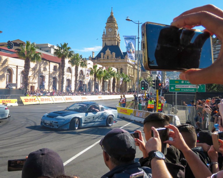 The coffee festival coincided with the Red Bull Cape Town Circuit where their F1 Aston Martin Red Bull racing car roared down Darling Street at over 150mph, passing the spot where Nelson Mandela addressed the nation upon his release from Robben Island, and turning the stretch in front of city hall, lined with bleachers, into a high-speed drag strip. At the intersections, souped-up street cars burned rubber and spun donuts while the Red Bull Air Force performed aerial acrobatics over the city. It was a raucous day that we could hear from our apartment.

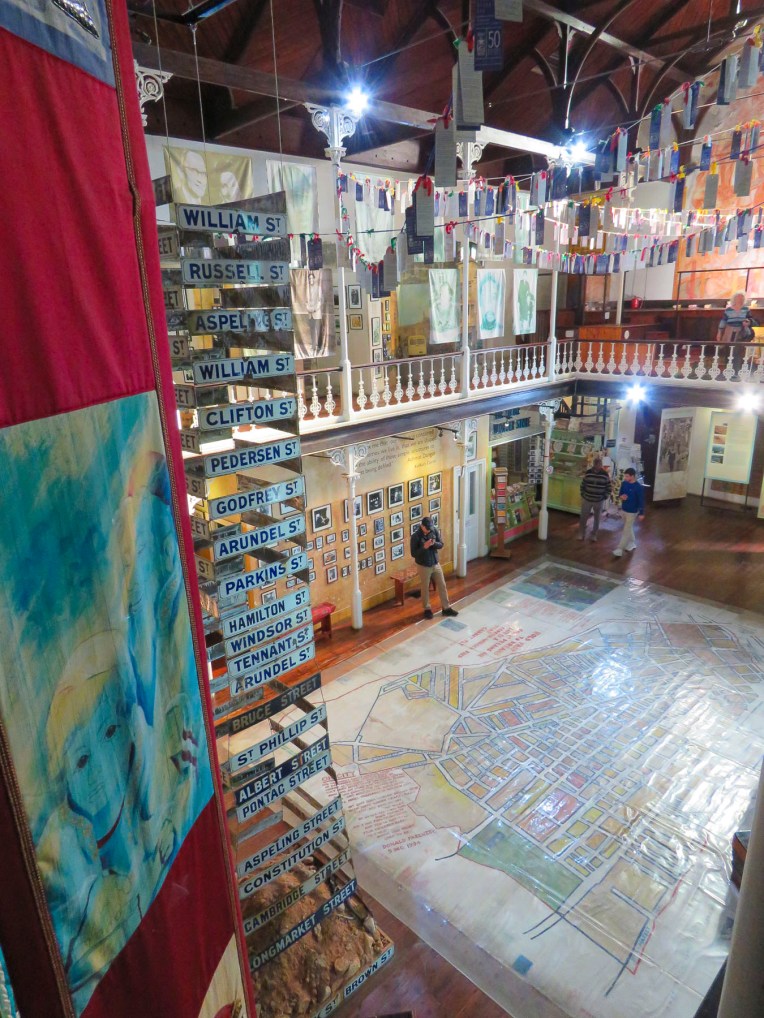 Families and neighbors were intentionally sent to different communities to break the spirit of the people. The apartheid government was so vile it “regarded the district as both physically and morally tainted by miscegenation, wholly unfit for rehabilitation” and flattened every building except for Churches. Even the original streets were destroyed, and new roadways were created so folks couldn’t find their homes, now vacant lots, that they legally owned. Much of the area still remains abandoned. The District Six Museum commemorates this tragedy and the lasting heartbreak of this cruelty.


 Despite our apartment’s faults, we enjoyed our time on Buitenkant Street. Watching the brilliant sunrises and the flat clouds – the tablecloth of Table Mountain – cover the summit and then spill down the side like a waterfall. The street life below spanned the gamut from groups of tutu-clad race walkers one day to noisily protesting sex workers or Fridays for Future demonstrators the next.


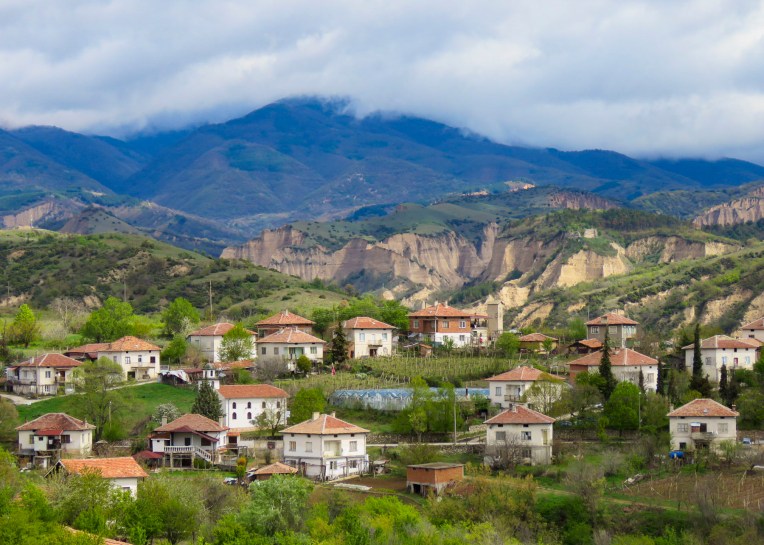
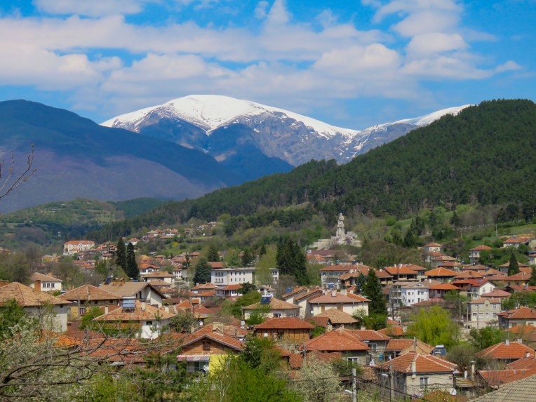 Heading north on Routes 64 and 6 we drove past fallow farmlands waiting for their Spring tilling, and forgotten industrial sites as we worked our way north towards Stara Planina, the Balkans Mountain range that runs east to west for 348 miles and divides Bulgarian into northern and southern regions.


 Turning down the long driveway of the
 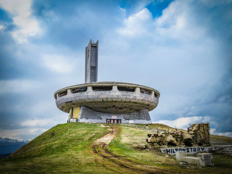 On a wintry, cloudy afternoon the silhouette of

 At the opening ceremony in 1981, tribute was paid to those who had gathered there ninety years earlier. “Let the work of sacred and pure love that was started by those before us never fall into disrepair.” Buzludzha was a huge success and a point of national pride for eight years, hosting communist party congresses and educational events. Schools and businesses booked tours for their students and employees. Foreign delegations were paraded through to witness socialism’s success. But then in 1989 the Berlin Wall fell and communism collapsed like a fighter jet breaking through the sound barrier. The monument to socialism was suddenly ironic, irrelevant and abandoned. In 1999 the security guards protecting it were removed and the building was left open to the public and it was looted. Anything of value quickly disappeared, and the rest was left to vandals and frustrated citizens who were known to take their anger out on the building with sledgehammers or spray paint. The red stars in the tower were shattered by gun shots. Soon the glass skylights broke and water damage from rain and the winter elements hastened its structural decline, and the building was eventually shut tight to protect folks from injury. The day we visited there was a lone security guard, suffering as he made his rounds in the bitter wind, protecting this crumbling modern ruin from a handful of visitors.

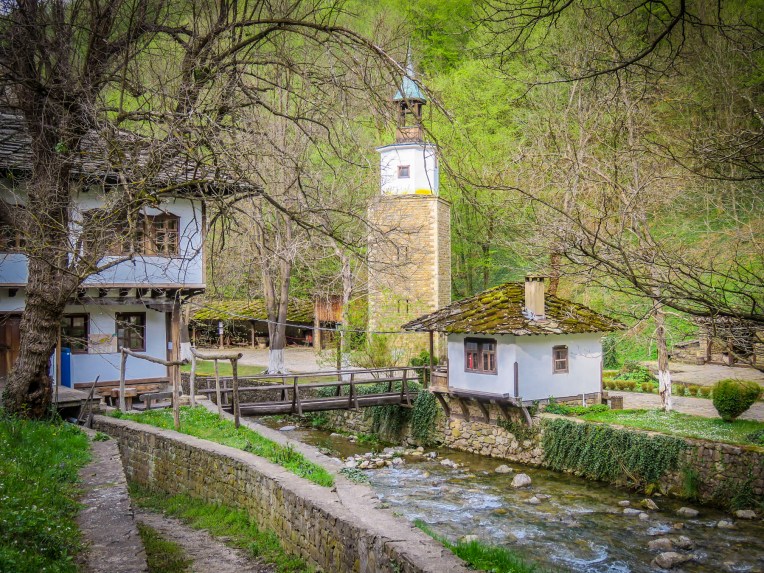 As we continued our journey north through the mountains on Route E85, the picturesque
  Woodcarvers, weavers and other craftspeople dressed in period outfits helped further to transport us to a simpler era at the beginning of the Bulgarian industrial revolution. We visited on a quiet day, but the museum has an extensive twelve-month calendar of events with many festivals listed that would have been nice to observe.
  Traveling along an isolated background road we worked our way towards Sokolski Monastery, known for its cliffside chapel overlooking the northern slope of the Balkan Mountain range. We weren’t disappointed; the church is stunning with its colorful exterior frescoes contrasting with the natural environment surrounding it.
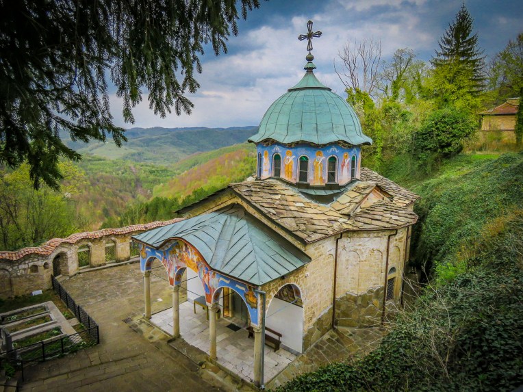 Built in 1833, the monastery has played an important role in Bulgarian history. During the April Uprising of 1876 eight freedom fighters took sanctuary there. Later captured by the Ottoman army, they were thrown to their deaths from the cliff behind the chapel. The short-lived April Rebellion was brutally repressed, but a year later Russia would help the Bulgarian rebels defeat the Turks at Shipka Pass and begin the march towards freedom. In the courtyard of the monastery an octagon-shaped water fountain was built with eight spouts to commemorate those fallen heroes. Legend states the fountain has never run dry and its cool water holds healing powers.
  We made it to Tryavna just in time to have dinner at the restaurant next to our hotel. Enjoying a hot meal after a long chilly day, we were entertained by the waitress trying to keep a determined stray cat from entering the restaurant every time the front door was opened.
 Generations of skilled woodworkers have lived in the Tryavna River Valley, turning trees harvested from the deciduous forests on the slopes of the Balkan Mountains into furniture and ornate wood carvings.

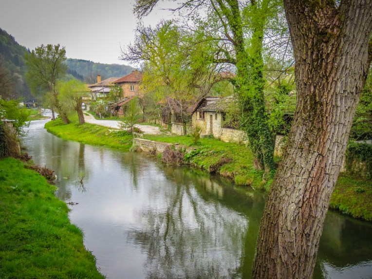 Crossing the footbridge over the Tryavna River at the clock-tower, the pleasant whiff of wood smoke came to us on a chilly Spring morning. Large woodpiles are essential in this region and we saw plenty of homes with the winter’s firewood neatly stacked, as we wandered around the village, with its parks filled with sculpture and tulips in bloom.


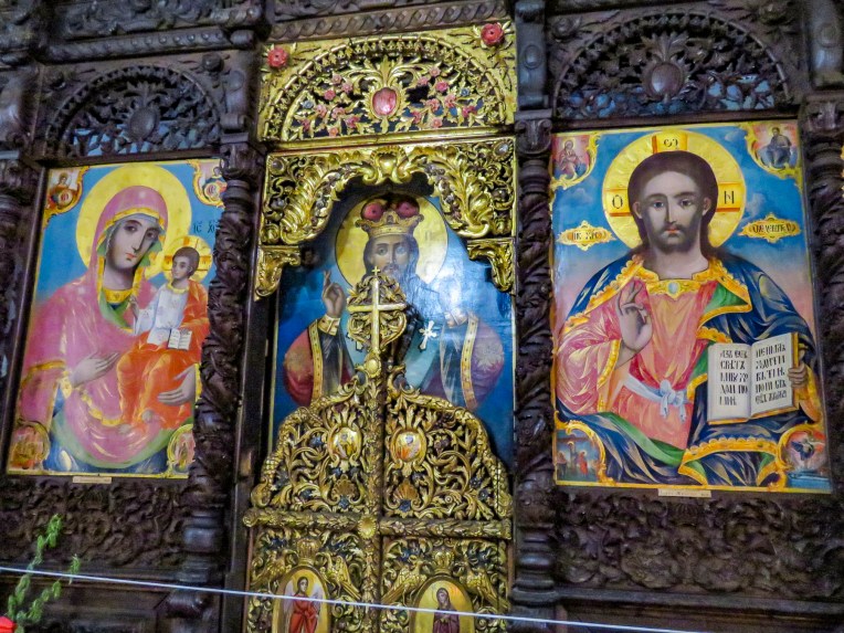 Over the centuries Saint Archangel Michael Church has been reconstructed several times. Its most recent incarnation dates from 1853 when the tall wooden belfry was added. Inside, the interior is richly ornamented with elaborate 19th century woodcarvings and iconography created by members of the Vitan family, famous throughout Bulgaria for generations of skilled artisans. The carved bishop’s throne is an exquisite masterpiece.
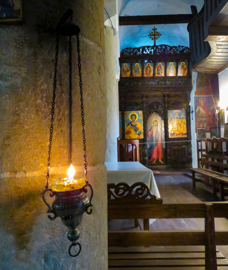 The safest way to order your cup of java in parts of Bulgaria is to ask for a traditional coffee, not wanting to offend anyone by calling it Turkish. The fact is Greek, Albanian, Bosnian, Persian, Turkish andthe same, plus or minus cardamom or a local spice. But here in Tryavna at the Renaissance Café the coffee was brewed on a very traditional sand stove. A shallow pan filled with sand was heated over an open flame, and a long handled, brass cezve was filled with coffee and water, then partially buried in the hot sand to brew. With diligent attendance our coffee was brought to a frothy boil three times before being moved to the top of the sand where it stayed warm while the grounds settled. The ritual of the event definitely enhanced our enjoyment of the brew.
 We only just scratched the surface of this lovely country. There’s so much to see here, especially in its vast countryside. Hopefully one day we’ll get a chance to return.

 Just outside Old Town Plovdiv,


 At just over a mile long the pedestrian mall in the center of Plovdiv is the longest in Europe, running from the Stefan Stambolov Square along Knyaz Alexander I, and Rayko Daskalov Street before ending at the footbridge lined with shopping stalls that crosses the Maritza River.


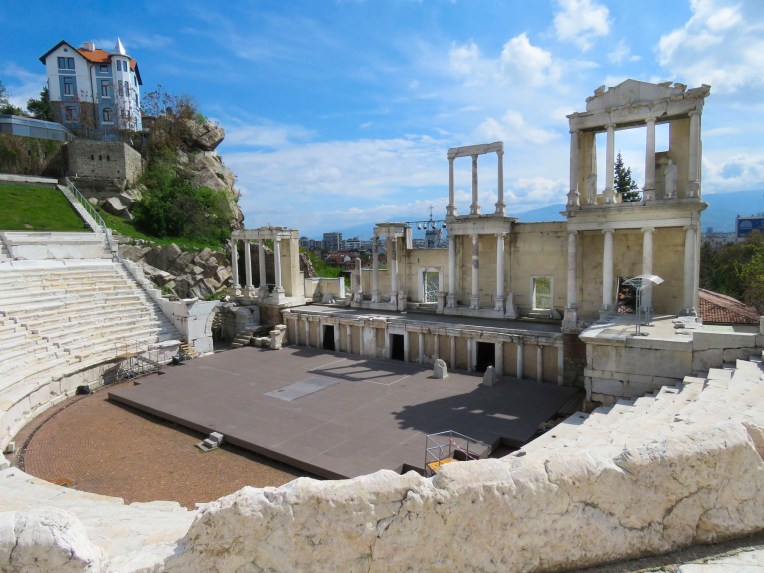
 But the jewel of the mall area was the curved ruins of the Ancient Stadium of Philipopolis, with its fourteen tier seating area, unearthed in 1923. Situated below street level and surrounded by modern buildings at Dzhumaya Square, the ruins provided a dramatic juxtaposition of the ancient and contemporary, where you can actually see the layering of history and how the city was built over earlier civilizations. From this excavated section, archeologists have determined that the stadium was a huge 790 feet long and 165 feet wide and could seat nearly 30,000 spectators.
 Across the square the Dzhumaya Mosque is the main Friday Mosque for Muslims in Plovdiv. Constructed in 1421, it replaced an earlier mosque built in 1363 on the foundations of a Bulgarian Church destroyed during the Ottoman conquest. It is one of the oldest and largest Muslim religious buildings in the Balkans. At the café in front of it we enjoyed some sweet Turkish tea and pastries in the warm afternoon sun.


 After you crouch to enter through a low door and then look up in this intimate space, the WOW element of

 Our main destination was


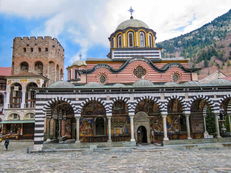 This is the only monastery to survive during the centuries of Ottoman domination over Bulgaria, when it was rebuilt in defiance of the Turks. The Bulgarian people have great affection for this monastery, as a symbol of their religion and culture during those turbulent centuries.
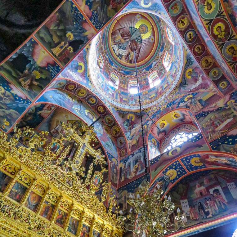


 Thirteen miles from the monastery, on a side street in the town of Rila, we spotted a church with three small cupolas, that called for a quick stop. The church “St. Nicholas the Wonderworker Mirikliyski” was a surprising find with its cracked bell tower and muraled covered entrance porch, complete with woodpile.
 The painter of these hell fire and brimstone murals might have gotten his inspiration from the tortured works of Dutch painter Hieronymus Bosch. Unfortunately, the church was closed and we haven’t been able to find any other information about this off-the beaten-path treasure.


 The Unofficial Junk Museum is a vast, rusty and dusty collection of whatever the owner deemed representative of Bulgarian culture under communism. Radios, tv’s, typewriters, farming equipment, cars, motorcycles, household items and busts of Stalin are stacked everywhere. It’s fascinating! And of all the places to buy a bottle of homemade


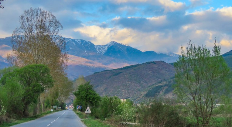
 In the morning we followed Rt. 1 south for a while as it hugged the Struma River, which would eventually reach the Aegean Sea, before we turned off and headed in to the Pirin Mountains.


 Melnik is situated in a wide gorge under striking sandstone rock formations, called hoodoos, that tower hundreds of feet high, created from millennia of erosion. Locals refer to these geological phenomena as Melnik Earth Pyramids. The village has been renown for making strong wine since 1346 from a regional red grape varietal, Shiroka Melnishka, and wine cellars still line its main street.
 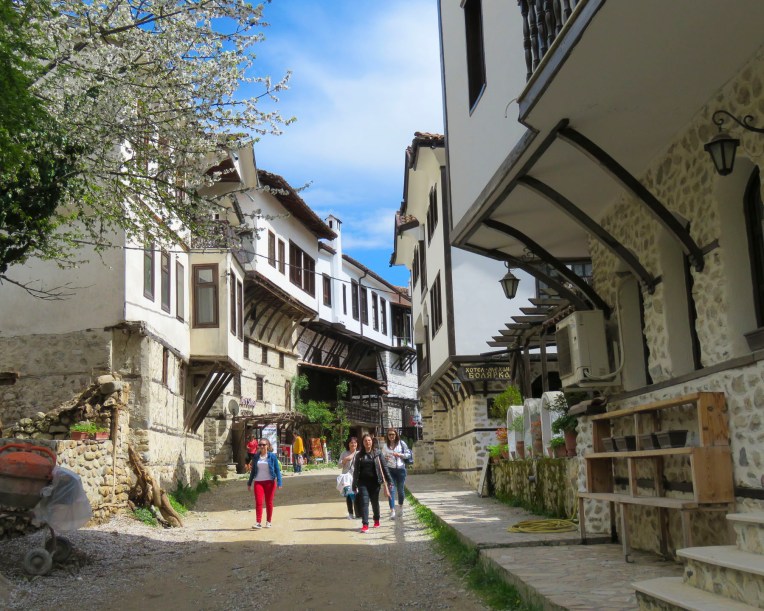 Once a thriving village with one thousand residents, today it is now home to fewer than three hundred. The village was a delight to explore with its cobbled streets meandering between the whitewashed stone and timber homes built in the Bulgarian Revival style. Ninety-six of the village’s houses are historically protected. Any new construction in town adhered to that aesthetic.
  From the ruins of Bolyarska kŭshta, high on a hill above the Church of St. Anthony, we spotted the dome of what looked like a hammam, a Turkish bath, nestled between the traditional homes below, and went to explore.
 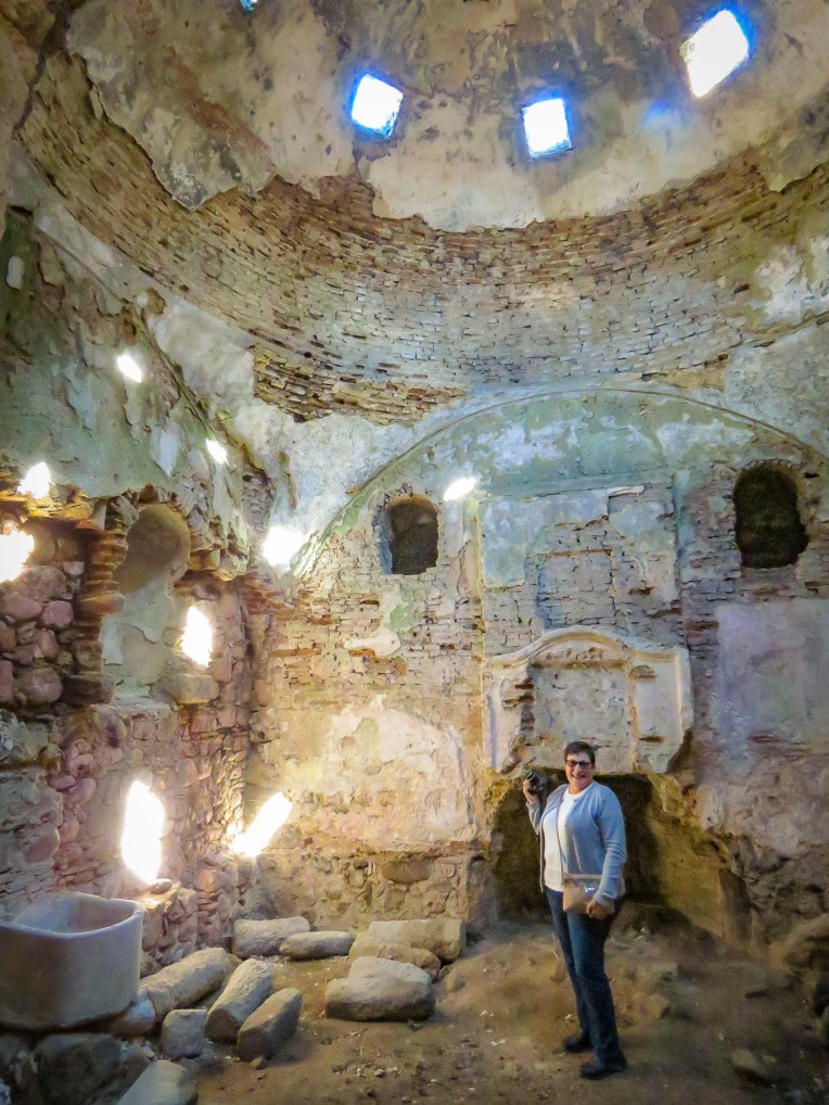 With the help of a kind woman, who somehow knew what we were looking for, we found the ruins of a small Roman era spa in a small side alley. Its dome was fully intact and the substructure of its once heated floor remained. There is also a single arched old roman bridge, near the parking lot, that you can still walk across. Before continuing to Kovachevitsa, we relaxed at one of the sunny cafes in the center of the village.
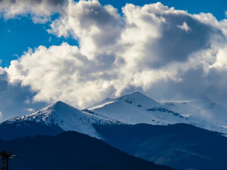 Kovachevitsa, an isolated, rustic stone village in the Rhodope mountains, was only 52 miles away near the border with Greece. However, it took us the bulk of the afternoon to reach because “someone stops every hundred yards to take a photo.” And stop we did as we were awed by the beauty of the border region as we drove through the mountains. So close were we to the border that our phones binged with a “Welcome to Greece” message from our cell phone carrier.
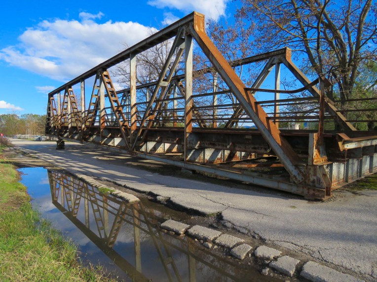 At one point we stopped to photograph a complete section of an iron truss bridge, just rusting away on the side of the road, only to have our car suddenly surrounded by a flock of bah-ing sheep.

 So, we knocked on the ancient door of the closest building only to be greeted by loud barking. Retreating back to the car we pondered what to do when a voice behind us said “hello.” That was the only word of English our host spoke until he said “goodbye” two days later. The barking dog turned out to be a gentle giant, who welcomed us to the inn. In fact, all the dogs of the village were St. Bernard-size, and they must all have been related, because they closely resembled one another. Fortunately, they were good-natured.


 Bulgarians fleeing religious persecution and the forced conversion policies of the Ottoman Empire sought refuge in the rugged Rhodope mountains and established Kovachevitsa in 1656. Agriculture and stockbreeding in the area thrived during the 1800s and the homes still standing in the village date from that time. The tall stone homes of Kovachevitsa are stunning and unique in an organic way.

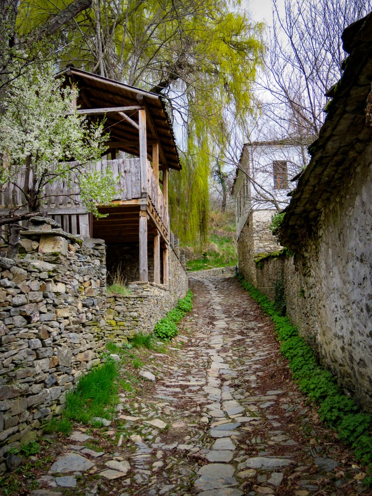 At breakfast the next morning Google Translate nicely bridged our communications barrier with the innkeeper’s wife. Loading the Cyrillic keyboard into the app for our hostess to use, Donna’s phone was passed back and forth repeatedly during a lively conversation about family, each other’s lives, the village and our travels. Our hosts’ children live with their grandparents in one of the larger towns off the mountain as there isn’t a school in the village anymore.
 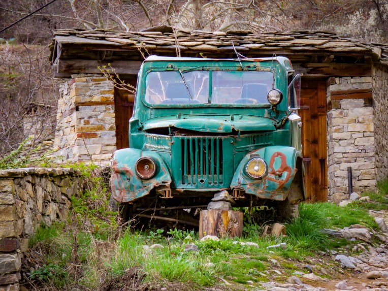 Most of the young families have moved away to find work, leaving only 28 year-round residents looking after the village till the tourist season starts. Strolling under blossoming elderberry trees, we had the narrow lanes to ourselves as we worked our way towards St. Nikolas Church.

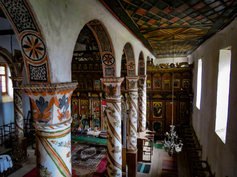 On the way back to our inn we stopped to admire the woolen creations knitted by a lone street vendor with a toothless smile who was bundled under layers of clothing to ward off the mountain chill. Her prospects for a profitable day seemed slim as the street was nearly deserted. When we expressed interest in only one pair of socks, she assertively pantomimed that we needed more. Looking up from readying our payment we could only smile and chuckle when we found she had filled our bag with two extra pairs of socks. They were well made and a bargain, so we caved to her sales pressure. I’m wearing a pair now as I write this, and my toes are happy we she insisted. I wouldn’t have been surprised if we were her only sale of the day.

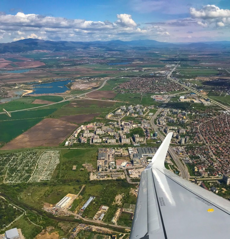 In the airport, at the tourist information kiosk, multiple large screen tv’s played flashy videos promoting Bulgaria’s culture, tourism, and natural beauty. We asked the woman staffing the desk for a map of Sofia and directions on how to transfer into the city. “Follow the line,” she snapped. Not fully understanding I asked again. “Follow the line!” she barked firmly a second time. She scowled in the direction of the arrows painted on the floor and turned away. Her previous career, I’m speculating, was a prison guard in the now closed gulags. She was obviously better suited commanding prisoners to “assume the position” than to being the first friendly face welcoming visitors to her country. I’m sure she was hiding handcuffs and would have used them if I asked another question. But that’s how it was, one day you’re communist and the next day you’re taking customer service courses and trying to embrace a free market economy. And for some the promise of a better life hasn’t been realized. Later, one of our hosts would express, “some folks prefer the old way, they’re still communists.” “Come and keep your comrade warm,” another refrain from the Beatles song, didn’t ring true. We weren’t feeling the love just yet. Aside from that rocky start, we had very enjoyable time in Bulgaria.
  The line led to a modern subway station adjacent to the airport terminal and for 1.60 BGN, about 90¢ USD, we rode the
 We emerged onto the pedestrian only Vitosha Boulevard filled with folks enjoying a warm Spring day and an incredible vista of Vitosha Mountain towering over the city. Inviting outdoor cafes lined the street and we quickly chose which one we’d return to after meeting our Airbnb host. We stayed on Knyaz Boris just two blocks parallel to Vitosha Boulevard and as majestic as the pedestrian mall was, the side streets, though tree lined and harboring small shops and restaurants, were slightly dismaying with wanton graffiti tags on every apartment building door and utility box. There was a lack of pride in ownership.
 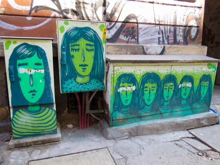 The idea that’s it’s not my responsibility is a leftover from the communist era, when the government owned and was responsible for everything. The front door to our building was no different, but our third-floor walkup apartment was an oasis with a sun-drenched living room and tiny balcony that we would call home for a month. And to our delight, but to our waistlines’ detriment, there was a baklava bakery across the street!
  Long at the crossroads of expanding empires, Bulgaria has had a contentious past with Thracian, Persian, Greek, Roman, Byzantine, Ottoman and communist influences. The First Bulgarian Empire, 681-1018, has been deemed the Golden Age of Bulgarian Culture, with the adoption of Christianity as the official religion in 865 and the creation of the Cyrillic alphabet. Independent for only short periods of time during the medieval age, the National Revival period between 1762-1878 brought Bulgaria to finally throw off the yoke of Ottoman domination that had lasted from 1396. Sadly, there were only six decades of self-government before the proud people of Bulgaria became a satellite regime of communist Russia at the end of WWII and fell behind the Iron Curtain.
 Today Sofia is transforming itself into one of the most beautiful, cosmopolitan cites in Europe with its pedestrian malls, extensive park system and tram lines that weave throughout the city. But the past is always present and just around the corner in Sofia. Walking north along Vitosha past the end of the pedestrian mall there is a three block stretch that displays a vast stretch of that history on the way to the Central Market Hall, where we were headed to stock our pantry. We got sidetracked.
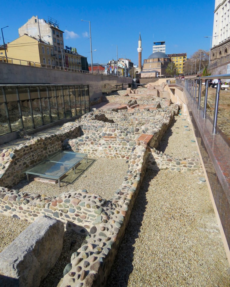 Seven millennia ago, put down the first foundations of what we now call Sofia. The construction of Sofia’s modern subway system in the 1990’s revealed multiple layers of antiquity and many of the amazing artifacts unearthed are displayed, in museum cases, on the subway platforms in the Serdika station and National Archeology Museum nearby.


 Tragically in a 1925 bombing, the Bulgarian Communist Party attempted to kill the King of Bulgaria and other members of the government who were attending a funeral at this church – one hundred-fifty people died, and the cathedral’s dome was razed. Excavations behind the church in 2015 uncovered early ruins and a treasure of 3,000 Roman silver coins from the 2nd century AD.
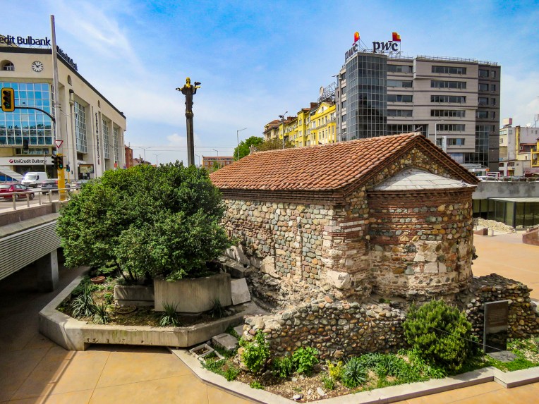


 It ends just short of Banya Bashi, an Ottoman mosque built in the 16th century. The towering statue of St. Sofia is also visible just beyond the subway station. Ancient walls found during the renovation of the Central Market Hall can also be seen in the lower level of that building.
 Nearby the oldest building in Sofia, the Church of Saint George, built by the Romans in the 4th century, has early Christian frescoes which were painted over by the Ottomans when it was used as a mosque, but they were rediscovered in the 1900s and restored. It stands surrounded by modern buildings in a courtyard behind the President of the Republic of Bulgaria building, within earshot of the Changing of the Guard.


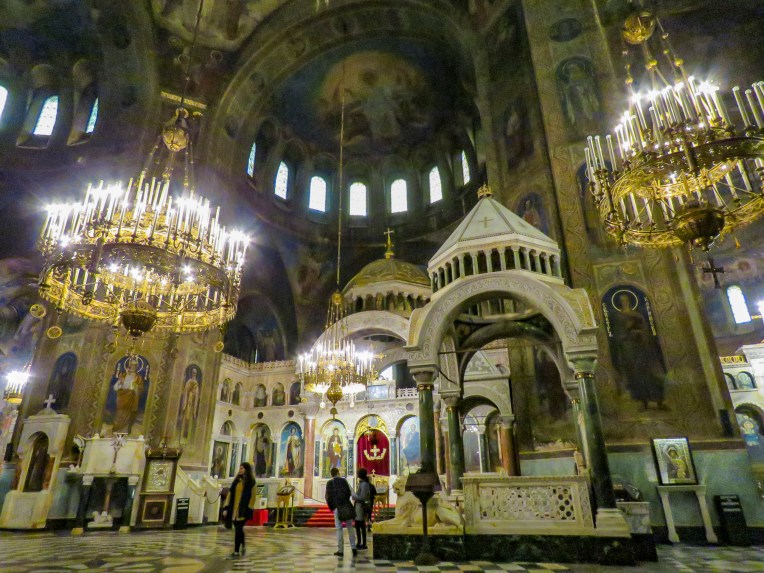 In the crypt of the cathedral a small, state of the art museum showcases the development of Bulgarian orthodox iconography over the centuries.
  Nearby, the five gilded spires of the Russian Church, officially known as the Church of St Nicholas the Miracle-Maker, can be seen from the steps of Cathedral Saint Aleksandar Nevski. Built in 1914 on the site of a mosque that was torn down after the liberation of Bulgaria, it served has the official church for the Russian Embassy and the Russian community in Sofia. The religious murals that cover the interior of the church were created by Vasily Perminov’s team of talented icon painters, who were also responsible for the iconography in Cathedral Saint Aleksandar Nevski. Darkened by decades of candle smoke, the fresco paintings in the dome were restored in 2014.


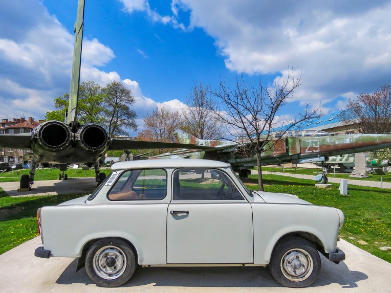 In 2001 an early Christian mausoleum was unearthed near the American Embassy and it’s fantastic that things are still being discovered in 2019.


