

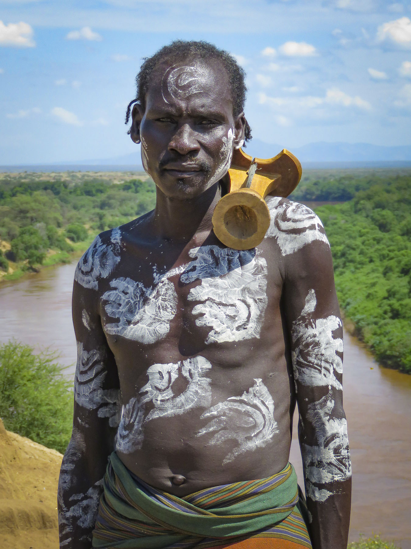
Our first glimpse of Dubrovnik caught us by surprise as we rounded a curve on Croatia’s RT 8. Its thick limestone walls and brilliant red tile roofs, saturated with color, reflected brilliantly on cobalt blue Adriatic Sea. Its nickname “pearl of the Adriatic” rightly earned.
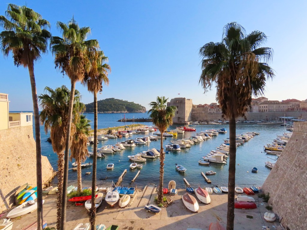
Fortunately, mid-October was considered off-season and we were able to find a wonderful apartment, Old Town Sunrise Apartments just steps away from the Babic’ Bakery and the 14th century Vrata od Ploča or East Gate with its ancient drawbridge. The agony of lugging our bags up three flights of stairs was rewarded with gorgeous views from our roof windows, since the studio apartment was directly across the harbor from Fort St. Ivana.
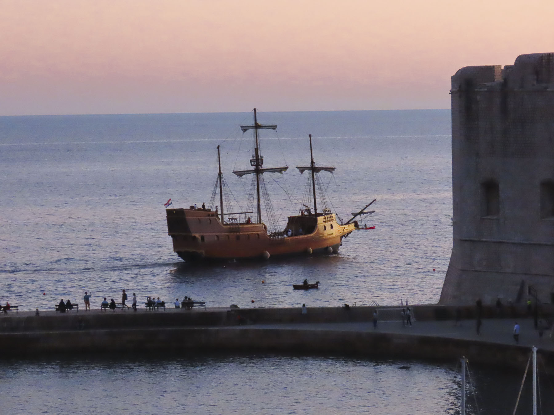

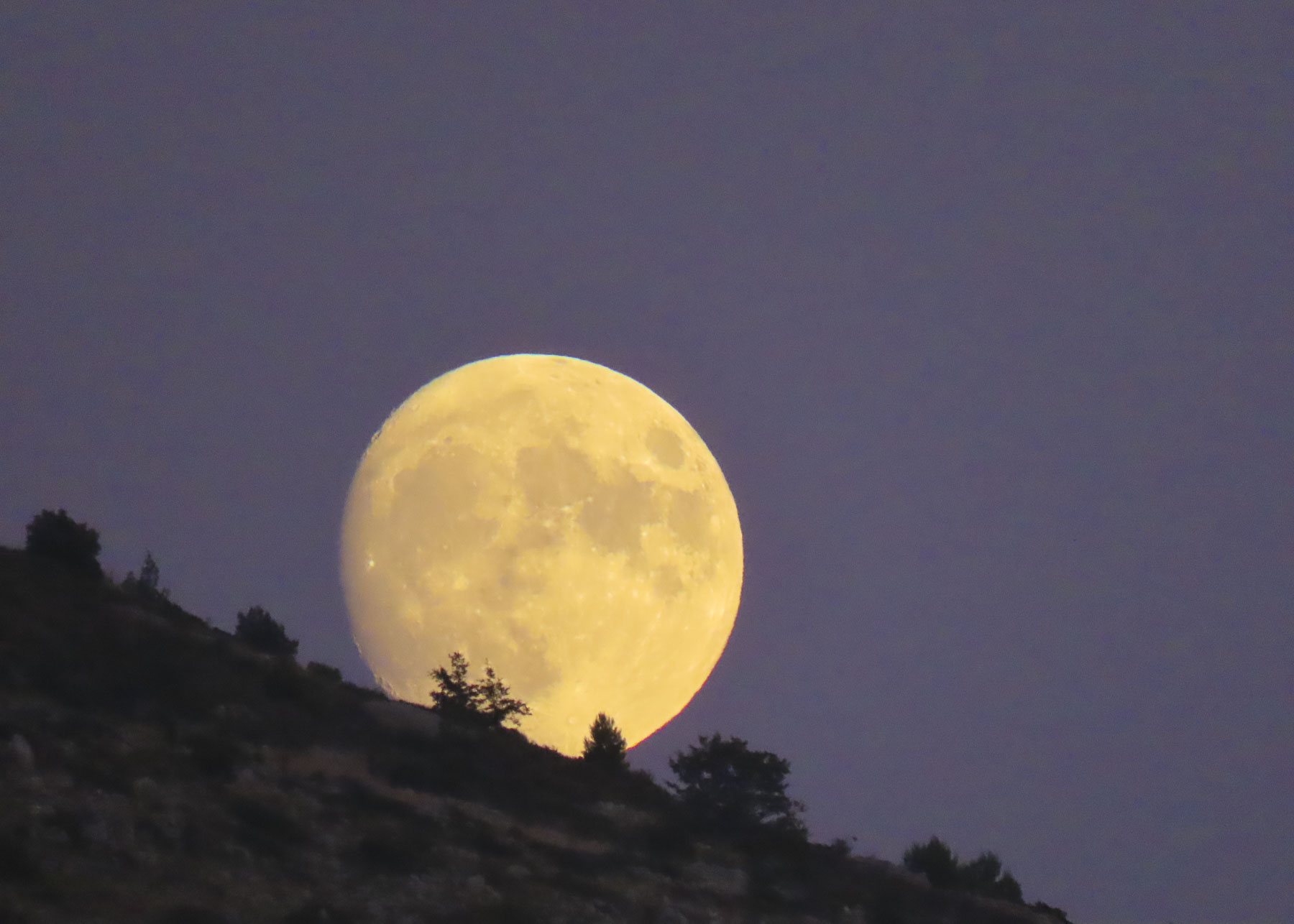
We couldn’t have asked for a better location. The sunrises and sunsets were spectacular over the Adriatic and the citadel. A brilliant Hunters’ Moon one night was an added bonus, as was watching a group of elderly friends take an early morning swim, their daily ritual.

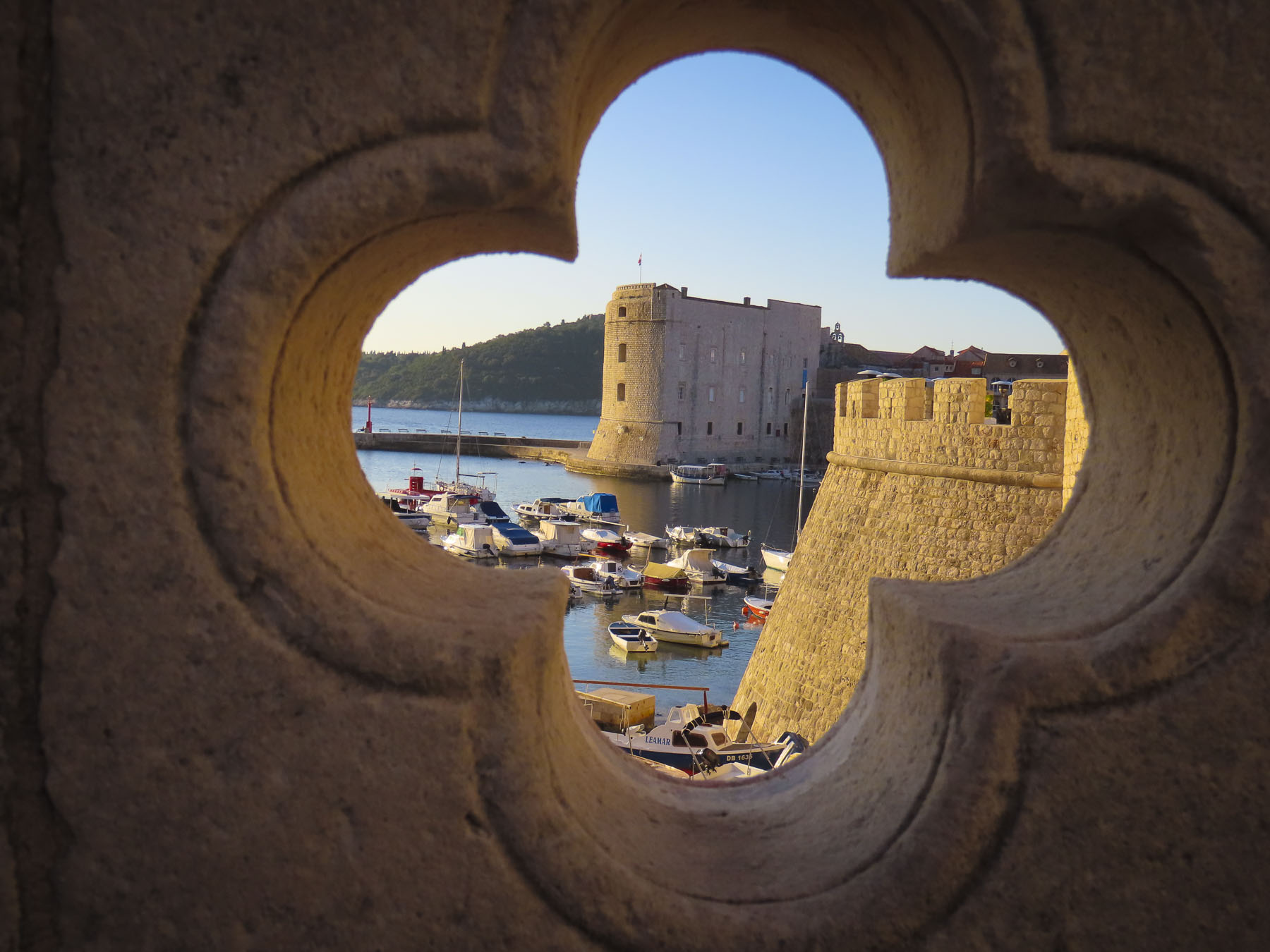
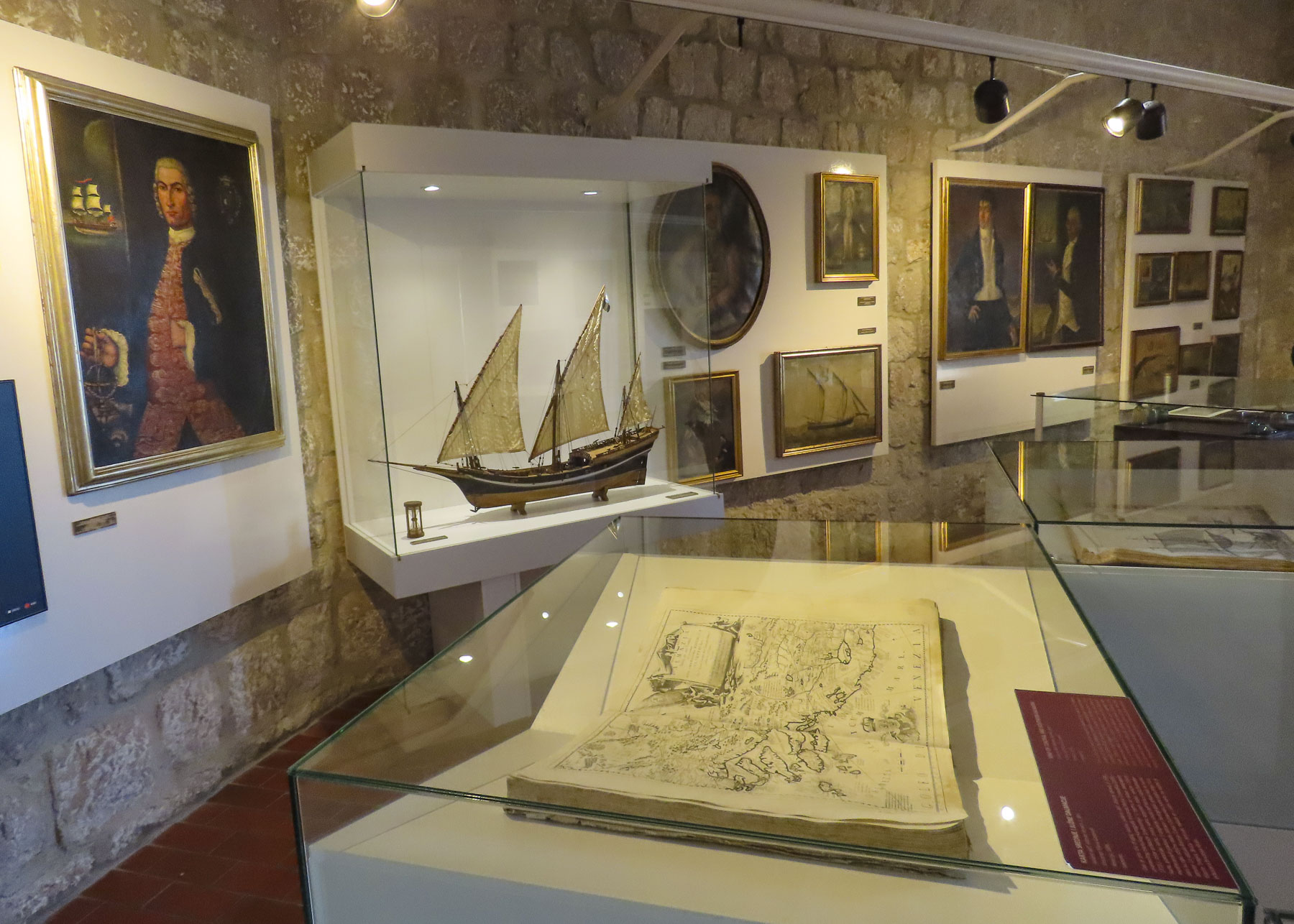
Fort St. Ivana today houses an interesting maritime museum and aquarium, but when it was built in the 16th century its canons protected the city-state’s merchant fleet from the Venetians and Ottomans. Over the centuries Dubrovnik’s maritime merchants rivaled Venice’s with trade representatives in Goa, India and the Cape Verde Islands off Africa’s Atlantic coast. Its merchant fleet even traded during the Middle Ages with the English court of Elizabeth the First.

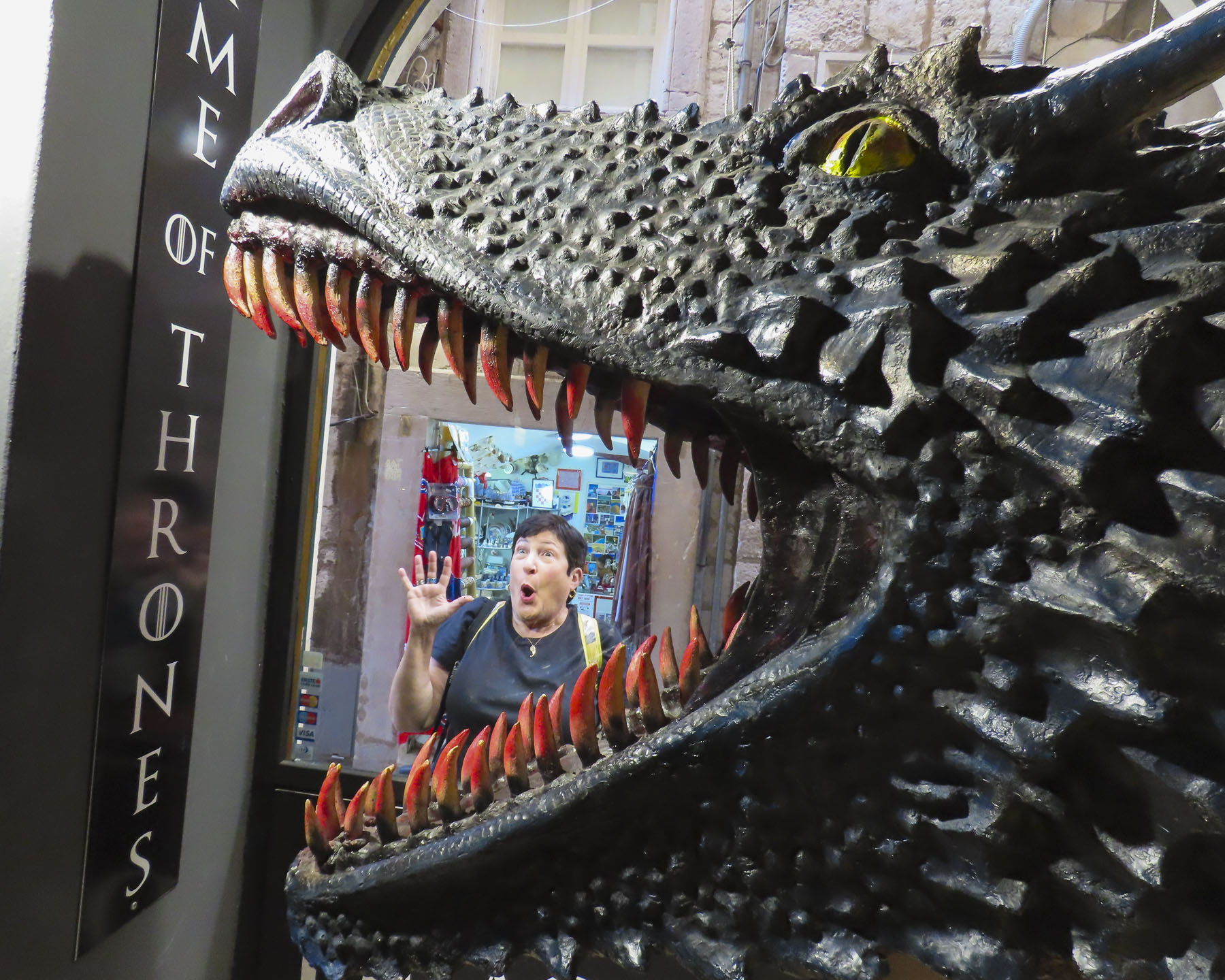
Blame it on Drogon! Since the medieval fantasy Game of Thrones was filmed in Dubrovnik the city has lost its previous reputation as an under-visited and affordable destination on the sunny shores of the Adriatic. Ever since the TV show’s premiere in 2011 the city has become a mecca, big time, for fans eager to visit the show’s filming locations. Thankfully, it hasn’t risen to placards of “Jon Snow slept here” or “Rhaegal roasted a nobleman on our roof” level yet.

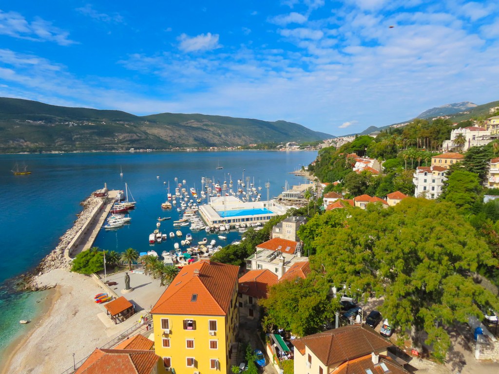
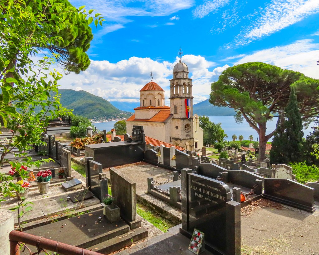
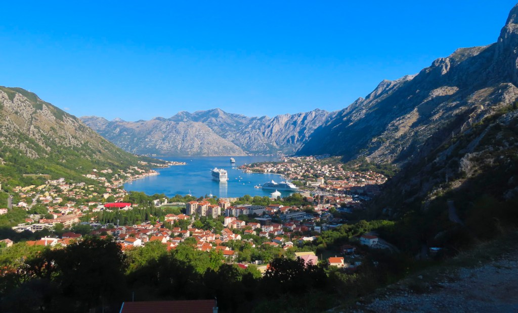
We had been on our journey fifteen months now and aside from a brief stay in London, Dubrovnik was by far the most expensive destination. I think this explains why we saw so many people walking down Stradun, the city’s main pedestrian boulevard, eating slices of pizza. The impact of these high prices was especially acute since the affordability of Kotor, Montenegro (only a short drive away) was still fresh in our minds. It was actually easier to find an affordable restaurant in London. It was captive pricing for sure within the fortress walls that encircle Old Town and the only reprieve was to eat in the new town portion of Dubrovnik, outside the citadel.
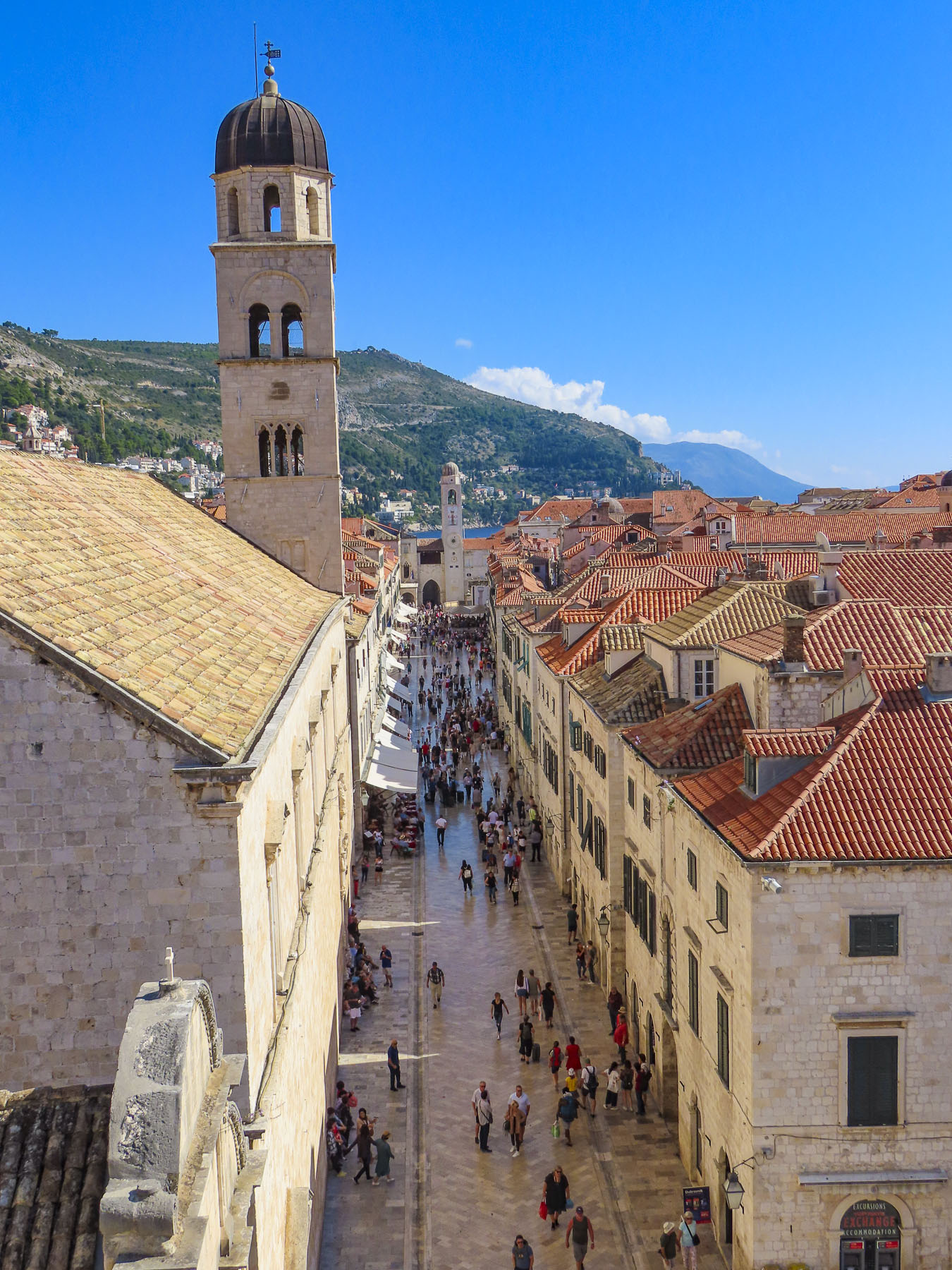
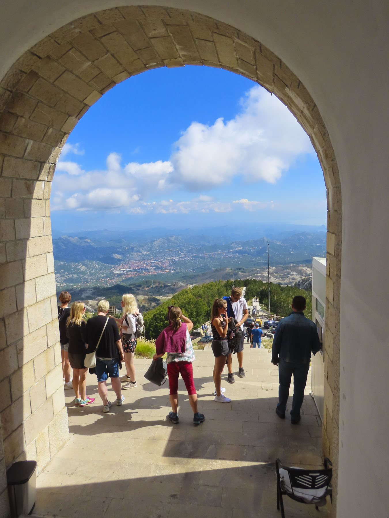
Stradum, aka Placa (Stradone or Corso) is the city’s pedestrian-only main boulevard, running 300 yards east to west, connecting both ancient gates and harbors on either side of town. For us it was too pristine. An unfair comment, as this resulted when Dubrovnik was rebuilt after the 1991 Balkans War, when the city was shelled for seven months from the top of the mountain above town. Two hundred eighty civilians and soldiers were killed during that prolonged bombardment. Today an aerial tram takes you there for panoramic views. Shrapnel scars, signs of the conflict, remain etched into the stone walls on some buildings. But the newness of the polished limestone boulevard running past upscale shopping reminded us of an amusement park.

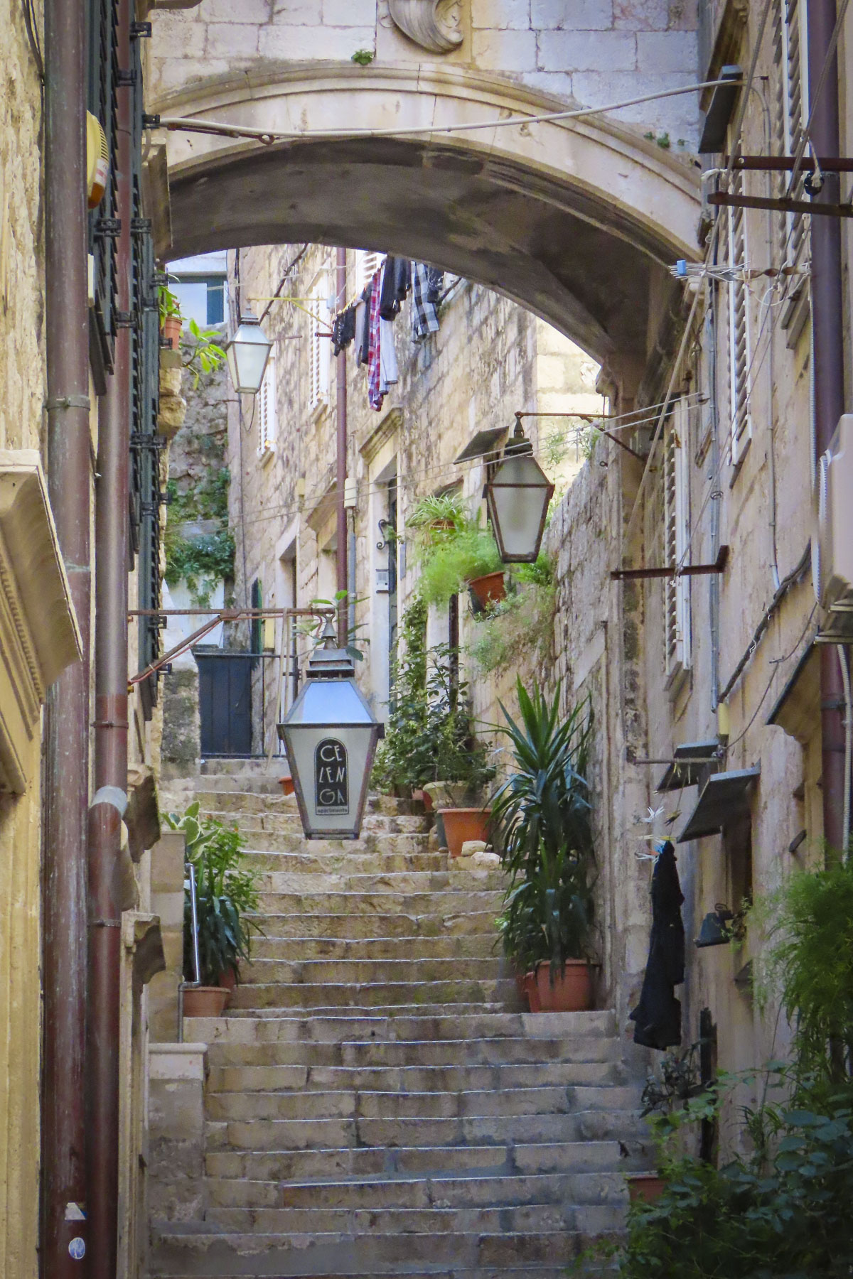
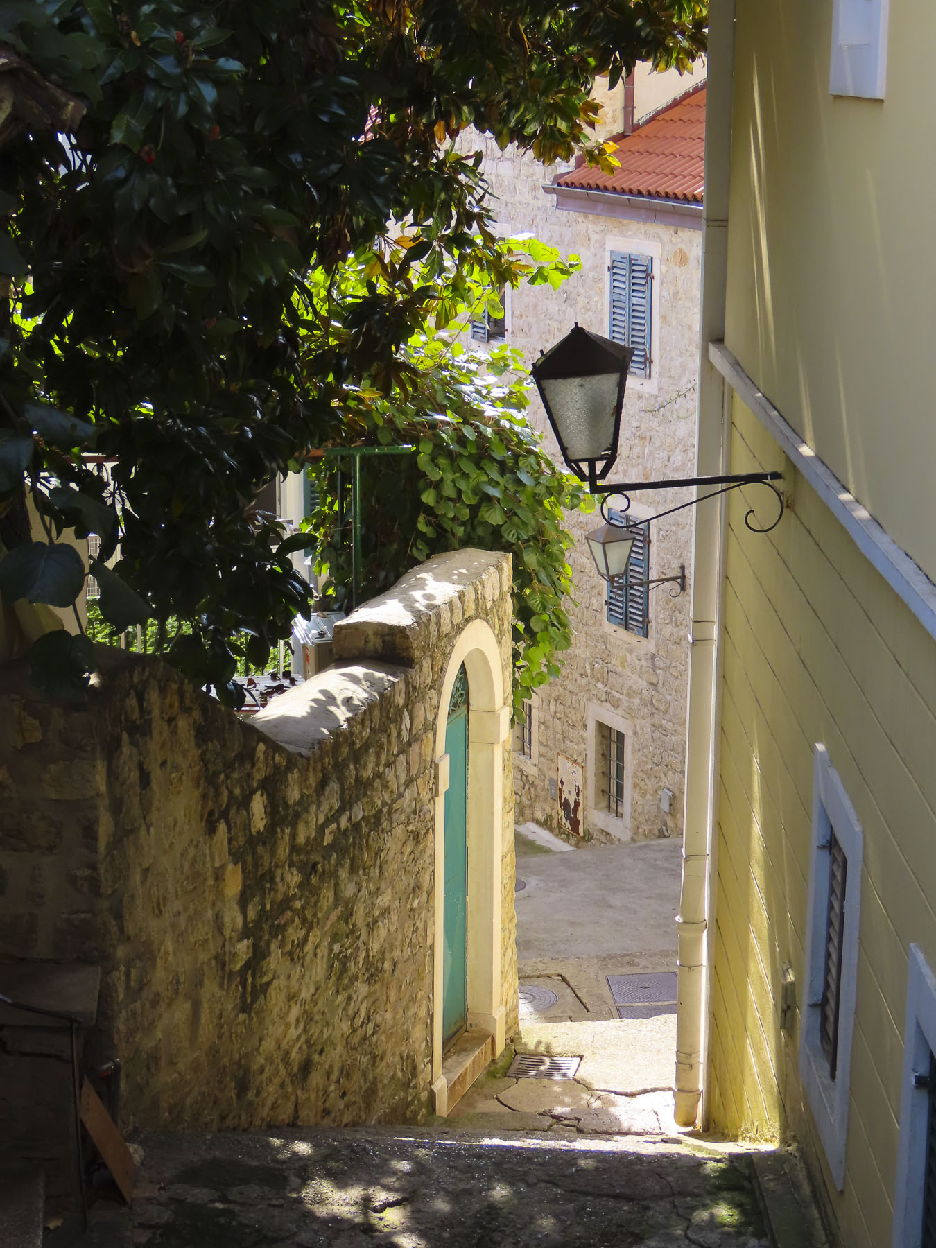
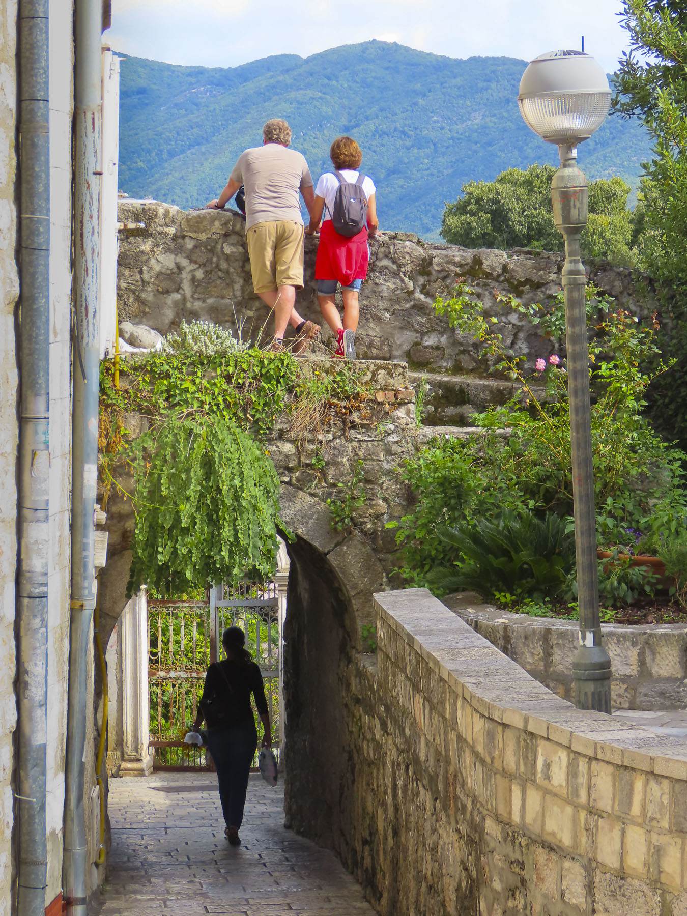
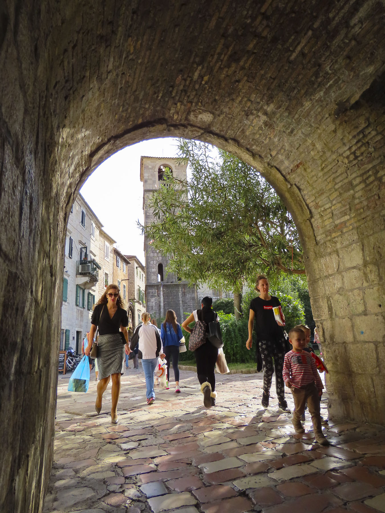
We were drawn into the narrow, arched alleys with steep stairs that climbed the hills and weaved through older neighborhoods on either side of Stradum. The farther away from Stradum we got, the more the crowds diminished.
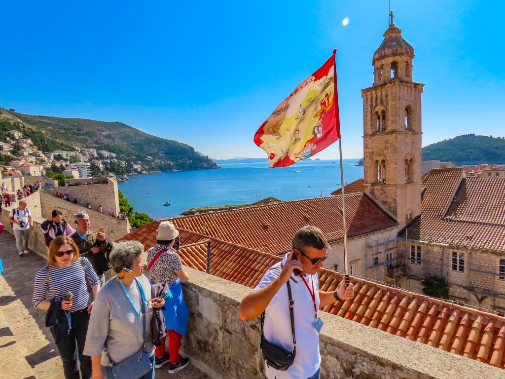
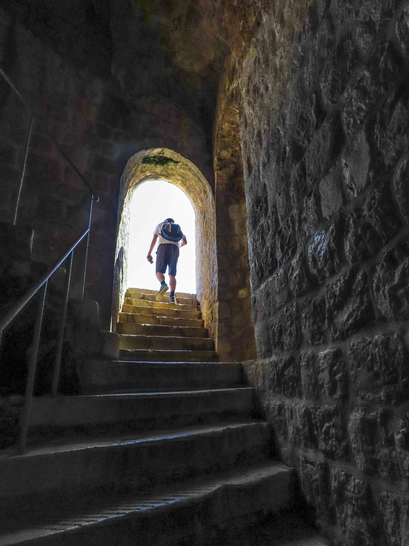
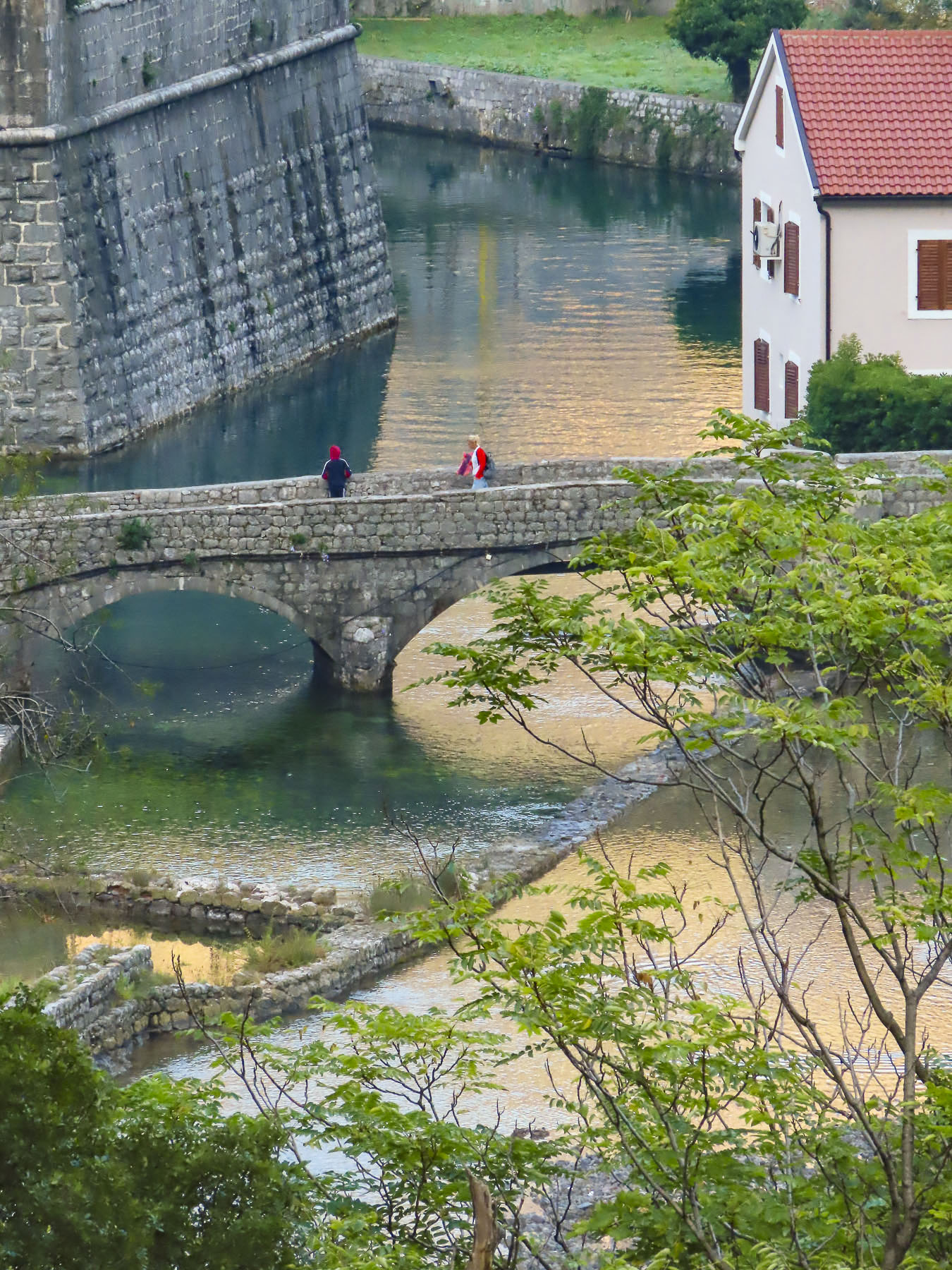
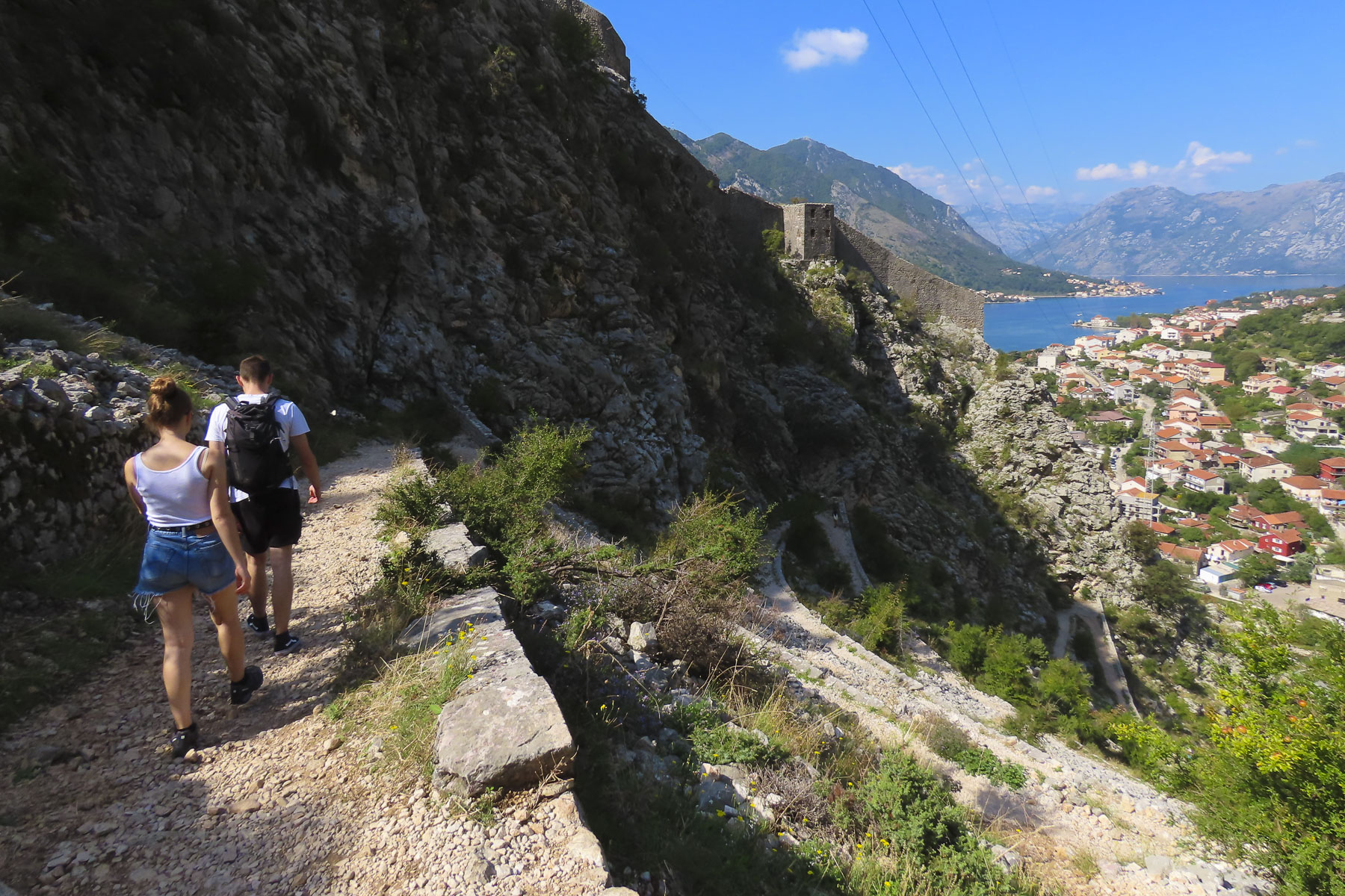
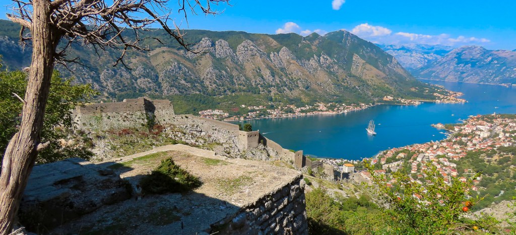
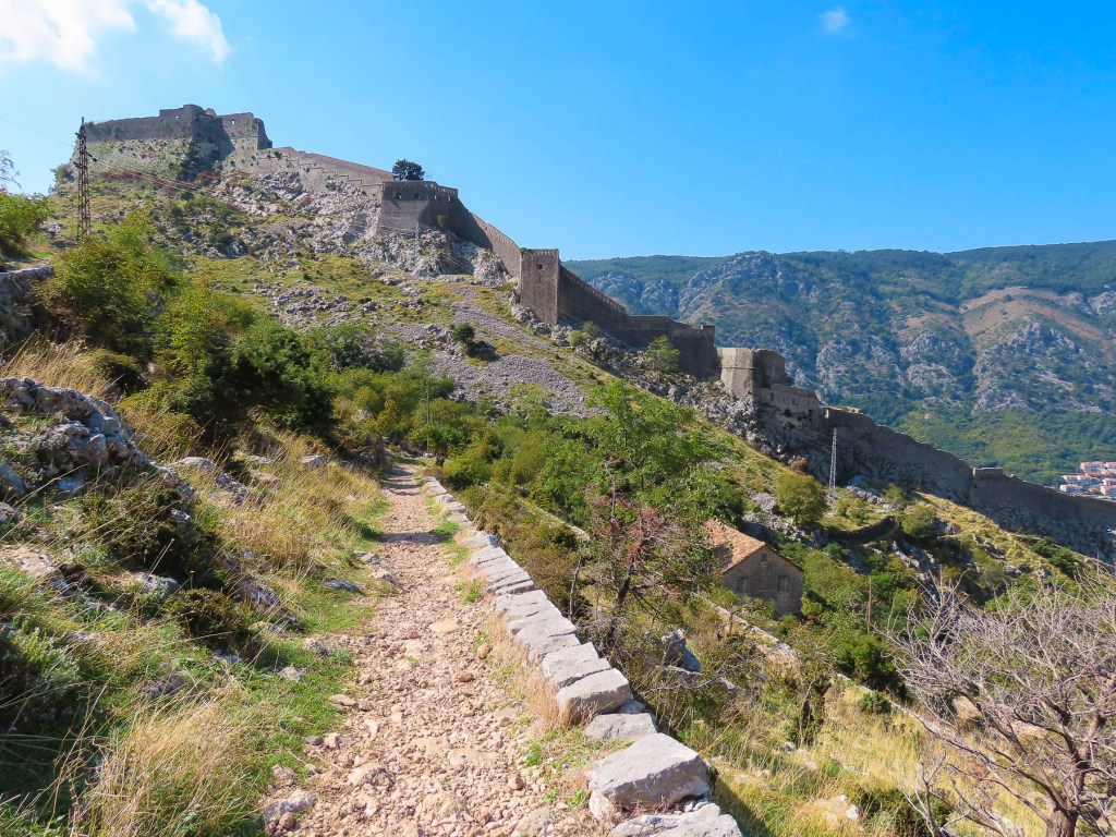
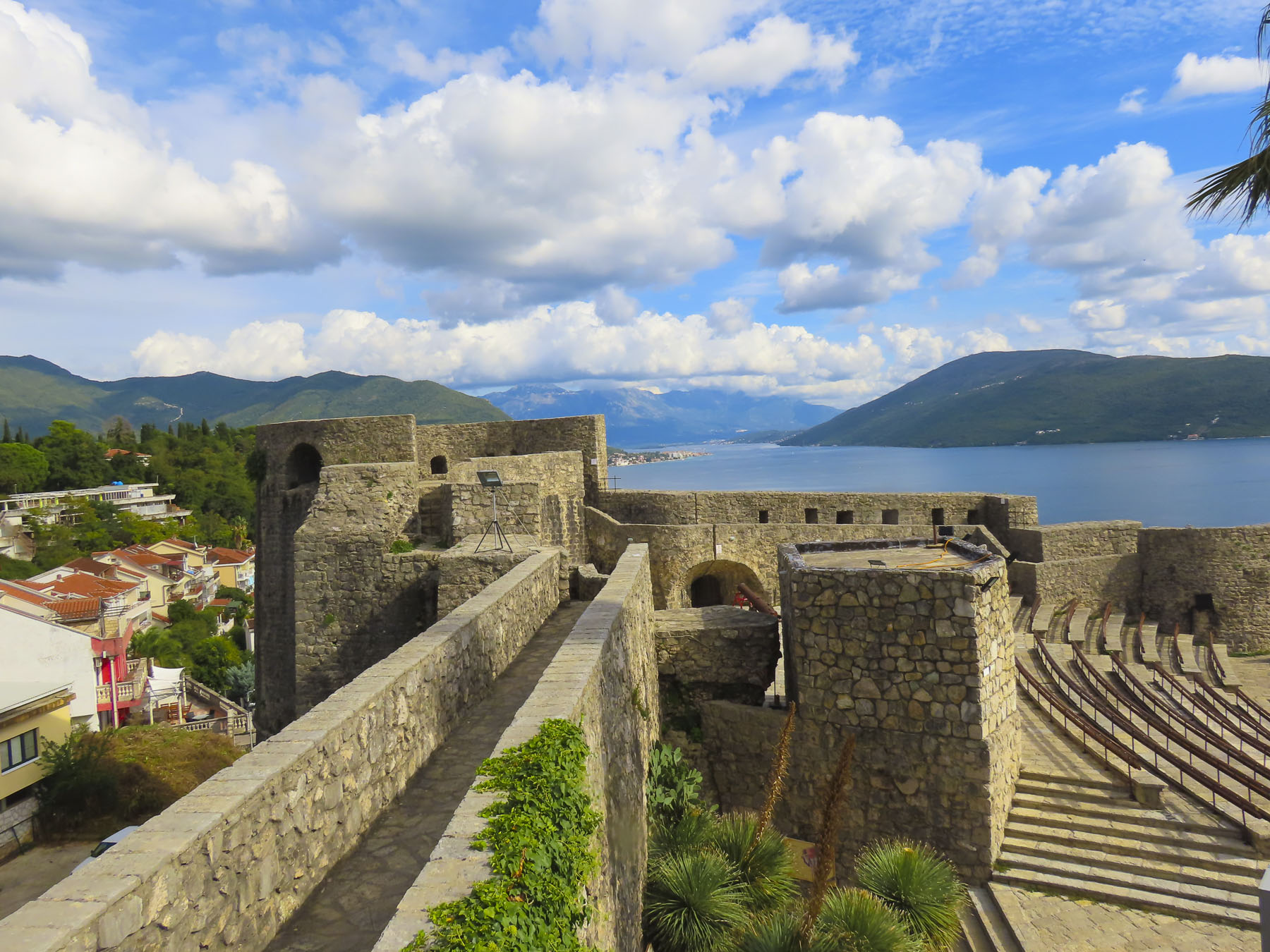
Our other alternative was to walk along the fortress walls that encircle the city for slightly over a mile. Thirteen to twenty feet thick and towering eighty feet high in some sections, the walls once held 120 cannons to protect the city from land or sea attack. This walk is a popular activity with fast moving tour groups, but we found if we just let them pass there would be a tranquil void until the next group which allowed us to linger in one spot for a while.


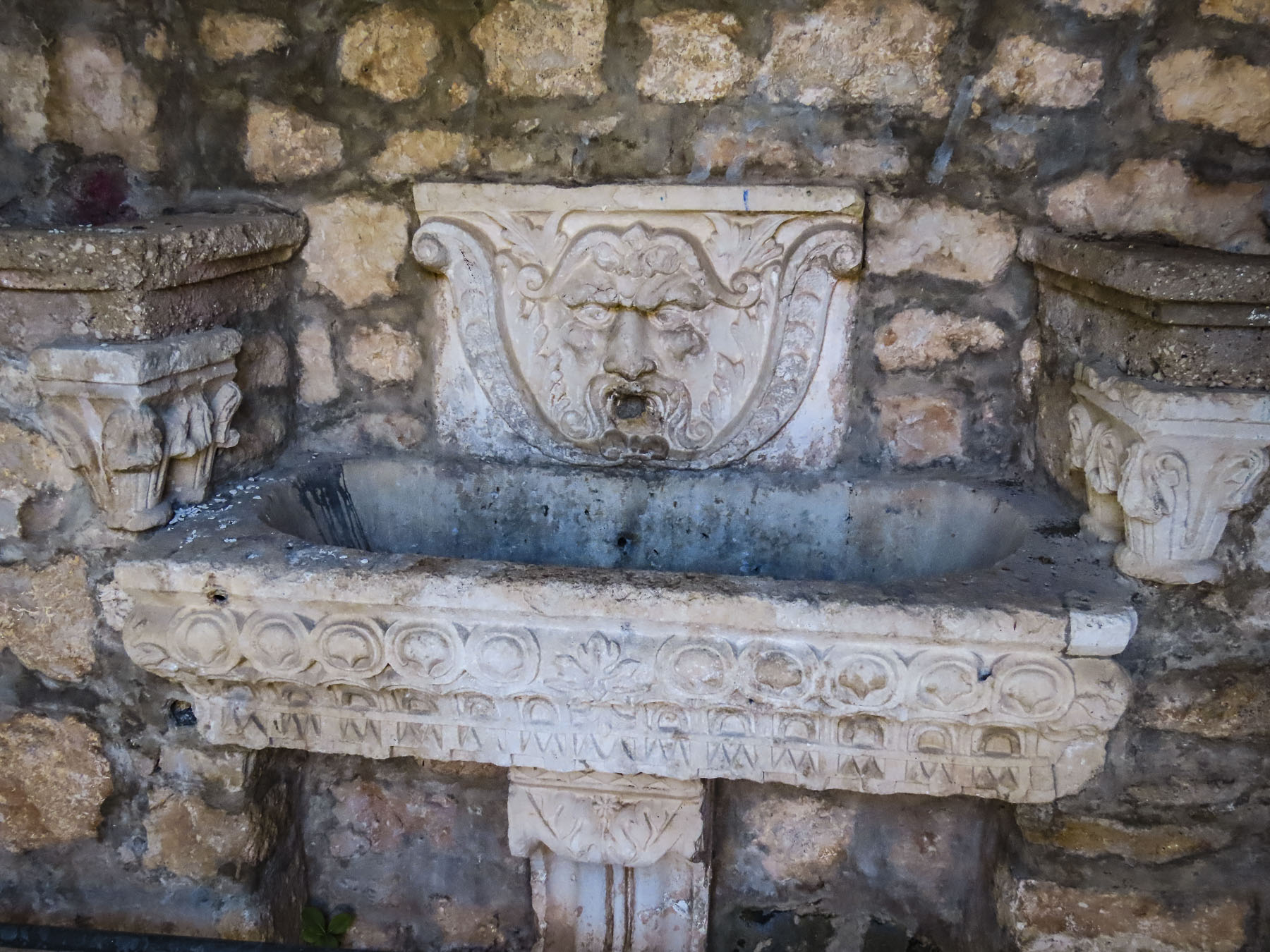
Standing above the West Gate and looking down the Stradum was a prime view that included the circular Large Onofrio’s Fountain built in 1438 and which still supplies fresh spring water, from mountains miles away, to carved faces that spurt water. Farther down the Franciscan Church and Monastery houses the oldest continuously operating pharmacy in the world dating to 1317 in its muraled cloister. Farther along the wall there were several small cafes and stairs that lead to roped off swimming areas at the sea’s edge.


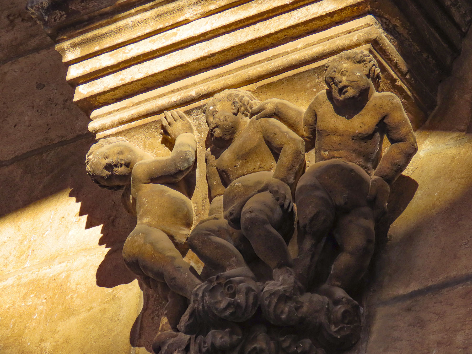
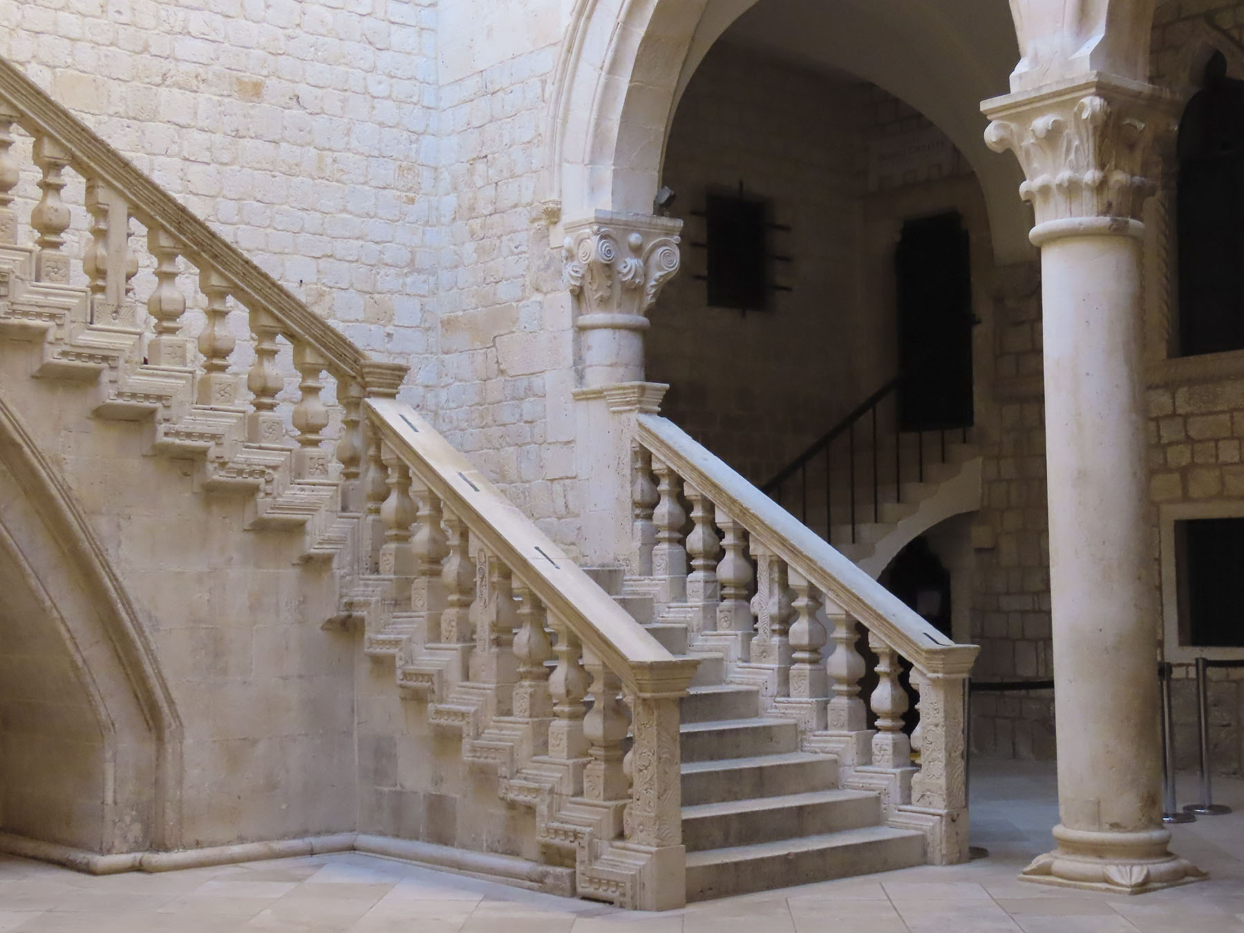
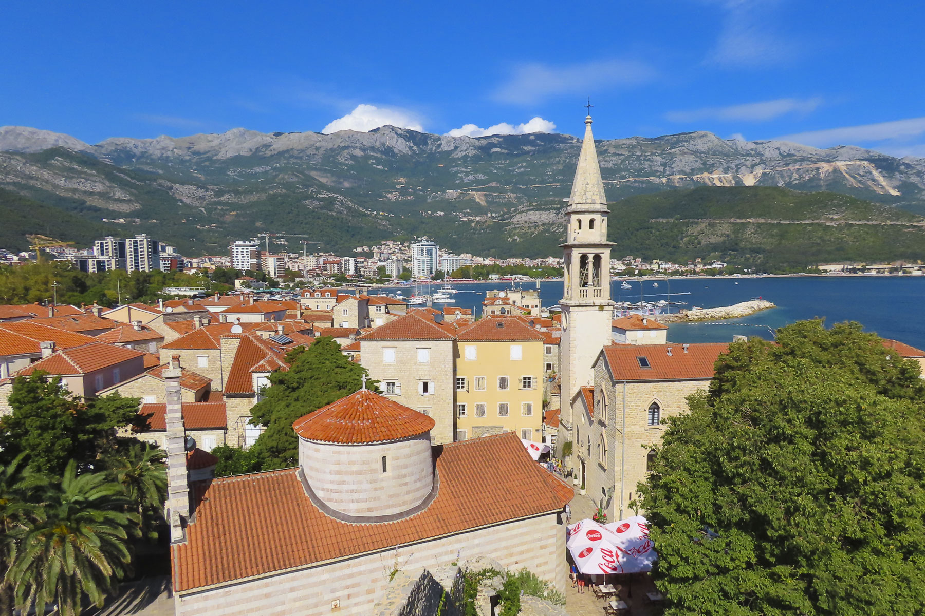
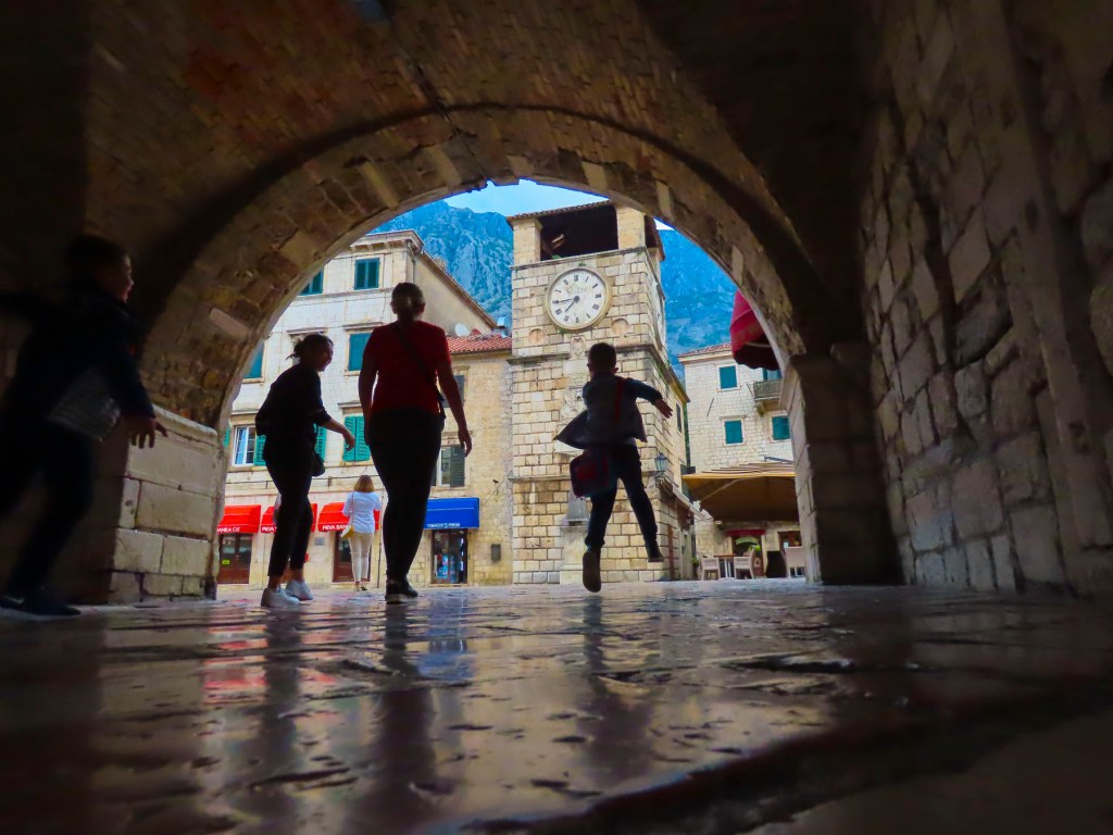
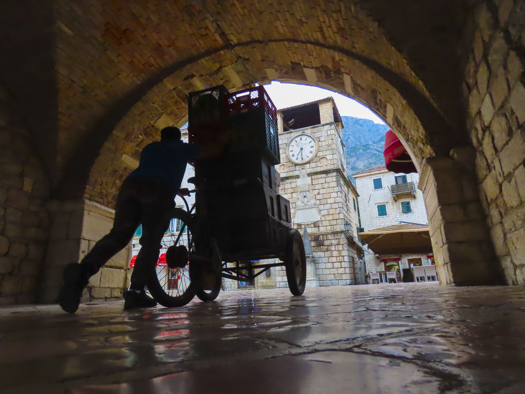
At the far end of Stradum the city’s 100 ft tall clock and belltower zooms skyward over an area that was once the city market in the 1400s. Famously the belltower has two bronze figures named Maro and Baro, zelenci (green) twins that strike the bell on the quarter, half and full hour. Interestingly, several generations of the same family have maintained the clockworks for over 100 years. Next door the 14th-century Gothic-Renaissance style Rector’s Palace exhibits vestiges of Dubrovnik’s history. Especially noteworthy were the intricately carved exterior columns.


Across the street the statue of golden statue of Saint Blaise cradling a model Dubrovnik on his arm crowns his church.


The city’s 16th century granary and mill has undergone a beautiful and innovative renovation and now houses the Etnografic Museum Rupe. It has a prominent collection of Croatian Cultural items, particularly traditional attire from the regions surrounding Dubrovnik.

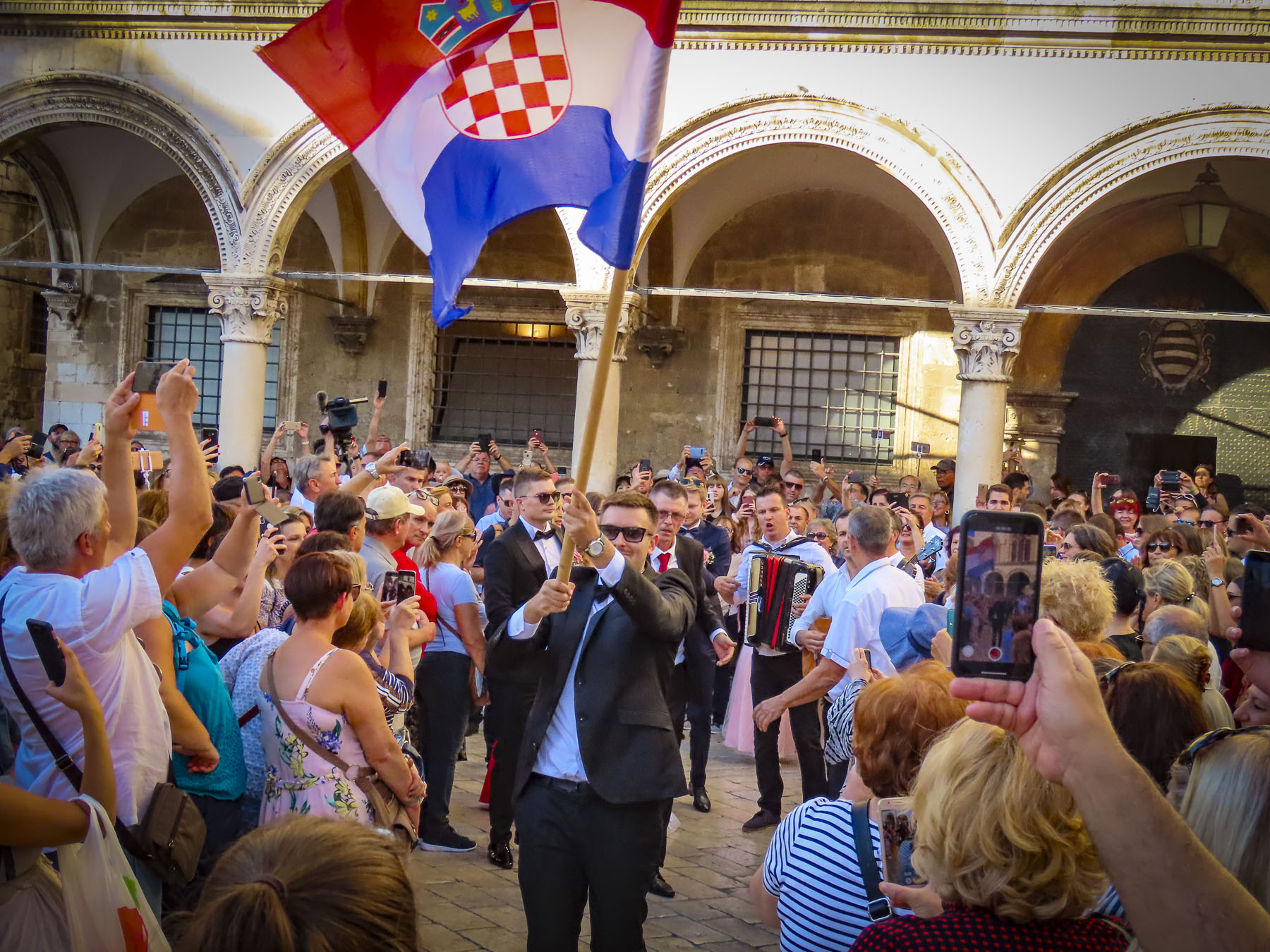
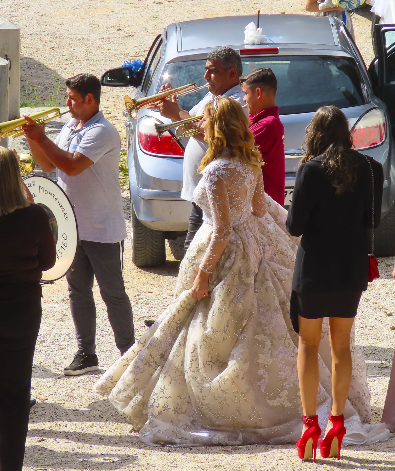
Weddings are a boisterous affair in Dubrovnik, with the bride and groom following a flag waving entourage parading through the pedestrian-only streets on the way to their church ceremony.

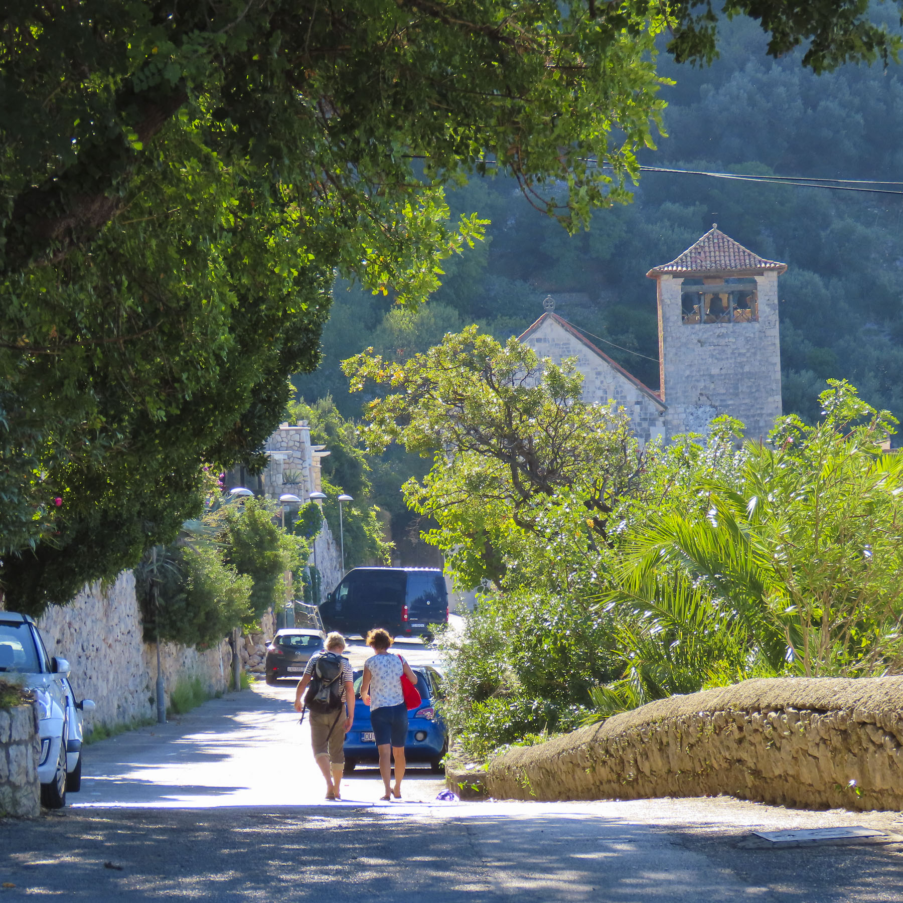
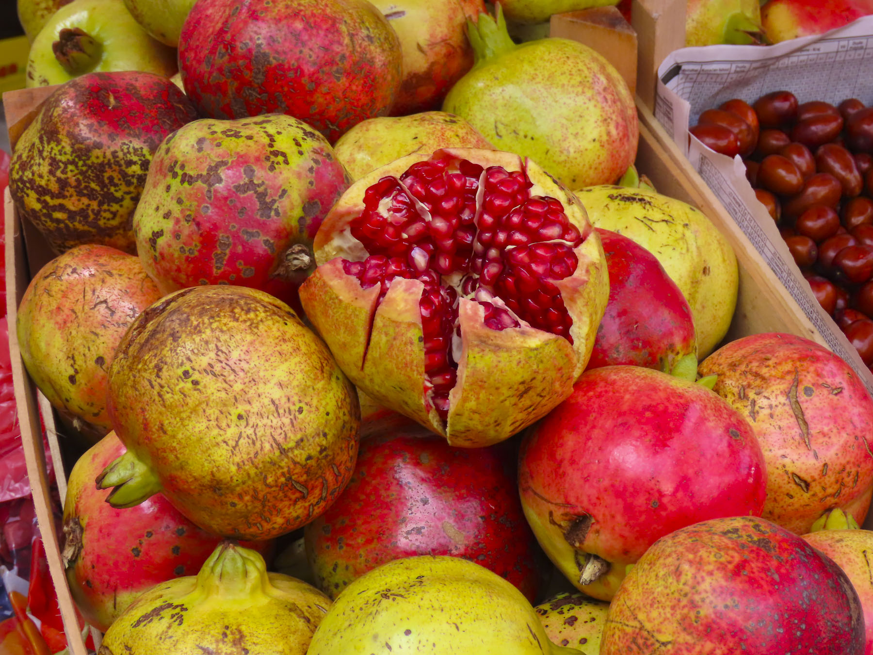
Walking east one morning away from the city, along Ul Frana Supila, a quiet road that hugs the water, a small village ambiance prevailed with colorful homes, flowering plants and wild pomegranate trees set into the hillside.
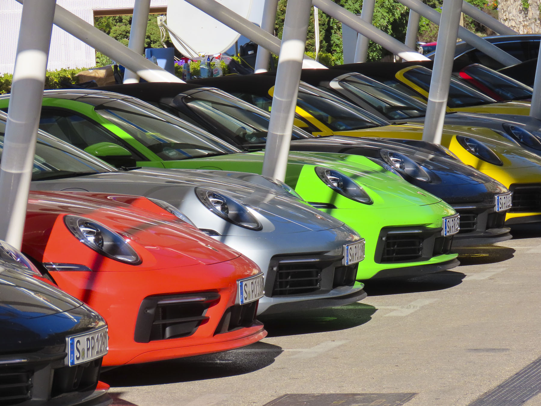
Villas for the well to do, many built on the ruins of previous civilizations, line the road, beautiful none the less. Bored? There was a rainbow-colored selection of wheels for rent at the exotic car dealer to satisfy that zoom, zoom craving.


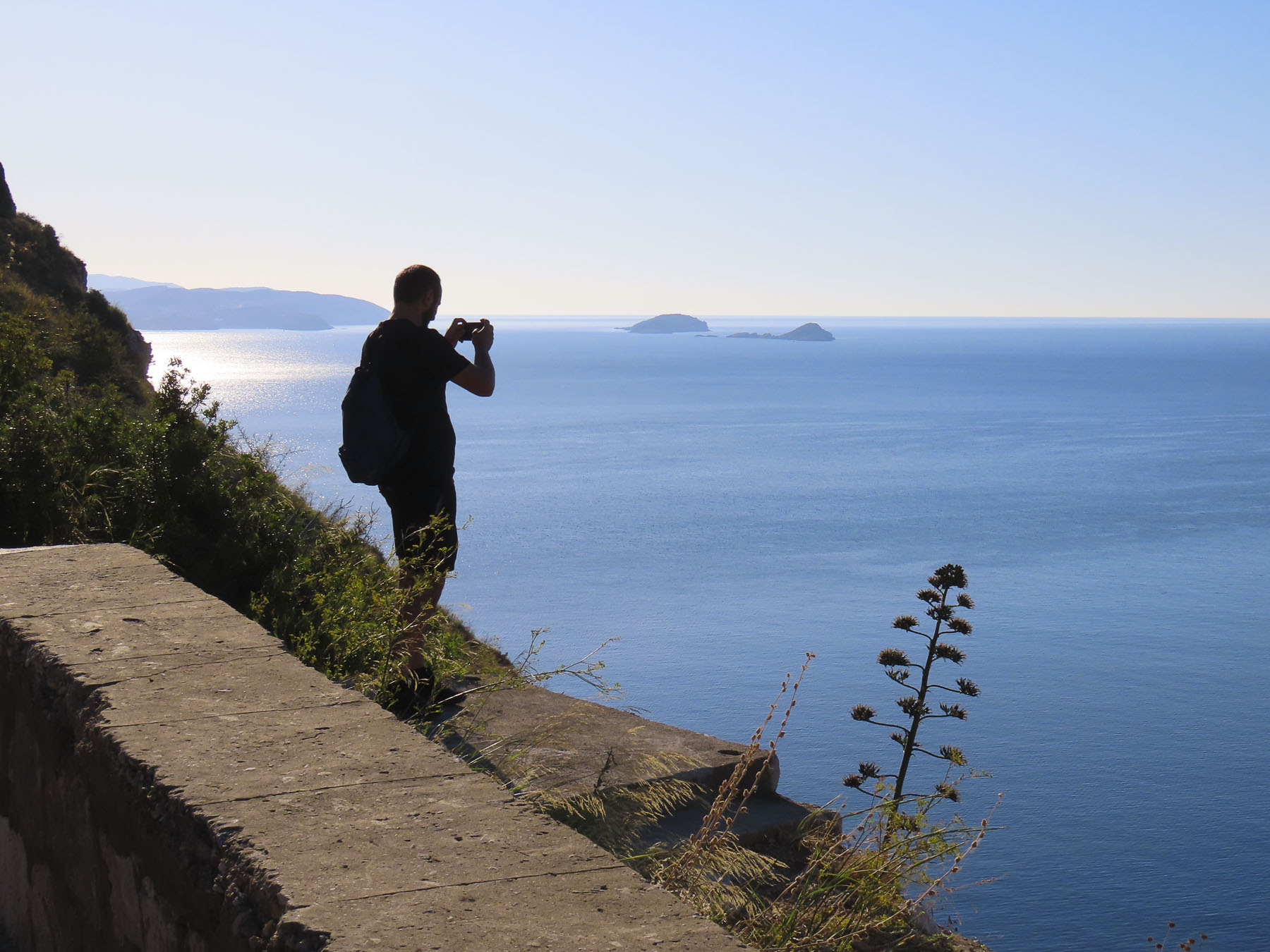
Eventually the road narrowed and a chain across it prevented cars from going farther along a treacherous, serpentine stretch that hugs the cliff face. The road used to connect back to the highway near one of the scenic overlooks. But it was determined to be too dangerous when its guardrails tumbled down the cliff into the sea. Now only walkers and bicyclists use it to traverse a dramatic section of the coast.

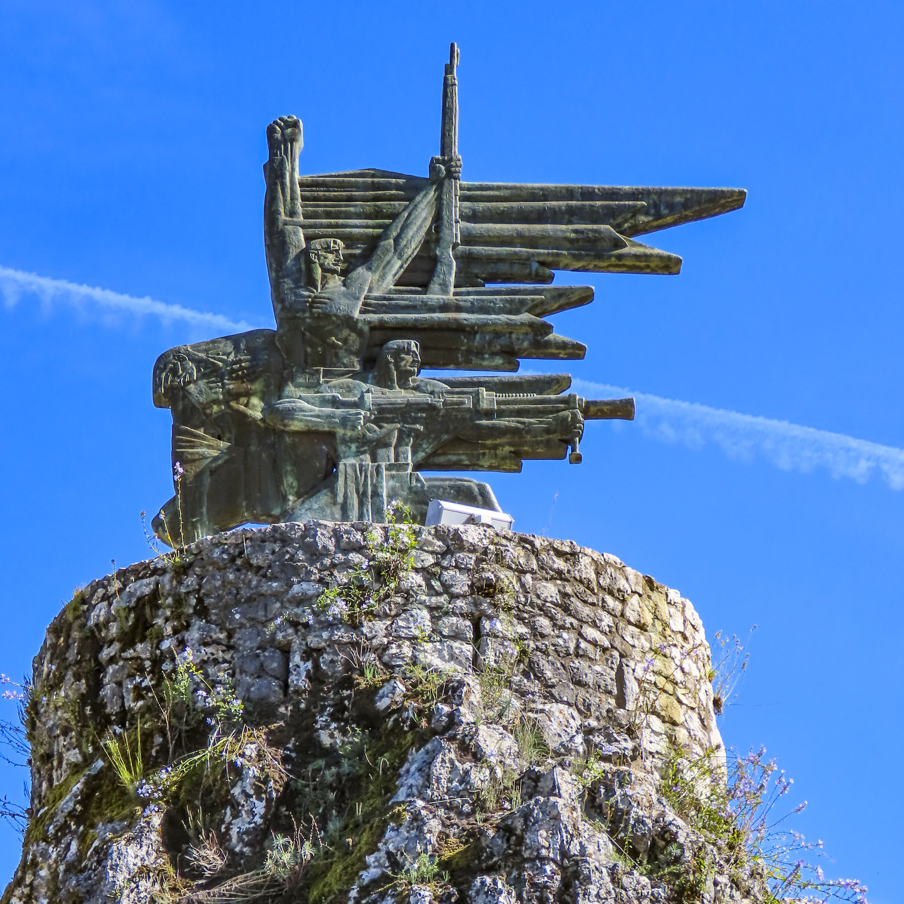
A memorial, Spomen ploča žrtvama komunističkog terora, to victims of the communist terror, stands on a curve in the road. It commemorates the lives of five young Yugoslavian partisans thrown from the cliff to their deaths by communist “liberation forces” loyal to Marshal Tito at the end of WWII.

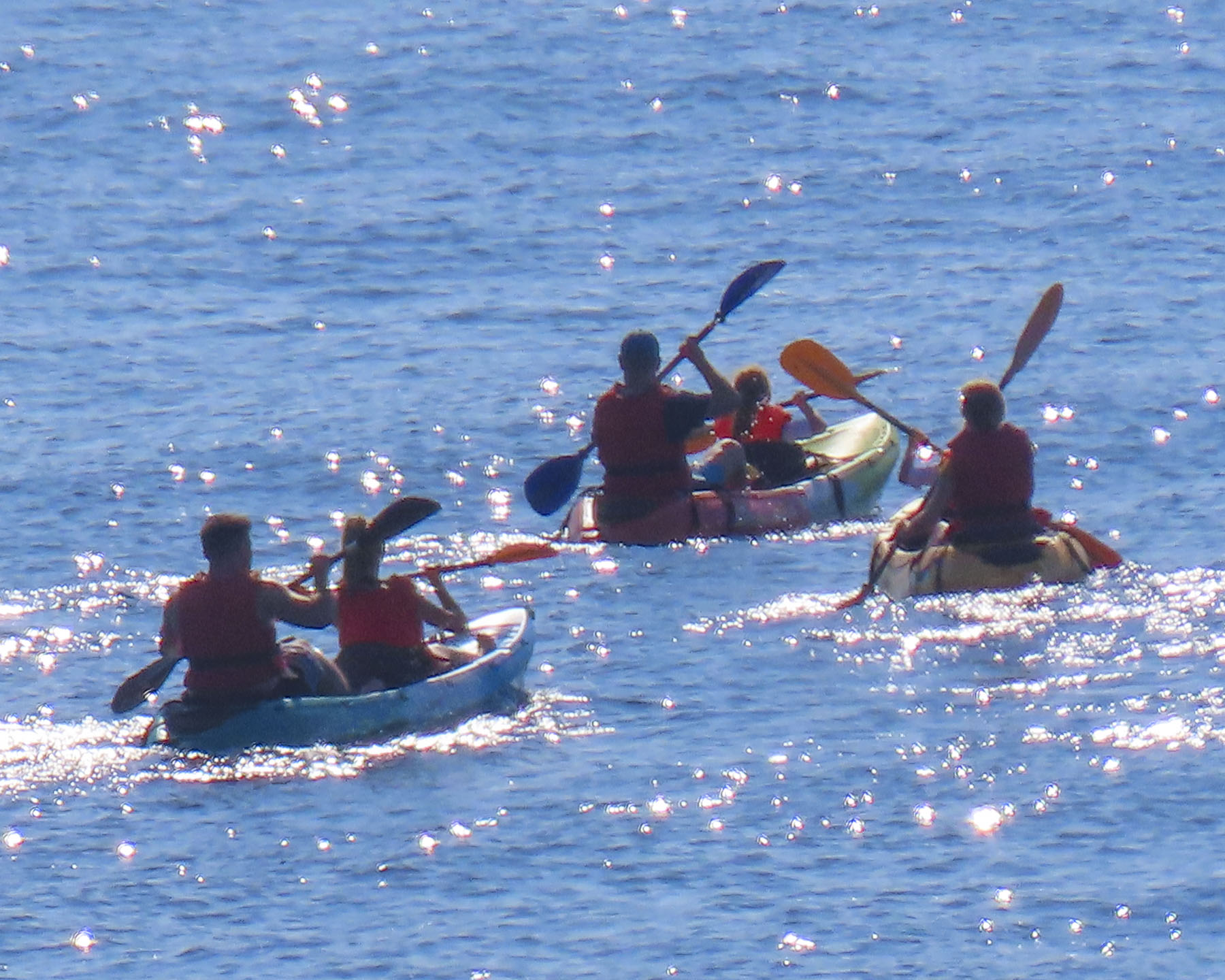
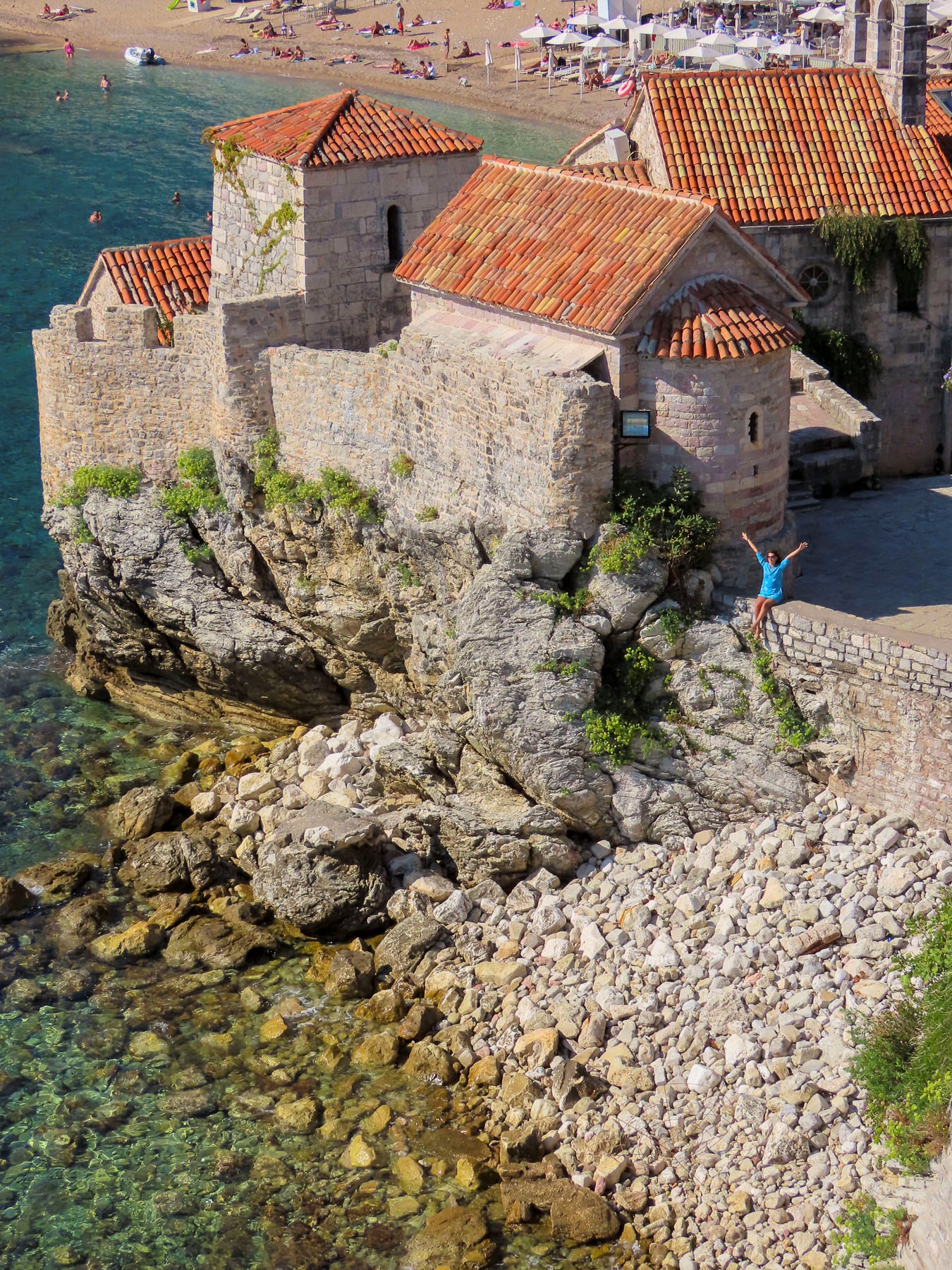
Across from Dubrovnik’s West Gate and harbor, the 11th century Fort Lovrijenac, the “Gibraltar of the Adriatic,” sits atop a towering rock monolith 121 feet above the sea. Climbing to the top of the citadel along well-worn footpaths and stairs satisfied us with great views back across the harbor of walled Dubrovnik and kayakers paddling along in the cove below.


Many kayaking tours leave from West Harbor. Today Lovrijenac’s walls, some reaching a thickness of 39 feet, support theater and music productions during the summer months. The dramatic setting is also the backdrop for Red Bull Cliff Diving World Series and Knightfall, a historical fiction TV drama about the Knights Templar.
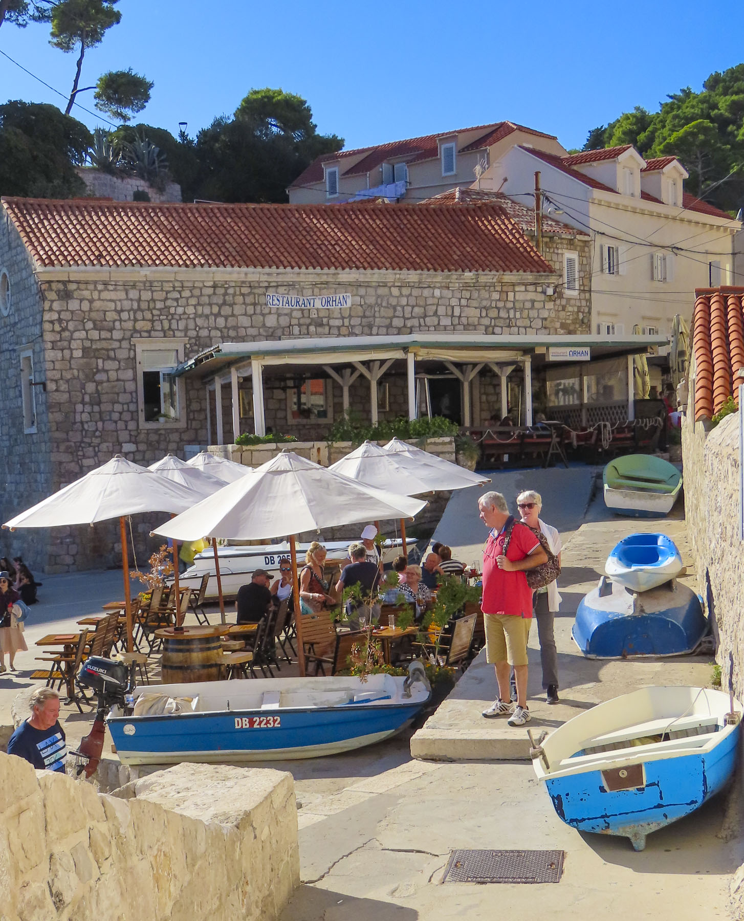

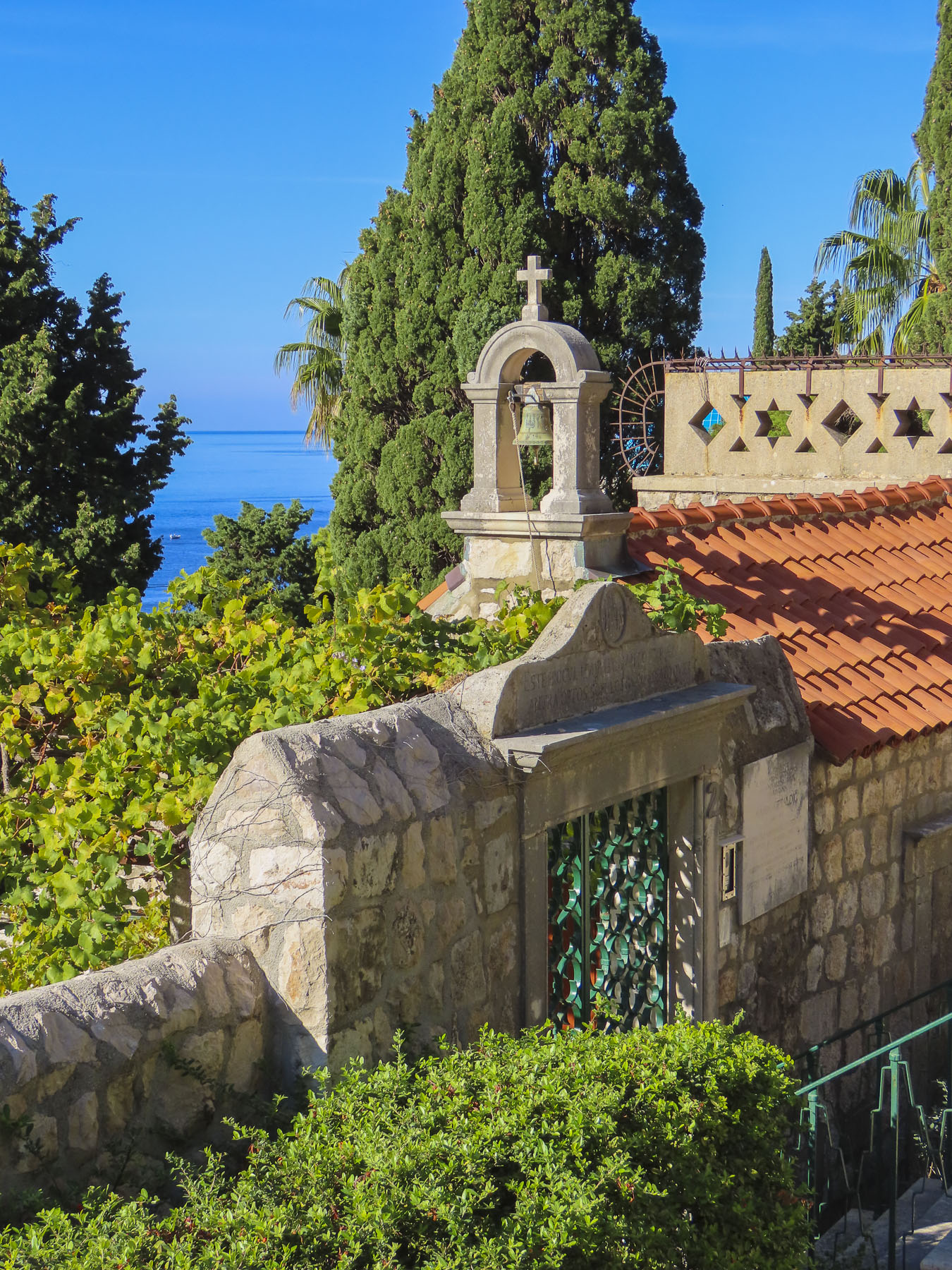
Behind the fortress, wandering the narrow lanes along the water’s edge felt like we were in a quaint seaside village.

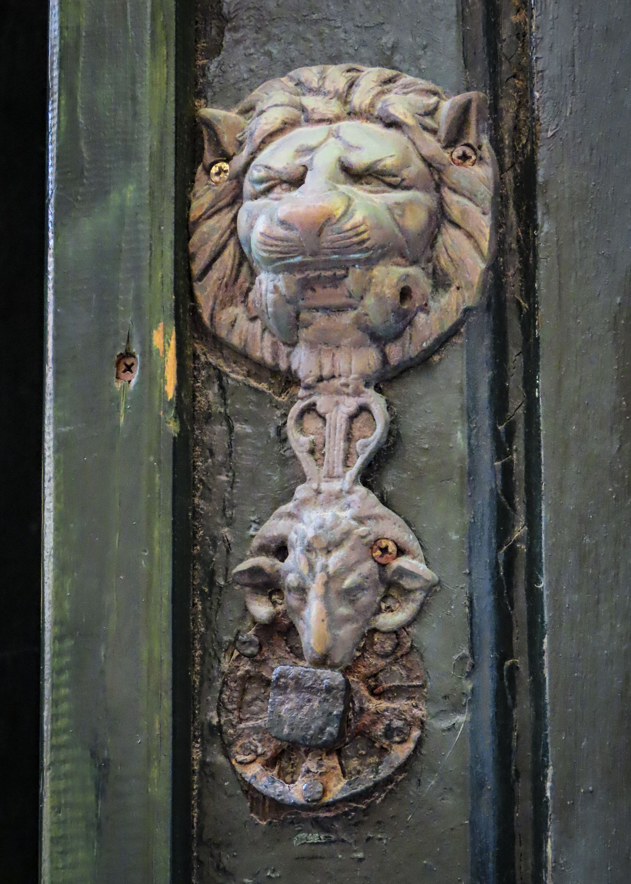
We thought the Three-Day Dubrovnik Card was a good value for us, since it offered free entrance to six museums, two galleries and the city walls, as well as six free rides on the local buses. Staying just outside the fortress walls permitted us to avoid a premium room rate yet allowed us easy entry into the citadel early in the mornings and to find those quiet vignettes and ancient architectural details hidden amidst dramatic shadows.


For moments we felt like we had this beautiful medieval city all to ourselves.
Till next time, Craig & Donna


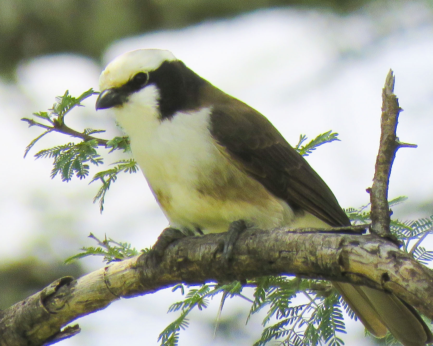


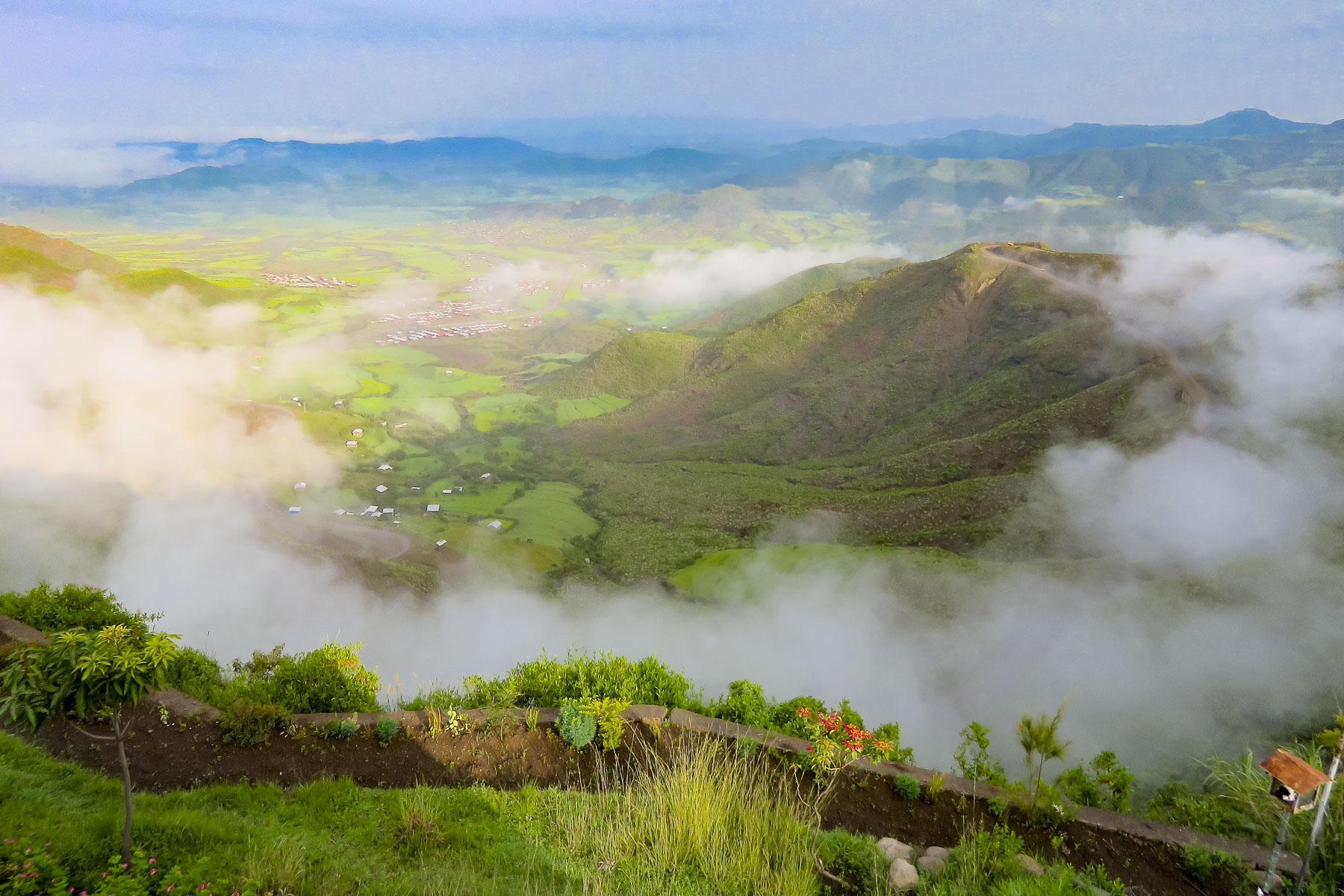 We started our day listening to bird calls and watching the morning clouds burn off from the valley below our hotel as the sun rose higher into the sky. The


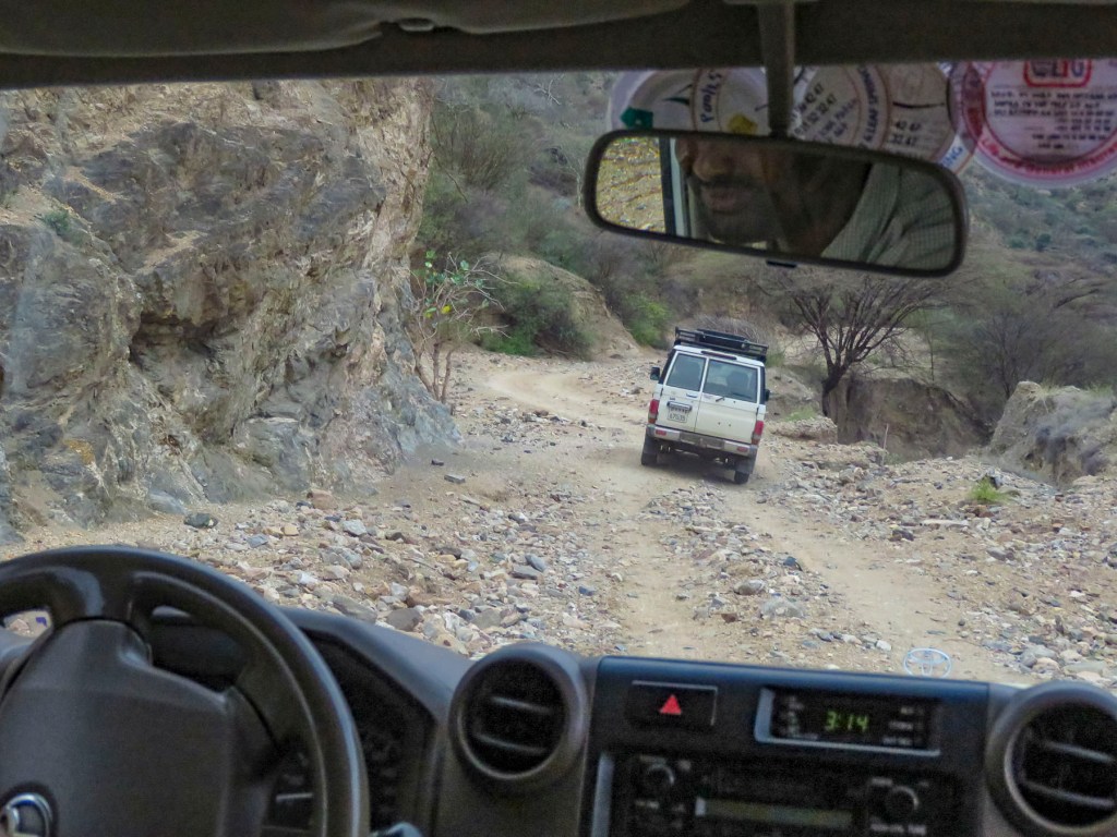
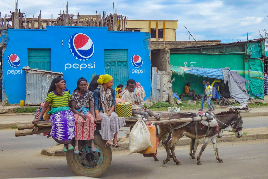
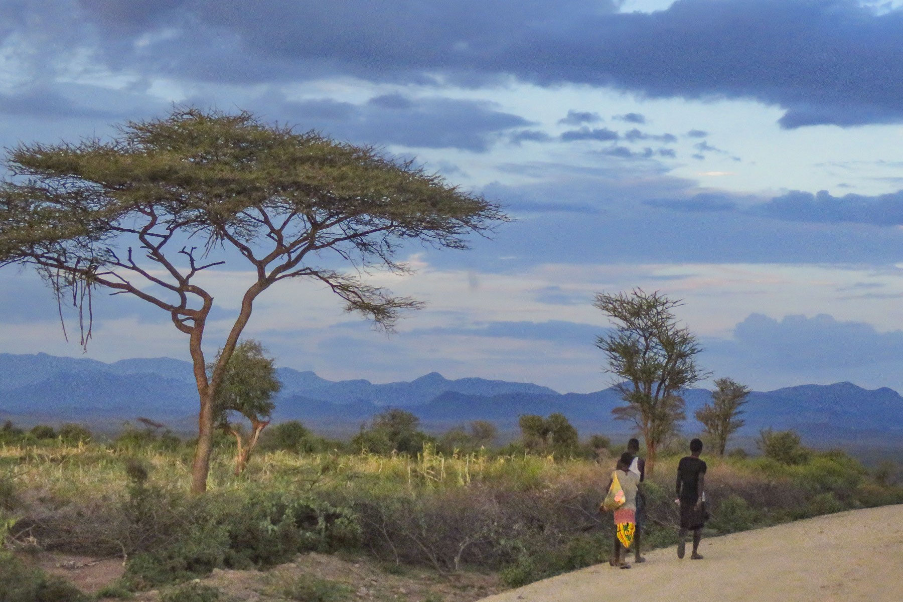
 The shops were busy, and the roadside Ping-Pong games were in full swing as we departed Lalibela. The road into the mountains rose quickly from Lalibela into a semi-forested landscape. Too steep for crops, the land was used for cattle, which grazed on clumps of wild grasses on the hillside. We stopped at one clearing for the view and noticed a herder gently nudging his cows away from recently planted tree seedlings. “This is part of our government’s commitment to reverse deforestation and help mitigate climate change. It’s called the
  “On July 29th Ethiopians planted 350 million trees in a single day, a world record!” he proudly shared. “The farmers know how important this is and help shoo the cattle away, but the government has also chosen a tree seedling that doesn’t taste good.” This annual Ethiopian project is part of the African Union’s
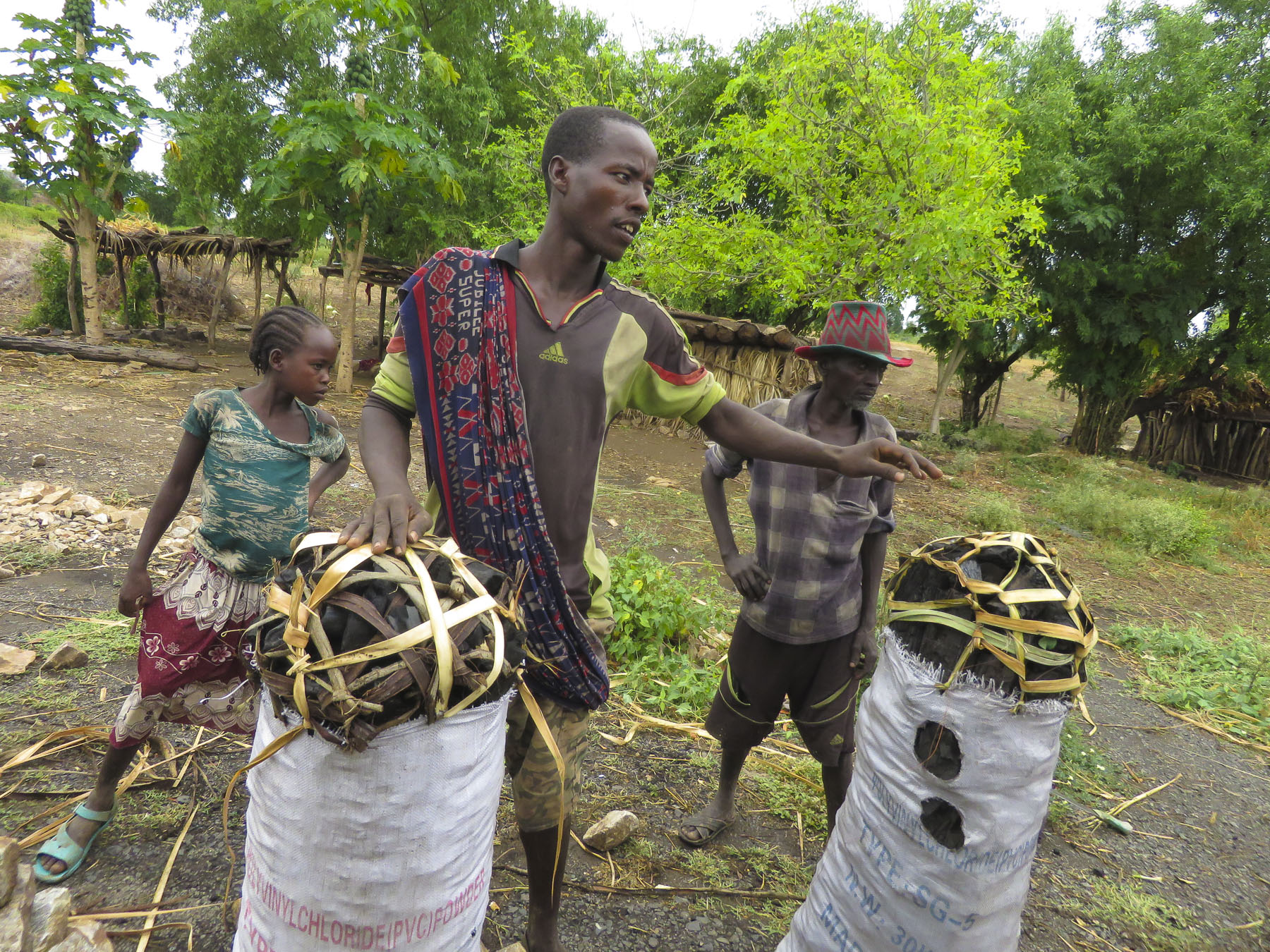
 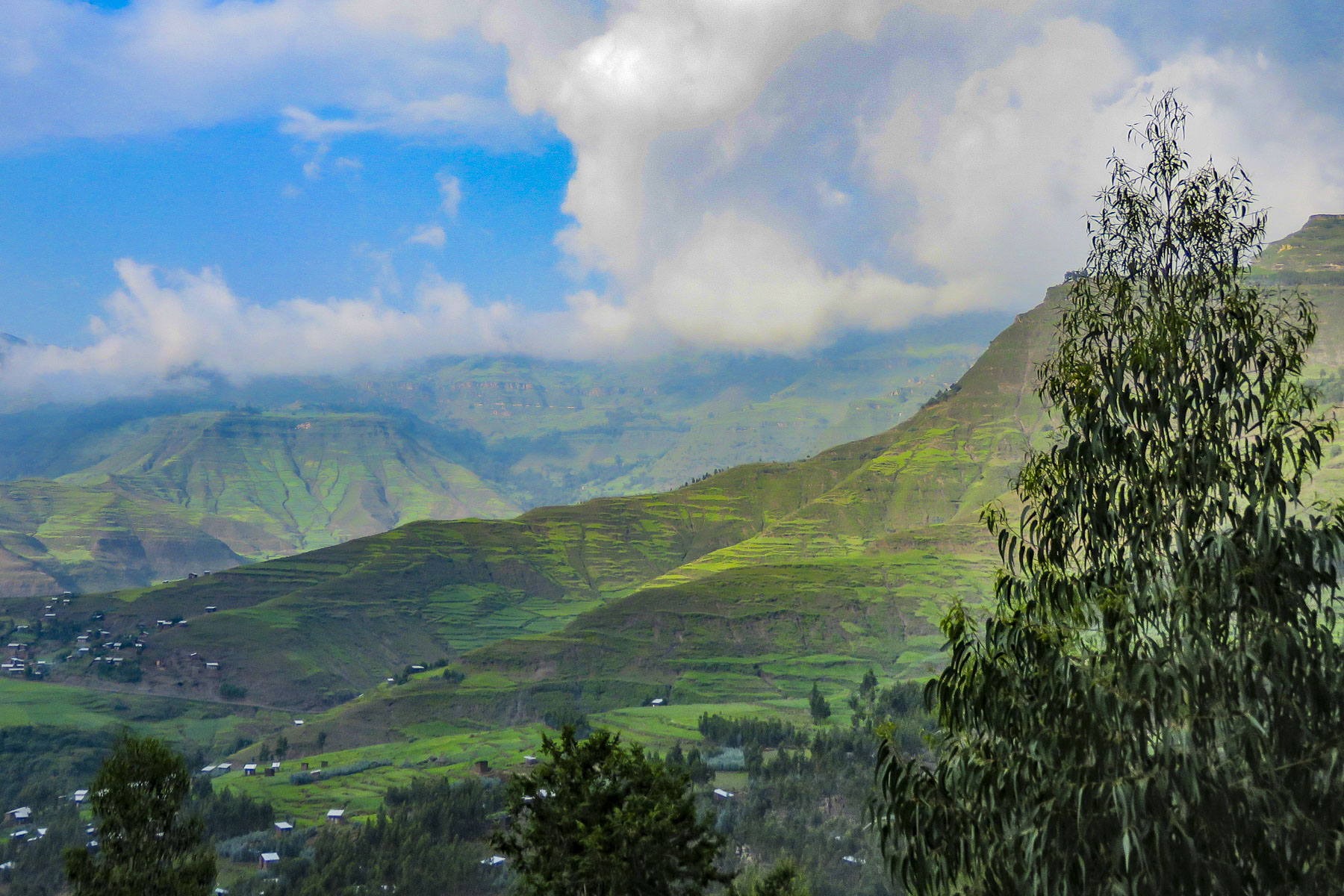 The road deteriorated after this, with deep mudded ruts tossing us from side to side regardless of how slowly we navigated through, over or around them. Our “rattled tourist syndrome” is the most appropriate way to describe the ride, while optimists might refer to it as an an “African deep tissue massage.” We were the only truck to park at the trailhead to the Asheten Mariam Monastery and were greeted with children selling handicrafts, and young men renting walking sticks and offering to accompany us on the hike.
 Confident in our abilities we declined, but they tagged along anyway. This was a good thing. What our guide had forgotten to mention was that there was a short steep section at the beginning of the hike, before it leveled off. Within minutes, between the altitude and the terrain, our hearts were pumping and my wife, who struggles with asthma, was gasping for breath. We are unfortunately not the 7 second 0-60mph vroom, vroom of a 1964 Corvette anymore, but more like the putt-putt of a classic Citroën 2CV. We get there, eventually. So, our guide, forgetting his youth and our age, led the way from a distance, as if he was channeling
  It was at this point that my wife spoke up. “Girma, you must think of me as the same age as your mother.” Instantly, his attitude became very solicitous, and he smilingly offered her a hand or other assistance at every opportunity. We marveled at the agility of the local kids. They nimbly scampered up and down the trail, easily outdistancing us, in order to set up their little trailside displays of carvings and beadednecklaces. When we didn’t purchase at first, they simply packed up and reappeared further up the trail. We had to reward such perseverance with a couple of purchases.
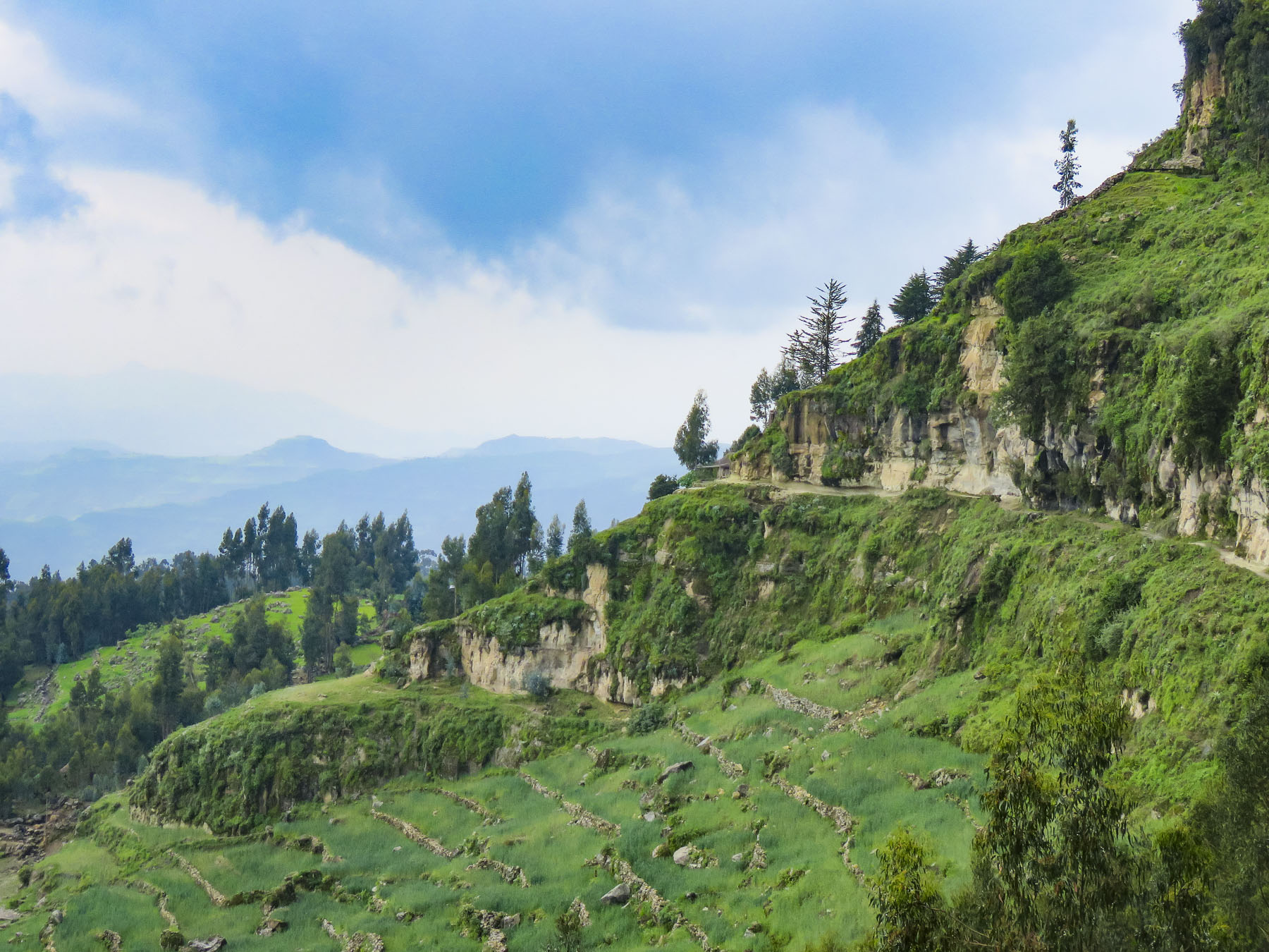 Meanwhile, we regained our pace as the trail leveled off and tracked along the base of a cliff face that fell away to terraced farmland far below. The incline of the trail continued to rise; the walking sticks were now invaluable in helping us steady our footing on the rough path. Around a curve the trail abruptly narrowed at a sheer rock wall broken by a vertical chasm, slightly wider than our shoulders.


 Imprinted at the bottom of a page in one ancient text were the thumbprints of the ten scribes who helped copy the book. Legend has it that it was the first church ordered built by King Lalibela during his reign in the twelfth century and that his successor, Na’akueto La’ab, who only ruled for a short time, is buried there.


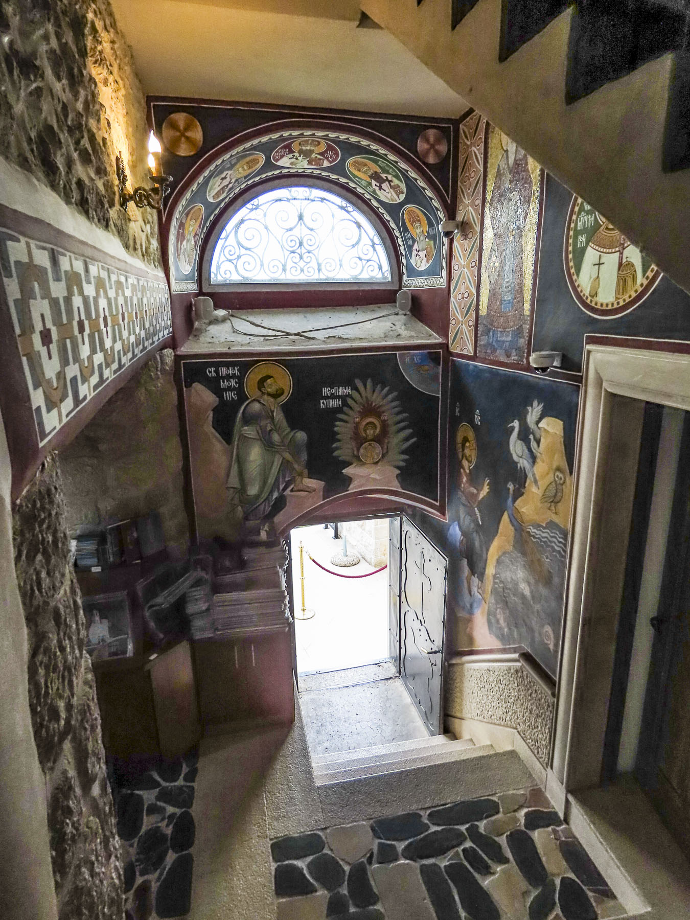
 Coming to the end of the road, we could see the monastery dramatically situated behind a small waterfall, in a long shallow cave at the bottom of a cliff.

 Stone bowls smoothed from centuries of use sat in various places on the rough floor to collect the water seeping from the cave’s ceiling one drip at a time. It gets blessed by the priest and used as Holy water, continuing a tradition from the 12th century when King La’ab ordered the monastery’s creation.


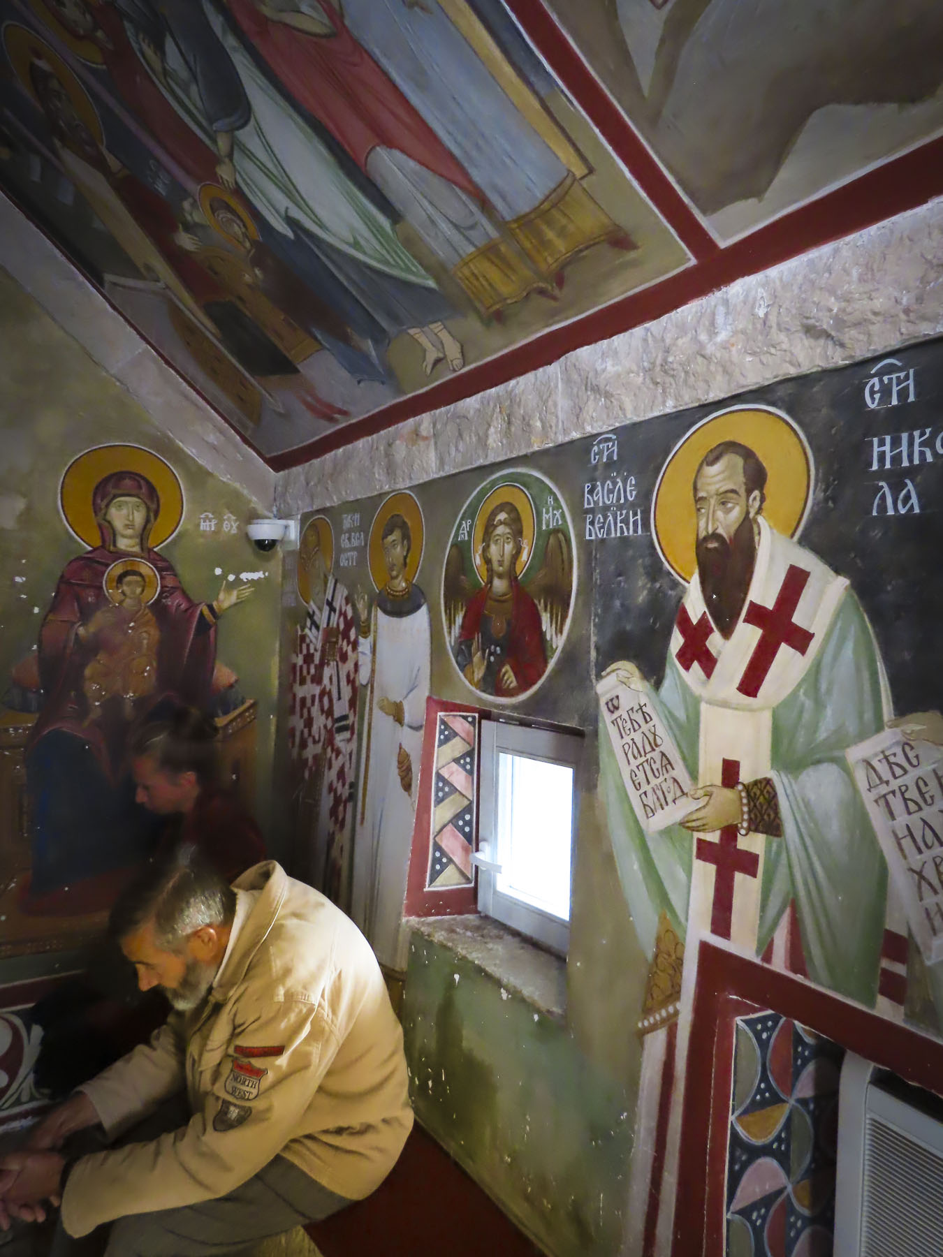
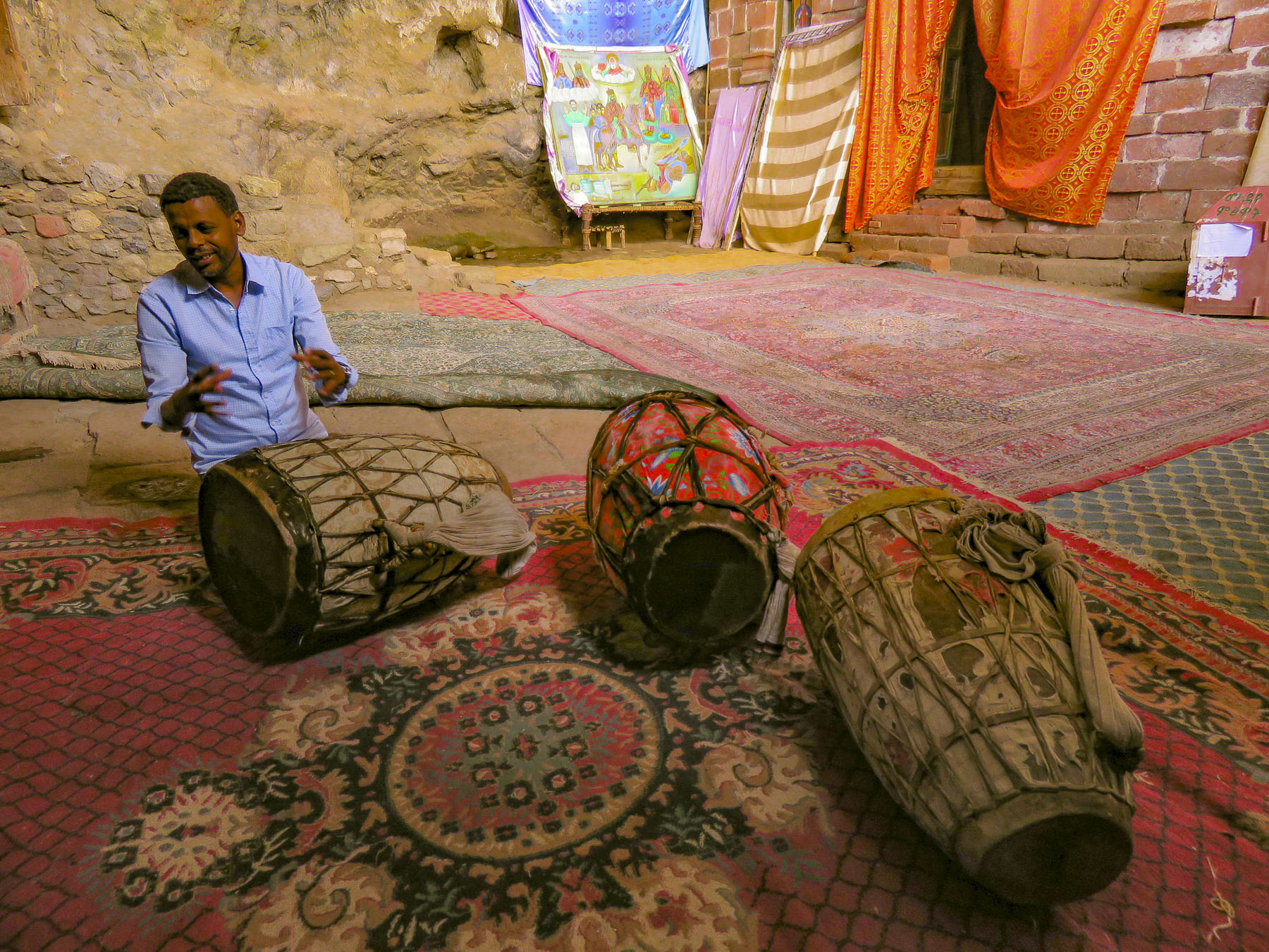 In the learning area, layers of carpet attempted to smooth an uneven, rocky floor where the novitiates sit to learn the ways of the orthodox church. In the corner rested several large ceremonial drums used during worship services. Picking one up our guide beat out a rhythm that would normally accompany liturgical chanting, or Zema, by the young monks. We’ve noticed that the treasures of the Ethiopian churches are not determined by their monetary value and locked securely away, only to be used on religious holidays, but by their spiritual connection. Precious, irreplaceable, ancient bibles and manuscripts, lovingly worn and torn as they are, continue to be used every day, as they have been for the last nine-hundred-years.
 It is well worth the effort to visit these remote churches and monasteries. The physical strength required and hardships endured to build these remote churches as a testament of faith continues to be inspiring.
