Road Tripping Through Brittany: Saint Malo, Dinard & Dinan or For the Love of Oysters

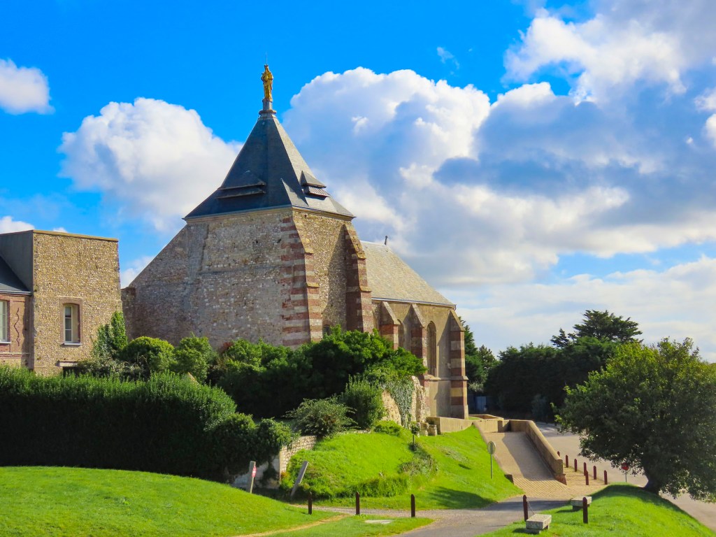
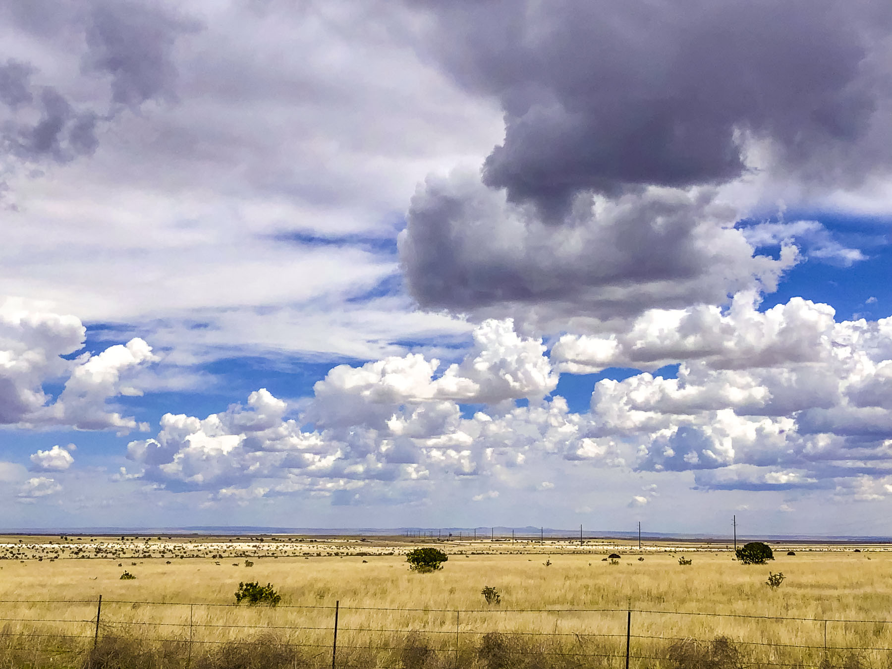
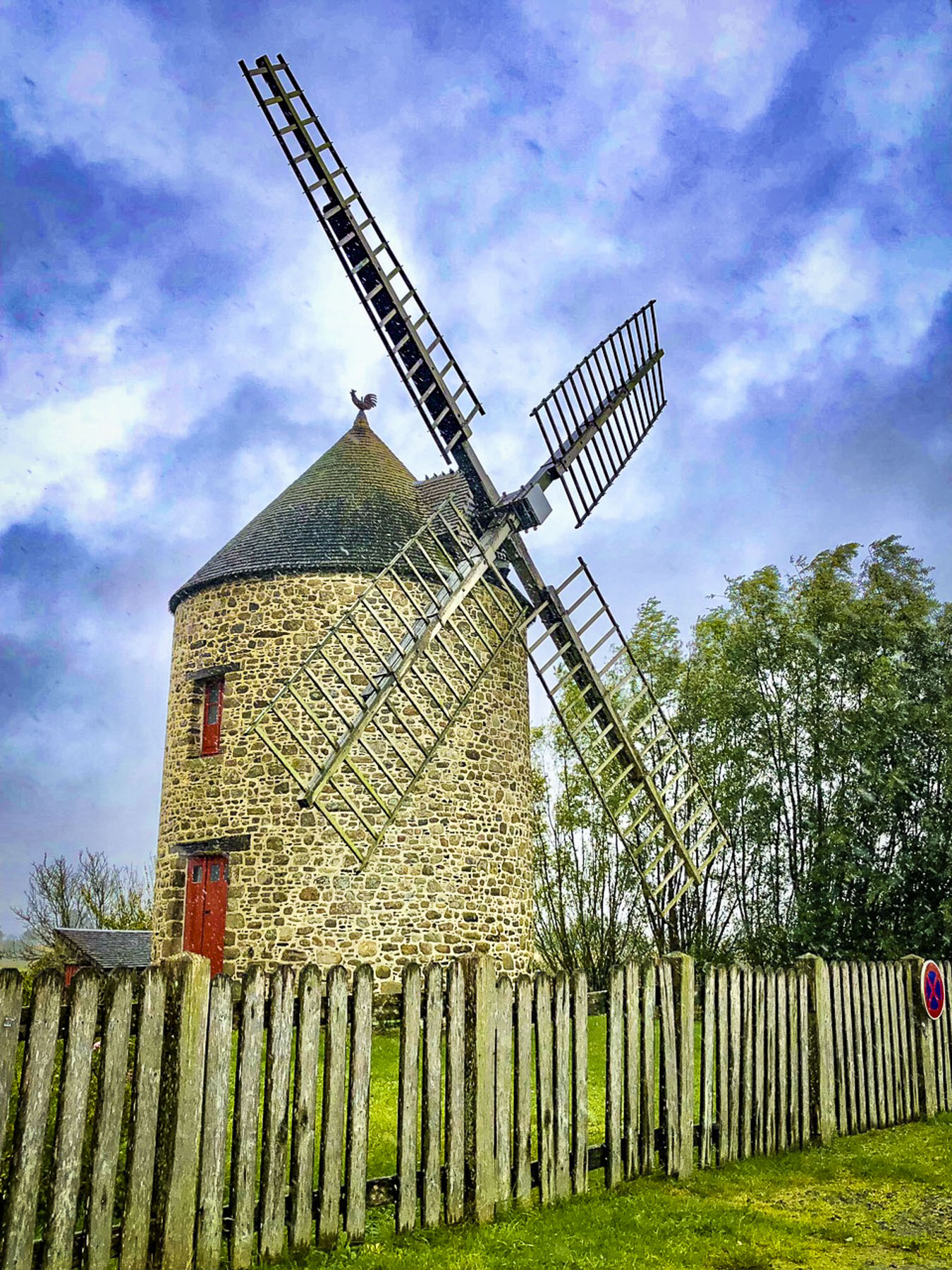
Tractors pulling wagons laden with huitres just harvested from the oyster beds of Cancale Bay now replaced the apple carts we passed two days ago in the Calvados region. Leaving Mont Saint-Michel in Normandy, we had entered Brittany in mid-October at the height of oyster season, which is traditionally considered the months that contain “r” in them, September – April. Our destination was Dinard, after stopping for lunch in Cancale, ground zero for huitres aquaculture in France. We had detoured from our route into Cherrueix to see the wide beach there that is popular for land-sailing, where specially designed three wheeled carts, outfitted with a sail, glide along the flat sand and attain high speed due to the strong winds that blow in off the ocean, filling their sails. But a windless day dampened that activity. The weather was pretty miserable that morning with intermittent squalls at times, limiting our explorations and photography. Our course diversion wasn’t a total loss as we found that the small village had several historic windmills and thatched roofed homes, which lent the town an unexpected Dutch and English feel.

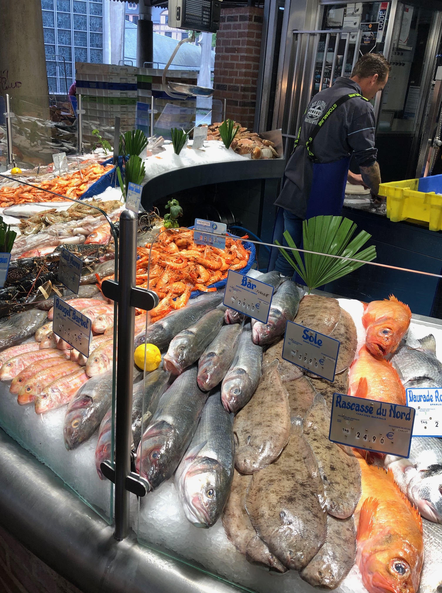
Oyster connoisseurs enjoy Brittany oysters for their unique merroir. Just as wines derive a distinguishable terroir from the soil their grape vines grow in, oysters get their signature flavor from the saltiness and temperature of the seawater they are harvested from. The extreme, fast moving  tides, which Victor Hugo once described as “moving as swiftly as a galloping horse,” and cold water of Mont Saint-Michel Bay, which encompasses the ocean from Saint Malo, Brittany to the Cotentin Peninsula of Normandy, impart the oysters grown here with a sweet delicate flavor, which have won them fans the world over. Really, they are the best we’ve ever tasted, and we would order them whenever we saw them offered during our trip. They were also very affordable, which was a delight. Low tide along the coast revealed the extensive network of oyster farm pilings that support the growth of over 5,000 tons of succulent huitres a year.

Oysters have been gathered along the coast of Brittany since this region of France was part of the Roman Empire 2000 years ago. As with all ancient agrarian traditions, women have played a vital role harvesting oysters and Cancale’s town plaza hosts a bronze statue commemorating them. The day we visited, and it took us a while to figure out why, the female figures of the memorial were adorned in pink aprons. Turns out this was in recognition of France’s Breast Cancer Awareness Day, which happens every October. At lunch in a small establishment on the square, of course we slurped a dozen oysters, with just a touch of shallot mignonette sauce. They were divine. On Cancale’s waterfront there is also a daily Marche aux Huitres, surprisingly this oyster market which is open year-round. That old tradition of eating oysters only during the ‘r’ months dates back to King Louis XV in the 1700’s when refrigeration wasn’t possible, and it was unsafe to consume them during the warmer months. It’s also a matter of preference as the texture of the oyster becomes creamier during the warmer months, but today in France they are consumed year-round.

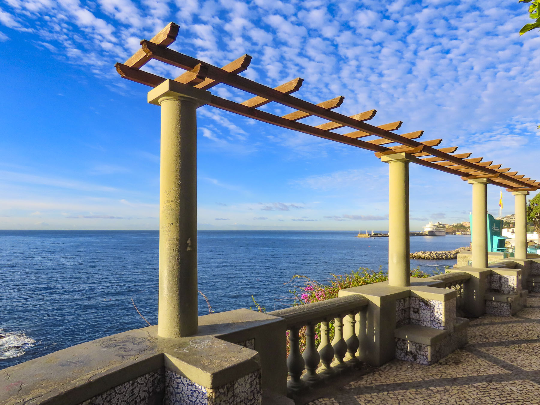
The late afternoon sun was shining brilliantly by the time we arrived in Dinard, found a free parking space on the street, and checked into the Hôtel du Parc Dinard, our home for four nights. The popular vacation spot is practically a ghost town in the fall, with most of its elegant Victorian-era homes battened down tight awaiting winter storms. The quietness was perfect for us, and the town would be our base for visiting Saint-Malo, a short distance away across the Rance Estuary, and farther inland the ancient riverport town of Dinan.

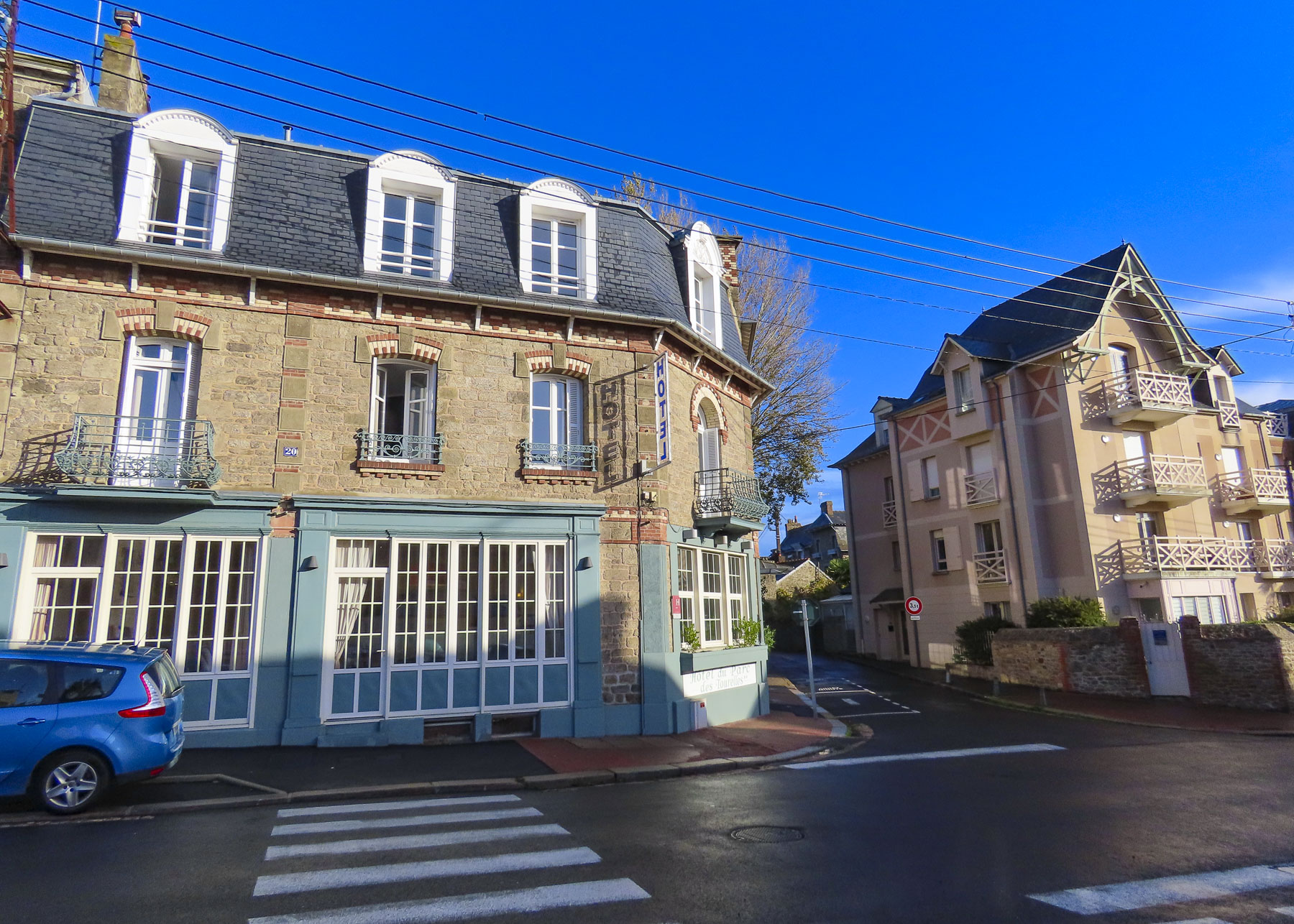
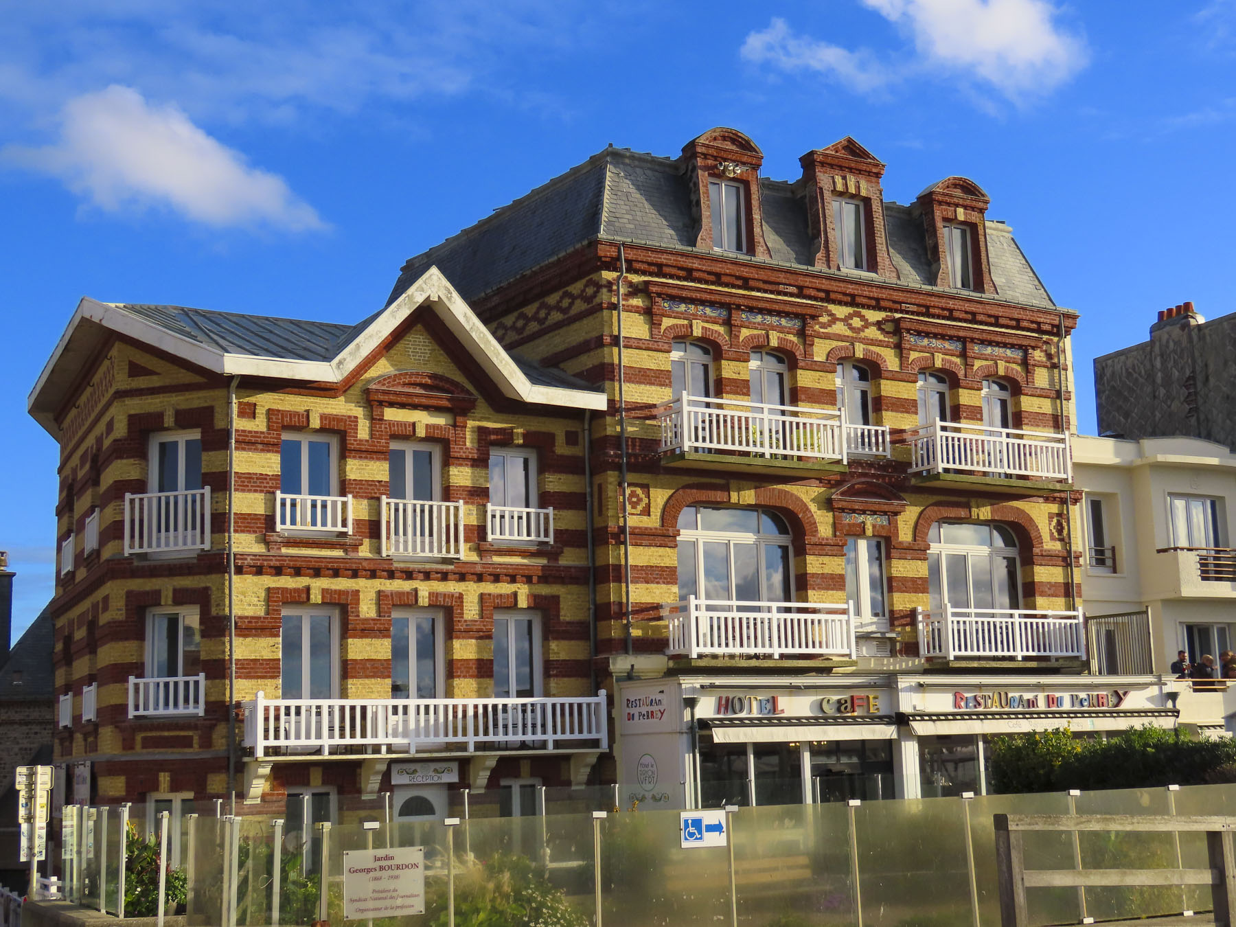
A former fishing village, Dinard was transformed into a vacation hotspot, when the French gentry, wealthy Americans, and British aristocrats discovered its picturesque beaches, and cliffside walks in the late-nineteenth century. A pleasant mild climate, influenced by the nearby warm waters of the Atlantic gulf stream helped set its reputation as “the Pearl of the Emerald Coast.” A who’s who list of celebrities – Picasso, Gary Grant, Joan Collins, Winston Churchill, and Oscar Wilde – frequented the seaside resort. The British film director Alfred Hitchcock visited often enough that the town erected a statue in his honor. Film legend believes he based the house in the film “Psycho,” on one of the town’s elegant mansions and the movie “Birds,” partly on experiences with raucous seagulls along the cliffs here. His relationship with the town led to the establishment of the Dinard Festival of British & Irish Film. Now in its 35th year, it’s held early in October. Prize winners receive a golden Hitchcock statuette.

One of France’s most “British resorts,” the town’s luster faded in the 1960’s when the “jet set” discovered the Mediterranean beaches of southern France. Fortunately, the town has been rediscovered as a holiday destination and today attracts folks looking for vacation rentals in the now sub-divided mansions, who appreciate its quite ambiance and location along the Cote d’Emeraude of Brittany.

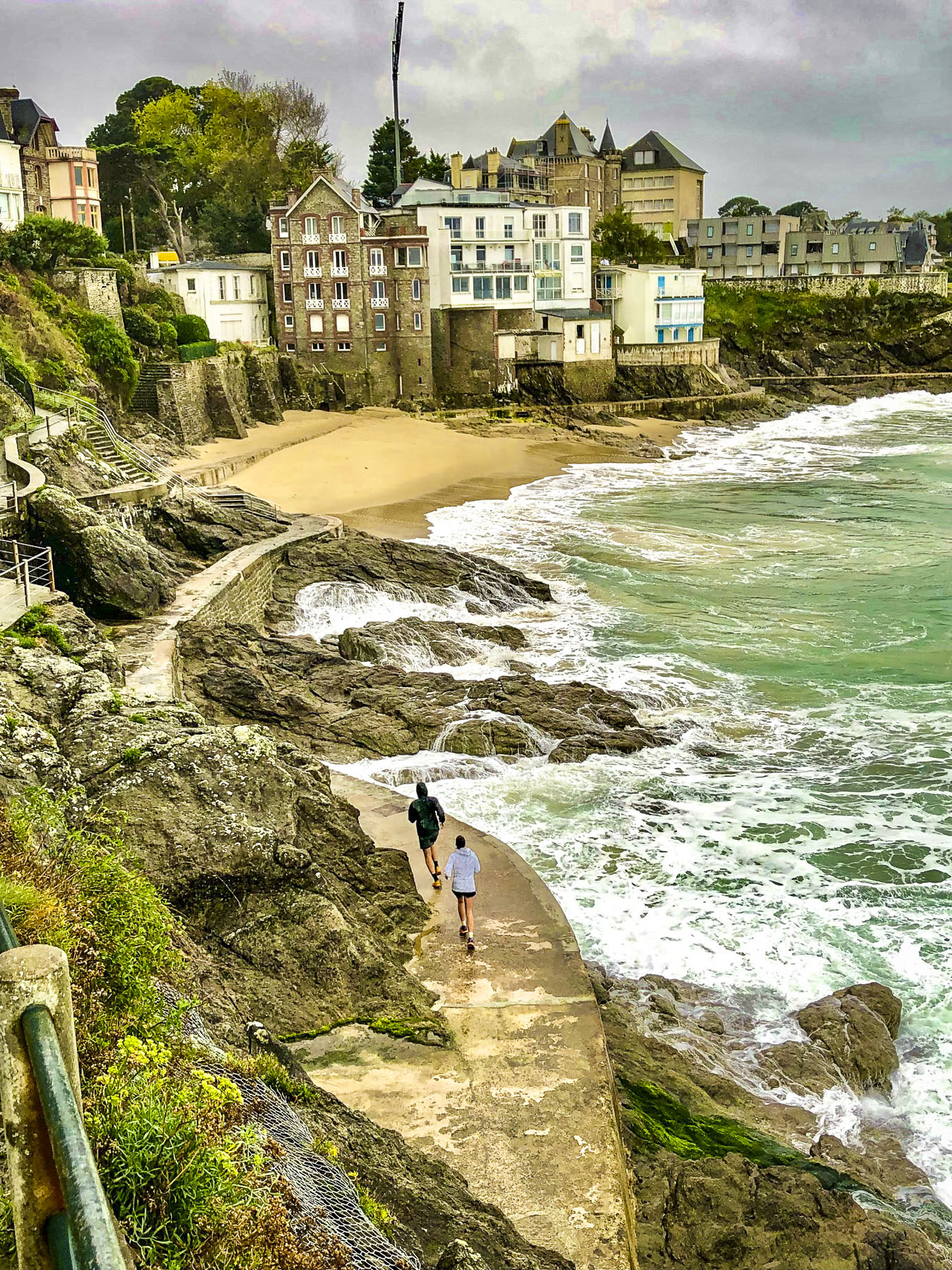
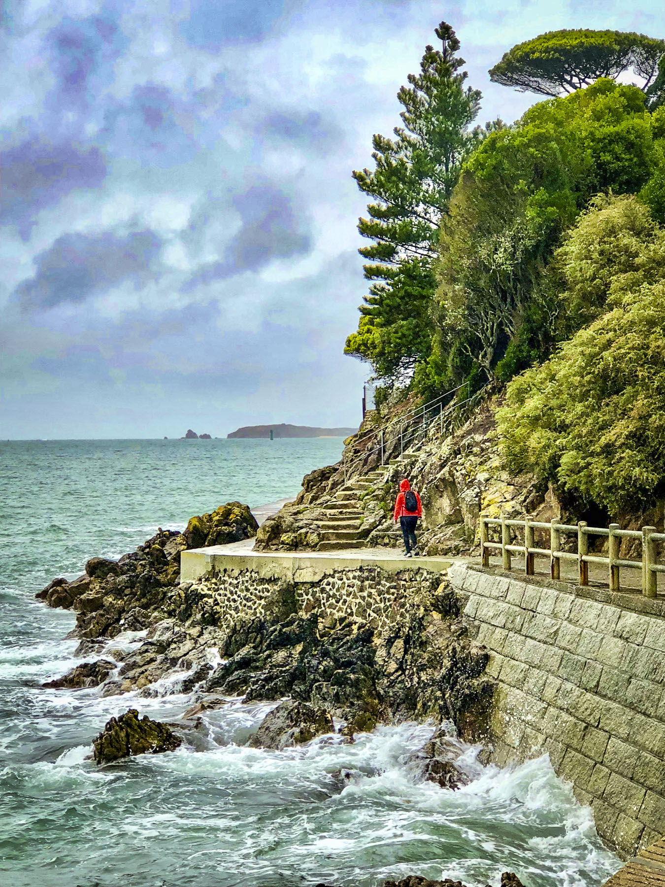
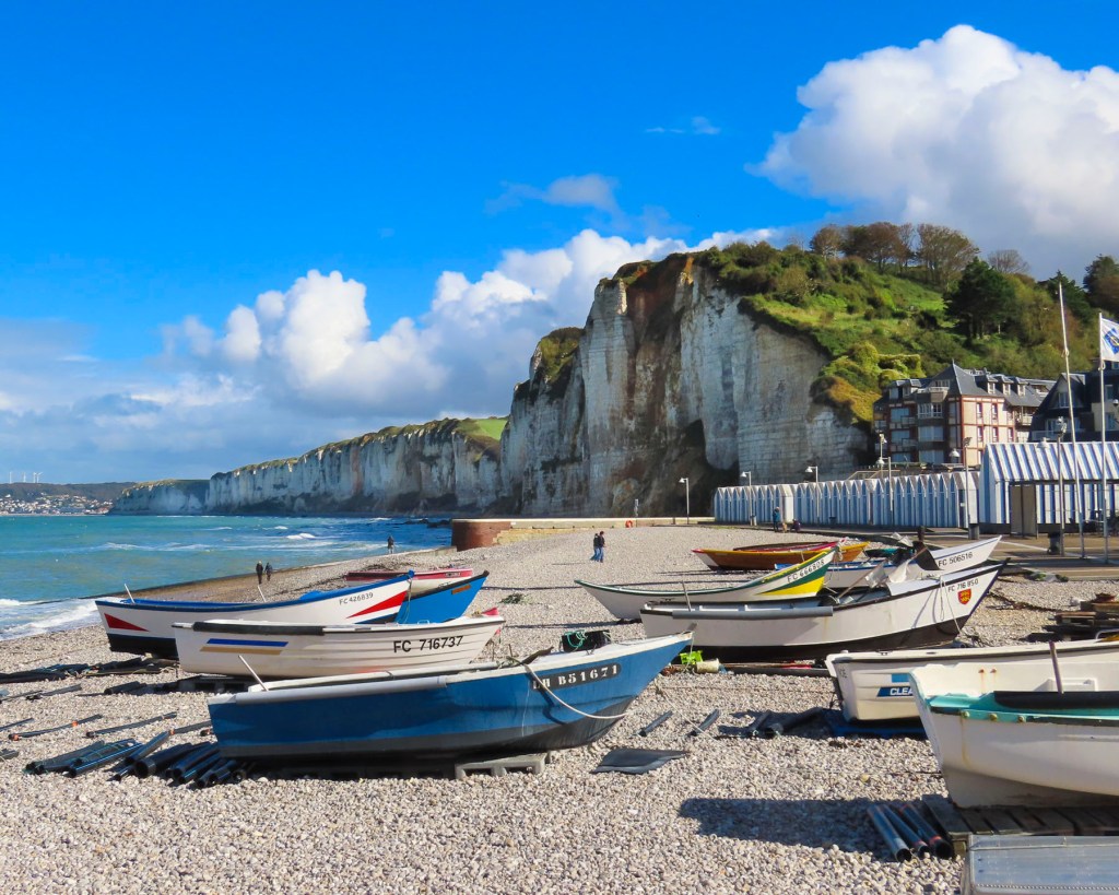
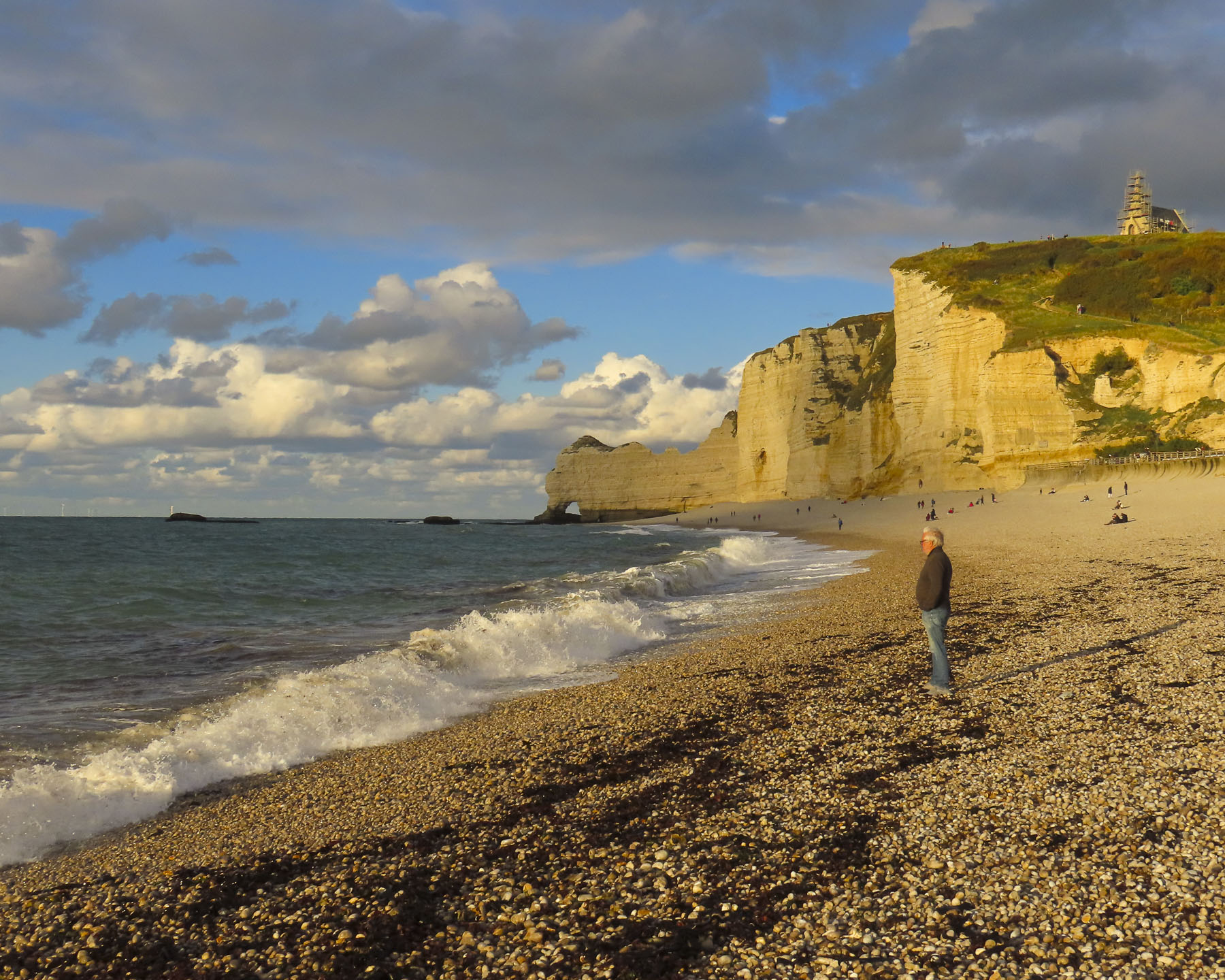
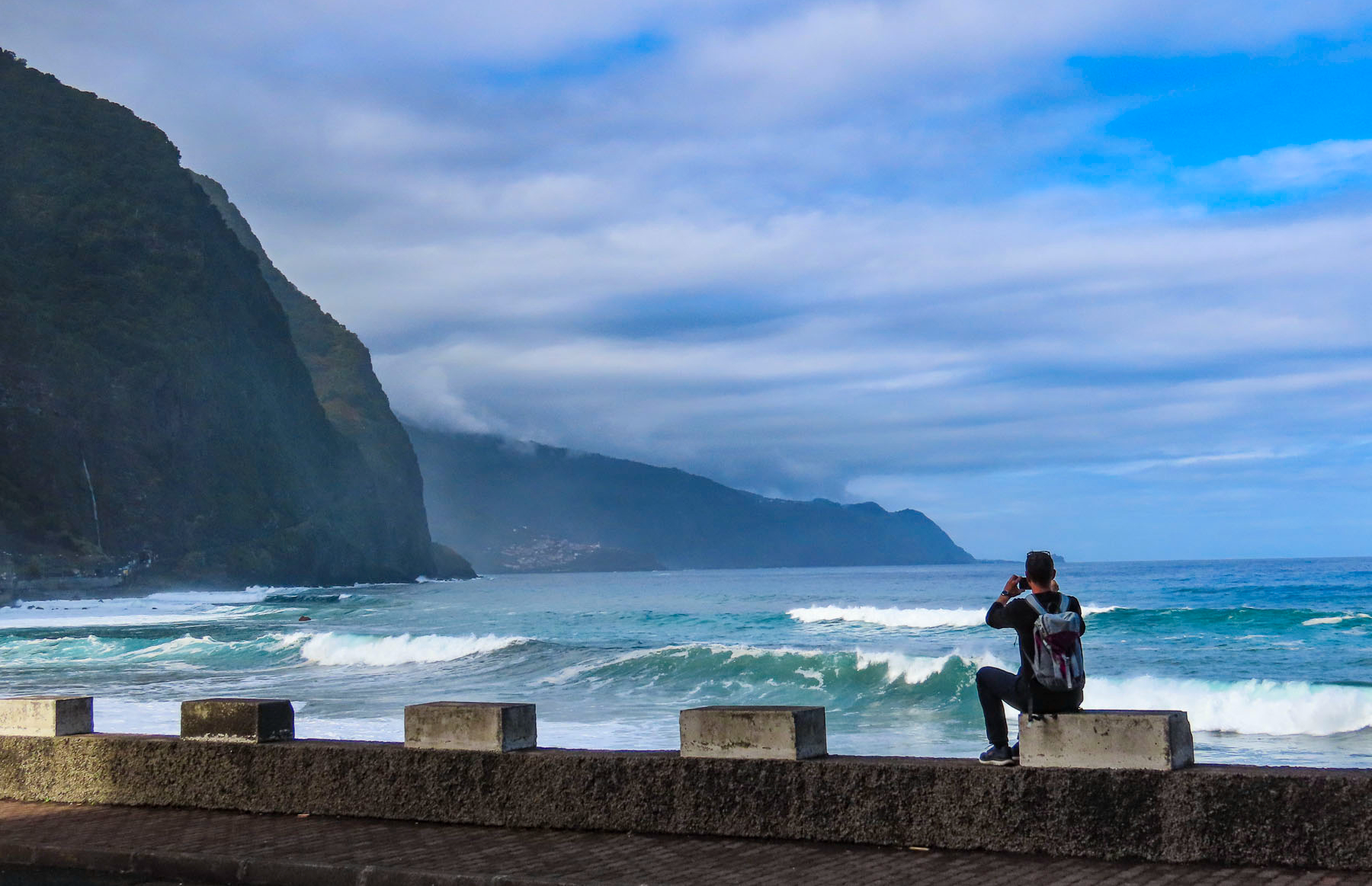
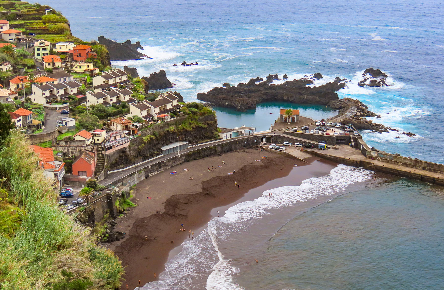
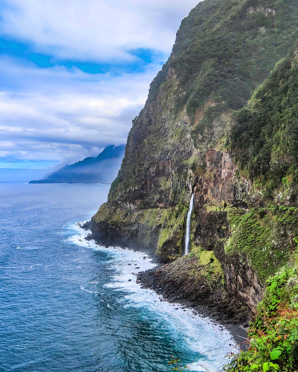
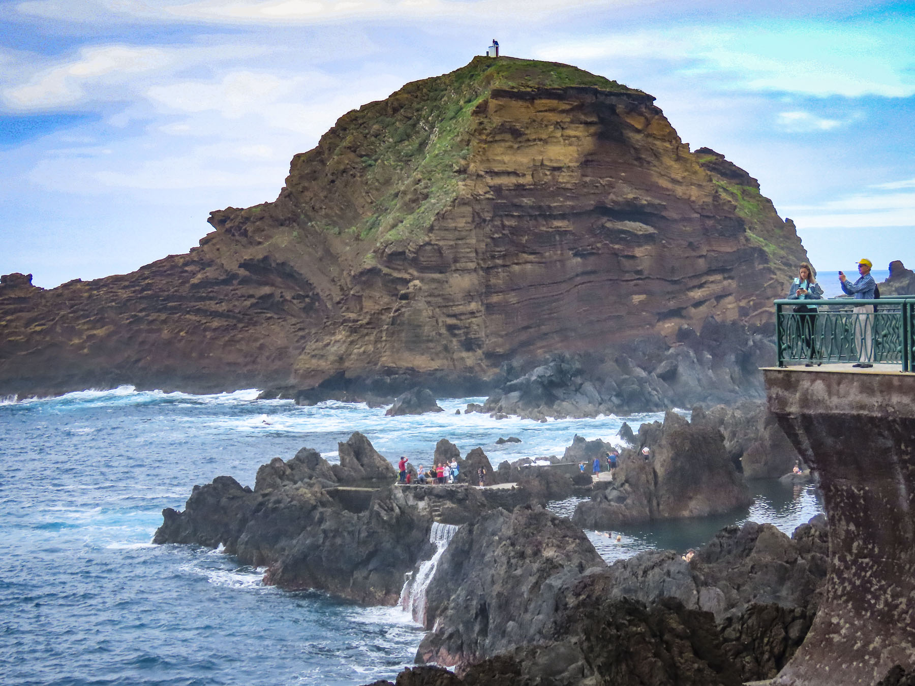
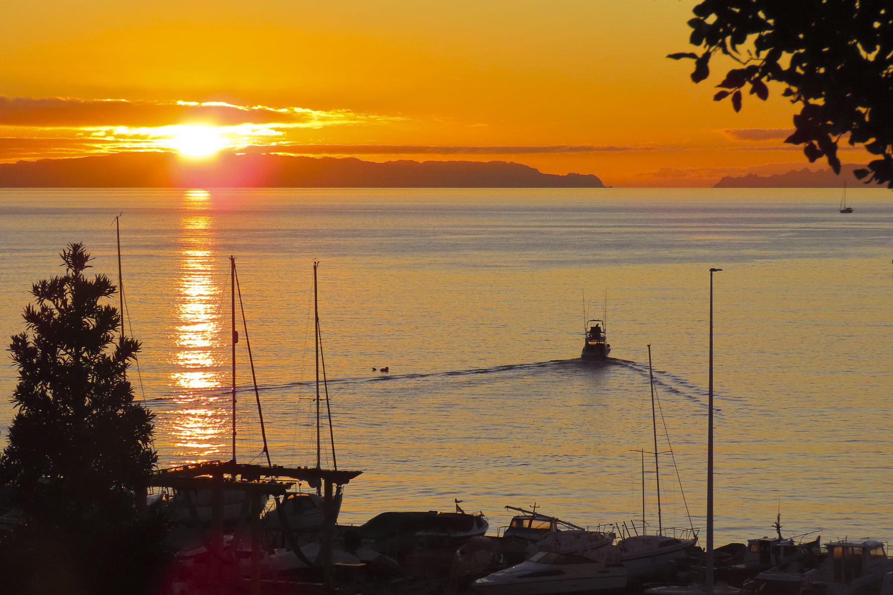
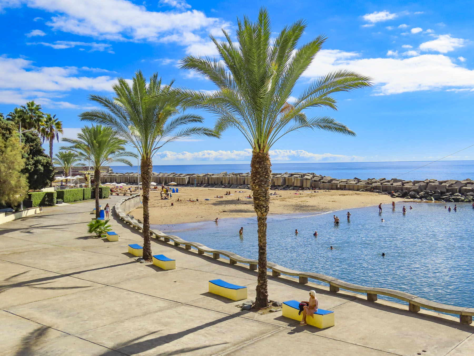
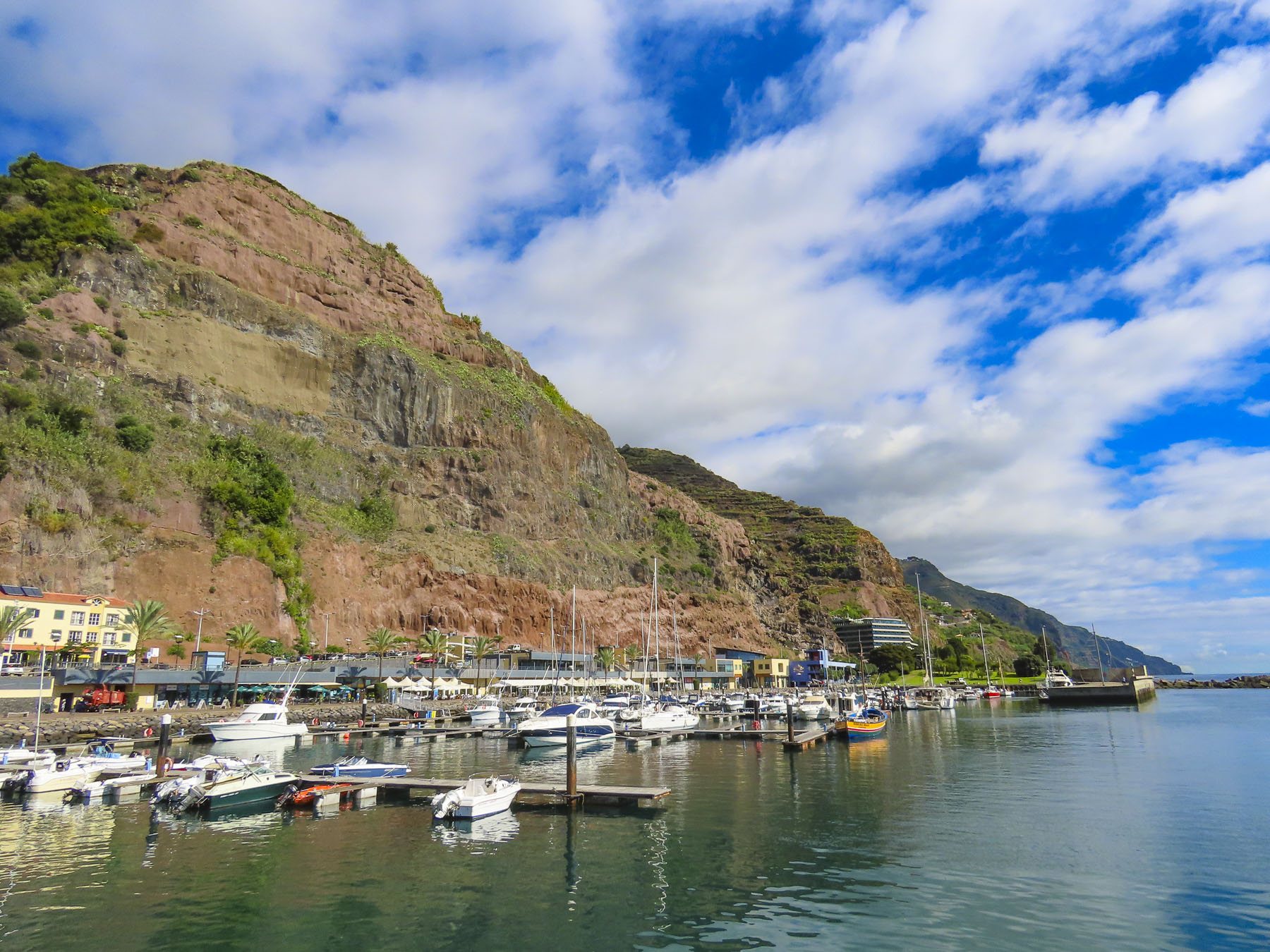
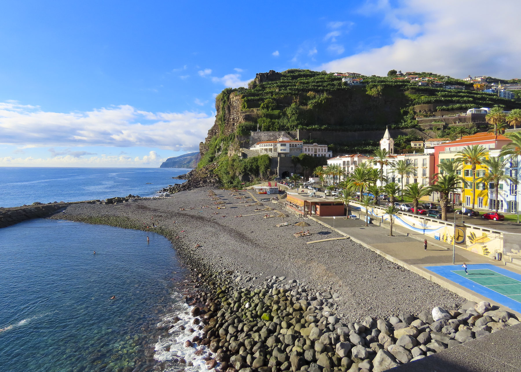
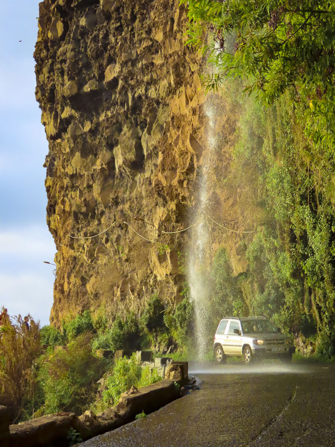
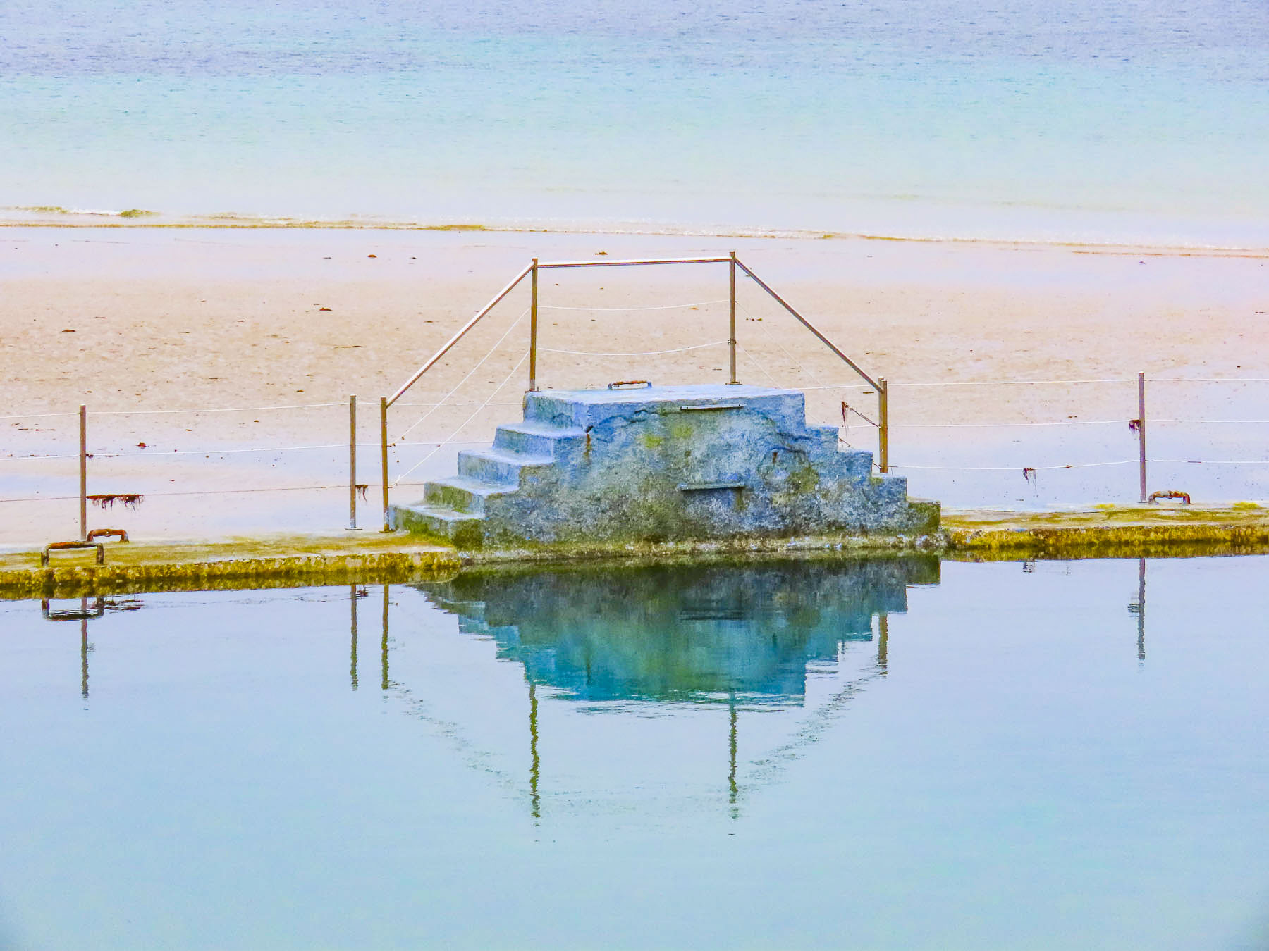
One of the best ways to enjoy the town, in any season, is to follow the Coastal Path of Dinard, a 5-mile-long improved trail that hugs the rocky coastline, passes sandy coves and fascinating old architecture. From our hotel we broke our walk into two manageable segments and included a stop at the weekly market one day to purchase supplies for a picnic lunch for later in the day. One afternoon we drove west along the backroads to Saint-Briac-sur-Mer. Here we could see the extreme tides of the Brittany coast, which left boats at their moorings high and dry at low tide.

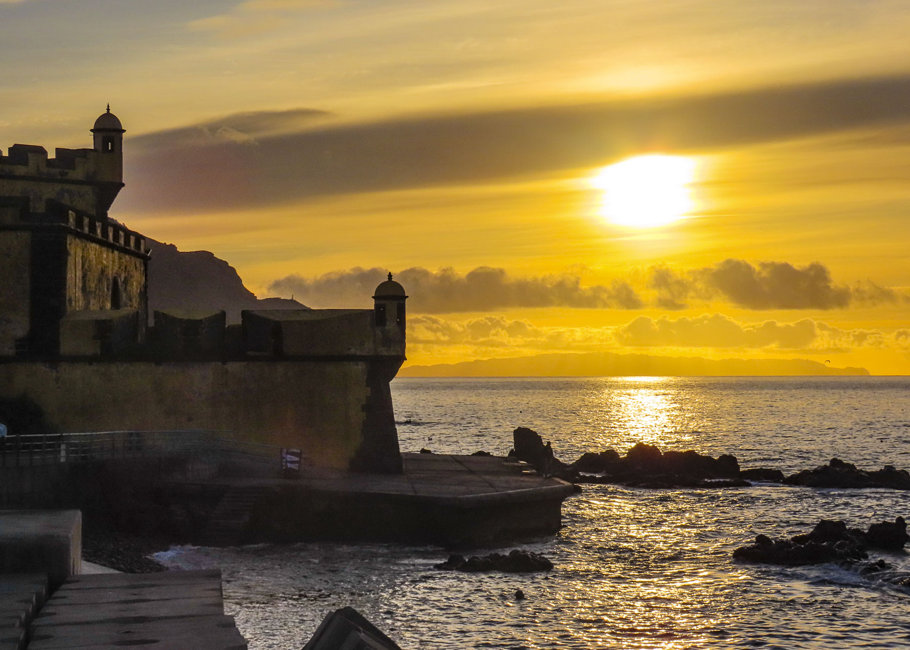
Just across the water from Dinard the old fortress city of Saint-Malo still guards the natural harbor created by the La Rance estuary as it enters the Gulf of Saint-Malo and the English Channel.  Its ramparts have remained mostly unscathed since their first construction in the 12th century, in order to deter feared Viking attacks. Centuries later the Corsairs of Saint-Malo, French privateers serving the King of France, would pillage foreign ships sailing the English Channel, or extort a transit tax from them, then flee the scene of the crime and seek refuge from the pursuing English Navy under the cannons along Saint-Malo’s ramparts. This tactic was so annoying to the British that they launched an amphibious naval assault against the Saint-Malo corsairs in 1758, but determined the city’s ramparts were impenetrable and instead attacked the nearby town of Saint-Servan and destroyed 30 of the pirate’s ships there.

Outlaws to the English and Dutch, the corsairs of Saint-Malo had more nuanced careers and were well respected as explorers and merchants in France, enriching the town and serving the interests of several French kings over the centuries. Departing from Saint-Malo, Jacques Cartier sailed down the St. Lawerence River and claimed the discovery of Canada for France in the 16th century and sacked a few vessels along the way. Jacques Gouin de Beauchêne would lead the first French expedition into the South Atlantic, raid Rio de Janeiro, find the Falkland Islands, sail through the Strait of Magellan, visit the Galapagos Islands and return to the Atlantic Ocean by sailing west to east across the treacherous waters of Cape Horn. Other corsairs helped establish trade with ports along the west coast of Africa, Southeast Asia and the Pacific, which would evolve into French colonies. Corsair Duguay-Trouin led a Moka expedition to Yemen in the early 1700s, returned with the legendary coffee beans, and French society was changed forever: the café tradition had begun. Saint-Malo prospered.

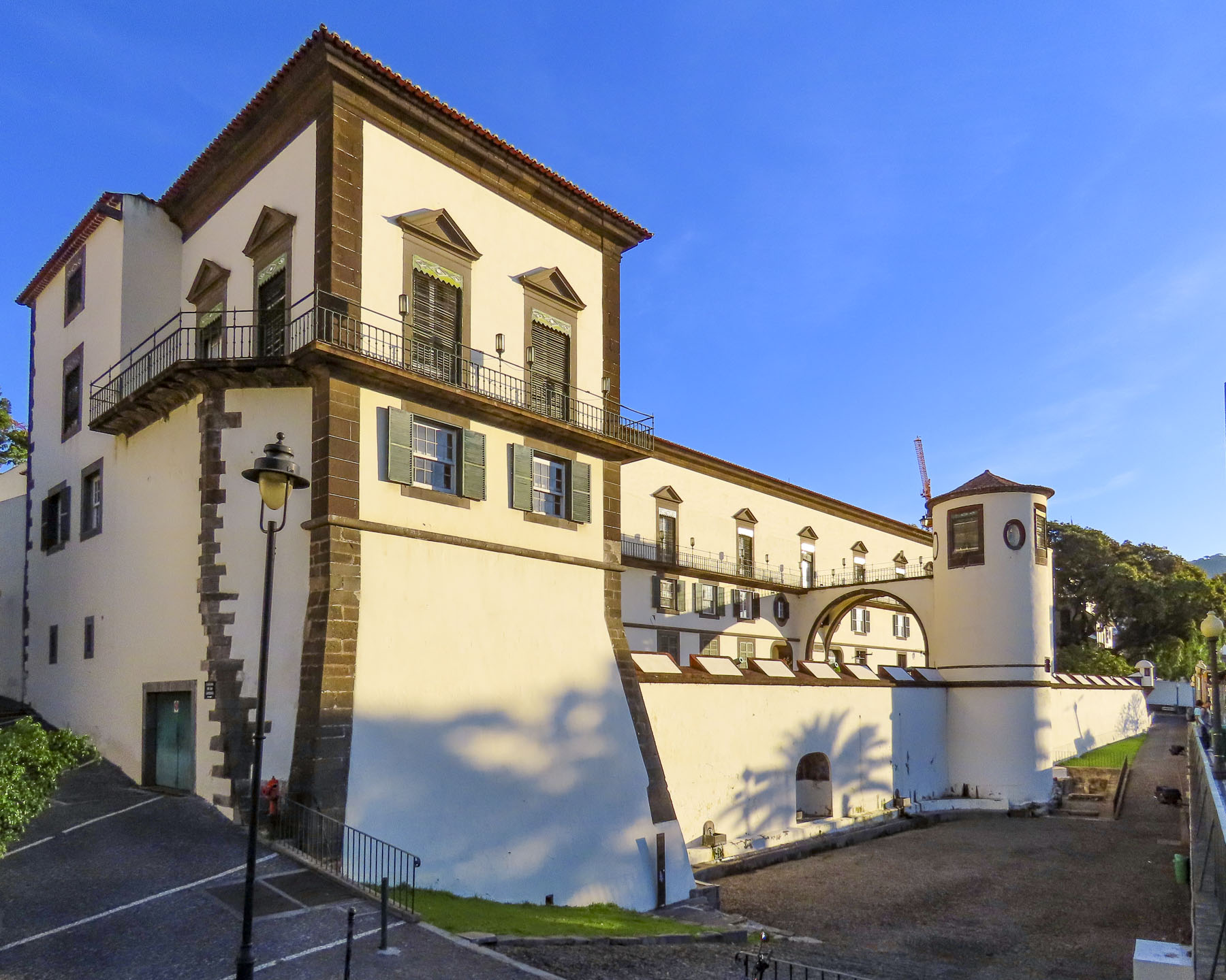
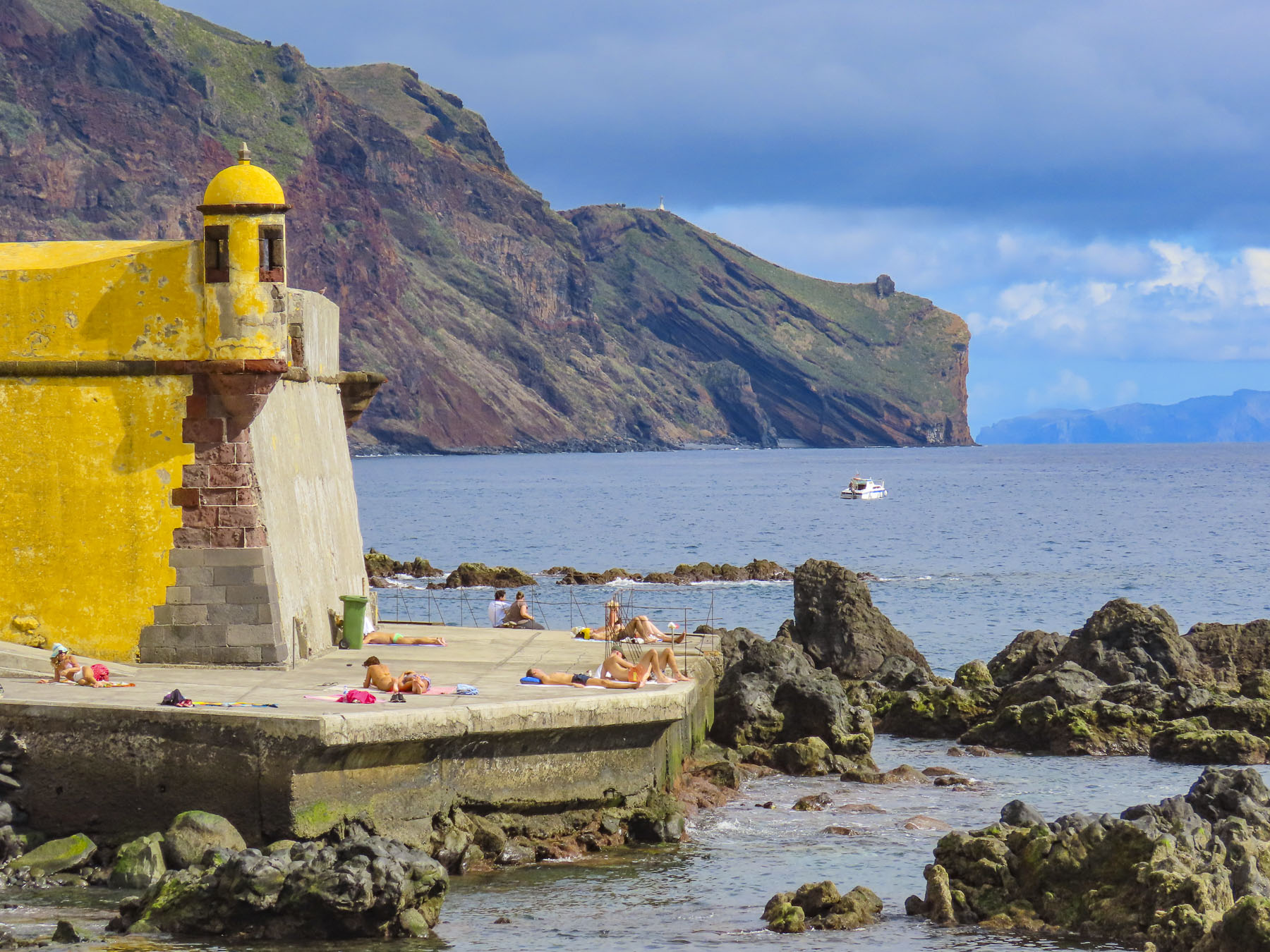
Walking atop the ramparts that encircle the ancient citadel, it’s difficult to imagine that this beautiful city lay in ruins in September 1944. The D-Day invasion of Normandy had happened three months earlier, but well dug-in German forces, led by a commander who swore to defend the Third Reich to the last man, refused to surrender their reinforced positions in Saint-Malo. It took a relentless, months long campaign of allied aerial and artillery bombardment for the Germans to concede defeat.  The ramparts still stood, but 683 of the town’s 865 historic buildings were leveled, its 6,000 inhabitants homeless. The mayor at the time, Guy Lachambre, petitioned vigorously for the reconstruction council and its architects Marc Brillaud de Laujardière and Louis Arretche not to modernize the war-torn town, but to respect the ancient medieval character of the city and retain its maze of alleys, granite facades and steep slate roofs. It took two years to painstakingly remove the rubble, before rebuilding could start. Workers cataloged the ruins like an archaeological excavation, numbering each brick and stone, so that town’s original building materials could be reused, when possible, to authentically resurrect it from its ashes. Major reconstruction lasted until 1960; however, the Cathédrale de Saint-Malo, the final resting place for the famous Corsairs Jacques Cartier and René Duguay-Trouin, didn’t acquire its new steeple until 1971. The church’s spire, rightfully returned to its place of honor on the citadel’s skyline, was once again a welcome landmark for sailors returning from the sea. Renewed prosperity returned to Saint-Malo in the mid-1960s when folks rediscovered the seaside town as a great place to rent a vacation flat in apartments now vacated by families that moved away during the reconstruction years.

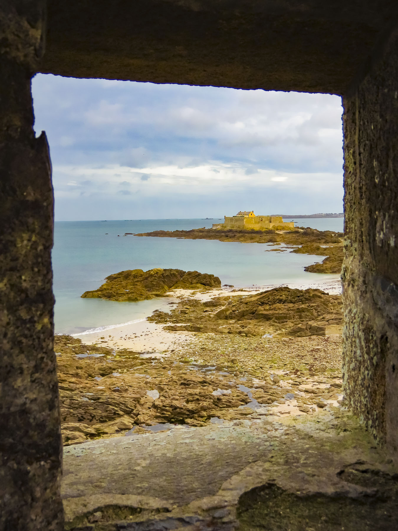
The views from atop the ramparts of the sea and the citadel were great. It’s an easy 1.4 mile loop around the ramparts, with many gateways that descend back into to the walled city or out onto the surrounding beach. At low tide it’s possible to walk across a sandy peninsula to the nearby 17th century Fort Natioinal, or to the small island Grand Bé, where the French writer François-René de Chateaubriand is buried, but be careful not to get stuck out there during an incoming high tide. Afterwards, back in town we found a rustic bar with a fire going in its stove and warmed ourselves with snifters of Calvados and café.

During the high season, parking in Saint-Malo can be problematic. However, if you are staying in Dinard it’s possible to take the small ferry across to the “The Corsair City.” If you are looking for a good read, the book All the Light We Cannot See, written by Anthony Doerr, evocatively tells an intriguing and mysterious story of life during WWII in Saint-Malo.

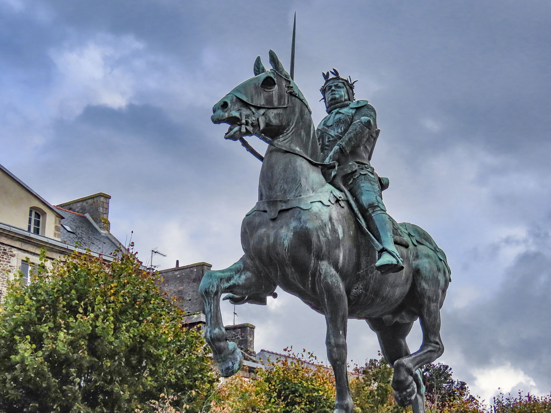
Traveling 30 minutes south from Dinard, we seemed to have arrived in the 14th century. We were greeted by an equestrian statue of the famous French general Bertrand du Guesclin, which towered above us in the car park. He was known for his many victories over the English during the Hundred Years War. He was so well regarded that upon his death, in 1380, he was given a royal funeral, his body quartered for burial, a practiced usually reserved for France’s kings. “His heart was buried in Dinan in his native Brittany, his entrails were buried in Puy, his flesh at Montferrand, and his skeleton in the tomb of St. Denis outside Paris.” We were off to an interesting start.

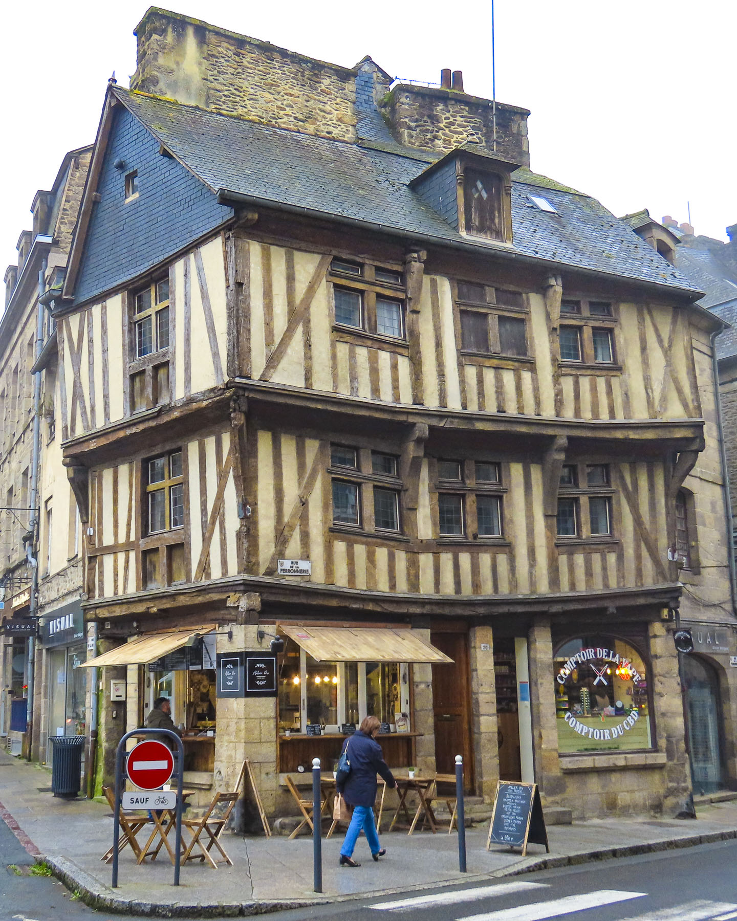
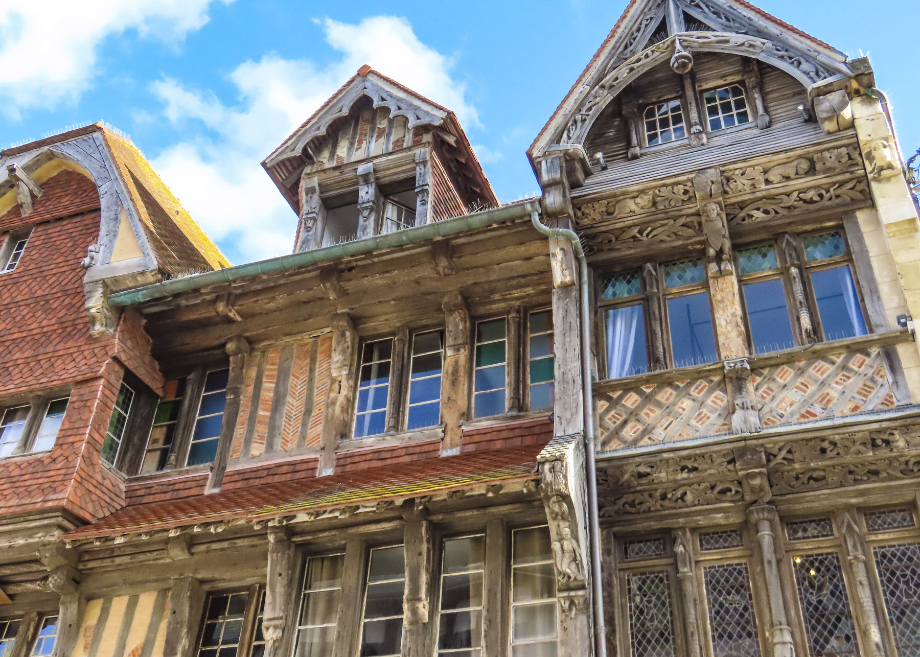
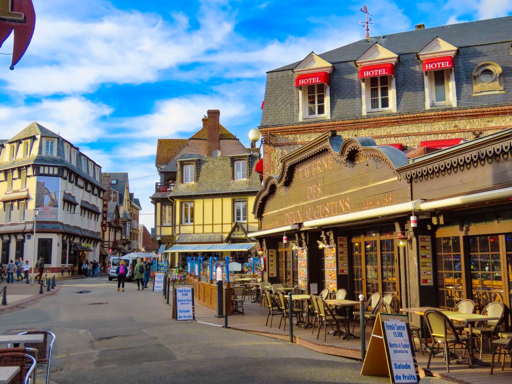
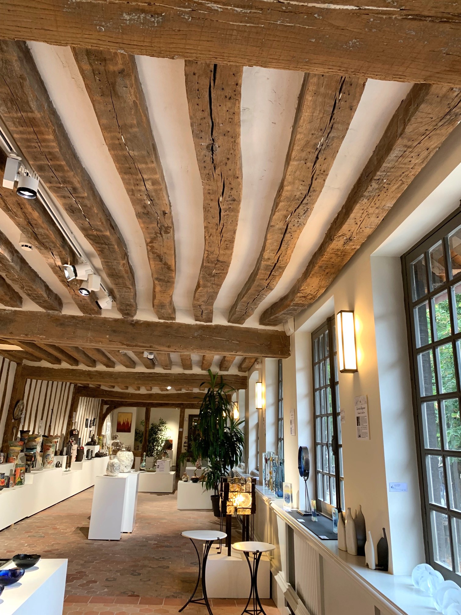
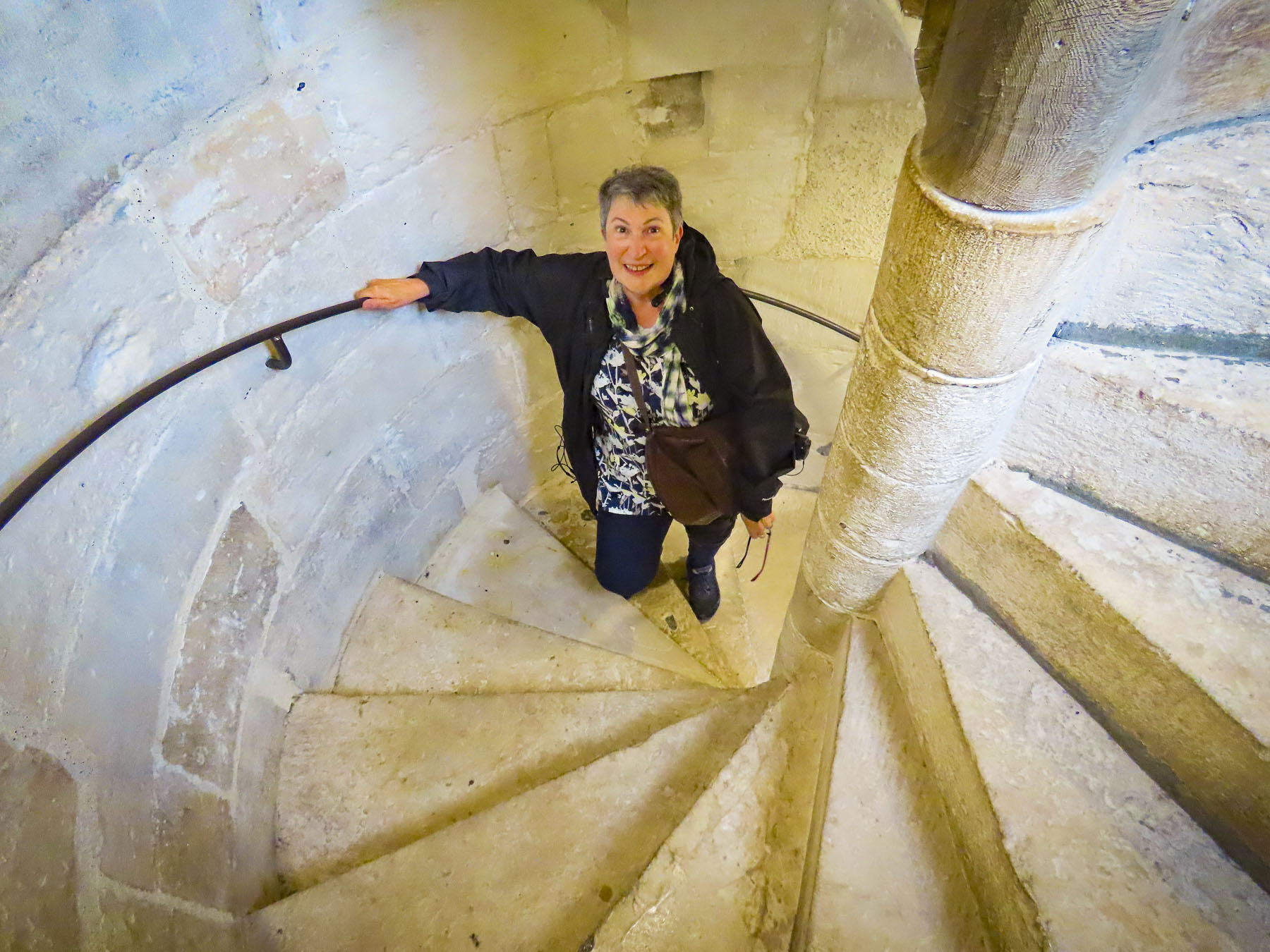
Somehow having escaped the destruction that befell Saint-Malo, Dinan’s historic center is filled with charming leaning, half-timbered medieval buildings dating from the 13th to 16th centuries, and shares an ambiance that felt more akin to Rouen than its neighbors Saint-Malo and Dinard.  This morning the narrow-cobbled alleys were busy with activity, modern shops behind the ancient facades, replacing the craftsmen and guild merchants of this market town and riverport who traded with Spain, England, Holland, and the new world colonies.

Our “walk a little, then café,” led us to Marcel, on Rue de la Cordonnerie, a delightful patisserie, where between cheerfully serving customers, the staff was photographing their artistic, mouthwatering temptations to post to the store’s Instagram page. Outside it could have been 1305 or 1673; only folks’ clothing had changed.

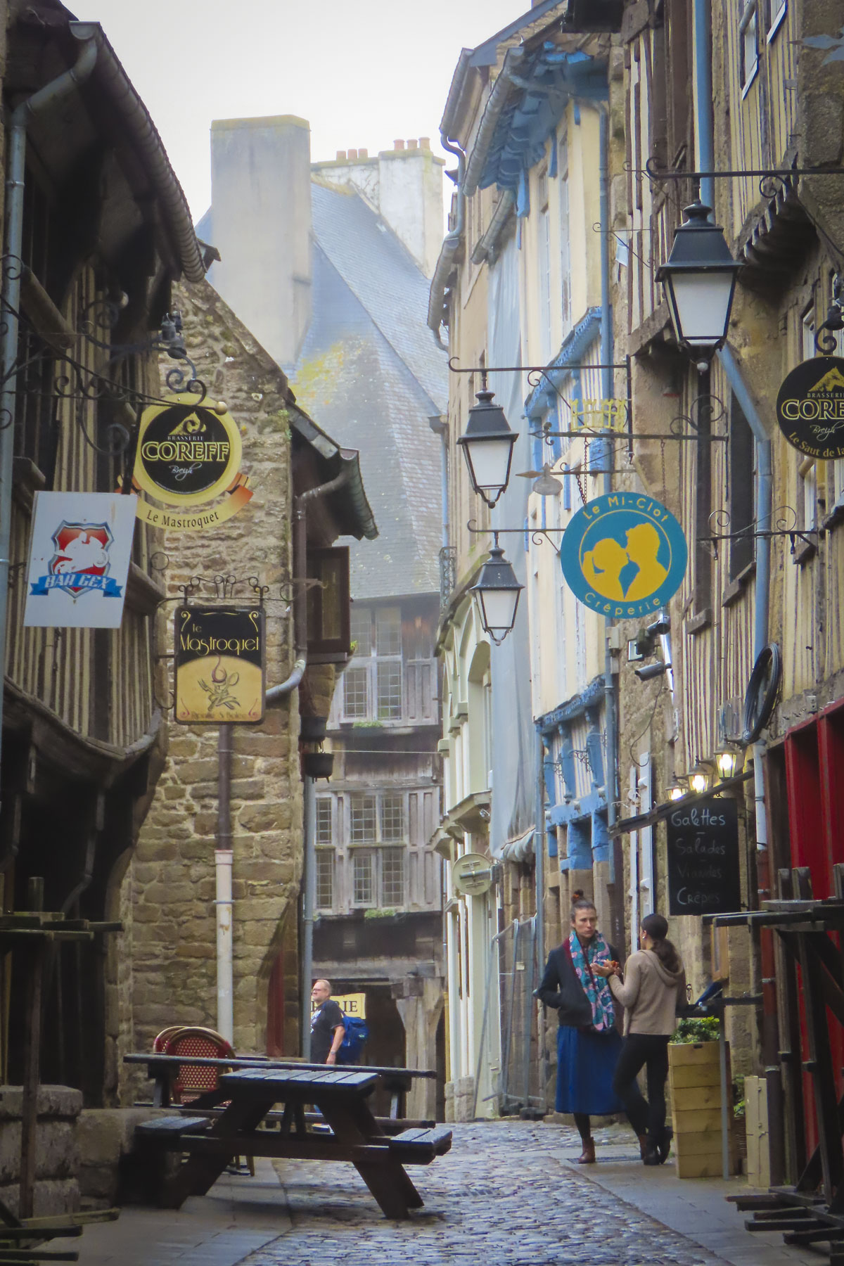
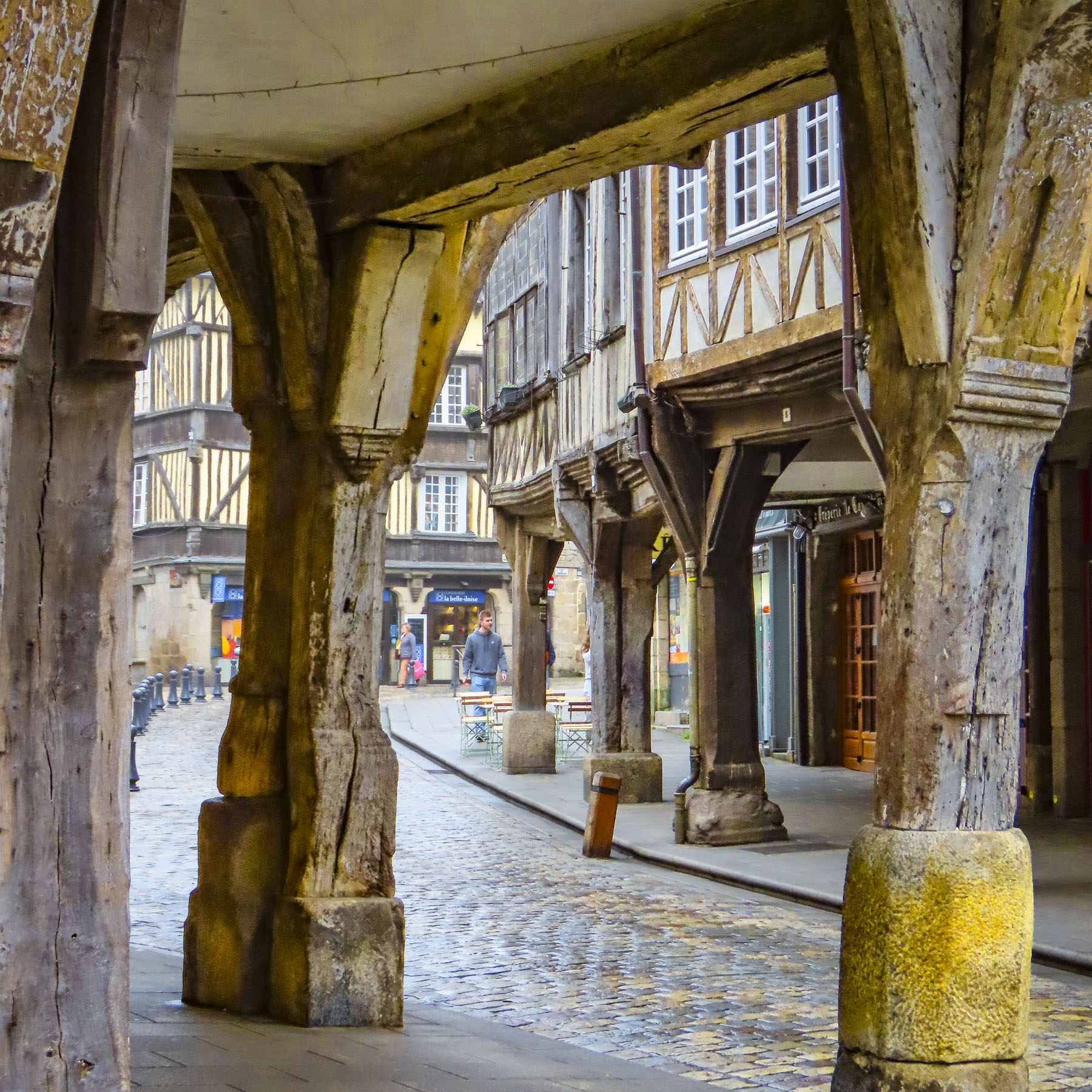
Farther along, stores had their merchandise displayed along the sidewalks under the porches of the buildings. This style resulted from the tax code at the time when merchants’ stores were taxed based on their ground floor square footage, but were allowed to expand outward on the higher floors.

Polished from a millennium of footfalls, the cobbled lanes in Dinan glowed with different tones and hues, especially apparent on the damp overcast day we followed the long Rue du Jerzual downhill to the Port de Dinan. It’s an amazing street lined with a vast array of interesting buildings and a tower gate, which was once part of the ramparts which encircled upper Dinan.

The waters of the La Rance river were calm and reflected the boats docked along the waterfront and the emerging autumn colors on the hillside above the river. Here the tributary narrows, no longer navigable for larger ships, a single arch stone bridge allowing only small recreational boats to proceed upstream to the pretty village of Léhon. A bike and footpath also follow the contour of the river to the village, only a 30 minute walk away.

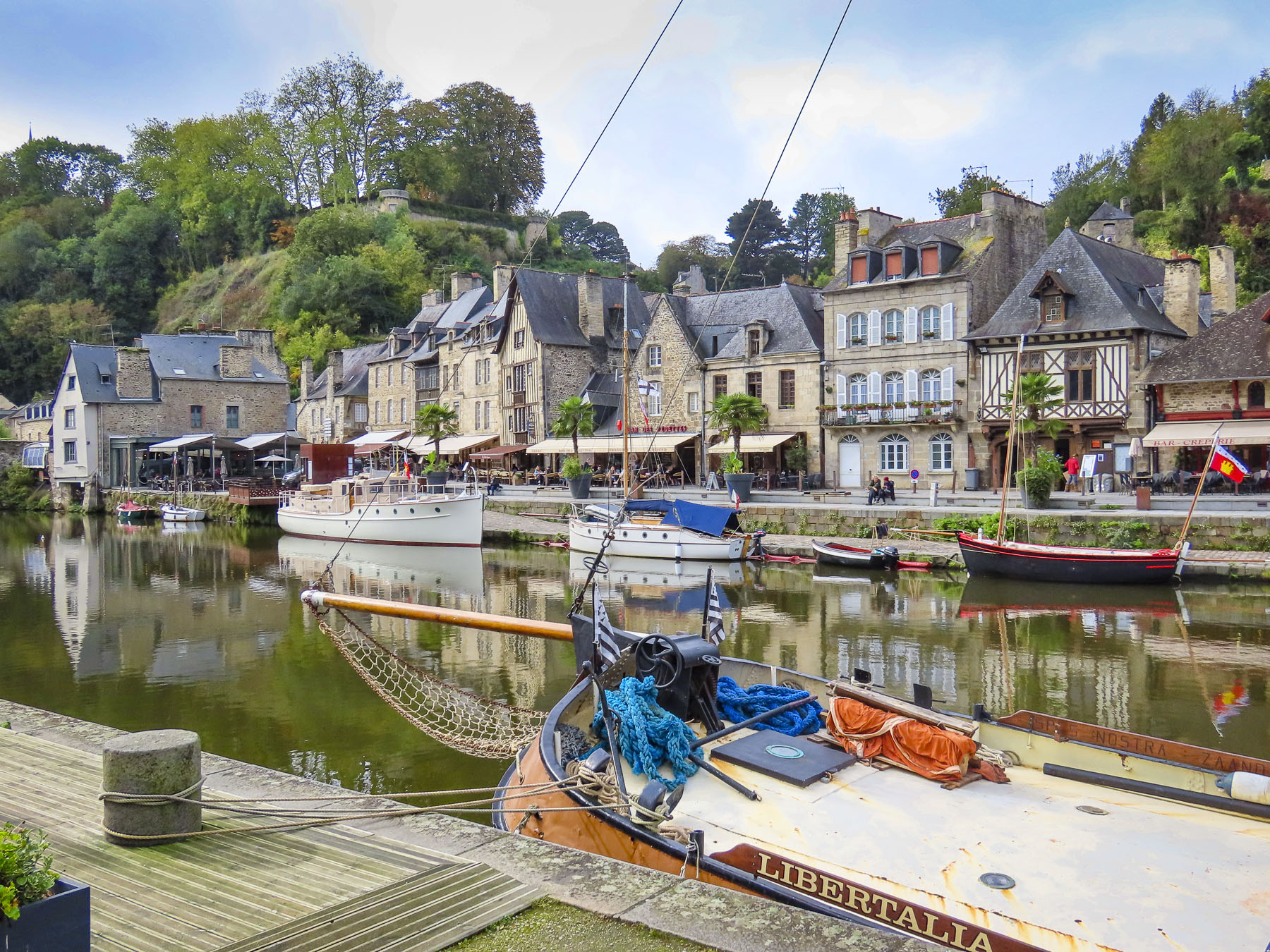
We lunched outside along the quay trying some garlicky escargot and enjoyed the now-sunny afternoon. We were dreading the long uphill walk back and had asked at the restaurant to arrange for a cab, but they cheerfully informed us there was no need as a local small bus stopped just over the bridge and would take us back to the historic center.

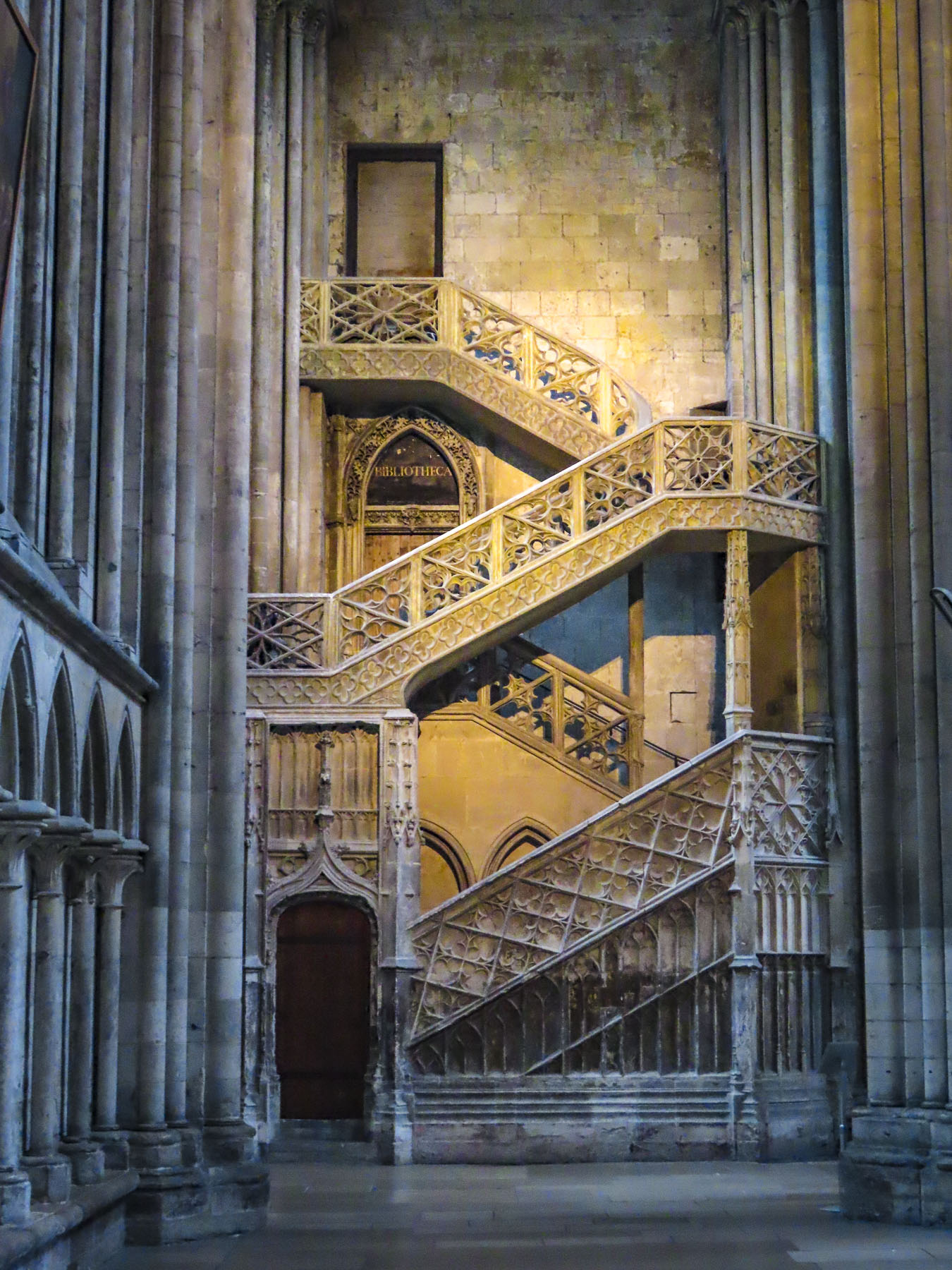
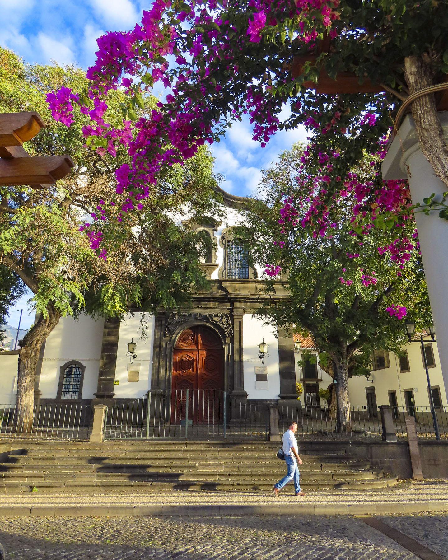
The driver stopped at the Basilique Saint-Sauveur for us. Built in the early 1100s, it retained its Roman style façade during a 15th century expansion. But we only had a few moments for outside shots before a late afternoon thunderstorm chased us inside.

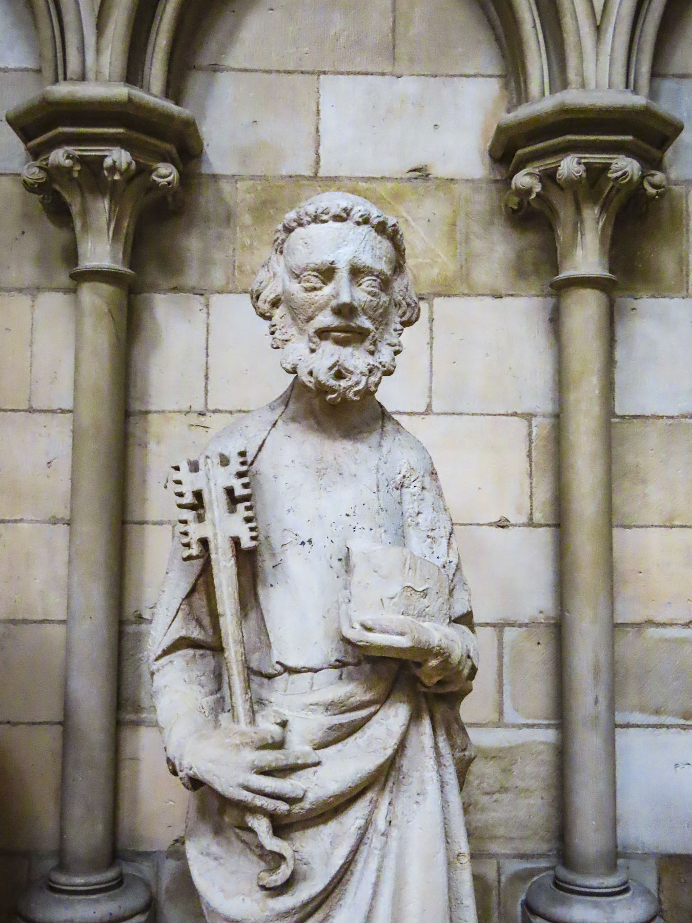
The inside has an impressive altar and artworks, while the interior architecture reflects a church renovated over several centuries. One side features Romanesque arches, though the other side displays a Gothic influence.

Rain kept us from walking through the Jardin Anglais, an English-style garden behind the town’s ramparts, with views across the La Rance river valley. We wrapped up a wonderful day in Dinan at the Château de Dinan, once a palace and fortress for the Dukes of Brittany in the 14th and 15th centuries. We seemed to have just scratched the surface of this intriguing town. And looking back it would have been a more interesting locale for a four-night stay.

Till next time,

Craig & Donna

France: Road Tripping Through Normandy – Fecamp, Yport & Étretat

Overnight showers had cleansed the air, the morning was brilliant with sunshine, and the deep blue sky was checkered with fair weather clouds. We were road tripping west through flat farmlands and pasturelands, which were lined with rows of beech trees to protect the land from the ferocious winds of winter storms. The landscape was dotted with Normande, a breed of dairy cow descended from the cattle that the Vikings brought with them when they settled in the area during the 9th century. A white cow, speckled with brown patches, this breed is favored for its milk’s high fat content, which lends itself perfectly for making CHEESE! More specifically the PDO (Protected Designation of Origin) Camemberts, Livarots, Pont-l’Evêques and Neufchâtels that the Normandy region is famous for. Small signs for fromage and cider pointed down many dirt lanes that spurred off our route.

We were heading to the white cliffs of Fecamp and Yport, in the Seine-Maritime department of Normandy, on the English Channel. While planning this trip we read about high season – over-tourism running rampant across France. Crowds don’t appeal to us, so we’ve been planning our travels to coincide with a destination’s shoulder season for a while now. The articles also suggested visiting places off the usual tourist radar, which is how we came across Fecamp and Yport, our stops before reaching Étretat. In hindsight we should have planned a full afternoon or overnight stay in Fecamp, as the quick glimpses of the Palais Ducal, now ruins, and the Holy Trinity Abbey, as we drove through the historic center, revealed a pretty town and looked intriguing, worthy of further exploration.

Our “walk a little then café,” becomes “drive a little then café,” when we have wheels, and by the time we entered Fecamp it was time to satisfy that late morning craving. Parking in unfamiliar towns is always a challenge, and on a busy Saturday even more so, but we lucked out and found both a parking space and great café near the harbor. The sunny outside tables at Le Coffee de Clo were empty so we were surprised when we entered to see a lively shop nearly full of people busily enjoying the decadent sweet creations we had stumbled across. More muffin than pastry, the baked goods and excellent coffee here are the only excuse you need to detour to Fecamp.

Walking back to the car, we spotted the Chapelle Notre-Dame du Salut, across the harbor, high atop Cap Fagnet. It’s believed that Robert the Magnificent, an 11th century Duke of Normandy, constructed the church in thanks to God for surviving a shipwreck in the waters below the white cliffs of Cap Fagnet. It’s been a pilgrimage site for fishermen, sailors, and their families ever since.

The views from the terrace in front of the church of Fecamp’s harbor, and the southern half of La Côte d’Albâtre, the Alabaster Coast, take in an 80-mile stretch of white cliffs between Etretat and Dieppe on the Normandy coast, that mirrors the distant White Cliffs of Dover across the channel. Locally the cliffs around Fecamp are known as le Pays des Hautes Falaises, high cliff country.

In 1066, William of Normandy set sail from Fecamps’ harbor with a fleet of more than 700 ships, partly financed by the Abbott of Fecamp, to claim the Crown of England, which he had inherited, but this was being contested by Harold, a pretender to the throne.  The issue was settled at the Battle of Hastings when the former became King William the Conqueror. It was also reassuring to learn that the Fecamp monks transitioned away from being international arms merchants, and segued into a more appropriate occupation –  running a distillery in the 16th century, that produced a 27-herb flavored liqueur that would become popular in the mid-1800s and sold as Le Grand Bénédictine.

Eight hundred seventy-eight years after William set sail, on June 6, 1944, during WWII German fortifications along the Côte d’Albâtre failed against an allied amphibious invasion fleet of over 7000 ships and landing craft. It was the beginning of the end of WWII. Scrambling to the top of an abandoned bunker provided us with the perfect vantage point for photos of the coast.

By the time we arrived in Yport the clouds had thickened and were threatening to rain. To our dismay, it poured just as we were parking by the beach promenade. Fortunately, it was an intense but brief shower that cleared into a cloudless sky and revealed a quaint picturesque hamlet and shining white cliffs towering above the sea.

The cliffs along the seafront have been eroding for eons, creating in certain spots deep, long ravines that funneled torrents of water, laden with sand and stone through the cliff face to the ocean, which created beaches in certain places over the ages. These narrow valleys are called valleuses, and the small coastal fishing village of Yport started in one during the Neolithic era.

Without a harbor, fishermen pushed their small boats across a pebbled beach and rowed out through the waves to pursue their livelihood. They repaired their boats and mended their nets on the beach at the foot of the town. This way of life supported the villagers for centuries. Only the invention of the small outboard motor in the early 1900s eased their physical effort, until the 1960s when tourism and a small casino replaced fishing as the town’s driving economic force.

In 1838, the tightly knit community decided to build a church. Men, women, and children gathered tons of smooth stones from the beach, carted them 500m inland, and proudly worked together to mix cement and build the center piece of their town. Horizontally striped with alternating layers of colored beach stones, the façade of the church is beautiful, and unique in Normandy. It is a true testament to the power of community spirit.

By the mid-1800s Parisians seeking a more relaxing retreat than Etretat were frequenting the quiet fishing village. The French painters Monet, Renoir, Schuffenecker, and Vernier visited and painted there, while the 19th century French writer Guy de Maupassant set his novel, ‘Une Vie,’ in Yport. Paths from the center of the town and from behind the casino lead to the cliff tops and join the popular GR21 trail that can be followed north to Fecamp or south to Etretat.

Regardless of how beautiful photos of the Falaise d’Aval are, they don’t rival the physical reality of the calling gulls, wind-swept hair, the whistling wind and the relentless sound of the surf crashing against the stoney beach.

Arriving late on a Saturday afternoon in mid-October, we were surprised Étretat was jammed with tourists. Parking is extremely limited here and finding a space is almost a competitive sport that ultimately just required us to sit in a row and wait for someone to return to their car. It sorted itself quickly enough and luckily, we were only a short walk from one of Étretat’s first lodgings, the Hotel Le Rayon Vert, which to our delight was directly across from the beach and Étretat’s promenade. After checking in, we headed to the top of the towering 300ft high cliffs for sunset, the first of many walks along this beautiful stretch of coast and the perfect way to work up an appetite.

If you have been following this blog, you’ll know my superpower is the ability to find a great pâtisserie, pastelería or pastry shop. It’s a great talent when the hotel wants 16€ per person for breakfast. In Etretat, the boulangerie patisserie “Le Petit Accent” exceeded all expectations!

Set high above the town, it was a steep uphill walk to the Jardins d’Etretat. This whimsical topiary garden, with playful faces as “Drops of Rain,” by the Spanish artist Samuel Salcedo, more so than the Falaise d’Aval, was the catalyst for visiting this seaside resort.

This magical spot has its roots over 100 hundred years ago when a villa and garden were built here by Madame Thébault, a Parisian actress, and friend of the impressionist painter, Claude Monet. Madame Thébault cultivated a circle of creative folks as friends, and Monet along with other painters and writers were her frequent guests. It was from a patio in this garden that Monet found repeated inspiration to capture the essence Les Falaises à Étretat.  His love of the area is evident in the nearly 90 canvases he painted depicting various scenes along the Normandy coast. But the Jardins d’Etretat today are a relatively new botanical masterpiece reopening in 2017 after an expansive reinterpretation led by the landscape architect, Alexander Grivko.

Across from the entrance to the garden, a tall soaring monument pointing skyward, elegant in its simplicity, commands a view out over the cliffs and the ocean beyond. This tribute commemorates the last sighting from French soil of the pilots Charles Nungesser and François Coli on May 8th, 1927. They were flying their biplane L’Oiseau Blanc, The White Bird, from Paris to New York in an attempt to be the first non-stop flight across the Atlantic Ocean and win the Orteig Prize of $25,000. But they disappeared somewhere along their route. It’s believed they made it across the Atlantic, but crashed into the dense wilderness forest of Nova Scotia or Maine. Wreckage of L’Oiseau Blanc has never been found and their disappearance remains an unsolved aviation mystery, that rivals Amelia Earhart’s story.  If Nungesser and Coli had succeeded, they would have beaten Charles Lindbergh in the Spirit of St. Louis by twelve days.

The Notre Dame de la Garde stands alone on the slope below the Monument “L’Oiseau Blanc,” isolated on the cliffs like a small boat surrounded by a vast ocean, its spire like a lighthouse’s guiding beacon, visible far out at sea. It offers a welcome sign for the fishermen and sailors returning home. Unfortunately, it was undergoing renovation when we visited in mid-October.

Walking back through the village we found the Normandy architecture in Etretat intriguing. It encompasses many different styles and runs the gamut from ancient half-timbered buildings embellished with ornate wood carvings, to 18th and19th century designs utilizing the local hard flintstone and incorporating steep pitched slate roofs and turrets into their designs. All fascinating.    

Etretat has been a popular destination since rail service began between the port city of Le Havre and Paris in 1847. Swimming or a day at the beach later became common place with the latest fashion, the full body bathing suits. While society folks were sunbathing on the stoney beach, there was a cottage industry of locals, called pebblers. They collected the beach stones for their high silicone content, which were then pulverized and used for various industrial purposes. It’s now illegal to remove any pebbles from the beach as they are vital natural protection against storm surges and marine submersion of the promenade built across the top of the beach, which is much easier walk on than trekking across the pebbly beach, where each footstep sinks into the loose stones and is exhausting to cross.

The classic 19th seaside resort continues to draw visitors, with the success of the French Netflix series Lupin, based on the writer Maurice Leblanc’s character, Arsène Lupin, the gentleman burglar. Leblanc’s former summer home, where he wrote some of his books, is now the Le Clos Arsène Lupin Museum. Some scenes were filmed locally, motivating a whole new generation to discover the white cliffs. The other French writers and composers who enjoyed their time in the quaint village include Victor Hugo, Guy de Maupassant, and Jacques Offenbach, all of whom are remembered with streets named in their honor.

We also enjoyed our time along the Côte d’Albâtre, but just seemed to scratch the surface of this beautiful part of Normandy.

Till next time, Craig & Donna

The Rouen Lean: It’s not a Dance

We had narrowly escaped Paris’s evening rush hour as we sped away from Orly through the French countryside. Our destination is Rouen, an ancient port town on the river Seine with a pivotal role in France’s history since the Romans first settled along the graceful bend of the river there. It would be a restart to a trip cut short by covid in 2020.

The last light of the darkening sky reflected off the Seine, like a brush stroke of silver paint across a dark canvas, as we turned away from the river and entered Rouen. We are not fans of night driving, especially in a new locale, and our maps app had difficulty with the narrow one-way streets in the historic center of the city. Frustrated, we decided to park at the first opportunity. Miraculously the planets were aligned in our favor as we entered the Q-Park Palais de Justice Musée des Beaux-Arts, a massive unground parking garage that encompasses several subterranean blocks beneath a park in Rouen’s historic district. Not sure exactly where to park, something urged us to continue through the cavernous space until we found a garage attendant moments before he locked his booth for the night. Friendly and extremely helpful, he explained how their multiday ticket would be the best value for us. Yes, we were so lucky he spoke English. Our good fortune continued at street level when we realized we were only two blocks from our hotel. But we had arrived later than planned and the gate to Le Vieux Carré was locked. Fortunately, another guest was returning to the hotel at that time and let us in. “I saw several keys on the reception desk when I went out, and figured you were one of the late arrivals.” Indeed, a room key with our name on it was there waiting for us.

Early the next morning the unusual, but pleasant aroma of caramelized onions drifted in through our open window. With our tastebuds awakened and appetites whetted we headed out. “Walk a little, then café,” is how we like to describe our wanderings. Our first stop – coffee and pastries. It is France, after all! But where to stop? There’s an abundance of eateries in Rouen, thanks to the city hosting two universities and thousands of students. There were so many places that looked inviting, but the criteria for us first thing of a morning was a café with a table in the sun, a must in mid-October to help alleviate the day’s early chill. Once sufficiently caffeinated, we set out.

Flat as a crepe, Rouen was a walker’s delight and savory with explorations that pulled us in every direction. During the 9th century, Vikings pillaged and then stayed to become the first Normans, and the prosperous town of became the capital of Normandy in the 10th century. During the Middle Ages, conflicts in the region were nearly continuous, but the city somehow evolved into one of France’s gems, with its distinctive medieval half-timbered buildings and three towering, majestic churches which still grace the city’s skyline. 

A who’s who of historical figures have crisscrossed Rouen’s cobbled lanes for centuries. The Anglo-French kings, William the Conqueror, a succession of King Henrys, Eleanor of Aquitaine and Richard the Lionheart viewed the city as their home away from home. In 1431, after inspiring her countrymen to rally against English expansionism, Joan of Arc was captured, tried, and burnt at the stake in Rouen’s Old Market Square. It wasn’t until the Siege of Rouen in 1449 when forces commanded by King Charles of France finally defeated the English. Later the French impressionist painter Claude Monet found inspiration in the city, featuring the Rouen Cathedral over thirty times as he put paint to canvas to catch its essence perfectly. With conflicts never seeming to end in Europe, somehow, this beautiful renaissance city, though deeply wounded, miraculously survived World War II. Most importantly perhaps, in March 1948, Julia Child had her first taste of French cuisine at Restaurant La Couronne, on Rouen’s central square, the Place du Vieux-Marché.  

Open since 1345, La Couronne is France’s oldest inn. Savoring her Sole Meuniere, a lightly breaded fish dish flavored with fresh butter, lemon, parsley and capers, it was an experience she described “as the most exciting meal of my life.” Local oysters and a bottle of Pouilly-Fumé were also enjoyed. She was hooked and a Francophile was born!

The Rouen Lean is not a dance, nor the result of drinking too much wine, but the very obvious tilt exhibited by many of the city’s ancient half-timbered buildings constructed during the Middle Ages. Our hotel was a prime example of this with scarcely a wall or floor that was square, plumb, and level. But that was the charming character and ambiance we were looking for. The half-timbered building’s superstructures were constructed with huge square oak timbers held together only with mortises, tenons, and wooden pegs, while the nonstructural area between the supporting timbers was filled with bricks or stones and covered with plaster. Over the centuries it has proven to be an aesthetically pleasing and durable construction method used to build five to six story houses. Many of the buildings still retain a centuries old, carved wooden sculpture on the front of the building that represented a service or craft that was once conducted there.

Approximately two thousand half-timbered structures from the Middle Ages still stand in Rouen. The abundance of wooden buildings surprised us as most of our travels have been through the countries of Southern Europe, Portugal, Spain, and Italy, where stone was historically used to construct everything. In Rouen, scarce stone was saved for the churches and castles.

Even stone erodes over time and occasionally old churches need a facelift every few centuries, as was evident by all the scaffolding surrounding the15th century, Gothic style, Saint-Ouen Abbey Church, though with a selective camera angle I was able to eliminate most of the temporary platforms from our photo. But the difference between the areas covered by grime and the newly cleaned sections was phenomenal. The multiyear project is scheduled to be completed later in 2024. Though the interior of the church was closed the day we visited, we were able to watch a stone carver as she worked to create a new gargoyle to replace one beyond repair.

Rouen’s three main churches, Saint-Ouen Abbey Church, Église Catholique Saint-Maclou, and the Cathédrale Notre-Dame de Rouen are all located a short distance from each other on the eastern edge of the historic district, but the journey through the narrow lanes connecting them and exploring many other splendid points of interest along the way made for a wonderful day.

After the abbey we window-shopped down Rue Damiette, admiring the handcrafted violins created by master luthier Sarhan Jean-Marc. Farther on, interesting antique stores lined the narrow lane. Behind us the abbey’s belltower rose over the street. A view that hasn’t changed significantly in centuries. One of the best examples of the “Rouen Lean” is at the end of the street across from Saint-Maclou and caused us to stop for a double take. How, we wondered, can these buildings still be standing?

There was a shortage of cemetery space in Rouen during the Middle Ages when the plague revisited the city repeatedly and 75% of its citizens died. At the time it was the custom to bury the dead only until their bodies decomposed.

Then the bones were exhumed and reinterned above ground in the ossuary Aitre Saint Maclou and the grave reused for the newly departed. Hidden away down a discreet side alley, the ossuary complex was expanded several times and functioned as a secondary cemetery until the early 1700s when the remains were removed, and the buildings were repurposed as a school for poor boys. Today the space houses a fine arts academy and exhibition space. Though it’s still a macabre place with skull and crossbones carved into its exterior timbers.

We rested with coffees at a café on Place Barthélémy in front of Saint Maclou. While a lovely spot, the coffees were overpriced to the point that we could have purchased lunch for two if we’d chosen a less touristy spot. Just a reminder, a block or two off the usual tourist routes and prices drop dramatically.

Rouen’s Cathédrale Notre-Dame has been the center of focus since the first early Christian converts built a temple in 395 AD, on the spot where the current church now stands. And, like the city, the church has a turbulent history. Charlemagne visited in 769, but those pesky Vikings couldn’t decide if they hated or loved the place, sacking it repeatedly in the 9th century, only to later claim the Duchy of Normandy as theirs and embrace Christianity after the Viking leader Rollo was baptized in the church and later buried there as well. Nearby, Richard the Lionheart’s tomb only contains his heart.

Romanesque architecture was the rage during the 11th century and William the Conqueror attended the consecration for the first of many expansions and renovations that would follow over the centuries.

More chiseling and hammering continued during the 12th century when successive Archbishops embraced the new Gothic style. In 1204, Philip II of France celebrated Normandy’s merging with his kingdom amidst the new Gothic renovations.

During the 16th century, a second tower in the Renaissance style was built and ornate stonework and hundreds of statues were added to the front of the church, creating the visage that remains today.

Later lightning strikes, hurricanes and Calvinists would wreak havoc on the church. During the French Revolution any metal objects, not hidden away, were seized and melted down to create cannon balls. During WWII the cathedral was heavily damaged by Allied bombs. The damage was so extensive that final restoration wasn’t completed until 2016, when all the scaffolding was finally removed. Built and rebuilt, inside and out, for over eight hundred years, the cathedral is a fascinating place to explore.

The next morning we headed down Rue de Gros-Horloge, Rouen’s main pedestrian-only thorough fare that runs east to west from the cathedral to the Place du Vieux-Marche, a historic market square. This is the street where the city’s famous 14th century astronomical clock, Le Gros-Horloge, seems to transport you backwards through time to the Renaissance. Early in the morning is the best time to experience this landmark without crowds, as later in the day the narrow lane is as busy as Paris’ Champs-Élysées. During our short time in Rouen, we passed under its gilded façade many times and always, like Monet and his multiple paintings of the cathedral, tried to capture this beautiful clock just right in our photographs.

Indulging our wanderlust, we veered left and right off the lane to satisfy our curiosity. We found ancient gargoyles on the Tribunal Judiciaire de Rouen, and whimsical unicorns, a porcupine, and a reference to L’Ordre de l’Hermine, the Order of the Ermine, a medieval chivalric order on the exterior walls of the Hotel de Bourgtheroulde, a former 1500s mansion, built in what is kindly referred to as the Flamboyant Gothic style popular at the time.

Seriously – the Order of the Ermine is not from a Monty Python skit. A small but ferocious animal, during the Middle Ages the ermine was believed to to fight to its death if attacked rather than “sully the purity of its white fur,” and was used by many medieval chivalric orders to symbolize their uncompromising integrity and honor.

There was also the Ordre du Porc-Épic, porcupine, for prickly knights, and the Order of the Golden Fleece, for royal embezzlers. These were actual chivalric orders, though I am taking liberty with their membership.

Today the Place du Vieux-Marché is surrounded with restaurants and cafes with outside tables, which were very lively at Happy Hour when students and folks just off work congregated on the square. Quite a different scene now as opposed to the day in 1431 when Joan of Arc was burned alive at the stake, in the center of the square, though her heart remained untouched by the flames. A beautiful, modern wooden church built in 1979, the Église Sainte-Jeanne-d’Arc now memorializes the spot where her pyre stood. A plaque nearby reads “Oh Joan, you who knew that the tomb of heroes is in the hearts of the living.”

Inside the food market we savored our first fresh oysters from the Brittany coast and purchased some fruit, and of course cheese! A difficult process considering the tremendous variety we could choose from.

Intrigued by Joan of Arc’s story, the next day we headed to the Historial Jeanne d’Arc, which is housed in a wing of the ancient Archbishop’s Palace where part of her trial was held. We were skeptical at first while buying our tickets, thinking we’d just be watching a movie. But we both ended up being enthralled with the interactive digital technologies used to project Joan’s saga onto the old stone walls, floors, and domed arches.

Her history was exceptionally well portrayed and presented as chapters, with each chapter presented in a different room of the architecturally interesting space. We climbed one of the palace’s towers and were rewarded with a timeless view down Rue Saint Romain to the church of St. Maclou; a view that would look familiar to Joan of Arc were she to stand in this spot today, so little changed from her time.

A symbol of defiance, heroine for the French, and a successful military adversary against the English, she claimed God supported Frances’s freedom, but this was a position the Rouen church could not support as they were allied to England and claimed God was on their side. She was tried and convicted for her heresy. Her male jury also had difficulty with her dressing in men’s clothing for battle. As if because she was a woman, she should have worn a skirt and sat side saddle as she rallied the French to fight. But this practicality was viewed as cross dressing and as such was held to be against God’s law. (Though the robes of the clergy were not considered feminine.) The French finally defeated the English and succeeded in uniting Normandy and Rouen with France. Twenty-five years after her execution, Joan’s family petitioned for the trial records to be reviewed. The court determined she had been tried “under false articles of accusation,” and posthumously declared her innocent and annulled her sentence in 1456.

Our time in Rouen was a beautiful look back into Medieval France.

Till next time, Craig & Donna

Tenerife Part 3: Garachico & Buenavista del Norte – A Wonderful Coastal Drive

Our drive along the coast started in the small harbor of Icod de los Vinos. From the start the sea vistas were beautiful, with crisp clarity and saturated blues and brilliant white breakers crashing against the rocky coast. The lighthouse on the remote headland Punta de Teno was our destination. Though only sixteen miles away, it took a good part of the morning with all the frequent photo stops we were making as we proceeded. The spectacular scenery along this short drive rivals the Pacific Coast Highway in California and Chapman’s Peak Drive outside Cape Town, South Africa or the Amalfi Coast of Italy. Just epic!

A few minutes from Icod de los Vinos along TF-42, we stopped at Mirador El Guincho which overlooks the coastal homes, banana plantations, and the new Port of Garachico. Constructed in 2012 behind a large breakwater, it is the only harbor on the north side of Tenerife. Beyond the harbor the extinct volcano Montaña de Taco highlights the horizon, its crater now used as a reservoir.

Enthused by what we glimpsed as we passed through Garachico, we decided to keep with our original plan to go to our farthest destination first and then return later to linger in the quaint town.

“Drive a little, then café.” We were ready to stop by the time we reached Buenavista del Norte and easily found parking around the Plaza de los Remedios. Sitting in the shade, we ordered coffees from the café under the park’s gazebo. It’s a classic Canarian town with colorful two and three story homes. What’s unusual though is the town sits on flat land! Something that is in short supply on this mountainous island. It’s only access to the sea was from the small rocky landing at Playa de las Barqueras, where for centuries supplies were rowed ashore from passing merchant ships. Nearby set along the dramatic coastline is the Buenavista Golf Course, designed by the famous Spanish golfer, Seve Ballesteros.

The Church of Nuestra Señora de los Remedios stands across from the plaza and has played a significant role in the town’s history since its cornerstone was laid in 1516, most importantly when the townspeople filled the church in 1659 and prayed to the statue of La Virgen de los Remedios to stop a plague of locust which was ravaging their crops. According to history the plague stopped. Sadly in 1996, that historic statue and many other centuries-old religious treasures were lost in a fire that destroyed the church.

It’s very easy to speed by and miss, but on the outskirts of town on Cruz de Toledo at its intersection with TF-445 there is a statue of a locust atop a tall column with the anagram of the Virgen de los Remedios, and the dates 1659-2015 which commemorate that event. Every fifth year a procession from the church carries the virgin’s statue out to the locust monument. 

We continued towards Punta de Teno only to be stopped by a manned roadblock across the pavement, just shy of Mirador Punta del Fraile. Only buses and taxis were allowed to travel the road farther; we weren’t told why. Even Google map drivers have been prohibited from making the journey. There was a small dirt parking area next to the gatehouse and we could see a few folks walking the long incline to the mirador. We followed. It was about a thirty minute, moderately strenuous walk, and the views were awesome. It was well worth our effort. Gale force winds whipped through a cut in the rock which the road followed down to the lighthouse at Punta de Teno, three miles away. Behind us a large cliff face blocked most of the view of the Teno headland. It’s a barren peninsular without tourist amenities, just a lonely lighthouse and modern wind turbine farm, the blades of which must turn furiously 24hrs a day, if it’s as blustery there as it was at Mirador Punta del Fraile. Hold your hats!

The views returning to Garachico were equally as impressive as the morning sights, and we stopped several times before entering the old town.

As prosperous as the Canary Islands are today, we were reminded by the statue at the Mirador del Emigrante that life here was not always easy. This poetic description by Fernando García Ramos, the sculptor, explains for the viewer the meaning behind his statue of a walking man – with a hole in his chest, as if in his heart – holding a suitcase. “The figure is scanning the horizon, in a daring position, as if pretending to jump over the sea, with a suitcase in hand, and many more suitcases in a series as a chain behind him; these suitcases behind him surely mean the memories, the sadnesses, the nostalgia, the girlfriend, the mother, the sisters, the families that are left behind by an emigrant who takes a new life, who jumps over the infinite sea, in search of a new life in strange and distant lands.”

Occasionally we spotted colorful red rock crabs scurrying about as walked along the waterfront to the Castillo de San Miguel, a square block fortress built from quarried lava rock in 1575 to protect Garachico’s port from French, Dutch and Arab pirate attacks, along with the threat of British invasion.

For two hundred years Garachico’s harbor was the most important commercial port in the Canary Islands. Its citizenry accumulated wealth through prosperous imports and exports from Spain’s New World colonies and Europe. It was a prestigious town with many warehouses and shops, fine homes, convents, and churches.

This ended on May 5th, 1706, when Volcan Arenas Negras, a vent volcano on Mt. Tiede’s lower slope, erupted and spewed lava down a ravine that led directly into the town and harbor. Amazingly, no lives were lost, but a great number of the town’s historic buildings as well as four convents were destroyed, buried under lava that flowed into the town for nine days. Buildings close to the lava flow caught fire and burned to the ground. The fortress narrowly escaped, but it lost its relevance when the harbor was filled with lava and ships could no longer anchor there. With the loss of the harbor, merchant ships shifted to Puerto de la Cruz, folks left and Garachico evolved into a fishing village until the tourist economy on Tenerife took off in the 1960’s, embracing tourism so enthusiastically that the town recently constructed an ocean front municipal pool open to all along the promenade.

Walking into the center of town, we admired several noteworthy historic buildings:, Convento de San Francisco (1524,) and its church the Iglesia de Santa Cruz de Tenerife; Casa Palacio de Los Condes de La Gomera (1666.) They still stand around a beautiful, shaded gazebo in the Plaza de la Libertad.

Walk a little then café.

Till next time, Craig & Donna

Peru: The Inti Raymi Festival – An Ancient Celebration Revived

The precision stone masonry of ancient Inca craftsmen lined narrow alleys, and slowly began to come to life with Quechuan women dressed in their colorful attire. They were clutching baby llamas and claiming spots to pose for photos with tourists. It would be a busy day. The Plaza de Armas, the historic center of Cusco, would soon be packed with spectators for the Inti Raymi Festival.

This nine day long ancient Inca ritual traditionally celebrated the Sun God, Inti, on the winter solstice in the southern hemisphere, June 21st, but is now observed on the feast day of Saint John the Baptist, June 24th, in an attempt to blend beliefs. The celebration marks the beginning of a new life cycle with the approach of Spring and warmer weather for the planting of crops to begin another agricultural year. We wanted to scope out the plaza early and find a spot with an unobstructed view of the activities.

In ancient times the ritual began at Coricancha the Temple of the Sun, now the Convent of Santo Domingo since the Spanish conquest of Peru. Talented astronomers, the Inca built the temple in the 1400s for one portal to celestially align with the rising sun on the winter solstice and brilliantly fill the gold covered interior with light.  

After watching the sunrise and receiving this blessing, the Inca ruler as the Sun God’s earthly representative would thank the Sun God for the last year’s harvest and request his light shine upon the Inca Empire favorably for another year.

He was then carried ceremonially on his throne atop the shoulders of warriors across Cusco, followed by other members of the royal Inca family, the mummified remains of previous Inca emperors and delegates from hundreds of different tribes that inhabited the vast Inca Empire that spanned from Columbia, Ecuador, Bolivia, Chile, from the Pacific coast over the Andes to the Amazon jungle, representing a rainbow of people, a theme that today is incorporated into the city flag of Cusco.

Conquistador Francisco Pizarro captured Atahuallpa, the 13th and last Inca emperor. Atahuallpa offered a room filled with treasure for his freedom, and the Spanish accepted. The walls of Coricancha and other temples across the Inca Empire were stripped of their gold and silver, which was then melted into bullion and sent to Spain on the famous treasure fleets that plied the Atlantic from 16th to the 18th century. The Spanish executed the Emperor when he refused to convert to Christianity in 1533.

The Spanish banned the Inti Raymi as a pagan event. But the tradition went underground and was observed in secret, in isolated villages throughout the Andes. The festival was revied in 1944, mostly due to the efforts of two proud Quechuans, Faustino Espinoza Navarro (a scholar and artist) and Humberto Vidal Unda (a future mayor of Cusco and a leader of the Indigenismo movement, which advocated for native political involvement.)

Researching historic chronicles such as Royal Commentaries of the Inca by Garcilaso de la Vega (1612), the illustrated book The First New Chronicle and Good Government by Felipe Guamán Poma de Ayala (1615) and a manuscript by friar Martín de Murúa, The Historia General del Piru (1616), that also contains illustrations, Navarro created a script and Unda envisioned the theatrical staging for a cast of 800 performers.

The event has grown over time and now includes 25,000 participants drawn from hundreds of Peruvian indigenous groups, who dress in their unique regional garments parade, dance, and sing their way through Cusco and the Plaza de Armas. They then continue uphill to the ruins of Sacsayhuaman fortress, overlooking Cusco.

In this open expanse above the city roughly 80,000 people gather to watch all the participants fill the field for the grand finale, which depicts simulated animal sacrifices, pledges of loyalty to the Inca emperor from all the tribes, and final offerings to the Sun God. This is the second largest festival in South America, after Carnival. It was a dynamic and colorful event that was a joy to experience.

Till next time,

Craig & Donna

South of Albuquerque: Mountains, Missions and Bottomless Cups of Coffee

In all our previous trips to Albuquerque, we had always opted to head towards Santa Fe, never exploring south of the city. But we only had a few days to ourselves this time after attending our daughter’s wedding and decided to do day trips from the Duke City. The nickname references the city’s naming in 1706 honoring the 10th Duke of Albuquerque and/or the Albuquerque Dukes, a beloved minor league baseball team.

The pueblo ruins around Mountainair piqued our interest. We mapped out a circular route; south on I-25, east on NM-60 to Mountainair, then north on NM-55 & NM-337 to Tijeras where we would pick up I-40 West back to town. The day dawned with a crisp blue sky, and we headed south. We would have preferred a slower drive through the Rio Grande Valley nearer the stately Manzano Mountain range, but with 153 miles to go and multiple stops it would be a long day. The panoramas from I-25 were expansive.

Francisco Vazquez de Coronado’s failed mission to find the legendary “Seven Cities of Gold,” in 1540 did not discourage other explorers from trying, which brought Don Juan de Oñate onto the scene. A marriage to Doña Isabel de Tolosa Cortés de Moctezuma, granddaughter of conquistador Hernán Cortés, and the great-granddaughter of Aztec Emperor Moctezuma II, gave Don Juan de Oñate new prestige and influence. In 1595 King Philip II of Spain chose Ornate to colonize the upper Rio Grande valley. In 1598 he led an expedition that included his nine-year-old son, a nephew, 20 Franciscan missionaries, 400 settlers, 129 soldiers, 83 wagons, plus livestock, north from Mexico City, with the stated mission from the Pope to spread Catholicism. But there was also hope that riches rivaling that of the Aztecs and Incas would be found again. Fording the Rio Grande near present day El Paso, he proclaimed all the lands north of the river “for God, the Church, and the Crown.”

They eventually reached three pueblos in the Abó Pass area, which were on an ancient route between the mountains that facilitated trade between the Plains Indians of Eastern New Mexico and the Pueblo peoples that lived in the lush Rio Grande Valley. This area that at the time was thought to have a population of 10,000 talented farmers, weavers, stone masons, ceramicists, and adobe making Pueblo Indians, which the Spaniards quickly began exploiting. They eventually reached three pueblos in the Abó Pass area, which were on an ancient route between the mountains that facilitated trade between the Plains Indians of Eastern New Mexico and the Pueblo peoples that lived in the lush Rio Grande Valley.

This area that at the time was thought to have a population of 10,000 talented farmers, weavers, stone masons, ceramicists, and adobe making Pueblo Indians, which the Spaniards quickly began exploiting. Life in the new territory under Oñate was severe. Some settlers urged a return to Mexico when silver was not discovered, and Oñate executed the dissenters. Pueblos that refused to share winter food stocks needed for their own survival were brutally suppressed into submission. The most notorious crime occurred at the Acoma Pueblo, north of Albuquerque, when the inhabitants resisted seizure of their winter provisions, killing Oñate’s nephew during the upheaval. In response, soldiers under his command massacred 800 men, women, and children. The 500 surviving villagers were enslaved and by his decree every Acoma man over the age of twenty-five had his left foot amputated. Word of his atrocities eventually reached the Spanish throne, and in 1606 he was recalled to Mexico City, tried and convicted of cruelty to colonists and natives. With a slap on the wrist, he was banished from Nuevo México, and allowed passage to Spain where the king appointed him Minister of Mining Inspections.

In 1621, Fray Francisco Fonte was assigned the task of building a mission at Abó Pueblo. First occupying rooms in an existing pueblo and later commandeering labor, including a large number of women, to build a separate church and convento which radically incorporated a kiva into its structure. This effort at syncretism was most likely modeled after the Catholic church’s success in Peru where Pachamama, an “Earth Mother” goddess who was celebrated to facilitate the indigenous population’s conversion to Catholicism. This  technique was adapted from Julius Caesar who allowed conquered peoples to keep their religions, as it “eased the acceptance of Roman rule.”

Two other Church missions in the Salinas Valley at Gran Quivira and Quarai pueblos were also constructed around the same time as Abo’s and also incorporate Kivas. This was a controversial practice as the Spanish Inquisition, (1478–1834), was still going strong. This threat couldn’t be used against the Puebloans, as they were not yet considered citizens of Spain without conversion. But it was a dangerous tight rope for the friars who constantly heard from the regional Spanish civil authorities that they were overly tolerant of the Indians “pagan beliefs,” and the Puebloan’s religious studies took too much time away from the encomendero. The encomendero was a colonial business model that granted conquistadores or ordinary Spaniards the right to free labor and tribute from the indigenous population. In return Nuevo México encomiendas were obligated to “instruct the Indians in the Roman Catholic faith and the rudiments of Spanish civilization.” The free land and free Indian labor promised with the encomendero was also used as a recruiting tool to encourage settlers to venture into the wilderness. The pueblos did not submit willingly; any resistance was violently suppressed. Though out-numbering the Spanish invaders, the Indians’ weapons of stone-tipped arrows and spears were no match against the Spaniards’ guns, armor, metal swords, and horses. Relations with Puebloans ultimately deteriorated when the friars, under civil pressure, refused to allow the kachina dances in the Kivas and filled them with rubble and dirt to prevent their use.

An extended period of drought and frequent raids from the plains tribes led to abandonment of the three Salinas pueblos by 1678, two years before the Pueblo Revolution in 1680 in which they surely would have participated. Four-hundred Spaniards died, including 21 of the 33 priests, but there were almost 2000 Spanish survivors. Warriors followed the fleeing refugees all the way to El Paso to ensure their expulsion from Indian territory.

When the Spanish returned 12 years later, they did not try to reimpose the encomendero and returning missionaries displayed more tolerance of indigenous religious beliefs. Spain instead sought to enlist the Pueblo tribes as allies to resist French and British empire expansion farther west. But the Salinas Valley remained deserted until Spanish shepherds returned for a few years in the early 1800s, only to be forced out by nomadic Apaches. Successful resettlement did not happen until the mid-1860s.

We turned off NM-60. Long ago the road was known as the Atlantic and Pacific Highway, one of the original Auto Trails in the early years of motoring. It was a route marked with colored bands on utility poles, that started in Los Angeles, California, and ended 2700 miles later in Virginia Beach, Virginia. Those were the days! We followed the single lane road into a gully and through a seasonal stream before rising to a field in which the earth-red stone ruins of the Abó mission glowed in the morning sun. The ruins of the mission church are massive. The complex must have been a wonderous sight when it was built next to the pueblos. Unfortunately, only piles of rubble remain of the pueblos themselves and I could not find a record as to why they were destroyed. But there is an entry from a Spaniard’s journal that describes the Salinas villages before the mission was constructed; “Each of these pueblos must have about 800 people, young and old. They were close to the plains and had bison-hide (acquired by bartering salt with the Apaches,) as well as cotton and deerskin garments; they had maize and turkeys; their houses were well-built, of slabs and rocks and whitewashed inside; the province was well forested with pine and juniper.”

We imagined a small town nestled into the mountains. Yes, it sits on the summit of Abó Pass at an elevation of 6,500 feet, in the vast expanse of the high desert. The mountains were way behind us. Mountainair is a misnomer, though the air is crisp and the town catches the winds blowing in from the eastern New Mexico plain. It’s a quaint crossroads that keeps its frontier spirit alive. In the early 1900s it was also “The Pinto Bean Capital of the World,” when peak production filled over 750 train carloads of beans in one season. A 10-year drought in the 1940s forced farmers to become ranchers. The town had passenger rail service between 1907 and mid-1960s. The railroad is an important part of the town’s heritage and BNSF Railway now owns the old Atchison, Topeka & Santa Fe Railway depot which is on the National Register of Historic Places. It’s a good spot to watch freight trains, many over a mile long, on the Southern Transcon route, pass by.

One block south of the main thoroughfare the Shaffer Hotel anchors a quiet corner. It has welcomed guests since “Mom & Pop” Shaffer built it in 1923 and decorated it with chandeliers, hand-carved vigas, and Indian art patterns painted on the walls and ceilings in bright primitive colors. The façade features four Navajo Whirling Logs, ancient symbols that represent wellbeing, good luck and protection, but unfortunately, they are often misinterpreted as nefarious swastikas. During the Depression the hotel claimed itself to be “The Most Unique Hotel in the World.” The hotel boasts a colorful history and one on legends tells of the time when Mom fired a shot at Pop when she found him in the arms of another women. She missed, but the bullet is still lodged in the ceiling above the stairs. The marriage continued. Mom died before she got to kill him.

Mr. Shaffer lived on to become a well-regarded creative wood sculptor, using twisted roots and branches from local juniper trees to carve imaginary beasts. Eleanor Roosevelt arranged an exhibit of his unique folk-art in Washington, D.C. An unusual rock-inlaid fence that Pop built still surrounds the side yard of the inn. At the Mustang Diner good food and, surprisingly, bottomless cups of coffee (star****’s is a foul word in my vocabulary) were a welcome break.

Gas stations are far apart out here, and Mountainair will be your last opportunity to fill the tank for many miles. From Mountainair we could have driven south to Gran Quivira, but it would have been a sixty-mile roundtrip, so we chose to save it for another time.

The views across the high desert were endless as we headed north on NM-55 to the Salinas Pueblo Missions National Monument Quarai Unit. To the east white puffy clouds raced across the sky. We turned west and drove into the rain. The storm was clearing by the time we stopped at an old church in Punta de Agua, not far from the Quarai mission, that dates from the 1860s.

A sign at the entrance warned visitors to stay on the paved trail to avoid rattlesnakes. It was an easy one-mile loop that took us through the church ruins and mounds of the fallen pueblos before circling back through a forest and picnic area. Four massive centuries-old logs still firmly held the weight of the thick stone wall above the church entrance. The scale of the church was immense, and the ruins towered above us.

The three Salinas Valley missions share similar histories, but there is an interesting side note to the Quarai mission. It served as the seat of the Spanish Inquisition in Nuevo México during the mid-1600s. A Spanish Inquisition panel consisting of three priests would send abusive encomenderos, (Indians did have certain rights under Spain’s complex laws), and mis-guided priests guilty of liaisons with native women, back to Mexico City for trail. The women would be sent to Santa Fe to be whipped by civil authorities.

The Quarai mission also had an unusual square kiva built within its walls, but there are not any historical references to why this shape was used. As with the one in Ado it’s thought that the kiva’s location within the walls of the mission represents the church’s syncretic approach to teaching the Puebloans the gospel. By the 1630s, there were 25 mission districts encompassing 90 pueblos in northern New Mexico, with 50 friars trying to convert nearly 60,000 Indians.

The good condition of the ruins today are the results of repairs and stabilization projects started in the 1930s by the Depression era Work Projects Administration, WPA, under the guidance of the Museum of New Mexico.

Our route back to Albuquerque traversed many isolated hamlets without many amenities. Coffee and food was a thing of the past until we reached Duke City. But we did pass several nicely done religious murals along the way in Manzano and Chilili.

The mural on the side of San Juan Nepomuceno Church in Chilili looks like it’s a scene from a Spanish Iberian village and we questioned the choice of a scenic river and bridge as a background, only to realize later that, behind the church, we had in fact crossed over a bridge that spanned the Canon De Chilili, and left centuries behind.   

Till next time,

Craig and Donna

Madeira: Pico Ruivo, Santana & Faial or Summits, Valleys and Stones

We imagine it’s possible to enjoy a full week pleasantly wandering the quaint streets of old town Funchal, basking in the sun and swimming in front of Forte de São Tiago, while venturing no farther afield than the Monte Palace Tropical Garden.

But the real beauty of Madeira lies in its rugged seascapes and mountains. The mountains admittedly aren’t that tall if you compare them to the Swiss Alps or American Rockies.

The highest, Pico Ruivo, reaches 6100 feet, nearby Pico do Areeiro is a tad shorter at 5,965 feet, and you can drive to its summit. A popular though arduous trail connects the two summits that are often above the clouds. In January and February, the sub-tropical island’s peaks can be snowcapped, and parents take off from work to bring their kids into the mountains to make snowballs and snowmen. There really aren’t foothills before the mountains. They appear to have been thrust violently upward from the earth’s crust like a knife thrower targeting a loaf of bread. They are tremendously steep and majestic, and you can experience them up close through various hikes or simply driving across the island’s numerous switch-back roads. Madeira in many aspects is similar to California, with a landscape where it is feasible to experience mountains and ocean in the same afternoon. On Madeira though it’s within the same hour.

The weather constantly changes on Madeira. The opposite of what’s forecast quite often is what happens, as it was the morning we looked up at a small patch of blue sky, teasing us with a shaft of sunlight while we waited in the parking lot atop Pico do Areeiro for our small group of intrepid hikers to gather. It was also a good twenty degrees chillier than Funchal and we quickly layered up. The clouds descended. A light rain began. Rain ponchos appeared. Visibility was 100 feet. Not the best conditions, but it was a non-refundable tour and our international group of seventeen stoically set forth into the clouds.

Commonly known as the “Pico to Pico” or the PR1 hike, it’s a semi-difficult 5-mile trek with a 1000 ft altitude gain. The route balances across narrow ridgetops and follows cliffside trails, climbs steep stairs and ladders, and passes through narrow rock-hewn tunnels before summiting Pico Ruivo. It then descends to the Achada do Teixeira parking lot for the return shuttle to Funchal. The path is improved in many sections with cobbled pavers and hand railing, but in other parts it was a muddy, puddled mess.

With the rain the trail was slippery and slow going. Unfortunately, the low cloud conditions didn’t allow for spectacular panoramas. But even with the dismal weather we were able to capture some photos that are evocative of the day. Spotting the well named red-legged partridge was a highlight of the trek. If you choose to do this hike, be prepared, wear sturdy shoes or hiking boots, bring extra clothing to layer up, plenty of water and lunch. Personally, I think this hike is too strenuous for older folks, especially if you are an inexperienced hiker. Back at our hotel, glasses of Madeira helped alleviate our chill.

We continually drove back and forth over the mountains. Many times, we partially retraced a previous route only to turn onto narrower country lanes and zig zag to a miradouro or destination that beckoned for a photo op. As birds fly, the distances are short around the island. Not so with the roads.

The Museu Família Teixeira was one such detour. It’s an interesting family museum that displays the older way of life on the island. One fascinating piece was the old wooden grape press on display, which looked like an ancient Roman catapult, more capable of destroying fortress walls than crushing wine grapes. The grounds of the family estate are also exquisitely landscaped as a living memorial garden to a lost son.

Afterwards we worked our way along the backroads through Faial to Santana then headed west down a long single lane road that eventually ended in the Parque Florestal das Queimadas. The full parking lot was quite the contrast to the desolate road we had just traveled.

Beyond the parking area there was a picnic area in a fairytale-like grove with two quaint thatched cottages, the smaller one serving as a snack bar. This is the trail head for the PR9 Levada do Caldeirão Verde, one of the easiest and flattest levada walks on Madeira that ends at a hundred-foot-tall waterfall cascading into a natural amphitheater. Unfortunately, we only followed the path next to the irrigation channel a short way before a sudden downpour turned us back.

Later that afternoon we drove down a well-worn track that followed the shallow Ribeira de São Jorge through a rugged narrow gorge. The road ended just before a footbridge that led to a freshwater lagoon, created by the river’s rushing water, just shy of the ocean. Above the lagoon was a restaurant with outside tables around a pool that had nice views of the surrounding hills and the sea.

Some of the first sugar mills on the island were built in this valley during the early 1500s. It was a good location with an abundant source of river water channeled into the mills to spin their grindstones. The king of crops was eventually dethroned and today all that remains are the Ruínas de São Jorge, Ruins of St. George – a few stone walls, and an arched portico that faces the sea.

Driving back to Funchal at the end of the day, the coastline at Faial called for some last photos we couldn’t resist.

There’s a countless number of miradouros on Madeira and it was so tempting to turn at each sign indicating a view. But leaving a few unexplored provides a good excuse to plan a return to this spectacular paradise.

Till next time, Craig & Donna

Madeira: Sao Vicente, Porto Moniz & the Fanal Forest – Mountains, Waterfalls and Waves

Often, we started our mornings at Forte de São Tiago on Funchal’s seafront to watch the sun rise over the ocean. But turn around and fog could be rolling down the slope of the hills above the city. The weather can be fickle on this mountainous, beautiful island. Though with its numerous microclimates created by the rugged terrain, it would usually be sunny someplace. A fifteen-minute drive in any direction and the weather could be totally different, as was often the case.

While it’s possible to enjoy an entire stay on the sunnier and dryer south side of the island, where Funchal is located, the dramatic mountains and deep valleys of the interior, which stretch the length of the island and the northern coast, are spectacular destinations.

As rugged as Madeira is, man has left his mark on the landscape with terracing and irrigation channels, called levadas. They’ve been an integral part of island life since 1420 when the first settlers were recruited to the uninhabited island, and impossible to avoid. With a landscape covered with virgin forests, experienced lumbermen from the Minho region, farmers and terrace builders from the Douro valley, and fishermen from the Algarve, all seeking better fortunes, were recruited to the island by the promise of land if they worked it for five years.

With a plume of black ash rising from it, Madeira from the sea must have looked like a volcano erupting. Slash and burn fires started to clear the land reportedly lasted for seven years. By the mid-1400s, soil erosion became a problem; largescale slash and burn fires were prohibited and cleared land on the slopes had to be terraced immediately. The felled trees were a valuable export to ship builders in Europe. The enriched soil from the fires was perfect for the introduction of sugar cane, which quickly became the island’s main export. Slaves from west Africa were brought to the island to sweat out this economic expansion.

To support the expanding villages, hamlets, and agricultural terraces, narrow irrigation channels called levadas were arduously cut into the mountains to divert water around the island, from the wet northern side to the dryer southern side. Their water was also used to turn the waterwheels of the first lumber, flour, and sugarcane mills on the island. Close to five-hundred miles of levadas cover this mountainous island that is roughly thirty-four miles long and fourteen miles wide.

Madeira wine replaced sugarcane when Madeira lost market share to the larger sugarcane plantations of Brazil and the Caribbean. Madeira’s a small island with a large agricultural punch. Today it’s well-watered terraces support wine grapes, banana and flower exports to Europe, as well as the cultivation of other exotic fruits like custard apple, passion fruit, tamarillo, avocado, papaya and mango.

The clouds were slowly being torn apart. Shafts of light dramatically illuminated the valley as we drove north across the island to Sao Vicente. It’s a compact village centered around its church. Nearer the ocean, we explored an ancient lava tube that led down to the sea.

Surf pounded against a rocky beach across the road from a truly amazing bakery, Padaria do Calhau. Something we didn’t expect to find, but if you need an excuse to visit, a coffee and pastry at Padaria do Calhau should suffice. Heading west, just outside of town and before you enter a tunnel, the Cascata Água d’Alto tumbles down next to the road. Unfortunately, there is not any convenient parking here.

Following the ER101 west towards Porto Moniz there were a number of beautiful waterfalls on the way. First the Córrego da Furna waterfall will be on your left and has a small, unmarked parking area across from it. Then just past the picturesque village of Seixal with its black sand beach, there is the Cascata da Ribeira da Pedra Branca on an old coastal road.

But farther along the most iconic of all of Madeira’s waterfalls is the Véu da Noiva, or bridal veil. It’s a beautiful waterfall that tumbles over a rockslide that permanently closed a section of the old coastal road. It’s a popular stop with plenty of parking, that’s perfect for lingering.

Before Porto Moniz the longest river on Madeira, the Ribeira da Janela, empties into the sea over a rocky, boulder-strewn beach. Tall, eroded sea stacks stand like sentinels amid a crashing surf only a few yards from the shore. We had lost the sun by this time, but the seascape was just as dramatic, nonetheless.

Madeira’s shoreline is very rugged; most of its beaches are pebbly rather than sandy. Then there are spots where over the eons the waves have eroded away the volcanic rock and created natural rock tidal pools along the coast.

Porto Moniz at Madeira’s northwestern tip is a popular destination for swimming safely in these coastal pools, set dramatically against a background of crashing waves. The pools have been enhanced over time, with steps into the water, sidewalks between swimming areas, and some areas being dammed to create deeper pools. There is modest entrance fee of 1.50€ per person, but it’s one of the best bargains on the island.

After a late lunch we retraced our route to Ribeira da Janela and followed a narrow secondary road over a stone bridge and through the small hamlet of pastel-colored homes set against verdant fields, into the cloud-shrouded mountains.

Whether it was cloudy or foggy we’re not sure, but it was perfectly misty as we pulled into the parking area for the Florestal do Fanal. Roughly 37,000 acres of primal laurel forest, and open woodland, the largest in Europe, it covers the mountainside 3500 feet above sea level. A short walk into the woodlands set us in an atmospheric wonderland of huge windblown trees with gnarled twisted trunks and crooked branches, covered with moss and lichens.

Other hikers and wandering cows vanished into and reappeared out of the mist as we wandered through the silent woods. Mysterious, eerie, or benignly moody are apt descriptions for this intriguing laurel forest that is a photographer’s delight.

Driving back to Funchal we crested the ridgeline of the mountains that divides northern Madeira from the south and suddenly we were driving above the clouds.

Till next time, Craig & Donna

Madeira: Pirates, Wine & Flowers or Everywhere There’s a Miradouro!

“Could you recommend any restaurants for lunch?” The young car rental agent seemed surprised, at first, that we asking her opinion. “Where are you staying. What do you like?” “In the center of Funchal. Meat, fish, we enjoy everything,” I replied. “Hah, most places in Funchal will be closed for the mid-afternoon break by the time you reach town, but nearby, though it’s in the opposite direction, there is Restaurante Snack-bar Frente Ao, one of my favorite places.” And so, our Madeira adventure began with a delicious lunch in a no-frills local place. Tasty grilled limpets in a buttery garlic sauce started our meal. A traditional Polvo a Lagareio, baked octopus with potatoes, and scabbardfish served with fried bananas followed. It was scrumptious, heavenly, you get my point, it was really GOOD!  Outside, planes flew close to the water on their final approach to FNC, across a panorama of the coast that stretched all the way to the headland of Ponta de São Lourenço.

Our first short drive to the restaurant revealed a verdant, lush tropical island bursting with flowering plants, and mountainous with steep ravines that descended into the ocean, like the radial arms of a spider’s web, from a central ridge that runs the length of the island. Colorfully painted homes with red tiled roofs dotted the countryside like swathes of pigment in an impressionist painting. There are few direct, only circuitous routes, where even the bridges and tunnels, some almost 2 miles long, curve to follow the contour of the land. Banana groves large and small dotted every plot of land between the homes that covered the hillsides. Three vintage cars zoomed by.

Portuguese sailors blown 300 miles off course by a violent storm as they explored the west coast of Africa in 1418 discovered a small uninhabited island, with a sheltered anchorage, where they rode out the storm. In thanks they christened the island Porto Santo, Holy Harbor. They noted in a ship’s log that on the western horizon a “dark monstrous shape loomed.” A year later they returned. Wood, madeira, from its virgin forests was the island’s first exports. The trees were so tall and straight that they allowed the Portuguese to design larger, sturdier ships, which Vasco da Gama’s fleet used to sail to India in 1497.

Felling trees for export opened the hillsides for extensive terracing of the lower slopes in the mid-1500s, when sugar cane became the prized export. Later grapes were introduced, and Madeira wine was born. Both crops thrived with irrigation provided by an extensive series of arduously cut, narrow channels called levadas, which traverse the rugged terrain and divert water from mountain streams to the agricultural terraces across the island. Their water was also used to turn the waterwheels of the first mills on the island. Close to five-hundred miles of levadas cover this mountainous island that is roughly thirty-four miles long and fourteen miles wide.

With Madeira wine came the English, who believed that fortified wines improved with age on long ocean voyages. Sailing to their various colonies in the Americas, English naval and merchant ships would sail south from England to catch the trade winds blowing west off Morocco. Fortuitously, Madeira was a well-placed port of call to resupply. With full sails and barrels of Madeira wine in the ship’s hold, they’d reach the Caribbean in a month’s time. Farther on, in their New England colonies, members of the Continental Congress toasted the signing of the Declaration of Independence in 1776 with Madeira wine. While being notoriously at odds with Spain for centuries, the Brits and the Portuguese have the world’s oldest alliance which stems from the Treaty of Windsor in 1386 and was fortified, port glasses raised, with the marriage of King John I of Portugal to a daughter of John of Gaunt, Philippa of Lancaster. This treaty of mutual support has lasted over 630 years. Cheers!

Captain Cook and Charles Darwin both visited at the beginning of their explorations. Napoleon in 1815 stopped for a final supply of Madeira wine while enroute to his permanent exile on St Helena. With the advent of steamships, Madeira became a destination for the well to do of Europe. Before the quay was constructed, historical photos show merchants rowing long boats laden with supplies out to ships anchored in the harbor, and returning with visitors to disembark on Funchal’s rocky beach. Doctors recommended its good fresh air for patients convalescing from tuberculosis. Winston Churchill visited in 1950, painted seascapes and stayed at Reid’s Palace, a Madeira institution since 1891 that still serves afternoon high tea.  He left the island with a reputation that it was for stogey old folks, that remained for decades.

But with Portugal joining the European Union in 1986, it enabled a massive investment in infrastructure that united all parts of the island that were previously inaccessible by overland routes. The small island now has over 100 tunnels and bridges, along with seven cable car routes scattered around the island. Across from the cruise terminal at the base of Santa Catarina Park, there is a relief statue set into a granite embankment that commemorates the men who toiled to build the island’s tunnels and terraces.

Flat land is a rarity on Madeira, as is landfill, the lack of which required the airport runway extension in 2000 to be uniquely expanded over the ocean on 180 concrete columns, each of which are 230-foot-tall, for a total length of 9,000 feet. It felt like we were going to land on an aircraft carrier. Fifty-eight cities in twenty-one countries now have direct flights to the island. Cruises to the island continue to be popular and in 2022 Madeira was voted by the World Cruise Awards the Best Cruise Destination in Europe. Madeira has now reinvented itself into a destination packed with outdoor activities that include sailing, whale watching, surfing, paragliding, scuba diving, and mountain hikes for all levels of fitness.

Our hotel, São Francisco Accommodation, was a modest three-star hotel centrally located in Funchal’s historic old town. The big pluses for us were its elevator, underground parking lot across the street, and its location. The most interesting parts of Madeira’s capital city were within walking distance of our lodging. We were set for the week!  We chose to stay in Funchal because it is the island’s largest city, with enough things to do locally so we wouldn’t feel the need to go elsewhere. The car was for day trips to explore the rest of the island.

One afternoon we were drawn down the street by the sound of classical music flowing from the park around the corner from the hotel. Folks casually filled a small amphitheater in the midst of a manicured garden. Next to the bandstand a small kiosk offered a table.  We ordered drinks and enjoyed the afternoon entertainment. At the bottom of the park people mingled around a line of classic cars parked along the street.

Delightfully, Madeirans out of necessity have inadvertently created a sub-culture of serious vintage car enthusiasts. Importing cars to the island has always been very expensive. Consequently, automobiles have become family heirlooms. Many of them are passionately maintained or restored and passed down through the generations. So common is the practice that over 800 vintage cars are registered on this small island. Their enthusiasm is celebrated each year with the Madeira Classic Car Revival, a three day event that culminates with a race along the Praça do Povo waterfront every May.

Several mornings we were up before dawn to walk along the waterfront in search of the ultimate sunrise shots with the unpopulated islands Selvagens and Desertas silhouetted on the horizon. We were not disappointed.

There were numerous interesting photo opportunities from the marina to Forte de São Tiago, which was built in the early 1600s in response to two brutal attacks by pirates. French pirate Bertrand de Montluc assaulted the town in 1566 with three ships. Mayhem ensued as his cut-throats   rampaged and plundered the streets for fifteen days. Then Barbary pirates with eight ships ransacked Funchal in 1617 and took 1200 people back to Algiers as slaves. Now, under the ramparts of the fort, pensioners enjoyed ritualistic morning swims along a peaceful, pebbly Praia de São Tiago.

Around the corner from the fortress at the Miradouro do Socorro, a pretty arbor frames the view of the sea and the Complexo Balnear da Barreirinha, a waterfront day resort where you can rent a lounger and swim in their pool or the sea. Across the street the Igreja de Santa Maria Maior, a small parish church, serenely graces the neighborhood.

Heading back into town we walked along the Rua de Santa Maria, a narrow alley known for the uniquely painted doors on homes, galleries and restaurants that line the street.  To see many of the doors you have to visit the street early before the shops open them for the business day.

In front of the Mercado dos Lavradores, the town’s old central market, there is a bronze statue depicting a merchant driving a team of oxen pulling a flat wooden pallet loaded with barrels of wine. Versions of these toboggans fitted with wicker chairs were called Carro de Cesto. Until roads were introduced in 1904 to accommodate the first cars brought to the island, this was the preferred downhill method of public transport, as a wheeled cart might run away uncontrollably if there was a mishap.

Today, at the steps before the Nossa Senhora do Monte Church, toboggans filled with tourists are pushed downhill by two men, Carreiros, donning wicker hats and traditional white outfits. Hold on, the steep serpentine course is over a mile long and the sleds can go almost 25 miles an hour! There are no brakes, only the special, rubber-soled shoes the carreiros wear, and stopping is accomplished by dragging their feet along the road to slow the toboggan. It’s a popular activity easily combined with a cable car ride from the Funchal waterfront to the Monte Palace Tropical Garden.

Though when we visited we chose to use our car instead of taking the cable car to Monte. We didn’t realize when we started but the google map route we followed to the garden was up one of Funchal’s steepest streets. The Caminho de Ferro takes its name from the old funicular train tracks upon which the road was paved. It runs for two miles straight up a hill with a twenty-five-degree slope and gains nearly 2000ft in altitude. I was doing fine driving uphill in second gear until we encountered a semi-blind cross street that did not have a stop sign, only a large traffic mirror. This was something I hadn’t encountered before, so I came to a complete stop. The incline of the road was very steep at this point, and I had difficulty getting the car moving again without rolling back too far. Ultimately after several frustrating minutes I rolled the car back perpendicularly to the road, got the car in gear and powered slowly through the intersection. Fortunately, there is very little car traffic on the side roads in Funchal and we lucked out in finding a parking space near the garden. The return route into the city center, down streets so narrow it required pulling the mirrors in, was equally challenging.

In the 1700s the hillside that the garden covers was a private estate with a small chateau. Later it functioned as a grand luxury hotel. In 1987 the entrepreneur Jose Manuel Rodrigues Berardo acquired it and transformed it into a serene Japanese themed botanical garden and opened it to the public. It’s a beautiful tranquil landscape, but it’s best to arrive early or late to avoid a crowd. There is also collection of contemporary Zimbabwean stone sculptures from the 1960s and a cave created to display a spectacular mineral collection gathered from around the world.

Slightly smaller and lower on the slope the Jardim Botânico da Madeira is also worth a visit to experience its stunning formal garden with a view of the Funchal coastline, and paths that weave through various plantings. There is also a nice cafe with a terrace that has one of the best views of Funchal.

However, if you enjoy orchids the place to head is the Quinta da Boa Vista. It’s a quirky plant nursery that has been operated by several generations of the Garton family and has hundreds of different orchids. As we entered the first greenhouse, an eager attendant waved us over and encouraged us to smell a delicate plant she was holding. An Oncidium Sharry Baby, it had a delicate chocolate aroma. It was delightful. With two stunning botanical gardens in Funchal and smaller ones seeded around the island, Madeira justly earns its nickname as “The Floating Garden of the Atlantic.”

Earlier we had spotted the hulking edifice of the Fortaleza de São João Baptista do Pico. A 17th century stronghold, it was built high on a hill, 350 feet above Funchal’s waterfront to deter pirate attacks. It’s a wonderful destination within town, with a nice children’s playground and café outside the fortress battlements. The view out over the city and ocean was spectacular.

Other mornings we explored closer to home heading to the Igreja de São João Evangelista, on Funchal’s central plaza. Built by Jesuits in 1629, it is known for the fusion of its Mannerist exterior with a lavish Baroque interior.

We climbed to the church’s roof for an exceptional view of the old town. Funchal’s City Hall is adjacent to the church and has a stately courtyard centered around a unique fountain depicting Leda and the Swan. An odd choice we thought for decorating a municipal building.

But Funchal is very supportive of public art and we passed many interesting sculptures along our walks. The historic old town with its cobbled lanes lined with centuries old buildings and churches was a delight to explore.

One morning we photographed small boats leaving the port at sunrise from Parque de Santa Catarina, which commands a bluff across from the cruise terminal.

From the park we walked along Rua Carvalho Araujo up into São Martinho, an upscale area anchored by Reid’s Palace. Occasionally we popped into the hotels that faced the water to check out their views.

But there is more to this island than just Funchal, so we hopped in the car for farther explorations west along the coast. Our first day trip was on a Saturday afternoon to Câmara de Lobos, famous as a favorite spot for Winston Churchill to paint. A newly married couple was taking wedding photos amid the colorful small boats pulled ashore as young children splashed and played with their dog in the shallow surf  that splashed against the boat ramp.

Parallel parking on a steep incline was challenging, but it’s a skill that’s required on Madeira, and came in handy when we reached the Cabo Girão Skywalk, one of the highest cliffs in Europe. Relatively close to Funchal, this is a popular destination and there was actually a traffic jam as cars and buses creatively parked. This glass bottomed miradouro seems to hover miraculously over fertile fields that grow grapes and tomatoes nineteen-hundred feet below. Nearby the Cabo Girão cable car, originally built to help farmers bring their crops up from the fields, can whisk you down to a secluded beach. We have a healthy fear of heights and instead continued on.

I wasn’t fast enough with my camera to grab a photo of a paraglider swooping low over our car as he landed along the stoney beach at Cais da Fajã do Mar. High above us a group of paragliders swirled on warm thermals and we waited for them to descend, but they kept floating back over the ridge.

We meandered farther west to the beach and harbor, dramatically wedged between ocean and mountain, in Estreito da Calheta.  This is a largely human-altered section of the coast with a breakwater protecting Praia da Calheta, created with imported sand, and harbor next to it. We ate lunch on the promenade across from the marina.

Heading back to Funchal later that afternoon we made a final stop in Ponta do Sol, and were able to find sanctioned parking in one of Madeira’s older, now decommissioned traffic tunnels. Walking out to a small headland we had late afternoon refreshments on a terrace with a brilliant view of the coastal village.

“Roll up your window.” “Wait, you’re not going to…” Yee haw! I yelled and we laughed while a thunderous cascade of water splashed off the roof of our car as we drove under the Cascade of Angels waterfall.

Till next time, Craig & Donna