Hawaii – Road Tripping Around the Big Island or Black Sand, Sea Turtles and Snowbirds in Paradise

There’s a saying in the low country, that “summer in Georgia is like living on Hell’s front porch.” Our winters here are usually very mild, and our neighbors tell us a dusting of snow falls about once every 13 years, and it melts away in hours. But this year 3 inches of snow fell and stayed frozen on the ground for 4 days. The counties along the coast and in southern Georgia can’t cope with this type of “unusual weather phenomenon,” and declared a state of emergency. Schools were closed, and folks were advised to stay off the roads. Traffic came to a standstill on Interstate 95 due to the icy roadway and was shut down for 2 days. State Police rescued stranded truckers by using ATVs. Our neighbors shared, “When it snows like this in Georgia, you know Hell has frozen over!”

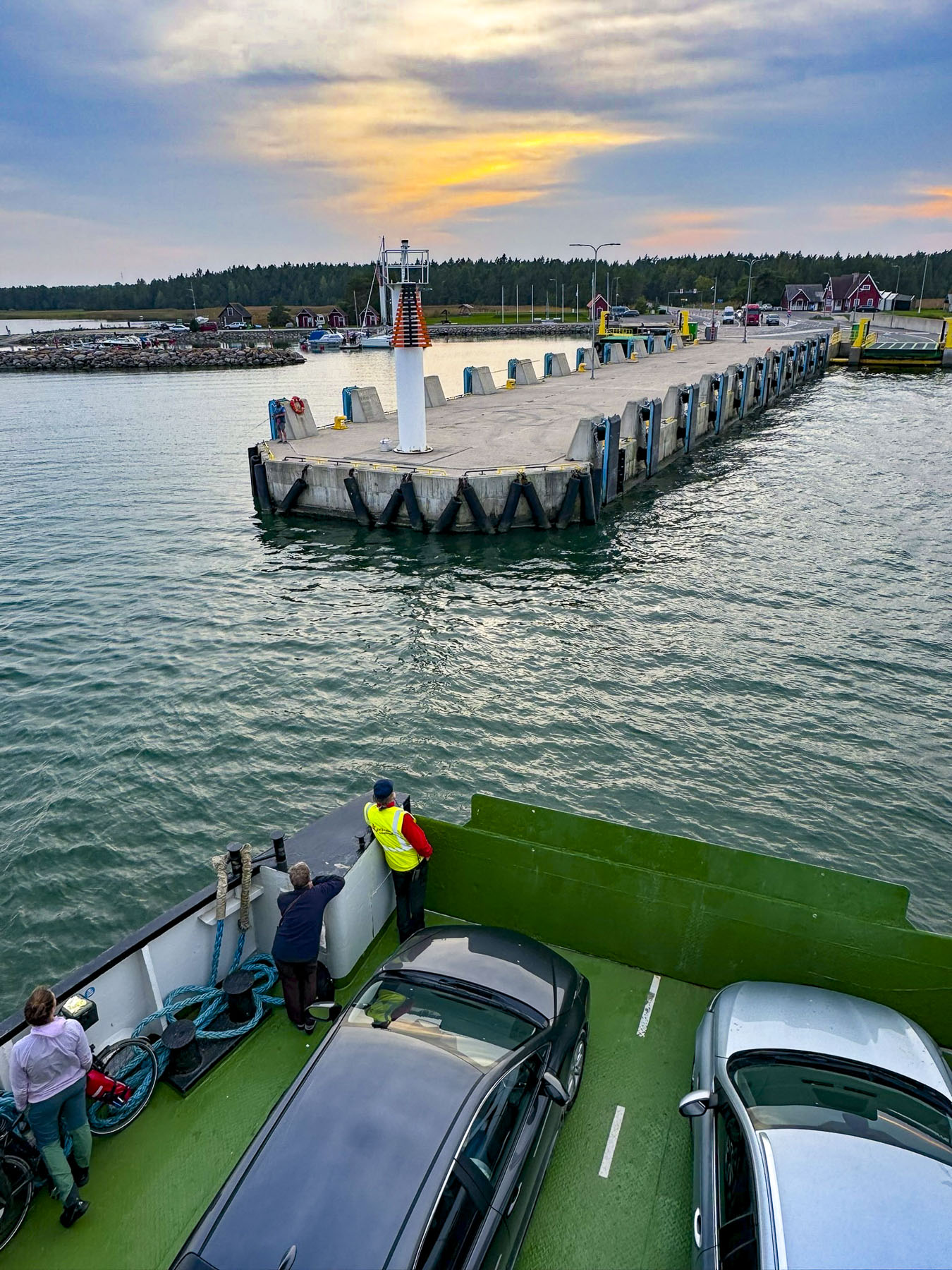
Fortuitously, months earlier four of us from our lake community had booked a flight to Hawaii that departed the same day the runways at the Savanna Airport were cleared of ice and ready for business again.  

The balmy air was a welcome reprieve as we descended the stairs from the plane onto the runway in Kailua-Kona, on Hawaii Island or as the local folks like to say, The Big Island. But we were overdressed and overheated by the time we reached the baggage claim area and headed to the restrooms to strip off layers of now unseasonably warm clothing.

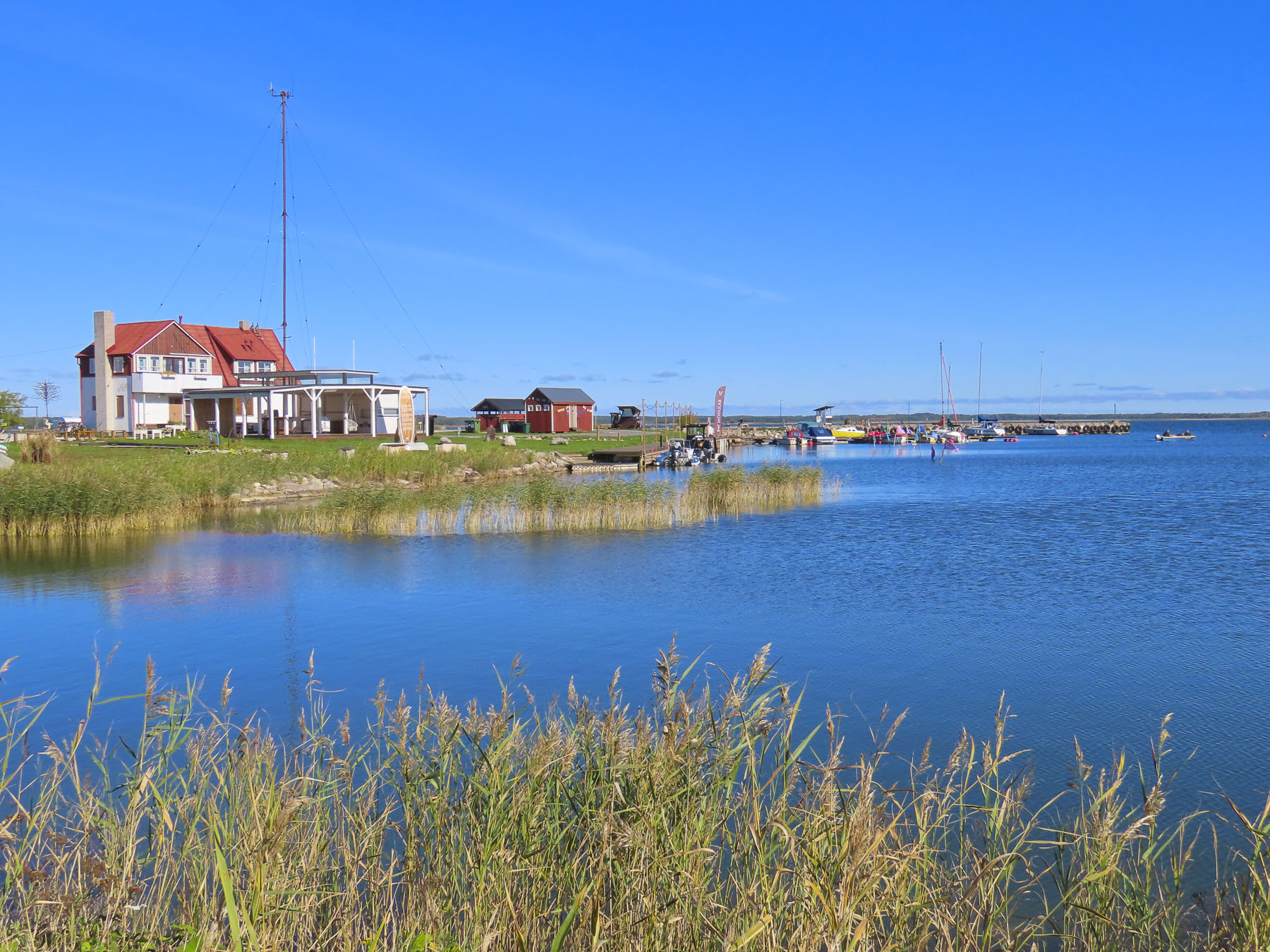
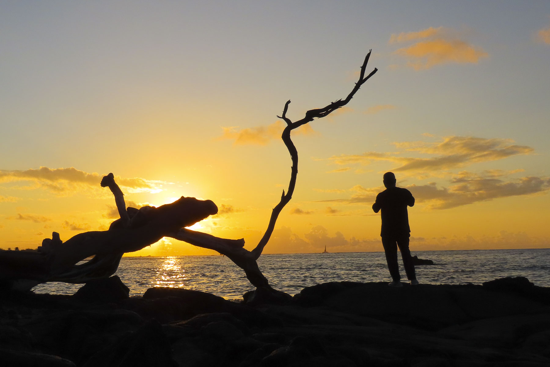
When we arrived at the Budget Car Rental office the queue was already out the door, and we watched our first Hawaiian sunset from the waiting line as the sun’s dying rays silhouetted the palm trees. This was not the romantic drinks-on-the-beach sunset we had envisioned for our first night on the island. The problem was a severely understaffed rental counter which gave priority to members of the company’s Fastbreak Program. We finally figured this out after waiting two hours, with more than one hundred other folks in a queue that now wrapped around the building. Donna realized we could download their app and take advantage of the expedited checkout program, and signed us up on the spot. As we switched lines, we shared our tip with folks around us, and we were headed out to our car within minutes. Donna acknowledges a twinge of guilt as we sashayed past all the other poor folks still stuck in that dreadful line. We’ve used Budget Car Rental flawlessly many times, but this was a horrendous experience. Fortunately, our lodging for the week at a Hilton property in Waikoloa was only a 30-minute drive north on Rt19.

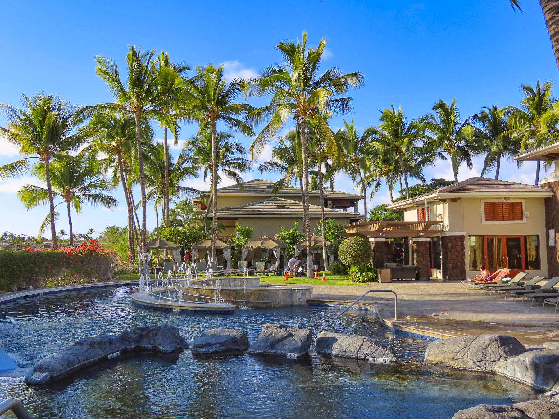
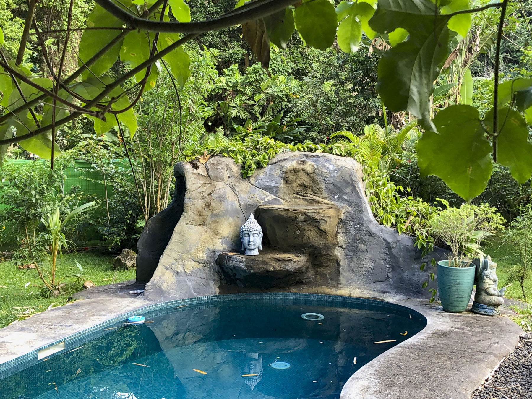
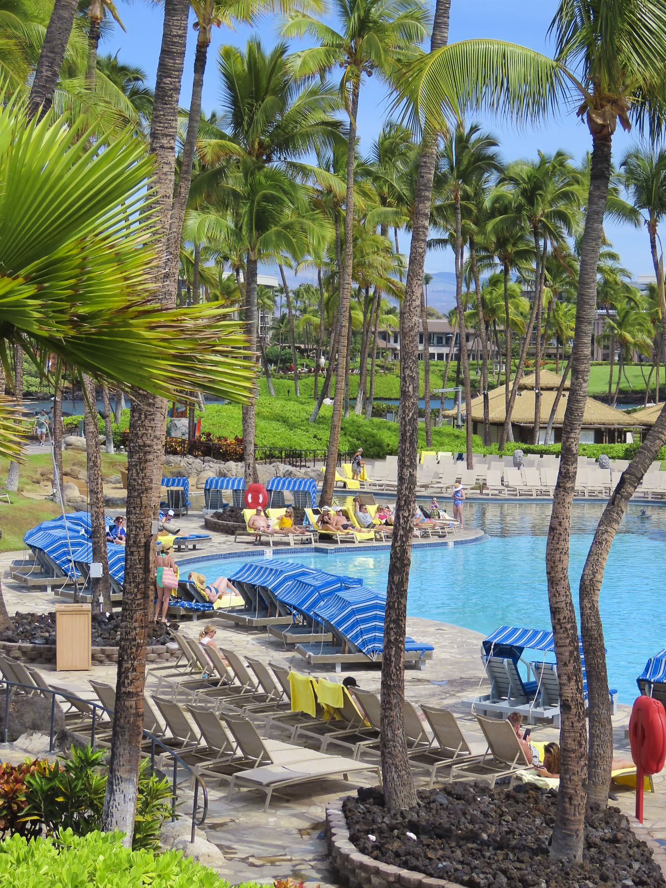
Beyond the reception desk, the dancing patterns of light off the ripples of the hotel’s dramatically lit pool looked enticing. But after a long day of flying we needed a good night’s sleep.

The next morning we were up with the sunrise and out for a walk after a quick cup of coffee. The day was beautiful and there were many other like-minded couples out and about following the sidewalk that looped between the buildings of the sprawling resort.

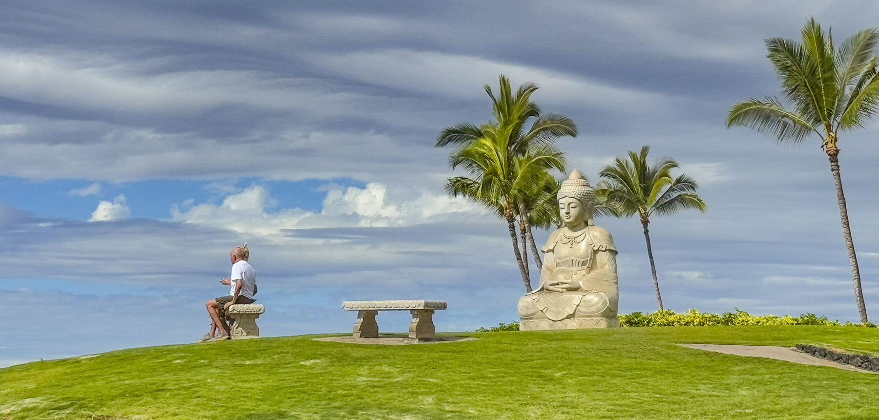
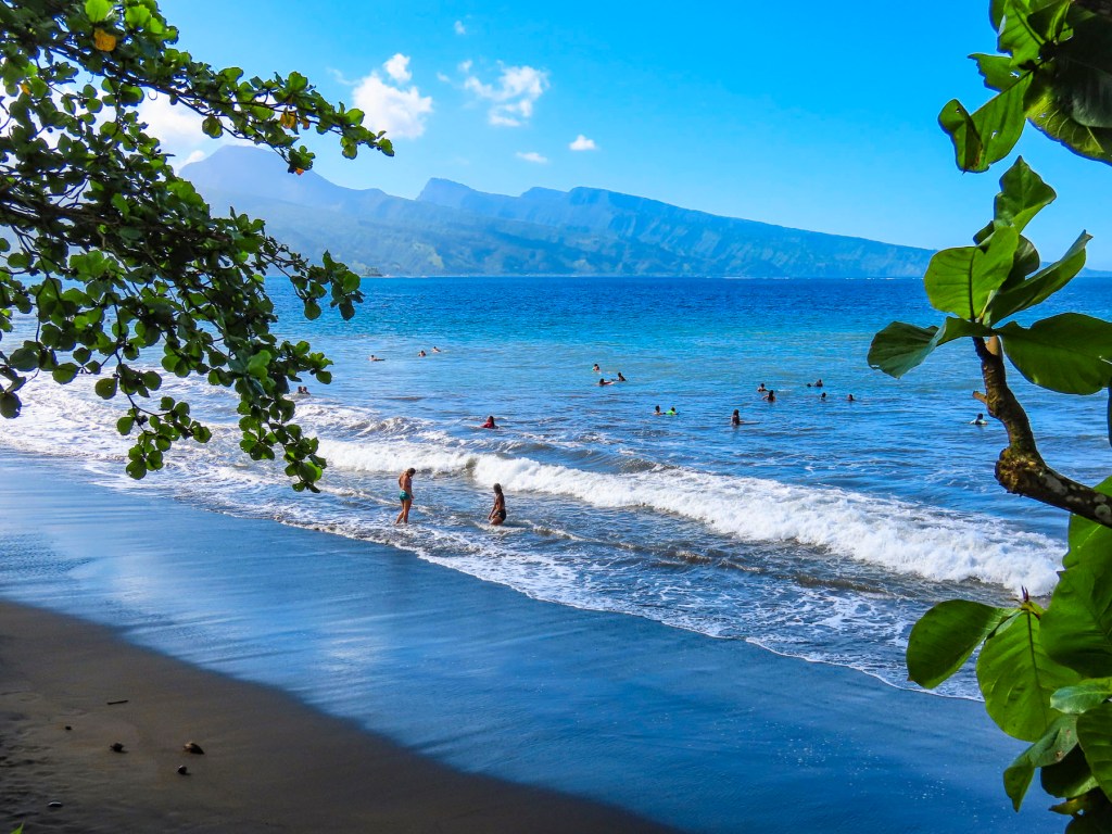
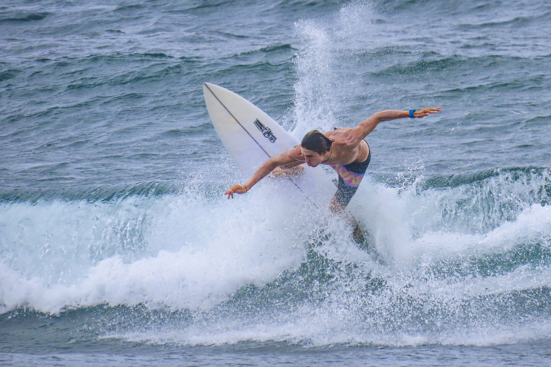
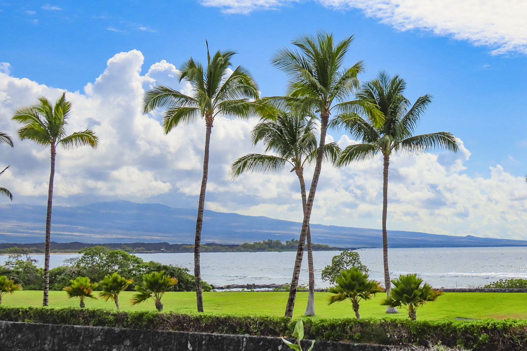
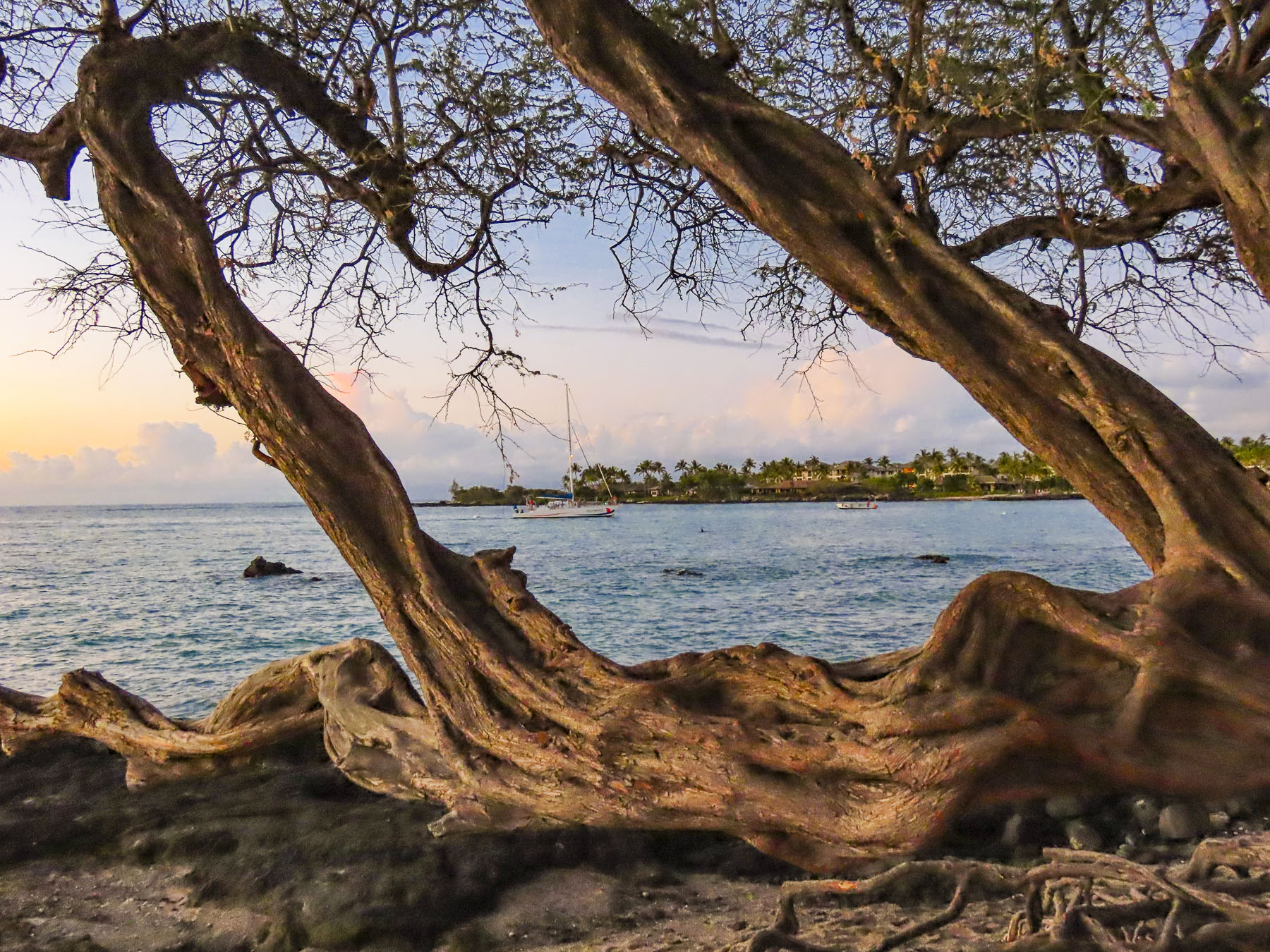
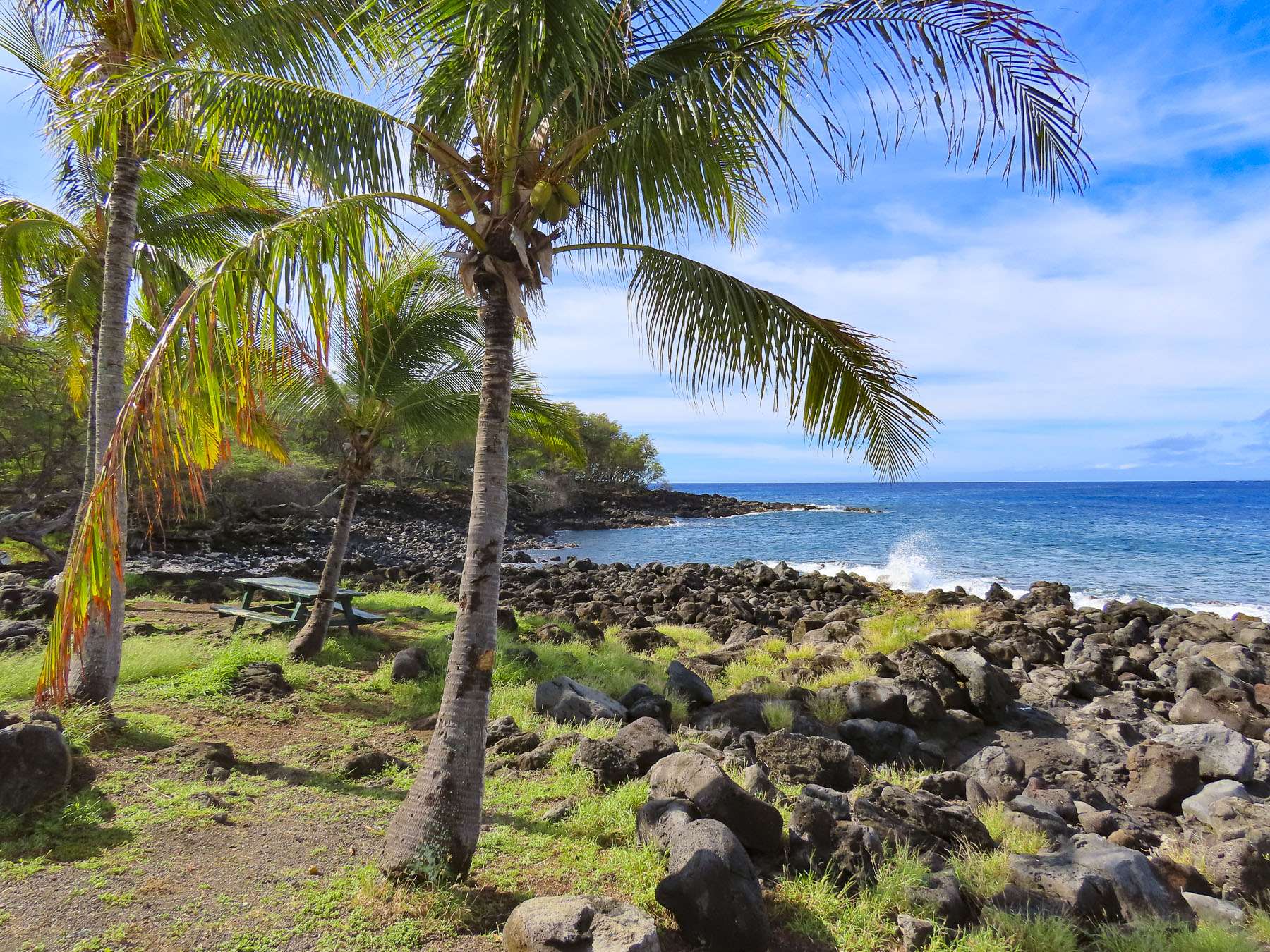
Budha Point, a tranquil scenic spot on Waiulua Bay, that overlooked the vast expanse of the Pacific Ocean, was our destination. We visited here several times over the week and spotted whales breaching offshore a number of times.

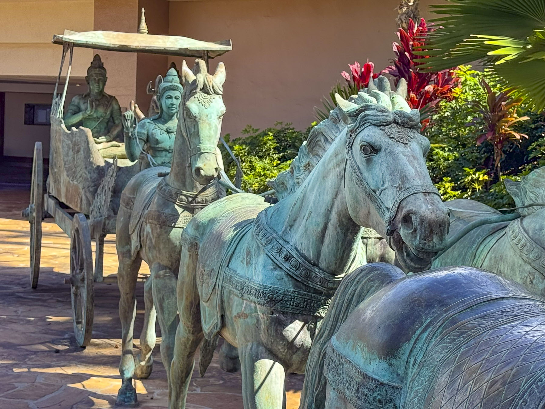
It was less than a mile walk from our room through the beautifully manicured landscaping which coursed through the jagged lava fields that surrounded the Hilton Waikoloa Village, a sprawling complex with a tramway and footpaths connecting several towered hotels and pools along the seafront and the site’s lagoon.

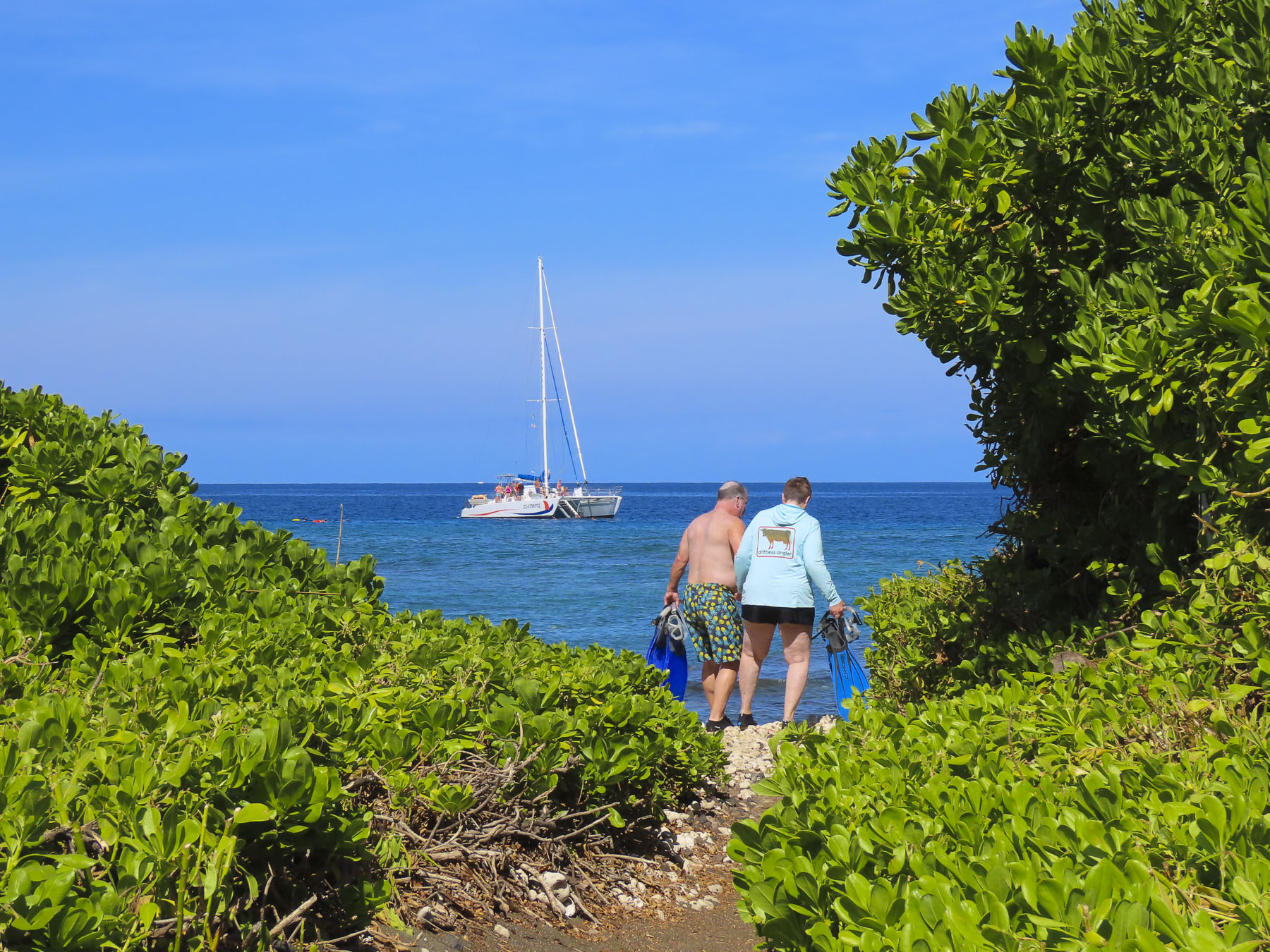
Hawaiians have a great reverence for the ocean, and one of the wonderful things about the state are its laws that guarantee folks have a right of access along the beaches and shorelines, and that private property owners cannot obstruct access to it.

A little segway here: Hawaii is costly – think San Franciso or NYC expensive! The cost of parking is outrageous across the island, with residents parking for free and rental car drivers paying a high hourly rate at parking kiosks. Hilton guests staying in their premiere hotels around the resort’s lagoon or visitors wanting to attend the Legends of Hawaii Luau are charged $48 per day or $8 hourly for self-parking, and $55 per day for valet parking. Fortunately, the hotel we were staying in was farther away from the action and included free parking.

There was also a free shuttle bus that connected the hotels, shopping and restaurant courtyard within the complex. Several small free Beach Access Parking lots, which are closed to overnight parking, are across from excessively expensive Waikoloa Village parking lot.

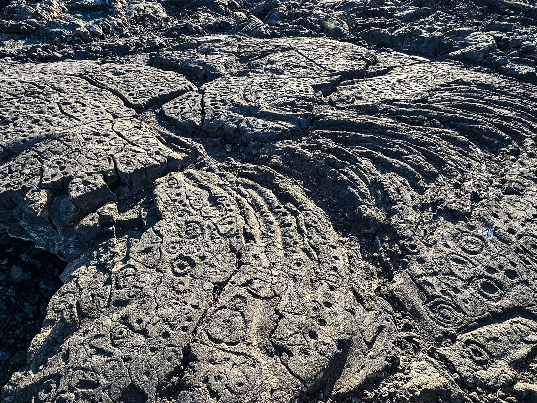
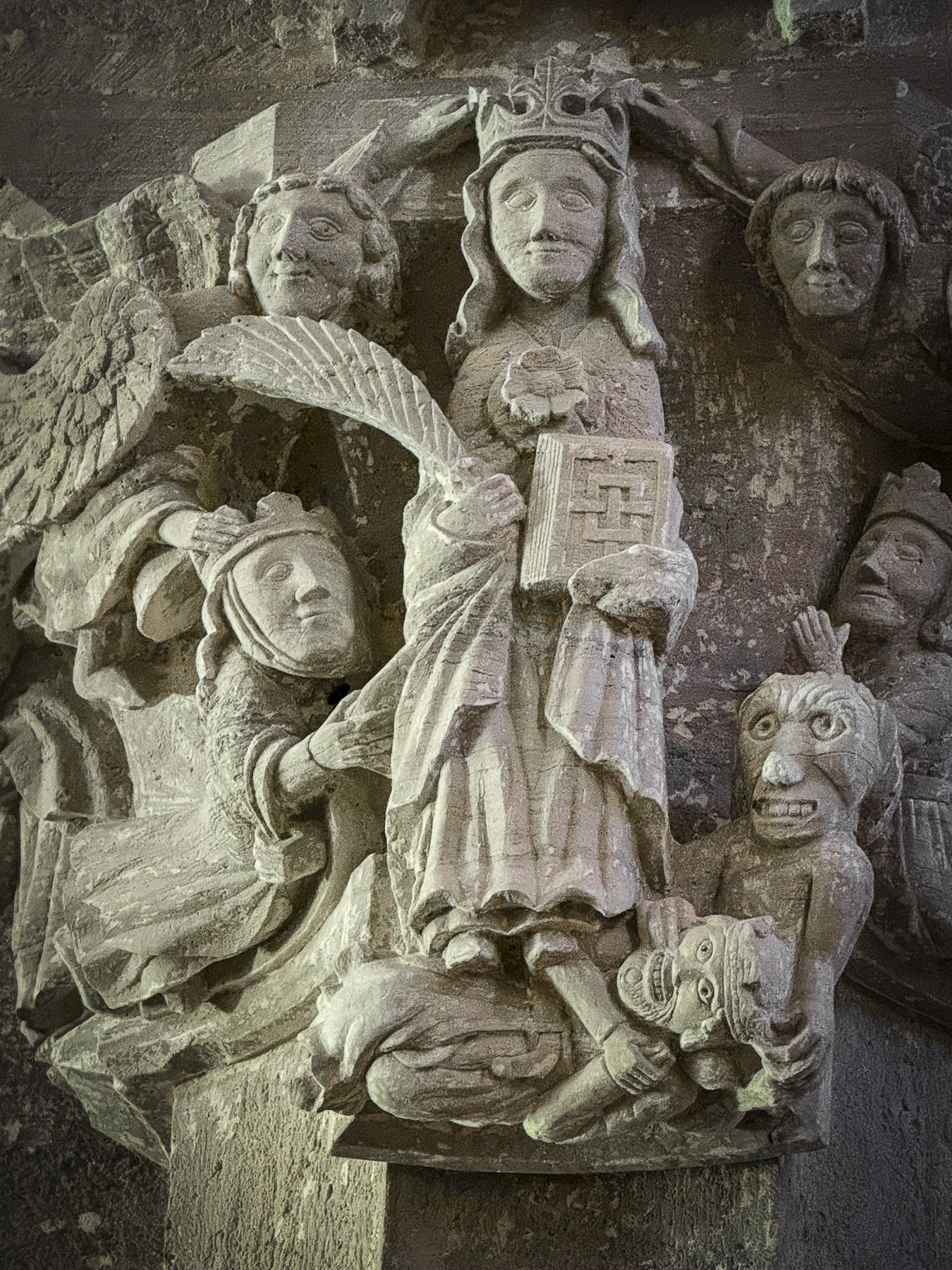
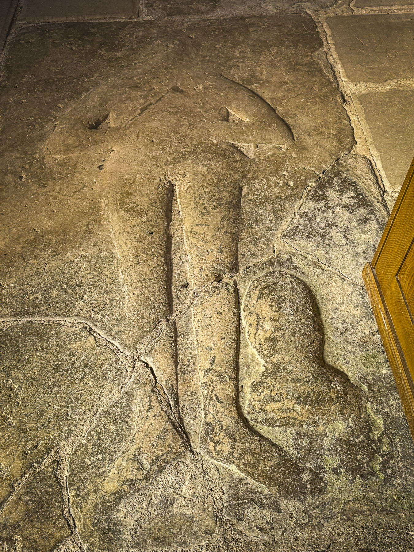
Continuing our loop around the resort we came upon the Kings Highway Foot Trail, part of the Ala Kahakai National Historic Trail, a 175-mile narrow footpath that follows an ancient trading and communications route, through rough lava beds. Starting at the farthest spot north on the island, Upolu Point, the trail which dates from the 1500s, connected the ancient Polynesian fishing villages and religious sites along the western and southern coast of Hawaii island to the farming villages in the highlands. In places like the Waikōloa Petroglyph Reserve, ancient messages were carved into the lava stones.

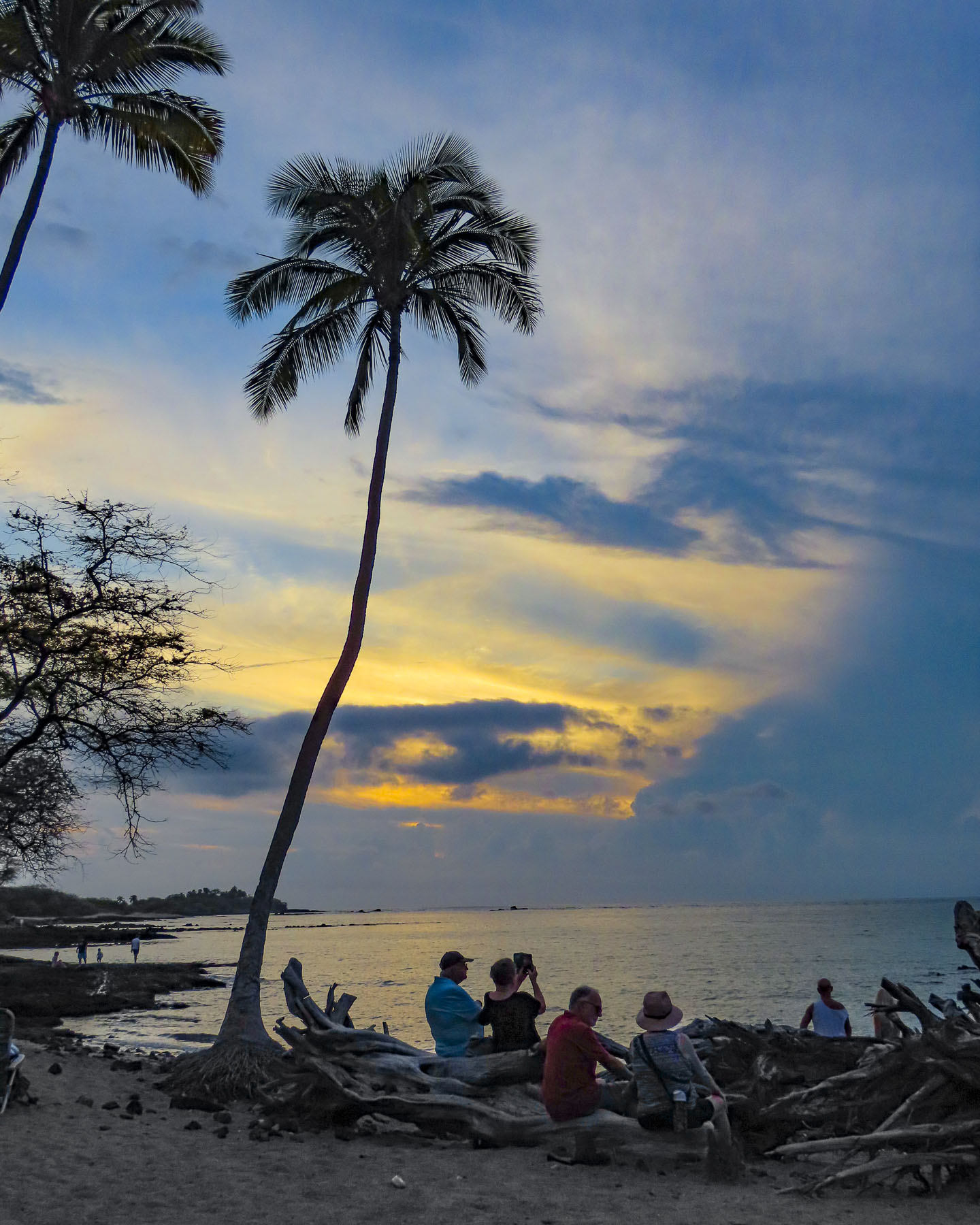
Dinner and watching the sunset from the Lava Lava Beach Club on ʻAnaehoʻomalu Bay is a pleasant nightly ritual for many who visit the area.

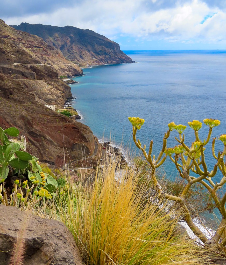
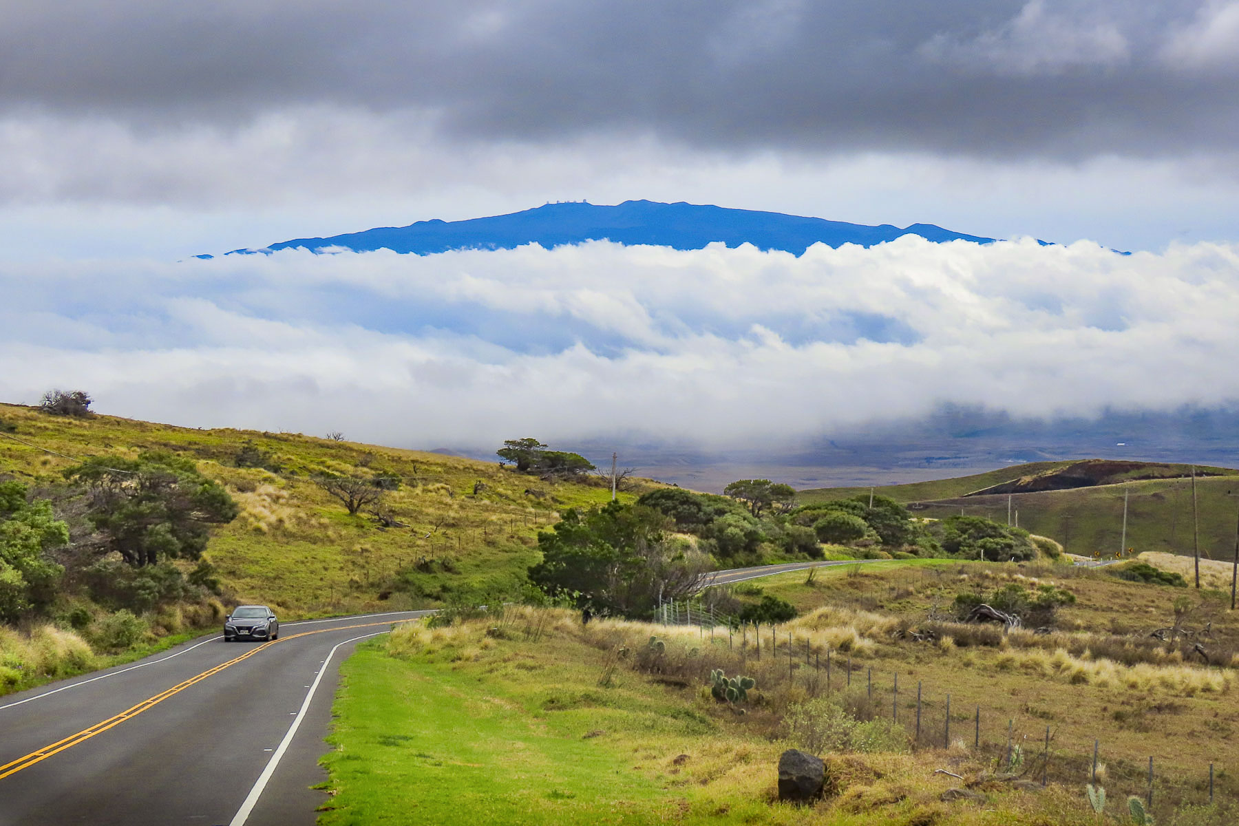
We could have spent the entire week lounging by the pool, but that’s not really us, so we planned several road trips around the island. We had driven to the hotel in the dark two days earlier, and the area around the resort was a mix of verdant greenery and sporadic patches of lava. Exiting the hotel complex onto Rt19 revealed an immense Martian-like terrain of arid inhospitable lava fields that stretch for dozen of miles down from the 4205m (13,786 ft) tall snowcapped summit of the dormant volcano Mauna Kea, and Mauna Loa, the world’s largest active volcano that sits 4170m (13,680ft) above sea level. They represent just one of the 11 climate zones found on the island. Which means when you circumnavigate the diverse landscapes of the island, you can experience everything from lush rainforests to arid deserts.

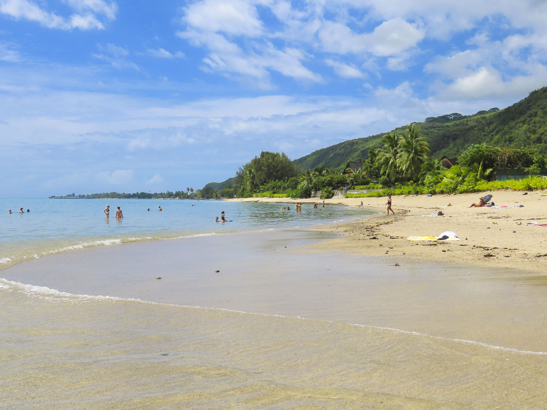
A short part of our drive that morning was through a landscape that reminded us of the American Southwest as we headed toward Hapuna Beach, the longest and widest stretch of white sand on the island. It consistently gets ranked as “one of world’s best beaches.”

The boulders of ancient lava, from the now extinct Mt Kohala, carpeted the shoreline at Kapa’a Beach Park. An estimated one million years old, it’s the oldest of the Big Islands’ six volcanoes, and last erupted 120,000 years ago.

Rain clouds threaten us as we stopped for coffee at the Kohala Coffee Mill, in the small town of Hawi, to indulge in our “drive a little then café,” philosophy. Rain poured for a few minutes as we sipped our coffees at tables under a covered sidewalk, and waited for the shower to pass. It’s a quiet one street town with a few small shops, galleries and artwork along the street. Away from the large resorts on the Kona coast a little bit of “old Hawaii,” shined through here.

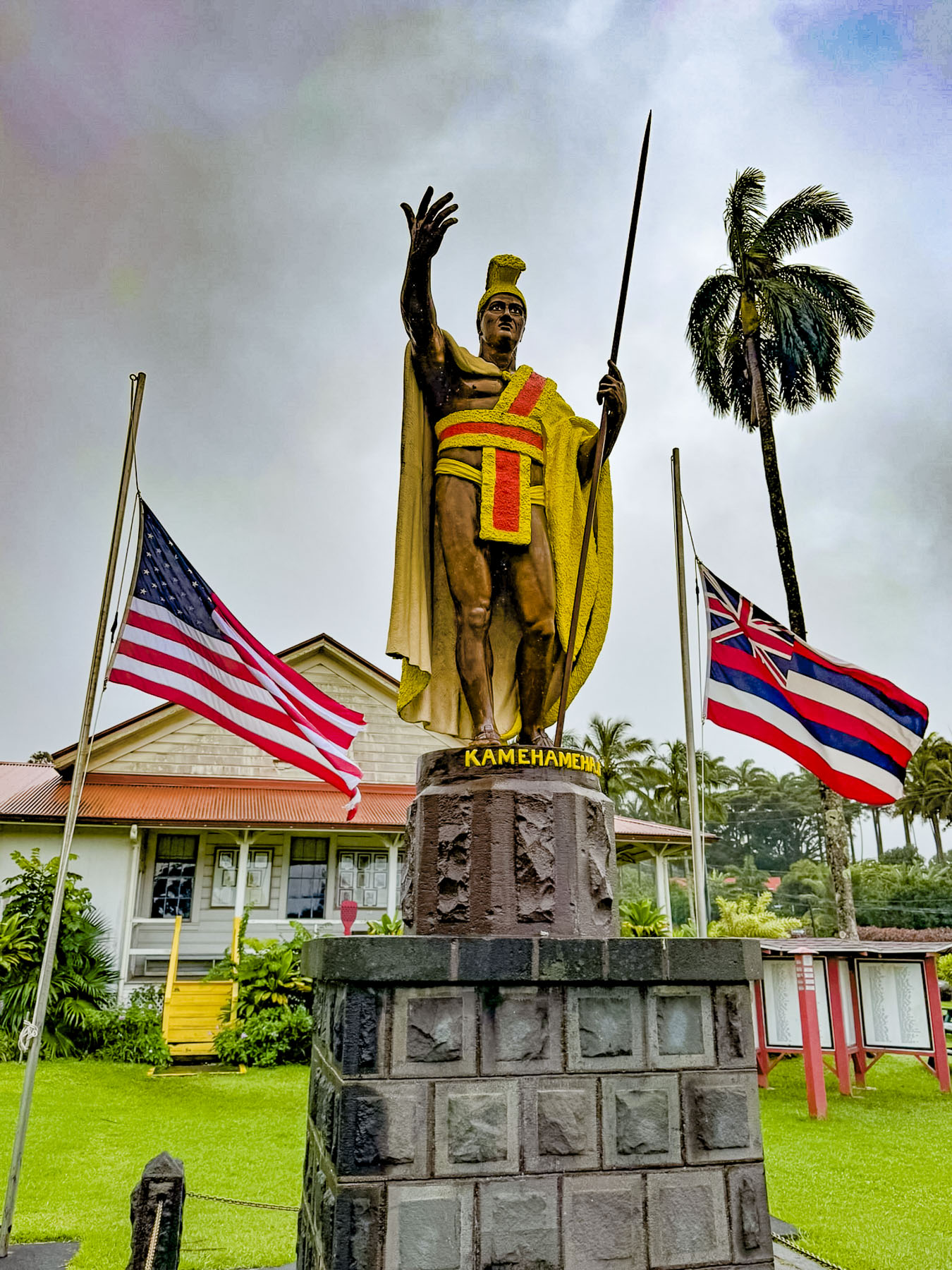
A few minutes farther up the road we stopped in Kapaau at the Statue of King Kamehameha that commands the slope in front of the Old Kohala Courthouse. Ancient Hawaiian legends had foretold, “a light in the sky with feathers like a bird would signal the birth of a great chief.” Halley’s comet passed over the isalnds in 1758, the year Hawaiians believe Kamehameha was born. For centuries warfare between clans and inter-island raids were widespread throughout the Hawaiian archipelago. Kamehameha with an army of warriors on hundreds of peleleu, double-hulled 70ft long war canoes, sailed between the islands. In a series of battles he defeated the opposing chiefs on Hawaii, Oahu, Maui, and Molokai and united the islands into the Kingdom of Hawaiʻi in 1795. By 1810 the islands of Lanai, Kauai, and Niihau voluntarily joined the kingdom.

Leaving Kapaau we followed Rt 250 up into the Waimea highlands beneath Mt Kohala, a vast grasslands atop a long ridge, and home to the 135,000-acre Parker Ranch, one of the oldest and largest cattle ranches in the United States. From the road distant views of the west coast of the island were abundant. As we descended into Waimea the summit of the dormant volcano Mauna Kea poked through the clouds.

Waimea is the center of the Big Islands’ paniolo (Hawaiian cowboy) country. It’s a large pretty town, with several old historic churches, colorful street murals and a tall cowboy boot marking the entrance to a shopping center. The first cattle on the island, 11 cows and 1 bull, were given to King Kamehameha by the British Naval Officer, Captain George Vancouver, in 1793. The king prohibited the islanders from slaughtering them and the small herd was left to freely roam the highlands.

In 1803 King Kamehameha received, from an American trader, the first horses to arrive on the island. The king invited vaqueros from Spanish California to the Big Island to teach some islanders cattle herding and roping skills. Eventually, the taboo against killing the cattle was lifted in 1830 by King Kamehameha III, when an estimated 25,000 wild cattle became troublesome as they destroyed farmer’s crops. Some of the cattle would be herded into the sea where they were swum out and then lifted onto waiting freighters and transported to the other islands. Hawaiian paniolos grew to be accomplished riders and over the years, have competed in numerous rodeos and world steer-roping championships. In 1999, Parker Ranch paniolo Ikua Purdy was inducted into the National Cowboy Hall of Fame. We had hoped to attend a Paniolo BBQ at Kahua Ranch for a night of good food and cowboy stories, but the weather the week we were on the island was just too iffy for us to commit to it.

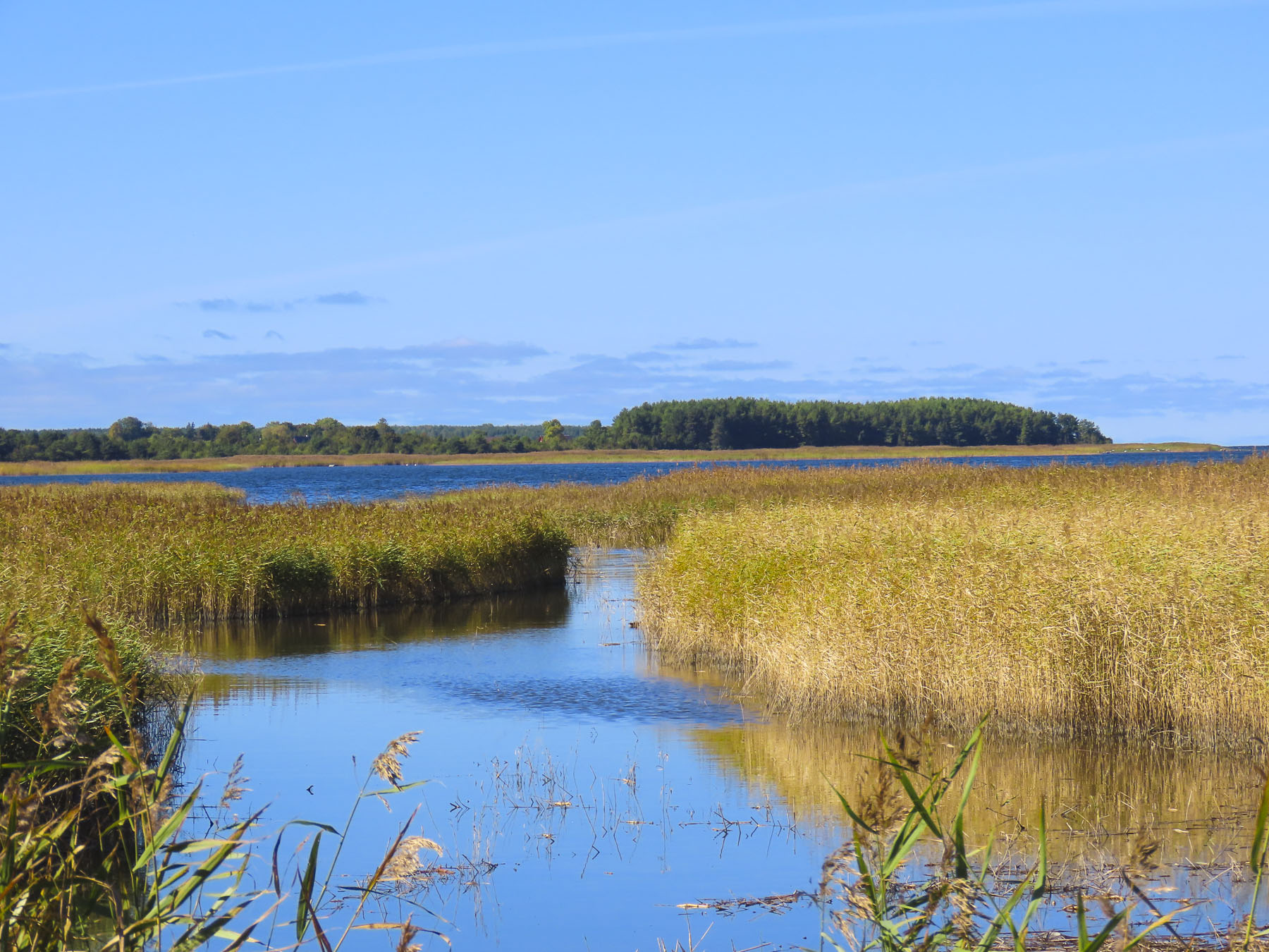
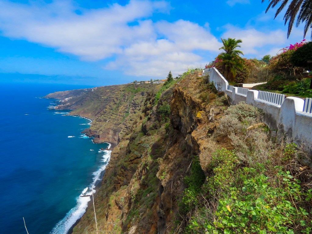
Oustide of Waimea on the Mamalahoa Hwy, the ring road, we headed to the eastern, or windward side of the island and traveled through verdant landscapes of thick forests and jungles, the beneficiaries of the 130 inches of rain that this side of the island annually receives from the tradewinds that bring moisture in from the Pacific Ocean.  It’s a sharp contrast to the arid western, or leeward side of the island that receives only 18 inches of rain.

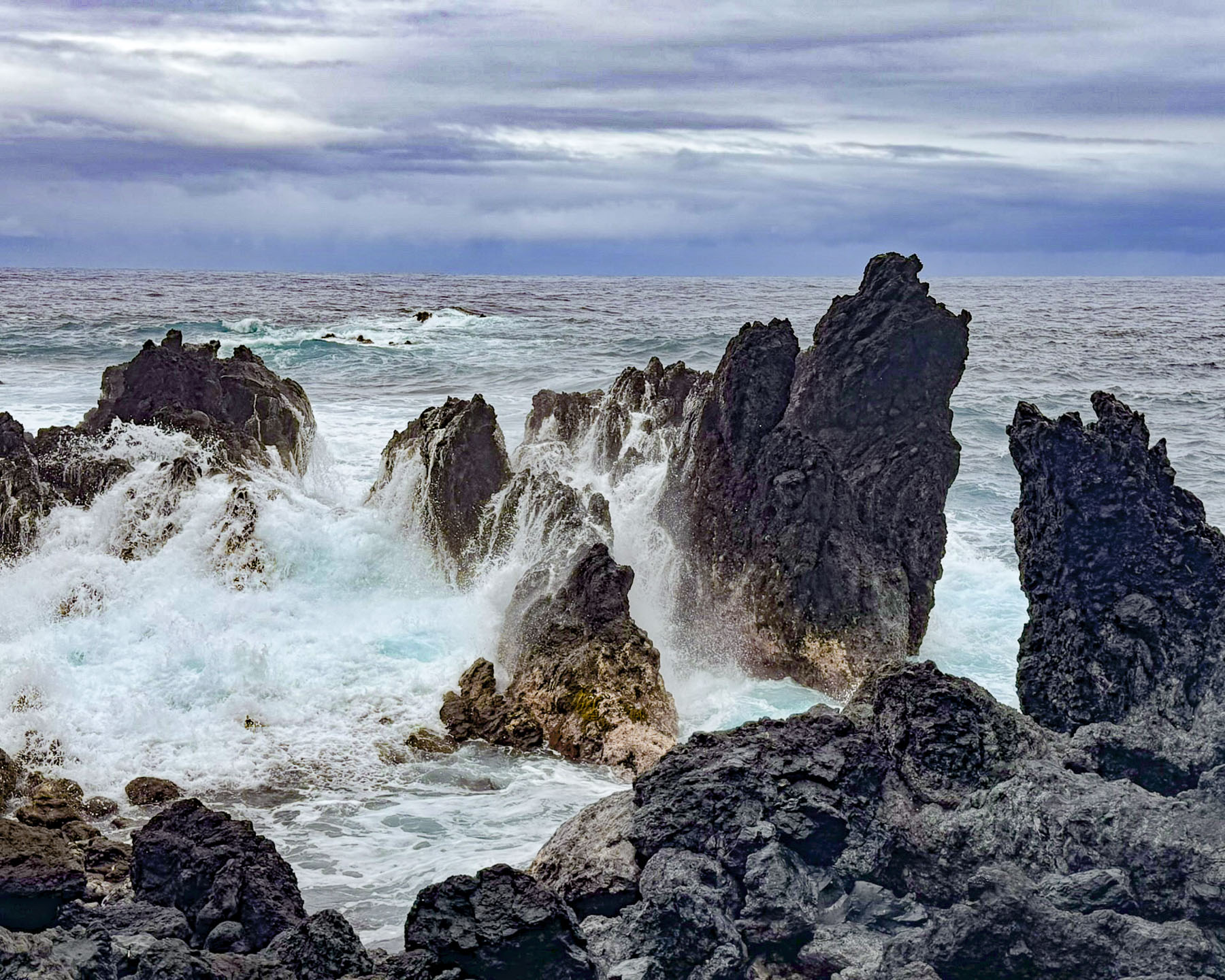
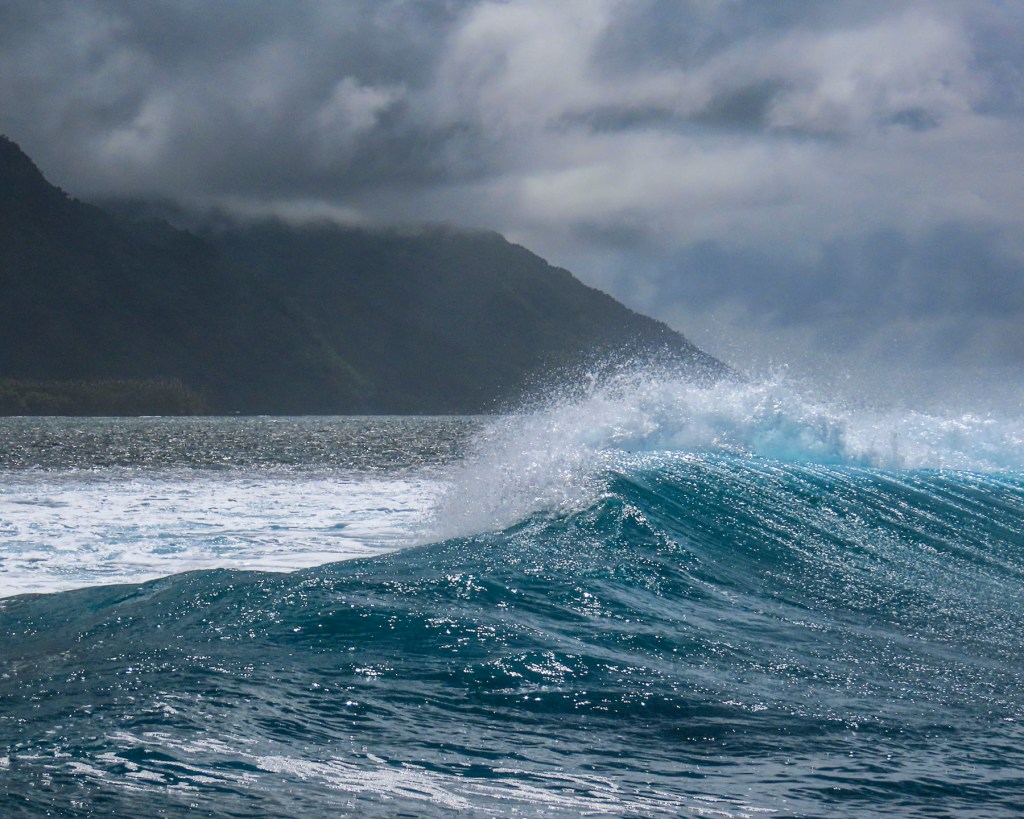
The overcast sky persisted as we drove down a twisting road through a rainforest to Laupāhoehoe Point. It’s a small, beautiful peninsula, with a rough lava rock coastline. The ocean swelled and crashed against the coast with a ferocity that the beaches on the west side of the island don’t experience, unless there’s a storm.

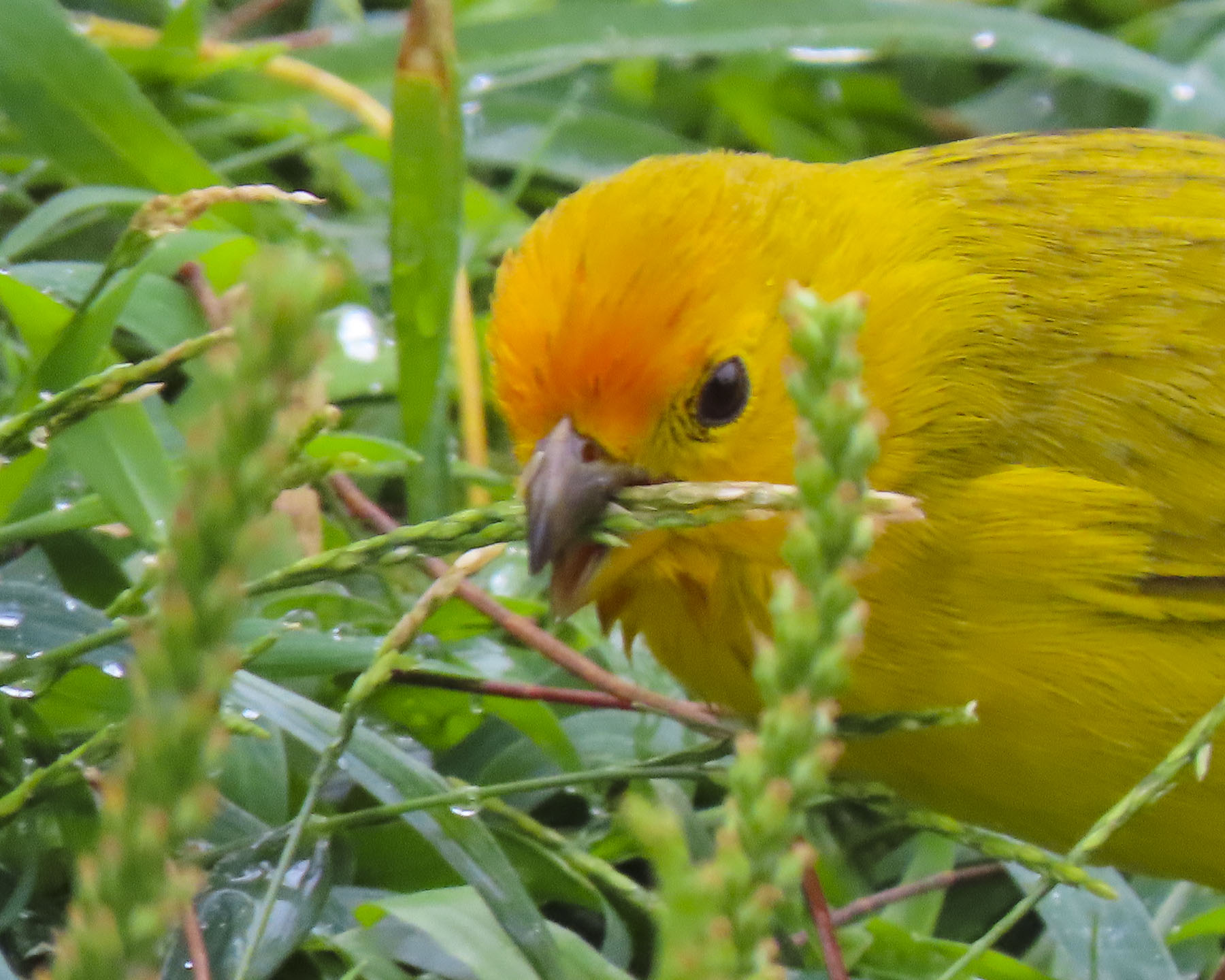
Saffron finches scooted around the undergrowth near the water’s edge. Over the horizon Baja, Mexico was 2,000 miles away. Things are not always wonderful in paradise and a memorial commemorates the tragic deaths of 20 schoolchildren and 4 teachers who drowned as their school was swept away in the giant waves of a tsunami that pounded the northeastern shores of the Big Island on April 1, 1946. Farther south in Hilo 159 people drowned and 1,300 homes were swept away.

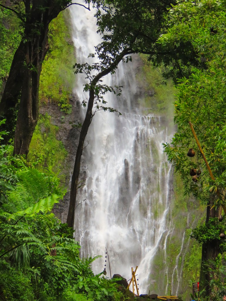
The Big Island has over 100 waterfalls with the tallest, Waihilau Falls at a lofty 792m (2,600ft) tall, hidden away in the remote Waimanu Valley. Some serious trekking through the rainforest is required to reach them, while there are others that are way easier to view. As much as I liked the idea of an expedition through the tropical forest with my crew to see this spectacular waterfall, they can be a mutinous car full towards happy hour. So, we opted to seek out some of the more readily accessible ones during our week on the island.

Continuing south on the Mamalahoa Hwy we stopped to view the cascading Triple-Tier Umauma Falls, thundering loudly from all the rain that had fallen lately. It’s on private property, so there was an admission fee, but they did have really tasty coconut, pineapple and mango ice-cream.

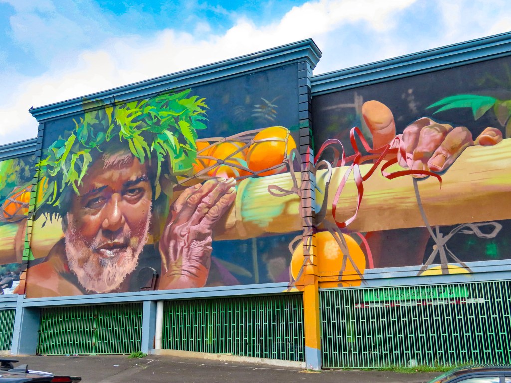
We ended our day with drinks and dinner at Jackie Rey’s Ohana Grill in Hilo. It’s interestingly set in an old bank building across from some street murals. Our dinners from the happy hour menu were delicious and quite filling. In our opinion it was one of the best values on the island, and we did in fact eat there twice. Occasionally, a feral goat or donkey would be illuminated by the car’s headlights as we followed Saddle Road across the center of the island. At one point we reached an elevation of 2,021m (6,632ft) as we passed between the summits of Mauna Kea and Mauna Loa. On the downhill side we could have coasted all the way back to the hotel.

Two days later we headed to Kona for their Farmer’s Market. We very much enjoy wandering about the stands at a good street market. Sadly, the Kona market was a huge disappointment, with only a handful of vendors selling tourist souvenirs and clothing. Only one stand sold local fruit and vegetables, which we did purchase to enjoy back at the hotel. Across the street we had breakfast at Papa Kona Restaurant & Bar, which had a spectacular second-story balcony perched right above the rocky oceanfront, where fishermen were casting into the surf.

Our ambitious plan for the day was to follow the Hawaiʻi Belt Road, Rt11, to the Hikiau Heiau temple on the opposite side of Kealakekua Bay from which Captain Cook landed in 1779, then hit a number of other interesting spots as we continued south to Ka Lae, or South Point as it is also known, before swinging around to the eastern side of the island, and ending our day on the volcanic black sand of Punaluʻu Beach.

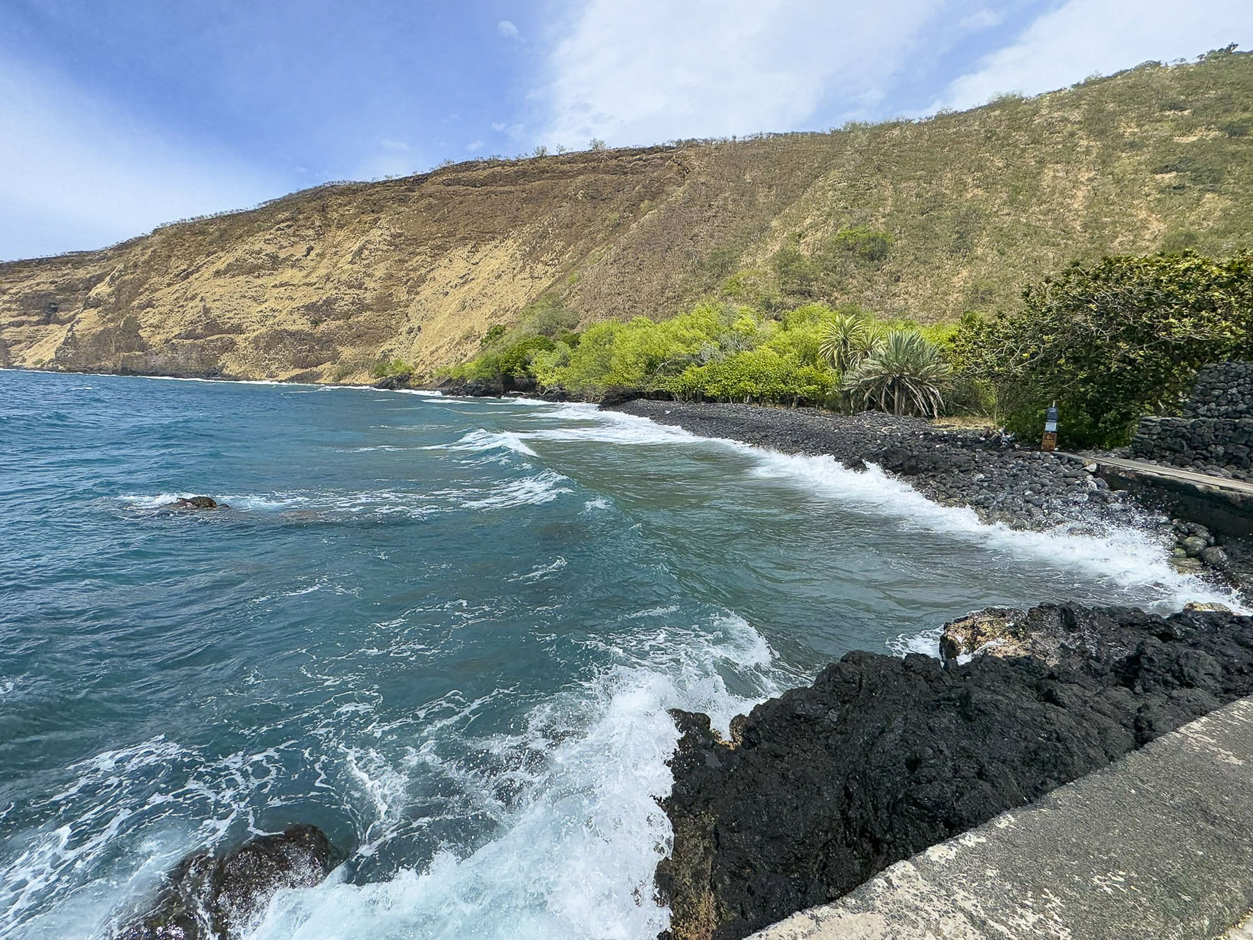
Cook happened to sail into Kealakekua Bay during a Makahiki festival, a religious festival to appease the Hawaiian deity Lono, who in legend returns to the islands on a large ship. Timing is everything! Cook lucked out, his skull could have hung with other victims who had been sacrificed to appease the wrath of their deity, amidst the towering fierce tikis which portrayed Lono. The High Chief of the island ceremoniously welcomed the captain and lavished him with gifts of feathered capes, helmets, lei, and tapa cloth along with hogs, taro, sweet potatoes, and bananas. The bay is a tranquil spot now, but during Cook’s visit it would have been filled with hundreds of islanders on wa’a, outrigger canoes, and surfboards.

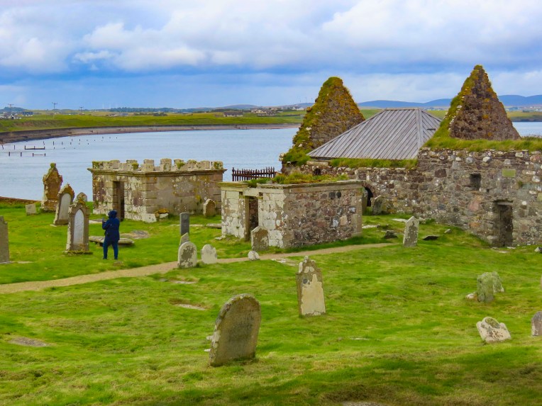
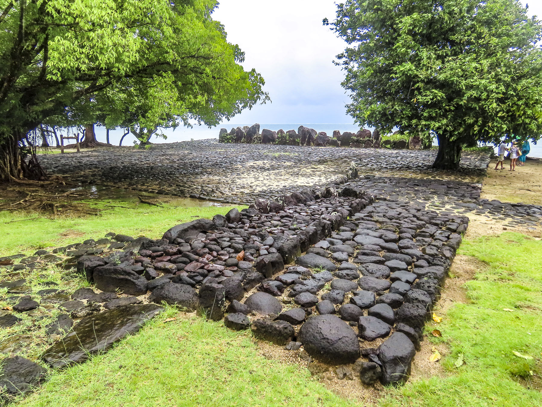
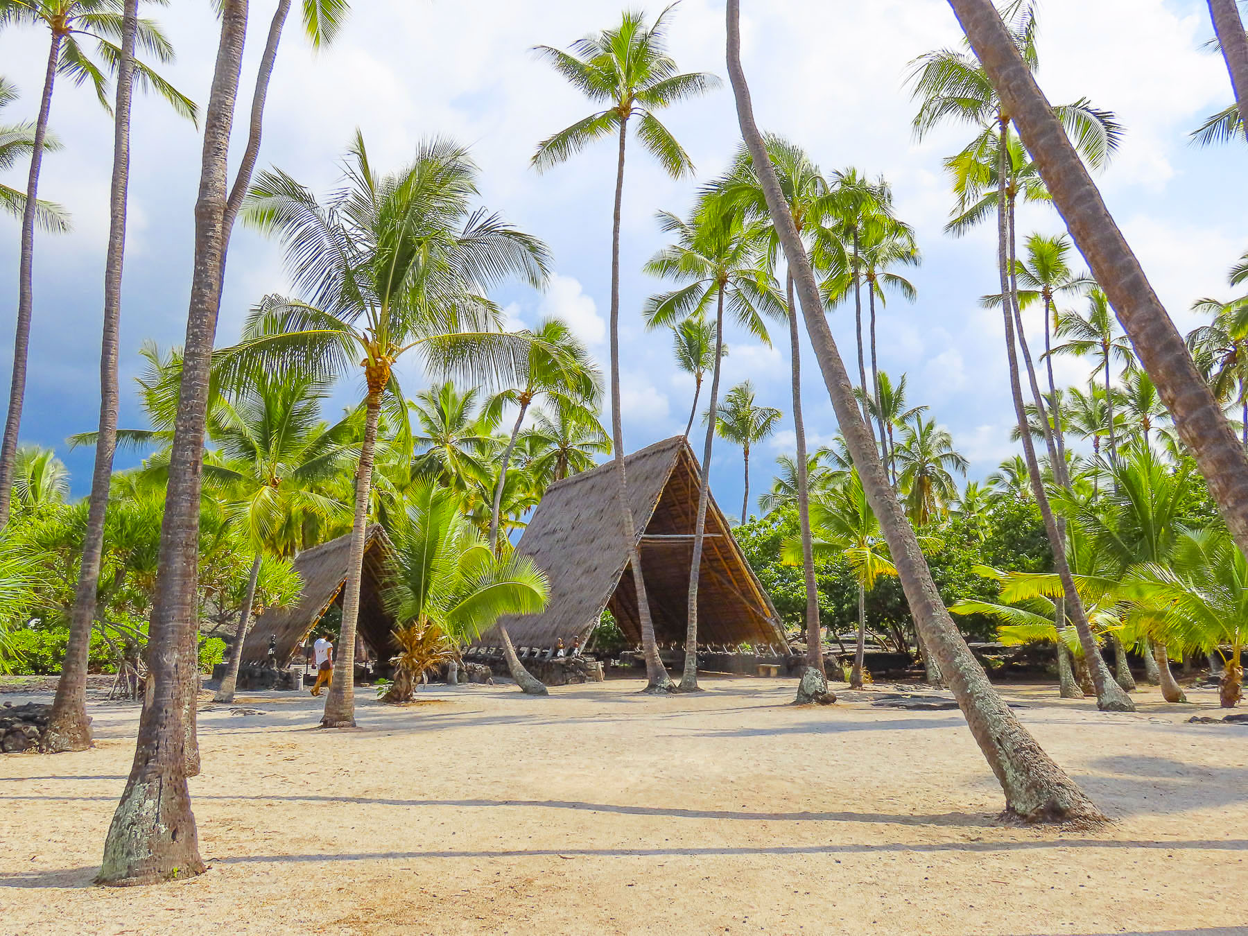
Continuing south we reached the Pu’uhonua O Honaunau National Historical Park, site of an ancient religious sanctuary. Few spots on the Big Island resemble paradise more than Pu’uhonua O Honaunau, with its brilliant white sandy beach lined with swaying palm trees, along a cove with clear blue water. For centuries before the Christianization of the island started with the first arrival of protestant missionaries in the 1820s, it was also known as the City of Refuge, where islanders who broke a kapu, an ancient law, could flee to safety to escape the death penalty their action incurred. Here an offender of the ancient ways would seek absolution from a high priest and be free to return to their village. Villagers and defeated warriors could also seek sanctuary here during periods of inter-chiefdom wars.

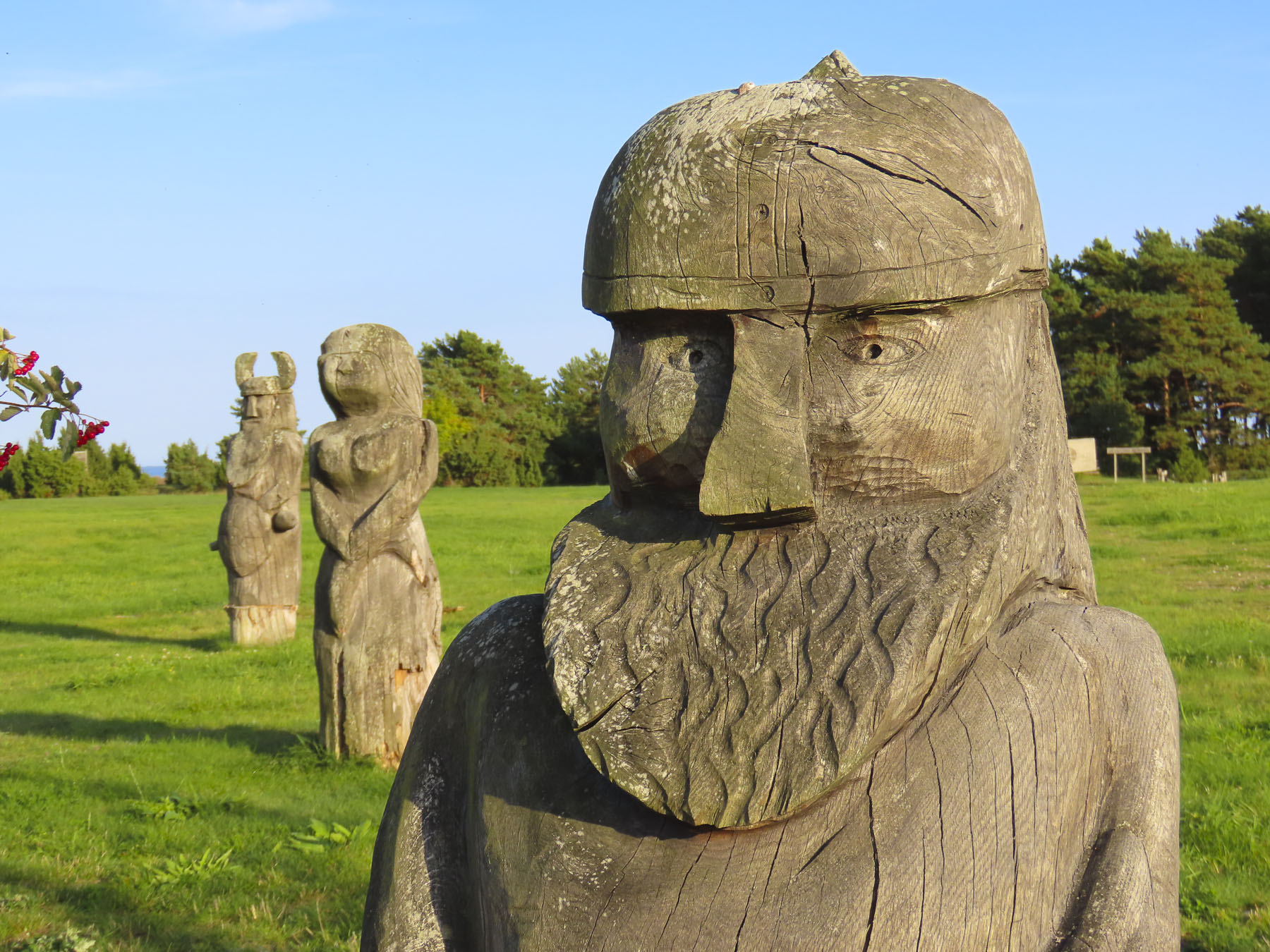
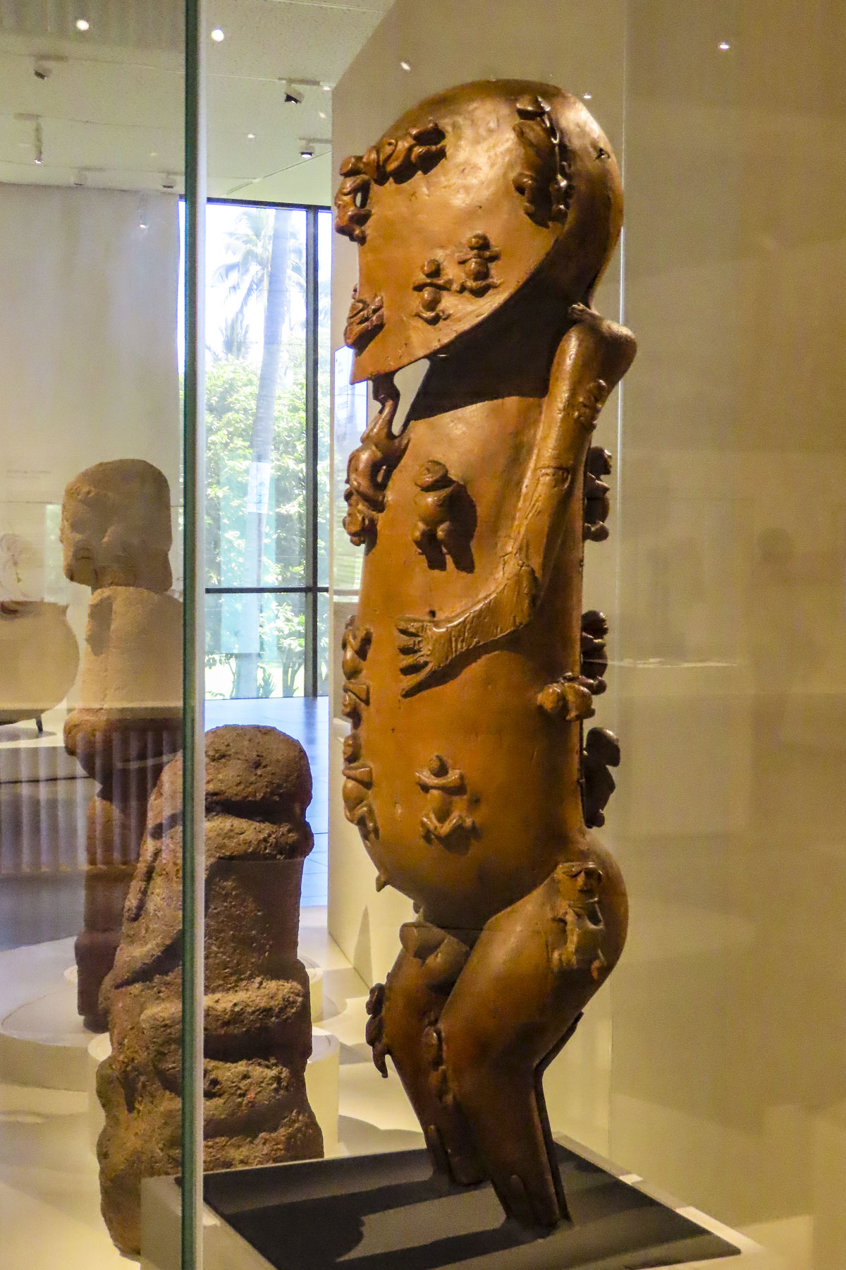
The most important structure on the site is Hale o Keawe, a stone and thatch royal mausoleum that contained the remains of 23 deified high chiefs. Around it, fierce looking tiki statues serve as guardians of the dead, and embody the spiritual power of the kapu.

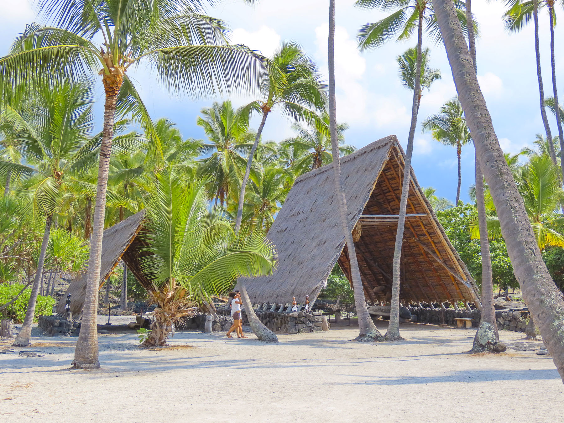
The site also has two Hawaiian hale houses, open sided bamboo and palm frond or pili grass covered structures. Multiple hale houses were built in a village for specific uses: men’s meeting house, cooking house, separate eating houses for men and women, workshop and canoe house, and a menstruation house.

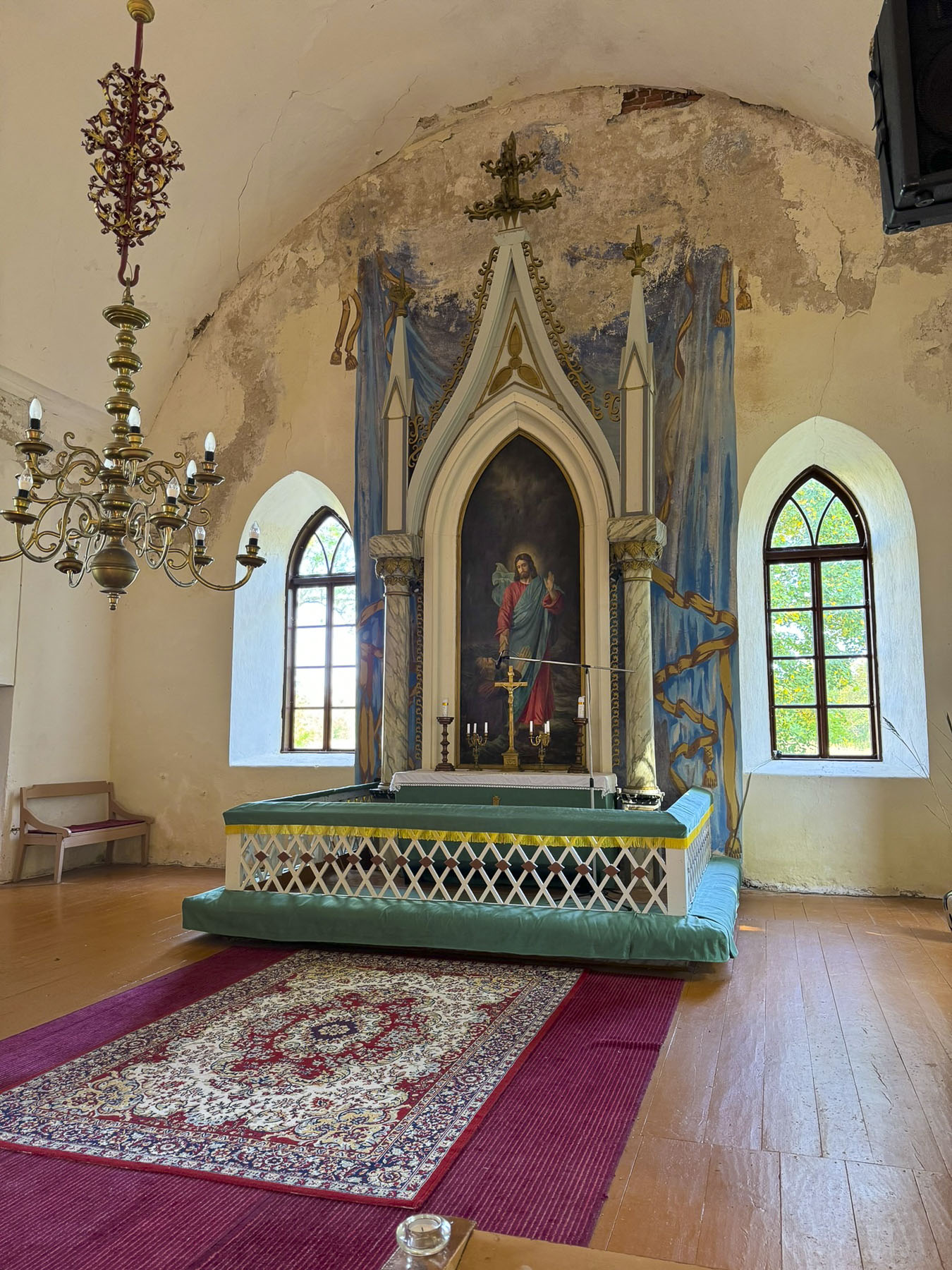
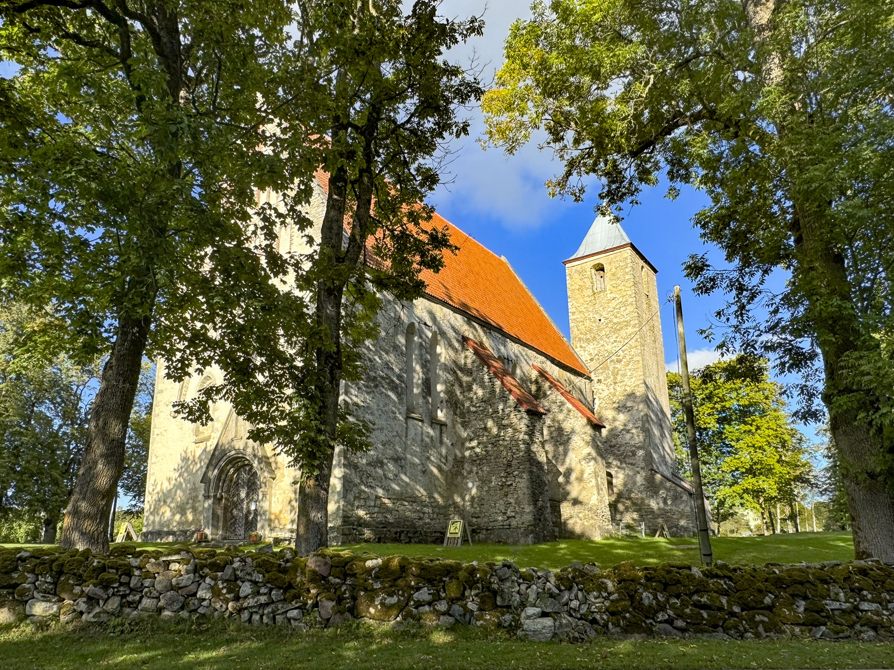
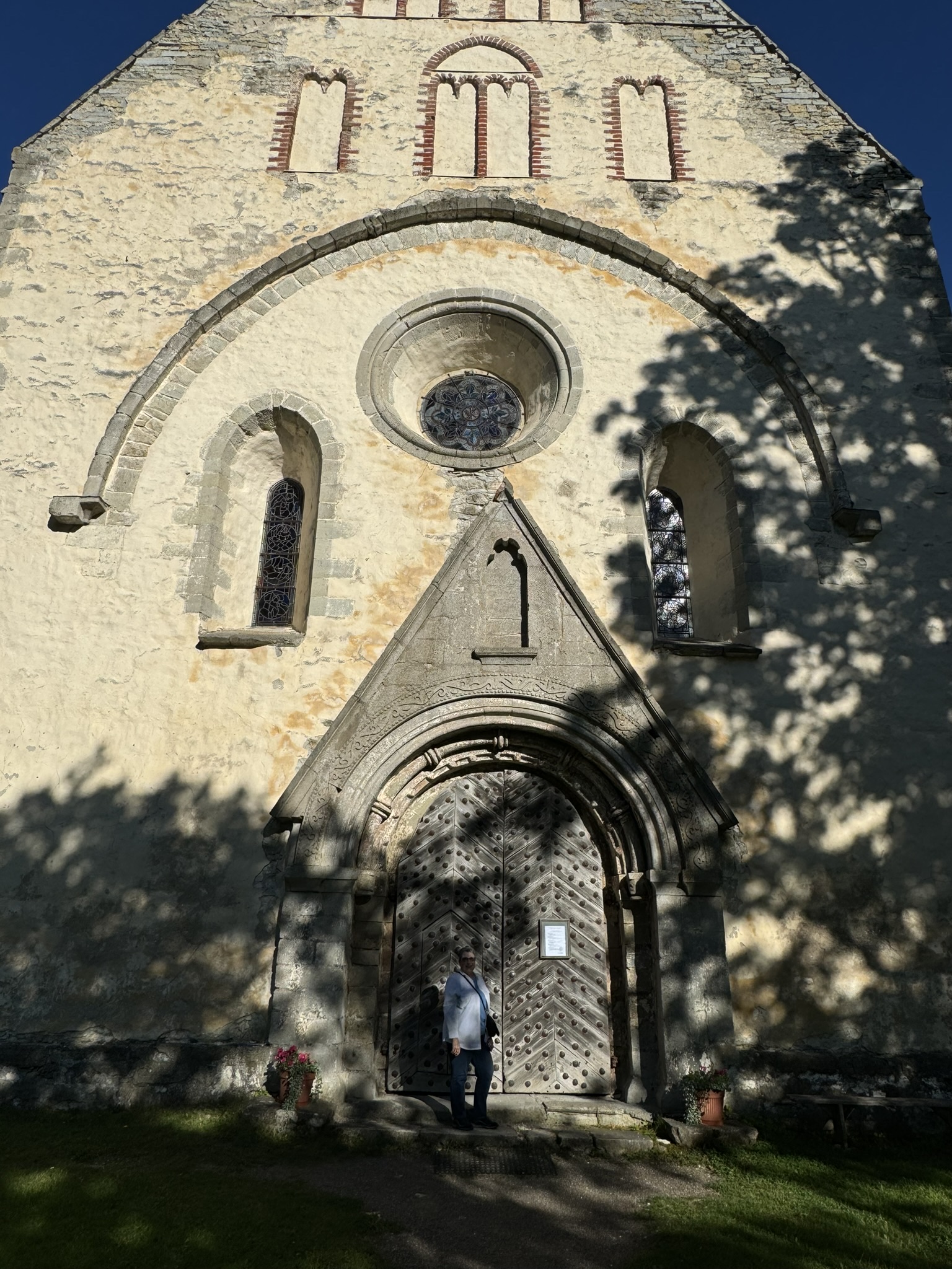
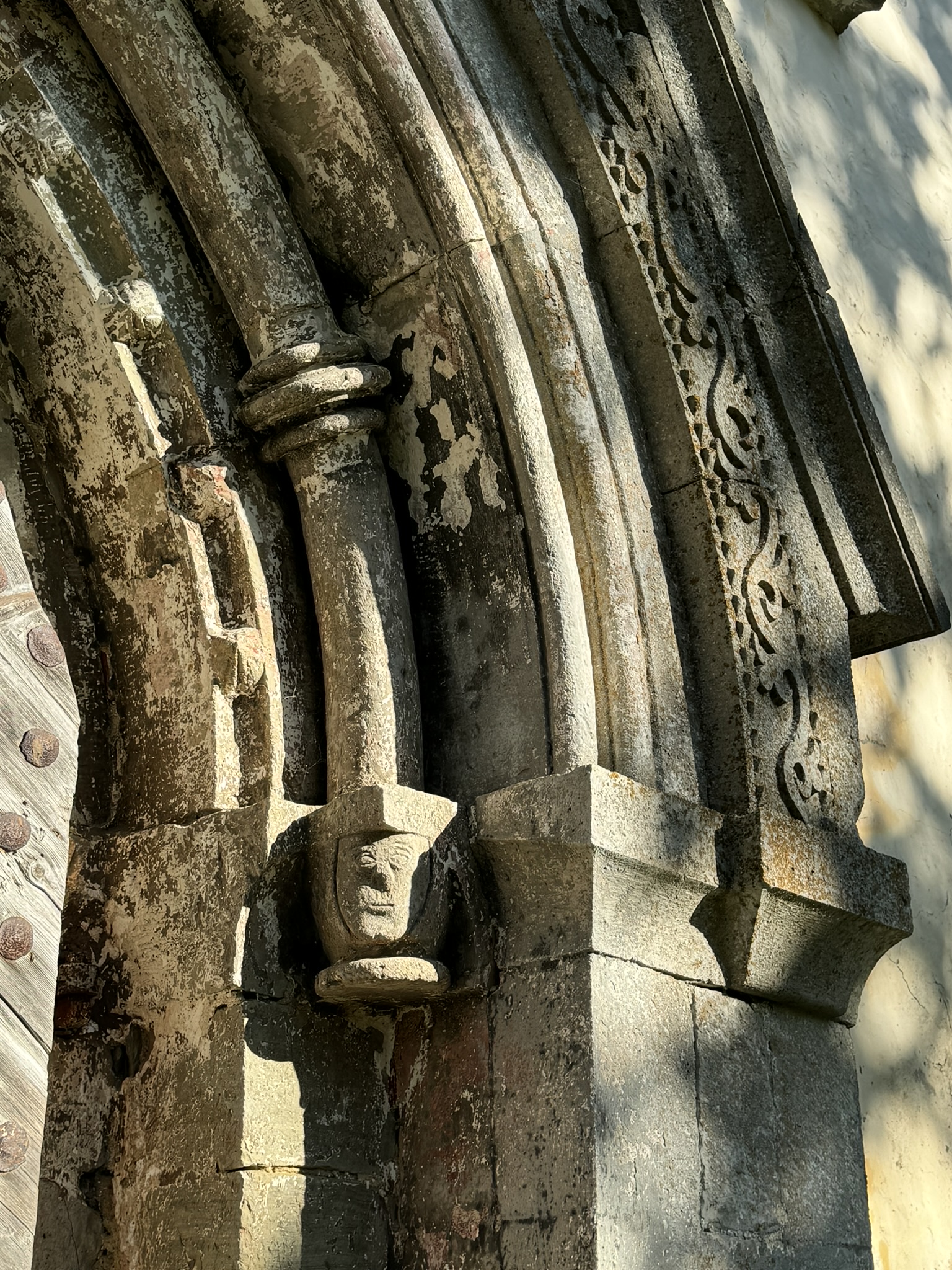
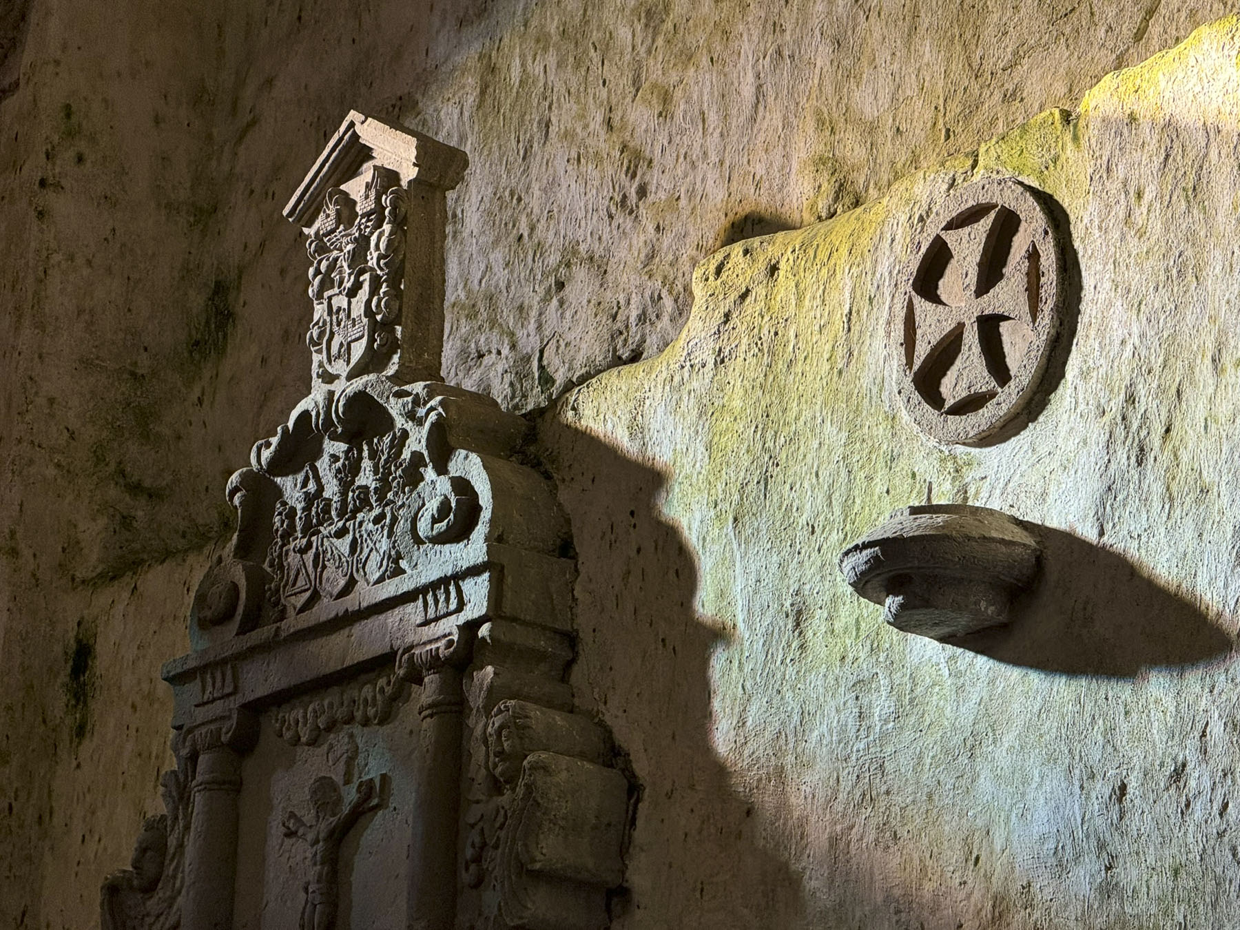
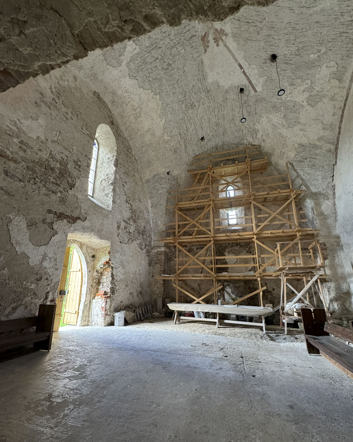
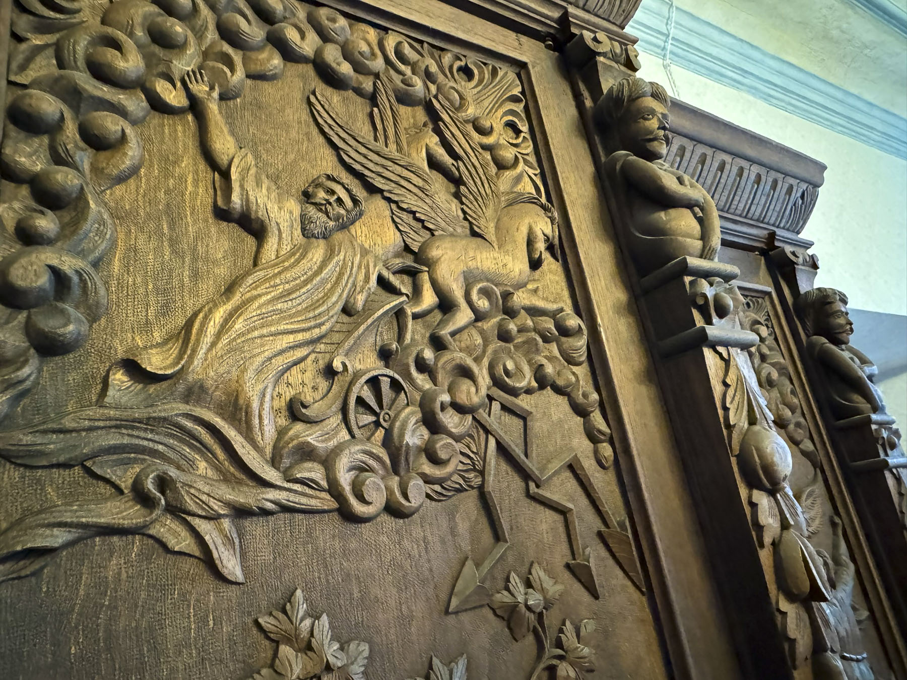
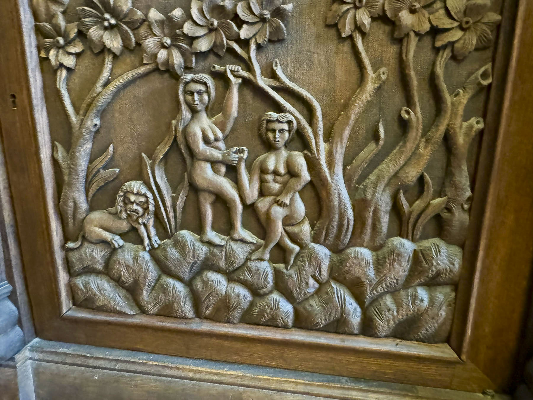
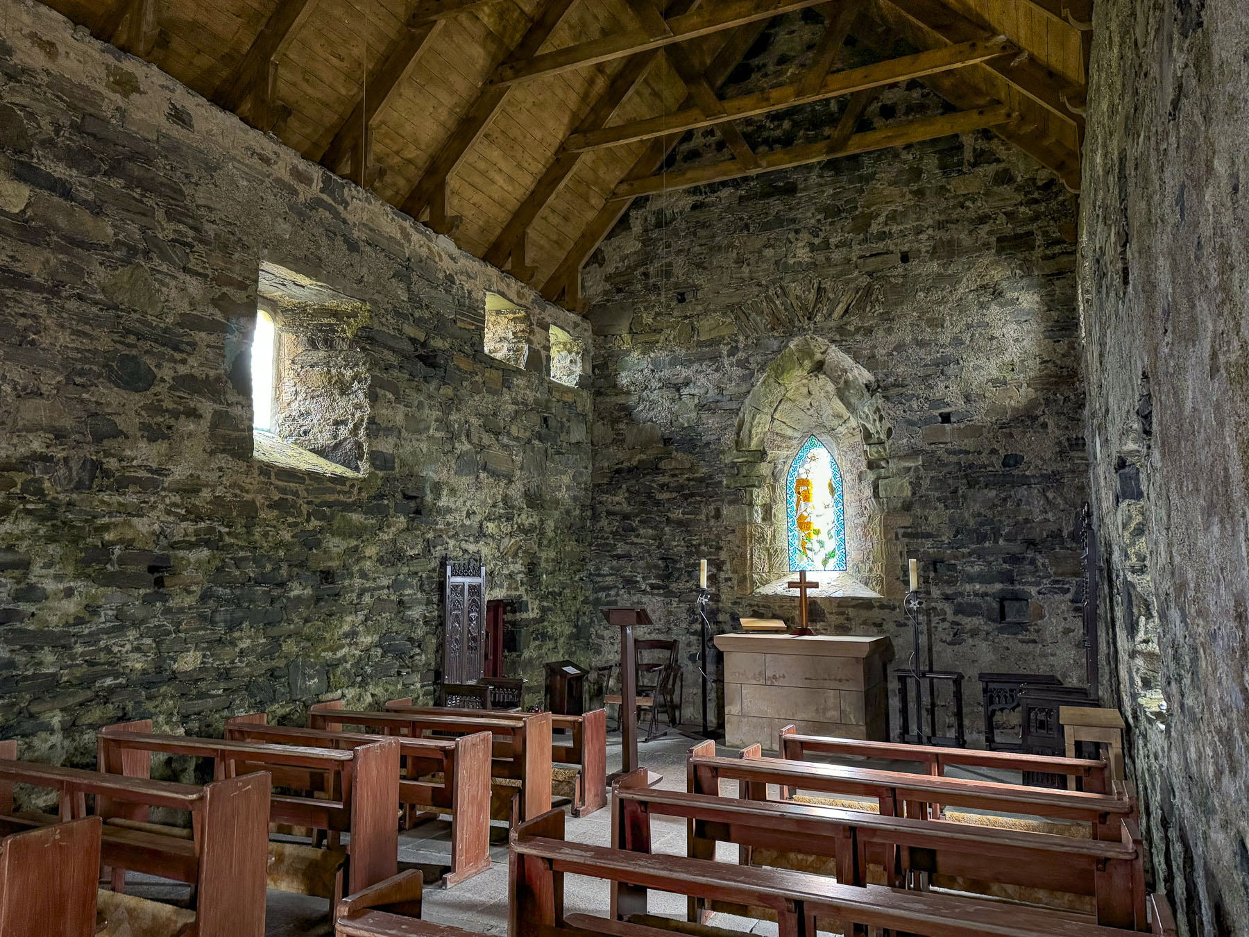
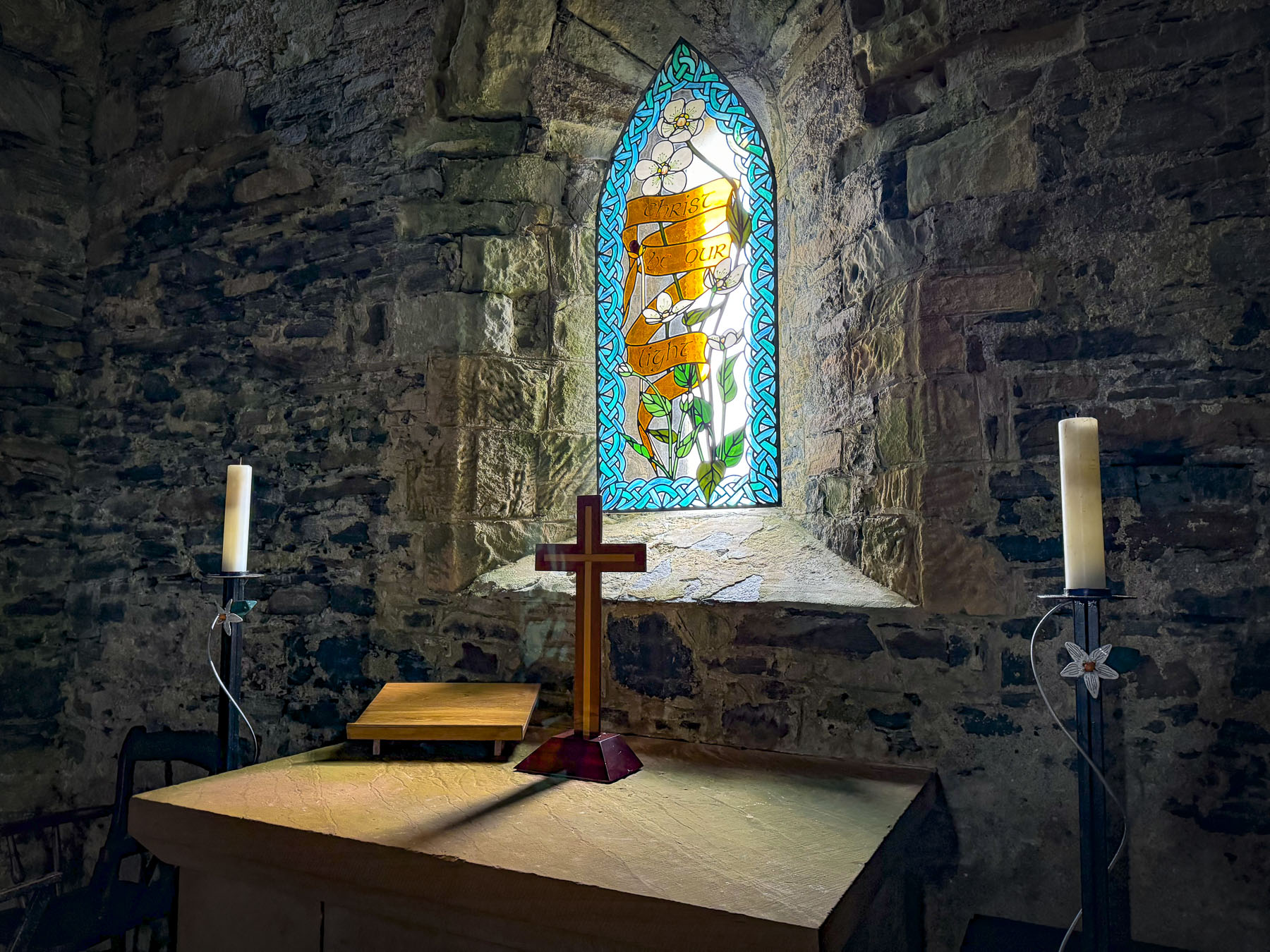
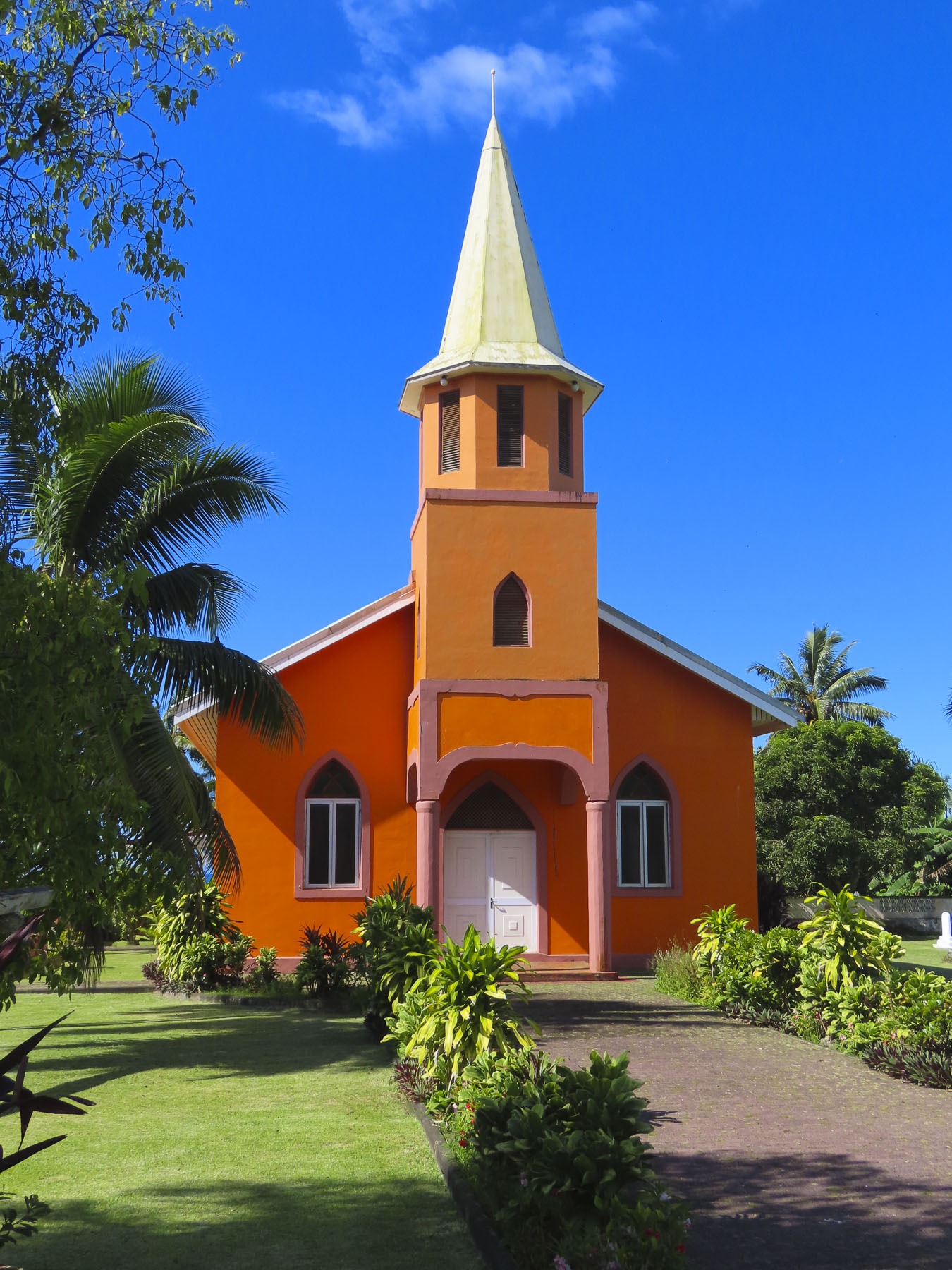
Uphill from Pu’uhonua O Honaunau we visited the Painted Church, aka St Benedict Catholic Church. It’s a simple wooden church that dates from the 1880’s, and easy enough to just drive by unless you know it has a spectacularly painted interior.

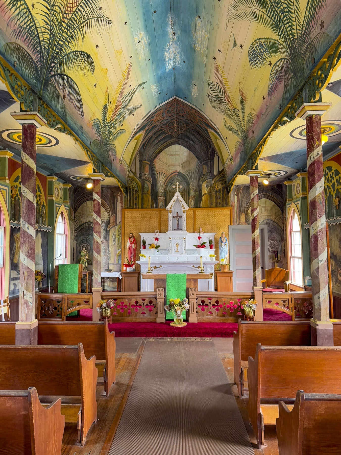
While it’s not Michelangelo’s Sistine Chapel, the message is the same with every surface of the interior illustrated with stories from the bible. It was all the work of one creative Belgian priest, Father Jean Berchmans Velghe. He painted these religious murals between 1899 – 1902 for his, largely illiterate congregation.

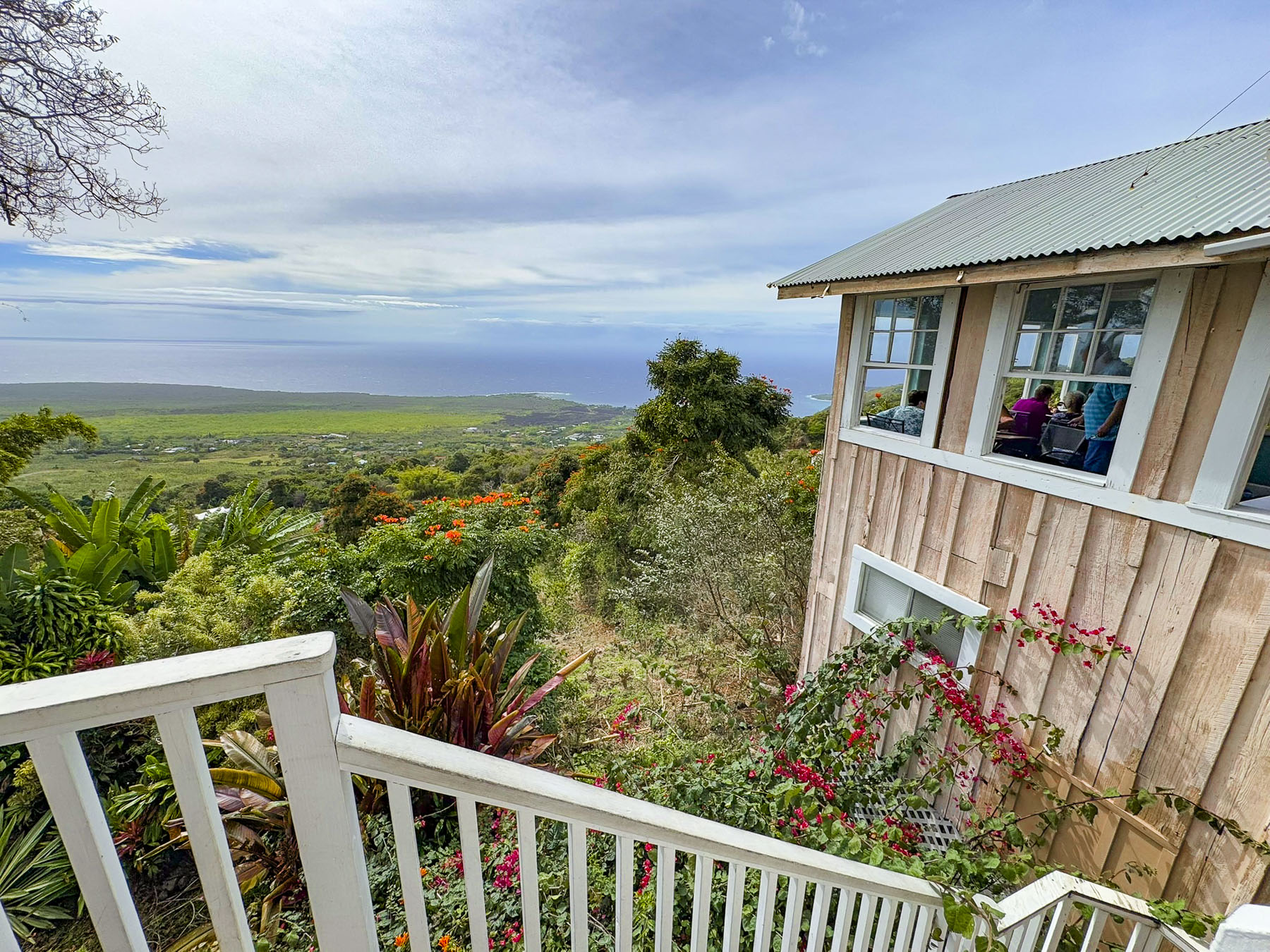
The Coffee Shack,  a laidback breakfast and lunch restaurant on Rt11 in Honaunau-Napoopoo, was recommended to us as a nice place to eat. Parking was a little difficult in their small lot, and the place doesn’t look like much from the outside, but inside they have a lanai, an open sided porch, with panoramic views over the hills leading down to the Kona coast and Kealakekua Bay. We had just gotten seated when the power went out, something that we were told happens quite frequently across the island, and the server informed us “the cook doesn’t open the refrigerator when this happens, so we only have pastries, and the coffee is still hot.” It wasn’t much of a sacrifice to content ourselves with coffee and luscious pastry.

After a snack we optimistically continued south in search of an open restaurant, and we were not having much luck. Talk of mutiny was fomenting in the back seat. This whole southern coast lies in the shadow of the Mauna Loa volcano. Past the town of Ocean View the road crossed scars of ancient lava flows that stretched from the volcano’s summit to the sea. Fortunately, we came upon the El Encanto Food Truck, which had its own generator, and was busily serving a long line of hungry patrons at its window. Our lunches were delicious! The mutiny was postponed.

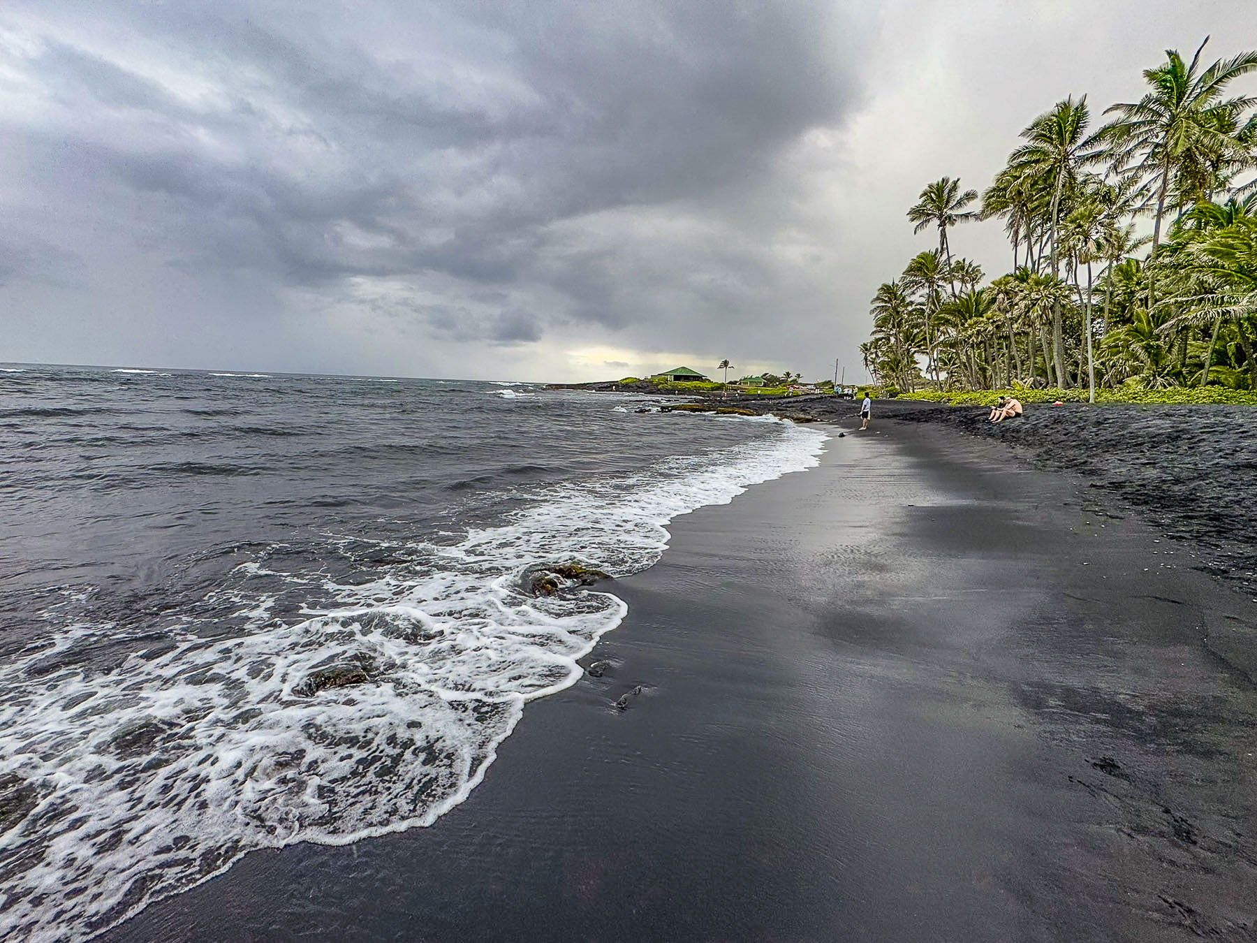
The power outage also affected gas stations along our route. With the afternoon sky darkening we decided to forego visiting South Point and continue on to Punaluʻu Beach. It’s a graceful crescent shape, and we are sure on a sunny day its volcanic black sand beach lined with coconut palms would be stunning, but this afternoon it looked foreboding with a gray sea sweeping its shore, more apropos for the scene of a novel’s fictional shipwreck, than a place to sunbath.

Rain was threatening now, but as we walked back to the car, Donna was waving excitedly to us. On the beach were three large green sea turtles in a roped off nesting area. Native to the Hawaiian archipelago, they are the largest sea turtle that nests on the islands and are symbols of good luck, wisdom, and protection. It was such a pleasure to see them.

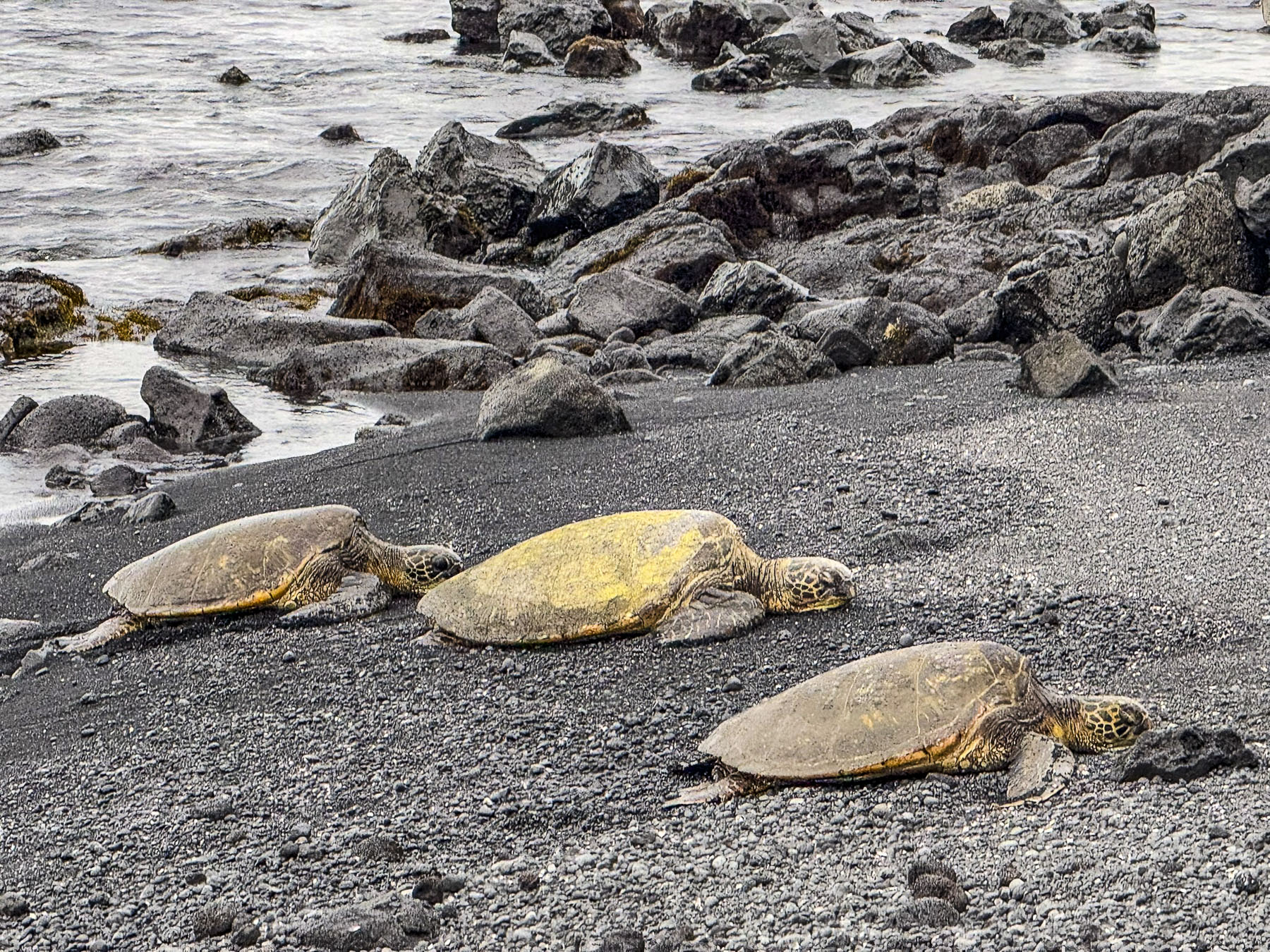
The Hawaiian legend of Kauila, tells of a mystical turtle born on the black sands of Punalu’u, who had the ability to shapeshift into a human to play with the islander’s children that came to the beach, and to protect them from the dangers of the ocean. Heavier rain sent us hurrying back to the car. It was a long but rewarding day; we agreed that the spotting of the turtles was a real highlight of the trip.

Our pursuit of waterfalls continued the next day. Recrossing the mountains during the day cast a new light on the arid windswept heights as we ascended the road under snowcapped Mauna Kea then descended towards Hilo and into verdant greenery of the eastern side of the Big Island. It was a contrast equivalent to night and day, like our two drives across the island.

Roaring from all the recent rain, Wai’ale Falls was easily seen from the bridge over the Wailuku River. There’s not any official parking, so folks just park along the side of the road and walk out onto the bridge. There is also a rough trail, through thick undergrowth, up and over the road embankment that leads to the upper falls. We followed the footpath for a while until it narrowed along the edge of a fall-off, and we decided to turn back. Though some younger, more adventurous folks had reached the top of the 17m (55ft) high falls and were fearlessly jumping into the pool below.

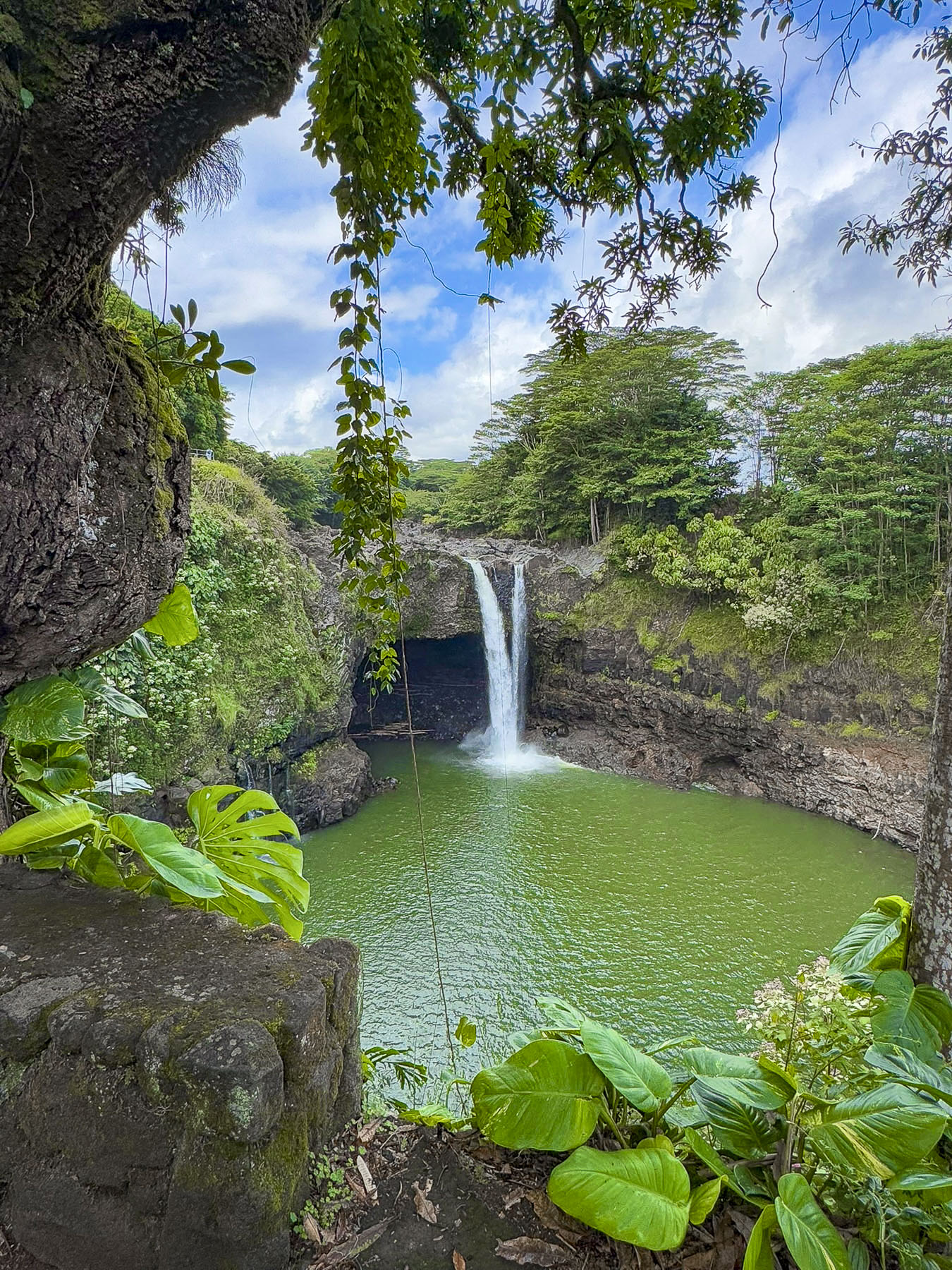
Downriver, Rainbow Falls, in Wailuku River State Park, was a short drive away. It’s known for, you guessed it, rainbows that frequently appear when the light is just right. The riverside park is quite pretty and has paved trails that overlook the falls where the river’s cascading water veils a shallow cave as it drops 24m (80ft) into a large stone basin created over the ages by erosion. “Legends say that the cave beneath the waterfall was the home of Hina, mother of the Hawaiian demigod, Maui.”

Our next “drive a little then café,” moment was satisfied at Coffee Girl, a cute café in a Hilo strip mall, on the way to Makuʻu Point.

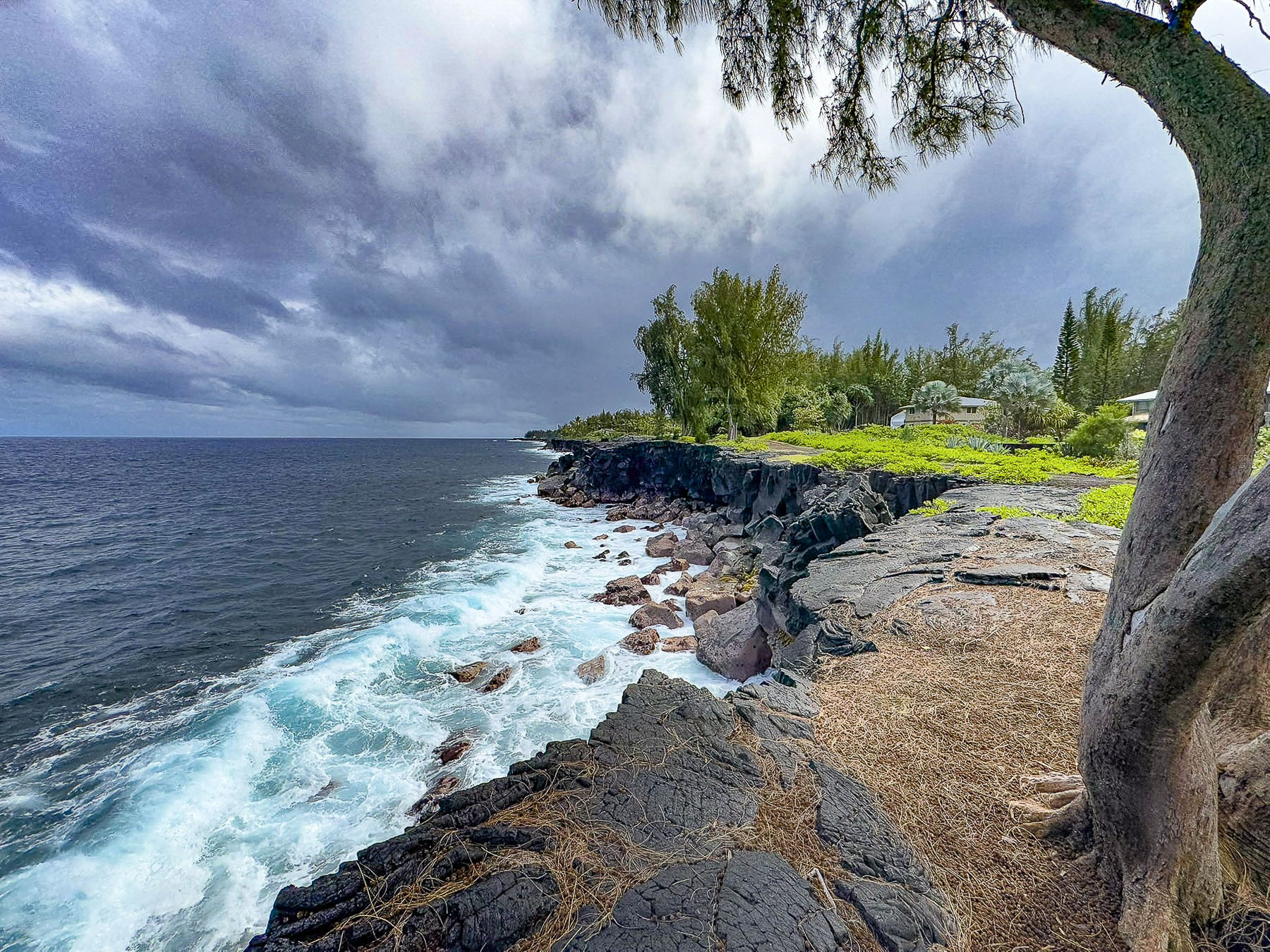
Turbulent seas churned from storms blowing across the Pacific along with volcanic activity have prevented the creation of beaches on eastern coast of the Big Island. Dramatic volcanic cliffs and lava outcroppings line the windward coastline instead.

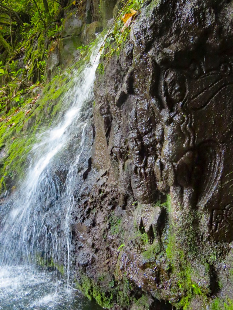
The next morning, we set out to find more ancient stone inscriptions at the Puakō Petroglyph Park, in nearby Waimea. The trail started in Holoholokai Beach Park, where there is a unique beach of black lava rocks mixed with white coral, and soon led to a gathering of petroglyphs.

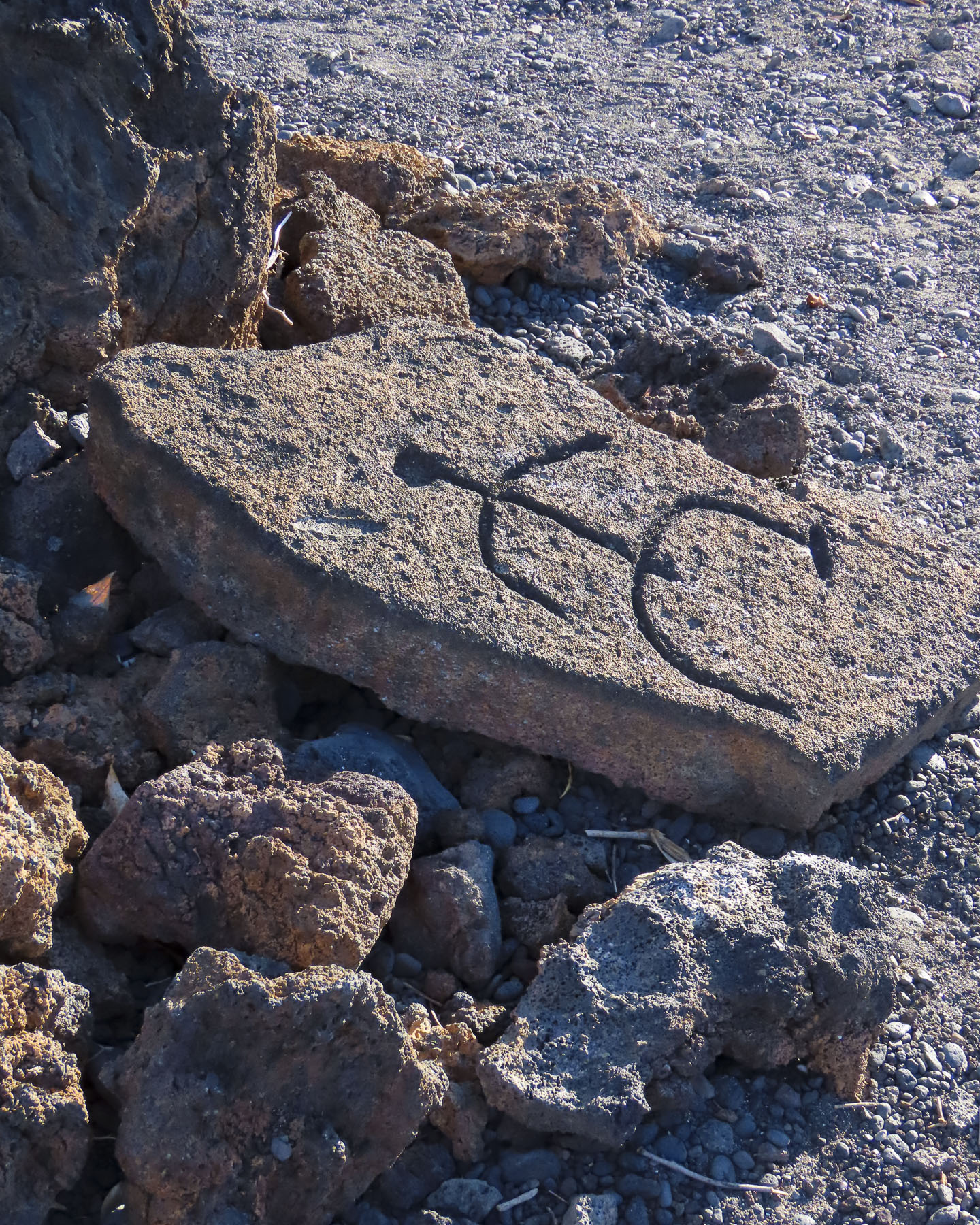
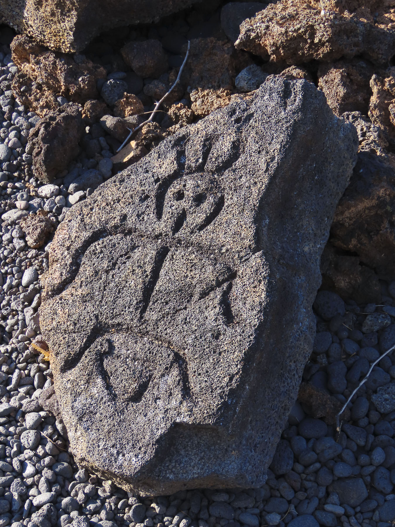
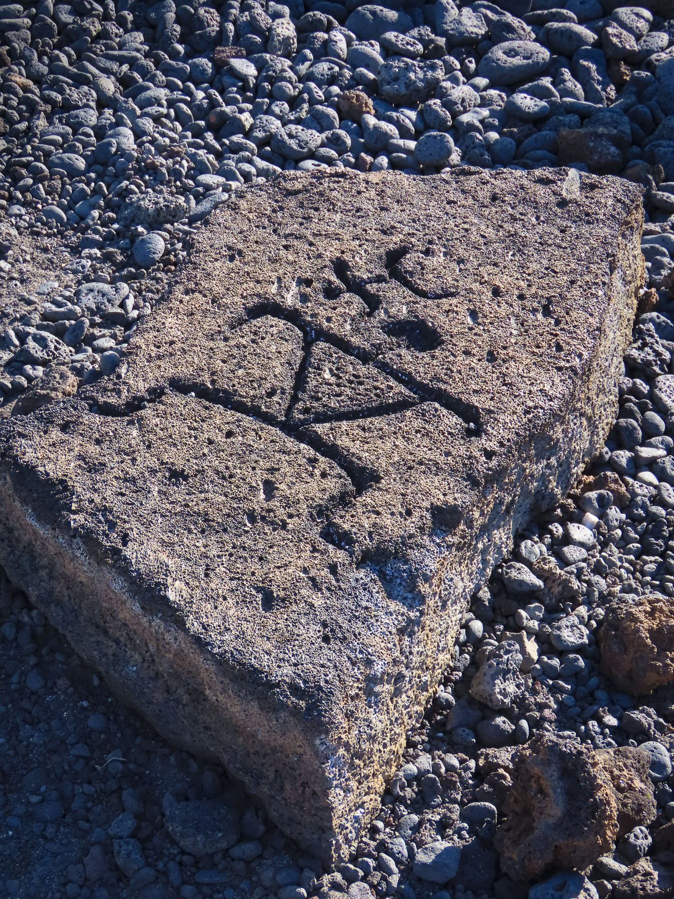
The symbols were quite interesting, but it was obvious that the carvings were reproductions of ones that the trail led to. We followed what started out as a well-worn trail through a primeval forest full of twisted trees, until the trail seemed to vanish. It was a hot day, and we were concerned about getting lost, so we backtracked and turned our attention to discovering some of the smaller beaches near the resort.

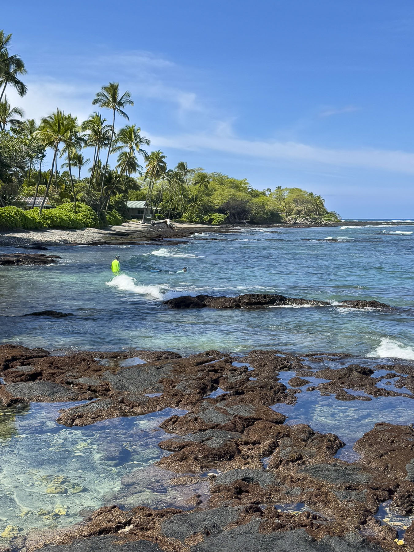
Puako Bay is a few minutes south of Hapuna Beach, the island’s largest stretch of sand, which we had visited earlier in the week. It’s a tranquil bay with many public access trails from the road to small sandy beaches, and rocky coves, that folks like to snorkel in.

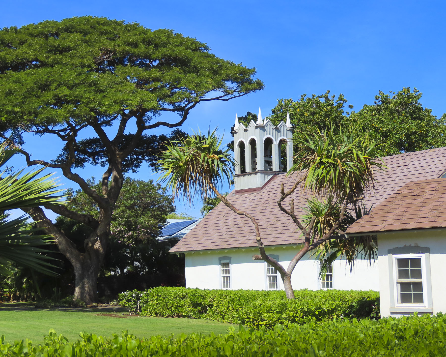
There was a small beach next the Hokuloa Church that offered a nice view of the bay with Mauna Kea in the distance. The church was built with lava rock and then whitewashed in the late 1850s.

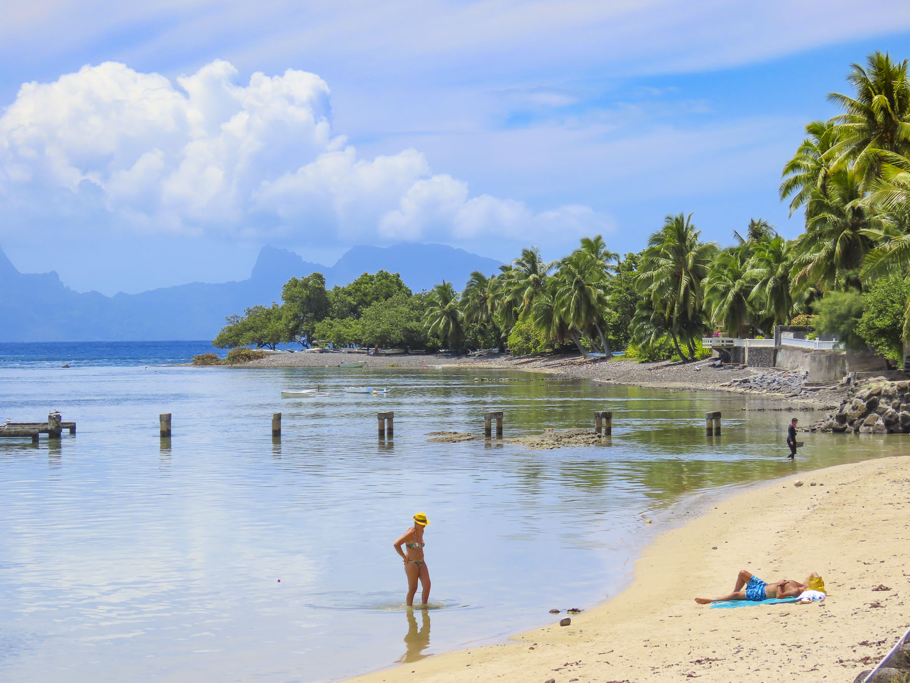
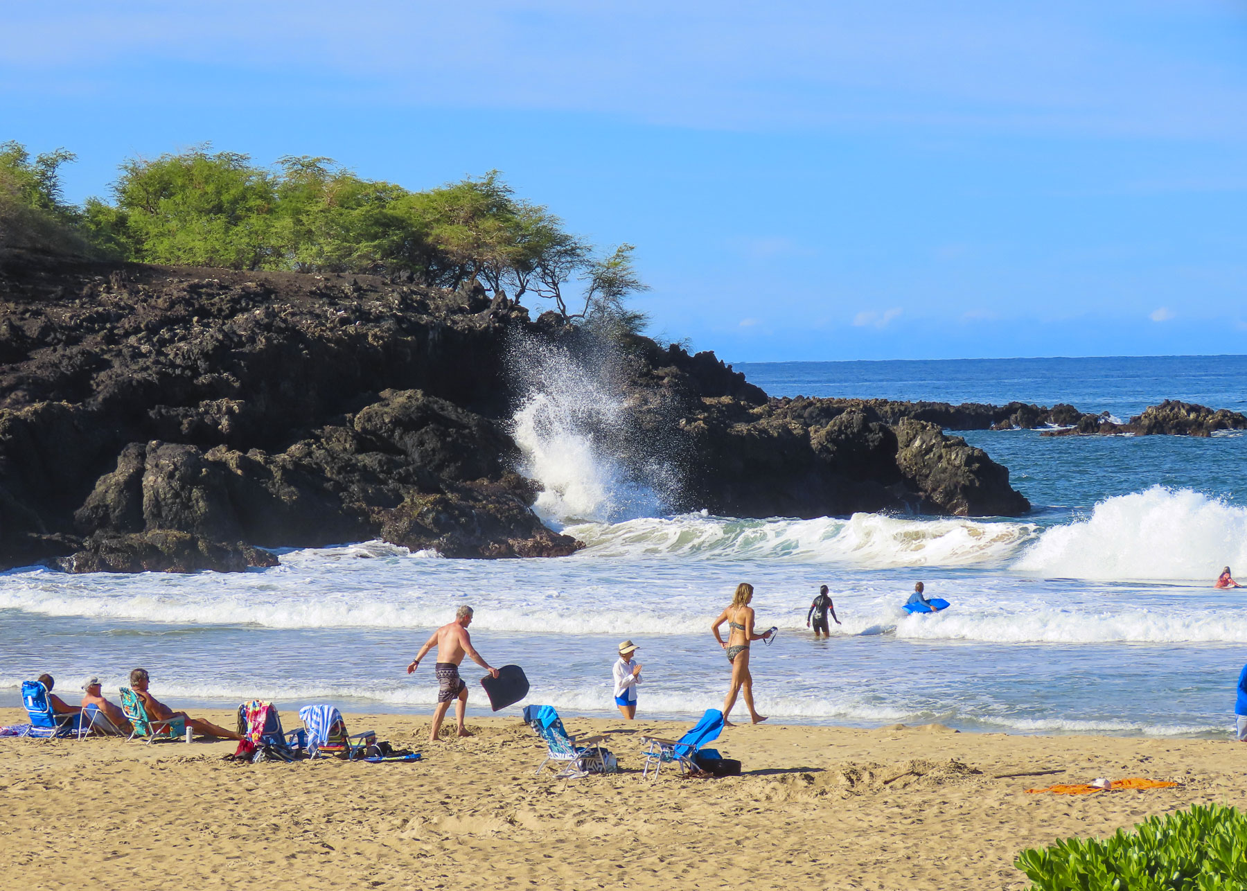
Kikaua Point Park was south of our resort and access to it was, surprisingly, through a gated community. Where folks are allowed access to the beach after getting a parking permit from the security guard. A long concrete walkway led from the parking lot through a boulder strewn lava field to a lovely palm treed beach. Folks were enjoying the breeze in the shade of the trees and swimming in the warm water of an almost completely circular and shallow sandy bottom cove. It was the perfect spot to spread our towels out and go for a swim.

We only scratched the surface of this big, beautiful island. And if we ever return we would definitely go to see the array of telescopes at the observatory atop Mauna Kea. The cost of living is very high on the island, with even locally caught fish, fruit and vegetables being expenses. Folks always say eat at the food trucks; while less expensive, their prices are steep too. So, if we ever return to the island – Donna furrows her eyebrows when I say this – we are packing snacks, several bottles of wine, a jar of spaghetti sauce and pasta, along with a couple of frozen steaks that should be perfectly thawed by the time our flight lands.

Till next time,

Craig & Donna

An Estonian Road Trip: Part 4 – Three Autumn Days on Saaremaa Island or A Castle, Conflicts, & Churches

A row of windmills silhouetted against the early autumn twilight lined the road as we sped toward Kuressaare, the largest town on Saaremaa Island. A heavy plumbeous cloud cover was darkening the sky earlier than usual, but we hoped to reach our lodging, Vinoteegi Residents, before nightfall.

From past experiences of driving in Europe, parking our rental car was always an issue, and sometimes very costly. We were pleasantly relieved during our three-week road trip through Estonia, Latvia, and Lithuania that we only had to pay for parking once when staying in Riga, Latvia. The rest of the time, convenient and safe parking was available on the street. After settling into the charming boutique hotel, we walked several blocks through a residential area and the historic town center to dinner.

On the town square the lively activity at Söstar köök & baar caught our attention, and we enjoyed several tasty selections from their eclectic menu.

The next morning, we were up early to take advantage of the photographer’s “golden hour,” at Kuressaare Castle, a twenty-minute walk from our hotel. Our stroll down the quiet neighborhood lanes was a nice introduction to the town’s charming diverse architecture.

In the dawn light the bastion fortress, Saaremaa Island’s most iconic landmark, looked particularly beautiful and intriguing. So much so that we found ourselves returning to the citadel several times during our stay to snap photos of it in different light.   

Construction of the fortress’s earthen ramparts started after the Teutonic Order defeated the pagan Saaremaa islanders during the Great Northern Crusade in the early 1200s. A century later the fortress was transferred to the Bishopric of Ösel–Wiek, based on the mainland in Haapsalu, and the building of the three story, stone Bishop’s castle began. Interestingly, the first written record of the castle appears in 1380 concerning the murder of Bishop Heinrich III Biscop. Elected by church officials in 1374, Heinrich III turned out to be very corrupt and was, among other abuses, accused of selling church land and assets to support his mistress’s lavish lifestyle. Ignoring the charges, he left Haapsalu and fled to Kuressaare Fortress’s newly finished Bishop’s castle, with only the loyal members of his staff. A while later the bishop was reported missing. After an exhaustive search of the castle Bishop Heinrich III was found dead in the fortress sewage system, with the garrote still around his neck.

During the 16th century the Bishopric sold the castle to the Danish Empire, which promptly began to improve the castle’s fortifications with the addition of the encircling moat, which established the citadel that exists today.  

Early in the 17th century the Danes ceded Saaremaa Island to Sweden. Lutheran preaching which began during the Reformation was now the formal religion of the land and the Swedish government exercised strict control over religious life with regular inspections by church officials to all the congregations across the island called “visitations.” These visits were to “inspect the religious beliefs of peasants and to root out the remnants of paganism and Catholicism.”

With the signing of the Treaty of Nystad at the end of the Great Northern War (1700 – 1721), Sweden ceded all of mainland Estonia and its islands to Russia. Estonia attained a brief independence at the end of WW1 which lasted for 22 years before Russia, as the Soviet Union, returned.

One of the towers of Kuressaare Castle had been used for centuries as a prison. But with the communist Red Army occupying the island in 1940, unheard-of horrors befell the castle, and its courtyard was used as the execution ground for ninety islanders. During WWII, Estonians were forcibly conscripted to fight in both the Russian and German armies. The Nazi Army occupied Estonia from 1941 to 1944. But with the Soviet Red Army advancing again, roughly 27,000 Estonians started a journey to freedom in Sweden from the islands of Saaremaa and Hiiumaa in the fall of 1944, an exodus from their homeland that would become known as “The Great Flight.”

After the Soviet Union annexed Estonia at the end of WWII, the communist regime forcibly deported 30,000 Estonians from every region of the country to Siberia. Few returned. Estonians caught trying to escape Saaremaa Island now were considered “enemies of the state,” and shot by the communist border guards who patrolled the island’s beaches.

In 1994, the fiftieth anniversary of the event, a monument called The Freedom Gate, acknowledging Sweden’s help and Estonia’s gratitude, was erected in Stockholm.  The inscription on it reads, “We came in small boats over the sea to escape from terror and dictatorship. Thousands of men, women and children reached the shore, among them workers, fishermen, farmers, intellectuals. We received a warm welcome, we were able to find work and to safely establish homes and families. We did never forget the country from which we were forced to leave and we strove for its freedom. Let the Freedom Gate testify to the humanity and tolerance of the Swedish people towards those who were looking for shelter in evil times and let it commemorate a tiny nation who found here a new home for itself.”  By Estonians and Estonian Swedes in Sweden – 1944-1994

The castle’s palace now hosts an interesting museum with exhibits dedicated to explaining the island’s complex history over the centuries. One of the exhibits honors the “Forest Brothers,” a loosely knit group of resistance fighters who opposed the Russian occupation and its security forces. They used their knowledge of the island’s forests and bogs to evade capture by hiding supplies underground in sealed milk cans. They disrupted the Soviet Union’s occupation efforts until most of them were hunted down and killed in the early 1950s. The most famous Forest Brother, August Sabbe, continued the fight, well into his seventies, until he died in a gun battle with KGB agents in 1978.

There is also an intriguing ethnological wing with a large collection of centuries-old island artifacts.

The next day we headed to the lighthouse at the tip of the Sõrve peninsula, only a 45-minute drive from Kuressaare. It was a beautiful drive and along the way we noticed the island’s eclectic bus stops. Some were quite ordinary, while one was lined with bookshelves, and served as a lending library. Another was enclosed with windows and filled with hanging plants. Many were colorfully painted.

We detoured to the ruins of the Church of the Nativity of Christ in the village of Tiirimetsa, population 50. (A small aside here: a village in Estonia doesn’t necessarily refer to a central collection of buildings. It is often just an area.)  It was the first of several historic churches on Saaremaa we planned to see over the next couple of days, but we nearly drove past it, as the ruin was nearly hidden in the shade of a tree line. Built in the 1870s, the once grand Russian Orthodox church was looted and vandalized by soldiers in the Soviet Red Army during WWII. Afterwards during the occupation, the church was used as a barn until the roof collapsed. Tall trees now reach for the sky from its sanctuary.

On the peninsula now, we drove down a serene country lane to the Jämaja kirik, and interrupted a husband and wife team mowing the grounds and vacuuming the sanctuary. Although not expecting visitors, they graciously let us enter. Something led me to believe the woman was the pastor of the church, but there was a language barrier. Donna, herself a pastor, thought I was mistaken. Her reasoning was that no congregation would ask their preacher to also clean. But I couldn’t imagine the congregation of the church being that large anymore, and multitasking might be needed. Built in the mid-1800s over the ruins of an early 13th century church, the historicist style building was very pretty in its pastoral surroundings.

Inside, the church was very bright and since the windows were open you could hear the sound of the sea rolling onto the beach, not far away. The blue tones of the sea are reflected in the church’s altar painting. The church’s cemetery is farther down the lane, on the water edge. 

A short distance away we hoped to have our ritual “drive a little then café,” morning coffee at the Family Café at Ohesaare bank, a rocky beach area reached by descending a shallow embankment.  It’s a popular spot where folks come to build small cairns, and there are literally thousands of these wobbly stone towers along the water’s edge. There is also a nice example of an Estonian windmill near the café. To our disappointment the restaurant was not open mid-week during the September shoulder season, even though checking its hours on Google Maps indicated otherwise.  In the larger towns this wasn’t an issue, but restaurants and cafes reducing their mid-week hours was something we had not anticipated.

When we reached the tip of the peninsula the Sõrve lighthouse towered over us. We didn’t climb it, but instead walked the meditative stone circle near its base.  At the water’s edge the sea was perfectly flat with the ebbing of the tide, and the view across the Baltic was endless.

Heading back to Kuressaare we stopped at a park in the village of Salme to investigate some wooden sculptures of people that we had noticed earlier as we drove by. Our closer inspection revealed they were depictions of Vikings. The sculptures link to the accidental discovery, during road construction in 2008 and 2010, of two large Viking burial ships, one 38ft long and the other 56ft in length and dating back to 700 AD. They contained the skeletal remains of 42 warriors plus artifacts, that included swords, spears, arrowheads, and dice in the grave sites. Historians speculate that the Vikings were defeated by the Saaremaa islanders, and that the survivors were allowed to pull the longships ashore to ritually bury their brethren.

Back in Kuressaare we strolled along the harbor’s promenade to the large whimsical sculpture of Suur Tõll ja Piret, a mythic Estonian couple, happily dancing in their birthday suits. The Folkloric heroes are especially beloved on Saaremaa, where legends portray the helpful giant as defenders of the islanders.

The castle was across the harbor, and we couldn’t resist taking some more photos of it in the late afternoon light.

Centuries of religious turmoil have embroiled Saaremaa, starting with the Northern Crusade’s imposition of Catholic Christianity on the islanders in the 13th century and ending with Martin Luther’s Protestant Reformation in the 16th century. But it’s left an enduring mark on the island with seven historic medieval churches that still stand, amazingly enough, and are actively used, albeit by a smaller number of worshippers than during their heyday.

We didn’t visit all of them, but we did use them as destinations to work our way across the island to explore other areas. After a tasty breakfast the next morning at Pagariäri | Vanalinna kohvik, a bakery and café in old town Kuressaare, we headed to Kaarma Church. Originally dedicated as The Peter and Paul Church, it dates to the late 1200s, making it one of the oldest churches on the island. The church was originally built without a steeple, as was the style at the time. But any structure this old was bound to have withstood numerous alterations and additions over the centuries. The church underwent its first major alteration in the 15th century, when the bell tower – the first on the island – was added to its façade. Later heavy buttresses were added on either side of the church entrance to prevent the front wall from collapsing. The inside was quite intriguing with a pulpit from 1645 and wonderful carved wood sculpture of St. Simon of Cyrene, along with other interesting pieces and primitive stone carvings.

Afterwards we headed to see the windmills we had zoomed past the day we arrived on the island. In use on Saaremaa since the 14th century, there were nearly 900 of the iconic windmills, or one for every two farms on the island by the early 1900s. In 1925 Angla was a prosperous village with 9 privately owned windmills built across its highest point to catch the wind for the mills to grind the grains harvested from the hamlet’s 13 farms. Most of the windmills across the island did not survive WWII, and many of the ones that did were left abandoned after “The Great Flight,” which saw the depopulation of the island. After Estonia’s 1991 independence, Alver Sagur acquired the property with the village’s remaining 5 windmills, and spent years restoring them with parts salvaged from other ruined mills from across the island. They are now the centerpiece of the Angla Windmill Hill and Heritage Cultural Center which Sagur envisioned to preserve Saaremaa’s unique agrarian culture. 

Four of them, the oldest dating to the early 1880s, are post mills typical to Saaremaa, where the whole windmill turns around a central post to bring the sails into the wind by physically moving the long arm projecting from its side. While the other one, built in 1927, is a Dutch mill, where only the top which houses the sail’s gear shaft rotates around the stationary base.

Only one windmill has been totally restored to working order and still is used occasionally to grind grain, and you are allowed to climb the ladders between floors to examine its inner workings. The museum also had an interesting collection of historic agricultural equipment. The center’s restaurant was also good, and we really enjoyed their coffee.

We did a quick detour to the old Russian Orthodox Church in Leisi, which was built in 1873, and has those distinctive orthodox crosses atop its domes, before backtracking to the medieval Karja church, only minutes away from the windmills.

Noticeably the church, from 1254, was built without a steeple, which was a common style for fortress sanctuaries in the 13th century. There was another car in the driveway, though we didn’t see anyone, and the church was locked. Next to the door was a wonderful carved stone relief sculpture with rustic figures. Posted on the door was the caretaker’s phone number, but no one answered when we called. But luck was with us, and as we were just turning to leave two people appeared walking down the driveway. One was waving a set of keys.

Inside, more relief carvings decorated some of the interior’s architectural elements.

Along with an elegant altar there were some partial remnants of medieval era decorative paintings, faded but still visible on the walls.

On the way back to Kuressaare we turned off the main road to visit the church in Valjala, the oldest preserved stone sanctuary in Estonia.  Construction of the church started in 1227 after the Livonia Crusades of the 13th century, which forced Christianity on the pagan indigenous populations of Saaremaa Island and the northern Estonian mainland. The islanders didn’t convert willingly and their resistance was fierce, requiring the church to be expanded and fortified by the end of the century.

The entrance to the church looked more like a door to a medieval castle, ready to repel any attempted siege, and of course it was locked, a dilemma that was fortuitously resolved with the arrival of a middle-aged woman coasting to a stop on her bicycle. With a friendly greeting, she unlocked the door and vanished as quickly as she had arrived. The sanctuary was dimly lit with ambient light from its tall narrow windows, which dramatically highlighted the sculptural wall decorations. There was also a highly carved Romanesque baptismal font that is believed to be original to the church and is thought to be one of the oldest pieces of carved stonework in Estonia. In the 17th century the church’s tower was added. Three centuries later lightning struck the tower and destroyed its steeple.

We locked the door behind us when we left and when we reached our car, parked across the street, turned to look back at the church. Our mysterious bike rider had returned to check the lock, “Thank you,” she called. We waved.

That evening, our last night in the village, we wandered about with no particular restaurant in mind, simply enjoying the town’s warm ambience on a nice fall day. We checked Saaremaa Veski, a restaurant located in a beautiful historic 1899 Dutch-style stone windmill. However, it was only open on the weekends during the shoulder season. Further on we came across the sculpture of a giant hand called “Suure Tõllu käsi,” the Hand of Suur Tõll, which playfully references the beloved folkloric hero always giving the islanders a helping hand. The artistic work with its abstract background subtly reminded us, after several days of exploring medieval churches and a castle, that we were still in the 21st century.

“Oysters,” prominently displayed on the placard in front of Vinoteek Prelude drew us inside. Rustically finished with stone walls and roughhewn ceiling beams, the restaurant had a wonderful warmth enhanced by candles lit on the tables. The menu featured locally sourced produce, fish and game meats, along with an extensive wine list. The oysters were fantastic, though they were imported from Brittany, as the shallow waters of the Baltic Sea stay too warm and are not salty enough to grow them.

The next morning, we were up early to explore the eastern part of the island before catching a late afternoon ferry back to the Estonian mainland and continuing on to Pärnu for the night.

Miraculously, the door to the Pöide church was open! Some renovation work on the tower end of the church was underway, and workers were erecting scaffolding. The early history of the first churches on Saaremaa tends to be quite confusing with overlapping dates. But it seems the ancient church in Pöide vies with the Valjala Church as the oldest Christian place of worship on the island, each being quickly built shortly after the conclusion of the Livonian Crusade, in 1227. The original Pöide chapel was the only surviving part of a Livonian castle destroyed during the St. George’s Night Uprising of 1343, which saw the indigenous islanders kill their German and Danish overlords, and “drown the priests in the sea.” The folks seeking refuge at the Pöide castle withstood a siege for eight days before surrendering their weapons, with the assurance they would not be used against them. They were lied to and when they exited the castle the islanders stoned them to death. By the end of the 13th century the Livonian Order had reconquered Saaremaa and the small original chapel was expanded to the east and west. At this time the roof was raised and vaulted. When the fortified tower was added it became the largest medieval church on the island.

The inside is cavernous and at one time had enough pews to seat 320 parishioners.

In 1940, on the day that Estonia was forced to become a member state of the Soviet Union, lightning struck the church’s tall spire that was erected in 1734. Some considered it an omen of future difficulties. The church did not fare well during WWII with Soviet troops looting anything of value, and burning the pews for firewood, before it was used for decades as a hay barn. Only some sections of early painted wall ornamentation and the heaviest stone architectural artifacts were left untouched. One of the pieces to survive is the ledger stone of a local Saaremaa knight entombed by the altar, its carving now partially worn away by centuries of footsteps over it. Today the church holds services twice a month and hosts religious music concerts.

There was no missing the onion top domes of the Russian Orthodox Neitsi Maarja Kaitsmise in the small crossroads village of Tornimäe. The 1873 church’s setting on a small rise above the village wonderfully highlights its beauty. With the signing of the Treaty of Nystad to end the Great Northern War in 1721, Sweden surrendered Estonia to Peter the Great’s Russian Empire. Originally the Orthodox church had an insignificant footprint on Saaremaa, but that changed in the mid-1800s with the unfounded rumors that the church would give land to the islanders, mostly Protestant serfs, if they converted to the Orthodox church. Consequently, nearly 65 percent of the island’s Protestant rural peasantry fell victim to this deception, and converted to the orthodox religion, in the false hope of attaining their own land.

Down the hill from the church, we parked at Meierei Kohvik, a small café, one of the only two businesses in the village, for lunch. I was driving and had just turned off the ignition when Donna asked if I heard the car horn blaring. I’ll admit that I am slowly going deaf, and even with the help of hearing aids still have difficulty. “No. It must be from that truck over there.” “It’s from our car and it’s very loud,” she responded. By this point on our trip we had been driving the car, without any trouble, for over a week, so this was new issue. It turns out that that I inadvertently pressed something on the key fob, but no combination of pressing buttons would undo it. Unfortunately, to our dismay, the car’s manual was totally in Estonian too. So, there we were sitting in the car in the middle of Saaremaa island with the horn blasting away. I was totally useless in this situation. Fortunately, Donna resolved the problem by doing a quick internet search. Peace and quiet reigned once again. The café was simply furnished, but the food, pastries and coffees were very good. They also had a nice selection of apple juice and cider produced on Saaremaa available for purchase.

We arrived to Illiku Laid, a small thumb of land protruding into the Vaike Strait which separates Saaremaa from its smaller eastern neighbor, Muhu Island, with hopes of seeing From the Sea, an environmentally conscious sculpture, depicting human-like creatures emerging from the water. It was created by the Estonian artist Ines Villido using lost fishermen’s nets and other garbage retrieved from the sea. It was created several years earlier for the annual 4 day I Land Sound festival that’s held on Illiku Laid every July. The festival is the event that turns this sleepy backwater into Estonia’s version of Burning Man and “brings together artists, musicians, and creatives from around the world, fostering cultural exchange and collaboration, with a strong emphasis on environmental sustainability and community engagement.” Disappointingly, the sculpture was not there, but on tour as part of an environmental awareness campaign. Though we did realize we had seen one of Villido’s other works, Trust the Whale during our wanderings in Kuressaare. Her Cigarette Butt – Stand Up Board, made with 29,000 butts collected during the 2019 festival, was on display along the waterfront.

Saaremaa Island receded in the rear-view mirror as we followed the road across the Väinatamm, a long narrow causeway and bridge that connects Saaremaa to Muhu, before ending at the Praamid ferry terminal in Kuivastu. The day had passed quickly, and we arrived in time to take an earlier ferry to Virtsu, on the Estonian mainland. We had purchased our tickets for a later crossing, but there were enough open cars spaces that we were allowed to drive aboard. There was barely enough time to climb to the observation deck before the ferry’s 30-minute crossing concluded. We headed to the coastal city of Pärnu for an overnight stay before continuing our travels to Riga, Latvia.

Till next time,

Craig & Donna

An Estonian Road Trip: Part 3 – Hiiumaa Island: Ghost Ships, Churches and Fog

Only the red hull of a fishing trawler tied against the breakwater was visible through the fog that cloaked the coast in its grey mist. We had just set sail from the port of Rohuküla, on the Estonian Mainland. Our destination, the village of Heltermaa on Hiiumaa Island, a short one hour crossing on the Praamid Car Ferry. We had spent the previous day exploring the charming town of Haapsalu. Fortunately, it was only a 15-minute drive to the ferry terminal, which left us with plenty of time to watch the fog-veiled activities of the port before our 8:30am sailing. Our ultimate destination at the end of the day would be a hotel in Kuressaare on the island of Saaremaa. We had debated going directly there, but thought three full days on Saarema would be too long, so we opted instead to spend a day investigating the southern part of its smaller neighbor, the island of Hiiumaa, before catching a late ferry from there to Saarema.

The fog seemed thicker as we disembarked and headed to the Pühalepa kirik, the oldest stone church on the island. We used to be fair weather photographers but have come to embrace the moody light that inclement days offer. The fog that morning provided us with numerous opportunities to hone our skills. Some fall colors were just beginning to show.

Archeological evidence found on the island’s Kõpu Peninsula date the first traces of habitation on Hiiumaa to nomadic seal hunters over 7000 years ago. Its early history is vastly unknown, but it is believed folks lived on the island seasonally, but there might have been small hamlets, as the island was near a Viking trading route. But curiously enough, the first written mention of Hiiumaa in a 1228 document by the Archbishop of Riga, creating the island as a Bishopric to Bishop Gottfried, refers to it as ‘Some empty island named Dageida.”

This might help explain why the island’s new Germanic settlers felt the need to build Pühalepa kirik, surprisingly without a steeple, as a safe haven fortress church in the early 1200s, since the indigenous pagan tribes across ancient Estonia were resisting foreign rule and the imposition of Christianity upon them. The early German influence on Hiiumaa faded after the island was conquered by the Swedish Empire in the late 1500s.

The small red roofed building next to the church is the 16th century crypt of the von Stenbocks, a noble Swedish family that had extensive land holdings on the island and played a significant role in the island’s economy at the time. The current shape of the church dates from an extensive 18th century renovation which added the steeple.

Suuremõisa Manor on the von Stenbock’s largest estate was nearby. The imposing Baroque-Rococo style country home featured a large central building with a wing on either side of a formal courtyard, where guests would arrive by carriage. Years later the property was acquired by Baron Otto Reinhold Ludwig von Ungern-Sternberg, a shipping magnate. Things didn’t go well for the Baron, and in 1803 he was accused of murdering one of his ship’s captains, racketeering, piracy, and multiple kidnappings. He was convicted of murder and sent to prison in Siberia.

Miraculously the building survived both world wars and the Soviet occupation of Estonia. Today the preserved manor house is used by two schools, one a technical college, the other a local primary school. The site maintains a very low-key approach toward visitors. After a receptionist signed us in we were able to visit several rooms where there were some amazing pieces of antique furniture featuring finely carved religious motifs. Even though the building has a contemporary use, we thought it still retained a grand understated elegance.

It was still foggy as we drove to our next destination: Kassari Chapel, nine miles away, along the island’s southern coast. After driving through a lushly forested landscape, we chuckled when turning onto a side road we saw a barn painted with palm trees. We speculated about how harsh the winters on the island might be and what tropical islands the painter dreamed of.

Much smaller than the Pühalepa kirik, the Kassari Chapel sits on the edge of a forest that backs to the waters of Õunaku Bay. A wooden church built in the 16th century stood on this site until it was replaced with this unique stone church, still covered with a thatch roof, in the early 1800s. All the worship services in the church take place by candlelight as the sanctuary has never had electricity. The quaint graveyard is almost lost in the woods, with headstones covered in moss and leaves. Many of the island’s notable poets, artists, teachers, and other island characters (a manor’s swineherd), along with several wealthy landholders are buried in the graveyard. Noticeably the wealthier folks had headstones made from imported marble, while the less well-off had iron crosses crafted by the local blacksmith.

At the crossroads nearby in the hamlet of Kassari stood a tall statue of the giant Leiger, carrying a large boulder on his shoulder, with two small islanders atop it. Leiger is an Estonian folk hero, and relative of Suur Tõll, with incredible strength, who lived on Hiiumaa. The sculpture captures the essence of one of the giant’s legendary feats when he built a bridge for the islanders across the waters of the Soela Strait that separate Hiiumaa from the island of Saaremaa, which lies to the south. According to legend, Säare Tirp, a long narrow, tail-like strip of land that protrudes from the mainland into the strait, is all that remains from his endeavor.

A place to break for coffee was difficult to find mid-week during the September shoulder season. While many eateries were noted on the map, they unfortunately were only open on the weekend. But luckily, Rannu Pubi in the village of Käina was open mid-week for lunch. Miraculously it seemed by the time we parked the car, the clouds parted, and we were able to eat outside in bright sunshine on the restaurant’s terrace. The food was delicious, and the coffee was welcomed.

The town of Käina was also an interesting stop with the ultra-modern Tuuletorn Experience Center, “a bit of a museum, a bit of a science center and a bit of a play world,” was a main attraction, along with the ruins of Martin’s Church. When it was built in the 16th century it was the largest church on the island, and could hold 600 people. Unfortunately, the church began to settle into the soil unevenly and in 1850 the corners were buttressed to prevent its collapse. During WWII the building was hit by an incendiary bomb, the resulting fire burned through the roof, and destroyed the interior.

Our stops earlier in the day were only minutes apart, so with the sun gloriously shining we returned to Pühalepa kirik and Suuremõisa Manor to take a few more outside shots on a now beautiful day before heading to catch the 4PM ferry from Sõru to Triigi, on Saaremaa.

The Rudolf Tobias House Museum, a centuries old farmstead, and the 1873 birthplace of the famous Estonian composer and organist, was on our route. The museum was closed, though we were able to walk around the grounds. Across the road we plucked some fruit from some wild apple trees.

First noted in 1254, Sõru was for centuries an important fishing harbor and its waterfront was lined with fish processing sheds. A ferry has run from the inlet since the time of Swedish rule, when two energetic young men first offered the service. The village’s ship builders used the plentiful pine and oak timber from Hiiumaa’s forests to construct vessels up until 1939, when Estonia’s last large, ocean-going wooden boat, the three-masted motor merchant ship Alar was launched, with the crack of a champaign bottle across its bow. Efforts are underway to fully restore the historic vessel after it was found in Denmark, after sailing the seas under several different flags. Today, Sõru is a small quiet harbor with a limited number of berths, a campground, and nautical heritage museum.

The ferry boat from Sõru to Triigi was much smaller than the morning ferry from the mainland, and only sails twice a day, so if you are traveling via car a reservation is highly recommended.

We boarded the 4PM ferry and struck up a conversation with a young woman who had spent several months bicycling camping her way from Paris through the Nordic countries and was now returning to Europe through the Baltic states. “It’s been a tremendous journey, but now that the weather is changing, it’s time to head south.” It was only mid-September, but there was a definite chill in the air, and we also wondered how many fair-weather days lay ahead.

Over the course of seven hours, and driving about 55 miles, we had a thoroughly delightful, leisurely day exploring the southern part of Hiiumaa Island. It was confirmation that our decision to detour through Hiiumaa, instead of heading directly to Saaremaa Island, was a good choice for us.

Till next time, Craig & Donna

Driving the North Coast 500 – Part 6: A Day Trip to Orkney

We had spent the previous day enjoying the fantastic landscapes of the Highlands along the NC500 from Ullapool to Durness before calling it a night at the John o’ Groats Guest House, just outside the village of the same name, at the land’s end of northern Scotland. With any trip it’s a matter of choices: how long, how much to spend, what to see, and where to go. Being this close to the Orkney Islands, how could we resist a visit? Sorry Inverness, but you were scratched off the itinerary.

After a hearty full Scottish breakfast, we were off early to catch the Pentland Ferry, only 8 minutes away in Gills Bay. Reading about how busy the Highlands are during the summer months, especially the car ferries, we made our reservations back in February as soon as their new yearly schedule was posted online. While it wasn’t inexpensive (RT 2 ppl, 1 car for £170) to get the car to Orkney, it was 40% less than doing a coach tour for the day, and it retained our freedom to dally and dither. After scanning our e-ticket, the attendant directed us to the proper queue. Within a few minutes the ferry from St Margaret’s Hope, on Orkney, docked and disembarked its cars and passengers, and we drove aboard.

As we rounded Hoxa Head, long abandoned coastal gun batteries were a reminder of the important role Orkney and its large natural harbor Scapa Flow played during WWI & WWII. During these conflicts it served as the main naval base for the British Home Fleet and a strategic location for patrolling the North Sea and Atlantic Ocean. As remote as the island was, it did not prevent Nazi war planes from bombing it in 1940. The short crossing of 19 miles took an hour. We pulled aside in the parking area to let the tour buses and delivery trucks race ahead, along with all the other drivers who knew where they were going. St. Margaret’s Hope is actually on a separate island and is connected to Orkney by the A961 which crosses several islets and causeways to reach the mainland.

We planned to stop first at the Italian Chapel on the small island of Lamb Holm, but the tour buses were there so we moved on. We did stop at the foot of the last causeway, to photograph divers exploring the half-exposed hull of a rusted shipwreck. The wreck wasn’t the result of a tragic storm, but an intentional sinking of a block ship to prevent German U-boats from entering Scapa Flow again after an earlier U-boat attack sank the battleship HMS Royal Oak in 1939.

We figured we would race ahead of the tour buses now and headed across the Orkney mainland, a distance of 24 miles, to the Broch of Gurness.

Located on the shoreline of Eynhallow Sound, the Broch is one of Scotland’s most complete and best-preserved Iron Age settlements. The historic settlement dates to around 500BC and featured a large stone tower, the broch, surrounded by smaller stone houses and animal sheds, all of which were protected by an encircling earthen rampart.

Broches are drystone hollow-walled structures unique to Scotland, and were usually the large home of the village chief, which also served as a place of refuge for villagers during times of conflict. The site was used for about 600 years before it was abandoned around 100AD. Slowly the abandoned ruins were covered, and the site was a Pictish farmstead until the Vikings landed on Orkneys in 8th century and established farming communities while also using the islands as a base for seafaring raids to Scotland, England and France.

The site slowly vanished into obscurity until 1929, when the leg of stool which a local artist was sitting on to sketch sank unusually deep into the earth. A little digging revealed a staircase into the broch. With news of this discover the Society of Antiquaries of Scotland bought the land and started a full excavation which revealed Iron Age settlement, along with artifacts and the medieval era grave of a Viking woman buried with a sickle blade and a pair of tortoise brooches.

We are constantly amazed by the desire of older civilizations to explore the horizon. On Orkney and the other islands of the archipelago the curiosity of Mesolithic hunter gatherers 8,000 years ago was rewarded with the discovery of a fertile landscape, and the abundant resources of the surrounding seas, as they followed the retreating glaciers of the Ice Age north. The Broch of Gurness is not the earliest settlement on Orkney, that distinction goes to Skara Brae, a 5000-year-old Neolithic era village that was also on our itinerary.

Often the journey between destinations is half the fun, and the vast landscapes of the windswept Orkney farmlands and brilliant seascapes delighted us as we headed toward Skara Brae.

The historic ruins of the Earl’s Palace in the tiny seaside hamlet of Birsay was on the route and of course we stopped. The vistas of the coast, and the Brough of Birsay Lighthouse from the hamlet were beguiling, and it was easy to see why the, “I want to be king,” Lord Robert Stewart, the illegitimate son of King James V of Scotland, choose the spectacular spot to build his fortress palace. It was probably the only instance of good taste he displayed while on Orkney.  

In 1564 Mary, Queen of Scots, his half-sister, dispatched Robert, as the sheriff and justiciar of Orkney and Shetland, to the remote recently acquired islands, (the resolution of an unpaid dowry for the King of Norway’s daughter Margaret’s marriage to James III of Scotland,) to get him out of Edinburgh. A few years later he was made the Lord of Shetland and Orkney, but took advantage of the island’s isolation and ruled over them as a tyrant with an iron fist, making the area his own private fiefdom.

His time was marked by severe taxation, the seizure and redistribution of land to his allies, a gang of henchmen who violently enforced his rule, and conscripted labor to build his palace. The palace was a large two-story structure, with three-story towers on the corners, and a central courtyard. The upper level had two halls, a gallery, and the Earl’s private chambers. The ground floor was for servant’s quarters and workrooms for the support of the estate. The exterior walls on this level had gunports for defense. Above the entrance to the palace was inscribed the Latin phrase, “Dominus Robertus Stewartus, filius Jacobi Quinti, Rex Scotorum, hoc opus instruxit.” The controversial use of “Rex” in the phrase was interpreted by some as Robert calling himself King, a traitorous act.

He died in 1593, but his legacy of ruthlessly treating the Orcadians as serfs was continued by the successive rule of his son and grandson. Their subjugation of the islanders ended with their execution during an armed rebellion in 1615.

Beyond the ruins sheep graze peacefully in the surrounding pasturelands. Across the street we spotted our first Honesty Box stocked with the tasty creations made by Jane & Paul’s Orkney Produce, and there we procured the makings for a picnic lunch. The Honesty Boxes are a wonderful concept of selling homemade treats, and relying on the honesty of the purchasers to deposit money in the box. Unfortunately, this doesn’t exist in the states anymore.

Knowledge of Skara Brae remained hidden until a severe North Atlantic storm in 1850 washed away the dunes that were covering the small cluster of eight dwellings on the shore of the idyllic Skaill Bay, though the site was only 700ft away from the Skaill House, a 17thcentury mansion, and the estate of the Lairds of Skaill.  The first partial excavation of the site was conducted by 7th Laird of Skaill, William Watt.

After another storm in 1926, extensive excavations were undertaken by the Ancient Monuments branch of the British Ministry of Works, which revealed the dwellings had earthen or thatch covered roofs supported by a structure made from driftwood and whalebones, with stone sleeping platforms and in the center of each house was a water pit which drained onto the beach.

Stone slabs covered narrow sunken passageways between the houses. But the age of the site wasn’t established until the 1970s when radiocarbon dating of the artifacts discovered at the site dated them to the Neolithic era around 3200BC. While you can’t walk amid the archeological ruins here as you can at the Broch of Gurness site, there was a recreated Neolithic dwelling next to the Skara Brae Visitor Center that we walked through and found very interesting.

It was late in the afternoon when we headed back to the ferry along a route that took us through Kirkwall. It’s the largest town in the Orkney archipelago and a ferry hub onto the other islands and the Shetlands. The town looked intriguing and we wished that we had time to explore it. Hopefully, there’s a next time to Orkney.

Now there was only one other car in the parking lot at the Italian Chapel, a beautiful small country church built by Italian POWs captured in North Africa.  Five-hundred Italian soldiers were incarcerated in Camp 60 on the uninhabited islet of Lamb Holm during WWII to construct the causeways that connected St Margaret’s Hope to the Orkney mainland. The causeways were also called the Churchill Barriers, as he ordered their construction to prevent Nazi U-boats from entering Scapa Flow, where the British Home Fleet was based, from the North Sea.

After petitioning the prison camp’s commandant that they needed a place of worship, the Italians were allowed to repurpose two Quonset huts and craft the interior and exterior of the chapel with concrete material leftover from the construction of the causeways. It was definitely an inspired labor of love, and the chapel is beautiful.

The statue of Saint George, the patron saint of soldiers, in front of the chapel was sculpted by the POW Domenico Chiocchetti, an artist from Moena, Italy. A 1970s restoration revealed it was sculpted with concrete over a tower of glass milk bottles and barbed wire frame. The milk bottles contained names of all the prisoners, Italian notes and coins, along with prayers.

We made it back to the ferry with only a few minutes to spare before boarding began. Ideally, we wish we had an extra day on Orkney to explore it in more depth.

Back on the Scottish mainland we still had time to catch the sunset, and we headed to the Duncansby Head Lighthouse which overlooks the North Sea. It’s a tranquil, beautifully expansive spot on the headland. It was a nice way to end a busy day.

Till next time, Craig & Donna

The North Coast 500, kind of – Part 4: To The Isle of Lewis & Harris or Standing Stones, Blue Skies and Rain

Under layers of clothing, our bones still shivered as we stood bundled against an unusually cold August wind on the top deck of the CalMac ferry.  The port of Uig on the Isle of Skye vanished on the horizon behind us as we steamed across the Little Minch channel to the Isle of Lewis & Harris in the Outer Hebrides, the island chain off the west coast of mainland Scotland.

On reading how busy the summer ferries are we had made our car reservation for the passage in the early Spring, as soon as the CalMac timetable for the year was published.

Our interest in Scotland has been piqued ever since hearing the entrancing song and watching the intriguing landscapes in the opening credits to the Outlander television drama. The ancient standing stones seemed to call us, and what better place to see them than on Lewis & Harris. And if you have made it all the way to the Isle of Skye, it only takes a little more effort to reach the outer island.

The two-hour ferry crossing passed quickly under a brilliant blue sky, but within fifteen minutes of landing in Tarbert we were caught in a shower while taking pictures of the small port. The weather changes quickly all across Scotland, even more so in the Outer Hebrides, which feel the full force of the North Atlantic winds.

Within minutes it was sunny again as we drove across the interior of the island to the Gealabhat B&B in Callanish, our base for two nights, and within walking distance of the legendary Calanais Standing Stones site 1. https://www.9callanish.co.uk/

Relentless winds over the millennia have left an austere yet beautiful gently rolling landscape of boglands and heaths, with only the hardiest of trees left standing sporadically about on the island. Though it’s the perfect terrain for the native Scottish Blackface and the Hebridean sheep breeds which have adapted well to the island’s rugged terrain and harsh climate.

It was late in the afternoon by the time we arrived at the standing stones, which was perfect as the weather was still nice and we had this amazing site practically all to ourselves. Older than Stonehenge, the circle is believed to have been erected by a thriving ancient community nearly 5000 years ago, around 2900BC, as a celestial calendar that aligns with the orbits of the sun and moon.

Surprisingly, the extent and height of the complex arrangement of over 50 stones was not fully realized until 1857, when peat cutting around the site revealed the full extent of the impressive, megalithic ritual structure, which was mostly covered by 6 feet of peat.

Do we hold hands and dance around them, meditate or dare touch them?  Over the next two days we returned at sunrise and sunset to experience the wonder of this magnificent site.

A brief shower passed, but by the time we turned into the driveway of the B&B a rainbow arched across the sky. A good prediction for the weather ahead, we hoped.

Gregor’s friendly, “Ceud Mile Failte,” (one hundred thousand welcomes) greeted us as he ushered us into his family’s traditional croft home that has been operating as a charming three-bedroom inn since the early sixties. He hadn’t noticed the rainbow and joked of his now lost opportunity to discover the pot of gold. We didn’t realize when we made our booking that the proprietor was also a popular Gaelic TV chef who hosts a cooking program produced on the island. The Outer Hebrides are one of the few areas in Scotland where Scottish Gaelic is still spoken as the everyday language. https://www.youtube.com/watch?v=6EAvaVkjRo4

Staying at this B&B was one of the nicest experiences we had while traveling through Scotland. While the rooms are small, they were tastefully decorated in meticulous details that included Harris Tweed draperies and throw pillows, woven on the island, and we enjoyed listening to a small flock of sheep baa-ing under our window. The meals that Gregor created for breakfast and dinner using locally sourced food stuffs, and seasonal vegetables freshly harvested from his garden were delicious. Cordial conversations with the other guests around the communal dining table were also a highlight of our stay.

With only one full day on Lewis and Harris, we headed north to the Port of Ness and the Butt of Lewis Lighthouse, a distance of 35 miles, 57km, on the A858. Though only an hour journey without stopping it would take us much longer, with multiple stops along the way and back.

The island is actually one large land mass connected by a narrow isthmus at Tarbert. But the delineation is more topological, with the northern part of the Island, Lewis, being rolling moor and peatlands, while the southern part of the island, Harris, is more mountainous. The name “Lewis” comes from the Old Norse “Ljóðhús,” which is marked on medieval Norwegian maps of the island. Harris is derived from the Old Norse word “hærri,” meaning ‘higher’, which references the hillier terrain of the southern part of the island.

It was a cold morning and a tease of blue sky showed through the clouds as we walked the path to the summit of a knoll where the Dun Carloway Broch ruins commanded the spot. Brochs are cylindrical cone shaped, dry stone towers that stand about 40ft, 12m, tall when complete. The unique Iron Age structures, with an inner and outer wall design, separated by a stairway that winds to the top, is a building method only found on Outer Hebrides, Orkney, Shetland, and the Scottish mainland.

The Dun Carloway Broch is believed to have been built around 200BC by a local chief as a symbol of his status. Excavations and oral tradition show that the dwelling was used almost continuously across the centuries, up until the 1870s when it was last used by “a respectable looking family.” From the knoll we watched a farmer with his dog herd a flock of sheep into a pen.

At Gearrannan we experienced what life was like in a blackhouse village. The homes in the 1700s coastal hamlet share the long elliptical shape and utilitarian design of the turf house in Glencoe, where folks lived in one end of their dwelling and kept their animals in the other. The blackhouses are more substantially built utilizing thick stone walls with an earthen core, and layers of thatch roofing held down by weighted fishing nets. With a fire in the hearth, they provided a welcome shelter away from the harsh weather of the Outer Hebrides. Folks lived in the village until the 1970s when the last elderly residents were moved into newer housing with indoor plumbing, and which didn’t require the continual maintenance that the ancient blackhouses did.

The village remained deserted until 1989, when a local preservation trust set about restoring the dwellings of the village. Today it’s a remarkable living museum with craft demonstrations in some buildings and old-timers sharing tales of life on the island. Some are the individual blackhouses are even available for vacation rental and one is also used as a hostel for budget conscious travelers. https://www.gearrannan.com/

Cloudy skies continued to follow us as we stopped in Bragar to see the Whale Bone Arch. This is an easy site to miss; we drove by it twice, as it wasn’t well marked and it’s set back from the road, but it is very close to the Grinneabhat Community Center. The story of the arch starts in 1920 when local fishermen spotted the carcass of a dead 80ft long blue whale with an unexploded harpoon imbedded in its back. They decided to tow the monster to a more accessible location in Bragar Bay, where hopefully a commercial whaling company would retrieve it and pay a reward for finding the valuable hulk that was worth about $30,000.00 in 1920.  A whaling boat from Harris, on the southern part of the island, came but was unable to remove the now firmly beached whale.  The enormous carcass began to rot. Island authorities in Stornoway were contacted, and they expressed interest in the problem, but failed to respond. It wasn’t until local folk feared death from a putrid plague blowing into the village from the rotting remains that authorities told them, it’s your problem, dispose of it yourself. Villagers shared the now stinky task of boiling the blubber down to oil for casking and bottling.  Eventually only the skeleton remained and the local Postmaster and general merchant, Murdo Morrison, expressed an interest in taking the harpoon and the whale’s lower 25ft long jawbone, to create an arch over the gate to his home. It had been almost a year since the whale was first discovered when a team of horses pulled the 4 ton jawbone along a sandy track on a sled to Morrison’s home. One day the charge in the harpoon exploded as Morrison was cleaning it. Fortunately, he had it pointing away from himself at the time, and the only damage was a large hole left in the wall of his workshop. After slowly deteriorating for nearly a century, the jawbone underwent major restoration in 2000 and was encased in fiberglass to preserve it.

“Drive a little, then café,” we like to say, and the perfect spot was just across the road at the Grinneabhat Community Center. It’s an interesting spot with a no-frills café, serving good pastries and coffee. It also has accommodations for tourists to rent. https://www.grinneabhat.com/ After our coffee we stopped in one of the halls to browse a small community sale, where local folk had tables setup and were selling hand knitted hats, scarves, and mittens along with various knick-knacks. To Donna’s delight, she found a lovely teapot set in purple and green, resembling the thistle, which is Scotland’s national flower and emblem, and a symbol of Scottish independence.   The ceramics were made on Lewis & Harris by Scotia Ceramics, a company that is now closed. It was only £5, and it’s a treasured souvenir from our trip to Scotland.

Farther along we stopped at a recreated shieling hut built by the Barvas and Brue Historical Society in 2017. These small shepherds’ huts built of stone and thatch were usually windowless and only had one door that was placed on the side of the building that was away from the prevailing winds. The huts were once a familiar feature that dotted the landscape across the vast windswept moorlands of Lewis & Harris. They were purely spartan, but they provided shelter against the cold and rain as folks tended their flocks of sheep throughout the year, as they moved them between grazing areas. 

Golden sand and turquoise blue water filled our view as we stood on the cliff above the tidal harbor at the Port of Ness and watched seagulls circle above a fisherman on the breakwater, in hope of retrieving scrapes of bait. The Caribbean color was unexpected for an island surrounded by the North Atlantic. The man-made harbor experiences an extreme tidal range in late August that swings between 15ft at hightide but leaves the boats in the harbor waterless and resting on the sandy bottom at low tide. The Breakwater café, on the heights above the harbor, with its huge picture windows overlooking the coast, was the perfect spot for lunch. The food was very good and reasonably priced.

Revitalized after lunch, we headed to the northernmost point on the island, the Butt of Lewis Lighthouse. It was built in 1862 on a ferociously wind battered headland surrounded by a raging ocean. We dared not to get too close to the edge for fear of being swept away.

Earlier we had passed St Moluag’s Church, spotting it in the middle of a large field surrounded by grazing sheep on our way to the lighthouse, but we had a difficult time actually finding the path between the croft houses that led to it. Eventually we spotted an obscure sign and small pullover between the homes on the main road from Port Ness to the village of Eoropaidh. The parking area is about 1000 ft before the turn to the lighthouse.

We followed a fenced pathway, no frolicking with the sheep permitted, to the ancient stone building. Outside behind a low stone wall stood a tall, intricately chiseled Celtic cross. The door to the sanctuary was open. Once inside, it took a few minutes for our eyes to adjust to the darkness, but finally a large interior was revealed with a small stained-glass window behind the altar, which brought a bit of bright color into the monochrome earth toned interior. Otherwise, it was a chilly space that didn’t appear to have heat, but we saw cushions on the church pews, which indicated that it was still used for services.

Tradition believes the church was built in the 12th century, above a 6th century ruin, by a Norse prince who had converted to Christianity. It’s named for Saint Moluag who, with Saint Columba, were the first Irish missionaries to bring Christianity to the people of Scotland. Surveys reveal the church underwent several expansions and alterations until the 16th century but has since remained true to its ancient core. We headed back towards our B&B after this.

Obsolete, abandoned red phone booths, some just seemed randomly placed in the middle of nowhere, were a curiosity across the island, and always reminded us of Superman and Dr. Who.

Different configurations of standing stones can be found in various locations across the island. But one of the more intriguing ones was the single stone, Clach An Truishal, in the hamlet of Baile an Truiseil. It’s a gigantic lichen covered monolith that looks like a dagger thrust into the earth by the hand of God. Oddly, it stands alone, within sight of the ocean, down an isolated farmer’s track, between two stone walls that separate crofter’s fields. The 19ft tall stone was once part of a larger stone circle, but unfortunately, in the early 1900s the smaller stones were broken apart and incorporated into the nearby field walls and also used as lintels in several local crofter’s homes. Though as ancient as the Calanais Standing Stones, local tradition believes the Clach An Truishal stone marks the grave of a great Norse warrior or, alternately, is the site of a momentous clan battle, the result of cattle rustling, between the Morrisons and the Macaulays in the mid-1600s.

Just off the A858 in Shawbost, we followed a gravel trail through rolling heathland to an ancient Norse mill and kiln set along a stream that flowed to the sea. During the Viking era the water-powered technology of the mill was essential for grinding grains like barley and oats into flour, a staple of the islander’s diet during that era. The kiln next to it would have been used to dry the grains before grinding, as well as for smoking fish and meat for preservation. Pottery vessels known as a ‘crogan’ or ‘craggan’ would also have been fired in the kiln.

Back in Calanais we stopped at the standing stones again to enjoy the wonder of them one last time before dinner and our departure from the B&B the next morning.

We thoroughly enjoyed Gregor’s hospitality and cooking skills, but regrettably it was our last day on the island, and we hadn’t toured the southern region of Harris. Hopefully, we will get the opportunity to return one day to explore more of Lewis & Harris, along with the other Outer Hebrides islands. But our plan for the day revolved around our reservation for the 3pm ferry from Stornoway to Ullapool back on the Scottish mainland.

Spontaneously we turned off the main road after we spotted several standing stones in a field far from the road. This turned out to be Callanish Stone Circle II which is set in a fenced cow pasture. To our delight several hairy coos were vigorously scratching their backs and necks against the ancient obelisks. It was funny to think that the monuments, once an ancient society’s connection to the celestial heavens, were also humble, utilitarian bovine rubbing posts.

Instead of taking the A858 and A859 to Stornoway, we chose to follow Pentland Road, a weaving, slow, 12-mile-long route through the Lewis highlands. The area is a barren, treeless wilderness of rolling heathland that stretches in all directions as far as the eye can see. A lone car whisked by going in the opposite direction.  Sheep, along with an occasional hawk circling overhead, were the only other signs of life.

It’s difficult to believe that the island was ruled by basically two clans starting with the Macleods of Lewis in the 1300’s, but their 300-year stewardship was fraught with feuds and various rebellions. In 1598, King James VI sent the “Fife Adventurers,” a group of lowland gentry and farmers from the Scottish mainland to Lewis to establish a colony, but the clans defeated their efforts. In 1610 the powerful Clan Mackenzie of Kintail, in the Scottish Highlands, purchased the Fife Adventurers’ charter for the island, and successfully subjugated the island’s rebellious clans.

The Mackenzie Clan remained in control of the island for nearly 250 years until 1844, when it was sold due to financial difficulties, to the Far East trade magnate Sir James Matheson, for £190,000. Shortly afterward he built Lews Castle on a hill across the harbor from Stornoway. He also oversaw the “clearances” of over 500 crofting families from the island to make room for industrial scale sheep farming. Many of the tenant farmers, left without homes, were forced to emigrate to Canada or other British colonies to seek better opportunities.

After Matheson’s death the island was eventually sold for £143,000, in 1918, to William Hesketh Lever, Lord Leverhulme, the soap magnate and founder of the business that would eventually become the Unilever conglomerate. He invested heavily in expanding Stornoway’s burgeoning fishing industry, and other projects with the hope of lifting the town’s economic prosperity.

The islanders resisted his plans to make them employees, and in 1923, a now discouraged Leverhulme gifted Lews Castle and 64,000 acres of land to the Stornoway Trust, a community-owned land trust. During WWII the castle was used as a military hospital and then served as the home of Lews Castle College until 1988, when structural issues forced the school to relocate. After extensive renovation and modernization the castle is now a multi-function destination that offers luxury accommodation, holds a museum dedicated to island life, and hosts weddings and other events. 

On the far side of Stornoway we viewed the Aiginis Farm Raiders’ Monument. Our first thoughts upon seeing the hull shaped monument was that it must mark the site of a Viking raid, but we were totally off in our speculation, as the twin pillars commemorate a January 1888 event in which 400 brave men and women from Point Peninsula, risking imprisonment for their actions, stormed the farm in an attempt to reclaim it for small-scale crofting. This was still the era of the “clearances,” and folks were tired of being forced out of their ancestral homes for the benefit of a few landlords who wanted to raise sheep and cattle. The government sent in the army to take back control of the farm, but by the early 1900s, after other protests across the Outer Hebrides and the Highlands, land reforms were slowly underway, and Aiginis Farm was divided into a number of croft plots.

The ancient ruins of Eaglais na h-Aoidhe, St Columba’s Church, were just past the Raider’s monument. It’s an intriguing old church that is believed to have been first built in the 6thcentury, with the chapel and churchyard later becoming the burial site for the Macleod Chiefs of Lewis. Slowly the boggy soil of the cemetery is swallowing many of the historic gravestones under the ground.

Being from the US, the land where every store is open seven days per week, we were surprised to find that most businesses and restaurants were closed on Sundays in Stornoway. Fortunately, we found the Hebridean Bakehouse, a standing-room only, petite pastry shop that makes the most lusciously sinful sweet and savory temptations. There was a long line out the door and down the block. We enjoyed a tasty picnic in the car before driving onto the ferry for the crossing to Ullapool on Scottish mainland.

 “Slán go fóill,” till next time, Craig & Donna.

The NC500 Part 3 – Adventures on Skye: Mountains, Rain, Whisky and Oysters

With only two full days on the Isle of Skye, the largest of the Inner Hebrides islands, we were up before dawn and headed out to hike the Old Man of Storr. We had read so much about the Old Man of Storr trail being the most popular activity on Skye that it we thought it wise to get an early start. Several cars were already parked in the lot, still wet from an overnight rain, when we got our ticket from the parking kiosk.

Even in places you wouldn’t expect, paid parking seems to be everywhere across Scotland, and since it’s the UK there’s video surveillance too. At the unmanned attendant’s hut a note taped to the window advised of “less than ideal wet conditions” on the mountain. We had hoped for a clear morning, but the mountain was shrouded in mist.

The first short stretch of the trail was moderately steep and would have been easier if our heart rates were up, though the incline soon lessened after rounding several switchbacks. When the trail leveled, we turned around to survey how far we had climbed and were rewarded with a spectacular view of morning light, in golden rays, cascading through the clouds onto the Sound of Raasay.

It began to rain by the time we reached a set of rough stone steps that would have taken us higher up the slope, but the rocks were getting slippery, and we decided to turn back.

We thought the morning was cold and had suited up with several layers under our rain gear, and were totally surprised when several guys in shorts and just t-shirts, obviously vacationers from the Artic Circle, passed us on the trail, followed by a young couple carrying a toddler.

Even though we didn’t make it as far up the mountain as we would have liked, we enjoyed the views.

By the time we returned for breakfast at The Rosedale Hotel in Portree the clouds were clearing, and we were able to admire the view of the harbor from a window table.

Afterwards we walked along the waterfront, where the view across Loch Portree, with boats rocking at anchor, resembled New England waterscapes from the coast of Maine, in the United States.

Our plan for the day was to make several stops at scenic sites as we headed north from Portree along the coast of Skye’s Trotternish Peninsula. We decided to look for dinosaur footprints at An Corran Beach before turning west across the highlands to Uig, then continuing a southern loop back to Portree.

This time as we approached Old Man of Storr the morning’s mist had lifted, and the mountain’s rugged peaks were clearly visible. The parking lot was also completely full.

The one good thing about all the August rain was that the rivers were high, and the waterfalls were thundering furiously. We had to wait for a few minutes for parking space at the Lealt Fall View Point. Strong winds buffeted us as we walked out onto the viewing platform.

Actually, two waterfalls can be seen from this spot: one flowing from a stream called the Ford is directly across from the platform, while the larger one to the right cascades 90 feet down from the Abhainn An Lethuillt, the River Leath.

From the ridge above the gorge carved by the falls, we followed the water flowing to the sea. The wind on this headland was extremely ferocious and we were fine as long as we had our hoods up and turned our backs to it. But as soon as we turned around a gust of wind threw my hood back and blew my baseball hat off my head. Really, it wasn’t my hat – since I had lost my own, I had borrowed Donna’s this morning, while she was still sleeping. The red hat had a long and colorful history, and was a treasured companion that she had worn on many adventures. The salt in the wound was that it settled only about 12 feet out of reach, down a very steep grassy slope, too risky of a spot to try to retrieve it. Months later I am still hearing about how untrustworthy I am as a hat borrower. I’m a lucky guy if that’s the worst of her grievances. The vistas surrounding this area were beautiful regardless of the weather.

The sun was finally out when we stopped a little farther north at Mealtfalls where the waters of Loch Mealt spectacularly plunged 180 feet onto a rocky coastline and the sea, from a notch eroded into the 295 feet high cliff face of Kilt Rock. If viewed from the sea the basalt stone columns of the cliff face are said to resemble the pleads of a Scottish kilt.

The scenic drive north along the coast was stunning and we stopped many times to take photos. The sun was still shining, but the wind was blowing a “hoolie”, lifting swirling sprays of water into the air from the surf crashing onto the beach when we reached An Corran Beach.

The beach itself is very nice, but since 2002 when a local dog walker discovered the three-toed footprints of a Jurassic era Megalosaurus in rocks newly exposed after a large storm, it’s been a popular destination on Skye. We searched along the rock shelf at the water’s edge, but an incoming tide hindered our exploration.

Our hunger pangs began pinging around noon, and we stopped at several local restaurants only to be discouraged by the long waiting times for a table. We continued our drive. The issue wasn’t that the establishments were full, but that they lacked the seasonal staff to serve the customers adequately. This situation is a consequence of the Brexit maneuver that restricts foreign workers from entering the United Kingdom. This situation was mentioned to us several times by unhappy locals.

Following signs in Stenscholl for the Quiraing Pass we turned onto a serpentine single-track lane that climbed a 14% grade to an elevation of 856 feet above sea level before reaching a viewpoint.

With every fifteen miles or fifteen minutes the weather changed on the Isle of Skye, for better or worse. The deep grey sky was very forbidding and as soon as we opened the car door the rain poured down. The viewpoint and the trails leading from this scenic spot rival the Old Man of Storr’s, and are very popular for the views of the east coast of Skye and the highlands that can be seen on a clear day. It was raining too hard for us, so we continued across the highlands toward Idrigill on the west coast.

The interior sections of Skye are now vast wilderness areas with few signs of folks living in the area. But that wasn’t the case in the early 1800’s when the hills and glens of the island’s highlands supported over 20,000 crofters, tenant farmers, before the notorious “clearances” removed folks from the land to make way for large industrial scale sheep flocks. Many families emigrated to America, Canada, Australia, and New Zealand seeking better opportunities. A slow decline of Skye’s population continued into the 1970’s when it reached a low of 7,100 people. The most recent census shows the island’s population growing to 10,000 residents.

The sky was clearing once again when we reached the Idrigil Viewpoint. It was a splendid spot with panoramic views of Uig Bay and village. We finally had a late lunch at the Anchorage Cafe, across from the ferry terminal. It was nice to familiarize ourselves with the area, as we’d be taking the ferry from the Uig port to the Isle of Lewis and Harris in two days.

After lunch we drove up the western side of the Trotternish Peninsula to the Skye Museum of Island Life, which is a collection of thatched roofed stone cottages showcasing the way folks lived on the island centuries ago. Sheep and several hairy coos shared a bucolic pasture next to the museum when we pulled into the sunny parking area. But it was a deceptive moment of fair weather, and we were soon darting between the buildings, in the lulls between downpours, to see the interesting array of artifacts from seafaring, farming, and other trades on display.

We returned to Portree in time to snag a coveted parking space along the quay in front of our hotel and spent the rest of the late afternoon visiting the various shops in town. Our best find was in the charity shop along the waterfront where I was able to replace Donna’s hat with a warm woolen plaid cap. For the bargain price of fine pounds, she was willing to overlook a moth hole in the tweed.

We set out late the next morning to explore the western side of the Duirinish peninsula, visiting the village of Stein and Dunvegan Castle, both on the shore of Loch Dunvegan, but miles apart. Then heading back towards Portree and stopping in Carbost, on the Minginish peninsula, at the end of the day.

It was an overcast day from the get-go and we took the drive slowly as we followed the A850 though the countryside. At the head of Loch Greshornish we turned off the main road and followed a narrow lane into the village of Edinbane in search of a place to stop for coffee. The village was very quiet and didn’t show any sign of life, even though it was a weekday in the August high season, and several inns were shown on our map. We did encounter an unusual traffic sign that boldly warned with its red triangle that we were in a “Free Range Children” zone. It touched our hearts and made us laugh, while we remembered being kids with hours of unsupervised freedom to roam about. We’d seen many signs warning of stags, hedge hogs, and red squirrels throughout the highlands. Even a road crossing sign near a retirement complex in Edinburgh that featured the silhouette of an elderly couple using  canes, that made its point quite effectively with a touch of humor. Back on the main road the take-away coffee at the filling station didn’t appeal to us so we continued on our way.

Our approach to Stein looked like the soft edged, muted colors of an impressionist painting through the windshield, as the wipers didn’t work fast enough to whisk the heavy downpour away. The rain was too intense to get out of the car. So, we drove slowly through the village looking for a place to turn around, until the road suddenly disappeared as a boat ramp into the sea. Gloomy, wet, and unpleasant, it was definitely a “dreich” day, as the Scots like to say.

With everyone on Skye looking for an indoor activity to do, the parking area at Dunvegan Castle was full. There’s only so many castles you can see before they all begin to feel the same, and we had stopped at several earlier on the mainland, so we didn’t feel totally guilty when we decided to head to lunch instead. There are several restaurants that sit along the road through the village of Dunvegan. Dunvegan this, Dunvegan that. Of course we had lunch at The Dunvegan, a small five room inn overlooking the loch, which features a very nice restaurant along with a café, and deli for takeaway. Even though it was very busy on this inclement day, we found it relaxing, and the staff was very nice. Just down the street, a restored one-room crofter’s cottage houses the quirky Giant Angus MacAskill Museum. It’s run by a distant relative of the seven feet nine inch tall giant who was born in 1825 on the Isle of Berneray, in the Outer Hebrides. I guess that’s close enough to be considered a hometown boy, even though he spent most of his youth growing up in Nova Scotia, Canada after his parents emigrated. His height and strength eventually brought fame and fortune to the gentle giant called Gille Mór (Big Boy) when he toured the world with P.T Barnum and Tom Thumb, the world’s smallest man. Performing before Queen Victoria, she declared him the “strongest, stoutest and tallest man to ever enter the palace.” For a while he was listed in the Guiness Book of Records as the world’s strongest man. Statues of Angus and his stage partner Tom, along with his size 18 boots, and a replica of his huge coffin, fill the space. 

We arrived too late for the last tour of the distillery at Talisker in Carbost, but nevertheless we enjoyed sharing a flight of three single malt whiskies aged for 10, 18, and 25 years, while standing at the bar, as the tasting area and showroom were full of folks escaping the rainy afternoon. Our young barkeep was a well-versed whisky sommelier who described the “smoky sweetness intertwined with distinct maritime notes,” as he guided us through the subtle influences the haar, the sea mists that blow in from Loch Harport has on the aging process. He poetically used a cask full of adjectives to describe the Nose – floral seaside aromas, with gentle smoke palate; a malty creaminess and finish; sublimely spicy; a kick of cloves; an exquisite lingering saltiness.  All were very nice to sip slowly, and on a damp rainy “dreich” day like today we fully appreciated the healing properties of Scottish whisky and why some refer to it as the “water of life” in the highlands.

Just up the hill from the Talisker Distillery is The Oyster Shed. Occupying a metal farm building,

it’s a local no frills, order at the counter joint, with incredibly fair prices, that serves the freshest seafood caught locally that day. We ordered a dozen oysters and a bowl of mussels along with cans of Irn Bru, a fruity carbonated soft drink often referred to as “Scotland’s other national drink.” We sat outside around the corner of the building at a long, shared picnic table with other customers. Simple, delicious and authentic, it was a great way to cap off our day. Parking can be difficult here, so be patient; experiencing the Oyster Shed is well worth the short wait.

The next morning in Portree was beautiful and also our last day on Skye. We made the best of our time before catching the Caledonian MacBrayne ferry from Uig to Tarbert on the Isle of Lewis and Harris, in the Outer Hebrides. Overlooking Uig’s harbor we stopped at Captain Fraser’s Folly, a stone tower built in the mid 1800’s on the spot where Fraser’s Kilmuir estate Factor collected rent from the crofters that lived on the land. Fraser and his Factor were not popular during the clearances and often had to seek shelter in the tower from tenants evicted from the estate. Once in 1884 they even had to ask the Royal Navy to help secure their safety.

Skye’s legendary Faerie Glen, known as a place of myth and wonder, was only a short distance away from Fraser’s Folly, in the hills above Uig. It’s a magical spot, centered with concentric rings of stones, under a rocky hilltop that resembled ruins, that’s called Castle Ewen. The landscape surrounding the glen is rugged and covered with gnarled trees and heather where, according to legend, the Faeries of the glen lived. One of the ancient folk tales speaks of a Clan MacLeod chief that lived in Dunvegan Castle and married a Faerie princess. She stayed with the chief for a year before returning to her world, but left with him a Faerie flag to protect the Clan MacLeod from evil and bring victory in battles. It’s reportedly brought the clan good luck over the centuries.

Inexperienced with car ferries, we made sure we were early in the queue at the Caledonian MacBrayne pier. We had purchased our tickets online, months before, as soon as their summer sailing schedule became available. We read that while being a last-minute walk-on isn’t a problem, car reservations during the summer high season fill quickly. There were special lanes for each category of vehicle – car, camper, truck and bus. Vehicles without reservations get driven on last or not at all depending on available space. It all worked very smoothly with a ferry attendant scanning the barcode of our printed ticket and directing us into the correct boarding lane.

Surprisingly, the ferry was very quickly loaded and with a blast of the ship’s horn we departed Uig and headed across the Minch, the body of water that separates Skye from the Isle of Lewis and Harris. 

Till next time, Craig & Donna

P.S. According to Sir William Connolly, Scotland’s favorite retired stand-up comedian, “There’s no such thing as bad weather, just the wrong clothing, so get yourself a sexy raincoat and live a little.”

Sailing to Bora Bora: Magic Mountains, Sacred Eels & the Turquoise Waters of Tahiti

I teeter-tottered to the bow and gently landed on my back into a lounge chair, like a turtle out of water, my hands and feet waving in the air. My unbalanced ballet was appreciated with oohs, aahs and the friendly chuckles of our congenial shipmates from Poland, Germany, France, Spain, England, Australia, New Zealand, and the United States. We’d just left Papeete’s Nanuu Bay and had entered the gentle swells of the Pacific Ocean, and my sea legs were not accustomed to the ocean’s rhythms yet. The captain had just unfurled the sails of Variety Cruises’ MS Panorama II, a beautiful, 24 cabin, 160ft motorsailer, for a sailing adventure through the Society Islands of French Polynesia to Bora Bora. Our first stop was Moorea.

The shoreline of ‘Ōpūnohu Bay hasn’t changed much since the cry “land ho!” came down from the crow’s nest of the HMS Resolution during Captain Cook’s third and final voyage around the Pacific, in 1777. Remarkably, there are not any multi-story massive hotels disrupting the serene beauty of the bay, only the verdant flora rising steeply into the jagged mountains which surround the bay. The only hint of modernization, a few small cottages, barely visible through the palm trees, were sporadically placed along the shore, and an inflatable Zodiac which raced by.

Cook wasn’t the first European to arrive in the Islands. In 1521, Ferdinand Magellan sailed through, and was probably advised by the Inquisition Officer aboard not to land, fearing that witnessing a hip-shaking Ote’a dance would condemn the sailors to years of purgatory, and so they sailed on. Two hundred forty-seven years later the French Captain, Louis Antoine de Bougainville arrived and viewed the islands as “a paradise found on earth.” Wanting to name the islands after the legendary birthplace of the mythical Greek goddess of love, Aphrodite, he called it ‘La Nouvelle Cythere.’ So began the myth of paradise found on earth.

Anchored in the calm waters of the bay, the swimming ladder was lowered for a short while before dinner, and we enjoyed the warm water. So blue and clear, the polar opposite of the murky grey waters of the North Atlantic off New England, which we were used to. Before dinner the captain introduced us to the crew, assembled from Greece, Bali, the Philippines, and Tahiti. After a week together we appreciated their cohesive professionalism and amiable nature. Dinner was always a sumptuous affair, under the canvas canopy of the upper stern deck, that was usually timed to coincide with the sunset. We especially enjoyed the locally caught Mahi Mahi and various tropical fruits that were delicious. Ubiquitous on Tahiti, French baguettes were even served daily and in a nod to the Greek crew, an excellent feta cheese, imported from Athens, was available for the salads.

The next morning, we packed our dry sacks in preparation for a wet landing, using the ship’s small Zodiac to beach us at Ta’ahiamanu Beach. The clarity of the water was amazing, and the white sandy beach sparkled, as gentle ripples washed ashore. The bay is a natural harbor, with a passage through the island’s encircling reef wide enough for large cruise ships to sail through. Yet the reef is substantial enough to absorb the energy of the Pacific Ocean’s relentless pounding against it, leaving the small waves that reached the beach barely noticeable. We had time to amble along the beach until the groups separated into various tours.

Six of us climbed into the bed of a Toyota 4×4 pickup truck, outfitted with bench seats and a canvas awning, in case of rain, for a tour of the island. The cool rush of air felt good in the day’s already building humidity, as we drove along the coast. It was a little unusual considering it was well before noon, but our first stop was at Manutea TahitiRotui Juice Factory & Manutea Distillery for a tasting. We are not big fruit juice fans, but the Rotui juices – Papaya Passion, Mango, Banana Vanilla, Pineapple, and their various blends, all organic, were delicious. The aged rums are created from distilled O’Tahiti sugar cane, a flavor heirloom variety that thrives in the volcanic soil of the Polynesia islands. Captains Cook and Bligh brought this variety to the sugar plantations of the English colonies in the Caribbean. For nearly a century afterwards the O’Tahiti sugar cane variety was the most widely cultivated in the world. Saluting the old adage, “the sun is over the yardarm somewhere,” we enjoyed our daily ration of rum, and  even purchased a bottle of Coconut flavored rum to take home. Cheers!

Our tour continued into the center of the island where the fertile ‘Ōpūnohu Valley is surrounded by a crown of four rugged peaks, created from the collapsed cone of an ancient volcanic eruption. Mount Tohiea, at 3959 ft, is the highest peak on Moorea. It’s followed by Mt Rotui, at 2,949 ft, and Mounts Mouaputa & Maturaorao, at 2724 and 2700 feet. Of the four, only Mount Rotui is hikeable.

Driving along a dirt track through rolling acres of pineapples and sugar cane, our guide stopped and with a small machete cut a fresh pineapple from the field and deftly sliced it, without getting any juice on himself. He explained that Queen Tahiti pineapples thrive in the volcanic soil here, though smaller than the famous Dole pineapples grown on Hawaii, which are good for canning. Queen Tahiti pineapples are sweeter, have a smaller tender core, and are better eaten fresh.

Tahitian myths and gods are associated with mountains throughout Polynesia. Though Mouaputa is not the island’s tallest mountain, its shear pinnacle shape with a hole through its summit, like the eye of a needle, spectacularly sets it apart from the others. Passed down through generations for more than a millennium, Tahitian’s oral lore tells a story about Hiro, the god of thieves, and his cohorts, who rowed a large war canoe across the ocean from Raiatea one night and tried to steal sacred Mount Rotui, where it was believed the souls of the dead begin their journey to heaven. Seeing this thievery from Tataa hill on Tahiti, the famous warrior, Pai, a demi-god, threw a magic spear crafted from hibiscus wood across the 11 miles of ocean separating the islands, in order to stop them. Missing its target, the spear punched a hole straight through Mount Mouaputa with such an enormous bang it woke all the roosters on the island. Fearing the whole island would awaken from the rooster’s cacophony of crowing, and discover their treachery, the thieves fled emptyhanded.

Later we pulled down a shady lane and stopped at a narrow, fresh-water stream, where we followed our guide into the shallow, barely ankle deep water. We had stopped to see the sacred blue-eyed eels of Moorea. The surface of the water was very still, with barely a ripple, until our guide ceremoniously reached into his rucksack and withdrew a magic can of mackerel to chum the water. Suddenly the water around our group erupted with a dozen or more 4-6 feet long eels racing toward us from all directions!  They squirmed and splashed in a frenzy around us, fighting for pieces of mackerel. Tahitian legend believes the eels are the reincarnation of the God Hiro, who after his death assumed the shape of an eel and took on the responsibility of keeping the island’s freshwater streams and springs clean. The eels are a protected species across Tahiti, and are also believed to possess healing powers that can cure disease and bring good fortune to anyone who touches them.

Reaching the Belvedere Lookout, we were rewarded with a pristine panoramic view, without any hint of mankind in the landscape, centered by Mount Rotui, and flanked by ‘Ōpūnohu Bay on the left and Cook’s Bay on the right. Afterwards we stopped a short distance away at Marae Ti’i-rua and Marae-o-Mahine, where tiered open-air platforms had been constructed with rounded lava stones, and used for religious ceremonies and sacrifices. During Captain Cook’s third and final visit to Tahiti in 1777, he along with several other officers from the HMS Resolution witnessed a human sacrifice held on Moorea to ensure the success of a war party against a neighboring island.

Tahitians are practical and for centuries the lava outcropping behind the village of Papetō’ai, near the reef on the edge of ‘Ōpūnohu Bay, was simply called the “hill behind Papetō’ai.” Its name change probably happened in the 1960s after the opening of the Tahiti International Airport and a marketing executive was tasked with drawing tourists to islands. I can just imagine the conversation, “Listen folks, who wants to fly across the Pacific, or sail around the islands to visit a hill? Now Magic Mountain, that creates an impact!” Signed, sealed, and delivered. The rutted road up was very steep and the six of us bounced and swayed quite a bit in the back of the 4×4 and when we stopped, we still had to walk up a rough zig-zag trail to the summit. But it was well worth the effort for tremendous views of the mountains, reef, and bay, with the Panorama II tranquilly anchored below us. Our guide pointed out an octagonally shaped red roof at the water’s edge in Papetō’ai. “That’s a church, the Église protestante de Saint Michel, the first western structure built in the South Pacific. It was built by Protestant missionaries from the London Mission Society in 1827 atop the ancient Marae Taputapuatea, which was dedicated to Oro, the Tahitian god of war.”

After dinner, we pulled anchor and sailed through the night to Huahine, and tied to the quay in Tahateao just as the sun was breaking the horizon, We shared the dock with an inter-island ferry readying to get underway. The quiet unpretentious street harkened back to a different bygone era. Huahhine is actually two islands, Huahine Nui and Huahine Iti, connected by a short bridge. Legend believes that the Tahitian troublemaker Hiro sliced the island in half when he paddled his canoe through it.

Women are revered on the island, and islanders attribute the land’s fertility to the mountain silhouette that looks like a pregnant woman lying on her back. Huahine meaning, “woman’s womb.” There is a long history of Queens ruling Huahine, and they are credited with a sacred power and wisdom, often counseling their warrior chiefs to make love not war, especially as the British Navy began to explore the islands of Tahiti.

We joined a tour heading to see the marae that line the shore of Lake Fa’una Nui, a shallow saltwater bay. Our guide explained to us that there are over 200 ancient stone ceremonial sites, of various sizes, around the lake, which were central to the community’s religious life. There are more hidden on the forested and jungled hillsides of the island’s mountains, some dating to the arrival of the first Polynesians around 700 AD. After the marae are discovered and if the sites are not maintained, the jungle grows quickly over them again. This is the reason the island is commonly called, ‘the Garden or Secret Island.”

Farther along we stopped at the bridge over the saltwater estuary that feeds Lake Fa’una Nui to view the ancient V shaped stone fish traps that are still used communally. A sandy road led us to the Marae Manunu, a very substantial stone platform that stood taller than us. It was quite different from the earlier ones we viewed, which were low to the ground, like patios. It was along the road here that we noticed gravestones in front of houses; it is a Polynesian custom to bury your deceased family members close to home, often in the front yard. There is usually more than one grave. It’s a custom that stems from the ancient belief that the spirits of your dead relatives will protect the family home from evil spirits. The mountains of Huahine aren’t as dramatic as on Moorea, but the vista from the Maroe Bay Viewpoint out over a verdant jungle, and the azure waters of the bay with Mont Pohu Rahi, on Huahine Iti behind it, was sublime.

We’re all familiar with those epic aerial photographs of Bora Bora, a volcanic atoll, with Mount Otemanu rising from its center, like a spear thrust up through the crust of the earth, ringed with white surf, and  surrounded by an artist’s inviting palette of blues. It’s an expensive perspective you’ll only get if you fly into the island, but sailing through the reef is truer to the Polynesian way of life – smelling the air, tasting the salt spray blown up from the bow of ship lunging forward through the waves, feeling the wind on your face, and listening to the surf crash against the reef. For us it was a rewarding tactile journey. We had crossed the waves and arrived.

Bora Bora has been a romantic destination since the publication of James Michener’s Tales of the South Pacific, a collection of related anecdotes garnered from his time in the South Pacific during WWII, and which was awarded a Pulitzer Prize. Later the book was brought to the stage as a Broadway musical by the playwrights Rodgers and Hammerstein. South Pacific the movie premiered in 1958. Resorts with thatched roofed overwater bungalows, a new concept in the 1960s, followed. Tahiti was suddenly an exotic honeymoon destination with bragging rights, and the island still retains its allure.

With two days scheduled in Bora Bora, it was time to get our feet wet again and we signed up for a snorkeling excursion. The tour group boarded a motorized catamaran which made 4 stops as we circumnavigated the lagoon, known for its concentration of marine life. Our first stop was to see sting rays and black tip reef sharks.

The 80°F/27°C water was perfect for snorkeling without a wetsuit, and the clarity of the water was amazing, making it easy to attempt some underwater photography. I have a new respect for the photographers that document marine life – it’s not easy. Pulling anchor, we motored along the shoreline, the captain calling out the name of the resorts and any celebrities that might have vacationed there. The underwater coral garden just off the beautiful palmed lined shore of Pitiuu Uta, a small islet or motu, had us imagining a Robinson Crusoe adventure and Tom Hank’s character in Castaway, though we didn’t spot any wayward volleyballs floating along.

The water was deeper here and the naturalist who accompanied us warned us not to stand on the endangered coral. Even as our party tried hard to avoid contact with the reefs, the currents made it difficult, and Donna and another person discovered the hard way that coral is sharp! It was a great spot for a variety of fish, and we enjoyed finding giant clams embedded into the reef. The colorful lips of their shells were the only clue to their presence. It was easy to appreciate the beauty of Bora Bora as we motored along.

Off the Tā’ihi Point we stopped to snorkel with large manta rays which swam close to shore, and appreciated the joy and enthusiasm of four black dogs that frolicked through the surf to join us. They swam safely back to shore as we departed.

Beaching at a motu, we enjoyed refreshments and snacks. Some of us joined an impromptu game of volleyball, as others relaxed in the water or walked along the beach to savor the view of Mount Otemanu.

The next day we continued with an outrigger taxi ride along the lagoon’s waterfront before wandering around the small village of Vaitape. Remarkably, Bora Bora is not overrun with a intensely developed tourist infrastructure. The resorts with overwater bungalows are barely visible from the mainland. And a walk along the main road through Vaitape revealed a town that has kept its laid-back identity, hosting stores geared for the islanders. There are not any international fast-food joints or coffee shops, though there are several art galleries and a pearl shop. Fishermen still display their daily catch along the roadside along with farmers selling fruits and vegetables. There are several small grocery stores in town as well.

Walking back to our ship along the quay, we noticed a memorial to the U.S. Navy Seabees who arrived on the island in February 1942 after sailing from Charleston, South Carolina. The 150 men were tasked to build a fuel depot and airfield. It was the first of many naval air patrol bases built on various islands across the South Pacific to keep communication channels open with our allies during WWII. Later they built roads around the island to strategic points for the placement of naval artillery batteries to defend the island. And they brought electricty to the island for the first time. After the war the airfield they built was passed to civil authorities and it became Bora Bora’s Motu Mute Airport which accepted international flights from Los Angles through Hawaii, before Papeete’s airport was constructed. The Seabee memorial resonated with Donna, remembering her dad’s stories from WWII, when he was a young, 18 year old sailor on a fuel-tanker making frequent stops to this enchanting paradise.

By the end of the day the weather had turned and our overnight passage to Taha’a across a tempestuous sea was the roughest of our cruise. If you expect verdant jungle in paradise, you need to accept some rainy days. Unfortunately, the weather didn’t break, and we stayed onboard all-day watching movies, playing board games, and reading.

Overcast skies followed us to Raiatea, but we kept our plans with several other passengers and toured along the coast in an outrigger canoe to the Faaroa River, which flows from the mountainous interior of the island. Our hope for the day brightened as the sky cleared and brilliant colors returned to the landscape. It lasted only a brief time until we were deluged with rain. The Faaroa is referred to as the only navigable river in Polynesia, but during our visit the river narrowed as it travelled through the jungle and was blocked by a fallen tree. It would be perfect for exploring with a kayak.

Afterwards our guide explained as our outrigger headed towards the Marae Taputapuatea archeological site that Raiatea, meaning “faraway heaven,” is believed to be the homeland, Hawaiki, in Polynesian legend, and the island from which the colonization of the South Pacific began around 500AD. Polynesians wayfarers sailed across the great expanse of ocean, using their seafaring knowledge of the stars, wind and waves to reach Hawaii, 2500 miles away to the North, and eventually reaching New Zealand 2400 miles to the south, and Easter Island 2800 miles east – the area referred to as the Polynesian triangle. These were amazing weeks-long voyages in double-hulled, sailing canoes, with folks aboard exposed to the weather.

The Marae Taputapuatea was not only a religious ceremonial site, but also a place where the knowledge of the sea was passed down from generation to generation. The bravery of these wayfarers was immense, but they followed a belief that “under a chosen star there is a land that that will provide us with a new home.”

The last evening of the cruise, the sky cleared, and our cruise director, a vivacious Tahitian woman, arranged for a local ukulele trio to come aboard and entertain us on the top deck, as she and a crew member demonstrated the three different styles of ‘Ori Tahiti, the Polynesian dances, once banned by the first missionaries that arrived to the islands, from which Hawaiian hula evolved. Between songs she explained the characteristics of the types of dance: the slow, graceful motions of Aparima, which mixes hand and body movement to tell a story in a kind of elaborate pantomime; the lively Ote’a, similar to Hula, and danced to drumming; and Hivinau, a group dance performed as a  communal celebration in a group circle with singing and clapping.

It was a wonderful evening of shared camaraderie. Our adventure complete, and the night darkened; the stars we’d follow back to Papeete, and eventually home, sparkled above us.

Till next time,  Craig & Donna

Road Trip Tahiti: Black Sand, Waterfalls and Sunsets or Enjoying a Week in Paradise

“What do you think about Tahiti?” Donna asked.  “I haven’t, honestly – it’s not on my radar.” “There’s this very good airline points sale to Papeete. I think we should go!” And so, we made it happen.  It’s one of our great pleasures in retirement, the ability to indulge our desire to see the world. Though the statement that Tahiti was not on my radar might not be exactly true.  James Michener’s Tales of the South Pacific might have been the first book I freely chose to read as a teenager, fifty-plus years ago; the catalyst was my dad’s dream of building a sailboat to sail around the world. Frustratingly, our sailing never extended beyond Long Island Sound, but the lifelong desire to explore had been instilled in me.

It was a long sixteen-hour flight from the east coast of the United States to San Francisco with a final connection to Papeete on Tahiti in French Polynesia. Arriving just before 9:00pm, we opted to taxi to our three-night apartment rental, Little Home Tahiti, a small studio apartment chosen for price, onsite parking, and short walking distance to the car rental agent – Tahiti Rent.

Checking into Little Home Tahiti was a bit unusual: instructions to access the key to the apartment building and garage door fob from a key box were hanging from a traffic signpost in front of the building (our payment, Tahiti has the prettiest currency, was to be placed there too.) The next morning, after excellent coffees at Kaūa’a Tahiti, just around the corner (they roast the coffee beans in the café), we walked a few short blocks to the Marché de Papeete, the town’s old central market.

The 2-story building still has several fruit and vegetable vendors, fish mongers and exotic flower stalls. Most of the space is now, though, is filled with folks selling handicrafts, souvenirs, and Tahitian black pearls, for the tourist trade. Afterwards we picked up our rental car – an easy procedure, with the caveat that we would need to vacuum out the beach sand, before returning the car. We thought this was an unusual request, as most car rental companies that we’ve used have provided this service. Not being local, I asked where I would accomplish this and was informed most gas stations have vacuums available. Easy enough in theory, but nine days later after stopping at five different gas stations, I was not able to find a vacuum pump. Upon returning the car the rental agent was ready to charge us an additional fee for a small amount of sand, difficult to avoid on Tahiti, on the car’s front floor, until I pointed out that we interrupted him from vacuuming a car when we pulled into the lot.

While the airfare to Tahiti, the largest island in French Polynesia, was relatively low, restaurants and hotels in this isolated paradise in the middle of the Pacific Ocean are expensive. This is the direct result of having to import nearly everything from France, China, the United States, Australia and New Zealand. So, to keep within a reasonable budget for nine nights, we chose to stay in three different self-catering apartments across the island. We’ve always enjoyed checking out the local grocery stores and markets during our travels, and enjoy cooking in. Food trucks were mentioned as a budget friendly alternative to restaurants; although good, we found these to be not nearly as inexpensive as you would think. Surprisingly, freshly caught tuna and mahi-mahi were reasonably affordable in restaurants and stores. We enjoyed preparing it several times during our stay.

Papeete, the capital of French Polynesia, is a small city with a population of roughly 27,000. Its popularity as a booming destination was never envisioned and the traffic in paradise is just as bad as NYC’s at rush hour, since most of the island seems to drive to work here. To help alleviate the morning and evening congestion they use a road zipper, moveable barrier systems, to reconfigure the incoming and outgoing lanes of traffic at rush-hour. The city’s antiquated footprint was inherited from the days when the town was viewed as only ever being colonial backwater.  Fortunately, the town is thoroughly walkable.

Surprisingly wonderful street murals grace the side of many otherwise dull city walls. Many of these beautiful pieces of art were sponsored by the Ono’u Festival, a street art event that has been held in Papeete since 2014. We used this street art map to help plot our walks around the different areas of the city. There are murals spread all across the city, but several of our favorites were located along the Rue Mgr Tepano Jaussen near the Cathédrale Notre-Dame de Papeete, a French colonial era church from 1875.

Closer to our temporary home, the Résidence Paraita, an apartment building, was totally immersed in an abstract design by the Spanish street artist Okuda, which we could see from the balcony of our apartment.

We also enjoyed the walk along the waterfront promenade to Pā’ōfa’i Gardens and the Papeete Marina, where it was interesting to see the different home ports painted on the stern of wandering sailors’ boats. San Francisco, Sydney, Barcelona, Paris, Rio. The boat crews enjoying a safe anchorage before continuing their journey.

Further along we had drinks at the over-water tiki bar of the Restaurant Le Moana and watched with amazement as the bay in front of us filled with just off from work Tahitians who took to the water in Polynesian outrigger canoes, called “va’a,“ and larger longboats, practicing in preparation for a number of races around the islands that take place each year.

The longest and largest, with over 100 teams participating, is the Hawaiki Nui Va’a Race, in which six-person crews paddle across 79 miles of ocean in three days. Starting in Huahine they visit Raiatea, and Tahaa before beaching their canoes on Bora Bora.

This is one of many races around Tahiti keeping alive the nautical heritage of their Mā’ohi, ancient ancestors’ incredible ocean-going feats in search of new horizons. Folks stayed on the water until sunset, one of the most colorful we experienced while on the island. The last of the day’s inter-island ferries sailed toward the sunset.

Also on the waterfront in Place Jacques Chirac is a full-size replica of an ancient Polynesian wa’a kaulua, a double-hulled, long distance, sailing canoe. Just looking at it made us realize what an amazing accomplishment it was for the early Polynesians to cross vast stretches of unforgiving ocean.

Walking back through town we stopped at Vini Vini Fish N’Chill for dinner. It’s a small casual place, with inside and outside tables, that grew as an off-shoot from the families long-line fishing fleet and serves poke bowls, tartines – a French open face sandwich with various toppings, sushi and of course burgers. Occasionally they’ll host a ukulele band outside on the sidewalk.

Outside Papeete the traffic eases tremendously and we took several short day-trips out into the surrounding area, traveling along the north coast to the Pointe Vénus lighthouse in Māhina. Built in 1867, on a black sand peninsular that juts into Matavai Bay, it was the first lighthouse built in the South Pacific and equipped with a powerful beam that could be seen by ships 215 miles out to sea. It takes its name from an event on Captain James Cook’s first voyage around the world, when on June 3rd, 1769, Cook and his accompanying astronomer Charles Green set up equipment to observe the transit of Venus, a small black dot, travelling across the Sun. From the shore here looking north the blues of the sea gradated seamlessly into the sky, a vast endless emptiness that Polynesians explored and found Hawaii, 2600 miles away, 1200 years ago. The brightly painted Église Getesemane de Mahina along the road to the lighthouse was definitely a worthy photo stop that epitomized the Tahitian celebration of color.

Later we headed to the O Belvédère, a remote French restaurant, located in the foothills of 7,352 ft Mount ‘Orohena, the island’s tallest peak and the highest mountain in French Polynesia. The restaurant is only open for lunch and dinner Friday – Sunday. Unfortunately, we visited earlier in the week, but the staff kindly let us take in the breathtaking views, over the rugged foothills which extend to the coast, from its balconies.

It’s definitely a destination restaurant and part of its allure is the harrowing 3.5 mile drive, not for the faint of heart, up a single-track, heavily potholed road through dense jungle-like forest that dead ends at the restaurant. There was barely room for the rare oncoming car to pass. It’s not a drive we would undertake in the dark. Guided hikes to Mount ‘Orohena and 4×4 safaris into the mountains can be arranged through local tour operators, as there are not any roads that cross Tahiti’s mountainous interior. One the way back to Papeete we passed and then circled back to photograph the Mairie de Pirae, the local town hall, a beautiful example of French colonial architecture that seemed out of place on the tropical island.

The morning of our checkout from Little Home Tahiti, just as we had finished our coffee and zippered the suitcases, the power to our building went out. Not usually a big deal, but we were staying on the 5th floor and the car was in the underground parking. The heat and humidity builds quickly in the tropics without A/C. We called our host for a situation update, only to be informed that it was an island wide power outage, something that, it turns out, happens rather frequently. The big question for us, was the electric gate to the underground garage functioning? We were reluctant to walk down seven flights with only the emergency stairwell lights and the weak flashlights on our cell phones. After an hour of indecisiveness, I slowly carried our suitcases downstairs to the car and was very relieved to find the gate wide open. I parked the car on the street, called Donna and relayed, “We’re free – let’s go!”

The intersections required caution as the traffic lights were also down, but once we followed Route 1 away from Papeete the prevalence of traffic circles was a blessing. From the air, the island of Tahiti is shaped like a flounder or beaver with a larger upper body and smaller tail. Similar to the way Tahiti Nui, the larger main island, connects to the smaller Tahiti Iti, at the narrow Taravao isthmus. It’s difficult to get lost on Tahiti considering the ring road, Route 1, is only 72 miles long and transverses a narrow coastal plain that encircles the island and separates the ocean from the abruptly steep mountainous interior. The road starts and ends in Papeete, with short spurs down the east and west coasts of Tahiti Iti. It’s a modest distance that we gave ourselves seven days to cover, split between exploration of the island and R&R. Our target at the end of the day, after multiple stops, Soul Rise in Nutae on Tahiti Iti, a rustic attached bungalow, with a private cabana and shared pool, for three nights.

Following the ring road east we stopped at the Arahoho Blowhole. It’s a geological curiosity, as it’s not the usual type of blowhole that exists right at the ocean’s edge and water is pushed up through a crack in the rock. Here water is vented quite a distance inland from the sea as a fine mist after being pushed back forcefully by the waves through an ancient, long and narrow lava tube. The park here has picnic tables and a black sand beach that surrounds a small cove that’s popular with surfers.

Located at the end of the road, almost directly across the street from the blowhole, the Fa’aruma’i Waterfalls were beautiful. This first was an easy walk from the parking area, but the second two are reached by an eroded and rocky trail that took some effort for us to negotiate before crossing a rickety suspension bridge and climbing farther into the hills. There were numerous photo stops along this drive, especially at the bridges over the rivers, that give a glimpse into Tahiti’s rugged, verdant interior.

Closer to Tahiti Iti, La Cascade de Pape’ana’ana was a hidden gem barely visible from the road. It’s a mysterious site with figures of a tribal chief and a woman carved into the stone face of a small waterfall. No one knows when or who created it. There were numerous waterfalls and beaches along the east coast of Tahiti Nui just waiting to be explored.

We reached Taravao late in the afternoon, at the time when most restaurants are closed until dinner. We opted to eat at the local McDonalds, something we rarely do, especially when traveling abroad. But we were pleasantly surprised with tasty McWraps, and the coffee was good. But one of the memorable things about this stop was the appearance of a young father and his daughter dressed in matching pinks tutus, enjoying each other’s company and lunch together. It’s not something every dad would do, and I would have loved to know the backstory, but I admired him for his self-confidence, and that he didn’t perceive this playfulness as eroding his masculinity, just a desire to please his little girl. Something I can relate to.

Afterwards we stopped at the local Carrefour, which was as fully stocked as any supermarket in France, though the prices were through the roof, as high as if we were living in Paris. We purchased tuna, mahi-mahi, some vegetables, salad, and a fresh baguette for dinner. Croissants and French style pâtisseries were gathered for breakfast. A bottle of French rose’ and a 6 pack of locally brewed Hinano beer rounded out our purchases. Curiously, the beer’s distinctive and elegant “vahine” logo of a Tahitian woman wearing a red pareo was painted by a fellow from Sweden in 1953.

With the groceries put away and the beer in the fridge, we cooled off in the pool. Tahiti was one of our warmest vacations with daily temperature in the mid-80Fs, with high humidity. Usually we target locales with spring-like weather. Fortunately, along the coast there was always a cooling breeze blowing in from the ocean.

The next morning, we walked a short distance and crossed the road to a black sand beach, created eons ago from volcanic eruptions. Following the local folks’ example lead we rinsed off after our swim under a pipe, driven into the hillside like a spout into a barrel, gushing spring fed water from the highlands.

Later we headed to Tautira for lunch at Le Bout du Monde, which sounds so elegant in French, but translates as “The End of the World,” and aptly describes the locale, with the coast of South America nearly 5,000 miles east. The road literally stops here, as there is not a coastal plain around the southern tip of Tahiti Iti that is suitable for a road. The mountains descend into the sea here. Folks live along this isolated eastern coast but need to use boats to get to their homes. Rustic simplicity best describes Le Bout du Monde, with its walk-up ordering window, and wallboard menu. There were several dishes listed, but I think they only serve the catch-of-the-day. Picnic tables were around the back under shade trees at the edge of the ocean. Only us and another couple were there. The fish was delicious!

Afterwards we took our time walking along Tautira’s beautiful black sand beach set against the mountains. On the way home we noticed people standing by the roadside in front of their homes. Some were holding umbrellas to shield themselves from the intense sun. Soon a van stopped and handed the people waiting a paper bag, with tan colored oblong shapes protruding from the top. Aha! We realized folks had been waiting for their rural baguette delivery, fresh from the bakery. It’s so wonderfully French.

We have never surfed, though we were intrigued by the spectacular photos captured of the surfers riding the famous Teahupo’o Barrel Wave, located off the west coast of Tahiti Iti. The next morning, we drove to the village of Teahupo’o on the opposite side of Iti, where there are a number of boat operators, and booked a tour with Michael, the owner of Teahupoo Excursion Taxi Boat.

Though the conditions were not right to form the famous curl that day, we still enjoyed our time on the water and the dramatic perspective it provided looking back at the mountainous coastline. The 2024 Summer Olympic Surfing event will be held at Teahupo’o.

Afterwards we enjoyed a scenic drive to the Belvédère de Taravao in Iti’s highlands. The inaccessible Mount Ronui, standing at 4370 feet, is the highest point on Tahiti Iti. The Belvédère de Taravao, at 1800 feet, offers an expansive view of the Taravao isthmus that includes the east and west coasts of Tahiti Nui.

For the last four days we headed back to Tahiti Nui and drove along the west coast towards Papeete, stopping to take pictures numerous times. Gardneners ourselves, we especially enjoyed the Water Gardens Vaipahi and the Grottes De Mara’a, where we followed the paths through colorful specimen plantings and noticed, not for the first time, the ubiquitous free range roosters, hens, and chicks that seem to roam everywhere in Tahiti.

At Taharuu Beach we practiced our sports photography skills, capturing surfers riding the waves, an activity we could spend hours engrossed in, but the weather just wouldn’t cooperate fully.

Later that afternoon we arrived at Bungalow Poerava in Punaauia and were blown away by its dramatic location. It’s a small apartment next to the owner’s home that’s cantilevered out over a steep hillside.

This construction gave it a splendid Robin Crusoe treehouse feel. It had a fully equipped outdoor kitchen, and porch and seating area boasted a view of Moorea in the distance. It was one of the nicest apartments we’ve every stayed in during our years of travel. Oh, and it had an avocado tree laden with fruit hanging over the entry stairs. We didn’t want to leave!

Normally we never just stay still and chill while traveling, but the setting here was perfect for kicking back, reading and enjoying a glass of wine on the shaded deck. We explored the surrounding area in the mornings but made sure we were back to enjoy the sunset.

We divided our mornings between exploring cultural sites and swimming at beaches sheltered by the island’s surrounding reefs before returning for the day. The Museum of Tahiti and The Islands is a Polynesian ethnographic museum and has a fascinating collection of ancient artifacts collected from across the Tahitian islands. Later we enjoyed the food trucks at Parc Vaipoopoo, before enjoying the soothing bath-like waters of the Plage publique de Toaroto’s white sand beach.

The next day at ‘Ārahurahu Marae, an ancient Polynesian place of worship, a striking stone moai guarded the entrance to the religious site. Though smaller than its famous cousins on Easter Island, there was a definite resemblance. A large marae, an ancient ceremonial altar, constructed from lava stones and coral was at the rear of the site, where human sacrifices were once held centuries ago.

Afterwards we savored our last swim on Tahiti in the gentle waves of Plage Vaiava. Tomorrow we would head to the Port of Papeete to board Variety Cruises’ Panorama II for a sailing adventure to Bora Bora.

Till next time, Craig & Donna

Tenerife; Miradors, Miradors, & More Miradors

You’ve landed, rented a car, checked into your hotel. Then what? Where to? It seems the more we’ve traveled and the older we’ve become, the less we plan. Throw a dart at the map? Often, how blue the sky is is the determining factor. That can be tricky in Tenerife where the weather changes quickly multiple times a day. But when in doubt, choose a mirador, any mirador. We figured enroute to them we’d pass other wonderful discoveries that would spur us to detour and investigate, rounding out what we saw of the island. Let your adventure around Tenerife begin. Here’s twelve of the miradors and viewpoints we enjoyed.

Mirador Punta del Fraile

Located on the outskirts of Buenavista del Norte, a manned roadblock across the pavement required us to park. It was about a thirty minute, moderately strenuous uphill walk, and the views along the way were awesome. It was well worth our effort. Reaching the mirador, gale force winds whipped through a cut in the rock which the road followed down to the lighthouse at Punta de Teno, three miles away. Behind us a large cliff face blocked most of the view of the Teno headland.

Nearby Buenavista del Norte is delightful old village with a historic church and memorial to a locust plague in 1659.

Playa del Roque de las Bodegas & Mirador de Playa Benijo

Any resemblance to a straight road disappeared as we turned onto TF-12 to work our way across the island to Playa del Roque de las Bodegas and the Mirador de Playa Benijo. The distances between sites on Tenerife are relatively short as the crow flies, but the roads are narrow and serpentine, so the driving is slow, even though not many cars are on the roads. Rising into the mountains, the terrain changed from arid brown to verdant green. The views along the way of isolated villages hugging the steep slopes were tremendous and there are multiple places you’ll want to stop for photos.

Our intent was to drive all the way to the El Draguillo Mirador, as our GPS map led us to believe it was feasible, but the road ended at a very small gate in a muddy car park with a sign that said only residents of the village were allowed to drive past this point. Evidently this is the starting point for El Draguillo trail, a 6-hour hike.

The parking lot was jammed full, and it took a serious multipoint K turn to get us out. We recovered nicely though by having a great lunch nearby at La Venta de Marrero, a cliffside restaurant with a fabulous view of Playa de Benijo, below.

Mirador Playa de las Teresitas

Only twenty minutes from Santa Cruz de Tenerife, the island’s largest city and capital, the Mirador Playa de las Teresitas seems a world away with tremendous views south of the coast.

Turn around and walk a few yards back along the road for a spectacular view of the black sand beaches Playa de Las Gaviotas and Playa Cueva del Agua.

La Barada

Set on a steep hill, the restaurant La Barada, just a short distance off TF-5, is technically not a mirador, but it is a very popular place due to its glass pier that is cantilevered dramatically out over the countryside from the restaurant. It offers an amazing bird’s eye view of the coast with Pico del Teide in the distance. The food was also very good and the terrace was alive with boisterous activity the afternoon we stopped. 

Mirador de Cherfe

Sitting atop a mountain pass, this mirador has expansive views of the sea. It was also one of the busiest miradors, with vendors selling lava trinkets, and many tourists stopping on the way to or from Masca, like us.

Oh, the thrills of driving in the mountains of Tenerife were just beginning!

Pico del Teide: Mirador de los Poleos, Mirador de Samara & Mirador de La Ruleta

Venturing into the foothills, our drive continued along TF-38 and traversed ever-changing, diverse bio-systems as we left the arid shrub-covered lowlands behind and climbed into hillsides covered with pine forests. It was a well paved but narrow serpentine road, without any shoulder, that required constant vigilance. The mouths of ancient lava tunnels were visible from the road, but there was no room to pull over and stop for photos until we reached the Mirador de los Poleos.

Beautiful, inhospitable, Death Valley-esque, lunar or Martian, however you choose to describe the varied topography that surrounds Pico del Teide, it’s enthralling and fascinating. So much so that filmmakers have used the location for scenes in several block buster films: One Million Years B.C. – 1966, Planet of the Apes – 1968, Clash of the Titans – 2010 and its 2012 sequel Wrath of the Titans and in 2023 the Last Triala, a Star Wars fan film. 

TV episodes of Doctor Who, The Dark Along the Ways and season 2 of The Lord of the Rings: The Rings of Power have incorporated Tiede’s environs into their productions.

Jardines del Marquesado de la Quinta Roja

Any visits to La Orotava should start at the Jardines del Marquesado de la Quinta Roja. Constructed in 1883, it’s a beautiful French-style, terraced, formal garden with a view over the town and the distant sea. A smaller but older (1788) sister park next to it, the Hijuela del Botánico, features a towering dragon tree and other plantings of specimen trees collected from Spain’s former colonies. After coffee at the garden’s café, it’s an easy walk downhill in La Orotava’s historic center.

Mirador La Garañona

Is set dramatically atop a 1000ft sheer cliff, in El Sauzal, with a tremendous view of the coast below. The park’s shaded paths lead to a delightful small café perched at the cliff edge. We lingered and soaked in the view.

The Iglesia de Santa Catalina is nearby. It’s a classic, white-washed church from the early 1500s and picture perfect with its magnificent dragon tree in front. Nearby the Restaurante el Calvario is a great place to stop for a delightful meal.

Mirador Roque Grande

The waterfront in Puerto de la Cruz is beautiful and there are numerous miradors, beaches and tidal pools along the coast where you can swim. We strolled along the promenade above the black sand beaches at Playa Maria Jiménez, and Playa Chica to El Castillo San Felipe, a small block fortress built in the 1600s to prevent pirates or the British from landing on the beach there.

We lunched at a restaurant on the boardwalk under umbrellas just yards from the surf. Stopping at the Mirador Roger Piedra Gorda and Mirador Roque Grande rounded out the afternoon. Though parking was a challenge at both spots, we think the effort was worth it for the dramatic seascapes we viewed.

Mirador del Emigrante

The views driving into Garachico are impressive, and we stopped several times before entering the old town. As prosperous as the Canary Islands are today, we were reminded by the statue at the Mirador del Emigrante that life here was not always easy.

This poetic description by Fernando García Ramos, the sculptor, explains for the viewer the meaning behind his statue of a walking man – with a hole in his chest, as if in his heart – holding a suitcase. “The figure is scanning the horizon, in a daring position, as if pretending to jump over the sea, with a suitcase in hand, and many more suitcases in a series as a chain behind him; these suitcases behind him surely mean the memories, the sadnesses, the nostalgia, the girlfriend, the mother, the sisters, the families that are left behind by an emigrant who takes a new life, who jumps over the infinite sea, in search of a new life in strange and distant lands.”

Mirador Caribe at the Palmetum

Reaching the Mirador Caribe at the Palmetum, we were rewarded with an expansive view of the city and Auditorio de Tenerife.  A botanical garden, the Palmetum was started in 1995 atop 30 acres of reclaimed land that was once a landfill. Now it’s filled with nearly a thousand palm trees gathered from around the world. It’s a spectacular place.

Playa del Médano

For our last full day on Tenerife we headed to El Médano to be nearer the airport for our flight the following morning. Arriving late in the afternoon to Playa del Medano, we entertained ourselves watching wind and kite surfers speed across the whitecaps. The more experienced kiters crested the waves and performed aerobatics before splashing back into the sea. Closer to town, families favored the gentler waves, wider beach, and a view of Montaña Roja volcano on the horizon. Tables at eateries along the boardwalk were quickly filling as the golden hour approached. A crescent beach, gentle waves, good wine and delicious seafood – is there a better way to end the day? We’ll miss Tenerife.

We hope you found the photos inspirational for planning a trip to Tenerife.

Till next time, Craig & Donna