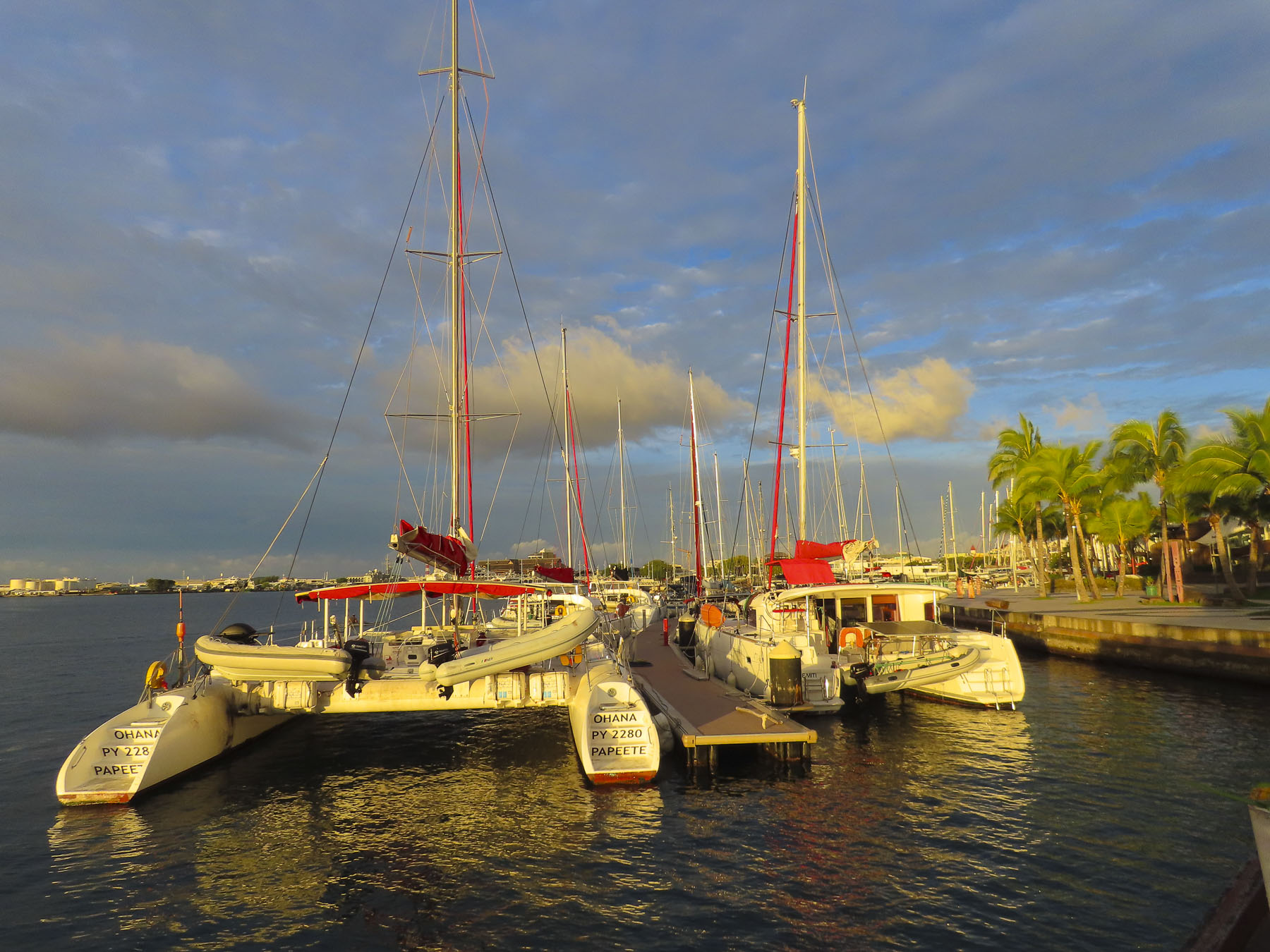
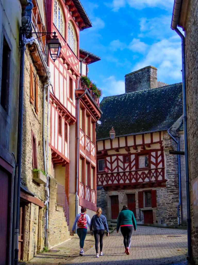
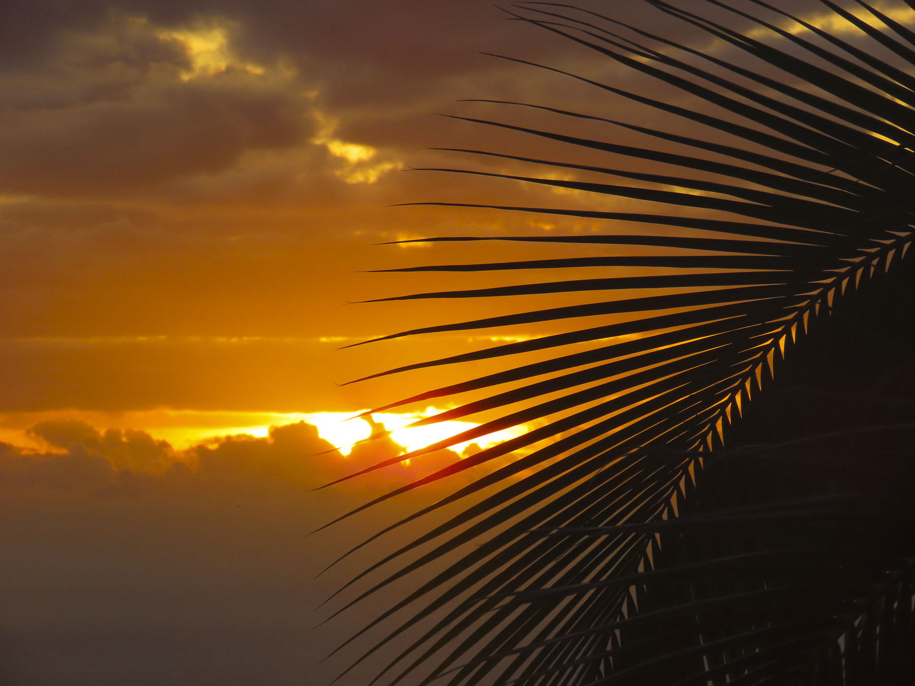
I teeter-tottered to the bow and gently landed on my back into a lounge chair, like a turtle out of water, my hands and feet waving in the air. My unbalanced ballet was appreciated with oohs, aahs and the friendly chuckles of our congenial shipmates from Poland, Germany, France, Spain, England, Australia, New Zealand, and the United States. We’d just left Papeete’s Nanuu Bay and had entered the gentle swells of the Pacific Ocean, and my sea legs were not accustomed to the ocean’s rhythms yet. The captain had just unfurled the sails of Variety Cruises’ MS Panorama II, a beautiful, 24 cabin, 160ft motorsailer, for a sailing adventure through the Society Islands of French Polynesia to Bora Bora. Our first stop was Moorea.

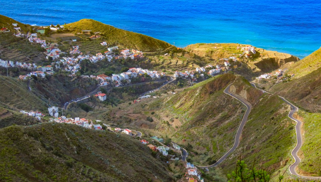
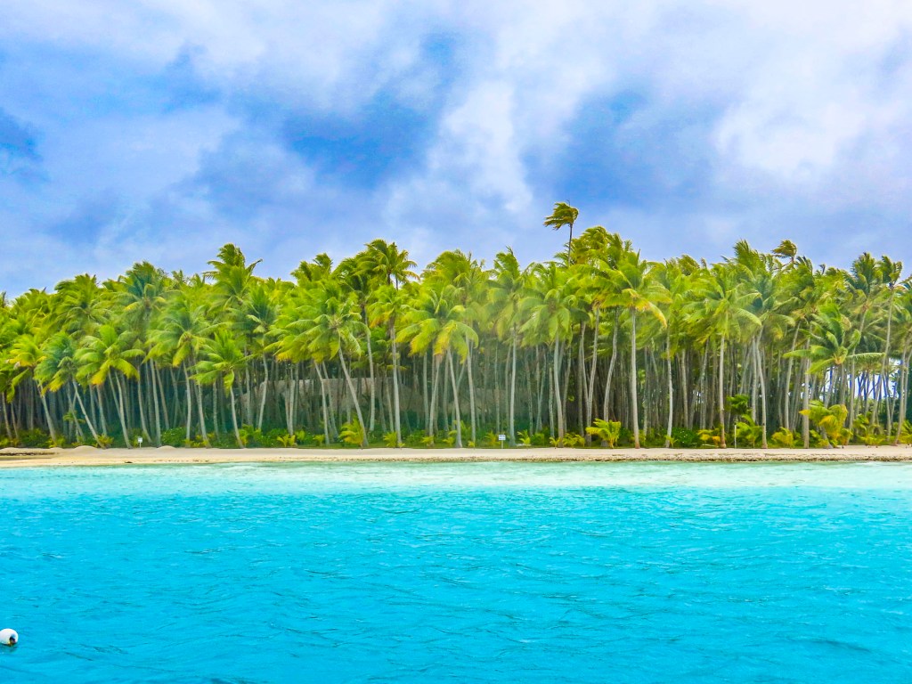
The shoreline of ‘Ōpūnohu Bay hasn’t changed much since the cry “land ho!” came down from the crow’s nest of the HMS Resolution during Captain Cook’s third and final voyage around the Pacific, in 1777. Remarkably, there are not any multi-story massive hotels disrupting the serene beauty of the bay, only the verdant flora rising steeply into the jagged mountains which surround the bay. The only hint of modernization, a few small cottages, barely visible through the palm trees, were sporadically placed along the shore, and an inflatable Zodiac which raced by.

Cook wasn’t the first European to arrive in the Islands. In 1521, Ferdinand Magellan sailed through, and was probably advised by the Inquisition Officer aboard not to land, fearing that witnessing a hip-shaking Ote’a dance would condemn the sailors to years of purgatory, and so they sailed on. Two hundred forty-seven years later the French Captain, Louis Antoine de Bougainville arrived and viewed the islands as “a paradise found on earth.” Wanting to name the islands after the legendary birthplace of the mythical Greek goddess of love, Aphrodite, he called it ‘La Nouvelle Cythere.’ So began the myth of paradise found on earth.


Anchored in the calm waters of the bay, the swimming ladder was lowered for a short while before dinner, and we enjoyed the warm water. So blue and clear, the polar opposite of the murky grey waters of the North Atlantic off New England, which we were used to. Before dinner the captain introduced us to the crew, assembled from Greece, Bali, the Philippines, and Tahiti. After a week together we appreciated their cohesive professionalism and amiable nature. Dinner was always a sumptuous affair, under the canvas canopy of the upper stern deck, that was usually timed to coincide with the sunset. We especially enjoyed the locally caught Mahi Mahi and various tropical fruits that were delicious. Ubiquitous on Tahiti, French baguettes were even served daily and in a nod to the Greek crew, an excellent feta cheese, imported from Athens, was available for the salads.
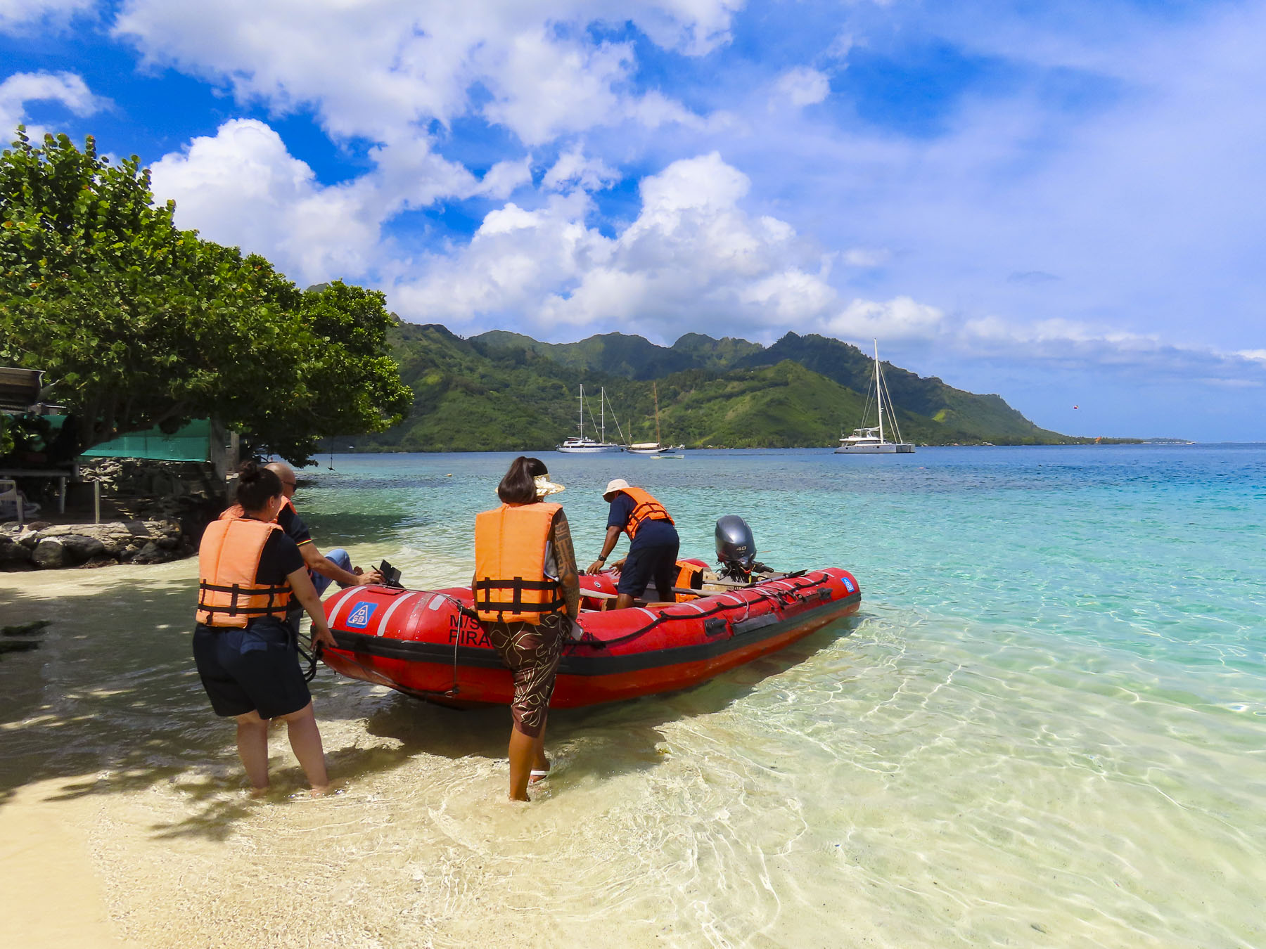

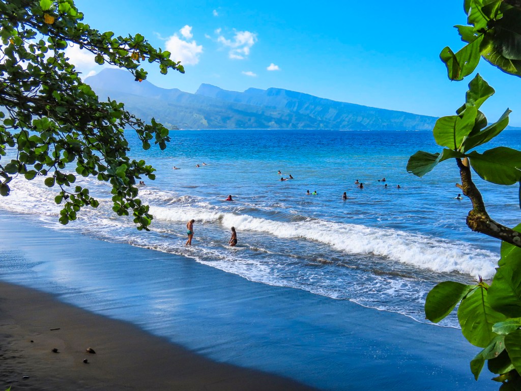
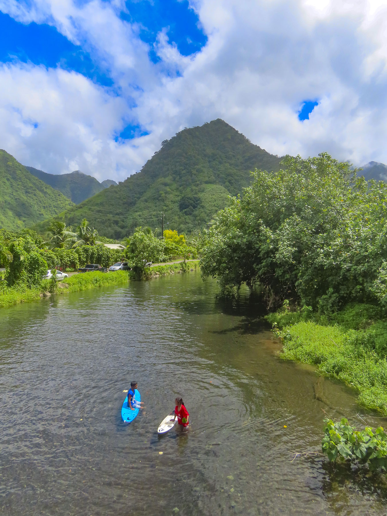
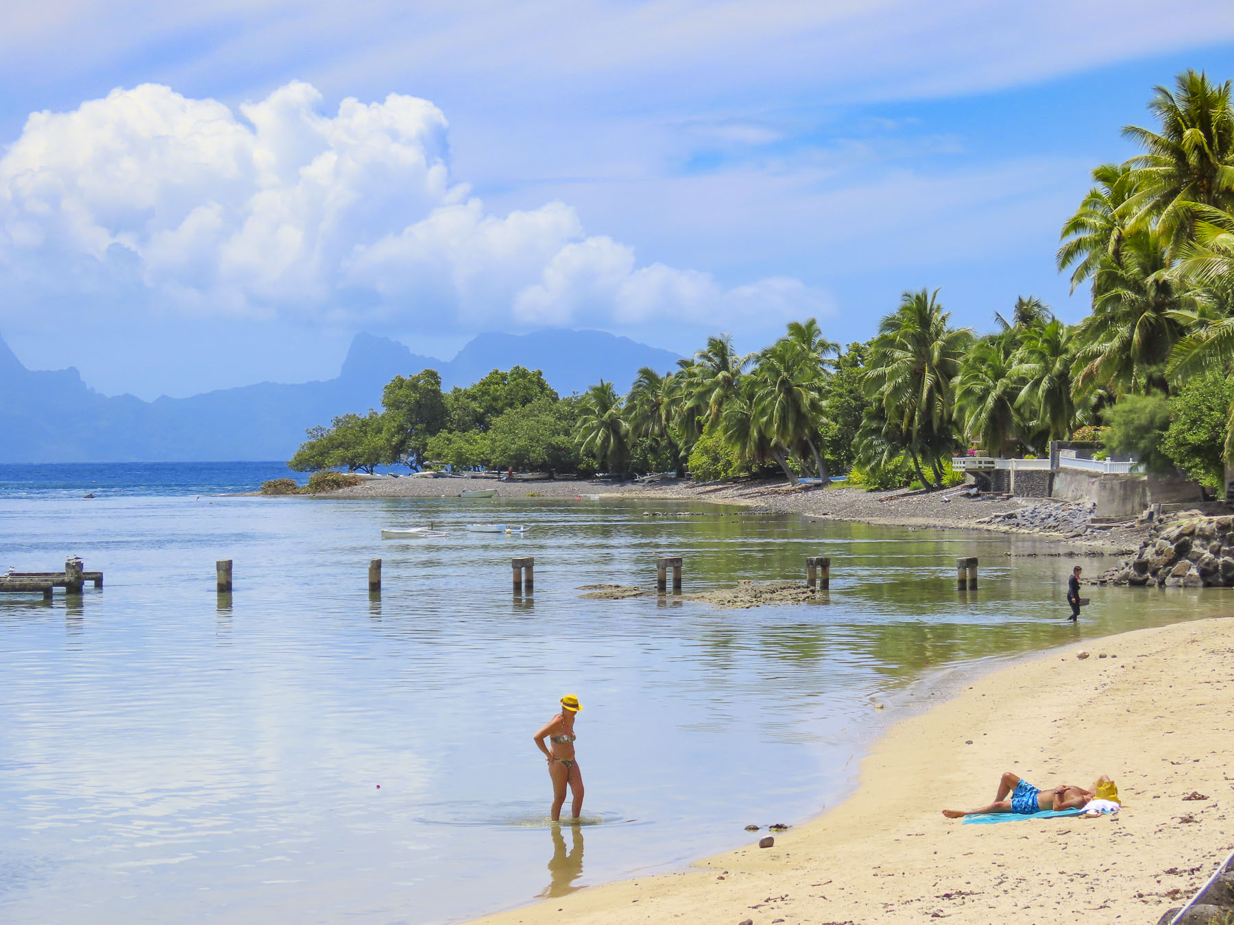
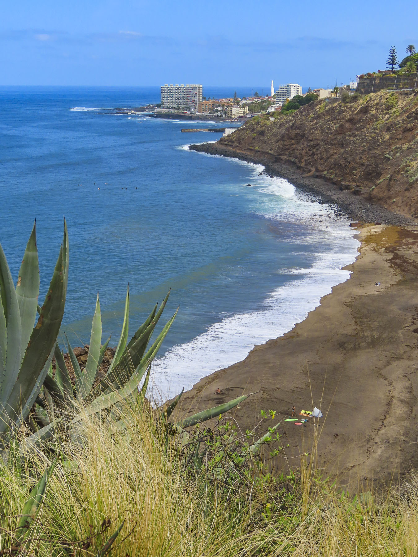
The next morning, we packed our dry sacks in preparation for a wet landing, using the ship’s small Zodiac to beach us at Ta’ahiamanu Beach. The clarity of the water was amazing, and the white sandy beach sparkled, as gentle ripples washed ashore. The bay is a natural harbor, with a passage through the island’s encircling reef wide enough for large cruise ships to sail through. Yet the reef is substantial enough to absorb the energy of the Pacific Ocean’s relentless pounding against it, leaving the small waves that reached the beach barely noticeable. We had time to amble along the beach until the groups separated into various tours.

Six of us climbed into the bed of a Toyota 4×4 pickup truck, outfitted with bench seats and a canvas awning, in case of rain, for a tour of the island. The cool rush of air felt good in the day’s already building humidity, as we drove along the coast. It was a little unusual considering it was well before noon, but our first stop was at Manutea TahitiRotui Juice Factory & Manutea Distillery for a tasting. We are not big fruit juice fans, but the Rotui juices – Papaya Passion, Mango, Banana Vanilla, Pineapple, and their various blends, all organic, were delicious. The aged rums are created from distilled O’Tahiti sugar cane, a flavor heirloom variety that thrives in the volcanic soil of the Polynesia islands. Captains Cook and Bligh brought this variety to the sugar plantations of the English colonies in the Caribbean. For nearly a century afterwards the O’Tahiti sugar cane variety was the most widely cultivated in the world. Saluting the old adage, “the sun is over the yardarm somewhere,” we enjoyed our daily ration of rum, and even purchased a bottle of Coconut flavored rum to take home. Cheers!
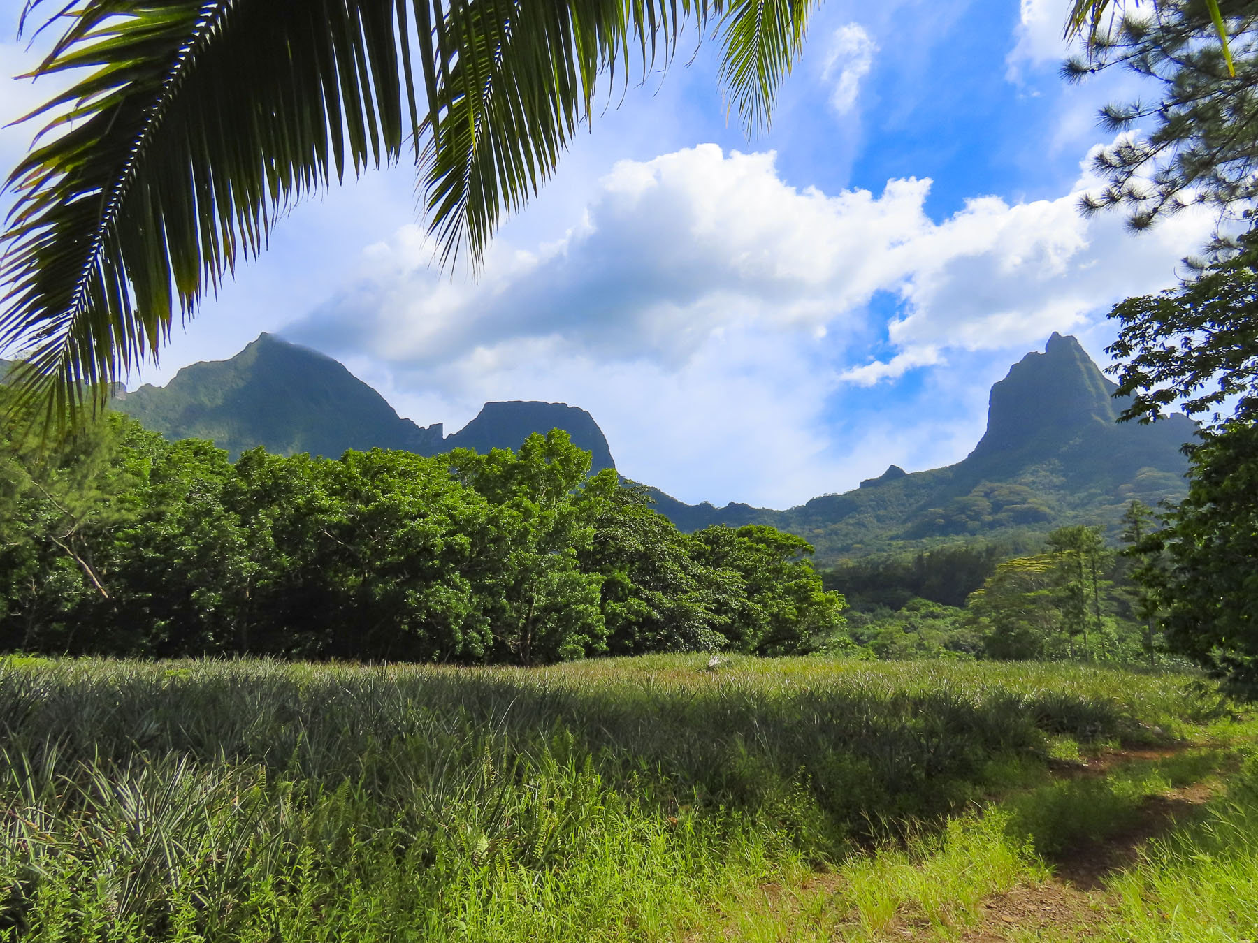
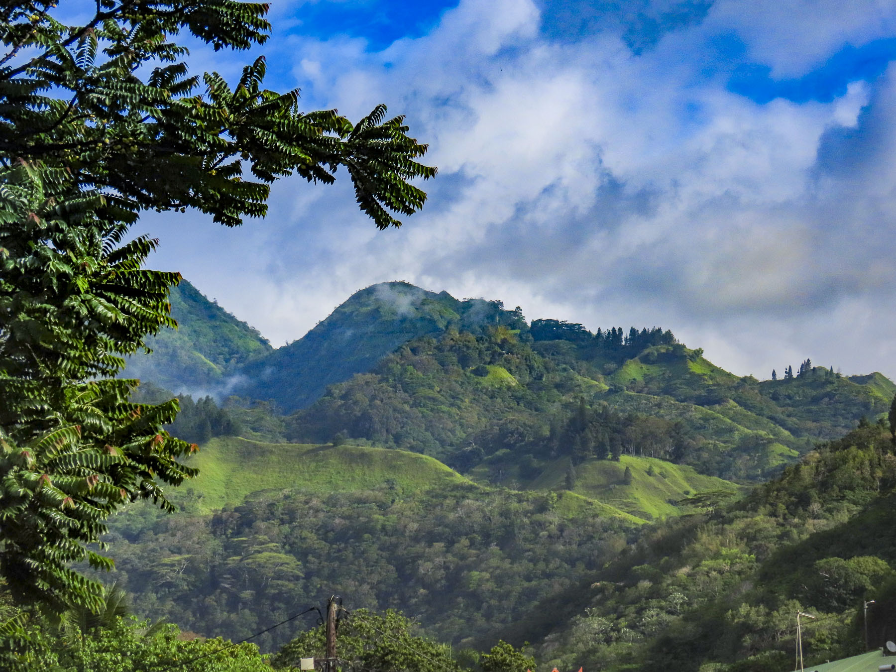
Our tour continued into the center of the island where the fertile ‘Ōpūnohu Valley is surrounded by a crown of four rugged peaks, created from the collapsed cone of an ancient volcanic eruption. Mount Tohiea, at 3959 ft, is the highest peak on Moorea. It’s followed by Mt Rotui, at 2,949 ft, and Mounts Mouaputa & Maturaorao, at 2724 and 2700 feet. Of the four, only Mount Rotui is hikeable.
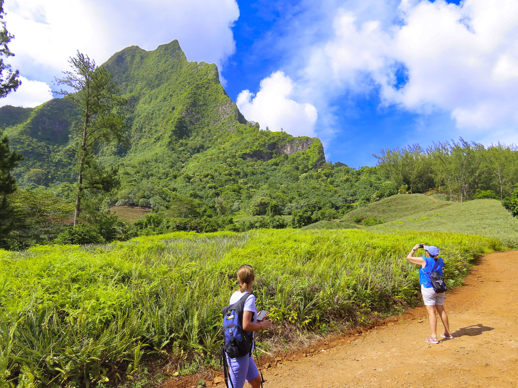
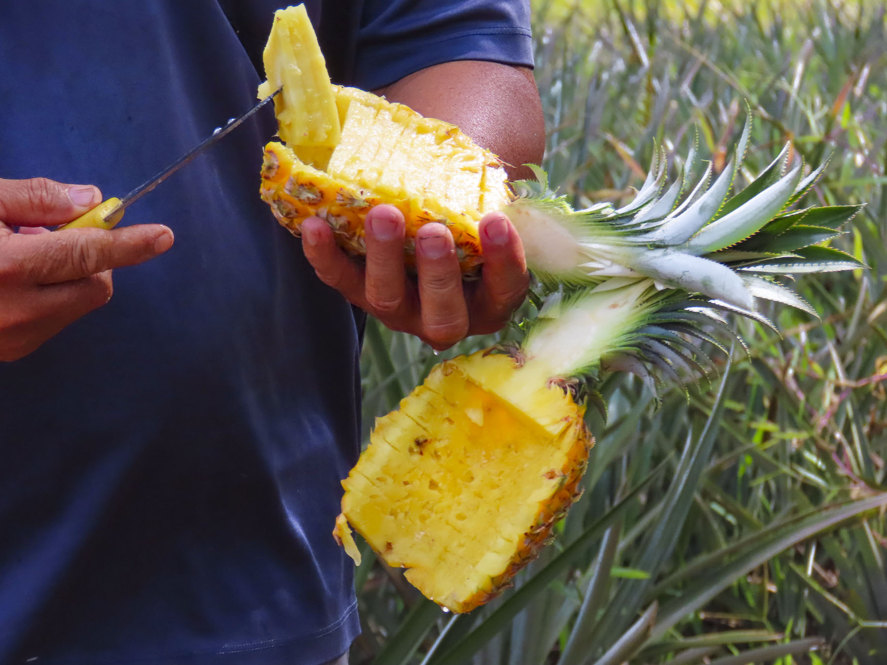
Driving along a dirt track through rolling acres of pineapples and sugar cane, our guide stopped and with a small machete cut a fresh pineapple from the field and deftly sliced it, without getting any juice on himself. He explained that Queen Tahiti pineapples thrive in the volcanic soil here, though smaller than the famous Dole pineapples grown on Hawaii, which are good for canning. Queen Tahiti pineapples are sweeter, have a smaller tender core, and are better eaten fresh.

Tahitian myths and gods are associated with mountains throughout Polynesia. Though Mouaputa is not the island’s tallest mountain, its shear pinnacle shape with a hole through its summit, like the eye of a needle, spectacularly sets it apart from the others. Passed down through generations for more than a millennium, Tahitian’s oral lore tells a story about Hiro, the god of thieves, and his cohorts, who rowed a large war canoe across the ocean from Raiatea one night and tried to steal sacred Mount Rotui, where it was believed the souls of the dead begin their journey to heaven. Seeing this thievery from Tataa hill on Tahiti, the famous warrior, Pai, a demi-god, threw a magic spear crafted from hibiscus wood across the 11 miles of ocean separating the islands, in order to stop them. Missing its target, the spear punched a hole straight through Mount Mouaputa with such an enormous bang it woke all the roosters on the island. Fearing the whole island would awaken from the rooster’s cacophony of crowing, and discover their treachery, the thieves fled emptyhanded.


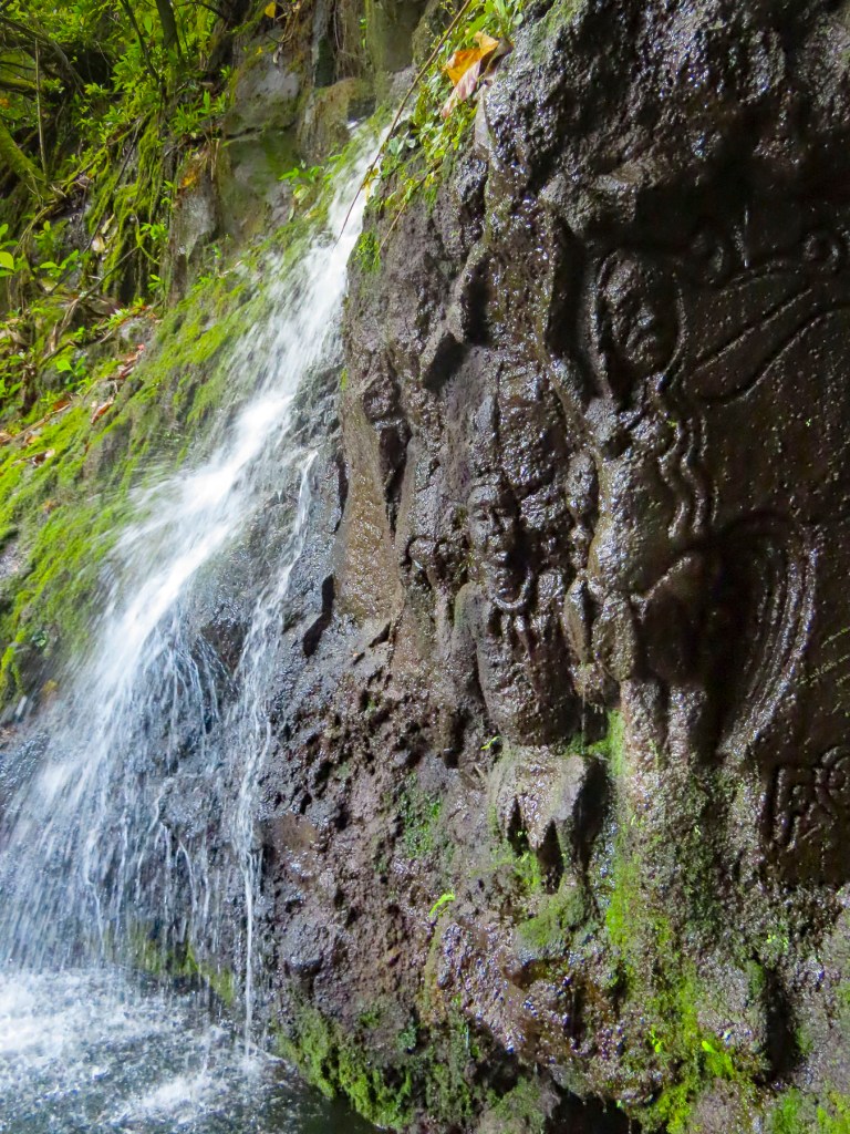
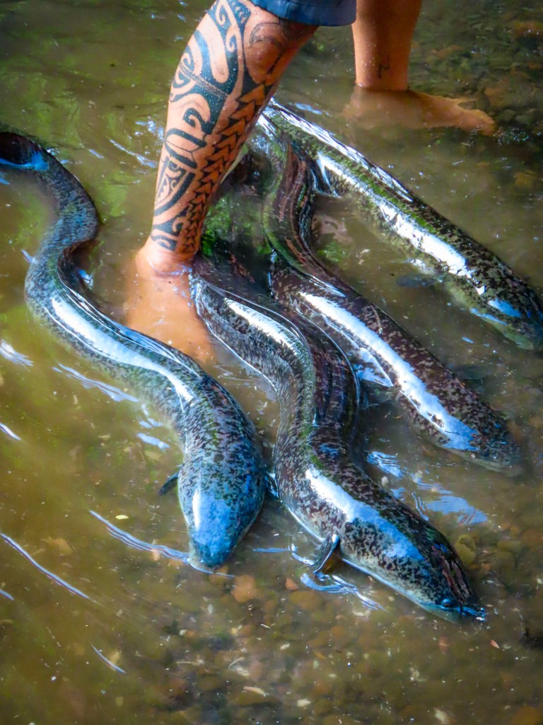
Later we pulled down a shady lane and stopped at a narrow, fresh-water stream, where we followed our guide into the shallow, barely ankle deep water. We had stopped to see the sacred blue-eyed eels of Moorea. The surface of the water was very still, with barely a ripple, until our guide ceremoniously reached into his rucksack and withdrew a magic can of mackerel to chum the water. Suddenly the water around our group erupted with a dozen or more 4-6 feet long eels racing toward us from all directions! They squirmed and splashed in a frenzy around us, fighting for pieces of mackerel. Tahitian legend believes the eels are the reincarnation of the God Hiro, who after his death assumed the shape of an eel and took on the responsibility of keeping the island’s freshwater streams and springs clean. The eels are a protected species across Tahiti, and are also believed to possess healing powers that can cure disease and bring good fortune to anyone who touches them.
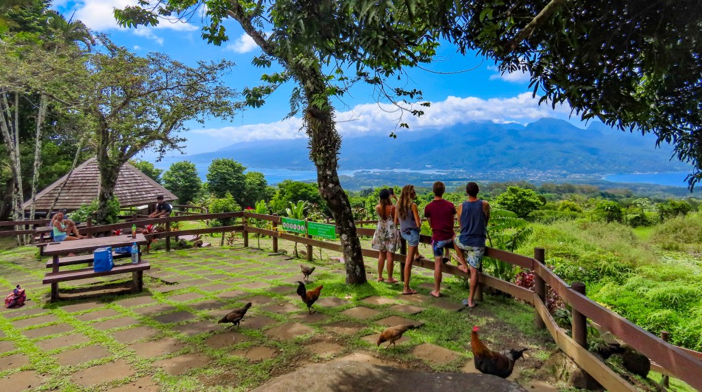
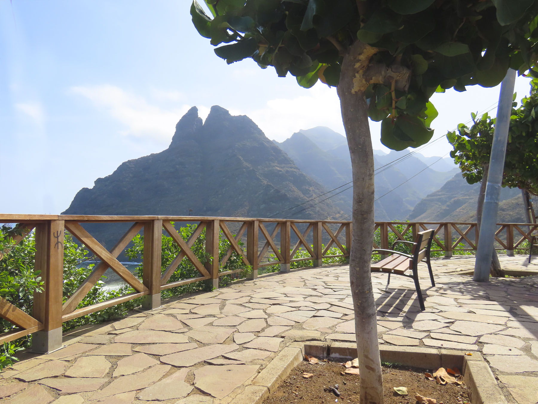
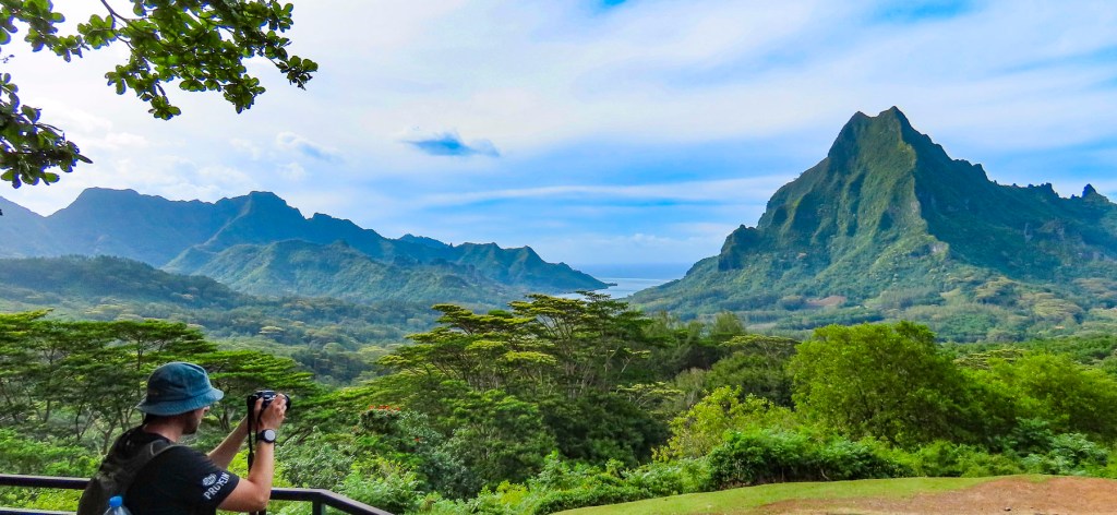
Reaching the Belvedere Lookout, we were rewarded with a pristine panoramic view, without any hint of mankind in the landscape, centered by Mount Rotui, and flanked by ‘Ōpūnohu Bay on the left and Cook’s Bay on the right. Afterwards we stopped a short distance away at Marae Ti’i-rua and Marae-o-Mahine, where tiered open-air platforms had been constructed with rounded lava stones, and used for religious ceremonies and sacrifices. During Captain Cook’s third and final visit to Tahiti in 1777, he along with several other officers from the HMS Resolution witnessed a human sacrifice held on Moorea to ensure the success of a war party against a neighboring island.
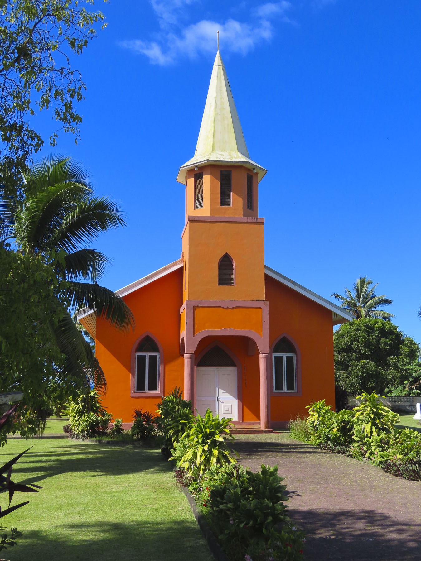
Tahitians are practical and for centuries the lava outcropping behind the village of Papetō’ai, near the reef on the edge of ‘Ōpūnohu Bay, was simply called the “hill behind Papetō’ai.” Its name change probably happened in the 1960s after the opening of the Tahiti International Airport and a marketing executive was tasked with drawing tourists to islands. I can just imagine the conversation, “Listen folks, who wants to fly across the Pacific, or sail around the islands to visit a hill? Now Magic Mountain, that creates an impact!” Signed, sealed, and delivered. The rutted road up was very steep and the six of us bounced and swayed quite a bit in the back of the 4×4 and when we stopped, we still had to walk up a rough zig-zag trail to the summit. But it was well worth the effort for tremendous views of the mountains, reef, and bay, with the Panorama II tranquilly anchored below us. Our guide pointed out an octagonally shaped red roof at the water’s edge in Papetō’ai. “That’s a church, the Église protestante de Saint Michel, the first western structure built in the South Pacific. It was built by Protestant missionaries from the London Mission Society in 1827 atop the ancient Marae Taputapuatea, which was dedicated to Oro, the Tahitian god of war.”


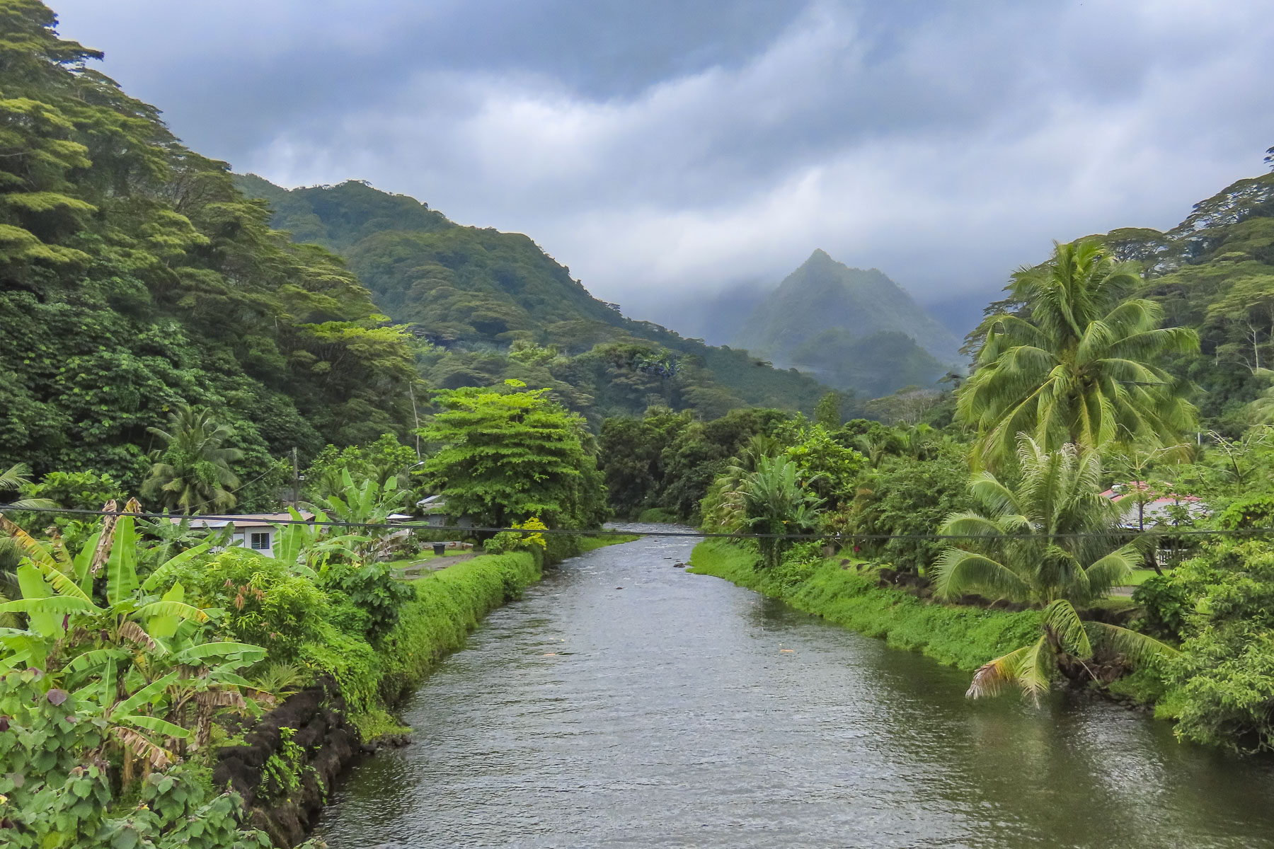
After dinner, we pulled anchor and sailed through the night to Huahine, and tied to the quay in Tahateao just as the sun was breaking the horizon, We shared the dock with an inter-island ferry readying to get underway. The quiet unpretentious street harkened back to a different bygone era. Huahhine is actually two islands, Huahine Nui and Huahine Iti, connected by a short bridge. Legend believes that the Tahitian troublemaker Hiro sliced the island in half when he paddled his canoe through it.

Women are revered on the island, and islanders attribute the land’s fertility to the mountain silhouette that looks like a pregnant woman lying on her back. Huahine meaning, “woman’s womb.” There is a long history of Queens ruling Huahine, and they are credited with a sacred power and wisdom, often counseling their warrior chiefs to make love not war, especially as the British Navy began to explore the islands of Tahiti.


We joined a tour heading to see the marae that line the shore of Lake Fa’una Nui, a shallow saltwater bay. Our guide explained to us that there are over 200 ancient stone ceremonial sites, of various sizes, around the lake, which were central to the community’s religious life. There are more hidden on the forested and jungled hillsides of the island’s mountains, some dating to the arrival of the first Polynesians around 700 AD. After the marae are discovered and if the sites are not maintained, the jungle grows quickly over them again. This is the reason the island is commonly called, ‘the Garden or Secret Island.”


Farther along we stopped at the bridge over the saltwater estuary that feeds Lake Fa’una Nui to view the ancient V shaped stone fish traps that are still used communally. A sandy road led us to the Marae Manunu, a very substantial stone platform that stood taller than us. It was quite different from the earlier ones we viewed, which were low to the ground, like patios. It was along the road here that we noticed gravestones in front of houses; it is a Polynesian custom to bury your deceased family members close to home, often in the front yard. There is usually more than one grave. It’s a custom that stems from the ancient belief that the spirits of your dead relatives will protect the family home from evil spirits. The mountains of Huahine aren’t as dramatic as on Moorea, but the vista from the Maroe Bay Viewpoint out over a verdant jungle, and the azure waters of the bay with Mont Pohu Rahi, on Huahine Iti behind it, was sublime.

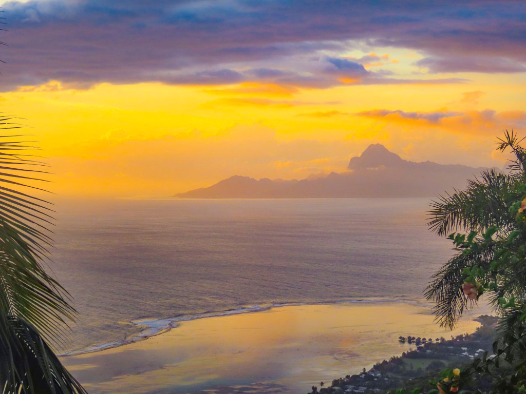
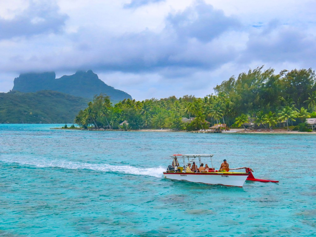
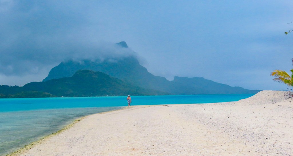
We’re all familiar with those epic aerial photographs of Bora Bora, a volcanic atoll, with Mount Otemanu rising from its center, like a spear thrust up through the crust of the earth, ringed with white surf, and surrounded by an artist’s inviting palette of blues. It’s an expensive perspective you’ll only get if you fly into the island, but sailing through the reef is truer to the Polynesian way of life – smelling the air, tasting the salt spray blown up from the bow of ship lunging forward through the waves, feeling the wind on your face, and listening to the surf crash against the reef. For us it was a rewarding tactile journey. We had crossed the waves and arrived.
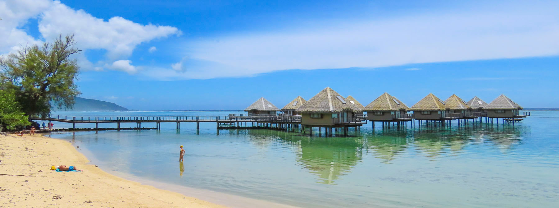
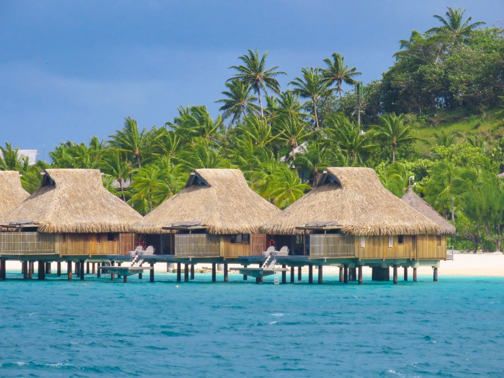
Bora Bora has been a romantic destination since the publication of James Michener’s Tales of the South Pacific, a collection of related anecdotes garnered from his time in the South Pacific during WWII, and which was awarded a Pulitzer Prize. Later the book was brought to the stage as a Broadway musical by the playwrights Rodgers and Hammerstein. South Pacific the movie premiered in 1958. Resorts with thatched roofed overwater bungalows, a new concept in the 1960s, followed. Tahiti was suddenly an exotic honeymoon destination with bragging rights, and the island still retains its allure.
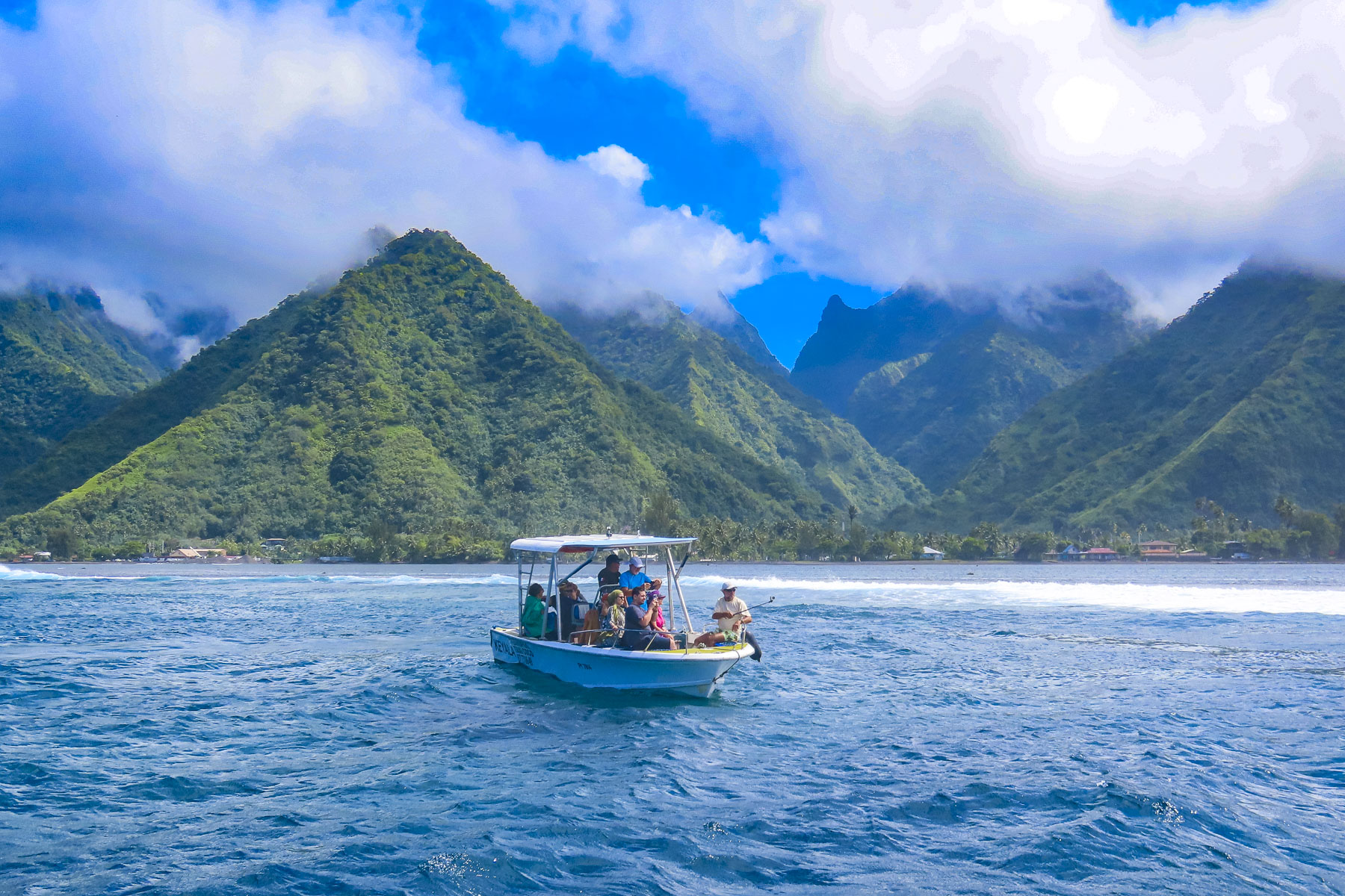
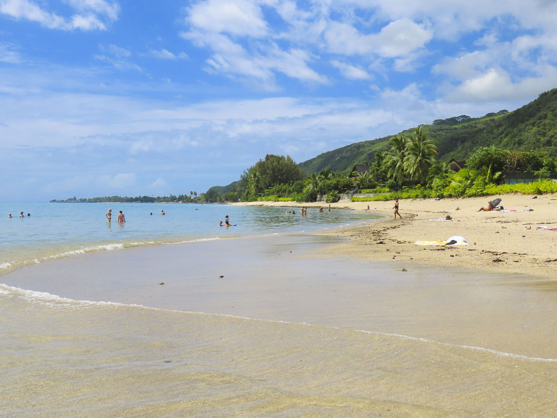
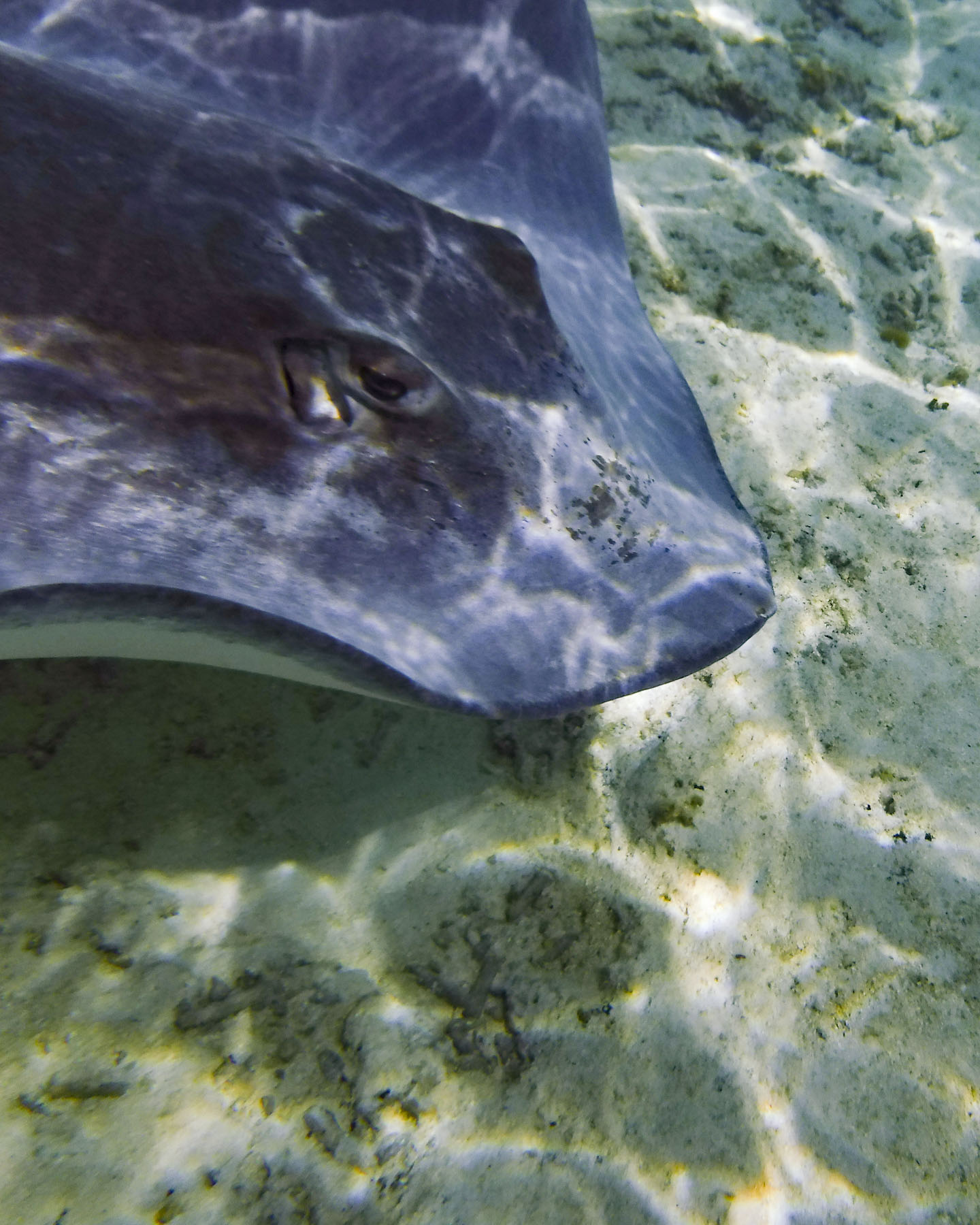
With two days scheduled in Bora Bora, it was time to get our feet wet again and we signed up for a snorkeling excursion. The tour group boarded a motorized catamaran which made 4 stops as we circumnavigated the lagoon, known for its concentration of marine life. Our first stop was to see sting rays and black tip reef sharks.

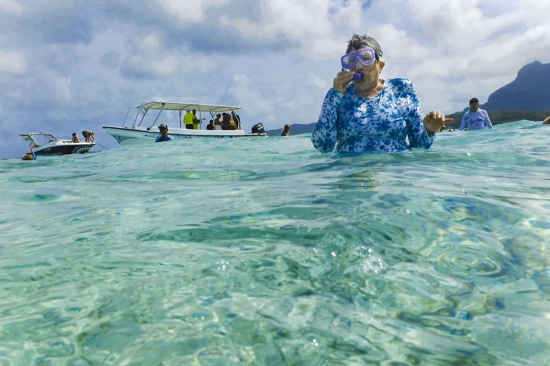
The 80°F/27°C water was perfect for snorkeling without a wetsuit, and the clarity of the water was amazing, making it easy to attempt some underwater photography. I have a new respect for the photographers that document marine life – it’s not easy. Pulling anchor, we motored along the shoreline, the captain calling out the name of the resorts and any celebrities that might have vacationed there. The underwater coral garden just off the beautiful palmed lined shore of Pitiuu Uta, a small islet or motu, had us imagining a Robinson Crusoe adventure and Tom Hank’s character in Castaway, though we didn’t spot any wayward volleyballs floating along.

The water was deeper here and the naturalist who accompanied us warned us not to stand on the endangered coral. Even as our party tried hard to avoid contact with the reefs, the currents made it difficult, and Donna and another person discovered the hard way that coral is sharp! It was a great spot for a variety of fish, and we enjoyed finding giant clams embedded into the reef. The colorful lips of their shells were the only clue to their presence. It was easy to appreciate the beauty of Bora Bora as we motored along.


Off the Tā’ihi Point we stopped to snorkel with large manta rays which swam close to shore, and appreciated the joy and enthusiasm of four black dogs that frolicked through the surf to join us. They swam safely back to shore as we departed.


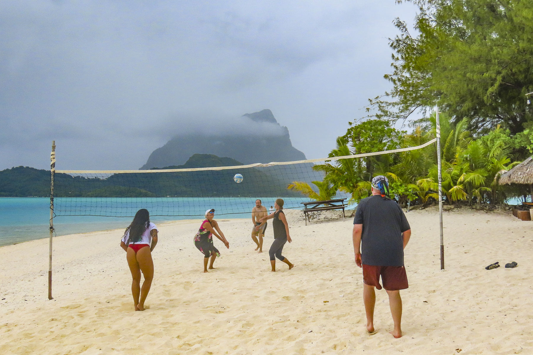
Beaching at a motu, we enjoyed refreshments and snacks. Some of us joined an impromptu game of volleyball, as others relaxed in the water or walked along the beach to savor the view of Mount Otemanu.
The next day we continued with an outrigger taxi ride along the lagoon’s waterfront before wandering around the small village of Vaitape. Remarkably, Bora Bora is not overrun with a intensely developed tourist infrastructure. The resorts with overwater bungalows are barely visible from the mainland. And a walk along the main road through Vaitape revealed a town that has kept its laid-back identity, hosting stores geared for the islanders. There are not any international fast-food joints or coffee shops, though there are several art galleries and a pearl shop. Fishermen still display their daily catch along the roadside along with farmers selling fruits and vegetables. There are several small grocery stores in town as well.


Walking back to our ship along the quay, we noticed a memorial to the U.S. Navy Seabees who arrived on the island in February 1942 after sailing from Charleston, South Carolina. The 150 men were tasked to build a fuel depot and airfield. It was the first of many naval air patrol bases built on various islands across the South Pacific to keep communication channels open with our allies during WWII. Later they built roads around the island to strategic points for the placement of naval artillery batteries to defend the island. And they brought electricty to the island for the first time. After the war the airfield they built was passed to civil authorities and it became Bora Bora’s Motu Mute Airport which accepted international flights from Los Angles through Hawaii, before Papeete’s airport was constructed. The Seabee memorial resonated with Donna, remembering her dad’s stories from WWII, when he was a young, 18 year old sailor on a fuel-tanker making frequent stops to this enchanting paradise.


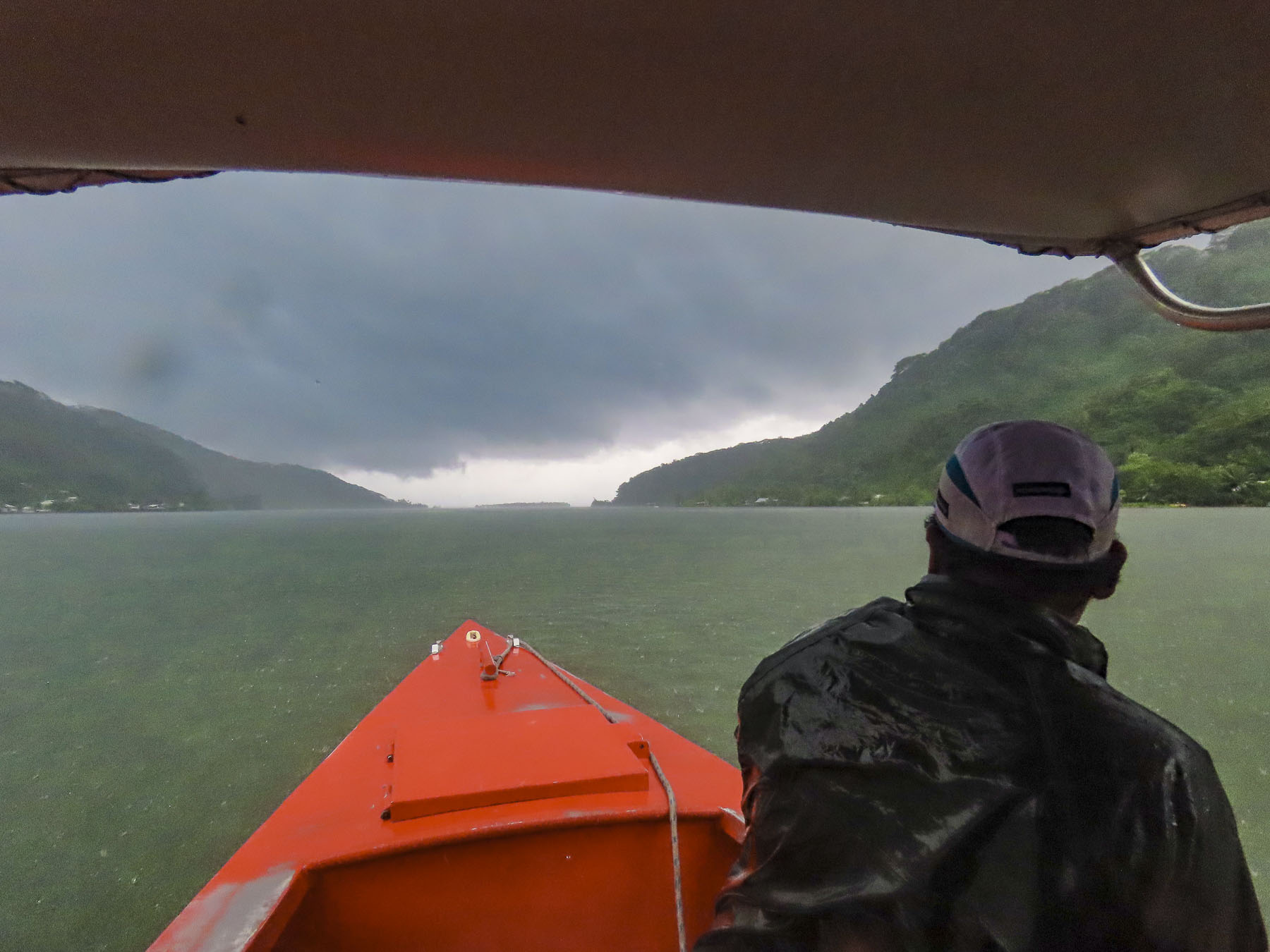
By the end of the day the weather had turned and our overnight passage to Taha’a across a tempestuous sea was the roughest of our cruise. If you expect verdant jungle in paradise, you need to accept some rainy days. Unfortunately, the weather didn’t break, and we stayed onboard all-day watching movies, playing board games, and reading.

Overcast skies followed us to Raiatea, but we kept our plans with several other passengers and toured along the coast in an outrigger canoe to the Faaroa River, which flows from the mountainous interior of the island. Our hope for the day brightened as the sky cleared and brilliant colors returned to the landscape. It lasted only a brief time until we were deluged with rain. The Faaroa is referred to as the only navigable river in Polynesia, but during our visit the river narrowed as it travelled through the jungle and was blocked by a fallen tree. It would be perfect for exploring with a kayak.

Afterwards our guide explained as our outrigger headed towards the Marae Taputapuatea archeological site that Raiatea, meaning “faraway heaven,” is believed to be the homeland, Hawaiki, in Polynesian legend, and the island from which the colonization of the South Pacific began around 500AD. Polynesians wayfarers sailed across the great expanse of ocean, using their seafaring knowledge of the stars, wind and waves to reach Hawaii, 2500 miles away to the North, and eventually reaching New Zealand 2400 miles to the south, and Easter Island 2800 miles east – the area referred to as the Polynesian triangle. These were amazing weeks-long voyages in double-hulled, sailing canoes, with folks aboard exposed to the weather.
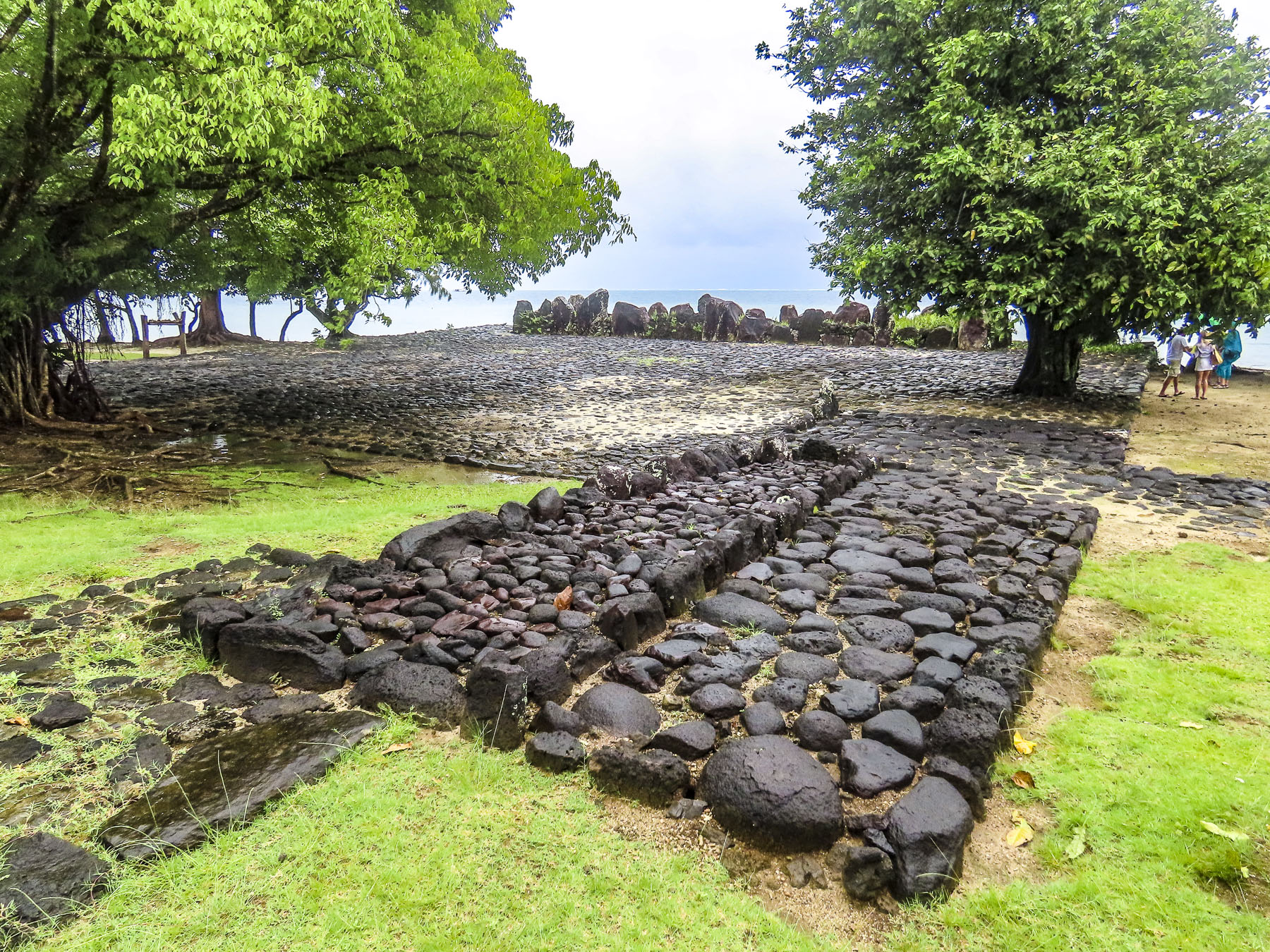

The Marae Taputapuatea was not only a religious ceremonial site, but also a place where the knowledge of the sea was passed down from generation to generation. The bravery of these wayfarers was immense, but they followed a belief that “under a chosen star there is a land that that will provide us with a new home.”

The last evening of the cruise, the sky cleared, and our cruise director, a vivacious Tahitian woman, arranged for a local ukulele trio to come aboard and entertain us on the top deck, as she and a crew member demonstrated the three different styles of ‘Ori Tahiti, the Polynesian dances, once banned by the first missionaries that arrived to the islands, from which Hawaiian hula evolved. Between songs she explained the characteristics of the types of dance: the slow, graceful motions of Aparima, which mixes hand and body movement to tell a story in a kind of elaborate pantomime; the lively Ote’a, similar to Hula, and danced to drumming; and Hivinau, a group dance performed as a communal celebration in a group circle with singing and clapping.
It was a wonderful evening of shared camaraderie. Our adventure complete, and the night darkened; the stars we’d follow back to Papeete, and eventually home, sparkled above us.
Till next time, Craig & Donna