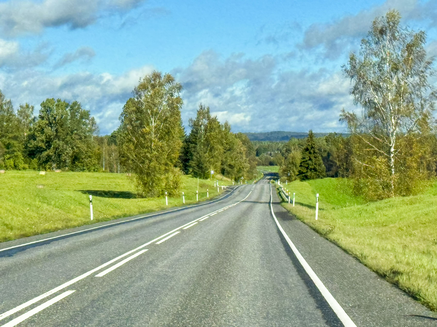
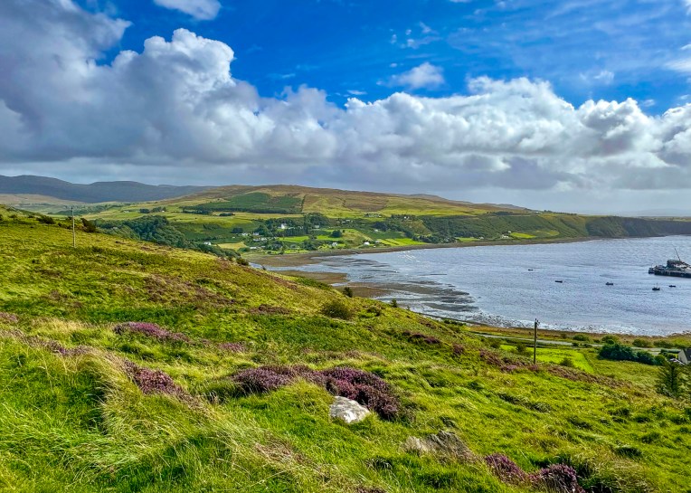
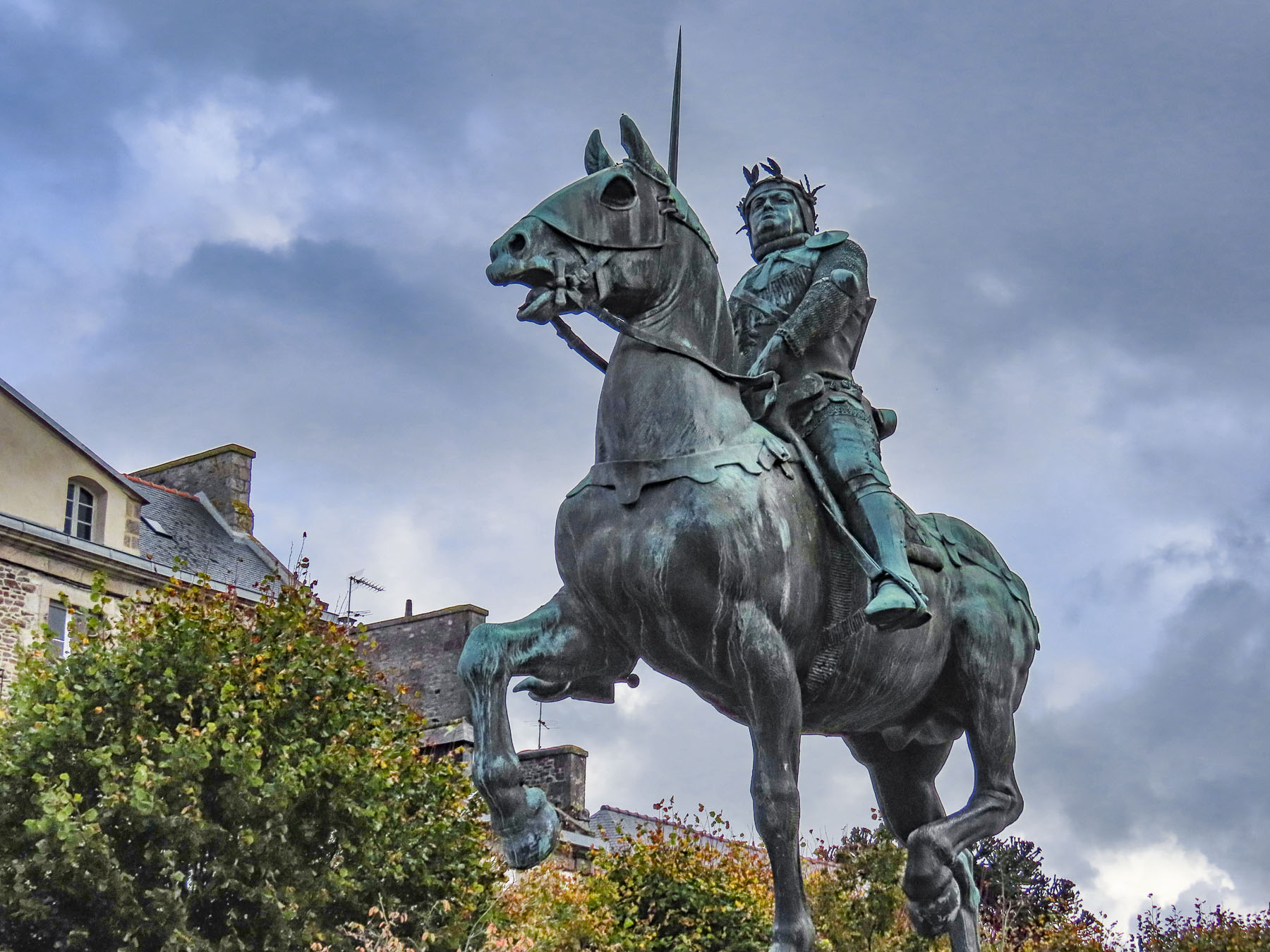
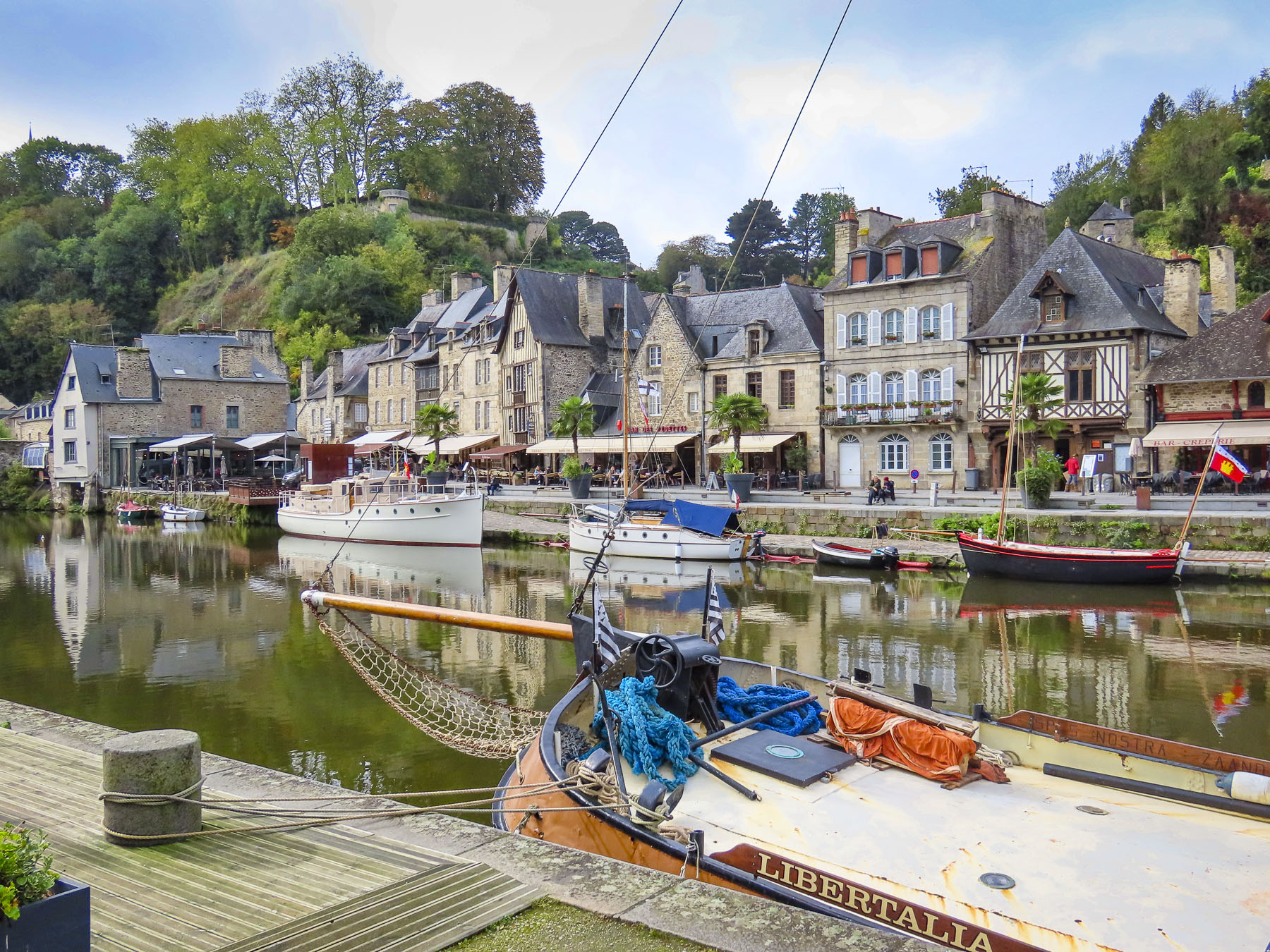
Gently undulating farmlands soon flanked the road as we departed Tartu for a day trip to the Old Believers villages that dot the southern shoreline of Lake Peipus, Estonia’s largest lake which creates part of the country’s border with Russia. The villages are also part of the Onion Route, a 30km (19mi) tourist drive that promotes the area’s culture and “Estonia’s most celebrated onions, the Peipsi sibul, a golden variety known for their long storage life and flavor,” which the Old Believers have cultivated in the sandy soil of the region for several centuries.
The group’s name stems from a schism with the Russian Orthodox Church in the 17th century, in which they did not abide with the reforms Orthodox clergy patriarchates were initiating, and wow, wow, wow regarded the reforms which curled the beards of its elders, “as a corruption of their faith which was heralding the End of Days, and as such the Russian church and state were servants of the Antichrist.” Their dissent wasn’t allowed, and during The Russian Orthodox Synod of 1666-1667 the church and Tsar Alexis sanctioned their persecution. The group’s oppression was so severe that some ardent followers self-immolated in the ultimate act of protest. Thousands of Old Believers chose to escape their persecution and fled across Lake Peipus for refuge, and established a series of farming and fishing communities, in then Swedish-controlled Estonia, in which they prided themselves on their self-sufficiency.
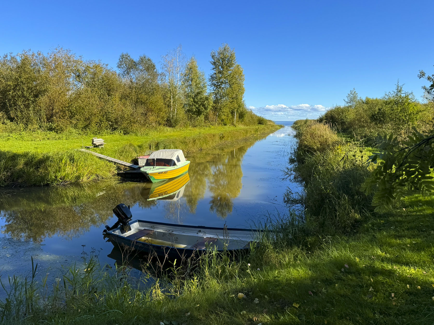
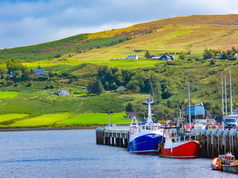
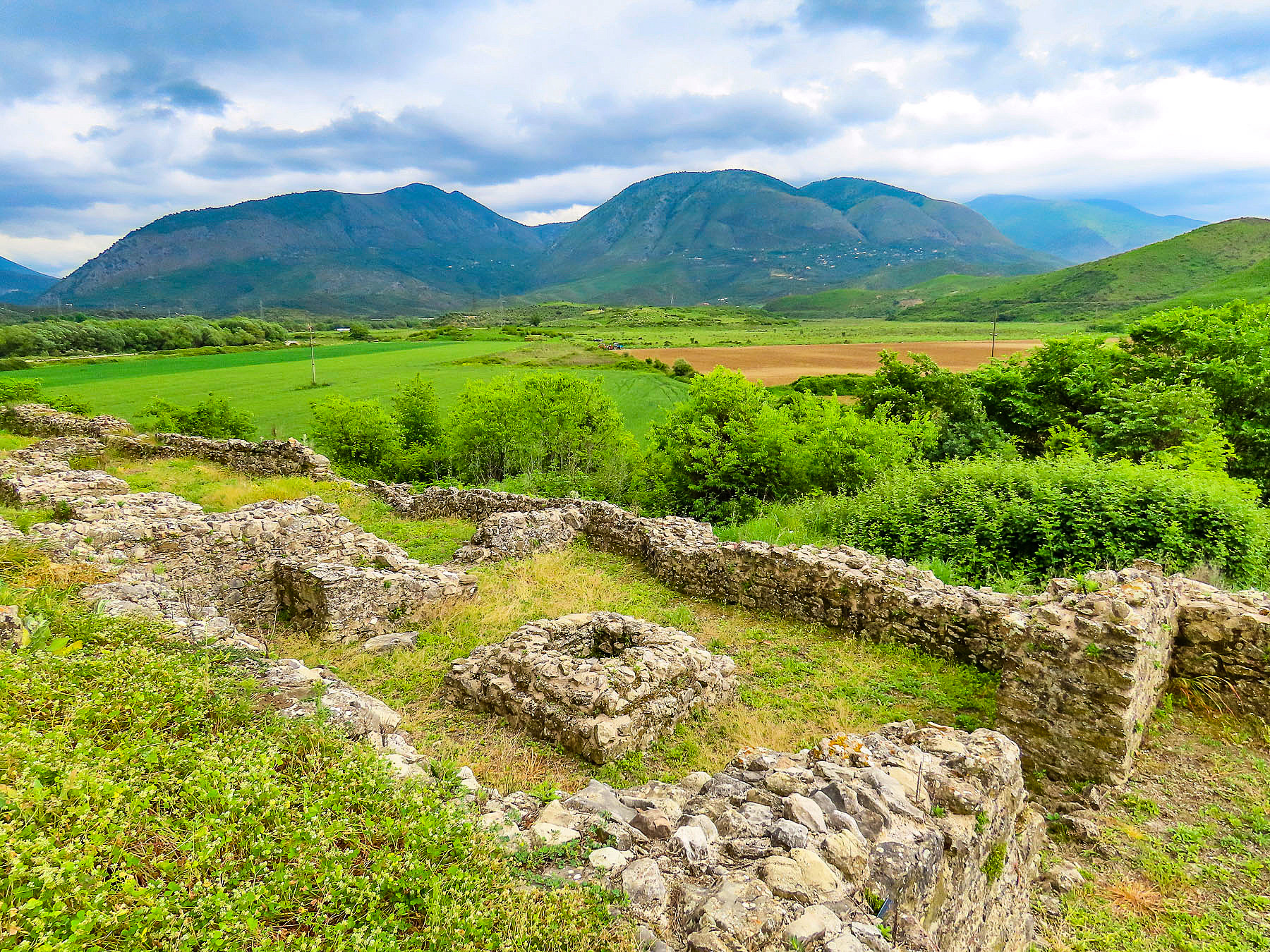
We passed more farm tractors than cars that morning, but it was still a surprise when a large John Deere tractor pulled up alongside us in the gas station to refuel. Varnja is the southernmost village and the gateway to outdoor activities in the Peipsiveere Nature Reserve, which protects the fish and wildlife of the Emajõgi delta.
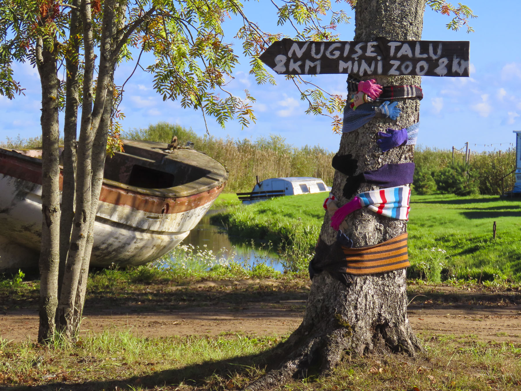
It’s a beautiful area, and was nearly deserted mid-week at the beginning of October. Fishing was once a viable livelihood, but only a few boats go out nowadays. Instead, some folks have converted them into niche rentals, like the owners of Mesi Tarewho have creatively repurposed several small boats into maritime bungalows, both floating and permanently beached.
There wasn’t a soul about in the village, only an idle tractor in front of a barn with bundles of onions hanging from its rafters, or a plume of smoke from a chimney, and the lone dog sunning obliviously in the middle of the lane. Winter preparations were underway with large free-standing globe shaped piles of freshly split wood stacked along the lane or piled in cords neatly along the sides of houses.
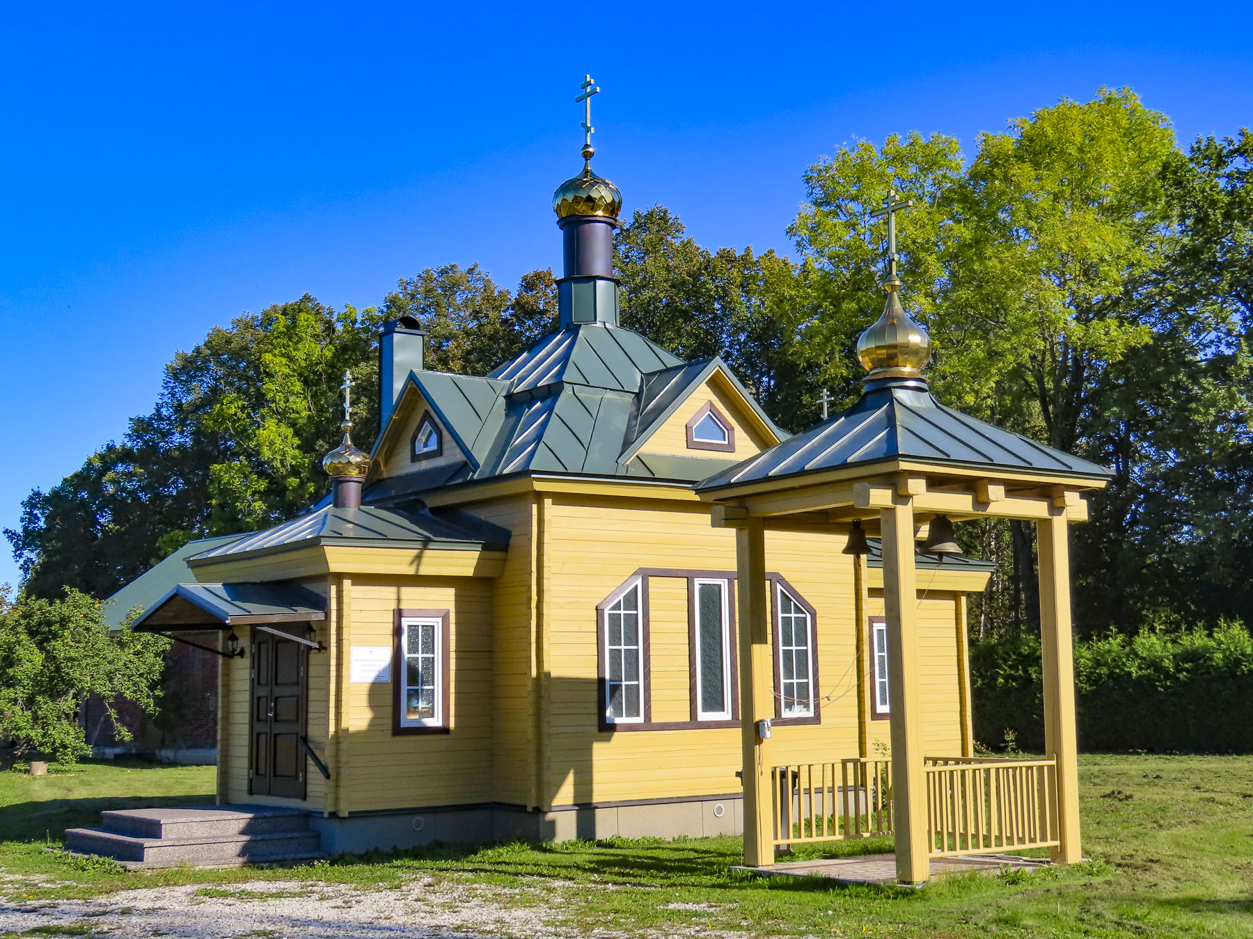
As we left the hamlet and headed north on Kesk Tn, the main road connecting all the settlements along the lake, we stopped at Varnja’s Old Believers Prayer House, a red brick structure built between 1928 and 1930, and the nearby Issanda Templisseviimise, the town’s youngest Old Believers chapel constructed in 2015.
As we headed farther north, long narrow inlets, like the fingers on our hands, stretched from the roadside into the lake. Baskets, bowls and buckets of apples were in front of homes with backyard orchards that had what is commonly called in Estonia, “the apple flood.” This abundance is shared with the community, and the apples are free. It’s a long-standing tradition that reflects a spirit of sharing and generosity within Estonian culture. Occasionally, an abandoned stork’s nest crowned a telephone pole along the road, their yearly winter migration to southern Africa had already started in August.
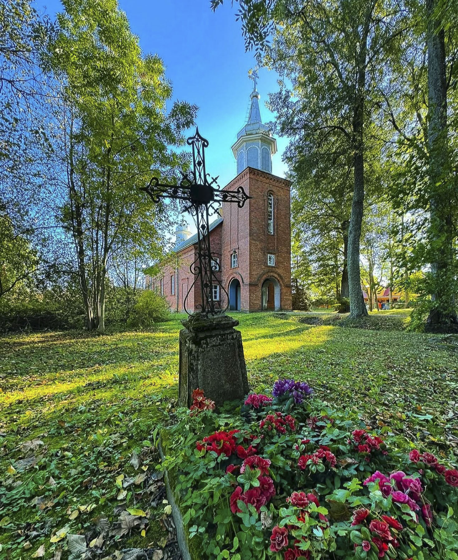
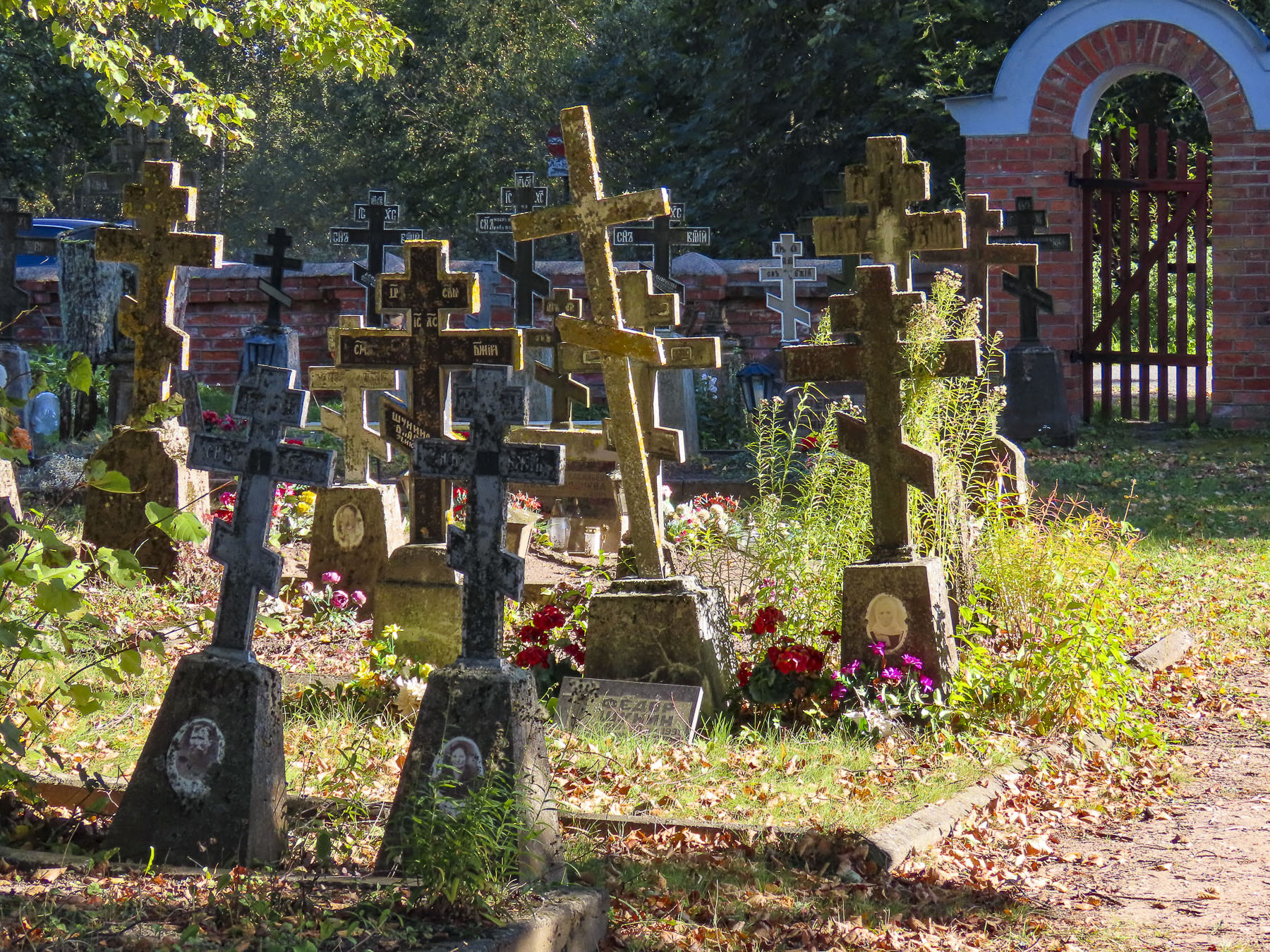
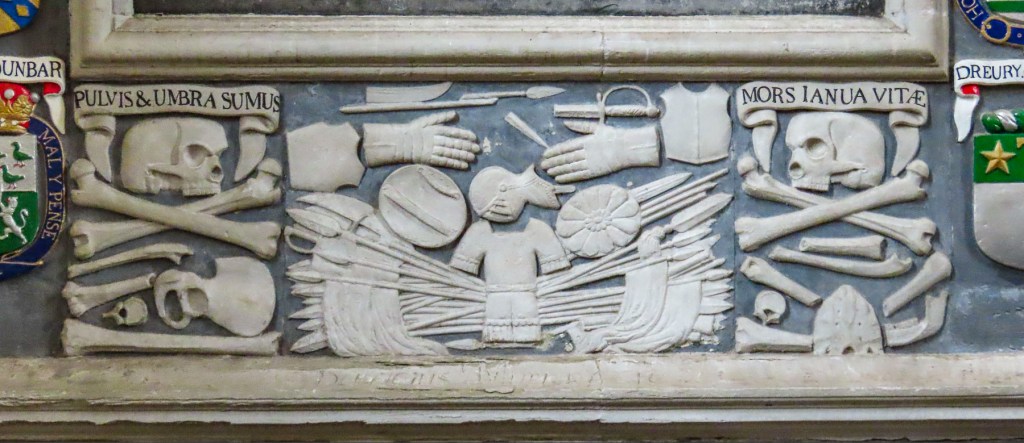
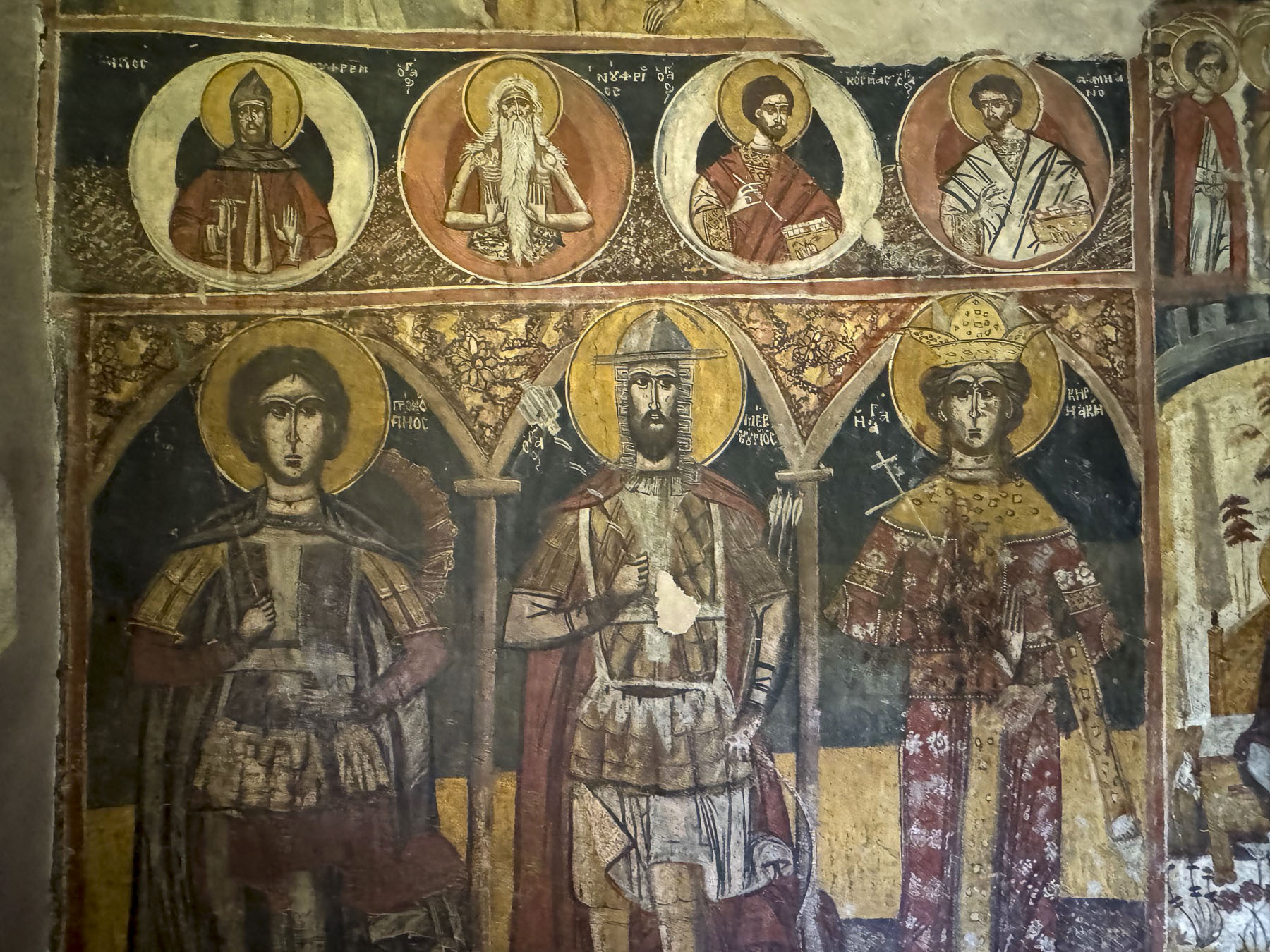
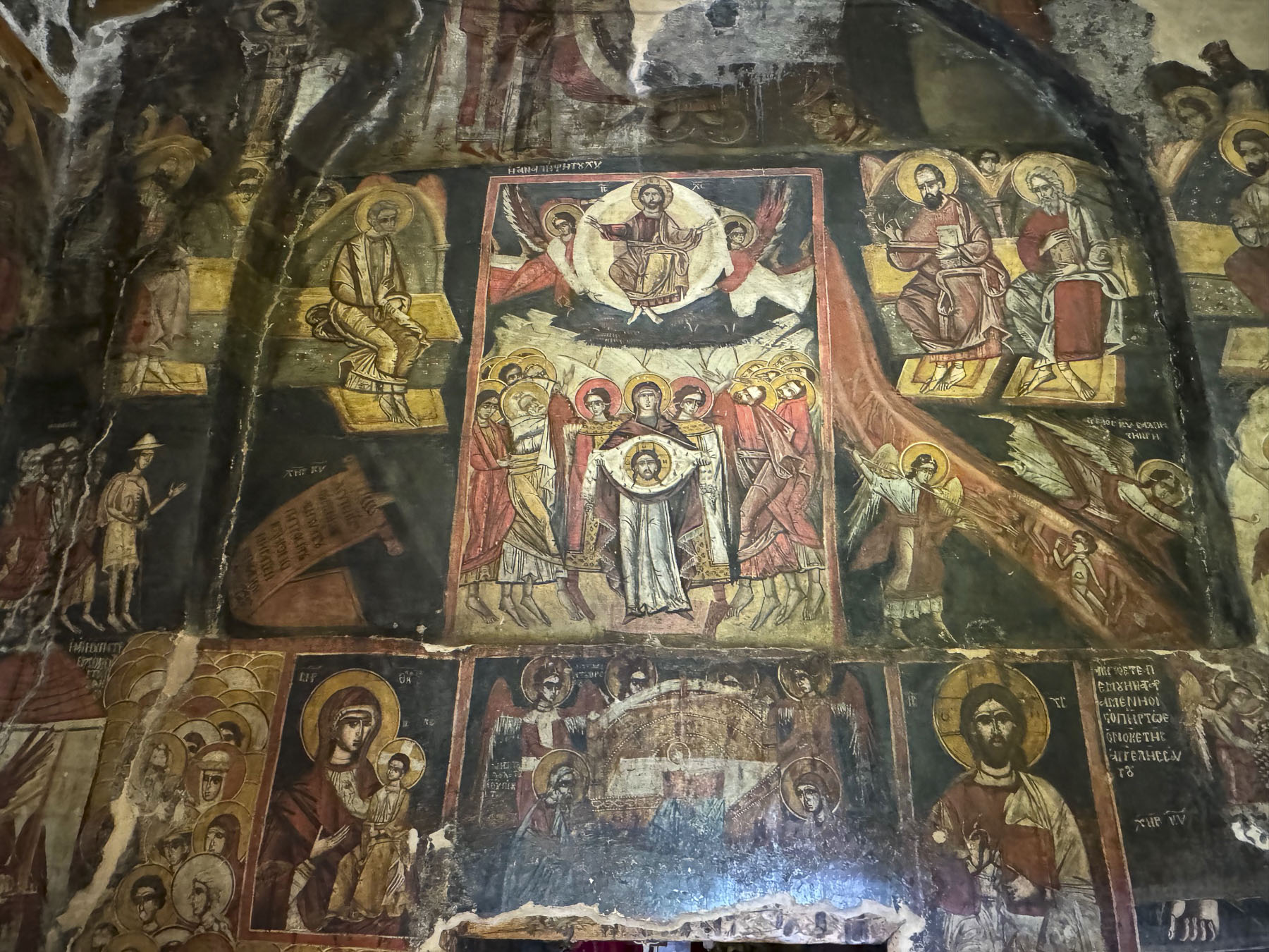
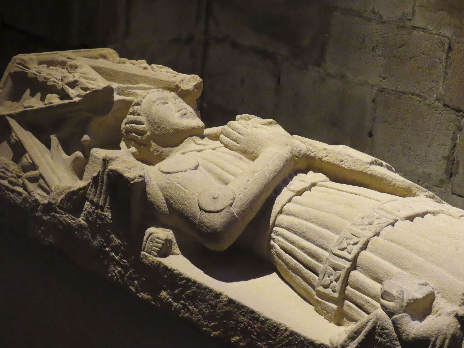
We turned off the main road at every sign that pointed to the way to a kirk, church. The Kasepää Old Believers Church and Cemetery were particularly interesting. The current 1862 sanctuary sits atop the foundation of a building that is thought to be the site of one of the group’s earliest churches after their exodus from Russia. Graves in the cemetery were marked with the traditional three horizontal-bar Orthodox cross. The configuration dates from the 6th century in which the Top Bar represents the inscription ordered by Pontius Pilate, The Middle Bar, the main beam where Christ’s hands were nailed, and Bottom Slanted Bar symbolizes the footrest and its slant reflects the fate of the two thieves crucified alongside Jesus – upward towards the repentant thief (St. Dismas) and downward towards the unrepentant one.
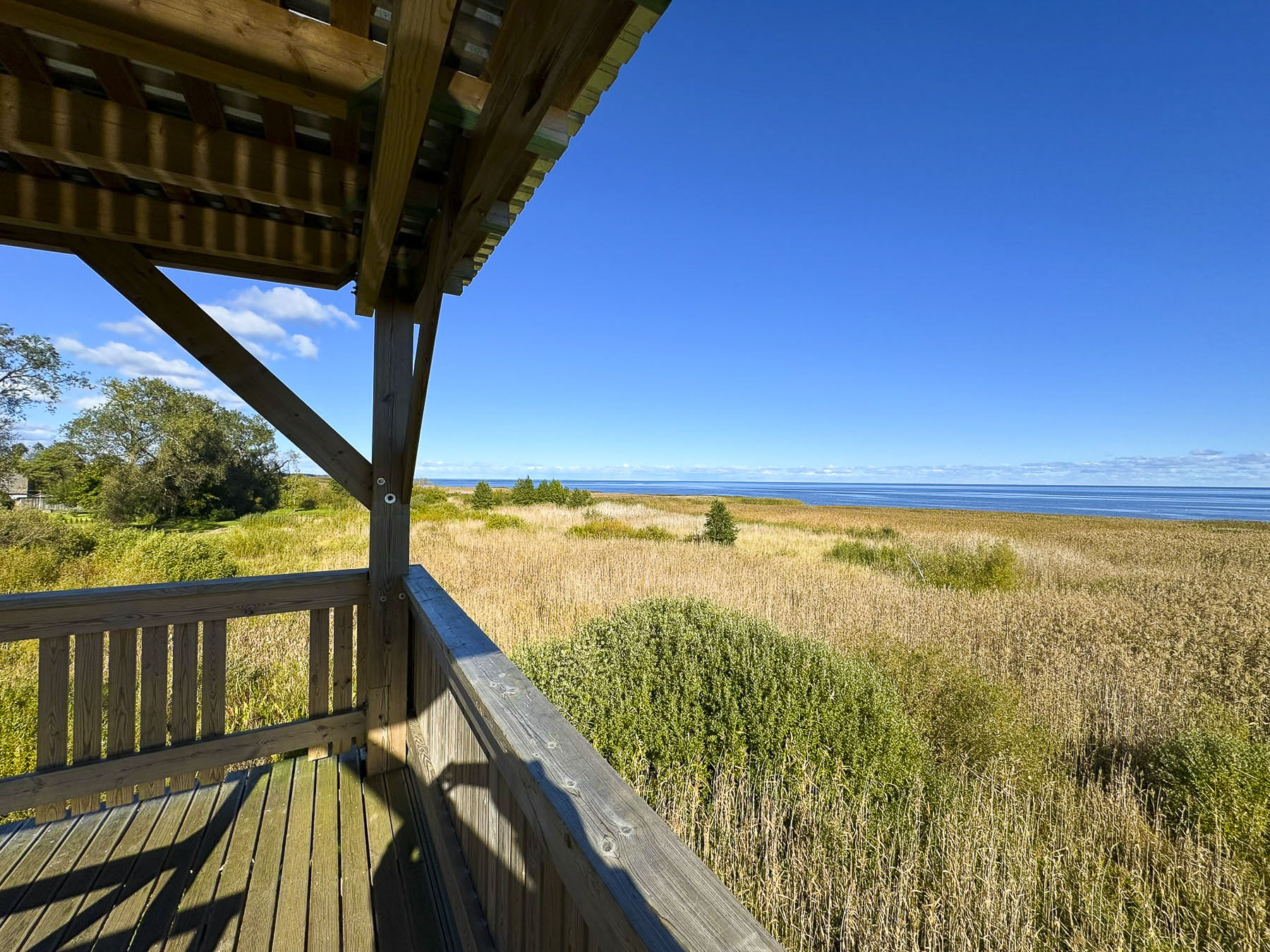
In Kolkja, a village first mentioned in historical records of 1592, we climbed the Vaatetorn bird-watching tower for an expansive view across the marshes and 3,555km2 (1,373 sq mi) Lake Peipus. The 219km (136mi) long lake has an average width of 82km (51mi), and is surprisingly very shallow, with an average depth of 7m (23ft). At its northern end the lake feeds into the Narva River between the Estonian border city of Narva and the Russian city of Ivangorod into the Gulf of Finland. Ice fishing is a popular winter activity on the lake which typically stays frozen from November to March. Small ice flows remain on the northern part of the lake until early May. Though with the recent climate change folks living along Lake Peipus have noticed a shortening of the ice season.
Afterwards, we stopped at Suur-Kolkja Vanausuliste Palvemaja, an Old Believers house of worship that was constructed in 1883, and its cemetery which was down the lane.
As we left the village an enterprising older woman, with a babushka covering her head, was unloading bags of onions, loaves of bread, and jars of jam from the trunk of a taxi and arranging them on a foldable card table she had already set up along the road. We had assumed the area was nearly deserted, but maybe there was an end-of-day rush hour as people returned home from work.
Although several museums, cafes and restaurants were shown on Google Maps, they were only open on the weekends during shoulder season. Our search for coffee took us to the larger town of Alatskivi, where we were able to satisfy our “drive a little, then café,” philosophy with a good lunch at Kivi kõrts, a bright eclectically decorated tavern, including a restroom decorated in a quirky theme.
We drove farther to Kallaste, a still larger village on the shore of Lake Peipus, but were discouraged from investigating the town in depth by the number of roadwork closures that hindered our travel.
On our return route to Tartu we passed through Alatskivi again and purchased honey from an automated vending machine near beehives in front of a local beekeeper’s home. We enjoy the simplest of things and found this combination of ancient practice and modern technology delightful. The machine even accepted credit cards.
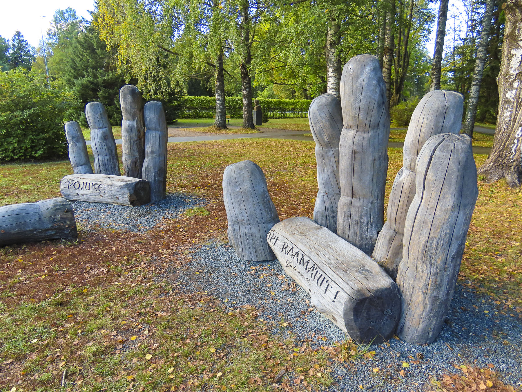
At the roundabout in town, we circled twice to figure out how to reach the town’s library, which had a large wooden sculpture of two hands, with fingers carved from tree trunks, protruding from the ground in front of the building.
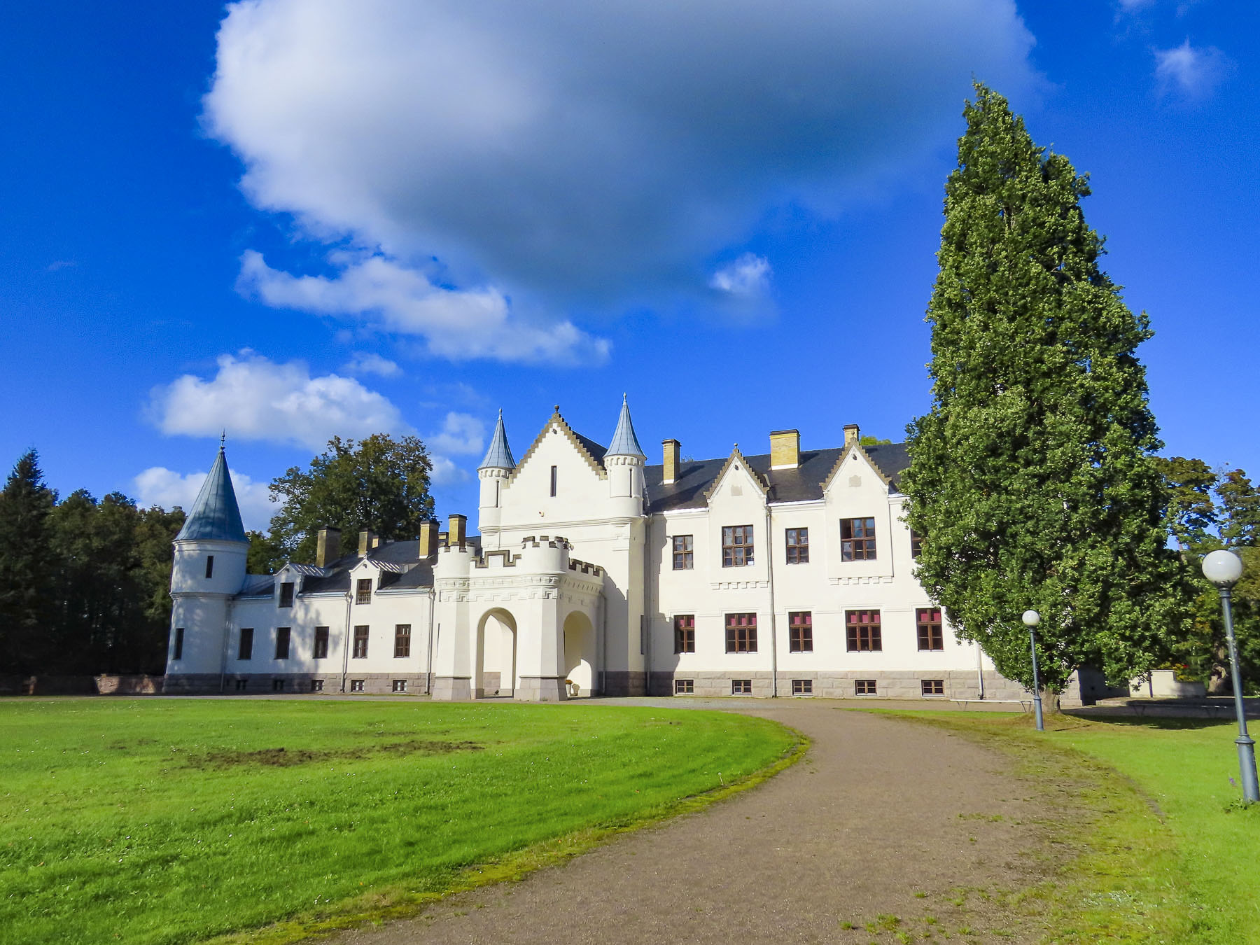
Earlier, the server at the tavern suggested we visit Alatskivi Castle,an old Baltic German feudal estate with vast land holdings, that was first mentioned in the historical records of the early 1600s. In 1885 Baron Arved von Nolcken, a widely traveled aristocrat, purchased the estate and reconstructed the old manor house in a Scottish baronial style, that is said to closely resemble Balmoral Castle, which he had recently visited. The von Nolcken family lived in the manor house for twenty years before they left for Germany with all their possessions, including the manor’s silk wallpaper, at the beginning of the Estonian Peasant Revolution in 1905. During the Soviet occupation of Estonia the lands of the estate were a state-controlled collective farm, and the castle was used as school, cinema, and library. Today, after extensive renovations the manor features a fine-dining restaurantand 4 suites available for booking directly through the castle, along with offering a ceramic studio and workshop in the cellar. There is also a wax museum featuring figures of the manor’s servants; a butler, lady’s maid, cook, baker, groomsman, stable hands, and laundry maid are just a few of the various trades depicted. The exterior of the castle is totally white, and during the winter, with snow on the ground, must shine brilliantly on a sunny day. Or vanish totally from view during an Estonian tuiskav lumi, a blizzard. We wondered – if the walls of the castle could speak, what tales would they tell?
We had a great time exploring the cultures and complex histories of Estonia, Latvia, and regrettably only a small part of Lithuania during our three week-long road trip through these fascinating Baltic countries.
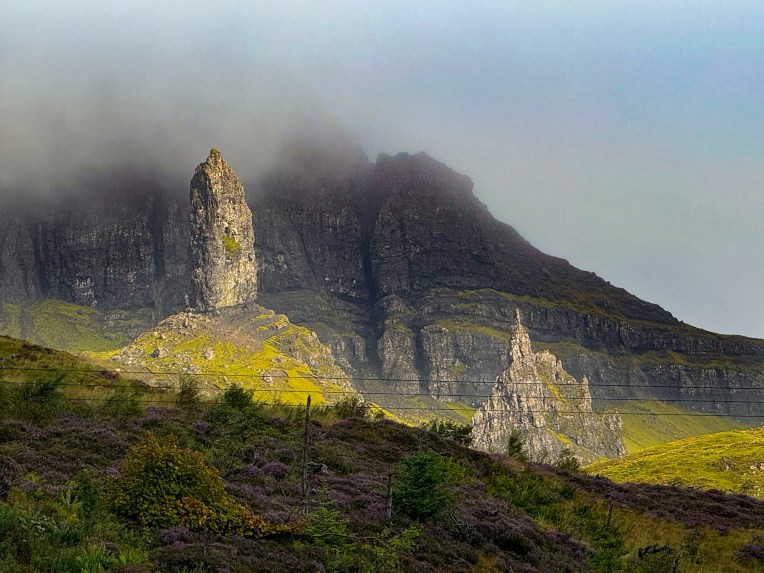
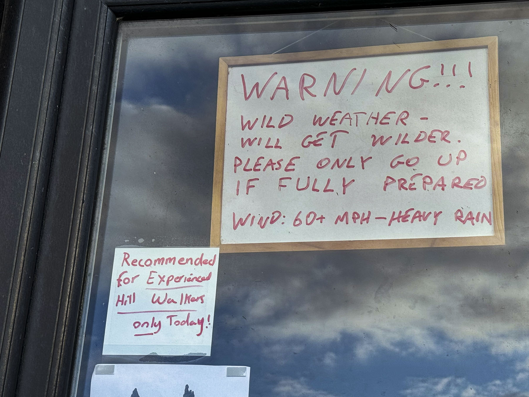
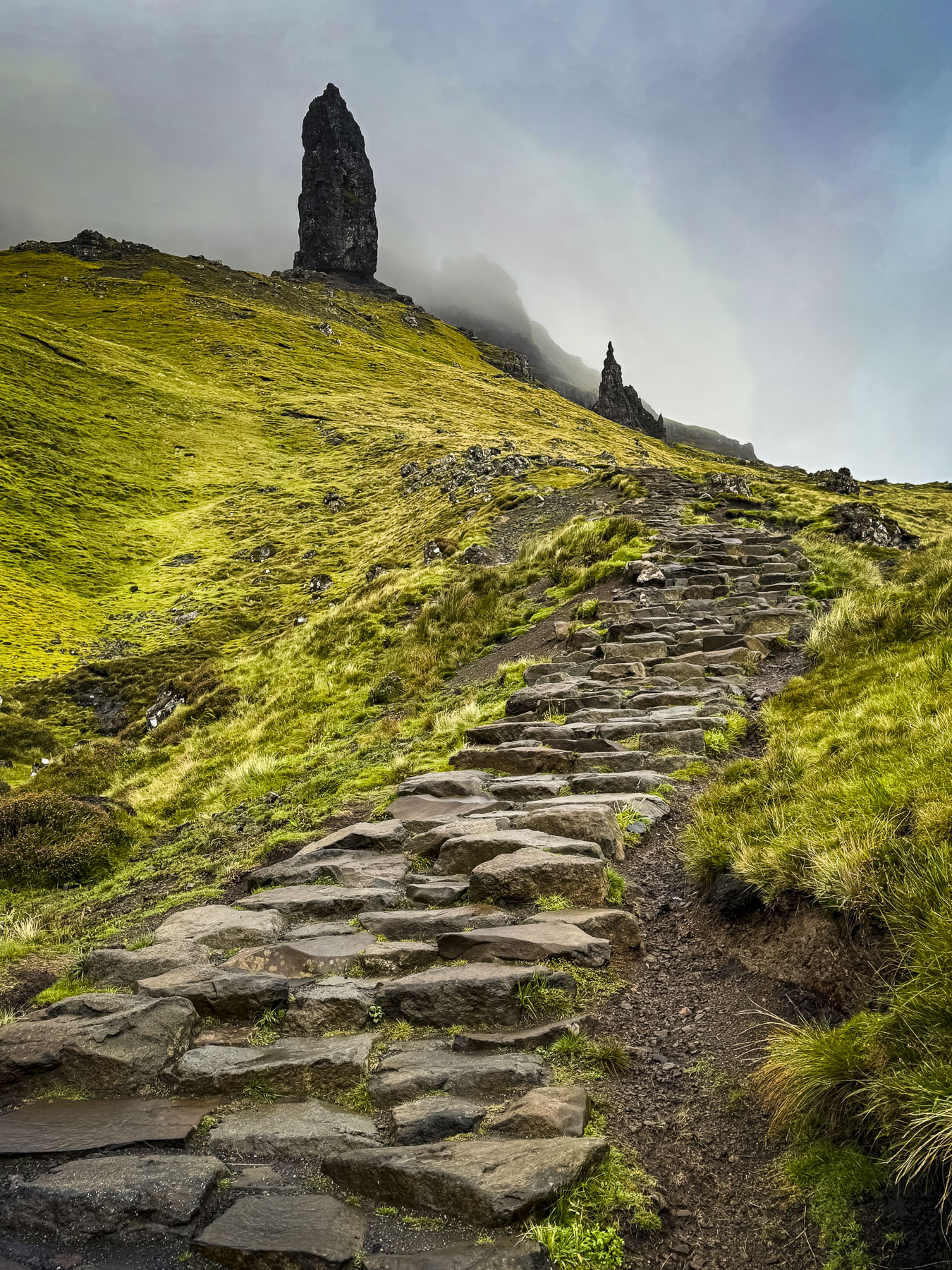
With only two full days on the Isle of Skye, the largest of the Inner Hebrides islands, we were up before dawn and headed out to hike the Old Man of Storr. We had read so much about the Old Man of Storr trail being the most popular activity on Skye that it we thought it wise to get an early start. Several cars were already parked in the lot, still wet from an overnight rain, when we got our ticket from the parking kiosk.
Even in places you wouldn’t expect, paid parking seems to be everywhere across Scotland, and since it’s the UK there’s video surveillance too. At the unmanned attendant’s hut a note taped to the window advised of “less than ideal wet conditions” on the mountain. We had hoped for a clear morning, but the mountain was shrouded in mist.
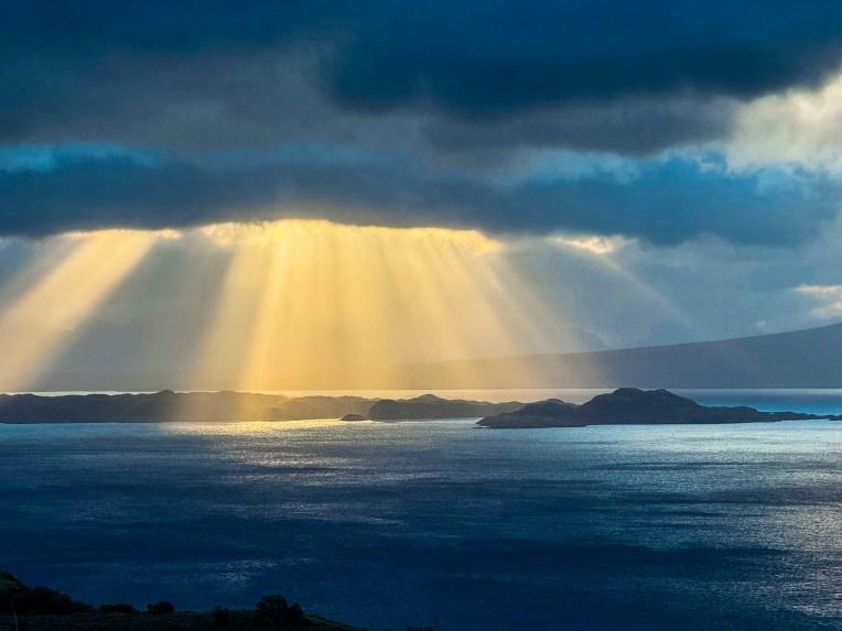
The first short stretch of the trail was moderately steep and would have been easier if our heart rates were up, though the incline soon lessened after rounding several switchbacks. When the trail leveled, we turned around to survey how far we had climbed and were rewarded with a spectacular view of morning light, in golden rays, cascading through the clouds onto the Sound of Raasay.
It began to rain by the time we reached a set of rough stone steps that would have taken us higher up the slope, but the rocks were getting slippery, and we decided to turn back.
We thought the morning was cold and had suited up with several layers under our rain gear, and were totally surprised when several guys in shorts and just t-shirts, obviously vacationers from the Artic Circle, passed us on the trail, followed by a young couple carrying a toddler.
Even though we didn’t make it as far up the mountain as we would have liked, we enjoyed the views.
By the time we returned for breakfast at The Rosedale Hotel in Portree the clouds were clearing, and we were able to admire the view of the harbor from a window table.
Afterwards we walked along the waterfront, where the view across Loch Portree, with boats rocking at anchor, resembled New England waterscapes from the coast of Maine, in the United States.
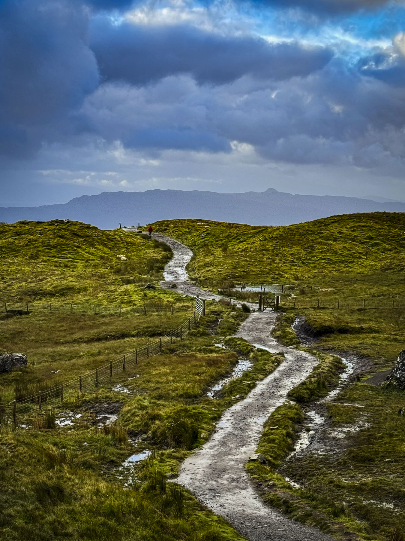
Our plan for the day was to make several stops at scenic sites as we headed north from Portree along the coast of Skye’s Trotternish Peninsula. We decided to look for dinosaur footprints at An Corran Beach before turning west across the highlands to Uig, then continuing a southern loop back to Portree.
This time as we approached Old Man of Storr the morning’s mist had lifted, and the mountain’s rugged peaks were clearly visible. The parking lot was also completely full.
The one good thing about all the August rain was that the rivers were high, and the waterfalls were thundering furiously. We had to wait for a few minutes for parking space at the Lealt Fall View Point. Strong winds buffeted us as we walked out onto the viewing platform.
Actually, two waterfalls can be seen from this spot: one flowing from a stream called the Ford is directly across from the platform, while the larger one to the right cascades 90 feet down from the Abhainn An Lethuillt, the River Leath.
From the ridge above the gorge carved by the falls, we followed the water flowing to the sea. The wind on this headland was extremely ferocious and we were fine as long as we had our hoods up and turned our backs to it. But as soon as we turned around a gust of wind threw my hood back and blew my baseball hat off my head. Really, it wasn’t my hat – since I had lost my own, I had borrowed Donna’s this morning, while she was still sleeping. The red hat had a long and colorful history, and was a treasured companion that she had worn on many adventures. The salt in the wound was that it settled only about 12 feet out of reach, down a very steep grassy slope, too risky of a spot to try to retrieve it. Months later I am still hearing about how untrustworthy I am as a hat borrower. I’m a lucky guy if that’s the worst of her grievances. The vistas surrounding this area were beautiful regardless of the weather.
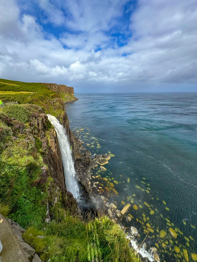
The sun was finally out when we stopped a little farther north at Mealtfalls where the waters of Loch Mealt spectacularly plunged 180 feet onto a rocky coastline and the sea, from a notch eroded into the 295 feet high cliff face of Kilt Rock. If viewed from the sea the basalt stone columns of the cliff face are said to resemble the pleads of a Scottish kilt.
The scenic drive north along the coast was stunning and we stopped many times to take photos. The sun was still shining, but the wind was blowing a “hoolie”, lifting swirling sprays of water into the air from the surf crashing onto the beach when we reached An Corran Beach.
The beach itself is very nice, but since 2002 when a local dog walker discovered the three-toed footprints of a Jurassic era Megalosaurus in rocks newly exposed after a large storm, it’s been a popular destination on Skye. We searched along the rock shelf at the water’s edge, but an incoming tide hindered our exploration.
Our hunger pangs began pinging around noon, and we stopped at several local restaurants only to be discouraged by the long waiting times for a table. We continued our drive. The issue wasn’t that the establishments were full, but that they lacked the seasonal staff to serve the customers adequately. This situation is a consequence of the Brexit maneuver that restricts foreign workers from entering the United Kingdom. This situation was mentioned to us several times by unhappy locals.
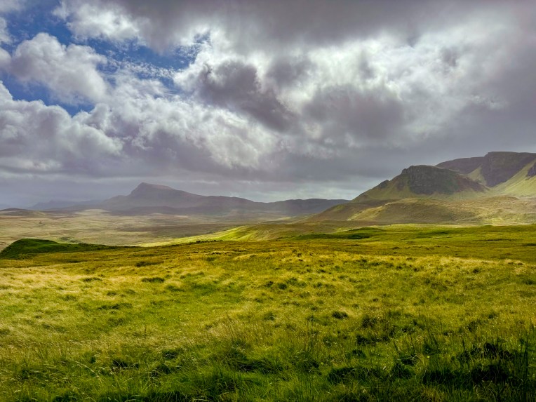
Following signs in Stenscholl for the Quiraing Pass we turned onto a serpentine single-track lane that climbed a 14% grade to an elevation of 856 feet above sea level before reaching a viewpoint.
With every fifteen miles or fifteen minutes the weather changed on the Isle of Skye, for better or worse. The deep grey sky was very forbidding and as soon as we opened the car door the rain poured down. The viewpoint and the trails leading from this scenic spot rival the Old Man of Storr’s, and are very popular for the views of the east coast of Skye and the highlands that can be seen on a clear day. It was raining too hard for us, so we continued across the highlands toward Idrigill on the west coast.
The interior sections of Skye are now vast wilderness areas with few signs of folks living in the area. But that wasn’t the case in the early 1800’s when the hills and glens of the island’s highlands supported over 20,000 crofters, tenant farmers, before the notorious “clearances” removed folks from the land to make way for large industrial scale sheep flocks. Many families emigrated to America, Canada, Australia, and New Zealand seeking better opportunities. A slow decline of Skye’s population continued into the 1970’s when it reached a low of 7,100 people. The most recent census shows the island’s population growing to 10,000 residents.
The sky was clearing once again when we reached the Idrigil Viewpoint. It was a splendid spot with panoramic views of Uig Bay and village. We finally had a late lunch at the Anchorage Cafe, across from the ferry terminal. It was nice to familiarize ourselves with the area, as we’d be taking the ferry from the Uig port to the Isle of Lewis and Harris in two days.
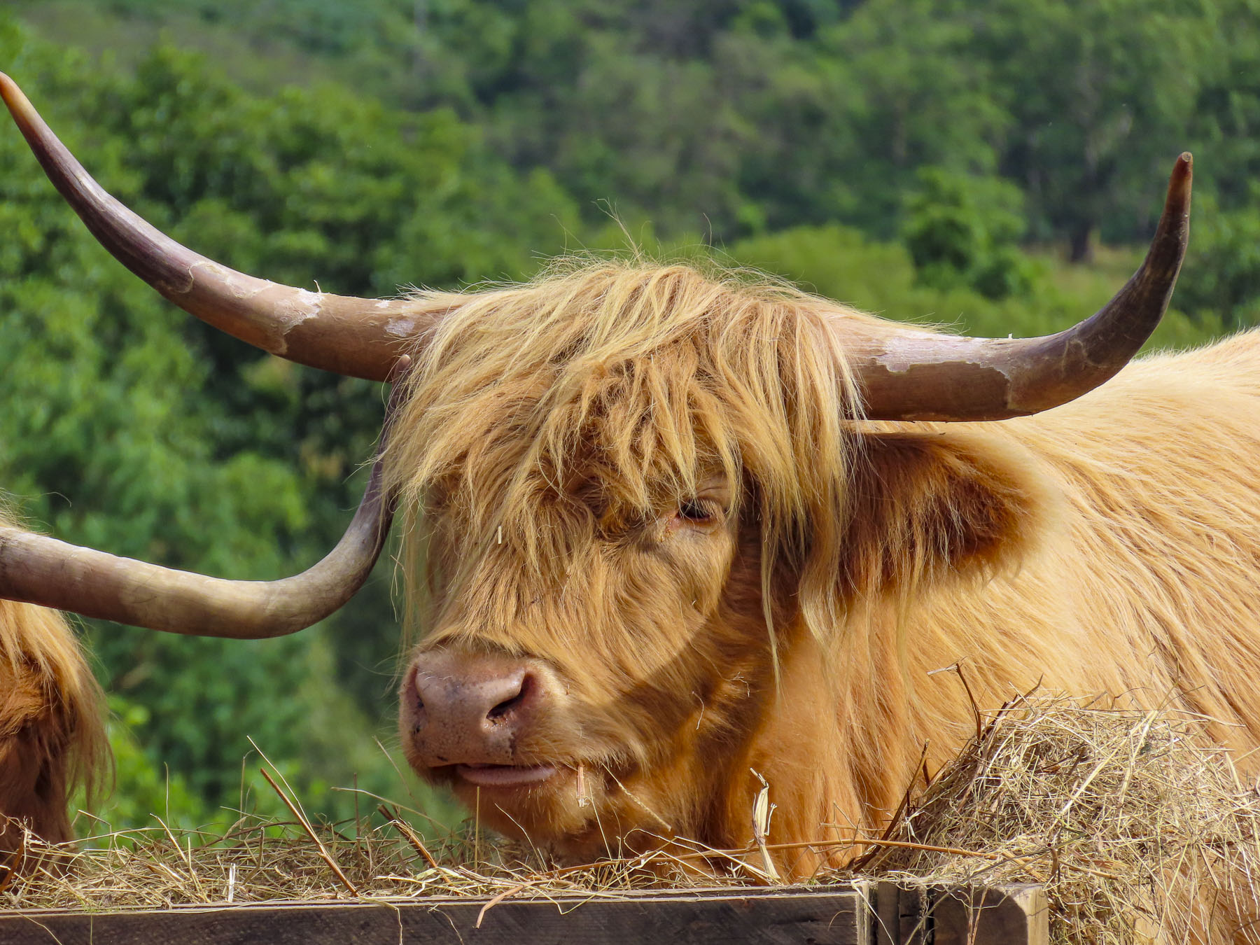
After lunch we drove up the western side of the Trotternish Peninsula to the Skye Museum of Island Life, which is a collection of thatched roofed stone cottages showcasing the way folks lived on the island centuries ago. Sheep and several hairy coos shared a bucolic pasture next to the museum when we pulled into the sunny parking area. But it was a deceptive moment of fair weather, and we were soon darting between the buildings, in the lulls between downpours, to see the interesting array of artifacts from seafaring, farming, and other trades on display.
We returned to Portree in time to snag a coveted parking space along the quay in front of our hotel and spent the rest of the late afternoon visiting the various shops in town. Our best find was in the charity shop along the waterfront where I was able to replace Donna’s hat with a warm woolen plaid cap. For the bargain price of fine pounds, she was willing to overlook a moth hole in the tweed.
We set out late the next morning to explore the western side of the Duirinish peninsula, visiting the village of Stein and Dunvegan Castle, both on the shore of Loch Dunvegan, but miles apart. Then heading back towards Portree and stopping in Carbost, on the Minginish peninsula, at the end of the day.
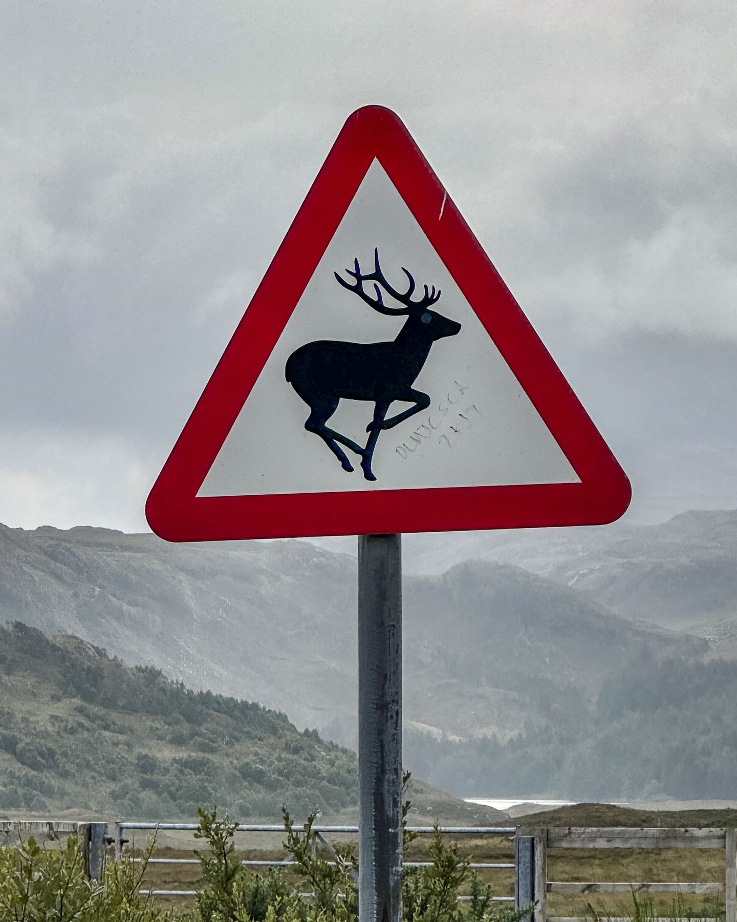
It was an overcast day from the get-go and we took the drive slowly as we followed the A850 though the countryside. At the head of Loch Greshornish we turned off the main road and followed a narrow lane into the village of Edinbane in search of a place to stop for coffee. The village was very quiet and didn’t show any sign of life, even though it was a weekday in the August high season, and several inns were shown on our map. We did encounter an unusual traffic sign that boldly warned with its red triangle that we were in a “Free Range Children” zone. It touched our hearts and made us laugh, while we remembered being kids with hours of unsupervised freedom to roam about. We’d seen many signs warning of stags, hedge hogs, and red squirrels throughout the highlands. Even a road crossing sign near a retirement complex in Edinburgh that featured the silhouette of an elderly couple using canes, that made its point quite effectively with a touch of humor. Back on the main road the take-away coffee at the filling station didn’t appeal to us so we continued on our way.
Our approach to Stein looked like the soft edged, muted colors of an impressionist painting through the windshield, as the wipers didn’t work fast enough to whisk the heavy downpour away. The rain was too intense to get out of the car. So, we drove slowly through the village looking for a place to turn around, until the road suddenly disappeared as a boat ramp into the sea. Gloomy, wet, and unpleasant, it was definitely a “dreich” day, as the Scots like to say.
With everyone on Skye looking for an indoor activity to do, the parking area at Dunvegan Castle was full. There’s only so many castles you can see before they all begin to feel the same, and we had stopped at several earlier on the mainland, so we didn’t feel totally guilty when we decided to head to lunch instead. There are several restaurants that sit along the road through the village of Dunvegan. Dunvegan this, Dunvegan that. Of course we had lunch at The Dunvegan, a small five room inn overlooking the loch, which features a very nice restaurant along with a café, and deli for takeaway. Even though it was very busy on this inclement day, we found it relaxing, and the staff was very nice. Just down the street, a restored one-room crofter’s cottage houses the quirky Giant Angus MacAskill Museum. It’s run by a distant relative of the seven feet nine inch tall giant who was born in 1825 on the Isle of Berneray, in the Outer Hebrides. I guess that’s close enough to be considered a hometown boy, even though he spent most of his youth growing up in Nova Scotia, Canada after his parents emigrated. His height and strength eventually brought fame and fortune to the gentle giant called Gille Mór (Big Boy) when he toured the world with P.T Barnum and Tom Thumb, the world’s smallest man. Performing before Queen Victoria, she declared him the “strongest, stoutest and tallest man to ever enter the palace.” For a while he was listed in the Guiness Book of Records as the world’s strongest man. Statues of Angus and his stage partner Tom, along with his size 18 boots, and a replica of his huge coffin, fill the space.
We arrived too late for the last tour of the distillery at Taliskerin Carbost, but nevertheless we enjoyed sharing a flight of three single malt whiskies aged for 10, 18, and 25 years, while standing at the bar, as the tasting area and showroom were full of folks escaping the rainy afternoon. Our young barkeep was a well-versed whisky sommelier who described the “smoky sweetness intertwined with distinct maritime notes,” as he guided us through the subtle influences the haar, the sea mists that blow in from Loch Harport has on the aging process. He poetically used a cask full of adjectives to describe the Nose – floral seaside aromas, with gentle smoke palate; a malty creaminess and finish; sublimely spicy; a kick of cloves; an exquisite lingering saltiness. All were very nice to sip slowly, and on a damp rainy “dreich” day like today we fully appreciated the healing properties of Scottish whisky and why some refer to it as the “water of life” in the highlands.
Just up the hill from the Talisker Distillery is The Oyster Shed. Occupying a metal farm building,
it’s a local no frills, order at the counter joint, with incredibly fair prices, that serves the freshest seafood caught locally that day. We ordered a dozen oysters and a bowl of mussels along with cans of Irn Bru, a fruity carbonated soft drink often referred to as “Scotland’s other national drink.” We sat outside around the corner of the building at a long, shared picnic table with other customers. Simple, delicious and authentic, it was a great way to cap off our day. Parking can be difficult here, so be patient; experiencing the Oyster Shed is well worth the short wait.
The next morning in Portree was beautiful and also our last day on Skye. We made the best of our time before catching the Caledonian MacBrayne ferry from Uig to Tarbert on the Isle of Lewis and Harris, in the Outer Hebrides. Overlooking Uig’s harbor we stopped at Captain Fraser’s Folly, a stone tower built in the mid 1800’s on the spot where Fraser’s Kilmuir estate Factor collected rent from the crofters that lived on the land. Fraser and his Factor were not popular during the clearances and often had to seek shelter in the tower from tenants evicted from the estate. Once in 1884 they even had to ask the Royal Navy to help secure their safety.
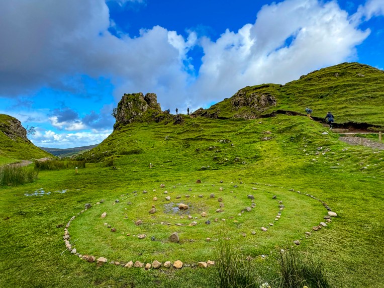
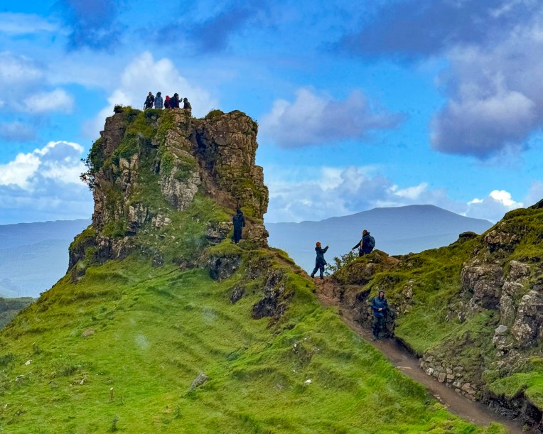
Skye’s legendary Faerie Glen, known as a place of myth and wonder, was only a short distance away from Fraser’s Folly, in the hills above Uig. It’s a magical spot, centered with concentric rings of stones, under a rocky hilltop that resembled ruins, that’s called Castle Ewen. The landscape surrounding the glen is rugged and covered with gnarled trees and heather where, according to legend, the Faeries of the glen lived. One of the ancient folk tales speaks of a Clan MacLeod chief that lived in Dunvegan Castle and married a Faerie princess. She stayed with the chief for a year before returning to her world, but left with him a Faerie flag to protect the Clan MacLeod from evil and bring victory in battles. It’s reportedly brought the clan good luck over the centuries.
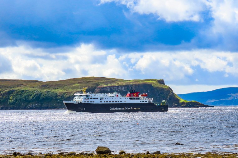
Inexperienced with car ferries, we made sure we were early in the queue at the Caledonian MacBraynepier. We had purchased our tickets online, months before, as soon as their summer sailing schedule became available. We read that while being a last-minute walk-on isn’t a problem, car reservations during the summer high season fill quickly. There were special lanes for each category of vehicle – car, camper, truck and bus. Vehicles without reservations get driven on last or not at all depending on available space. It all worked very smoothly with a ferry attendant scanning the barcode of our printed ticket and directing us into the correct boarding lane.
Surprisingly, the ferry was very quickly loaded and with a blast of the ship’s horn we departed Uig and headed across the Minch, the body of water that separates Skye from the Isle of Lewis and Harris.
Till next time, Craig & Donna
P.S. According to Sir William Connolly, Scotland’s favorite retired stand-up comedian, “There’s no such thing as bad weather, just the wrong clothing, so get yourself a sexy raincoat and live a little.”
Good hosts, Shopkeepers, and restauranteurs constantly apologized for the unusually cold and fickle August weather that Scotland was experiencing. In the Outer Hebrides, on the Isle of Lewis and Harris, strong winds and high tides led to road flooding in the center of Stornoway, a destination on our itinerary. “Normally the weather is perfect this time of year,” was a frequent refrain. “Lively thunderstorms,” such a nice phrase, had delayed our flight from London to Inverness, several days earlier. Later in the month heavy rain and strong winds led to the naming of the 12th storm of the 2024 season, Storm Lilian.
We had donned our Gore-tex rain gear for two days straight, and were thankful we made the investment in some reliable waterproof jackets. But yesterday afternoon as we visited The Kelpies while driving to Edinburgh, it was 65°F and the sun was shining. The weather was brilliant. Rain then clearing storms was the weather pattern that would repeat itself for the next three weeks, which provided many opportunities for some dramatic landscape photography.
With the weather predicted to be nice for the next several days, we planned to head to the Dugald Stewart Monument on Calton Hill for that iconic view of Edinburgh at sunrise. It didn’t go exactly as planned, as we didn’t get up early enough, underestimated the length of time our tram journey from the Holiday Inn Express Edinburgh – LeithWaterfront would take, and we overshot our stop.
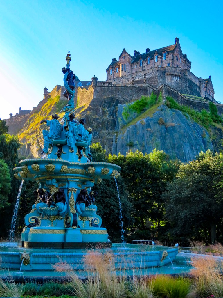
Nevertheless, we enjoyed a quiet early morning in the Princes Street Gardens, catching Edinburgh castle in early morning light from the Ross Fountain. Before walking back to Calton Hill, as the city’s streets slowly awakened, and sculptures atop buildings glowed in the morning sun.
Along our route were solid examples of buildings constructed with Craigleith sandstone. The locally quarried stone was the building material of choice for James Craig, the 18th century Scottish architect tasked with replacing the ancient city’s medieval Old Town’s unsanitary tenements and warren of alleys, with a grid of avenues, squares, and gardens. The results, James Craig’s New Town, are today treasured as a prime example of Georgian era town planning.
An obscure alley-like entrance across the road from the stairs to Calton Hill caught our attention and we followed a forgotten walkway into the Old Calton Cemetery. Long neglected tombs and teetering headstones dotted the graveyard. In the middle was a stately monument depicting a freed slave looking skyward to a statuesque Abraham Lincoln.
The Scottish-American Soldiers Monument, as it is called, commemorates the six Scotsmen who volunteered to fight against slavery during the American Civil War. Donations for its construction were solicited across the Scottish dispora in the United States with the American business magnates; Andrew Carnegie and John D. Rockefeller becoming major contributors. The memorial monument was erected in 1893, was the first statue of Abraham Lincoln outside of the United Sates, and continues to be the only American Civil War monument in Europe.
Even though our heart rates were up, after the walk from the center of Edinburgh, the long climb of stairs to the top of Calton hill was a challenge, though it was well worth the effort for that iconic view across The Athens of the North. The 19th century nickname references the Grecian architectural influences incorporated into some of the city’s most notable neoclassical buildings.
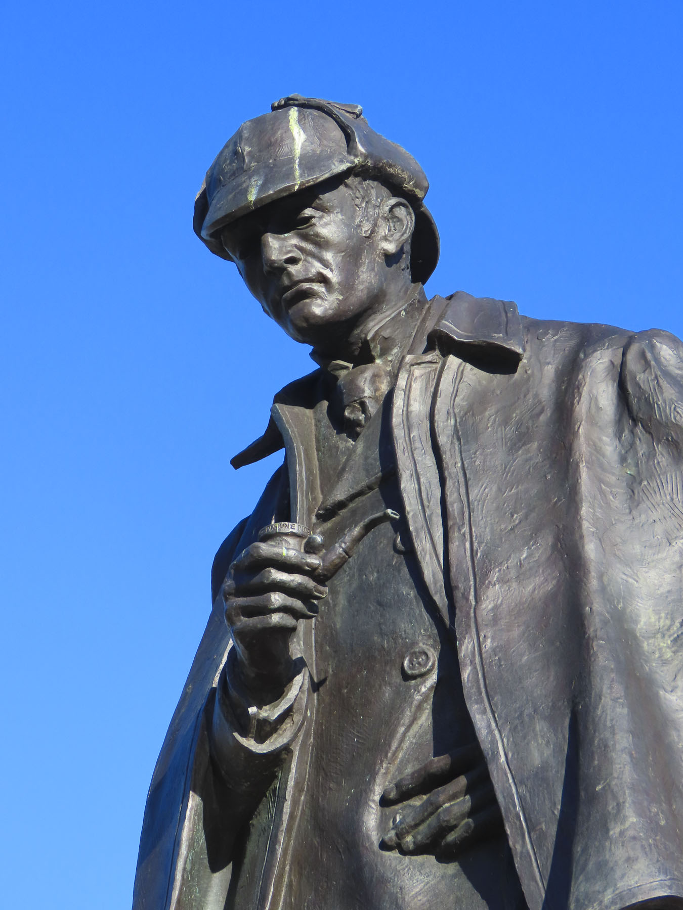
Atop the hill the style is most evident in the Dugald Stewart Monument, a memorial to the Scottish philosopher and mathematician; the old City Observatory; and the National Monument of Scotland, a Napoleonic Wars memorial built in remembrance of the soldiers and sailors who fought in those wars. Afterwards we walked down the opposite side of the hill towards the Omni building, a theater and entertainment center, across from the tram stop at Picardy Place. A tall statue of Scotland’s favorite detective, Sherlock Holmes, commands the plaza located a short distance away from the birthplace of the writer Sir Arthur Conan Doyle.
Our goal now was to walk towards the Port of Leith along the Leith Way to delve into some of Donna’s family history. Here’s Donna to explain:
Before I was Donna Hammell, I was Donna Leith. My mother-in-law was a sweet Italian woman who married a Scottish fellow named John Leith. In the 1970s, they traveled to Scotland to explore the family heritage. They knew that generations back, one of the Leith men had been a sailmaker with a shop along Water Street; another had been a ship builder. Mom and Dad wandered around Leith, trying to find the shop. They were about to give up the search, when they decided to ask at a pharmacy. Turns out that was the very building the sailmaker had occupied, and the people who ran the shop were cousins, once or twice removed. The two women corresponded for decades and exchanged recipes. I just baked a batch of Eyemouth Tarts – deliciously addictive little squares of candied fruit atop a buttery crust. My children are named Sandra Leith and Ian Leith, and I was determined to bring them a souvenir with the Leith name on it. Although for obvious reasons there is some antipathy between my former and current husbands, nevertheless Craig kindly indulged me on this search for my kids’ ancestry. I think he was as pleased as I was when we hit the jackpot at a lovely little store. I cleaned her out on all things Leith.
Leith Way, is one of Edinburgh’s oldest streets, that followed the line of a now long- gone earthen rampart built to defend Edinburgh from Oliver Cromwell’s army in 1650. On either side of the road, it seemed as if every storefront we passed incorporated Leith into the name of their business: Leith Shwarma, The Dog House Leith, Leith Artisan Coffee, Leith Walk Denture Studio, Leith Barber, and Tribe Leith, a yoga studio. Nearing sensory overload, we stopped for a pint of beer at the Boundary Bar. It’s an unpretentious neighborhood pub famously known for its line painted along the floor that marked the border between Leith and Edinburgh, and most importantly allowed customers who crossed to the Leith side of the bar to party an hour longer, when the pubs in Edinburgh closed at 9 PM. Leith’s advantage ended when the two cities merged in1920. Across the street we enjoyed an inexpensive lunch at the Kukina Turkish Bakery, just down from The Wee Leith Shop, which was only twice as wide as its door. Farther along we found a very nice shop, Destined for Home, with all things Leith souvenirs. Donna was thrilled!
Leith’s history was tied to the rise of Edinburgh as the seat of the Scottish crown. Archeological discoveries along the port’s waterfront suggest an extensive wharf area that dates to the 12th century. The port thrived for centuries upon shipbuilding, whaling, fishing, and glass making, along with warehouses storing whisky and wines imported from Europe. Leith was so prosperous that it had gas street lighting in 1822, and electrified its tram network in 1905, years before the town merged with Edinburgh in 1920. Severely hard times fell on Leith after WWII when ship building declined, and the advent of mega container ships required larger, modern port facilities. Notoriously, the city was unceremoniously depicted in the 1993 novel, Trainspotting. It was a much different perspective than that of the Proclaimer’s1988 hit song, Sunshine on Leith, which the BBC hailed as a “love song to the city and Scotland.” The song became an anthem of endurance for a city once down on its luck. But since then, the dock area has undergone a transformation with new office buildings and residential towers being built along the old canals and dock area of the port, reinvigorating the area and earning the designation as the “Venice of the North.”
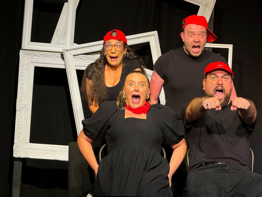
Later that afternoon we returned to the center of Edinburgh via the tram and walked across town to theSpace @ Surgeons’ Hall, a performing arts theater, to see a play hosted by the Fringe Festival. I Love You, You’re Perfect, Now Change was written by award-winning playwright Joe DiPietro, who happens to be the little brother of Donna’s girlfriend from grade school. The four-person performance, the second longest-running off-Broadway play, was performed in a small intimate space with seating on three sides of the stage. The play was fantastic, and the tickets were extremely inexpensive.
At this point we need to confess that we didn’t know anything about the Edinburgh Fringe Festival, a large three-week entertainment event held every August in Edinburgh, for over 75 years. It was only after purchasing our airfare, when we tried to book a hotel, six months out, that room availability was severely limited, and we delved deeper as to why. The Fringe Festival started as an act of rebellion against the status quo in 1947 when eight theater companies, not invited to the Edinburgh International Festival, performed on the streets in Edinburgh. The event has mushroomed over the years and in 2024 “sold more than 2.6 million tickets and featured more than 51,446 scheduled performances of 3,746 different shows across 262 venues from 60 different countries.” The Edinburgh Fringe Festival website and catalog of shows was very helpful in planning what to see. Everything we read said Edinburgh would be insanely packed with tourists. But our barometer was a New York city rush hour, and Edinburgh’s streets were an oasis of calm in comparison. Not being able to find any reasonably priced hotels near the center of the city, the Holiday Inn Express Edinburgh – LeithWaterfront, located on the tram line, was the perfect alternative.
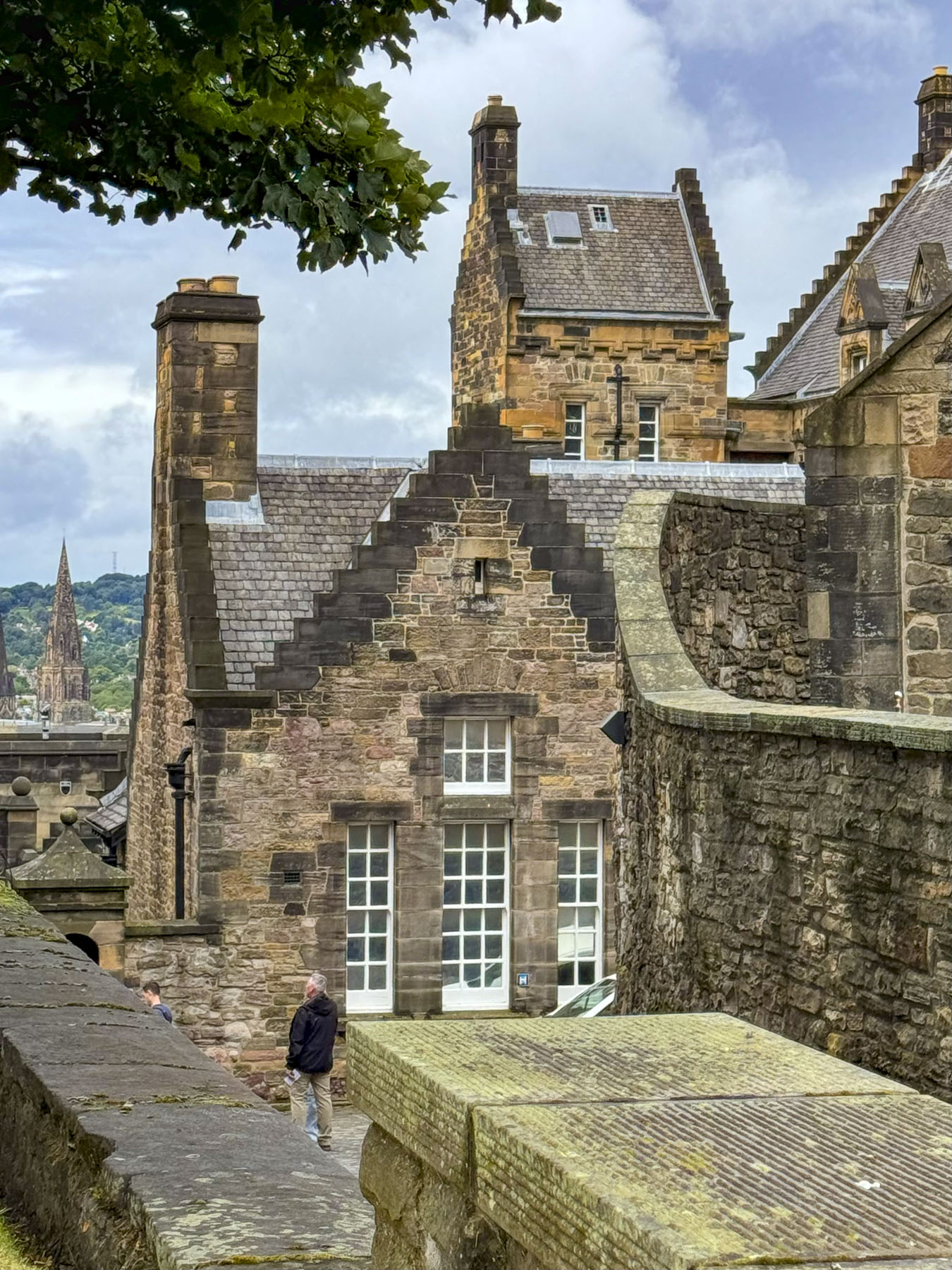
For the next morning Donna secured us tickets for the opening time at Edinburgh Castle, and we arrived to join the small queue already forming. The top of this massive rock has been a safe haven since the Iron Age when folks first sought refuge there. It was the seat of the Scottish crown for several centuries after Malcolm III Canmore, the first King of Scotland, set foot upon the Castle Rock in the 11th century, though the principal royal residence, since its construction in the 16th century has been Holyrood Palace.
I imagine the wind carries the stories of Mary Queen of Scots, James VI, Oliver Cromwell, and soldiers barracked, and prisoners of wars in its dungeons, that walked upon the rock. Noteworthy historical oddities include: the first fireworks lit the sky above the castle in 1507 to celebrate a lavish jousting tournament hosted by James IV. In 1838, the 78th Highlanders, stationed at the castle, returned from serving in Sri Lanka with an elephant in tow. The parade ground before the castle entrance hosts a spectacular event every August evening called The Royal Edinburgh Military Tattoo.
Afterwards we wandered the streets and alleys of Edinburgh’s ancient Old Town below the castle. The cheerfully painted storefronts along the bow of Victoria Street certainly brightened the day after a gloomy morning. The streets were busy with crowds gathered around entertainers performing in the squares. Eventually, we found our way to the Greyfriars Kirkyard Cemetery.
The land for the graveyard was granted to the city by Mary Queen of Scots in the mid-16th century. Soon the city started to use the graveyard for the mass burials of thousands that died during the multiple plagues that struck the city over a seventy-five year period. Though there are only several hundred headstones in the cemetery, it is thought nearly 100,000 people were buried there over a three-hundred-year period, and tour guides will have you believing it’s the most haunted cemetery in the world.
After the establishment of Edinburgh’s Medical College in the 1700s, graverobbers often exhumed the recently deceased and sold the cadavers to the school for use in their anatomy classes. The cemetery is also known for the story of Bobby, the beloved pet of John Grey. The Skye Terrier is remembered for dedicatedly guarding his owner’s grave for 14 years before his own death at age 16, in 1872. More recently, the success of JK Rowling’s Harry Potter books have drawn fans of the novels to the cemetery where the author borrowed the names of Robert Potter, Thomas Riddle (aka Lord Voldemort), William McGonagall (a famously bad poet), Elizabeth Moodie, and Margaret Louisa Scrymgeour Wedderburn off the gravestones for some of her important characters.
After lunch at the Greyfriars Bobby’s, a pub at the entrance to the cemetery, we walked across town. At the National Galleries of Scotland we stopped to watch a juggler tossing flaming torches from atop a tall teetering platform, held aloft by members of the audience.
At the Princes Street Gardens the skirl of bagpipes filled the air near the sculpture of Wojtek, an orphaned Syrian brown bear cub that Polish soldiers found in Iran, and adopted while they were serving with the British army in WWII. After the war Wojtek lived out his life in the Edinburgh Zoo.
Our destination was Dean Village, an old, though now gentrified, milling community, that once had eleven mills along the Water of Leith. It’s a tranquil bucolic area with a foot and bike path that can be followed to the Port of Leith, four miles away. Saint Bernard’s Well is along the walkway, and during the Middle Ages the water from the natural spring was believed to have curative powers.
For dinner that evening we headed back into the new town and stopped at The Black Cat pub, which was recommended as having a great selection of whisky, friendly knowledgeable bartenders, and good fairly priced food. We tried a flight of three single malt coastal whiskies. Two were from islands off Scotland’s west coast; an Arran 10 year from the Isle of Arran, and a Ledaig 10 from the Isle of Mull. The third was a Glenglassaugh 12 year distilled near Sandend Bay in northern Scotland. The young barkeep was also a well versed whisky sommelier, and guided us through the subtle influences the Atlantic and North Sea air have on the aging process. Poetically using a cask full of adjectives to describe the Nose – floral seaside aromas, with gentle smokey palate – a malty creaminess, and finish – sublimely spicy, a kick of cloves, or an exquisite lingering saltiness, to variously describe the warm amber liquors we were enjoying. All were very nice to sip slowly, though the Ledaig 10 was a little too peaty for our taste, and we likened it to inhaling too deeply with your first cigar – it took some getting used to.
The following morning, we set off for the Palace of Holyroodhouse. It has been an official royal residence since James IV constructed the palace in1501, adjacent to the Holyrood Abbey’s cathedral that was completed in 1230. The original palace was destroyed in the 1650s when a fire consumed much of the building while it was being used as a barracks by Oliver Cromwell’s troops. Though there have been many interior alterations over the centuries, the façade of the palace today closely resembles its 1679 construction.
The Renaissance fountain in the forecourt was installed in 1850 to spiff the place up for a visit by Queen Victoria. Sadly, that seems to be the last attempt to improve the place, and our tour of the inside felt like we were walking through spartanly furnished, shabby aristocratic public housing. The Abbey’s cathedral is an ancient ruin, and the gardens surrounding the palace get much better PR than they deserve. For the exorbitant admission price, they didn’t deliver the expected enthralling experience. If you are watching your budget, we suggest skipping Holyroodhouse and visiting Stirling Castle or Dunrobin Castle with its spectacular interior and garden instead.
For our last afternoon in the city, we visited the Royal Botanic Garden, seventy acres of beautiful, manicured rolling woodland with formal gardens. We followed the signs through the park, passing under a 23ft tall hedge over 100 years old, to the Queen Mother’s Memorial Garden, that’s noted for its perennial flowers and collection of indigenous plants.
The gardens were thriving in the moist moderate weather of Scotland, and bursting with color. At the very end of the garden is a small building called The Memorial Pavilion. It’s very unique, with every square inch of the interior walls and ceiling covered with shells collected by school children all across Scotland.
Planted outside was a bed of thistle, Scotland’s national flower. Scottish folklore credits the thistle with saving an ancient village from a Viking raid, when the barefooted invaders stepped on the spiky plant. Their cries of agony alerted the sleeping warriors of the village who then defeated their enemy. It has since become an important symbol of Scottish heraldry, and being invested into the ancient chivalric order of the Most Ancient and Most Noble Order of the Thistle, is one of Scotland’s and England’s highest awards. The prickly flower was even celebrated in a 1926 poem, A Drunk Man Looks at the Thistle, by the famous Scottish poet by Hugh MacDiarmid. The epic, “stream-of-consciousness” poem touches on everything from the state of the nation and the mysteries of the universe to the joy of whisky.
Edinburgh was a fantastic destination, that requires multiple visits to fully explore.
Large swathes of sunlight graced the rolling landscape of the northern highlands as the plane began its descent toward Inverness. The change in weather was welcomed after a delayed flight from London put us two hours behind schedule, and we were landing in Inverness after all the car rental agents in the airport closed at 5 pm. It was a situation we didn’t realize until we departed London, and in the air. Being from the states where the airports stay open extremely late, we hadn’t made any contingency plans for this unexpected delay, and it, along with fretting about driving on the left side of the road, filled us with anxiety as the last car hire bus to Arnold Clark’s offsite lot ran at five. While waiting at baggage claim we somehow connected with another couple on our flight with the same dilemma and shared our worries. An audible sigh of relief was released when to our surprise an Arnold Clark agent was waiting for all of us, holding a placard with our names on it, as we exited the baggage claim area. Our cars were parked for us outside. The agent was absolutely wonderful, and prevented a rough start to our vacation. He also recommended an excellent restaurant, The Snow Goose, just minutes from the airport. Arnold Clark really went the extra mile for us, and we thanked the agent profusely.
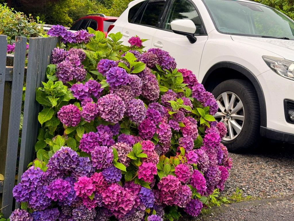
I think driving away from any new airport is the most dangerous part of many trips. Horns blared. Stay left, look right was our mantra. Lunch had happened many hours earlier, and with a two-hour drive south to Pitlochry ahead of us, we decided to stop for dinner. First impressions of a new destination are important, and ours were pleasantly exceeded when we stopped at The Snow Goose, first with a riotous display of color from beautiful hydrangeas that lined the walkway. Then the realization that customers’ dogs are welcomed inside restaurants, pubs too, and just want the chance to wag their tails, and have their heads rubbed. This is something totally alien to the restaurant scene in the United States, but it was very nice, and all the dogs were so well behaved. Lastly, the food was great. Beetroot and Pumpkin Seed Arancini to start, followed by Seared Sea Bass and Pan-Roasted Lamb.
Grand expanses of heather covered the hillsides between forests of pine, while tufted vetch in infinite shades of purple and pink carpeted the edge of the road.
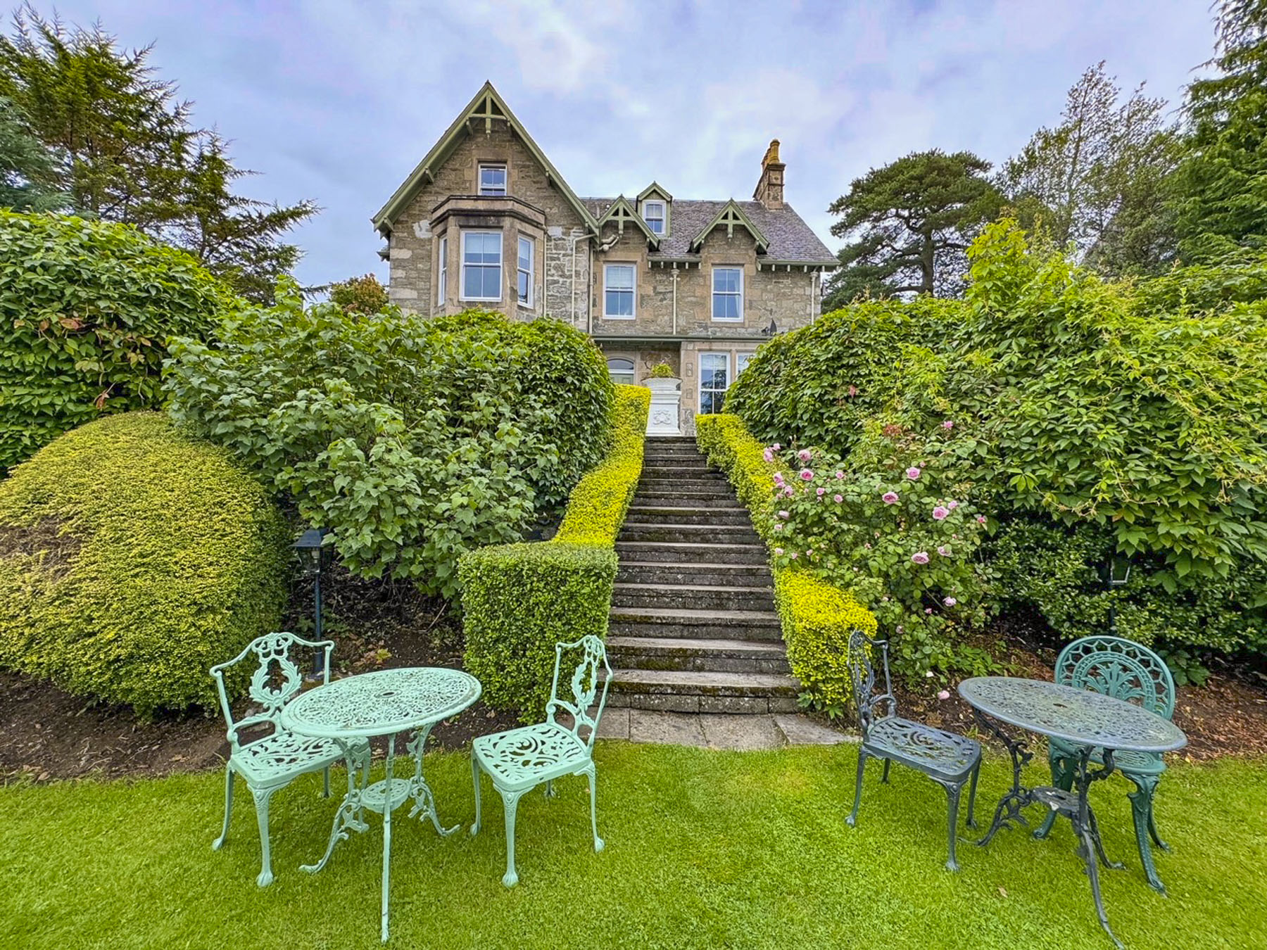
After a little difficulty finding the driveway, the hosts, a husband-and-wife team, of the Craigroyston House & Lodge greeted us as dusk was descending, and showed us our room. It was late, a friendly “See you in the morning. Good night,” was all that was called for. The Full Scottish breakfast – bacon, sausage, black pudding, haggis, mushrooms, tomatoes, and egg was a delicious as the dinner the evening before. The small medallion of haggis that accompanied this breakfast was the perfect introduction to the national dish of Scotland that’s made with minced liver, heart, and lungs of a sheep, and mixed with mutton suet, oatmeal, then seasoned with onion, cayenne pepper, and other spices. It really was very good, and we enjoyed it many times with breakfast during our stay in the Highlands.
The Craigroyston Houseis a small eight-room inn, with a beautiful, terraced garden, conveniently located one block away from Pitlochry’s main thoroughfare. Colorful hanging baskets hung from many shops, and brightened a gray morning. The weather report for the week ahead showed the possibility of rain every day.
Shopkeepers apologized for the unusually cold and rainy August Scotland was having. We soon realized, though, that those dreary mornings often gave way to brilliantly sunny afternoons. Heading back to the inn we stopped at Heathergems, a shop that turns highly compressed heather stems into unique jewelry. If you are looking for a souvenir this is definitely a place to consider.
The plan for the day was to drive to the village of Dunkeld. Then continue to Drummond Castle to wander around its formal garden, before ending the day in Edinburg.
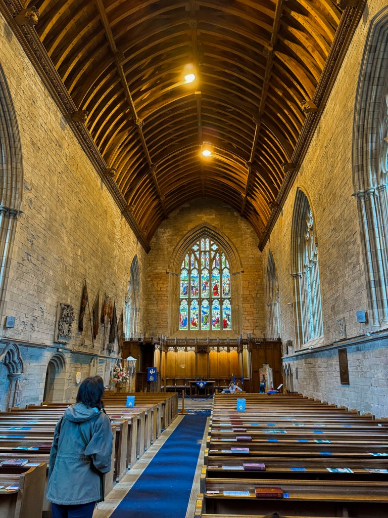
By late morning we arrived in Dunkeld and spent a while searching for parking close to the town’s ancient cathedral. It had started to rain, and it became a futile task competing with other tourists also wanting to find a parking space in the small village. We opted to park along the Tay River at the Tay Terrace Car Park, only a short walk away from the cathedral. The village has a long history that has always been tied to the early church in Scotland since 730AD, when Culdee Monks, Celtic missionaries, built a monastery there. One hundred and twenty years later the small village’s influence mushroomed when the first King of the newly united Picts and Scots, Kenneth I MacAlpin, moved the relics of Saint Columba from the Hebrides’ Isle of Iona to Dunkeld, to prevent their desecration by Viking raiders. Columba was a 6th century Irish missionary who founded an abbey on Iona, and is credited with spreading Christianity in Scotland.
In the mid 1200’s construction of a grand cathedral started above the ruins of the ancient Culdee Monastery. It was finished 250 years later in 1501, but only served in all its glory for sixty years before the altar and nave of the cathedral were seriously damaged when the roof of the cathedral was destroyed during the Protestant Reformation. At this time, the Scottish Parliament outlawed Catholicism and ended centuries of Papal authority over Scotland, which fundamentally altered the country’s cultural and social landscape. “Churches were to be stripped of their idolatrous religious art and decoration and then whitewashed, so that only God and Christ would be worshipped, and not their images, or images of the saints.”
The choir end of the cathedral was reroofed in 1600 to serve as the parish church or kirk, but was again damaged, when most of Dunkeld was destroyed in the Jacobite Rebellion of 1689. Over time the village slowly re-emerged as a market town, and supported weaving, candle-making, tanning and brewing businesses.
Off to the side and behind the altar in the “new” parish kirk, there is an interesting small museum with sculptures and tombs. Nearby in front of the cathedral, in the town’s old market square, there is an elegant stone fountain detailed with carvings of animals, birds, and Masonic symbols. It’s dedicated to George Augustus Frederick John, the 6th Duke of Atholl, and a Grand Master of the Scottish Masons, who brought piped water to the village in the mid 1800’s.
Dunkeld, with its many nooks and crannies and architectural details, was a delight to explore. When it started to rain harder, we sought refuge and lunch at Palmerstons, a small café busy with wet tourists. They served a great hearty lunch and good coffee at a fair price.
Centuries ago a ferry was the only way to cross the Tay river to Dunkeld’s sister village, Little Dunkeld, but it was extremely dangerous when the river was running high and fast. So, with great relief and fanfare, a stone bridge across the river was built in 1809. It’s a simple seven-arch construction that has withstood the test of time. It was designed by Thomas Telford, who is more famously known for engineering the 60-mile long Caledonian Canal which joined Inverness to Fort William, essentially connecting the North Sea to the Atlantic Ocean.
The Legacy of Beatrice Potter drew us across the bridge. The author and illustrator of the widely loved children’s books, The Tale of Peter Rabbit, The Tale of Jemima Puddle Duck and The Tale of Tom Kitten spent many summers of her youth vacationing in Dunkeld and exploring the flora and fauna along the River Tay. A charming park featuring small bronze sculptures of her animal characters along a pathway through the woods is dedicated to her memory.
We abandoned the highways and drove southwest through rolling hills along the famously narrow single-track roads of the highlands. The lanes, often lined with stone walls and fencing, allow two-way traffic, but in order to pass an oncoming car one vehicle has to pullover into a small bump-out called a Passing Place. These are well marked and spaced along the country roads, but you need to be on the lookout for approaching cars, as the protocol is for drivers to pull into the closest Passing Place on their side of the lane and wait for the other vehicles to pass. It took some getting used to. Surprisingly, the speed limit on these single-track roads is 60 mph, but we were only comfortable driving at half that speed. It was also important to be on the lookout for any stray farm animals that might have escaped their pasture, or equestrians, and those adorable tiny hedgehogs that wander across the road. Fortunately, no one was behind us when Donna, my eagle-eyed co-pilot shouted, “STOP!” and was out of the car in a flash to usher a hedgehog across the lane. The one big drawback is that you are not allowed to use the Passing Places to park and take pictures of the beautiful scenery.
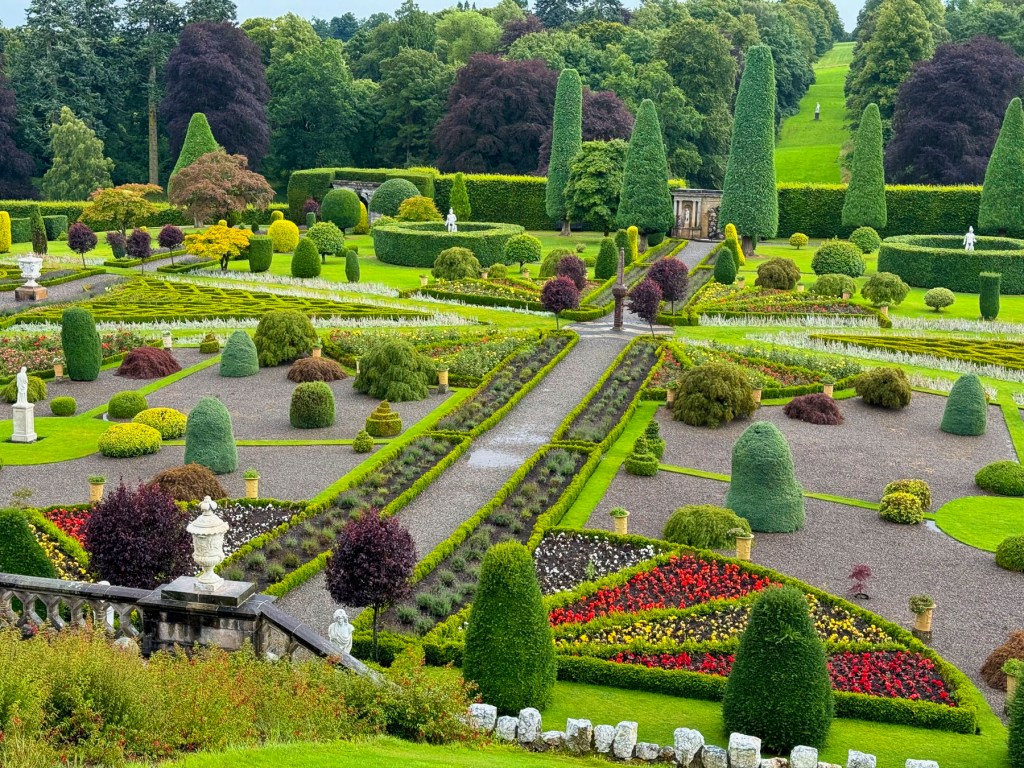
Just beyond Crieff we turned off the main road and followed a mile long driveway through a tunnel of ancient trees to Drummond Castle to see its Renaissance style formal gardens. It was still cloudy, but there was a hint of blue sky on the horizon as we stood in the castle’s courtyard above the gardens and readied ourselves for the walk down a long set of wide stairs into the flowering oasis, when suddenly a cloud burst above our heads and drenched us.
We scrambled back to the ticket office and asked for a refund, as we had only been there for a few minutes, but none was offered. That patch of blue above still teased us. We waited, and the sky brightened. The gardens were spectacular, as if the flowers had received a heavenly command to overcompensate for the bleak weather.
The castle’s original 15th century six-story stone keep still stands, but only the lower 2 floors are open to the public. The other chateau-like buildings were added in the 1600’s and are the private rooms of the Drummond family, which remarkably still owns the place after 500 years. In 1842 Queen Victoria is believed to have planted a beech tree in the garden, and understatedly praised the grounds in a letter to a friend, “Prince Albert and I walked in the garden, which is really very fine, with terraces, like an old French garden.”
After climbing back up the stairs we ordered two cappuccinos to ward off the day’s chill from a barista, boredly pacing in a coffee trailer parked in the courtyard. “Do the folks who own this live here?” I asked. “No, they have other castles but visit occasionally.” We walked away with a new realization about one-percenters.
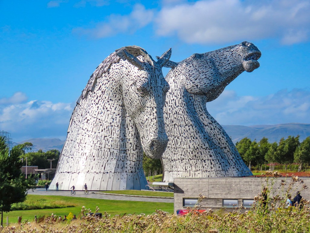
As we headed to Edinburg the sky finally cleared. Originally, I had planned our route to follow the M90 south and cross the Firth of Forth bridge into the city. But somehow, we ended up much further west, and were totally surprised when the 100ft tall steel Kelpies, shining brilliantly in the afternoon, towered above the tree line along the side of the highway. We had planned to stop there after visiting Edinburgh, but with the afternoon weather now perfect we seized the day and changed our plans. These equestrian statues are located in Helix Park at the confluence of the Clyde Canal and the River Carron. The steel horseheads are the largest in the world, and were created by the internationally acclaimed Scottish sculptor, Andy Scott. They are based on Scottish folklore where a kelpie is a dangerous shape-shifting water spirit that appears on land as a horse, who entices its unsuspecting victim to ride on their backs, only to be sped away to a watery grave.
It was a great second day in Scotland. On to Edinburgh!
Till next time, Craig & Donna
P.S. Scottish weather is notoriously fickle and changes dramatically throughout the day. Being prepared to layer up or down and having proper waterproof rain gear and footwear was essential. We invested in some Gore-Tex rain jackets and were delighted that they kept us totally dry.
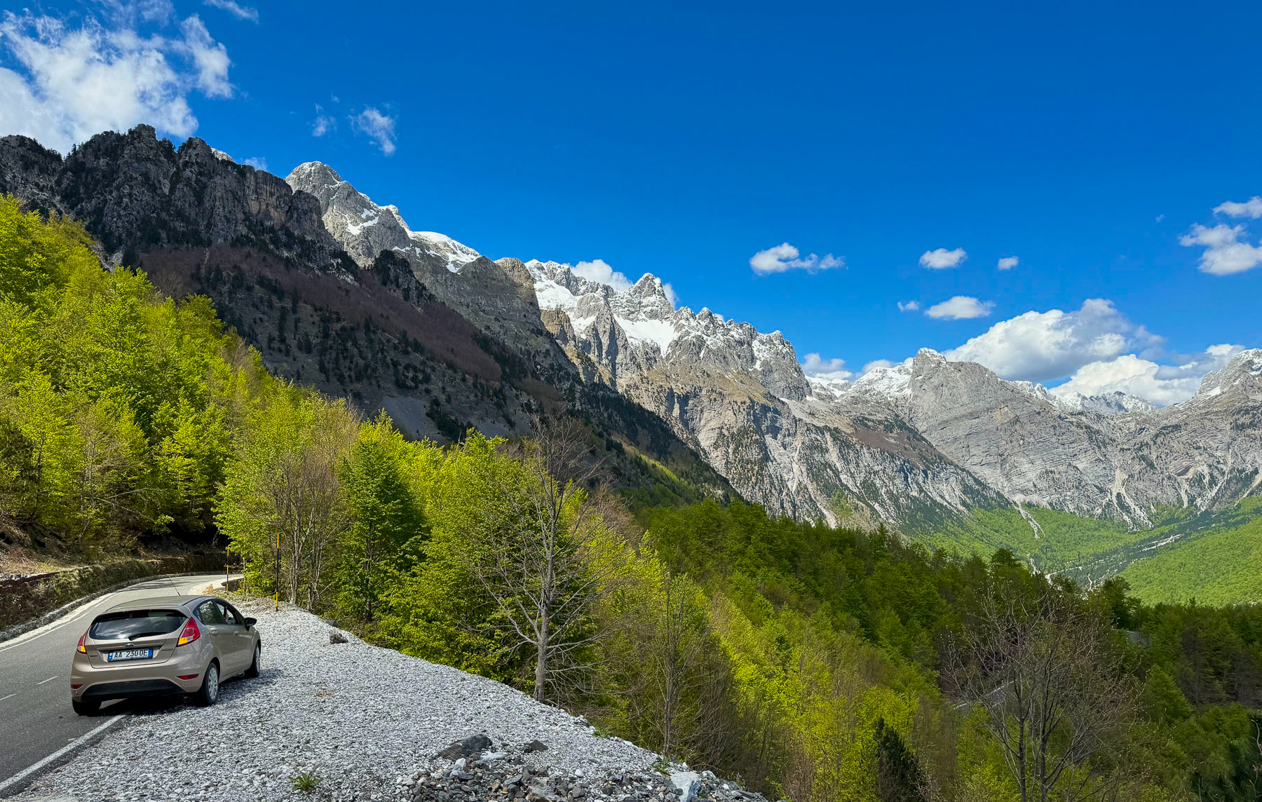
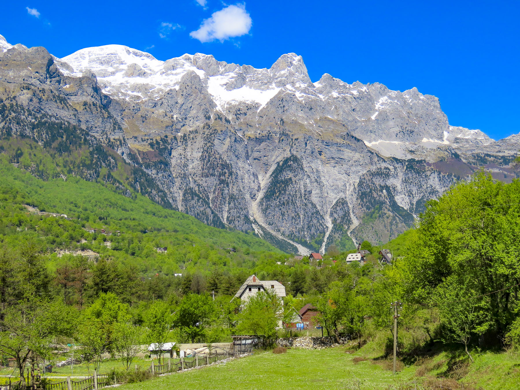
The day was crisp, the sky a clear blue, the mountains beautiful with their peaks still covered with late spring snow. We zigged and zagged our way along the infamous SH21, higher into the mountains, around many challenging blind corners and switchbacks. In spots the road narrowed to a single lane, but there were pullover areas to allow for oncoming cars to pass. Fortunately, in late April we had the roads and the overlooks in this pristine region mostly to ourselves. The views were breathtaking. A half-hearted complaint if any, there just were not enough places to stop safely to enjoy the picturesque landscapes.
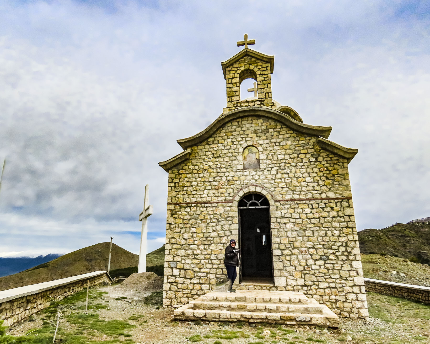
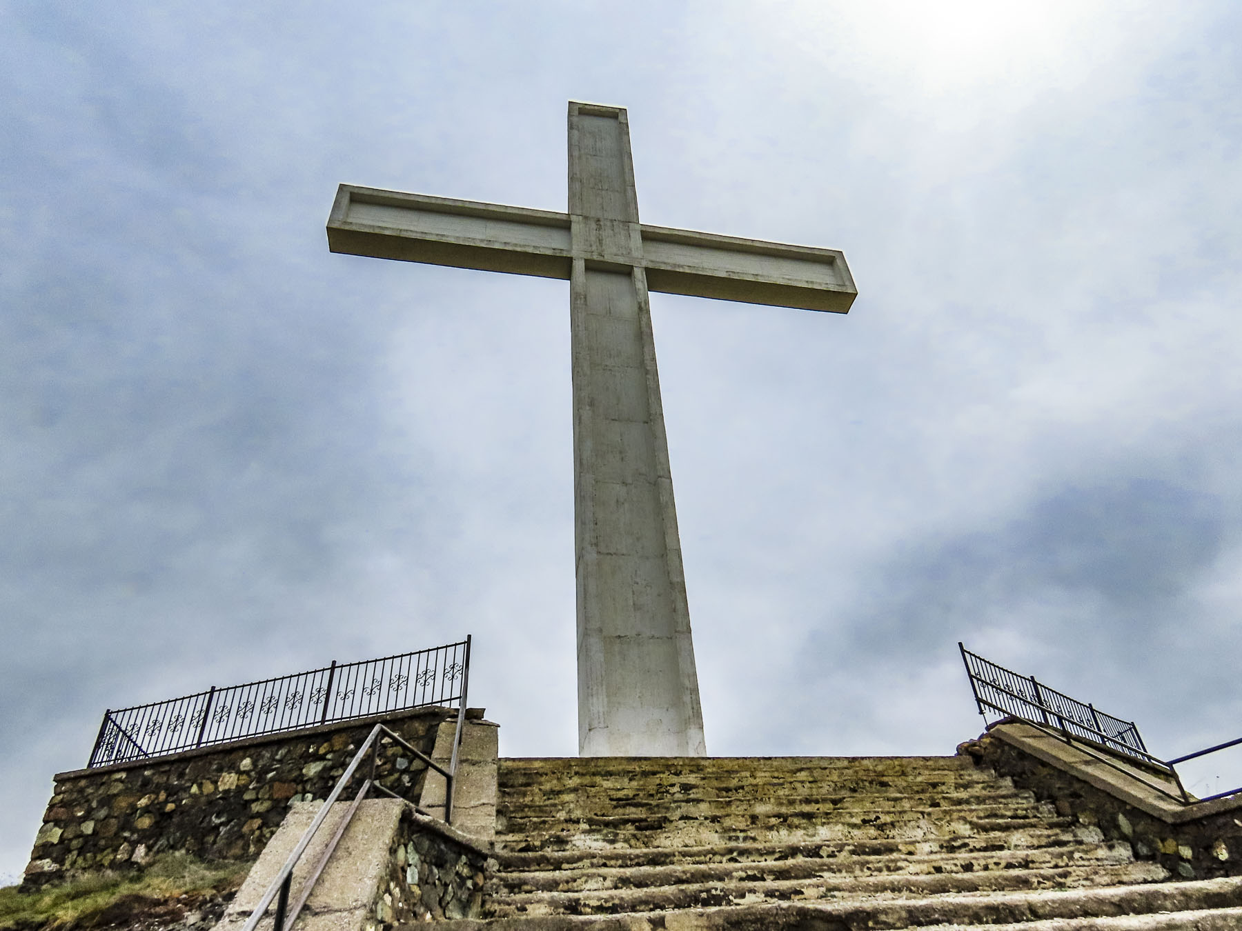
After cresting the Thore Mountain Pass, at 5,547ft the highest along the route, we stopped at the Monument commemorating Edith Durham, a British anthropologist who championed Albanian independence in the early 1900’s, and was lovingly called, “Queen of the Highlanders.” After that we could have coasted all the way into Theth, like Olympic bobsledders, but we were very judicious with braking.
Centuries ago, the inhospitable, saw-toothed mountains of northern Albania were a sanctuary for folks fleeing invaders. It’s a massive area at the southern end of the Dinaric Mountain Range, with nearly twenty mountain peaks having 9000 ft high summits, and it encompasses the border region where Albania, Montenegro, and Kosovo meet. The Dinaric Mountains are the spine of the Balkans, stretching from Slovenia through Croatia, Bosnia and Herzegovina, Serbia, Montenegro, and Kosovo before ending in Albania, where today they are called the Albanian Alps. A much friendlier name to encourage tourism than the Accursed Mountains, or “Bjeshkët e Namuna” as the original Albanian name goes.
There are three prevalent legends as to how the mountains got that original title, but hardship is at the core of each. One of the earliest legends credited the creation of the torturously steep mountains to the Devil when he escaped from Hell for a day. While there are streams and waterfalls throughout the mountains, they are not easily accessible and are often dry during the summer months. These dry conditions explained the tale of a mother fleeing her burning village. Her husband was killed in the fighting with Ottoman invaders, and she took her children into the mountains to save them from being forcibly converted to Islam. The days were hot, the terrain steep and unforgiving; her children were thirsty after three days without any water. Distraught, she cursed the mountains for causing their suffering. It’s also believed that soldiers struggling to cross the treacherous mountain terrain cursed the steep slopes, and most likely used many foul adjectives to make their point.
Footpaths and donkey trails were the only way into Theth for a millennium. The village didn’t have a school until 1917. The American Red Cross arrived in Theth in 1921 to help expand the educational opportunities in the Shala Valley. The American journalist Rose Wilder Lane tells of this school building mission in her 1922 book Peaks of Shala. Communication with the modern world didn’t expand until the first dirt track, a single lane, serpentine road that crested numerous mountain passes, was carved into the side of the masiffs that isolated the remote valley in 1936. It took another thirty years before the village received electricity in 1966.
It is difficult to find accurate figures on the ancient population of Theth, which in some instances includes the entire Shala valley and its nine hamlets, and at other times just the village of Theth itself. But it’s thought that at the end of Albania’s Communist regime in 1991 the remote area had a population of roughly 3000 folks in 700 households, though it is much less today. Interestingly, most of these villagers claim Zog Diti as a common ancestor of the Shala tribe or clan. Oral tradition relates that the name Shala is derived from shalë, a saddle, a gift he was given by his brothers, when led his family into the northernmost reaches of the Shala Valley. They fled from the region of Pashtrik, during the Ottoman invasion of Albania in the early decades of the 15th century to preserve their Catholic faith.
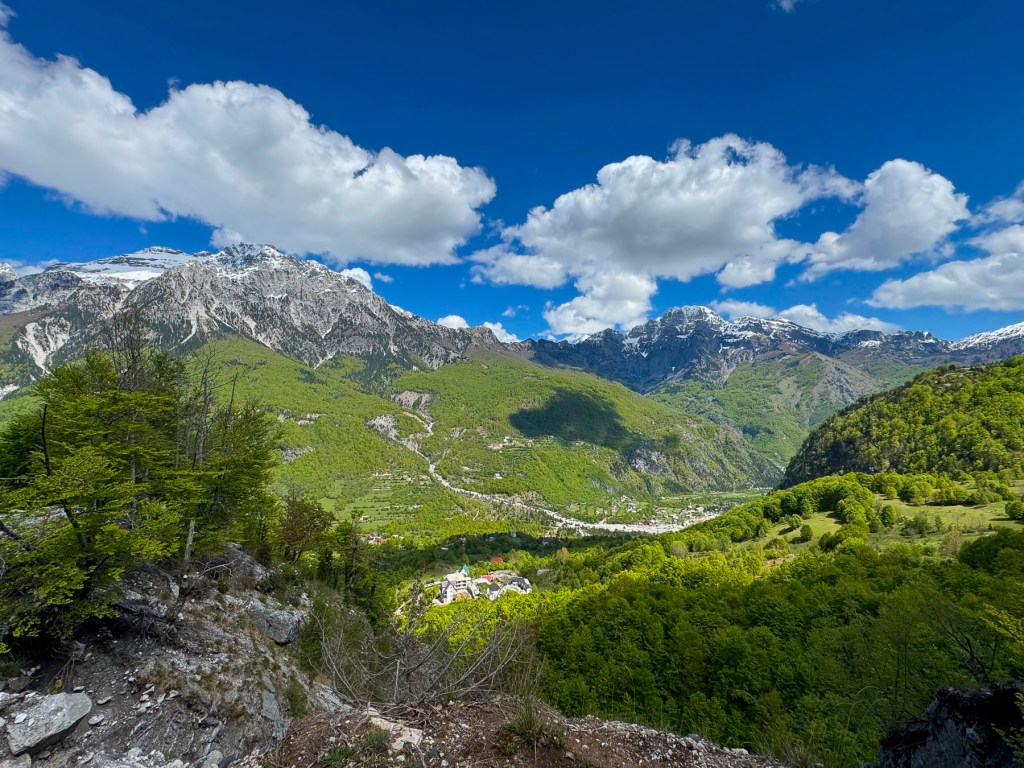
A road changes everything. While it brought progress in its early years, it eventually was the route of exodus for families seeking non-agrarian jobs for themselves and better educational opportunities for their children. It was extremely difficult to recruit teachers to live in the “wilderness.” Currently Theth has about 370 summer residents that return to support the tourist season, but only a hearty, resourceful handful of residents winter over in the often snowbound valley.
Today the village, with its modest tourist infrastructure, is the jumping off spot to pursue outdoor activities in the northern Albanian park system that includes Nikaj-Mertur Regional Nature Park, Valbona Valley National Park, and Theth National Park. This vast area encompasses many diverse ecosystems that include oak and beech forests at lower elevations that transition to pine trees and scree-covered slopes the higher up the mountains you go. The region is home to over 50 bird species, including kestrels and eagles. And if you are lucky enough you can spot gray wolves, wild goats, brown bears, and roe deer.
We arrived at the Royal Land Hotel & Restaurant as the shadows were lengthening and the sun skimmed the snowy ridge across the valley from the hotel. Just a week earlier the hotel had reopened for the season, and we, along with several other couples, were some of the hotel’s first guests of the year. After checking in, we sat at picnic tables on the terrace outside, sipping glasses of their homemade red wine, and watching the inn keeper’s son rototill the fertile dark soil of a garden plot. The sky stayed light for several more hours, but the sun had disappeared behind the mountains behind us. The lodge is very rustic with fourteen cedar-planked rooms, and a glass enclosed dining area, where each table has fantastic views of the surrounding mountains. The Inn’s restaurant is open to the public, as are most of the hotel restaurants in the valley. The family that owns the hotel was very friendly and helpful. Their breakfast buffet and home cooked dinners were delicious, with many of the items on the menu homemade or locally sourced. The sky was clear that evening and the stars brilliant across the night sky. Early the next morning, moonlight filled our room.
Hiking is the main activity in the Shala Valley, and we eagerly headed down into the village to explore the valley. Many folks choose to trek the popular Theth to Valbona trail, a nine-hour hike one way, covering 11 miles that takes you through a pristine high alpine wilderness. Being the city folks we are, we stayed in the relatively flat flood plain of the Lumi i Shalës which tumults from its source in the mountains north of the village. Near the bridge that crossed the river we spotted an understated monument that upon closer inspection commemorated the schools built by the American Red Cross in the Shala Valley.
Farther along we reached Kisha e Thethit, Theth’s iconic church, and could hear music softly emanating from the Sunday service being held inside. Built in 1892, the church is a strong stone building with a steeply pitched roof, and a belltower, that looks like a small medieval castle, ready to withstand a siege. Though, during Albania’s communist era, the building was used as a health center. Nearby a sign pointed the way to the trailhead for the Theth – Valbonë hike. Sheep contentedly grazed as their shepherd checked his cell phone. Untethered horses sauntered nearby.
From the church we could see Kulla e Pajtimit, the Reconciliation Tower, or “Lock-in Tower,” and headed there. The formidable two-story stronghold, with three small windows, was built four centuries ago, and served a dual purpose; to provide shelter for the villagers in times of trouble, and to serve as the reconciliation tower, a neutral ground where disputes within the village were resolved by a council of elders. In more serious cases that involved a murder or threat of murder for revenge, the accused party would be locked in the tower for fifteen days as a cooling off period, while the elders tried to reconcile all parties affected by the crime.
This millennia old tribal custom was widespread throughout Albania and was part of the “Code of the Mountains,” that was passed down through an oral history tradition from generation to generation until it was codified in the 15th century by Lekë Dukagjini, an Albanian nobleman and contemporary of Skanderbeg, an Albanian hero. Since then, the tribal laws have been known as the Kanun of Lekë Dukagjini. The kanun has an extensive set of 1263 rules that cover everything from beekeeping to marriage and honor. It is most famously known for obligating families to partake in gjakmarrja, (blood feuds), that permitted koka për kokë (a head for a head), and hakmarrja, (vendettas), to maintain honor by seeking revenge. The heavy hand of Albania’s communist government had some success in outlawing this practice, but unfortunately, it’s still an issue for law enforcement today.
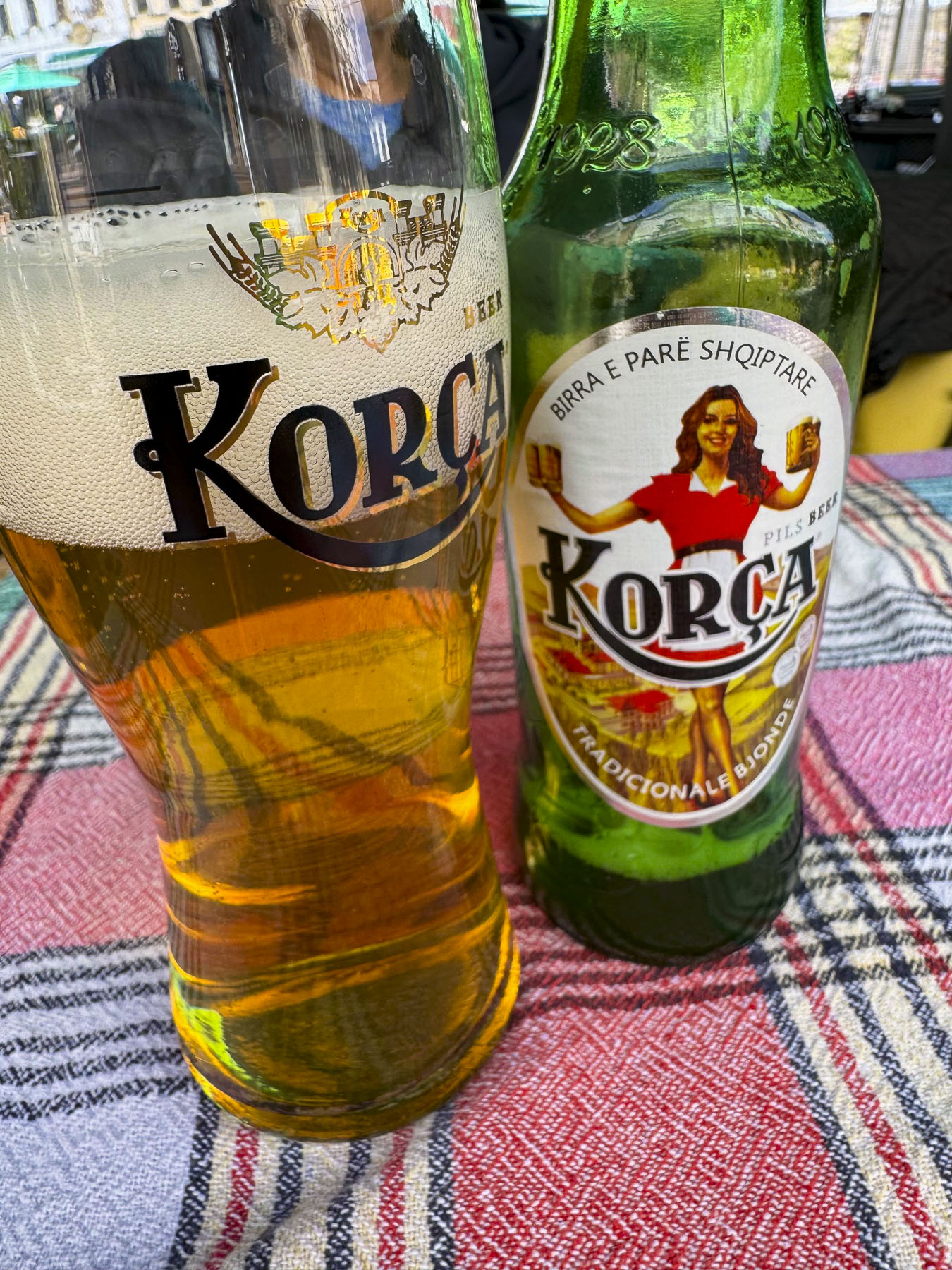
Later we stopped for lunch at the Thethi Paradise restaurant and enjoyed fresh trout, grilled lamb, and a few Korça beers, at an umbrella covered table on the patio.Surrounded by mountains from end to end, the Theth Valley was absolutely stunning and serenely tranquil in its “majestic isolation,” borrowing a phrase from Edith Durham.
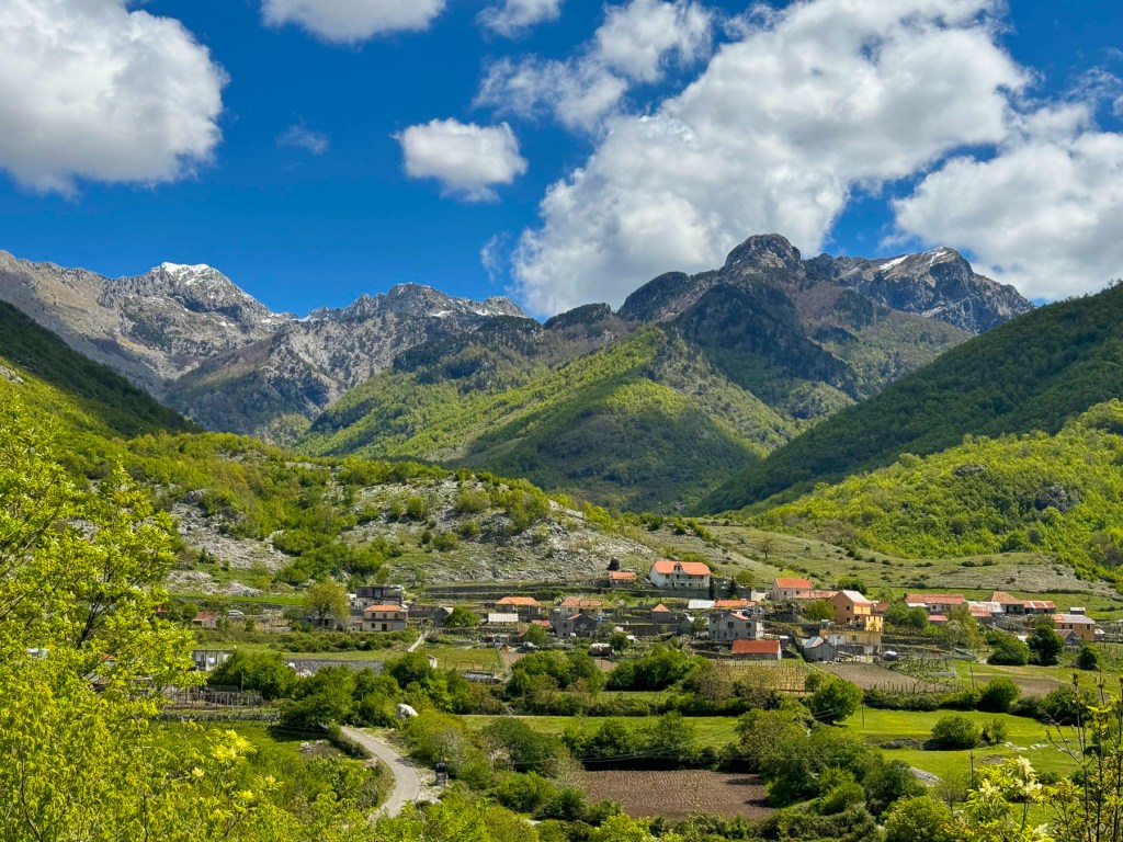
The next morning, we retraced our drive across the mountains to Shkodër before continuing south to the Lezhë Castle and Kruje, where we spent the night. The drive out of the valley was just as beautiful as the drive in.
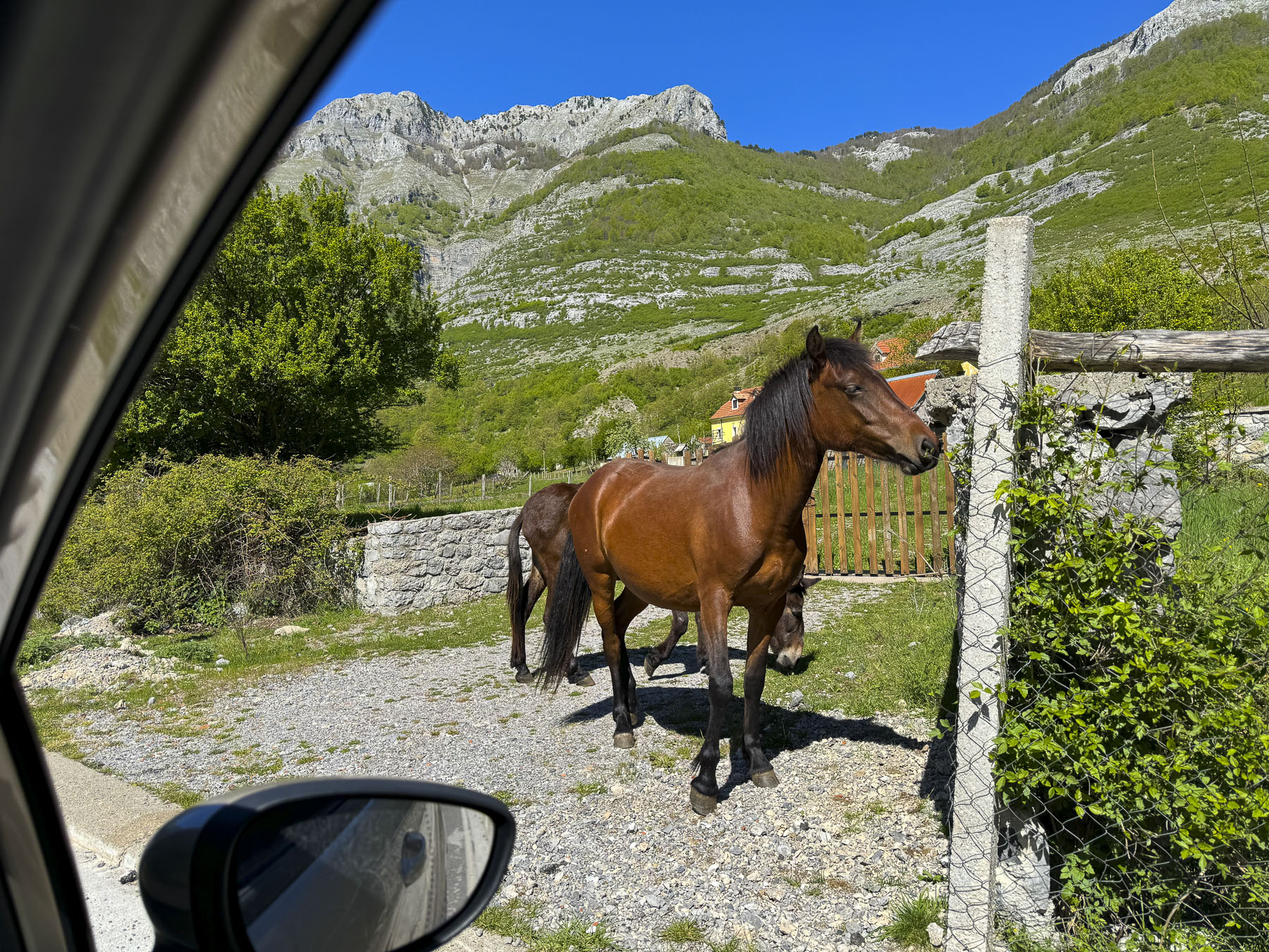
Our only companions on this quiet stretch were a flock of sheep being herded down the road, and a sow followed by her piglets crossing behind her. The drive was uneventful until the bridge over the river ahead of us was closed for road repairs, and we were directed to follow a deeply rutted farm track through the countryside for several miles. The road surface was so unforgiving that the car bottomed out several times regardless of how slowly we were going. At this point we didn’t have a cell signal, and there were no other detour signs, so we had to dead reckon our way back to the highway. The rental car company had cautioned us that they prohibited driving on dirt roads, and that we would be fined if their satellite tracking recorded us doing so. We kept our fingers crossed.
It was easy to spot Lezhë Castle, perched high on a hill, from miles away. Though getting there was a little more challenging and involved driving on some of the steepest roads we ever encountered. Think hills of San Francisco steep, but worse.
The castle had a commanding view of the surrounding terrain, though especially important was its western vista, where ships on the Adriatic Sea could be spied before they reached Albania’s shore. It was in this castle in 1444 that Skanderbeg, Albania’s national hero, rallied his countrymen to resist the occupation of the country by the Ottoman Empire. The best view of the castle was from the parking area. The area behind the walls is left in a rather rustic state with tumbled ruins and cisterns to explore. Overlooking the sea, we enjoyed a picnic lunch in the shade of the ramparts.
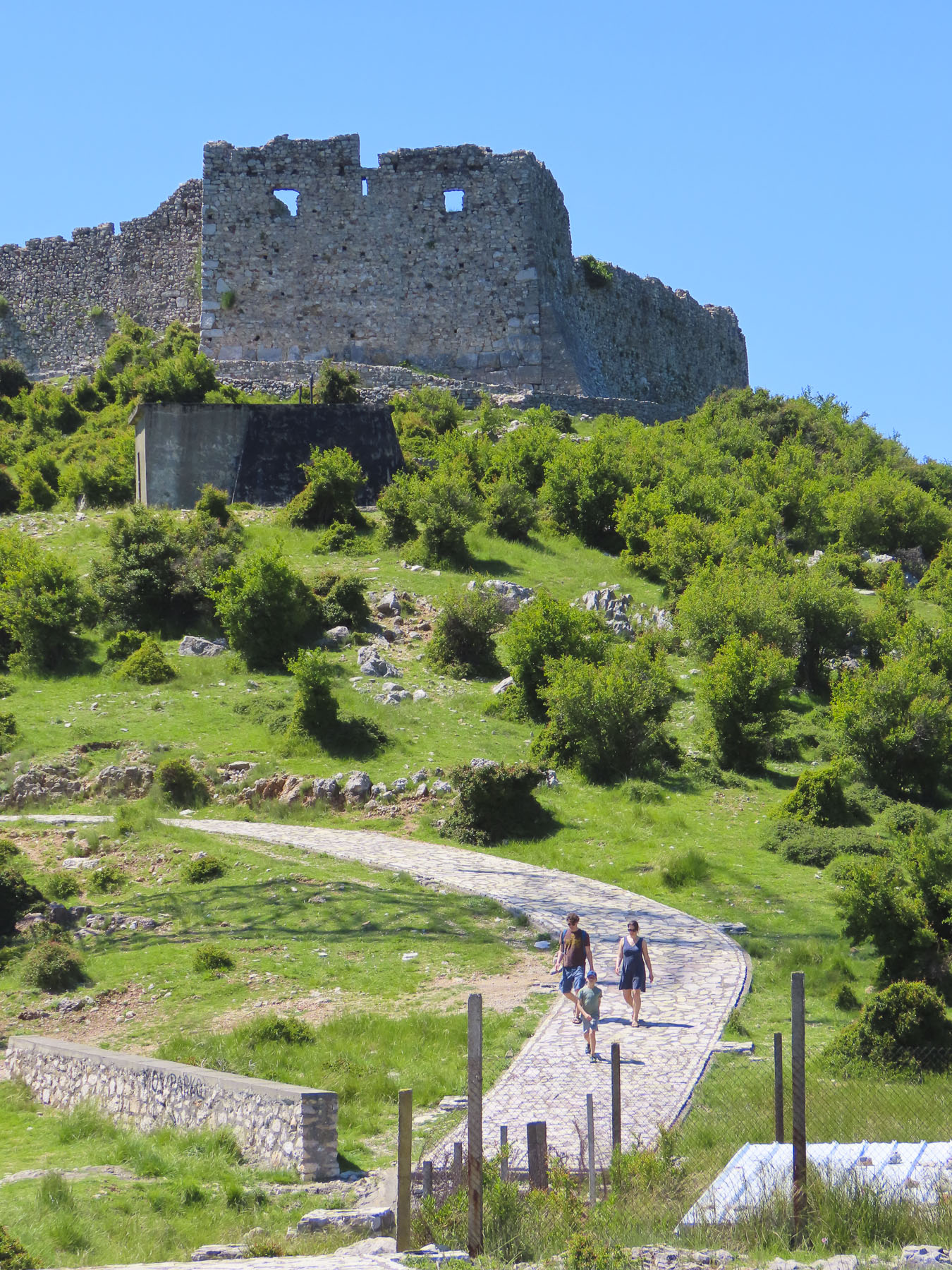
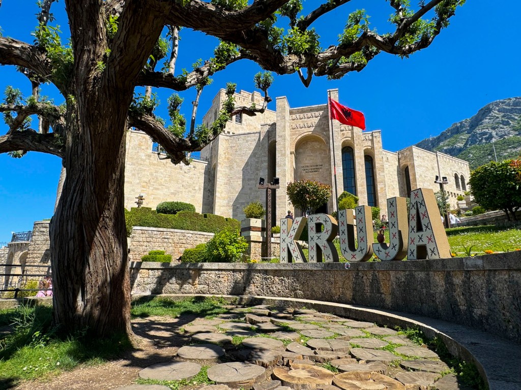
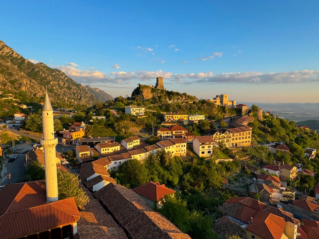
The hillside town of Kruje, set high above the Tirana Valley, was our last destination in Albania. On our way to the Hotel Panorama we passed a large statue of Skanderbeg astride his steed, which commanded an overlook in a city park.
Albania’s national identify, a spirit of perseverance and resistance, is intimately linked to Skanderbeg and Kruje, his hometown. Born into the noble Kastrioti family during the early 1400’s, his parents were forced to give him to the Ottoman Empire as part of Sultan’s devşirme system. This “child tax” was to ensure a family’s loyalty to the sultan. Only one son could be taken. These children were then taught the Koran, given an education, and raised as Muslims, before being sent to serve in the Ottoman Empire’s Janissary corps, a highly trained infantry. Skanderbeg excelled as a skilled Ottoman soldier and rose through the ranks. But after a 1443 battle in Serbia he renounced Islam and escaped back to his homeland and reclaimed his title. A year later he led a league of Albanian Princes in revolt against the Ottoman occupiers. For over twenty years he rallied his fellow Albanians to repel 13 invasions, and was considered a hero throughout a Europe that feared the expansion of Islam across the continent. The citadel in Kruje was his headquarters during this time and endured three intensive sieges. Ten years after Skanderbeg’s death the castle fell and the Albanians relinquished their independence to the Ottomans for 400 years.
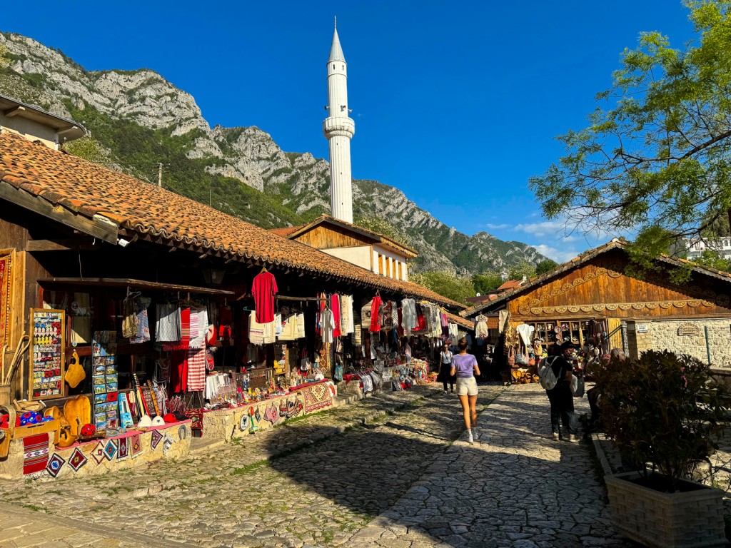
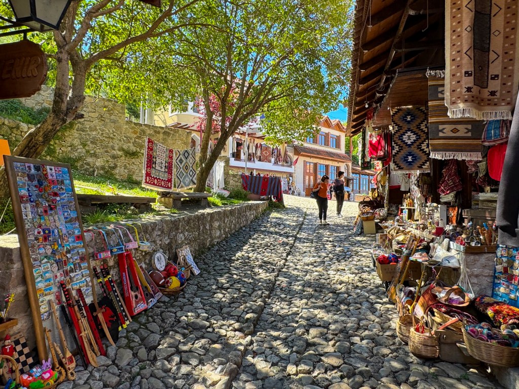
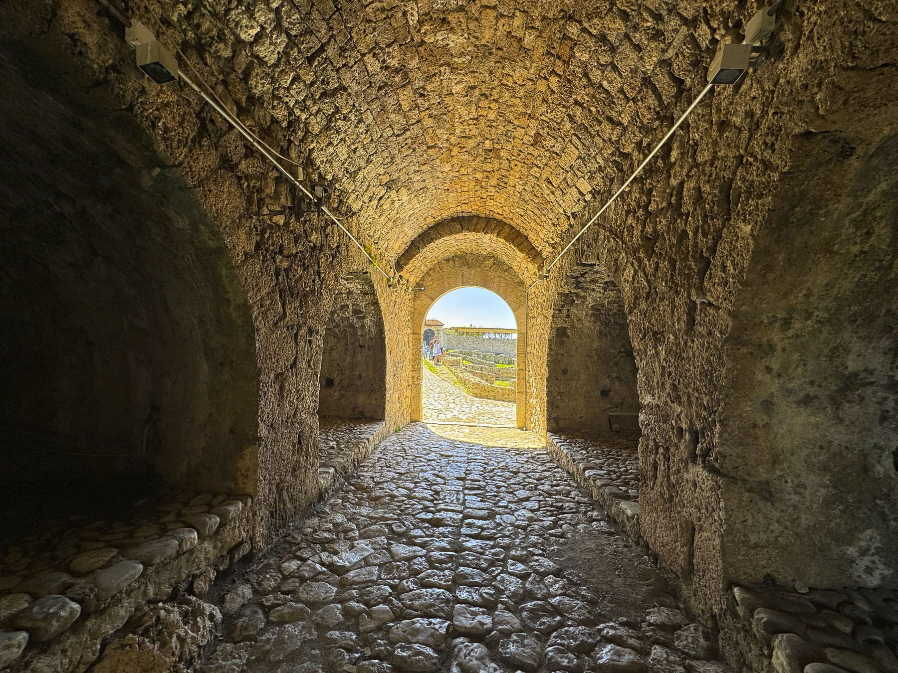
Its name said it all, and the Hotel Panorama’s guest rooms and rooftop terrace were the perfect spot for views out over the town’s ancient caravan market and Kruje castle. An arched stairway descended under the hotel from the main street and led to the historic bazaar, which is over 400 years old. A 16th century minaret towered above us.
It’s believed to be the most historically accurate representation of an ancient marketplace in Albania, with its cobbled street centered with a drainage divert and canvas awnings hung from the shops, to protect shoppers from the midday sun.
In centuries past it would have had a full array of merchants offering a wide assortment of ancient everyday items, and luxuries crafted in faraway lands. Today, it’s a gauntlet of tourist themed merchandise, but we found one hidden gem, the Berhami Silver shop. The proprietor and sole craftsman, specializes in unique, intricately woven filigree jewelry.
We shielded our eyes from the bright sun as we left the long, arched tunnel through the ramparts, and looked up at the Skanderbeg National Museum. Built in a historical style to reflect its surroundings, it was a majestic sight, its sandstone blocks glowing in the afternoon sun, and the red and black Albanian flag full out in the breeze.
Its exhibits feature artifacts from Skanderbeg’s era and Albania history. One of the most intriguing displays was a replica of the hero’s signature goat head-topped helmet. Albania’s flag evolved from the two headed eagle on the Byzantine Empire’s flag which flew over Albania from the 4th to 14th centuries.
The double eagle heads symbolized the unity between the Orthodox Church and the Byzantine Empire. The black eagles above the Kastrioti family coat of arms on a crimson background became the flag of rebellion when Skanderbeg raised it above Kruje in 1443. Its colors black and red represent the strength, bravery and heroism of the Albanian people.
Above the castle we rested outside at a small café with an expansive panoramic view. Unaware of castle’s closing time we headed down the slope to the Tekke of Dollma, a small Bektashi Sufi shrine that contains the tomb of the mystic leader, Baba Shemimi. We reached the gate of the tekke’s courtyard just as the caretaker was about to lock the door for the day.
Graciously, he let us stay for a few minutes. The building was still under repair from the 2019 earthquake, but still very interesting. Legend believes the ancient olive tree in the courtyard was planted by Skanderbeg. The castle was a wonderful site to explore, and if we had had more time, we would have visited its ethnographic museum.
The sun was casting a golden glow across the hillside by the time we reached the rooftop terrace of our hotel. We clinked glasses and reflected back upon a fabulous vacation exploring Albania.
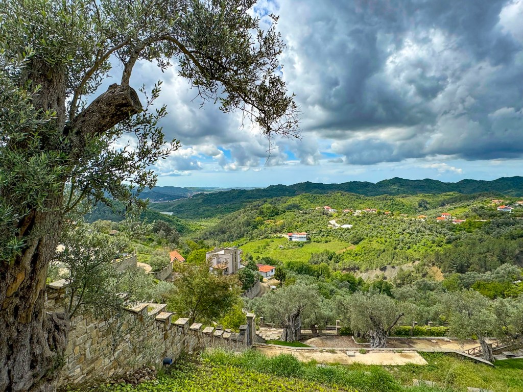
Ancient, gnarled olive trees covered the sharp slopes on either side of the road, along a narrow razorback ridge. Their silver-gray olive leaves undulated with light from a morning breeze. Some of the older trees are 3000 years old, and the fruit from the trees is believed to make the best olive oil in Albania, and is sought after by connoisseurs and chefs. An elderly man herded a small flock of sheep across the road, a common occurrence in rural Albania where it seems there is more four-legged traffic than cars.
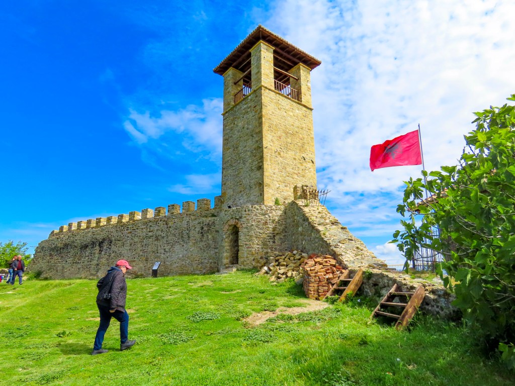
We parked and walked up a short steep lane, past a school where a coed basketball game was enthusiastically underway, to the ridge’s 1300ft summit and the Preza Fortress. The stronghold was built in the mid 1400’s and played an important role in the Albanian resistance to Ottoman rule.
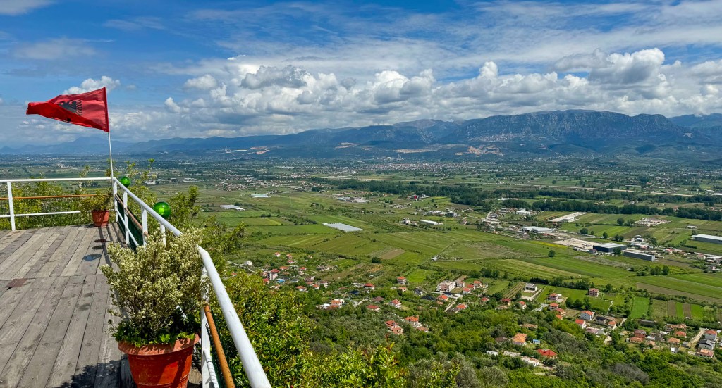
It was once a massive compound with commanding views of the broad plane of the Tirana Valley to the east. This valley was the favored north-south route for invaders, and was the fertile breadbasket of Albania since the Iron Age. Mid-week in late April we had the site to ourselves except for a group of older men, seemingly an old boys’ club, enjoying each other’s company, tucked away in a small outbuilding with a large glass window through which we could see them playing cards, drinking coffee, and reading the newspaper. Unfortunately, only one tall watch tower remains of the compound, but the panoramic view was fantastic.
Bar Kalaja e Prezës is the restaurant at the site and was a great place to relax with a coffee and absorb the serenity of the landscape from their terraces. There was also a very large lover’s heart perched on the overlook that was the perfect spot for an Instagram photo.
We had left Durrës earlier that morning, headed toward the northern city of Shkodër, and followed the A1 north. We had been in southern Albanian for the prior two weeks and were surprised now by the amount of traffic congestion along this main artery. It was mostly due to the construction project widening the two-lane road, and the economic activities of businesses, with parking lots right next to the road which creaed all sorts of mayhem – cars were pulling off and onto the highway. There were few traffic lights. One section of the road was lined with folks selling parrots and chickens right from the curbside, while at another point men on either side of the road carried puppies up and down the traffic, offering them for sale. Fruit and vegetable stands were a common occurrence. As we’ve mentioned in our earlier blogs, we found Albanians to be very friendly. But put them behind the wheel of a car, and there is an aggressive personality shift, where they throw the driving rules out the window. I know this is a sweeping statement, but when you experience the roads firsthand, you’ll understand, and any Albanian citizen will agree with me. Driving in Albania was a blood sport – the automotive version of rugby.
The one big plus of driving along Albania’s main roads was the superb quality of restaurants attached to gas stations. In the states these are often fast-food chains or “greasy spoons,” that serve caloric, processed foods. Albanians take their cuisine quite seriously, and we found it nearly impossible to have a bad meal in the country. The key though to these roadside restaurants is to pick one where the parking lot is almost full. It’s always a good sign that the place is busy with satisfied customers. The restaurant Autogrill Emanuel, along the SH1, in Balldren was a wonderful find, and a great place for lunch. The façade was ho-hum, it is after all located at a gas station, but the inside was pleasant, and the tables were covered with linen tablecloths.
Near closing time we arrived at Rozafa Castle, parked and started to walk around a small hill that obstructed our view of the fortress. It quickly became apparent that it was too long of a trek uphill, and it would diminish our time exploring the site. Several cars passed us coming downhill and we realized we just might get lucky finding a place to park nearer the entrance. Fortunately, that was the case, but even so it was still a strenuous walk to the center of the citadel.
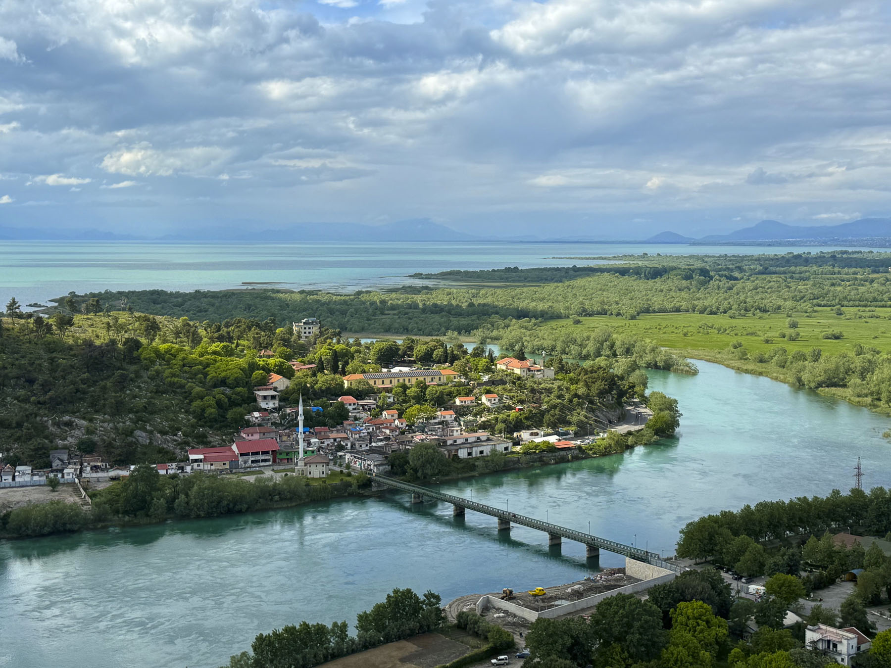
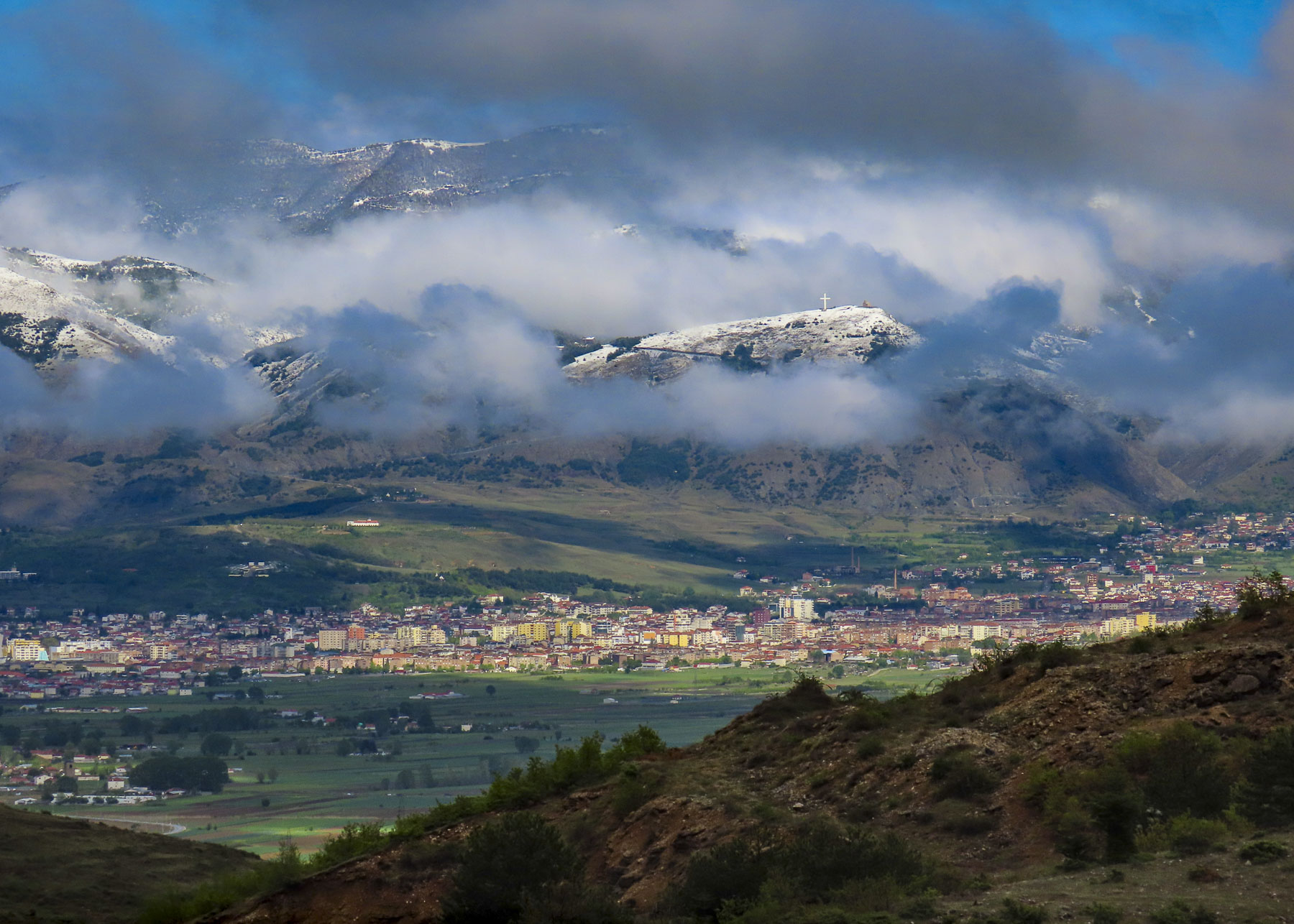
The views were fantastic. We could see for miles around, especially out over Shkodra Lake where the mountains of Montenegro rose on the northern horizon. To the east the small metropolis of Shkoder spread imposingly across the flatland beneath the foothills of Albanian’s beloved Accursed Mountains. While the panorama to the south encompassed the meandering Drin River.
The first fortifications on the hill date to the Illyrian kingdom during the 4th century BC, though archeological discoveries confirm the hilltop had inhabitants since the Bronze Age. Albania folklore is full of tales of stoic women sacrificing for their country. Though the legend of how Rozafa Castle received its name is one of the more tragic and involves human sacrifice. The tale goes that construction of the castle was beset with difficulties, walls collapsed, workers died. An oracle was consulted and advised that a woman be entombed in the castle’s wall to appease the Gods. Rozafa, a young mother, was chosen, and as the legend goes, willingly participated as long as her chest was left exposed for her infant to breastfeed. For ages afterward it was believed that the liquid dripping from the limestone stalactites on the ceiling of the ancient Illyrian gateway to the fortress was the entombed mother’s milk, and that the castle was alive with her spirit.
The Roman Empire defeated the Illyrians, and over the following centuries the fortress was controlled by an ever-evolving list of rulers that included the Byzantine Empire, Kingdom of Serbia, Lordship of Zeta, Principality of Zaharia, the Venetian Empire, the Ottoman Empire, the Pashalik of Scutari, and the Kingdom of Montenegro. T
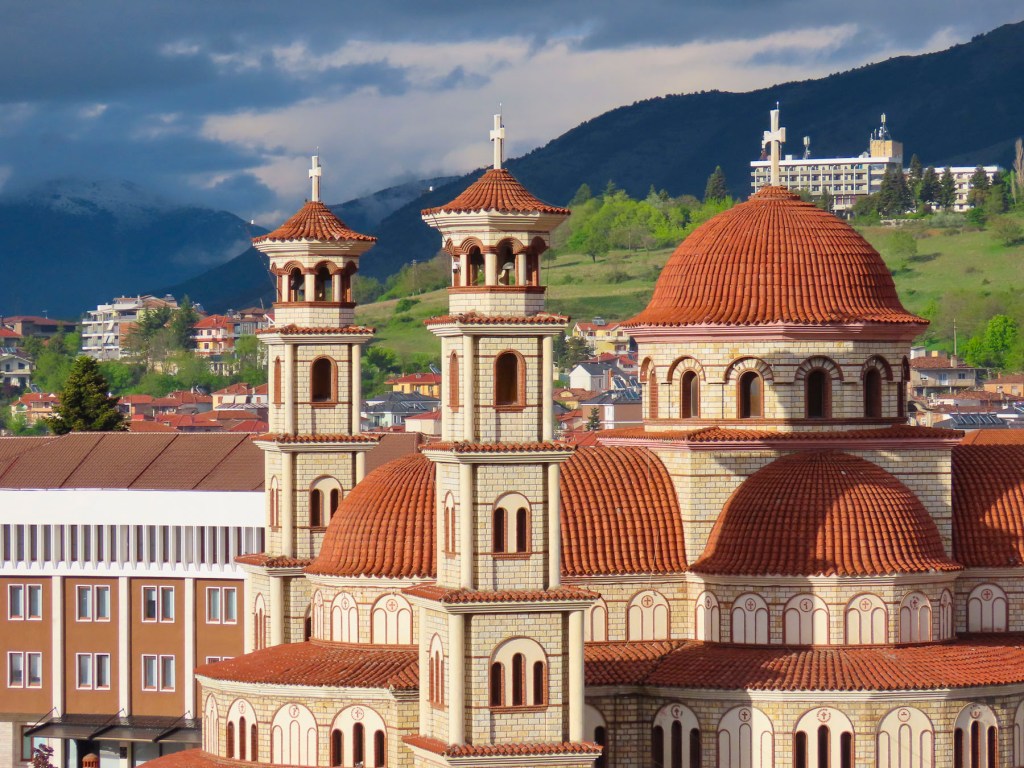
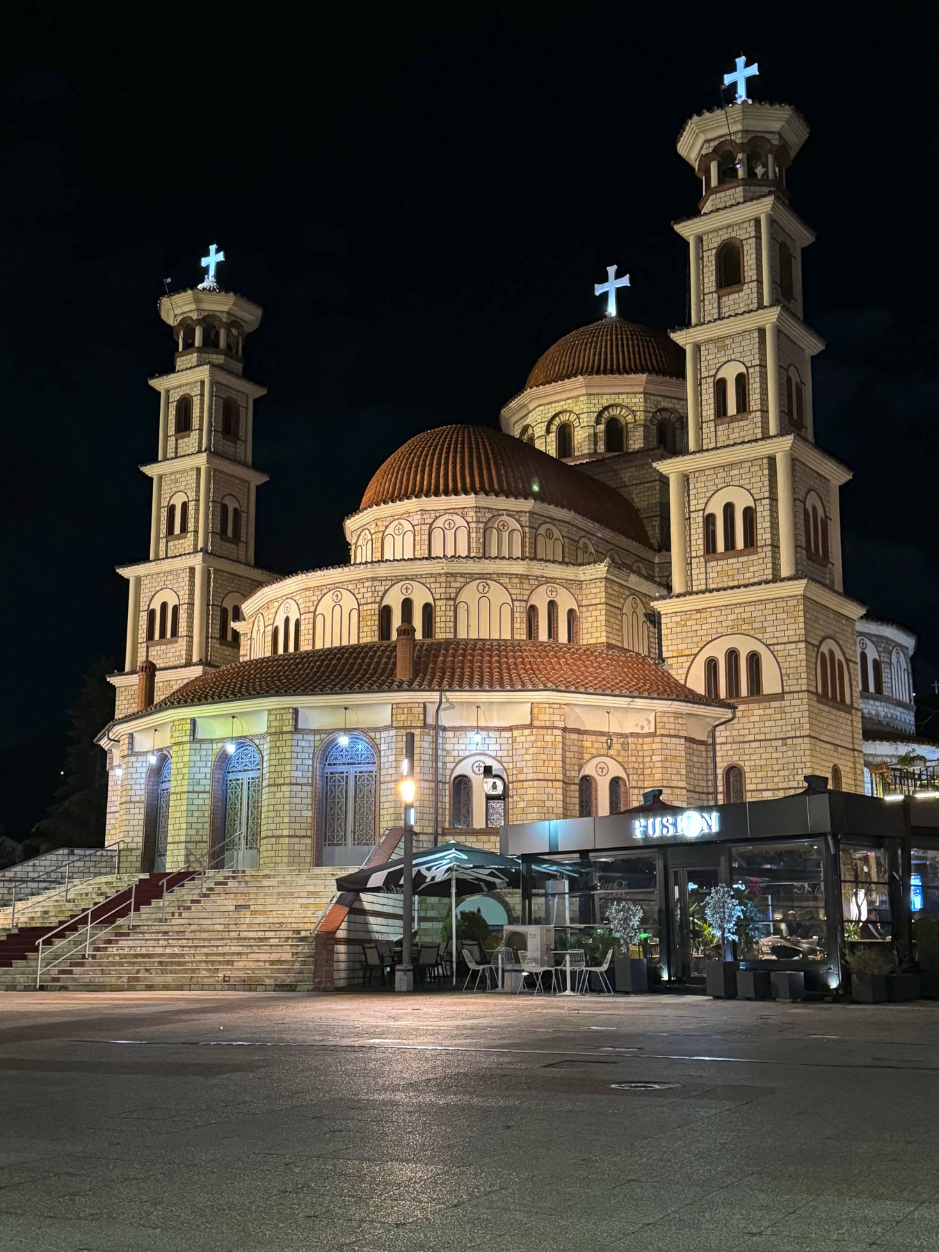
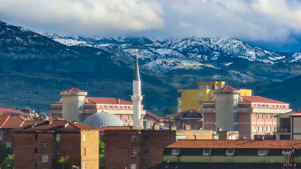
We were taken by the beauty of the old town at the Migjeni roundabout, where an intriguing cityscape included Ebu Beker Moosque’s minarets, and Kisha Katolike Frencekane’s belltower; crenellates and fountains revealed themselves. Shkodërtoday is Albania’s fifth largest city with a population of 102,000. Though thriving today, the city has had a tumultuous history. Most poignantly in 1967, the Communist dictator Enver Hoxha declared Albania an atheist state and banned the practice of all religions. Churches and mosques were seized and converted to other uses or destroyed. Religious leaders were executed or imprisoned for decades in brutal labor camps and prisons to break their faith. The communist regime viewed anyone who believed in religion as an enemy of the state. Family members of the accused were victimized as well, with the denial of educational opportunities, and decent jobs. Consequently, the citizens of Shkodër who cherished their religious harmony and embraced each other’s Muslim and Christian traditions, in a city where it was not uncommon for members of the same family to practice different religions or intermarry, suffered greatly under communism.
The most poignant insult was the creation of the National Museum of Atheism, an anti-religious propaganda center, in the city. While the borders of Albania were closed to the outside world, even the cities within the country were isolated from each other, and Shkodër sat alone and inaccessible in the northern part of the country. Any news it received of events in southern Albania was heavily censored. Even folks that were “free” likened it to living in a penal colony, as the town had 23 prisons, and nearly every family had someone in jail. The Sigurimi, the communist secret police, had a heavy presence in the city, and encouraged informants to denounce anyone, even for simply wearing a religious cross. Similar to Bunk’Art 2 in Tirana, the site of the Witness and Memory Museum in Shkodër documents the atrocities the communists committed against the townsfolk, in a confiscated Catholic school that was operated as an interrogation center.
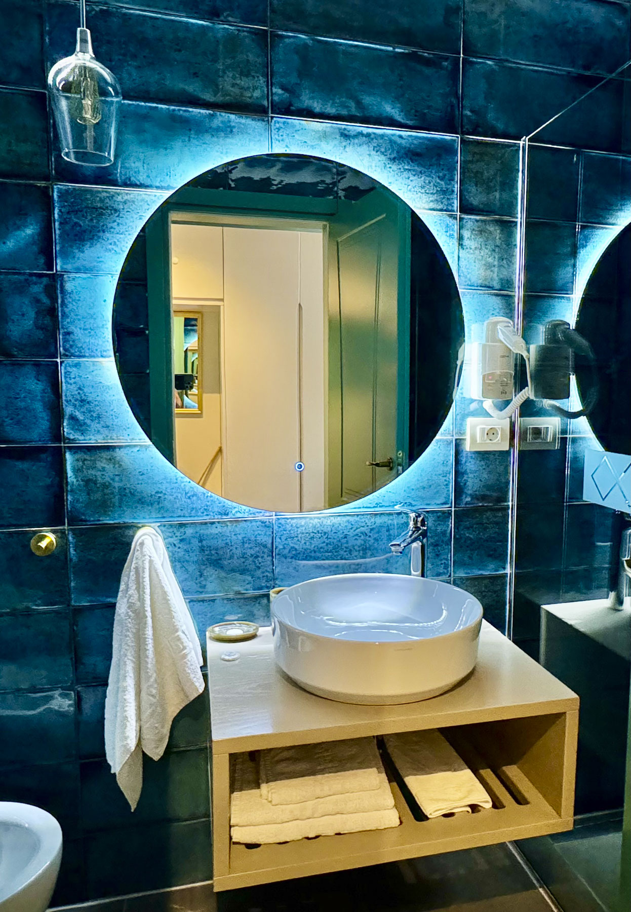
The Çoçja Boutique Hotel was only a few minutes from the roundabout, had underground parking, and most importantly was a short walk away from the pedestrian only streets Rruga Kolë Idromeno, and Rruga 28 Nëntori. We are not sure why this small 17-room hotel is only rated three-stars, but it was one of the nicest hotels we have ever stayed in. It’s a newer building that’s exquisitely well decorated, and our bathroom was a modern wonder. The staff was also very nice.
Ten thousand undergraduates attend the University of Shkodër, and the cosmopolitan city’s streets are full of students pedaling across the town’s flat roads. Their presence contributed greatly to Shkodër’s youthful contemporary vibe, that’s much different from the rest of the country. In the evenings the restaurants and cafés along the pedestrian mall were filled with their energetic enthusiasm.
We took advantage of a warm night and enjoyed eating outside on the second-floor balcony, which overlooked the mall, at Bar Restaurant San Francisco, on Rruga Kolë Idromeno. I tried the traditional Shkodër specialty, Tavë kosi, made with lamb, yogurt, eggs, garlic, and oregano, while Donna ordered baked lamb with rice. Roasted vegetables and the house wine accompanied our dinner. All were quite good. We ordered lamb frequently while traveling around Albania, as in the states it is not offered in many restaurants, and when it is it’s very expensive.
The next morning, we strolled in the opposite direction down the shaded Rruga 28 Nëntori, where preparations were underway for the 11th annual Hemingway Jazz Fest & Swing Marathon, that’s held at the end of April. Unfortunately, we were not in Shkodër for it, but it would have been really nice to watch folks cutting loose. Towards the end of our walk, we reached Shatërvani Park, where there were several sculptures.
One was a whimsical and retro collection of towering, stylized dandelions, which I haven’t been able to find any information about. Nearby, across from the City Hall, stood the Monument Dedicated to the Victims of Communist Persecution.
A plaque near the sculpture states it’s dedicated to the sacrifices, and resistance the people of Shkodër made during the communist dictatorship. This is the first memorial of its kind in Albania and considered long overdue. Many think it is an important first step towards reconciling the atrocities of Albania’s communist past with survivors of the nightmare.
In hindsight two nights in Shkodër wasn’t enough time to adequately explore the city. An extra day would have allowed time to visit some of the museums in the city.
“The old timers say on a stormy day like this you can hear their cries on the wind when you pass through Borove,” our host commented mysteriously as he learned of our plans to drive along the SH75 towards Voskopoja and then Korce. Evidence of Albania’s new investments in its road infrastructure to support tourism in southeastern part of the country were visibly apparent, with bridges being repaired, as well as sections of the road being widened, and repaved along our serpentine route through beautiful, forested mountains. The mountains finally receded behind us as we coasted downhill into a wide valley with gently rolling hills.
As we rounded a bend, a tall brooding silhouette loomed over the road. The statue of two resistance fighters captured in a decisive moment of attack commemorates the July, 1943 partisan ambush of a German troop convoy through the valley, near the hamlet of Barmash. The battle raged for hours and left 60 enemy soldiers dead, and numerous vehicles destroyed. Sadly, the second part of this event revealed itself several miles away in the larger village of Borove. Here stairs on the outskirts of the village quietly led to the top of a knoll and the Memorial i Viktimave të Masakrës së Borovës. This heart-rending site contains the graves of 107 men, women and children massacred the next day when Nazi troops returned to the area and set their village ablaze in retaliation. It’s a moving memorial, and we stayed until a pounding rain forced us back to our car.
Farther along we passed through Ersekë. It’s one of Albania’s highest towns, sitting at an elevation of 3,445 ft on a high plain, in the shadow of the Greece’s Pindus mountain range. This southeastern part of Albania is very remote, and the village so close to the Greek border, that during the communist era villagers were prevented from leaving the town, on the fear that an abandoned village on the border would invite Greek expansionism. The town is most noticeable for its well-maintained communist era minimalistic architecture.
Reaching Korce we turned west onto SH63 and headed back into the mountains, our destination, the ancient Orthodox churches of Voskopoja. Light rain turned into 3 inches of wet snow as we drove higher into the mountains. This didn’t particularly faze us as we both have decades of experience driving on wintry roads in northeastern United States. But the drastic change of weather did, considering 10 days earlier, when we arrived in Tirana we rejoiced in 80F weather for several days earlier in the month. The saving grace – there were literally no other cars on the road.
On a snowy Sunday afternoon in late April we practically had the whole town to ourselves. It was quite serene and beautiful with the fresh snow clinging to the trees, and tufts of spring greenery poking through the snow on the ground. We found Saint Nicholas Church and gingerly made our way down the puddled walkway to shelter under the exonarthex and shake the snow off our jackets before entering the sanctuary.
The walls of this covered porch area were painted with illustrative religious stories designed to visually educate the illiterate, warn the sinners, and inspire the devout, before entering the church. Sadly, the frescoes show the scars from being vandalized during the Ottoman era, but their beauty is still evident.
We had expected a caretaker to be present, though no one was around, but the door to the church was unlocked and we entered. The ancient cavernous space was barley lit with only two bare bulbs and the light from several small windows, but it was enough to see that every surface of the whole interior was beautifully illuminated in ancient orthodox iconography.
Liturgical music was faintly audible in the background as we admired the artisitic vision and faith that inspired this moving creation. Constructed in 1721, the frescoes are attributed to the painter David Selenica, and his assistants, the religious brothers Constantine and Christos.
This team also famously painted religious iconography in the monasteries on Mount Athos. It’s amazing the church survived several centuries of turbulent history, only to be atrociously used as a storage depot during the communist era. The church, as beautiful as it is, was also a little spooky with centuries of candle soot covering the walls and gilded wood-carved iconostasis. Afterwards we headed to Kisha e Shën Mëhillit, the Church of Saint Michael, 1722, just on outskirts of the village and found it surrounded with scaffolding. Though disappointed, this was an encouraging sign that restoration was under way. Unfortunately, the road leading to the Church of St. Elija, the last church built in Voskopoja in 1751, was under repair and a muddy mess that deterred us from reaching it. But we did get to view the Shënepremte Church perched on a hill above an old Ottoman era bridge. By mid-afternoon our stomachs were growling and we feared there wouldn’t be a place open to eat in the village. (This is an issue during off-season travel when many establishments close. It’s wise to bring snacks along.) Luckily, we found the Taverna Voskopojë open, and full of activity that Sunday afternoon. Their lakror, a pastry-style traditional Albanian pie, filled with ground meat or vegetables, is common to the Korçë region, and was delicious. The house wine was also very good.
First mentioned in 14th century historical records, Voskopoja was once one of the largest cities outside Istanbul, and the most important trading, cultural and religious center in the Balkans from the 1600’s to the 1800’s. It was during this height of prosperity that the city had an estimated population of between 30,000 – 60,000 and supported 26 Orthodox churches richly decorated with Byzantine frescoes; the only printing house in the Balkans; and a New Academy or Greek school. Its influence and wealth stemmed from metal smithing, wool processing and tanneries. Merchandise from these industries supplied the traders that traveled along the Tsarigrad Road. The road was an old caravan route that connected Rome to its colonies in Sofia and Plovdiv, Bulgaria, before reaching Tsarigrad, the Slavic name for Constantinople. In later centuries the route passing through Voskopoja connected it to the Venetian ports on the Adriatic Sea and Belgrade.
The armies of Rome, the Huns, and the Ottoman Empire also followed this route through Albania and in the process brought new ideas and religions with them. During the Middle Ages the Christian Byzantine Empire encouraged the spread of the Eastern Orthodox religion into the Balkans along the ancient trade route, which was most famously followed by the early evangelists Cyril and Methodius. They made tremendous inroads with the pagan Balkan tribes by leading Mass, not in Latin, but in the Slavic language, an act many church leaders in Rome considered blasphemous at the time.
Voskopoja flourished peacefully under the Ottoman Empire’s millet system, where “Christians and Jews were considered dhimmi, protected, under Ottoman law in exchange for sworn loyalty to the state and payment of the jizya, a religious tax on non-Muslims,” until the 1768. Then the Russian-Ottoman war fueled an anti-orthodox sentiment and the government in Istanbul allowed Voskopoja in 1769 to be sacked and burned by Muslim tribes from the Dangëllia region around Përmet. The city was rebuilt, but twenty years later it was attacked, and razed to the ground again by the notorious Albanian warlord, Ali Pashë of Tepelena in 1789. After this the town never recovered its former glory and folks moved away to Korce and Berat, or farther afield into Bulgaria and Romania. It received additional damage during World Wars I & II. The final blow came in 1960 when a massive earthquake leveled many of the centuries-old churches, leaving only 5 standing in various states of disrepair. Today, the surviving churches are listed on the World Monuments Fund’s Watch List of 100 Most Endangered Sites. Only 600 year-round residents live in Voskopoja now, but this hidden gem is slowly being rediscovered and recognized as an interesting tourist destination for its many cultural and outdoor activities.
We drove back towards Korce under clearing storm clouds which dramatically revealed freshly snowcapped mountains dappled in sunlight. Situated in a wide fertile valley surrounded by the Morava mountains, Korce and the lands surrounding it were once the property of a feudal family in medieval times. Like Voskopoja, it benefited from trading with the caravans that trekked across routes to Thessaloniki in Greece, Istanbul and Southern Russia.
Traces of this industrious past can still be found along the cobbled lanes in the town’s colorful, old bazaar section, where deep-rooted merchants and craftsmen now share the lanes with cafes and chic shops.
A short walk away is Albania’s second oldest mosque, the Iljaz Mirahori. It’s named after the founder of Korce, and dates from 1496. Its original minaret was taken down during the communist era and not rebuilt until 2014.
The wide pedestrian mall, Bulevardi Shen Gjergji, which runs through the center of the city, along with the town’s many parks, helped Korce earn the moniker as “the Paris of Albania,” after the city was occupied by French troops during World War I.
With French support the local region existed briefly as the Republic of Korçë, from 1916-1920. In 1887, Mësonjëtorja, or the Albanian School, opened its doors to students on Bulevardi Shen Gjergji and taught students the Albanian language. This was a milestone in the Albanian National Awakening movement of the late 1800’s because until then giving lessons in the Albanian language was done in secret since Turkish was the official language under Ottoman rule.
Across from the pedestrian mall the Katedralja Ortodokse “Ringjallja e Krishtit,” aka, the Orthodox Cathedral “Resurrection of Christ,” grandly commands a plaza. Constructed in 1995, in Byzantine Revival-style, it is the largest orthodox church in Albania and replaces the St. John Church, which Albania’s former communist regime destroyed in 1968. It has a splendid interior covered with vibrantly new, orthodox religious imagery.
Anchoring the far end of the plaza, like a lighthouse on the ocean, is a modern seven-story skyscraper, the Sky View Hotel. It is the tallest building in Korce, and its architecture is very incongruous with the rest of the city, but that difference makes it very refreshing, and symbolizes Korce’s progressive future. It also had the best vantage points from its top floor restaurant, and our room, for taking pictures of the church and the surrounding snowcapped mountains. During our stay there we were surprised to learn that we were the hotel’s only guests on a Sunday and Monday in late April. Our room was very comfortable, and we enjoyed our stay. Additionally, it was very budget friendly, free parking was available on the street, and the staff was very nice.
The next morning, we drove into the foothills above Korce to the small village of Mborja. It took only 8 minutes to get there, but when we entered the Church of St. Mary it seemed like every minute of travel time transported us back a century. There is not a definitive record of when the Church of St. Mary was built, but it’s believed the small church was first constructed in 896 to honor Pope Clement I, and is the oldest Orthodox church in Albania. Later renovations were added in the 14th century.
We had entered the small, fenced yard that surrounds the church only to find its door locked tight. Luckily, two local women were walking by and acknowledged our dilemma with that global twist of the wrist, as if opening a door with a key. They motioned for us to wait and then headed downhill to the small produce shop we had just driven by. A few minutes later the guardian appeared. An elderly gentleman, he silently unlocked the door for us and invited us in. It was a small space, made even smaller by a solid stone wall with a half door in it which led to the altar.
It was difficult to bend so low, but I crouched down and entered. Donna followed. Whack! Ouch! “What happened?” “I cracked my skull on the door jamb!” Sympathetic to her injury, I tried to comfort her and divert her attention. “Babes, that was the kiss of God.” “Really!” “Yes, it’s in recognition for those twenty-four years of devoted service as a Methodist minister.” “Go away.” “Remember the Lord does work in mysterious ways.” A gentle elbow to my gut silenced me. Low doors were a common design feature of ancient churches built in areas prone to conflict.
The feature was used to prevent an invader from entering the sanctuary on horseback and defiling it. The compact interior was dark, but there was just enough light to see iconography on all the walls and the dome. The frescoes in the church are believed to be from the late 1300’s, and are in remarkably good condition, but the painter is unknown. The church is also an Orthodox pilgrimage site on Christ’s Ascension Day.
It was still well before noon when we reached to Kryqi Moravë, the Morovian Cross, which dramatically commands a mountain ridge above Korce. We had spotted it from miles away the other day as a ray of light caught it just right through clearing clouds. The parking area for it was only a 15 minute drive from Mborja. But the steep climb to the large cross and small chapel of Saint Elias on the ridge top took another 20 minutes.
The panoramic views over Korce, its valley, and the freshly snowcapped mountains were fantastic. You could literally see for miles all around. Back at the parking area we warmed ourselves with delicious cappuccinos at the Restaurant La Montagna. It’s a popular spot for folks to eat after spending a day hiking in the mountains.
On the way back downhill, we stopped at the Martyrs’ Cemetery on the hillside above Korce. It’s a beautiful location high above the city. The slope is lined with the simple graves of Albanian partisans who fought around Korce in WWII for the liberation of the country from German occupation. All the graves face west toward the setting sun. Many of the gravestones only contain a first or last name, and the year of death, the fighter’s year of birth unknown.
At the foot of the cemetery a monumental communist-era statue of a resistance fighter, with arm raised and fist clenched, stands victoriously over the city. It’s a powerful reminder of the ultimate price the partisans paid for what they thought would be a better future. These propagandistic communist statues can be found all around Albania and portrayed the communists as liberators, not the oppressors they truly were, who sent any political opposition to forced labor camps on trumped up charges of treason, and shot citizens who tried to escape the hardships of the regime for a better life elsewhere. It’s possible to walk from the city to the cemetery up a long stairway that starts at the top of Rruga Sotir Mero. Though the better way is to take a taxi up and walk down the stairway.
On the way back into the city for lunch in the old bazaar, we passed the Birra Korca. It’s Albania’s oldest brewery, capping its first bottles in 1928, and miraculously survived the communist decades as a state-owned business, though they ignored the old adage, “We know God loves us because he gave us beer.” The brewery and the city also host an annual Korca Beer Festival every August. It’s a week-long, city-wide event that draws thousands of folks to Korce.
In the old bazaar we sat outside at Taverna *Pazari i Vjeter* in a warm afternoon sun, and ordered, of course, two Korca beers, and some traditional dishes. Afterwards the waiter brought us Shahine plums. They are small sour green plums served as a digestive, and they were very tasty, much like a green apple. It was the first and only time they were offered to us in Albania, but if you have a chance to try them, go for it.
With his eyes still focused on the newspaper spread across the steering wheel of his Mercedes, the caretaker acknowledged our presence, and his ambivalence to our disturbing his quiet routine, with a slight nod. His left index finger barely raised off the steering wheel confirmed the direction through the gate. He sipped from his thermos before turning to the next page of the Gazeta Panorama.
From Upper Qeparo we had made good time driving south along the Albanian coast, only stopping occasionally, as it was a grey day, to admire the dramatic, refreshingly undeveloped coastline. And by the time we walked around the exterior of the church at Manastiri i Shën Nikollës, Monastery of Saint Nicholas, in Mesopotamia, the caretaker was unlocking the ancient door to the sanctuary.
Built in 1224, above a 3rd century BC Greek temple, the church incorporated some of the ancient structure’s still-standing walls in a unique twin apse design, that accommodated Orthodox and Catholic religious services. Light cascading through pigeonhole venting high up on the exterior walls illuminated the interior and gave the wall’s ancient blue paint an ethereal patina. Sadly, the blue paint was applied over original frescoes during the Ottoman era when the church was converted to a mosque and human figures were no longer allowed in religious sites.
After 800 years the church is showing its age with cracks in the walls. A newer cinderblock column stood amid its arches to support the sagging roof. Gold and silver rimmed the icons hung on the carved wooden screen that separated the nave from a remarkable surviving frescoed altar.
Carved stone relief sculptures on outside walls of serpent dragons with their twisting tails tied in knots, as well as a lion, are attributed to the church’s ancient Greek builders.
The church and nearby foundation ruins of the monks’ living quarters are all that remain from what was once a large monastery, surrounded by a defensive wall with seven towers. Its stones were carted away long ago to Mesopotamia, and other nearby villages. We had planned to visit the Blue Eye, a crystal clear natural spring, only 30 minutes down the road, but a darkening grey sky deterred us.
Clearing skies greeted our late afternoon arrival at the Harmony Hotel in Saranda. While the freedom a rental car offers during the day is fantastic, the rental often becomes an expensive ball and chain when considering overnight parking options.Fortunately, during the mid-April shoulder season, the Harmony Hotel had plenty of parking right out front on a street that was as steep as those in San Francisco. Concerned that if the parking brake ever failed the car would roll downhill into the Adriatic, I curbed the wheels, a concern the receptionist thought was unwarranted. The local folks never curb their wheels, and no cars have rolled away to a watery grave. Still. The hotel is run by a wonderfully enthusiastic and friendly extended family that exudes hospitality. The sister-in-law guided us upstairs and down a freshly painted hallway, touching the walls every so often to make sure the paint had dried, to a crisp, all white room, with a balcony and a distant view of Corfu, Greece, on the horizon. It was the perfect romantic spot for two nights.
While we prefer touring in the shoulder season to avoid the crowds and heat of the summer months, one of the compromises we often encounter is the closure of many restaurants that would otherwise be open. Fortunately, the hotel’s restaurant was open, and surprisingly it was an unexpected fine dining experience that became one of the highlights of our vacation! We dined there both nights of our stay because the locally sourced seafood and vegetables were extremely flavorful, excellently prepared, totally delicious; Grilled octopus accompanied with a puree of eggplant and pistachio, Albanian Tuna with carrots and asparagus, and local Butrint mussels with fennel were beautifully presented. The restaurant deserves to be a destination in itself. We still remember these dinners as some of the best meals we’ve ever had. If you are staying in Sarande, head to the Harmony Restaurant – you won’t be disappointed!
After dinner our gregarious host joined us. And as we sipped raki, or rakija, together he explained this is powerful stuff with an alcohol content of 45-50%, or as high as 80%, especially if its homemade. Since it’s a traditional Albanian drink, many households pride themselves on their home distilled raki. He went on to explain that many countries have a strong distilled spirit: Mexico with its tequila, Italy has grappa, Greece ouzo, and Russia Vodka. But Albania’s raki is legendary and went on to illustrate it with a story. Three groups of friendly mice hailed from different countries. The mice from Mexico drank tequila and happily partied till morning singing Mariachi songs and dancing. The group of Russian mice, imbibing vodka all evening, became sullen, and eventually fell asleep with their heads on the table. But the Albanian mice, deep into their glasses of raki, become feisty and boisterous, and yell, BRING US THE CAT!! They proceed to chase the unlucky feline around the bar all night. There was also some speculation that Albanian raki might have fueled the first Russian space flight.
The next morning, we watched from our balcony, as the fast ferry from Corfu sped across the water as it headed to dock along the Saranda promenade. We followed it there after breakfast. The Saranda promenade is along a lovely part of the Albanian Riviera, where the coast bends like the crook of your elbow. The views of the beach, water, mountains and city were spectacular, with the sky speckled with cumulus clouds.
Fishermen sold their morning catch from the bows of their boats tied to the quay. A super-yacht cruised into the harbor and dropped anchor, not far offshore. Our “walk a little, then café,” philosophy brought us to the outdoor tables at Bar Restaurant Limani, on the waterfront.
Later that morning we headed south towards Greece and stopped in the beach town of Ksamil, on the Ionian Sea, to specifically visit that iconic swing set in the ocean, that’s symbolic of the area’s laid-back vibe and tranquility – at least during the day anyway. It’s set in the surf directly across from the Poda Beach Bar if you need a landmark.
The horseshoe shaped beach was a brilliant white, with gentle waves caressing the sand. The water was an inviting aquamarine that faded to shades of cobalt blue as the water deepened. Dipping our toes in the still cold Ionian Sea was as far as we got. In the background the Ksamil Islands separated us from nearby Corfu.
An easy 15 minute drive from Ksamil, we arrived mid-afternoon to the Butrint National Archaeological Park, a UNESCO site since 1992. Parking was easily found near the entrance, by the small car ferry.
Folks who want to see the old Venetian Castle across the waterway, and those traveling farther south to Greece, need to use the ferry to cross the Vivari Channel, which feeds water to Lake Butrint, really a salt water lagoon. For several millennium it was a vital artery, protected by fortresses on both sides of the waterway, for ancient shipping fleets that sought a safe anchorage in Lake Butrint.
The lake is surrounded by Butrint National Park which was established in the 1990’s to protect the wetland area that is internationally recognized as a supreme habitat for many different bird and fish species. Today the Vivari Channel’s nutrient rich waters continue to support many mussel farms that raise the unique Blue Butrint mollusks. Favored for their high nutrient content, mussels were an important food stock during the lean communist years. A great place to try them is nearby at the Mussel House, run by entrepreneurial Husein Mane and his family. Proudly it’s recognized as the 19th free enterprise business registered in Albania after the fall of communism.
Located on a bulbous peninsula, almost completely surrounded by water, this small defensive hill has been trodden upon since the bronze and iron ages. Later an Illyrian tribe left their detritus. it’s believed the first substantial improvements were made when Greek traders from nearby Corfu established a colony on the hill and built an acropolis in the 8th BC and called it Buthrotum.
The ancient ruins are spread across a beautiful park-like setting, with dirt paths following the riverfront, and winding between the monuments, under tall shade trees. It’s the perfect locale to release your latent Indiana Jones or Laura Croft. It’s obvious from the wonderful aesthetics of the landscape why a succession of civilizations have settled the land, and why the UNESCO literature describes the site “as a microcosm of Mediterranean history.”
After the Greeks, the Julius Caesar arrived in 48 BC and called the city Bouthrotos. I can imagine Caesar atop the hill standing next to Pliny the Architect and asking, “Pliny, what can you do with all of this Greek rubble?” Emperor Augustus renamed the city Colonia Augusta Buthrotumhe. The city thrived under several centuries of Roman rule, its coffers full from trade with the Western Roman and Byzantine Empires. It was during this period of prosperity that a bridge and aqueduct across the Vivari Channel were built. The aqueduct, a testament to Roman engineering, spanned the waterway and continued to a fresh water, mountain spring four miles to the east. Many substantial buildings include a Forum, Roman Baths with heated water, Capitolium, a Gymnasium complex, and a circular Baptistery with a splendid mosaic floor. The floor is covered with sand to preserve it, but it is occasionally revealed for several days each year. Temples dedicated to mythological gods were eventually replaced with a Christian Basilica. Villas of the wealthy dotted the lake shore.
Charles I of Anjou of the Angevin dynasty, aka the King of Sicily, who later named himself King of Albania too, wrestled control of Bouthrotos away from the Byzantines in 1292. The Angevin dynasty ruled the city for nearly 100 years before the Republic of Venice said, “let’s make a deal,” and purchased the city in 1386. This strategic decision gave the Venetians nearly total control of the Adriatic Sea. They reinforced their intent with the construction of a Castle, now the archeological museum, atop the ancient Greek acropolis, at the highest point of the hill. Defensive walls and towers along the shoreline, and a fort across the Vivari waterway were built to help protect their new possession, Butrinto, and harbor. Three hundred years of near continuous conflict followed with the Ottoman empire as it fought to spread its reach across eastern Europe, Greece and the Balkans. The city finally fell to the notorious Ottoman Albanian warlord Ali Pasha Tepelena in 1799, but was soon abandoned as the marshes around the peninsula were infested with malaria carrying mosquitos. Shepherds and their flocks wandered amid the ruins until the first archeological excavations began in 1928. The dig was funded by Italy’s Fascist government headed by Benito Mussolini, with the aim to extend Italy’s historic ties to the region, and support a case for Italy’s bid to annex Albania.
We enjoyed a wonderful afternoon exploring the ruins, and after also visiting the Apollonia Archaeological Park, we must say Butrint is a larger, and far more interesting site, w hich two thousand years ago the Roman writer Virgil described as being as beautiful as the ancient city of Troy, in his poem, Aeneid.
Back in Saranda, we watched the sunset as the ferry from Italy sailed across waters once rowed by the Greek, Roman, and Venetian galleys. We packed. The next morning, we headed to Gjirokaster.
Tractors pulling wagons laden with huitres just harvested from the oyster beds of Cancale Bay now replaced the apple carts we passed two days ago in the Calvados region. Leaving Mont Saint-Michel in Normandy, we had entered Brittany in mid-October at the height of oyster season, which is traditionally considered the months that contain “r” in them, September – April. Our destination was Dinard, after stopping for lunch in Cancale, ground zero for huitres aquaculture in France. We had detoured from our route into Cherrueix to see the wide beach there that is popular for land-sailing, where specially designed three wheeled carts, outfitted with a sail, glide along the flat sand and attain high speed due to the strong winds that blow in off the ocean, filling their sails. But a windless day dampened that activity. The weather was pretty miserable that morning with intermittent squalls at times, limiting our explorations and photography. Our course diversion wasn’t a total loss as we found that the small village had several historic windmills and thatched roofed homes, which lent the town an unexpected Dutch and English feel.
Oyster connoisseurs enjoy Brittany oysters for their unique merroir. Just as wines derive a distinguishable terroir from the soil their grape vines grow in, oysters get their signature flavor from the saltiness and temperature of the seawater they are harvested from. The extreme, fast moving tides, which Victor Hugo once described as “moving as swiftly as a galloping horse,” and cold water of Mont Saint-Michel Bay, which encompasses the ocean from Saint Malo, Brittany to the Cotentin Peninsula of Normandy, impart the oysters grown here with a sweet delicate flavor, which have won them fans the world over. Really, they are the best we’ve ever tasted, and we would order them whenever we saw them offered during our trip. They were also very affordable, which was a delight. Low tide along the coast revealed the extensive network of oyster farm pilings that support the growth of over 5,000 tons of succulent huitres a year.
Oysters have been gathered along the coast of Brittany since this region of France was part of the Roman Empire 2000 years ago. As with all ancient agrarian traditions, women have played a vital role harvesting oysters and Cancale’s town plaza hosts a bronze statue commemorating them. The day we visited, and it took us a while to figure out why, the female figures of the memorial were adorned in pink aprons. Turns out this was in recognition of France’s Breast Cancer Awareness Day, which happens every October. At lunch in a small establishment on the square, of course we slurped a dozen oysters, with just a touch of shallot mignonette sauce. They were divine. On Cancale’s waterfront there is also a daily Marche aux Huitres, surprisingly this oyster market which is open year-round. That old tradition of eating oysters only during the ‘r’ months dates back to King Louis XV in the 1700’s when refrigeration wasn’t possible, and it was unsafe to consume them during the warmer months. It’s also a matter of preference as the texture of the oyster becomes creamier during the warmer months, but today in France they are consumed year-round.
The late afternoon sun was shining brilliantly by the time we arrived in Dinard, found a free parking space on the street, and checked into the Hôtel du Parc Dinard, our home for four nights. The popular vacation spot is practically a ghost town in the fall, with most of its elegant Victorian-era homes battened down tight awaiting winter storms. The quietness was perfect for us, and the town would be our base for visiting Saint-Malo, a short distance away across the Rance Estuary, and farther inland the ancient riverport town of Dinan.
A former fishing village, Dinard was transformed into a vacation hotspot, when the French gentry, wealthy Americans, and British aristocrats discovered its picturesque beaches, and cliffside walks in the late-nineteenth century. A pleasant mild climate, influenced by the nearby warm waters of the Atlantic gulf stream helped set its reputation as “the Pearl of the Emerald Coast.” A who’s who list of celebrities – Picasso, Gary Grant, Joan Collins, Winston Churchill, and Oscar Wilde – frequented the seaside resort. The British film director Alfred Hitchcock visited often enough that the town erected a statue in his honor. Film legend believes he based the house in the film “Psycho,” on one of the town’s elegant mansions and the movie “Birds,” partly on experiences with raucous seagulls along the cliffs here. His relationship with the town led to the establishment of the Dinard Festival of British & Irish Film. Now in its 35th year, it’s held early in October. Prize winners receive a golden Hitchcock statuette.
One of France’s most “British resorts,” the town’s luster faded in the 1960’s when the “jet set” discovered the Mediterranean beaches of southern France. Fortunately, the town has been rediscovered as a holiday destination and today attracts folks looking for vacation rentals in the now sub-divided mansions, who appreciate its quite ambiance and location along the Cote d’Emeraude of Brittany.
One of the best ways to enjoy the town, in any season, is to follow the Coastal Path of Dinard, a 5-mile-long improved trail that hugs the rocky coastline, passes sandy coves and fascinating old architecture. From our hotel we broke our walk into two manageable segments and included a stop at the weekly market one day to purchase supplies for a picnic lunch for later in the day. One afternoon we drove west along the backroads to Saint-Briac-sur-Mer. Here we could see the extreme tides of the Brittany coast, which left boats at their moorings high and dry at low tide.
Just across the water from Dinard the old fortress city of Saint-Malo still guards the natural harbor created by the La Rance estuary as it enters the Gulf of Saint-Malo and the English Channel. Its ramparts have remained mostly unscathed since their first construction in the 12th century, in order to deter feared Viking attacks. Centuries later the Corsairs of Saint-Malo, French privateers serving the King of France, would pillage foreign ships sailing the English Channel, or extort a transit tax from them, then flee the scene of the crime and seek refuge from the pursuing English Navy under the cannons along Saint-Malo’s ramparts. This tactic was so annoying to the British that they launched an amphibious naval assault against the Saint-Malo corsairs in 1758, but determined the city’s ramparts were impenetrable and instead attacked the nearby town of Saint-Servan and destroyed 30 of the pirate’s ships there.
Outlaws to the English and Dutch, the corsairs of Saint-Malo had more nuanced careers and were well respected as explorers and merchants in France, enriching the town and serving the interests of several French kings over the centuries. Departing from Saint-Malo, Jacques Cartier sailed down the St. Lawerence River and claimed the discovery of Canada for France in the 16th century and sacked a few vessels along the way. Jacques Gouin de Beauchêne would lead the first French expedition into the South Atlantic, raid Rio de Janeiro, find the Falkland Islands, sail through the Strait of Magellan, visit the Galapagos Islands and return to the Atlantic Ocean by sailing west to east across the treacherous waters of Cape Horn. Other corsairs helped establish trade with ports along the west coast of Africa, Southeast Asia and the Pacific, which would evolve into French colonies. Corsair Duguay-Trouin led a Moka expedition to Yemen in the early 1700s, returned with the legendary coffee beans, and French society was changed forever: the café tradition had begun. Saint-Malo prospered.
Walking atop the ramparts that encircle the ancient citadel, it’s difficult to imagine that this beautiful city lay in ruins in September 1944. The D-Day invasion of Normandy had happened three months earlier, but well dug-in German forces, led by a commander who swore to defend the Third Reich to the last man, refused to surrender their reinforced positions in Saint-Malo. It took a relentless, months long campaign of allied aerial and artillery bombardment for the Germans to concede defeat. The ramparts still stood, but 683 of the town’s 865 historic buildings were leveled, its 6,000 inhabitants homeless. The mayor at the time, Guy Lachambre, petitioned vigorously for the reconstruction council and its architects Marc Brillaud de Laujardière and Louis Arretche not to modernize the war-torn town, but to respect the ancient medieval character of the city and retain its maze of alleys, granite facades and steep slate roofs. It took two years to painstakingly remove the rubble, before rebuilding could start. Workers cataloged the ruins like an archaeological excavation, numbering each brick and stone, so that town’s original building materials could be reused, when possible, to authentically resurrect it from its ashes. Major reconstruction lasted until 1960; however, the Cathédrale de Saint-Malo, the final resting place for the famous Corsairs Jacques Cartier and René Duguay-Trouin, didn’t acquire its new steeple until 1971. The church’s spire, rightfully returned to its place of honor on the citadel’s skyline, was once again a welcome landmark for sailors returning from the sea. Renewed prosperity returned to Saint-Malo in the mid-1960s when folks rediscovered the seaside town as a great place to rent a vacation flat in apartments now vacated by families that moved away during the reconstruction years.
The views from atop the ramparts of the sea and the citadel were great. It’s an easy 1.4 mile loop around the ramparts, with many gateways that descend back into to the walled city or out onto the surrounding beach. At low tide it’s possible to walk across a sandy peninsula to the nearby 17th century Fort Natioinal, or to the small island Grand Bé, where the French writer François-René de Chateaubriand is buried, but be careful not to get stuck out there during an incoming high tide. Afterwards, back in town we found a rustic bar with a fire going in its stove and warmed ourselves with snifters of Calvados and café.
During the high season, parking in Saint-Malo can be problematic. However, if you are staying in Dinard it’s possible to take the small ferry across to the “The Corsair City.” If you are looking for a good read, the book All the Light We Cannot See, written by Anthony Doerr, evocatively tells an intriguing and mysterious story of life during WWII in Saint-Malo.
Traveling 30 minutes south from Dinard, we seemed to have arrived in the 14th century. We were greeted by an equestrian statue of the famous French general Bertrand du Guesclin, which towered above us in the car park. He was known for his many victories over the English during the Hundred Years War. He was so well regarded that upon his death, in 1380, he was given a royal funeral, his body quartered for burial, a practiced usually reserved for France’s kings. “His heart was buried in Dinan in his native Brittany, his entrails were buried in Puy, his flesh at Montferrand, and his skeleton in the tomb of St. Denis outside Paris.” We were off to an interesting start.
Somehow having escaped the destruction that befell Saint-Malo, Dinan’s historic center is filled with charming leaning, half-timbered medieval buildings dating from the 13th to 16th centuries, and shares an ambiance that felt more akin to Rouen than its neighbors Saint-Malo and Dinard. This morning the narrow-cobbled alleys were busy with activity, modern shops behind the ancient facades, replacing the craftsmen and guild merchants of this market town and riverport who traded with Spain, England, Holland, and the new world colonies.
Our “walk a little, then café,” led us to Marcel, on Rue de la Cordonnerie, a delightful patisserie, where between cheerfully serving customers, the staff was photographing their artistic, mouthwatering temptations to post to the store’s Instagram page. Outside it could have been 1305 or 1673; only folks’ clothing had changed.
Farther along, stores had their merchandise displayed along the sidewalks under the porches of the buildings. This style resulted from the tax code at the time when merchants’ stores were taxed based on their ground floor square footage, but were allowed to expand outward on the higher floors.
Polished from a millennium of footfalls, the cobbled lanes in Dinan glowed with different tones and hues, especially apparent on the damp overcast day we followed the long Rue du Jerzual downhill to the Port de Dinan. It’s an amazing street lined with a vast array of interesting buildings and a tower gate, which was once part of the ramparts which encircled upper Dinan.
The waters of the La Rance river were calm and reflected the boats docked along the waterfront and the emerging autumn colors on the hillside above the river. Here the tributary narrows, no longer navigable for larger ships, a single arch stone bridge allowing only small recreational boats to proceed upstream to the pretty village of Léhon. A bike and footpath also follow the contour of the river to the village, only a 30 minute walk away.
We lunched outside along the quay trying some garlicky escargot and enjoyed the now-sunny afternoon. We were dreading the long uphill walk back and had asked at the restaurant to arrange for a cab, but they cheerfully informed us there was no need as a local small bus stopped just over the bridge and would take us back to the historic center.
The driver stopped at the Basilique Saint-Sauveur for us. Built in the early 1100s, it retained its Roman style façade during a 15th century expansion. But we only had a few moments for outside shots before a late afternoon thunderstorm chased us inside.
The inside has an impressive altar and artworks, while the interior architecture reflects a church renovated over several centuries. One side features Romanesque arches, though the other side displays a Gothic influence.
Rain kept us from walking through the Jardin Anglais, an English-style garden behind the town’s ramparts, with views across the La Rance river valley. We wrapped up a wonderful day in Dinan at the Château de Dinan, once a palace and fortress for the Dukes of Brittany in the 14th and 15th centuries. We seemed to have just scratched the surface of this intriguing town. And looking back it would have been a more interesting locale for a four-night stay.