

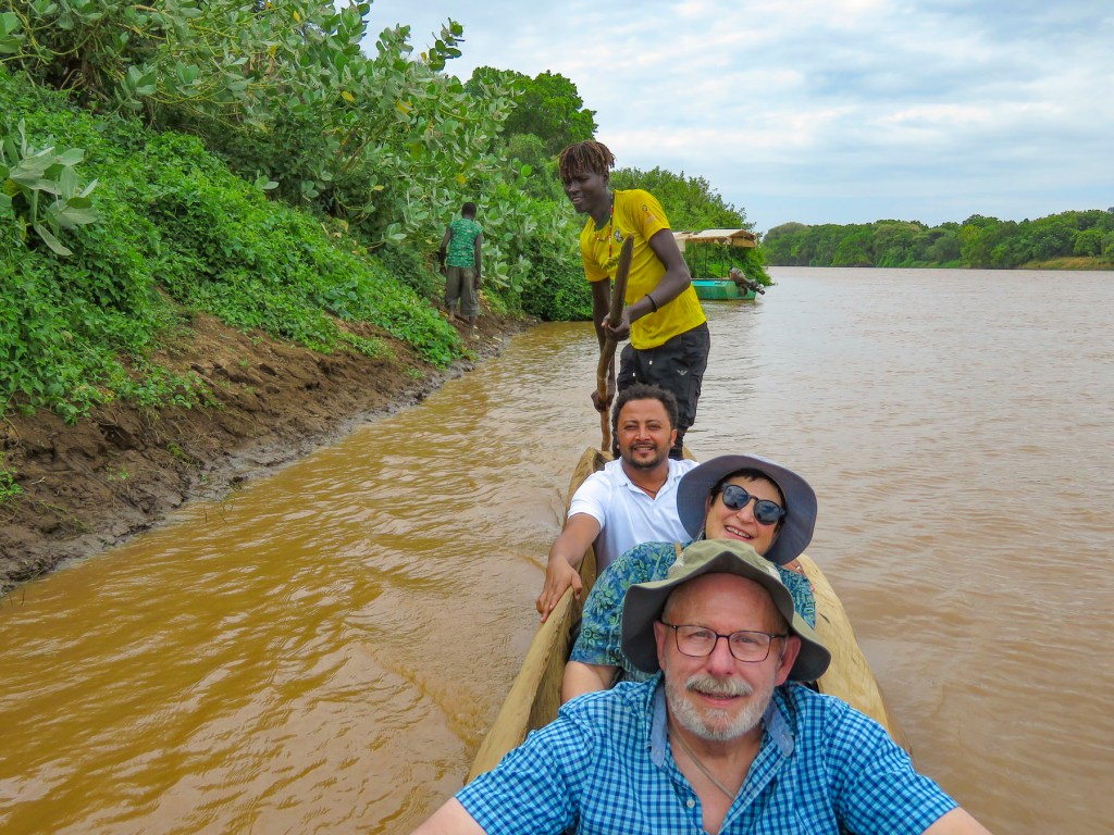
Below us, down an extremely steep embankment, a dugout canoe waited to take us across the Omo River to visit the Dassanech tribe. “If we trip, we are going for a swim,” I mentioned to our guide. “Don’t worry, the crocodiles are further downstream, closer to the delta,” he replied with his dry sense of humor, as several people helped us down to the water.

Sitting low in the water, the dugout canoe was stable like a kayak and large enough for three of us. Standing on the stern, a tribesman poled us upstream for a distance before letting the current take us across the river to the equally steep, opposite bank.

At the top of the riverbank freshly tilled fields, bordered with narrow irrigation canals, gave way to a flat dry landscape that extended to the horizon. The Dassanech are the southernmost tribe in the Omo valley, and their territory extends south to the Kenyan border at Lake Turkana and west to South Sudan. Even with the river and lake nearby it’s a dry inhospitable terrain that has suffered from years of extended drought and climate change. The temperature often exceeds 110°F. Consequently, as cross border tensions over diminishing grazing lands have increased, the Ethiopian government has discouraged the nomadic ways of the Dassanech. In exchange for reducing the size of their cattle herds the government is helping them farm along the banks of the Omo River by providing resources and irrigation pumps.

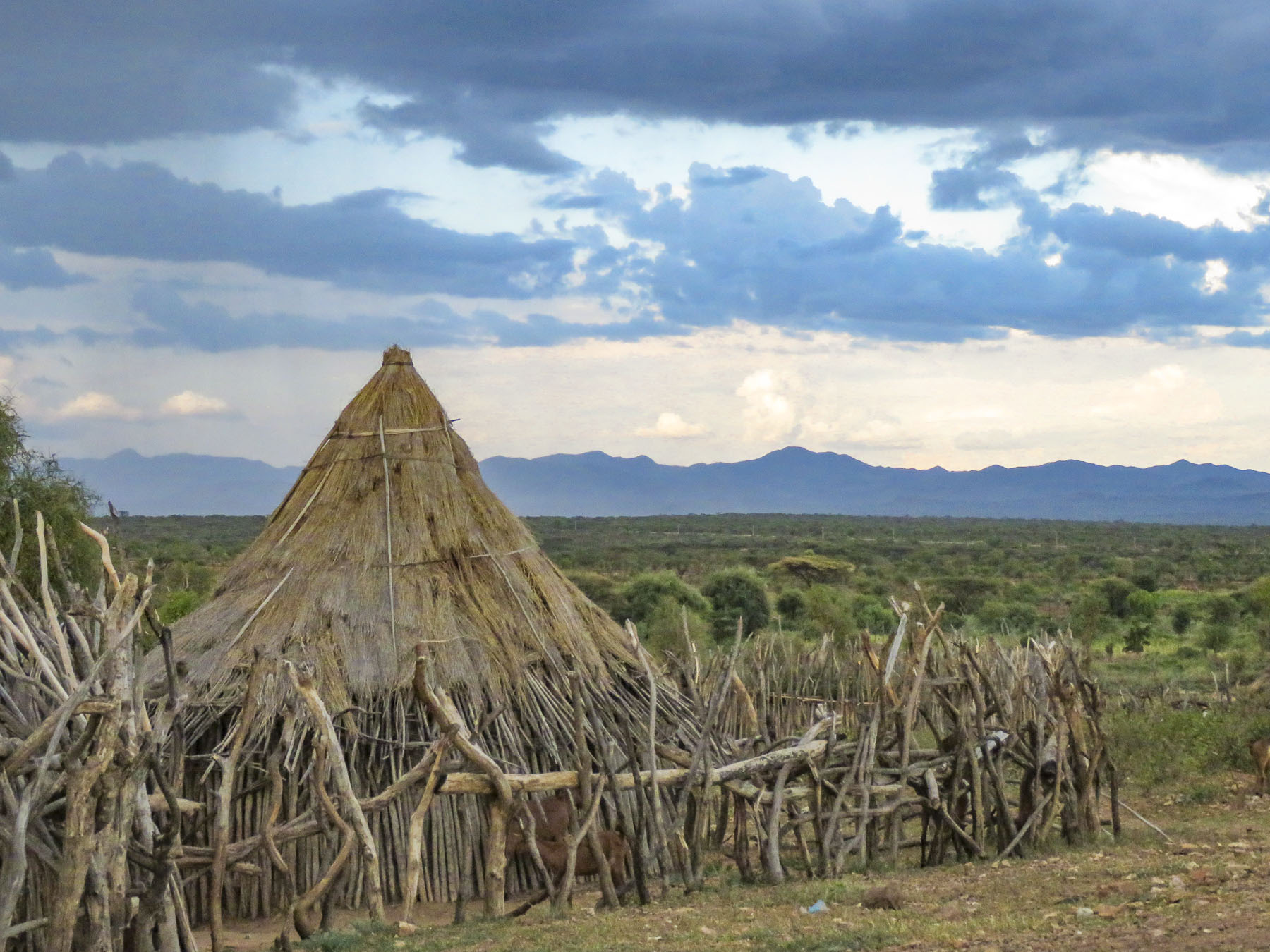
We entered the village through an opening in the corral that encircled it. Roughly made of tree branches, it serves to keep cattle in and hyenas out at night. Low dome-shaped huts called miede constructed from foraged branches, twigs, river reeds and leaves used to be covered in cowhide for protection from dust storms and infrequent rains. Now corrugated tin is used instead as there are fewer cattle to slaughter.

The huts must be roasting hot inside! Children hoop rolled an old bicycle tire along the irrigation canal while others played with empty water bottles tied to sticks as tribeswomen sat in the meager shade provided by huts.


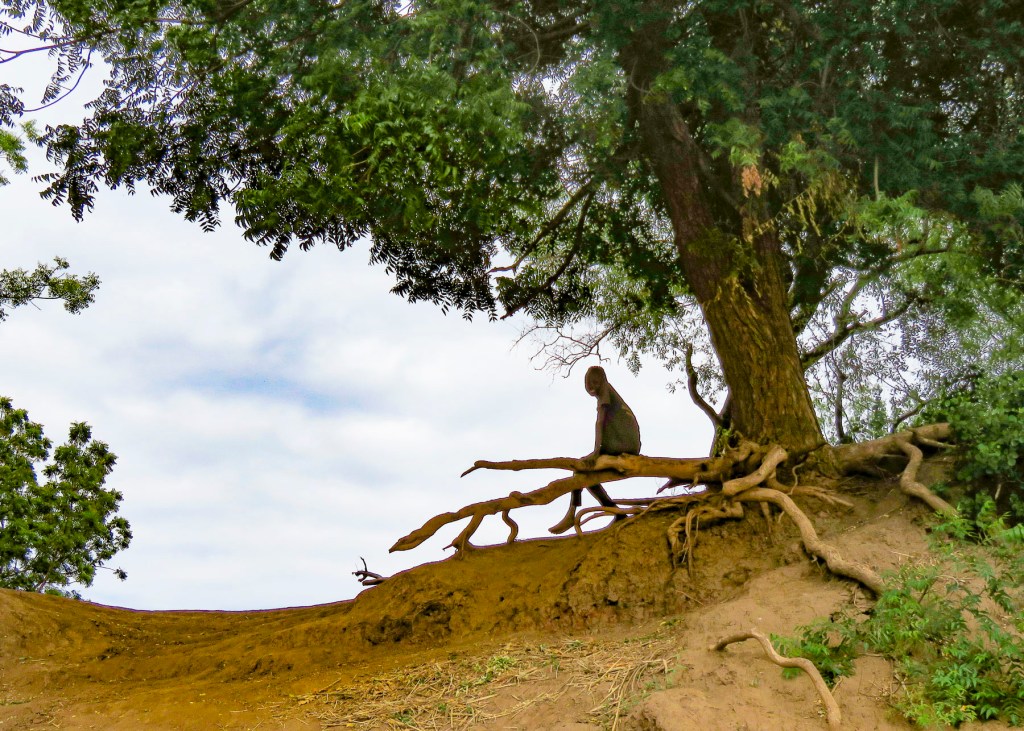
The more plentiful shade of the few large, ancient trees still standing by the river is reserved for the men of the village and is off-limits to women and children.
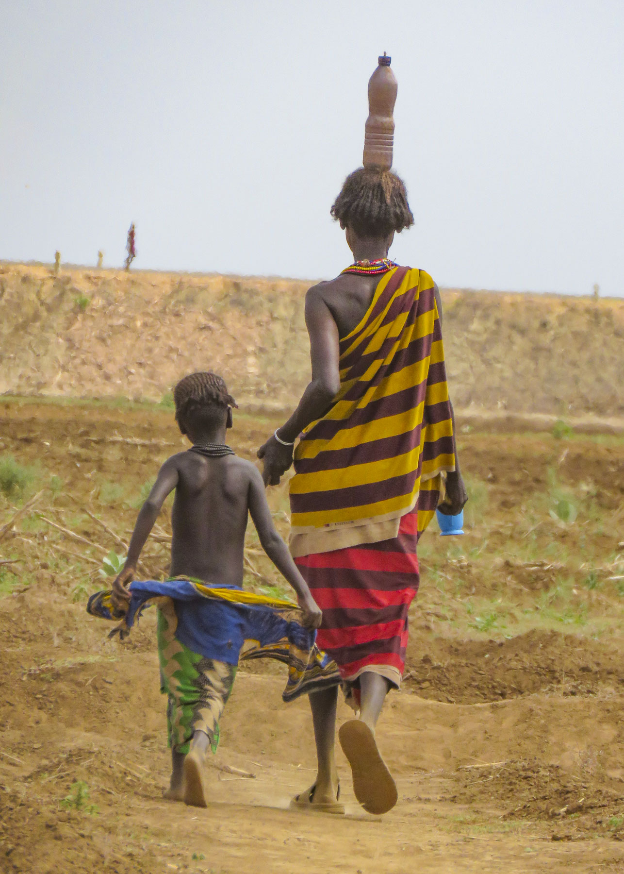
This unforgiving environment created the atmosphere of a desolate refugee camp whose tribespeople were awaiting an unknown future. To borrow a phrase, it felt like “the doorstep to hell.” I don’t say this to be derogatory, but to describe the intensely harsh environment. It’s remarkable that roughly 20,000 Dassanech can survive in such brutal, extreme conditions. In such an environment, people wear very little clothing except when going to town.

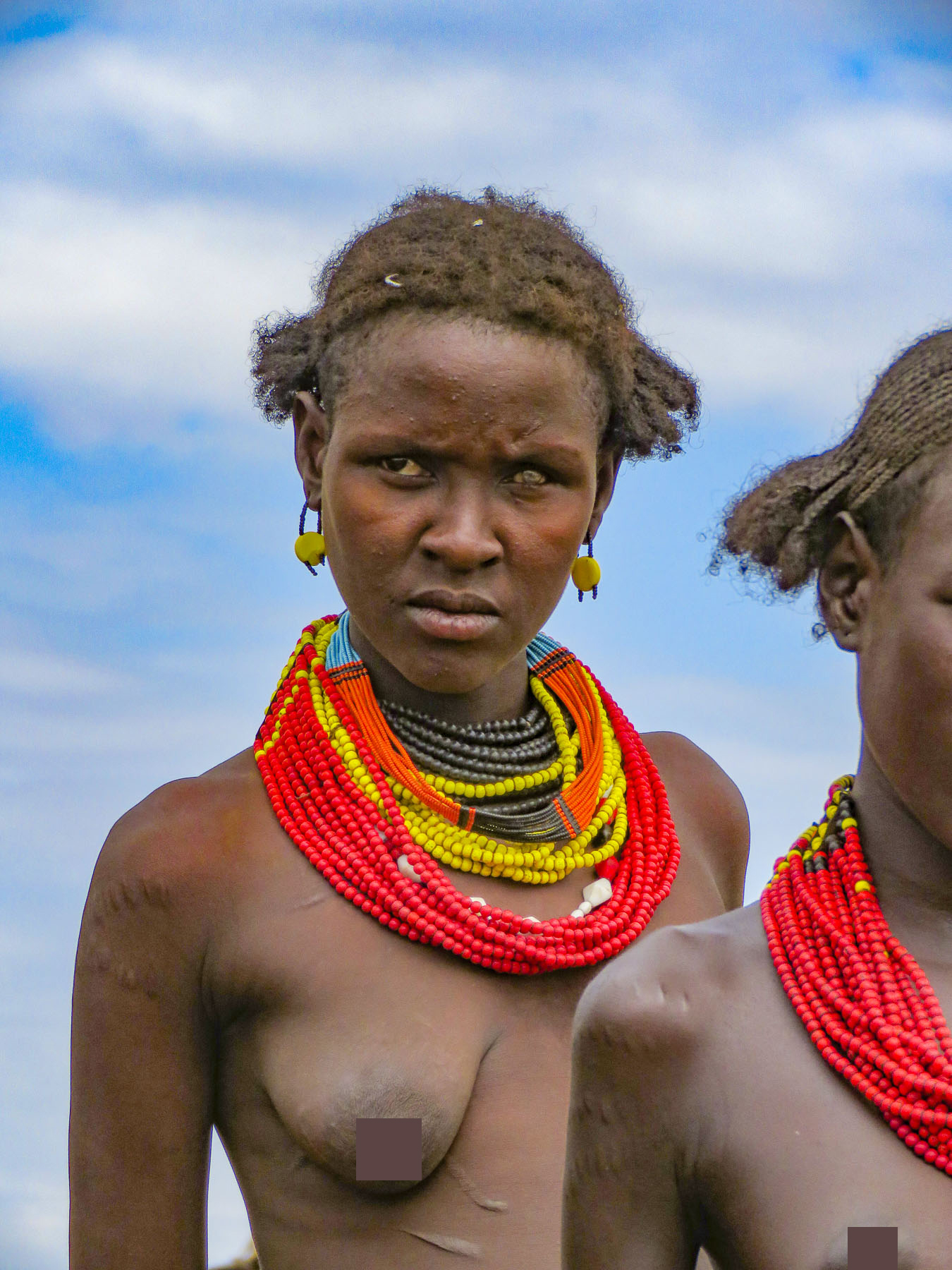
Visiting the Dassanech gave us a new understanding of the effects of climate change and the desire to migrate as a consequence of it. As we left the village, some of the tribeswomen had gathered to display their crafts. There is a social contract that, aside from paying for photos, tourists should purchase handcrafts from the villagers. It’s an additional way to help.


Back across the river, we stopped for a late lunch at a small place along the road, before heading to a Hamar village near Turmi. Outside the restaurant was a small collection box for the local church.
Just a little aside: we had no intestinal issues with the food during our time in Ethiopia. The pit toilets, on the other hand, were truly frightening and we are convinced that they could only be mastered if you grew up with them. The privacy of a “bush toilet” behind a large termite mound was the more sanitary alternative. And bring hand sanitizer! (Surprisingly, after a year on the road, we only succumbed to food poisoning when we were back in Europe.)
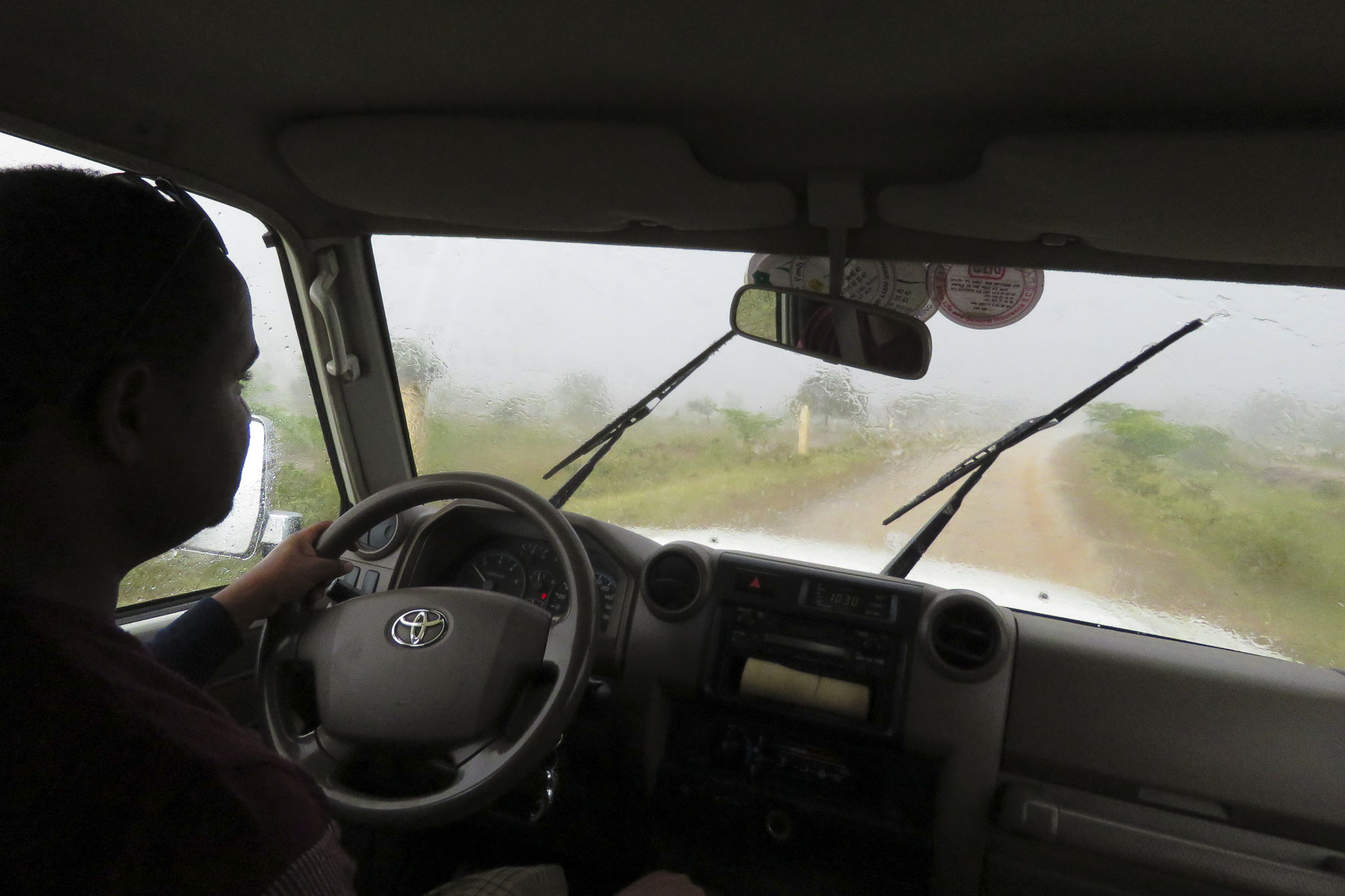

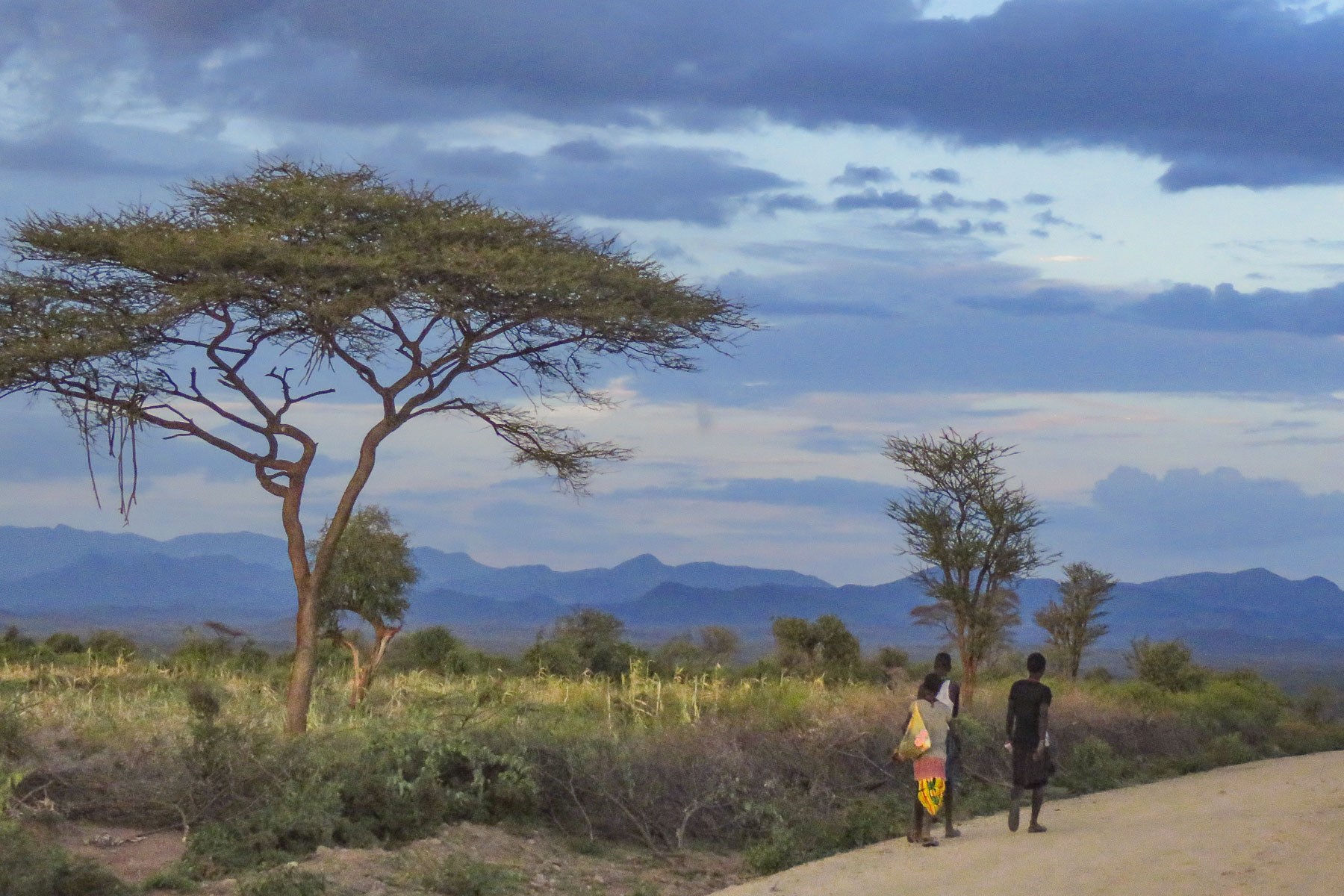
A brief torrential rain dampened the dust and cleaned the air as we headed for the afternoon’s destination.
The golden hour was quickly descending when we arrived in the Hamar village and we only had a short time to work our way around the village before the sun disappeared behind a cloud bank.
We were supposed to camp overnight in the village, an activity my adventuresome, good sport of a wife reluctantly agreed to when we planned this portion of our tour. “It will be fun!” I reassured her at the time. But seeing our pup tent set up in a small corral surrounded by dried cow dung and imagining how we would deal with a bush toilet in the darkness of the savanna, I had my doubts. I had imagined more of a glamping experience. Thinking of our aching backs in the morning from sleeping on the ground without any kind of padding, we asked our guide for plan B.
Since the guides would have been participating in this camping adventure with us, they didn’t put up much argument about changing plans. This brought us to a comfortable room at the Buska Lodge, an eco-inn isolated in the thorn tree-studded savanna outside Turmi. It was an oasis after a long and hot day. By the time we arrived the generator and water had been turned on. At dinner we discussed returning to the Hamar village the next day, but early enough in the afternoon to give us enough time to enjoy the tribe and their village.


Early the next afternoon, before we entered Turmi, we crossed a dry riverbed where several teams of men were digging deep into the sand to find water. Towns without any water infrastructure rely on these hardworking and enterprising men to fill the ubiquitous yellow jerry cans with water and deliver them by donkey cart to people’s homes. It was another sign of climate change that reinforced its dire consequences.


The men of the village were still out with the cattle herds, but we were greeted by a throng of women and children. The Hamar are known for their tradition of “bull jumping” or “bullah,” a purification and rite of passage ceremony for young tribesmen to prove their worthiness for marriage. It’s a complex ritual that culminates with the young man jumping over the backs of 10 bulls, which are smeared with dung to be slippery, four times without falling. If he falls he will have to wait a year until he’s allowed to try again.
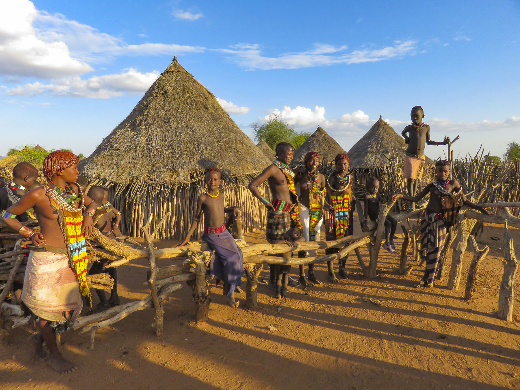
We did not witness a bullah; what we did see were the results of the whipping ceremonies that precede the bull jumping. Displayed on the bare backs of the women of the village were large raised scars, which were inflicted by the men; the women receive the beatings as a show of loyalty. Before the bull jumping, the sisters and other female relatives of the initiates from the surrounding villages gather, and with sorghum beer brewed for the occasion dance, sing and blow horns. As the dancing intensifies the women are said to ask, beg, or provoke the maza, young men who bull jumped but haven’t married yet, to whip them with long birch branches called miceres. This act of scarification is a visual reminder of the women’s loyalty to the young man about to bull jump and earns them the right to his help in the future should they ever need it. “If your sisters, female cousins, or aunties need your assistance in the future your debt to them is sealed. You can’t ignore their requests, period. After all, they nearly died for you!”


By western morals this is a brutal practice, but with the Hamar it’s an ancient ritual that has been performed for centuries. They have a saying, “Women with scars are as strong as lions!”
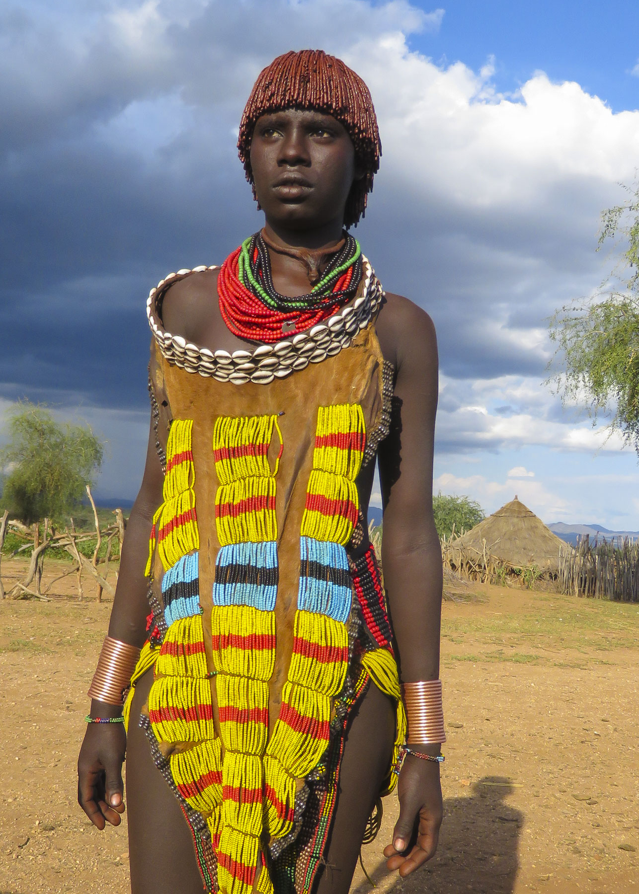
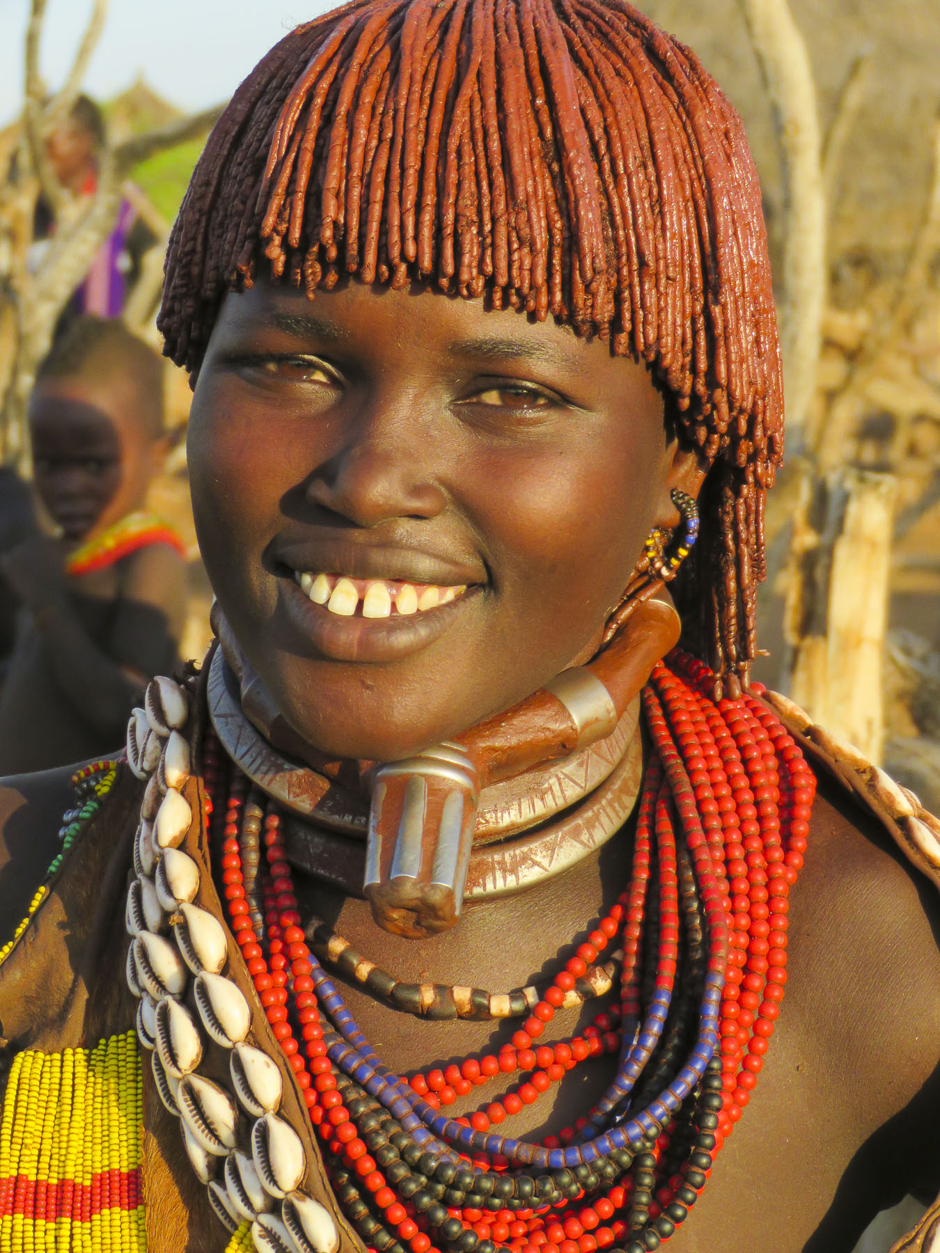
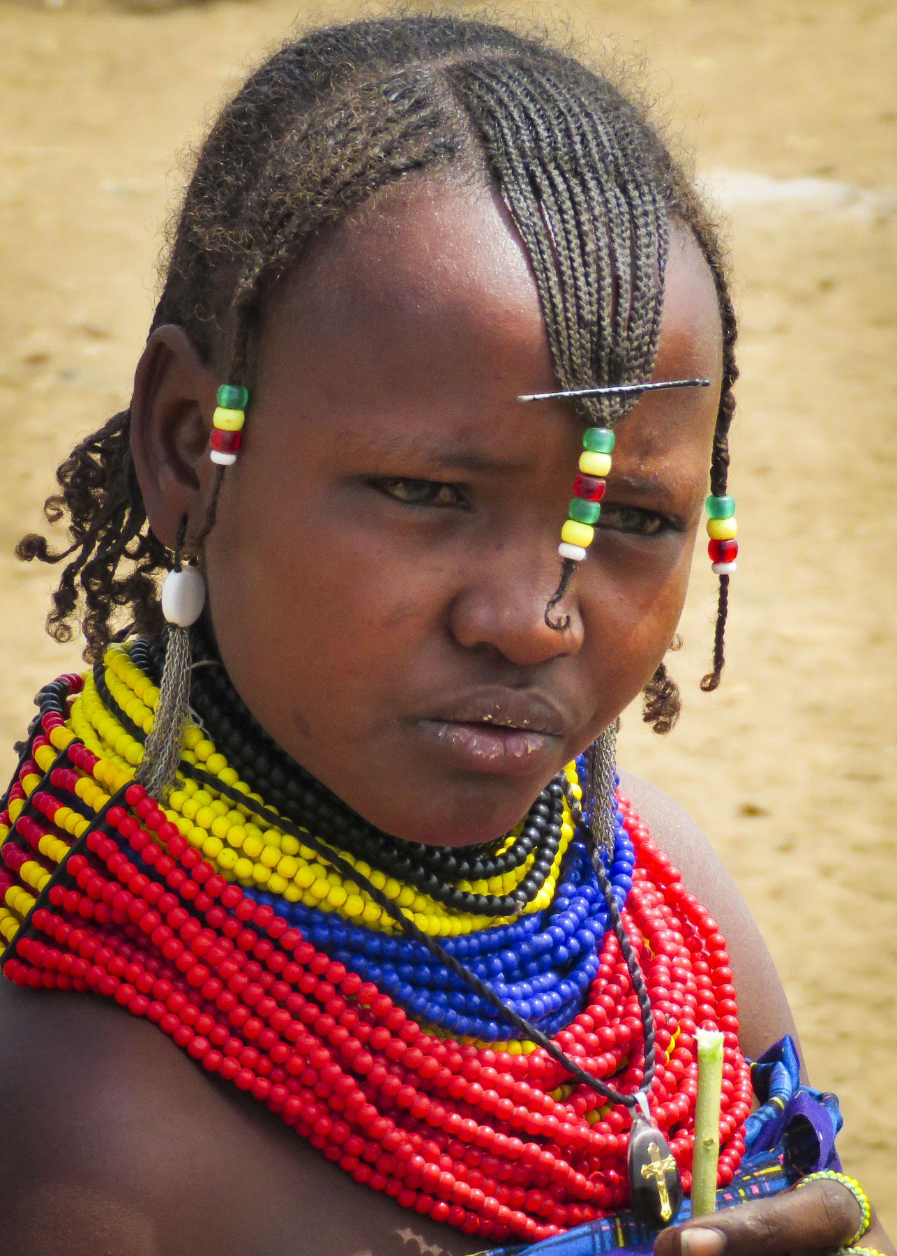
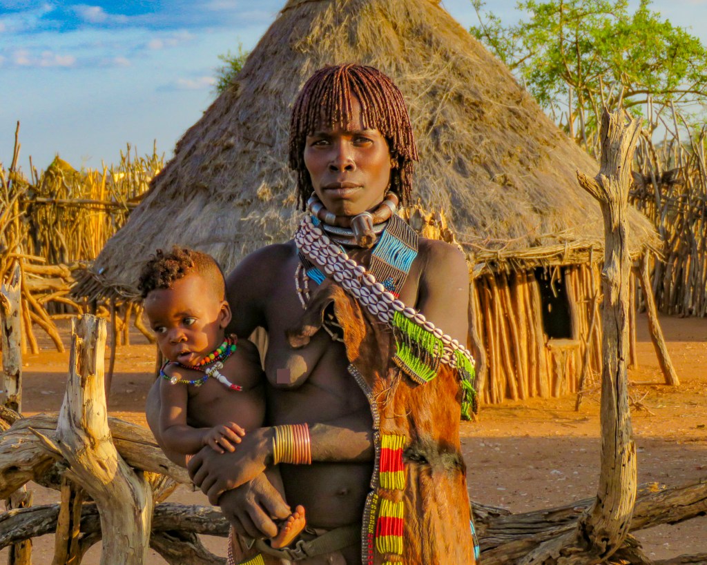
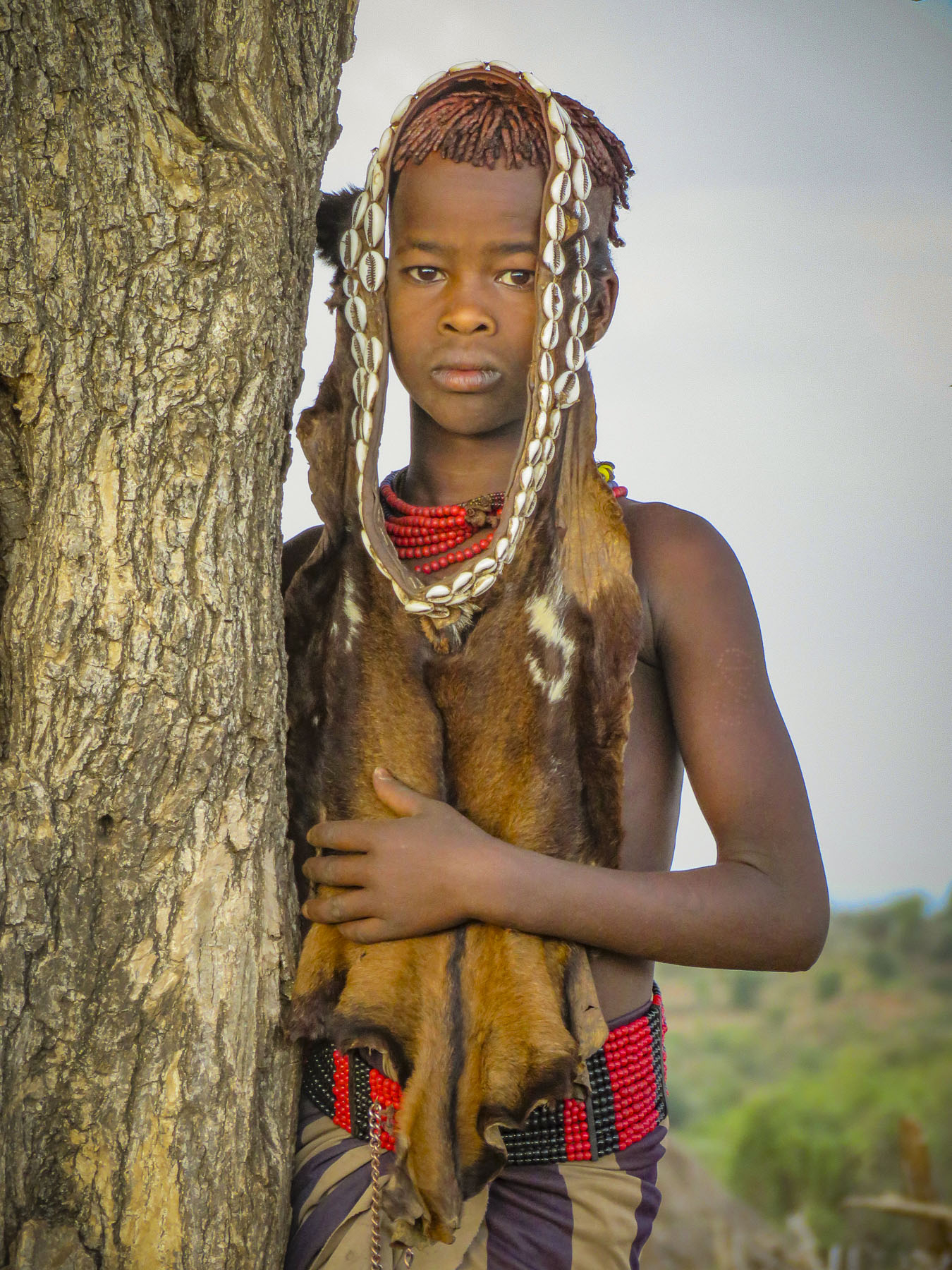
The Hamar tribeswomen are also very distinctive with their dress, wearing long goatskin garments adorned with cowry shells and beads. The first wife of a tribesman wears an iron neck ring with a protruding knob on the front, called a binyere, that visually distinguishes her status as the first wife, above two esente, simple iron collars, that she has worn since her engagement. The collars are permanently placed on the woman by the village blacksmith and only removed by her husband upon her death. Additional wives only wear simple metal necklaces to indicate their lower status.


We stayed late into the day, wandering through the village watching children play atop the cattle corrals while waiting for the herds to return and the sky slowly deepen to darkness.

Till next time, Craig & Donna


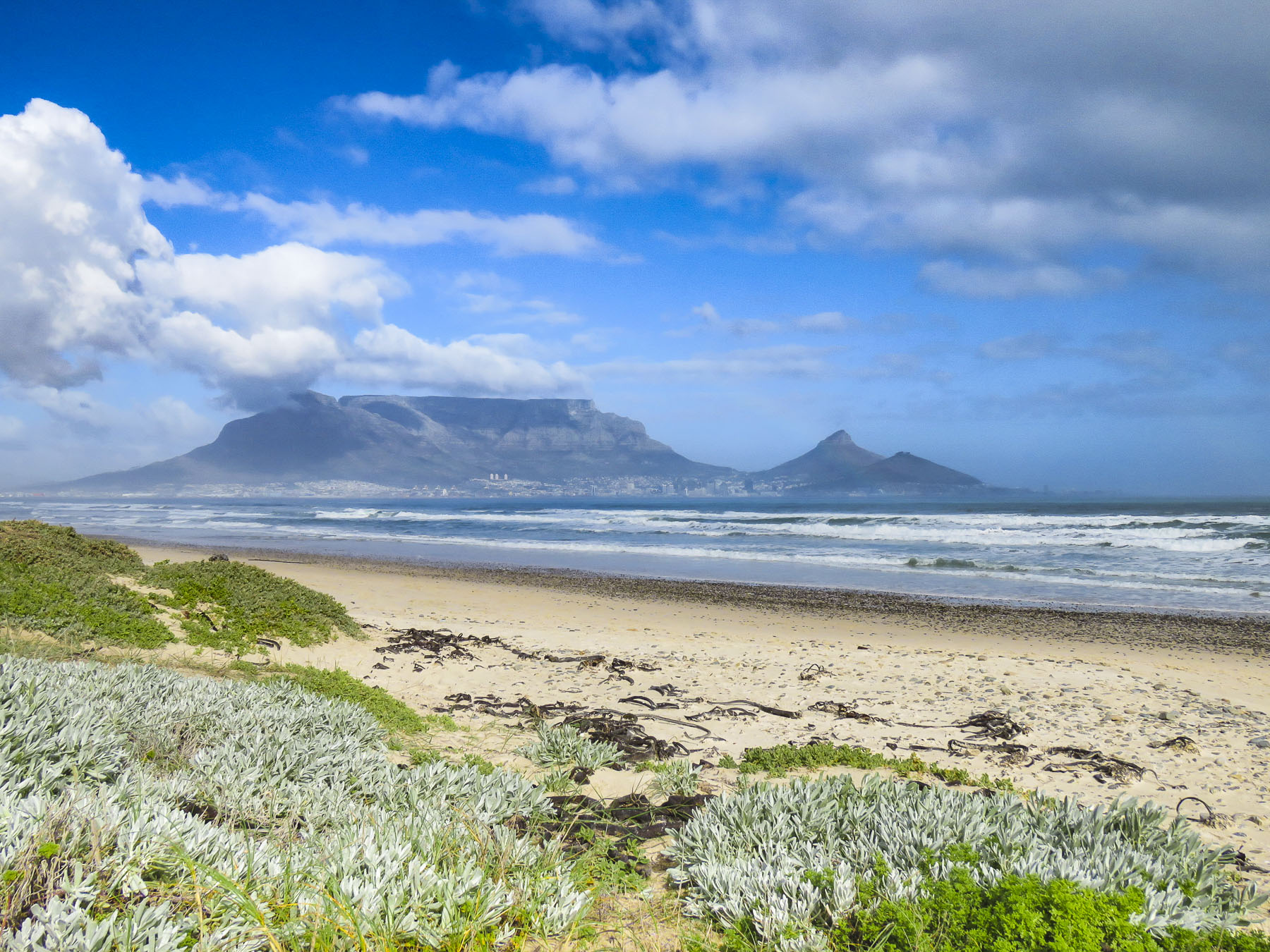
 After our last apartment in the “Mother City,” on Bree Street, we moved to the Sea Point neighborhood and as its name suggests, it hugs the coastline under Signal Hill and Lion’s Head Mountain. Finding the ideal apartment for our last 30 days in Cape Town required a bit of detective work on our part though. One of the draw backs of using Airbnb is that it does not provide the specific address of a property until you actually book it. So, while the interior photos of a listing might be charming, its exact location could be anywhere within a five-block radius of a dot on the map, unless the host gives hints in the apartment description.
 In Sea Point this could mean on the water or nowhere near it. But with a little sleuthing regarding our final three choices, we were able to determine which one was right on the waterfront. Our reconnaissance of the neighborhood paid off and we booked a sixth-floor one-bedroom apartment with a terrace, that had an ocean view for dramatic sunsets and inland views of the paragliders launching from Signal Hill.
  It was the perfect location across from the Sea Point promenade. The lively Mojo Market, with numerous food stalls and live music seven nights a week, was just around the corner. Here we enjoyed the best fresh oysters and mussels in sauce at The Mussel Monger & Oyster Bar while sipping South African wine or local craft beers as the nightly band played.
 It’s actually possible to walk along the promenade from the V&A Waterfront all the way to the Camps Bay Beach. It’s a little over six miles in length, but it’s a popular stretch of sidewalk, which locals call the Prom.


 Weather permitting, paragliders seemed to launch in rapid succession all day long from Signal Hill, first riding the thermals along the ridge towards Lion’s Head before turning back and gracefully spiraling down over the rooftops of Sea Point to land in a grassy park next to the promenade.
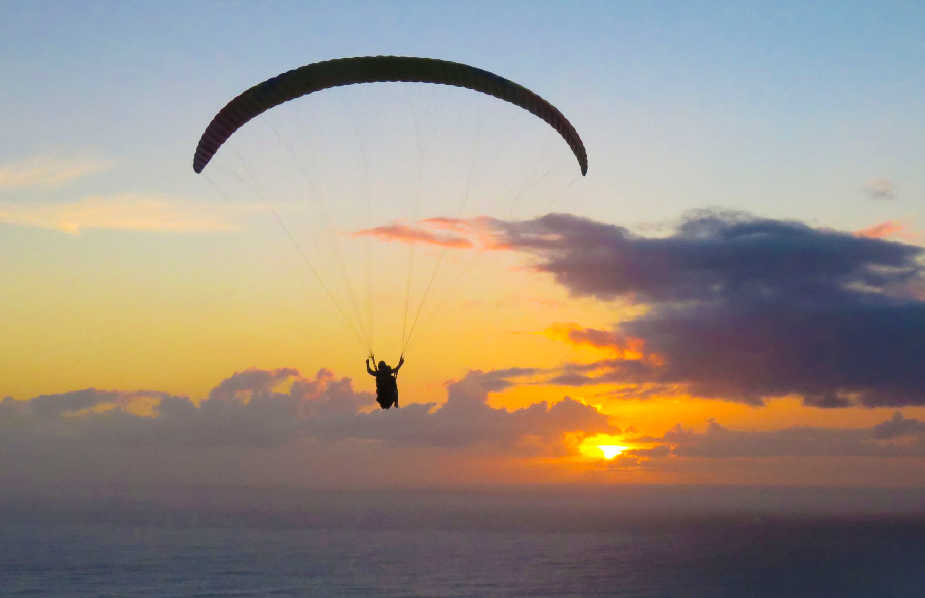 We transitioned easily into our new neighborhood, finding three grocery stores and
 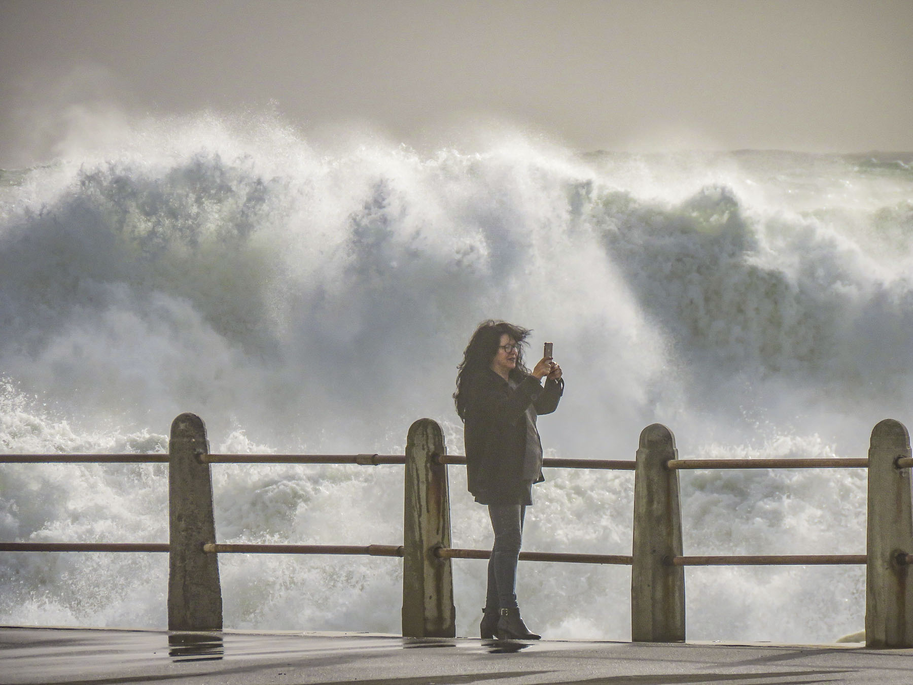 Cape Town artists will paint anywhere and the walls of the underground parking garage at the Pick ‘n Pay – Sea Point were the perfect canvases for some incredibly talented street muralists. Sadly, we don’t think enough folks see these hidden works of art.


 In Hout Bay, time flew by at the


 The wind was so strong it made it impossible to hold the camera steady. We soaked in the views as long as we could before the buffeting winds forced our retreat. Sitting outside at the snack bar we were astonished to witness a baboon snatch an ice-cream cone from a young boy and then gobble it up with great delight.
 We revisited the Simon’s Town area several times, because to see all the spots that interested us required more than one day. The big draw to Simon’s Town was the Boulders Penguin Colony. This is a restricted reserve where visitors must stay on the boardwalk in the viewing areas. Our timing was perfect as penguin chicks had recently hatched and could be seen at the nests snuggling against their parents for warmth. The beach was full of activity, with different groups of penguins doing their best Charlie Chaplin struts into or out of the turquoise waters of the bay.


 One morning in late July we opted to try a whale watching tour again, this time from the Simon’s Town waterfront, hoping to see some tail slapping or breaching action that was elusive in Hermanus earlier. Alas, we only viewed one tail slap on this trip. As much as the tour operators want you to believe July is a good month for viewing whales, based on our disappointing experiences we’d suggest waiting till later in August or September for more certainty when larger whale pods return to the waters of False Bay. But it was a smooth day at sea, cruising along a dramatic coast and we did get to view a large colony of sea lions on some offshore rocks.


 Once outside of Cape Town the R27 cut a desolate track through a rolling landscape of open fynbos with scarcely a tree to be seen. Every so often the head of an antelope or ostrich could be seen emerging above the bushes on either side of the road. The heather clad landscape eventually gave way to pastureland speckled with sheep and wheat fields.
 Paternoster is one of the Western Cape’s oldest fishing villages, dating from the early 1800s, and is said to have gotten its name from Portuguese sailors who evoked the Lord’s Prayer to save themselves from shipwreck off its coast. The area was first explored when Vasco da Gama landed nearby in Helena Bay, in 1497. By then the area had been inhabited by the indigenous Khoisan for thousands of years. Hunter-gatherers, they harvested dune spinach, an local vegetable, from the beaches, and shellfish from the area waters, and they left behind middens that have been estimated to be 3,000-4,000 years old. The harvesting of the ocean’s bounty continues, with fishermen still launching their small boats into the sea from the beach and returning with fish and lobsters. As you pull into the village it’s not unusual to see fishermen selling their day’s catch from five- gallon buckets at the town’s intersections, where they hoist live lobsters aloft and yell “kry hier kreef!”, Afrikaans for “get some lobster here.” Aside from the picturesque whitewashed and thatched roofed fisherman’s cottages along a white sand beach dotted with boulders, there’s not much to this sleepy fishing village, except for some reportedly excellent seafood restaurants that were unfortunately closed the winter day we visited.
 A short way out of town we followed a dirt road to the Cape Columbine Lighthouse. Built in 1936, on an outcropping of boulders called Castle Rock, it’s one of the last manned lighthouses in South Africa. “Seniors are free,” the lighthouse keeper, a senior himself, announced, as he pointed us to a set of stairs that eventually led to a very tall, steep wooden ladder. The panoramic view from the top was brilliant and, as expected, breathtaking. Getting down was a little more challenging than getting up. It was a kind of “make it or break every bone in your body if you don’t” situation. We’ve found in our travels around the world that folks in other countries can do all sorts of risky things, that in the states wouldn’t be allowed for safety concerns. Overseas it’s all about being responsible for your own safety. “See you at the bottom,” Donna said as she agilely maneuvered on to the ladder. “One way or another,” I grimaced in response. For me, with a fearful respect for height, it was all about that first step down.


