Croatia Road Trip Part 2: The Istria Peninsula – Plitvička Jezera, Pula, and Rovinj or Waterfalls, Roman Ruins & a Saint

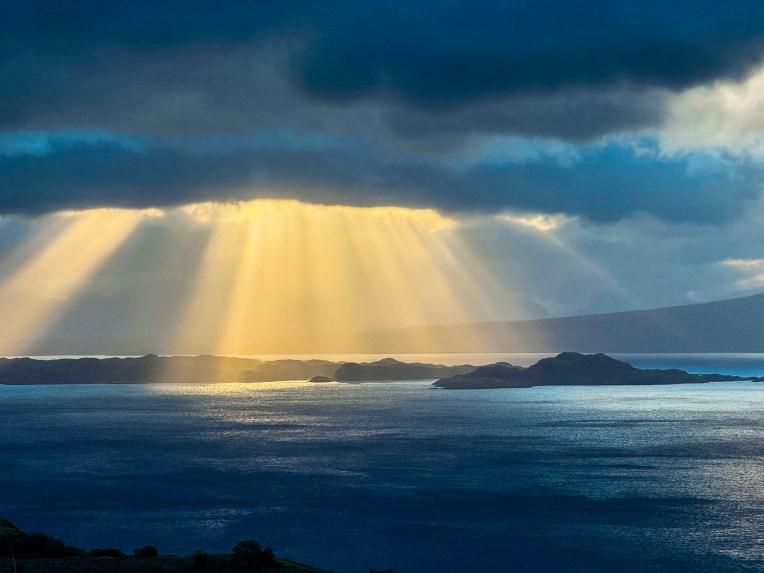
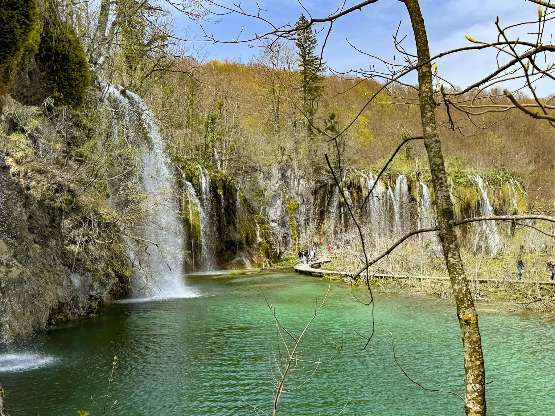
We experienced an infinite palette of blues spread across the sea, sky and waterfalls of Croatia, as if they were an artist’s inspiration, but in fact were mother earth’s creation. The emerald green, turquoise and azure arteries of the rivers were particularly enthralling; they shimmered with the changing light, almost glowing, as they coursed through their surrounding landscapes. The intense colors are the result of limestone and other mineral deposits that line the waterways, and the angle of sunlight on the water. This majestic display of nature’s wonder is on display at Plitvička Jezera National Park, just two hours from Zadar. 

Created in 1949, Plitvička Jezera was Croatia’s first national park and protects a massive 296.85 km2 (114.61 sq mi) area, situated on a plateau in the mountainous Dinaric Alps of central Croatia, that separate the inland region of the country from the Adriatic coast.

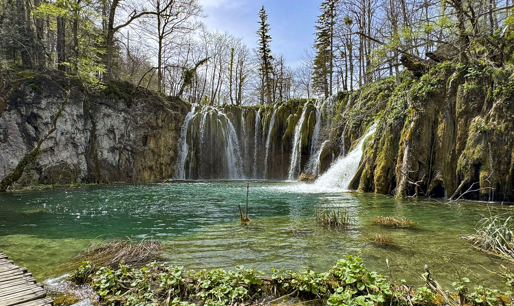
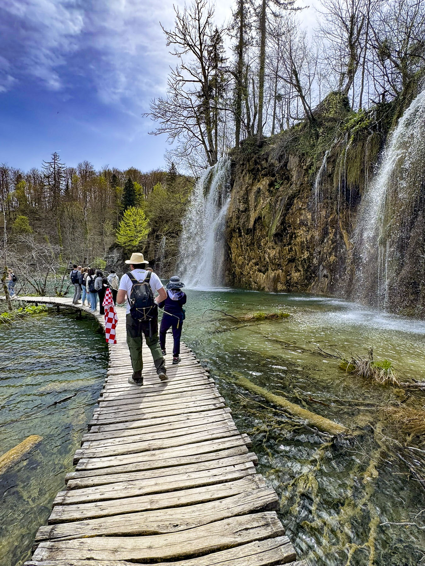
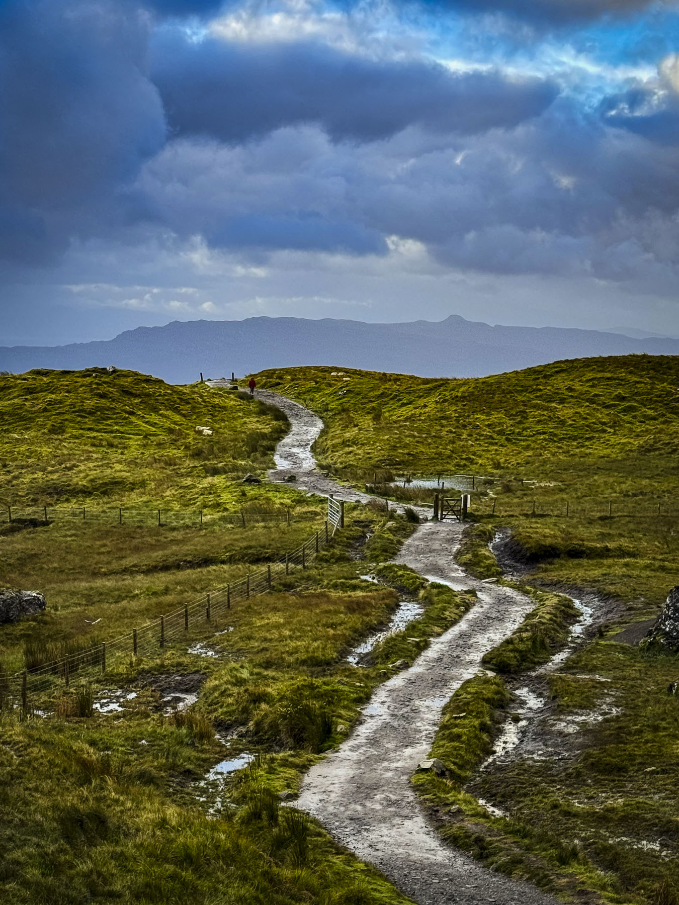
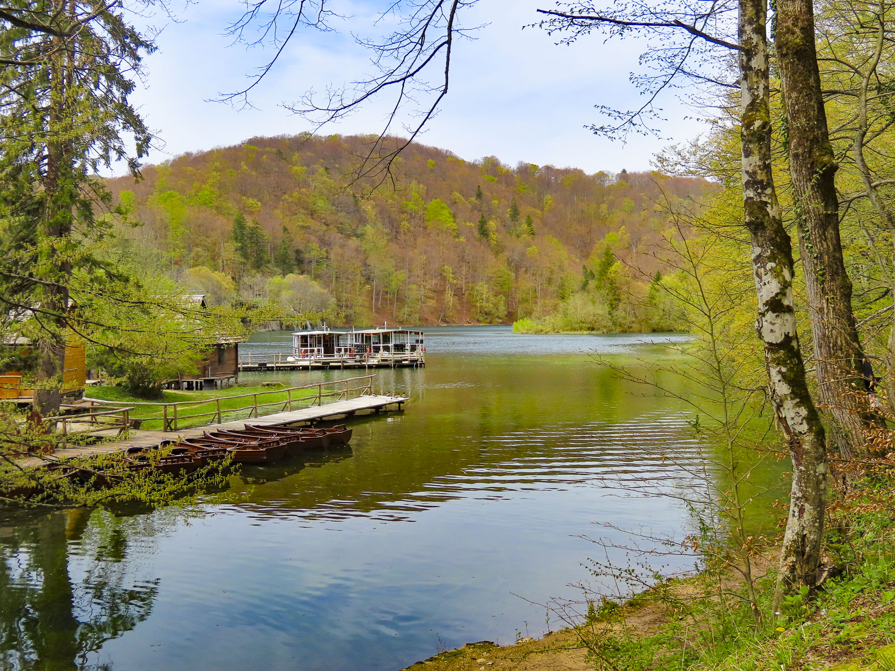
The park has 16 terraced lakes with numerous waterfalls of various heights which folks can view via a series of meandering boardwalks built across the shallow pools below each cascade. The park service has organized these walkways into eight different touring routes/programs.

We visited the park on the Wednesday before Easter, a school vacation week, and the park was busy, but not overwhelmed with visitors. Those in the know arrived early, as convenient parking vanished quickly, and it was a very long walk to the ticket booth.

We chose route E, a three hour, 5100m (3mi) circular walk through the Upper Lakes section past Veliki prštavac, and Mali Prštavac falls to Lake Prošćansko, that included a short boat ride across Kozjak Lake at the beginning and end of the trek.

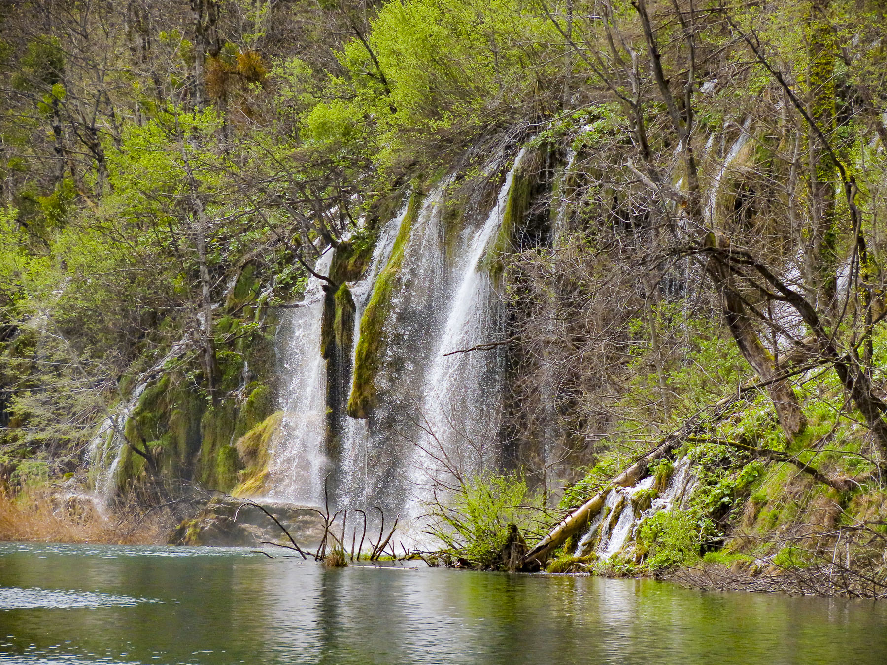
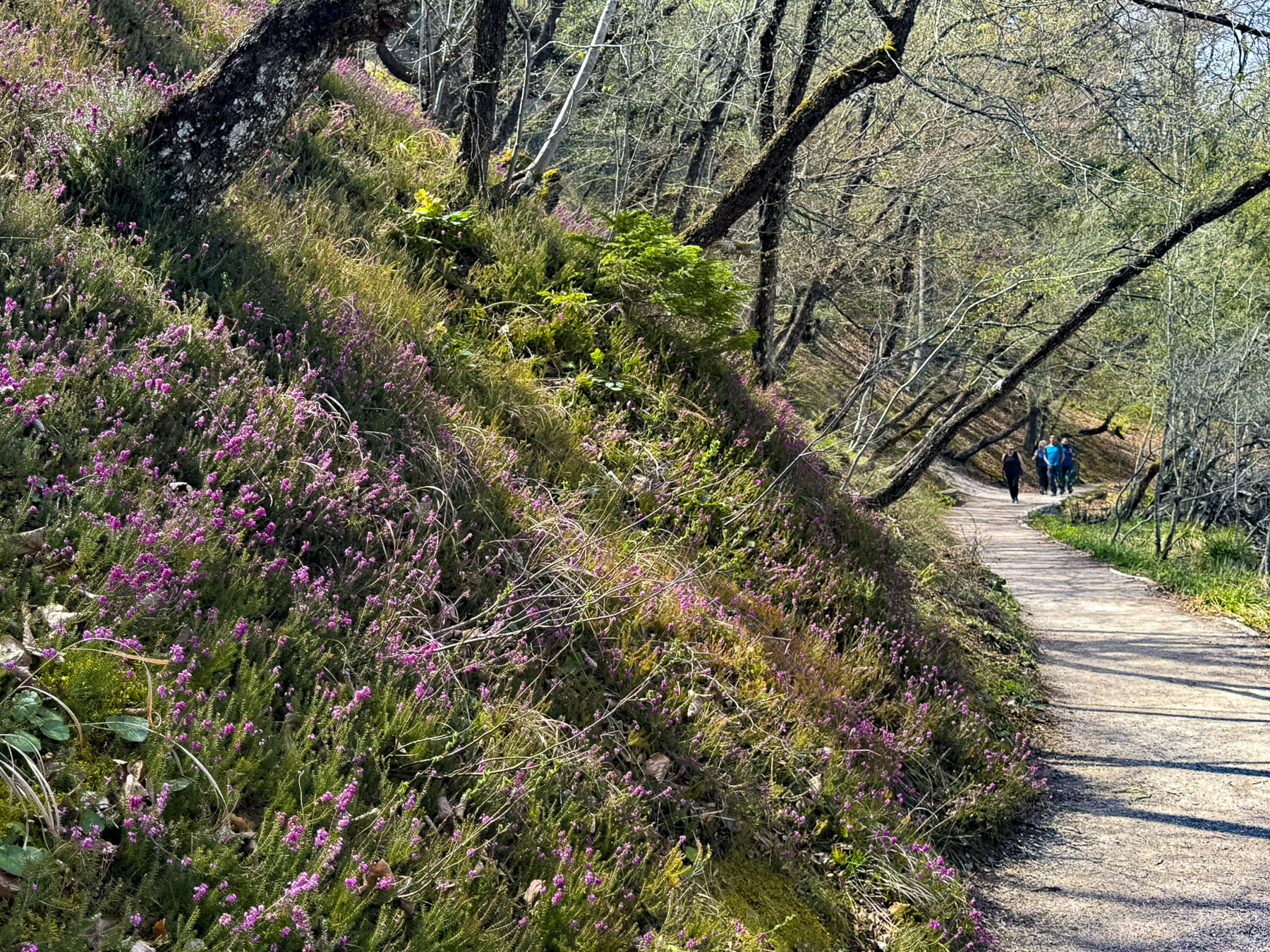
The falls were enthralling, flowing like delicate veils across the rock face of the hills. The boardwalks above the crystal-clear pools were narrow, and for the most part without railings except for sections of stairs that ascended a hillside. But the walk was very easy, and we encountered folks of all different ages, and parents carrying young children.

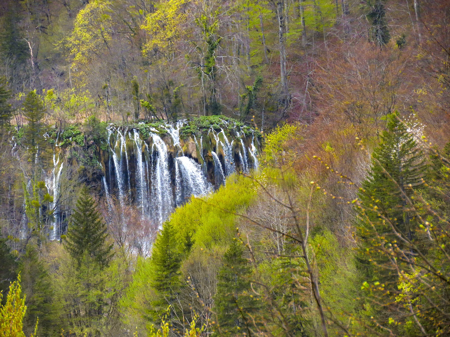
In mid-April the foliage on the trees in the park was just beginning to leaf out, making it the perfect season to view the falls without them being hidden by trees. Trying to take photographs of the falls, midday, without people in them was nearly impossible, and you need to be at the park before most folks arrive to accomplish that.

Our destination for the end of the day was the Hotel Katarina in Selce, a modest-sized resort village, on the Adriatic. The two-hour drive first took us through mountains covered in pine forests along Rt D52, past small villages where all the homes still had cords of wood for their fireplaces and wood stoves stacked high. Descending the mountains, the landscape slowly greened and transitioned to a rolling pastureland dotted with cows and sheep. Freshly turned gardens along the way were already planted with spring onions. Some of the small farms had roadside stands offering honey and homemade cheese for sale. It was a very pretty drive, but the roads were narrow and did not have any shoulder area to pullover to safely take photographs. Intersecting D23, we continued our descent to the coast through thinning forests then Garrigue, an evergreen shrubland well suited for the region’s hot dry summers.

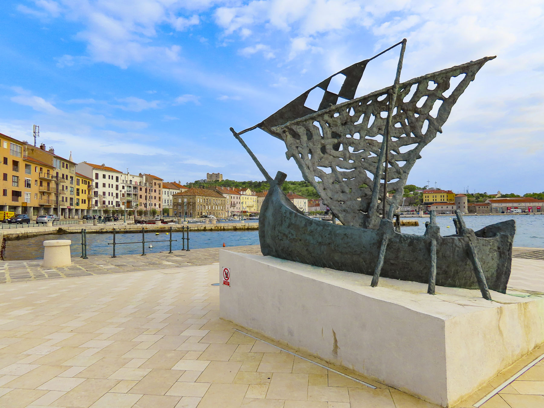
We reached the coast at Senj, the oldest town on the North Adriatic coast, with a history that goes back 3,000 years. The town is located on a crescent shaped bay under the watchful eye of the Nehaj Fortress, a 16th-century bastion that helped to keep the Croatian town independent during the centuries of Ottoman and Venetian aggression in the Adriatic Region. Unfortunately, we didn’t have time to visit the castle, which also hosts an annual three day Renaissance festival called the Days of Uskoks every July. But we did enjoy a short walk along its waterfront before continuing on.

Large modern hotels like the Hotel Katarina, which cater to tour groups, are not our first choice when we travel, but unfortunately during the shoulder seasons along the Adriatic coast many of the hotels that would normally be open during the summer are closed, and options are limited. But the hotel’s location for a one-night stay, in the town of Selce, worked well with our driving plans, as we headed to historic town of Pula, on the Istrian Peninsula.

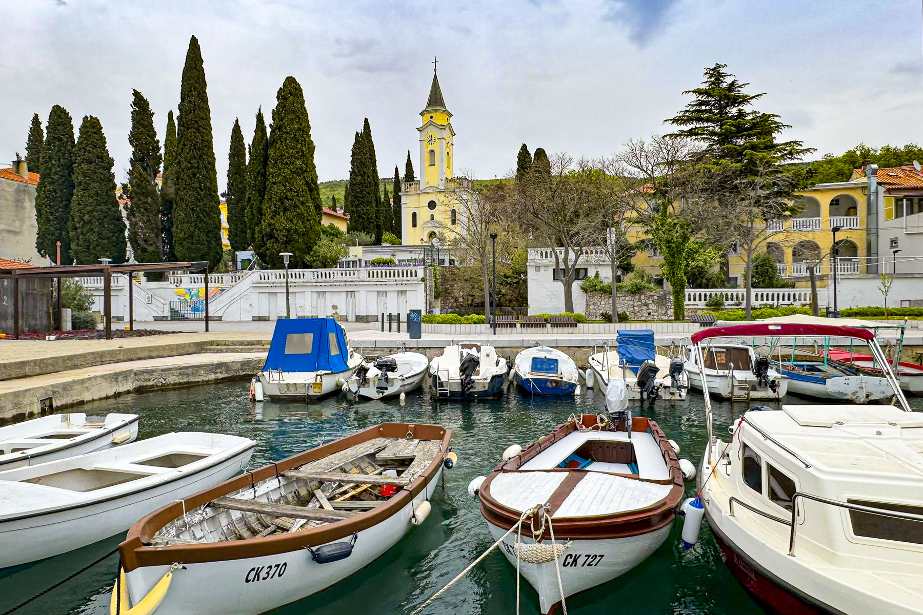
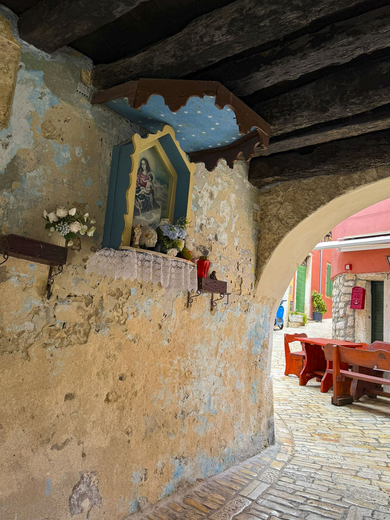
The hotel was directly across from a promenade, alive with a chorus of wonderful song birds, which we followed the next morning.  At the town’s port the walkway widened into a small plaza planted with tulips and centered with a large Easter Egg, called a pisanice.  

These fiberglass eggs are painted by local artists with themes that reflect the Croatian Christian traditions, and celebrations of Spring. There were numerous restaurants along the quay, but only a few of the smaller cafés were open this time of year. Even though the morning was overcast, the town’s small harbor was a colorful scene of boats and waterfront buildings.

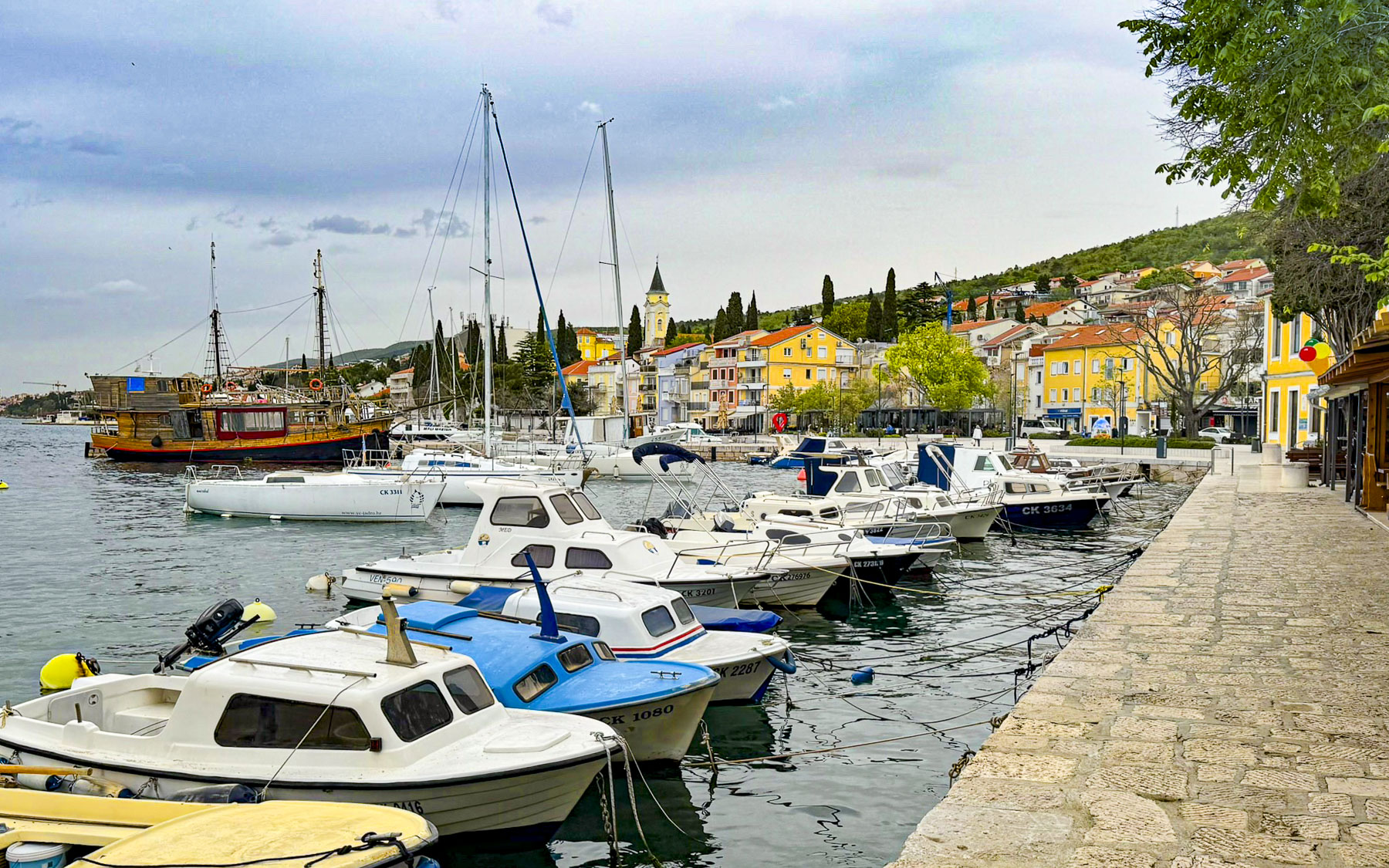
Our drive north from Selce mostly hugged the coast and was reminiscent of Italy’s Cilento Coast along the Mediterranean in the Campagna region. We found the towns and glimpses of the sea along the Croatian coast fascinating and started to think about future return trips to the area. 

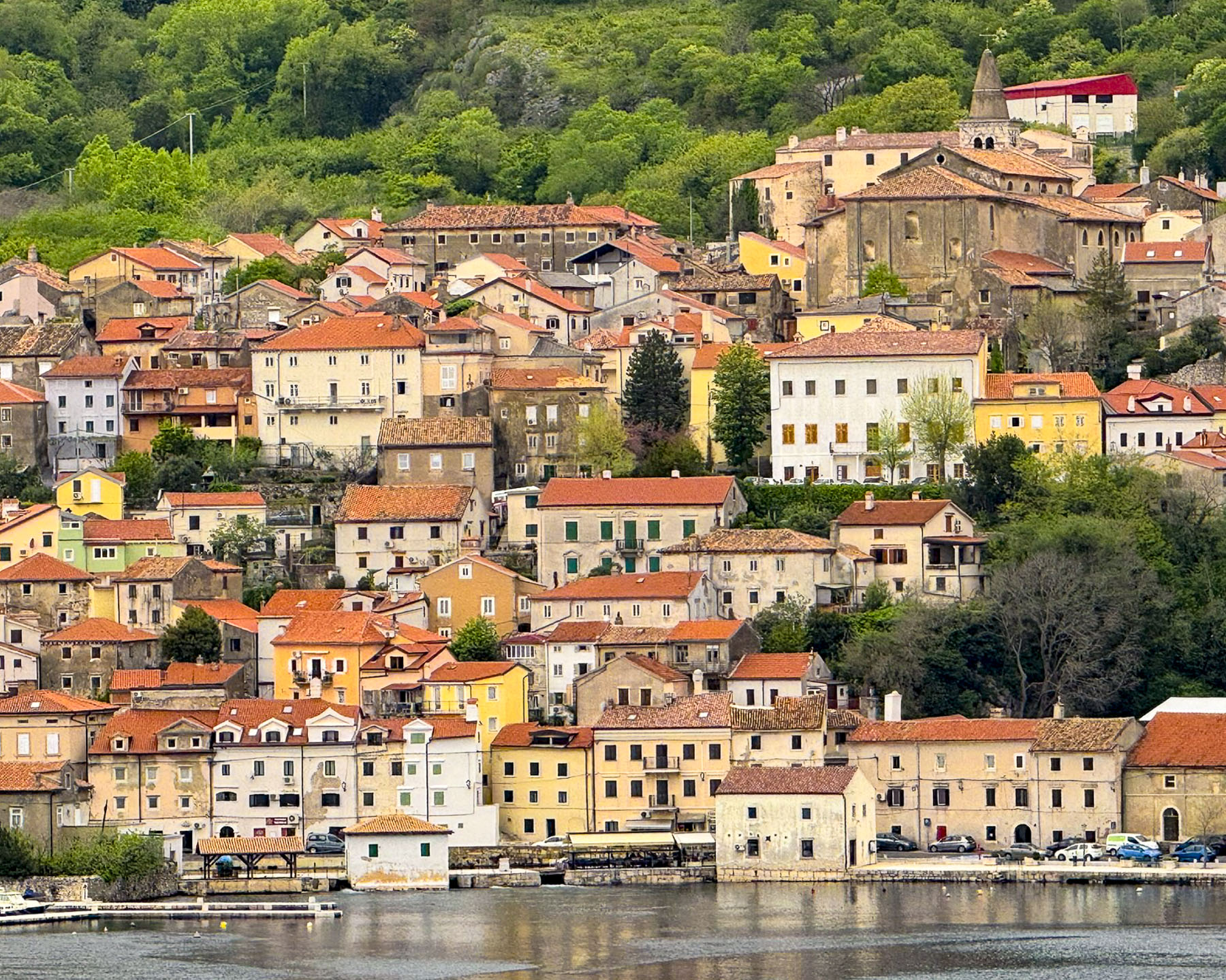
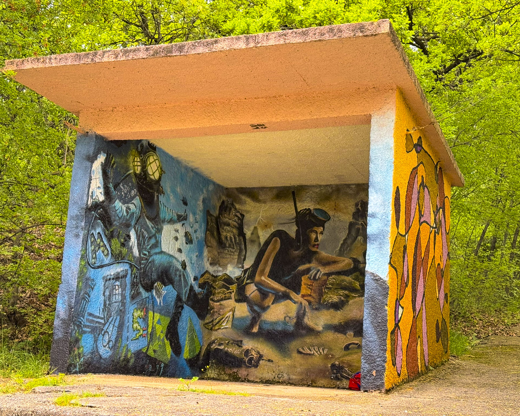
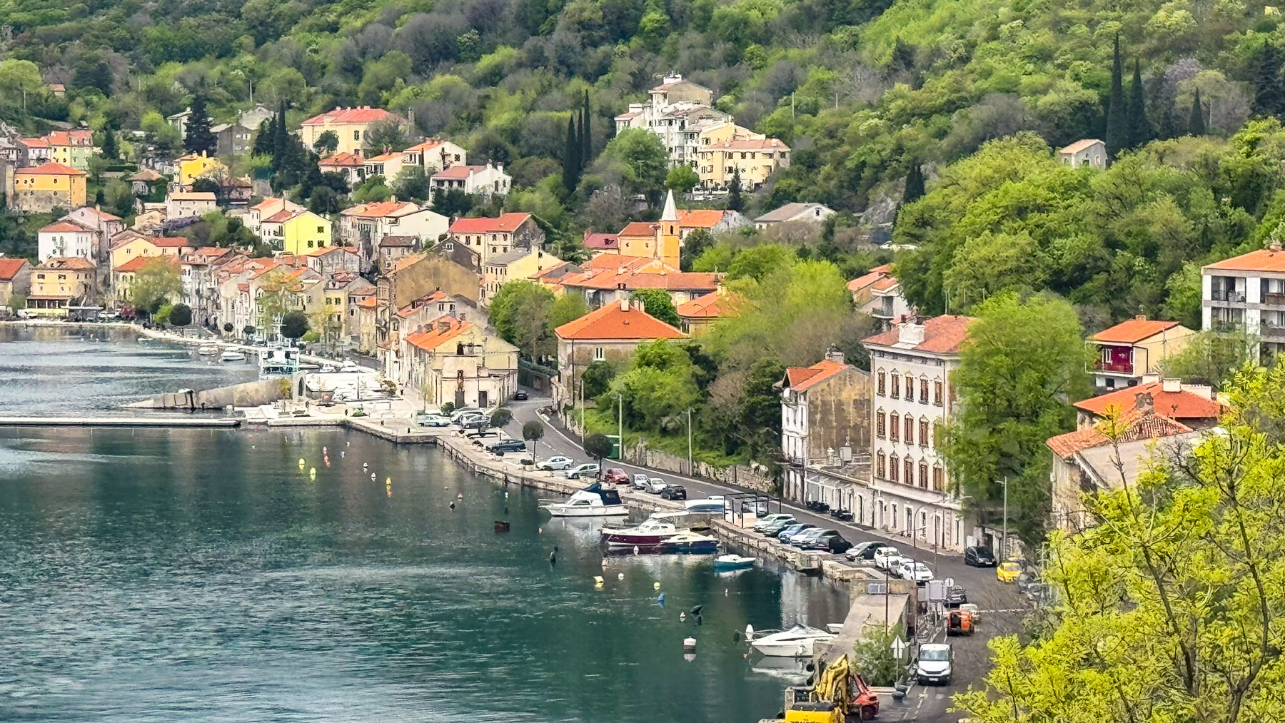
We would enjoy time  to explore in depth not just the small coastal villages like Bakar, where just beyond the village some of the bus stops along the road are covered with murals that reflected the areas maritime heritage, and Mošćenička Draga, beautifully set on a small cove, but also some of the less mentioned larger coastal cities like Jadrolinija and Opatija, which were fashionable Habsburg-era resorts in the 19th century and still retain their fine architecture. We regretted that we only had time to drive through these areas.

The Istrian Peninsula is known for the high quality of its olive oils, wine and regional cuisine which spans from light seafood entrees to hearty meat dishes and stews, the first of which we tried at Tri Murve in Plomin. I wish we could say that this was a well-researched choice, but it was a spontaneous stop, to satisfy a mutinous co-pilot, but we were pleasantly rewarded with a very wonderful lunch. On this chilly day, the temptation to linger here was overwhelming.

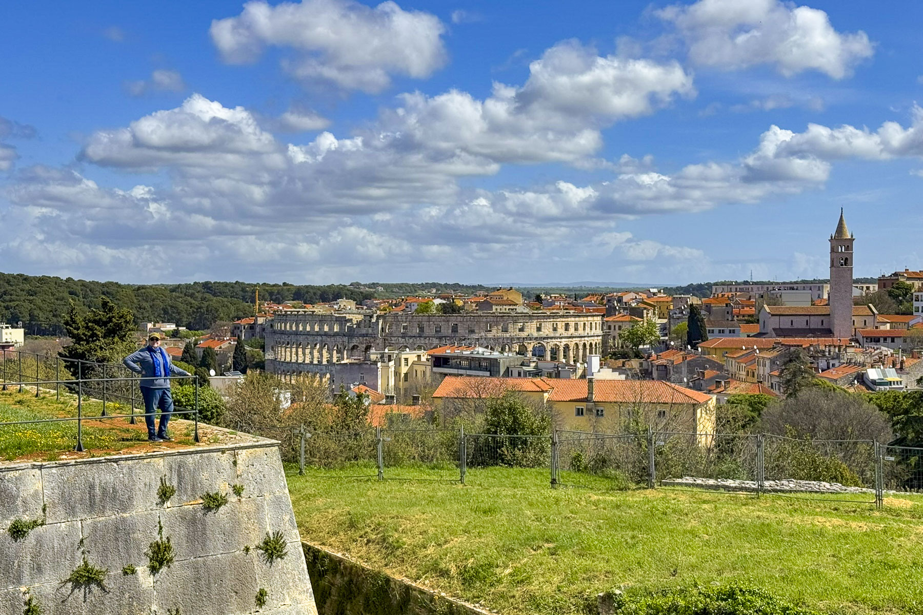
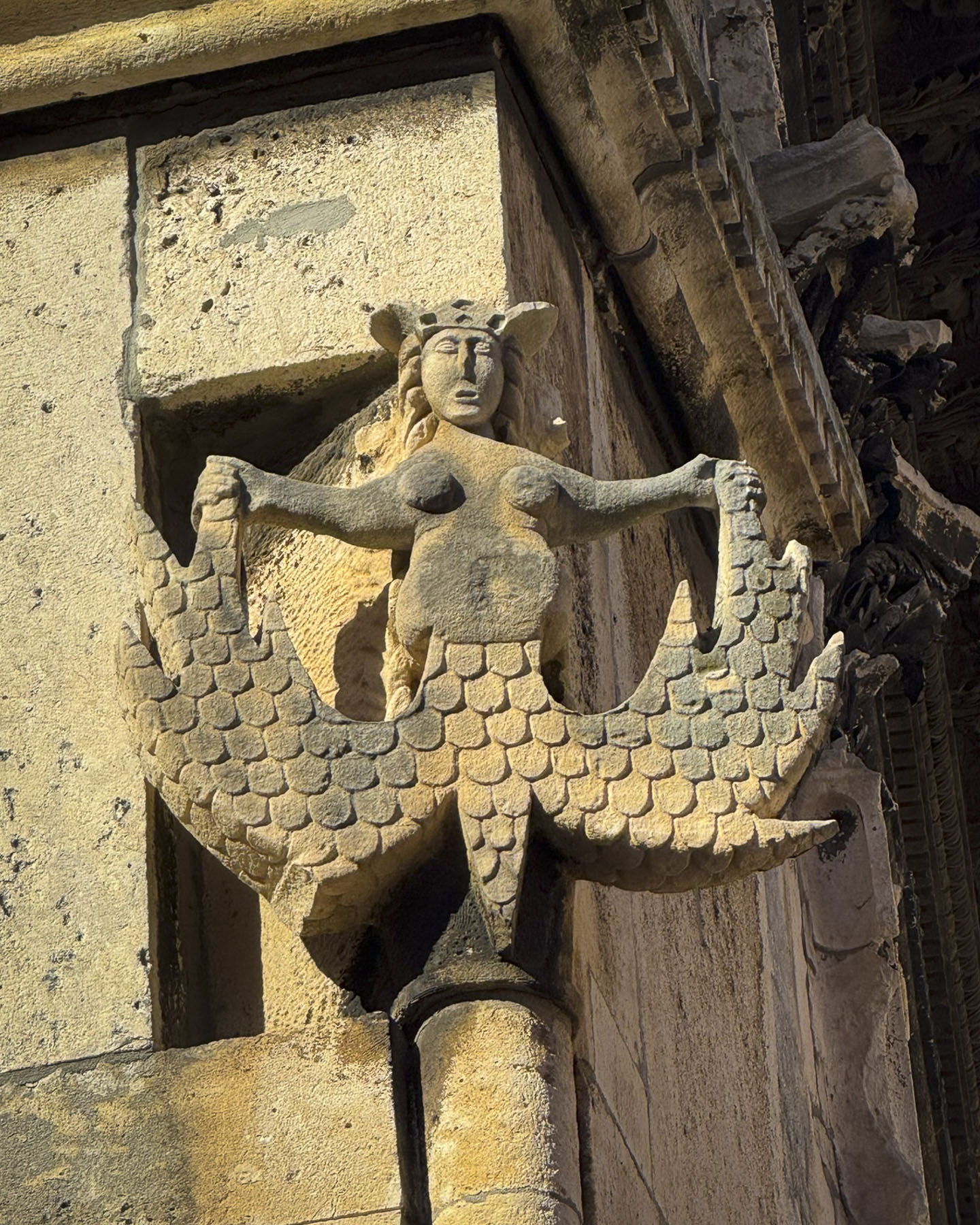
The top of Pula’s ancient Roman colosseum surged above the trees as we drove into the center of the port city. Rome’s presence in the city dates back over 2,000 years, but legend believes the city’s founding was a thousand years earlier and linked to the mythological Greek hero Jason and the Argonauts who sailed into the northern Adriatic Sea to escape the pursuit of the Colchians. The Colchians, exhausted after years of pursuing the Argonauts, feared returning home without the Golden Fleece, and founded Polai, the City of Refuge.

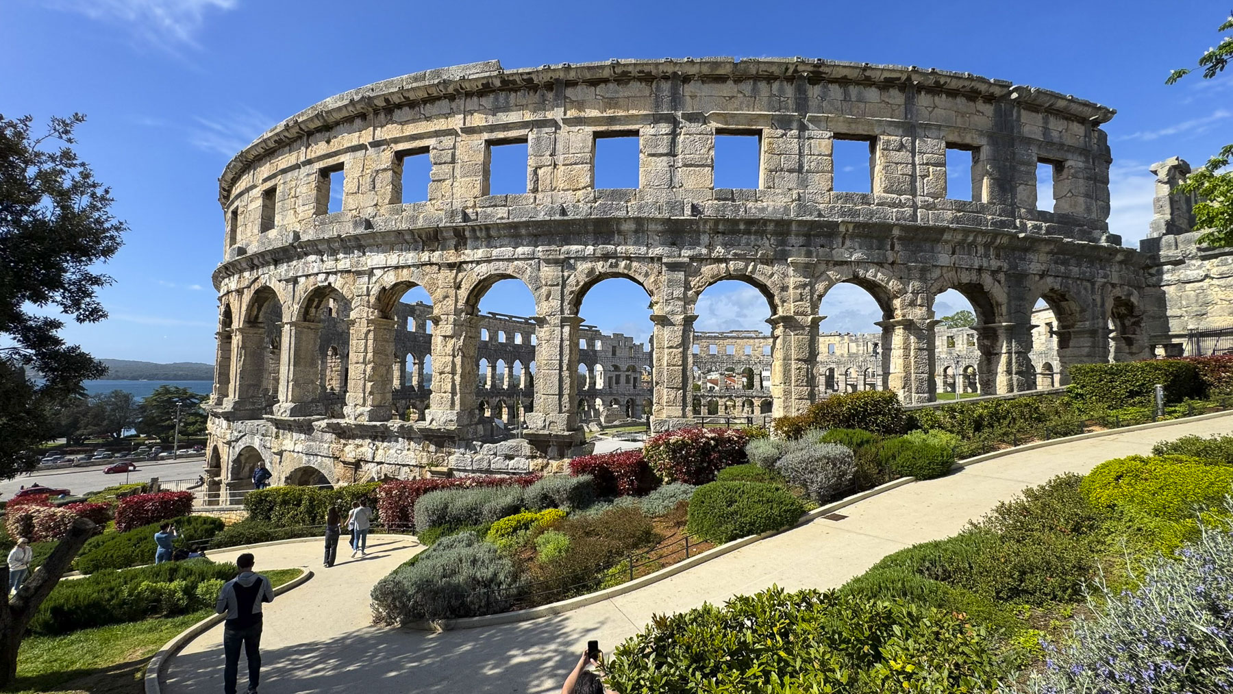
In the mid-1500s when Pula was part of the Venetian Empire plans were proposed to dismantle the arena and rebuild it in Venice. But they were rejected after the passionate arguments of Venetian senator Gabriele Emo, who is remembered with a plaque in the stadium. Though his efforts did not stop the removal of stones to build other structures in Pula which continued well into the 18th century. The arena, a masterpiece of Roman engineering, was originally built to seat 23,000 spectators, and is used to host a variety of events that range from film festivals to concerts and soccer matches, though its seating capacity has been reduced to a safe 7,000.

We thought we were in luck when we found a spot in an untended parking lot atop the hill near the Citadel of Pula, and the Monastery of St. Francis, only two blocks from our lodging at Luxury Flats. However, as we were lifting our luggage from the trunk a parking attendant appeared and informed us the lot was reserved for local residents with permits and we would be ticketed, but he was very gracious and gave us 15 minutes to get our bags to the apartment before we needed to move the car to a municipal paid parking lot across from the Roman colosseum, that he suggested. Finding parking for a rental car is always a task in small European cities. This one was reasonably priced, charging hourly during the day, but free after 18:00 until 8:00 the next morning. 

The small studio apartment we rented was modern and had a shared balcony which overlooked an orchard with a garden area that was once tended to by the nuns of the Monastery of St. Francis, next door. The monastery was built by the Franciscan Order in the 1300s and served the religious needs of the community until the country’s communist era. When the complex was then used as a military barracks, then kindergarten, before being returned to the Franciscans in 1992.

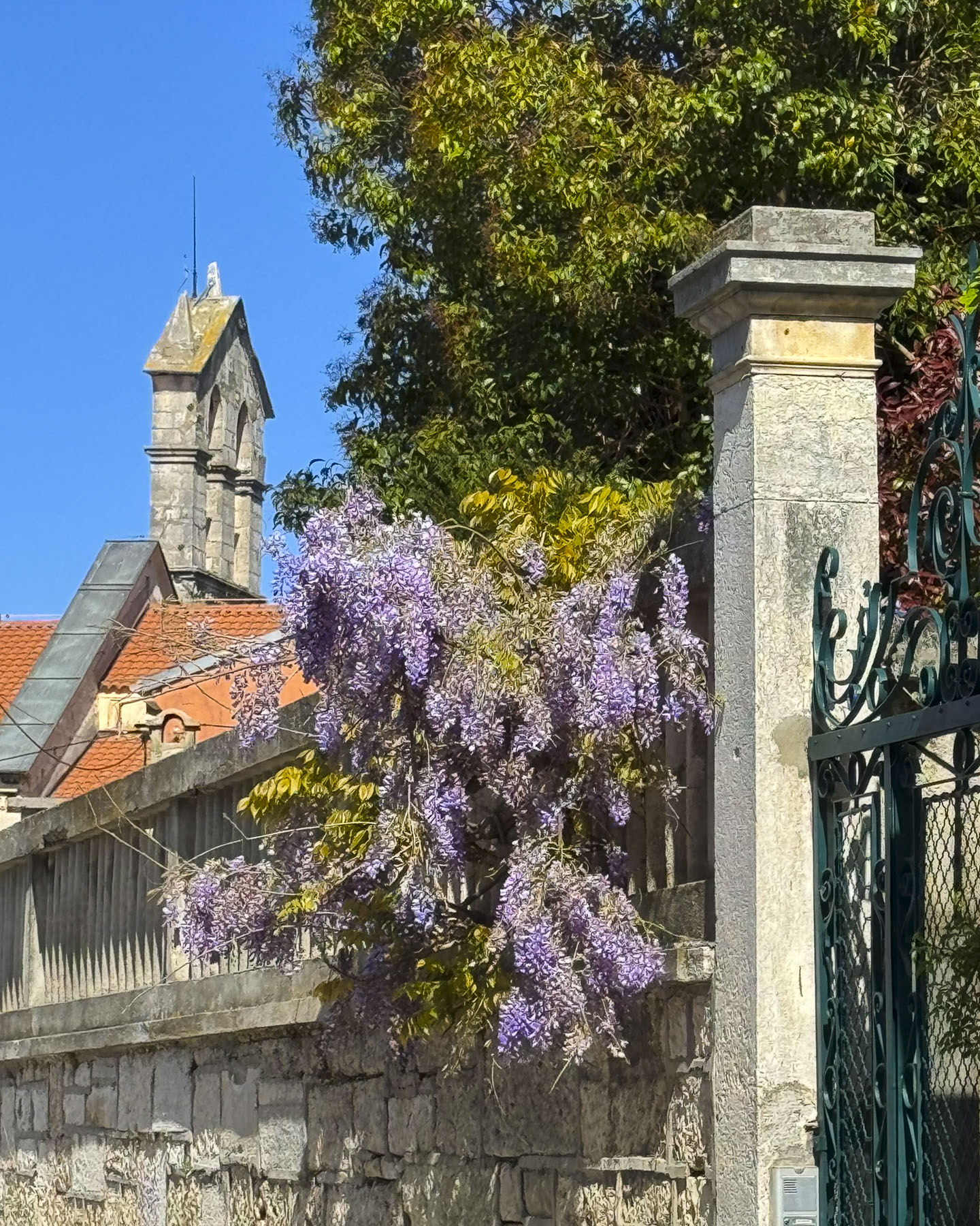
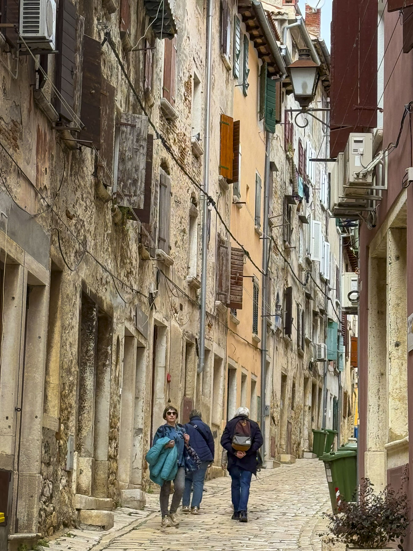
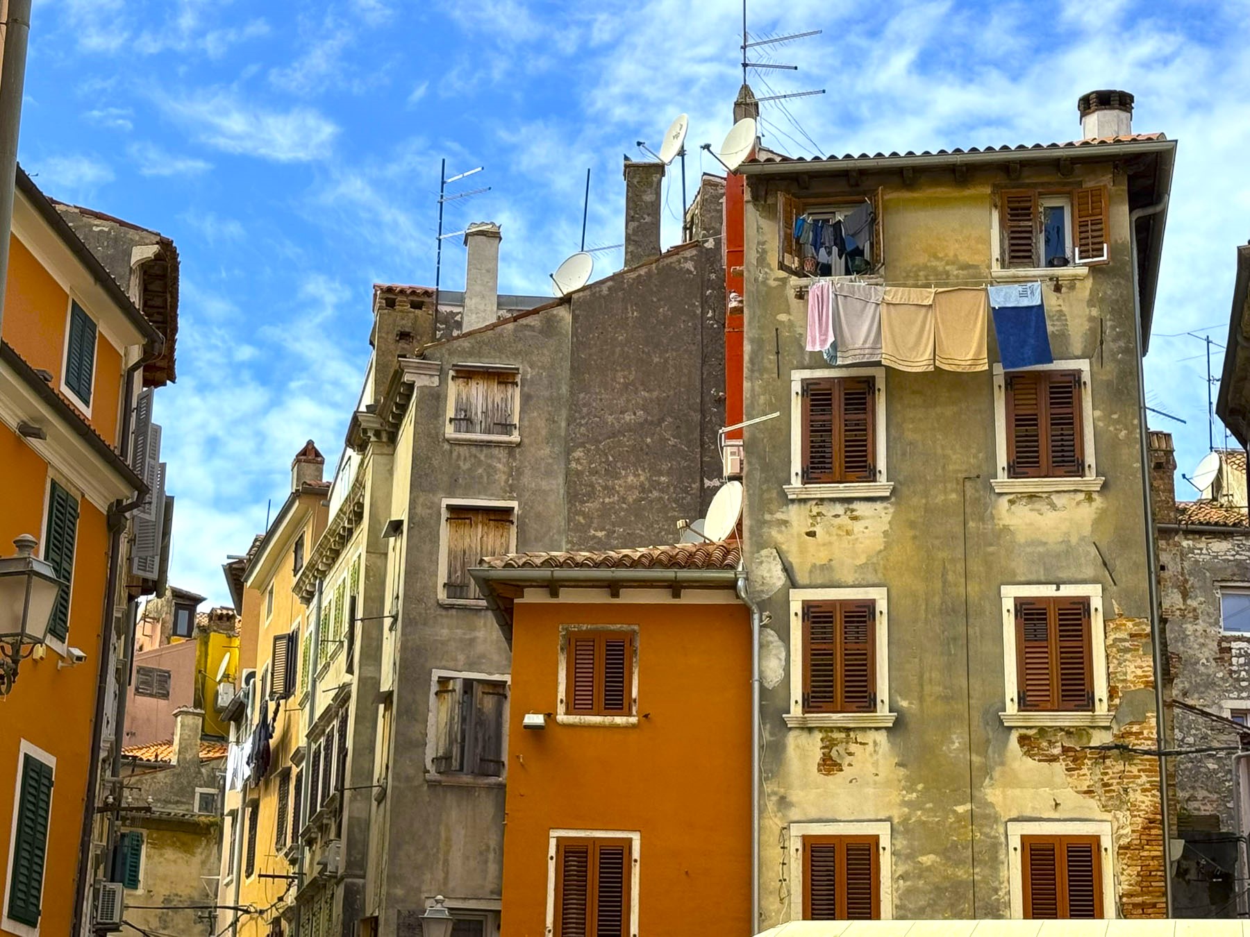
While our flat was adequate for our 3-night stay, we wouldn’t describe it as luxurious, but its location on a steep lane in the center of the historic district was excellent, being only a short walk away from everything in Pula. Wanting to take advantage of the sunny afternoon that appeared as we entered the city, we were soon out and about, walking past colorful homes and flowering wisteria along the road to the Citadel of Pula or Kaštel, as it is locally known.

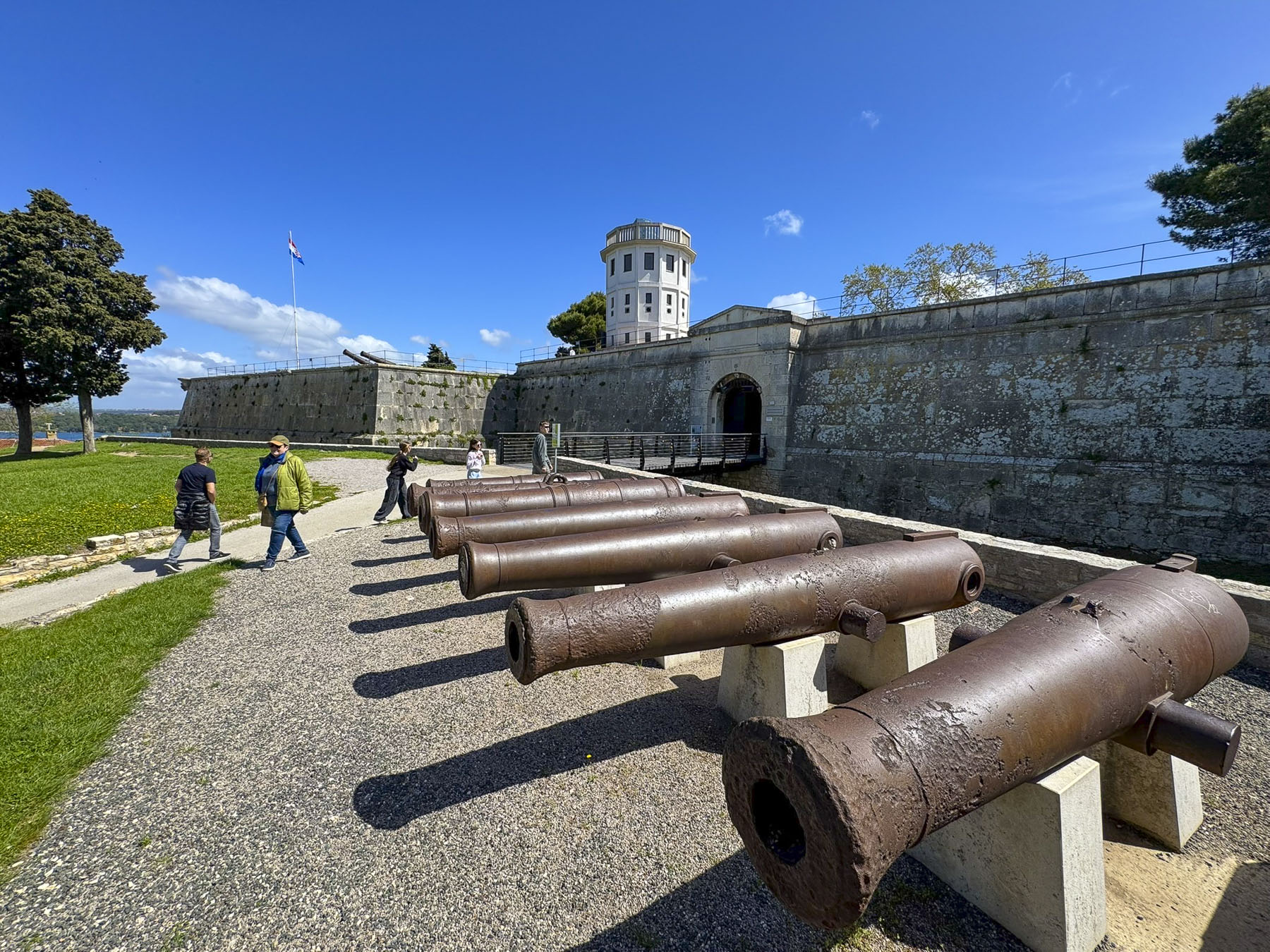
The star shaped bastion was built by the Venetian Empire in the 1500s over the ruins of an earlier Roman fortress and partially used some of the stones from the old colosseum in its construction. It has a commanding view of the harbor and the town surrounding it, and was actively used as military installation by the Austrians during WWI, who built an extensive network of tunnels under the castle known as the Zerostrasse. The tunnels were later expanded upon by the Italians during WWII, and later still, by Yugoslavia’s communist regime, to shelter 50,000 people. Unfortunately, the tunnels were closed when we visited Pula. Near the Zerostrasse’s entrance, at the bottom of the hill behind the Kaštel, there are also the ruins of a small Roman era amphitheater and museum with historical artifacts from the period. The Gate of Hercules and remnants of Pula’s ancient defensive wall are nearby.

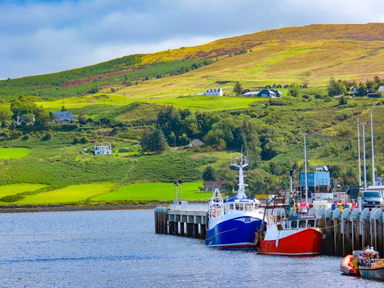
Earlier at the Kaštel, we had noticed large idle shipping cranes in the harbor, remnants of Pula’s once important shipping industry. Now from a window in our apartment, as the night sky darkened, we could see the “Lighting Giants” as they are called, lit with colorful lights.

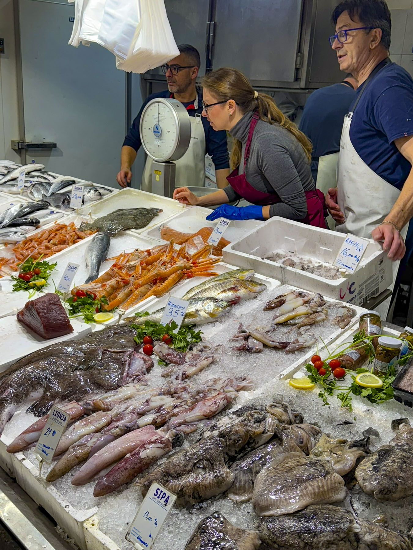
The next morning, in search of breakfast, we headed to Gradska tržnica, Pula’s traditional daily market where the seafood and meat vendors are indoors and the produce and flower sellers are setup outdoors in a shaded park. All the produce in the market looked extraordinary, and we were tempted to purchase some foodstuffs to cook later, but our apartment only had a coffee maker. Excellent pastries and coffee were found at Mlinar, an Adriatic region bakery chain, which we ended up visiting frequently during our road trip through the Balkans.

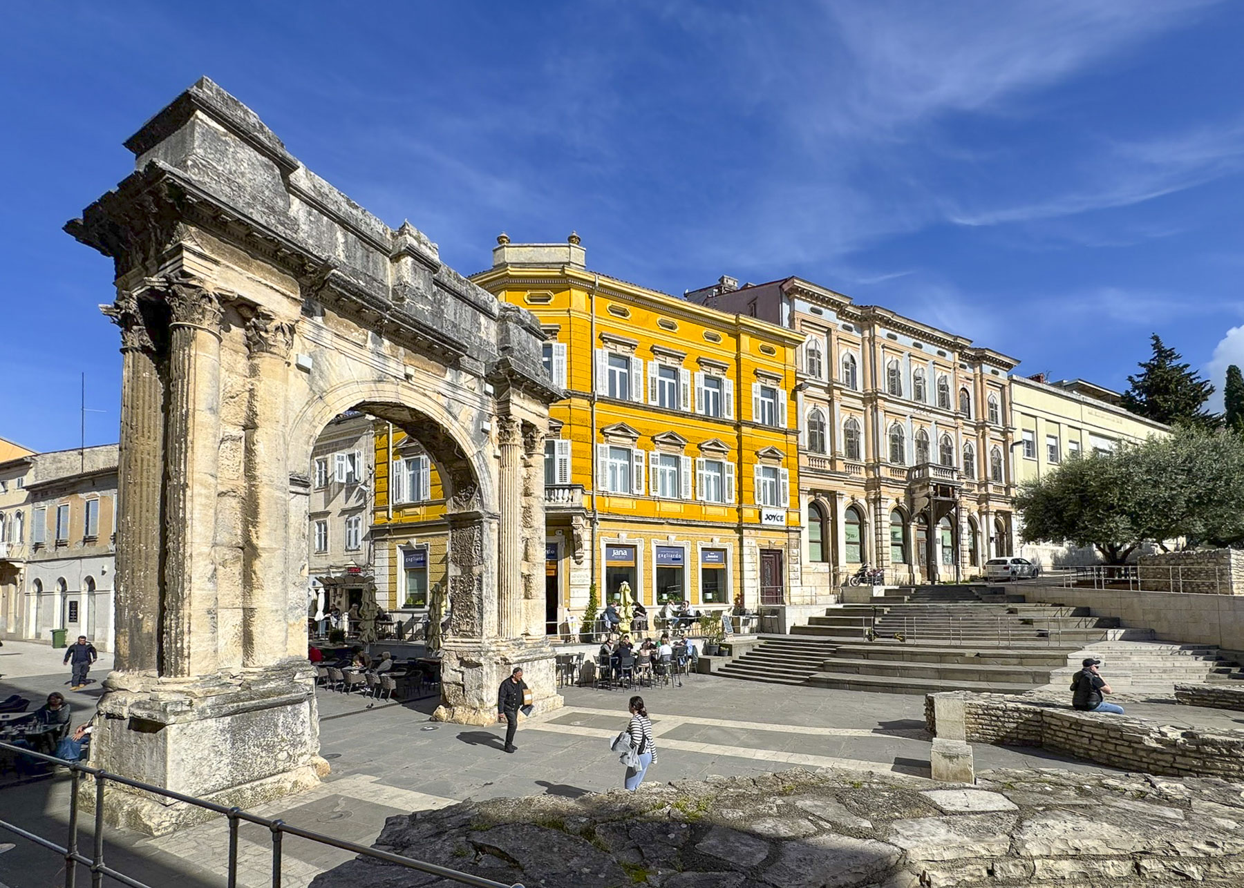
Our route took us through the Arch of the Sergii (29 BC), a Roman triumphal arch, and main gate through Pula’s defensive wall, which once stood around the city.  The ramparts were dismantled in the early 19th century, when Pula was an important naval base for the Austrian Empire, and the prosperous city needed room for expansion.    

Back-tracking through the arch we walked along the pedestrian only Sergijevaca Street, Pula’s main shopping lane, to the old Roman Forum.  After 2000 plus years, the plaza is still surrounded with ancient buildings that include the 2BC Temple of Augustus, and a 13th century Communal Palace, now used as Pula’s City Hall, and remains the center of activity in this historic town. Cafés with outdoor tables lined the perimeter of the square, though the popularity of each seemed to change during the day as people sought tables in the sun to help relieve the chill of an April day. Across from a busker, folks queued up to lend an artistic hand to the painting of two large fiberglass pisanice, Easter Eggs, as part of a fund-raising event.

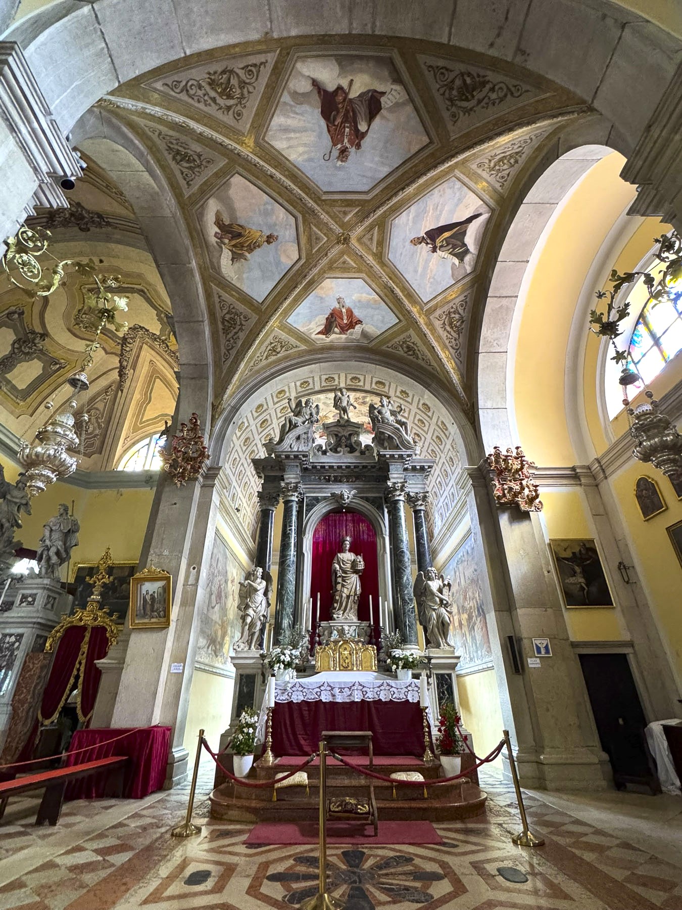
Farther along the lane, which is now called Kandlerova, curved with the base of the hill below the Kaštel, and opened into a smaller plaza in front of the Cathedral of the Assumption of the Blessed Virgin Mary, Pula’s main church. It was constructed in the 4th century over the foundation of an earlier Roman temple dedicated to the mythological god Jupiter. In the early 1700s, masons reused stones taken from the colosseum to construct the free-standing belltower in front of the church.

Next to the church was Park Jurja Dobrile, a quaint patch of greenery across from the promenade that stretches along the harbor.

It was very easy to enjoy Pula’s sites in a day and a half, so the next morning we set out for a day trip to Rovinj, less than an hour away. Olive groves and farmland graced our route through the verdant Istrian countryside.

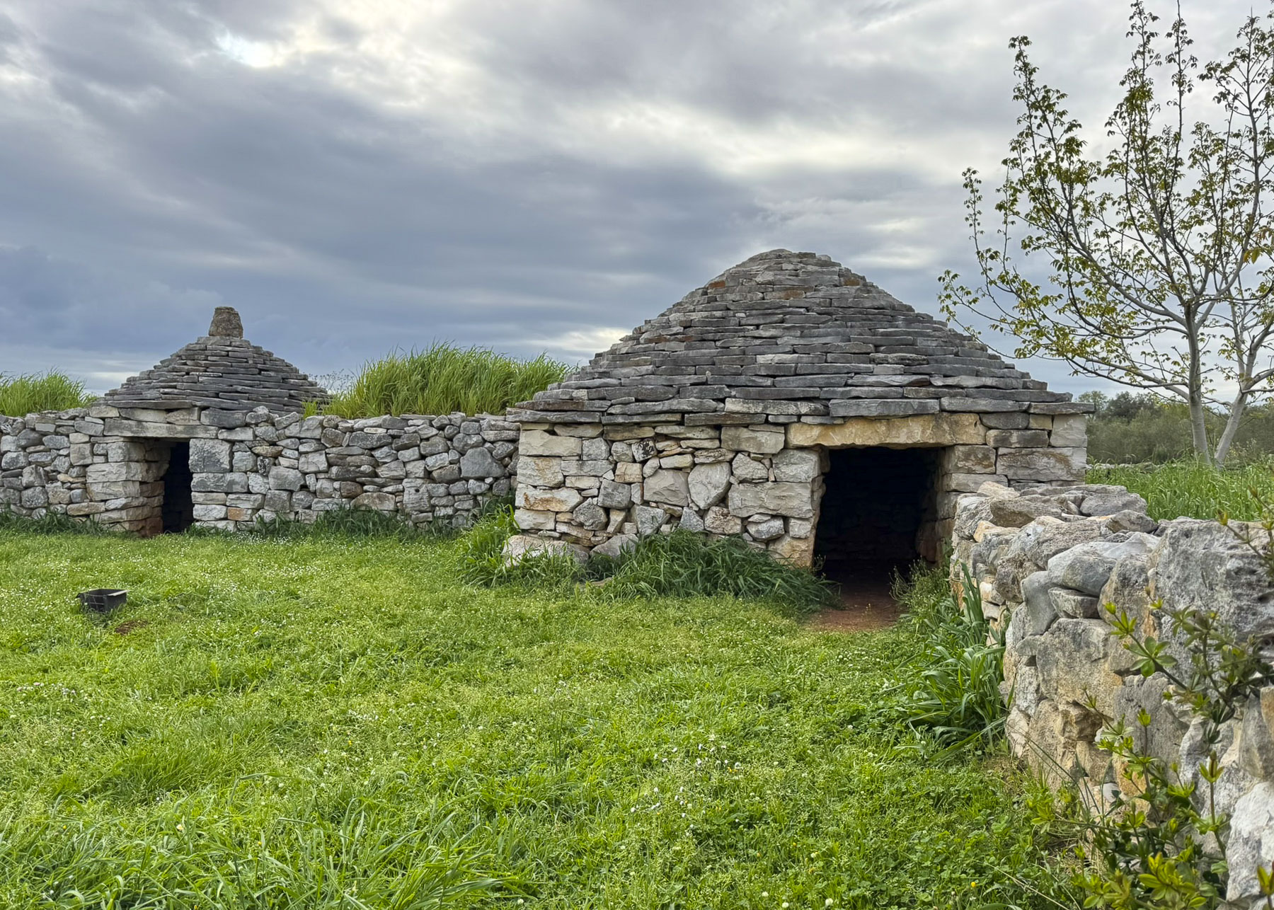
In the fields just beyond Vodnjan we noticed small round stone structures with conical roofs called Kažun. They were very similar to the Trulli we saw several years ago in the Puglia region of southern Italy. Though they share the dry-stone construction technique used to build the Trulli, the Kažun in the Istrian region are much smaller, and were mainly used to store crops, keep animals, and provide temporary shelter for farmers.

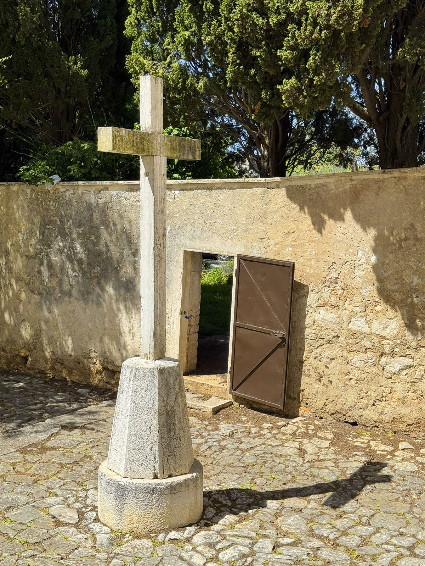
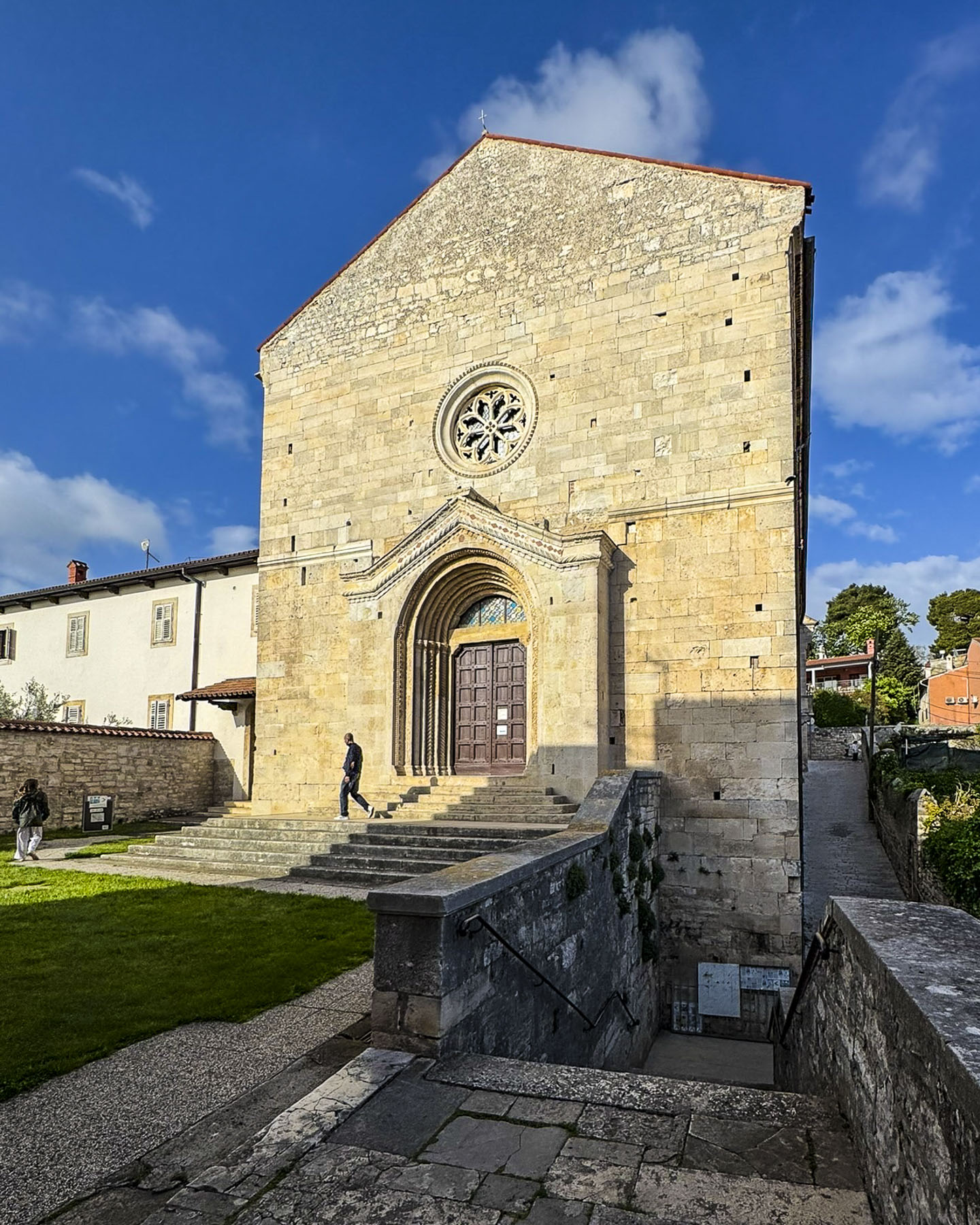
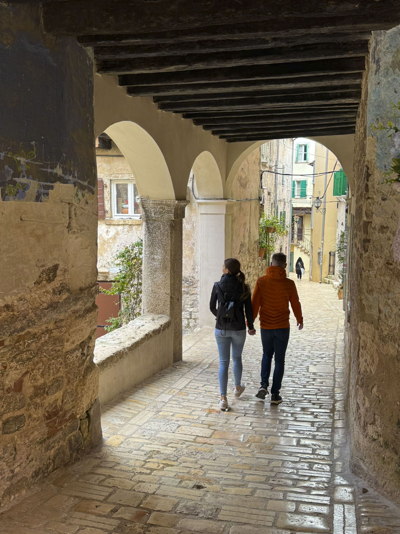
Like Pula, parking in Rovinj was limited and the large municipal lot, on the quay nearest to the old town, filled up quickly, even during the shoulder season. Fortunately, we found a parking lot on Vijenac braće Lorenzetto, a little farther away.  From there it was a steep uphill walk until we reached Crkva sv. Franje, the Church of St. Francis, and its Franciscan Monastery which date from the early 1700s.

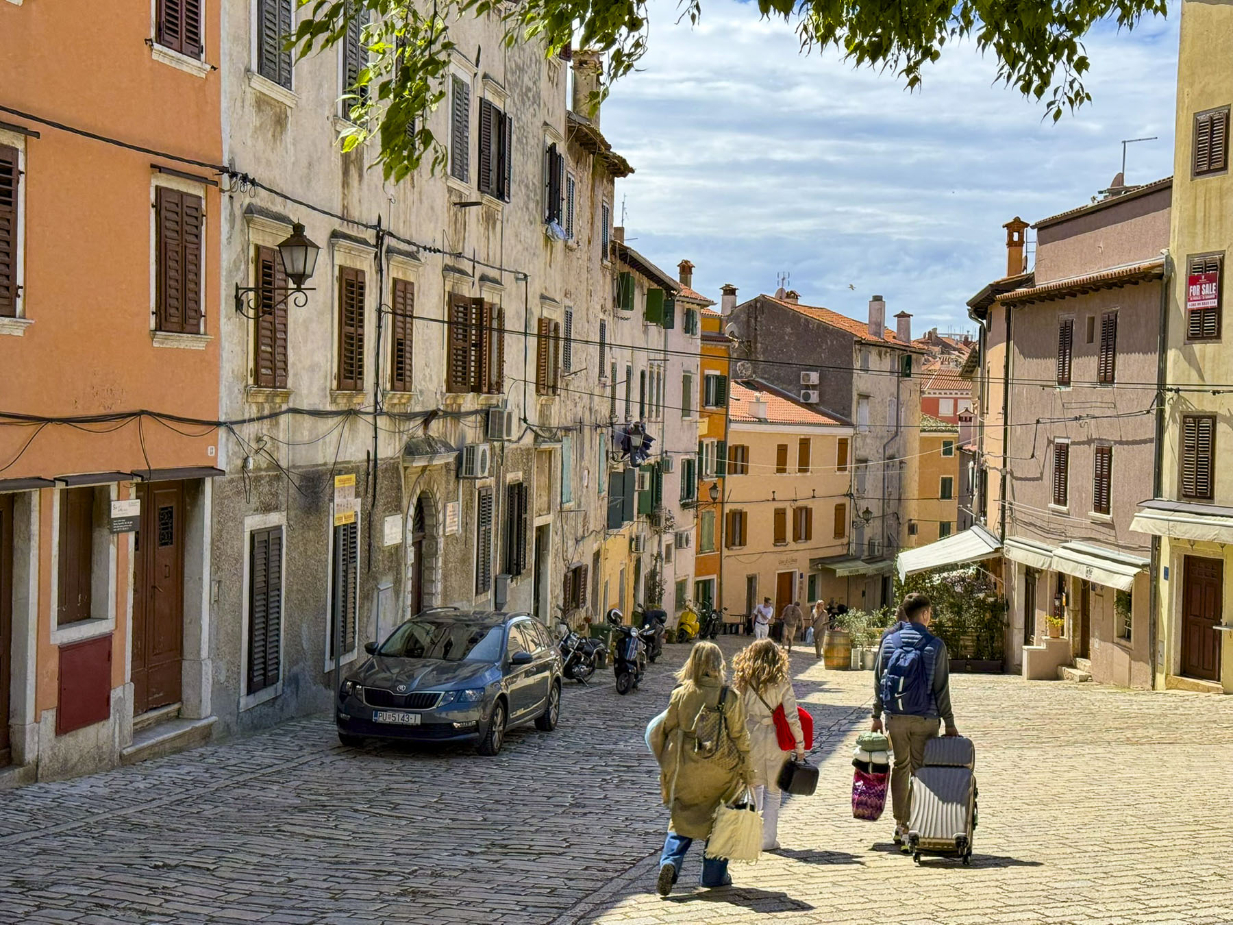
The rattling of suitcases pulled across ancient cobblestones by vacationers heading to their hotels accompanied us downhill. Surely an annoying sound, and we wondered if it was any better or worse than the hoofs of donkeys or horses, and wagon wheels clattering across the stones centuries ago.

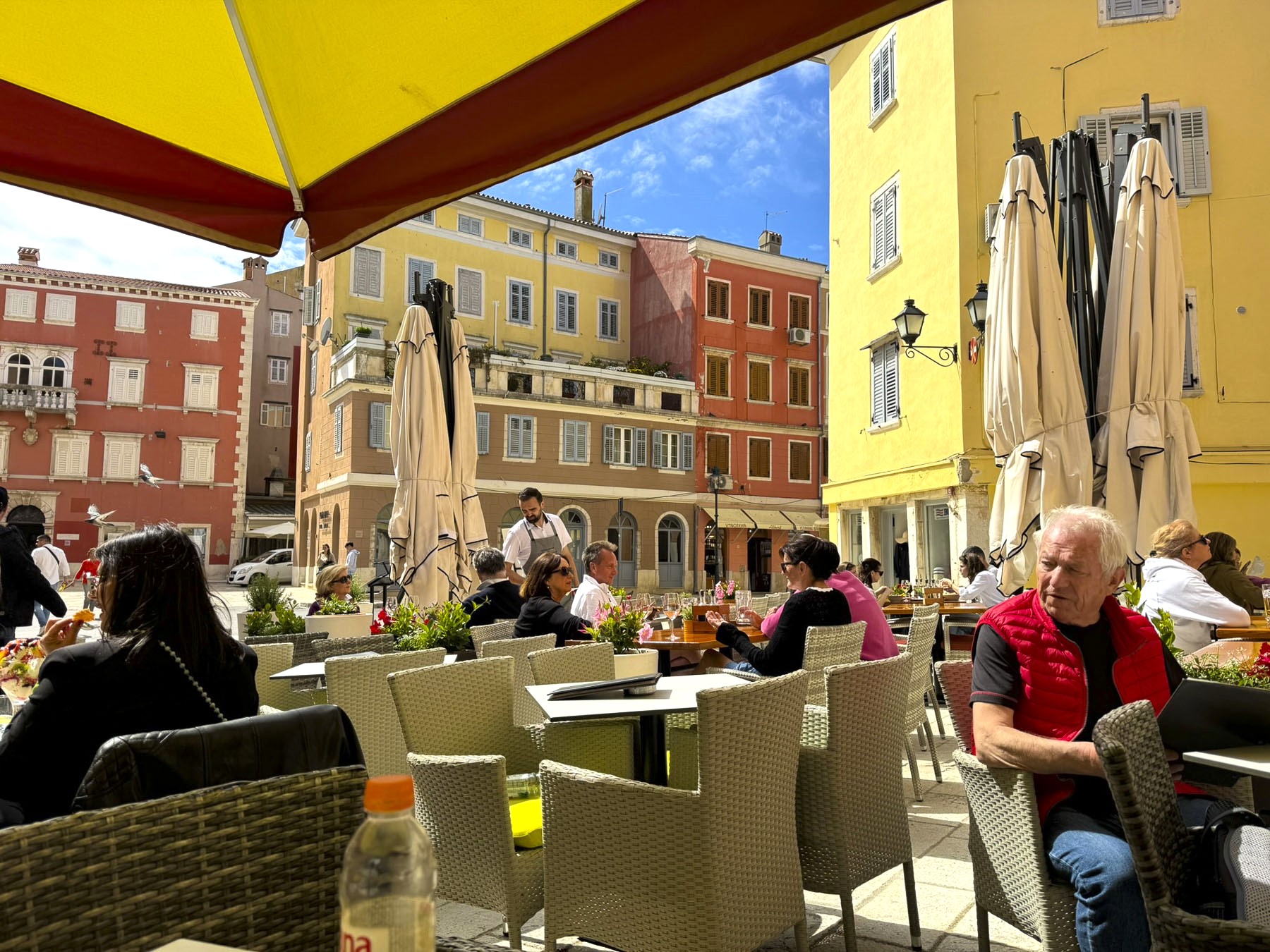
This lane from the church passed several restaurants, but the wonderful aroma originating from Fish House Rovinj encouraged us to stop for lunch. It’s a tiny no frills seafood bar with limited seating on bar stools inside and along the wall outside. All the fish is locally sourced and purchased fresh every morning at the docks. We tried fried calamari, grilled shrimps and fish tacos. Every dish was delicious. Their staff were very nice, and the menu was extremely budget friendly considering Rovinj is a top tourist destination. The place should definitely be considered a destination spot when visiting Rovinj.

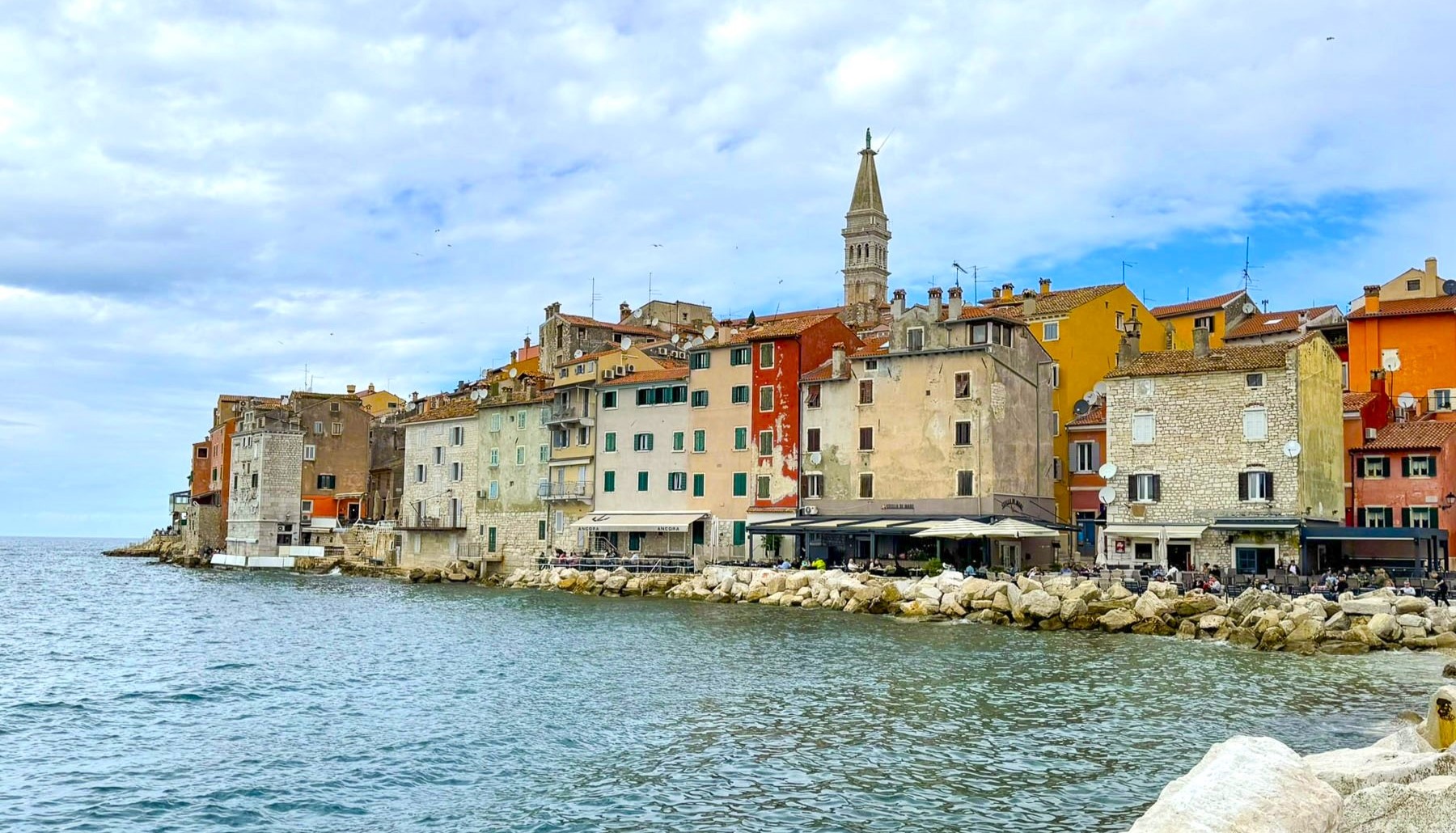
The attraction of Rovinj is its beautiful location on a small headland, that juts out into the northern Adriatic Sea, every square foot of which is covered with picturesque buildings which cascade down to the water’s very edge. The iconic picture of this 16th century merchant and fishing town is taken from the sea and captures the town, centered with the belltower of St. Euphemia’s Church at its apex, as if it was an island floating effortlessly on a horizon that seamlessly merges the sea and sky. The town was in fact an island until it the channel separating it from the mainland was filled in 1763, when the town was part of the Austrian Empire.

We had hoped to take our own pictures of the town from the sea, but the weather we felt was too cloudy to justify the expense of the boat trip. We contented ourselves instead with wandering along the harbor front before entering the old town through Balbi’s Arch, an old  Venetian gate, to the once walled citadel, before following the twisting stone lanes up to St. Euphemia’s Church.

The old town was charming, and while many of the alleys have been gentrified with upscale shops and lodging above them, several retain a rawness, similar to the historic quarter in Naples, Italy.

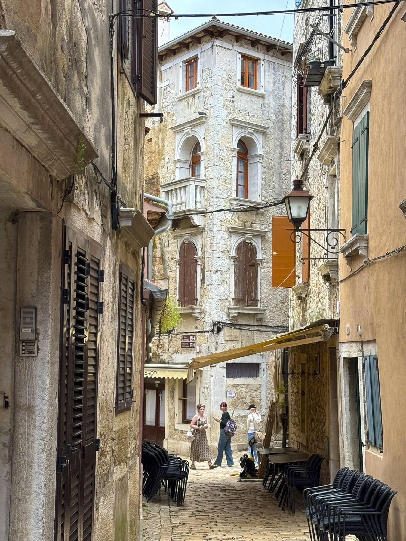
The lanes to the top of the hill twisted and rose before ending at a large plaza in front of the church. This church was constructed in the mid-1700s, to accommodate the growing city, over the foundation of a small church dedicated to St. George which was built in the mid-300s when the region adopted Christianity.

But part of the reason for the new church was to honor the miracle of St. Euphemia, a 4th century martyr, executed by the Eastern Roman Empire in Constantinople, before the empire adopted Christianity. The legend of St. Euphemia’s sarcophagus arrival to Rovinji  begins during the 700s Iconoclast heresy, when Emperor Constantine V, ordered her relics thrown into the sea. One hundred years later “fishers early one morning discovered a marble sarcophagus which had floated ashore like a stone ship. The townsfolk enlisted their strongest men, horses and oxen attempted  to pull the tomb off the beach, but to no avail.  

Miraculously, the saint presented herself to the crowd and singled out a small boy and said, “I am Euphemia of Chalcedon and I have engaged Jesus by blood. You will pull the stone ark with your body to the church at the top of the hill.” Awed, the crowd parted and watched the child pull the amazing weight of the tomb uphill. There priests slid off the tomb’s top and revealed the motionless body of a beautiful 14 year old girl. Next to her was a scroll of parchment paper with these words written on it: Hoc est corpus Euphemiae Sancte. “This is the body of Saint Euphemia.” Saint Euphemia is now the patron saint of Rovinj and her feast day is celebrated every September 16th, the day her sarcophagus floated ashore.

We had great experiences in Pula and Rovinj, and enjoyed learning about their fascinating history and legends.

Till next time,

Craig & Donna

Driving the North Coast 500 – Part 7: Duncansby Head Lighthouse To Loch Ness or Castles, Myths & Bagpipes

A small flock of sheep, sleeping on the tarmac, scattered when we rounded a bend to Duncansby Head Lighthouse before the crack of dawn. The pinnacle stood silhouetted against a brightening sky of pink, amber and blue, as the sun crested the horizon over the North Sea.

We followed the trail along the cliffs towards the Duncansby Stacks and passed a spot where we imagined an ancient Norse god had wielded a broadaxe and severed the bluff in two. The stacks were glowing red in the early morning light as Kittiwakes and Guillemots swooped along the cliff face, which stretched south for miles.

Following a delicious hardy breakfast, we packed our bags and said goodbye to the innkeepers at the John o’ Groats Guest House, one of our nicest stays while in the Scotland, then began the final leg of our NC500 tour and headed south along the A99 and A9 to Dunrobin Castle & Gardens, before spending the night in Strathpeffer. A pleasant distance of only 113 miles, which took us all day with all the photo stops we made. But that’s the way we roll.

There’s a debate about the best way to drive the North Coast 500 and the consensus seems to be that exploring it in a counterclockwise direction leaves the breathtaking scenery of the west coast for the last part of your trip.

We did the opposite and followed the NC500 clockwise, heading south from Inverness to Edinburgh, then west through the highlands to the Isles of Skye and Lewis & Harris before returning to the mainland and heading north to Durness and John o’ Groats, before heading south along the North Sea Coast of Scotland. We found the scenery breathtaking.

Our only complaint was the lack of official scenic pullovers, as we often had to park at the entrance to a farmer’s pasture or on a side road, and walk back along its shoulder to the spot we wanted. Fortunately, there were few cars on the road, because we stopped numerous times.

At Wick we visited the Old Parish Church and wandered amid its ancient gravestones, the oldest of which dates to 1639. The present church was built in 1862 over the foundations of two earlier churches, the earliest dating to the 12th century. A prideful lot the Wicks were, and they didn’t take kindly to anyone disparaging St. Fergus, their church’s patron saint. History tells of an Archdeacon, a noted reformer, who visited the parish in 1613 and vented his wrath on a beloved image of St Fergus in the old church, attacking and defacing it. The congregation was incensed, and the Archdeacon might have met his maker on the steps of the altar if the local sheriff hadn’t escorted him out of town. But he only got as far as the Wick River when he was ambushed and drowned.  During the following enquiry, “witnesses swore on oath that they had seen the ghost of St Fergus astride the unfortunate minister holding him down in the river.”

Clan Gunn Museum & Heritage Centre is beautifully set on the coast.

There are few natural harbors along Scotland’s North Sea coast. Ferocious storms blowing in off the sea required many villages to build stout seawalls to prevent their fishing boats from being smashed against the rocky coast. One such place was the tiny Latheronwheel Harbour. We had it all to ourselves when we visited on a Wednesday in August.

Crossing the River Helmsdale, we stopped at the Emigrants Monument which graces a hilltop that overlooks the village of Helmsdale nestled against its river and the sea. It’s a heart-rending tribute to those who were forced from their homes and livelihoods during the Clearances. The inscription on the monument, in Gaelic and English, reads:

“The Emigrants commemorates the people of the Highlands and Islands of Scotland who, in the face of great adversity, sought freedom, hope and justice beyond these shores. They and their descendants went forth and explored continents, built great countries and cities and gave their enterprise and culture to the world. This is their legacy. Their voices will echo forever thro the empty straths and glens of their homeland.”

It was commissioned by Dennis MacLeod. The son of a war-widowed crofter, he emigrated from Scotland to South Africa and made his fortune in mining.

Dunrobin Castle & Gardens was our main destination for the day, but our hopes were temporarily dampened by a sudden heavy rain. Fortunately, after we ran through the storm to the entrance, the sky cleared.

The castle is one of the best-preserved examples of how the landed nobility extravagantly lived. A castle has stood on this site overlooking the Dornoch Firth and the North Sea since the Earldom of Sutherland was created in 1235. Only a few walls of the ancient castle’s keep remained after extensive renovations and expansion in the 1700 and 1800s. The result was a French style chateau with towering conical spires and 189 rooms. Amazingly, the beautiful estate has remained the seat of Clan Sutherland for 800 years and is today owned by the 25th Earl of Sutherland.

Our self-guided tour (there were staff along the way to answer any questions) through the

exquisite rooms of this immense family home was very interesting. And it does feel like a family home, opulent but not pretentious. It was significantly nicer than the royal Palace of Holyroodhouse in Edinburgh.

As gardeners, we delighted in wandering through the Versailles-inspired oasis of flower beds and fountains.

Off the garden was the estate’s former two-story summer house, now a museum that displayed a notable collection of Pictish Stones, along with a variety of ethnographic items collected from travels around the world, and animal head trophies from safaris in Africa. 

At the lower end of the garden, we watched the castle’s resident falconer demonstrate and explain the ancient art of falconry as a Harris hawk, Gyrfalcon and Peregrine swooped low over the gasping audience. It was a very entertaining and informative show.

Farther south we turned off the A9 and headed to an early dinner at the Surf and Turf in Dornoch, a small town that traces its roots back to the 8th century. We discovered the Surf and Turf through one of the Instagram feeds we follow. The reviews were quite favorable and pictures of the seafood looked delicious, but we didn’t realize it was a takeaway shop. Luckily for us, they had a long bar with stools along one wall. The fresh fried fish, calamari and mussels we ordered were excellent and all locally caught.

The Dornoch Cathedral was just around the corner, and we spent a while studying the grotesque ancient gargoyles and stone interior of the church, which held its first service in 1239. During the medieval era the gargoyles were believed to portray evil spirits, which were driven from the church by ringing its tower bells.

In 1245 the 1st Earl of Sutherland was buried in the cathedral, the first of many Sutherlands  to be entombed in the family vault under the sanctuary floor. Three centuries later the church was left in ruins after fire destroyed the nave and roof during a climatic feud between Clan MacKay of Strathnaver and Clan Murray of Dornoch. Fifty years later only the roof over the chancel and transept walls were replaced. The cathedral remained partially renovated for another 300 years until 1835, when the Duchess of Sutherland financed a full restoration. Light poured through 27 stained glass windows and brilliantly illuminated the church’s interior. Three of those windows, with the themes literacy, music, and peace, were donated to the church in 1926, in the memory of the famous Scottish-American industrialist, Andrew Carnegie, who summered nearby at his baronial estate, Skibo Castle.

Also of interesting note, the last burning at the stake of a witch in Scotland happened in Dornoch in 1727.  Janet Horne, a local woman, was accused of turning her daughter into a pony and riding her around the highlands to perform her witchcraft. The Scottish Witchcraft Act of 1563 was repealed in 1736. The singer Madonna had her son Rocco christened in the cathedral in 2000, before her wedding ceremony to Guy Ritchie at Skibo Castle.

We ended our day in the quaint village of Strathpeffer, a Victorian era spa town whose sulphurous spring waters were touted as a cure for many ailments. A railway line reached the town in the late 1800s, and it became an easy destination for wealthy Victorians who sought “to take the waters.” Our hotel, the Highland Hotel Strathpeffer was one of those grand, four-story wood paneled, railway hotels built to ease spa-goers’ visits to the village. It’s glory years now a distant memory, the hotel still has its original warm wood paneling, but our room was very spartan, and a far cry from what we imagined were its luxuries during its heyday. During World War I the hotel was requisitioned as a convalescent military hospital, and in the Second World War served as a naval training school.

The village was very charming with a visually pleasing assortment of well-kept Victorian architecture. The old train station now hosts the Highland Museum of Childhood and a nice cafe. Across the street from our hotel the town’s original pavilion was recently renovated and once again hosts music and theater events, along with weddings, and exhibitions. Behind the pavilion is a small whimsical sculpture garden with five 13ft tall wooden sculptures of mythical figures from Celtic, Viking and Pictish legends. They were created by Allister Brebner, a local woodcarver with a workshop in the old train station, from the trunks of giant Douglas Fir trees, harvested from the Highland’s forests.

Is a tour of the Scottish Highlands really complete without visiting Loch Ness? We didn’t want to have any regrets, so on our last full day in Scotland we headed to Urquhart Castle and hoped to catch a glimpse of the fabled serpent so we could tell our young grandchildren, with our fingers crossed and a wink of the eye, that we had indeed spotted and encountered the creature and tried to wrestle it to ashore. I had his head and Donna his tail, but the slippery slimy thing was wildly thrashing about, and we lost hold of him, and in a final splash he vanished. An epic fish story about the one that got away is always good for a child’s imagination.

The castle commands a strategic point that juts out into Loch Ness, the natural geographic dividing line between the northern and southern Highlands. Built in the 13th century, it was one of Scotland’s largest fortifications and had a tumultuous 500 year history as it was captured then retaken numerous times during the Wars of Scottish Independence. Finally British soldiers blew it up in 1692 as they retreated to prevent the Jacobite army of Bonnie Prince Charlie from occupying it. On the grounds is a full-sized working recreation of a medieval trebuchet, a catapult-like siege engine that used a counterweight to hurl large stones against castle walls. Unfortunately, they were not demonstrating its use when we visited. Urquhart Castle, along with the Glenfinnan Viaduct for the Harry Potter train, were the busiest attractions we visited while in the Highlands. The rest of the time it felt like we had the Highlands mostly to ourselves. This was wonderful considering we drove the NC500 during the summer high season in August.

Our last stop before catching an evening flight from Inverness Airport was in Drumnadrochit, a crossroads village at the foot of a bridge that crosses over the River Enrick. We drove through it on the way to Urquhart Castle, earlier that morning, and thought it would be a nice place to break for lunch.

A young bagpiper commanded the village green as we settled into an outside table at The Fiddler’s Highland Restaurant to people-watch for a while. We were a little melancholic that our trip was finally coming to an end after driving a big loop around the Highlands, an area blessed with an amazing array of beautiful mountains and seascapes. The wizardly spell cast by the pipes was hard to break as we departed.

My heart’s in the Highlands, my heart is not here,

My heart’s in the Highlands, a-chasing the deer;

Chasing the wild-deer, and following the roe,

My heart’s in the Highlands, wherever I go.

The poem was written by Robert Burns

Till next time, Craig & Donna

The NC500 Part 3 – Adventures on Skye: Mountains, Rain, Whisky and Oysters

With only two full days on the Isle of Skye, the largest of the Inner Hebrides islands, we were up before dawn and headed out to hike the Old Man of Storr. We had read so much about the Old Man of Storr trail being the most popular activity on Skye that it we thought it wise to get an early start. Several cars were already parked in the lot, still wet from an overnight rain, when we got our ticket from the parking kiosk.

Even in places you wouldn’t expect, paid parking seems to be everywhere across Scotland, and since it’s the UK there’s video surveillance too. At the unmanned attendant’s hut a note taped to the window advised of “less than ideal wet conditions” on the mountain. We had hoped for a clear morning, but the mountain was shrouded in mist.

The first short stretch of the trail was moderately steep and would have been easier if our heart rates were up, though the incline soon lessened after rounding several switchbacks. When the trail leveled, we turned around to survey how far we had climbed and were rewarded with a spectacular view of morning light, in golden rays, cascading through the clouds onto the Sound of Raasay.

It began to rain by the time we reached a set of rough stone steps that would have taken us higher up the slope, but the rocks were getting slippery, and we decided to turn back.

We thought the morning was cold and had suited up with several layers under our rain gear, and were totally surprised when several guys in shorts and just t-shirts, obviously vacationers from the Artic Circle, passed us on the trail, followed by a young couple carrying a toddler.

Even though we didn’t make it as far up the mountain as we would have liked, we enjoyed the views.

By the time we returned for breakfast at The Rosedale Hotel in Portree the clouds were clearing, and we were able to admire the view of the harbor from a window table.

Afterwards we walked along the waterfront, where the view across Loch Portree, with boats rocking at anchor, resembled New England waterscapes from the coast of Maine, in the United States.

Our plan for the day was to make several stops at scenic sites as we headed north from Portree along the coast of Skye’s Trotternish Peninsula. We decided to look for dinosaur footprints at An Corran Beach before turning west across the highlands to Uig, then continuing a southern loop back to Portree.

This time as we approached Old Man of Storr the morning’s mist had lifted, and the mountain’s rugged peaks were clearly visible. The parking lot was also completely full.

The one good thing about all the August rain was that the rivers were high, and the waterfalls were thundering furiously. We had to wait for a few minutes for parking space at the Lealt Fall View Point. Strong winds buffeted us as we walked out onto the viewing platform.

Actually, two waterfalls can be seen from this spot: one flowing from a stream called the Ford is directly across from the platform, while the larger one to the right cascades 90 feet down from the Abhainn An Lethuillt, the River Leath.

From the ridge above the gorge carved by the falls, we followed the water flowing to the sea. The wind on this headland was extremely ferocious and we were fine as long as we had our hoods up and turned our backs to it. But as soon as we turned around a gust of wind threw my hood back and blew my baseball hat off my head. Really, it wasn’t my hat – since I had lost my own, I had borrowed Donna’s this morning, while she was still sleeping. The red hat had a long and colorful history, and was a treasured companion that she had worn on many adventures. The salt in the wound was that it settled only about 12 feet out of reach, down a very steep grassy slope, too risky of a spot to try to retrieve it. Months later I am still hearing about how untrustworthy I am as a hat borrower. I’m a lucky guy if that’s the worst of her grievances. The vistas surrounding this area were beautiful regardless of the weather.

The sun was finally out when we stopped a little farther north at Mealtfalls where the waters of Loch Mealt spectacularly plunged 180 feet onto a rocky coastline and the sea, from a notch eroded into the 295 feet high cliff face of Kilt Rock. If viewed from the sea the basalt stone columns of the cliff face are said to resemble the pleads of a Scottish kilt.

The scenic drive north along the coast was stunning and we stopped many times to take photos. The sun was still shining, but the wind was blowing a “hoolie”, lifting swirling sprays of water into the air from the surf crashing onto the beach when we reached An Corran Beach.

The beach itself is very nice, but since 2002 when a local dog walker discovered the three-toed footprints of a Jurassic era Megalosaurus in rocks newly exposed after a large storm, it’s been a popular destination on Skye. We searched along the rock shelf at the water’s edge, but an incoming tide hindered our exploration.

Our hunger pangs began pinging around noon, and we stopped at several local restaurants only to be discouraged by the long waiting times for a table. We continued our drive. The issue wasn’t that the establishments were full, but that they lacked the seasonal staff to serve the customers adequately. This situation is a consequence of the Brexit maneuver that restricts foreign workers from entering the United Kingdom. This situation was mentioned to us several times by unhappy locals.

Following signs in Stenscholl for the Quiraing Pass we turned onto a serpentine single-track lane that climbed a 14% grade to an elevation of 856 feet above sea level before reaching a viewpoint.

With every fifteen miles or fifteen minutes the weather changed on the Isle of Skye, for better or worse. The deep grey sky was very forbidding and as soon as we opened the car door the rain poured down. The viewpoint and the trails leading from this scenic spot rival the Old Man of Storr’s, and are very popular for the views of the east coast of Skye and the highlands that can be seen on a clear day. It was raining too hard for us, so we continued across the highlands toward Idrigill on the west coast.

The interior sections of Skye are now vast wilderness areas with few signs of folks living in the area. But that wasn’t the case in the early 1800’s when the hills and glens of the island’s highlands supported over 20,000 crofters, tenant farmers, before the notorious “clearances” removed folks from the land to make way for large industrial scale sheep flocks. Many families emigrated to America, Canada, Australia, and New Zealand seeking better opportunities. A slow decline of Skye’s population continued into the 1970’s when it reached a low of 7,100 people. The most recent census shows the island’s population growing to 10,000 residents.

The sky was clearing once again when we reached the Idrigil Viewpoint. It was a splendid spot with panoramic views of Uig Bay and village. We finally had a late lunch at the Anchorage Cafe, across from the ferry terminal. It was nice to familiarize ourselves with the area, as we’d be taking the ferry from the Uig port to the Isle of Lewis and Harris in two days.

After lunch we drove up the western side of the Trotternish Peninsula to the Skye Museum of Island Life, which is a collection of thatched roofed stone cottages showcasing the way folks lived on the island centuries ago. Sheep and several hairy coos shared a bucolic pasture next to the museum when we pulled into the sunny parking area. But it was a deceptive moment of fair weather, and we were soon darting between the buildings, in the lulls between downpours, to see the interesting array of artifacts from seafaring, farming, and other trades on display.

We returned to Portree in time to snag a coveted parking space along the quay in front of our hotel and spent the rest of the late afternoon visiting the various shops in town. Our best find was in the charity shop along the waterfront where I was able to replace Donna’s hat with a warm woolen plaid cap. For the bargain price of fine pounds, she was willing to overlook a moth hole in the tweed.

We set out late the next morning to explore the western side of the Duirinish peninsula, visiting the village of Stein and Dunvegan Castle, both on the shore of Loch Dunvegan, but miles apart. Then heading back towards Portree and stopping in Carbost, on the Minginish peninsula, at the end of the day.

It was an overcast day from the get-go and we took the drive slowly as we followed the A850 though the countryside. At the head of Loch Greshornish we turned off the main road and followed a narrow lane into the village of Edinbane in search of a place to stop for coffee. The village was very quiet and didn’t show any sign of life, even though it was a weekday in the August high season, and several inns were shown on our map. We did encounter an unusual traffic sign that boldly warned with its red triangle that we were in a “Free Range Children” zone. It touched our hearts and made us laugh, while we remembered being kids with hours of unsupervised freedom to roam about. We’d seen many signs warning of stags, hedge hogs, and red squirrels throughout the highlands. Even a road crossing sign near a retirement complex in Edinburgh that featured the silhouette of an elderly couple using  canes, that made its point quite effectively with a touch of humor. Back on the main road the take-away coffee at the filling station didn’t appeal to us so we continued on our way.

Our approach to Stein looked like the soft edged, muted colors of an impressionist painting through the windshield, as the wipers didn’t work fast enough to whisk the heavy downpour away. The rain was too intense to get out of the car. So, we drove slowly through the village looking for a place to turn around, until the road suddenly disappeared as a boat ramp into the sea. Gloomy, wet, and unpleasant, it was definitely a “dreich” day, as the Scots like to say.

With everyone on Skye looking for an indoor activity to do, the parking area at Dunvegan Castle was full. There’s only so many castles you can see before they all begin to feel the same, and we had stopped at several earlier on the mainland, so we didn’t feel totally guilty when we decided to head to lunch instead. There are several restaurants that sit along the road through the village of Dunvegan. Dunvegan this, Dunvegan that. Of course we had lunch at The Dunvegan, a small five room inn overlooking the loch, which features a very nice restaurant along with a café, and deli for takeaway. Even though it was very busy on this inclement day, we found it relaxing, and the staff was very nice. Just down the street, a restored one-room crofter’s cottage houses the quirky Giant Angus MacAskill Museum. It’s run by a distant relative of the seven feet nine inch tall giant who was born in 1825 on the Isle of Berneray, in the Outer Hebrides. I guess that’s close enough to be considered a hometown boy, even though he spent most of his youth growing up in Nova Scotia, Canada after his parents emigrated. His height and strength eventually brought fame and fortune to the gentle giant called Gille Mór (Big Boy) when he toured the world with P.T Barnum and Tom Thumb, the world’s smallest man. Performing before Queen Victoria, she declared him the “strongest, stoutest and tallest man to ever enter the palace.” For a while he was listed in the Guiness Book of Records as the world’s strongest man. Statues of Angus and his stage partner Tom, along with his size 18 boots, and a replica of his huge coffin, fill the space. 

We arrived too late for the last tour of the distillery at Talisker in Carbost, but nevertheless we enjoyed sharing a flight of three single malt whiskies aged for 10, 18, and 25 years, while standing at the bar, as the tasting area and showroom were full of folks escaping the rainy afternoon. Our young barkeep was a well-versed whisky sommelier who described the “smoky sweetness intertwined with distinct maritime notes,” as he guided us through the subtle influences the haar, the sea mists that blow in from Loch Harport has on the aging process. He poetically used a cask full of adjectives to describe the Nose – floral seaside aromas, with gentle smoke palate; a malty creaminess and finish; sublimely spicy; a kick of cloves; an exquisite lingering saltiness.  All were very nice to sip slowly, and on a damp rainy “dreich” day like today we fully appreciated the healing properties of Scottish whisky and why some refer to it as the “water of life” in the highlands.

Just up the hill from the Talisker Distillery is The Oyster Shed. Occupying a metal farm building,

it’s a local no frills, order at the counter joint, with incredibly fair prices, that serves the freshest seafood caught locally that day. We ordered a dozen oysters and a bowl of mussels along with cans of Irn Bru, a fruity carbonated soft drink often referred to as “Scotland’s other national drink.” We sat outside around the corner of the building at a long, shared picnic table with other customers. Simple, delicious and authentic, it was a great way to cap off our day. Parking can be difficult here, so be patient; experiencing the Oyster Shed is well worth the short wait.

The next morning in Portree was beautiful and also our last day on Skye. We made the best of our time before catching the Caledonian MacBrayne ferry from Uig to Tarbert on the Isle of Lewis and Harris, in the Outer Hebrides. Overlooking Uig’s harbor we stopped at Captain Fraser’s Folly, a stone tower built in the mid 1800’s on the spot where Fraser’s Kilmuir estate Factor collected rent from the crofters that lived on the land. Fraser and his Factor were not popular during the clearances and often had to seek shelter in the tower from tenants evicted from the estate. Once in 1884 they even had to ask the Royal Navy to help secure their safety.

Skye’s legendary Faerie Glen, known as a place of myth and wonder, was only a short distance away from Fraser’s Folly, in the hills above Uig. It’s a magical spot, centered with concentric rings of stones, under a rocky hilltop that resembled ruins, that’s called Castle Ewen. The landscape surrounding the glen is rugged and covered with gnarled trees and heather where, according to legend, the Faeries of the glen lived. One of the ancient folk tales speaks of a Clan MacLeod chief that lived in Dunvegan Castle and married a Faerie princess. She stayed with the chief for a year before returning to her world, but left with him a Faerie flag to protect the Clan MacLeod from evil and bring victory in battles. It’s reportedly brought the clan good luck over the centuries.

Inexperienced with car ferries, we made sure we were early in the queue at the Caledonian MacBrayne pier. We had purchased our tickets online, months before, as soon as their summer sailing schedule became available. We read that while being a last-minute walk-on isn’t a problem, car reservations during the summer high season fill quickly. There were special lanes for each category of vehicle – car, camper, truck and bus. Vehicles without reservations get driven on last or not at all depending on available space. It all worked very smoothly with a ferry attendant scanning the barcode of our printed ticket and directing us into the correct boarding lane.

Surprisingly, the ferry was very quickly loaded and with a blast of the ship’s horn we departed Uig and headed across the Minch, the body of water that separates Skye from the Isle of Lewis and Harris. 

Till next time, Craig & Donna

P.S. According to Sir William Connolly, Scotland’s favorite retired stand-up comedian, “There’s no such thing as bad weather, just the wrong clothing, so get yourself a sexy raincoat and live a little.”

France: Road Tripping Through Normandy – Fecamp, Yport & Étretat

Overnight showers had cleansed the air, the morning was brilliant with sunshine, and the deep blue sky was checkered with fair weather clouds. We were road tripping west through flat farmlands and pasturelands, which were lined with rows of beech trees to protect the land from the ferocious winds of winter storms. The landscape was dotted with Normande, a breed of dairy cow descended from the cattle that the Vikings brought with them when they settled in the area during the 9th century. A white cow, speckled with brown patches, this breed is favored for its milk’s high fat content, which lends itself perfectly for making CHEESE! More specifically the PDO (Protected Designation of Origin) Camemberts, Livarots, Pont-l’Evêques and Neufchâtels that the Normandy region is famous for. Small signs for fromage and cider pointed down many dirt lanes that spurred off our route.

We were heading to the white cliffs of Fecamp and Yport, in the Seine-Maritime department of Normandy, on the English Channel. While planning this trip we read about high season – over-tourism running rampant across France. Crowds don’t appeal to us, so we’ve been planning our travels to coincide with a destination’s shoulder season for a while now. The articles also suggested visiting places off the usual tourist radar, which is how we came across Fecamp and Yport, our stops before reaching Étretat. In hindsight we should have planned a full afternoon or overnight stay in Fecamp, as the quick glimpses of the Palais Ducal, now ruins, and the Holy Trinity Abbey, as we drove through the historic center, revealed a pretty town and looked intriguing, worthy of further exploration.

Our “walk a little then café,” becomes “drive a little then café,” when we have wheels, and by the time we entered Fecamp it was time to satisfy that late morning craving. Parking in unfamiliar towns is always a challenge, and on a busy Saturday even more so, but we lucked out and found both a parking space and great café near the harbor. The sunny outside tables at Le Coffee de Clo were empty so we were surprised when we entered to see a lively shop nearly full of people busily enjoying the decadent sweet creations we had stumbled across. More muffin than pastry, the baked goods and excellent coffee here are the only excuse you need to detour to Fecamp.

Walking back to the car, we spotted the Chapelle Notre-Dame du Salut, across the harbor, high atop Cap Fagnet. It’s believed that Robert the Magnificent, an 11th century Duke of Normandy, constructed the church in thanks to God for surviving a shipwreck in the waters below the white cliffs of Cap Fagnet. It’s been a pilgrimage site for fishermen, sailors, and their families ever since.

The views from the terrace in front of the church of Fecamp’s harbor, and the southern half of La Côte d’Albâtre, the Alabaster Coast, take in an 80-mile stretch of white cliffs between Etretat and Dieppe on the Normandy coast, that mirrors the distant White Cliffs of Dover across the channel. Locally the cliffs around Fecamp are known as le Pays des Hautes Falaises, high cliff country.

In 1066, William of Normandy set sail from Fecamps’ harbor with a fleet of more than 700 ships, partly financed by the Abbott of Fecamp, to claim the Crown of England, which he had inherited, but this was being contested by Harold, a pretender to the throne.  The issue was settled at the Battle of Hastings when the former became King William the Conqueror. It was also reassuring to learn that the Fecamp monks transitioned away from being international arms merchants, and segued into a more appropriate occupation –  running a distillery in the 16th century, that produced a 27-herb flavored liqueur that would become popular in the mid-1800s and sold as Le Grand Bénédictine.

Eight hundred seventy-eight years after William set sail, on June 6, 1944, during WWII German fortifications along the Côte d’Albâtre failed against an allied amphibious invasion fleet of over 7000 ships and landing craft. It was the beginning of the end of WWII. Scrambling to the top of an abandoned bunker provided us with the perfect vantage point for photos of the coast.

By the time we arrived in Yport the clouds had thickened and were threatening to rain. To our dismay, it poured just as we were parking by the beach promenade. Fortunately, it was an intense but brief shower that cleared into a cloudless sky and revealed a quaint picturesque hamlet and shining white cliffs towering above the sea.

The cliffs along the seafront have been eroding for eons, creating in certain spots deep, long ravines that funneled torrents of water, laden with sand and stone through the cliff face to the ocean, which created beaches in certain places over the ages. These narrow valleys are called valleuses, and the small coastal fishing village of Yport started in one during the Neolithic era.

Without a harbor, fishermen pushed their small boats across a pebbled beach and rowed out through the waves to pursue their livelihood. They repaired their boats and mended their nets on the beach at the foot of the town. This way of life supported the villagers for centuries. Only the invention of the small outboard motor in the early 1900s eased their physical effort, until the 1960s when tourism and a small casino replaced fishing as the town’s driving economic force.

In 1838, the tightly knit community decided to build a church. Men, women, and children gathered tons of smooth stones from the beach, carted them 500m inland, and proudly worked together to mix cement and build the center piece of their town. Horizontally striped with alternating layers of colored beach stones, the façade of the church is beautiful, and unique in Normandy. It is a true testament to the power of community spirit.

By the mid-1800s Parisians seeking a more relaxing retreat than Etretat were frequenting the quiet fishing village. The French painters Monet, Renoir, Schuffenecker, and Vernier visited and painted there, while the 19th century French writer Guy de Maupassant set his novel, ‘Une Vie,’ in Yport. Paths from the center of the town and from behind the casino lead to the cliff tops and join the popular GR21 trail that can be followed north to Fecamp or south to Etretat.

Regardless of how beautiful photos of the Falaise d’Aval are, they don’t rival the physical reality of the calling gulls, wind-swept hair, the whistling wind and the relentless sound of the surf crashing against the stoney beach.

Arriving late on a Saturday afternoon in mid-October, we were surprised Étretat was jammed with tourists. Parking is extremely limited here and finding a space is almost a competitive sport that ultimately just required us to sit in a row and wait for someone to return to their car. It sorted itself quickly enough and luckily, we were only a short walk from one of Étretat’s first lodgings, the Hotel Le Rayon Vert, which to our delight was directly across from the beach and Étretat’s promenade. After checking in, we headed to the top of the towering 300ft high cliffs for sunset, the first of many walks along this beautiful stretch of coast and the perfect way to work up an appetite.

If you have been following this blog, you’ll know my superpower is the ability to find a great pâtisserie, pastelería or pastry shop. It’s a great talent when the hotel wants 16€ per person for breakfast. In Etretat, the boulangerie patisserie “Le Petit Accent” exceeded all expectations!

Set high above the town, it was a steep uphill walk to the Jardins d’Etretat. This whimsical topiary garden, with playful faces as “Drops of Rain,” by the Spanish artist Samuel Salcedo, more so than the Falaise d’Aval, was the catalyst for visiting this seaside resort.

This magical spot has its roots over 100 hundred years ago when a villa and garden were built here by Madame Thébault, a Parisian actress, and friend of the impressionist painter, Claude Monet. Madame Thébault cultivated a circle of creative folks as friends, and Monet along with other painters and writers were her frequent guests. It was from a patio in this garden that Monet found repeated inspiration to capture the essence Les Falaises à Étretat.  His love of the area is evident in the nearly 90 canvases he painted depicting various scenes along the Normandy coast. But the Jardins d’Etretat today are a relatively new botanical masterpiece reopening in 2017 after an expansive reinterpretation led by the landscape architect, Alexander Grivko.

Across from the entrance to the garden, a tall soaring monument pointing skyward, elegant in its simplicity, commands a view out over the cliffs and the ocean beyond. This tribute commemorates the last sighting from French soil of the pilots Charles Nungesser and François Coli on May 8th, 1927. They were flying their biplane L’Oiseau Blanc, The White Bird, from Paris to New York in an attempt to be the first non-stop flight across the Atlantic Ocean and win the Orteig Prize of $25,000. But they disappeared somewhere along their route. It’s believed they made it across the Atlantic, but crashed into the dense wilderness forest of Nova Scotia or Maine. Wreckage of L’Oiseau Blanc has never been found and their disappearance remains an unsolved aviation mystery, that rivals Amelia Earhart’s story.  If Nungesser and Coli had succeeded, they would have beaten Charles Lindbergh in the Spirit of St. Louis by twelve days.

The Notre Dame de la Garde stands alone on the slope below the Monument “L’Oiseau Blanc,” isolated on the cliffs like a small boat surrounded by a vast ocean, its spire like a lighthouse’s guiding beacon, visible far out at sea. It offers a welcome sign for the fishermen and sailors returning home. Unfortunately, it was undergoing renovation when we visited in mid-October.

Walking back through the village we found the Normandy architecture in Etretat intriguing. It encompasses many different styles and runs the gamut from ancient half-timbered buildings embellished with ornate wood carvings, to 18th and19th century designs utilizing the local hard flintstone and incorporating steep pitched slate roofs and turrets into their designs. All fascinating.    

Etretat has been a popular destination since rail service began between the port city of Le Havre and Paris in 1847. Swimming or a day at the beach later became common place with the latest fashion, the full body bathing suits. While society folks were sunbathing on the stoney beach, there was a cottage industry of locals, called pebblers. They collected the beach stones for their high silicone content, which were then pulverized and used for various industrial purposes. It’s now illegal to remove any pebbles from the beach as they are vital natural protection against storm surges and marine submersion of the promenade built across the top of the beach, which is much easier walk on than trekking across the pebbly beach, where each footstep sinks into the loose stones and is exhausting to cross.

The classic 19th seaside resort continues to draw visitors, with the success of the French Netflix series Lupin, based on the writer Maurice Leblanc’s character, Arsène Lupin, the gentleman burglar. Leblanc’s former summer home, where he wrote some of his books, is now the Le Clos Arsène Lupin Museum. Some scenes were filmed locally, motivating a whole new generation to discover the white cliffs. The other French writers and composers who enjoyed their time in the quaint village include Victor Hugo, Guy de Maupassant, and Jacques Offenbach, all of whom are remembered with streets named in their honor.

We also enjoyed our time along the Côte d’Albâtre, but just seemed to scratch the surface of this beautiful part of Normandy.

Till next time, Craig & Donna