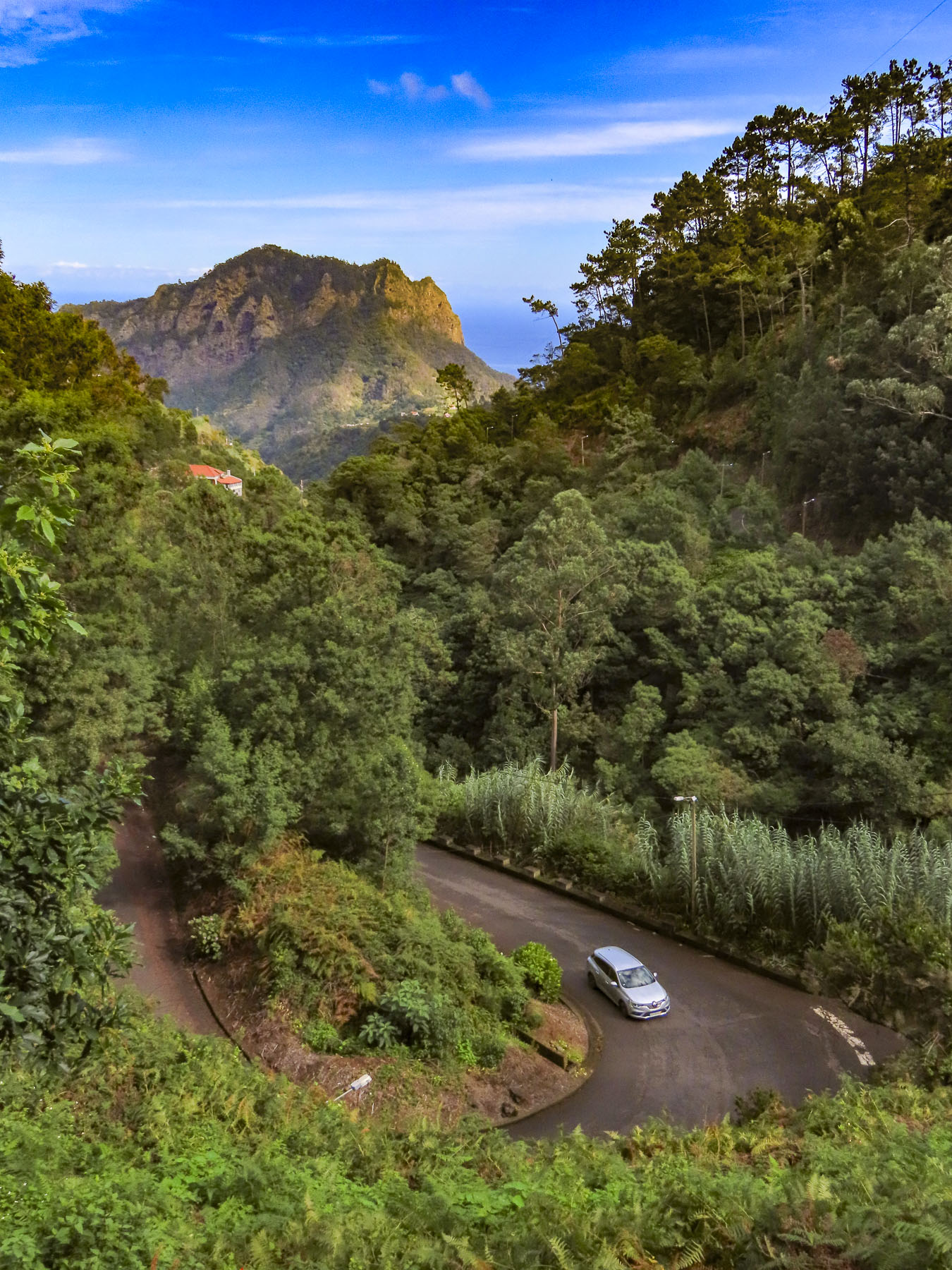
Our drive along the coast started in the small harbor of Icod de los Vinos. From the start the sea vistas were beautiful, with crisp clarity and saturated blues and brilliant white breakers crashing against the rocky coast. The lighthouse on the remote headland Punta de Teno was our destination. Though only sixteen miles away, it took a good part of the morning with all the frequent photo stops we were making as we proceeded. The spectacular scenery along this short drive rivals the Pacific Coast Highway in California and Chapman’s Peak Drive outside Cape Town, South Africa or the Amalfi Coast of Italy. Just epic!

A few minutes from Icod de los Vinos along TF-42, we stopped at Mirador El Guincho which overlooks the coastal homes, banana plantations, and the new Port of Garachico. Constructed in 2012 behind a large breakwater, it is the only harbor on the north side of Tenerife. Beyond the harbor the extinct volcano Montaña de Taco highlights the horizon, its crater now used as a reservoir.

Enthused by what we glimpsed as we passed through Garachico, we decided to keep with our original plan to go to our farthest destination first and then return later to linger in the quaint town.

“Drive a little, then café.” We were ready to stop by the time we reached Buenavista del Norte and easily found parking around the Plaza de los Remedios. Sitting in the shade, we ordered coffees from the café under the park’s gazebo. It’s a classic Canarian town with colorful two and three story homes. What’s unusual though is the town sits on flat land! Something that is in short supply on this mountainous island. It’s only access to the sea was from the small rocky landing at Playa de las Barqueras, where for centuries supplies were rowed ashore from passing merchant ships. Nearby set along the dramatic coastline is the Buenavista Golf Course, designed by the famous Spanish golfer, Seve Ballesteros.


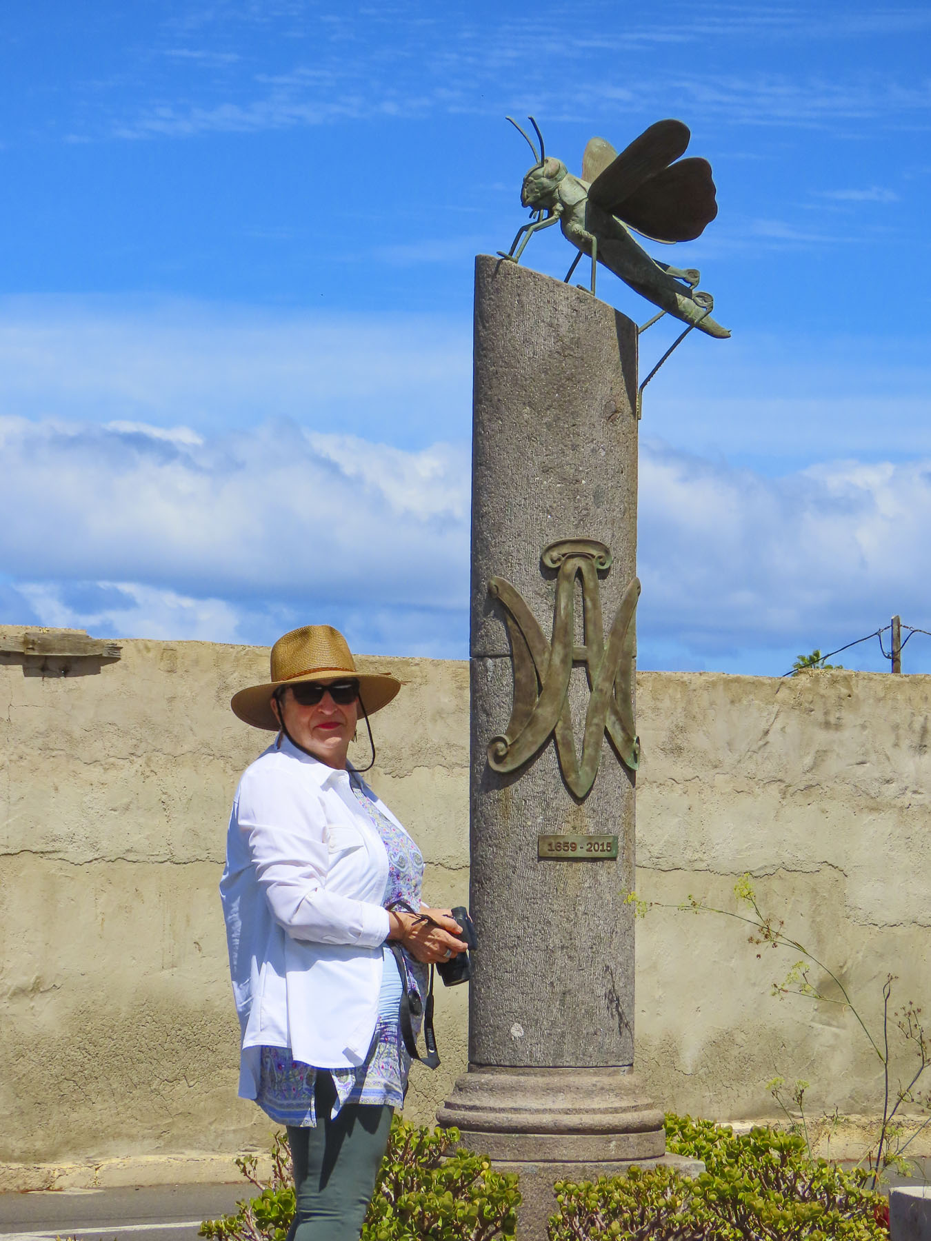
The Church of Nuestra Señora de los Remedios stands across from the plaza and has played a significant role in the town’s history since its cornerstone was laid in 1516, most importantly when the townspeople filled the church in 1659 and prayed to the statue of La Virgen de los Remedios to stop a plague of locust which was ravaging their crops. According to history the plague stopped. Sadly in 1996, that historic statue and many other centuries-old religious treasures were lost in a fire that destroyed the church.
It’s very easy to speed by and miss, but on the outskirts of town on Cruz de Toledo at its intersection with TF-445 there is a statue of a locust atop a tall column with the anagram of the Virgen de los Remedios, and the dates 1659-2015 which commemorate that event. Every fifth year a procession from the church carries the virgin’s statue out to the locust monument.

We continued towards Punta de Teno only to be stopped by a manned roadblock across the pavement, just shy of Mirador Punta del Fraile. Only buses and taxis were allowed to travel the road farther; we weren’t told why. Even Google map drivers have been prohibited from making the journey. There was a small dirt parking area next to the gatehouse and we could see a few folks walking the long incline to the mirador. We followed. It was about a thirty minute, moderately strenuous walk, and the views were awesome. It was well worth our effort. Gale force winds whipped through a cut in the rock which the road followed down to the lighthouse at Punta de Teno, three miles away. Behind us a large cliff face blocked most of the view of the Teno headland. It’s a barren peninsular without tourist amenities, just a lonely lighthouse and modern wind turbine farm, the blades of which must turn furiously 24hrs a day, if it’s as blustery there as it was at Mirador Punta del Fraile. Hold your hats!

The views returning to Garachico were equally as impressive as the morning sights, and we stopped several times before entering the old town.

As prosperous as the Canary Islands are today, we were reminded by the statue at the Mirador del Emigrante that life here was not always easy. This poetic description by Fernando García Ramos, the sculptor, explains for the viewer the meaning behind his statue of a walking man – with a hole in his chest, as if in his heart – holding a suitcase. “The figure is scanning the horizon, in a daring position, as if pretending to jump over the sea, with a suitcase in hand, and many more suitcases in a series as a chain behind him; these suitcases behind him surely mean the memories, the sadnesses, the nostalgia, the girlfriend, the mother, the sisters, the families that are left behind by an emigrant who takes a new life, who jumps over the infinite sea, in search of a new life in strange and distant lands.”

Occasionally we spotted colorful red rock crabs scurrying about as walked along the waterfront to the Castillo de San Miguel, a square block fortress built from quarried lava rock in 1575 to protect Garachico’s port from French, Dutch and Arab pirate attacks, along with the threat of British invasion.


For two hundred years Garachico’s harbor was the most important commercial port in the Canary Islands. Its citizenry accumulated wealth through prosperous imports and exports from Spain’s New World colonies and Europe. It was a prestigious town with many warehouses and shops, fine homes, convents, and churches.

This ended on May 5th, 1706, when Volcan Arenas Negras, a vent volcano on Mt. Tiede’s lower slope, erupted and spewed lava down a ravine that led directly into the town and harbor. Amazingly, no lives were lost, but a great number of the town’s historic buildings as well as four convents were destroyed, buried under lava that flowed into the town for nine days. Buildings close to the lava flow caught fire and burned to the ground. The fortress narrowly escaped, but it lost its relevance when the harbor was filled with lava and ships could no longer anchor there. With the loss of the harbor, merchant ships shifted to Puerto de la Cruz, folks left and Garachico evolved into a fishing village until the tourist economy on Tenerife took off in the 1960’s, embracing tourism so enthusiastically that the town recently constructed an ocean front municipal pool open to all along the promenade.

Walking into the center of town, we admired several noteworthy historic buildings:, Convento de San Francisco (1524,) and its church the Iglesia de Santa Cruz de Tenerife; Casa Palacio de Los Condes de La Gomera (1666.) They still stand around a beautiful, shaded gazebo in the Plaza de la Libertad.

Walk a little then café.
Till next time, Craig & Donna