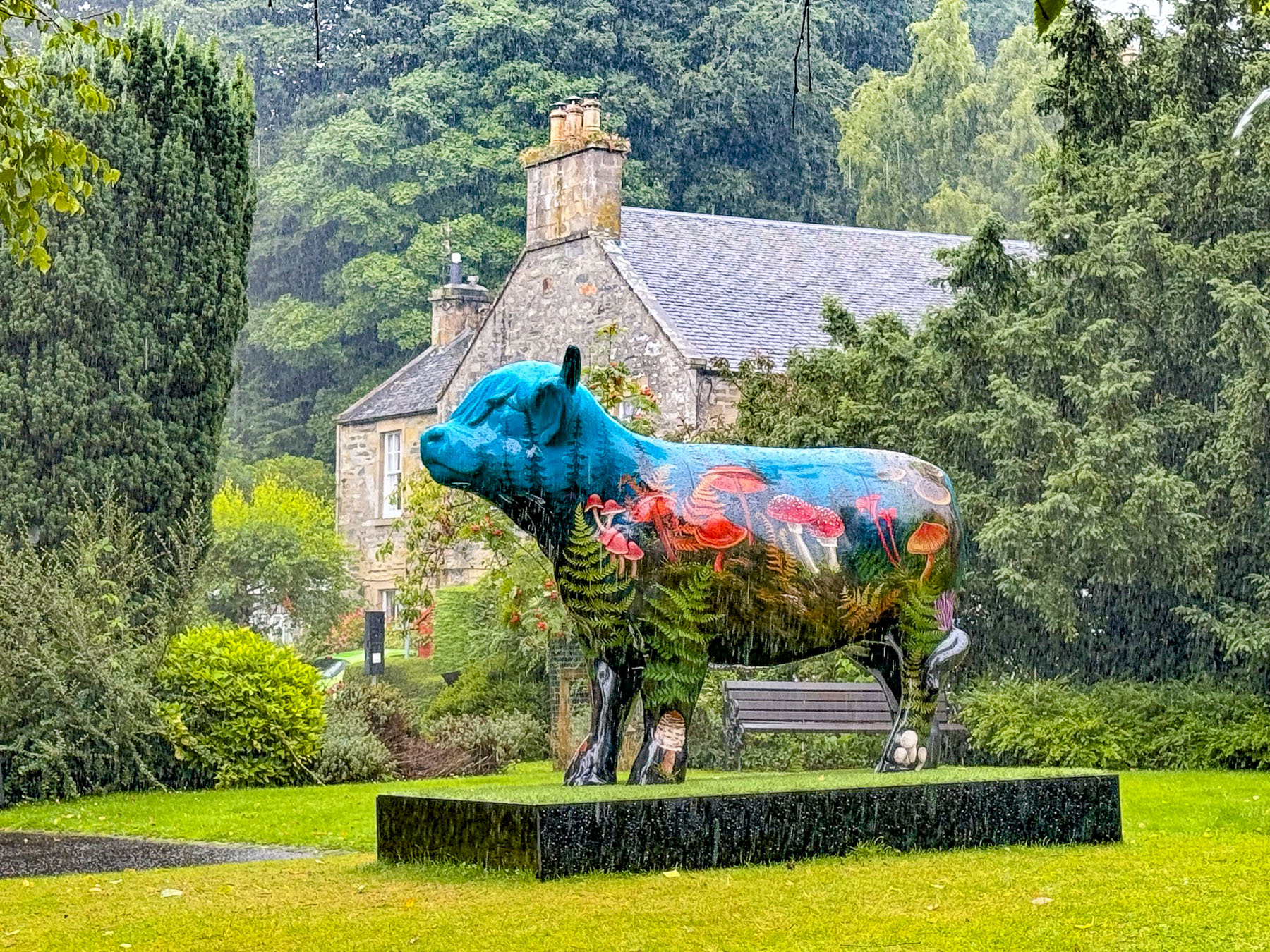
Rain pounding on the skylight woke us and revealed a grey day with not an inkling of sun in the sky. A real “drookit” of a day our innkeeper called it at breakfast. The tumultuous weather in the highlands is always a topic of conversation. “When the sun shines it’s glorious. For the other 364 days of the year we Scots amuse ourselves with over 100 Gaelic words to describe the variety of rain, and 421 words to describe the intricacies of snow.” It was a form of entertainment for our ancestors as they sat around the fire at night, in their ancient turf and creel houses, he related with a smile. With the way the weather blows in off the Atlantic Ocean, it’s possible to experience the four seasons in one day in the highlands. It’s a “dreich” day this morning – gloomy, damp, and grey – but the sun will most certainly shine later between sporadic showers. “It’s God’s way of cleaning the coos.”

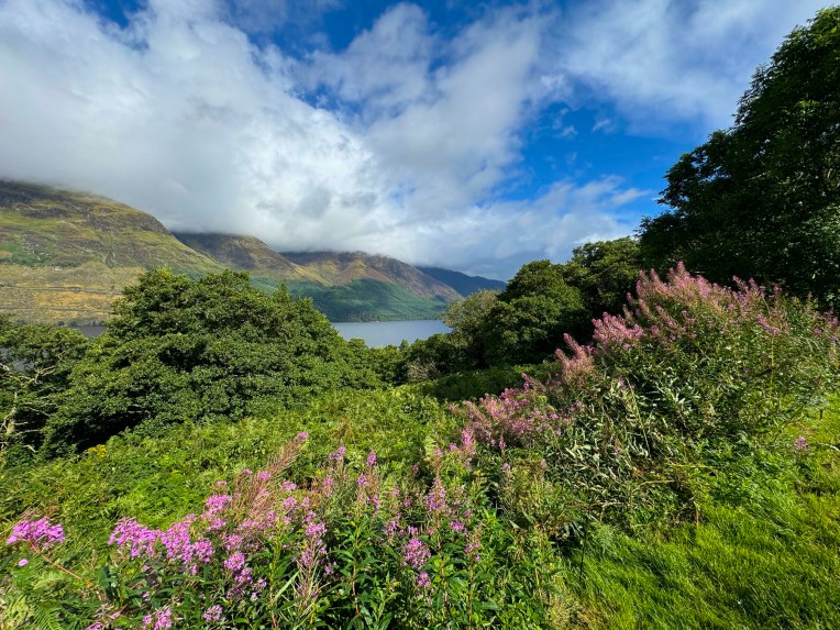
True to his prediction the sun broke through clouds that were being torn apart by the wind as we stopped along Loch Lochy to photograph the multi-hued pinks, whites and magentas of the wild bush vetch growing along the side of the road. On the loch a sailboat was running downwind at a good clip with only its mainsail set. Our plan for the day was to head north from Glencoe along the A82 before following the A87 west through the highlands and across Loch Alsh to the Isle of Skye and end the day in Portree.
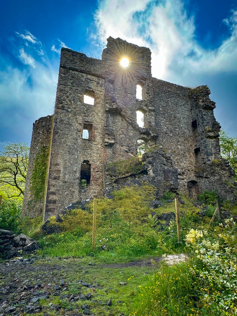
As the road turned west, we turned to the right and followed signs to Invergarry and Glengarry Castles down a narrow lane through an old growth forest. The ruins of Invergarry Castle eventually revealed itself from behind a curtain of woods. Sunlight cascaded through ruins. Only a few walls of Invergarry Castle remain, but in its glory it was a five story L-shaped structure with a six story tower, and seat of the Chiefs of the Clan MacDonell of Glengarry, a powerful branch of the Clan Donald. Clan legend believes that in the early 1600’s the stones for the castle’s construction were passed hand to hand by a chain of clansmen from the mountain Ben Tee, five miles away. The castle had a short and turbulent history. Oliver Cromwell’s troops attacked the MacDonnells for supporting King Charles I and burned the castle in 1654 during the Engilsh Civil War. Rebuilt, the MacDonnell’s castle was used by the Jacobites in the 1715 and 1745 rebellions. Bonnie Prince Charlie visited the castle after raising the Scottish flag on the shore of Loch Shiel at Glenfinnan when he returned from France, and again, to rest, after his devastating defeat at the Battle of Culloden in 1746. As part of a systematic suppression of the Highlands the castle was destroyed again, but two walls refused to fall, as if symbolizing the Scots’ refusal to yield the British crown.
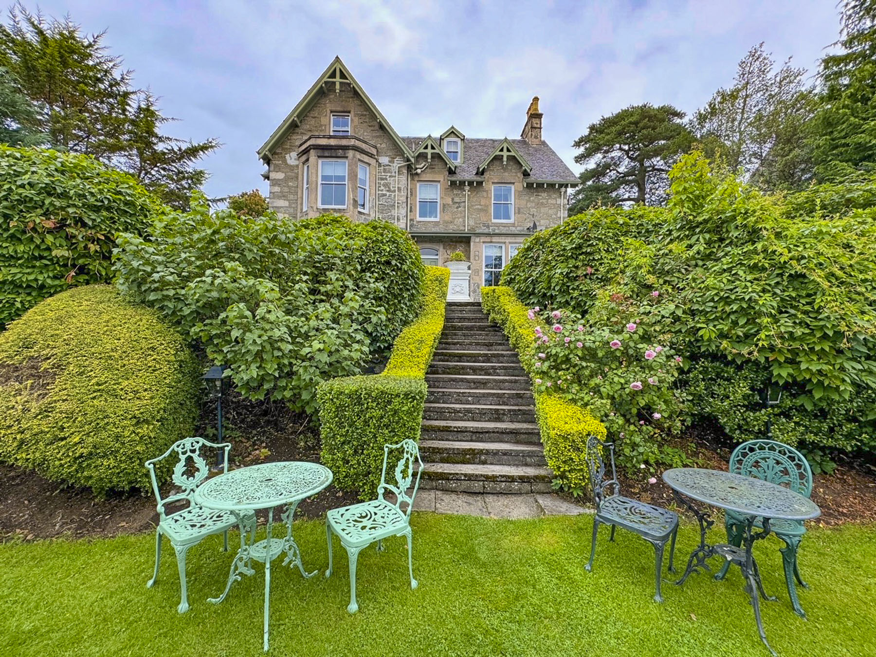
The castle was abandoned, and by 1760 the chief of the Clan MacDonell was in the new Invergarry House, just a short distance away from the ruins of the castle. In 1960s Invergarry House was reborn as the Glengarry Castle Hotel.

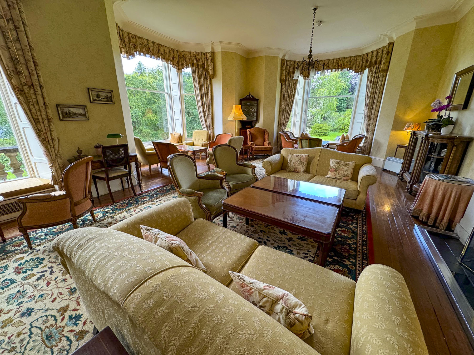

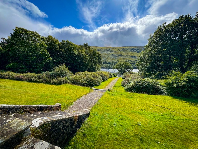
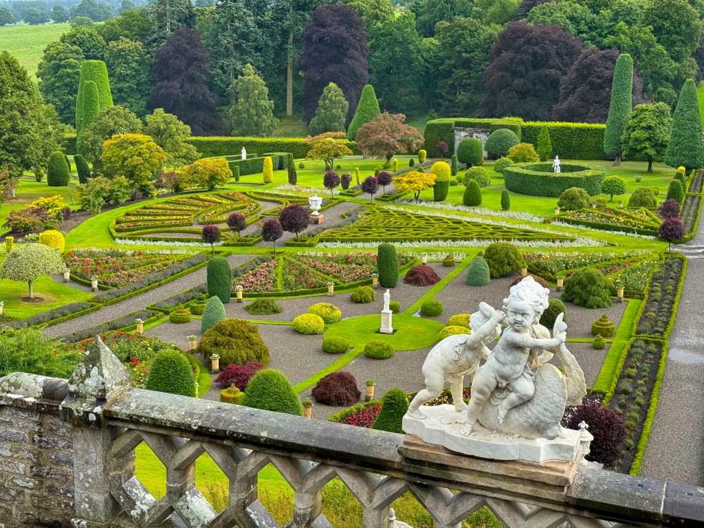
“Drive a little then café,” is our motto on road trips to break up our drives and Glengarry Castle was the perfect stop for our mid-morning caffeine compulsion. To describe Glengarry as a castle might be stretching it a little. It’s beautiful building, more accurately described as an estate home or chateau. It’s now a lovely hotel that harkened back to the reserved elegance of an earlier era. From its comfortable sitting room we enjoyed our coffees, and watched several boats motoring along Loch Oich. We lingered. From north to south the lochs Ness, Oich, Lochy, and Linnhe connect to one another via a series of locks along the Caledonian Canal which traverses the highlands to form a sixty-mile long intercoastal waterway that starts in Inverness and ends at Fort William, connecting the North Sea to the Atlantic Ocean. Conceived to give employment to highlanders displaced during the clearances, the canal was constructed in the early 1800’s and was designed to accommodate large merchant sailing ships. The canal reaches its highest point, 106 feet above sea level, at Laggan, between Loch Oich and Loch Lochy. One of the canal’s significant engineering feats is Neptune’s Staircase, a series of eight step locks near Fort William.
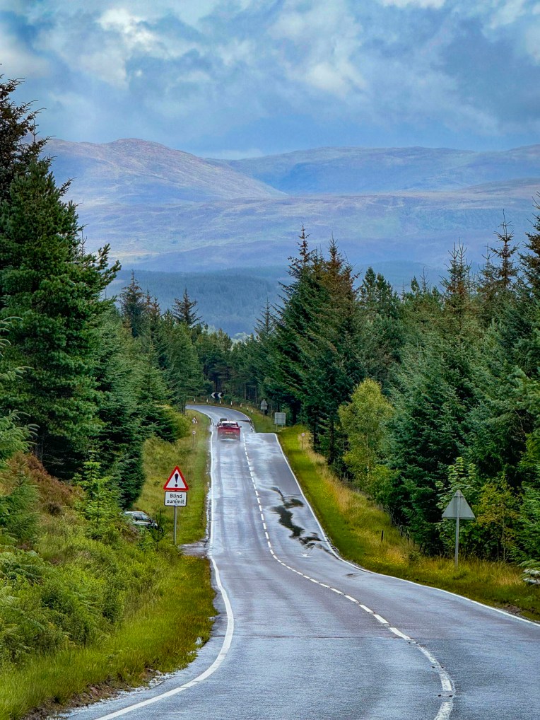
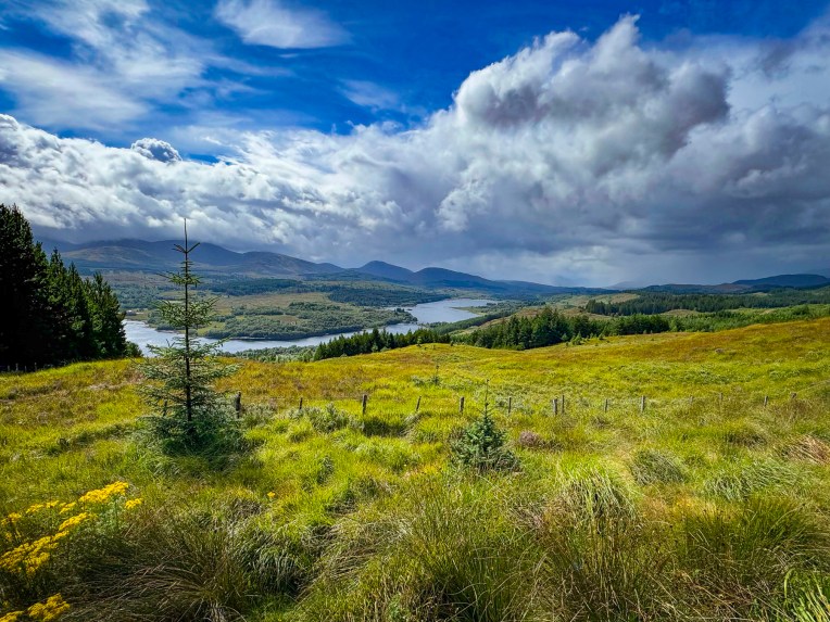
We rejoined the A82 for a few minutes before turning onto the A87 and followed it west along a route that paralleled the River Garry, before rising higher into the mountains and reaching the river’s source, Loch Garry. The views of Loch Garry under clearing storm clouds were spectacular, and we stopped several times, but the most rewarding photograph was taken from a farmer’s gate that led to an open field, high above the loch.

From the rocky beach at Loch Cluanie it was apparent that our luck with the weather was changing, and that “tha stoirm mhor ann,” was brewing with darkening clouds.
It was a real pish-oot by the time we sought sustenance at The Pitstop at Kintall, across the road from Loch Duich. It’s one of the few eateries along the A87, and the folks that run it are good-humored angels. Their wings were especially visible the day we stopped. The small restaurant was full of people seeking shelter from the storm. Just inside the door, a large queue of dripping wet folks huddled, and created a loch size puddle as they waited for tables. On a nicer day the restaurant’s picnic tables outside would have easily accommodated everyone. Fortunately, the kitchen was quick, and folks didn’t linger. Their coffee was good, and the food was delicious.

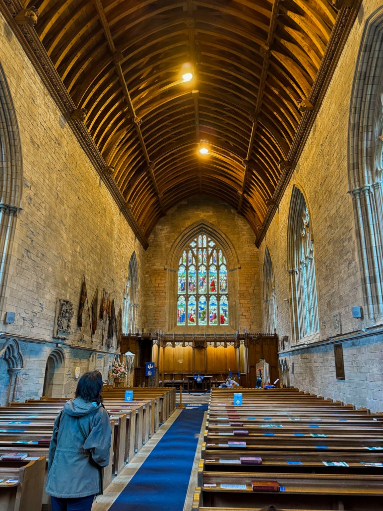
The rain was lessening when we spotted the St Dubhthac’s Church on a small hill above Loch Duich and did a quick U-turn to investigate its ruins. It’s a pretty setting atop the hill with views of the loch and mountains covered in the purple heather blooms of summer. The exact date the church was built is unknown, but it’s believed to have been constructed in the 11th century shortly after Dubhthac a popular priest, and great missionary walker venerated for his evangelistic efforts, visited the area. An ancient cemetery, the Clachan Duich Burial Ground (“clachan” meaning stone or church in Gaelic) surrounds the ruins, and was the traditional burial place for many Clan Macrae chiefs over the centuries.
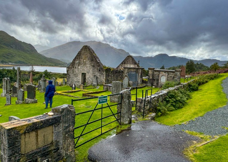
After the Battle of Glenshiel in 1719, the church was used to treat wounded Jacobite soldiers. Consequently, British troops later torched the church in retaliation. The church was eventually rebuilt and used into the 1850’s, but was left to neglect after the “clearances” reduced the area’s population. Today modern pilgrims can follow the St Dubhthac Way through Glen Affric via Chisholm’s Pass, along what is believed to be the evangelist’s original path through the highlands.
Fickle weather continued to plague our day, but we weren’t deterred from enjoying the moody weather when we visited Eilean Donan Castle, one of the Scottish Highland’s most iconic sites. Having invested in some good quality Gore-Tex rain gear that actually kept us dry made all the difference. And what better way to experience the harsh conditions of life in medieval Scotland than on a cold stormy afternoon in the highlands. Seems many other tourists felt the same way, and the parking lot for the castle was nearly full. https://www.eileandonancastle.com/?s=tickets

Eilean Donan means “Island of Donan” and refers to St Donan, an Irish missionary, who lived on the small island for a short time while he traveled through the western highlands and isles introducing Christianity to the Picts in the beginning of the 7th century. Later the island held an early Pict fort.
In the12th century a larger castle was built on the strategically located tidal island, situated at the confluence of three sea lochs: Loch Duich, Loch Alsh, and Loch Long, to defend the area from the frequent Viking raids that were happening at the time.

By the 14th century the castle was the western stronghold of the Clan MacKenzie and their allies Clan MacRae. Siding with Robert the Bruce, the MacKenzies granted him refuge at the castle after his defeat at the Battle of Methven in the early 1300’s, before he became the King of Scotland.
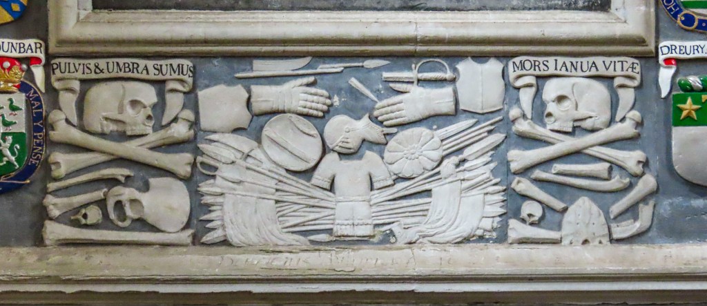
These were brutal and lawless times in the highlands and vividly illustrated in a gruesome event in 1331 when fifty “mysdoaris” (mis-doers) were gathered and executed, their heads then put on pikes along the castle’s walls to deter others from wrongdoing and assure the Warden of Scotland, who’s visit prompted this massacre, that there was law and order in the region.
During the unsuccessful Jacobite Uprising of 1719, Spanish troops allied with Bonnie Prince Charlie and exiled King James II were garrisoned in the castle. That May three Royal Navy frigates sailed into the lochs and bombarded the castle. After the Spanish forces surrendered, the British sailors used 343 barrels of gunpowder that the foreign troops left behind to blow the castle to smithereens. Some believe the ghost of a fallen Spanish soldier still haunts the isle.


The castle was left in ruins for nearly 200 years before Lt Colonel John Macrae-Gilstrap bought the island in 1911, and with the help of Farquhar MacRae set about rebuilding it over the next twenty years. Not knowing what the original castle actually looked, it’s believed Farquhar envisioned it in a dream. Surprisingly, years later when old plans of Eilean Donan were discovered in the ancient archives of Edinburgh Castle, his vision was confirmed as true to the original design. The only addition was the multi-arched stone footbridge we were about to cross above seaweed covered boulders exposed with the low tide. Wonderfully evocative on a moody rainy day, the views of the castle surrounded by water and mountains on a sunny day must be spectacular. No wonder it’s one of Scotland’s most photographed treasures.
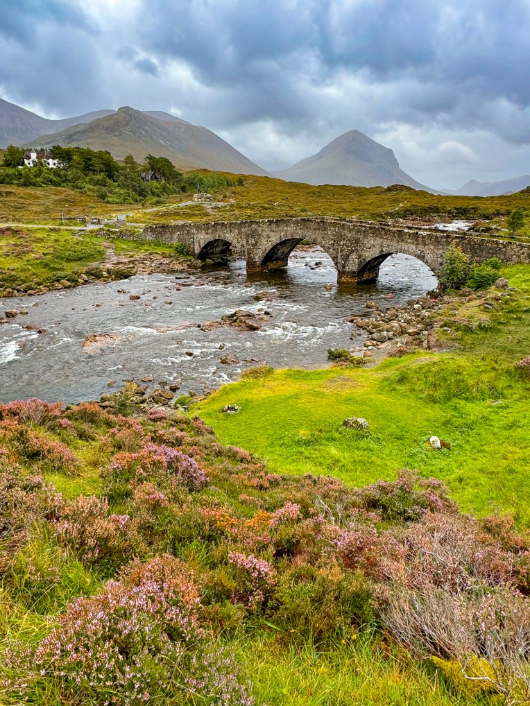
It continued to be a dreich afternoon as we followed the A87 over the Kyle of Lochalsh, the narrow strait that separates the Isle of Skye from the Scottish mainland. The Sligachan Old Bridge was our last stop of the day before reaching Portree. It was designed by the famous Scottish architect Thomas Telford, better known for Dean Bridge in Edinburgh and the locks of Neptune’s Staircase on the Caledonian Canal, and it was built in 1810 with rocks collected from the river over which it spans. There is a mystical quality to the often mist-covered landscapes on the Isle of Skye. Fabulous tales of faeries and myths of ancient warriors inhabiting the land have been passed along by oral tradition throughout the Highlands and the Hebrides Islands since primitive folks first settled the region around 7000BC.
Two legends are associated with the River Sligachan. The first is the ferocious battle between Scáthach, the chief of a tribe of skilled female warriors, who had a fearsome reputation and was said to be stronger than any man, and Cú Chulainn, an Irish hero and demi-god who sailed to Skye to prove his strength against her. The battle raged for weeks. The earth shook as their weapons struck the ground, creating rivers and mountains across Skye as they wrestled in combat.
The second legend is the tale of the magical powers of the River Sligachan, when Scáthach’s daughter, Uathach, was granted eternal beauty and wisdom by following the guidance of faeries to dip her head into the icy water of the River Sligachan, for a very specific seven seconds and then let the water on her face air dry. It’s not as easy as it sounds considering the temperature of the water and that you have to get on your hands and knees to accomplish it. But she succeeded and was given a vision that the aroma of a wonderfully cooked meal would entice Scáthach and Cú Chulainn to stop battling. It worked and the combatants, realizing they were starving, called a truce.
Afterward Scáthach agreed to train the Irishman in her ways of warfare at her “Fortress of Shadows” on a remote windswept headland on Skye’s Sleat Peninsula. But the tale doesn’t end and continues to become a juicy Iron Age soap opera with Cú Chulainn seducing Uathach and killing her husband, then having a child with Scáthach’s sister and rival Aífe. Of course there are many versions of this ancient folk tale. The ruins of Dunscaith Castle, the 14th century stronghold of the Clan MacDonald, are believed to be the setting for this epic story.

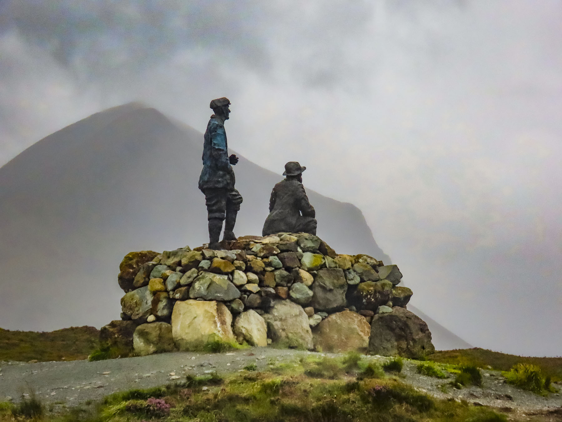
The river valley and mountains west of the old bridge are called the Cuillin, an expansive area of pristine beauty with over 20 Munros, mountains over 3,000 feet high. South of the bridge the Collie and MacKenzie Statue, marks a trailhead into the wilderness, and commemorates the mountaineer and guide who mapped hiking routes across the Cuillin range and climbed many of Skye’s rugged mountains in the late 1890’s and early 1900’s.

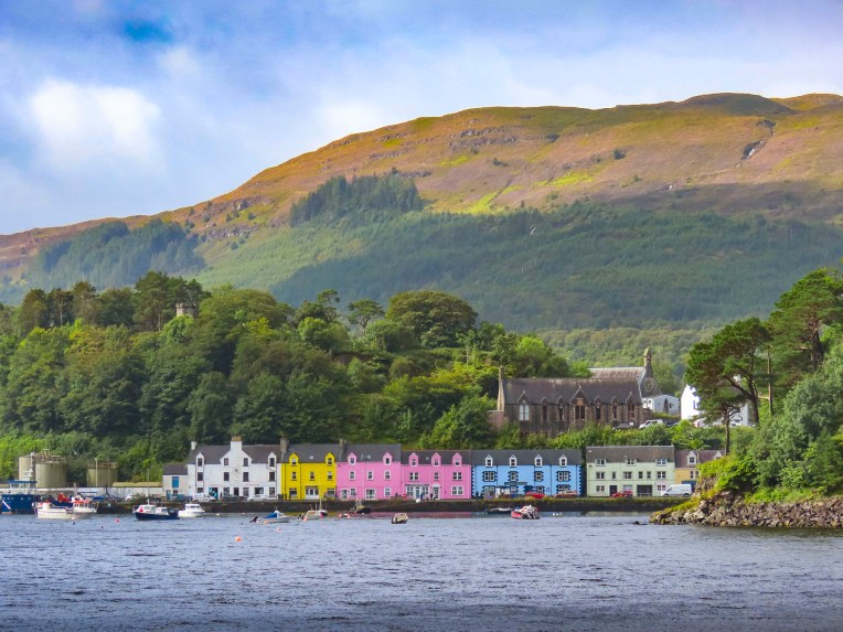
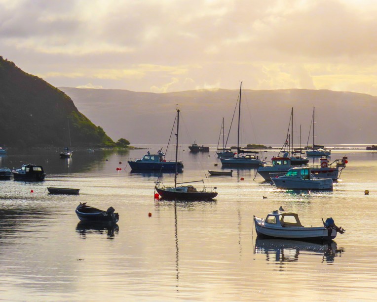
Winds change the weather quickly on the Isle of Skye and by the time we reached Portree and checked into the Rosedale Hotel, located along the harbor’s waterfront, the sky was clearing. It was the height of the summer season and unfortunately, we couldn’t reserve a room with a harbor view, but we were quite happy with our accommodations otherwise.
Each morning at breakfast, the sweet waitresses gave us the table with the best view of the harbor, as if in recompense for our view-less room. Free parking along the quay is possible, but it’s almost impossible to find a space. The hotel did provide directions to the free municipal lot across from Phil the Barber and the Portree Community Centre on Park Road, a short distance away, that worked out quite well.

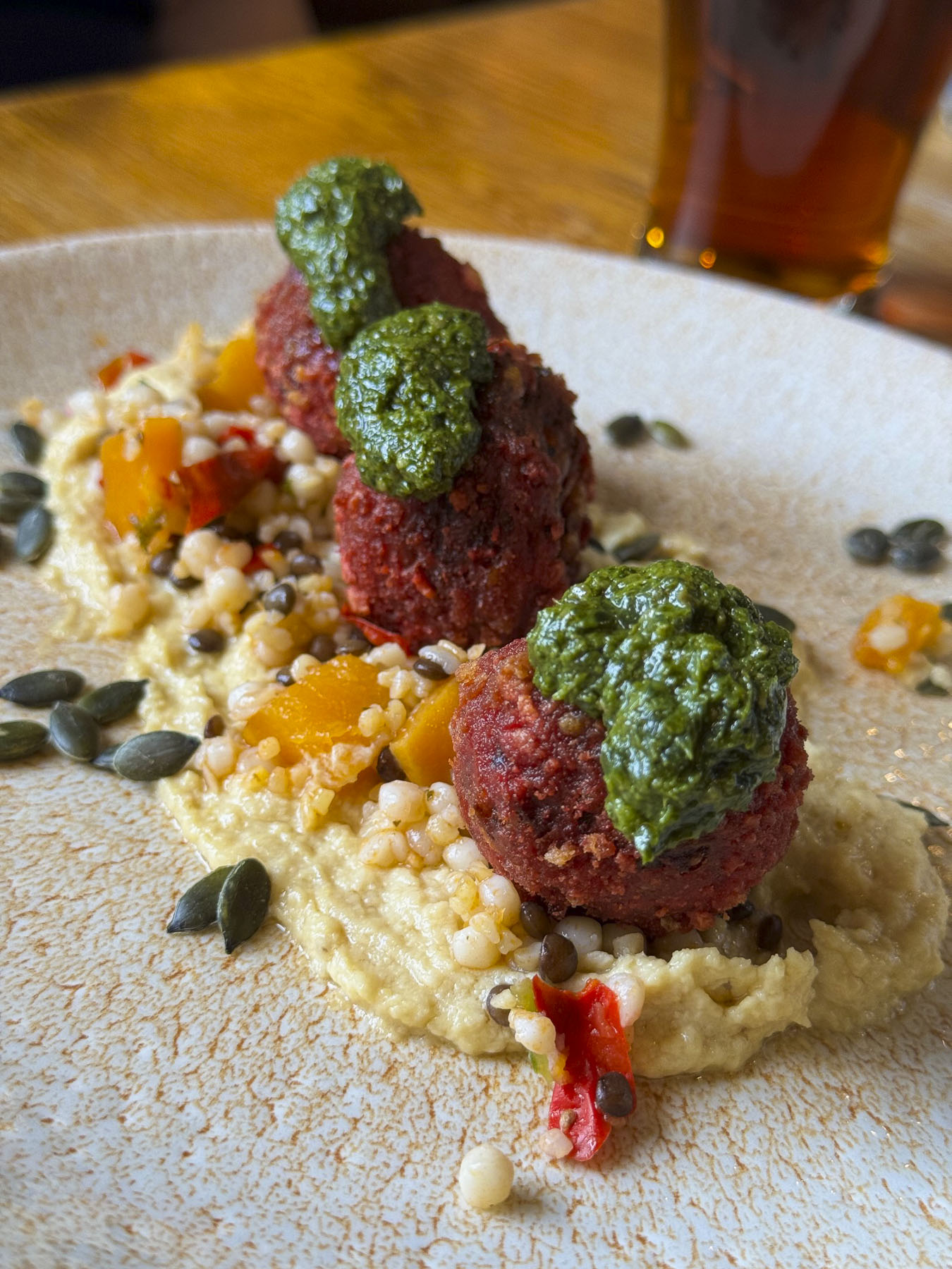
Later, we shared a seafood platter at Sea Breezes, a small restaurant in one of the colorful 19th century buildings along the harbor front, where it’s recommended to be among the first in line when it opens at 5 PM. Our meal was delicious and featured locally sourced sea trout, mussels, and scallops harvested from the waters around Skye that morning.
https://www.rosedalehotelskye.co.uk/ https://sea-breezes-skye.co.uk/
It was long wet afternoon after we lost the morning sunshine, and we hoped for better weather in the days ahead. But as our hotelier reminded us “today’s rain is tomorrow’s whisky.”
Till next time, Craig & Donna