Driving the North Coast 500 – Part 7: Duncansby Head Lighthouse To Loch Ness or Castles, Myths & Bagpipes

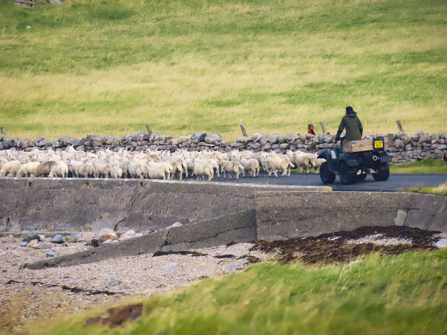
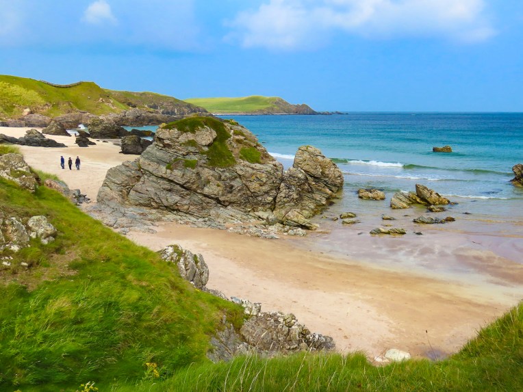
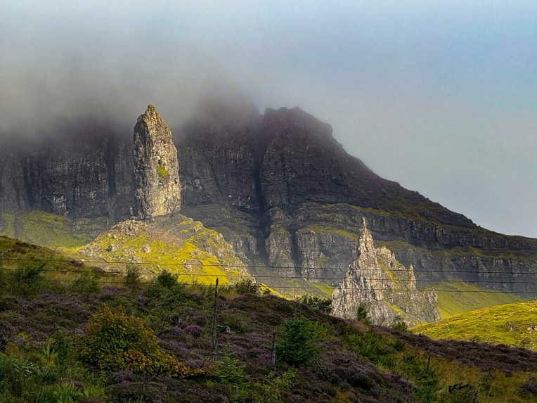
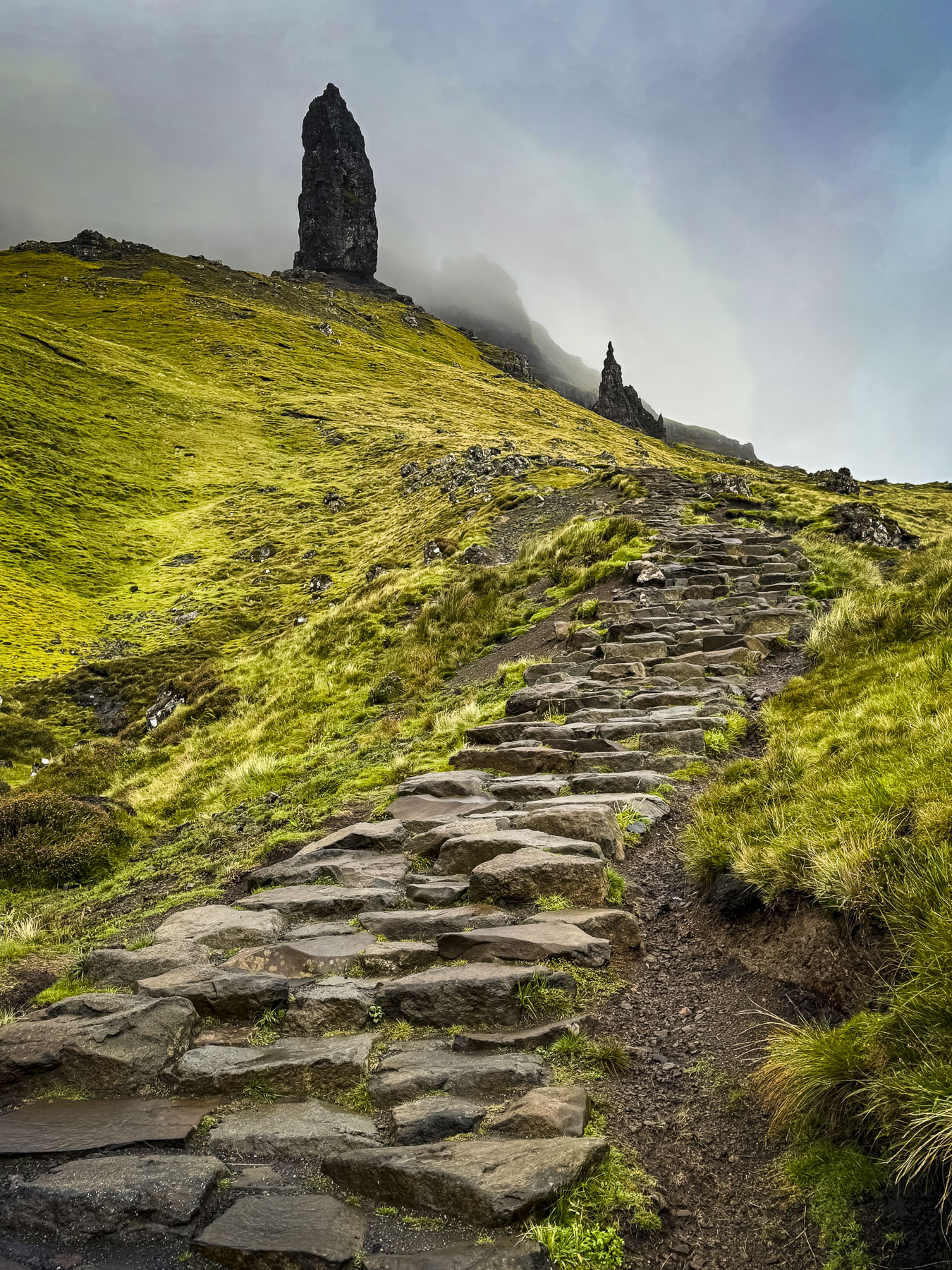
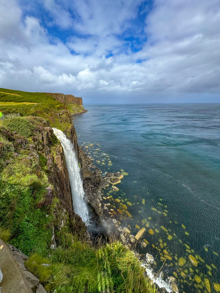
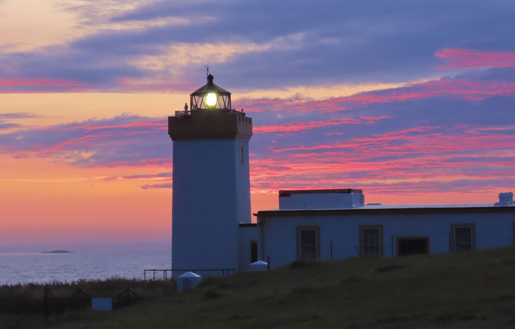
A small flock of sheep, sleeping on the tarmac, scattered when we rounded a bend to Duncansby Head Lighthouse before the crack of dawn. The pinnacle stood silhouetted against a brightening sky of pink, amber and blue, as the sun crested the horizon over the North Sea.

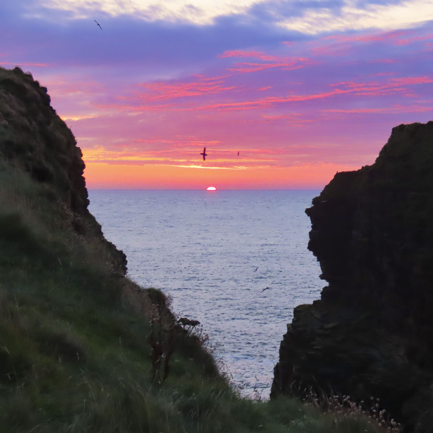
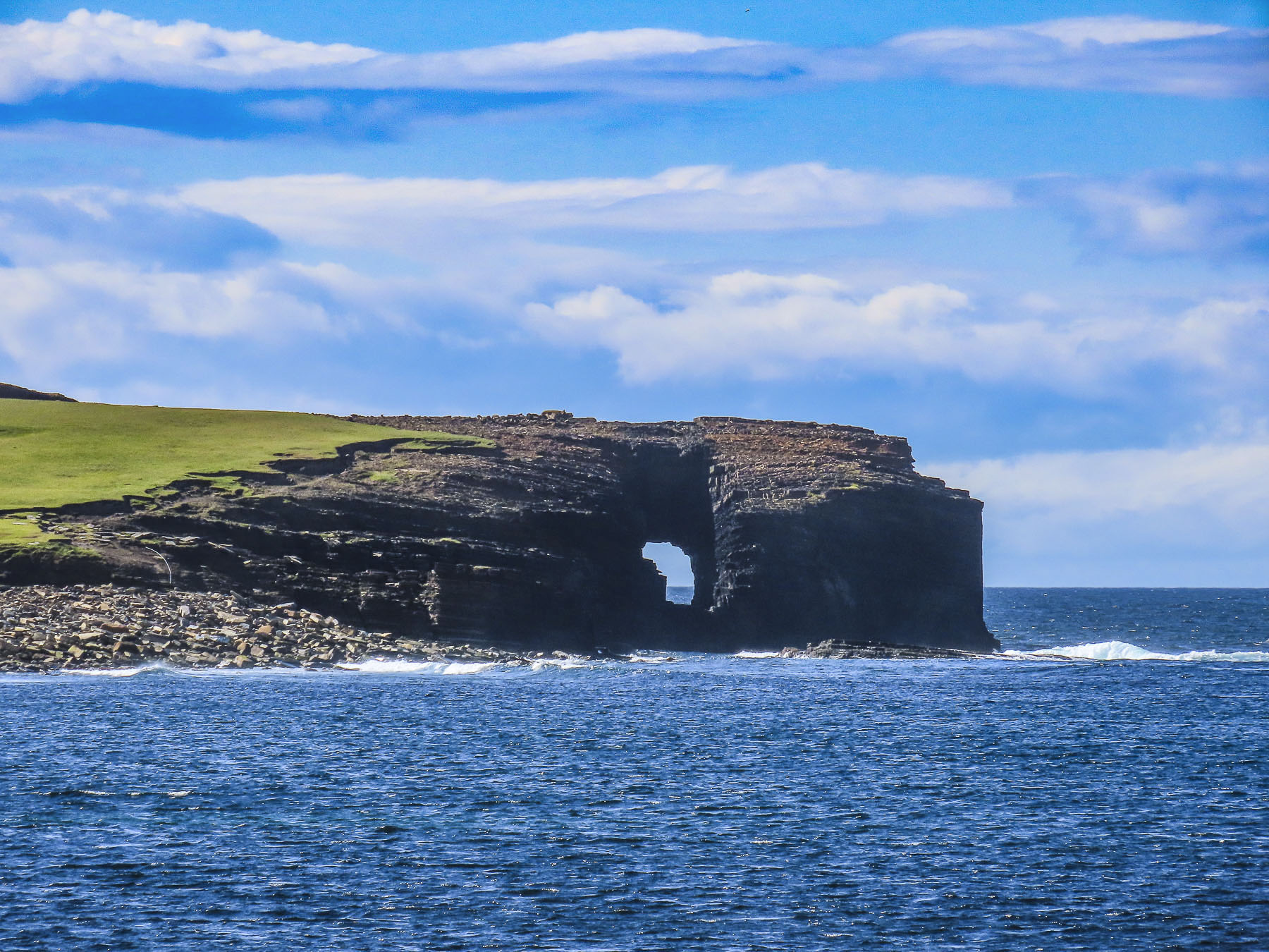
We followed the trail along the cliffs towards the Duncansby Stacks and passed a spot where we imagined an ancient Norse god had wielded a broadaxe and severed the bluff in two. The stacks were glowing red in the early morning light as Kittiwakes and Guillemots swooped along the cliff face, which stretched south for miles.

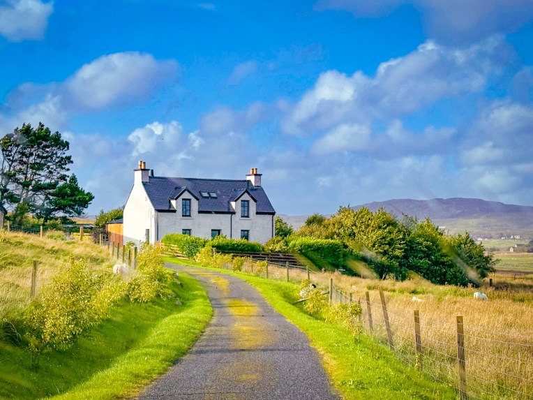
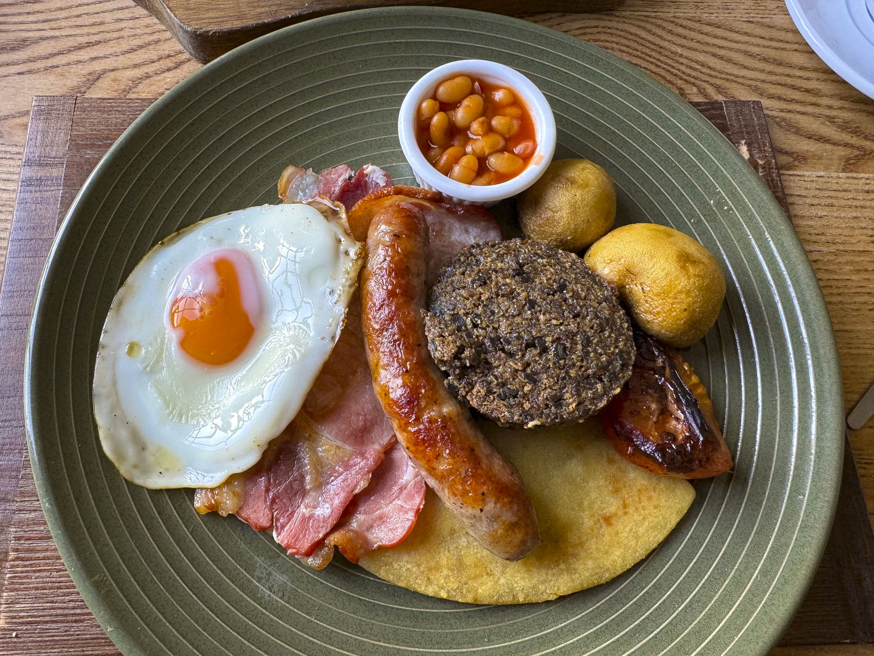
Following a delicious hardy breakfast, we packed our bags and said goodbye to the innkeepers at the John o’ Groats Guest House, one of our nicest stays while in the Scotland, then began the final leg of our NC500 tour and headed south along the A99 and A9 to Dunrobin Castle & Gardens, before spending the night in Strathpeffer. A pleasant distance of only 113 miles, which took us all day with all the photo stops we made. But that’s the way we roll.

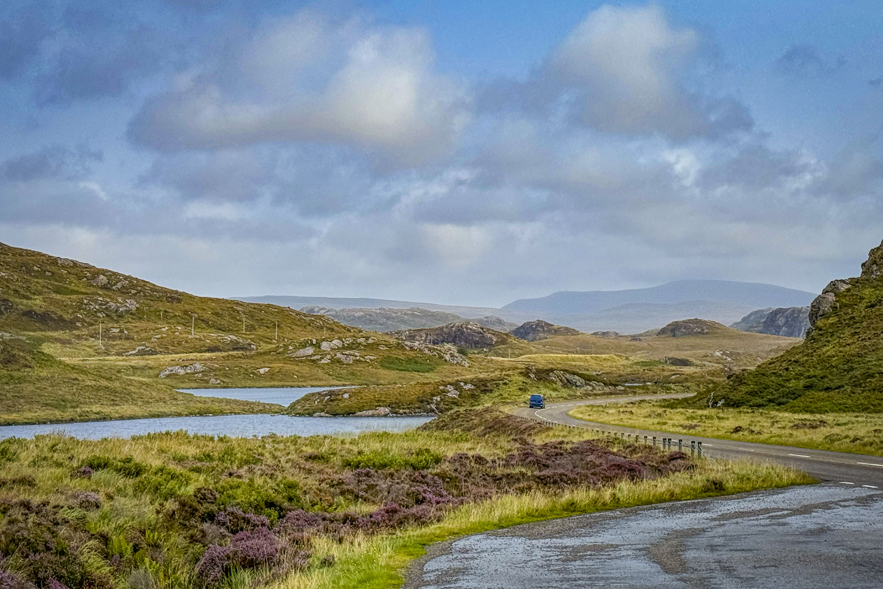
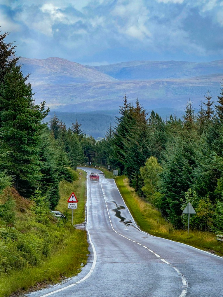
There’s a debate about the best way to drive the North Coast 500 and the consensus seems to be that exploring it in a counterclockwise direction leaves the breathtaking scenery of the west coast for the last part of your trip.

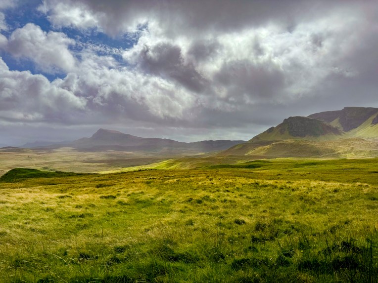
We did the opposite and followed the NC500 clockwise, heading south from Inverness to Edinburgh, then west through the highlands to the Isles of Skye and Lewis & Harris before returning to the mainland and heading north to Durness and John o’ Groats, before heading south along the North Sea Coast of Scotland. We found the scenery breathtaking.

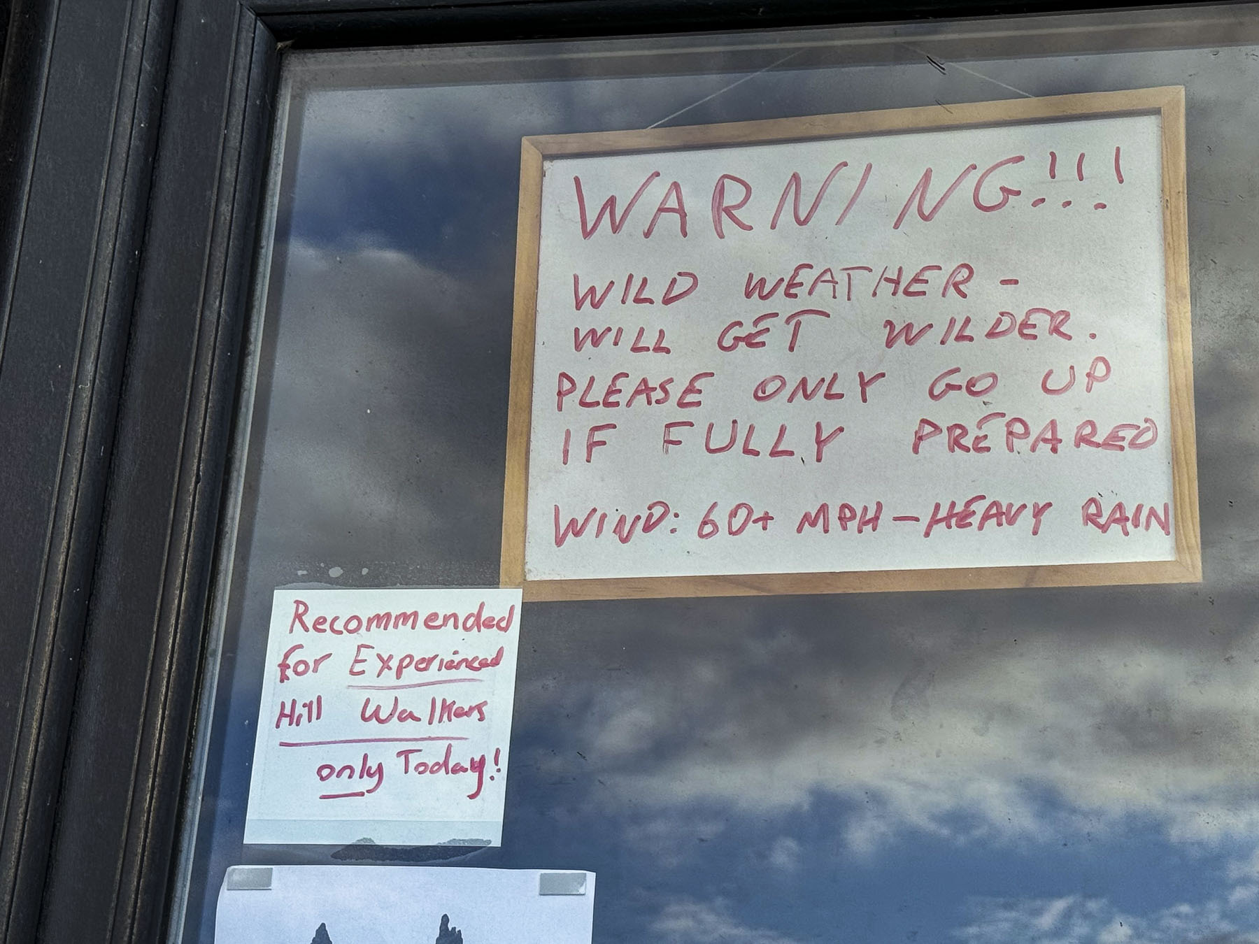
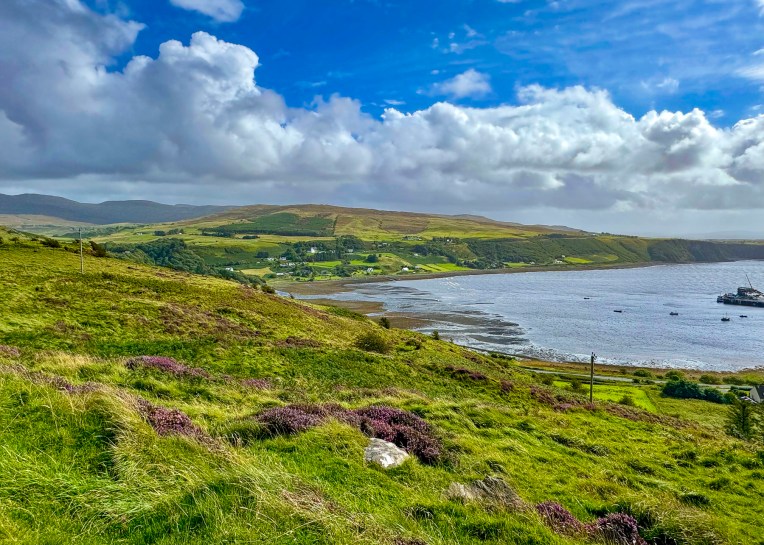
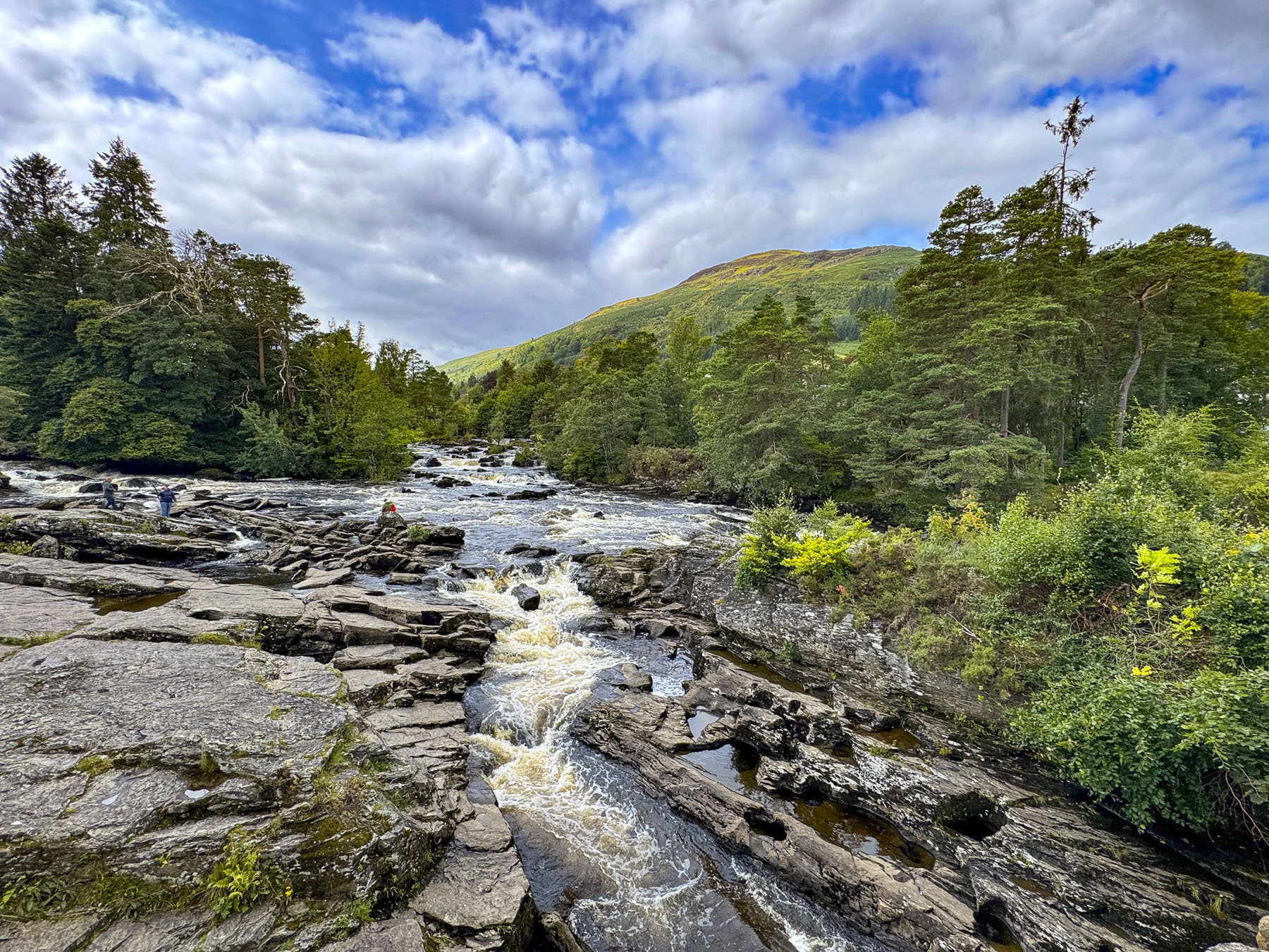
Our only complaint was the lack of official scenic pullovers, as we often had to park at the entrance to a farmer’s pasture or on a side road, and walk back along its shoulder to the spot we wanted. Fortunately, there were few cars on the road, because we stopped numerous times.

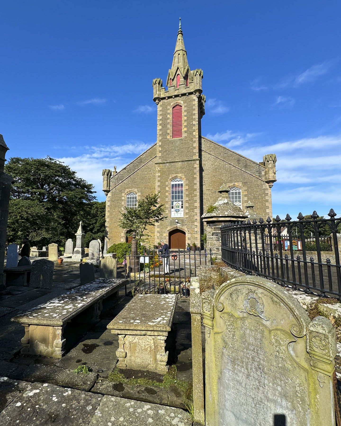
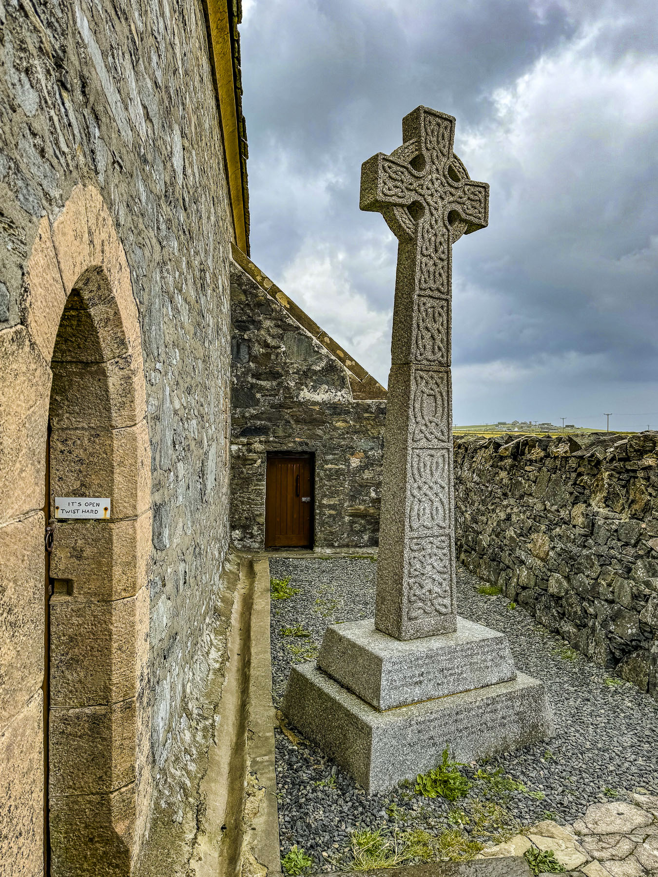
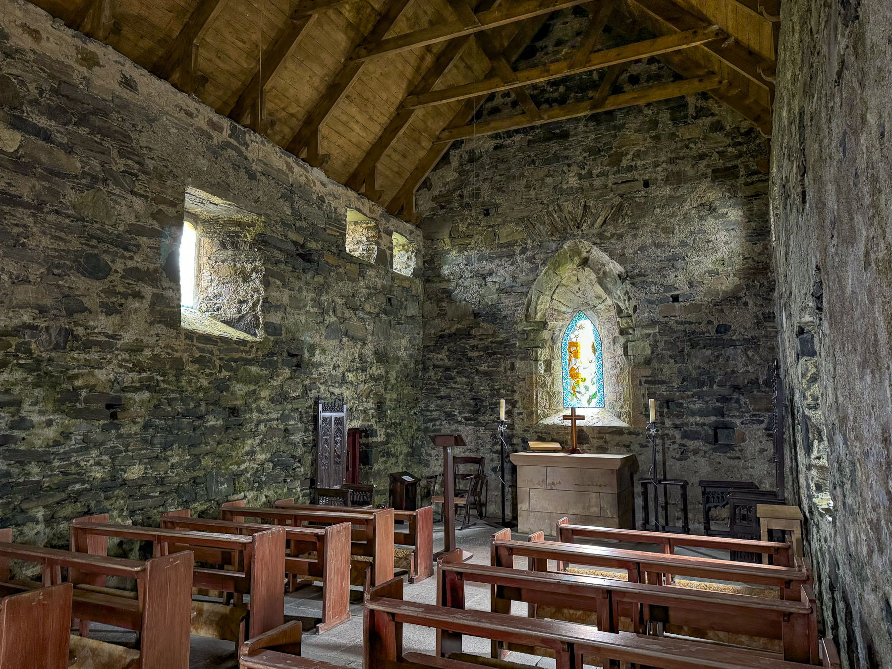
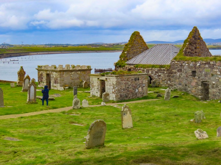
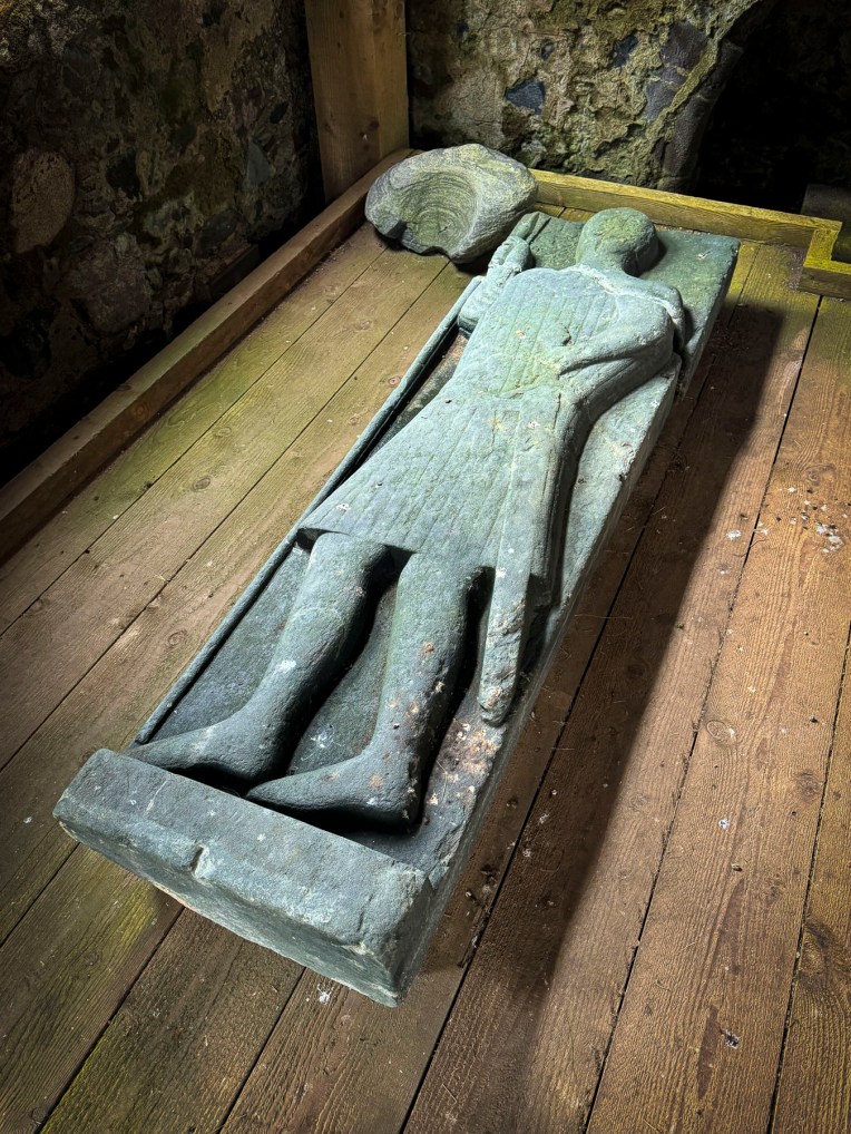
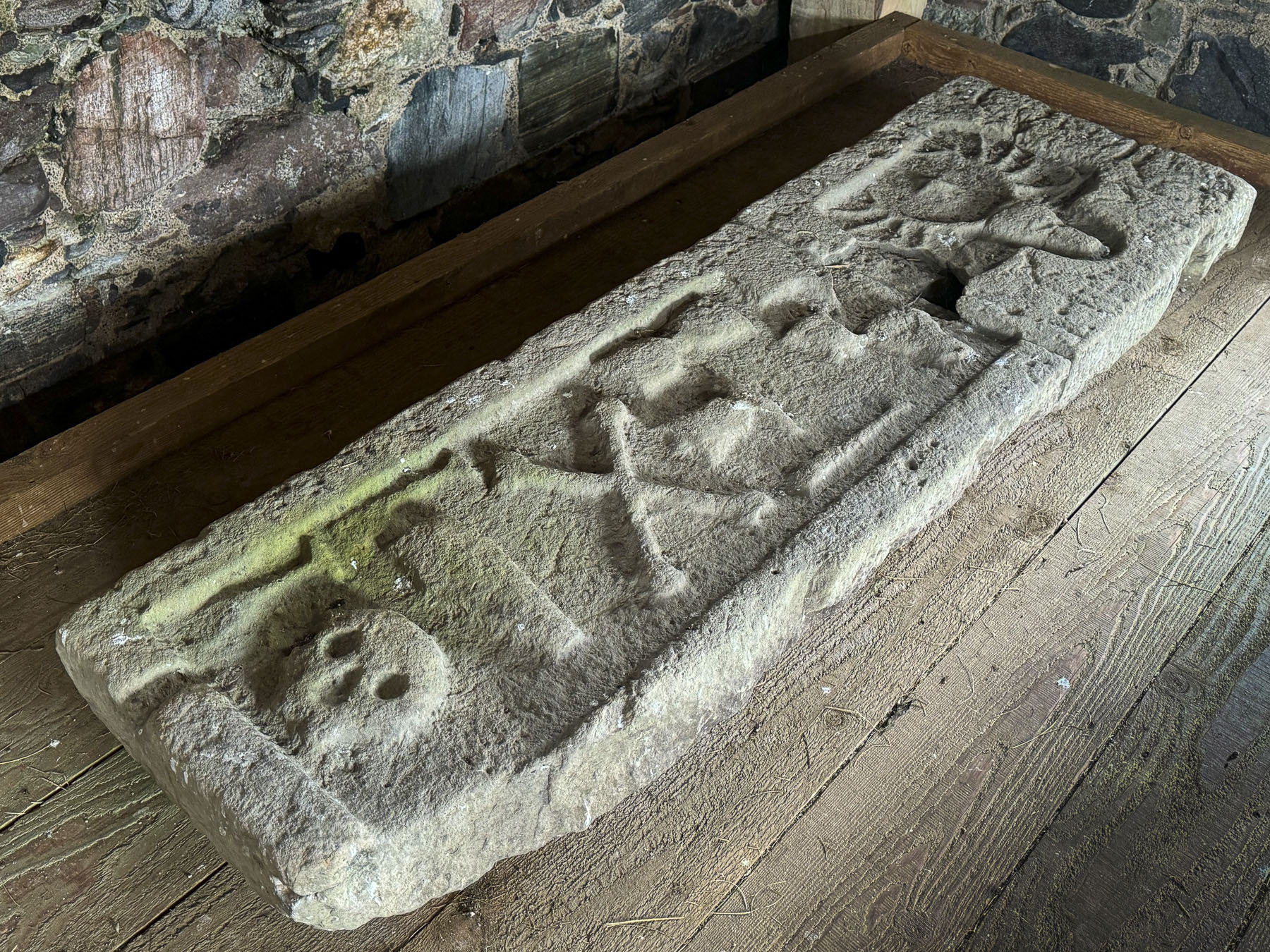
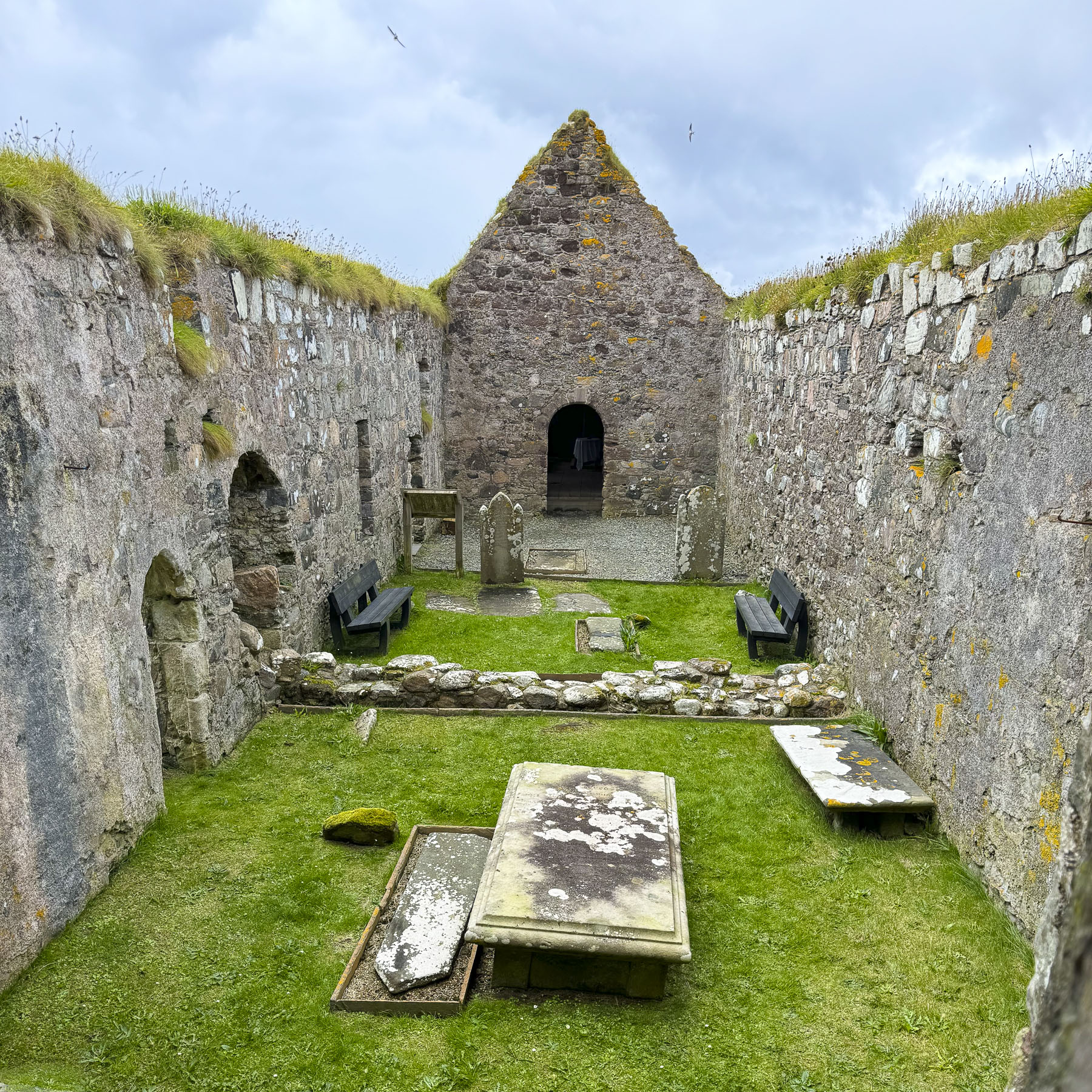
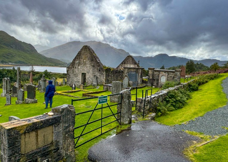
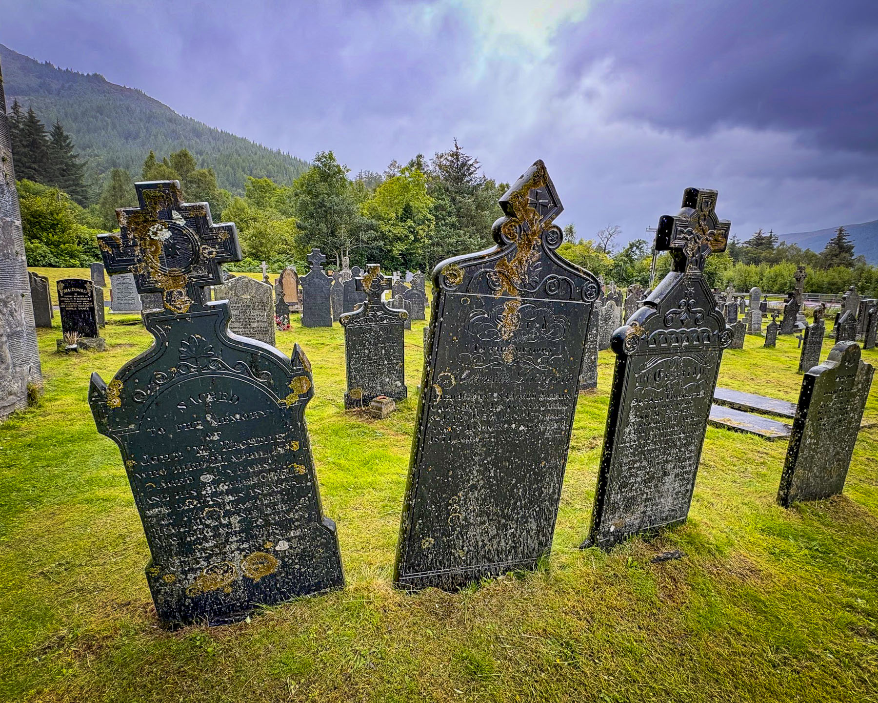
At Wick we visited the Old Parish Church and wandered amid its ancient gravestones, the oldest of which dates to 1639. The present church was built in 1862 over the foundations of two earlier churches, the earliest dating to the 12th century. A prideful lot the Wicks were, and they didn’t take kindly to anyone disparaging St. Fergus, their church’s patron saint. History tells of an Archdeacon, a noted reformer, who visited the parish in 1613 and vented his wrath on a beloved image of St Fergus in the old church, attacking and defacing it. The congregation was incensed, and the Archdeacon might have met his maker on the steps of the altar if the local sheriff hadn’t escorted him out of town. But he only got as far as the Wick River when he was ambushed and drowned.  During the following enquiry, “witnesses swore on oath that they had seen the ghost of St Fergus astride the unfortunate minister holding him down in the river.”

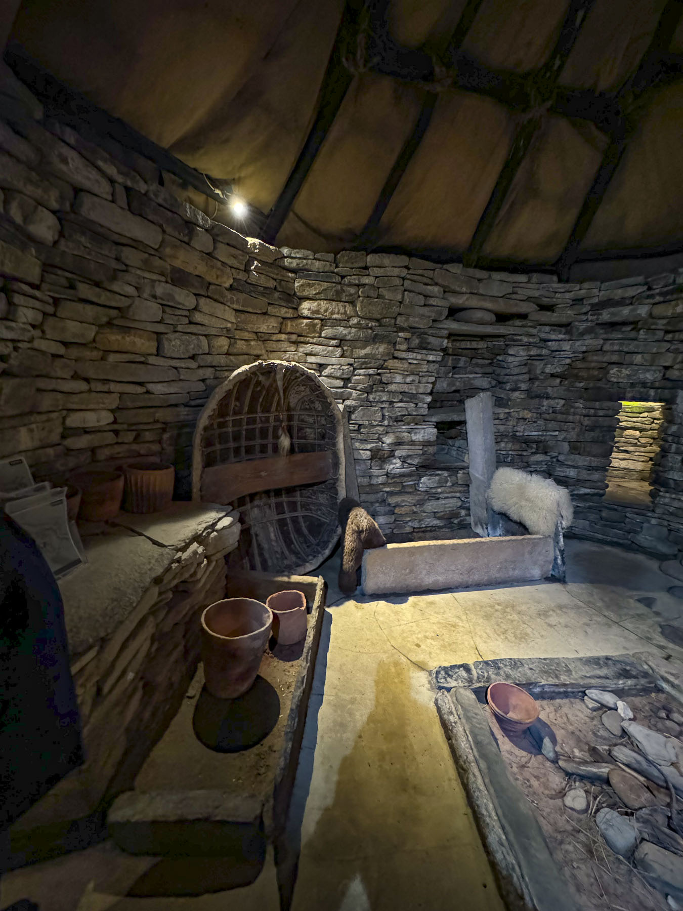
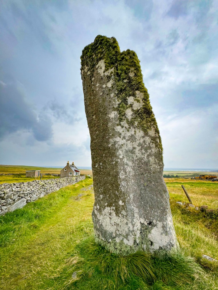
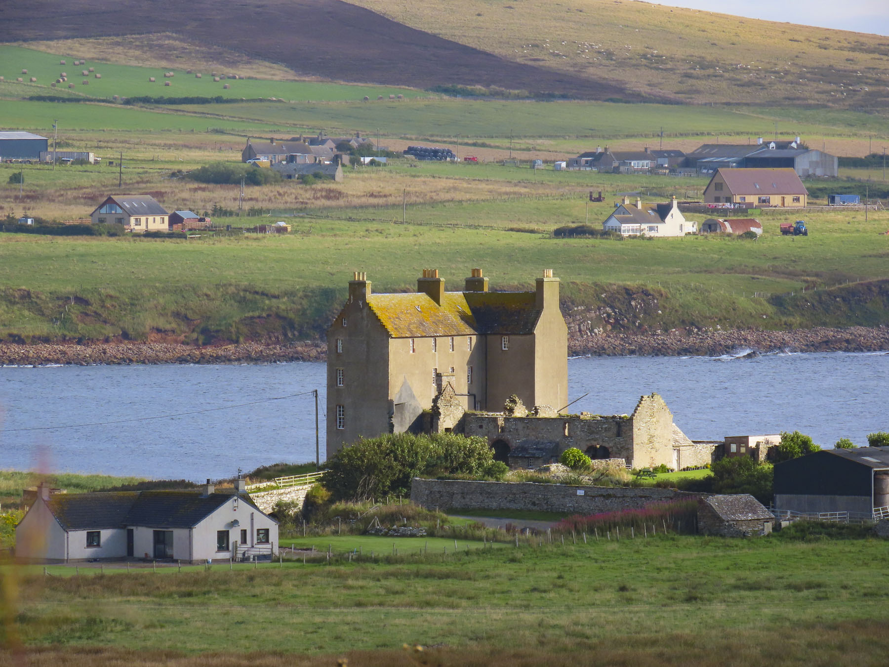
Clan Gunn Museum & Heritage Centre is beautifully set on the coast.

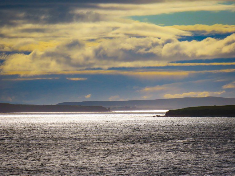
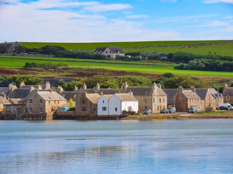
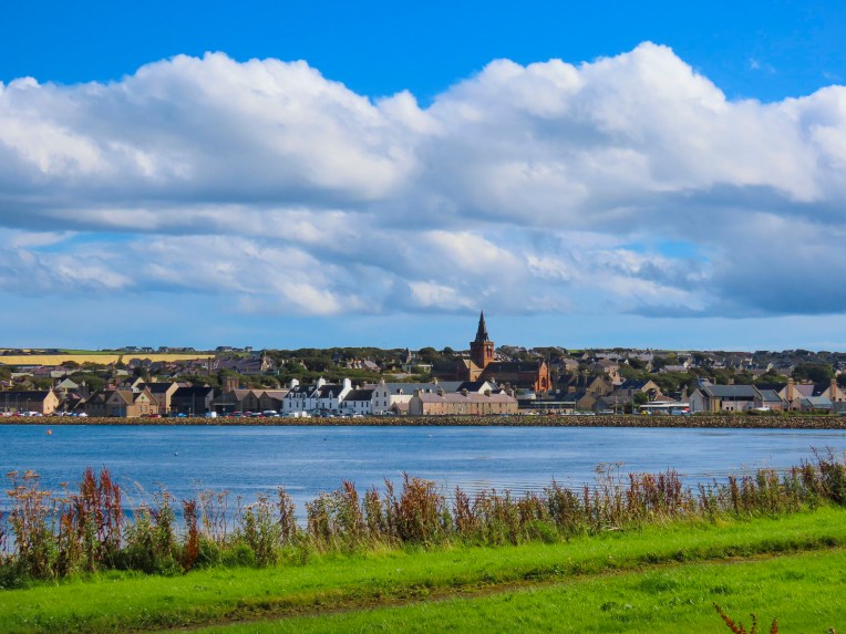
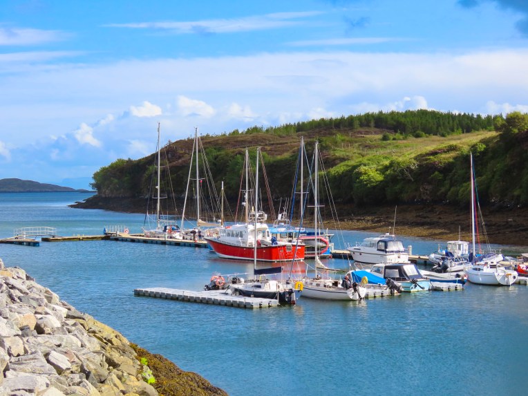
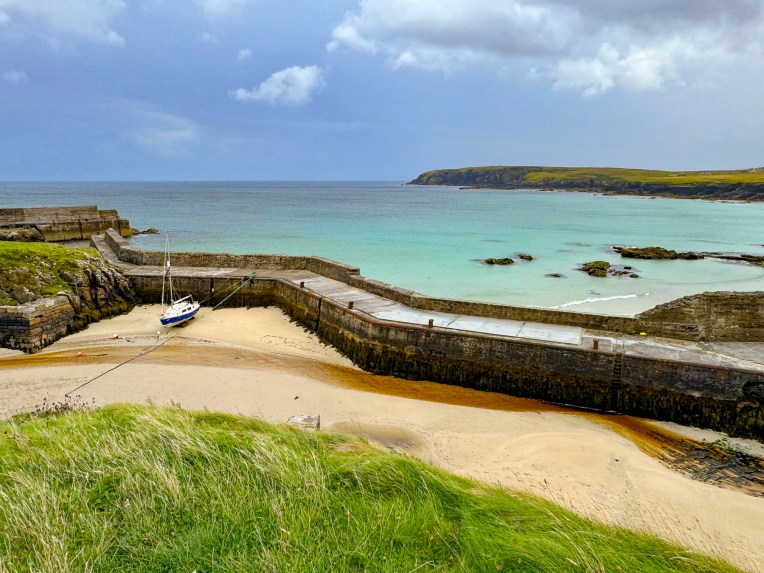
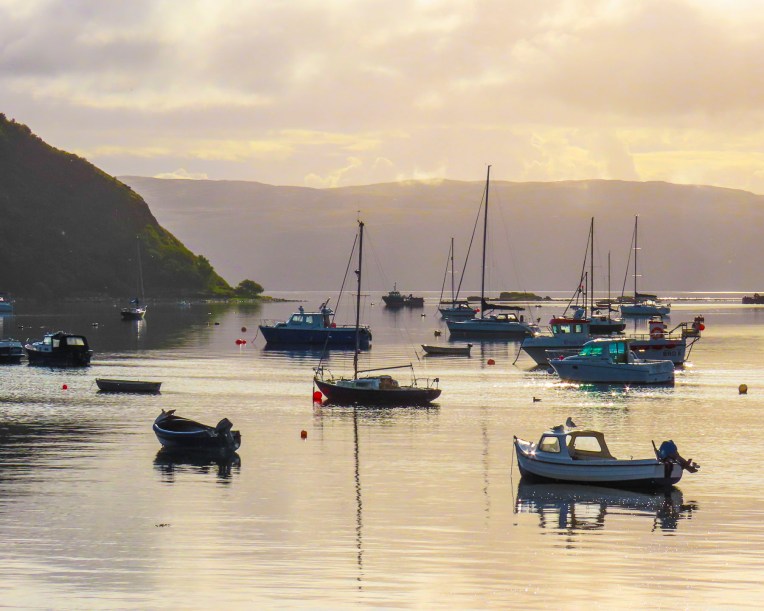
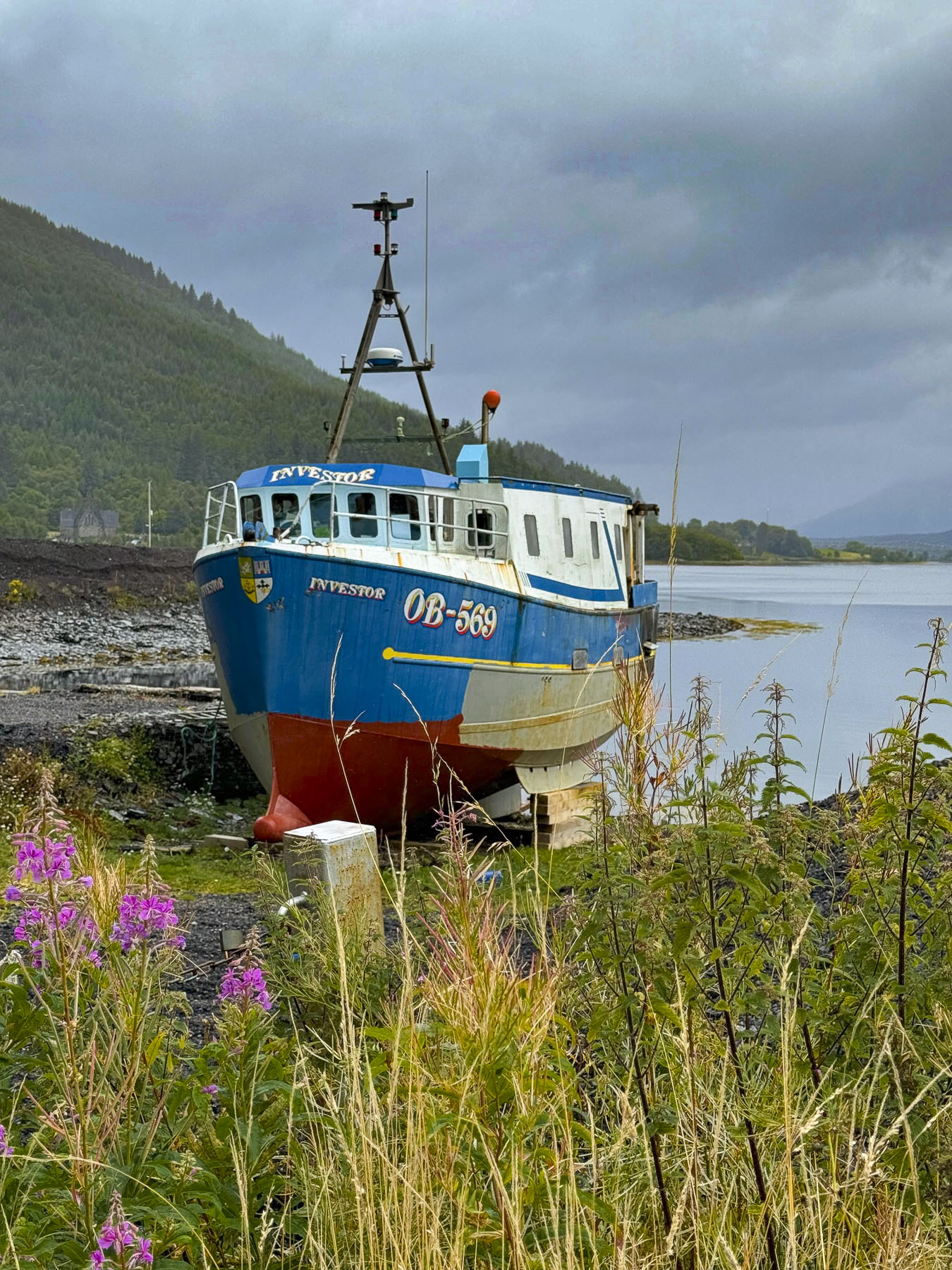
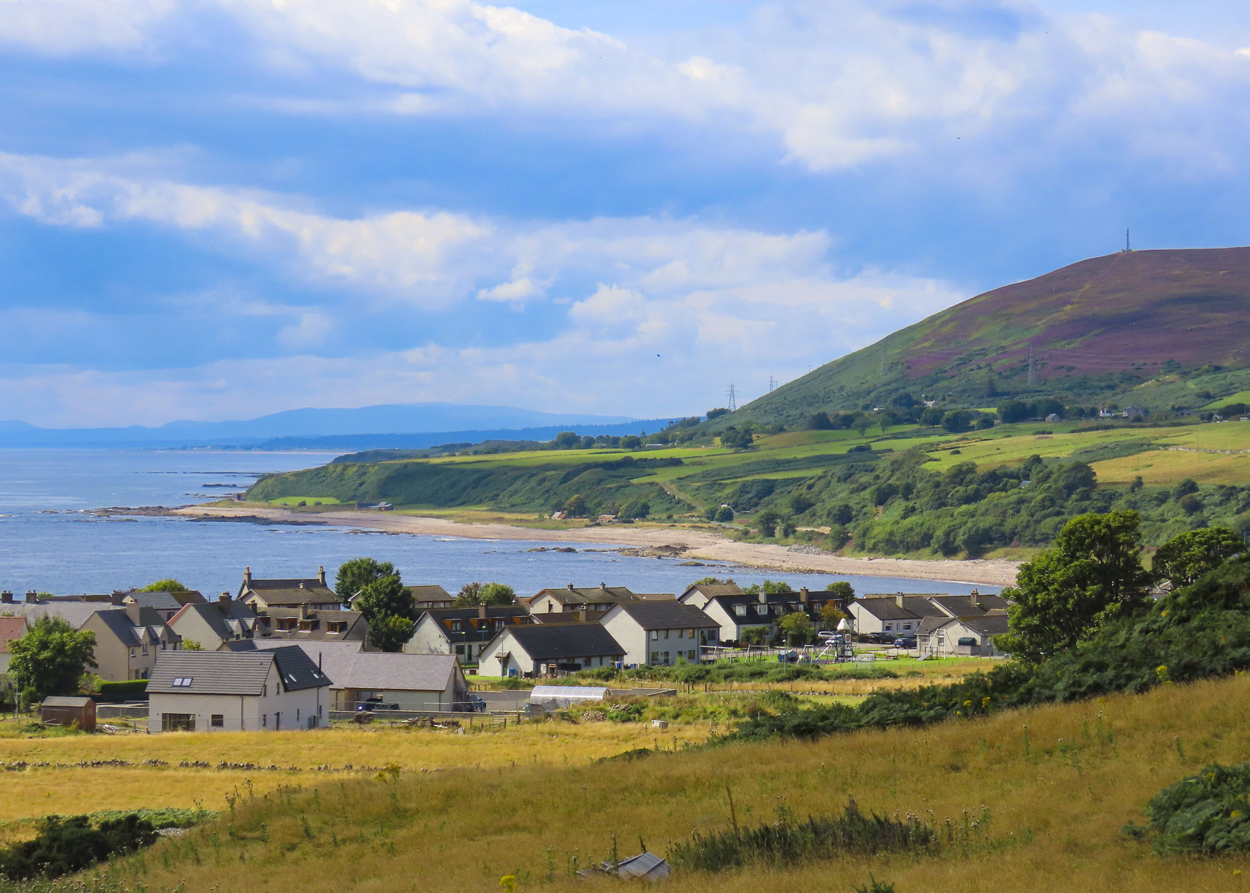
There are few natural harbors along Scotland’s North Sea coast. Ferocious storms blowing in off the sea required many villages to build stout seawalls to prevent their fishing boats from being smashed against the rocky coast. One such place was the tiny Latheronwheel Harbour. We had it all to ourselves when we visited on a Wednesday in August.

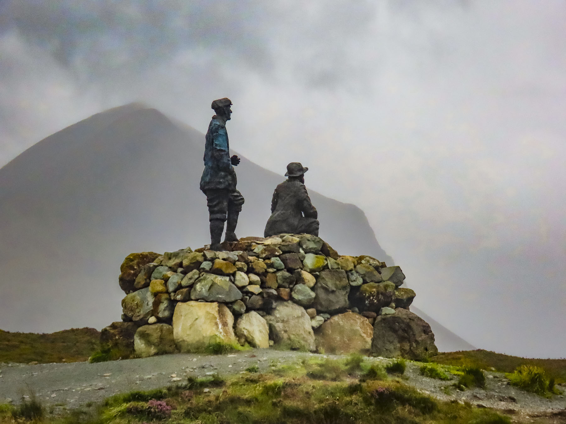
Crossing the River Helmsdale, we stopped at the Emigrants Monument which graces a hilltop that overlooks the village of Helmsdale nestled against its river and the sea. It’s a heart-rending tribute to those who were forced from their homes and livelihoods during the Clearances. The inscription on the monument, in Gaelic and English, reads:

“The Emigrants commemorates the people of the Highlands and Islands of Scotland who, in the face of great adversity, sought freedom, hope and justice beyond these shores. They and their descendants went forth and explored continents, built great countries and cities and gave their enterprise and culture to the world. This is their legacy. Their voices will echo forever thro the empty straths and glens of their homeland.”

It was commissioned by Dennis MacLeod. The son of a war-widowed crofter, he emigrated from Scotland to South Africa and made his fortune in mining.

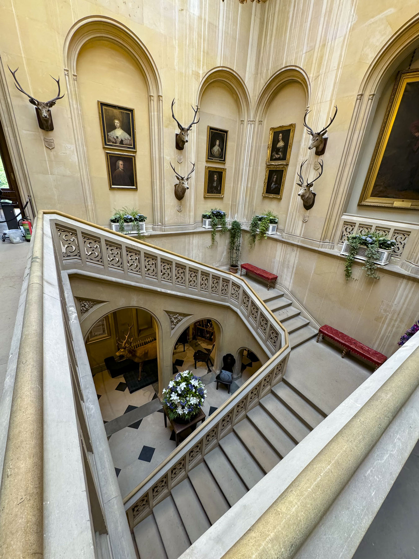
Dunrobin Castle & Gardens was our main destination for the day, but our hopes were temporarily dampened by a sudden heavy rain. Fortunately, after we ran through the storm to the entrance, the sky cleared.

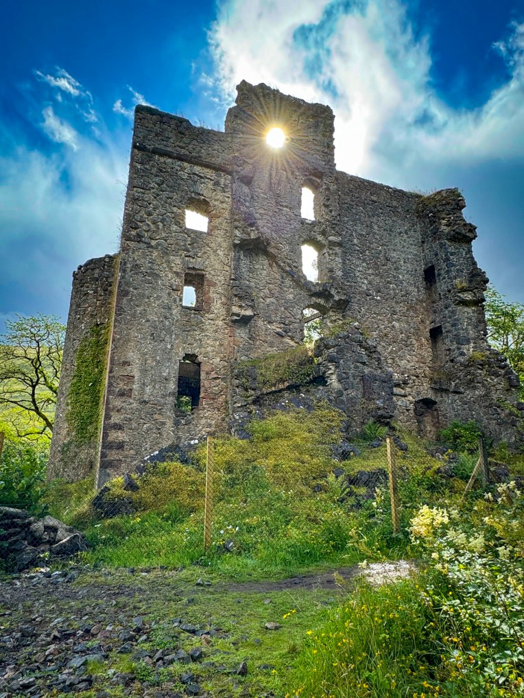
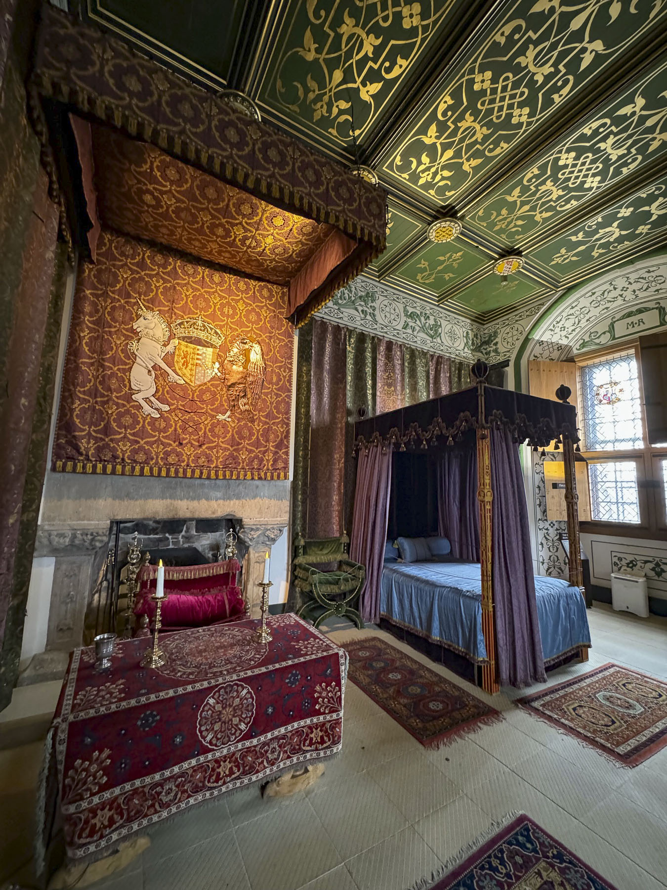
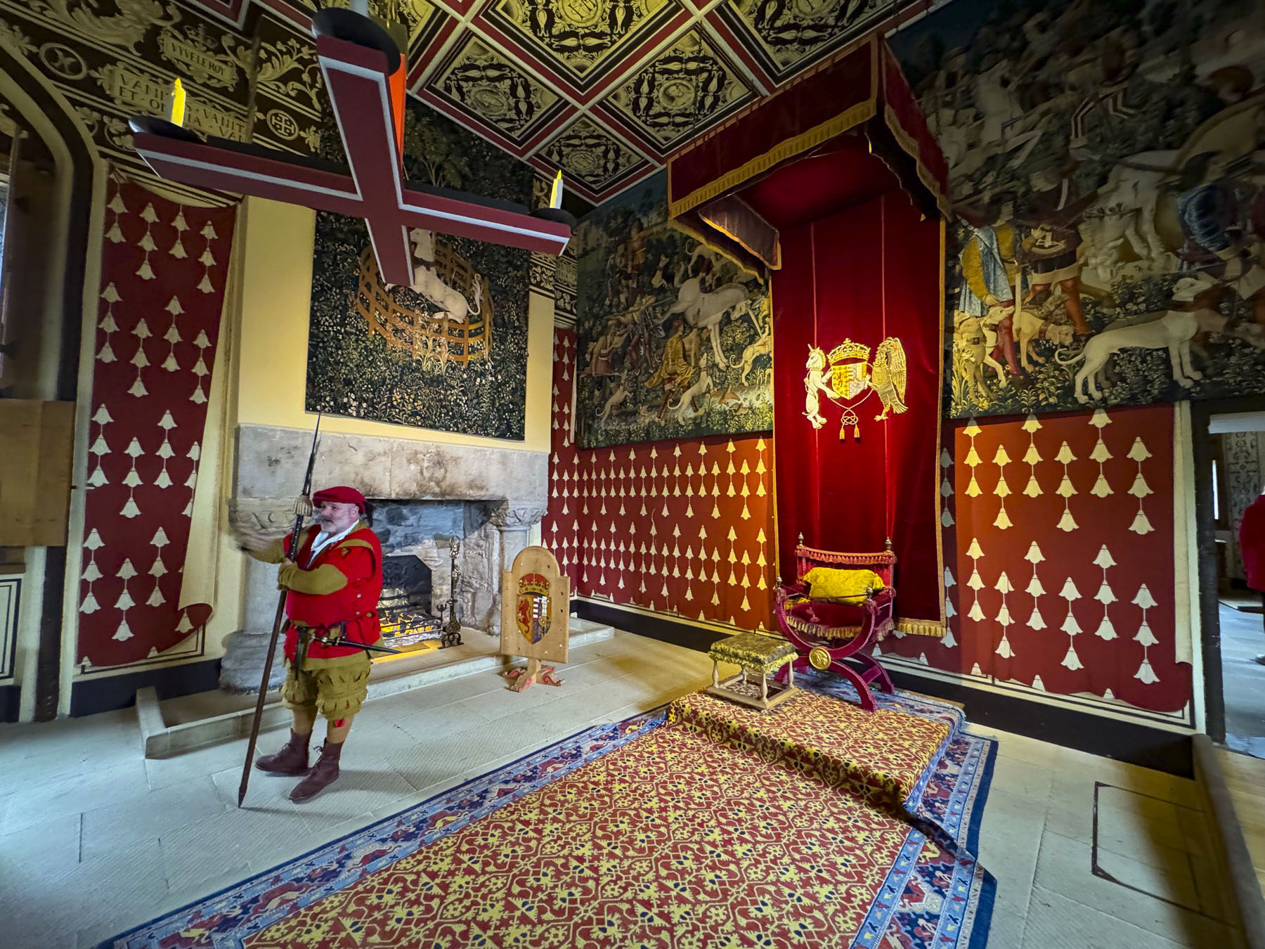
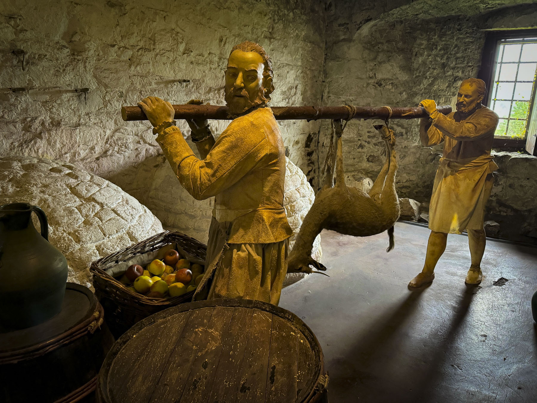
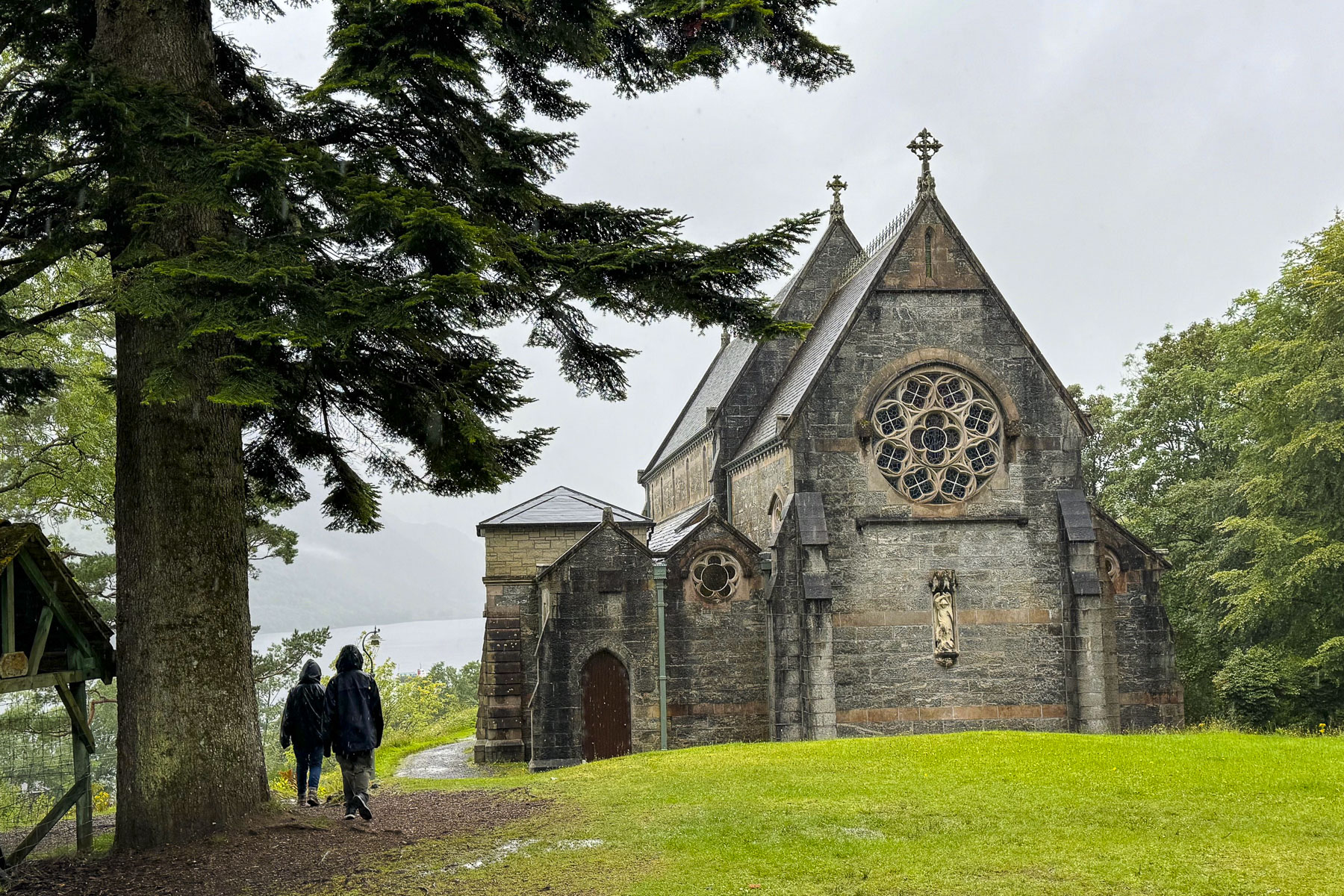
The castle is one of the best-preserved examples of how the landed nobility extravagantly lived. A castle has stood on this site overlooking the Dornoch Firth and the North Sea since the Earldom of Sutherland was created in 1235. Only a few walls of the ancient castle’s keep remained after extensive renovations and expansion in the 1700 and 1800s. The result was a French style chateau with towering conical spires and 189 rooms. Amazingly, the beautiful estate has remained the seat of Clan Sutherland for 800 years and is today owned by the 25th Earl of Sutherland.

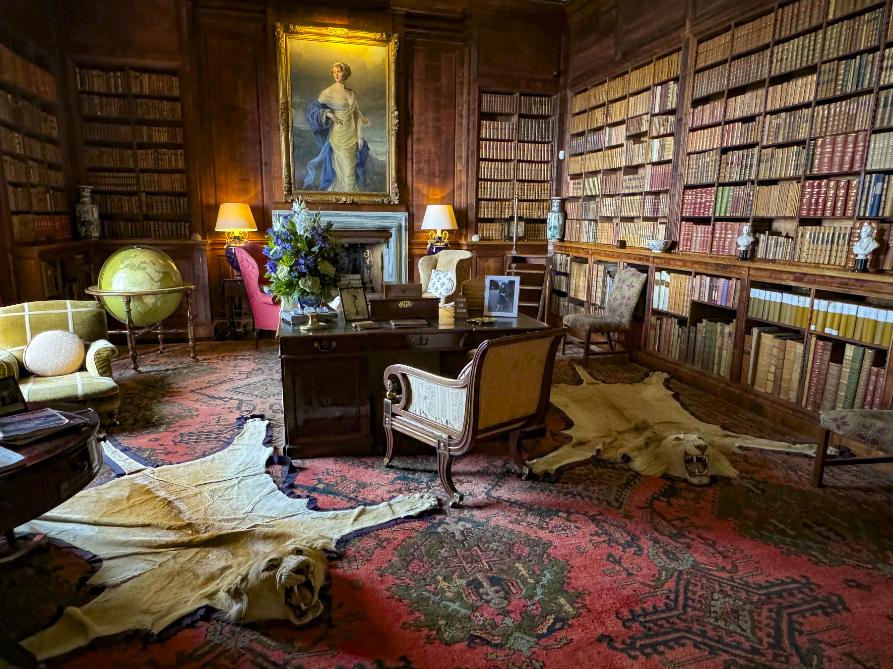
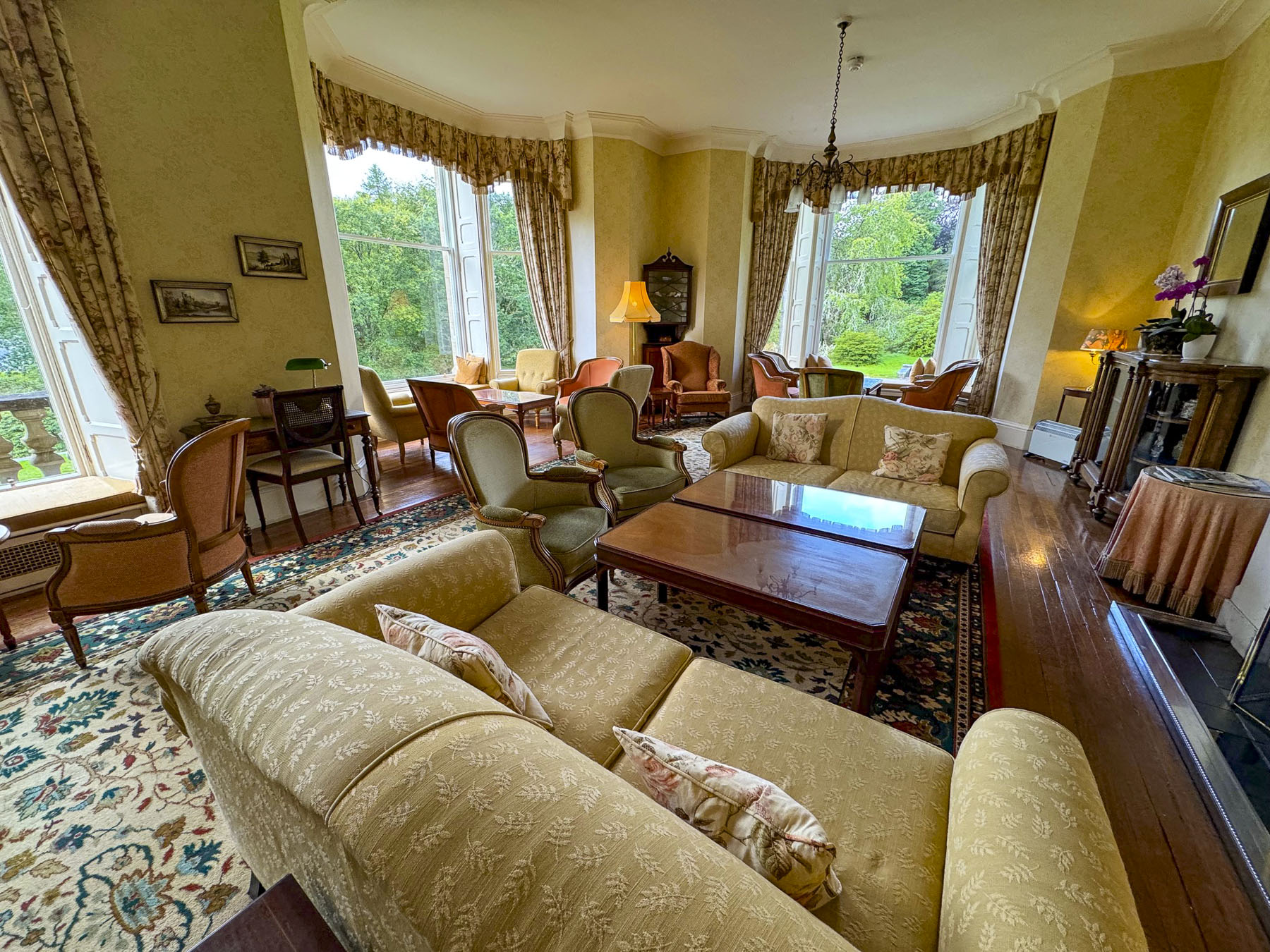
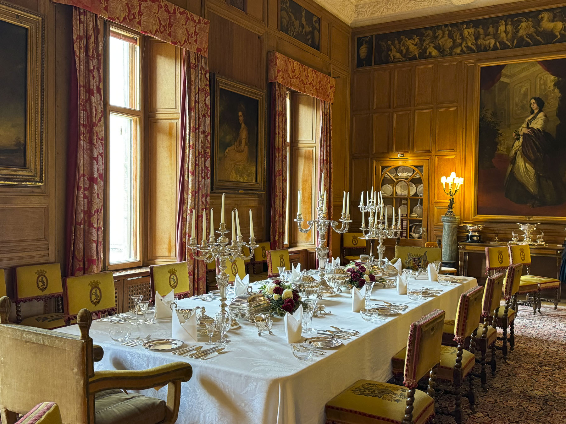
Our self-guided tour (there were staff along the way to answer any questions) through the

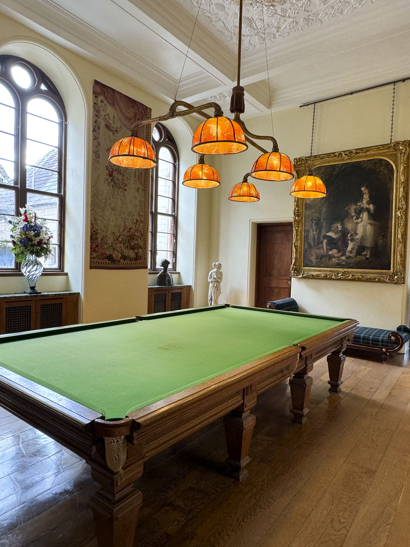
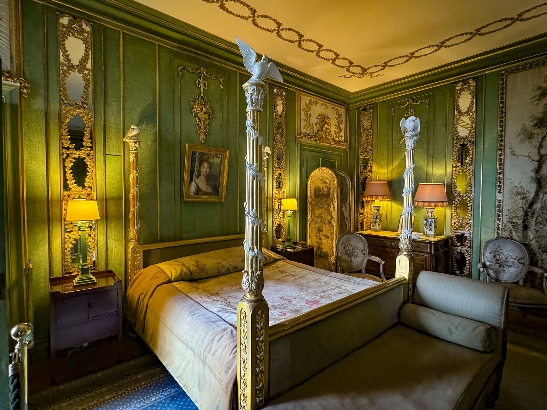
exquisite rooms of this immense family home was very interesting. And it does feel like a family home, opulent but not pretentious. It was significantly nicer than the royal Palace of Holyroodhouse in Edinburgh.

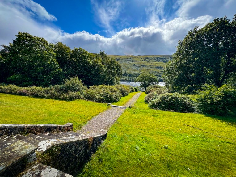
As gardeners, we delighted in wandering through the Versailles-inspired oasis of flower beds and fountains.

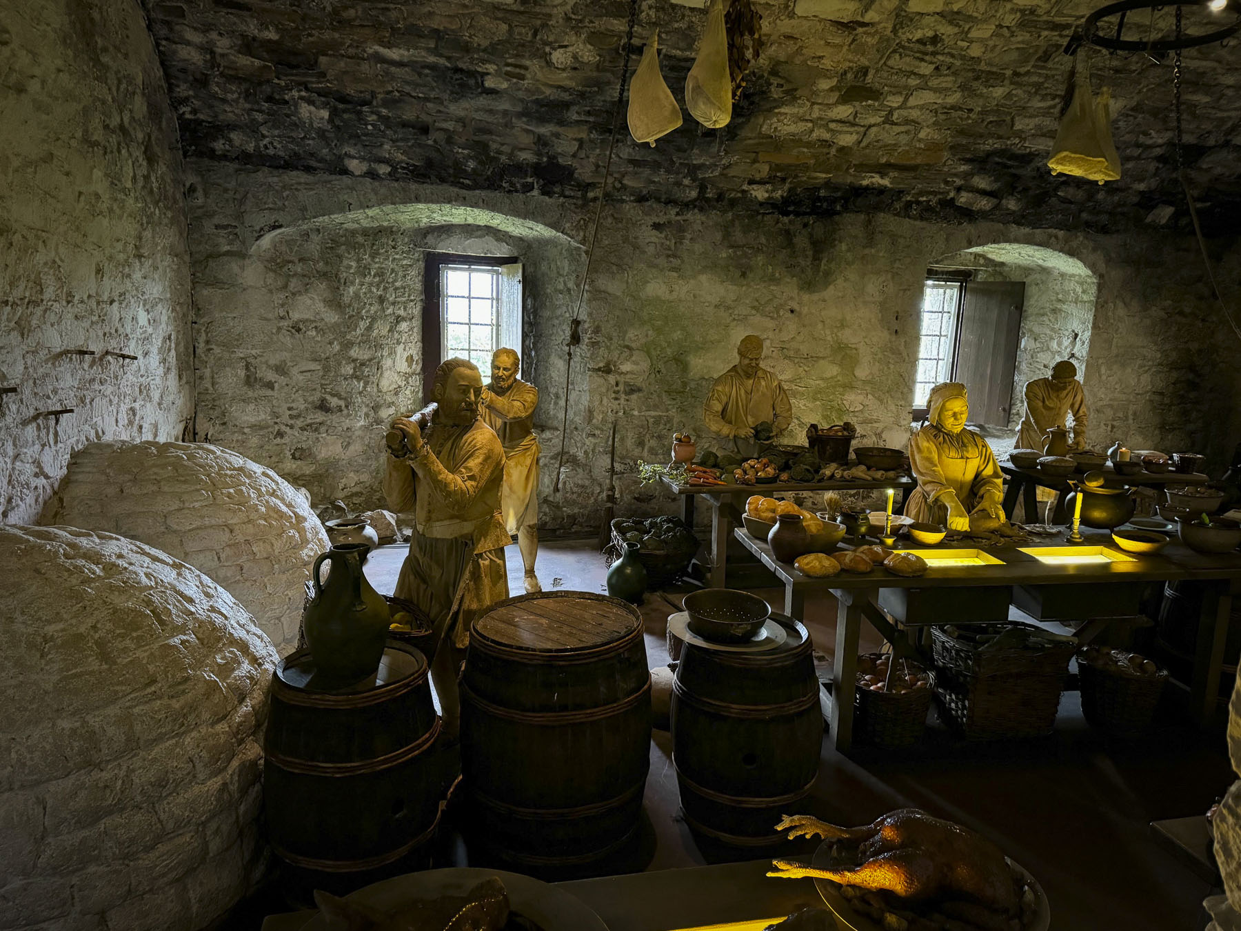
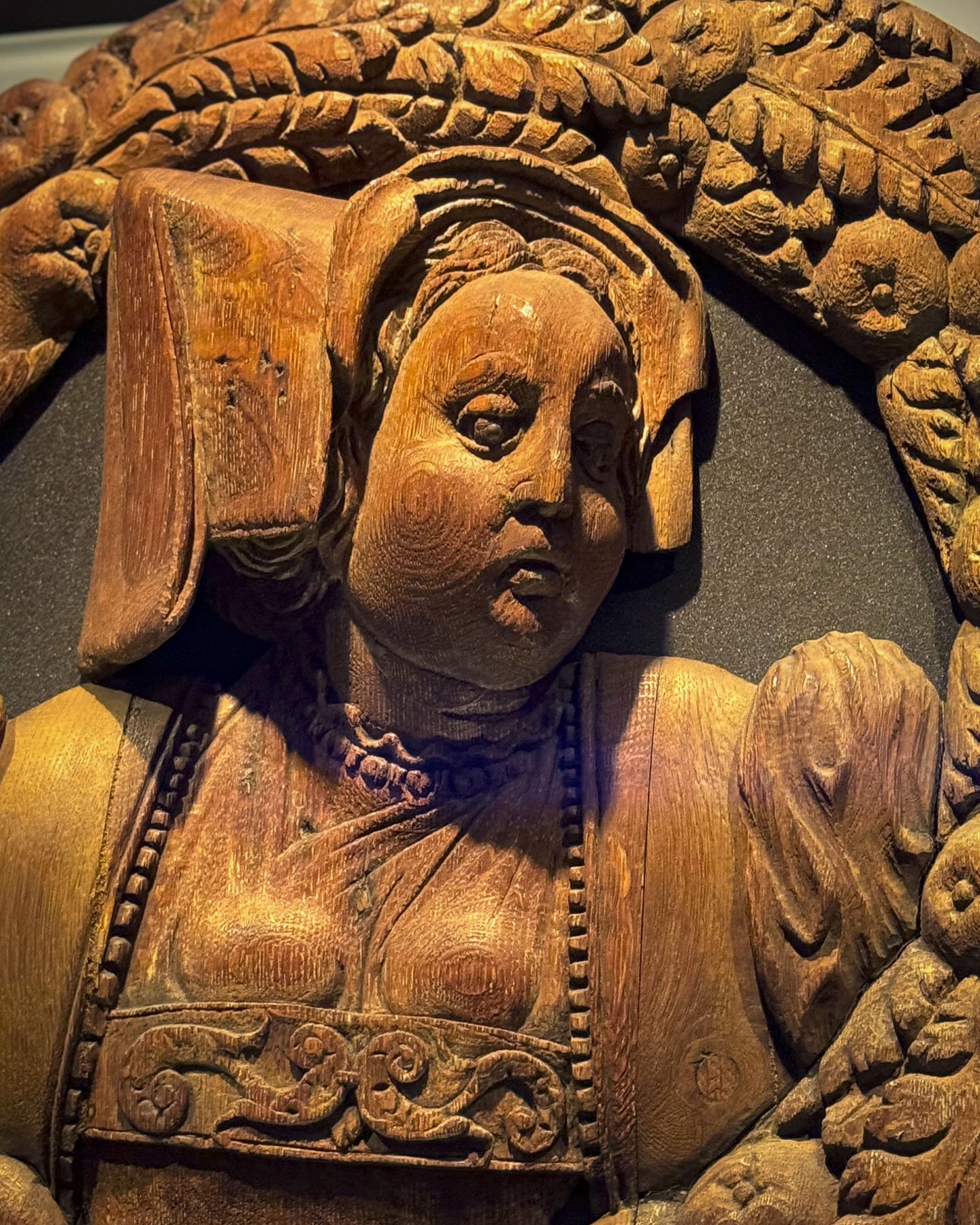
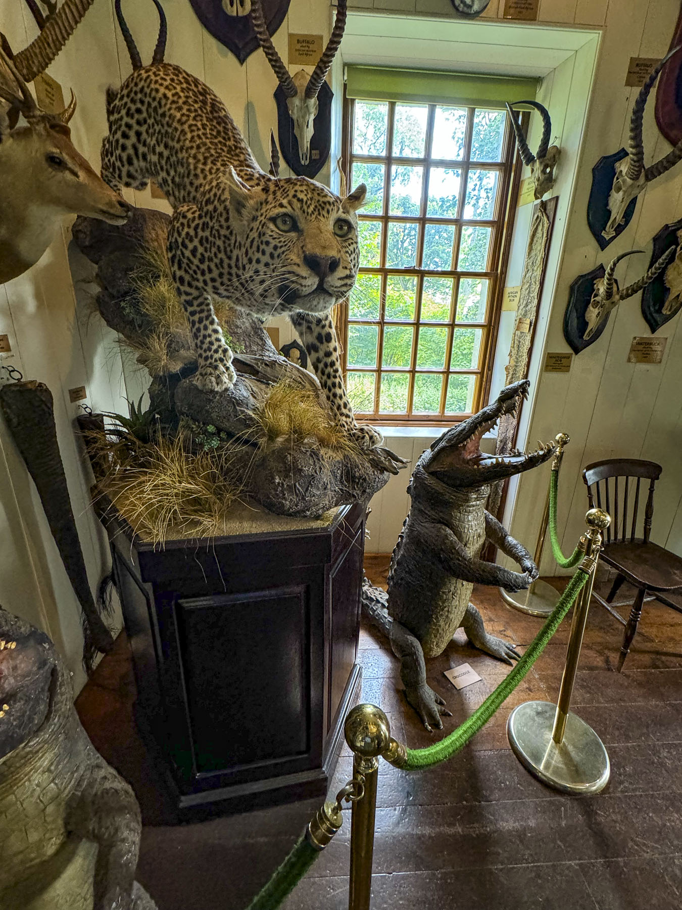
Off the garden was the estate’s former two-story summer house, now a museum that displayed a notable collection of Pictish Stones, along with a variety of ethnographic items collected from travels around the world, and animal head trophies from safaris in Africa. 

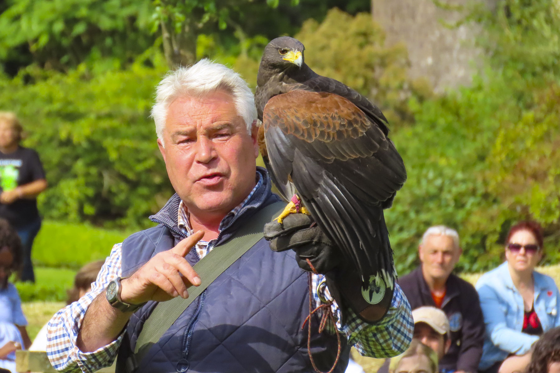
At the lower end of the garden, we watched the castle’s resident falconer demonstrate and explain the ancient art of falconry as a Harris hawk, Gyrfalcon and Peregrine swooped low over the gasping audience. It was a very entertaining and informative show.

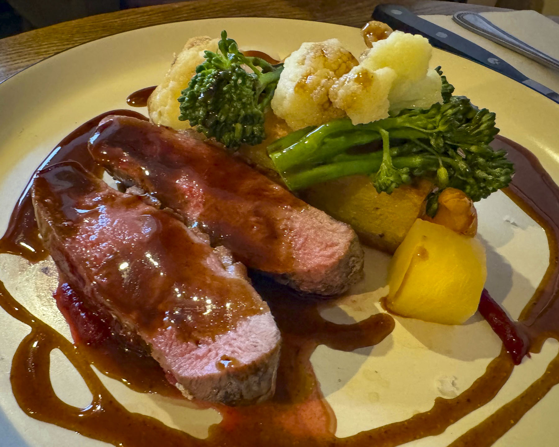
Farther south we turned off the A9 and headed to an early dinner at the Surf and Turf in Dornoch, a small town that traces its roots back to the 8th century. We discovered the Surf and Turf through one of the Instagram feeds we follow. The reviews were quite favorable and pictures of the seafood looked delicious, but we didn’t realize it was a takeaway shop. Luckily for us, they had a long bar with stools along one wall. The fresh fried fish, calamari and mussels we ordered were excellent and all locally caught.

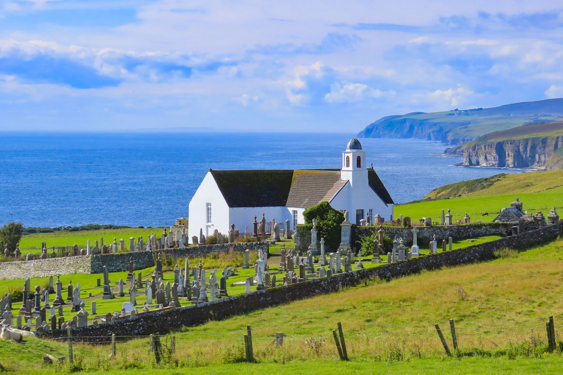
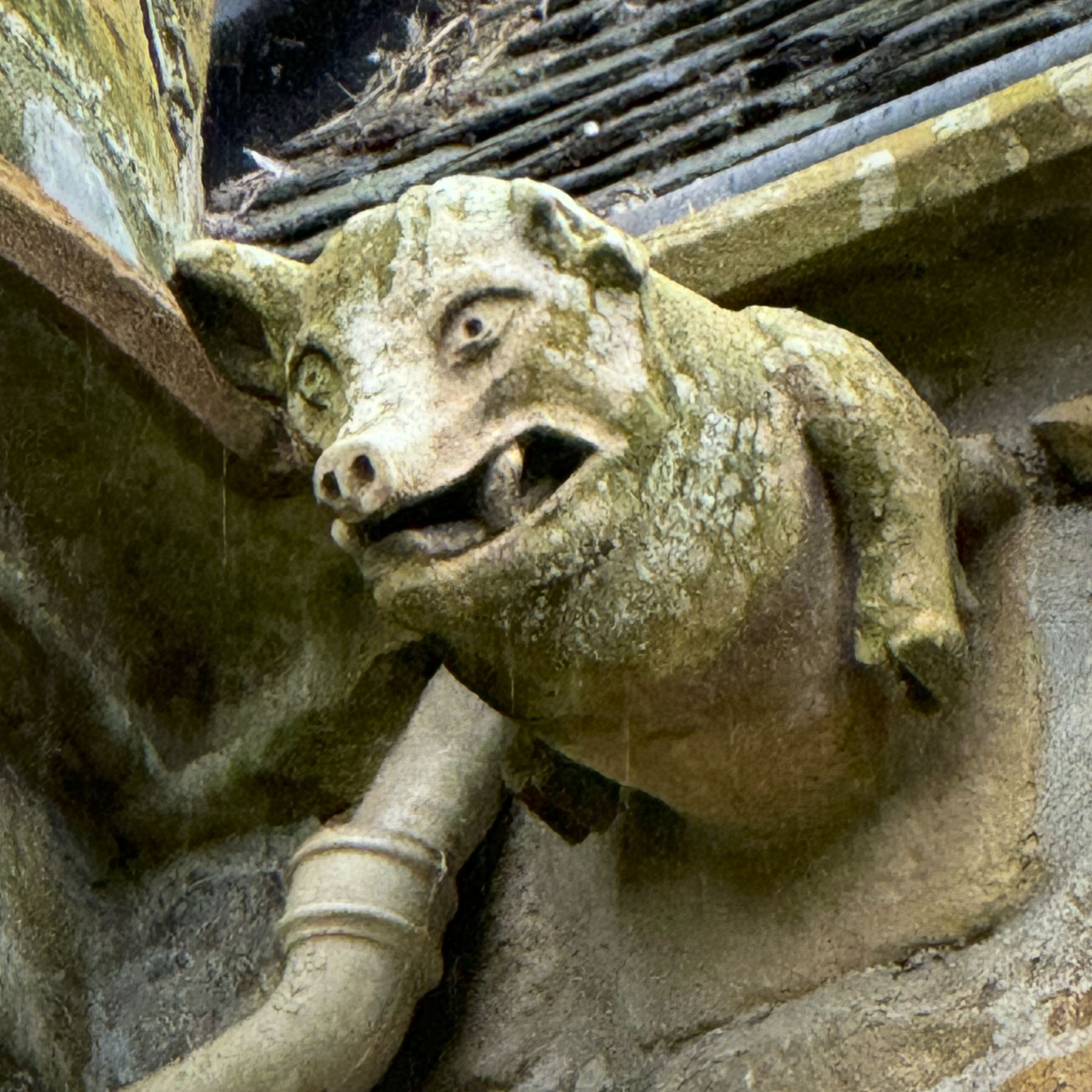
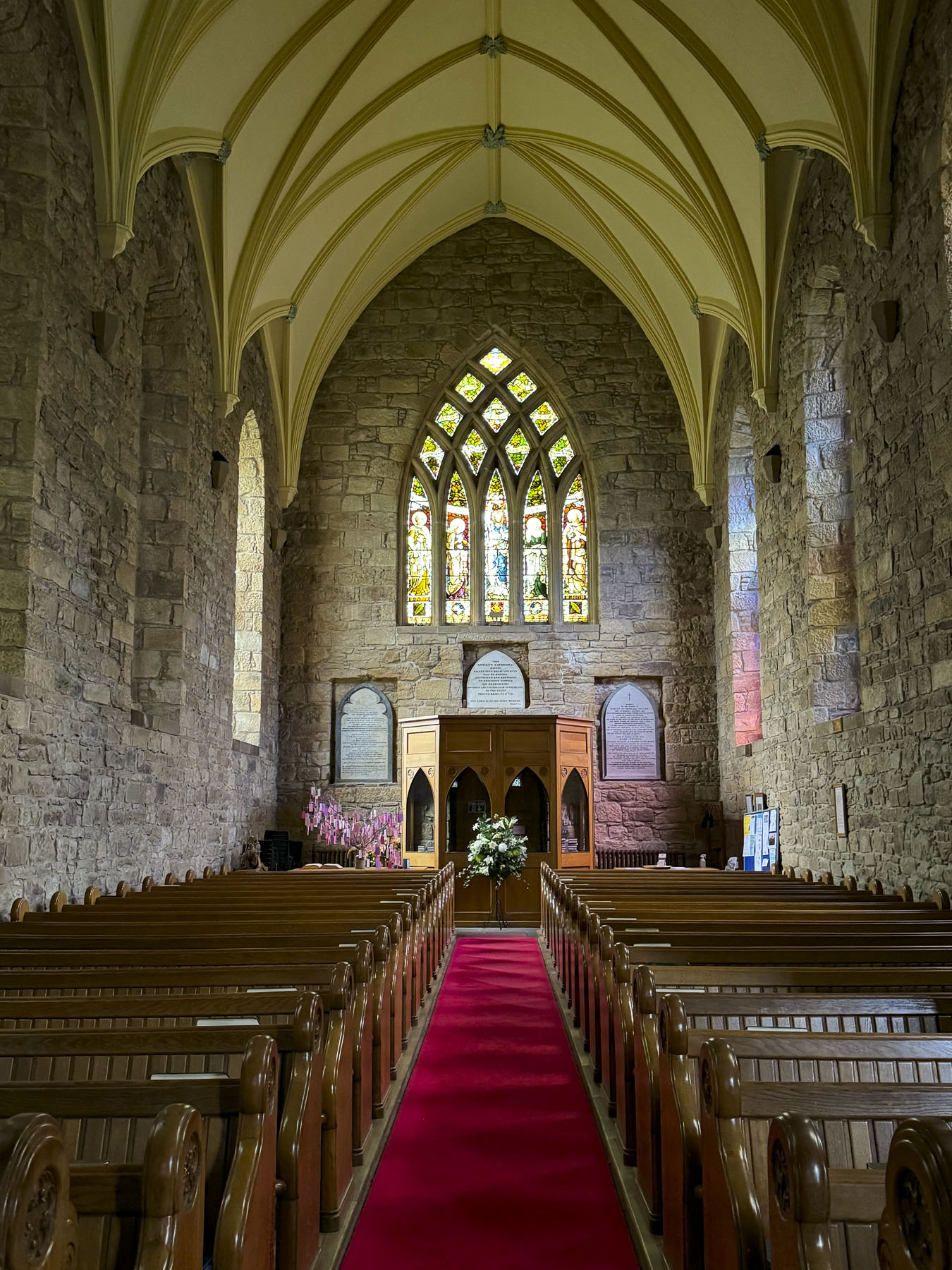
The Dornoch Cathedral was just around the corner, and we spent a while studying the grotesque ancient gargoyles and stone interior of the church, which held its first service in 1239. During the medieval era the gargoyles were believed to portray evil spirits, which were driven from the church by ringing its tower bells.

In 1245 the 1st Earl of Sutherland was buried in the cathedral, the first of many Sutherlands  to be entombed in the family vault under the sanctuary floor. Three centuries later the church was left in ruins after fire destroyed the nave and roof during a climatic feud between Clan MacKay of Strathnaver and Clan Murray of Dornoch. Fifty years later only the roof over the chancel and transept walls were replaced. The cathedral remained partially renovated for another 300 years until 1835, when the Duchess of Sutherland financed a full restoration. Light poured through 27 stained glass windows and brilliantly illuminated the church’s interior. Three of those windows, with the themes literacy, music, and peace, were donated to the church in 1926, in the memory of the famous Scottish-American industrialist, Andrew Carnegie, who summered nearby at his baronial estate, Skibo Castle.

Also of interesting note, the last burning at the stake of a witch in Scotland happened in Dornoch in 1727.  Janet Horne, a local woman, was accused of turning her daughter into a pony and riding her around the highlands to perform her witchcraft. The Scottish Witchcraft Act of 1563 was repealed in 1736. The singer Madonna had her son Rocco christened in the cathedral in 2000, before her wedding ceremony to Guy Ritchie at Skibo Castle.

We ended our day in the quaint village of Strathpeffer, a Victorian era spa town whose sulphurous spring waters were touted as a cure for many ailments. A railway line reached the town in the late 1800s, and it became an easy destination for wealthy Victorians who sought “to take the waters.” Our hotel, the Highland Hotel Strathpeffer was one of those grand, four-story wood paneled, railway hotels built to ease spa-goers’ visits to the village. It’s glory years now a distant memory, the hotel still has its original warm wood paneling, but our room was very spartan, and a far cry from what we imagined were its luxuries during its heyday. During World War I the hotel was requisitioned as a convalescent military hospital, and in the Second World War served as a naval training school.

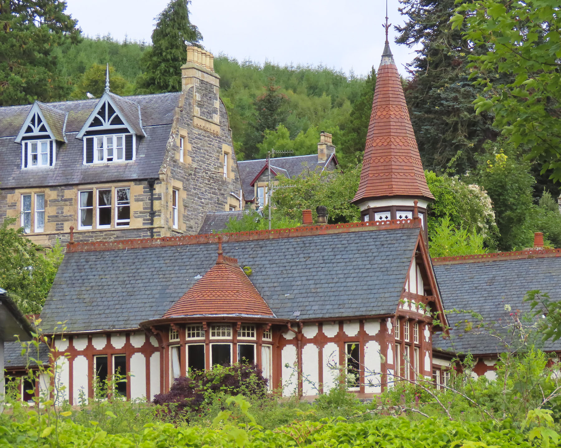
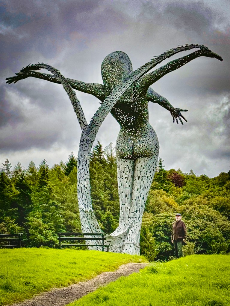
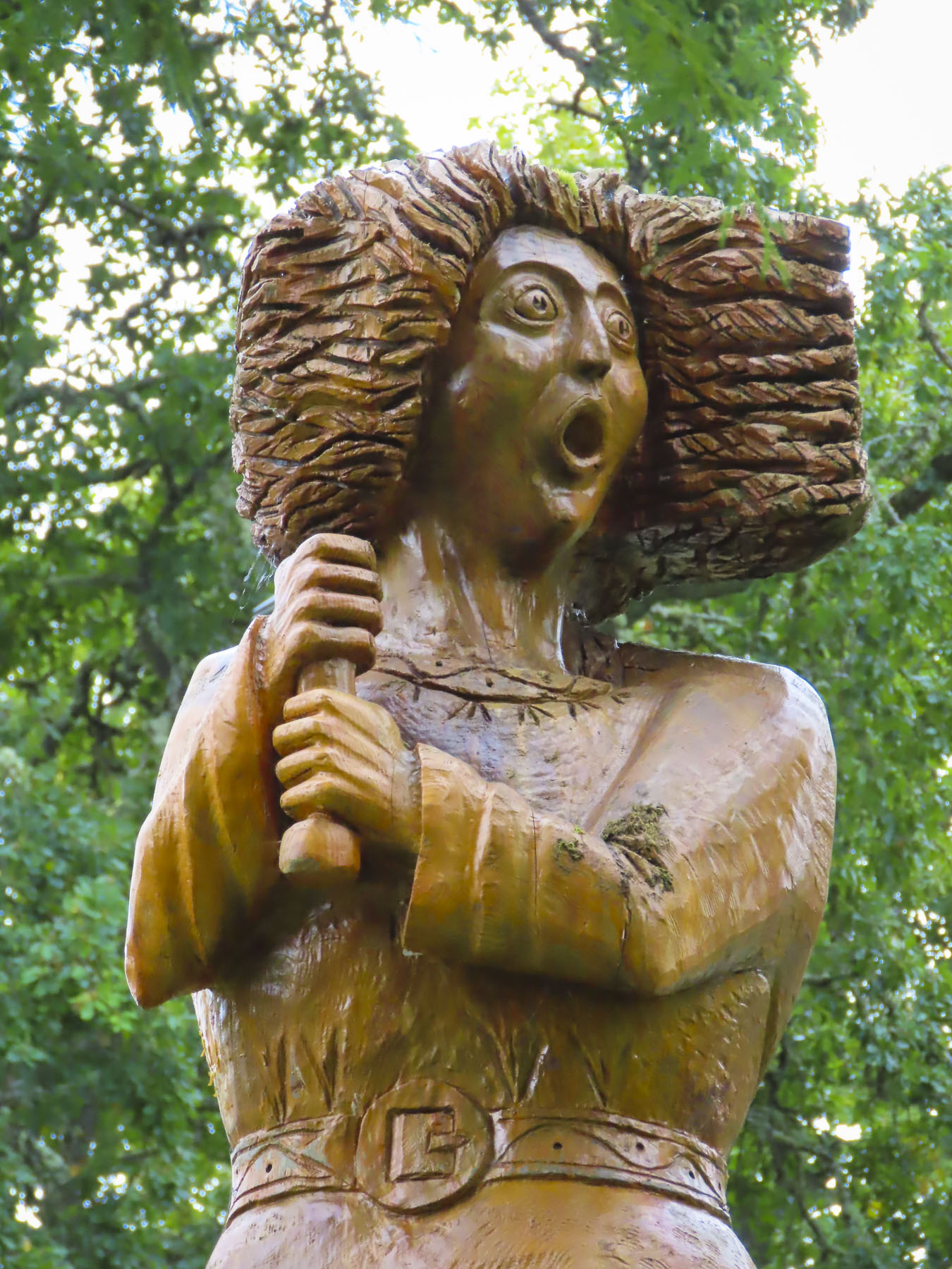
The village was very charming with a visually pleasing assortment of well-kept Victorian architecture. The old train station now hosts the Highland Museum of Childhood and a nice cafe. Across the street from our hotel the town’s original pavilion was recently renovated and once again hosts music and theater events, along with weddings, and exhibitions. Behind the pavilion is a small whimsical sculpture garden with five 13ft tall wooden sculptures of mythical figures from Celtic, Viking and Pictish legends. They were created by Allister Brebner, a local woodcarver with a workshop in the old train station, from the trunks of giant Douglas Fir trees, harvested from the Highland’s forests.

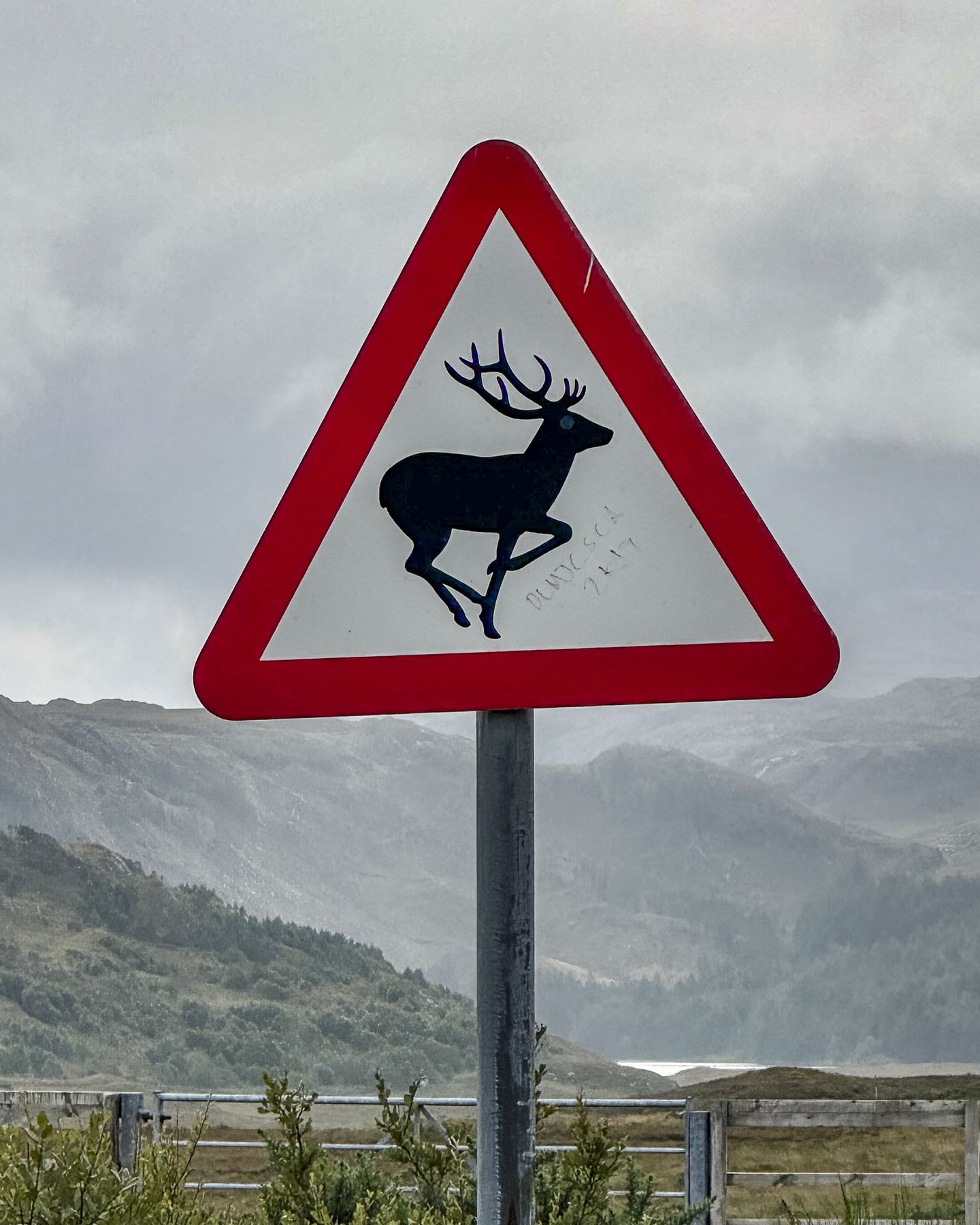
Is a tour of the Scottish Highlands really complete without visiting Loch Ness? We didn’t want to have any regrets, so on our last full day in Scotland we headed to Urquhart Castle and hoped to catch a glimpse of the fabled serpent so we could tell our young grandchildren, with our fingers crossed and a wink of the eye, that we had indeed spotted and encountered the creature and tried to wrestle it to ashore. I had his head and Donna his tail, but the slippery slimy thing was wildly thrashing about, and we lost hold of him, and in a final splash he vanished. An epic fish story about the one that got away is always good for a child’s imagination.

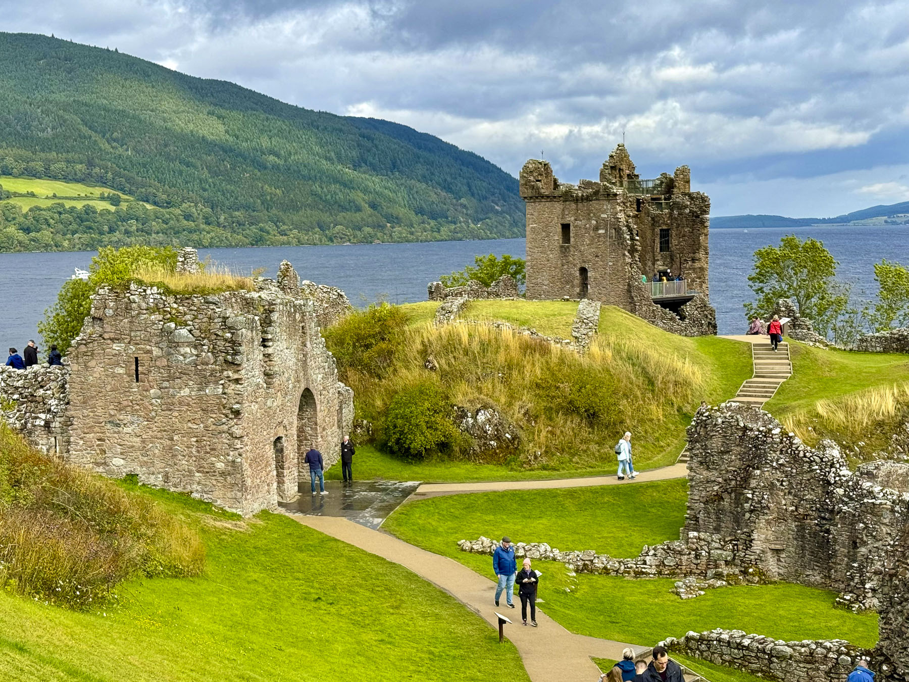
The castle commands a strategic point that juts out into Loch Ness, the natural geographic dividing line between the northern and southern Highlands. Built in the 13th century, it was one of Scotland’s largest fortifications and had a tumultuous 500 year history as it was captured then retaken numerous times during the Wars of Scottish Independence. Finally British soldiers blew it up in 1692 as they retreated to prevent the Jacobite army of Bonnie Prince Charlie from occupying it. On the grounds is a full-sized working recreation of a medieval trebuchet, a catapult-like siege engine that used a counterweight to hurl large stones against castle walls. Unfortunately, they were not demonstrating its use when we visited. Urquhart Castle, along with the Glenfinnan Viaduct for the Harry Potter train, were the busiest attractions we visited while in the Highlands. The rest of the time it felt like we had the Highlands mostly to ourselves. This was wonderful considering we drove the NC500 during the summer high season in August.

Our last stop before catching an evening flight from Inverness Airport was in Drumnadrochit, a crossroads village at the foot of a bridge that crosses over the River Enrick. We drove through it on the way to Urquhart Castle, earlier that morning, and thought it would be a nice place to break for lunch.

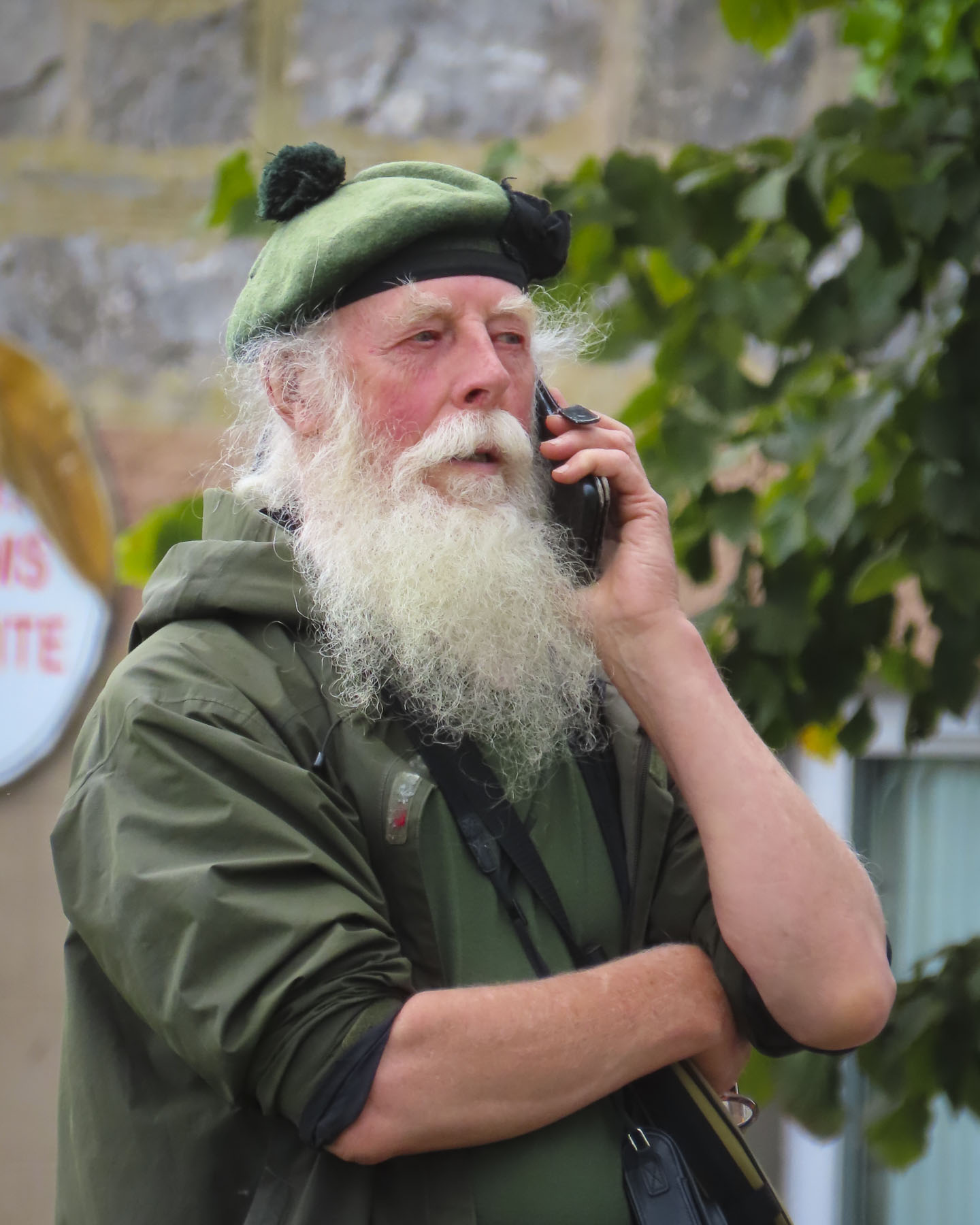
A young bagpiper commanded the village green as we settled into an outside table at The Fiddler’s Highland Restaurant to people-watch for a while. We were a little melancholic that our trip was finally coming to an end after driving a big loop around the Highlands, an area blessed with an amazing array of beautiful mountains and seascapes. The wizardly spell cast by the pipes was hard to break as we departed.

My heart’s in the Highlands, my heart is not here,

My heart’s in the Highlands, a-chasing the deer;

Chasing the wild-deer, and following the roe,

My heart’s in the Highlands, wherever I go.

The poem was written by Robert Burns

Till next time, Craig & Donna

Driving the North Coast 500 – Part 6: A Day Trip to Orkney

We had spent the previous day enjoying the fantastic landscapes of the Highlands along the NC500 from Ullapool to Durness before calling it a night at the John o’ Groats Guest House, just outside the village of the same name, at the land’s end of northern Scotland. With any trip it’s a matter of choices: how long, how much to spend, what to see, and where to go. Being this close to the Orkney Islands, how could we resist a visit? Sorry Inverness, but you were scratched off the itinerary.

After a hearty full Scottish breakfast, we were off early to catch the Pentland Ferry, only 8 minutes away in Gills Bay. Reading about how busy the Highlands are during the summer months, especially the car ferries, we made our reservations back in February as soon as their new yearly schedule was posted online. While it wasn’t inexpensive (RT 2 ppl, 1 car for £170) to get the car to Orkney, it was 40% less than doing a coach tour for the day, and it retained our freedom to dally and dither. After scanning our e-ticket, the attendant directed us to the proper queue. Within a few minutes the ferry from St Margaret’s Hope, on Orkney, docked and disembarked its cars and passengers, and we drove aboard.

As we rounded Hoxa Head, long abandoned coastal gun batteries were a reminder of the important role Orkney and its large natural harbor Scapa Flow played during WWI & WWII. During these conflicts it served as the main naval base for the British Home Fleet and a strategic location for patrolling the North Sea and Atlantic Ocean. As remote as the island was, it did not prevent Nazi war planes from bombing it in 1940. The short crossing of 19 miles took an hour. We pulled aside in the parking area to let the tour buses and delivery trucks race ahead, along with all the other drivers who knew where they were going. St. Margaret’s Hope is actually on a separate island and is connected to Orkney by the A961 which crosses several islets and causeways to reach the mainland.

We planned to stop first at the Italian Chapel on the small island of Lamb Holm, but the tour buses were there so we moved on. We did stop at the foot of the last causeway, to photograph divers exploring the half-exposed hull of a rusted shipwreck. The wreck wasn’t the result of a tragic storm, but an intentional sinking of a block ship to prevent German U-boats from entering Scapa Flow again after an earlier U-boat attack sank the battleship HMS Royal Oak in 1939.

We figured we would race ahead of the tour buses now and headed across the Orkney mainland, a distance of 24 miles, to the Broch of Gurness.

Located on the shoreline of Eynhallow Sound, the Broch is one of Scotland’s most complete and best-preserved Iron Age settlements. The historic settlement dates to around 500BC and featured a large stone tower, the broch, surrounded by smaller stone houses and animal sheds, all of which were protected by an encircling earthen rampart.

Broches are drystone hollow-walled structures unique to Scotland, and were usually the large home of the village chief, which also served as a place of refuge for villagers during times of conflict. The site was used for about 600 years before it was abandoned around 100AD. Slowly the abandoned ruins were covered, and the site was a Pictish farmstead until the Vikings landed on Orkneys in 8th century and established farming communities while also using the islands as a base for seafaring raids to Scotland, England and France.

The site slowly vanished into obscurity until 1929, when the leg of stool which a local artist was sitting on to sketch sank unusually deep into the earth. A little digging revealed a staircase into the broch. With news of this discover the Society of Antiquaries of Scotland bought the land and started a full excavation which revealed Iron Age settlement, along with artifacts and the medieval era grave of a Viking woman buried with a sickle blade and a pair of tortoise brooches.

We are constantly amazed by the desire of older civilizations to explore the horizon. On Orkney and the other islands of the archipelago the curiosity of Mesolithic hunter gatherers 8,000 years ago was rewarded with the discovery of a fertile landscape, and the abundant resources of the surrounding seas, as they followed the retreating glaciers of the Ice Age north. The Broch of Gurness is not the earliest settlement on Orkney, that distinction goes to Skara Brae, a 5000-year-old Neolithic era village that was also on our itinerary.

Often the journey between destinations is half the fun, and the vast landscapes of the windswept Orkney farmlands and brilliant seascapes delighted us as we headed toward Skara Brae.

The historic ruins of the Earl’s Palace in the tiny seaside hamlet of Birsay was on the route and of course we stopped. The vistas of the coast, and the Brough of Birsay Lighthouse from the hamlet were beguiling, and it was easy to see why the, “I want to be king,” Lord Robert Stewart, the illegitimate son of King James V of Scotland, choose the spectacular spot to build his fortress palace. It was probably the only instance of good taste he displayed while on Orkney.  

In 1564 Mary, Queen of Scots, his half-sister, dispatched Robert, as the sheriff and justiciar of Orkney and Shetland, to the remote recently acquired islands, (the resolution of an unpaid dowry for the King of Norway’s daughter Margaret’s marriage to James III of Scotland,) to get him out of Edinburgh. A few years later he was made the Lord of Shetland and Orkney, but took advantage of the island’s isolation and ruled over them as a tyrant with an iron fist, making the area his own private fiefdom.

His time was marked by severe taxation, the seizure and redistribution of land to his allies, a gang of henchmen who violently enforced his rule, and conscripted labor to build his palace. The palace was a large two-story structure, with three-story towers on the corners, and a central courtyard. The upper level had two halls, a gallery, and the Earl’s private chambers. The ground floor was for servant’s quarters and workrooms for the support of the estate. The exterior walls on this level had gunports for defense. Above the entrance to the palace was inscribed the Latin phrase, “Dominus Robertus Stewartus, filius Jacobi Quinti, Rex Scotorum, hoc opus instruxit.” The controversial use of “Rex” in the phrase was interpreted by some as Robert calling himself King, a traitorous act.

He died in 1593, but his legacy of ruthlessly treating the Orcadians as serfs was continued by the successive rule of his son and grandson. Their subjugation of the islanders ended with their execution during an armed rebellion in 1615.

Beyond the ruins sheep graze peacefully in the surrounding pasturelands. Across the street we spotted our first Honesty Box stocked with the tasty creations made by Jane & Paul’s Orkney Produce, and there we procured the makings for a picnic lunch. The Honesty Boxes are a wonderful concept of selling homemade treats, and relying on the honesty of the purchasers to deposit money in the box. Unfortunately, this doesn’t exist in the states anymore.

Knowledge of Skara Brae remained hidden until a severe North Atlantic storm in 1850 washed away the dunes that were covering the small cluster of eight dwellings on the shore of the idyllic Skaill Bay, though the site was only 700ft away from the Skaill House, a 17thcentury mansion, and the estate of the Lairds of Skaill.  The first partial excavation of the site was conducted by 7th Laird of Skaill, William Watt.

After another storm in 1926, extensive excavations were undertaken by the Ancient Monuments branch of the British Ministry of Works, which revealed the dwellings had earthen or thatch covered roofs supported by a structure made from driftwood and whalebones, with stone sleeping platforms and in the center of each house was a water pit which drained onto the beach.

Stone slabs covered narrow sunken passageways between the houses. But the age of the site wasn’t established until the 1970s when radiocarbon dating of the artifacts discovered at the site dated them to the Neolithic era around 3200BC. While you can’t walk amid the archeological ruins here as you can at the Broch of Gurness site, there was a recreated Neolithic dwelling next to the Skara Brae Visitor Center that we walked through and found very interesting.

It was late in the afternoon when we headed back to the ferry along a route that took us through Kirkwall. It’s the largest town in the Orkney archipelago and a ferry hub onto the other islands and the Shetlands. The town looked intriguing and we wished that we had time to explore it. Hopefully, there’s a next time to Orkney.

Now there was only one other car in the parking lot at the Italian Chapel, a beautiful small country church built by Italian POWs captured in North Africa.  Five-hundred Italian soldiers were incarcerated in Camp 60 on the uninhabited islet of Lamb Holm during WWII to construct the causeways that connected St Margaret’s Hope to the Orkney mainland. The causeways were also called the Churchill Barriers, as he ordered their construction to prevent Nazi U-boats from entering Scapa Flow, where the British Home Fleet was based, from the North Sea.

After petitioning the prison camp’s commandant that they needed a place of worship, the Italians were allowed to repurpose two Quonset huts and craft the interior and exterior of the chapel with concrete material leftover from the construction of the causeways. It was definitely an inspired labor of love, and the chapel is beautiful.

The statue of Saint George, the patron saint of soldiers, in front of the chapel was sculpted by the POW Domenico Chiocchetti, an artist from Moena, Italy. A 1970s restoration revealed it was sculpted with concrete over a tower of glass milk bottles and barbed wire frame. The milk bottles contained names of all the prisoners, Italian notes and coins, along with prayers.

We made it back to the ferry with only a few minutes to spare before boarding began. Ideally, we wish we had an extra day on Orkney to explore it in more depth.

Back on the Scottish mainland we still had time to catch the sunset, and we headed to the Duncansby Head Lighthouse which overlooks the North Sea. It’s a tranquil, beautifully expansive spot on the headland. It was a nice way to end a busy day.

Till next time, Craig & Donna

Driving the North Coast 500 – Ullapool to John o’ Groats or Mountains, Lochs, Seas, and Midges

True to form, blustery afternoon winds were ripping the clouds apart as the CalMac ferry steamed past the Rhue Lighthouse, heading into Loch Broom and the ferry dock at Ullapool. Being one of the last cars to board the ferry, we were one of the first off in Ullapool, and decided to pull over out of everyone else’s way to get our bearings before taking a spin around the village. Ullapool isn’t a particularly large village, only a couple of blocks, but within ten minutes of folks disembarking from the ferry, there was no sign of life on the streets. Granted, it was a Sunday, but in August, which is the tourist high season, and it felt like a ghost town. Fortunately, we did find the local Tesco supermarket open, and we bought some provisions for breakfast the next morning, as where we were staying for the night, the Altnacealgach Motel on Loch Borrolan only offered dinner.

We were back on mainland Scotland and on the NC500 again, after modifying our NC500 route to include the Isles of Skye, and Lewis & Harris, for seven days of exploring those interesting islands.

Scotland is so outstandingly beautiful, and with every twist and bend in the road there always seemed to be another vista worthy of photographing. While the roads around the Highlands are in excellent condition, our one pet peeve is there are not enough designated vantage points to pull over and take pictures from. Often, we u-turned and pulled into a gated entrance to a field. Pulling over onto the hard shoulder wasn’t an option as The NC500 throughout the Highlands is mostly a two-lane road without shoulders. The narrower country roads off the NC500 have pullovers called Passing Places for when you encounter oncoming cars, but they are not to be used for parking.

Our recently refurbished room at the Altnacealgach Motel was nice and large. Most importantly it had a kettle for our early morning coffee. The motel is a modest place with 8 rooms, but it’s beautifully situated, a pebble’s toss across the road from Loch Borrolan. Dinner was simply pizza and chili, but quite good. https://www.altnacealgachmotel.co.uk/

Our 144-mile route along the NC500 to Balnakeil Beach then onward to John o’ Groats the next day was our longest drive in the Highlands. We figured as always, we’d make many other stops along the way, so planned for an early departure the next morning.

For a third day in a row, it seemed we couldn’t shake the overcast sky from the heavens and have a sunny morning. It was unusually dreary weather for a Highland August, so much so that many of the folks we encountered felt it necessary to apologize for the unusually dreary weather.

We followed the A837 north and stopped at Ardvreck Castle, once the seat of the MacLeods of Assynt, and Calda House, now ruins. The ancient 3-4 story fortified tower house dates to the late 15thcentury and is set on an island in Loch Assynt. It’s a dramatic setting, with the loch surrounded by the magnificent mountains Quinag, Ben More Assynt, and Canisp. A narrow, sandy isthmus connects the island to the mainland. Accusations of a sinister betrayal made by the MacKenzies of Wester Ross ruined the reputation of the MacLeods of Assynt and was believed to be the cause for the rapid decline of the MacLeods’ fortunes. A final battle between the clans in1672 forced the MacLeods to surrender their rule of the Assynt region to the MacKenzies. The Calda House was built in 1726 by Kenneth MacKenzie II of Assynt for his new bride who found the old fortress dreary and uncomfortable, and “much to her dislike.” Built with imported sandstone, her new mansion stood three stories high and had 14 bedrooms. As legend tells it, the joy of a new home only lasted until 1737 when a late-night celebration continued past midnight into the sabbath, and the house was struck by lightning. Only a bagpiper who refused to play on the sabbath survived. The castle stood strong until 1795 when a lightning strike also destroyed it.  It wouldn’t be proper castle ruins without a ghost and local lore obliged with the story of the daughter of the MacLeod chief, who threw herself from the tower of Ardvreck Castle when she realized her father had betrothed her to the Devil, as payment for the Devil’s help in building it.

We pulled over at several spots along the A894 in Unapool to take pictures of Loch Gleann Dubh. The views of the loch were gorgeous, and we were a little envious of the folks who owned homes above the loch and could enjoy this panoramic vista every day.

The road swerved through a mountainous landscape sprinkled with lochs. Clouds raced across the sky. Surprisingly this popular route did not have many restaurants open on a Monday. This was a near crisis situation for two under-caffeinated coffee aficionados.  Our  pursuit of coffee was almost a forgotten memory when we spotted a Spar grocery store in Scourie, adjacent to a caravan campsite overlooking Scourie Bay and a beautiful beach. Back in the car we enjoyed two cups of coffee and the view.

We eventually turned onto the A838 at Laxford Bridge and followed it to Rhiconich. Past the hamlet this section of the A838 narrows to a single lane track as it winds through a desolate landscape of rolling hills and heather land. It was on this stretch that we encountered oncoming “traffic,” the occasional grouping of 3 or 4 cars or caravan. The narrow road allowed two-way traffic, but in order to pass an oncoming car one vehicle has to pullover into a small bump-out called a Passing Place. These are well marked and spaced along the country roads, but you need to be on the lookout for approaching cars, as the protocol is for drivers to pull into the closest Passing Place on their side of the lane and wait for the other vehicles to pass. It took some getting used to. Surprisingly, the speed limit on these single-track roads is 60 mph, but we were only comfortable driving at half that speed. Donna says that’s because I drive like an old man.

We pulled over at the Geological Information Point along the bank of Kyle of Durness, a sea loch, to read the placard and stretch our legs. Here we were fortunate to spot a shepherd on an ATV, as he and his sheep dog herded a large flock of the wooly beasts down the side road to a new pasture. The A838 continued as a single lane road all the way to the crossroad in Durness. It was suddenly a sunny day!

The beaches along the coast of Durness were our main destination for the day. Compared to the barren earth toned landscapes we traversed earlier in the morning, the striking Caribbean blues of the ocean off Balnakeil Beach were exotic, and for a moment we thought we might have been transported to the British Virgin Islands. The wide white sandy beach stretches for nearly a mile and is flanked by dunes covered with beach grass. Following the curve of the beach to the Faraid headland and stacks is a popular walking activity. There was a strong breeze which discouraged sunbathers, but there were a few hardy folks willing to take off their shoes and dip their toes in the chilly water of the North Atlantic, which hovers around 56F/13.5C in late August.

The location of the Balnakeil Church overlooking the beach and bay must have been very inspirational back in the early 1600s when it was constructed atop the ruins of an earlier 6th century Celtic monastery. Services were held in the church for about 200 years before a new place of worship was built on the southern side of the hamlet.

Today, headstones in the graveyard surrounding the ivy-covered ruins are slowly being swallowed into the peaty earth. Some interesting folks are buried in the cemetery. Notably Domhnull MacMhurchaidh, a hitman for the Clan MacKay. He is believed to have murdered 18 people and dumped their bodies into the waterfall that runs down into the caves at Smoo. “Apparently, he believed the folklore tale that the Devil lived below the falls and thence his crimes would never be discovered.” Fearing his grave would be desecrated after his death he paid a princely sum beforehand to be interned in a tomb inside the church.

A monument to the Durness born poet Rob Donn, aka, the Robbie Burns of Gaelic poetry, also stands in the churchyard. He never learned to speak English and composed in Scots Gaelic. His poems sometimes contained bawdy verse and satirical social commentary, but they were faithfully memorized and orally repeated around Scotland for 50 years before the first printed versions were available after his death.

Elizabeth Parkes, the aunt of John Lennon, is also buried in the churchyard, and he is said to have visited Durness frequently. It’s believed locally that his song In My Life, “There are places I remember,” reflects his experiences in the area.

Since the 1500s, one of the historic residences of the chiefs of Clan MacKay, Balnakeil House has commanded a prominent spot across from the ancient church, with a sweeping view of the beach. The current, bright yellow dwelling on the site dates to 1744.

Continuing our travels east on the A838, a two-lane road again, we stopped at Durness Beach. Though much smaller than Balnakeil, its waters were still a pristine blue and the beach, which backed to a steep slope, had dramatic rock outcroppings. 

Farther along from the overlook above Ceannabeinne Beach we watched paddle boarders in wetsuits set out onto the calm waters.

With our stomachs growling, we were beginning to envision all that lamb on the hoof turned in to chops; lunch was finally procured at the Norse Bakehouse in Rhitongue. This is a fine family-owned establishment that has probably saved the lives of many tourists driving the NC 500 on a Monday. It was an excellent casual restaurant, with indoor and outdoor seating that serves sandwiches, soup and pizza. Their coffee was wonderful and the food was fairly priced. https://norsebakehouse.wixsite.com/my-site/dinner-menu

“From Land’s End to John o’Groats.” We made it! Though the expression usually relates to traveling from the tip of southern England. We had cheated and started in Inverness and headed south to Edinburgh before going west across the Highlands to the Isles of Skye and Lewis and Harris. Then returning to the mainland and driving north along the west coast to John o’Groats, traditionally considered the northernmost point on the English mainland, though the designation actually belongs to Dunnet Head, about 13 miles west. Our own expanded version of the iconic NC500!

The clouds had thickened again by the time we arrived at the famous signpost overlooking a small harbor, and the sea. That’s pretty much the main drawing card to the village, which otherwise feels like an outlet shopping center. But it’s considered a must stop for most tourists before they continue on to explore the immense beauty of the northern Highlands. That seems to be the case since 1496, when King James IV granted a license to Jan de Groot, a Dutchman, to operate a ferry between this northern-most port in Scotland to the Orkney Islands, which had recently been acquired from Norway in 1472, as the resolution of an unpaid dowry for the King of Norway’s daughter Margaret’s marriage to James III of Scotland.

Business boomed for the enterprising de Groot and he was eventually able to build a large octagonal house with eight doors, in the center of which was an eight-sided table, designed so his seven sons seated at the table would be recognized as equals, as there was not a head of the table.  Over time Jan de Groot was anglicized to John o’Groats.  A modern art installation, in front of the John o’ Groats Hotel, now occupies the spot where the family home once stood. But a nod to his legacy was incorporated into the Victorian era John o’Groats Hotel built in 1875 with the inclusion of an octagonal tower in its design. The hotel now called the ‘The Inn at John o’Groats’ underwent an extensive renovation, which included a modern Norse style extension in 2013, and now features individually unique, self-catering apartments with 1, 2 or 4 bedrooms. https://www.togethertravel.co.uk/destinations/scotland/john-ogroats?guests=1&nights=1&bedrooms=0

Outside of town Leonna and Adam, the innkeepers of the John o’ Groats Guest House, warmly greeted us when we arrived very late that afternoon, but still with enough time for a short rest before dinner. While the inn looks a little spartan from the road, our accommodation was quite large and comfortable. https://www.johnogroatsguesthouse.com/

We were enjoying a whisky before dinner when Adam came into the lounge to mention that the sunset that evening, after several cloudy days, looked like it could be quite spectacular. Now, we had read about the intensity of midges during the summer months and came fully equipped to ward off the tiny nuisances with all sorts of repellents: bug sprays, lotions, insecticide wipes, and head netting. We were prepared! But in our almost two-week long trip through the highlands, we hadn’t encountered any – none, nada, zero, zip – until I spontaneously grabbed my camera and rushed outside to the corner of the building. Suddenly I was engulfed in a swarm of nearly invisible Culicoides impunctatus, the Highland Midge, Scotland’s most ferocious foe, and reportedly the reason why the Highlands remain so underpopulated. I was woefully unprepared! If anyone was watching me, I must have looked like a dancing fool with one arm frantically waving about my head as I tried to level the horizon through the viewfinder of my camera to capture the sunset. Thankfully there were still a couple of sips of whisky left to settle my nerves.

The dinners and breakfasts that Leonna and Adam created over the next two days, which showcased locally sourced provisions, were especially delicious. Their inn was one of the nicer places we stayed during our travels through Scotland. We would definitely return.

The next morning, we caught the ferry to Orkney.

Till next time, Craig & Donna

The North Coast 500, kind of – Part 4: To The Isle of Lewis & Harris or Standing Stones, Blue Skies and Rain

Under layers of clothing, our bones still shivered as we stood bundled against an unusually cold August wind on the top deck of the CalMac ferry.  The port of Uig on the Isle of Skye vanished on the horizon behind us as we steamed across the Little Minch channel to the Isle of Lewis & Harris in the Outer Hebrides, the island chain off the west coast of mainland Scotland.

On reading how busy the summer ferries are we had made our car reservation for the passage in the early Spring, as soon as the CalMac timetable for the year was published.

Our interest in Scotland has been piqued ever since hearing the entrancing song and watching the intriguing landscapes in the opening credits to the Outlander television drama. The ancient standing stones seemed to call us, and what better place to see them than on Lewis & Harris. And if you have made it all the way to the Isle of Skye, it only takes a little more effort to reach the outer island.

The two-hour ferry crossing passed quickly under a brilliant blue sky, but within fifteen minutes of landing in Tarbert we were caught in a shower while taking pictures of the small port. The weather changes quickly all across Scotland, even more so in the Outer Hebrides, which feel the full force of the North Atlantic winds.

Within minutes it was sunny again as we drove across the interior of the island to the Gealabhat B&B in Callanish, our base for two nights, and within walking distance of the legendary Calanais Standing Stones site 1. https://www.9callanish.co.uk/

Relentless winds over the millennia have left an austere yet beautiful gently rolling landscape of boglands and heaths, with only the hardiest of trees left standing sporadically about on the island. Though it’s the perfect terrain for the native Scottish Blackface and the Hebridean sheep breeds which have adapted well to the island’s rugged terrain and harsh climate.

It was late in the afternoon by the time we arrived at the standing stones, which was perfect as the weather was still nice and we had this amazing site practically all to ourselves. Older than Stonehenge, the circle is believed to have been erected by a thriving ancient community nearly 5000 years ago, around 2900BC, as a celestial calendar that aligns with the orbits of the sun and moon.

Surprisingly, the extent and height of the complex arrangement of over 50 stones was not fully realized until 1857, when peat cutting around the site revealed the full extent of the impressive, megalithic ritual structure, which was mostly covered by 6 feet of peat.

Do we hold hands and dance around them, meditate or dare touch them?  Over the next two days we returned at sunrise and sunset to experience the wonder of this magnificent site.

A brief shower passed, but by the time we turned into the driveway of the B&B a rainbow arched across the sky. A good prediction for the weather ahead, we hoped.

Gregor’s friendly, “Ceud Mile Failte,” (one hundred thousand welcomes) greeted us as he ushered us into his family’s traditional croft home that has been operating as a charming three-bedroom inn since the early sixties. He hadn’t noticed the rainbow and joked of his now lost opportunity to discover the pot of gold. We didn’t realize when we made our booking that the proprietor was also a popular Gaelic TV chef who hosts a cooking program produced on the island. The Outer Hebrides are one of the few areas in Scotland where Scottish Gaelic is still spoken as the everyday language. https://www.youtube.com/watch?v=6EAvaVkjRo4

Staying at this B&B was one of the nicest experiences we had while traveling through Scotland. While the rooms are small, they were tastefully decorated in meticulous details that included Harris Tweed draperies and throw pillows, woven on the island, and we enjoyed listening to a small flock of sheep baa-ing under our window. The meals that Gregor created for breakfast and dinner using locally sourced food stuffs, and seasonal vegetables freshly harvested from his garden were delicious. Cordial conversations with the other guests around the communal dining table were also a highlight of our stay.

With only one full day on Lewis and Harris, we headed north to the Port of Ness and the Butt of Lewis Lighthouse, a distance of 35 miles, 57km, on the A858. Though only an hour journey without stopping it would take us much longer, with multiple stops along the way and back.

The island is actually one large land mass connected by a narrow isthmus at Tarbert. But the delineation is more topological, with the northern part of the Island, Lewis, being rolling moor and peatlands, while the southern part of the island, Harris, is more mountainous. The name “Lewis” comes from the Old Norse “Ljóðhús,” which is marked on medieval Norwegian maps of the island. Harris is derived from the Old Norse word “hærri,” meaning ‘higher’, which references the hillier terrain of the southern part of the island.

It was a cold morning and a tease of blue sky showed through the clouds as we walked the path to the summit of a knoll where the Dun Carloway Broch ruins commanded the spot. Brochs are cylindrical cone shaped, dry stone towers that stand about 40ft, 12m, tall when complete. The unique Iron Age structures, with an inner and outer wall design, separated by a stairway that winds to the top, is a building method only found on Outer Hebrides, Orkney, Shetland, and the Scottish mainland.

The Dun Carloway Broch is believed to have been built around 200BC by a local chief as a symbol of his status. Excavations and oral tradition show that the dwelling was used almost continuously across the centuries, up until the 1870s when it was last used by “a respectable looking family.” From the knoll we watched a farmer with his dog herd a flock of sheep into a pen.

At Gearrannan we experienced what life was like in a blackhouse village. The homes in the 1700s coastal hamlet share the long elliptical shape and utilitarian design of the turf house in Glencoe, where folks lived in one end of their dwelling and kept their animals in the other. The blackhouses are more substantially built utilizing thick stone walls with an earthen core, and layers of thatch roofing held down by weighted fishing nets. With a fire in the hearth, they provided a welcome shelter away from the harsh weather of the Outer Hebrides. Folks lived in the village until the 1970s when the last elderly residents were moved into newer housing with indoor plumbing, and which didn’t require the continual maintenance that the ancient blackhouses did.

The village remained deserted until 1989, when a local preservation trust set about restoring the dwellings of the village. Today it’s a remarkable living museum with craft demonstrations in some buildings and old-timers sharing tales of life on the island. Some are the individual blackhouses are even available for vacation rental and one is also used as a hostel for budget conscious travelers. https://www.gearrannan.com/

Cloudy skies continued to follow us as we stopped in Bragar to see the Whale Bone Arch. This is an easy site to miss; we drove by it twice, as it wasn’t well marked and it’s set back from the road, but it is very close to the Grinneabhat Community Center. The story of the arch starts in 1920 when local fishermen spotted the carcass of a dead 80ft long blue whale with an unexploded harpoon imbedded in its back. They decided to tow the monster to a more accessible location in Bragar Bay, where hopefully a commercial whaling company would retrieve it and pay a reward for finding the valuable hulk that was worth about $30,000.00 in 1920.  A whaling boat from Harris, on the southern part of the island, came but was unable to remove the now firmly beached whale.  The enormous carcass began to rot. Island authorities in Stornoway were contacted, and they expressed interest in the problem, but failed to respond. It wasn’t until local folk feared death from a putrid plague blowing into the village from the rotting remains that authorities told them, it’s your problem, dispose of it yourself. Villagers shared the now stinky task of boiling the blubber down to oil for casking and bottling.  Eventually only the skeleton remained and the local Postmaster and general merchant, Murdo Morrison, expressed an interest in taking the harpoon and the whale’s lower 25ft long jawbone, to create an arch over the gate to his home. It had been almost a year since the whale was first discovered when a team of horses pulled the 4 ton jawbone along a sandy track on a sled to Morrison’s home. One day the charge in the harpoon exploded as Morrison was cleaning it. Fortunately, he had it pointing away from himself at the time, and the only damage was a large hole left in the wall of his workshop. After slowly deteriorating for nearly a century, the jawbone underwent major restoration in 2000 and was encased in fiberglass to preserve it.

“Drive a little, then café,” we like to say, and the perfect spot was just across the road at the Grinneabhat Community Center. It’s an interesting spot with a no-frills café, serving good pastries and coffee. It also has accommodations for tourists to rent. https://www.grinneabhat.com/ After our coffee we stopped in one of the halls to browse a small community sale, where local folk had tables setup and were selling hand knitted hats, scarves, and mittens along with various knick-knacks. To Donna’s delight, she found a lovely teapot set in purple and green, resembling the thistle, which is Scotland’s national flower and emblem, and a symbol of Scottish independence.   The ceramics were made on Lewis & Harris by Scotia Ceramics, a company that is now closed. It was only £5, and it’s a treasured souvenir from our trip to Scotland.

Farther along we stopped at a recreated shieling hut built by the Barvas and Brue Historical Society in 2017. These small shepherds’ huts built of stone and thatch were usually windowless and only had one door that was placed on the side of the building that was away from the prevailing winds. The huts were once a familiar feature that dotted the landscape across the vast windswept moorlands of Lewis & Harris. They were purely spartan, but they provided shelter against the cold and rain as folks tended their flocks of sheep throughout the year, as they moved them between grazing areas. 

Golden sand and turquoise blue water filled our view as we stood on the cliff above the tidal harbor at the Port of Ness and watched seagulls circle above a fisherman on the breakwater, in hope of retrieving scrapes of bait. The Caribbean color was unexpected for an island surrounded by the North Atlantic. The man-made harbor experiences an extreme tidal range in late August that swings between 15ft at hightide but leaves the boats in the harbor waterless and resting on the sandy bottom at low tide. The Breakwater café, on the heights above the harbor, with its huge picture windows overlooking the coast, was the perfect spot for lunch. The food was very good and reasonably priced.

Revitalized after lunch, we headed to the northernmost point on the island, the Butt of Lewis Lighthouse. It was built in 1862 on a ferociously wind battered headland surrounded by a raging ocean. We dared not to get too close to the edge for fear of being swept away.

Earlier we had passed St Moluag’s Church, spotting it in the middle of a large field surrounded by grazing sheep on our way to the lighthouse, but we had a difficult time actually finding the path between the croft houses that led to it. Eventually we spotted an obscure sign and small pullover between the homes on the main road from Port Ness to the village of Eoropaidh. The parking area is about 1000 ft before the turn to the lighthouse.

We followed a fenced pathway, no frolicking with the sheep permitted, to the ancient stone building. Outside behind a low stone wall stood a tall, intricately chiseled Celtic cross. The door to the sanctuary was open. Once inside, it took a few minutes for our eyes to adjust to the darkness, but finally a large interior was revealed with a small stained-glass window behind the altar, which brought a bit of bright color into the monochrome earth toned interior. Otherwise, it was a chilly space that didn’t appear to have heat, but we saw cushions on the church pews, which indicated that it was still used for services.

Tradition believes the church was built in the 12th century, above a 6th century ruin, by a Norse prince who had converted to Christianity. It’s named for Saint Moluag who, with Saint Columba, were the first Irish missionaries to bring Christianity to the people of Scotland. Surveys reveal the church underwent several expansions and alterations until the 16th century but has since remained true to its ancient core. We headed back towards our B&B after this.

Obsolete, abandoned red phone booths, some just seemed randomly placed in the middle of nowhere, were a curiosity across the island, and always reminded us of Superman and Dr. Who.

Different configurations of standing stones can be found in various locations across the island. But one of the more intriguing ones was the single stone, Clach An Truishal, in the hamlet of Baile an Truiseil. It’s a gigantic lichen covered monolith that looks like a dagger thrust into the earth by the hand of God. Oddly, it stands alone, within sight of the ocean, down an isolated farmer’s track, between two stone walls that separate crofter’s fields. The 19ft tall stone was once part of a larger stone circle, but unfortunately, in the early 1900s the smaller stones were broken apart and incorporated into the nearby field walls and also used as lintels in several local crofter’s homes. Though as ancient as the Calanais Standing Stones, local tradition believes the Clach An Truishal stone marks the grave of a great Norse warrior or, alternately, is the site of a momentous clan battle, the result of cattle rustling, between the Morrisons and the Macaulays in the mid-1600s.

Just off the A858 in Shawbost, we followed a gravel trail through rolling heathland to an ancient Norse mill and kiln set along a stream that flowed to the sea. During the Viking era the water-powered technology of the mill was essential for grinding grains like barley and oats into flour, a staple of the islander’s diet during that era. The kiln next to it would have been used to dry the grains before grinding, as well as for smoking fish and meat for preservation. Pottery vessels known as a ‘crogan’ or ‘craggan’ would also have been fired in the kiln.

Back in Calanais we stopped at the standing stones again to enjoy the wonder of them one last time before dinner and our departure from the B&B the next morning.

We thoroughly enjoyed Gregor’s hospitality and cooking skills, but regrettably it was our last day on the island, and we hadn’t toured the southern region of Harris. Hopefully, we will get the opportunity to return one day to explore more of Lewis & Harris, along with the other Outer Hebrides islands. But our plan for the day revolved around our reservation for the 3pm ferry from Stornoway to Ullapool back on the Scottish mainland.

Spontaneously we turned off the main road after we spotted several standing stones in a field far from the road. This turned out to be Callanish Stone Circle II which is set in a fenced cow pasture. To our delight several hairy coos were vigorously scratching their backs and necks against the ancient obelisks. It was funny to think that the monuments, once an ancient society’s connection to the celestial heavens, were also humble, utilitarian bovine rubbing posts.

Instead of taking the A858 and A859 to Stornoway, we chose to follow Pentland Road, a weaving, slow, 12-mile-long route through the Lewis highlands. The area is a barren, treeless wilderness of rolling heathland that stretches in all directions as far as the eye can see. A lone car whisked by going in the opposite direction.  Sheep, along with an occasional hawk circling overhead, were the only other signs of life.

It’s difficult to believe that the island was ruled by basically two clans starting with the Macleods of Lewis in the 1300’s, but their 300-year stewardship was fraught with feuds and various rebellions. In 1598, King James VI sent the “Fife Adventurers,” a group of lowland gentry and farmers from the Scottish mainland to Lewis to establish a colony, but the clans defeated their efforts. In 1610 the powerful Clan Mackenzie of Kintail, in the Scottish Highlands, purchased the Fife Adventurers’ charter for the island, and successfully subjugated the island’s rebellious clans.

The Mackenzie Clan remained in control of the island for nearly 250 years until 1844, when it was sold due to financial difficulties, to the Far East trade magnate Sir James Matheson, for £190,000. Shortly afterward he built Lews Castle on a hill across the harbor from Stornoway. He also oversaw the “clearances” of over 500 crofting families from the island to make room for industrial scale sheep farming. Many of the tenant farmers, left without homes, were forced to emigrate to Canada or other British colonies to seek better opportunities.

After Matheson’s death the island was eventually sold for £143,000, in 1918, to William Hesketh Lever, Lord Leverhulme, the soap magnate and founder of the business that would eventually become the Unilever conglomerate. He invested heavily in expanding Stornoway’s burgeoning fishing industry, and other projects with the hope of lifting the town’s economic prosperity.

The islanders resisted his plans to make them employees, and in 1923, a now discouraged Leverhulme gifted Lews Castle and 64,000 acres of land to the Stornoway Trust, a community-owned land trust. During WWII the castle was used as a military hospital and then served as the home of Lews Castle College until 1988, when structural issues forced the school to relocate. After extensive renovation and modernization the castle is now a multi-function destination that offers luxury accommodation, holds a museum dedicated to island life, and hosts weddings and other events. 

On the far side of Stornoway we viewed the Aiginis Farm Raiders’ Monument. Our first thoughts upon seeing the hull shaped monument was that it must mark the site of a Viking raid, but we were totally off in our speculation, as the twin pillars commemorate a January 1888 event in which 400 brave men and women from Point Peninsula, risking imprisonment for their actions, stormed the farm in an attempt to reclaim it for small-scale crofting. This was still the era of the “clearances,” and folks were tired of being forced out of their ancestral homes for the benefit of a few landlords who wanted to raise sheep and cattle. The government sent in the army to take back control of the farm, but by the early 1900s, after other protests across the Outer Hebrides and the Highlands, land reforms were slowly underway, and Aiginis Farm was divided into a number of croft plots.

The ancient ruins of Eaglais na h-Aoidhe, St Columba’s Church, were just past the Raider’s monument. It’s an intriguing old church that is believed to have been first built in the 6thcentury, with the chapel and churchyard later becoming the burial site for the Macleod Chiefs of Lewis. Slowly the boggy soil of the cemetery is swallowing many of the historic gravestones under the ground.

Being from the US, the land where every store is open seven days per week, we were surprised to find that most businesses and restaurants were closed on Sundays in Stornoway. Fortunately, we found the Hebridean Bakehouse, a standing-room only, petite pastry shop that makes the most lusciously sinful sweet and savory temptations. There was a long line out the door and down the block. We enjoyed a tasty picnic in the car before driving onto the ferry for the crossing to Ullapool on Scottish mainland.

 “Slán go fóill,” till next time, Craig & Donna.

The NC500 Part 3 – Adventures on Skye: Mountains, Rain, Whisky and Oysters

With only two full days on the Isle of Skye, the largest of the Inner Hebrides islands, we were up before dawn and headed out to hike the Old Man of Storr. We had read so much about the Old Man of Storr trail being the most popular activity on Skye that it we thought it wise to get an early start. Several cars were already parked in the lot, still wet from an overnight rain, when we got our ticket from the parking kiosk.

Even in places you wouldn’t expect, paid parking seems to be everywhere across Scotland, and since it’s the UK there’s video surveillance too. At the unmanned attendant’s hut a note taped to the window advised of “less than ideal wet conditions” on the mountain. We had hoped for a clear morning, but the mountain was shrouded in mist.

The first short stretch of the trail was moderately steep and would have been easier if our heart rates were up, though the incline soon lessened after rounding several switchbacks. When the trail leveled, we turned around to survey how far we had climbed and were rewarded with a spectacular view of morning light, in golden rays, cascading through the clouds onto the Sound of Raasay.

It began to rain by the time we reached a set of rough stone steps that would have taken us higher up the slope, but the rocks were getting slippery, and we decided to turn back.

We thought the morning was cold and had suited up with several layers under our rain gear, and were totally surprised when several guys in shorts and just t-shirts, obviously vacationers from the Artic Circle, passed us on the trail, followed by a young couple carrying a toddler.

Even though we didn’t make it as far up the mountain as we would have liked, we enjoyed the views.

By the time we returned for breakfast at The Rosedale Hotel in Portree the clouds were clearing, and we were able to admire the view of the harbor from a window table.

Afterwards we walked along the waterfront, where the view across Loch Portree, with boats rocking at anchor, resembled New England waterscapes from the coast of Maine, in the United States.

Our plan for the day was to make several stops at scenic sites as we headed north from Portree along the coast of Skye’s Trotternish Peninsula. We decided to look for dinosaur footprints at An Corran Beach before turning west across the highlands to Uig, then continuing a southern loop back to Portree.

This time as we approached Old Man of Storr the morning’s mist had lifted, and the mountain’s rugged peaks were clearly visible. The parking lot was also completely full.

The one good thing about all the August rain was that the rivers were high, and the waterfalls were thundering furiously. We had to wait for a few minutes for parking space at the Lealt Fall View Point. Strong winds buffeted us as we walked out onto the viewing platform.

Actually, two waterfalls can be seen from this spot: one flowing from a stream called the Ford is directly across from the platform, while the larger one to the right cascades 90 feet down from the Abhainn An Lethuillt, the River Leath.

From the ridge above the gorge carved by the falls, we followed the water flowing to the sea. The wind on this headland was extremely ferocious and we were fine as long as we had our hoods up and turned our backs to it. But as soon as we turned around a gust of wind threw my hood back and blew my baseball hat off my head. Really, it wasn’t my hat – since I had lost my own, I had borrowed Donna’s this morning, while she was still sleeping. The red hat had a long and colorful history, and was a treasured companion that she had worn on many adventures. The salt in the wound was that it settled only about 12 feet out of reach, down a very steep grassy slope, too risky of a spot to try to retrieve it. Months later I am still hearing about how untrustworthy I am as a hat borrower. I’m a lucky guy if that’s the worst of her grievances. The vistas surrounding this area were beautiful regardless of the weather.

The sun was finally out when we stopped a little farther north at Mealtfalls where the waters of Loch Mealt spectacularly plunged 180 feet onto a rocky coastline and the sea, from a notch eroded into the 295 feet high cliff face of Kilt Rock. If viewed from the sea the basalt stone columns of the cliff face are said to resemble the pleads of a Scottish kilt.

The scenic drive north along the coast was stunning and we stopped many times to take photos. The sun was still shining, but the wind was blowing a “hoolie”, lifting swirling sprays of water into the air from the surf crashing onto the beach when we reached An Corran Beach.

The beach itself is very nice, but since 2002 when a local dog walker discovered the three-toed footprints of a Jurassic era Megalosaurus in rocks newly exposed after a large storm, it’s been a popular destination on Skye. We searched along the rock shelf at the water’s edge, but an incoming tide hindered our exploration.

Our hunger pangs began pinging around noon, and we stopped at several local restaurants only to be discouraged by the long waiting times for a table. We continued our drive. The issue wasn’t that the establishments were full, but that they lacked the seasonal staff to serve the customers adequately. This situation is a consequence of the Brexit maneuver that restricts foreign workers from entering the United Kingdom. This situation was mentioned to us several times by unhappy locals.

Following signs in Stenscholl for the Quiraing Pass we turned onto a serpentine single-track lane that climbed a 14% grade to an elevation of 856 feet above sea level before reaching a viewpoint.

With every fifteen miles or fifteen minutes the weather changed on the Isle of Skye, for better or worse. The deep grey sky was very forbidding and as soon as we opened the car door the rain poured down. The viewpoint and the trails leading from this scenic spot rival the Old Man of Storr’s, and are very popular for the views of the east coast of Skye and the highlands that can be seen on a clear day. It was raining too hard for us, so we continued across the highlands toward Idrigill on the west coast.

The interior sections of Skye are now vast wilderness areas with few signs of folks living in the area. But that wasn’t the case in the early 1800’s when the hills and glens of the island’s highlands supported over 20,000 crofters, tenant farmers, before the notorious “clearances” removed folks from the land to make way for large industrial scale sheep flocks. Many families emigrated to America, Canada, Australia, and New Zealand seeking better opportunities. A slow decline of Skye’s population continued into the 1970’s when it reached a low of 7,100 people. The most recent census shows the island’s population growing to 10,000 residents.

The sky was clearing once again when we reached the Idrigil Viewpoint. It was a splendid spot with panoramic views of Uig Bay and village. We finally had a late lunch at the Anchorage Cafe, across from the ferry terminal. It was nice to familiarize ourselves with the area, as we’d be taking the ferry from the Uig port to the Isle of Lewis and Harris in two days.

After lunch we drove up the western side of the Trotternish Peninsula to the Skye Museum of Island Life, which is a collection of thatched roofed stone cottages showcasing the way folks lived on the island centuries ago. Sheep and several hairy coos shared a bucolic pasture next to the museum when we pulled into the sunny parking area. But it was a deceptive moment of fair weather, and we were soon darting between the buildings, in the lulls between downpours, to see the interesting array of artifacts from seafaring, farming, and other trades on display.

We returned to Portree in time to snag a coveted parking space along the quay in front of our hotel and spent the rest of the late afternoon visiting the various shops in town. Our best find was in the charity shop along the waterfront where I was able to replace Donna’s hat with a warm woolen plaid cap. For the bargain price of fine pounds, she was willing to overlook a moth hole in the tweed.

We set out late the next morning to explore the western side of the Duirinish peninsula, visiting the village of Stein and Dunvegan Castle, both on the shore of Loch Dunvegan, but miles apart. Then heading back towards Portree and stopping in Carbost, on the Minginish peninsula, at the end of the day.

It was an overcast day from the get-go and we took the drive slowly as we followed the A850 though the countryside. At the head of Loch Greshornish we turned off the main road and followed a narrow lane into the village of Edinbane in search of a place to stop for coffee. The village was very quiet and didn’t show any sign of life, even though it was a weekday in the August high season, and several inns were shown on our map. We did encounter an unusual traffic sign that boldly warned with its red triangle that we were in a “Free Range Children” zone. It touched our hearts and made us laugh, while we remembered being kids with hours of unsupervised freedom to roam about. We’d seen many signs warning of stags, hedge hogs, and red squirrels throughout the highlands. Even a road crossing sign near a retirement complex in Edinburgh that featured the silhouette of an elderly couple using  canes, that made its point quite effectively with a touch of humor. Back on the main road the take-away coffee at the filling station didn’t appeal to us so we continued on our way.

Our approach to Stein looked like the soft edged, muted colors of an impressionist painting through the windshield, as the wipers didn’t work fast enough to whisk the heavy downpour away. The rain was too intense to get out of the car. So, we drove slowly through the village looking for a place to turn around, until the road suddenly disappeared as a boat ramp into the sea. Gloomy, wet, and unpleasant, it was definitely a “dreich” day, as the Scots like to say.

With everyone on Skye looking for an indoor activity to do, the parking area at Dunvegan Castle was full. There’s only so many castles you can see before they all begin to feel the same, and we had stopped at several earlier on the mainland, so we didn’t feel totally guilty when we decided to head to lunch instead. There are several restaurants that sit along the road through the village of Dunvegan. Dunvegan this, Dunvegan that. Of course we had lunch at The Dunvegan, a small five room inn overlooking the loch, which features a very nice restaurant along with a café, and deli for takeaway. Even though it was very busy on this inclement day, we found it relaxing, and the staff was very nice. Just down the street, a restored one-room crofter’s cottage houses the quirky Giant Angus MacAskill Museum. It’s run by a distant relative of the seven feet nine inch tall giant who was born in 1825 on the Isle of Berneray, in the Outer Hebrides. I guess that’s close enough to be considered a hometown boy, even though he spent most of his youth growing up in Nova Scotia, Canada after his parents emigrated. His height and strength eventually brought fame and fortune to the gentle giant called Gille Mór (Big Boy) when he toured the world with P.T Barnum and Tom Thumb, the world’s smallest man. Performing before Queen Victoria, she declared him the “strongest, stoutest and tallest man to ever enter the palace.” For a while he was listed in the Guiness Book of Records as the world’s strongest man. Statues of Angus and his stage partner Tom, along with his size 18 boots, and a replica of his huge coffin, fill the space. 

We arrived too late for the last tour of the distillery at Talisker in Carbost, but nevertheless we enjoyed sharing a flight of three single malt whiskies aged for 10, 18, and 25 years, while standing at the bar, as the tasting area and showroom were full of folks escaping the rainy afternoon. Our young barkeep was a well-versed whisky sommelier who described the “smoky sweetness intertwined with distinct maritime notes,” as he guided us through the subtle influences the haar, the sea mists that blow in from Loch Harport has on the aging process. He poetically used a cask full of adjectives to describe the Nose – floral seaside aromas, with gentle smoke palate; a malty creaminess and finish; sublimely spicy; a kick of cloves; an exquisite lingering saltiness.  All were very nice to sip slowly, and on a damp rainy “dreich” day like today we fully appreciated the healing properties of Scottish whisky and why some refer to it as the “water of life” in the highlands.

Just up the hill from the Talisker Distillery is The Oyster Shed. Occupying a metal farm building,

it’s a local no frills, order at the counter joint, with incredibly fair prices, that serves the freshest seafood caught locally that day. We ordered a dozen oysters and a bowl of mussels along with cans of Irn Bru, a fruity carbonated soft drink often referred to as “Scotland’s other national drink.” We sat outside around the corner of the building at a long, shared picnic table with other customers. Simple, delicious and authentic, it was a great way to cap off our day. Parking can be difficult here, so be patient; experiencing the Oyster Shed is well worth the short wait.

The next morning in Portree was beautiful and also our last day on Skye. We made the best of our time before catching the Caledonian MacBrayne ferry from Uig to Tarbert on the Isle of Lewis and Harris, in the Outer Hebrides. Overlooking Uig’s harbor we stopped at Captain Fraser’s Folly, a stone tower built in the mid 1800’s on the spot where Fraser’s Kilmuir estate Factor collected rent from the crofters that lived on the land. Fraser and his Factor were not popular during the clearances and often had to seek shelter in the tower from tenants evicted from the estate. Once in 1884 they even had to ask the Royal Navy to help secure their safety.

Skye’s legendary Faerie Glen, known as a place of myth and wonder, was only a short distance away from Fraser’s Folly, in the hills above Uig. It’s a magical spot, centered with concentric rings of stones, under a rocky hilltop that resembled ruins, that’s called Castle Ewen. The landscape surrounding the glen is rugged and covered with gnarled trees and heather where, according to legend, the Faeries of the glen lived. One of the ancient folk tales speaks of a Clan MacLeod chief that lived in Dunvegan Castle and married a Faerie princess. She stayed with the chief for a year before returning to her world, but left with him a Faerie flag to protect the Clan MacLeod from evil and bring victory in battles. It’s reportedly brought the clan good luck over the centuries.

Inexperienced with car ferries, we made sure we were early in the queue at the Caledonian MacBrayne pier. We had purchased our tickets online, months before, as soon as their summer sailing schedule became available. We read that while being a last-minute walk-on isn’t a problem, car reservations during the summer high season fill quickly. There were special lanes for each category of vehicle – car, camper, truck and bus. Vehicles without reservations get driven on last or not at all depending on available space. It all worked very smoothly with a ferry attendant scanning the barcode of our printed ticket and directing us into the correct boarding lane.

Surprisingly, the ferry was very quickly loaded and with a blast of the ship’s horn we departed Uig and headed across the Minch, the body of water that separates Skye from the Isle of Lewis and Harris. 

Till next time, Craig & Donna

P.S. According to Sir William Connolly, Scotland’s favorite retired stand-up comedian, “There’s no such thing as bad weather, just the wrong clothing, so get yourself a sexy raincoat and live a little.”

The North Coast 500, kind of – Part 2: Glencoe to the Isle of Skye or Castles, Lochs and Legends

Rain pounding on the skylight woke us and revealed a grey day with not an inkling of sun in the sky. A real “drookit” of a day our innkeeper called it at breakfast. The tumultuous weather in the highlands is always a topic of conversation. “When the sun shines it’s glorious. For the other 364 days of the year we Scots amuse ourselves with over 100 Gaelic words to describe the variety of rain, and 421 words to describe the intricacies of snow.” It was a form of entertainment for our ancestors as they sat around the fire at night, in their ancient turf and creel houses, he related with a smile. With the way the weather blows in off the Atlantic Ocean, it’s possible to experience the four seasons in one day in the highlands. It’s a “dreich” day this morning – gloomy, damp, and grey – but the sun will most certainly shine later between sporadic showers. “It’s God’s way of cleaning the coos.”

True to his prediction the sun broke through clouds that were being torn apart by the wind as we stopped along Loch Lochy to photograph the multi-hued pinks, whites and magentas of the wild bush vetch growing along the side of the road. On the loch a sailboat was running downwind at a good clip with only its mainsail set. Our plan for the day was to head north from Glencoe along the A82 before following the A87 west through the highlands and across Loch Alsh to the Isle of Skye and end the day in Portree.

As the road turned west, we turned to the right and followed signs to Invergarry and Glengarry Castles down a narrow lane through an old growth forest. The ruins of Invergarry Castle eventually revealed itself from behind a curtain of woods. Sunlight cascaded through ruins. Only a few walls of Invergarry Castle remain, but in its glory it was a five story L-shaped structure with a six story tower, and seat of the Chiefs of the Clan MacDonell of Glengarry, a powerful branch of the Clan Donald. Clan legend believes that in the early 1600’s the stones for the castle’s construction were passed hand to hand by a chain of clansmen from the mountain Ben Tee, five miles away. The castle had a short and turbulent history. Oliver Cromwell’s troops attacked the MacDonnells for supporting King Charles I and burned the castle in 1654 during the Engilsh Civil War. Rebuilt, the MacDonnell’s castle was used by the Jacobites in the 1715 and 1745 rebellions. Bonnie Prince Charlie visited the castle after raising the Scottish flag on the shore of Loch Shiel at Glenfinnan when he returned from France, and again, to rest, after his devastating defeat at the Battle of Culloden in 1746. As part of a systematic suppression of the Highlands the castle was destroyed again, but two walls refused to fall, as if symbolizing the Scots’ refusal to yield the British crown.

The castle was abandoned, and by 1760 the chief of the Clan MacDonell was in the new Invergarry House, just a short distance away from the ruins of the castle. In 1960s Invergarry House was reborn as the Glengarry Castle Hotel.

“Drive a little then café,” is our motto on road trips to break up our drives and Glengarry Castle was the perfect stop for our mid-morning caffeine compulsion. To describe Glengarry as a castle might be stretching it a little. It’s beautiful building, more accurately described as an estate home or chateau. It’s now a lovely hotel that harkened back to the reserved elegance of an earlier era. From its comfortable sitting room we enjoyed our coffees, and watched several boats motoring along Loch Oich. We lingered. From north to south the lochs Ness, Oich, Lochy, and Linnhe connect to one another via a series of locks along the Caledonian Canal which traverses the highlands to form a sixty-mile long intercoastal waterway that starts in Inverness and ends at Fort William, connecting the North Sea to the Atlantic Ocean. Conceived to give employment to highlanders displaced during the clearances, the canal was constructed in the early 1800’s and was designed to accommodate large merchant sailing ships. The canal reaches its highest point, 106 feet above sea level, at Laggan, between Loch Oich and Loch Lochy. One of the canal’s significant engineering feats is Neptune’s Staircase, a series of eight step locks near Fort William.

We rejoined the A82 for a few minutes before turning onto the A87 and followed it west along a route that paralleled the River Garry, before rising higher into the mountains and reaching the river’s source, Loch Garry. The views of Loch Garry under clearing storm clouds were spectacular, and we stopped several times, but the most rewarding photograph was taken from a farmer’s gate that led to an open field, high above the loch.

From the rocky beach at Loch Cluanie it was apparent that our luck with the weather was changing, and that “tha stoirm mhor ann,” was brewing with darkening clouds.

It was a real pish-oot by the time we sought sustenance at The Pitstop at Kintall, across the road from Loch Duich.  It’s one of the few eateries along the A87, and the folks that run it are good-humored angels. Their wings were especially visible the day we stopped. The small restaurant was full of people seeking shelter from the storm. Just inside the door, a large queue of dripping wet folks huddled, and created a loch size puddle as they waited for tables. On a nicer day the restaurant’s picnic tables outside would have easily accommodated everyone. Fortunately, the kitchen was quick, and folks didn’t linger. Their coffee was good, and the food was delicious.

The rain was lessening when we spotted the St Dubhthac’s Church on a small hill above Loch Duich and did a quick U-turn to investigate its ruins. It’s a pretty setting atop the hill with views of the loch and mountains covered in the purple heather blooms of summer. The exact date the church was built is unknown, but it’s believed to have been constructed in the 11th century shortly after Dubhthac a popular priest, and great missionary walker venerated for his evangelistic efforts, visited the area. An ancient cemetery, the Clachan Duich Burial Ground (“clachan” meaning stone or church in Gaelic) surrounds the ruins, and was the traditional burial place for many Clan Macrae chiefs over the centuries.

After the Battle of Glenshiel in 1719, the church was used to treat wounded Jacobite soldiers. Consequently, British troops later torched the church in retaliation. The church was eventually rebuilt and used into the 1850’s, but was left to neglect after the “clearances” reduced the area’s population. Today modern pilgrims can follow the St Dubhthac Way through Glen Affric via Chisholm’s Pass, along what is believed to be the evangelist’s original path through the highlands.

Fickle weather continued to plague our day, but we weren’t deterred from enjoying the moody weather when we visited Eilean Donan Castle, one of the Scottish Highland’s most iconic sites. Having invested in some good quality Gore-Tex rain gear that actually kept us dry made all the difference. And what better way to experience the harsh conditions of life in medieval Scotland than on a cold stormy afternoon in the highlands. Seems many other tourists felt the same way, and the parking lot for the castle was nearly full. https://www.eileandonancastle.com/?s=tickets

Eilean Donan means “Island of Donan” and refers to St Donan, an Irish missionary, who lived on the small island for a short time while he traveled through the western highlands and isles introducing Christianity to the Picts in the beginning of the 7th century. Later the island held an early Pict fort.

In the12th century a larger castle was built on the strategically located tidal island, situated at the confluence of three sea lochs: Loch Duich, Loch Alsh, and Loch Long, to defend the area from the frequent Viking raids that were happening at the time.

By the 14th century the castle was the western stronghold of the Clan MacKenzie and their allies Clan MacRae. Siding with Robert the Bruce, the MacKenzies granted him refuge at the castle after his defeat at the Battle of Methven in the early 1300’s, before he became the King of Scotland.

These were brutal and lawless times in the highlands and vividly illustrated in a gruesome event in 1331 when fifty “mysdoaris” (mis-doers) were gathered and executed, their heads then put on pikes along the castle’s walls to deter others from wrongdoing and assure the Warden of Scotland, who’s visit prompted this massacre, that there was law and order in the region.

During the unsuccessful Jacobite Uprising of 1719, Spanish troops allied with Bonnie Prince Charlie and exiled King James II were garrisoned in the castle. That May three Royal Navy frigates sailed into the lochs and bombarded the castle. After the Spanish forces surrendered, the British sailors used 343 barrels of gunpowder that the foreign troops left behind to blow the castle to smithereens. Some believe the ghost of a fallen Spanish soldier still haunts the isle.

The castle was left in ruins for nearly 200 years before Lt Colonel John Macrae-Gilstrap bought the island in 1911, and with the help of Farquhar MacRae set about rebuilding it over the next twenty years. Not knowing what the original castle actually looked, it’s believed Farquhar envisioned it in a dream. Surprisingly, years later when old plans of Eilean Donan were discovered in the ancient archives of Edinburgh Castle, his vision was confirmed as true to the original design. The only addition was the multi-arched stone footbridge we were about to cross above seaweed covered boulders exposed with the low tide. Wonderfully evocative on a moody rainy day, the views of the castle surrounded by water and mountains on a sunny day must be spectacular. No wonder it’s one of Scotland’s most photographed treasures.

It continued to be a dreich afternoon as we followed the A87 over the Kyle of Lochalsh, the narrow strait that separates the Isle of Skye from the Scottish mainland. The Sligachan Old Bridge was our last stop of the day before reaching Portree. It was designed by the famous Scottish architect Thomas Telford, better known for Dean Bridge in Edinburgh and the locks of Neptune’s Staircase on the Caledonian Canal, and it was built in 1810 with rocks collected from the river over which it spans. There is a mystical quality to the often mist-covered landscapes on the Isle of Skye. Fabulous tales of faeries and myths of ancient warriors inhabiting the land have been passed along by oral tradition throughout the Highlands and the Hebrides Islands since primitive folks first settled the region around 7000BC.

Two legends are associated with the River Sligachan. The first is the ferocious battle between Scáthach, the chief of a tribe of skilled female warriors, who had a fearsome reputation and was said to be stronger than any man, and Cú Chulainn, an Irish hero and demi-god who sailed to Skye to prove his strength against her. The battle raged for weeks. The earth shook as their weapons struck the ground, creating rivers and mountains across Skye as they wrestled in combat.

The second legend is the tale of the magical powers of the River Sligachan, when Scáthach’s daughter, Uathach, was granted eternal beauty and wisdom by following the guidance of faeries to dip her head into the icy water of the River Sligachan, for a very specific seven seconds and then let the water on her face air dry. It’s not as easy as it sounds considering the temperature of the water and that you have to get on your hands and knees to accomplish it. But she succeeded and was given a vision that the aroma of a wonderfully cooked meal would entice Scáthach and Cú Chulainn to stop battling. It worked and the combatants, realizing they were starving, called a truce.

Afterward Scáthach agreed to train the Irishman in her ways of warfare at her “Fortress of Shadows” on a remote windswept headland on Skye’s Sleat Peninsula. But the tale doesn’t end and continues to become a juicy Iron Age soap opera with Cú Chulainn seducing Uathach and killing her husband, then having a child with Scáthach’s sister and rival Aífe. Of course there are many versions of this ancient folk tale. The ruins of Dunscaith Castle, the 14th century stronghold of the Clan MacDonald, are believed to be the setting for this epic story.

The river valley and mountains west of the old bridge are called the Cuillin, an expansive area of pristine beauty with over 20 Munros, mountains over 3,000 feet high. South of the bridge the Collie and MacKenzie Statue, marks a trailhead into the wilderness, and commemorates the mountaineer and guide who mapped hiking routes across the Cuillin range and climbed many of Skye’s rugged mountains in the late 1890’s and early 1900’s.

Winds change the weather quickly on the Isle of Skye and by the time we reached Portree and checked into the Rosedale Hotel, located along the harbor’s waterfront, the sky was clearing. It was the height of the summer season and unfortunately, we couldn’t reserve a room with a harbor view, but we were quite happy with our accommodations otherwise.

Each morning at breakfast, the sweet waitresses gave us the table with the best view of the harbor, as if in recompense for our view-less room. Free parking along the quay is possible, but it’s almost impossible to find a space. The hotel did provide directions to the free municipal lot across from Phil the Barber and the Portree Community Centre on Park Road, a short distance away, that worked out quite well.

Later, we shared a seafood platter at Sea Breezes, a small restaurant in one of the colorful 19th century buildings along the harbor front, where it’s recommended to be among the first in line when it opens at 5 PM. Our meal was delicious and featured locally sourced sea trout, mussels, and scallops harvested from the waters around Skye that morning.

https://www.rosedalehotelskye.co.uk/              https://sea-breezes-skye.co.uk/

It was long wet afternoon after we lost the morning sunshine, and we hoped for better weather in the days ahead. But as our hotelier reminded us “today’s rain is tomorrow’s whisky.”

Till next time, Craig & Donna

The North Coast 500, kind of – Part 1: Edinburgh to Glencoe

Traditionally the North Coast 500 is a 516-mile tourist route that hugs the vast coastline of northern Scotland, and in its serpentine course includes some of the most scenic seascapes and landscapes on the planet, and in the Scottish Highlands as well. Maps show it as a large roughly circular route that starts and ends in Inverness, as our trip did, but bypasses Edinburgh and Glencoe since they are farther south. In planning our trip, we used the traditional NC500 as inspiration for preparing our own itinerary that included Edinburgh, Skye, the Isle of Lewis and Harris, and the Orkney Islands. Ultimately, we drove 1,430 miles over 15 days. Roughly 95 miles per day, which was a very manageable pace and offered plenty of opportunities to visit sites and explore. We used Arnold Clark for our car hire and were quite pleased with their pricing and service. Visit Scotland has a great website that outlines 15 other scenic driving routes that will get your wheels spinning. We hope you enjoy this first part of trip that we fondly call the D&C1430.

By this point in our trip, we had already been in Scotland for four days, but really considered this the first day of our Highlands adventure. Leaving Edinburgh and the Fringe Festival behind us, we zipped past the Kelpies. You have to be mindful of the speed limits while driving on the roads in the United Kingdom, as there are speed cameras everywhere. But it seems to be a lenient system where your speed is averaged between two points, so if you enter the camera zone above the speed limit you have a chance to compensate for the error by slowing down. Five months on and we have not yet received any notices of fines, but it did take some getting used to.

The morning was gray. The plan for the day was to visit several intriguing sculptures around Cumbernauld, head to Stirling Castle, and spend the night in the small village of Kippen. Luckily, we had stopped at the Kelpies several days earlier, on a beautiful afternoon, as we drove into Edinburgh. The 100ft tall equestrian statues are located in Helix Park at the confluence of the Clyde Canal and the River Carron. The steel horseheads are the largest in the world, and were created by the internationally acclaimed Scottish sculptor, Andy Scott. They are based on Scottish folklore;  a kelpie is a dangerous shape-shifting water spirit that appears on land as a horse, who entices its unsuspecting victim to ride on its back, only to be sped away to a watery grave. 

We used to purchase guidebooks to research our travels, but now rely mostly on internet research and Instagram. We have found Google Maps to be a great tool and use it to find many points of interest that seem to fly under the radar. We highlight them as favorites on the app and then connect the dots for our itinerary.

That’s how we planned our first stop of the day at another artwork conceived by Andy Scott – Arria, the Angel of the ‘Nauld,’ or the Steel Mermaid. The sculpture appeared quickly above the tree line along the M80 then vanished from view like a mirage. There was not any signage to the sculpture, but we eventually found ourselves at the back corner of the Eastfield Cemetery in Cumbernauld, where a path led through the woods to the 33ft tall steel figure.        

The graceful sweep of the split tail combining as one is meant to represent the original meaning of Cumbernauld. In Gaelic ‘Comar nan Allt’, means the merging of water, which represents the town’s two rivers flowing into the Forth and Clyde.  The figure offers, with outstretched arms, the rivers as her gift of life to the earth. Encircling the base of the sculpture is the poem by ‘Watershed’ by Jim Carruth.

The first sounds spoken, from the spring’s core, are of a new beginning, of people and place,

a poetry that bubbles and gargles to the surface, to leave this watershed, flow east and west,

in a rush of words, that tumble and fall, to join the conversations, of two great rivers,

a voice calling out, I belong I belong, adding to the language of sea and ocean.

The name was chosen from a local school competition. Arria was the mother of the Roman Emperor Antoninus Pius, who in AD 142 built a series of forts along the Antonine Wall which crossed Scotland from the River Forth to the River Clyde and marked the Roman Empire’s most northern frontier. The Romans only held it for thirty years before Scottish tribes forced them to flee to safety farther south behind Hadrian’s Wall.

A short distance farther on we pulled down a narrow country track bordered by fields and horse pastures to a trailhead for Croy Hill, where soldiers were once stationed in a fort along the Antonine Wall. The only remainder of that era is an 18ft tall steel sculpture of a Roman centurion, created by the Edinburgh artist, Svetlana Kondakova, in 2021. Today 78 miles of trails along the wall welcome distance hikers, dog walkers and equestrians to explore the ancient history of the area.

Hunger called and we found refuge along a quiet pedestrian lane in Kilsyth, at Scarecrow Bar & Grill. It had friendly staff, good food, and was a nice place to relax before heading to Stirling Castle.

The Saturday crowd was tapering off by the time we arrived, around 3:00 pm, and we were able to park conveniently at the top of the hill next to the entrance. The ancient castle was entwined throughout Scotland’s epic history. Situated dramatically on a volcanic outcrop, the castle was built in the early 1100’s to guard the shallowest fording point across the River Forth, which divides the lowlands from the highlands. Over the centuries nearly ever Scottish monarch has paced the halls and ramparts of this mighty castle. Alexander I, Mary Queen of Scots, James IV, V & VI, William Wallace, Robert the Bruce, Margaret Tudor, and Bonnie Prince Charlie are just a few of the dozens of Kings and Queens who have called the castle home and most likely cursed the food, from the dungeon like kitchen, along with the wet weather and wind, while warming their bones next to one of the castle’s numerous fireplaces.

Many reconfigurations and additions have happened to the castle over the centuries. One of the most significant was the building of the Great Hall by James IV in 1501. This cavernous structure measuring, 138ft by 47ft, has five walk-in fireplaces, and a unique hammer beam roof, which resembles the inside of a wooden boat hull,. It was used to host royal banquets, weddings, christenings and meetings of state. One lavish event featured a specially built wooden boat with 40ft tall masts, and 36 brass canons, which were fired in celebration. After the smoke cleared and the guests stopped coughing, a seafood banquet was served from it. And, I’m assuming, the party planner lost his head the next day. Centuries later it was used as a stable before being renovated and used as a military barracks until the 1960’s.

Touring the rooms of the palace was the highlight of our visit to Stirling Castle. They were noticeably better furnished than Edinburgh Castle and the Palace of Holyroodhouse. Gorgeous tapestries were displayed throughout and the ceiling of one main rooms featured replicas of the famous 37 “Stirling Heads.” They were quite an unusual embellishment for a royal residence, depicting mythical heroes, historical Scots, and everyday people.

The original three-foot wide portrait medallions, often referred to as “Scotland’s other Crown Jewels,” were carved from solid oak in the 16th century, and are on exhibit in the castle’s gallery. The new medallions, installed on the ceiling in 2011, were painstakingly recreated over a six-year period by the master wood sculptor John Donaldson and then painted in a renaissance style, appropriate to the era, by artist Graciela Ainsworth.

It’s always debatable how far out we should make our hotel bookings. Six months out for hotel reservations is what we normally do, and it usually works very well, but surprisingly to our dismay most of our first-choice hotels in prime locations were already fully booked by then. 

Which is how we arrived at The Inn at Kippen in time for dinner. Kippen is a quaint crossroads village west of Stirling and was a wonderful off-the-beaten track discovery. The first public record of Kippen appears in the 1300’s when the village church is mentioned. But its heyday was in the 18th century when it was stagecoach stop along a military road between Stirling and Balloch.

The Kippen is a historic coaching Inn and continues the friendly tradition of welcoming travelers, with a dog-friendly bar and restaurant on the first floor and five well-appointed rooms on the second. The hosts pride themselves on sourcing all meats, fish and produce locally and the menu changes accordingly with the seasons. Our dinner, as well as breakfast the next morning, was delicous.

A bright early sunrise encouraged us to quickly dress and amble around the quiet village, and enjoy views pf the countryside before breakfast. We then continued our drive west into the Highlands.

Glencoe was the day’s ultimate destination, but with us it’s never a straight drive. We are always zigging, zagging, detouring and stopping for photos along the way. The view as we crossed a bridge over the Eas Gobhain, a river that flows from Loch Venachar into Callander, was beautiful, so we U-turned and parked. Our timing was perfect, as we caught photos of kayakers out for a Sunday paddle.

Afterwards, we stopped at a riverside park called the Meadows that was a popular spot for feeding the ducks and for fishing from the riverbank.

The A84 is the main route into the Highlands from Stirling and passes through Callander. We followed it west through a rolling landscape that gently changed to mountains covered by pine forests. Brilliant sunlight reflected off the water and glistened through the trees as we stopped at Loch Lubnaig. Our first Highland loch! We were captivated by the crystal blue lake shimmering in the sun, before a background of verdant mountain and clear sky.

We had read about the Highlands being unbearably full of tourists during the summer months, but hadn’t really noticed it until trying to find a parking space. This became a recurring issue during our trip. While the roads were not congested, the small parking areas were, and there was often a queue for a spot if you arrived later in the day.

We veered off the route to see the Falls of Dochart, and the Clan Macnab Burial Grounds on an island in the river at the village of Killin. While many local folks apologized for the unusually rainy August weather, it was surely beneficial to the rivers, which were running high, and the spectacular waterfalls.

The earliest note of the Clan Macnab goes back to 1124 during the reign of David I, the 9th King of Scotland. It was a rather violent clan known for beheading its defeated enemies, which is rather surprising considering the clan descended from an Abbot of Strathfillan. But occasionally they backed the wrong cause and famously fought against Robert the Bruce in 1306, and subsequently forfeited most of their extensive territory, which encompassed land between the village of Tyndrum and the south-west corner of Loch Tay, until their property rights were reinstated by King David II in 1336.

Across the Highlands, the clans notoriously pillaged villages and stole livestock from each other in a vicious cycle of attack and revenge. One episode is best illustrated in a description, by the Clan Macnab Society, of the Battle of Glenboultachan in 1522 between the Macnab and the Neish clans, after the Neishes initiated a major raid on the Macnab herds. “As the Macnabs rushed downhill they threw away their plaids and, naked apart from their brogues, flung themselves upon the Neishes. The Neishes threw off their plaids as well, and soon the glen was packed with naked, screaming warriors locked in mortal combat.” I can only image they wished to keep their clothes from being shredded. Ninety years later, only two young Neishes survived the swords of the Macnab’s after a retaliatory attack for a Christmas season ambush. The A85 now passes the site at Little Port Farm where the epic fight took place. 

As we continued west the pine covered slopes faded from green to hills and moorlands covered in the pink, purple, and lavender colors of flowering heather shrubs in full bloom, and the yellow and amber of late summer grasses. Vast areas were a treeless wilderness without signs of habitation. The clouds slightly thickened and their shadows raced across the panorama. Patiently we waited with our cameras ready at the Buachaille Etive Mòr car park for the sun to break through and were rewarded with dramatic shots of endless landscape. We stopped along the way so many times that it seemed we were not making any progress toward Glencoe. 

At the National Trust for Scotland – Glencoe Visitor Centre we encountered our first highland cows, or hairy coos as the Scots like to say. With how heavily these wonderful animals are used in advertising to promote Scottish tourism, we thought there would be abundant herds of the coos everywhere. But that was not the case, and based on our experience, I swear these two hairy coos were the only ones in the Highlands. We did see some from a great distance in the northern Highlands later in the trip, although they were so far away that they could have been plywood silhouettes of the beasts. And I can just imagine an elderly pensioner exclaiming to his wife, “those silly tourists stopped again to take photos of our fake coos. If I had a Two pence for every time someone stopped, we’d be vacationing on the Rock of Gibraltar this winter.”

Beyond the coos stood a re-creation of an ancient highlander turf and creel house. Sturdy log framing was built atop thick walls of insulating turf and then covered on the inside with a basket-like weaving of freshly cut and still pliable ‘green’ wood. The steep roof framing was then covered with a thinner layer of turf and thatched with heather. The dwellings had high peaked interiors and were built without windows or a chimney. The only ventilation for the cooking fire, in an open stone hearth, was through one or two low entries that would be covered with skins to protect the inside from the fierce wind, snow and rain of the highlands, along with attempting to contain the heat thrown off by the fire inside. In an 1822 letter to a friend, a Londoner traveling through the region snarkily described a creel house, “smoke came pouring out through the ribs and roof all over; but chiefly out at the door, which was not four feet high, so that the whole made the appearance of a fuming dunghill.”

It was in homes like this creel house that one of the greatest atrocities against the Scots was committed by the English. On February 13, 1692, in Glencoe, Clan MacDonald extended their hospitality and opened their homes to 120 Redcoats. On orders sent from John Dalrymple, the Earl of Argyll, the night before, the soldiers were ordered to “kill all,” and “not to trouble the government with prisoners,” at 5 the next morning. The Earl of Argyll suspected the chief of the clan opposed the new monarch William III, and the MacDonald Chief was not prompt in pledging allegiance to the new king, after James II was deposed during the Glorious Revolution of 1688, for supporting the Catholic religion. It was also an opportunity for the Earl, a Campbell, to settle a long-standing clan feud with the MacDonalds.

Thirty-eight innocent men, women, and children were massacred as dawn broke. Another forty died in the snow as they fled into mountains trying to escape. After the tragedy, several British army officers were court martialed for refusing to follow the heinous order. The poor Earl, who was also the Secretary of State for Scotland at the time, was only told to resign. It’s difficult to imagine that this tranquil valley holds such tragedy. This verse from the poem Glencoe by Douglas Alexander Stewart, says it well. 

Sigh, wind in the pine,
Cover it with snow;
But terrible things were done
Long, long ago.

A memorial to the MacDonald Clan stands on the Upper Carnoch road in the village.

After we settled in at the Beechwood Cottage B&B for a two-night stay, and admired the view of Sgorr na Ciche mountain from our window, our host offered to make early dinner reservations for us, relating that during the high season, the restaurants fill quickly and it’s not like Edinburgh where things stay open late. In Glencoe everything closes early and without dinner reservations, there is usually an impossible queue. Following her recommendation, we enjoyed the view of Lock Leven from the restaurant at the Isles of Glencoe Hotel, while having a wonderful dinner and a decadent dessert.

We should have listened more closely to our host’s tip about parking at the Glenfinnan Viaduct to photograph the old Jacobite Steam Train, often referred to as Harry Potter’s Hogwarts Express. Our host suggested it would be wise to arrive an hour before the train is scheduled to cross the bridge, as there are usually hundreds of folks wanting to do the same thing, and it takes a while to hike up the hill to find the right observation point. Well, we were the last car in line before they closed the gate to the Glenfinnan Car Park. Folks who were willing to walk a greater distance back resorted to all sorts of creative and illegal parking along the shoulder of the road. We searched for a while, but the historic area never envisioned the mass tourism that the Harry Potter train brings to the region when the line was constructed in the 1880’s. It began to rain.

For Plan B we backtracked to the Corpach Caol shipwreck on the shore of Loch Linnhe, near the Caledonian Canal Locks, just west of Fort William. The rain lessened as we walked across the locks and along a stoney beach to the evocative wreck silhouetted against Ben Nevis, the tallest mountain in the United Kingdom. The wreck of the old fishing trawler has rested on the beach since 2011, when a fierce storm broke the boat from its mooring, miles away, farther down the loch in Camusnagaul Bay, where a new owner was renovating it to liveaboard.

Afterwards we headed back, across the canal, to a small café for coffee and a reprieve from the rain that had started again and decided to try our luck one more time at the Glenfinnan Viaduct. We planned to be there very early for the afternoon crossing of the train. We secured a parking space easily enough, even though it was beginning to rain harder, and followed the other mad fools as intent as we down a long heavily mudded track. It rained harder. And harder. We thanked our lucky stars that we had invested heavily in completely waterproof jackets for this trip. The rain finally deterred us from continuing up the slope to those spots from which all the iconic photos of the steam train puffing across the curve of the viaduct are taken. Instead, we claimed a spot, under a tree, along the stream that runs through a valley, and stood there stoically like hairy coos in a drenching downpour. That in Gaelic is called a Goselet. One of the infinite number of words that the Scots use to describe their finicky weather.  It was a bust! The train stopped mid span for a minute, for us paparazzi-like tourists to snap away, but the sky was so grey and low that the steam from the engine was indiscernible from the gloom. Our young grandson, having just finished reading all the Harry Potter books, was delighted to see our photos that we texted to him later that day.

By the time we finished a late lunch at The Lochy, a nice unpretentious pub, with some very good value daily specials, the morning storm had cleared, and we headed back to Glencoe. We didn’t get far before we came to a halt at the lowered gates of a railroad crossing. Imagine our surprise when  the Jacobite Steam Train passed in front of us in all its steaming glory in the bright afternoon sun.

We capped the day wandering about closer to Glencoe, exploring various shorelines and St. John’s Scottish Episcopalian Church in Ballachulish. The original church on the site is actually the smaller stone building to the left. It was a storage shed before it was donated to the church and consecrated for use as a sanctuary in 1770. The larger old stone church was built in 1842 and is surrounded by an interesting cemetery.

Till next time, Craig & Donna

Timetable for the Jacobite Steam Train

The Scotland Explorer Pass helped with the price of admission to many sites across the country.

Visit ScotlandWhere to see Highland cows in Scotland