

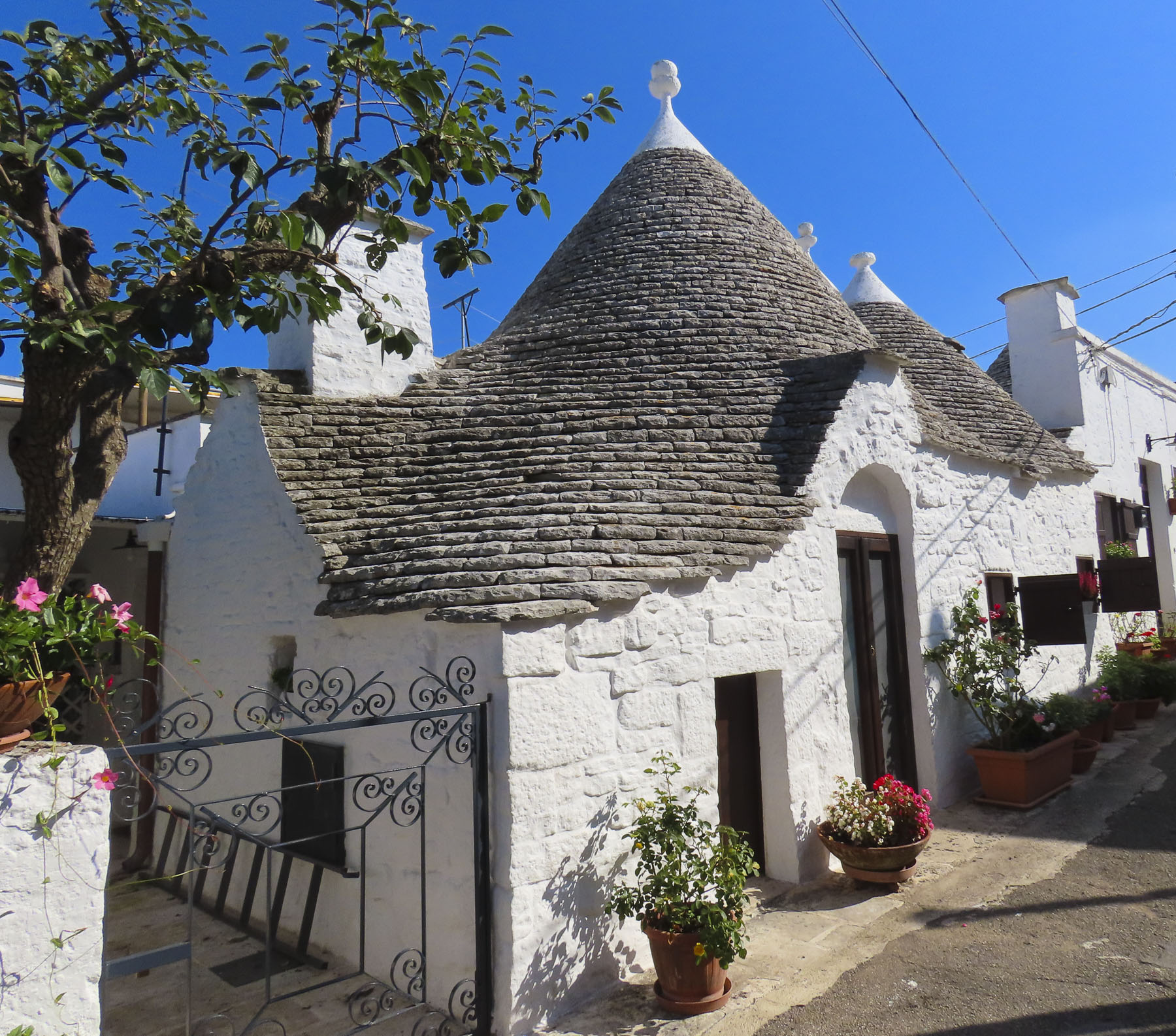
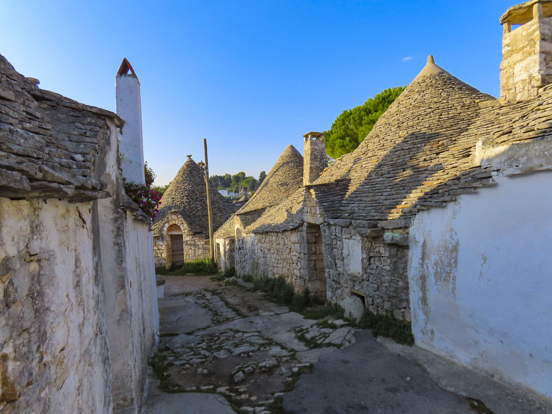
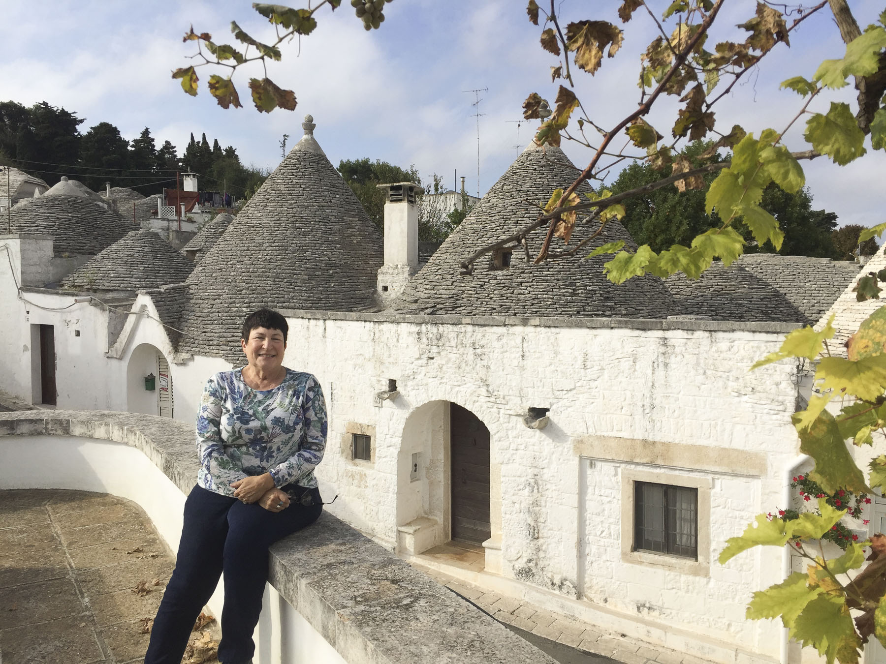
To the south, the Ionian Sea sparkled in the distance as we left Alberobello behind and headed west along the E90. Our destination in three days’ time – Naples. There was some family history to investigate before that, though, and we set the GPS course to Sassano on a journey to explore the ancestral village of Donna’s maternal grandmother. On the far side of Basilicata, the small hilltop village sits just inside the border of the Campania region. This would be the culmination of a trip planned years ago, that was originally going to be shared with her mother, before her passing. Nearer to Naples, we also planned to visit Volturara Irpina, the birthplace of her paternal grandfather.
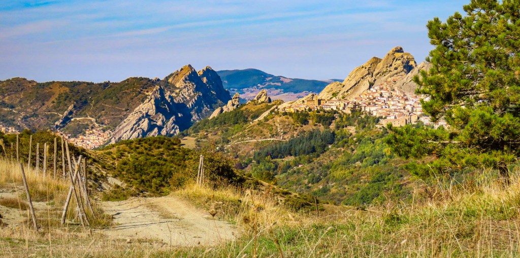
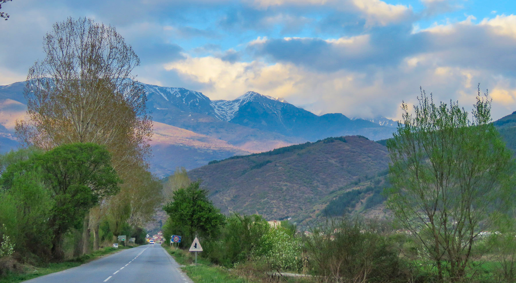
Our road trips rarely involved a direct route between destinations and this held true as we turned away from the coast and followed the E847 through the Basento River Valley into the rugged mountains of Basilicata. Ancient hilltop villages crowned the ridges on either side of the roadway, each looking worthy of future investigation. The Basilicata region has been referred to as “Italy’s best-kept secret” by the New York Times, but it was once the realm of roving bands of brigands. Highwaymen of legend made traveling in the region notoriously unsafe after the unification of Italy in the 1870s.
Under the Royal House of Bourbon, southern Italy fought against unification. After the war the residents were disenfranchised by unfulfilled promises; with support from Bourbons in exile and the church, which had much of its lands seized, many in opposition to the new government headed to the hills. These brigands were informally comprised of people with different motives. Former soldiers, some nobles, criminals, peasants, and farmers filled their ranks. The most famous one, Carmine Crocco, aka Donatello, led a band of two thousand men. Your criminal is my guerilla-fighter hero. I guess it depends on which folksongs you listen to. The region was remote, and severely poverty stricken. During the fascist era of the 1930’s and 40’s, the Basilicata region was used as an open-air prison, where political dissidents were sentenced to exile in remote villages – Italy’s Siberia.

With mountains deforested of wood for fuel, poor soil conditions for farming, an illiteracy rate of seventy percent, bleak employment opportunities in other industries and a central government dominated by northerners that ignored the region, four million Italians chose prospects for a better future and emigrated to the United States between 1880 and 1924. Others headed to Brazil, Argentina, Canada, Australia and South Africa. It wasn’t unusual for emigrants from the same village to head to the same new cities overseas where they continued the tradition of campanilismo, the spirit of “loyalty to those who live within the sound of your village’s church bells.” Chicago, Boston, Baltimore, Philadelphia and New York all drew huge concentrations of new immigrants eager to prosper, and societies like the Italian Welfare League helped folks adapt to a new home in a foreign country.
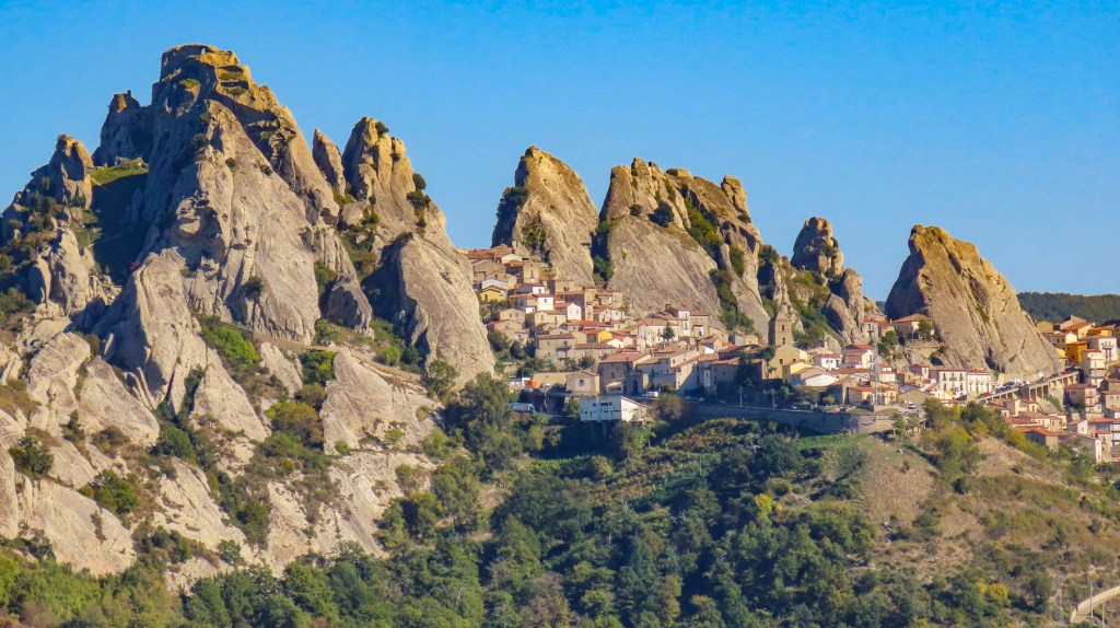
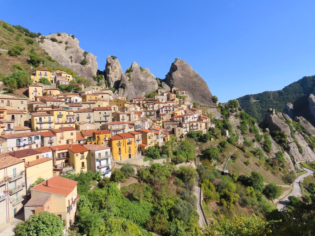
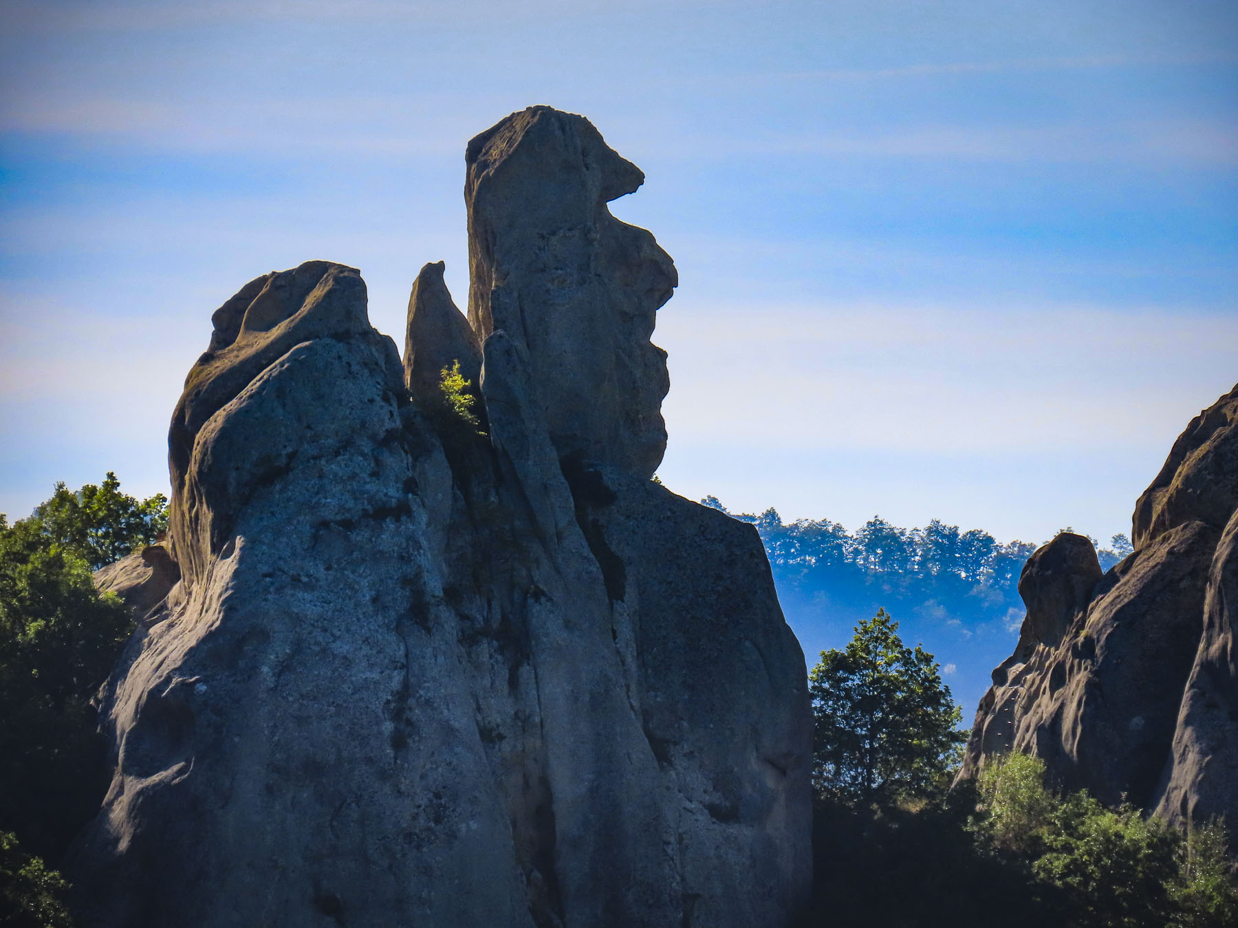
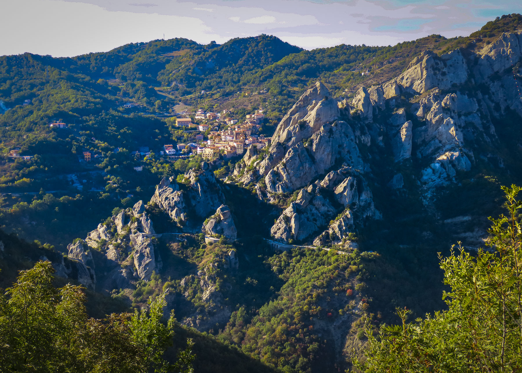
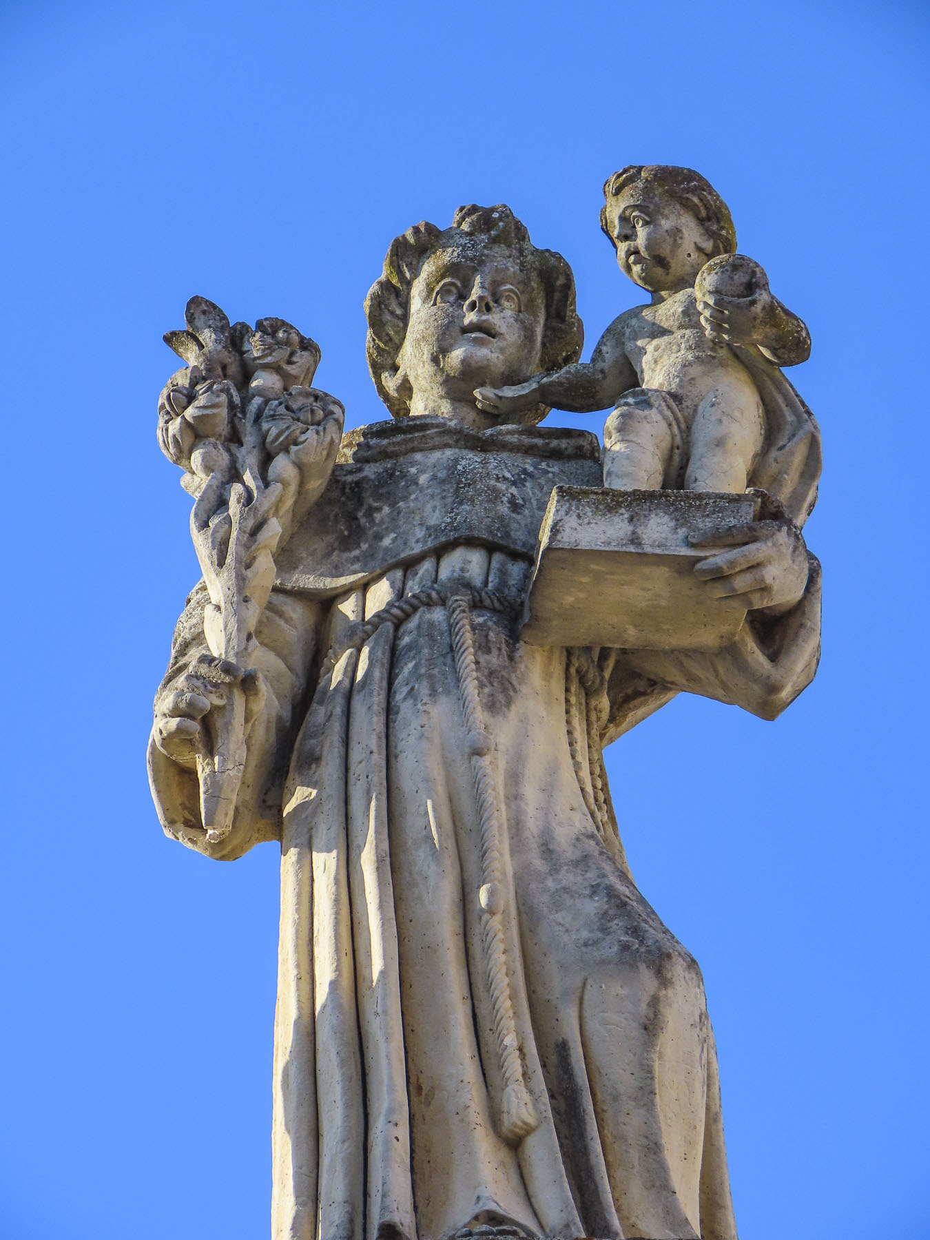
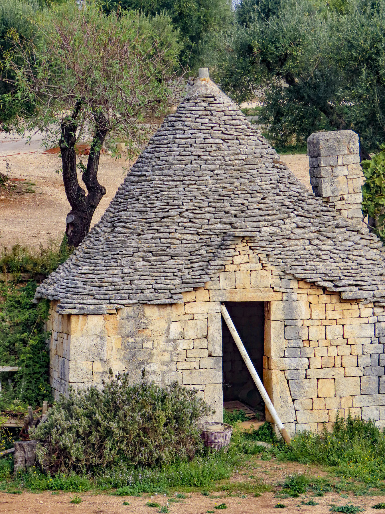
Castelmezzano, castle in the middle, between Albano di Lucania and Pietrapertosa, was our first stop. Descendants of 6th century Greek settlers in the Basento Valley fled to safety in the jaws of the Lucanian Dolomites when Saracen invaders from North Africa forced the local populace from the river valley into the mountains. The smooth sides of the tall, steep tooth-shaped outcroppings that protected the villages of Castelmezzano and Pietrapertosa were perfect for villagers to roll boulders down onto their attackers.
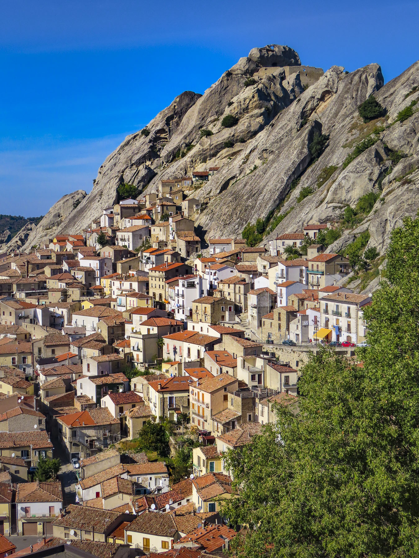
The same mountains offered safe haven to the brigands of the late 1800’s. Today the area, only two and a half hours from Naples, is part of the 67,000 acre Parco Regionale di Gallipoli Cognato, a mountainous park with wolves, foxes, porcupines, and wild boar that is a magnet for outdoor enthusiasts who enjoy camping, hiking, biking and rock climbing.

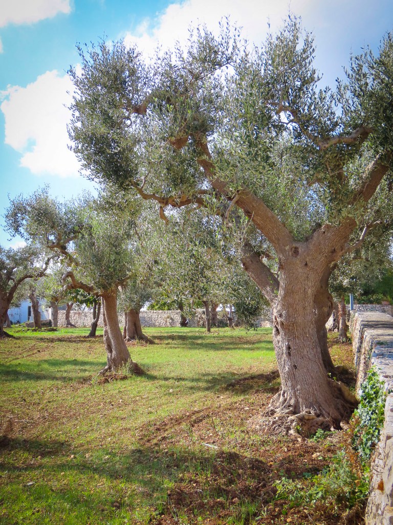
The area is stunningly beautiful with its unique rock formations, lush forests, olive groves, vineyards, and pastures. During the spring and summer, the small villages of the region host colorful Marriage of the Trees Festivals that combine ancient pagan rites with Catholicism to celebrate fertility and hope. Mid-week in the middle of November the area was nearly deserted, and unfortunately there were not any cafes open. Hopefully, it would be different on the weekends.

Back on the highway we speculated how interesting a future trip would be, zigzagging back and forth across the valley to explore every hilltop village, large and small. There were so many of them! We still regret not stopping in Brienza to walk through the historic district at the foot of its 7th century castle, after its profile suddenly burst forth and filled the windscreen as we rounded a curve.

The sun was just setting as we pushed the button on the driveway gate to Affittacamere – Nonno Domenico, located in the valley below Sassano. Check-in was smooth, but establishing our internet connection required first the involvement of the innkeeper’s teenage son and then his older sister. In the off-season, prospects for dinner were extremely limited. Though Google Maps showed many restaurants in the area, they were closed for the season. After driving around searching, we ended up having a delicious, no-frills dinner at the local pizza parlor.

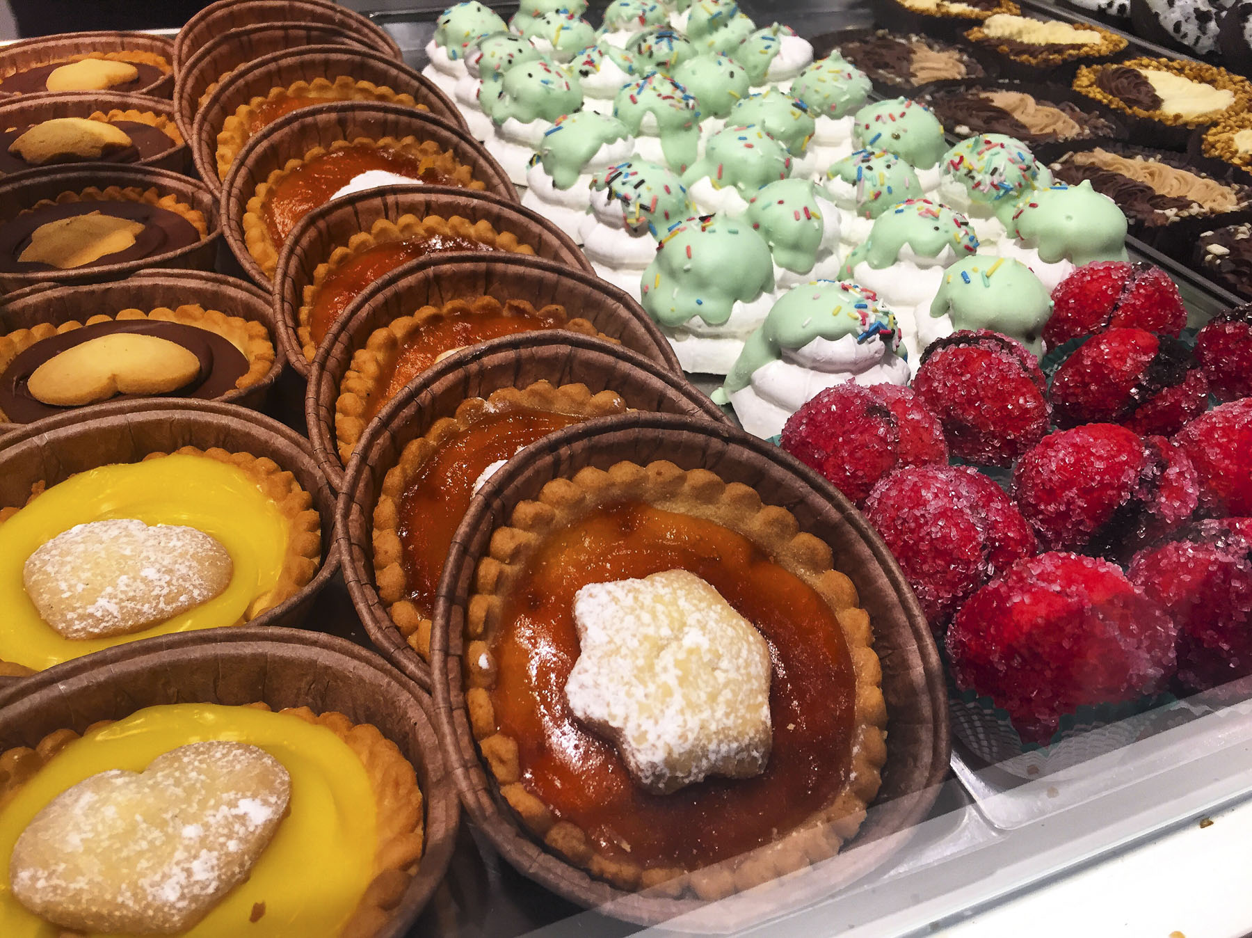
We scored big time the next morning for breakfast with our discovery of Pasticceria Tropiano Peccati di Gola & Dintorni. This bakery and café is run by two brothers, Cono and Franco, who are devoted to guiding their customers through the “consumption of sinful delicacies and coffees.” They offer baked goods of a quality you would expect to find in Naples or Florence, not in the remote area surrounding Sassano.
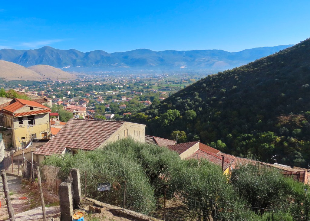
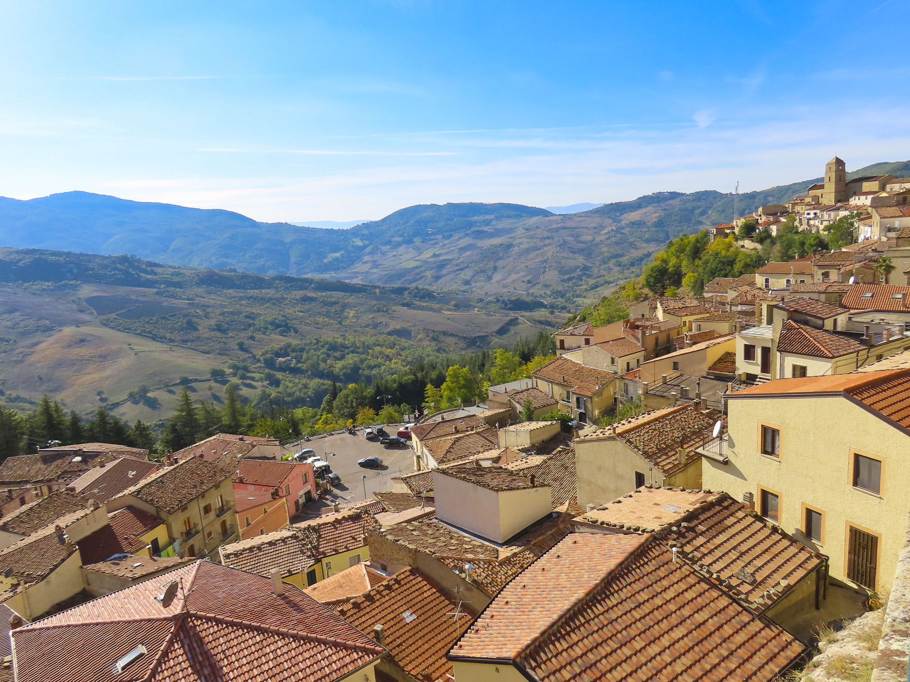
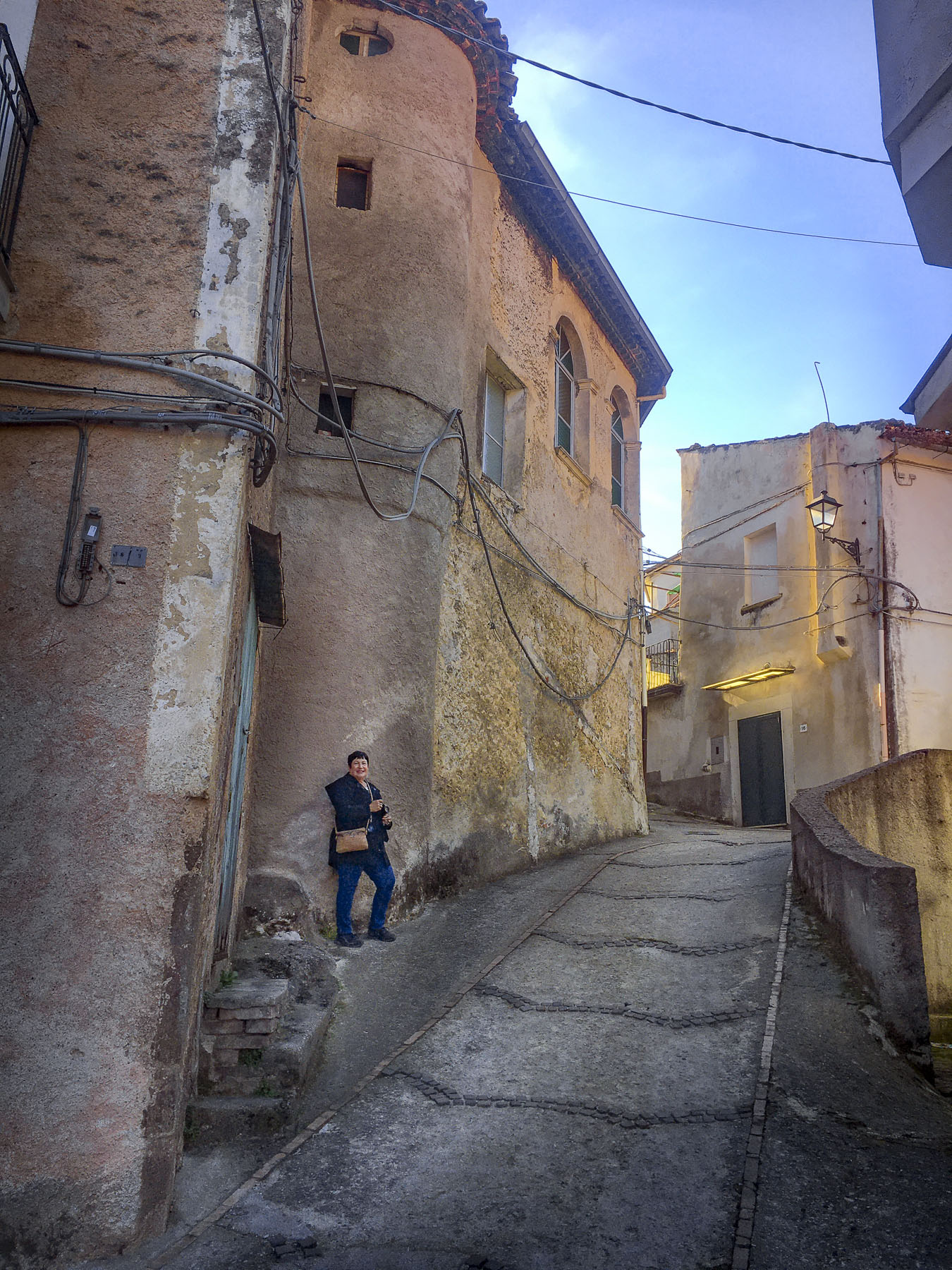
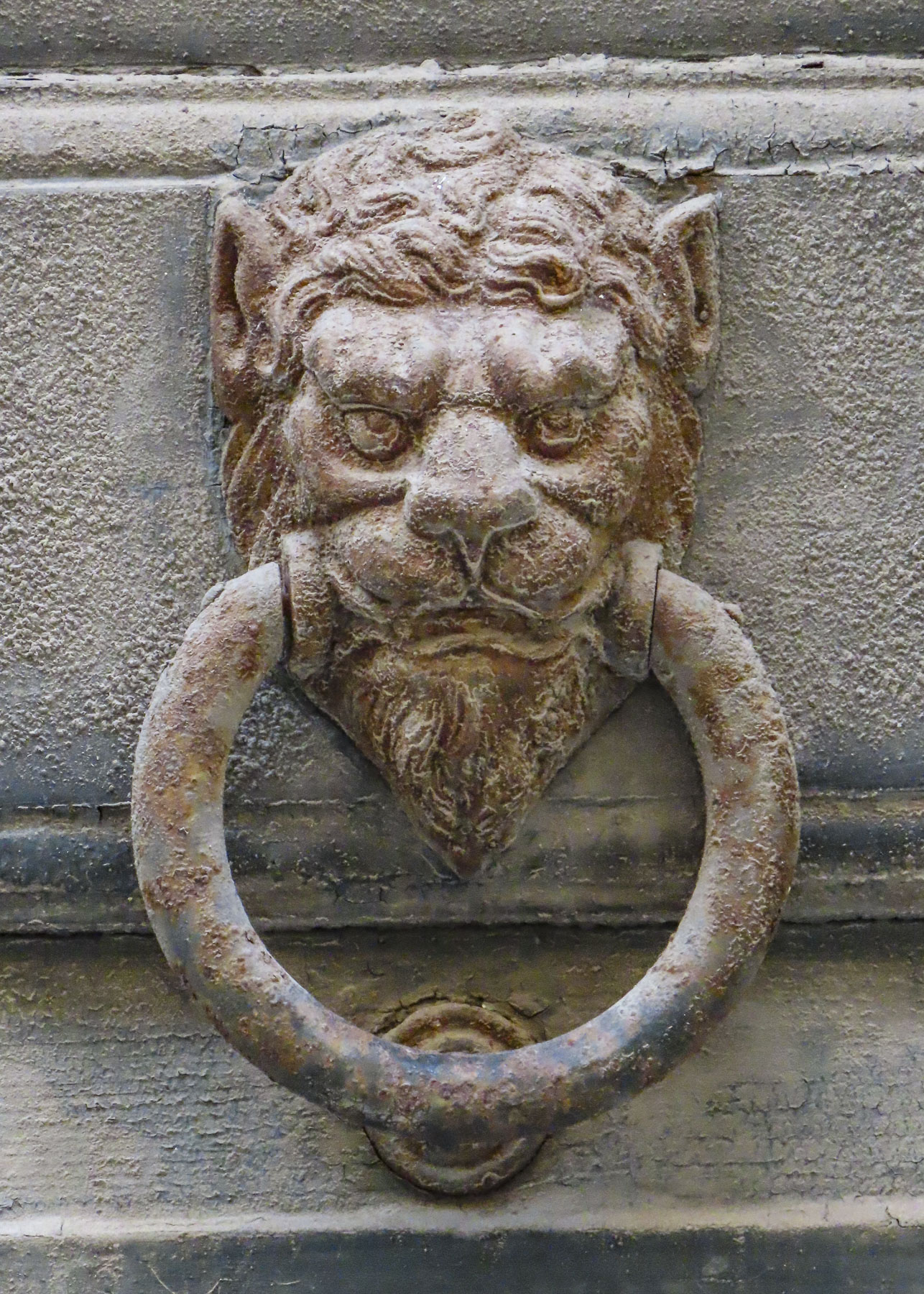
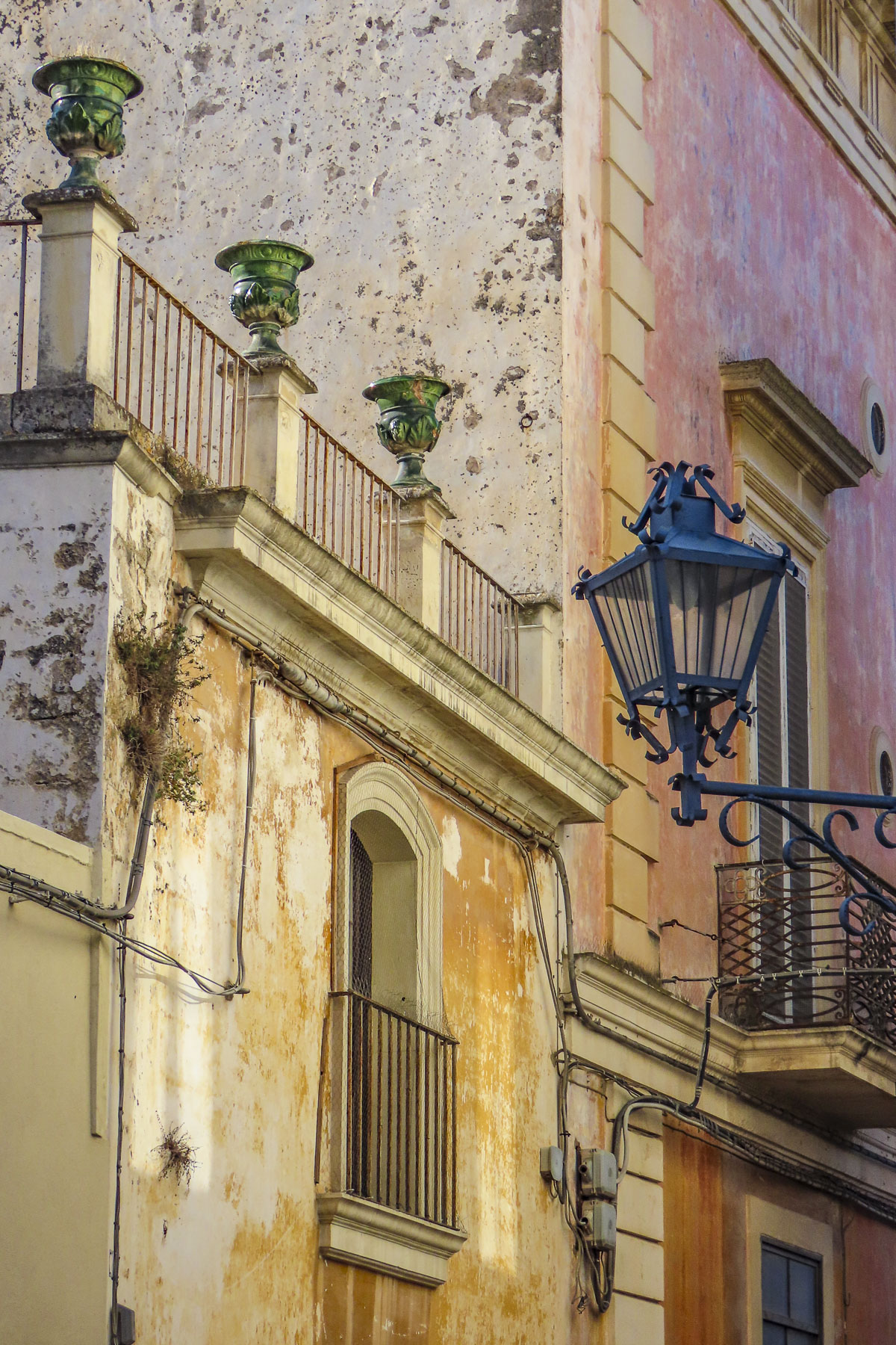
The village of Sassano rose sharply from the flat, flood plain of the Tanagro River in the Vallo di Diano, the lower slope of Monte Cervati checkered with the stacked profiles of dwellings built of stone and capped with red tile roofs.

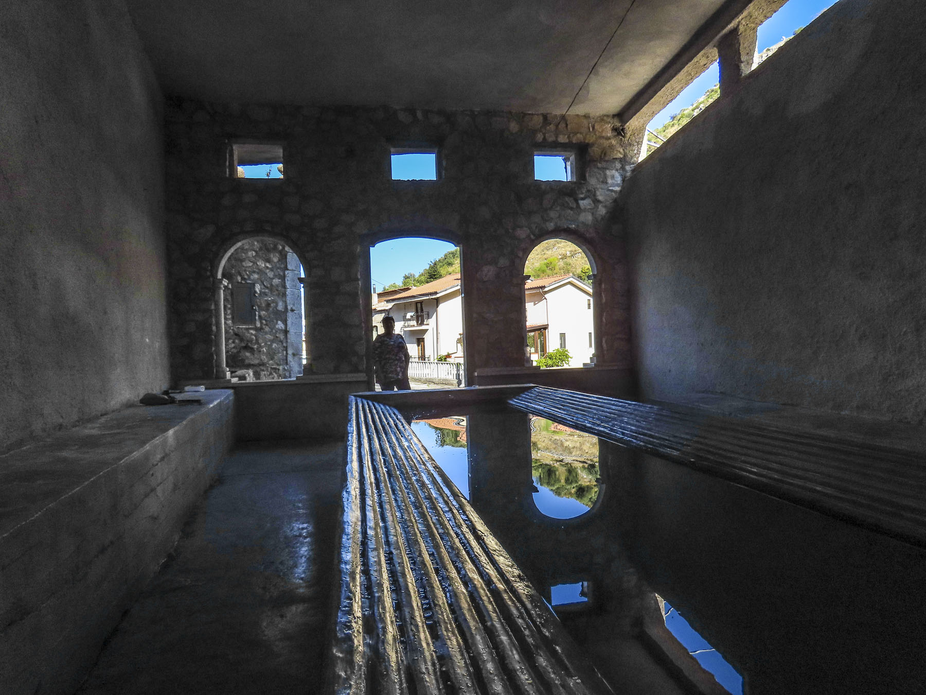
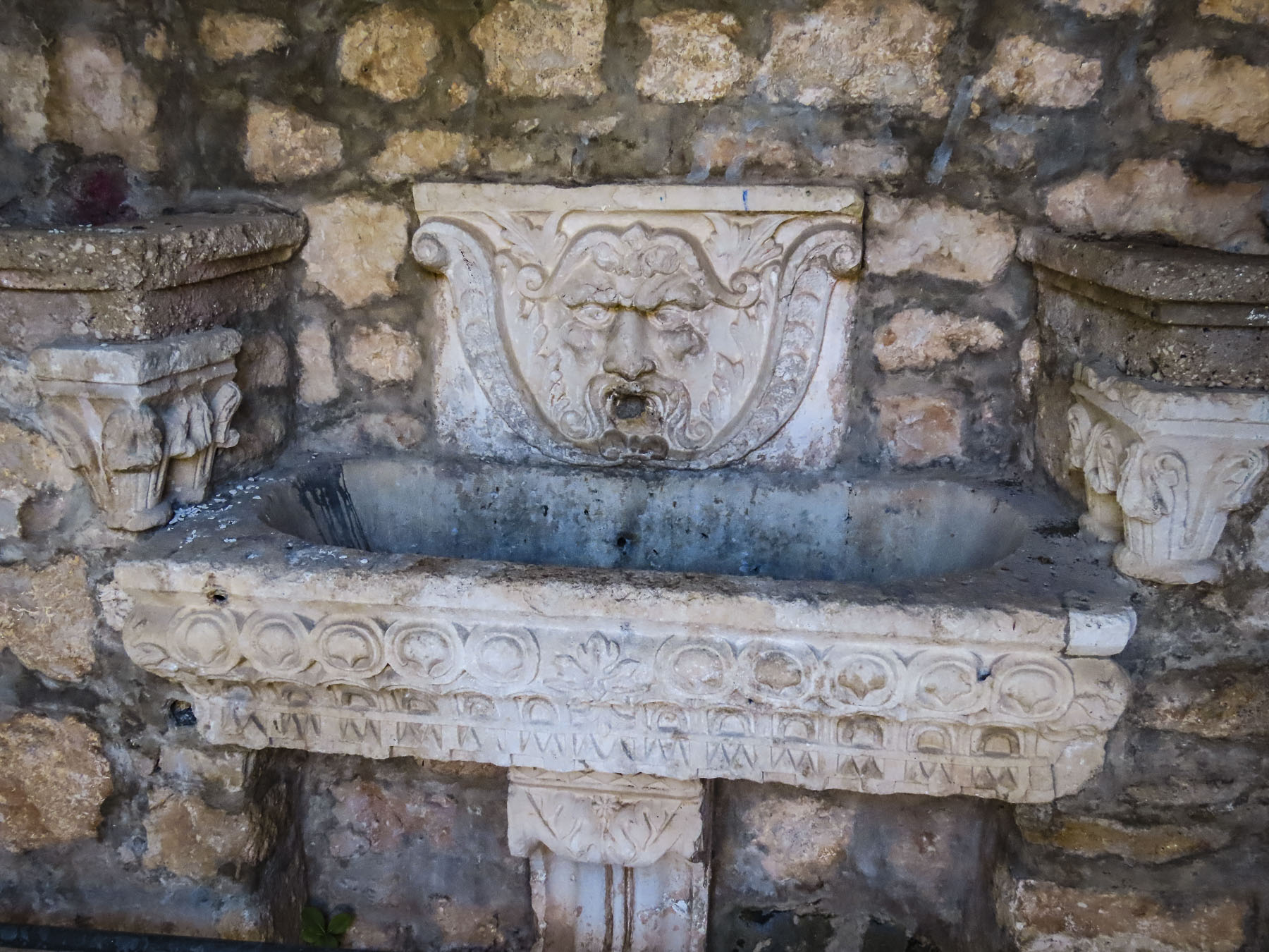
At the foot of the hill, the spring-fed communal laundry looked newly renovated, with updated washbasins and scrub racks. Empty laundry detergent bottles indicated recent use. Outside we refilled our water bottles from an ever-flowing fountain built into the terraced wall. Basilian monks have been credited with the first construction of a fountain on this site in the 10th century when the village was founded. It’s difficult to believe in this day and age that such facilities are needed and still used. But it reflects the past poverty of the region and the plight of the elderly who still use it. Just imagine the task of carrying a basket of wet laundry uphill, back to your home to dry.

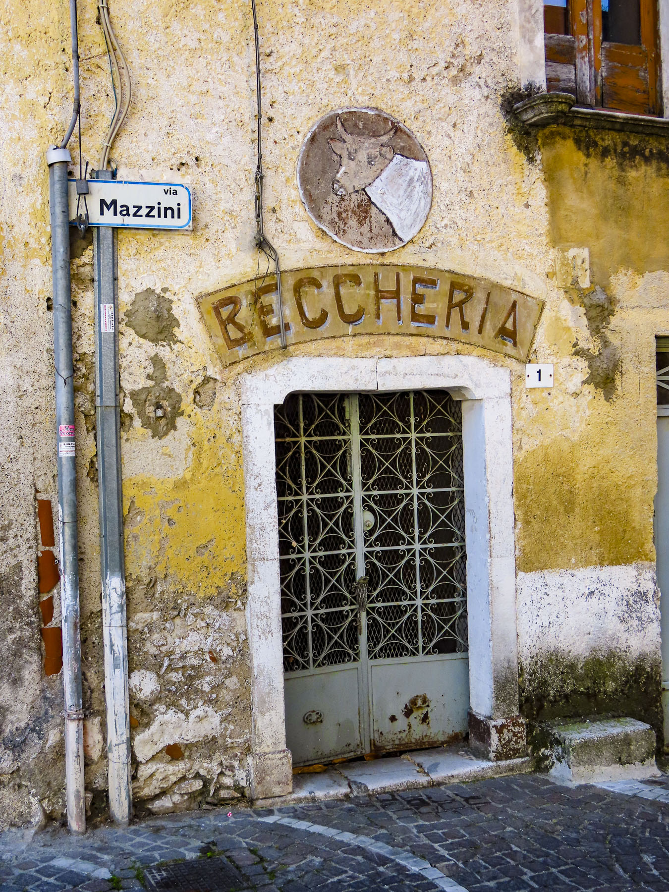
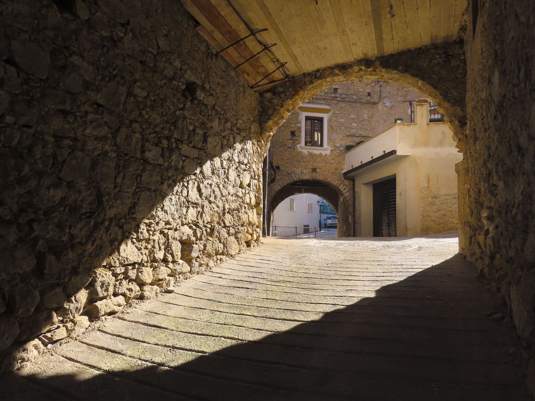
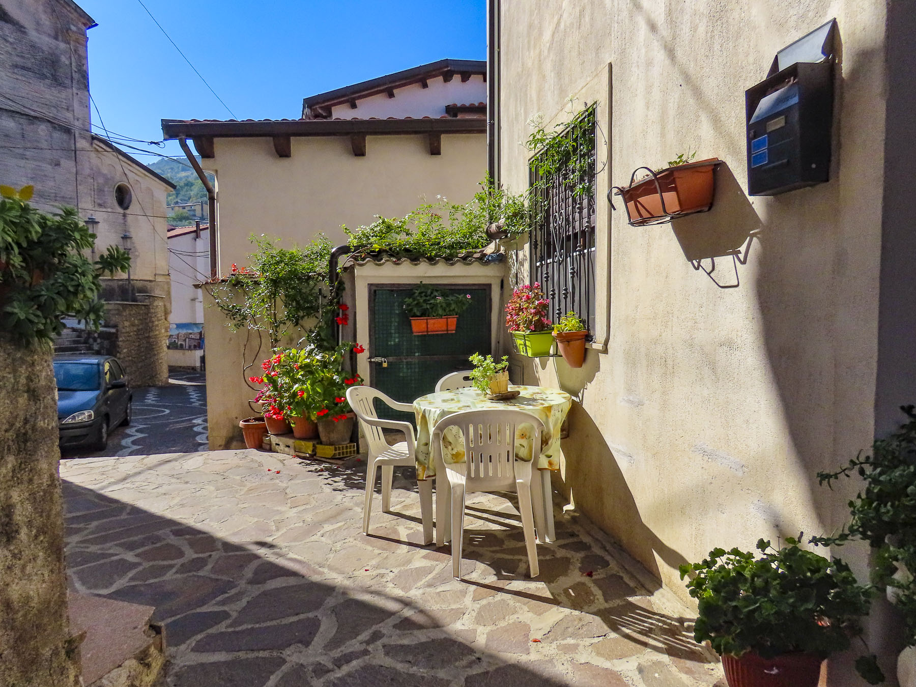
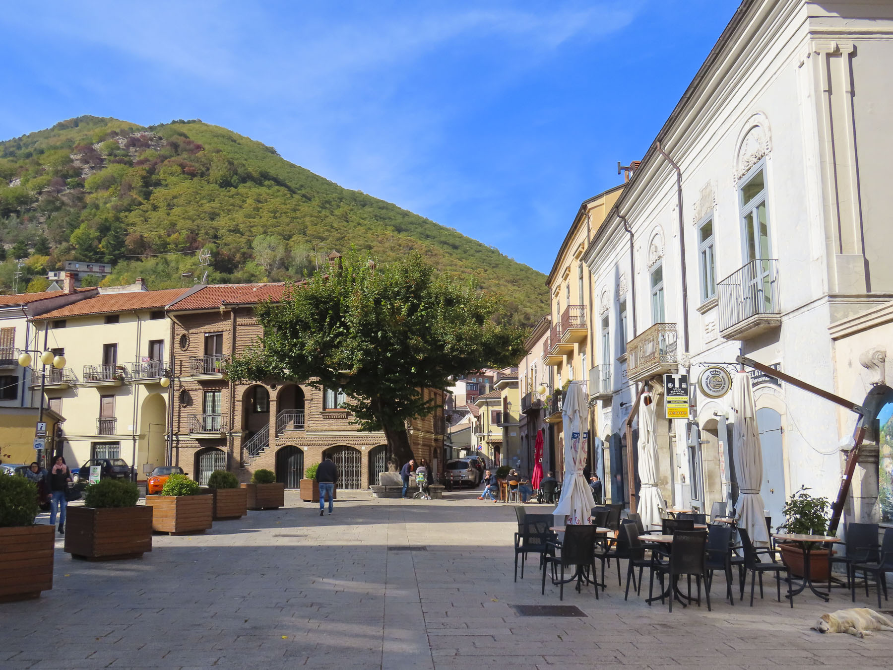
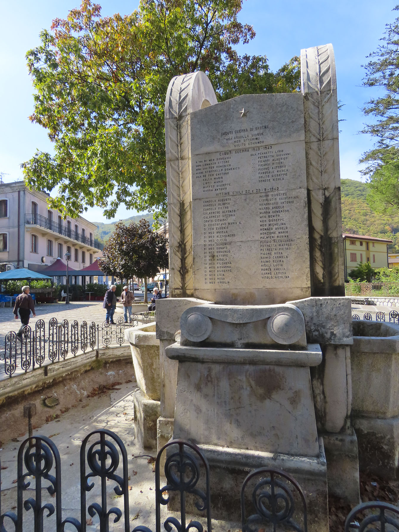
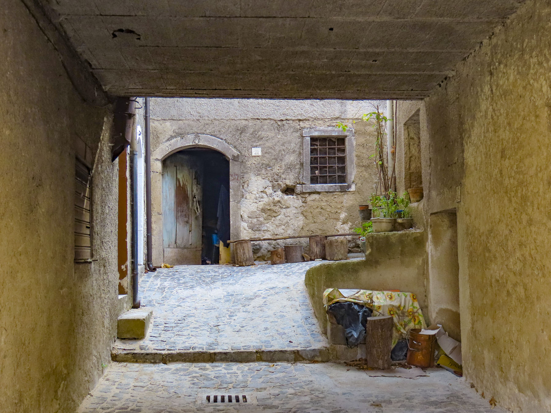
The lane into the village rose slowly to the small central plaza, Piazza Giuseppe Mazzini, where most of the buildings looked permanently shuttered. We parked in front of a long-closed butcher’s shop which stood yards from a war memorial that listed the village’s men that did not return from two world wars. The only sign of life emanated from a tiny bar across the cobbled square, where the barista made small talk with an elderly pensioner sipping prosecco, while warming himself at a sunny table. We ordered café and planned our morning. Could we find Donna’s grandmother’s home here?

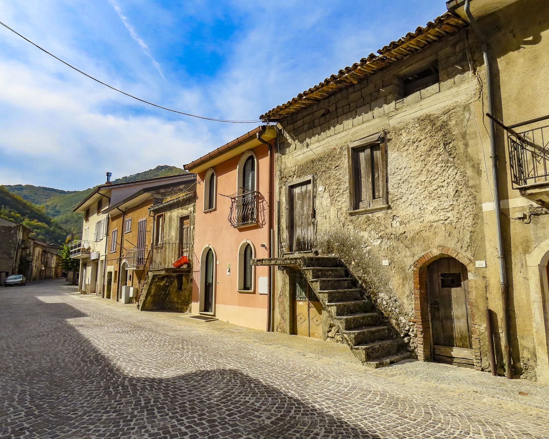
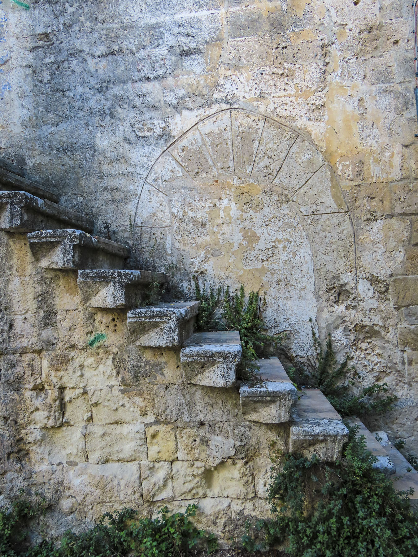
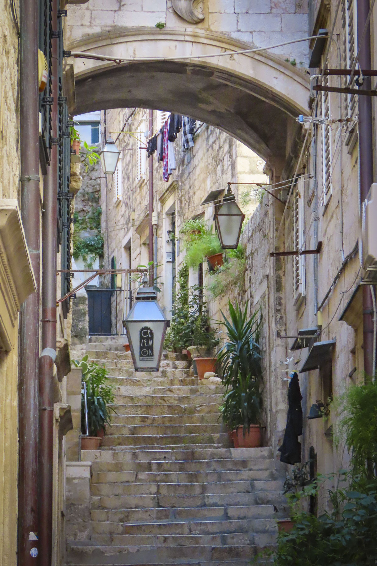
There are only steep, narrow streets called “carrare,” meaning only as wide as a cart, here. In the early 1900s they would have been filled with farm carts, donkeys, chickens, and a milk cow if you were well off. Somewhere in the family archive, a photo exists of a young woman returning from the forest with a huge bundle of foraged wood tied to her back. Water was gathered from the village well and carried home. Extremely hard work and no way to avoid it.
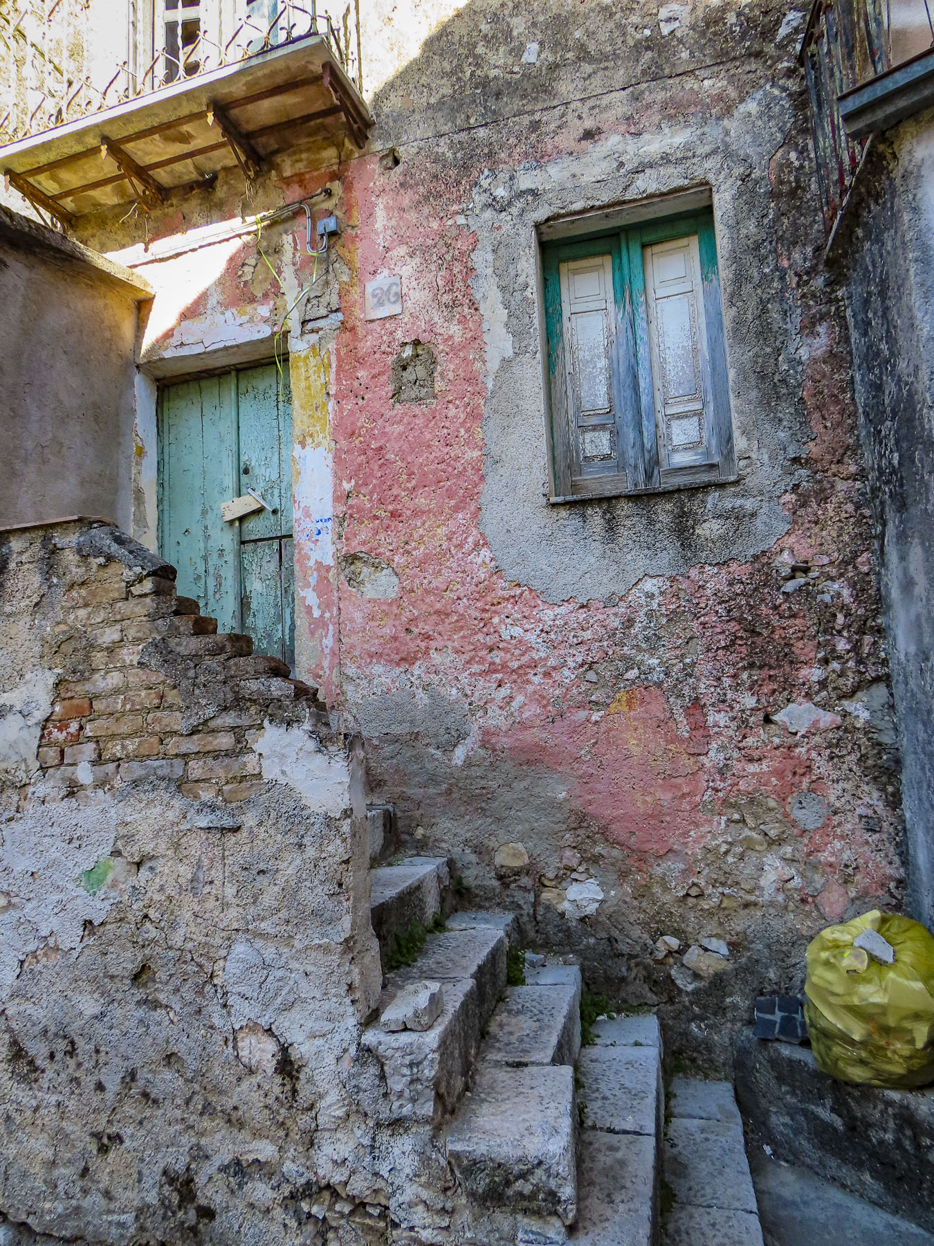
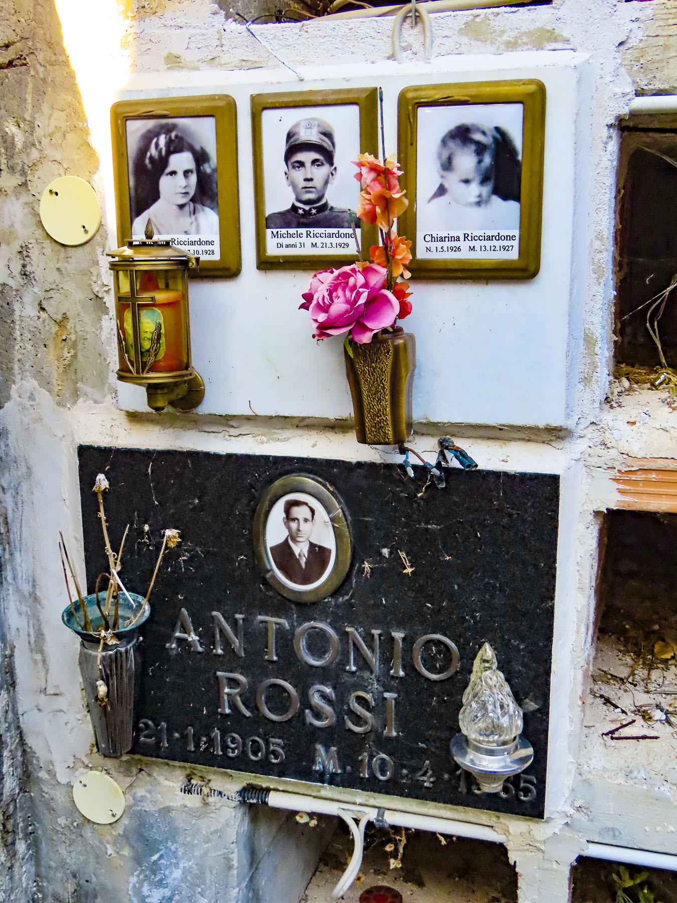
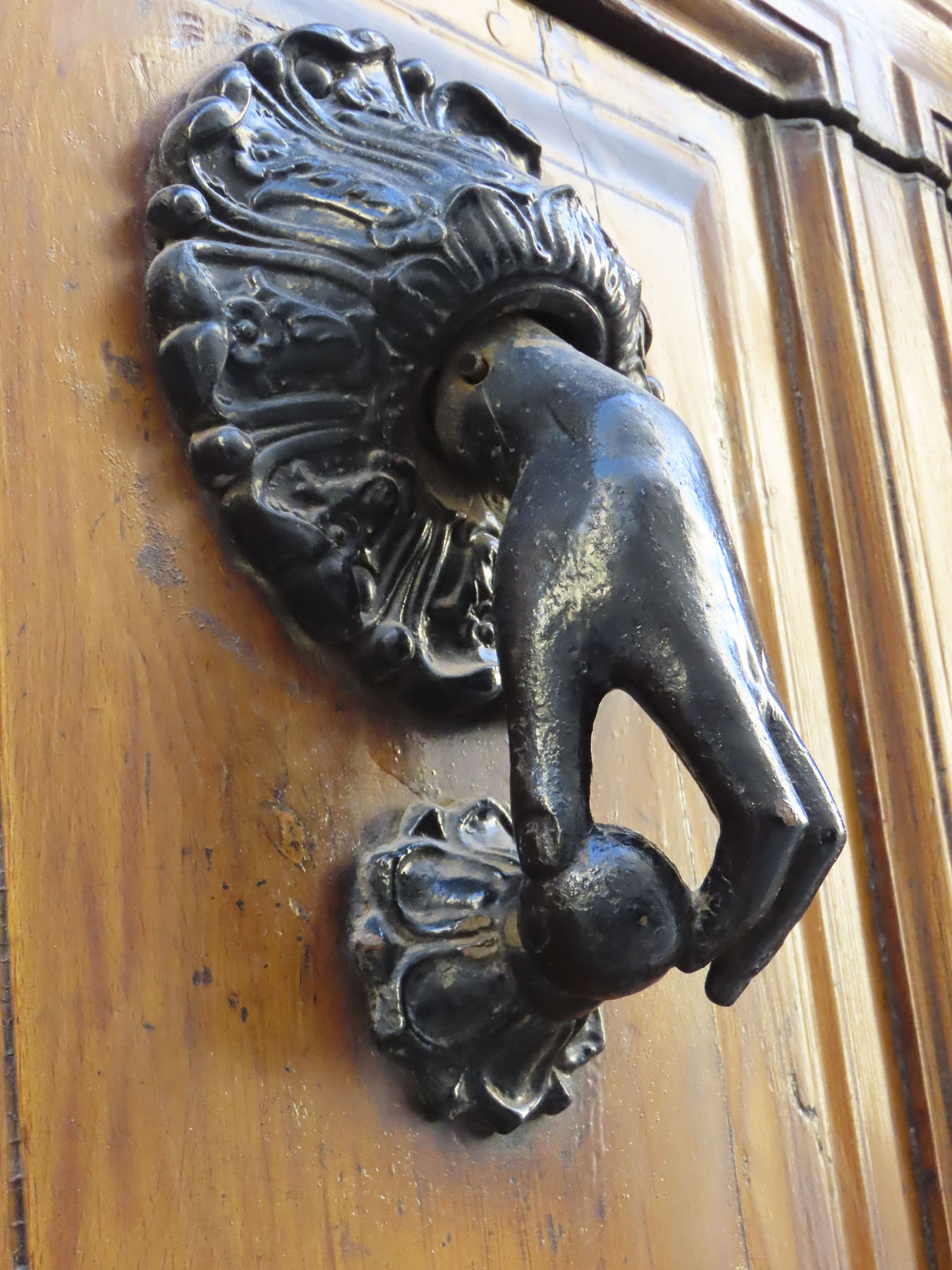
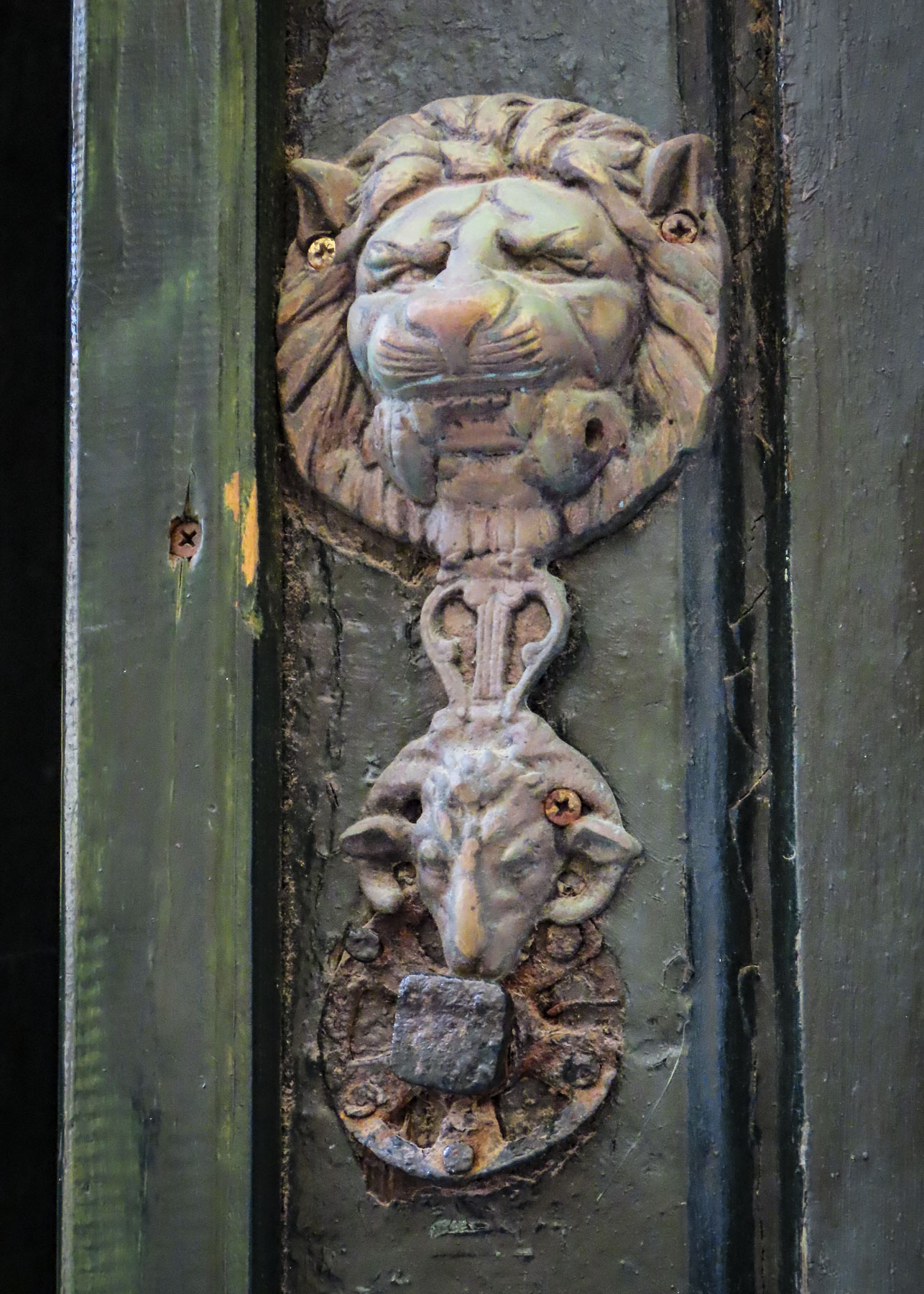
Via San Biagio was a short distance away from the plaza and as steep as expected; it curved its way uphill to a small neighborhood church bearing the same name. Time has not been kind to the homes on the street. Many showed sign of neglect, with broken stairs and windows along with cobwebbed locks on doors that that looked like they had not been opened in decades. Donna had notes written by her mother, who had passed away only the year before our trip. The familiar clear handwriting stated that Christina D’Alessio DeGondea had lived at Number 10 San Biagio. But Number 10 didn’t exist, only Numbers 9 and 11. A mystery. Perhaps Grandma’s birthplace had been destroyed.

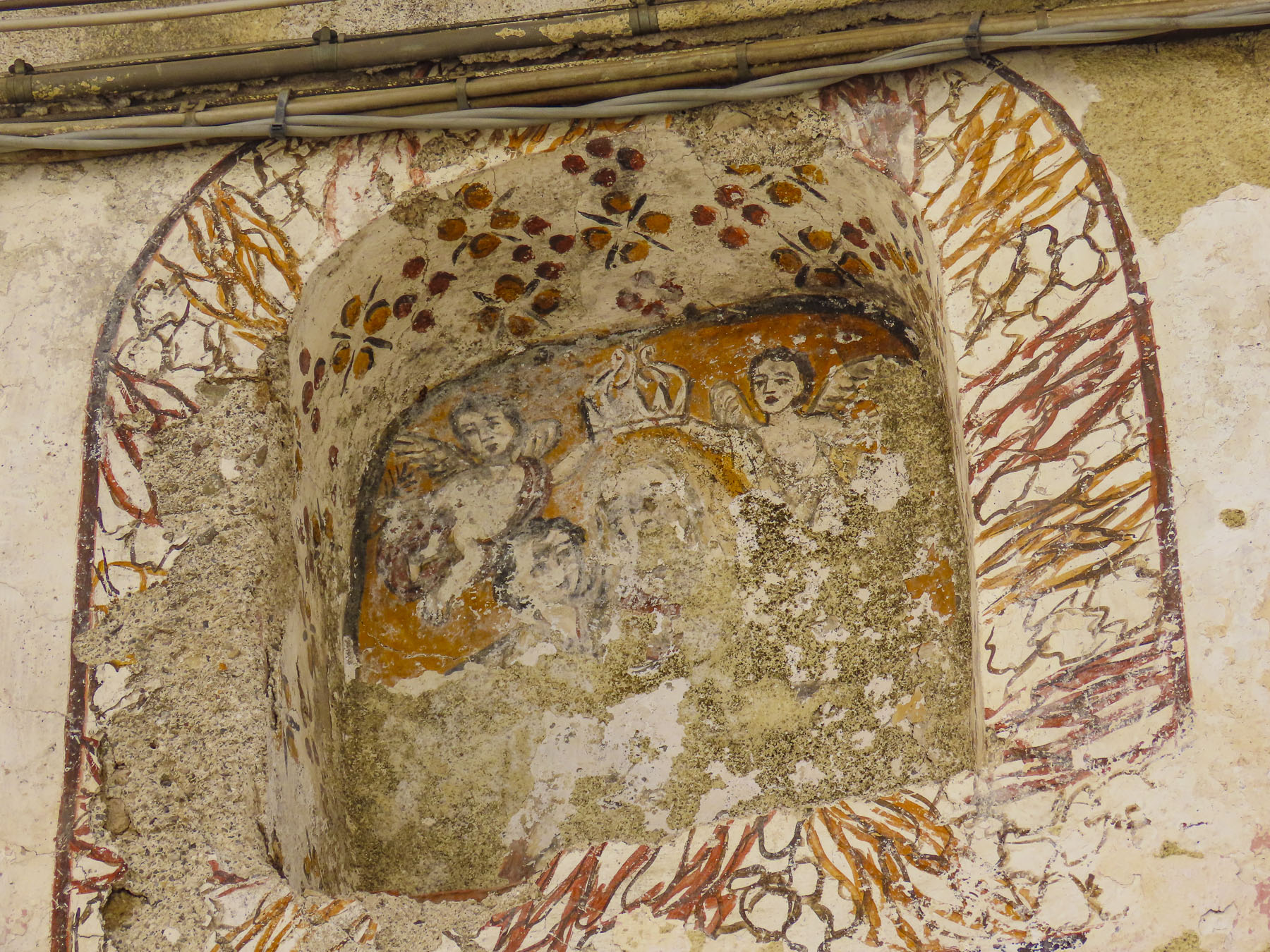
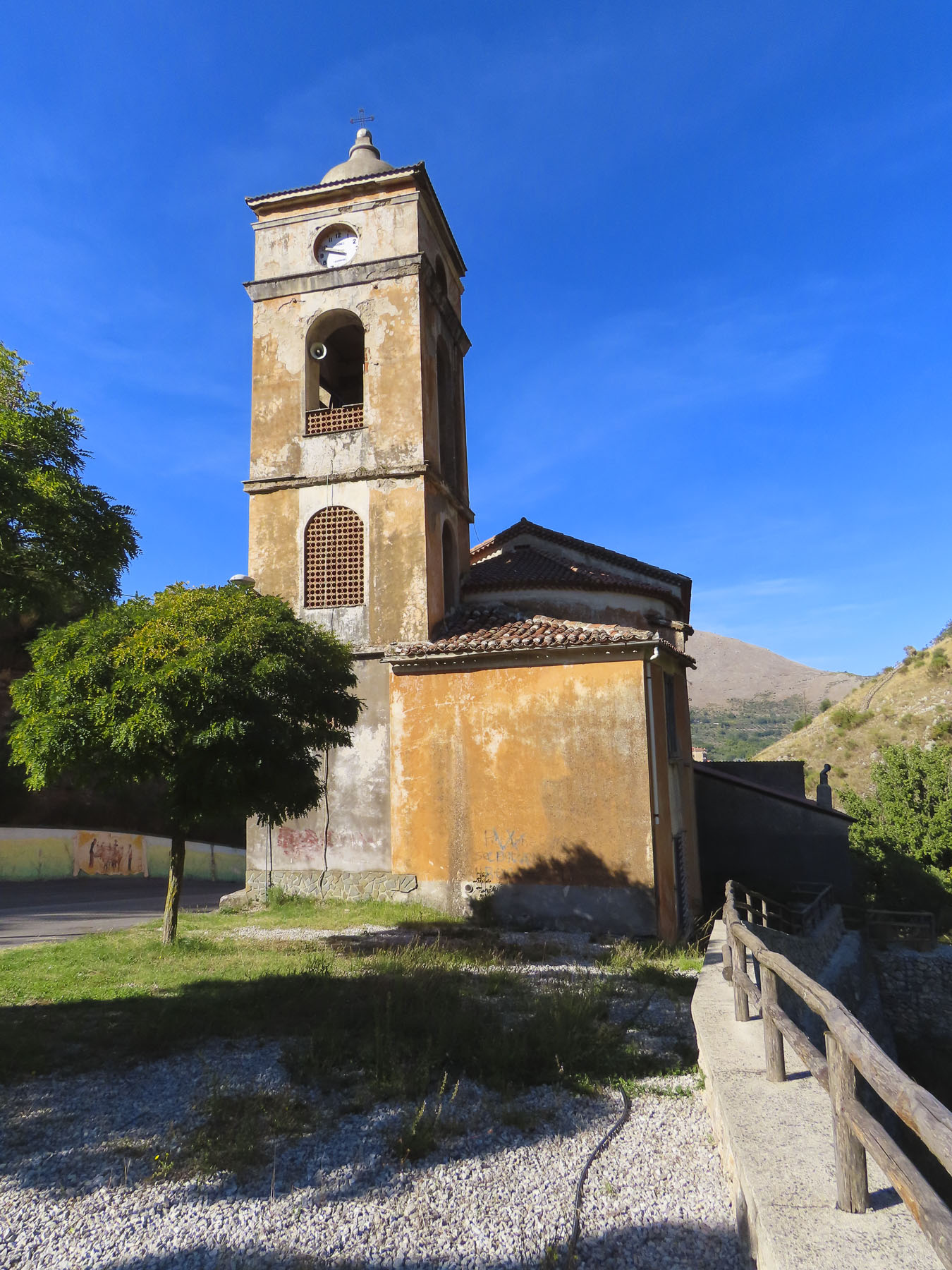
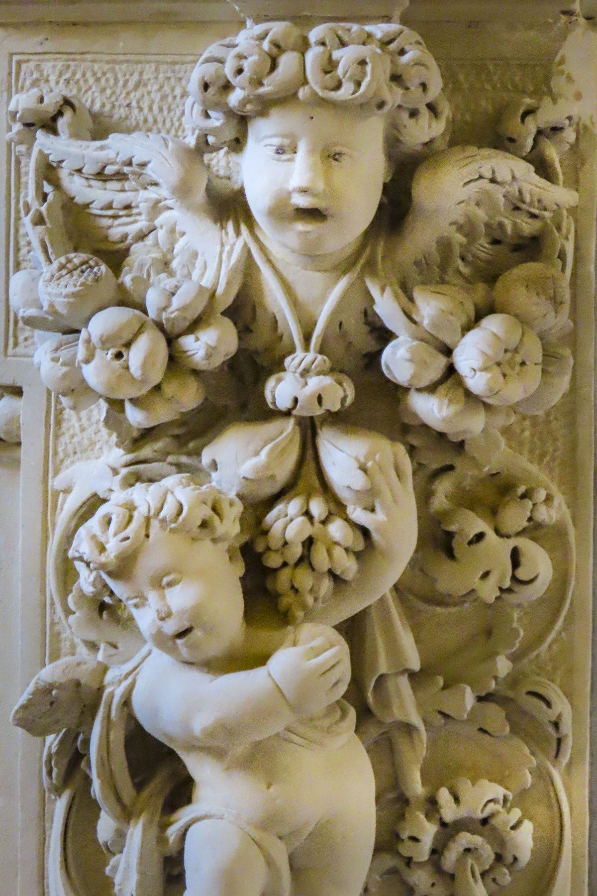
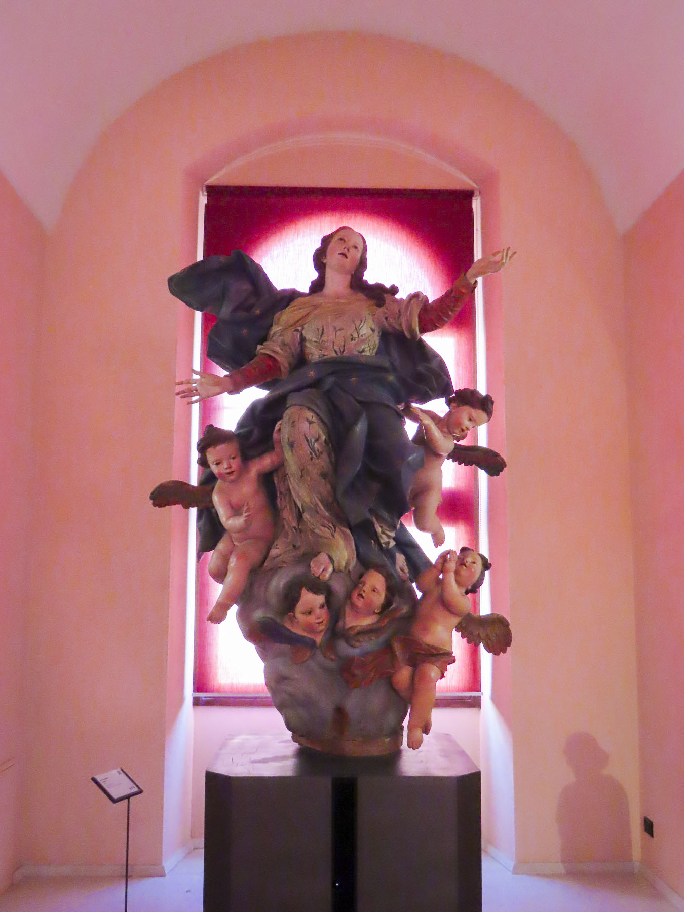
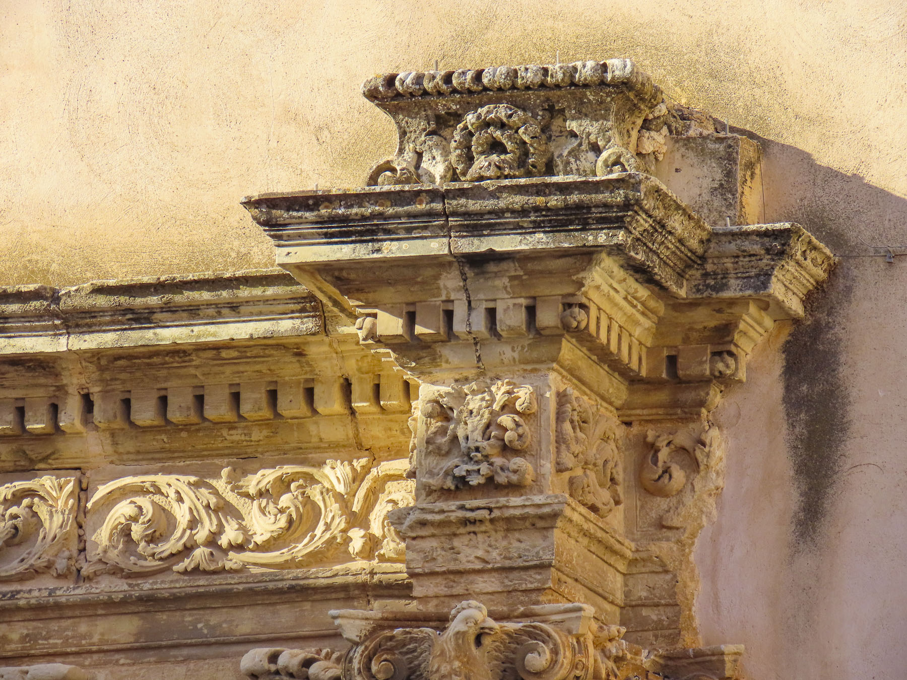
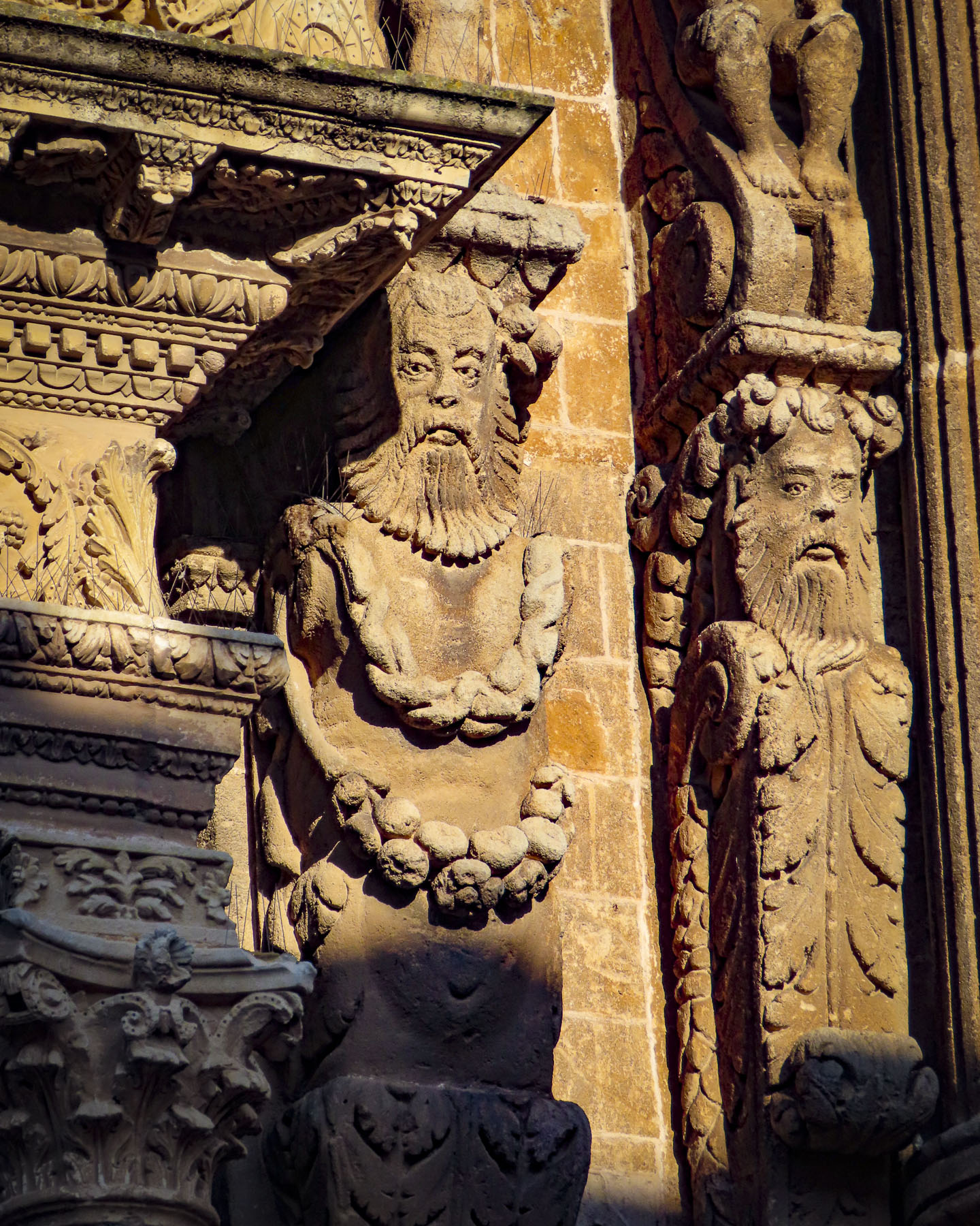
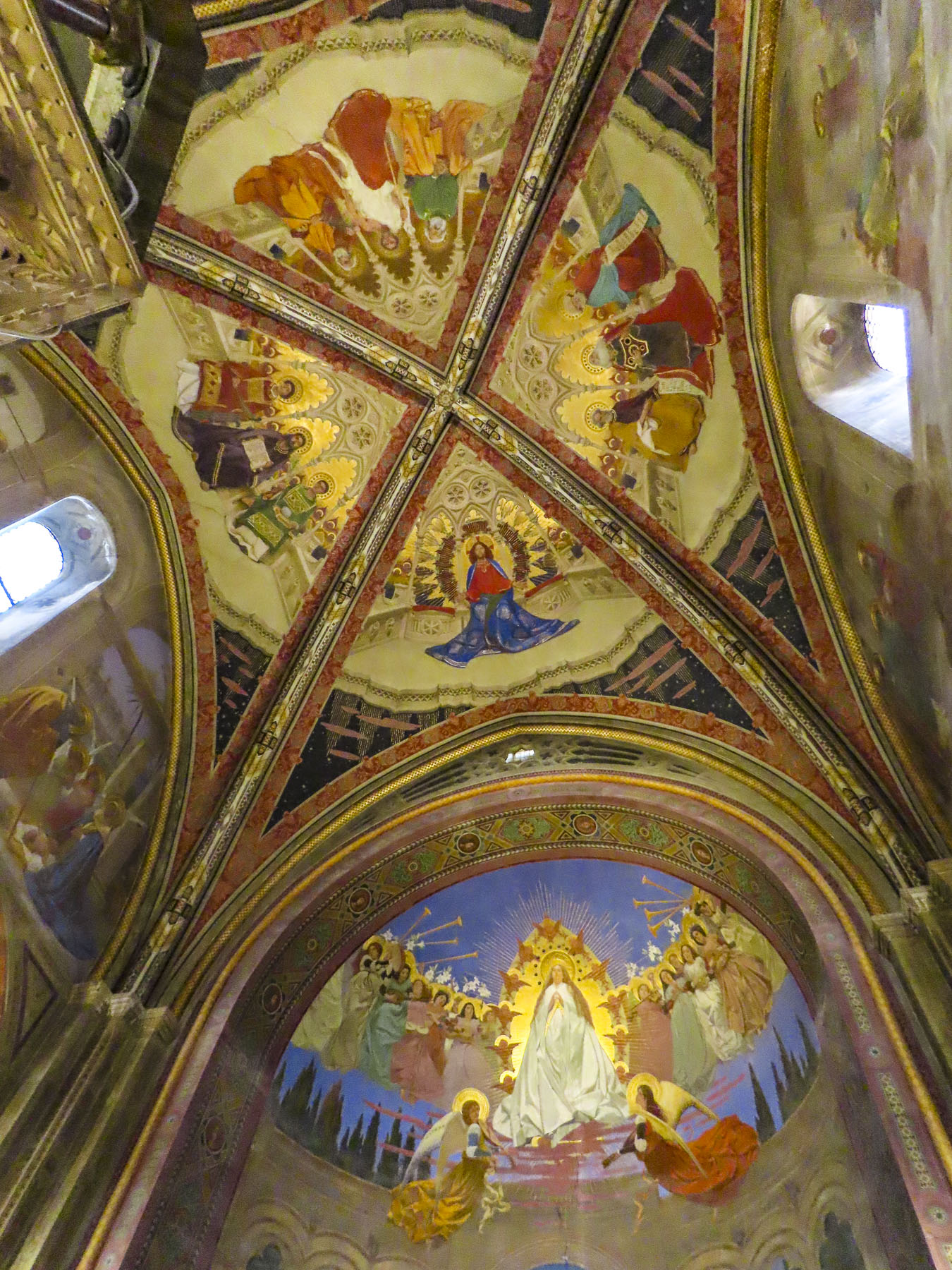
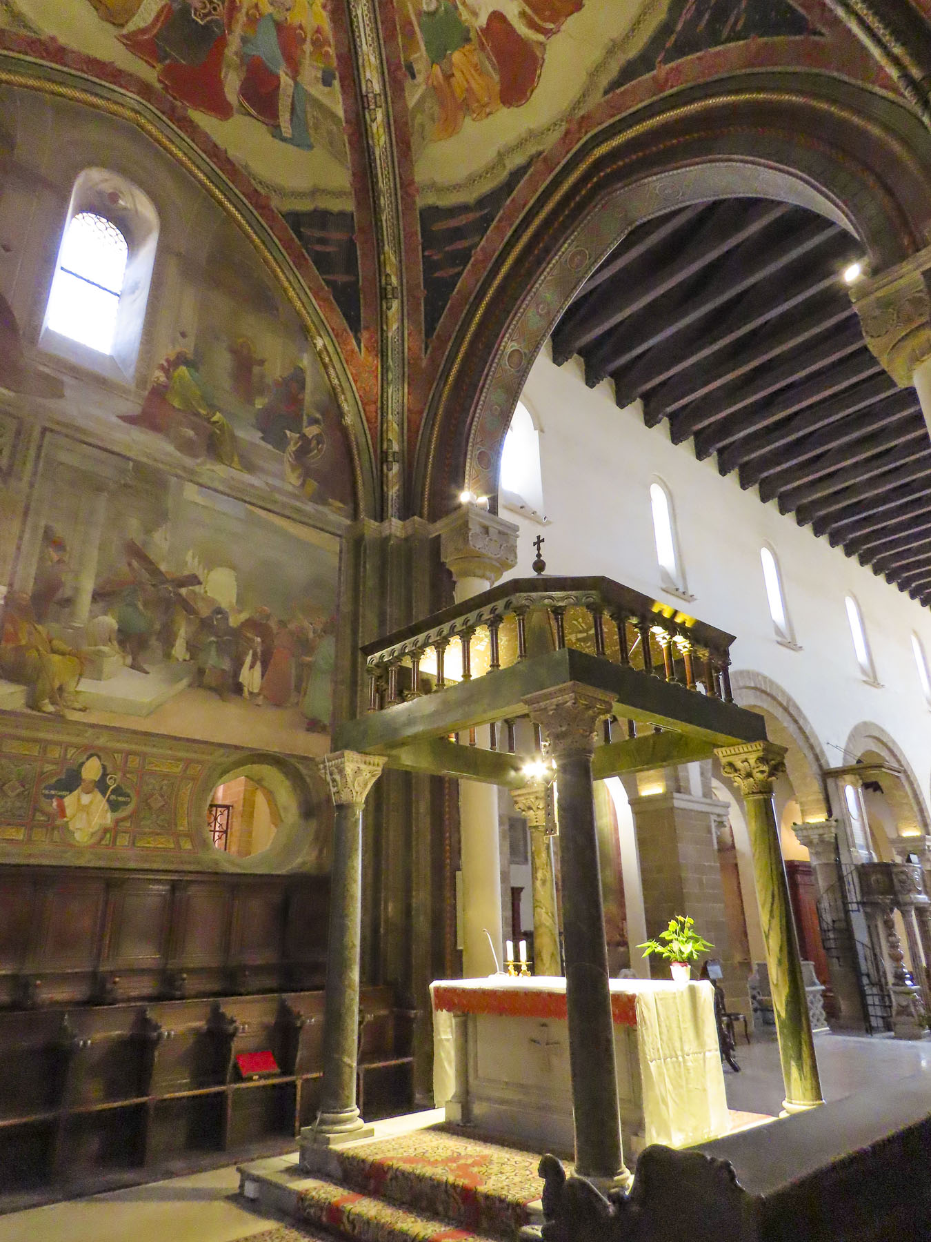
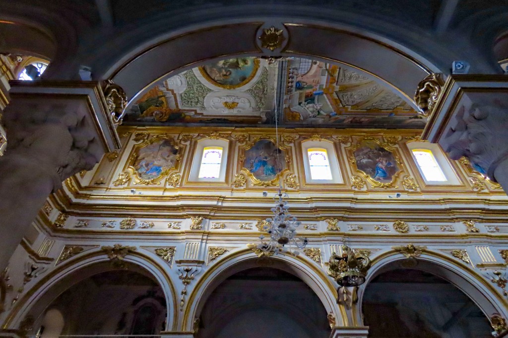
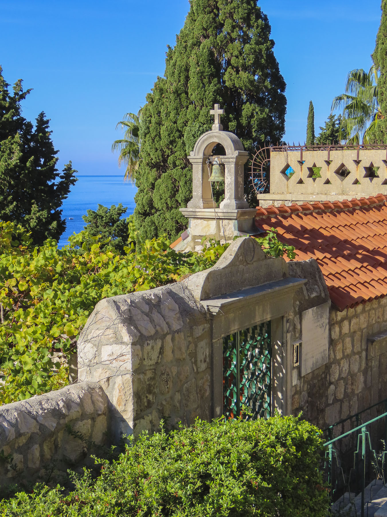
With a copy of her grandmother’s baptismal certificate in hand, we backtracked past the café to the Church of San Giovanni Evangelista. The 16th century church that stands today was built atop the ruins of an earlier 11th century church destroyed by fire. Unfortunately, the church and its office were closed during the midweek, the population of the village today only supporting Sunday services, and we missed the opportunity to view its preserved baroque frescoes. We did catch a glimpse of its notable wooden crucifix by peering through the church’s keyhole.

Only two hours from Naples and just one hour from the Mediterranean, parts of Sassano are showing signs of renewal with gentrification of some of the architecturally unique homes and those with views of the valley.

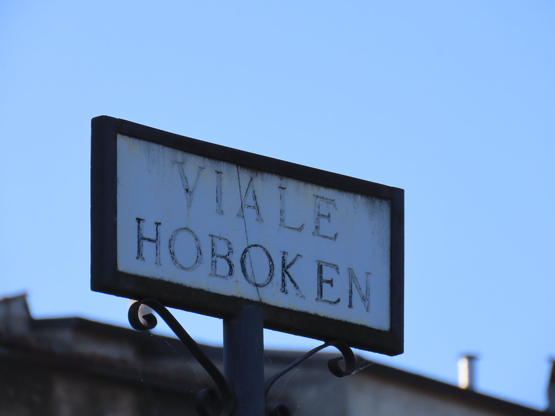
Walking along we came to a street named Hoboken, a city in the shadow of the Statue of Liberty only a short ferry ride away from Ellis Island and the promise of new life in America. At a small square we found a mural dedicated to those that emigrated from the village; we sat for a while and wondered about life here in the past.

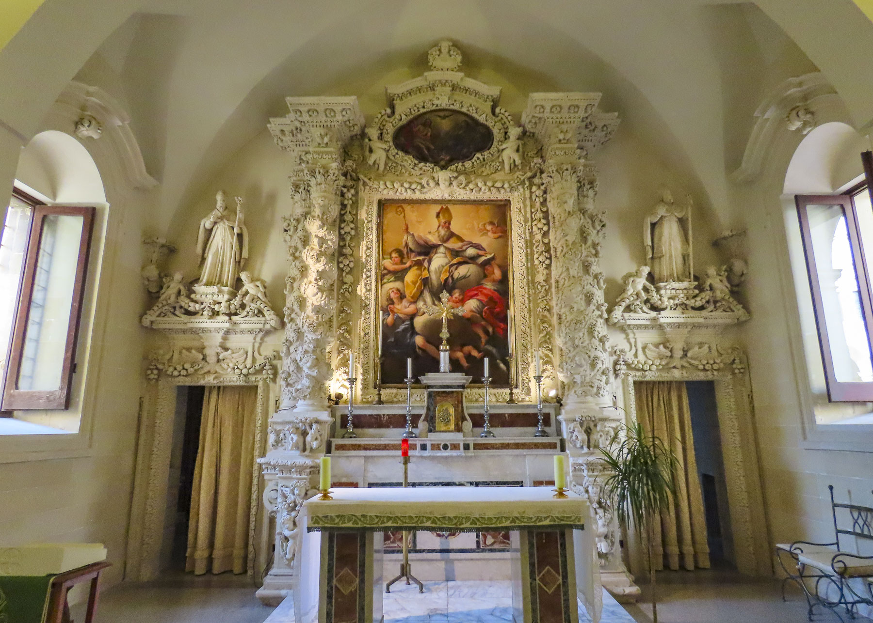
For a small village there was an amazing number of churches, but that is true of most towns in Italy. One of our favorites was the Chiesa San Michele. Located on a ridge across from the village, it had a panoramic view of Sassano and was a perfect spot for our picnic lunch.


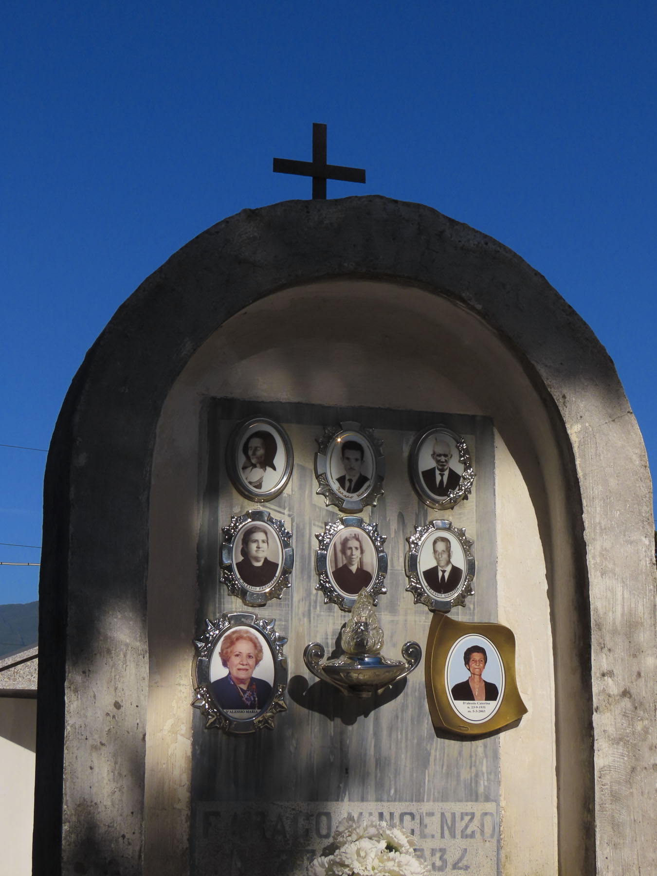
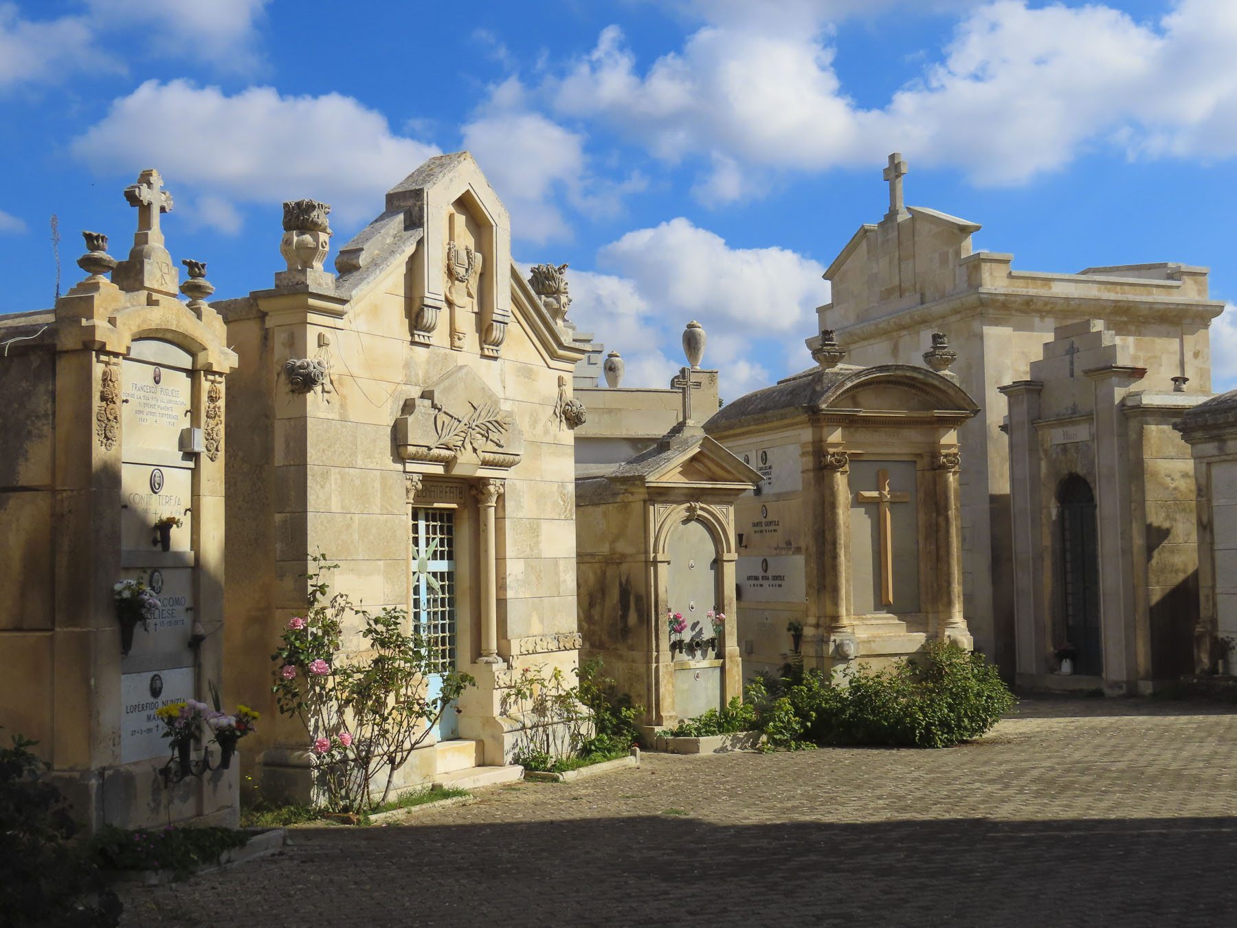
Cilento and Vallo di Diano National Park, the mountainous area around Sassano, is also known for its variety of wild orchids, containing 54 of the 120 varieties found in Italy. Earning the village’s second name “paese delle orchidee” – village of the orchids. It sounds so pretty, and it’s the perfect excuse to return when they are in bloom. Afterwards a caretaker at the town’s cemetery helped us search for family headstones.


The next day we drove to the neighboring town of Monte San Giacomo to explore the village of Donna’s maternal grandfather, Nunzio DeGondea. Larger, the village looked significantly more prosperous, with several small cafés and an open restaurant, Dei Tigli Di Totaro Domenico.
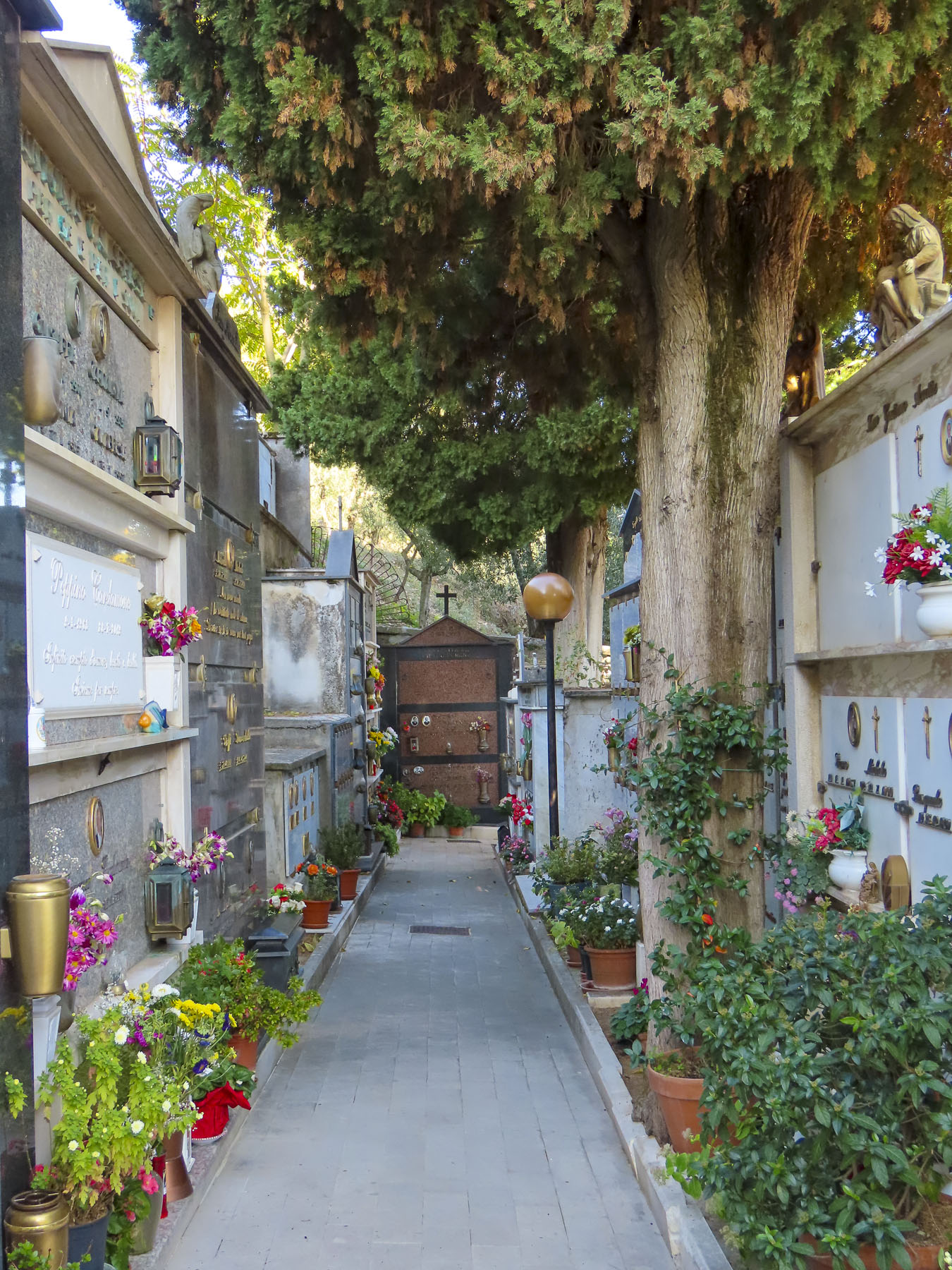

Without much to go on we worked our way to the town cemetery near the Santuario Di Sant’Anna on the outskirt of town to search for his family name. As cemeteries go it was gracefully beautiful and very tranquil, though family history eluded us. At the Sant’Anna, Donna held me by the belt as I leaned as far as I could over a low wall to pick plump ripe figs from a wild tree.
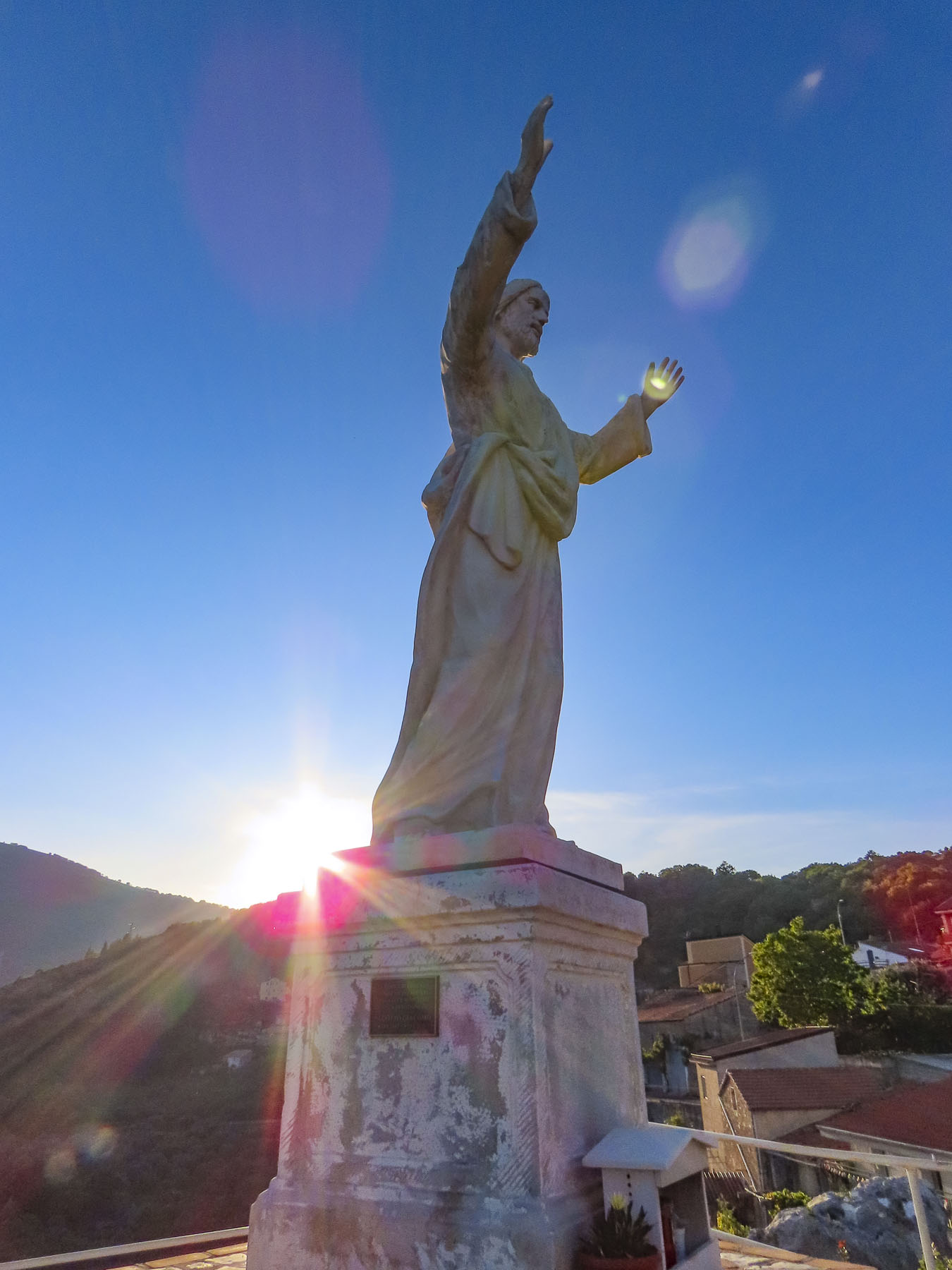
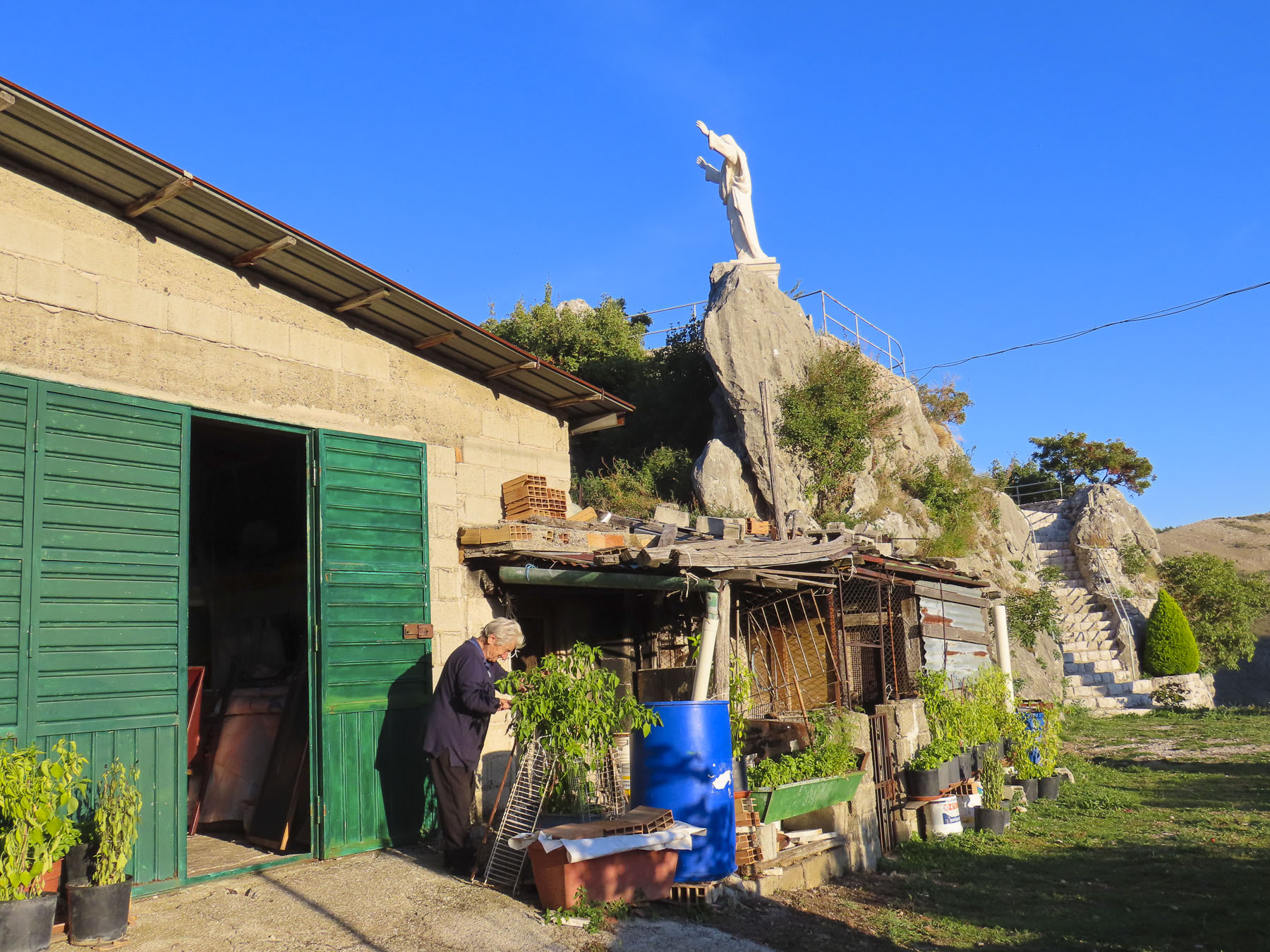
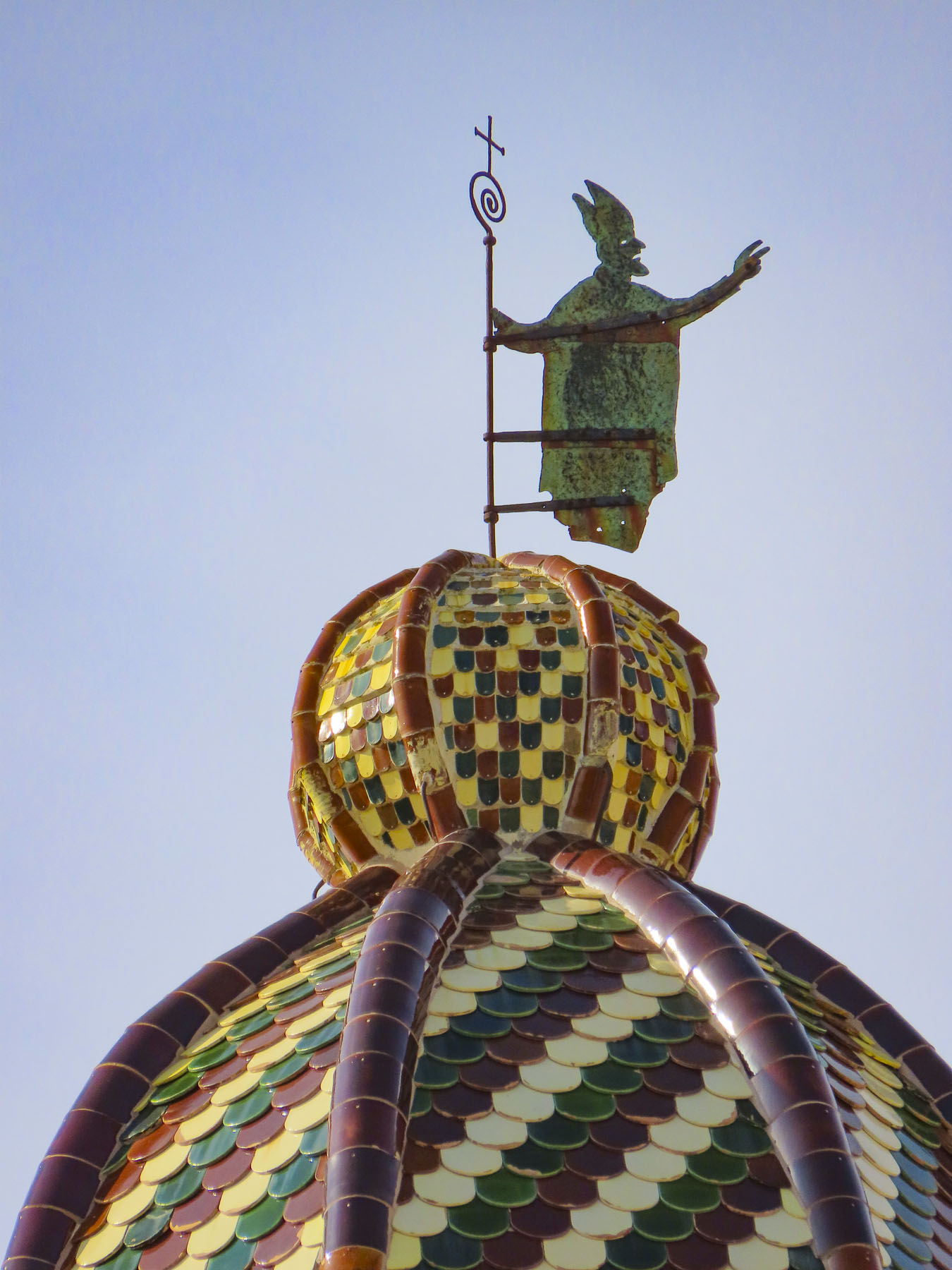
Later we searched for a large statue of Christ that we had spotted from a lower road as we drove into town earlier. It was a good excuse for a leisurely drive around, exploring. Eventually, down a dead-end near the Chiesa Madonna di Loreto, we found it.

Not much is known about the origins of Quaglietta Castle, but it is thought to be a Norman feudal fort from the 11th century. And as intriguing as it looked from the road, I had to fight the impulse to follow the exit ramp. Next time!
Our desire to reach Naples before sunset required an early start to leave enough time to visit Volturara Irpina, roughly translated as “valley of vultures,” due to a large population of the birds that once inhabited the area until the 1900’s. The village of Donna’s paternal grandfather, or as I referred to it, DiMeo-ville. Farmacia DiMeo, Avvocato DiMeo, Clinica Medica DiMeo were all businesses lining the main boulevard and plaza around town hall. We had found her people! Folks were cordial, and since we were obviously foreigners, a few stopped to chat with us. When Donna introduced herself to one gentleman, he smiled. Making a sweeping gesture with his arm, he proclaimed, “Multo DiMeo!” Closer to Naples, the town had the feel of a relatively affluent commuter suburb. In the town park a monument paid tribute to the men of the village who died in the world wars, and the September 23, 1943, allied bombing, due to Nazis troops in the area, which caused sixty civilian deaths. Many DiMeos were among those lost that day.


Once again, we tried to locate the home where Grandpa DiMeo lived before emigrating. We visited the town hall, but our lack of an extensive Italian vocabulary prompted the receptionist at town hall to call for assistance. In a hopeful frame of mind, we followed a kind woman, slightly older than us, back to the archives where she opened a safe-like door and leafed through the century old, dry and torn pages of several thick volumes of town records, taking notes as she went. We were still having difficulty communicating, though the gist of it was “your grandfather came from a neighborhood on that side of town,” as she pointed the way. “The streets are still there; however, the names were changed decades ago.” With several “mille grazie,” a thousand thank yous, followed by hugs all around (after all, this is Italy) we headed to of all places – Via Alessandro DiMeo. Of course! It was a long, quiet residential street with modest, well-kept older homes on the edge of town. Only a few homes looked like they had been forgotten. What was confusing though was that off the main road there was a parallel lane and several dead-end spurs that all went by the name Via Alessandro DiMeo. Walking the street, we stopped to take a photo of some just-harvested walnuts which an elderly man had placed in the sun to dry. Asking of our interest in the area, he led us further down the road pointing to where the grocer and tailor shops used to be, though he did not know any DiMeos still in residence there. Parting, he insisted we take some walnuts with us.

Slowing to find a parking space near the McMany Scottish Pub & Pizzeria I suddenly yelled “I just saw your Dad!” “What do you mean?” Donna responded in surprise. “That man could have been his twin – same hair, same nose. He even wore the same glasses. We have to ask him if he’s related.” Parking was not easy, so we circled the block, only to have lost him. The search began and fortunately two blocks on the gentleman had stopped to speak to a friend. We quickly double-parked and introduced ourselves the best we could as he was saying goodbye to a younger man. “Ciao, il mio cognome è DiMeo,” Hello, my last name is DiMeo. His friend had stayed when he saw us approaching and interpreted our tale for him as best he could.
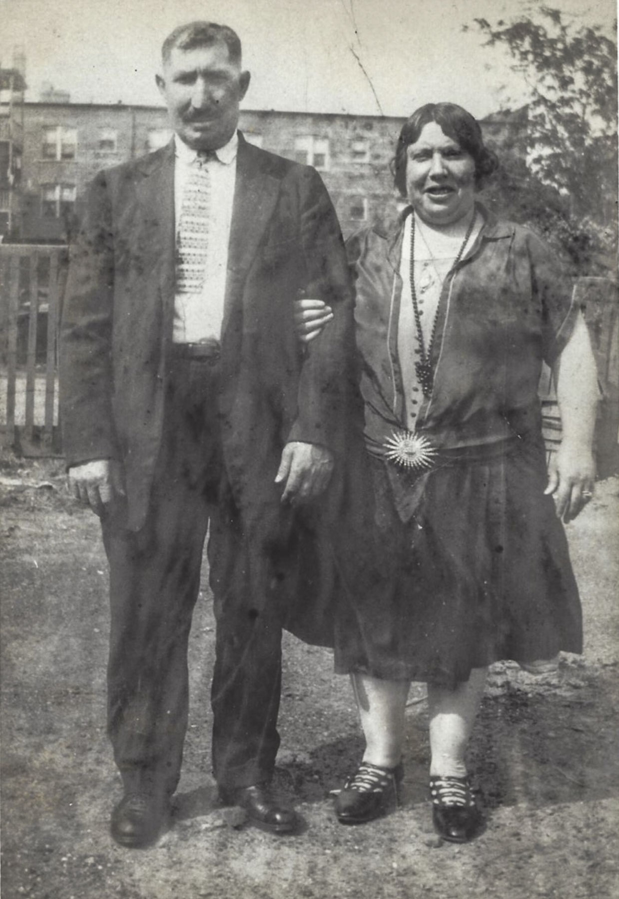
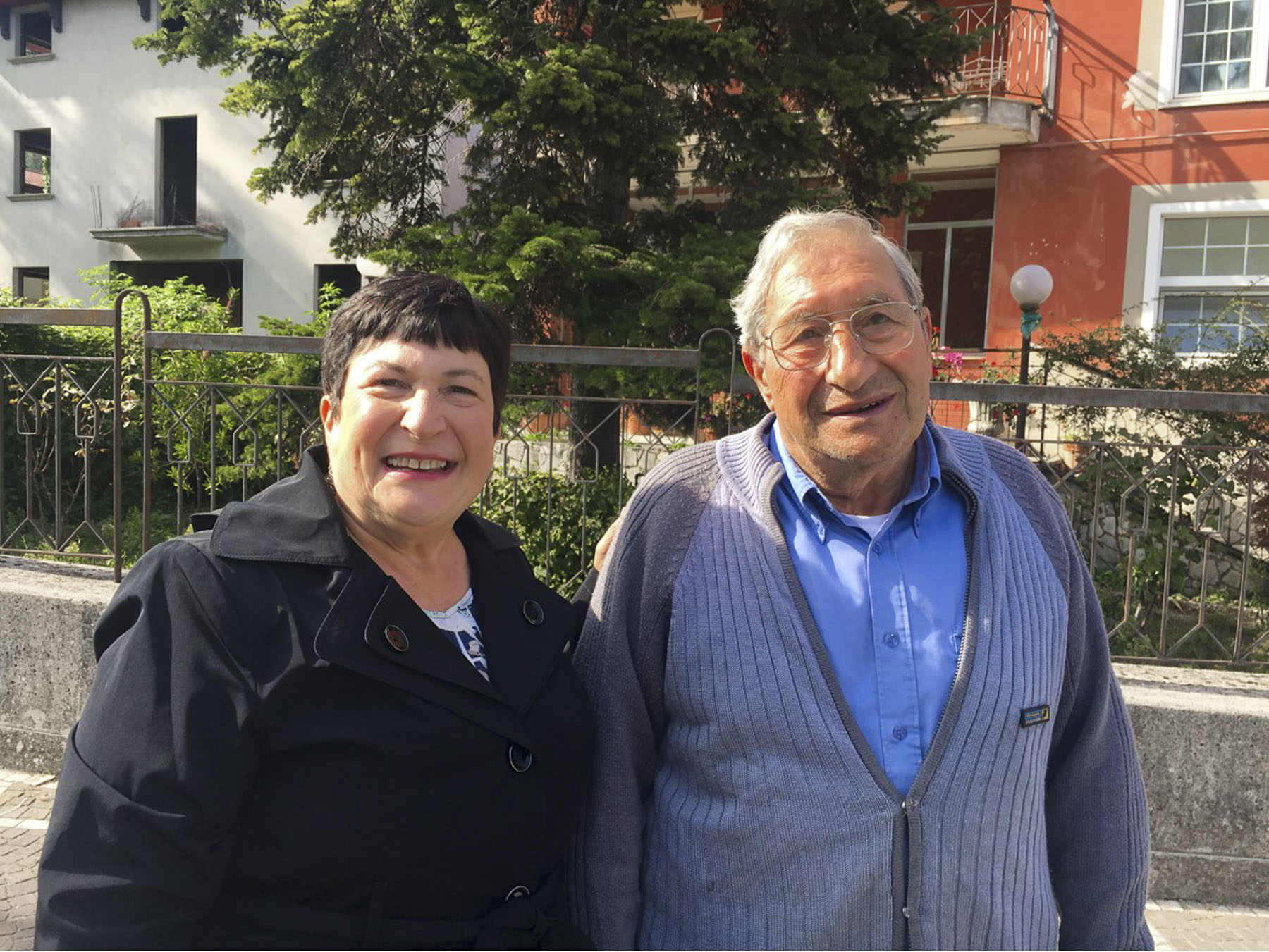
Unfortunately, he had been born in a different region and there were not any DiMeos in his family tree, which was difficult to believe. He kindly posed with Donna for a photo, so we could show the folks back home. For those of you who knew Donna’s father, do you see the resemblance to the gentleman in the above right photo? The old photo on the left is Donna’s paternal grandparents, Domenico and Filomina DiMeo.
Till next time, Craig & Donna


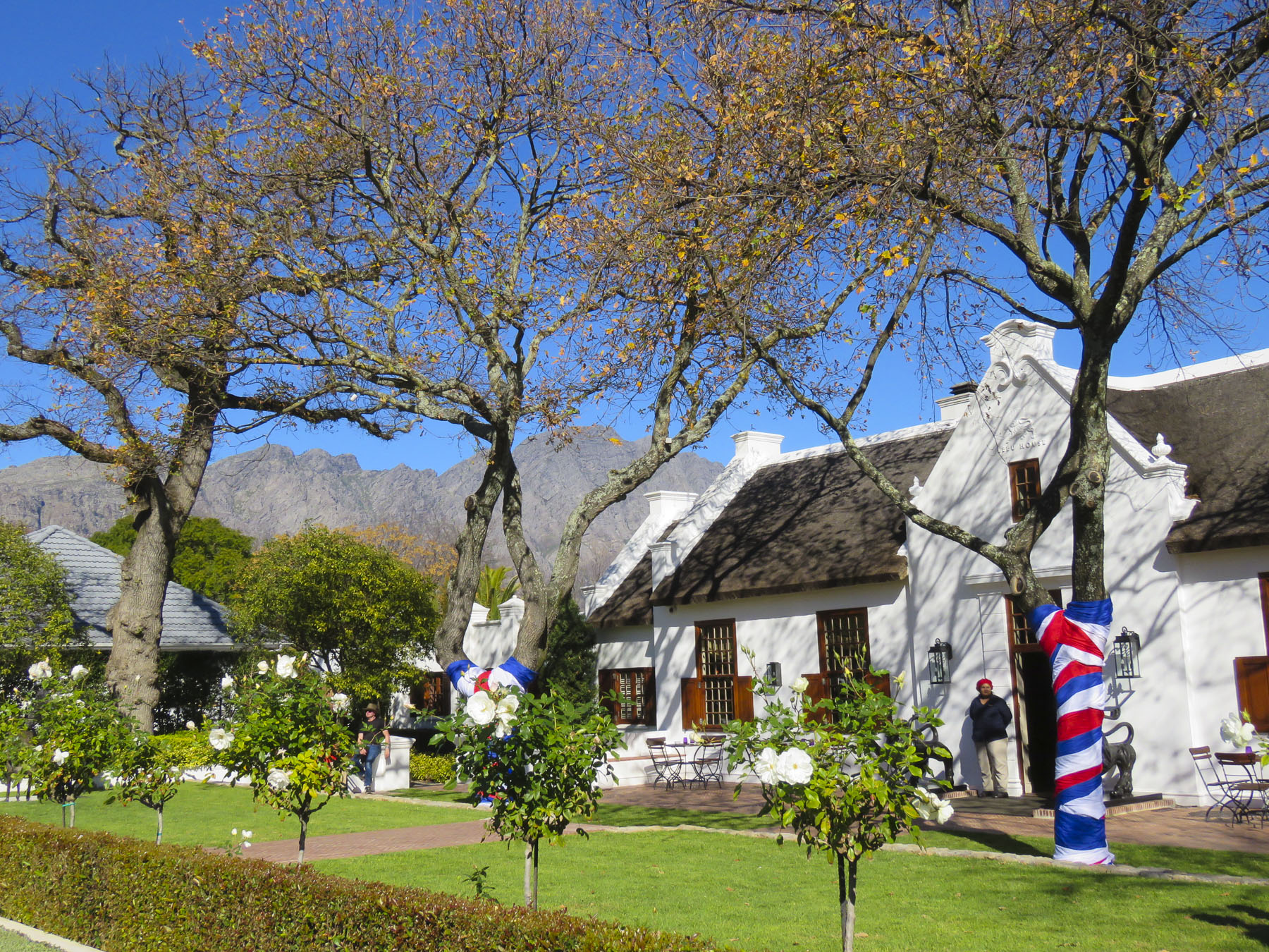
 We planned a long weekend to celebrate
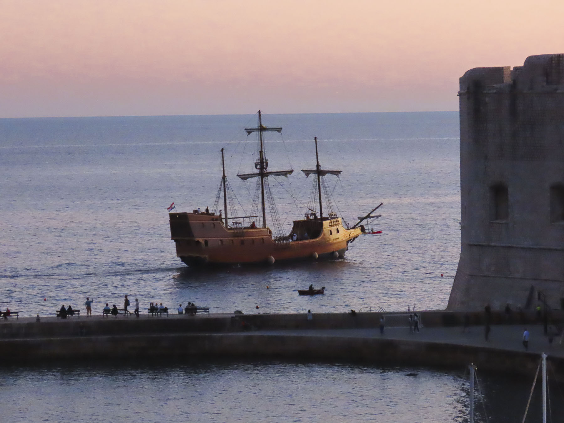
  But first we had to get there. Just before our exit off the N2, the silhouettes of several tall sailing ships broke the horizon as if they were crossing an inland sea. Imagining a pirate swinging from a yardarm, we did a quick double take and followed a side road down to the entrance of
  Across the street from the movie studio, our wine tasting started at


")


 Our room was spacious and comfortable, bigger than several studio apartments we have rented. We spent a little time walking around the pond, watching the weaver birds dart in and out of their hanging nests, before the sunset.


 We followed the queue of beret wearing Francophiles draped in colors of the flag, past a vintage car show and a very competitive barrel rolling contest, to the Food & Wine Marquee, where our tickets included a live concert by South African rocker Karen Zoid, two very nice wine glasses, tasting coupons and R20 vouchers to use towards the purchase of food or bottles of wine.


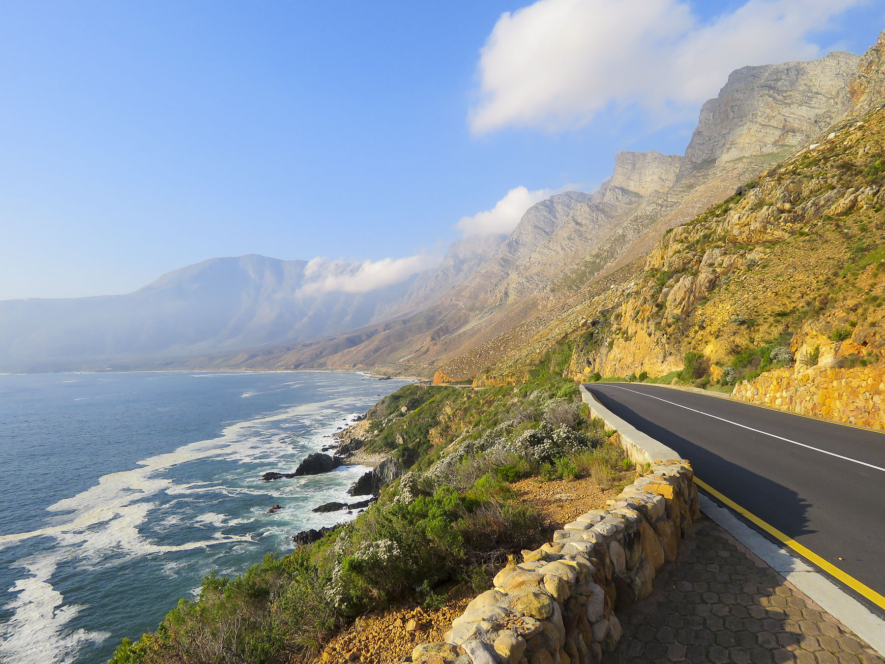
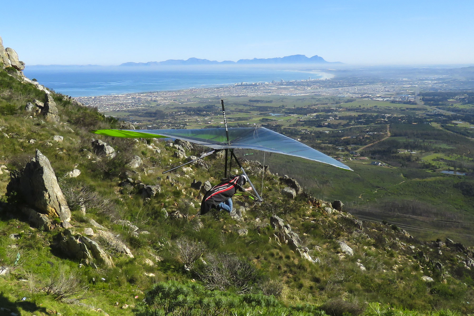 Luck was with us when we pulled into the Sir Lowry’s Pass View Point, in time to see several paragliders launch from the steep slope of the overlook. The view toward the town of Strand, on False Bay, with its long sandy crescent of beach, was incredible. Further on fruit orchards lined both sides of the road for as far as we could see. The valley’s unique climate, cooler and wetter than the surrounding region, is perfect for the local orchards to blossom. Today the Elgin region produces 65% of South Africa’s export crop of deciduous fruits.
 We were working our way to the
 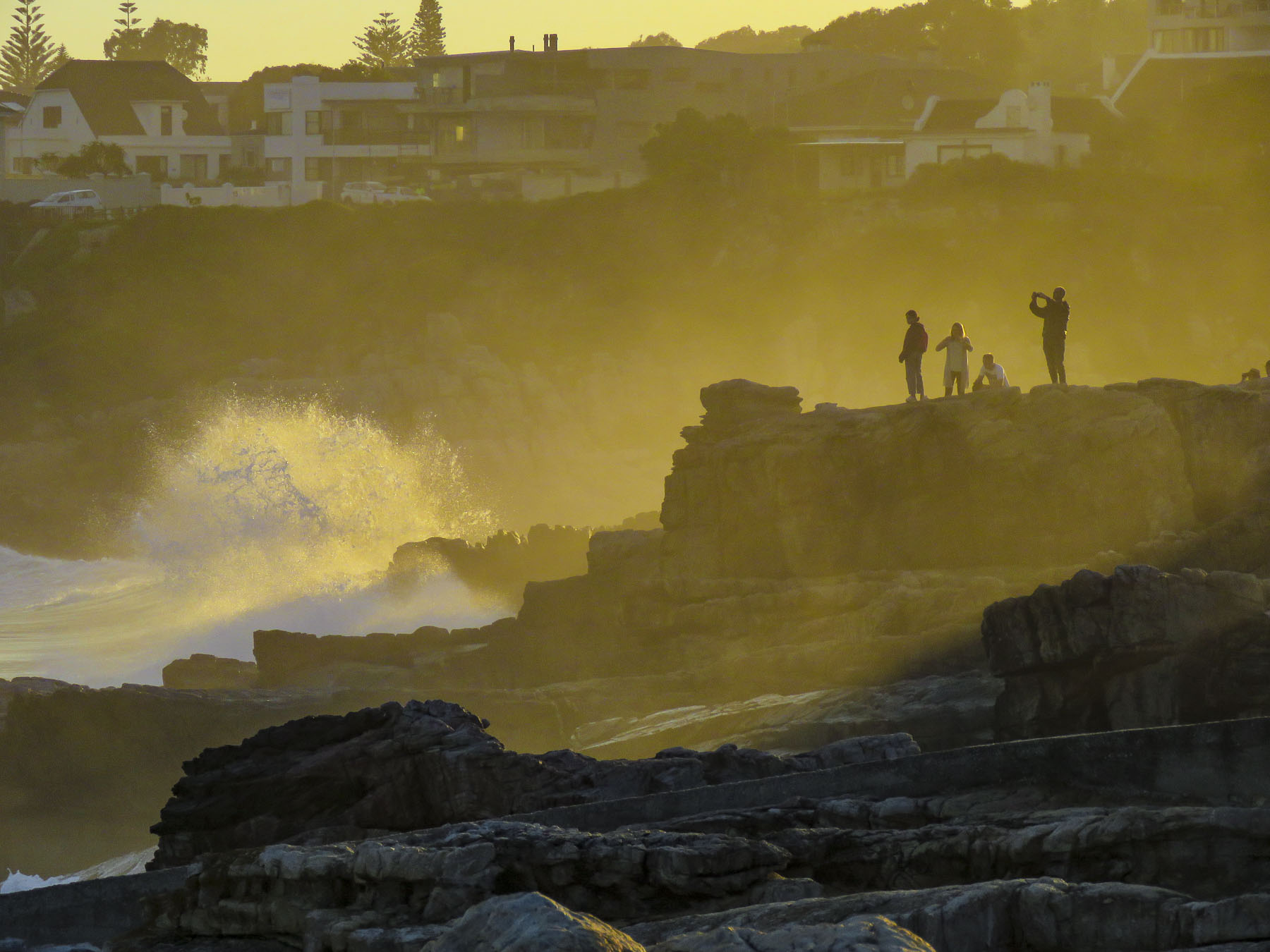 Located directly across the street from the ocean, the
  Walker Bay’s thunderous waves crashing against the rocky coastline were spectacular with their large sprays as we walked along the Hermanus’ Cliffside Path to Gearing’s Point, a scenic overlook, hoping to spot whales. Our Cape Town friends had mentioned that it’s often possible to sight Southern Right Whales from the shore here during their June to November calving season, after which they head back to the waters of Antarctica.
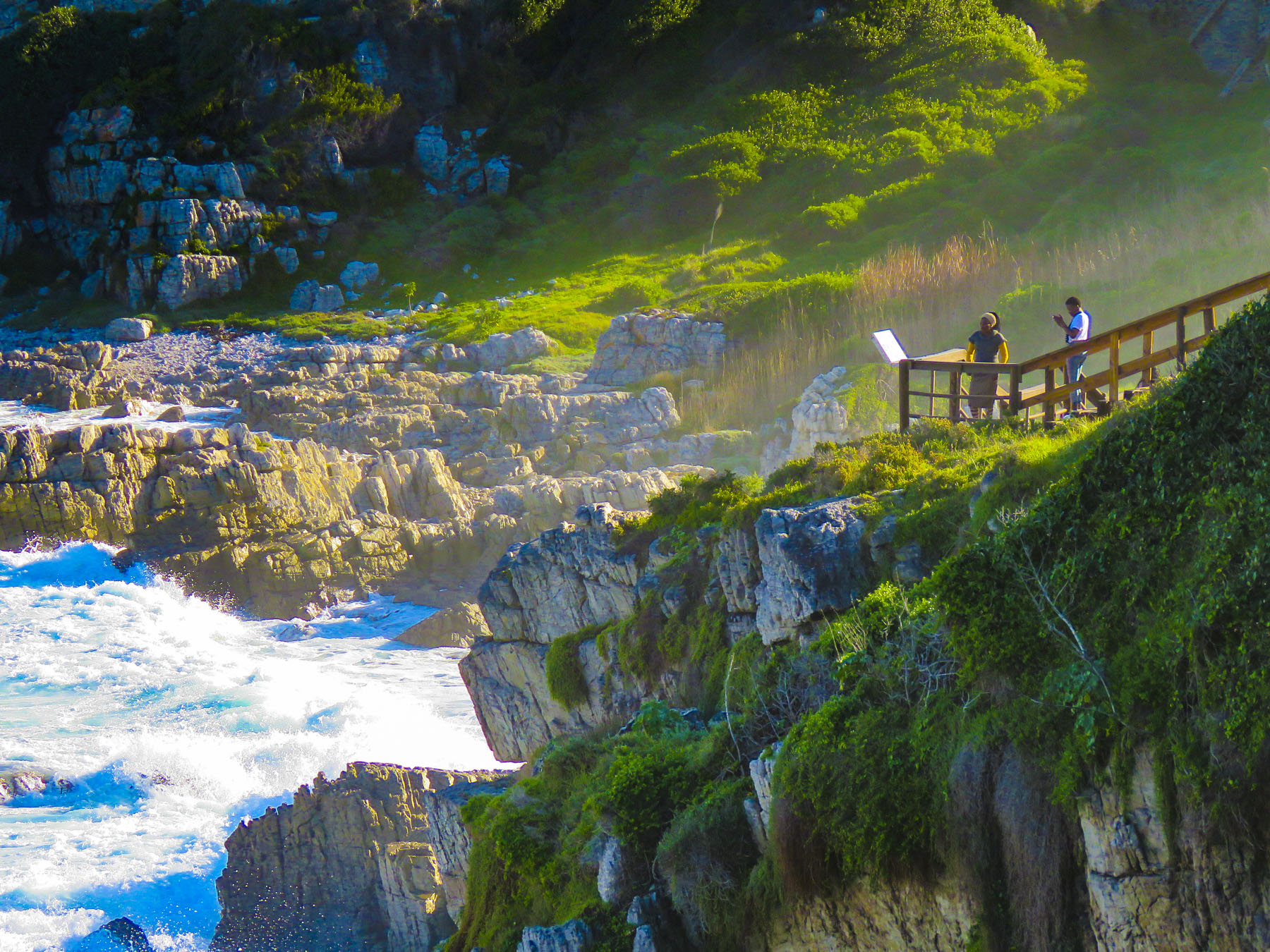 It’s a well-defined trail, with cement, dirt and boardwalk sections, that starts at the village’s New Harbor and hugs the coast for 7.5 miles, ending at the Klein River Estuary. Five miles of the path are wheelchair accessible. In some places it passes under trees twisted to grow almost parallel to the ground, by the fierce South Atlantic winds that blow in from Antarctica.

 The seascapes from the cliffside path were beautiful, but we hadn’t spotted any whales and the village’s whale crier wasn’t sounding his kelp horn. Yep, what started as a publicity stunt has become tradition and Hermanus has had an official, and the world’s only, whale crier since 1992.
 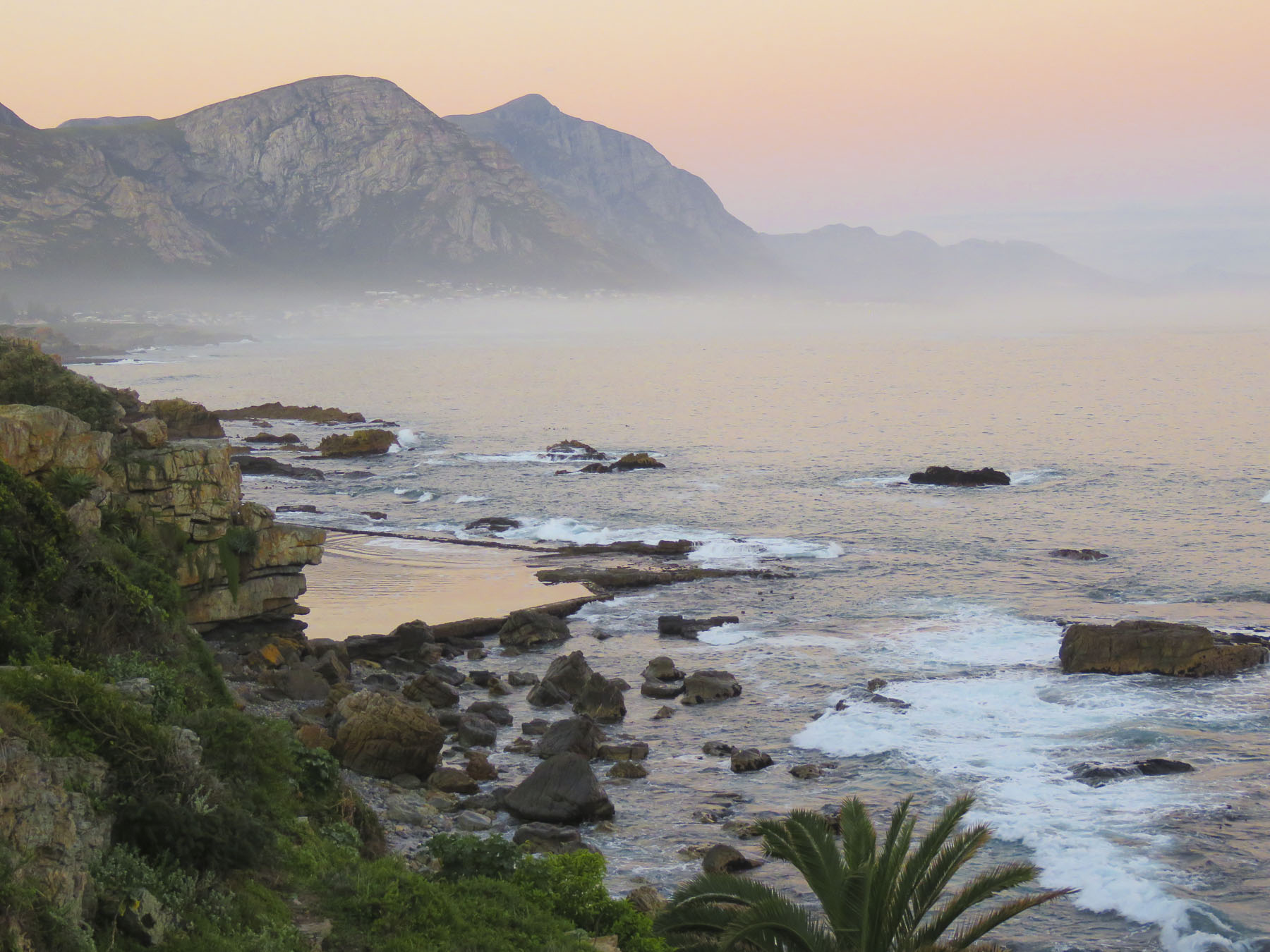 In 2016 the movie The Whale Caller was adapted from South African author Zake Mda’s 2005 novel, of the same name, which has the whale crier as the central character.

 With skipper Emile at the helm, the first mate tossed the mooring lines to the dock and we departed onto a gently rolling sea. Phillip, a registered naturalist with a delightful wry sense of humor shared his love of the sea with us. “There’s a good chance we’ll see Southern Rights today. We spot them by their distinctive V-shaped blow and the callosities (clusters of barnacle like growths) on their heads. We may also see Africa Penguins, Fur Seals, Dolphins, migrating Humpback Whales and resident Bryde’s Whales.” Psyched now, all eyes scanned the horizon for any telltale signs of these gigantic, yet elusive creatures.

 Heading back to Cape Town late the next day, we followed the scenic R44 coastal road through the seaside villages of Kleinmond, Betty’s Bay, Pringle Bay and Rooi-Els as the golden hour was approaching.
 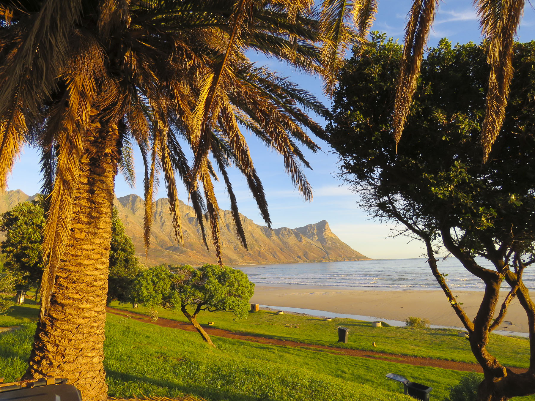 Each turn of the road offered a dramatic view of the coast and we stopped many times for photos. We merged back onto the R2 at Gordons Bay just after sunset for the ride the rest of the way back to the city.


 During the morning “golden hour” we watched a family of giraffe walk gracefully through the forest, nibbling thorns from the acacia trees, before saying our goodbyes. Stormsriver, it was! Backtracking through Port Elizabeth we retraced our drive past Jeffreys Bay and continued west on the N2 until we stopped to photograph the steep chasm that the Stormsriver Bridge spanned, just before the village of the same name. Mostly folks mean the
  We thought the entrance fee of $17.00 per person for international tourists was steep and we did see some cars turning away, but we had heard such tremendous recommendations we would regret it if we didn’t check it out. There was a long winding road down from the entrance gate and when we finally rounded a sharp corner, the view of the rugged coastline with crashing waves sending up large white sprays was spectacular!
 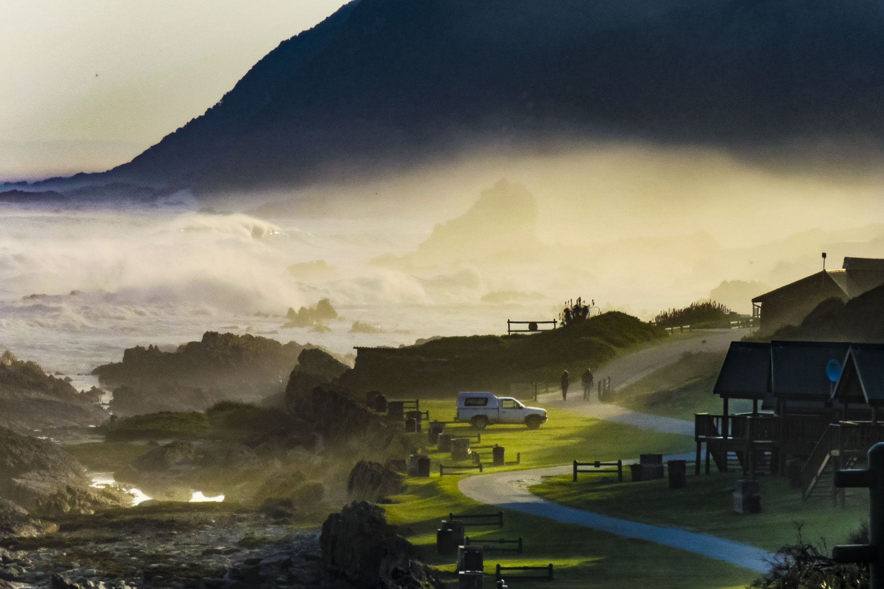 We enjoyed lunch watching and listening to thunderous waves explode against rocks only a short distance away from our table at the Cattle Baron. It’s the only restaurant in the park and was excellent, along with being very affordable. A nice surprise after the park entrance fee.
  After lunch we followed an easy section of the
 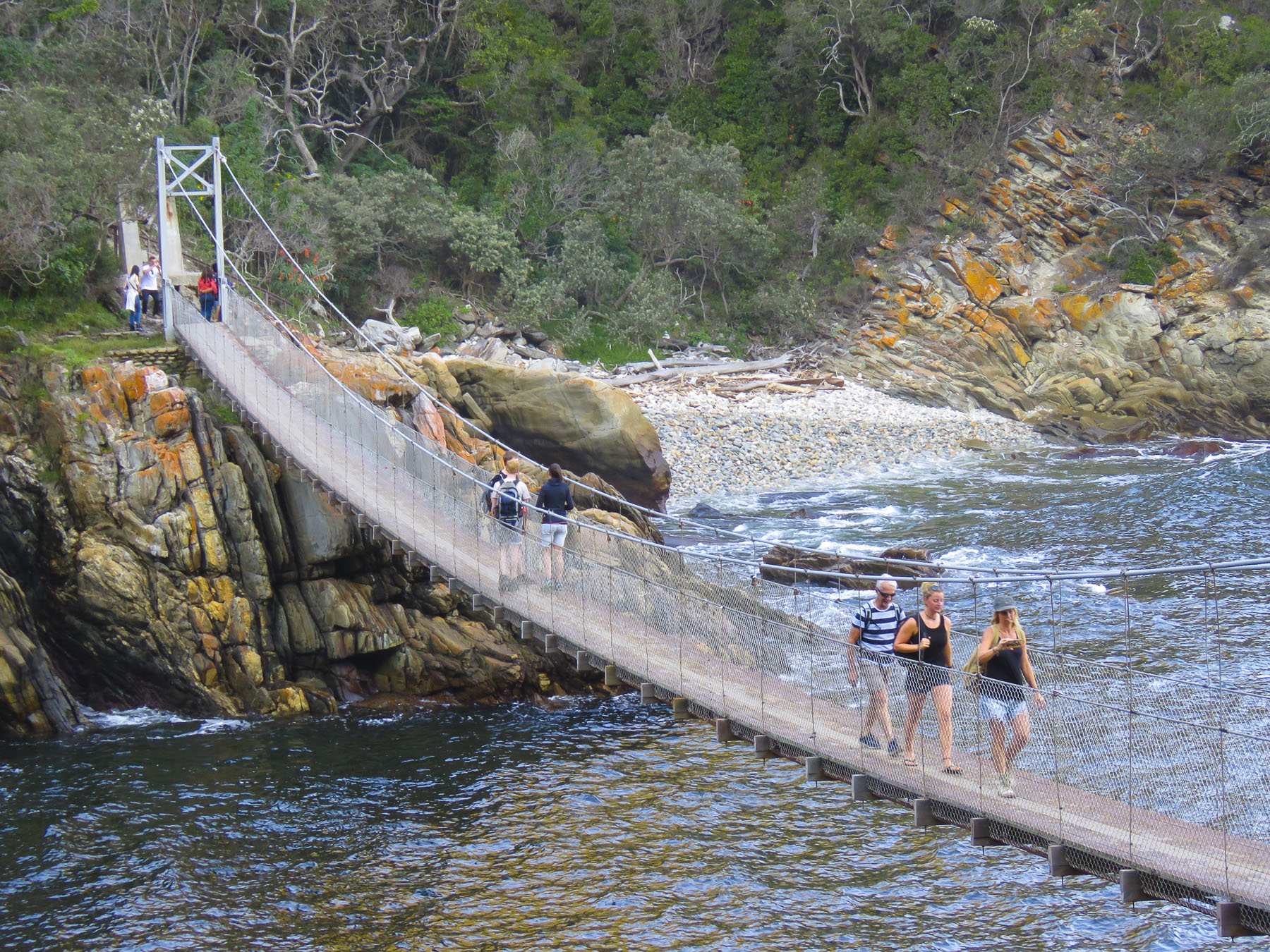 Staying in designated cabins each night, it takes five days to cover the route that stretches from Stormsriver in the Eastern Cape to Nature’s Valley in the Western Cape. The reverse hike is referred to as the


 On the way back to the highway we stopped at


 Our steep ascent away from the coast began in George as we headed north on the N9/N12 twisting our way uphill through the Outeniqua Pass to Oudtshoorn. This is a challenging stretch of highway with continuous s-turns that required my constant attention. Passengers can enjoy spectacular views on sunny days that stretch for miles. If possible, drive the route towards the coast, it’s easier to stop at the scenic lookouts this way.
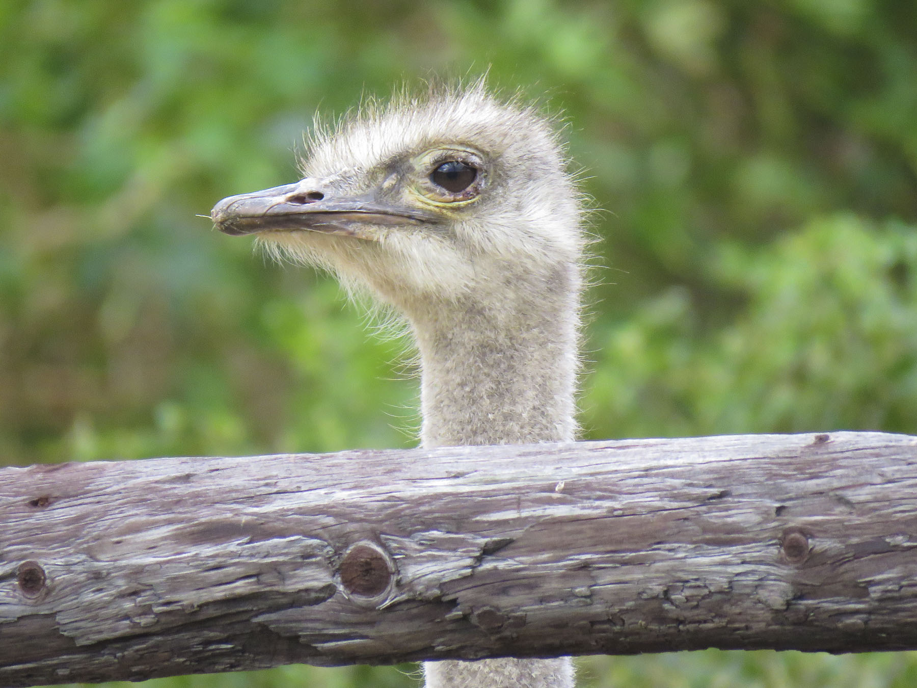 We’ve heard of gold booms, where fortunes were made. But it was the ostrich booms in 1865 -1885 and 1902-1913 when ostrich feathers were the ultimate fashion accessory in Europe that enriched local farmers here. At one point 314,000 ostriches were being raised and their feathers were a valuable South African export, only surpassed by gold, diamonds and wool.


 The word karoo comes from the Khoisan language meaning “land of thirst” and it precisely describes the terrain along R62 which we followed. Parched, rock encrusted rolling hills and mountains covered with a fynbos of low heather-like shrubs and proteas occasionally accentuated by taller, lone trees and dry riverbeds crisscrossed the landscape. During the South African spring, in October, it bursts with flowers, but it was July, still winter. The area endures extreme heat during the summer. Fortunately for us recent winter rains had spurred some greenery to burst forth and aloe plants to bloom.
  We stopped in Ladismith, a rural farming community where Vincent, Donna’s friend from seminary, first pastored a church, and enjoyed its colonial Dutch architecture.

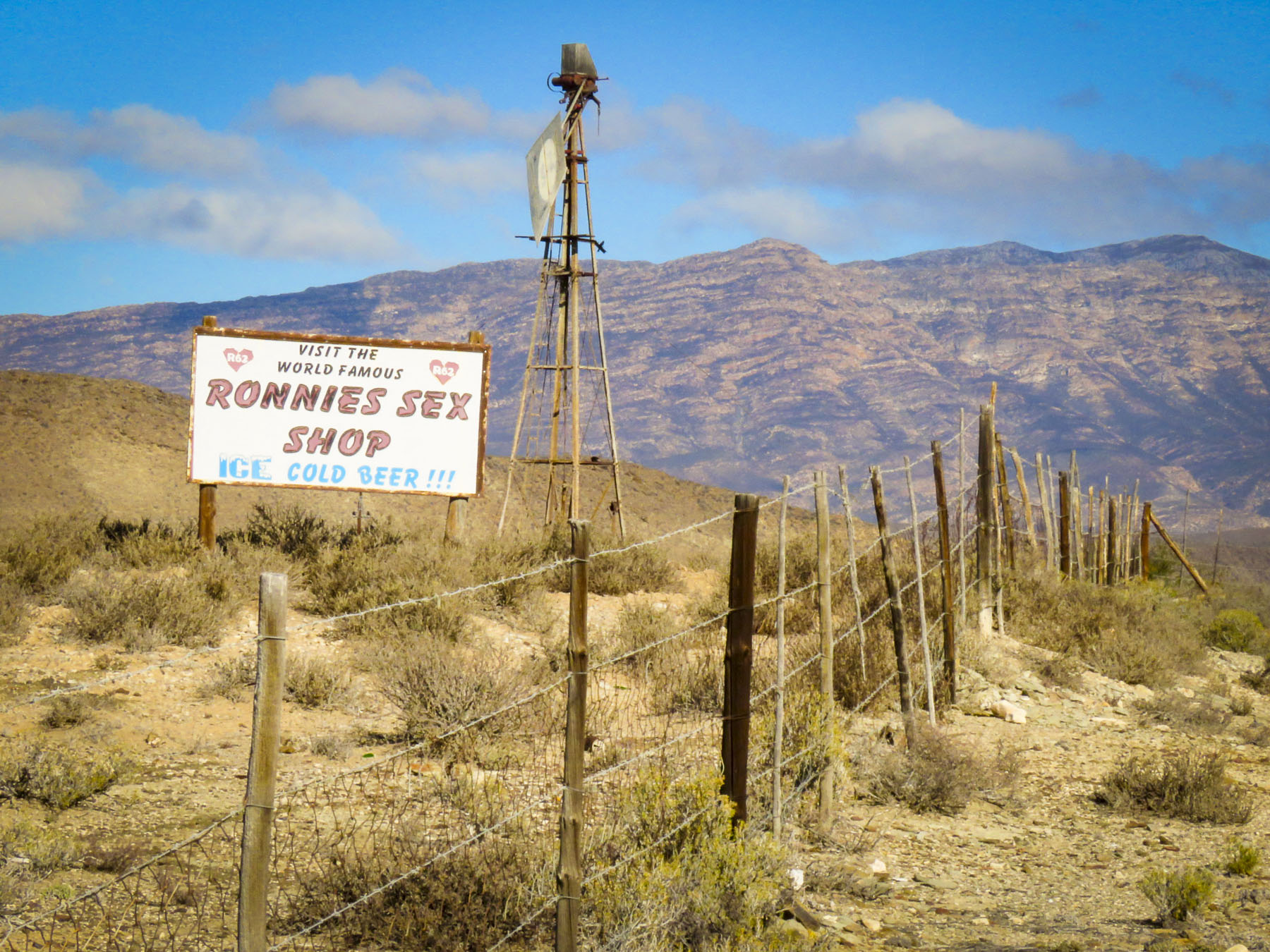 The heat can do strange things to the mind and sometime in the 1970’s Ronnie thought a farm stand on this desolate stretch of highway through the karoo would be a good idea. Fortunately, his buddies realized it was destined for failure and would soon be another abandoned building along the road if something wasn’t done. One night they painted SEX into the name of the shop and suggested he open a bar. They saved his butt! Famous now worldwide as a dive bar in the middle of nowhere, it draws in the curious. It’s not the raunchy place the name implies, filled with frustrated farmers between ostrich roundups. A grey bearded Ronnie, now a cause célèbre, still pours drinks at the bar. It has a tired, dusty bar area filled with foreign money plastered to the walls and lingerie hanging from the ceiling, but aside from that it’s a wholesome oasis with a covered patio where you can get a decent burger with fries, ice cream and coffee along with some hard stuff if that’s your drink. It’s not worth a detour, but if you are on the R62 traveling between Barrydale and Ladismith, it’s worth the stop. Actually, it’s the only place to stop.

 We zoomed past the small village of Barrydale on our way to Montagu, so we could explore the town a little before nightfall. The farming community is in a valley surrounded by the Langeberg mountain range and has many examples of late 19th century Cape Dutch architecture scattered about town. Ornate gables, thatched roofs, whitewashed walls and occasionally gingerbread trim define the style, but there are modern interpretations also.
 In a country not known for Art Deco we booked ourselves into the
 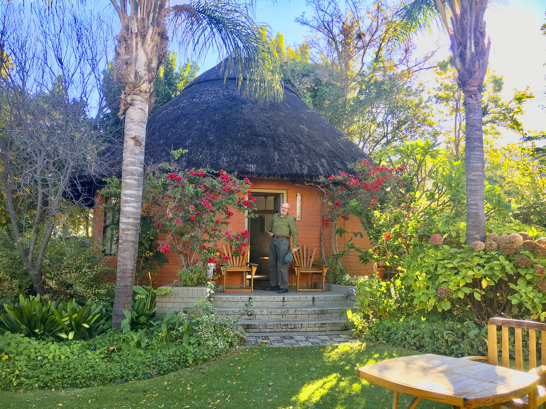 The temperature drops quickly in the mountains once the sun sets so we enjoyed a local wine, in front of a fireplace, in one of the lounges before dinner. We usually look for a less expensive alternative for dinner, but the hotels’ Wild Apricot Restaurant drew us in with elegant candlelit tables and live piano music. It was the last night of our road trip – we could splurge. With Smoked Ostrich Carpaccio and Springbok Tarta for appetizers followed by Cape Malay Bobotie and Karoo Lamb Pie as mains and a traditional Orange Malva Pudding for dessert, we were splendidly sated.


 We followed R62 west through a small tunnel, locally referred to as the “Hole in the Wall,” that was dynamited out in the 1870’s. It’s a dramatic landmark that tells you of your arrival into or departure from the Karoo. As we left our road trip behind, we looked forward to heading to a new apartment in Cape Town.

 Heading north on Routes 64 and 6 we drove past fallow farmlands waiting for their Spring tilling, and forgotten industrial sites as we worked our way north towards Stara Planina, the Balkans Mountain range that runs east to west for 348 miles and divides Bulgarian into northern and southern regions.


 Turning down the long driveway of the
 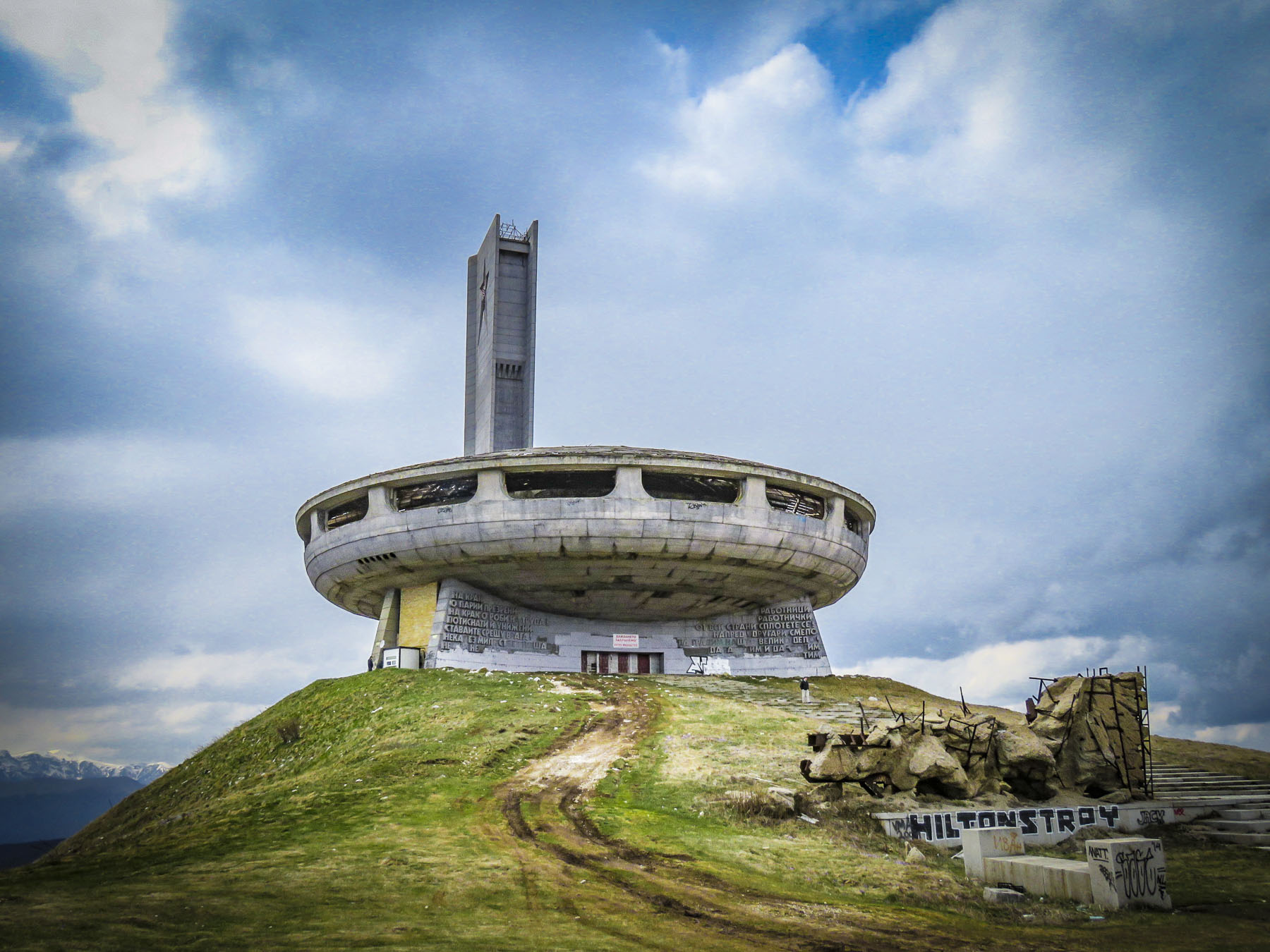 On a wintry, cloudy afternoon the silhouette of

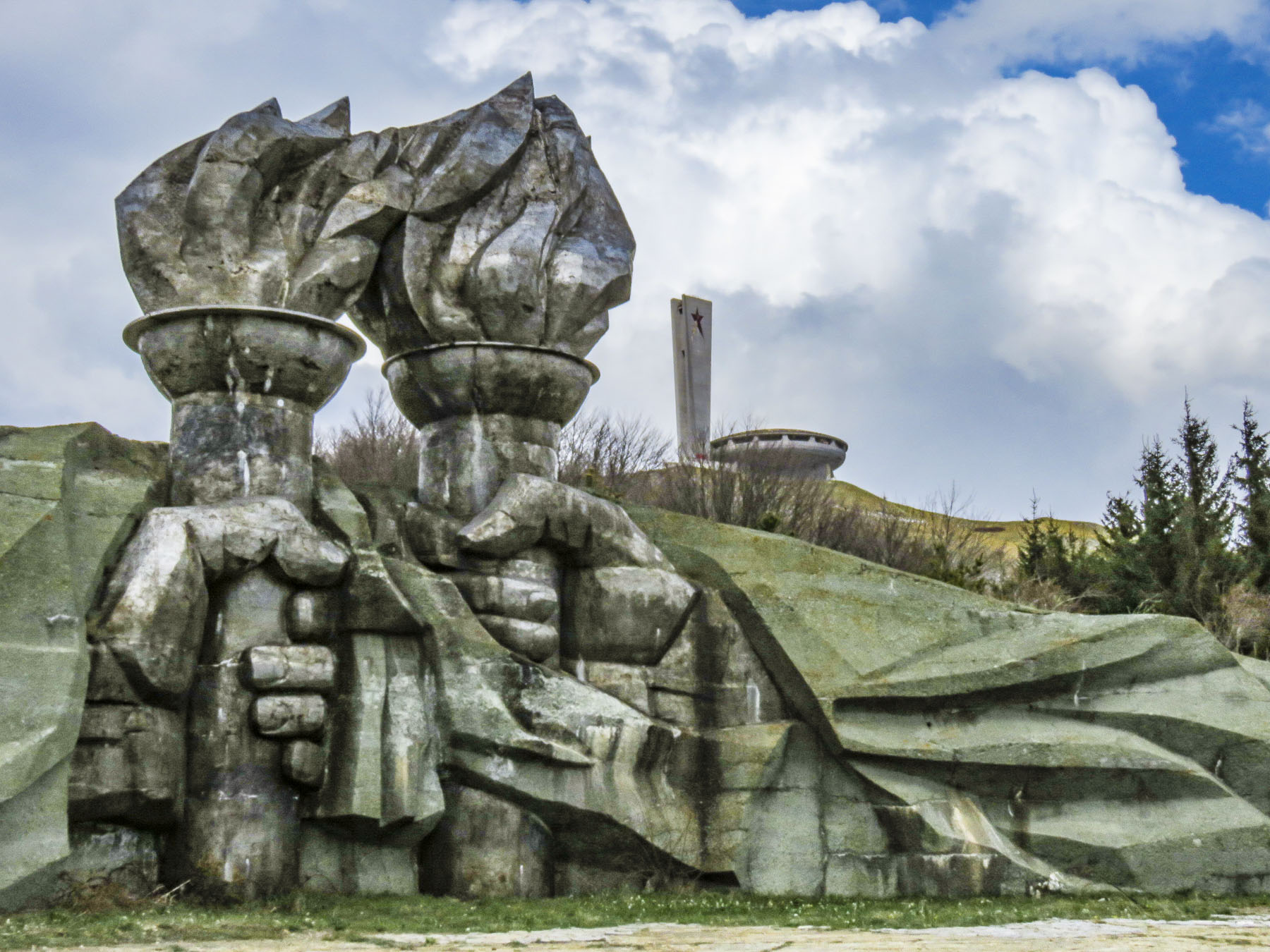 At the opening ceremony in 1981, tribute was paid to those who had gathered there ninety years earlier. “Let the work of sacred and pure love that was started by those before us never fall into disrepair.” Buzludzha was a huge success and a point of national pride for eight years, hosting communist party congresses and educational events. Schools and businesses booked tours for their students and employees. Foreign delegations were paraded through to witness socialism’s success. But then in 1989 the Berlin Wall fell and communism collapsed like a fighter jet breaking through the sound barrier. The monument to socialism was suddenly ironic, irrelevant and abandoned. In 1999 the security guards protecting it were removed and the building was left open to the public and it was looted. Anything of value quickly disappeared, and the rest was left to vandals and frustrated citizens who were known to take their anger out on the building with sledgehammers or spray paint. The red stars in the tower were shattered by gun shots. Soon the glass skylights broke and water damage from rain and the winter elements hastened its structural decline, and the building was eventually shut tight to protect folks from injury. The day we visited there was a lone security guard, suffering as he made his rounds in the bitter wind, protecting this crumbling modern ruin from a handful of visitors.

 As we continued our journey north through the mountains on Route E85, the picturesque
  Woodcarvers, weavers and other craftspeople dressed in period outfits helped further to transport us to a simpler era at the beginning of the Bulgarian industrial revolution. We visited on a quiet day, but the museum has an extensive twelve-month calendar of events with many festivals listed that would have been nice to observe.
  Traveling along an isolated background road we worked our way towards Sokolski Monastery, known for its cliffside chapel overlooking the northern slope of the Balkan Mountain range. We weren’t disappointed; the church is stunning with its colorful exterior frescoes contrasting with the natural environment surrounding it.
 Built in 1833, the monastery has played an important role in Bulgarian history. During the April Uprising of 1876 eight freedom fighters took sanctuary there. Later captured by the Ottoman army, they were thrown to their deaths from the cliff behind the chapel. The short-lived April Rebellion was brutally repressed, but a year later Russia would help the Bulgarian rebels defeat the Turks at Shipka Pass and begin the march towards freedom. In the courtyard of the monastery an octagon-shaped water fountain was built with eight spouts to commemorate those fallen heroes. Legend states the fountain has never run dry and its cool water holds healing powers.
  We made it to Tryavna just in time to have dinner at the restaurant next to our hotel. Enjoying a hot meal after a long chilly day, we were entertained by the waitress trying to keep a determined stray cat from entering the restaurant every time the front door was opened.
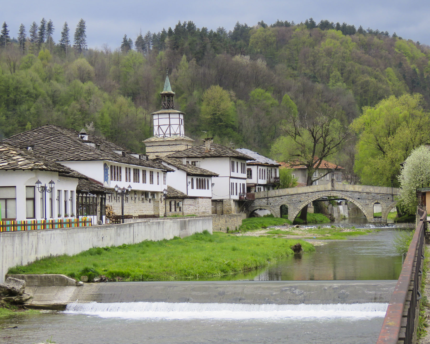 Generations of skilled woodworkers have lived in the Tryavna River Valley, turning trees harvested from the deciduous forests on the slopes of the Balkan Mountains into furniture and ornate wood carvings.

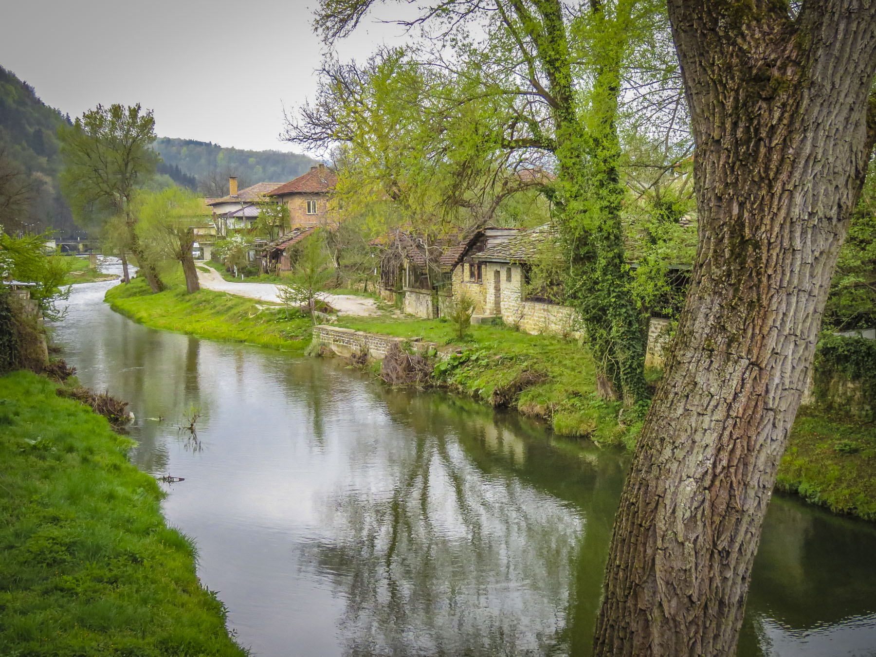 Crossing the footbridge over the Tryavna River at the clock-tower, the pleasant whiff of wood smoke came to us on a chilly Spring morning. Large woodpiles are essential in this region and we saw plenty of homes with the winter’s firewood neatly stacked, as we wandered around the village, with its parks filled with sculpture and tulips in bloom.


 Over the centuries Saint Archangel Michael Church has been reconstructed several times. Its most recent incarnation dates from 1853 when the tall wooden belfry was added. Inside, the interior is richly ornamented with elaborate 19th century woodcarvings and iconography created by members of the Vitan family, famous throughout Bulgaria for generations of skilled artisans. The carved bishop’s throne is an exquisite masterpiece.
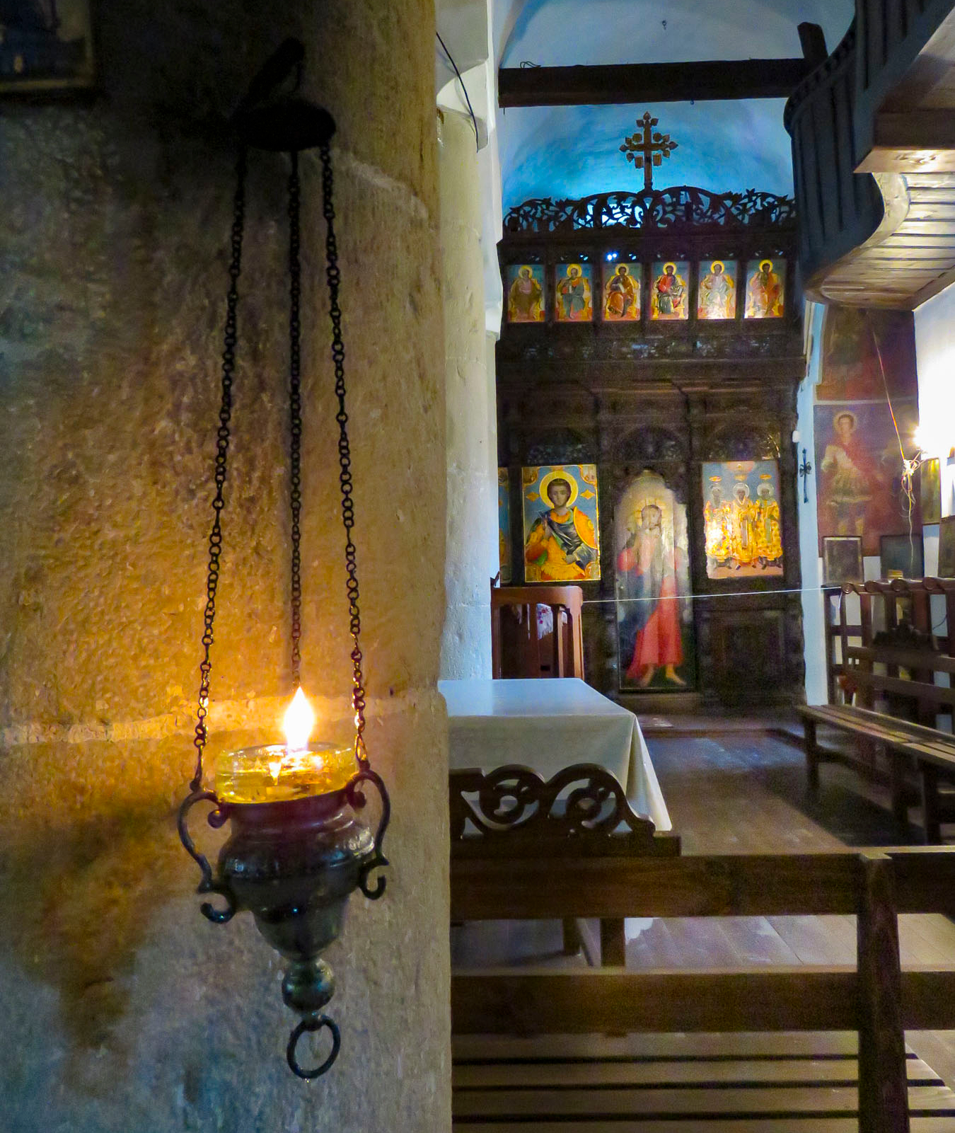 The safest way to order your cup of java in parts of Bulgaria is to ask for a traditional coffee, not wanting to offend anyone by calling it Turkish. The fact is Greek, Albanian, Bosnian, Persian, Turkish andthe same, plus or minus cardamom or a local spice. But here in Tryavna at the Renaissance Café the coffee was brewed on a very traditional sand stove. A shallow pan filled with sand was heated over an open flame, and a long handled, brass cezve was filled with coffee and water, then partially buried in the hot sand to brew. With diligent attendance our coffee was brought to a frothy boil three times before being moved to the top of the sand where it stayed warm while the grounds settled. The ritual of the event definitely enhanced our enjoyment of the brew.
 We only just scratched the surface of this lovely country. There’s so much to see here, especially in its vast countryside. Hopefully one day we’ll get a chance to return.

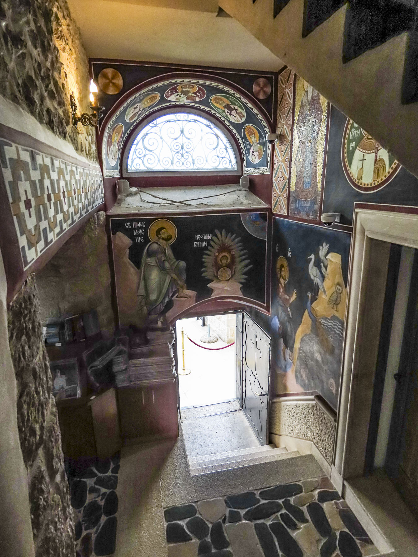
 After you crouch to enter through a low door and then look up in this intimate space, the WOW element of

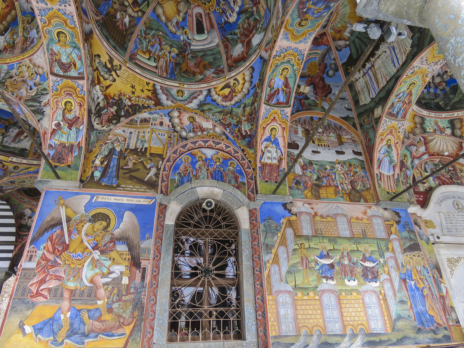
 Our main destination was


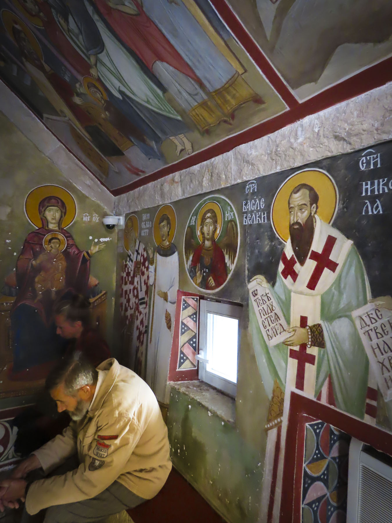
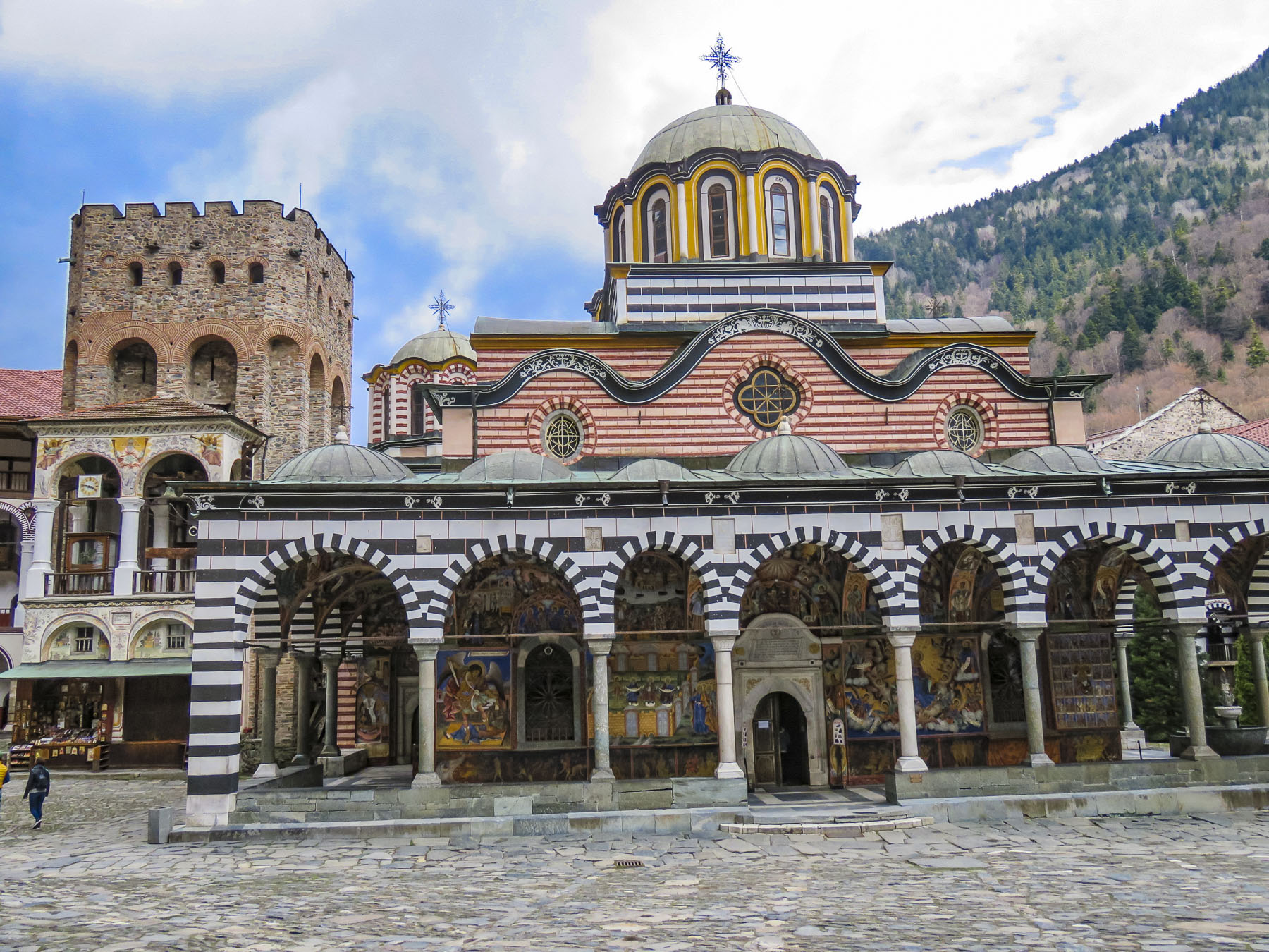 This is the only monastery to survive during the centuries of Ottoman domination over Bulgaria, when it was rebuilt in defiance of the Turks. The Bulgarian people have great affection for this monastery, as a symbol of their religion and culture during those turbulent centuries.


 Thirteen miles from the monastery, on a side street in the town of Rila, we spotted a church with three small cupolas, that called for a quick stop. The church “St. Nicholas the Wonderworker Mirikliyski” was a surprising find with its cracked bell tower and muraled covered entrance porch, complete with woodpile.
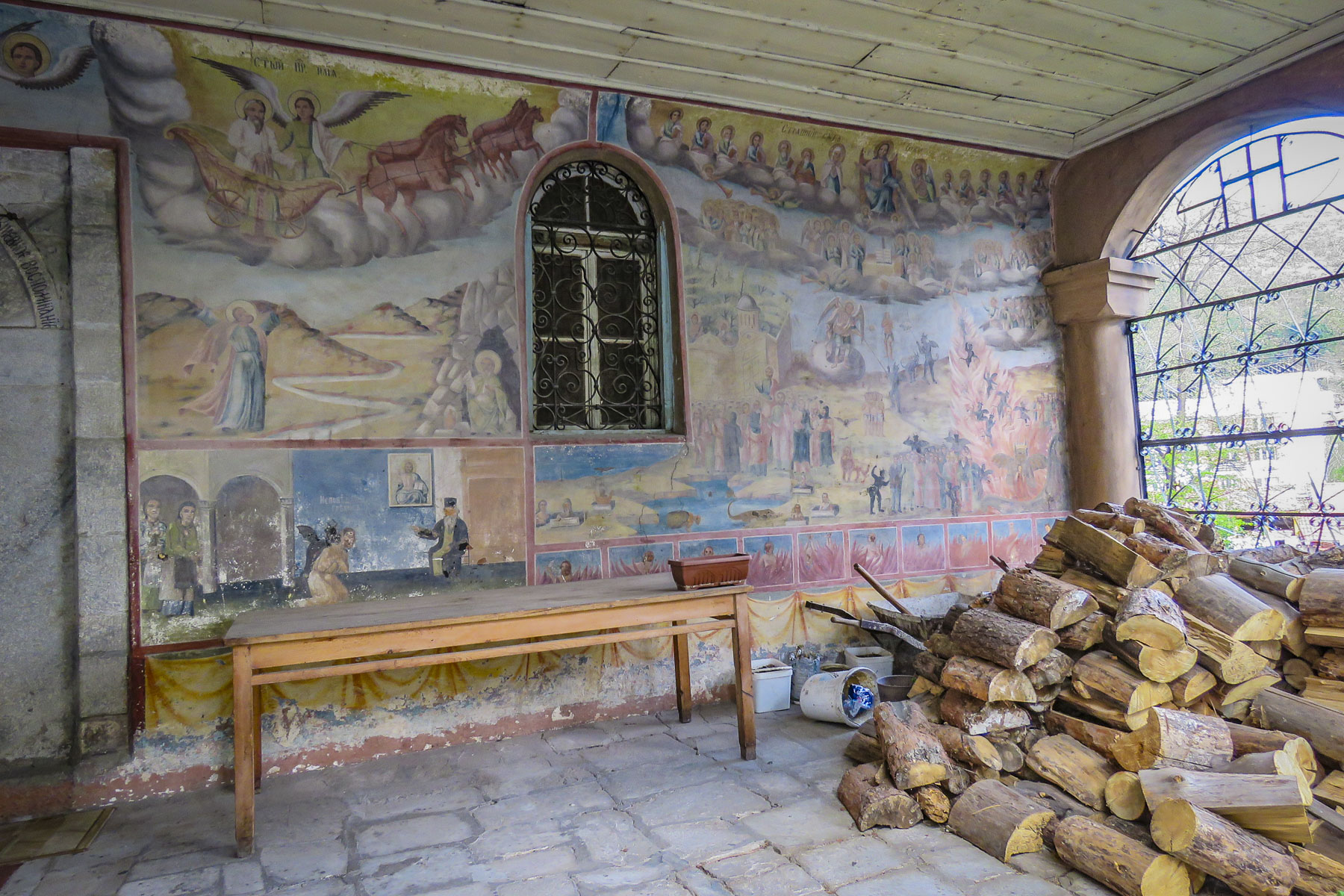 The painter of these hell fire and brimstone murals might have gotten his inspiration from the tortured works of Dutch painter Hieronymus Bosch. Unfortunately, the church was closed and we haven’t been able to find any other information about this off-the beaten-path treasure.


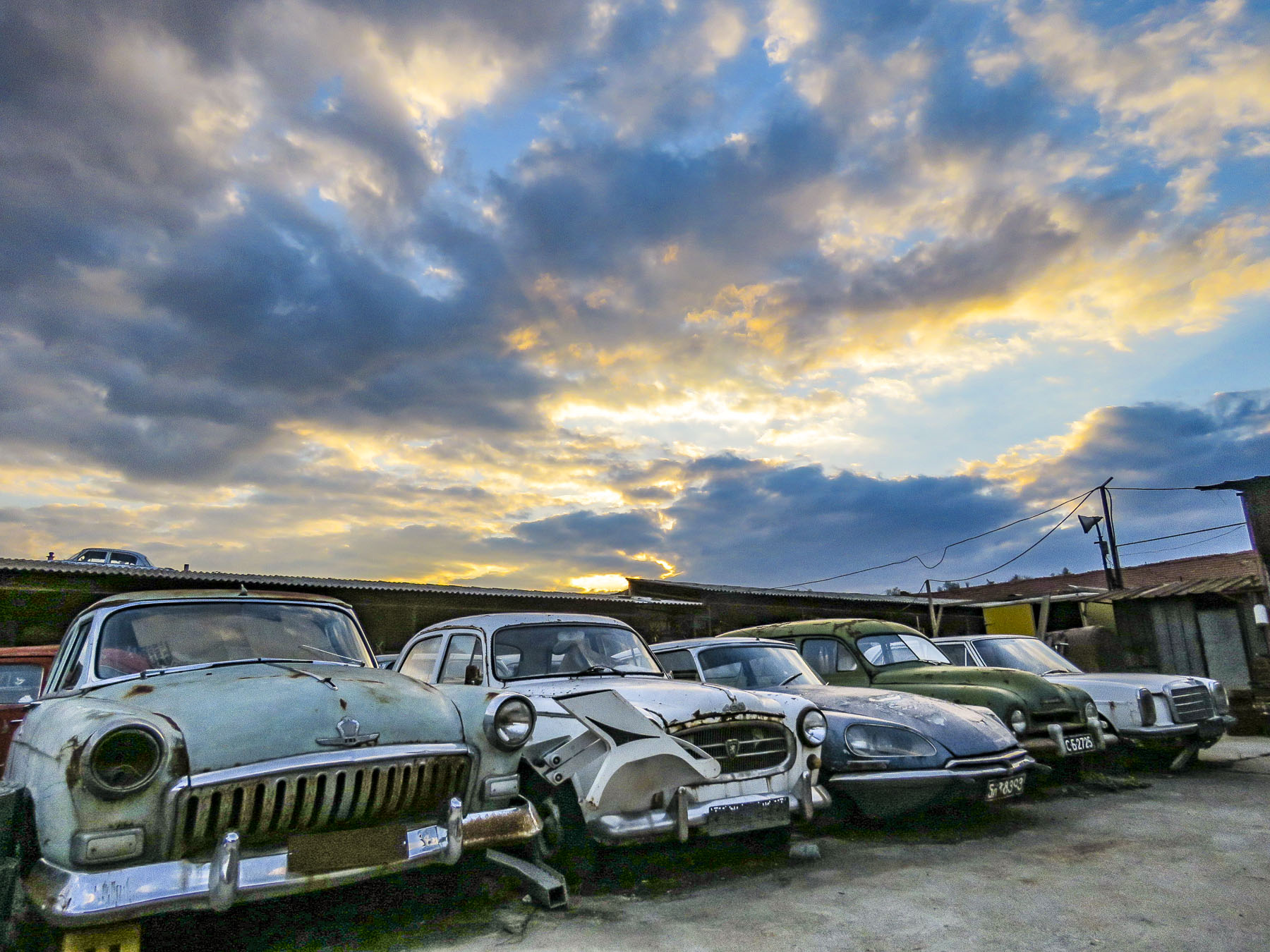 The Unofficial Junk Museum is a vast, rusty and dusty collection of whatever the owner deemed representative of Bulgarian culture under communism. Radios, tv’s, typewriters, farming equipment, cars, motorcycles, household items and busts of Stalin are stacked everywhere. It’s fascinating! And of all the places to buy a bottle of homemade


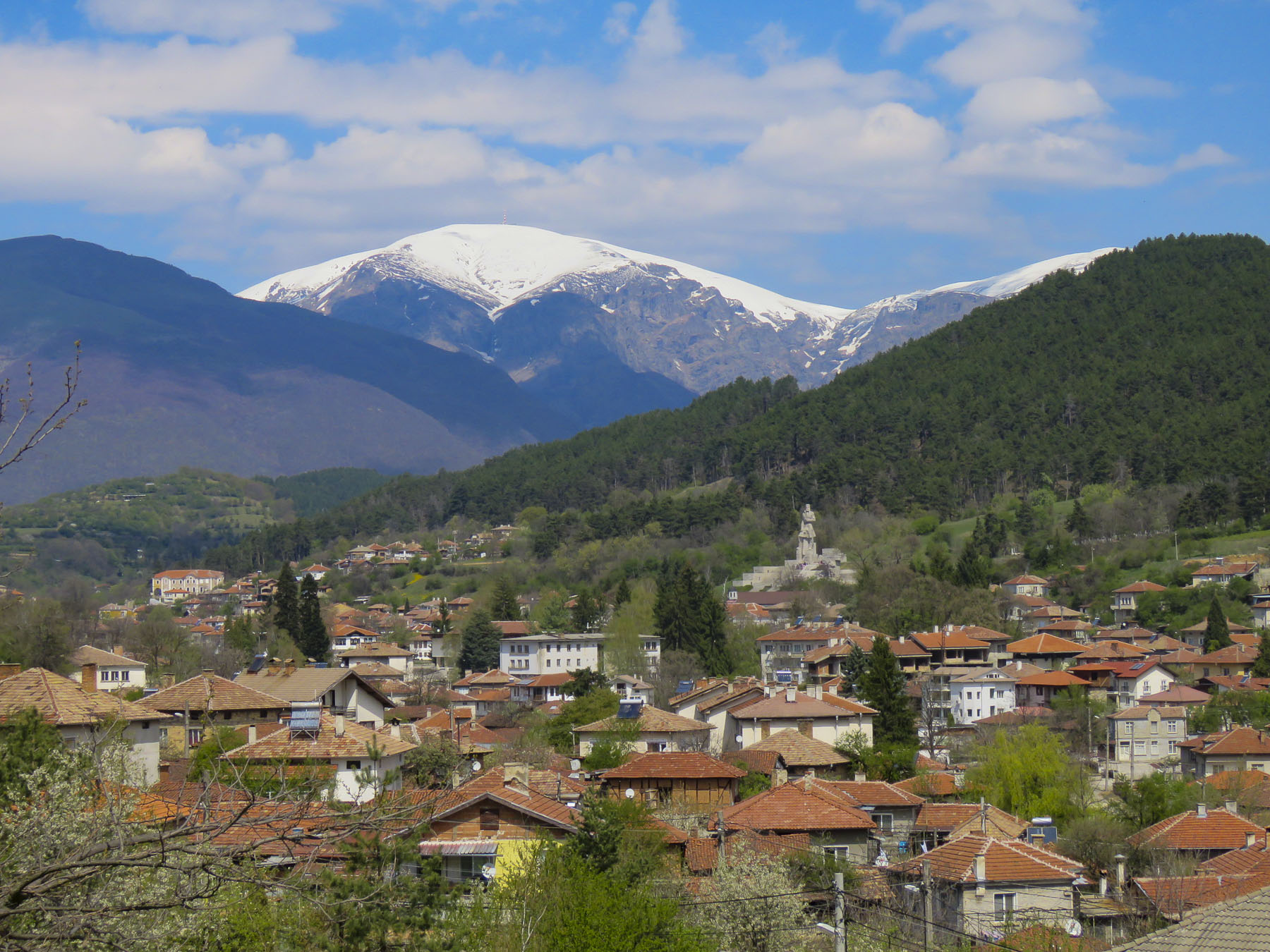
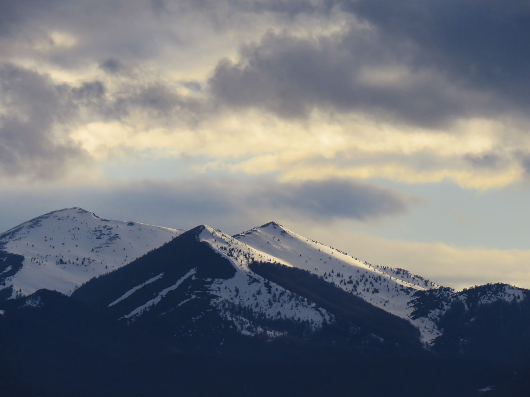
 In the morning we followed Rt. 1 south for a while as it hugged the Struma River, which would eventually reach the Aegean Sea, before we turned off and headed in to the Pirin Mountains.


 Melnik is situated in a wide gorge under striking sandstone rock formations, called hoodoos, that tower hundreds of feet high, created from millennia of erosion. Locals refer to these geological phenomena as Melnik Earth Pyramids. The village has been renown for making strong wine since 1346 from a regional red grape varietal, Shiroka Melnishka, and wine cellars still line its main street.
  Once a thriving village with one thousand residents, today it is now home to fewer than three hundred. The village was a delight to explore with its cobbled streets meandering between the whitewashed stone and timber homes built in the Bulgarian Revival style. Ninety-six of the village’s houses are historically protected. Any new construction in town adhered to that aesthetic.
  From the ruins of Bolyarska kŭshta, high on a hill above the Church of St. Anthony, we spotted the dome of what looked like a hammam, a Turkish bath, nestled between the traditional homes below, and went to explore.
  With the help of a kind woman, who somehow knew what we were looking for, we found the ruins of a small Roman era spa in a small side alley. Its dome was fully intact and the substructure of its once heated floor remained. There is also a single arched old roman bridge, near the parking lot, that you can still walk across. Before continuing to Kovachevitsa, we relaxed at one of the sunny cafes in the center of the village.
 Kovachevitsa, an isolated, rustic stone village in the Rhodope mountains, was only 52 miles away near the border with Greece. However, it took us the bulk of the afternoon to reach because “someone stops every hundred yards to take a photo.” And stop we did as we were awed by the beauty of the border region as we drove through the mountains. So close were we to the border that our phones binged with a “Welcome to Greece” message from our cell phone carrier.
 At one point we stopped to photograph a complete section of an iron truss bridge, just rusting away on the side of the road, only to have our car suddenly surrounded by a flock of bah-ing sheep.

 So, we knocked on the ancient door of the closest building only to be greeted by loud barking. Retreating back to the car we pondered what to do when a voice behind us said “hello.” That was the only word of English our host spoke until he said “goodbye” two days later. The barking dog turned out to be a gentle giant, who welcomed us to the inn. In fact, all the dogs of the village were St. Bernard-size, and they must all have been related, because they closely resembled one another. Fortunately, they were good-natured.


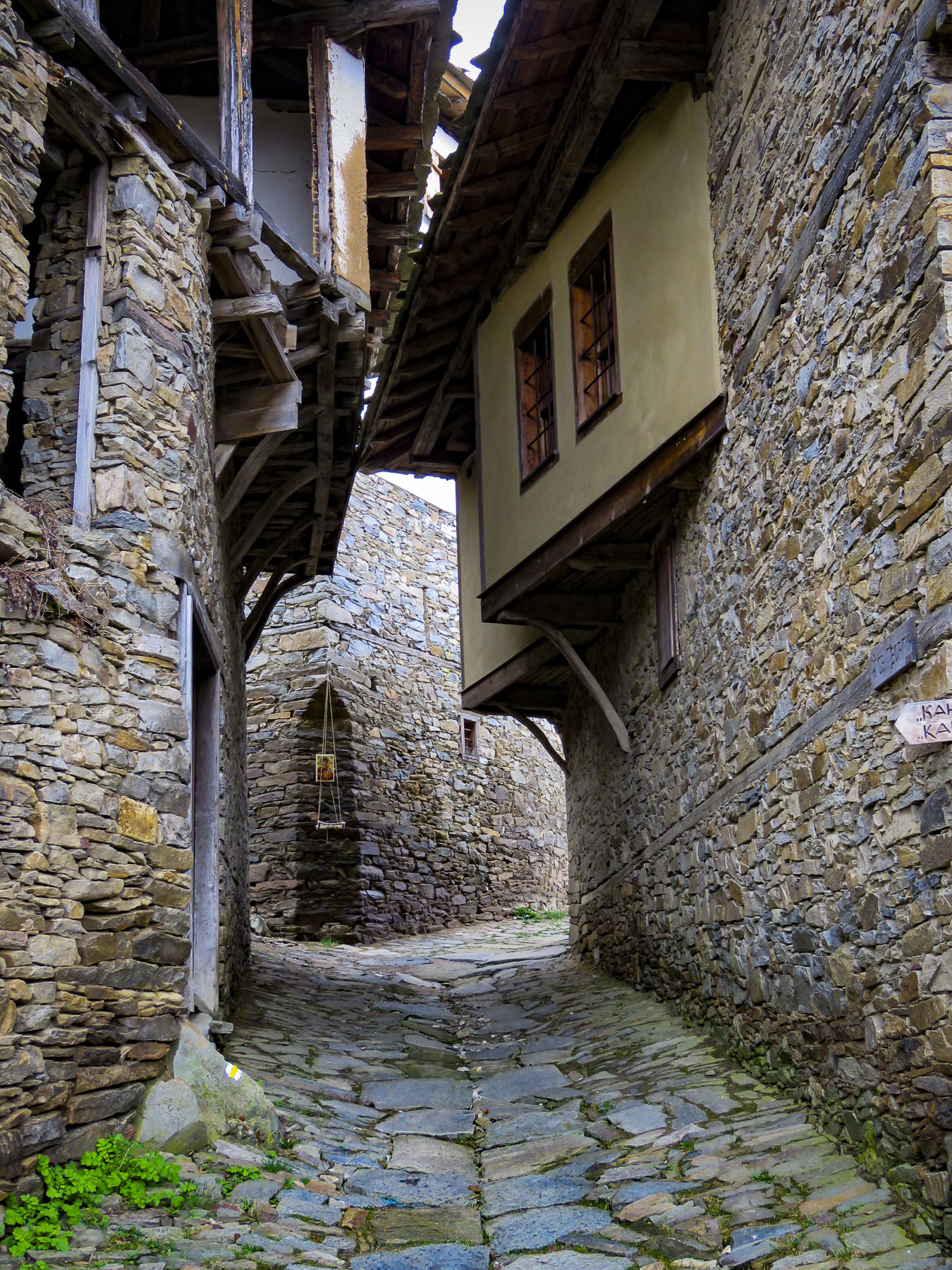 Bulgarians fleeing religious persecution and the forced conversion policies of the Ottoman Empire sought refuge in the rugged Rhodope mountains and established Kovachevitsa in 1656. Agriculture and stockbreeding in the area thrived during the 1800s and the homes still standing in the village date from that time. The tall stone homes of Kovachevitsa are stunning and unique in an organic way.

 At breakfast the next morning Google Translate nicely bridged our communications barrier with the innkeeper’s wife. Loading the Cyrillic keyboard into the app for our hostess to use, Donna’s phone was passed back and forth repeatedly during a lively conversation about family, each other’s lives, the village and our travels. Our hosts’ children live with their grandparents in one of the larger towns off the mountain as there isn’t a school in the village anymore.
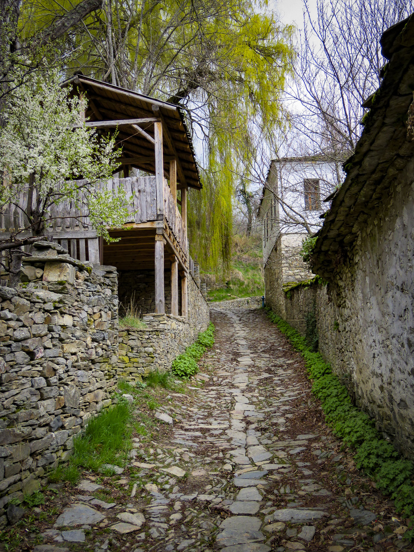
  Most of the young families have moved away to find work, leaving only 28 year-round residents looking after the village till the tourist season starts. Strolling under blossoming elderberry trees, we had the narrow lanes to ourselves as we worked our way towards St. Nikolas Church.

 On the way back to our inn we stopped to admire the woolen creations knitted by a lone street vendor with a toothless smile who was bundled under layers of clothing to ward off the mountain chill. Her prospects for a profitable day seemed slim as the street was nearly deserted. When we expressed interest in only one pair of socks, she assertively pantomimed that we needed more. Looking up from readying our payment we could only smile and chuckle when we found she had filled our bag with two extra pairs of socks. They were well made and a bargain, so we caved to her sales pressure. I’m wearing a pair now as I write this, and my toes are happy we she insisted. I wouldn’t have been surprised if we were her only sale of the day.
