Vietnam: Ho Chi Minh City – A Dynamic Blending of the Old and New or Scooters, Neon, and Warm-Hearted People

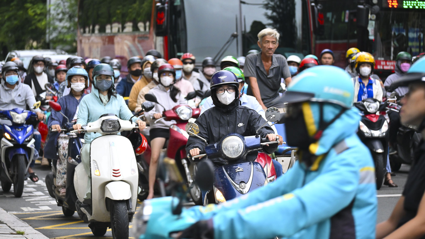
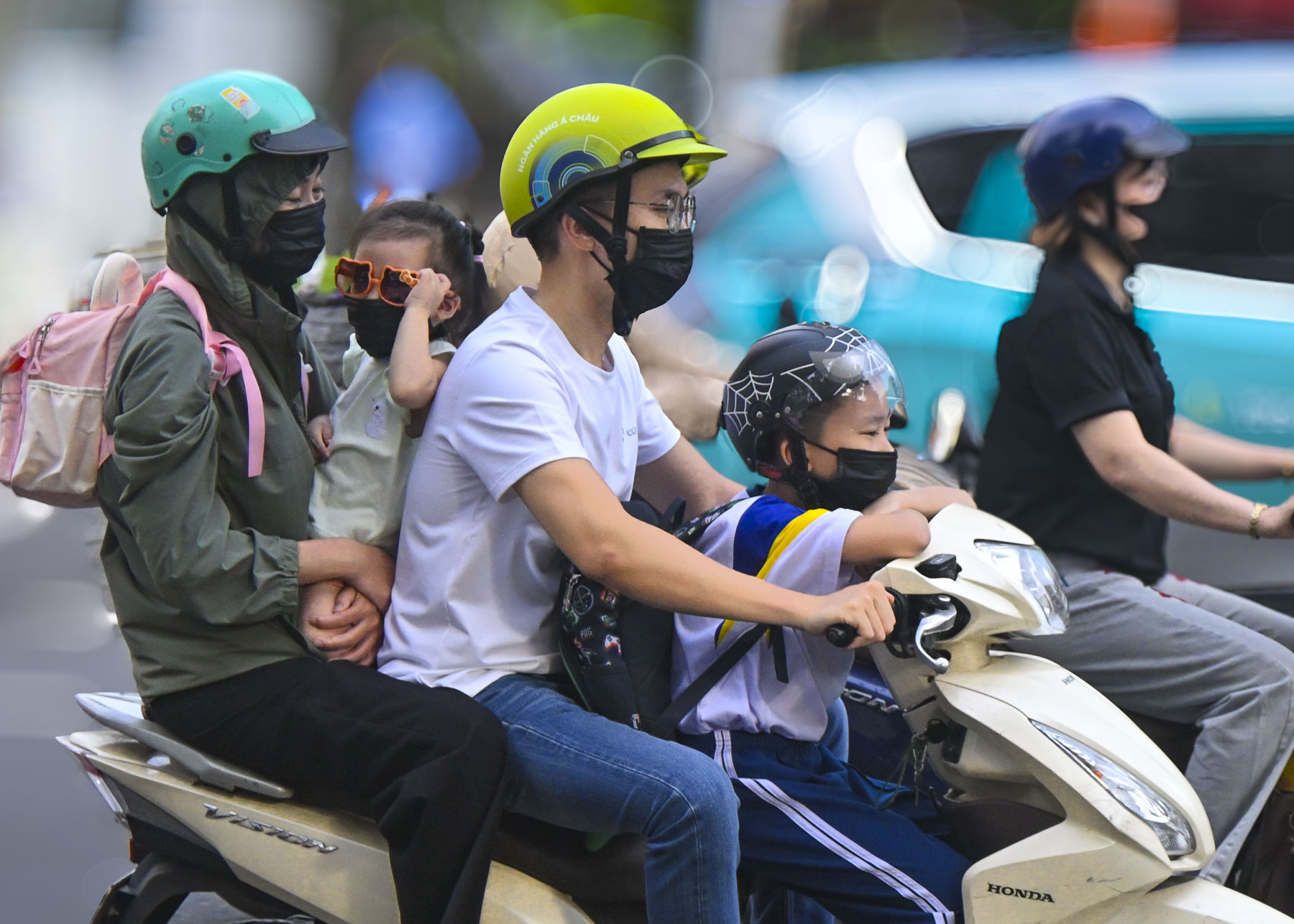
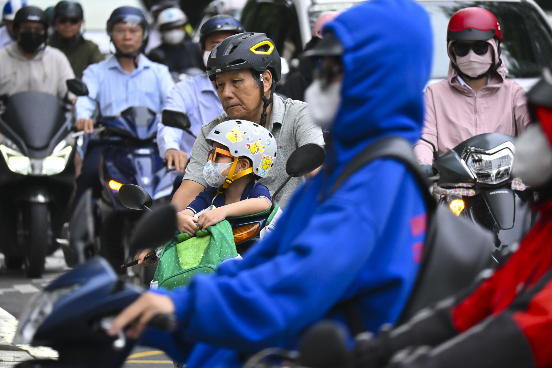
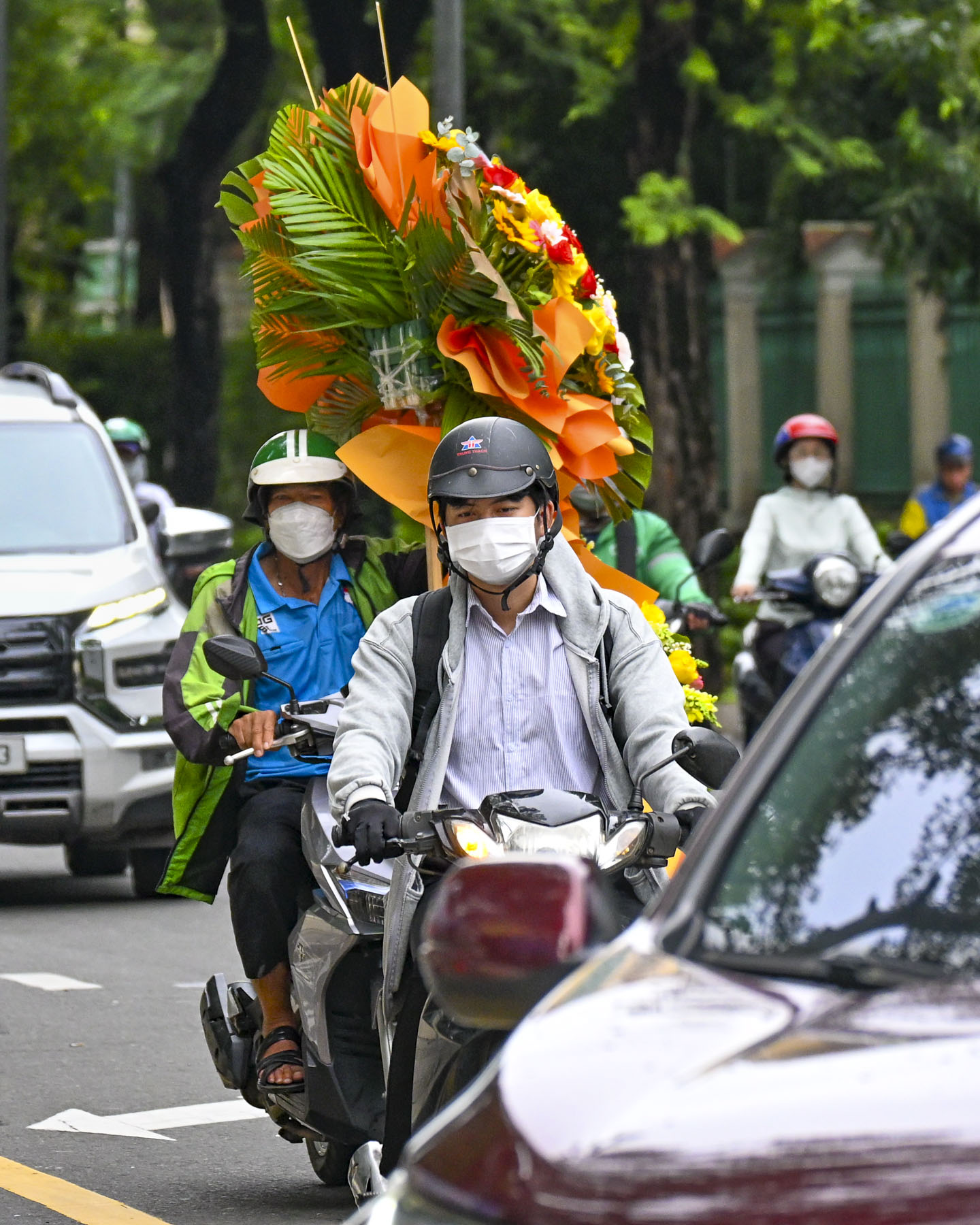
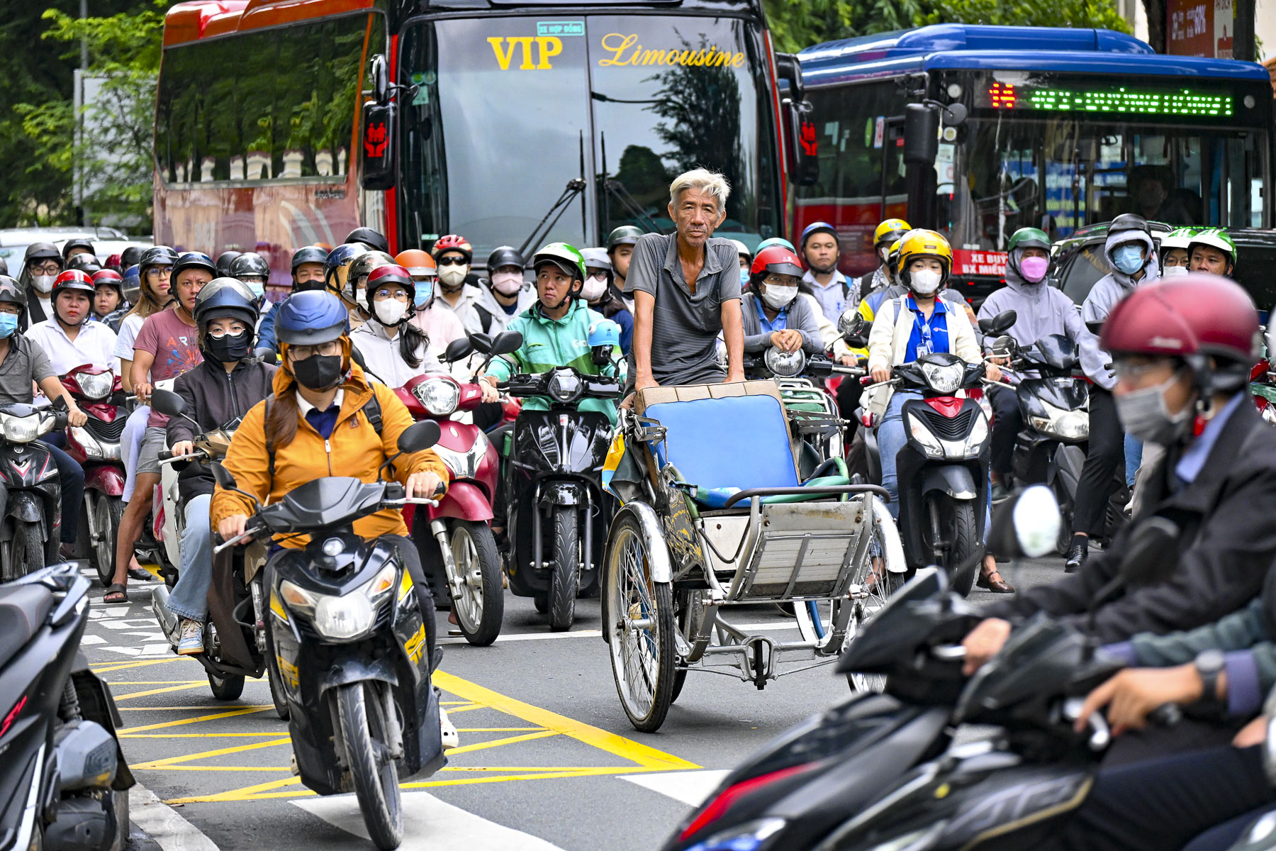
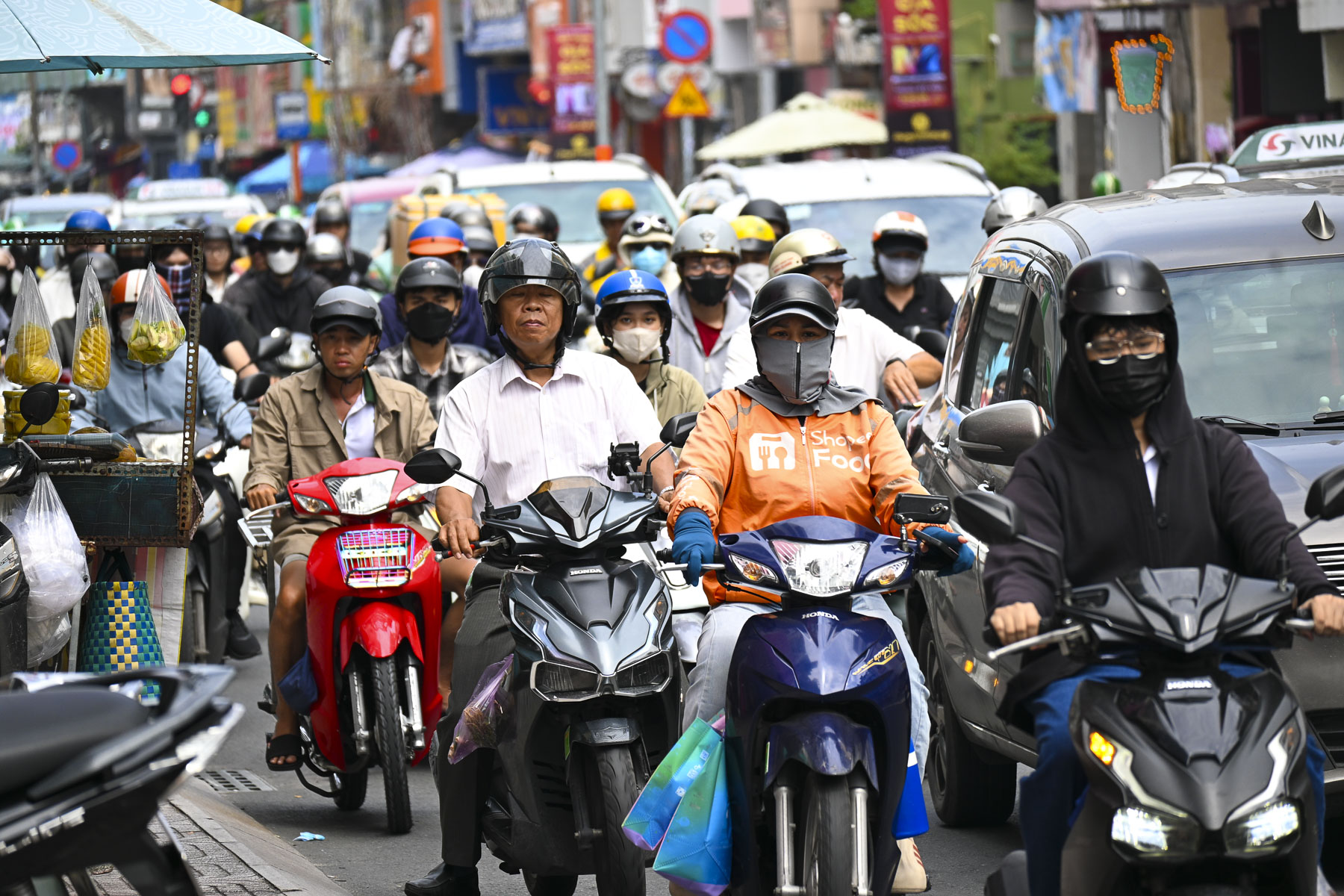
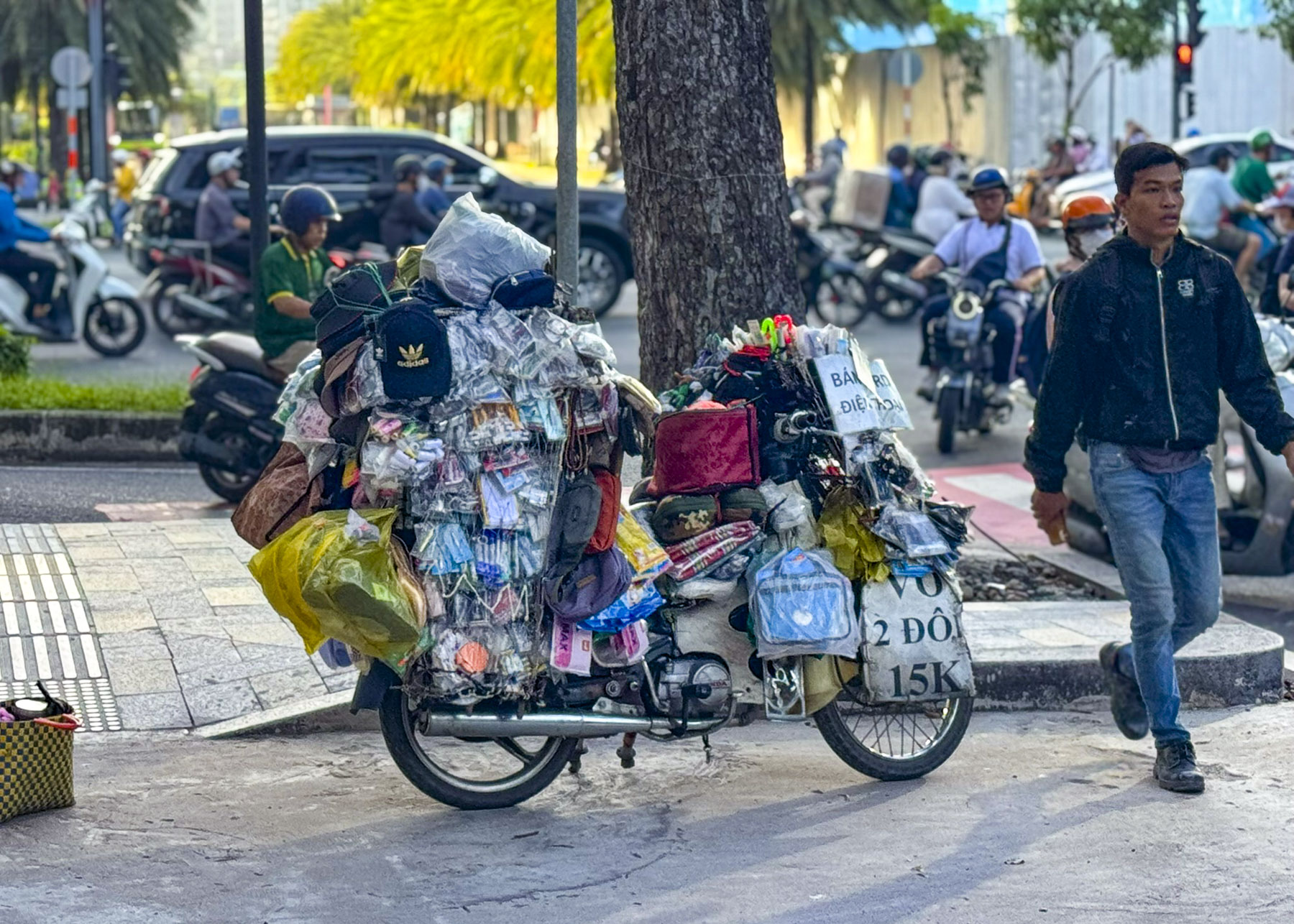
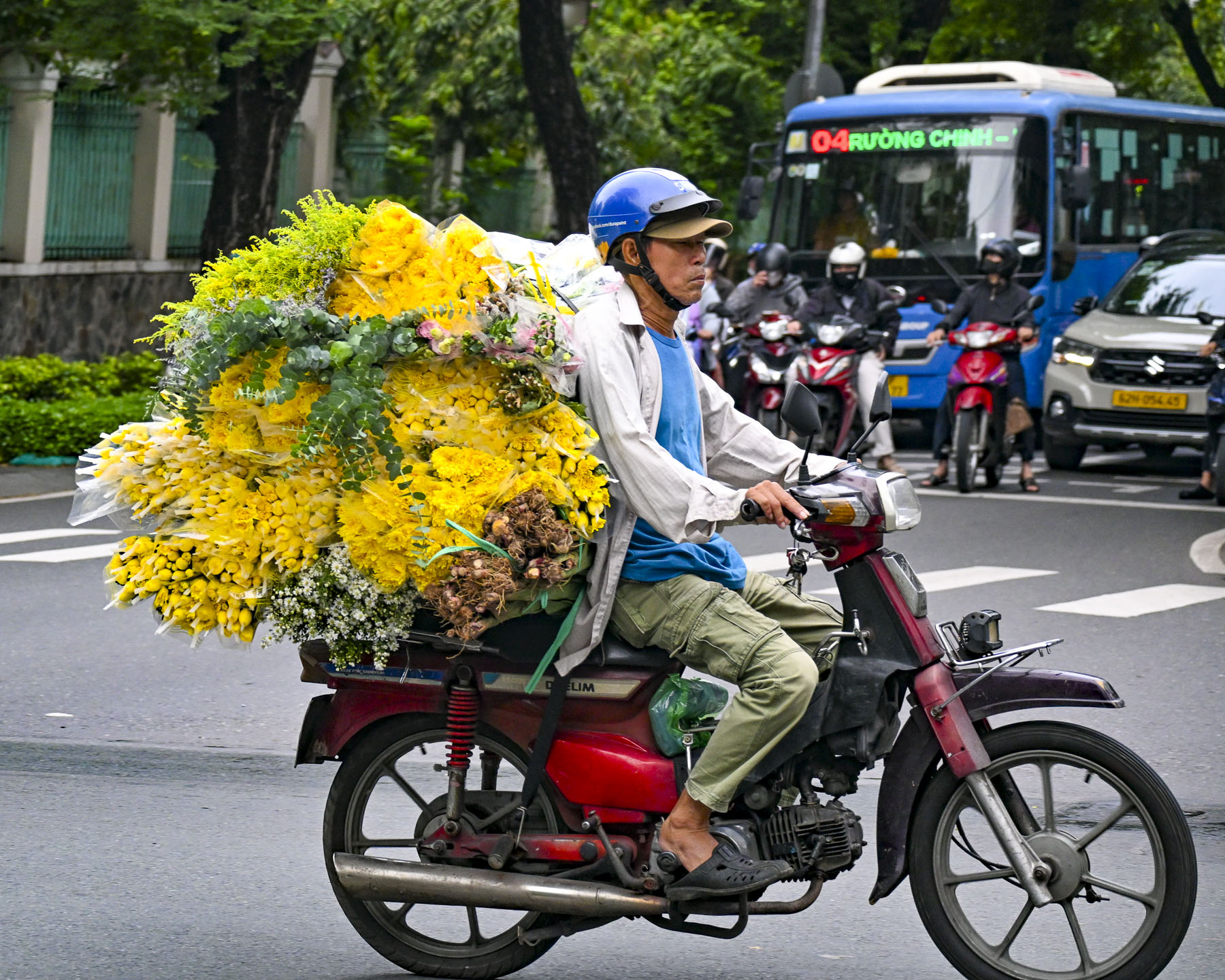
Scooters everywhere, with apocalyptic-looking masked and helmeted riders roaring along the streets, like cells in our veins always moving never stopping. Individuals off to work, parents taking kids to school, and florists delivering large floral bouquets, along with ice vendors whose towers of bagged ice tied to the backs of their scooters were slowly melting away in the heat.

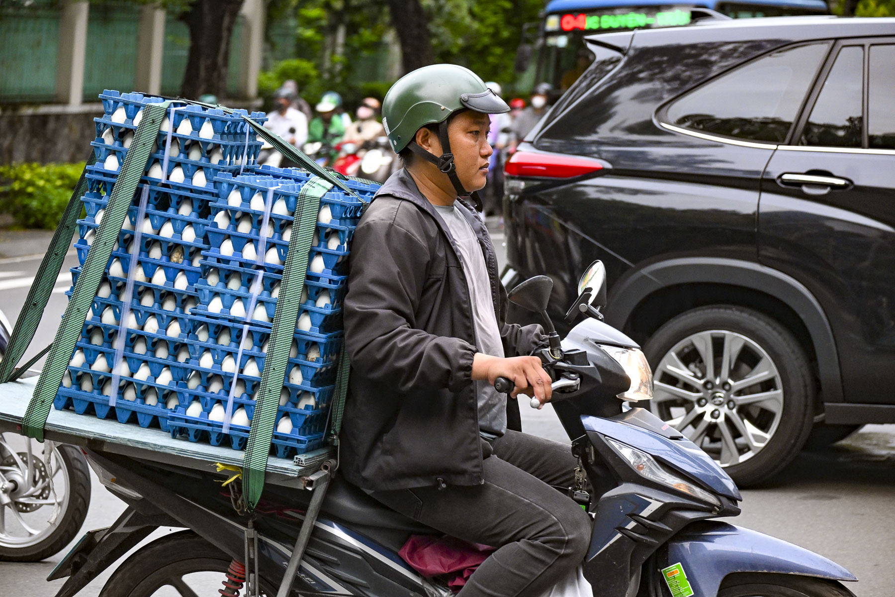
Cartons of fresh eggs, ladders, toolboxes, and wheelbarrows all whizzed by our GrabTaxi, the Vietnamese equivalent to Uber, as we headed into the city. Think Mad Max set in a metropolis of ten million; Ho Chi Minh City, formerly called Saigon, was crazy!

What had we gotten ourselves into? With horrific traffic like this into the city from the airport, downtown must be a congested nightmare! But it wasn’t. The cars, buses, and scooters flowed in an impressively smooth manner during the morning rush-hour without tempers flaring or any horns being blasted.

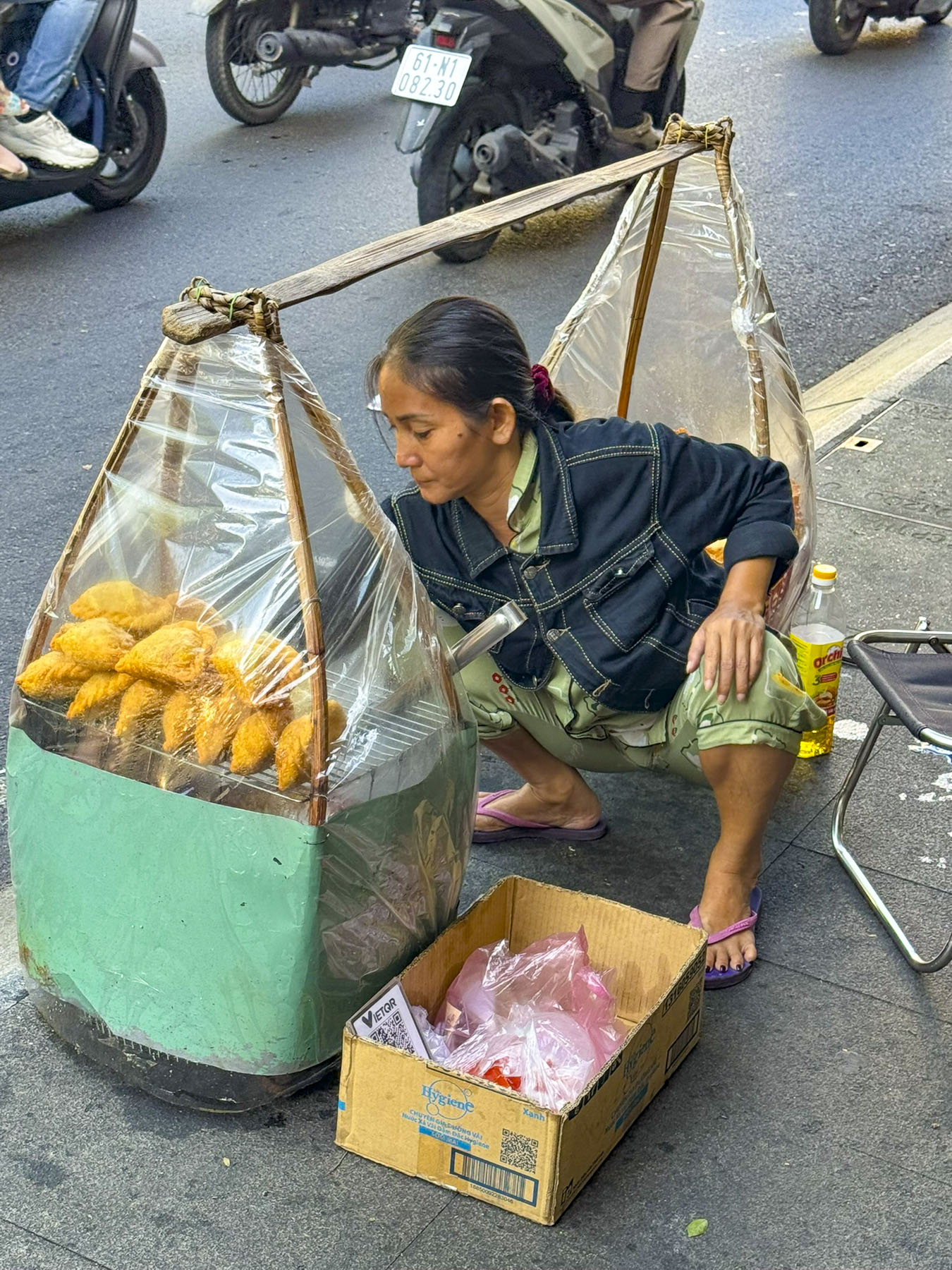
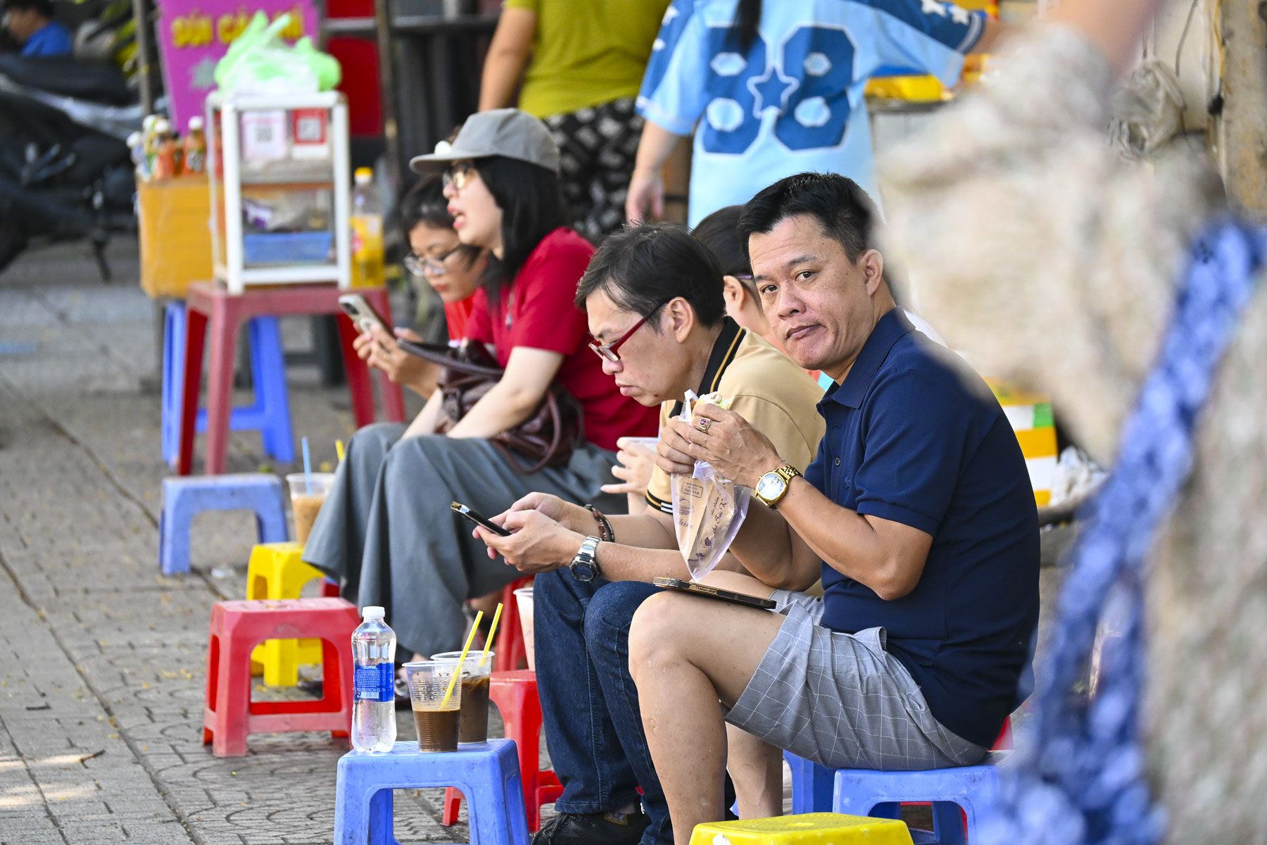
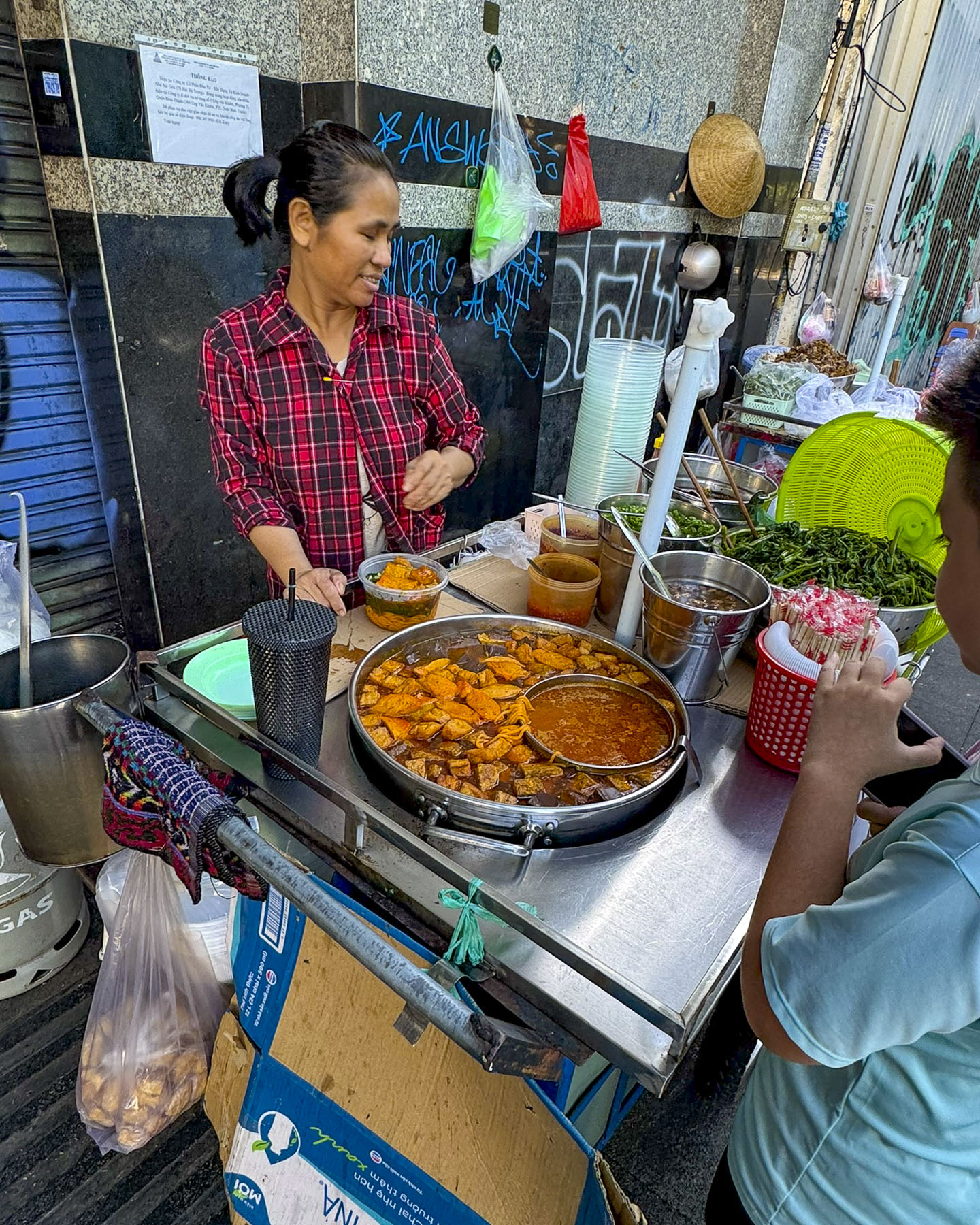
Along our route, ubiquitous Xe Bánh Mì and Xôi, bread and sticky rice carts, were set up along the roadside curb to offer takeaway, while also offering low colorful plastic stools on the sidewalk for customers to perch on while they ate.  These street vendors offered Banh mi, small French style baguettes stuffed with various fillings, or a variety of Xôi Mặn, savory sticky rice dish, traditionally served wrapped in banana leaves or a paper container nowadays.

Crossing the street was quite an adventure. We soon realized we couldn’t be timid, and followed the locals’ lead; wait for the light to change and once you commit don’t hesitate. Scooters drivers will give way; they really don’t want any pedestrians as fender ornaments.

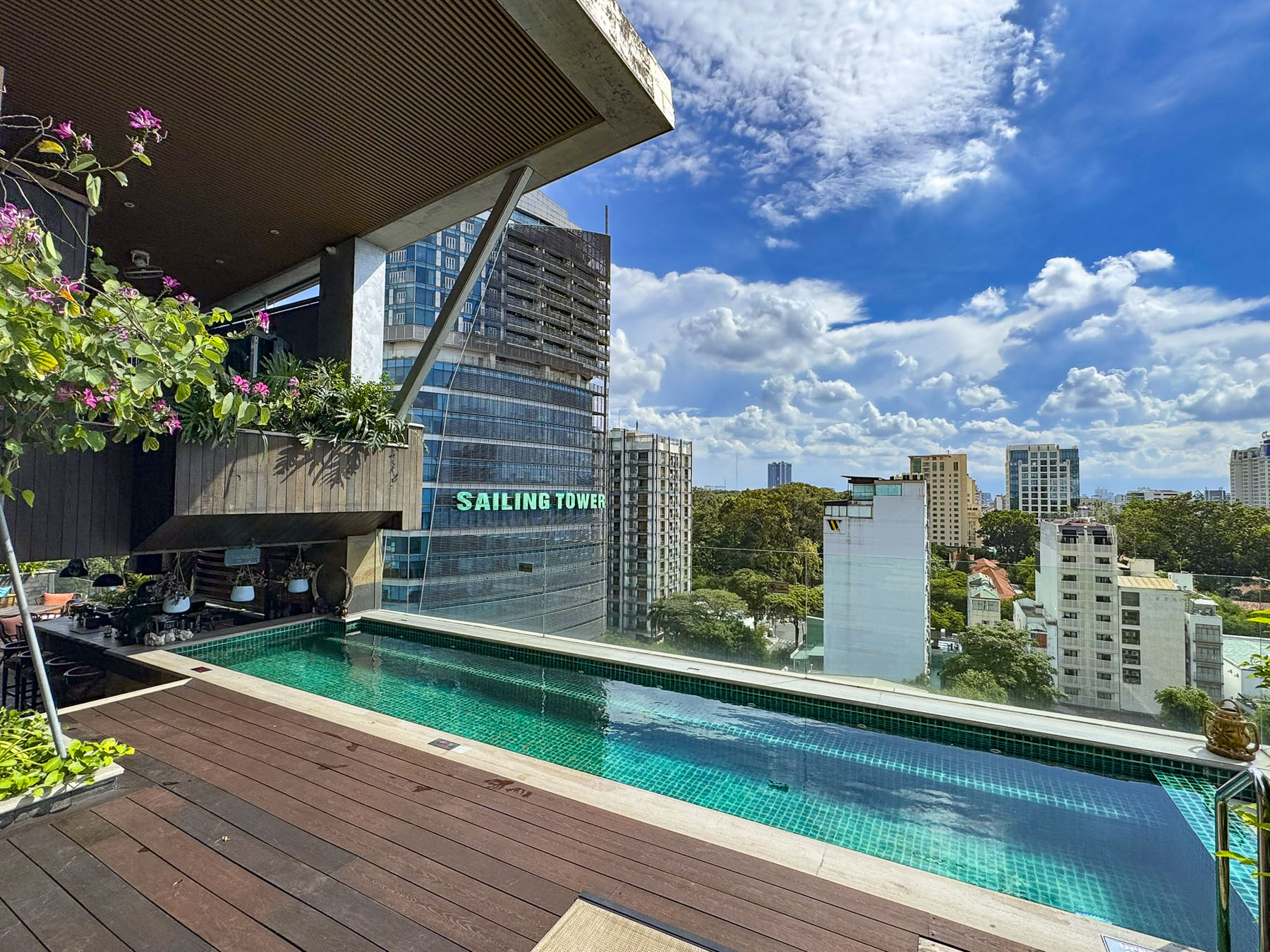
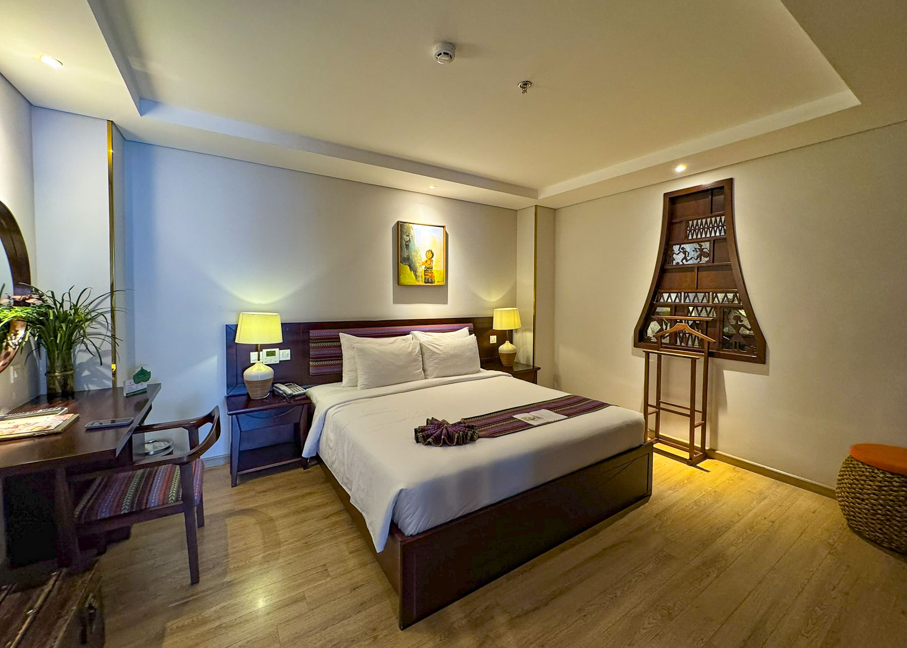
After our long flight we spent the balance of the afternoon resting after checking into the Au Lac Legend Hotel, named for the ancient Vietnamese Kingdom. The small boutique hotel was our base for seven nights. It was conveniently located in District 3, an interesting area where “The Pearl of the Far East” remnants of Vietnam’s French colonial past merge with the vitality of a modern neon lit and towering skyline in District 1.  There is a confusing merging of districts and reorganizing them into different administrative subdivisions in progress.

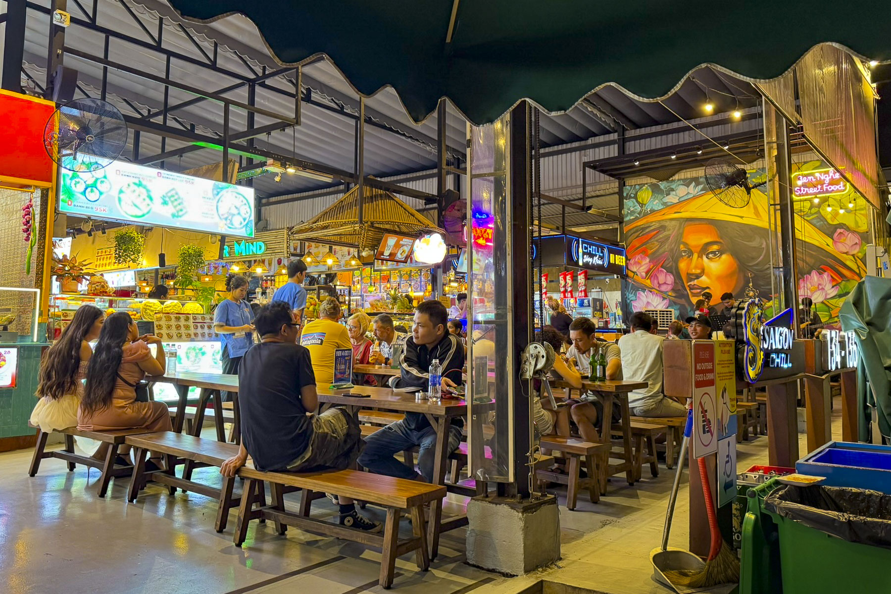
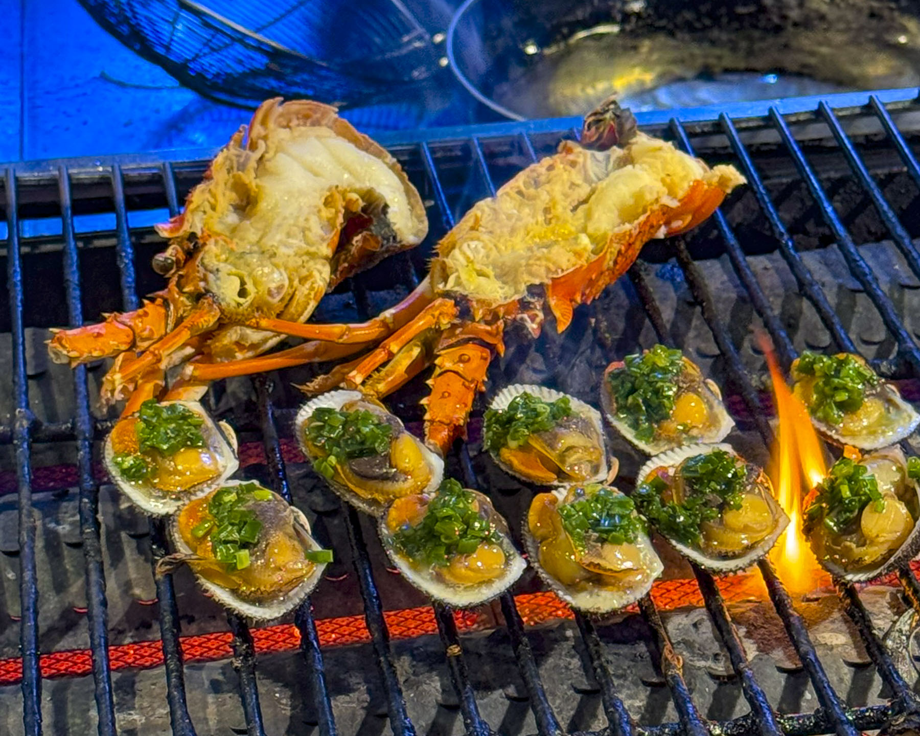
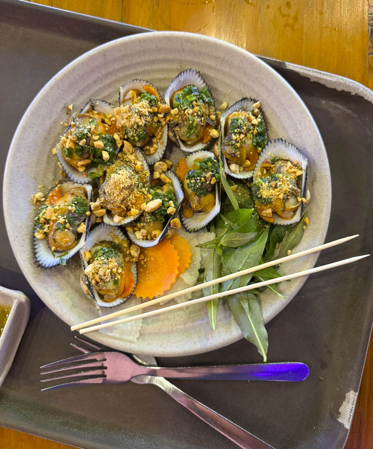
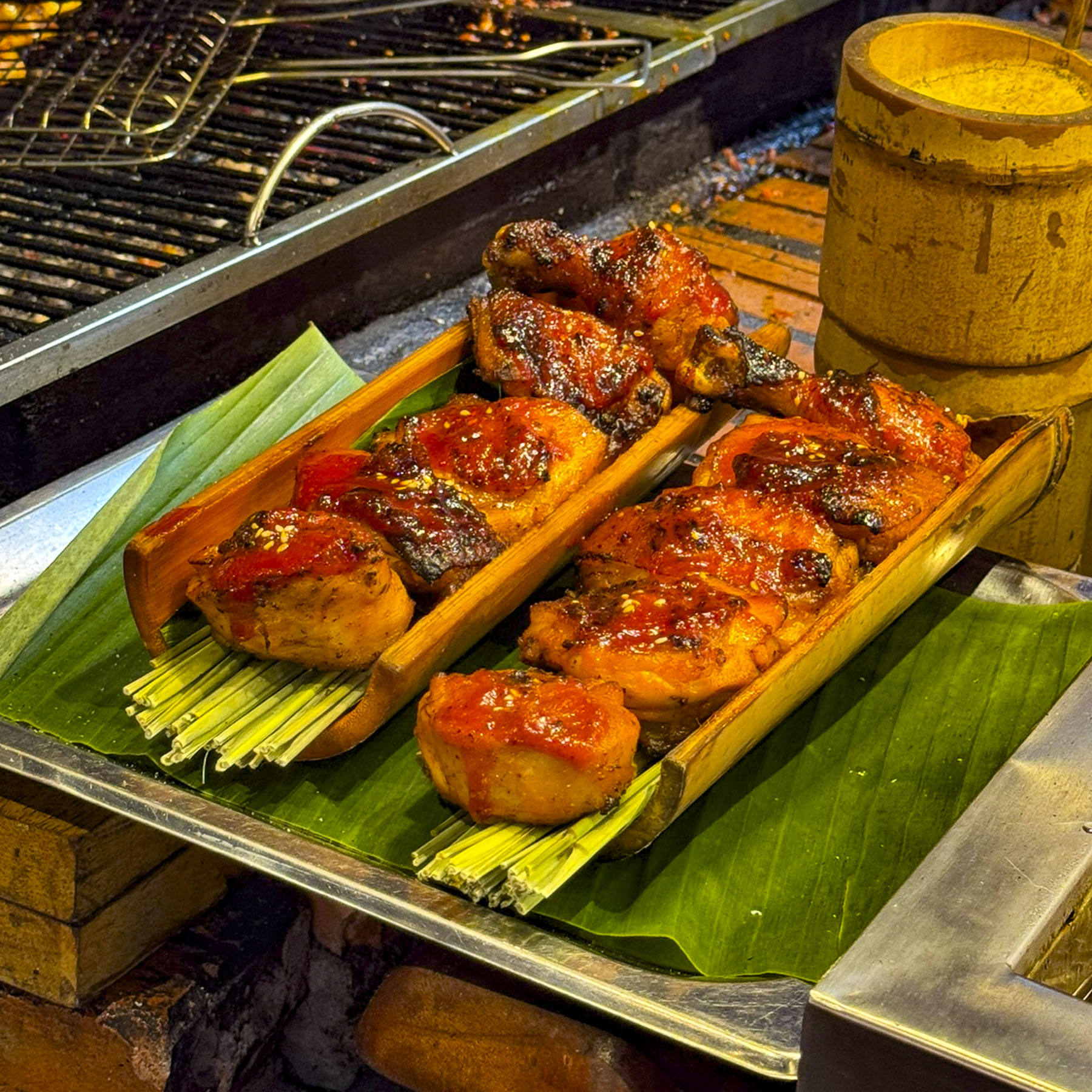
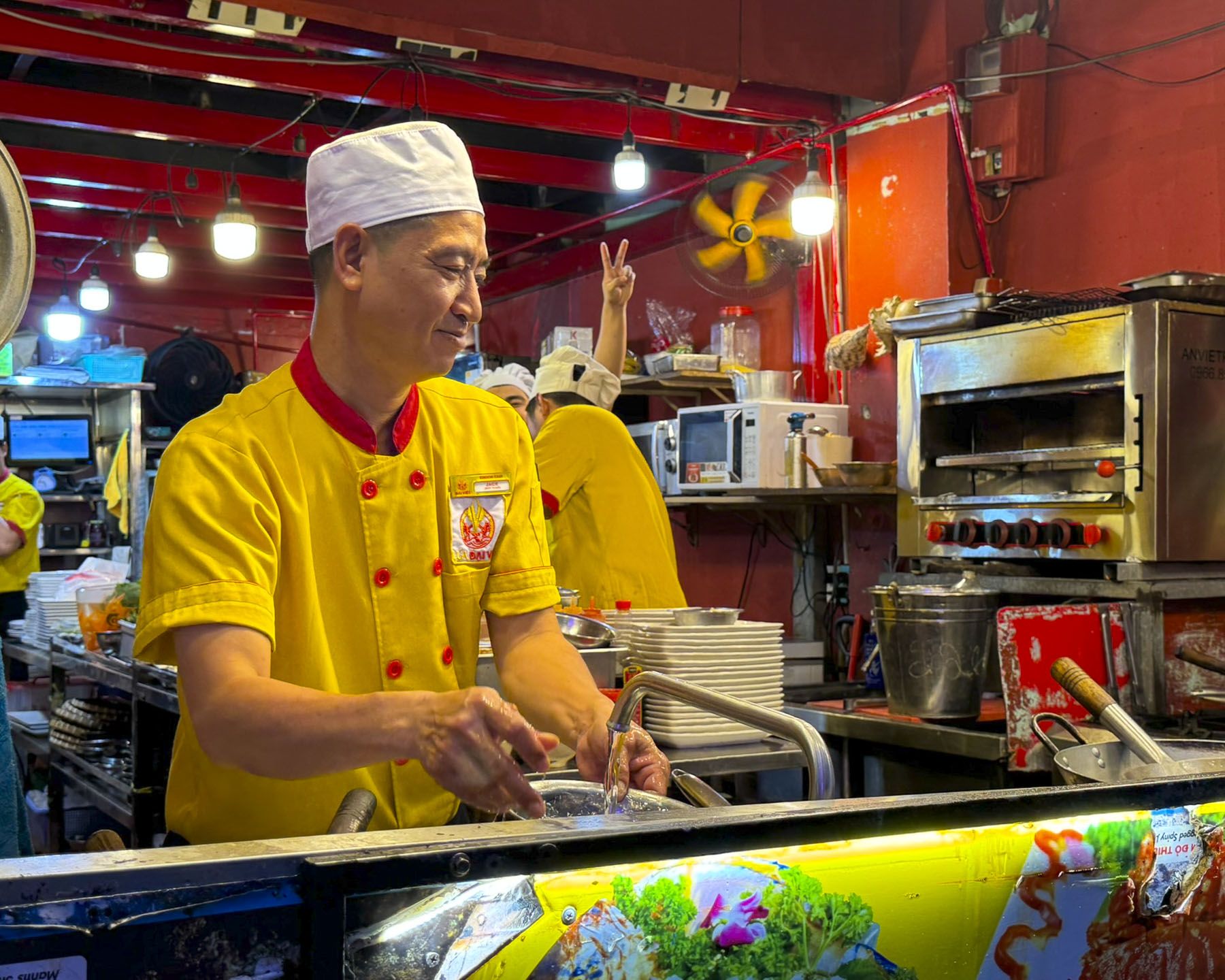
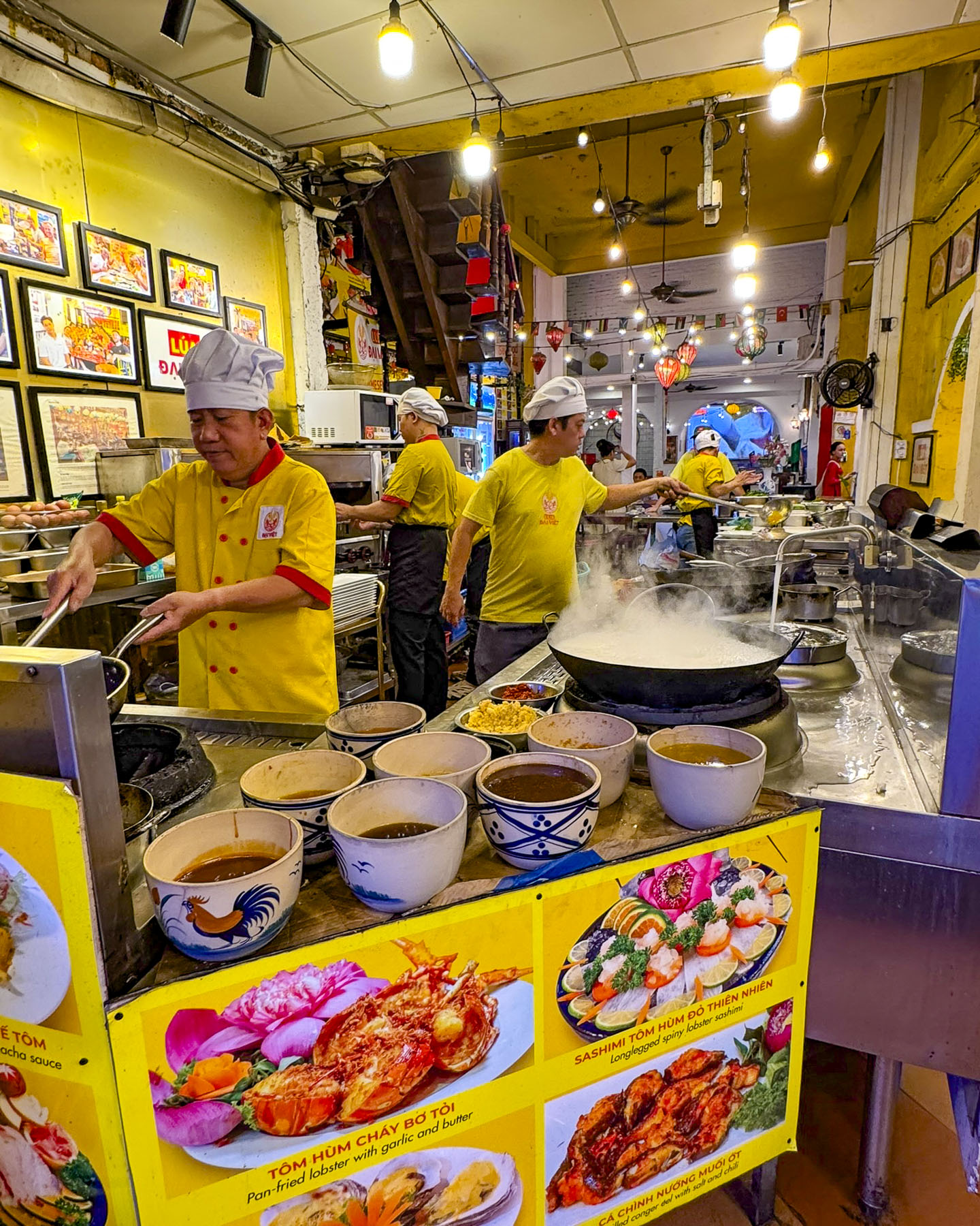
Later that evening we walked to Ben Nghe Street Food, a large food hall with many different stands offering a great variety of foods from seafood and Pho noodles to Bún Thịt Nướng, Vietnamese Grilled Pork & Rice Noodles. With a nightly band singing a mix of Vietnamese, and American pop songs, that included the Rolling Stones, Johnny Cash, and the Village People’s YMCA, along with its delicious food and good vibes, it’s a popular spot for locals and tourists.  

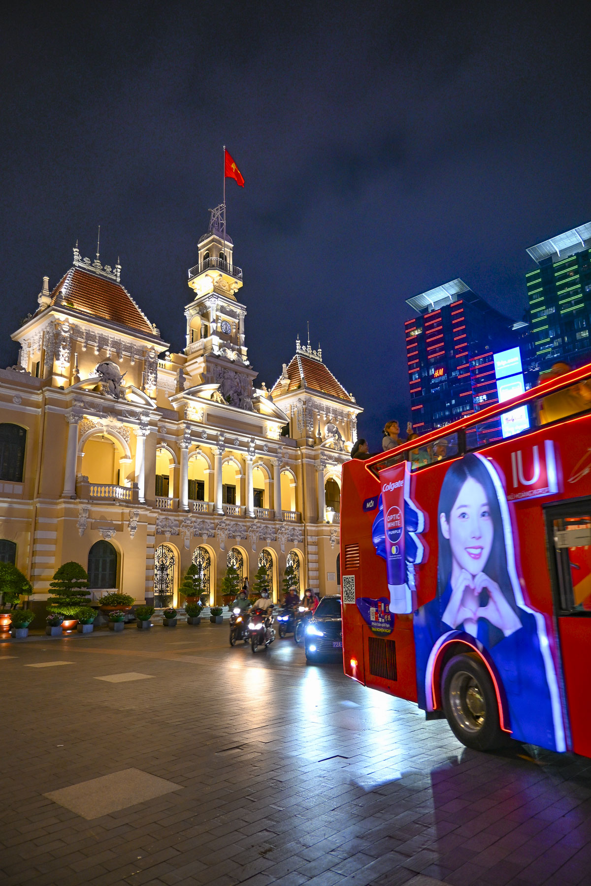
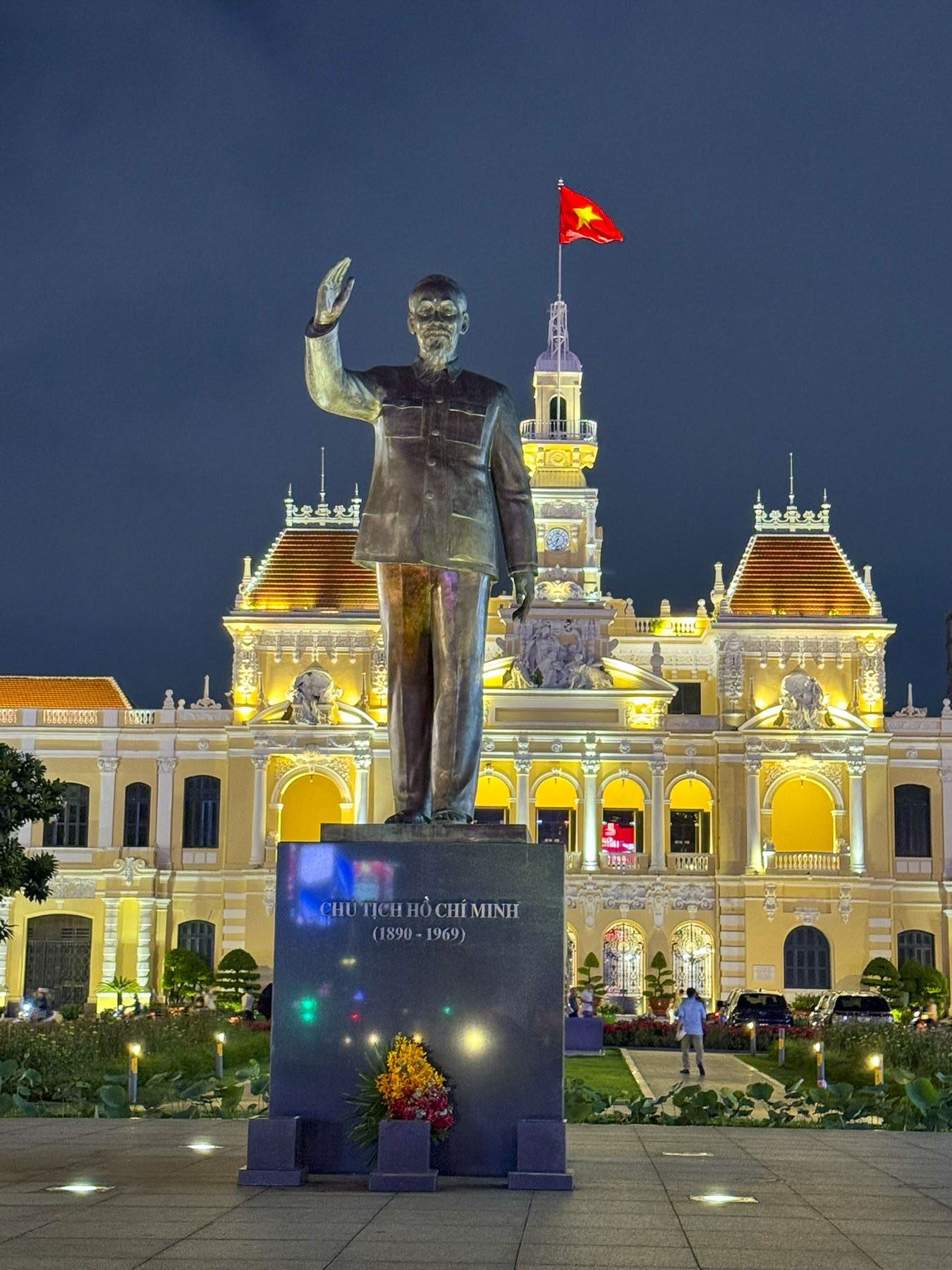
After dinner we continued our first explorations of the city and headed to the Ho Chi Minh City People’s Committee building in District 1. It is a historic French colonial building constructed in 1902 that served as the Hôtel de Ville, Saigon’s city hall. Tall buildings with electronic billboards now tower over the People’s Committee Building and the in the plaza across the street there’s an imposing monument to Ho Chi Minh, the communist leader whose military campaign reunited North and South Vietnam.

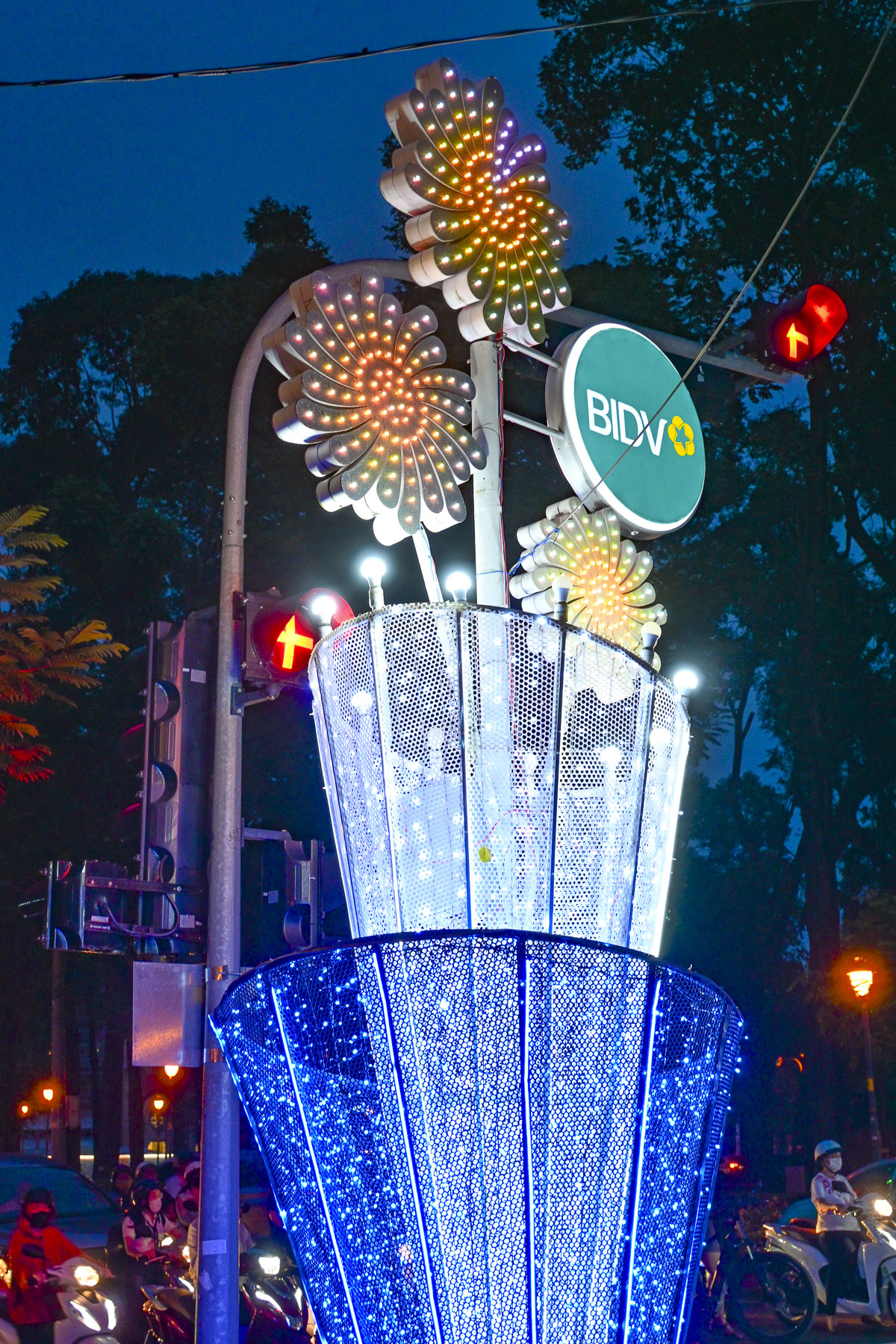
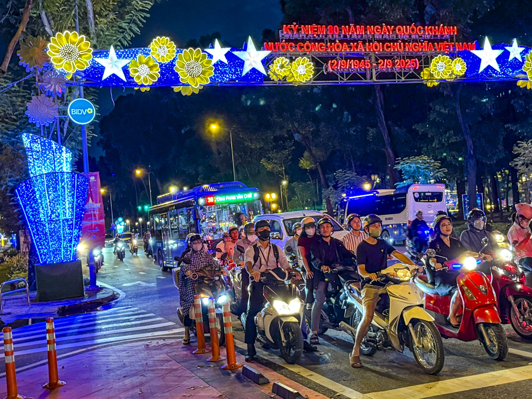
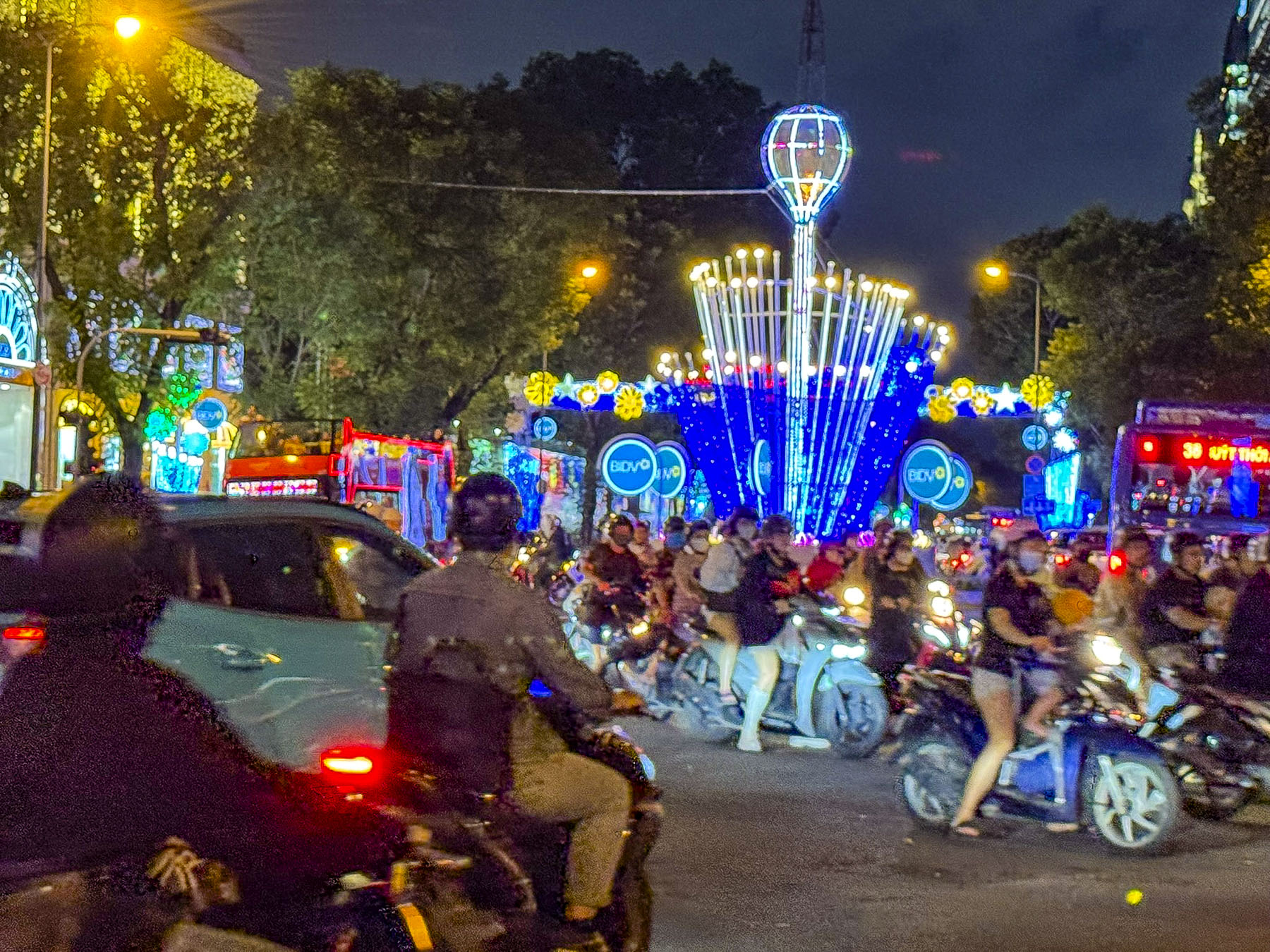
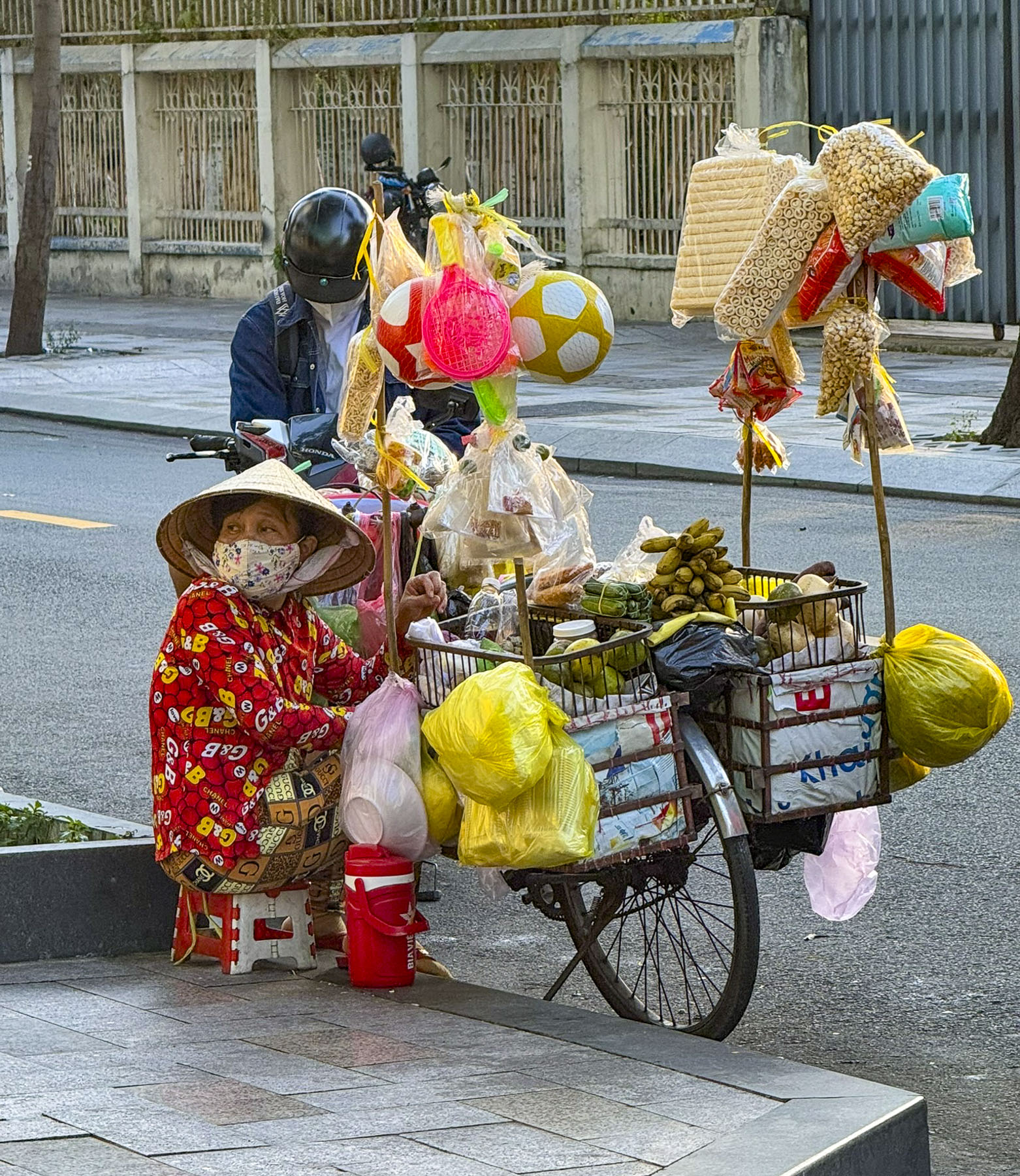
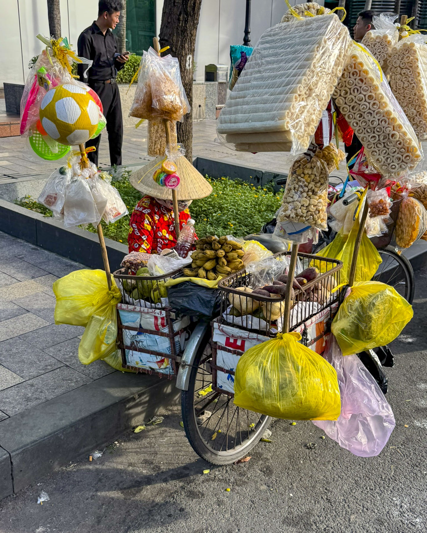
On our route back to the hotel, brightly decorated street posts sponsored by BIDV, the Bank for Investment and Development of Vietnam, lit our way. Outside a college, small groups of students taking a break from their evening classes were gathered, two or three friends on a blanket along the sidewalk, thoughtfully supplied by their snack vendor.

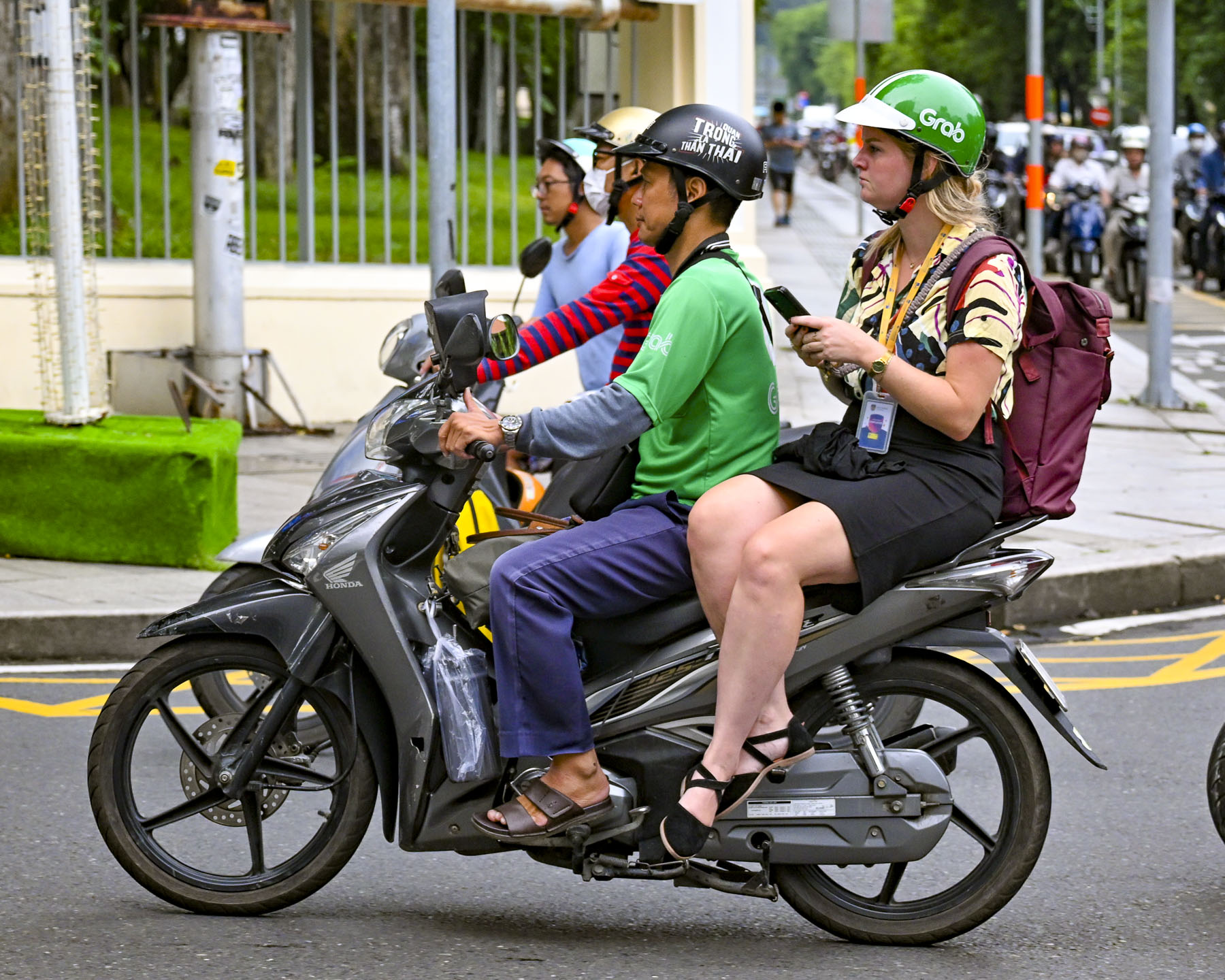
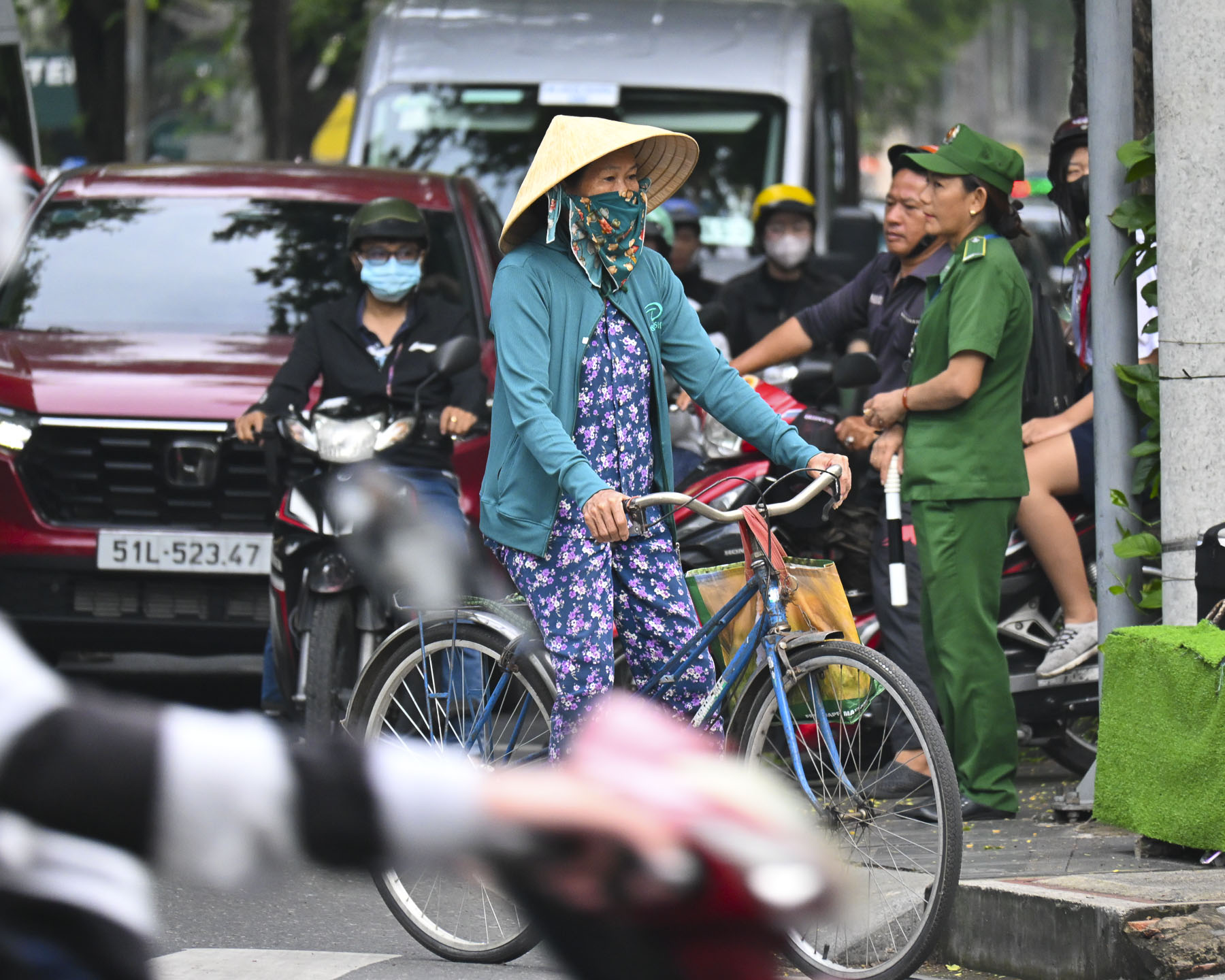
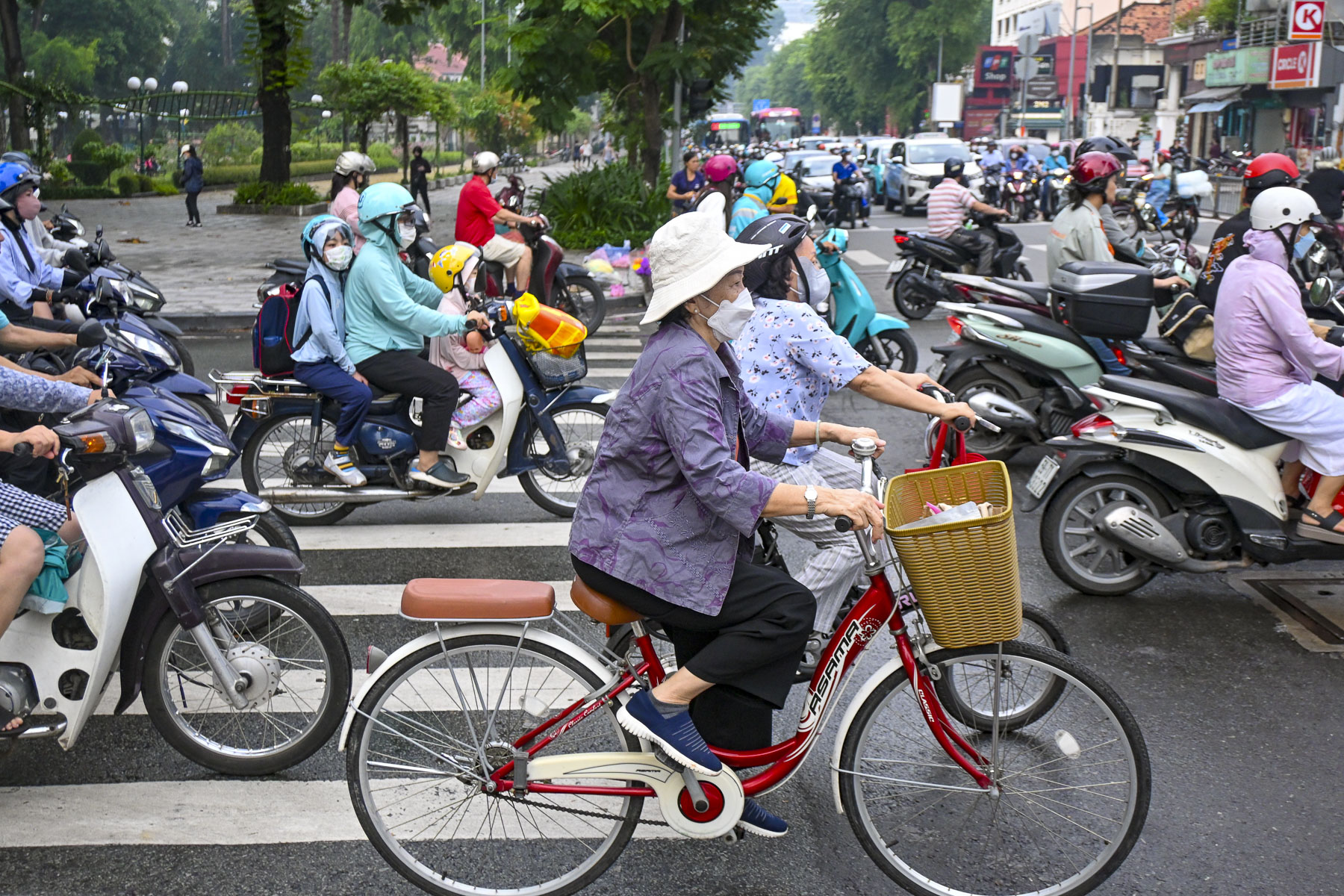
Torrential rain and high humidity define the monsoon season that ends during late September in southern Vietnam. The streets were steaming the next morning when we peeked through the curtains of our room, but the weather report forecast clearing skies. The humidity was intense, even for two folks living in the southern United States. What we didn’t expect was the extraordinary amount of time it took for our camera lenses to defog. We observed the balletic chaos of the morning rush, which now included bicycles and an occasional xích lô, or cyclo, a traditional human-powered bicycle rickshaw where the passenger sits in a seat in front of the driver. Along with helmeted tourists and fashionably dressed women sitting side saddle as scooter passengers on GrabBikes.

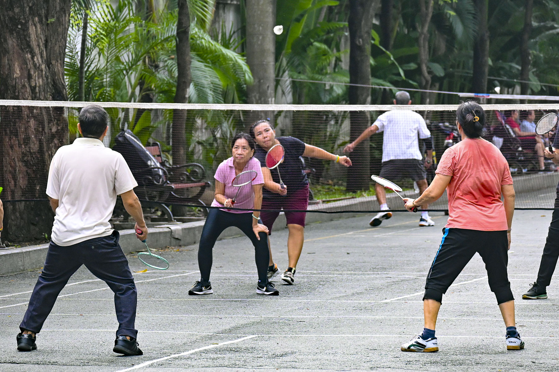
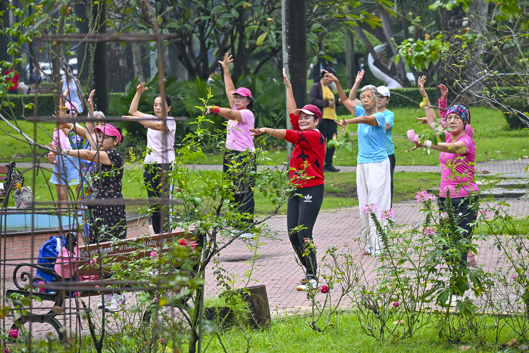
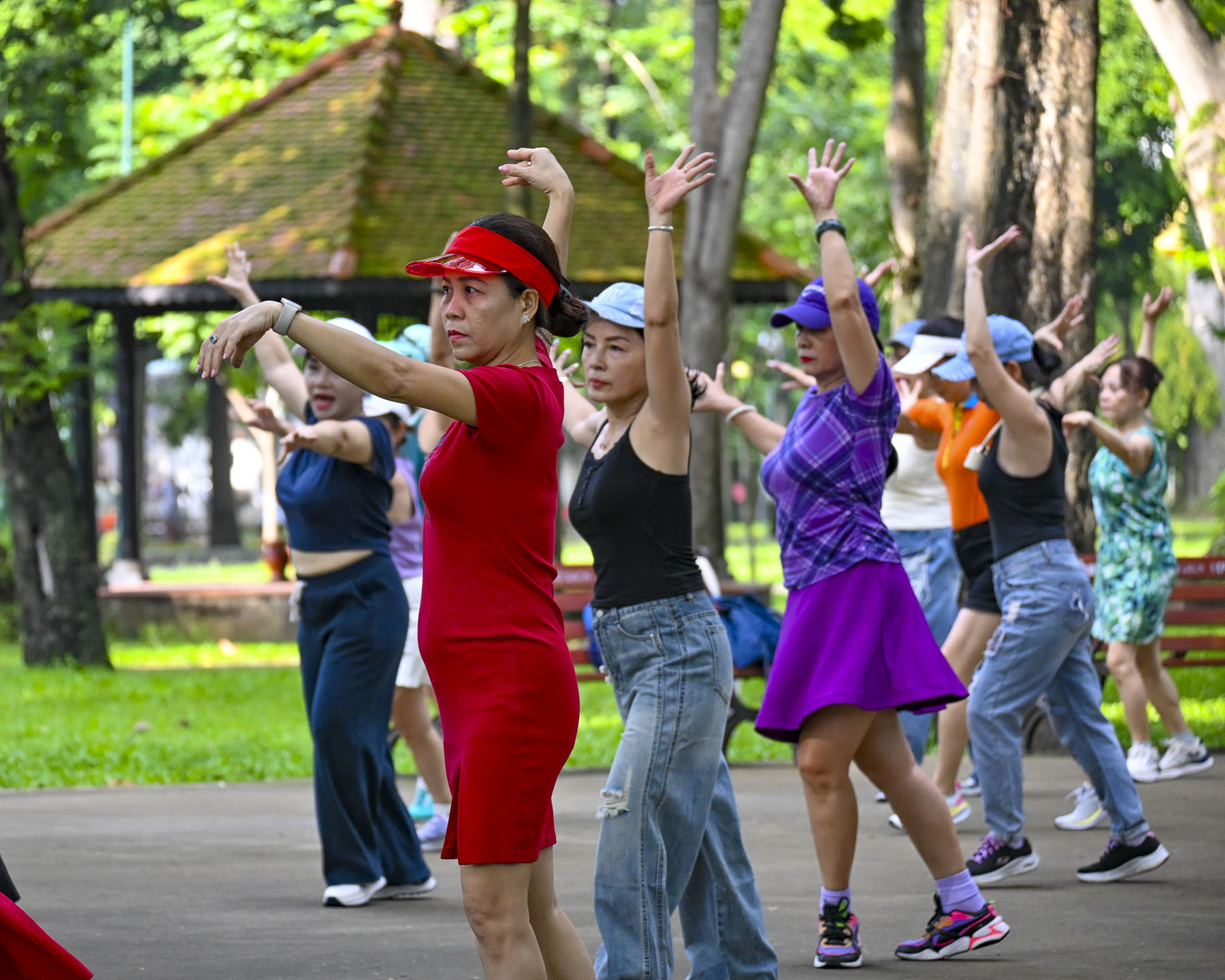
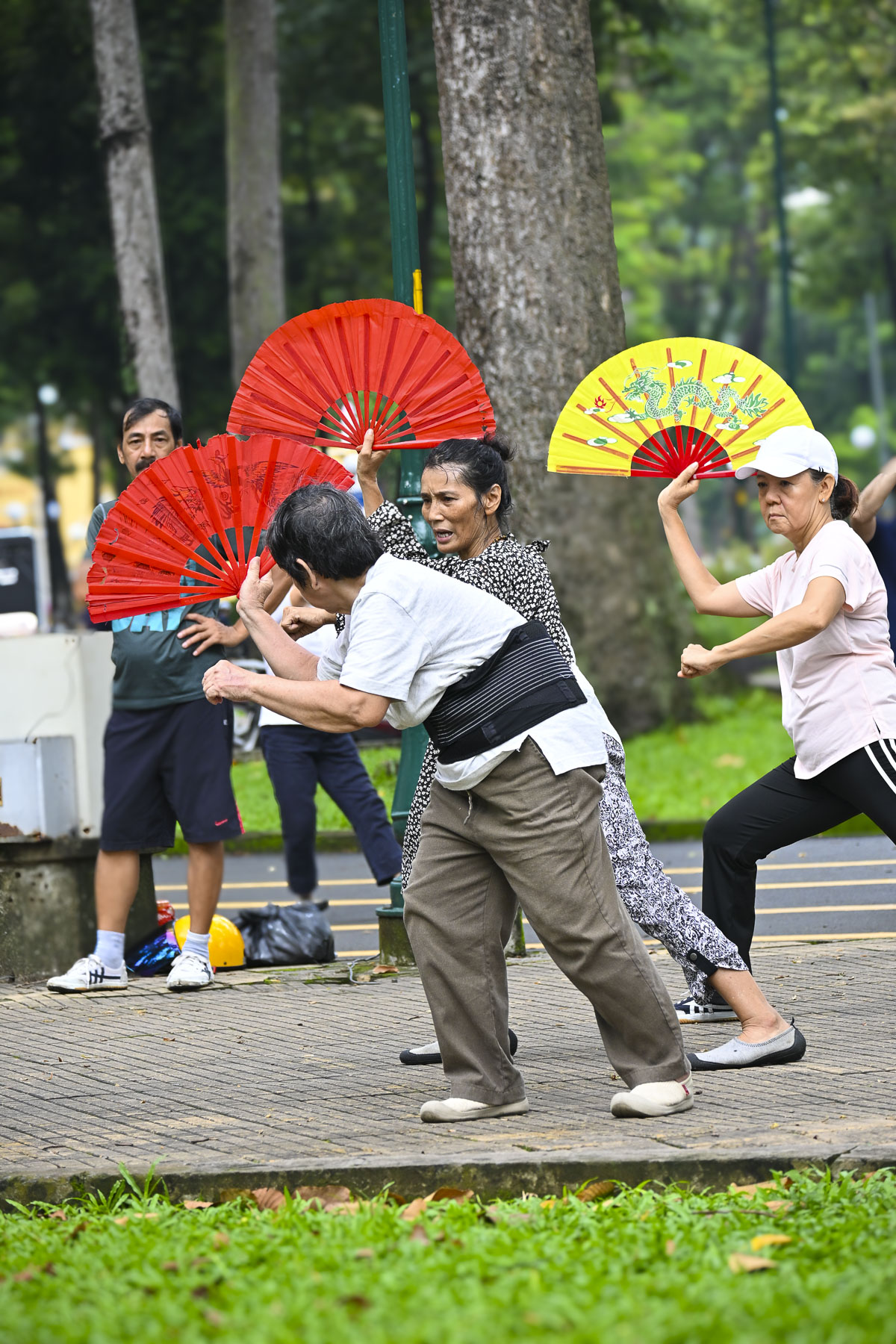
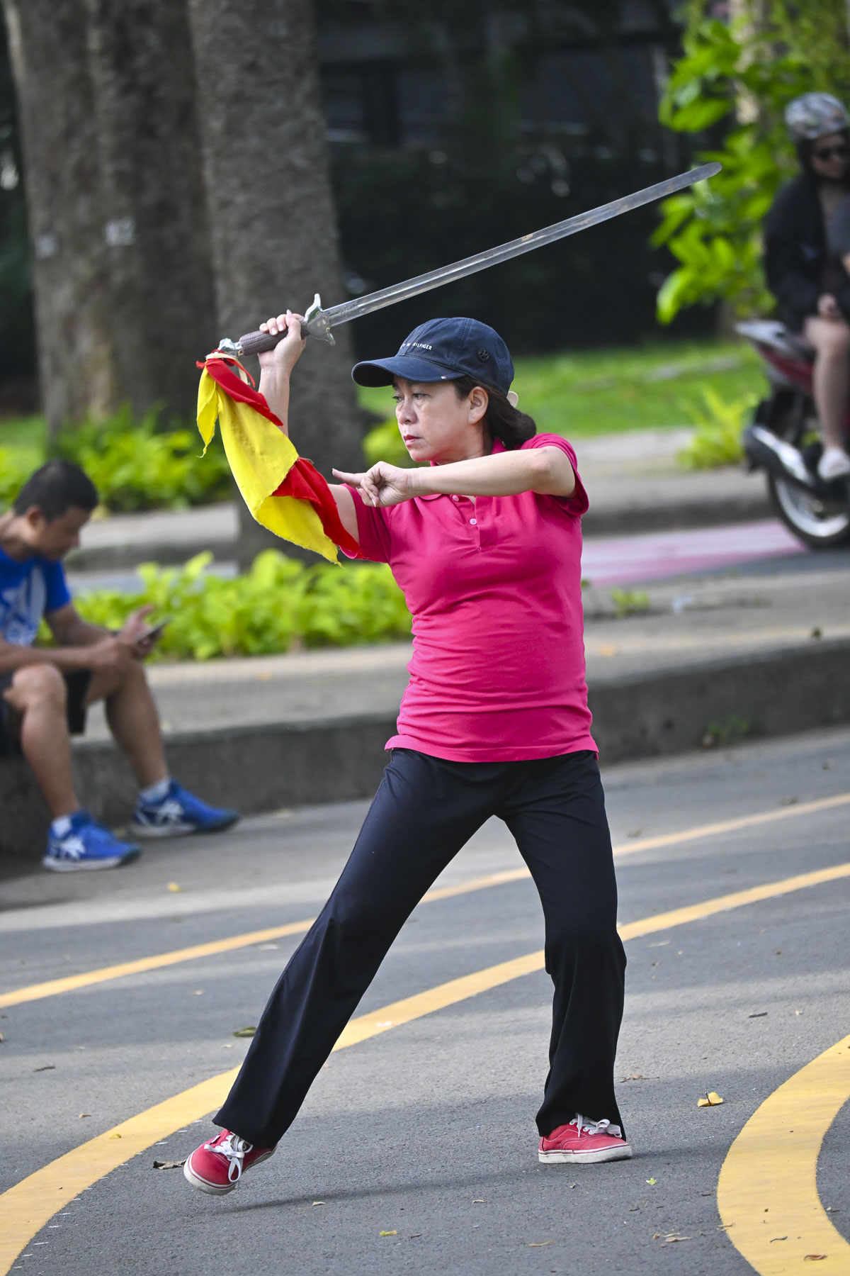
Our destination for the morning was the War Remnants Museum,several blocks from our hotel, but along the way we detoured to Tao Dan Park, where morning calisthenics are a daily ritual for older folks and women who have just gotten their children off to school. The park was full of hundreds of people practicing traditional Tai Chi, aerobics, badminton, Vo Thuat Quat (fan martial arts), and Múa Kiếm (a sword dance).

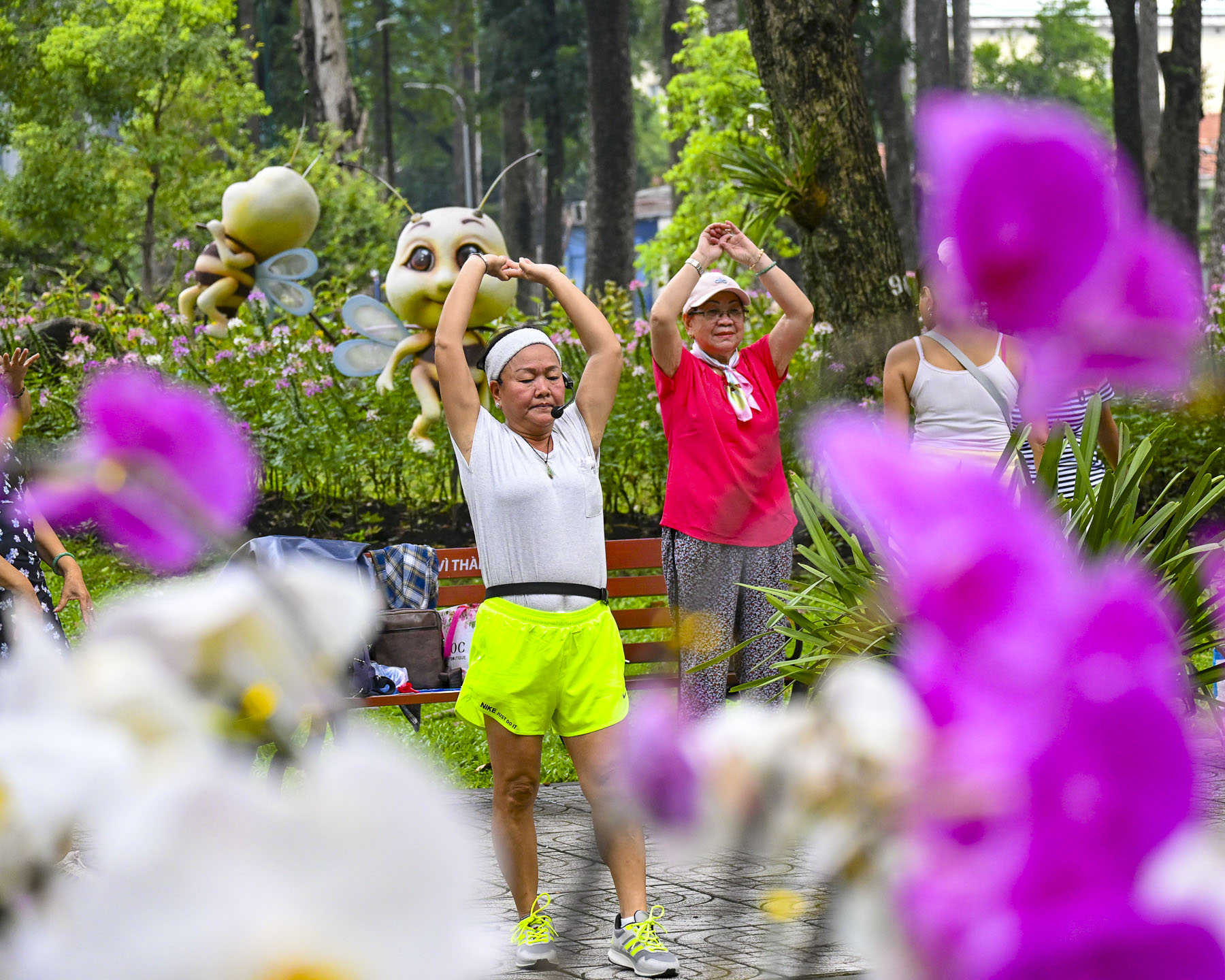
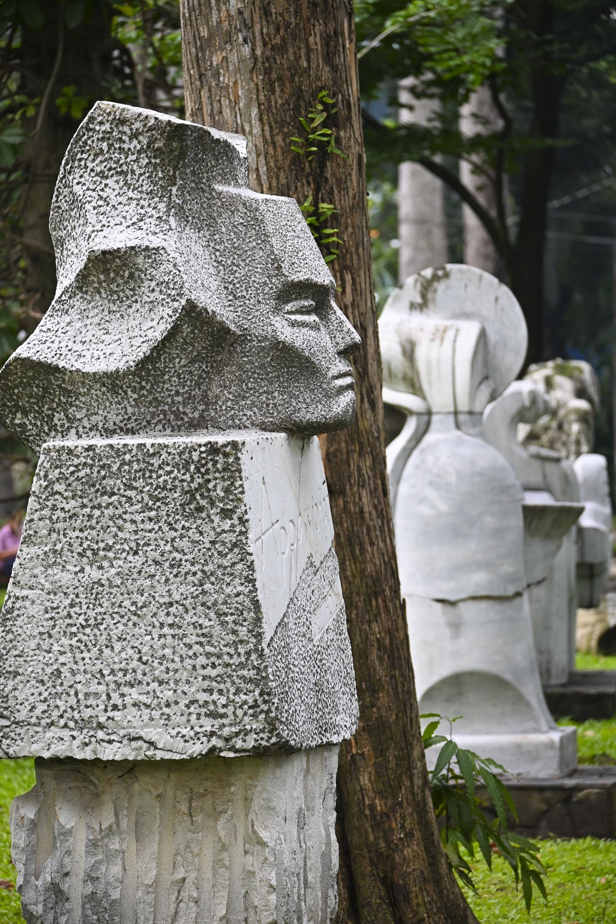
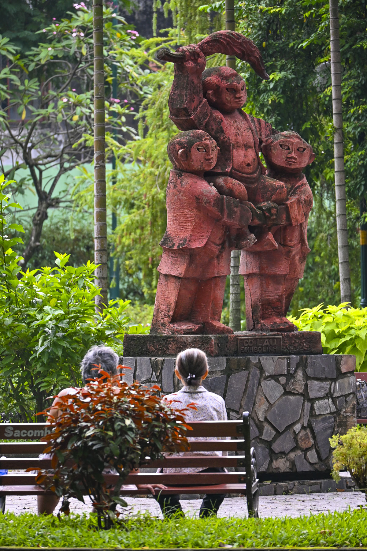
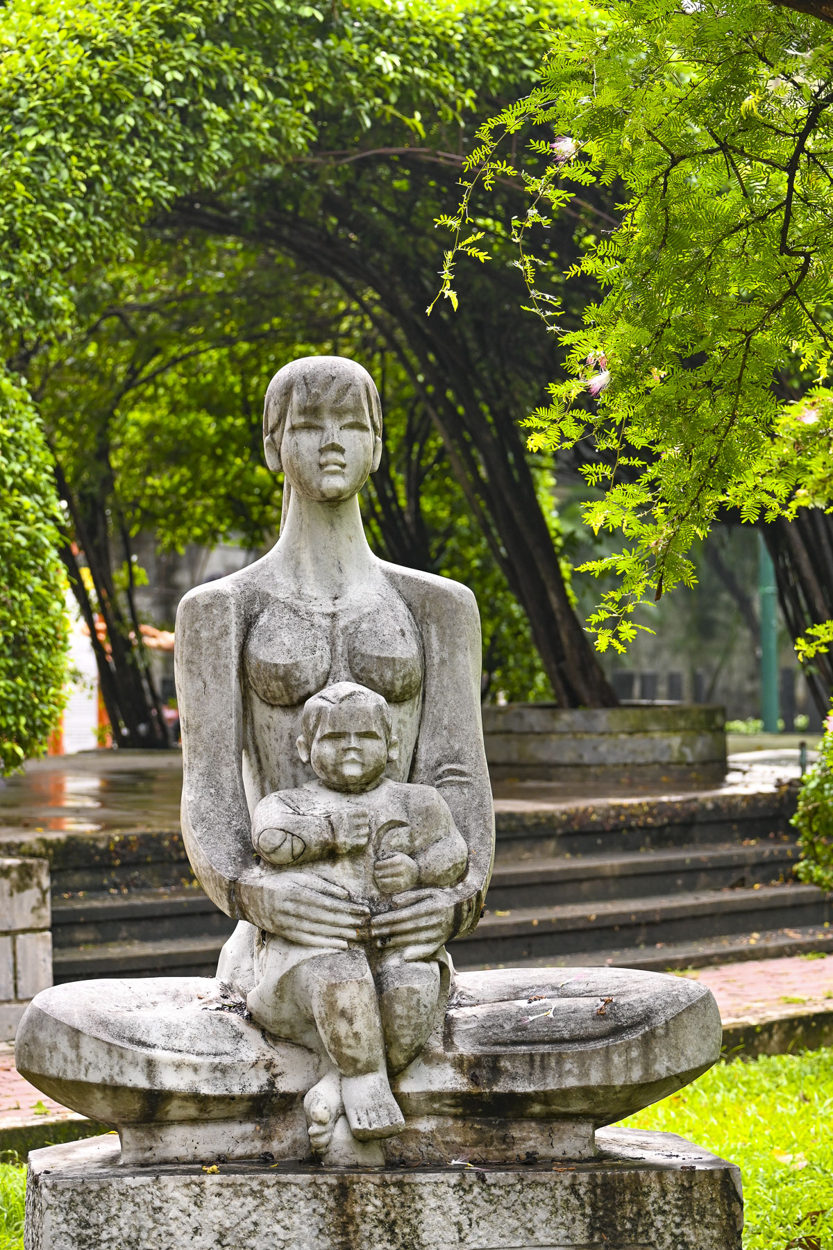
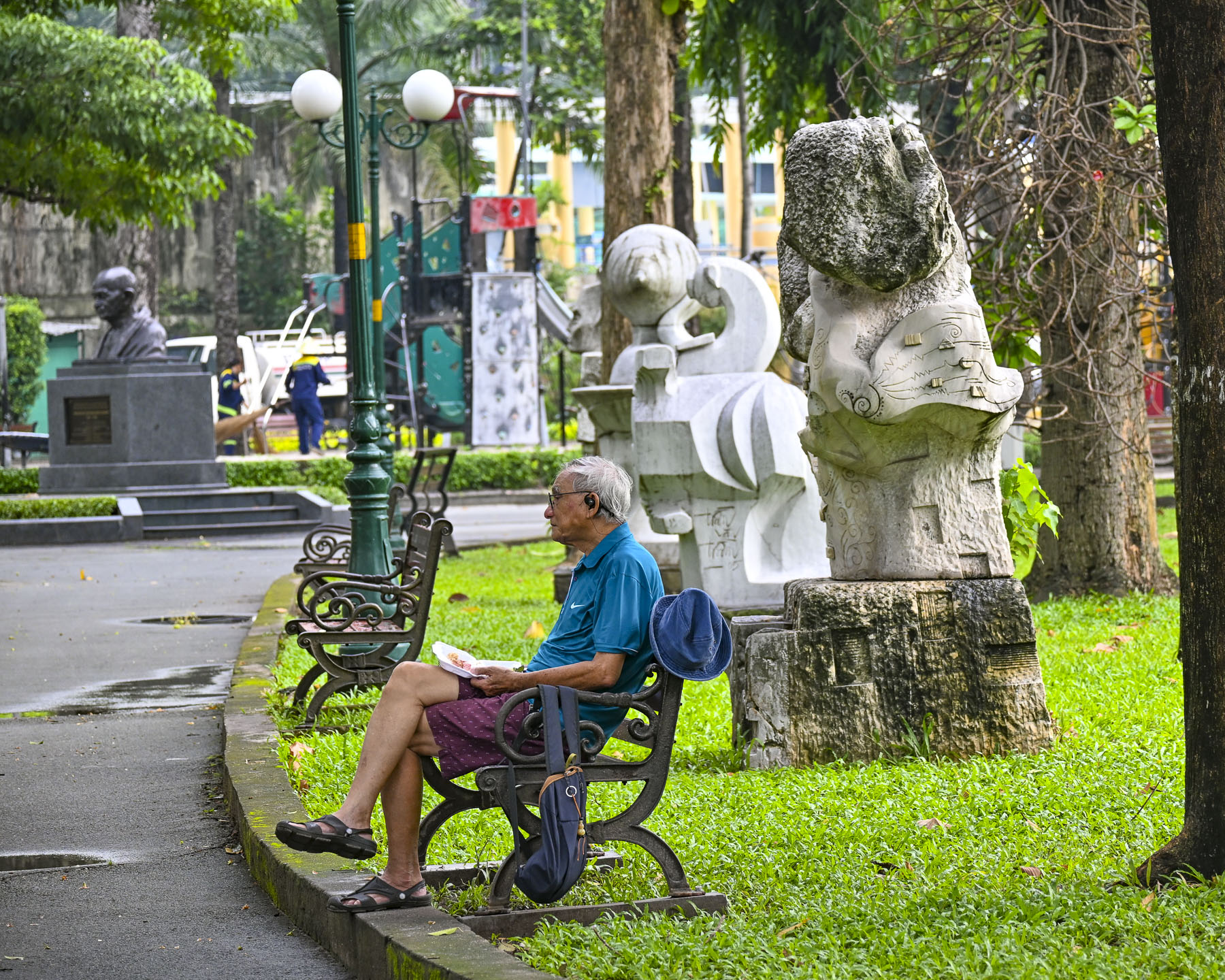
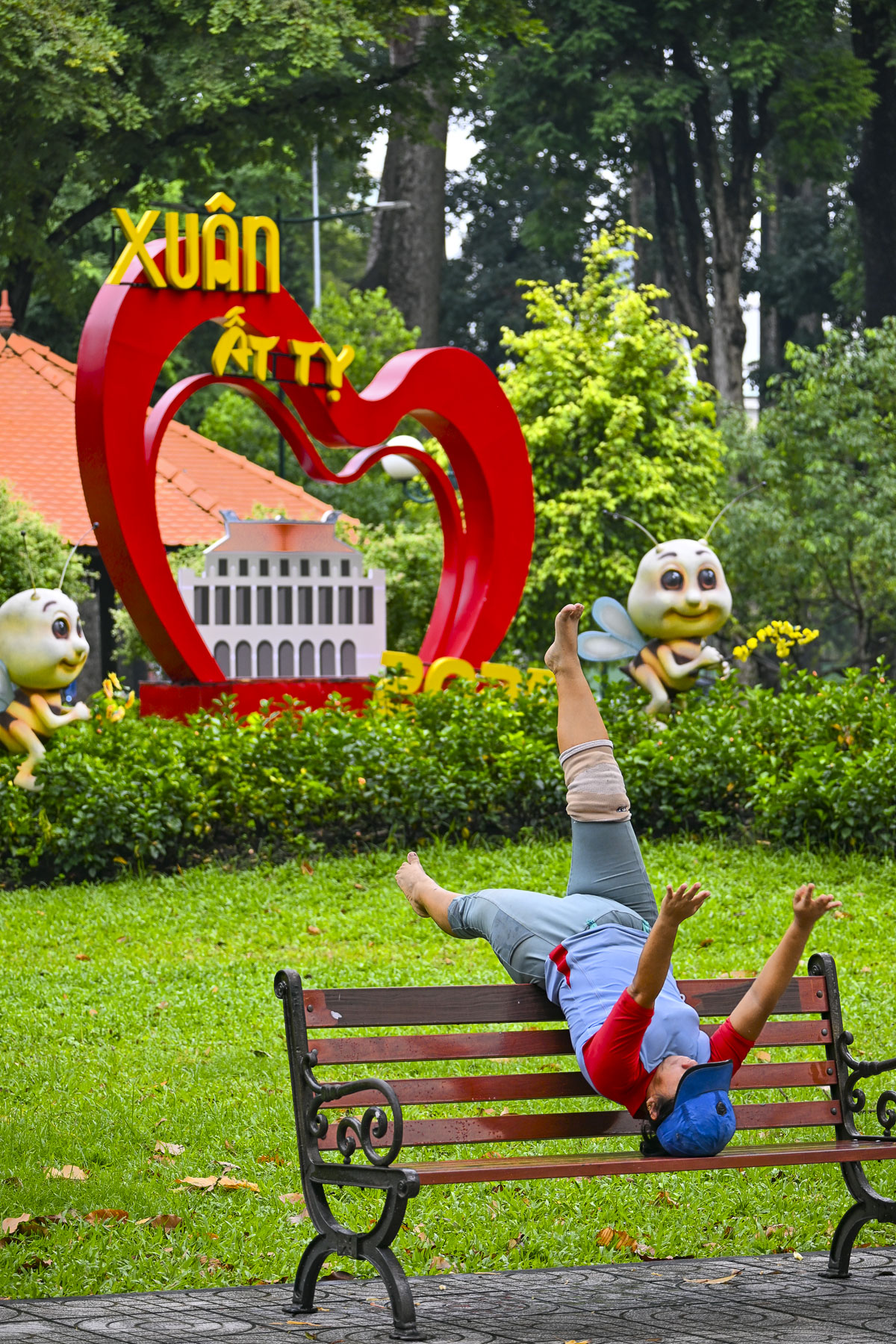
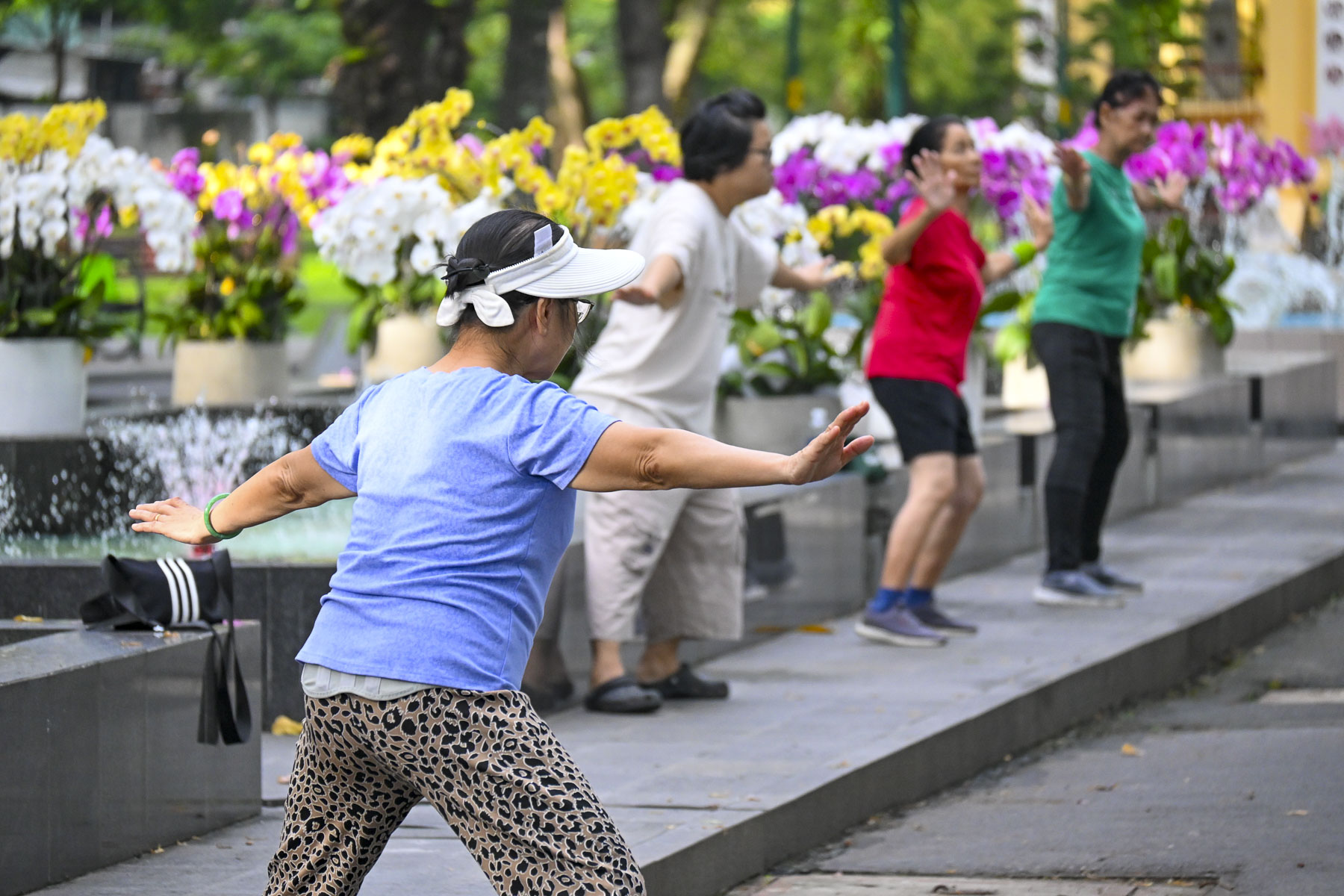
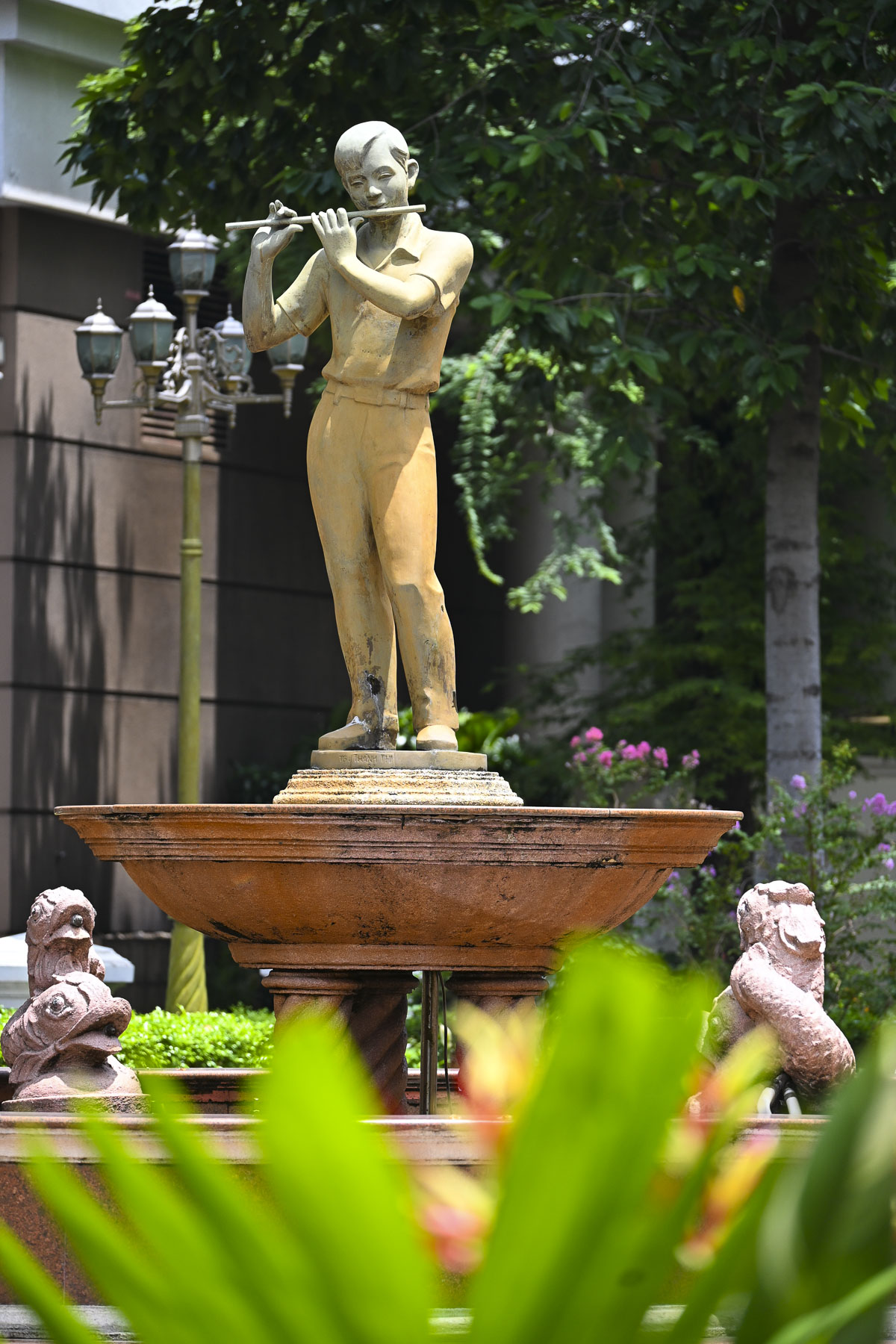
In multiple sections of the park folks twisted, turned, and stretched to classical Asian music, channeled Richard Simmons with eighties pop songs, or pursued a modified course inspired by Chloe Ting, a YouTube fitness instructor. In front of the Temple of the Hung Kings, the legendary founders of the Viet dynasties more than 4,000 years ago, was a fountain with a beautiful display of orchids. Nearby the soft aroma of jasmine drifted on the air in a sculpture park.

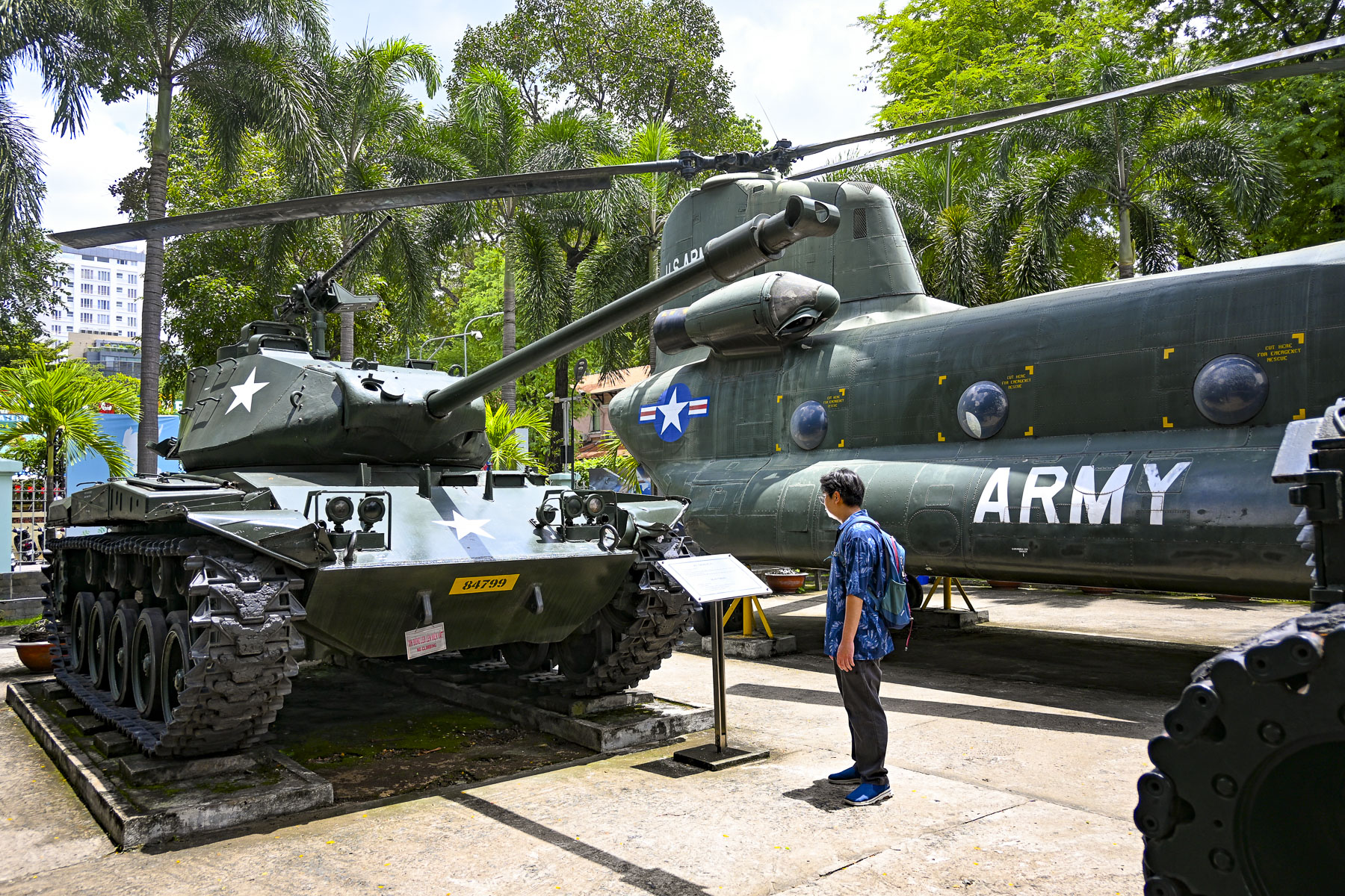
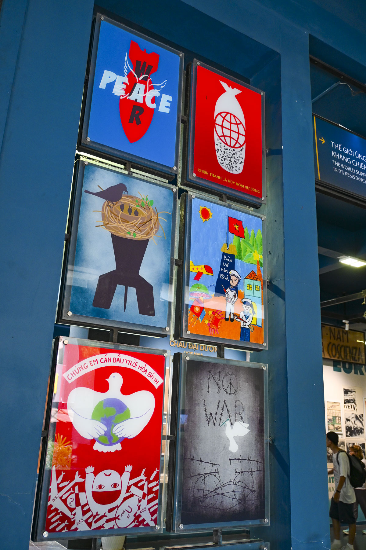
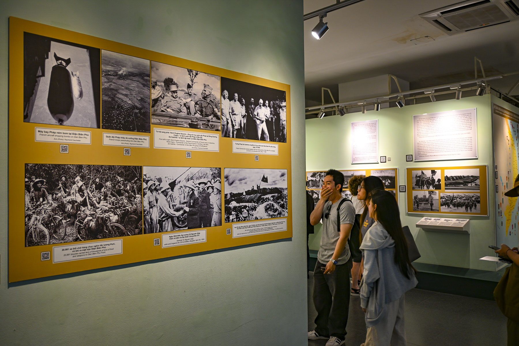
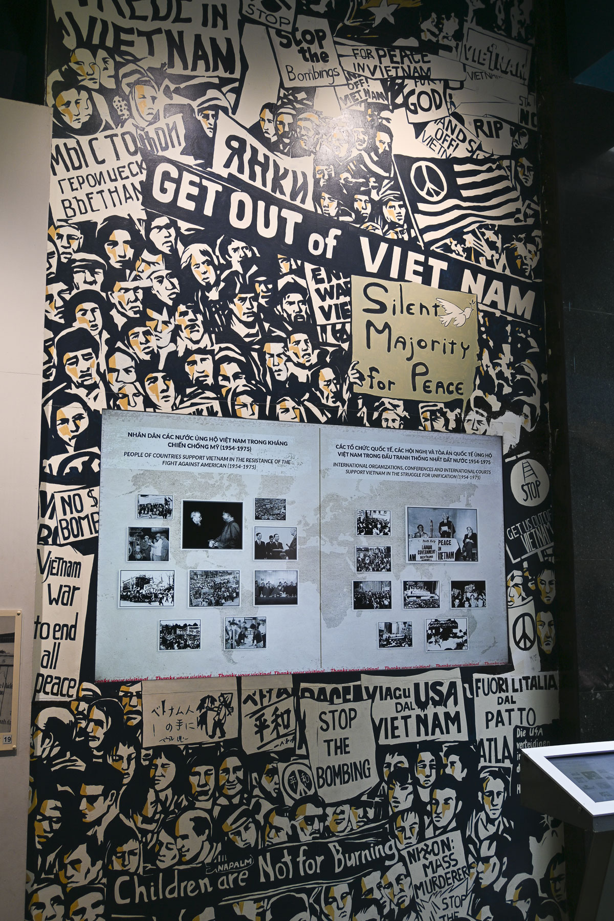
Everyday during our teen years – this certainly ages us – the Vietnam War was on the front page of every newspaper and the nightly news. We are not historians; the victors write their history and the War Remnants Museum does document both French and American participation in a horrific war. Though the museum does not address the story of the Vietnamese boat people, more than 800,000 refugees who fled Vietnam by sea between 1975 and 1995 following the war. Nor does it address the forced labor “re-education” camps spread across the country where the victorious Vietnamese communist government interned nearly one million people for three years or longer in a system of prison camps modeled after the Soviet Union’s gulags in Siberia.

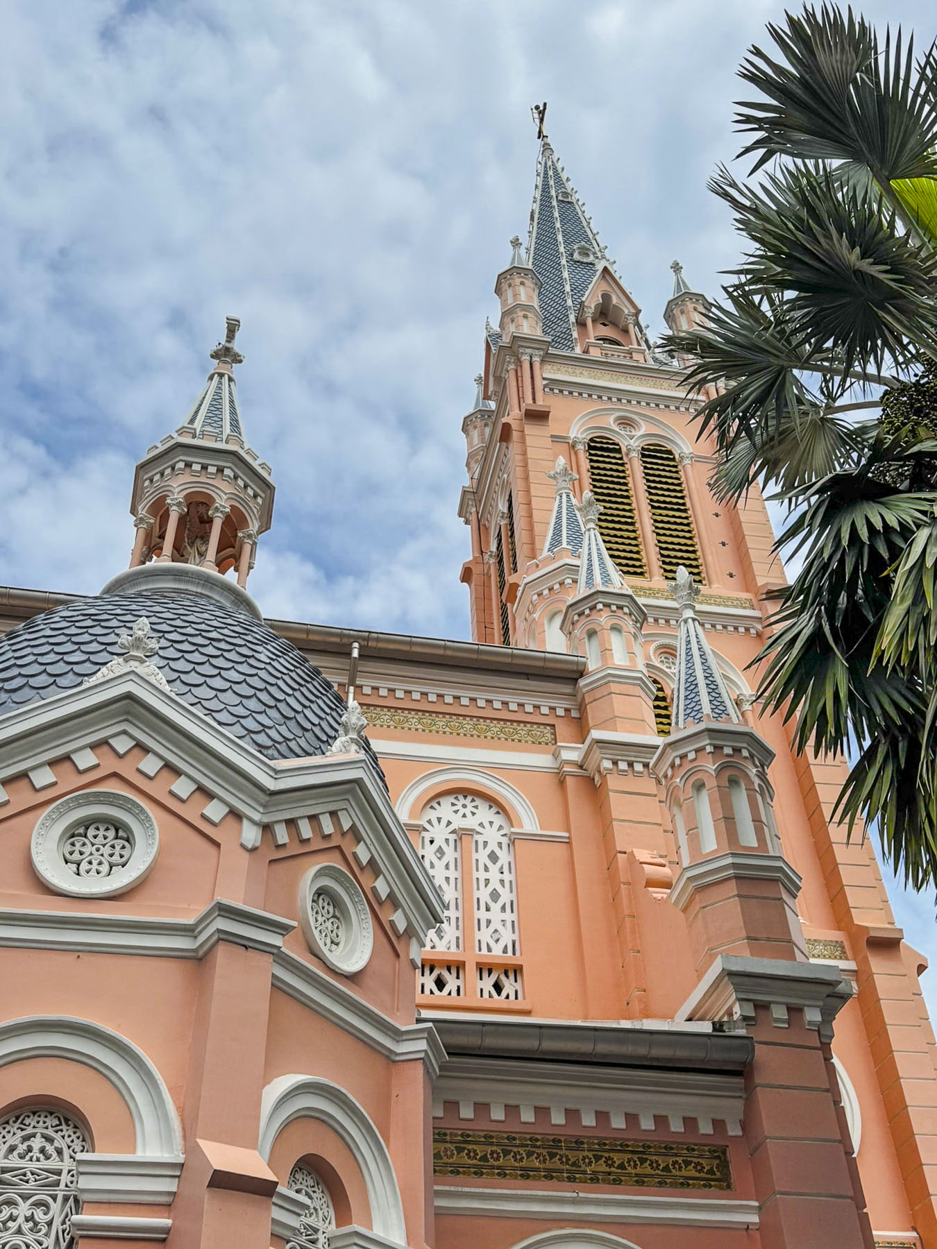
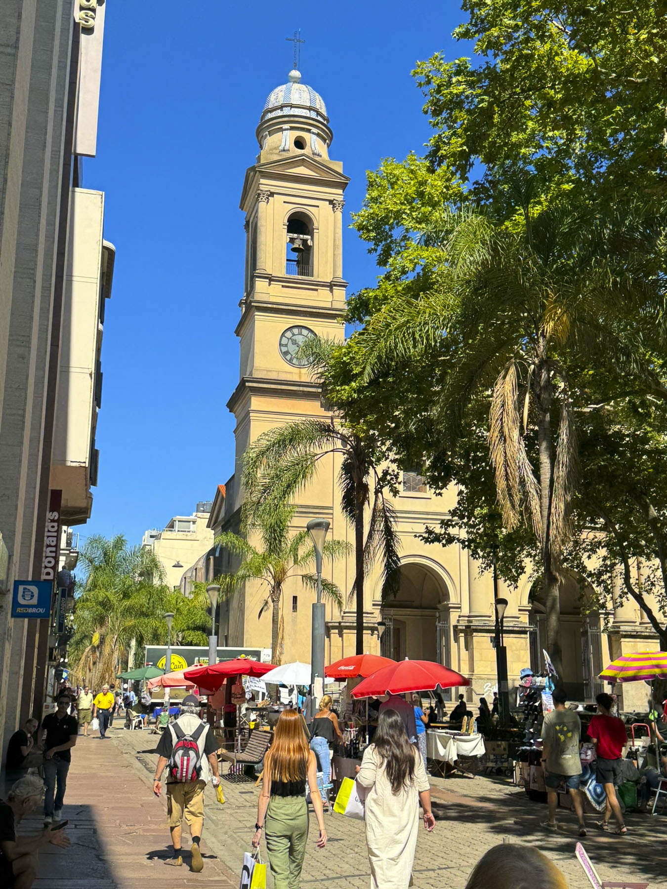
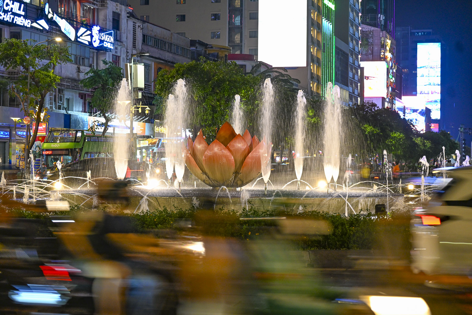
Ho Chi Minh City was interesting to walk around and the next day we headed to Tân Định Parish Church, a Catholic church dating to the 1870s that’s admired for its distinctive pink façade and Gothic pillars. We then continued to Hồ Con Rùa, Turtle Lake, a large manmade lake in the center of a traffic circle. The site originally housed a water tower built in 1878, which was later replaced in 1921 with a statue of three French soldiers around a water fountain, symbolizing their colonial rule over Vietnam. This monument lasted until the French army left Vietnam in 1956. The lake was later enlarged in 1967, and the concrete tower that looks like a blooming flower was added by the newly elected president Nguyen Van Thieu of the Republic of Vietnam.

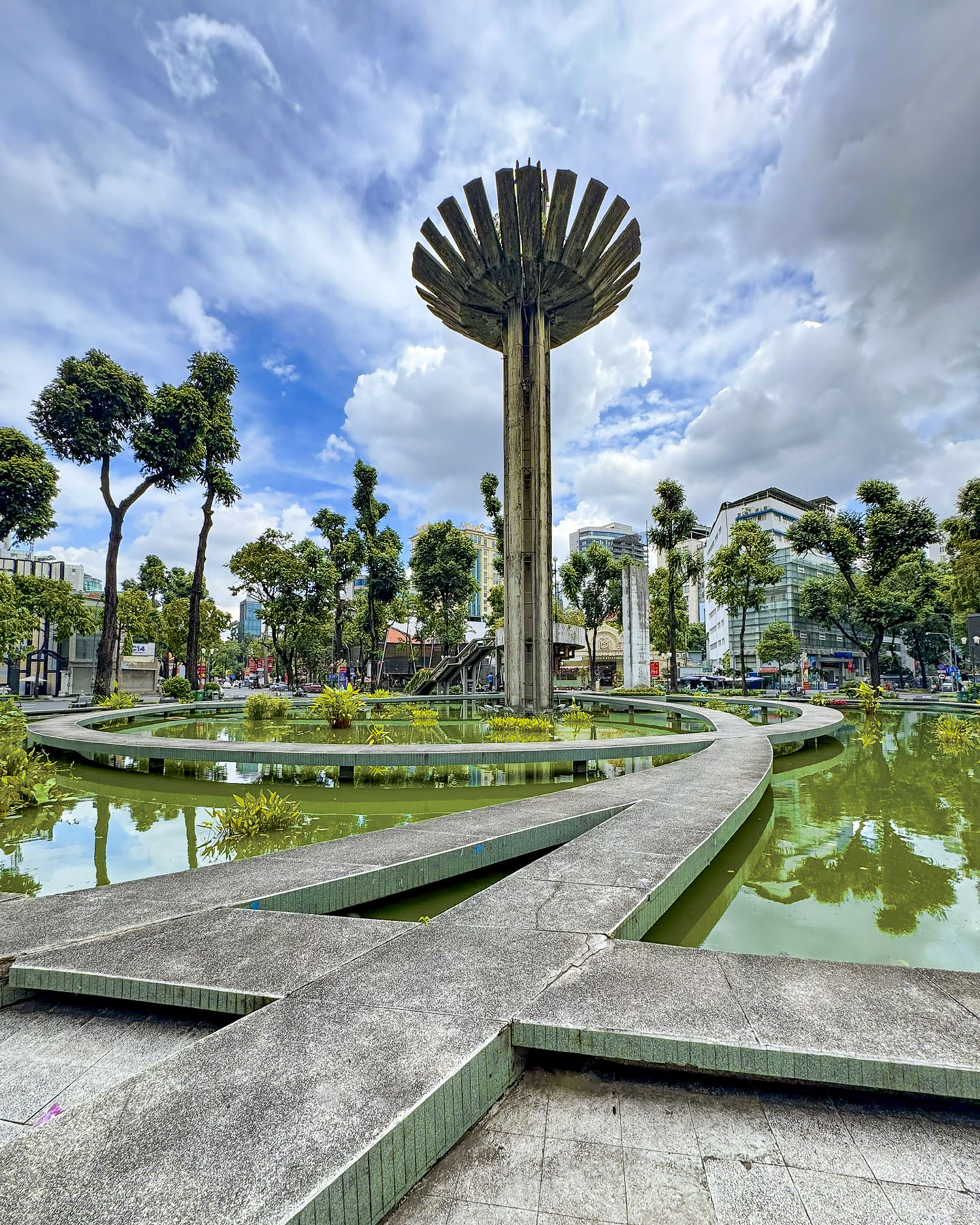
There’s a legend associated with the tower – it says that the president, to ensure his success, “invited a famous Chinese feng shui master to assess the land at Independence Palace,” now Reunification Convention Hall. The feng shui master praised the palace for being built on a dragon’s head, but the dragon’s tail was wildly thrashing about in Turtle Lake. In feng shui terms, this was really bad news for political stability, and a large turtle needed to be cast to hold down the dragon’s tail. Following the master’s advice a turtle sculpture was cast and placed at the center of walkways built over the lake that resemble a bagua, a feng shui symbol used for protection. And the flower shaped tower was reinterpreted as the shaft of an arrow shot into the tail of the dragon to pin it down. The turtle didn’t survive the city’s new communist regime and was destroyed in 1976. The plaza, surrounded by a variety of restaurants and coffee shops, was a nice place to relax for a while.

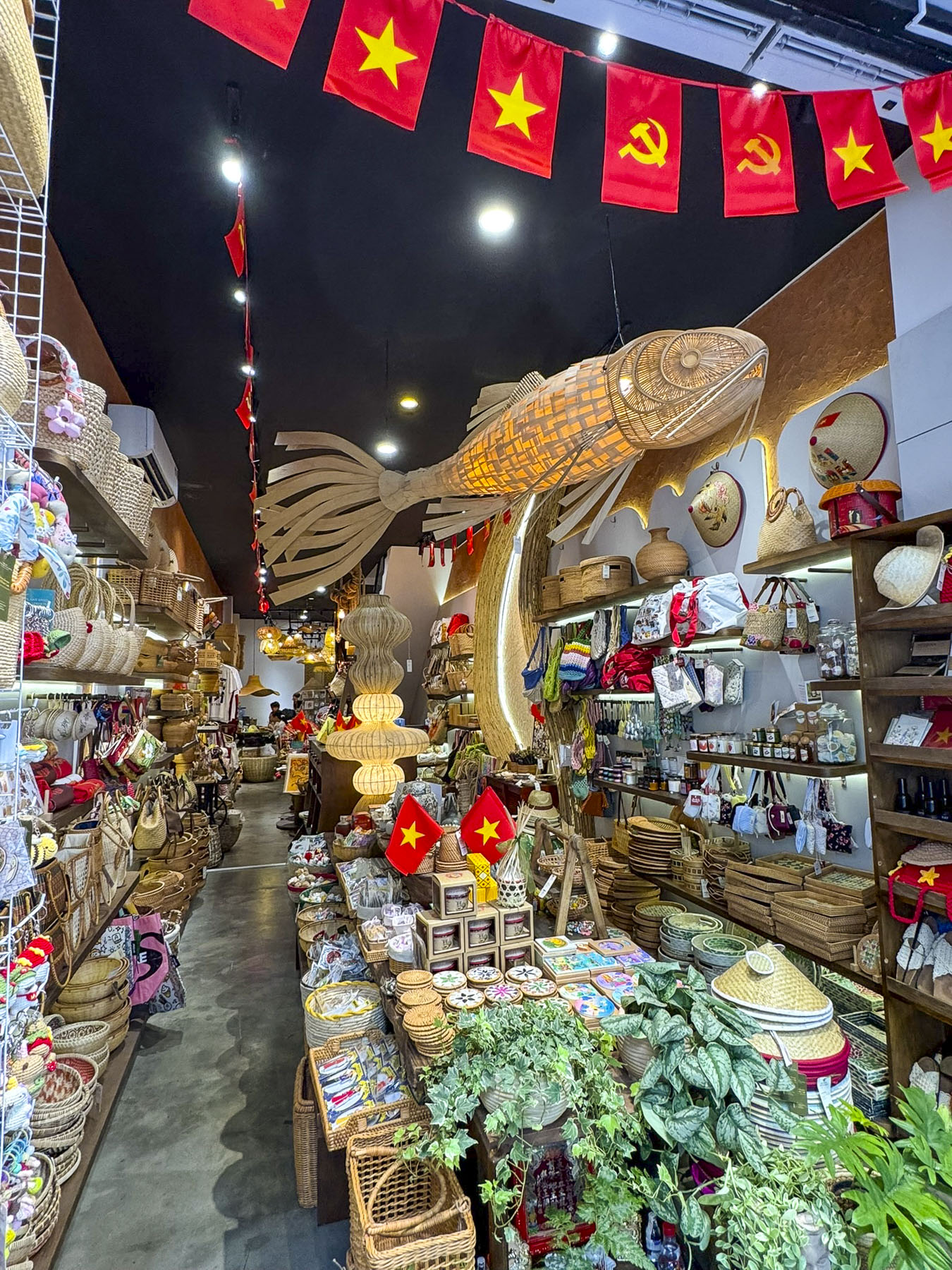
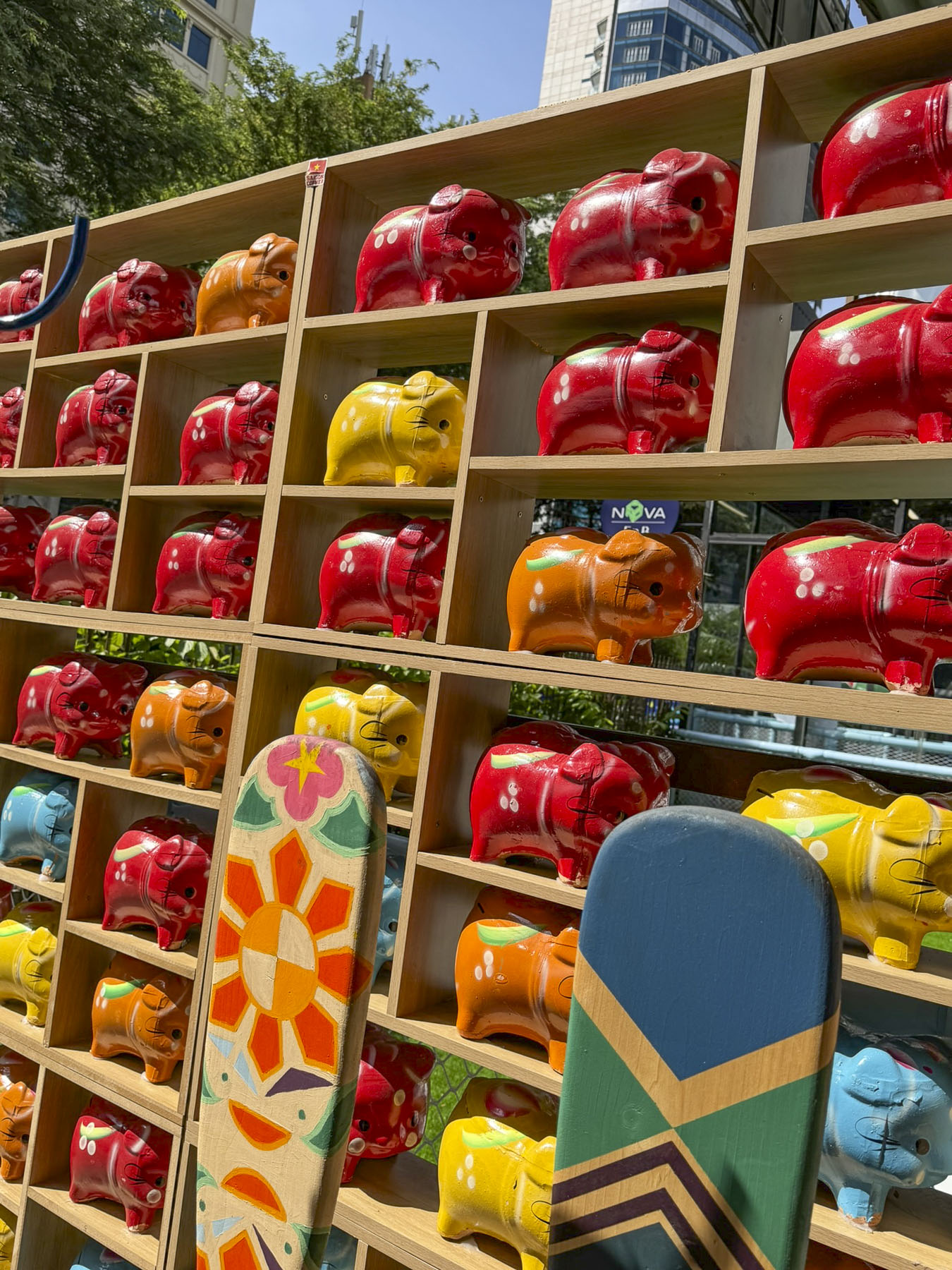
There are many upscale stores and shops across the city, but for every fancy store there are multiple small mom and pop shops that specialize in one item, like glassware or wicker, which is spilled onto the sidewalk in order to show the wares. There were numerous small mechanic shops that tended to the thousands of scooters that whizz around the city; they conducted their business on the sidewalks, repairing tires, changing oil, rebuilding engines, or doing body work and spray painting. This sidewalk sprawl often forced us to walk in the street to pass by.

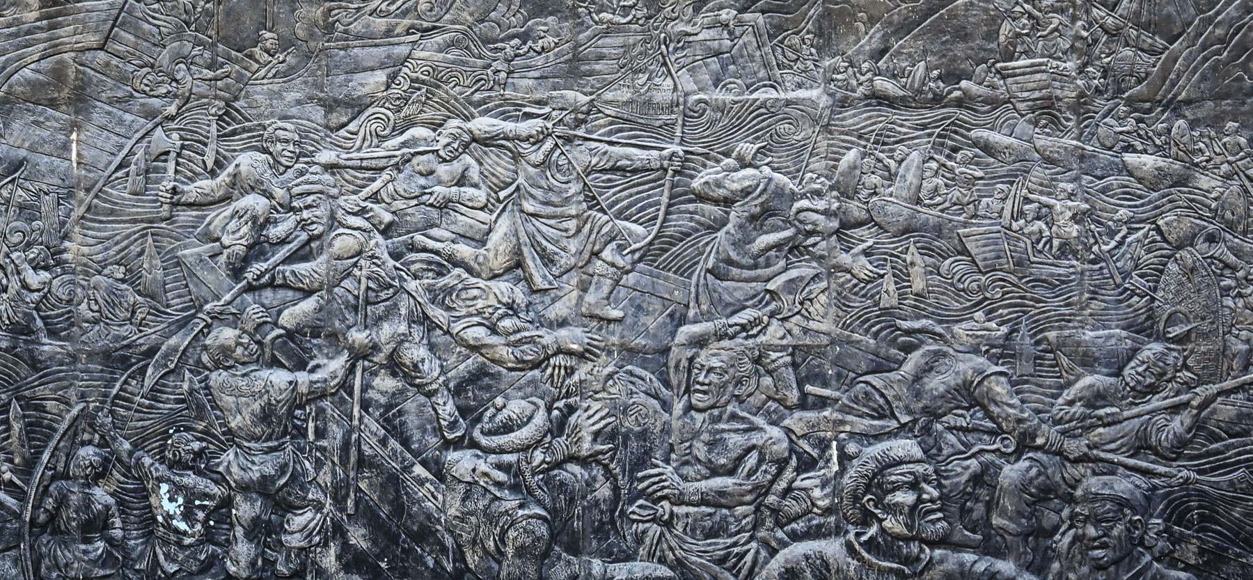
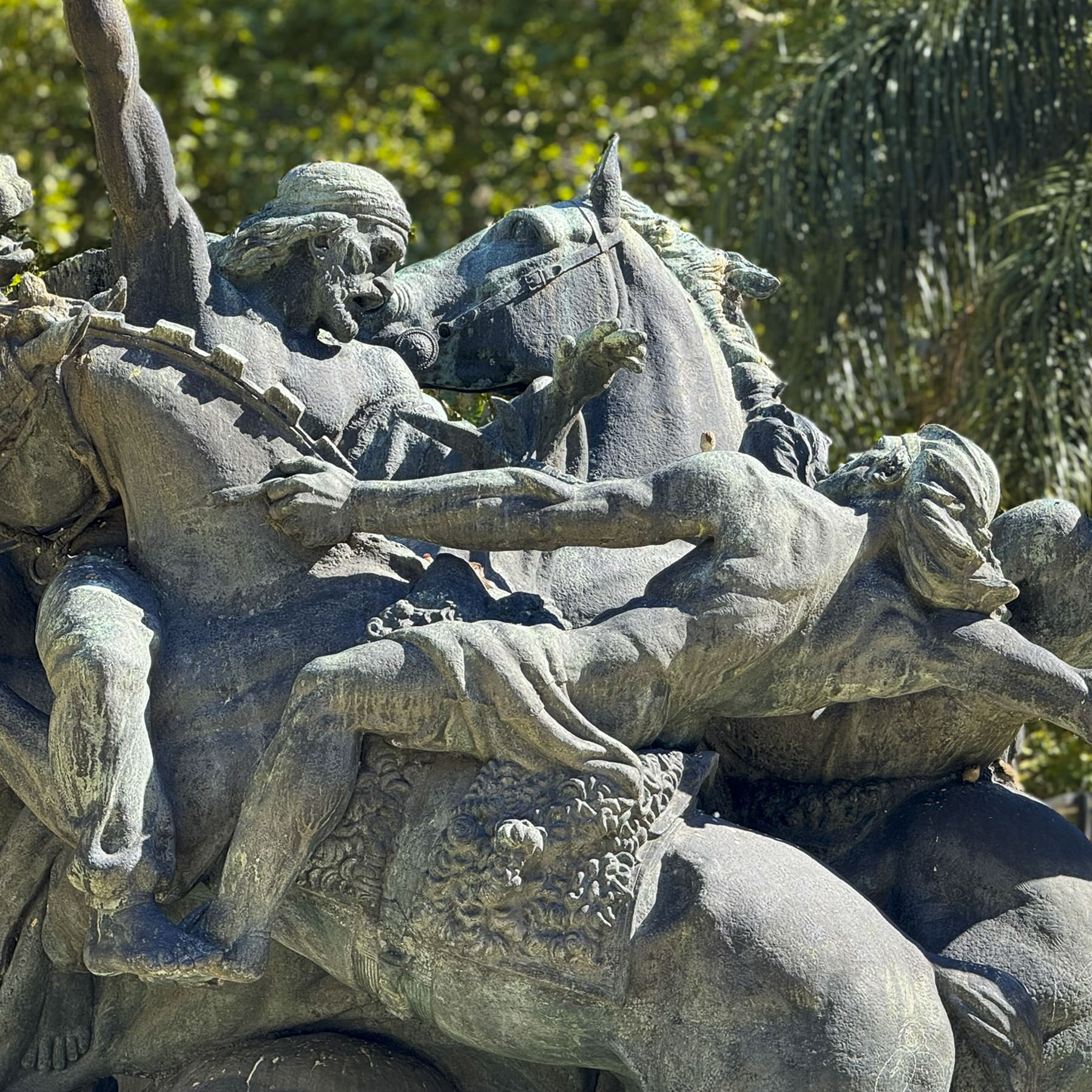
A large metal relief sculpture above the entrance to the Ho Chi Minh City Museum of History caught our eye as we headed to the Saigon Zoo and Botanical Garden in District 1. The cataclysmic scene commemorates the great victory of Vietnamese General Trần Hưng Đạo over the army of the invading Mongol Empire in 1288. The captioning on its placard described it as “emphasizing national heroism and successful resistance against foreign invasion, a recurring theme in Vietnamese history.”

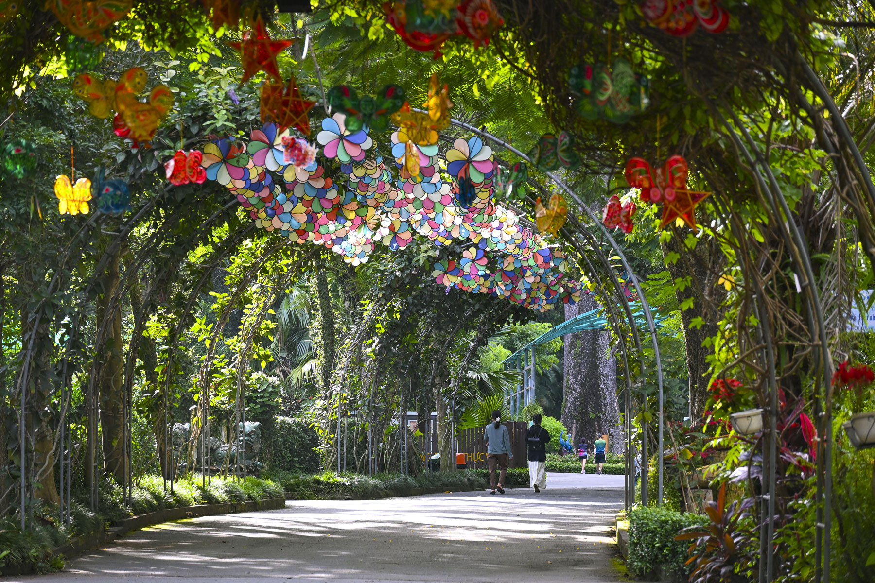
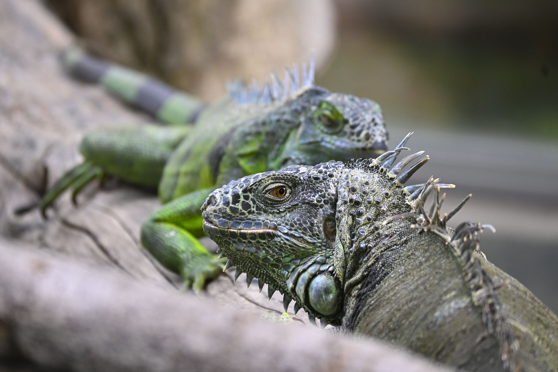
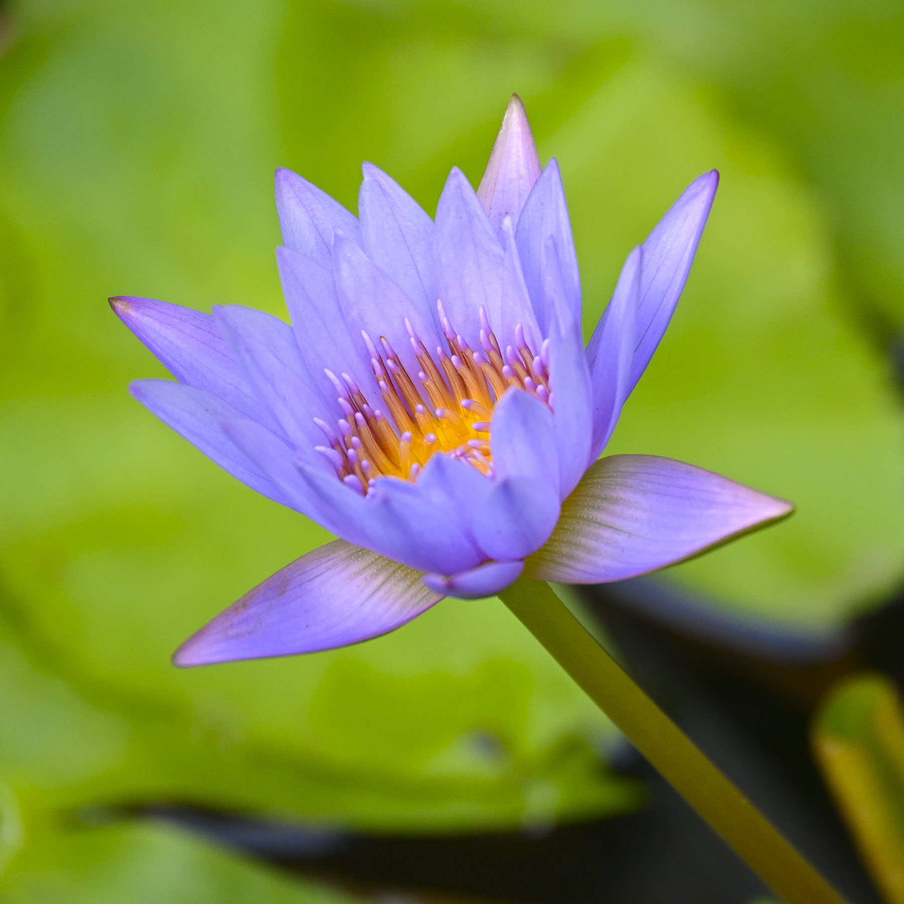
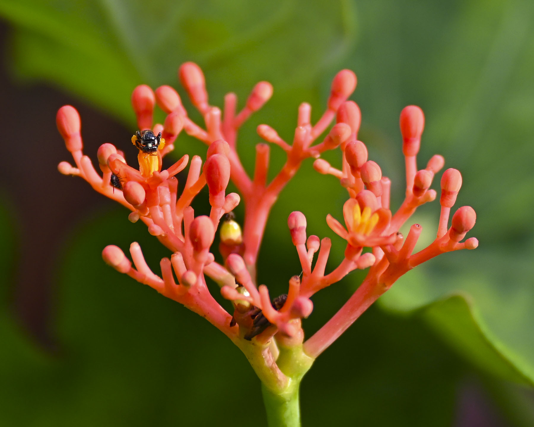
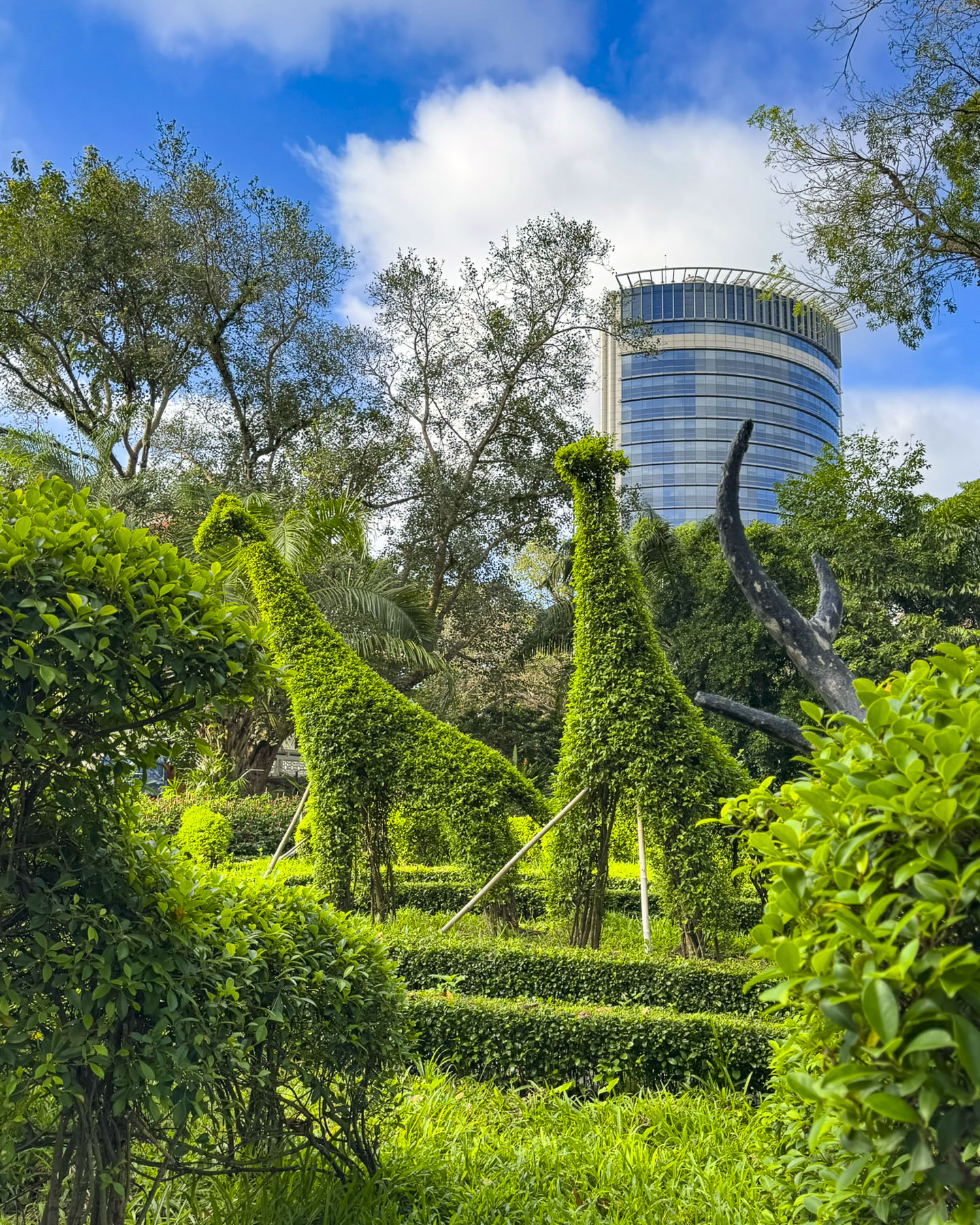
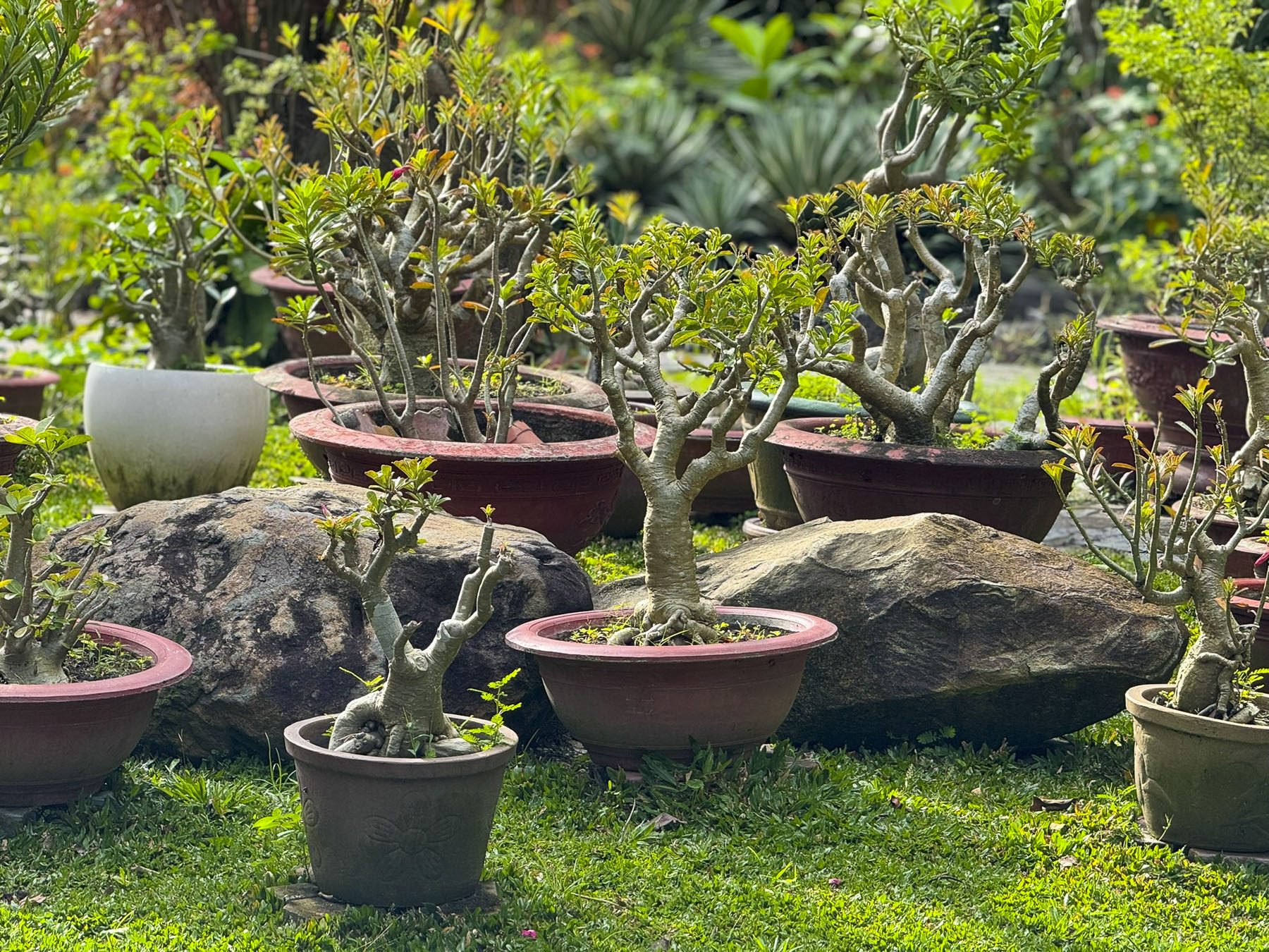
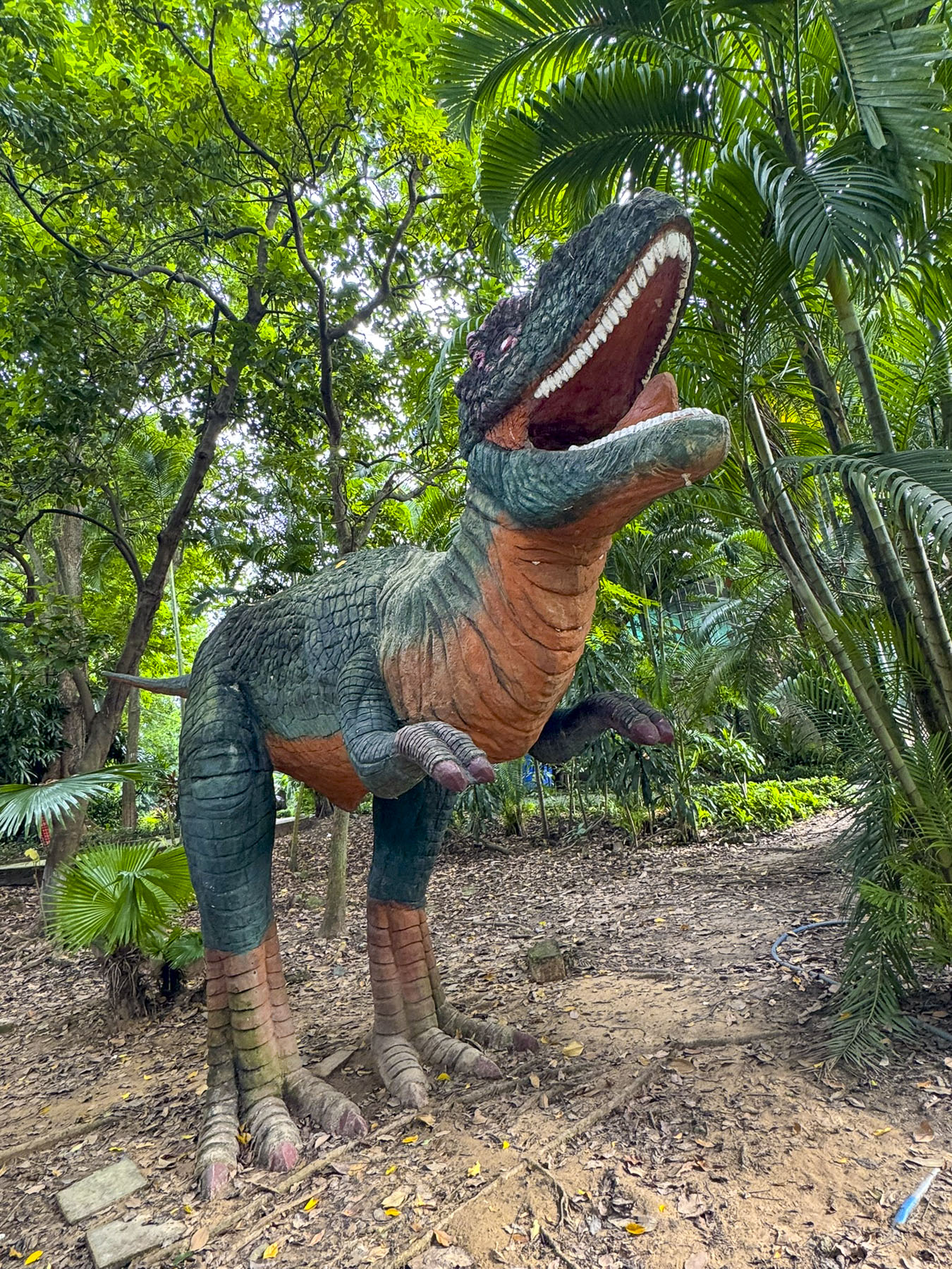
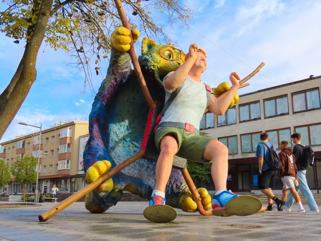
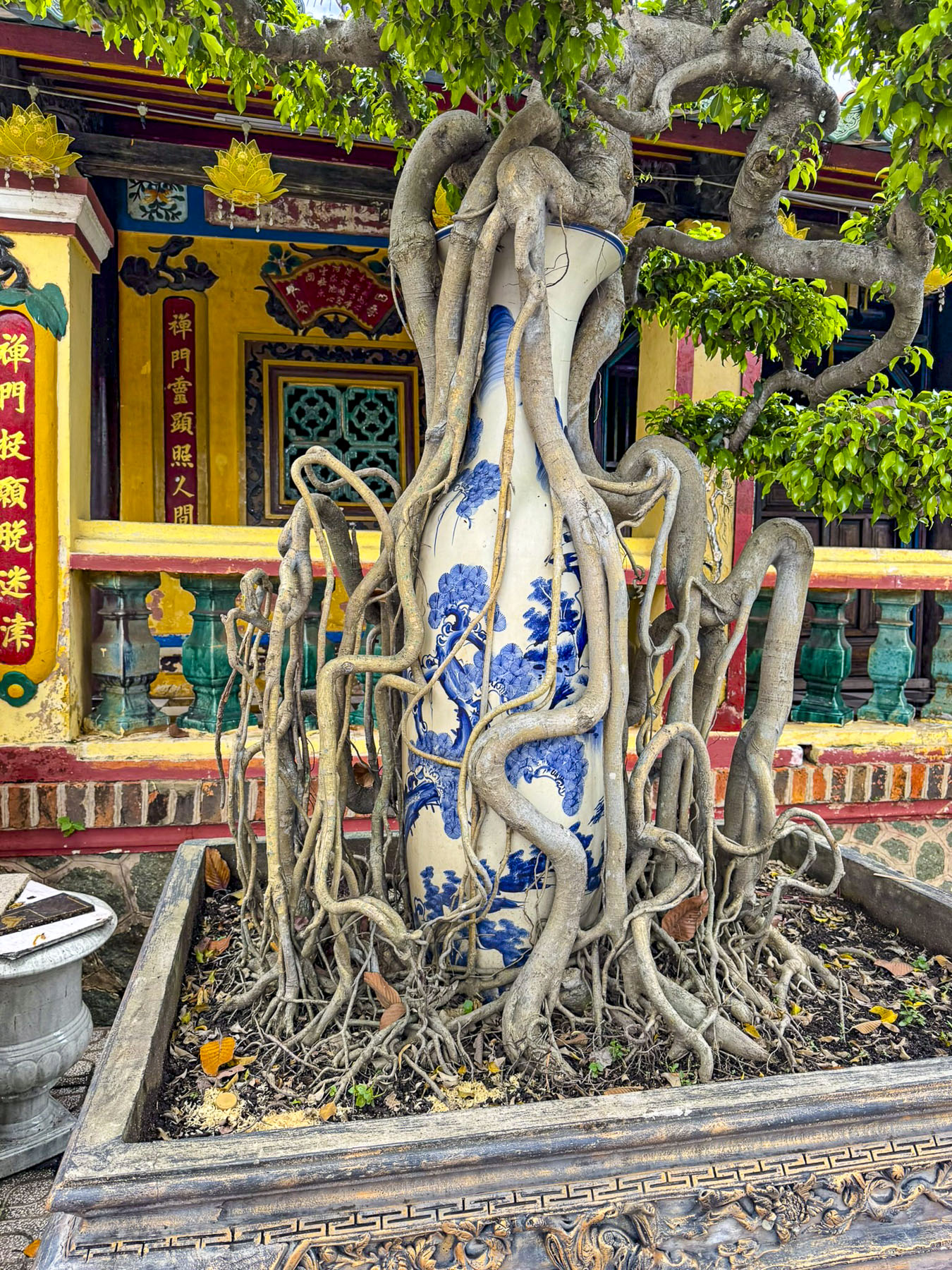
Founded by the French in 1864, the zoo is the eighth oldest in the world and a beloved destination for generations of Vietnamese families. The botanical section with its topiary sculptures of wild animals is what drew us here and we spent about two hours wandering the gardens amid flowering plants, a collection of bonsai trees, some irresistible reptiles, and a miniature Jurassic Park geared for kids. 

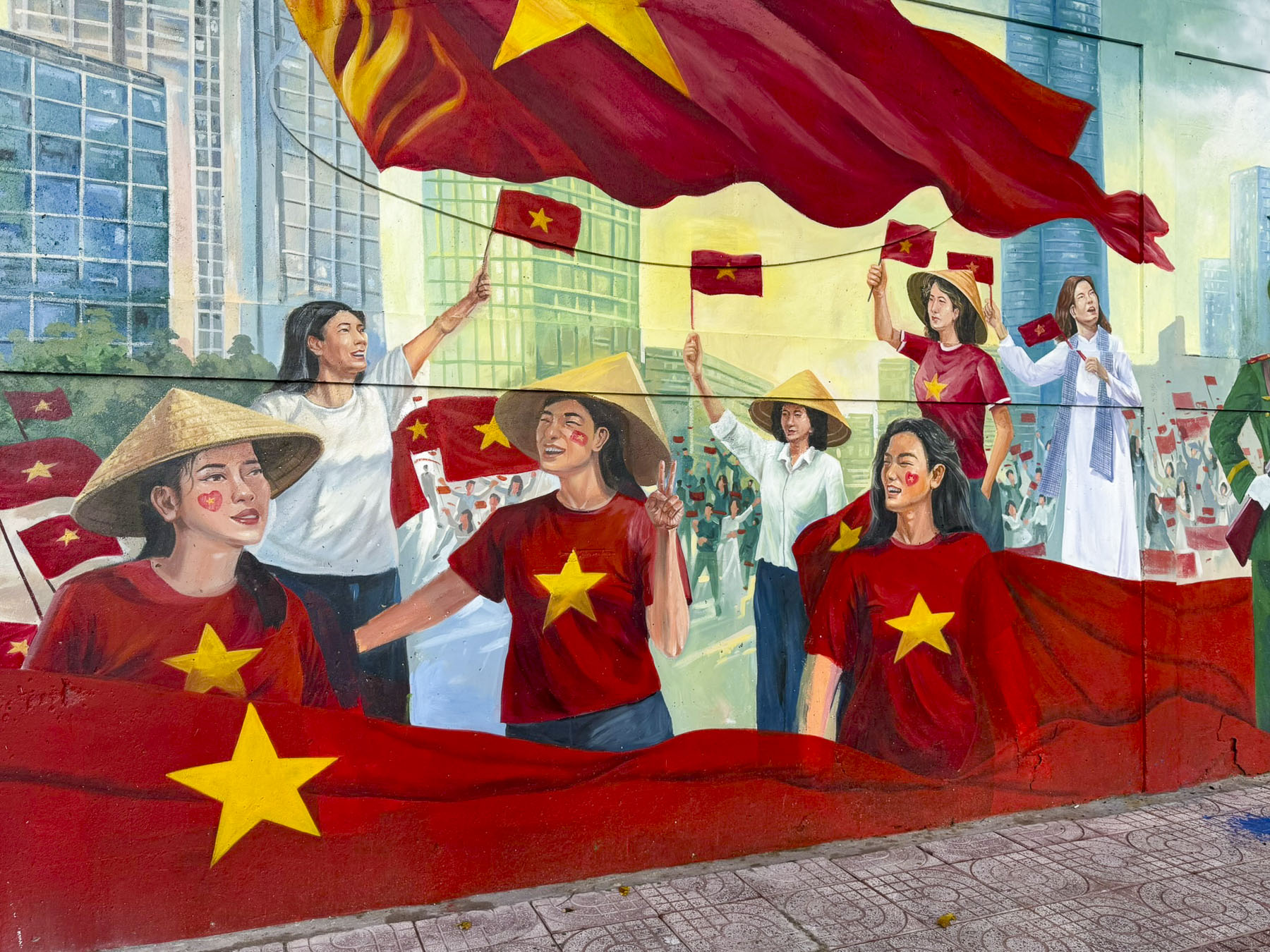
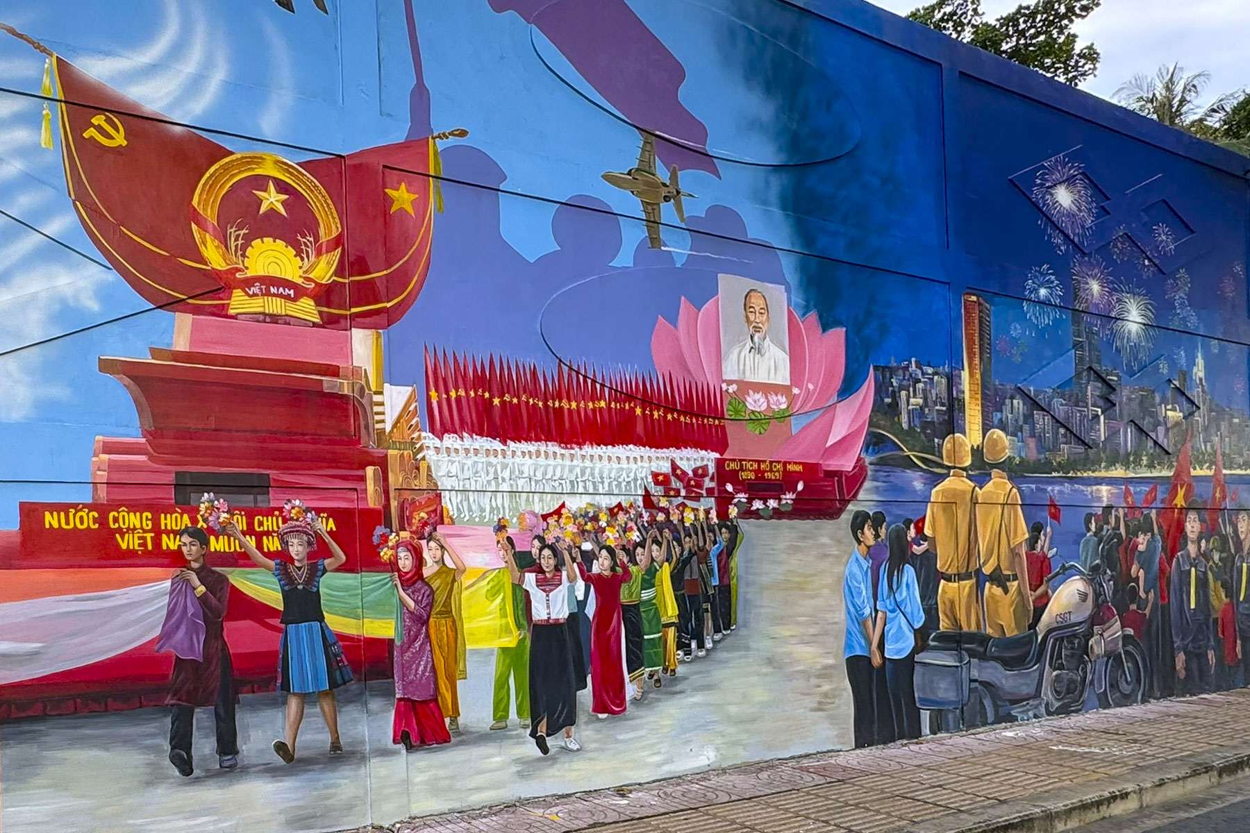
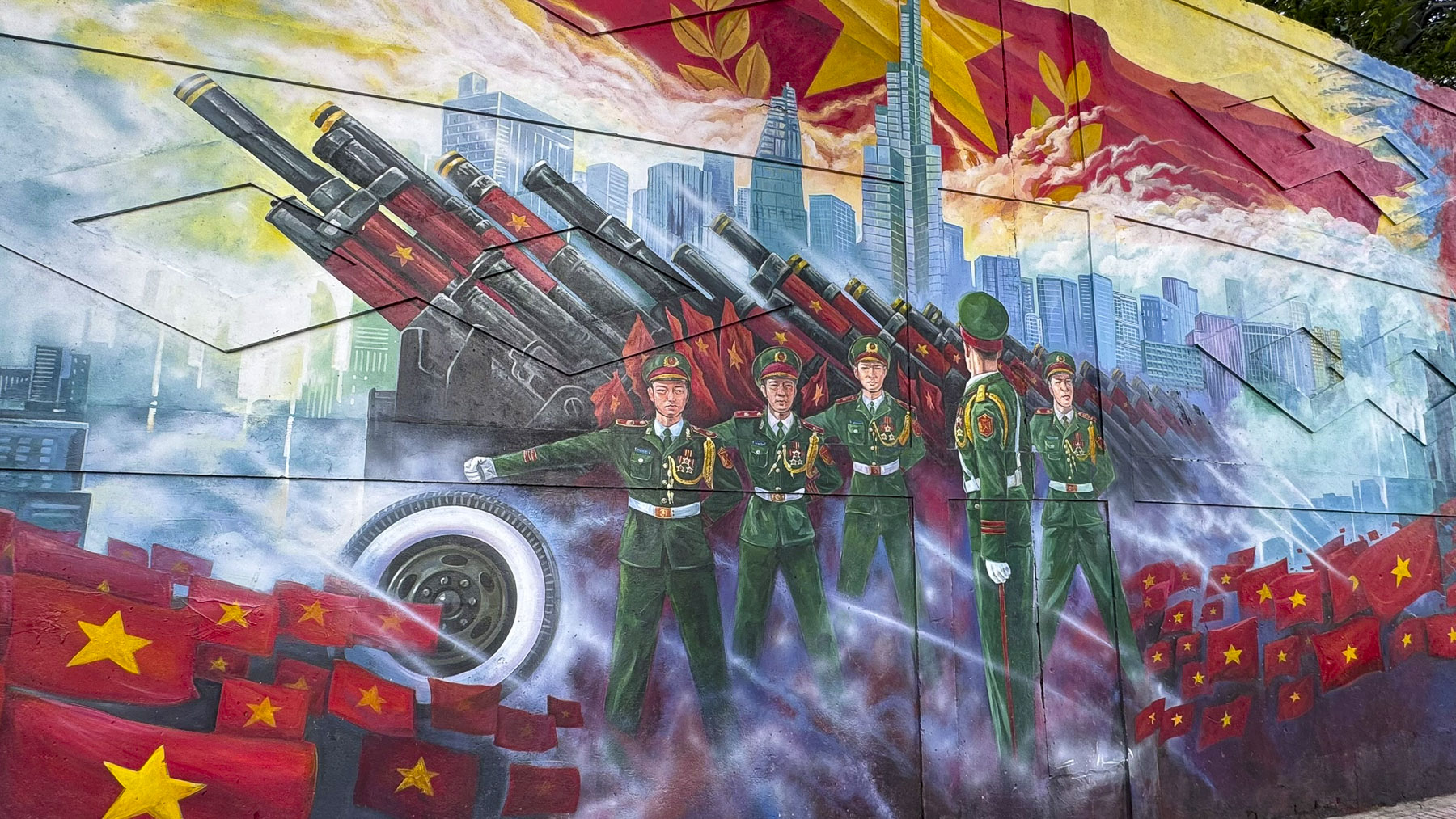
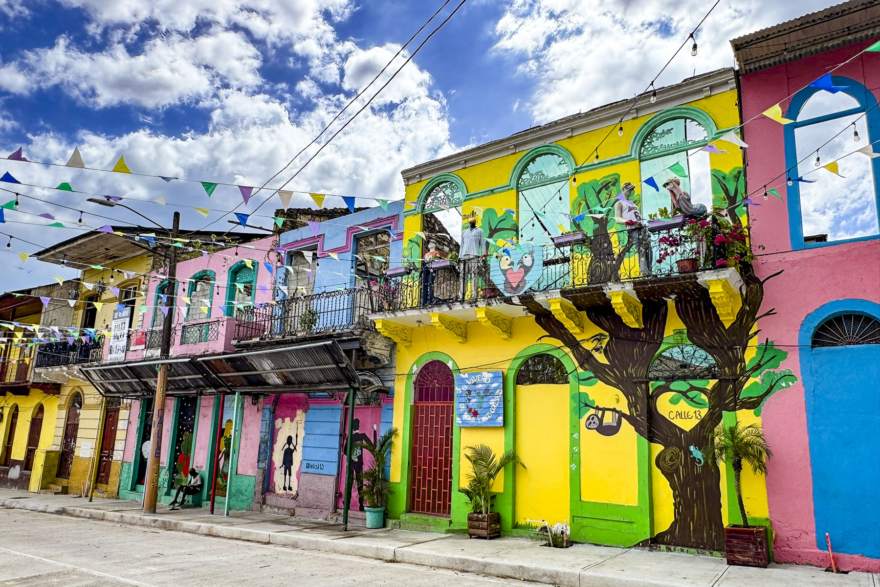
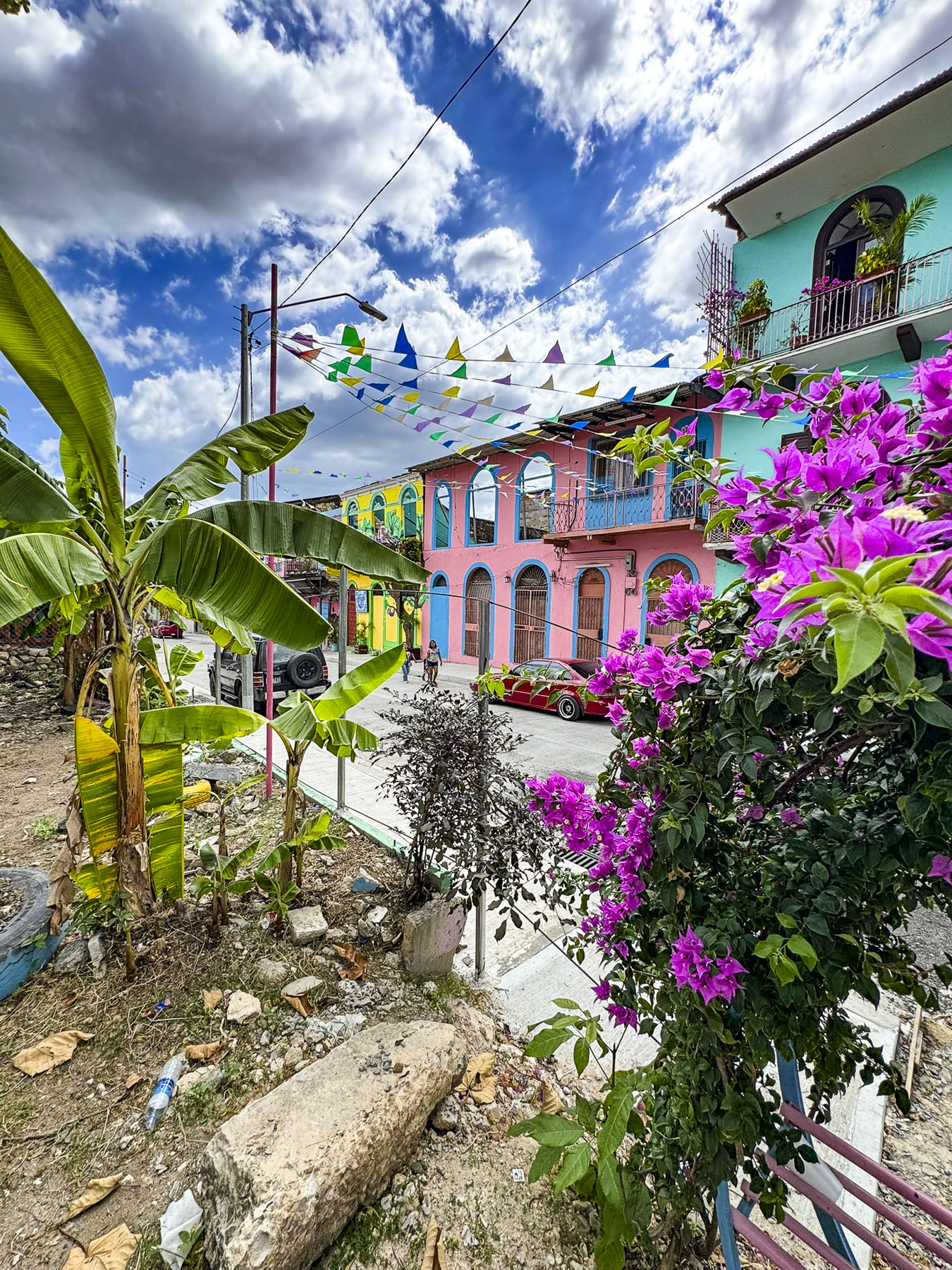
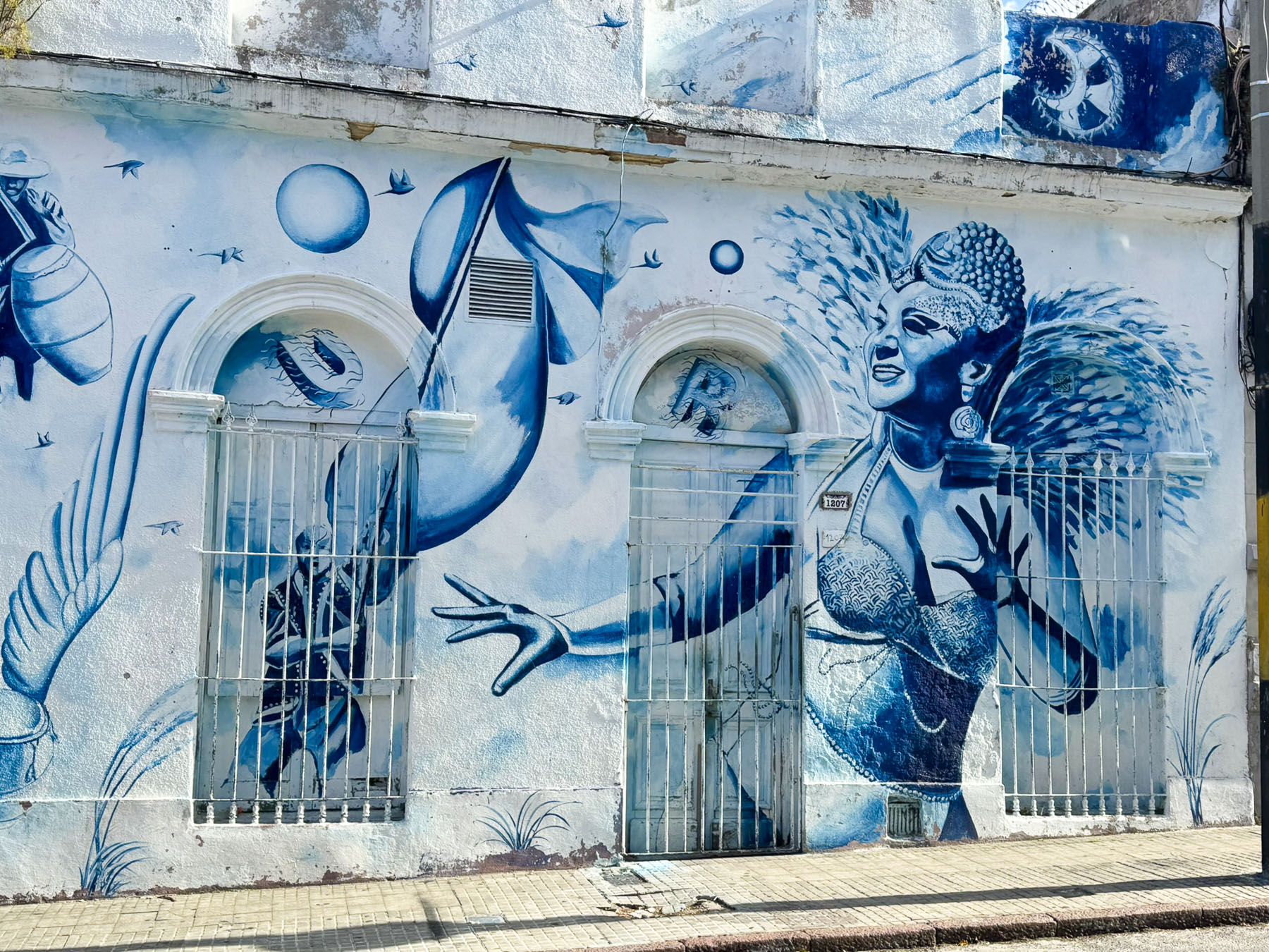
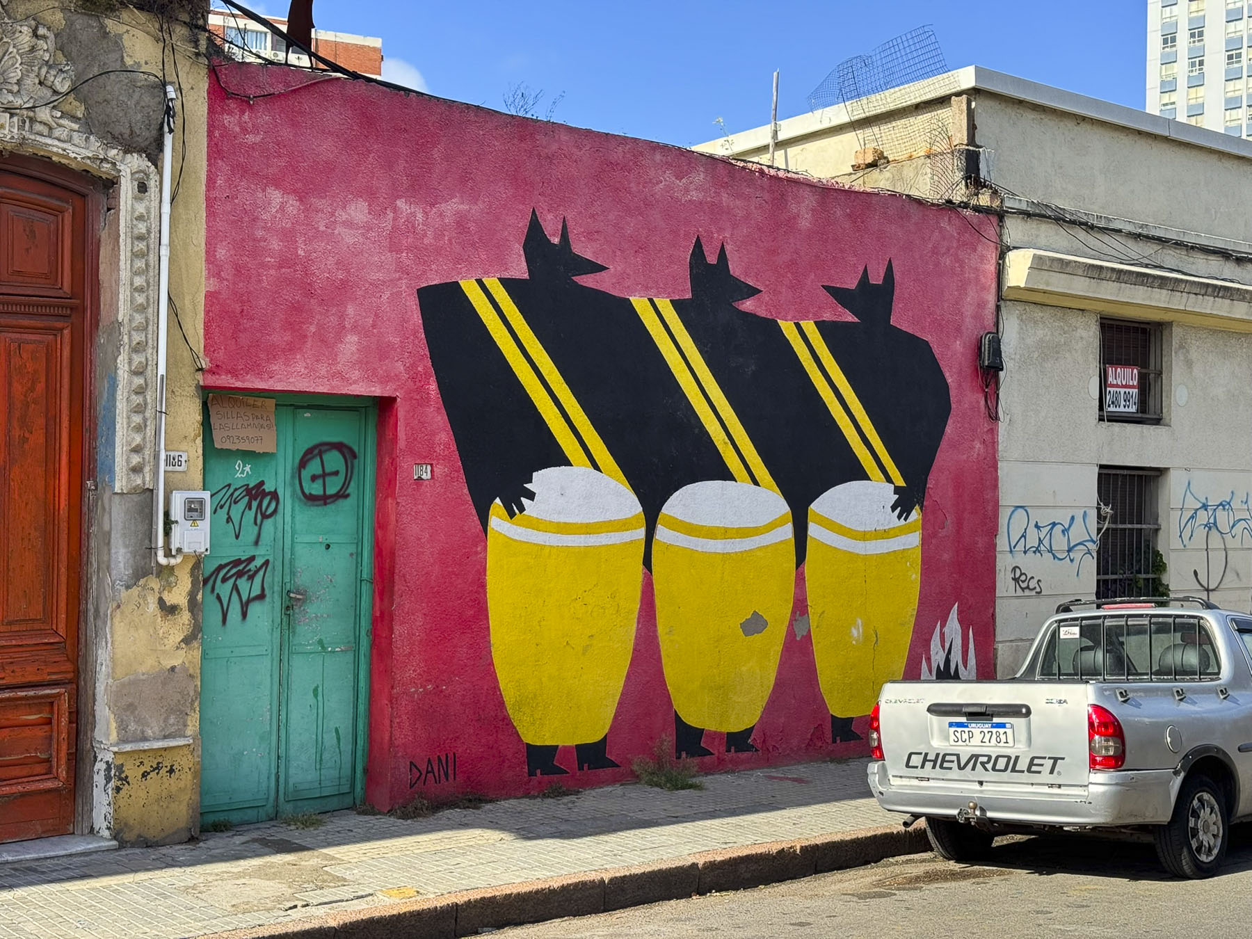
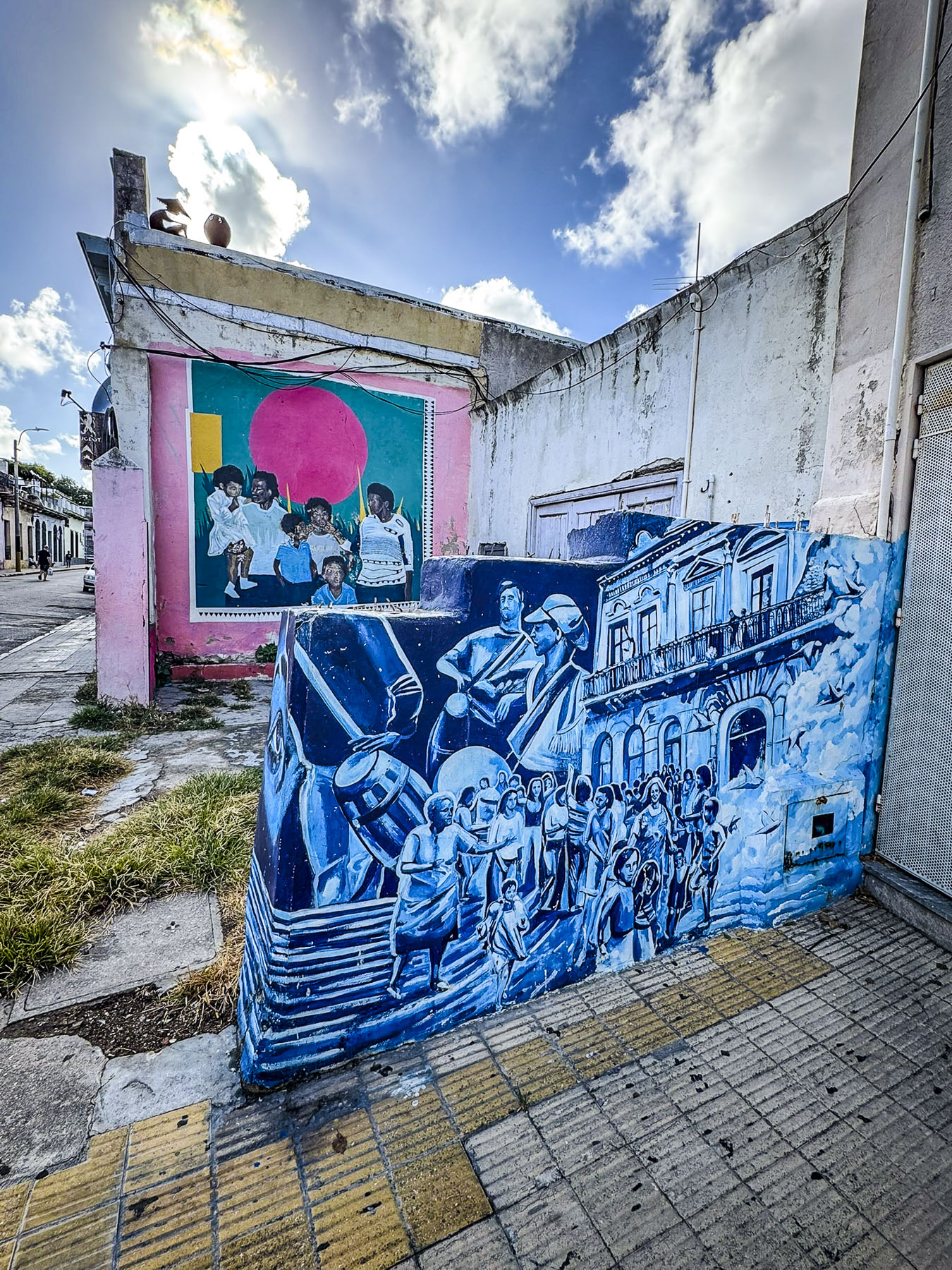
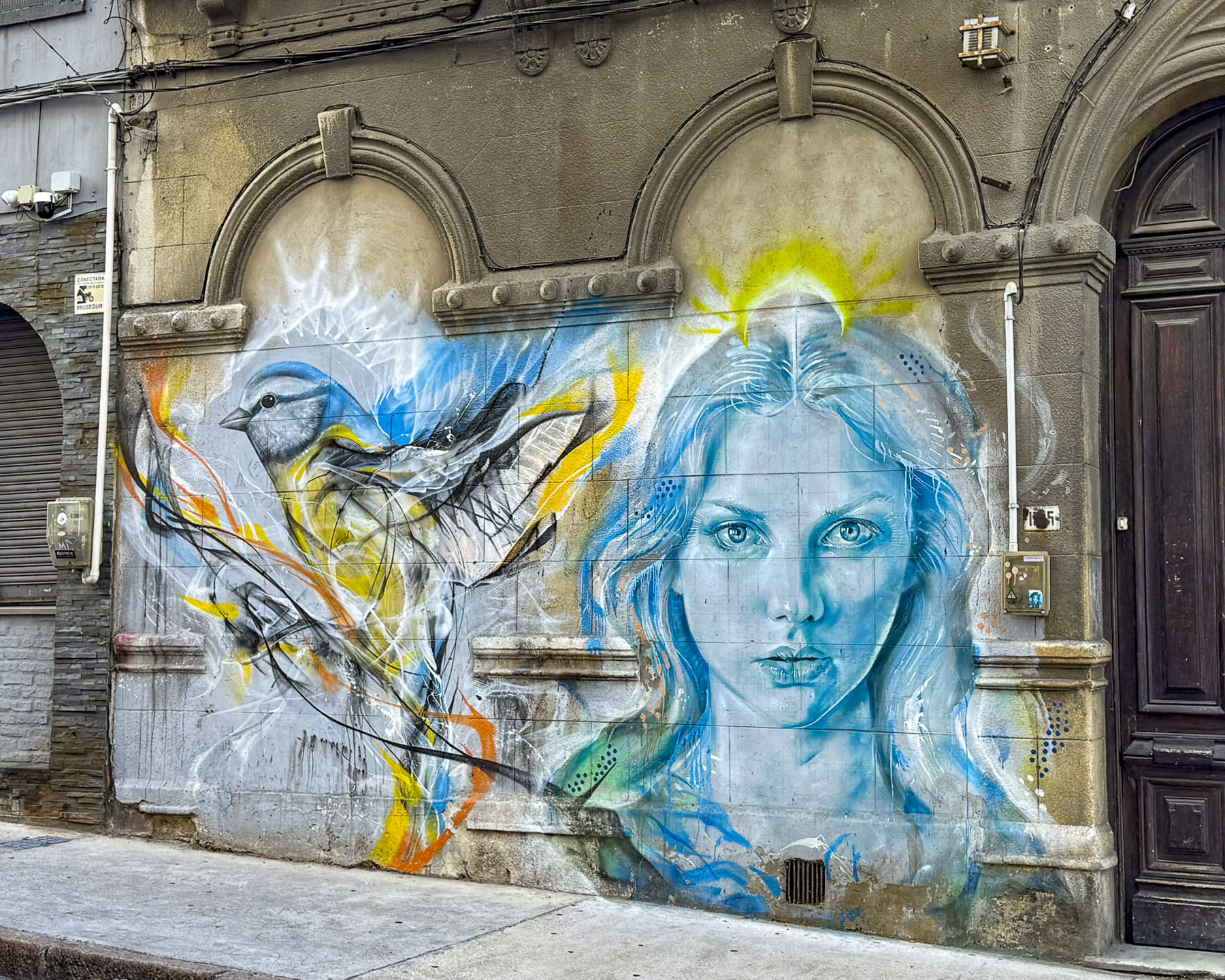
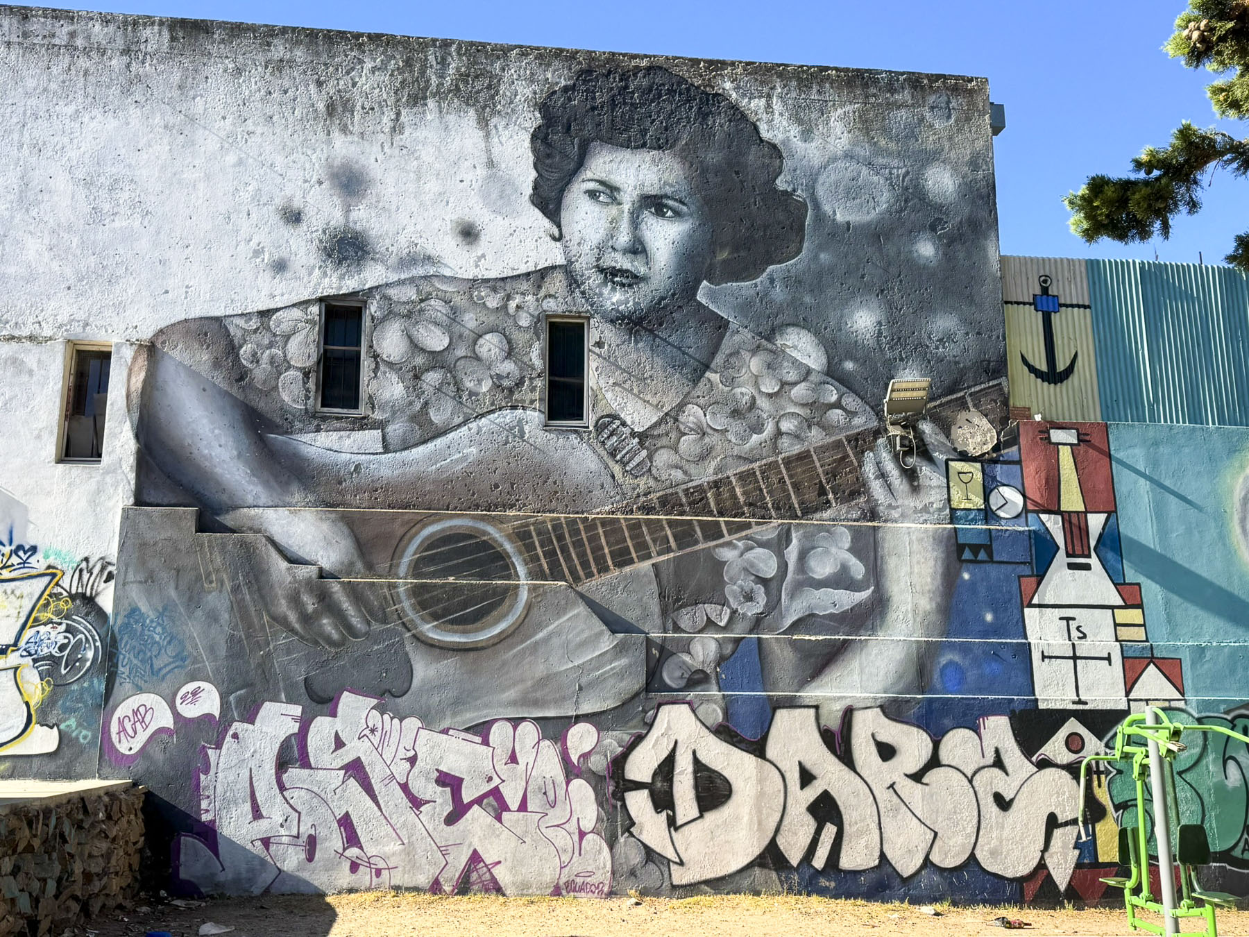
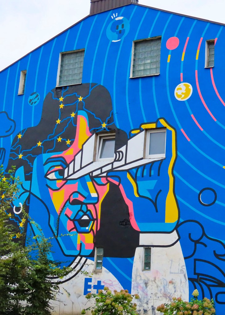
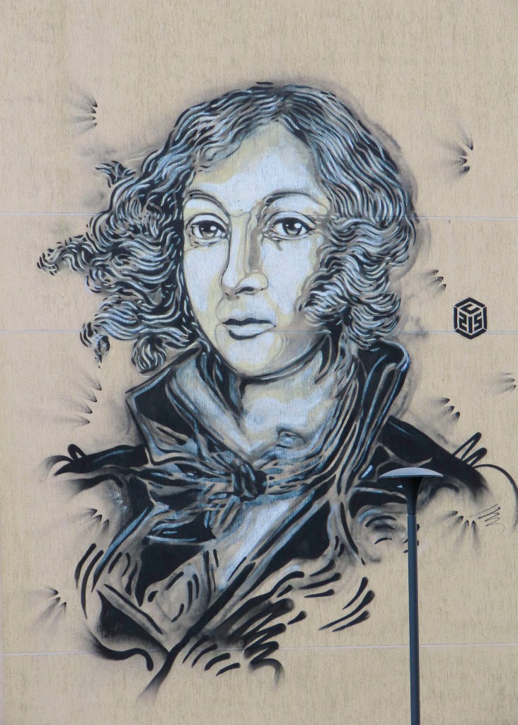
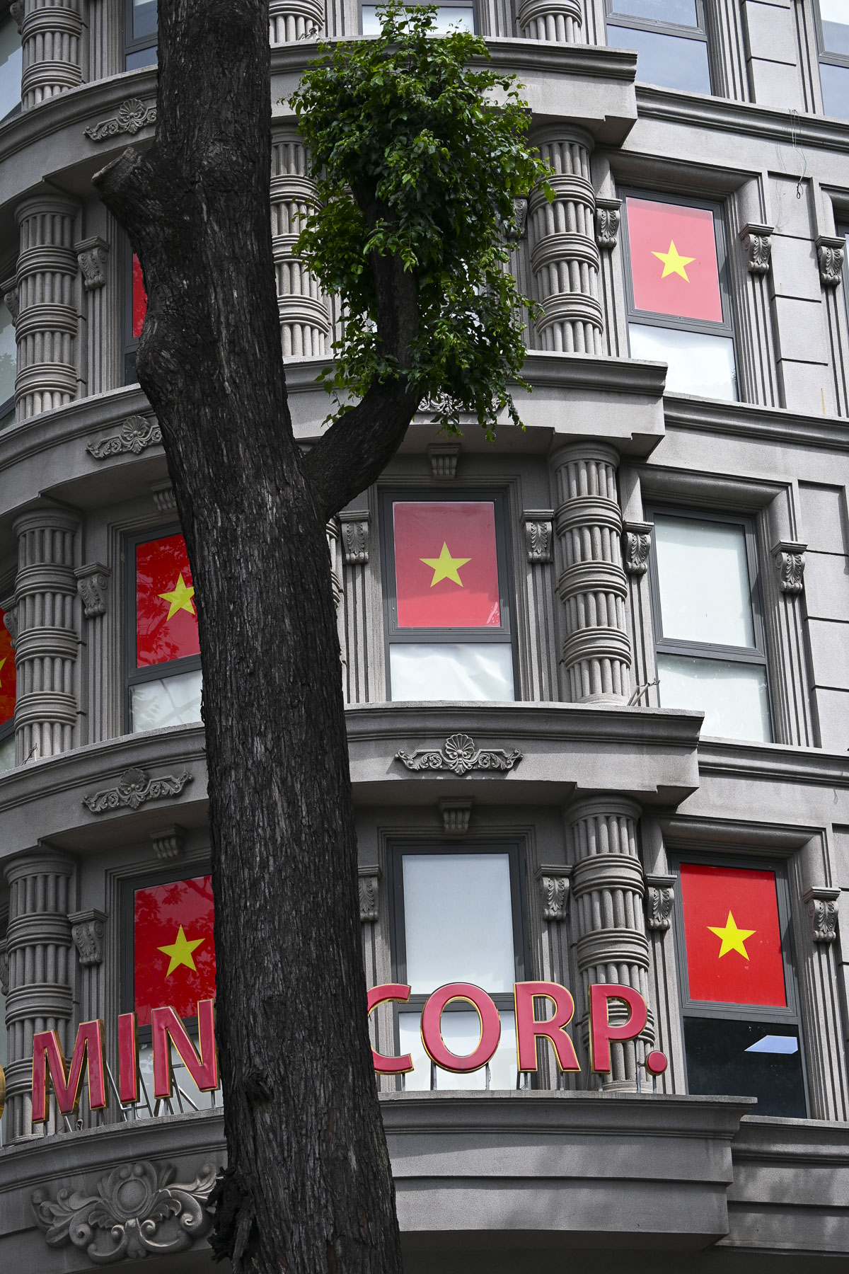
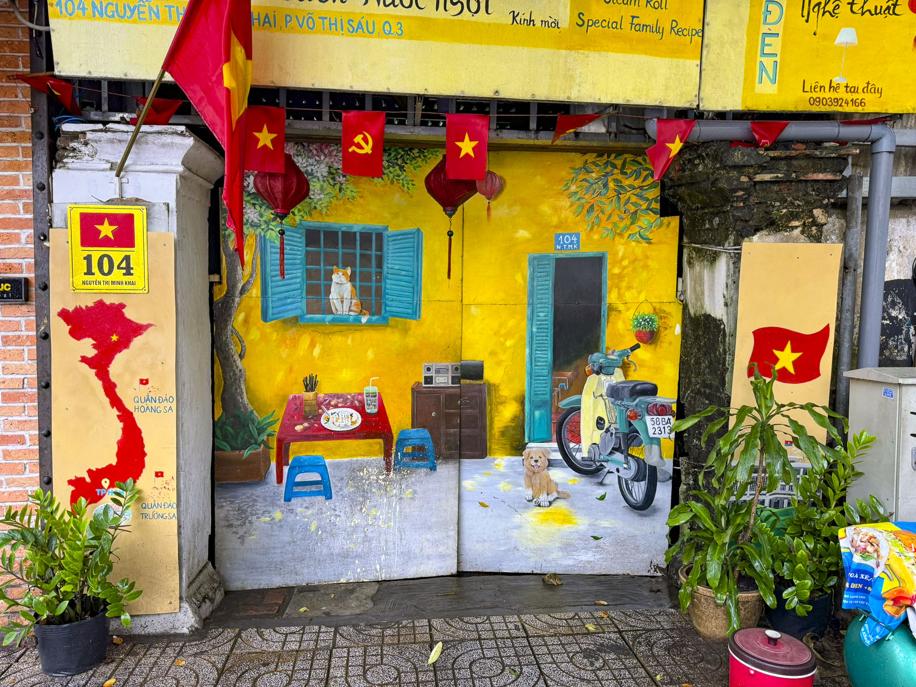
Turning left upon exiting the zoo we were waiting for a traffic light to change at the intersection of Nguyễn Hữu Cảnh, when we noticed a row of recently painted patriotic street murals. Obviously, these were government approved to celebrate the 50th anniversary of the end of the Vietnam War and the thriving economy that Vietnam now enjoys. Graffiti is unheard of and unapproved street art as a form of expression is illegal throughout the city, and the few decorative murals on buildings we saw were apolitical but still required the city’s permission. While talking about the unusual, we also didn’t see any homeless people sleeping rough on the streets. This is due to active government policies that relocate homeless individuals to social support centers, their home region, or shanty towns away from the city center.

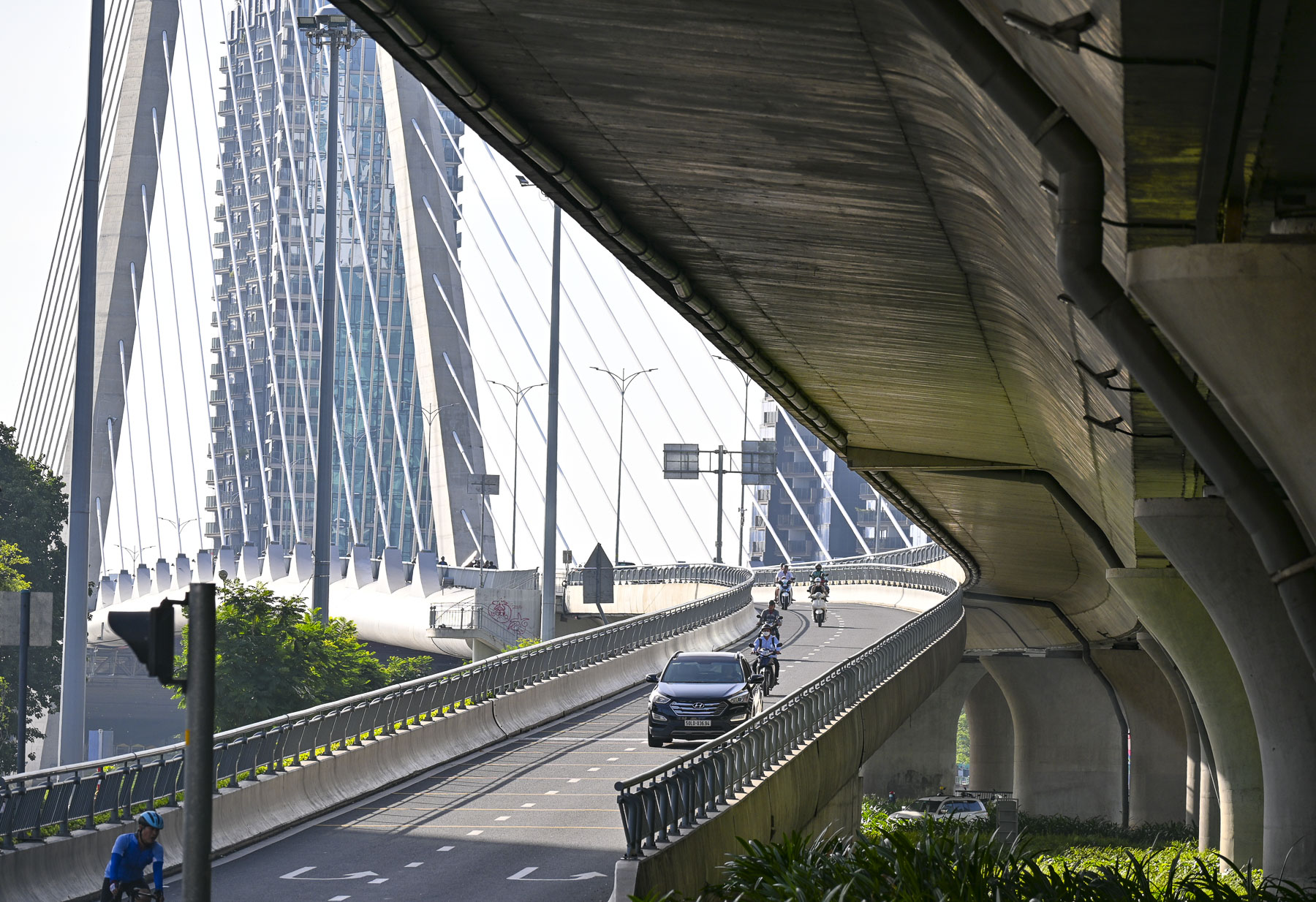
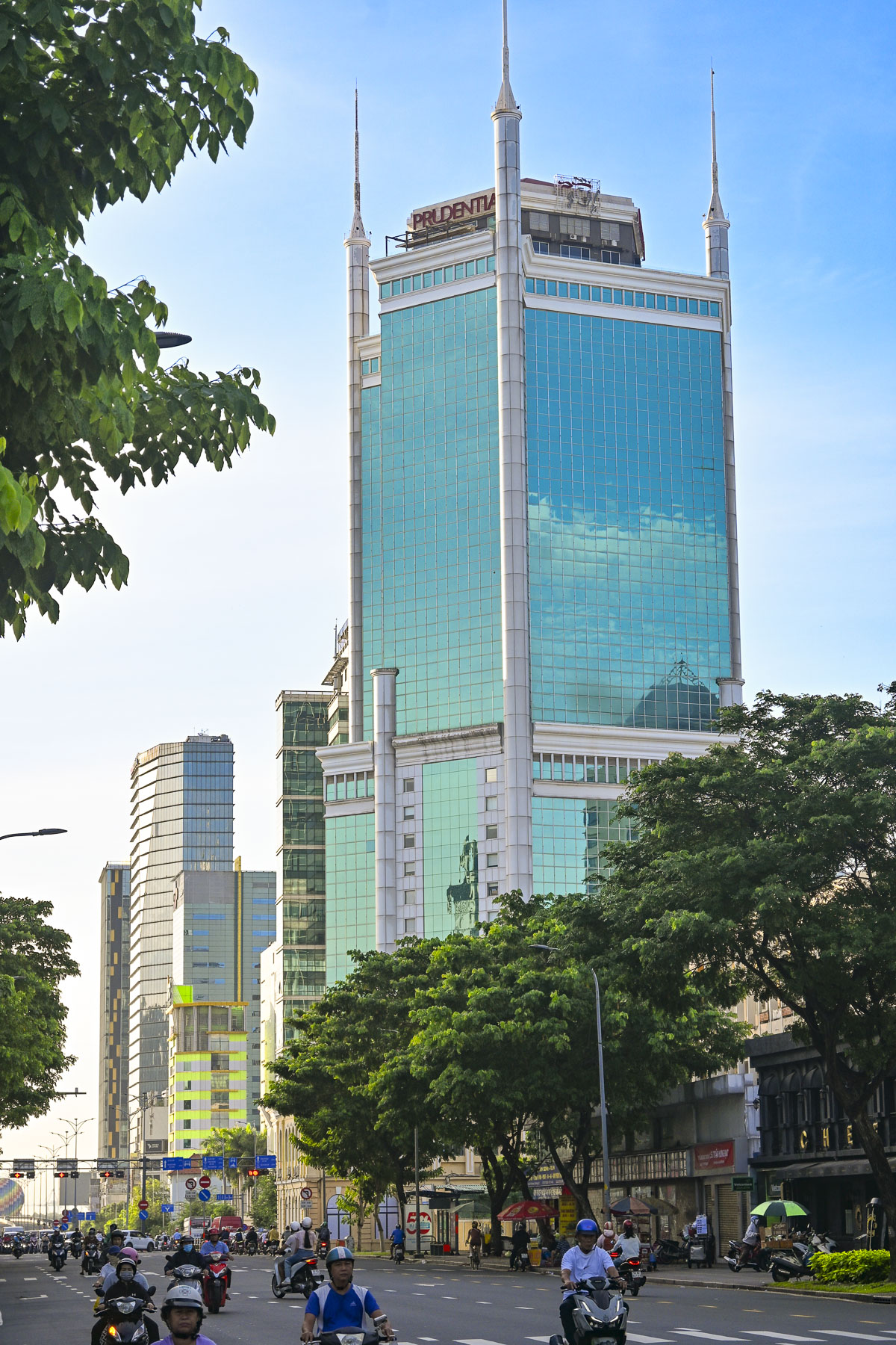
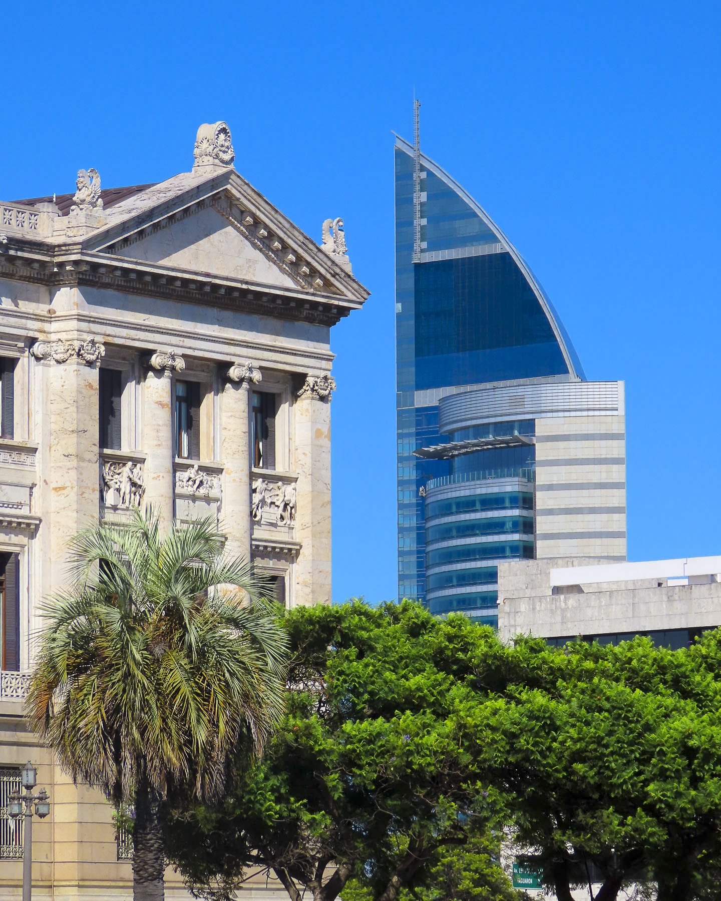
Walking back towards the historic center of District 1 we passed tall glass office buildings and transportation infrastructure projects built to sustain one of the fastest-growing economies in Southeast Asia, which is transforming Ho Chi Minh City into a global financial hub by focusing on digital technologies, finance, and high-tech industries.

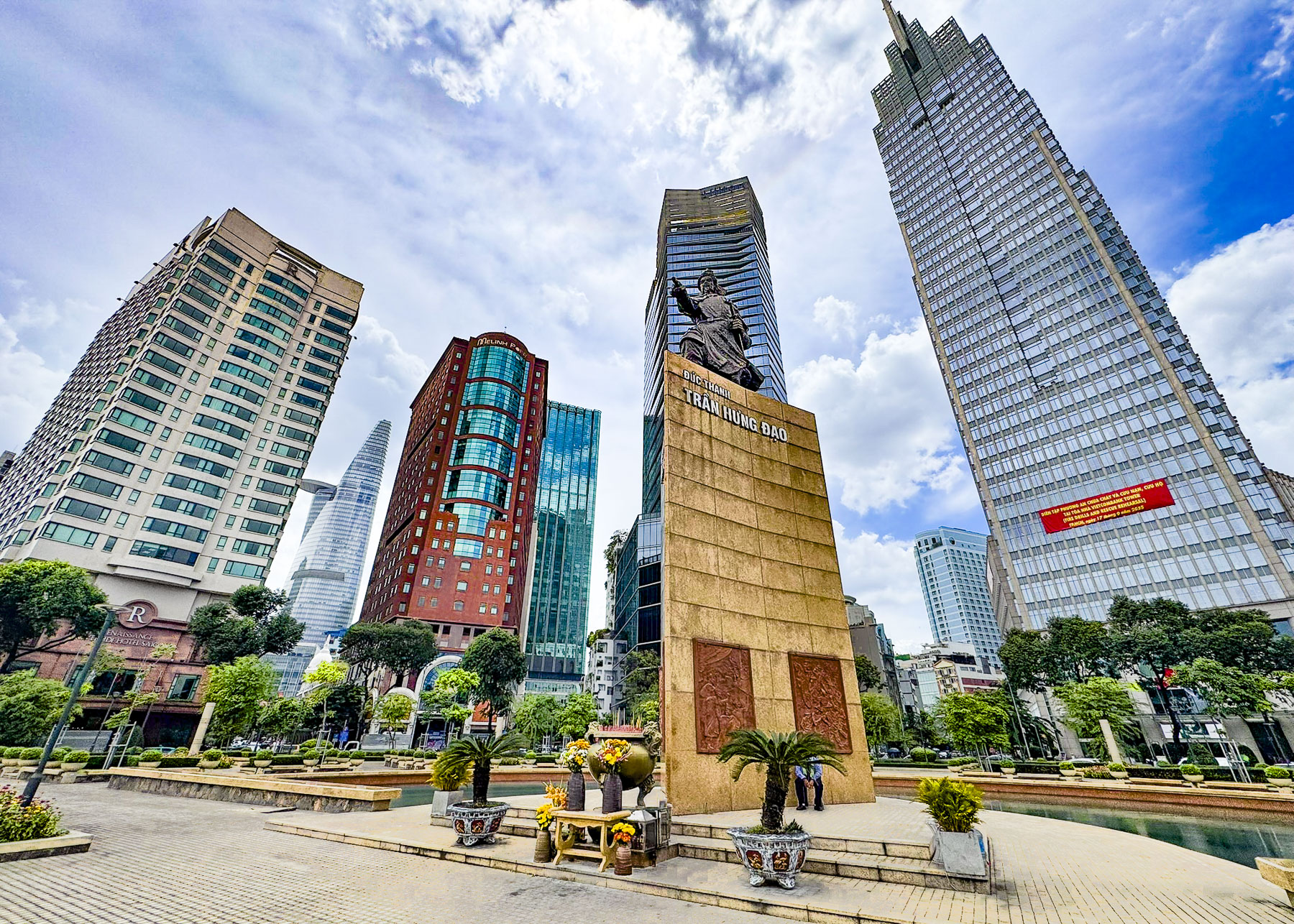
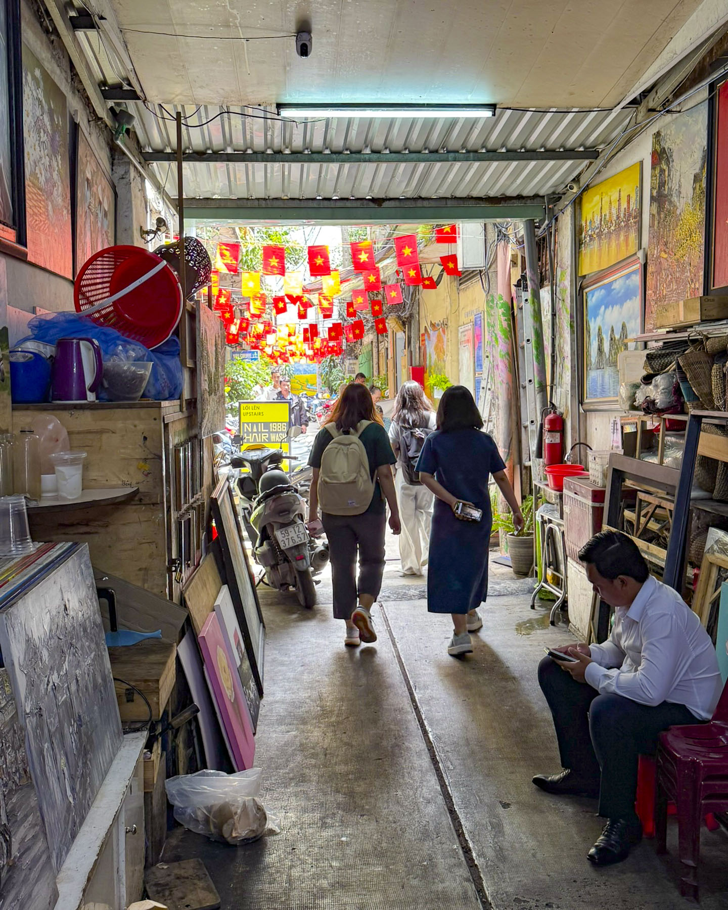
Near a plaza along the Sông Sài Gòn riverfront with a statue of the legendary General Tran Hung Dao we ducked into a passageway, off Mạc Thị Bưởi, lined with artwork called Alley 39 that opened to a narrow lane lined with small no-frills restaurants filled with folks. We found one with an empty table and enjoyed Pho for lunch.

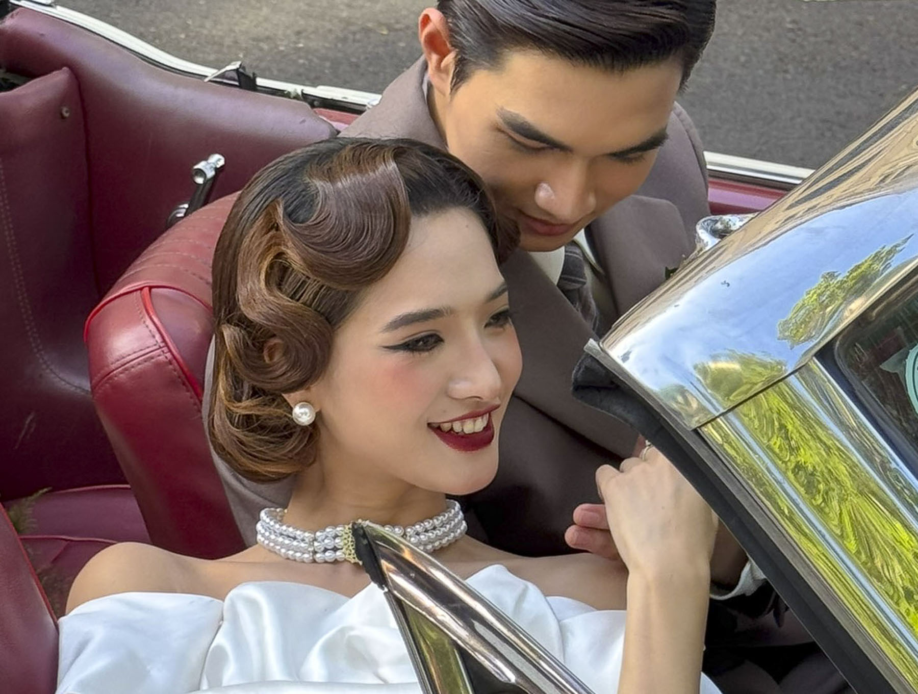
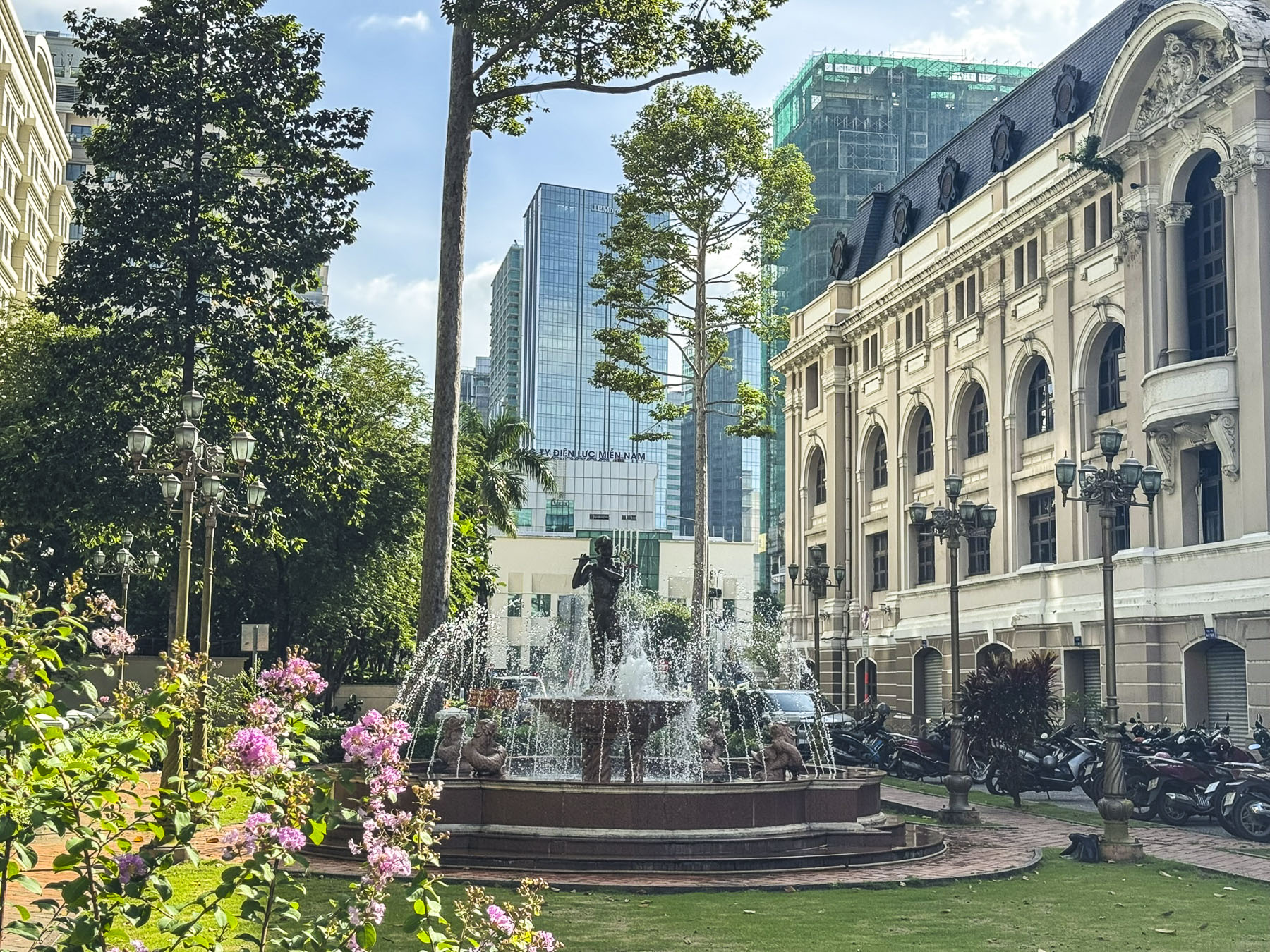
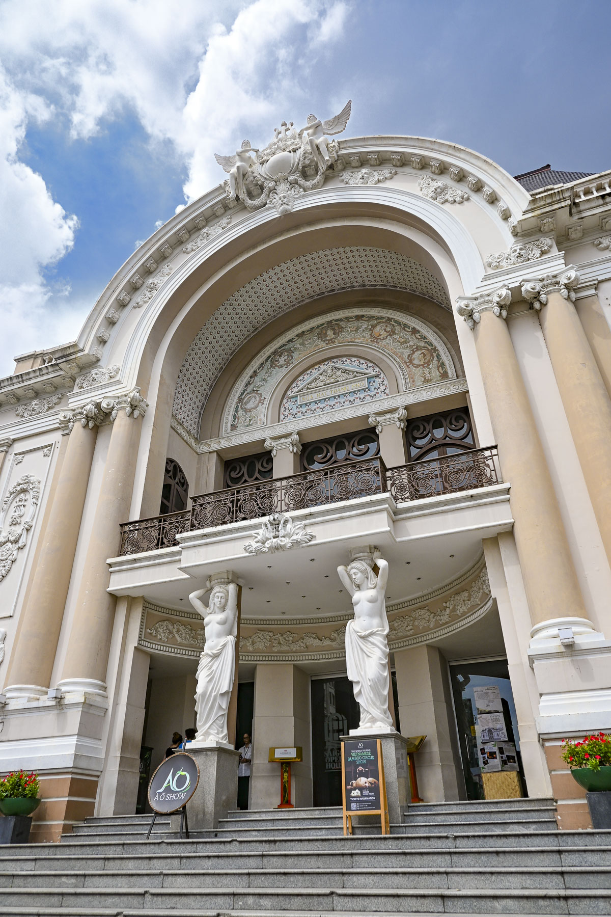
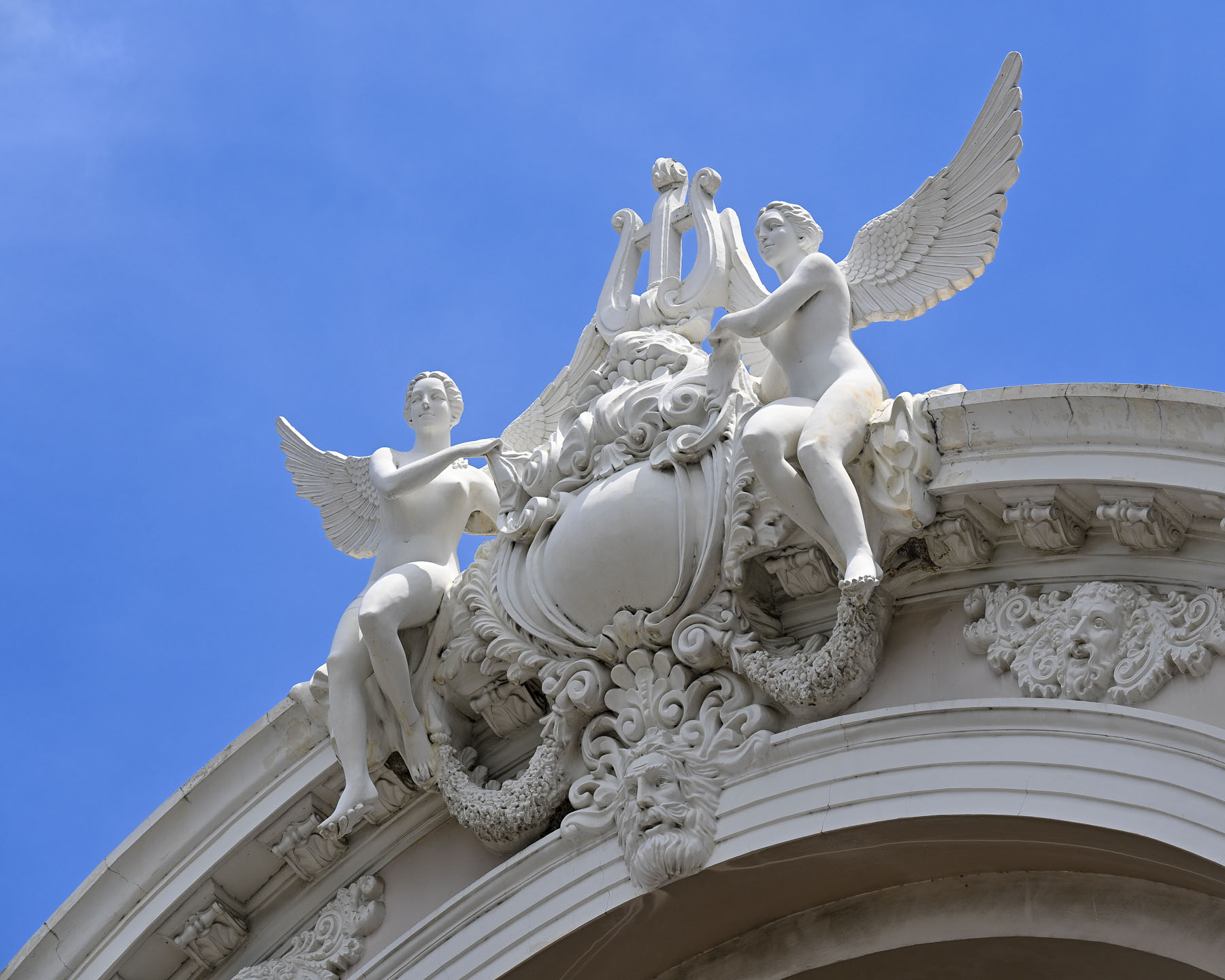
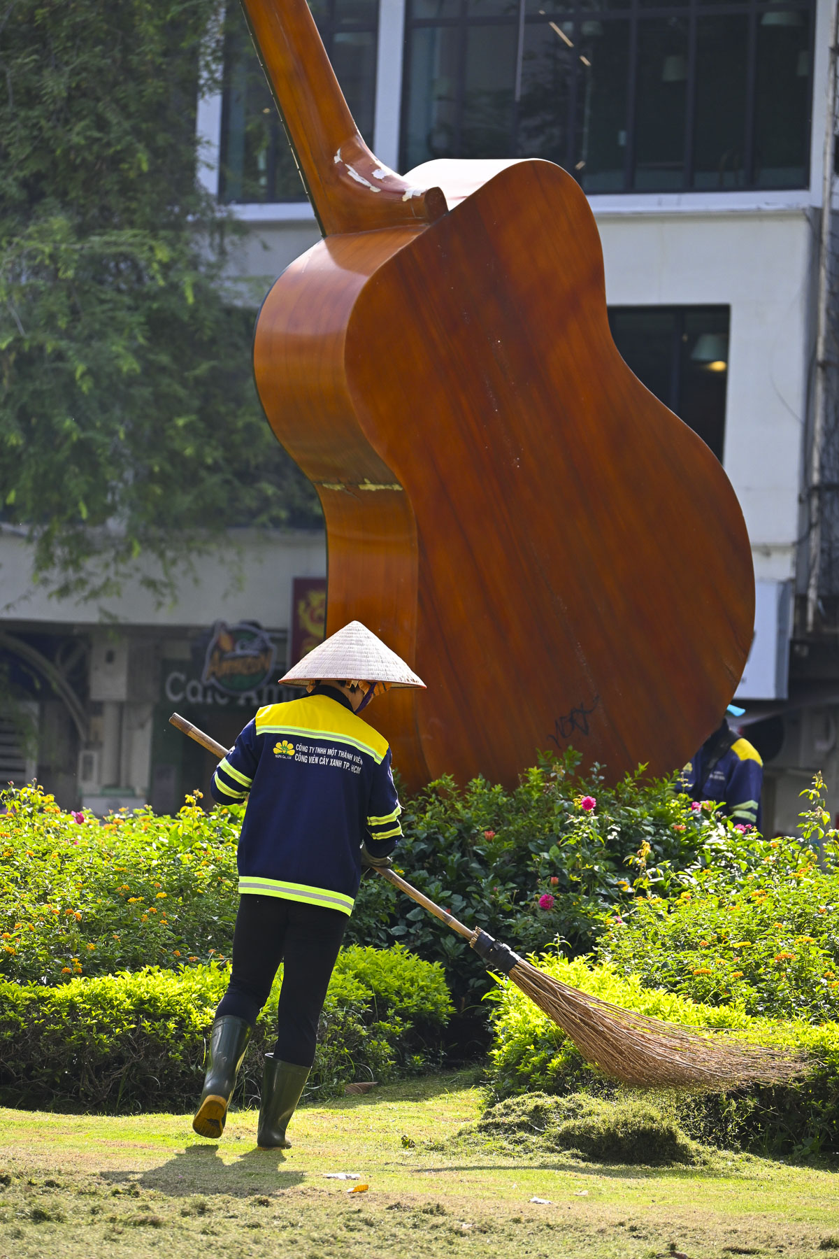
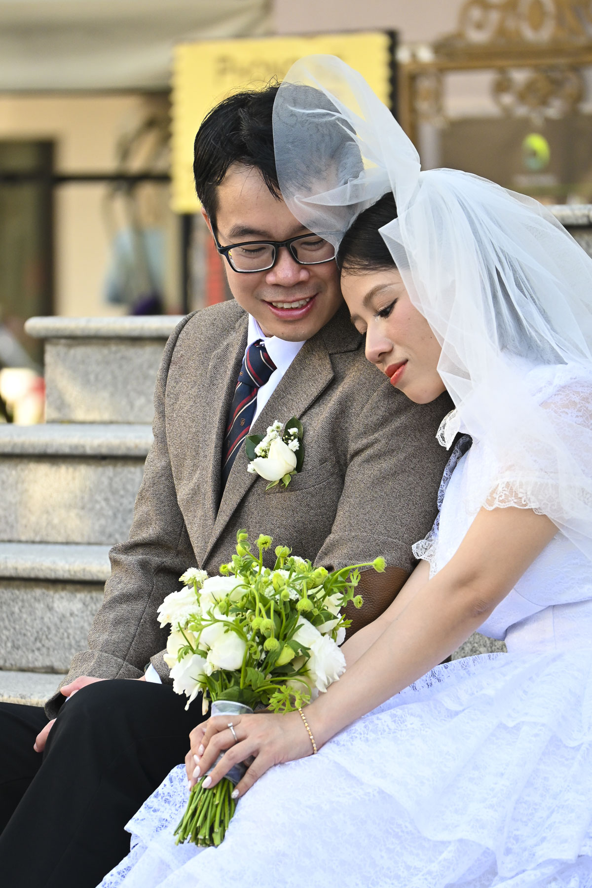
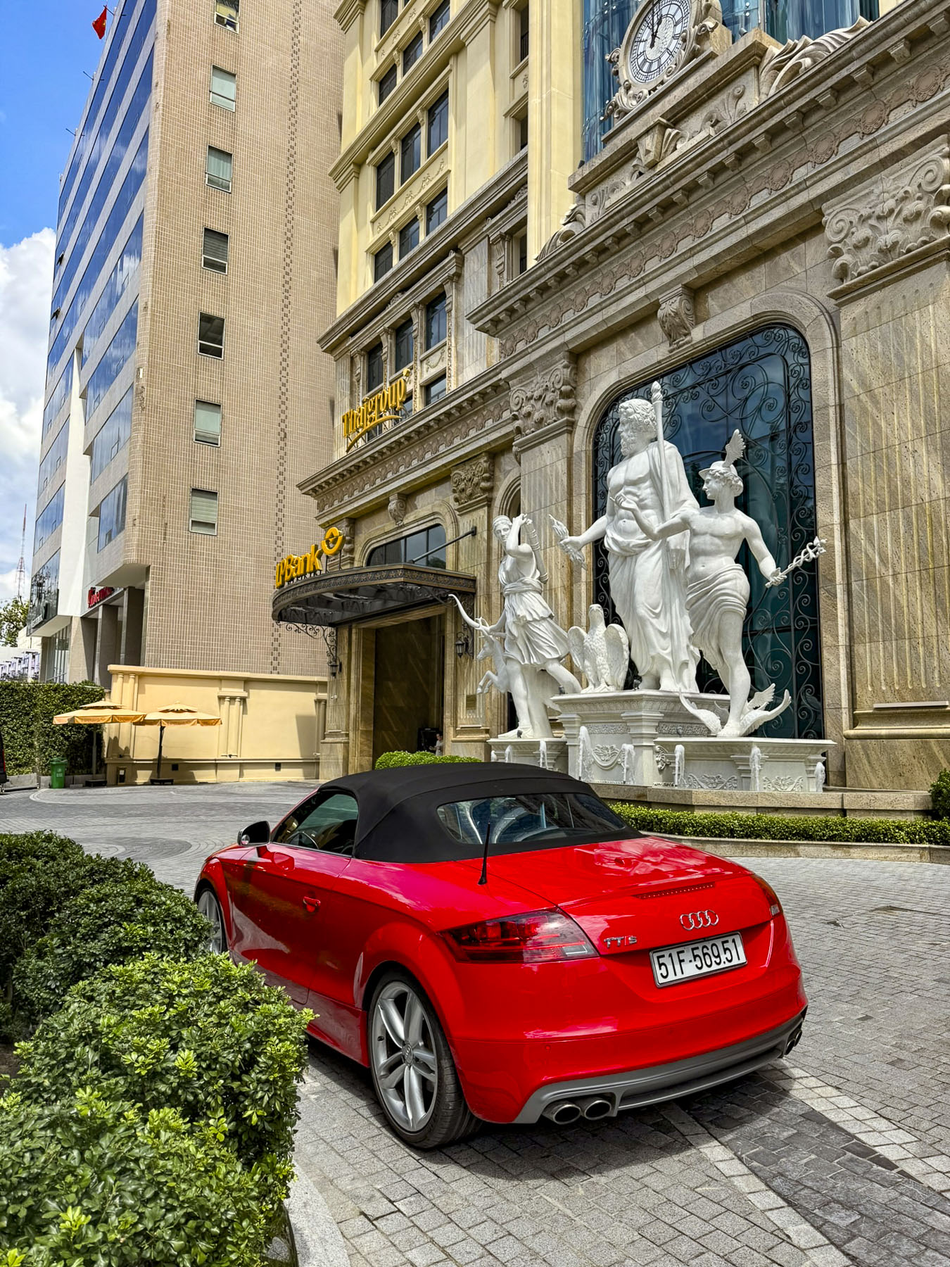
Afterwards we headed to the Municipal Theatre of Ho Chi Minh City, Saigon’s old opera house built by the French in 1897. It’s a fine example of grand colonial architecture, and it served as the legislative assembly for South Vietnam after the war before being restored to its original use and declared a national monument in 2012. Surrounding the opera house are several small squares with musical themed statuary. It’s also a popular place for couples to have their engagement and wedding photos taken and there even seemed to be two vintage sports cars permanently parked there to facilitate a variety of shots.

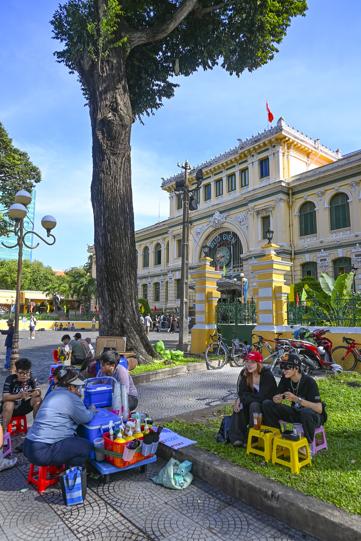
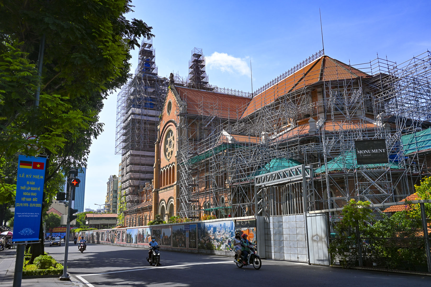
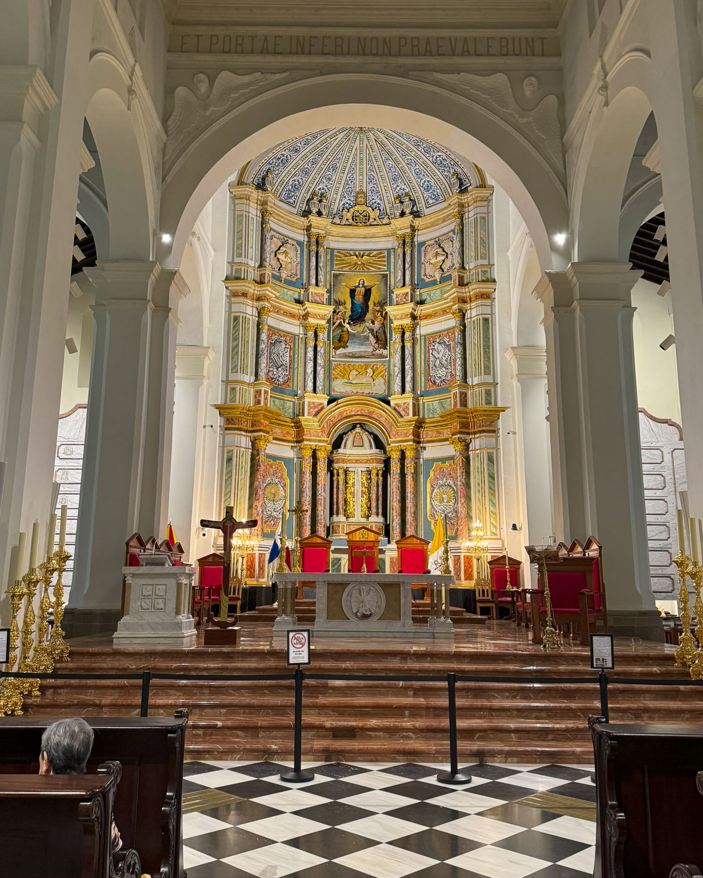
It was a long hot and humid day, but we strolled slowly back to our hotel past Saigon’s monumental Central Post Office. Across from it was the Notre Dame Cathedral of Saigon, wrapped in construction scaffolding for a multi-year renovation. It was extravagantly constructed between 1863 and 1880 with every brick, piece of structural steel, nail and stained glass window imported from France. Both structures are beloved vestiges of the city’s colonial past and historic landmarks. While Vietnam’s communist government officially guarantees religious freedom in its constitution, it heavily regulates Buddhist, Catholic, Protestant, and Islamic houses of worship and the activities they support via the Government Committee for Religious Affairs.

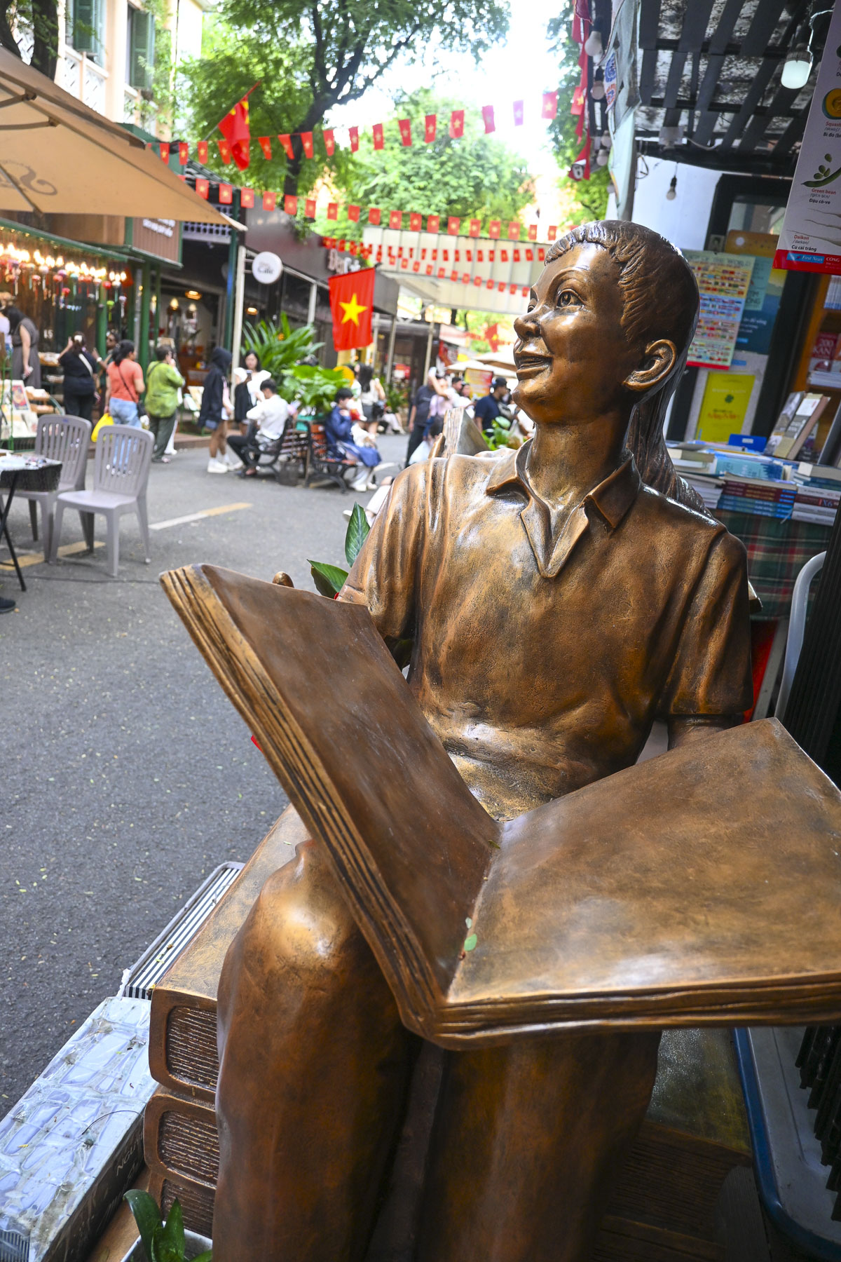
Next to the post office was Nguyen Van Binh Book Street, a pedestrian-only lane lined with books, shops, and cafes. As we enjoyed a cup of coffee in a café, the bookseller across the way sent her young daughter over chat with us, to practice her English. The young girl spoke very well, and we enjoyed her company, but she soon lost interest and wandered off.

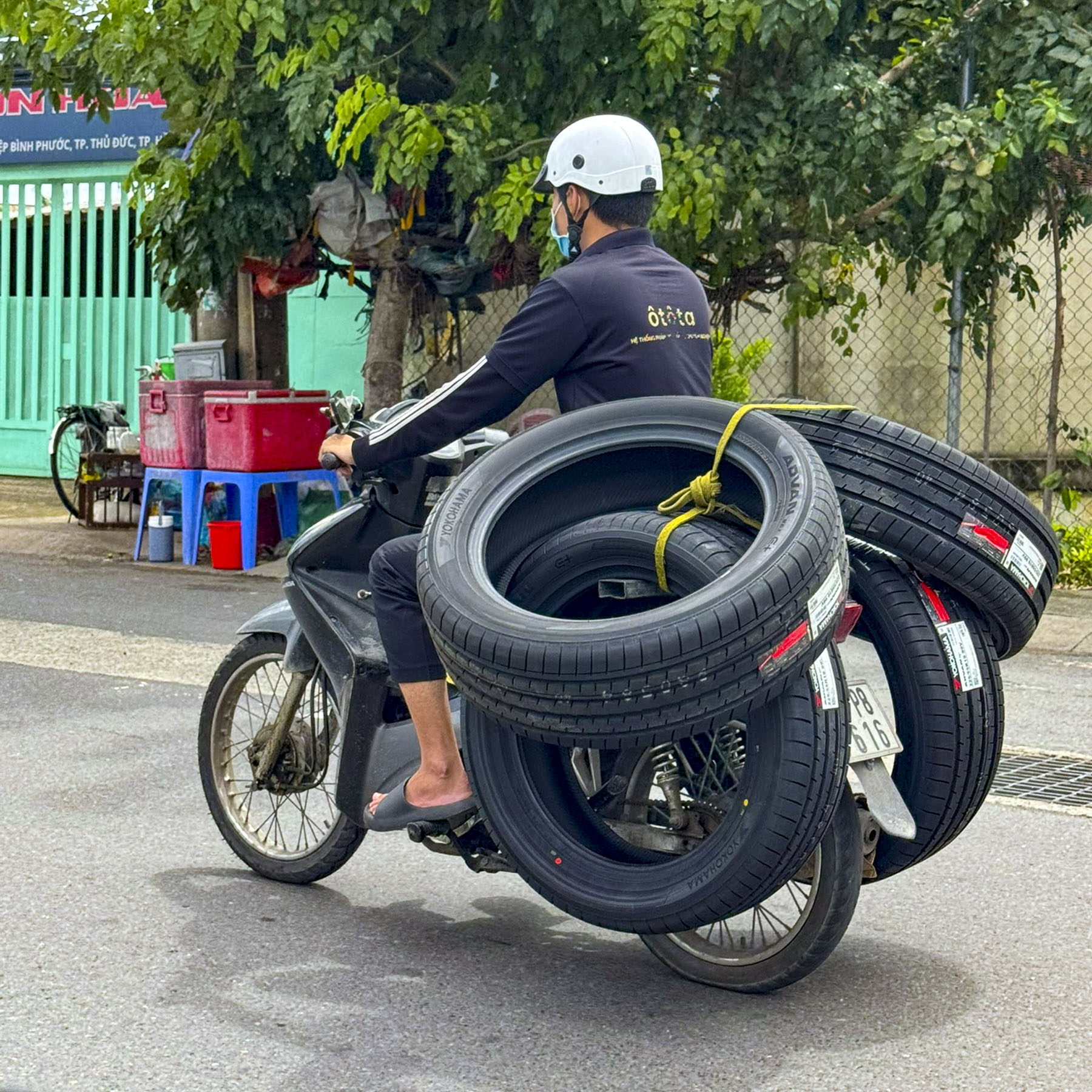
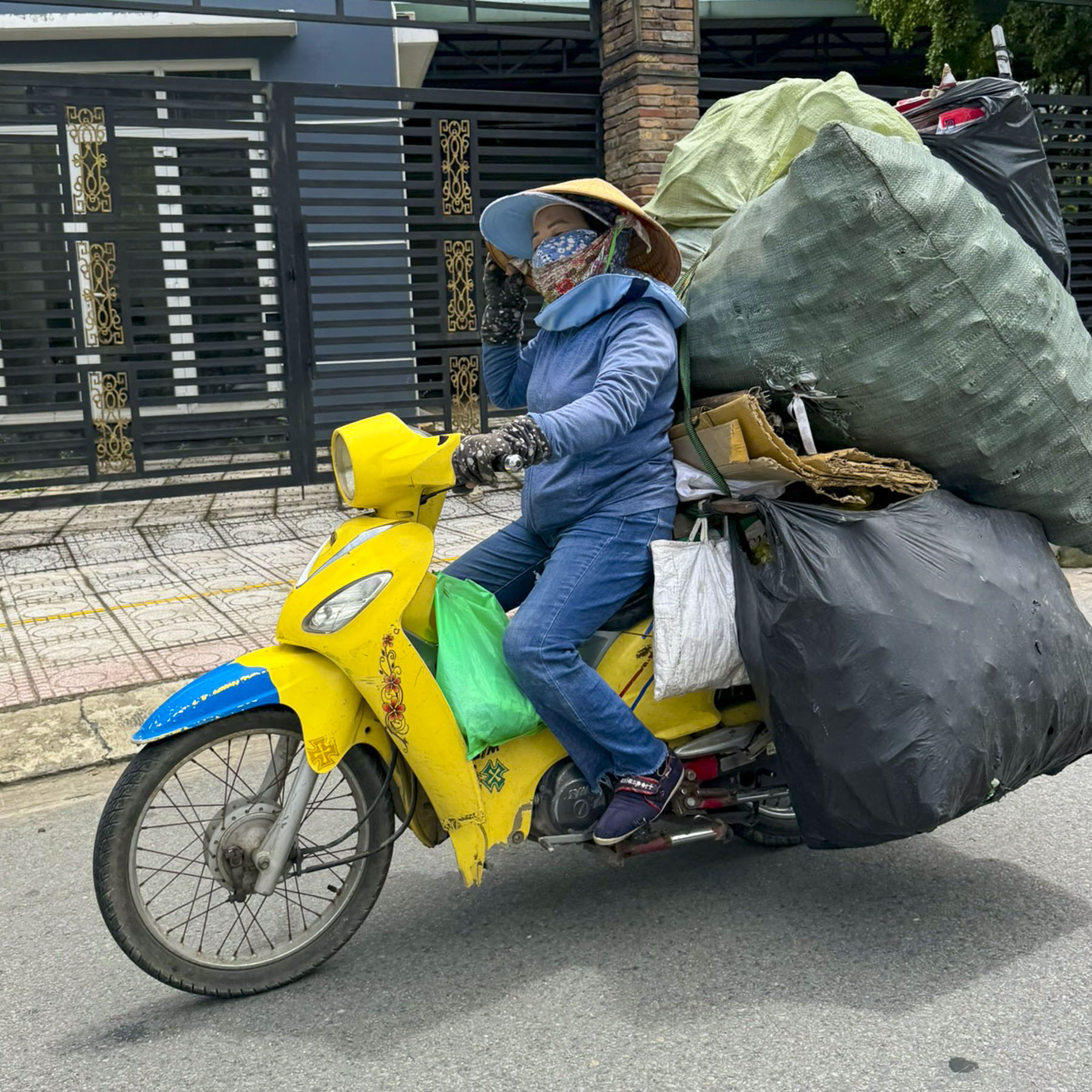
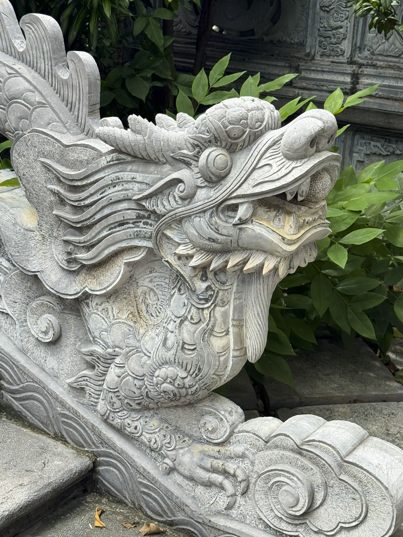
The next day we hired a private driver, a relative of the hotel’s concierge, to take us to the town of Thủ Dầu Một to see the reclining Buddha at the Hoi Khanh Pagoda complex, and several smaller temples on the return trip to the city. This was a fascinating ride down roads filled with overburdened scooters delivering various wares and lined with weathered roadside businesses that included a rubber clogs shop and factory with thousands of brightly colored shoes, a coffin shop, poultry and gold fish stores, a birdcage shop, various statuary makers, one of which had a Statue of Liberty out front, and numerous mechanic shops. It’s traditional for business owners to live above their tightly spaced shops in narrow dwellings called “tube homes,” which are often faced with marble to reflect the prosperity of the owners.

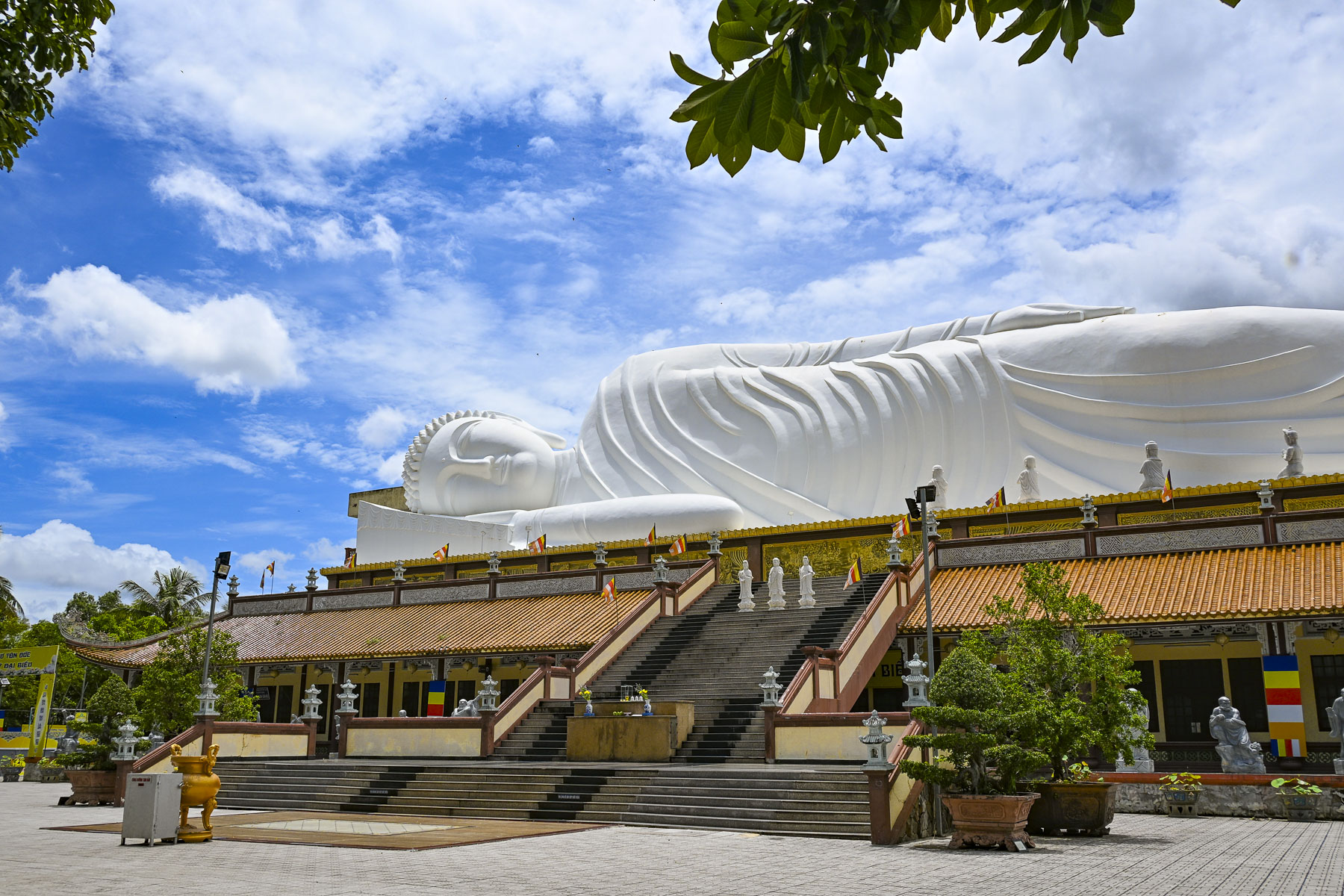
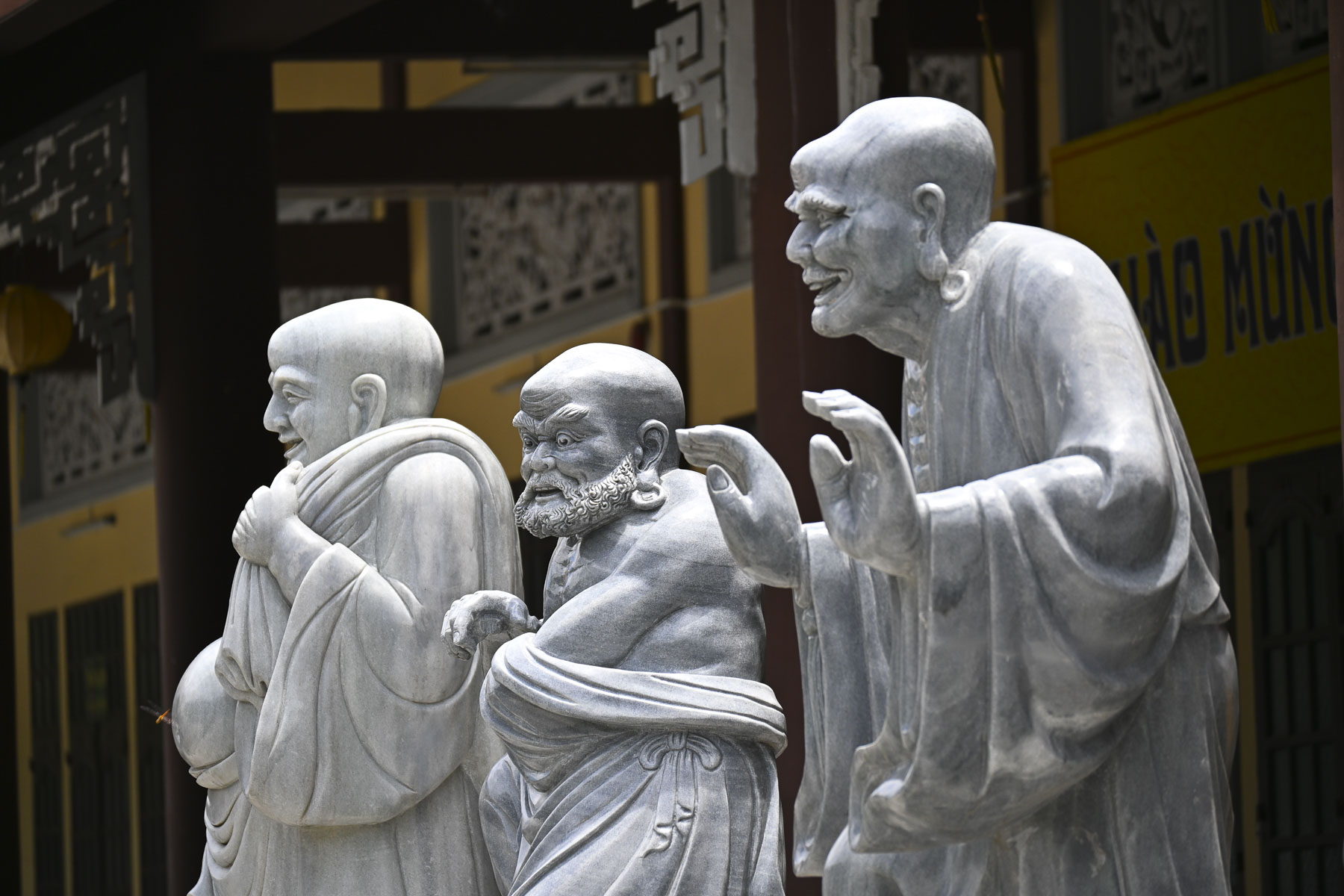
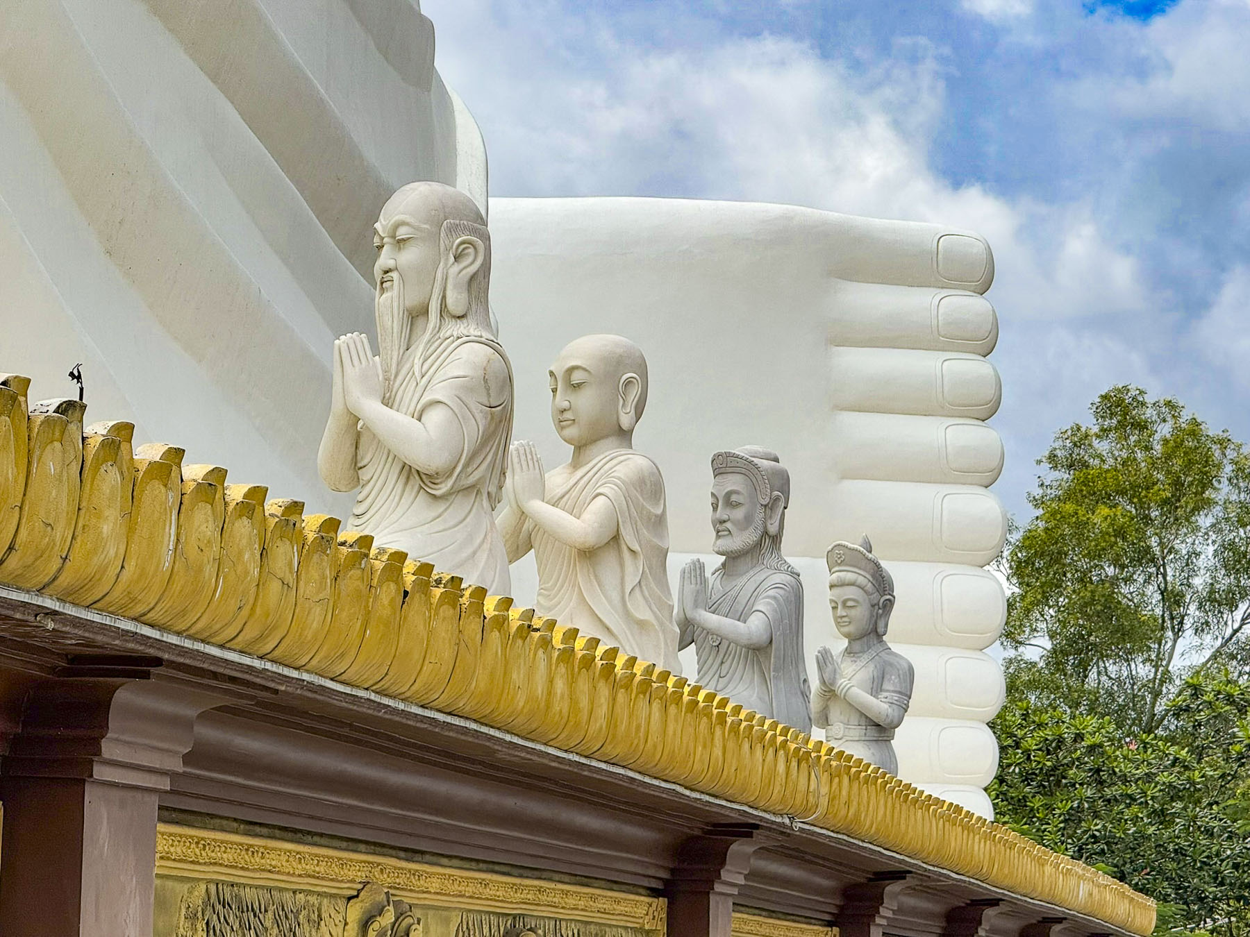
The massive pure white Buddha is 52m (170ft) long and reclines atop the temple’s two-story Buddhist academy. Along the base of the giant statue are 20 reliefs showing the life of the Buddha from his birth to his Parinirvana. According to the Buddhist tradition, women cannot ascend to the status of a Buddha — one who is awake, enlightened and emancipated. I like to tease Donna, who is a Methodist minister, that she might have been a little too close for the Buddha’s comfort, and he pushed her as she was coming down the stairs. Fortunately, a very sweet vendor selling flowers for offerings gave Donna an herbal salve to help with the immediate pain while our driver hurried down the street and bought two bags of ice from a nearby restaurant, to help reduce the swelling. 

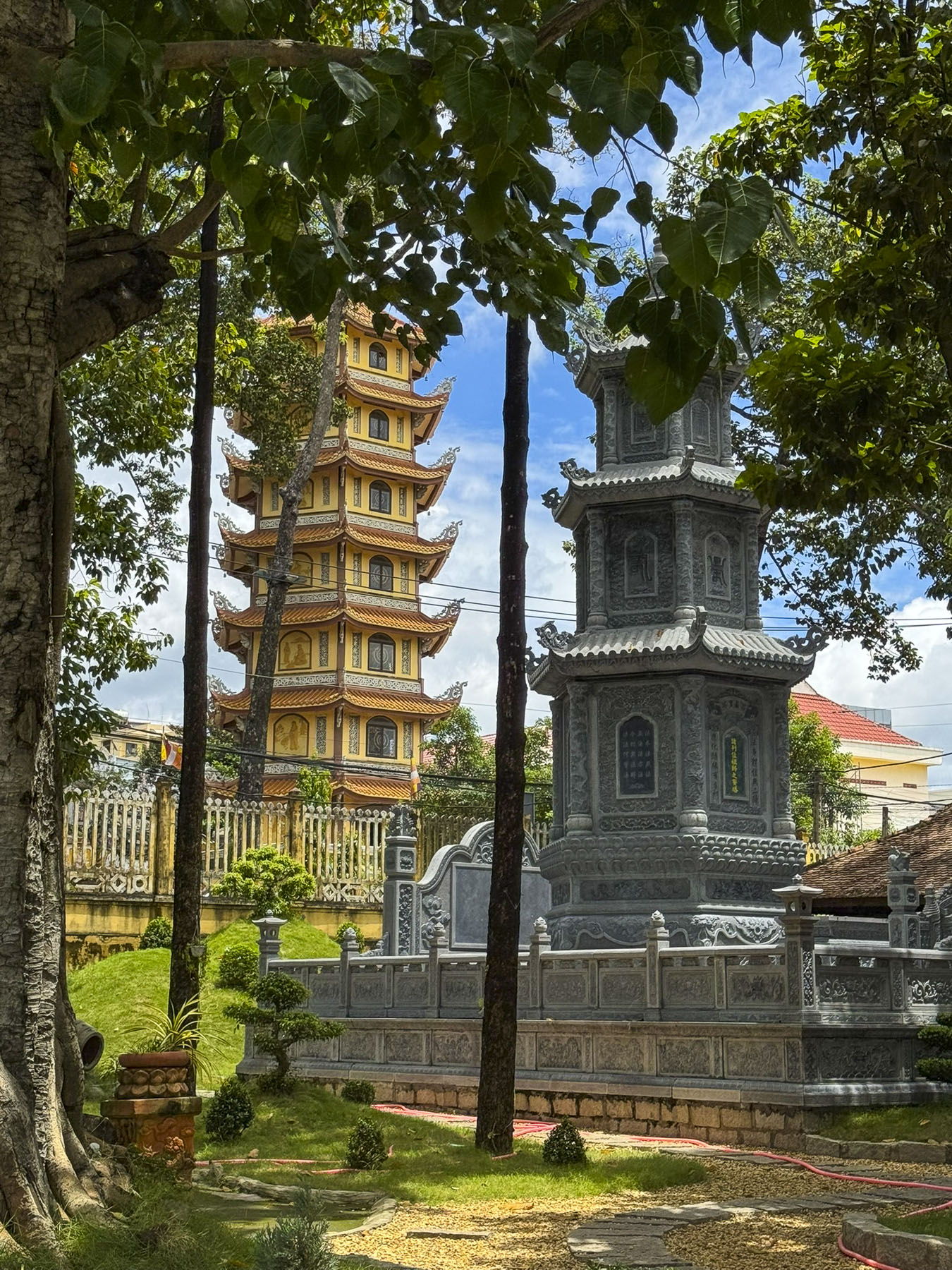
Across the street was the site of the original small Hoi Khanh temple, first established in 1741 by Zen Master Đại Ngạn Từ Tấn, a third-generation monk. This temple was destroyed during fighting in 1861, as the French colonial army colonized southern Vietnam. The temple is a major spiritual site in the region and continuous to evolve with additions of the seven-story pagoda in 2007, along with the academy and reclining Buddha in 2010.

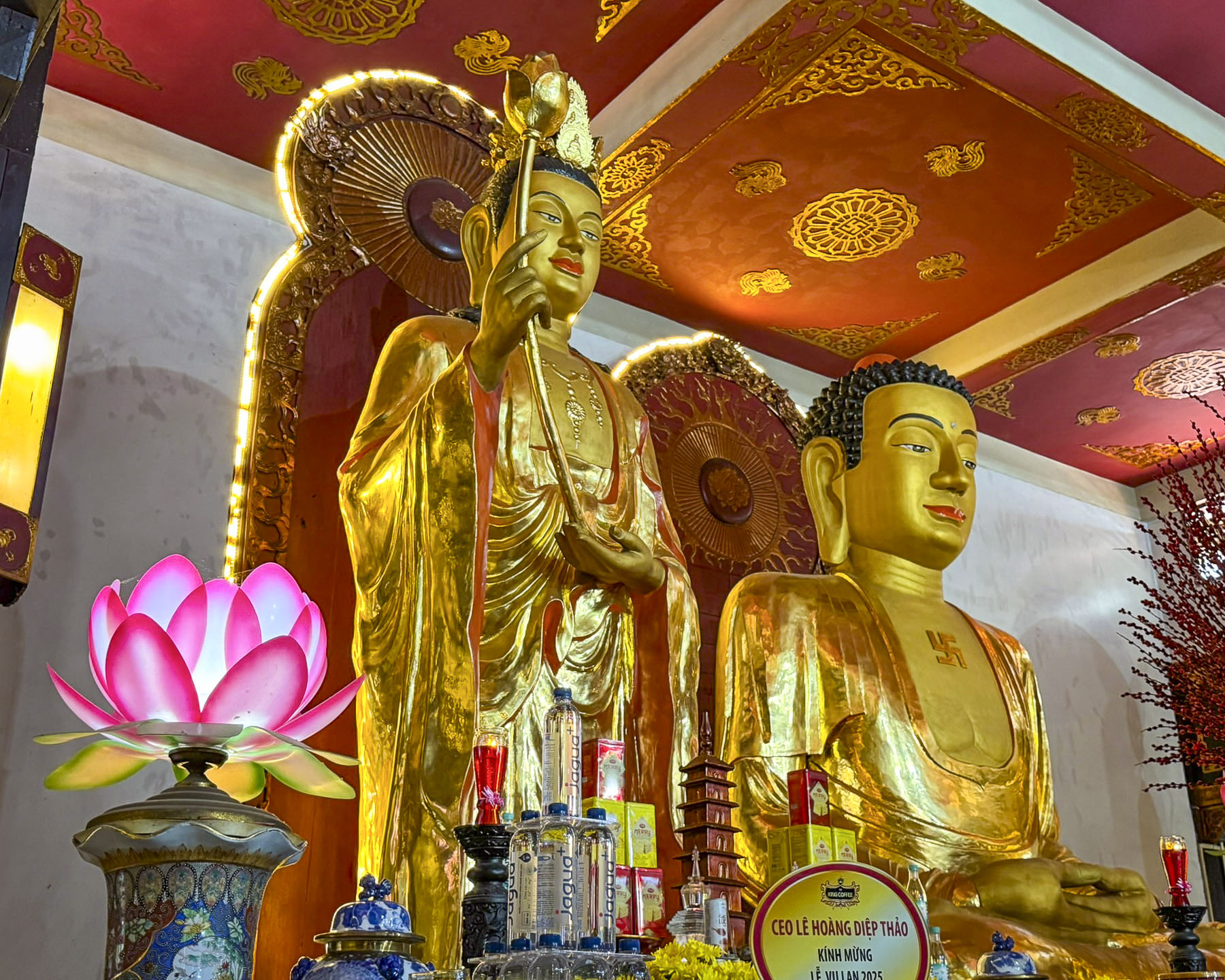
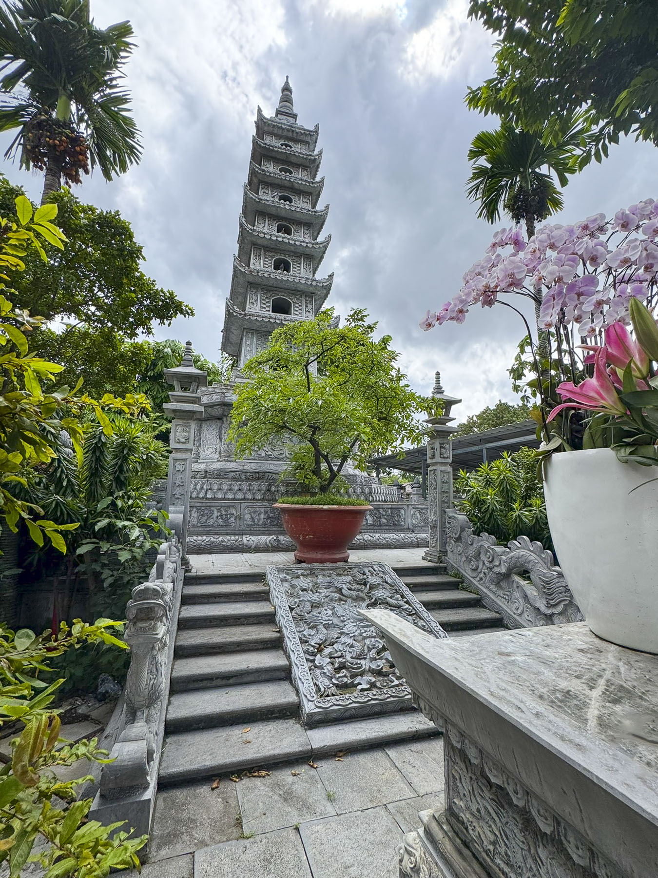
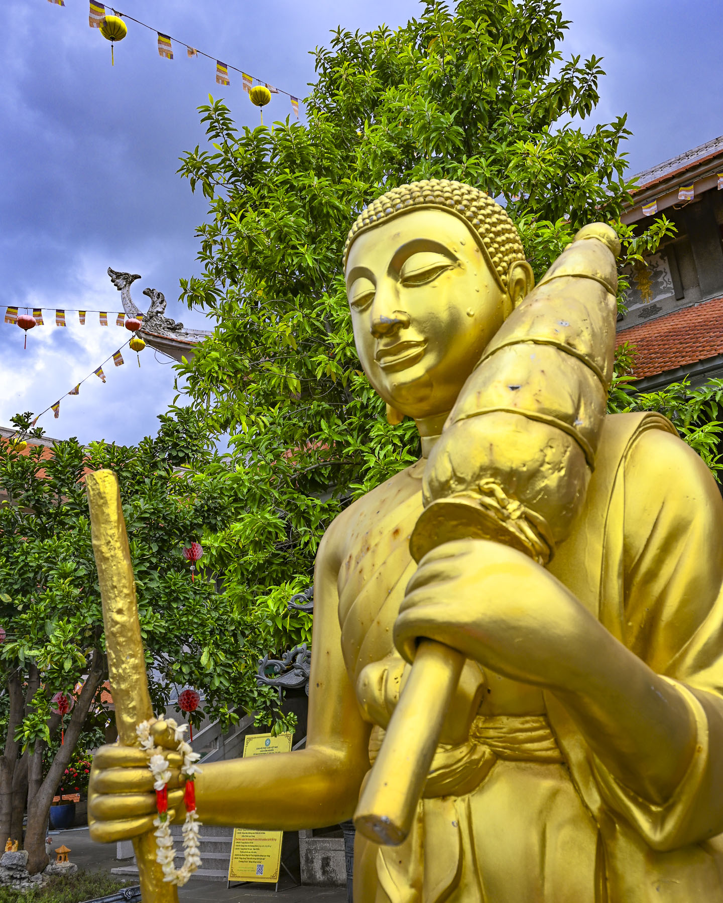
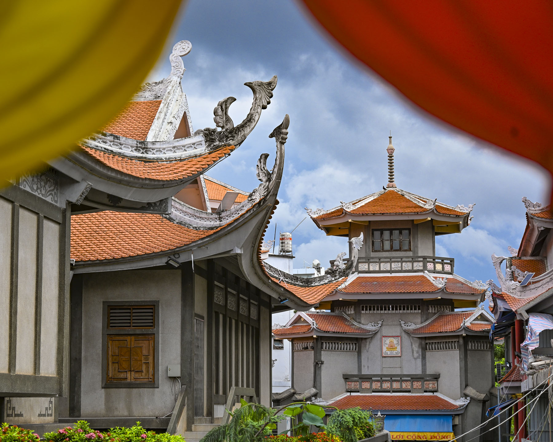
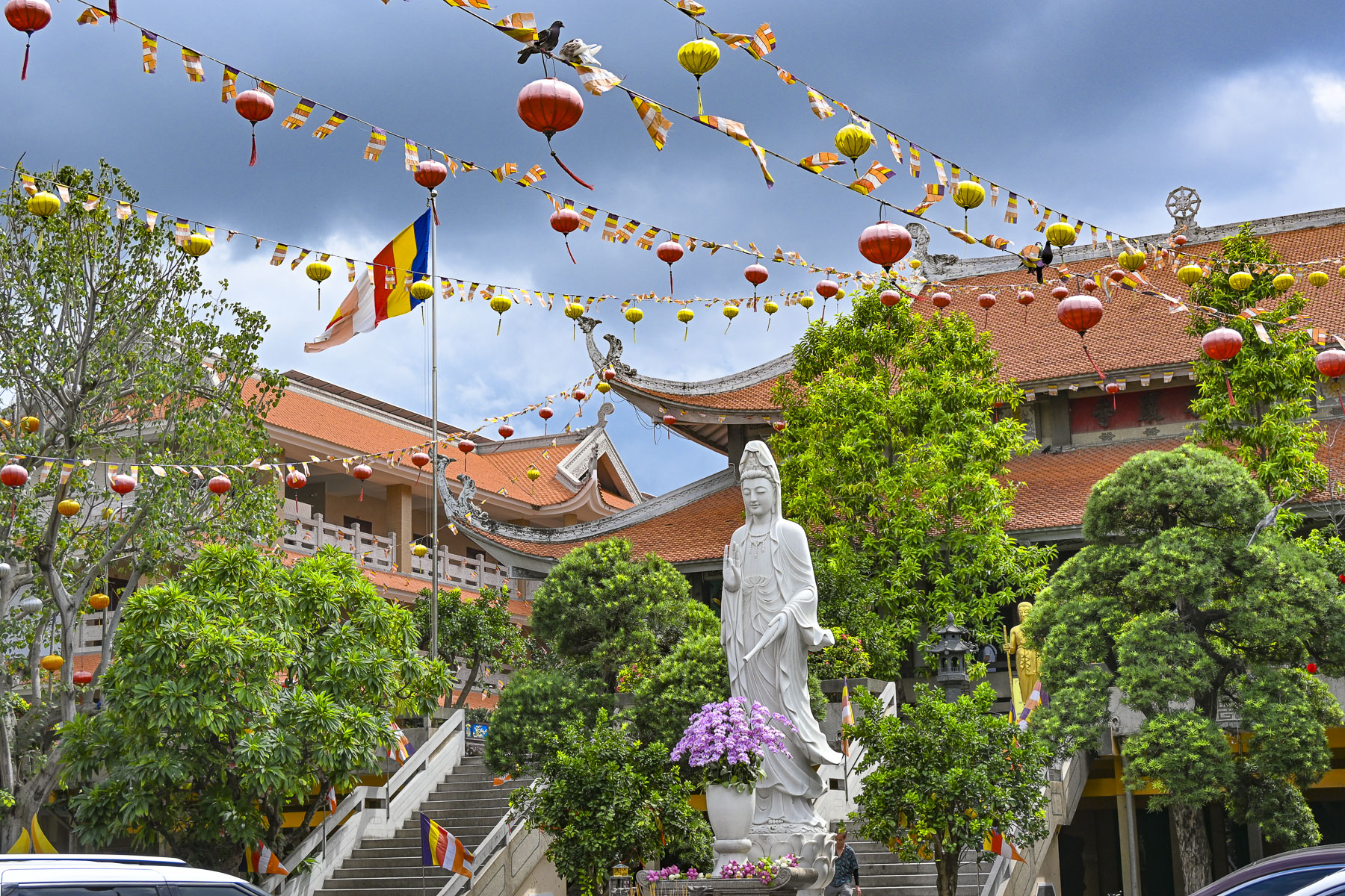
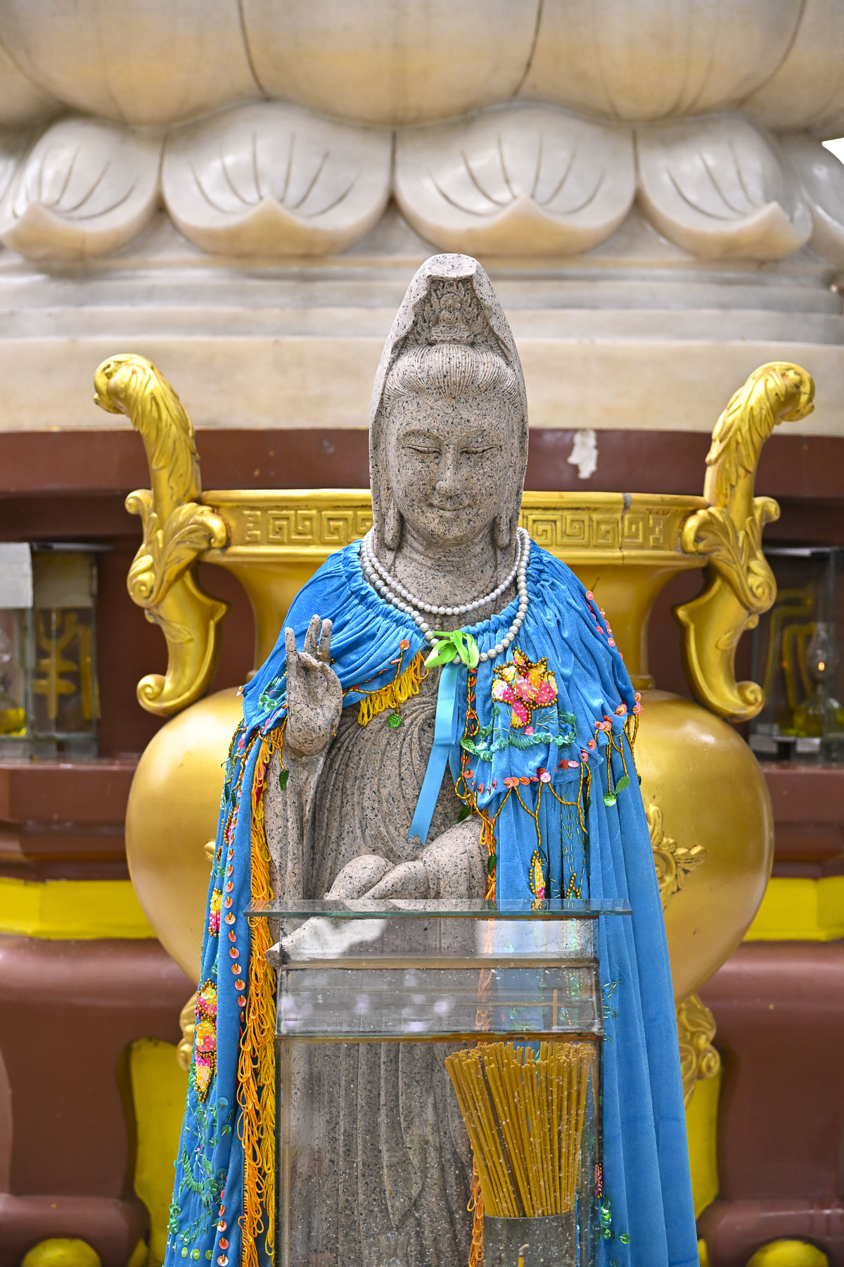
Returning to Ho Chi Minh City, we visited the Vinh Nghiem Buddhist Temple in District 3, where we incorrectly assumed that classical design of the temple reflected its ancient history, only to learn that the temple complex was started in 1964 by two monks who migrated from North Vietnam to spread the Truc Lam Zen meditation sect to the south of the country.  The Vinh Nghiem Pagoda holds an important role in the spiritual life of Ho Chi Minh City. “It serves not only as a place of worship but also as a center for moral education and community learning. The temple actively promotes Buddhist teachings on compassion, mindfulness, and filial piety through lectures, study courses, and social activities.” It’s a large complex with many areas and a 14m (46ft) tall stone memorial tower, that was once the tallest in Vietnam. In the Buddha Hall we received our first introduction to Buddha puja, a devotional tradition that symbolizes respect to Buddha by offering fruits, clean water, non-alcoholic drinks, or vegetarian foods. These offerings are often shared daily with the less fortunate.

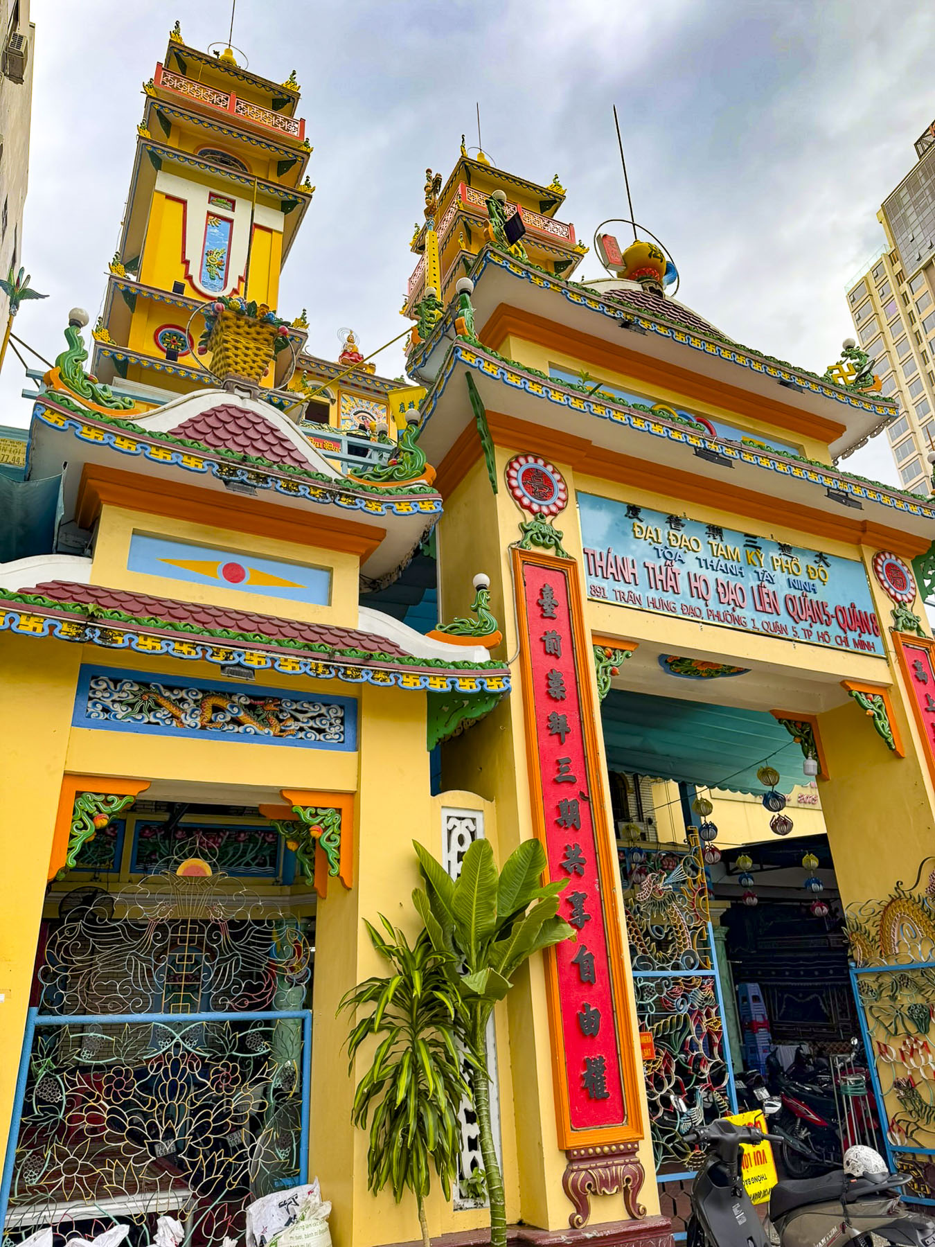
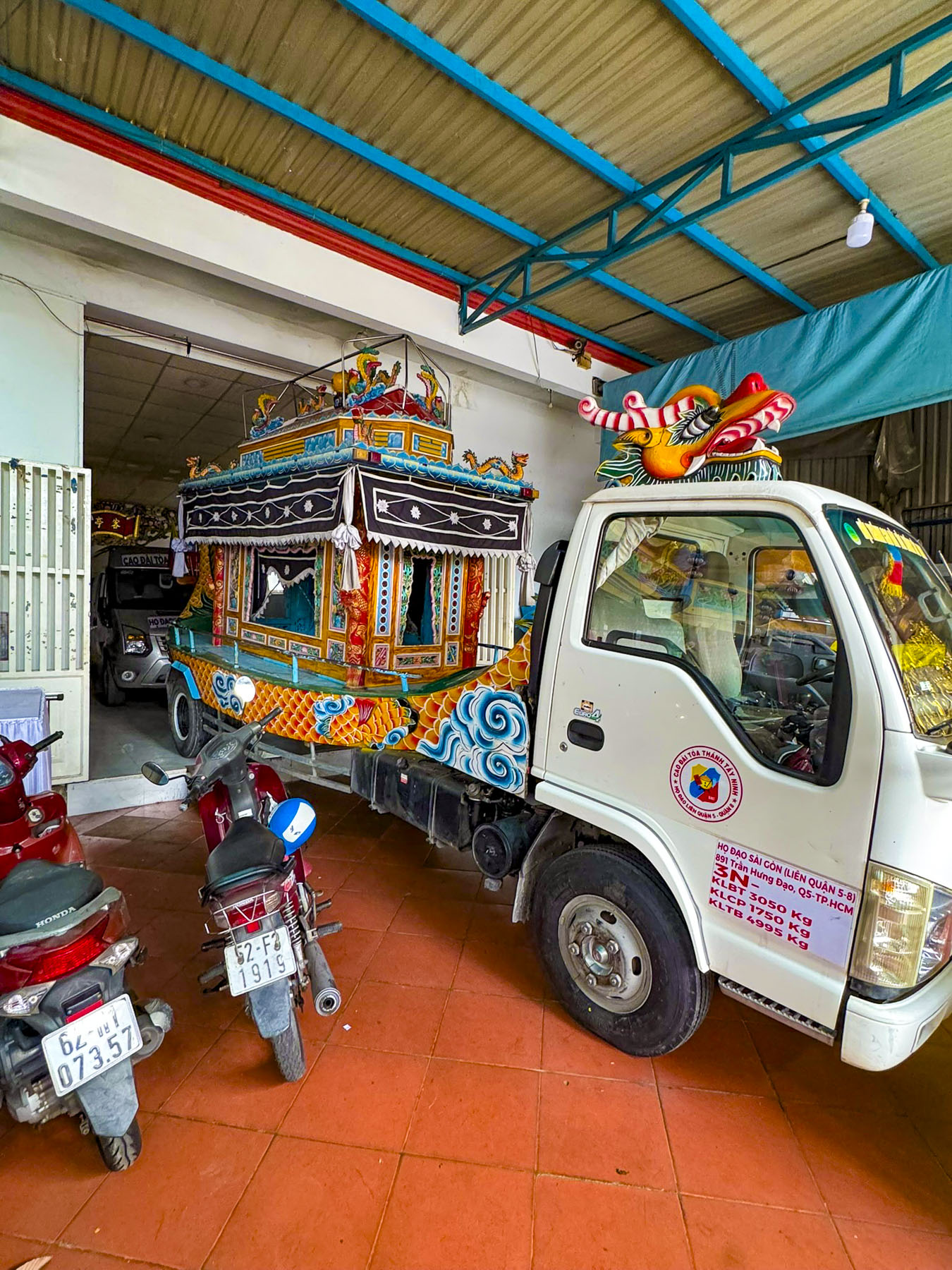
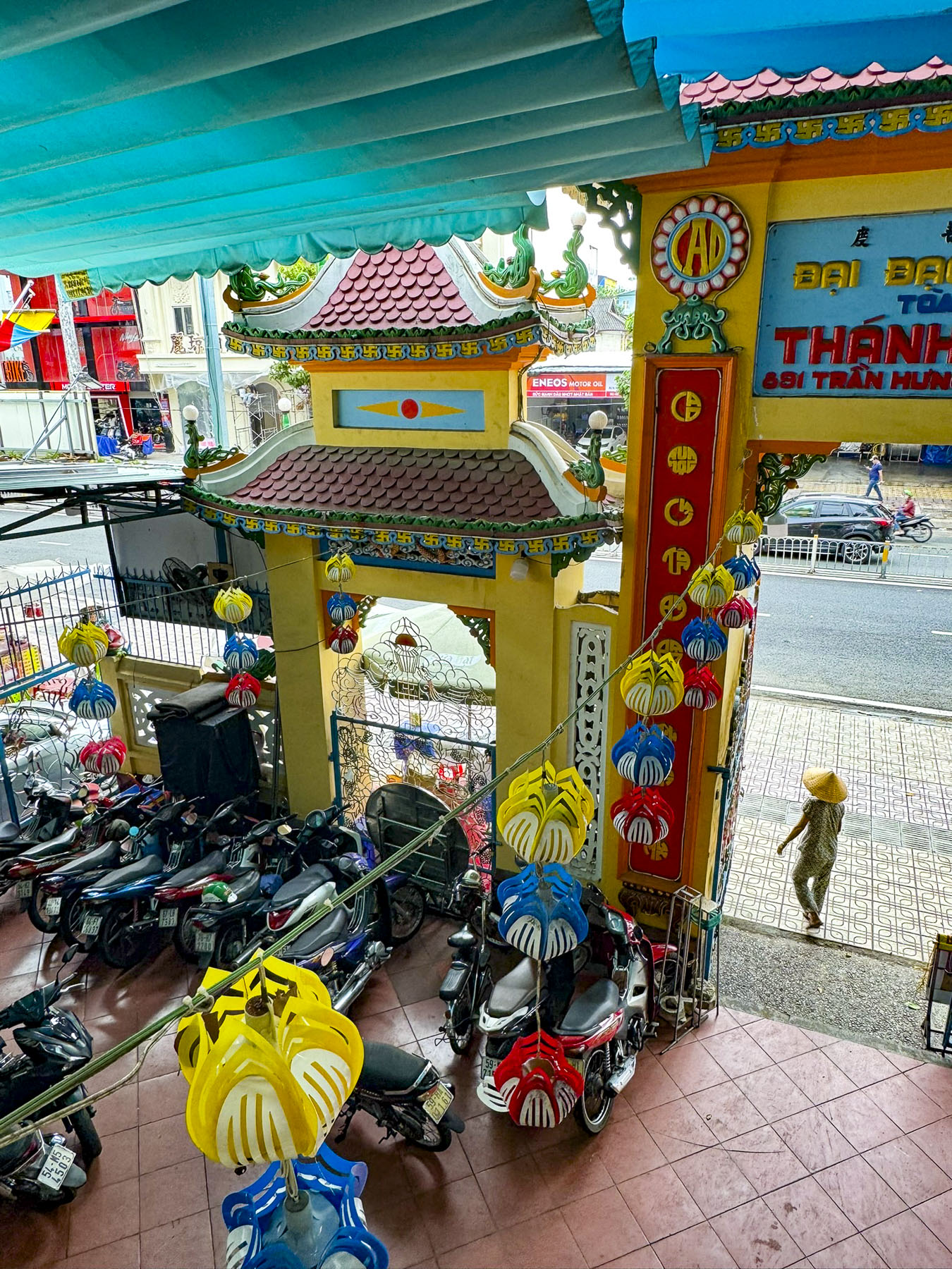
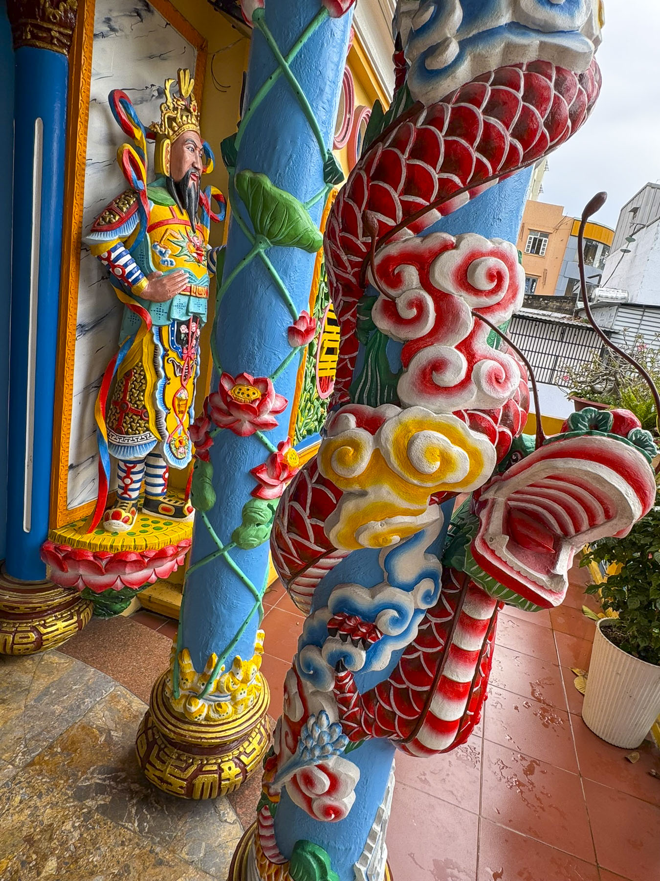
The Saigon Cao Dai Temple in District 5 was the last temple we visited and fascinatingly different, with a tarpaulin covered courtyard sheltering scooters, coffins and a hearse. Cao Dai was formally established in 1926 in southern Vietnam by Ngô Văn Chiêu, a civil servant who received divine revelations, along with several others who practiced spiritualism, to create a syncretic religion that unites the philosophies of Buddhism, Confucianism, Hinduism, Catholicism, Protestantism, Judaism, and Islam into a into a single, universal faith. 

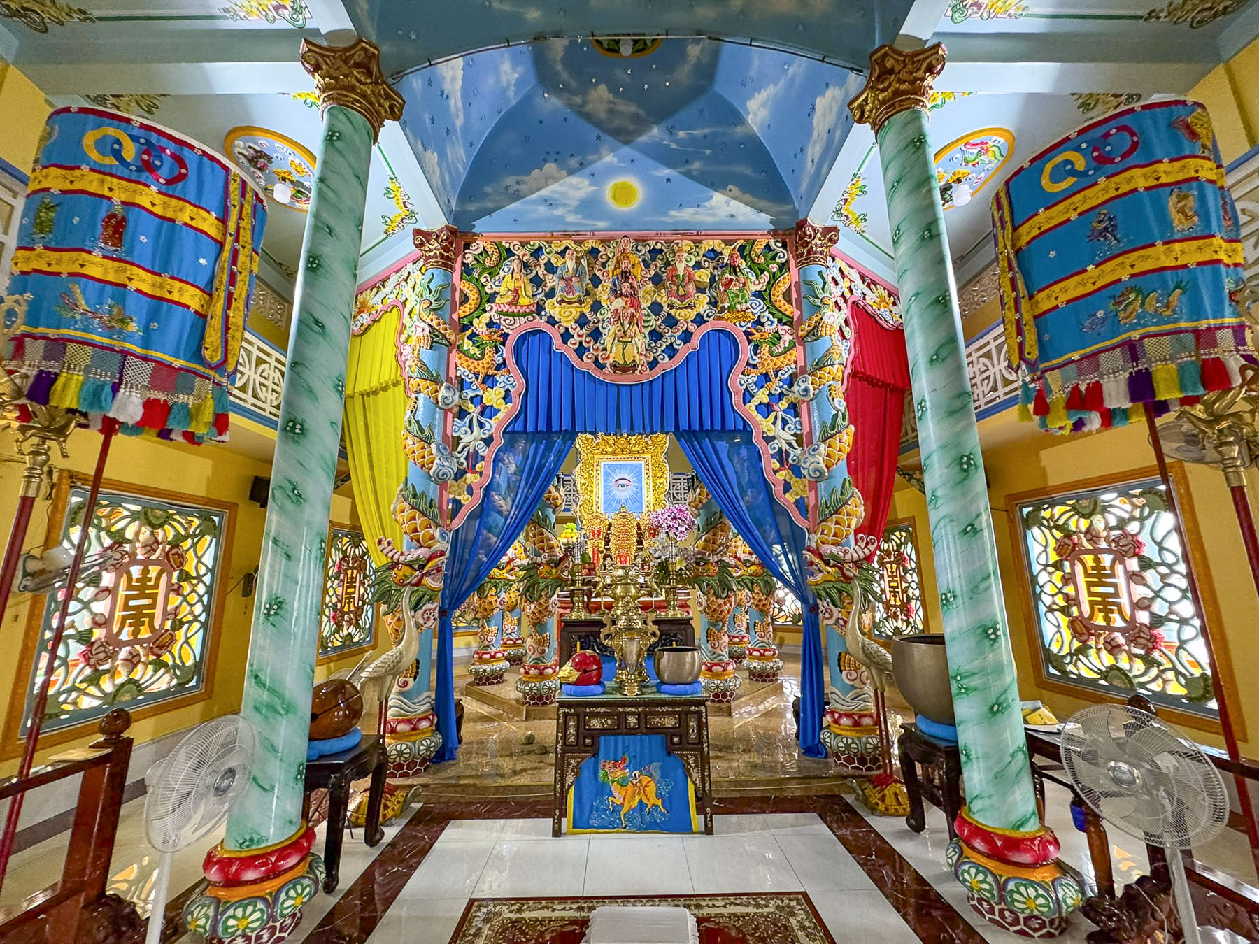
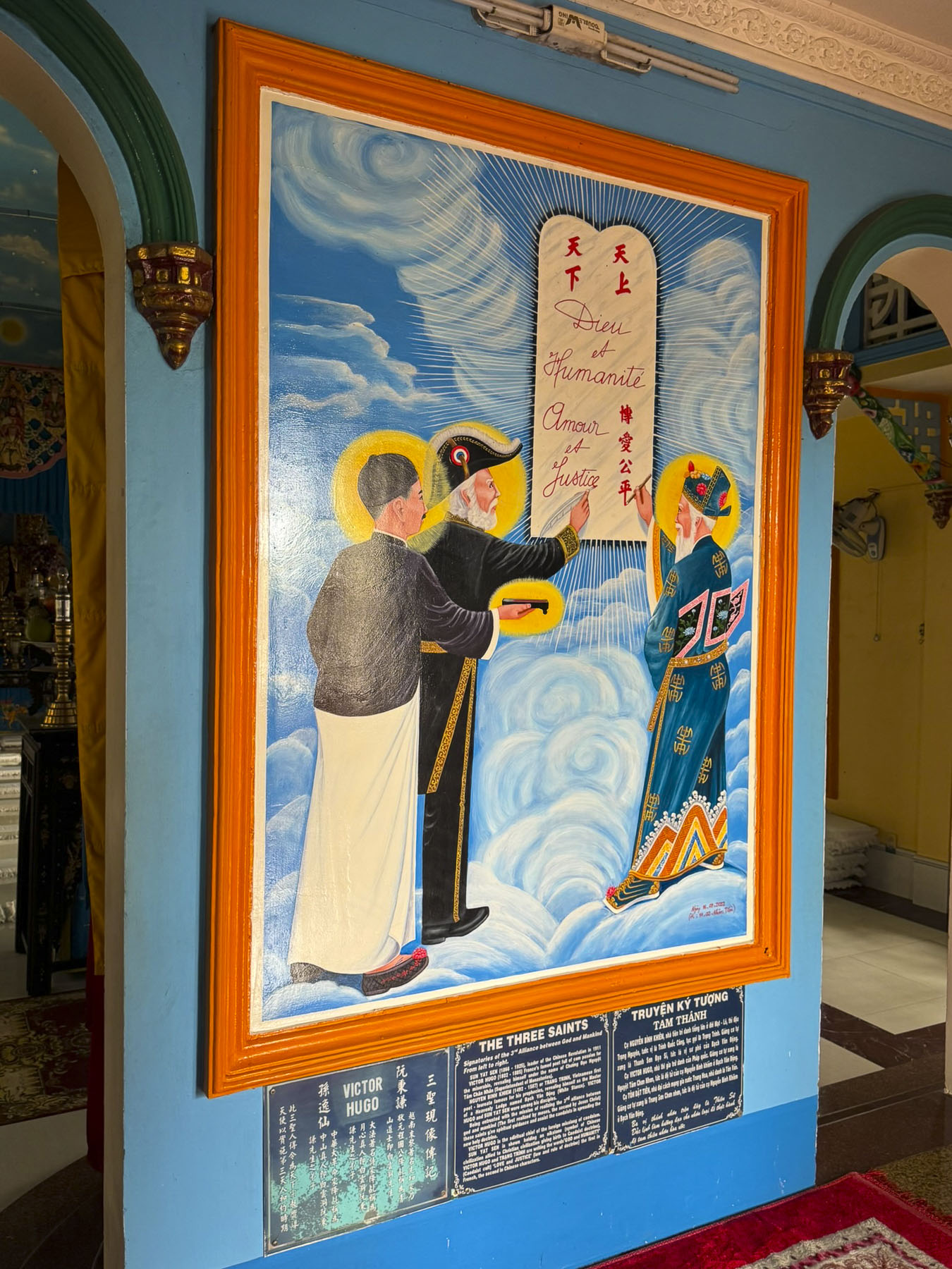
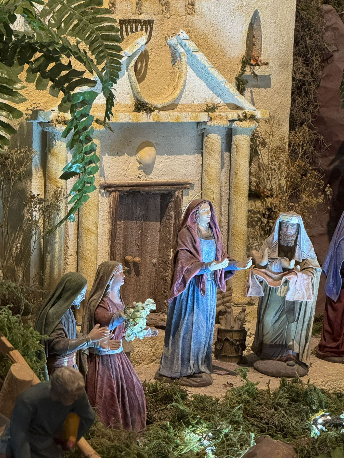
The group revealed through séances the faith’s three saints and “Divine Messengers;” French writer Victor Hugo; Sun Yat-sen, a Chinese revolutionary who fought against oppressive rule; and Nguyễn Bỉnh Khiêm, a 16th century poet regarded as the “Vietnamese Nostradamus” for his accurate prophecies. The faith’s minor saints include Joan of Arc, Thomas Jefferson, William Shakespeare and Louis Pasteur, amongst others. In the sanctuary colorful dragon motifs surrounded an altar prominently displaying the Eye of Providence.

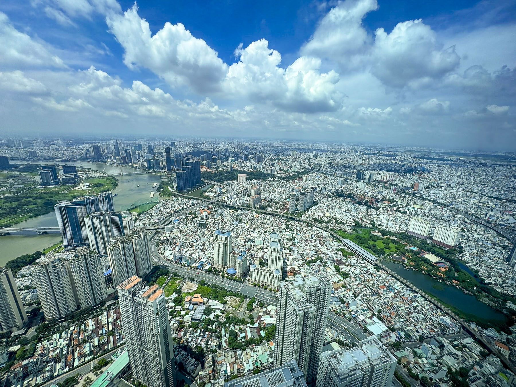
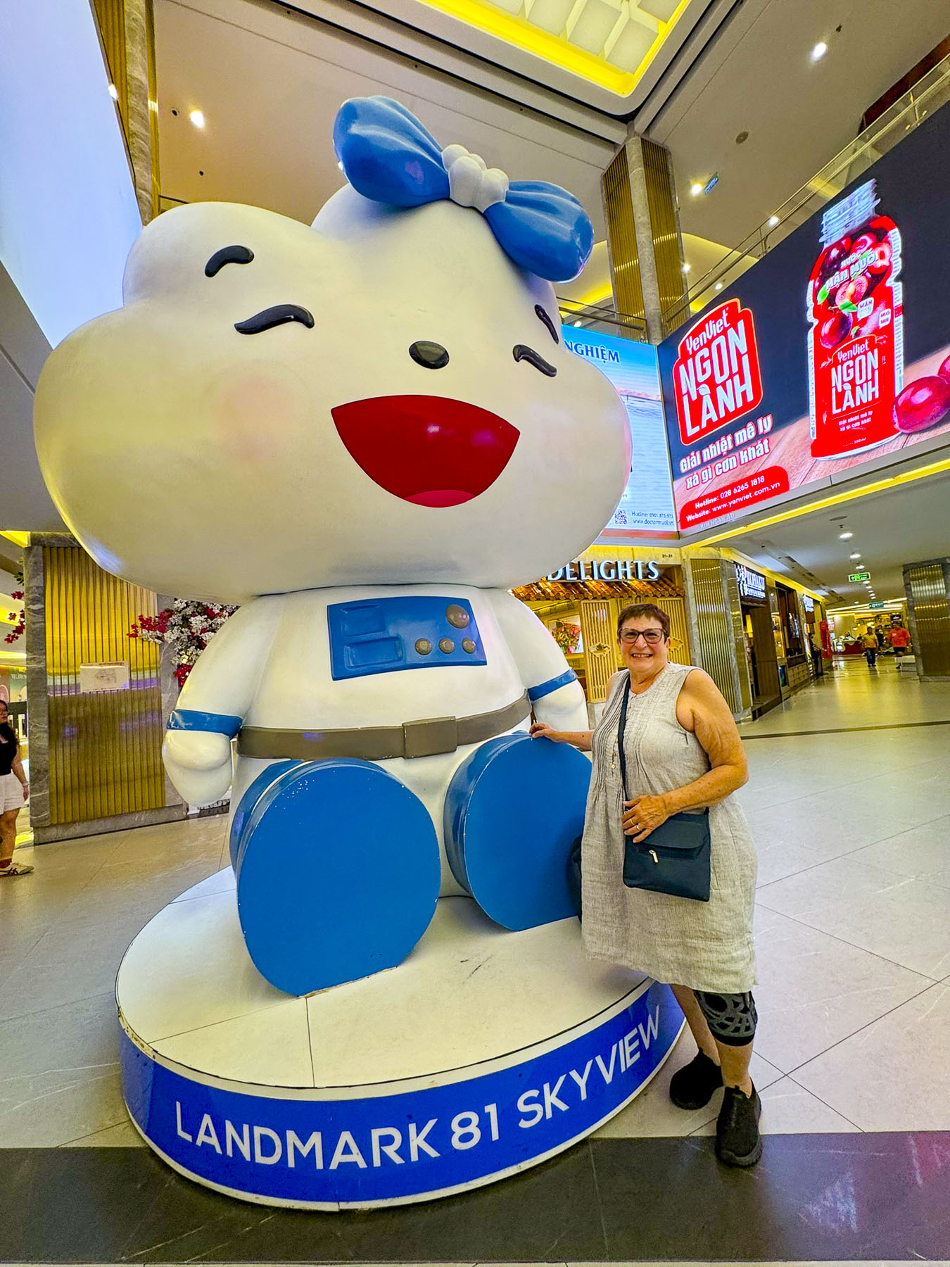
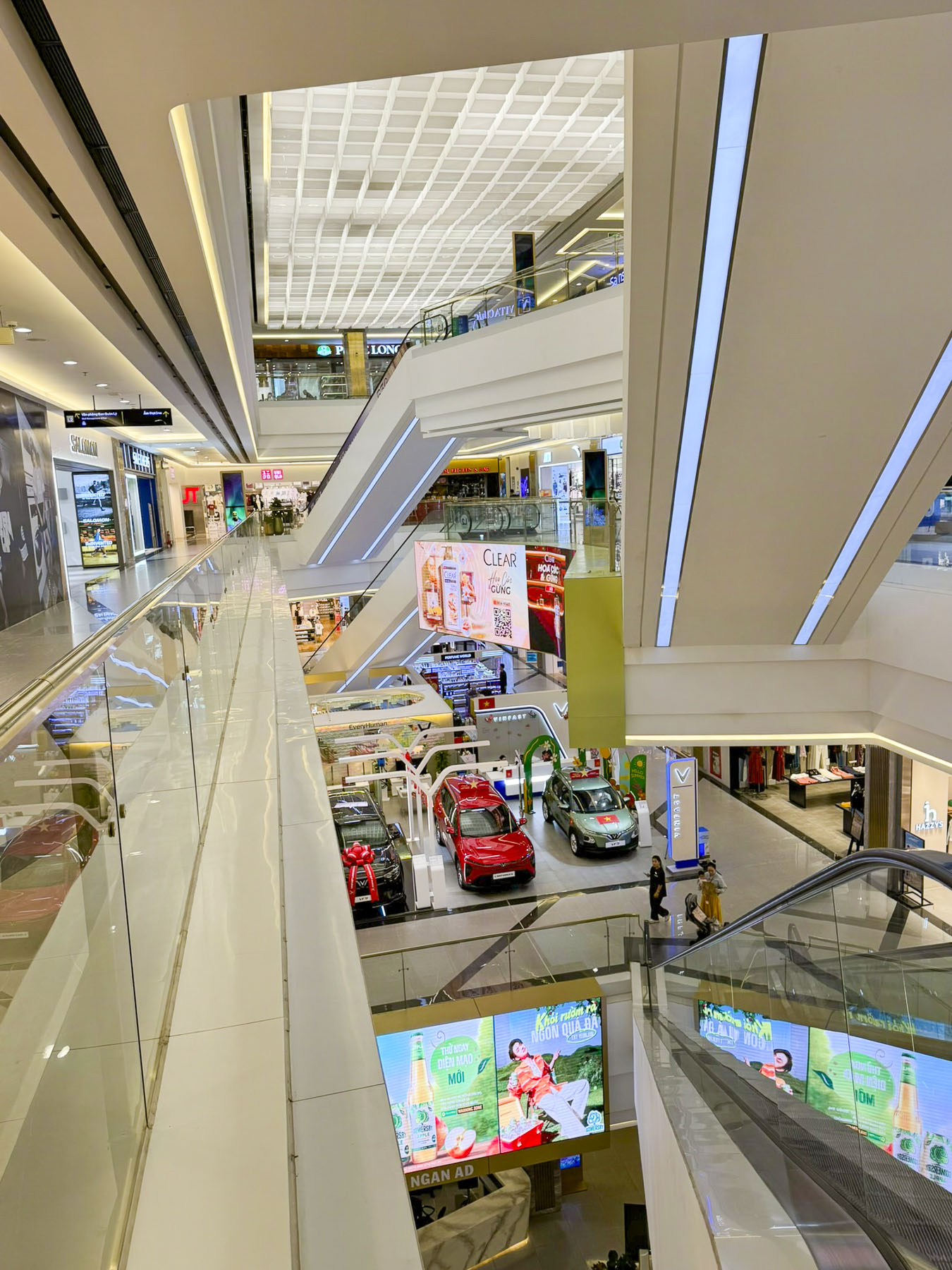
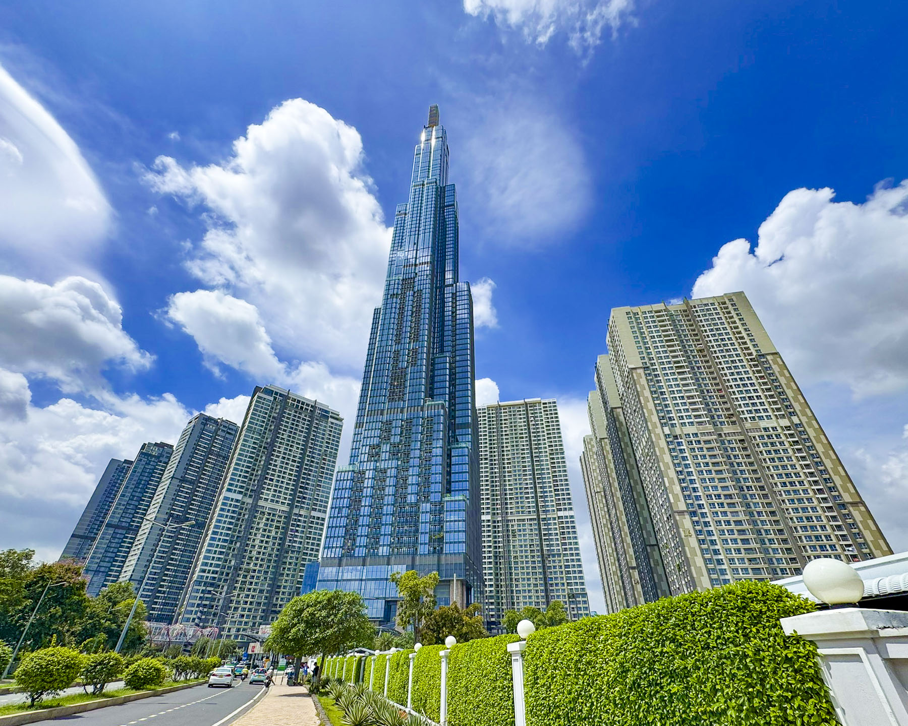
On our last day in the city we waited for morning showers to clear before we took a GrabTaxi to Landmark 81. With eighty-one floors, this has been Vietnam’s tallest skyscraper since its completion in 2018, a symbol of Vietnam’s economic growth, and an iconic structure on the city’s quickly evolving skyline. It’s a mixed use building with a shopping mall and entertainment complex, residential apartments, and the Vinpearl Landmark 81 – Autograph Collection hotel. We, however, were there for the fantastic panoramas of Ho Chi Minh City’s sprawling metropolis from its SkyView observation deck.

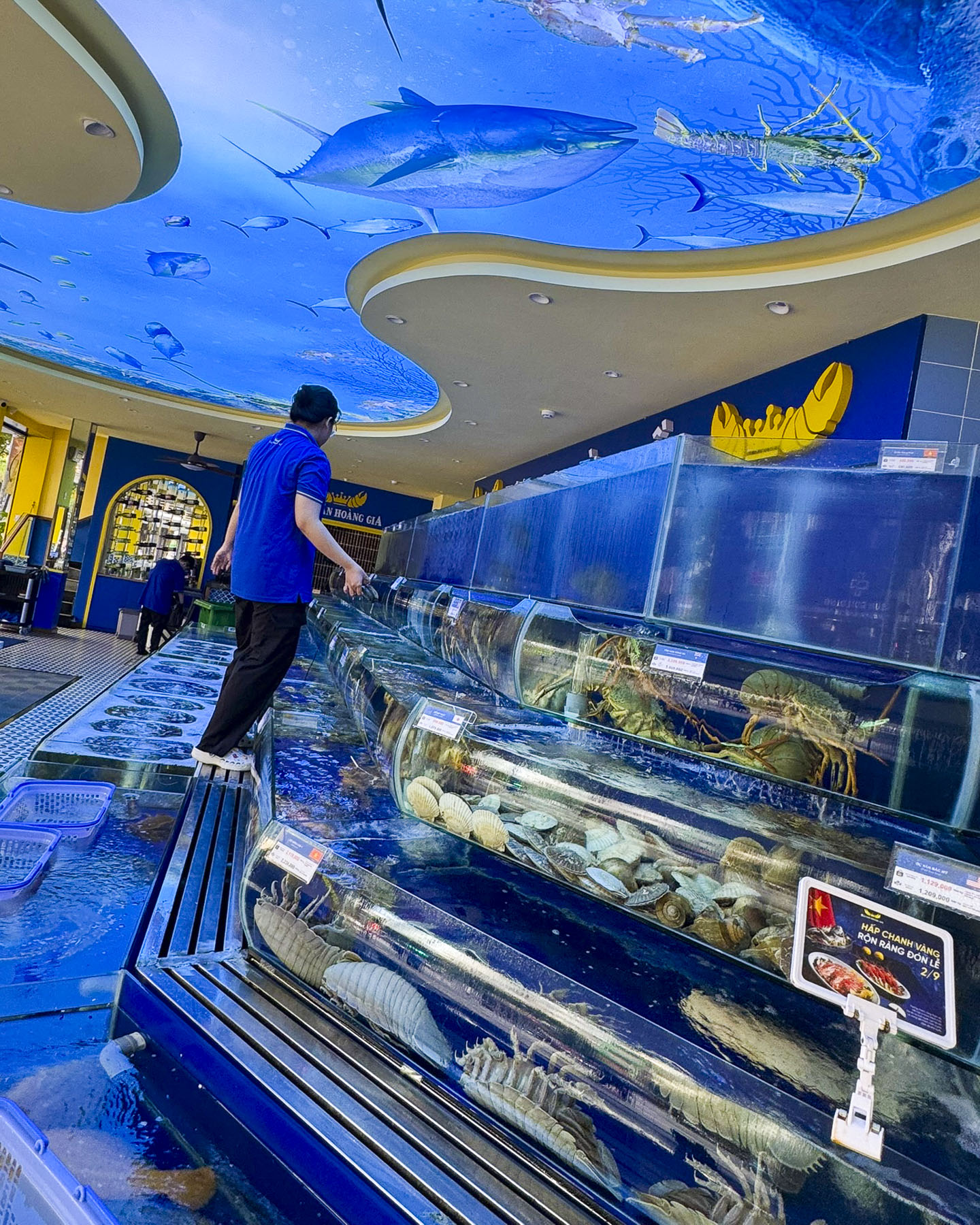
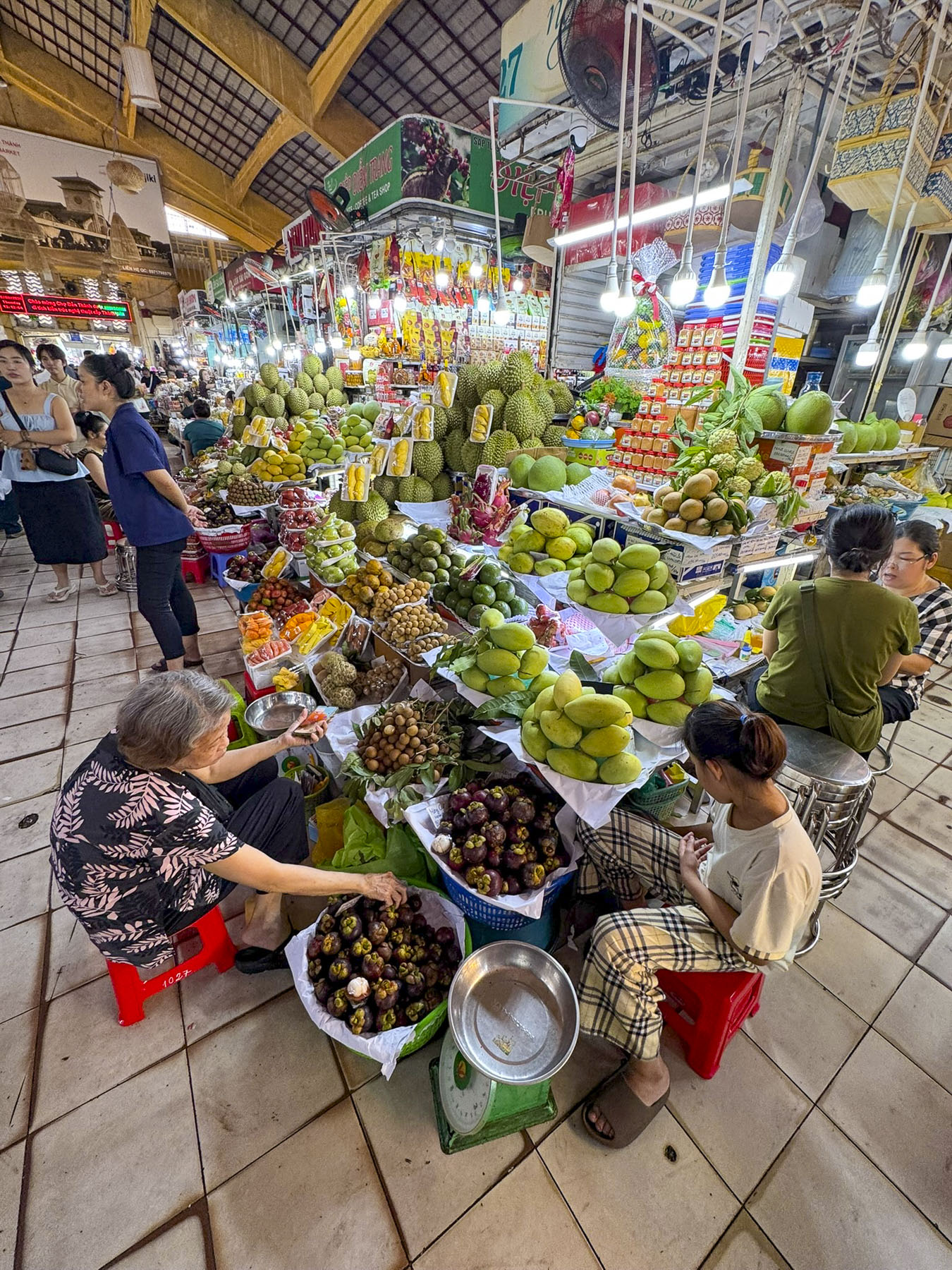
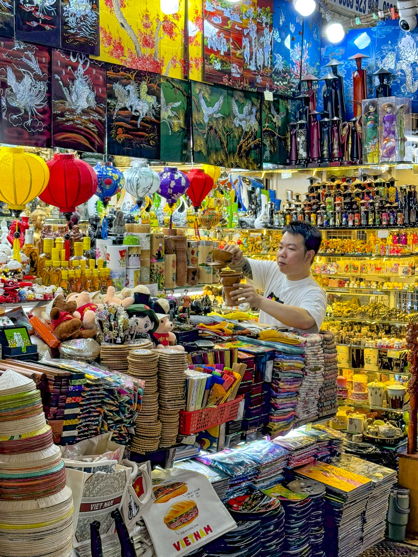
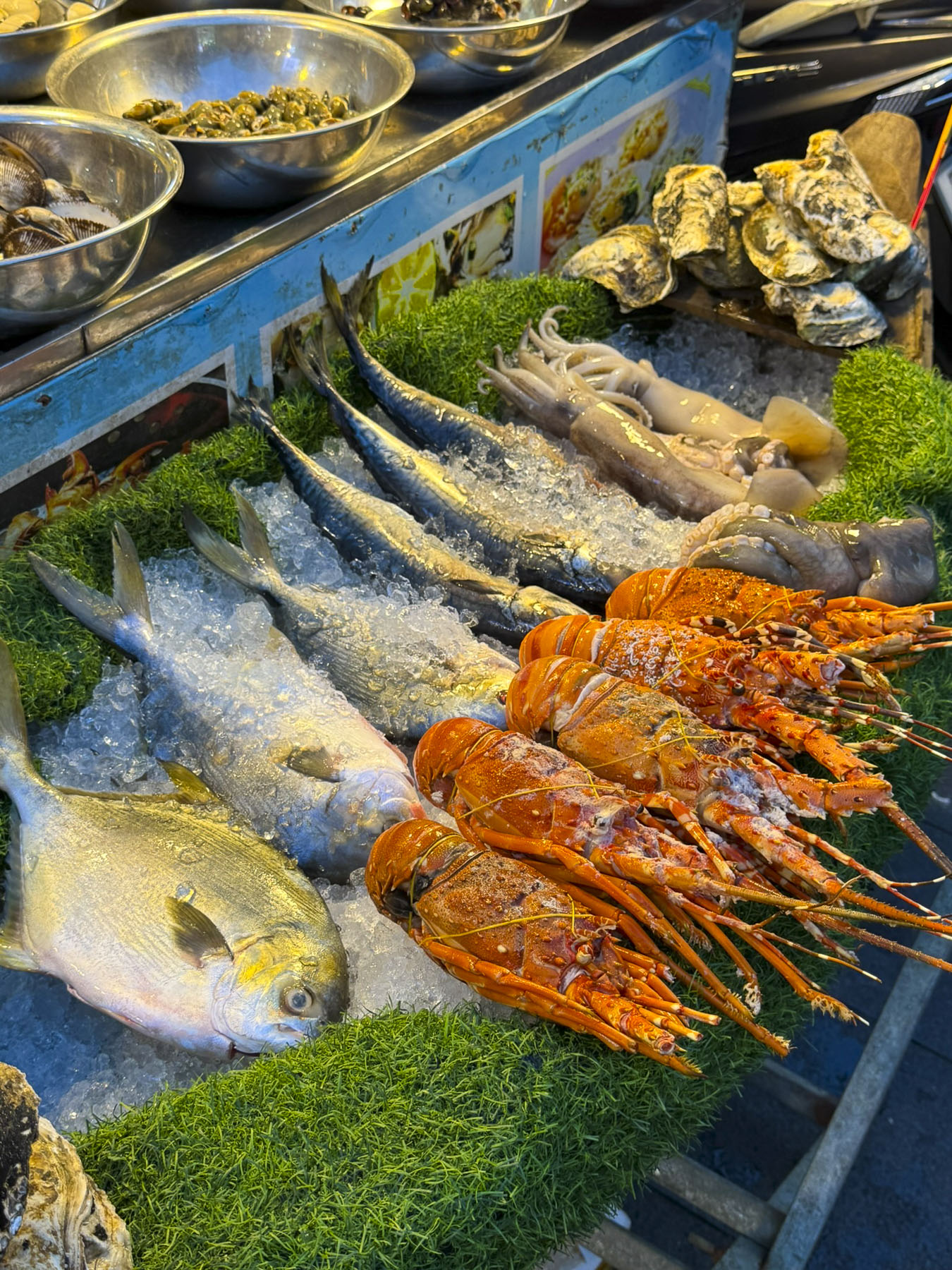
Afterwards we took another GrabTaxi to Ben Thanh, the city’s old central market in district 1, where a bazaar has been on this site since the 1600s. The current building dates from the French in 1914. It’s a sprawling place with hundreds of stalls offering clothing, food and everything in between. The premium outer perimeter stalls are operated by the government with set pricing, while the maze of hundreds of inner stalls offer dynamic opportunities to bargain. We bought several shirts and blouses, along with some dresses for our granddaughters at very reasonable prices. Nearby was the nicest fish store we’ve ever visited. It featured a towering pyramid of sculptural water tanks holding the fresh catch of the day. 

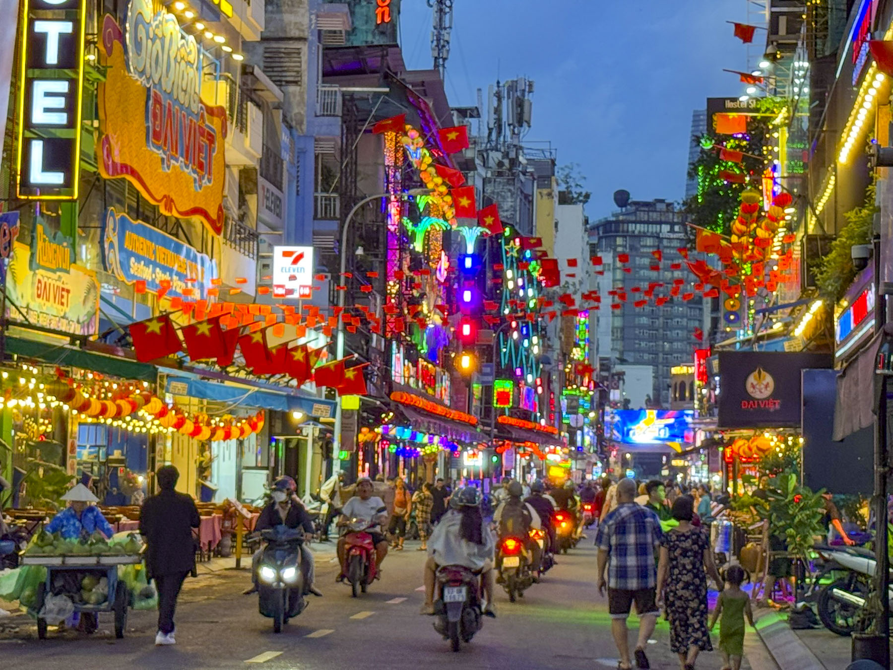
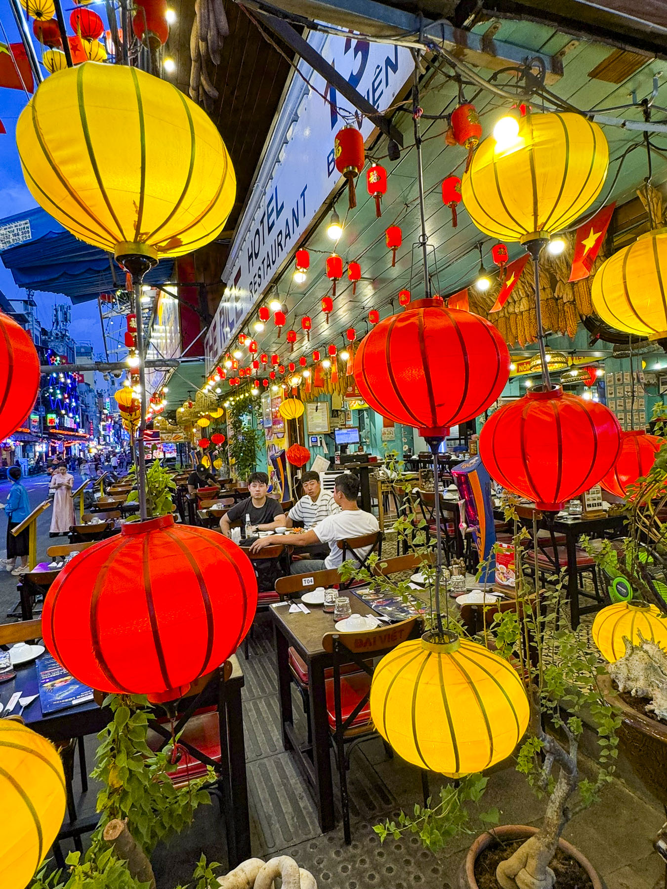
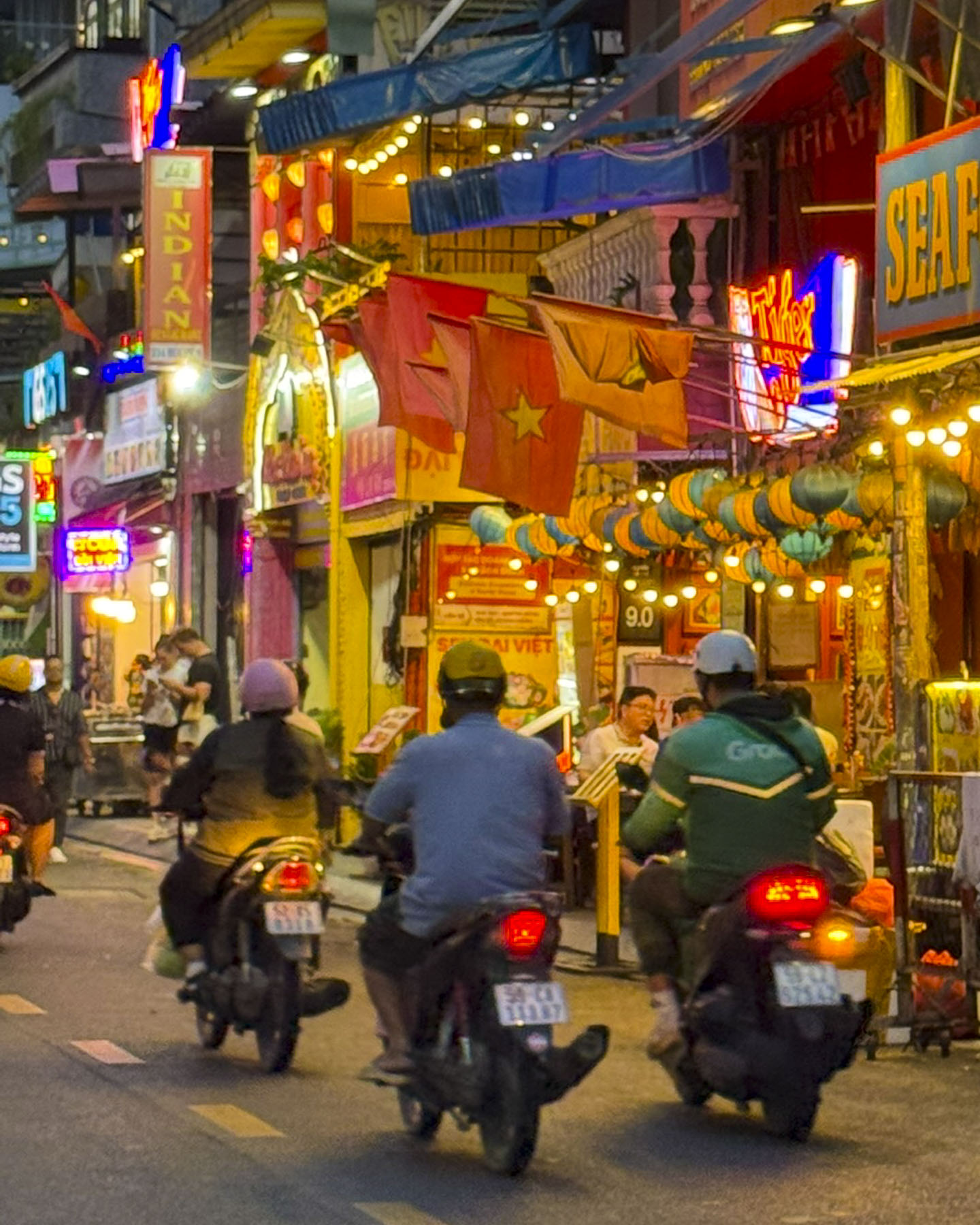
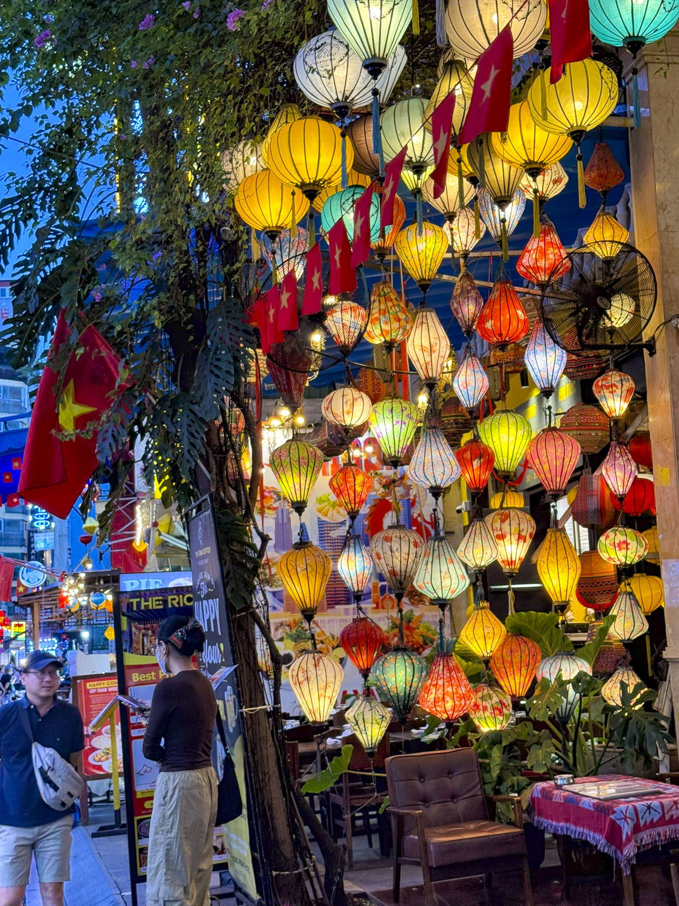
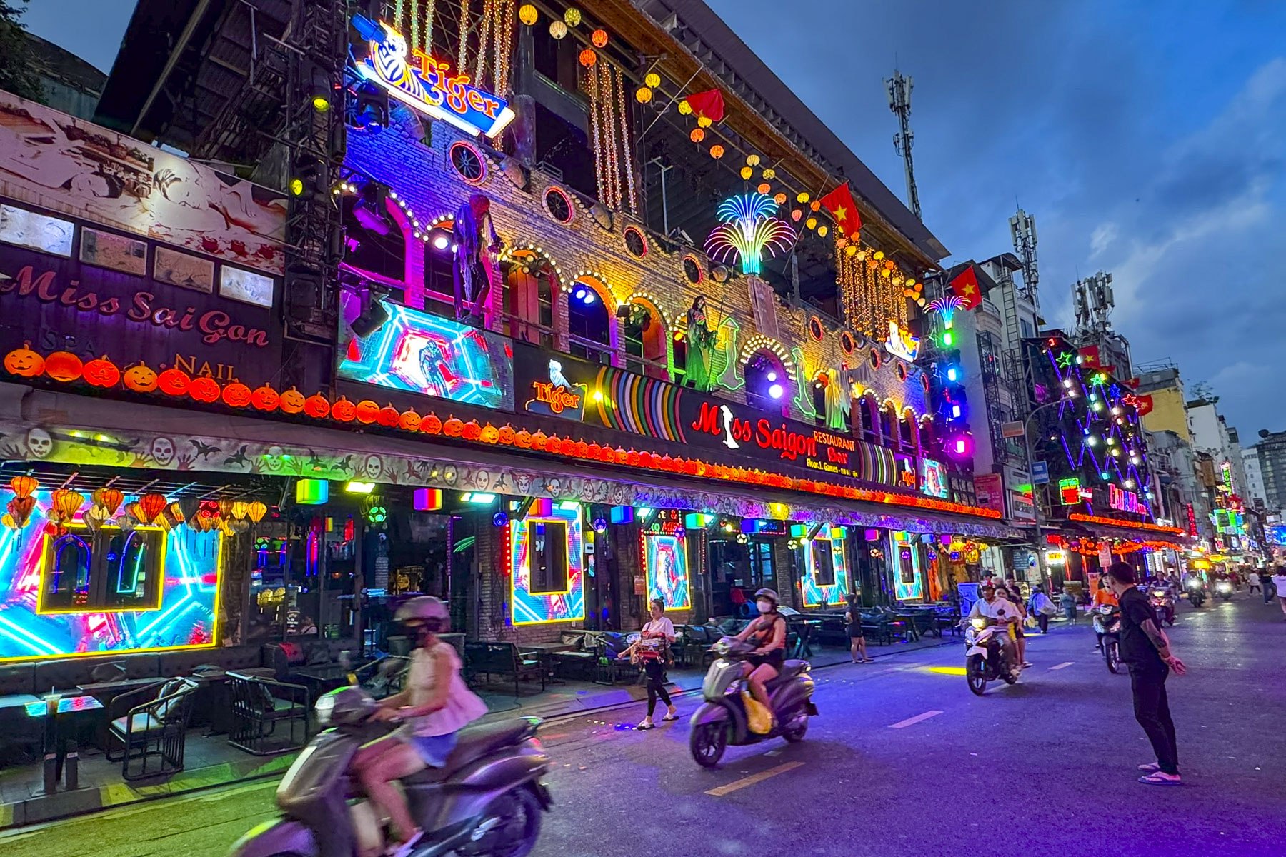
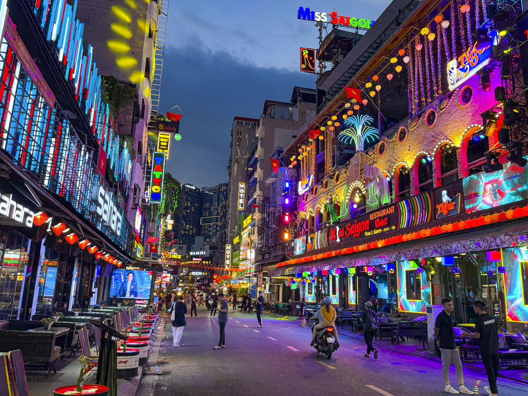
After returning to the hotel for a reprieve from the day’s heat and humidity, we headed out in the early evening to Bui Vien Walking Street, the city’s center for nightlife. It’s known for its partying atmosphere along a vibrant neon-lit street lined with open-air kitchens, bars and clubs that stay open into the early hours of the mornings. It was a fun place to stroll, and people watch as the night sky darkened and more groups filled the street.

We are not sure why it took us so many years to get to Southeast Asia, and Vietnam in particular. It was a nice change from our European centric vacations, and we found Ho Chi Minh City to be a youthful, vibrant and energetic destination that was very affordable compared to the United States and Europe. Everyone we encountered was friendly and welcoming, with the hotel staff almost feeling like family by the time we left. And we managed to stay dry during the occasional monsoon downpour with the help of umbrellas provided by our hotel.

Since the airfare is a considerable portion of any trip, we also booked a cruise up the Mekong River to Cambodia because we’re not sure if we’ll get a chance to return one day or decide to explore other areas of Asia. But after getting our feet wet in Vietnam, we are confident we’ll enjoy wherever we choose to go next in the region.

Book your flights!

Till next time,

Craig & Donna

Panama: Snowbirds in Paradise – Sand, Sea, and Skyscrapers or A Relaxing Visit to the Azuero Peninsula

By the time we picked up our rental car at the Tocumen International Airport it was the height of the evening rush hour in Panama City. Fortunately, we were heading into the city, while the traffic lanes carrying the daily exodus of commuters home from the financial capital of Latin America were jammed. It was only a twenty-five minute drive to our hotel on the waterfront, but we missed our exit and had to re-route our way through the now deserted downtown streets to the Hotel Plaza Paitilla Inn, for a one night stay. We chose this 19-floor waterfront hotel after determining it was the best place to get those iconic photographs of the city’s modern skyline along the Pacific Ocean coast. And we were not dissappointed.

Golden light filled the room as we drew back the curtains along a wall of windows to reveal a spectacular cityscape that transitioned through the sunset, twilight, and darkness. It was a million-dollar view and we felt as if we were some place only accessible to billionaires or actors lucky enough to have a movie scene filmed on location here. Surprisingly, the Hotel Plaza Paitilla Inn was an excellent value and very budget friendly.

After discussing our travel plan with the concierge the night before, we departed after an early breakfast to avoid the expected traffic delays as folks took the Friday afternoon off in anticipation of the four days of Carnaval before Ash Wednesday. The nationwide el Carnaval de Panama, which literally happens in every town, is the biggest celebration of the year in the country. It starts in each town with the coronation of a queen and ends with the Burial of the Sardine, which symbolizes the past festivals and enjoyment of drink and food, in the predawn hours of Ash Wednesday, and the beginning of Lent. Little did we know that Panama’s Carnaval is regarded as “one of the largest— and rowdiest — events in Latin America.” Nightly events feature themed parades with elaborately decorated floats escorted by trumpet and drum bands, called tunas. To the benefit of all, water trucks called Culecos spray the revelers in the ninety-degree heat to keep them cool. And between the water trucks, mojaderas, wetters, keep everyone partying around them soaked with water pistols, water balloons, and buckets of water. It’s not a particularly camera-friendly event.

Our destination for the next 5 nights was Posada Los Destiladeros on Playa Los Destiladeros, in Los Santos Province, a 5 hour, 335km (208mi) drive. Leaving the city, we crossed the Bridge of the Americas which soars 64m (210ft) above the Panama Canal, and stopped on the far side at the Mirador de las Américas for our first look at the canal. Two monuments commemorate the arrival of 750 immigrants from China 170 years ago to work on projects relating to the construction of the canal, which created an enduring friendship between Panama and China. The view of the canal wasn’t as impressive as its fact sheet: over 12,000 ships carrying $270 billion worth of cargo pass through the locks of the canal annually. Over 70% of the ships are headed to or are returning from ports in the United States.

Continuing on Rt1 we passed the first of many pillars being constructed to support Panama City’s new Metro 3 line, a double-track monorail project sponsored by the Chinese, that will connect the growing towns of Ciudad Del Futuro and La Chorrea to the city’s Metro 1 and Metro 2 lines, Central America’s first and only subway system that became operational in 2014. Rt1 is alternately called the Pan-American Highway, that famously stretches from Prudhoe Bay, Alaska in the United States, 19,000 miles way to Ushuaia, Tierra del Fuego in Argentina. Though a 100-mile section is missing in the difficult terrain of treacherous Darien Gap region between Yaviza, Panama and Chigorodó, Colombia.

Shopping centers and strip malls with McDonald’s golden arches, Starbucks, and Burger Kings lined both sides of the highway before giving way to open crop- and pastureland. The occasional hilltop offered views of the Gulf of Panama and the Pacific Ocean to the south. While to the north the rural highlands of the Cordillera Central, the jagged mountainous spine of the country, graced the horizon. Veering off the Pan-American Highway we headed west on Rt2 to Las Tablas. The town has been ground zero for Carnaval in Panama since the mid-1800s when two fiercely rival groups representing Calle Arriba and Calle Abajo started to compete in a festive, one upmanship every year before the 40 days of Lent began. The event in Las Tablas is very popular with folks from Panama City seeking to experience a more traditional Carnaval with folkloric music and regional dress, in what many consider Panama’s “heartland.”

Traffic had been slowly building all morning, and by early afternoon the streets of our intended route were blocked with floats being prepared for the weekend’s first parade that night. Folks were already creatively parking along the side of the roads and walking to the town’s central plaza, Belisario Porras. The congestion in the town unfortunately nixed our plans for lunch there, and we continued on for several miles along Rt2 through a scenic landscape of lightly treed hillocks. Cattle grazed in the shade under the trees.

Cars were parked on both sides of the road in front of El Cruce #2. It was a small fonda – a Panamanian roadside food stand, with smoke billowing up from its barbeque pit. It piqued our interests, and we stopped.  The outside grill area was open sided, under a corrugated tin roof. In its shade a man prepped and attended the meats that were smoking above a fire while another was using a machete to shave kernels from ears of corn. The unhusked pile next to him seemed monumental, akin to the Greek myth of Sisyphus and his never-ending task. It was the beginning step in the preparation of masa, a corn flour. It’s a must-have ingredient for traditional, homemade corn tortillas and tamales. The menu hung above a small window to the kitchen filled with women attending various stoves. Everyone was very nice and curious about where we were from, but seemed surprised that we had stopped. A large John Deere combine harvester with a police escort passed as we ate. A small caravan of pickup trucks with farm workers standing in the back followed it slowly down the road. The fonda was a very authentic, nothing touristy about it experience, and the food was good.  The line of traffic behind the harvester slowly disappeared as cars passed it when the opportunity arose.  It wasn’t until the last seconds as we raced past the tractor that we realized we also had to pass the police car! We returned the officer’s wave. It seemed like it was an everyday occurrence in the rural countryside. In Pedasi, the closest town to our hotel, preparations for the Carnaval were also visible down the side streets.

We missed the entrance to the hotel and continued down the road in hope of finding an easy spot to turn around, only to find that the road suddenly ended, with a log across it, at the top of Playa Destiladeros, a short distance away from the thundering waves of the Pacific Ocean, as if an early extension had been washed away in a storm. We were at one of the farthest points south on the remote Azuero Peninsula.

When we made plans for this return layover from our trip earlier in the month to Uruguay and Argentina, we didn’t realize our week coincided with Carnaval, consequently many of the hotels we were interested in were fully booked. After scouring the map for areas we wanted to stay we found Posada Los Destiladeros. While it showed as fully booked on Booking.com and Hotels.com, we were able to book a room directly through the hotel’s reservation page.

From the gated entrance we followed a long twin-tracked road, through a large palm tree covered property with many outbuildings, to the parking area. Through a grove of palm trees, the inviting blue water of the Pacific glistened behind the receptionist.

The vibe was really nice. It’s an unpretentious, tenderly time-worn resort in a verdant oasis of greenery on the low cliffs overlooking a wild beach and undeveloped coastline. The staff were very nice and friendly, and after a few days felt like family. The dinners that emerged from their kitchen were extraordinary!

It’s very unusual that we stay in one spot for 5 nights to unwind. But the Posada Los Destiladeros was the perfect place for us to relax, with easy walks on the beach, lounging around the pool and under palm thatched gazebos overlooking the surf as we waited for sunset every day, which offered a dramatic play of light across sand and surf.

A conversation in the pool one afternoon with another guest, a Panamanian American man visiting family over the week of Carnaval, related that he and his wife had been coming here for years, but “somehow it remains a hidden gem.” Of course, we took several half day trips to explore what else the Azuero Peninsula had hidden away.

Several days later we drove toward the beach town of Las Escobas del Venado. Well suited to the heat and humidity of the region, herds of Brahma cows have rested in the shade of the region since Spanish colonists first brought them to the area in the mid-1500s. At a turnoff for the small ranching town of Los Asientos, a roadside monument highlights the town’s traditional la corridas, bullfights. These are non-lethal events since a 2012 law prohibited the injury or death of the bull; however, la corridas are still popular in rural Panama. Along the road milk cans were placed next to the rancher’s gate, waiting for the local dairy cooperative to pick them.

A little way farther along, the colors of the tombs in a small cemetery seemed to vibrate against the verdant landscape, which receives between 45 and 90 inches of rain every year. A large group of cyclists, followed slowly by a support vehicle, made passing difficult along the narrow hilly road, with many blind curves. Though the congestión they created was well tolerated, without the honking of horns. Drivers respected their safety and gave them a wide berth when they were eventually able to pass. Small artesanal lumber mills along the way vertically stacked their milled lumber, like skis, against a wall to dry.

During the dryer summer months the Rio Oria lazily flows through the ranchlands to the ocean.

Las Escobas del Venado was the closest example of a traditional beach town, with several small hotels build along the shore of the half-moon shaped Playa Venao. It is not by any means a large resort town. The beach is very wide and shallow, especially when the tide is out, and it’s a popular spot to horseback ride or drive an ATV along the sand. Across the water a sailboat was safely anchored out of the wind and rolling waves behind the bluff at the southern end of the bay. The day was very hot, so we didn’t spend much time on the beach, and hugged the shade as we walked to the Almendro Café for our traditional “walk a little then café.”

It was a really nice spot, under large shade trees. Our coffees and pastries were excellent, and its menu looked very good with vegetarian, vegan, and gluten-free choices. It was to our surprise part of the Selina River Hostel which promotes itself as a destination for digital nomads to enjoy the sun, surf, and sand of Playa Venao. We definitely skewed their demographics for the morning.

We continued driving into the highlands along Via Hacia El Carate, a narrow serpentine road that rose through a mesmerizing landscape of hills and valleys. Unfortunately, there were not any places to stop along the way until we reached the Mirador La Vigía, which offered great views of forested ranchlands, backed by the Pacific Ocean on the horizon.

Familiar with the road now, we occasionally stopped along gated pastures to photograph the expansive landscape, that showed little sign of human intrusion, as we followed the same road back downhill.

They were few opportunities for lunch along the way so we decided to head back to the Almendro Café at the Selina River Hostel . We were not disappointed; the food was excellent and healthy. It’s so nice to order from a menu that doesn’t automatically serve French fries with every order.

Nearing our hotel, a rancher blocked the road with his herd of cows as he moved them to a different pasture.

We were back in time to watch the sunset over Playa Destiladeros. We stayed until the last color in the sky had faded away before walking back to the resort’s restaurant, where we usually dined inside to take advantage of the air conditioning and ceiling fans.

Though having breakfast on the veranda, with the sound of the waves crashing in the distance, was a delight during the cool morning hours.

Early morning walks along the beach as the sun crested to the horizon were equally as enjoyable as the sunsets, but more tranquil with squadrons of pelicans swooping low over the surf, looking for fish. Occasionally some would peel away to dive headfirst into the water to catch fish.

Remnants of Carnaval celebrations the night before were still visible in the small towns along our route as we headed back early to Panama City to avoid the traffic. We arrived on the outskirts of the city sooner than expected and decided to spend the afternoon at Perico Island. Located at the end of the very long Amador Causeway which extends for 6km (3.7mi) into Panama Bay, it’s a popular spot for city folks to catch the breezes, picnic, rent bicycles or walk along its full length which offers great panoramic views of the city’s modern skyline and large cargo ships underway to the entrance of the Panama Canal.

After strolling along the waterfront for a while we decided to have lunch at Sabroso Panamá, a uniquely decorated place with a nice vibe, that also had a balcony overlooking a marina. We tried the carimañolas, similar to empanadas, though they are made with mashed cassava (yucca) dough and then fried.

Carnaval celebrations continued that evening and the direct route back to Hotel Plaza Paitilla Inn (we had such a nice experience there earlier in the week we decided to stay there again) along the Cinta Costera, the city’s waterfront park, and the eight lanes of the Pan-American that parallel it were blocked, and we had to circumnavigate our way around it. The massive street party continued well past midnight into the wee hours of Ash Wednesday morning.

Ash Wednesday was our last full day in Panama City, and we spent it exploring the Casco Antiguo, the historic old town district which dates from 1673, and is also known as Casco Viejo or San Felipe.

This town, built on a defensible small peninsula, replaced the city’s original settlement, Panama La Vieja, which was started 11km (7mi) farther east in 1519 when Spanish conquistador Pedro Arias Dávila landed 100 settlers along the coast, and built the first permanent European settlement on the Pacific. The city prospered for 150 years as the Spanish used the town as a base for expeditions to conquer the Inca Empire and sent the plundered gold and silver they seized back to Spain. The city’s wealth did not go unnoticed, and in 1671 the British privateer Henry Morgan landed over a thousand brigands on the Caribbean coast and trekked through treacherous jungles across the Isthmus of Panama to reach the city, which they then attacked, pillaged and burnt to the ground. Six hundred Spaniards died during the assault. Though the booty they looted wasn’t as much as expected, Morgan was declared a British hero, and knighted.

We arrived by Uber to the Catedral Basílica Metropolitana Santa María La Antigua on the Plaza de la Independencia in the center of Casco Antiguo. Its striking façade which blends Baroque and Neoclassical architecture dates from 1688, but the cathedral took more than 100 years to build, and wasn’t consecrated until 1796. Inside, an interesting mural in monochrome blue depicted the indigenous peoples of Panama accepting Chrisitanity.

The Old Town was once a citadel, though the defensive wall which encircled its 36 blocks was taken down ages ago to ease its expansion. Surprisingly, within this small area there were 4 still active historic churches and the ruins of another. Our basic plan was to visit every church and then spur off to other nearby points of interest.

Adjacent to the cathedral was the Museum of Panamanian History, housed in the Municipal Palace of Panama. It’s a beautiful Neo-Renaissance style building with pilasters, arches and decorative cornices. We didn’t tour the exhibits, but we did enjoy resting in the air-conditioning of the lobby.

The narrow-bricked lanes were more suitable for the horse drawn carriages for which they were designed than the cars of today. They surrounded a plaza full of colorful well-maintained 18th and 19th century buildings with decorative iron railed balconies covered by profusely blooming bougainvillea.

Cafes surround the Plaza Simón Bolívar where a grand monument commemorates the Latin America independence hero. Behind it the graceful belltower of the Saint Francis of Assisi Church looms above the plaza. It was a later addition to the original early 1700s church that was damaged during fires in 1737 and 1756.  

Nice views of the modern Panama City skyline were available along the lane leading to the Corredor Artesanal De Casco Antiguo, a trellis-covered lane with flowering vines that offers shade for the indigenous artisans who have stalls along its length.

Back in the center we passed the ruins of the Iglesia de la Compañía de Jesús. It was built as a Jesuit monastery in 1641 and later in the 1740s it also served as the home of the Royal Pontifical University of San Javier, Panama’s first university, until the Spanish Crown banished the Jesuits from the colonies in 1767, and the church and monastery was abandoned. The ruins still standing are all that were left from a 1781 fire that ravaged the complex.

A block away was the Iglesia de San José. The 1670s church is notable for its ornate gold altar, that legend believes was saved from Morgan’s pirates by a priest who painted it black to hide its importance. There is also an interesting collection of religious sculptures and nativity scenes in a side chamber.

Afterwards we headed to the Santa Anna neighborhood, which was outside the walled citadel. While parts of it are in the UNESCO protected area of the Casco Antiguo; most of it is not. We had read that the area has great potential with many older buildings needing renovation, but were surprised by the quick transition from one neighborhood to another. While hopes are high for the barrio, many of the buildings we passed were only colorfully painted facades, with the sky above showing through the windows of roofless buildings.

Returning to Old Town we passed the Iglesia de la Merced, the only church to survive, fully intact, the destruction of Panama La Vieja during the pirate’s 1671 attack on the town. After the attack the church was disassembled by Franciscan monks and moved stone by stone to the new town, where it was painstakingly rebuilt, and is believed to be several years older than Iglesia de San José.

Our “walk a little then café,” beckoned when we happened upon Café Unido, a local coffee shop that pridefully specializes in Panamanian grown coffee, which they consider the best in the world.

A delightfully warm March day wandering the colorful streets of the Casco Antiguo was the perfect way to end our week in Panama. Between the beauty of the countryside and the coast, along with the warm hospitality of the Panamanians, we can understand why the country is a warm weather haven for expats from all across the northern hemisphere.

Hopefully, we will get the opportunity to explore more of the country in the future.

Till next time,

Craig & Donna

Along the Coast of Uruguay: Sand in Our Shoes – Faro de José Ignacio & Punta del Este & Beyond

After a three-day road trip through the colonial towns of Colonia del Sacramento and Carmelo, then the rural farmlands of Minas and ranchlands of Gorzon, the amount of activity around the traffic circle in Faro de José Ignacio took us by surprise. We had reached civilization again! Not that it was really busy, but literally more cars had passed us in the last five minutes than the last three days, as we pulled into the small collection of shops along Rt10, which leads up from Punta del Este. Some fruit and supplies were gathered for our four night stay at Casa Franca from the Devoto Market, a well-stocked, but typical beach town store that benefits from a captive market. A few doors down the Panadería José Ignacio, a popular bakery, has a very nice selection of bread, pastries and tasty delectables. They also have a pizza and sandwich counter along with tables for eating outside on their terrace. We returned every morning during our stay for fresh from the oven delights.

Folks parked along the road followed sandy paths across the dunes to the beach. The sails of kite surfers filled the sky as we passed the Laguana de José Ignacio, a freshwater lake separated from the South Atlantic Ocean by a sandbank, which it breaches when it rains too much.

Surf pounded against the Playa Balneario across from our host Daniel’s guesthouse in the tiny hamlet of Santa Mónica, only 5km (3mi) west of Faro de José Ignacio, but a sea change in tranquility, compared to our earlier shopping experience. His wife and children waved from their balcony as his friendly dog energetically greeted us. Daniel helped take our bags to our room, which was located through a private entrance to an extension on their home with three other guest rooms. While our chic petite studio didn’t face the ocean it did thankfully have a shaded porch, where we spent many hours.

After settling in we headed to the lighthouse in José Ignacio, located on thumb-like peninsula that juts into the South Atlantic. Its 32m (105ft) tall lighthouse has guided sailors off this treacherous reef coast since 1877.

While Punta del Este has been promoted as a beach resort for wealthy Argentinians and Uruguayans since the early 1900s, and is now known as the “Ibiza of Uruguay”. José Ignacio remained a quiet isolated fishing village without running water or electricity, as the coastal road from Punta ended at the Laguana de José Ignacio. All that changed in 1981 with the construction of a bridge across the lagoon. The infrastructure improvements that came at that time were appreciated, but the town’s small population rallied to prevent the coastal area from becoming a Miami-esque playground, and successfully petitioned the local government to enact ordinances to ensure its quiet, peaceful character remained intact by allowing only single-family homes, no taller than two-stories within the Maldonado region. Along with banning discothèques, pubs and nightclubs, as well as all motorized vehicles on the beaches, jet skis and speedboats are also prohibited in the lagoons. Today the town’s seven miles of pristine beaches attract folks from all over who just want to unwind along what many consider the best part of Uruguay’s 410-mile-long coastline.

We walked out onto the rocky point next to the lighthouse, then down a boardwalk over the dunes to the Playa Brava, a long gracefully curved stretch of sand, scoping out the best spots to return to the next morning for sunrise photos. We strolled along the wide beach between lifeguard chairs. Squealing kids ran into the surf from the beach speckled with blankets and sun umbrellas amidst impromptu volleyball and soccer games. We stopped at El Chiringo, an outdoor restaurant with tables in the sand and shared a pizza for an early dinner.

Heading back to Casa Francawe stopped along the lagoonto watch a beautiful sunset across its calm water. Kite Surfers unwilling to end their day skimmed along the water until it was nearly dark.

The next morning Donna slept in while I rose before dawn and drove back to the lighthouse to watch the sun cast its first rays of light across the rocky headland and lighthouse.

A few hardy fishermen had already made their first casts of the day from the rocks. On the other side of the lighthouse a group of fishermen were readying two large skiffs to push into the surf from the beach. Next to them the first surfer of the day paddled out, and a few joggers pounded along the cool sand in early morning solitude.

After a day of rest and relaxation we wanted to explore the beach towns farther east along the coast as it runs towards Brazil. The weather doesn’t always cooperate, but we were hopeful the sky would clear as we drove along Rt 9 near Rocha. There were a good number of produce stalls along the road hoping to entice travelers to the beaches to shop. We stopped at one with shelves stacked full with jars of local honey, jams, and Dulce de Leche, along with wheels of artisanal cheeses. We purchased a Dambo, similar to Edam or Gouda. It is a traditional local cheese made with the milk from grass fed cows which graze freely in the palm tree studded, pampas rangelands, that define the region. Farther up the road we stopped for our “drive a little then café,” break at a small shop attached to a gas station in the uniquely named town, 19 de Abril.  The town takes its name from an event related the revolutionaries called the Thirty-Three Orientals, who returned from their exile in Argentina on April 19, 1825, an event that eventually started the Cisplatine War, which led to Uruguay’s independence from Brazil.

Normally in the states we avoid like the plague any eateries attached to gas stations, as they are typically places that just offer junk food, but route 9 traversed a semi-rural region, and there were few options. We were pleasantly surprised as we parked to see a mural of a painting by Simon Silva on the side wall of the café. We bought a poster of this image twenty years ago and it still hangs in our home, and it was nice to know that someone else enjoys the image as much as we do. The café Parador 19 de Abril delighted us. It’s a quaint oasis in the wilderness. The cappuccinos and fresh pastries were quite good, and the folks who ran it were very nice.

Folks were slipping and sliding through streams of water that were gushing down the hardpacked sandy roads of Punta del Diablo, as a deluge had descended upon us since our coffee break. The rain was too heavy to wander about, but we contented ourselves with driving through the haphazard layout of the oldest part of the rustic fishing village, that now has brightly painted shops and restaurants but is reminiscent of a village being founded by survivors of a shipwreck, using whatever materials they could salvage from the sea. Taking a horse drawn cart across the dunes was the only way to reach the once isolated village, until a road connecting it to Rt 9 was built in 1968. Larger flat bottomed fishing boats were beached along the gentle curve of Playa del Rivero, awaiting their next awaiting their launch at the arrival of high tide. A fisherman under a rain tarp offered his morning catch. Often during the Uruguay’s winter, June to November, the deep ocean just offshore allows folks to spot humpback and southern right whales breaching from the town’s beaches as they migrate north to the warmer waters around Brazil.

By the time we reached Aguas Dulces the rain had stopped, though the sky was still threatening, and the streets were nearly deserted. The high tide was rough from the earlier storm and was inching its way towards the row of boulders placed along the shoreline to prevent further coastal erosion and homes being swept away.  Laidback and low keyed, Aguas Dulces is a budget-friendly destination for Uruguayan families who enjoy its lifeguard protected beaches when the weather cooperates.

On the way to La Paloma we stopped at Puente Valizas, a picturesque riverside fishing village along the Arroyo Valizas. The tributary flows 10km (6mi) from the Laguana Castillos to the Atlantic Ocean, near the beach resort of Barra de Valizas. The river was busy with fishermen speeding to the Laguana to catch pink shrimp, which thrive in the brackish waters of the lagoon, for the restaurants along the coast.

In La Paloma the afternoon sky was brightening as we walked along the Paseo Marítimo, a boardwalk through the dunes that lined the tranquil waters of Bahía Grande, a small clam shell shaped bay. La Paloma is the largest coastal town east of Punta del Este and is a popular resort area with 20km (12mi) of beaches that are suitable for surfers and families with young children to enjoy.  Eventually we reached El Faro del Cabo Santa Maria, the town’s historic 42m (138 ft) tall lighthouse. Built in 1874, the powerful navigational beacon atop the tower can be seen 37km (23mi) out to sea. When it is open, folks can climb 143 steps to the top for some spectacular views of the coast.

On the way back to Faro de José Ignacio we followed Rt10 across the Laguna Garzón Bridge, an experience that totally took us by surprise, as the 2015 bridge has a unique circular design that resembles a flat donut. It’s really quite unusual but was designed this way to naturally slow the speed of traffic.

Our host and his family the next morning departed for a day trip a few minutes ahead of us. Their dog which watched their leaving from the second-floor deck had somehow escaped and was running frantically around outside the gated area. Fortunately, Donna has mastered that universal dog-call kissing sound, and we were able to lock him securely behind the gate. We called Daniel to let him know.

A few blocks down we stopped to photograph two abandoned properties. They were both very interesting, and we always wonder what the backstory is that goes with these places.

Route 10 hugs the beautiful 33km (20mi) stretch of wild undeveloped coast that extends from Faro de José Ignacio to Punta del Esta.

Reaching the outskirts of Punta we got our first glimpse of the Puente de la barra, a whimsical wavy bridge, that our route followed across the Arroyo Maldonado. Designed in 1965 to force drivers to reduce their speed, it’s said the rollercoaster-like bridge can cause vertigo if you drive too fast across it. On the Punta side there is a traffic circle that made it too easy for us to cross the bridge multiple times, just for the fun of it.

We stopped at a mirador near the “La Ola Celeste,” a stylized sculpture of a wave that overlooks the fast rolling breakers that beat against the waters of the Arroyo Maldonado as the river empties into the sea, and separates Punta from the smaller resort town of La Barra, which has a vibrant nightlife that rivals Punta’s as the best place to party in Uruguay.

This was also a great spot to get an expansive view of the dramatic beaches along the coast and Punta’s modern skyline, which often prompts folks to refer to it as “the St. Tropez or Monaco of South America.” The vista reminded us of Miami Beach.

We stopped for lunch at the Aura Beach House, a small modern café with a light menu, set on the brilliant white sand of Playa La Brava. They also have several rows of lounge chairs under nicely thatched beach umbrellas for daily rent. It was a beautiful, relaxing spot and our food and coffees were excellent; we didn’t want to leave. We found in our travels across Uruguay that street parking was always free, even along the beaches, something that is very rare in the United States.

We weren’t sure what the weather was going to be like the next day, so we took advantage of the splendid afternoon and stopped at The Hand, Punta’s most iconic landmark since the Chilean artist Mario Irarrázabal installed it along the oceanfront in 1982. It was very crowded with a tour group, but we waited for their departure before taking any photos. As it turned out the sculpture was within walking distance of our hotel, and we returned to it several times during our stay in Punta.

We continued on our way to the Faro de Punta del Este lighthouse that stands on the highest point of the narrow peninsula that was Old Town Punta, a whaling port established in the early 1800s.  

Punta, like Montevideo, has a lot of public art on the streets we realized as we drove by the Monumento El Rapto de Europa. The large bronze sculpture references the myth of Europa, a Phoenician princess who was abducted by Zeus in the form of a bull and taken to the island of Crete.  Why it is on a street corner near the beach in Punta, we haven’t a clue. Across the street from the lighthouse were several architecturally interesting homes and the very blue Nuestra Señora de la Candelaria church which had a lovely tranquil interior.

At Punta’s modern marina, sleek motor yachts and sailboats now bob gently in the water where the whaling ships once anchored. The first tourists to Punta arrived in the early 1900s, but it wasn’t until the infrastructure improvements of the 1940’s supported the construction of modern hotels and the town’s first casino that Punta’s reputation as a luxurious destination in South America was cemented. We stayed in the Old Town at Hotel Romimar, a budget-friendly lodging with an excellent breakfast, off Av. Juan Gorlero, Punta’s main shopping street.

We love exploring a new city early in the morning as it wakes up. By 7:30 beach attendants were hard at work carrying lounge chairs and umbrellas from trailers parked along the street, down to the sand and assembling them into tidy rows for their expected sunbathers. It was the perfect time to re-visit The Hand, as the sun was just cresting over its fingertips, and sunlight was reflecting brightly off the row of high-rise condos that fronted the coastline.

Wandering about we spotted several cachilas, old cars that out of economic necessity were lovingly maintained and passed forward through hard times. Some are now totally restored and look as good as the day they rolled out of the showroom. One, an old Plymouth, was creatively covered in a mosaic pattern of old Uruguayan coins.

Families were also out early to claim their preferred batches of sand at Playa El Emir, a small beach on the edge of Old Town Punta with a wonderful view of the coastline, near the Ermita Virgen de la Candelaria. The shrine to the patron virgin of Punta del Este is located on a narrow sliver of land that juts into the South Atlantic Ocean, that is believed to be where the Spanish explorer Juan Díaz de Solís held a mass when he landed nearby in 1516. Our “walk a little the café,” breaks were satisfied that morning with excellent coffee and pastries at Donut City and Cresta Café. Both were only a short walk from the beach.

A day trip the next morning took us to towns west along the coast from Punta that also interested us. Our first stop was at the Escultura Cola de la Ballena Franca, an open wire metal sculpture of a whale tail that overlooks the ocean between the endless beaches of Playa Mansa and Playa Cantamar. It is a popular lookout spot for southern right whales during the peak of their winter migration between July and October.

Casapueblo  is a surreal Guadi structure that captures the essence of the whitewashed cliffside homes on the Mediterranean island of Santorini, Greece. It started as a small wooden shack in 1958, the studio of Páez Vilaró, a Uruguayan abstract artist. He expanded it himself along the oceanfront as his family grew, and friends like Picasso and Brigitte Bardot visited, until a whimsical 13-story structure with 72 rooms stacked upon each other covered the cliff face. Today it is a museum and hotel.

Afterwards we drove to the Laguana del Sauce and enjoyed a quiet lunch overlooking the lagoon from the Hotel Del Lago.

Away from the oceanside a rural landscape quickly unfolded as we drove through farmlands to the Capilla Nuestra Señora de la Asunción, a pretty church that reminded us of settings in the American Midwest.

The next morning, our last full day in Uruguay, we headed west toward the Canelones wine region near Montevideo, an area which produces nearly fifty percent of Uruguayan wines at vineyards which were started four to five generations ago by families which immigrated from Europe. Piriápolis is a small coastal city which grew from a private investment as the country’s first planned resort was along our route. El Balneario del Porvenir (the Resort of the Future) was the vision of Francisco Piria, a wealthy Uruguayan businessman, who in 1890 bought 2700 hectares (6672 acres) of undeveloped land along a beautiful beach, 99km (62mi) from Montevideo. He spent forty years commissioning hotels and a promenade along the oceanfront, which he likened to the French Riviera, before his death in 1933. In 1937 the population of the resort town was large enough to be declared a pueblo, and twenty-three years later it achieved the status of a city. From the landing of a small chapel atop Cerro San Antonio we had a perfect panoramic view of the city that still draws visitors to its beach where families can rent scooter cars for their children to wheel along the promenade. During the high season the Aerosillas Piriápolis chairlift whisks tourist from the marina to the top of the hill. The Castillo de Francisco Piria, the entrepreneur’s home, was on the outskirts of the city as we headed to a wine tasting and overnight stay at the Pizzorno Winery & Lodge.

We arrived at the winery as a tractor pulling a wagon full of just-harvested grapes was being unloaded into a destemmer-crusher, the first step in the long process to create wine.

Founded in 1910, the fourth generation of the Pizzorno family operates the wine estate. It has 21 hectares (52 acres) of vineyards planted with Tannat, Cabernet Sauvignon, Cabernet Franc, Petit Verdot, Merlot, Pinot Noir, Malbec, Arinarnoa, Marselan, Sauvignon Blanc, Chardonnay, and Muscat of Hamburg vines.

We were the only guests that afternoon during the last week of February and thoroughly enjoyed the interesting tour of the wine cellar led by Joaquin, the winery’s sommelier. He   explained their viticulture philosophy which endorses “traditionally harvesting grapes by hand, respect for the ecosystem, environmental conservation through a no fertilization and watering wisely policy, along with green pruning, leaf removal, and bunch thinning to obtain the best grapes, which is reflected in the quality of the wines we make using only our own grapes.”

Afterwards Joaquin’s experience continued to enhance our tasting of four wines as he shared his knowledge of the vineyard’s terroir, and the different grape varietals, along with their aromas, flavors, and recommended pairings with food.

It was our last night of our 15-day trip around Uruguay and we treated ourselves to a luxurious stay in the winery’s posada. It was for many years the family home until it was creatively restored into an attractive boutique inn with four guest rooms overlooking a pool and the vineyards.   

“You will have the posada all to yourselves tonight. Enjoy the pool, and feel free to walk through the vineyard. A nightwatchman will arrive later.”  The golden hour was upon the vineyard as we cooled off in the pool. 

This surely dates us, but it felt like we were in an episode of the TV show Lifestyles of the Rich and Famous hosted by Robin Leach, who used to sign-off with “Champagne wishes and caviar dreams.”

Till next time,

Craig & Donna

A Road Trip Across Southern Uruguay: Colonia del Sacramento, Carmelo & Garzon or Colonial Charm, Wineries & a Ghost Town

Montevideo’s skyline vanished quickly from our rearview mirror as we headed west on Rt 1, through rolling hills verdant from recent rains, into Uruguay’s burgeoning wine region. The road roughly paralleled the contour of the Río de la Plata. This large navigable body of water that separates Uruguay from Argentina is often called the widest river estuary in the world. Sheltered from the harsh seas and winds of the Southern Atlantic Ocean, it appealed to the Portuguese who, in 1680, landed 400 soldiers and cannons, along with stonecutters, carpenters, and craftsmen from five Galleons to found Colonia del Sacramento, on a small strategic peninsula. It was an attempt to deter Spain from expanding its Argentina colony, which had already established Fuerte de San Lázaro, a military outpost farther north near the Arroyo de las Vacas River in 1527. Spain later sent more settlers across the Río de la Plata to establish ranches in the vast pampas wilderness, around what today is the town of Carmelo, in 1611.

There was very little traffic on the road, and the two-and-half-hour trip flew by as we zipped past the occasional farm stand along the way. Nearing Colonia del Sacramento, a row of stately palm trees lined the thoroughfare. Entering the city, we drove down Gral. Flores, a wide tree-lined boulevard, past a colorful street mural and an inviting city park to the Posada Manuel Lobo, our hotel for two nights. The newer boutique hotel was nicely decorated in an old colonial theme, with beamed ceilings and antiques, and its location was perfect, just a block away from Colonia’s historic quarter. And with a hearty breakfast included, and free parking on the street, what else could we ask for?

A quick trip to a pharmacy took us past the first of several antique cars, from the 1930s and 40s, that seem to be parked intentionally across the town as interesting accent points, and the Café Rollito where we returned to later and ordered a luscious waffle topped with cream mixed with fruit. Their cappuccinos were also very good. The cars, as we learned, are called ‘cachilas,’ family heirlooms that were acquired in the early 20th century when Uruguay’s economy boomed from exports of beef and wheat to a war-torn Europe.

Imports nearly ceased when the country’s economy collapsed in the late 1950’s. Out of necessity family cars were lovingly maintained, and passed down through the generations, and repeatedly repaired until they couldn’t be. They reflect the country’s strong family ties, work ethic and nostalgia for simpler times. 

Afterwards we walked into the historic quarter, which is roughly defined by the footprint of the ramparts that once encircled this small frontier outpost. Only the citadel’s gateway, the Puerta de la Ciudadela, and a small section of the fortress’s defensive wall have been preserved. But the original irregular layout of the 17th century cobbled lanes still exists, and weaves between rows of Portuguese era colonial buildings.

The citadel was attacked and captured by Spain several times, only to be returned to Portugal by various treaties. Spain’s “Laws of the Indies,” which required towns to be designed in a “checkerboard” grid pattern, wasn’t imposed on the growing town until it became a Spanish possession with the Treaty of San Ildefonso in 1777.

The afternoon was surprisingly hot, reaching 38C (100F). We thought we had timed our trip to coincide with the more temperate weather of Uruguay’s fall, but during our 16 days in the country the weather was unseasonably hot. 

We wandered the shaded lanes of the historic district for a while before heading back to the hotel for a siesta. Later we headed to the Vista del Atardecer, a short waterfront promenade that is a popular spot to sip maté tea, and watch the sunset over the Río de la Plata. It was off this point in 1763 that cannon fire from the fort sank the British privateer Lord Clive as it attacked the town. The surviving pirates were tried and hung. In 2004 the sunken ship was located, and efforts to raise money to finance the salvage of its rumored treasure are underway. The late ferry from Buenos Aires was silhouetted against the fiery sunset as it set below the horizon. Over the horizon Buenos Aires lies only 59km (37mi) away and takes only an hour and a quarter to reach by ferry.  

Later we visited the Basílica del Santísimo Sacramento. It’s often considered the oldest church in Uruguay because the 1810 building that stands today was built over the ruins of a smaller stone church built in 1699 atop the site where the colony’s first adobe and straw chapel was erected in 1680.  

Across the lane we had dinner outside at ¡Qué Tupé! It has a very colorful interior, but the evening was cooler, and we chose a table outside on the plaza, under trees strung with lights. We both enjoyed wonderfully tender and flavorful steaks for dinner, along with glasses of Tanat, Uruguay’s signature wine.

The next day we crossed the citadel’s old drawbridge and walked along the remants of the San Miguel Bastion. We continued down rough stone lanes lined with colorful time worn pastel buildings covered in bougainvillea. At the Museo de Colonia we decided to go inside when we spotted a huge skeleton of a blue whale while peeking through a gate to the museum’s courtyard.

We discussed ticket options with the attendant in the lobby, whether to purchase individual tickets or the pass that allowed us to visit all the museums in Colonia. We opted for the multi-museum pass but after purchasing we were frustrated to learn that only the ticket lobby and not the museum itself was open that day.

Aside from the Museo de Colonia, most of the museums in Colonia are very small, with only 2-3 rooms, but we were able to use our pass at the Nacarello House, a 1700s era home, and the Museo Naval which had a tiny collection focusing on the town’s nautical heritage.

Reflections from the lighthouse beacon glistened on the still wet pavement as we strolled to Charco Bistró. The 34m (112ft) Colonia del Sacramento Lighthouse has guided sailors on the Río de la Plata since 1850 when it was erected on the highest spot in the town. We rarely make reservations, and the restaurant was full of people still leery of the weather, but a table was found for us. The pleasant but overworked staff contributed greatly to a very nice dining experience on our last night in Colonia.

Following Rt 21, we headed north to Carmelo, an hour away. The C’ars International Museum was along the route. It has a modest collection of cachilas, the oldest being a 1929 REO. The museum also features nostalgic recreations, using restored original materials, of early 20th-century settings, such as a pharmacy, gas station, and barber shop. A little farther up the road there was an abandoned colonial era church. The stone building was quite large, but unfortunately there wasn’t a historical placard outside, and we haven’t been able to find any information about it.

Our morning sun had faded by the time we crossed a historic old swing bridge over the Arroyo de las Vacas into Carmelo. The gray overcast day gave the deserted streets of the quiet town the feeling of being a forgotten colonial backwater. This ambiance was reinforced when the first traffic we encountered was a horse drawn farm cart cantering down the street as we parked at the Rambla de los Constituyentes, a riverfront promenade, to get a better view of the bridge. It’s a pretty park with terraces along the water and an ivy-covered arbor dedicated to Dionysus, the god of wine making.

The swing bridge was built in Cologne, Germany, shipped to Uruguay, and then reassembled across the river in 1912. It had at the time a unique hand-operated mechanism that turned the center part of the bridge parallel to the riverbank, so larger merchant vessels could still access the warehouses along the upper reaches of the river, and load cash crops for export. From the riverport there is ferry service from Carmelo to Tigre, Argentina, several days a week.

Driving through town we stopped at the Plaza Artigas where under waving flags a statue commemorated General José Gervasio Artigas, who founded Carmelo in 1816. The area’s history dates back to 1527, when the Spanish built the Fuerte de San Lázaro, a small wooden fortress near the mouth of the Arroyo de las Vacas River. But a concerted effort to colonize the area wasn’t made until settlers were given cattle to bring into the wilderness grassland in 1611. But before leaving Carmelo we indulged our “drive a little then café” philosophy with very good coffee and pastry at Amor Café. There were a few newer buildings in Carmelo, but generally time seems to have stopped in the town.

We came up to Carmelo, the oldest wine producing region in Uruguay, to visit some of its highly touted wineries, known for their Tannat, Merlot, and Chardonnay wines. The area’s subtropical climate and diverse soils create a unique terroir that allows winemakers to cultivate a wide range of grapes.

Our first tasting for the afternoon was at El Legado, a small boutique winery, with four guest rooms and a restaurant, that produces only 4,000 bottles of wine a year. It is named to honor Bernardo Marzuca’s father, who dreamed of establishing a family winery. María Marta Marzuca and her son welcomed us warmly, and shared the history of winery – it has only been open since 2007 – before giving us an interesting tour through the winery, as well as the vineyard, where the grapes had been harvested the week before. In the small wine cellar, bottles from particularly good vintages were signed with the name of people who had bought them, but left them there to age.

Our tasting included their three red wines; Syrah, Tannat, and a Tannat/Syrah blend, along with a Viogner, an aromatic and fruity white wine. The accompanying hearty charcuterie board with artisanal cheeses, salamis, and bread was excellent, as were the wines. It was a very pleasant experience and we wished we could have lingered more, but we had booked a later tasting that day at the Bodega Zubizarreta, where we would be staying for the night.

We followed a road through gently rolling farmland past the Zubizarreta winery to the Calera de las Huérfanas, the ruins of a large Spanish Jesuit mission. It existed from 1741 until 1767, when all the Jesuits were expelled from the Spanish Empire, and their lands were seized by the crown. But during that brief time it was a self-sustaining community of 250 people that included priests, colonialists, indigenous Charrúa natives, and slaves who operated four clay kilns which produced limestone and the bricks that were used for building the site’s chapel.

In addition, they ran a blacksmith shop and bakery, farmed the land, tended animals, and made wine from 1500 grape vines, which were the founding of Uruguay’s wine industry. After its confiscation it was used as the College of Orphan Girls of Buenos Aires, and then forgotten after it was destroyed in the early 1800s by Brazilian forces when a state of undeclared war existed between Uruguay and Brazil.

Grapes still hung from a decorative arbor as we made our way into the courtyard of the Zubizarreta Winery and were greeted by Mariela Zubizarreta, the daughter of the matriarch that now owns the wine estate that was started four generations ago by her grandfather in 1957, a Basque immigrate with “nothing to lose.”

From their large vineyard they harvest nine different varietals and bottle 12 fine red, white and rosé wines. And as a commercial vineyard they also fill 5 gallon damajuanas with an excellent house wine for restaurants across the region.

We finished our tasting as the sun began its slow afternoon descent and cast a warm glow across the vineyard. Mariela showed us our room in Aitona’s House, the old family home which dates from the early 1900s, one end of which has been transformed into a lovely period furnished, large one-bedroom suite. Handing us the key, she relayed that the winery was now closed for the day, and that we would have the estate to ourselves for the night. “A nightwatchman will arrive later. See you in the morning.” We sipped wine as the sun set across the vineyard.   

The next morning was a transition day for us, and we set out on our longest drive of our road trip through southern Uruguay. Driving from Carmelo to Minas would take 4.5 hours, but with stops along the way it would take us all day.

We backtracked on Rt21 before turning east off Rt1 past Colonia del Sacramento onto east Rt11 through sleepy towns and expansive farmlands that were completely flat to the horizon. In San José de Mayo we stopped to photograph a monument to the Motorcycle Club of Uruguay, which for us, channeled the book and movie the Motorcycle Diaries, which portrays a young Che Guevara’s journey to discover the essence of South America in 1952, before he became a ruthless revolutionary.

Passing through the city of Santa Lucia, we found a restaurant on Google Maps across from the town’s central plaza. The Paseo Bistro turned out to be atop the  Supermercado El Paseo, a very large two-story grocery and department store, that has a hardware department and appliance center, along with a very popular restaurant with a rooftop terrace. The bistro was very busy at lunchtime, full of families and professionals. Ordering was from a picture menu above the kitchen, where our meal was freshly prepared. A restaurant pager alerted us when our food was ready. We were pleasantly surprised at the quality of our lunch as well as its reasonable price.

From Santa Lucia we continued east on Rt81. The route now rose through gently rolling hills spectacled with small patches of forests. Just before reaching the village of Montes I suddenly slowed and did a U-turn. “Why are we turning around?” Donna asked. “Did you see those dinosaurs?” “You’re delusional and should drink more water to stay hydrated!” “I only need to run faster than you,” I chuckled. The Parque de los Dinosaurios was at the end of a two-track lane, where a man and woman were sunning in their yard. With our lack of Spanish, we pointed and expressed an interest in seeing the dinosaurs up close.  As we learned from the man’s wife he single-handedly created this whimsical playland and picnic area filled with colorful prehistoric creatures. It’s definitely a Uruguayan roadside oddity that was a fun stop.

Driving into the center of Minas we passed a number of interesting street murals on the way to the Plaza Libertad, a classic Spanish square with an equestrian statue that celebrates the Lavalleja Department’s gaucho heritage, and a reflecting pool surrounded by palm trees that faces the neoclassical designed Catedral de la Inmaculada Concepción de Minas, which dates from 1892.

After an early dinner we headed to our accommodation for the night at the Valle de Domos, a small eco-friendly, sustainable resort where the individual cone-shaped cottages were constructed with earthen bags.

But before leaving Minas we made one last stop at the Museo de Réplicas en Miniatura. It’s a small private museum/workshop in the home of Horacio and Mirta Chocho. Horacio, a retired mechanic, met us at the gate to his yard and explained with no ifs, ands, and buts that his presentation takes a full 45 minutes and that he wasn’t interested in sharing his work unless we agreed to stay till the end. The man is definitely a mechanical genius and created his working models of cars, trucks, tractors and trains, along with various other items from found objects.

Twilight was descending when we reached the Valle de Domos. Though we had a confirmed reservation the manager was not expecting us, and was reluctant to let us stay, even though they had vacancies, until a phone call to the owner rectified the situation. We love these sort of alternative housing solutions and had a comfortable one-night stay. Sun light filled the tiny kitchen the next morning as we made coffee. There are several larger cone shaped cottages at the resort with 2-4 bedrooms and living rooms. If we had stayed longer, we would have chosen a larger unit.

Though we had a kitchen, we only had the makings for instant coffee and a few snacks, so we started the day in pursuit of a real breakfast and a good cup of java, which unfortunately was a little more challenging than expected. The hours and open days listed for the cafes on our online maps were incorrect. We realized this when the owner of Penitente Station, a unique restaurant in an old railroad car positioned atop a ridge in the Sierra de Minas, turned us away, but did let us admire the panoramic view from the railcar.

Fortunately nearby, everything was fully operational when we arrived at Salto del Penitente, a large state park with a zip line course, that is known for its spectacular rainy season waterfall. The park’s excellent restaurant with an open terrace overlooks Uruguay’s tallest waterfall, which drops 60m (200ft) through a narrow gorge below the granite rock face of Salto del Penitente, into a lagoon that’s a popular spot to swim. But the water flow was low and the stream was hidden away in its crevice. We did enjoy watching birds of prey soaring on the updrafts, two Pampas foxes, and several large black and white tegu lizards, which can grow to four feet in length, scattering from one shady spot to the next.

From here we were cutting across the rugged Sierra de Minas region to the South Atlantic coast at Faro de José Ignacio, 252 miles east of Carmelo. The excellent state roads we followed were all paved, numbered and well signed, until we turned to Garzon, where the blacktop suddenly became hard-packed dirt.  These wide, well maintained dirt roads coursed through a vast nearly unpopulated area that took us near Uruguay’s highest point, the 513.66 m (1,685.2 ft) tall Cerro Catedral. Though it really wasn’t noticeably distinguishable from the surrounding landscape.

Pueblo Garzón is an old frontier-like ranching community that was founded in the early 1900s, and was a boom town on the Central Uruguay Rail Line, which took the rancher’s cattle to the port of Montevideo for export. When the pueblo achieved the status of being a town in 1935, it had 470 inhabitants. With the economic downturn that engulfed Uruguay after WW2, partially as a result of the economy relying too heavily on beef exports, the train service to Garzón ended. An exodus of people began and by the 1970s Garzon was considered a ghost town. We good picture tumbleweed blowing through the town.

In 2003 the internationally renowned chef Francis Mallmann fell in love with the tranquility of the area and renovated the town’s abandoned general store into the El Garzón, a small restaurant and boutique inn. His signature horno, a large clay oven, surrounded by piles of stacked wood dominates the old wrap-around porch where ranch supplies once stood. Several small galleries, a café, and another inn soon followed.

The town’s prospects really began to increase in 2016 when Bodega Garzón, a large ultramodern, sustainably built winery with 524 acres of vineyards, was opened. It was envisioned by Alejandro P. Bulgheroni, the Argentine billionaire and wine entrepreneur, to be “the most emblematic winery of modern viticulture in Uruguay, creating premium wines with an intense personality and a deep sense of belonging to the land.” Since then, grapes harvested from 1200 different plots, which take advantage of the estates’ different microclimates, have created wines which have consistently won awards, and it has become a destination for wine enthusiasts and bon vivants from around the world.

It was serendipitously Valentines Day and El Garzón was the perfect place to celebrate.

Faro de José Ignacio was only 30 minutes and a whole world away.

Till next time,

Craig & Donna

Montevideo: Feria, Murals & Carnaval – The Antidote for our North America “Winter Blues.”

A clearing storm covered Uruguay’s Atlantic Coast as we landed at Carrasco International Airport on the outskirts of Montevideo. We were ten minutes into our forty-minute Uber ride into Ciudad Vieja, the old town section of Montevideo, when the masts of several catamarans poked above the tree line that obscured our view of the oceanfront. Our driver proudly boasted that the country has nearly 660km (410mi) of pristine beach-covered coastline along the Río de la Plata and the South Atlantic Ocean. But the real pride and joy of Montevideanos is La Rambla of Montevideo, a wide coastal esplanade that runs for 22km (14mi) along the city’s waterfront, “one of the longest continuous sidewalks in the world.”

Our ride into the city soon started to follow La Rambla’s serpentine route along the coast, past folks, at the end of the workday, flocking to its breezy shoreline to enjoy all sorts of activities from rollerblading to kite surfing. Several beach areas also had bandstands where musicians were drawing good size audiences. Lovers snuggled on the seawalls, amidst swimmers emerging from the ocean, games of soccer, joggers, aerobic classes, personal trainers, cyclists, sun worshippers, and walkers carrying their ubiquitous Mate carryalls. Enjoying socializing with friends on La Rambla is an important part of life in Uruguay’s capital, where the city’s 1.4 million residents, nearly 40% of the country’s population, have an open invitation to “The Outdoor Living Room of Montevideo.” Come sunset there seemed to be collective quieting as folks stopped to watch the sun sink below the horizon. We could already tell that this could be the antidote for our North America “winter blues.”

The next morning, we were up before sunrise to stroll along the oceanfront, hoping to catch the first rays of sunlight cast across the city. From our room at Hotel NH Montevideo Columbia, we could see seven freighters making their way to port, and the remnants of an old defensive tower. It was part of the quickly built ramparts that once encircled the citadel soon after the Spanish founded the city in 1726, to thwart Portuguese expansion southward along the coast from Brazil.

Street art and sculptures that were a blur yesterday as we sped by were now full of detail. In some places along the esplanade there were images of dinosaurs on relief plaques implanted into the sidewalk that suggested the region’s fauna 85 million years ago.

We reached Playa Ramirez, a large crescent-shaped beach as the sun was breaching the trees and shining upon the city’s modest skyline. A large group of cyclists preparing for the upcoming Vuelta Ciclista del Uruguay sped by. Two women stood in the water and let the gentle morning waves lap around their ankles as they chatted.

Across from the beach was Parque Jose Enrique Rodó. A large sculpture in the center of the park is dedicated to the Montevideo-born philosopher and essayist, who wrote about Latin America pursuing its own cultural identity and spiritual renewal, and the dangers of unbridled materialism.

We started our loop back towards the Ciudad Vieja down one of the park’s palm-lined paths and zig zagged our way through barrios full of colorful street murals, and older 1900’s era buildings with interesting architectural details.

Walking through Barrio Sur along Isla de Flores, bleachers were being set up at the intersections in preparation for one of the last parades of Carnaval. The street was lined with murals dedicated to the local comparsas, large groups of 50-100 candombe drum performers and dancers, who participate in the yearly festival. We spent some time determining a good vantage point for watching the parade later in the week.

The grand Plaza Independencia was a huge contrast to modest barrios we had walked through earlier that morning. In the park’s center a large equestrian statue stands atop the Masoleum of José Gervasio Artigas, a gaucho, military leader, and revolutionary who inspired Uruguayans to fight against Spanish and Portuguese rule. He is considered the father of Uruguay’s liberation movement, though he did not live long enough to see the country’s independence in 1828.

A vast array of different architectural styles can be seen on the buildings around the plaza, but the most intriguing is the chaotic styling of the 27-story tall Palacio Salvo, which eclectically blends elements of Art Nouveau, Art Deco, Gothic, and Renaissance architecture into its design. The iconic mixed-use building has shops, offices, apartments and the Museo del Tango. It was for a short period of time after its completion in 1928 the tallest building in South America.

At the opposite end of the plaza the Puerta de la Ciudadela, one of the old gateways into the colonial citadel, is all that remains of a tall stone defensive wall that was 6 meters (20ft) thick, and totally encircled the small peninsula where Spain established its first colony in Uruguay. After Uruguay gained its independence the demolition of the citadel’s ramparts started in 1829, less than 100 years after their construction, to make room for the growing port city’s expansion.

The old gateway opened to Sarandí, the main pedestrian lane that runs from one end of Ciudad Vieja to the other. At the beginning of the lane was Montevideo’s Walk of Fame, where stars of famous visitors to the city, like Nelson Mandela, the Rolling Stones, Enrique Iglesias, and Olga Delgrossi, Uruguay’s beloved singer and tango dancer, were imbedded in the pavement with sun bursts above their names.  Now mid-afternoon, the day had warmed, and the street was full of vendors under colorful umbrellas, selling all sorts of items geared for tourists.

We wrapped up our day’s wandering about at the Montevideo Metropolitan Cathedral, or as it is formally called the Catedral Metropolitana de la Inmaculada Concepción y San Felipe y Santiago.  In 1790 the construction of the cathedral was started to accommodate a growing congregation in the prosperous city, which had outgrown its first smaller brick church, which was built on the same site in 1740. Inside were some very nice pieces of religious art.

The next morning we continued exploring the old town and watched a wedding party throw rice upon a newly married couple at the Registry Office. We only noticed a sculpture of Montevideo’s version of Romeo and Juliet when a crowd in front of us was pointing up to a balcony. “Our walk a little then café,” routine was satisfied with breakfast at Federación, an artesanal panaderia and café, with tables on the sidewalk and in a small courtyard. It was on the way to several museums we planned to visit, before having a late lunch at one of the steakhouses in the Mercado del Puerto.

Montevideo has over twenty museums that span the spectrum from art and science to tango and carnaval. Around the corner from the café, in a 19th century building, was the Pre-Columbian and Indigenous Art Museum. It is a relatively small museum, but it has an interesting collection of archeological artifacts and an extensive collection of Carnaval masks from across Latin America.

Everything about the South American cowboy can be viewed at the Museo del Gaucho and Currency. It occupies a stately old bank building which in itself is worth poking your head into, but the immense scale of the building overpowers the exhibits of small objects used in the South American cowboy’s everyday life. Many of the fine silver items on display were from the estates of wealthy ranch owners.

The currency exhibit was okay, but we think you really have to admire a country that puts an armadillo on one of their coins. There was also a collection of coins recovered from the wreck of the Spanish galleon El Preciado, which was sunk in Río de la Plata by pirates in 1792, as it sailed for Spain carrying gold and silver to pay the taxes levied against the South America colonies.

Artistic street murals can be found all across Montevideo and we passed several interesting ones on the way to the Museo de las Migraciones. We really enjoyed this museum as it celebrates the country’s diverse population of its immigrants who contributed to making Uruguay the wonderful place that it is. The exhibits confirm the belief that most folks have more in common than what separates us.

It was a long walk back towards the Mercado del Puerto. The cast-iron and glass roofed structure was imported from Liverpool, England, and feels a little like a Victorian era train station; it opened for its first customers in 1868. The old port market used to be the central place to buy supplies, fruits, produce, meats, and fish, but has now been gentrified into an atmospheric food hall, where steakhouses reign supreme, and charge a hefty price for being convenient for the cruise ships passengers which disembark at the port. That being said, we enjoyed the ambience of open wood-fired parrillas, and wafting aromas rising from the various kitchens. It was a challenge to choose a restaurant, as all the dishes that waiters whisked by us looked delicious and tempting.

Later in the week we returned to the area to attend a tablado at the Museo del Carnaval, which also had a great collection of imaginative costumes from past carnavals. As the actors readied themselves for the performance, an announcer stepped forward. There were lots of Spanish words, followed by “Donna DiMeo Hammell” and more Spanish. I speculated that we had won the Uruguayan Lottery.  Or “maybe I’ve been chosen to participate, but I don’t speak Spanish!” Donna’s first thought was, wow, they pronounced my name correctly! The mystery was solved when Donna approached the offstage area, and a smiling theater employee handed her the credit card she had unknowingly dropped earlier.

Tablados are temporary neighborhood stages set up across Montevideo where colorful theatrical and musical performances are put on by groups of actors called Murgas, known for their satirical and humorous songs, who are joined by groups of Parodistas who are recognized for their entertaining parodies of well-known stories or events.

Tablados performances only happen during the carnaval season in Uruguay, which runs for forty days between mid-January and mid-March in Uruguay. The performance we attended lasted two hours and had eight different skits. If you cannot attend one of the carnaval parades in Montevideo the tablados are extremely funny and entertaining and you don’t need to understand Spanish to thoroughly enjoy them. They are also very inexpensive.

Walking back through the newer part of Montevideo the next morning we strolled along

Av. 18 de Julio. The street is named for the day in 1830 when the Uruguayan Constitution was ratified, and is the city’s busiest street with numerous stores, restaurants and bars along its length. At the intersection of Av. Carlos Quijano was the Fuente de los Candados,

the Fountain of the Padlocks. It seems every city has one of these landmarks where couples announce their love by hanging a lock on the metalwork; many of these were engraved with names, dates, or sentiments. What’s unique about this one is that it surrounds a fountain where folks also throw coins to make a wish.

Next to the fountain was a couple busking for tips as they tango danced in front of a café. This was the only time we saw tango dancing in Montevideo, even though the city shares credit with Buenos Aires as the birthplace of the dance. The scarcity of dancers might have been because we were there during carnaval season, and so many other events were happening then.  

Nearby was the Mirador Panorámico de la Intendencia de Montevideo. It’s an open-air viewing platform on the 22nd floor of the headquarters building of the Municipality of Montevideo. Montevideo does not have a very interesting skyline, but the view was expansive, and you can see the port and how La Rambla follows the twists and turns of the coast. There is a small café inside at the mirador. We didn’t find it to be a “must do,” destination, and would suggest trying to time your visit to the mirador around sunset, if possible, to make it more spectacular.

Afterwards we decided to expand our wanderings around the city, and we walked many blocks to the Mercado Agrícola de Montevideo, a historic city market that dates from 1913. We bought some fruit and empanadas for lunch. The most interesting part of our walk was around the Palacio Legislativo, a neoclassical building that is the seat of the Uruguayan parliament. The building’s iconic architecture stands in stark contrast to the large heart felt murals portraying local Montevideans, and the writer Kurt Vonnegut.

Over the weekend the Llamadas parade, one of the largest during carnaval, was taking place Friday and Saturday night in Barrio Sur. The parade celebrates the Afro-Uruguayan culture in the country with numerous comparsas, large groups of 50-100 festively dressed drummers who play traditional candombe rhythms for their dancers who perform along the street ahead of them.

Our Uber driver dropped us as close as possible to the viewing spot we had scoped out earlier in the week. But the streets were full of activity, with roads blocked for charter buses carrying various comparsas and staging areas where the dancers and drummers readied their groups.

We didn’t know advance ticket purchase was required, so we were totally surprised when the intersections were cordoned off and only tickets holders were allowed onto the sidewalks along Isla de Flores street. Fortunately, the area we had chosen had one small section that was open, and we jammed in, shoulder to shoulder, along with several hundred other folks with the same idea, to watch the parade. Folks next to us cautioned us about losing our phones to grab and run thieves, but we never felt uncomfortable in the crowd.

Carnaval in Montevideo is not as elaborate spectacle as in Rio de Janeiro where huge floats dominate the night. We didn’t last until the end of the parade, but it was a hugely fun, very authentic grassroots event that we thoroughly enjoyed. A few blocks off the parade route at Restaurante Palermo Viejo we shared our first chivito. These are huge, layered sandwiches that contain churrasco steak, ham, bacon, mozzarella cheese, lettuce, tomato, and a fried egg on top. The tasty creation was very filling, and it is often referred to as Uruguay’s national dish.

The next morning after a luscious breakfast at El Copacabana, in the old town, we took an Uber over to the Feria de Tristan Narvaja, a Sunday street market that stretches for seven long blocks through the Cordon neighborhood. It features a multitude of vendors selling everything imaginable, along with secondhand clothing, used books, fresh produce, and artist’s handcrafted creations.

Following our “walk a little then café” philosophy we took a break at El Imperio, an eclectically decorated bar, where the barista between serving inside customers ran trays of espressos out to the vendors on the street. We thought the feria was one of the more interesting ones we’ve experienced during our travels and think it’s a must-do activity when visiting Montevideo, if you like this sort of event.

Later that morning we headed to the airport and picked up a rental car we had reserved at Localiza Aquiler de Autos, a very good local agency with reasonable rates, for our 12 day road trip, which we were starting the next day. But first we had one more thing to do locally, and we drove an hour north into the countryside outside of Montevideo. Nearly forty percent of Uruguay’s population lives in Montevideo, but the city’s urban sprawl quickly transformed into gently rolling farmlands and vineyards as we drove through the Canelones region to the Cabaña La Mansedumbre, a rustic, under-the-radar destination restaurant. We eventually turned down a sandy dirt road. A small weather-worn sign hung from the cattle gate across the twin tracks that led to Fredy and Silvana’s ranch. When making our reservation, he had reminded us to close the gate securely so his goats wouldn’t escape.

We were the first guests to arrive that afternoon and were warmly welcomed into the courtyard of the couple’s rural farm stead. A tour of the open-air kitchen followed where we met Fredy’s son Juan, as he was preparing charcuterie boards under an array of sausages and cheeses hanging from the rafters. Heat emanated from a brick oven in the corner. Two large golden tortilla de papas cooled on a countertop under shelves laden with jars or homemade sauces, jams, and jellies. Baskets of fresh bread and rolls which Silvana had baked that morning tempted us with their wonderful aroma. 

Very enthusiastically Fredy explained that everything they use to prepare their dinners is sourced within a 5-mile radius of their farm. Though many items, like the goat cheeses, were made by his neighbor using the goat milk from Fredy’s herd, while the tanat wine we were offered, as we waited for the other guests to arrive, came from a friend’s vineyard at the other end of the road. Bottles of grappa that Fredy had infused with herbs lined a shelf above wine casks which flowed freely all afternoon.

Neither has trained as a chef, but they both share a passion for food and travel which has inspired them to refine their skills over the years, and now share their enthusiasm for great food at their home on the weekends. Seeing their farming community’s potential they have encouraged their purveyors to provide new and different sausages, cheeses, and produce than what was traditionally available in the past.

With everyone’s arrival we were seated at tables under their tinned roof porch. We were hoping to experience a traditional Uruguayan asado, but grilling meats on the parrilla was not part of the gourmet eight course feast that the couple had planned.

Our initial disappointment faded quickly as amazingly delicious dishes emerged from that simple country kitchen for nearly three hours that afternoon. Every dish was uniquely flavored, excellently prepared and presented. Coffee, dessert and grappa crowned the dinner. We wish we had taken notes, but photos of some of the dishes will have to suffice. 

The dinner was nicely paced, with plenty of time to talk with the other guests and enjoy the wine between courses. It was a memorable afternoon, and an excellent farm to table dining experience, along with being the best meal we had while visiting Uruguay.

For reservations Fredy and Silvana can be contacted through phone & WhatsApp +598 99 390 054.

Montevideo consistently ranks as the top city in Central and South America for quality of life. We thought it was a great destination, especially during Carnaval and it exceeded our expectations.

Till next time,

Craig & Donna

P.S. Our 12 day road trip through Uruguay started the next day.

During our stay, Donna had horrible hacking cough, that was so concerning one night we called the reception desk at NH Montevideo Columbia to ask for advice. The hotel, to our relief, had a physician on-call who made a late-night visit to our room. After an initial exam the doctor wrote a prescription for a chest x-ray in the emergency room at The British Hospital, a private hospital in downtown Montevideo. Fortunately, it was a quiet night at the hospital, and we were attended to quickly after checking in. We had a good experience there, the x-rays were negative for lung infection, and the hospital visit was totally covered by our travel insurance.

Street parking everywhere in Uruguay is free!

Driving Through the Baltics: Part 11 – Lake Peipus or Old Believers, Onions, and Honey

Gently undulating farmlands soon flanked the road as we departed Tartu for a day trip to the Old Believers villages that dot the southern shoreline of Lake Peipus, Estonia’s largest lake which creates part of the country’s border with Russia. The villages are also part of the Onion Route, a 30km (19mi) tourist drive that promotes the area’s culture and “Estonia’s most celebrated onions, the Peipsi sibul, a golden variety known for their long storage life and flavor,” which the Old Believers have cultivated in the sandy soil of the region for several centuries.

The group’s name stems from a schism with the Russian Orthodox Church in the 17th century, in which they did not abide with the reforms Orthodox clergy patriarchates were initiating, and wow, wow, wow regarded the reforms which curled the beards of its elders, “as a corruption of their faith which was heralding the End of Days, and as such the Russian church and state were servants of the Antichrist.” Their dissent wasn’t allowed, and during The Russian Orthodox Synod of 1666-1667 the church and Tsar Alexis sanctioned their persecution. The group’s oppression was so severe that some ardent followers self-immolated in the ultimate act of protest. Thousands of Old Believers chose to escape their persecution and fled across Lake Peipus for refuge, and established a series of farming and fishing communities, in then Swedish-controlled Estonia, in which they prided themselves on their self-sufficiency.

We passed more farm tractors than cars that morning, but it was still a surprise when a large John Deere tractor pulled up alongside us in the gas station to refuel. Varnja is the southernmost village and the gateway to outdoor activities in the Peipsiveere Nature Reserve, which protects the fish and wildlife of the Emajõgi delta.

It’s a beautiful area, and was nearly deserted mid-week at the beginning of October. Fishing was once a viable livelihood, but only a few boats go out nowadays. Instead, some folks have converted them into niche rentals, like the owners of Mesi Tare who have creatively repurposed several small boats into maritime bungalows, both floating and permanently beached.

There wasn’t a soul about in the village, only an idle tractor in front of a barn with bundles of onions hanging from its rafters, or a plume of smoke from a chimney, and the lone dog sunning obliviously in the middle of the lane. Winter preparations were underway with large free-standing globe shaped piles of freshly split wood stacked along the lane or piled in cords neatly along the sides of houses.

As we left the hamlet and headed north on Kesk Tn, the main road connecting all the settlements along the lake, we stopped at Varnja’s Old Believers Prayer House, a red brick structure built between 1928 and 1930, and the nearby Issanda Templisseviimise, the town’s youngest Old Believers chapel constructed in 2015.

As we headed farther north, long narrow inlets, like the fingers on our hands, stretched from the roadside into the lake. Baskets, bowls and buckets of apples were in front of homes with backyard orchards that had what is commonly called in Estonia, “the apple flood.” This abundance is shared with the community, and the apples are free. It’s a long-standing tradition that reflects a spirit of sharing and generosity within Estonian culture. Occasionally, an abandoned stork’s nest crowned a telephone pole along the road, their yearly winter migration to southern Africa had already started in August.

We turned off the main road at every sign that pointed to the way to a kirk, church. The Kasepää Old Believers Church and Cemetery were particularly interesting.  The current 1862 sanctuary sits atop the foundation of a building that is thought to be the site of one of the group’s earliest churches after their exodus from Russia. Graves in the cemetery were marked with the traditional three horizontal-bar Orthodox cross. The configuration dates from the 6th century in which the Top Bar represents the inscription ordered by Pontius Pilate, The Middle Bar, the main beam where Christ’s hands were nailed, and Bottom Slanted Bar symbolizes the footrest and its slant reflects the fate of the two thieves crucified alongside Jesus – upward towards the repentant thief (St. Dismas) and downward towards the unrepentant one.

In Kolkja, a village first mentioned in historical records of 1592, we climbed the Vaatetorn bird-watching tower for an expansive view across the marshes and 3,555km2 (1,373 sq mi) Lake Peipus. The 219km (136mi) long lake has an average width of 82km (51mi), and is surprisingly very shallow, with an average depth of 7m (23ft). At its northern end the lake feeds into the Narva River between the Estonian border city of Narva and the Russian city of Ivangorod into the Gulf of Finland. Ice fishing is a popular winter activity on the lake which typically stays frozen from November to March. Small ice flows remain on the northern part of the lake until early May. Though with the recent climate change folks living along Lake Peipus have noticed a shortening of the ice season.

Afterwards, we stopped at Suur-Kolkja Vanausuliste Palvemaja, an Old Believers house of worship that was constructed in 1883, and its cemetery which was down the lane.

As we left the village an enterprising older woman, with a babushka covering her head, was unloading bags of onions, loaves of bread, and jars of jam from the trunk of a taxi and arranging them on a foldable card table she had already set up along the road. We had assumed the area was nearly deserted, but maybe there was an end-of-day rush hour as people returned home from work.

Although several museums, cafes and restaurants were shown on Google Maps, they were only open on the weekends during shoulder season. Our search for coffee took us to the larger town of Alatskivi, where we were able to satisfy our “drive a little, then café,” philosophy with a good lunch at Kivi kõrts, a bright eclectically decorated tavern, including a restroom decorated in a quirky theme.

We drove farther to Kallaste, a still larger village on the shore of Lake Peipus, but were discouraged from investigating the town in depth by the number of roadwork closures that hindered our travel.

On our return route to Tartu we passed through Alatskivi again and purchased honey from an automated vending machine near beehives in front of a local beekeeper’s home. We enjoy the simplest of things and found this combination of ancient practice and modern technology delightful. The machine even accepted credit cards.

At the roundabout in town, we circled twice to figure out how to reach the town’s library, which had a large wooden sculpture of two hands, with fingers carved from tree trunks, protruding from the ground in front of the building.

Earlier, the server at the tavern suggested we visit Alatskivi Castle,an old Baltic German feudal estate with vast land holdings, that was first mentioned in the historical records of the early 1600s. In 1885 Baron Arved von Nolcken, a widely traveled aristocrat, purchased the estate and reconstructed the old manor house in a Scottish baronial style, that is said to closely resemble Balmoral Castle, which he had recently visited. The von Nolcken family lived in the manor house for twenty years before they left for Germany with all their possessions, including the manor’s silk wallpaper, at the beginning of the Estonian Peasant Revolution in 1905. During the Soviet occupation of Estonia the lands of the estate were a state-controlled collective farm, and the castle was used as school, cinema, and library. Today, after extensive renovations the manor features a fine-dining restaurantand 4 suites available for booking directly through the castle, along with offering  a ceramic studio and workshop in the cellar. There is also a wax museum featuring figures of the manor’s servants; a butler, lady’s maid, cook, baker, groomsman, stable hands, and laundry maid are just a few of the various trades depicted. The exterior of the castle is totally white, and during the winter, with snow on the ground, must shine brilliantly on a sunny day. Or vanish totally from view during an Estonian tuiskav lumi, a blizzard. We wondered – if the walls of the castle could speak, what tales would they tell?

We had a great time exploring the cultures and complex histories of Estonia, Latvia, and regrettably only a small part of Lithuania during our three week-long road trip through these fascinating Baltic countries.

Till next time,

Craig & Donna

Driving Through the Baltics: Part 9 – Sigulda, Latvia to Tartu, Estonia or Spires, Onion Domes and a Neat Cafe

Mornings with overcast skies, which cleared by noon, had prevailed for the past two days. We hoped that this weather pattern would continue as we headed north from Sigulda to Tartu under a gunmetal gray sky. It would be less than a three-hour drive if we drove directly there, but that’s not our modus operandi. Over wine the night before we had scoured the map along our tentative route and highlighted some picturesque and fascinating stops for further exploration in the region.

After a short 20-minute drive from Sigulda we stopped at Lielstraupe Castle. It was originally constructed in the later part of the 13th century as a crusader fortress by Voldemar von Rosen, a Teutonic knight and vassal to the Archbishop of Riga, who had initiated a crusade into the region to forcibly convert the area’s pagan tribes to Christianity. The thriving medieval village of Straupe grew around the castle and was a merchant town within the Hanseatic League. It was totally destroyed during the Polish – Swedish wars in the early 1600s and never rebuilt. The castle, now a substantial manor home after being rebuilt from ruins after the wars of the 17th century, remained sporadically in the possession of the von Rosen family, through centuries of the region’s conflicts, until 1939. During the Soviet era the manor was used as the Lielstraupe Tractor Station, with its rooms and stables being used for classrooms, workshops, and dormitories. In the 1960s the estate was used as a psychiatric hospital. Since 2023 the castle has been owned by the Municipality of Cēsis, which has opened it to tourists as it undergoes renovations. Unfortunately, we were unable to tour the interior of the manor, since we stopped by before its opening time.

Our “drive a little then café” instincts took us to Valmiera, the largest town in the Vidzeme region with a population of about 51,000. Like Cēsis and Sigulda, its founding is tied to the Northern Crusade in the 13th century. Parking was conveniently located across from Valmiera’s St. Simon Church. Amazingly, the medieval building, which dates to 1283, is believed to have survived the centuries without any major alterations. Russian Czar Ivan the Terrible ruled during the Livonian War (1558-1583), a conflict which included the medieval superpowers Sweden, Denmark, and the Polish-Lithuanian Commonwealth fighting for control of Latvia. Several cannon balls fired by Russian troops into the church’s walls are on display in the church’s narthex as testimony to the strength of its construction. It was a Catholic church until Martin Luther’s Protestant Reformation was brought to Latvia with the signing of the Truce of Altmark in 1629, which ended the Polish-Swedish War (1600-1629).

A short walk from the church were the 13th century ruins of a Livonian Order Castle. As ruins go, these were not very impressive, with only a small L-shaped wall section still standing. However, there was a very interesting 3D relief map of old Valmiera in the courtyard in front of the Museum of Valmiera which showed that the town was ringed with defensive fortifications, which signified the town’s importance within the Hanseatic League, second only to the town of Cēsis in the Vidzeme region. The ramparts stood until they were destroyed in the Russian Empire’s shelling of the city during the Great Northern War in 1702. After the war the castle’s ruins were used as a quarry to rebuild the villagers’ homes destroyed during the conflict. The church was easily located on the map and was a good reference point for understanding how the old town was laid out.

From the castle grounds we then followed a pretty path downhill to the bank of the Gaujas River before succumbing to our call for coffee. We stumbled upon Café Kekss totally by accident. They have several unique small greenhouses, with tables and chairs for 4 people in each enclosure, outside their small cafe. It was a chilly and windy day when we visited, but sitting in one of the glass houses was perfect. The staff was very nice and the barista who took our order delivered everything to our table.

We really enjoyed our experience there, and the greenhouses are a great way to extend the season. Before returning to the car we spent a little bit of time strolling along the Dzirnavu ezeriņa promenade in the park downhill from the café.

It was the last Saturday in September, and unexpectedly we had the road to ourselves, only occasionally seeing another car whiz by. As hoped for, the sun brightened the sky later that morning as we continued our drive through a mostly semi-rural landscape, dotted with farms, towards the Latvia/Estonia border.

Only a short distance away from the border we paused to stretch our legs at Valka-Lugaži’s Evangelical Lutheran Church, our last stop in Latvia. The church’s name first appears in medieval documents of 1477. Prominent nobles were patrons of the church since much of the congregation were the poor serfs who farmed the land of their lords during the feudal era, which unfortunately lasted in Latvia and Estonia well into the late 19th century. Church history notes that the Baron von Wrangell family rebuilt the church many times over four calamitous centuries which saw the region engulfed in wars. The last descendant offered to repair the church in 1910 when a fire collapsed the belltower into the church. With the Lord’s good graces and the steady hand of a bomb disposal expert, an unexploded WW2 bomb, ignored by the communist regime for fifty years, was finally removed from the belltower after Latvia regained its independence in 1991. We crossed over the waters of the Pedeli River into Valga, Estonia. Interestingly Valka and Valga were one town until their separation at the end of World War I. With the collapse of Imperial Russia, Estonia and Latvia declared their independence and a new border was determined which split the town in half down the center of the river. A spirit of unity still remains between the two towns, as extended families now travel freely across the border since the countries joined the Schengen Area, and even share a professional basketball team, the BC Valga-Valka/Maks & Moorits, along with the slogan “One Town, Two Countries.”

A few minutes outside of Valga we turned and followed a secondary road to Sangaste Castle in rural Otepää Parish. More manor home than castle, the estate’s history began in 1866 when F. G. M. von Berg (1845–1938), the last Lord of Sangaste, inherited the property from his uncle Count von Berg, a decorated Russian Field Marshal, and dreaming big decided to build his family a 99-room English style mansion. Its size was only curtailed by an imperial rule that permitted no homes with over 100 rooms unless they were built for the Czar. Von Berg was a successful agriculturalist, having developed a new rye variety, along with establishing a prized dairy herd with milk “so good that it was sold in the markets of St Petersburg.”  Though located deep in the rural countryside, the manor had all the modern conveniences available at the beginning of the 20th century, with a telephone line installed in 1896 and electric lights in 1907.

With Estonia’s independence from Russia at the end of the First World War the new government started to seize the lands and manor houses of Baltic Germans. The government however acknowledged von Berg’s contributions to Estonian agriculture and allowed the aging Baron to stay in his home until his death in 1938. During the communist occupation of Estonia, the castle was used as a Young Pioneer Camp and its interior was altered to have 146 rooms. Somewhere along the line someone determined that the manor was composed of 1.45 million red bricks, or one brick for every Estonian.

In the crossroads village of Sangaste, in front of its church, a lone tree showed off its spectacular yellow leaves, signaling Autumn was finally here.

Four miles beyond Sangaste we glimpsed the onion shaped domes of (EAÕK) Ilmjärve Jumalailmumise, an Estonian Apostolic Orthodox Church, amidst a clearing. The red brick and stone facade of the 1873 church was brilliant in the afternoon sun. Unfortunately, the church was closed, though we were able to peek at the interior through an old-fashioned skeleton lock, and even take a picture. A placard in front of the building noted that the church’s two large bells were donated by the Russian Czar Alexander II. The church suffered during WW2, but its spirit was wounded the most when thieves in 1979 stole the church’s silver treasures used for communion.

We hadn’t expected restaurants in the area to be so scarce and far apart. Many were already closed for the season, though the weather, now cooler in late September, was still very comfortable. Our hope rose when we approached a restaurant across from the ski lift, that was now carrying mountain bike riders to the summit for a thrilling downhill ride, at the Munamägi Ski Center, outside of Otepää, the “winter capital of Estonia.”

But as we neared an employee flipped the sign hanging in the door to CLOSED! It was only mid-afternoon, had we missed the lunch hours? With our stomachs now rumbling we breezed quickly through the town and regretfully bypassed the opportunity to visit the ruins of Otepää’s ancient hill fort from the Viking era, and the remains of a Bishop’s castle where the oldest known firearm in Europe was discovered. We also missed Otepää kirik, the town’s historic church, which in modern times is historically connected to the country’s flag, when in 1884 the blue, black and white flag of the Estonian Student Union was consecrated there during “Estonia’s Awakening.” The Student Union’s design became the flag of Estonia in 1991.

We eventually had a very nice late lunch at Pangodi kalarestoran, a fish restaurant, before  our last excursion to Luke Mõis, an ancient feudal estate that dates from the 13th century. The manor house is an unassuming building that now hosts events and weddings. But the real interests here were the cascading ponds and the Gardener’s Cottage. The estate’s head horticulturalist must have been highly regarded judging by the beauty of his ornately trimmed petite home, in a lovely bucolic setting along one of the ponds. If we had planned better this would have been the perfect spot for an afternoon picnic. It’s a very pretty spot that’s worth detouring to if you are driving from Riga to Tartu.

Tartu was only 30 minutes from Luke Mõis and we arrived to find Estonia’s 2024 Capital of Culture alive with activity as we checked into the Art Hotel Pallas, a creatively decorated boutique hotel, ideally located on a pedestrian mall that led into the town’s historic center.

After dinner we enjoyed a leisurely stroll over the Kaarsild, an arched bridge that spans the Emajõgi River, an important trade route since the Viking era that connects Lake Võrtsjärv to Lake Peipus and is still navigable all the way to the Baltic Sea. We wondered if a Viking ever imagined the bright lights of the bridge and Tartu’s growing skyline reflecting upon the river’s water.  

Till next time,

Craig & Donna

Road Tripping Through the Baltics: Part 7 – Riga to Šiauliai, Lithuania or Crosses, Churches and Towns Filled with Art

There are always several dilemmas with a road trip: how far to drive, do we drive straight through or look for interesting stops along our route? We tend to make stops, multiple stops to the point of my trusted co-pilot advising that, “we’ll never make it there at this rate,” but there’s a fear of possibly missing something. Fortunately, our “walk a little, then café,” philosophy easily converts to “drive a little, then café,” and in pursuit of those cups of coffee we’ve happened upon some laid back, interesting places.

The Hill of Crosses in northern Lithuania was our destination as we headed south on the A8/12 from Riga. Only two hours (78 miles/126 km) from Riga, many folks choose to do it as a day trip out of the Latvian capital. Which would have worked for us, but we have this quirky rule that we don’t put a pin in our wall map unless we’ve actually stayed overnight in the country. So, with that in mind, we booked two nights’ accommodation in Šiauliai, the town just beyond the Hill of Crosses.

Craving a cappuccino, we detoured into Jelgava for what we thought would be a short stop to satisfy our caffeine addiction. As we crossed over the Lielupe River we spotted the Jelgava Palace on a large island. It called for a stop. A wooden fortress was first erected here in the 13th century as part of the Livonian Order’s conquest of the pagan Zemgalian tribe that inhabited the region. Today’s beautiful 18th century Baroque style palace with 669 rooms is touted as being the largest in the Baltic states. It is actually a reconstruction of the palace which was burned down during WW2. During its apex it was the seat of the Duchy of Courland and Zemgale, and an important diplomatic post between Russia and Poland. Famously, the exiled French King Louis XVIII, to save his head from the guillotine, inhabited the palace from 1798 – 1807. Part of the palace houses a small museum with the Family Vault of the Dukes of Courland and Semigalla being the main attraction. The rest of the building is occupied by the Latvia University of Agriculture and Latvia’s University of Life Sciences and Technologies.

Across from the palace was Pasta Sala, a smaller island with an interesting art park that hosts the annual Jelgava International Sand Sculpture Festival every June and an International Ice Sculpture Festival every February. Unfortunately, traveling in the late September shoulder season we missed it. But we did enjoy wandering along a walking path through an installation of Chamotte fired-clay sculptures.

Between the palace and the park, we were now smitten with the impromptu stop and were enticed to follow a graceful modern footbridge, the Mītavas Gājēju, that tilts over the river into the town center, which was surprisingly quiet for a Tuesday in late September, considering that the university town is Latvia’s fourth largest city, with a population of roughly 60,000.

It’s unusual for only half a church to be left standing, but Jelgava’s Holy Trinity Church (1574) is a stark reminder of the devastation the city suffered during Soviet Union and Nazi Germany sieges and occupations of the city during WW2, which left ninety percent of Jelgava in ruins and all its Jewish citizens lost to the Holocaust. Its belltower above the town’s tourist information office was opened in 2010 as an observation deck after extensive reconstruction.

That promise of a morning coffee wasn’t forgotten as we walked along a pedestrian mall past a small daily street market to Konditoreja Silva, a bistro and patisserie where the coffees were very good and the selection of tasty pastries was mouthwatering.

Back on the road, we continued our drive south and crossed the border into Lithuania. We zoomed by a small roadside marker that pointed to the Jakiškiai Chapel, one of the last wooden churches from the 17th century remaining in Lithuania. We u-turned in order to find it. Passing through a small hamlet, we located the church situated on a low knoll, surrounded by fields and pasturelands.

It’s also known as the St Ignatius of Loyola Cemetery Chapel, named for the founder of the Jesuits, who were active in the region at the time. It’s a fine example of rustic folk sacral architecture.

The graveyard surrounding the chapel was full of interesting old headstones. Some were carved from logs and were well weathered and split from age and the elements, while the more recent graves were marked with stone or marble memorials with the deceased’s portrait etched into the surface. There was a caretaker working on the grounds who wouldn’t acknowledge our presence, so we contented ourselves with peering through the dusty windows into the sanctuary the best we could.

The Hill of Crosses was only 20 minutes farther south, just off the A12. The precise history of the hill is not known, but it is believed to have started as a way to commemorate Lithuanian rebels who never returned after uprisings against Imperial Russia’s rule in 1831 and 1836.  From a distance the hill is only speck on the horizon. It wasn’t until we were walking the long approach path that the hill slowly grew, and its monumental scale became apparent.

Not really in height, it’s a modest hill with stairs to its apex, but in girth and the sheer number of crosses, from tiny store-bought ones to large crosses handcrafted I imagine with sweat and tears. It’s estimated that there are now 200,000 crosses and crucifixes spread across the half hectare (1 acre) site. All are mingled together haphazardly and are treated equally in their importance, and they stand as testimony to the character and faith of the Lithuanian people who created this spectacular monument. The crosses were bulldozed and razed repeatedly during the Soviet era but were always rebuilt by the people. The hill stands as a sign of quiet resistance to the Soviet Union’s atheist communist occupation.

The fifty years of oppression which started with the Soviet Union’s annexation of Lithuania in 1940 ended in 1990 with the Act of the Re-Establishment of the State of Lithuania. A dream realized after the Baltic Way, a human chain of approximately two million peaceful protesters joining hands along a route that stretched from Vilnius, Lithuania through Riga, Latvia to Tallinn, Estonia in August 1989. Lithuanian was the first of fifteen Soviet republics to declare independence, which forced the collapse of the Soviet Union in 1991. Since Pope John Paul II’s visit to the Hill of Crosses in 1993 it has become a popular pilgrimage site.

During the 13th-century Christianity was not enthusiastically embraced by the pagan Lithuanian tribes of the region who rallied to decisively defeat the onslaught of the crusader Knights of the Livonian Brothers of the Sword in the1236 Battle of the Sun/Saulė, the victory from which Šiauliai takes its name and the year of its founding. It would be another two centuries before the first wooden church in the town was built on a small rise overlooking Lake Talkša.

The graceful Church of Saints Peter and Paul with its soaring belltower and brilliant white façade replaced the earlier 1445 church in 1617. It was our first stop. The church became Šiauliai Cathedral when Pope John Paul II elevated its status when the Diocese of Siauliai was created in 1997.

After checking into the hotel Turnė (free parking) for two nights, we walked a short distance into the center of Šiauliai to stroll along its nearly mile long pedestrian mall, Vilniaus g. One of the first things we noticed about the town was the amount of public art displayed along this street.

It’s an interesting variety of wall murals, and contemporary sculptures that enhance the walkway. As it was getting late we only walked the southern end of the mall to have dinner at Žemaitis Restoranas, located in the Hotel Šiauliai. The Lithuanian specialties – cepelini, homemade dumplings, Kedainiai potato pancakes, Karka with stewed cabbage – were so good and reasonably priced that we dined there twice.  

By the time we had finished dinner it was dark outside and upon leaving the restaurant we spotted the spectacularly lit dancing water fountain “Trys paukščiai,” Three Birds, designed by the Lithuanian artist Kestutis Kasparavicius. Its ballet of synchronized water jets and colored lights totally mesmerized us as we watched its performance several times. The quality of the installation was amazing and equal to the best fountains you’d find in NYC, Paris or Madrid.

The next morning, in pursuit of breakfast, we walked the northern part of Vilniaus Street, which we discovered was the first pedestrianized boulevard in Lithuania when it prohibited cars in 1975, and is the third oldest pedestrian street in Europe. A nice feather in the town’s cap for an off-the-radar-destination.

As we worked our way towards the Prezo Kepyklėlė café, the street was full of university students walking to morning classes in the buildings of Vilnius University and Šiauliai State University of Applied Sciences scattered across town.

Much of the contemporary public art at this end of the mall is sponsored by the Šiauliai Art Gallery with a mission statement to encourage within the community the free expression of art.

A narrow alley next to the gallery led to an almost hidden away St. Ignatius Loyola Church. It’s not very old as churches go, but its uniqueness stems from its roots as an ordinary home before the Jesuits bought it in 1930 and converted it to a church. At the end of WW2 communist authorities imprisoned two of its priests and sent a third to exile in Siberia. The sanctuary was closed and used as a warehouse, then a gym. In 1986 the local government deceptively requested funds from Soviet authorities to renovate the building into a concert hall but instead restored the church. After Lithuania declared its independence in March of 1990 the church was reconsecrated in December, just in time to celebrate Christmas Mass. A statue of Pope John Paul II in the church’s courtyard commemorates his stay in the small rectory when he visited the Hill of Crosses in 1993.

In the parking lot of an apartment building next to the church we noticed a defiant wall mural depicting a young woman in traditional dress lighting a Molotov cocktail held by a partisan resistance fighter. It testifies to the resilient character of Lithuanians. Lithuania did not submit easily to communist rule after WW2 and had an organized resistance movement into the early 1950s, with some individual partisans fighting on in the 1960s. Unfortunately, a car was parked too close to the wall for me to get a clear photo of the mural.

We found Šiauliai to be wonderfully walkable as we made our way across town to Lake Talkša, first stopping at Saulės Laikrodžio Aikštė, Sundial Square, where a brilliant golden archer stands atop an 18m (59ft) tall gnomon which casts its shadow across the numbers 1-2-3-6, the year of the town’s founding, in the plaza at its base.

Two paths from the sundial led to the lake. One was a direct shorter route, but we chose the longer way through the neighboring cemetery to the lakeshore. It was a perfect fall afternoon with puffy white clouds sailing across the bluest sky. On the far shore only a subtle hint of yellow suggested autumn colors would soon appear.

A path along the shore led to a children’s playground and outdoor fitness area before reaching a large stone labyrinth where a lone woman seemed to be deep in a meditative walk.

Beyond the labyrinth stood a large metal sculpture called Geležinė Lapė, the Iron Fox. In 2009 the local artist Vilius Puronas crafted 7 tons of steel into this whimsical monument that’s 15m (49ft) long and 6.6m (22ft) tall to celebrate the 1000th anniversary of the earliest mention of Lithuania as a country. In a 1009 chronicle called Annals of Quedlinburg, a writer described in Latin, “in confinio Rusciæ et Lituæ a paganis capite plexus,” which translates as, on the border of Rus’ and Lithuania, the pagans have their heads covered with plexuses. It’s not the most notable introduction to the world at large, but I will say during our short time in Lithuanian the country made a great first impression upon us! One day we hope to return and make it to Vilnius.

Till next time,

Craig & Donna

An Estonian Road Trip: Part 5 – Pärnu to Riga or A Hidden Gem and Rocky Beaches

Decisions, decisions, decisions: where to go, what to see, which hotel to choose, how far to drive? An hour earlier we had driven from the ferry port in Virtsu, after spending three days on Saaremaa Island, and arrived in Pärnu.

A long 4-hour drive to Riga, Latvia, at the end of the day, which would have had us navigating the city after dark, did not appeal to us. Instead, we opted for a one-night stay in Pärnu, a popular summer resort town, with a long, wide, sandy beach. The northern end of the beach has low dunes and the Muuli boardwalk that parallels the Pärnu River and leads to a breakwater that extends far out into the waters of Pärnu Bay and the Gulf of Riga. In the wide middle section of the beach there is the Purskkaev, an illuminated, dancing fountain at the beginning of a long walkway that follows the edge of the sand farther south. While the beach that September afternoon was a little too chilly for us to enjoy, we did find the historic center of Pärnu to be a wonderful, sleepy gem of a destination, with intriguing architecture. A pleasant surprise that fully exceeded our expectations, instead of the boring overnight stay that we had anticipated.

Valli Park with the last section of moat that once encircled a Hanseactic League fortress, and the 17th-century old Tallinn Gate, the only surviving monumental rampart gate in the Baltics, was our first stop. Its ancient drawbridge once connected the citadel to the old Postal Road that ran from Riga to Tallinn. Originally the town was founded on the right bank of Pärnu River in the early 13th-century, during the Northern Crusades, by the bishop of Ösel-Wiek, as a base to Christianize the indigenous pagans of ancient Estonia. After local tribes raided and destroyed much of old Pärnu, the decision was made to establish new Pärnu as a citadel across the river. New Pärnu prospered under the Hanseactic League, the powerful Germanic merchant guild that influenced the growth of many of the port cities along the Baltic Sea. A succession of rulers – the Teutonic Knights, Lithuania, and Poland – have left their marks on the city. But most notable was the Swedish Empire’s construction of the moat and earthen ramparts in the 1670s to defend the city from being engulfed by the Russian Empire’s desire to expand west into the Baltic.

A walk across town to Punane Torn, Red Tower, revealed a cornucopia of wonderful 17th, 18th, and 19th century architectural styles that included painted doors, timbered buildings, stucco facades, orthodox church domes, and protestant steeples.

The tower, once part of the city’s defensive wall, was constructed in the 15th century, during the tenure of the Teutonic Knights, as a prison with a 6-meter-deep prisoner pit. It is the oldest preserved structure in Pärnu and houses a branch of the city’s museum. A block from the tower is the Seegi Maja Almshouse, first built in the13th-century to help Parnu’s destitute and disabled; it was rebuilt in 1658 and is now used as the restaurant for the St. Peterburg Hotel.

Rüütli Tänav, a pedestrian mall with several side alleys, runs for several blocks through the old town and is the center of activity. It boasts an array of coffee houses, shops, and restaurants featuring international menus. Later that evening we had a great dinner at Kolhethi, a Georgian restaurant, which we highly recommend.

On the edge of Old Town, the streets around the Hotel Victoria still hosted interesting architecture and a variety of street murals and graffiti.

The hotel, with its distinctive mansard roof, was built in 1926 and opened as the Grand Hotel with a café in 1931, “where the great soloists from Tallinn performed.” During the Soviet era it was known as the Hotel Voit and it was the only sanctioned hotel in Pärnu that westerners were allowed to stay in when visiting the city. But the café’s music tradition continued with a small orchestra that performed twice a day. The building was renovated after Estonia’s independence in 1991 and reopened as the Hotel Victoria with the Grand Café.

As we were checking in a celloist, an older gentleman, was playing in the lobby. We commented on how splendid his playing was, and the receptionist responded, “he practices in the lobby every time he stays with us, and he’s been coming here for many years.” Unaware of the hotel’s history then, we now wonder, was he old enough to have been an echo of the Soviet era orchestra?

The next morning, we continued to Riga. After entering Latvia, our search for a place to stop for a morning coffee break (there were few opportunities) took us to Saulkrasti, a small seaport along the rugged Baltic, where we found the Ostmala Café, in the lower level of the Saulkrasti Cultural Center. The café is a wonderful little hidden gem and the perfect spot to relax for a while on the way from Pärnu to Riga. It’s nicely decorated with paintings by local artists and seemed to have only two employees – our friendly and helpful waitress/cashier, and the talented chef in the kitchen. The restaurant had a simple menu with some tasty Latvian dishes and was very budget friendly. Afterwards we followed the walkway from the cafe along the harbor for a short way, and watched logging trucks bring their cut trees to the port for export. Afterwards we headed to nearby Saulkrasti beach for a walk along a dramatic stretch of boulders and sand.

Closer to Riga we stopped at Carnikavas Pludmale, a picturesque and inviting wild beach that stretched for miles along the Baltic coast, north and south, as far as our eyes could see. A strong breeze off the water lifted the soft golden sand into the wind and tingled our skin. Latvia’s pristine coastline is the unintended result of Joseph Stalin’s paranoia that the western alliance was going to stage an amphibious landing along the coast. Do defend the USSR against this threat, the communists razed all the homes along the seacoast for 300km (186mi) and heavily guarded it against attack and preventing escape from behind the Iron Curtain.

Riga’s Brīvības Piemineklis, Freedom Monument, greeted us later that day as we arrived in the city.

Till next time, Craig & Donna