Tenerife Part 4: Pico del Teide, La Orotava, Puerto de la Cruz & Beyond

The silhouette of the ancient volcano mesmerized us. Even in the dark blues and blacks of the night the volcano’s majestic silhouette loomed large above Icod de Vinos. Later the moon rose and contributed a magical otherworldliness to our vista. During the winter when its 12,000 ft summit is snow covered and there is a full moon, it’s said to shine like the beacon of a lighthouse that can be seen from the coast of Morocco. The aboriginal Guanches believed Pico del Teide held up the sky and placed offerings on the volcano’s slopes to appease Guayota, an evil deity they believed responsible for its volcanic eruptions. We made our own photographic pilgrimage to Teide as we drove to the Hotel Alhambra in La Orotava, our base for the remainder of our vacation. Though not the most direct route from Icod de los Vino to La Orotava via Pico del Teide it was, I can assure you, the most interesting.

Teide is still considered an active volcano and while its cone hasn’t erupted in the last 850 years, side vents on its slopes have spewed destructive massive lava flows across its slopes in 1492, which Columbus noted in his logbook as he sailed on his maiden voyage of discovery, 1704,1705, 1706, 1798 and 1909. Our route on TF-5 cut across the lava field left from the 1909 El Chinyero vent eruption. Now over one-hundred years later new growth pines are just beginning to emerge from this carnage. Their verdant green needles, a refreshing sign of life in an otherwise barren landscape. Crossing the ridge of the mountains we descended into Santiago del Teide. The main road was lined with several inviting spots to stop for café! (We didn’t realize at the time, but this was also our last chance for lunch, as many places normally open in high season are closed or only open on the weekends in the shoulder seasons.)

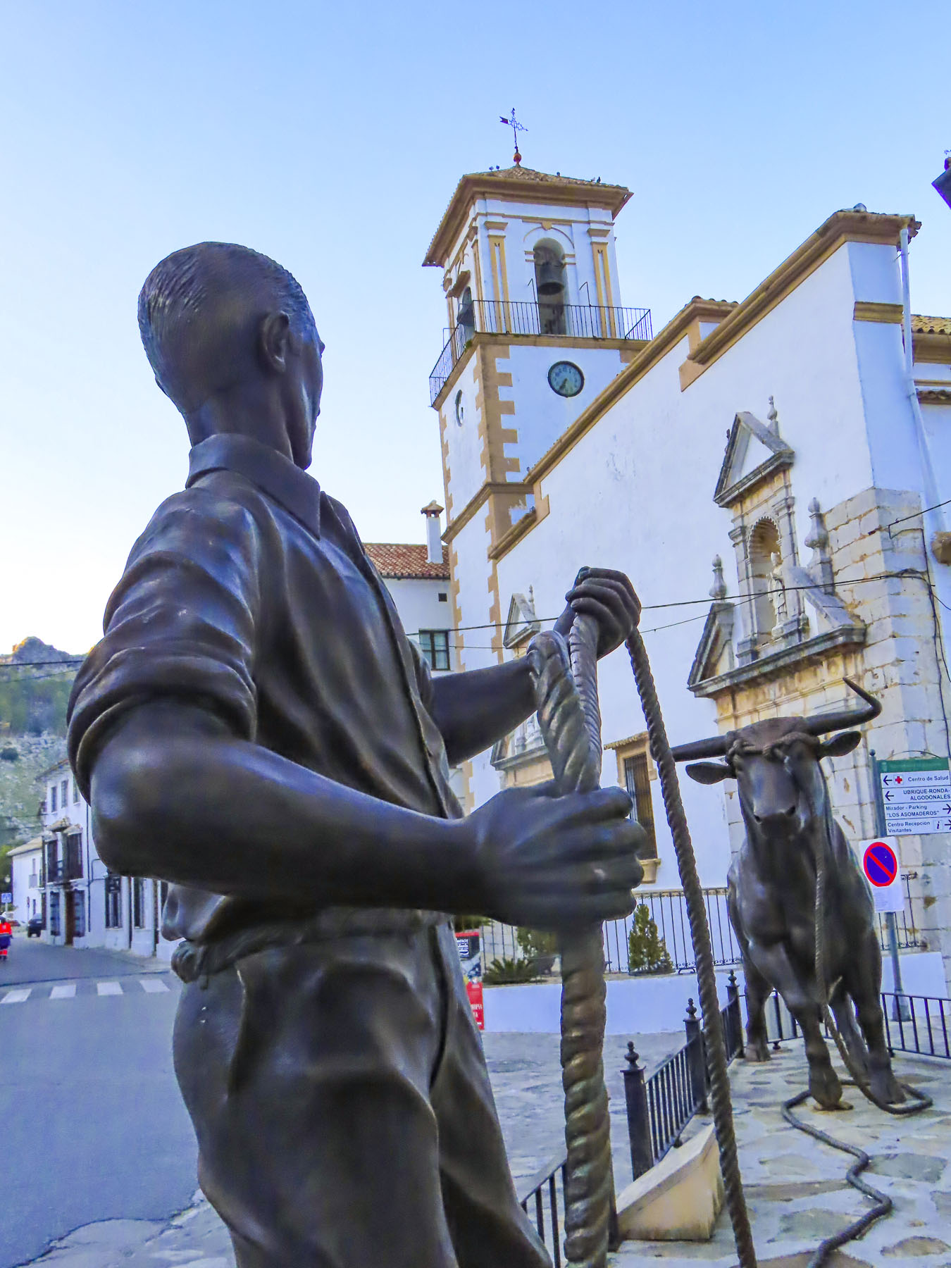
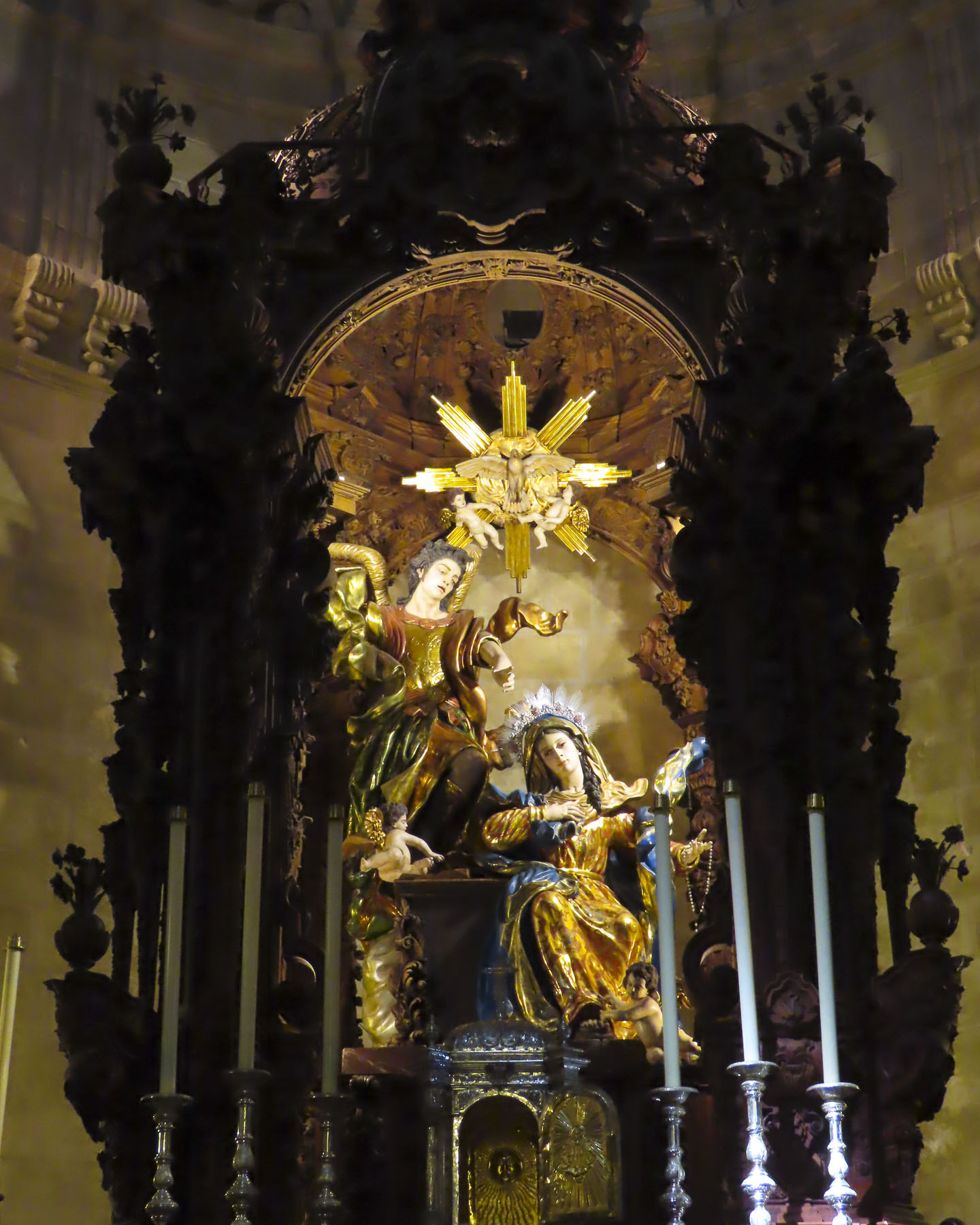
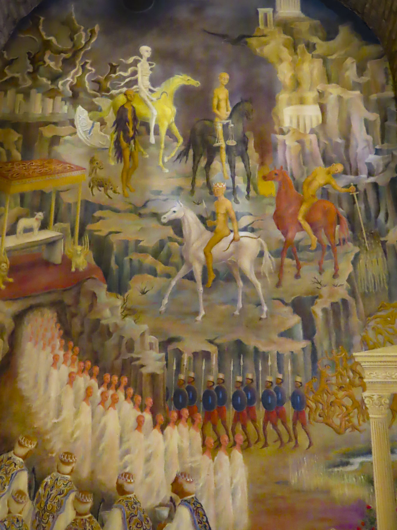
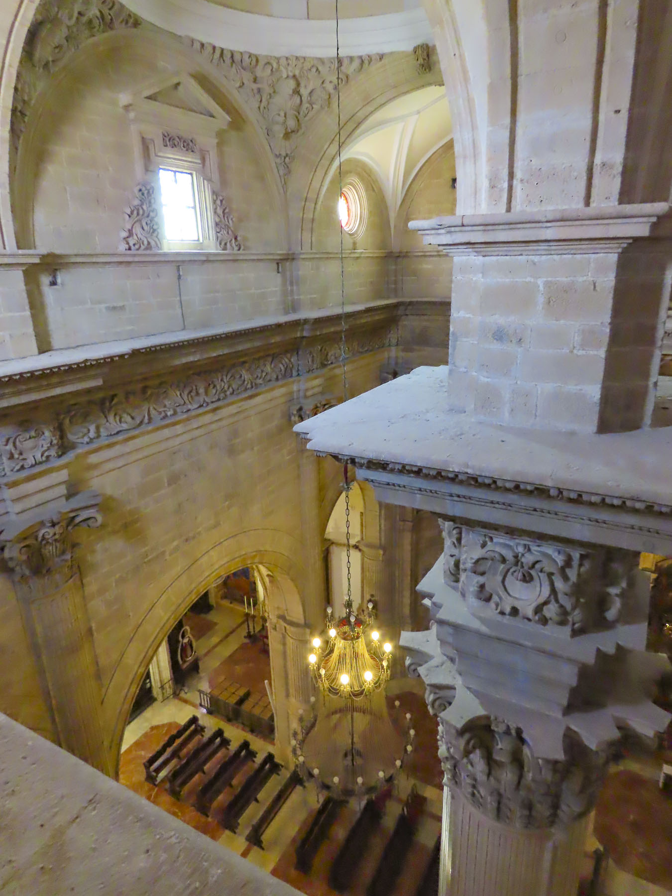
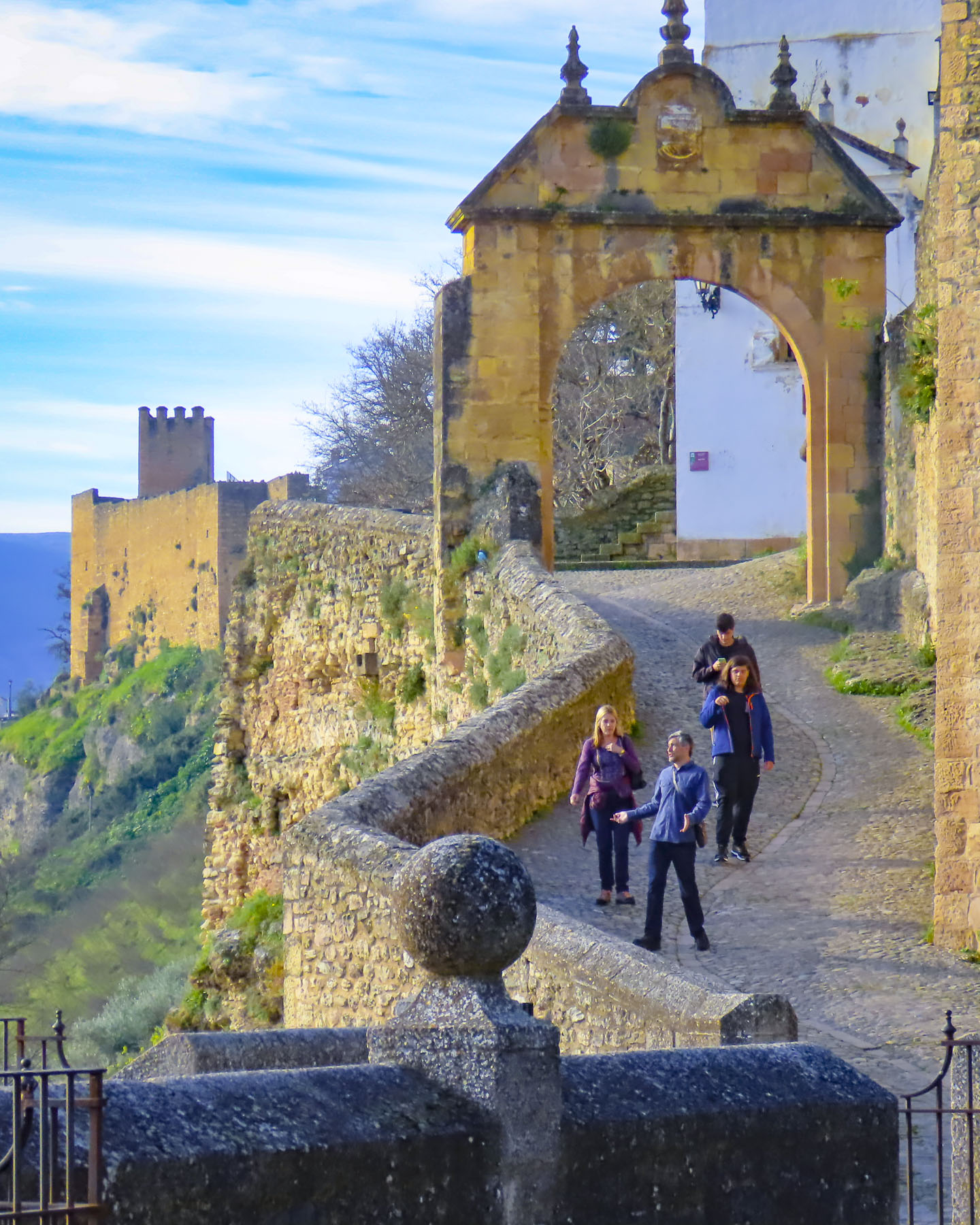
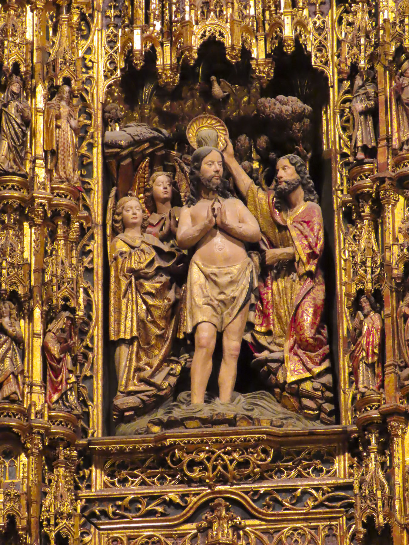
After coffee we visited the town’s church, Parroquia de San Fernando Rey. It’s a small, whitewashed structure constructed in the late 1600s and has an interesting collection of religious art. Across the street stands a life-size statue called “the brave Guanche,” dedicated to Alonso Diaz, a goatherd, who in 1509 stood up for his rights and successfully petitioned Spain’s King Fernando the Catholic for justice, after 200 goats were stolen from him by a Spanish conquistador. By royal decree the goats were returned.

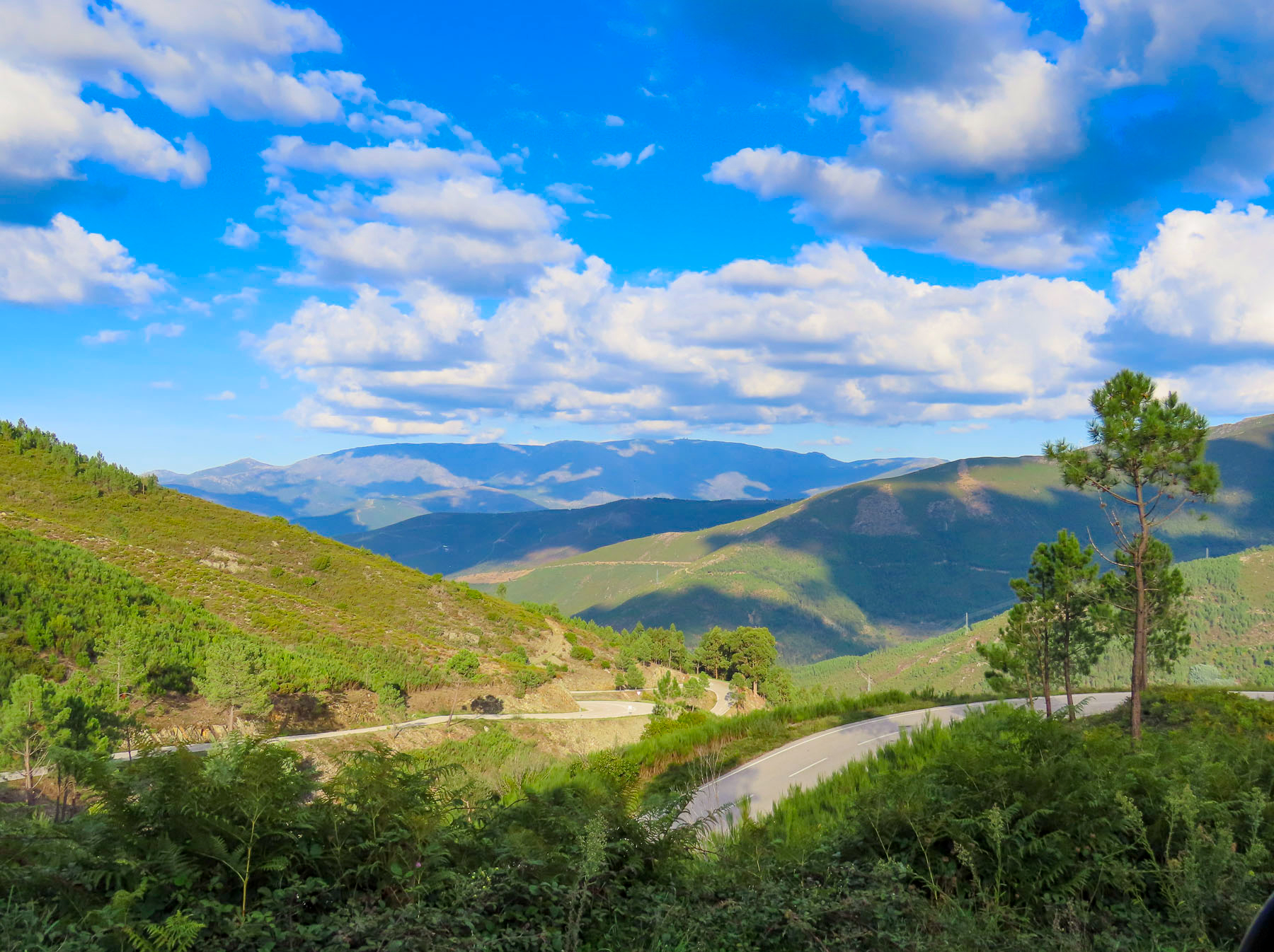
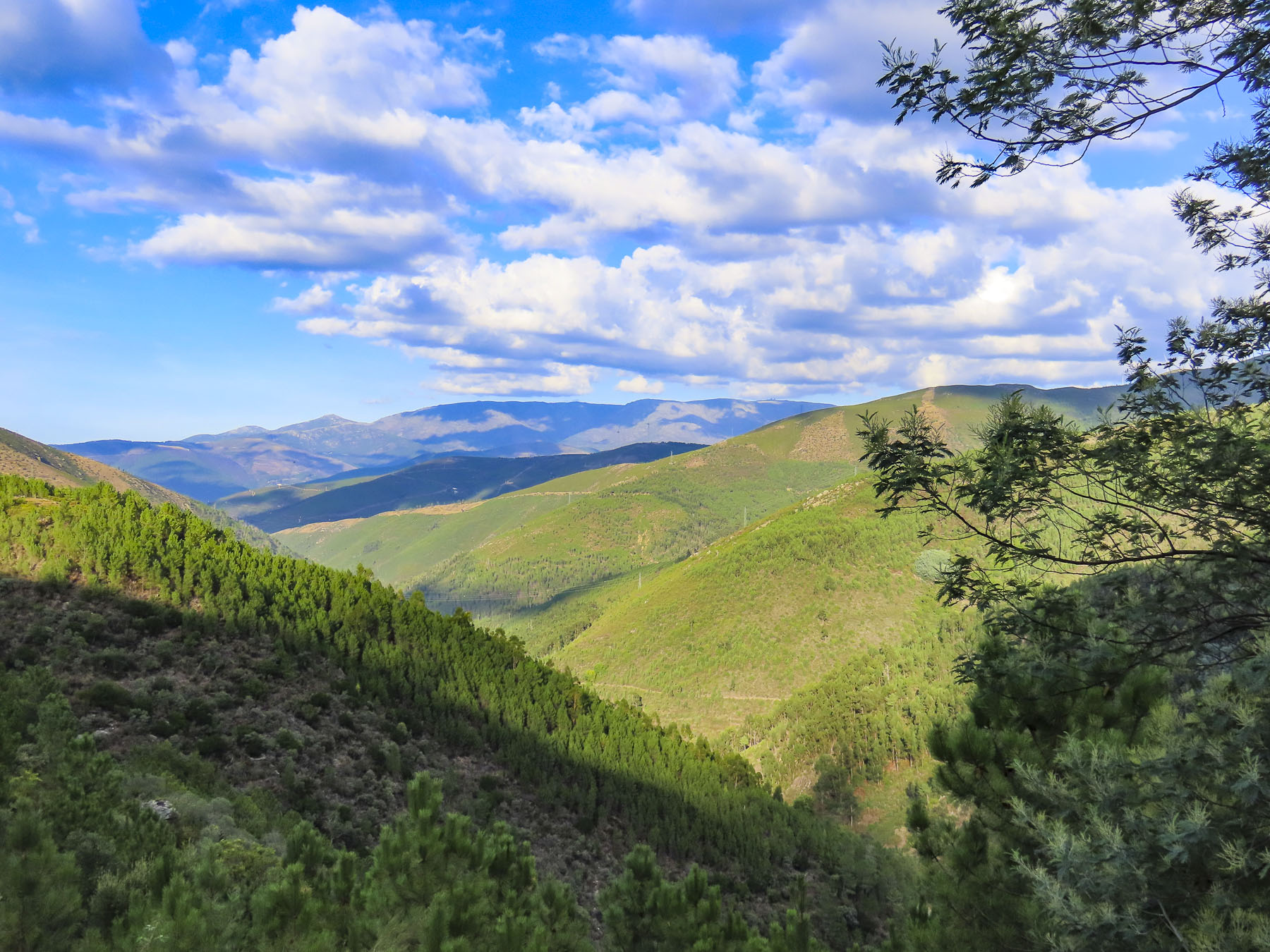
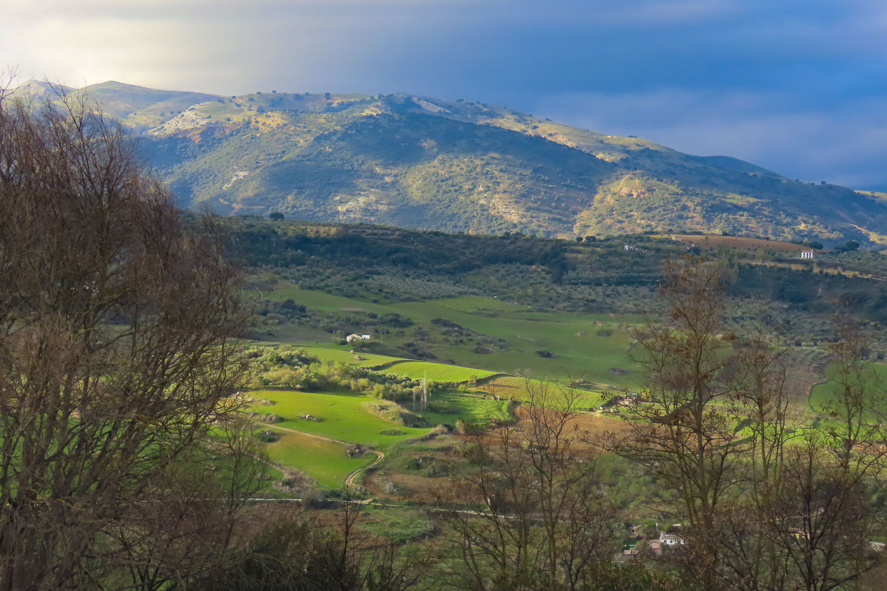
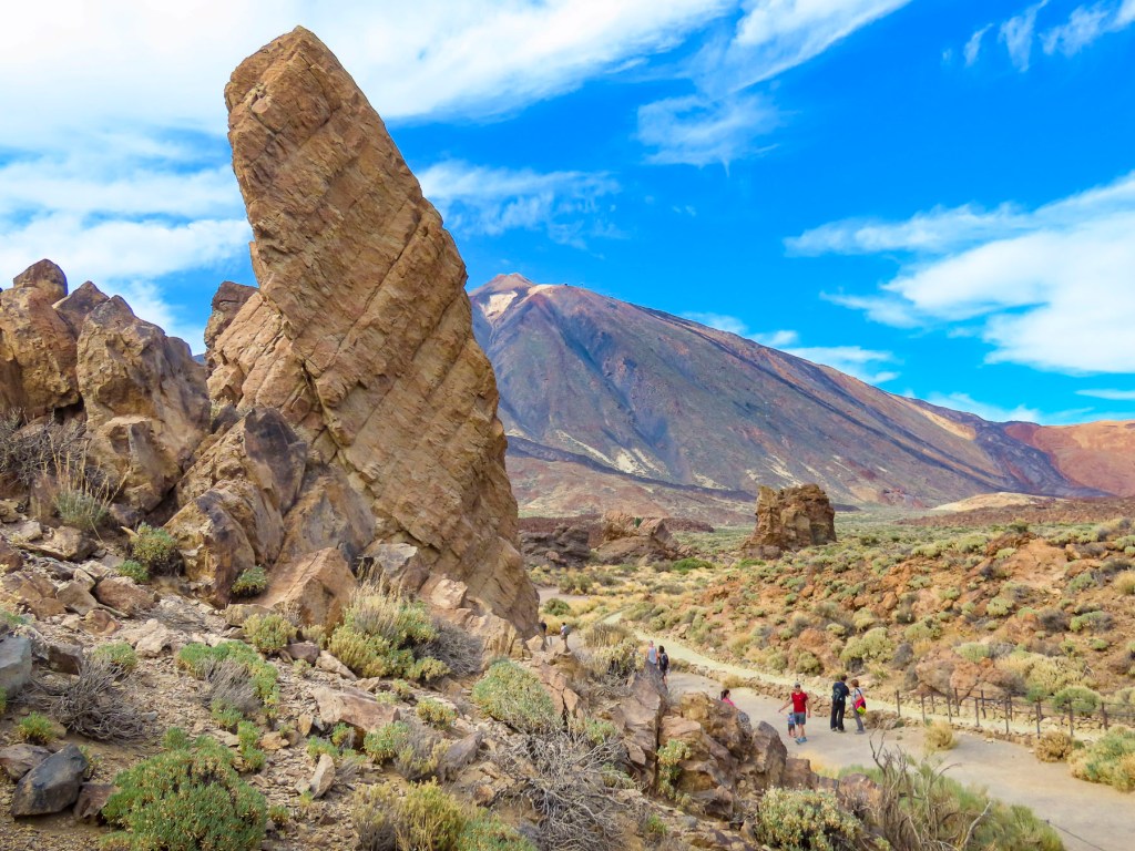
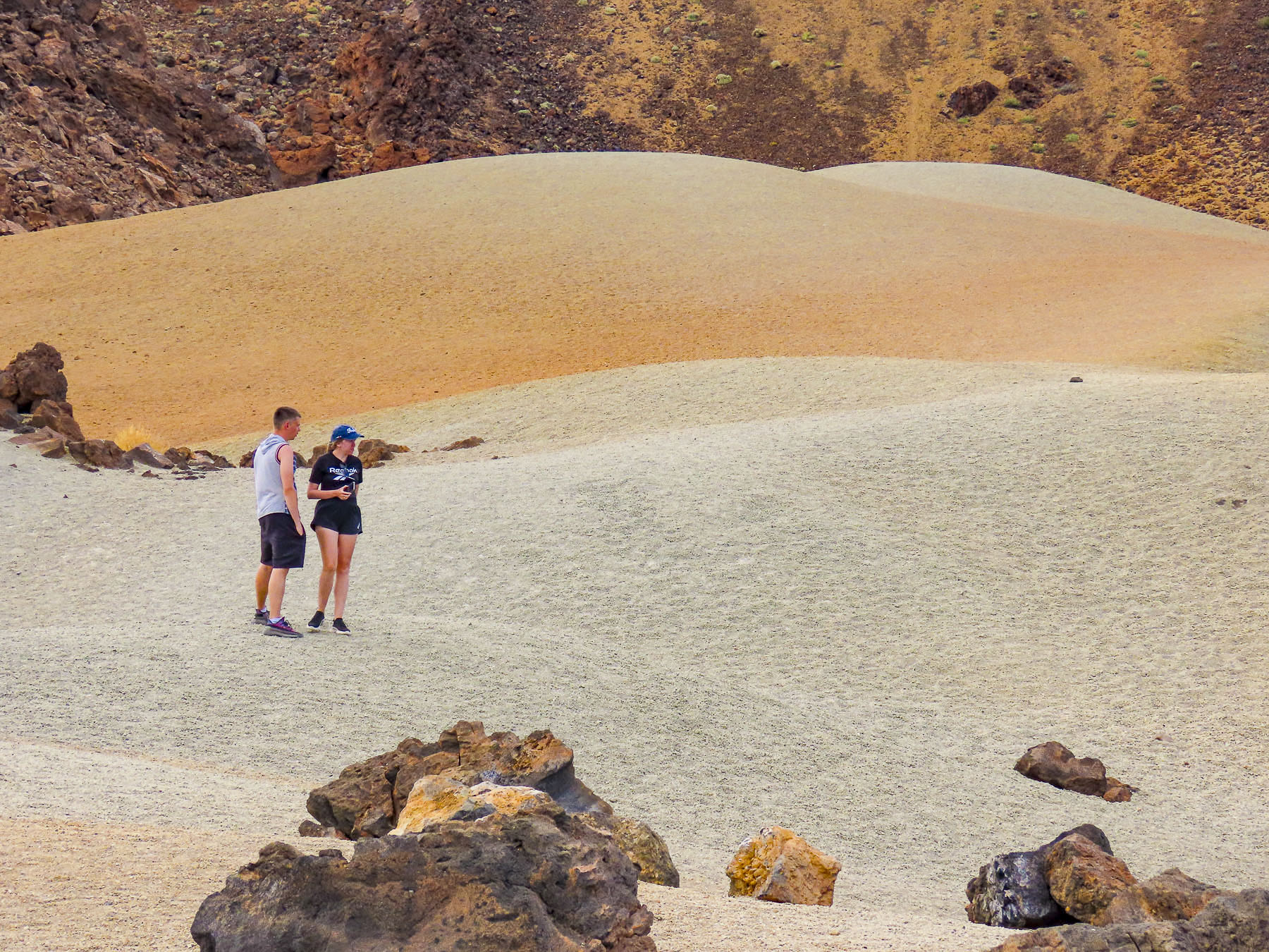
Venturing into the foothills, our drive continued along TF-38 and traversed an ever-changing, diverse bio-system as we left the arid shrub-covered lowlands behind and climbed into hillsides covered with pine forests. It was a well paved but narrow serpentine road, without any shoulder, that required constant vigilance. The mouths of ancient lava tunnels were visible from the road, but there was no room to pull over and stop for photos until we reached the Mirador de los Poleos. Here the raw beauty in these charcoal-colored landscapes flourished beneath the Chinyero Volcano, and we had a chance to walk across the lunar-like terrain, part of the immense lava field from its 1909 eruption. Dotted with huge boulders, it was difficult to comprehend the ferocious forces required to expel these massive rocks from their subterranean origin.

Continuing on, we had encountered what we thought was fog until, to our surprise, we emerged above the clouds at Mirador de Samara.

This area is also very popular for hiking, with many very obvious trails crisscrossing through a young forest emerging from the volcanic soil left from Pico Viejo’s last, 92 days long, eruption in 1798.

Approaching noon, we turned toward Vilaflor, the highest village, at 4600ft, on Pico del Teide’s southern slope and surrounded by vineyards. The surrounding wineries produce some of Tenerife’s best wines from Listán Negro, Malvasia, Negramoll, and Listán Blanco grapes. And are embodied with a distinctive terroir from the warm climate and fertile volcanic soil. The weather had suddenly turned gray and dreary. More frustrating though, the wineries we had planned to visit were closed mid-week during the shoulder season. Fortunately, we happened upon Mar de Nubes, a craft store and café run by a friendly young married couple from Tenerife and the States. The shop features only handicrafts made by Canarians and local wines and artisanal beers. Of course, we shopped.

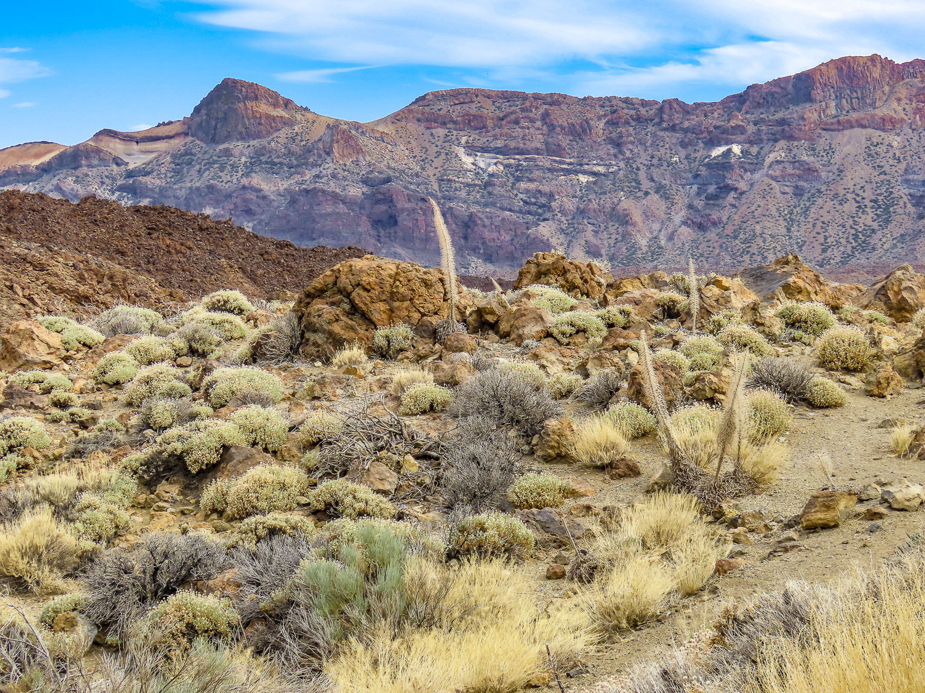
Beautiful, inhospitable, Death Valley-esque, lunar or Martian, however you choose to describe the varied topography that surrounds Pico del Teide’s, it’s enthralling and fascinating. So much so that filmmakers have used the location for scenes in several block buster films: One Million Years B.C. – 1966, Planet of the Apes – 1968, Clash of the Titans – 2010 and its 2012 sequel Wrath of the Titans, and in 2023 the Last Triala, a Star Wars fan film.  TV episodes of Doctor Who, The Dark Along the Ways and season 2 of The Lord of the Rings: The Rings of Power have incorporated Tiede’s environs into their productions.

Driving back up the mountain we continued on to view the large sculptural outcroppings at the Mirador de La Ruleta and the desert-like dunes of the Siete Cañadas hiking area, before following the long downward grade of the road to La Orotava. We speculated that if you dropped a soccer ball at the top of the slope, it would bounce downhill continually until it splashed into the ocean at Puerto de la Cruz, roughly 23 miles away. Our route along TF-21 cut through forests ravaged by the wildfires of 2023. The blackened trees were the only scars in the otherwise pristine wilderness of the Tiede’s northern slope in Parque Natural Corona Forestal.

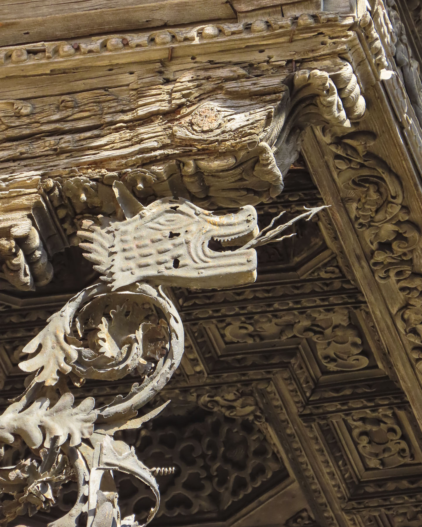
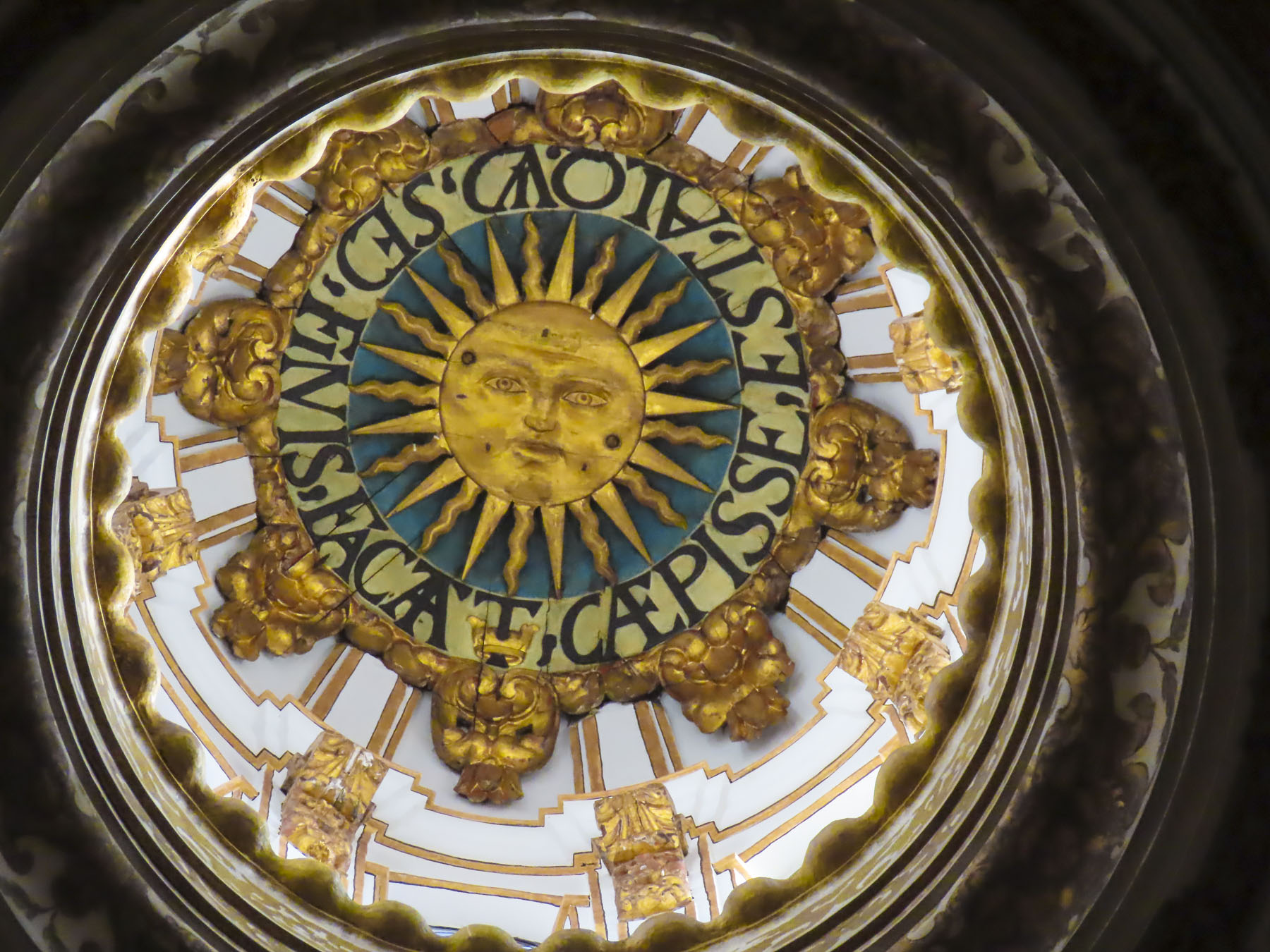
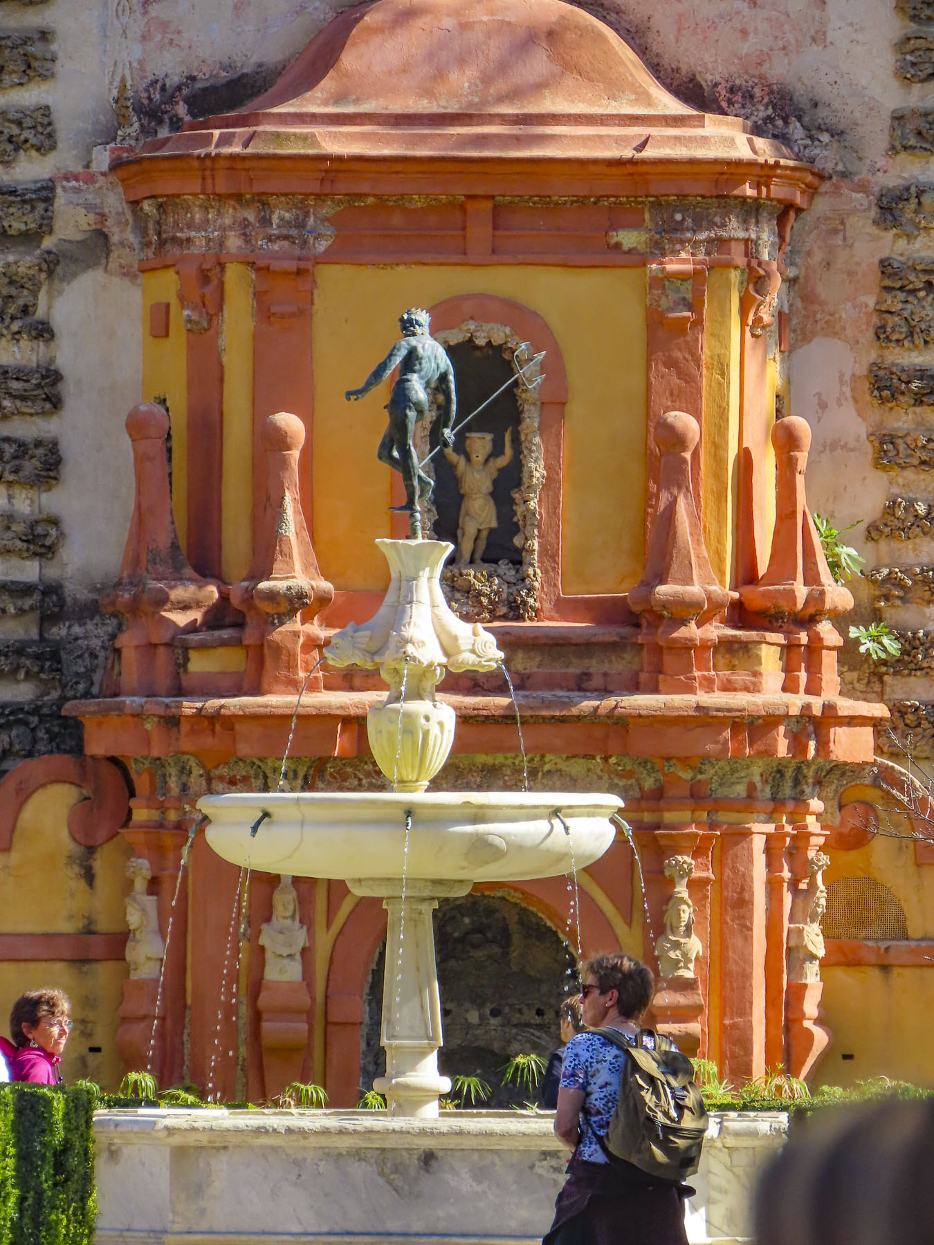
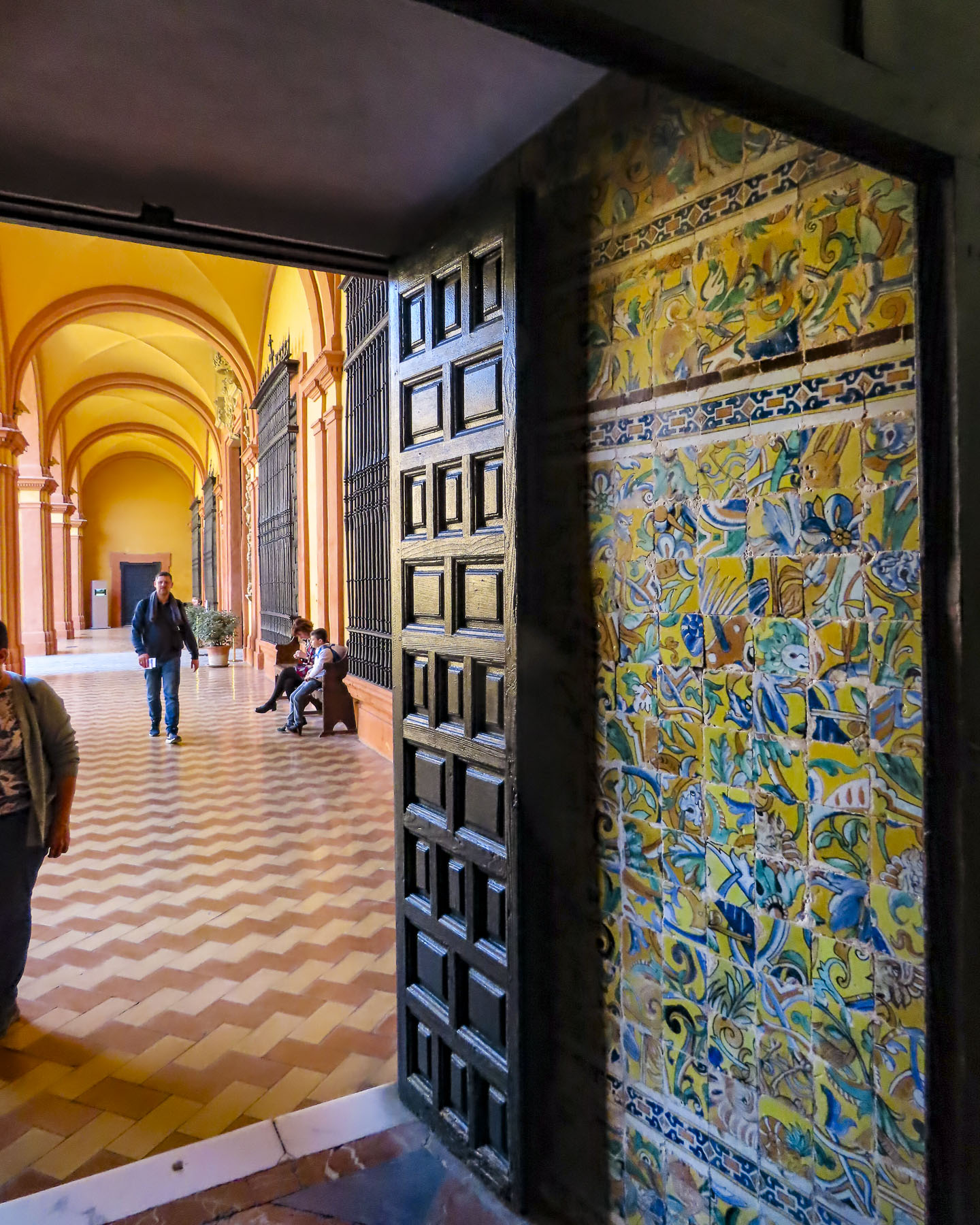
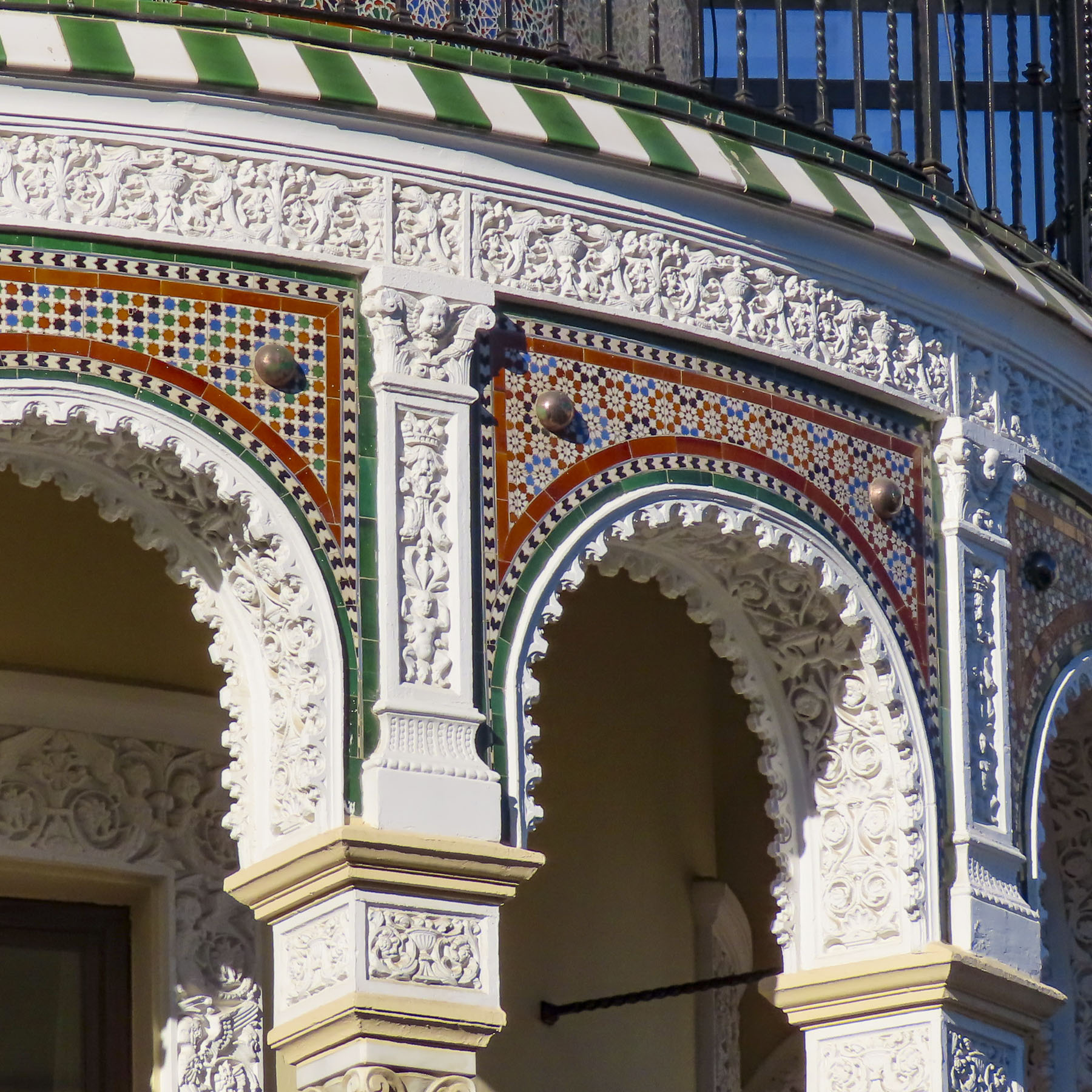
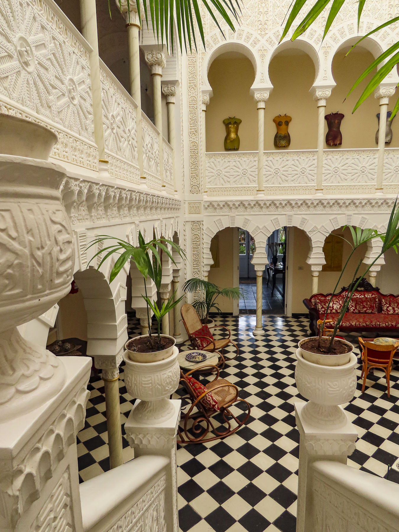
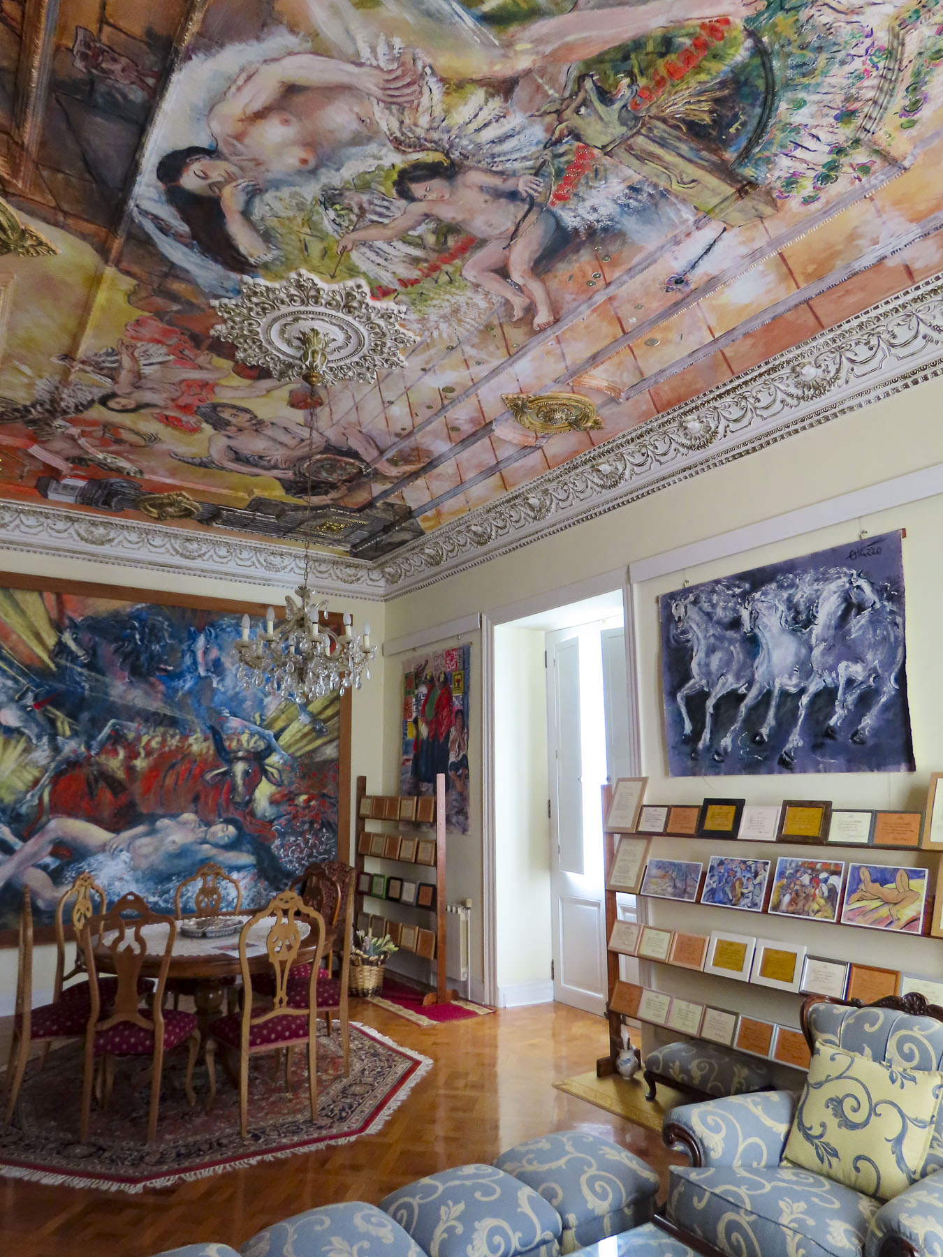
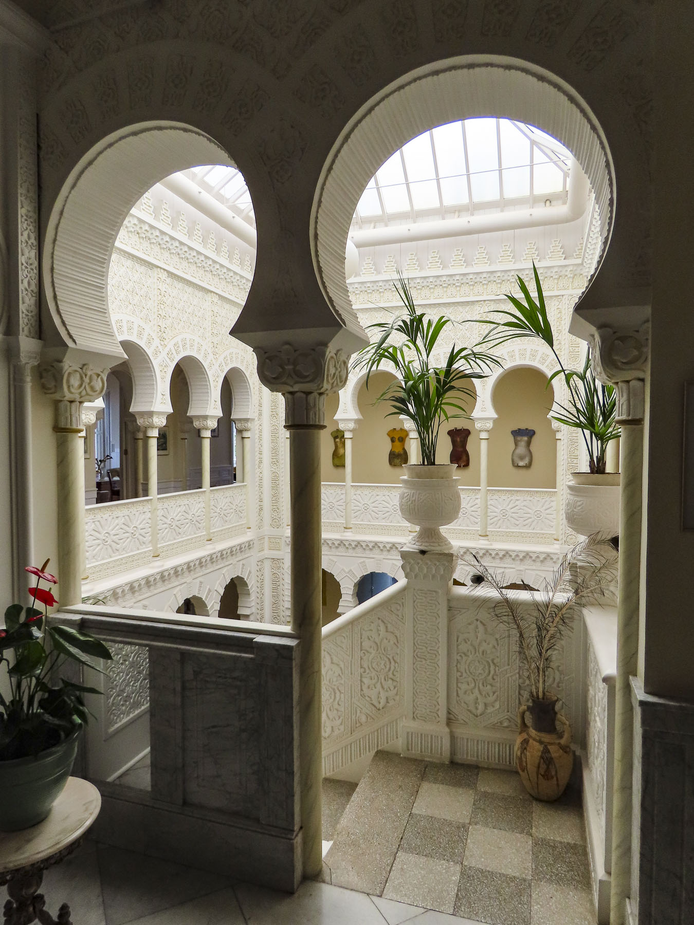
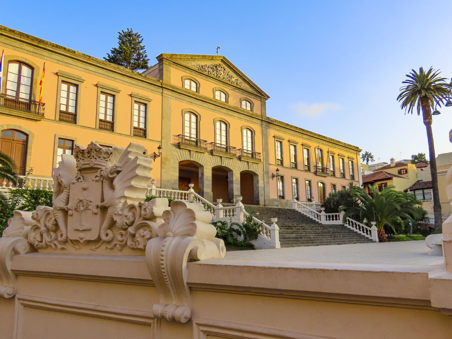
Late in the day we coasted into our parking space in front of Hotel Alhambra. Parking on the streets in La Orotava is free, but it’s a competitive sport. We chose to stay at this hotel for its distinctive architecture and location in the historic center. While the exterior of the 500-year-old dwelling is quietly classical, the interior walls of its Canarian-style courtyard were beautifully transformed in 1925 with intricate floral and geometric Nasrid art designs, created with gebs plasterwork and enclosed under a high glass roof. An eclectic decorating theme is highlighted with frescos by Maestro Antonio Otazzo, a local self-described painter, sculptor, musician, philosopher, and poet. As if being followed by a friendly giant, Pico del Teide was in our line of sight when we opened the shutters on our room’s window.

La Orotava was rather easy to walk around if we were walking across the slope, but after several days our hamstrings and calves were sore, though our butts were firmer. “Walk a little then café,” as we say was the perfect approach to exploring this wonderful town.

Along with San Cristóbal de La Laguna, it’s considered to be one of the prettiest towns on Tenerife.

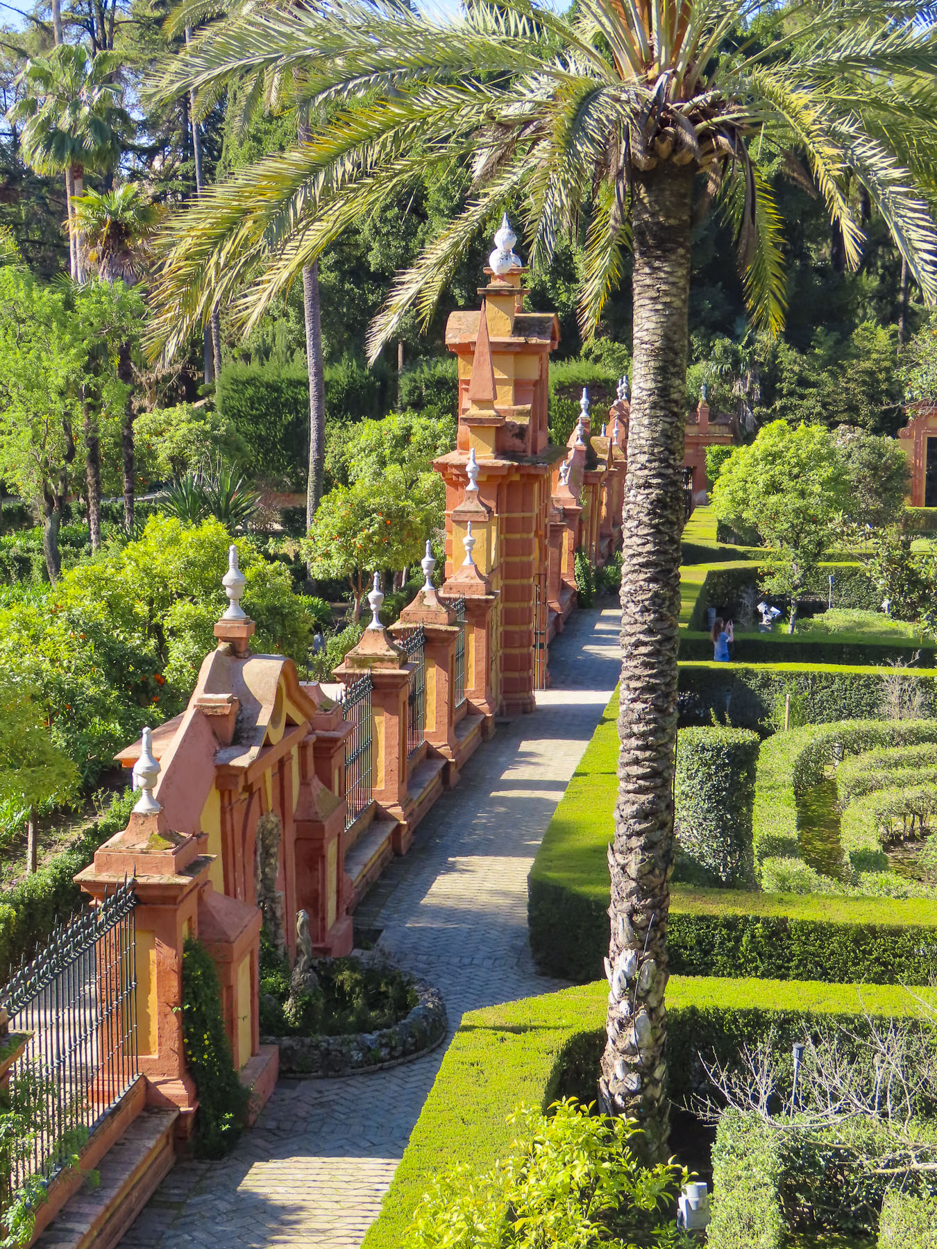
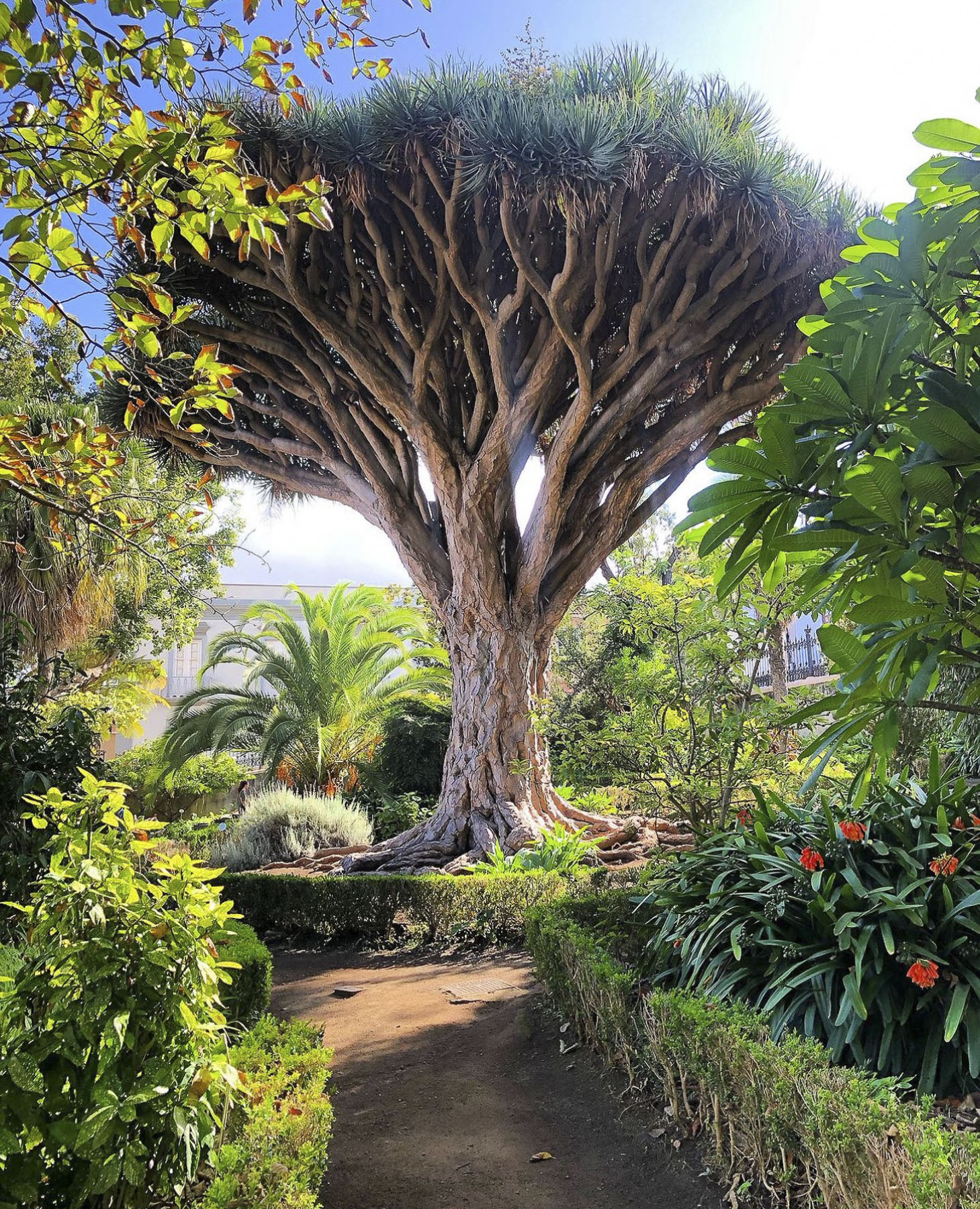
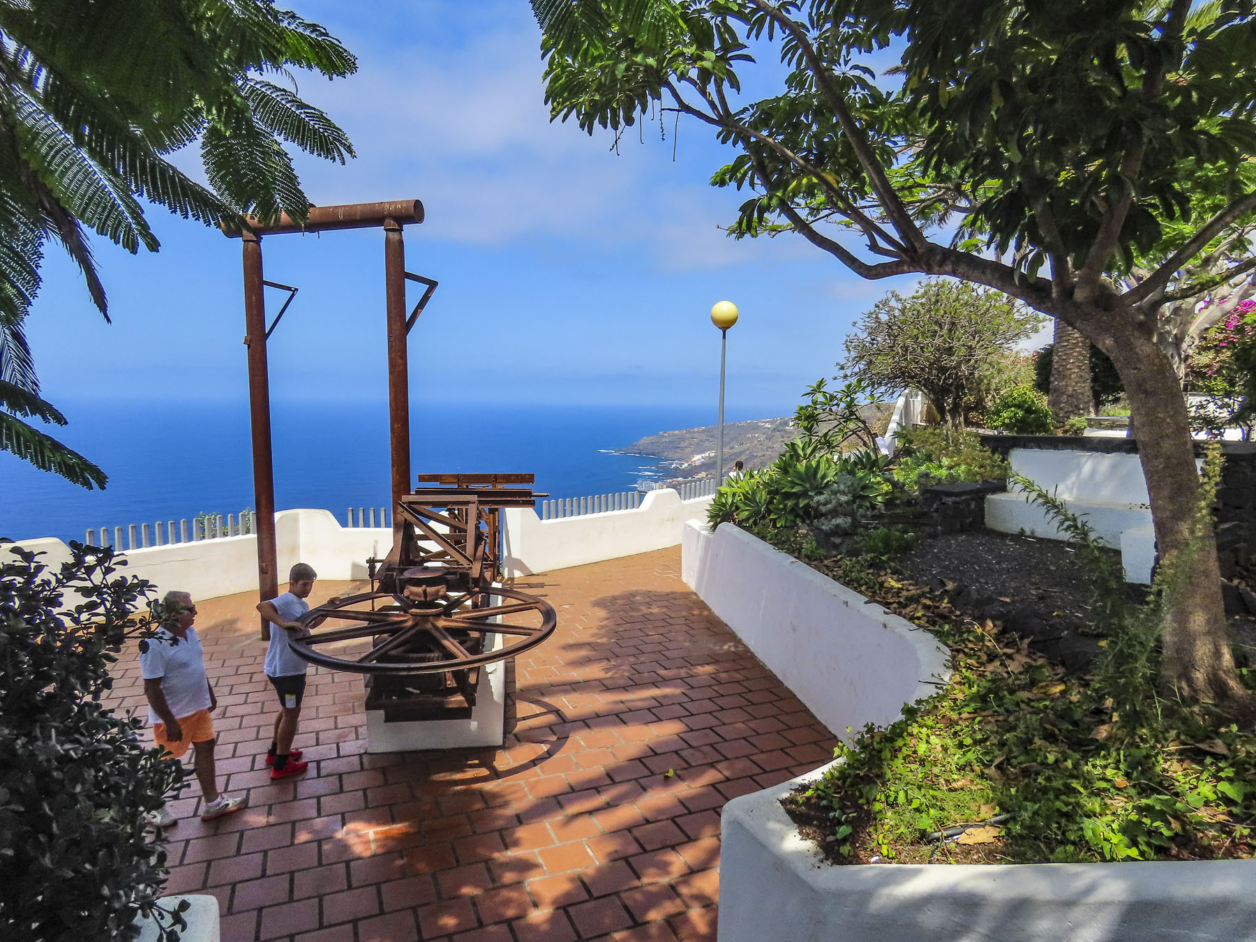
Getting to the higher points in town we asked the hotel to call for a cab, for a quick ride to the Jardines del Marquesado de la Quinta Roja. Once part of an estate, it’s named after the noble interred in the park’s marble mausoleum; as a member of the Masonic Temple his family was not allowed to bury him in the town’s catholic cemetery. Constructed in 1883, the garden is a beautiful French-style, terraced, formal garden with a view over the town and the distant sea. A smaller but older (1788) sister park next to it, the Hijuela del Botánico, features a towering dragon tree and other plantings of specimen trees collected from Spain’s former colonies.  And if you are in awe of dragon trees, as we are, the Villa de La Orotava Dragon Tree Tour might be for you.

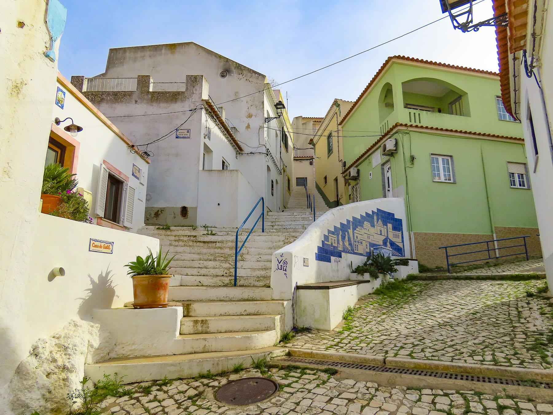
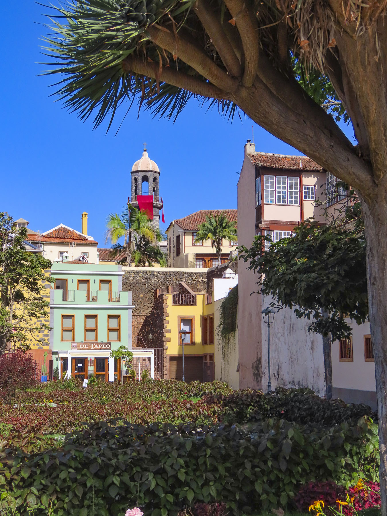
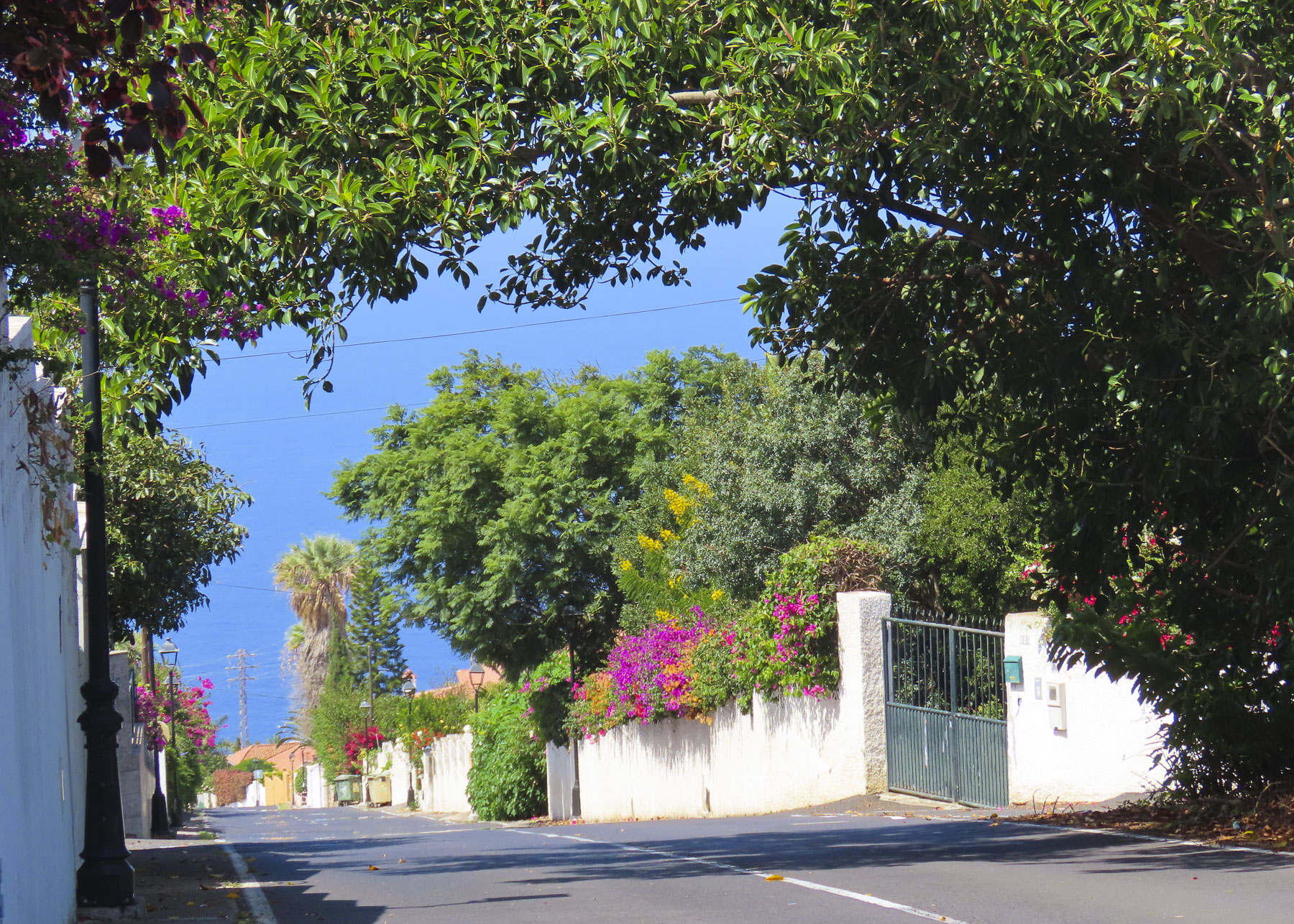
From the gardens we wandered downhill along cobbled lanes, past wonderful examples of colorful Canarian architecture, into the historic old town, which is centered around the Nuestra Señora de la Concepción. Started in 1516, it is the town’s oldest and largest church, with its colorful dome giving the town its iconic skyline.

But La Orotava’s history starts early in 1496 with the final defeat of Tenerife’s aboriginal Guanches at the battle of Aguere, after which their leader committed suicide by jumping off a cliff in nearby Tigaiga. “To the victor go the spoils,” and the fertile lands of the Guanche kingdom of Taoro were awarded to the nobles, conquistadors and financiers who participated in the Spanish victory.

The rich soil of the hillside was perfect for the cultivation of sugarcane and the steep streams from the mountain were soon harnessed to run sugar and lumber mills. Prosperity followed. Ice from Mt. Tiede chilled the drinks of the town’s wealthy.

Landowners and merchants built large family mansions in a style which would become known as Canarian, which feature interior courtyards and distinctive facades with decorative wooden balconies and the family’s Coat of Arms prominently facing the street. Convents housed the daughters from families that didn’t want to diminish their wealth by paying the dowry for the girls’ wedding, as was the custom of the time. 

Vines and wine replaced sugar cane and ruled the town’s economy in the 17th century. In the mid-1800s, the textile mills of Europe were searching for different dyes, and mealybugs or cochineal were bred in cactus around La Orotava and harvested to obtain a crimson dye, produced from an acid that the bug makes to fight off predators. Since the late 1800s, vast banana plantations thriving on Tenerife’s mineral-rich volcanic soil continue to bring prosperity to the island and La Orotava, enabling the community to restore its historic buildings.

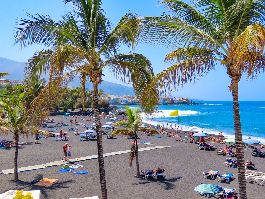
Not wanting to miss anything on Tenerife, we planned day trips from La Orotava around visiting coastal miradors and following any whims along the way. The Mirador Punta Del Hidalgo was not our favorite photographic destination, but we did enjoy stopping at the crescent shaped, black sand beach at Playa del Arenal in Bajamar, and a farmer’s market, Mercadillo del Agricultor in Tacoronte. Here we purchased some pastries for a snack and some Tuno Indio juice made from the purple fruit of the Canarian Red Prickly Pear. The cactus was brought to the Canary Islands from the Americas centuries ago and has been used in Canarian folk medicine to lower blood sugar and treat other ailments. It also has antiviral, anti-inflammatory, antioxidant, and anti-ulcerogenic properties. It tastes pretty good.

Afterwards we headed to the Mirador La Garañona in El Sauzal. Set dramatically atop a 1000ft sheer cliff, there’s a tremendous view of the coast below. And the park’s shaded paths led to a delightful small café perched at the cliff edge. We lingered and soaked in the view.

On the way to the mirador, we whizzed passed a small neighborhood restaurant set by itself on a corner, and decided to try it on our return trip. But first we had one last stop to make on the way at the Iglesia de Santa Catalina. It’s a classic, white-washed church from the early 1500s and picture perfect with its magnificent dragon tree in front.

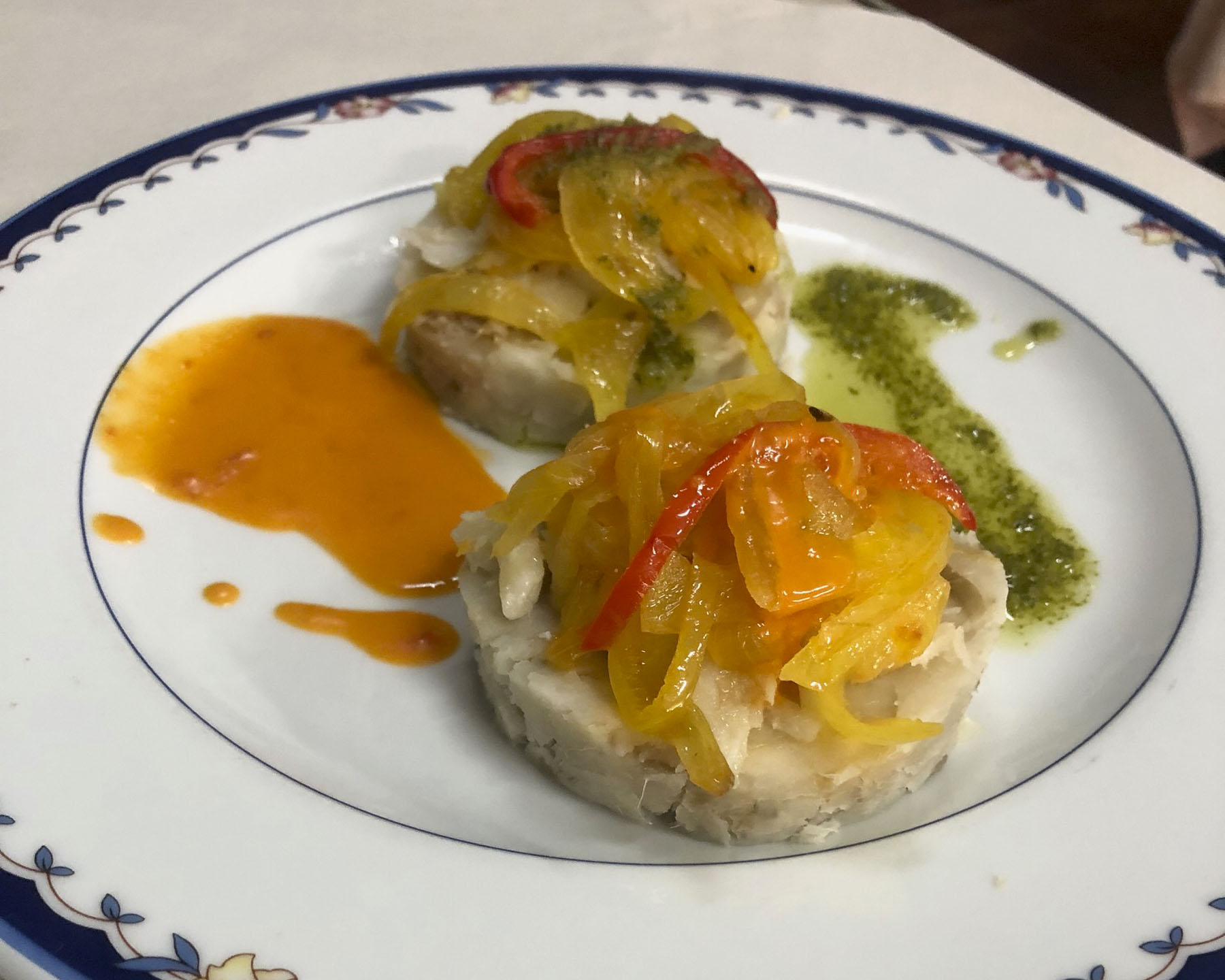
Lunch at Restaurante el Calvario was delightful, with excellent house wine and menu featuring traditional Canarian dishes. A young friendly staff, tolerant of our poor Spanish, contributed to a very enjoyable afternoon.

Puerto de la Cruz, just down the hill from La Orotava, was the destination for our last day trip. Originally a small fishing village, the town grew in importance after the main harbor on the north coast of Tenerife in Garachico was filled with lava from a 1706 volcanic eruption. Close to La Orotava, it also benefited from that town’s thriving economy, with the export of sugar, wine and bananas from its port. It has been a popular vacation spot since the Victorian era. Now it attracts visitors and expats from across Europe, drawn to its cosmopolitan vibe, wide beaches, quaint historic center, numerous parks, and vast array of restaurants.

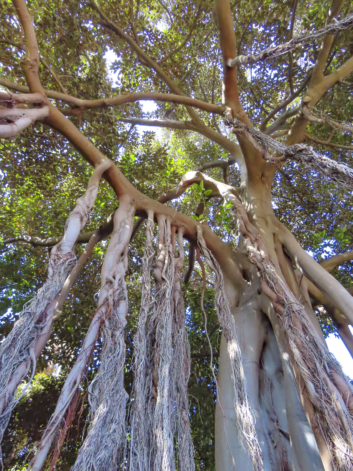
Giant three-hundred-year-old fig trees, planted when the park first opened in the 18th century, are king here. Shaded pathways thread through a cornucopia of verdant jungle, flowers, and water garden. We enviously wished that we could grow everything in our garden at home.

In the historic center we had coffee across from the majestic Iglesia de Nuestra Señora de la Peña de Francia and afterwards were able to catch a glimpse of a bride and groom taking their vows. Their antique wedding car waiting under gently swaying palm trees on the plaza in front of the church.

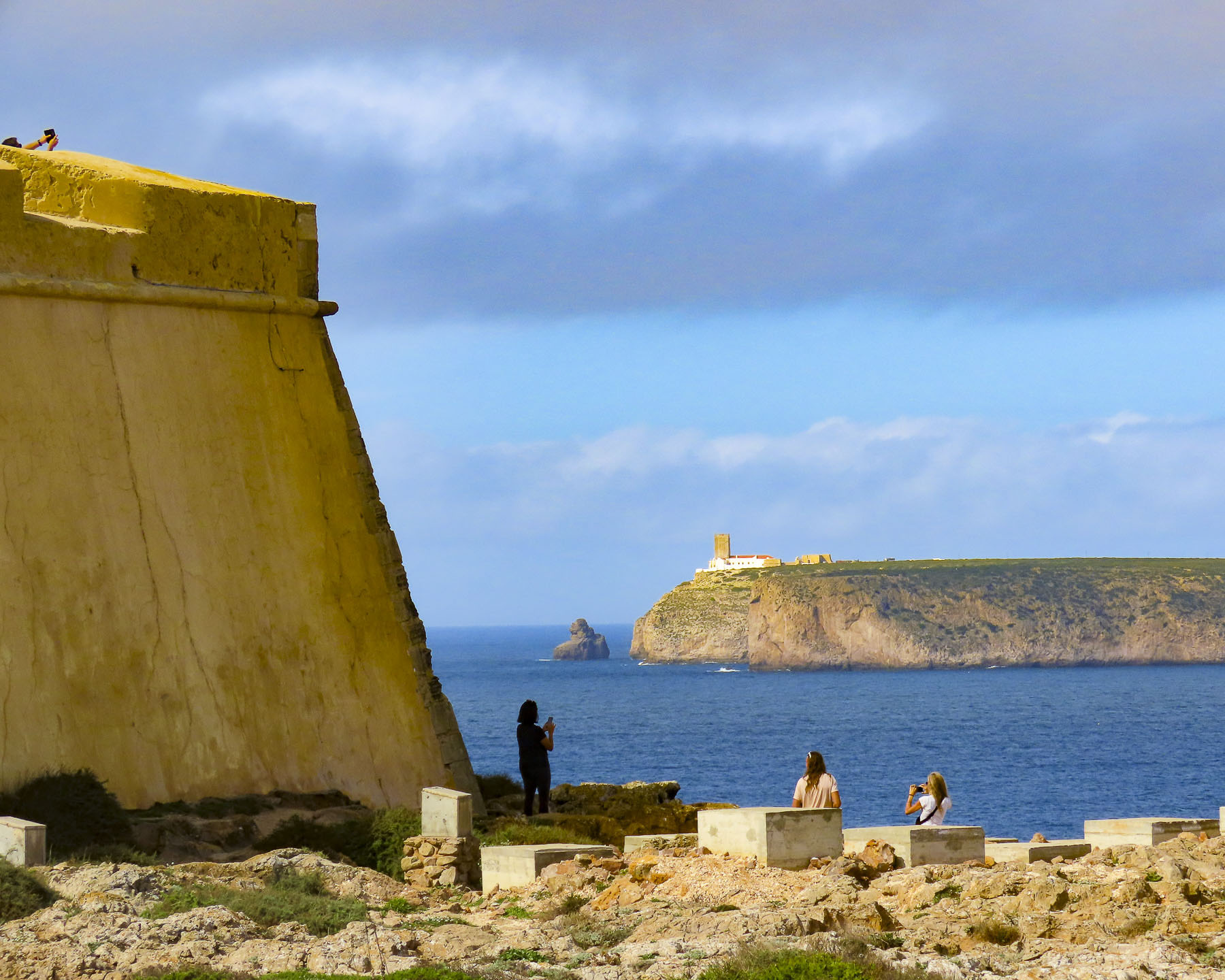
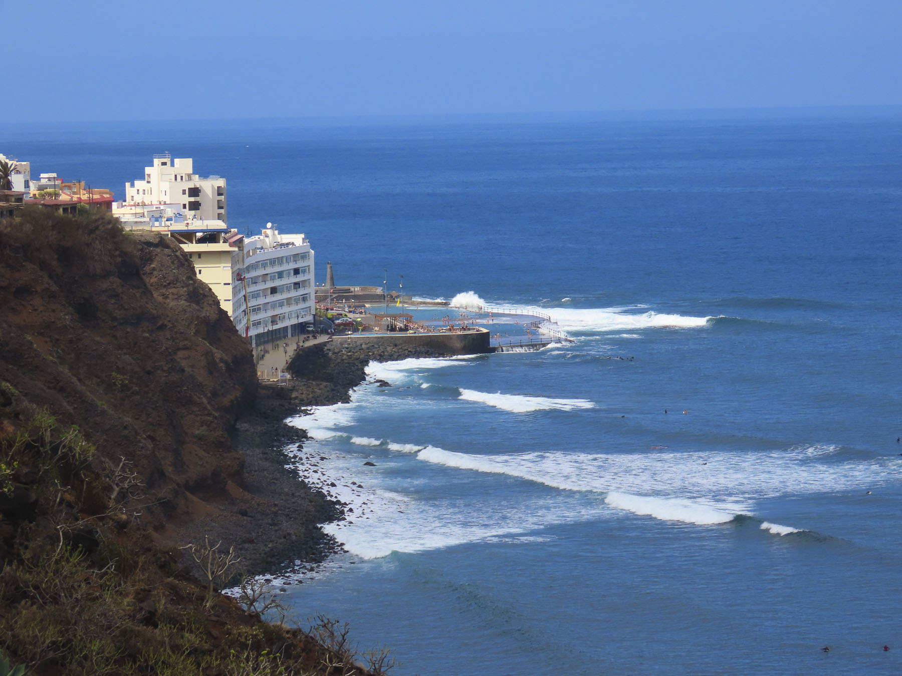
The waterfront in Puerto de la Cruz is beautiful and there are numerous beaches and tidal pools along the coast where you can swim. We strolled along the promenade above the black sand beaches at Playa Maria Jiménez, and Playa Chica to El Castillo San Felipe, a small block fortress built in the 1600s to prevent pirates or the British from landing on the beach here. We lunched along the boardwalk under umbrellas just yards from the surf.

Stopping at the Mirador Roger Piedra Gorda and Mirador Roque Grande rounded out the afternoon. Though parking was a challenge at both spots, we think the effort was worth it for the dramatic seacapes we viewed.

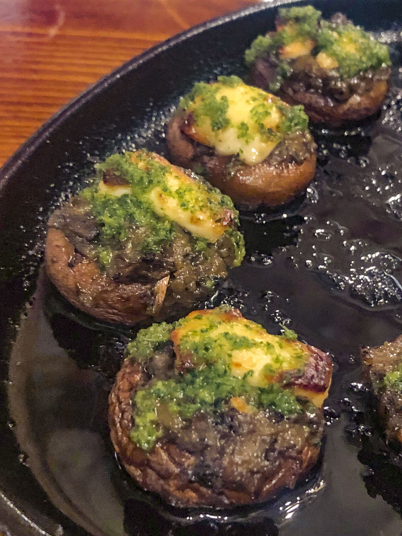
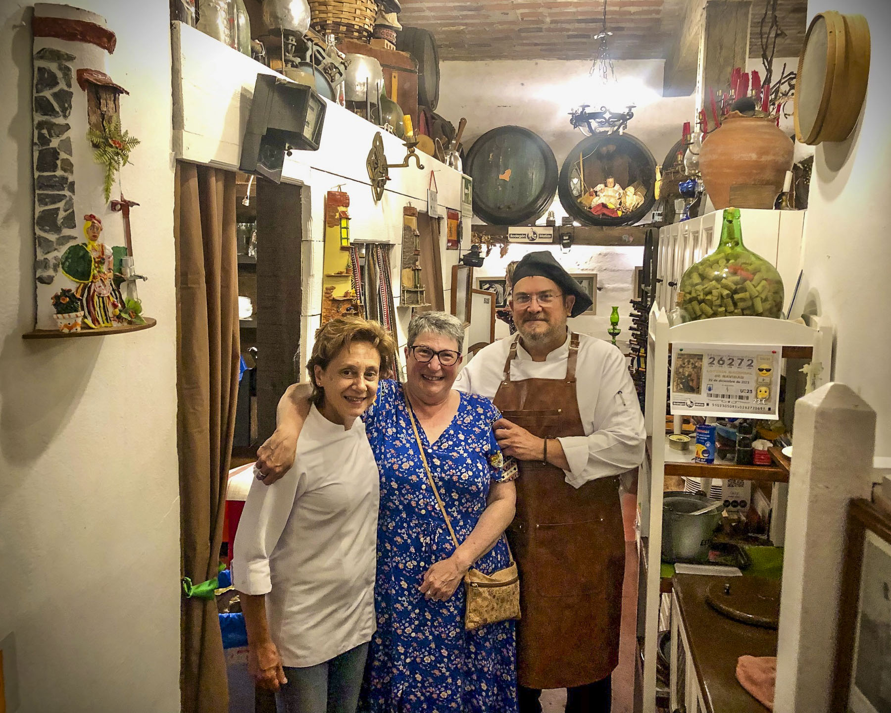
That evening we drove up into the hills above La Orotava and enjoyed a great meal at Bodegón Casa Matías. It’s a rustic establishment, decorated with wine barrels and antique farming tools to acknowledge the history of the region. The chefs and owners, a vivacious husband and wife team, are part of Tenerife’s farm to table movement, sourcing only local meats, including rabbit and goat, fish, cheeses, and seasonal vegetables for their traditional Canarian recipes.

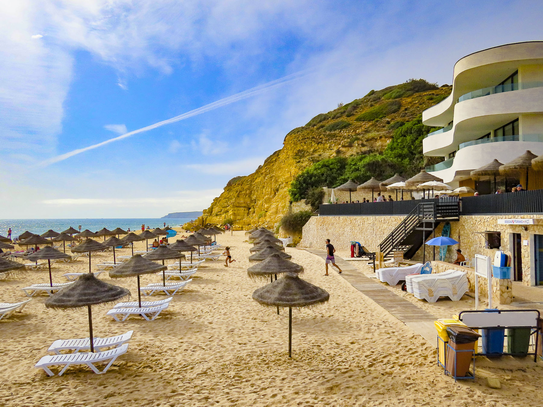
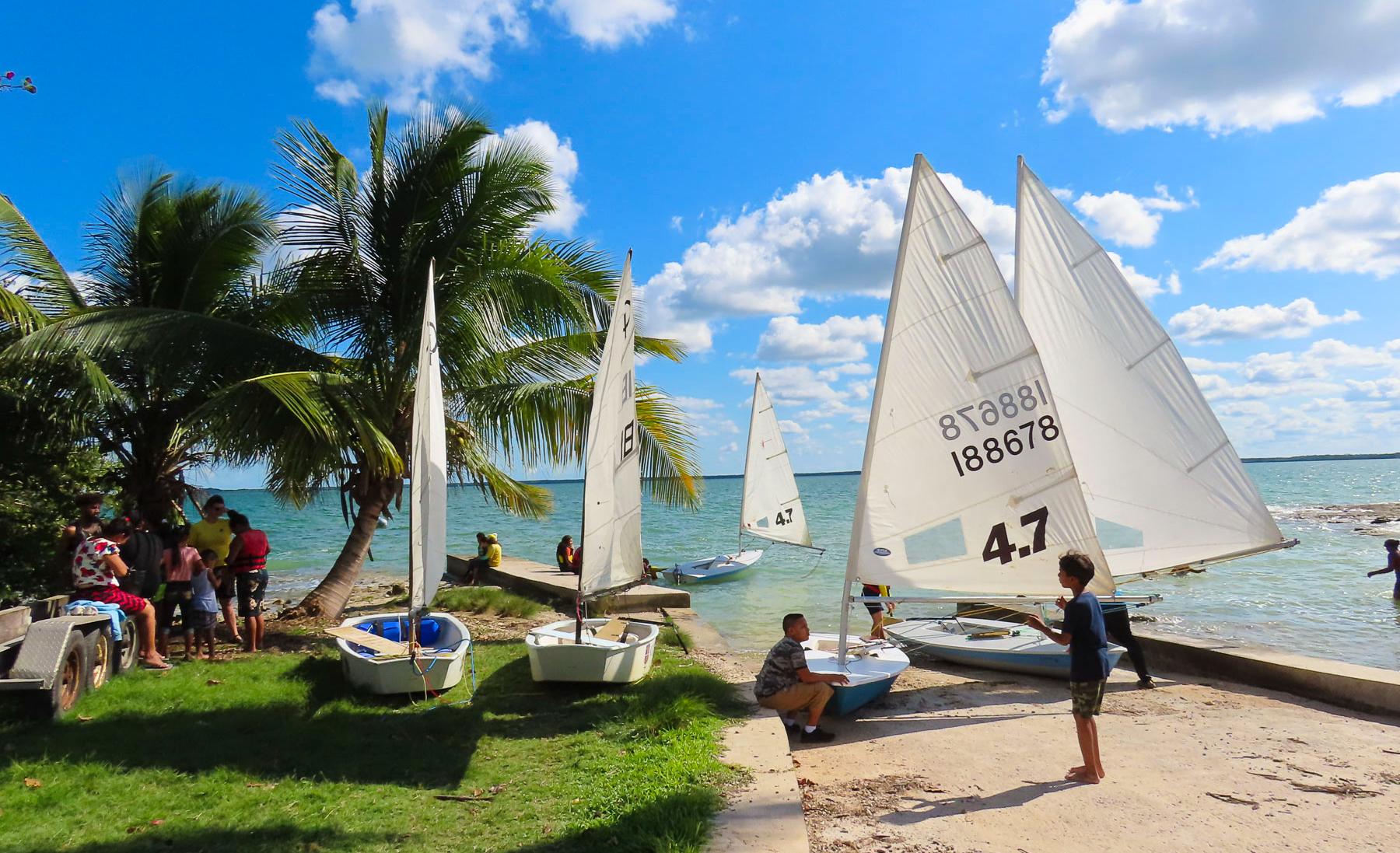
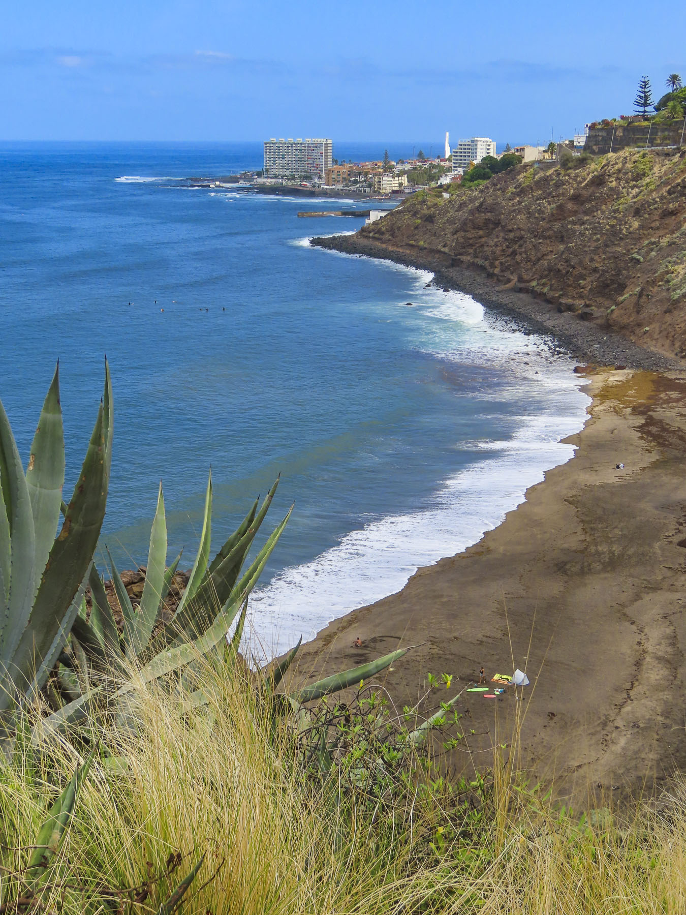
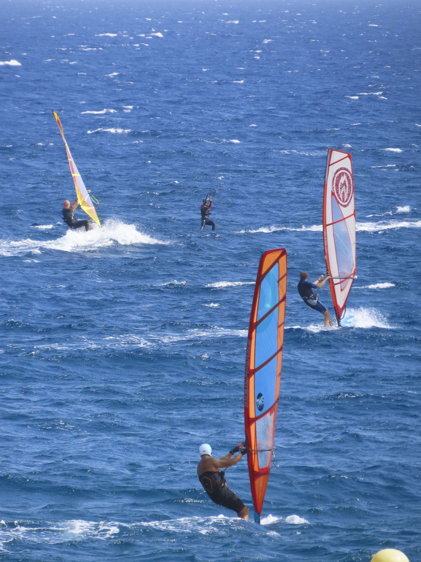
For our last full day on Tenerife, we headed to El Médano to be nearer the airport for a flight the following morning. Arriving late in the afternoon to Playa del Médano we entertained ourselves watching wind and kite surfers speed across the whitecaps. The more experienced kiters crested the waves and performed aerobatics before splashing back into the sea.

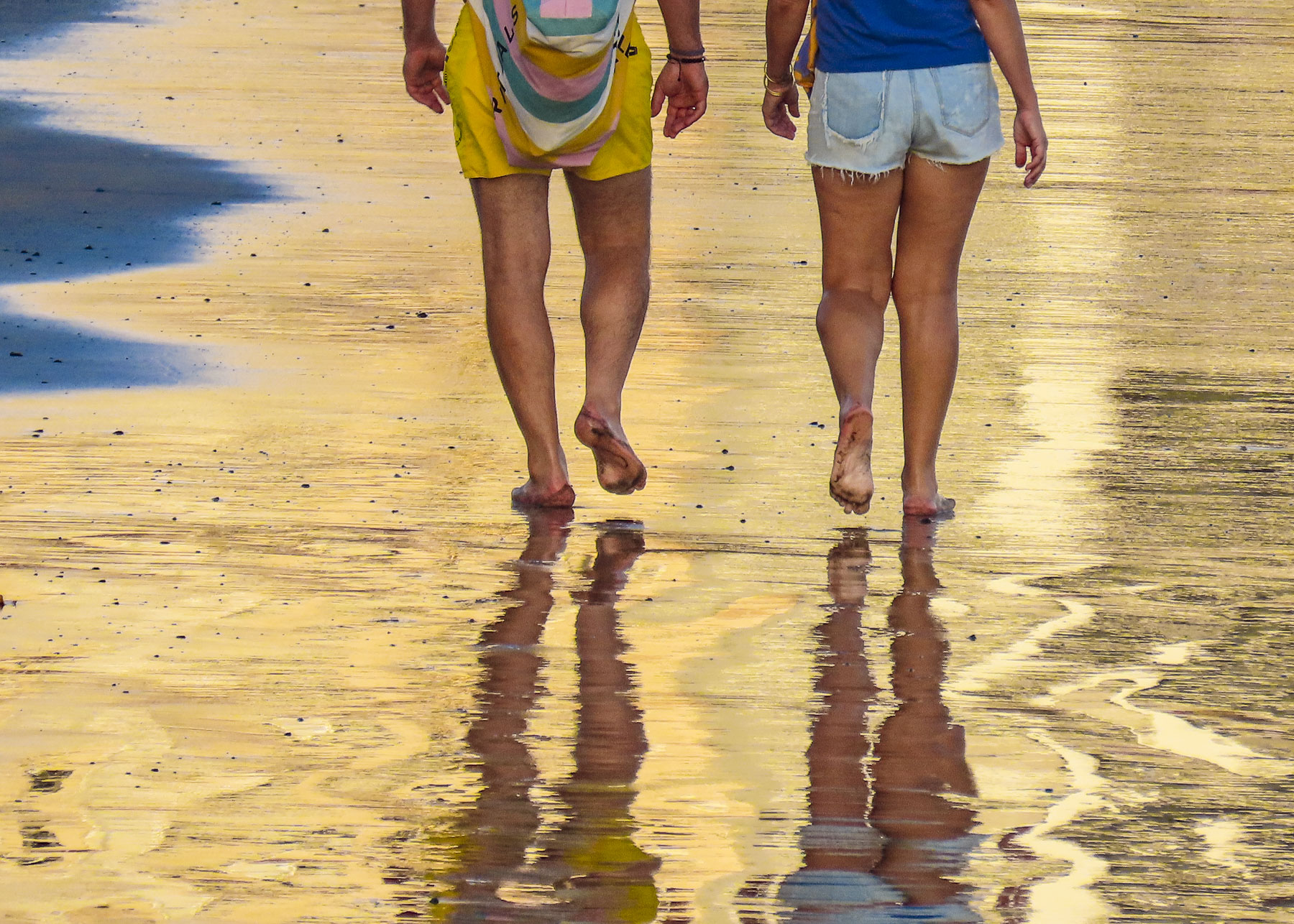
Closer to town, families favored the gentler waves, wider beach, and a view of Montaña Roja volcano on the horizon. Tables at eateries along the boardwalk were quickly filling as the golden hour approached.

A crescent beach, gentle waves, good wine and delicious seafood – is there a better way to end the day? We’ll miss Tenerife.

Till next time, Craig & Donna

Tenerife Part 3: Garachico & Buenavista del Norte – A Wonderful Coastal Drive

Our drive along the coast started in the small harbor of Icod de los Vinos. From the start the sea vistas were beautiful, with crisp clarity and saturated blues and brilliant white breakers crashing against the rocky coast. The lighthouse on the remote headland Punta de Teno was our destination. Though only sixteen miles away, it took a good part of the morning with all the frequent photo stops we were making as we proceeded. The spectacular scenery along this short drive rivals the Pacific Coast Highway in California and Chapman’s Peak Drive outside Cape Town, South Africa or the Amalfi Coast of Italy. Just epic!

A few minutes from Icod de los Vinos along TF-42, we stopped at Mirador El Guincho which overlooks the coastal homes, banana plantations, and the new Port of Garachico. Constructed in 2012 behind a large breakwater, it is the only harbor on the north side of Tenerife. Beyond the harbor the extinct volcano Montaña de Taco highlights the horizon, its crater now used as a reservoir.

Enthused by what we glimpsed as we passed through Garachico, we decided to keep with our original plan to go to our farthest destination first and then return later to linger in the quaint town.

“Drive a little, then café.” We were ready to stop by the time we reached Buenavista del Norte and easily found parking around the Plaza de los Remedios. Sitting in the shade, we ordered coffees from the café under the park’s gazebo. It’s a classic Canarian town with colorful two and three story homes. What’s unusual though is the town sits on flat land! Something that is in short supply on this mountainous island. It’s only access to the sea was from the small rocky landing at Playa de las Barqueras, where for centuries supplies were rowed ashore from passing merchant ships. Nearby set along the dramatic coastline is the Buenavista Golf Course, designed by the famous Spanish golfer, Seve Ballesteros.

The Church of Nuestra Señora de los Remedios stands across from the plaza and has played a significant role in the town’s history since its cornerstone was laid in 1516, most importantly when the townspeople filled the church in 1659 and prayed to the statue of La Virgen de los Remedios to stop a plague of locust which was ravaging their crops. According to history the plague stopped. Sadly in 1996, that historic statue and many other centuries-old religious treasures were lost in a fire that destroyed the church.

It’s very easy to speed by and miss, but on the outskirts of town on Cruz de Toledo at its intersection with TF-445 there is a statue of a locust atop a tall column with the anagram of the Virgen de los Remedios, and the dates 1659-2015 which commemorate that event. Every fifth year a procession from the church carries the virgin’s statue out to the locust monument. 

We continued towards Punta de Teno only to be stopped by a manned roadblock across the pavement, just shy of Mirador Punta del Fraile. Only buses and taxis were allowed to travel the road farther; we weren’t told why. Even Google map drivers have been prohibited from making the journey. There was a small dirt parking area next to the gatehouse and we could see a few folks walking the long incline to the mirador. We followed. It was about a thirty minute, moderately strenuous walk, and the views were awesome. It was well worth our effort. Gale force winds whipped through a cut in the rock which the road followed down to the lighthouse at Punta de Teno, three miles away. Behind us a large cliff face blocked most of the view of the Teno headland. It’s a barren peninsular without tourist amenities, just a lonely lighthouse and modern wind turbine farm, the blades of which must turn furiously 24hrs a day, if it’s as blustery there as it was at Mirador Punta del Fraile. Hold your hats!

The views returning to Garachico were equally as impressive as the morning sights, and we stopped several times before entering the old town.

As prosperous as the Canary Islands are today, we were reminded by the statue at the Mirador del Emigrante that life here was not always easy. This poetic description by Fernando García Ramos, the sculptor, explains for the viewer the meaning behind his statue of a walking man – with a hole in his chest, as if in his heart – holding a suitcase. “The figure is scanning the horizon, in a daring position, as if pretending to jump over the sea, with a suitcase in hand, and many more suitcases in a series as a chain behind him; these suitcases behind him surely mean the memories, the sadnesses, the nostalgia, the girlfriend, the mother, the sisters, the families that are left behind by an emigrant who takes a new life, who jumps over the infinite sea, in search of a new life in strange and distant lands.”

Occasionally we spotted colorful red rock crabs scurrying about as walked along the waterfront to the Castillo de San Miguel, a square block fortress built from quarried lava rock in 1575 to protect Garachico’s port from French, Dutch and Arab pirate attacks, along with the threat of British invasion.

For two hundred years Garachico’s harbor was the most important commercial port in the Canary Islands. Its citizenry accumulated wealth through prosperous imports and exports from Spain’s New World colonies and Europe. It was a prestigious town with many warehouses and shops, fine homes, convents, and churches.

This ended on May 5th, 1706, when Volcan Arenas Negras, a vent volcano on Mt. Tiede’s lower slope, erupted and spewed lava down a ravine that led directly into the town and harbor. Amazingly, no lives were lost, but a great number of the town’s historic buildings as well as four convents were destroyed, buried under lava that flowed into the town for nine days. Buildings close to the lava flow caught fire and burned to the ground. The fortress narrowly escaped, but it lost its relevance when the harbor was filled with lava and ships could no longer anchor there. With the loss of the harbor, merchant ships shifted to Puerto de la Cruz, folks left and Garachico evolved into a fishing village until the tourist economy on Tenerife took off in the 1960’s, embracing tourism so enthusiastically that the town recently constructed an ocean front municipal pool open to all along the promenade.

Walking into the center of town, we admired several noteworthy historic buildings:, Convento de San Francisco (1524,) and its church the Iglesia de Santa Cruz de Tenerife; Casa Palacio de Los Condes de La Gomera (1666.) They still stand around a beautiful, shaded gazebo in the Plaza de la Libertad.

Walk a little then café.

Till next time, Craig & Donna

Along the Algarve Coast – Lagos, Carvoeiro & the End of the World

Finally, the weather was improving as we headed south from Evora to the Algarve coast. We had hit an unusual week of rain in “sunny Portugal,” but the whole Iberian Peninsula had been experiencing a multi-year drought. So, it was good to know that some relief was in sight.

The sky was a refreshingly brilliant blue by the time we drove down palm-lined Av. dos Descobrimentos, along the Lagos riverfront, towards the ocean. On our left, Forte da Ponta da Bandeira stood, a silent sentinel still guarding Lagos’ fine harbor since the days of Henry the Navigator and the beginning of Portugal’s Age of Discoveries in the 1400s, when Lagos shipbuilders supplied fleets of caravels to explore the African coast, and later the Indian Ocean and beyond. In 1580,the fortress repelled the English privateer Sir Francis Drake, only to see him sail farther down the Algarve coast and sack Faro instead. Since antiquity Lagos has been an important trading port; Phoenicians established a settlement on the shore of the bay. Later Greek and Carthaginian seafarers visited and traded with the port.

The Romans came, conquered, and left the first defensive walls and a fortress along the cliff. Over the centuries its ruins have slowly fallen into the sea as the cliff face erodes. The only remnant of its existence is an arched bridge, too dangerous to cross, connecting the mainland to a rock pinnacle. Later Visigoths were succeeded by Moors until the Portuguese reconquest in 1241 permanently secured the port for Portugal. The road curved and climbed to the Miradouro Praia da Batata, where we parked and reveled in our first glimpse of the dramatically sculpted Algarve coast and its turquoise waters.

To our delight our accommodation at VI MAR – GUEST HOUSE was located within old town Lagos, just inside the massive defensive wall, which was expanded by the Moors in the tenth century and still encircles the town.

Our room was small, but it had a compact balcony that compensated for the lack of space and was the perfect spot for a morning coffee or evening glass of wine. The big plus was the location, only five minutes from the center of Lagos and just around the corner from MiMar, a great tapas restaurant, Padaria Centrala fabulous bakery, and MarLe Café for excellent coffees and a quiet place to chill. Our host recommended Casinha do Petisco, a small friendly and lively, family run restaurant famous for its cataplana de marisco (a traditional Portuguese seafood stew). We were not disappointed. Arrive right when it opens at 5:30pm if you’d like to be seated without making a reservation; after 7:00pm they are must.

One of our main reasons for choosing Lagos as a base for our five nights’ stay was the size of the town. Small enough to be manageable, yet large enough to be interesting. A walker’s and photographer’s delight within the old town. Plus the fascinating coastal rock formations of Ponta da Piedade and Praia dos Pinheiros were an easy twenty-minute walk away. We planned day trips to explore the coast, east to Carvoeiro and west to Sagres and Cabo de São Vicente.

At the end of October Lagos was quiet and beautiful, with daytime temperatures in the 70sF. With “walk a little then café” as our mindset we explored the old walled town, riverfront and on multiple occasions the trails and boardwalks along the ocean. The coastal rock formations were fascinating and kept revealing different fissures and crevices as the light kept changing throughout the day, though we thought the afternoon light was the nicest for photography.

The cobbled lanes of the historic district were uncrowded during the shoulder season and the ambience was wonderful amidst the palm trees and tiled facades of the buildings.

At the old Mercado Municipal de Lagos we were tempted by the bounty on display to buy “the catch of the day,” beautiful tuna from the fish mongers. On the top level a quaint small café overlooks the waterfront.

Farther along excellent street art decorated a store front awaiting reincarnation near a laundromat we were happy to use after washing clothes in various sinks for two weeks. It wasn’t Portuguese, but Poké Lagos served a delicious bowl of food as we waited for our laundry to finish.

In the evenings buskers performed in several plazas. One misty night a guitarist enthusiastically worked an appreciative crowd that kept growing and tossing coins into his guitar case. He must have sung for 90 minutes, breaking only to quench his thirst with a beer offered by a local waiter. Several times he announced it would be his last song. But the night was electrifying, and he played on. He proudly acknowledged his wife and young child in the crowd, playing for them as much as he was for us. He was, I imagine, in the ultimate musician’s groove, giving one of his best performances, and the folks who circled around watching and listening loved it as much as he did.

After several days of rough water, the wind and ocean finally calmed, and we spontaneously opted for a boat tour along the cliffs. Expertly timing the surge of the waves, our boatsman safely navigated us through tunnels and between rock formations.

At one point he looked high up the cliff face, waved and then yelled “hey Antonio!” to a lone fisherman wedged precariously on a ledge very high above the water. When asked why folks fish from the dangerous cliffs, our boatsman explained that only certain species of fish inhabit the zone where the bluffs meet the sea and that “Antonio, my cousin, thinks they taste better.” We saw this activity in several other places along the coast. Antonio wasn’t the only loco, maluco, fisherman.

The seaside town of Carvoeiro, with its homes built on cliffs encirling a small crescent beach and a boardwalk which follows the rugged coastline, was a destination one morning. One of the things we appreciate about Portugal is that, while gasoline is expensive, parking is free in most places. Even along the beautiful coast.

Parking near the Forte de Nossa Senhora da Encarnação we followed the Passadiços do Carvoeiro boardwalk atop the cliffs and back into town, stopping often along the way to take photos of the seascape before lunch at a shaded café. Although the temperature was comfortably cool, the sun was strong and frequent escapes to shady spots were required.

Afterwards we headed to Ferragudo, a small town, across from the busy port of Portimão, where the Arade River widens and meets the Atlantic Ocean. Two beautiful, wide sandy beaches with calm waters, the Praia Grande and the Praia da Angrinha front the tidal Arade River here. There are three relaxing restaurants along this stretch of sand to grab a beer and find some shade. The dividing point between the two beaches is the Castelo de São João do Arade. The castle was built in the 1500s to protect the important inland city of Silves from pirates, as the upper reaches of the Arade River were still navigable at the time. Over the centuries the fortress lost its relevance and was eventually abandoned and later auctioned off in 1896 to the Portuguese writer Joaquim José Coelho de Carvalho (1855-1934), who restored the cool digs into his summer residence. Years later the town of Ferragudo was unable to fund its transformation into a cultural center. Since 1998, the unique summer home has been owned by the Portuguese businessman Vasco Pereira Coutinho, who continues to use it as a private residence.

Just beyond the castle and the Praia da Angrinha the river juts to the right into a small, sheltered cove that fishermen have used for safe anchor since the Phoenicians. The harborside village, with whitewashed homes and narrow alleys that gently follow the contour of the hill, first appears on a Portuguese map of the Algarve coast in 1560.

It’s a picturesque harbor with boats bobbing softly on wind-blown waves. Quayside fishermen still piled their nets and pots, reminding us of its roots as a working village, but gentrification is slowly happening.

Driving home later that day we were delighted to spot storks resting in their nests before migrating further south to winter over on the African continent. Spontaneously we turned down a country road in search of more birds. We didn’t find any, but we happened across a historic moinho de vento, windmill, in Odiáxere. A nice surprise and something we would have missed if we had stayed on the main road.

Only an endless sky and sea filled the western horizon as we stood on the cliffs next to the Lighthouse of Cabo de São Vicente. The Atlantic Ocean stretched infinitely before us. In the time of Prince Henry the Navigator, this was the last frontier and filled with legendary monsters. Knowing the coast of North Africa can be seen from southern Spain, Henry sent his explorers south to follow the west coast of the African continent in the early 1400s, and later, when blown off course during a storm, Brazil. There was a high mortality rate amongst the sailors who ventured into the unknown. Fewer ships returned than set out.

But there was always the promise of riches and fame to be found. In 1484, in a plea to the Portuguese crown, Christopher Columbus pitched his idea of sailing due west, but maritime officials rejected it because they thought his estimate of distance to India was incorrect. In 1492 Spain was eager to match Portugal’s discoveries and accepted Columbus’ idea. One hundred and fifty miles east along the Algarve coast, just across the border with Spain, Columbus set sail from the river port of Palos de la Frontera.  For many millennia this barren land’s end, where the horizon swallowed the sun, was considered sacred. Today, near the lighthouse, a witty food truck vendor markets the “last hotdog before America.”

Fifteenth century fortresses dot the Algarve coast at every seaside port. While the Moors retreated from Portugal after their defeat during the Reconquista, Barbary pirates from Morocco, Algiers, Tunisia and Tripoli often raided ships and towns along the coast, taking mercantile goods and hostages. As a defense, Prince Henry ordered the unique Fortaleza de Sagres be constructed upon a narrow cliff-faced peninsula that protrudes like an index finger from the coast. From here you can look west and see the lighthouse of Cabo de São Vicente. The peninsula is flanked on both sides by two sandy beaches, Prainha das Poças and popular with surfers, Praia do Tonel. Only the entrance to the fort that divides the peninsula from the mainland is fortified across the narrow width of this windswept headland. The unscalable cliffs provided the bulk of the fort’s defense, or so it was thought. Though some how that thorn in every sailor’s side (if you weren’t English), Sir Francis Drake, returned to the Algarve Coast in 1587 when Portugal was under Spanish rule and raided the fort!

Without any natural harbor, the fishermen in the old village of Salema used to push their boats across the beach and launch their sturdy craft into the crashing surf, hop aboard and row further out into smoother waters.

Fortunately, lifting glasses of sangria to our lips was the only exertion required to enjoy the beach today. The once sleepy whitewashed village has transformed itself into popular tourist destination with many new villas built along the coast that take advantage of the gorgeous seascape.

Trails going east and west from the town’s central Praia da Salema lead to small isolated beaches. From the top of an actively eroding cliff face the ruins of Forte de Almádena loom over the crescent shaped Praia da Boca do Rio below. We freely roamed the ancient ruins, but well away from the roped off precipice that had already swallowed parts of the castle into the ocean. 

The weather along the Algarve coast changes quickly and our sunny day was cut short as we were mesmerized by a fog bank that slowly blanketed the coast. We took this as our  signal to return to Lagos and back our bags for the next part of our journey to Maderia Island.

Till next time,

Craig & Donna

Portugal Road Trip – Part 2: For the Love of Guardrails

To misquote RWE, “It’s the journey, but an interesting destination helps.” We left Tomar, destined for Piodão, one of the 27 Aldeias do Xisto, Schist villages, in the mountainous central part of Portugal. Only two and a half hours from Tomar, we rarely passed another car as we drove. Our route quickly transitioned to serpentine roads traversing rolling hills covered in eucalyptus and pine forest. Then the higher above the tree line we drove, an expansive vista of shrublands fielding heather, broom, carqueja and rosemary were revealed. Hair raising, twisting and turning roads would truthfully be a better description, made all the more unsettling because there seemed to have been a transportation department budget crisis, as in, they forgot to install guardrails on most of those mountainous roads! My wife’s knuckles were white from tightly grasping the “Oh Jesus” handle above her door. With all the gorgeous panoramas, they could have planned more miradouros for folks to safely enjoy the views from.

We are not novice mountain drivers, having taken many switchback roads to remote places on several continents, which has reinforced or belief in and appreciation for a nice sturdy guardrail when we see one.

This was also the day our moody rent-a-wreck of a car went psychotic, every warning light on the dashboard blinking violently in Portuguese, requiring us to pull over to check the vehicle. Reluctant to turn off the engine in such a remote area, we listened closely for any sounds of motor distress. The car sounded fine. We drove on. With a quick, blind left turn and an “Oh God!” we descended a steep single lane road on the far side of the village that eventually led us across terraced slopes to Casa da Padaria for the night.

With warm greetings and help with our bags Gorete, the innkeeper, showed us to our room. For many years, decades before its renovation, the inn served as the town’s bakery run by Gorete’s father in-law. She and her husband returned to the village and remodeled the original building into a small four-bedroom guesthouse. The bakery’s large brick oven still takes up one whole wall of the breakfast room, which also displays a huge dough trough and long wooden bread peels used to take the loaves out of the wood fired oven.

Schist, schist, schist, everywhere schist! Walls, roofs, cobbled lanes, terraces, everything in the village is built with this durable brown and grayish stone, from a distance giving it the appearance that it has grown organically from the earth of the box canyon that shelters cradles it.  Everyone’s blue doors and window frames are not the result of superstition to ward off demons or to bring good fortune, but a shop keeper buying many years’ worth of paint in only one color. It became tradition.  

Channeled narrow rivulets of cold mountain water run quickly between homes, under doorsteps and along the edges of walkways before cascading downhill into irrigation trenches for the terraced crops below the village.  Small fountains throughout the hamlet offer spring water for drinking and washing for some of the older homes that still might not have plumbing.   

Slowly exploring the village, we made our way to its central plaza for dinner at O Solar dos Pachecos and enjoyed delicious bowls of Moelas Guisadas a Portuguesa, stewed chicken gizzards. This dish might not be for everyone, but it is truly one of Portugal’s culinary treasures. The owner enthusiastically shared tidbits of information and pointed across the way to the only mailbox in this unique village for the 120 full-time residents left here. Pity the poor postman otherwise trying to figure out the twist, turns and stairways of the hamlet’s ancient lanes. Surely everyone gets to know one another this way with the mailbox strapped to a tree on the main square in front of the village’s only white-washed building, the church.  Before leaving he suggested we enjoy some of the hiking trails the area is known for with a short trek through the valley to Praia Fluvial de Foz d’Égua, a scenic spot with a suspension bridge over a stream that widens into a natural swimming hole. Later for coffee and dessert we watched part of a soccer game on the TV above the bar at O Fontinha.

Piodão owes its unadulterated charm to the fact that it was pretty much forgotten and slowly abandoned until the 1970’s when the donkey and horse trails leading to the village were replaced with roads carved into the isolating mountains of the Serra do Açor that surround it. It is located not far from Parque Natural da Serra da Estrela and continental Portugal’s highest peak, Torre at 6,539ft. Difficult terrain lured fugitives, seeking to escape justice, to the isolated villages of the area. Allegedly one of the assassins of D. Inês de Castro, the mistress of Pedro l, sought refuge here in the late 1300s. Other than that interesting historical footnote and mention in a 1529 census, folks got by on a subsistence economy of farming, grazing sheep and goats, along with wood and stone cutting for centuries.

Its rediscovery and revitalization in the 1980’s brought the isolated village built with the abundant local schist stone recognition as one of the “most Portuguese villages of Portugal,” with a Galo de Prata “silver rooster” award.  

Waking during the night to close the window against the mountain chill, I observed a full moon illuminating a single arched stone bridge over a babbling brook at the bottom of the valley. The mountain songbirds were loud enough to encourage an early wakening as the sun rose over the ridge behind the village. The next morning Gorete’s homemade jams, pastries and a neighbor’s artisanal cheese nourished us before we explored the village and moved on.

The drive to Praia Fluvial de Foz d’Égua was through forest thick with oak, chestnut and laurel cherry and arbutus trees. Arriving, we understood immediately why this beautiful area is such an out of the way tourist magnet. Traveling during the fall shoulder season, we were fortunate to experience the tranquility of this serene spot in solitude.

Continuing the next day, we headed north to Ucanha for its old Roman bridge with fortified tower that spans the Rio Varosa. In the off-season not as many restaurants are open, but we were fortunate to find Casa da Eira near the bridge still welcoming folks for a splendid meal.

The walk to it was down a lane bounded with high walls draped with bunches of grapes dangling beneath, the vines sporting brilliant fall foliage. Just before reaching the restaurant, we peeked through the broken shutters of a long-abandoned church, its wedding cake altar and walls stripped of any religious embellishments.

After lunch we strolled across the bridge and under its tower which served as a toll booth for travelers crossing the river and gateway to the vast land holdings of the Mosteiro de Santa Maria de Salzedas in the 1400s, and further on to the Portuguese frontier.  

The bridge we crossed is thought to have replaced an earlier Roman structure from the first century AD. Through the tower’s archway we followed the lane up to the village’s parish church, Igreja de S. João Evangelist, that dates from 17th century.

It was surprising to learn about the ancient Roman presence here in central Portugal, but we had already noticed signs for the old Roman route as we drove through the area and tried to find two ancient bridges nearby, the Ponte Românica de Vila Pouca de Salzedas and Ponte Romana without any success while on our way to Salzedas. In searching for them, we did however thoroughly enjoy an afternoon ride through tiny hamlets, vineyards, olive groves, and apple orchards, where the tastiest apples were plucked from a tree within reach of our car window.

Reaching Salzedas we parked and walked towards the monastery across a small bridge over a dry riverbed. Stopping across from the monastery to take a photo, we spotted the most unusual statue along the watercourse’s retaining wall: a carved stone sculpture of a naked man sitting with a huge serpent-head phallus bursting forth from between his legs. Its location across from the monastery was all the more bewildering, but we had to laugh. Odd, just really odd, some of the things you discover when you travel.

Shorter opening hours are one of the disadvantages of travel during the shoulder season as by the time we were done exploring the Mosteiro de Santa Maria de Salzedas the small cathedral next to it was closed. Having paid fully for our entry tickets, we were startled by the guard’s request request for coins. “Do you have any foreign coins? I don’t travel, it’s my hobby and I ask all the foreign visitors if they don’t mind sharing.”  Having collected foreign money ourselves we could relate to this desire to touch something of the outside world. “We have some somewhere in our suitcase. I’ll check before we go,” I replied. The attendant replied with a subtly disappointed, “okay.” We were sure he thought we were just giving an excuse as we climbed the stairs to the exhibition.

From its placement in 1155 near the Torno River, in keeping with the sect’s requirements that its buildings be near watercourses, this was one of the largest and wealthiest Cistercian monasteries in Portugal, having been gifted extensive land holdings, by a royal patron, with the express duty of exploiting the land for profit. A century later it was consecrated after the monastic complex was finished. Over the centuries it continued to be financed by various members of succeeding royal dynasties, perhaps seeking divine intervention or to influence the politics of the almighty Catholic church. Like all things old, it underwent several significant renovations during the 16th and 17th centuries. The addition of a second larger cloister in the 18th century left the façade of the monastery we saw today.

“Enough is enough, we’ve had enough,” could have been the chant of the Liberal government after their victory over the Absolutists at the end of the Portuguese Civil War, 1828 -1834, a war fought for basic human rights and to reverse centuries of disenfranchisement from autocratic monarchies and their allies, namely the Catholic church. Reforms started by the enlightened Marquês de Pombal in the mid-1700s to restrict the powers of old aristocratic families and the church with the expulsion of the Jesuits from the Portuguese Empire had stalled. In 1834 the new minister of justice, Joaquim António de Aguiar, enacted a law, The Extinction of the Religious Orders, requiring the dissolution of “all monasteries, convents, colleges, hospices and any other houses of the regular religious orders.” Their properties and moveable assets were to be nationalized and sold, the profits to be entered into the National Exchequer. Convents were allowed to stay open until the last nun died. Joaquim António de Aguiar earned the nickname, O Mata-Frades, “The Friar-Killer,” because of the anti-ecclesiastical spirit of this law. Over 500 monasteries were closed. Urban buildings were easily sold and repurposed, but many monasteries and convents in the rural areas were abandoned. Their religious art and iconography was redistributed to local parish churches, sold into private collections or “lost.” The Santa Maria de Salezadas Monastery sat abandoned and left to ruin for over 160 years until renovation work started in 2002 and culminated in the reopening of the cloisters in 2011 as a museum with displays of the monastery’s medieval and renaissance religious art and treasures recollected from afar.

With a wave and “thank you,” we left the monastery and headed to our car. “Wait, I’ve got to find those coins for you to take him.” Returning to the car with a smile on her face, Donna relayed that he was delighted that we remembered. A small connection.

It’s the journey. We headed to the Douro Valley. 

Till next time, Craig & Donna

Seville Part 3 – Walk a Little then Café

Parts of this ancient city with its labyrinth of cobbled lanes feel more akin to a small village with an earth toned, sun drenched patina. Vibrant traditions and a youthful vitality along with numerous historic sites scattered across the city all contribute to make Seville a walker’s delight. There’s no correct way to explore the city. How you do it depends on the amount of time you have to indulge yourself in the history and atmosphere of this beautiful city. Strolling through the city is the finest way to discover its character. Immersing ourselves into the city for six weeks, we walked the familiar cobbled lanes multiple times with many variations and sporadic detours that we hope you find interesting.  Seville never ceased to charm us. 

The routes we favored most webbed out from behind the Cathedral of Seville’s Patio de los Naranjos on Calle de Placentines, around the corner from the Palacio Arzobispal on Plaza Virgen de los Reyes, and wandered through the Alfalfa, Centro and La Macarena districts.

An old-world fabric store bedecked with selections of gold embroidered trim, ribbons, and tassels hanging from worn wooden cabinets enticed us inside.  Further on the display window of a religious goods store fascinated us with its selection of all things sacred. Before crossing into the Plaza Jesus de la Pasion, the savory window display at Confiteria La Despensa De Palacio stopped us dead in our tracks. Lovingly run by generations of the Santaella family, the shop has been Seville’s premiere chocolatier and pastelería for over 250 years. The pastries were sumptuous!

Across the street the Plaza Jesus de la Pasion widens to reveal a wonderful example of 19th century Andalusian architecture. The far end of the square features a façade of red brick framing Azulejos tiles and Moroccan influenced, pointed arched windows.  The plaza also seems to be a favored place for a protest or political rally as we came across several, over the weeks we spent there.

At this point it’s possible to head one block over to visit the Iglesia Colegial del Divino Salvador, on the plaza of the same name. This is a very popular square with many restaurants and outdoor tables along with buskers providing entertainment.

The Iglesia Colegial del Divino Salvador is the second most important church in Seville after the main cathedral and features a monumental and intricately carved 18th century Baroque altar. The beautiful piece was created by the Andulasian altarpiece architect and sculptor Cayetano de Acosta, who contributed works to numerous churches across southern Spain.

Returning to Plaza Jesus de la Pasion, the far end of the square funnels into the very cosmopolitan C. Puente y Pellon. Lined with a wide variety of shops, we found the most interesting to be the Zapaterias, shoe cobblers, and the dress shops, their windows filled with colorfully clad mannequins displaying tight fitting and frilly dresses called traje de flamenco or traje de gitana, for the upcoming Seville Fair (La Feria De Abril).

Here we found what we regard as the best bread bakery in Seville, Crustum Panem Bridge and Pellón, https://www.crustum.es/ sandwiched between window displays featuring towering pyramids of tasty Bocadillo de jamón, the ultimate hoagie lunch para llevar, to carry away, for an inexpensive picnic. The bakery offered a wide assortment of breads and empanadas. Our favorite though was a very dense bread made with nuts, seeds, and dried fruit which they sold by the slice and weight.  We returned often.

A little further on the Setas de Sevilla loomed over us as we left the alley.  The Setas is a massive, multi-story, Lego-like freeform sculpture with a viewing deck atop it. Constructed entirely of wood, it nearly covers a full city block. It’s an iconic symbol of modern Seville that the locals lovingly call The Mushroom because of its shape. 

For over 150 years this plaza was the true center of the city for Sevillianos when 400 market stalls of the Mercado de la Encarnación occupied the land above the ruins of the medieval Convento de la Encarnación, from which the plaza took its name.  The market operated until 1973 when the building was demolished for structural reasons and the remaining ninety vendors were housed in temporary facilities for what was hoped to be three years.  Inaction by the city left the site closed for 31 years and the area around the plaza became blighted, until the local government sponsored an international design competition in 2004 for ideas to revitalize the plaza and return it to its former prominence. 

Jürgen Mayer, a German architect, won with a concept called Metropol Parasol, constructed with sustainable wood. At 490 feet long by 230 feet wide and just under 100 feet tall, it is the largest wooden structure in the world made with laminated Finnish pine. Its unique design features 3500 sections attached together with 16 million nuts and bolts. The interior of the Setas now hosts a daily market with 38 vendors offering fruits and vegetables, fish, meat, poultry, and cheese. The base of the monument and plaza is ringed with restaurants that have excellent outdoor seating in the shade of the mammoth structure. Inside by the market stalls are several traditional luncheonettes that offer inexpensive daily specials.

A detour to the Guadalquivir River and Triana can be easily made here by following Calle Imagen west. This walk took us past many older buildings with interesting architectural details, and the 14th century Iglesia de San Antonio Abad which hosts the Brotherhood of Silence, the oldest brotherhood in Seville.

A block away the aroma of freshly roasted coffee beans drew us into Elhombre Pez, where you can only purchase bags of whole or ground coffee beans. Their coffee beans are definitely worth the purchase if you have an apartment stay in the city.

The Seville Museum of Fine Arts, set in a former 17th century palace, is also in this direction and is an intriguing detour with its extensive collection of Spanish masterpieces.

Several blocks farther the Real Parroquia de Santa María Magdalena was an interesting discovery. Built in 1691, this Baroque church has a fascinating interior.  The small bar on the corner, Casa Murillo, was a reliable spot for café and lunch. Across the street Churreria San Pablo always seemed to have a line waiting for its sweet treats.

Calle Regina directly behind the Setas de Sevilla begins to funnel folks away from the bustling historic district and into a more residential area, though it’s still lined with a variety of shops and eateries. And if you share our belief that the food is always better and more affordable two blocks away from a popular tourist attraction, you will like this neighborhood. On this stretch Mr. Cake Sevilla with its artfully prepared and tasty offerings is a nice place to rest.

The Iglesia de San Juan de la Palma stands at the crossroad to our favorite tapas bar in Seville, the Bodega La Plazoleta. The gothic portal of the church is one of its few remaining original features. Compared to other churches in Seville its relatively small, but it features three interesting side chapels devoted to the Brotherhoods of Bitterness, the Virgin of the Head, and Our Lady of Montemayor.

The restaurant is on a small square, to the right of the church, that was far enough off the main path that it didn’t attract many tourists. Over our six-week stay in Seville this was our go to bodega for its excellent food, relaxing atmosphere and chocolate cake! The restored 15th century Palacio de las Dueñas is nearby, but let’s face it, it’s impossible to do everything and we needed to save some ideas for future visits to this wonderful city.

If you make a left at this crossroad, it’s a simple detour to the Alameda de Hércules. The origins of this large park date to 1574 and it is believed to be the oldest public garden with tree lined promenades in Europe.  The park takes its name from a statue of Hercules, the mythical founder of Seville, excavated from the ruins of a nearby ancient Roman wall.  This part of the city now has a younger hipster atmosphere and is known for its nightlife and club scene as well as its array of restaurants offering a variety of international cuisine. In this barrio the Basílica de Jesús del Gran Poder is an unusual church with its circular sanctuary which is surprisingly hidden within the church’s traditional façade.

Back at the crossroads: Thursdays are, as the name Mercadillo Histórico del Jueves suggests, the best day for this final leg of the walk. Legend says that this street market has been a feature of the city since the Moors ruled Seville.  Every Thursday several blocks of Calle Feria are closed to traffic, and it becomes a pedestrian mall lined with vendors now selling antiques and flea-market type items.  The market is a popular destination, and occasionally we felt like we were in a conga-line weaving through a sardine can.  We did find a small, folkloric style painting of Seville’s La Feria de Abril that just fit into our suitcase.

It was quite a walk from our apartment on Plaza de Doña Elvira, but our favorite local food market in Seville was the Mercado de la Feria, several blocks past the mercadillo histórico.  The market had a very authentic feel to it, being in a neighborhood that is far away from the tourist center of the city. It had a wonderful fish monger, cheese shop and fresh pasta maker. Accustomed to their neighborhood clientele, the vendors seemed surprised with our purchases which indicated that we actually cook for ourselves.  This is also a great destination for lunch as there are a number of small restaurants that ring the market.

Next to the market – It’s not always open, but if the door under the 13th century pointed Gothic arch of the Real Parroquia de Omnium Sanctorum is ajar, it’s worth stopping to investigate – is one of the oldest churches in Seville. It has gone through many incarnations over the centuries, most notably after a 1355 earthquake, and arson attack in 1936 during the Spanish Civil War.

At this point in the walk, you can choose to head back towards the Alameda de Hércules or continue on towards the towers of the Puente del Alamillo bridge, which you’ve probably already spotted, that spans the northern part of the Guadalquivir River. Head to the river. There is a wonderful pedestrian foot/bike path that follows the course of the river. This stretch of the river is also popular with anglers using traditional long poles and line gear to catch fish from its bank.

It is a long but pleasant walk south along the river back towards the bustle of Seville.  Mid span on the Puente del Cachorro is a great vantage point for photos of the historic Triana waterfront with kayakers and scullers enjoying the river.

If its late in the day and you want to catch a movie, the Centro Comercial Plaza de Armas is only two blocks inland from here, in the restored 19th century Old Cordoba Train Station.

Till next time, Craig & Donna

Ronda Road Trip – The Pueblos Blancos or Blinded by the Light

Needing a break from city life we rented a car at the Santa Justa train station and within minutes we were out of Seville heading south to Ronda, one of Andalucia’s many “Pueblos Blancos,” the white villages, so called because of their uniformly whitewashed houses.  Although it was less than two hours from Seville, it took us all day due to the number of planned stops and spontaneous detours we made.

Lime paint was introduced to the region when Rome controlled the Iberian peninsular. Its use was greatly expanded during the mid-1300’s when a bubonic plague pandemic swept through the Mediterranean countries.  Residents of villages were required yearly to cover the outside and the interiors of their homes and churches with a limewash, known for its natural anti-bacterial and insecticidal properties, in an effort to reduce the spread of disease. Community inspections were done, and folks were fined for noncompliance. This mandated conformity was eventually appreciated as an aesthetically pleasing look and a symbol of meticulous tidiness. Fortunately, the custom stayed and has become an iconic signature of southern Andalusia.

Cresting a low hill on the A-375, we spotted a small castle with crenellated walls and towers in a shallow valley not far from the road. Turning towards it we followed a dirt track through farmland not yet ploughed for the Spring planting to a small intersection where the castle stood next to a narrow, babbling brook.  The history of the Castillo de Las Aguzaderas isn’t really known, but it is thought to have been built in the 1300’s by the Moors as they retreated from advancing territorial gains made by the Spanish during the Reconquista. 

Of Spain’s 2500 castles this is the only one that does not sit atop the high ground of a hill or mountain to command the surrounding terrain, but according to its historical placard, stands in a hollow to protect the spring that emerges from the earth outside its wall. With no attendant and an open gate, we were free to scramble around the walls and climb stairs in a terrible state of disrepair to the top of the castle keep for views all around. In the distance an ancient stone watchtower, Torre del Bollo, dominated a hill.

From afar the whitewashed casas of Zahara de la Sierra brilliantly reflected the sunlight like polished marble.  The homes, stacked like building blocks, rose up the hillside until they met a sheer butte. A square tower crowned the butte’s summit.

We followed the long ring road that circles the mount through the village and decided to have lunch at Meson Oñate where we were drawn to the outdoor patio that overlooks the Zahara-El Gastor Reservoir and the rolling farmland that surrounds it. 

After lunch, to work off our delicous meal, we hiked to the Castillo de Zahara, which crowns the mountaintop above the village. It was a well paved steep path at the start, but soon the slope decreased to a manageable incline that zigzagged up the mountain.  For our effort we were rewarded with stunning bird’s eye views over the red tiled roofs of the village and to the distant lake below. A tower is all that is left of a larger Moorish castle from the 13th century that was built over the ruins of a small Roman settlement that once called the mountaintop home. Barely accessible, it provided a safe haven during times of trouble. The castle had a turbulent history with its control passing back and forth several times between the Moors and Spanish. Even French troops once commanded its summit through Napoleon’s conquest of Spain during the Peninsular War that raged in the early 1800’s.

With a last-minute decision to take a longer route to Ronda, we headed into the mountains outside of Zahara de la Sierra on CA-9104, a serpentine road with steep slopes that took us into the Sendero La Garganta Verde, a rugged and wild scenic area that is known for its population of Griffon vultures, and Monte Prieto.  The wind was insanely whipping around us when we parked the car at the Puerto de las Palomas (4500ft above sea level) mountain pass and walked to an observation deck in hope of viewing some vultures.  Griffons are large birds of prey that have wing spans up to nine feet across. We were fortunate to spot some, far off in the distance before we ran back to the car, chilled to the bone.

The sun sets early when you are on the eastern side of the steep Sierra del Pinar mountain range.  The last rays of sunlight still illuminated Grazalema as we drove into the village, but the temperature dropped along with the vanishing light of a February afternoon.

We sat in the plaza and had café across the sidewalk from an interesting statue of a bull being roped.  The statue commemorates the ancient practice of hunting wild bulls. The tradition continued through the Romans and Arabs and was Christianized by the church into the feast of the bull to celebrate the Virgen del Carmen. During the festival, three times a day, a bull is released to run through the village for an hour with the men chasing after, in hopes of roping it. The beginning and end of each bull’s run is announced with fireworks throughout the day.  Sections of an old Roman road that led up into the village are still visible from the mirador on the edge of town.

Enjoying the freedom and spontaneity a rental car offers is a big plus when developing itineraries. Finding convenient and affordable hotels that have free or inexpensive onsite parking was another whole issue.  It was dark by the time we reached Ronda and we were having difficulty finding the hotel’s parking. With one last call to the hotel receptionist the garage door to their secret lair, that was our parking space, was magically revealed to us on a back alley, under the Hotel Plaza de Toros. Only big enough for six cars, our tiny Fiat 500 easily fit in its tight confines.

The next morning revealed that the hotel was in an excellent location, just a block from the town’s famous bullring, Plaza de Toros de la Real Maestranza de Caballería de Ronda, built in 1784. Aside from bullfights it has been used as an armory and calvary training grounds by the Real Maestranza de Caballería de Ronda, a noble order of horsemen in the 18th and 19th centuries.

The promenade next to bullring is dedicated to famous literary talents who were enamored with the “Ciudad Sońada” or “Dreamed City,” as Ronda is also called. While Don Quixote didn’t tilt at any windmills in Ronda, his creator Miguel de Cervantes certainly drew inspiration from the area as he traveled between villages for his day job as Royal Tax Collector. Washington Irving found inspiration in the rugged landscape of southern Spain when he traveled through Ronda in 1828 prompting him to write, “There is something in the austere presence of this Spanish landscape that wounds the soul with a feeling close to the sublime.” He also romanticized the brigands, who some saw as Robin Hood figures that lived in the mountainous terrain surrounding Ronda, and Irving was disappointed in not encountering any on his journey through Andalusia, ignoring the poverty and repressive feudal system that forced many into a life of crime. Ernst Hemingway was drawn to the machismo and pageantry of bullfighting in Ronda, where the sword and red muleta cape were first introduced into the ring by the legendary matador Francisco Romero in 1726.  Orson Welles explained bullfighting as “an unjustifiable yet irresistible, three-act tragedy.” Wells was so fascinated with this quintessential Andalusian village that he chose to be buried here on the hacienda of a bullfighter friend – “A man does not belong to the place he was born in, but to the place he chooses to die.” Spanish poet, José Agustín Goytisolo summed it up best for us with, “We sighted Ronda. It was raised up in the mountains, like a natural extension of the landscape, and in the sunlight it seemed to me to be the most beautiful city in the world.”

The mirador beyond the park overlooked olive groves and spring fields still dormant.  Past them distant mountains faded into the horizon.  The path through the mirador led to the Puente Nuevo bridge that connects the younger old town to the ancient village across the steep sided El Tajo (The Deep Cut) gorge, carved out eons ago by the rushing waters of the Rio Guadalevín.  Finished in 1793 after 34 years of construction, the new bridge isn’t so new anymore, but it was an engineering feat when it was constructed across the shear 390ft deep chasm that divided the village. It replaced a poorly built 1735 bridge that tragically collapsed after only six years’ use, killing fifty people.

Ronda is a fabulous city for walking and as we continued across the bridge into La Ciudad, Ronda’s old-town quarter, we stopped in awe, to photograph the iconic whitewashed houses that are tenuously perched atop the walls of the gorge. Precarious to the point that if their front door slammed too hard the back of the house might fall into the gorge! 

We worked our way to Plaza Duquesa de Parcent in the center of the historic district for lunch. Passing architectural details from Ronda’s Moorish and Spanish past still evident on some of the ancient buildings.

In the off-season not all of the restaurants were open, but it was a beautiful day and we didn’t mind waiting for a table in the fascinating historical surroundings. A few minutes later we were seated at a table in the sun, caddy corner between the Convento de Clarisas de Santa Isabel de los Ángeles and the Convento De La Caridad, both built in the 16th century. The classic symmetry of Ronda’s Town Hall with its two-tier colonnade anchored the far side of the plaza.  

Adjacent to the town hall the Iglesia de Santa María la Mayor is the real draw to this side of the historic district.  With two rows of covered balconies next to an adjoining former minaret turned belltower, it’s a unique façade for a church and it’s built on the foundation of a 14th century mosque. Ronda and Granada were the last Moorish strongholds in Andalusia, and the mosque was ordered destroyed after Ronda surrendered in 1485. King Ferdinand and Queen Isabel immediately ordered that a Gothic church be built upon the spot. 

The balconies on the front were added during the reign of King Felipe II in the 1500s for the well-to-do and nobles of the city to watch maestranza tournaments in the plaza, before the Plaza de Toros de la Real Maestranza de Caballería de Ronda was built. A century later the church was partially destroyed in an earthquake and the rebuilding over the next two centuries embraced a mishmash of Gothic, Renaissance and Baroque styles that sends architectural purists into a frenzy of “how could they.” Though smaller than the churches in Seville, we found the Iglesia very refreshing with its lofty interior and fabulous religious art.

Just inside one of the side entrances, a worn stone stairwell led up to a walled catwalk that wrapped around the side and back of the building. The views from it over the red tiled roofs of the old quarter seemed not to have changed for centuries.

Later that evening we explored the new town and found Grabados Somera, Shallow Engravings, a wonderful workshop and gallery filled with etchings of matadors, senoritas and Ronda, all the creations of master printmaker engraver Pedro Somera Abad. Writing this now we regret not purchasing a print as a souvenir of our time in Spain.

We eventually came across La Casa de Jamon, a gourmet store and Iberian Ham bar that will leave any carnivorous epicure salivating. Here a leg of the best jamon to take back to your casa will dent your wallet an extravagant 600€.  We never realized those acorn fed porkers could command such a price. Along with jamon, they have locally sourced sausages, wine and cheese from the Andalusia region. We decided to order a charcuterie board for dinner and we were not dissappointed with the tasty assortment presented.

The next morning we walked through the Jardines De Cuenca along a walled path that traced the course of the Rio Guadalevín through El Tajo gorge far below. Across the chasm the hanging gardens of the old palatial homes that lined the cliff edge were redolent with color. The path through the park slowly descended to the Puente Viejo; built in 1616, it is the oldest stone bridge over the river.

Across the bridge the route split to go back into La Ciudad, the old town, through the Renaissance era Puerta de Carlos V, where taxes were once levied on the wares merchants brought into the city.  Or we could go downhill to the impressive arched ruins of the Baños Arabes, a 13th century Moorish bathhouse on the outskirts of the city, that provided heated water, an impressive feat 800 years ago.

Along the river that supplied water to the Arab baths, grist mills once stood just inside Ronda’s double ring of fortress walls that protected this side of La Ciudad.  The mills ground wheat harvested from the surrounding countryside. The stones of the outer wall were repurposed long ago. Now only remnants of the massive inner wall, the last line of defense before entering the city still stands, causing us to pause and imagine its former glory. Walking under the last vestiges of Ronda’s mighty defenses, we headed back.

It was lightly raining as we strolled along Carrera Espinel in search of an interesting place for dinner.  Most of the inside tables at the restaurants we passed were taken with diners escaping the damp evening chill.  But the aroma of savory clams drew us to an outside table at Restaurante Las Maravillas, where the waiter was attentive and refueled the tower heater next to our table to help keep us warm. The dinner and wine were delicious.

Plans to visit Olvera and Setenil de las Bodegas the next day were made over dessert and coffee. It had been a long satisfying day, our “walk a little then café” evolved to “walk a little more, then bed.”

Till next time, Craig & Donna

Follow 2suitcasesfor2years on Instagram!

Seville Part 2 – Walking Through History Under the Orange Trees

One of the tenets of slow travel is the ability to revisit a place many times to savor the changes in its ambience. The Plaza de España in Parque de María Luisa was one such lively spot that we enjoyed and returned to several times. 

It is an iconic landmark for Seville with its eclectic mix of Baroque, Renaissance and Moorish architectural styles embellished with hand painted Mudéjar tiles created across the Guadalquivir River, in the Triana barrio.

Along with an expansive plaza, signature horseshoe colonnade, and boating moat, it has been a popular destination since it was constructed for the Ibero-American Exposition of 1929.  It, along with the Museum of Popular Arts and Traditions, and the Archeological Museum of Seville in Parque de María Luisa, are hubs of activity on the weekends when they fill with friends and families looking for more elbow room.

Several other architecturally interesting buildings were constructed in the park and along Paseo de la Delicias at this time to host exhibitions from countries that were formerly part of the Spanish Empire and which would later be used as consulate building. 

On the way to the park one morning, we stopped for café along the edge of Jardines de Murillo and unsuccessfully tried to order cappuccinos from a brusque waiter who replied, “No,” just no and without any further explanation turned and walked away. Confounded, we left.  This happened again several days later when we were early for a dermatologist appointment, for an overdue skin cancer screening at Hospital Fátima, a private hospital in Seville that facilitates multi-lingual medical tourism services for travelers. We used TripMedic to arrange our appointments.

We found the small café, Bar Puerto Chico, on the block behind the hospital. It was full of folks on the way to work, having the traditional Andalusian breakfast that consists of tostada, soft Mollette bread, perfectly toasted to a golden brown and drizzled with olive oil, a smear of crushed tomatoes and maybe a slice of jamon, along with coffee and zumo natural, fresh squeezed Spanish oranges.  “Dos capuchinos por favor.” The barman smiled this time when he responded with a “No,” but seemed to be delighted that two foreigners had found his establishment, when he explained that they only serve espresso or café con leche. In some local bars cappuccinos just aren’t done. Mystery solved.

Heading back into the city center, the sidewalk along Paseo de la Delicias eventually dips down, near the Escuela de Mareantes (School of Navigation) and widens to a scenic esplanade for bicyclists and walkers, that parallels the Guadalquivir River through Seville for several miles.

Speckled with buskers, sculptures, and benches, there are plenty of excuses to saunter slowly and savour the view. The river is popular with numerous kayaking and sculling clubs that launch miles upstream and then race down the river. 

The waterway on the weekends was always bustling, but even during the week there were a good number of paddlers and rowers on the water, from sunrise to sunset.

It’s also an historic stretch of river that was the Port of Seville, where galleons returning from the Spanish colonies in the Americas during the 16th and 17th centuries unloaded cargo and registered their treasure of gold and silver bullion at the Torre del Oro, tower of gold bullion.  The 118 ft tall tower dates from the 1100s and was part of the Moorish defensive wall that once encircled the entirety of ancient Seville and was the anchor point for a heavy chain that was stretched across to the Triana side of the river to control shipping.

Ferdinand Magellan launched the first circumnavigation of the world from this quay in 1519. For the 500th anniversary of this tremendous feat the city commissioned a full-size replica of his ship, the Nao Victoria, to be moored on the river.  A small vessel by today’s standards, it made us wonder how they ever succeeded in sailing around the world. 

Nearing sundown, the quay along the river fills with folks waiting to watch the sky erupt with color as the sun sets behind the bridge and Triana.

At the base of the bridge stands the lofty, wrought-iron and glass Mercado Lonja del Barranco, designed by Gustave Eiffel in 1883. It functioned as the city’s fish market for several decades before it was re-envisioned in 2014 as an upscale food hall with a contemporary, architecturally beautiful interior.  It’s definitely a fun foodie destination; it is a savory gauntlet of display cases offering the full spectrum of Spanish cuisine prepared by twenty different restautrants.  There is something delicous for everyone available here.

Aside from the completion of the Puente de Triana bridge in 1852, which replaced a well maintained 700 hundred year old Arab-designed pontoon bridge, it’s alleged that the Triana riverfront looks unchanged since Columbus recruited his sailors from the barrio.

While it still retains its authentic character, some wonderful alterations have been implemented, starting with the pedestrian only Calle San Jacinto that starts at the foot of the bridge on the Triana side. It is a lively stretch of outdoor cafes that offer an array of different cuisines.

The ruined dungeons of Castillo de San Jorge castle, located under the Mercado de Triana, are now a museum and Interpretation Center for the 300 year terror known as the Spanish Inquisition.  Nearby a short alley leading up from the river, the “Paseo de la Inquisición,” was the last walk of freedom for many before the prison door slammed behind them.

The mercado is a thriving, lively spot that draws locals for the seafood, meat, cheese and vegetable vendors, along with a slew of always busy restaurants.  We caught a lesson in buying fresh fish while waiting in line at a fish monger’s stand. “Always look at the inside color of the gills, they should be very bright,” is what we gathered as he showed several large whole fish to the customer in front of us as we waited to purchase a filet of tuna to cook back at our apartment.

One stall, which we dubbed the olive porn store, only sold decadent large olives garnished with all sorts of delicious extras.  Another booth offered artfully decorated puff pastries, which were as tasty as they were visually stunning. The mercado was a long walk from our apartment, but one of our favorite traditional markets to shop at, which we returned to several times during our six-week immersion in Seville.

We were on the Triana side of the river one late February morning and came across a crew of city workers with ladders and buckets harvesting all the softball size Seville oranges from the trees that were lining the street. The fruit was brought to the city by the Arabs in the 9th century and Seville now, unbelievably, has 46,000 bitter orange trees that produce close to six million tons of fruit annually. Most of it is sold to be used to make marmalade, but it is also an ingredient in Cointreau, Curacao, Grand Marnier and Triple Sec liquors. Oil from the bitter orange skin is used for cosmetics, pharmaceuticals, and soaps. Recently the city started using the unsold oranges in an innovative Biogas program, where the methane gas created by the decomposing oranges is used to make “clean electricity” to run a water purification plant.

Before continuing our day, we stopped for coffee at one of the cafes that line the riverfront on Calle Betis. From our previous experiences we believed it was impossible to get a bad cup of coffee in Europe. All of it is usually made to order on one of those fancy deluxe espresso machines that you see behind the bars. My wife is more the coffee connoisseur than me as I’ve been known to make a mug of coffee last all day. But that day we both had the worst cup of coffee ever and couldn’t drink it beyond our first sips. It must have been the last pot of drip coffee from the day before that was left on the burner overnight. It’s amazing how waiters can vanish; perhaps ours did from embarrassment, but this could explain the beginning of the inquisition. Bad coffee leading to misplaced aggression, we all know what happens without that caffeine.  Sympathetically the second waiter understood when we explained the situation and he didn’t request payment.

Triana was also famous for the ceramic workshops that painted and then fired in massive kilns the Azulejo and colorful Mudéjar style tiles that adorn many of the historic buildings in Seville.  Along with sailors, Triana has cultivated many famous flamenco dancers, guitarists and bullfighters. The most admired matador was Juan Belmonte who stood famously close to the bulls and was gored several times over a career that spanned 109 bullfights. His statue stands in the plaza across from the Triana Mercado and if you follow his gaze you’ll see Seville’s beloved bullring, Plaza de toros de la Real Maestranza de Caballería de Sevilla, often simply called the Maestranza, across the river. It has been holding corridas in the same ring since 1761. 

Many of the taverns surrounding the bullring are full of corrida memorabilia. Our favorite was Bar Baratillo on Calle Adriano which is also full of shops catering to the Andalusian equestrian tradition.  La Feria de Abril is a colorful weeklong festival that celebrates this Andalusian equestrian tradition with the women wearing traditional traje de gitana or faralaes (flamenco style dress), while the men wear a cordobes hat along with a fitted short jacket, riding trousers and riding boots, refered to as traje corto. Every midday during the festival a parade of carriages and riders, called the paseo de caballos, heads to the bullring to watch the best matadores on Seville’s bullfighting calendar perform. Bullfighting season in Seville starts at the end of Semana Santa, Holy Week, on Easter Day.

Farther behind the bullring the Hospital de la Caridad, founded by the Holy Charity brotherhood in the 1600s, still follows its mission to help the poor and infirm. Its beautiful baroque chapel is now a museum filled with art.

Also, in this neighborhood in Casa Morales, we found one of Seville’s oldest abacerías, a small grocery store with a small tavern in the back, on the corner of Garcia de Vinuesa and Castillejo that is still run by the same family since its opening in 1850. The bodeguita retains its original atmosphere with antique cabinetry in the store and tall, large earthen wine vats lining tavern’s walls. It’s definitely worth a stop here to try their traditional tapas or montaditos, small sandwiches.

Just off Calle Adriano one Saturday in the weeks prior to Semana Santa we came upon a Christian brotherhood training to carry their float for the holy week processional. With military marching precision, the muscular team turned the weighted float around a tight corner and continued down the block in synchronized step. 

We followed the marching band that accompanied them to a fundraiser for the brotherhood.  Very much like a church bake sale, the only difference was they surprisingly sold bottles of various liquors.

We smiled, bought one and saluted Seville’s spirit later that evening.

Salud! – Till next, Craig & Donna 

Seville Part 1 – Living in the Centro Historico

Our host had given us instructions to make our way to the Jardines de Murillo, past the historic monument commemorating Columbus’ discovery of the new world and then cross the park entering the Santa Cruz barrio through an old gate, under an elaborate balcony. It’s believed this balcony was the inspiration for a scene in Rossini’s comedic opera, The Barber of Seville, where Lindoro and his band of troubadours played a serenade below the window of the stunning Rosina.  We’d pass through this relaxing park many times during our time in Seville while heading out to explore the city or shop at the closest Supermercados MAS. An excellent small grocery store with bakery, meat, cheese, and fish departments. We signed up for their shopper’s club card!

“Continue down Calle Agua,” so called for the ancient aqueduct that ran atop the high wall that parallels its length and supplied water to Royal Alcázar of Seville, a former Moorish palace before the reconquest of Seville in the 13th century by the Castilians. “It turns and becomes Calle Vida.” A few steps down the lane Calle Judería veered off, a reminder that this was once the old Jewish quarter when the Moors ruled the city and continued until 1492 when King Ferdinand II and Queen Isabella decreed that all Hebrews be expelled from Spain.

We continued straight as the high walls of the lane narrowed to a point where walking single file was required, and the clickety-clack of our suitcases reverberated off the shadowed stone walls. With a broad smile and “Hola!” a sample of freshly toasted snacks was enthusiastically offered to us by an energetic saleswoman. It appeared that her mission was to have every tourist who passed her station sample the tasty treats created at Sabor a Espana, the shop that anchored a corner on Plaza de Doña Elvira, our final destination. Centered with a tiled fountain and surrounded by fragrant Seville orange trees, the intimate plaza was an oasis of greenery amidst the ancient stones of the old town.

Our host was waiting as promised with keys and an orientation of the apartment which we would call home for the next six weeks. It was the smallest apartment we had rented during our travels, but it had wonderful rooftop access with a super view of the plaza below and the Royal Alcázar, which was close enough for Seville football star Jesus Navas to kick a soccer ball into, if he were so inclined.

We will be the first to admit that our travels have not been in an orderly systematic approach to working our way slowly around the world. Instead, we seemed to have adopted a hybrid pinballer approach for ricochet shots to select our destinations across the globe. We wanted a location that offered a warm winter but eliminated any coastal towns for concern that a February/March stay would be too cold or damp along the oceanfront. We opted for Seville, with a population of 700,000, as an affordable alternative to staying in Madrid or Barcelona. The city was the ideal choice for an extended stay with near perfect weather and loads of interesting things to do and see within minutes of our apartment in the center of the historic district. This would have been totally prohibitive with our budget if we had booked this during the high season, but traveling in Spain during the shoulder season was very budget friendly and allowed us to immerse ourselves into the city’s cycle of activity.

A wonderful daily ritual soon emerged, with greetings exchanged with the shop attendant as she swept the cobblestones every morning or was offering samples later in the day when we passed.  Of course, we shopped there; the sweet aroma was too enticing to resist and the snacks were delicious. “We’ll walk it off,” we laughed. Then there were the tapas! Two favorite spots were La Fresquita, a tiny standing room only bar, uniquely devoted to “all things Semana Santa.” This included the playing of classical church music and the occasional wave of a smoky incense-filled censer over the countertop.  The other was Las Teresas, an old school tavern decked with polished wood and whole legs of Jamon Iberico dangling above the bar. We walked everywhere in Seville; it was the perfect city to explore by foot. Every direction proved rewarding with interesting discoveries.

Small plazas held cafés. With their tables set in deep shade, they dotted the historic center and provided a quiet spot to just sit back and enjoy the old-world ambiance of this foreign city, with an intriguing mix of Moorish and Spanish architecture. Our “walk a little then café, then walk a little more,” approach allowed ample opportunities to enjoy the sunny days.

Minutes from our door an arched passage under dwellings in the old Jewish quarter opened onto the Patio de Banderas. It was once a courtyard for a tenth century Moorish palace. In the 1700s the buildings that lined it were used as an armory. Later the square was planted with orange trees and converted to a riding ring for the local gentry to use. At the far end another arched gate framed the La Giralda belltower of the Catedral de Sevilla as we exited onto the Plaza del Triunfo. Built in the twelfth century during the Almohades dynasty when the Andalusian region was still part of Muslim Spain, the tower was originally a minaret.

Its square design is based on the Moorish architecture of the Koutoubia Mosque in Marrakech. The interior does not have a traditional set of stairs for the muezzin to climb to the top for the call to prayer. Instead, it was built with a ramp wide enough for the muezzin to ride a donkey to the summit of its 167ft height. I imagine they would have had a high muezzin turnover rate if this accommodation wasn’t made to facilitate the five times a day call to prayer. After a sixteen-month siege that ended in November 1248, the Muslim forces in Seville surrendered and originally wanted to destroy the minaret before their forced relocation from the city, to prevent its repurposing for another religion. Upon hearing this ing Ferdinand III of Castile included in the terms of surrender a passage that threatened “they would all be put the sword” if the beautiful minaret were defiled in any way. In the sixteenth century a new top third was added with renaissance architectural influences that expanded its height to 337ft and included space for its array of 24 bells. Giralda, “she who turns,” is the name given to the weathervane atop the belltower, with the heroic female statue representing the triumph of Christianity. The exterior of the tower blends Islamic decorative relief sculpture, featuring floral forms, intricate geometric shapes and stylized calligraphy, with Gothic, Romanesque and Renaissance architecture. This is referred to as Mudéjar style and is prevalent in many of the historic buildings in Seville and throughout Andalusia. It is an enchanting blending of cultures and a signature of the region.

The lower part of the belltower and the Mudéjar style Puerta del Perdón gate into the Patio de los Naranjos courtyard filled with perfuming oranges is all that remains of the grand mosque that was repurposed as Seville’s first Christian cathedral after the reconquest. The old building stood until 1401 when construction started on the Catedral De Sevilla, https://www.catedraldesevilla.es/cultural-visit/ with the mission to illustrate the city’s emerging importance and wealth as a trading center on the last navigable stretch of the Guadalquivir River. The church elders offered the following inspirational instructions to the builders: “let us build a church so beautiful and so magnificent that those who see it finished will think we are mad.”

The inside of the of the church, also known as Santa Maria de la Sede, is cavernous with eighty side chapels and a ceiling that soars 138ft high. It is the third largest Christian cathedral in the world. The grandiose Gothic woodcarving of the Retablo Mayor, altar piece, is the life work of one artisan, Pierre Dancart, and gilded with an amazing amount of gold from the then newly discovered Americas.

Statues representing four kings of Spain from Aragon, Castile, Leon and Navarra are pole bearers for Columbus’ tomb, belatedly acknowledging that the explorer, who died in poverty, had made a major contribution to the Spanish Empire.

Always up for a climb, we signed on for a rooftop tour of the cathedral. Following our guide, we climbed stairs worn smooth over the centuries through ancient passageways hidden in the walls and towers to the top of the church for a beautiful view across Seville. We were grateful that we didn’t pass up a chance to walk amid the Gothic spires, flying buttresses and gargoyles that adorn the inspirational structure.

When the tour ended, we rested across from the church, on the steps of the Monumento a la Inmaculada Concepción in Plaza del Triunfo. It seems to be a rite of passage for visitors to Seville, to sit here in the heart of the historic district and soak in the ambiance of this beautiful city.

We let your minds imagine life in Seville centuries ago as horse drawn carriages, filled with tourists now, clattered across the cobblestoned square in front of the Royal Alcazar of Seville. Despite the fact that we were visiting in February, every day the queue for the Royal Alcázar of Seville was always exceptionally long, so we opted to buy our tickets and reserve an entry time online.  The same option is available for the Catedral De Sevilla.

The Plaza del Triunfo sits on what was once Seville’s ancient river port until the 900’s when the area was filled, and the Caliph of Cordoba ordered the building, adjacent to it, of the Royal Alcázar of Seville to accommodate offices of the Muslim government and the Caliph’s residence.

It’s been expanded and renovated numerous times over the centuries by both Muslim and Christian rulers. But surprisingly each successive regime savored an appreciation of the previous ruler’s Islamic architecture, intricate wall and ceiling decorations and quiet, lush oasis-like gardens. All are designed to create a sense of wonder, a key element of Islamic art. The Spanish Kings and Queens continued to admire the Muslim architectural style and imported Mudéjar craftsmen from Toledo and Granada to enhance their newer constructions which favored European Gothic, Romanesque and Renaissance architectural styles. 

The importance of the Alcázar evolved significantly as Spain’s colonization of the Americas saw the country grow into the world’s first global empire, all of it directed from this seat of power in Seville. It’s an amazing place is the best way to sum it up.  Today the Alcázar of Seville is still occasionally used as a royal residence by King Felipe VI and Queen Letizia.

Flamenco is synonymous with Seville and one of most enjoyable ways to watch it was to find a street dancer or group busking. Our favorite dancer was Charli La Tornillo. She entertained crowds many afternoons with a passionate, fiery routine near the fountain in Puerta de Jerez Square, located on the tram line not far from the Alcázar. The Jardines de Murillo and the Plaza de España were also reliable spots to find Flamenco dancers.

One Saturday morning we decided to take the tram from the Prado De San Sebastian metro station into Plaza Nueva to start our morning, a relatively short trip in a modern coach through the pedestrian only historic center on a route lined with ancient stone and fin-de-siècle buildings.

It passed Seville’s 15th-century Exchange that now houses the Archivo de Indias, which contains centuries worth of records pertaining to Spain’s colonies in the new world. We first noticed a group of elegantly attired women wearing unique fashionable hats called tocados, or fascinators, walking along Av. de la Constitución, not far from city hall, our final stop. Saturday mornings, it turns out, are when civil weddings are performed in Seville.

It was an interesting morning watching the various fancifully dressed wedding groups queue in the plaza before their assigned time. Unlike civil ceremonies in the states, which usually are lowkey events, civil weddings in Spain are occasions for fashionistas to dress to the hilt.

After the ceremonies, friends and families escorted the bride and groom to nearby restaurants to continue the celebrations.

Seville is also a popular destination for joyful, outlandishly boisterous hen parties. Participants parade through the streets, dressed in quirky outfits, to celebrate their friend and bride to be.

Seville packs a lot into a small space and every direction we headed offered something interesting. The Hospital los Venerables was just a few steps away from our front door, down the narrow Calle Gloria that opens to the aptly named Plaza Venerables. 

It was built in the 1600s as a retirement home for poor, elderly or disabled priests.  The very austere exterior deceitfully hides a wonderfully ornate Baroque chapel and interior, as well as various tranquil courtyards. Today the building is used as a museum dedicated to the Sevillian born (1599) artist Diego Velázquez.  A collection of paintings by 17th century artists Francisco Pacheco, Murillo and Bartolomeo Cavarozzi are also on display.

There was an amazing amount to see in Seville as we wandered all over the city.  We’ll share our walks across this intriguing city in a number of future blogs.

Till next time, Craig & Donna

Belize – When Iguanas Fall from Trees, Head South

“Welcome aboard, folks. Our flight time to Belize is two hours and ten minutes. The weather is expected to be a balmy 80 degrees Fahrenheit today when we land,” the pilot announced as we were buckling in. Then continued with “As you know the National Weather Service has issued the very rare ‘Beware of Falling Iguanas Weather Alert’ for Miami and South Florida this morning.”  As funny as this sounds, it actually happens when the temperature dips into the thirties in Florida.  Cold blooded animals, the iguanas slowly stiffen as the temperature drops and eventually lose their grip on the tree branches they have been sleeping on and fall to the ground, stunned, where they lay immobile until the temperature rises.  Iguanas can grow quite large and may cause serious injury or death if you are unlucky enough to get struck by one of the falling frozen reptiles. It sounds like something out of a zombie apocalypse movie – be careful out there. We were delighted to be heading south again to a warmer climate after a cold and rainy November and December in Italy, which was followed by a warm-hearted, but very frigid Christmas with our kids in New Jersey.

On our final approach for landing the wing of the plane dipped to reveal a beautiful azure sea outlined with dense green jungle and brilliantly white sand beaches – and not much else – as far as the eye could see.  It was still much like it was several millennium ago when a prosperous Mayan civilization flourished, supporting an estimated population of 500,000 – 1,000,000 in the region. Columbus sailed by without stopping and landed in Honduras during his last voyage to the Americas in 1502.  Navigator Juan Diaz de Solis did not mention a landfall or discovery during his expedition in 1507 sailing from Panama to the Yucatan. Several theories suggest that the 190-mile-long Belize Barrier Reef, the largest in the northern hemisphere, was too difficult to navigate through so the Spanish fleets sailed past. We witnessed this difficulty once from the deck of a cruise ship as the captain left a snaking wake as he steered a serpentine route through the underwater obstacle course.

The first European to arrive in Corozal literally washed ashore as a survivor of a 1511 Spanish shipwreck. To stay alive, conquistador Gonzalo Guerrero offered his skills as a soldier to Mayan Chief Na Chan Kan at Chactemal, (now Santa-Rita, Corozal Town). He proved his skill as a warrior and married the chief’s daughter, Princess Zazil Há. The children from their union are recognized as the first Mestizos of Central America; theirs was the first Mayan liaison recorded by Bernal Diaz de Castillo in his memoir “The True History of the Conquest of New Spain,” written in 1568.

Guerrero defended his adopted homeland against conquest in 1531 when he helped Chief Na Chan Kan defeat the Spanish army in a battle near the Rio Hondo. Today the river is still Belize’s northern border with Mexico.  Spain never established any permanent settlements in Belize.  Gold and silver were discovered next door in Guatemala and Honduras. Belize was absorbed into the Spanish empire of Central America by its proximity to its larger neighbors, but was never colonized until the British subversively entered the territory.

The riches of the new world didn’t go unnoticed for long, but by the time English and Scottish pirates arrived on the scene in the mid-1600s, the treasure-laden flotillas destined for the Spanish crown from central America had been replaced by shipments of logwood.  Native to northern Central America, logwood or bloodwood was used by the indigenous tribes of the region to produce a vibrant red-orange dye. Mixed with other ingredients, a full spectrum of colors was possible. It grew abundantly and was exported to Spain where the cheap natural resource revolutionized the textile industry and afforded commoners a chance to have colorful wardrobes, which before was only afforded by the nobility. Gone were the days of fabrics dyed gray with soot. 

Gold or wood – it didn’t matter. Pirates were pirates and willing to steal your cargo regardless of its content, as long as there was a profit to be made, and the English textile mills were demanding logwood.  After plundering large Spanish merchant ships that sailed across the Gulf of Honduras, the pirates found safe refuge for their smaller vessels in the shallow waters behind the Belize Barrier Reef amidst its 450 cays and atolls, where they could hunt for food, get fresh water, and repair their boats.  In 1670 England and Spain signed a treaty banning piracy in the Caribbean.  The days of the infamous pirates of Belize, Edward Lowe, Captain Charles Johnson, Bartholomew Sharp, Captain Henry Morgan, and Blackbeard, were waning.  By this time English pirates had discovered Belize was full of logwood and many ex-privateers became legitimate and wealthy logwood cutters and exporters after buying African slaves to work in the miserable conditions of the mosquito-infested jungles.  Though Spain considered all of Central America as part of their empire and occasionally harassed the British logwood camps trying to evict them, the Spanish crown never established any settlements in Belize. 

In 1763 Spain signed another treaty allowing English subjects the “privilege of wood-cutting,” but still retained sovereignty over the region. Possession is nine-tenths of the law and Belize finally became the English colony of British Honduras in 1862. Mahogany had replaced logwood as the major export. Conflict with the Mayans escalated as settlers moved farther into the interior exploiting the regions mahogany forests, and forced the indigenous population from their lands by burning their villages and crops. The giant cut logs were floated down the country’s rivers to the coast and where rivers didn’t exist, small logging railroads were built to satisfy the European demand for this beautiful hardwood that was favored for fine cabinetry, furniture and shipbuilding.

Disenfranchised and oppressed, the Mayan revolted in what is called the Caste War against their colonizers. Led by Marcus Canul, a Mayan chief,  his people demanded the British pay for the crops they burnt and for the land they occupied.  In northern Belize, Canul’s freedom fighters attacked and occupied the garrison town of Corozal. The movement lost its momentum when Canul was killed during an unsuccessful assault on Orange Walk in 1872.  Long considered a rebel and criminal, he is now regarded as a Belizean hero who fought against ethnic cleansing. The deforested jungles were replaced by sugar cane, ranching and agriculture plantations.

Belize finally became independent in 1981, though The British Army still maintains a jungle warfare training facility in the country to help deter Guatemalan aggression in an unresolved border issue. Aldous Huxley once wrote, “If the world had any ends, British Honduras (Belize) would certainly be one of them. It is not on the way from anywhere to anywhere else. It has no strategic value. It is all but uninhabited.”

Today the tiny country of 400,000 supports a diverse culture descended from Mayans, Mestizos, African slaves, Garifunas, Europeans and more recently immigrants from Lebanon, Germany, the East Indies, Asia and North America with an economy centered on tourism and agriculture.  English is the official language of Belize, but it is not the first language of many with Spanish, Belizean Creole and Q’eqchi’ Maya primarily spoken, depending on what part of the country you are in.

The barrier Islands and cays where pirates might have hidden treasure now sport popular resorts on their white sand beaches. Scuba divers can explore shipwrecks, the Great Blue Hole (a marine sinkhole that is visible from space,) and the exceptional marine life found along the Belize Barrier Reef which is now a marine reserve and UNESCO World Heritage site.  Ashore the jungles and mountains continue to reveal the extent of the Mayan civilization in Belize with over 600 known archeological sites discovered so far, ranging from ceremonial caves to towering stone pyramids.

We are on the other end of the tourist spectrum and wanted something very lowkey, inexpensive and relaxing for a month. We headed to Corozal! Located on Chetumal Bay, it is the northern most city in Belize and only 16 miles from Chetumal, Mexico. It was founded in 1848 by Mestizo refugees from Mexico fleeing Mayan retribution from the Caste Wars there. It prospered exporting mahogany logs when there were still enough trees to support the timber industry. Sugarcane now fuels the economy. 

In 1955 Hurricane Janet, a category 5 storm with winds of 175mph, flattened ninety-five percent of Corozal and left 8,000 people homeless.  Surprisingly one of the few buildings left standing on the waterfront, fully intact, was the home of lumber baron John Carmichael.  It was built in the 1880’s using only mahogany.  The house is still used today as a Catholic mission. The pre-1955 wooden structures have been replaced with concrete block houses now, mostly two stories high, except the four-story Mirador Hotel, the tallest building in town.

Our ah-ha moment happened after the two-hour, inland drive from the airport, when we entered Corozal and saw the enticing turquoise waters of Corozal Bay on our way to our Airbnb rental. We drove a mile along a still bay bordered by a low battered seawall and numerous public parks dotted with palm trees.

Turning onto 2nd St. North our driver stopped in front of a flowering bougainvillea-covered wall, less than 200ft from the water, that hid the Villa Imperial Loft Apartment, our home for the next four weeks.  Our host Oscar wasn’t home at the time, but had made arrangements with Sue, another guest, who graciously led us through the flowering garden, complete with a resident mama cat and her kitten, and up the back stairs to our studio apartment. She enthusiastically answered our first questions about Corozal.

The large room was brightly painted and pleasantly decorated with an eclectic mix of antiques, reminiscent of visiting our grandparents.  A wall of windows facing east offered a glimpse of the bay, and any storms approaching, through the neighbor’s tree. Best was the kitchen across the landing at the top of the stairs. It was enclosed on three sides with just screened windows, covered with louvered shutters. In stark contrast to the apartment, it was very rustic with the feel of an old lake cabin. But we soon realized it was the perfect spot to observe the wide varieties of birds that visited the trees in the backyard, and we thoroughly enjoyed cooking and eating there.  Birding over the next month while walking along the waterfront was one of the highlights of our stay in Corozal. Spotting just a few of the 590 bird species in Belize, we saw sandpipers, great kiskadee, white-collared manakin, yellow-throated euphonia, tricolored heron, kingfisher, lineated woodpecker, great egrets, couch’s kingbird, crimson-collared tanager, black and white warbler, and the outrageously raucous plain chachalaca, which you’ll hear well before seeing them.

For many travelers visiting northern Belize, Corozal is just a brief stop on their way to or from Mexico or Guatemala, or a transfer point to catch the two-hour Thunderbolt Ferry or a flight on Tropic Air from the Corozal Airport (CZH) to San Pedro, on the barrier island, Ambergris Caye.  The town doesn’t have a beach, which has probably helped keep it off the beaten path for most tourists that visit Belize. Access to the shallow water is from stairs in the 1.5 mile long stone seawall that has not fared well against the surges of the ocean. We had read that the district has a sizeable expat community, that likes to avail themselves of all the big city options, mainly a Walmart and Sam’s Club that are across the border in Chetumal, Mexico.  But from our experiences we only encountered a handful of North Americans, surely not surging numbers that would indicate it was a sizzling hot spot for vacationing or retirement that would change the character of the town. And that’s a good thing. The joy of Corozal for us was its tranquility; there really was not much to do there aside from chilling and the occasional dip in the gentle waves of the bay.  The serenity of the seascapes compensated for the lack of activities.

We were enjoying the tropical 80-degree weather of Corozal and re-embracing our slow travel philosophy by immersing ourselves in the daily flow of life in this small coastal town. It was wonderful to see parents accompanying their uniform clad children to school every morning. Some parents drove, others walked along or bicycled with their kids. Routinely at the end of the school day an older couple pedaling a three-wheeler sold homemade popcorn to the kids or the youngsters lined up for ice cream on the porch of a home that doubled as an ice cream parlor. The kids waved to us if they noticed us bobbing in the bay across the street.

Our daily walks led to discoveries all across town, mostly culinary in nature. We were eager to find the best places to buy groceries, interesting places to eat and quench our thirst.  Most importantly, our craving for good coffee was easily satisfied directly across the street at the top of a colorful flight of tiled stairs. Here Oscar’s nephew Rudi runs the LVDM Coffee Stop on the porch of his home and makes what are easily the best cappuccinos in Corozal. He also rents two rustic villitas in his backyard. 

In town there were any number of Asian-owned grocery stores that all offered the same staples. We tended to prefer a shop called the Central Supermarket, because they were the closest place to carry our recyclable beer bottles. Diagonally across the street the city’s daily market had numerous fruit and vegetable stands, an open-air butcher, and clothing vendors. A twice weekly farmers market was held outside of town, across from the cemetery.  Fortunately, this location did not reflect negatively upon the quality of produce sold there. At a much greater walking distance, it didn’t offer any real advantage over the produce sold for the same price at the daily market. Shopping there was an early morning event and the atmosphere was very vibrant. It was here we got the first glimpse of the country’s Mennonite farming community, easily identifiable by their conservative dress and spoken Pennsylvania German. Since 1958 when they were invited to settle in Belize by the first Premiere of the country, George C. Price, the community has grown to 10,000, and they have contributed immensely to Belize’s agriculture self-reliance.

Surprisingly, even though Corozal is located right on the bay, we could not find fresh fish and had to purchase locally caught frozen fish, conch and lobster from Frank’s, a great butcher shop that makes their own sausage and offers a wide assortment of fresh beef, pork and poultry.  Directly across from Frank’s on the other side of the civic center field we found Vivi’s for wonderful meat pies.

On one of our walks, we did meet a young brother and sister team carrying a five-gallon bucket on the handlebar of their bicycle. It was full of lobster and conch, caught by their father earlier that morning.  They were going door to door in the neighborhood, selling it so they could buy their school uniforms.  Of course, we purchased some, and it was delicious.

The town does not have a marina for boats, but there are spots along the bay where fishermen pull out their ancient mahogany boats for repairs.  Called sandlighters, many of these traditional sailing vessels were built across the bay in the fishing community of Sarteneja and are over eighty years old.

There were several small bakeries in town, each offering different specialties.  The Y Not Bakery, to the detriment of our waistlines, was the closest and created the best temptations. Another favorite was Caramelo Bakery across from the high school and down the street from Belcuisine, a spice factory that produces flavorful Belizean Recados mixes.

Corozal really was a rewarding foodie’s destination with numerous small taquerias and enterprising folks offering roadside barbeque. Many businesses were operated from the windows of homes, like Ruby’s, who prepared delicous ceviche then sold it through her living room window for take-away.

The only option for eating out was casual dining. We found June’s Kitchen and Mar’s Caribbean Garden for homecooked meals.  Directly across from the bay, Scotty’s Crocodile Cove was a relaxing spot with thatched roofs; it was an enjoyable place for a refreshing Belizean brewed Belikin beer and large burritos that could easily feed three people.  The Tortuga Grill, across from the waterfront Rainbow Park, and the Wood House Restaurant, adjacent to Miami Beach, both offered good food and views of the bay.

Corozal enthusiastically supports its art community and one Saturday a month, in the town’s Central Park, holds the Art in the Park event where local artists and craftspeople display and sell their work. It was a fun time, with live music and delicous Belizean food. It’s held between 5pm – 9pm to avoid the heat of the day.  If City Hall is open make sure to check out the fantastic wall mural depicting the history of Corozal, painted by Belizean-Mexican artist Manual Villamor.

The blank concrete block walls of homes and businesses across from Miami Beach were the canvases for street artists invited to participate in the Corozal Graffiti Festival. In 2020 street mural artists from Belize, Cuba, El Salvador and Mexico were invited to enliven the walls with an “Ancient Chactemal” theme. It was a lively event with a music stage, art and crafts for sale, body painting and food vendors. On the beach, the Corozal sailing club was offering catamaran rides on the gentle waters of the bay.

There is an abundance of civic pride displayed in this small, well-kept community on Corozal Bay that is endearing. We barely scratched the surface of places to explore in Belize and were perfectly content “Snow Birds” with our choice of Corozal for a month’s worth of lazy rest and relaxation.  We’d definitely return to explore the surrounding area more fully.

Till next time, Craig & Donna