Panama: Snowbirds in Paradise – Sand, Sea, and Skyscrapers or A Relaxing Visit to the Azuero Peninsula

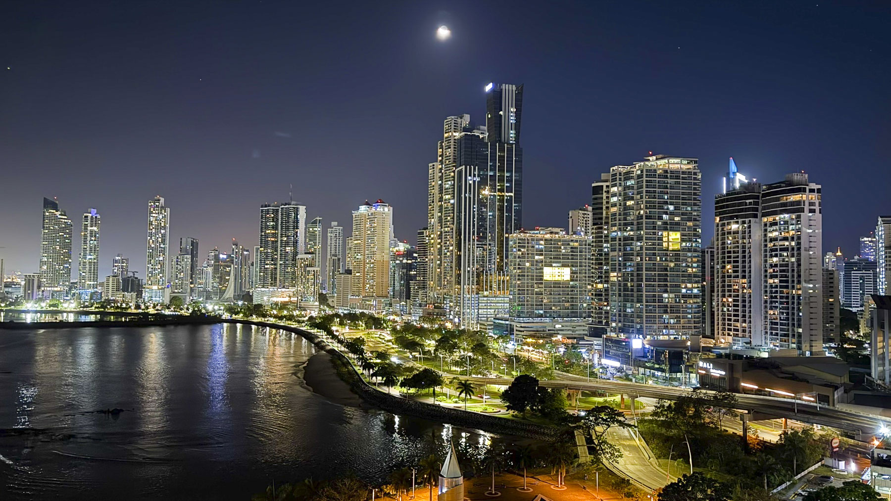
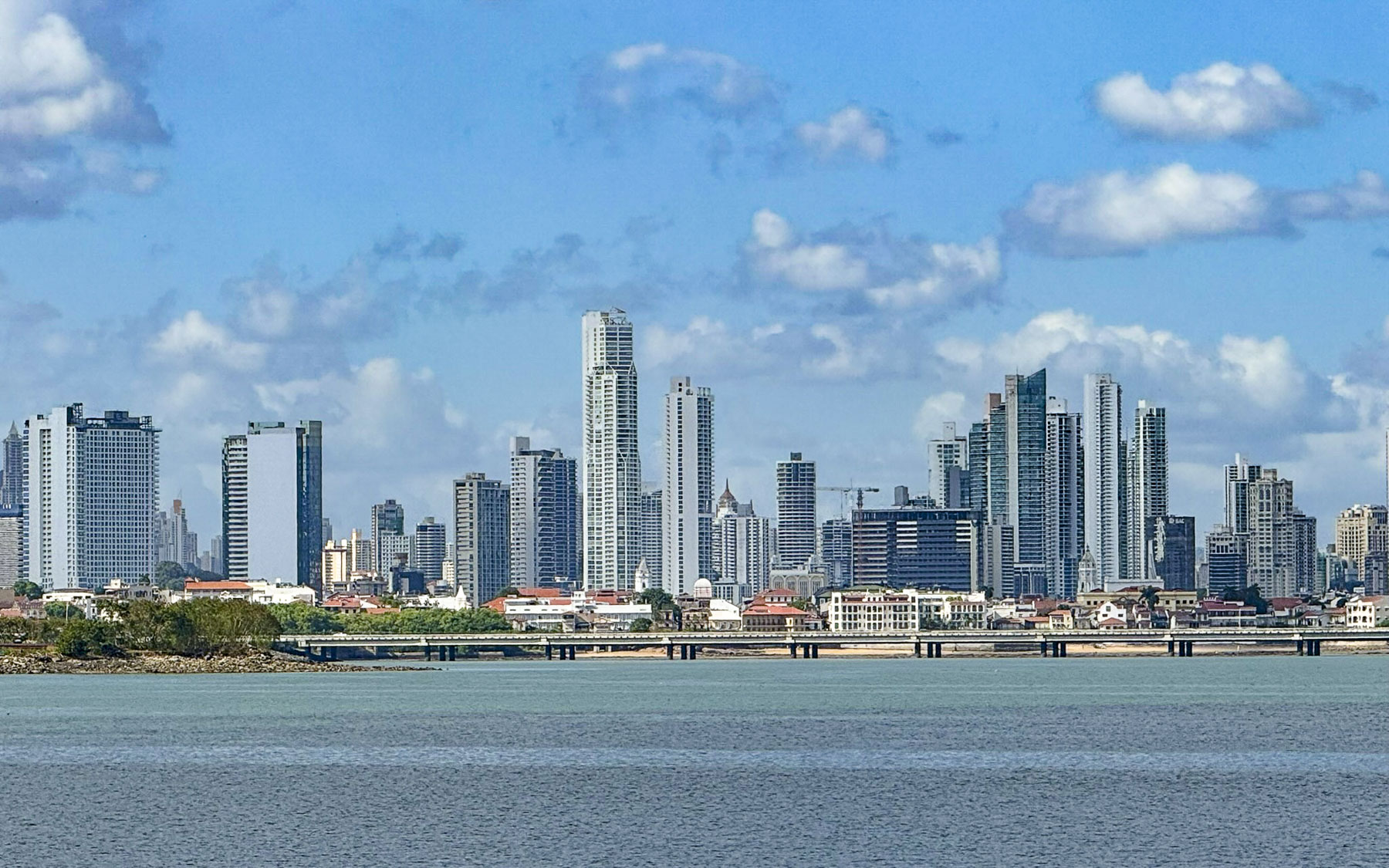
By the time we picked up our rental car at the Tocumen International Airport it was the height of the evening rush hour in Panama City. Fortunately, we were heading into the city, while the traffic lanes carrying the daily exodus of commuters home from the financial capital of Latin America were jammed. It was only a twenty-five minute drive to our hotel on the waterfront, but we missed our exit and had to re-route our way through the now deserted downtown streets to the Hotel Plaza Paitilla Inn, for a one night stay. We chose this 19-floor waterfront hotel after determining it was the best place to get those iconic photographs of the city’s modern skyline along the Pacific Ocean coast. And we were not dissappointed.

Golden light filled the room as we drew back the curtains along a wall of windows to reveal a spectacular cityscape that transitioned through the sunset, twilight, and darkness. It was a million-dollar view and we felt as if we were some place only accessible to billionaires or actors lucky enough to have a movie scene filmed on location here. Surprisingly, the Hotel Plaza Paitilla Inn was an excellent value and very budget friendly.

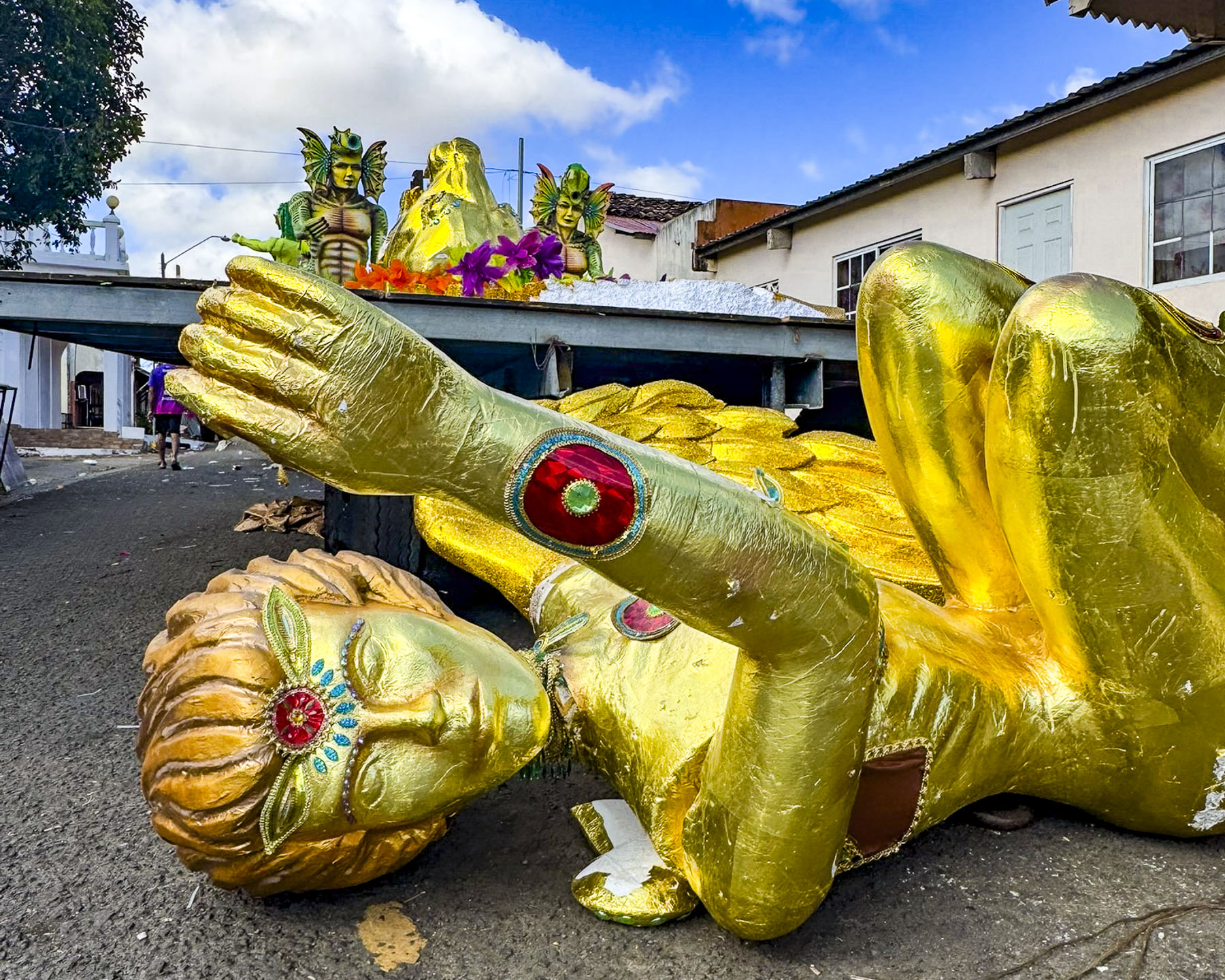
After discussing our travel plan with the concierge the night before, we departed after an early breakfast to avoid the expected traffic delays as folks took the Friday afternoon off in anticipation of the four days of Carnaval before Ash Wednesday. The nationwide el Carnaval de Panama, which literally happens in every town, is the biggest celebration of the year in the country. It starts in each town with the coronation of a queen and ends with the Burial of the Sardine, which symbolizes the past festivals and enjoyment of drink and food, in the predawn hours of Ash Wednesday, and the beginning of Lent. Little did we know that Panama’s Carnaval is regarded as “one of the largest— and rowdiest — events in Latin America.” Nightly events feature themed parades with elaborately decorated floats escorted by trumpet and drum bands, called tunas. To the benefit of all, water trucks called Culecos spray the revelers in the ninety-degree heat to keep them cool. And between the water trucks, mojaderas, wetters, keep everyone partying around them soaked with water pistols, water balloons, and buckets of water. It’s not a particularly camera-friendly event.

Our destination for the next 5 nights was Posada Los Destiladeros on Playa Los Destiladeros, in Los Santos Province, a 5 hour, 335km (208mi) drive. Leaving the city, we crossed the Bridge of the Americas which soars 64m (210ft) above the Panama Canal, and stopped on the far side at the Mirador de las Américas for our first look at the canal. Two monuments commemorate the arrival of 750 immigrants from China 170 years ago to work on projects relating to the construction of the canal, which created an enduring friendship between Panama and China. The view of the canal wasn’t as impressive as its fact sheet: over 12,000 ships carrying $270 billion worth of cargo pass through the locks of the canal annually. Over 70% of the ships are headed to or are returning from ports in the United States.

Continuing on Rt1 we passed the first of many pillars being constructed to support Panama City’s new Metro 3 line, a double-track monorail project sponsored by the Chinese, that will connect the growing towns of Ciudad Del Futuro and La Chorrea to the city’s Metro 1 and Metro 2 lines, Central America’s first and only subway system that became operational in 2014. Rt1 is alternately called the Pan-American Highway, that famously stretches from Prudhoe Bay, Alaska in the United States, 19,000 miles way to Ushuaia, Tierra del Fuego in Argentina. Though a 100-mile section is missing in the difficult terrain of treacherous Darien Gap region between Yaviza, Panama and Chigorodó, Colombia.

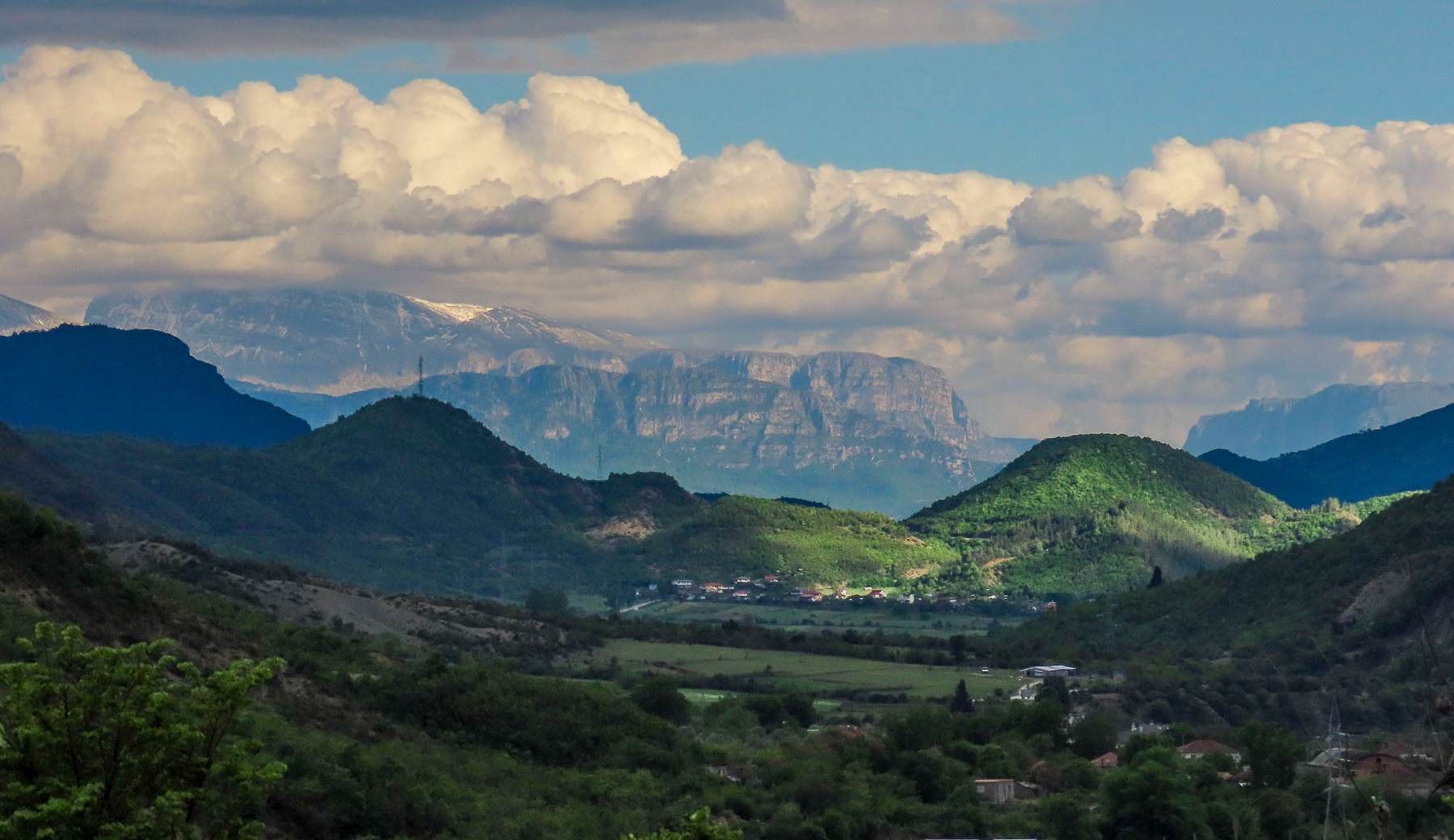
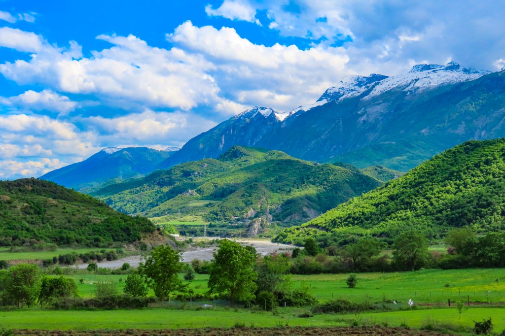
Shopping centers and strip malls with McDonald’s golden arches, Starbucks, and Burger Kings lined both sides of the highway before giving way to open crop- and pastureland. The occasional hilltop offered views of the Gulf of Panama and the Pacific Ocean to the south. While to the north the rural highlands of the Cordillera Central, the jagged mountainous spine of the country, graced the horizon. Veering off the Pan-American Highway we headed west on Rt2 to Las Tablas. The town has been ground zero for Carnaval in Panama since the mid-1800s when two fiercely rival groups representing Calle Arriba and Calle Abajo started to compete in a festive, one upmanship every year before the 40 days of Lent began. The event in Las Tablas is very popular with folks from Panama City seeking to experience a more traditional Carnaval with folkloric music and regional dress, in what many consider Panama’s “heartland.”

Traffic had been slowly building all morning, and by early afternoon the streets of our intended route were blocked with floats being prepared for the weekend’s first parade that night. Folks were already creatively parking along the side of the roads and walking to the town’s central plaza, Belisario Porras. The congestion in the town unfortunately nixed our plans for lunch there, and we continued on for several miles along Rt2 through a scenic landscape of lightly treed hillocks. Cattle grazed in the shade under the trees.

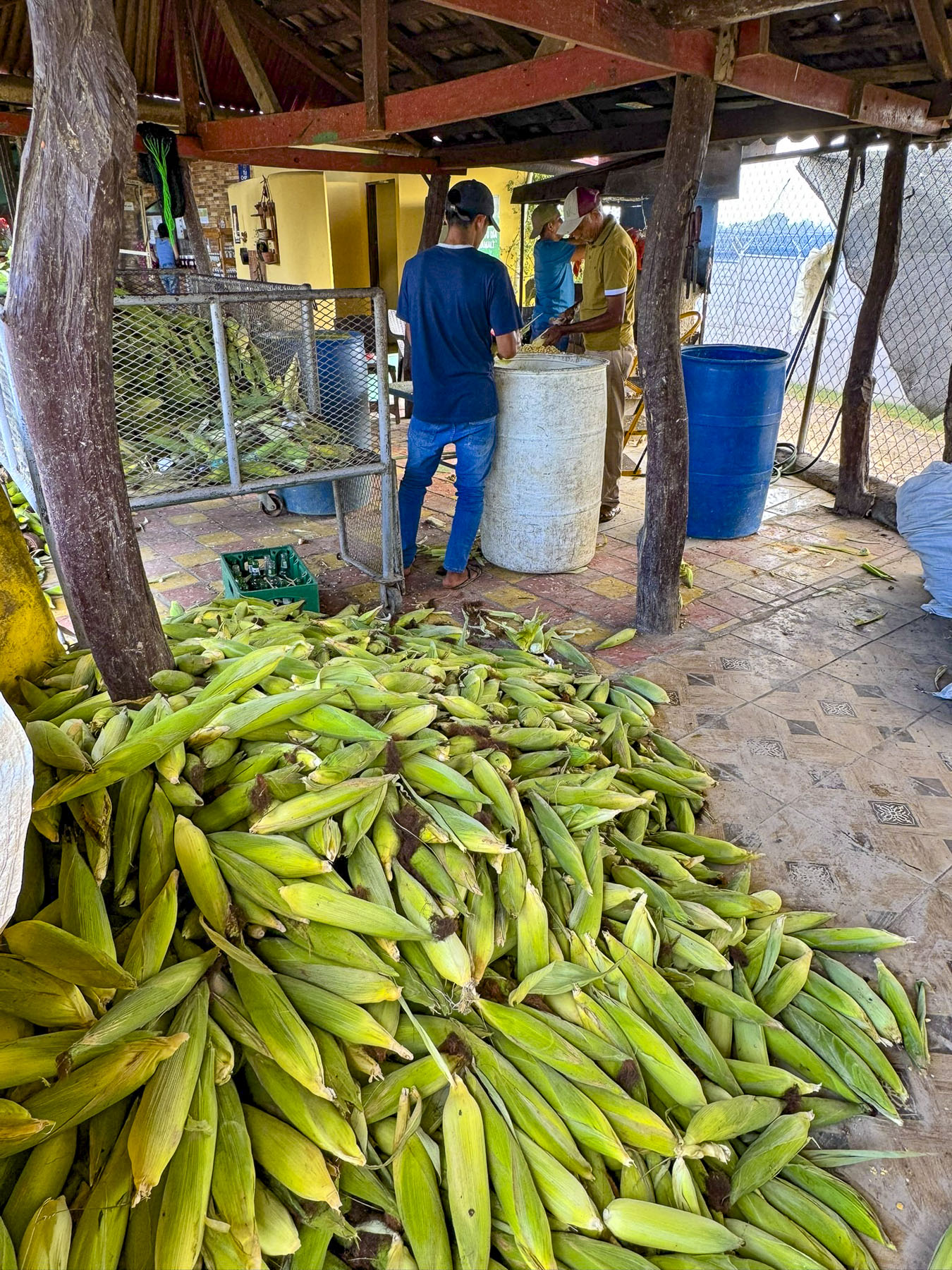
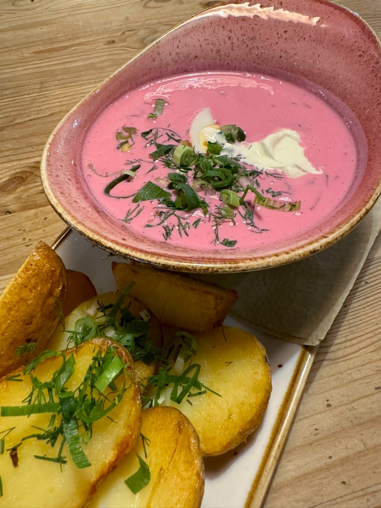
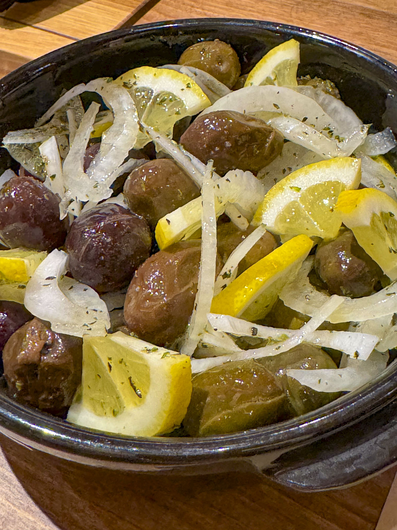
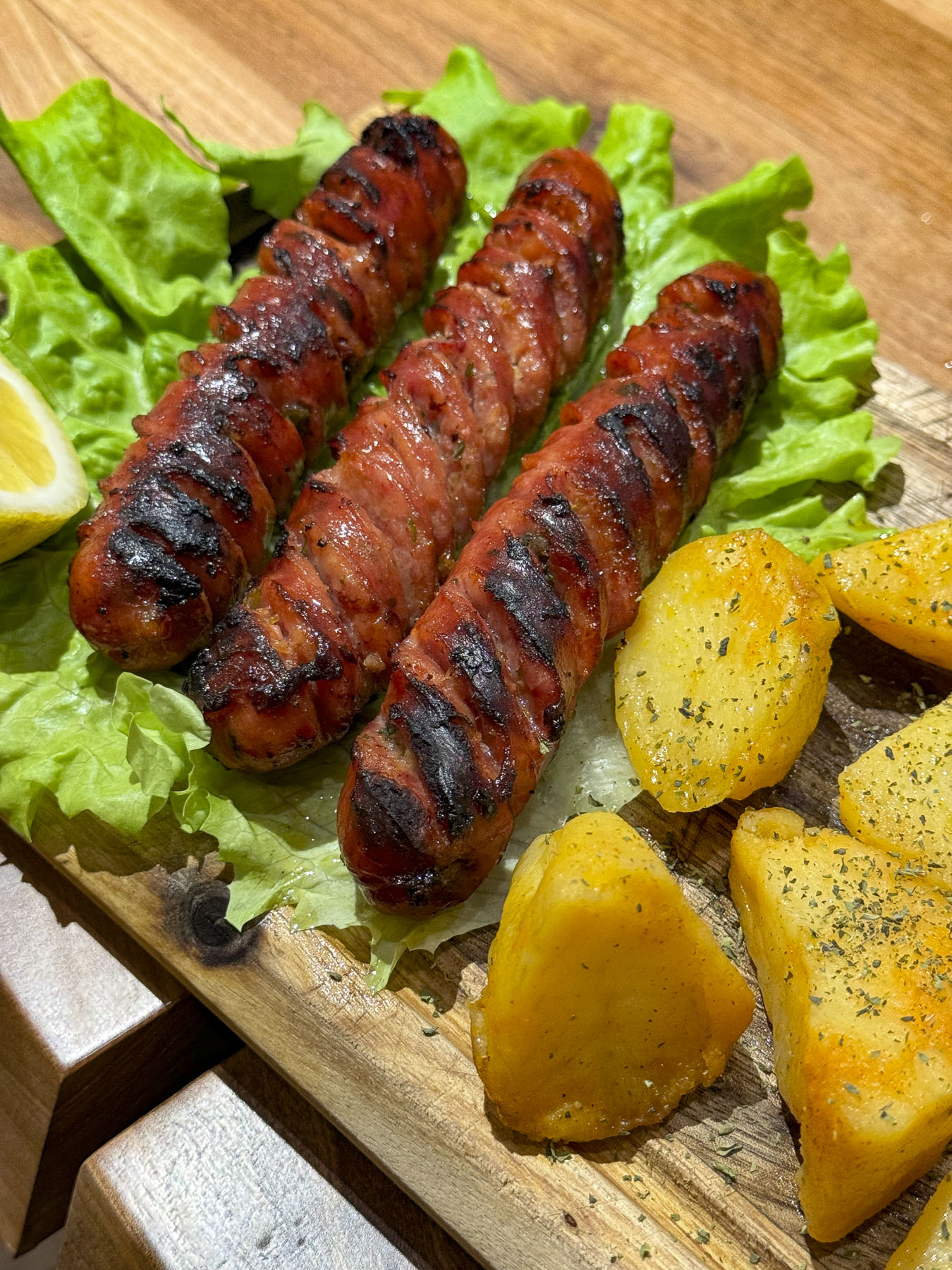
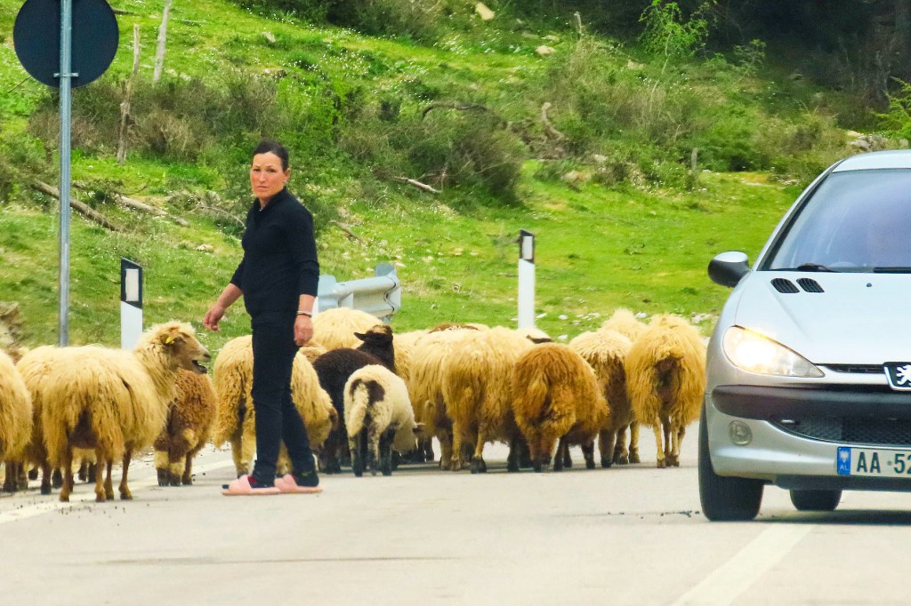
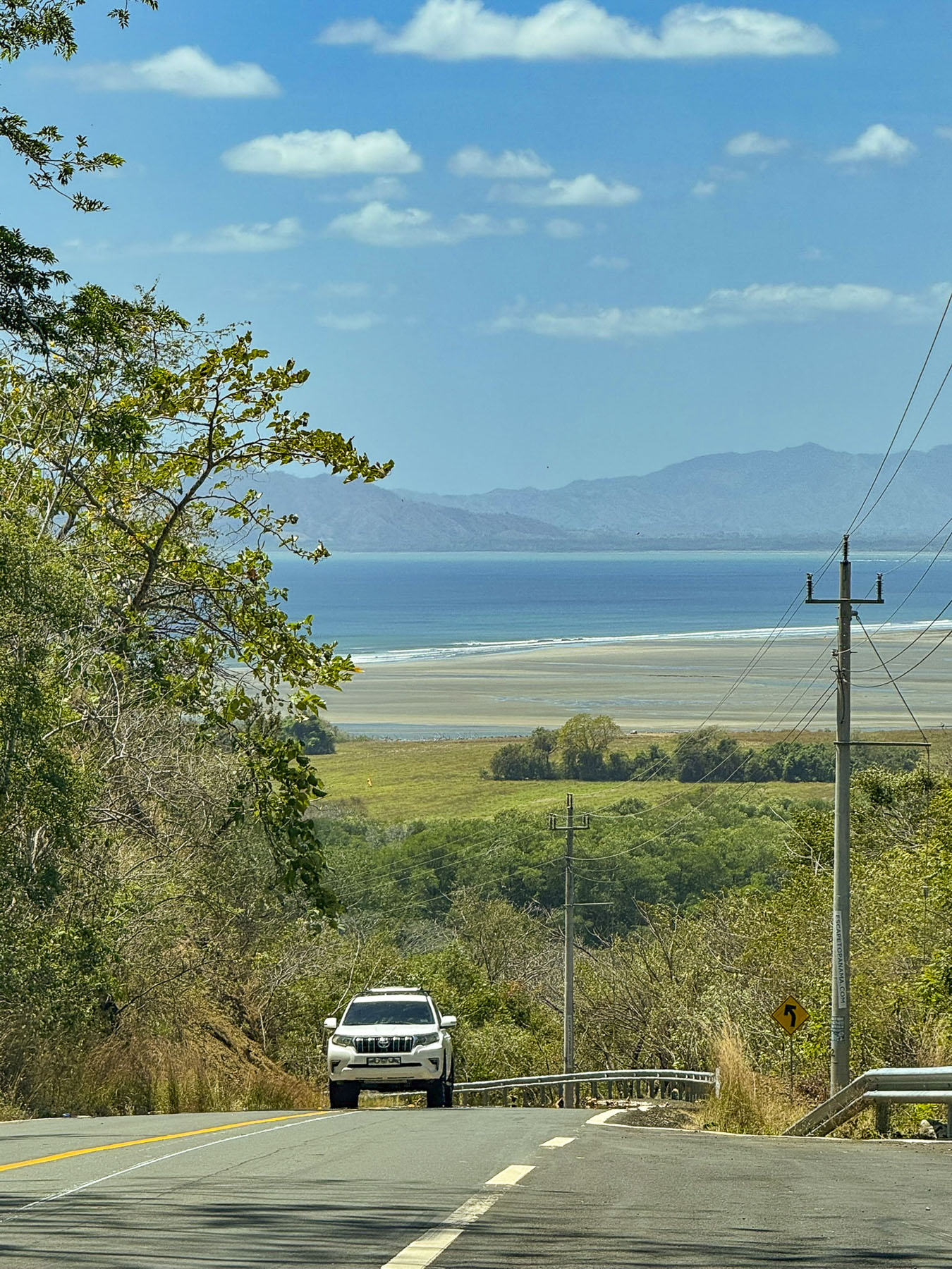
Cars were parked on both sides of the road in front of El Cruce #2. It was a small fonda – a Panamanian roadside food stand, with smoke billowing up from its barbeque pit. It piqued our interests, and we stopped.  The outside grill area was open sided, under a corrugated tin roof. In its shade a man prepped and attended the meats that were smoking above a fire while another was using a machete to shave kernels from ears of corn. The unhusked pile next to him seemed monumental, akin to the Greek myth of Sisyphus and his never-ending task. It was the beginning step in the preparation of masa, a corn flour. It’s a must-have ingredient for traditional, homemade corn tortillas and tamales. The menu hung above a small window to the kitchen filled with women attending various stoves. Everyone was very nice and curious about where we were from, but seemed surprised that we had stopped. A large John Deere combine harvester with a police escort passed as we ate. A small caravan of pickup trucks with farm workers standing in the back followed it slowly down the road. The fonda was a very authentic, nothing touristy about it experience, and the food was good.  The line of traffic behind the harvester slowly disappeared as cars passed it when the opportunity arose.  It wasn’t until the last seconds as we raced past the tractor that we realized we also had to pass the police car! We returned the officer’s wave. It seemed like it was an everyday occurrence in the rural countryside. In Pedasi, the closest town to our hotel, preparations for the Carnaval were also visible down the side streets.

We missed the entrance to the hotel and continued down the road in hope of finding an easy spot to turn around, only to find that the road suddenly ended, with a log across it, at the top of Playa Destiladeros, a short distance away from the thundering waves of the Pacific Ocean, as if an early extension had been washed away in a storm. We were at one of the farthest points south on the remote Azuero Peninsula.

When we made plans for this return layover from our trip earlier in the month to Uruguay and Argentina, we didn’t realize our week coincided with Carnaval, consequently many of the hotels we were interested in were fully booked. After scouring the map for areas we wanted to stay we found Posada Los Destiladeros. While it showed as fully booked on Booking.com and Hotels.com, we were able to book a room directly through the hotel’s reservation page.

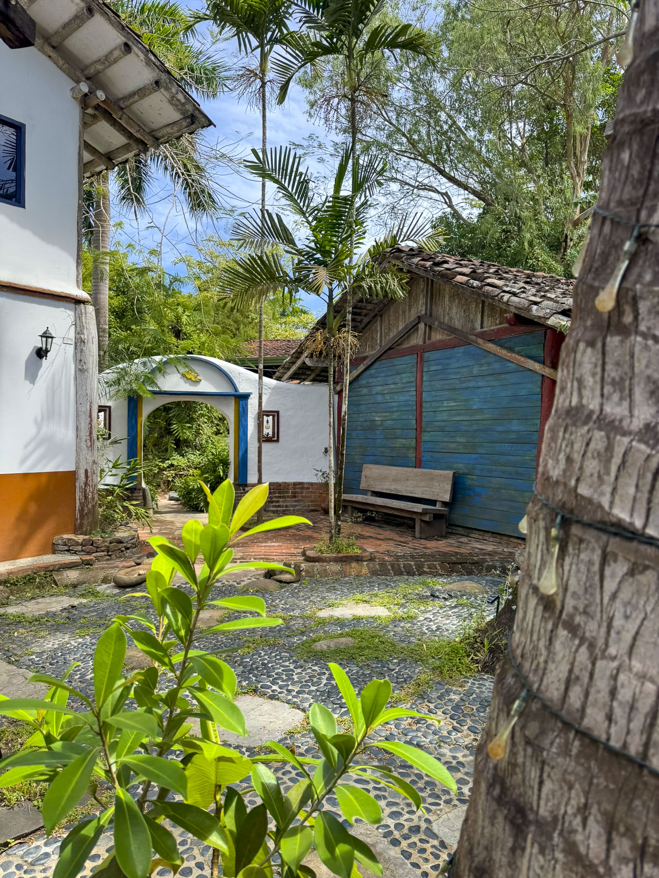
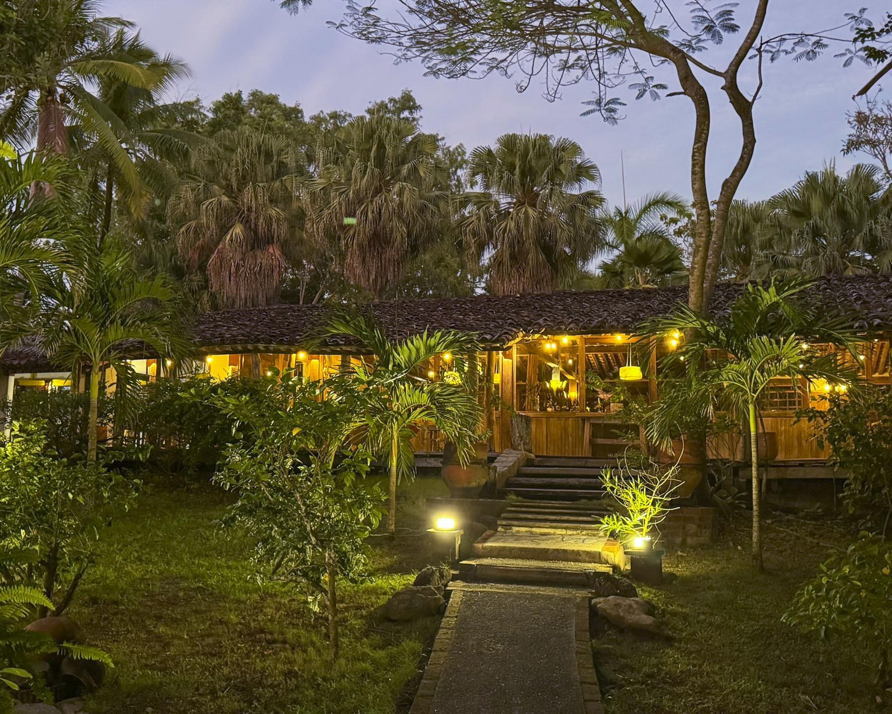
From the gated entrance we followed a long twin-tracked road, through a large palm tree covered property with many outbuildings, to the parking area. Through a grove of palm trees, the inviting blue water of the Pacific glistened behind the receptionist.

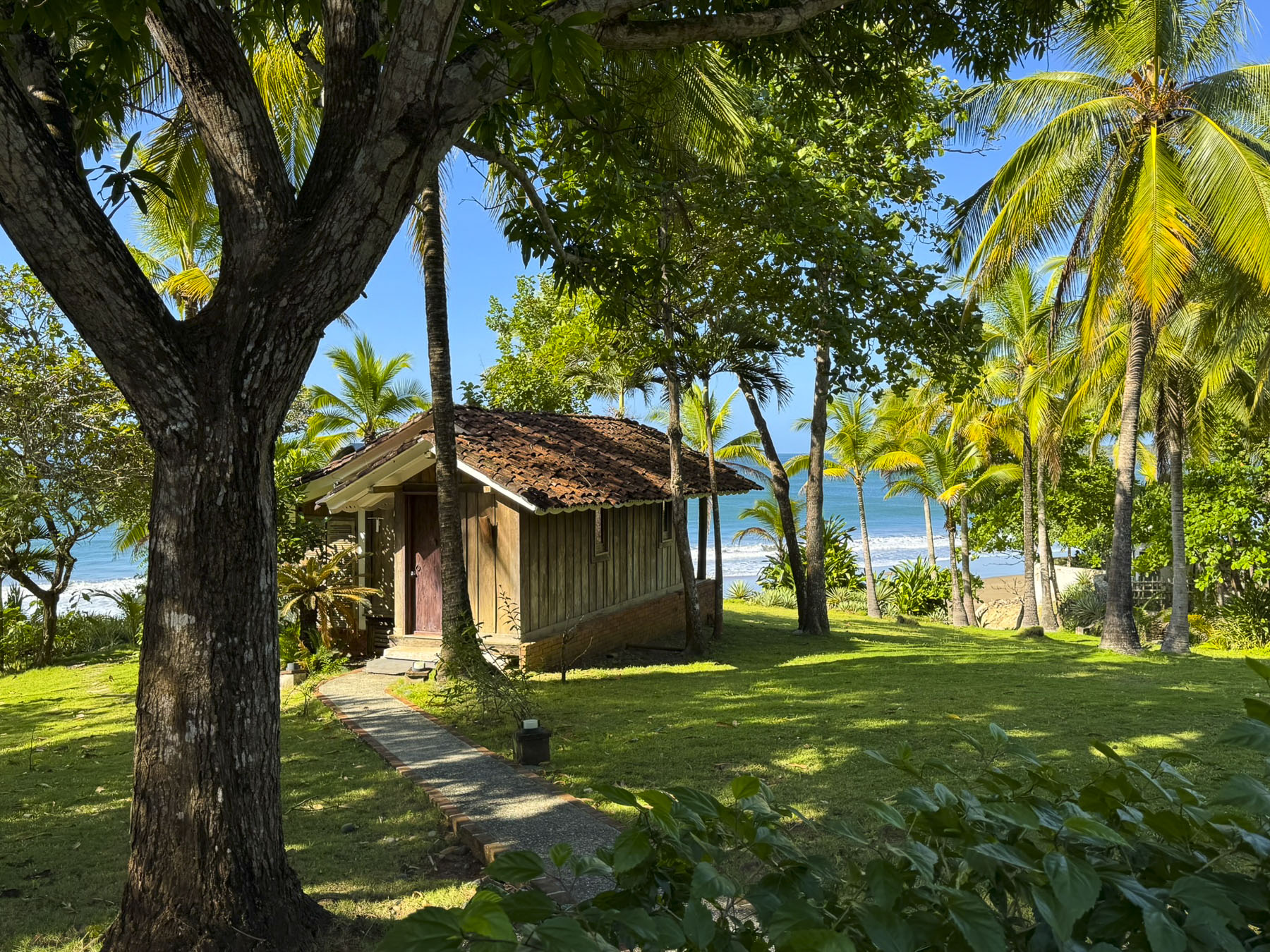
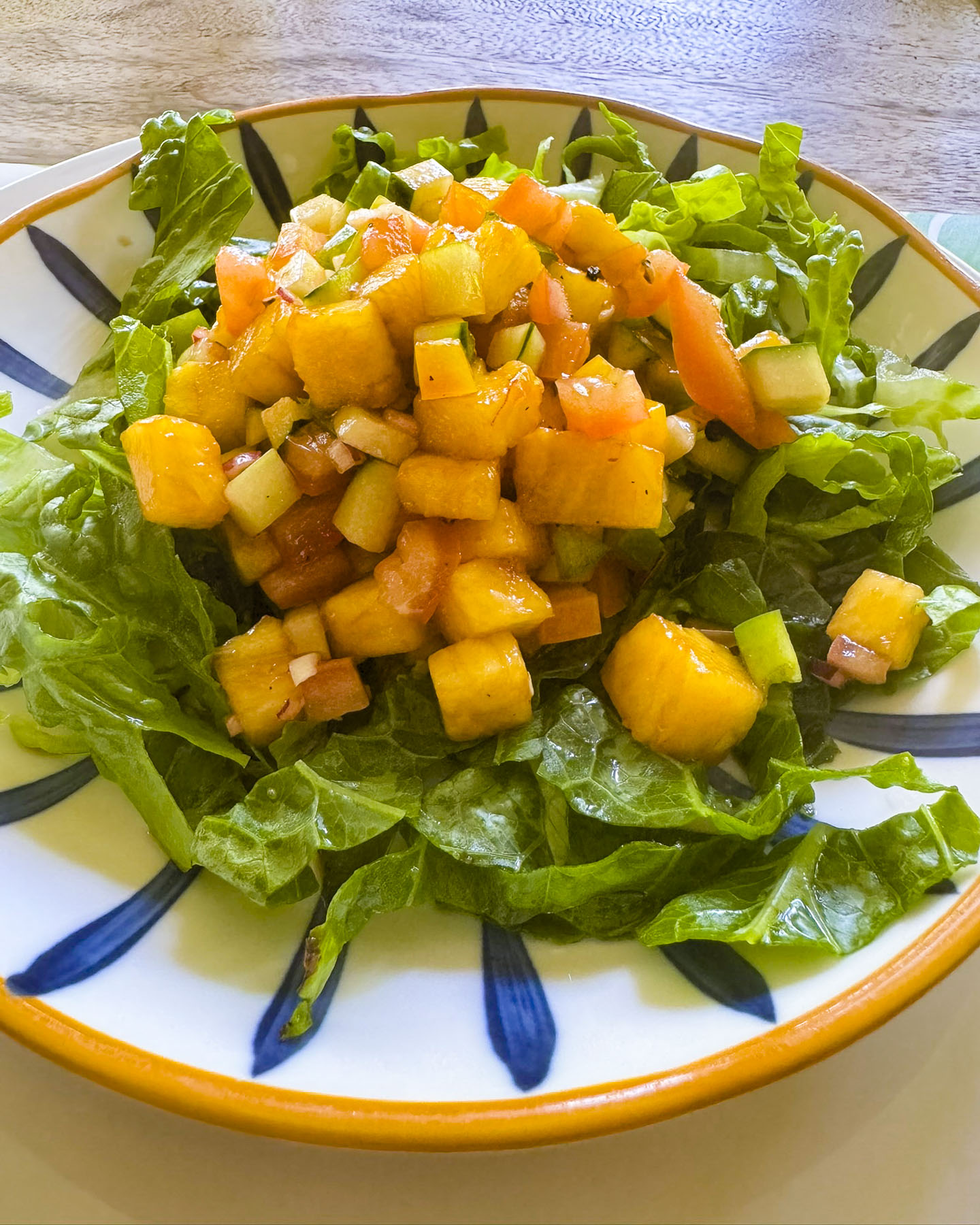
The vibe was really nice. It’s an unpretentious, tenderly time-worn resort in a verdant oasis of greenery on the low cliffs overlooking a wild beach and undeveloped coastline. The staff were very nice and friendly, and after a few days felt like family. The dinners that emerged from their kitchen were extraordinary!

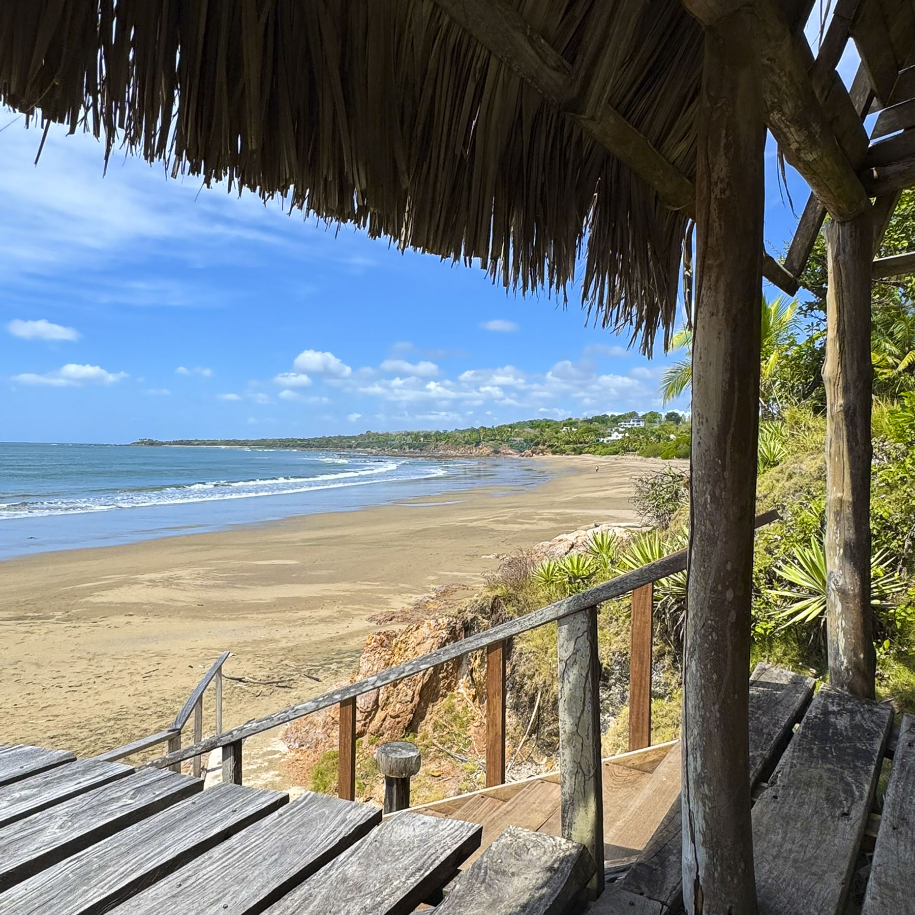
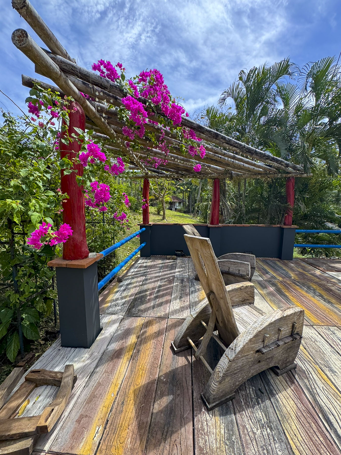
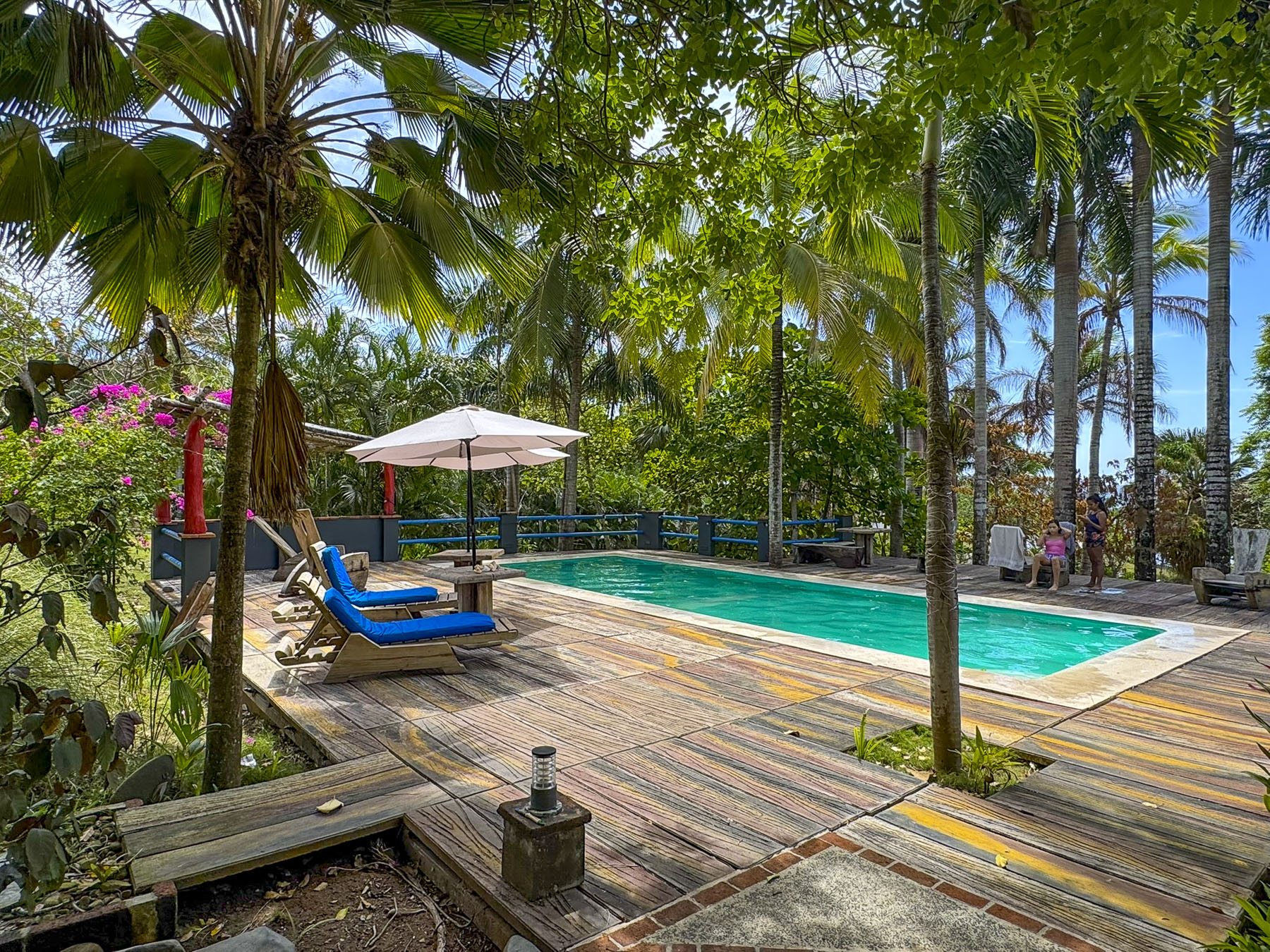
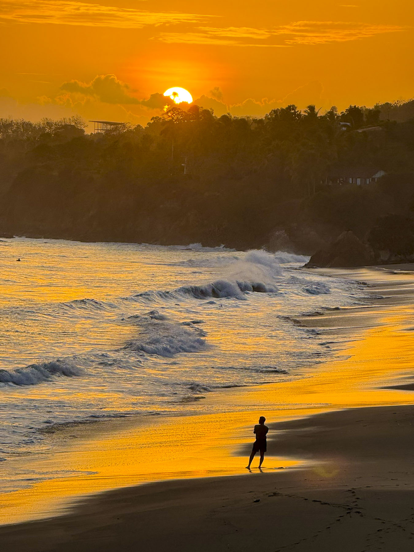
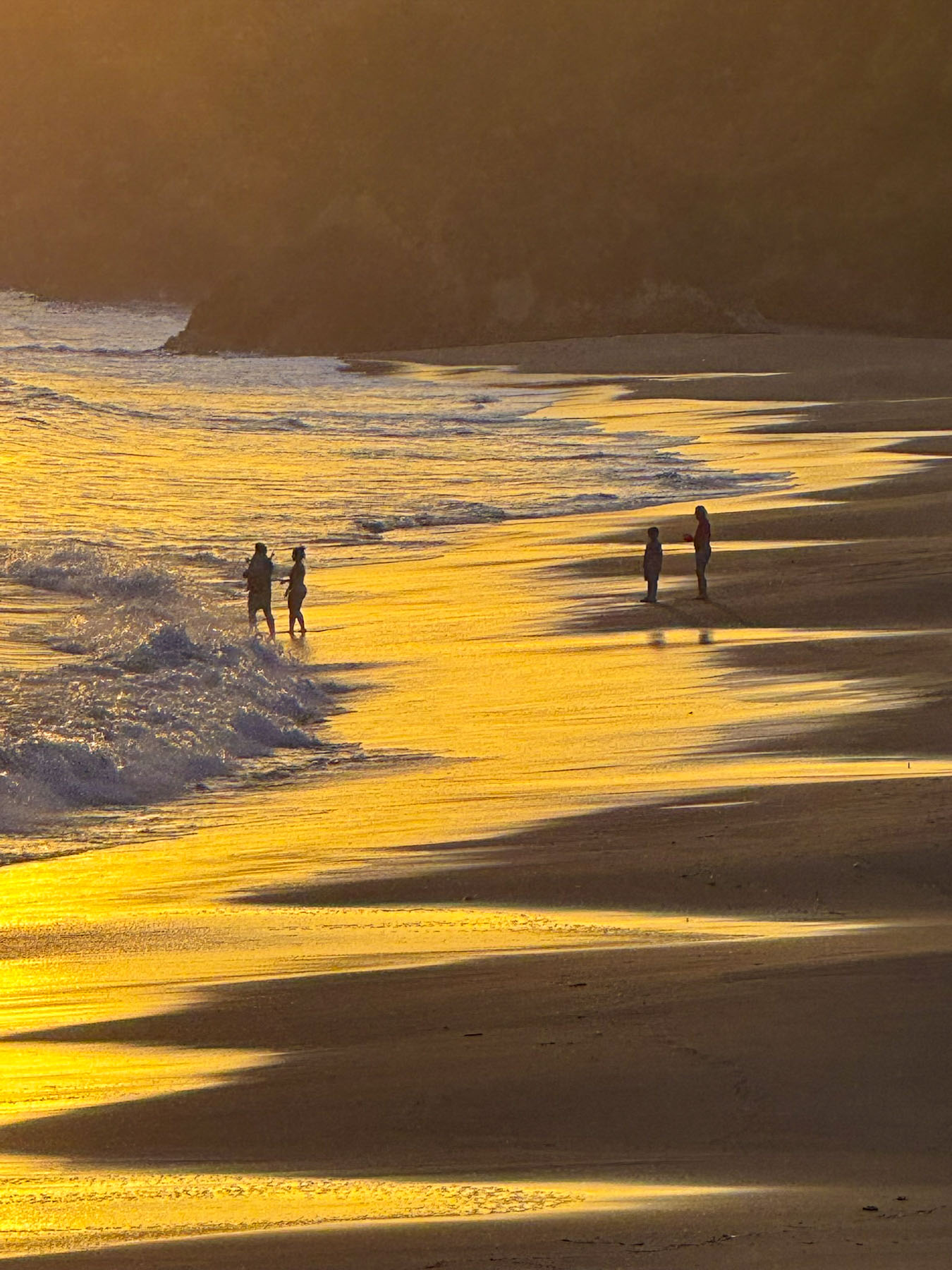
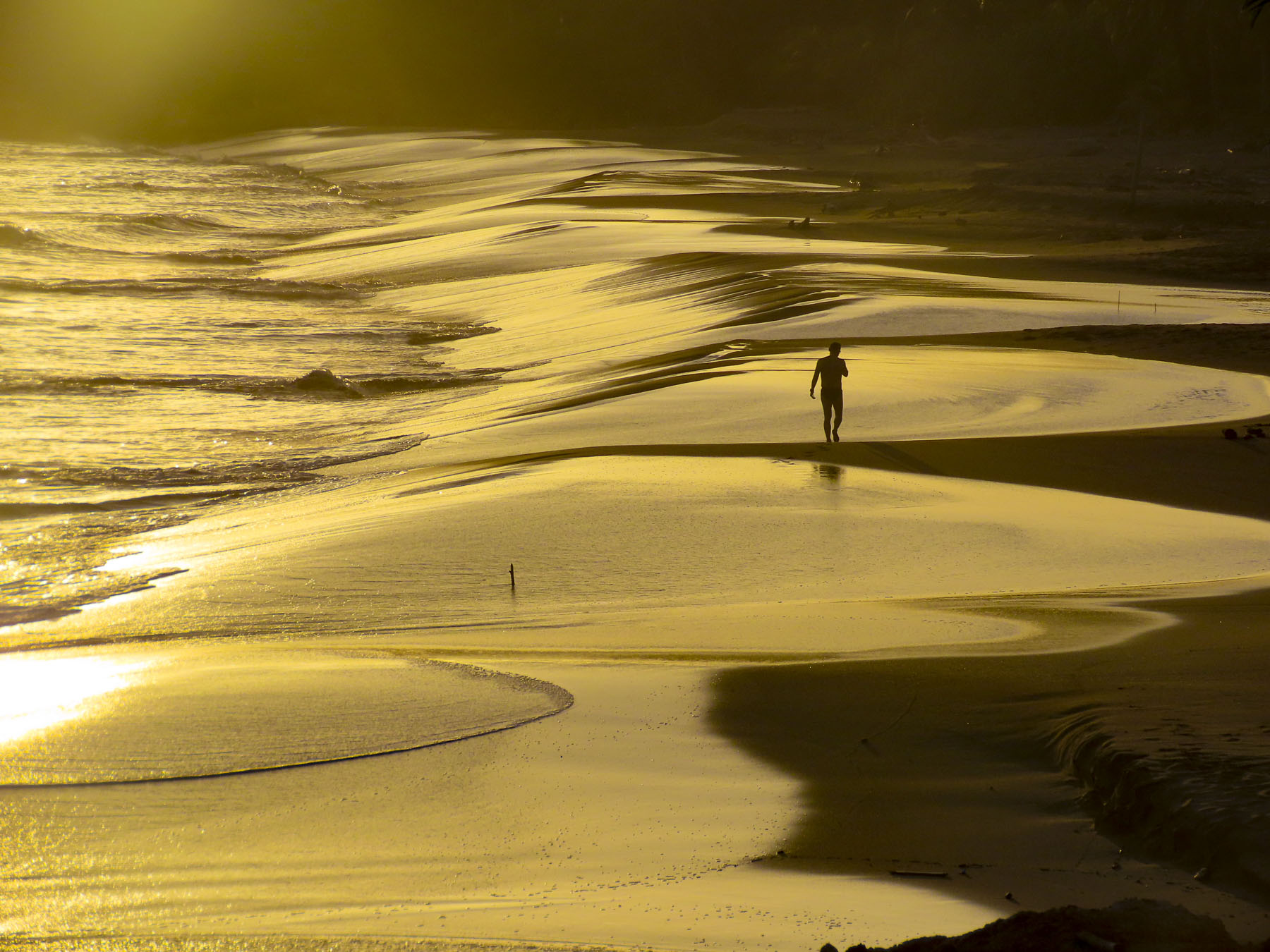
It’s very unusual that we stay in one spot for 5 nights to unwind. But the Posada Los Destiladeros was the perfect place for us to relax, with easy walks on the beach, lounging around the pool and under palm thatched gazebos overlooking the surf as we waited for sunset every day, which offered a dramatic play of light across sand and surf.

A conversation in the pool one afternoon with another guest, a Panamanian American man visiting family over the week of Carnaval, related that he and his wife had been coming here for years, but “somehow it remains a hidden gem.” Of course, we took several half day trips to explore what else the Azuero Peninsula had hidden away.

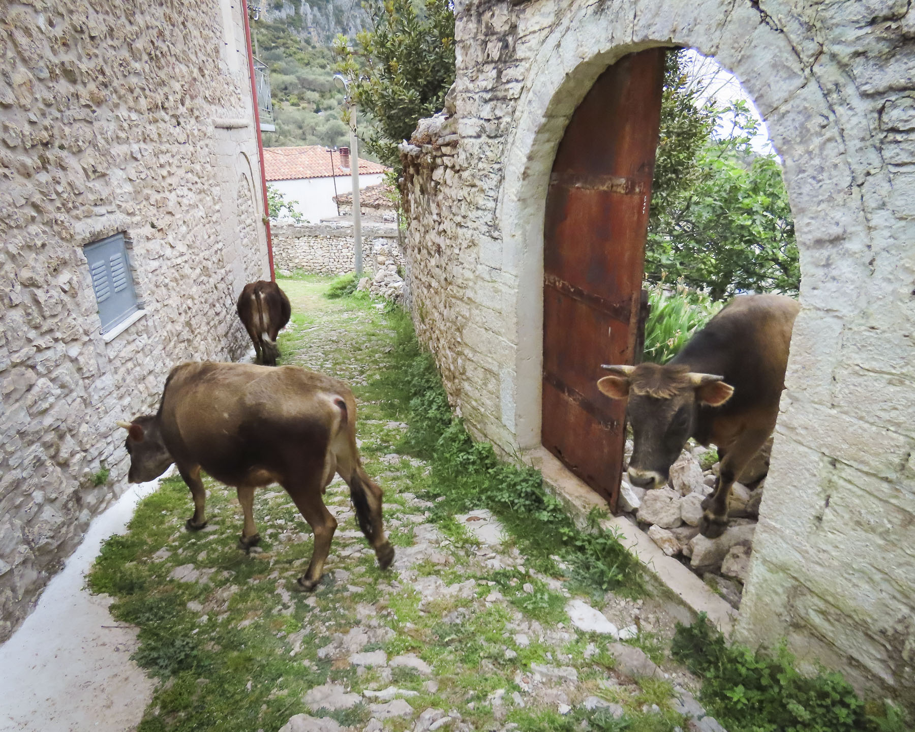
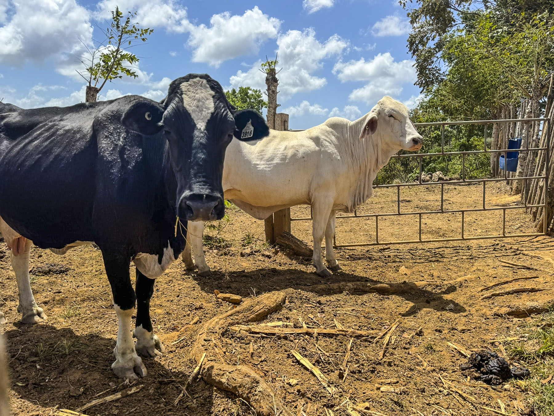
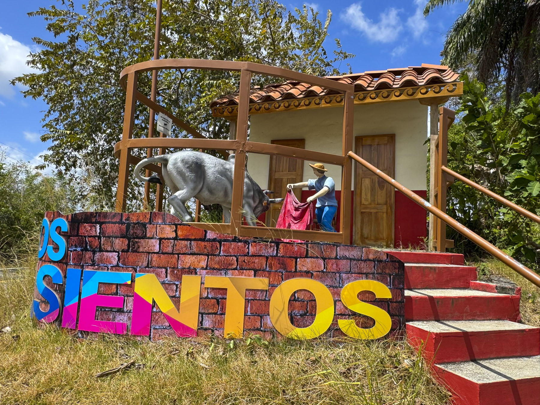
Several days later we drove toward the beach town of Las Escobas del Venado. Well suited to the heat and humidity of the region, herds of Brahma cows have rested in the shade of the region since Spanish colonists first brought them to the area in the mid-1500s. At a turnoff for the small ranching town of Los Asientos, a roadside monument highlights the town’s traditional la corridas, bullfights. These are non-lethal events since a 2012 law prohibited the injury or death of the bull; however, la corridas are still popular in rural Panama. Along the road milk cans were placed next to the rancher’s gate, waiting for the local dairy cooperative to pick them.

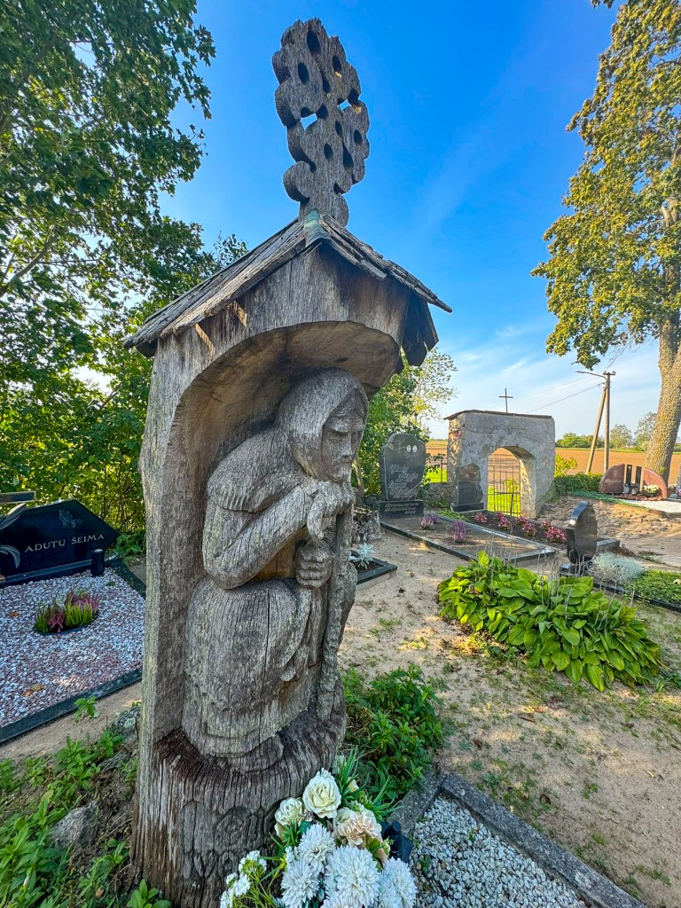
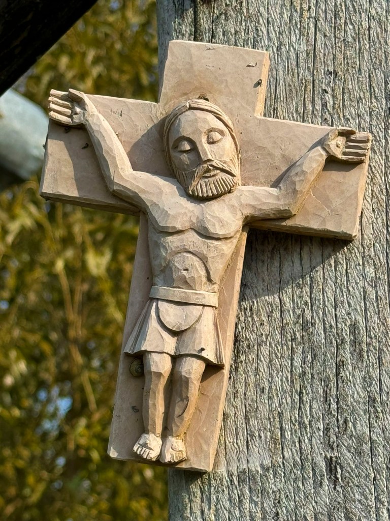
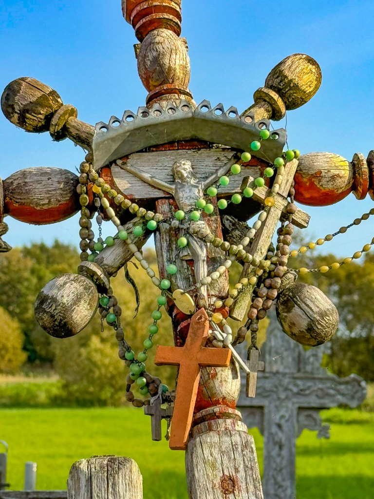
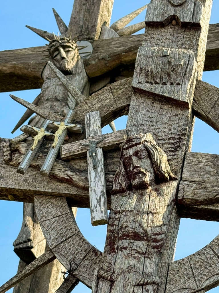
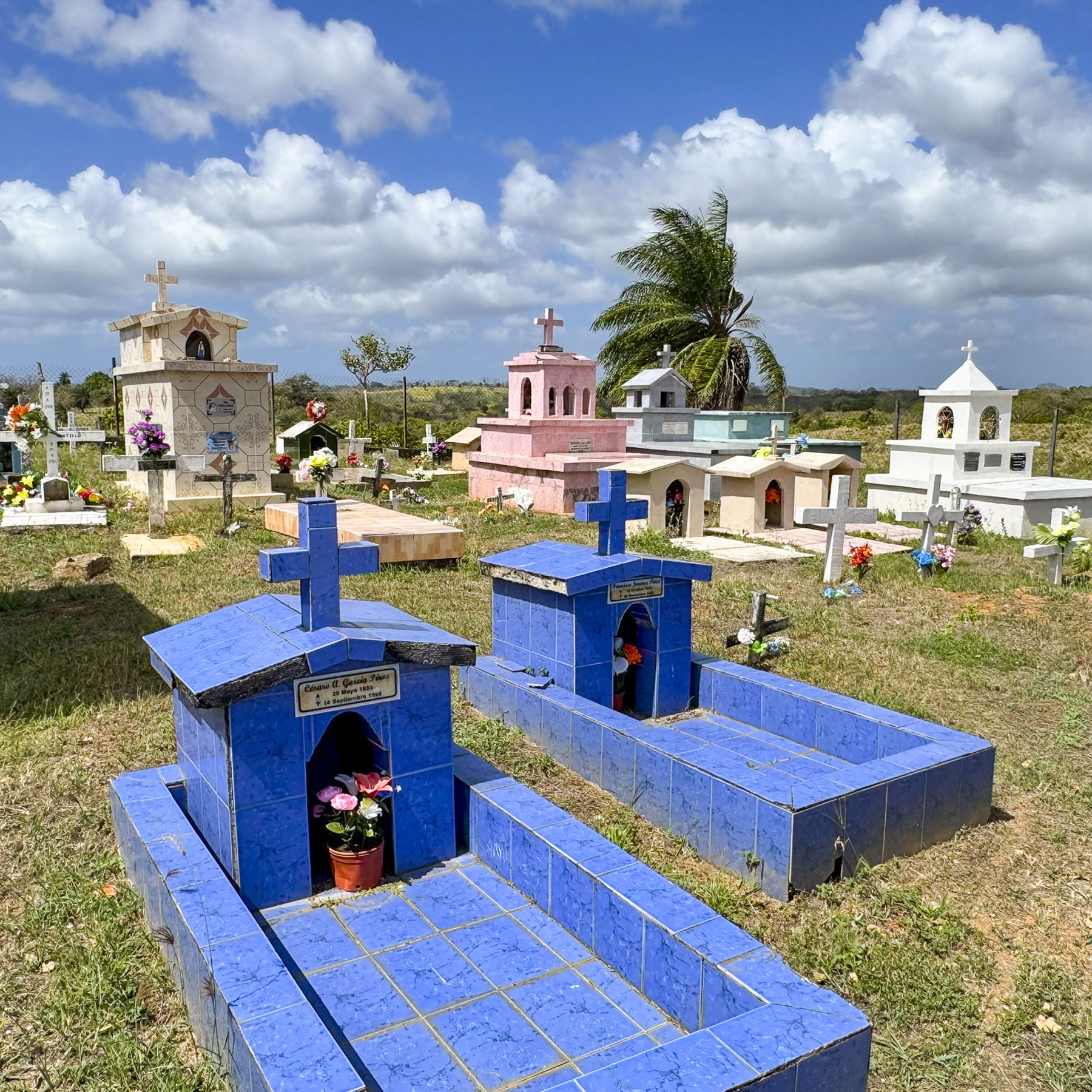
A little way farther along, the colors of the tombs in a small cemetery seemed to vibrate against the verdant landscape, which receives between 45 and 90 inches of rain every year. A large group of cyclists, followed slowly by a support vehicle, made passing difficult along the narrow hilly road, with many blind curves. Though the congestión they created was well tolerated, without the honking of horns. Drivers respected their safety and gave them a wide berth when they were eventually able to pass. Small artesanal lumber mills along the way vertically stacked their milled lumber, like skis, against a wall to dry.

During the dryer summer months the Rio Oria lazily flows through the ranchlands to the ocean.

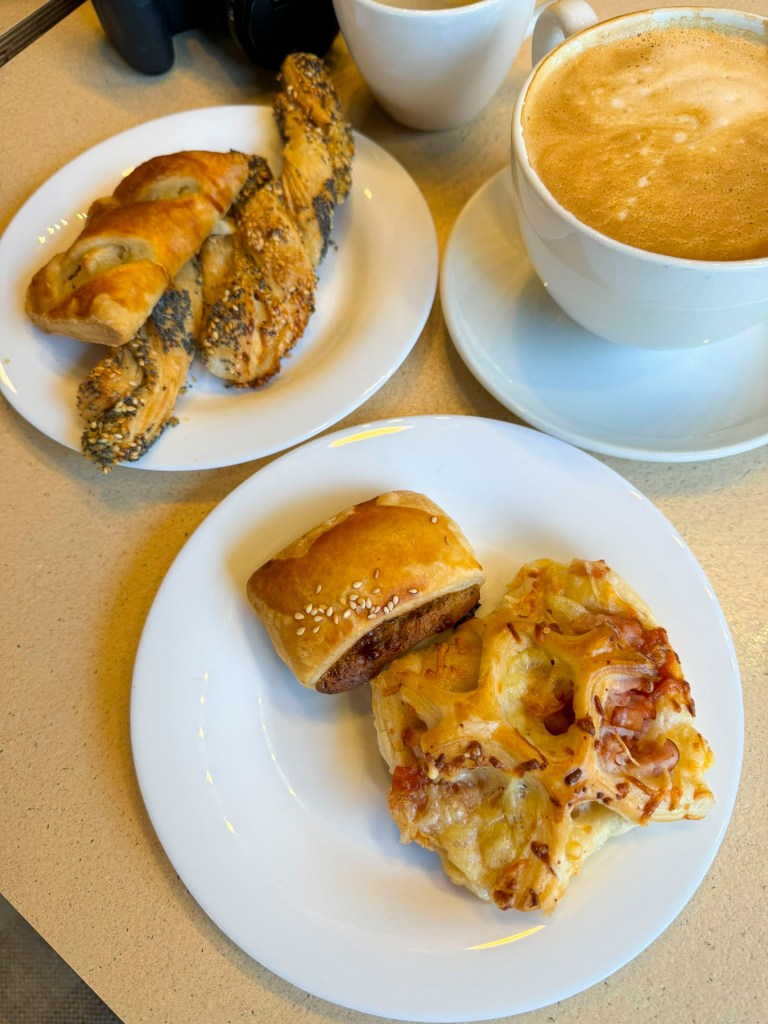
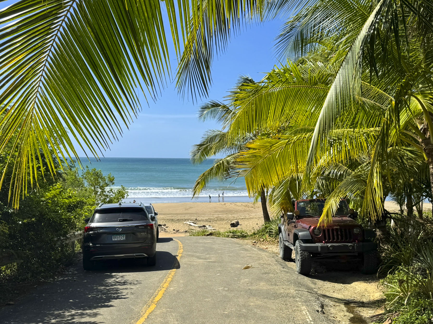
Las Escobas del Venado was the closest example of a traditional beach town, with several small hotels build along the shore of the half-moon shaped Playa Venao. It is not by any means a large resort town. The beach is very wide and shallow, especially when the tide is out, and it’s a popular spot to horseback ride or drive an ATV along the sand. Across the water a sailboat was safely anchored out of the wind and rolling waves behind the bluff at the southern end of the bay. The day was very hot, so we didn’t spend much time on the beach, and hugged the shade as we walked to the Almendro Café for our traditional “walk a little then café.”

It was a really nice spot, under large shade trees. Our coffees and pastries were excellent, and its menu looked very good with vegetarian, vegan, and gluten-free choices. It was to our surprise part of the Selina River Hostel which promotes itself as a destination for digital nomads to enjoy the sun, surf, and sand of Playa Venao. We definitely skewed their demographics for the morning.

We continued driving into the highlands along Via Hacia El Carate, a narrow serpentine road that rose through a mesmerizing landscape of hills and valleys. Unfortunately, there were not any places to stop along the way until we reached the Mirador La Vigía, which offered great views of forested ranchlands, backed by the Pacific Ocean on the horizon.

Familiar with the road now, we occasionally stopped along gated pastures to photograph the expansive landscape, that showed little sign of human intrusion, as we followed the same road back downhill.

They were few opportunities for lunch along the way so we decided to head back to the Almendro Café at the Selina River Hostel . We were not disappointed; the food was excellent and healthy. It’s so nice to order from a menu that doesn’t automatically serve French fries with every order.

Nearing our hotel, a rancher blocked the road with his herd of cows as he moved them to a different pasture.

We were back in time to watch the sunset over Playa Destiladeros. We stayed until the last color in the sky had faded away before walking back to the resort’s restaurant, where we usually dined inside to take advantage of the air conditioning and ceiling fans.

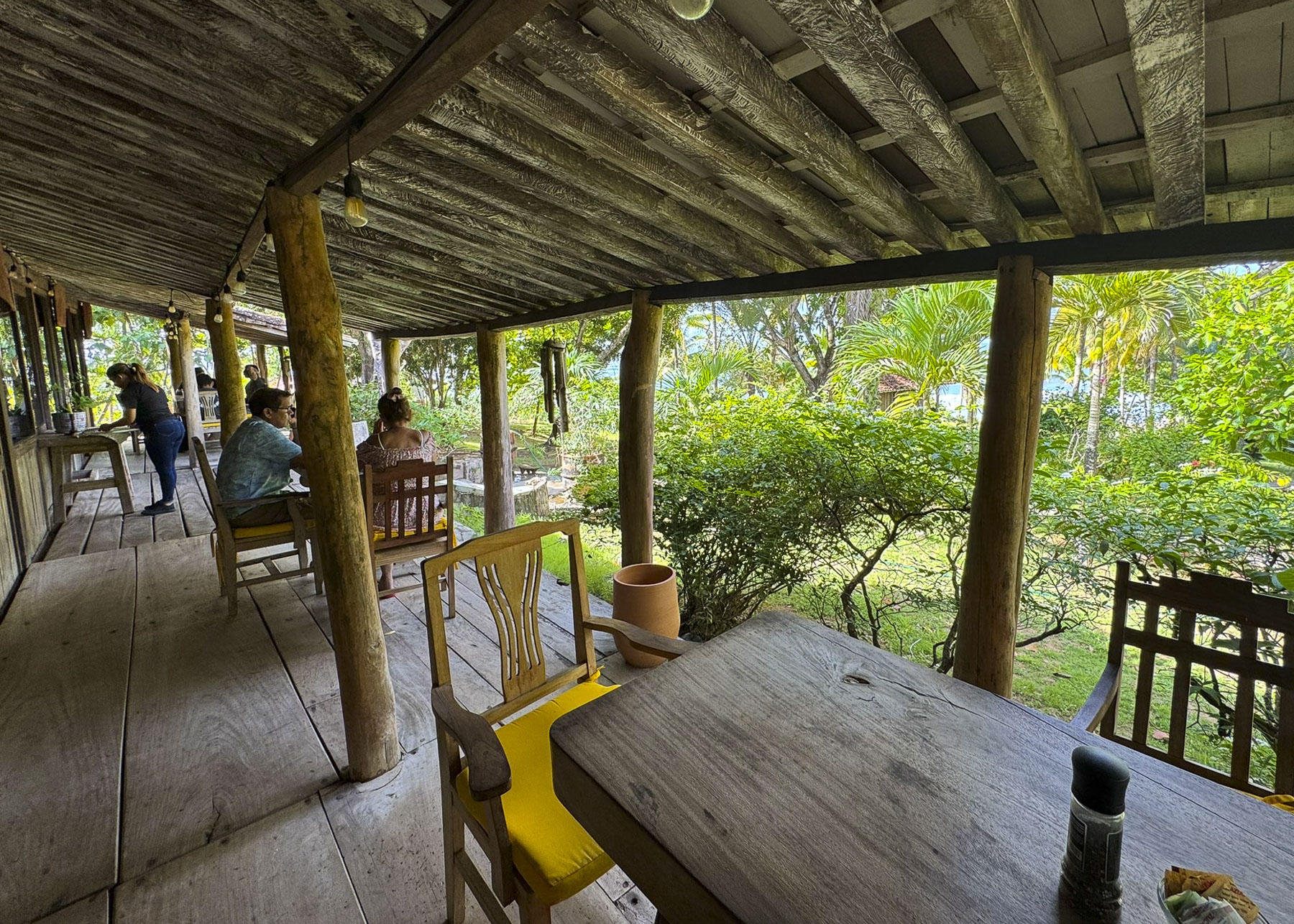
Though having breakfast on the veranda, with the sound of the waves crashing in the distance, was a delight during the cool morning hours.

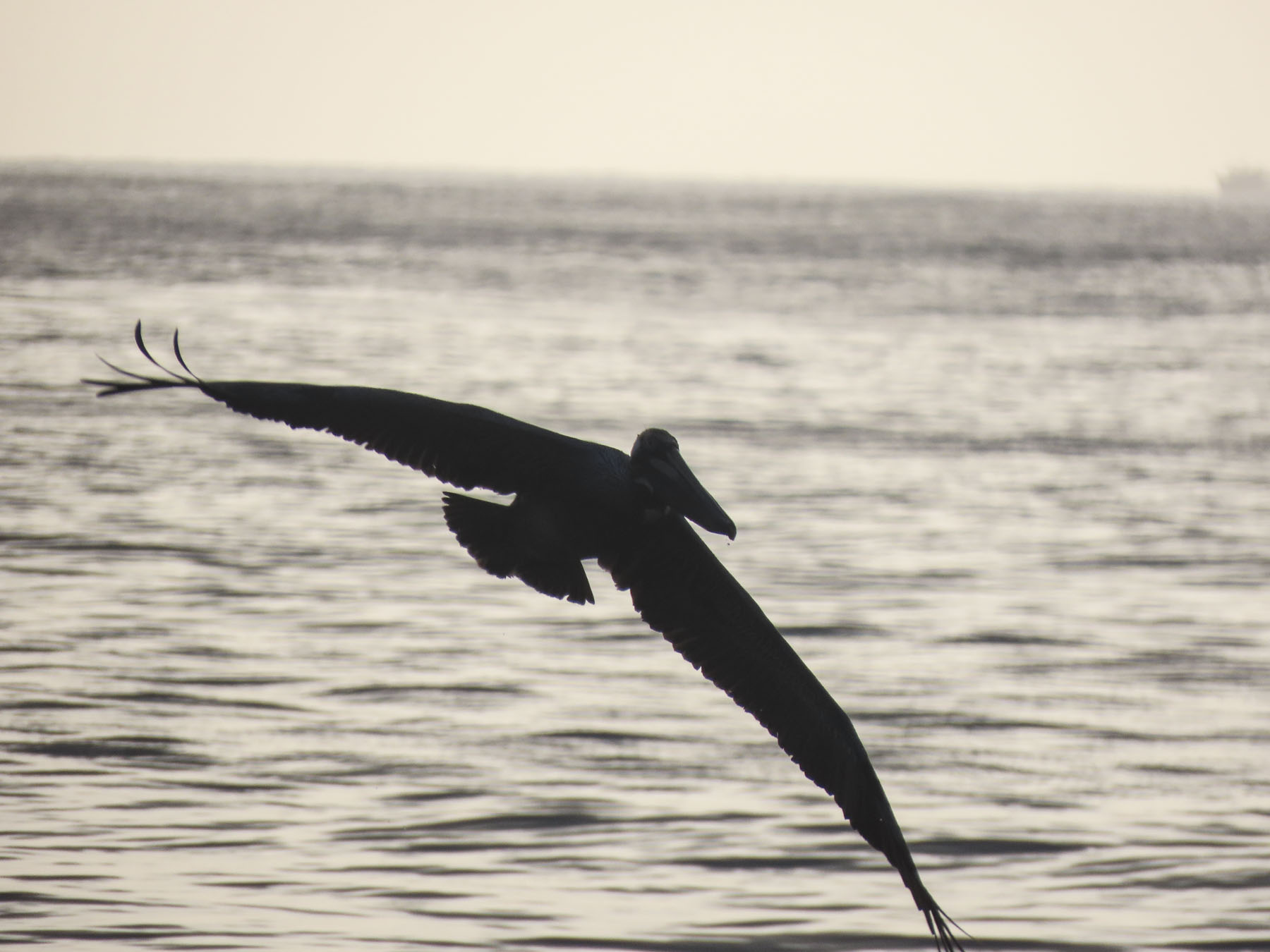
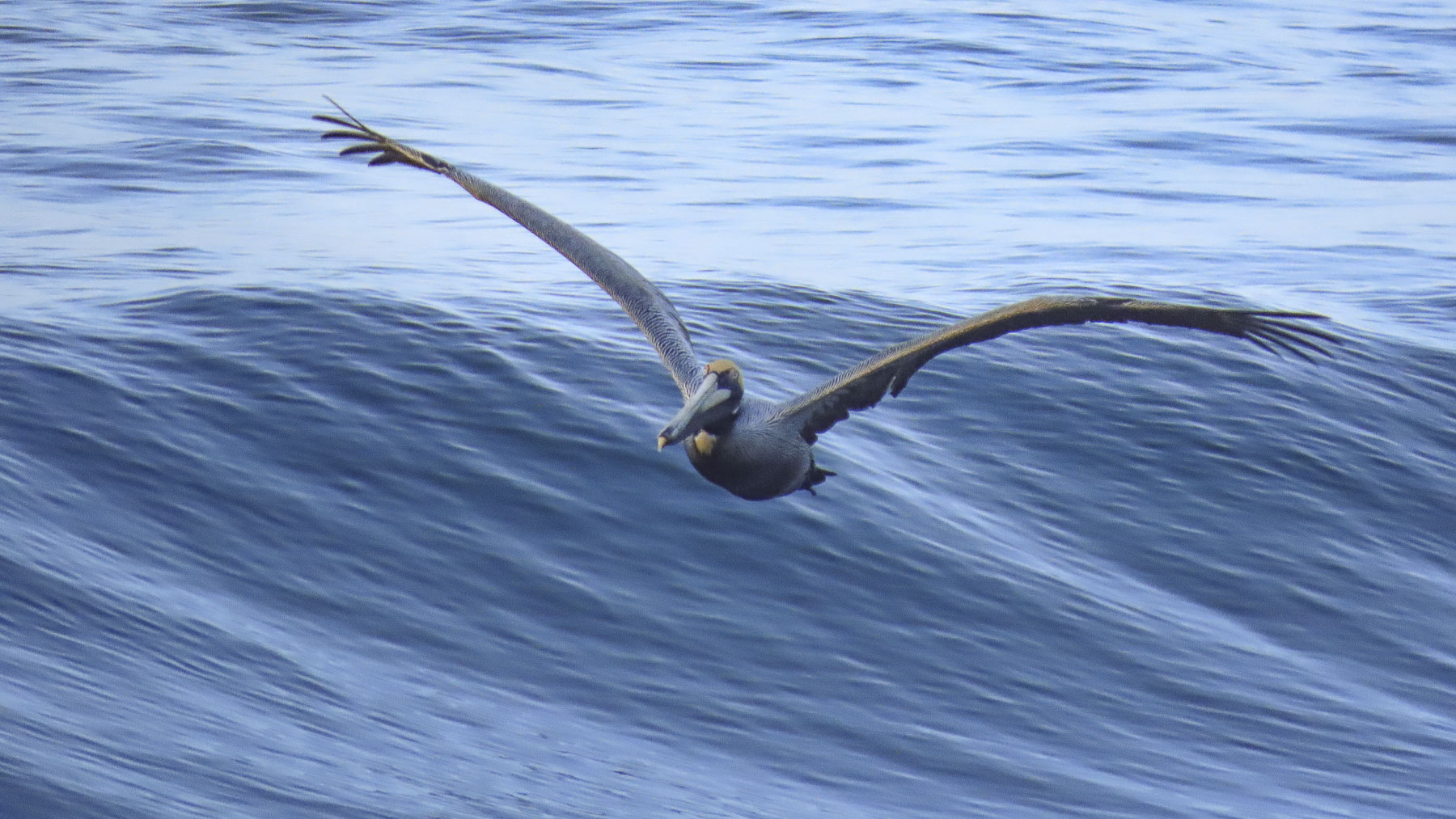
Early morning walks along the beach as the sun crested to the horizon were equally as enjoyable as the sunsets, but more tranquil with squadrons of pelicans swooping low over the surf, looking for fish. Occasionally some would peel away to dive headfirst into the water to catch fish.

Remnants of Carnaval celebrations the night before were still visible in the small towns along our route as we headed back early to Panama City to avoid the traffic. We arrived on the outskirts of the city sooner than expected and decided to spend the afternoon at Perico Island. Located at the end of the very long Amador Causeway which extends for 6km (3.7mi) into Panama Bay, it’s a popular spot for city folks to catch the breezes, picnic, rent bicycles or walk along its full length which offers great panoramic views of the city’s modern skyline and large cargo ships underway to the entrance of the Panama Canal.

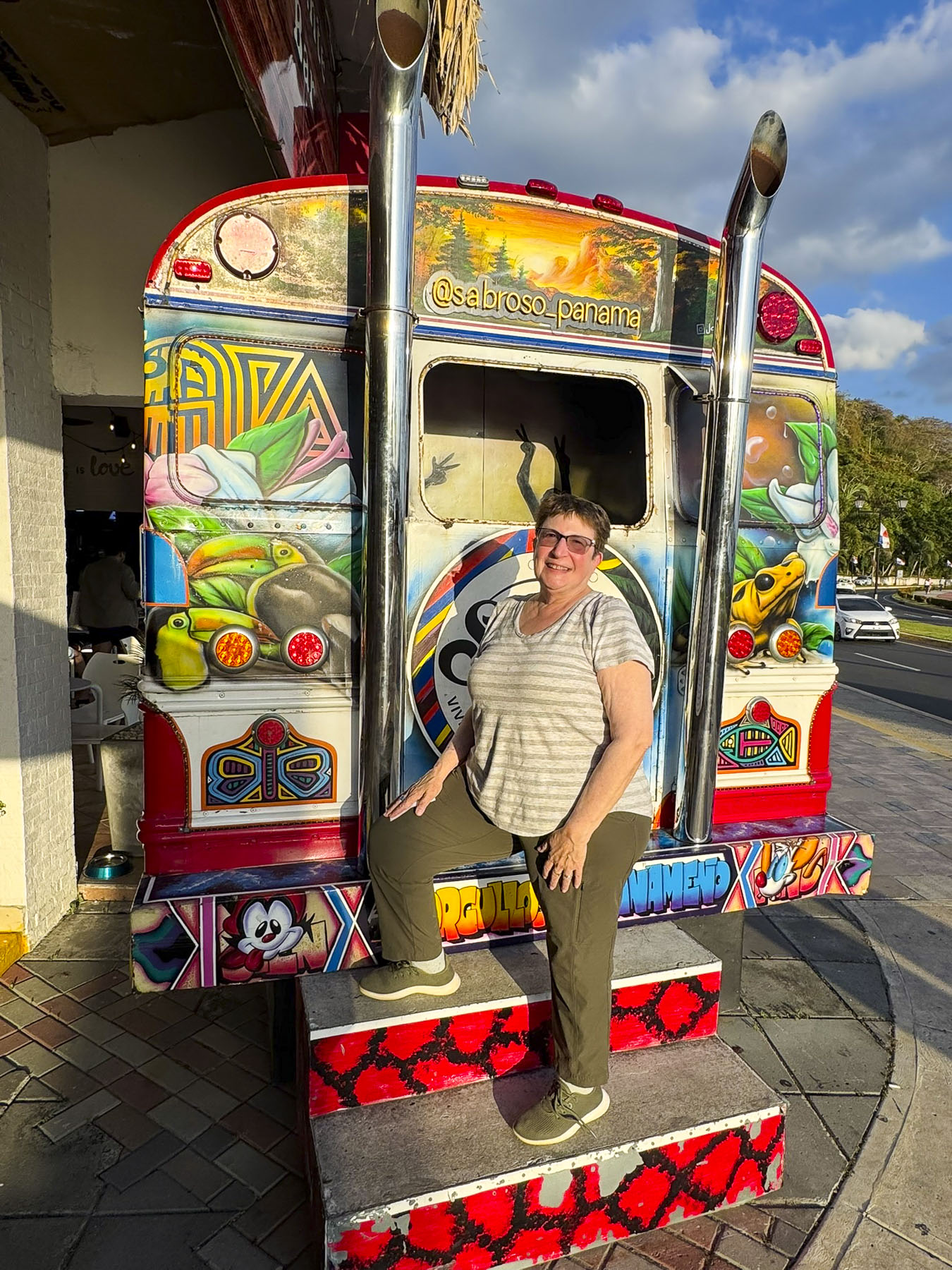
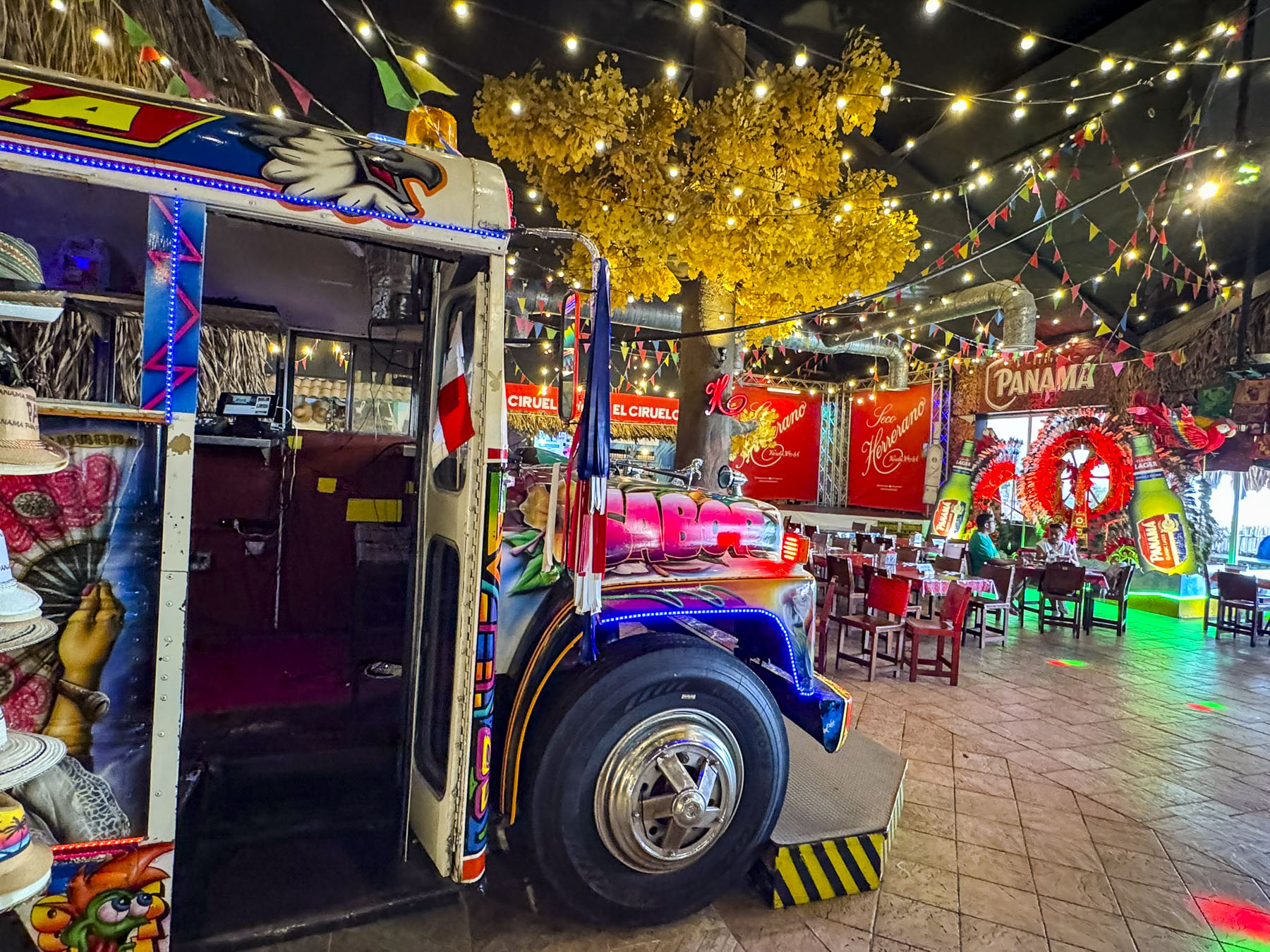
After strolling along the waterfront for a while we decided to have lunch at Sabroso Panamá, a uniquely decorated place with a nice vibe, that also had a balcony overlooking a marina. We tried the carimañolas, similar to empanadas, though they are made with mashed cassava (yucca) dough and then fried.

Carnaval celebrations continued that evening and the direct route back to Hotel Plaza Paitilla Inn (we had such a nice experience there earlier in the week we decided to stay there again) along the Cinta Costera, the city’s waterfront park, and the eight lanes of the Pan-American that parallel it were blocked, and we had to circumnavigate our way around it. The massive street party continued well past midnight into the wee hours of Ash Wednesday morning.

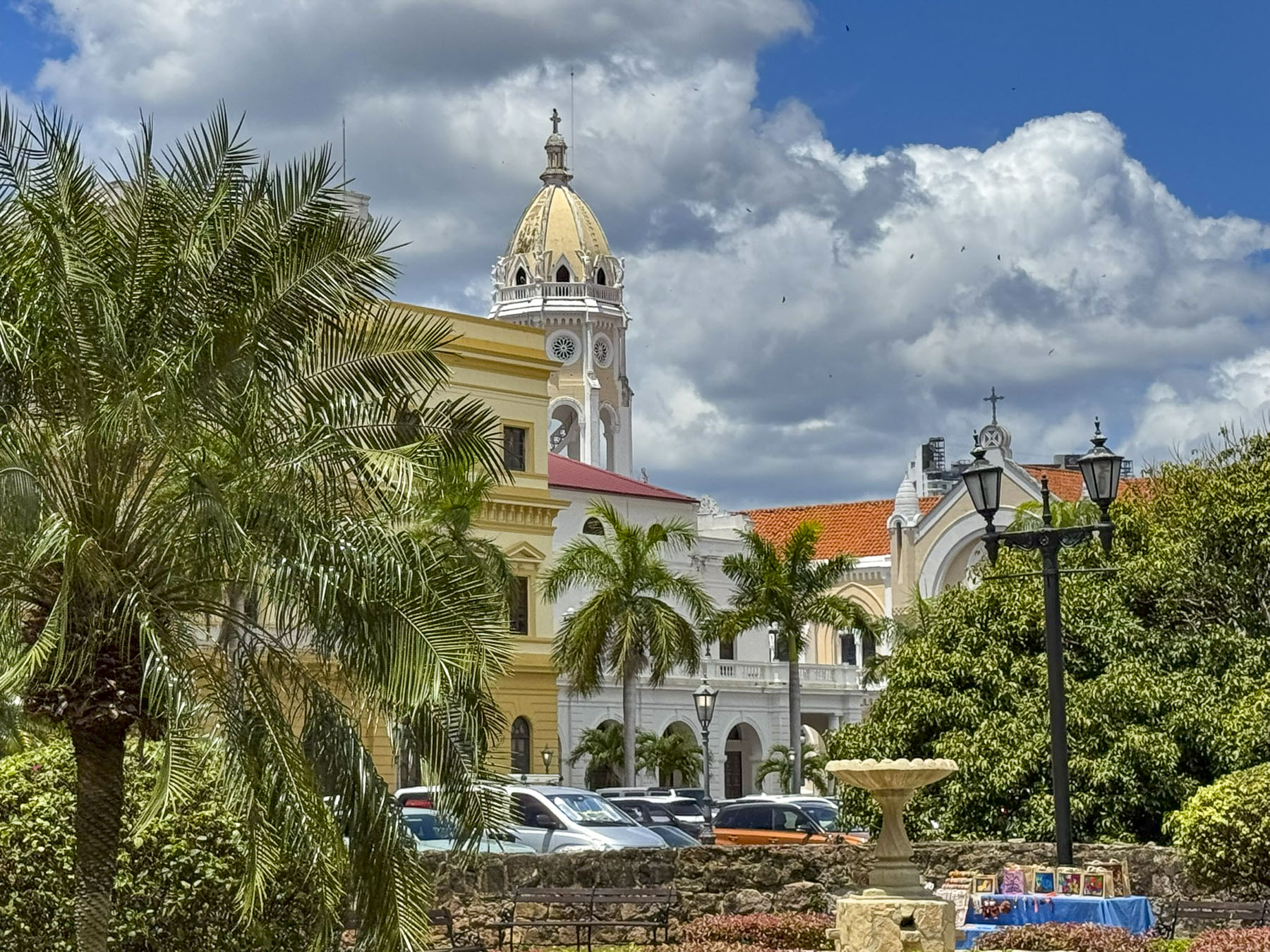
Ash Wednesday was our last full day in Panama City, and we spent it exploring the Casco Antiguo, the historic old town district which dates from 1673, and is also known as Casco Viejo or San Felipe.

This town, built on a defensible small peninsula, replaced the city’s original settlement, Panama La Vieja, which was started 11km (7mi) farther east in 1519 when Spanish conquistador Pedro Arias Dávila landed 100 settlers along the coast, and built the first permanent European settlement on the Pacific. The city prospered for 150 years as the Spanish used the town as a base for expeditions to conquer the Inca Empire and sent the plundered gold and silver they seized back to Spain. The city’s wealth did not go unnoticed, and in 1671 the British privateer Henry Morgan landed over a thousand brigands on the Caribbean coast and trekked through treacherous jungles across the Isthmus of Panama to reach the city, which they then attacked, pillaged and burnt to the ground. Six hundred Spaniards died during the assault. Though the booty they looted wasn’t as much as expected, Morgan was declared a British hero, and knighted.

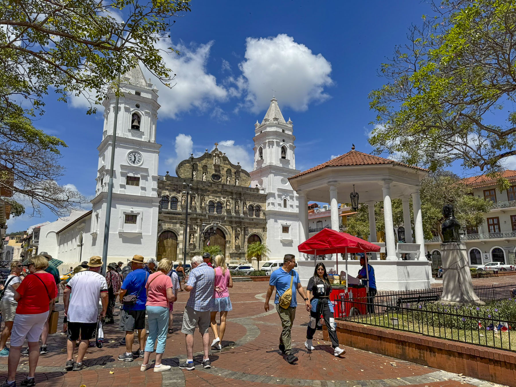
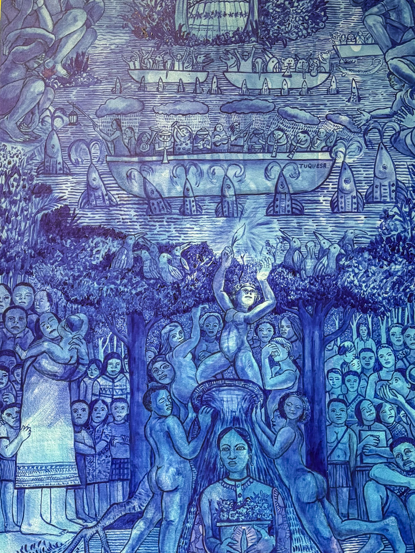
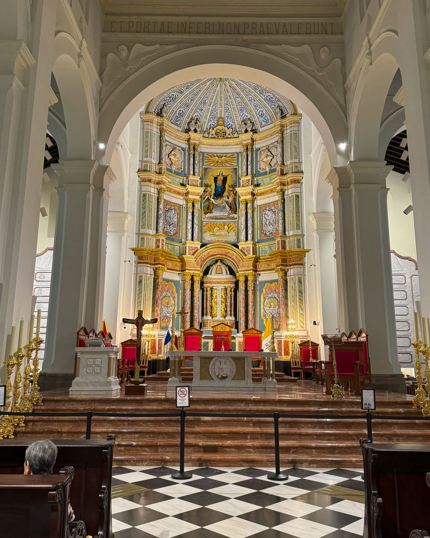
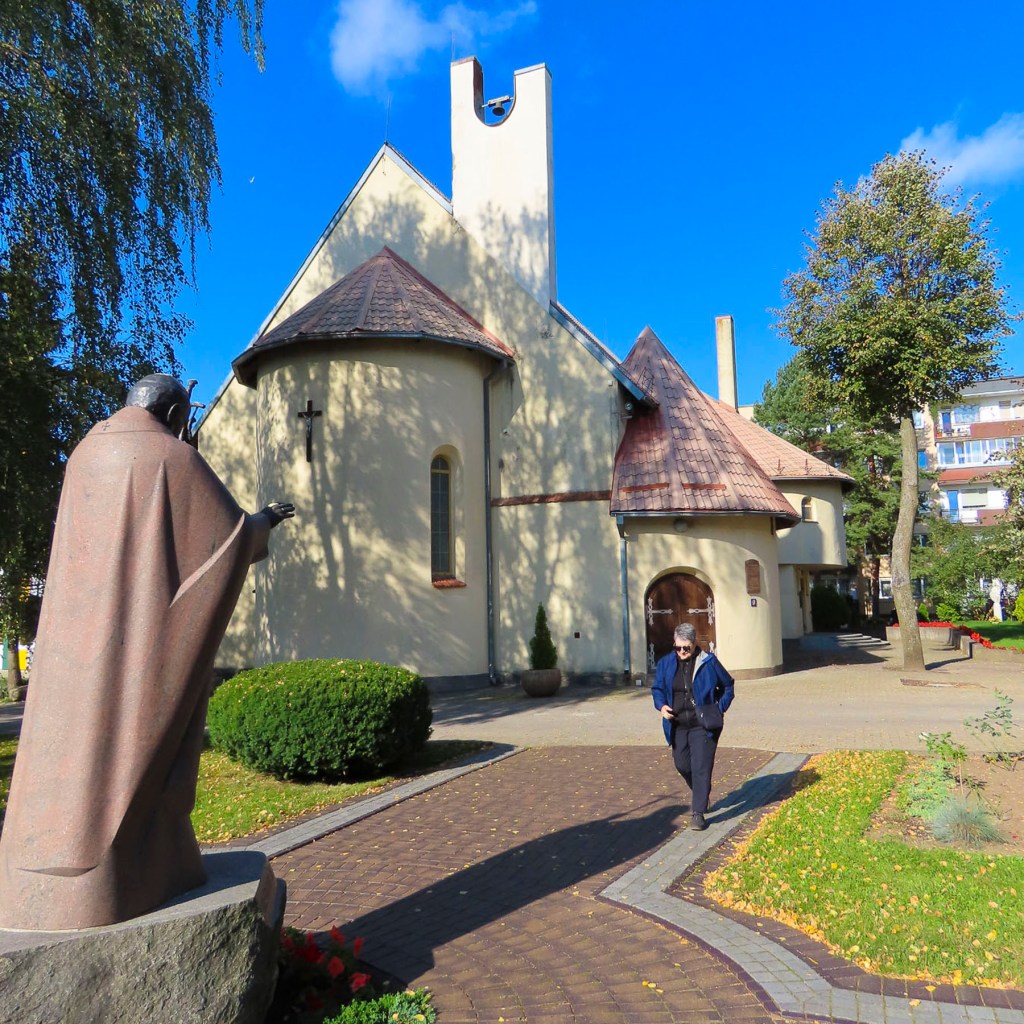
We arrived by Uber to the Catedral Basílica Metropolitana Santa María La Antigua on the Plaza de la Independencia in the center of Casco Antiguo. Its striking façade which blends Baroque and Neoclassical architecture dates from 1688, but the cathedral took more than 100 years to build, and wasn’t consecrated until 1796. Inside, an interesting mural in monochrome blue depicted the indigenous peoples of Panama accepting Chrisitanity.

The Old Town was once a citadel, though the defensive wall which encircled its 36 blocks was taken down ages ago to ease its expansion. Surprisingly, within this small area there were 4 still active historic churches and the ruins of another. Our basic plan was to visit every church and then spur off to other nearby points of interest.

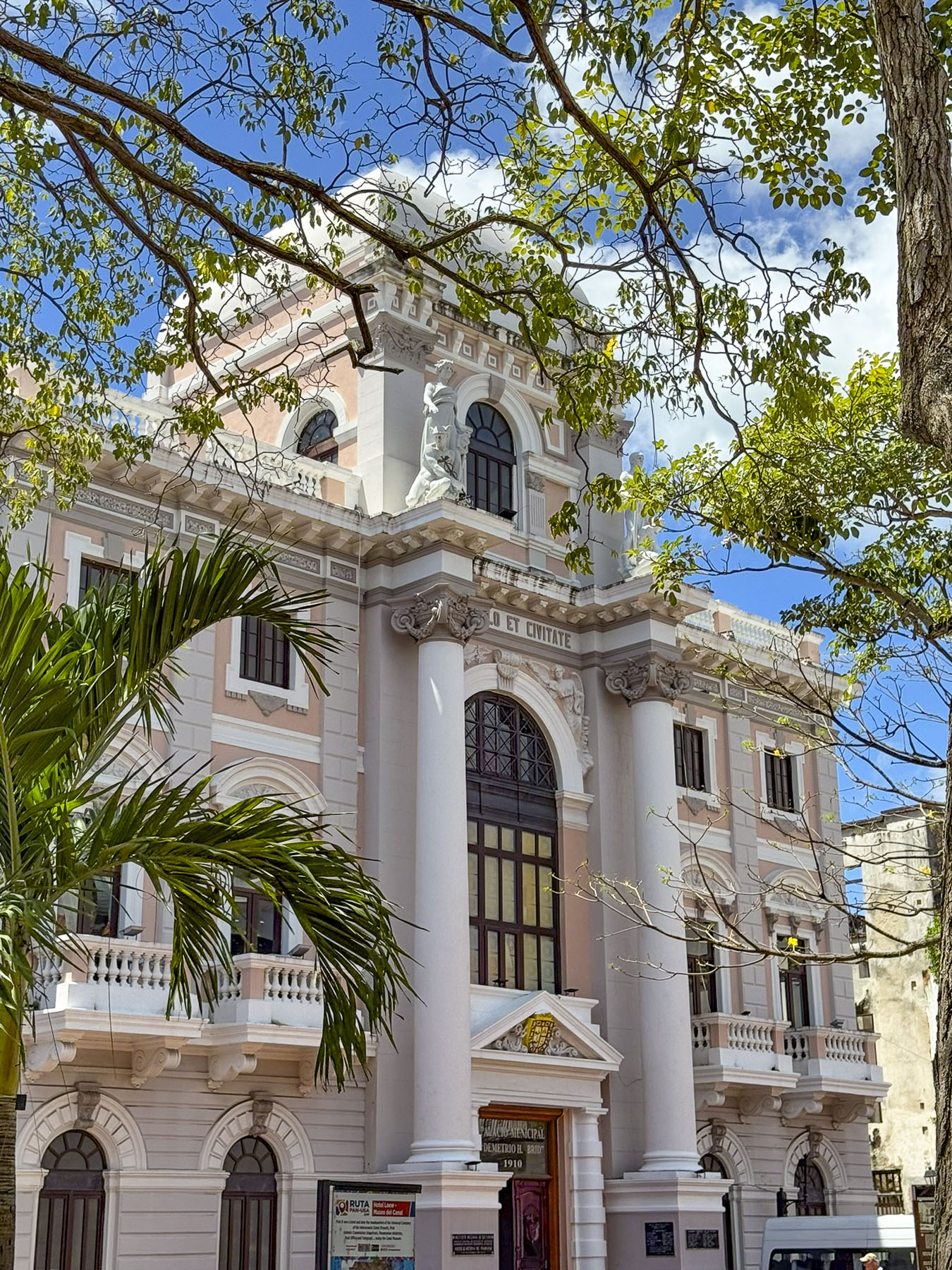
Adjacent to the cathedral was the Museum of Panamanian History, housed in the Municipal Palace of Panama. It’s a beautiful Neo-Renaissance style building with pilasters, arches and decorative cornices. We didn’t tour the exhibits, but we did enjoy resting in the air-conditioning of the lobby.

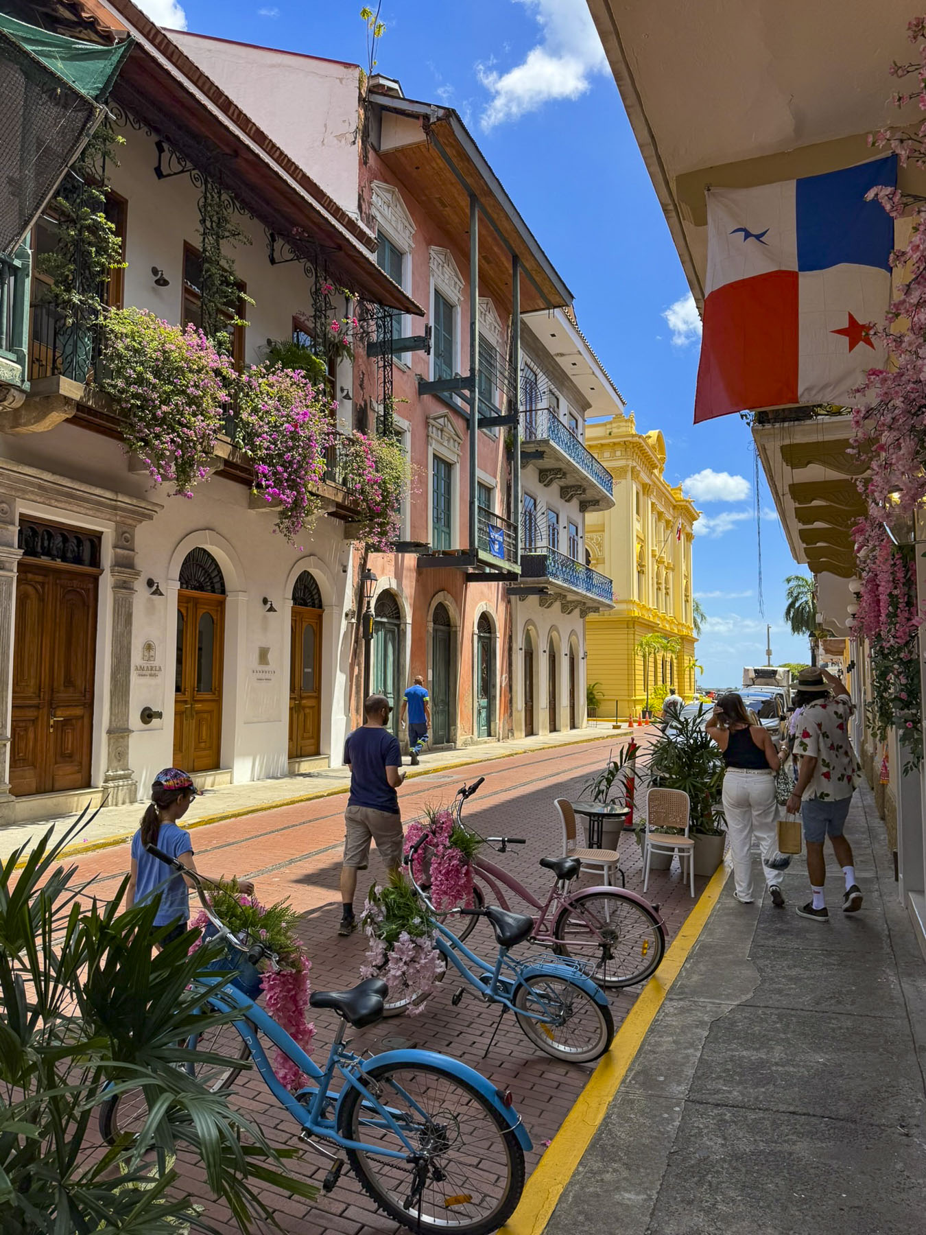
The narrow-bricked lanes were more suitable for the horse drawn carriages for which they were designed than the cars of today. They surrounded a plaza full of colorful well-maintained 18th and 19th century buildings with decorative iron railed balconies covered by profusely blooming bougainvillea.

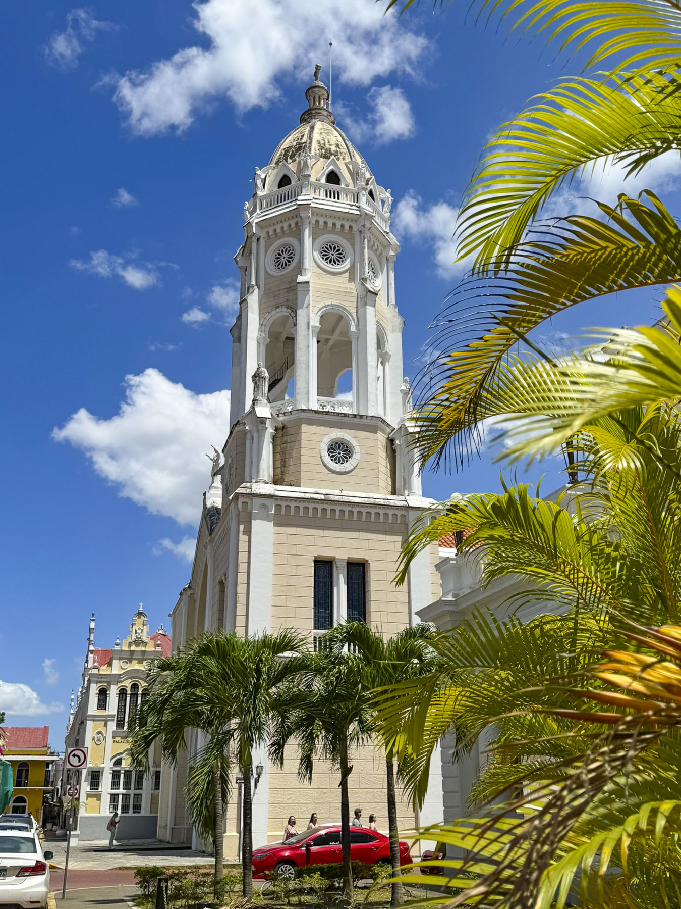
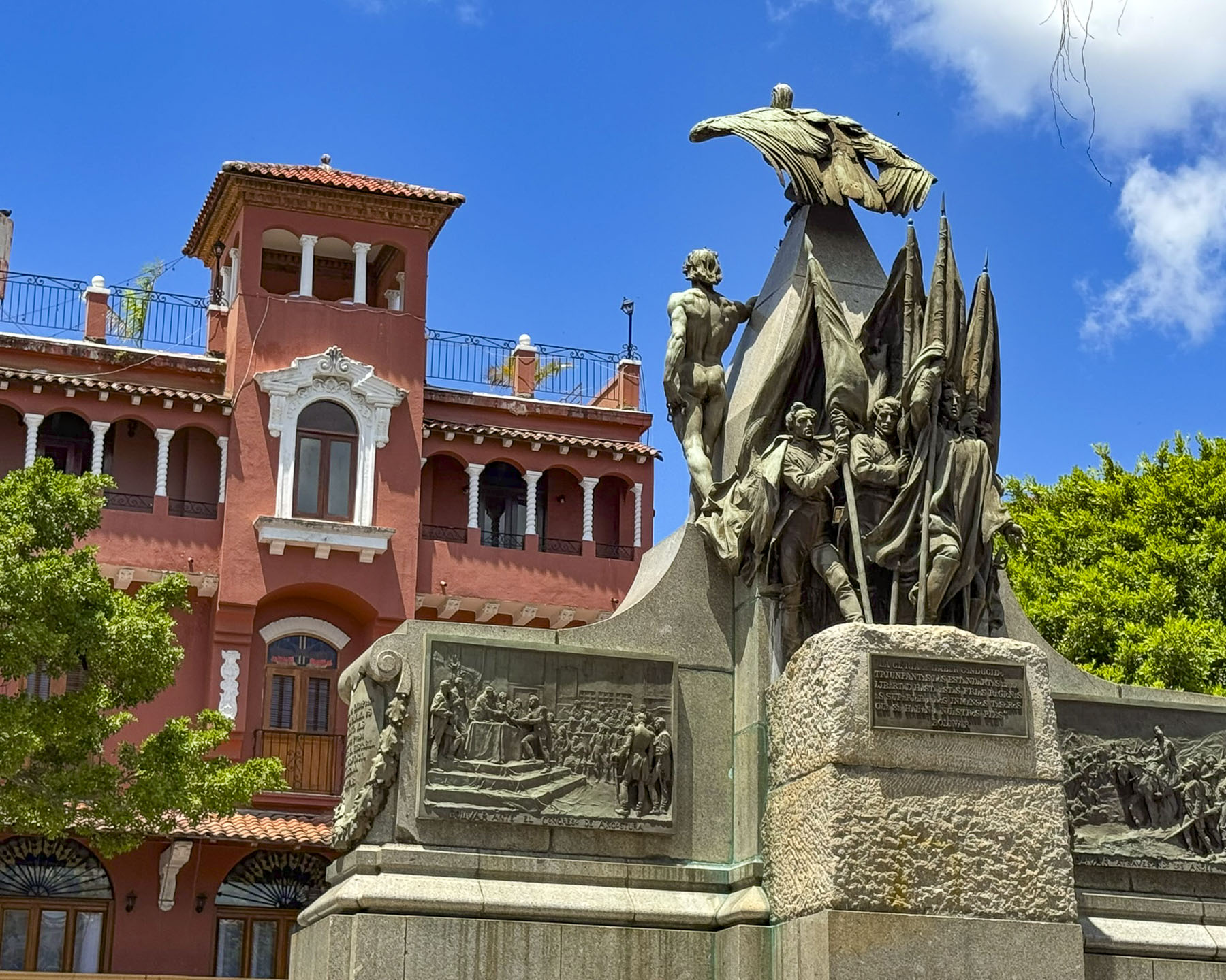
Cafes surround the Plaza Simón Bolívar where a grand monument commemorates the Latin America independence hero. Behind it the graceful belltower of the Saint Francis of Assisi Church looms above the plaza. It was a later addition to the original early 1700s church that was damaged during fires in 1737 and 1756.  

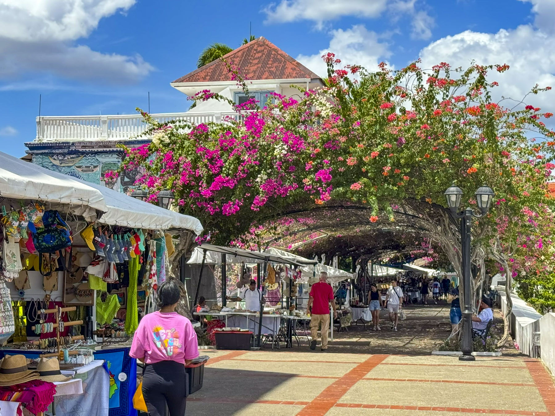
Nice views of the modern Panama City skyline were available along the lane leading to the Corredor Artesanal De Casco Antiguo, a trellis-covered lane with flowering vines that offers shade for the indigenous artisans who have stalls along its length.

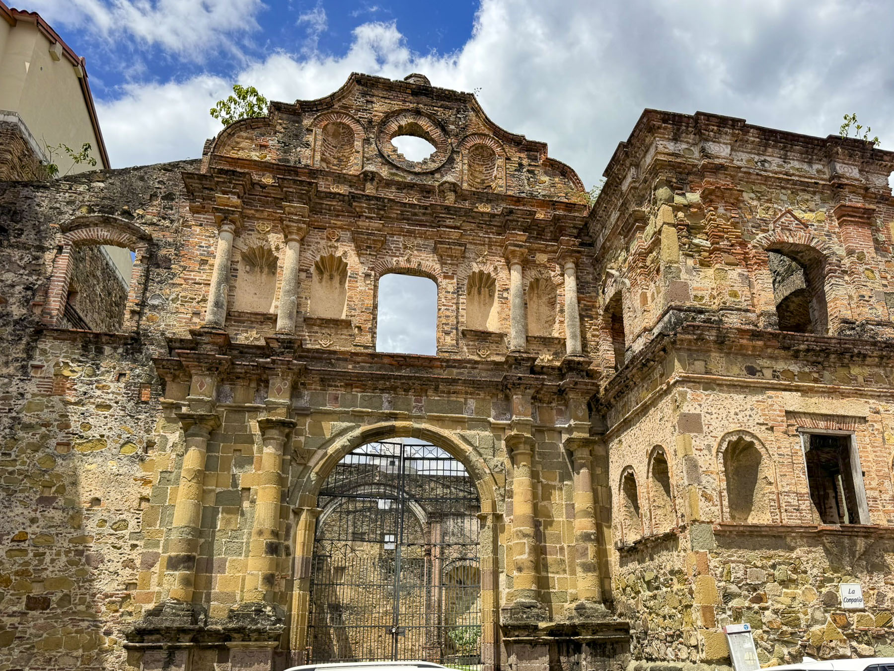
Back in the center we passed the ruins of the Iglesia de la Compañía de Jesús. It was built as a Jesuit monastery in 1641 and later in the 1740s it also served as the home of the Royal Pontifical University of San Javier, Panama’s first university, until the Spanish Crown banished the Jesuits from the colonies in 1767, and the church and monastery was abandoned. The ruins still standing are all that were left from a 1781 fire that ravaged the complex.

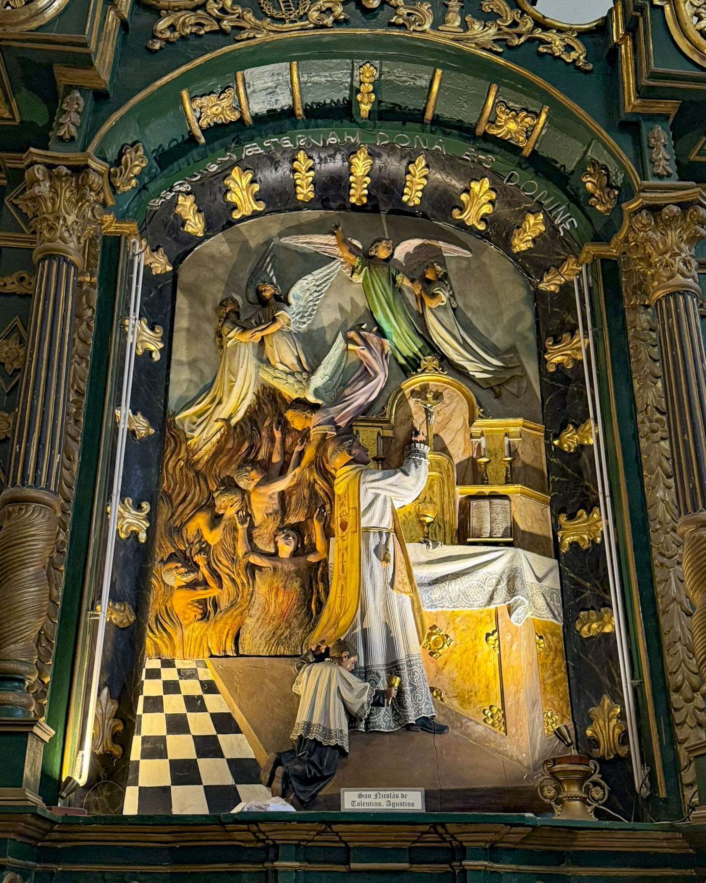
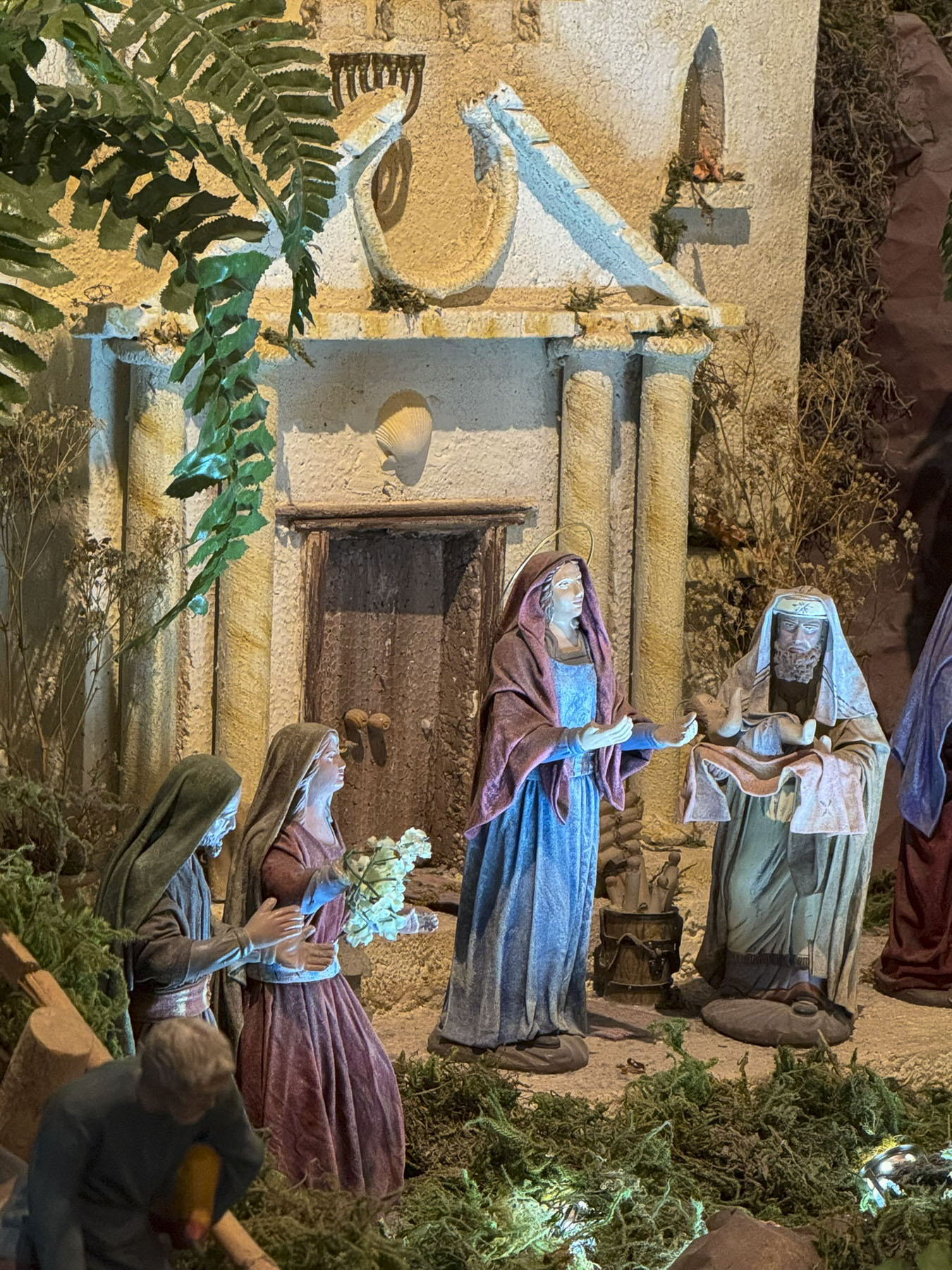
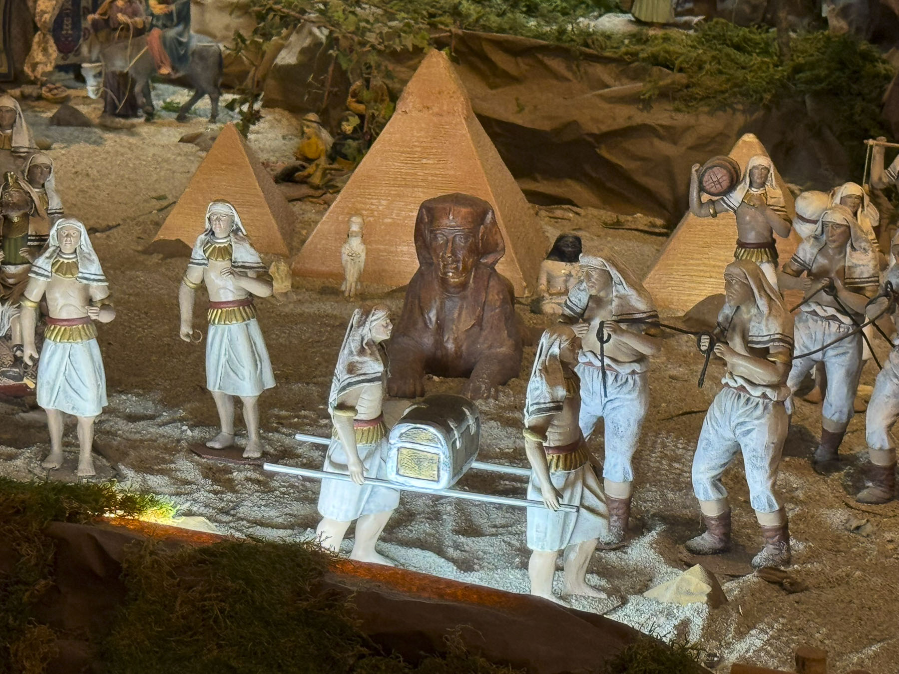
A block away was the Iglesia de San José. The 1670s church is notable for its ornate gold altar, that legend believes was saved from Morgan’s pirates by a priest who painted it black to hide its importance. There is also an interesting collection of religious sculptures and nativity scenes in a side chamber.

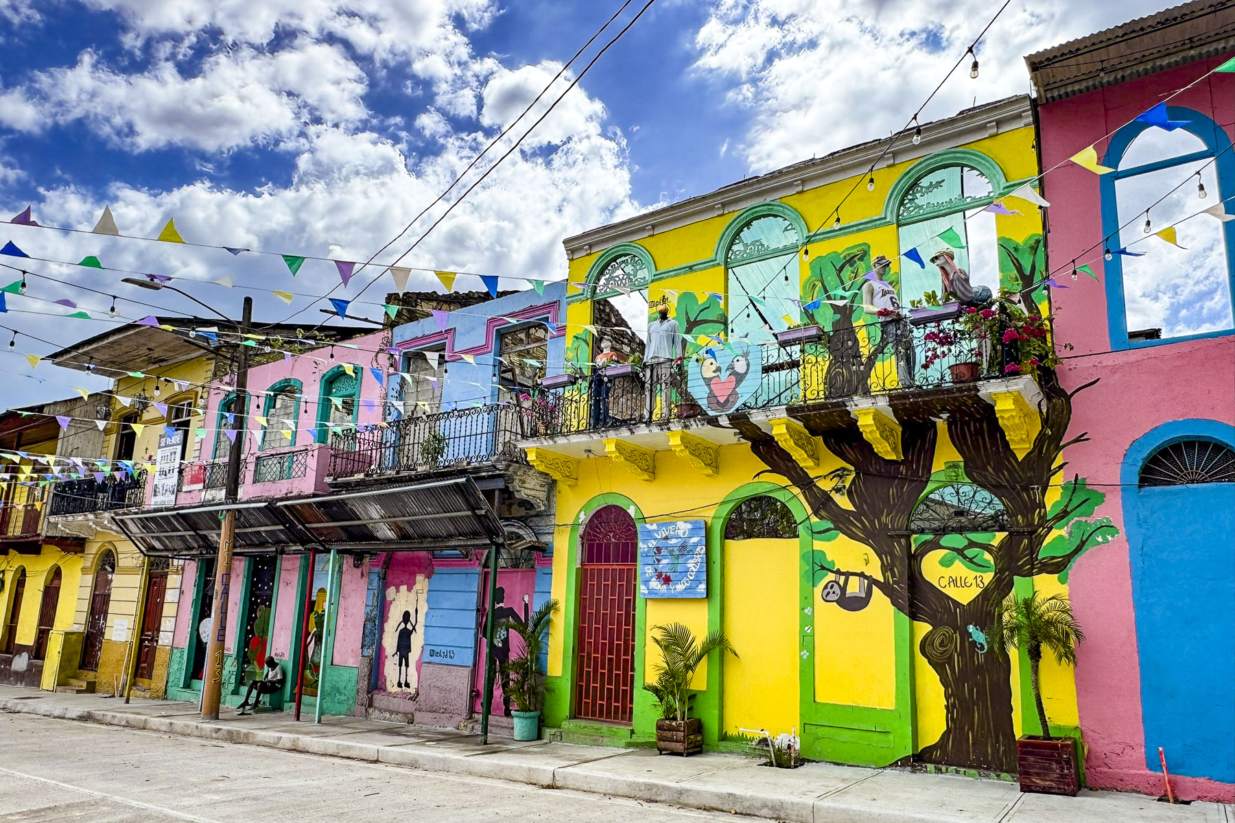
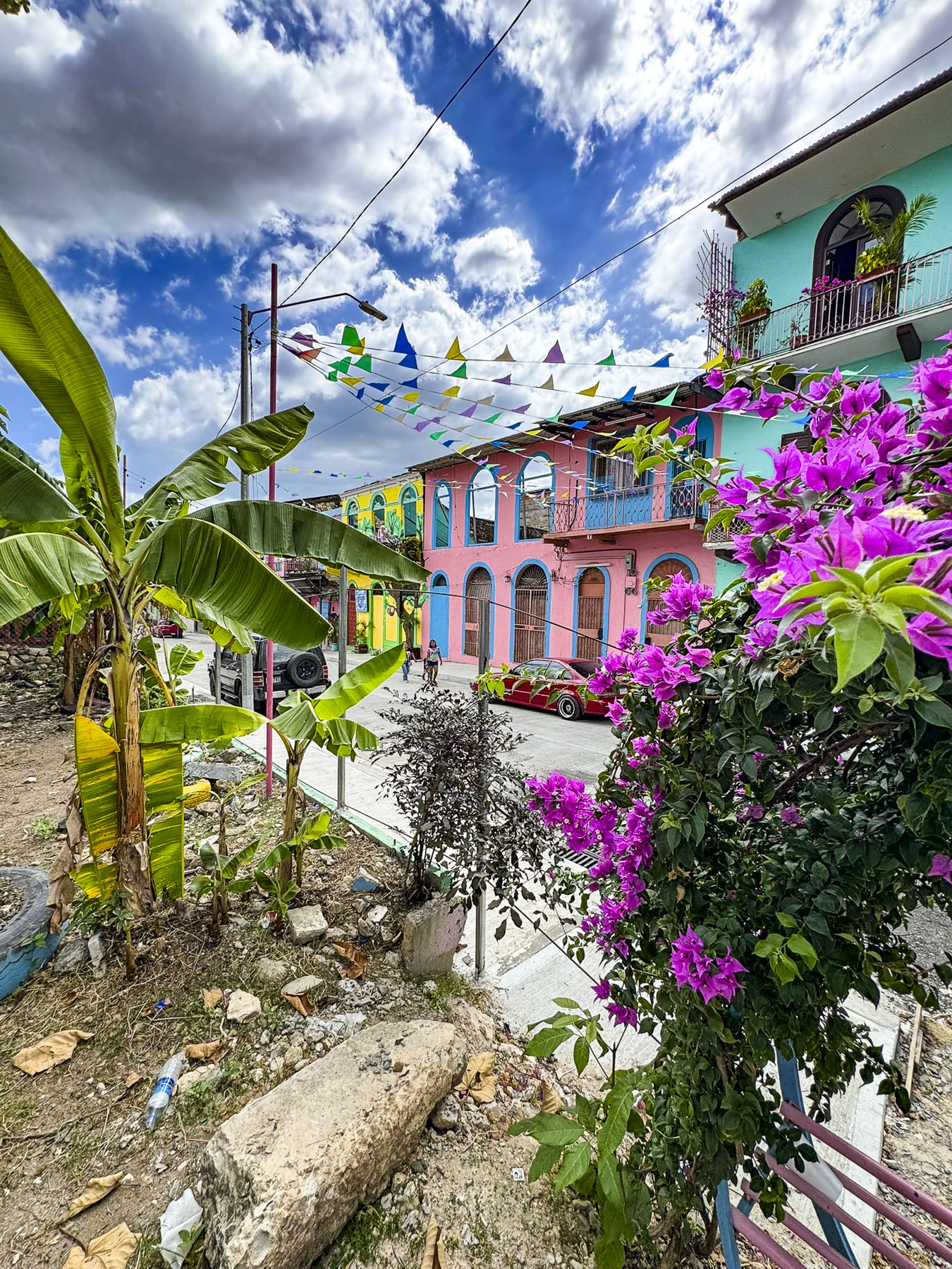
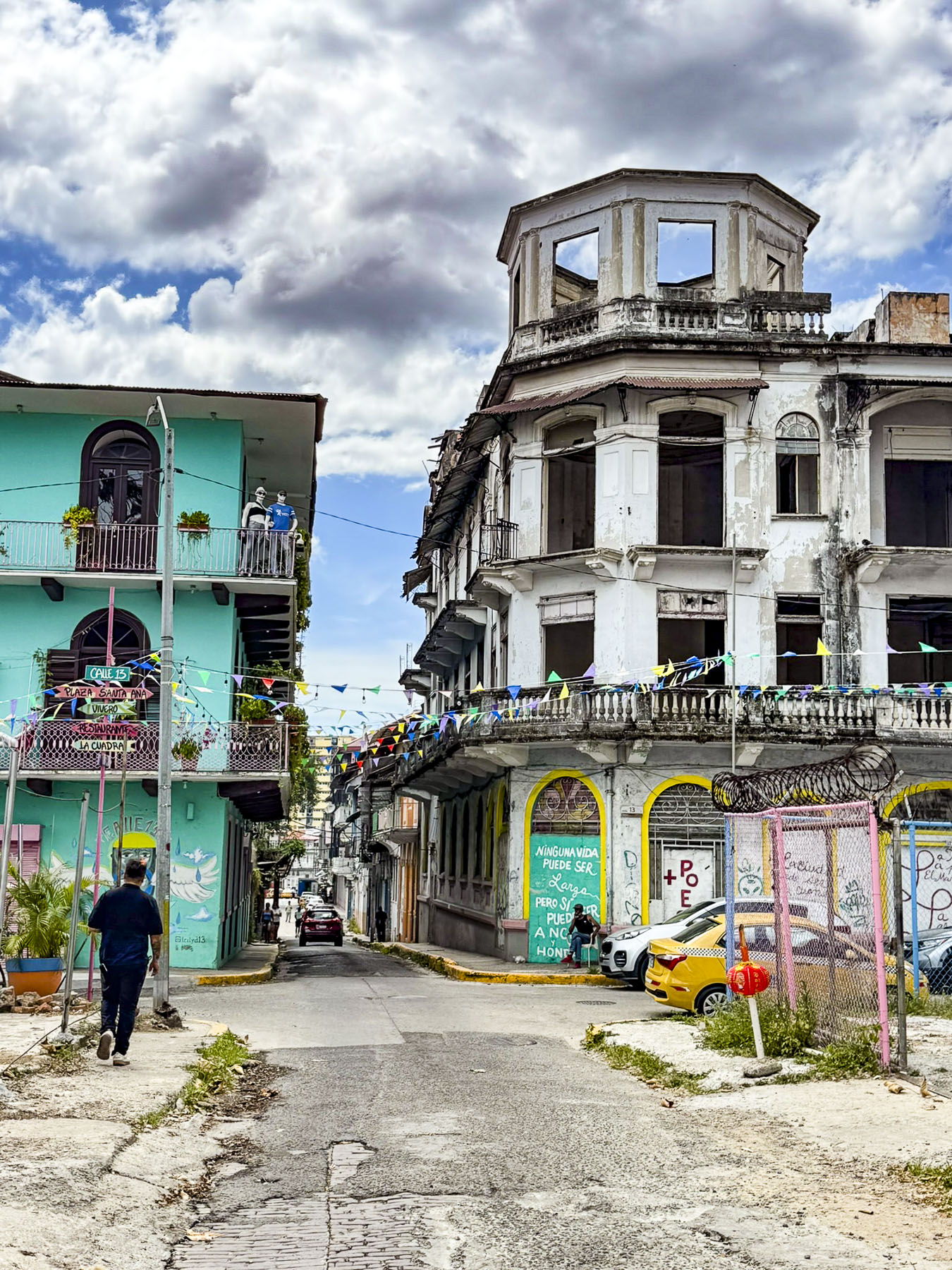
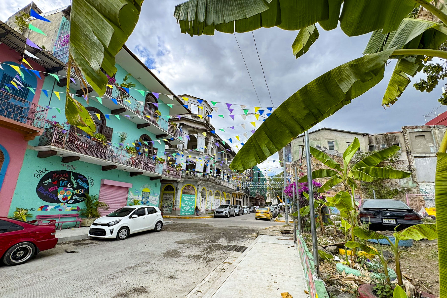
Afterwards we headed to the Santa Anna neighborhood, which was outside the walled citadel. While parts of it are in the UNESCO protected area of the Casco Antiguo; most of it is not. We had read that the area has great potential with many older buildings needing renovation, but were surprised by the quick transition from one neighborhood to another. While hopes are high for the barrio, many of the buildings we passed were only colorfully painted facades, with the sky above showing through the windows of roofless buildings.

Returning to Old Town we passed the Iglesia de la Merced, the only church to survive, fully intact, the destruction of Panama La Vieja during the pirate’s 1671 attack on the town. After the attack the church was disassembled by Franciscan monks and moved stone by stone to the new town, where it was painstakingly rebuilt, and is believed to be several years older than Iglesia de San José.

Our “walk a little then café,” beckoned when we happened upon Café Unido, a local coffee shop that pridefully specializes in Panamanian grown coffee, which they consider the best in the world.

A delightfully warm March day wandering the colorful streets of the Casco Antiguo was the perfect way to end our week in Panama. Between the beauty of the countryside and the coast, along with the warm hospitality of the Panamanians, we can understand why the country is a warm weather haven for expats from all across the northern hemisphere.

Hopefully, we will get the opportunity to explore more of the country in the future.

Till next time,

Craig & Donna

Road Tripping Through the Baltics: Part 7 – Riga to Šiauliai, Lithuania or Crosses, Churches and Towns Filled with Art

There are always several dilemmas with a road trip: how far to drive, do we drive straight through or look for interesting stops along our route? We tend to make stops, multiple stops to the point of my trusted co-pilot advising that, “we’ll never make it there at this rate,” but there’s a fear of possibly missing something. Fortunately, our “walk a little, then café,” philosophy easily converts to “drive a little, then café,” and in pursuit of those cups of coffee we’ve happened upon some laid back, interesting places.

The Hill of Crosses in northern Lithuania was our destination as we headed south on the A8/12 from Riga. Only two hours (78 miles/126 km) from Riga, many folks choose to do it as a day trip out of the Latvian capital. Which would have worked for us, but we have this quirky rule that we don’t put a pin in our wall map unless we’ve actually stayed overnight in the country. So, with that in mind, we booked two nights’ accommodation in Šiauliai, the town just beyond the Hill of Crosses.

Craving a cappuccino, we detoured into Jelgava for what we thought would be a short stop to satisfy our caffeine addiction. As we crossed over the Lielupe River we spotted the Jelgava Palace on a large island. It called for a stop. A wooden fortress was first erected here in the 13th century as part of the Livonian Order’s conquest of the pagan Zemgalian tribe that inhabited the region. Today’s beautiful 18th century Baroque style palace with 669 rooms is touted as being the largest in the Baltic states. It is actually a reconstruction of the palace which was burned down during WW2. During its apex it was the seat of the Duchy of Courland and Zemgale, and an important diplomatic post between Russia and Poland. Famously, the exiled French King Louis XVIII, to save his head from the guillotine, inhabited the palace from 1798 – 1807. Part of the palace houses a small museum with the Family Vault of the Dukes of Courland and Semigalla being the main attraction. The rest of the building is occupied by the Latvia University of Agriculture and Latvia’s University of Life Sciences and Technologies.

Across from the palace was Pasta Sala, a smaller island with an interesting art park that hosts the annual Jelgava International Sand Sculpture Festival every June and an International Ice Sculpture Festival every February. Unfortunately, traveling in the late September shoulder season we missed it. But we did enjoy wandering along a walking path through an installation of Chamotte fired-clay sculptures.

Between the palace and the park, we were now smitten with the impromptu stop and were enticed to follow a graceful modern footbridge, the Mītavas Gājēju, that tilts over the river into the town center, which was surprisingly quiet for a Tuesday in late September, considering that the university town is Latvia’s fourth largest city, with a population of roughly 60,000.

It’s unusual for only half a church to be left standing, but Jelgava’s Holy Trinity Church (1574) is a stark reminder of the devastation the city suffered during Soviet Union and Nazi Germany sieges and occupations of the city during WW2, which left ninety percent of Jelgava in ruins and all its Jewish citizens lost to the Holocaust. Its belltower above the town’s tourist information office was opened in 2010 as an observation deck after extensive reconstruction.

That promise of a morning coffee wasn’t forgotten as we walked along a pedestrian mall past a small daily street market to Konditoreja Silva, a bistro and patisserie where the coffees were very good and the selection of tasty pastries was mouthwatering.

Back on the road, we continued our drive south and crossed the border into Lithuania. We zoomed by a small roadside marker that pointed to the Jakiškiai Chapel, one of the last wooden churches from the 17th century remaining in Lithuania. We u-turned in order to find it. Passing through a small hamlet, we located the church situated on a low knoll, surrounded by fields and pasturelands.

It’s also known as the St Ignatius of Loyola Cemetery Chapel, named for the founder of the Jesuits, who were active in the region at the time. It’s a fine example of rustic folk sacral architecture.

The graveyard surrounding the chapel was full of interesting old headstones. Some were carved from logs and were well weathered and split from age and the elements, while the more recent graves were marked with stone or marble memorials with the deceased’s portrait etched into the surface. There was a caretaker working on the grounds who wouldn’t acknowledge our presence, so we contented ourselves with peering through the dusty windows into the sanctuary the best we could.

The Hill of Crosses was only 20 minutes farther south, just off the A12. The precise history of the hill is not known, but it is believed to have started as a way to commemorate Lithuanian rebels who never returned after uprisings against Imperial Russia’s rule in 1831 and 1836.  From a distance the hill is only speck on the horizon. It wasn’t until we were walking the long approach path that the hill slowly grew, and its monumental scale became apparent.

Not really in height, it’s a modest hill with stairs to its apex, but in girth and the sheer number of crosses, from tiny store-bought ones to large crosses handcrafted I imagine with sweat and tears. It’s estimated that there are now 200,000 crosses and crucifixes spread across the half hectare (1 acre) site. All are mingled together haphazardly and are treated equally in their importance, and they stand as testimony to the character and faith of the Lithuanian people who created this spectacular monument. The crosses were bulldozed and razed repeatedly during the Soviet era but were always rebuilt by the people. The hill stands as a sign of quiet resistance to the Soviet Union’s atheist communist occupation.

The fifty years of oppression which started with the Soviet Union’s annexation of Lithuania in 1940 ended in 1990 with the Act of the Re-Establishment of the State of Lithuania. A dream realized after the Baltic Way, a human chain of approximately two million peaceful protesters joining hands along a route that stretched from Vilnius, Lithuania through Riga, Latvia to Tallinn, Estonia in August 1989. Lithuanian was the first of fifteen Soviet republics to declare independence, which forced the collapse of the Soviet Union in 1991. Since Pope John Paul II’s visit to the Hill of Crosses in 1993 it has become a popular pilgrimage site.

During the 13th-century Christianity was not enthusiastically embraced by the pagan Lithuanian tribes of the region who rallied to decisively defeat the onslaught of the crusader Knights of the Livonian Brothers of the Sword in the1236 Battle of the Sun/Saulė, the victory from which Šiauliai takes its name and the year of its founding. It would be another two centuries before the first wooden church in the town was built on a small rise overlooking Lake Talkša.

The graceful Church of Saints Peter and Paul with its soaring belltower and brilliant white façade replaced the earlier 1445 church in 1617. It was our first stop. The church became Šiauliai Cathedral when Pope John Paul II elevated its status when the Diocese of Siauliai was created in 1997.

After checking into the hotel Turnė (free parking) for two nights, we walked a short distance into the center of Šiauliai to stroll along its nearly mile long pedestrian mall, Vilniaus g. One of the first things we noticed about the town was the amount of public art displayed along this street.

It’s an interesting variety of wall murals, and contemporary sculptures that enhance the walkway. As it was getting late we only walked the southern end of the mall to have dinner at Žemaitis Restoranas, located in the Hotel Šiauliai. The Lithuanian specialties – cepelini, homemade dumplings, Kedainiai potato pancakes, Karka with stewed cabbage – were so good and reasonably priced that we dined there twice.  

By the time we had finished dinner it was dark outside and upon leaving the restaurant we spotted the spectacularly lit dancing water fountain “Trys paukščiai,” Three Birds, designed by the Lithuanian artist Kestutis Kasparavicius. Its ballet of synchronized water jets and colored lights totally mesmerized us as we watched its performance several times. The quality of the installation was amazing and equal to the best fountains you’d find in NYC, Paris or Madrid.

The next morning, in pursuit of breakfast, we walked the northern part of Vilniaus Street, which we discovered was the first pedestrianized boulevard in Lithuania when it prohibited cars in 1975, and is the third oldest pedestrian street in Europe. A nice feather in the town’s cap for an off-the-radar-destination.

As we worked our way towards the Prezo Kepyklėlė café, the street was full of university students walking to morning classes in the buildings of Vilnius University and Šiauliai State University of Applied Sciences scattered across town.

Much of the contemporary public art at this end of the mall is sponsored by the Šiauliai Art Gallery with a mission statement to encourage within the community the free expression of art.

A narrow alley next to the gallery led to an almost hidden away St. Ignatius Loyola Church. It’s not very old as churches go, but its uniqueness stems from its roots as an ordinary home before the Jesuits bought it in 1930 and converted it to a church. At the end of WW2 communist authorities imprisoned two of its priests and sent a third to exile in Siberia. The sanctuary was closed and used as a warehouse, then a gym. In 1986 the local government deceptively requested funds from Soviet authorities to renovate the building into a concert hall but instead restored the church. After Lithuania declared its independence in March of 1990 the church was reconsecrated in December, just in time to celebrate Christmas Mass. A statue of Pope John Paul II in the church’s courtyard commemorates his stay in the small rectory when he visited the Hill of Crosses in 1993.

In the parking lot of an apartment building next to the church we noticed a defiant wall mural depicting a young woman in traditional dress lighting a Molotov cocktail held by a partisan resistance fighter. It testifies to the resilient character of Lithuanians. Lithuania did not submit easily to communist rule after WW2 and had an organized resistance movement into the early 1950s, with some individual partisans fighting on in the 1960s. Unfortunately, a car was parked too close to the wall for me to get a clear photo of the mural.

We found Šiauliai to be wonderfully walkable as we made our way across town to Lake Talkša, first stopping at Saulės Laikrodžio Aikštė, Sundial Square, where a brilliant golden archer stands atop an 18m (59ft) tall gnomon which casts its shadow across the numbers 1-2-3-6, the year of the town’s founding, in the plaza at its base.

Two paths from the sundial led to the lake. One was a direct shorter route, but we chose the longer way through the neighboring cemetery to the lakeshore. It was a perfect fall afternoon with puffy white clouds sailing across the bluest sky. On the far shore only a subtle hint of yellow suggested autumn colors would soon appear.

A path along the shore led to a children’s playground and outdoor fitness area before reaching a large stone labyrinth where a lone woman seemed to be deep in a meditative walk.

Beyond the labyrinth stood a large metal sculpture called Geležinė Lapė, the Iron Fox. In 2009 the local artist Vilius Puronas crafted 7 tons of steel into this whimsical monument that’s 15m (49ft) long and 6.6m (22ft) tall to celebrate the 1000th anniversary of the earliest mention of Lithuania as a country. In a 1009 chronicle called Annals of Quedlinburg, a writer described in Latin, “in confinio Rusciæ et Lituæ a paganis capite plexus,” which translates as, on the border of Rus’ and Lithuania, the pagans have their heads covered with plexuses. It’s not the most notable introduction to the world at large, but I will say during our short time in Lithuanian the country made a great first impression upon us! One day we hope to return and make it to Vilnius.

Till next time,

Craig & Donna

An Albanian Road Trip: Voskopoja and Korce – Snowy Mountains, Ancient Churches & a Skyscraper 

“The old timers say on a stormy day like this you can hear their cries on the wind when you pass through Borove,” our host commented mysteriously as he learned of our plans to drive along the SH75 towards Voskopoja and then Korce. Evidence of Albania’s new investments in its road infrastructure to support tourism in southeastern part of the country were visibly apparent, with bridges being repaired, as well as sections of the road being widened, and repaved along our serpentine route through beautiful, forested mountains. The mountains finally receded behind us as we coasted downhill into a wide valley with gently rolling hills.

As we rounded a bend, a tall brooding silhouette loomed over the road. The statue of two resistance fighters captured in a decisive moment of attack commemorates the July, 1943 partisan ambush of a German troop convoy through the valley, near the hamlet of Barmash. The battle raged for hours and left 60 enemy soldiers dead, and numerous vehicles destroyed.  Sadly, the second part of this event revealed itself several miles away in the larger village of Borove. Here stairs on the outskirts of the village quietly led to the top of a knoll and the Memorial i Viktimave të Masakrës së Borovës. This heart-rending site contains the graves of 107 men, women and children massacred the next day when Nazi troops returned to the area and set their village ablaze in retaliation. It’s a moving memorial, and we stayed until a pounding rain forced us back to our car.

Farther along we passed through Ersekë. It’s one of Albania’s highest towns, sitting at an elevation of 3,445 ft on a high plain, in the shadow of the Greece’s Pindus mountain range. This southeastern part of Albania is very remote, and the village so close to the Greek border, that during the communist era villagers were prevented from leaving the town, on the fear that an abandoned village on the border would invite Greek expansionism. The town is most noticeable for its well-maintained communist era minimalistic architecture.

Reaching Korce we turned west onto SH63 and headed back into the mountains, our destination, the ancient Orthodox churches of Voskopoja. Light rain turned into 3 inches of wet snow as we drove higher into the mountains. This didn’t particularly faze us as we both have decades of experience driving on wintry roads in northeastern United States. But the drastic change of weather did, considering 10 days earlier, when we arrived in Tirana we rejoiced in 80F weather for several days earlier in the month. The saving grace – there were literally no other cars on the road.

On a snowy Sunday afternoon in late April we practically had the whole town to ourselves. It was quite serene and beautiful with the fresh snow clinging to the trees, and tufts of spring greenery poking through the snow on the ground. We found Saint Nicholas Church and gingerly made our way down the puddled walkway to shelter under the exonarthex and shake the snow off our jackets before entering the sanctuary.

The walls of this covered porch area were painted with illustrative religious stories designed to visually educate the illiterate, warn the sinners, and inspire the devout, before entering the church. Sadly, the frescoes show the scars from being vandalized during the Ottoman era, but their beauty is still evident.

We had expected a caretaker to be present, though no one was around, but the door to the church was unlocked and we entered. The ancient cavernous space was barley lit with only two bare bulbs and the light from several small windows, but it was enough to see that every surface of the whole interior was beautifully illuminated in ancient orthodox iconography.

Liturgical music was faintly audible in the background as we admired the artisitic vision and faith that inspired this moving creation. Constructed in 1721, the frescoes are attributed to the painter David Selenica, and his assistants, the religious brothers Constantine and Christos.

This team also famously painted religious iconography in the monasteries on Mount Athos. It’s amazing the church survived several centuries of turbulent history, only to be atrociously used as a storage depot during the communist era. The church, as beautiful as it is, was also a little spooky with centuries of candle soot covering the walls and gilded wood-carved iconostasis. Afterwards we headed to Kisha e Shën Mëhillit, the Church of Saint Michael, 1722, just on outskirts of the village and found it surrounded with scaffolding. Though disappointed, this was an encouraging sign that restoration was under way. Unfortunately, the road leading to the Church of St. Elija, the last church built in Voskopoja in 1751, was under repair and a muddy mess that deterred us from reaching it. But we did get to view the Shënepremte Church perched on a hill above an old Ottoman era bridge. By mid-afternoon our stomachs were growling and we feared there wouldn’t be a place open to eat in the village. (This is an issue during off-season travel when many establishments close. It’s wise to bring snacks along.) Luckily, we found the Taverna Voskopojë open, and full of activity that Sunday afternoon. Their lakror, a pastry-style traditional Albanian pie, filled with ground meat or vegetables, is common to the Korçë region, and was delicious. The house wine was also very good.

First mentioned in 14th century historical records, Voskopoja was once one of the largest cities outside Istanbul, and the most important trading, cultural and religious center in the Balkans from the 1600’s to the 1800’s. It was during this height of prosperity that the city had an estimated population of between 30,000 – 60,000 and supported 26 Orthodox churches richly decorated with Byzantine frescoes; the only printing house in the Balkans; and a New Academy or Greek school. Its influence and wealth stemmed from metal smithing, wool processing and tanneries. Merchandise from these industries supplied the traders that traveled along the Tsarigrad Road. The road was an old caravan route that connected Rome to its colonies in Sofia and Plovdiv, Bulgaria, before reaching Tsarigrad, the Slavic name for Constantinople. In later centuries the route passing through Voskopoja connected it to the Venetian ports on the Adriatic Sea and Belgrade.

The armies of Rome, the Huns, and the Ottoman Empire also followed this route through Albania and in the process brought new ideas and religions with them. During the Middle Ages the Christian Byzantine Empire encouraged the spread of the Eastern Orthodox religion into the Balkans along the ancient trade route, which was most famously followed by the early evangelists Cyril and Methodius. They made tremendous inroads with the pagan Balkan tribes by leading Mass, not in Latin, but in the Slavic language, an act many church leaders in Rome considered blasphemous at the time.

Voskopoja flourished peacefully under the Ottoman Empire’s millet system, where “Christians and Jews were considered dhimmi, protected, under Ottoman law in exchange for sworn loyalty to the state and payment of the jizya, a religious tax on non-Muslims,” until the 1768. Then the Russian-Ottoman war fueled an anti-orthodox sentiment and the government in Istanbul allowed Voskopoja in 1769 to be sacked and burned by Muslim tribes from the Dangëllia region around Përmet. The city was rebuilt, but twenty years later it was attacked, and razed to the ground again by the notorious Albanian warlord, Ali Pashë of Tepelena in 1789. After this the town never recovered its former glory and folks moved away to Korce and Berat, or farther afield into Bulgaria and Romania. It received additional damage during World Wars I & II. The final blow came in 1960 when a massive earthquake leveled many of the centuries-old churches, leaving only 5 standing in various states of disrepair. Today, the surviving churches are listed on the World Monuments Fund’s Watch List of 100 Most Endangered Sites. Only 600 year-round residents live in Voskopoja now, but this hidden gem is slowly being rediscovered and recognized as an interesting tourist destination for its many cultural and outdoor activities.

We drove back towards Korce under clearing storm clouds which dramatically revealed freshly snowcapped mountains dappled in sunlight. Situated in a wide fertile valley surrounded by the Morava mountains, Korce and the lands surrounding it were once the property of a feudal family in medieval times. Like Voskopoja, it benefited from trading with the caravans that trekked across routes to Thessaloniki in Greece, Istanbul and Southern Russia.

Traces of this industrious past can still be found along the cobbled lanes in the town’s colorful, old bazaar section, where deep-rooted merchants and craftsmen now share the lanes with cafes and chic shops.

A short walk away is Albania’s second oldest mosque, the Iljaz Mirahori. It’s named after the founder of Korce, and dates from 1496. Its original minaret was taken down during the communist era and not rebuilt until 2014.

The wide pedestrian mall, Bulevardi Shen Gjergji, which runs through the center of the city, along with the town’s many parks, helped Korce earn the moniker as “the Paris of Albania,” after the city was occupied by French troops during World War I.

With French support the local region existed briefly as the Republic of Korçë, from 1916-1920. In 1887, Mësonjëtorja, or the Albanian School, opened its doors to students on Bulevardi Shen Gjergji and taught students the Albanian language. This was a milestone in the Albanian National Awakening movement of the late 1800’s because until then giving lessons in the Albanian language was done in secret since Turkish was the official language under Ottoman rule.

Across from the pedestrian mall the Katedralja Ortodokse “Ringjallja e Krishtit,” aka, the Orthodox Cathedral “Resurrection of Christ,” grandly commands a plaza. Constructed in 1995, in Byzantine Revival-style, it is the largest orthodox church in Albania and replaces the St. John Church, which Albania’s former communist regime destroyed in 1968. It has a splendid interior covered with vibrantly new, orthodox religious imagery.

Anchoring the far end of the plaza, like a lighthouse on the ocean, is a modern seven-story skyscraper, the Sky View Hotel. It is the tallest building in Korce, and its architecture is very incongruous with the rest of the city, but that difference makes it very refreshing, and symbolizes Korce’s progressive future. It also had the best vantage points from its top floor restaurant, and our room, for taking pictures of the church and the surrounding snowcapped mountains. During our stay there we were surprised to learn that we were the hotel’s only guests on a Sunday and Monday in late April. Our room was very comfortable, and we enjoyed our stay. Additionally, it was very budget friendly, free parking was available on the street, and the staff was very nice.

The next morning, we drove into the foothills above Korce to the small village of Mborja. It took only 8 minutes to get there, but when we entered the Church of St. Mary it seemed like every minute of travel time transported us back a century. There is not a definitive record of when the Church of St. Mary was built, but it’s believed the small church was first constructed in 896 to honor Pope Clement I, and is the oldest Orthodox church in Albania. Later renovations were added in the 14th century.

We had entered the small, fenced yard that surrounds the church only to find its door locked tight. Luckily, two local women were walking by and acknowledged our dilemma with that global twist of the wrist, as if opening a door with a key. They motioned for us to wait and then headed downhill to the small produce shop we had just driven by. A few minutes later the guardian appeared. An elderly gentleman, he silently unlocked the door for us and invited us in. It was a small space, made even smaller by a solid stone wall with a half door in it which led to the altar.

It was difficult to bend so low, but I crouched down and entered. Donna followed. Whack! Ouch! “What happened?” “I cracked my skull on the door jamb!”  Sympathetic to her injury, I tried to comfort her and divert her attention. “Babes, that was the kiss of God.” “Really!” “Yes, it’s in recognition for those twenty-four years of devoted service as a Methodist minister.” “Go away.” “Remember the Lord does work in mysterious ways.” A gentle elbow to my gut silenced me. Low doors were a common design feature of ancient churches built in areas prone to conflict.

The feature was used to prevent an invader from entering the sanctuary on horseback and defiling it. The compact interior was dark, but there was just enough light to see iconography on all the walls and the dome. The frescoes in the church are believed to be from the late 1300’s, and are in remarkably good condition, but the painter is unknown. The church is also an Orthodox pilgrimage site on Christ’s Ascension Day.

It was still well before noon when we reached to Kryqi Moravë, the Morovian Cross, which dramatically commands a mountain ridge above Korce. We had spotted it from miles away the other day as a ray of light caught it just right through clearing clouds. The parking area for it was only a 15 minute drive from Mborja. But the steep climb to the large cross and small chapel of Saint Elias on the ridge top took another 20 minutes.

The panoramic views over Korce, its valley, and the freshly snowcapped mountains were fantastic. You could literally see for miles all around. Back at the parking area we warmed ourselves with delicious cappuccinos at the Restaurant La Montagna. It’s a popular spot for folks to eat after spending a day hiking in the mountains.

On the way back downhill, we stopped at the Martyrs’ Cemetery on the hillside above Korce. It’s a beautiful location high above the city. The slope is lined with the simple graves of Albanian partisans who fought around Korce in WWII for the liberation of the country from German occupation. All the graves face west toward the setting sun. Many of the gravestones only contain a first or last name, and the year of death, the fighter’s year of birth unknown.

At the foot of the cemetery a monumental communist-era statue of a resistance fighter, with arm raised and fist clenched, stands victoriously over the city. It’s a powerful reminder of the ultimate price the partisans paid for what they thought would be a better future. These propagandistic communist statues can be found all around Albania and portrayed the communists as liberators, not the oppressors they truly were, who sent any political opposition to forced labor camps on trumped up charges of treason, and shot citizens who tried to escape the hardships of the regime for a better life elsewhere. It’s possible to walk from the city to the cemetery up a long stairway that starts at the top of Rruga Sotir Mero. Though the better way is to take a taxi up and walk down the stairway.

On the way back into the city for lunch in the old bazaar, we passed the Birra Korca. It’s Albania’s oldest brewery, capping its first bottles in 1928, and miraculously survived the communist decades as a state-owned business, though they ignored the old adage, “We know God loves us because he gave us beer.” The brewery and the city also host an annual Korca Beer Festival every August. It’s a week-long, city-wide event that draws thousands of folks to Korce.

In the old bazaar we sat outside at Taverna *Pazari i Vjeter* in a warm afternoon sun, and ordered, of course, two Korca beers, and some traditional dishes. Afterwards the waiter brought us Shahine plums. They are small sour green plums served as a digestive, and they were very tasty, much like a green apple. It was the first and only time they were offered to us in Albania, but if you have a chance to try them, go for it.

Till next time, Craig & Donna

An Albanian Road Trip: Gjriokaster, Përmet and the Vjosa Wild River National Park

Traveling north or south in Albania is easy, as the roads follow the lay of the land between mountain ranges that run parallel with each other. Heading east away from the coast towards villages and small towns farther inland is a bit more difficult. Destinations that appeared relatively close on a map, from a bird’s eye view, often became a driving marathon following routes north or south until the rugged massifs conceded a mountain pass that was suitable for a road to be constructed across. Road tunnels did not exist during the communist dictatorship of Enver Hoxha. Though tunnels were extensively built across the country as part of Hoxha’s “bunkerisation” program, which constructed an estimated 173,000 military bunkers across the country. Fortunately, as tourism has blossomed, Albania has invested in its roadway infrastructure, and our route to Gjirokaster from Sarande benefited from it. We were able to traverse our way across the deep gorges of the Mali i Gjerë range along the recently opened Kardhiq-Delvin road and scoot under the 7,000 foot high massif through the mile long Skërfica tunnel. It was a beautiful and dramatic stretch of roadway with expansive views at every curve.

There is nothing subtle about Gjiokaster; it’s a gorgeous place. The ancient town’s beauty startled us like a slap across the face, as soon as we turned off the main road. The town rose from the Drino River valley up the steep eastern flank of the Mali i Gjerë mountains. Large fortified tower houses, known as kullëh, dating from the 17th and 18thcenturies, followed the topography and were built randomly across the slope, as if they were stepping stones across a river. These small family fortresses were built to protect against foreign invaders and violent feuds between Albanian clans. 

Gjirokaster Castle centered the landscape atop a long thin ridge that protruded from the lower slope of the mountain. At the castle’s apex the red and black flag of Albania blew full out in the wind, its colors vividly contrasting against the verdant hillside.

Little is known about Gjirokaster’s early history, though archeological evidence suggests that the area has been inhabited since the 5th century BC, and that a smaller fortification in the 2nd century BC existed where Gjirokaster Castle now stands. Gjirokaster isn’t mentioned in any historic records until 1336 when a Byzantine chronicler noted it. By the early 15th century, the region was under Ottoman rule and Gjirokaster was an administration center. The town’s residents prospered from their industriousness in embroidery, silk, wool, flannel, dairy products, and livestock. The notorious Albanian brigand, warlord, and Ottoman governor, Ali Pasha of Tepelenë – more about him later – acquired control of Gjirokaster in 1811 and built the magnificent castle/fortress that crowns the city.

We were able to find parking on the street near the castle’s entrance, just after the site opened. Unfortunately, we were in the ticket queue behind a large student group on a school outing. But the line went quickly, and the students soon vanished into the cavernous lower level. Its high arched ceiling resembled the interior of a medieval cathedral more than any fortress we’ve toured previously. This was the ancient storeroom, barracks, and stable area. Today the open undercroft is used to display a collection of antiquated artillery pieces, tanks, and antiaircraft guns, that have been used in the conflicts of the past 200 years that have engulfed the country. Farther on there are rooms with exhibits about Albania’s complicated history over the centuries, the WWII resistance and folklore heroes. Especially moving was the tale of legendary Princess Argjiro, who, with her young son in her arms, is believed to have jumped from the castle wall to their deaths, to avoid imminent capture by the Ottomans.

Not wanting to miss anything, we climbed stairs in the museum and followed signs to a small military museum, that had an extensive collection of ancient swords, rifles and pistols. But, on our return walk we noticed a small discreet sign that pointed to the prison.

This part of the fortress was added in 1932 by King Zog, who ruled Albania from 1922-1939. The later communist regime under Hoxha filled it with political prisoners. It was a chilling experience walking the hallways and entering the cells where prisoners slept on the floor, without blankets, through the cold winter months.

The top level of the castle features a clock tower and also offers a fantastic 360-degree panoramic view of the Drino River and the Mali i Gjerë mountains.

Oddly, on display is the fuselage of an American fighter jet, whose pilot flew off course while flying over the Adriatic Sea in 1957 and violated Albanian airspace.

The pilot was forced to land at Tirana airport by two Albanian jets that intercepted it. These were the Cold War years, and the incident fueled Enver Hoxha’s paranoia that the West was going to invade Albania at any moment. He also used the event to further justify his “bunkerisation” of the nation. The castle is also the amazing venue for Albania’s National Folklore Festival. This event is held every five years and was first orchestrated in 1968 to celebrate the despot’s 60th birthday, in his hometown. An Albanian postage stamp, with his portait, issued in1968 also commemorated the occasion. After the castle we walked a short distance towards the mountains, to lunch nearby at Taverna Tradicionale Kardhashi. The restaurant is just 200ft past the intersection where several restaurant hustlers tried to steer us to different establishments. The owner was a gregarious fellow, and delights in sharing the tasty Albanian specialties that his nënë and gjyshja must have created in the kitchen. Our lunch was wonderful and very reasonably priced.

After lunch it began to rain as we headed to check-in at our lodging for the night, the Hotel Bineri. The hotel is conveniently located near the center of the Gjirokaster’s old town, and we specifically chose it because they offered parking. A huge part of Gjirokaster’s charm comes from its meandering archaic footprint that follows the natural lay of the land, but driving to the hotel along the town’s ancient cobbled alleys, that were built for horses drawing farm carts, was a nerve-wracking experience. Our mapping app was totally confounded by the one-way roads, and lanes wide enough to start down but then ended at a set of stairs or required K-turns to negotiate. We tried multiple routes. The fact that it was raining didn’t help. The one saving grace was we did not encounter any cars coming downhill as we were going up. This was such a relief as there was no room to pull over, and it would have required us to back down the alley. The lane ended as we reached the hotel. It was not obvious where to park, and we didn’t want to get ticketed, so Donna trekked up a tall flight of stairs to reception to inquire about it. It seemed the hotel was short staffed during the shoulder season, and the cleaning staff was manning the front desk. Eventually it was conveyed that Donna should inquire at the bar, across the street from the bottom of the stairs. “No problem, park behind my SUV over there.” But this was a difficult task that required us to pull forward and then reverse up a switchback driveway that paralleled the alley we had just driven up. There was barely enough room to squeeze by the SUV and there was no wall to prevent me from mistakenly putting two wheels over the edge. And did I mention it was heavily raining?

The Bineri is a very stately hotel, and our room was very nice, with great attention paid to fine woodworking throughout. However, we were dismayed when we realized a rambunctious student group shared the floor with us. After dinner the rain had stopped, and we wandered along the cobblestones of the five lanes that converge in the center of the old town. The stones still glistened from the earlier rain and reflected the lights of the shops and restaurants still open. The clock tower at the castle was illuminated against a royal blue night sky.

I’m hard of hearing, but Donna is a very light sleeper, and we inquired about a room change to avoid the loud students, only to be told the hotel was full. They graciously offered us a bottle of white wine and delicious orange peels soaked in honey for dessert, which we enjoyed in the restaurant until it quieted upstairs. Considering the price of our room, we are not sure if this was fair compensation for a poor night’s sleep. It was the third week of April, and overnight the rain had turned to snow on the higher elevations of the mountains around Gjirokaster. They brilliantly glistened in the morning sun. A week earlier, when we landed in Tirana, it was 80F for several days.

Very often gas stations along the roads in Albania are attached to a restaurant, and sometimes there will be a hotel too. These are not the iconic American greasy spoons, associated with truck stops. We found them to be surprisingly nice places to dine, especially if their parking lot was busy. The BOV station on the way to the Castle of Tepelena, was an exceptional place to stop. We enjoyed coffee on their patio which had a tremendous view of the confluence of the Drinos and Vjosa River.

The Castle of Tepelena dramatically commands a cliff face above the Vjosa River Valley. It’s a supremely strategic location with views of the valley extending for miles north and south. The flat river plane was a natural highway that has funneled invaders into the Balkans since antiquity.

A Byzantine fort first occupied this spot and was later expanded by the Ottomans and Ali Pasha. Ali Pasha was a figure in Albanian history, with an interesting background story. He was born in 1740, nearby in the small hamlet of Beçisht, into a family of notorious brigands. He followed his family’s business plan until the Ottomans, who embraced a philosophy of if I can’t defeat you, I will employ you, hired him into the administrative-military apparatus of the empire. A savvy and talented individual, Ali rose through the ranks and was eventually appointed Pasha of the region, the Ottoman equivalent of a governor, in 1788. He benefited from Albania’s remoteness from Constantinople and governed the region as an autonomous despot intent on enriching himself and his clan. He was intelligent, charming, charismatic, ruthless, and brutal. Captured enemy leaders were roasted alive. Men from rebellious villages were executed, the women and children sold into slavery to intimidate other villages into submission during the day while he entertained the likes of British poet Lord Byron and the French diplomat François Pouqueville in the evenings. He was a political opportunist who allied himself with anyone he thought served his interests. By 1819 Sultan Mahmud II had had enough of Ali’s deceit. Ali was captured and shot after a long siege of Ioannina, in Greece. His head was sent to the sultan and was publicly displayed, on a platter, in the sultan’s Constantinople palace.

Sadly, only the defensive walls that encircled the 10-acre fortress remain. Its mosque, barracks, and stables, along with Ali’s palace, which Byron one described as “splendidly ornamented with silk and gold,” have been lost to earthquake damage, and battles during WW1 and WW2. Now streets lined with small homes course through the site. Tepelena itself is a quaint town that’s worth exploring.

We had gotten off to an early start, as our destination for the end of the day was the Melesin Distillery in Leskovik, near the border with Greece, which also offered stylish, luxurious rooms. It was only 56 miles, 90 km, from the Tepelena Castle, but with a break for lunch and a stop at the Kadiut Bridge in the Langarica Canyon, it would take all day.

From Tepelena we followed the winding SH75 south along the Vjosa River Valley. It was a beautiful stretch of road, and we stopped many times to take landscape photos along the way. The valley narrows near the village of Këlcyrë, where in 198 BC the battle of the Aous raged between armies of the Roman Republic and the Kingdom of Macedon. It was an epic confrontation, and “the river ran red with the blood of 2000 dead and wounded.”

Aous is the ancient name for the Vjosa River which originates in the Pindus mountains of Greece, but from the Albanian border to the Adriatic Sea it’s called the Vjosa. The 168-mile-long waterway and its many tributaries are among the last free-flowing, wild rivers in Europe.  And since March 2023, 50,000 acres have been protected as the Vjosa Wild River National Park to ensure that the rivers within its boundary will never be dammed, mined, or dredged.

Across the river, overnight snow had covered the Nemërçka mountain ridges, and the pure white snowcap gleamed between a deep blue sky and verdant mountain slopes. On the other side of the road, we spotted the green domes of Teqja e Baba Aliut, a Bektashi (an Islamic Sufi mystic order,) pilgrimage site in the remote mountaintop village of Alipostivan. The site commemorates Baba Aliut, a ledendary figure who is believed to have ridden a white horse from Mecca to Albania, to save the country from paganism. Key supporters of the the Albanian National Awakening Ba Baba Abdullah, and Baba Dule Përmeti are also buried at the site. Knowing about the shrine now, I wish we had included it in our plans.

We reached Përmet around noon and headed to Guri i Qytetit, a very large bulbous rock that protrudes from the terrain along the river, like a wart on a witch’s nose. It’s a geological feature unique to Përmet with stairs that lead to the top, where we interrupted two young teenagers sharing their first cigarettes as they sat on the ruins of an ancient watch tower. There was a great view of the Vjosa River and the town.

Nearby we found Sofra Përmetare, a small restaurant that was booming with a Saturday lunch crowd, and we needed to have our coffee outside before an inside table was ready. Our lack of Albanian didn’t faze the owner, and he proudly called his son over to explain the menu to us. His English was excellent, explaining that he studied it in school and watched American TV programs. We really enjoyed Albanian food, and appreciated that vegetable dishes were always available, and that French fries didn’t automatically accompany every meal. In the more rural parts of the country it’s important to carry cash, as many restaurants, shops, and gas stations do not accept credit cards.

The side road cut through a wide valley planted with orchards and field crops. We were headed to the Ottoman-era Kadiut Bridge, built in the 1600’s across the Lengarica River as part of a caravan route that connected the Albanian coast through Përmet to Korce, Thessaloniki, and Constatinople. Locally, oxen laden with timber cut in the mountains hauled their loads to Përmet, the quickly growing regional center, over the bridge.

The old stone Ottoman bridges are truly graceful with their high arch design. But the real draw for folks to the bridge are the Llixhat e Bënjës, thermal hot springs at its base. Even in mid-April there was a sizeable crowd in various stages of undress enjoying the warm water.

On the Saturday afternoon that we followed the SH75 to Leskovik there was very little traffic, but we did notice a number of roadside memorials to the victims of car accidents. While Albanians are very friendly, they are extremely aggressive drivers who, I speculate, pour raki on the driver’s rule book, set it afire with a cigarette, and toss it out the window while they are driving. A newly paved roadway rose into the mountains and we stopped at a scenic overlook, where a historic plaque noted another Battle of the Aous was fought in the valley below the towering Nemërçka mountains in 274 BC between the armies of King Pyrrhus of Epirus (Greece,) and King Antigonus II Gonatas of Macedon.

The road wound, zigged and zagged, climbed, and fell through tall pine forests that covered the mountain slopes before it summited and continued its winding descent to Leskovik. The drive along the river and through the mountains was beautiful and the area is full of potential for outdoor enthusiasts to enjoy rafting, camping and hiking in the Vjosa Wild River National Park.

Under a stormy sky when we arrived, it was difficult to believe that the Ottomans established Leskovik as a summer resort for wealthy officials who owned estates in the region when it was under their control. Fortunately, we were pampered with a wonderful stay at the Melesin Distillery, truly a five-star boutique hotel in the wilderness of southern Albania. Its eight guest rooms upstairs are well designed, and nicely appointed with stylish furnishings, and great amenities.

The distillery makes raki with locally harvested grapes, and gin flavored with juniper berries hand-picked in the mountains. Grapes have been grown in the region for centuries and the area’s wineries were productive and known for producing a strong red wine from Mavrud, an indigenous grape varietal, during the communist years.

But after the fall of the regime in the 1990’s and the economic collapse that followed, many people moved away to find work abroad, and the vineyards surrounding Leskovik were abandoned or destroyed. The Melesin Distillery along with the Max Mavrud Winery are hoping to reinvigorate the area’s historic winemaking tradition. Our dinner was excellent, as was our breakfast the next morning. On the plaza in front of the distillery there is a fountain shaped like a wine cask at the base of a stately tree, and a statue of Jani Vreto renown as an important figure in the Albanian National Awakening in the 19th century, and his epic poem, Histori e Skënderbeut, History of Skanderbeg, dedicated to Albania’s national hero.

The Melesin Distillery in Leskovik was the perfect way station before we continued onto Voskopoja for its Orthodox churches, and Korce.

Till next time, Craig & Donna

P.S. We only scratched the surface of GjiroKaster, and should have planned for a two night stay in the beguiling town.

Albania Road Trip:   Apollonia & Upper Qeparo – A Journey Back Through Centuries

We slowed to let a shepherd guide his flock across the road to Apollonia. An hour earlier the sky was brighter as we left Berat. Our intention for the day was to visit the Archaeological Museum of Apollonia before heading to Vlora, on the coast, and then continuing south to the Llogara Pass, for epic views of the Adriatic Coast before reaching our accommodation in Upper Qeparo, a semi-abandoned, old Albanian village, for the night. But the deepening grey sky was concerning. The sheep were now grazing on tufts of grass, growing in between parked cars, in the dirt parking lot at the foot of the hill below the archaeological park. A short uphill walk got our circulation going and brightened our mood.  A large group from a bus tour followed their pennant waving guide uphill, towards ruins still hidden from view.

We turned in the opposite direction to investigate the Sleeping Saint Mary Church and its Ardenica Monastery, and entered its courtyard through an arched gateway with a heavy wooden door.  Outside the refectory museum, staff had propped up large sections of a mosaic floor and were cleaning them with soapy water and a scrub brush.

The church and monastery date to 1282 when the Byzantine Emperor, Andronikos II Palaiologos, ordered their construction to celebrate his army’s victory over the Angevins during the defense of Berat a year earlier. Stones for the church, monastery and the other buildings that form a large defensive courtyard were quarried from the ruins of ancient Apollina.

As we walked around, it was interesting to see parts of old pillars, capitals and decorative elements randomly used amongst stone blocks to build the exterior walls. The Albanian national hero Skanderbeg and his bride Andronika Arianiti celebrated their marriage vows here in 1451.

It was this historical fact, and a fast-thinking priest, in 1967, that saved the church from the communist wrecking ball of Enver Hoxha’s atheist campaign to destroy churches across the country. The monastery building now houses a fascinating collection of antiquities from Illyrian, Greek, and Roman occupants of the city.

Founded in the 6th century BC, Apollonia was a prosperous seaport on the Adriatic Sea at the mouth of Vjosa River, and a strategic link on the Via Egnatia, a Roman road constructed in the 2nd century BC that connected the seaport to Constantinople, through what are now the modern countries of Albania, North Macedonia, Greece, and Turkey. The ancient city also grew wealthy from a trade route that followed the Vjosa River valley south and ended in Thessaloniki, Greece, on the Aegean Sea. At its height Apollonia was surrounded by two miles of defensive walls that protected a population of 60,000. The importance of the city slowly faded after a 243 AD earthquake altered the course of the Vjosa River and Apollina’s large harbor, which could hold 100 ships at a time, began to fill with silt. The city was eventually abandoned in the 4th century.

The archeological park is a vast site spread across rolling hills, but today the Temple of Apollo, with only its front façade intact, is the most complete ruin. Walking up the slope behind the temple, a panoramic view revealed fertile farmland separated from the Adriatic Sea by low hills, some of which had a series of doors carved into their hillside.

These are some of Hoxha’s estimated 750,000 military bunkers that the paranoid dictator built across Albania. At the top of the hill there was a very tranquil looking outdoor café/restaurant, that we pegged as the perfect spot for a break, but unfortunately it was still closed in mid-April when we visited. Fortunately, there was a second restaurant closer to the church that served excellent coffee, and was much appreciated on this chilly, damp day.

The weather refused to cooperate with our plans to explore the waterfront in Vlora, Albania’s third largest city, and we opted instead to have a quick lunch before driving on. Parking in this beach town can be particularly challenging, even in the shoulder season, and we opted for a cash-only, pay as you enter, parking lot. Surprisingly, the attendant was unable to break the bill we gave him, and he told us to wait as he disappeared around the corner at the end of the block in search of change. There were many expensive lunch options on the elegant, palm lined Rruga Aleksandër Moisiu, which hugged the beachfront in front of towering apartments. But this was lunch and it was just too dreary to sit outside. Fortunately, we stumbled across Taverna Dangëllia, a delightful place with an open grill, that was reassuringly busy on a weekday afternoon. We ordered a variety of traditional Albanian dishes, all delicious and inexpensive. Charmingly though, the one quirky thing about the place was the DJ, who fell asleep in his chair, as his music selections played on. Maybe Raki is the new melatonin.

While we were looking forward to some great views of the Adriatic from the route through the Llogara Pass, the grey day was challenging for landscape photography, and we decided to take a faster, more inland drive to Upper Qeparo along SH76. It was a more interesting drive than we had anticipated through the Shushices River Valley before crossing over the mountains to the Adriatic coast near Himarë.

We were zipping along when we suddenly passed a colossal arched memorial set back from the road. A quick U-turn brought us back to the Drashovica Monument. Erected in 1980, the monument was designed in the soviet art style that celebrates the collective effort and commemorates the Albanian resistance fighters who in 1920 liberated Vlora from the WW1 Italian occupiers who refused to leave, thereby defeating Italy’s plans to annex the country. The monument also commemorated the Battle of Drashovica in 1943, where communists and nationalist guerilla fighters united to defeat a larger German force, during a battle that lasted 20 days. Albania has a long history of fighting for its freedom, starting with Skanderbeg’s resistance to the Ottoman invasions in the 15th century and culminated with Albania liberating itself, without the help of the Allied armies, from Nazi occupation during WWII. Behind us an elderly man led a donkey down the embankment of the river toward the water.

Farther along we stopped at a narrow, suspended footbridge that hung over the river. It was a rickety lifeline to small hamlets tucked into the mountains across the river, the footbridge being their only route to the outside world. Though by the sheer number of sheep droppings at the beginning of the walkway it’s a fair assumption that shepherds move their flocks of sheep across it when they switch grazing pastures. That would have been quite a sight to see.

Just down from the bridge, set against a mountainous background, was a small cemetery with interesting headstones. Carved or etched into the granite blocks were photographic quality portraits of the deceased. Some were just tight headshots, while others were full length pictures that captured the individual in their traditional wardrobe. We found these stone tributes very moving.

We passed several other footbridges in various stages of collapse, as if they had been caught in destructive floodwaters. There was also an ancient stone bridge in the village of Brataj that I wish we had investigated, but the footpath down to it looked a little too rough for us to navigate. Shepherds ushering their livestock across the road were frequent occurrences. Though the most memorable herder was the gal in pink slippers urging her sheep into a different pasture.

An Albanian standoff happened in the middle of a bridge as a herd of cattle stopped traffic in both directions and refused to budge from the double yellow line, their owner nowhere in sight to encourage them to mosey along.

On the coastal road a small directional sign warned of the approaching turn to Upper Qeparo. We hesitated to commit as the lane looked more like a driveway between two buildings than a road suitable to follow up into the mountains. We cautiously followed the narrow sinuous road, dotted with homes built into the steep hillside covered with ancient olive trees, uphill around blind curves. We began tooting our horn occasionally now to warn any oncoming cars of our presence, after barely avoiding a fender-bender moments earlier. It was difficult enough on this roughly paved track to reach the village and we speculated about the villagers’ hardships when they only had donkeys or horses to traverse the mountain.

Somehow the host of the small guest house we had made a reservation with overbooked, and by the time we arrived all the rooms were taken. Luckily for us, her neighbor Veronika, the owner of Te Rrapi I Veronikes restaurant across the street, also rents rooms above the tavern, and had one available for the night. The room, although basic, was immaculate, and the gleaming floors were so clean we couldn’t bear to walk on them in our dusty shoes. We left our dirty footwear at the front door, and our hostess seemed to appreciate our nod to her high standards of cleanliness.

There was still plenty of time before dinner to explore, and we set off. The ancient village is set atop a 1500’ high haystack-shaped hill surrounded by steep mountains covered in scree, like an isolated volcanic island surrounded by ocean. Across the ravine on the outskirts of the village, the stone ruins of a small outpost called the Ali Pasha’s Tower, and the town’s cemetery above it, almost dissolved into the landscape in the late afternoon light. Mention of the ancient village first appears in Ottoman records of 1431, and then 1583 when it’s noted the village had 50 homes. Though archeological evidence unearthed at Karos Castle, just a short distance beyond the tower, suggests that the area has been inhabited since the Iron Age.

Sadly, the village has endured an exodus since the late 1950’s when the Albanian government built the road along the coast, thereby providing services and infrastructure to a new village, lower Qeparo, which boosted its residents’ economic prospects. The aftermath of Albania’s economic collapse in 1997 forced most of the remaining townspeople of Upper Qeparo to emigrate to countries in Europe or overseas for better economic opportunities. The old folks who stayed relied mostly on remittances from abroad to survive. The future prospects for Upper Qeparo are improving, with more tourists now frequently visiting this charming village, and former residents returning after years working abroad and reinvesting in it.

A large Billy goat commanded a boulder above us when we turned to wander the labyrinth of alleys that comprise the old town. Like a sentry, he eyed us but let us pass unchallenged. Occasionally we cut a path through abandoned homes with their roofless rooms opened to the elements, carefully placing our steps to avoid falling through any deteriorated floor beams. Sometimes we passed a freshly painted door boasting new brass hardware. A look up revealed new windows and a renovation proudly underway.

Farther along a cow, chased by her owner, entered the alleyway through the door of a long vacant home. The interior opened to the sky, and grass as thick as pasture grew where the floor used to be. Every now and then, between the buildings, we glimpsed distant views of the Adriatic Sea far below. Fig trees opportunistically grew through open windows, and untended olive trees arched over our heads. A few teenagers lazily kicked a soccer ball against the belltower base of St Mary’s Church, constructed in 1796.

Veronika didn’t offer a menu, but she enthusiastically invited us back into her kitchen where she explained the traditional dishes that she had created that day for dinner, and we were not dissappointed. Later, on the restaurant’s veranda, we capped a great day with a splendid dinner and glasses of Veronika’s husband’s homemade raki. We slept well.

Till next time,  Craig & Donna