Road Trip Tahiti: Black Sand, Waterfalls and Sunsets or Enjoying a Week in Paradise

“What do you think about Tahiti?” Donna asked.  “I haven’t, honestly – it’s not on my radar.” “There’s this very good airline points sale to Papeete. I think we should go!” And so, we made it happen.  It’s one of our great pleasures in retirement, the ability to indulge our desire to see the world. Though the statement that Tahiti was not on my radar might not be exactly true.  James Michener’s Tales of the South Pacific might have been the first book I freely chose to read as a teenager, fifty-plus years ago; the catalyst was my dad’s dream of building a sailboat to sail around the world. Frustratingly, our sailing never extended beyond Long Island Sound, but the lifelong desire to explore had been instilled in me.

It was a long sixteen-hour flight from the east coast of the United States to San Francisco with a final connection to Papeete on Tahiti in French Polynesia. Arriving just before 9:00pm, we opted to taxi to our three-night apartment rental, Little Home Tahiti, a small studio apartment chosen for price, onsite parking, and short walking distance to the car rental agent – Tahiti Rent.

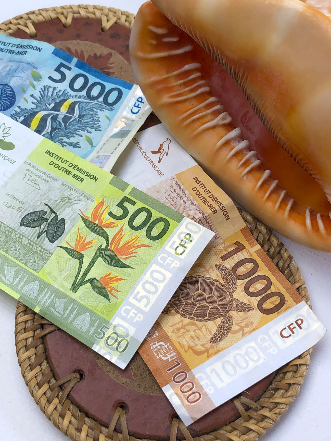
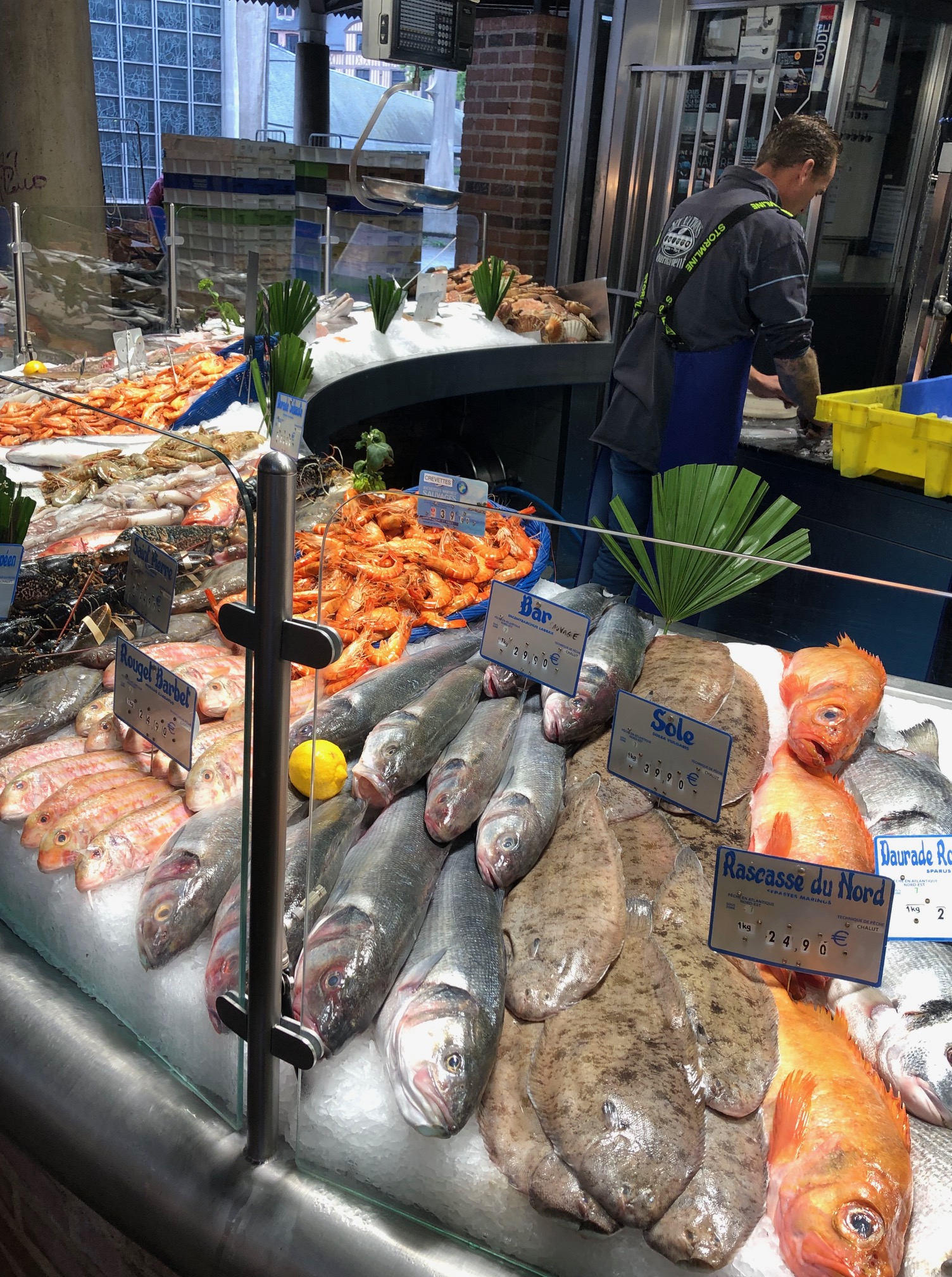
Checking into Little Home Tahiti was a bit unusual: instructions to access the key to the apartment building and garage door fob from a key box were hanging from a traffic signpost in front of the building (our payment, Tahiti has the prettiest currency, was to be placed there too.) The next morning, after excellent coffees at Kaūa’a Tahiti, just around the corner (they roast the coffee beans in the café), we walked a few short blocks to the Marché de Papeete, the town’s old central market.

The 2-story building still has several fruit and vegetable vendors, fish mongers and exotic flower stalls. Most of the space is now, though, is filled with folks selling handicrafts, souvenirs, and Tahitian black pearls, for the tourist trade. Afterwards we picked up our rental car – an easy procedure, with the caveat that we would need to vacuum out the beach sand, before returning the car. We thought this was an unusual request, as most car rental companies that we’ve used have provided this service. Not being local, I asked where I would accomplish this and was informed most gas stations have vacuums available. Easy enough in theory, but nine days later after stopping at five different gas stations, I was not able to find a vacuum pump. Upon returning the car the rental agent was ready to charge us an additional fee for a small amount of sand, difficult to avoid on Tahiti, on the car’s front floor, until I pointed out that we interrupted him from vacuuming a car when we pulled into the lot.

While the airfare to Tahiti, the largest island in French Polynesia, was relatively low, restaurants and hotels in this isolated paradise in the middle of the Pacific Ocean are expensive. This is the direct result of having to import nearly everything from France, China, the United States, Australia and New Zealand. So, to keep within a reasonable budget for nine nights, we chose to stay in three different self-catering apartments across the island. We’ve always enjoyed checking out the local grocery stores and markets during our travels, and enjoy cooking in. Food trucks were mentioned as a budget friendly alternative to restaurants; although good, we found these to be not nearly as inexpensive as you would think. Surprisingly, freshly caught tuna and mahi-mahi were reasonably affordable in restaurants and stores. We enjoyed preparing it several times during our stay.

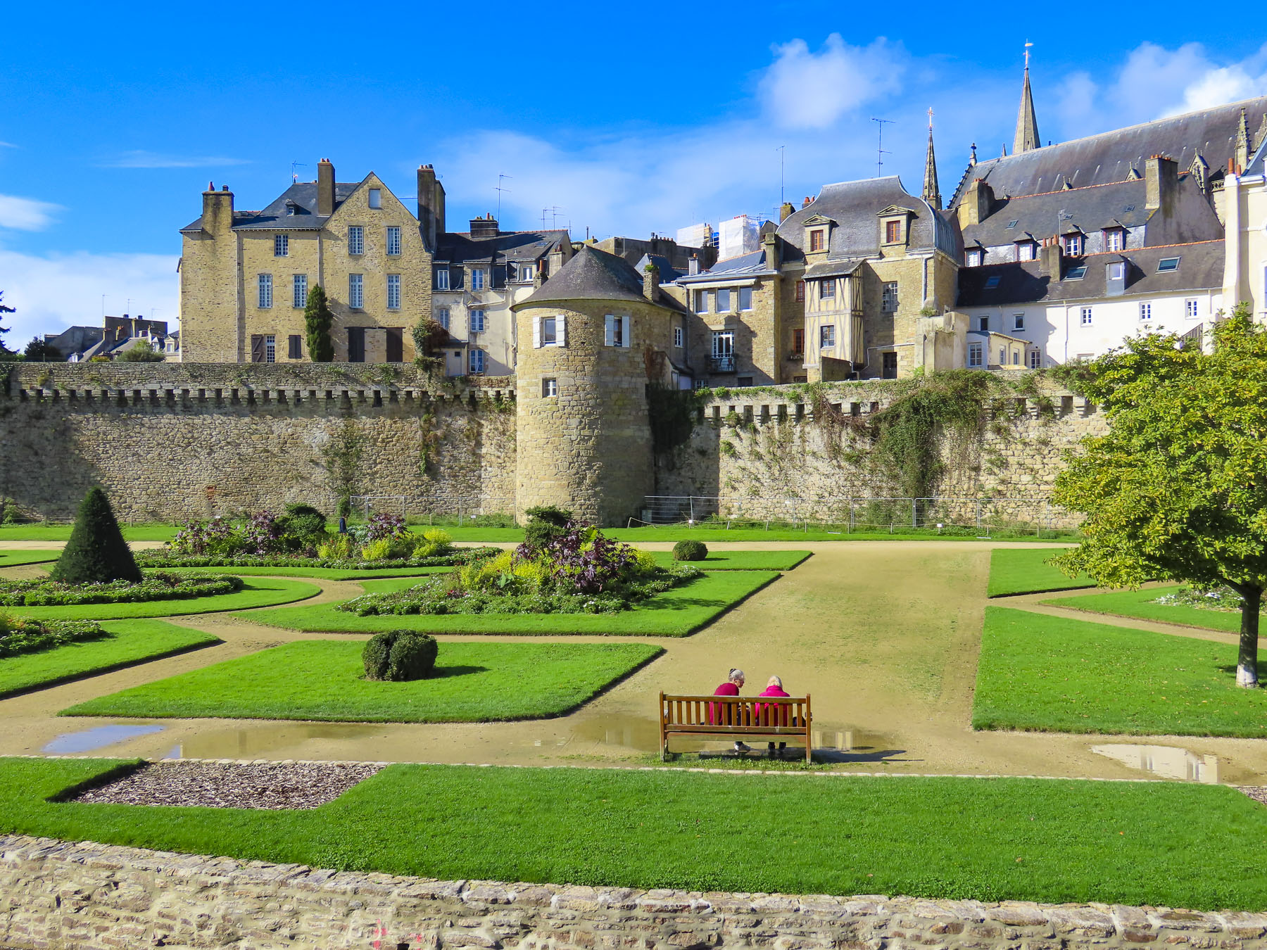
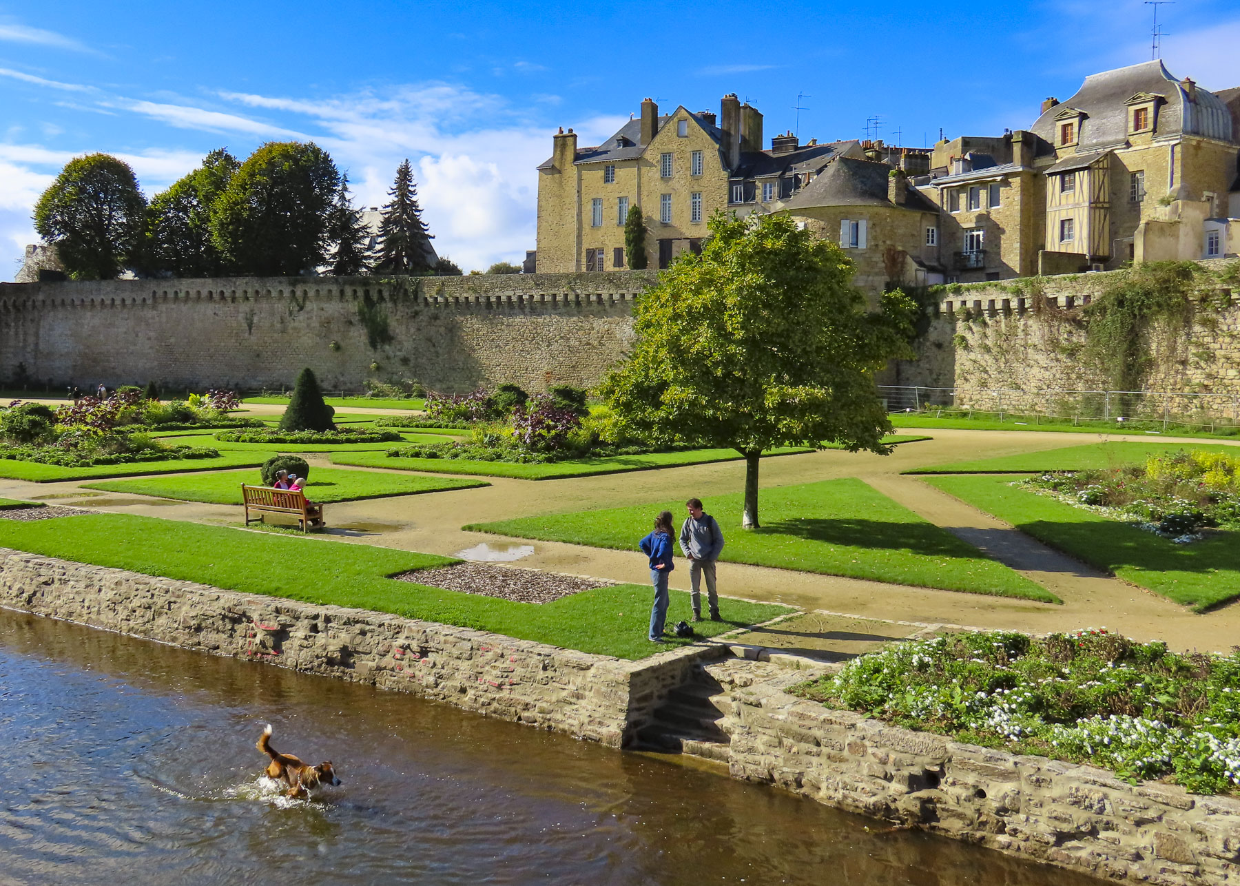
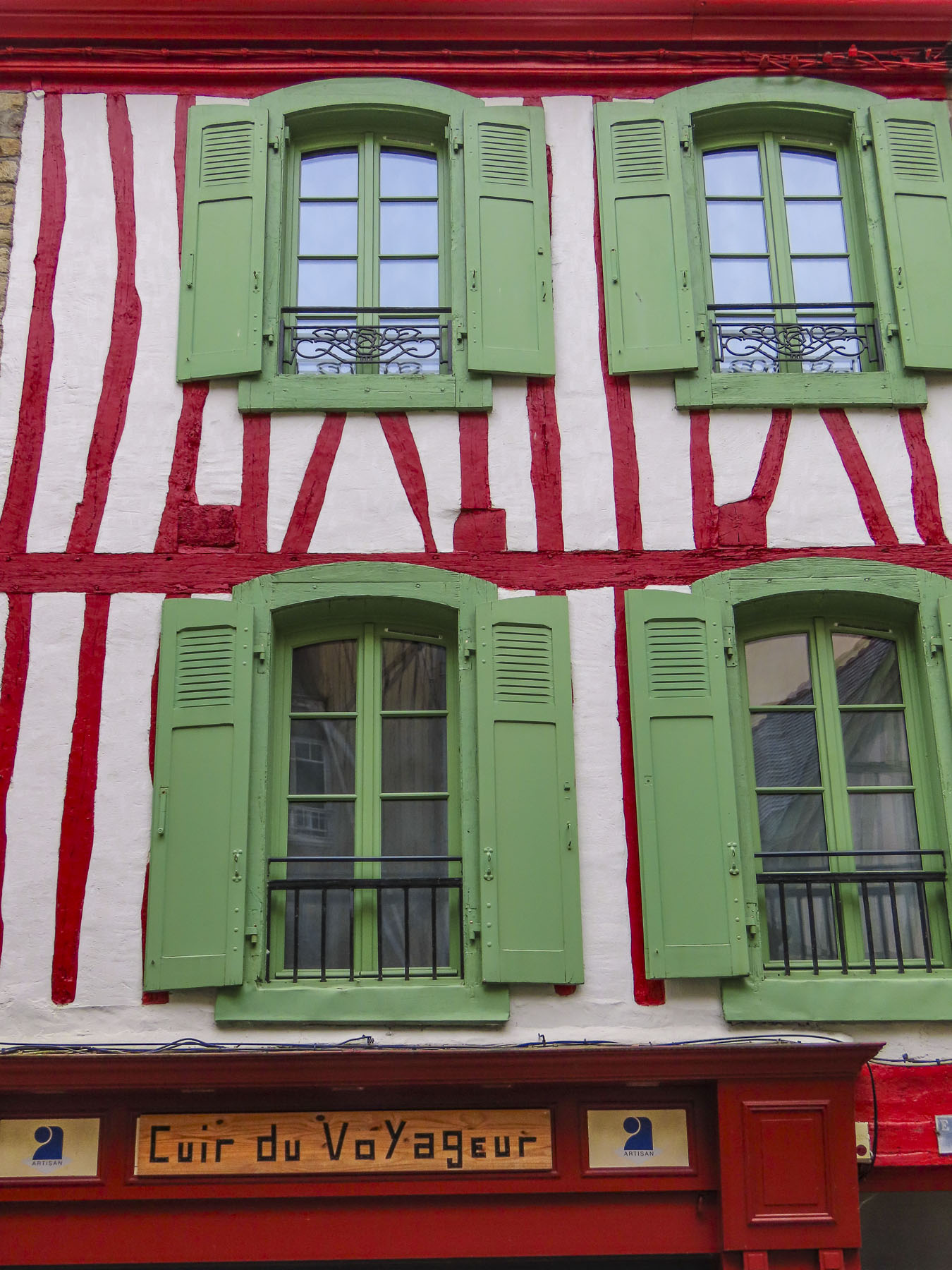
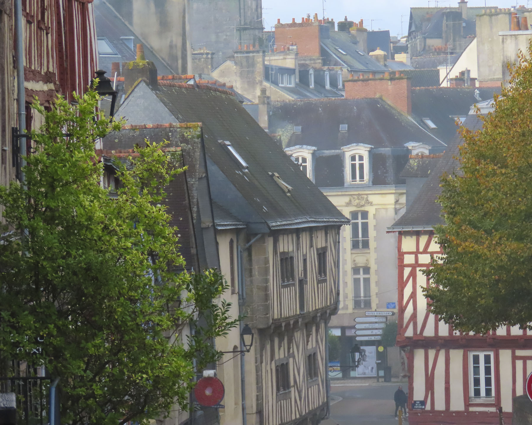
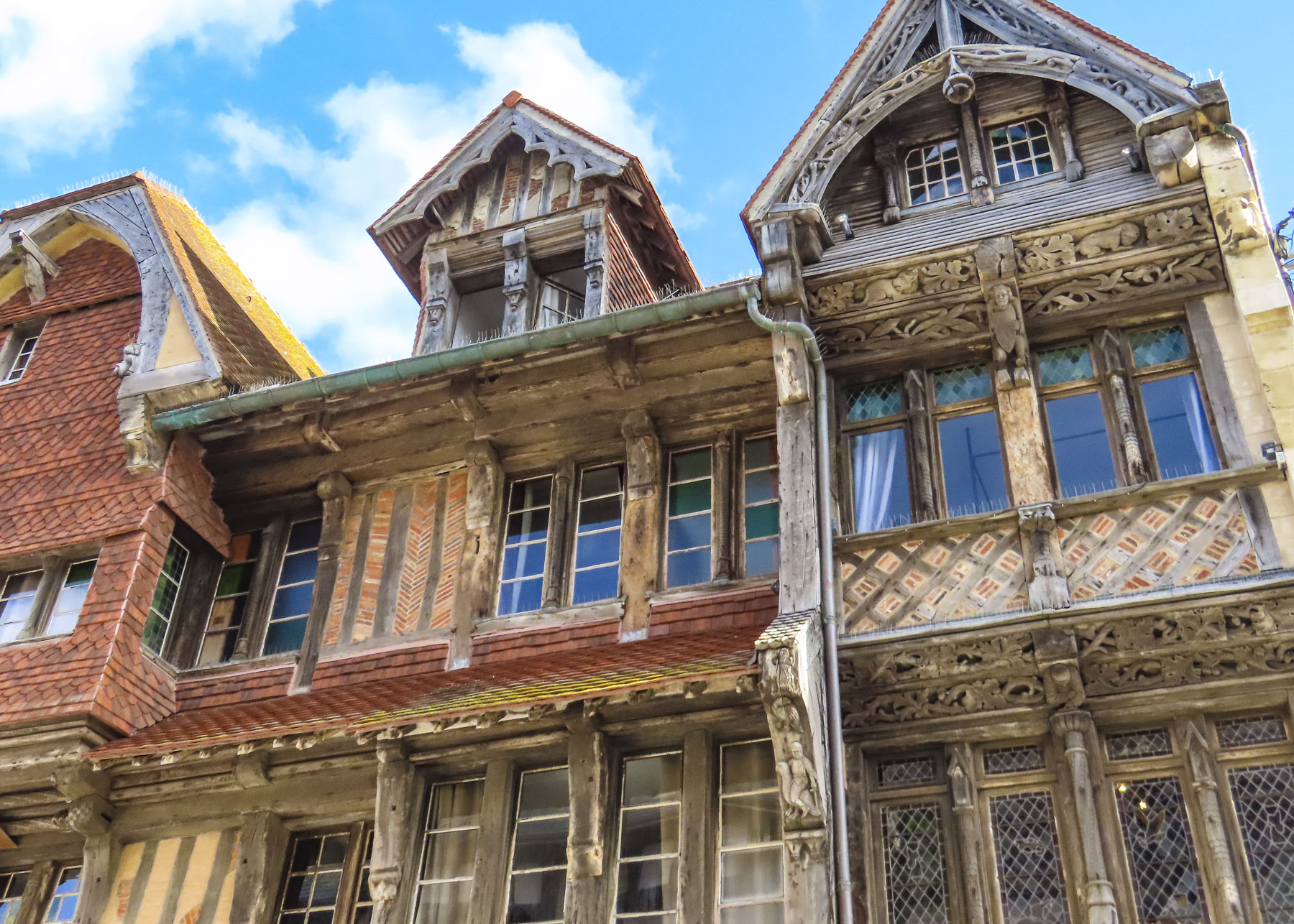
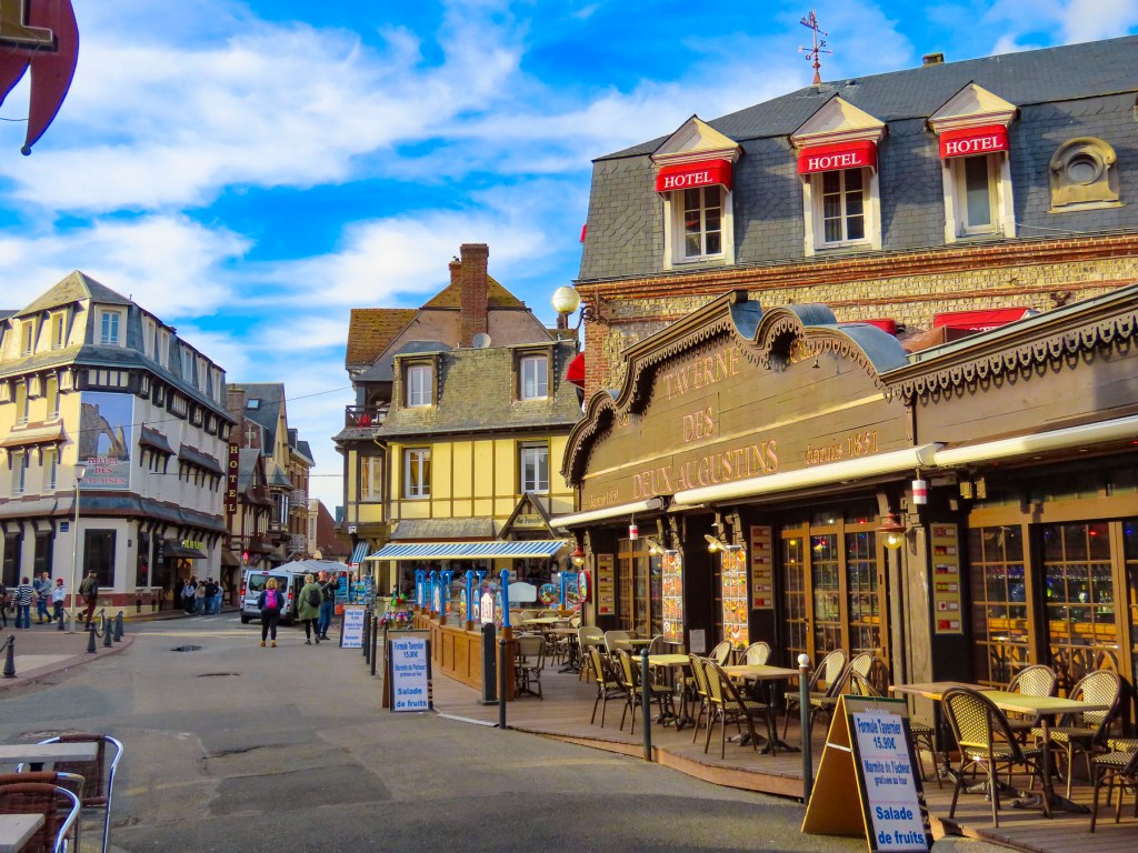
Papeete, the capital of French Polynesia, is a small city with a population of roughly 27,000. Its popularity as a booming destination was never envisioned and the traffic in paradise is just as bad as NYC’s at rush hour, since most of the island seems to drive to work here. To help alleviate the morning and evening congestion they use a road zipper, moveable barrier systems, to reconfigure the incoming and outgoing lanes of traffic at rush-hour. The city’s antiquated footprint was inherited from the days when the town was viewed as only ever being colonial backwater.  Fortunately, the town is thoroughly walkable.

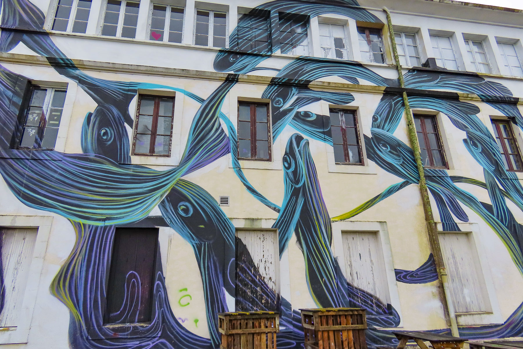
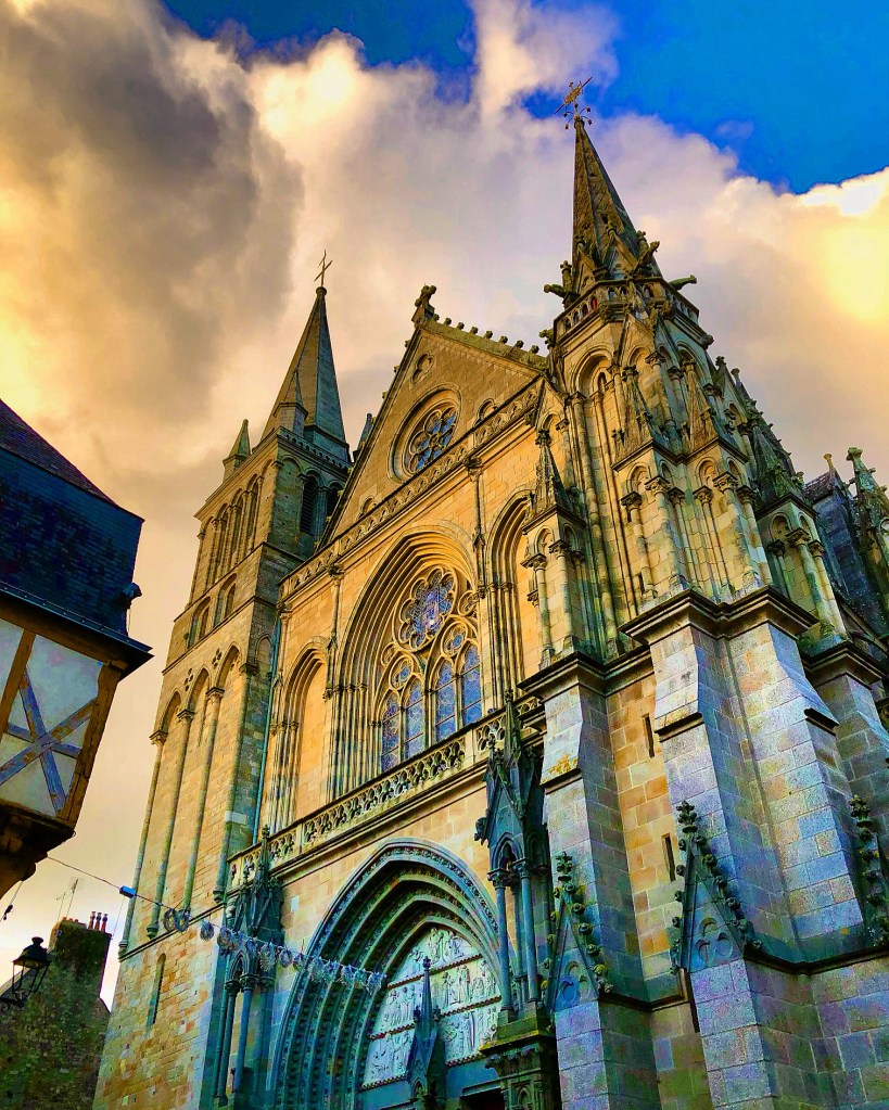
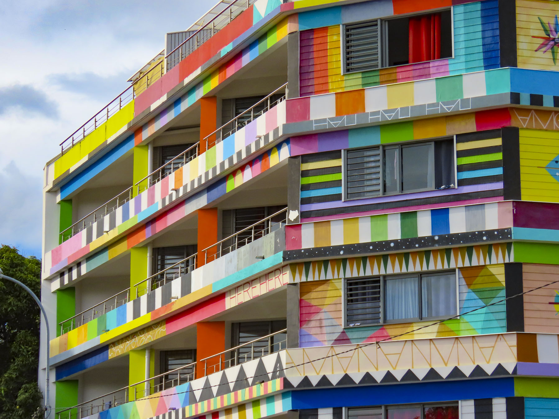
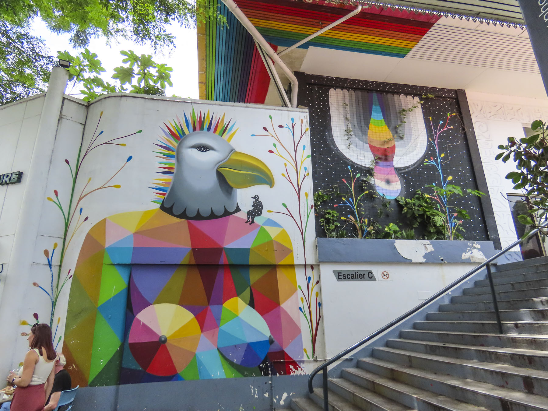
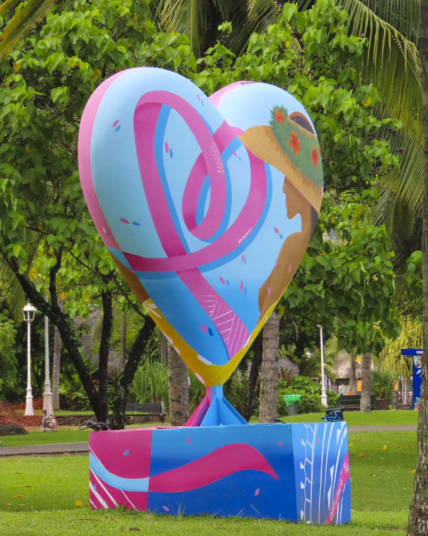
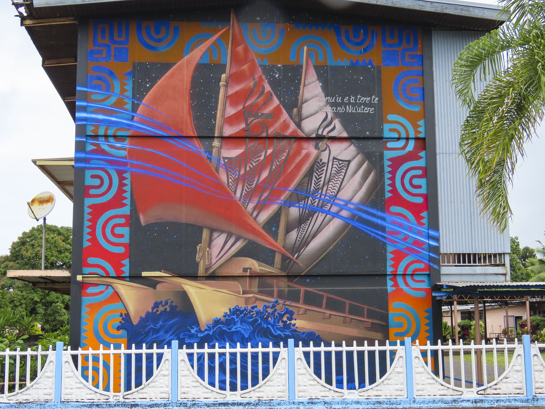
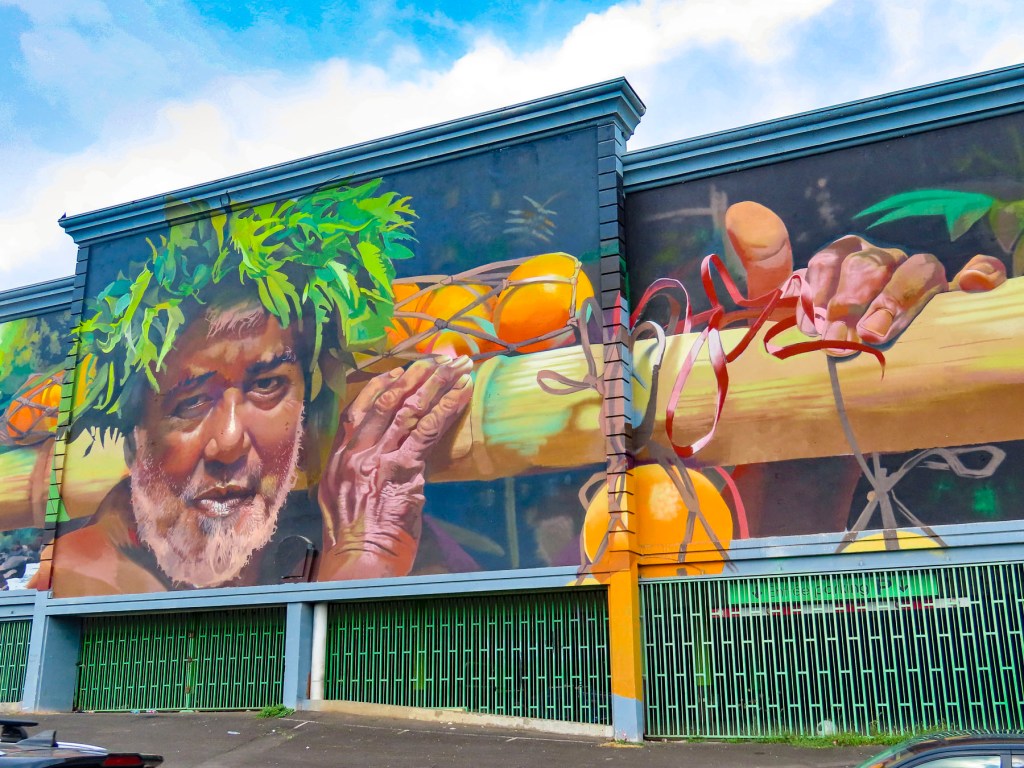
Surprisingly wonderful street murals grace the side of many otherwise dull city walls. Many of these beautiful pieces of art were sponsored by the Ono’u Festival, a street art event that has been held in Papeete since 2014. We used this street art map to help plot our walks around the different areas of the city. There are murals spread all across the city, but several of our favorites were located along the Rue Mgr Tepano Jaussen near the Cathédrale Notre-Dame de Papeete, a French colonial era church from 1875.

Closer to our temporary home, the Résidence Paraita, an apartment building, was totally immersed in an abstract design by the Spanish street artist Okuda, which we could see from the balcony of our apartment.

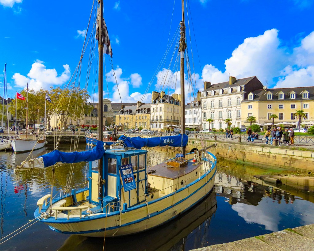
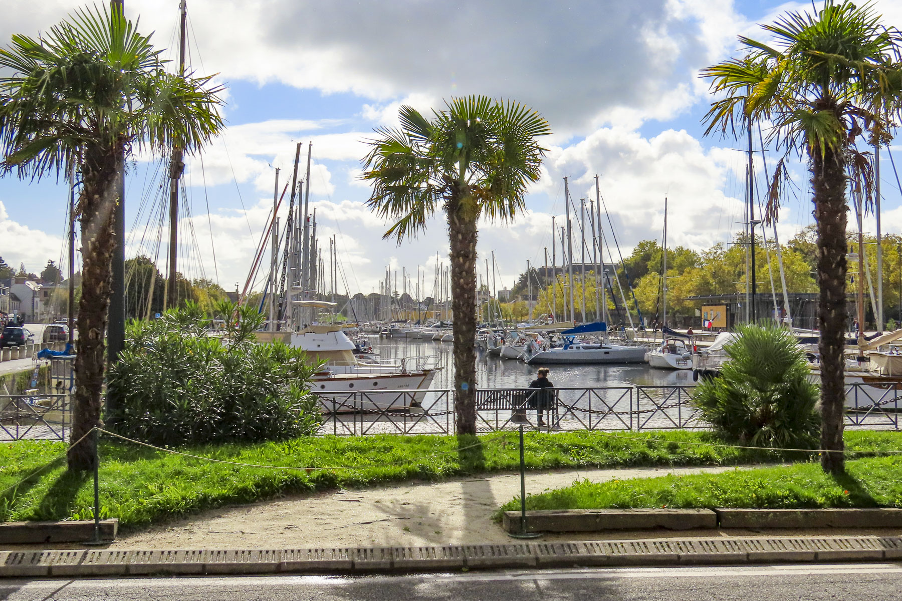
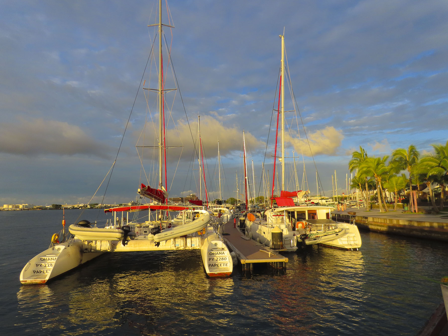
We also enjoyed the walk along the waterfront promenade to Pā’ōfa’i Gardens and the Papeete Marina, where it was interesting to see the different home ports painted on the stern of wandering sailors’ boats. San Francisco, Sydney, Barcelona, Paris, Rio. The boat crews enjoying a safe anchorage before continuing their journey.

Further along we had drinks at the over-water tiki bar of the Restaurant Le Moana and watched with amazement as the bay in front of us filled with just off from work Tahitians who took to the water in Polynesian outrigger canoes, called “va’a,“ and larger longboats, practicing in preparation for a number of races around the islands that take place each year.

The longest and largest, with over 100 teams participating, is the Hawaiki Nui Va’a Race, in which six-person crews paddle across 79 miles of ocean in three days. Starting in Huahine they visit Raiatea, and Tahaa before beaching their canoes on Bora Bora.

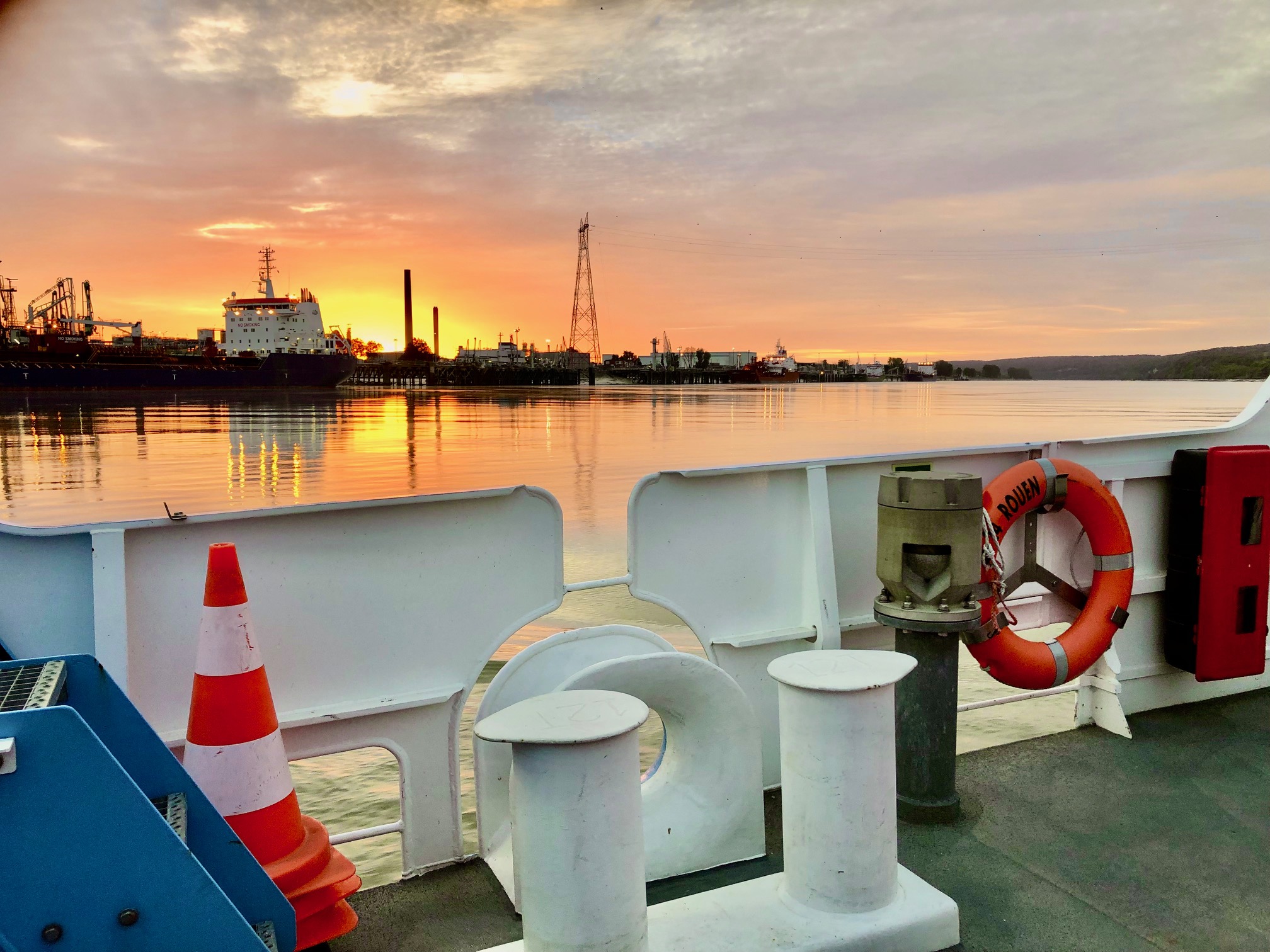
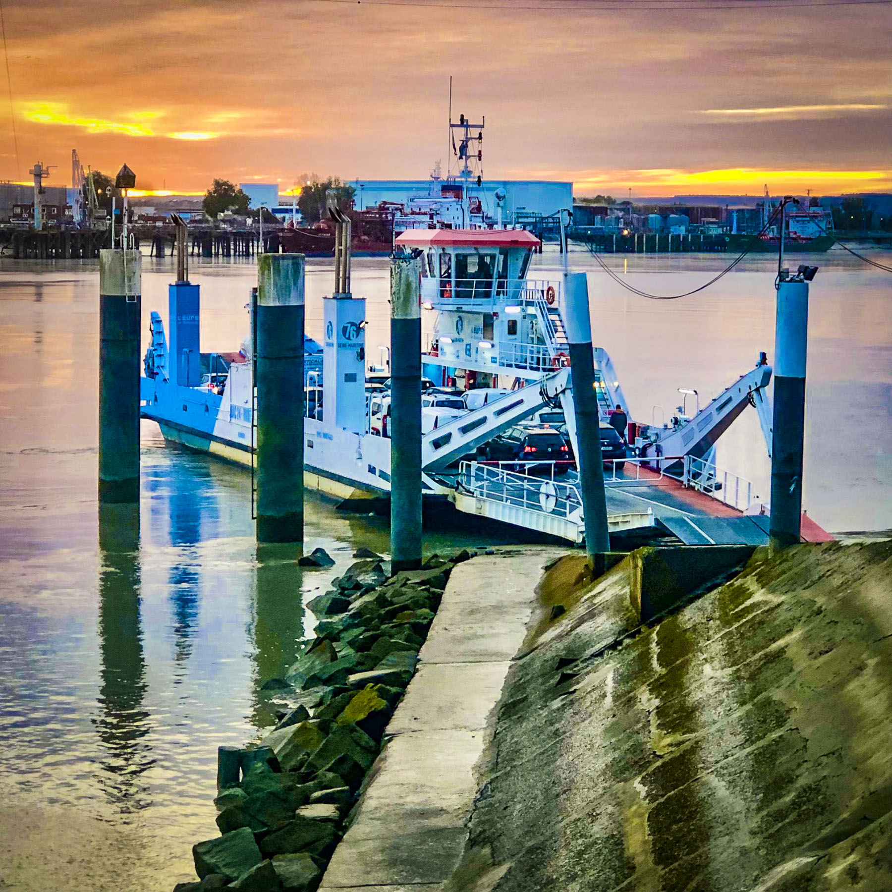
This is one of many races around Tahiti keeping alive the nautical heritage of their Mā’ohi, ancient ancestors’ incredible ocean-going feats in search of new horizons. Folks stayed on the water until sunset, one of the most colorful we experienced while on the island. The last of the day’s inter-island ferries sailed toward the sunset.

Also on the waterfront in Place Jacques Chirac is a full-size replica of an ancient Polynesian wa’a kaulua, a double-hulled, long distance, sailing canoe. Just looking at it made us realize what an amazing accomplishment it was for the early Polynesians to cross vast stretches of unforgiving ocean.

Walking back through town we stopped at Vini Vini Fish N’Chill for dinner. It’s a small casual place, with inside and outside tables, that grew as an off-shoot from the families long-line fishing fleet and serves poke bowls, tartines – a French open face sandwich with various toppings, sushi and of course burgers. Occasionally they’ll host a ukulele band outside on the sidewalk.

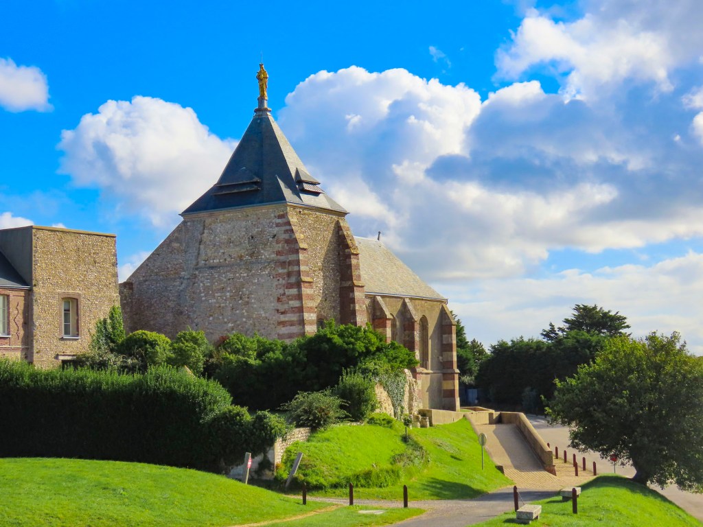
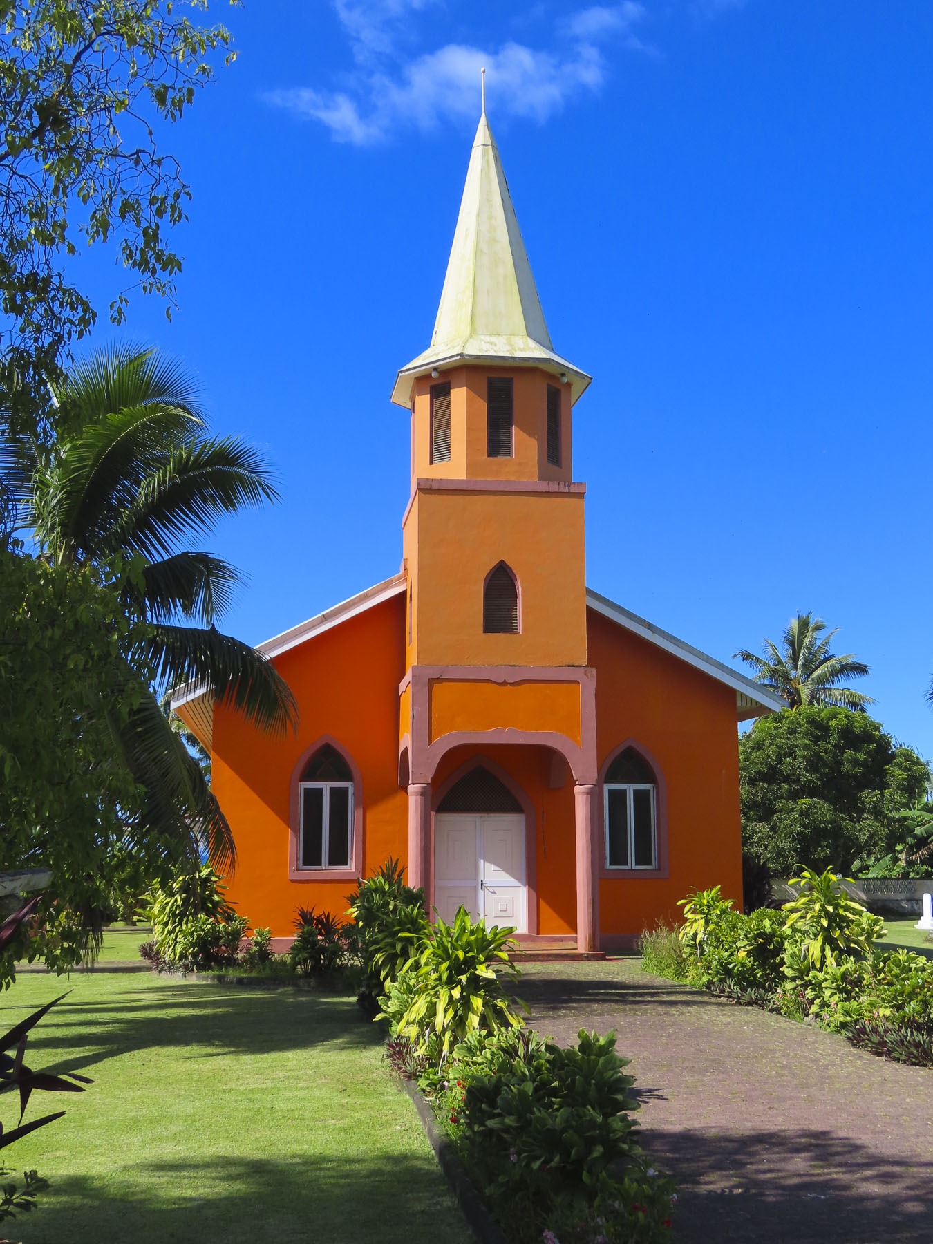
Outside Papeete the traffic eases tremendously and we took several short day-trips out into the surrounding area, traveling along the north coast to the Pointe Vénus lighthouse in Māhina. Built in 1867, on a black sand peninsular that juts into Matavai Bay, it was the first lighthouse built in the South Pacific and equipped with a powerful beam that could be seen by ships 215 miles out to sea. It takes its name from an event on Captain James Cook’s first voyage around the world, when on June 3rd, 1769, Cook and his accompanying astronomer Charles Green set up equipment to observe the transit of Venus, a small black dot, travelling across the Sun. From the shore here looking north the blues of the sea gradated seamlessly into the sky, a vast endless emptiness that Polynesians explored and found Hawaii, 2600 miles away, 1200 years ago. The brightly painted Église Getesemane de Mahina along the road to the lighthouse was definitely a worthy photo stop that epitomized the Tahitian celebration of color.

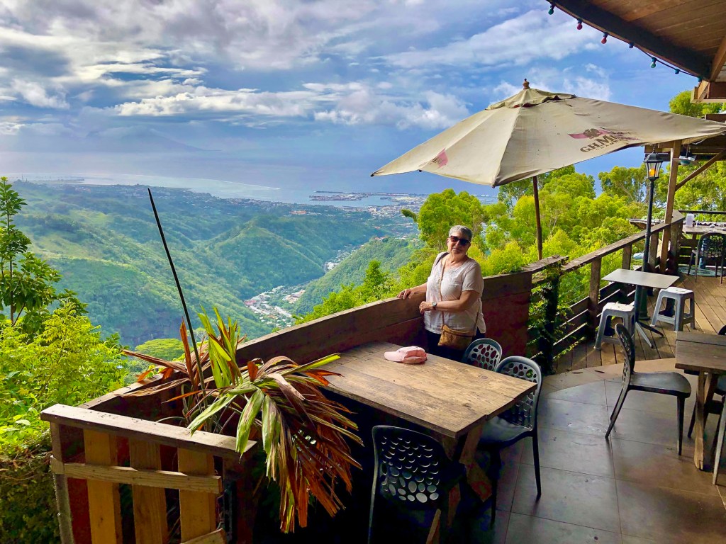
Later we headed to the O Belvédère, a remote French restaurant, located in the foothills of 7,352 ft Mount ‘Orohena, the island’s tallest peak and the highest mountain in French Polynesia. The restaurant is only open for lunch and dinner Friday – Sunday. Unfortunately, we visited earlier in the week, but the staff kindly let us take in the breathtaking views, over the rugged foothills which extend to the coast, from its balconies.

It’s definitely a destination restaurant and part of its allure is the harrowing 3.5 mile drive, not for the faint of heart, up a single-track, heavily potholed road through dense jungle-like forest that dead ends at the restaurant. There was barely room for the rare oncoming car to pass. It’s not a drive we would undertake in the dark. Guided hikes to Mount ‘Orohena and 4×4 safaris into the mountains can be arranged through local tour operators, as there are not any roads that cross Tahiti’s mountainous interior. One the way back to Papeete we passed and then circled back to photograph the Mairie de Pirae, the local town hall, a beautiful example of French colonial architecture that seemed out of place on the tropical island.

The morning of our checkout from Little Home Tahiti, just as we had finished our coffee and zippered the suitcases, the power to our building went out. Not usually a big deal, but we were staying on the 5th floor and the car was in the underground parking. The heat and humidity builds quickly in the tropics without A/C. We called our host for a situation update, only to be informed that it was an island wide power outage, something that, it turns out, happens rather frequently. The big question for us, was the electric gate to the underground garage functioning? We were reluctant to walk down seven flights with only the emergency stairwell lights and the weak flashlights on our cell phones. After an hour of indecisiveness, I slowly carried our suitcases downstairs to the car and was very relieved to find the gate wide open. I parked the car on the street, called Donna and relayed, “We’re free – let’s go!”

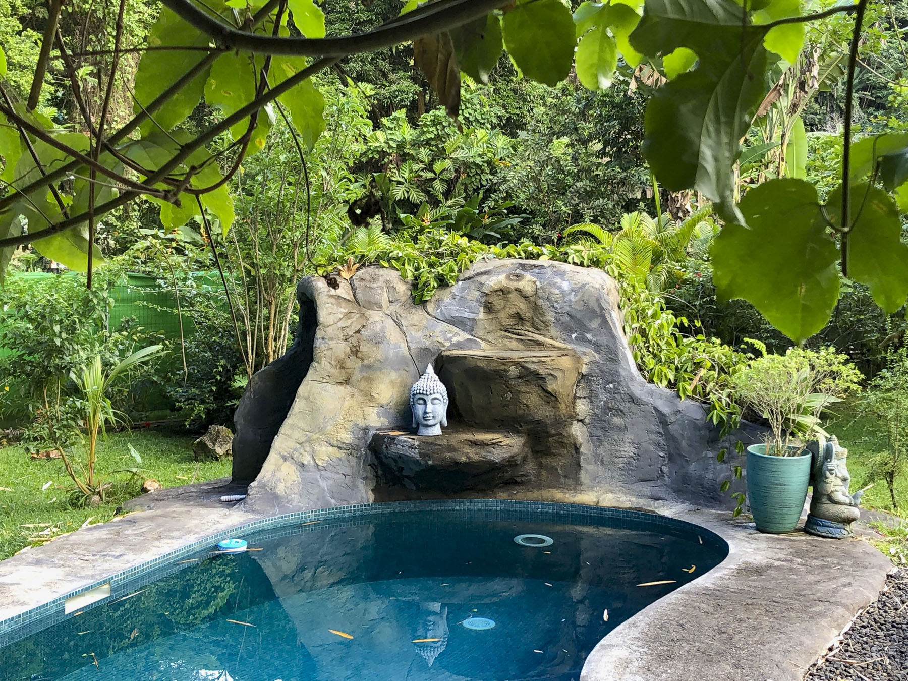
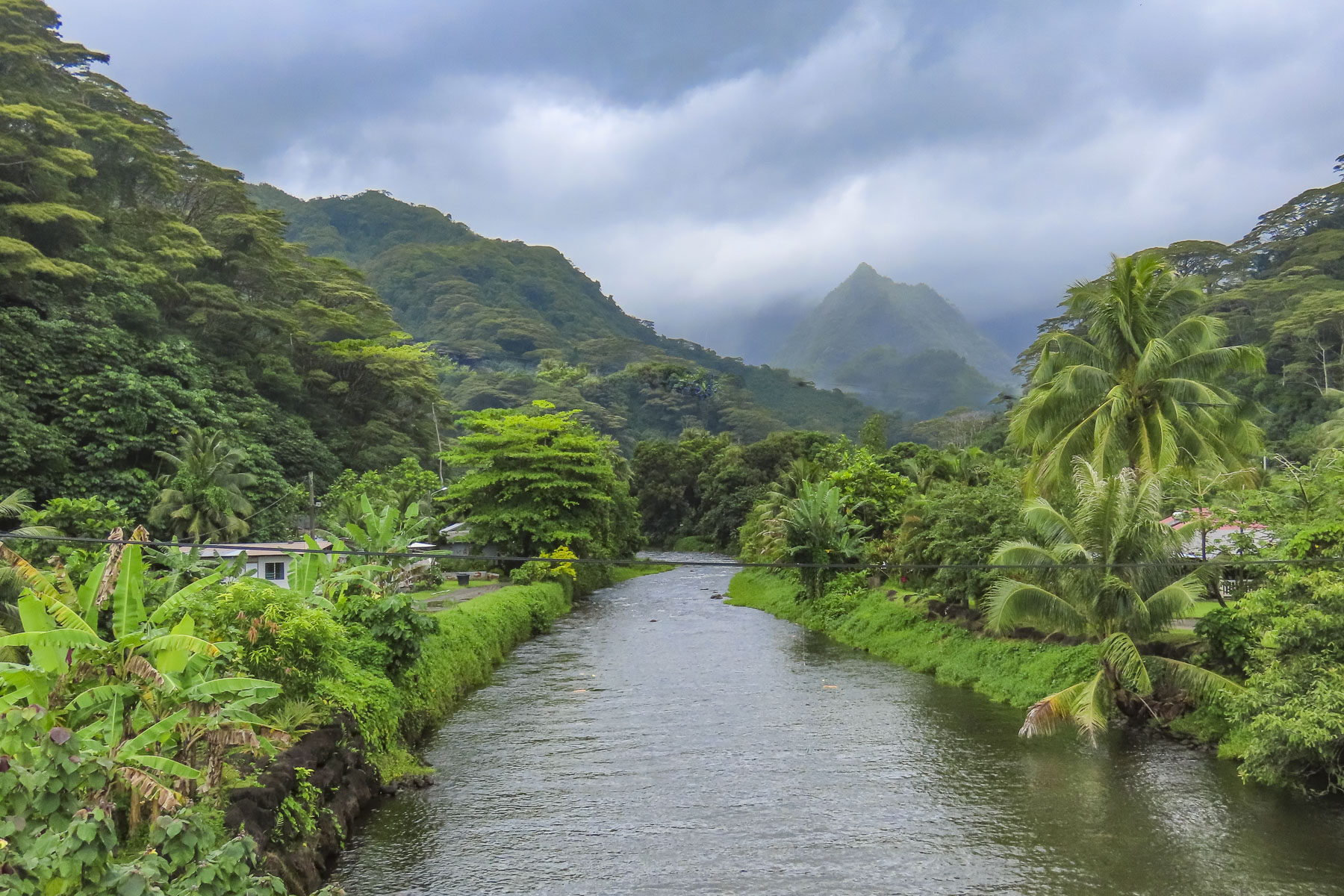
The intersections required caution as the traffic lights were also down, but once we followed Route 1 away from Papeete the prevalence of traffic circles was a blessing. From the air, the island of Tahiti is shaped like a flounder or beaver with a larger upper body and smaller tail. Similar to the way Tahiti Nui, the larger main island, connects to the smaller Tahiti Iti, at the narrow Taravao isthmus. It’s difficult to get lost on Tahiti considering the ring road, Route 1, is only 72 miles long and transverses a narrow coastal plain that encircles the island and separates the ocean from the abruptly steep mountainous interior. The road starts and ends in Papeete, with short spurs down the east and west coasts of Tahiti Iti. It’s a modest distance that we gave ourselves seven days to cover, split between exploration of the island and R&R. Our target at the end of the day, after multiple stops, Soul Rise in Nutae on Tahiti Iti, a rustic attached bungalow, with a private cabana and shared pool, for three nights.

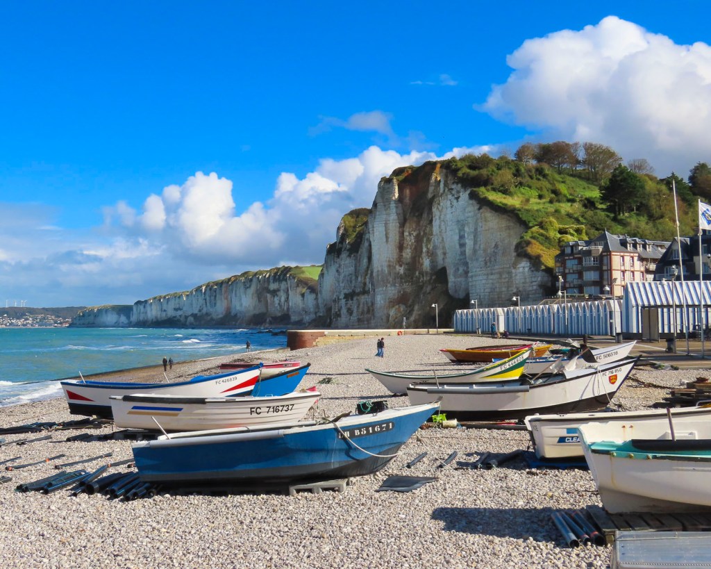
Following the ring road east we stopped at the Arahoho Blowhole. It’s a geological curiosity, as it’s not the usual type of blowhole that exists right at the ocean’s edge and water is pushed up through a crack in the rock. Here water is vented quite a distance inland from the sea as a fine mist after being pushed back forcefully by the waves through an ancient, long and narrow lava tube. The park here has picnic tables and a black sand beach that surrounds a small cove that’s popular with surfers.

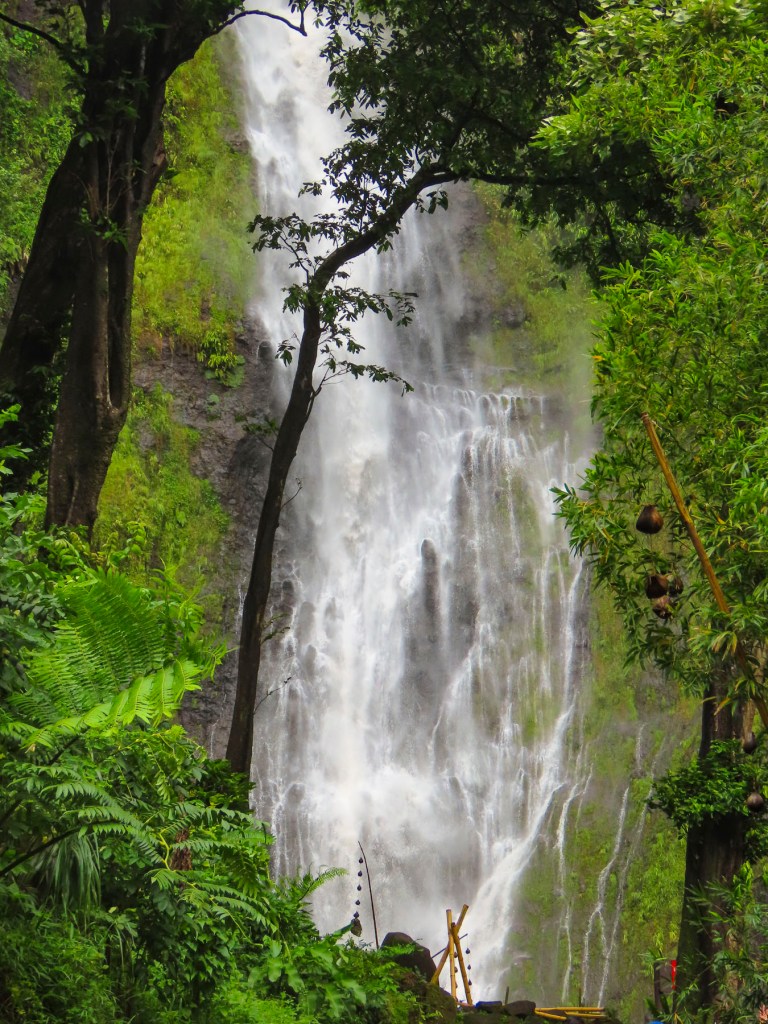
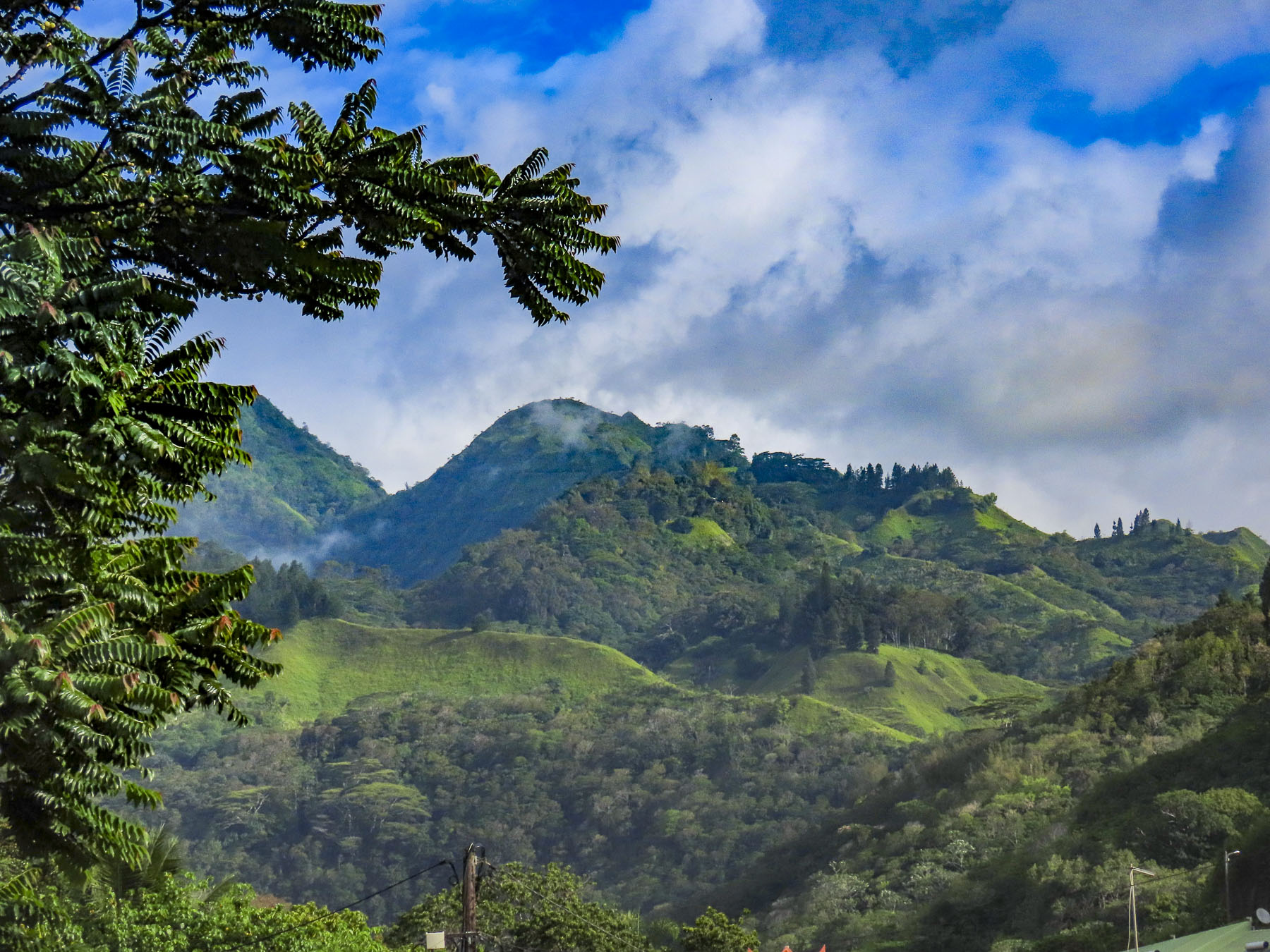
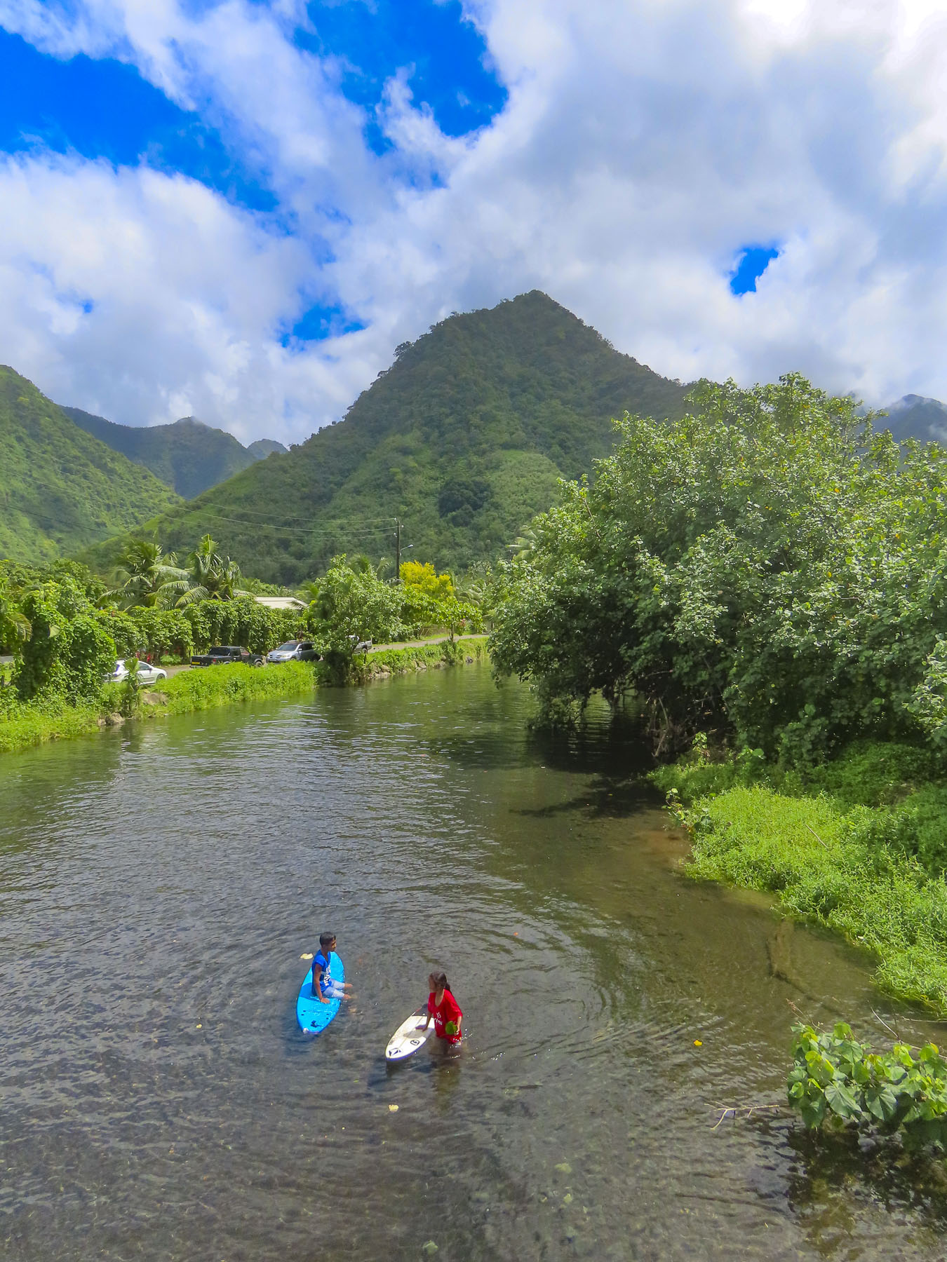
Located at the end of the road, almost directly across the street from the blowhole, the Fa’aruma’i Waterfalls were beautiful. This first was an easy walk from the parking area, but the second two are reached by an eroded and rocky trail that took some effort for us to negotiate before crossing a rickety suspension bridge and climbing farther into the hills. There were numerous photo stops along this drive, especially at the bridges over the rivers, that give a glimpse into Tahiti’s rugged, verdant interior.

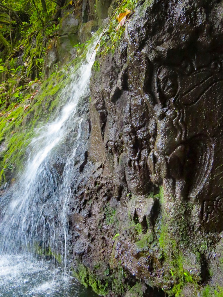
Closer to Tahiti Iti, La Cascade de Pape’ana’ana was a hidden gem barely visible from the road. It’s a mysterious site with figures of a tribal chief and a woman carved into the stone face of a small waterfall. No one knows when or who created it. There were numerous waterfalls and beaches along the east coast of Tahiti Nui just waiting to be explored.

We reached Taravao late in the afternoon, at the time when most restaurants are closed until dinner. We opted to eat at the local McDonalds, something we rarely do, especially when traveling abroad. But we were pleasantly surprised with tasty McWraps, and the coffee was good. But one of the memorable things about this stop was the appearance of a young father and his daughter dressed in matching pinks tutus, enjoying each other’s company and lunch together. It’s not something every dad would do, and I would have loved to know the backstory, but I admired him for his self-confidence, and that he didn’t perceive this playfulness as eroding his masculinity, just a desire to please his little girl. Something I can relate to.

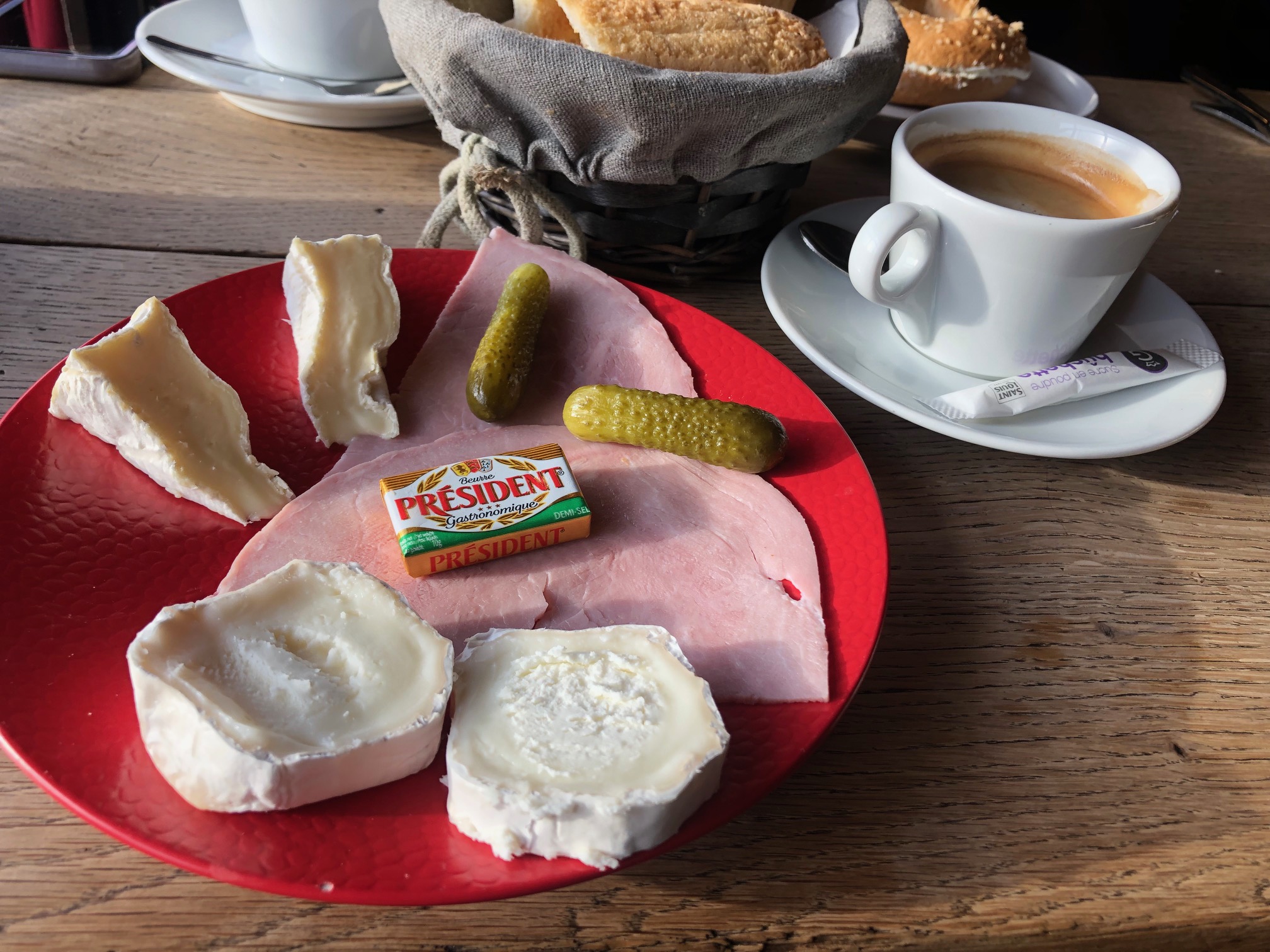
Afterwards we stopped at the local Carrefour, which was as fully stocked as any supermarket in France, though the prices were through the roof, as high as if we were living in Paris. We purchased tuna, mahi-mahi, some vegetables, salad, and a fresh baguette for dinner. Croissants and French style pâtisseries were gathered for breakfast. A bottle of French rose’ and a 6 pack of locally brewed Hinano beer rounded out our purchases. Curiously, the beer’s distinctive and elegant “vahine” logo of a Tahitian woman wearing a red pareo was painted by a fellow from Sweden in 1953.

With the groceries put away and the beer in the fridge, we cooled off in the pool. Tahiti was one of our warmest vacations with daily temperature in the mid-80Fs, with high humidity. Usually we target locales with spring-like weather. Fortunately, along the coast there was always a cooling breeze blowing in from the ocean.

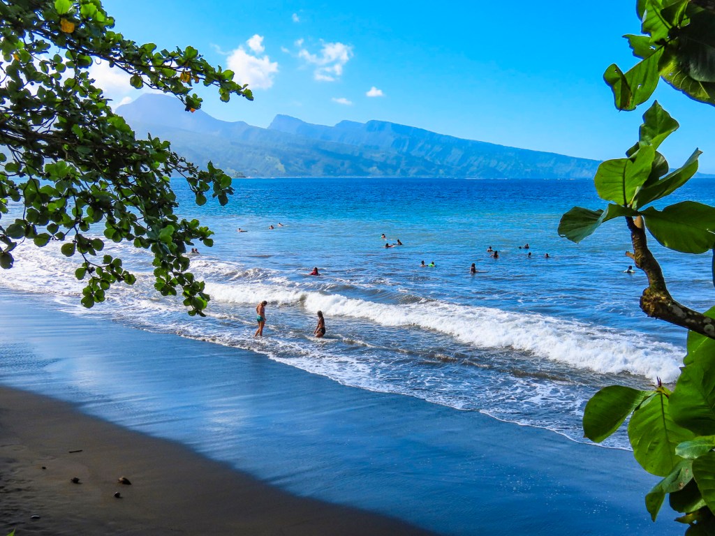
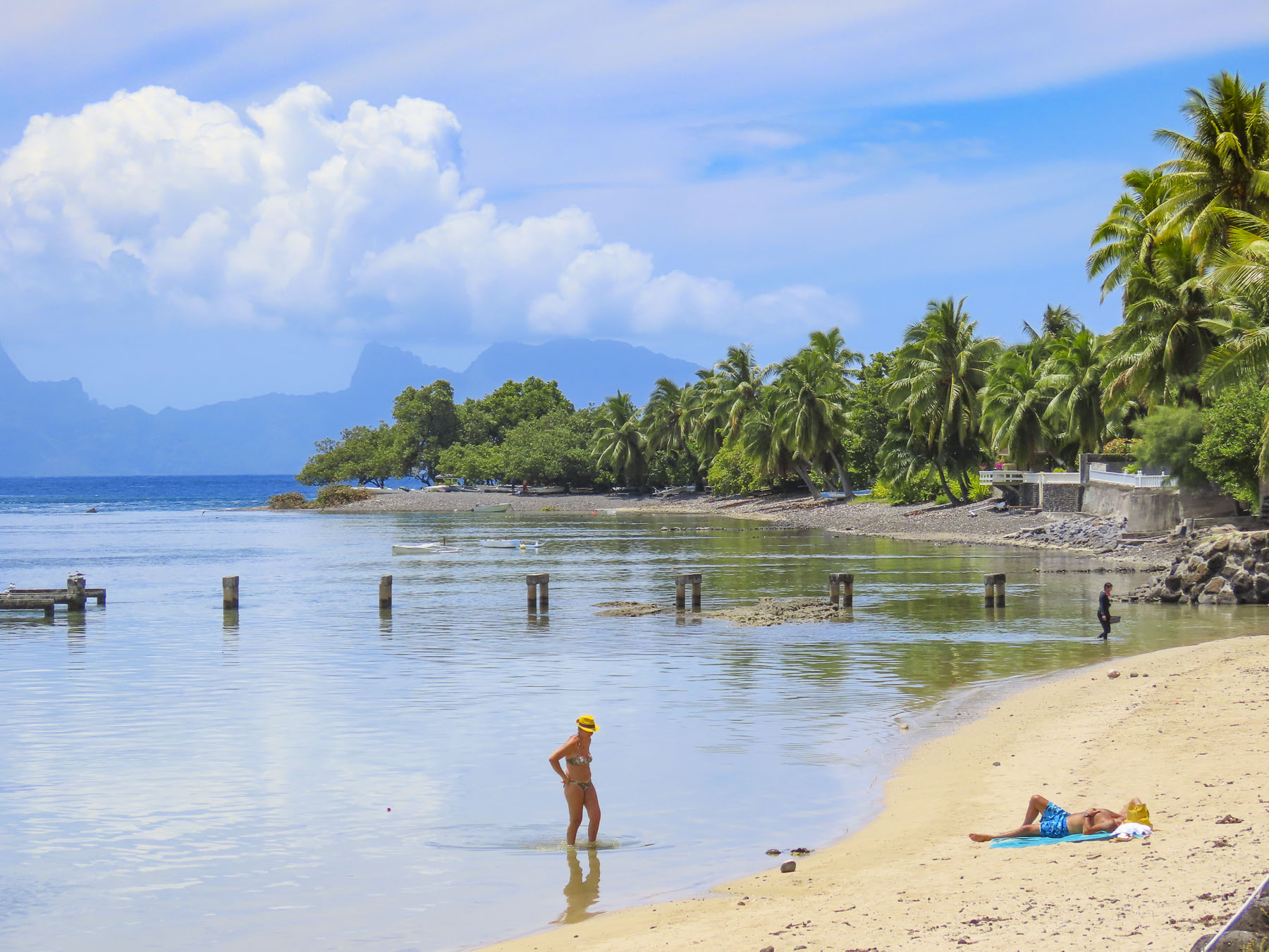
The next morning, we walked a short distance and crossed the road to a black sand beach, created eons ago from volcanic eruptions. Following the local folks’ example lead we rinsed off after our swim under a pipe, driven into the hillside like a spout into a barrel, gushing spring fed water from the highlands.

Later we headed to Tautira for lunch at Le Bout du Monde, which sounds so elegant in French, but translates as “The End of the World,” and aptly describes the locale, with the coast of South America nearly 5,000 miles east. The road literally stops here, as there is not a coastal plain around the southern tip of Tahiti Iti that is suitable for a road. The mountains descend into the sea here. Folks live along this isolated eastern coast but need to use boats to get to their homes. Rustic simplicity best describes Le Bout du Monde, with its walk-up ordering window, and wallboard menu. There were several dishes listed, but I think they only serve the catch-of-the-day. Picnic tables were around the back under shade trees at the edge of the ocean. Only us and another couple were there. The fish was delicious!

Afterwards we took our time walking along Tautira’s beautiful black sand beach set against the mountains. On the way home we noticed people standing by the roadside in front of their homes. Some were holding umbrellas to shield themselves from the intense sun. Soon a van stopped and handed the people waiting a paper bag, with tan colored oblong shapes protruding from the top. Aha! We realized folks had been waiting for their rural baguette delivery, fresh from the bakery. It’s so wonderfully French.

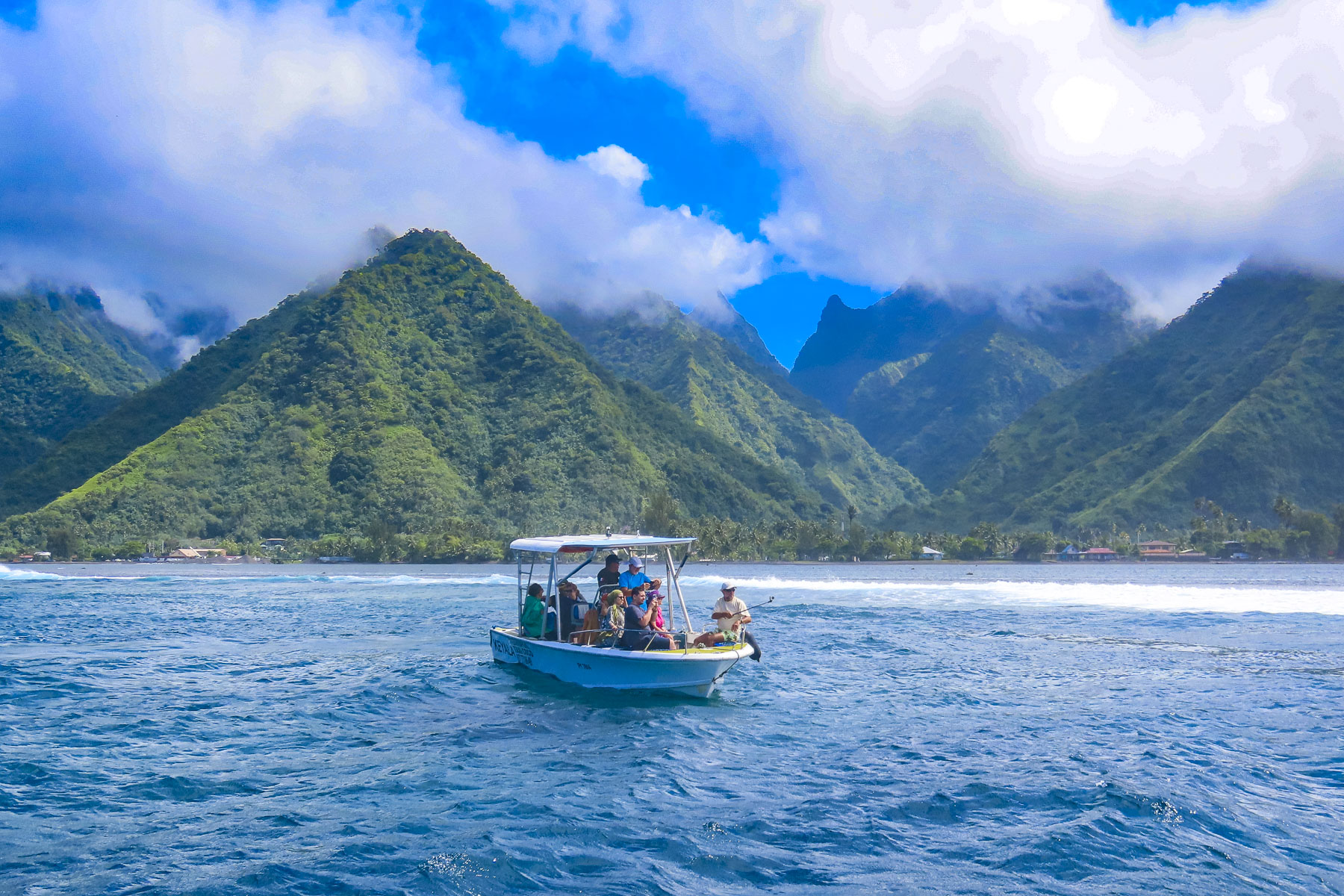
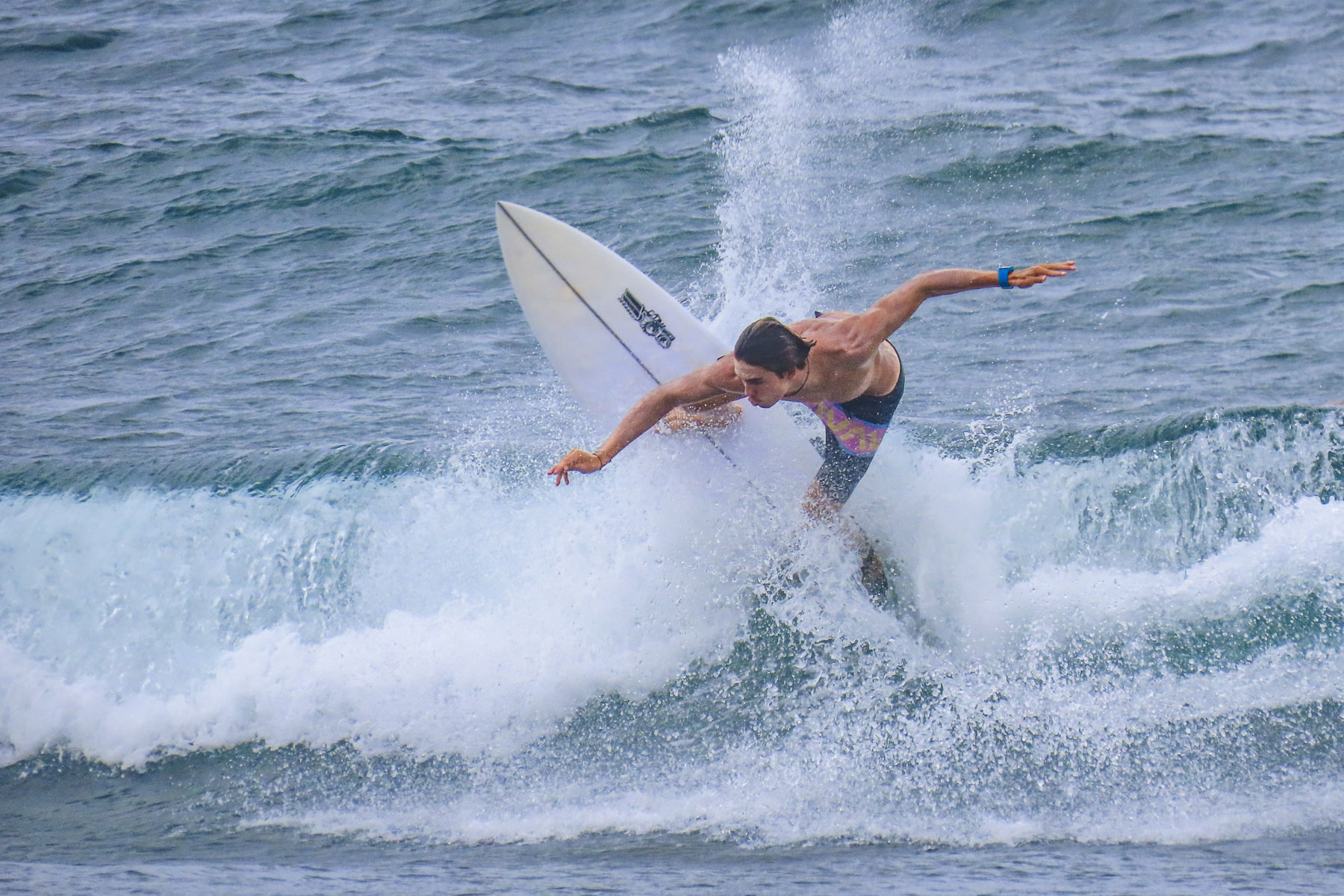
We have never surfed, though we were intrigued by the spectacular photos captured of the surfers riding the famous Teahupo’o Barrel Wave, located off the west coast of Tahiti Iti. The next morning, we drove to the village of Teahupo’o on the opposite side of Iti, where there are a number of boat operators, and booked a tour with Michael, the owner of Teahupoo Excursion Taxi Boat.

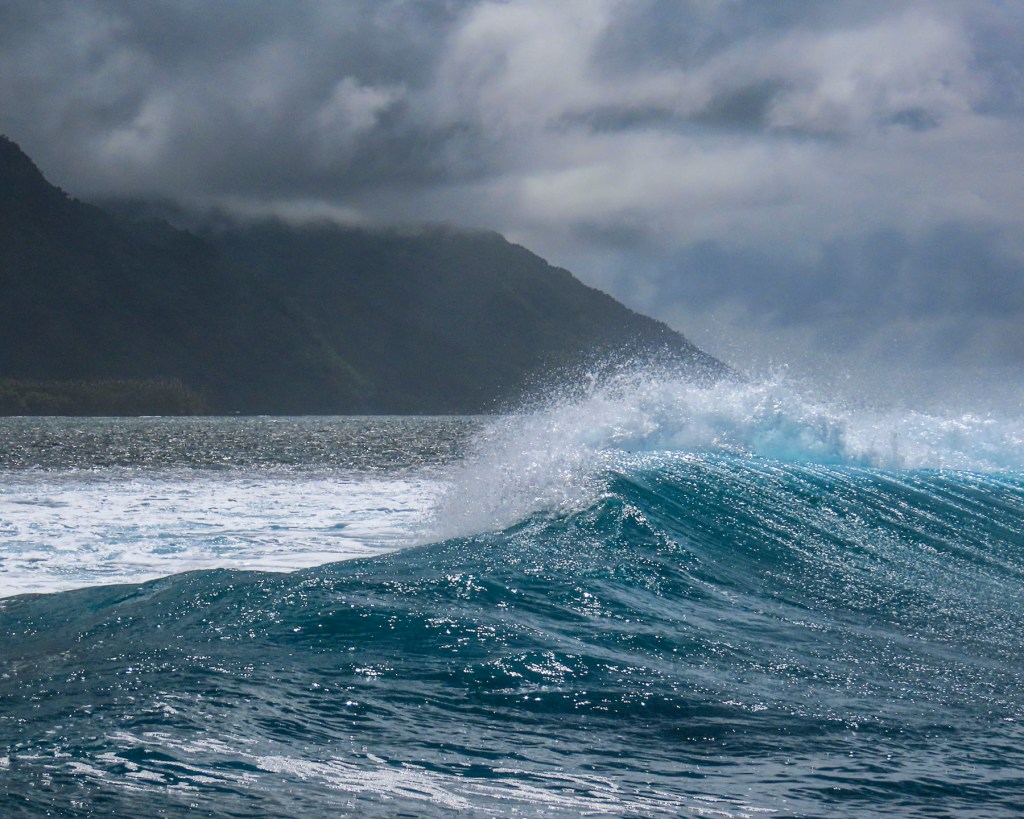
Though the conditions were not right to form the famous curl that day, we still enjoyed our time on the water and the dramatic perspective it provided looking back at the mountainous coastline. The 2024 Summer Olympic Surfing event will be held at Teahupo’o.

Afterwards we enjoyed a scenic drive to the Belvédère de Taravao in Iti’s highlands. The inaccessible Mount Ronui, standing at 4370 feet, is the highest point on Tahiti Iti. The Belvédère de Taravao, at 1800 feet, offers an expansive view of the Taravao isthmus that includes the east and west coasts of Tahiti Nui.

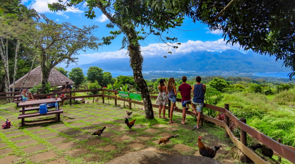
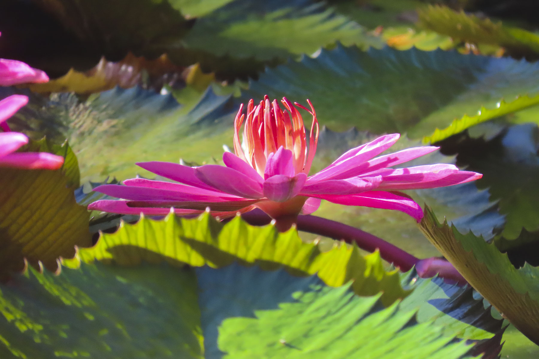
For the last four days we headed back to Tahiti Nui and drove along the west coast towards Papeete, stopping to take pictures numerous times. Gardneners ourselves, we especially enjoyed the Water Gardens Vaipahi and the Grottes De Mara’a, where we followed the paths through colorful specimen plantings and noticed, not for the first time, the ubiquitous free range roosters, hens, and chicks that seem to roam everywhere in Tahiti.

At Taharuu Beach we practiced our sports photography skills, capturing surfers riding the waves, an activity we could spend hours engrossed in, but the weather just wouldn’t cooperate fully.

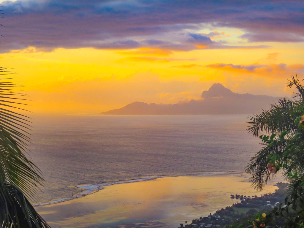
Later that afternoon we arrived at Bungalow Poerava in Punaauia and were blown away by its dramatic location. It’s a small apartment next to the owner’s home that’s cantilevered out over a steep hillside.

This construction gave it a splendid Robin Crusoe treehouse feel. It had a fully equipped outdoor kitchen, and porch and seating area boasted a view of Moorea in the distance. It was one of the nicest apartments we’ve every stayed in during our years of travel. Oh, and it had an avocado tree laden with fruit hanging over the entry stairs. We didn’t want to leave!

Normally we never just stay still and chill while traveling, but the setting here was perfect for kicking back, reading and enjoying a glass of wine on the shaded deck. We explored the surrounding area in the mornings but made sure we were back to enjoy the sunset.

We divided our mornings between exploring cultural sites and swimming at beaches sheltered by the island’s surrounding reefs before returning for the day. The Museum of Tahiti and The Islands is a Polynesian ethnographic museum and has a fascinating collection of ancient artifacts collected from across the Tahitian islands. Later we enjoyed the food trucks at Parc Vaipoopoo, before enjoying the soothing bath-like waters of the Plage publique de Toaroto’s white sand beach.

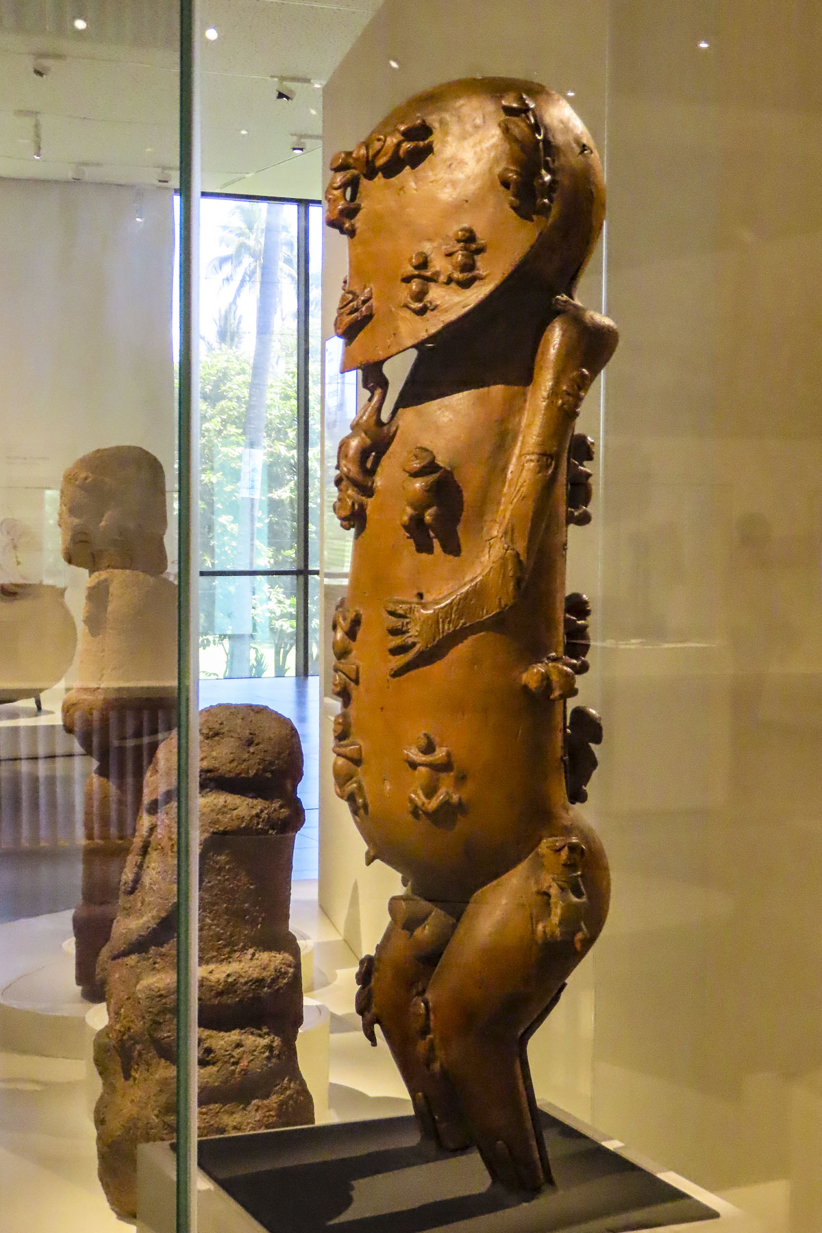
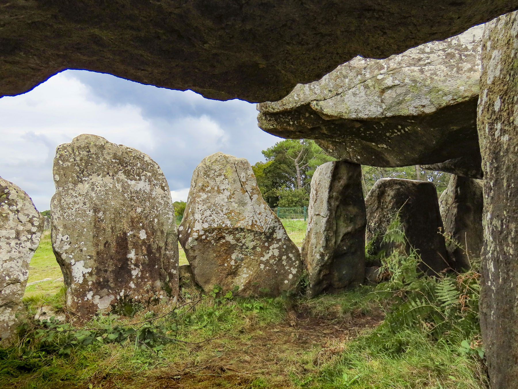
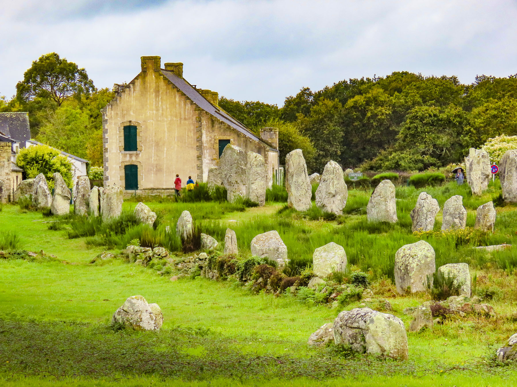
The next day at ‘Ārahurahu Marae, an ancient Polynesian place of worship, a striking stone moai guarded the entrance to the religious site. Though smaller than its famous cousins on Easter Island, there was a definite resemblance. A large marae, an ancient ceremonial altar, constructed from lava stones and coral was at the rear of the site, where human sacrifices were once held centuries ago.

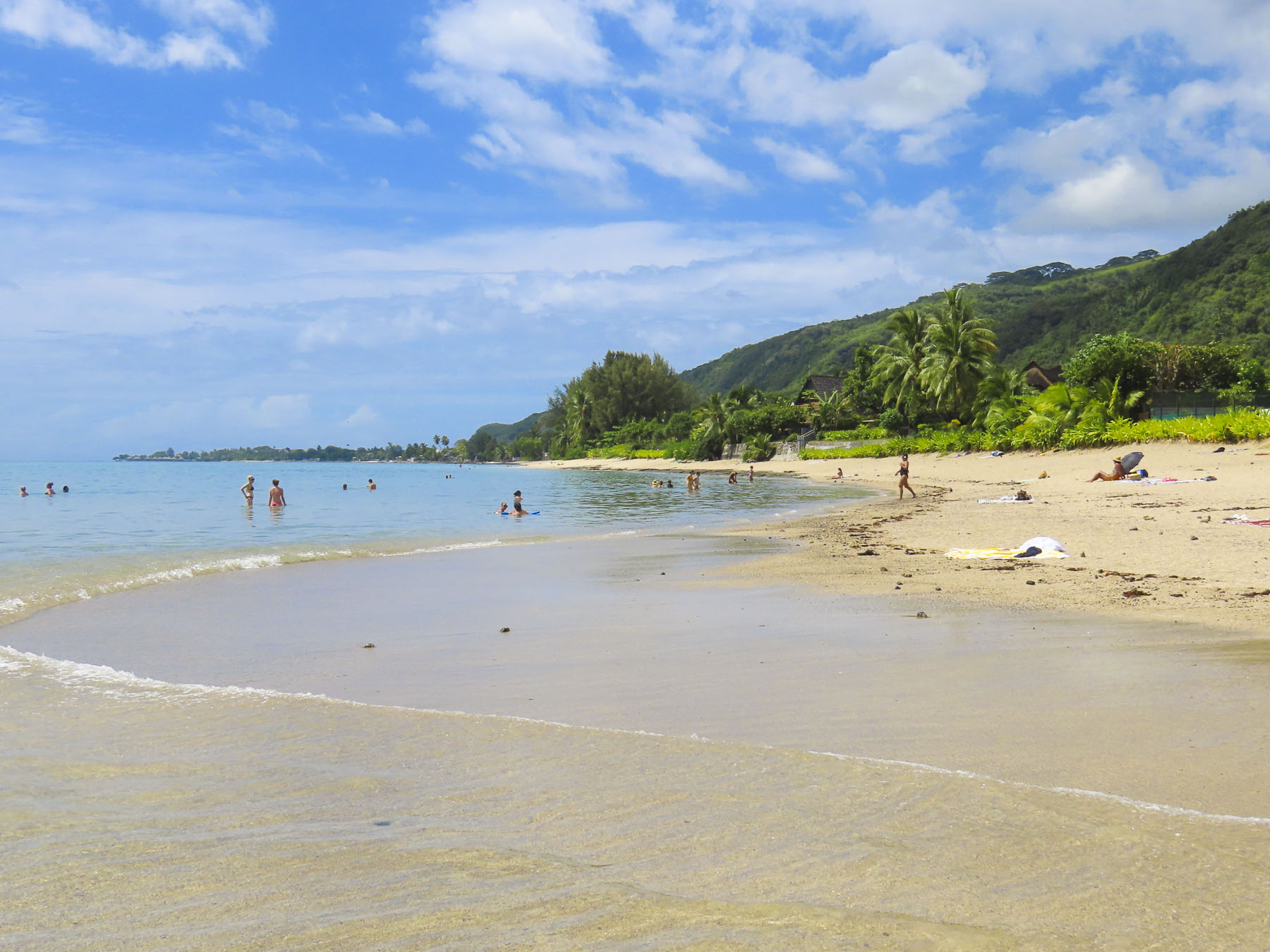
Afterwards we savored our last swim on Tahiti in the gentle waves of Plage Vaiava. Tomorrow we would head to the Port of Papeete to board Variety Cruises’ Panorama II for a sailing adventure to Bora Bora.

Till next time, Craig & Donna

Road Trip Through Brittany: Josselin & Vannes or Castles, Standing Stones and Cheese

The sun’s early morning rays cast a soft glow across the gently rolling countryside, silhouetting farm buildings and highlighting here and there pockets of mist still clinging to warm earth, and stubble in freshly plowed fields waiting to be seeded with their winter over crop.

The timing was uncanny, but I had just started to write this story when Donna called from the porch, “you have mail from France!” It must have been some tourist information I requested, I thought, and excitedly stopped writing. But I should have suspected from Donna’s smug grin that something was off kilter. To my disappointment it was the notification of a traffic fine! Who drives when we are touring is a bone of contention between the two of us. But I’ll be the first to admit that I am a terrible passenger and believe that the “Oh God” strap above the passenger door was specifically designed for my benefit.

As a consequence, I prefer to drive slowly to see tomorrow’s sunrise. I deliberately choose to deny my lovely, daring wife the thrill of downshifting and accelerating along the many cliffside serpentine roads we might encounter, as I cower in the passenger seat. There weren’t any cliffside drives in Brittany, but you get my drift. I can safely say we have different driving styles. Seriously, my wife is an excellent driver, it’s more about the extravagant fee per day the car rental companies charge for the extra driver than anything else, kinda. It was not a speeding ticket, but a moving violation caught by a traffic camera on a quiet Sunday morning in the sleepy French village of Saint-Jouan-de-I’Isle, deep in the heart of Brittany. I alone was to blame, but would have preferred asking forgiveness from a gendarme, then the robotic indifference of a traffic spy camera, and a letter months later in the mail. Though I will give credit to the French authorities for designing a user-friendly website, Amendes.gouv.fr, for paying fines online.  

We arrived mid-morning in Josselin just as the first wave of walkers were completing a charity walk in support of Pink October, France’s breast cancer awareness month, along the towpath that followed the Oust River in front of the town’s ancient castle, the Château de Josselin. It was late October, but the first yellows and muted oranges of Autumn were just beginning to show and combined with the walker’s pink vests made for a very colorful sight under a brilliant blue sky.

There has been a castle on this spot in Josselin since the 11th century, but the chateau you see today dates from 1370. Early in the 1400s Alain VIII of Rohan inherited the castle and it has remained a House of Rohan estate for 600 years. The chateau suffered poorly during the 16th century French Wars of Religion, as Henry II of Rohan supported protestant Huguenots against the King of France and the Catholic church; five of its original nine towers were destroyed on the orders of Cardinal Richelieu. During the French Revolution the castle’s towers were used as a prison, but afterwards it sat abandoned until the mid-1800s when Duke Josselin X of Rohan piloted an extensive restoration.

Strolling against the current of walkers we crossed a bridge to Josselin’s Quartier Sainte-Croix and wandered along narrow lanes past ancient half-timbered buildings dating from the early 16th century. Some leaned precariously, like an elderly person requiring a cane, while others featured ornamental heads carved into exposed roof rafters for decoration. Following our philosophy of “walk a little, then café,” we enjoyed a rest at the Logis Hôtel du Château, and its location on the riverbank.

Returning to the village, we stopped mid-bridge to admire the view along the riverport’s quay. With a renaissance chateau, charming buildings and a beautiful river to stroll along, no wonder Josselin has received the very French distinction as a Petite Cité de Caractère, a small town of character. During the high season paddle boards, kayaks, and boats are available for rent to enjoy this tranquil stretch of water.

The Oust is a canalized river and is part of the 220-mile-long Canal de Nantes à Brest which traverses inland Brittany to connect the seaports of Nantes and Brest, on the Bay of Biscay. The old towpath which follows the canal’s course is also a popular route for cyclists and hikers. We thoroughly enjoyed our morning in Josselin, but truly the quaint village deserves more time, or an overnight stay to absorb its wonderful ambiance. Vannes awaited us, so we drove on.

We arrived in Vannes and found convenient parking along the Port de Vannes quay, in an underground garage, in time for a late lunch. The masts of sailboats, with their colors flying, rocked gently in the afternoon breeze, against the background of the port’s Place Gambetta, and its iconic 19th century sandstone colored, Haussmann styled buildings, with their distinctive dormer windows in their mansard roofs. It’s difficult to imagine from the size of this petite harbor located on a narrow stretch of water called La Marle, that Vannes is actually an inland seaport, and the economic engine that drove Vannes’ prosperity since the era of the Romans, two-thousand years earlier. It was a favored protected anchorage, located three-quarters of a mile inland from the Gulf of Morbihan, for Rome’s merchant fleet of oared galleons, and it facilitated trade in wine and olive oil from France to England, while ships returned with valuable tin, lead and copper. Today the Port de Vannes hosts recreational and tour boats, which offer day trips to the islands in the Gulf of Morbihan, where on a windy day you can still see restored siganots, Brittany’s iconic two masted, gaff rigged, wooden fishing schooners, that typically have red sails, plying the waves.

Surprisingly, for this far north, a row of palm trees separated the Place Gambetta from the harbor, and gave the area a delightful French Caribbean vibe, before leading to the historic citadel through the Saint-Vincent gate. There were numerous restaurants, bustling with activity, surrounding the harbor, and we chose to lunch at Le Daily Gourmand for its outside tables and seasonal menu.

Excited by our first impressions of Vannes, we roughly planned our four days in the ancient city and day trips to Suscinio Castle, and the Alignements de Carnac. One of the attributes we consider when choosing a destination for a multiple day stay is the walkability of a city and are there enough things to do to keep us busy. Vannes fit the description perfectly, offering me multiple routes to explore the city during my 6 a.m. walks, while Donna slept in.

The walk along the Promenade de la Rabine, “the alley planted with trees,” was one of these walks that started near the Place Gambetta and followed the long sliver of La Marla, down its right bank a half-mile, towards the newer commercial port and the Gulf of Morbihan. The idea for this tranquil public space first arose in 1687, and over the following centuries it has been widened and extended several times. Halfway back on the return route there is a pontoon footbridge across the marina to the more cosmopolitan left bank.

A short walk from the Place Gambetta, the 19th century faded away quickly as we approached the historic Château de l’Hermine, with its formal garden featuring the emblem of the L’Ordre de l’Hermine, a medieval chivalric order, worked into its landscaping, and the Remparts de Vannes. The ermine depicted might look like us like a flying weasel, but it’s a traditional symbol of Brittany that signifies nobility, courage, honesty, uncompromising integrity, and personal honor. The ancient order was revived by the Cultural Institute of Brittany in the 20th century to honor people who contribute to Breton culture. The château, built in 1785, is a beautiful example of 18th century French architecture, and operated as the Hôtel Lagorce until 1803. It was then used as a private mansion until the French State purchased it in 1876 and proceeded to use it as an Artillery School and barracks for the XIth Army Corps, treasury, and university.

But the more interesting history of the site begins in 1380 when the Dukes of Brittany decided to use Vannes as their seat of power and ordered a castle with moat built and the ramparts surrounding the town, first erected by the Romans in the 5th century, improved. It served several generations of Dukes as their main residence until the late 1400s when François II, the last Duke of Brittany, moved his court to Nantes. During the early 1600s, the now-old castle was dismantled for its stones, which were used to build the quay at the port.

Skip ahead to March 2024 and the18th century château is now owned by the City of Vannes and construction has begun to renovate it and add a new wing for a project that will eventually be the Vannes Museum of Fine Arts – Chateau de l’Hermine. While excavating for new footings, workers uncovered well preserved walls, parts of a moat with drawbridge, and evidence that the castle had been three to four stories tall and had indoor toilets. We visited Vannes shortly before this discovery, but still marvel at the amazing things out there that are yet to be rediscovered.

A little farther along the Jardin des Remparts has the longest remaining section the city’s ancient defensive wall, with gates and towers, as their backdrop. The formal gardens are beautiful, with more than 30,000 flowers planted each year. It’s a popular spot to relax and walk dogs along the banks of the La Marla River before it reaches the port. The gardens are also used several times throughout the year to host various fairs and most importantly, the Fêtes Historiques de Vannes every July 12-14th. It’s a huge, festive cosplay event that celebrates Vannes’ rich history, and spreads into the historic center, with craft demonstrations, and participants and visitors wearing medieval clothing. The Porte Poterne gate is near the gardens, and entering the city one night across worn cobblestones glistening in a cold rain was an experience that transported us back centuries.

Later that first day in Vannes we were thrilled when we arrived at the Hôtel Le Bretagne and were able to find inexpensive street parking directly in front of it. The hotel abutted the rampart’s Executioner Tower and was ideally located just outside the historic old town, between the Porte de la Prison and Porte Saint-Jean gates. Vannes’ architectural continuity is unique among cities in France as it escaped the destructive aerial bombings of WWII, which ravaged many towns throughout the country.

Consequently, it has kept its rich architectural history intact. This was evident as we rounded the first corner from our hotel and entered the ancient citadel under the narrow-arched Porte Saint-Jean gate. In its earlier years it was known as the Porte du Mené, the Door of the Executioner, because of its close proximity to the axeman’s place of work. Fittingly, his tower was only a short walk down the alley from the Cathédrale Saint-Pierre, for the priests to give prisoners their last rites.

Built atop the ruins of an ancient Roman church, Saint-Pierre commands the highest point in the old town and blends Romanesque, Gothic, and neo-Gothic styles, which is what happens when a church is constructed, remodeled, expanded and restored from 1020 until 1857, when the carving of the façade was finally completed. It’s beautiful inside and out.

A short walk away, many fine examples of Vannes’ colorful,15th century, half-timbered buildings surround the Place Henri IV. A map isn’t needed to explore the ancient citadel. Wandering or “walk a little, then café,” as we like to say, is the perfect approach to discovering the town’s architectural gems and enjoying Vannes. After all, what’s the rush?

Wednesday and Saturday have been the traditional market days in Vannes for decades and the streets of the historic center fill with activity as folks shop among vendors selling housewares, clothing, breads, pastries, fruits and vegetables, wine, meat, sausages and CHEESE! Our weakness. Fromagers offering samples of soft and hard goat, sheep and cow cheeses with various ageing enticed us all too easily to purchase their products. Shopping there was a sensory experience that had us wishing we had opted for an apartment stay just so we could cook.

There are also two permanent food halls within the old town, Halle Aux Poissons, the fish market – is located down a side street just beyond the Porte Saint Vincent gate as you enter the city from the harbor. And the Halle des Lices, a large market hall with about thirty shopkeepers that is open Tuesday to Sunday from 8 am to 2 pm. It’s also a good place for breakfast or lunch.

The market takes its name from the Place des Lices on which it stands, though during the 14th and 15th centuries the Dukes of Brittany held jousts and tournaments there, between the Tour du Connétable, built for the commander of the Duke’s army, and the original Château de l’Hermine. The Tour du Connétable is a substantial tower that was part of the defensive wall that encircled Vannes, but what we found interesting was that you can still see where other ramparts intersected with the tower but were removed to reconfigure the fortifications as the city grew over time.

Only thirty minutes away, the Alignements de Carnac were an easy day trip from Vannes. We drove along D196 and followed a 1.6 mile route that started in a wooded glen at Alignements du Petit-Ménec and passed the alignments in Kerlescan, Kermario, and Toulchignan before ending at Carnac. It was a fascinating area with many opportunities to stop, touch and walk through the fields with over 3000 prehistoric standing stones.

Arranged in rows across a rolling landscape, the alignments are thought to have been erected around 4000BC, predating the 2500BC Stonehenge. Little is known of the Mesolithic hunter-gatherers that are thought to have erected the stones.

But a later Brittany Arthurian myth associated with them holds that they were a marching legion of Roman soldiers turned to stone by the sorcerer Merlin. Away from the road there is also a cycling/walking path through the countryside that paralleled our route. Afterwards we drove along the Trinité-sur-Mer waterfront, which we found reminiscent of coastal Maine.

Another day we drove a half-hour south from Vannes to the Domaine de Suscinio, one of the prettiest castles in Brittany, near the Bay of Biscay. It started as a modest seigneurial manor house for Peter I, Duke of Brittany, in 1218.  His son John I started to expand it and add fortifications, a building campaign that continued through successive Dukes until they moved their court to Vannes. Thereafter it was mostly used as a hunting lodge, unless there was a war in progress.

In the early 1500s it became the property of the French Crown and Francis I of France installed a favored mistress there. During the French Revolution, the now dilapidated castle was sold off to a stone quarry and its rocks were slowly carted away.

A dramatic restoration of the castle started in 1965, and was obviously a labor of love, that reflects the Bretonne pride in their heritage. It’s an exquisite space with many interesting, museum-quality displays. We thought the discovery of an intact, highly decorative, mosaic floor from the castle’s chapel, which was located across the moat, most intriguing.

Archeological excavations around the site are still ongoing and objects discovered, are restored and exhibited. Refreshingly there are plenty of hands-on things for kids to do, like dressing as Renaissance knights, squires or princesses. Medieval board games are also available for kids to try.

Beyond the ramparts there is a medieval encampment complete with re-enactors for families to explore. Wandering around the castle was thoroughly engaging and from the top of the battlements, you can see the Bay of Biscay. With the coast so close we wondered if Henry Tudor, future King Henry VII of England, landed there after he fled England, and spent 11 years in exile at Suscinio before returning to seize his crown in the Battle of Bosworth Field in 1485.

Afterwards we headed to the Port du Crouesty marina in Arzon on the Peninsula Rhuys, surrounded by the Bay of Quiberon and Gulf of Morbihan. We sauntered along the port’s quay, admiring the boats docked in the marina, until we found Le Cap Horn. It was the perfect spot to enjoy some beers, and fresh seafood for dinner, our last meal in Brittany before heading home to the states.

We had a fantastic time exploring a small part of Brittany and hope one day to return to this charming, less explored, part of France.

Till next time, Craig & Donna

Road Tripping Through Normandy: Honfleur, Beuvron-en Auge & Mont Saint-Michel or South Across the Seine

The morning sky was dark and speckled with a few dim stars before sunrise as we walked through the carpark in Étretat by the light of our cell phones. The night air was still crisp and there was a heavy dew on the car windshield, which the wipers quickly cleared. The mirrors we cleared with our fingertips. Quickly we set the destination on the phone’s map app, before debating how much heat is enough to counteract the late October chill, but not fog the windows. We set off.

Forty-five minutes later the dawn’s first light reflected pink and yellow off the Seine River as we unexpectedly drove onto a queue ramp for a car ferry across the river. We were totally surprised, and not sure what the proper procedure was; there wasn’t a ticket booth or office to inquire at. We figured we would just follow the short line of cars ahead of us onto the small car ferry when it returned from the far shore. When the cars were waved aboard the ferrymen raised the ramp, brought in the mooring lines, and we departed. No payment was requested from any of the cars. Five minutes later we landed in the small riverport village of Quillebeuf-sur Seine, which looked intriguing in the early morning light, and whispered for further investigation. Had some of the shops been open we would have stopped for café, but the sun was still a small ball, just breaking the horizon. Honfleur was our first destination. By day’s end we’d be in Mont Saint-Michel.

The sun was trying its hardest to burn through a stubborn, light cloud cover by the time we reached Honfleur. A café was desperately needed after such an early morning start without our usual cup of coffee. Our “walk a little” or “drive a little” philosophy was way behind schedule. The question of having our cup of joe inside or outside was moot as all the cafés along the Le Vieux-Bassin, Honfleur’s harbor had their doors swung wide open. Hoping the solar effect would help us, we found a table inside by a window, though we still needed to wear our coats.

Accessed by a small channel off the La Morelle river before it empties into the Seine and the Bay of Le Harve a short distance away, Le Vieux-Bassin is a well sheltered anchorage that for centuries has provided French sailors a safe haven against ferocious North Atlantic storms. From the 1500s into the 1800s the seaport flourished as the gateway for goods entering France from Canada, its North America colony, and later Asia. Wealthy merchants surrounded the Le Vieux-Bassin with 4-6 story buildings that were warehouses on the lower levels and their homes above. Most of the vessels docked in the harbor today are recreational craft, but there was a predominance of sailboats, new and old with their masts swaying gently with the wind, that kept Honfleur’s historic waterfront in character.

From the harbor we wandered our way through the quiet town past galleries, restaurants, antique stores, and all variety of contemporary shops, which have replaced the sailmakers and ship chandlers which previously outfitted merchantmen and explorers before they set sail on long voyages to distant lands. Samuel de Champlain most famously sailed from Honfleur on his first voyage to Canada in 1603 and founded Quebec.

A block above the quay the 15thcentury Eglise Sainte-Catherine sits on the ruins of an early 11th century chapel destroyed in the Hundred Years War. The 11th century church was one of three in Fecamp, Honfleur, and Caen that Robert the Magnificent, an 11th century Duke of Normandy, constructed in thanks to God for surviving a shipwreck in the waters below the white cliffs of Normandy. Its 15thcentury replacement, the Eglise Sainte-Catherine, is the largest church constructed entirely of wood in France, with all of its structural oak beams hand hewn with axes. It features an amazing, vaulted ceiling which resembles the ribbed hull of a wooden ship.

The inspiration for the church’s design is credited to Honfleur’s shipbuilders who used their familiarity with wood and knowledge of naval construction techniques to build the massive structure. To reduce the risk of fire from a lightning strike, the church’s belltower was built separately and stands across the plaza quite a distance away from the chapel. The church continues to be a pilgrimage site for fishermen, sailors, and others who make their livelihood from the sea.Before leaving Honfleur we had a simple no-frills lunch at L’Hippocampe poissonnerie, a fresh seafood shop on the edge of the harbor, where we perused the morning’s catch before orderingfresh oysters, fried fish, and white wine. We enjoyed our short visit to Honfleur, but wish we had scheduled more time or an overnight stay to further explore this delightful town and absorb its ambience.

Afterwards we headed to Beuvron-en-Auge, a commune in the Calvados, the apple brandy and cider region of Normandy. It’s a small village, with one main thoroughfare and a cross street, meticulously lined with well-kept 15th,16th and 17th century half-timbered buildings. “Picture perfect,” the village is recognized as one of the Les Plus Beaux Villages de France, “Most Beautiful Villages of France.”

We practically had the whole hamlet to ourselves when we stopped mid-week on a sunny afternoon in mid-October.  Most of the restaurants and shops only open on the weekends this time of year, but we still delighted in walking the length of the village, taking numerous pictures, and investigating the churchyard and cemetery of the Église Saint-Martin.

“Walk a little, then café,” we stopped at one of the few shops open, L’Orée du Village. The local tobacconist did a little bit of everything: off-track betting, souvenirs, post office, café. We sat outside in the sun and watched an occasional farm tractor rumble by. The coffee was very good.

Beuvron-en-Auge is also the starting point for the Cider Route, a 25-mile loop through small villages and the surrounding French countryside filled with apple orchards and over 20 cider and calvados, apple brandy producers. So far during our trip we had only encountered brief rain showers, but the weather along the Normandy coast in middle of October can be iffy and rain was predicted for the next day. So we pushed on, hoping to reach Mont Saint-Michel by late afternoon and the “golden hour.”

We had anticipated a high entry and parking fee but were pleasantly surprised when neither were requested. Driving access to the mainland part of Mont Saint-Michel is restricted by a traffic gate. But if you are staying at one of the town’s hotels, they text you an entry code when you call them. We stayed at Hôtel Vert, which was very convenient to the island’s free shuttle bus. Unless you choose to walk along the causeway to the Mont Saint-Michel island, a distance of 1.6 miles, the shuttle bus is the only way to reach the island. Hôtel Vert was kind enough to let us use their parking for an additional night even though we were staying at a different inn on the island.

Luck was with us and the afternoon light that shined on this mystical island was beautiful and we snapped away till nightfall. The next morning, we repacked some clothes into a small duffel bag for our one night on the island. After all, visiting Mont Saint-Michel was the catalyst for our trip through Normandy and we wanted to experience it fully. Literally a “pyramid rising from the sea,” Mont Saint-Michel was built one stone at a time above a small rocky islet, a half-mile from the mainland, in the tidal mudflats of the Bay of Cancale which opens onto the English Channel. Its beauty has lasted for centuries, and in any weather, this iconic image of man’s symbiotic relationship with nature fascinates its visitors. It was visionary in the 8th century and will forever be enchanting.

The monastery was celestially inspired through the dream-visions of Aubert, the Bishop of Avranches, who received the commands of the archangel Michael in 708 to build a sanctuary devoted to him. And since the seriousness of devotion seems to be questioned unless churches were built in extremely difficult places – why make it easy for the faithful? – an islet accessible only by boat, or a treacherous trek across mudflats dotted with patches of quicksand was chosen.

By 966, Benedictine monks were expanding Aubert’s chapel and establishing an abbey with a scriptorium, which was widely recognized for the copying skills and illuminated manuscripts created by its monks. The abbey was also a center for religious education supported by a library containing over 3800 ancient books and manuscripts and known for translating Aristotle’s texts to Latin. A small village was also growing on the island to support the abbey and pilgrims visiting the site. Granite stones for this construction and the islands’ fortress walls were quarried on the Chausey islands, some 19 miles away, and transported by boat across the bay to Mont Saint-Michel during the high tides. The stone ramparts successfully protected the island’s inhabitants from several sieges by the English during the Hundred Years’ War.

It was a never-ending, arduous effort to supply the abbey with food and wood to fuel the large walk-in fireplaces that heated the cavernous rooms and fire the kitchen hearths. Ingeniously, a human hamster wheel, operated by two people walking inside it, was designed and built to vertically lift a sled loaded with 2 tons of goods, several hundred feet up a cliff face from the dock below, where boats had brought supplies to unload.

Sadly, the books in its library were confiscated during the French Revolution (only 199 remained when they were inventoried in 1835,) and the abbey became a slowly decaying prison which housed over 600 inmates and operated until 1863, when Victor Hugo and other members of the French elite successfully petitioned the government for its closure and subsequent restoration as a pilgrimage site.

Even on a weekday in the middle of October the narrows alleys of Mont Saint-Michel were busy, not surprising for one of France’s most popular destinations that annually receives over three million visitors. Thankfully we were here in the colder shoulder season and the crowds were bearable. It’s all uphill to the Abbey and the closer you get to it the number of eateries near it decline inversely. We didn’t want to head back downhill only to walk up again, so we grabbed a bite to eat at a take-away and found an isolated section of wall, in the sun, to sit on, and rest Donna’s arthritic knee.

The afternoon sun was welcomed, and helped to alleviate the morning’s damp chill from our bones. Taking in the view over the rooftops, we contemplated how difficult life on this rock must have been in previous centuries, and joked about abbot Aubert possibly authoring an illuminated 10th century aerobics fitness manual and promoting the Mont Saint-Michel diet. They definitely would have been hits with the pilgrims and a good source of income for the abbey.

Rejuvenated from our restful picnic lunch, we continued climbing the final stretch of stairs to the top of the Mont. The expansive abbey was a wonder to explore and the views from it of the surrounding mud flats, with modern day pilgrims crossing them were extraordinary.

Later that evening as the lanes darkened and the amber lights from the restaurants illuminated their interiors, we wandered along until we found an establishment with a fire roaring in its hearth. Warmth, good food and wine restored us.

We slept well, exhausted from a long day of walking. The next morning it poured relentlessly as we waited for the shuttle bus on the causeway, but we were fulfilled, having accomplished a lifelong desire to visit this iconic site.

Victor Hugo famously expressed “Mont-Saint-Michel is to France what the Pyramids are to Egypt.” Another French writer described “The Pyramid of the Seas” as the “eighth wonder of the world.”

Sentiments we agree with.

Till next time, Craig & Donna

France: Road Tripping Through Normandy – Fecamp, Yport & Étretat

Overnight showers had cleansed the air, the morning was brilliant with sunshine, and the deep blue sky was checkered with fair weather clouds. We were road tripping west through flat farmlands and pasturelands, which were lined with rows of beech trees to protect the land from the ferocious winds of winter storms. The landscape was dotted with Normande, a breed of dairy cow descended from the cattle that the Vikings brought with them when they settled in the area during the 9th century. A white cow, speckled with brown patches, this breed is favored for its milk’s high fat content, which lends itself perfectly for making CHEESE! More specifically the PDO (Protected Designation of Origin) Camemberts, Livarots, Pont-l’Evêques and Neufchâtels that the Normandy region is famous for. Small signs for fromage and cider pointed down many dirt lanes that spurred off our route.

We were heading to the white cliffs of Fecamp and Yport, in the Seine-Maritime department of Normandy, on the English Channel. While planning this trip we read about high season – over-tourism running rampant across France. Crowds don’t appeal to us, so we’ve been planning our travels to coincide with a destination’s shoulder season for a while now. The articles also suggested visiting places off the usual tourist radar, which is how we came across Fecamp and Yport, our stops before reaching Étretat. In hindsight we should have planned a full afternoon or overnight stay in Fecamp, as the quick glimpses of the Palais Ducal, now ruins, and the Holy Trinity Abbey, as we drove through the historic center, revealed a pretty town and looked intriguing, worthy of further exploration.

Our “walk a little then café,” becomes “drive a little then café,” when we have wheels, and by the time we entered Fecamp it was time to satisfy that late morning craving. Parking in unfamiliar towns is always a challenge, and on a busy Saturday even more so, but we lucked out and found both a parking space and great café near the harbor. The sunny outside tables at Le Coffee de Clo were empty so we were surprised when we entered to see a lively shop nearly full of people busily enjoying the decadent sweet creations we had stumbled across. More muffin than pastry, the baked goods and excellent coffee here are the only excuse you need to detour to Fecamp.

Walking back to the car, we spotted the Chapelle Notre-Dame du Salut, across the harbor, high atop Cap Fagnet. It’s believed that Robert the Magnificent, an 11th century Duke of Normandy, constructed the church in thanks to God for surviving a shipwreck in the waters below the white cliffs of Cap Fagnet. It’s been a pilgrimage site for fishermen, sailors, and their families ever since.

The views from the terrace in front of the church of Fecamp’s harbor, and the southern half of La Côte d’Albâtre, the Alabaster Coast, take in an 80-mile stretch of white cliffs between Etretat and Dieppe on the Normandy coast, that mirrors the distant White Cliffs of Dover across the channel. Locally the cliffs around Fecamp are known as le Pays des Hautes Falaises, high cliff country.

In 1066, William of Normandy set sail from Fecamps’ harbor with a fleet of more than 700 ships, partly financed by the Abbott of Fecamp, to claim the Crown of England, which he had inherited, but this was being contested by Harold, a pretender to the throne.  The issue was settled at the Battle of Hastings when the former became King William the Conqueror. It was also reassuring to learn that the Fecamp monks transitioned away from being international arms merchants, and segued into a more appropriate occupation –  running a distillery in the 16th century, that produced a 27-herb flavored liqueur that would become popular in the mid-1800s and sold as Le Grand Bénédictine.

Eight hundred seventy-eight years after William set sail, on June 6, 1944, during WWII German fortifications along the Côte d’Albâtre failed against an allied amphibious invasion fleet of over 7000 ships and landing craft. It was the beginning of the end of WWII. Scrambling to the top of an abandoned bunker provided us with the perfect vantage point for photos of the coast.

By the time we arrived in Yport the clouds had thickened and were threatening to rain. To our dismay, it poured just as we were parking by the beach promenade. Fortunately, it was an intense but brief shower that cleared into a cloudless sky and revealed a quaint picturesque hamlet and shining white cliffs towering above the sea.

The cliffs along the seafront have been eroding for eons, creating in certain spots deep, long ravines that funneled torrents of water, laden with sand and stone through the cliff face to the ocean, which created beaches in certain places over the ages. These narrow valleys are called valleuses, and the small coastal fishing village of Yport started in one during the Neolithic era.

Without a harbor, fishermen pushed their small boats across a pebbled beach and rowed out through the waves to pursue their livelihood. They repaired their boats and mended their nets on the beach at the foot of the town. This way of life supported the villagers for centuries. Only the invention of the small outboard motor in the early 1900s eased their physical effort, until the 1960s when tourism and a small casino replaced fishing as the town’s driving economic force.

In 1838, the tightly knit community decided to build a church. Men, women, and children gathered tons of smooth stones from the beach, carted them 500m inland, and proudly worked together to mix cement and build the center piece of their town. Horizontally striped with alternating layers of colored beach stones, the façade of the church is beautiful, and unique in Normandy. It is a true testament to the power of community spirit.

By the mid-1800s Parisians seeking a more relaxing retreat than Etretat were frequenting the quiet fishing village. The French painters Monet, Renoir, Schuffenecker, and Vernier visited and painted there, while the 19th century French writer Guy de Maupassant set his novel, ‘Une Vie,’ in Yport. Paths from the center of the town and from behind the casino lead to the cliff tops and join the popular GR21 trail that can be followed north to Fecamp or south to Etretat.

Regardless of how beautiful photos of the Falaise d’Aval are, they don’t rival the physical reality of the calling gulls, wind-swept hair, the whistling wind and the relentless sound of the surf crashing against the stoney beach.

Arriving late on a Saturday afternoon in mid-October, we were surprised Étretat was jammed with tourists. Parking is extremely limited here and finding a space is almost a competitive sport that ultimately just required us to sit in a row and wait for someone to return to their car. It sorted itself quickly enough and luckily, we were only a short walk from one of Étretat’s first lodgings, the Hotel Le Rayon Vert, which to our delight was directly across from the beach and Étretat’s promenade. After checking in, we headed to the top of the towering 300ft high cliffs for sunset, the first of many walks along this beautiful stretch of coast and the perfect way to work up an appetite.

If you have been following this blog, you’ll know my superpower is the ability to find a great pâtisserie, pastelería or pastry shop. It’s a great talent when the hotel wants 16€ per person for breakfast. In Etretat, the boulangerie patisserie “Le Petit Accent” exceeded all expectations!

Set high above the town, it was a steep uphill walk to the Jardins d’Etretat. This whimsical topiary garden, with playful faces as “Drops of Rain,” by the Spanish artist Samuel Salcedo, more so than the Falaise d’Aval, was the catalyst for visiting this seaside resort.

This magical spot has its roots over 100 hundred years ago when a villa and garden were built here by Madame Thébault, a Parisian actress, and friend of the impressionist painter, Claude Monet. Madame Thébault cultivated a circle of creative folks as friends, and Monet along with other painters and writers were her frequent guests. It was from a patio in this garden that Monet found repeated inspiration to capture the essence Les Falaises à Étretat.  His love of the area is evident in the nearly 90 canvases he painted depicting various scenes along the Normandy coast. But the Jardins d’Etretat today are a relatively new botanical masterpiece reopening in 2017 after an expansive reinterpretation led by the landscape architect, Alexander Grivko.

Across from the entrance to the garden, a tall soaring monument pointing skyward, elegant in its simplicity, commands a view out over the cliffs and the ocean beyond. This tribute commemorates the last sighting from French soil of the pilots Charles Nungesser and François Coli on May 8th, 1927. They were flying their biplane L’Oiseau Blanc, The White Bird, from Paris to New York in an attempt to be the first non-stop flight across the Atlantic Ocean and win the Orteig Prize of $25,000. But they disappeared somewhere along their route. It’s believed they made it across the Atlantic, but crashed into the dense wilderness forest of Nova Scotia or Maine. Wreckage of L’Oiseau Blanc has never been found and their disappearance remains an unsolved aviation mystery, that rivals Amelia Earhart’s story.  If Nungesser and Coli had succeeded, they would have beaten Charles Lindbergh in the Spirit of St. Louis by twelve days.

The Notre Dame de la Garde stands alone on the slope below the Monument “L’Oiseau Blanc,” isolated on the cliffs like a small boat surrounded by a vast ocean, its spire like a lighthouse’s guiding beacon, visible far out at sea. It offers a welcome sign for the fishermen and sailors returning home. Unfortunately, it was undergoing renovation when we visited in mid-October.

Walking back through the village we found the Normandy architecture in Etretat intriguing. It encompasses many different styles and runs the gamut from ancient half-timbered buildings embellished with ornate wood carvings, to 18th and19th century designs utilizing the local hard flintstone and incorporating steep pitched slate roofs and turrets into their designs. All fascinating.    

Etretat has been a popular destination since rail service began between the port city of Le Havre and Paris in 1847. Swimming or a day at the beach later became common place with the latest fashion, the full body bathing suits. While society folks were sunbathing on the stoney beach, there was a cottage industry of locals, called pebblers. They collected the beach stones for their high silicone content, which were then pulverized and used for various industrial purposes. It’s now illegal to remove any pebbles from the beach as they are vital natural protection against storm surges and marine submersion of the promenade built across the top of the beach, which is much easier walk on than trekking across the pebbly beach, where each footstep sinks into the loose stones and is exhausting to cross.

The classic 19th seaside resort continues to draw visitors, with the success of the French Netflix series Lupin, based on the writer Maurice Leblanc’s character, Arsène Lupin, the gentleman burglar. Leblanc’s former summer home, where he wrote some of his books, is now the Le Clos Arsène Lupin Museum. Some scenes were filmed locally, motivating a whole new generation to discover the white cliffs. The other French writers and composers who enjoyed their time in the quaint village include Victor Hugo, Guy de Maupassant, and Jacques Offenbach, all of whom are remembered with streets named in their honor.

We also enjoyed our time along the Côte d’Albâtre, but just seemed to scratch the surface of this beautiful part of Normandy.

Till next time, Craig & Donna

The Rouen Lean: It’s not a Dance

We had narrowly escaped Paris’s evening rush hour as we sped away from Orly through the French countryside. Our destination is Rouen, an ancient port town on the river Seine with a pivotal role in France’s history since the Romans first settled along the graceful bend of the river there. It would be a restart to a trip cut short by covid in 2020.

The last light of the darkening sky reflected off the Seine, like a brush stroke of silver paint across a dark canvas, as we turned away from the river and entered Rouen. We are not fans of night driving, especially in a new locale, and our maps app had difficulty with the narrow one-way streets in the historic center of the city. Frustrated, we decided to park at the first opportunity. Miraculously the planets were aligned in our favor as we entered the Q-Park Palais de Justice Musée des Beaux-Arts, a massive unground parking garage that encompasses several subterranean blocks beneath a park in Rouen’s historic district. Not sure exactly where to park, something urged us to continue through the cavernous space until we found a garage attendant moments before he locked his booth for the night. Friendly and extremely helpful, he explained how their multiday ticket would be the best value for us. Yes, we were so lucky he spoke English. Our good fortune continued at street level when we realized we were only two blocks from our hotel. But we had arrived later than planned and the gate to Le Vieux Carré was locked. Fortunately, another guest was returning to the hotel at that time and let us in. “I saw several keys on the reception desk when I went out, and figured you were one of the late arrivals.” Indeed, a room key with our name on it was there waiting for us.

Early the next morning the unusual, but pleasant aroma of caramelized onions drifted in through our open window. With our tastebuds awakened and appetites whetted we headed out. “Walk a little, then café,” is how we like to describe our wanderings. Our first stop – coffee and pastries. It is France, after all! But where to stop? There’s an abundance of eateries in Rouen, thanks to the city hosting two universities and thousands of students. There were so many places that looked inviting, but the criteria for us first thing of a morning was a café with a table in the sun, a must in mid-October to help alleviate the day’s early chill. Once sufficiently caffeinated, we set out.

Flat as a crepe, Rouen was a walker’s delight and savory with explorations that pulled us in every direction. During the 9th century, Vikings pillaged and then stayed to become the first Normans, and the prosperous town of became the capital of Normandy in the 10th century. During the Middle Ages, conflicts in the region were nearly continuous, but the city somehow evolved into one of France’s gems, with its distinctive medieval half-timbered buildings and three towering, majestic churches which still grace the city’s skyline. 

A who’s who of historical figures have crisscrossed Rouen’s cobbled lanes for centuries. The Anglo-French kings, William the Conqueror, a succession of King Henrys, Eleanor of Aquitaine and Richard the Lionheart viewed the city as their home away from home. In 1431, after inspiring her countrymen to rally against English expansionism, Joan of Arc was captured, tried, and burnt at the stake in Rouen’s Old Market Square. It wasn’t until the Siege of Rouen in 1449 when forces commanded by King Charles of France finally defeated the English. Later the French impressionist painter Claude Monet found inspiration in the city, featuring the Rouen Cathedral over thirty times as he put paint to canvas to catch its essence perfectly. With conflicts never seeming to end in Europe, somehow, this beautiful renaissance city, though deeply wounded, miraculously survived World War II. Most importantly perhaps, in March 1948, Julia Child had her first taste of French cuisine at Restaurant La Couronne, on Rouen’s central square, the Place du Vieux-Marché.  

Open since 1345, La Couronne is France’s oldest inn. Savoring her Sole Meuniere, a lightly breaded fish dish flavored with fresh butter, lemon, parsley and capers, it was an experience she described “as the most exciting meal of my life.” Local oysters and a bottle of Pouilly-Fumé were also enjoyed. She was hooked and a Francophile was born!

The Rouen Lean is not a dance, nor the result of drinking too much wine, but the very obvious tilt exhibited by many of the city’s ancient half-timbered buildings constructed during the Middle Ages. Our hotel was a prime example of this with scarcely a wall or floor that was square, plumb, and level. But that was the charming character and ambiance we were looking for. The half-timbered building’s superstructures were constructed with huge square oak timbers held together only with mortises, tenons, and wooden pegs, while the nonstructural area between the supporting timbers was filled with bricks or stones and covered with plaster. Over the centuries it has proven to be an aesthetically pleasing and durable construction method used to build five to six story houses. Many of the buildings still retain a centuries old, carved wooden sculpture on the front of the building that represented a service or craft that was once conducted there.

Approximately two thousand half-timbered structures from the Middle Ages still stand in Rouen. The abundance of wooden buildings surprised us as most of our travels have been through the countries of Southern Europe, Portugal, Spain, and Italy, where stone was historically used to construct everything. In Rouen, scarce stone was saved for the churches and castles.

Even stone erodes over time and occasionally old churches need a facelift every few centuries, as was evident by all the scaffolding surrounding the15th century, Gothic style, Saint-Ouen Abbey Church, though with a selective camera angle I was able to eliminate most of the temporary platforms from our photo. But the difference between the areas covered by grime and the newly cleaned sections was phenomenal. The multiyear project is scheduled to be completed later in 2024. Though the interior of the church was closed the day we visited, we were able to watch a stone carver as she worked to create a new gargoyle to replace one beyond repair.

Rouen’s three main churches, Saint-Ouen Abbey Church, Église Catholique Saint-Maclou, and the Cathédrale Notre-Dame de Rouen are all located a short distance from each other on the eastern edge of the historic district, but the journey through the narrow lanes connecting them and exploring many other splendid points of interest along the way made for a wonderful day.

After the abbey we window-shopped down Rue Damiette, admiring the handcrafted violins created by master luthier Sarhan Jean-Marc. Farther on, interesting antique stores lined the narrow lane. Behind us the abbey’s belltower rose over the street. A view that hasn’t changed significantly in centuries. One of the best examples of the “Rouen Lean” is at the end of the street across from Saint-Maclou and caused us to stop for a double take. How, we wondered, can these buildings still be standing?

There was a shortage of cemetery space in Rouen during the Middle Ages when the plague revisited the city repeatedly and 75% of its citizens died. At the time it was the custom to bury the dead only until their bodies decomposed.

Then the bones were exhumed and reinterned above ground in the ossuary Aitre Saint Maclou and the grave reused for the newly departed. Hidden away down a discreet side alley, the ossuary complex was expanded several times and functioned as a secondary cemetery until the early 1700s when the remains were removed, and the buildings were repurposed as a school for poor boys. Today the space houses a fine arts academy and exhibition space. Though it’s still a macabre place with skull and crossbones carved into its exterior timbers.

We rested with coffees at a café on Place Barthélémy in front of Saint Maclou. While a lovely spot, the coffees were overpriced to the point that we could have purchased lunch for two if we’d chosen a less touristy spot. Just a reminder, a block or two off the usual tourist routes and prices drop dramatically.

Rouen’s Cathédrale Notre-Dame has been the center of focus since the first early Christian converts built a temple in 395 AD, on the spot where the current church now stands. And, like the city, the church has a turbulent history. Charlemagne visited in 769, but those pesky Vikings couldn’t decide if they hated or loved the place, sacking it repeatedly in the 9th century, only to later claim the Duchy of Normandy as theirs and embrace Christianity after the Viking leader Rollo was baptized in the church and later buried there as well. Nearby, Richard the Lionheart’s tomb only contains his heart.

Romanesque architecture was the rage during the 11th century and William the Conqueror attended the consecration for the first of many expansions and renovations that would follow over the centuries.

More chiseling and hammering continued during the 12th century when successive Archbishops embraced the new Gothic style. In 1204, Philip II of France celebrated Normandy’s merging with his kingdom amidst the new Gothic renovations.

During the 16th century, a second tower in the Renaissance style was built and ornate stonework and hundreds of statues were added to the front of the church, creating the visage that remains today.

Later lightning strikes, hurricanes and Calvinists would wreak havoc on the church. During the French Revolution any metal objects, not hidden away, were seized and melted down to create cannon balls. During WWII the cathedral was heavily damaged by Allied bombs. The damage was so extensive that final restoration wasn’t completed until 2016, when all the scaffolding was finally removed. Built and rebuilt, inside and out, for over eight hundred years, the cathedral is a fascinating place to explore.

The next morning we headed down Rue de Gros-Horloge, Rouen’s main pedestrian-only thorough fare that runs east to west from the cathedral to the Place du Vieux-Marche, a historic market square. This is the street where the city’s famous 14th century astronomical clock, Le Gros-Horloge, seems to transport you backwards through time to the Renaissance. Early in the morning is the best time to experience this landmark without crowds, as later in the day the narrow lane is as busy as Paris’ Champs-Élysées. During our short time in Rouen, we passed under its gilded façade many times and always, like Monet and his multiple paintings of the cathedral, tried to capture this beautiful clock just right in our photographs.

Indulging our wanderlust, we veered left and right off the lane to satisfy our curiosity. We found ancient gargoyles on the Tribunal Judiciaire de Rouen, and whimsical unicorns, a porcupine, and a reference to L’Ordre de l’Hermine, the Order of the Ermine, a medieval chivalric order on the exterior walls of the Hotel de Bourgtheroulde, a former 1500s mansion, built in what is kindly referred to as the Flamboyant Gothic style popular at the time.

Seriously – the Order of the Ermine is not from a Monty Python skit. A small but ferocious animal, during the Middle Ages the ermine was believed to to fight to its death if attacked rather than “sully the purity of its white fur,” and was used by many medieval chivalric orders to symbolize their uncompromising integrity and honor.

There was also the Ordre du Porc-Épic, porcupine, for prickly knights, and the Order of the Golden Fleece, for royal embezzlers. These were actual chivalric orders, though I am taking liberty with their membership.

Today the Place du Vieux-Marché is surrounded with restaurants and cafes with outside tables, which were very lively at Happy Hour when students and folks just off work congregated on the square. Quite a different scene now as opposed to the day in 1431 when Joan of Arc was burned alive at the stake, in the center of the square, though her heart remained untouched by the flames. A beautiful, modern wooden church built in 1979, the Église Sainte-Jeanne-d’Arc now memorializes the spot where her pyre stood. A plaque nearby reads “Oh Joan, you who knew that the tomb of heroes is in the hearts of the living.”

Inside the food market we savored our first fresh oysters from the Brittany coast and purchased some fruit, and of course cheese! A difficult process considering the tremendous variety we could choose from.

Intrigued by Joan of Arc’s story, the next day we headed to the Historial Jeanne d’Arc, which is housed in a wing of the ancient Archbishop’s Palace where part of her trial was held. We were skeptical at first while buying our tickets, thinking we’d just be watching a movie. But we both ended up being enthralled with the interactive digital technologies used to project Joan’s saga onto the old stone walls, floors, and domed arches.

Her history was exceptionally well portrayed and presented as chapters, with each chapter presented in a different room of the architecturally interesting space. We climbed one of the palace’s towers and were rewarded with a timeless view down Rue Saint Romain to the church of St. Maclou; a view that would look familiar to Joan of Arc were she to stand in this spot today, so little changed from her time.

A symbol of defiance, heroine for the French, and a successful military adversary against the English, she claimed God supported Frances’s freedom, but this was a position the Rouen church could not support as they were allied to England and claimed God was on their side. She was tried and convicted for her heresy. Her male jury also had difficulty with her dressing in men’s clothing for battle. As if because she was a woman, she should have worn a skirt and sat side saddle as she rallied the French to fight. But this practicality was viewed as cross dressing and as such was held to be against God’s law. (Though the robes of the clergy were not considered feminine.) The French finally defeated the English and succeeded in uniting Normandy and Rouen with France. Twenty-five years after her execution, Joan’s family petitioned for the trial records to be reviewed. The court determined she had been tried “under false articles of accusation,” and posthumously declared her innocent and annulled her sentence in 1456.

Our time in Rouen was a beautiful look back into Medieval France.

Till next time, Craig & Donna