Albania Road Trip: Tirana to Berat or Skyscrapers, a Pyramid, Castles & Albania’s Worse Road

Moments before we had just flown over a crescent-shaped beach, its thin strip of sand brilliantly separating the rich, inviting blues of the Adriatic Sea from the verdant land of the Albanian coast. What we didn’t expect as we continued our descent was just how mountainous the terrain was. This turned out to be a characteristic of the land that we enjoyed tremendously, after realizing there really aren’t many straight roads in the country, and we’d be spending most of our three weeks in Albania driving winding through its mountains.

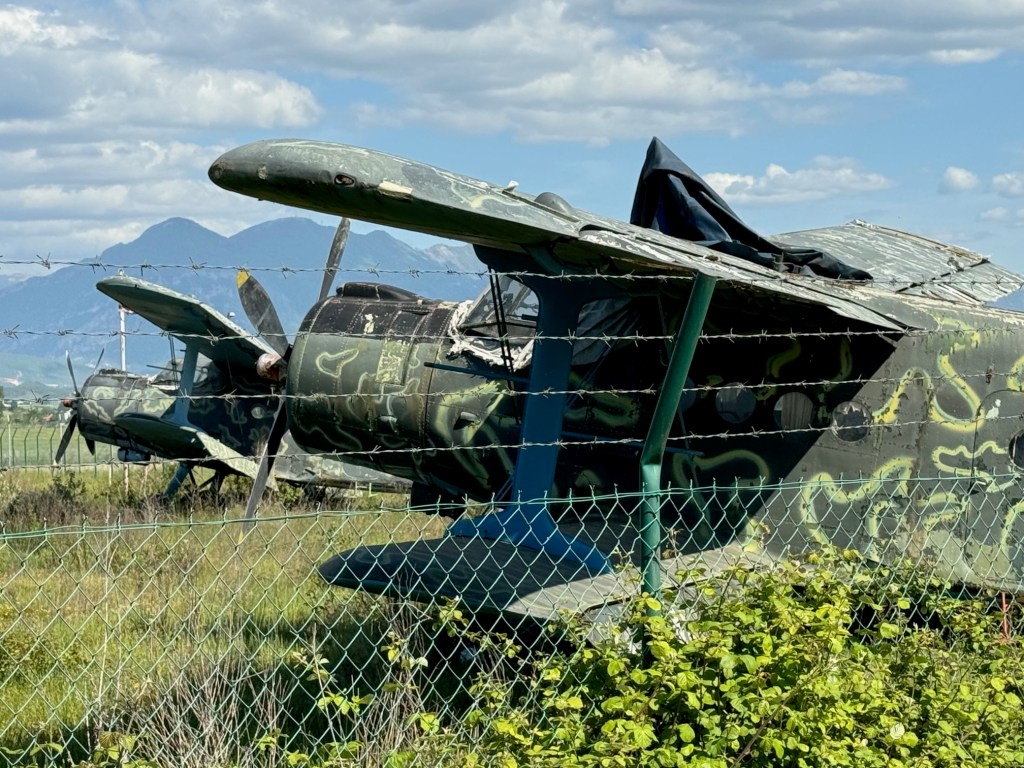
It was mid-April and 80F/26C as we sat outside the airport terminal enjoying coffees and the unseasonably warm day. “Do you really think you’ll need the thermal underwear you packed?” Donna chided, with a smile. “We’ll see,” I responded. At the rental car counter across the street, we reviewed our paperwork for the sedan and received the document we needed to drive the car into North Macedonia later on during our trip. “Now you have a city car, don’t drive on any restricted roads. The car has GPS tracking, and you will be fined if you do,” the rental agent explained. While we were aware that Albania did not have the best road infrastructure, we were not aware of road restrictions. We asked for a map showing the forbidden routes, but the agent didn’t have any, nor could he explain all the routes restricted. “Use your best judgement, if it’s a gravel road you should probably avoid it.” Which was not very helpful considering we’ve had lots of experience driving sedans to destinations that folks have said, “you’ll never make it there in that.” The rental agent also related that Albanians are very friendly, but terrible drivers. “Drive defensively!” he warned. We set off. My map app is set to default to no highways, and we followed a route along the perimeter of the airport, which also serves as an Albanian Air Force base, past a row of rusting, derelict MiG fighter jets and, for those aviation enthusiasts, several Antonov An-2, a legendary soviet bi-plane, first flown in 1947.

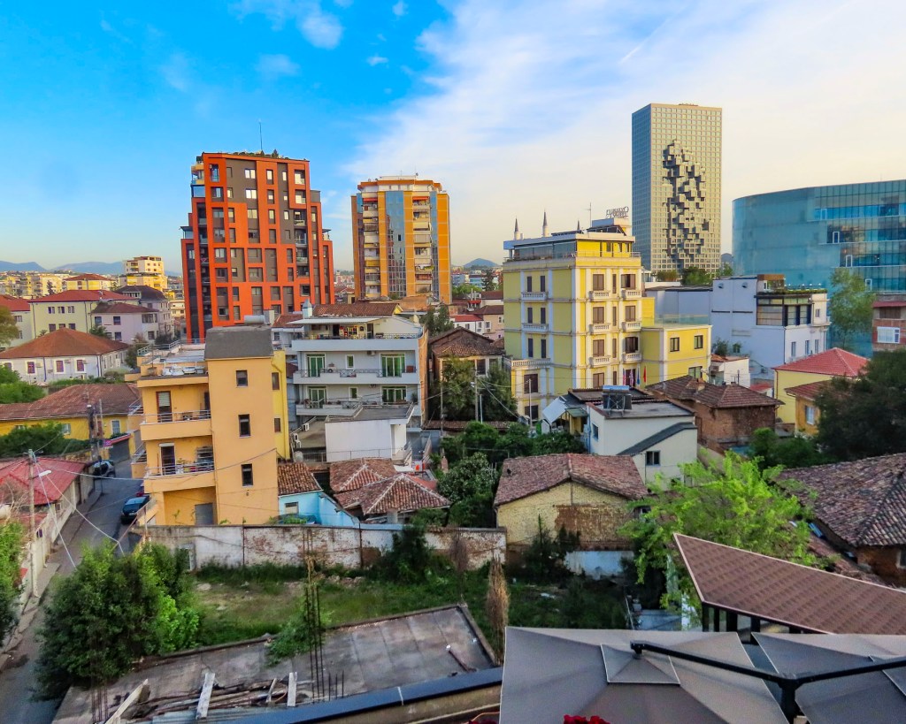
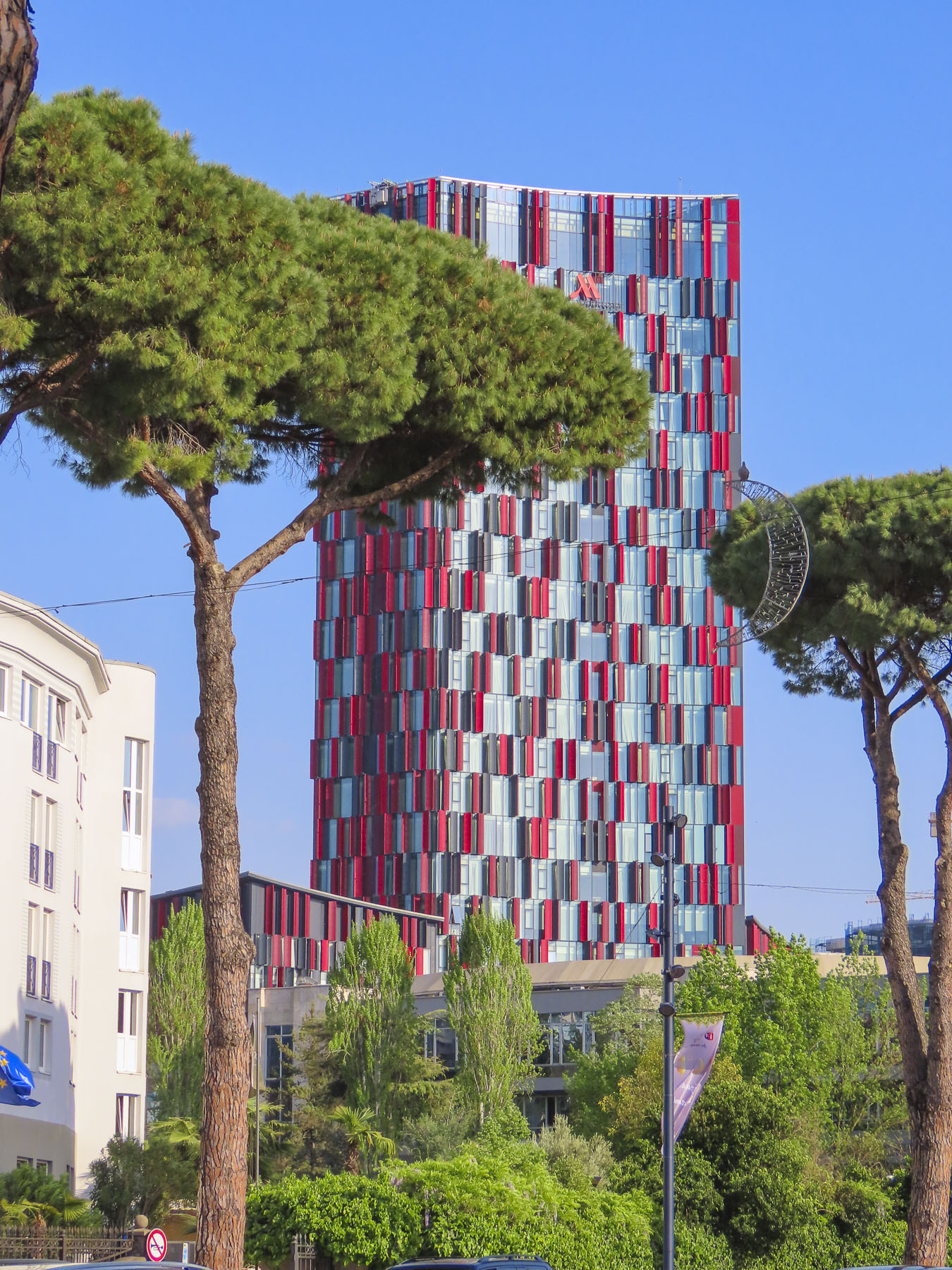
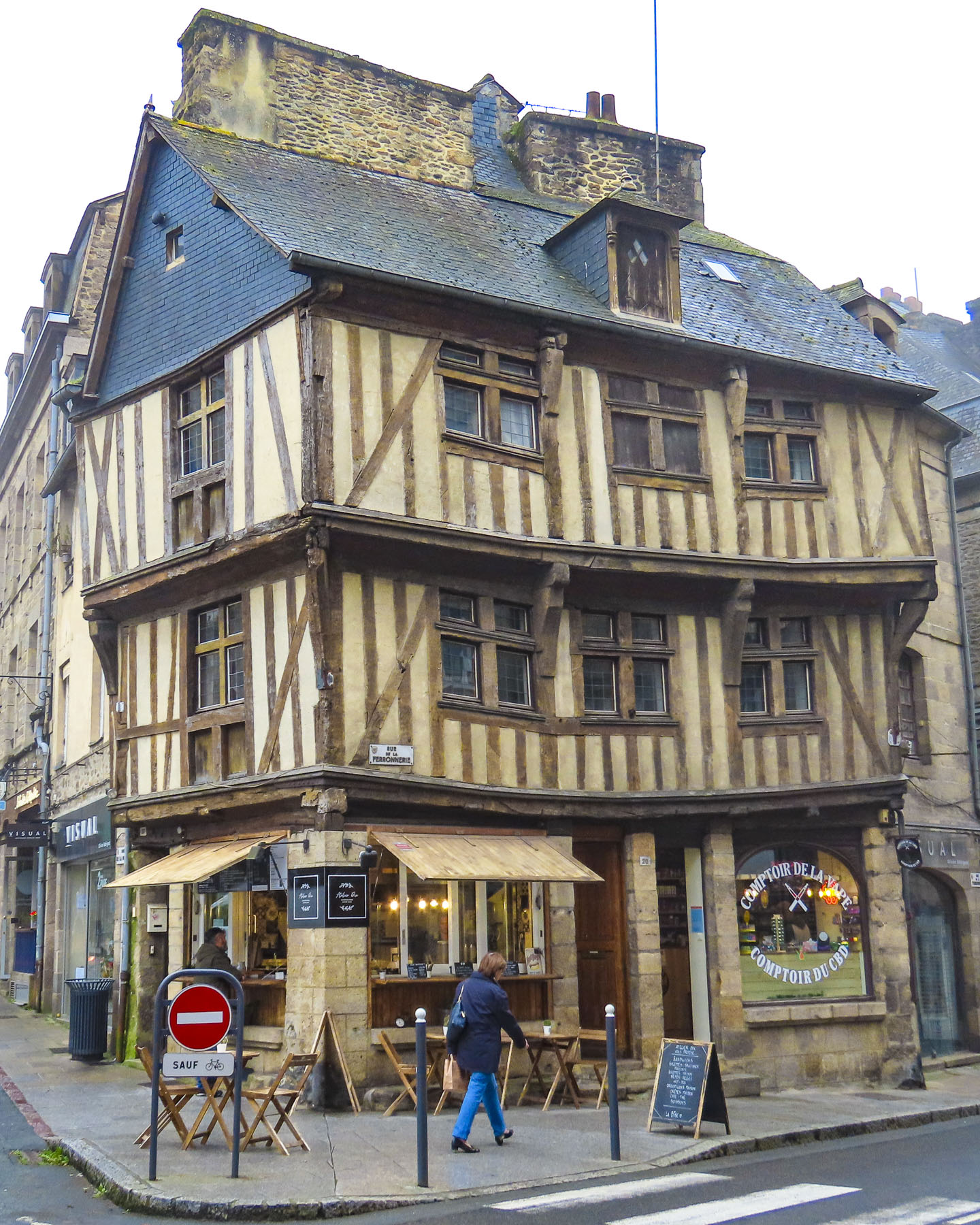
It was an interesting serpentine route through fields of grazing sheep, the roadway sporadically lined with irises in bloom, flowering orange trees, their scent filling the air, and fig trees laden with newly set fruit. Groups of old men sat at tables playing cards and dominos in vacant lots between mansions and shacks. A psychedelically painted, cold war era tank commanded a park along the road. As it neared the end of the workday and we got closer to Tirana, the roads became congested and wild, with drivers ignoring traffic signs and rules. Often it felt like a game of chicken with oncoming cars zipping into our lane to weave around creatively parked cars. Motorcycles were driven on sidewalks. Numerous speed bumps were the only deterrent preventing the roads from becoming the Daytona 500. In decades past, Tirana was a small town with an ancient footprint. It managed well enough during the country’s communist era when few people had the resources to buy cars. But now the city’s arteries are clogged and it’s ready for permanent gridlock due to the current number of vehicles.

With a car, there is always parking to take into consideration, and we lucked out with Lot Boutique Hotel, located on a narrow side street in the center of Tirana, because it had a small parking lot. The hotel recently had been nicely refurbished and was the perfect base for our wanderings around Tirana, the capital of Albania since 1920. Later after resting – jet lag affects us more as we age – we asked the front desk for recommendations for a traditional Albanian dinner. The young receptionist suggested two places: Ceren Ismet Shehu, a contemporary restaurant located behind the low ancient walls of Tirana Castle, in an area smartly repurposed for shopping and dining. And in the opposite direction Oda – Traditional Albanian Restaurant nearer the traditional daily market. We ended up eating at both on different nights. Each was excellent, but we preferred the simple, laid-back ambiance of Oda, its homestyle cooking, and inexpensive menu.

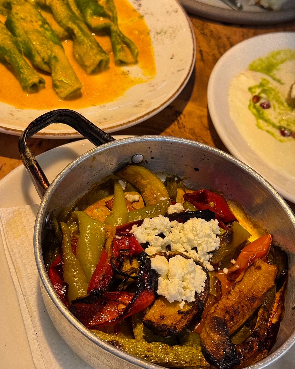
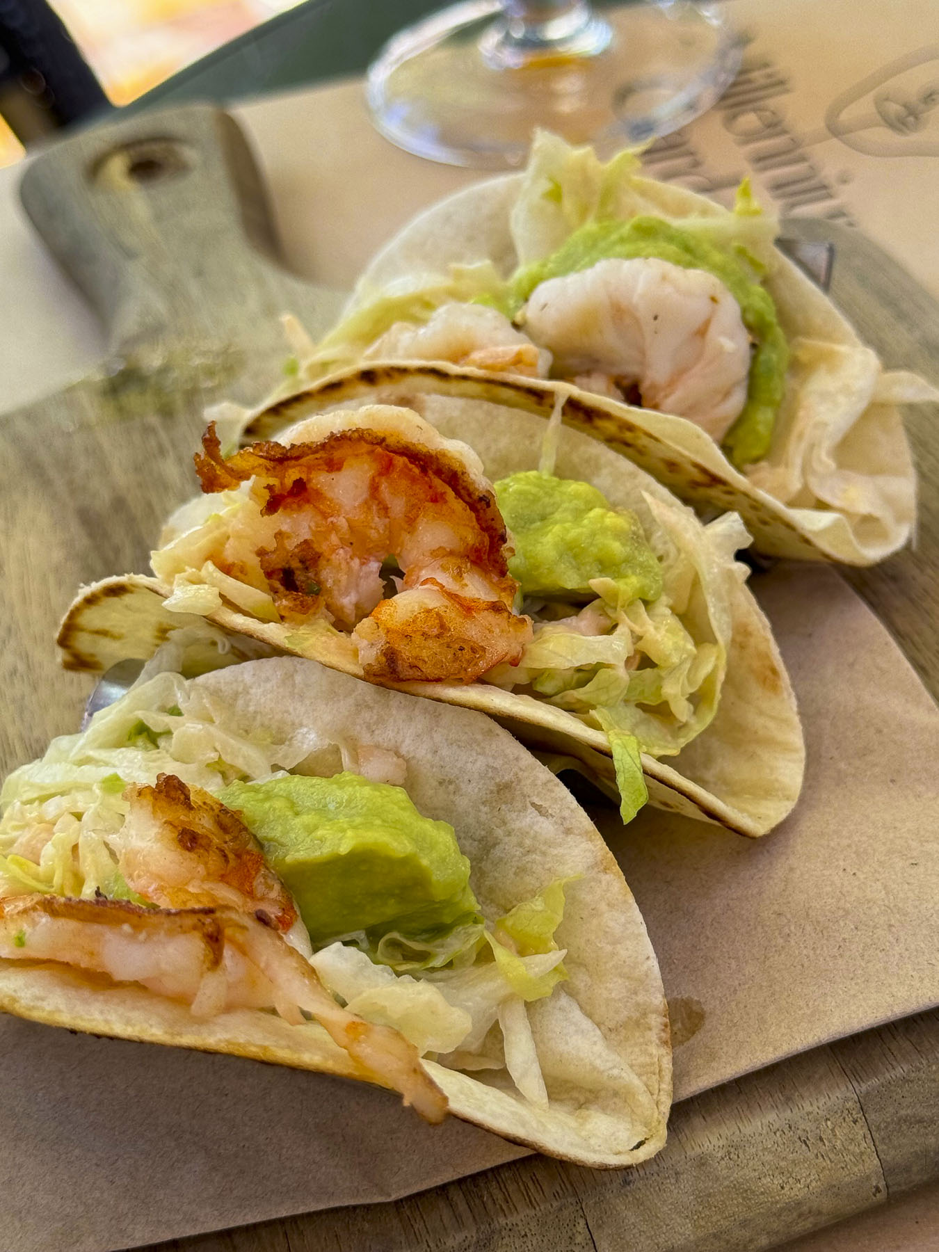
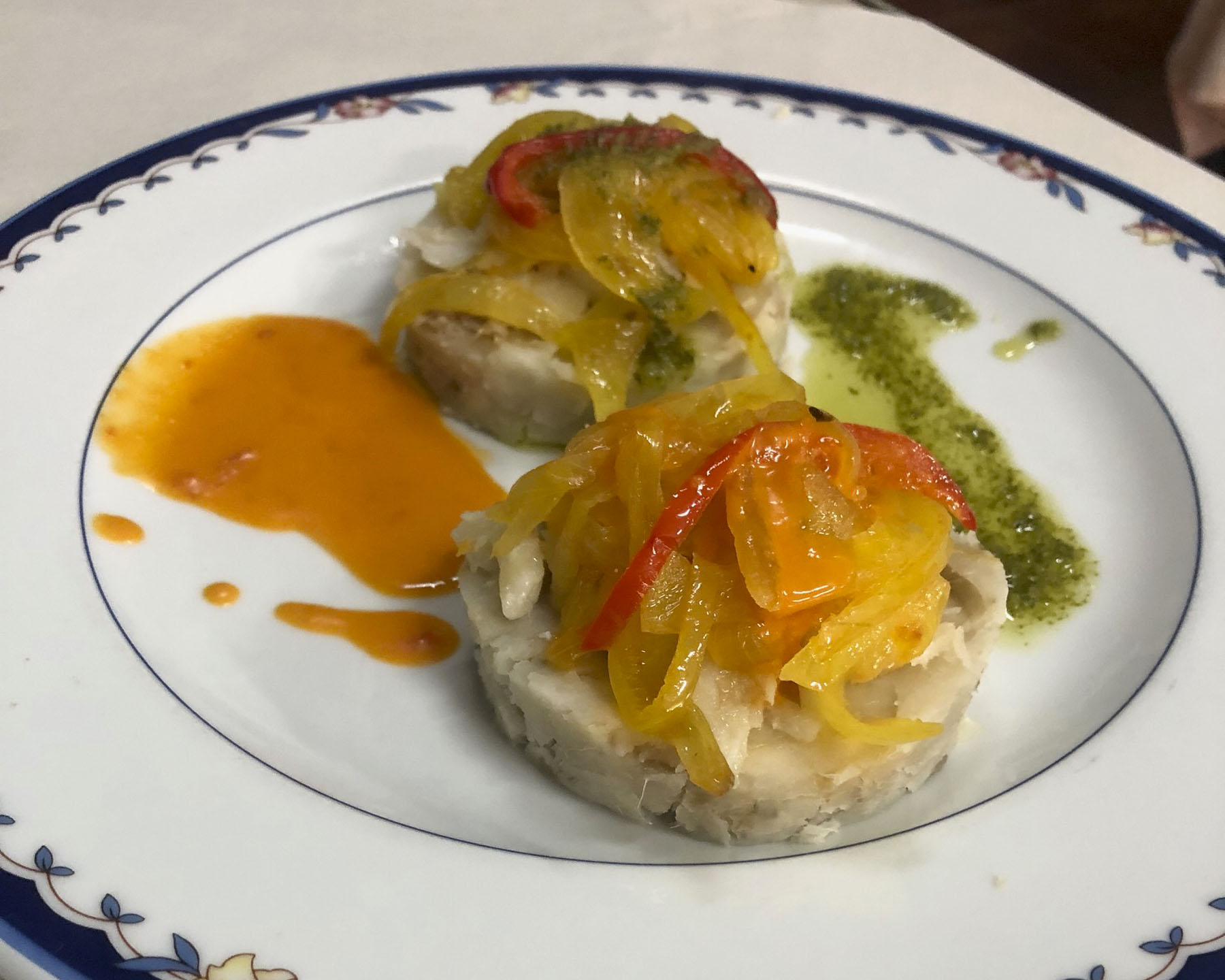
We’ve enjoyed all the cuisines of the different countries we’ve visited over the years, but surprisingly and refreshingly in Albania we found it very easy to eat a well-balanced meal. French-fried potatoes served automatically in other countries were replaced with the Albanian trilogy of lightly grilled vegetables: peppers, eggplants, and zucchini. And the customary salad of cucumbers, and tomatoes with brined cheese were always good. Grilled meats and fish were expertly prepared, though it was also easy to be a vegetarian sometimes and indulge in a variety of eggplant dishes.

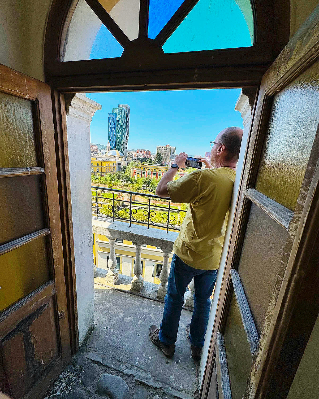
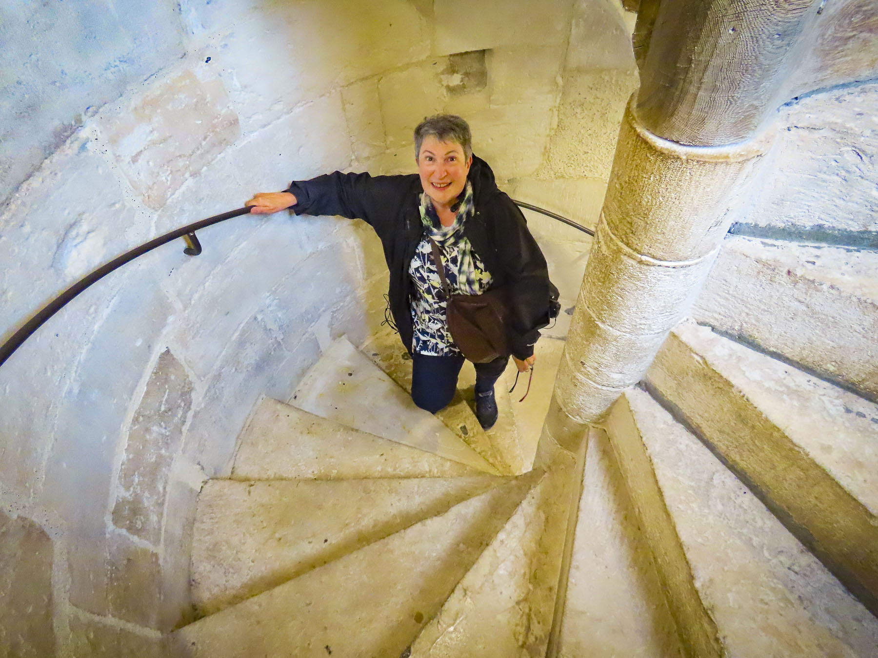
The next morning, we headed to Skanderberg Square. Next to the Et’hem Bey Mosque, built in the early 1800s, but closed during the anti-religion decades of communism, we climbed 90 steps to the top of the 115-foot-tall Clock Tower of Tirana. For decades during the 19th century, the tower was the tallest structure in Tirana. Unfortunately, its once 360-degree view has been hemmed in by the rapid construction of new buildings nearby, but it did have a view over Skanderbeg Square, and the rooftop garden atop Tirana City Hall.

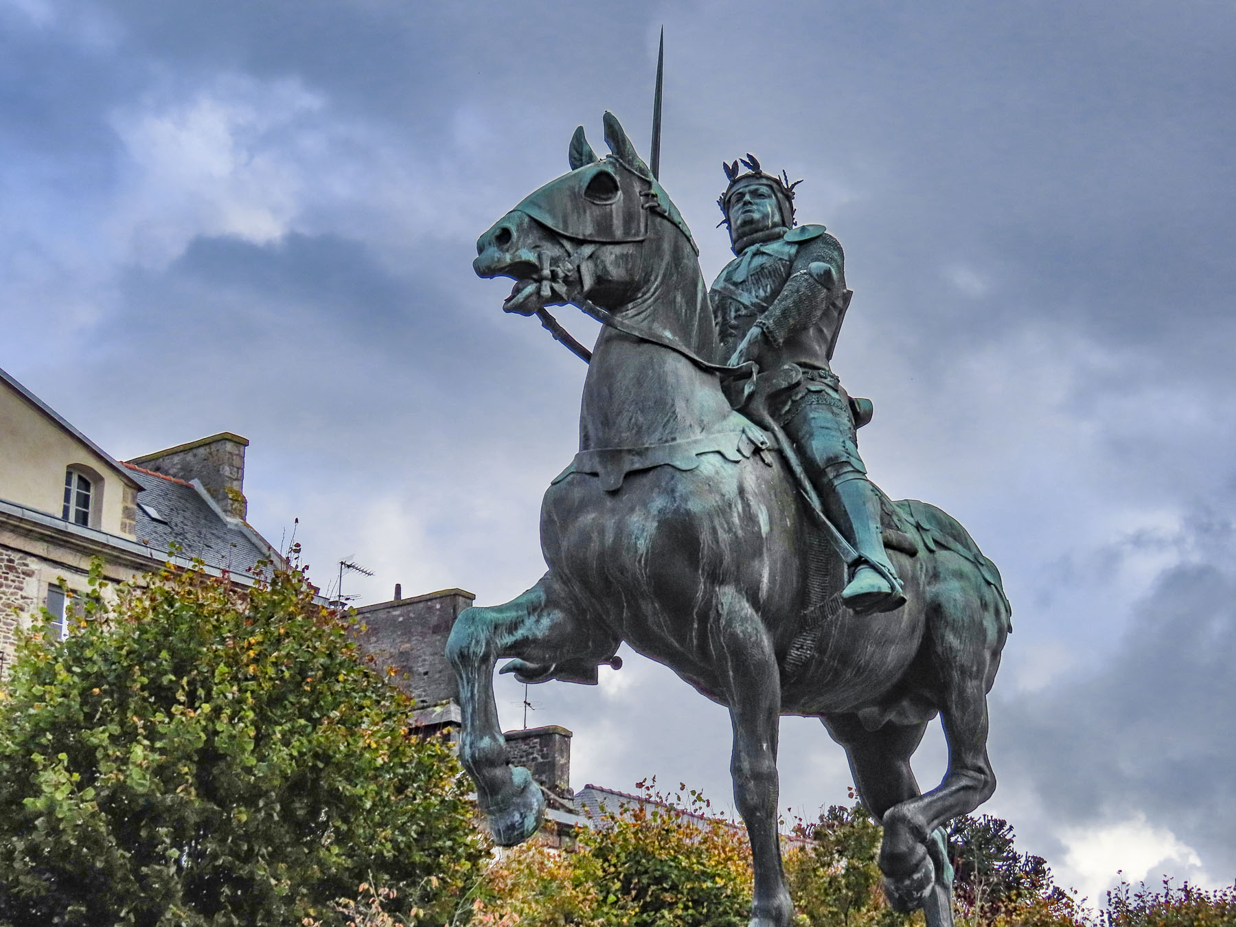
Before its renovation the plaza was a traffic circle with one side hosting a larger-than-life statue of Stalin and the other side a colossal 30ft tall sculpture of Albanian’s paranoid and isolationist communist leader Enver Hoxha. The 1991 student protests on the square, along with other demonstrations across the country, helped bring an end to 46 years of repressive communist ideology and failed economic policies. Stalin’s statue was replaced with a heroic sculpture of Skanderbeg, the 15th century nobleman who rallied Albanians to repel Turkish rule and defeated 13 Ottoman reinvasion attempts.

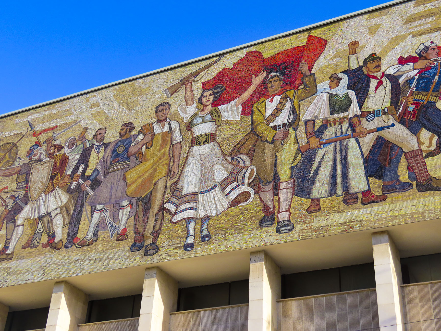
Hoxha’s statue was replaced with a public toilet. Centuries of conflict and resistance have defined Albania’s history and is reflected in a large, emotive mosaic above the entrance to the National Historical Museum. The Palace of Culture, the Opera & Ballet Theatre, and several government ministry buildings, designed by Italian architects in the 1930s, also line the square. Surrounding the plaza, an array of new construction projects are rapidly changing Tirana’s skyline. The city is having its moment as tourists rediscover this once isolated country, with its paranoia of the west, and shunned by its communist neighbors.

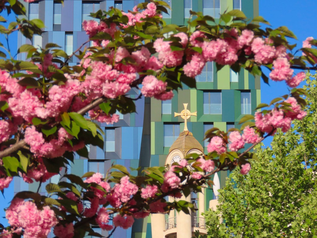
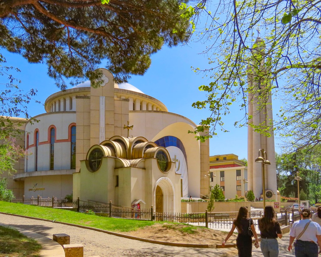
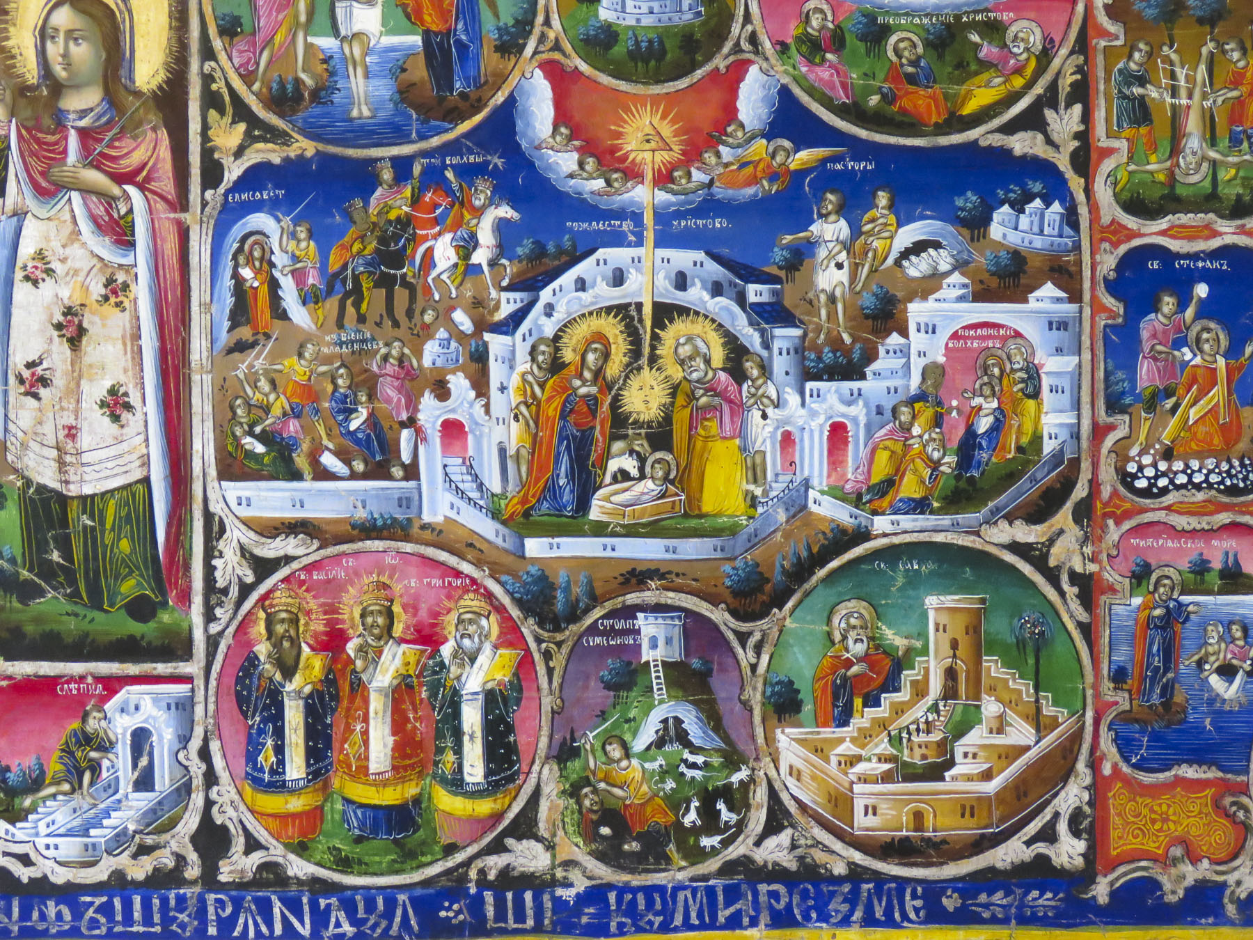
Spotting a belltower through the trees, we headed to the Resurrection of Christ Orthodox Cathedral, built between 1994 and 2002 to celebrate the revival of the Albanian Orthodox Church. It is one of the largest orthodox churches in the Balkans, and is a testament to a renewal of faith that had been outlawed under communism, when churches and mosques were destroyed or desecrated, after Hoxha proudly proclaimed Albania “the world’s first officially atheistic state.” The church is dedicated to the apostle St. Paul, who is believed to have founded the Christian community of Durrës, on the Albanian coast, during the 1st century AD.

We wandered through Rinia Park, a popular green oasis in the center of the city that is known for its Taiwan Musical Fountains, which were unfortunately still winterized when we visited. Afterwards we headed to Rruga Murat Toptani, a shady, treelined pedestrian-only lane with many outdoor cafes and restaurants, offering traditional Albanian food and various international cuisines. We enjoyed a light lunch and a local craft beer under the shade of a sun umbrella at the Millennium Garden.

Bunk’Art2, an eye-opening reminder of the perils of the despotic leader, Enver Hoxha, and the communist police state he created in order to stay in power for forty years, was nearby. It’s a large nuclear bomb-proof bunker in central Tirana, that was connected to various government ministries with tunnels for top officials of the regime to escape through. It was also an interrogation center for the Sigurimi, Albania’s Communist-era secret police force, which spied upon the country’s citizenry, and imprisoned anyone considered an opponent to Hoxha’s policies or authoritarian rule. Across the country 23 prisons were built to imprison 17,900 political prisoners.

Thirty Thousand people were sent to internment camps, and it’s believed over 14,000 were killed, died or worked to death from forced labor, often in dangerous mines. 6,000 are still missing. Often it was not just the individual who was jailed that suffered, but his family would be surveilled for years afterward, and his children would be denied educational opportunities. In Tirana the secret police kept 4,000 people under constant surveillance. The border was heavily patrolled with guard dogs and soldiers authorized to “shoot to kill,” as anyone trying to escape the country was viewed as an enemy of the state, and punishable for treason.

Only the most loyal communist families were allowed to live along the borders. Small villages were forcefully abandoned. The villagers were sent to larger cities were it was easier for the Sigurimi to watch for dissent. The mushroom shaped dome above the entrance to Bunk’Art 2 is symbolic of Hoxha’s paranoia, which manifested as a building campaign to construct an amazing 175,000 + bunkers of various sizes, across the country.  Most of them are only big enough for 2-3 people, but they were placed in strategic spots along Albania’s borders to protect the country from foreign invasion, not only from the western powers, but also from Yugoslavia or the USSR. Others were placed in the mountains, farm fields, road intersections and parks, with the intention that Hoxha’s loyalists would man them in a time of crisis.  The irresponsible cost of building the bunkers, from which shots were never fired, diverted Albanian funds away from other needed projects and ensured Albania’s position as the poorest country in Europe.  The communist government collapsed in 1991, and in the following years, more than 700,00 Albanians emigrated to find better opportunities in Europe  or farther afield.  Remittances from the Albanian diaspora to family still in the country amount to 14% of Albania’s Gross Domestic Product.

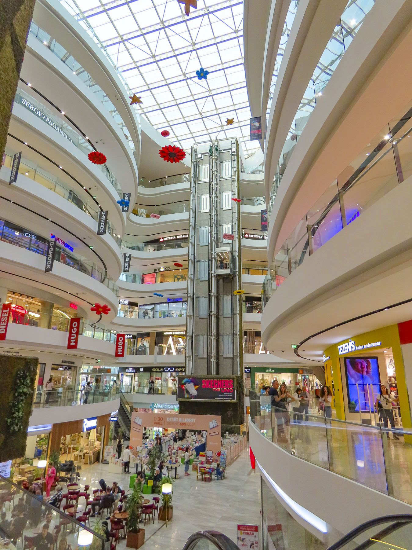
Our eyes needed a moment to adjust after resurfacing from the labyrinth of Bunk’Art 2, but if the construction boom underway in Tirana is an indication, Albania has thrown off the shackles of its communist past and is embracing the prospects of an exciting new future. Heading back to our hotel for a short rest before going to dinner we detoured into the Toptani shopping mall. A nine-story tower dedicated to the “shopping therapy” philosophy of capitalism.

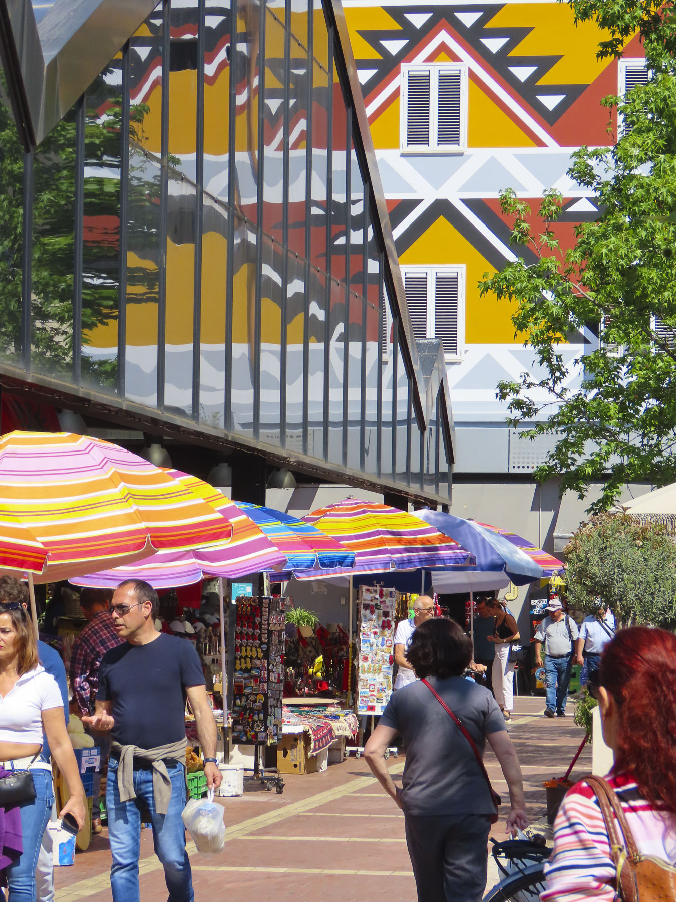
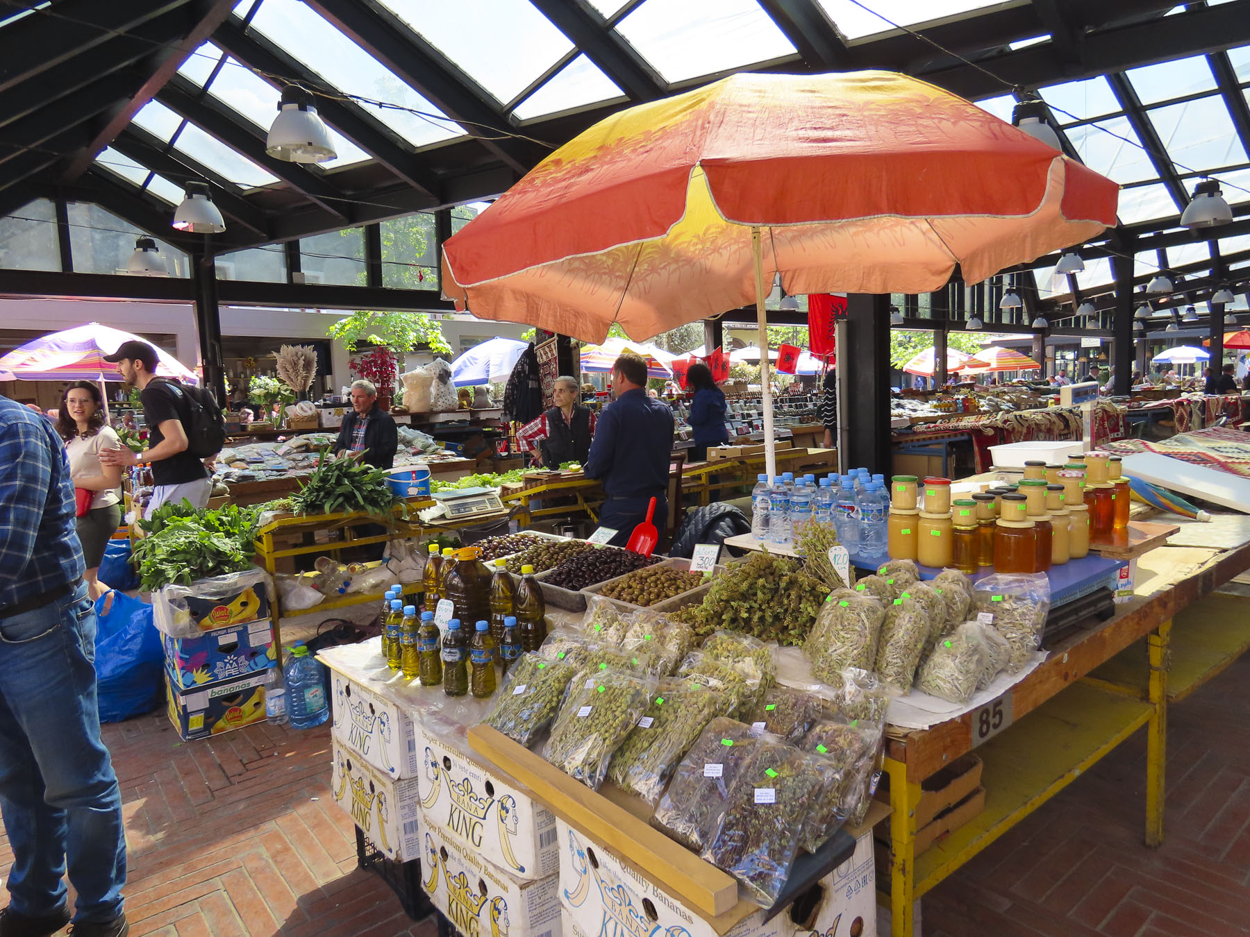
The next day we headed to the New Bazaar market area, only a five-minute walk from our hotel. On the way we passed impromptu sidewalk vendors, their crops and merchandise displayed on blankets or sheets of cardboard on the street, hoping to make sales to folks before they reached the daily market. The covered bazaar centers a plaza surrounded by restaurants, cafes, cheese shops and butcher stores. Under its roof, stands filled the space with vendors selling vegetables, olives, honey, and fruit. Women crocheted wool socks as they waited for customers. We browsed tables piled with rugs, displays of tools, pottery, vinyl records, and books, along with knickknacks, questionable antiques, and surplus Albanian army helmets. The time flew by.

Tirana is a wonderful, midsize cosmopolitan city with a population of 375,000 people, with many parks, tree lined streets, and older buildings, mostly under five stories tall. New high-rise buildings rise from the old neighborhoods across the city. It was an interesting and delightful place to wander around.

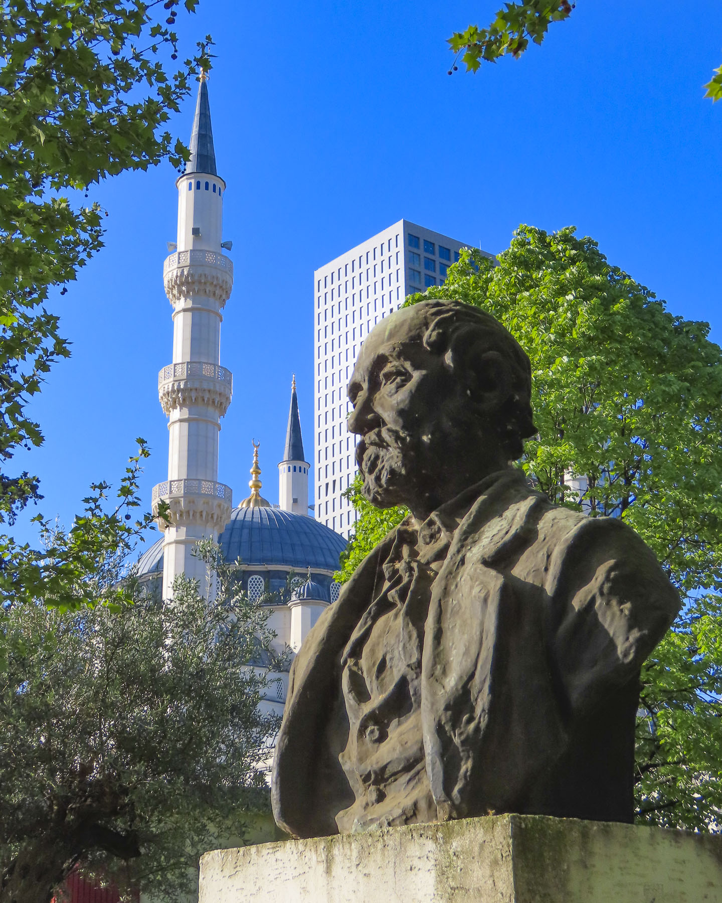
We passed ruins of Tirana Castle’s ancient defensive wall, dating to the 1300s, in the park next to Namazgah Mosque, the Great Mosque of Tirana. Completed in 2019, the mosque is currently the largest in the Balkans, and capable of holding 5,000 worshippers. The Muslim community was also persecuted under Hoxha’s anti religion policies, with many religious leaders killed or imprisoned, and 740 mosques destroyed around the country.

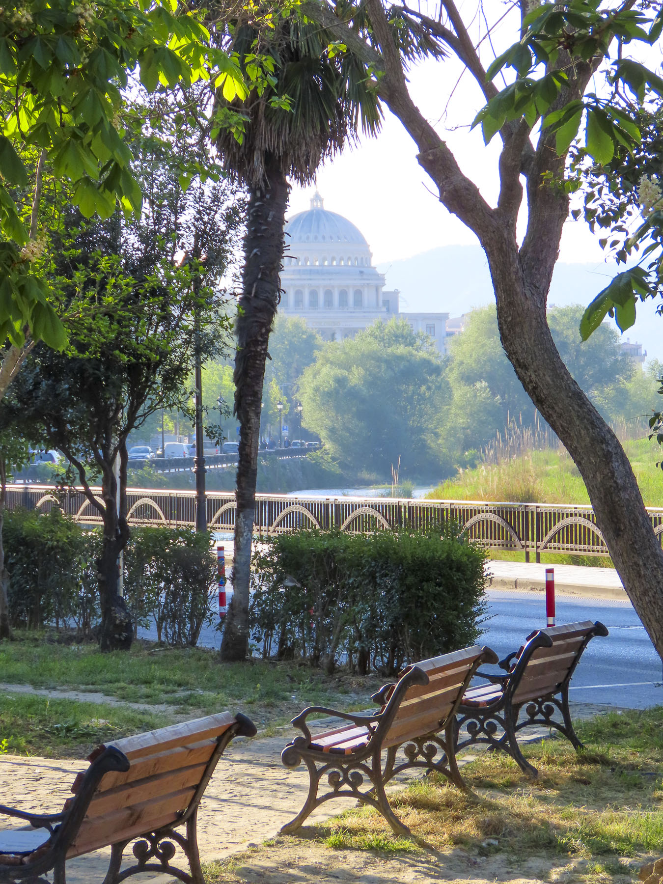
Nearby stood the 18th century Ottoman era Tanners’ Bridge, a stone arch across the Lana River that was used by farmers to bring produce into the city and livestock to the butcher shops and tanneries along the river. Farther away we crossed the ETC Bridge, a beautiful pedestrian only walkway over the Lana that is also a free wifi hotspot. The city’s tallest skyscraper, Downtown One, a 37 story, mixed used building with a very distinguishable cantilevered and recessed façade, stood in the background.

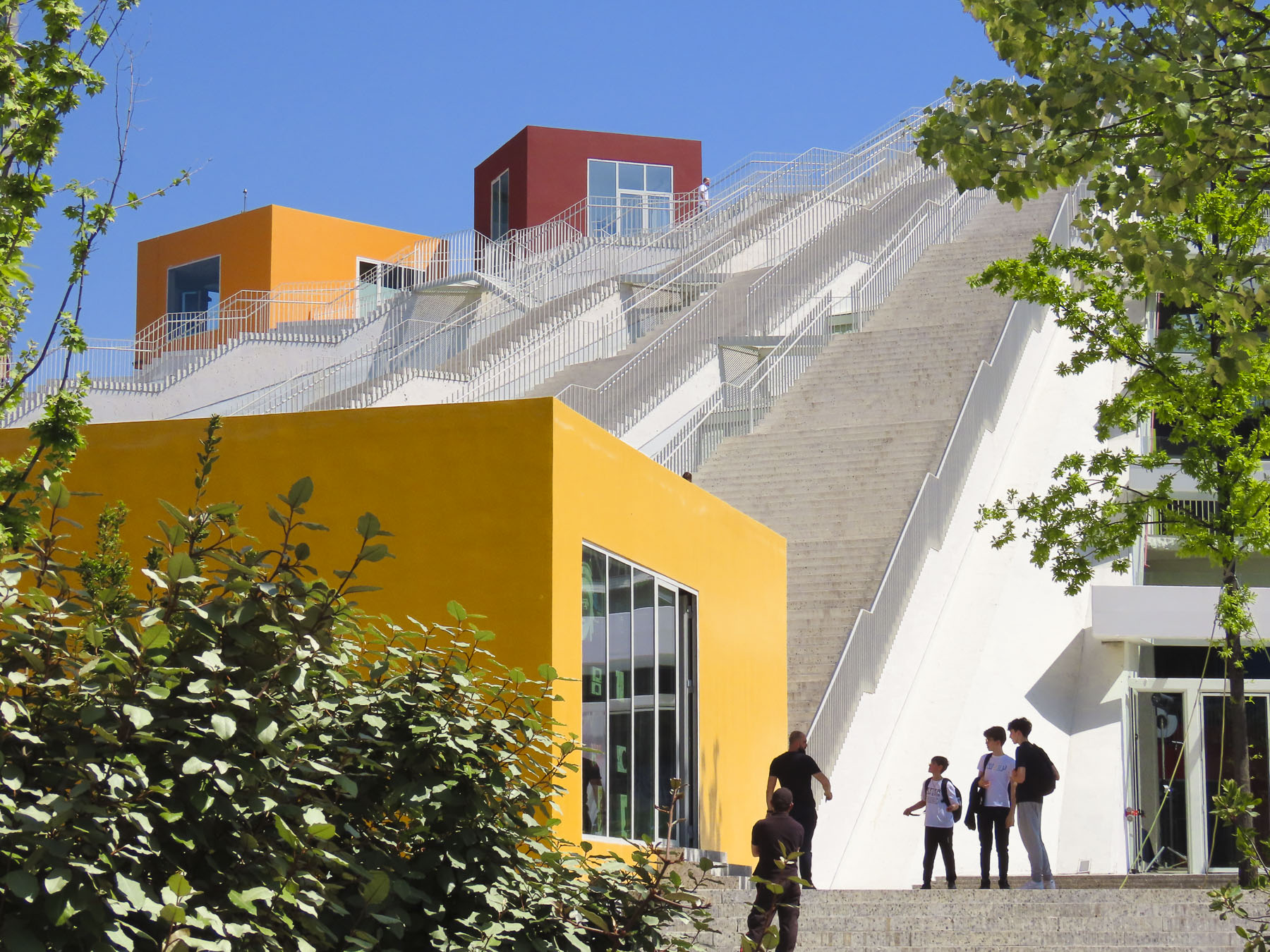
Our destination was the Pyramid of Tirana. Planned by Hoxha to be a memorial to his legacy as the Enver Hoxha Museum, covered in gleaming white marble, it opened in 1988, three years after his death. It was designed by Hoxha’s daughter and her husband and at the time of its construction thought to be the most expensive structure ever built in Albania.

Most likely forced prison labor and compulsory labor were used for parts of the project. With the collapse of the country’s last communist regime in 1991, the museum was closed and the space repurposed as a conference center, then a NATO base. It eventually fell into disuse and was vandalized, and its marble covering stripped away. It was finally reincarnated as an IT youth center with classrooms housed in colorful blocks attached on its slope, and 16 staircases leading to the viewing platform atop its 70ft high summit. We climbed to the top and enjoyed the panoramic view.

A short distance away, Hoxha lived in a modest villa in the Blloku neighborhood.  It was a secret district during the communist era, with housing reserved for the party elite, with entry forbidden to anyone else, and its road did not appear on any maps.

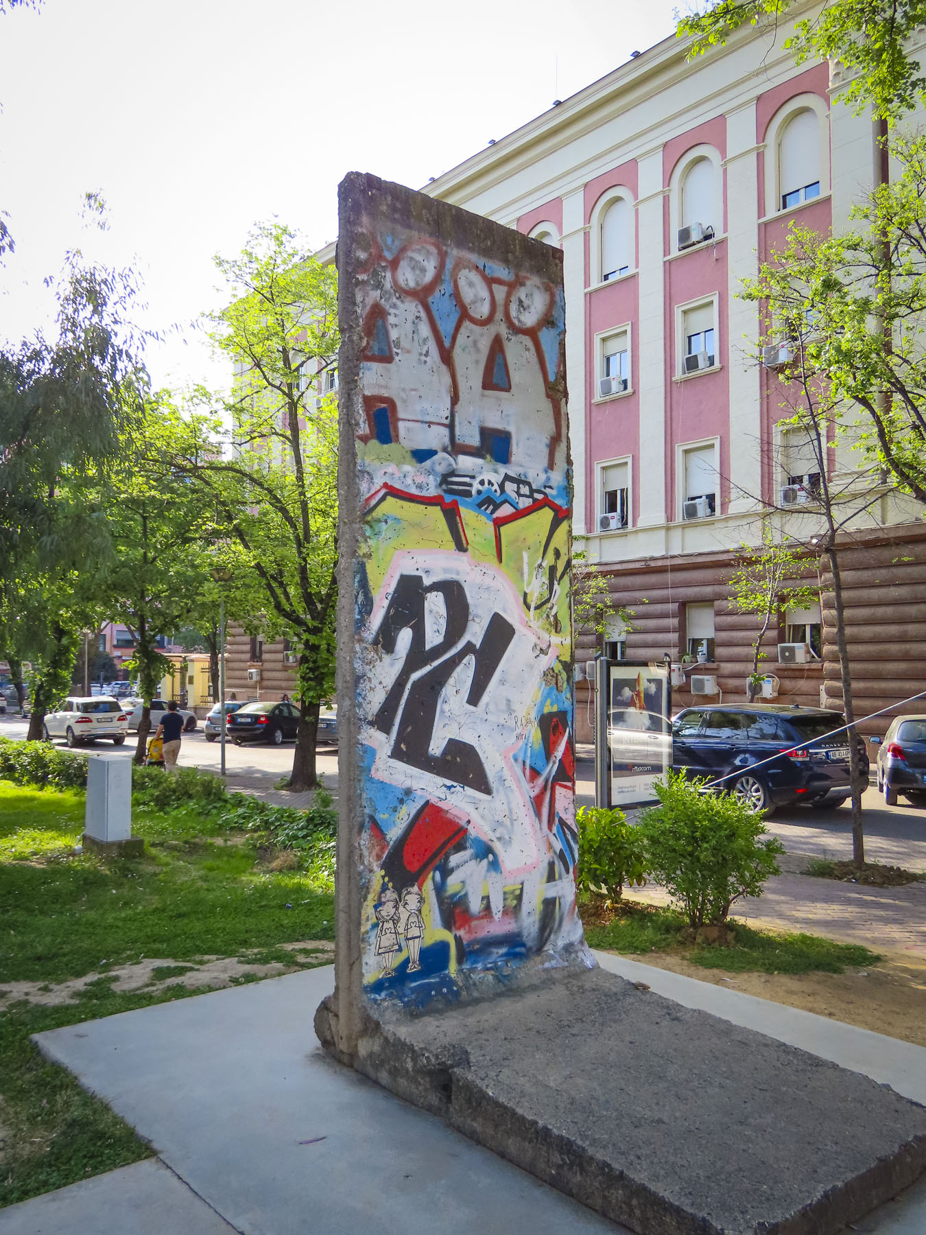
The Checkpoint memorial stands in the park down the street from his residence and features a bunker, iron mine shaft railings from the infamous Spac prison, and a section of the Berlin Wall. Subtle reminders of the brutality of communism.

For our last day in Tirana, we decided to head to the outskirts of the city to check out Bunk’Art1 before continuing into the mountains to Bovilla Lake. It’s easy to miss the turn into the long single-lane tunnel that leads to Bunk’Art1, an appropriate entrance to explore Albania’s past. After walking through a seemingly forgotten park, we entered a non-descript door in the side of an overgrown slope that hides the extensive maze of corridors and rooms of Hoxha’s secret command center.

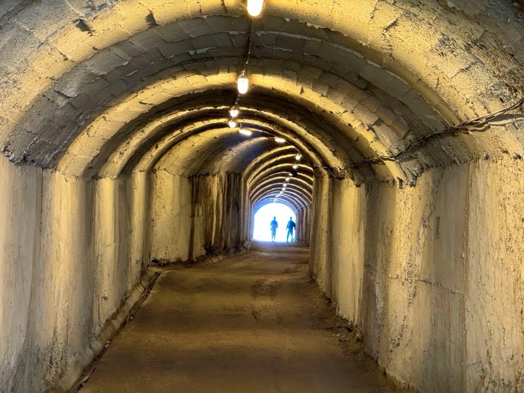
We followed a short corridor to the nuclear blast proof doors set in walls 6ft wide, and into a decontamination room. We were five stories underground in the foothills of Dajti Mountain, near the village of Linzë. There are no windows, the lights flicker, and a sign warns the power could go out at any time! It was a massive facility designed to shelter hundreds of Hoxha’s military and communist comrades, for six months, during any war.

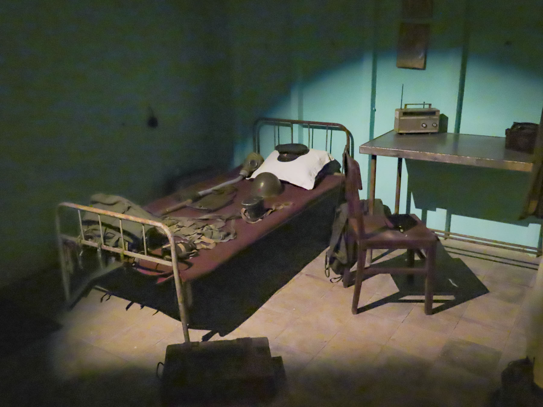
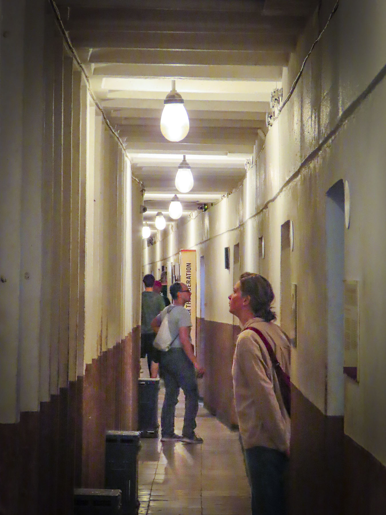
In Hoxha’s private quarters, we picked up a phone and listened to a recording of his voice. It was a sparse apartment, more prison cell than home, that lacked any warmth. Obviously, his wife wasn’t consulted. Other rooms displayed vintage equipment and weaponry. The isolation of having to live in this depressing environment would have been psychologically damaging; fortunately, the structure was never needed for war-time use and since 2014 it’s been a museum explaining Albania’s history from liberation by the partisans during WWII through Hoxha’s communist regime. The exhibits use amazing photographs and examples of nationalist propaganda from the country’s archives to great effect. The bunkers’ large meeting hall now hosts concerts and art exhibits. Emerging from the darknes,s an amazing number of different bird calls filled the air, as if welcoming us back to the present.

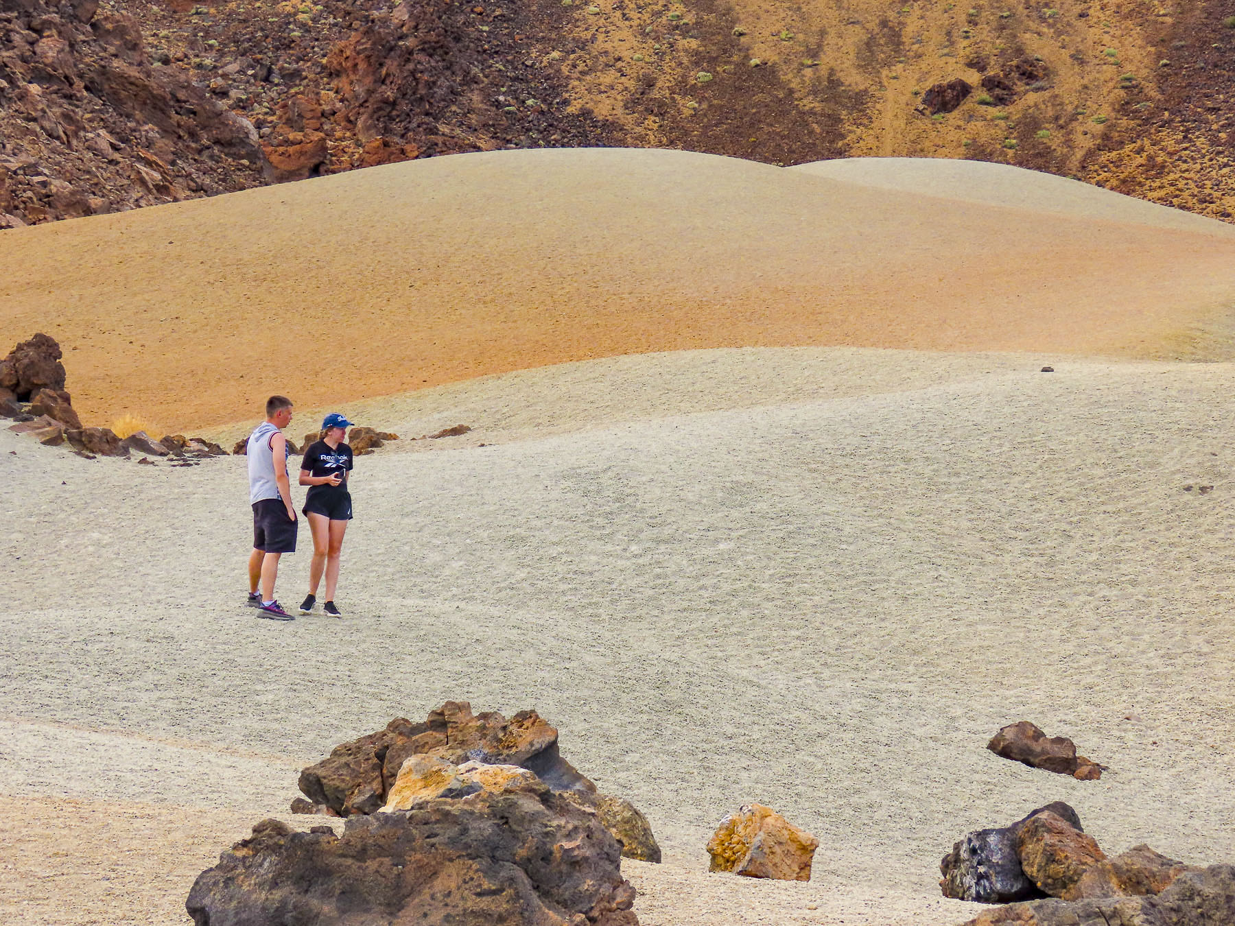
Following our map’s apps instructions we followed a confusingly serpentine route across the rolling hills outside Tirana before reaching the road, SH53, that led to Bovilla Lake. In the beginning the paved asphalt road was fine, but after a while abruptly changed to graded gravel. Nothing unusual here. Though the farther we traveled into the countryside, we passed fewer cars; rather, we saw large dump trucks, laden with stone from a quarry, headed towards Tirana, filling the air with dust. The road progressively worsened the closer to the quarry we got, as the weight of the trucks pulverized the road surface and created numerous potholes that we had to slowly navigate around. We thought several times about turning back, but we had driven through the Andes in Ecuador, with a sedan, on worse roads. While the going was slow and extremely bumpy, we did eventually make it to the lake, actually a reservoir, and more importantly, Bovilla Restaurant!

The views were astounding! The restaurant was full, with hikers and day trippers from Tirana. The food was good, the beer cold. It was a journey well worth the effort. The car rental GPS tracker did flag us, and we were fined for driving on possibly the worse road in Albania. Fortunately, when we returned the car eighteen days later, after some Albanian-style dickering, we were able to politely negotiate a reduction in the fine.

There were numerous speed traps on the highway leading out of Tirana and most of the times when we passed one, officers were writing out tickets, so we drove well below the speed limit. We were on the way to Berat and it was well past our usual morning coffee break when we spotted the colorful reflection of Bashkia Belsh’s waterfront.

After parking, we strolled along the Belshi Lake shorefront past small shops and some interesting street murals to the town’s boardwalk. Being a weekend, it was full of families with young children. To the delight of many, small rideable electric toy cars were available to rent, along with balloon, ice cream and cotton candy vendors. A small ferry boat took folks on a short cruise around the lake, while others enjoyed the fine weather and strolled along the boardwalk or sat under the umbrellaed tables of the restaurants that lined it.

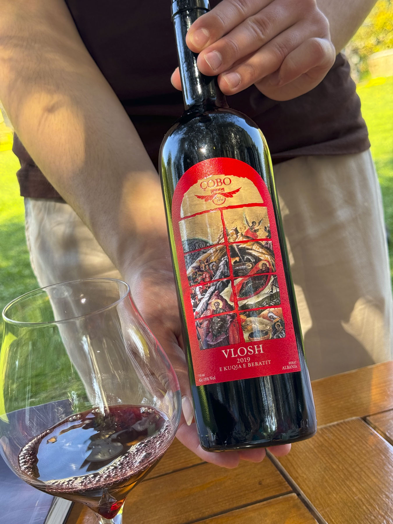
Closer to Berat we stopped at the Çobo Winery for a tasting that was accompanied by homemade cheeses and locally grown olives. Vintners of white, red, and sparkling wines and raki, they are regarded as one of the best wine producers in Albania.

It’s a small family vineyard with a 100-year tradition spanning four generations, that was sadly interrupted during the communist era, but since the 90s has grown production from 8,000 to 100,000 bottles per year. It was a nice break from our driving, and we enjoyed relaxing under the ancient olives trees in the their courtyard. The wines we tasted were very good and we purchased four to bring home in our luggage, and I’m happy to say they all made it back safely to the states.

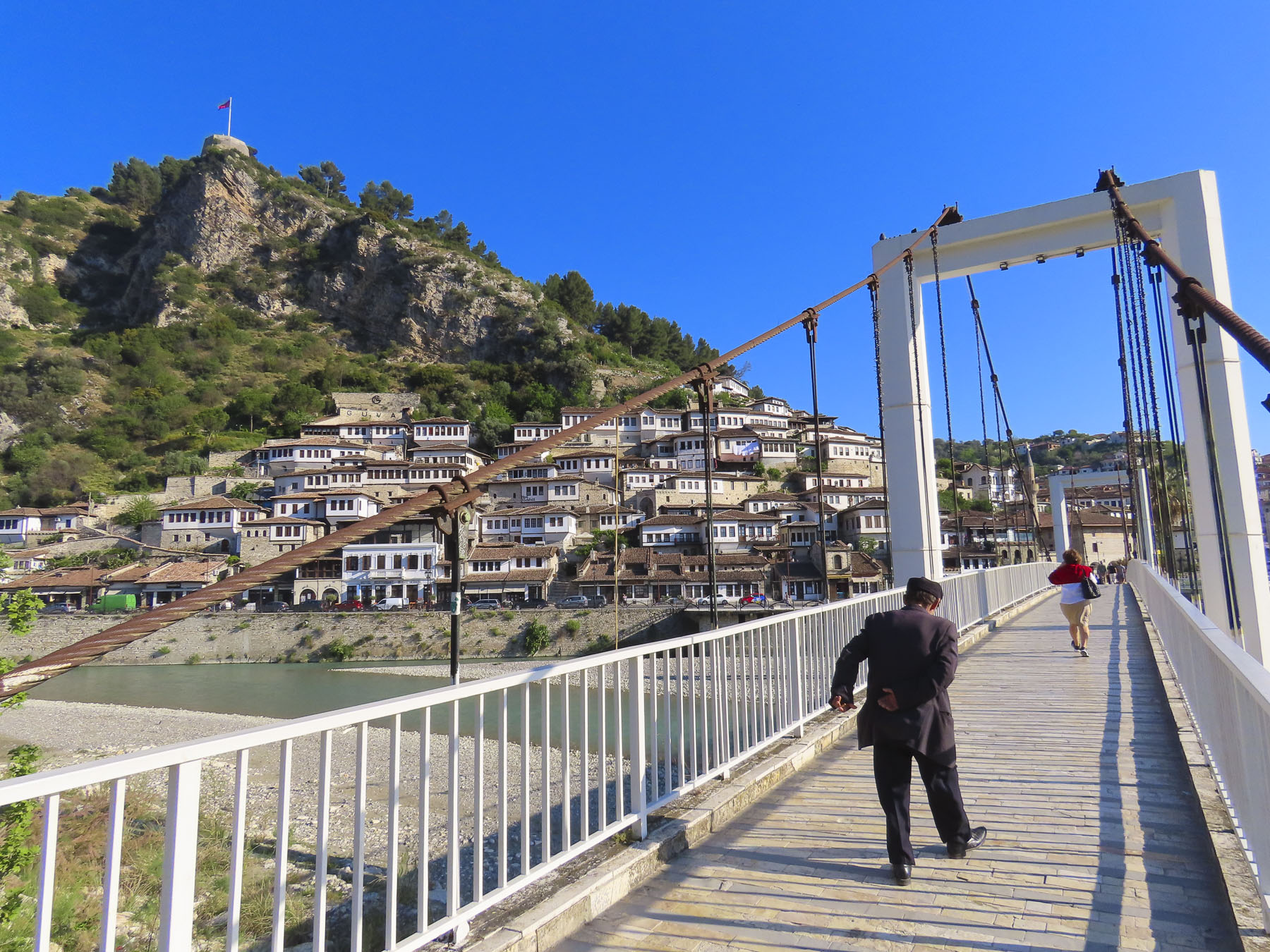
We reached Berat Castle just as the golden hour was approaching. We walked along its cobbled lanes, past homes surprisingly still occupied by about 400 people who live in 13th century citadel. But its history extends much farther back, with Roman records noting capture of the castle in 200BC. Archeological evidence shows the site has been inhabited since 2600-1800BC, making it one of the oldest settlements in Albania.

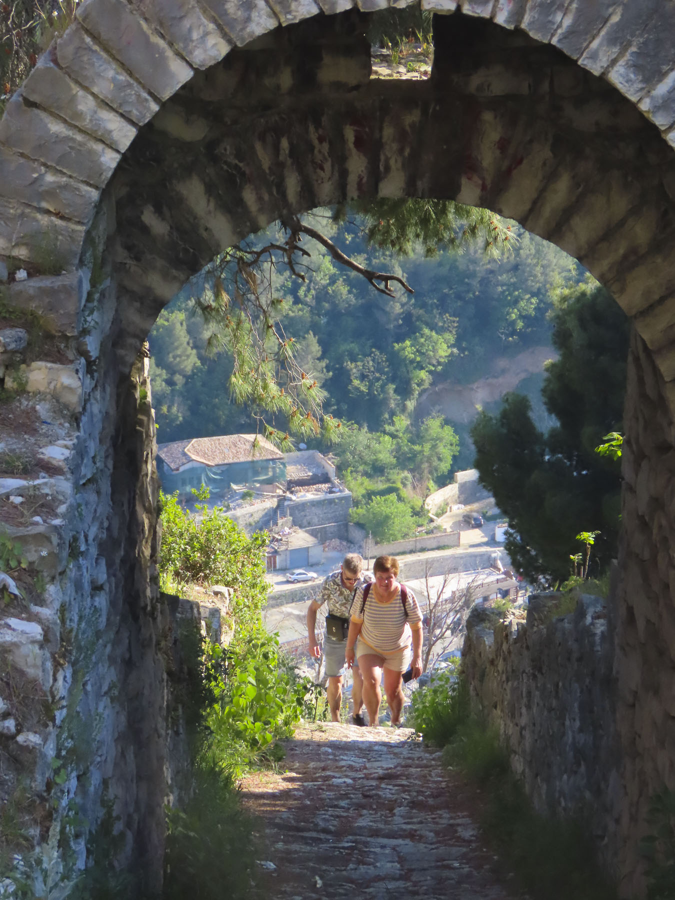
We worked our way to the overlook above Berat, passing the ruins of the Red Mosque, built in the 1400s after the Ottomans captured Berat, and Kisha e Shën Gjergjit, an orthodox church that’s been neglected since the communist ban on religion.

The panoramic view from the overlook out over Berat, the Osumi River below, and snowcapped 7900ft Mount Tomorri in the distance was stunning. Walking back along the ramparts we enjoyed watching an energetic dog race along the narrow top of the wall, chasing a stick his owner tossed up for him to retrieve multiple times. On the western slope of the castle, between the outer and inner defensive walls, Kisha Shën Triadha, a beautiful red brick, 14th century Byzantine church graces the hillside.

We wanted to stay on the “City of a Thousand Windows,” hillside under the castle, but didn’t want to drag our suitcases too far up the narrow alleys, and we had a car that needed parking. With those considerations in mind The Beratino Hotel fit our requirements perfectly and was great place to stay for two nights. Recently renovated, its stone and woodwork exemplified the best of Albanian craftsmanship. Still the shoulder season, in mid-April, I think were the hotel’s only guests.

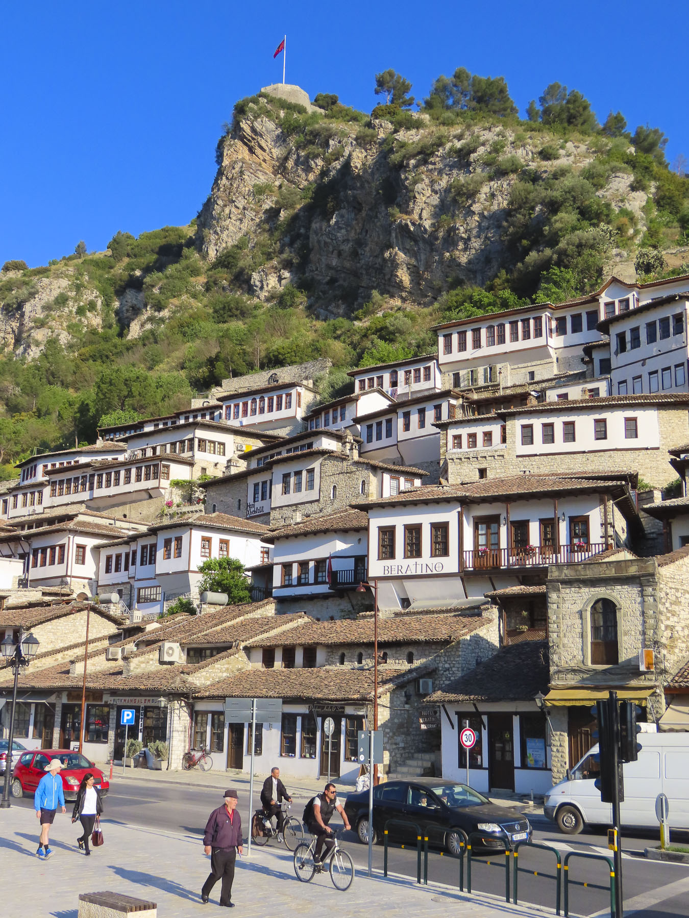
Sated from our afternoon wine tasting we walked into the newer part of Berat, now a small city of 47,000, along the pedestrian only Bulevardi Republika, next to Lulishtja park. It had a lovely Neapolitan vibe, with families enjoying the Albanian tradition of “xhiro,” to stroll with friends, relax and enjoy the outdoors after dinner. At a small shop perfectly named Bakery & Food we purchased Burek, a traditional Albanian pastry made with various meat and vegetable fillings. We purchased their spinach burek, reputed to be the best in Berat, some even say the best in Albania. The quest for the best byrek, burek, or borek in Albania might be the catalyst for a return trip to the country. Back on the balcony of our room we enjoyed a glass of wine, and the burek was delicious.

The next morning, we were up early and walked across the suspension bridge linking the old town with the southern Gorica “Little Village,” across the river. From this vantage point we spotted the Kisha e Shën Mehillit, St. Michael’s Church, an Eastern Orthodox Church, built on the steep rock face under the flag that flies above Berat. Thought to have been built in the 14th century, the setting of the red brick and stone church pricked our curiosity and we decided to hike there. The alley that led to the church was only a short distance away from our hotel but wound quickly up the hillside past homes and small inns.

We admired the strength of workers we passed carrying long wooden beams on their shoulders up the hill for a renovation project. We zigzagged higher up the hill, now looking down on the rooftops below, the trail looking like it hadn’t been trodden upon in ages. Unfortunately, the sanctuary was closed, but the views of the church with the river and mountains were well worth our effort.   

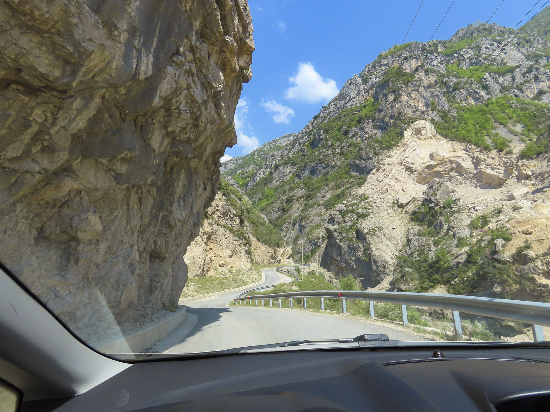
Later that morning we drove to the small town of Çorovoda, the gateway to the Osumi Canyon. It was a beautiful drive on a bright spring day, and we stopped many times along the way to photograph the scenery.

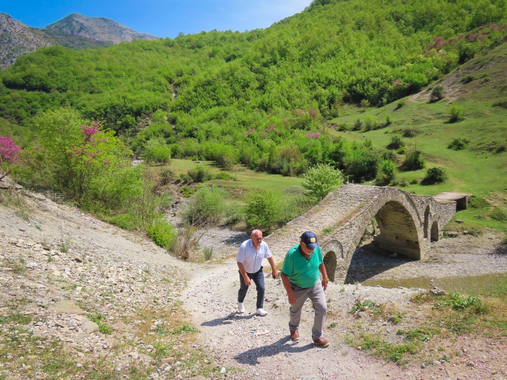
Before reaching the town, we veered off into the mountains to Ura e Kasabashit “The Bridge of Master Kasa/Kaso,” a classic high arched Ottoman era bridge constructed in 1640 across a wide stream, by the chief engineer of the Ottoman empire, at the time, Albanian architect Reis Mimar Kasemi. It was part of an ancient caravan trade route across the rugged central Albanian mountains, that connected the Adriatic Sea port of Vlorë to Berat, and Korçë before ending in the Greek city, Thessaloniki. Almost 400 years old, it surprised us that it is still standing and we followed some other tourists across it. Farther up the road from the bridge there are more abandoned military bunkers and warehouses, but we were bunkered out after Tirana and chose not to investigate them.

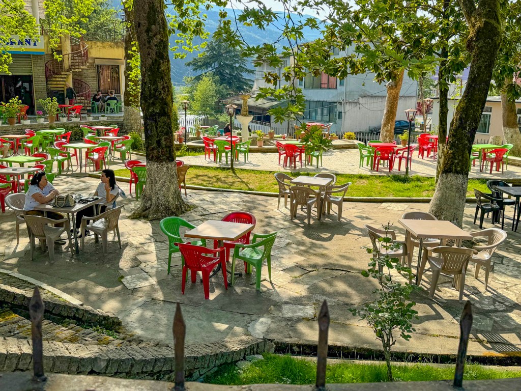
Our “drive a little, then café,” was way behind schedule when we stopped in Çorovoda at Drita e Tomorrit, a restaurant with a small park like setting.

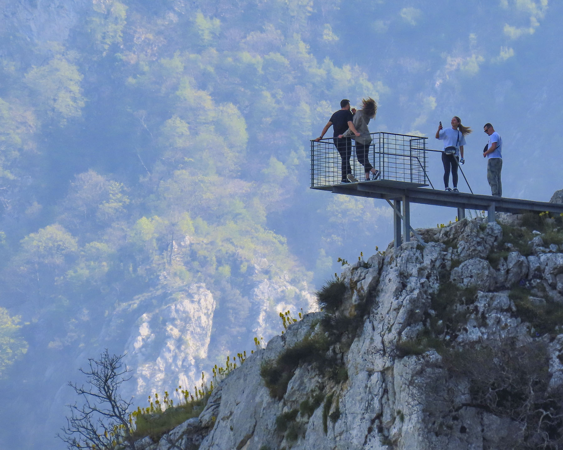
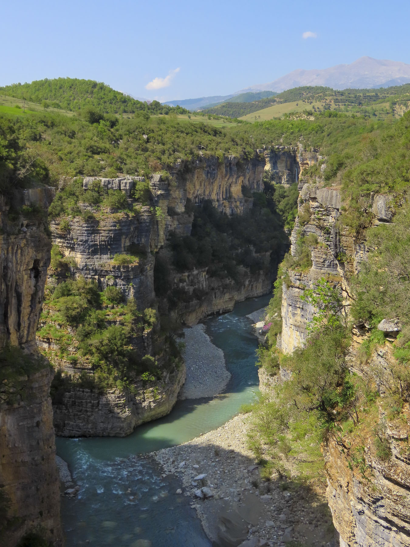
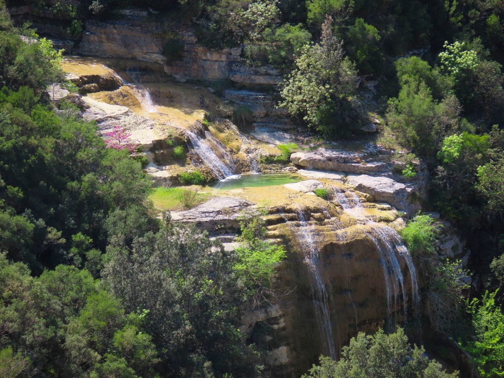
South of Çorovoda there are number of fantastic viewpoints along the Osumi Canyon. The water in the canyon is an amazing turquoise and it’s easy to see why it’s a popular area for rafting and swimming in the summer.

Before returning to Çorovoda for a late lunch we stopped at Gjurma e Abaz Aliut, the Footprint of Abaz Ali, a small roadside shrine believed to have in the solid rock under its canopy an impression of Ali’s foot. Made when the Albania folk hero, with legendary strength and courage, jumped across the Osumi Canyon from this spot. The depression in the stone looked very convincing to me.

Back in Çorovoda we had an early laid-back dinner at Zgara Korçare. It’s a small restaurant with nice owners across the street from where we earlier had coffee. Their mixed grill was delicious and we enjoyed our first tastes of Birra Korça. A good refreshing light beer brewed in Albania since 1928. Gëzuar, cheers!

The next day we headed to the Apollonia Archaeological Park before driving south to the semi-abandoned village of Upper Qeparo, eager to explore the rest of this interesting and stunningly beautiful counrty.

Till next time, Craig & Donna

Road Trip Through Brittany: Josselin & Vannes or Castles, Standing Stones and Cheese

The sun’s early morning rays cast a soft glow across the gently rolling countryside, silhouetting farm buildings and highlighting here and there pockets of mist still clinging to warm earth, and stubble in freshly plowed fields waiting to be seeded with their winter over crop.

The timing was uncanny, but I had just started to write this story when Donna called from the porch, “you have mail from France!” It must have been some tourist information I requested, I thought, and excitedly stopped writing. But I should have suspected from Donna’s smug grin that something was off kilter. To my disappointment it was the notification of a traffic fine! Who drives when we are touring is a bone of contention between the two of us. But I’ll be the first to admit that I am a terrible passenger and believe that the “Oh God” strap above the passenger door was specifically designed for my benefit.

As a consequence, I prefer to drive slowly to see tomorrow’s sunrise. I deliberately choose to deny my lovely, daring wife the thrill of downshifting and accelerating along the many cliffside serpentine roads we might encounter, as I cower in the passenger seat. There weren’t any cliffside drives in Brittany, but you get my drift. I can safely say we have different driving styles. Seriously, my wife is an excellent driver, it’s more about the extravagant fee per day the car rental companies charge for the extra driver than anything else, kinda. It was not a speeding ticket, but a moving violation caught by a traffic camera on a quiet Sunday morning in the sleepy French village of Saint-Jouan-de-I’Isle, deep in the heart of Brittany. I alone was to blame, but would have preferred asking forgiveness from a gendarme, then the robotic indifference of a traffic spy camera, and a letter months later in the mail. Though I will give credit to the French authorities for designing a user-friendly website, Amendes.gouv.fr, for paying fines online.  

We arrived mid-morning in Josselin just as the first wave of walkers were completing a charity walk in support of Pink October, France’s breast cancer awareness month, along the towpath that followed the Oust River in front of the town’s ancient castle, the Château de Josselin. It was late October, but the first yellows and muted oranges of Autumn were just beginning to show and combined with the walker’s pink vests made for a very colorful sight under a brilliant blue sky.

There has been a castle on this spot in Josselin since the 11th century, but the chateau you see today dates from 1370. Early in the 1400s Alain VIII of Rohan inherited the castle and it has remained a House of Rohan estate for 600 years. The chateau suffered poorly during the 16th century French Wars of Religion, as Henry II of Rohan supported protestant Huguenots against the King of France and the Catholic church; five of its original nine towers were destroyed on the orders of Cardinal Richelieu. During the French Revolution the castle’s towers were used as a prison, but afterwards it sat abandoned until the mid-1800s when Duke Josselin X of Rohan piloted an extensive restoration.

Strolling against the current of walkers we crossed a bridge to Josselin’s Quartier Sainte-Croix and wandered along narrow lanes past ancient half-timbered buildings dating from the early 16th century. Some leaned precariously, like an elderly person requiring a cane, while others featured ornamental heads carved into exposed roof rafters for decoration. Following our philosophy of “walk a little, then café,” we enjoyed a rest at the Logis Hôtel du Château, and its location on the riverbank.

Returning to the village, we stopped mid-bridge to admire the view along the riverport’s quay. With a renaissance chateau, charming buildings and a beautiful river to stroll along, no wonder Josselin has received the very French distinction as a Petite Cité de Caractère, a small town of character. During the high season paddle boards, kayaks, and boats are available for rent to enjoy this tranquil stretch of water.

The Oust is a canalized river and is part of the 220-mile-long Canal de Nantes à Brest which traverses inland Brittany to connect the seaports of Nantes and Brest, on the Bay of Biscay. The old towpath which follows the canal’s course is also a popular route for cyclists and hikers. We thoroughly enjoyed our morning in Josselin, but truly the quaint village deserves more time, or an overnight stay to absorb its wonderful ambiance. Vannes awaited us, so we drove on.

We arrived in Vannes and found convenient parking along the Port de Vannes quay, in an underground garage, in time for a late lunch. The masts of sailboats, with their colors flying, rocked gently in the afternoon breeze, against the background of the port’s Place Gambetta, and its iconic 19th century sandstone colored, Haussmann styled buildings, with their distinctive dormer windows in their mansard roofs. It’s difficult to imagine from the size of this petite harbor located on a narrow stretch of water called La Marle, that Vannes is actually an inland seaport, and the economic engine that drove Vannes’ prosperity since the era of the Romans, two-thousand years earlier. It was a favored protected anchorage, located three-quarters of a mile inland from the Gulf of Morbihan, for Rome’s merchant fleet of oared galleons, and it facilitated trade in wine and olive oil from France to England, while ships returned with valuable tin, lead and copper. Today the Port de Vannes hosts recreational and tour boats, which offer day trips to the islands in the Gulf of Morbihan, where on a windy day you can still see restored siganots, Brittany’s iconic two masted, gaff rigged, wooden fishing schooners, that typically have red sails, plying the waves.

Surprisingly, for this far north, a row of palm trees separated the Place Gambetta from the harbor, and gave the area a delightful French Caribbean vibe, before leading to the historic citadel through the Saint-Vincent gate. There were numerous restaurants, bustling with activity, surrounding the harbor, and we chose to lunch at Le Daily Gourmand for its outside tables and seasonal menu.

Excited by our first impressions of Vannes, we roughly planned our four days in the ancient city and day trips to Suscinio Castle, and the Alignements de Carnac. One of the attributes we consider when choosing a destination for a multiple day stay is the walkability of a city and are there enough things to do to keep us busy. Vannes fit the description perfectly, offering me multiple routes to explore the city during my 6 a.m. walks, while Donna slept in.

The walk along the Promenade de la Rabine, “the alley planted with trees,” was one of these walks that started near the Place Gambetta and followed the long sliver of La Marla, down its right bank a half-mile, towards the newer commercial port and the Gulf of Morbihan. The idea for this tranquil public space first arose in 1687, and over the following centuries it has been widened and extended several times. Halfway back on the return route there is a pontoon footbridge across the marina to the more cosmopolitan left bank.

A short walk from the Place Gambetta, the 19th century faded away quickly as we approached the historic Château de l’Hermine, with its formal garden featuring the emblem of the L’Ordre de l’Hermine, a medieval chivalric order, worked into its landscaping, and the Remparts de Vannes. The ermine depicted might look like us like a flying weasel, but it’s a traditional symbol of Brittany that signifies nobility, courage, honesty, uncompromising integrity, and personal honor. The ancient order was revived by the Cultural Institute of Brittany in the 20th century to honor people who contribute to Breton culture. The château, built in 1785, is a beautiful example of 18th century French architecture, and operated as the Hôtel Lagorce until 1803. It was then used as a private mansion until the French State purchased it in 1876 and proceeded to use it as an Artillery School and barracks for the XIth Army Corps, treasury, and university.

But the more interesting history of the site begins in 1380 when the Dukes of Brittany decided to use Vannes as their seat of power and ordered a castle with moat built and the ramparts surrounding the town, first erected by the Romans in the 5th century, improved. It served several generations of Dukes as their main residence until the late 1400s when François II, the last Duke of Brittany, moved his court to Nantes. During the early 1600s, the now-old castle was dismantled for its stones, which were used to build the quay at the port.

Skip ahead to March 2024 and the18th century château is now owned by the City of Vannes and construction has begun to renovate it and add a new wing for a project that will eventually be the Vannes Museum of Fine Arts – Chateau de l’Hermine. While excavating for new footings, workers uncovered well preserved walls, parts of a moat with drawbridge, and evidence that the castle had been three to four stories tall and had indoor toilets. We visited Vannes shortly before this discovery, but still marvel at the amazing things out there that are yet to be rediscovered.

A little farther along the Jardin des Remparts has the longest remaining section the city’s ancient defensive wall, with gates and towers, as their backdrop. The formal gardens are beautiful, with more than 30,000 flowers planted each year. It’s a popular spot to relax and walk dogs along the banks of the La Marla River before it reaches the port. The gardens are also used several times throughout the year to host various fairs and most importantly, the Fêtes Historiques de Vannes every July 12-14th. It’s a huge, festive cosplay event that celebrates Vannes’ rich history, and spreads into the historic center, with craft demonstrations, and participants and visitors wearing medieval clothing. The Porte Poterne gate is near the gardens, and entering the city one night across worn cobblestones glistening in a cold rain was an experience that transported us back centuries.

Later that first day in Vannes we were thrilled when we arrived at the Hôtel Le Bretagne and were able to find inexpensive street parking directly in front of it. The hotel abutted the rampart’s Executioner Tower and was ideally located just outside the historic old town, between the Porte de la Prison and Porte Saint-Jean gates. Vannes’ architectural continuity is unique among cities in France as it escaped the destructive aerial bombings of WWII, which ravaged many towns throughout the country.

Consequently, it has kept its rich architectural history intact. This was evident as we rounded the first corner from our hotel and entered the ancient citadel under the narrow-arched Porte Saint-Jean gate. In its earlier years it was known as the Porte du Mené, the Door of the Executioner, because of its close proximity to the axeman’s place of work. Fittingly, his tower was only a short walk down the alley from the Cathédrale Saint-Pierre, for the priests to give prisoners their last rites.

Built atop the ruins of an ancient Roman church, Saint-Pierre commands the highest point in the old town and blends Romanesque, Gothic, and neo-Gothic styles, which is what happens when a church is constructed, remodeled, expanded and restored from 1020 until 1857, when the carving of the façade was finally completed. It’s beautiful inside and out.

A short walk away, many fine examples of Vannes’ colorful,15th century, half-timbered buildings surround the Place Henri IV. A map isn’t needed to explore the ancient citadel. Wandering or “walk a little, then café,” as we like to say, is the perfect approach to discovering the town’s architectural gems and enjoying Vannes. After all, what’s the rush?

Wednesday and Saturday have been the traditional market days in Vannes for decades and the streets of the historic center fill with activity as folks shop among vendors selling housewares, clothing, breads, pastries, fruits and vegetables, wine, meat, sausages and CHEESE! Our weakness. Fromagers offering samples of soft and hard goat, sheep and cow cheeses with various ageing enticed us all too easily to purchase their products. Shopping there was a sensory experience that had us wishing we had opted for an apartment stay just so we could cook.

There are also two permanent food halls within the old town, Halle Aux Poissons, the fish market – is located down a side street just beyond the Porte Saint Vincent gate as you enter the city from the harbor. And the Halle des Lices, a large market hall with about thirty shopkeepers that is open Tuesday to Sunday from 8 am to 2 pm. It’s also a good place for breakfast or lunch.

The market takes its name from the Place des Lices on which it stands, though during the 14th and 15th centuries the Dukes of Brittany held jousts and tournaments there, between the Tour du Connétable, built for the commander of the Duke’s army, and the original Château de l’Hermine. The Tour du Connétable is a substantial tower that was part of the defensive wall that encircled Vannes, but what we found interesting was that you can still see where other ramparts intersected with the tower but were removed to reconfigure the fortifications as the city grew over time.

Only thirty minutes away, the Alignements de Carnac were an easy day trip from Vannes. We drove along D196 and followed a 1.6 mile route that started in a wooded glen at Alignements du Petit-Ménec and passed the alignments in Kerlescan, Kermario, and Toulchignan before ending at Carnac. It was a fascinating area with many opportunities to stop, touch and walk through the fields with over 3000 prehistoric standing stones.

Arranged in rows across a rolling landscape, the alignments are thought to have been erected around 4000BC, predating the 2500BC Stonehenge. Little is known of the Mesolithic hunter-gatherers that are thought to have erected the stones.

But a later Brittany Arthurian myth associated with them holds that they were a marching legion of Roman soldiers turned to stone by the sorcerer Merlin. Away from the road there is also a cycling/walking path through the countryside that paralleled our route. Afterwards we drove along the Trinité-sur-Mer waterfront, which we found reminiscent of coastal Maine.

Another day we drove a half-hour south from Vannes to the Domaine de Suscinio, one of the prettiest castles in Brittany, near the Bay of Biscay. It started as a modest seigneurial manor house for Peter I, Duke of Brittany, in 1218.  His son John I started to expand it and add fortifications, a building campaign that continued through successive Dukes until they moved their court to Vannes. Thereafter it was mostly used as a hunting lodge, unless there was a war in progress.

In the early 1500s it became the property of the French Crown and Francis I of France installed a favored mistress there. During the French Revolution, the now dilapidated castle was sold off to a stone quarry and its rocks were slowly carted away.

A dramatic restoration of the castle started in 1965, and was obviously a labor of love, that reflects the Bretonne pride in their heritage. It’s an exquisite space with many interesting, museum-quality displays. We thought the discovery of an intact, highly decorative, mosaic floor from the castle’s chapel, which was located across the moat, most intriguing.

Archeological excavations around the site are still ongoing and objects discovered, are restored and exhibited. Refreshingly there are plenty of hands-on things for kids to do, like dressing as Renaissance knights, squires or princesses. Medieval board games are also available for kids to try.

Beyond the ramparts there is a medieval encampment complete with re-enactors for families to explore. Wandering around the castle was thoroughly engaging and from the top of the battlements, you can see the Bay of Biscay. With the coast so close we wondered if Henry Tudor, future King Henry VII of England, landed there after he fled England, and spent 11 years in exile at Suscinio before returning to seize his crown in the Battle of Bosworth Field in 1485.

Afterwards we headed to the Port du Crouesty marina in Arzon on the Peninsula Rhuys, surrounded by the Bay of Quiberon and Gulf of Morbihan. We sauntered along the port’s quay, admiring the boats docked in the marina, until we found Le Cap Horn. It was the perfect spot to enjoy some beers, and fresh seafood for dinner, our last meal in Brittany before heading home to the states.

We had a fantastic time exploring a small part of Brittany and hope one day to return to this charming, less explored, part of France.

Till next time, Craig & Donna

Road Tripping Through Brittany: Saint Malo, Dinard & Dinan or For the Love of Oysters

Tractors pulling wagons laden with huitres just harvested from the oyster beds of Cancale Bay now replaced the apple carts we passed two days ago in the Calvados region. Leaving Mont Saint-Michel in Normandy, we had entered Brittany in mid-October at the height of oyster season, which is traditionally considered the months that contain “r” in them, September – April. Our destination was Dinard, after stopping for lunch in Cancale, ground zero for huitres aquaculture in France. We had detoured from our route into Cherrueix to see the wide beach there that is popular for land-sailing, where specially designed three wheeled carts, outfitted with a sail, glide along the flat sand and attain high speed due to the strong winds that blow in off the ocean, filling their sails. But a windless day dampened that activity. The weather was pretty miserable that morning with intermittent squalls at times, limiting our explorations and photography. Our course diversion wasn’t a total loss as we found that the small village had several historic windmills and thatched roofed homes, which lent the town an unexpected Dutch and English feel.

Oyster connoisseurs enjoy Brittany oysters for their unique merroir. Just as wines derive a distinguishable terroir from the soil their grape vines grow in, oysters get their signature flavor from the saltiness and temperature of the seawater they are harvested from. The extreme, fast moving  tides, which Victor Hugo once described as “moving as swiftly as a galloping horse,” and cold water of Mont Saint-Michel Bay, which encompasses the ocean from Saint Malo, Brittany to the Cotentin Peninsula of Normandy, impart the oysters grown here with a sweet delicate flavor, which have won them fans the world over. Really, they are the best we’ve ever tasted, and we would order them whenever we saw them offered during our trip. They were also very affordable, which was a delight. Low tide along the coast revealed the extensive network of oyster farm pilings that support the growth of over 5,000 tons of succulent huitres a year.

Oysters have been gathered along the coast of Brittany since this region of France was part of the Roman Empire 2000 years ago. As with all ancient agrarian traditions, women have played a vital role harvesting oysters and Cancale’s town plaza hosts a bronze statue commemorating them. The day we visited, and it took us a while to figure out why, the female figures of the memorial were adorned in pink aprons. Turns out this was in recognition of France’s Breast Cancer Awareness Day, which happens every October. At lunch in a small establishment on the square, of course we slurped a dozen oysters, with just a touch of shallot mignonette sauce. They were divine. On Cancale’s waterfront there is also a daily Marche aux Huitres, surprisingly this oyster market which is open year-round. That old tradition of eating oysters only during the ‘r’ months dates back to King Louis XV in the 1700’s when refrigeration wasn’t possible, and it was unsafe to consume them during the warmer months. It’s also a matter of preference as the texture of the oyster becomes creamier during the warmer months, but today in France they are consumed year-round.

The late afternoon sun was shining brilliantly by the time we arrived in Dinard, found a free parking space on the street, and checked into the Hôtel du Parc Dinard, our home for four nights. The popular vacation spot is practically a ghost town in the fall, with most of its elegant Victorian-era homes battened down tight awaiting winter storms. The quietness was perfect for us, and the town would be our base for visiting Saint-Malo, a short distance away across the Rance Estuary, and farther inland the ancient riverport town of Dinan.

A former fishing village, Dinard was transformed into a vacation hotspot, when the French gentry, wealthy Americans, and British aristocrats discovered its picturesque beaches, and cliffside walks in the late-nineteenth century. A pleasant mild climate, influenced by the nearby warm waters of the Atlantic gulf stream helped set its reputation as “the Pearl of the Emerald Coast.” A who’s who list of celebrities – Picasso, Gary Grant, Joan Collins, Winston Churchill, and Oscar Wilde – frequented the seaside resort. The British film director Alfred Hitchcock visited often enough that the town erected a statue in his honor. Film legend believes he based the house in the film “Psycho,” on one of the town’s elegant mansions and the movie “Birds,” partly on experiences with raucous seagulls along the cliffs here. His relationship with the town led to the establishment of the Dinard Festival of British & Irish Film. Now in its 35th year, it’s held early in October. Prize winners receive a golden Hitchcock statuette.

One of France’s most “British resorts,” the town’s luster faded in the 1960’s when the “jet set” discovered the Mediterranean beaches of southern France. Fortunately, the town has been rediscovered as a holiday destination and today attracts folks looking for vacation rentals in the now sub-divided mansions, who appreciate its quite ambiance and location along the Cote d’Emeraude of Brittany.

One of the best ways to enjoy the town, in any season, is to follow the Coastal Path of Dinard, a 5-mile-long improved trail that hugs the rocky coastline, passes sandy coves and fascinating old architecture. From our hotel we broke our walk into two manageable segments and included a stop at the weekly market one day to purchase supplies for a picnic lunch for later in the day. One afternoon we drove west along the backroads to Saint-Briac-sur-Mer. Here we could see the extreme tides of the Brittany coast, which left boats at their moorings high and dry at low tide.

Just across the water from Dinard the old fortress city of Saint-Malo still guards the natural harbor created by the La Rance estuary as it enters the Gulf of Saint-Malo and the English Channel.  Its ramparts have remained mostly unscathed since their first construction in the 12th century, in order to deter feared Viking attacks. Centuries later the Corsairs of Saint-Malo, French privateers serving the King of France, would pillage foreign ships sailing the English Channel, or extort a transit tax from them, then flee the scene of the crime and seek refuge from the pursuing English Navy under the cannons along Saint-Malo’s ramparts. This tactic was so annoying to the British that they launched an amphibious naval assault against the Saint-Malo corsairs in 1758, but determined the city’s ramparts were impenetrable and instead attacked the nearby town of Saint-Servan and destroyed 30 of the pirate’s ships there.

Outlaws to the English and Dutch, the corsairs of Saint-Malo had more nuanced careers and were well respected as explorers and merchants in France, enriching the town and serving the interests of several French kings over the centuries. Departing from Saint-Malo, Jacques Cartier sailed down the St. Lawerence River and claimed the discovery of Canada for France in the 16th century and sacked a few vessels along the way. Jacques Gouin de Beauchêne would lead the first French expedition into the South Atlantic, raid Rio de Janeiro, find the Falkland Islands, sail through the Strait of Magellan, visit the Galapagos Islands and return to the Atlantic Ocean by sailing west to east across the treacherous waters of Cape Horn. Other corsairs helped establish trade with ports along the west coast of Africa, Southeast Asia and the Pacific, which would evolve into French colonies. Corsair Duguay-Trouin led a Moka expedition to Yemen in the early 1700s, returned with the legendary coffee beans, and French society was changed forever: the café tradition had begun. Saint-Malo prospered.

Walking atop the ramparts that encircle the ancient citadel, it’s difficult to imagine that this beautiful city lay in ruins in September 1944. The D-Day invasion of Normandy had happened three months earlier, but well dug-in German forces, led by a commander who swore to defend the Third Reich to the last man, refused to surrender their reinforced positions in Saint-Malo. It took a relentless, months long campaign of allied aerial and artillery bombardment for the Germans to concede defeat.  The ramparts still stood, but 683 of the town’s 865 historic buildings were leveled, its 6,000 inhabitants homeless. The mayor at the time, Guy Lachambre, petitioned vigorously for the reconstruction council and its architects Marc Brillaud de Laujardière and Louis Arretche not to modernize the war-torn town, but to respect the ancient medieval character of the city and retain its maze of alleys, granite facades and steep slate roofs. It took two years to painstakingly remove the rubble, before rebuilding could start. Workers cataloged the ruins like an archaeological excavation, numbering each brick and stone, so that town’s original building materials could be reused, when possible, to authentically resurrect it from its ashes. Major reconstruction lasted until 1960; however, the Cathédrale de Saint-Malo, the final resting place for the famous Corsairs Jacques Cartier and René Duguay-Trouin, didn’t acquire its new steeple until 1971. The church’s spire, rightfully returned to its place of honor on the citadel’s skyline, was once again a welcome landmark for sailors returning from the sea. Renewed prosperity returned to Saint-Malo in the mid-1960s when folks rediscovered the seaside town as a great place to rent a vacation flat in apartments now vacated by families that moved away during the reconstruction years.

The views from atop the ramparts of the sea and the citadel were great. It’s an easy 1.4 mile loop around the ramparts, with many gateways that descend back into to the walled city or out onto the surrounding beach. At low tide it’s possible to walk across a sandy peninsula to the nearby 17th century Fort Natioinal, or to the small island Grand Bé, where the French writer François-René de Chateaubriand is buried, but be careful not to get stuck out there during an incoming high tide. Afterwards, back in town we found a rustic bar with a fire going in its stove and warmed ourselves with snifters of Calvados and café.

During the high season, parking in Saint-Malo can be problematic. However, if you are staying in Dinard it’s possible to take the small ferry across to the “The Corsair City.” If you are looking for a good read, the book All the Light We Cannot See, written by Anthony Doerr, evocatively tells an intriguing and mysterious story of life during WWII in Saint-Malo.

Traveling 30 minutes south from Dinard, we seemed to have arrived in the 14th century. We were greeted by an equestrian statue of the famous French general Bertrand du Guesclin, which towered above us in the car park. He was known for his many victories over the English during the Hundred Years War. He was so well regarded that upon his death, in 1380, he was given a royal funeral, his body quartered for burial, a practiced usually reserved for France’s kings. “His heart was buried in Dinan in his native Brittany, his entrails were buried in Puy, his flesh at Montferrand, and his skeleton in the tomb of St. Denis outside Paris.” We were off to an interesting start.

Somehow having escaped the destruction that befell Saint-Malo, Dinan’s historic center is filled with charming leaning, half-timbered medieval buildings dating from the 13th to 16th centuries, and shares an ambiance that felt more akin to Rouen than its neighbors Saint-Malo and Dinard.  This morning the narrow-cobbled alleys were busy with activity, modern shops behind the ancient facades, replacing the craftsmen and guild merchants of this market town and riverport who traded with Spain, England, Holland, and the new world colonies.

Our “walk a little, then café,” led us to Marcel, on Rue de la Cordonnerie, a delightful patisserie, where between cheerfully serving customers, the staff was photographing their artistic, mouthwatering temptations to post to the store’s Instagram page. Outside it could have been 1305 or 1673; only folks’ clothing had changed.

Farther along, stores had their merchandise displayed along the sidewalks under the porches of the buildings. This style resulted from the tax code at the time when merchants’ stores were taxed based on their ground floor square footage, but were allowed to expand outward on the higher floors.

Polished from a millennium of footfalls, the cobbled lanes in Dinan glowed with different tones and hues, especially apparent on the damp overcast day we followed the long Rue du Jerzual downhill to the Port de Dinan. It’s an amazing street lined with a vast array of interesting buildings and a tower gate, which was once part of the ramparts which encircled upper Dinan.

The waters of the La Rance river were calm and reflected the boats docked along the waterfront and the emerging autumn colors on the hillside above the river. Here the tributary narrows, no longer navigable for larger ships, a single arch stone bridge allowing only small recreational boats to proceed upstream to the pretty village of Léhon. A bike and footpath also follow the contour of the river to the village, only a 30 minute walk away.

We lunched outside along the quay trying some garlicky escargot and enjoyed the now-sunny afternoon. We were dreading the long uphill walk back and had asked at the restaurant to arrange for a cab, but they cheerfully informed us there was no need as a local small bus stopped just over the bridge and would take us back to the historic center.

The driver stopped at the Basilique Saint-Sauveur for us. Built in the early 1100s, it retained its Roman style façade during a 15th century expansion. But we only had a few moments for outside shots before a late afternoon thunderstorm chased us inside.

The inside has an impressive altar and artworks, while the interior architecture reflects a church renovated over several centuries. One side features Romanesque arches, though the other side displays a Gothic influence.

Rain kept us from walking through the Jardin Anglais, an English-style garden behind the town’s ramparts, with views across the La Rance river valley. We wrapped up a wonderful day in Dinan at the Château de Dinan, once a palace and fortress for the Dukes of Brittany in the 14th and 15th centuries. We seemed to have just scratched the surface of this intriguing town. And looking back it would have been a more interesting locale for a four-night stay.

Till next time,

Craig & Donna

France: Road Tripping Through Normandy – Fecamp, Yport & Étretat

Overnight showers had cleansed the air, the morning was brilliant with sunshine, and the deep blue sky was checkered with fair weather clouds. We were road tripping west through flat farmlands and pasturelands, which were lined with rows of beech trees to protect the land from the ferocious winds of winter storms. The landscape was dotted with Normande, a breed of dairy cow descended from the cattle that the Vikings brought with them when they settled in the area during the 9th century. A white cow, speckled with brown patches, this breed is favored for its milk’s high fat content, which lends itself perfectly for making CHEESE! More specifically the PDO (Protected Designation of Origin) Camemberts, Livarots, Pont-l’Evêques and Neufchâtels that the Normandy region is famous for. Small signs for fromage and cider pointed down many dirt lanes that spurred off our route.

We were heading to the white cliffs of Fecamp and Yport, in the Seine-Maritime department of Normandy, on the English Channel. While planning this trip we read about high season – over-tourism running rampant across France. Crowds don’t appeal to us, so we’ve been planning our travels to coincide with a destination’s shoulder season for a while now. The articles also suggested visiting places off the usual tourist radar, which is how we came across Fecamp and Yport, our stops before reaching Étretat. In hindsight we should have planned a full afternoon or overnight stay in Fecamp, as the quick glimpses of the Palais Ducal, now ruins, and the Holy Trinity Abbey, as we drove through the historic center, revealed a pretty town and looked intriguing, worthy of further exploration.

Our “walk a little then café,” becomes “drive a little then café,” when we have wheels, and by the time we entered Fecamp it was time to satisfy that late morning craving. Parking in unfamiliar towns is always a challenge, and on a busy Saturday even more so, but we lucked out and found both a parking space and great café near the harbor. The sunny outside tables at Le Coffee de Clo were empty so we were surprised when we entered to see a lively shop nearly full of people busily enjoying the decadent sweet creations we had stumbled across. More muffin than pastry, the baked goods and excellent coffee here are the only excuse you need to detour to Fecamp.

Walking back to the car, we spotted the Chapelle Notre-Dame du Salut, across the harbor, high atop Cap Fagnet. It’s believed that Robert the Magnificent, an 11th century Duke of Normandy, constructed the church in thanks to God for surviving a shipwreck in the waters below the white cliffs of Cap Fagnet. It’s been a pilgrimage site for fishermen, sailors, and their families ever since.

The views from the terrace in front of the church of Fecamp’s harbor, and the southern half of La Côte d’Albâtre, the Alabaster Coast, take in an 80-mile stretch of white cliffs between Etretat and Dieppe on the Normandy coast, that mirrors the distant White Cliffs of Dover across the channel. Locally the cliffs around Fecamp are known as le Pays des Hautes Falaises, high cliff country.

In 1066, William of Normandy set sail from Fecamps’ harbor with a fleet of more than 700 ships, partly financed by the Abbott of Fecamp, to claim the Crown of England, which he had inherited, but this was being contested by Harold, a pretender to the throne.  The issue was settled at the Battle of Hastings when the former became King William the Conqueror. It was also reassuring to learn that the Fecamp monks transitioned away from being international arms merchants, and segued into a more appropriate occupation –  running a distillery in the 16th century, that produced a 27-herb flavored liqueur that would become popular in the mid-1800s and sold as Le Grand Bénédictine.

Eight hundred seventy-eight years after William set sail, on June 6, 1944, during WWII German fortifications along the Côte d’Albâtre failed against an allied amphibious invasion fleet of over 7000 ships and landing craft. It was the beginning of the end of WWII. Scrambling to the top of an abandoned bunker provided us with the perfect vantage point for photos of the coast.

By the time we arrived in Yport the clouds had thickened and were threatening to rain. To our dismay, it poured just as we were parking by the beach promenade. Fortunately, it was an intense but brief shower that cleared into a cloudless sky and revealed a quaint picturesque hamlet and shining white cliffs towering above the sea.

The cliffs along the seafront have been eroding for eons, creating in certain spots deep, long ravines that funneled torrents of water, laden with sand and stone through the cliff face to the ocean, which created beaches in certain places over the ages. These narrow valleys are called valleuses, and the small coastal fishing village of Yport started in one during the Neolithic era.

Without a harbor, fishermen pushed their small boats across a pebbled beach and rowed out through the waves to pursue their livelihood. They repaired their boats and mended their nets on the beach at the foot of the town. This way of life supported the villagers for centuries. Only the invention of the small outboard motor in the early 1900s eased their physical effort, until the 1960s when tourism and a small casino replaced fishing as the town’s driving economic force.

In 1838, the tightly knit community decided to build a church. Men, women, and children gathered tons of smooth stones from the beach, carted them 500m inland, and proudly worked together to mix cement and build the center piece of their town. Horizontally striped with alternating layers of colored beach stones, the façade of the church is beautiful, and unique in Normandy. It is a true testament to the power of community spirit.

By the mid-1800s Parisians seeking a more relaxing retreat than Etretat were frequenting the quiet fishing village. The French painters Monet, Renoir, Schuffenecker, and Vernier visited and painted there, while the 19th century French writer Guy de Maupassant set his novel, ‘Une Vie,’ in Yport. Paths from the center of the town and from behind the casino lead to the cliff tops and join the popular GR21 trail that can be followed north to Fecamp or south to Etretat.

Regardless of how beautiful photos of the Falaise d’Aval are, they don’t rival the physical reality of the calling gulls, wind-swept hair, the whistling wind and the relentless sound of the surf crashing against the stoney beach.

Arriving late on a Saturday afternoon in mid-October, we were surprised Étretat was jammed with tourists. Parking is extremely limited here and finding a space is almost a competitive sport that ultimately just required us to sit in a row and wait for someone to return to their car. It sorted itself quickly enough and luckily, we were only a short walk from one of Étretat’s first lodgings, the Hotel Le Rayon Vert, which to our delight was directly across from the beach and Étretat’s promenade. After checking in, we headed to the top of the towering 300ft high cliffs for sunset, the first of many walks along this beautiful stretch of coast and the perfect way to work up an appetite.

If you have been following this blog, you’ll know my superpower is the ability to find a great pâtisserie, pastelería or pastry shop. It’s a great talent when the hotel wants 16€ per person for breakfast. In Etretat, the boulangerie patisserie “Le Petit Accent” exceeded all expectations!

Set high above the town, it was a steep uphill walk to the Jardins d’Etretat. This whimsical topiary garden, with playful faces as “Drops of Rain,” by the Spanish artist Samuel Salcedo, more so than the Falaise d’Aval, was the catalyst for visiting this seaside resort.

This magical spot has its roots over 100 hundred years ago when a villa and garden were built here by Madame Thébault, a Parisian actress, and friend of the impressionist painter, Claude Monet. Madame Thébault cultivated a circle of creative folks as friends, and Monet along with other painters and writers were her frequent guests. It was from a patio in this garden that Monet found repeated inspiration to capture the essence Les Falaises à Étretat.  His love of the area is evident in the nearly 90 canvases he painted depicting various scenes along the Normandy coast. But the Jardins d’Etretat today are a relatively new botanical masterpiece reopening in 2017 after an expansive reinterpretation led by the landscape architect, Alexander Grivko.

Across from the entrance to the garden, a tall soaring monument pointing skyward, elegant in its simplicity, commands a view out over the cliffs and the ocean beyond. This tribute commemorates the last sighting from French soil of the pilots Charles Nungesser and François Coli on May 8th, 1927. They were flying their biplane L’Oiseau Blanc, The White Bird, from Paris to New York in an attempt to be the first non-stop flight across the Atlantic Ocean and win the Orteig Prize of $25,000. But they disappeared somewhere along their route. It’s believed they made it across the Atlantic, but crashed into the dense wilderness forest of Nova Scotia or Maine. Wreckage of L’Oiseau Blanc has never been found and their disappearance remains an unsolved aviation mystery, that rivals Amelia Earhart’s story.  If Nungesser and Coli had succeeded, they would have beaten Charles Lindbergh in the Spirit of St. Louis by twelve days.

The Notre Dame de la Garde stands alone on the slope below the Monument “L’Oiseau Blanc,” isolated on the cliffs like a small boat surrounded by a vast ocean, its spire like a lighthouse’s guiding beacon, visible far out at sea. It offers a welcome sign for the fishermen and sailors returning home. Unfortunately, it was undergoing renovation when we visited in mid-October.

Walking back through the village we found the Normandy architecture in Etretat intriguing. It encompasses many different styles and runs the gamut from ancient half-timbered buildings embellished with ornate wood carvings, to 18th and19th century designs utilizing the local hard flintstone and incorporating steep pitched slate roofs and turrets into their designs. All fascinating.    

Etretat has been a popular destination since rail service began between the port city of Le Havre and Paris in 1847. Swimming or a day at the beach later became common place with the latest fashion, the full body bathing suits. While society folks were sunbathing on the stoney beach, there was a cottage industry of locals, called pebblers. They collected the beach stones for their high silicone content, which were then pulverized and used for various industrial purposes. It’s now illegal to remove any pebbles from the beach as they are vital natural protection against storm surges and marine submersion of the promenade built across the top of the beach, which is much easier walk on than trekking across the pebbly beach, where each footstep sinks into the loose stones and is exhausting to cross.

The classic 19th seaside resort continues to draw visitors, with the success of the French Netflix series Lupin, based on the writer Maurice Leblanc’s character, Arsène Lupin, the gentleman burglar. Leblanc’s former summer home, where he wrote some of his books, is now the Le Clos Arsène Lupin Museum. Some scenes were filmed locally, motivating a whole new generation to discover the white cliffs. The other French writers and composers who enjoyed their time in the quaint village include Victor Hugo, Guy de Maupassant, and Jacques Offenbach, all of whom are remembered with streets named in their honor.

We also enjoyed our time along the Côte d’Albâtre, but just seemed to scratch the surface of this beautiful part of Normandy.

Till next time, Craig & Donna

The Rouen Lean: It’s not a Dance

We had narrowly escaped Paris’s evening rush hour as we sped away from Orly through the French countryside. Our destination is Rouen, an ancient port town on the river Seine with a pivotal role in France’s history since the Romans first settled along the graceful bend of the river there. It would be a restart to a trip cut short by covid in 2020.

The last light of the darkening sky reflected off the Seine, like a brush stroke of silver paint across a dark canvas, as we turned away from the river and entered Rouen. We are not fans of night driving, especially in a new locale, and our maps app had difficulty with the narrow one-way streets in the historic center of the city. Frustrated, we decided to park at the first opportunity. Miraculously the planets were aligned in our favor as we entered the Q-Park Palais de Justice Musée des Beaux-Arts, a massive unground parking garage that encompasses several subterranean blocks beneath a park in Rouen’s historic district. Not sure exactly where to park, something urged us to continue through the cavernous space until we found a garage attendant moments before he locked his booth for the night. Friendly and extremely helpful, he explained how their multiday ticket would be the best value for us. Yes, we were so lucky he spoke English. Our good fortune continued at street level when we realized we were only two blocks from our hotel. But we had arrived later than planned and the gate to Le Vieux Carré was locked. Fortunately, another guest was returning to the hotel at that time and let us in. “I saw several keys on the reception desk when I went out, and figured you were one of the late arrivals.” Indeed, a room key with our name on it was there waiting for us.

Early the next morning the unusual, but pleasant aroma of caramelized onions drifted in through our open window. With our tastebuds awakened and appetites whetted we headed out. “Walk a little, then café,” is how we like to describe our wanderings. Our first stop – coffee and pastries. It is France, after all! But where to stop? There’s an abundance of eateries in Rouen, thanks to the city hosting two universities and thousands of students. There were so many places that looked inviting, but the criteria for us first thing of a morning was a café with a table in the sun, a must in mid-October to help alleviate the day’s early chill. Once sufficiently caffeinated, we set out.

Flat as a crepe, Rouen was a walker’s delight and savory with explorations that pulled us in every direction. During the 9th century, Vikings pillaged and then stayed to become the first Normans, and the prosperous town of became the capital of Normandy in the 10th century. During the Middle Ages, conflicts in the region were nearly continuous, but the city somehow evolved into one of France’s gems, with its distinctive medieval half-timbered buildings and three towering, majestic churches which still grace the city’s skyline. 

A who’s who of historical figures have crisscrossed Rouen’s cobbled lanes for centuries. The Anglo-French kings, William the Conqueror, a succession of King Henrys, Eleanor of Aquitaine and Richard the Lionheart viewed the city as their home away from home. In 1431, after inspiring her countrymen to rally against English expansionism, Joan of Arc was captured, tried, and burnt at the stake in Rouen’s Old Market Square. It wasn’t until the Siege of Rouen in 1449 when forces commanded by King Charles of France finally defeated the English. Later the French impressionist painter Claude Monet found inspiration in the city, featuring the Rouen Cathedral over thirty times as he put paint to canvas to catch its essence perfectly. With conflicts never seeming to end in Europe, somehow, this beautiful renaissance city, though deeply wounded, miraculously survived World War II. Most importantly perhaps, in March 1948, Julia Child had her first taste of French cuisine at Restaurant La Couronne, on Rouen’s central square, the Place du Vieux-Marché.  

Open since 1345, La Couronne is France’s oldest inn. Savoring her Sole Meuniere, a lightly breaded fish dish flavored with fresh butter, lemon, parsley and capers, it was an experience she described “as the most exciting meal of my life.” Local oysters and a bottle of Pouilly-Fumé were also enjoyed. She was hooked and a Francophile was born!

The Rouen Lean is not a dance, nor the result of drinking too much wine, but the very obvious tilt exhibited by many of the city’s ancient half-timbered buildings constructed during the Middle Ages. Our hotel was a prime example of this with scarcely a wall or floor that was square, plumb, and level. But that was the charming character and ambiance we were looking for. The half-timbered building’s superstructures were constructed with huge square oak timbers held together only with mortises, tenons, and wooden pegs, while the nonstructural area between the supporting timbers was filled with bricks or stones and covered with plaster. Over the centuries it has proven to be an aesthetically pleasing and durable construction method used to build five to six story houses. Many of the buildings still retain a centuries old, carved wooden sculpture on the front of the building that represented a service or craft that was once conducted there.

Approximately two thousand half-timbered structures from the Middle Ages still stand in Rouen. The abundance of wooden buildings surprised us as most of our travels have been through the countries of Southern Europe, Portugal, Spain, and Italy, where stone was historically used to construct everything. In Rouen, scarce stone was saved for the churches and castles.

Even stone erodes over time and occasionally old churches need a facelift every few centuries, as was evident by all the scaffolding surrounding the15th century, Gothic style, Saint-Ouen Abbey Church, though with a selective camera angle I was able to eliminate most of the temporary platforms from our photo. But the difference between the areas covered by grime and the newly cleaned sections was phenomenal. The multiyear project is scheduled to be completed later in 2024. Though the interior of the church was closed the day we visited, we were able to watch a stone carver as she worked to create a new gargoyle to replace one beyond repair.

Rouen’s three main churches, Saint-Ouen Abbey Church, Église Catholique Saint-Maclou, and the Cathédrale Notre-Dame de Rouen are all located a short distance from each other on the eastern edge of the historic district, but the journey through the narrow lanes connecting them and exploring many other splendid points of interest along the way made for a wonderful day.

After the abbey we window-shopped down Rue Damiette, admiring the handcrafted violins created by master luthier Sarhan Jean-Marc. Farther on, interesting antique stores lined the narrow lane. Behind us the abbey’s belltower rose over the street. A view that hasn’t changed significantly in centuries. One of the best examples of the “Rouen Lean” is at the end of the street across from Saint-Maclou and caused us to stop for a double take. How, we wondered, can these buildings still be standing?

There was a shortage of cemetery space in Rouen during the Middle Ages when the plague revisited the city repeatedly and 75% of its citizens died. At the time it was the custom to bury the dead only until their bodies decomposed.

Then the bones were exhumed and reinterned above ground in the ossuary Aitre Saint Maclou and the grave reused for the newly departed. Hidden away down a discreet side alley, the ossuary complex was expanded several times and functioned as a secondary cemetery until the early 1700s when the remains were removed, and the buildings were repurposed as a school for poor boys. Today the space houses a fine arts academy and exhibition space. Though it’s still a macabre place with skull and crossbones carved into its exterior timbers.

We rested with coffees at a café on Place Barthélémy in front of Saint Maclou. While a lovely spot, the coffees were overpriced to the point that we could have purchased lunch for two if we’d chosen a less touristy spot. Just a reminder, a block or two off the usual tourist routes and prices drop dramatically.

Rouen’s Cathédrale Notre-Dame has been the center of focus since the first early Christian converts built a temple in 395 AD, on the spot where the current church now stands. And, like the city, the church has a turbulent history. Charlemagne visited in 769, but those pesky Vikings couldn’t decide if they hated or loved the place, sacking it repeatedly in the 9th century, only to later claim the Duchy of Normandy as theirs and embrace Christianity after the Viking leader Rollo was baptized in the church and later buried there as well. Nearby, Richard the Lionheart’s tomb only contains his heart.

Romanesque architecture was the rage during the 11th century and William the Conqueror attended the consecration for the first of many expansions and renovations that would follow over the centuries.

More chiseling and hammering continued during the 12th century when successive Archbishops embraced the new Gothic style. In 1204, Philip II of France celebrated Normandy’s merging with his kingdom amidst the new Gothic renovations.

During the 16th century, a second tower in the Renaissance style was built and ornate stonework and hundreds of statues were added to the front of the church, creating the visage that remains today.

Later lightning strikes, hurricanes and Calvinists would wreak havoc on the church. During the French Revolution any metal objects, not hidden away, were seized and melted down to create cannon balls. During WWII the cathedral was heavily damaged by Allied bombs. The damage was so extensive that final restoration wasn’t completed until 2016, when all the scaffolding was finally removed. Built and rebuilt, inside and out, for over eight hundred years, the cathedral is a fascinating place to explore.

The next morning we headed down Rue de Gros-Horloge, Rouen’s main pedestrian-only thorough fare that runs east to west from the cathedral to the Place du Vieux-Marche, a historic market square. This is the street where the city’s famous 14th century astronomical clock, Le Gros-Horloge, seems to transport you backwards through time to the Renaissance. Early in the morning is the best time to experience this landmark without crowds, as later in the day the narrow lane is as busy as Paris’ Champs-Élysées. During our short time in Rouen, we passed under its gilded façade many times and always, like Monet and his multiple paintings of the cathedral, tried to capture this beautiful clock just right in our photographs.

Indulging our wanderlust, we veered left and right off the lane to satisfy our curiosity. We found ancient gargoyles on the Tribunal Judiciaire de Rouen, and whimsical unicorns, a porcupine, and a reference to L’Ordre de l’Hermine, the Order of the Ermine, a medieval chivalric order on the exterior walls of the Hotel de Bourgtheroulde, a former 1500s mansion, built in what is kindly referred to as the Flamboyant Gothic style popular at the time.

Seriously – the Order of the Ermine is not from a Monty Python skit. A small but ferocious animal, during the Middle Ages the ermine was believed to to fight to its death if attacked rather than “sully the purity of its white fur,” and was used by many medieval chivalric orders to symbolize their uncompromising integrity and honor.

There was also the Ordre du Porc-Épic, porcupine, for prickly knights, and the Order of the Golden Fleece, for royal embezzlers. These were actual chivalric orders, though I am taking liberty with their membership.

Today the Place du Vieux-Marché is surrounded with restaurants and cafes with outside tables, which were very lively at Happy Hour when students and folks just off work congregated on the square. Quite a different scene now as opposed to the day in 1431 when Joan of Arc was burned alive at the stake, in the center of the square, though her heart remained untouched by the flames. A beautiful, modern wooden church built in 1979, the Église Sainte-Jeanne-d’Arc now memorializes the spot where her pyre stood. A plaque nearby reads “Oh Joan, you who knew that the tomb of heroes is in the hearts of the living.”

Inside the food market we savored our first fresh oysters from the Brittany coast and purchased some fruit, and of course cheese! A difficult process considering the tremendous variety we could choose from.

Intrigued by Joan of Arc’s story, the next day we headed to the Historial Jeanne d’Arc, which is housed in a wing of the ancient Archbishop’s Palace where part of her trial was held. We were skeptical at first while buying our tickets, thinking we’d just be watching a movie. But we both ended up being enthralled with the interactive digital technologies used to project Joan’s saga onto the old stone walls, floors, and domed arches.

Her history was exceptionally well portrayed and presented as chapters, with each chapter presented in a different room of the architecturally interesting space. We climbed one of the palace’s towers and were rewarded with a timeless view down Rue Saint Romain to the church of St. Maclou; a view that would look familiar to Joan of Arc were she to stand in this spot today, so little changed from her time.

A symbol of defiance, heroine for the French, and a successful military adversary against the English, she claimed God supported Frances’s freedom, but this was a position the Rouen church could not support as they were allied to England and claimed God was on their side. She was tried and convicted for her heresy. Her male jury also had difficulty with her dressing in men’s clothing for battle. As if because she was a woman, she should have worn a skirt and sat side saddle as she rallied the French to fight. But this practicality was viewed as cross dressing and as such was held to be against God’s law. (Though the robes of the clergy were not considered feminine.) The French finally defeated the English and succeeded in uniting Normandy and Rouen with France. Twenty-five years after her execution, Joan’s family petitioned for the trial records to be reviewed. The court determined she had been tried “under false articles of accusation,” and posthumously declared her innocent and annulled her sentence in 1456.

Our time in Rouen was a beautiful look back into Medieval France.

Till next time, Craig & Donna

Tenerife Part 4: Pico del Teide, La Orotava, Puerto de la Cruz & Beyond

The silhouette of the ancient volcano mesmerized us. Even in the dark blues and blacks of the night the volcano’s majestic silhouette loomed large above Icod de Vinos. Later the moon rose and contributed a magical otherworldliness to our vista. During the winter when its 12,000 ft summit is snow covered and there is a full moon, it’s said to shine like the beacon of a lighthouse that can be seen from the coast of Morocco. The aboriginal Guanches believed Pico del Teide held up the sky and placed offerings on the volcano’s slopes to appease Guayota, an evil deity they believed responsible for its volcanic eruptions. We made our own photographic pilgrimage to Teide as we drove to the Hotel Alhambra in La Orotava, our base for the remainder of our vacation. Though not the most direct route from Icod de los Vino to La Orotava via Pico del Teide it was, I can assure you, the most interesting.

Teide is still considered an active volcano and while its cone hasn’t erupted in the last 850 years, side vents on its slopes have spewed destructive massive lava flows across its slopes in 1492, which Columbus noted in his logbook as he sailed on his maiden voyage of discovery, 1704,1705, 1706, 1798 and 1909. Our route on TF-5 cut across the lava field left from the 1909 El Chinyero vent eruption. Now over one-hundred years later new growth pines are just beginning to emerge from this carnage. Their verdant green needles, a refreshing sign of life in an otherwise barren landscape. Crossing the ridge of the mountains we descended into Santiago del Teide. The main road was lined with several inviting spots to stop for café! (We didn’t realize at the time, but this was also our last chance for lunch, as many places normally open in high season are closed or only open on the weekends in the shoulder seasons.)

After coffee we visited the town’s church, Parroquia de San Fernando Rey. It’s a small, whitewashed structure constructed in the late 1600s and has an interesting collection of religious art. Across the street stands a life-size statue called “the brave Guanche,” dedicated to Alonso Diaz, a goatherd, who in 1509 stood up for his rights and successfully petitioned Spain’s King Fernando the Catholic for justice, after 200 goats were stolen from him by a Spanish conquistador. By royal decree the goats were returned.

Venturing into the foothills, our drive continued along TF-38 and traversed an ever-changing, diverse bio-system as we left the arid shrub-covered lowlands behind and climbed into hillsides covered with pine forests. It was a well paved but narrow serpentine road, without any shoulder, that required constant vigilance. The mouths of ancient lava tunnels were visible from the road, but there was no room to pull over and stop for photos until we reached the Mirador de los Poleos. Here the raw beauty in these charcoal-colored landscapes flourished beneath the Chinyero Volcano, and we had a chance to walk across the lunar-like terrain, part of the immense lava field from its 1909 eruption. Dotted with huge boulders, it was difficult to comprehend the ferocious forces required to expel these massive rocks from their subterranean origin.

Continuing on, we had encountered what we thought was fog until, to our surprise, we emerged above the clouds at Mirador de Samara.

This area is also very popular for hiking, with many very obvious trails crisscrossing through a young forest emerging from the volcanic soil left from Pico Viejo’s last, 92 days long, eruption in 1798.

Approaching noon, we turned toward Vilaflor, the highest village, at 4600ft, on Pico del Teide’s southern slope and surrounded by vineyards. The surrounding wineries produce some of Tenerife’s best wines from Listán Negro, Malvasia, Negramoll, and Listán Blanco grapes. And are embodied with a distinctive terroir from the warm climate and fertile volcanic soil. The weather had suddenly turned gray and dreary. More frustrating though, the wineries we had planned to visit were closed mid-week during the shoulder season. Fortunately, we happened upon Mar de Nubes, a craft store and café run by a friendly young married couple from Tenerife and the States. The shop features only handicrafts made by Canarians and local wines and artisanal beers. Of course, we shopped.

Beautiful, inhospitable, Death Valley-esque, lunar or Martian, however you choose to describe the varied topography that surrounds Pico del Teide’s, it’s enthralling and fascinating. So much so that filmmakers have used the location for scenes in several block buster films: One Million Years B.C. – 1966, Planet of the Apes – 1968, Clash of the Titans – 2010 and its 2012 sequel Wrath of the Titans, and in 2023 the Last Triala, a Star Wars fan film.  TV episodes of Doctor Who, The Dark Along the Ways and season 2 of The Lord of the Rings: The Rings of Power have incorporated Tiede’s environs into their productions.

Driving back up the mountain we continued on to view the large sculptural outcroppings at the Mirador de La Ruleta and the desert-like dunes of the Siete Cañadas hiking area, before following the long downward grade of the road to La Orotava. We speculated that if you dropped a soccer ball at the top of the slope, it would bounce downhill continually until it splashed into the ocean at Puerto de la Cruz, roughly 23 miles away. Our route along TF-21 cut through forests ravaged by the wildfires of 2023. The blackened trees were the only scars in the otherwise pristine wilderness of the Tiede’s northern slope in Parque Natural Corona Forestal.

Late in the day we coasted into our parking space in front of Hotel Alhambra. Parking on the streets in La Orotava is free, but it’s a competitive sport. We chose to stay at this hotel for its distinctive architecture and location in the historic center. While the exterior of the 500-year-old dwelling is quietly classical, the interior walls of its Canarian-style courtyard were beautifully transformed in 1925 with intricate floral and geometric Nasrid art designs, created with gebs plasterwork and enclosed under a high glass roof. An eclectic decorating theme is highlighted with frescos by Maestro Antonio Otazzo, a local self-described painter, sculptor, musician, philosopher, and poet. As if being followed by a friendly giant, Pico del Teide was in our line of sight when we opened the shutters on our room’s window.

La Orotava was rather easy to walk around if we were walking across the slope, but after several days our hamstrings and calves were sore, though our butts were firmer. “Walk a little then café,” as we say was the perfect approach to exploring this wonderful town.

Along with San Cristóbal de La Laguna, it’s considered to be one of the prettiest towns on Tenerife.

Getting to the higher points in town we asked the hotel to call for a cab, for a quick ride to the Jardines del Marquesado de la Quinta Roja. Once part of an estate, it’s named after the noble interred in the park’s marble mausoleum; as a member of the Masonic Temple his family was not allowed to bury him in the town’s catholic cemetery. Constructed in 1883, the garden is a beautiful French-style, terraced, formal garden with a view over the town and the distant sea. A smaller but older (1788) sister park next to it, the Hijuela del Botánico, features a towering dragon tree and other plantings of specimen trees collected from Spain’s former colonies.  And if you are in awe of dragon trees, as we are, the Villa de La Orotava Dragon Tree Tour might be for you.

From the gardens we wandered downhill along cobbled lanes, past wonderful examples of colorful Canarian architecture, into the historic old town, which is centered around the Nuestra Señora de la Concepción. Started in 1516, it is the town’s oldest and largest church, with its colorful dome giving the town its iconic skyline.

But La Orotava’s history starts early in 1496 with the final defeat of Tenerife’s aboriginal Guanches at the battle of Aguere, after which their leader committed suicide by jumping off a cliff in nearby Tigaiga. “To the victor go the spoils,” and the fertile lands of the Guanche kingdom of Taoro were awarded to the nobles, conquistadors and financiers who participated in the Spanish victory.

The rich soil of the hillside was perfect for the cultivation of sugarcane and the steep streams from the mountain were soon harnessed to run sugar and lumber mills. Prosperity followed. Ice from Mt. Tiede chilled the drinks of the town’s wealthy.

Landowners and merchants built large family mansions in a style which would become known as Canarian, which feature interior courtyards and distinctive facades with decorative wooden balconies and the family’s Coat of Arms prominently facing the street. Convents housed the daughters from families that didn’t want to diminish their wealth by paying the dowry for the girls’ wedding, as was the custom of the time. 

Vines and wine replaced sugar cane and ruled the town’s economy in the 17th century. In the mid-1800s, the textile mills of Europe were searching for different dyes, and mealybugs or cochineal were bred in cactus around La Orotava and harvested to obtain a crimson dye, produced from an acid that the bug makes to fight off predators. Since the late 1800s, vast banana plantations thriving on Tenerife’s mineral-rich volcanic soil continue to bring prosperity to the island and La Orotava, enabling the community to restore its historic buildings.

Not wanting to miss anything on Tenerife, we planned day trips from La Orotava around visiting coastal miradors and following any whims along the way. The Mirador Punta Del Hidalgo was not our favorite photographic destination, but we did enjoy stopping at the crescent shaped, black sand beach at Playa del Arenal in Bajamar, and a farmer’s market, Mercadillo del Agricultor in Tacoronte. Here we purchased some pastries for a snack and some Tuno Indio juice made from the purple fruit of the Canarian Red Prickly Pear. The cactus was brought to the Canary Islands from the Americas centuries ago and has been used in Canarian folk medicine to lower blood sugar and treat other ailments. It also has antiviral, anti-inflammatory, antioxidant, and anti-ulcerogenic properties. It tastes pretty good.

Afterwards we headed to the Mirador La Garañona in El Sauzal. Set dramatically atop a 1000ft sheer cliff, there’s a tremendous view of the coast below. And the park’s shaded paths led to a delightful small café perched at the cliff edge. We lingered and soaked in the view.

On the way to the mirador, we whizzed passed a small neighborhood restaurant set by itself on a corner, and decided to try it on our return trip. But first we had one last stop to make on the way at the Iglesia de Santa Catalina. It’s a classic, white-washed church from the early 1500s and picture perfect with its magnificent dragon tree in front.

Lunch at Restaurante el Calvario was delightful, with excellent house wine and menu featuring traditional Canarian dishes. A young friendly staff, tolerant of our poor Spanish, contributed to a very enjoyable afternoon.

Puerto de la Cruz, just down the hill from La Orotava, was the destination for our last day trip. Originally a small fishing village, the town grew in importance after the main harbor on the north coast of Tenerife in Garachico was filled with lava from a 1706 volcanic eruption. Close to La Orotava, it also benefited from that town’s thriving economy, with the export of sugar, wine and bananas from its port. It has been a popular vacation spot since the Victorian era. Now it attracts visitors and expats from across Europe, drawn to its cosmopolitan vibe, wide beaches, quaint historic center, numerous parks, and vast array of restaurants.

Giant three-hundred-year-old fig trees, planted when the park first opened in the 18th century, are king here. Shaded pathways thread through a cornucopia of verdant jungle, flowers, and water garden. We enviously wished that we could grow everything in our garden at home.

In the historic center we had coffee across from the majestic Iglesia de Nuestra Señora de la Peña de Francia and afterwards were able to catch a glimpse of a bride and groom taking their vows. Their antique wedding car waiting under gently swaying palm trees on the plaza in front of the church.

The waterfront in Puerto de la Cruz is beautiful and there are numerous beaches and tidal pools along the coast where you can swim. We strolled along the promenade above the black sand beaches at Playa Maria Jiménez, and Playa Chica to El Castillo San Felipe, a small block fortress built in the 1600s to prevent pirates or the British from landing on the beach here. We lunched along the boardwalk under umbrellas just yards from the surf.

Stopping at the Mirador Roger Piedra Gorda and Mirador Roque Grande rounded out the afternoon. Though parking was a challenge at both spots, we think the effort was worth it for the dramatic seacapes we viewed.

That evening we drove up into the hills above La Orotava and enjoyed a great meal at Bodegón Casa Matías. It’s a rustic establishment, decorated with wine barrels and antique farming tools to acknowledge the history of the region. The chefs and owners, a vivacious husband and wife team, are part of Tenerife’s farm to table movement, sourcing only local meats, including rabbit and goat, fish, cheeses, and seasonal vegetables for their traditional Canarian recipes.

For our last full day on Tenerife, we headed to El Médano to be nearer the airport for a flight the following morning. Arriving late in the afternoon to Playa del Médano we entertained ourselves watching wind and kite surfers speed across the whitecaps. The more experienced kiters crested the waves and performed aerobatics before splashing back into the sea.

Closer to town, families favored the gentler waves, wider beach, and a view of Montaña Roja volcano on the horizon. Tables at eateries along the boardwalk were quickly filling as the golden hour approached.

A crescent beach, gentle waves, good wine and delicious seafood – is there a better way to end the day? We’ll miss Tenerife.

Till next time, Craig & Donna

Tenerife Part 3: Garachico & Buenavista del Norte – A Wonderful Coastal Drive

Our drive along the coast started in the small harbor of Icod de los Vinos. From the start the sea vistas were beautiful, with crisp clarity and saturated blues and brilliant white breakers crashing against the rocky coast. The lighthouse on the remote headland Punta de Teno was our destination. Though only sixteen miles away, it took a good part of the morning with all the frequent photo stops we were making as we proceeded. The spectacular scenery along this short drive rivals the Pacific Coast Highway in California and Chapman’s Peak Drive outside Cape Town, South Africa or the Amalfi Coast of Italy. Just epic!

A few minutes from Icod de los Vinos along TF-42, we stopped at Mirador El Guincho which overlooks the coastal homes, banana plantations, and the new Port of Garachico. Constructed in 2012 behind a large breakwater, it is the only harbor on the north side of Tenerife. Beyond the harbor the extinct volcano Montaña de Taco highlights the horizon, its crater now used as a reservoir.

Enthused by what we glimpsed as we passed through Garachico, we decided to keep with our original plan to go to our farthest destination first and then return later to linger in the quaint town.

“Drive a little, then café.” We were ready to stop by the time we reached Buenavista del Norte and easily found parking around the Plaza de los Remedios. Sitting in the shade, we ordered coffees from the café under the park’s gazebo. It’s a classic Canarian town with colorful two and three story homes. What’s unusual though is the town sits on flat land! Something that is in short supply on this mountainous island. It’s only access to the sea was from the small rocky landing at Playa de las Barqueras, where for centuries supplies were rowed ashore from passing merchant ships. Nearby set along the dramatic coastline is the Buenavista Golf Course, designed by the famous Spanish golfer, Seve Ballesteros.

The Church of Nuestra Señora de los Remedios stands across from the plaza and has played a significant role in the town’s history since its cornerstone was laid in 1516, most importantly when the townspeople filled the church in 1659 and prayed to the statue of La Virgen de los Remedios to stop a plague of locust which was ravaging their crops. According to history the plague stopped. Sadly in 1996, that historic statue and many other centuries-old religious treasures were lost in a fire that destroyed the church.

It’s very easy to speed by and miss, but on the outskirts of town on Cruz de Toledo at its intersection with TF-445 there is a statue of a locust atop a tall column with the anagram of the Virgen de los Remedios, and the dates 1659-2015 which commemorate that event. Every fifth year a procession from the church carries the virgin’s statue out to the locust monument. 

We continued towards Punta de Teno only to be stopped by a manned roadblock across the pavement, just shy of Mirador Punta del Fraile. Only buses and taxis were allowed to travel the road farther; we weren’t told why. Even Google map drivers have been prohibited from making the journey. There was a small dirt parking area next to the gatehouse and we could see a few folks walking the long incline to the mirador. We followed. It was about a thirty minute, moderately strenuous walk, and the views were awesome. It was well worth our effort. Gale force winds whipped through a cut in the rock which the road followed down to the lighthouse at Punta de Teno, three miles away. Behind us a large cliff face blocked most of the view of the Teno headland. It’s a barren peninsular without tourist amenities, just a lonely lighthouse and modern wind turbine farm, the blades of which must turn furiously 24hrs a day, if it’s as blustery there as it was at Mirador Punta del Fraile. Hold your hats!

The views returning to Garachico were equally as impressive as the morning sights, and we stopped several times before entering the old town.

As prosperous as the Canary Islands are today, we were reminded by the statue at the Mirador del Emigrante that life here was not always easy. This poetic description by Fernando García Ramos, the sculptor, explains for the viewer the meaning behind his statue of a walking man – with a hole in his chest, as if in his heart – holding a suitcase. “The figure is scanning the horizon, in a daring position, as if pretending to jump over the sea, with a suitcase in hand, and many more suitcases in a series as a chain behind him; these suitcases behind him surely mean the memories, the sadnesses, the nostalgia, the girlfriend, the mother, the sisters, the families that are left behind by an emigrant who takes a new life, who jumps over the infinite sea, in search of a new life in strange and distant lands.”

Occasionally we spotted colorful red rock crabs scurrying about as walked along the waterfront to the Castillo de San Miguel, a square block fortress built from quarried lava rock in 1575 to protect Garachico’s port from French, Dutch and Arab pirate attacks, along with the threat of British invasion.

For two hundred years Garachico’s harbor was the most important commercial port in the Canary Islands. Its citizenry accumulated wealth through prosperous imports and exports from Spain’s New World colonies and Europe. It was a prestigious town with many warehouses and shops, fine homes, convents, and churches.

This ended on May 5th, 1706, when Volcan Arenas Negras, a vent volcano on Mt. Tiede’s lower slope, erupted and spewed lava down a ravine that led directly into the town and harbor. Amazingly, no lives were lost, but a great number of the town’s historic buildings as well as four convents were destroyed, buried under lava that flowed into the town for nine days. Buildings close to the lava flow caught fire and burned to the ground. The fortress narrowly escaped, but it lost its relevance when the harbor was filled with lava and ships could no longer anchor there. With the loss of the harbor, merchant ships shifted to Puerto de la Cruz, folks left and Garachico evolved into a fishing village until the tourist economy on Tenerife took off in the 1960’s, embracing tourism so enthusiastically that the town recently constructed an ocean front municipal pool open to all along the promenade.

Walking into the center of town, we admired several noteworthy historic buildings:, Convento de San Francisco (1524,) and its church the Iglesia de Santa Cruz de Tenerife; Casa Palacio de Los Condes de La Gomera (1666.) They still stand around a beautiful, shaded gazebo in the Plaza de la Libertad.

Walk a little then café.

Till next time, Craig & Donna

Kotor Part 4: The Ladder of Kotor, Camel Tracks and Pirates

The water barely ripples on the inner reaches of Boka Bay when a storm rages across the Adriatic Sea. The steep walls of the fjord created the perfect harbor to shelter ancient fleets of merchant sailing vessels. Three-thousand years ago starting with Greek triremes and later Roman galleys, the vessels carrying goods through the Adriatic to ports along the Mediterranean were mainly rowed.  The ancient Greeks mostly relied on free men as paid rowers while the Romans used slave labor to expand their empire and propel their merchant fleets.

The city of Kotor was essentially a land locked island until an ancient foot path was widened by the Romans in the 1st century into a cobbled road, six to eight feet wide in many places, with stone retaining walls that zigzagged up the mountain four miles and climbed 3100 ft in altitude, about a five- hour trek.  Going downhill was much faster and more difficult for the camel trains. The danger here was if the camels were going too fast and couldn’t round the tight switchbacks, lost their balance and fell off the trail to their deaths.  The camel wranglers definitely had a difficult task on this route. The caravan trail remained the only land route into Kotor until 1897, when the Austrians built the road that now leads from Kotor to Cetinje.

This early example of infrastructure improvement resulted from Rome’s war against the Illyrian Kingdom after it refused to stop their piracy of Roman merchant ships. The empire determined that an overland trade route connecting to Constantinople/Istanbul and the Silk Road from China was needed as a safe alternative.  Eventually a spiderweb of caravan trails and Roman roads spread across the Balkans. Cilician pirates in the eastern Mediterranean were also creating havoc, at one point kidnapping a young Julius Caesar on a voyage to Rhodes. Piracy continued to be a problem for the Venetians with Omis pirates in the 11th to 13th centuries and later Uskok buccaneers from Croatia pillaged along the Adriatic until the 1600s.  Barbarossa, the notorious Ottoman pirate, commanded a fleet of swashbucklers that were the scourge of the Mediterranean at this time, raiding Spanish and Venetians merchant vessels and selling Christians into slavery. European empires also tolerated and endorsed pirates as long as they were “our pirates.”  Piracy persisted on the waters of the Adriatic and Mediterranean for so long because the rugged coastline had many small islands and hidden inlets to shelter the pirates.

Romanticized views of pirates persist today with the popular adventure movie franchise Pirates of the Caribbean, featuring a beguiling Captain Jack Sparrow, and the TV series Black Sails.  Interestingly there is a Japanese anime film about fictitious air piracy on the Adriatic Sea called Porco Rosso which is based on a 1992 short graphic novel called Hikōtei Jidai (飛行艇時代, The Age of the Flying Boat). It’s entertaining and worth checking the Porco Rosso film trailer.

The afternoons in mid-October were still quite hot so we planned for an early start from our apartment in the center the historic district.  This coincided with the young parents of old town escorting their children through the still shadowed alleys to the Vrata od Škurde, the River Gate, which was constructed in 1539 to celebrate a naval victory over Barbarossa, now an Ottoman admiral. We found ourselves behind an orthodox priest holding the hand of his daughter as we crossed the first and then second bridge that spanned the Scurda.  The Scurda is a wide, shallow stream that bubbles to the surface from beneath the tall rock escarpment that the Ladder of Kotor climbs and flows into Boka Bay. This area on the far side of the bridge was for centuries the market for all the goods brought down the trail from afar or from farms in the mountains to be sold or bartered for.

The old caravan trail starts behind the waterworks where the underground spring emerges and zigzags often in the tight confining space at the bottom of the gorge. The trail continued in the shadow of once towering fortress walls now humbled by earthquakes before the ravine widened out and the distance between the switchbacks increased.  There are seventy switchbacks in total if you chose to trek all the way to Krstac pass where the trail ends near Restaurant Nevjesta Jadrana. Here you can zipline over part of the trail you just hiked up, or catch a taxi or local bus back to Kotor or onto Cetinje.  Hiking back to Kotor is also an option for the hardy.

Our plans were more modest, just wanting to hike to a vantage point above the Castle of San Giovanni, Kotor Fortress, for views over the bay.  The cobbled road and retaining walls have seen better days having been damaged in the 1979 earthquake.  While the fortress has been repaired, maintenance of the caravan trail has been forgotten.  Though many sections of it are in better shape than the stairs to the Castle of San Giovanni and not as bad as some city sidewalks across Europe. Still you need to be aware of your footing and wear sturdy shoes.

It was a gentle hike through a rock-strewn hillside dotted with grasses, small shrubs, occasional pomegranate trees and wild thyme.  Off in the distance unseen donkeys could be heard braying. The pomegranates were just ripening, but were all teasingly just inches out of reach, too far from the trail’s edge.  The views were fantastic from many spots and there were two rustic taverns to stop at along the way to rest.  The lower one was closed for the season, but the higher one referred to as the Cheese Shop, on Google maps, is located where the trail veers off towards the deserted village of Spiljari, which is located under the back ramparts of San Giovanni Fortress. 

I think we were the innkeeper’s first customers of the day, and we ordered two espressos while we rested on the shaded porch.  After serving us he crossed to a refrigerator on the other side of the room to get himself a shot of chilled rakija. Being a good host, he offered us some. It was ten in the morning.  We politely declined. Though I’m sure it would have had wonderful medicinal qualities in case of any mishaps.

The village of Spiljari is over 1,000 years old and was abandoned when its water source went dry. Now trees grow between the half walls of a dozen buildings and the ruins of the Church of St John remain standing.  The ruins of the church alone are worth the detour. 

Slowly decaying, colorful remnants of what one only could imagine were beautiful frescoes remain on walls open to the weather. 

From here you can see a ladder to a small portal in the side wall of the fortress. The Ladder of Kotor? We are not sure if the name refers specifically to this or to the climb in general.  Years ago, this was an alternative entrance into the fortress.  Now it is strictly an exit point for those who have paid the €8 entrance fee to the fortress and walked up the stairs from old town and wish to return to Kotor by the caravan trail.  Though you might be able to purchase a cold drink from an ice cooler manned by the ladder attendant.  

The sun was high in the sky when we made it above the castle and the view was spectacular. We sat for a while and imagined the history of the trail: how it conveyed ideas, merchandise, pilgrims and invaders over the centuries. 

Notably in the 1830s a team of fifty men carried an Italian billiard table up this track to the rightfully named Biljarda House, home to the beloved prince bishop and poet Petar II Petrovic. (Just imagine the amount of cursing involved in that endeavor.)  Years later when Petar II Petrovic was on his deathbed a procession carried him up this same track to the historic old capital, Cetinje.  A few months later Montenegrins would carry his successor and nephew Danilo II Petrović-Njegoš to Cetinje to rule.

And although we took many photographs on the trek up, we took even more of the ever changing view as we descended back into town.

Till next time, Craig & Donna

Bulgaria: Plovdiv – Minarets and Roman Ruins

The fertile, rolling hills between Sofia and Plovdiv have been traversed by migrating populations and numerous invading armies over the millennia. Today the A1 highway whisks an ever-increasing number of tourists between these historic cities, only two hours apart.  We were heading to Plovdiv, voted a 2019 European Capital of Culture, at the suggestion of one of our Instagram followers to “go see more of Bulgaria.”  It is the oldest city in Europe, having been continuously inhabited since 6000 BCE, three-thousand years older than Athens.  Two nights in Plovdiv then a drive over Stara Planina, the Balkan Mountains range that runs east to west for 348 miles and divides Bulgarian into northern and southern regions, to the beautiful village of Tryavna.IMG_0331Just outside Old Town Plovdiv, Roots Hotel and Wine Bar was ideally located to explore the heights of the historic district and the newer, yet still old, city built below it.  Our host Mitko, an expat who returned from Canada, was an enthusiastic promoter of all things Bulgarian, especially its undiscovered wines.  Under his tutelage we enjoyed some excellent wines.  “We have a wine making tradition in Bulgaria that goes back thousands of years, but because of our recent history no-one knows of it. All the wine was sent to Russia to balance our trade deficit with them. Folks in Sofia only drink Italian wine, thinking it’s better. But ages ago even the Roman Emperors preferred wine from Bulgaria.”

Remnants of Plovdiv’s glorious past are clearly visible in the magnificent ruins of the Ancient Theater of Philippopolis which sits high on the slope of Nebet Tepe and overlooks the newer part of the city below.  Built in the first century, this Roman Amphitheatre could hold 6,000 people.  Today it is still used to host concerts and other cultural events.

Strolling uphill to the summit of Nebet Tepe, we saw fine examples of Bulgarian Revival Architecture lining both sides of the cobbled lanes.  Sometimes the upper floors of the homes jutted out so far, they almost kissed the dwellings across the street.

Just shy of the summit, the Regional Ethnographic Museum and Saints Konstantin and Elena Church offered windows into a past way of life.IMG_0676

The ruins on the summit date to the reign of the Roman Emperor Justinian in the 6th century CE, but traces of earlier civilizations have also been found that date back to 6000 BCE.  The site offered a great panoramic view of Plovdiv.  Returning from the summit we were able to enjoy a late lunch outside, on the terrace, at Rahat Tepe, and sample some traditional Bulgarian dishes and cold drafts as reward for our steep hike on a warm Spring day. IMG_0543At just over a mile long the pedestrian mall in the center of Plovdiv is the longest in Europe, running from the Stefan Stambolov Square along Knyaz Alexander I, and Rayko Daskalov Street before ending at the footbridge lined with shopping stalls that crosses the Maritza River.

History erupted along its length, and at times, it felt as if we were traveling back through antiquity.  At the south end of the mall near the Garden of Tsar Simeon park the ruins of a Roman Forum and Odeon from the second century CE can be observed.  Discovered in 1988, its been determined that this central shopping and administrative area of ancient Plovdiv covered a vast twenty acres.IMG_0749 
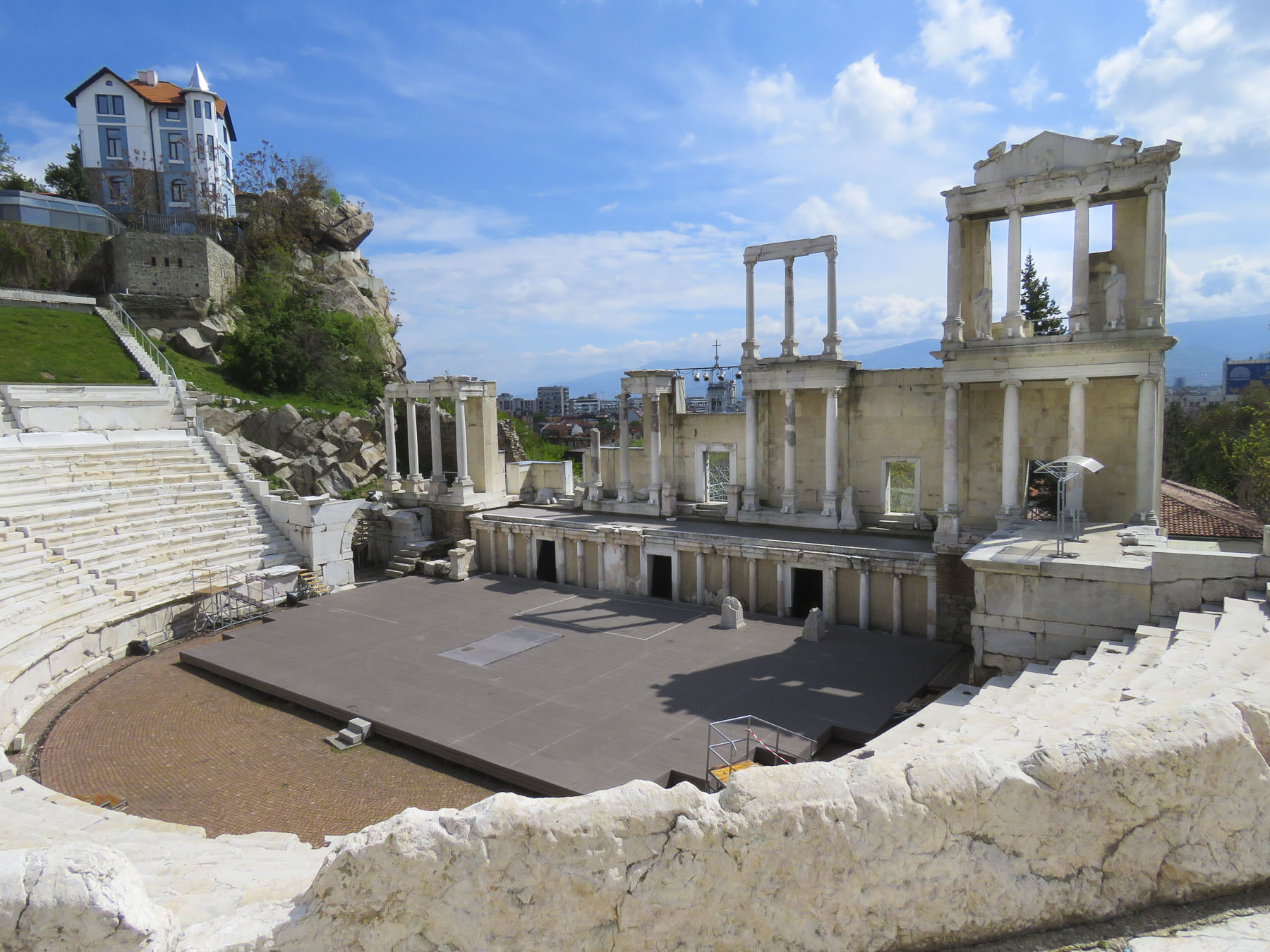
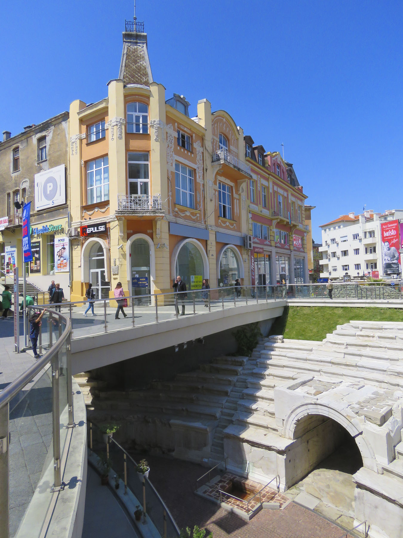
But the jewel of the mall area was the curved ruins of the Ancient Stadium of Philipopolis, with its fourteen tier seating area, unearthed in 1923. Situated below street level and surrounded by modern buildings at Dzhumaya Square, the ruins provided a dramatic juxtaposition of the ancient and contemporary, where you can actually see the layering of history and how the city was built over earlier civilizations.  From this excavated section, archeologists have determined that the stadium was a huge 790 feet long and 165 feet wide and could seat nearly 30,000 spectators.IMG_0758
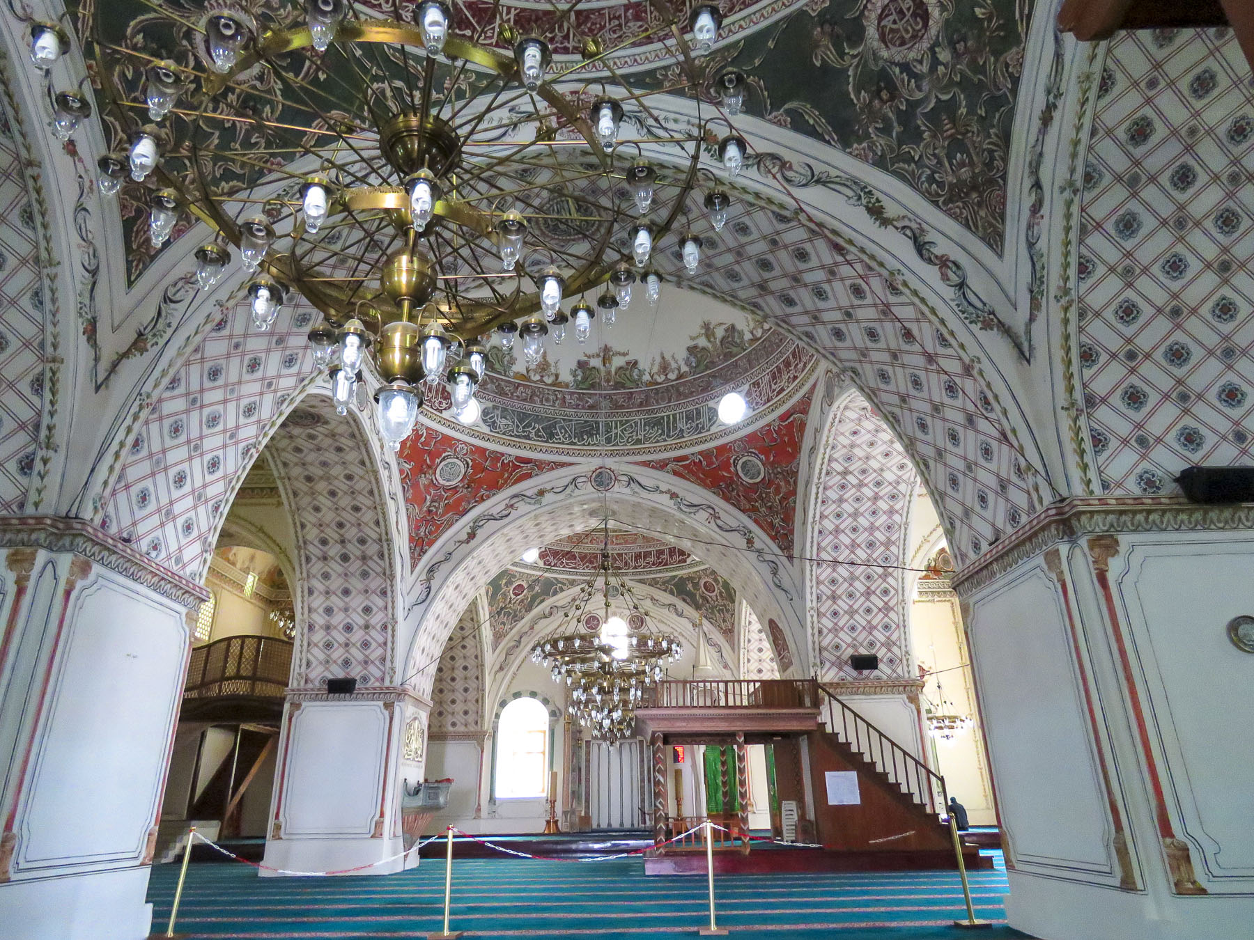
Across the square the Dzhumaya Mosque is the main Friday Mosque for Muslims in Plovdiv.  Constructed in 1421, it replaced an earlier mosque built in 1363 on the foundations of a Bulgarian Church destroyed during the Ottoman conquest.  It is one of the oldest and largest Muslim religious buildings in the Balkans. At the café in front of it we enjoyed some sweet Turkish tea and pastries in the warm afternoon sun.
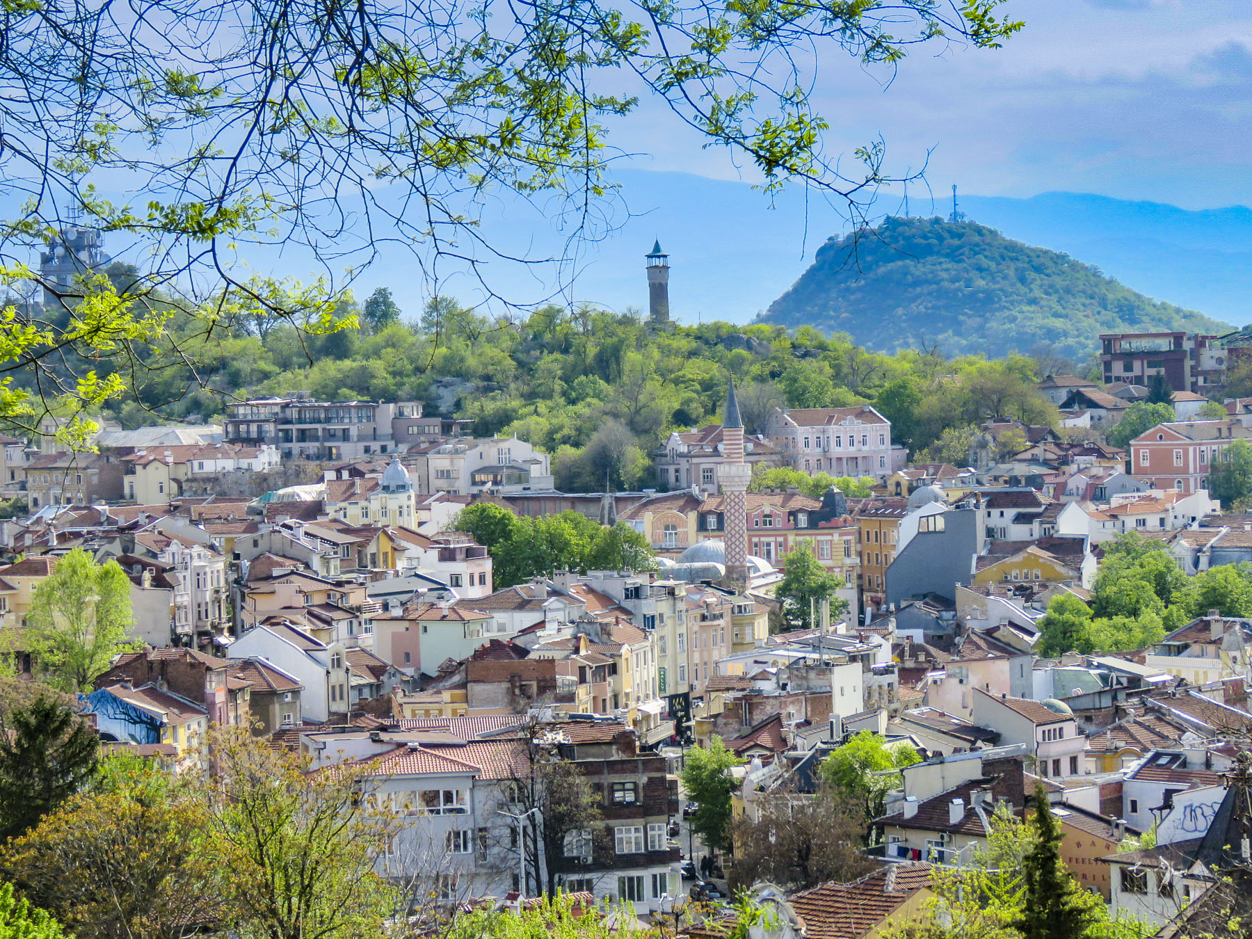
Veering off Rayko Daskalov Street we wandered through the Kapana Creative District.  The area had fallen on hard times and was almost demolished to become a modern trade zone before local architects and historians lobbied to protect its Bulgarian Revival architecture.  Now it’s a destination “go to place.”  The whole neighborhood has been pedestrianized with cafes, hip shops, artist galleries, wine bars, craft beer brewers and small restaurants now filling once vacant storefronts.

The distinctive twisted minaret of the Imaret Mosque towered above the treelined streets on the north side of the Kapana  District as we wandered back to the pedestrian mall and the Maritza River. The unplastered, red brick building and minaret were constructed in 1444 during the Ottoman reign.  Many fine gravestones with Islamic inscriptions were scattered around the yard which once served as a Muslim cemetery.

Under the peaked arches of the mosque’s portico hundreds of chairs were stacked high, waiting to be used for a future event.  The mosque took its name Imaret from the Turkish word used for soup kitchens. For four hundred years, every day hot meals and bread were handed out there for the poor people, regardless of their faith.

The pedestrian only shopping bridge over the Maritsa River will take you to the Karshiaka district, a newer neighborhood on the northern bank of the river.  The bridge itself was disappointing, being a totally enclosed, elevated tunnel with no views of the river, but the bike path along the riverfront offered a nice shady stroll along the water’s edge.

Heading back to our hotel we took our host’s advice and stopped to sample wines at his friend’s shop called Vino Culture.  It’s an intimate gastropub and wine bar with a knowledgeable staff dedicated to promoting small Bulgarian wineries from different regions of the country.  Since we like red wine, Boris, our viniculture expert for the evening, suggested we try a wine made with the Mavrud grape.  It’s an ancient grape that has been cultivated in Bulgaria thousands of years.  Late ripening with a thick and almost black colored skin, the grape produces a strong, full of character wine that is a deep ruby shade.  We loved it.

Tomorrow we look for a UFO.  Really – that’s not the wine talking.

Till later, Craig & Donna