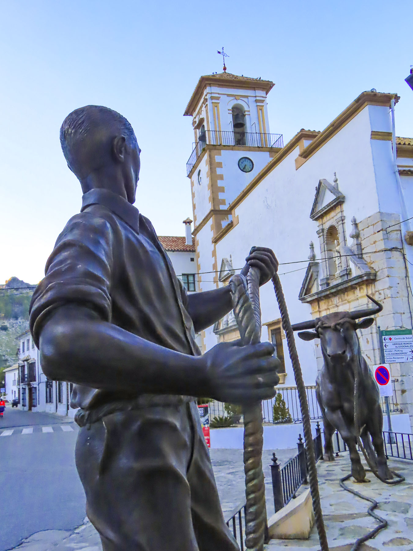
In all our previous trips to Albuquerque, we had always opted to head towards Santa Fe, never exploring south of the city. But we only had a few days to ourselves this time after attending our daughter’s wedding and decided to do day trips from the Duke City. The nickname references the city’s naming in 1706 honoring the 10th Duke of Albuquerque and/or the Albuquerque Dukes, a beloved minor league baseball team.

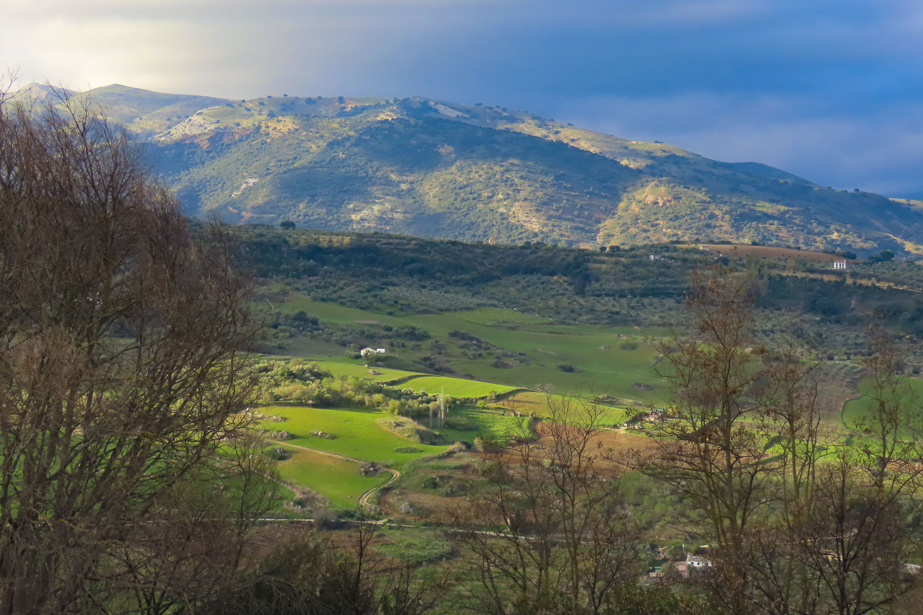
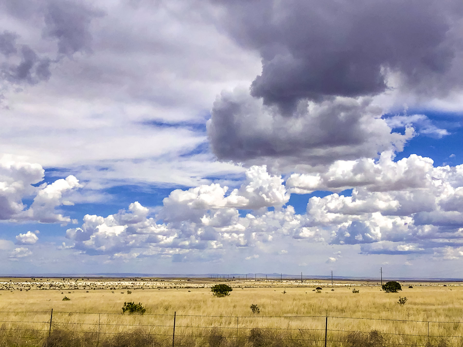
The pueblo ruins around Mountainair piqued our interest. We mapped out a circular route; south on I-25, east on NM-60 to Mountainair, then north on NM-55 & NM-337 to Tijeras where we would pick up I-40 West back to town. The day dawned with a crisp blue sky, and we headed south. We would have preferred a slower drive through the Rio Grande Valley nearer the stately Manzano Mountain range, but with 153 miles to go and multiple stops it would be a long day. The panoramas from I-25 were expansive.

Francisco Vazquez de Coronado’s failed mission to find the legendary “Seven Cities of Gold,” in 1540 did not discourage other explorers from trying, which brought Don Juan de Oñate onto the scene. A marriage to Doña Isabel de Tolosa Cortés de Moctezuma, granddaughter of conquistador Hernán Cortés, and the great-granddaughter of Aztec Emperor Moctezuma II, gave Don Juan de Oñate new prestige and influence. In 1595 King Philip II of Spain chose Ornate to colonize the upper Rio Grande valley. In 1598 he led an expedition that included his nine-year-old son, a nephew, 20 Franciscan missionaries, 400 settlers, 129 soldiers, 83 wagons, plus livestock, north from Mexico City, with the stated mission from the Pope to spread Catholicism. But there was also hope that riches rivaling that of the Aztecs and Incas would be found again. Fording the Rio Grande near present day El Paso, he proclaimed all the lands north of the river “for God, the Church, and the Crown.”
They eventually reached three pueblos in the Abó Pass area, which were on an ancient route between the mountains that facilitated trade between the Plains Indians of Eastern New Mexico and the Pueblo peoples that lived in the lush Rio Grande Valley. This area that at the time was thought to have a population of 10,000 talented farmers, weavers, stone masons, ceramicists, and adobe making Pueblo Indians, which the Spaniards quickly began exploiting. They eventually reached three pueblos in the Abó Pass area, which were on an ancient route between the mountains that facilitated trade between the Plains Indians of Eastern New Mexico and the Pueblo peoples that lived in the lush Rio Grande Valley.

This area that at the time was thought to have a population of 10,000 talented farmers, weavers, stone masons, ceramicists, and adobe making Pueblo Indians, which the Spaniards quickly began exploiting. Life in the new territory under Oñate was severe. Some settlers urged a return to Mexico when silver was not discovered, and Oñate executed the dissenters. Pueblos that refused to share winter food stocks needed for their own survival were brutally suppressed into submission. The most notorious crime occurred at the Acoma Pueblo, north of Albuquerque, when the inhabitants resisted seizure of their winter provisions, killing Oñate’s nephew during the upheaval. In response, soldiers under his command massacred 800 men, women, and children. The 500 surviving villagers were enslaved and by his decree every Acoma man over the age of twenty-five had his left foot amputated. Word of his atrocities eventually reached the Spanish throne, and in 1606 he was recalled to Mexico City, tried and convicted of cruelty to colonists and natives. With a slap on the wrist, he was banished from Nuevo México, and allowed passage to Spain where the king appointed him Minister of Mining Inspections.

In 1621, Fray Francisco Fonte was assigned the task of building a mission at Abó Pueblo. First occupying rooms in an existing pueblo and later commandeering labor, including a large number of women, to build a separate church and convento which radically incorporated a kiva into its structure. This effort at syncretism was most likely modeled after the Catholic church’s success in Peru where Pachamama, an “Earth Mother” goddess who was celebrated to facilitate the indigenous population’s conversion to Catholicism. This technique was adapted from Julius Caesar who allowed conquered peoples to keep their religions, as it “eased the acceptance of Roman rule.”
Two other Church missions in the Salinas Valley at Gran Quivira and Quarai pueblos were also constructed around the same time as Abo’s and also incorporate Kivas. This was a controversial practice as the Spanish Inquisition, (1478–1834), was still going strong. This threat couldn’t be used against the Puebloans, as they were not yet considered citizens of Spain without conversion. But it was a dangerous tight rope for the friars who constantly heard from the regional Spanish civil authorities that they were overly tolerant of the Indians “pagan beliefs,” and the Puebloan’s religious studies took too much time away from the encomendero. The encomendero was a colonial business model that granted conquistadores or ordinary Spaniards the right to free labor and tribute from the indigenous population. In return Nuevo México encomiendas were obligated to “instruct the Indians in the Roman Catholic faith and the rudiments of Spanish civilization.” The free land and free Indian labor promised with the encomendero was also used as a recruiting tool to encourage settlers to venture into the wilderness. The pueblos did not submit willingly; any resistance was violently suppressed. Though out-numbering the Spanish invaders, the Indians’ weapons of stone-tipped arrows and spears were no match against the Spaniards’ guns, armor, metal swords, and horses. Relations with Puebloans ultimately deteriorated when the friars, under civil pressure, refused to allow the kachina dances in the Kivas and filled them with rubble and dirt to prevent their use.

An extended period of drought and frequent raids from the plains tribes led to abandonment of the three Salinas pueblos by 1678, two years before the Pueblo Revolution in 1680 in which they surely would have participated. Four-hundred Spaniards died, including 21 of the 33 priests, but there were almost 2000 Spanish survivors. Warriors followed the fleeing refugees all the way to El Paso to ensure their expulsion from Indian territory.
When the Spanish returned 12 years later, they did not try to reimpose the encomendero and returning missionaries displayed more tolerance of indigenous religious beliefs. Spain instead sought to enlist the Pueblo tribes as allies to resist French and British empire expansion farther west. But the Salinas Valley remained deserted until Spanish shepherds returned for a few years in the early 1800s, only to be forced out by nomadic Apaches. Successful resettlement did not happen until the mid-1860s.

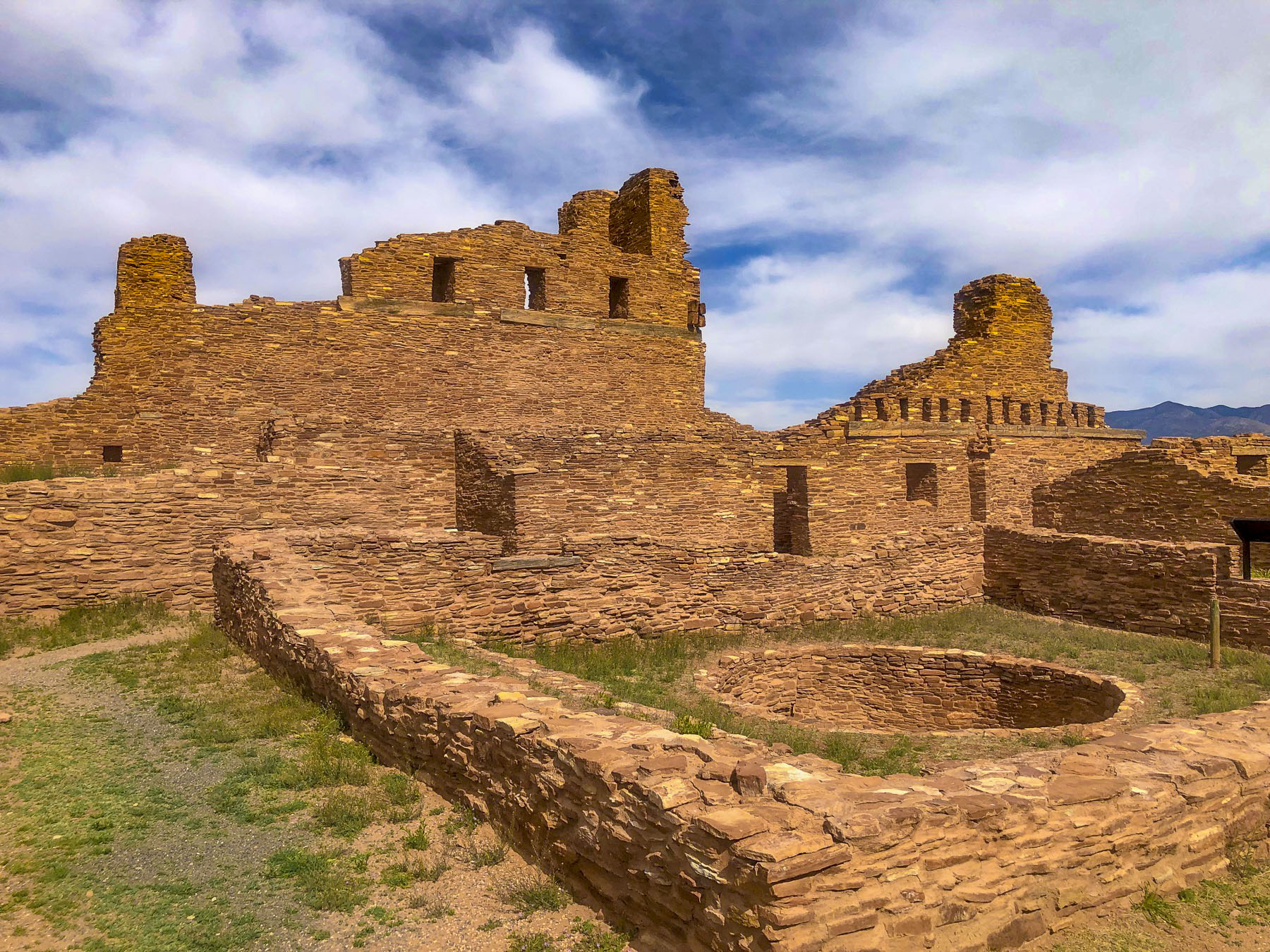
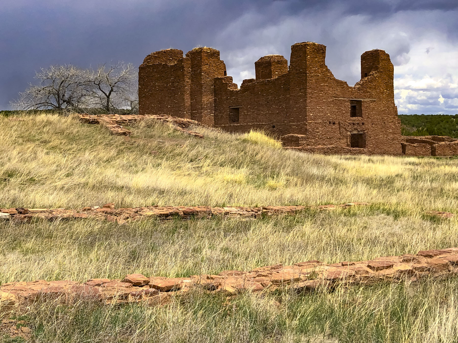
We turned off NM-60. Long ago the road was known as the Atlantic and Pacific Highway, one of the original Auto Trails in the early years of motoring. It was a route marked with colored bands on utility poles, that started in Los Angeles, California, and ended 2700 miles later in Virginia Beach, Virginia. Those were the days! We followed the single lane road into a gully and through a seasonal stream before rising to a field in which the earth-red stone ruins of the Abó mission glowed in the morning sun. The ruins of the mission church are massive. The complex must have been a wonderous sight when it was built next to the pueblos. Unfortunately, only piles of rubble remain of the pueblos themselves and I could not find a record as to why they were destroyed. But there is an entry from a Spaniard’s journal that describes the Salinas villages before the mission was constructed; “Each of these pueblos must have about 800 people, young and old. They were close to the plains and had bison-hide (acquired by bartering salt with the Apaches,) as well as cotton and deerskin garments; they had maize and turkeys; their houses were well-built, of slabs and rocks and whitewashed inside; the province was well forested with pine and juniper.”

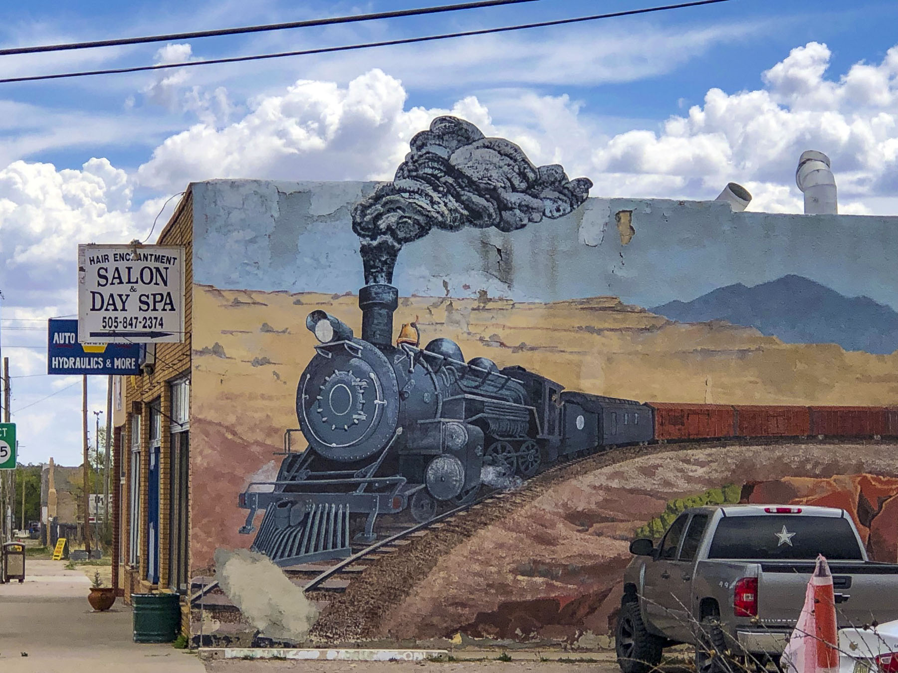
We imagined a small town nestled into the mountains. Yes, it sits on the summit of Abó Pass at an elevation of 6,500 feet, in the vast expanse of the high desert. The mountains were way behind us. Mountainair is a misnomer, though the air is crisp and the town catches the winds blowing in from the eastern New Mexico plain. It’s a quaint crossroads that keeps its frontier spirit alive. In the early 1900s it was also “The Pinto Bean Capital of the World,” when peak production filled over 750 train carloads of beans in one season. A 10-year drought in the 1940s forced farmers to become ranchers. The town had passenger rail service between 1907 and mid-1960s. The railroad is an important part of the town’s heritage and BNSF Railway now owns the old Atchison, Topeka & Santa Fe Railway depot which is on the National Register of Historic Places. It’s a good spot to watch freight trains, many over a mile long, on the Southern Transcon route, pass by.
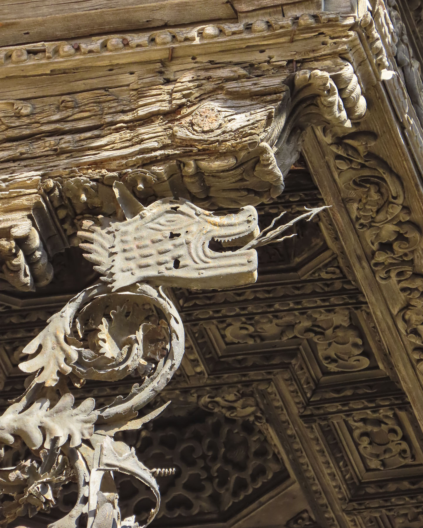
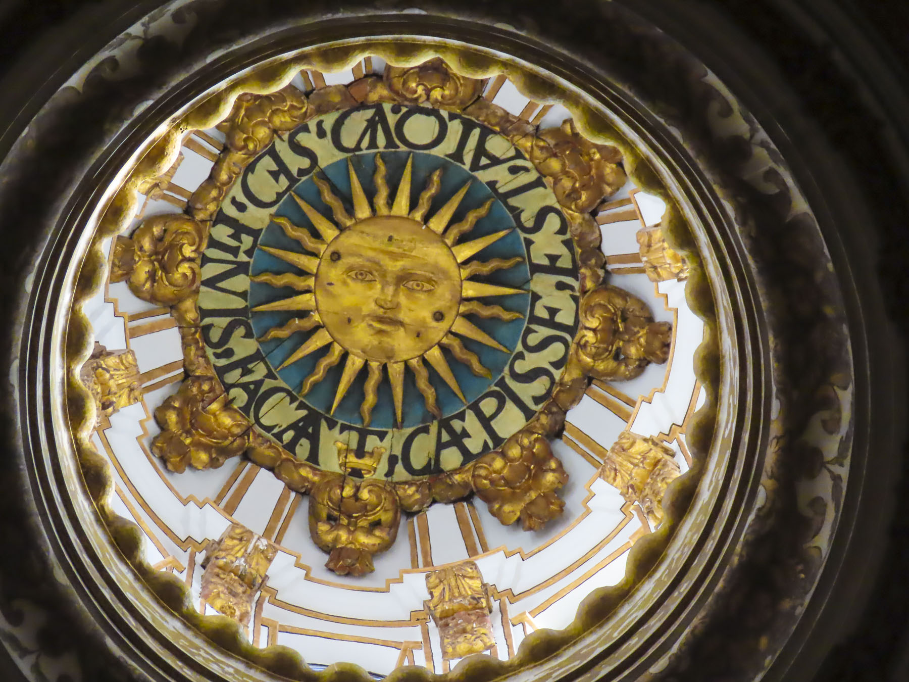
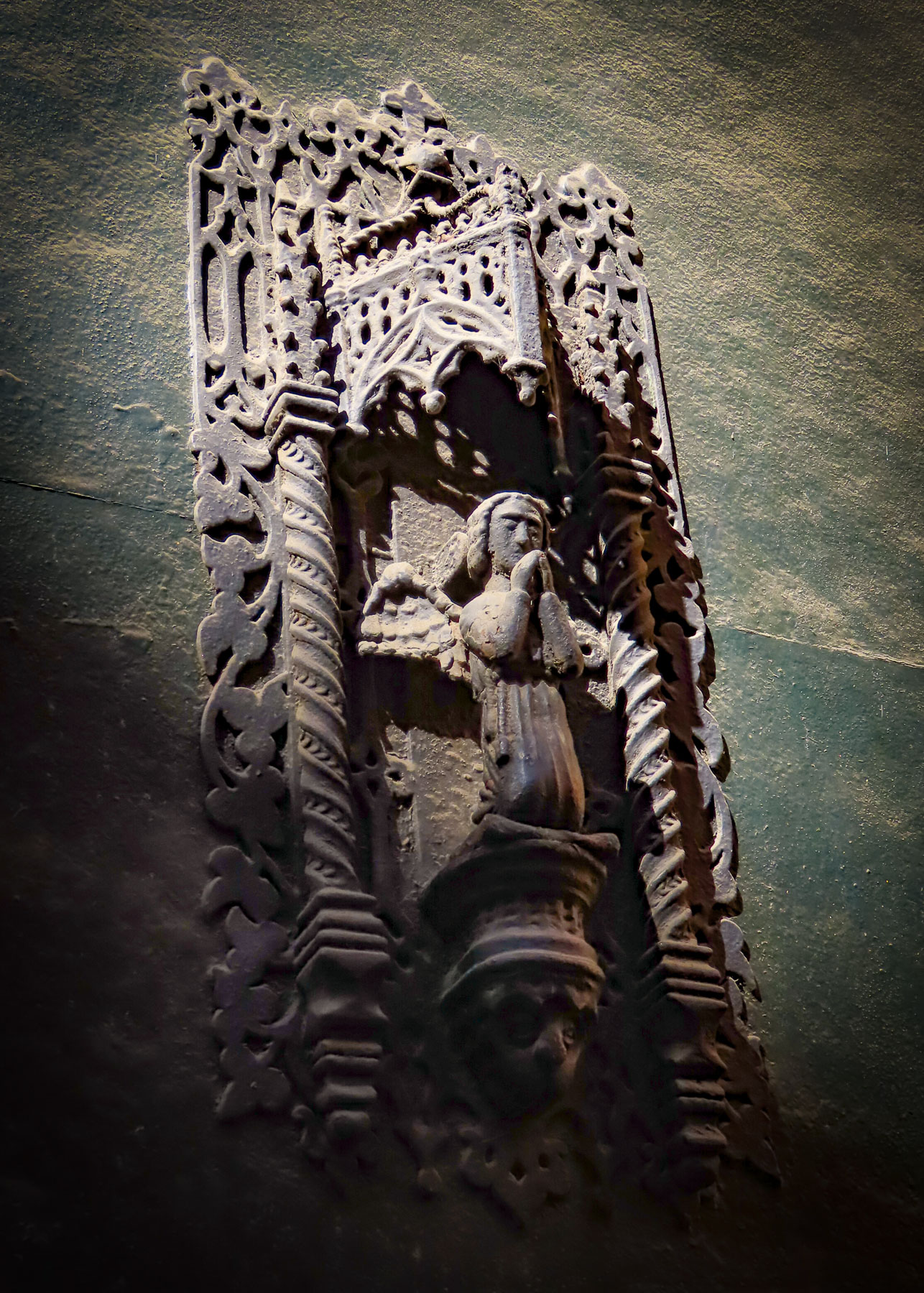
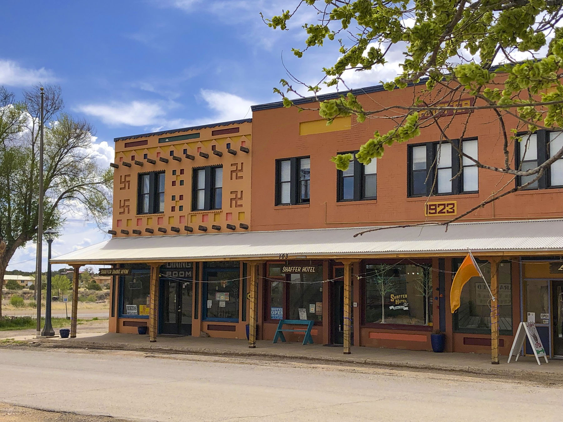
One block south of the main thoroughfare the Shaffer Hotel anchors a quiet corner. It has welcomed guests since “Mom & Pop” Shaffer built it in 1923 and decorated it with chandeliers, hand-carved vigas, and Indian art patterns painted on the walls and ceilings in bright primitive colors. The façade features four Navajo Whirling Logs, ancient symbols that represent wellbeing, good luck and protection, but unfortunately, they are often misinterpreted as nefarious swastikas. During the Depression the hotel claimed itself to be “The Most Unique Hotel in the World.” The hotel boasts a colorful history and one on legends tells of the time when Mom fired a shot at Pop when she found him in the arms of another women. She missed, but the bullet is still lodged in the ceiling above the stairs. The marriage continued. Mom died before she got to kill him.
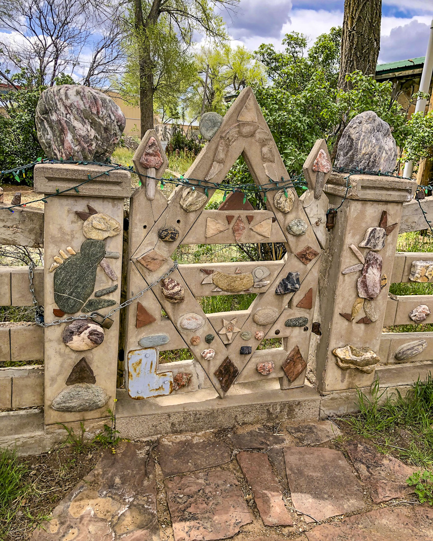
Mr. Shaffer lived on to become a well-regarded creative wood sculptor, using twisted roots and branches from local juniper trees to carve imaginary beasts. Eleanor Roosevelt arranged an exhibit of his unique folk-art in Washington, D.C. An unusual rock-inlaid fence that Pop built still surrounds the side yard of the inn. At the Mustang Diner good food and, surprisingly, bottomless cups of coffee (star****’s is a foul word in my vocabulary) were a welcome break.

Gas stations are far apart out here, and Mountainair will be your last opportunity to fill the tank for many miles. From Mountainair we could have driven south to Gran Quivira, but it would have been a sixty-mile roundtrip, so we chose to save it for another time.
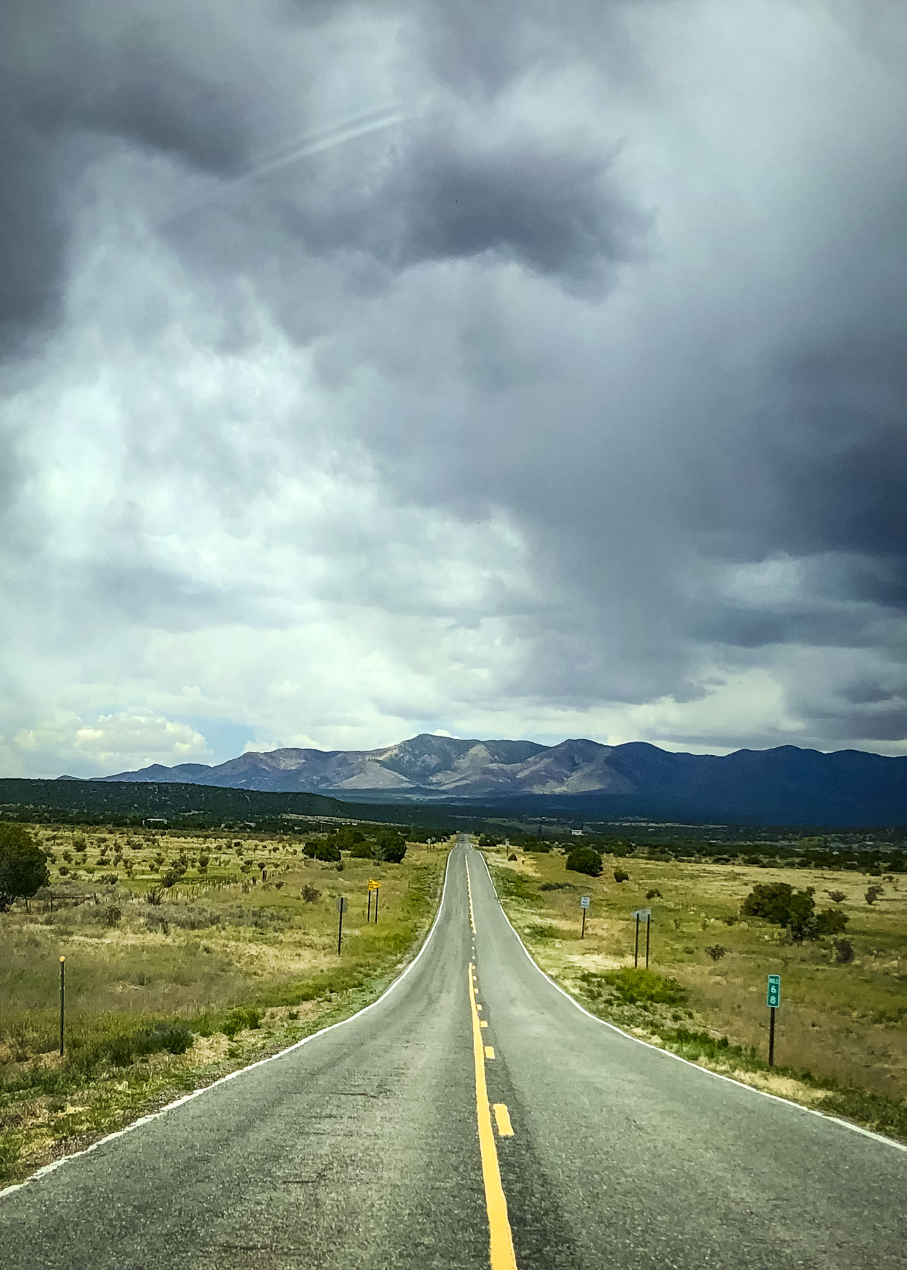
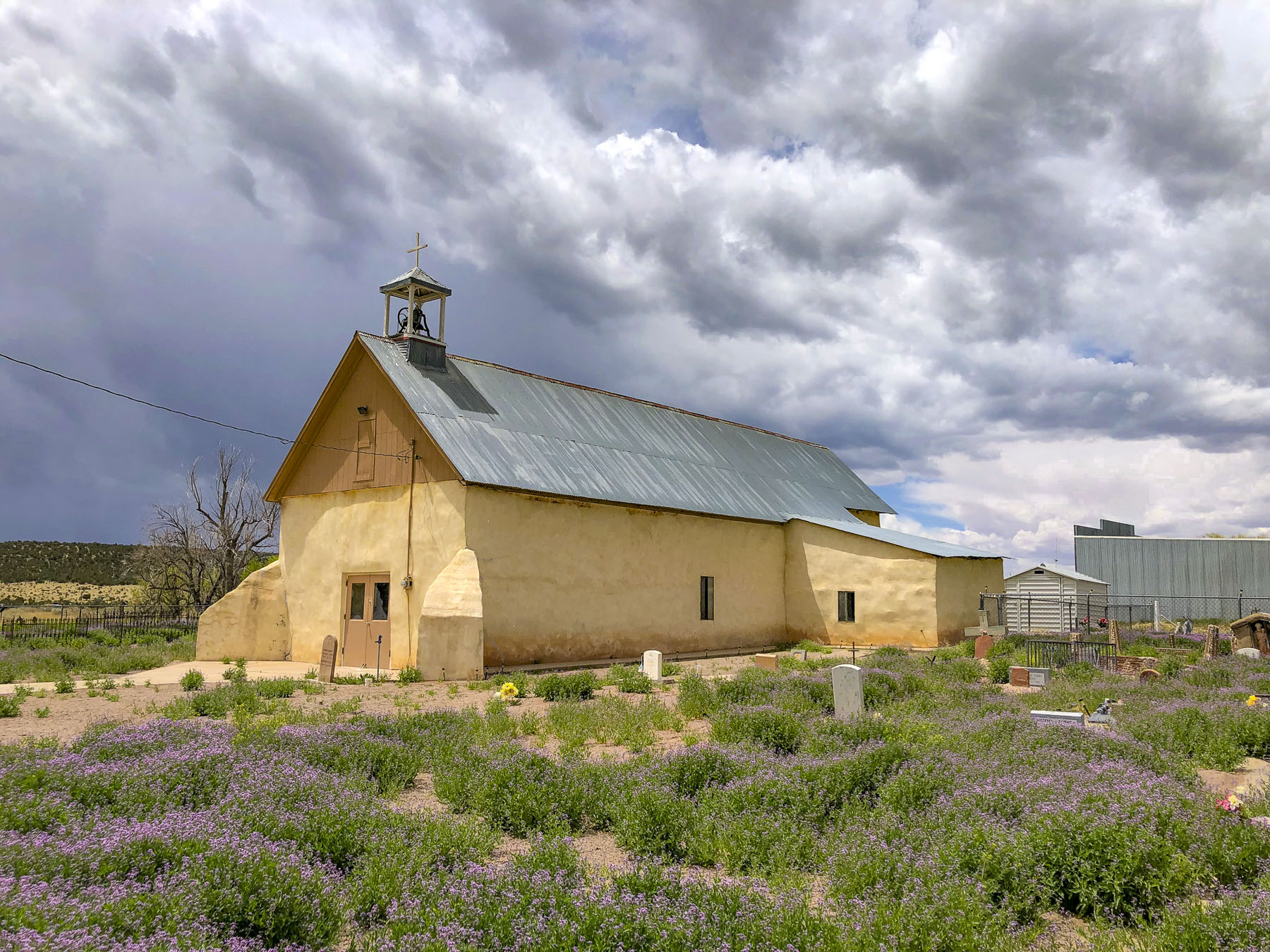
The views across the high desert were endless as we headed north on NM-55 to the Salinas Pueblo Missions National Monument Quarai Unit. To the east white puffy clouds raced across the sky. We turned west and drove into the rain. The storm was clearing by the time we stopped at an old church in Punta de Agua, not far from the Quarai mission, that dates from the 1860s.

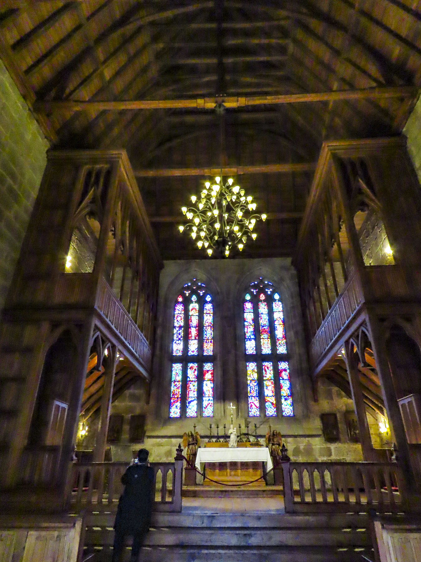
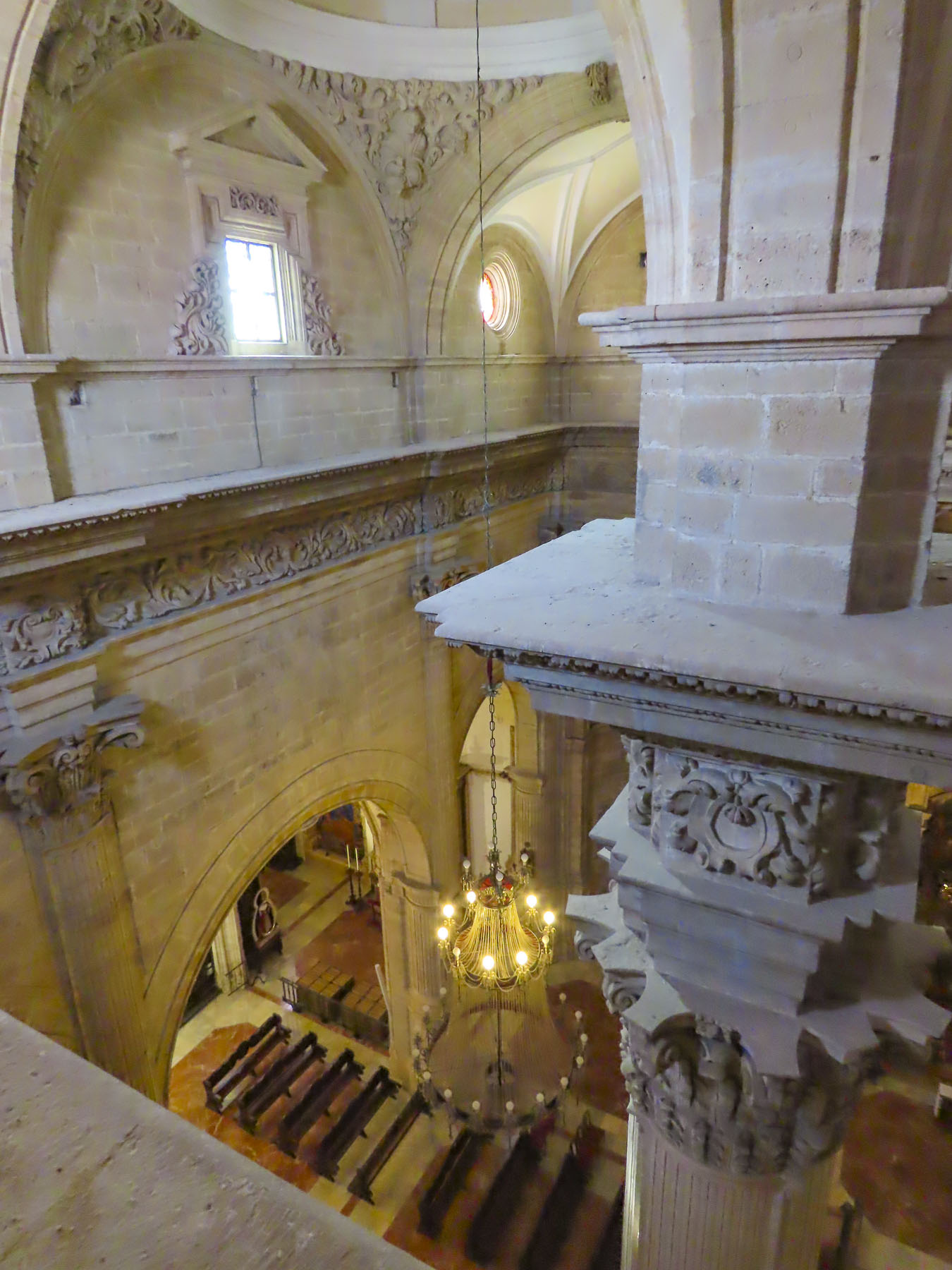
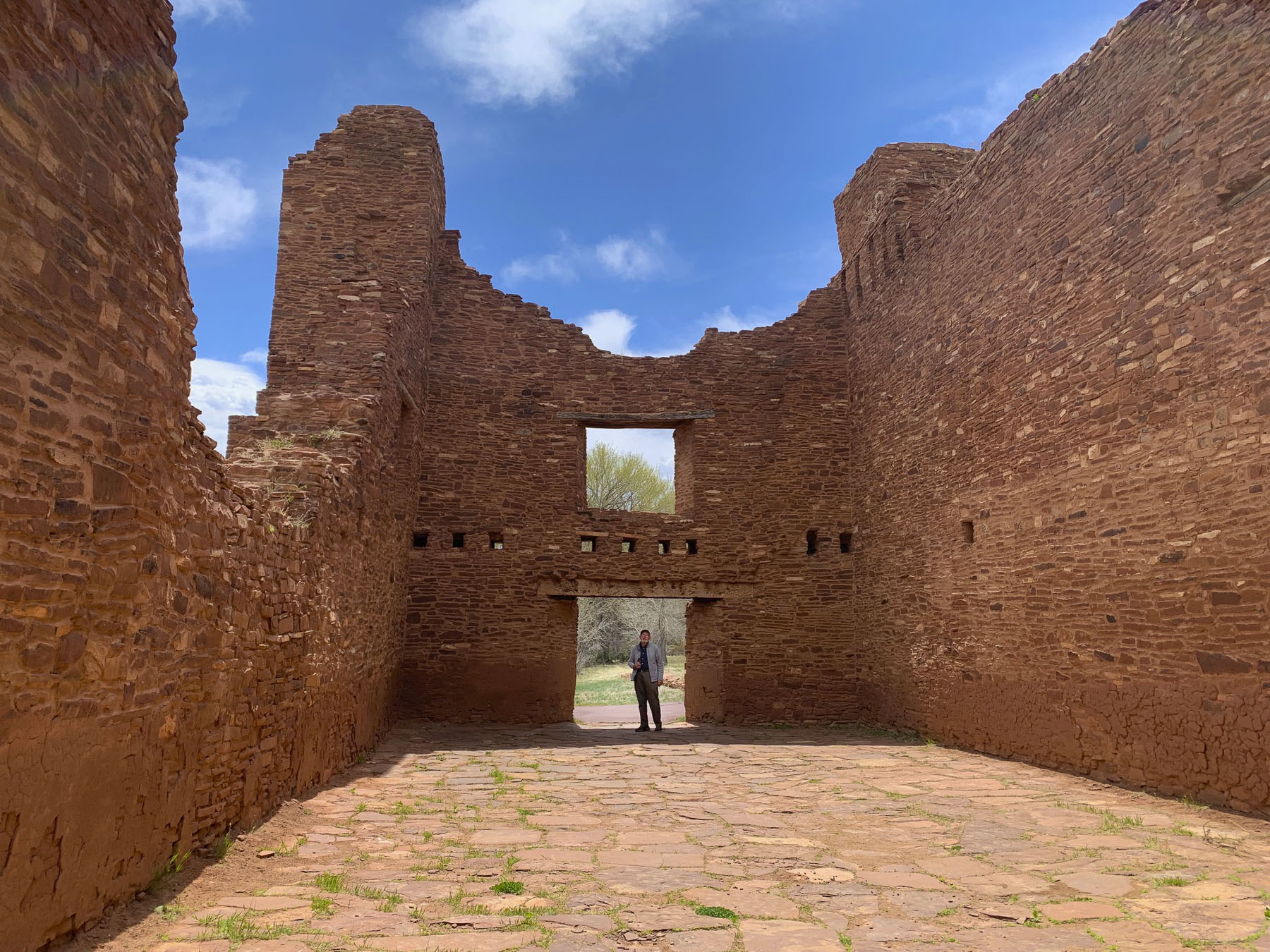
A sign at the entrance warned visitors to stay on the paved trail to avoid rattlesnakes. It was an easy one-mile loop that took us through the church ruins and mounds of the fallen pueblos before circling back through a forest and picnic area. Four massive centuries-old logs still firmly held the weight of the thick stone wall above the church entrance. The scale of the church was immense, and the ruins towered above us.
The three Salinas Valley missions share similar histories, but there is an interesting side note to the Quarai mission. It served as the seat of the Spanish Inquisition in Nuevo México during the mid-1600s. A Spanish Inquisition panel consisting of three priests would send abusive encomenderos, (Indians did have certain rights under Spain’s complex laws), and mis-guided priests guilty of liaisons with native women, back to Mexico City for trail. The women would be sent to Santa Fe to be whipped by civil authorities.
The Quarai mission also had an unusual square kiva built within its walls, but there are not any historical references to why this shape was used. As with the one in Ado it’s thought that the kiva’s location within the walls of the mission represents the church’s syncretic approach to teaching the Puebloans the gospel. By the 1630s, there were 25 mission districts encompassing 90 pueblos in northern New Mexico, with 50 friars trying to convert nearly 60,000 Indians.

The good condition of the ruins today are the results of repairs and stabilization projects started in the 1930s by the Depression era Work Projects Administration, WPA, under the guidance of the Museum of New Mexico.
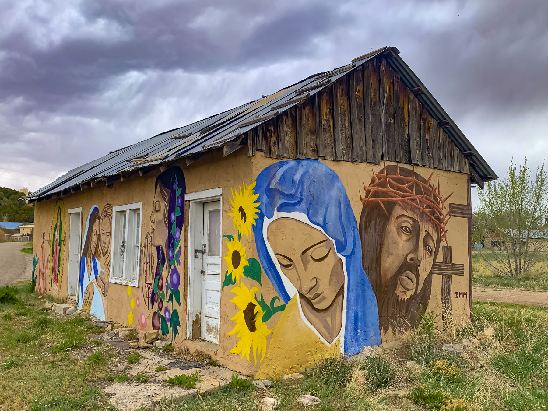
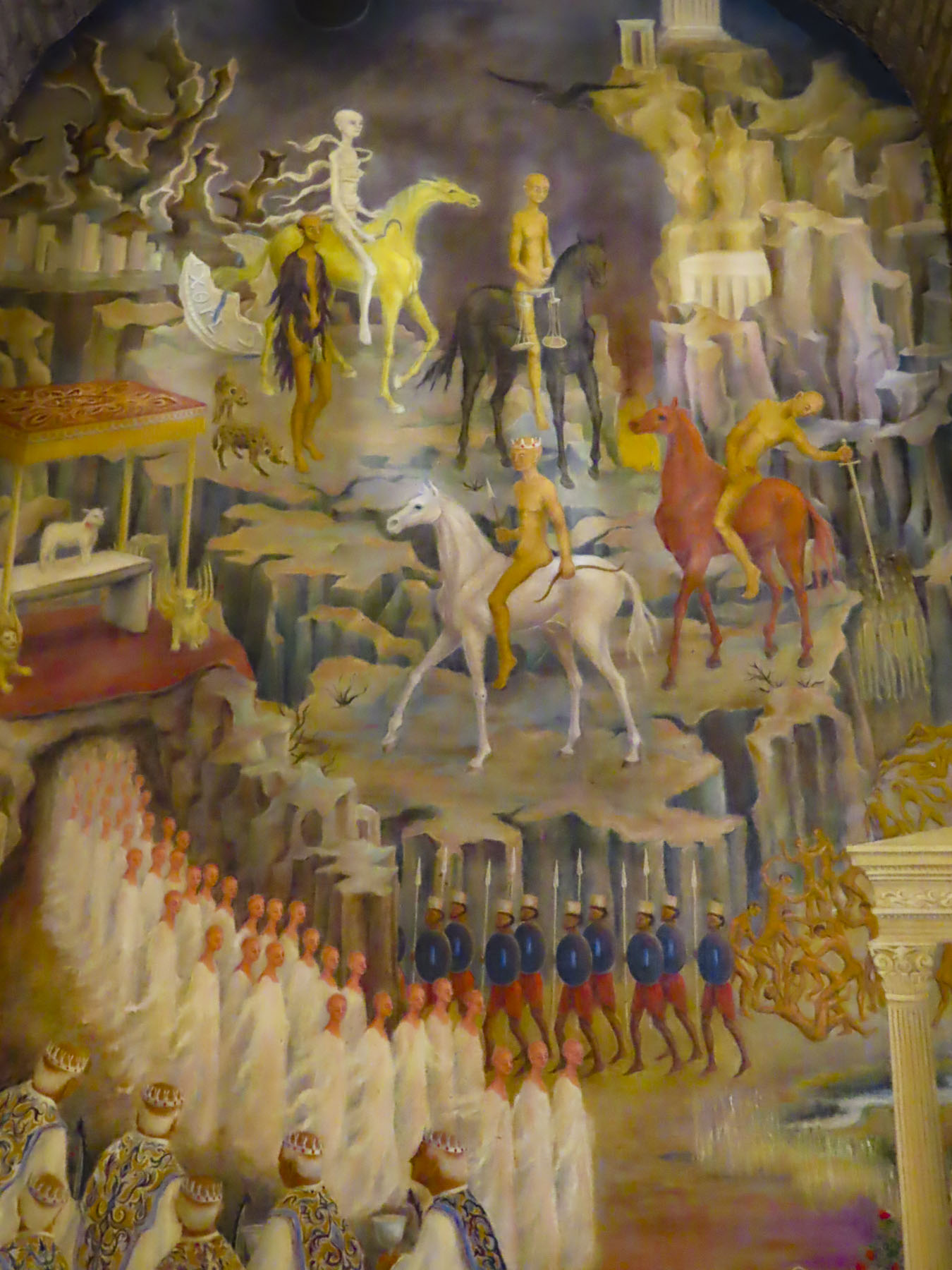
Our route back to Albuquerque traversed many isolated hamlets without many amenities. Coffee and food was a thing of the past until we reached Duke City. But we did pass several nicely done religious murals along the way in Manzano and Chilili.
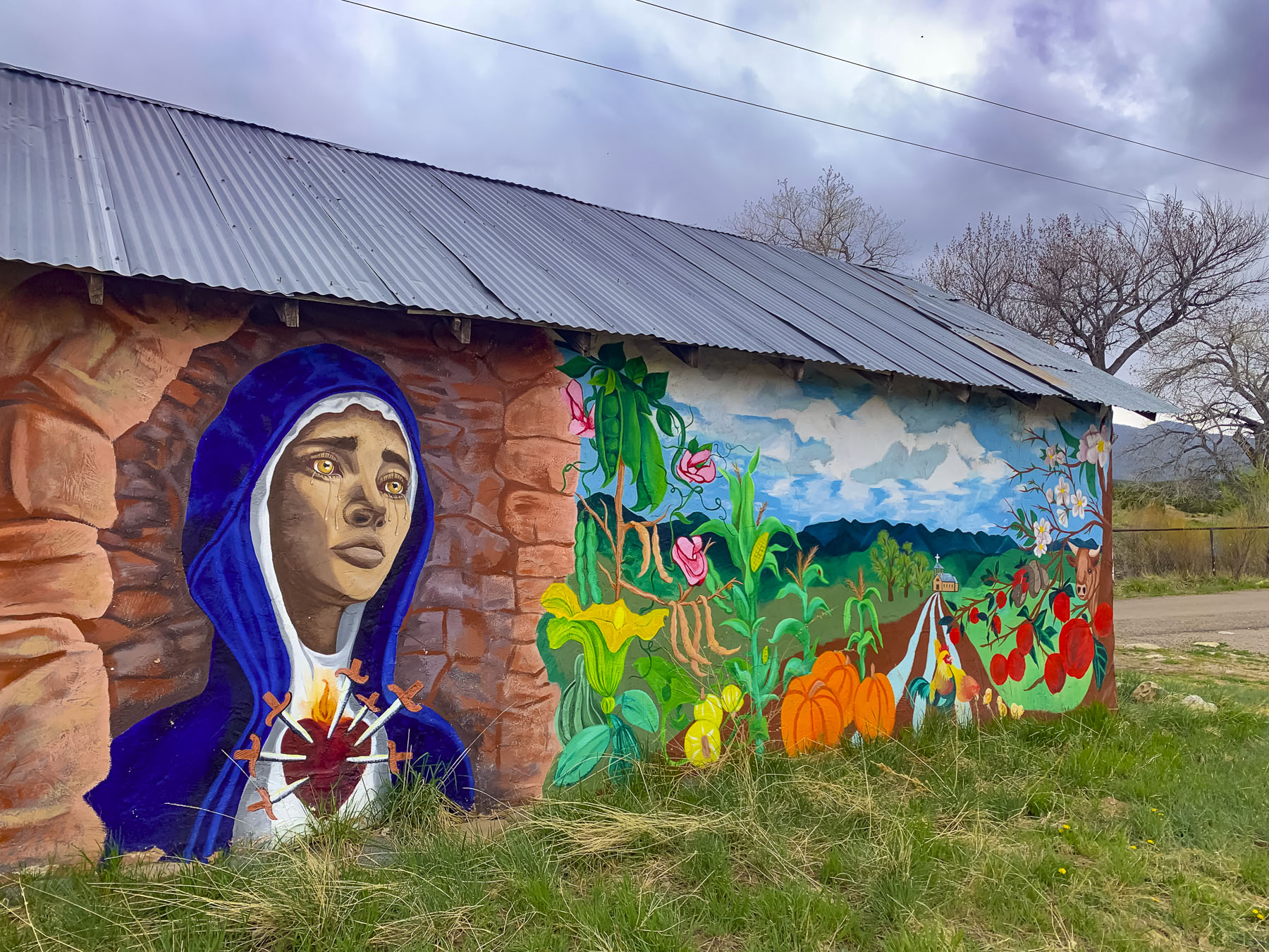

The mural on the side of San Juan Nepomuceno Church in Chilili looks like it’s a scene from a Spanish Iberian village and we questioned the choice of a scenic river and bridge as a background, only to realize later that, behind the church, we had in fact crossed over a bridge that spanned the Canon De Chilili, and left centuries behind.
Till next time,
Craig and Donna