The NC500 Part 3 – Adventures on Skye: Mountains, Rain, Whisky and Oysters

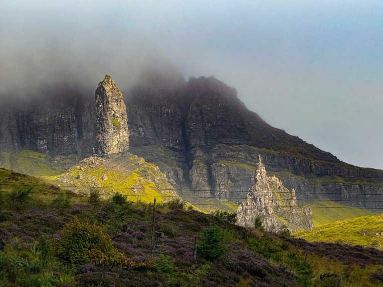
With only two full days on the Isle of Skye, the largest of the Inner Hebrides islands, we were up before dawn and headed out to hike the Old Man of Storr. We had read so much about the Old Man of Storr trail being the most popular activity on Skye that it we thought it wise to get an early start. Several cars were already parked in the lot, still wet from an overnight rain, when we got our ticket from the parking kiosk.

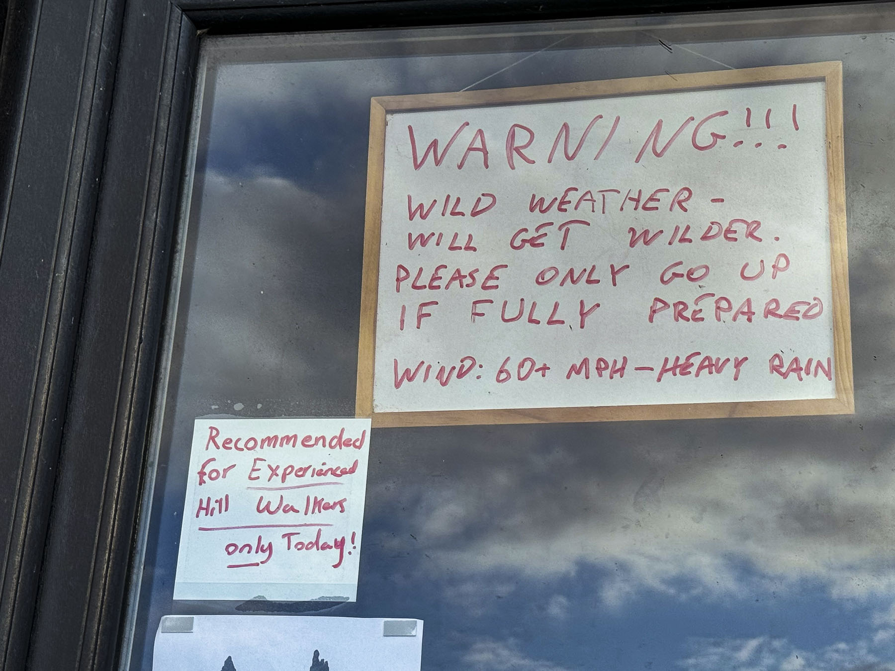
Even in places you wouldn’t expect, paid parking seems to be everywhere across Scotland, and since it’s the UK there’s video surveillance too. At the unmanned attendant’s hut a note taped to the window advised of “less than ideal wet conditions” on the mountain. We had hoped for a clear morning, but the mountain was shrouded in mist.

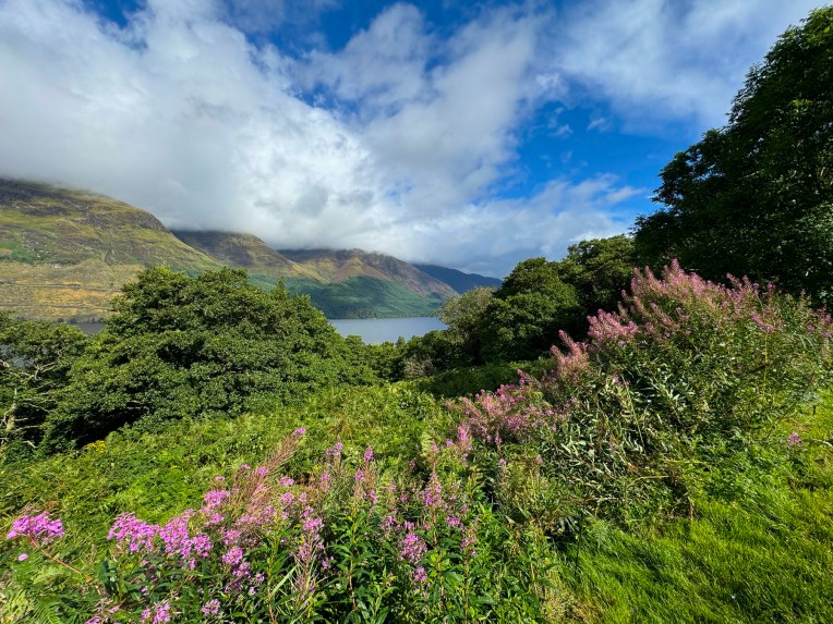
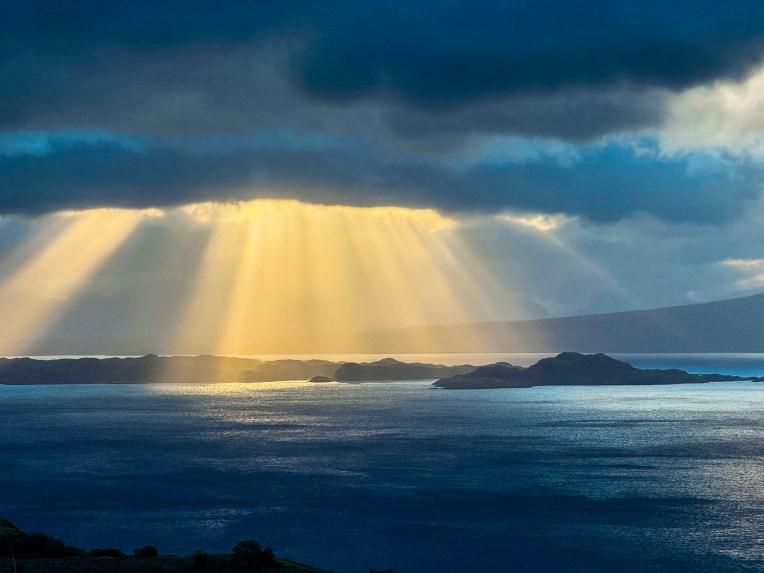
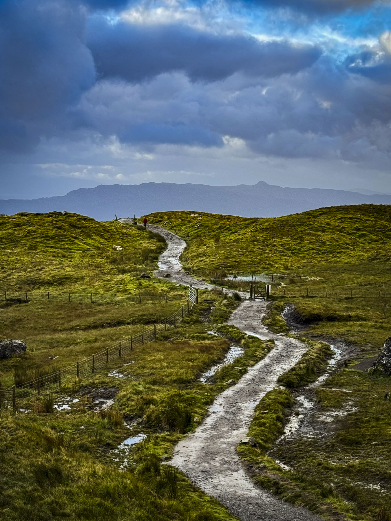
The first short stretch of the trail was moderately steep and would have been easier if our heart rates were up, though the incline soon lessened after rounding several switchbacks. When the trail leveled, we turned around to survey how far we had climbed and were rewarded with a spectacular view of morning light, in golden rays, cascading through the clouds onto the Sound of Raasay.

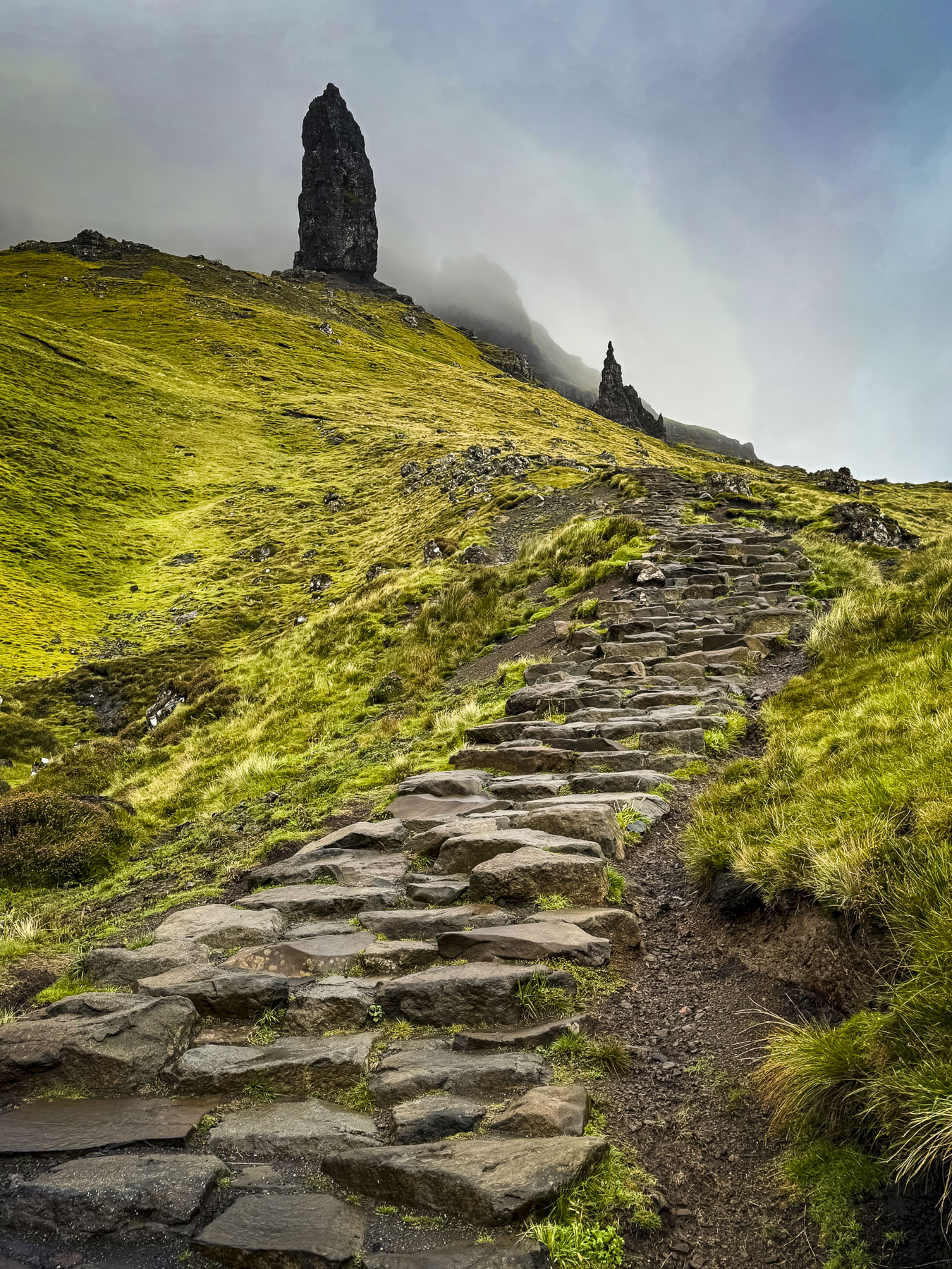
It began to rain by the time we reached a set of rough stone steps that would have taken us higher up the slope, but the rocks were getting slippery, and we decided to turn back.

We thought the morning was cold and had suited up with several layers under our rain gear, and were totally surprised when several guys in shorts and just t-shirts, obviously vacationers from the Artic Circle, passed us on the trail, followed by a young couple carrying a toddler.

Even though we didn’t make it as far up the mountain as we would have liked, we enjoyed the views.

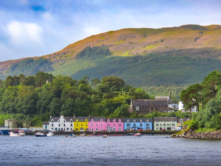
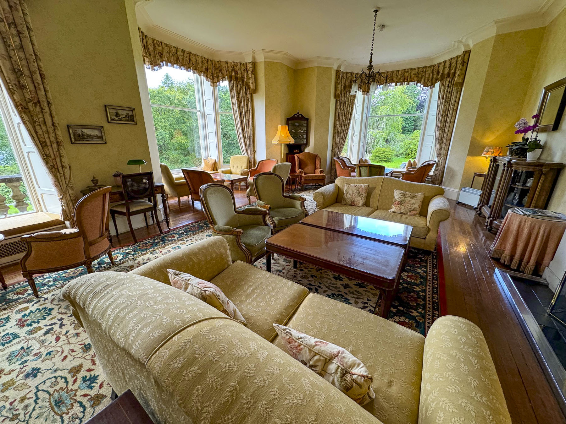
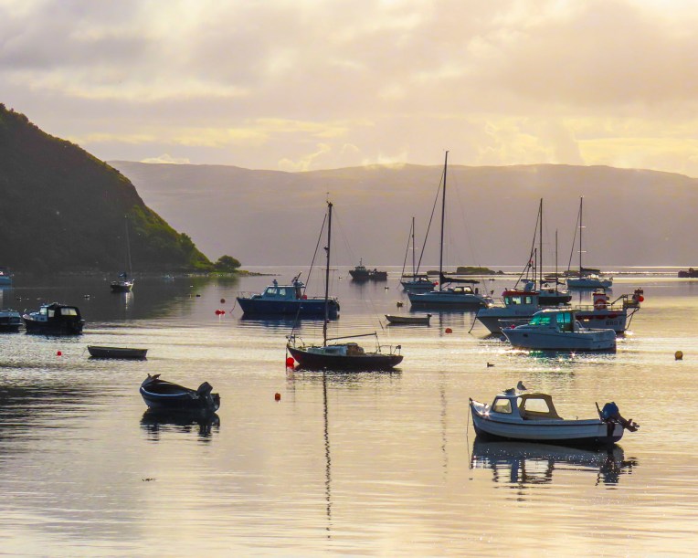
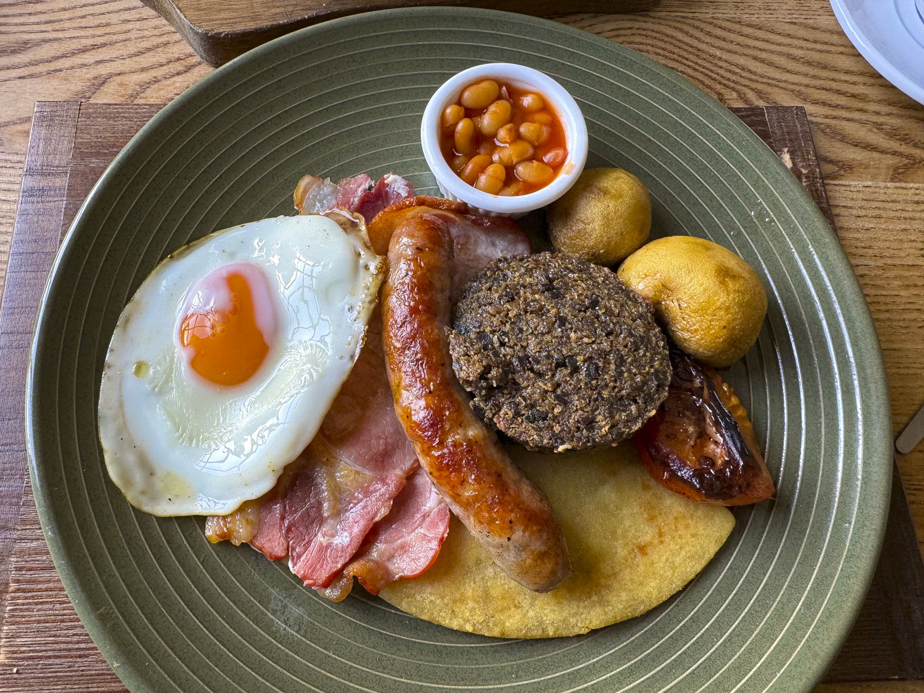
By the time we returned for breakfast at The Rosedale Hotel in Portree the clouds were clearing, and we were able to admire the view of the harbor from a window table.

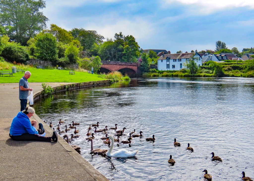
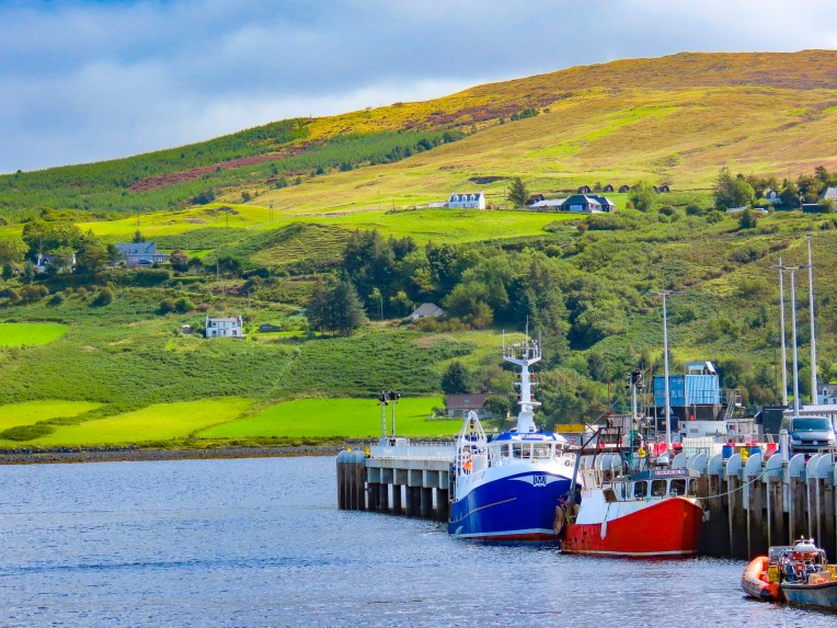
Afterwards we walked along the waterfront, where the view across Loch Portree, with boats rocking at anchor, resembled New England waterscapes from the coast of Maine, in the United States.

Our plan for the day was to make several stops at scenic sites as we headed north from Portree along the coast of Skye’s Trotternish Peninsula. We decided to look for dinosaur footprints at An Corran Beach before turning west across the highlands to Uig, then continuing a southern loop back to Portree.

This time as we approached Old Man of Storr the morning’s mist had lifted, and the mountain’s rugged peaks were clearly visible. The parking lot was also completely full.

The one good thing about all the August rain was that the rivers were high, and the waterfalls were thundering furiously. We had to wait for a few minutes for parking space at the Lealt Fall View Point. Strong winds buffeted us as we walked out onto the viewing platform.

Actually, two waterfalls can be seen from this spot: one flowing from a stream called the Ford is directly across from the platform, while the larger one to the right cascades 90 feet down from the Abhainn An Lethuillt, the River Leath.

From the ridge above the gorge carved by the falls, we followed the water flowing to the sea. The wind on this headland was extremely ferocious and we were fine as long as we had our hoods up and turned our backs to it. But as soon as we turned around a gust of wind threw my hood back and blew my baseball hat off my head. Really, it wasn’t my hat – since I had lost my own, I had borrowed Donna’s this morning, while she was still sleeping. The red hat had a long and colorful history, and was a treasured companion that she had worn on many adventures. The salt in the wound was that it settled only about 12 feet out of reach, down a very steep grassy slope, too risky of a spot to try to retrieve it. Months later I am still hearing about how untrustworthy I am as a hat borrower. I’m a lucky guy if that’s the worst of her grievances. The vistas surrounding this area were beautiful regardless of the weather.

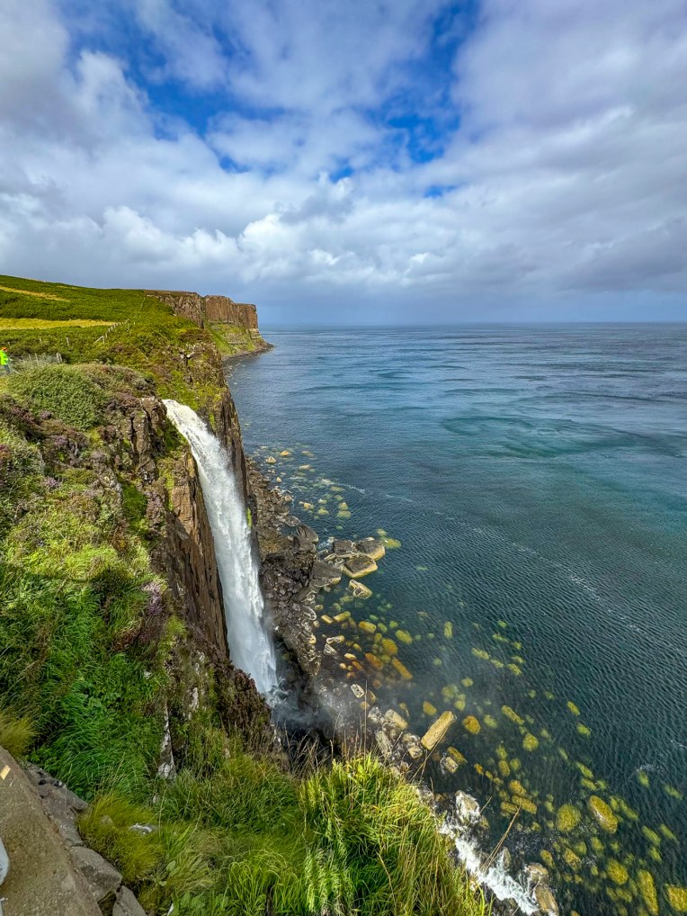
The sun was finally out when we stopped a little farther north at Mealtfalls where the waters of Loch Mealt spectacularly plunged 180 feet onto a rocky coastline and the sea, from a notch eroded into the 295 feet high cliff face of Kilt Rock. If viewed from the sea the basalt stone columns of the cliff face are said to resemble the pleads of a Scottish kilt.

The scenic drive north along the coast was stunning and we stopped many times to take photos. The sun was still shining, but the wind was blowing a “hoolie”, lifting swirling sprays of water into the air from the surf crashing onto the beach when we reached An Corran Beach.

The beach itself is very nice, but since 2002 when a local dog walker discovered the three-toed footprints of a Jurassic era Megalosaurus in rocks newly exposed after a large storm, it’s been a popular destination on Skye. We searched along the rock shelf at the water’s edge, but an incoming tide hindered our exploration.

Our hunger pangs began pinging around noon, and we stopped at several local restaurants only to be discouraged by the long waiting times for a table. We continued our drive. The issue wasn’t that the establishments were full, but that they lacked the seasonal staff to serve the customers adequately. This situation is a consequence of the Brexit maneuver that restricts foreign workers from entering the United Kingdom. This situation was mentioned to us several times by unhappy locals.

Following signs in Stenscholl for the Quiraing Pass we turned onto a serpentine single-track lane that climbed a 14% grade to an elevation of 856 feet above sea level before reaching a viewpoint.

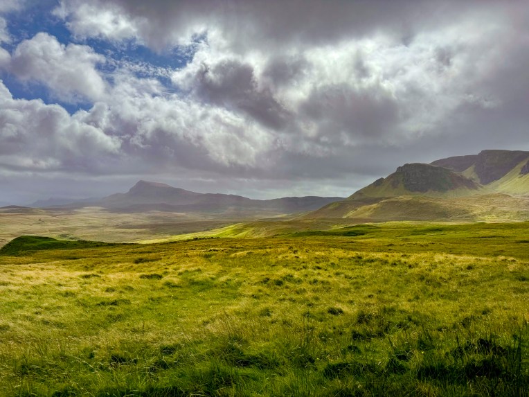
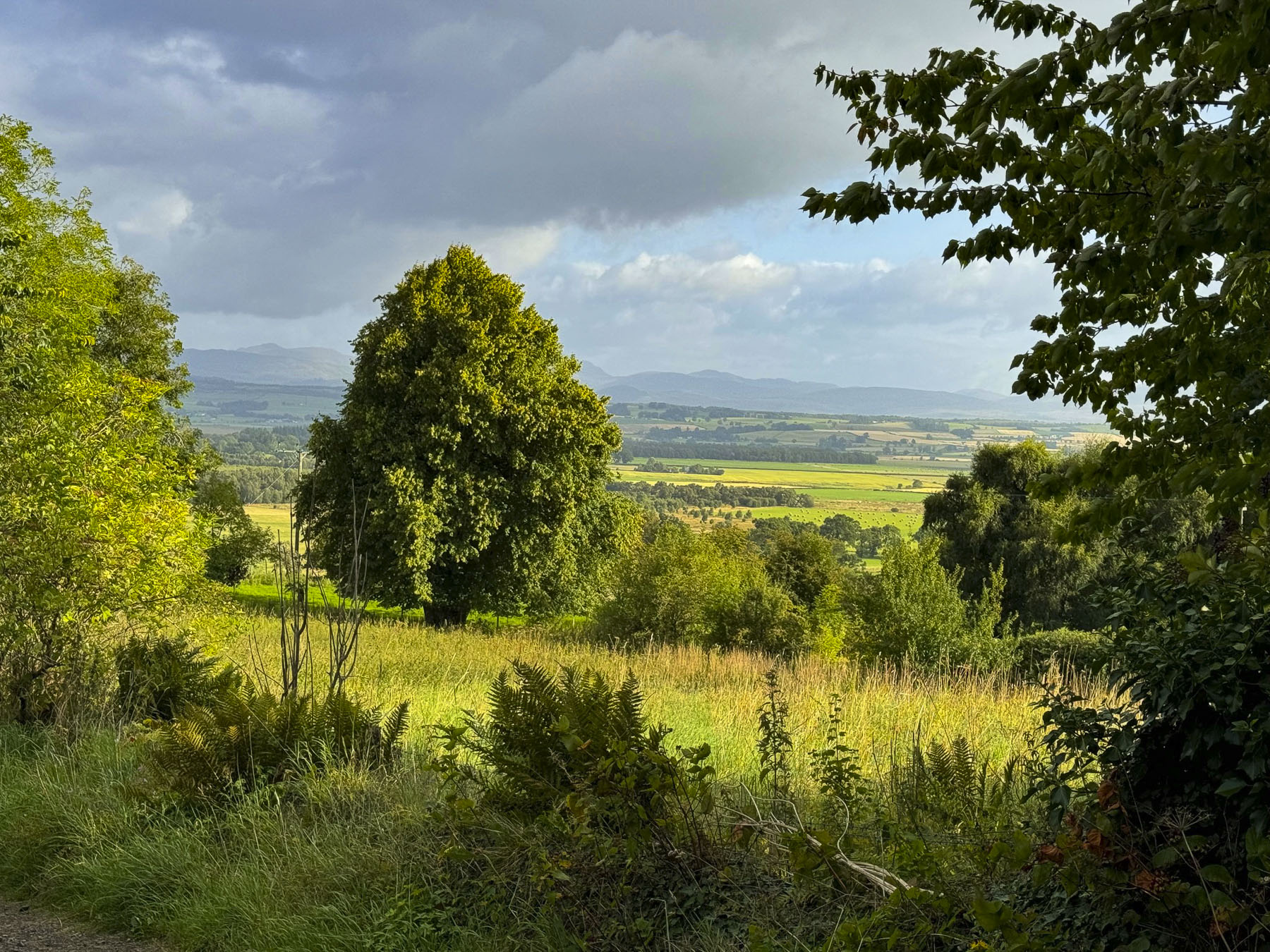
With every fifteen miles or fifteen minutes the weather changed on the Isle of Skye, for better or worse. The deep grey sky was very forbidding and as soon as we opened the car door the rain poured down. The viewpoint and the trails leading from this scenic spot rival the Old Man of Storr’s, and are very popular for the views of the east coast of Skye and the highlands that can be seen on a clear day. It was raining too hard for us, so we continued across the highlands toward Idrigill on the west coast.

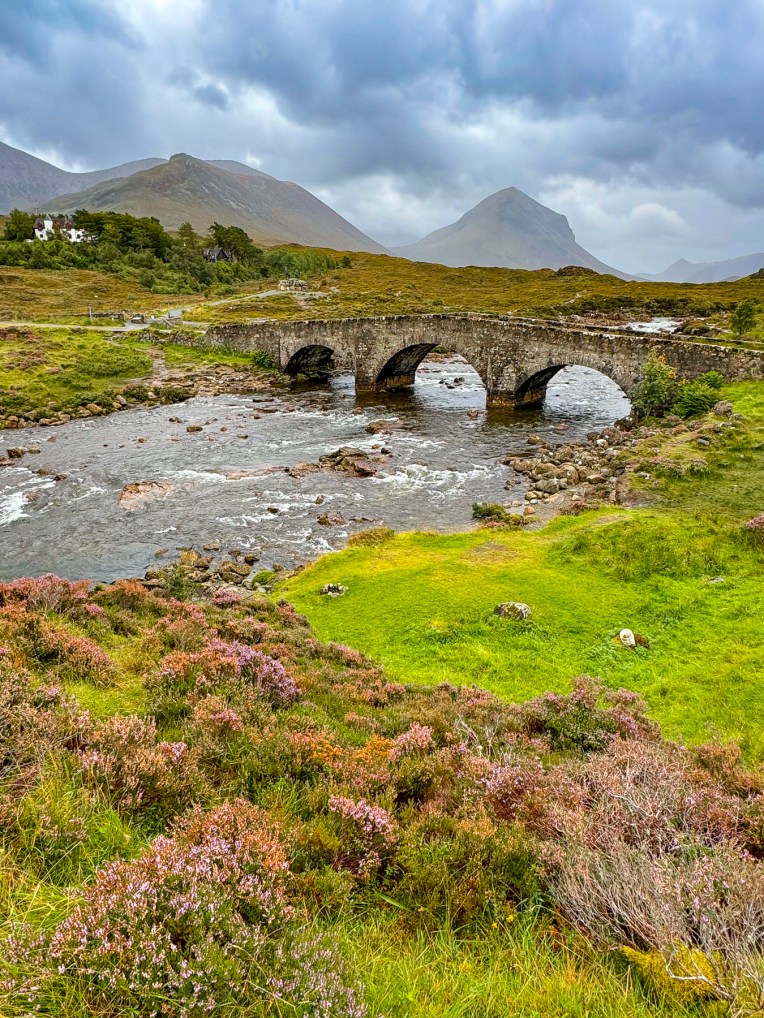
The interior sections of Skye are now vast wilderness areas with few signs of folks living in the area. But that wasn’t the case in the early 1800’s when the hills and glens of the island’s highlands supported over 20,000 crofters, tenant farmers, before the notorious “clearances” removed folks from the land to make way for large industrial scale sheep flocks. Many families emigrated to America, Canada, Australia, and New Zealand seeking better opportunities. A slow decline of Skye’s population continued into the 1970’s when it reached a low of 7,100 people. The most recent census shows the island’s population growing to 10,000 residents.

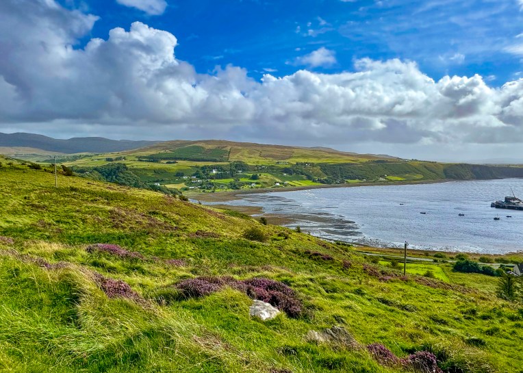
The sky was clearing once again when we reached the Idrigil Viewpoint. It was a splendid spot with panoramic views of Uig Bay and village. We finally had a late lunch at the Anchorage Cafe, across from the ferry terminal. It was nice to familiarize ourselves with the area, as we’d be taking the ferry from the Uig port to the Isle of Lewis and Harris in two days.

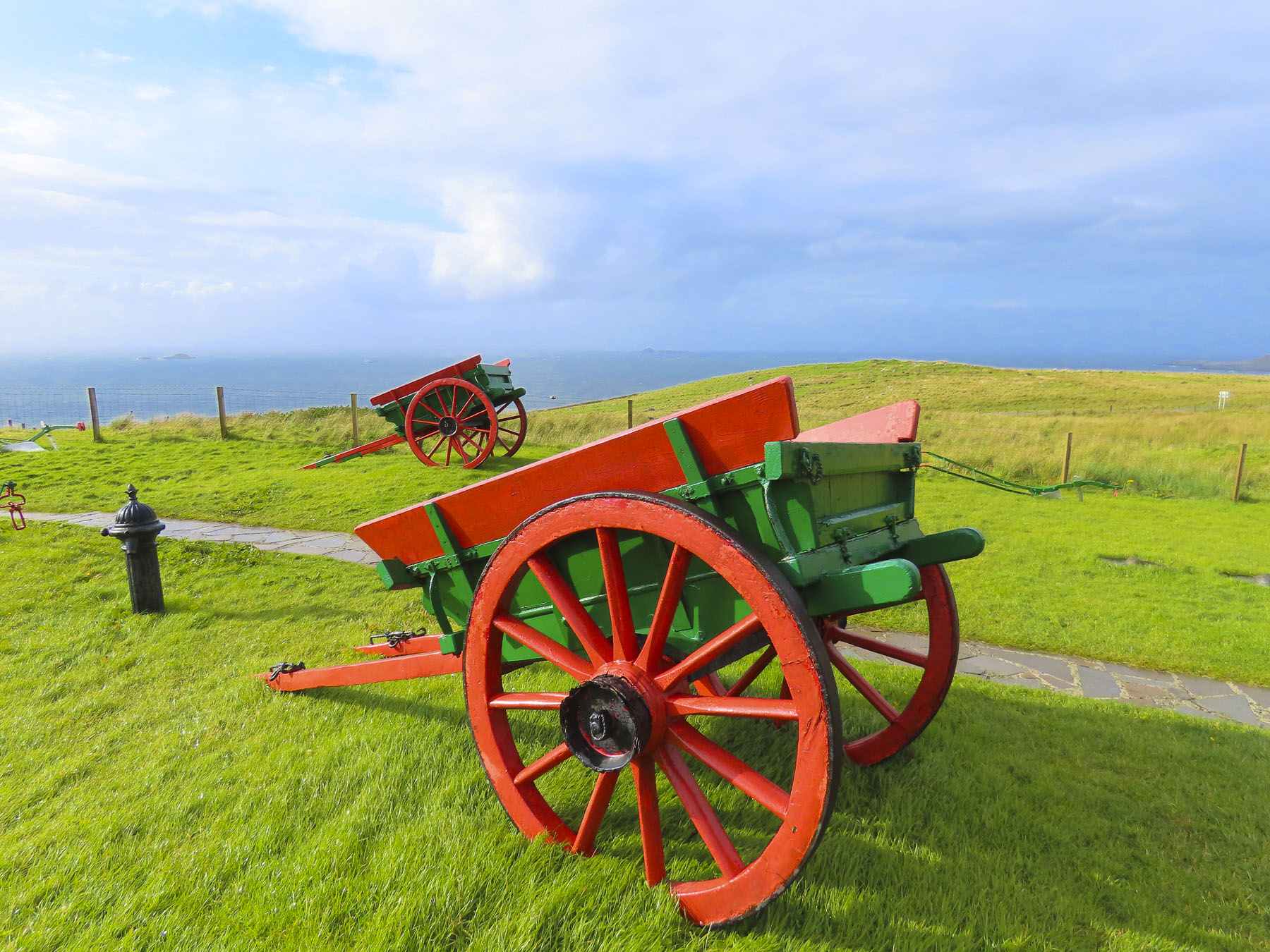
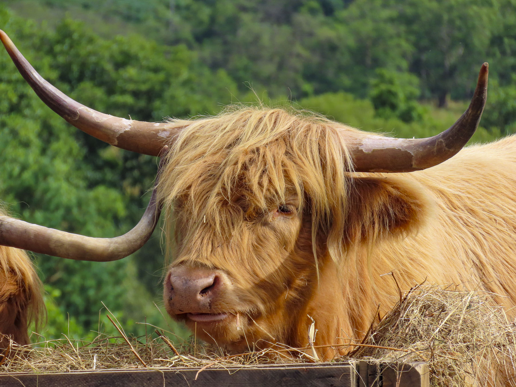
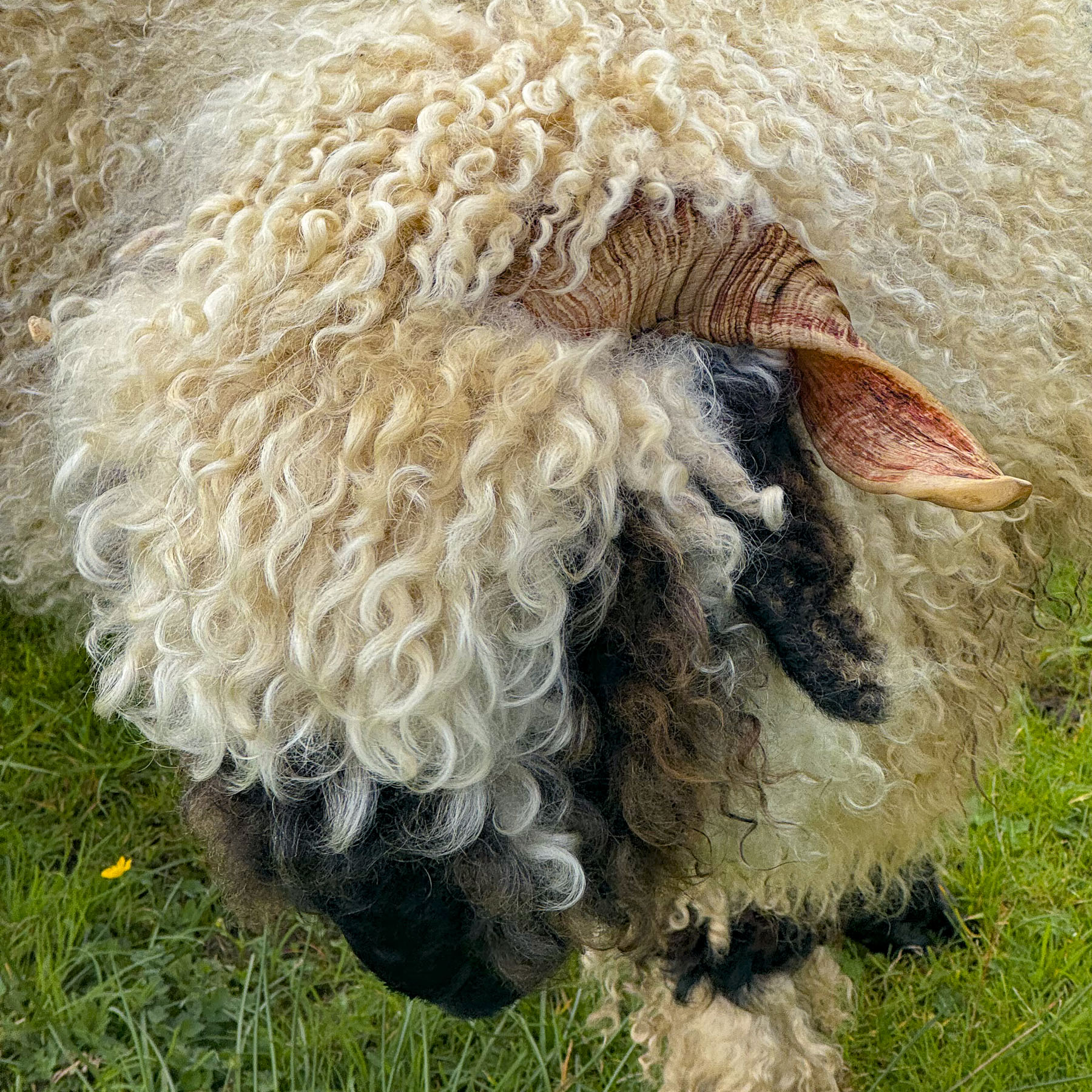
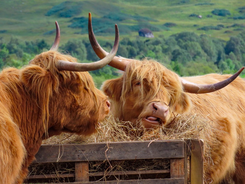
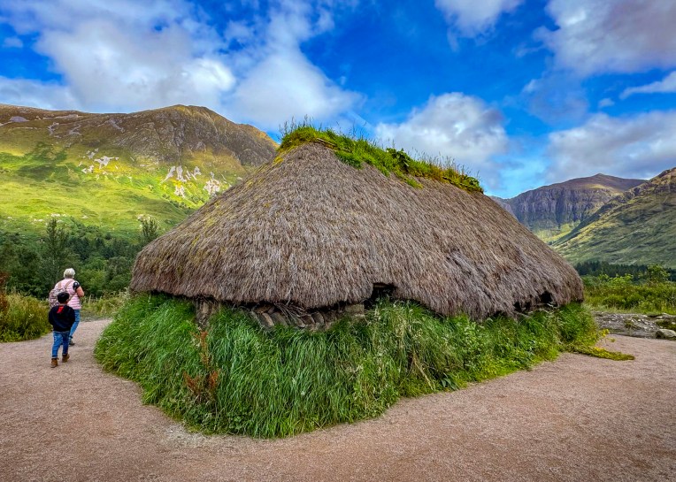
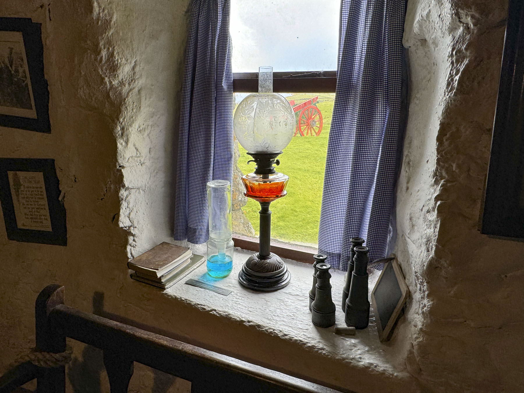
After lunch we drove up the western side of the Trotternish Peninsula to the Skye Museum of Island Life, which is a collection of thatched roofed stone cottages showcasing the way folks lived on the island centuries ago. Sheep and several hairy coos shared a bucolic pasture next to the museum when we pulled into the sunny parking area. But it was a deceptive moment of fair weather, and we were soon darting between the buildings, in the lulls between downpours, to see the interesting array of artifacts from seafaring, farming, and other trades on display.

We returned to Portree in time to snag a coveted parking space along the quay in front of our hotel and spent the rest of the late afternoon visiting the various shops in town. Our best find was in the charity shop along the waterfront where I was able to replace Donna’s hat with a warm woolen plaid cap. For the bargain price of fine pounds, she was willing to overlook a moth hole in the tweed.

We set out late the next morning to explore the western side of the Duirinish peninsula, visiting the village of Stein and Dunvegan Castle, both on the shore of Loch Dunvegan, but miles apart. Then heading back towards Portree and stopping in Carbost, on the Minginish peninsula, at the end of the day.

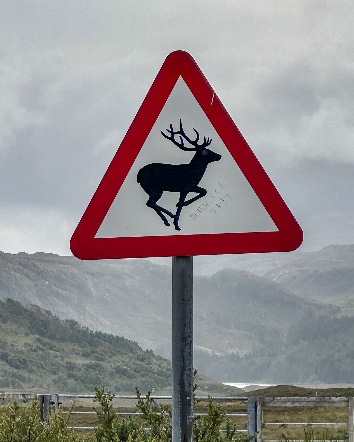
It was an overcast day from the get-go and we took the drive slowly as we followed the A850 though the countryside. At the head of Loch Greshornish we turned off the main road and followed a narrow lane into the village of Edinbane in search of a place to stop for coffee. The village was very quiet and didn’t show any sign of life, even though it was a weekday in the August high season, and several inns were shown on our map. We did encounter an unusual traffic sign that boldly warned with its red triangle that we were in a “Free Range Children” zone. It touched our hearts and made us laugh, while we remembered being kids with hours of unsupervised freedom to roam about. We’d seen many signs warning of stags, hedge hogs, and red squirrels throughout the highlands. Even a road crossing sign near a retirement complex in Edinburgh that featured the silhouette of an elderly couple using  canes, that made its point quite effectively with a touch of humor. Back on the main road the take-away coffee at the filling station didn’t appeal to us so we continued on our way.

Our approach to Stein looked like the soft edged, muted colors of an impressionist painting through the windshield, as the wipers didn’t work fast enough to whisk the heavy downpour away. The rain was too intense to get out of the car. So, we drove slowly through the village looking for a place to turn around, until the road suddenly disappeared as a boat ramp into the sea. Gloomy, wet, and unpleasant, it was definitely a “dreich” day, as the Scots like to say.

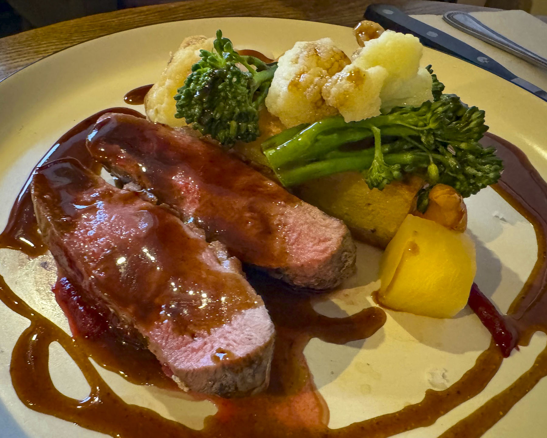
With everyone on Skye looking for an indoor activity to do, the parking area at Dunvegan Castle was full. There’s only so many castles you can see before they all begin to feel the same, and we had stopped at several earlier on the mainland, so we didn’t feel totally guilty when we decided to head to lunch instead. There are several restaurants that sit along the road through the village of Dunvegan. Dunvegan this, Dunvegan that. Of course we had lunch at The Dunvegan, a small five room inn overlooking the loch, which features a very nice restaurant along with a café, and deli for takeaway. Even though it was very busy on this inclement day, we found it relaxing, and the staff was very nice. Just down the street, a restored one-room crofter’s cottage houses the quirky Giant Angus MacAskill Museum. It’s run by a distant relative of the seven feet nine inch tall giant who was born in 1825 on the Isle of Berneray, in the Outer Hebrides. I guess that’s close enough to be considered a hometown boy, even though he spent most of his youth growing up in Nova Scotia, Canada after his parents emigrated. His height and strength eventually brought fame and fortune to the gentle giant called Gille Mór (Big Boy) when he toured the world with P.T Barnum and Tom Thumb, the world’s smallest man. Performing before Queen Victoria, she declared him the “strongest, stoutest and tallest man to ever enter the palace.” For a while he was listed in the Guiness Book of Records as the world’s strongest man. Statues of Angus and his stage partner Tom, along with his size 18 boots, and a replica of his huge coffin, fill the space. 

We arrived too late for the last tour of the distillery at Talisker in Carbost, but nevertheless we enjoyed sharing a flight of three single malt whiskies aged for 10, 18, and 25 years, while standing at the bar, as the tasting area and showroom were full of folks escaping the rainy afternoon. Our young barkeep was a well-versed whisky sommelier who described the “smoky sweetness intertwined with distinct maritime notes,” as he guided us through the subtle influences the haar, the sea mists that blow in from Loch Harport has on the aging process. He poetically used a cask full of adjectives to describe the Nose – floral seaside aromas, with gentle smoke palate; a malty creaminess and finish; sublimely spicy; a kick of cloves; an exquisite lingering saltiness.  All were very nice to sip slowly, and on a damp rainy “dreich” day like today we fully appreciated the healing properties of Scottish whisky and why some refer to it as the “water of life” in the highlands.

Just up the hill from the Talisker Distillery is The Oyster Shed. Occupying a metal farm building,

it’s a local no frills, order at the counter joint, with incredibly fair prices, that serves the freshest seafood caught locally that day. We ordered a dozen oysters and a bowl of mussels along with cans of Irn Bru, a fruity carbonated soft drink often referred to as “Scotland’s other national drink.” We sat outside around the corner of the building at a long, shared picnic table with other customers. Simple, delicious and authentic, it was a great way to cap off our day. Parking can be difficult here, so be patient; experiencing the Oyster Shed is well worth the short wait.

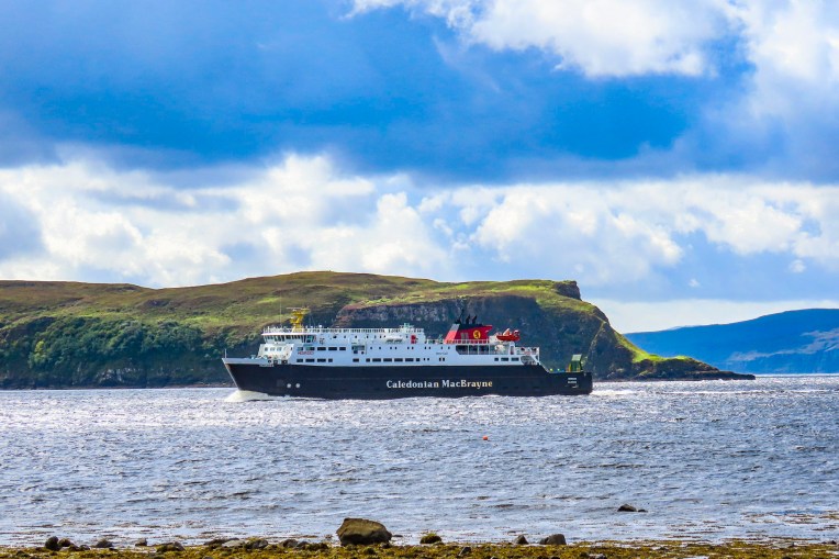
The next morning in Portree was beautiful and also our last day on Skye. We made the best of our time before catching the Caledonian MacBrayne ferry from Uig to Tarbert on the Isle of Lewis and Harris, in the Outer Hebrides. Overlooking Uig’s harbor we stopped at Captain Fraser’s Folly, a stone tower built in the mid 1800’s on the spot where Fraser’s Kilmuir estate Factor collected rent from the crofters that lived on the land. Fraser and his Factor were not popular during the clearances and often had to seek shelter in the tower from tenants evicted from the estate. Once in 1884 they even had to ask the Royal Navy to help secure their safety.

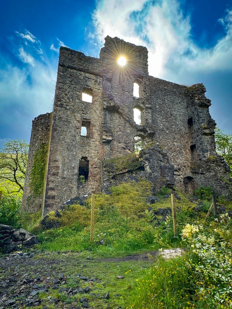
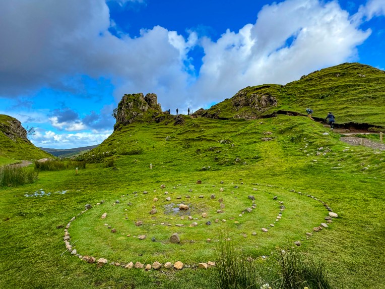
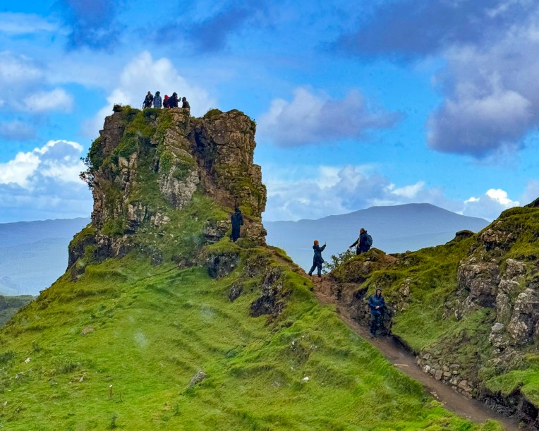
Skye’s legendary Faerie Glen, known as a place of myth and wonder, was only a short distance away from Fraser’s Folly, in the hills above Uig. It’s a magical spot, centered with concentric rings of stones, under a rocky hilltop that resembled ruins, that’s called Castle Ewen. The landscape surrounding the glen is rugged and covered with gnarled trees and heather where, according to legend, the Faeries of the glen lived. One of the ancient folk tales speaks of a Clan MacLeod chief that lived in Dunvegan Castle and married a Faerie princess. She stayed with the chief for a year before returning to her world, but left with him a Faerie flag to protect the Clan MacLeod from evil and bring victory in battles. It’s reportedly brought the clan good luck over the centuries.

Inexperienced with car ferries, we made sure we were early in the queue at the Caledonian MacBrayne pier. We had purchased our tickets online, months before, as soon as their summer sailing schedule became available. We read that while being a last-minute walk-on isn’t a problem, car reservations during the summer high season fill quickly. There were special lanes for each category of vehicle – car, camper, truck and bus. Vehicles without reservations get driven on last or not at all depending on available space. It all worked very smoothly with a ferry attendant scanning the barcode of our printed ticket and directing us into the correct boarding lane.

Surprisingly, the ferry was very quickly loaded and with a blast of the ship’s horn we departed Uig and headed across the Minch, the body of water that separates Skye from the Isle of Lewis and Harris. 

Till next time, Craig & Donna

P.S. According to Sir William Connolly, Scotland’s favorite retired stand-up comedian, “There’s no such thing as bad weather, just the wrong clothing, so get yourself a sexy raincoat and live a little.”

The North Coast 500, kind of – Part 2: Glencoe to the Isle of Skye or Castles, Lochs and Legends

Rain pounding on the skylight woke us and revealed a grey day with not an inkling of sun in the sky. A real “drookit” of a day our innkeeper called it at breakfast. The tumultuous weather in the highlands is always a topic of conversation. “When the sun shines it’s glorious. For the other 364 days of the year we Scots amuse ourselves with over 100 Gaelic words to describe the variety of rain, and 421 words to describe the intricacies of snow.” It was a form of entertainment for our ancestors as they sat around the fire at night, in their ancient turf and creel houses, he related with a smile. With the way the weather blows in off the Atlantic Ocean, it’s possible to experience the four seasons in one day in the highlands. It’s a “dreich” day this morning – gloomy, damp, and grey – but the sun will most certainly shine later between sporadic showers. “It’s God’s way of cleaning the coos.”

True to his prediction the sun broke through clouds that were being torn apart by the wind as we stopped along Loch Lochy to photograph the multi-hued pinks, whites and magentas of the wild bush vetch growing along the side of the road. On the loch a sailboat was running downwind at a good clip with only its mainsail set. Our plan for the day was to head north from Glencoe along the A82 before following the A87 west through the highlands and across Loch Alsh to the Isle of Skye and end the day in Portree.

As the road turned west, we turned to the right and followed signs to Invergarry and Glengarry Castles down a narrow lane through an old growth forest. The ruins of Invergarry Castle eventually revealed itself from behind a curtain of woods. Sunlight cascaded through ruins. Only a few walls of Invergarry Castle remain, but in its glory it was a five story L-shaped structure with a six story tower, and seat of the Chiefs of the Clan MacDonell of Glengarry, a powerful branch of the Clan Donald. Clan legend believes that in the early 1600’s the stones for the castle’s construction were passed hand to hand by a chain of clansmen from the mountain Ben Tee, five miles away. The castle had a short and turbulent history. Oliver Cromwell’s troops attacked the MacDonnells for supporting King Charles I and burned the castle in 1654 during the Engilsh Civil War. Rebuilt, the MacDonnell’s castle was used by the Jacobites in the 1715 and 1745 rebellions. Bonnie Prince Charlie visited the castle after raising the Scottish flag on the shore of Loch Shiel at Glenfinnan when he returned from France, and again, to rest, after his devastating defeat at the Battle of Culloden in 1746. As part of a systematic suppression of the Highlands the castle was destroyed again, but two walls refused to fall, as if symbolizing the Scots’ refusal to yield the British crown.

The castle was abandoned, and by 1760 the chief of the Clan MacDonell was in the new Invergarry House, just a short distance away from the ruins of the castle. In 1960s Invergarry House was reborn as the Glengarry Castle Hotel.

“Drive a little then café,” is our motto on road trips to break up our drives and Glengarry Castle was the perfect stop for our mid-morning caffeine compulsion. To describe Glengarry as a castle might be stretching it a little. It’s beautiful building, more accurately described as an estate home or chateau. It’s now a lovely hotel that harkened back to the reserved elegance of an earlier era. From its comfortable sitting room we enjoyed our coffees, and watched several boats motoring along Loch Oich. We lingered. From north to south the lochs Ness, Oich, Lochy, and Linnhe connect to one another via a series of locks along the Caledonian Canal which traverses the highlands to form a sixty-mile long intercoastal waterway that starts in Inverness and ends at Fort William, connecting the North Sea to the Atlantic Ocean. Conceived to give employment to highlanders displaced during the clearances, the canal was constructed in the early 1800’s and was designed to accommodate large merchant sailing ships. The canal reaches its highest point, 106 feet above sea level, at Laggan, between Loch Oich and Loch Lochy. One of the canal’s significant engineering feats is Neptune’s Staircase, a series of eight step locks near Fort William.

We rejoined the A82 for a few minutes before turning onto the A87 and followed it west along a route that paralleled the River Garry, before rising higher into the mountains and reaching the river’s source, Loch Garry. The views of Loch Garry under clearing storm clouds were spectacular, and we stopped several times, but the most rewarding photograph was taken from a farmer’s gate that led to an open field, high above the loch.

From the rocky beach at Loch Cluanie it was apparent that our luck with the weather was changing, and that “tha stoirm mhor ann,” was brewing with darkening clouds.

It was a real pish-oot by the time we sought sustenance at The Pitstop at Kintall, across the road from Loch Duich.  It’s one of the few eateries along the A87, and the folks that run it are good-humored angels. Their wings were especially visible the day we stopped. The small restaurant was full of people seeking shelter from the storm. Just inside the door, a large queue of dripping wet folks huddled, and created a loch size puddle as they waited for tables. On a nicer day the restaurant’s picnic tables outside would have easily accommodated everyone. Fortunately, the kitchen was quick, and folks didn’t linger. Their coffee was good, and the food was delicious.

The rain was lessening when we spotted the St Dubhthac’s Church on a small hill above Loch Duich and did a quick U-turn to investigate its ruins. It’s a pretty setting atop the hill with views of the loch and mountains covered in the purple heather blooms of summer. The exact date the church was built is unknown, but it’s believed to have been constructed in the 11th century shortly after Dubhthac a popular priest, and great missionary walker venerated for his evangelistic efforts, visited the area. An ancient cemetery, the Clachan Duich Burial Ground (“clachan” meaning stone or church in Gaelic) surrounds the ruins, and was the traditional burial place for many Clan Macrae chiefs over the centuries.

After the Battle of Glenshiel in 1719, the church was used to treat wounded Jacobite soldiers. Consequently, British troops later torched the church in retaliation. The church was eventually rebuilt and used into the 1850’s, but was left to neglect after the “clearances” reduced the area’s population. Today modern pilgrims can follow the St Dubhthac Way through Glen Affric via Chisholm’s Pass, along what is believed to be the evangelist’s original path through the highlands.

Fickle weather continued to plague our day, but we weren’t deterred from enjoying the moody weather when we visited Eilean Donan Castle, one of the Scottish Highland’s most iconic sites. Having invested in some good quality Gore-Tex rain gear that actually kept us dry made all the difference. And what better way to experience the harsh conditions of life in medieval Scotland than on a cold stormy afternoon in the highlands. Seems many other tourists felt the same way, and the parking lot for the castle was nearly full. https://www.eileandonancastle.com/?s=tickets

Eilean Donan means “Island of Donan” and refers to St Donan, an Irish missionary, who lived on the small island for a short time while he traveled through the western highlands and isles introducing Christianity to the Picts in the beginning of the 7th century. Later the island held an early Pict fort.

In the12th century a larger castle was built on the strategically located tidal island, situated at the confluence of three sea lochs: Loch Duich, Loch Alsh, and Loch Long, to defend the area from the frequent Viking raids that were happening at the time.

By the 14th century the castle was the western stronghold of the Clan MacKenzie and their allies Clan MacRae. Siding with Robert the Bruce, the MacKenzies granted him refuge at the castle after his defeat at the Battle of Methven in the early 1300’s, before he became the King of Scotland.

These were brutal and lawless times in the highlands and vividly illustrated in a gruesome event in 1331 when fifty “mysdoaris” (mis-doers) were gathered and executed, their heads then put on pikes along the castle’s walls to deter others from wrongdoing and assure the Warden of Scotland, who’s visit prompted this massacre, that there was law and order in the region.

During the unsuccessful Jacobite Uprising of 1719, Spanish troops allied with Bonnie Prince Charlie and exiled King James II were garrisoned in the castle. That May three Royal Navy frigates sailed into the lochs and bombarded the castle. After the Spanish forces surrendered, the British sailors used 343 barrels of gunpowder that the foreign troops left behind to blow the castle to smithereens. Some believe the ghost of a fallen Spanish soldier still haunts the isle.

The castle was left in ruins for nearly 200 years before Lt Colonel John Macrae-Gilstrap bought the island in 1911, and with the help of Farquhar MacRae set about rebuilding it over the next twenty years. Not knowing what the original castle actually looked, it’s believed Farquhar envisioned it in a dream. Surprisingly, years later when old plans of Eilean Donan were discovered in the ancient archives of Edinburgh Castle, his vision was confirmed as true to the original design. The only addition was the multi-arched stone footbridge we were about to cross above seaweed covered boulders exposed with the low tide. Wonderfully evocative on a moody rainy day, the views of the castle surrounded by water and mountains on a sunny day must be spectacular. No wonder it’s one of Scotland’s most photographed treasures.

It continued to be a dreich afternoon as we followed the A87 over the Kyle of Lochalsh, the narrow strait that separates the Isle of Skye from the Scottish mainland. The Sligachan Old Bridge was our last stop of the day before reaching Portree. It was designed by the famous Scottish architect Thomas Telford, better known for Dean Bridge in Edinburgh and the locks of Neptune’s Staircase on the Caledonian Canal, and it was built in 1810 with rocks collected from the river over which it spans. There is a mystical quality to the often mist-covered landscapes on the Isle of Skye. Fabulous tales of faeries and myths of ancient warriors inhabiting the land have been passed along by oral tradition throughout the Highlands and the Hebrides Islands since primitive folks first settled the region around 7000BC.

Two legends are associated with the River Sligachan. The first is the ferocious battle between Scáthach, the chief of a tribe of skilled female warriors, who had a fearsome reputation and was said to be stronger than any man, and Cú Chulainn, an Irish hero and demi-god who sailed to Skye to prove his strength against her. The battle raged for weeks. The earth shook as their weapons struck the ground, creating rivers and mountains across Skye as they wrestled in combat.

The second legend is the tale of the magical powers of the River Sligachan, when Scáthach’s daughter, Uathach, was granted eternal beauty and wisdom by following the guidance of faeries to dip her head into the icy water of the River Sligachan, for a very specific seven seconds and then let the water on her face air dry. It’s not as easy as it sounds considering the temperature of the water and that you have to get on your hands and knees to accomplish it. But she succeeded and was given a vision that the aroma of a wonderfully cooked meal would entice Scáthach and Cú Chulainn to stop battling. It worked and the combatants, realizing they were starving, called a truce.

Afterward Scáthach agreed to train the Irishman in her ways of warfare at her “Fortress of Shadows” on a remote windswept headland on Skye’s Sleat Peninsula. But the tale doesn’t end and continues to become a juicy Iron Age soap opera with Cú Chulainn seducing Uathach and killing her husband, then having a child with Scáthach’s sister and rival Aífe. Of course there are many versions of this ancient folk tale. The ruins of Dunscaith Castle, the 14th century stronghold of the Clan MacDonald, are believed to be the setting for this epic story.

The river valley and mountains west of the old bridge are called the Cuillin, an expansive area of pristine beauty with over 20 Munros, mountains over 3,000 feet high. South of the bridge the Collie and MacKenzie Statue, marks a trailhead into the wilderness, and commemorates the mountaineer and guide who mapped hiking routes across the Cuillin range and climbed many of Skye’s rugged mountains in the late 1890’s and early 1900’s.

Winds change the weather quickly on the Isle of Skye and by the time we reached Portree and checked into the Rosedale Hotel, located along the harbor’s waterfront, the sky was clearing. It was the height of the summer season and unfortunately, we couldn’t reserve a room with a harbor view, but we were quite happy with our accommodations otherwise.

Each morning at breakfast, the sweet waitresses gave us the table with the best view of the harbor, as if in recompense for our view-less room. Free parking along the quay is possible, but it’s almost impossible to find a space. The hotel did provide directions to the free municipal lot across from Phil the Barber and the Portree Community Centre on Park Road, a short distance away, that worked out quite well.

Later, we shared a seafood platter at Sea Breezes, a small restaurant in one of the colorful 19th century buildings along the harbor front, where it’s recommended to be among the first in line when it opens at 5 PM. Our meal was delicious and featured locally sourced sea trout, mussels, and scallops harvested from the waters around Skye that morning.

https://www.rosedalehotelskye.co.uk/              https://sea-breezes-skye.co.uk/

It was long wet afternoon after we lost the morning sunshine, and we hoped for better weather in the days ahead. But as our hotelier reminded us “today’s rain is tomorrow’s whisky.”

Till next time, Craig & Donna

The North Coast 500, kind of – Part 1: Edinburgh to Glencoe

Traditionally the North Coast 500 is a 516-mile tourist route that hugs the vast coastline of northern Scotland, and in its serpentine course includes some of the most scenic seascapes and landscapes on the planet, and in the Scottish Highlands as well. Maps show it as a large roughly circular route that starts and ends in Inverness, as our trip did, but bypasses Edinburgh and Glencoe since they are farther south. In planning our trip, we used the traditional NC500 as inspiration for preparing our own itinerary that included Edinburgh, Skye, the Isle of Lewis and Harris, and the Orkney Islands. Ultimately, we drove 1,430 miles over 15 days. Roughly 95 miles per day, which was a very manageable pace and offered plenty of opportunities to visit sites and explore. We used Arnold Clark for our car hire and were quite pleased with their pricing and service. Visit Scotland has a great website that outlines 15 other scenic driving routes that will get your wheels spinning. We hope you enjoy this first part of trip that we fondly call the D&C1430.

By this point in our trip, we had already been in Scotland for four days, but really considered this the first day of our Highlands adventure. Leaving Edinburgh and the Fringe Festival behind us, we zipped past the Kelpies. You have to be mindful of the speed limits while driving on the roads in the United Kingdom, as there are speed cameras everywhere. But it seems to be a lenient system where your speed is averaged between two points, so if you enter the camera zone above the speed limit you have a chance to compensate for the error by slowing down. Five months on and we have not yet received any notices of fines, but it did take some getting used to.

The morning was gray. The plan for the day was to visit several intriguing sculptures around Cumbernauld, head to Stirling Castle, and spend the night in the small village of Kippen. Luckily, we had stopped at the Kelpies several days earlier, on a beautiful afternoon, as we drove into Edinburgh. The 100ft tall equestrian statues are located in Helix Park at the confluence of the Clyde Canal and the River Carron. The steel horseheads are the largest in the world, and were created by the internationally acclaimed Scottish sculptor, Andy Scott. They are based on Scottish folklore;  a kelpie is a dangerous shape-shifting water spirit that appears on land as a horse, who entices its unsuspecting victim to ride on its back, only to be sped away to a watery grave. 

We used to purchase guidebooks to research our travels, but now rely mostly on internet research and Instagram. We have found Google Maps to be a great tool and use it to find many points of interest that seem to fly under the radar. We highlight them as favorites on the app and then connect the dots for our itinerary.

That’s how we planned our first stop of the day at another artwork conceived by Andy Scott – Arria, the Angel of the ‘Nauld,’ or the Steel Mermaid. The sculpture appeared quickly above the tree line along the M80 then vanished from view like a mirage. There was not any signage to the sculpture, but we eventually found ourselves at the back corner of the Eastfield Cemetery in Cumbernauld, where a path led through the woods to the 33ft tall steel figure.        

The graceful sweep of the split tail combining as one is meant to represent the original meaning of Cumbernauld. In Gaelic ‘Comar nan Allt’, means the merging of water, which represents the town’s two rivers flowing into the Forth and Clyde.  The figure offers, with outstretched arms, the rivers as her gift of life to the earth. Encircling the base of the sculpture is the poem by ‘Watershed’ by Jim Carruth.

The first sounds spoken, from the spring’s core, are of a new beginning, of people and place,

a poetry that bubbles and gargles to the surface, to leave this watershed, flow east and west,

in a rush of words, that tumble and fall, to join the conversations, of two great rivers,

a voice calling out, I belong I belong, adding to the language of sea and ocean.

The name was chosen from a local school competition. Arria was the mother of the Roman Emperor Antoninus Pius, who in AD 142 built a series of forts along the Antonine Wall which crossed Scotland from the River Forth to the River Clyde and marked the Roman Empire’s most northern frontier. The Romans only held it for thirty years before Scottish tribes forced them to flee to safety farther south behind Hadrian’s Wall.

A short distance farther on we pulled down a narrow country track bordered by fields and horse pastures to a trailhead for Croy Hill, where soldiers were once stationed in a fort along the Antonine Wall. The only remainder of that era is an 18ft tall steel sculpture of a Roman centurion, created by the Edinburgh artist, Svetlana Kondakova, in 2021. Today 78 miles of trails along the wall welcome distance hikers, dog walkers and equestrians to explore the ancient history of the area.

Hunger called and we found refuge along a quiet pedestrian lane in Kilsyth, at Scarecrow Bar & Grill. It had friendly staff, good food, and was a nice place to relax before heading to Stirling Castle.

The Saturday crowd was tapering off by the time we arrived, around 3:00 pm, and we were able to park conveniently at the top of the hill next to the entrance. The ancient castle was entwined throughout Scotland’s epic history. Situated dramatically on a volcanic outcrop, the castle was built in the early 1100’s to guard the shallowest fording point across the River Forth, which divides the lowlands from the highlands. Over the centuries nearly ever Scottish monarch has paced the halls and ramparts of this mighty castle. Alexander I, Mary Queen of Scots, James IV, V & VI, William Wallace, Robert the Bruce, Margaret Tudor, and Bonnie Prince Charlie are just a few of the dozens of Kings and Queens who have called the castle home and most likely cursed the food, from the dungeon like kitchen, along with the wet weather and wind, while warming their bones next to one of the castle’s numerous fireplaces.

Many reconfigurations and additions have happened to the castle over the centuries. One of the most significant was the building of the Great Hall by James IV in 1501. This cavernous structure measuring, 138ft by 47ft, has five walk-in fireplaces, and a unique hammer beam roof, which resembles the inside of a wooden boat hull,. It was used to host royal banquets, weddings, christenings and meetings of state. One lavish event featured a specially built wooden boat with 40ft tall masts, and 36 brass canons, which were fired in celebration. After the smoke cleared and the guests stopped coughing, a seafood banquet was served from it. And, I’m assuming, the party planner lost his head the next day. Centuries later it was used as a stable before being renovated and used as a military barracks until the 1960’s.

Touring the rooms of the palace was the highlight of our visit to Stirling Castle. They were noticeably better furnished than Edinburgh Castle and the Palace of Holyroodhouse. Gorgeous tapestries were displayed throughout and the ceiling of one main rooms featured replicas of the famous 37 “Stirling Heads.” They were quite an unusual embellishment for a royal residence, depicting mythical heroes, historical Scots, and everyday people.

The original three-foot wide portrait medallions, often referred to as “Scotland’s other Crown Jewels,” were carved from solid oak in the 16th century, and are on exhibit in the castle’s gallery. The new medallions, installed on the ceiling in 2011, were painstakingly recreated over a six-year period by the master wood sculptor John Donaldson and then painted in a renaissance style, appropriate to the era, by artist Graciela Ainsworth.

It’s always debatable how far out we should make our hotel bookings. Six months out for hotel reservations is what we normally do, and it usually works very well, but surprisingly to our dismay most of our first-choice hotels in prime locations were already fully booked by then. 

Which is how we arrived at The Inn at Kippen in time for dinner. Kippen is a quaint crossroads village west of Stirling and was a wonderful off-the-beaten track discovery. The first public record of Kippen appears in the 1300’s when the village church is mentioned. But its heyday was in the 18th century when it was stagecoach stop along a military road between Stirling and Balloch.

The Kippen is a historic coaching Inn and continues the friendly tradition of welcoming travelers, with a dog-friendly bar and restaurant on the first floor and five well-appointed rooms on the second. The hosts pride themselves on sourcing all meats, fish and produce locally and the menu changes accordingly with the seasons. Our dinner, as well as breakfast the next morning, was delicous.

A bright early sunrise encouraged us to quickly dress and amble around the quiet village, and enjoy views pf the countryside before breakfast. We then continued our drive west into the Highlands.

Glencoe was the day’s ultimate destination, but with us it’s never a straight drive. We are always zigging, zagging, detouring and stopping for photos along the way. The view as we crossed a bridge over the Eas Gobhain, a river that flows from Loch Venachar into Callander, was beautiful, so we U-turned and parked. Our timing was perfect, as we caught photos of kayakers out for a Sunday paddle.

Afterwards, we stopped at a riverside park called the Meadows that was a popular spot for feeding the ducks and for fishing from the riverbank.

The A84 is the main route into the Highlands from Stirling and passes through Callander. We followed it west through a rolling landscape that gently changed to mountains covered by pine forests. Brilliant sunlight reflected off the water and glistened through the trees as we stopped at Loch Lubnaig. Our first Highland loch! We were captivated by the crystal blue lake shimmering in the sun, before a background of verdant mountain and clear sky.

We had read about the Highlands being unbearably full of tourists during the summer months, but hadn’t really noticed it until trying to find a parking space. This became a recurring issue during our trip. While the roads were not congested, the small parking areas were, and there was often a queue for a spot if you arrived later in the day.

We veered off the route to see the Falls of Dochart, and the Clan Macnab Burial Grounds on an island in the river at the village of Killin. While many local folks apologized for the unusually rainy August weather, it was surely beneficial to the rivers, which were running high, and the spectacular waterfalls.

The earliest note of the Clan Macnab goes back to 1124 during the reign of David I, the 9th King of Scotland. It was a rather violent clan known for beheading its defeated enemies, which is rather surprising considering the clan descended from an Abbot of Strathfillan. But occasionally they backed the wrong cause and famously fought against Robert the Bruce in 1306, and subsequently forfeited most of their extensive territory, which encompassed land between the village of Tyndrum and the south-west corner of Loch Tay, until their property rights were reinstated by King David II in 1336.

Across the Highlands, the clans notoriously pillaged villages and stole livestock from each other in a vicious cycle of attack and revenge. One episode is best illustrated in a description, by the Clan Macnab Society, of the Battle of Glenboultachan in 1522 between the Macnab and the Neish clans, after the Neishes initiated a major raid on the Macnab herds. “As the Macnabs rushed downhill they threw away their plaids and, naked apart from their brogues, flung themselves upon the Neishes. The Neishes threw off their plaids as well, and soon the glen was packed with naked, screaming warriors locked in mortal combat.” I can only image they wished to keep their clothes from being shredded. Ninety years later, only two young Neishes survived the swords of the Macnab’s after a retaliatory attack for a Christmas season ambush. The A85 now passes the site at Little Port Farm where the epic fight took place. 

As we continued west the pine covered slopes faded from green to hills and moorlands covered in the pink, purple, and lavender colors of flowering heather shrubs in full bloom, and the yellow and amber of late summer grasses. Vast areas were a treeless wilderness without signs of habitation. The clouds slightly thickened and their shadows raced across the panorama. Patiently we waited with our cameras ready at the Buachaille Etive Mòr car park for the sun to break through and were rewarded with dramatic shots of endless landscape. We stopped along the way so many times that it seemed we were not making any progress toward Glencoe. 

At the National Trust for Scotland – Glencoe Visitor Centre we encountered our first highland cows, or hairy coos as the Scots like to say. With how heavily these wonderful animals are used in advertising to promote Scottish tourism, we thought there would be abundant herds of the coos everywhere. But that was not the case, and based on our experience, I swear these two hairy coos were the only ones in the Highlands. We did see some from a great distance in the northern Highlands later in the trip, although they were so far away that they could have been plywood silhouettes of the beasts. And I can just imagine an elderly pensioner exclaiming to his wife, “those silly tourists stopped again to take photos of our fake coos. If I had a Two pence for every time someone stopped, we’d be vacationing on the Rock of Gibraltar this winter.”

Beyond the coos stood a re-creation of an ancient highlander turf and creel house. Sturdy log framing was built atop thick walls of insulating turf and then covered on the inside with a basket-like weaving of freshly cut and still pliable ‘green’ wood. The steep roof framing was then covered with a thinner layer of turf and thatched with heather. The dwellings had high peaked interiors and were built without windows or a chimney. The only ventilation for the cooking fire, in an open stone hearth, was through one or two low entries that would be covered with skins to protect the inside from the fierce wind, snow and rain of the highlands, along with attempting to contain the heat thrown off by the fire inside. In an 1822 letter to a friend, a Londoner traveling through the region snarkily described a creel house, “smoke came pouring out through the ribs and roof all over; but chiefly out at the door, which was not four feet high, so that the whole made the appearance of a fuming dunghill.”

It was in homes like this creel house that one of the greatest atrocities against the Scots was committed by the English. On February 13, 1692, in Glencoe, Clan MacDonald extended their hospitality and opened their homes to 120 Redcoats. On orders sent from John Dalrymple, the Earl of Argyll, the night before, the soldiers were ordered to “kill all,” and “not to trouble the government with prisoners,” at 5 the next morning. The Earl of Argyll suspected the chief of the clan opposed the new monarch William III, and the MacDonald Chief was not prompt in pledging allegiance to the new king, after James II was deposed during the Glorious Revolution of 1688, for supporting the Catholic religion. It was also an opportunity for the Earl, a Campbell, to settle a long-standing clan feud with the MacDonalds.

Thirty-eight innocent men, women, and children were massacred as dawn broke. Another forty died in the snow as they fled into mountains trying to escape. After the tragedy, several British army officers were court martialed for refusing to follow the heinous order. The poor Earl, who was also the Secretary of State for Scotland at the time, was only told to resign. It’s difficult to imagine that this tranquil valley holds such tragedy. This verse from the poem Glencoe by Douglas Alexander Stewart, says it well. 

Sigh, wind in the pine,
Cover it with snow;
But terrible things were done
Long, long ago.

A memorial to the MacDonald Clan stands on the Upper Carnoch road in the village.

After we settled in at the Beechwood Cottage B&B for a two-night stay, and admired the view of Sgorr na Ciche mountain from our window, our host offered to make early dinner reservations for us, relating that during the high season, the restaurants fill quickly and it’s not like Edinburgh where things stay open late. In Glencoe everything closes early and without dinner reservations, there is usually an impossible queue. Following her recommendation, we enjoyed the view of Lock Leven from the restaurant at the Isles of Glencoe Hotel, while having a wonderful dinner and a decadent dessert.

We should have listened more closely to our host’s tip about parking at the Glenfinnan Viaduct to photograph the old Jacobite Steam Train, often referred to as Harry Potter’s Hogwarts Express. Our host suggested it would be wise to arrive an hour before the train is scheduled to cross the bridge, as there are usually hundreds of folks wanting to do the same thing, and it takes a while to hike up the hill to find the right observation point. Well, we were the last car in line before they closed the gate to the Glenfinnan Car Park. Folks who were willing to walk a greater distance back resorted to all sorts of creative and illegal parking along the shoulder of the road. We searched for a while, but the historic area never envisioned the mass tourism that the Harry Potter train brings to the region when the line was constructed in the 1880’s. It began to rain.

For Plan B we backtracked to the Corpach Caol shipwreck on the shore of Loch Linnhe, near the Caledonian Canal Locks, just west of Fort William. The rain lessened as we walked across the locks and along a stoney beach to the evocative wreck silhouetted against Ben Nevis, the tallest mountain in the United Kingdom. The wreck of the old fishing trawler has rested on the beach since 2011, when a fierce storm broke the boat from its mooring, miles away, farther down the loch in Camusnagaul Bay, where a new owner was renovating it to liveaboard.

Afterwards we headed back, across the canal, to a small café for coffee and a reprieve from the rain that had started again and decided to try our luck one more time at the Glenfinnan Viaduct. We planned to be there very early for the afternoon crossing of the train. We secured a parking space easily enough, even though it was beginning to rain harder, and followed the other mad fools as intent as we down a long heavily mudded track. It rained harder. And harder. We thanked our lucky stars that we had invested heavily in completely waterproof jackets for this trip. The rain finally deterred us from continuing up the slope to those spots from which all the iconic photos of the steam train puffing across the curve of the viaduct are taken. Instead, we claimed a spot, under a tree, along the stream that runs through a valley, and stood there stoically like hairy coos in a drenching downpour. That in Gaelic is called a Goselet. One of the infinite number of words that the Scots use to describe their finicky weather.  It was a bust! The train stopped mid span for a minute, for us paparazzi-like tourists to snap away, but the sky was so grey and low that the steam from the engine was indiscernible from the gloom. Our young grandson, having just finished reading all the Harry Potter books, was delighted to see our photos that we texted to him later that day.

By the time we finished a late lunch at The Lochy, a nice unpretentious pub, with some very good value daily specials, the morning storm had cleared, and we headed back to Glencoe. We didn’t get far before we came to a halt at the lowered gates of a railroad crossing. Imagine our surprise when  the Jacobite Steam Train passed in front of us in all its steaming glory in the bright afternoon sun.

We capped the day wandering about closer to Glencoe, exploring various shorelines and St. John’s Scottish Episcopalian Church in Ballachulish. The original church on the site is actually the smaller stone building to the left. It was a storage shed before it was donated to the church and consecrated for use as a sanctuary in 1770. The larger old stone church was built in 1842 and is surrounded by an interesting cemetery.

Till next time, Craig & Donna

Timetable for the Jacobite Steam Train

The Scotland Explorer Pass helped with the price of admission to many sites across the country.

Visit ScotlandWhere to see Highland cows in Scotland