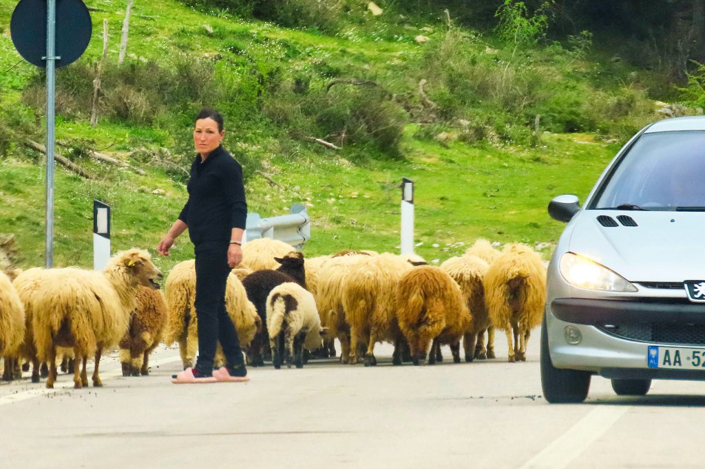
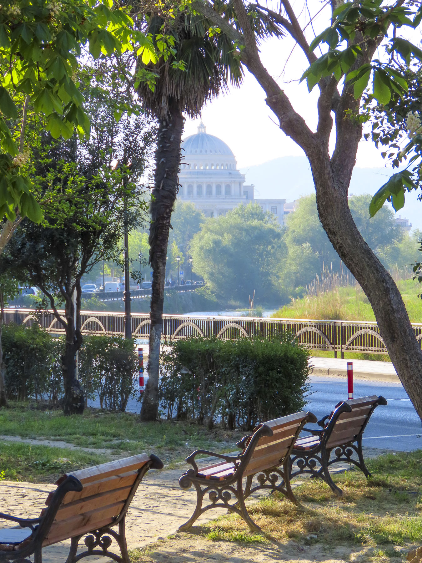
We slowed to let a shepherd guide his flock across the road to Apollonia. An hour earlier the sky was brighter as we left Berat. Our intention for the day was to visit the Archaeological Museum of Apollonia before heading to Vlora, on the coast, and then continuing south to the Llogara Pass, for epic views of the Adriatic Coast before reaching our accommodation in Upper Qeparo, a semi-abandoned, old Albanian village, for the night. But the deepening grey sky was concerning. The sheep were now grazing on tufts of grass, growing in between parked cars, in the dirt parking lot at the foot of the hill below the archaeological park. A short uphill walk got our circulation going and brightened our mood. A large group from a bus tour followed their pennant waving guide uphill, towards ruins still hidden from view.
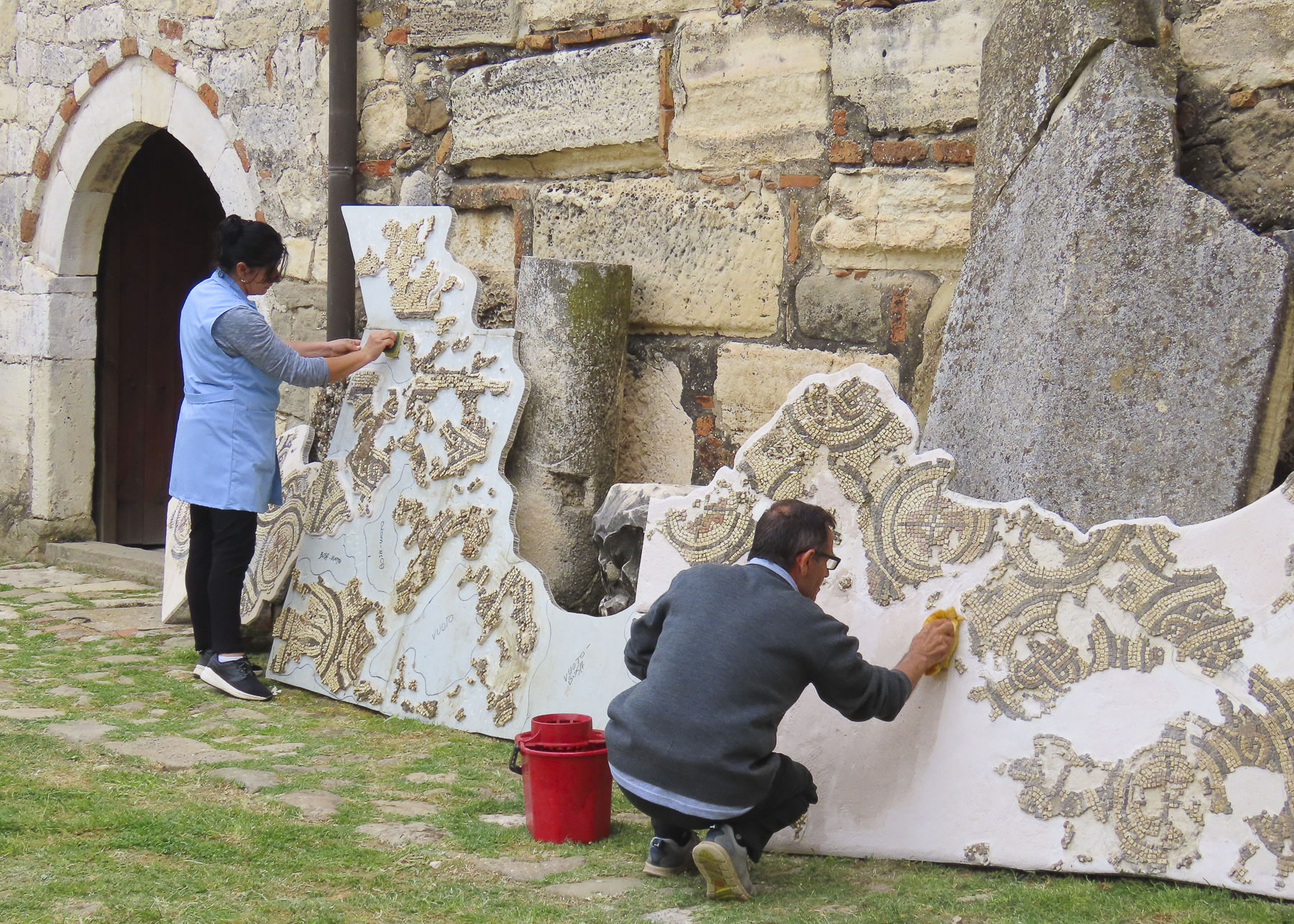
We turned in the opposite direction to investigate the Sleeping Saint Mary Church and its Ardenica Monastery, and entered its courtyard through an arched gateway with a heavy wooden door. Outside the refectory museum, staff had propped up large sections of a mosaic floor and were cleaning them with soapy water and a scrub brush.
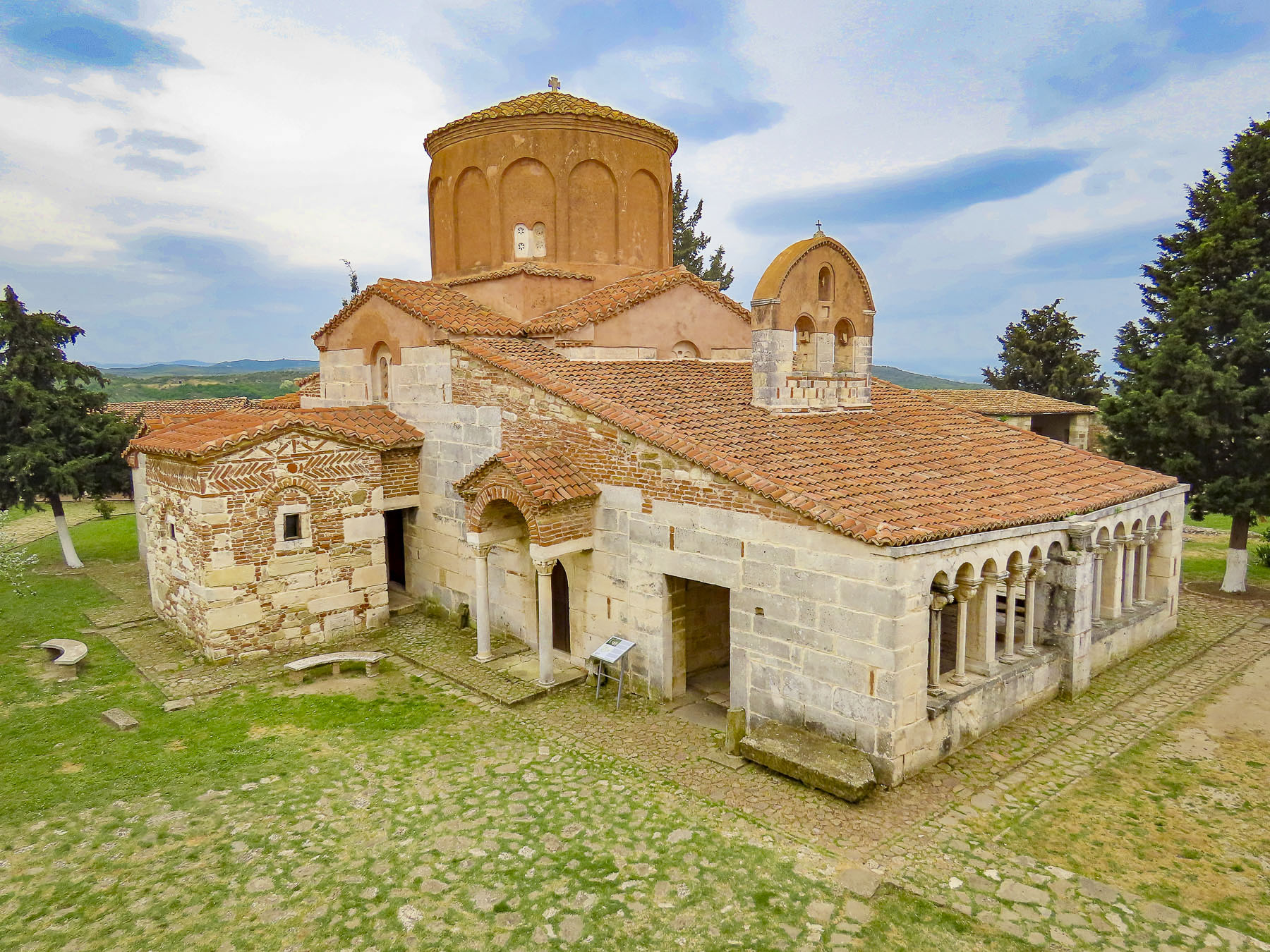
The church and monastery date to 1282 when the Byzantine Emperor, Andronikos II Palaiologos, ordered their construction to celebrate his army’s victory over the Angevins during the defense of Berat a year earlier. Stones for the church, monastery and the other buildings that form a large defensive courtyard were quarried from the ruins of ancient Apollina.
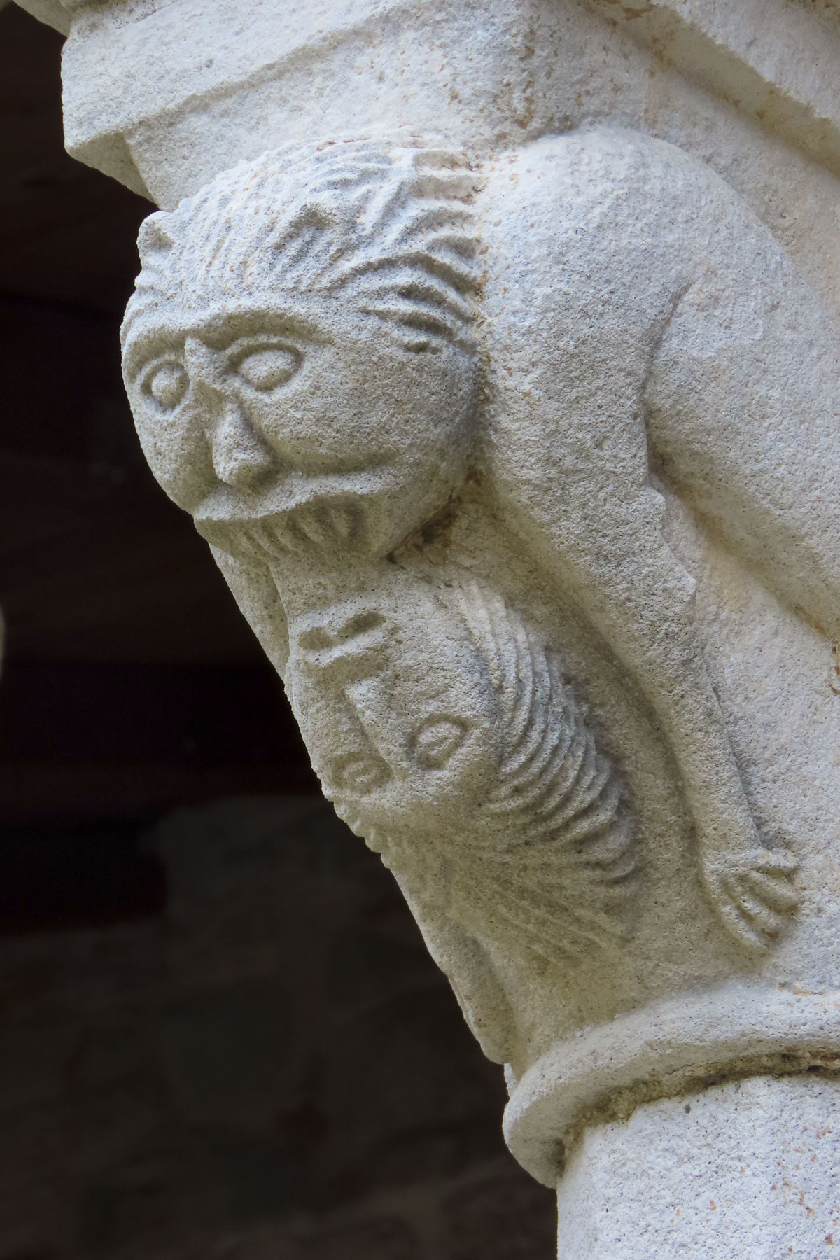
As we walked around, it was interesting to see parts of old pillars, capitals and decorative elements randomly used amongst stone blocks to build the exterior walls. The Albanian national hero Skanderbeg and his bride Andronika Arianiti celebrated their marriage vows here in 1451.
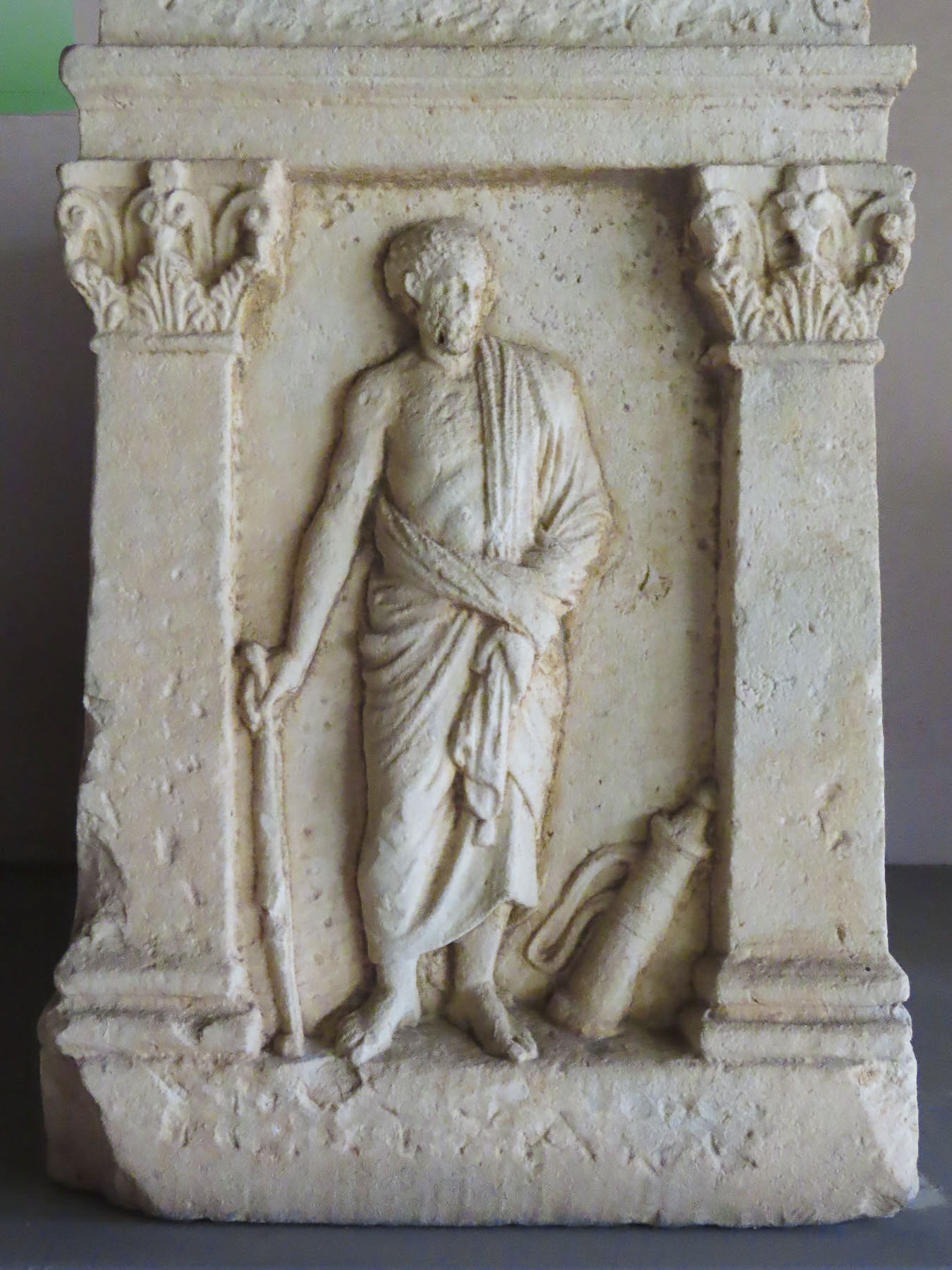
It was this historical fact, and a fast-thinking priest, in 1967, that saved the church from the communist wrecking ball of Enver Hoxha’s atheist campaign to destroy churches across the country. The monastery building now houses a fascinating collection of antiquities from Illyrian, Greek, and Roman occupants of the city.
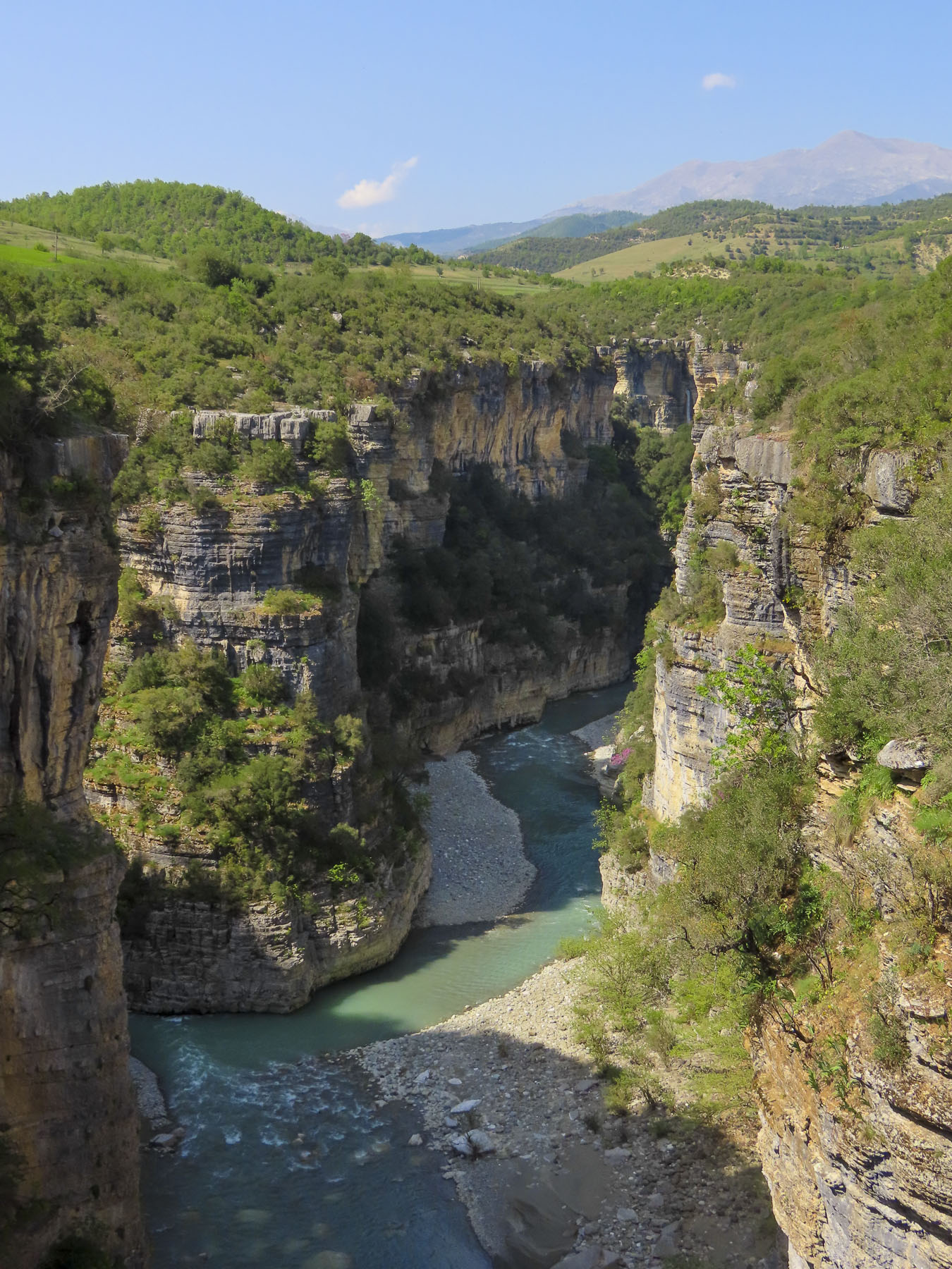
Founded in the 6th century BC, Apollonia was a prosperous seaport on the Adriatic Sea at the mouth of Vjosa River, and a strategic link on the Via Egnatia, a Roman road constructed in the 2nd century BC that connected the seaport to Constantinople, through what are now the modern countries of Albania, North Macedonia, Greece, and Turkey. The ancient city also grew wealthy from a trade route that followed the Vjosa River valley south and ended in Thessaloniki, Greece, on the Aegean Sea. At its height Apollonia was surrounded by two miles of defensive walls that protected a population of 60,000. The importance of the city slowly faded after a 243 AD earthquake altered the course of the Vjosa River and Apollina’s large harbor, which could hold 100 ships at a time, began to fill with silt. The city was eventually abandoned in the 4th century.
The archeological park is a vast site spread across rolling hills, but today the Temple of Apollo, with only its front façade intact, is the most complete ruin. Walking up the slope behind the temple, a panoramic view revealed fertile farmland separated from the Adriatic Sea by low hills, some of which had a series of doors carved into their hillside.
These are some of Hoxha’s estimated 750,000 military bunkers that the paranoid dictator built across Albania. At the top of the hill there was a very tranquil looking outdoor café/restaurant, that we pegged as the perfect spot for a break, but unfortunately it was still closed in mid-April when we visited. Fortunately, there was a second restaurant closer to the church that served excellent coffee, and was much appreciated on this chilly, damp day.
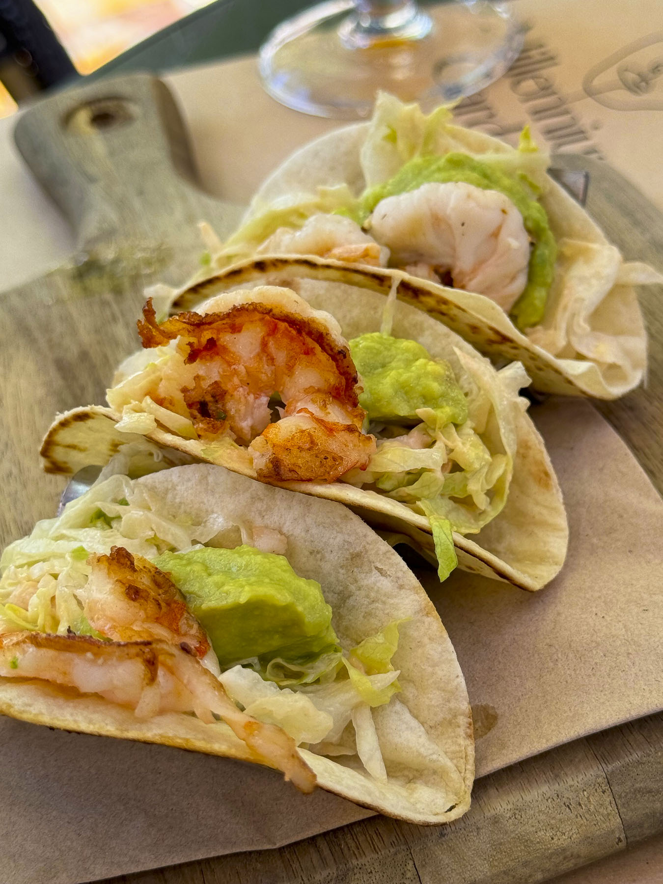
The weather refused to cooperate with our plans to explore the waterfront in Vlora, Albania’s third largest city, and we opted instead to have a quick lunch before driving on. Parking in this beach town can be particularly challenging, even in the shoulder season, and we opted for a cash-only, pay as you enter, parking lot. Surprisingly, the attendant was unable to break the bill we gave him, and he told us to wait as he disappeared around the corner at the end of the block in search of change. There were many expensive lunch options on the elegant, palm lined Rruga Aleksandër Moisiu, which hugged the beachfront in front of towering apartments. But this was lunch and it was just too dreary to sit outside. Fortunately, we stumbled across Taverna Dangëllia, a delightful place with an open grill, that was reassuringly busy on a weekday afternoon. We ordered a variety of traditional Albanian dishes, all delicious and inexpensive. Charmingly though, the one quirky thing about the place was the DJ, who fell asleep in his chair, as his music selections played on. Maybe Raki is the new melatonin.
While we were looking forward to some great views of the Adriatic from the route through the Llogara Pass, the grey day was challenging for landscape photography, and we decided to take a faster, more inland drive to Upper Qeparo along SH76. It was a more interesting drive than we had anticipated through the Shushices River Valley before crossing over the mountains to the Adriatic coast near Himarë.
We were zipping along when we suddenly passed a colossal arched memorial set back from the road. A quick U-turn brought us back to the Drashovica Monument. Erected in 1980, the monument was designed in the soviet art style that celebrates the collective effort and commemorates the Albanian resistance fighters who in 1920 liberated Vlora from the WW1 Italian occupiers who refused to leave, thereby defeating Italy’s plans to annex the country. The monument also commemorated the Battle of Drashovica in 1943, where communists and nationalist guerilla fighters united to defeat a larger German force, during a battle that lasted 20 days. Albania has a long history of fighting for its freedom, starting with Skanderbeg’s resistance to the Ottoman invasions in the 15th century and culminated with Albania liberating itself, without the help of the Allied armies, from Nazi occupation during WWII. Behind us an elderly man led a donkey down the embankment of the river toward the water.
Farther along we stopped at a narrow, suspended footbridge that hung over the river. It was a rickety lifeline to small hamlets tucked into the mountains across the river, the footbridge being their only route to the outside world. Though by the sheer number of sheep droppings at the beginning of the walkway it’s a fair assumption that shepherds move their flocks of sheep across it when they switch grazing pastures. That would have been quite a sight to see.
Just down from the bridge, set against a mountainous background, was a small cemetery with interesting headstones. Carved or etched into the granite blocks were photographic quality portraits of the deceased. Some were just tight headshots, while others were full length pictures that captured the individual in their traditional wardrobe. We found these stone tributes very moving.
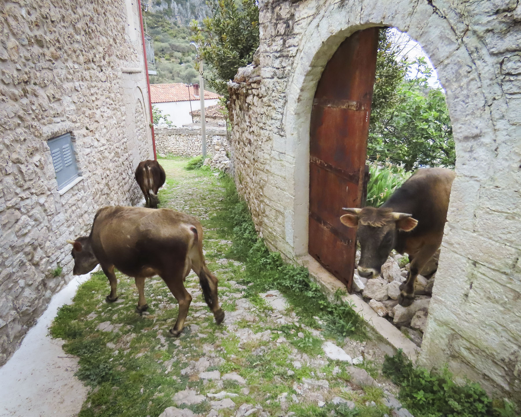
We passed several other footbridges in various stages of collapse, as if they had been caught in destructive floodwaters. There was also an ancient stone bridge in the village of Brataj that I wish we had investigated, but the footpath down to it looked a little too rough for us to navigate. Shepherds ushering their livestock across the road were frequent occurrences. Though the most memorable herder was the gal in pink slippers urging her sheep into a different pasture.
An Albanian standoff happened in the middle of a bridge as a herd of cattle stopped traffic in both directions and refused to budge from the double yellow line, their owner nowhere in sight to encourage them to mosey along.
On the coastal road a small directional sign warned of the approaching turn to Upper Qeparo. We hesitated to commit as the lane looked more like a driveway between two buildings than a road suitable to follow up into the mountains. We cautiously followed the narrow sinuous road, dotted with homes built into the steep hillside covered with ancient olive trees, uphill around blind curves. We began tooting our horn occasionally now to warn any oncoming cars of our presence, after barely avoiding a fender-bender moments earlier. It was difficult enough on this roughly paved track to reach the village and we speculated about the villagers’ hardships when they only had donkeys or horses to traverse the mountain.
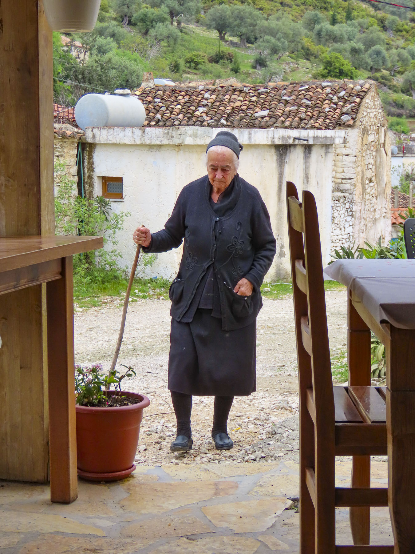
Somehow the host of the small guest house we had made a reservation with overbooked, and by the time we arrived all the rooms were taken. Luckily for us, her neighbor Veronika, the owner of Te Rrapi I Veronikes restaurant across the street, also rents rooms above the tavern, and had one available for the night. The room, although basic, was immaculate, and the gleaming floors were so clean we couldn’t bear to walk on them in our dusty shoes. We left our dirty footwear at the front door, and our hostess seemed to appreciate our nod to her high standards of cleanliness.
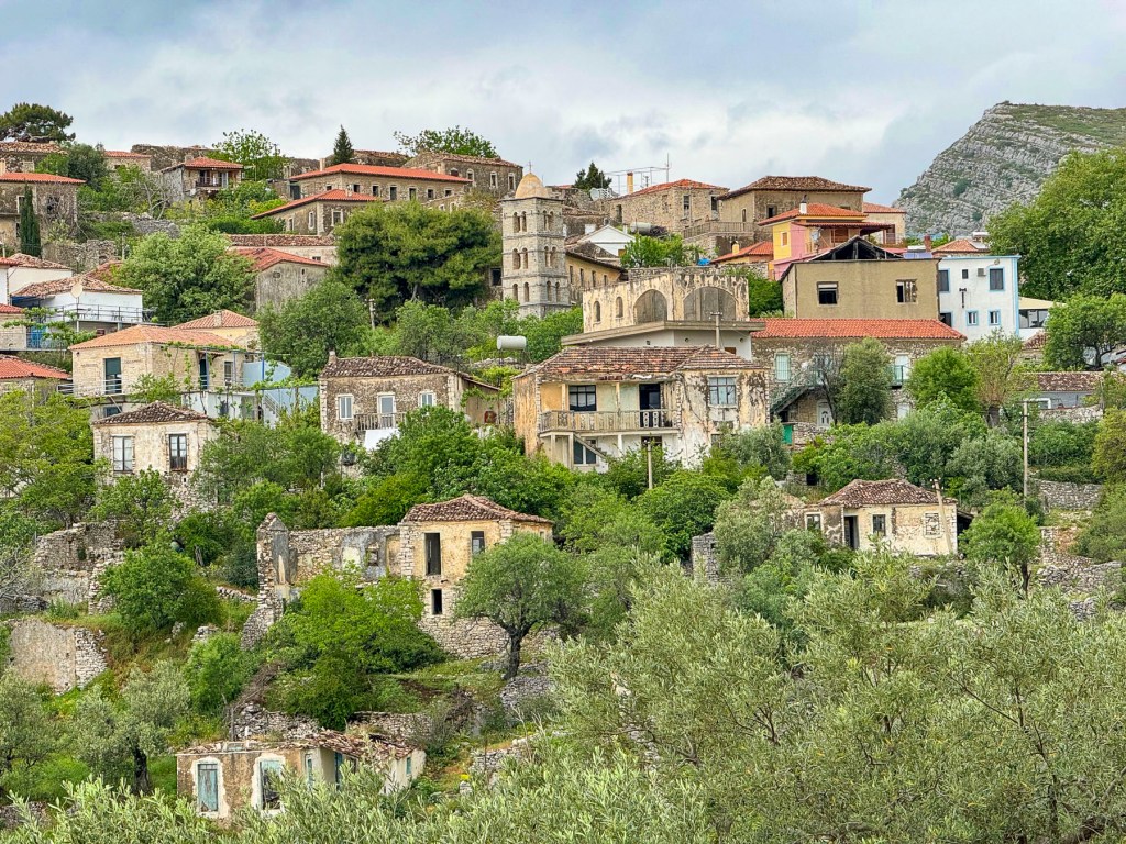
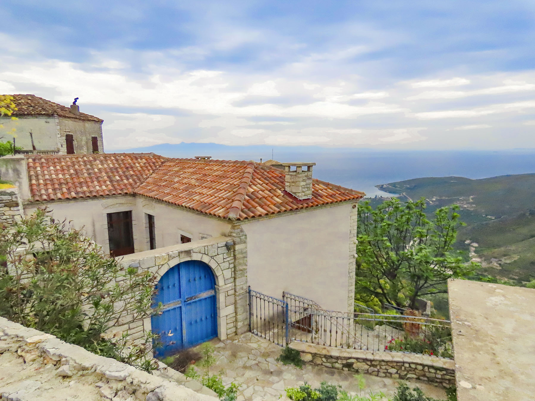
There was still plenty of time before dinner to explore, and we set off. The ancient village is set atop a 1500’ high haystack-shaped hill surrounded by steep mountains covered in scree, like an isolated volcanic island surrounded by ocean. Across the ravine on the outskirts of the village, the stone ruins of a small outpost called the Ali Pasha’s Tower, and the town’s cemetery above it, almost dissolved into the landscape in the late afternoon light. Mention of the ancient village first appears in Ottoman records of 1431, and then 1583 when it’s noted the village had 50 homes. Though archeological evidence unearthed at Karos Castle, just a short distance beyond the tower, suggests that the area has been inhabited since the Iron Age.
Sadly, the village has endured an exodus since the late 1950’s when the Albanian government built the road along the coast, thereby providing services and infrastructure to a new village, lower Qeparo, which boosted its residents’ economic prospects. The aftermath of Albania’s economic collapse in 1997 forced most of the remaining townspeople of Upper Qeparo to emigrate to countries in Europe or overseas for better economic opportunities. The old folks who stayed relied mostly on remittances from abroad to survive. The future prospects for Upper Qeparo are improving, with more tourists now frequently visiting this charming village, and former residents returning after years working abroad and reinvesting in it.
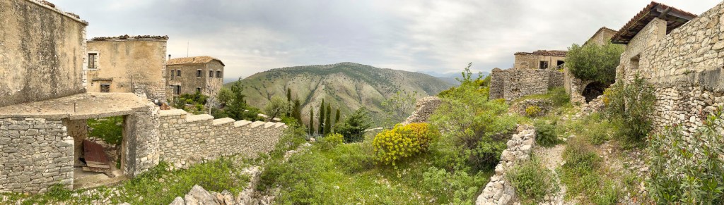
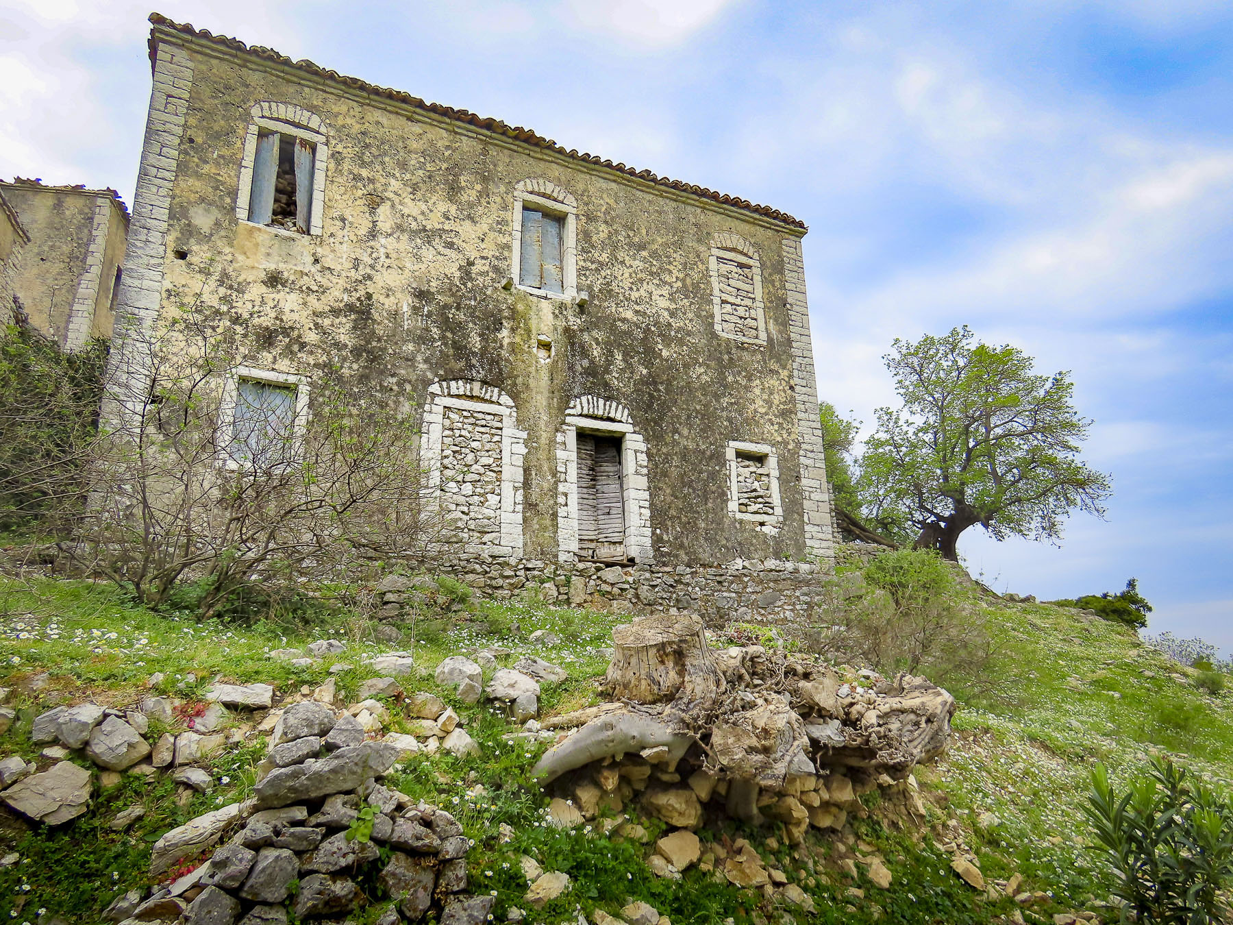
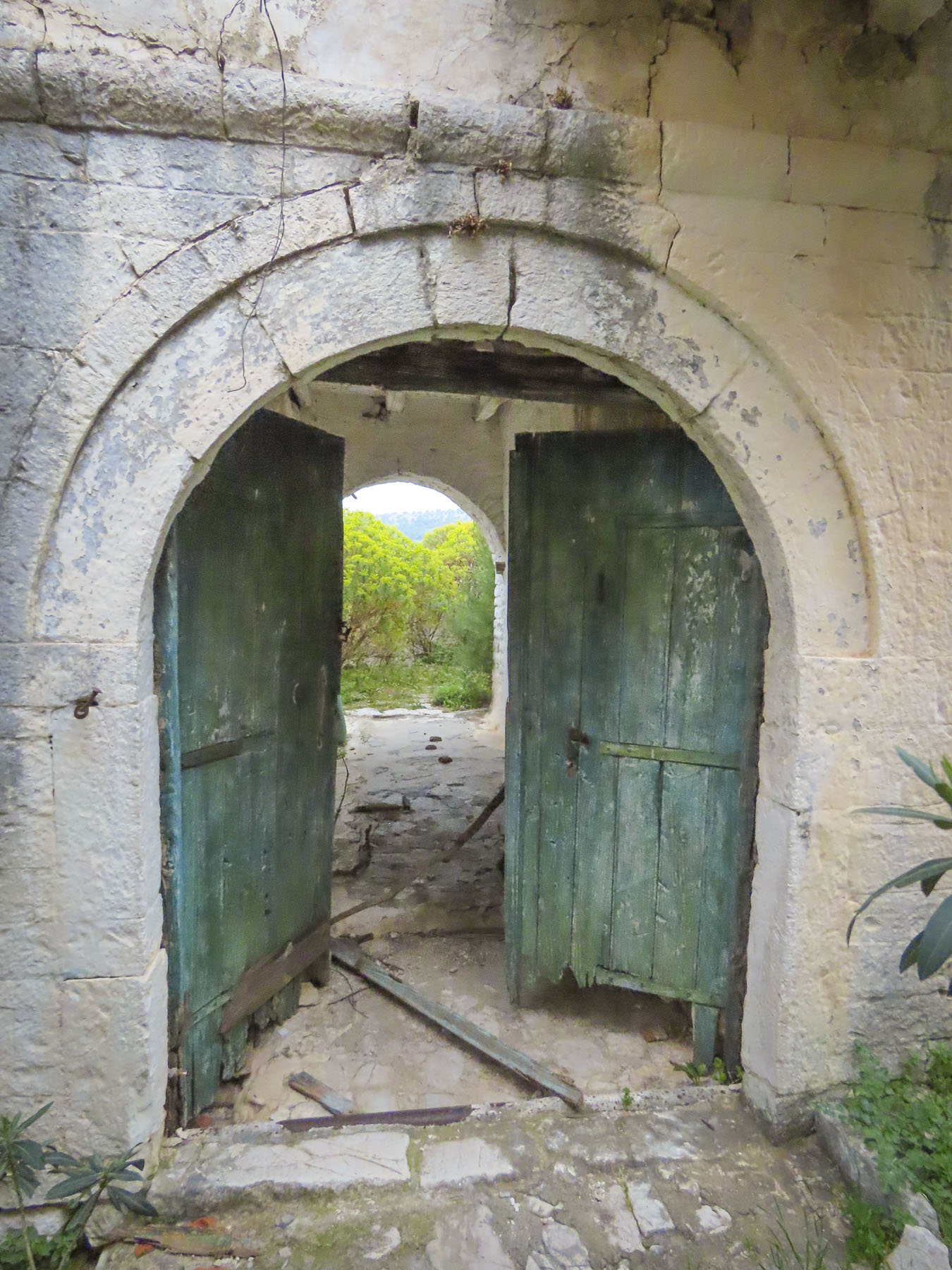
A large Billy goat commanded a boulder above us when we turned to wander the labyrinth of alleys that comprise the old town. Like a sentry, he eyed us but let us pass unchallenged. Occasionally we cut a path through abandoned homes with their roofless rooms opened to the elements, carefully placing our steps to avoid falling through any deteriorated floor beams. Sometimes we passed a freshly painted door boasting new brass hardware. A look up revealed new windows and a renovation proudly underway.
Farther along a cow, chased by her owner, entered the alleyway through the door of a long vacant home. The interior opened to the sky, and grass as thick as pasture grew where the floor used to be. Every now and then, between the buildings, we glimpsed distant views of the Adriatic Sea far below. Fig trees opportunistically grew through open windows, and untended olive trees arched over our heads. A few teenagers lazily kicked a soccer ball against the belltower base of St Mary’s Church, constructed in 1796.
Veronika didn’t offer a menu, but she enthusiastically invited us back into her kitchen where she explained the traditional dishes that she had created that day for dinner, and we were not dissappointed. Later, on the restaurant’s veranda, we capped a great day with a splendid dinner and glasses of Veronika’s husband’s homemade raki. We slept well.
Moments before we had just flown over a crescent-shaped beach, its thin strip of sand brilliantly separating the rich, inviting blues of the Adriatic Sea from the verdant land of the Albanian coast. What we didn’t expect as we continued our descent was just how mountainous the terrain was. This turned out to be a characteristic of the land that we enjoyed tremendously, after realizing there really aren’t many straight roads in the country, and we’d be spending most of our three weeks in Albania driving winding through its mountains.
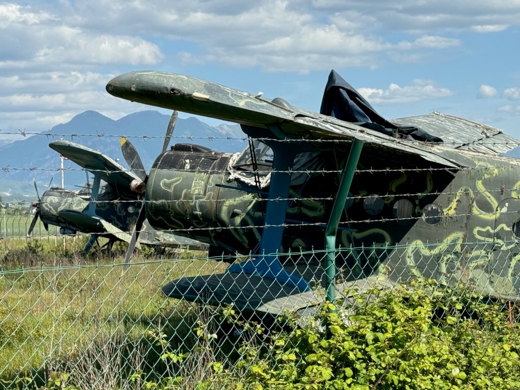
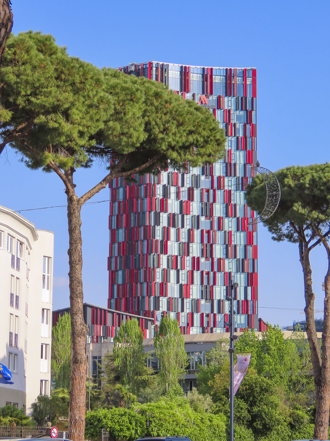
It was mid-April and 80F/26C as we sat outside the airport terminal enjoying coffees and the unseasonably warm day. “Do you really think you’ll need the thermal underwear you packed?” Donna chided, with a smile. “We’ll see,” I responded. At the rental car counter across the street, we reviewed our paperwork for the sedan and received the document we needed to drive the car into North Macedonia later on during our trip. “Now you have a city car, don’t drive on any restricted roads. The car has GPS tracking, and you will be fined if you do,” the rental agent explained. While we were aware that Albania did not have the best road infrastructure, we were not aware of road restrictions. We asked for a map showing the forbidden routes, but the agent didn’t have any, nor could he explain all the routes restricted. “Use your best judgement, if it’s a gravel road you should probably avoid it.” Which was not very helpful considering we’ve had lots of experience driving sedans to destinations that folks have said, “you’ll never make it there in that.” The rental agent also related that Albanians are very friendly, but terrible drivers. “Drive defensively!” he warned. We set off. My map app is set to default to no highways, and we followed a route along the perimeter of the airport, which also serves as an Albanian Air Force base, past a row of rusting, derelict MiG fighter jets and, for those aviation enthusiasts, several Antonov An-2, a legendary soviet bi-plane, first flown in 1947.
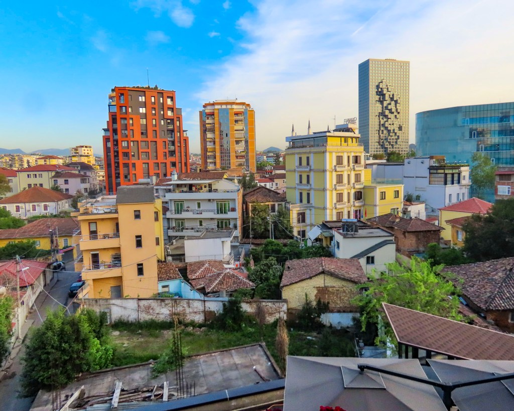
It was an interesting serpentine route through fields of grazing sheep, the roadway sporadically lined with irises in bloom, flowering orange trees, their scent filling the air, and fig trees laden with newly set fruit. Groups of old men sat at tables playing cards and dominos in vacant lots between mansions and shacks. A psychedelically painted, cold war era tank commanded a park along the road. As it neared the end of the workday and we got closer to Tirana, the roads became congested and wild, with drivers ignoring traffic signs and rules. Often it felt like a game of chicken with oncoming cars zipping into our lane to weave around creatively parked cars. Motorcycles were driven on sidewalks. Numerous speed bumps were the only deterrent preventing the roads from becoming the Daytona 500. In decades past, Tirana was a small town with an ancient footprint. It managed well enough during the country’s communist era when few people had the resources to buy cars. But now the city’s arteries are clogged and it’s ready for permanent gridlock due to the current number of vehicles.
With a car, there is always parking to take into consideration, and we lucked out with Lot Boutique Hotel, located on a narrow side street in the center of Tirana, because it had a small parking lot. The hotel recently had been nicely refurbished and was the perfect base for our wanderings around Tirana, the capital of Albania since 1920. Later after resting – jet lag affects us more as we age – we asked the front desk for recommendations for a traditional Albanian dinner. The young receptionist suggested two places: Ceren Ismet Shehu, a contemporary restaurant located behind the low ancient walls of Tirana Castle, in an area smartly repurposed for shopping and dining. And in the opposite direction Oda – Traditional Albanian Restaurantnearer the traditional daily market. We ended up eating at both on different nights. Each was excellent, but we preferred the simple, laid-back ambiance of Oda, its homestyle cooking, and inexpensive menu.
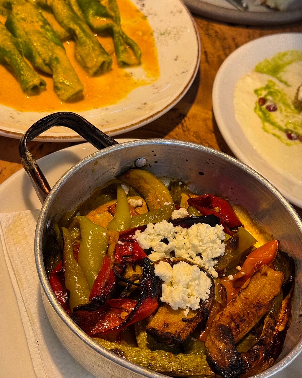
We’ve enjoyed all the cuisines of the different countries we’ve visited over the years, but surprisingly and refreshingly in Albania we found it very easy to eat a well-balanced meal. French-fried potatoes served automatically in other countries were replaced with the Albanian trilogy of lightly grilled vegetables: peppers, eggplants, and zucchini. And the customary salad of cucumbers, and tomatoes with brined cheese were always good. Grilled meats and fish were expertly prepared, though it was also easy to be a vegetarian sometimes and indulge in a variety of eggplant dishes.
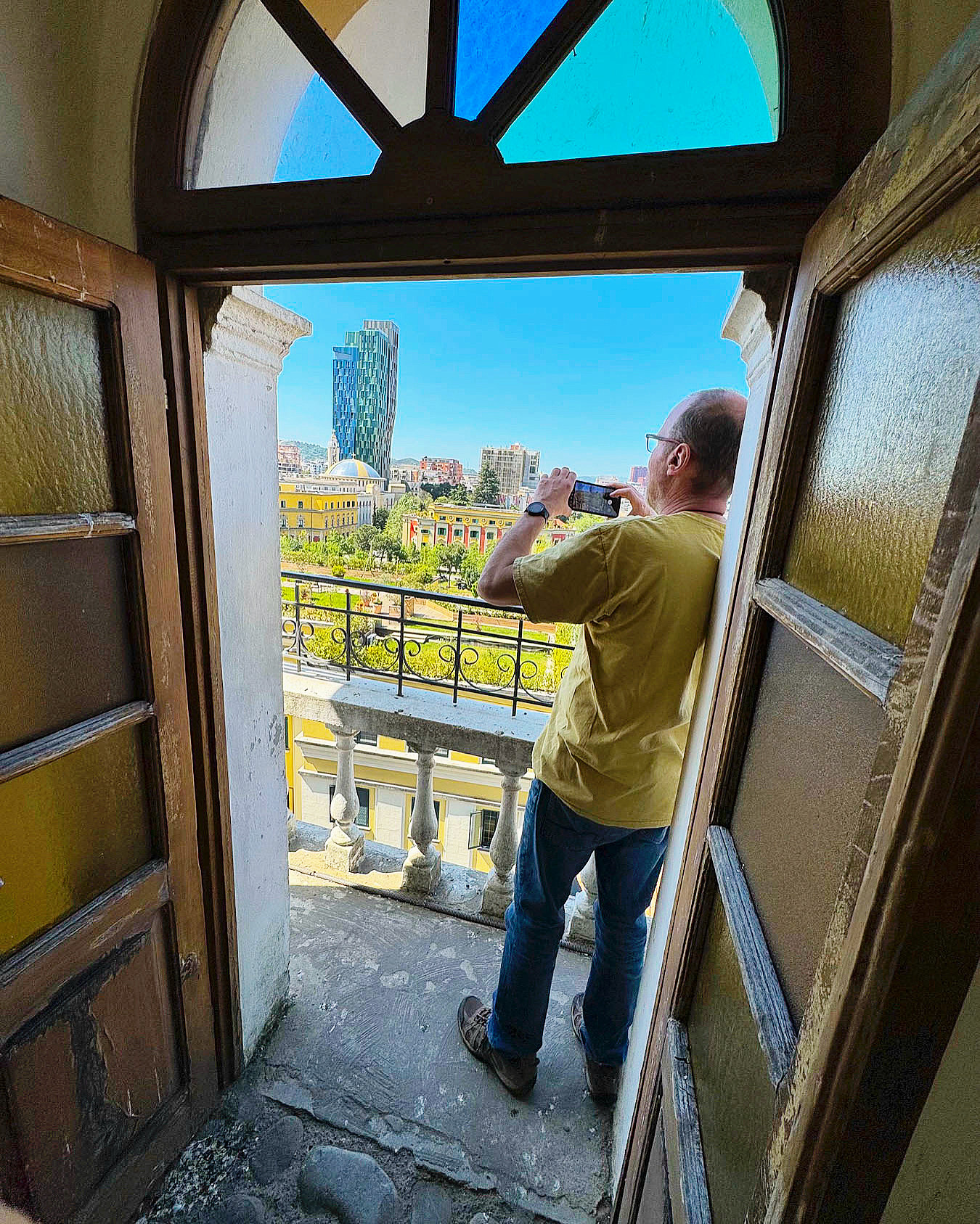
The next morning, we headed to Skanderberg Square. Next to the Et’hem Bey Mosque, built in the early 1800s, but closed during the anti-religion decades of communism, we climbed 90 steps to the top of the 115-foot-tall Clock Tower of Tirana. For decades during the 19th century, the tower was the tallest structure in Tirana. Unfortunately, its once 360-degree view has been hemmed in by the rapid construction of new buildings nearby, but it did have a view over Skanderbeg Square, and the rooftop garden atop Tirana City Hall.
Before its renovation the plaza was a traffic circle with one side hosting a larger-than-life statue of Stalin and the other side a colossal 30ft tall sculpture of Albanian’s paranoid and isolationist communist leader Enver Hoxha. The 1991 student protests on the square, along with other demonstrations across the country, helped bring an end to 46 years of repressive communist ideology and failed economic policies. Stalin’s statue was replaced with a heroic sculpture of Skanderbeg, the 15th century nobleman who rallied Albanians to repel Turkish rule and defeated 13 Ottoman reinvasion attempts.
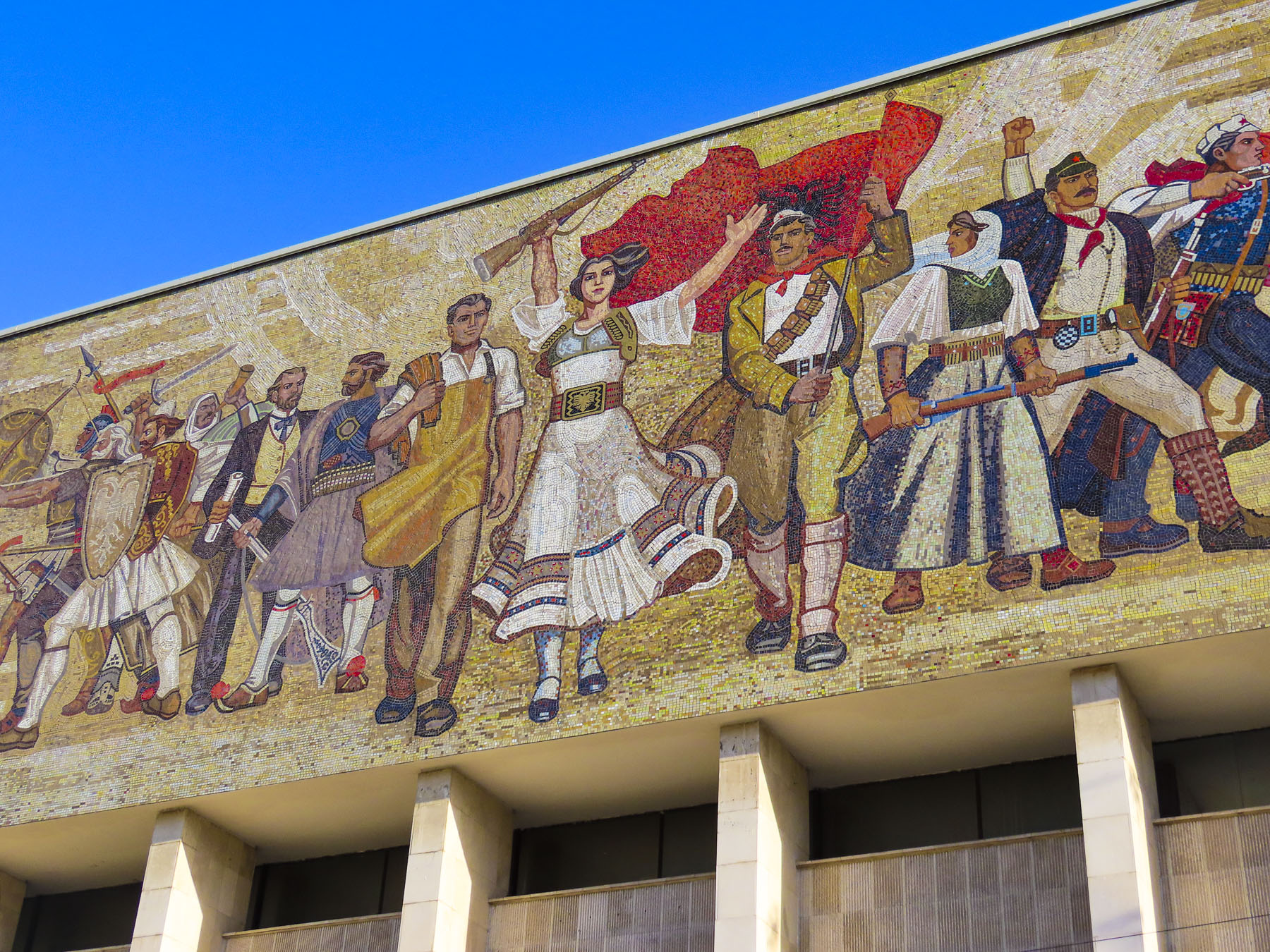
Hoxha’s statue was replaced with a public toilet. Centuries of conflict and resistance have defined Albania’s history and is reflected in a large, emotive mosaic above the entrance to the National Historical Museum. The Palace of Culture, the Opera & Ballet Theatre, and several government ministry buildings, designed by Italian architects in the 1930s, also line the square. Surrounding the plaza, an array of new construction projects are rapidly changing Tirana’s skyline. The city is having its moment as tourists rediscover this once isolated country, with its paranoia of the west, and shunned by its communist neighbors.
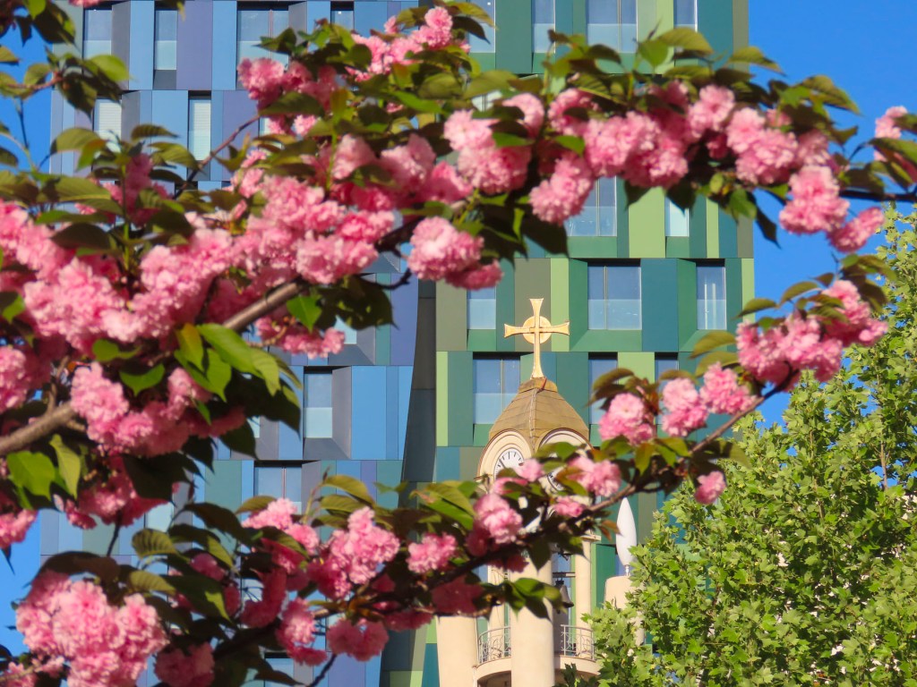
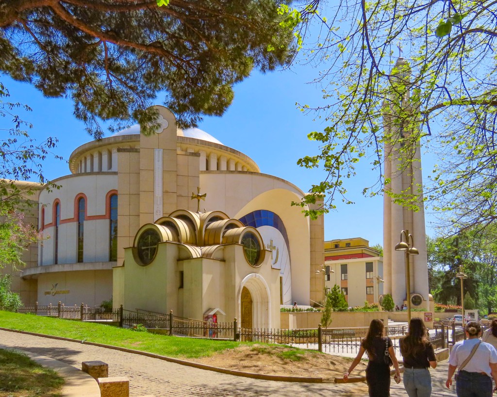
Spotting a belltower through the trees, we headed to the Resurrection of Christ Orthodox Cathedral, built between 1994 and 2002 to celebrate the revival of the Albanian Orthodox Church. It is one of the largest orthodox churches in the Balkans, and is a testament to a renewal of faith that had been outlawed under communism, when churches and mosques were destroyed or desecrated, after Hoxha proudly proclaimed Albania “the world’s first officially atheistic state.” The church is dedicated to the apostle St. Paul, who is believed to have founded the Christian community of Durrës, on the Albanian coast, during the 1st century AD.
We wandered through Rinia Park, a popular green oasis in the center of the city that is known for its Taiwan Musical Fountains, which were unfortunately still winterized when we visited. Afterwards we headed to Rruga Murat Toptani, a shady, treelined pedestrian-only lane with many outdoor cafes and restaurants, offering traditional Albanian food and various international cuisines. We enjoyed a light lunch and a local craft beer under the shade of a sun umbrella at the Millennium Garden.
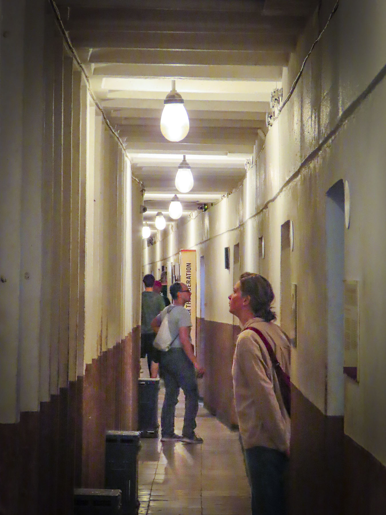
Bunk’Art2, an eye-opening reminder of the perils of the despotic leader, Enver Hoxha, and the communist police state he created in order to stay in power for forty years, was nearby. It’s a large nuclear bomb-proof bunker in central Tirana, that was connected to various government ministries with tunnels for top officials of the regime to escape through. It was also an interrogation center for the Sigurimi, Albania’s Communist-era secret police force, which spied upon the country’s citizenry, and imprisoned anyone considered an opponent to Hoxha’s policies or authoritarian rule. Across the country 23 prisons were built to imprison 17,900 political prisoners.
Thirty Thousand people were sent to internment camps, and it’s believed over 14,000 were killed, died or worked to death from forced labor, often in dangerous mines. 6,000 are still missing. Often it was not just the individual who was jailed that suffered, but his family would be surveilled for years afterward, and his children would be denied educational opportunities. In Tirana the secret police kept 4,000 people under constant surveillance. The border was heavily patrolled with guard dogs and soldiers authorized to “shoot to kill,” as anyone trying to escape the country was viewed as an enemy of the state, and punishable for treason.
Only the most loyal communist families were allowed to live along the borders. Small villages were forcefully abandoned. The villagers were sent to larger cities were it was easier for the Sigurimi to watch for dissent. The mushroom shaped dome above the entrance to Bunk’Art 2 is symbolic of Hoxha’s paranoia, which manifested as a building campaign to construct an amazing 175,000 + bunkers of various sizes, across the country. Most of them are only big enough for 2-3 people, but they were placed in strategic spots along Albania’s borders to protect the country from foreign invasion, not only from the western powers, but also from Yugoslavia or the USSR. Others were placed in the mountains, farm fields, road intersections and parks, with the intention that Hoxha’s loyalists would man them in a time of crisis. The irresponsible cost of building the bunkers, from which shots were never fired, diverted Albanian funds away from other needed projects and ensured Albania’s position as the poorest country in Europe. The communist government collapsed in 1991, and in the following years, more than 700,00 Albanians emigrated to find better opportunities in Europe or farther afield. Remittances from the Albanian diaspora to family still in the country amount to 14% of Albania’s Gross Domestic Product.
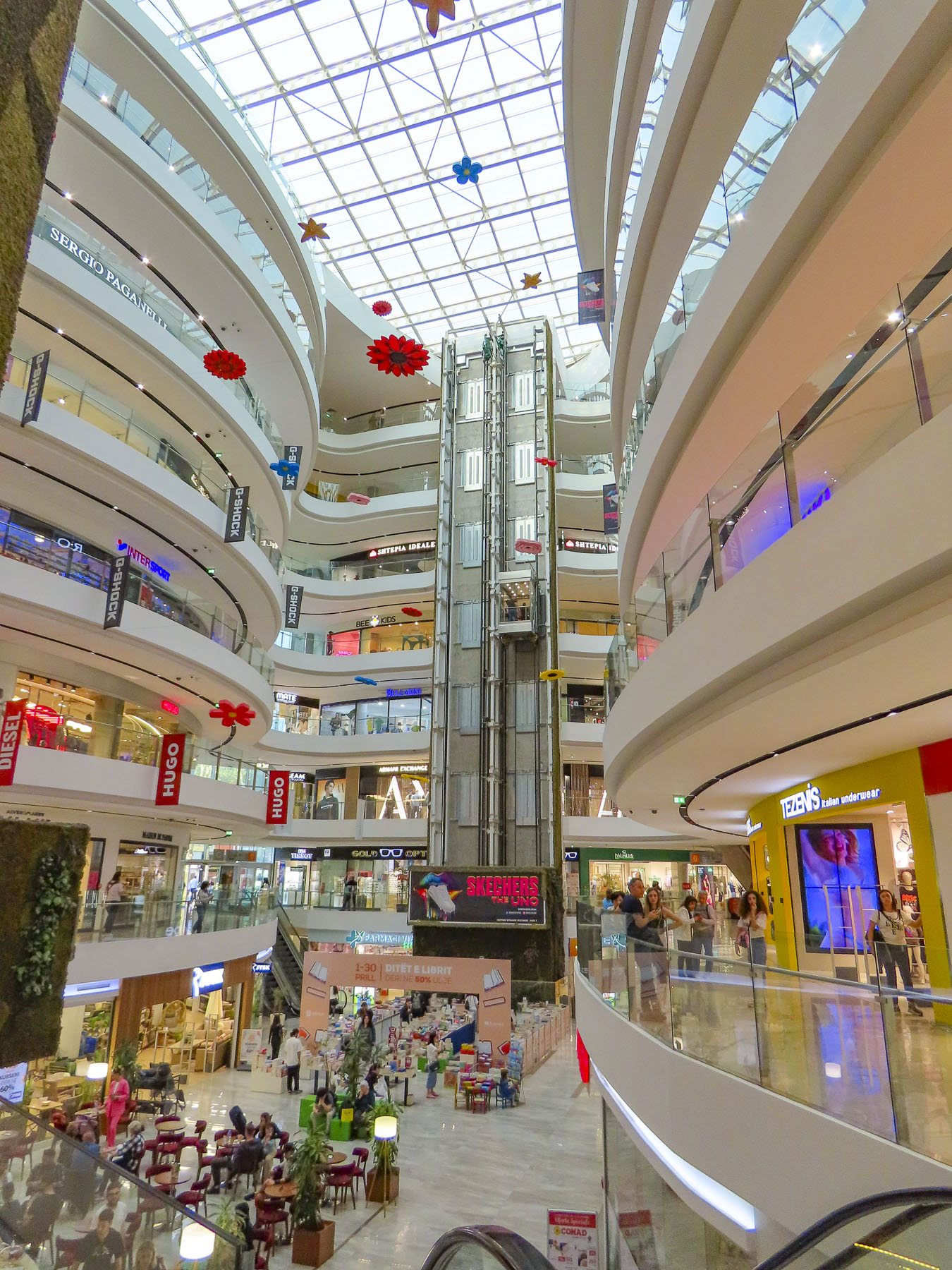
Our eyes needed a moment to adjust after resurfacing from the labyrinth of Bunk’Art 2, but if the construction boom underway in Tirana is an indication, Albania has thrown off the shackles of its communist past and is embracing the prospects of an exciting new future. Heading back to our hotel for a short rest before going to dinner we detoured into the Toptani shopping mall. A nine-story tower dedicated to the “shopping therapy” philosophy of capitalism.
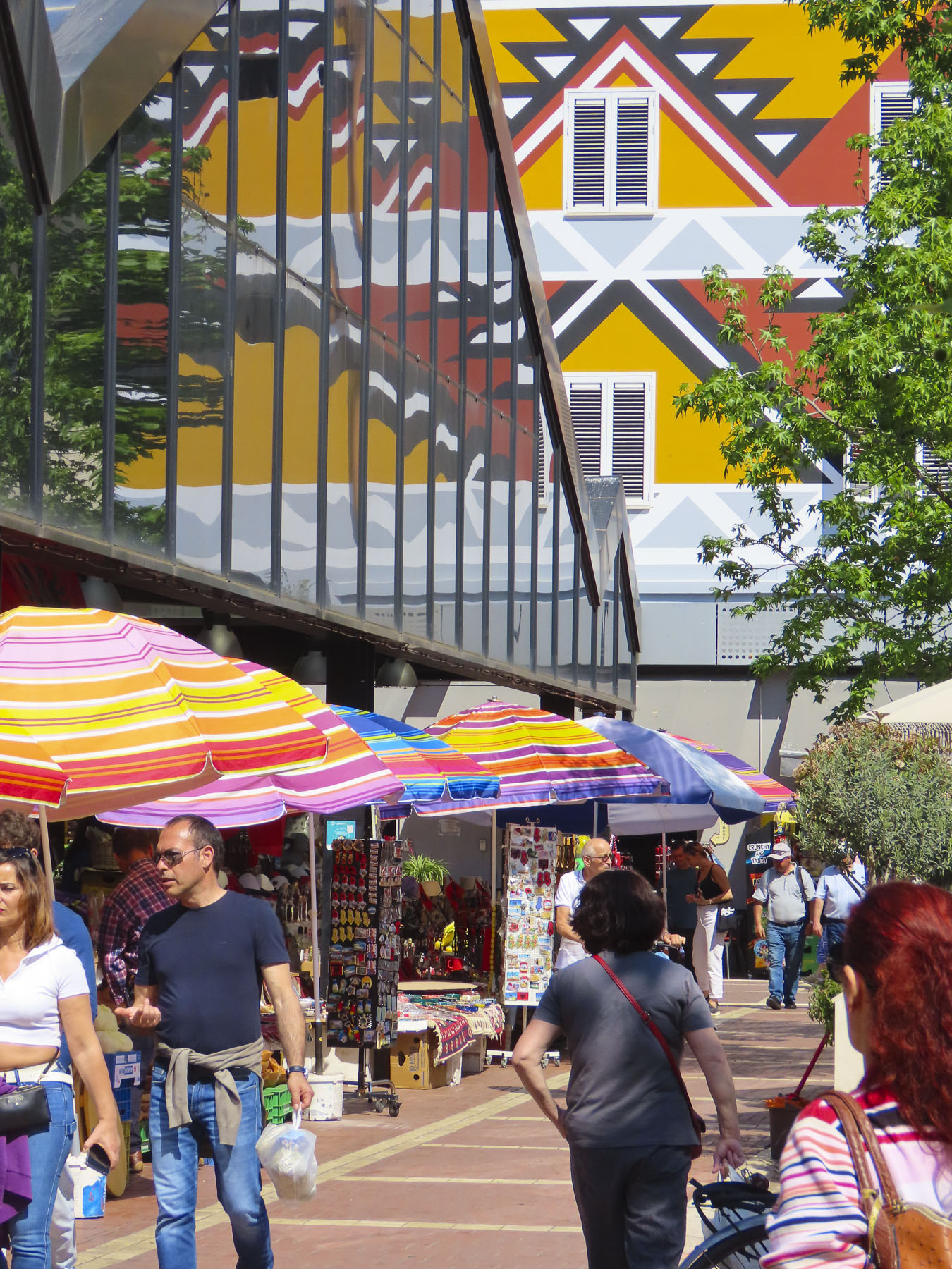
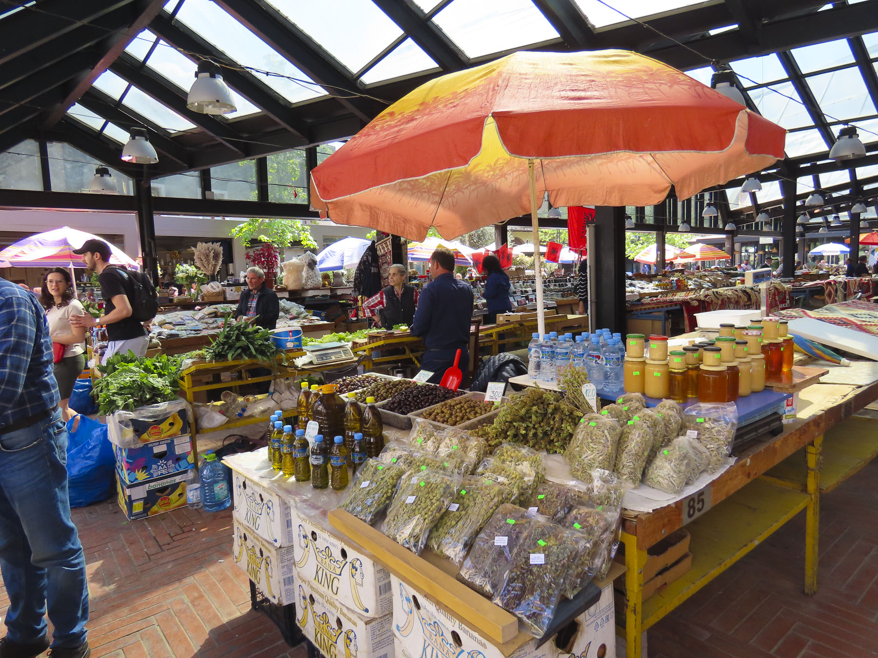
The next day we headed to the New Bazaar market area, only a five-minute walk from our hotel. On the way we passed impromptu sidewalk vendors, their crops and merchandise displayed on blankets or sheets of cardboard on the street, hoping to make sales to folks before they reached the daily market. The covered bazaar centers a plaza surrounded by restaurants, cafes, cheese shops and butcher stores. Under its roof, stands filled the space with vendors selling vegetables, olives, honey, and fruit. Women crocheted wool socks as they waited for customers. We browsed tables piled with rugs, displays of tools, pottery, vinyl records, and books, along with knickknacks, questionable antiques, and surplus Albanian army helmets. The time flew by.
Tirana is a wonderful, midsize cosmopolitan city with a population of 375,000 people, with many parks, tree lined streets, and older buildings, mostly under five stories tall. New high-rise buildings rise from the old neighborhoods across the city. It was an interesting and delightful place to wander around.
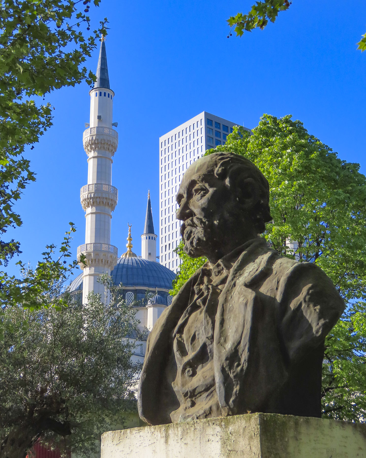
We passed ruins of Tirana Castle’s ancient defensive wall, dating to the 1300s, in the park next to Namazgah Mosque, the Great Mosque of Tirana. Completed in 2019, the mosque is currently the largest in the Balkans, and capable of holding 5,000 worshippers. The Muslim community was also persecuted under Hoxha’s anti religion policies, with many religious leaders killed or imprisoned, and 740 mosques destroyed around the country.
Nearby stood the 18th century Ottoman era Tanners’ Bridge, a stone arch across the Lana River that was used by farmers to bring produce into the city and livestock to the butcher shops and tanneries along the river. Farther away we crossed the ETC Bridge, a beautiful pedestrian only walkway over the Lana that is also a free wifi hotspot. The city’s tallest skyscraper, Downtown One, a 37 story, mixed used building with a very distinguishable cantilevered and recessed façade, stood in the background.
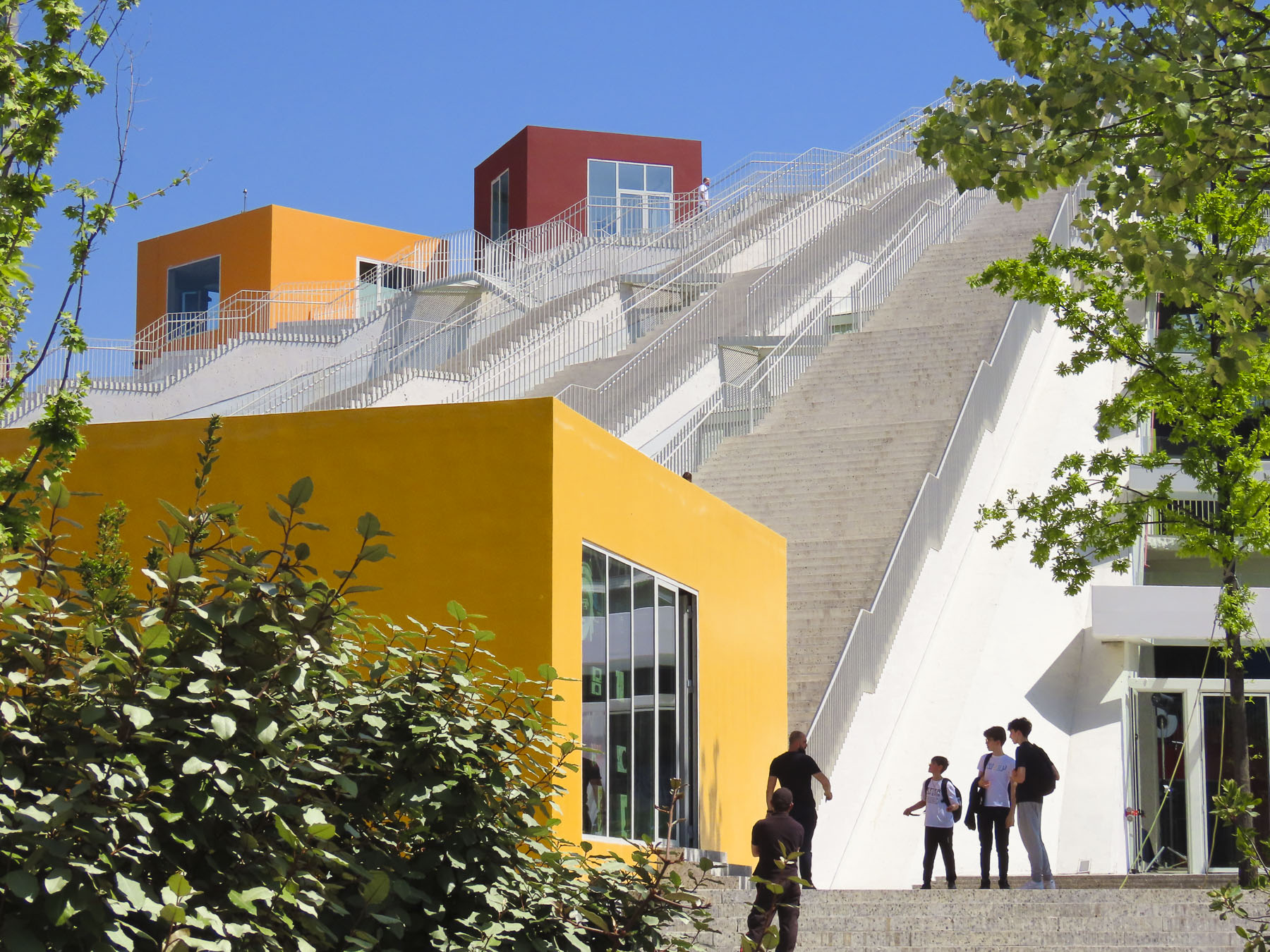
Our destination was the Pyramid of Tirana. Planned by Hoxha to be a memorial to his legacy as the Enver Hoxha Museum, covered in gleaming white marble, it opened in 1988, three years after his death. It was designed by Hoxha’s daughter and her husband and at the time of its construction thought to be the most expensive structure ever built in Albania.
Most likely forced prison labor and compulsory labor were used for parts of the project. With the collapse of the country’s last communist regime in 1991, the museum was closed and the space repurposed as a conference center, then a NATO base. It eventually fell into disuse and was vandalized, and its marble covering stripped away. It was finally reincarnated as an IT youth center with classrooms housed in colorful blocks attached on its slope, and 16 staircases leading to the viewing platform atop its 70ft high summit. We climbed to the top and enjoyed the panoramic view.
A short distance away, Hoxha lived in a modest villa in the Blloku neighborhood. It was a secret district during the communist era, with housing reserved for the party elite, with entry forbidden to anyone else, and its road did not appear on any maps.
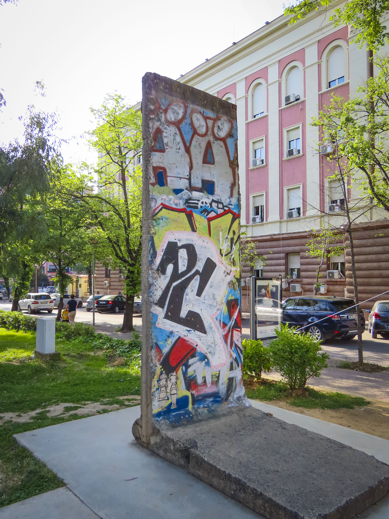
The Checkpoint memorial stands in the park down the street from his residence and features a bunker, iron mine shaft railings from the infamous Spac prison, and a section of the Berlin Wall. Subtle reminders of the brutality of communism.
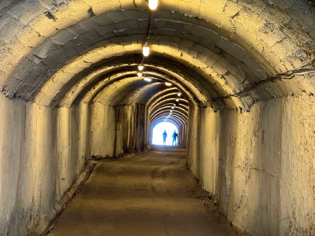
For our last day in Tirana, we decided to head to the outskirts of the city to check out Bunk’Art1 before continuing into the mountains to Bovilla Lake. It’s easy to miss the turn into the long single-lane tunnel that leads to Bunk’Art1, an appropriate entrance to explore Albania’s past. After walking through a seemingly forgotten park, we entered a non-descript door in the side of an overgrown slope that hides the extensive maze of corridors and rooms of Hoxha’s secret command center.
We followed a short corridor to the nuclear blast proof doors set in walls 6ft wide, and into a decontamination room. We were five stories underground in the foothills of Dajti Mountain, near the village of Linzë. There are no windows, the lights flicker, and a sign warns the power could go out at any time! It was a massive facility designed to shelter hundreds of Hoxha’s military and communist comrades, for six months, during any war.
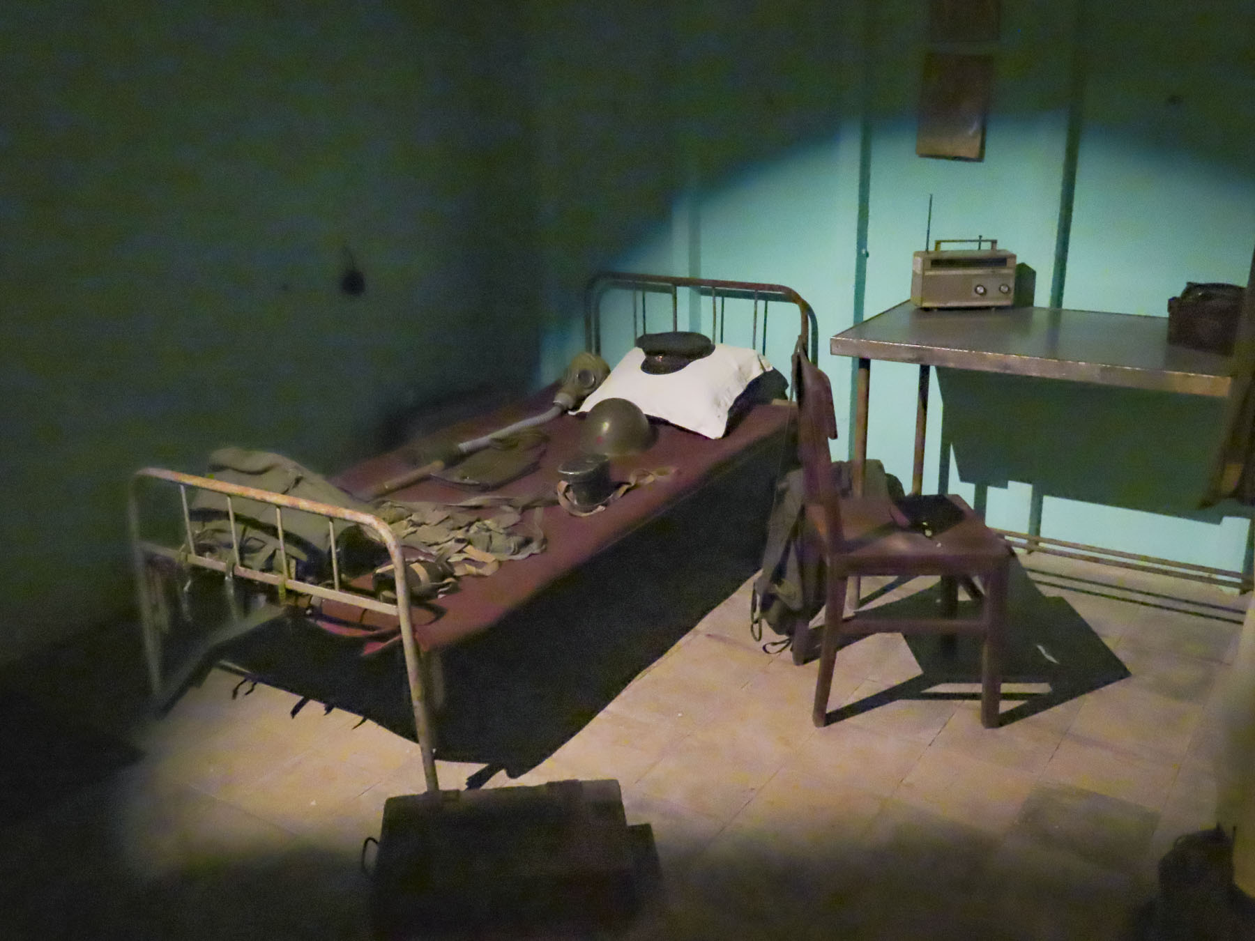
In Hoxha’s private quarters, we picked up a phone and listened to a recording of his voice. It was a sparse apartment, more prison cell than home, that lacked any warmth. Obviously, his wife wasn’t consulted. Other rooms displayed vintage equipment and weaponry. The isolation of having to live in this depressing environment would have been psychologically damaging; fortunately, the structure was never needed for war-time use and since 2014 it’s been a museum explaining Albania’s history from liberation by the partisans during WWII through Hoxha’s communist regime. The exhibits use amazing photographs and examples of nationalist propaganda from the country’s archives to great effect. The bunkers’ large meeting hall now hosts concerts and art exhibits. Emerging from the darknes,s an amazing number of different bird calls filled the air, as if welcoming us back to the present.
Following our map’s apps instructions we followed a confusingly serpentine route across the rolling hills outside Tirana before reaching the road, SH53, that led to Bovilla Lake. In the beginning the paved asphalt road was fine, but after a while abruptly changed to graded gravel. Nothing unusual here. Though the farther we traveled into the countryside, we passed fewer cars; rather, we saw large dump trucks, laden with stone from a quarry, headed towards Tirana, filling the air with dust. The road progressively worsened the closer to the quarry we got, as the weight of the trucks pulverized the road surface and created numerous potholes that we had to slowly navigate around. We thought several times about turning back, but we had driven through the Andes in Ecuador, with a sedan, on worse roads. While the going was slow and extremely bumpy, we did eventually make it to the lake, actually a reservoir, and more importantly, Bovilla Restaurant!
The views were astounding! The restaurant was full, with hikers and day trippers from Tirana. The food was good, the beer cold. It was a journey well worth the effort. The car rental GPS tracker did flag us, and we were fined for driving on possibly the worse road in Albania. Fortunately, when we returned the car eighteen days later, after some Albanian-style dickering, we were able to politely negotiate a reduction in the fine.
There were numerous speed traps on the highway leading out of Tirana and most of the times when we passed one, officers were writing out tickets, so we drove well below the speed limit. We were on the way to Berat and it was well past our usual morning coffee break when we spotted the colorful reflection of Bashkia Belsh’s waterfront.
After parking, we strolled along the Belshi Lake shorefront past small shops and some interesting street murals to the town’s boardwalk. Being a weekend, it was full of families with young children. To the delight of many, small rideable electric toy cars were available to rent, along with balloon, ice cream and cotton candy vendors. A small ferry boat took folks on a short cruise around the lake, while others enjoyed the fine weather and strolled along the boardwalk or sat under the umbrellaed tables of the restaurants that lined it.
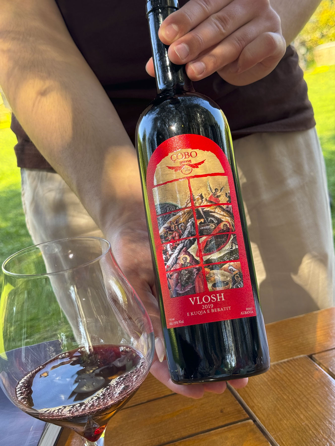
Closer to Berat we stopped at the Çobo Winery for a tasting that was accompanied by homemade cheeses and locally grown olives. Vintners of white, red, and sparkling wines and raki, they are regarded as one of the best wine producers in Albania.
It’s a small family vineyard with a 100-year tradition spanning four generations, that was sadly interrupted during the communist era, but since the 90s has grown production from 8,000 to 100,000 bottles per year. It was a nice break from our driving, and we enjoyed relaxing under the ancient olives trees in the their courtyard. The wines we tasted were very good and we purchased four to bring home in our luggage, and I’m happy to say they all made it back safely to the states.
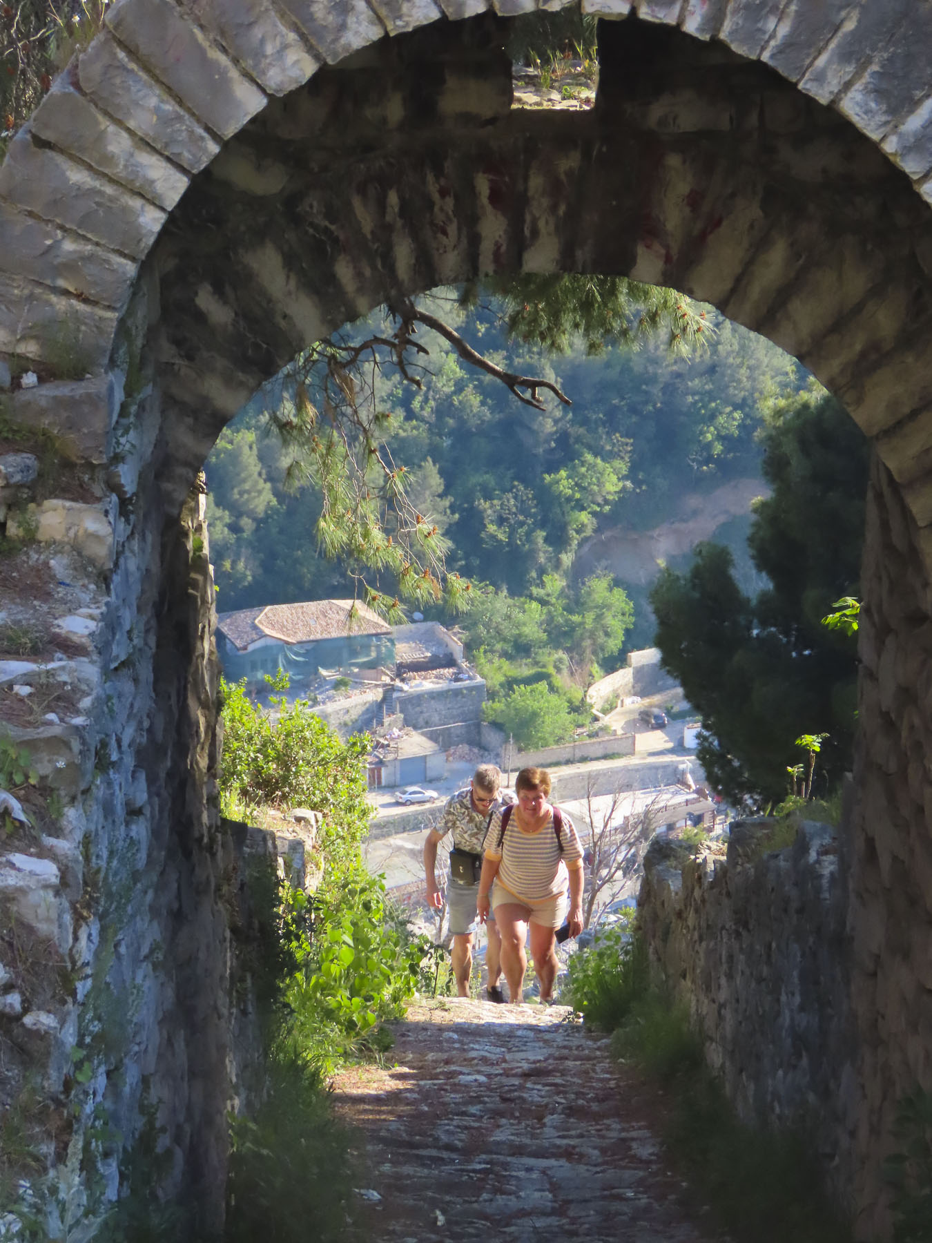
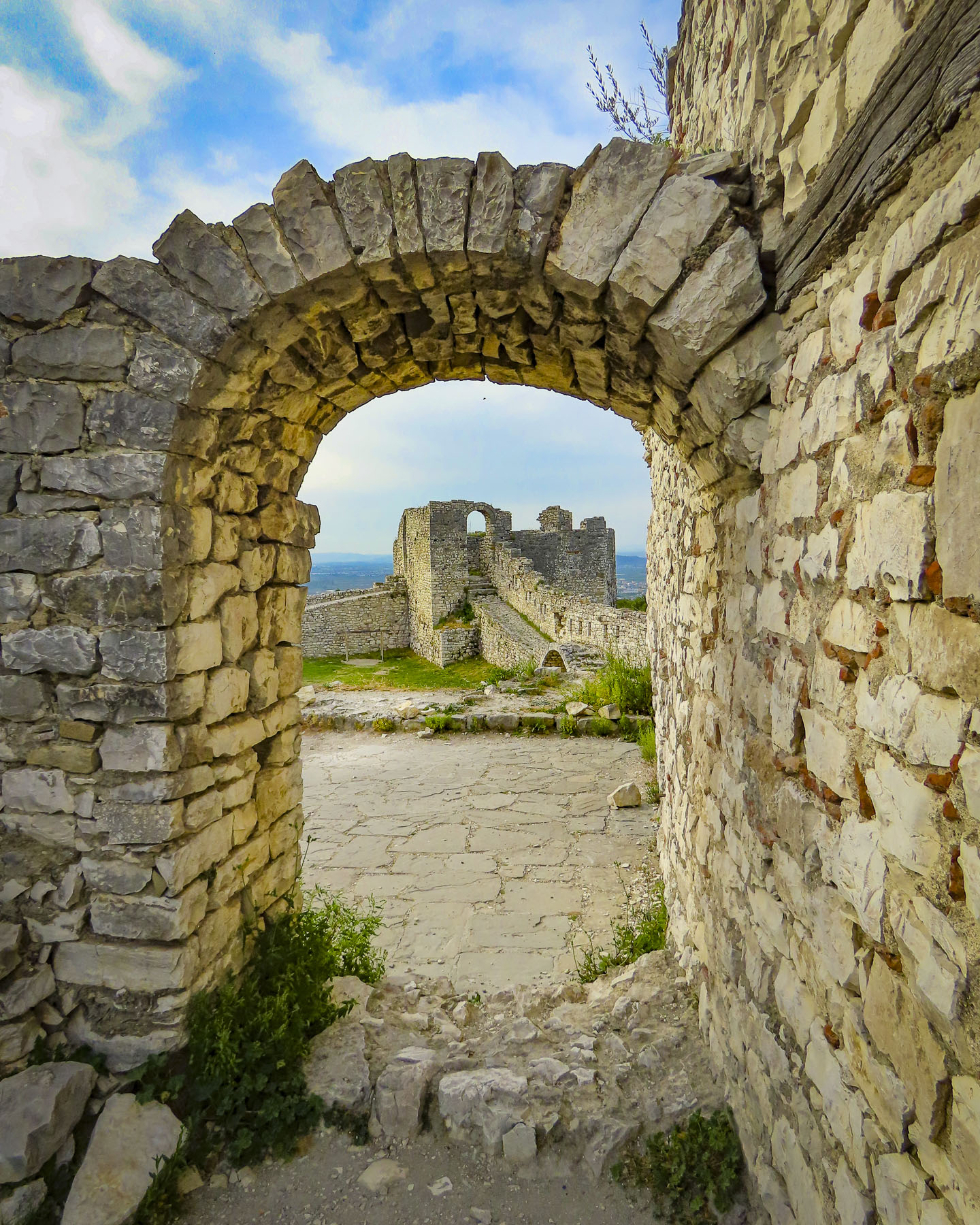
We reached Berat Castle just as the golden hour was approaching. We walked along its cobbled lanes, past homes surprisingly still occupied by about 400 people who live in 13th century citadel. But its history extends much farther back, with Roman records noting capture of the castle in 200BC. Archeological evidence shows the site has been inhabited since 2600-1800BC, making it one of the oldest settlements in Albania.
We worked our way to the overlook above Berat, passing the ruins of the Red Mosque, built in the 1400s after the Ottomans captured Berat, and Kisha e Shën Gjergjit, an orthodox church that’s been neglected since the communist ban on religion.
The panoramic view from the overlook out over Berat, the Osumi River below, and snowcapped 7900ft Mount Tomorri in the distance was stunning. Walking back along the ramparts we enjoyed watching an energetic dog race along the narrow top of the wall, chasing a stick his owner tossed up for him to retrieve multiple times. On the western slope of the castle, between the outer and inner defensive walls, Kisha Shën Triadha, a beautiful red brick, 14th century Byzantine church graces the hillside.
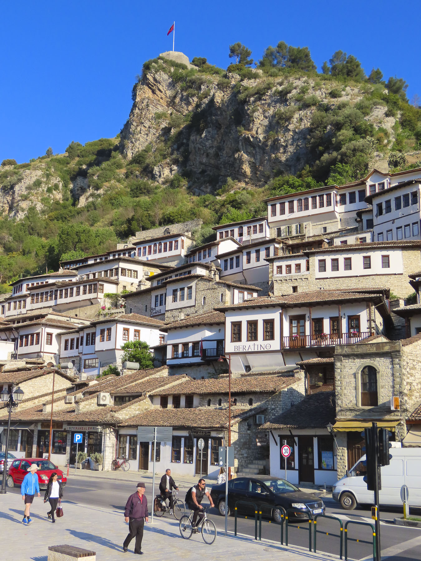
We wanted to stay on the “City of a Thousand Windows,” hillside under the castle, but didn’t want to drag our suitcases too far up the narrow alleys, and we had a car that needed parking. With those considerations in mind The Beratino Hotel fit our requirements perfectly and was great place to stay for two nights. Recently renovated, its stone and woodwork exemplified the best of Albanian craftsmanship. Still the shoulder season, in mid-April, I think were the hotel’s only guests.
Sated from our afternoon wine tasting we walked into the newer part of Berat, now a small city of 47,000, along the pedestrian only Bulevardi Republika, next to Lulishtja park. It had a lovely Neapolitan vibe, with families enjoying the Albanian tradition of “xhiro,” to stroll with friends, relax and enjoy the outdoors after dinner. At a small shop perfectly named Bakery & Food we purchased Burek, a traditional Albanian pastry made with various meat and vegetable fillings. We purchased their spinach burek, reputed to be the best in Berat, some even say the best in Albania. The quest for the best byrek, burek, or borek in Albania might be the catalyst for a return trip to the country. Back on the balcony of our room we enjoyed a glass of wine, and the burek was delicious.
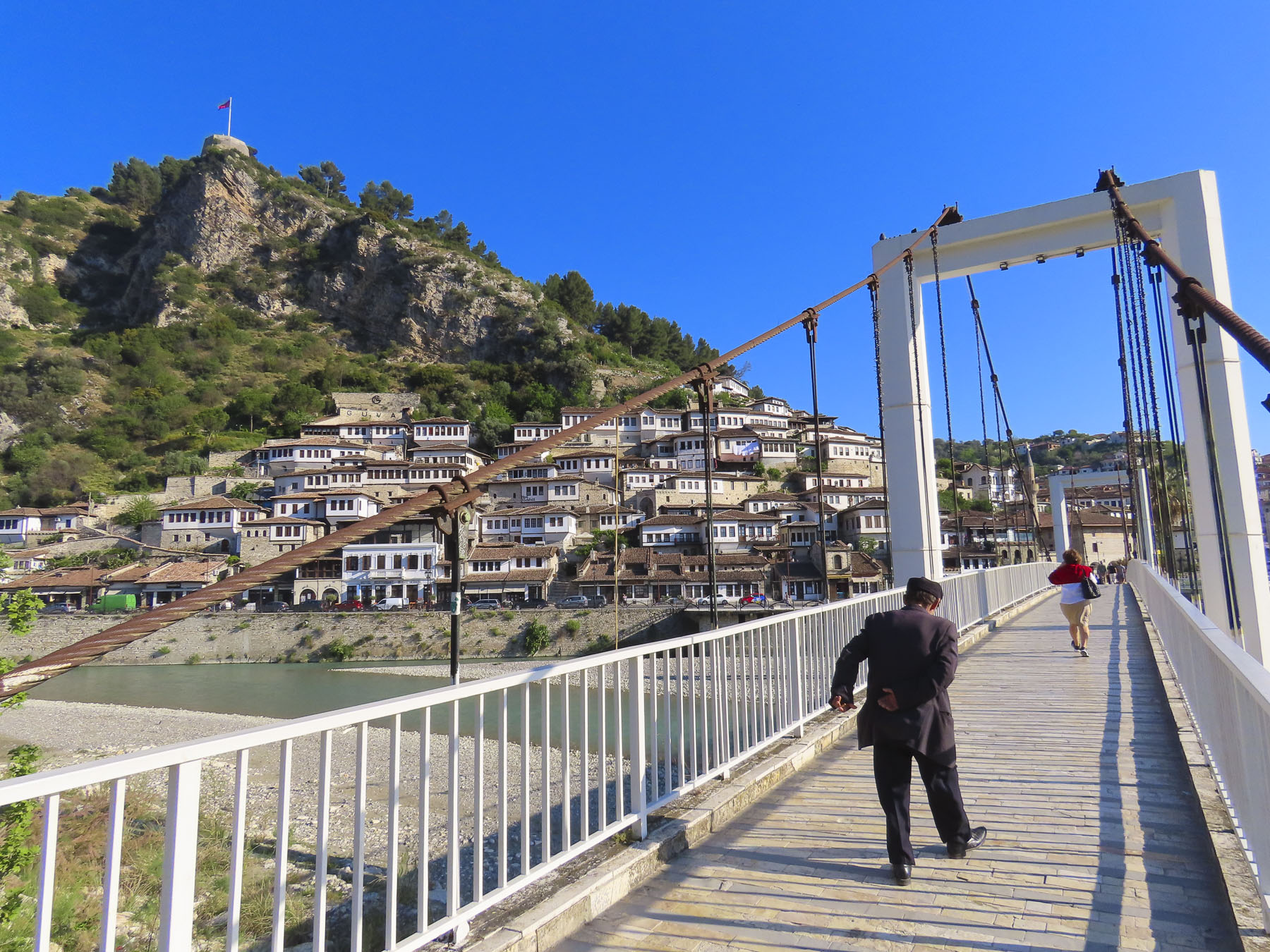
The next morning, we were up early and walked across the suspension bridge linking the old town with the southern Gorica “Little Village,” across the river. From this vantage point we spotted the Kisha e Shën Mehillit, St. Michael’s Church, an Eastern Orthodox Church, built on the steep rock face under the flag that flies above Berat. Thought to have been built in the 14th century, the setting of the red brick and stone church pricked our curiosity and we decided to hike there. The alley that led to the church was only a short distance away from our hotel but wound quickly up the hillside past homes and small inns.
We admired the strength of workers we passed carrying long wooden beams on their shoulders up the hill for a renovation project. We zigzagged higher up the hill, now looking down on the rooftops below, the trail looking like it hadn’t been trodden upon in ages. Unfortunately, the sanctuary was closed, but the views of the church with the river and mountains were well worth our effort.
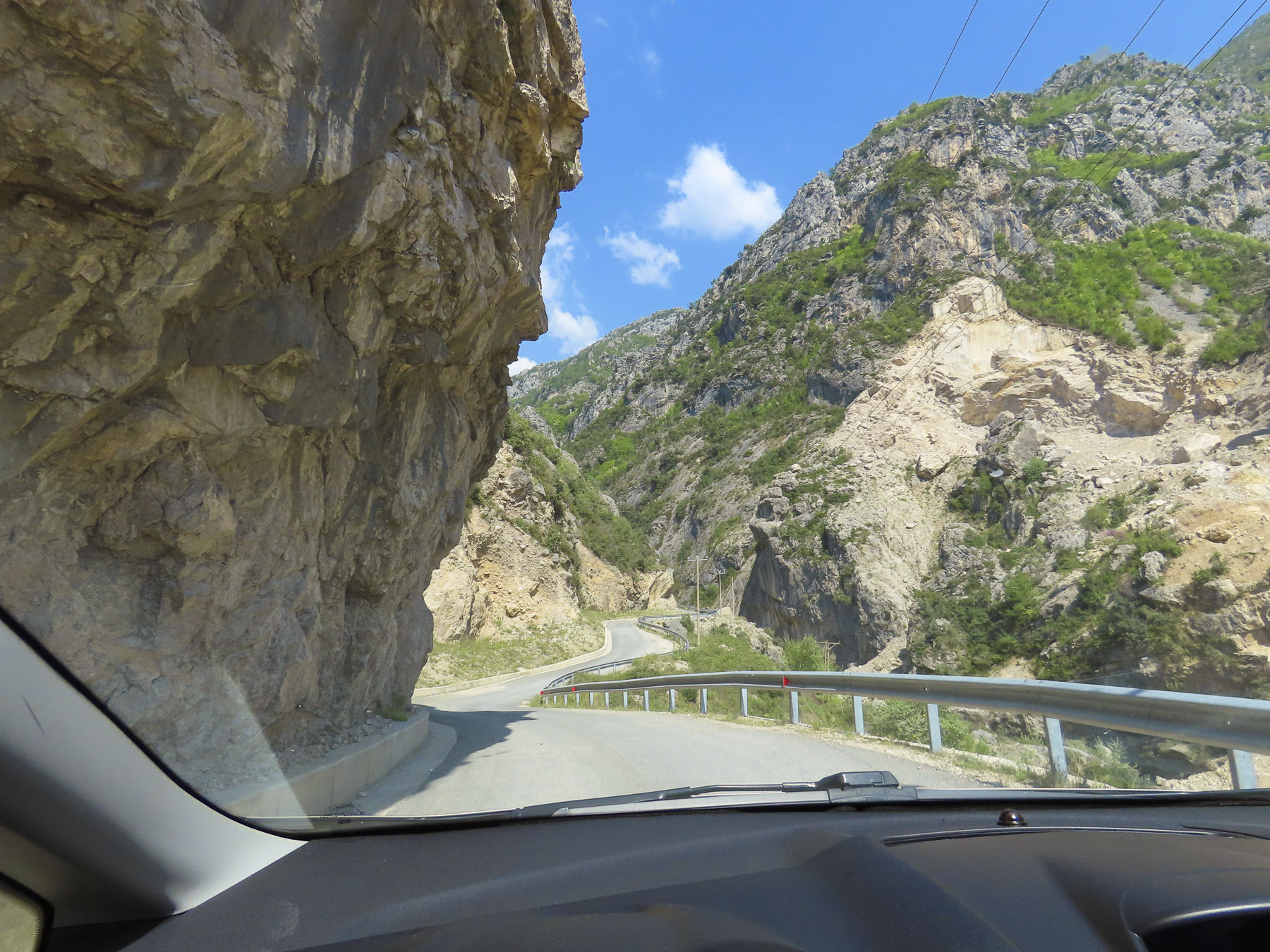
Later that morning we drove to the small town of Çorovoda, the gateway to the Osumi Canyon. It was a beautiful drive on a bright spring day, and we stopped many times along the way to photograph the scenery.
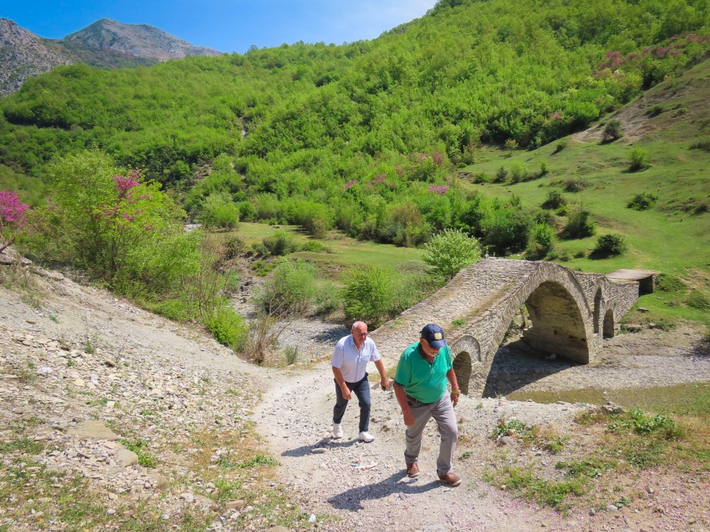
Before reaching the town, we veered off into the mountains to Ura e Kasabashit “The Bridge of Master Kasa/Kaso,” a classic high arched Ottoman era bridge constructed in 1640 across a wide stream, by the chief engineer of the Ottoman empire, at the time, Albanian architect Reis Mimar Kasemi. It was part of an ancient caravan trade route across the rugged central Albanian mountains, that connected the Adriatic Sea port of Vlorë to Berat, and Korçë before ending in the Greek city, Thessaloniki. Almost 400 years old, it surprised us that it is still standing and we followed some other tourists across it. Farther up the road from the bridge there are more abandoned military bunkers and warehouses, but we were bunkered out after Tirana and chose not to investigate them.
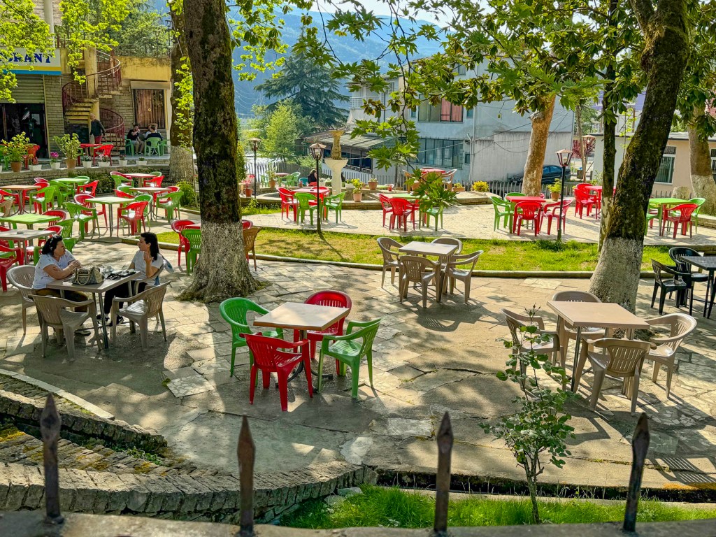
Our “drive a little, then café,” was way behind schedule when we stopped in Çorovoda at Drita e Tomorrit, a restaurant with a small park like setting.
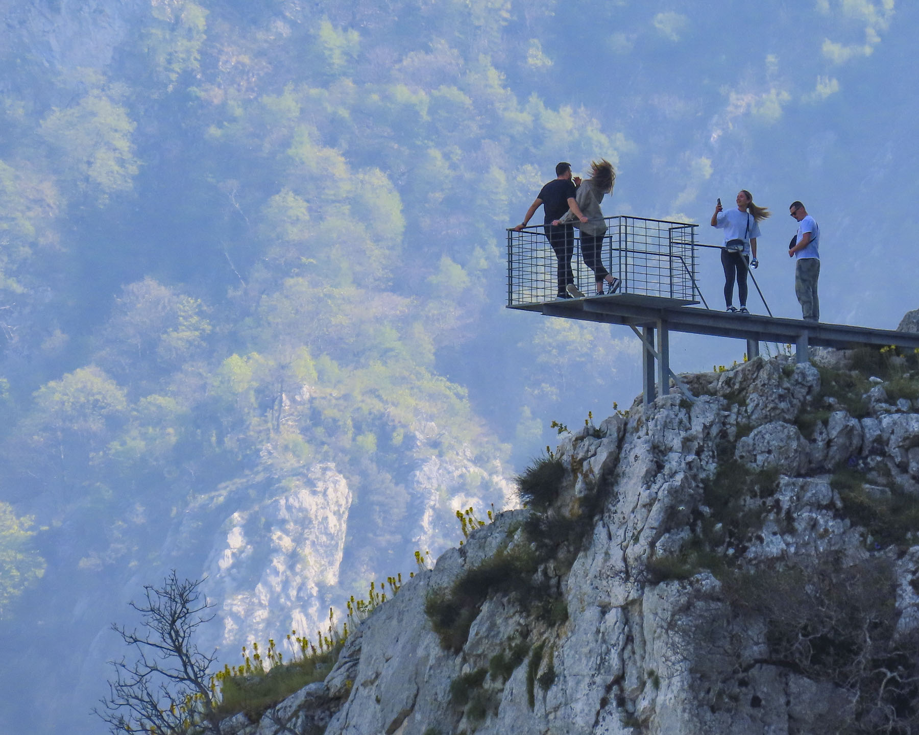
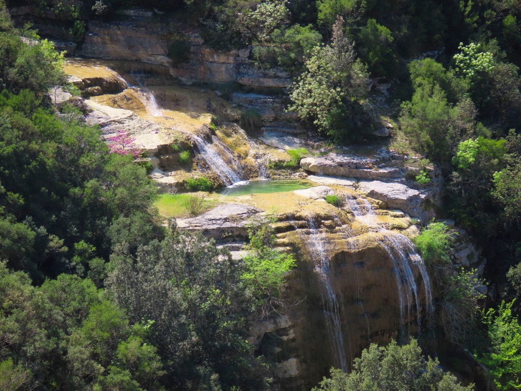
South of Çorovoda there are number of fantastic viewpoints along the Osumi Canyon. The water in the canyon is an amazing turquoise and it’s easy to see why it’s a popular area for rafting and swimming in the summer.
Before returning to Çorovoda for a late lunch we stopped at Gjurma e Abaz Aliut, the Footprint of Abaz Ali, a small roadside shrine believed to have in the solid rock under its canopy an impression of Ali’s foot. Made when the Albania folk hero, with legendary strength and courage, jumped across the Osumi Canyon from this spot. The depression in the stone looked very convincing to me.
Back in Çorovoda we had an early laid-back dinner at Zgara Korçare. It’s a small restaurant with nice owners across the street from where we earlier had coffee. Their mixed grill was delicious and we enjoyed our first tastes of Birra Korça. A good refreshing light beer brewed in Albania since 1928. Gëzuar, cheers!
The next day we headed to the Apollonia Archaeological Park before driving south to the semi-abandoned village of Upper Qeparo, eager to explore the rest of this interesting and stunningly beautiful counrty.
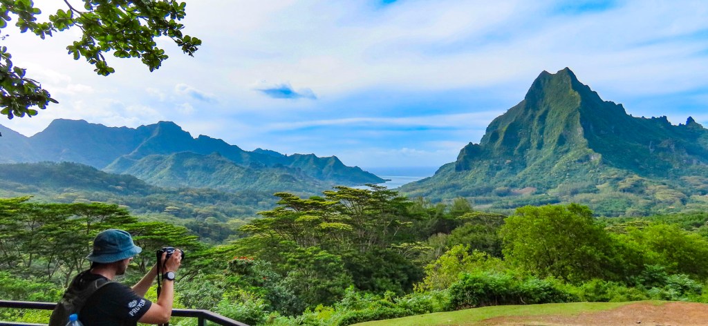
I teeter-tottered to the bow and gently landed on my back into a lounge chair, like a turtle out of water, my hands and feet waving in the air. My unbalanced ballet was appreciated with oohs, aahs and the friendly chuckles of our congenial shipmates from Poland, Germany, France, Spain, England, Australia, New Zealand, and the United States. We’d just left Papeete’s Nanuu Bay and had entered the gentle swells of the Pacific Ocean, and my sea legs were not accustomed to the ocean’s rhythms yet. The captain had just unfurled the sails of Variety Cruises’ MS Panorama II, a beautiful, 24 cabin, 160ft motorsailer, for a sailing adventure through the Society Islands of French Polynesia to Bora Bora. Our first stop was Moorea.
The shoreline of ‘Ōpūnohu Bay hasn’t changed much since the cry “land ho!” came down from the crow’s nest of the HMS Resolution during Captain Cook’s third and final voyage around the Pacific, in 1777. Remarkably, there are not any multi-story massive hotels disrupting the serene beauty of the bay, only the verdant flora rising steeply into the jagged mountains which surround the bay. The only hint of modernization, a few small cottages, barely visible through the palm trees, were sporadically placed along the shore, and an inflatable Zodiac which raced by.
Cook wasn’t the first European to arrive in the Islands. In 1521, Ferdinand Magellan sailed through, and was probably advised by the Inquisition Officer aboard not to land, fearing that witnessing a hip-shaking Ote’a dance would condemn the sailors to years of purgatory, and so they sailed on. Two hundred forty-seven years later the French Captain, Louis Antoine de Bougainville arrived and viewed the islands as “a paradise found on earth.” Wanting to name the islands after the legendary birthplace of the mythical Greek goddess of love, Aphrodite, he called it ‘La Nouvelle Cythere.’ So began the myth of paradise found on earth.
Anchored in the calm waters of the bay, the swimming ladder was lowered for a short while before dinner, and we enjoyed the warm water. So blue and clear, the polar opposite of the murky grey waters of the North Atlantic off New England, which we were used to. Before dinner the captain introduced us to the crew, assembled from Greece, Bali, the Philippines, and Tahiti. After a week together we appreciated their cohesive professionalism and amiable nature. Dinner was always a sumptuous affair, under the canvas canopy of the upper stern deck, that was usually timed to coincide with the sunset. We especially enjoyed the locally caught Mahi Mahi and various tropical fruits that were delicious. Ubiquitous on Tahiti, French baguettes were even served daily and in a nod to the Greek crew, an excellent feta cheese, imported from Athens, was available for the salads.
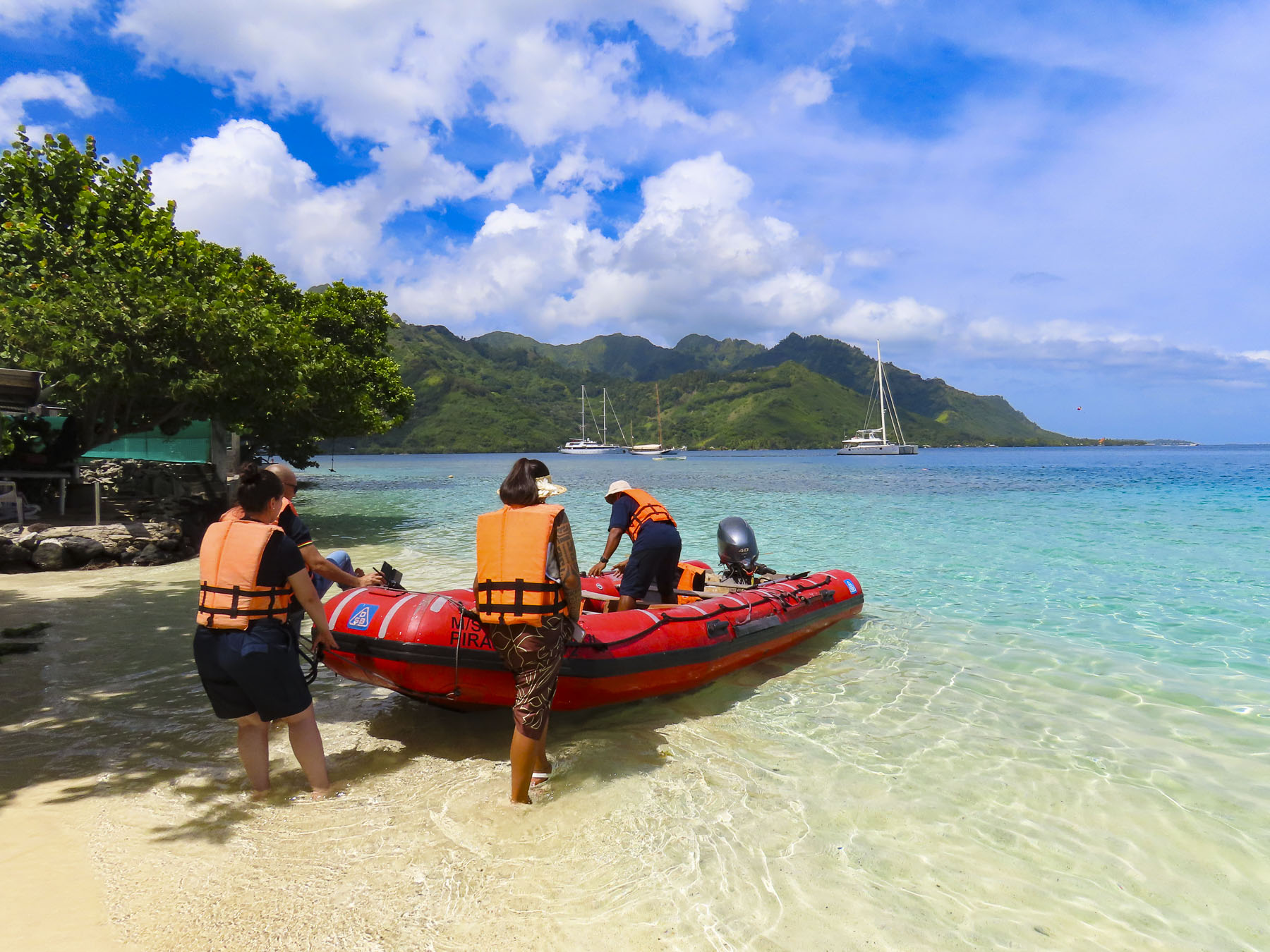
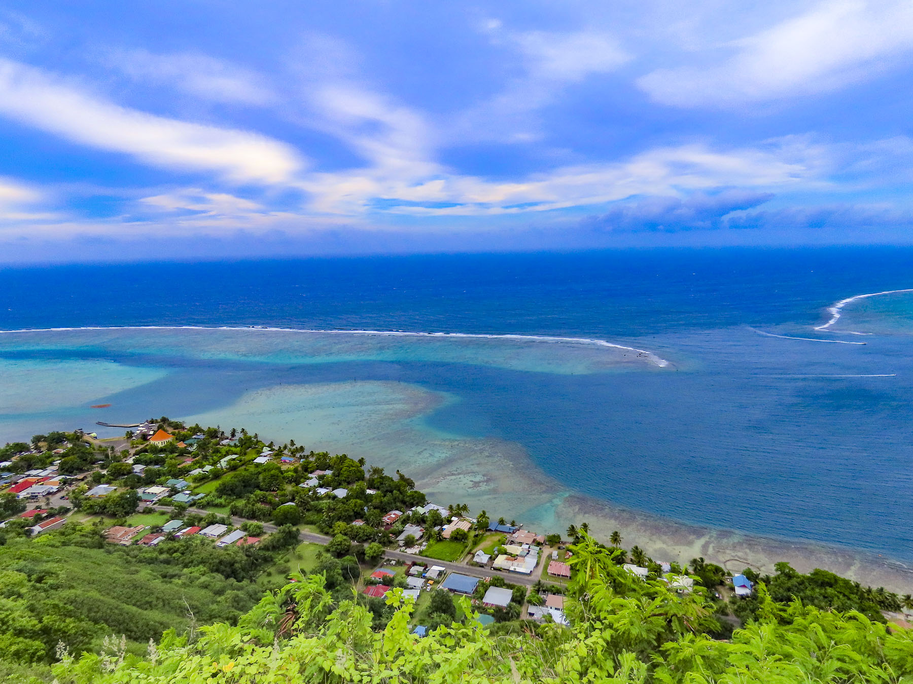
The next morning, we packed our dry sacks in preparation for a wet landing, using the ship’s small Zodiac to beach us at Ta’ahiamanu Beach. The clarity of the water was amazing, and the white sandy beach sparkled, as gentle ripples washed ashore. The bay is a natural harbor, with a passage through the island’s encircling reef wide enough for large cruise ships to sail through. Yet the reef is substantial enough to absorb the energy of the Pacific Ocean’s relentless pounding against it, leaving the small waves that reached the beach barely noticeable. We had time to amble along the beach until the groups separated into various tours.
Six of us climbed into the bed of a Toyota 4×4 pickup truck, outfitted with bench seats and a canvas awning, in case of rain, for a tour of the island. The cool rush of air felt good in the day’s already building humidity, as we drove along the coast. It was a little unusual considering it was well before noon, but our first stop was at Manutea TahitiRotui Juice Factory & Manutea Distillery for a tasting. We are not big fruit juice fans, but the Rotui juices – Papaya Passion, Mango, Banana Vanilla, Pineapple, and their various blends, all organic, were delicious. The aged rums are created from distilled O’Tahiti sugar cane, a flavor heirloom variety that thrives in the volcanic soil of the Polynesia islands. Captains Cook and Bligh brought this variety to the sugar plantations of the English colonies in the Caribbean. For nearly a century afterwards the O’Tahiti sugar cane variety was the most widely cultivated in the world. Saluting the old adage, “the sun is over the yardarm somewhere,” we enjoyed our daily ration of rum, and even purchased a bottle of Coconut flavored rum to take home. Cheers!
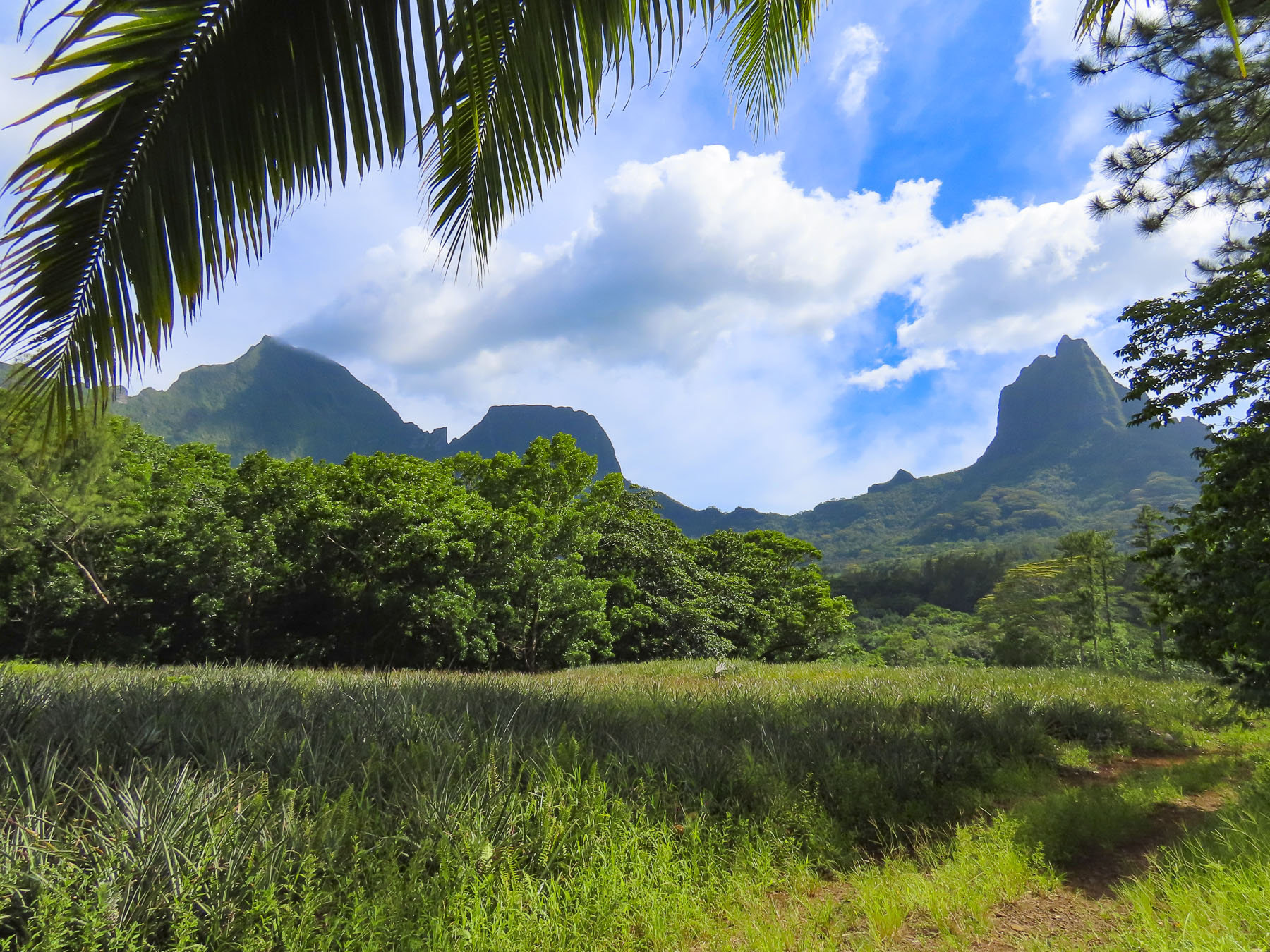
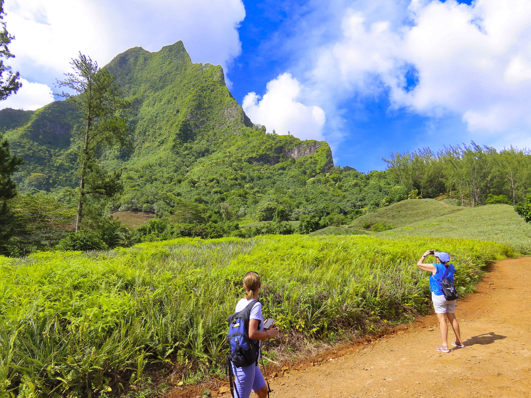
Our tour continued into the center of the island where the fertile ‘Ōpūnohu Valley is surrounded by a crown of four rugged peaks, created from the collapsed cone of an ancient volcanic eruption. Mount Tohiea, at 3959 ft, is the highest peak on Moorea. It’s followed by Mt Rotui, at 2,949 ft, and Mounts Mouaputa & Maturaorao, at 2724 and 2700 feet. Of the four, only Mount Rotui is hikeable.
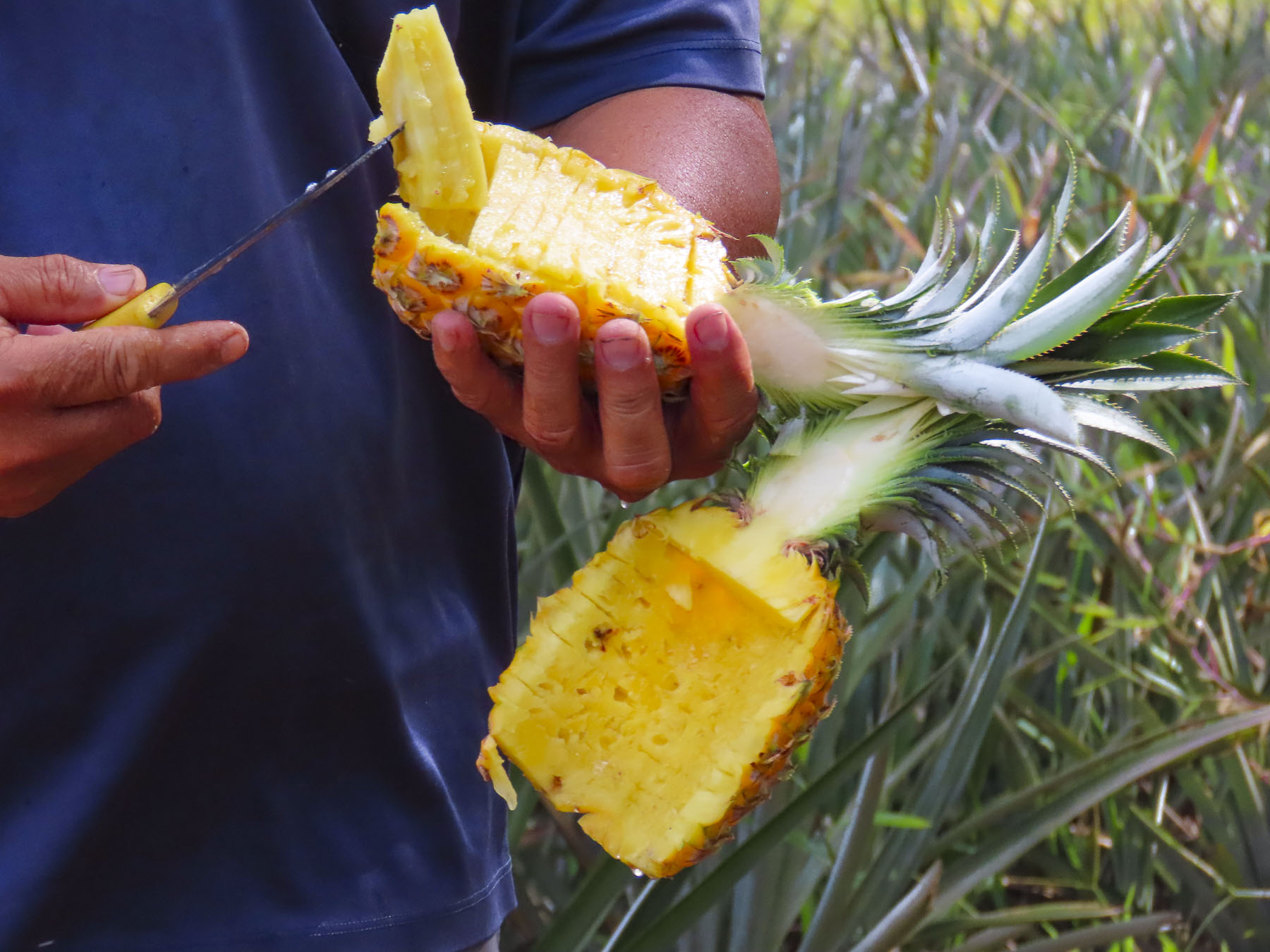
Driving along a dirt track through rolling acres of pineapples and sugar cane, our guide stopped and with a small machete cut a fresh pineapple from the field and deftly sliced it, without getting any juice on himself. He explained that Queen Tahiti pineapples thrive in the volcanic soil here, though smaller than the famous Dole pineapples grown on Hawaii, which are good for canning. Queen Tahiti pineapples are sweeter, have a smaller tender core, and are better eaten fresh.
Tahitian myths and gods are associated with mountains throughout Polynesia. Though Mouaputa is not the island’s tallest mountain, its shear pinnacle shape with a hole through its summit, like the eye of a needle, spectacularly sets it apart from the others. Passed down through generations for more than a millennium, Tahitian’s oral lore tells a story about Hiro, the god of thieves, and his cohorts, who rowed a large war canoe across the ocean from Raiatea one night and tried to steal sacred Mount Rotui, where it was believed the souls of the dead begin their journey to heaven. Seeing this thievery from Tataa hill on Tahiti, the famous warrior, Pai, a demi-god, threw a magic spear crafted from hibiscus wood across the 11 miles of ocean separating the islands, in order to stop them. Missing its target, the spear punched a hole straight through Mount Mouaputa with such an enormous bang it woke all the roosters on the island. Fearing the whole island would awaken from the rooster’s cacophony of crowing, and discover their treachery, the thieves fled emptyhanded.
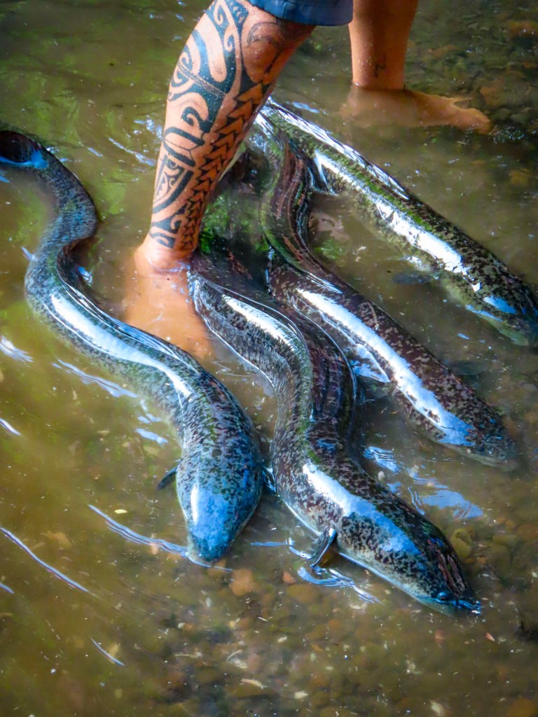
Later we pulled down a shady lane and stopped at a narrow, fresh-water stream, where we followed our guide into the shallow, barely ankle deep water. We had stopped to see the sacred blue-eyed eels of Moorea. The surface of the water was very still, with barely a ripple, until our guide ceremoniously reached into his rucksack and withdrew a magic can of mackerel to chum the water. Suddenly the water around our group erupted with a dozen or more 4-6 feet long eels racing toward us from all directions! They squirmed and splashed in a frenzy around us, fighting for pieces of mackerel. Tahitian legend believes the eels are the reincarnation of the God Hiro, who after his death assumed the shape of an eel and took on the responsibility of keeping the island’s freshwater streams and springs clean. The eels are a protected species across Tahiti, and are also believed to possess healing powers that can cure disease and bring good fortune to anyone who touches them.
Reaching the Belvedere Lookout, we were rewarded with a pristine panoramic view, without any hint of mankind in the landscape, centered by Mount Rotui, and flanked by ‘Ōpūnohu Bayon the left and Cook’s Bay on the right. Afterwards we stopped a short distance away at Marae Ti’i-rua and Marae-o-Mahine, where tiered open-air platforms had been constructed with rounded lava stones, and used for religious ceremonies and sacrifices. During Captain Cook’s third and final visit to Tahiti in 1777, he along with several other officers from the HMS Resolution witnessed a human sacrifice held on Moorea to ensure the success of a war party against a neighboring island.
Tahitians are practical and for centuries the lava outcropping behind the village of Papetō’ai, near the reef on the edge of ‘Ōpūnohu Bay, was simply called the “hill behind Papetō’ai.” Its name change probably happened in the 1960s after the opening of the Tahiti International Airport and a marketing executive was tasked with drawing tourists to islands. I can just imagine the conversation, “Listen folks, who wants to fly across the Pacific, or sail around the islands to visit a hill? Now Magic Mountain, that creates an impact!” Signed, sealed, and delivered. The rutted road up was very steep and the six of us bounced and swayed quite a bit in the back of the 4×4 and when we stopped, we still had to walk up a rough zig-zag trail to the summit. But it was well worth the effort for tremendous views of the mountains, reef, and bay, with the Panorama II tranquilly anchored below us. Our guide pointed out an octagonally shaped red roof at the water’s edge in Papetō’ai. “That’s a church, the Église protestante de Saint Michel, the first western structure built in the South Pacific. It was built by Protestant missionaries from the London Mission Society in 1827 atop the ancient Marae Taputapuatea, which was dedicated to Oro, the Tahitian god of war.”
After dinner, we pulled anchor and sailed through the night to Huahine, and tied to the quay in Tahateao just as the sun was breaking the horizon, We shared the dock with an inter-island ferry readying to get underway. The quiet unpretentious street harkened back to a different bygone era. Huahhine is actually two islands, Huahine Nui and Huahine Iti, connected by a short bridge. Legend believes that the Tahitian troublemaker Hiro sliced the island in half when he paddled his canoe through it.
Women are revered on the island, and islanders attribute the land’s fertility to the mountain silhouette that looks like a pregnant woman lying on her back. Huahine meaning, “woman’s womb.” There is a long history of Queens ruling Huahine, and they are credited with a sacred power and wisdom, often counseling their warrior chiefs to make love not war, especially as the British Navy began to explore the islands of Tahiti.
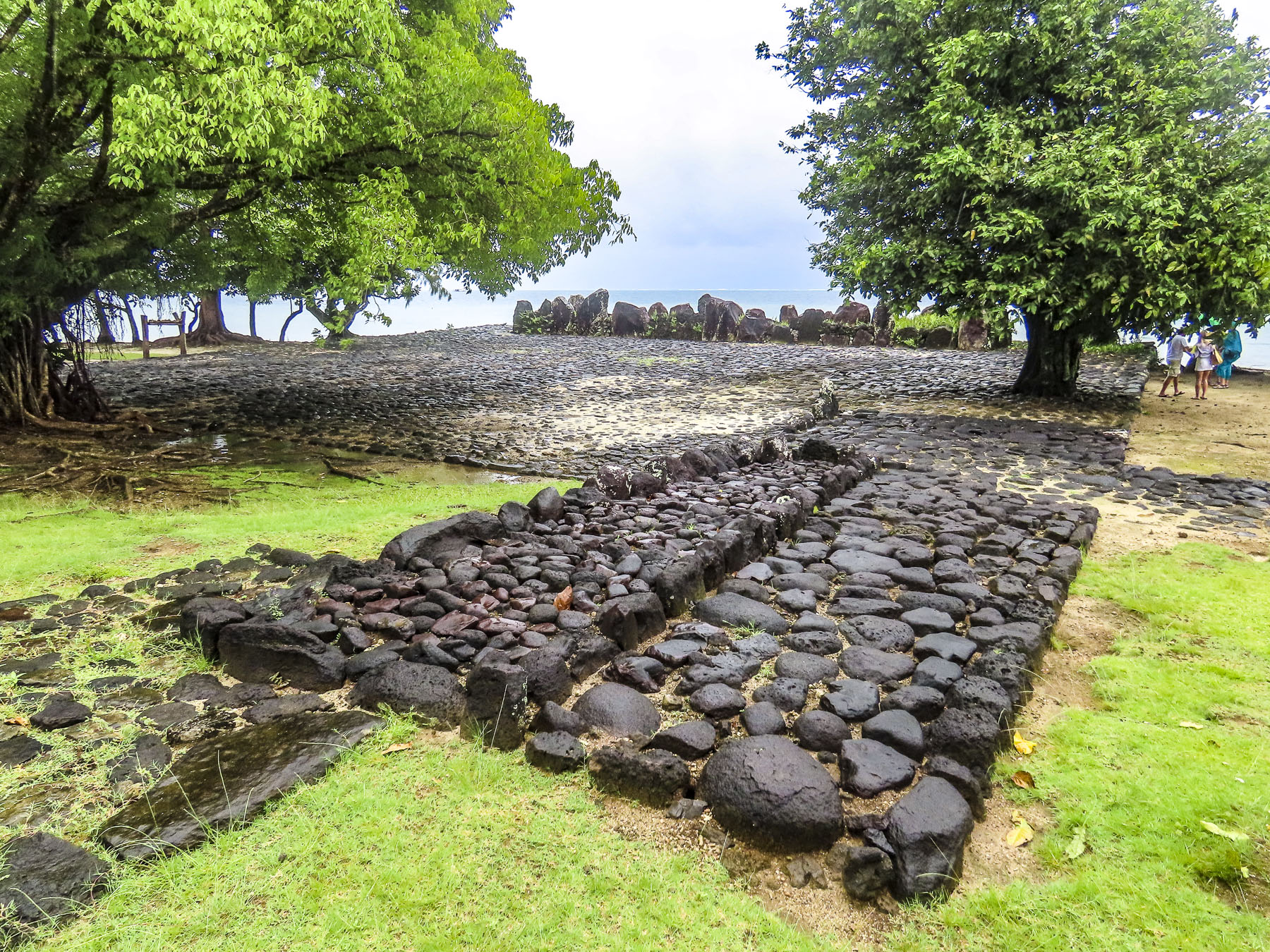
We joined a tour heading to see the marae that line the shore of Lake Fa’una Nui, a shallow saltwater bay. Our guide explained to us that there are over 200 ancient stone ceremonial sites, of various sizes, around the lake, which were central to the community’s religious life. There are more hidden on the forested and jungled hillsides of the island’s mountains, some dating to the arrival of the first Polynesians around 700 AD. After the marae are discovered and if the sites are not maintained, the jungle grows quickly over them again. This is the reason the island is commonly called, ‘the Garden or Secret Island.”
Farther along we stopped at the bridge over the saltwater estuary that feeds Lake Fa’una Nui to view the ancient V shaped stone fish traps that are still used communally. A sandy road led us to the Marae Manunu, a very substantial stone platform that stood taller than us. It was quite different from the earlier ones we viewed, which were low to the ground, like patios. It was along the road here that we noticed gravestones in front of houses; it is a Polynesian custom to bury your deceased family members close to home, often in the front yard. There is usually more than one grave. It’s a custom that stems from the ancient belief that the spirits of your dead relatives will protect the family home from evil spirits. The mountains of Huahine aren’t as dramatic as on Moorea, but the vista from the Maroe Bay Viewpoint out over a verdant jungle, and the azure waters of the bay with Mont Pohu Rahi, on Huahine Iti behind it, was sublime.
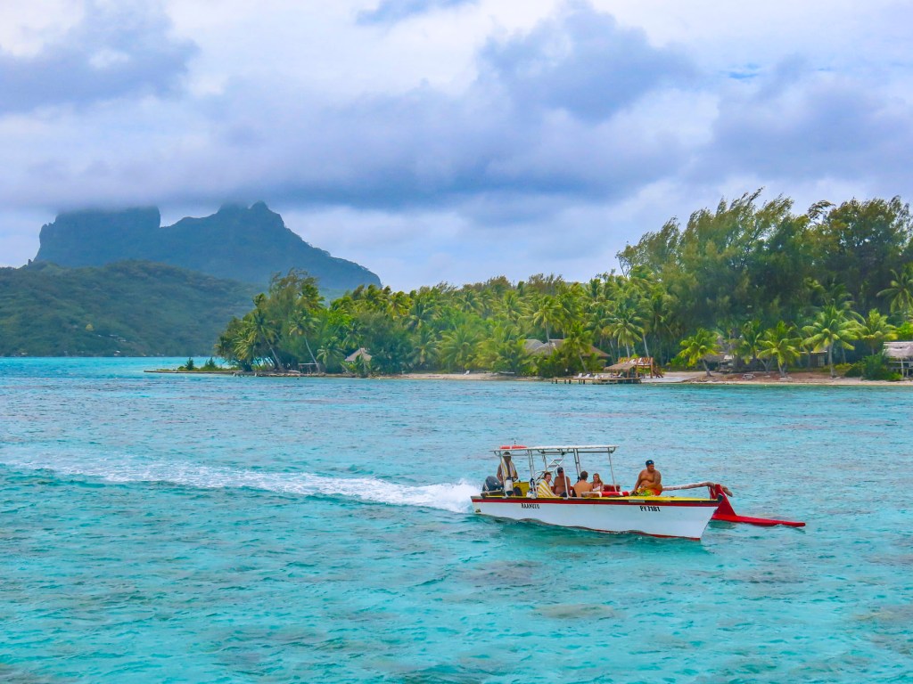
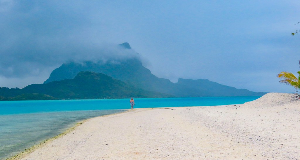
We’re all familiar with those epic aerial photographs of Bora Bora, a volcanic atoll, with Mount Otemanu rising from its center, like a spear thrust up through the crust of the earth, ringed with white surf, and surrounded by an artist’s inviting palette of blues. It’s an expensive perspective you’ll only get if you fly into the island, but sailing through the reef is truer to the Polynesian way of life – smelling the air, tasting the salt spray blown up from the bow of ship lunging forward through the waves, feeling the wind on your face, and listening to the surf crash against the reef. For us it was a rewarding tactile journey. We had crossed the waves and arrived.
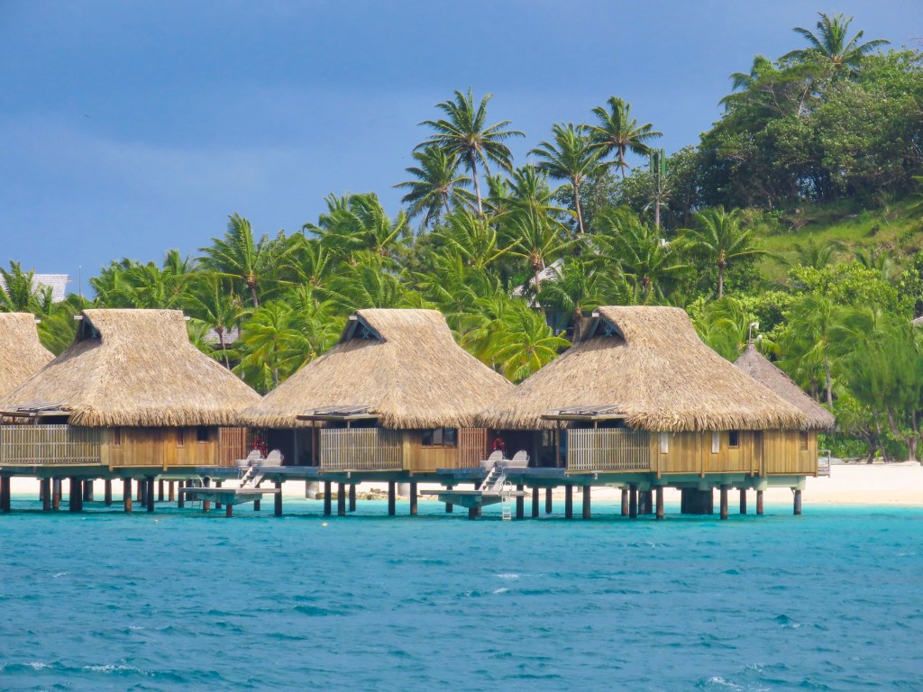
Bora Bora has been a romantic destination since the publication of James Michener’s Tales of the South Pacific, a collection of related anecdotes garnered from his time in the South Pacific during WWII, and which was awarded a Pulitzer Prize. Later the book was brought to the stage as a Broadway musical by the playwrights Rodgers and Hammerstein. South Pacific the movie premiered in 1958. Resorts with thatched roofed overwater bungalows, a new concept in the 1960s, followed. Tahiti was suddenly an exotic honeymoon destination with bragging rights, and the island still retains its allure.
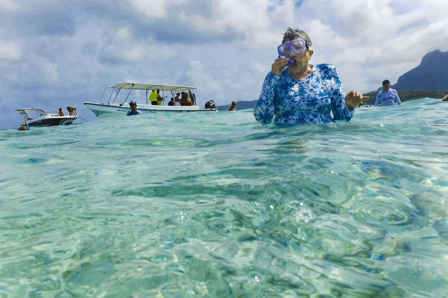
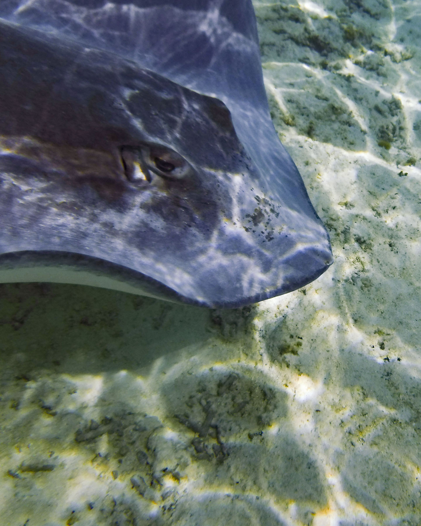
With two days scheduled in Bora Bora, it was time to get our feet wet again and we signed up for a snorkeling excursion. The tour group boarded a motorized catamaran which made 4 stops as we circumnavigated the lagoon, known for its concentration of marine life. Our first stop was to see sting rays and black tip reef sharks.
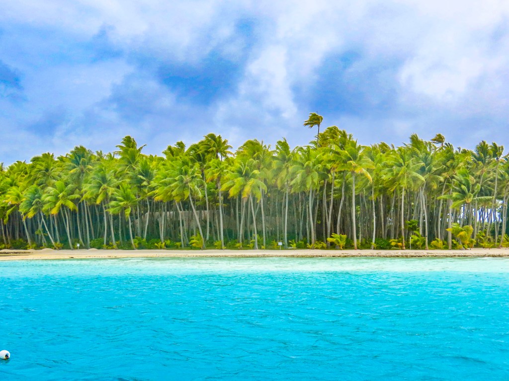
The 80°F/27°C water was perfect for snorkeling without a wetsuit, and the clarity of the water was amazing, making it easy to attempt some underwater photography. I have a new respect for the photographers that document marine life – it’s not easy. Pulling anchor, we motored along the shoreline, the captain calling out the name of the resorts and any celebrities that might have vacationed there. The underwater coral garden just off the beautiful palmed lined shore of Pitiuu Uta, a small islet or motu, had us imagining a Robinson Crusoe adventure and Tom Hank’s character in Castaway, though we didn’t spot any wayward volleyballs floating along.
The water was deeper here and the naturalist who accompanied us warned us not to stand on the endangered coral. Even as our party tried hard to avoid contact with the reefs, the currents made it difficult, and Donna and another person discovered the hard way that coral is sharp! It was a great spot for a variety of fish, and we enjoyed finding giant clams embedded into the reef. The colorful lips of their shells were the only clue to their presence. It was easy to appreciate the beauty of Bora Bora as we motored along.
Off the Tā’ihi Point we stopped to snorkel with large manta rays which swam close to shore, and appreciated the joy and enthusiasm of four black dogs that frolicked through the surf to join us. They swam safely back to shore as we departed.
Beaching at a motu, we enjoyed refreshments and snacks. Some of us joined an impromptu game of volleyball, as others relaxed in the water or walked along the beach to savor the view of Mount Otemanu.
The next day we continued with an outrigger taxi ride along the lagoon’s waterfront before wandering around the small village of Vaitape. Remarkably, Bora Bora is not overrun with a intensely developed tourist infrastructure. The resorts with overwater bungalows are barely visible from the mainland. And a walk along the main road through Vaitape revealed a town that has kept its laid-back identity, hosting stores geared for the islanders. There are not any international fast-food joints or coffee shops, though there are several art galleries and a pearl shop. Fishermen still display their daily catch along the roadside along with farmers selling fruits and vegetables. There are several small grocery stores in town as well.
Walking back to our ship along the quay, we noticed a memorial to the U.S. Navy Seabees who arrived on the island in February 1942 after sailing from Charleston, South Carolina. The 150 men were tasked to build a fuel depot and airfield. It was the first of many naval air patrol bases built on various islands across the South Pacific to keep communication channels open with our allies during WWII. Later they built roads around the island to strategic points for the placement of naval artillery batteries to defend the island. And they brought electricty to the island for the first time. After the war the airfield they built was passed to civil authorities and it became Bora Bora’s Motu Mute Airport which accepted international flights from Los Angles through Hawaii, before Papeete’s airport was constructed. The Seabee memorial resonated with Donna, remembering her dad’s stories from WWII, when he was a young, 18 year old sailor on a fuel-tanker making frequent stops to this enchanting paradise.
By the end of the day the weather had turned and our overnight passage to Taha’a across a tempestuous sea was the roughest of our cruise. If you expect verdant jungle in paradise, you need to accept some rainy days. Unfortunately, the weather didn’t break, and we stayed onboard all-day watching movies, playing board games, and reading.
Overcast skies followed us to Raiatea, but we kept our plans with several other passengers and toured along the coast in an outrigger canoe to the Faaroa River, which flows from the mountainous interior of the island. Our hope for the day brightened as the sky cleared and brilliant colors returned to the landscape. It lasted only a brief time until we were deluged with rain. The Faaroa is referred to as the only navigable river in Polynesia, but during our visit the river narrowed as it travelled through the jungle and was blocked by a fallen tree. It would be perfect for exploring with a kayak.
Afterwards our guide explained as our outrigger headed towards the Marae Taputapuatea archeological site that Raiatea, meaning “faraway heaven,” is believed to be the homeland, Hawaiki, in Polynesian legend, and the island from which the colonization of the South Pacific began around 500AD. Polynesians wayfarers sailed across the great expanse of ocean, using their seafaring knowledge of the stars, wind and waves to reach Hawaii, 2500 miles away to the North, and eventually reaching New Zealand 2400 miles to the south, and Easter Island 2800 miles east – the area referred to as the Polynesian triangle. These were amazing weeks-long voyages in double-hulled, sailing canoes, with folks aboard exposed to the weather.
The Marae Taputapuatea was not only a religious ceremonial site, but also a place where the knowledge of the sea was passed down from generation to generation. The bravery of these wayfarers was immense, but they followed a belief that “under a chosen star there is a land that that will provide us with a new home.”
The last evening of the cruise, the sky cleared, and our cruise director, a vivacious Tahitian woman, arranged for a local ukulele trio to come aboard and entertain us on the top deck, as she and a crew member demonstrated the three different styles of ‘Ori Tahiti, the Polynesian dances, once banned by the first missionaries that arrived to the islands, from which Hawaiian hula evolved. Between songs she explained the characteristics of the types of dance: the slow, graceful motions of Aparima, which mixes hand and body movement to tell a story in a kind of elaborate pantomime; the lively Ote’a, similar to Hula, and danced to drumming; and Hivinau, a group dance performed as a communal celebration in a group circle with singing and clapping.
It was a wonderful evening of shared camaraderie. Our adventure complete, and the night darkened; the stars we’d follow back to Papeete, and eventually home, sparkled above us.